Team Erlangga Baskara, Frithasya Jeniardina, Widasari Yunida, Jeremiah Delonix Aipassa
Contribution Producing planning development analysis (environment and mobility analysis), producing graphic of analysis, collage visualization, and video presentation rendering (25% in total contribution of the project)
TOGETHER WE THRIVE
A SUSTAINABLE FUTURE
CLOSING THE LOOP
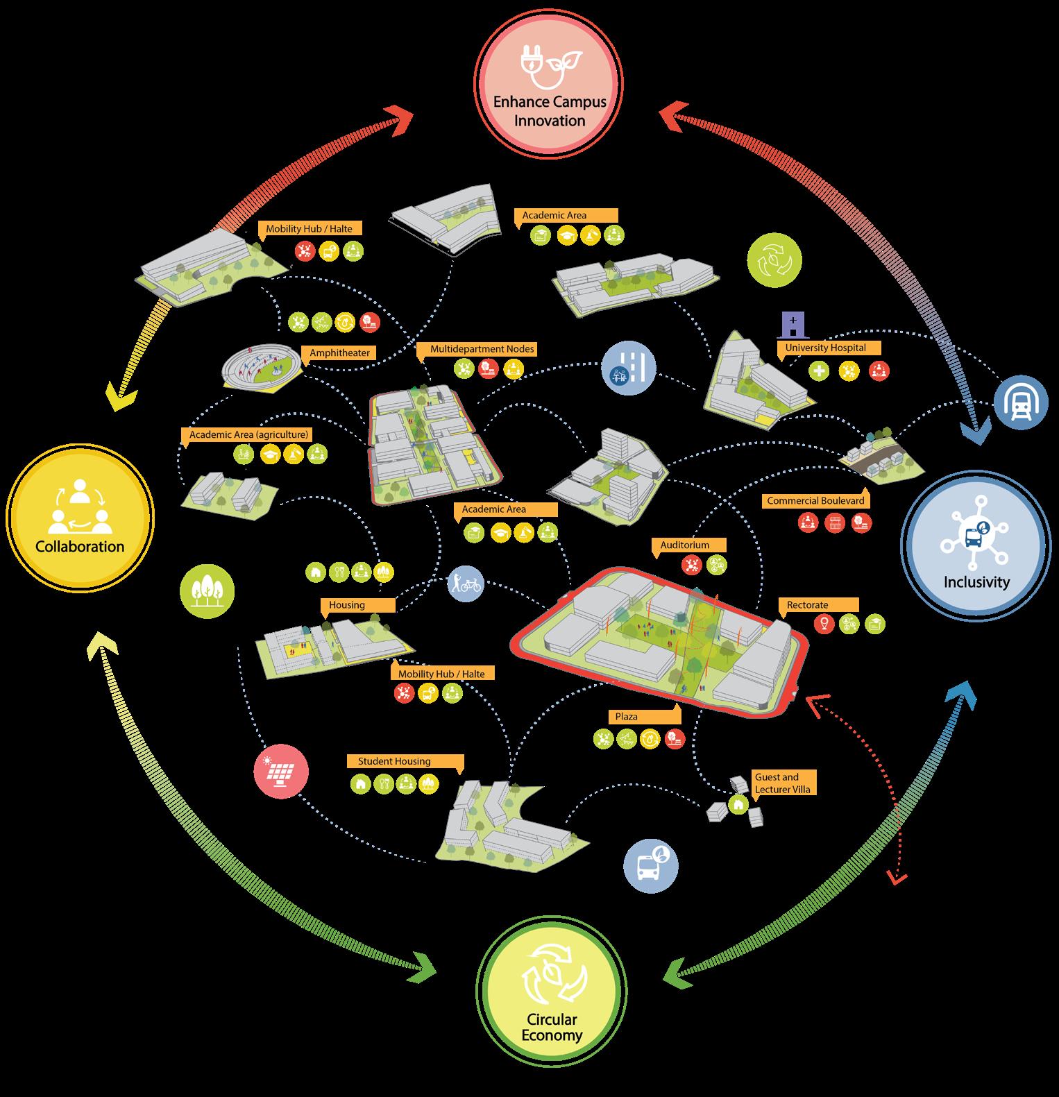
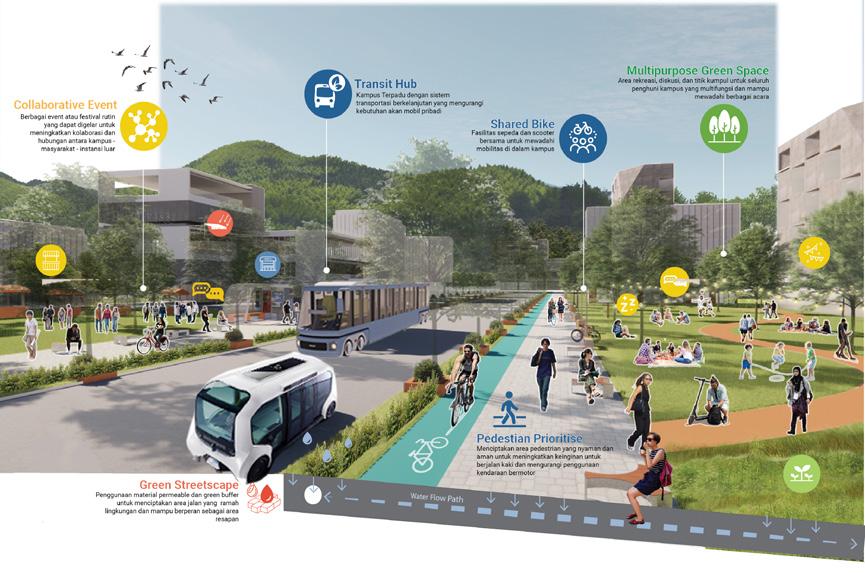
CONNECTING MIND and SPACES
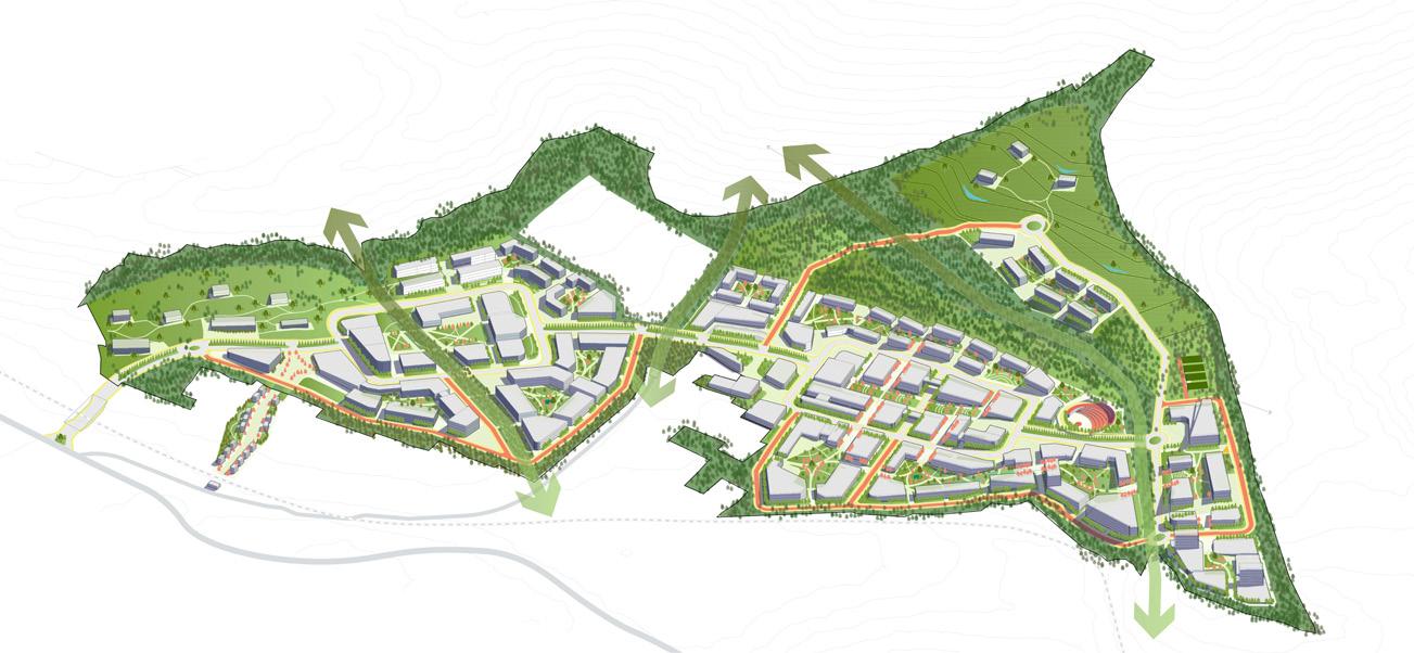
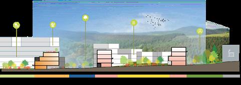
Strategy and Proposal Implementation
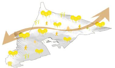
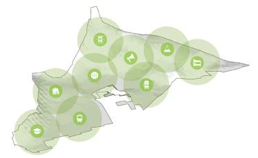
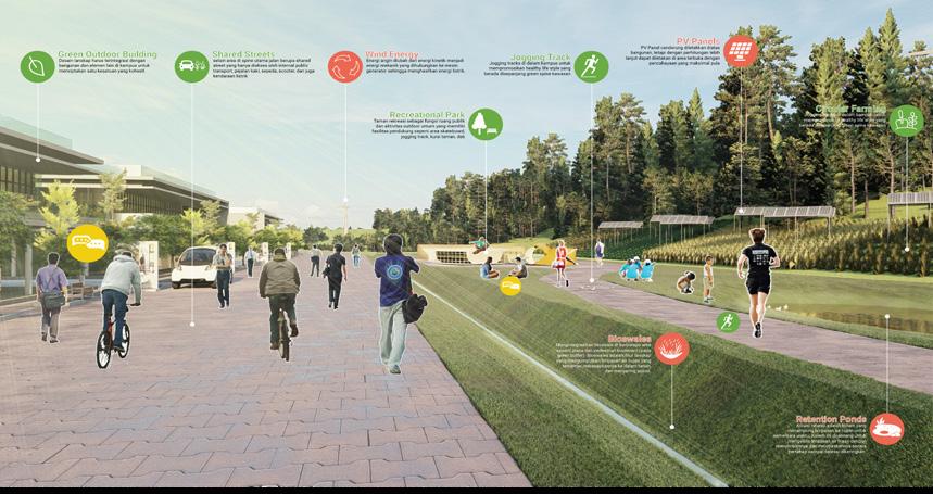
Growing a Sustainable Future: The Path to a Greener Campus
Strategy and Proposal Implementation
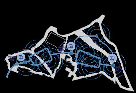
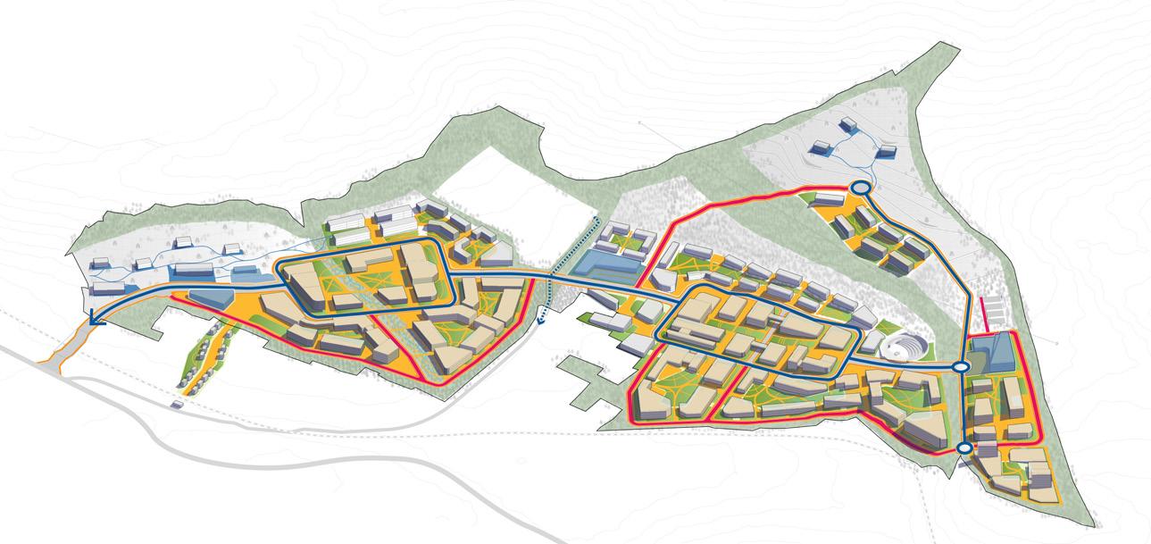
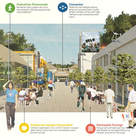
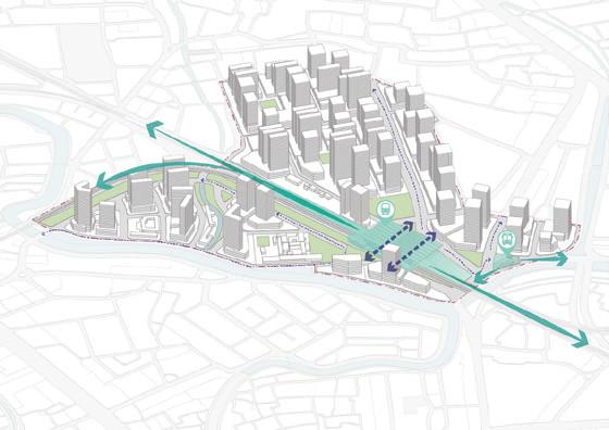
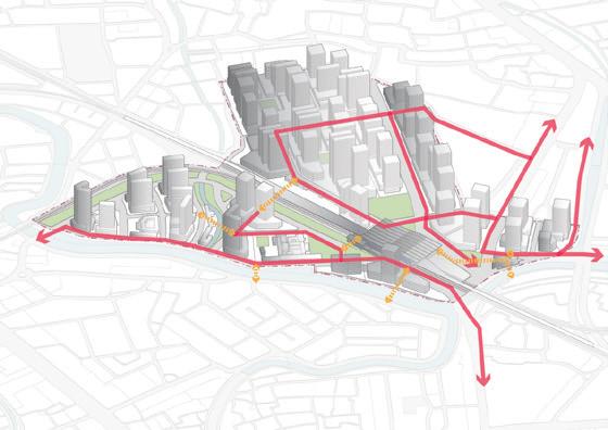
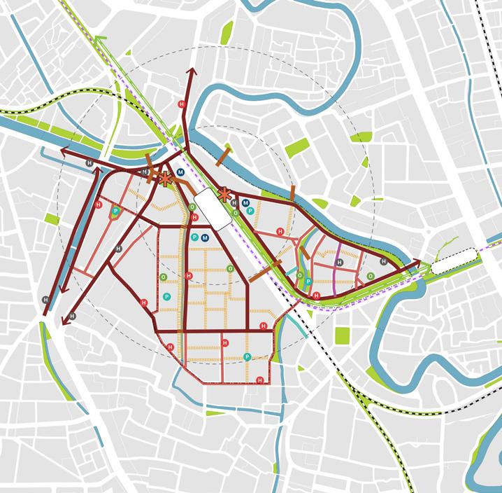
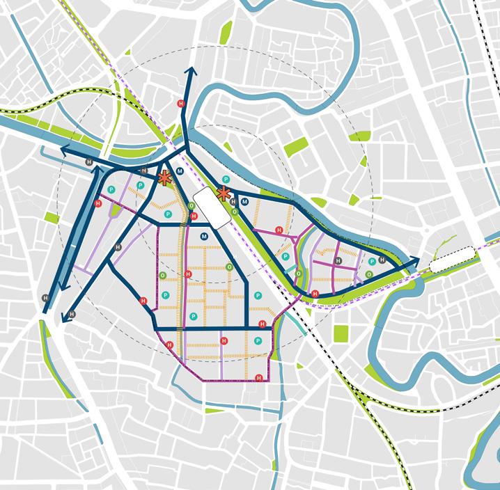
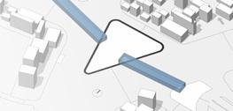
Connecting Mind and Space: Mobility Framework
Closing the Loop: The Sustainable and Circular Campus
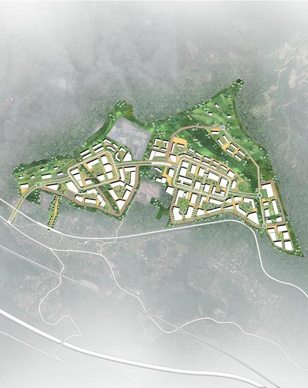
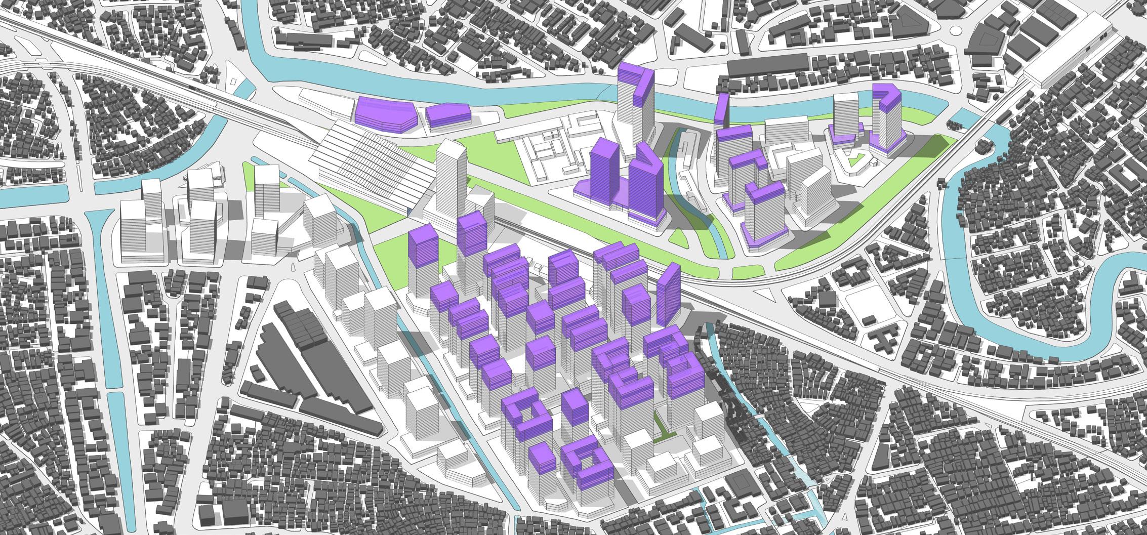
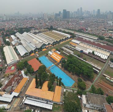
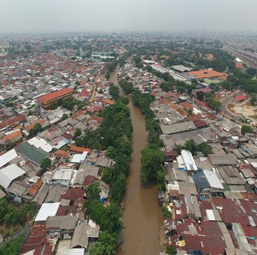
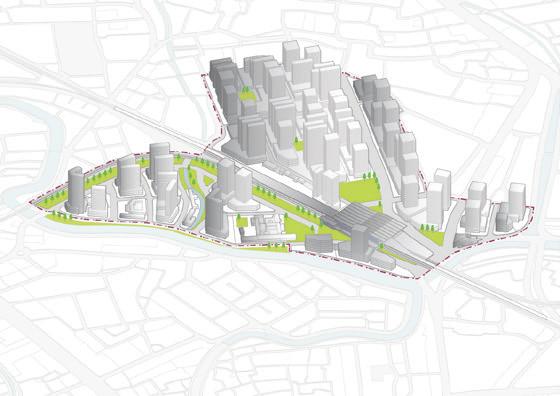
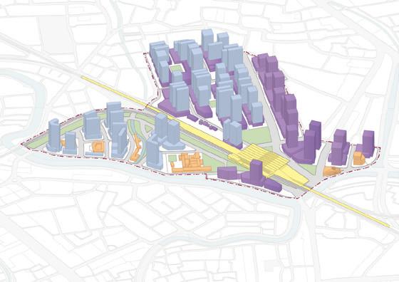
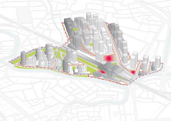
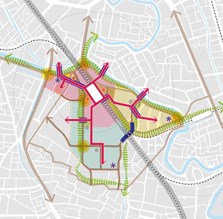
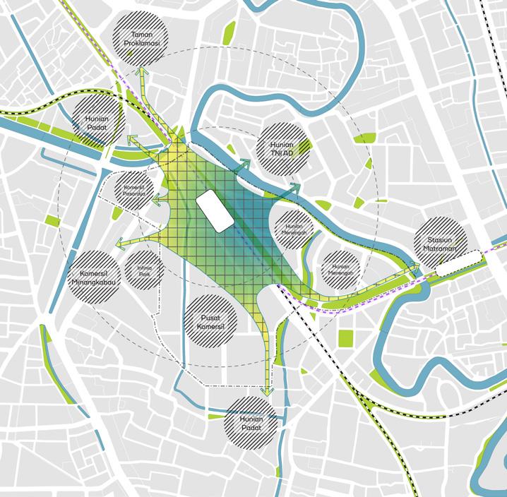
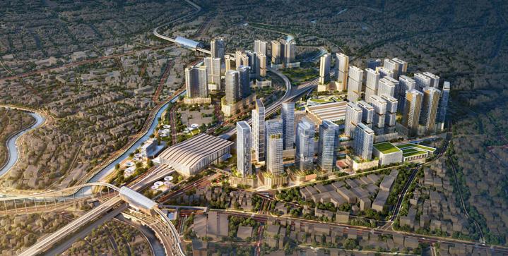
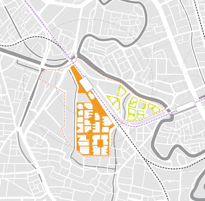
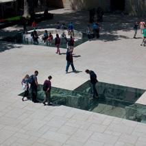
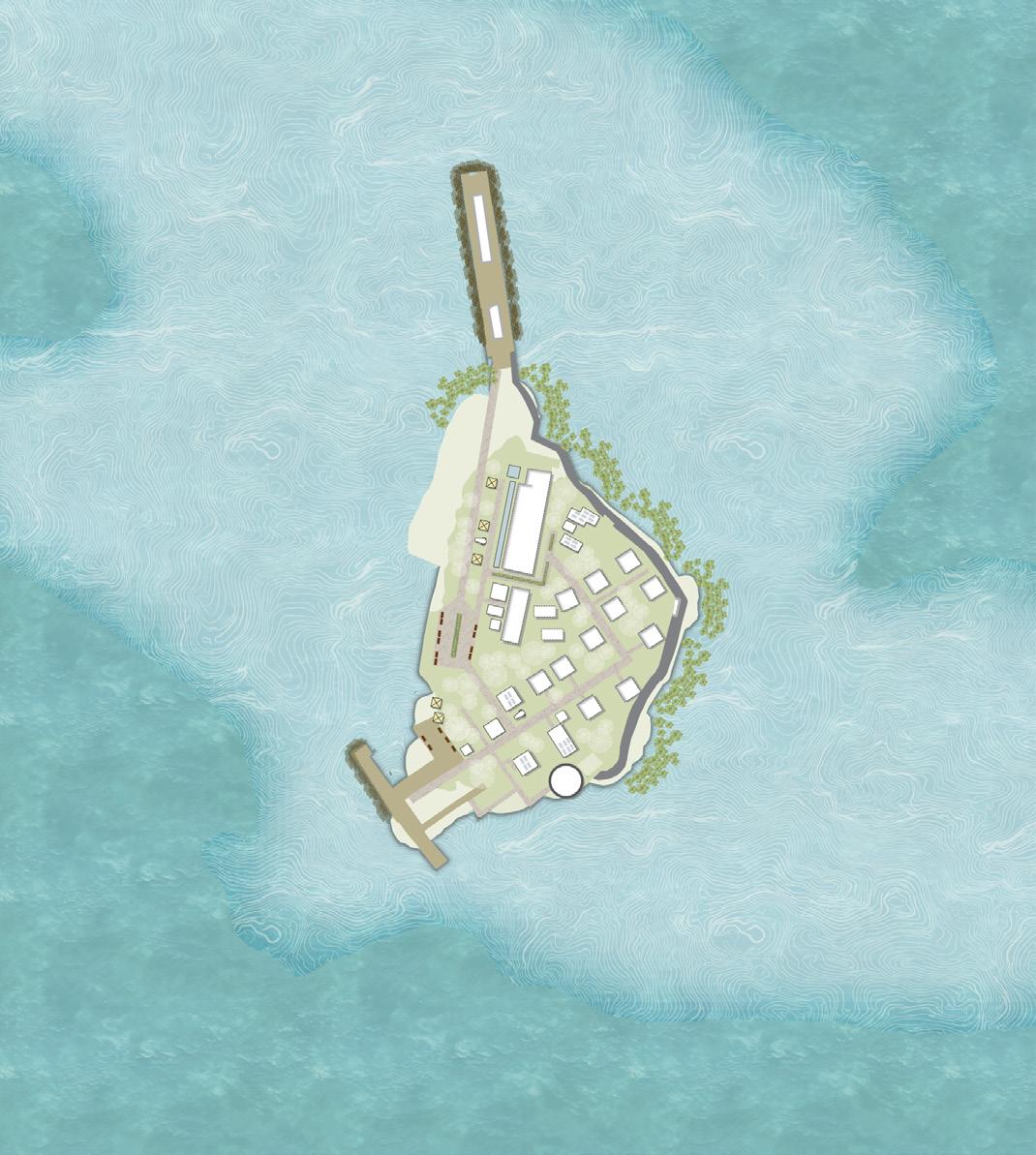
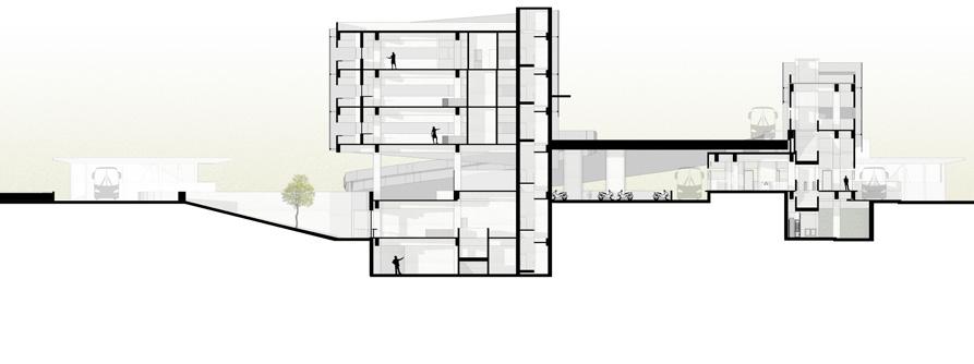
Manggarai Transportation Hub
Type Professional Project
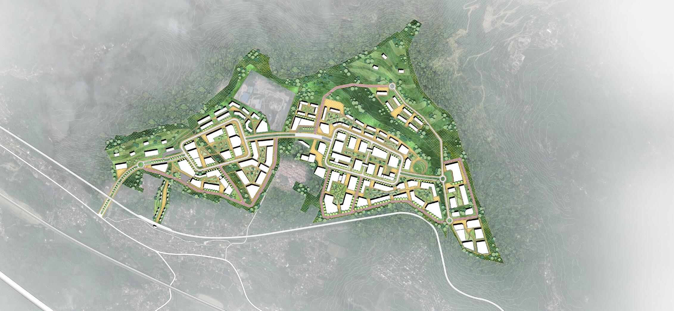
Project Urban Design Guideline
Location Jakarta, Indonesia
Area 33.4 Ha
Team Erlangga Baskara, Prinka Choesin, Riza Nur Afifah, Sabrina Rahma, Jeremiah Delonix Aipassa
Contribution Producing two chapter of interim reports including environment and mobility analysis (regulation planning), supporting graphical diagrams (20% in total contribution of the project)
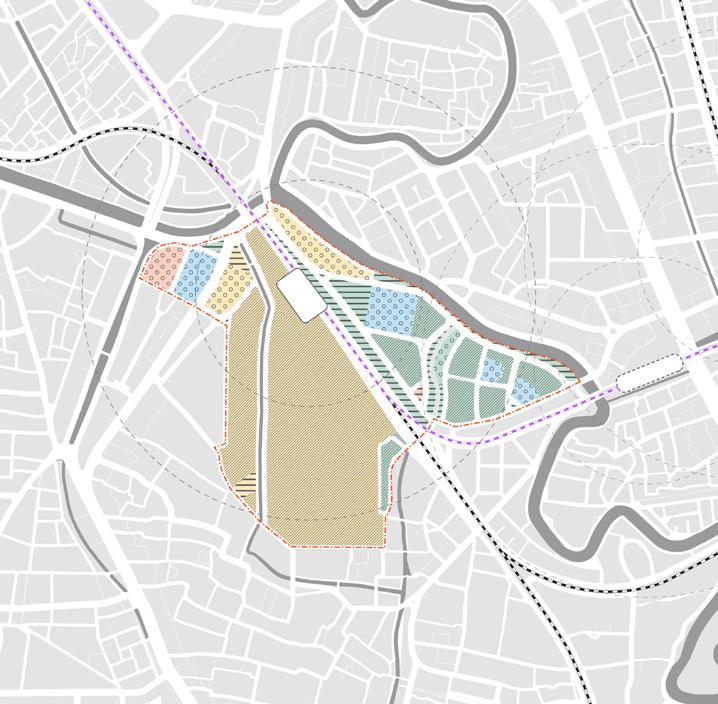
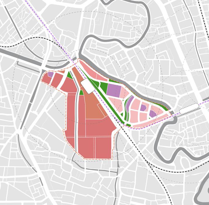
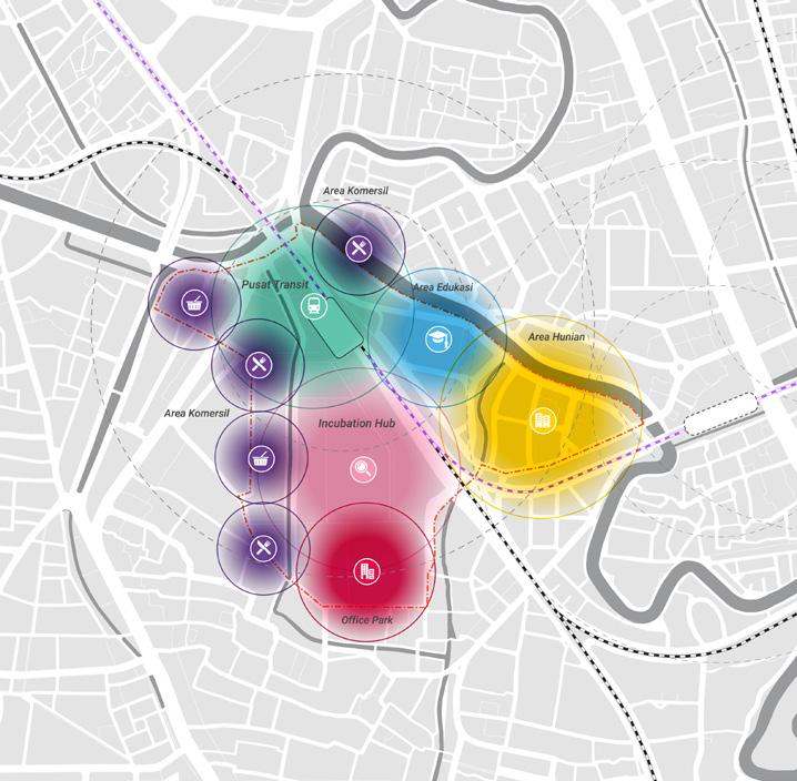
Regional-Scale Transit Facilities
Incubation Centre for Pioneering Start-ups
Inclusive Balanced Residence
Public Open Space and River Arrangement
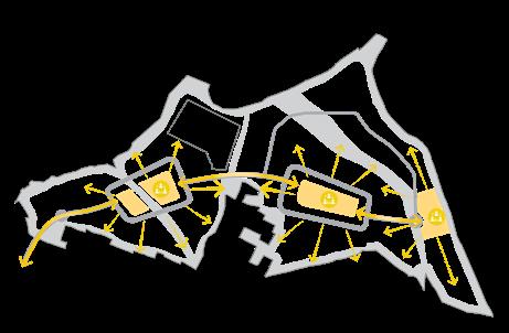
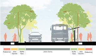
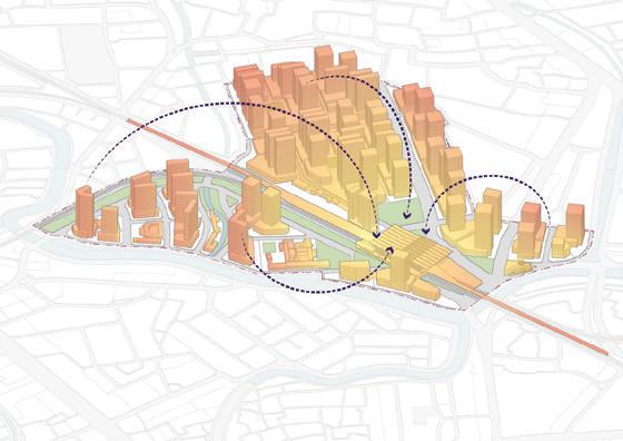
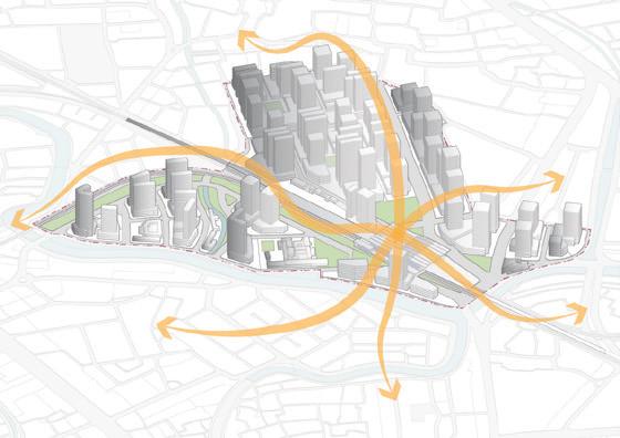
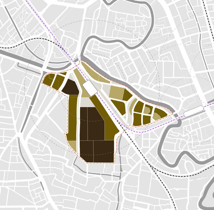
Mobility and Connectivity Analysis
Urban Design Framework Bike Lane
General Concept of Mobility Network Vehicle Lane Circulation Concept
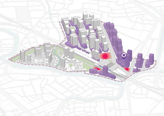
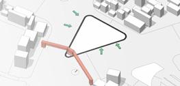
Planning and Strategy Analysis
JlSultanAgung
Jl.ManggaraiUtara2
Jl.Dr.Saharjo
Jl.SwadayaI
Jl.Dr.
SungaiCiliwung
JlSultanAgung
Jl.
SungaiCiliwung
Jl.ManggaraiUtaraI
Jl.SwadayaI
SungaiCiliwung
SungaiCiliwung
JlManggaraiSelatanI
Jl.ManggaraiUtara2
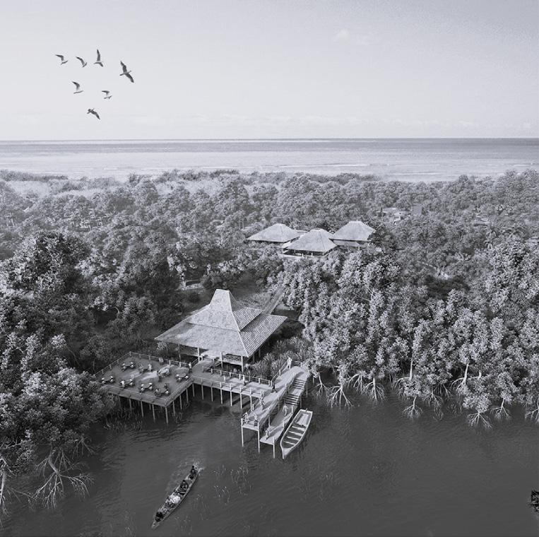
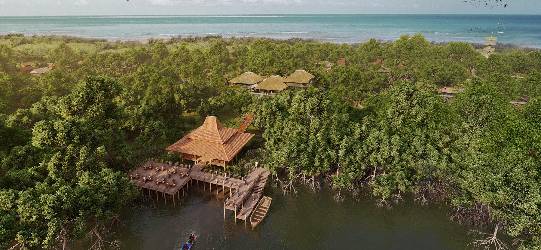
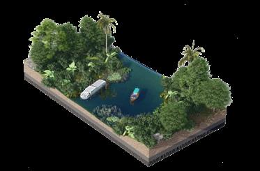
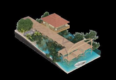
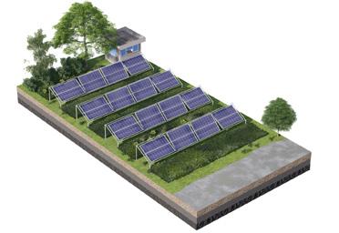
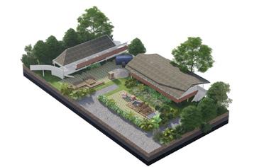
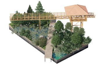
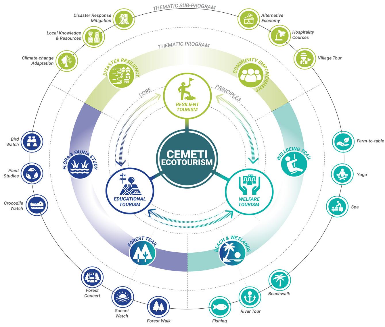
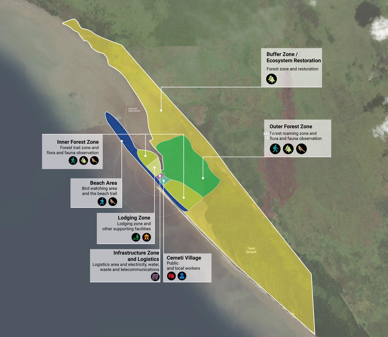
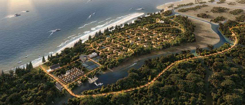
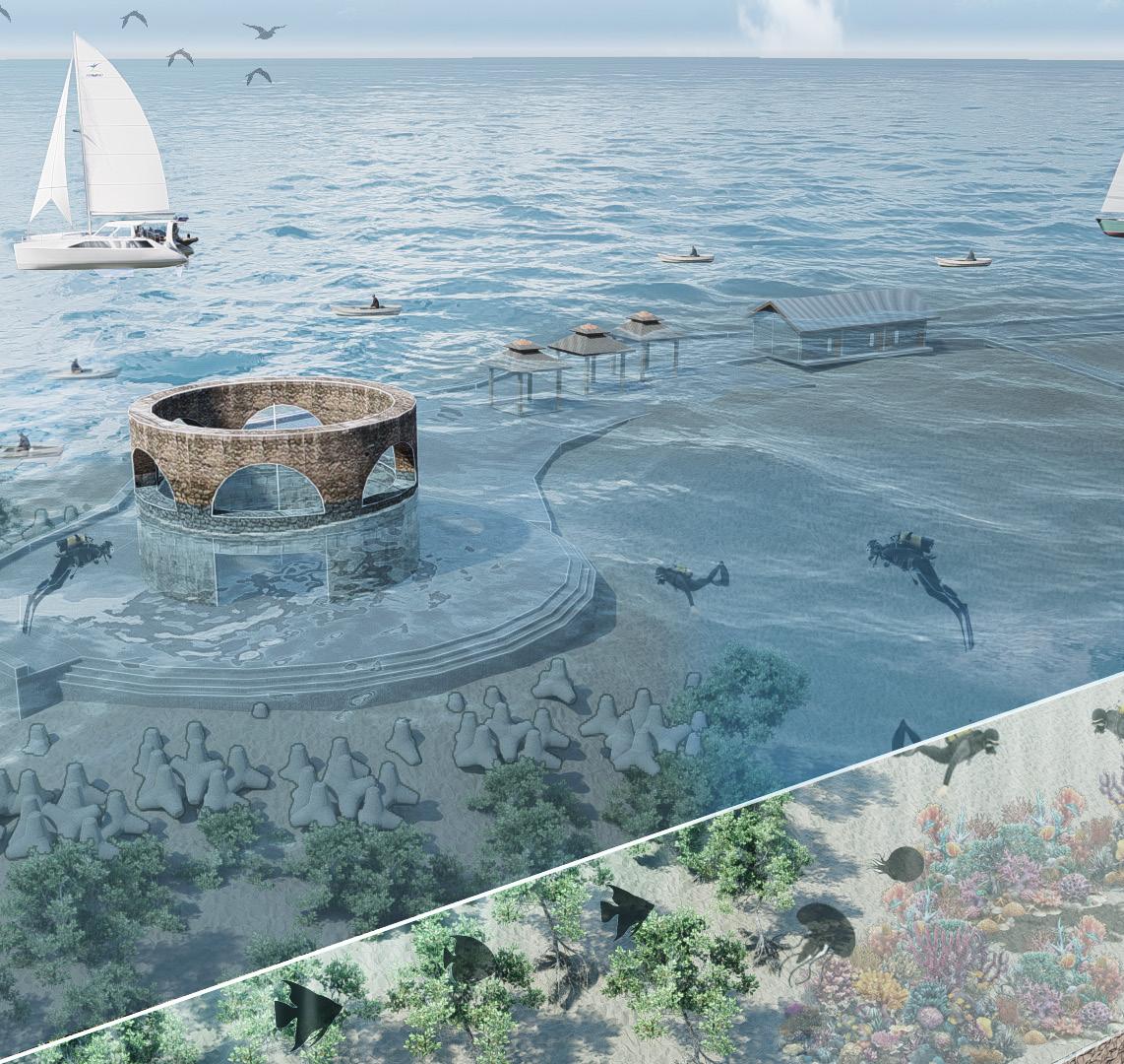
Cemeti Eco Resort & Conservation
Type Professional Project
Awards Gold Award in 8th Singaporean Institute of Planning Awards 2023
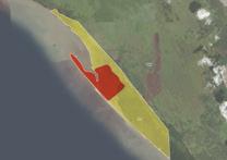
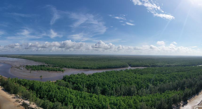
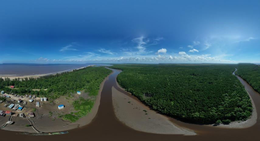
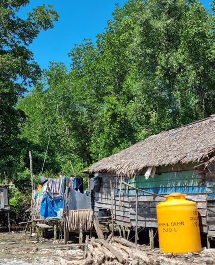
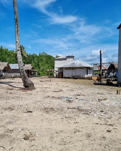
Project Tourism, Research, and Conservation area
Location Central Kalimantan (Borneo), Indonesia Area 1502 Ha
Team Erlangga Baskara, Prinka Choesin, Jeremiah Delonix
Aipassa
Contribution Supporting pre-eliminary planning and design strategy, producing planning analysis, producing graphic of analysis, collage visualization (30% in total contribution of the project)
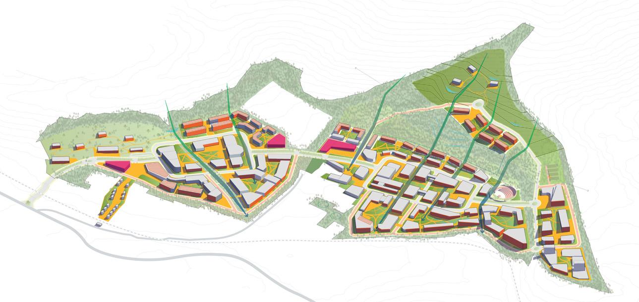
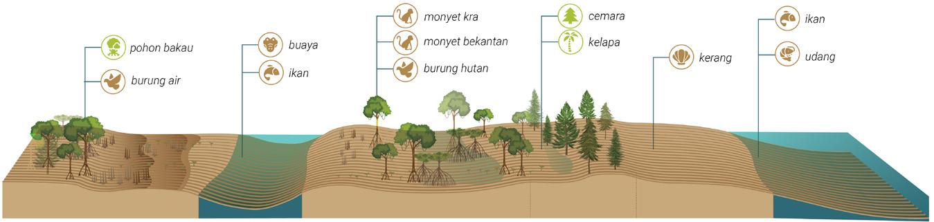
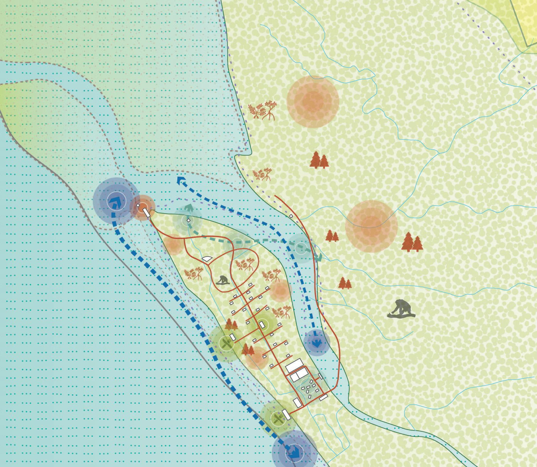
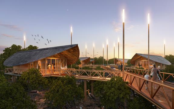
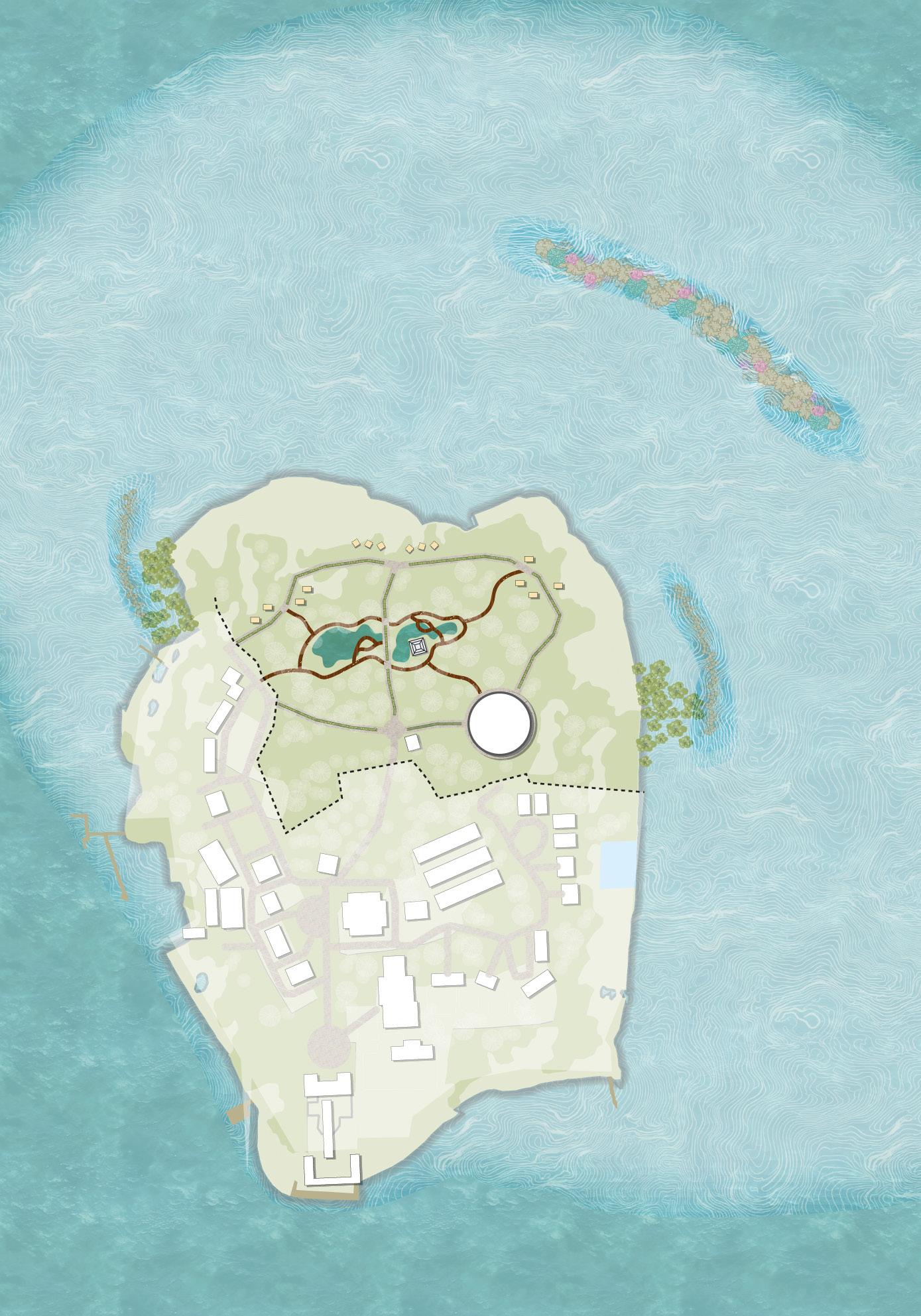
Regenerative Development
Resilient Community Resurgent Biodiversity
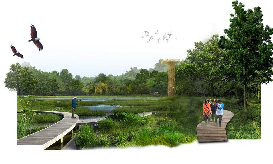
River Trail Tour
Jetty
Village Area
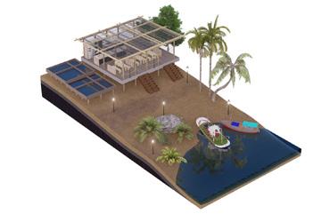
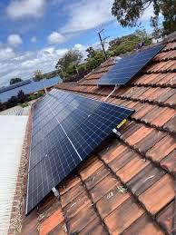
Solar Panel
Vocational School
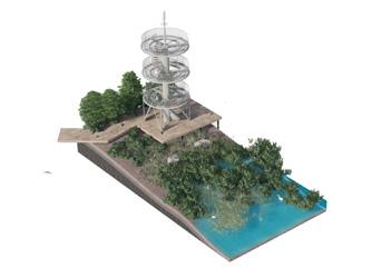
Birdwatch Tower
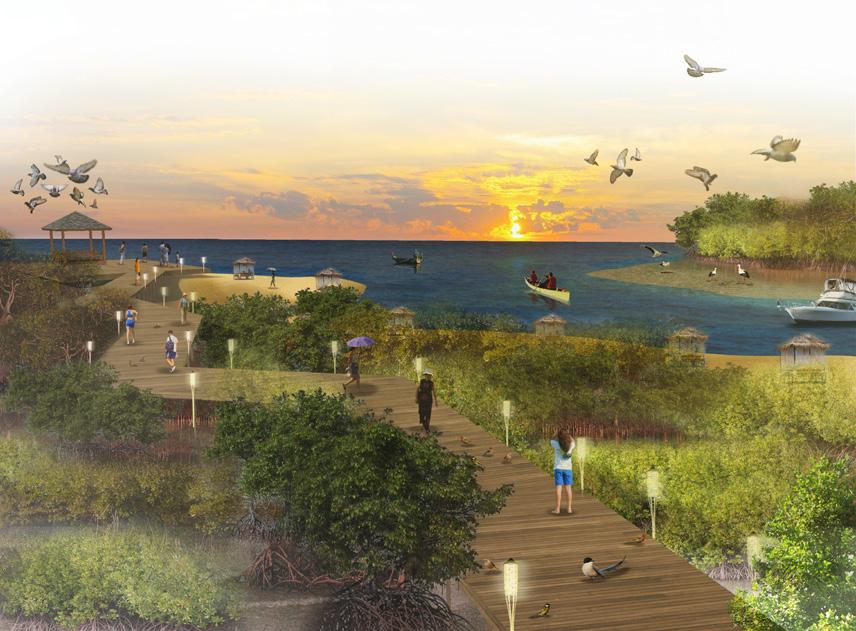
Sunrise-sunset Deck
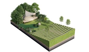
Forest Amphitheatre and Paviliun
Resort Cabin
Beachfront Facilities
Wellness and Spa
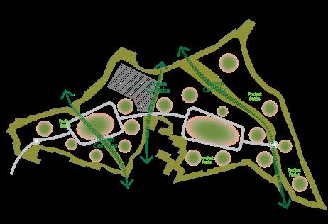
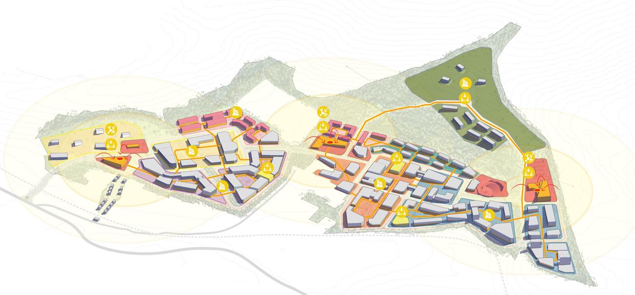
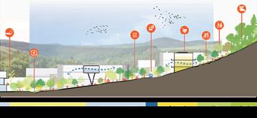
Zoning and Strategy Implementation
Strategy • The need for exposure to the potential of ecotourism so that people can prosper with alternative livelihoods
Mangrove conservation and Sunset point Migration Bird Observation
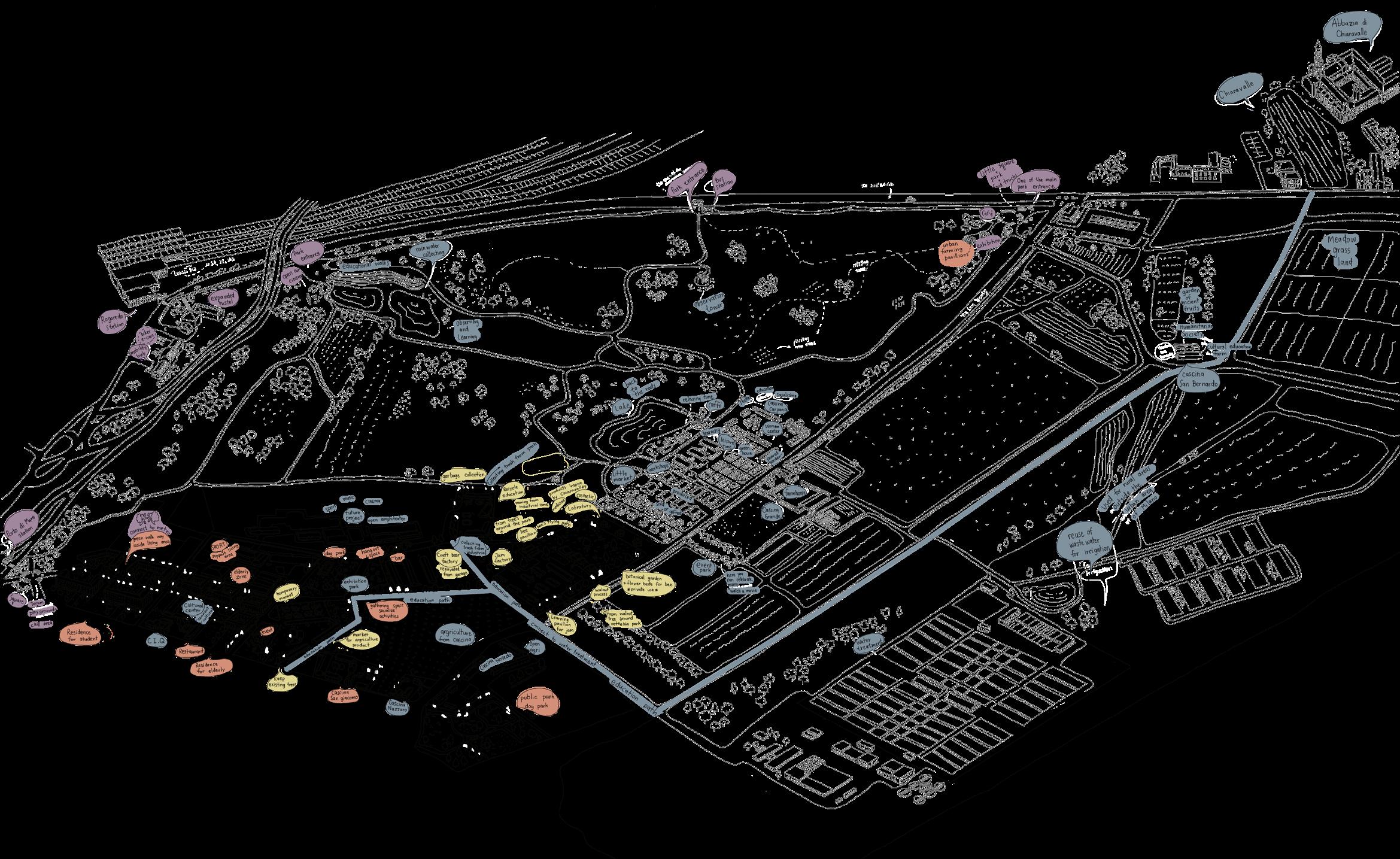
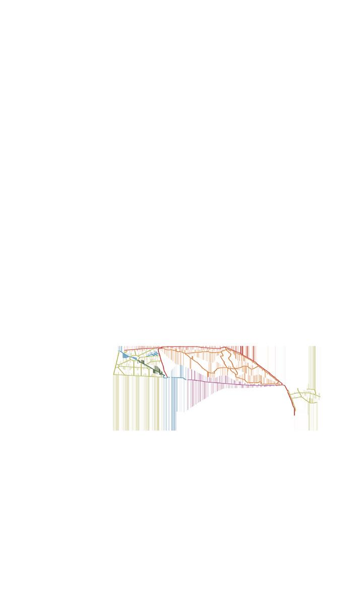
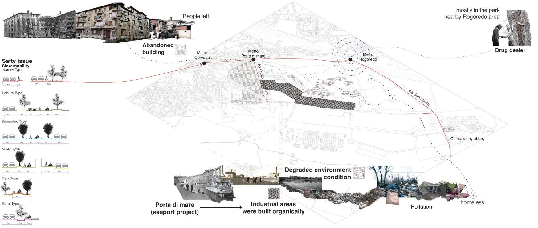
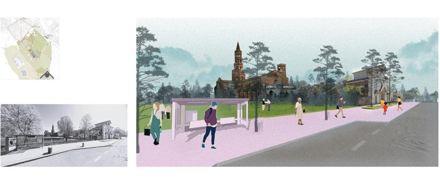
PERIPHERY BLOOM: REVITALIZATION OF PORTO DI MARE 4
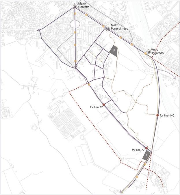
Design and Mobility Revitalization
Competition: C40 Students Reinventing Cities 2025
Proposals of transforming the islands into an attractive historical eco-tourism destination
Periphery Bloom: Revitalization of
Porto di Mare
Type Academic - Magistrale - Urban Design Studio
Project Urban Design and Mobility Revitalization
Location Milan, Italy
Area 1200 sqm
Advisor Prof. Laura Pogliani, Prof. Pezzoni Nausica
Contribution Producing urban analysis (environment), supporting planning strategy, supporting on masterplanning, producing graphic of analysis, collage visualization (25% in total contribution of the project)
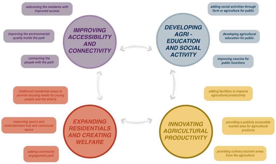
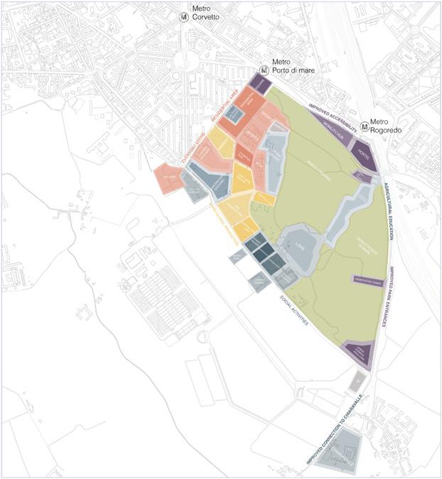
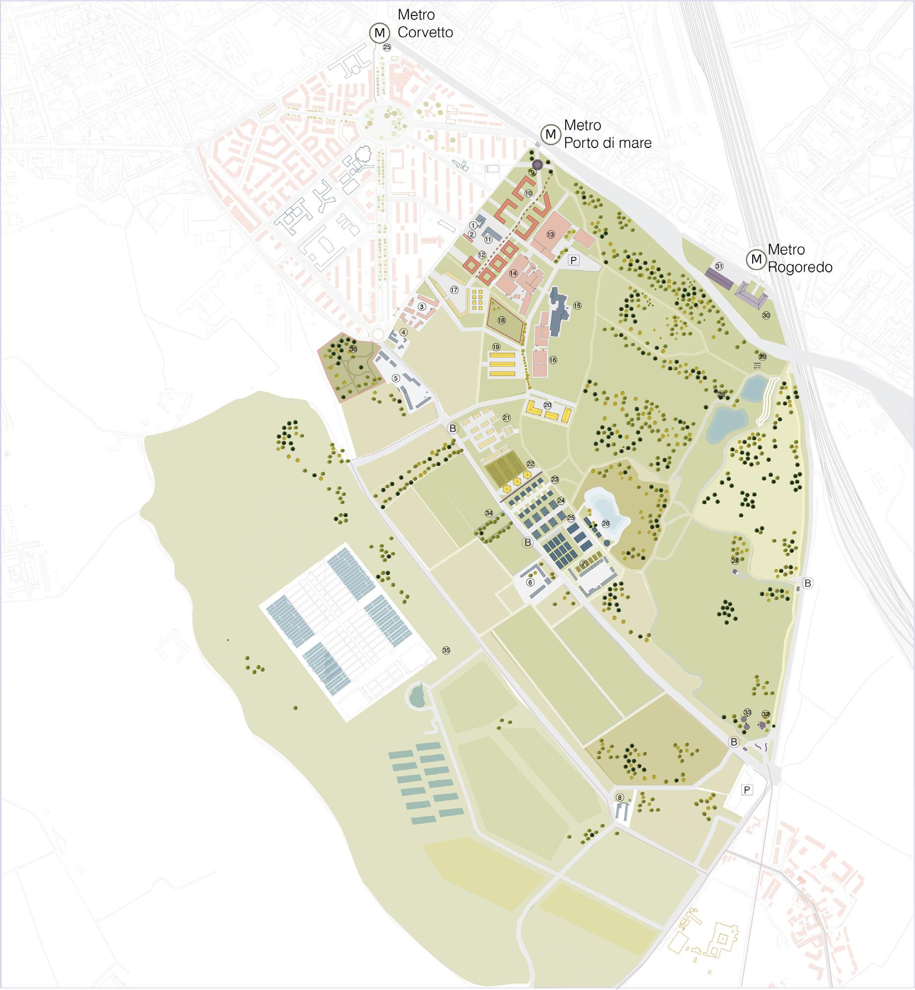
Problem Solving and Design Strategy Proposal
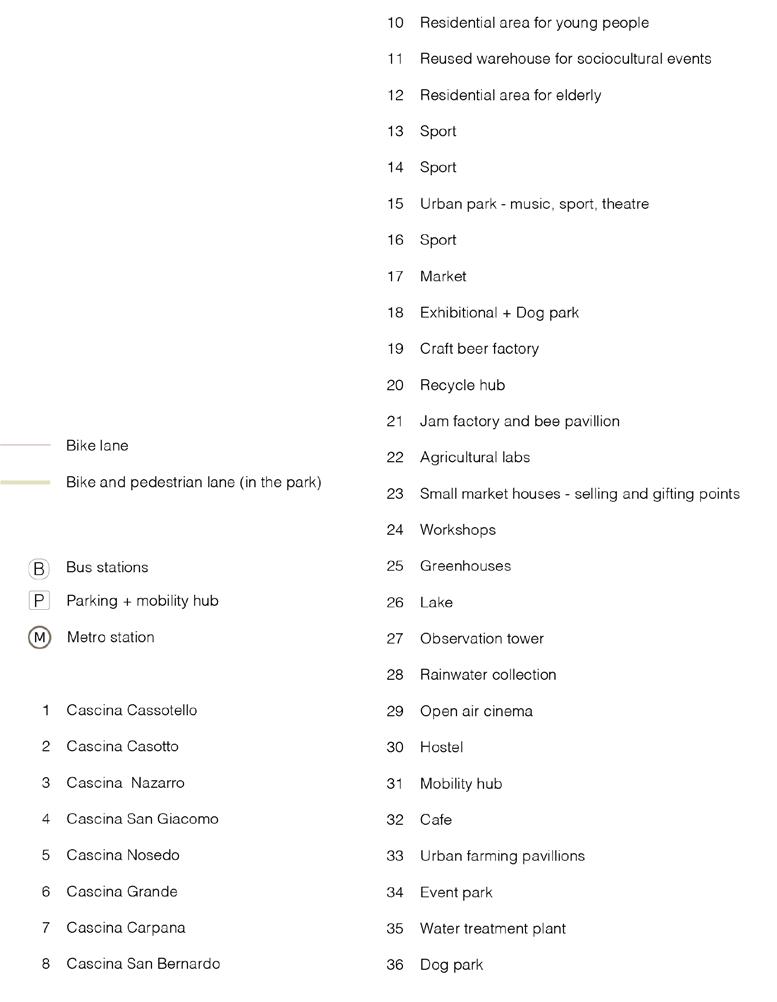
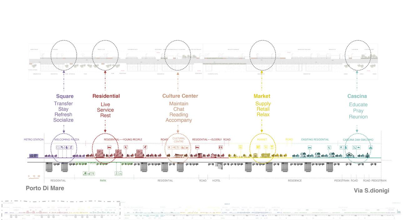
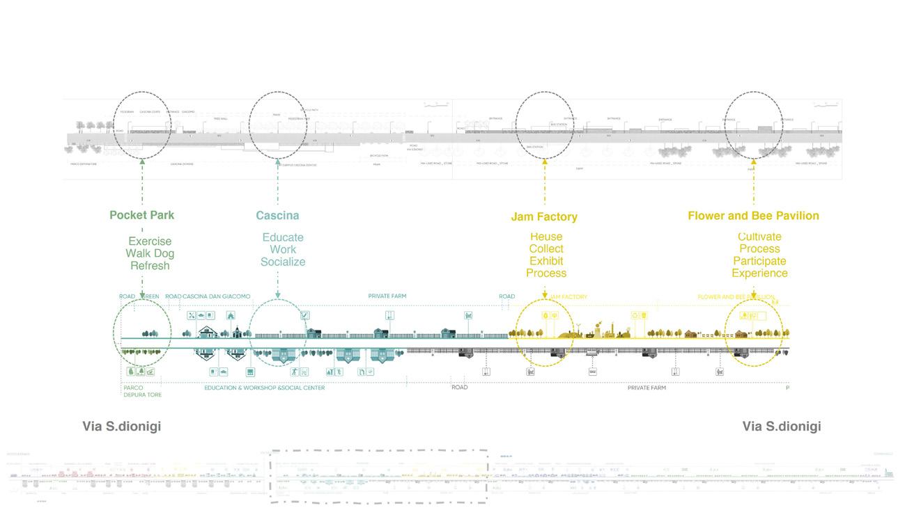
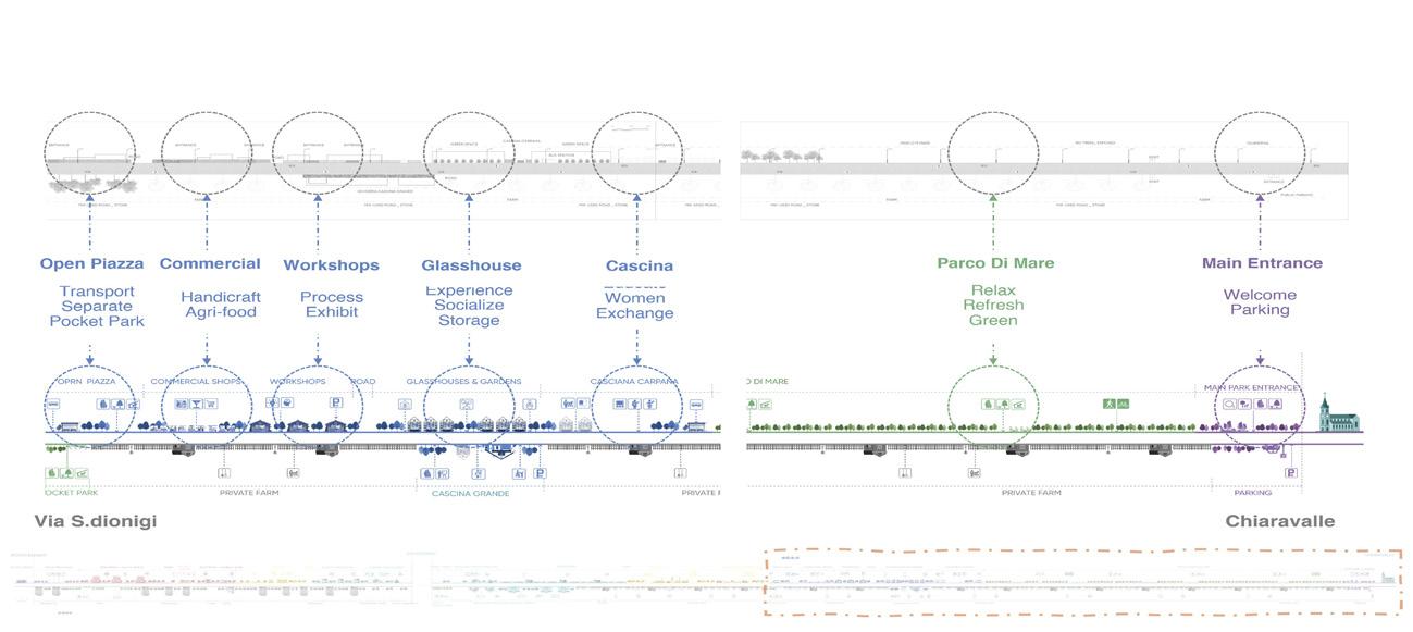
Welcoming entrance from Porto di Mare metro station
Living environment with residential, social, and culture welfare
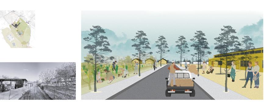
Adding agriculture product with more value through improving the market, restaurant, and agri-commerce
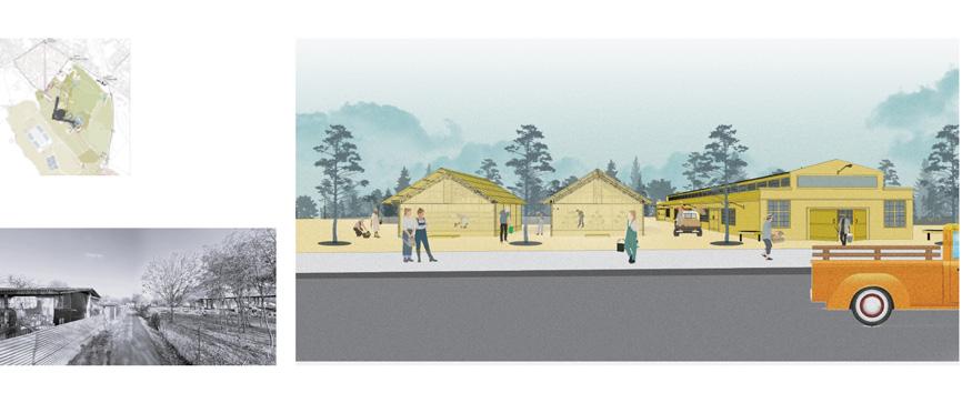
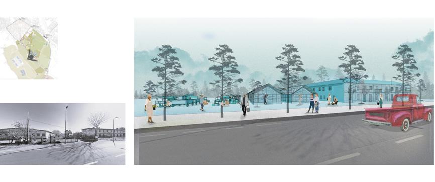
Improving agricultural productivity facility by reusing ex-warehouse and factory building
Developing agriculture education and tourism through communal area and reusing the
Cascinas
Connecting the area with Chiaravalle Heritage Site
Living environment with residential, social, and culture welfare
Trust Onrust: Archaeological Museum & Islands
Type Academic - Magistrale - Competition Representing POLIMI
Awards First Winner (C40 Students Reinventing Cities 2025)
Project Proposals of transforming the area into an attractive historical tourism destination
Location Jakarta, Indonesia
Area 11,83 Ha
Advisor Prof. Chiara Nifosì
Contribution Producing urban analysis (environment, social, and cultural analysis), supporting planning strategy, producing graphic of analysis, killer image visualization (15% in total contribution of the team consisting 7 members)
Proposed PIK Dock
To PIK Dock
PUP for Eco-Tourism Development
The south side of Bidadari Island is managed by PT Sea Breeze Indonesia (SBI), a subsidiary of the Jakarta-owned SOE PT Taman Impian Jaya Ancol. We propose a PublicPublic Partnership with SBI for the management of the islands.
With Ancol’s strong presence in North Jakarta, it can efficiently oversee the remaining areas of Bidadari and the other three islands. Being the main operator, the SOE will oversight the eco-tourism business and enforce the environmental protection such as complying the tourism carrying capacity.
Streamlined and Low-Carbon Water Transport
The current water transportation system to the Island Clusters operates from Marina Ancol and Muara Angke, with tours provided by PT Sea Breeze Indonesia, private operators, and the Jakarta Department of Transportation.
To reduce carbon emissions and manage waste more effectively, we propose using a Marina Ancol as the sole mainland dock. Bidadari Island will serve as the main gateway and host a waste bank for inorganic waste return.
A large boat will link the mainland to Bidadari, while a smaller boat will loop through Kelor, Onrust, and Cipir to collect people and sorted waste. We also propose a new dock at Pantai Indah Kapuk to serve short distance trips using fisherman boats for a low-impact alternative access point.
Muara Angke Dock 12.7km 50Boatwithcapacityof -100passengers
Boatwith capacityof20passengers
Marina Ancol Dock Ancol Station North Jakarta
Priok Dock
NounProject
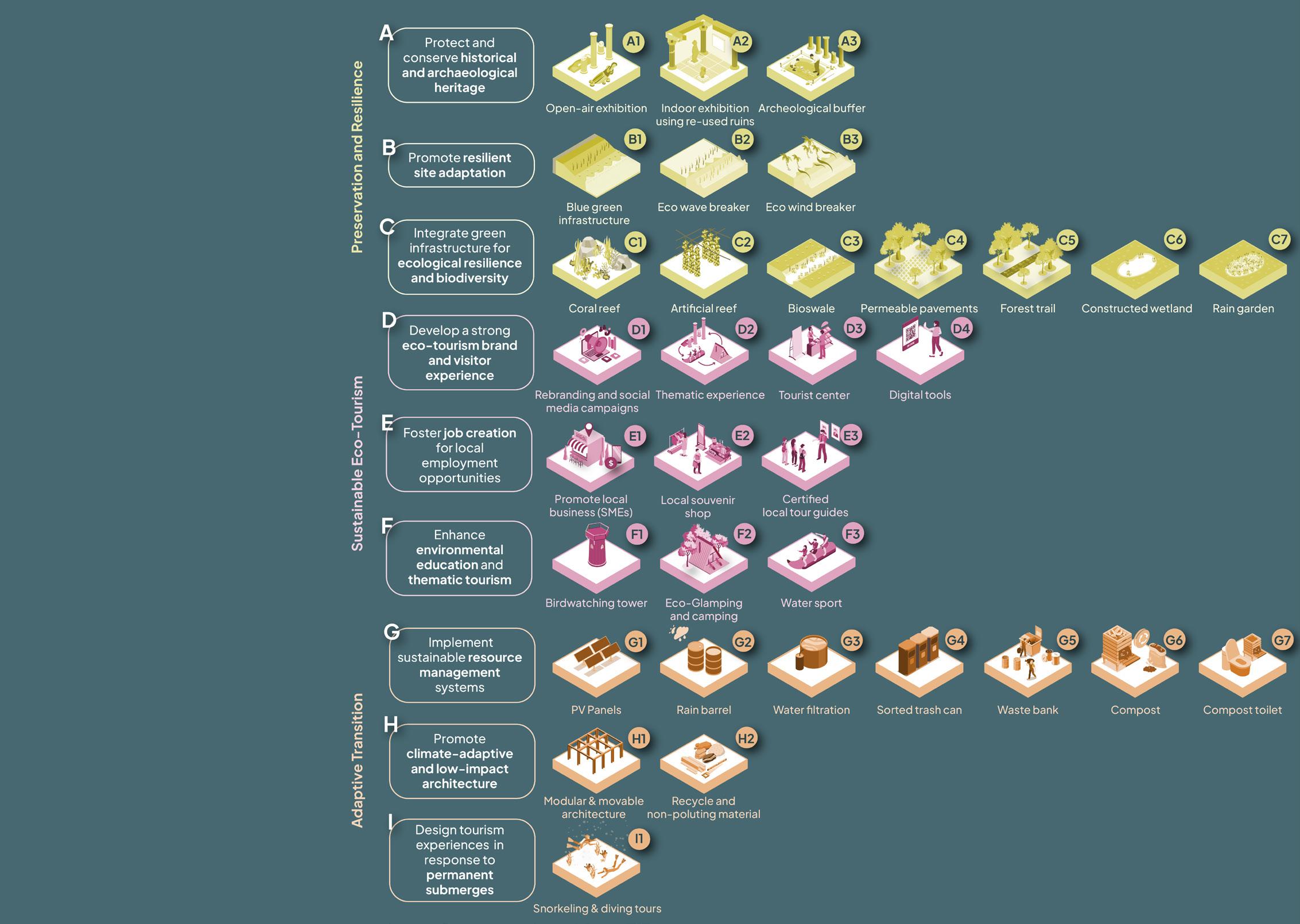
Vision
Built to remember, ready to let go
We are committed to ensuring the longevity of this island cluster by safeguarding its rich cultural heritage and sharing its historical value with a broader public. Yet we must also face the reality that, in the face of rising sea levels, this heritage may one day be lost beneath the water.
When that moment arrives, we recognize that conventional preservation methods may no longer be viable. We ensure that the site’s transition is guided by ecological responsibility and long-term foresight, allowing the islands to decline in a way that is both gentle and meaningful.
To execute this, we have 3 vision:
1. Preservation and Resilience
We are committed to maintaining the current condition of the islands for as long as possible by strengthening the islands’ resilience against environmental threats such as coastal erosion and rising sea levels.
2. Sustainable Eco-Tourism
We will promote eco-tourism that respects ongoing archaeological work and highlights the layered histories of the islands. We aim to foster public appreciation for the islands’ significance, both cultural and ecological.
3. Adaptive Transition
Recognizing that long-term submergence is inevitable, we are proactively planning for a sustainable transition. We ensure that any future decline of the islands occurs thoughtfully, allowing nature to reclaim the space in a way that is beneficial.
We will expand the vision into strategies that will be implemented using practical actions.
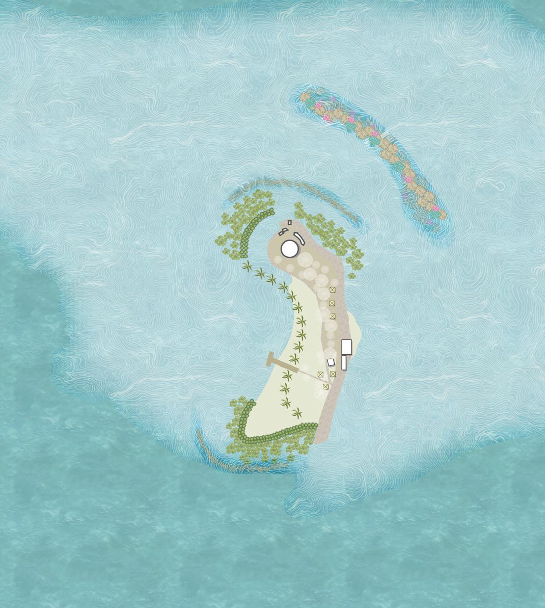
The Circular Islands
Circular Experience
Each island will have its own theme based on its unique characteristics and heritage. Through a designated tour route and cohesive storytelling, these distinct islands will be unified under a shared tourism narrative that celebrates their diversity while providing a seamless and enriching visitor experience.
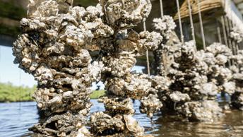
Circular Utility
Since achieving complete self-sufficiency on small islands is challenging, this integrated utility strategy focuses on minimizing waste, maximizing local water reuse, and generating renewable energy on-site. By combining rainwater harvesting, solar energy production, and a circular waste management approach (with residual waste responsibly sent to Jakarta), the system significantly enhances the islands’ sustainability and resilience.
Second Stop: Kelor Island General Intervention
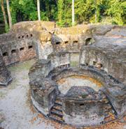
A strong impression with its striking ruins and raw, natural setting. With no modern structures, it highlights military heritage, making it one of the most unique and photogenic stops on the tour.
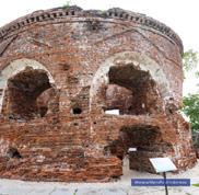
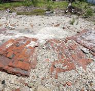
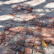
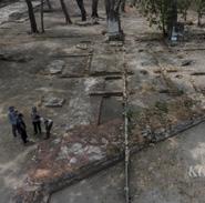
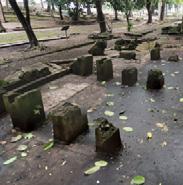
Third Stop: Onrust Island
An adventurous experience as the main historical attraction. Rich in colonial relics, the island features ongoing archaeological excavations, allowing visitors to witness history in the making.
First and Final Stop: Bidadari Island
A restful start or end to the journey, with cottages for overnight stays and the first bastion nestled in natural surrounding. Ideal for recharging or preparing for the trip.
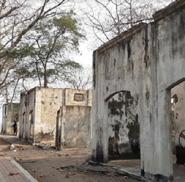
Fourth Stop: Cipir Island
A relaxing and fun break with watersports, dining, and scenic ruins. With added amenities like gazebos and a gift shop, the island blends leisure with light heritage exploration.
To Marina Ancol Dock
01.Kelor Island
Initial historical statement
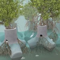
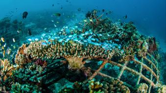
Kelor Island is the smallest and most ecologically fragile among the nearby islands, located at the outer edge of the island cluster, making it highly exposed to wave action and erosion. Despite its size, it holds cultural significance due to the presence of the Martello tower ruins. To strengthen the island’s resilience, a series of ecological interventions have been implemented.
02.Onrust Island
Historical Open-air Museum
Onrust Island is deeply rooted in rich historical significance, with multi-layered archaeological artifact spanning from different centuries that are still actively being excavated. It is home to a historical museum, and together with its diverse ruins, it holds great potential to be transformed into an open air museum that integrates the existing heritage and the ongoing archaeological excavation process for a more immersive experience.
03.Cipir Island
Cipir island holds some of the significant historical traces along with Onrust island. Therefore, outdoor exhibition areas with
with
are
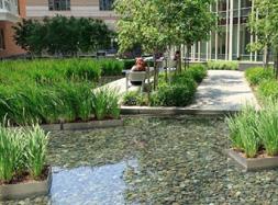
Bidadari Island features a central constructed wetland that functions to collect and purify rainwater, supporting sustainable water distribution across the island. Water flows into the wetland not only from rainfall but also through a bioswale system that runs along the main pathway. Located within a forested area and connected by nature trails, the wetland offers both ecological benefits and a space for visitors to engage with the landscape.
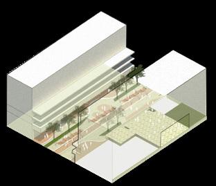
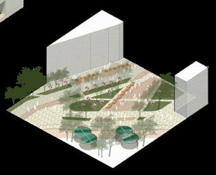
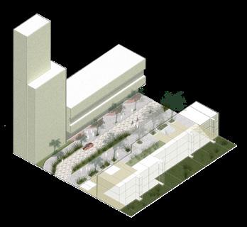
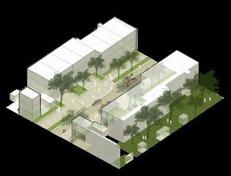
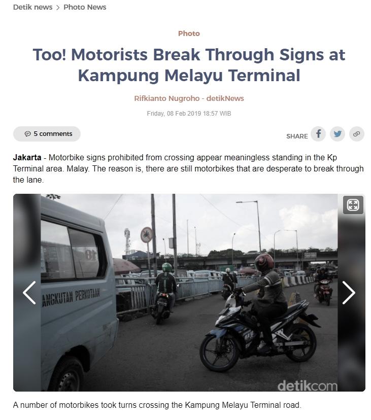
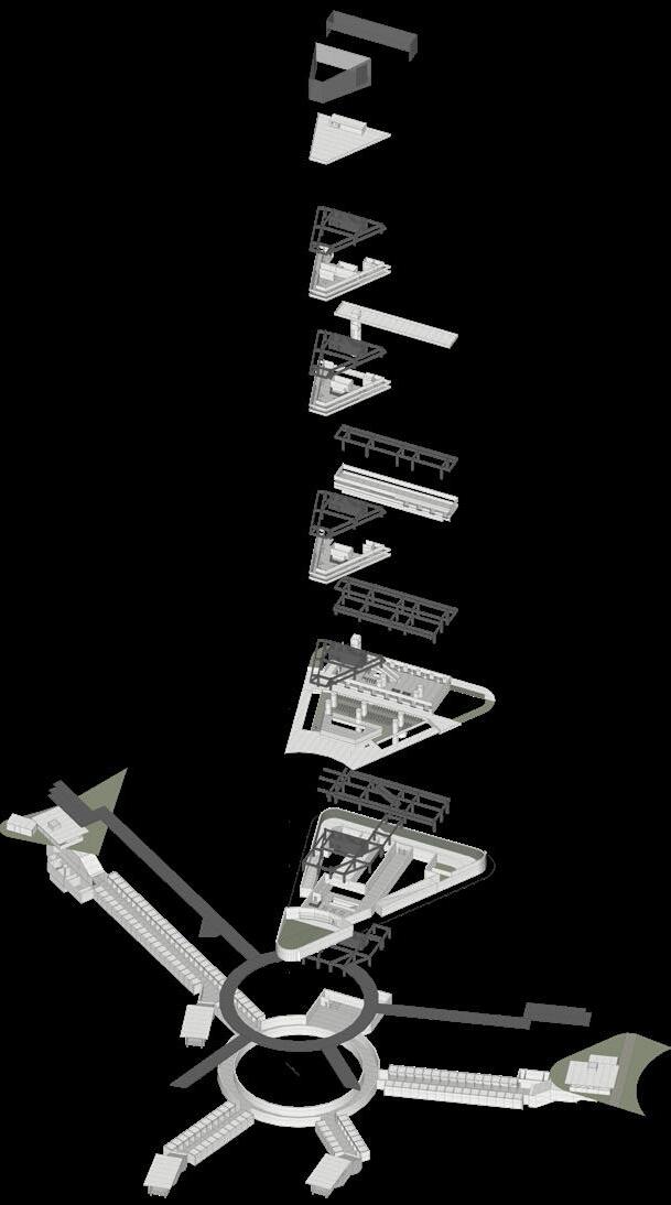
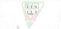
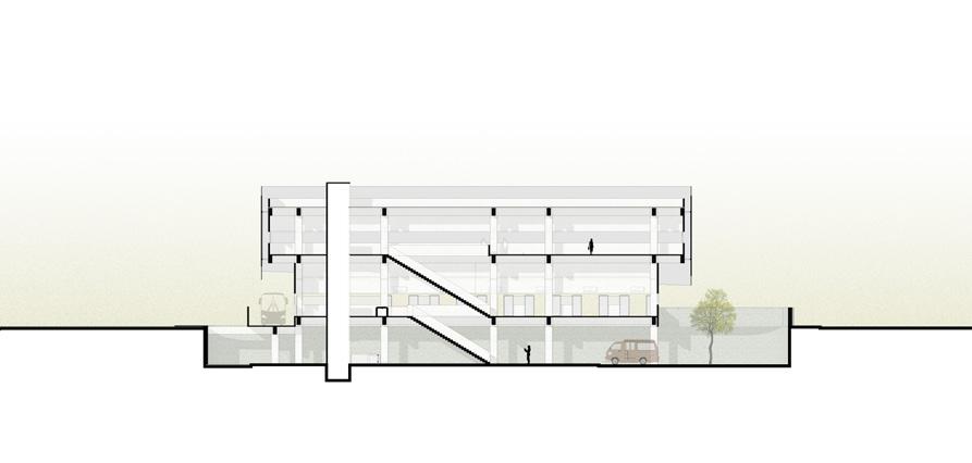
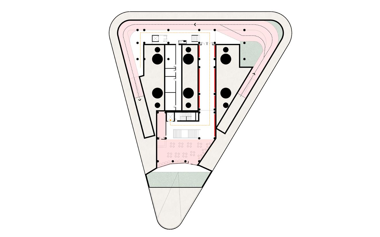
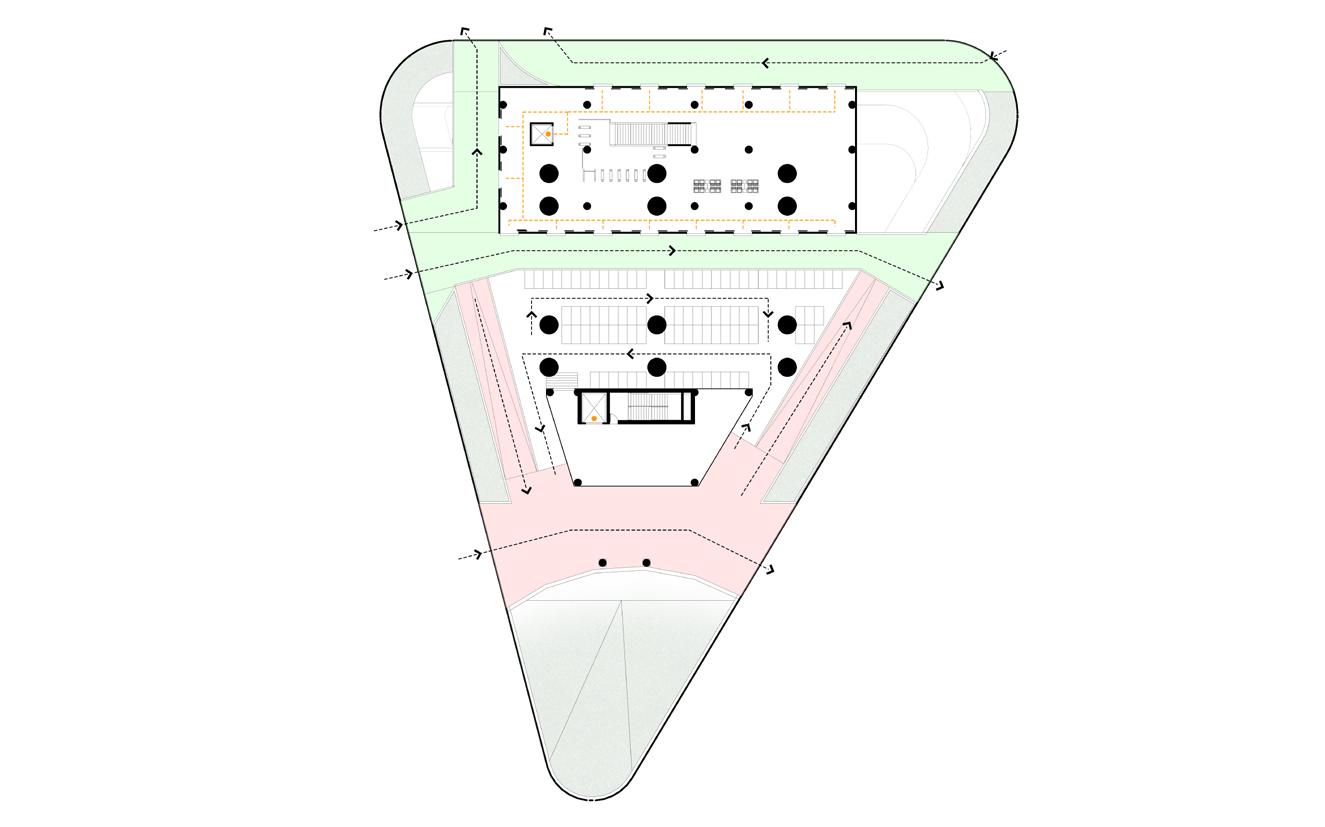
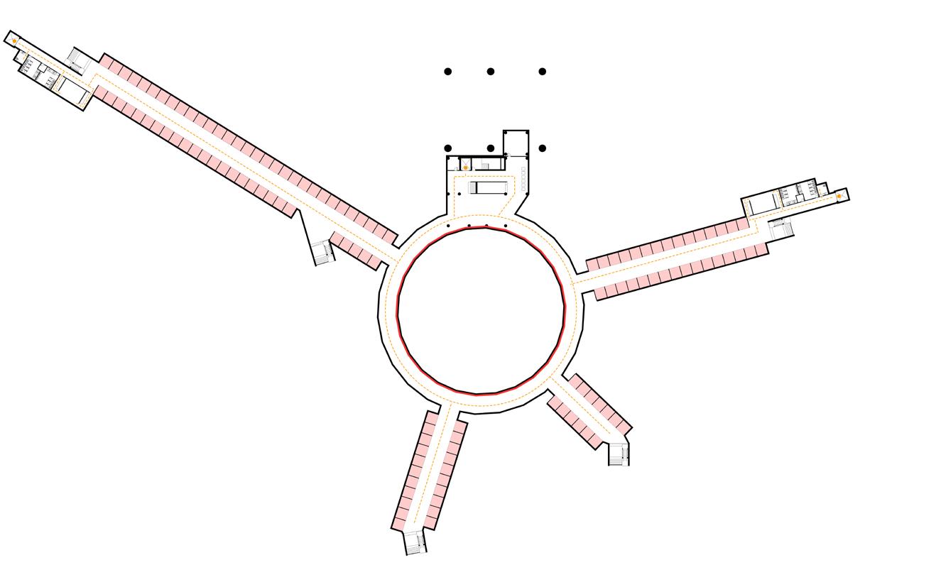
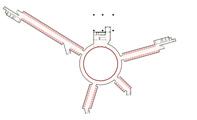
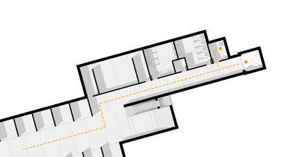
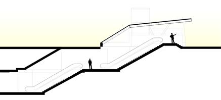
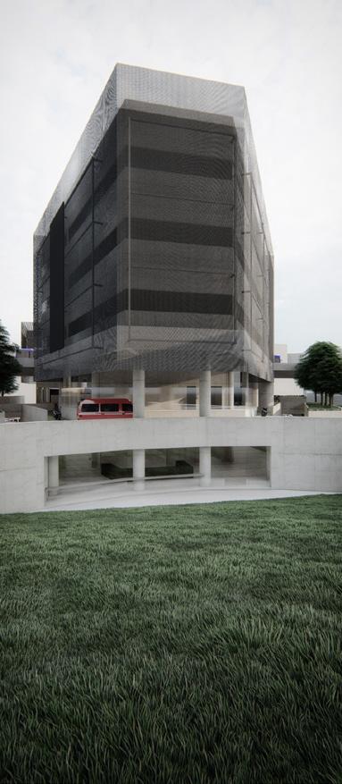
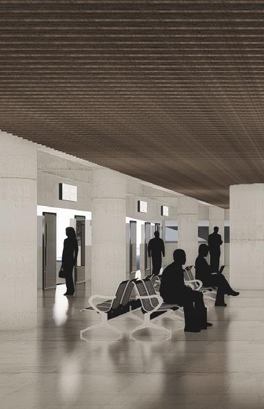
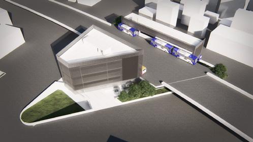
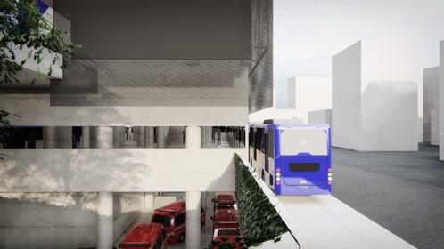
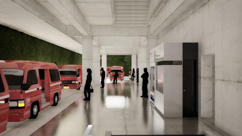
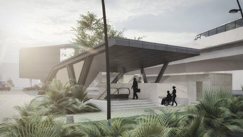
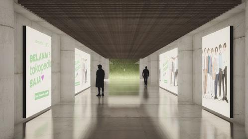
Kampung Melayu Terminal
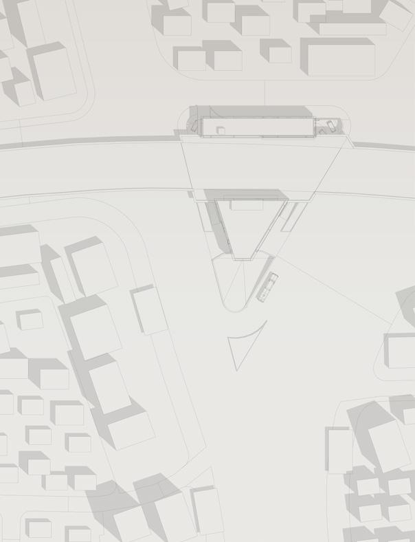
Type Academic - Undergraduate - Final Project
Awards Best Project - 39th Architecture Final Project and Presented at International Conference on Eco Engineering Development in Jakarta
Project Transportation Hub Complex
Location Jakarta, Indonesia
Area 3334 sqm
Advisor Prof. Noegroho, S.T., M.L.P., Prof. Ir. Michael Tedja S.T., M.T.