

LANDSCAPE ARCHITECTURE PORTFOLIO
JAYLAN HOLMAN
kj.holman.jh@gmail.com
JAYLAN HOLMAN
678-814-9510 CONTACT INFO
01 02 03 04 INFILL HOUSING CONSERVATION DEVELOPMENT WESTPOINTE OF ATHENS PROFESSIONAL WORK 1-4 5-10 11-14 15-16
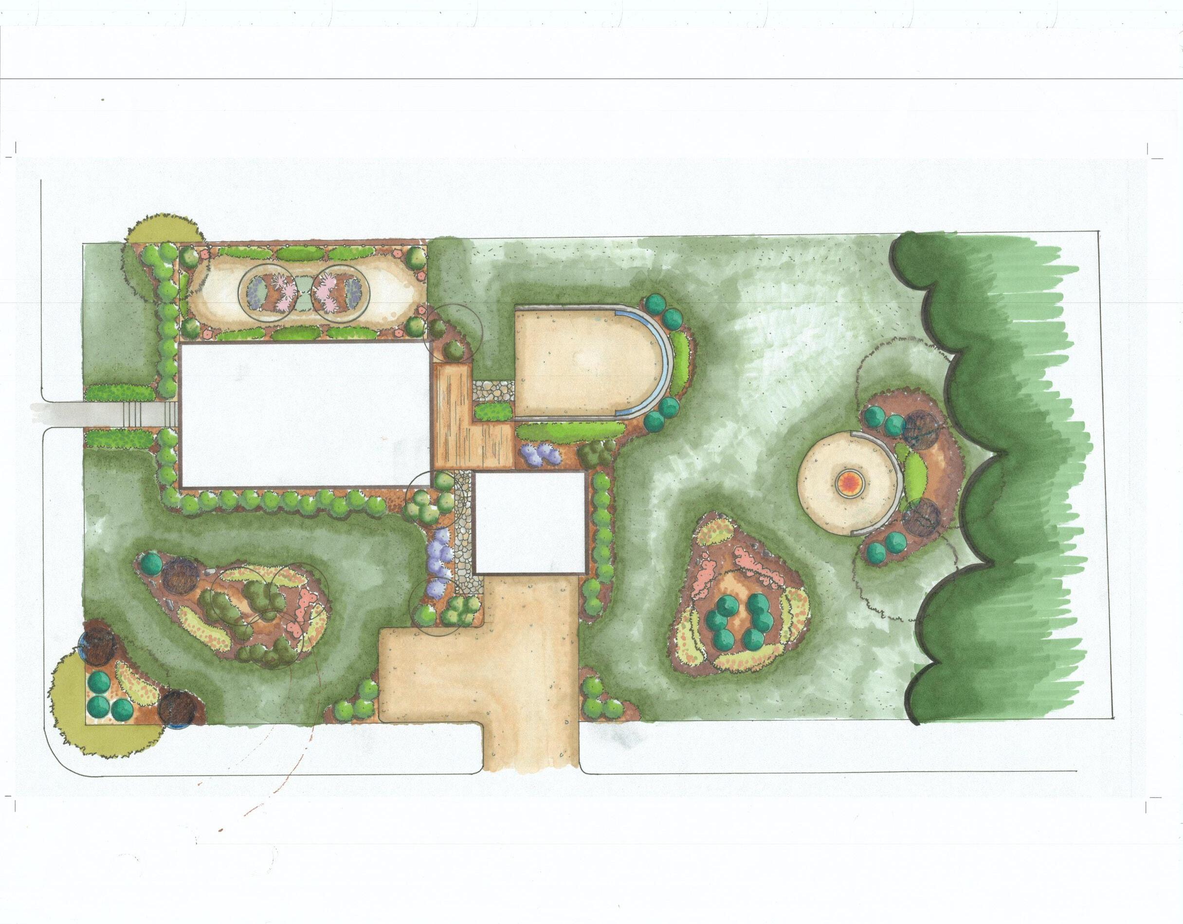
INFILL HOUSING- ALBY ESTATE
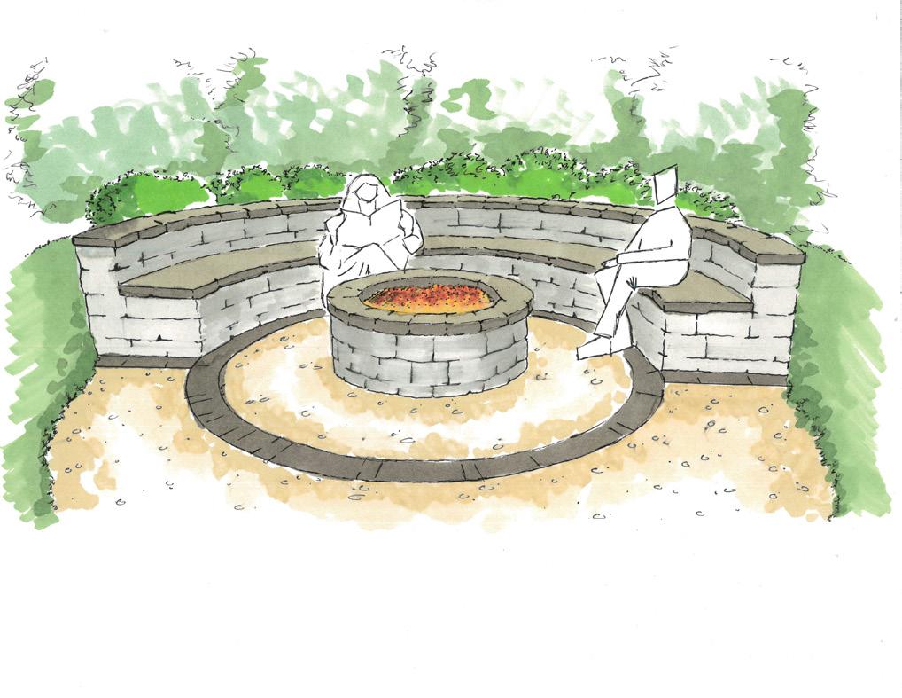
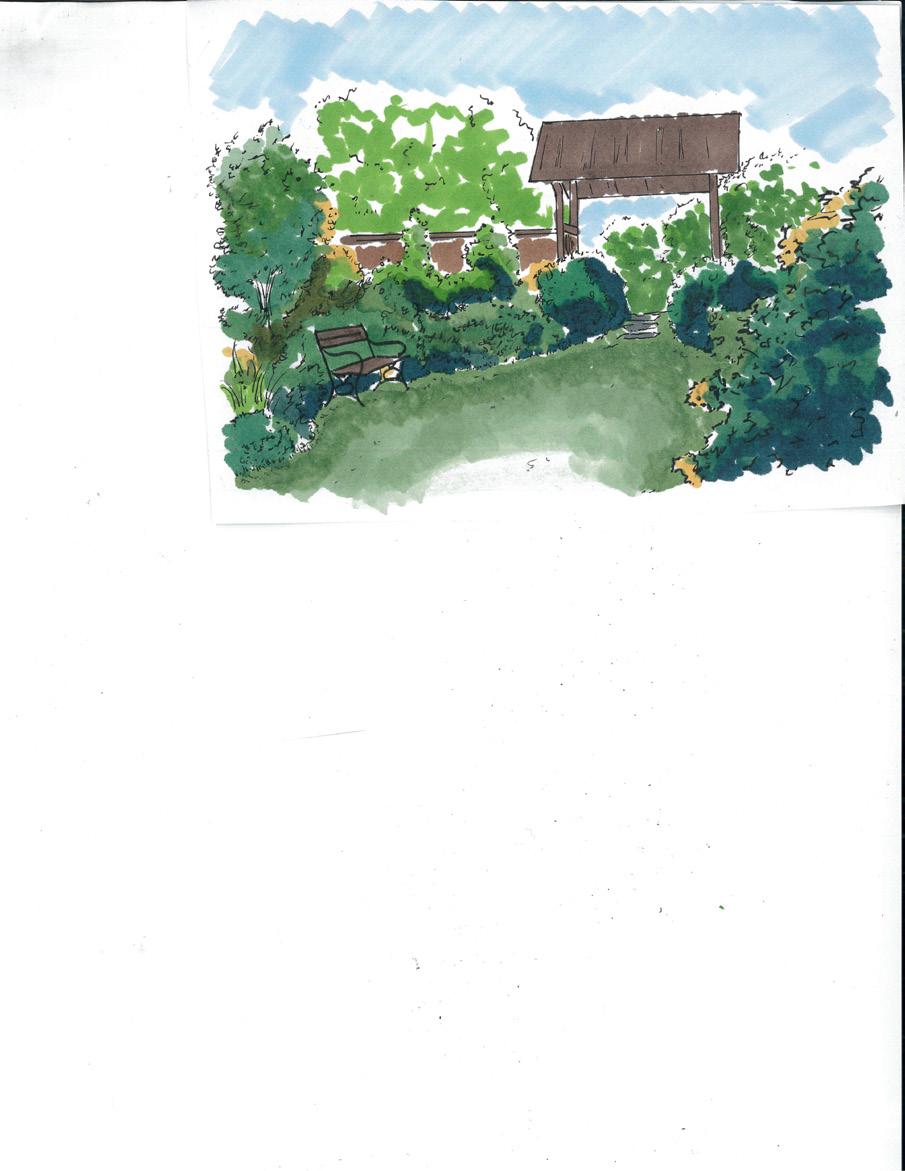
The project focuses in the redevelopment of a vacant parcel of land on the outskirts of downtown Athens, Georgia. The Alby Estate creates a unique look; using vibrant native vegetation in contrast with such a traditional style of architecture, the overall project generates a harmonious feeling. The estate will include many spacious outdoor areas, including a courtyard and overlook patio fitted with a fire pit, along with ample seating to fit family and friends. Located on the northernmost part of the site lies a meditation garden, an enclosed, private space that allows the user to completely unwind.
1
01
2
Site Features
This site features a courtyard surrounded by a stone retaining wall where residents can gather for socializing. The overlook patio, located at the highest part of the site provides a great view of the estate with a warm fire, acting as the perfect centerpiece for social occasions. The meditation garden is an enclosed oasis of lush native vegetation that gives the user a deeper connection to nature and allows them to completely unwind and get away from the outside world.
3
Site Grading Plan
Grading plan showing the existing/proposed topography of the infill development and how water will be conveyed on the site.
N CHURCH ST HILL ST
4
SCALE: 1''=10'
CONSERVATION DEVELOPMENT
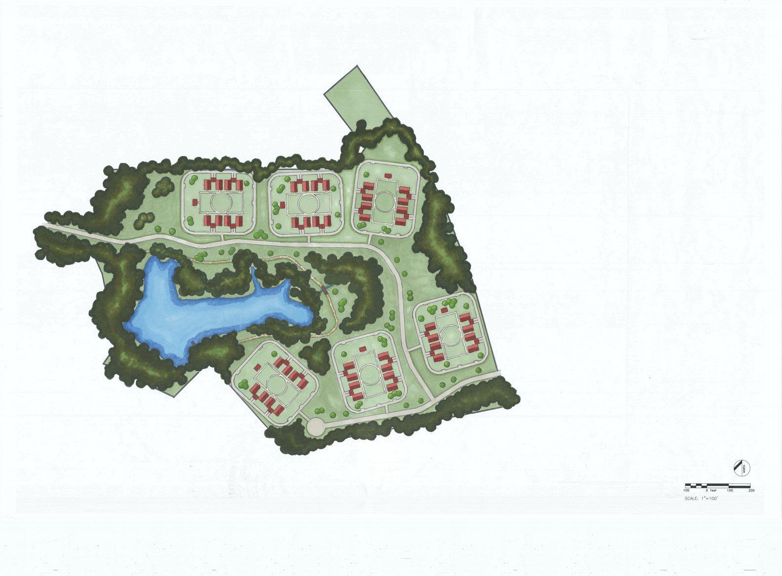
The Winslow at Moss Side is a conservation neighborhood that provides a number of open spaces and amenities for its residents while still preserving and maintaining much of the old growth vegetation and natural features already present in Moss Side. Included in this large expanse of land are six pocket communities, each with eight houses with attached garages, a community house, and a large open field free to be used by all residents. A key feature of this community is its proximity to the large lake located on the southwestern side of the site. This lake is surrounded by lush, mature vegetation as well as a nature trail that is easily accessible to all residents of the Winslow.
5
02
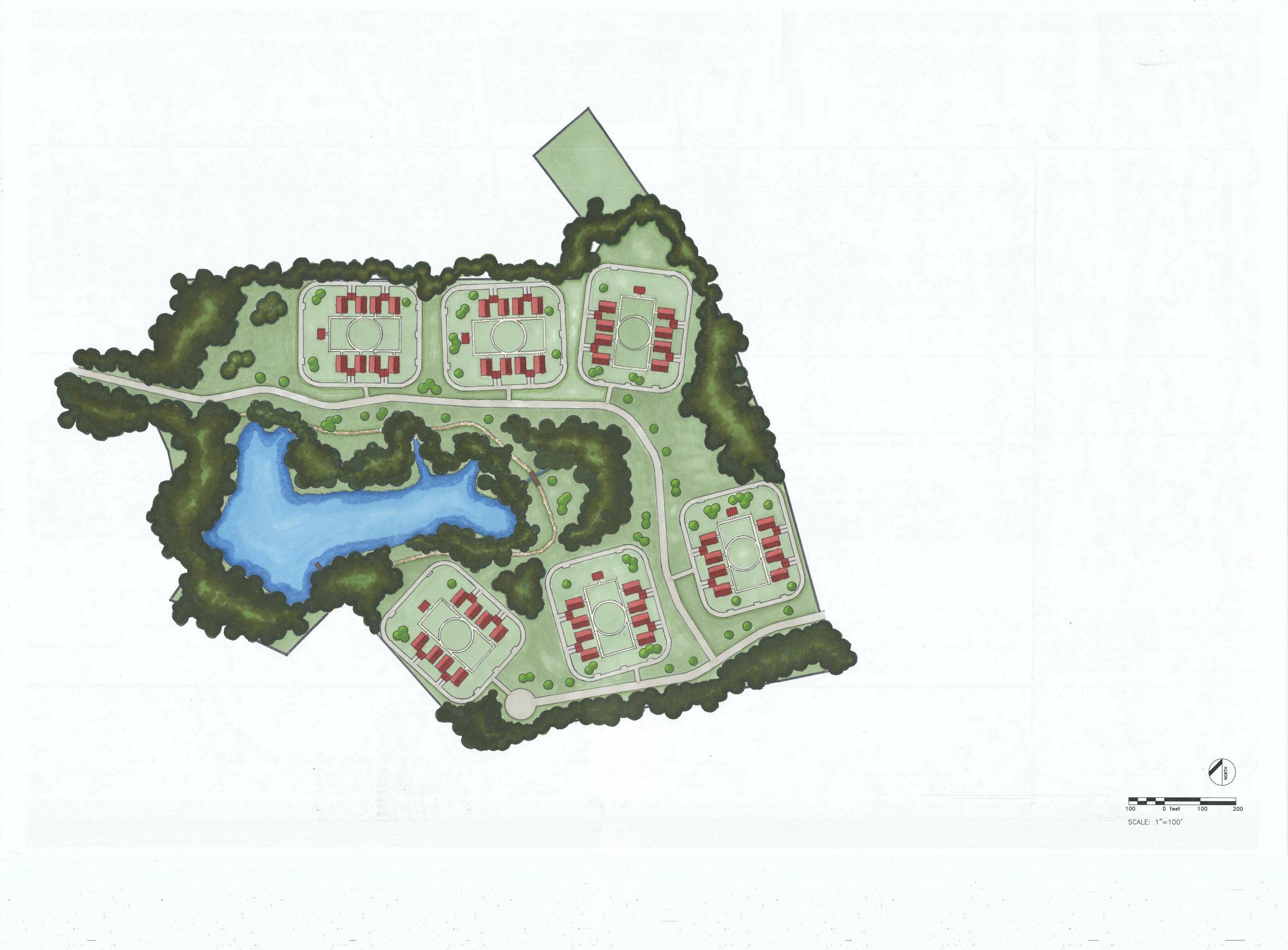
6
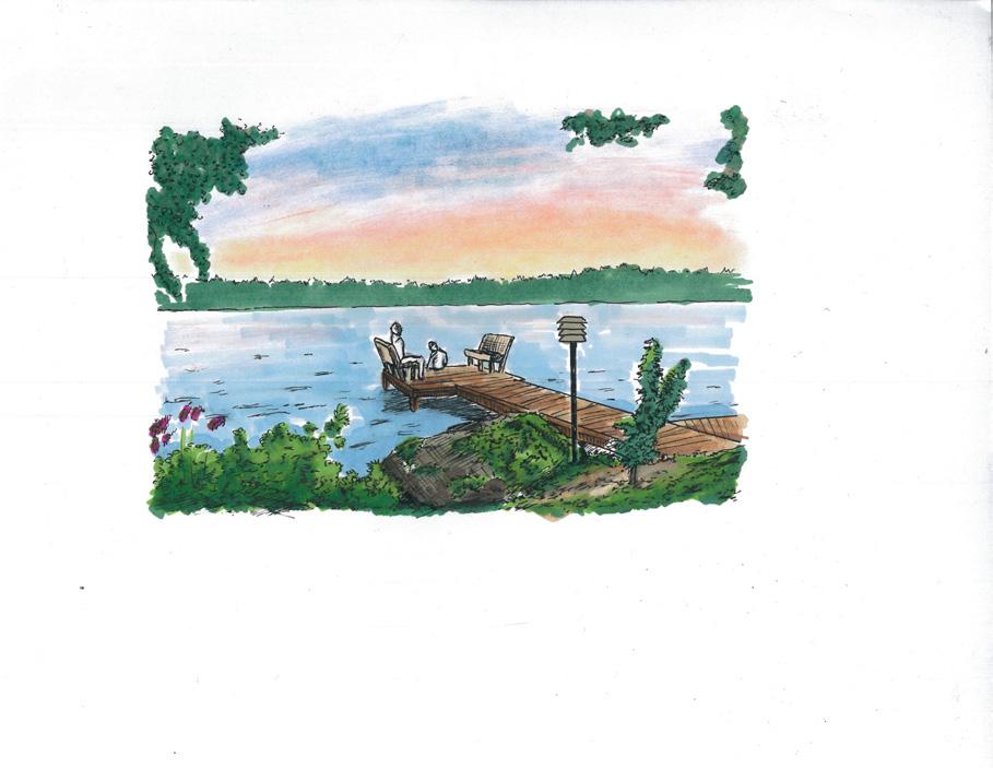
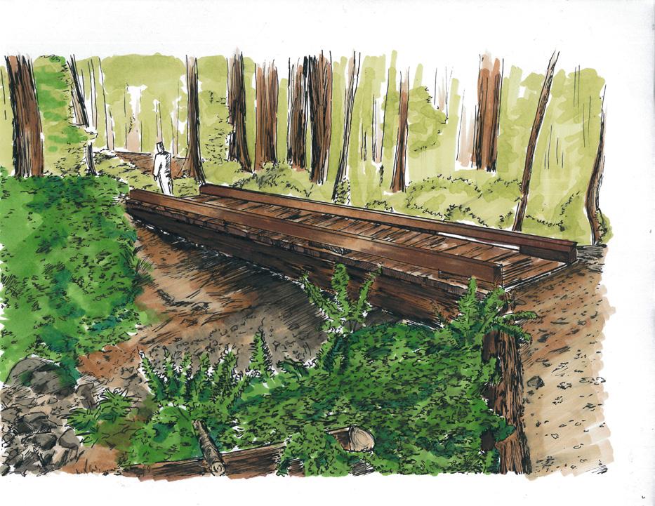
View of footbridge over overflow stream
Site Inventory & Analysis
Soil Inventory
Moss Side inventory map showing the soil types present on site ranging from moderately eroded to severely eroded. There are roughly eight different types of soil on the site.


Slope Inventory
Moss Side inventory map showing changes in slope on the site. Slopes within Moss Side vary from a gentle 0-4 percent slope to a severe 15 percent and up.
Vegetation Inventory
Moss Side inventory map showing the existing vegetation on site. Since the focus of this design was to keep as much old growth as intact as possible, it was important to indicate which areas on the site limit development. Limitations range from slightly limited (open areas and invasives), moderately limited (pines and young hardwoods), and severely limited (mature hardwoods).
7
Hydrology Analysis
Moss Side analysis map showing water features present on the site as well as the flow direction of water on the site. Also shown in on the map is the 75’ buffer zone that was to not be developed on.
Composite Analysis
Moss Side analysis map that describes the suitability of different areas of the site in regards to development. It also points out pertinent information to take into account before development, such as noise and possible entrances.
Master Land Use
Moss Side analysis map that describes which land is to be developed on (yellow) and which land is to be kept intact (green).
8
Roadway Engineering & Vertical Alignment
9
0+00 0+50 1+00 1+50 2+00 2+50 3+00 3+50 4+00 4+50 5+00 5+50 6+00 6+50 7+00 7+50 8+00 8+50 9+00 9+50 745 750 755 760 765 BVC: 1+75 ELV: 749.95 EVC: 3+25 ELV: 755.88 BVC: 3+50 ELV: 757.5 EVC: 5+50 ELV: 761.13 CURVE LENGTH: 150' 1.4% 6.5% END ST: 9+37.54 ELV: 750 747.5 748.2 748.9 749.6 750.41 751.96 754.36 757.5 760.16 761.66 761.98 761.13 759.69 758.25 756.81 755.38 753.94 752.5 751.06 CURVE LENGTH: 200' HP: 4+88.67 ELV: 762.01 -2.875% SCALE: 1"=100' VERTICAL SCALE: 1"=5' HORIZONTAL SCALE: 1"=50' 0+00 0+50 1+00 1+50 2+00 2+50 3+00 3+50 4+00 4+50 5+00 5+50 6+00 6+50 7+00 7+50 8+00 8+50 9+00 9+50 10+00 10+50 11+00 11+50 12+00 705 710 715 720 725 730 735 740 745 750 755 760 BVC: 5+75 ELV: 726.61 EVC: 7+25 ELV: 721.32 CURVE LENGTH: 150' -6.15% -0.91% 762 758.923 755.846 752.769 749.692 746.615 743.539 740.461 737.384 734.307 731.23 728.153 725.19 722.98 721.65 721.089 720.634 720.179 719.724 719.269 718.815 718.359 717.904 717.449 717 ROAD 2 INT: 3+64.1686 ELV: 762 SCALE: 1"=100' VERTICAL SCALE: 1"=5' HORIZONTAL SCALE: 1"=50' 12+00 12+50 13+00 13+50 14+00 14+50 15+00 15+50 16+00 16+50 17+00 17+50 18+00 18+50 19+00 19+50 20+00 20+50 21+00 21+50 22+00 22+50 23+00 23+50 705 710 715 720 725 730 735 740 745 750 755 760 BVC: 18+00 ELV: 710.57 LP: 18+22.98 ELV: 710.45 EVC: 20+00 ELV: 717.76 END ST: 23+84.417 ELV: 749.5 CURVE LENGTH: 200' -1.072% 8.257% 717 716.467 715.932 715.395 714.859 714.323 713.787 713.251 712.716 712.179 711.643 711.107 710.57 710.62 711.83 714.21 717.76 721.885 726.014 730.142 734.27 738.399 742.528 746.656 SCALE: 1"=100' VERTICAL SCALE: 1"=5' HORIZONTAL SCALE: 1"=50' 10

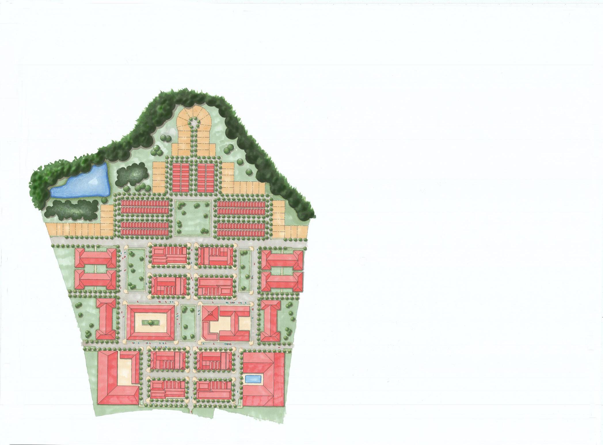
WESTPOINTE OF ATHENS
The Westpointe of Athens aims to completely revitalize the Georgia Square Mall site, turning what is now a rundown, 1970s era mall into an active, mixed-use community loaded with many commercial and residential options which all work in unison to emphasize the idea of “live, work, play”. With a primary entrance along Atlanta Highway as well as secondary entrances along Huntington Road and Mall Access Road, the front of the community will serve as the hotspot of Westpointe fit with office spaces, restaurants, retail and other amenities, including an open community park where residents and visitor alike can relax. Further into the site, Westpointe becomes more residential, being able to accommodate a number of family sizes and income levels ranging from an individual to a large family. The Westpointe is heavily influenced by walkability. By strategically organizing the commercial, residential, and entertainment aspects of the community, residents and visitors will be able to freely and comfortably move throughout the space without the congestion of the streets.
11
03
12
Design Process
Preliminary conceptual drawings showing movement of water on the site as well as traffic patterns on the roads surrounding the site.
13
14
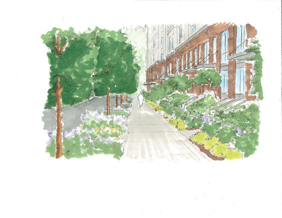
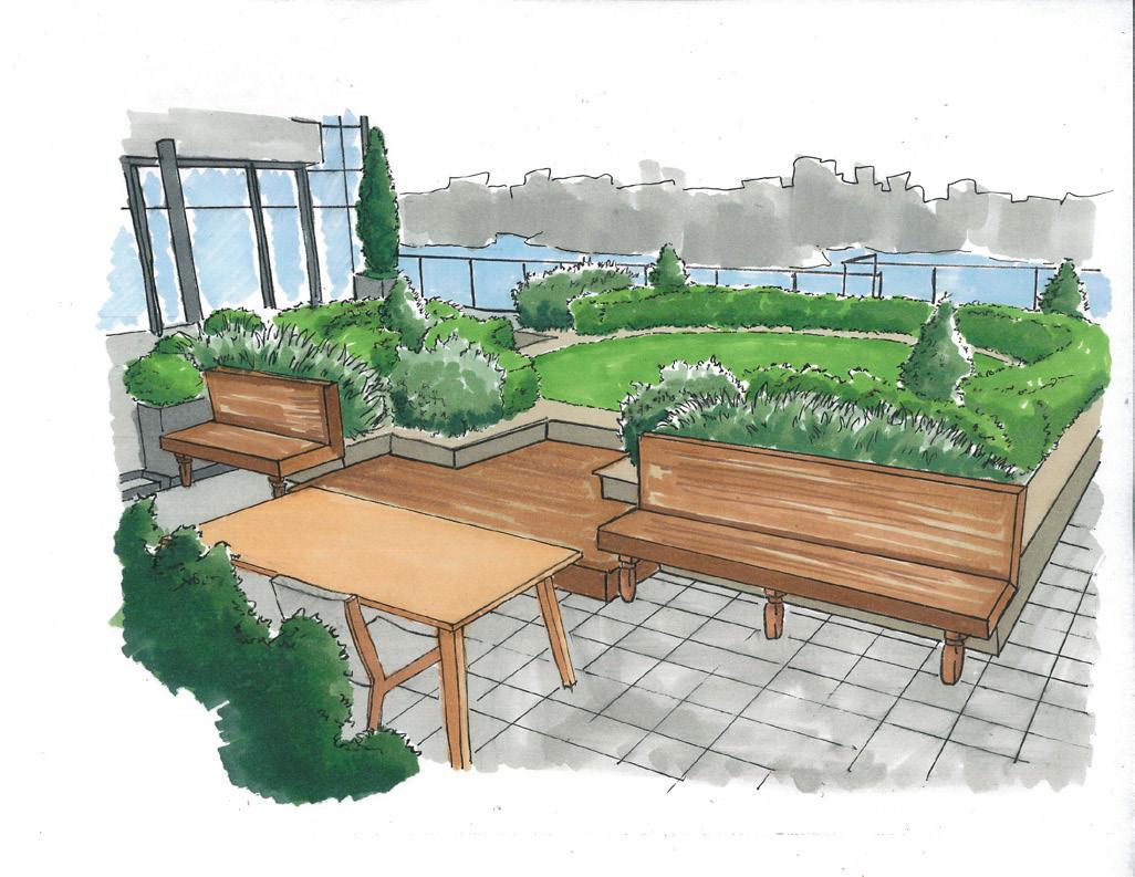
Townhome Streetscape Perspective Proposed Green Roof
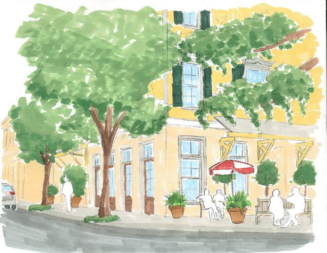
Commercial District Seating Area
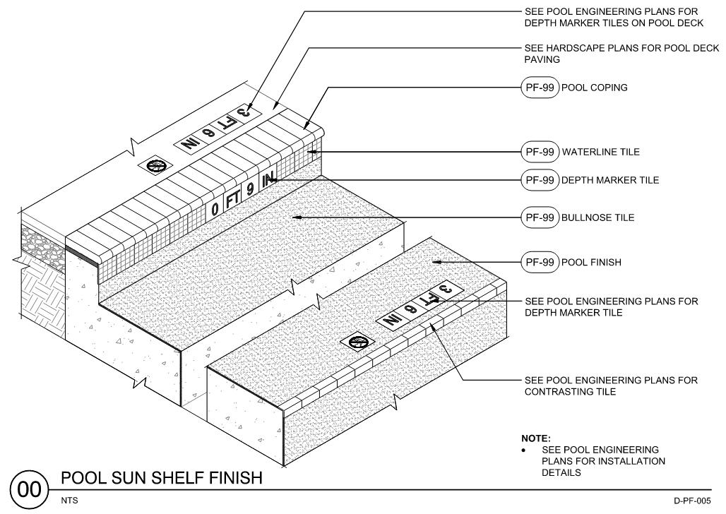
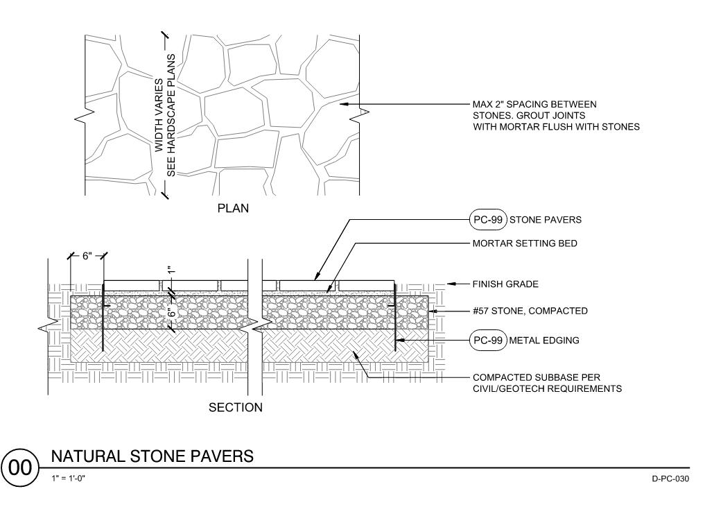
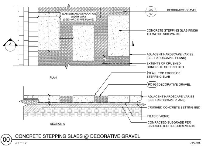
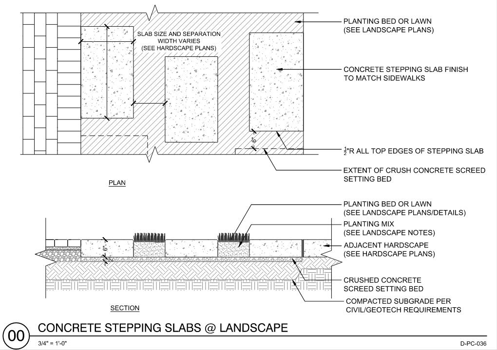
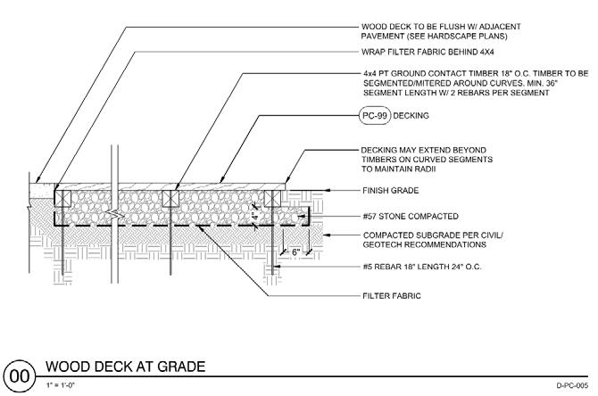
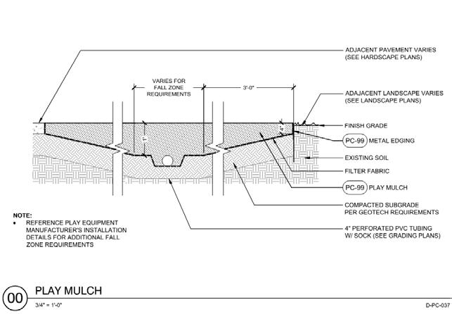
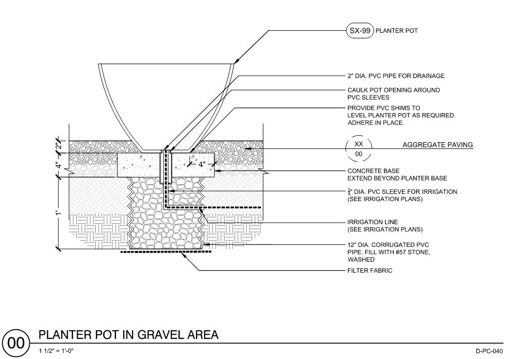
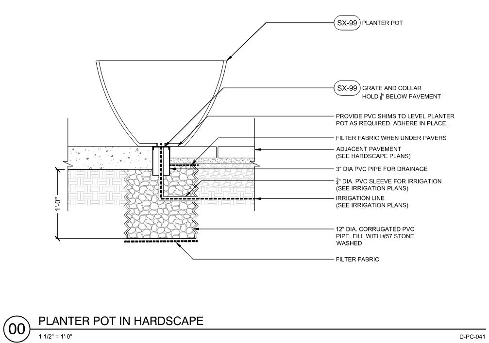
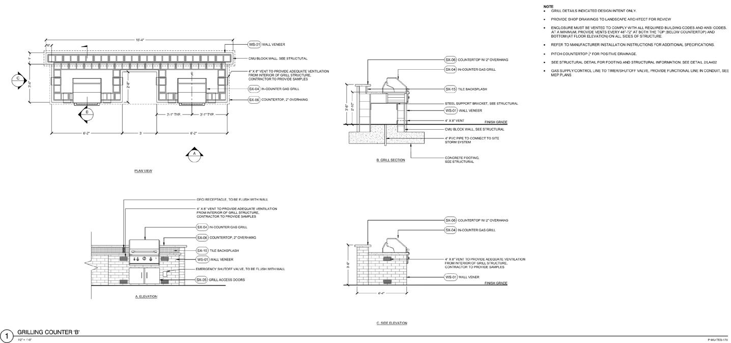
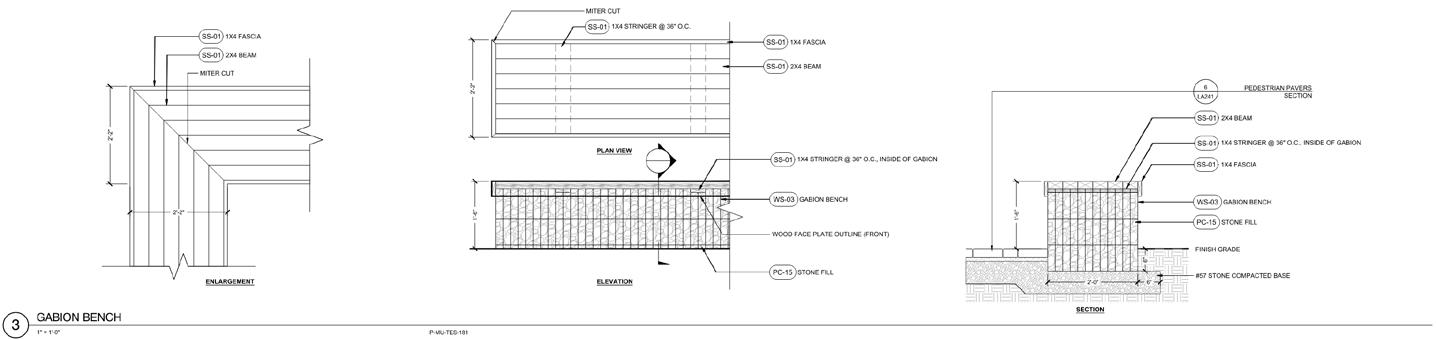
CONSTRUCTION DOCUMENTATIONSTANDARD DETAIL DRAFTING
15 04
PROFESSIONAL WORK
16
17
18
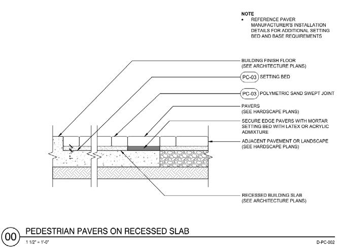
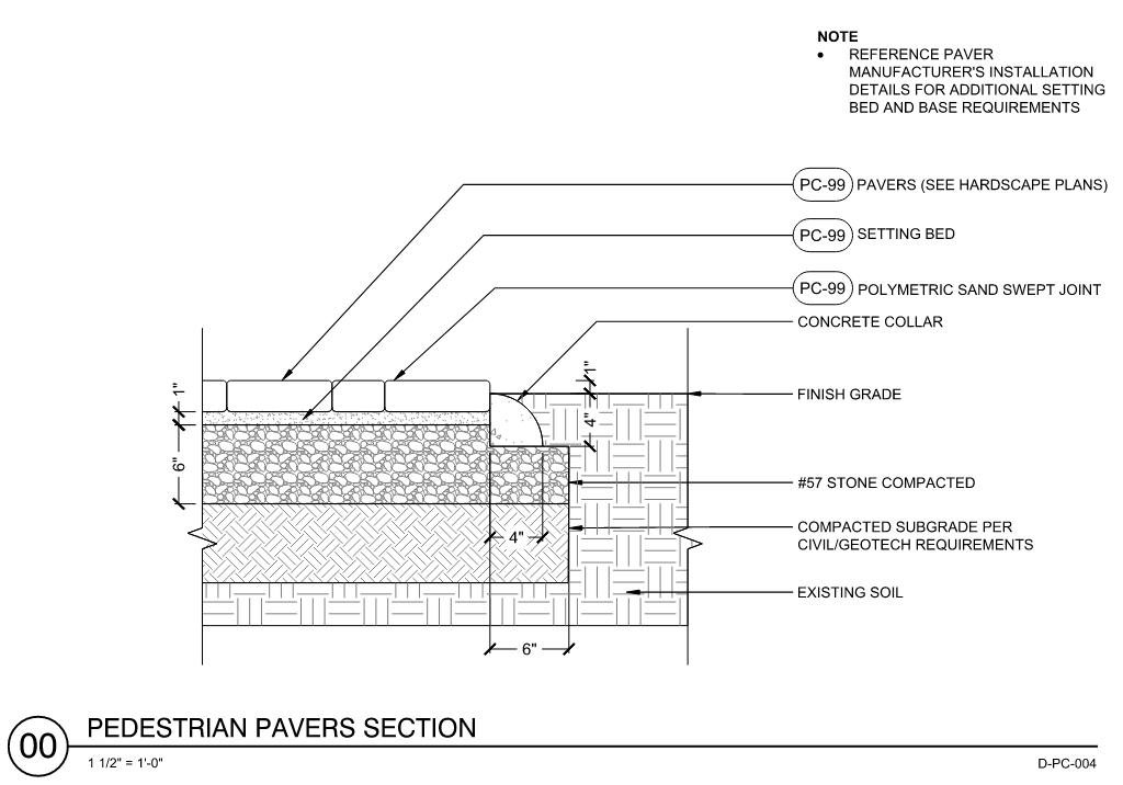
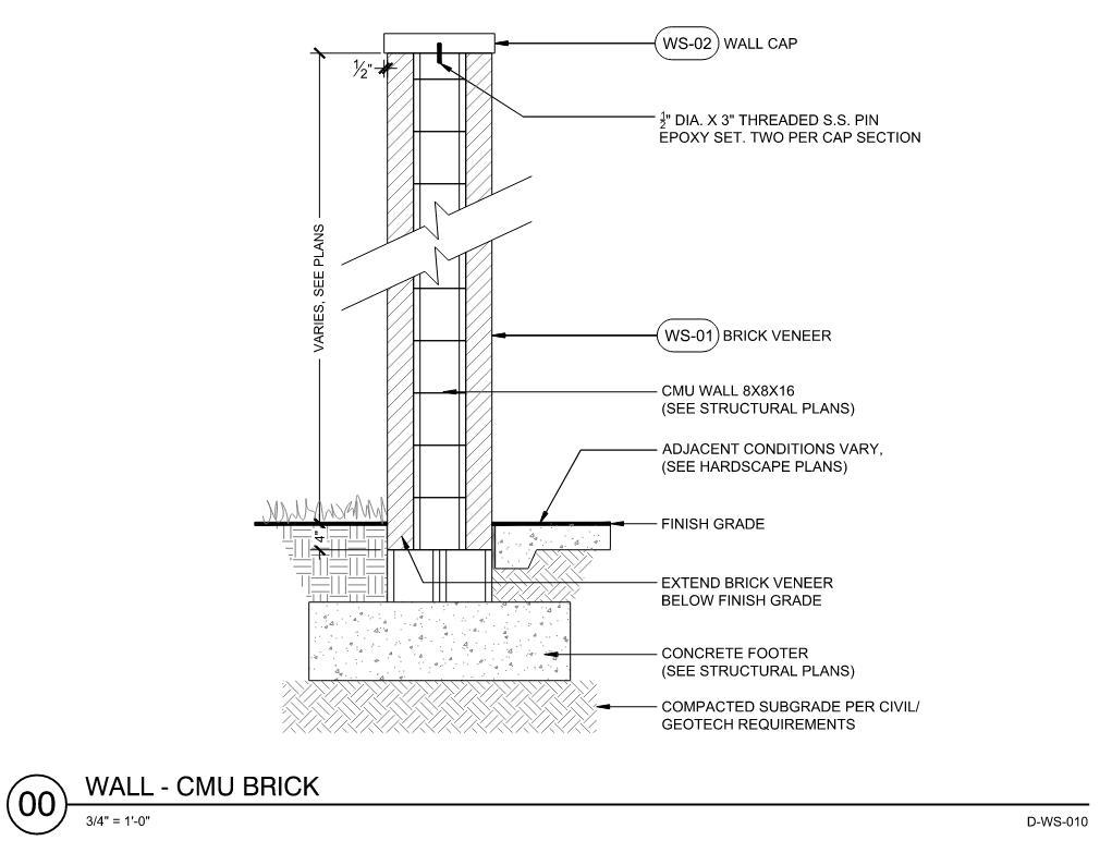
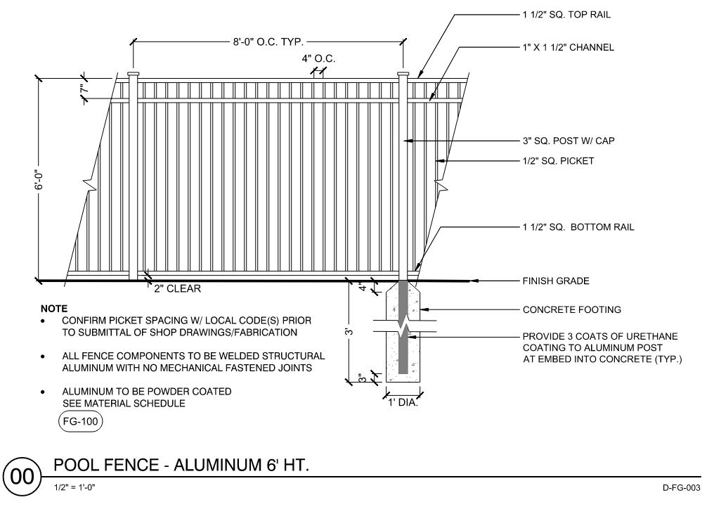
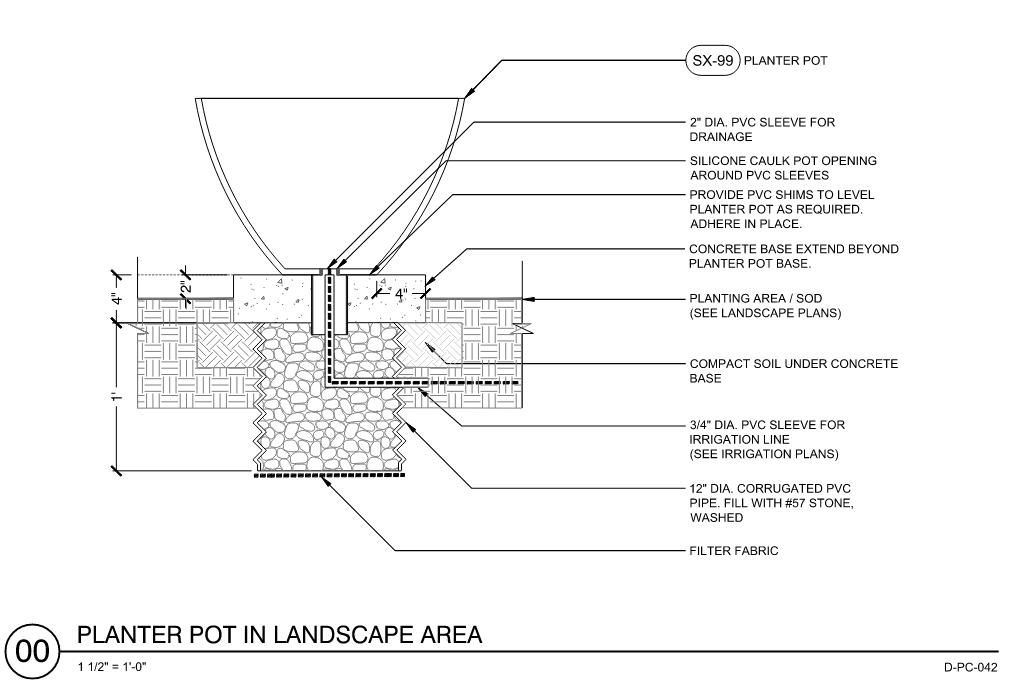
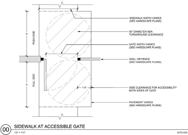
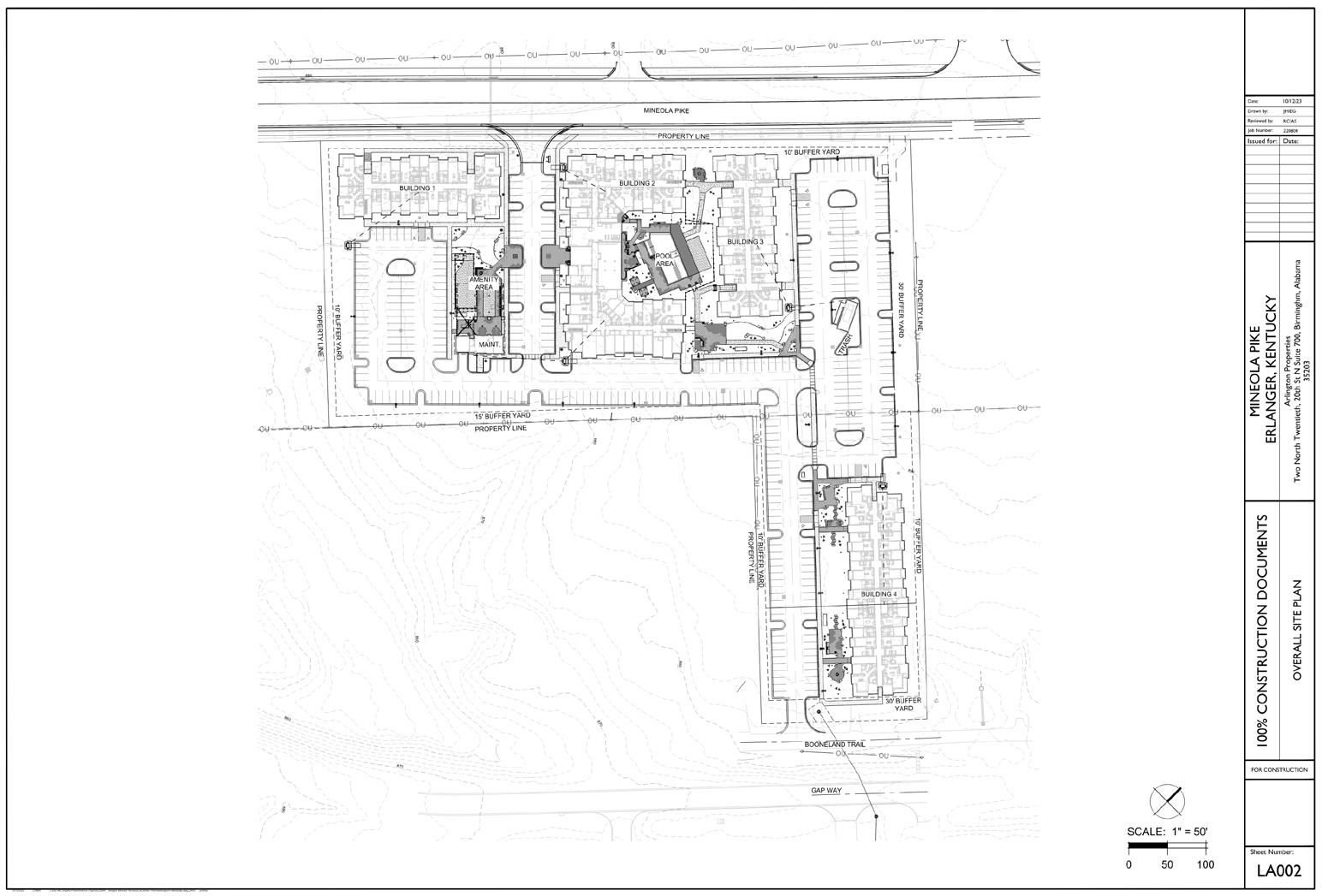
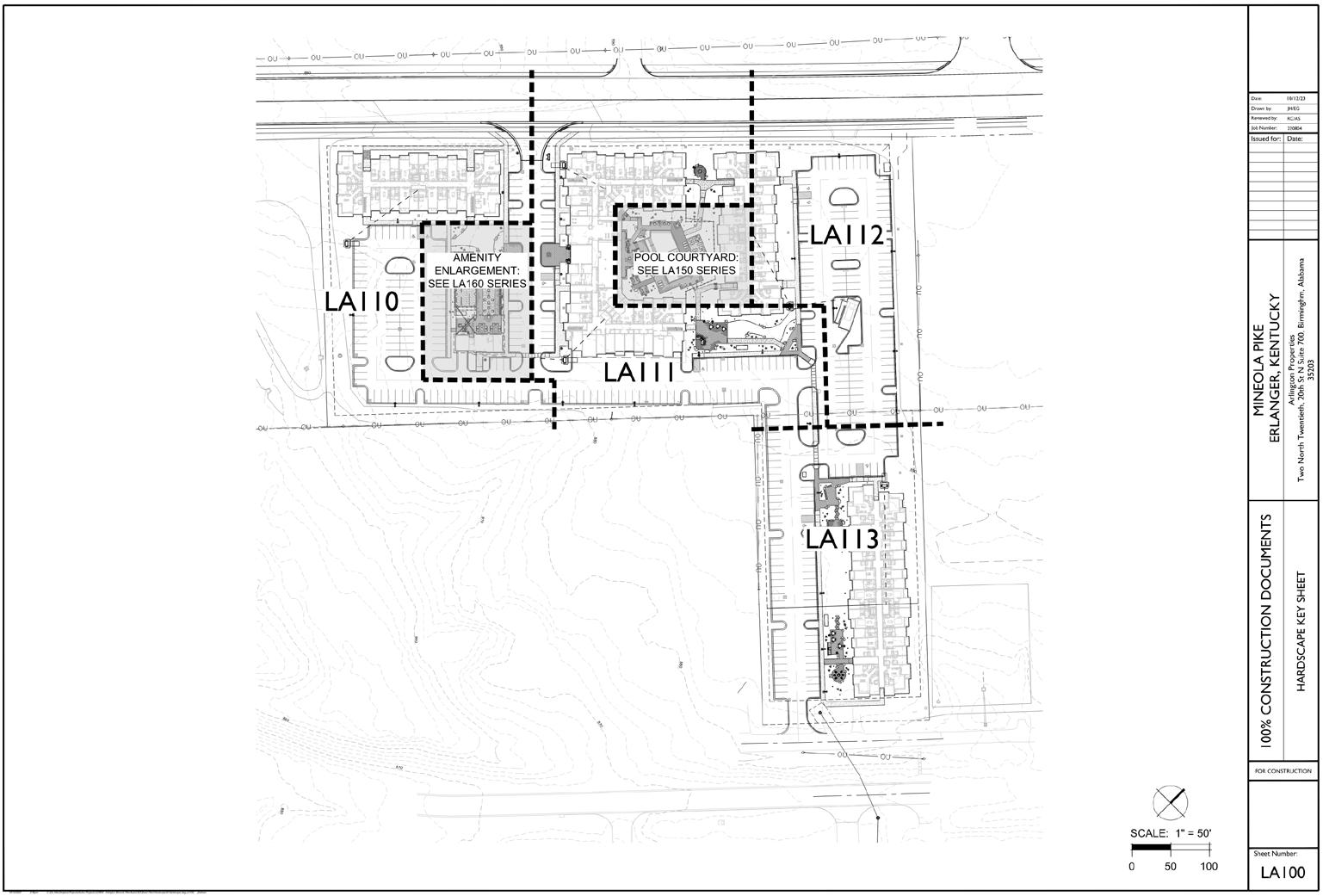
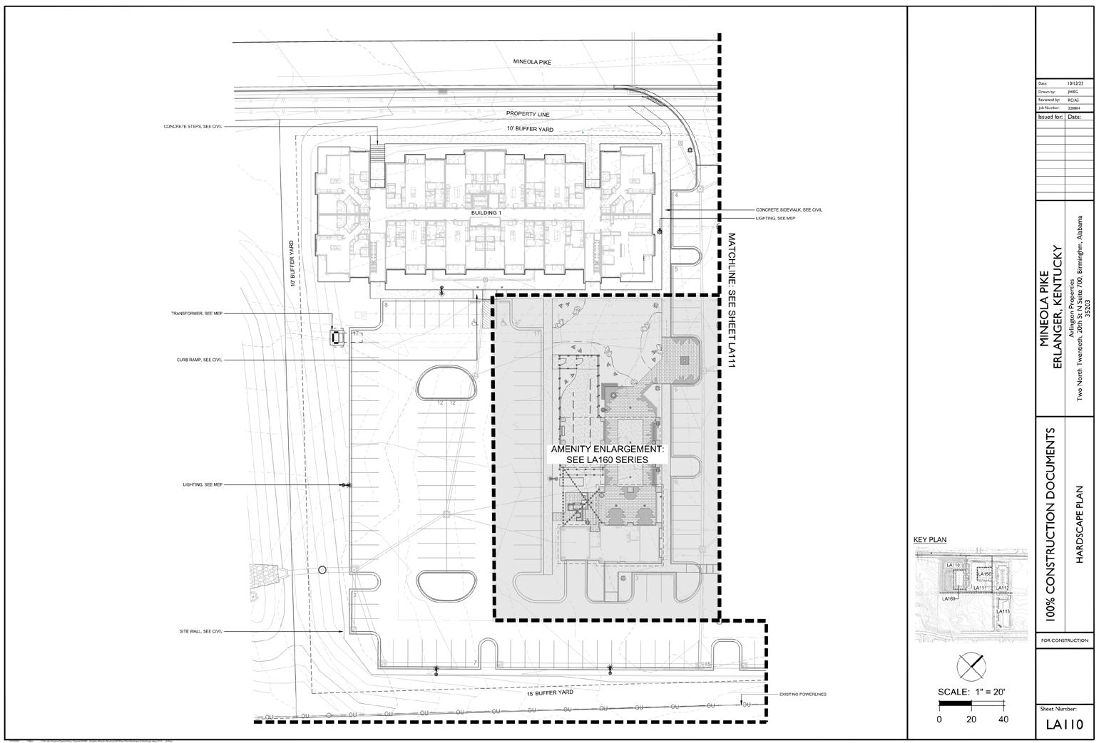
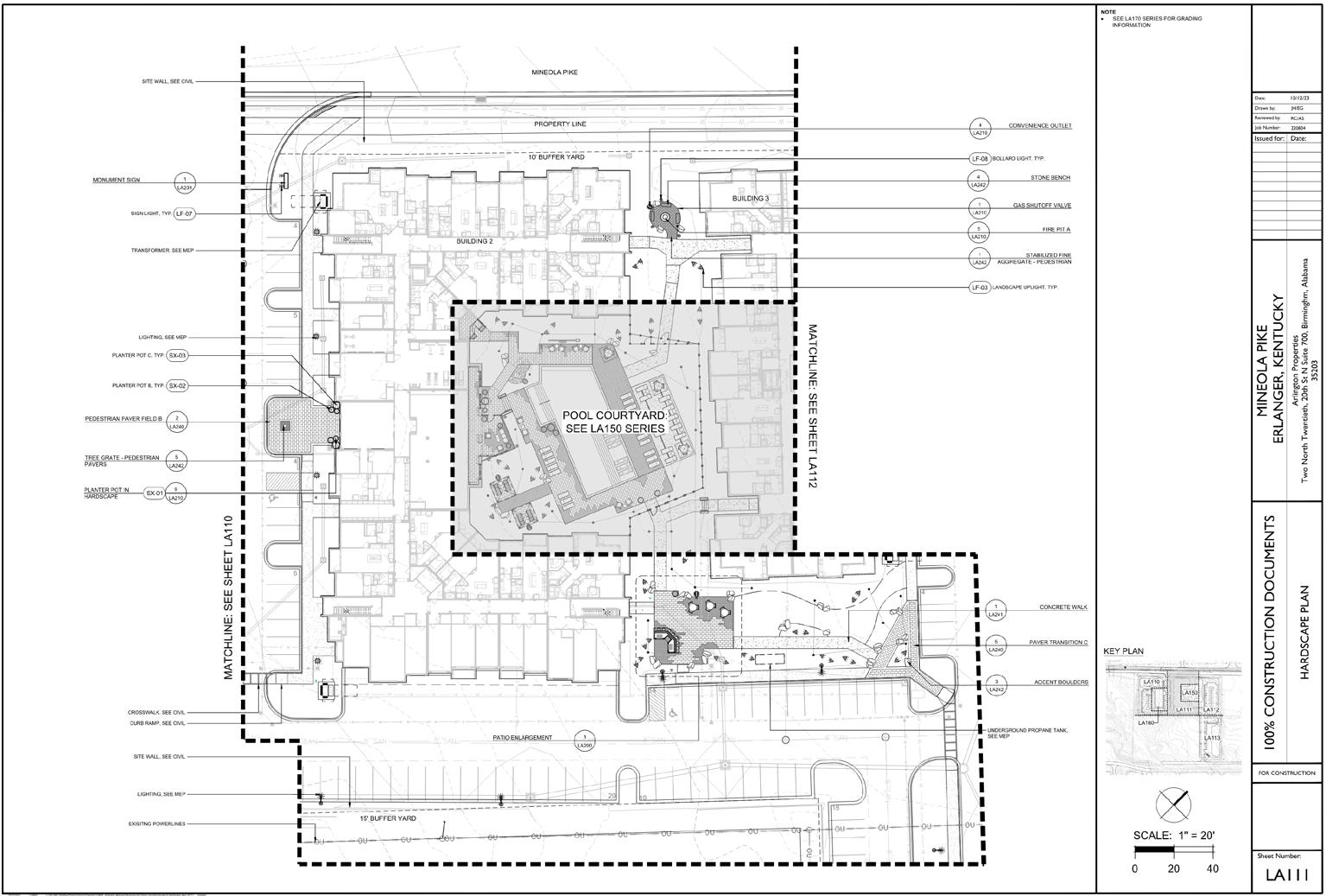
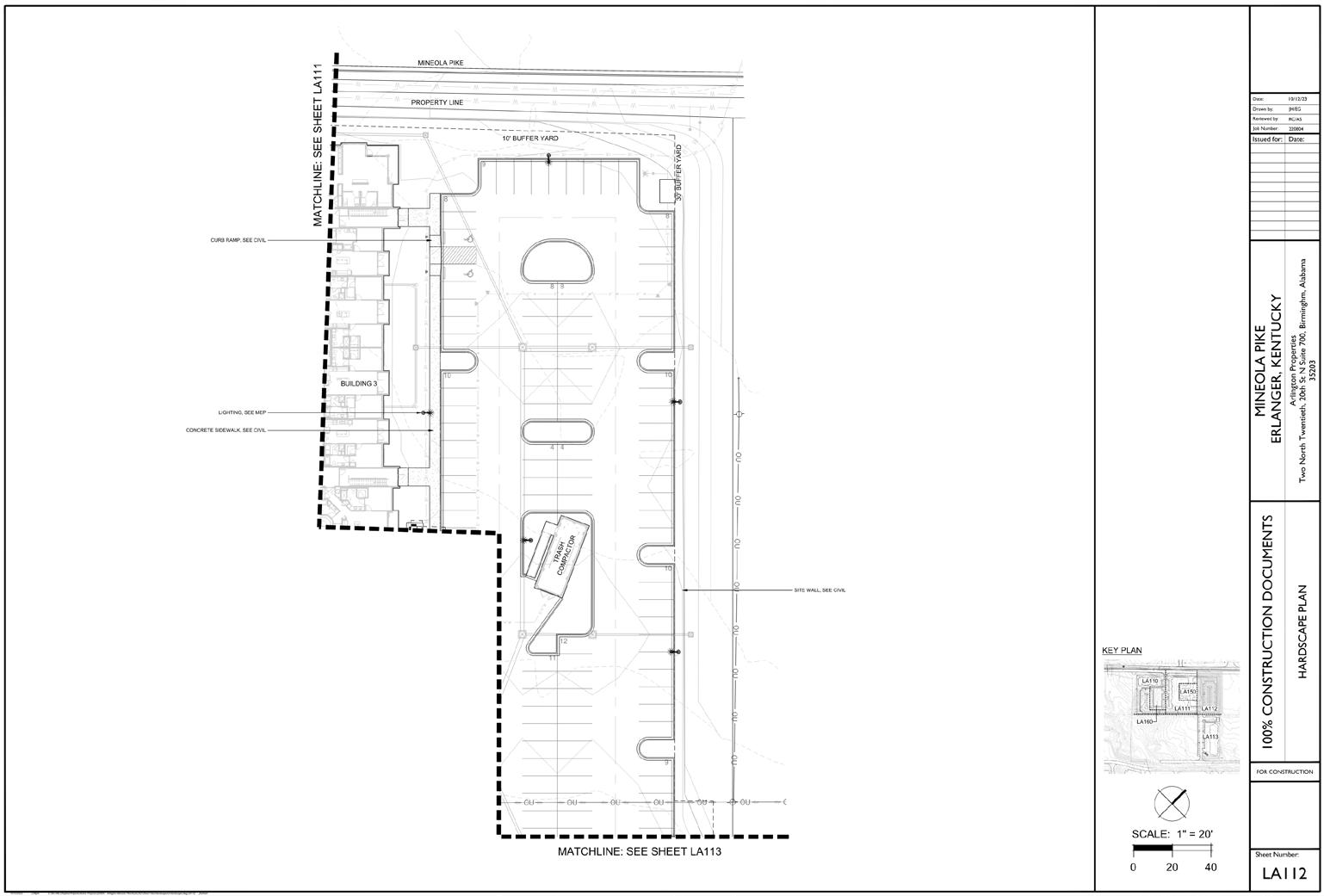
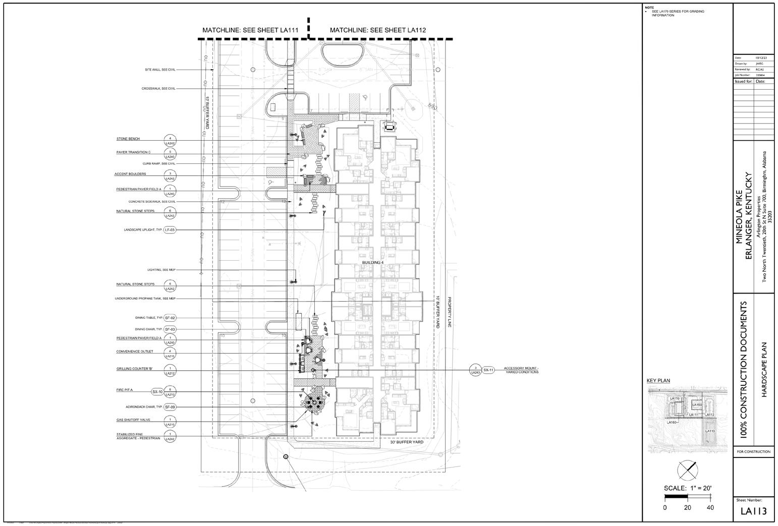
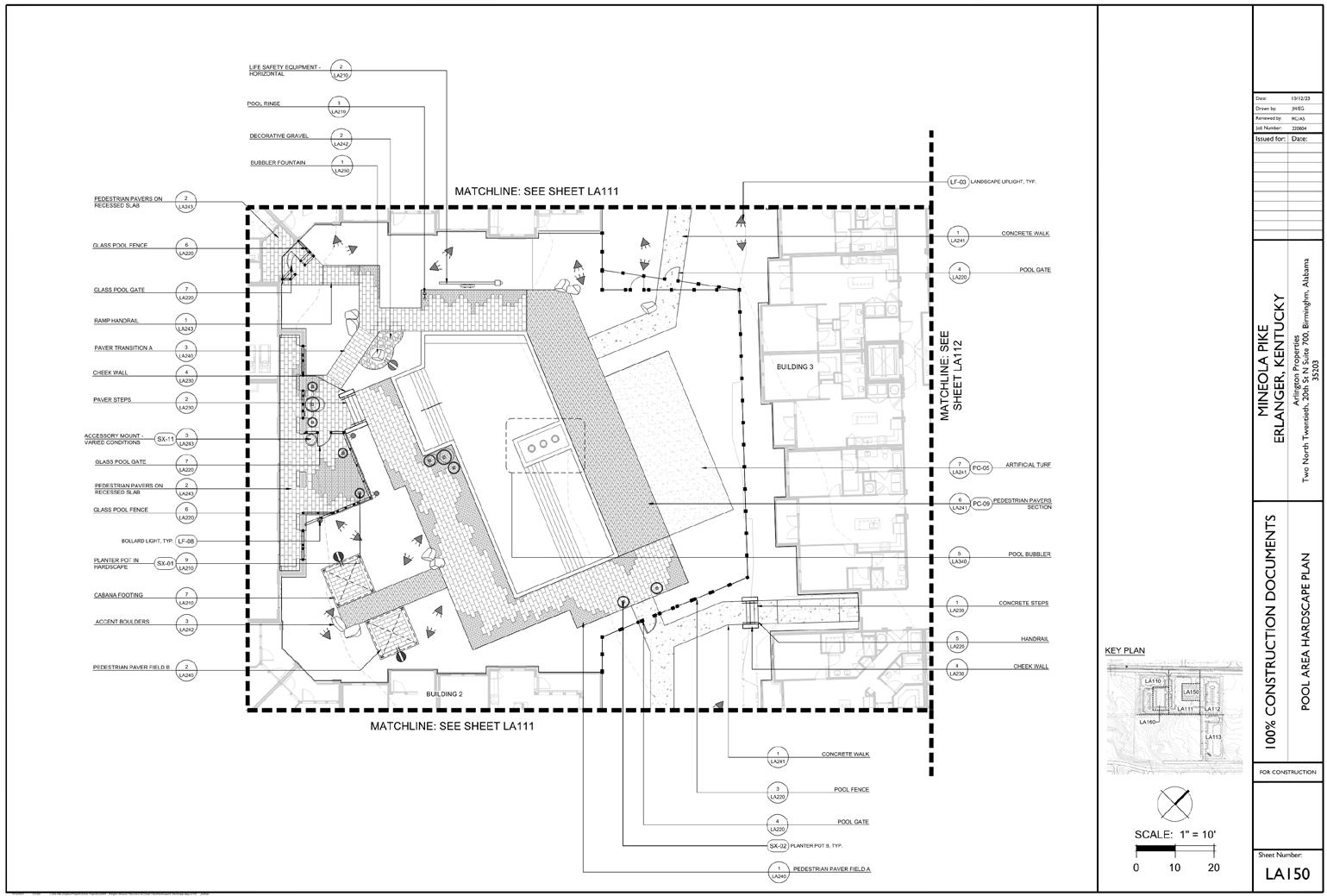
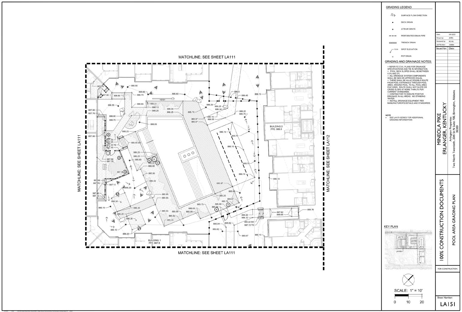
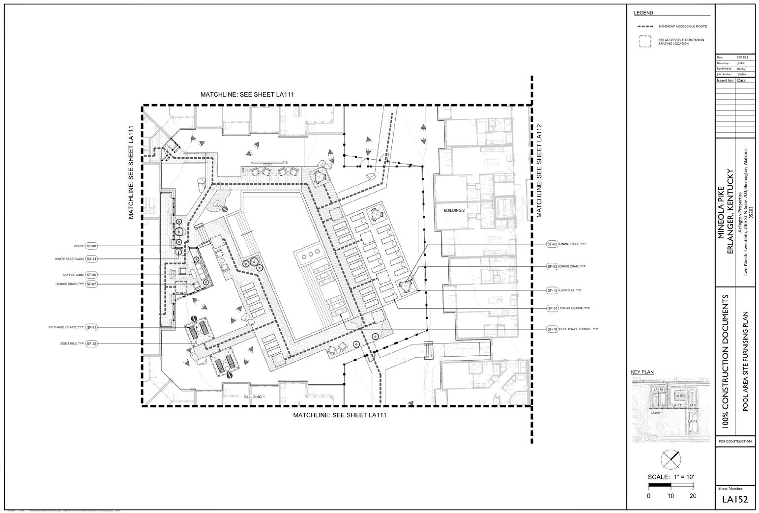
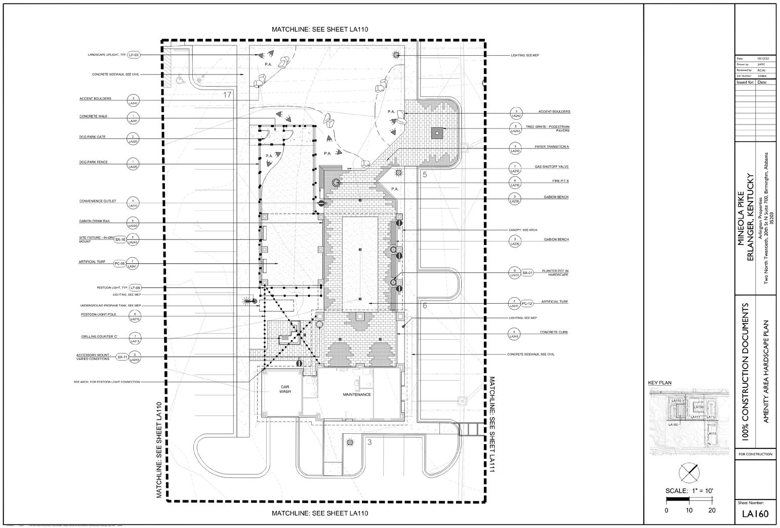
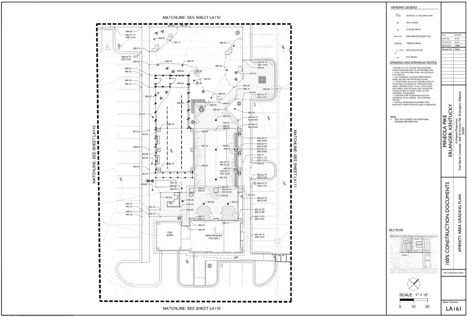
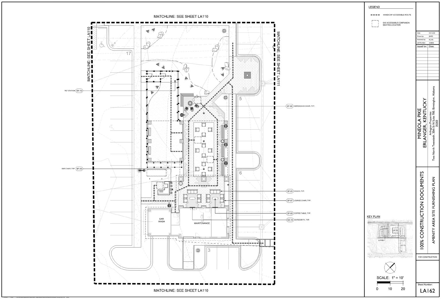
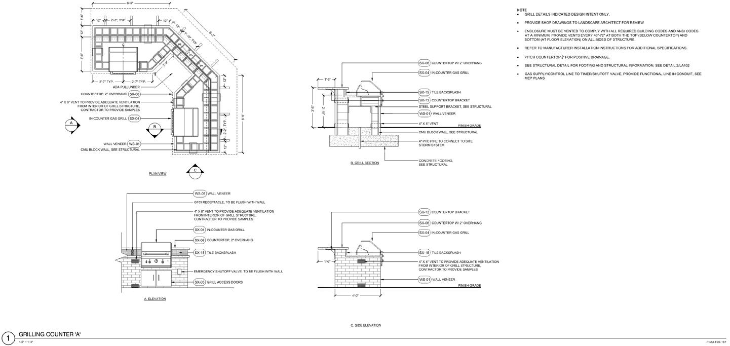
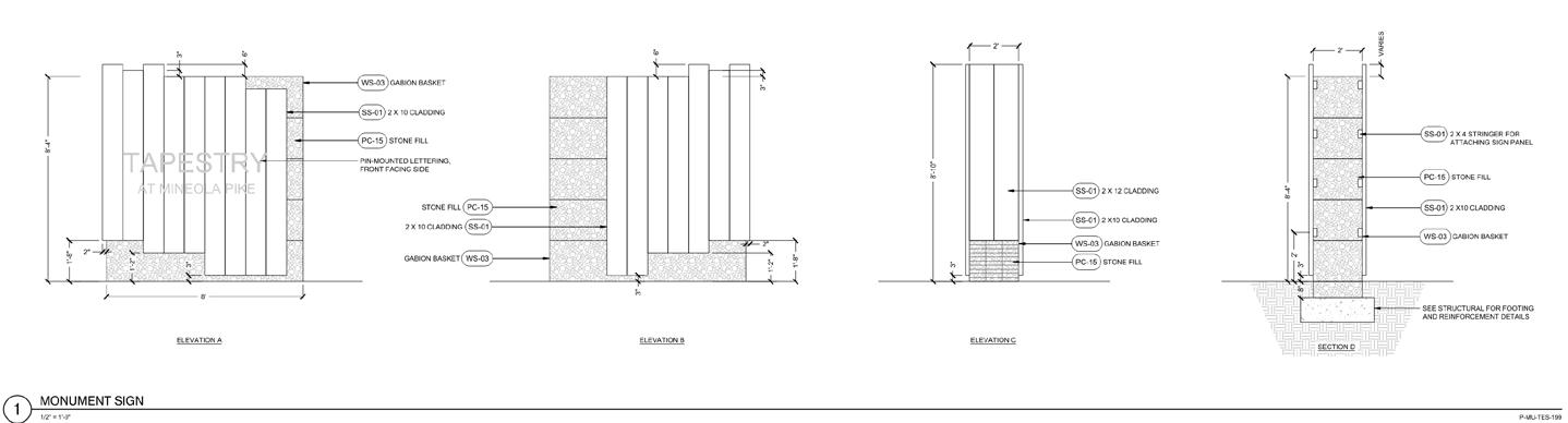
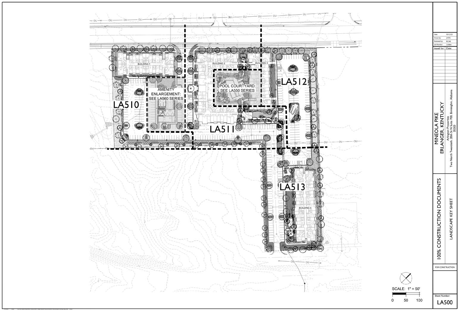
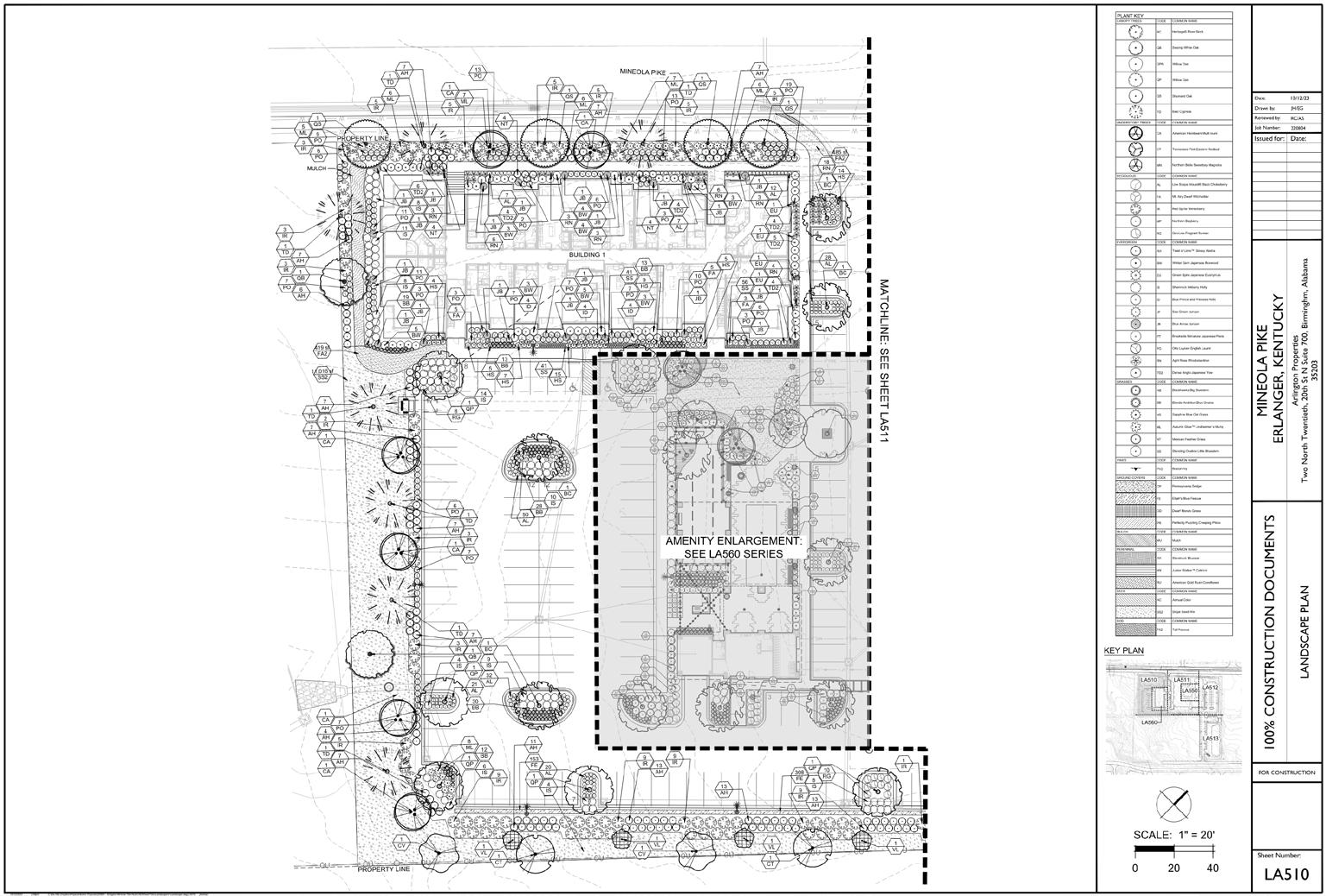
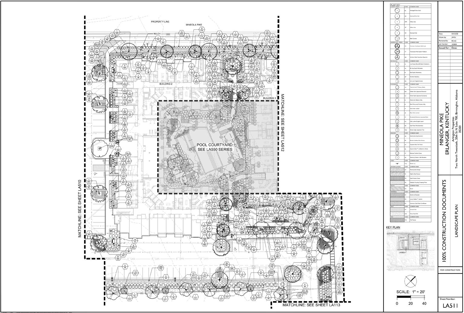
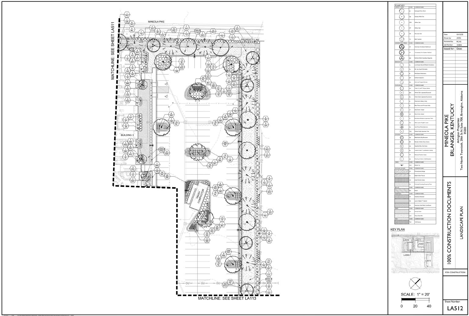
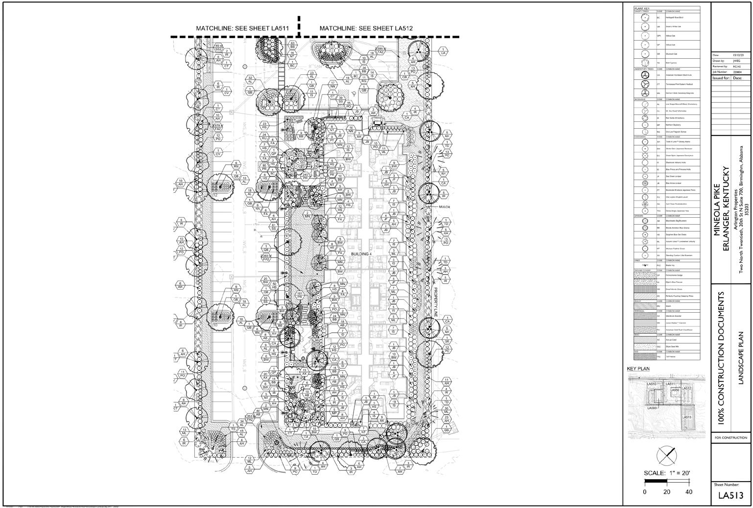
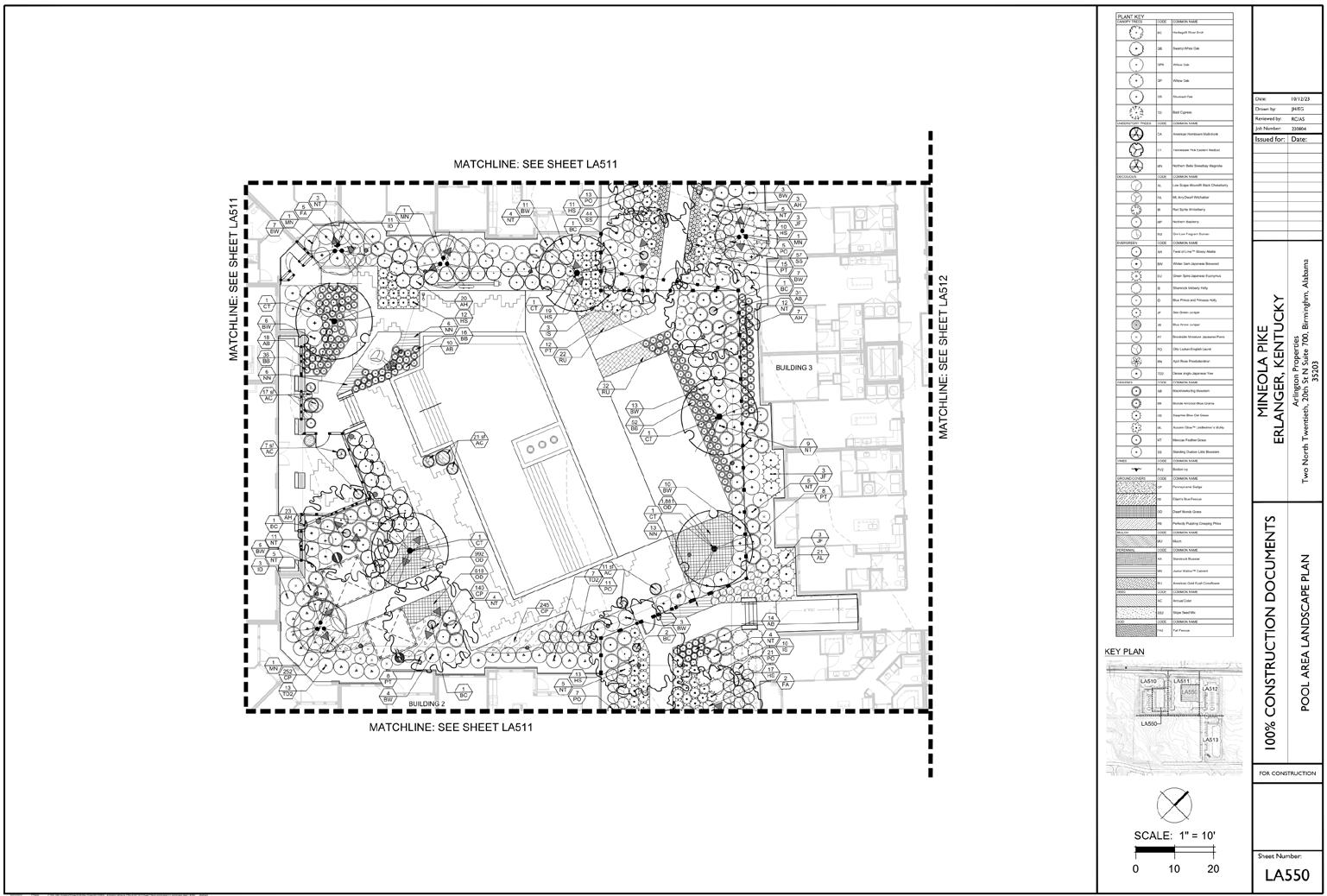
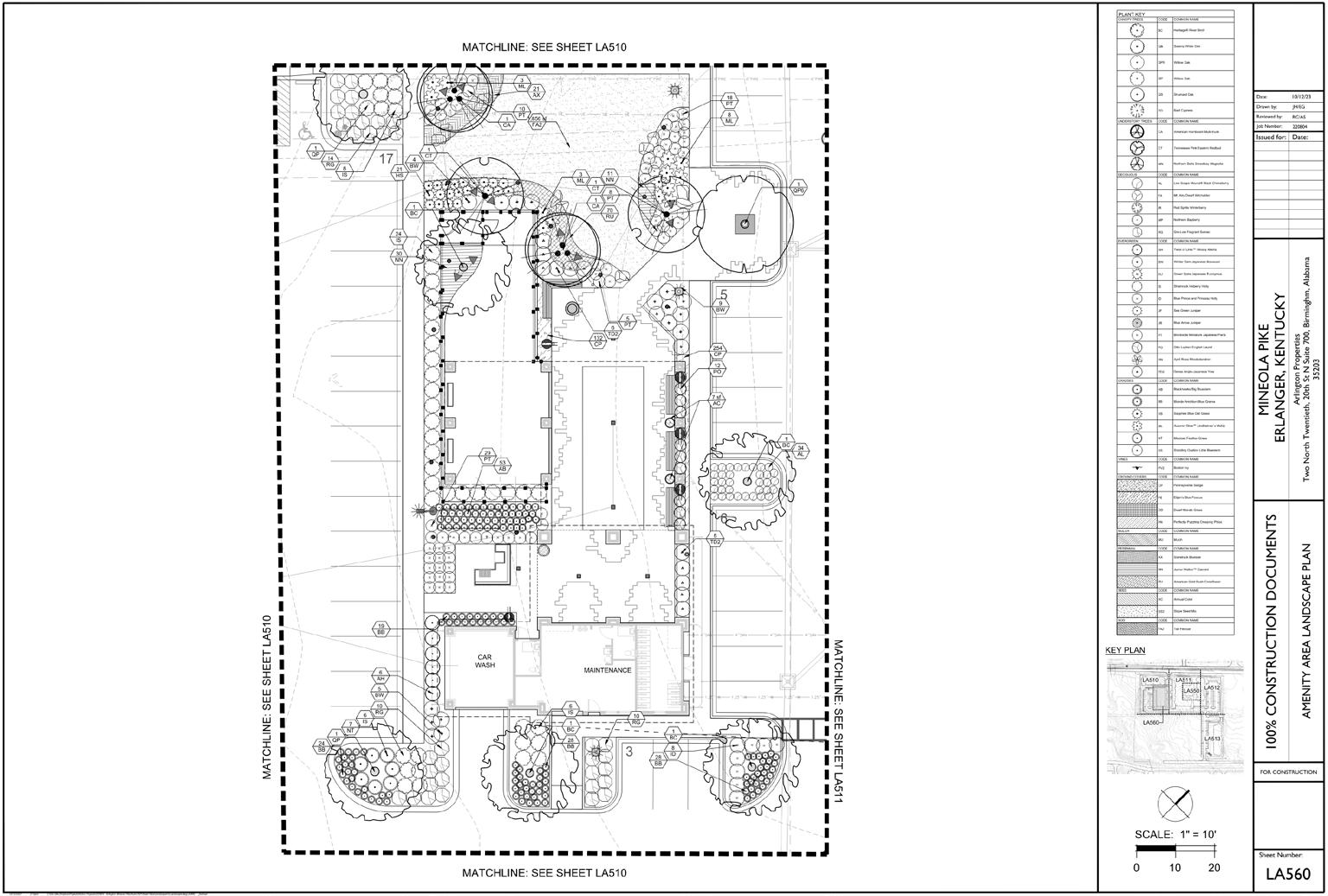
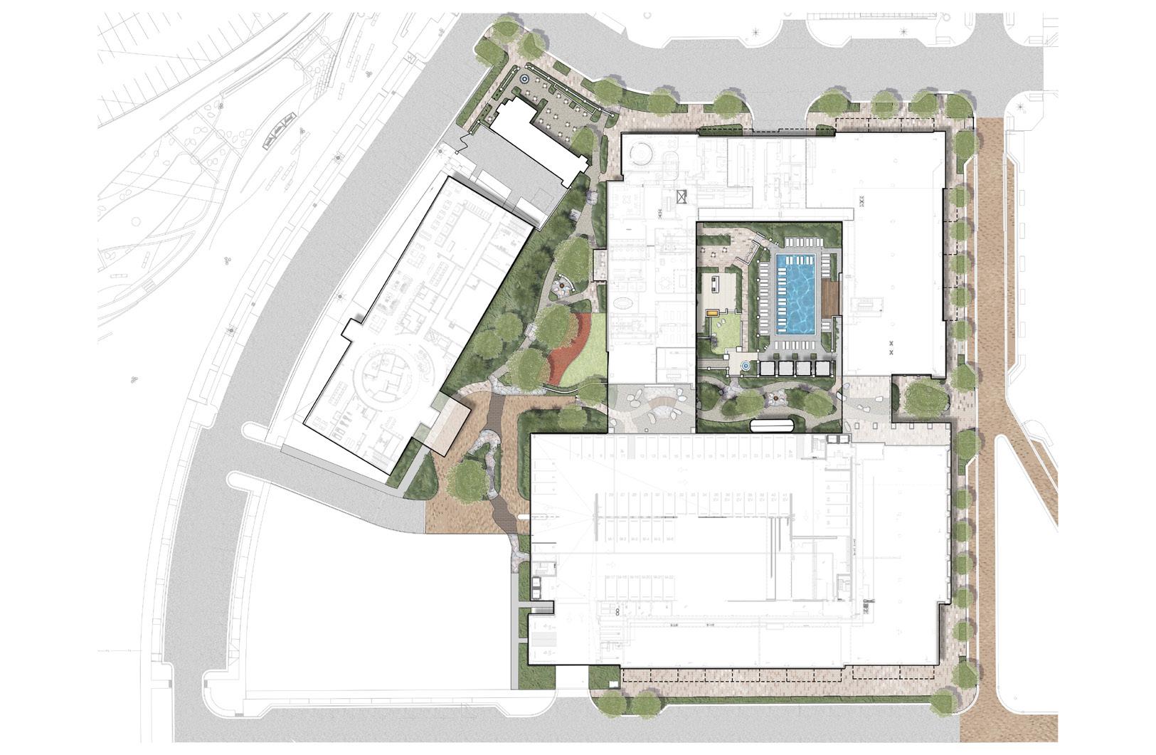
CONSTRUCTION DOCUMENTATION- MINEOLA PIKE
Hardscape and landscape construction documents for a multifamily development located in Erlanger, Kentucky
19
20
21
22
23
24
25
26
27
28
29
30
31
32
33
34
35
36
37
38
39
Conceptual rendering of a multifamily development in Oakwood, Georgia. Rendering created in Photoshop.
40
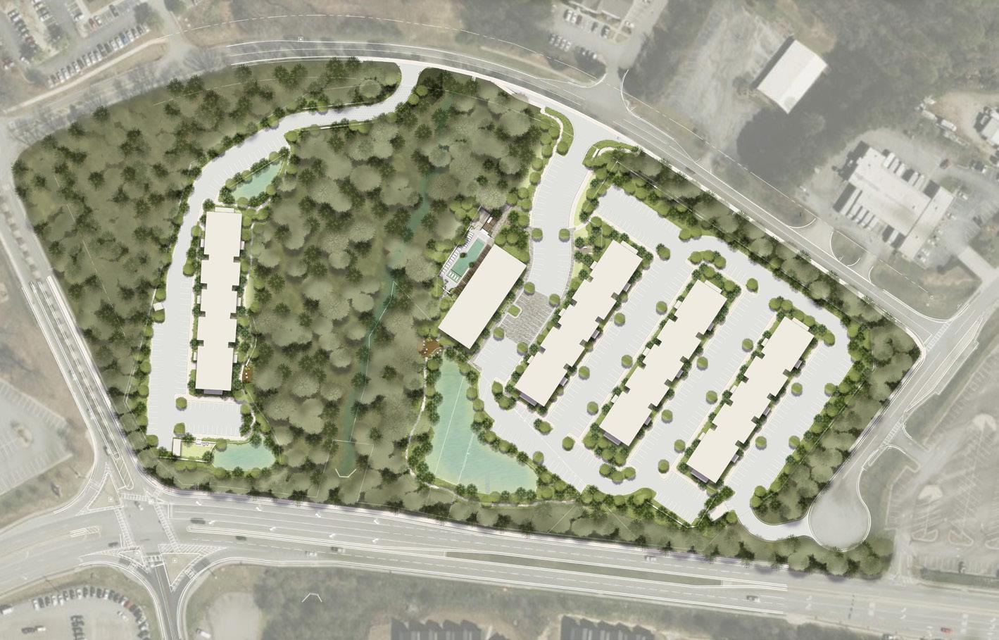
CONCEPTUAL RENDERINGS
Conceptual rendering of a multifamily development in Raleigh, North Carolina. Rendering created in Photoshop.
41
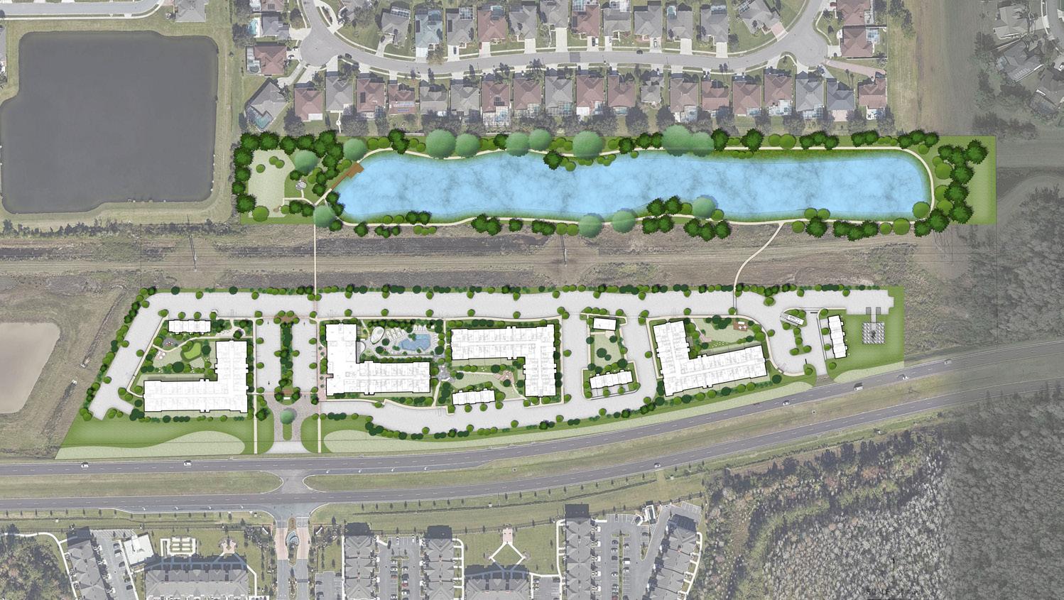
Conceptual rendering of a multifamily development in Kissimmee, Florida. Rendering created in Photoshop.
42

43
