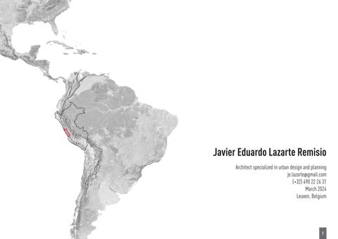
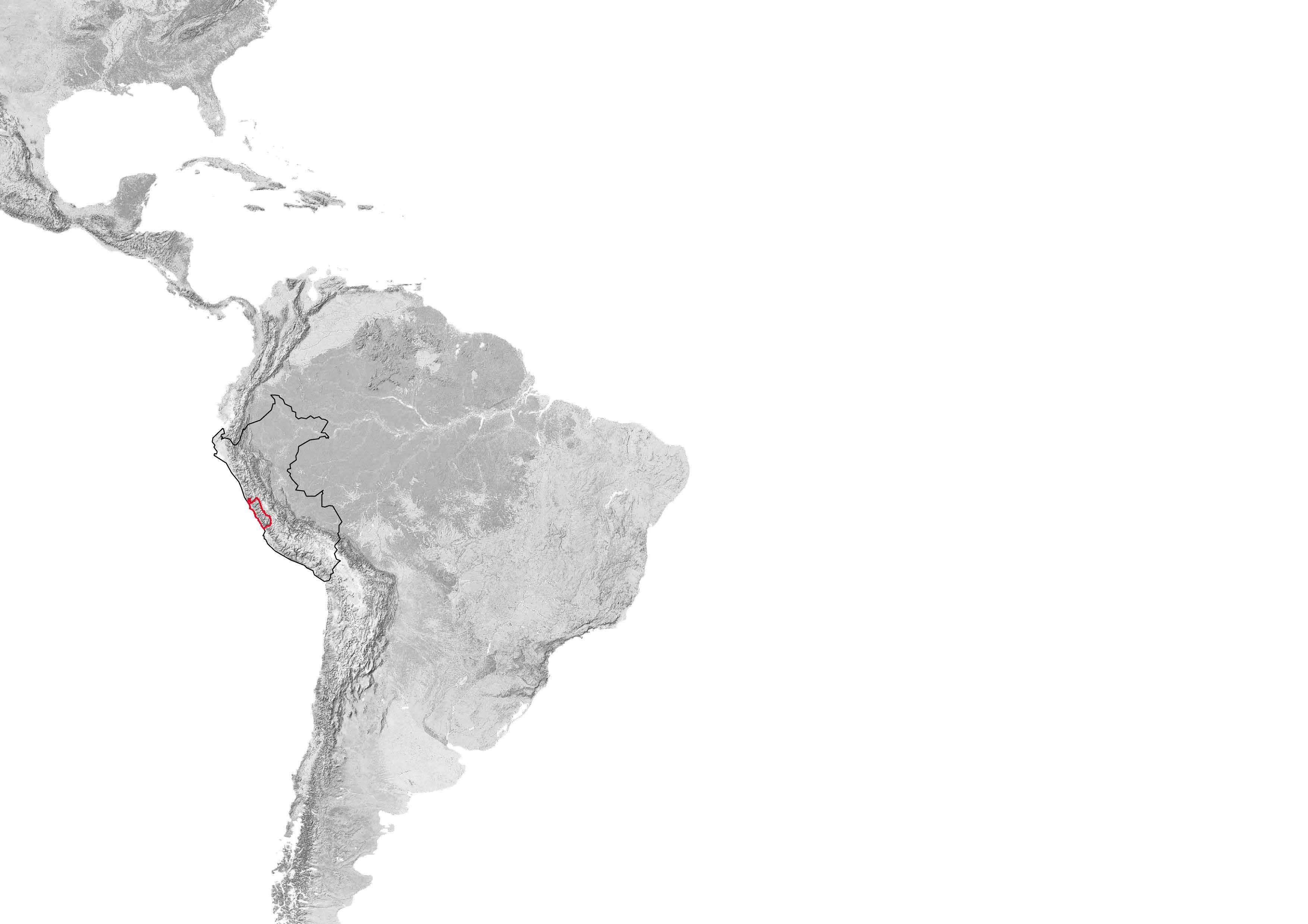
Chiclayo Territorial Development Plan 2022-2042
Chiclayo, Peru, 2022
Collective - Territorial Plan & Normative
Professional - Ministry of housing, building and sanitation
Team Leader: Gustavo Diaz Paz - gustavodiazpaz@gmail.com
Elaboration of the diagnosis and proposal of the physical-spatial component, units of territorial conditioning, and system of equipment and urban services .
3
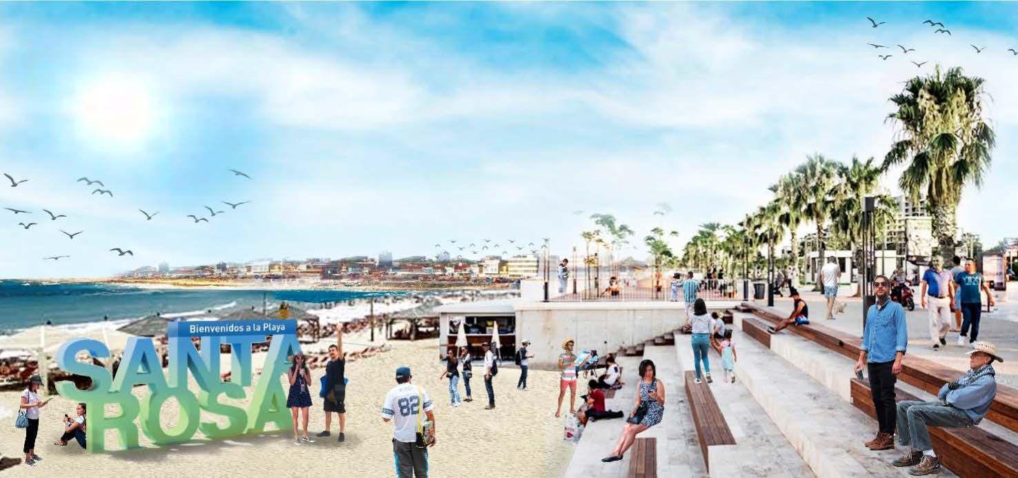
A plan for territorial equity
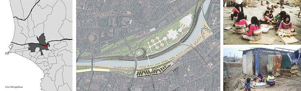
A Territorial Development Plan - TAP is a planning tool for the development of a province. It allows us to think on an appropriate scale to take advantage of the potentials of the basins, sub-basins, regional road networks, rural productive chains, ecological corridors, and tourist circuits, among others. At the same time, it allows for addressing critical problems that need a holistic vision and avoids the fragmented manner of small governmental scales.
The TAPs also make it possible to “put the house in order”; to identify and plan the sustainable coexistence in the territory of urban, rural, economic, and ecological services from a risk prevention approach. Thanks to this tool, it is possible to avoid current and future exposure to risks, environmental contamination, or the impact on economic dynamics.
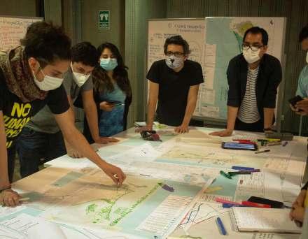
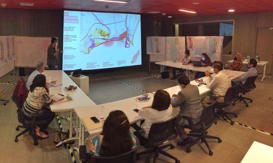
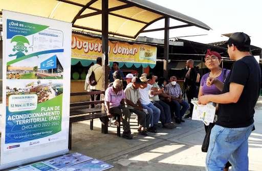
Participatory Process
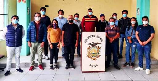
Due to the large territorial extension of the TAP, the participatory process was implemented in each province’s population centers we visited. In this way, we meet the 20 municipalities of the provincial territory, dialoguing and interviewing their officials on more than one occasion to have a sincere vision of the existing problems and potentials. To know the inequalities in Chiclayo, we applied more than 130 surveys in the most peripheral and concentric places; we interviewed different professional associations in the region and officials of the departments of the Lambayeque Regional Government.
Rol as an urban planner
My role was the elaboration of the diagnosis & proposal of the physical-spatial component, units of territorial conditioning, and system of equipment and urban services.
In addition, I have been part of all phases of public consultation, such as technical roundtables, validation and socialization workshops, public hearings, and culminating with the collection of observations.
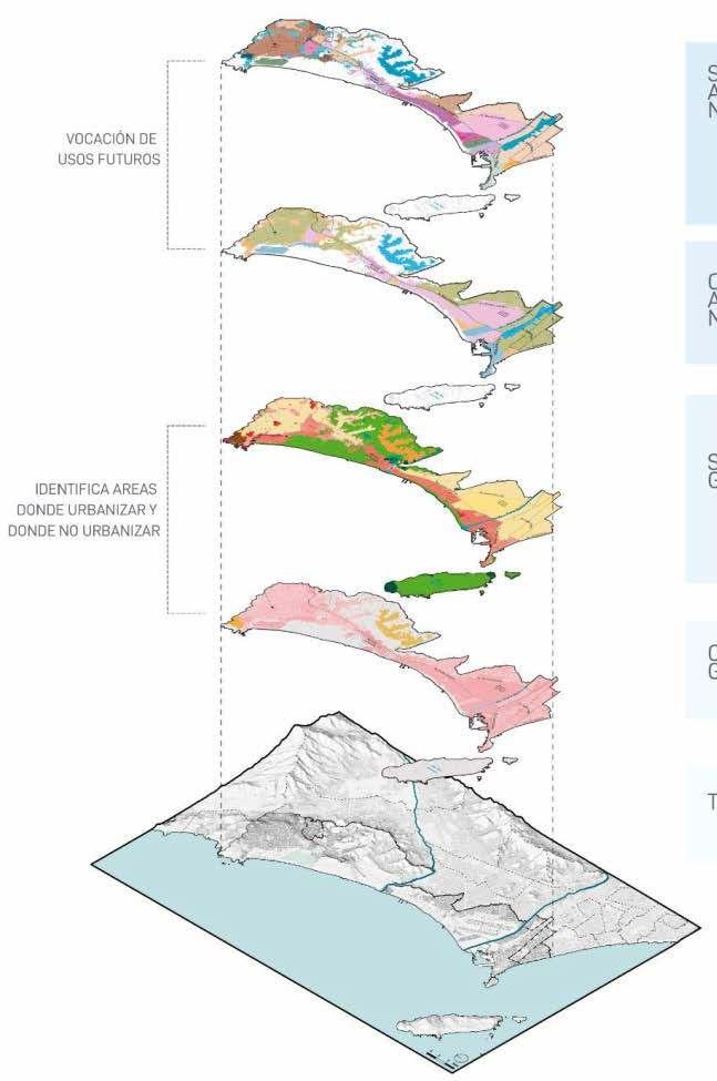
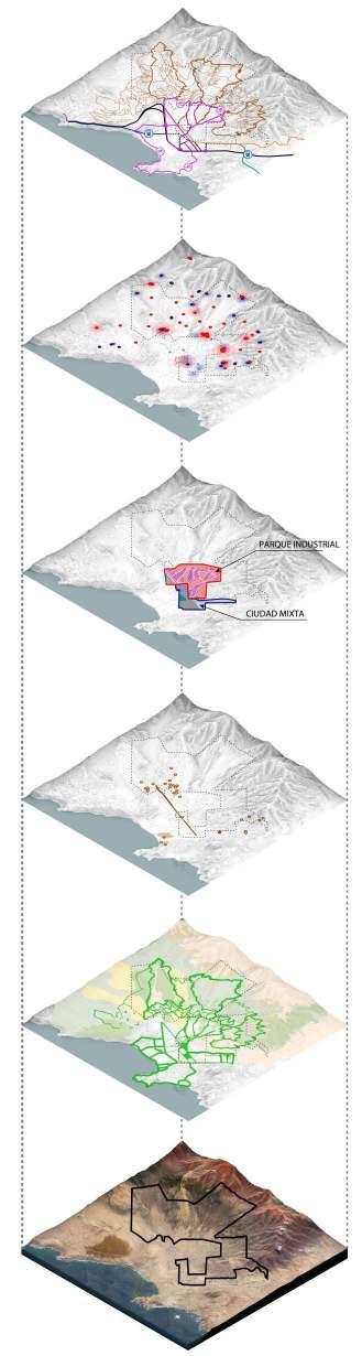
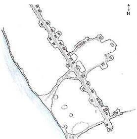
TERRITORIAL MODEL GUIDELINES
(1)
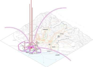
Current situation
(2)
(3)
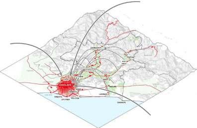
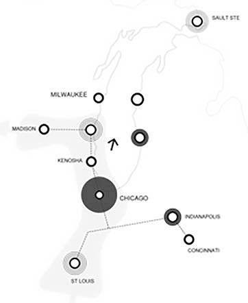
(1) The Chiclayo metropolis concentrates most of the services concerning the rural areas in the province; it leads to a territorial imbalance and requires long commuting time.
(2) The rural areas have dispersed populated centers totaling about 170,000 people. (3) The internal displacement time of the rural zone is approximately 25 minutes.
(4)
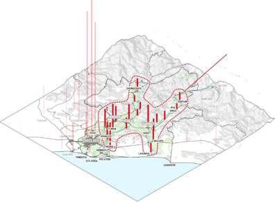
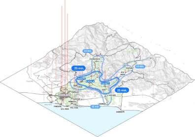
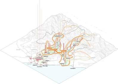
Proposed territorial model
(5)
(6)
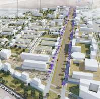
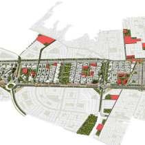
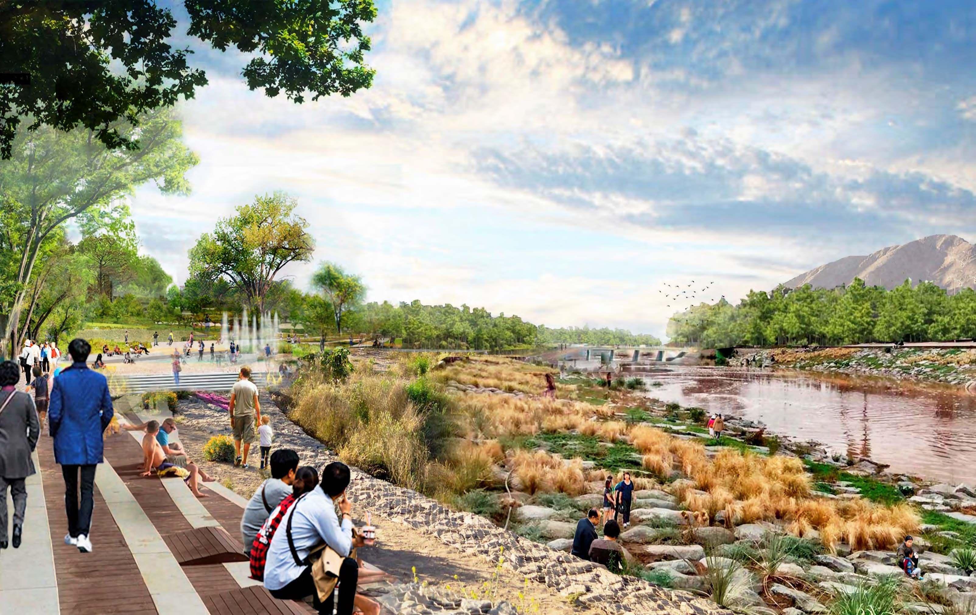
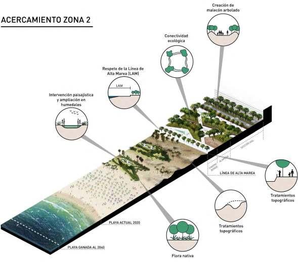
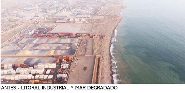
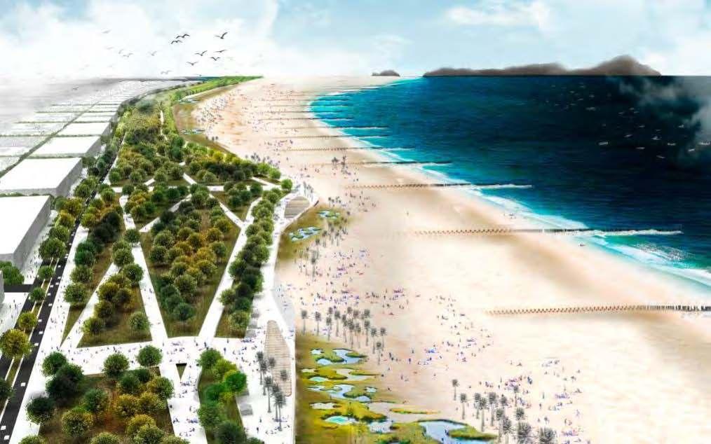
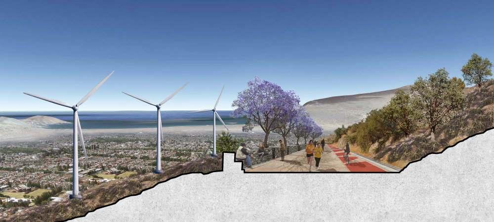
The proposal establish two autonomous service zones: the metropolitan commonwealth (4) and the commonwealth of the valleys (5), whose strategic zone is Cayaltí due to its equidistance from the other rural areas. (6) In addition, the territorial unit of Franja Litoral integrates the coastal axis that enhances cultural, ecological, seaside, and logistical heritage projects.
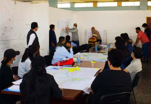
Participatory workshop with neighbors
4
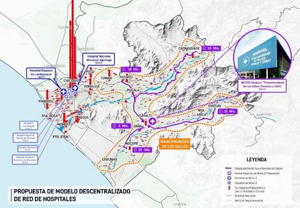
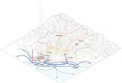
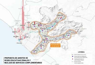
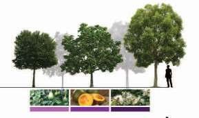
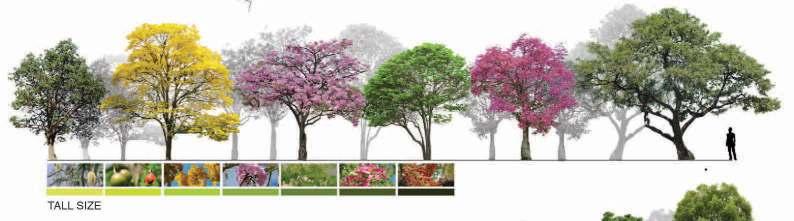
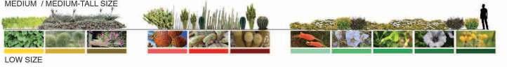
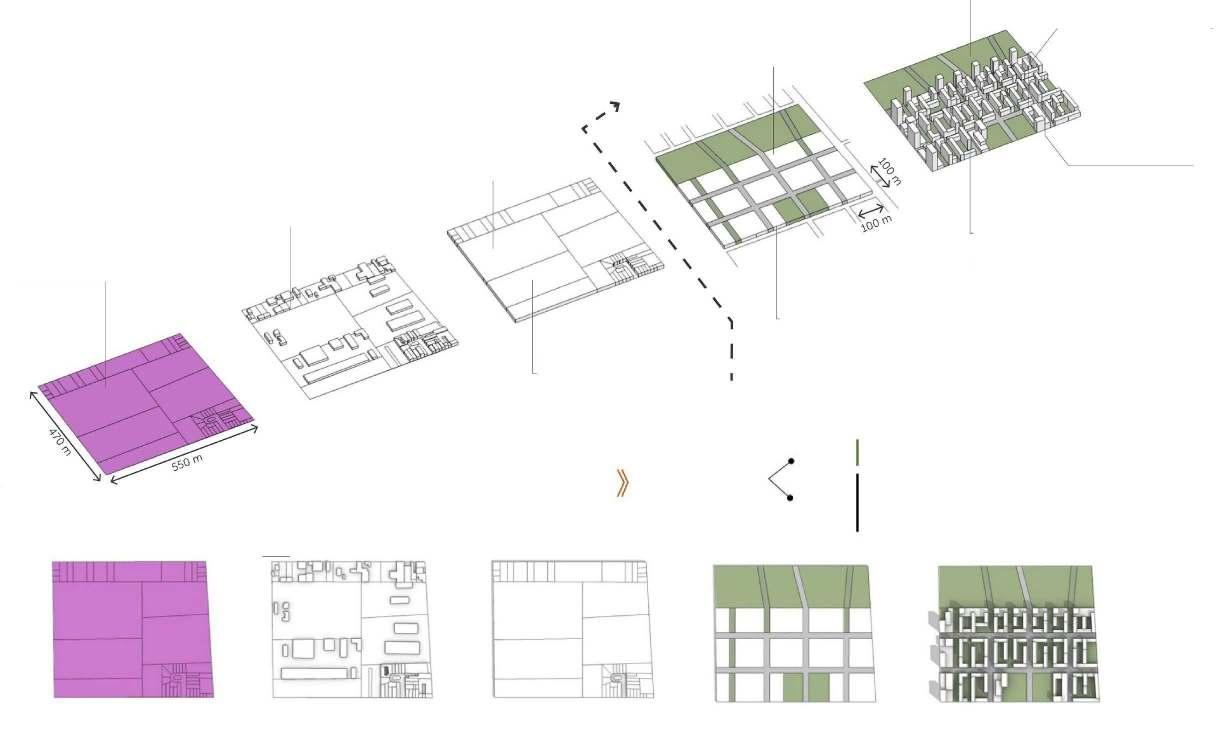
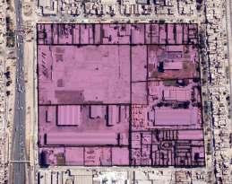
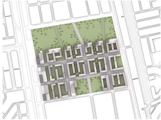
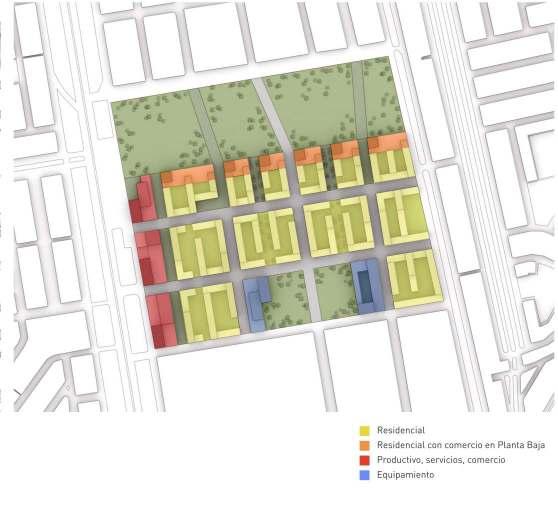
Proposed System of Facilities
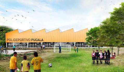
A decentralized health centers network is proposed with a regional hospital in Cayalti to serve the entire commonwealth of the valleys. Likewise, a nucleus of complementary educational services, such as libraries, laboratories, art workshops, cultural centers, and sports centers, support the school services and can be used by the whole community.
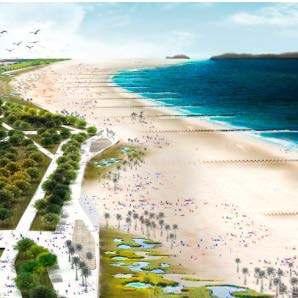
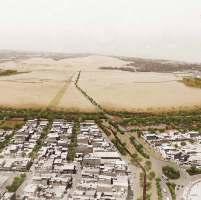
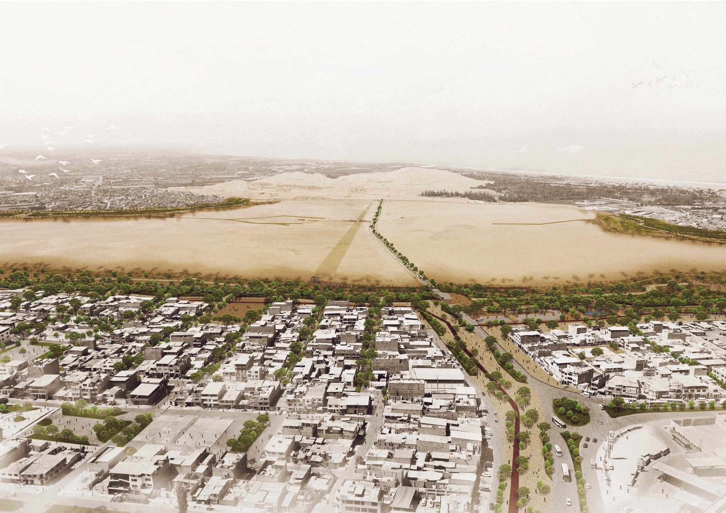
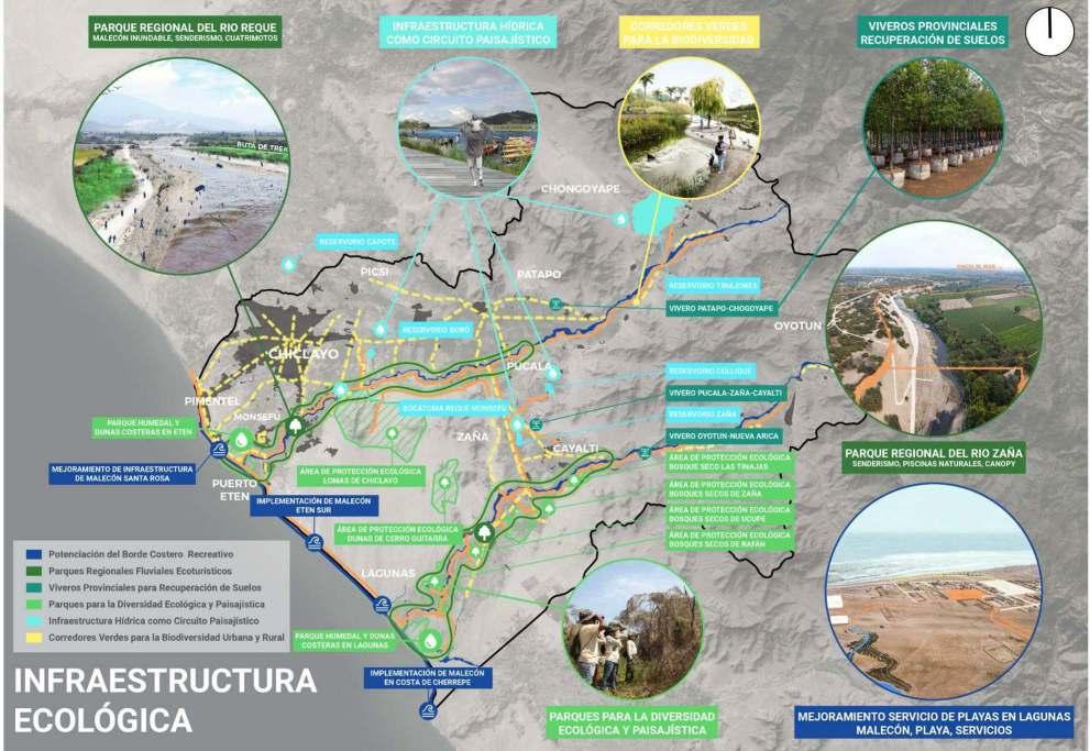
ECOLOGICAL INFRASTRUCTURE PROJECTS
5
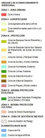
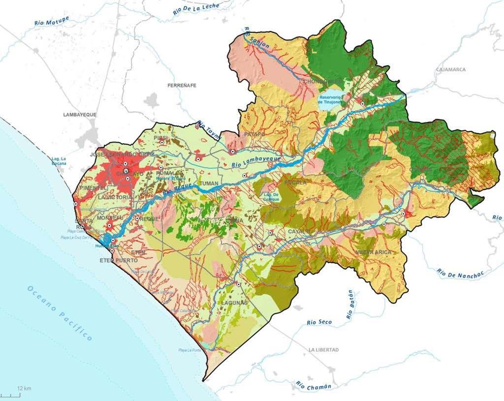
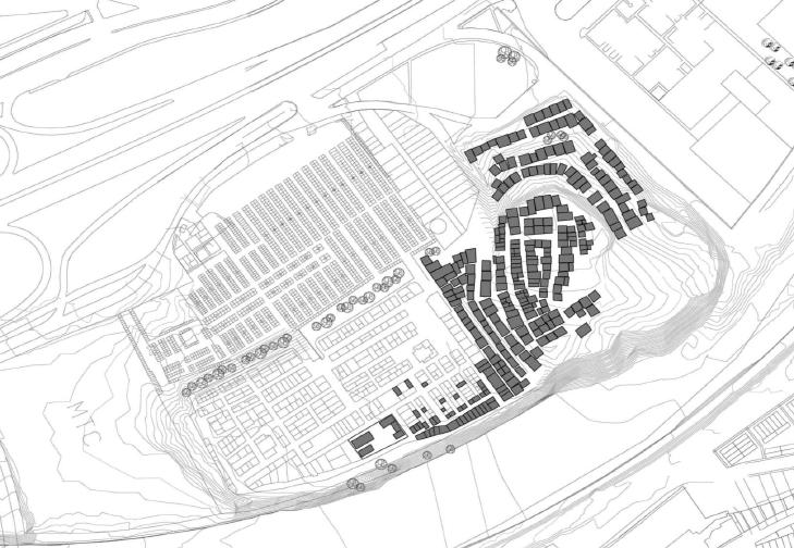
Development Units
Spatial
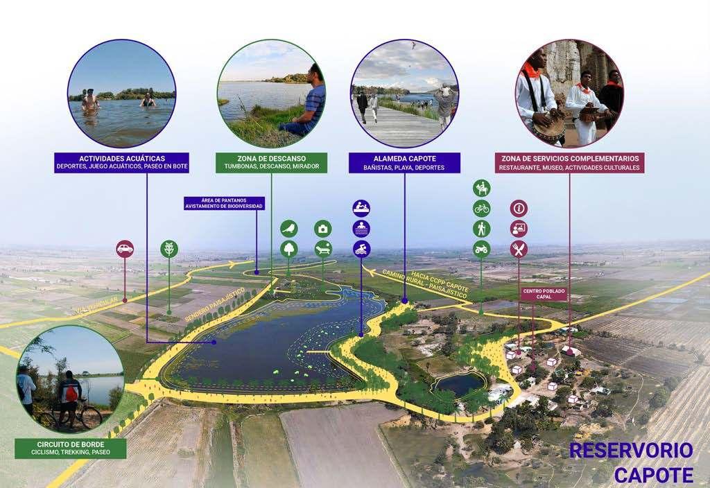
CAPOTE RESERVOIR
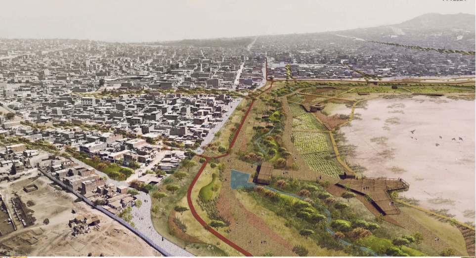
Cultural Park in Pachacamac Archaeological Sanctuary
Pachacamac, Lima, Peru, 2019
Collective - Finalist in competition Master Plan and Landscape design
Professional - Ministry of Culture
Team Leader: Jose Garcia Calderon - jose@urb-es.com
Landscape proposal acoording to the principies of water sensitive design / Landscape design team member
8
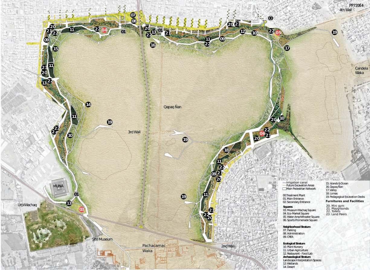
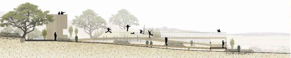
A fragile boundary exposed to urban conflicts and threaten of invasion will be transfirmed into a green infrastructure where the city and the archaeological site meet, to provide a series of environmental services, proper spaces for social interaction and revaloration of the ecological structure and historical heritage of the city
Here, the appropriation starts when all the voices in different times have a value in stake and not only social, but ecological and archeological processes are understood as a continuum dialogue of identities, times and spaces: a living collective territorial memory, a Territorial Memories Mosaic. VEGETATION
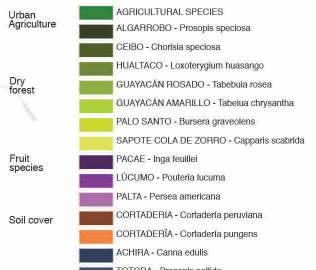
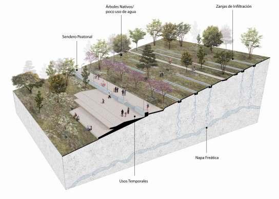
(a) Vegetation is a set as a mosaic of native and introduced species.
(b) Proposed plants have low water requirements. Xerophitic lawn and plants, dry forest are predominant in the green surface of the Pachacamac park.
Cultural Park
Pachacamac
b. a.
COVER
9
1. Model: Design & Management
CONTINUUM is a Design-Management Model focused in the intersection of socio-economic, ecologic and archaeological processes to preserve archeological sites in urban contexts. A series of strategies and activities are proposed to bring together urbanization and heritage by regenerating the ecological matrix and providing circular economy neighborhoods to create a Territorial Memories Mosaic that fosters the appropriation of the Pachacamac Sanctuary and avoids new intrusive built interventions in the archaeological site. In other words, it proposes that all the layers of occupation, coexist today to build a memory of urbanization, diffusing the boundaries between the city and the sanctuary.
2. Memories: Social, Ecological, Archeological
To start, the proposal looks at the memories of its context:
- The Social-Economic Memory, materialized in the intersection of the history, values, and activities of the 18 surrounding neighborhoods and the potential visitors of the park.
- The Ecological Memory, set to inform a range of regenerative -both productive and pedagogical - actions for the water, wind, soil and production cycles.
- The Archeological Memory: shown in the excavations process, the 21-century approaches of heritage, living memory, and urban heritage landscapes as an opportunity for pedagogic strategies that bring together natural and cultural heritage.
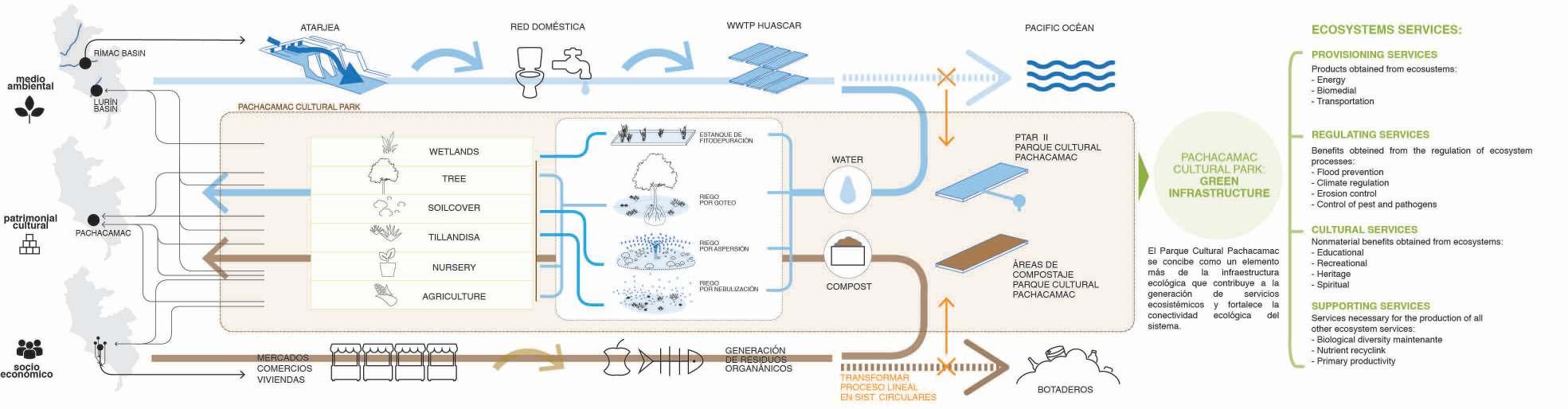
(a) From linear process to circular system to use water efficiently. (
b) Museum Wachaq Square provides a wide pedestrian level crossing to conect to the site museum and the park while regenerating and amplifying the wetland ecosystem toward the former Panamericana highway.
a. b.
10
Master Plan of the Antonio Raimondi National Ecological Park
Ancon, Lima, Peru, 2016
Collective - Master Plan and Urban design
Professional - Ministry of Environment
Supervisor: Karina Puente Frantzen - info@karinapuente.com
Coordinator of the Urban Development Unit / Planning methodology proposal and urban design team member
11
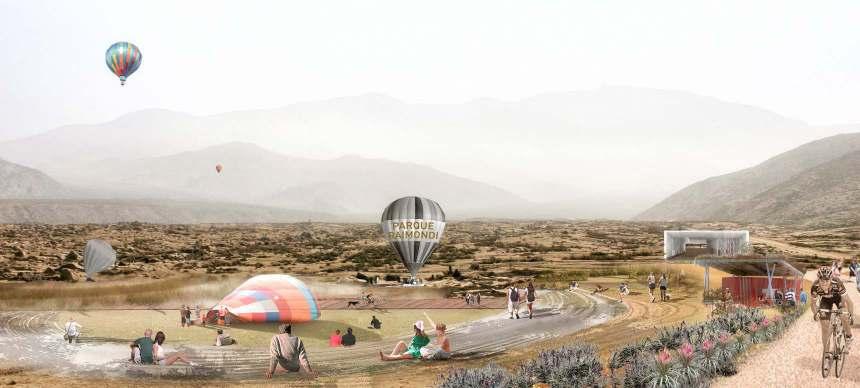
The great opportunity for a new sustainable development
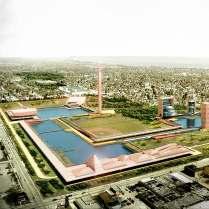
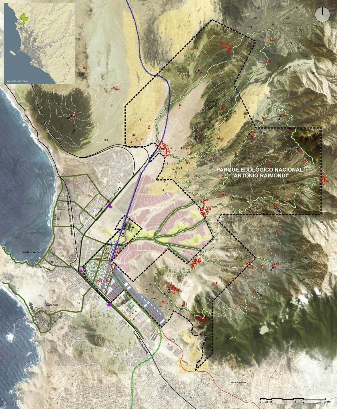
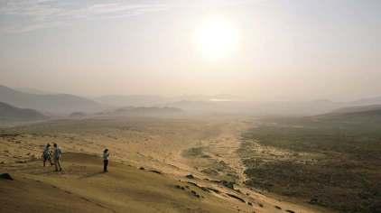
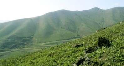
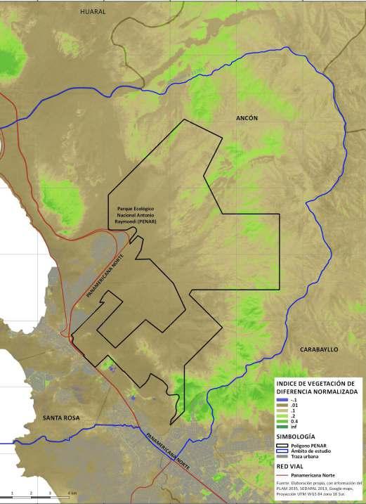
Antonio Raimondi National Ecological Park (PENAR) is the largest project in Lima promoted by the State. It is estimated that its impact will cover all districts north of the capital.
Due to its extension of 6777.14 hectares, Raimondi Park is not comparable with any park within the city, since its surface is equivalent to the area of several districts of Lima. Therefore, the project emerges as a paradigm and the most significant opportunity of the State to promote a development that articulates the ecological, urban and productive. Its creation takes place in 2010, under the administration of the Ministry of Environment, establishing its national interest in execution.
This Initiative won in 2016 the “Hexágono de Plata” - 1st place in the Urban Planning Category - XVII National Biennial of Architecture, Urbanism and Arts of Peru, and the 1st prize in the category of urban, natural and social landscape of the Latin American Landscape Call Initiative - LALI.
Comparisons of areas between Metropolitan Lima and the PENAR
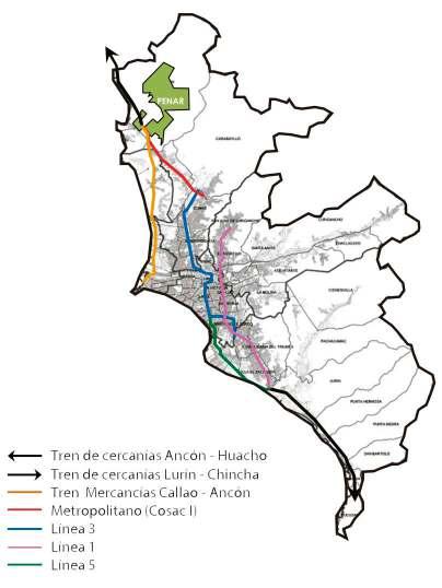
Rail
Lima
Lima
Lima
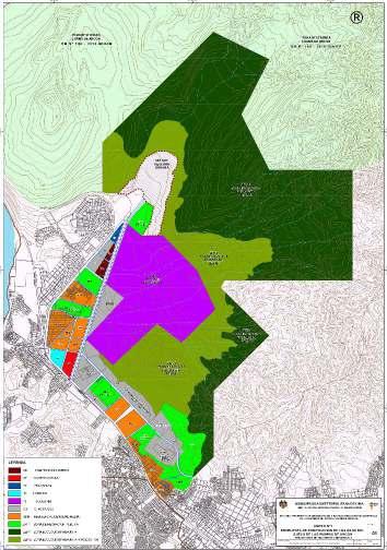
Urban and territorial planning structure
Integrated Mobility
Landscape equipment and basic services
Urban Aptitude AreaMixed City and Industrial Park
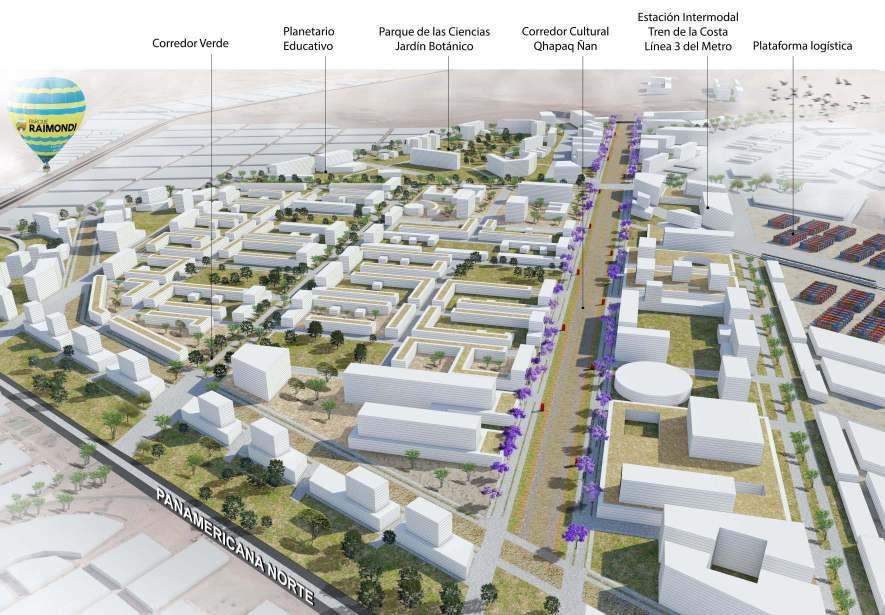
Heritage Areas
a.
(a) The ecological structure of PENAR mainly presents two environmental units, the arid meadow and the coastal hills. The hills constitute fragile ecosystems with species of flora and fauna included in the Red List of the International Union for the Conservation of Nature (IUCN). (b) Normalised Difference Vegetation Index-NDVI Map
12
green corridors
rail Lima - Huacho
rail Lima - Chincha
Landscapes and
Territory Commuter
Commuter
freight transport Callao - Ancón
Metropolitano
BRT
Metro - Line 3
Metro - Line 1
Metro - Line 5
b.
The project process consisted of: Systemic analysis of the structuring elements of the territory: territorial physical system, environmental biological system, socioeconomic system, heritage system, mobility system, equipment system, basic services system, to characterize the landscape units of the territory, determine the areas. with urban and non-urban aptitude and establish the needs of the project. Then, the update of the Urban Zoning and the Metropolitan Road System of an area of more than 6,700 hectares (67 square kilometers) was requested to the Metropolitan Municipality of Lima, which was approved in 2018 by Ordinance No. 2103-MML.
The protection of the landscape and the environmental values of the environment, understanding Raimondi Park as part of the territory of a larger system, thus seeking to improve the integration of the systems, the generation of synergies and their complementarity with new equipment and uses. It also proposes structuring projects such as the Botanical Garden of Lima to protect the ecosystem of Lomas Coastal.
Identification of the different actors of the local, sectoral and civil organization and their level of influence to establish the singular and specific, or compatible and complementary activities in the territory of the Raimondi Park. In this regard, it has been coordinated with the Ministry of Housing and the Ministry of Transportation for the development of projects in the area of urban aptitude.
13
Urban zoning map
Turning a post industial site into an innovation park
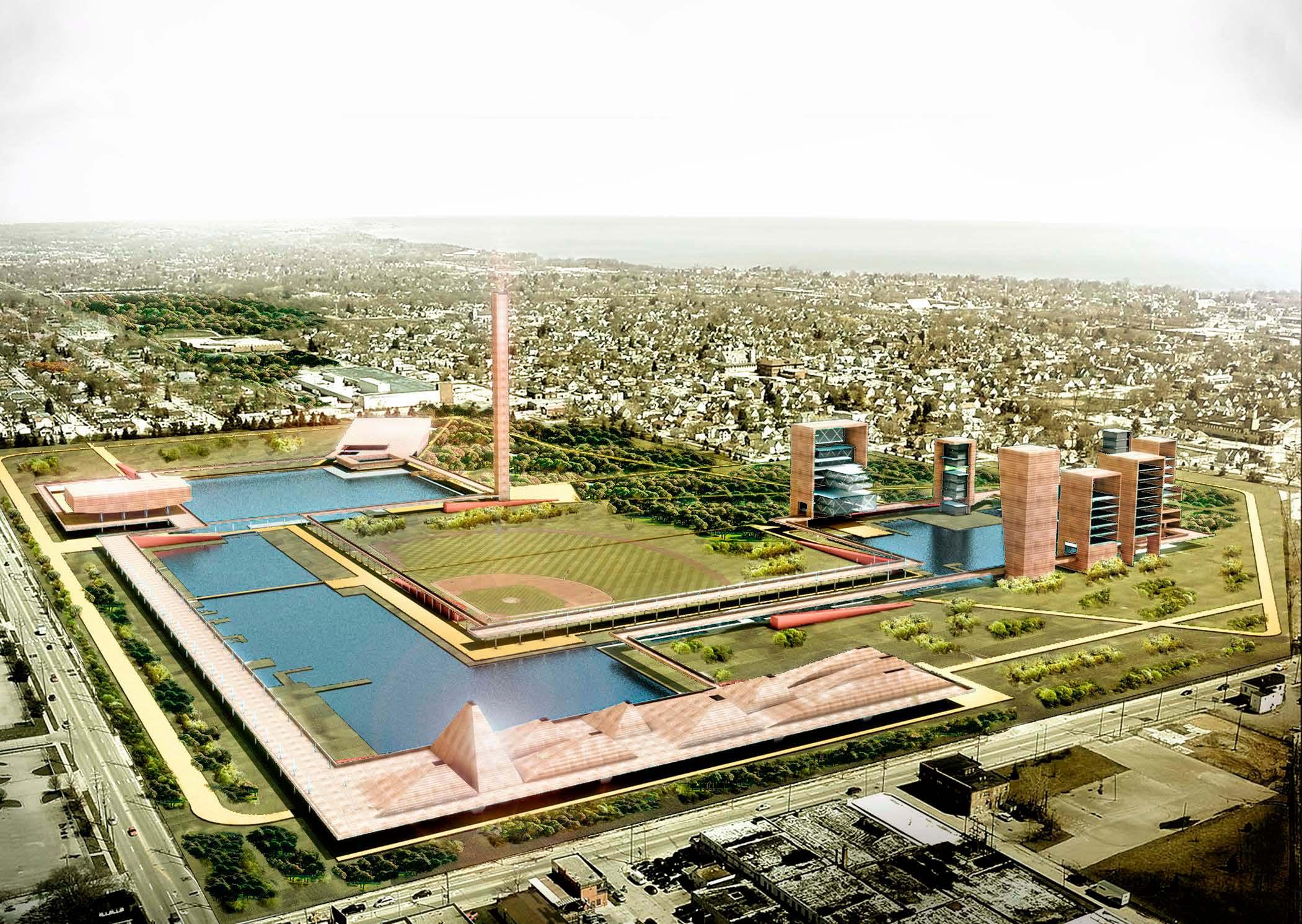
Kenosha, Wisconsin, United States of America, 2015
Collective - 2th Price in International competition of Urban Design
Professional - Urban Design for Everyone - UD4U
Team Leader: Jaime Sarmiento Pastor - jaime@metha.pe
Urban design team member
14
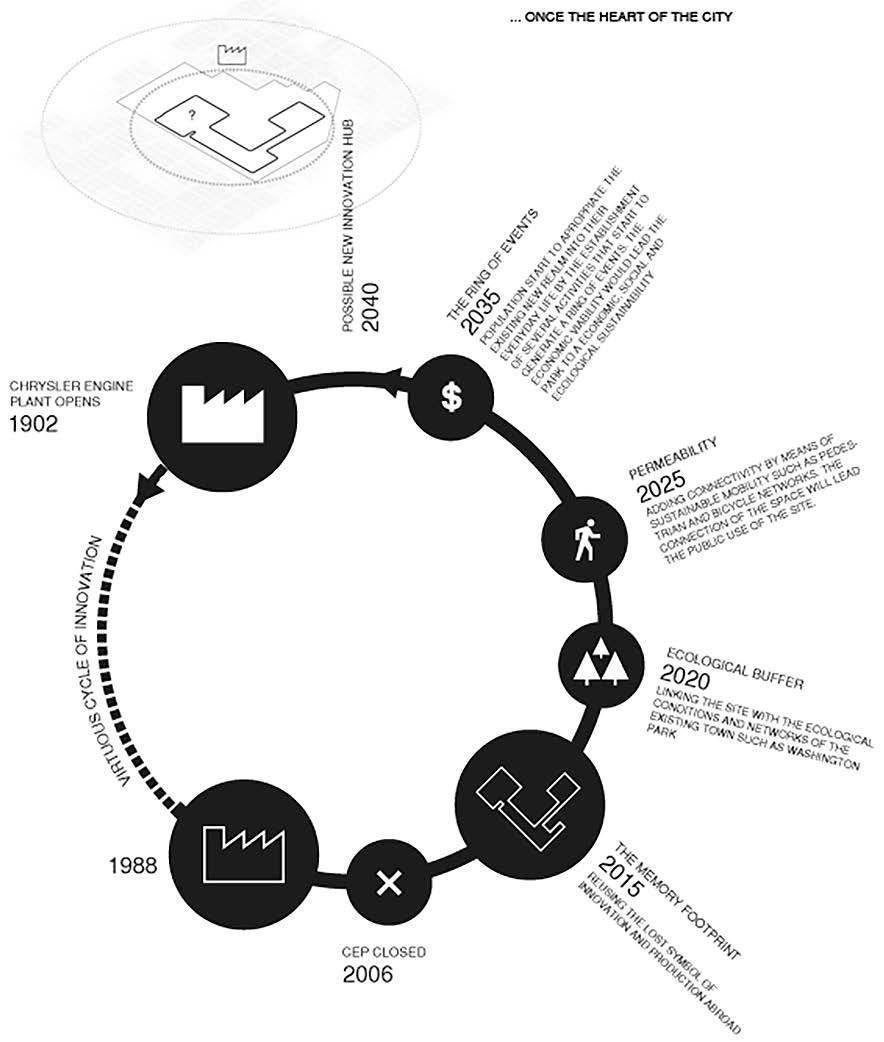
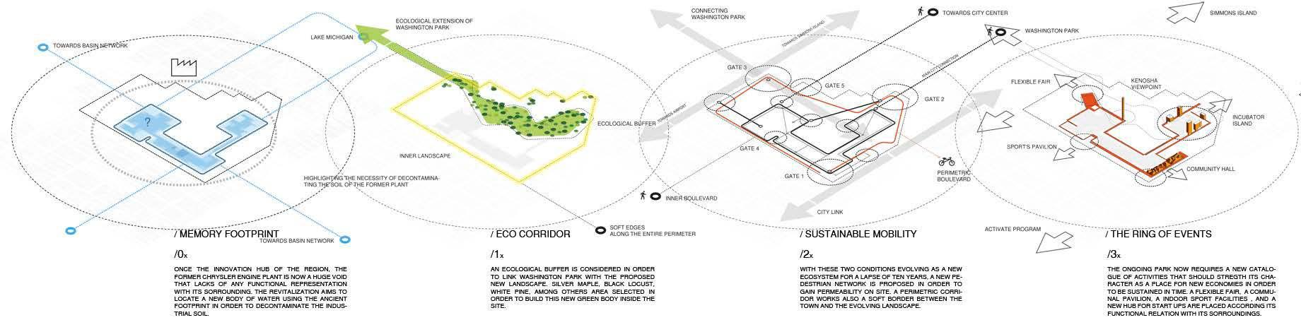
From the rust belt to a Ring of Events
Understanding Kenosha
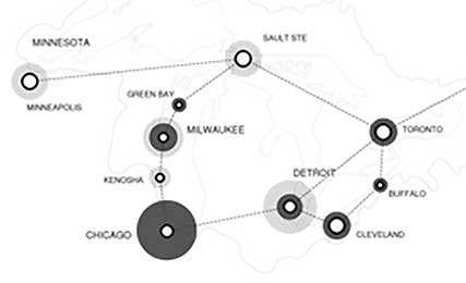

_XXL GREAT LAKES MEGALOPOLIS
Identity and representation
The legacy of Kenosha in this territorial megalopolis could be measured by its important role for innovation and technology during the entire 20th century. In this regard, any type of public and private initiative should highlight its strength in order to identify itself and differ from the existing constellation of cities throughout the great lakes.
_L THE RUST BELT
Empowering community and local economies
Commuting in the everyday life of most of the labor force in Kenosha has transformed the place in a bedroom city. In order to exceed the lack of social cohesion and improve city dynamics, it is imperative to find new economic conditions in town. The existence of a startup community driven by the information society urges to reclaim new spaces in which new economies could interact.
Strategic layering throughout time / 1 Generation park
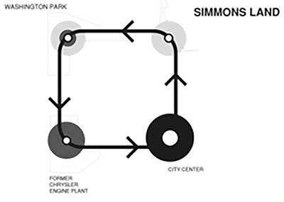
_XL KENOSHA BEDROOM CITY
Public network + Reciprocity
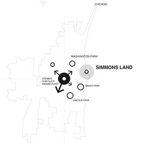
The proximity that the existing recreational facilities have with the former plant, raise the question on which should be the vision of the place. How does this void should be engaged with the city? In order to find reciprocity and increase the public network of the town lead us to believe that the empty space should.
_M -THE INNER SYSTEM
Functional diversity
If the Chrysler Engine Plant operates as a park, the possibility of constructing a small constellation of public activities the inner core of the city could act as a center in which different activities could merge.
15
Metropolitan Development Plan for Lima & Callao - PLAM 2035
Lima, Lima, Peru, 2014
Collective - Urban renewal of the new centrality of North Lima
Professional - Metropolitan Municipality of Lima
Team Leader: Karina Puente Frantzen / Jose Garcia Calderon - jose@urb-es.com
Development of Portfolio of Structuring Projects of the PLAM
implementing new urban planning and management instruments/ Urban design team member
16
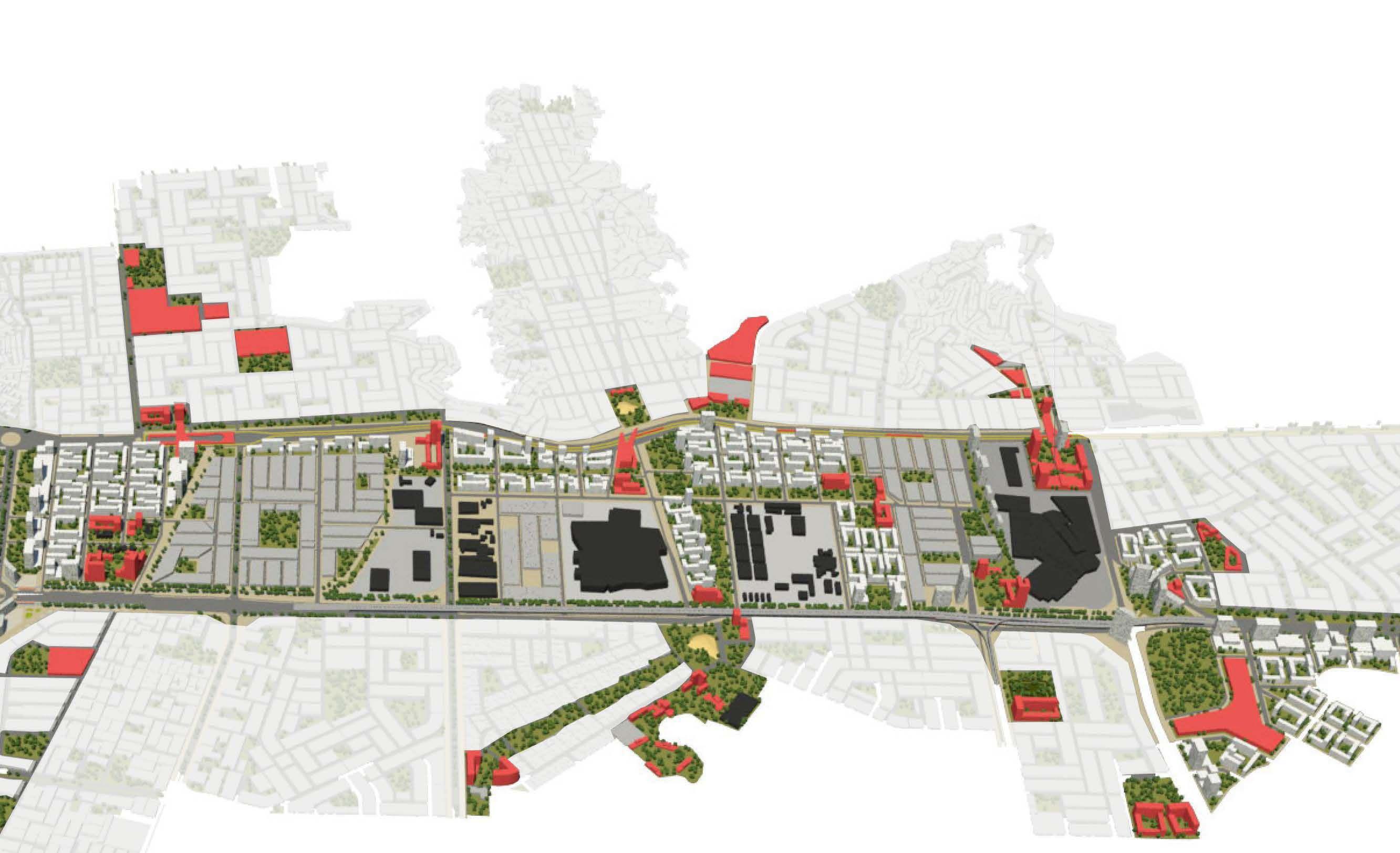
Planning Lima after 25 years
In 1989, the last urban plan of Metropolitan Lima called PLANMET 1990-2010 was approved. However, another plan was not re-elaborated until 2014 in which the Metropolitan Urban Development Plan was developed with a long-term vision to 2035. The PLAM 2035 is a strategic technical instrument to guide the growth and development of the city, proposes a new vision and guidelines for a fair and inclusive city, heritage and creative, sustainable and resilient, compact, integrated and polycentric.
Lima is a metropolis of more than 9 million inhabitants whose urban growth pattern was informal during the twentieth century, which has generated low levels of population density (less than 100 inhabitants per hectare in some areas). Therefore, as part of the strategies, urban centralities were identified in which structuring projects were proposed. One such project is the urban renovation of the new centrality of North Lima.
New centrality
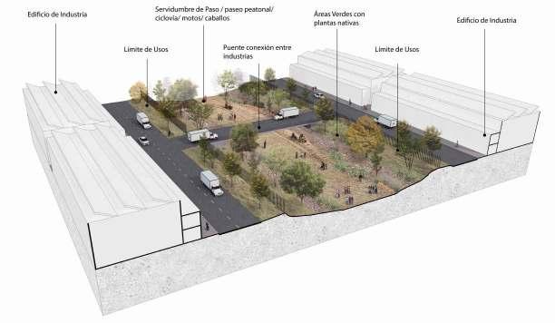
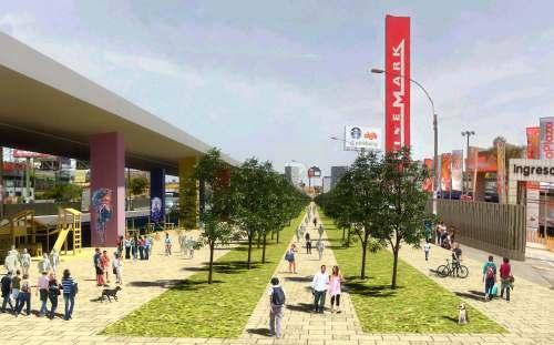
The conversion of uses and equipment of an old industrial zone is proposed, which in recent years has initiated a process of transformation to commercial uses. To guide the process in an orderly manner, it is proposed as strategies to enhance the integrated mobility system by guaranteeing the coverage of the transport system, consolidating the Lima North centrality by encouraging mixed uses and providing complementary equipment of a metropolitan nature, connecting the urban fabric generating transversal axes through green corridors that join important equipment and establish a system of open spaces regulating the size of the blocks and changing the character of the local roads to give priority to the pedestrian.
UrbanManagementUnit

Ownership structure Industrial zoning Land readjustment Public space, urban facilities and useful area Physical buildable proposal in the urban contextZoning Execution and management instruments Current buildable Current buildable Current growth capacity (1 average floor) Current growth capacity (no free area) Land readjustment Land readjustment Physical buildable proposal (new land uses) From industrial to residential and mixed uses block Park contribution Public space (perforated blocks) 1st level: Commercial Current building area 253,840 m2 (100%) Possible building area 770,541 m2 (304%)
17
Housing for urban indigenous in Lima downtown
Lima, Peru, 2012
Individual - Master Plan and Housing
Academic - Pontifical Catholic University of Peru
Supervisor: Antonio Graña - aga@qnet.com.pe
Thesis work - Final career project
18
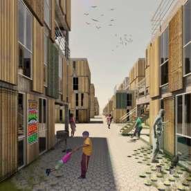
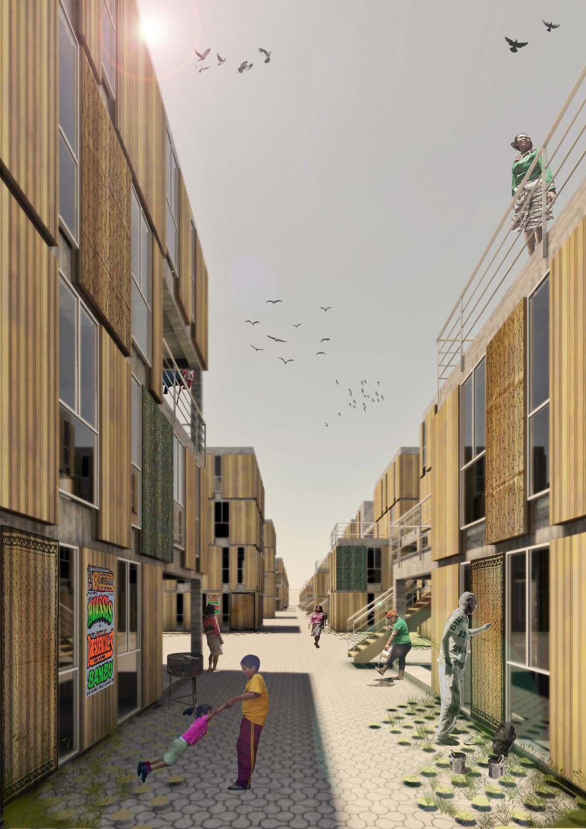
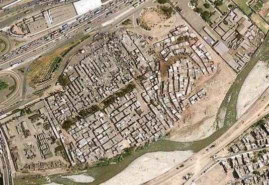
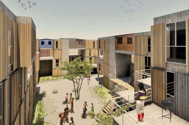
Shipiba Indigenous settlement in Lima
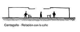
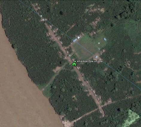
The project arose in response to a very particular situation that originated in Lima for 20 years: the formation of an indigenous Amazonian community in the center of the city. After living so long in the capital, this Shipiba community of approximately 1,000 inhabitants had to be relocated by the construction of two projects located on its settlement land: the construction of the Vía Rímac Park and the Great Cantagallo Park. In that context, one wonders how a rural Amazonian community should live in a desert city like Lima.
Collective Dimension
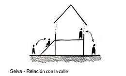
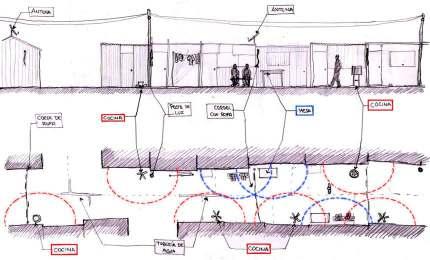
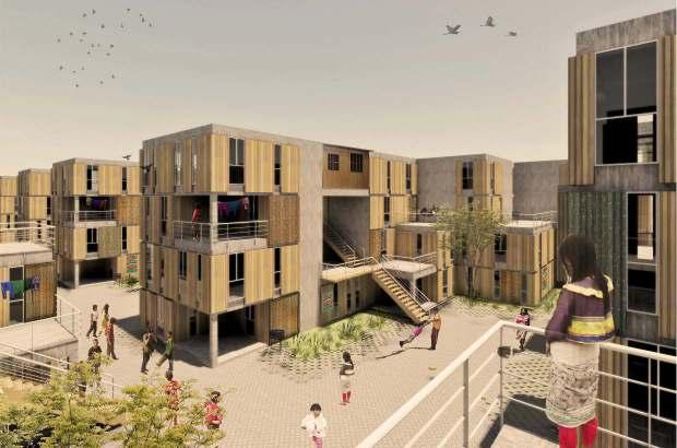
In the jungle, the settlement pattern is linked to kinship networks and the community’s spatial practices with respect to the river. In this pattern, a gradual transition from the public to the private can be observed through the different scales; the street, which relates the family subspaces; and finally, the domestic social space, which consists of an extension of the house that allows the exterior of the family social space. All this gives wealth in the degrees of privacy and promotes interaction in the community.
19
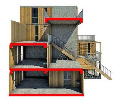
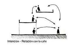
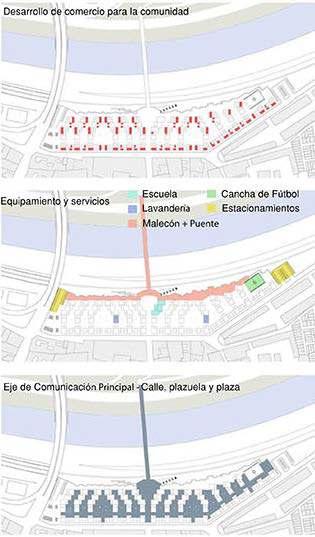
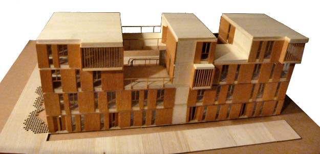
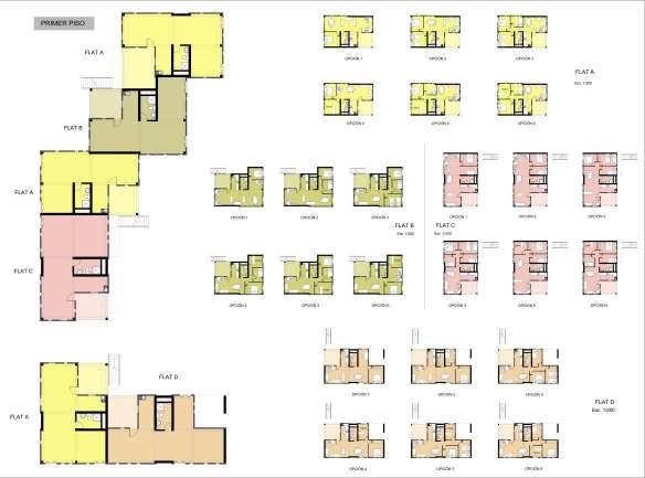
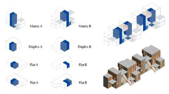
The project is based on the pattern of the jungle: plaza, street and terrace; with which the ground floor, middle and high are related horizontally and vertically from spaces that seek to offer community. In addition, housing is proposed as a flexible seed module. In that sense, being unfinished, it offers the possibility of personalizing the house by choosing the final finishes thus allowing the appropriation of the space. Finally, the constructed area may increase as it increases the possibility of growth in cases of duplex housing.
The project intends that the relationship between collective space and housing has the capacity to offer the symbolic and cultural to urban life; an indispensable need for collective memory; It is also a hypothesis to consolidate the city in front of the river, a pretext to rethink the edge.
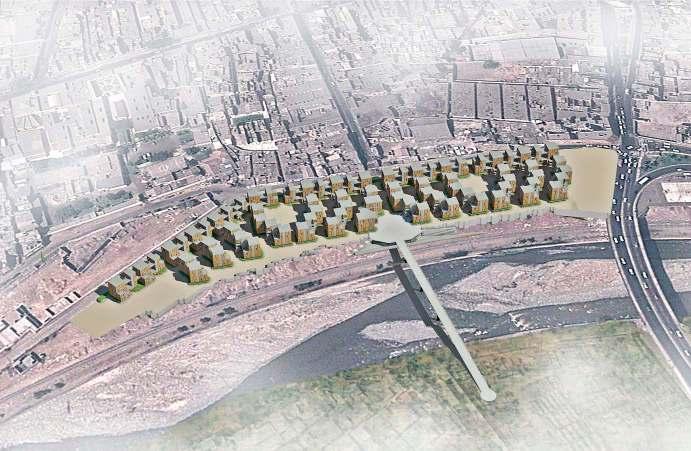
Urban scale
20