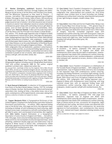
49 Bowles (Carington, publisher). Bowles’s Post-Chaise Companion; or Travellers Directory through England and Wales: Being an Actual Survey of all the Direct and Principal Cross Roads, with the Milestones Expressed as they stand at Present..., 2 volumes., 2nd edition, 1782, double page engraved map of England & Wales, title page to each volume, index of towns, 200 uncoloured engraved road strip maps, on 100 sheets (complete), circuits of judges bound at rear of volume 1, list of fairs bound at rear of volume 2, boards on volume 1 near detached, boards on volume 2 detached, contemporary green sheep with contrasting morocco gilt labels to spines, worn at head and foot of spine and extremities, 12mo, together with, Paterson (Daniel), A New and Accurate Description of all the Direct and the Principal Cross Roads in Great Britain..., 3rd. edition, 1776, double page engraved map of England & Wales with contemporary manuscript on verso, title page and dedication, index, folding engraved map of the ‘Road from London, Bath & Bristol through Shrewsbury to Holyhead’, later endpapers, modern cloth with printed paper label to spine, 8vo, with, Cary (G & J, publishers), Cary’s New Itinerary or an Accurate Delineation of the Great Roads, both Direct and Cross throughout England and Wales..., 11th edition, 1828, calligraphic title and dedication, publisher’s advertisement, numerous tables and lists, six uncoloured folding regional maps, and a folding map of England and Wales, sectionalised and laid on linen contained in pocket at rear of volume, later endpapers, early 20th century cloth gilt, with one other similar, 8vo (5)
53 Cary (John). Cary’s Traveller’s Companion or a Delineation of the Turnpike Roads of England and Wales..., 1791, engraved calligraphic title, advertisement and contents list, forty-three engraved maps printed back to back (including one folding), contemporary outline hand-colouring, advertisement leaf present at rear, light toning to margins, modern sheep, 12mo (1)
54 Cary (John). Cary’s New and Correct English Atlas: Being a new Set of County Maps from Actual Surveys..., 1793, general map of England & Wales with long closed tear affecting image, laid on later paper, title page and dedication toned overall and a little frayed at margins, forty-five (complete) engraved maps with contemporary outline colouring, each with tissue guard, maps are a little toned with occasional staining, index bound at rear, last few leaves frayed with slight loss, later marbled endpapers, modern panelled calf with gilt decorated spine, 4to Chubb CCLXI (1)
£200-300
(1)
£100-150
56 Cary (John). Cary’s Traveller’s Companion or a Delineation of the Turnpike Roads of England and Wales..., 1819, calligraphic title, advertisement, map of England & Wales and forty-two (complete as list) engraved maps with contemporary outline colouring, including one folding (Yorkshire), occasional slight staining, bound with, Cary’s New Itinerary or an Accurate Delineation of the Great Roads, Both Direct and Cross throughout England and Wales..., 8th edition, 1819, calligraphic title, folding engraved map of England & Wales with contemporary hand colouring, with long repaired closed tear, with six engraved folding maps with contemporary outline colouring, index bound at rear, later endpapers, modern quarter calf gilt with marbled boards, 8vo
An unusual item, seemingly written by the engineer Henry Marc Brunel (1842-1903), second son of Isambard Kingdom Brunel, recording a series of boating trips undertaken by him on the River Thames over the course of 1885. The author’s companions included fellow engineers E.M. Cruttwell and John Wolfe-Barry, with whom he designed Blackfriar’s Bridge. The author provides witty anecdotes of problems with locks and weirs, delights of bankside landscape, involvements with regattas at Henley, Kingston and Molesey, and information on eating houses along the river. (1) £150-200
51 Buck (Samuel & Nathaniel). A collection of 33 engraved plates from Ruins of the Most Noted Abbeys, Castles, 1727-33, including views in Chester, Durham, Northumberland, Oxford and Somerset, subscribers lists, lacking all titles, a few plates loose, one or two spots, contemporary calf & original boards, some wear, oblong folio
(1)
£100-150
57 Cary (John). Cary’s New Map of England and Wales with part of Scotland..., 1st edition, published 1794, title page and dedication, engraved map of England and Wales with contemporary hand colouring and table of explanation, seventyseven engraved map sheets with contemporary outline colouring, index of places bound at rear, occasional ink marginalia, slight offsetting and dust soiling, text block broken and detached with contents shaken and loose, near contemporary ink ownership signature to front pastedown, near contemporary limp reverse calf, worn, stained and frayed, rebacked retaining remains of old spine, 4to
£150-200
52 Capper (Benjamin Pitts). A Topographical Dictionary of the United Kingdom compiled from Parliamentary and other Authentic Documents and Authorities..., 1st edition, 1808, engraved folding map of the British Isles, title page and forty-five engraved maps (including six folding), all with contemporary hand colouring, slight toning to some maps, contemporary calf with contrasting morocco gilt label to spine, worn and bumped at extremities, 8vo, together with, Aikin (John), England Delineated; or a Geographical Description of every County in England and Wales..., 3rd edition, 1795, title page, hand coloured folding engraved map of England & Wales and forty-two (complete) uncoloured engraved maps, some offsetting, additional double page pen and watercolour map of England & Wales bound in before title, contemporary dated ownership signature to first front blank, later endpapers, modern half calf gilt with marbled boards, 8vo Chubb CCCXXVII and CCLXXXVII respectively. (2)
£150-250
55 Cary (John). Cary’s New Map of England and Wales with part of Scotland..., 1st edition, published 1794, title page and dedication, engraved map of England and Wales with contemporary hand colouring and table of explanation, seventyseven engraved map sheets with contemporary outline colouring, index of places bound at rear, marbled endpapers, contemporary blind stamped calf, repaired at corners, boards a little scarred, re-backed, 4to
50 [Brunel, Henry Marc]. River Thames sailing log for 1885, [1886], lithographed logbook including several lithographed illustrations, ‘title’ with printed monogram HMB for the author, original publisher’s printed cloth, rubbed and soiled, 8vo
Sold as a collection of plates not subject to return. (2)
£70-100
Sold as a collection of maps, not subject to return. (1)
£120-180
14
£50-80