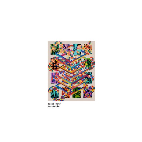
Jacob Deir Portfolio
Table of Contents
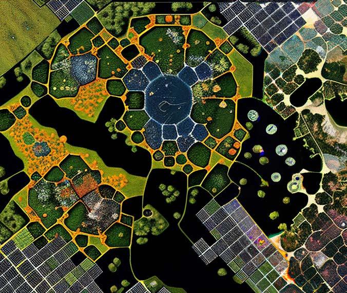
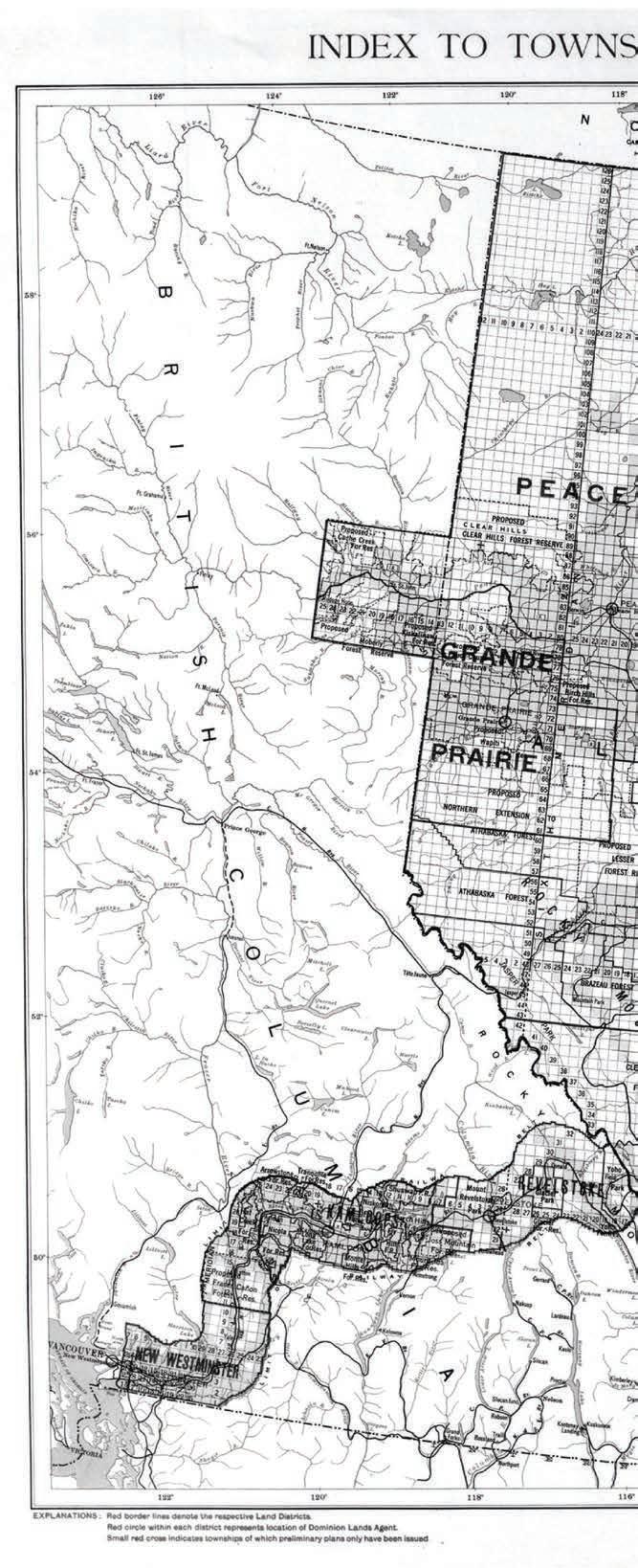
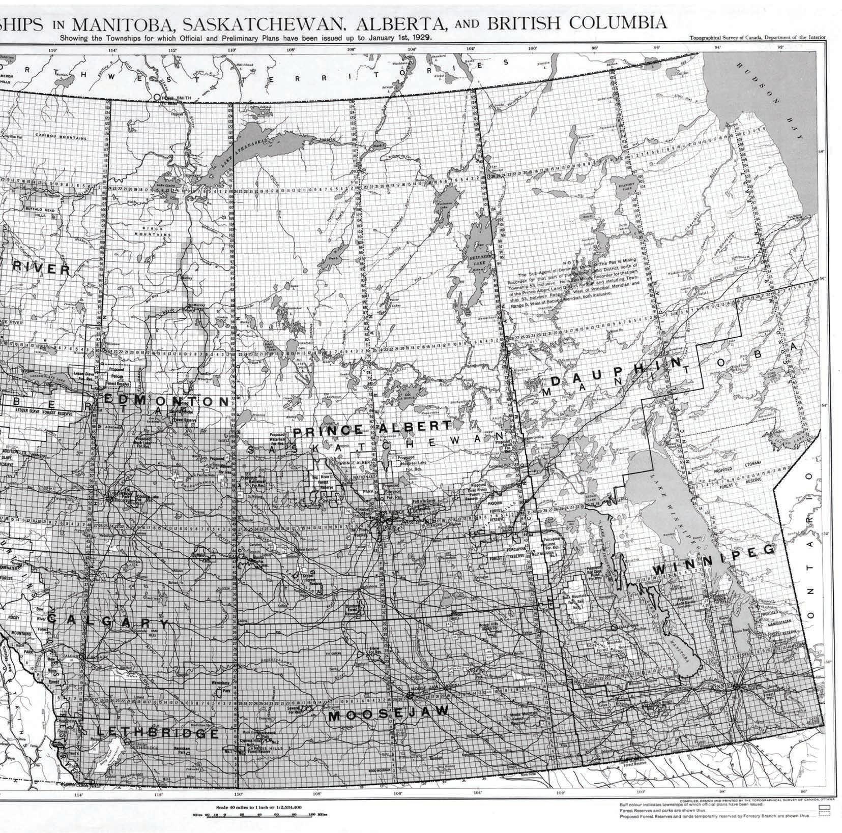
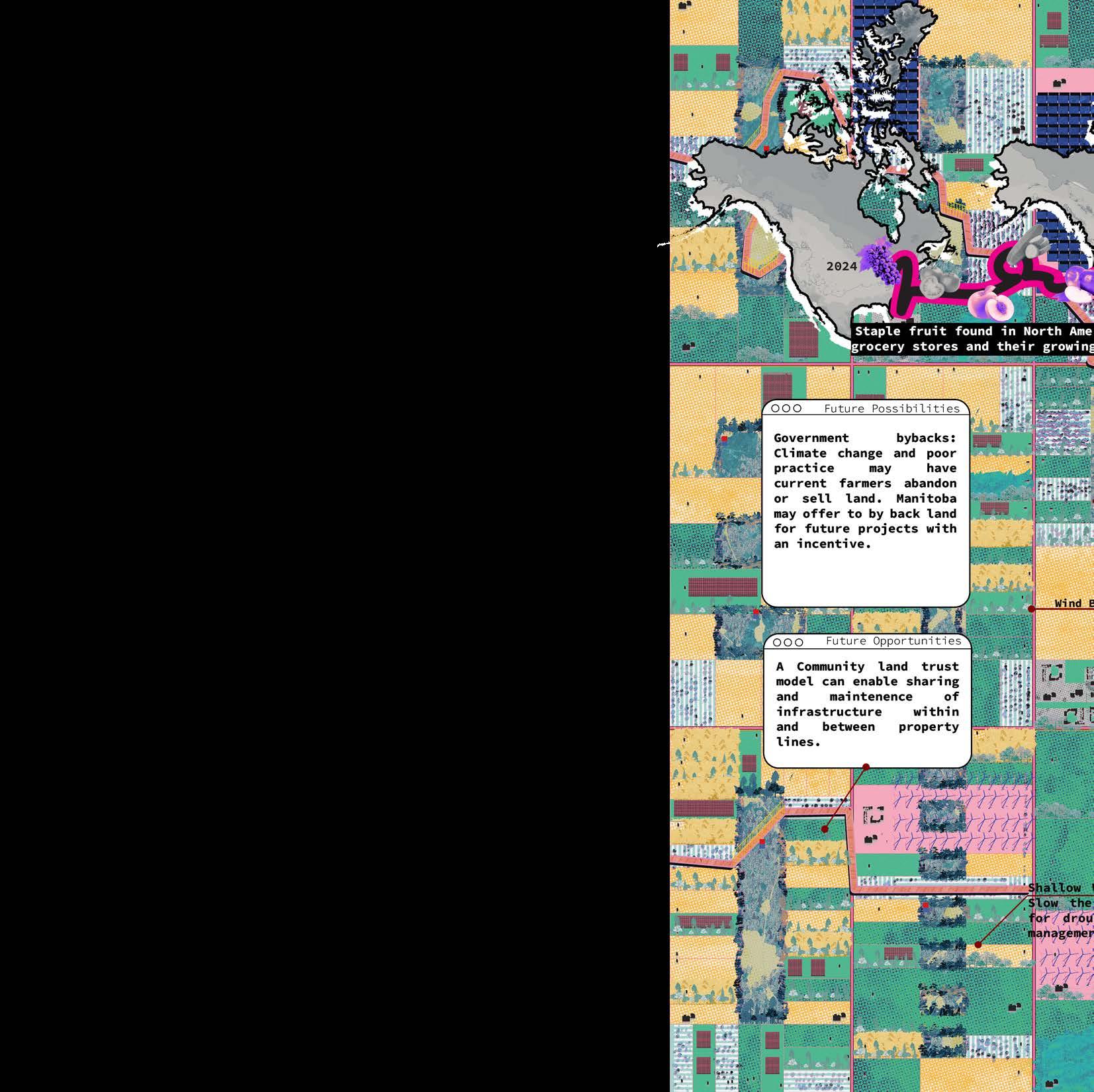
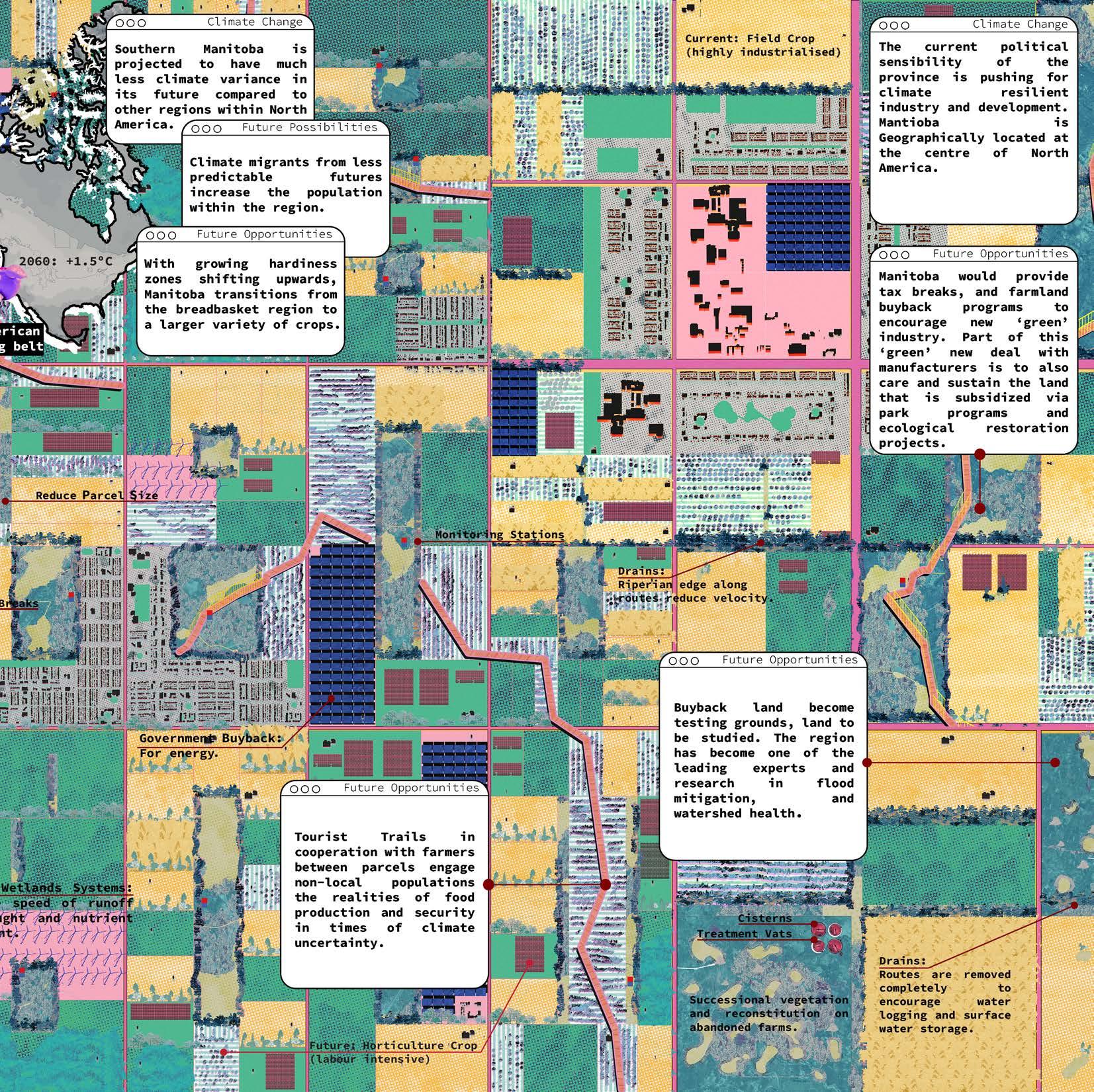
M.ARCH Thesis Excerpts 1: Counter Mapping the DLS 28-35
M.ARCH Thesis Excerpts 2: Rationalising the Grid
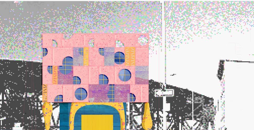
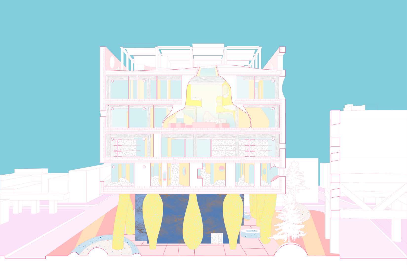
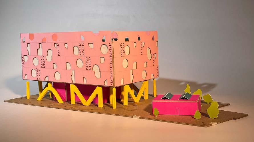
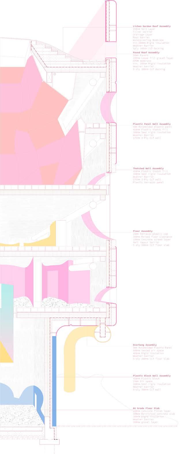
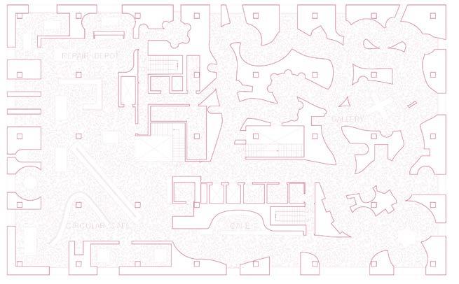
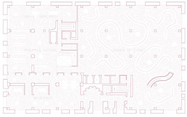
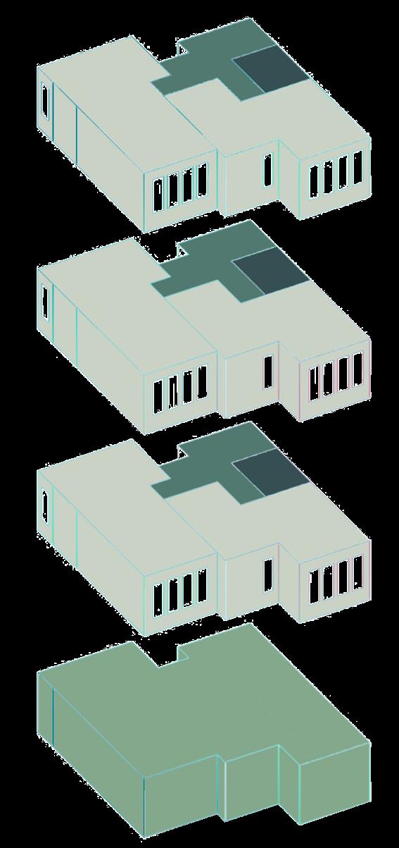
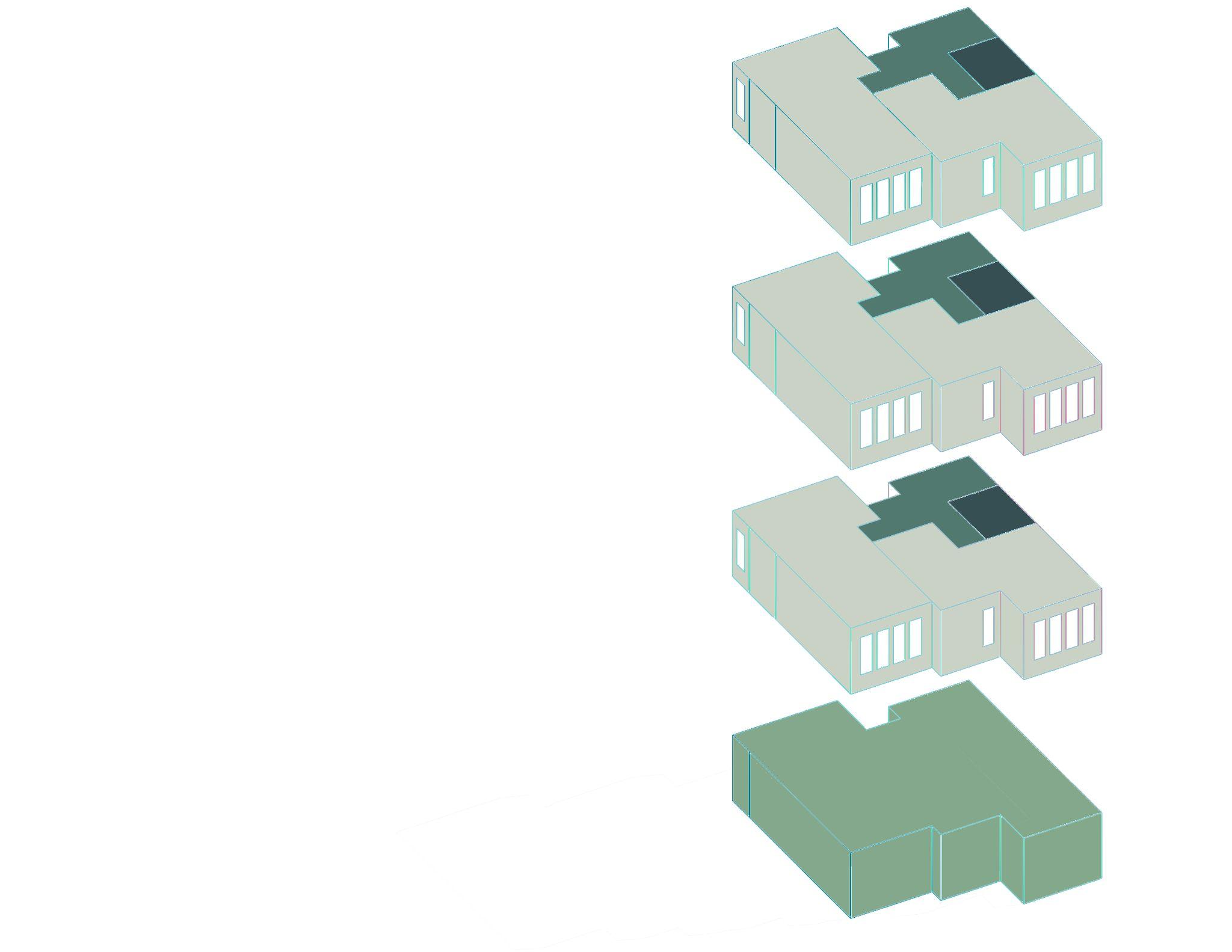
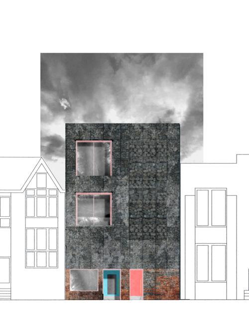
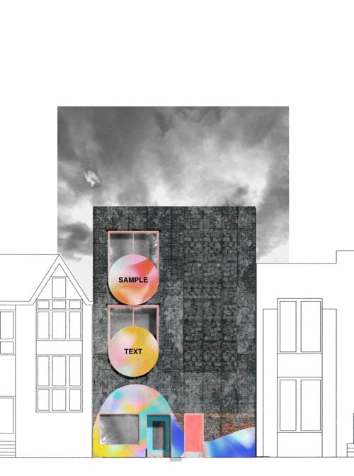
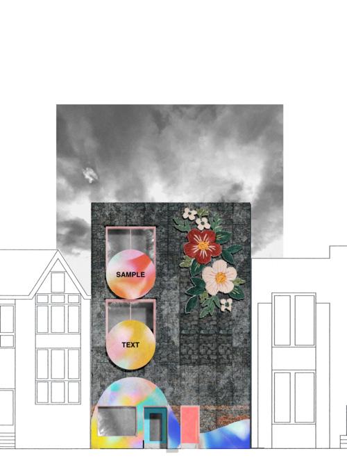
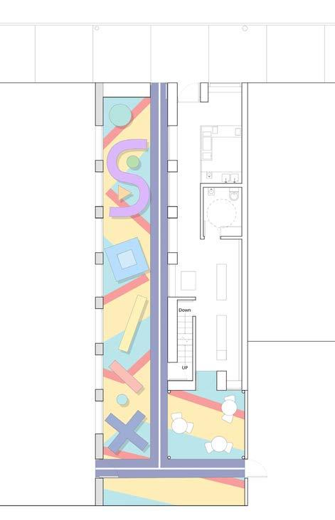
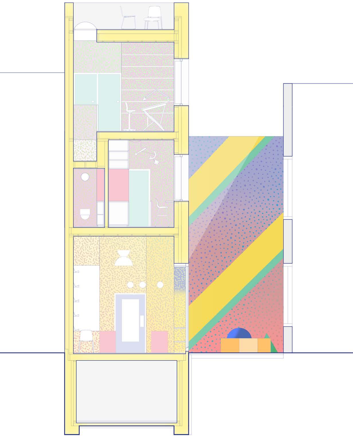
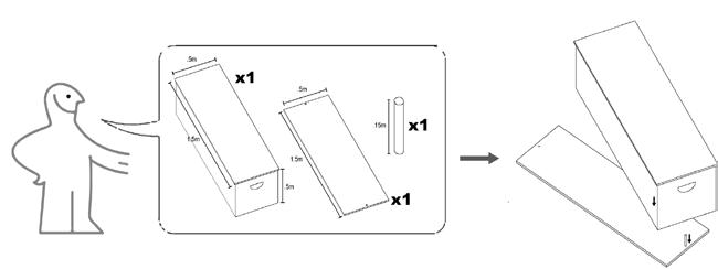
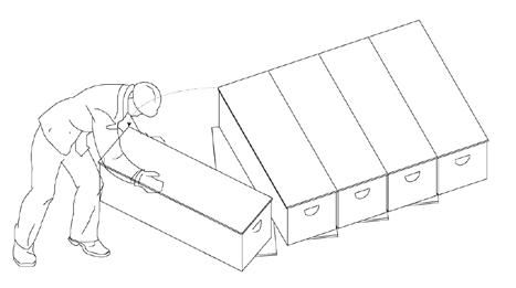
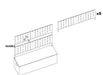
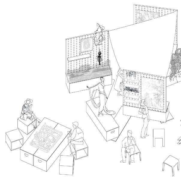
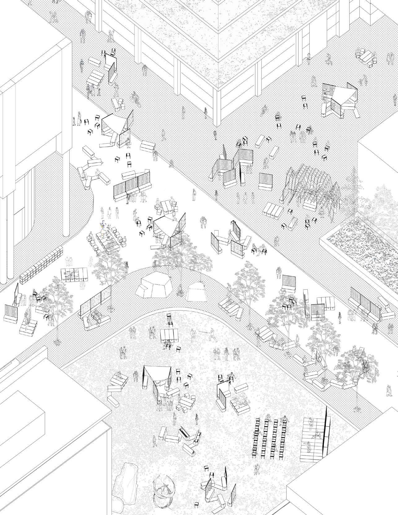
Library of Things
Library of Things
Winter 2023 Academic exploration, Semester Long Study, Collaborated With Lara Sedele
Winter 2023 Academic exploration, Semester Study, Collaborated With Lara Sedele
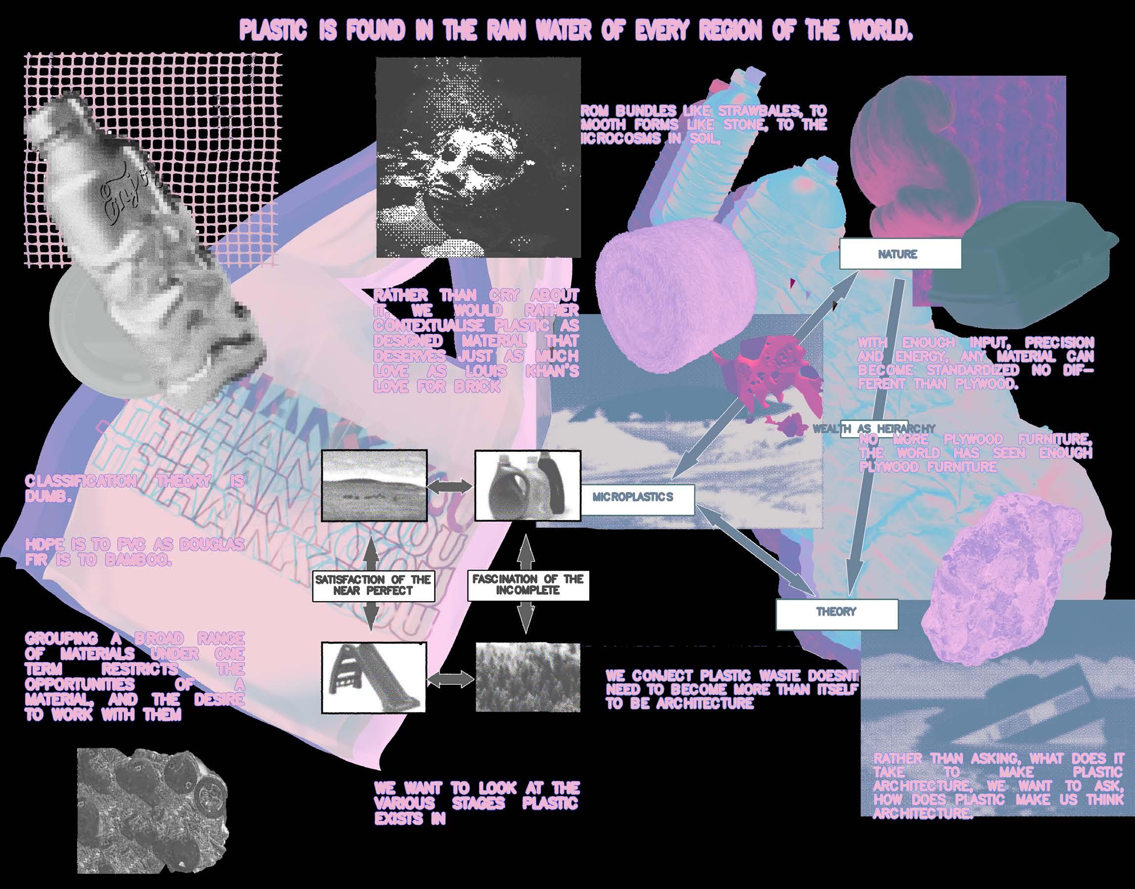
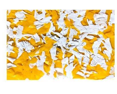
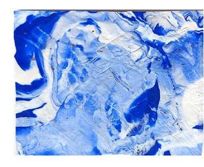
Situated along Brooklyn’s Gowanus Canal, The library is a mixed use centre around the culture of the coveted four Rs [reduce, reuse, recycle, rethink]. The project presents a dialogue behind consumer plastic; materials and aesthetics that have countless hours invested in them already, to only be discarded. We propose a range of additional input /degrees of recycling/ required to demonstrate architectural desire that many consumer plastics already have.
Situated along Brooklyn’s Gowanus canal, The library is a mixed use centre around the culture of the coveted four Rs [reduce, reuse, recycle, rethink]. The project presents a dialogue behind consumer plastic; materials and aesthetics that have countless hours invested in them already, to only be discarded. propose a range of additional input /degrees of recycling/ required demonstrate architectural desire that many consumer plastics already have.
Ground
Model and photo by Lara Sedele
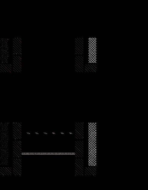
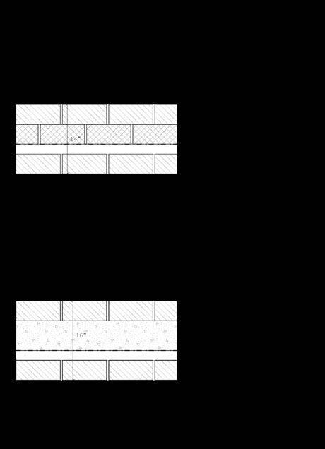
Rotomolded interior wall panels Coffee lid facade panel
WOULD YOU STILL LOVE ME IF I WAS A DIAGRAM IN A WORMS EYE VIEW
MOMO
GROVER
OBLONG GLOP
BLART
WOULD YOU STILL LOVE ME IF I WAS A DIAGRAM OF A PANELIZED SYSTEM
Laundry detergent bottle tile
Rotomolded facade panels
STEVE
HEIDI
TOBY
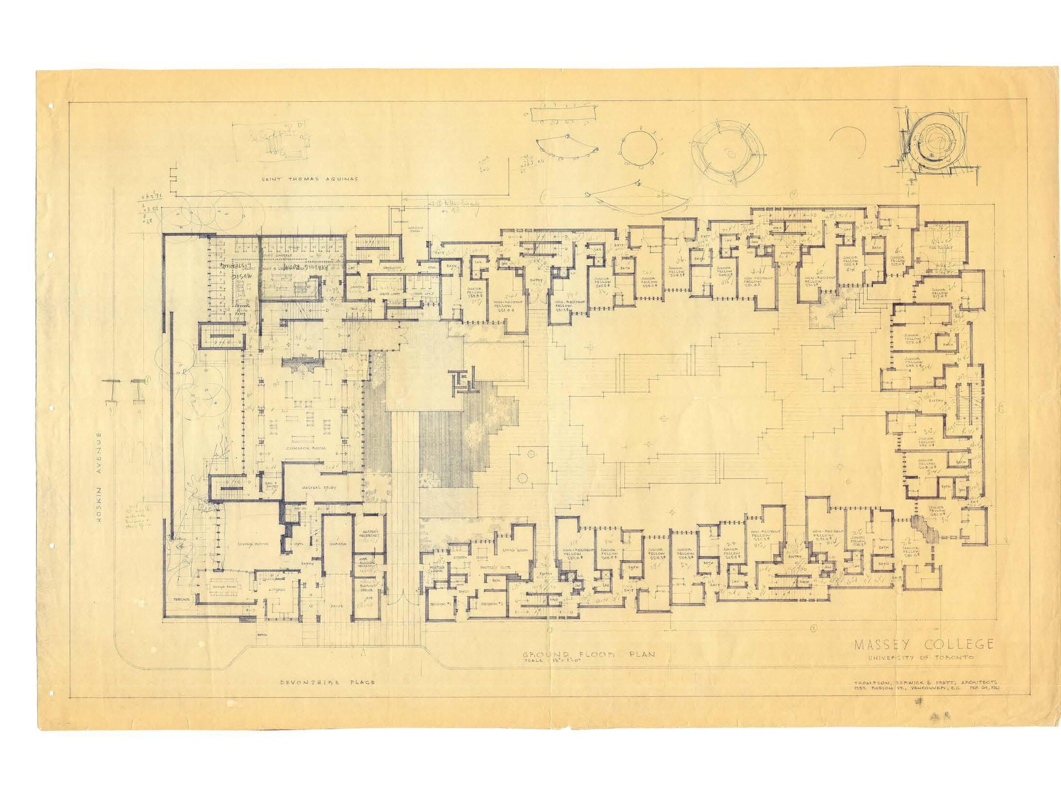
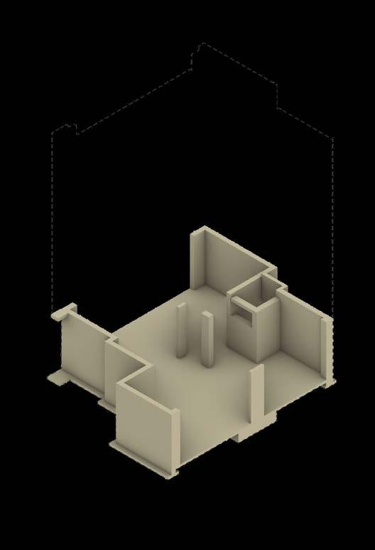
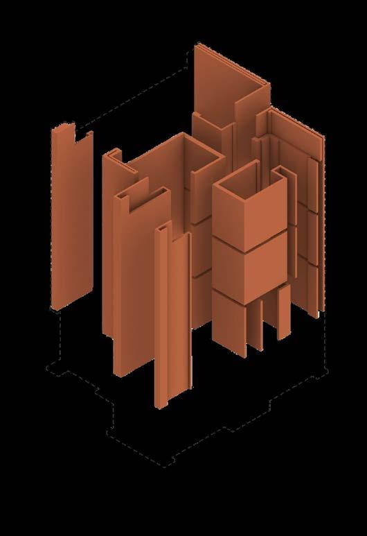
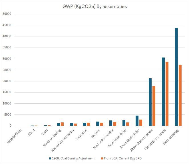
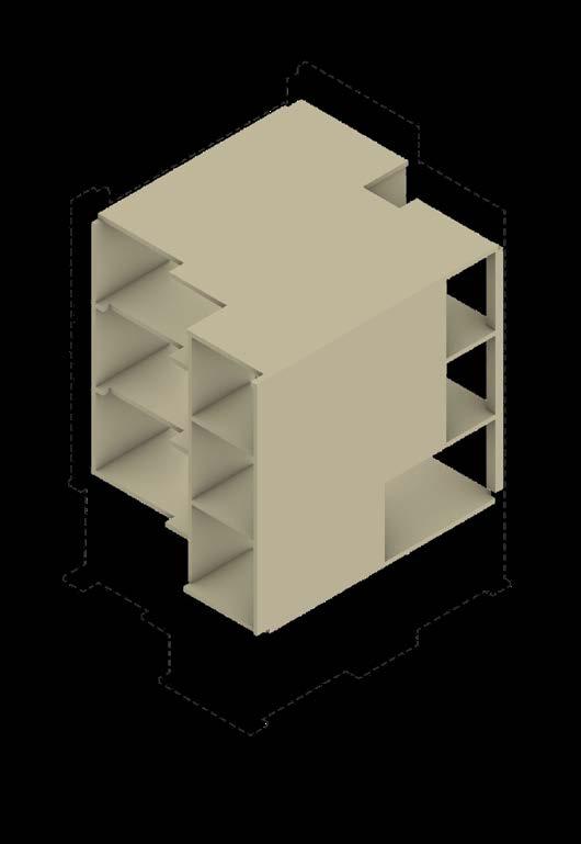
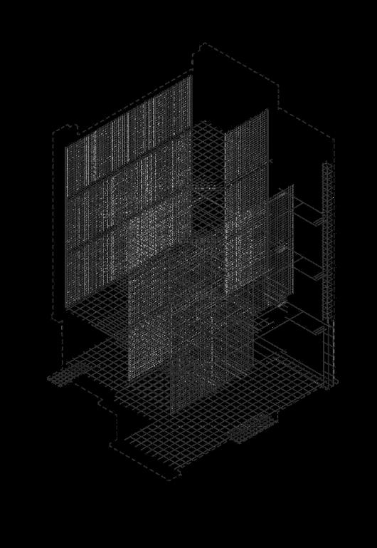
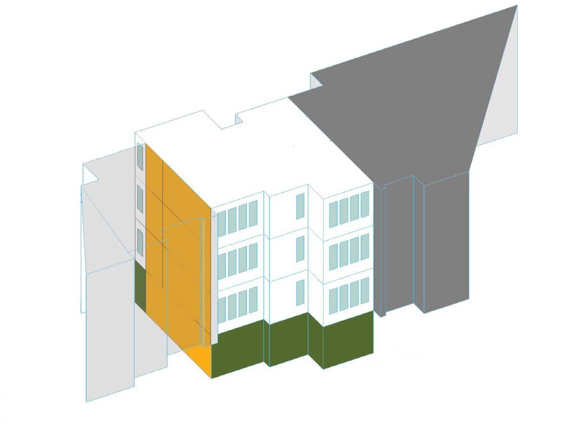
Whole Life Carbon of Massey College
Winter 2024 Academic exploration, Semester long study, Collaborated with Elizabeth
Constructed in 1962, Massey College is a private residence designed by Architect Ron Thom. Be-ing a designated heritage status building, very little renovations have been done to the project aside from minor cosmetic refresh in the bathrooms and occasional asbestos remediation. Part of the intentions of this study are to shed light on the significance building performance has on the embodied carbon of buildings, pushing for meaningful retrofits in the wake of overconsumption, and climate degrading practices.
Nadeau
Construction
GWP of Massey Study area
Study GWP: Study -
Construction Phase
Massey Hall: 548 kg CO2/m2
area GFA: 64.2 m2
GWP: 112,167 KgCO2e
whole building multiplier: 20.66
Embodied Carbon /
Division 3 - Concrete (foundation)
Total GWP: 43,780 KgCO2e
Volume of study area: 29 m3
Travel
Brick : 530 km
Division 3 - Brick
Total GWP: 27,322 KgCO2e
Volume of study area: 57 m3
From the Athens region in Ohio, the only Ohio county to produce
Concrete: 600 km
Limestone and cement from Eastern Massachusetts and Connecticut, but manufactured
Steel: 1800-1975 km
Iron ore from Schefferville, Labrador City and Fermont.
Coke and coal from South-West Pennsylvania, manufactured in Hamilton.
Copper: 340 km
Copper mines from around Sudbury.
Oak from South-East Ontario and South Québec.
Division 3 - Concrete (above grade)
Total GWP: 17,797 KgCO2e
Volume of study area: 54 m3
Division 3 - Rebar
Total GWP: 4,392 KgCO2e
Volume of study area: 1 m3
salt-glazed bricks.
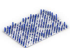
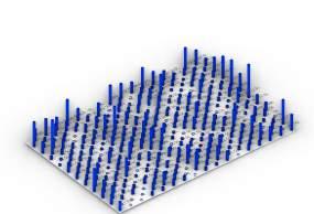
Value (kWh) 400,000
R-Value: 3.162m2K/W
R-Value: 0.416m2K/W
Simulated Total (Insulated, kWh)
Simulated Total (Without Insulation, kWh)
Yearly Cumulative Carbon (Kg) and Future Projections
1969: Around this year carbon emissions from operation equate to total embodied emissions due to construction
2024: about 8.4% of the total emodied emissions are due to construction
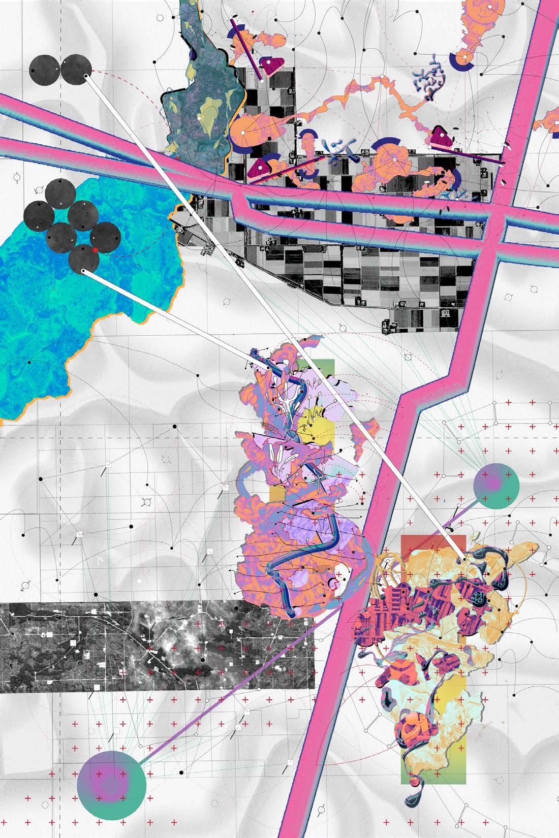
Excercise in Site Visualisation/Representation
November 2021, Personal project, Two week exploration, Individual
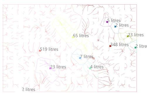
The project uses architectural methodologies and diagram techniques to visualize some of the data surrounding fossil fuel sites in Canada. Information such as crude oil production and communities displaced are displayed. The drawings were selfindulgent, methods to uncover research and information for me to better understand. Ironically, they also mistakenly reduce data to an aesthetic to anyone other than myself. Events such as an oil spill are easily misrepresented into a patchwork of colours and textures, potentially leading to unwanted conclusions.
Kalamazoo River
Fort Chipewyan
Horizon
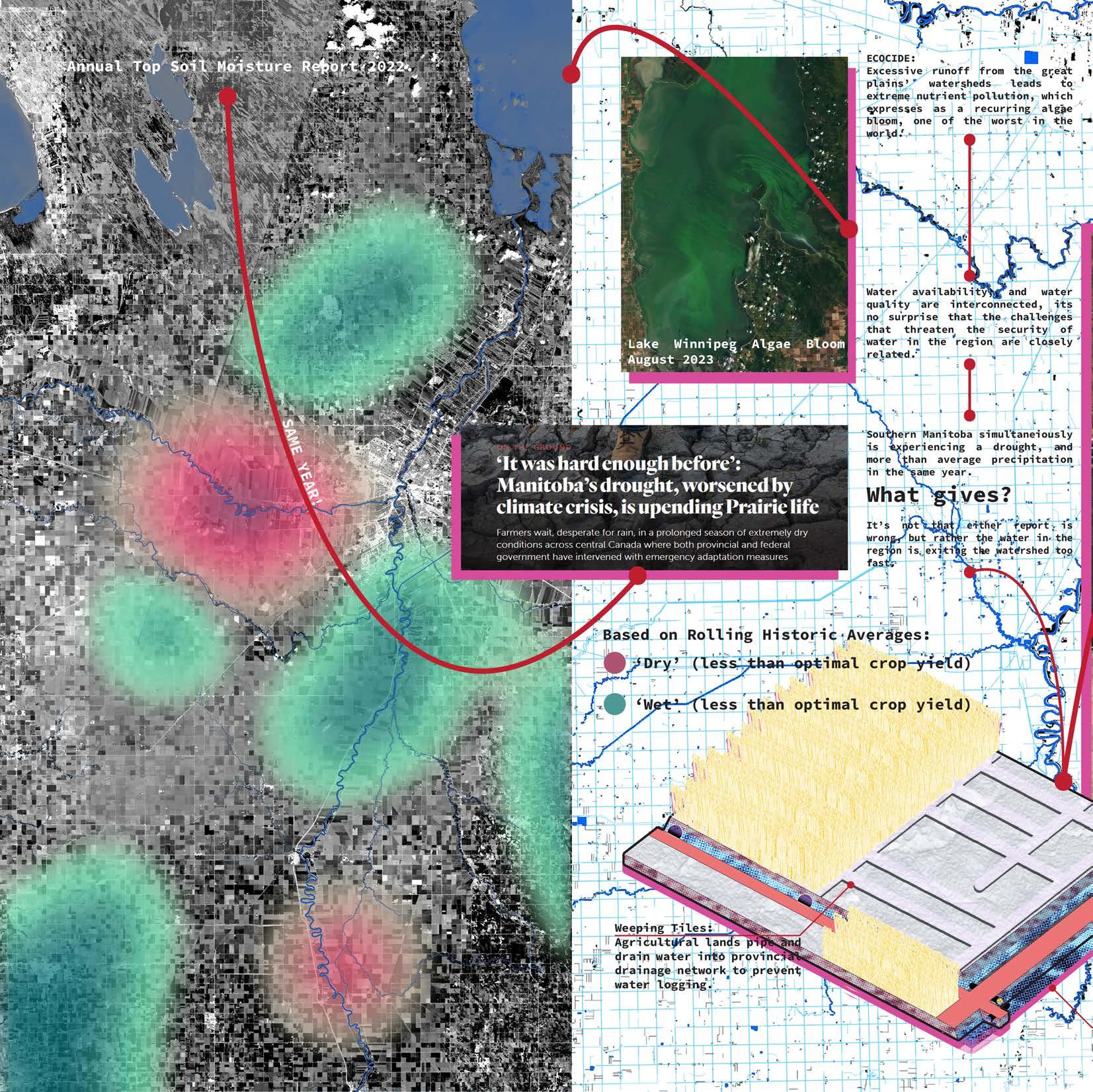
Drought
Kalamazoo River
Fort Chipewyan
Estevan
H2S Leak
Kalamazoo River Drought Bakken
Athabasca oil sands
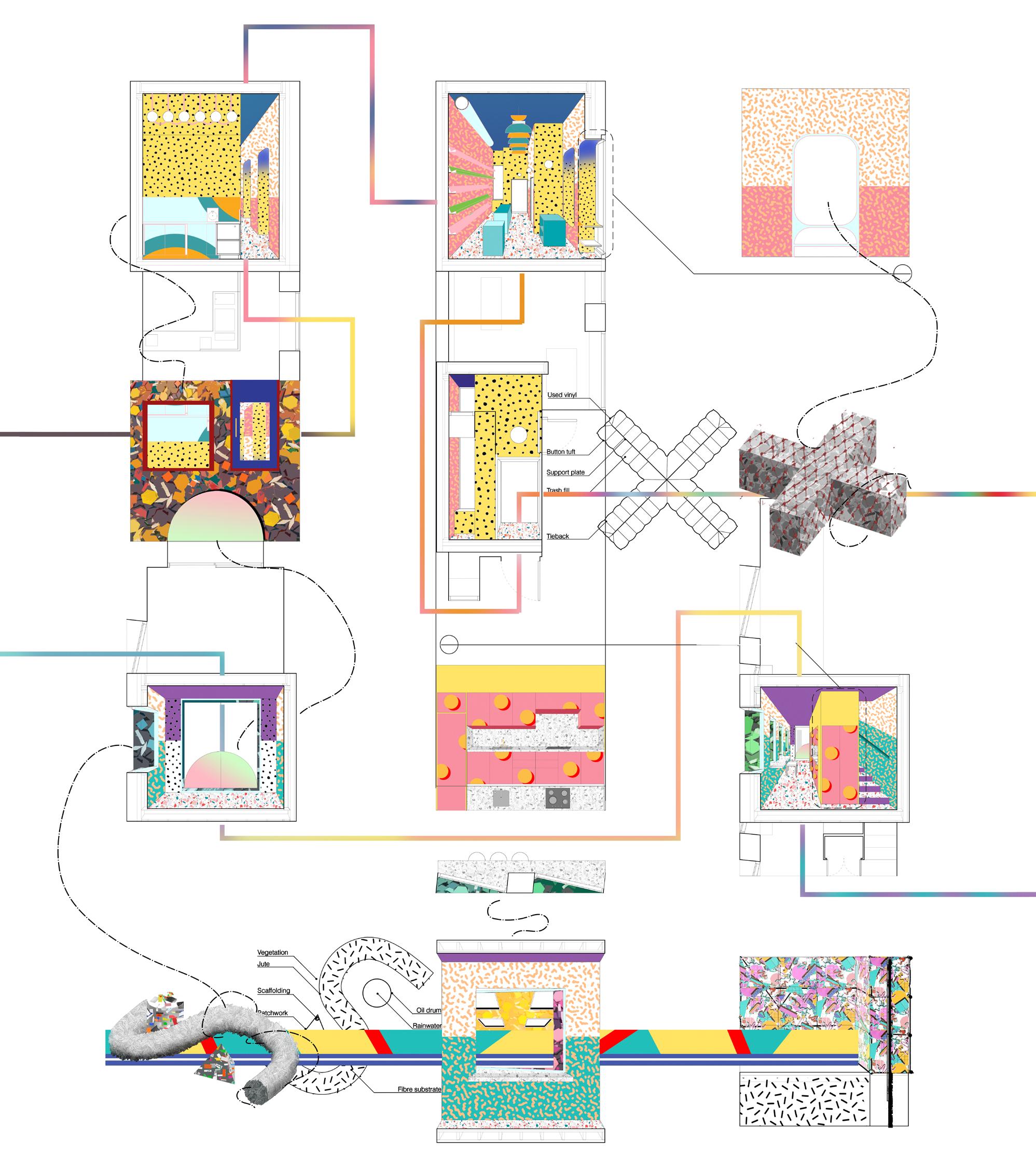
July 2021, Personal project, One month study, Individual Toronto Infill Study
Toronto, like many cities, suffers from empty lots in neighborhoods that are dying to be built upon. The issue is often rooted in combinations of mismatched zoning, awkward grandfathered conditions, and current landowners waiting for larger developments to purchase the land for huge profit. The presented project is on a site that is set for a condo within the next 10-15 years,and has the added bonus of a neighboring building’s windows and means of egress opening onto the lot. These conditions should be seen as opportunities to experiment with temporary and low-cost ideas, providing the area with a fresh face before becoming another tower for the skyline.
Toronto, like many cities, suffers from empty lots in neighborhoods that are dying to be built upon. The issue is often rooted in combinations of mismatched zoning, awkward grandfathered conditions, and current landowners waiting for larger developments to purchase the land for huge profit. The presented project is on a site that is set for a condo in 10-15 years, and has the added bonus of a neighboring building’s windows and egress opening onto the lot. These conditions should be seen as opportunities to experiment with temporary and lowcost ideas, providing the area with a fresh face before becoming another tower for the skyline.
Courtyard generated from setback
Gabion baskets filled with aggregate from nearby construction sites. Large aggregate for air and light permeation. Small aggregate for privacy.
Gabion baskets filled with aggregate from nearby construction sites. Large aggregate for air and light permeation. Small aggregate for privacy.
Secure vinyl, old banners, plywood and other fun art to the metal baskets via zipties or carabiners.
windows open up on site
Secure vinyl, old banners, plywood and other fun art to the metal baskets via zipties or carabiners.
crochet, weave, tuft!
Emborider,
Render:
Emborider, crochet, weave, tuft, cute!
Existing
Bookstore
Cafe
Render: Setback generated courtyard
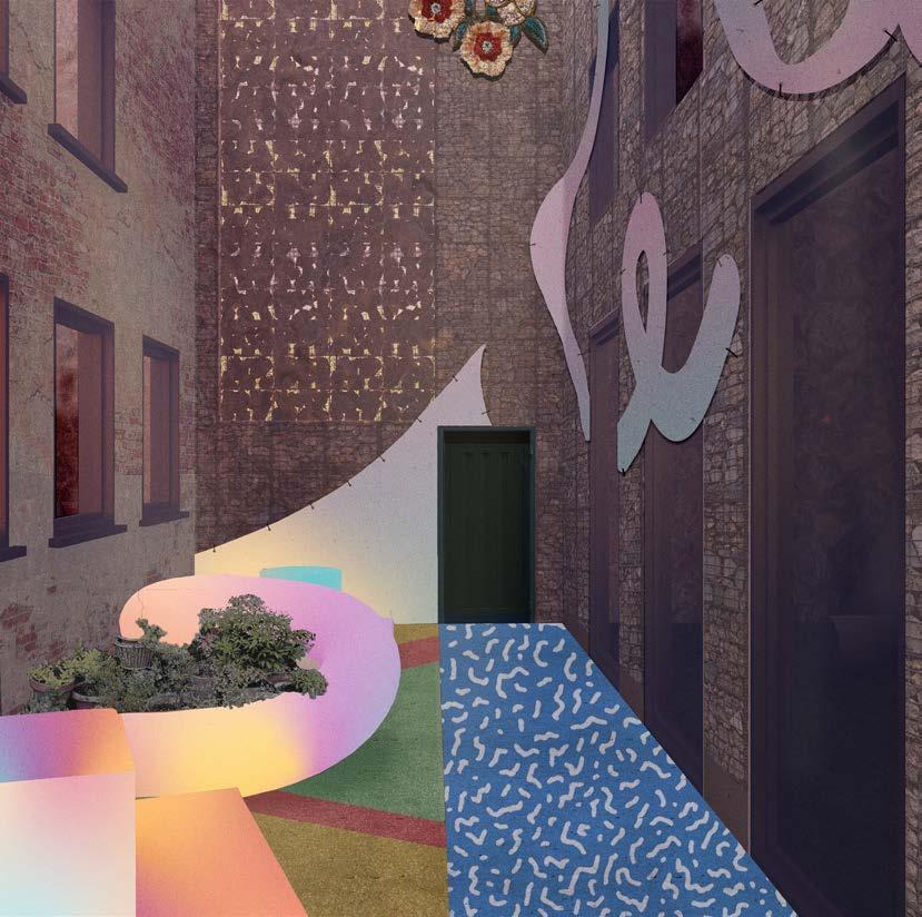
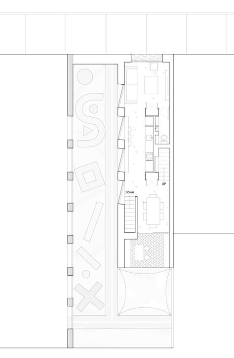
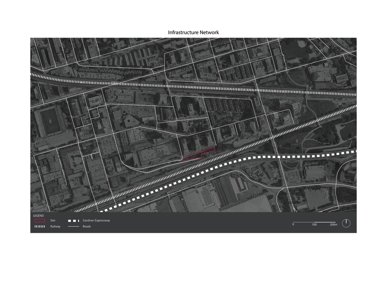
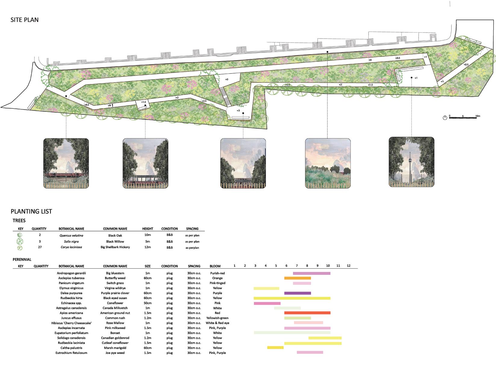
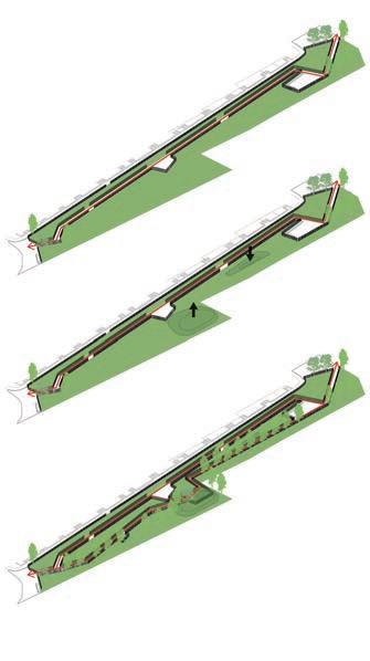
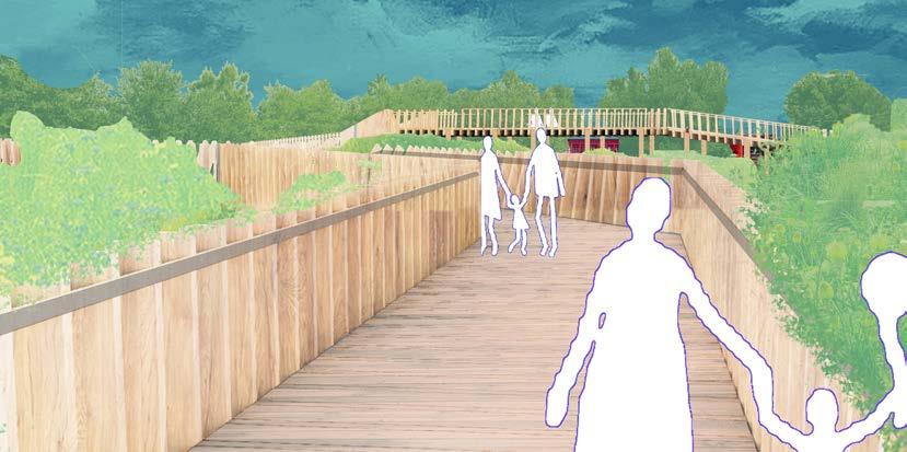
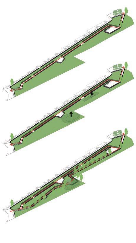
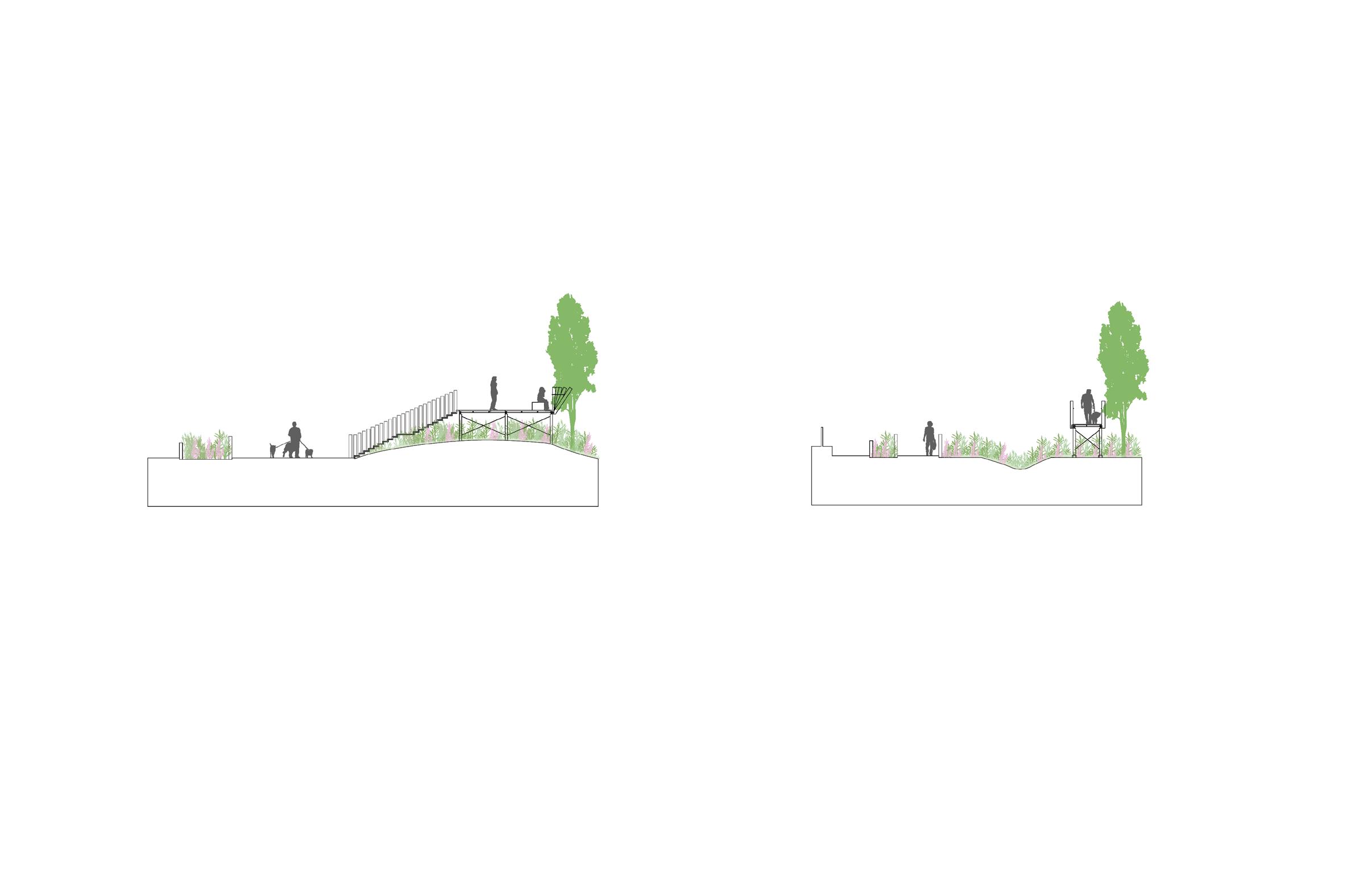
Winter 2023, Academic exploration, Semester Long Study, Collaborated with Hsuan-Fen Hsu Prairie in Liberty Village
n A
Previously an industrial lot that historically distrubuted ammunition for WWII efforts, the surrounding Neighborhood has developed into a condo dominated neighborhood, while the site remains contaminated. Bordered by the CN Rail/Gardiner Expressway on the south, the rail is stigmatised as loud, dirty and obstructive. We argue the passing by trains as a core identity to the site and wanted to highlight its movement. In parallel we noted that prairies once existed as a flourished ecosystem within Ontario, and are naturally very prominent in phytoremediation practices. It’s estimated less than .5% of the prairies remain. as the grass bows to the wind, and the trains run through the day, the prairie park is a lookout that recontextualises the rail line as something to be celebrated.
Phase
Urban Elements for Ryerson University
March 2019, Personal project, One month study, Individual Urban Elements for Toronto Metropolitan University
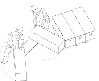
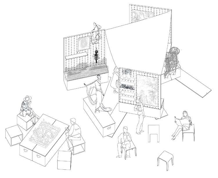
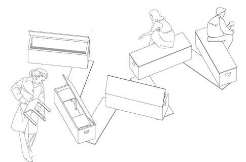
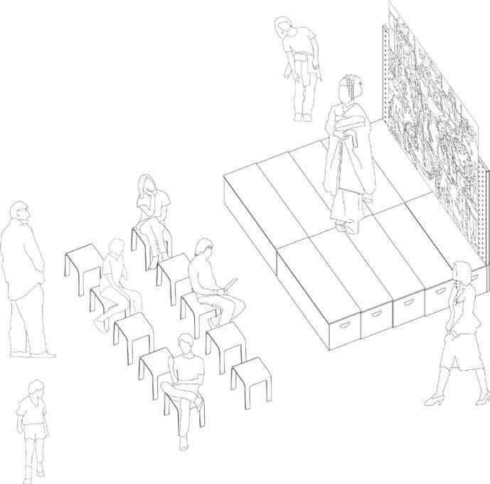
This project proposes adaptive furniture in the form of modular accordion benches that contain supplies to create temporary stages and scenes. The benches and equipment are made of accessible materials such as plywood and cabinet hinges, and are able to be constructed using equipment found at the school. All student [bodies] should be provided resources for demonstration and participation!
Tasked to provide an information kiosk for students on the Ryerson campus, this project proposes adaptive furniture in the form of modular accordion benches that contain supplies to create temporary stages and scenes. The benches and equipment are made of accessible materials such as plywood and cabinet hinges, and are able to be constructed using equipment found at the school. All student [bodies] should be provided resources for demonstration and participation!
4.
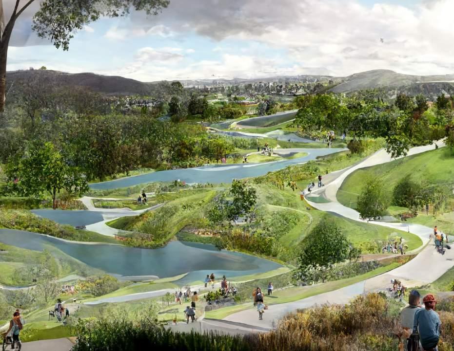
Generative Landscapes for Drought Resilience [WIP]
Winter 2023, Academic-Personal project, Collaborated with Natalie Chan-Individual
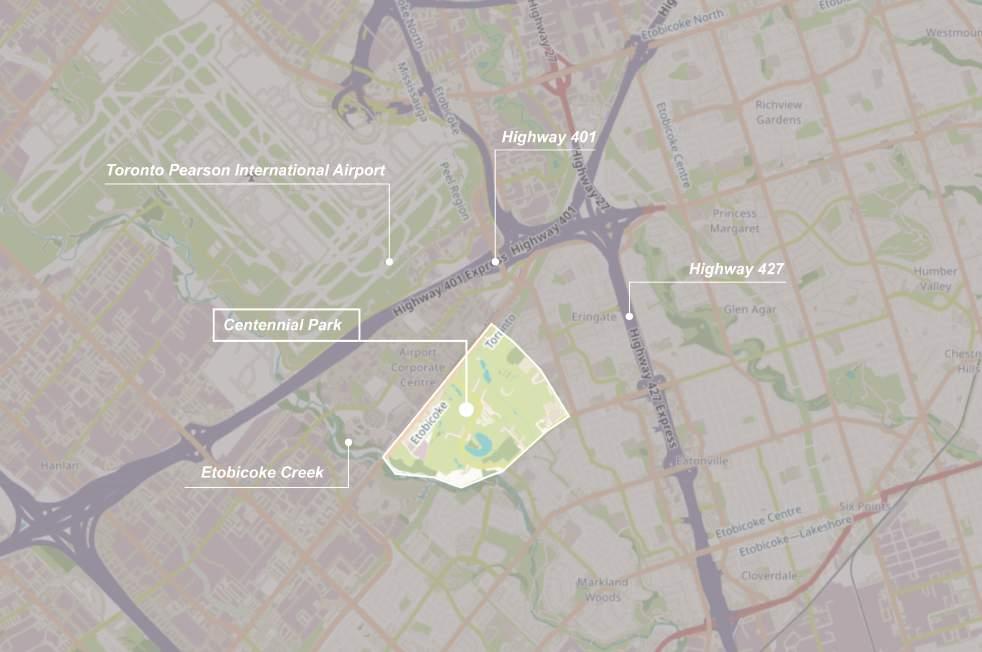
With the urgency of climate change, water is becoming less secure in our rural and wild landscapes. In Canada, physical water scarcity leads to severe events such as food shortages and wildfire devastation. Leveraging the access to 3D modeling software Rhinoceros and Grasshopper, genetic algorithms, and latent diffusion infrastructure and resilience strategies can be optimized and quantified, repeated and iterated over large landscapes and regions to maximize strategic potential to help combat climate change. I want to take the extra step of not only finding ideal strategies and geographical placement that can improve the water security of a land, but also make them engaging landscapes for the community and wildlife.
Test site selection:Centennial Park for its proximity to large surface area of hardscape and receives the surrounding contaminated run-off
Current Designed Logic and goals
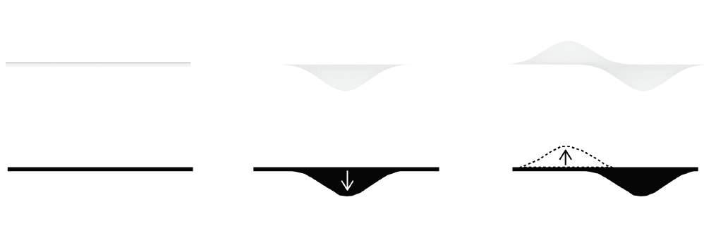
Constraint: No excavated earth shall leave site Maximise: Surface Water retention with Cut
Minimise: Excavation volume of soil
TOP 3 CHOICES COMPARISON
Design Logic
Create a series of cut and fill operations on a site to increase the amount of surface water on site
Project Objective
A successful design solution should be able to achieve a balance between the 3-goals:
1/ The typography is munipulated with cut & fill to maximize surface water retention
2/ the volume of land/soil has to be the same within the site boundary
3/ A successful design solution is also determined based of minimized excavation (volume of typography changed)
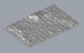
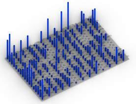
Volume of water onsite - Note the original surface run off accumulation Creek Boundry
On the iterations in which less surface site, slowing down surface and ground water security on site. volume
original Volume formed clusters - areas prone to flood due to
water flows into the creek, more water is retained on water movement during rainfall events allows for better water
Cut and fill is rudimentary. Land use changes such as planting strategies provide ground and surface water security and are possibly less invasive. These Algorithms have the OPPORTUNITY to provide interesting land use patterns for water security in rural contexts.
Climate strategies hold designed value, these infrastructure and land changes have endless opportunity to improve the surrounding community to be engaging and beautiful, improving the landscape quality for the local community and its ecosystem to be more reslient in times of water crisis and forest fires.
FINAL IMAGE 1
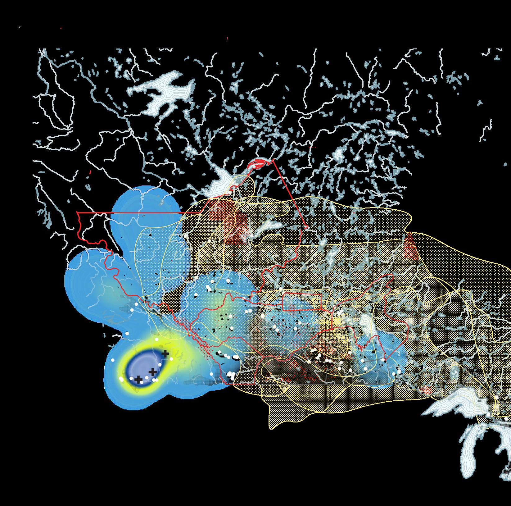
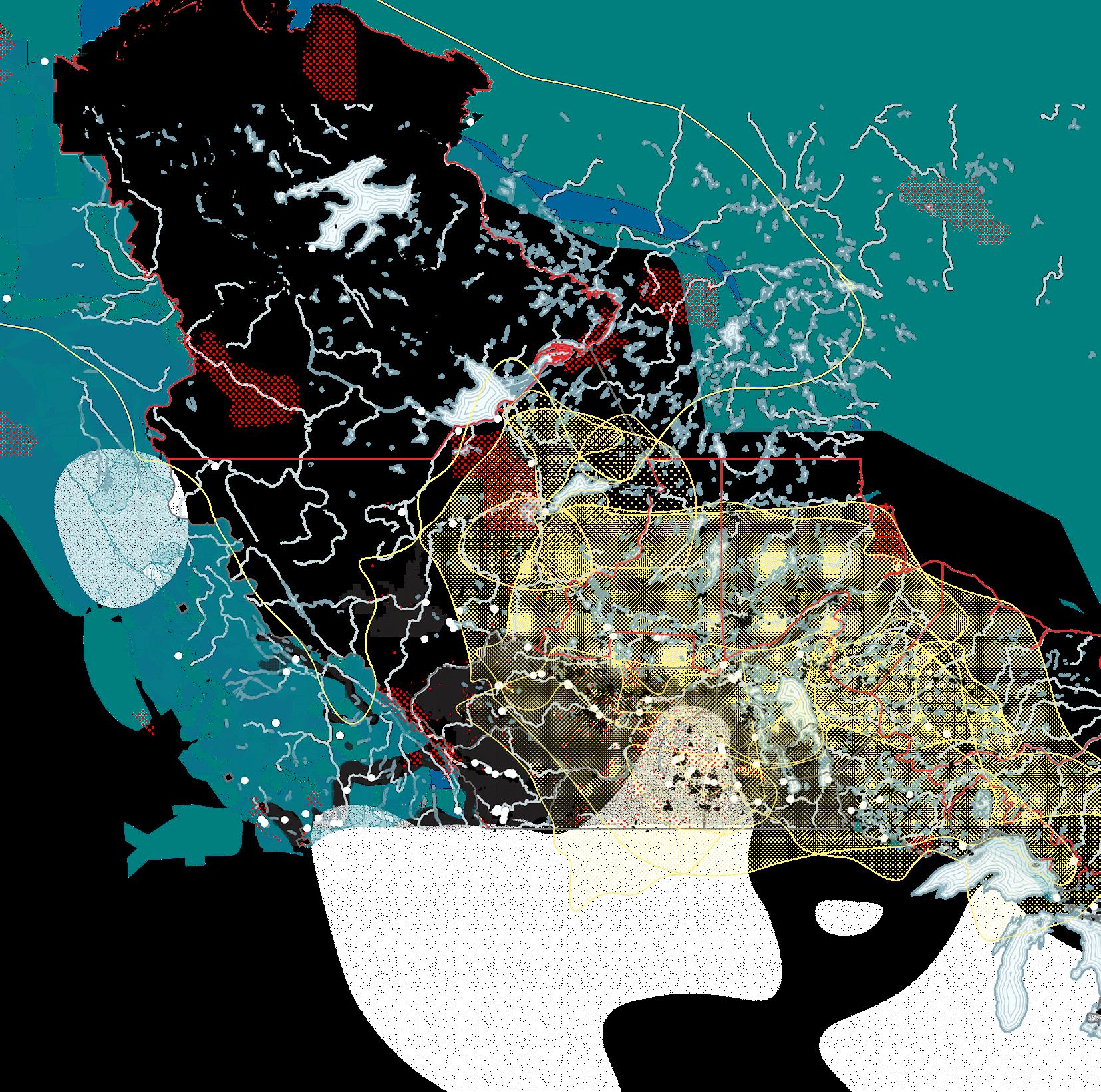
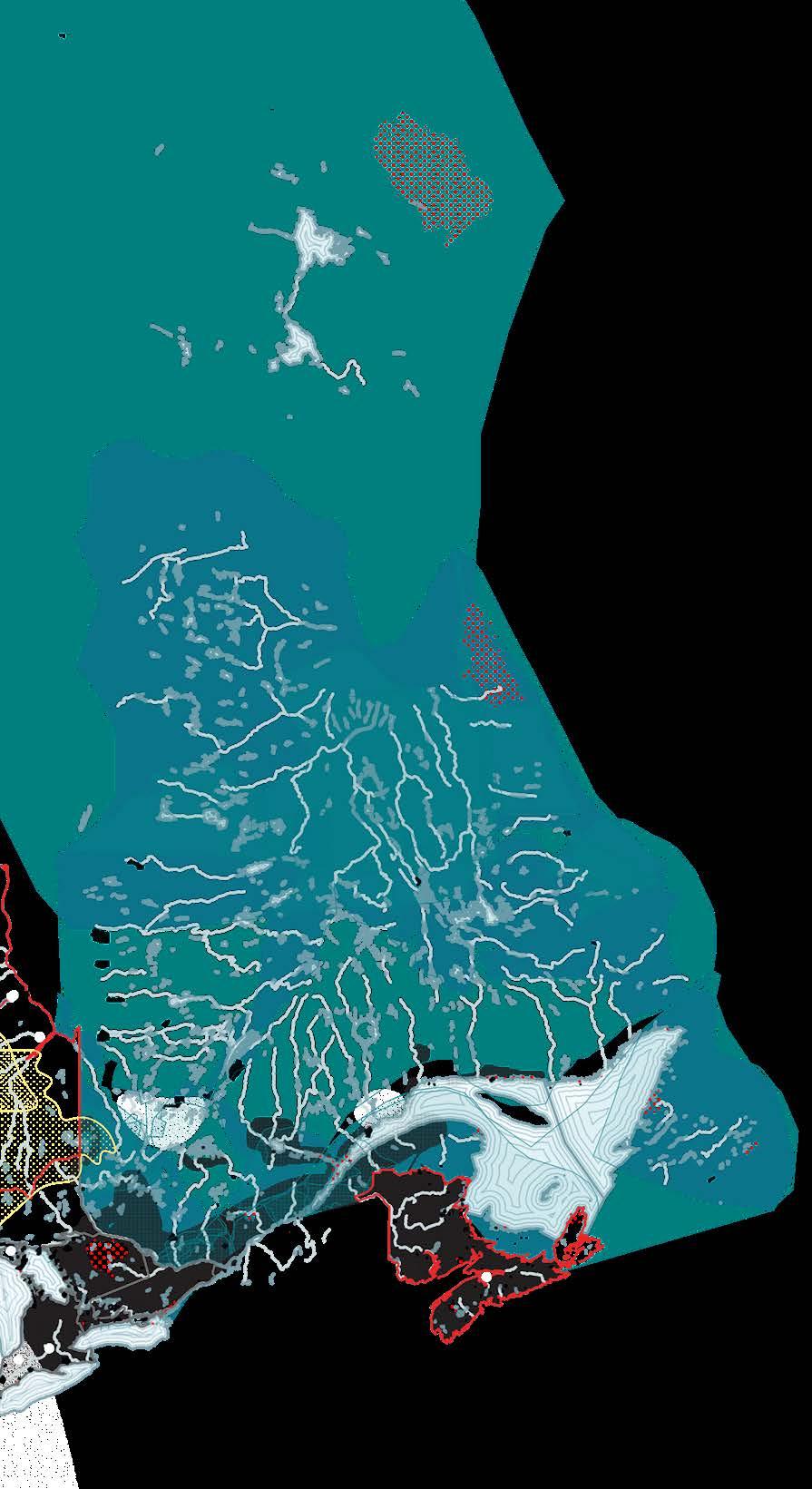
Counter Mapping the Dominion Land Survey
M.Arch Thesis exploration, 2023 - 2024, Individual Thesis Excerpts:
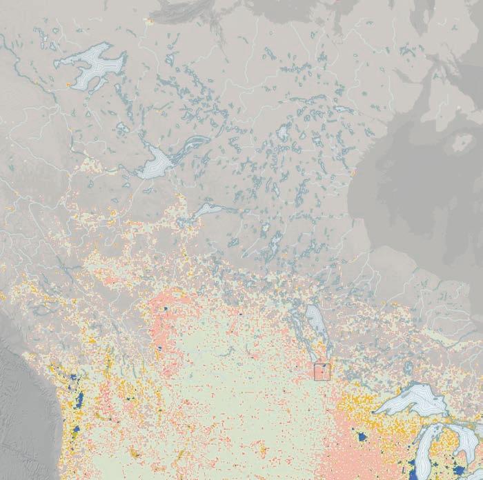
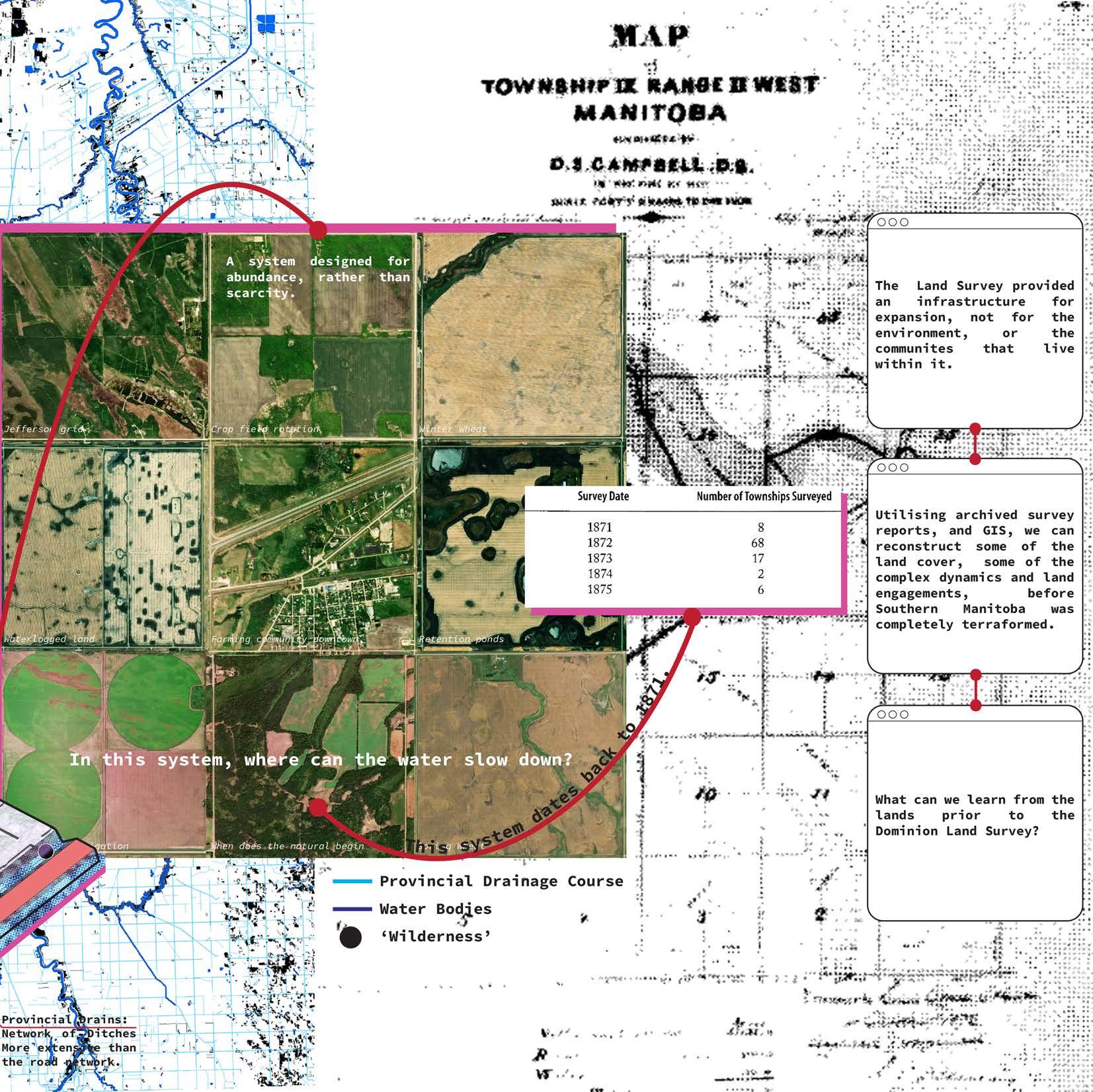
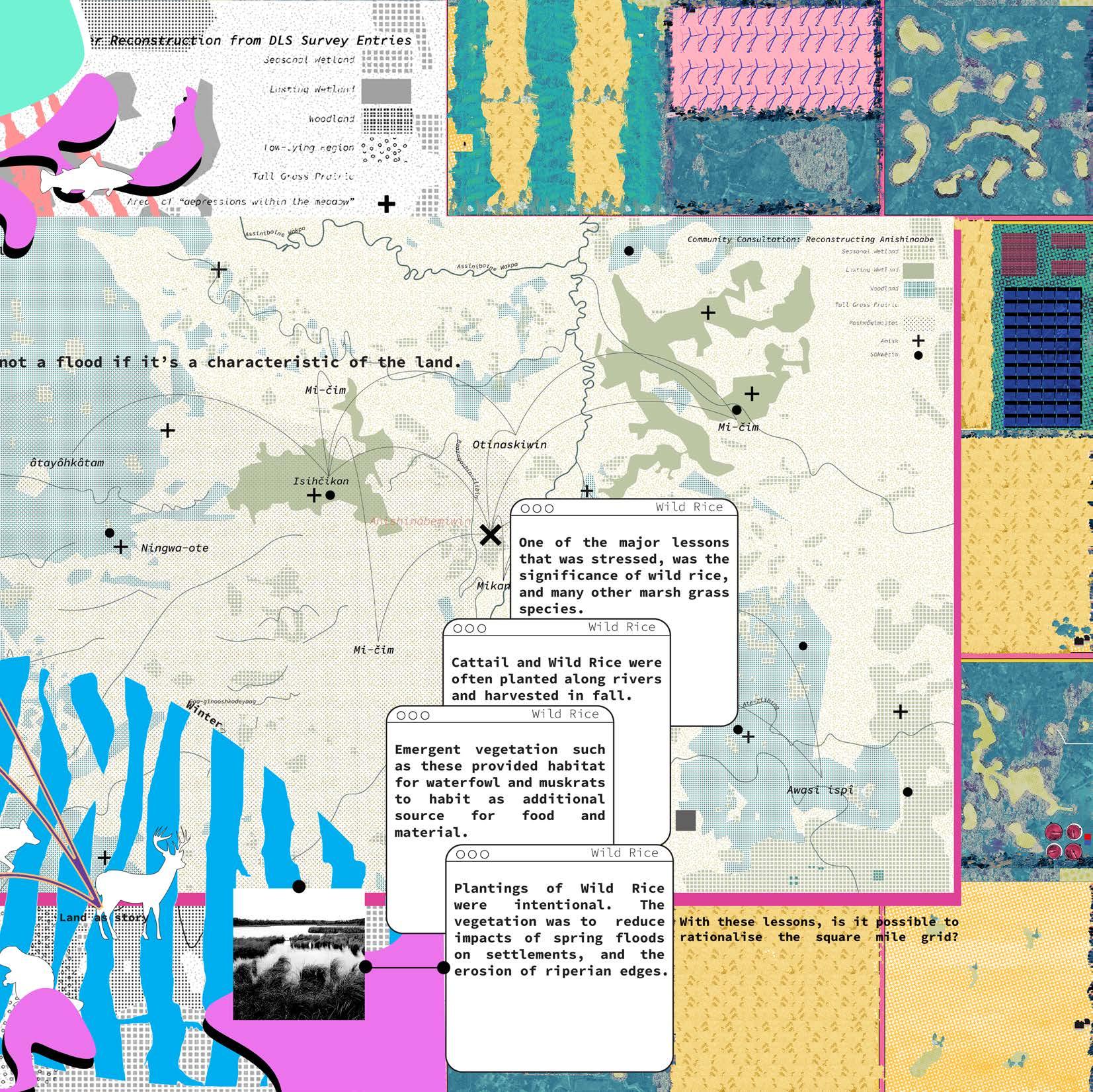
Disregarding terrestrial ecologies, from 1871-1930 the Dominion Land Survey subdivided the Canadian West into square-mile grids, implementing a colonial infrastructure that continues to dominate the Canadian West. The grid dictates much of the land use patterns, management techniques, and environmental policies in Western Canada’s agricultural belt, exposing an increasingly fragile landscape in the wake of climate change. Assuming the form of an atlas, this thesis initially juxtaposes non-settler narratives against the intrinsic rhetoric of the Dominion Grid, revealing stories and perspectives neglected from our history books.
Sahoyúé-§ehdacho
NÊHIYAW-ASKIY
Policed bison range in Canada
Sipi,
Michel Band
Michel Band
Rapid Conquest of the West: 1905 Infrastructure of Death and Assimilation
Residential Schools
Policed Public Land
Lost Tribal Band Ranges
First Nations Reserves
Private Settler Land
Treatise areas
Railworker Camps
Speculated Chinese Railworker Deaths
Many Few
“...to separate the savage parent from the child...and to kill the Indian within.”
-The Davin Report, 1879
“I found these people living in big tenement houses and large numbers crowded in individual rooms and underground, without proper ventilation, with bad drainage, and a great deal of filth, the odors from which were horrible. you go into a room which was originally higher than this room. They will have bunks all around; sometimes they will have a platform in one corner, extending over one fourth of it, not more than three or four feet in depth, and numbers of them will sleep on that. I found cases of smallpox concealed in places like that.”
-John Meares, 1876
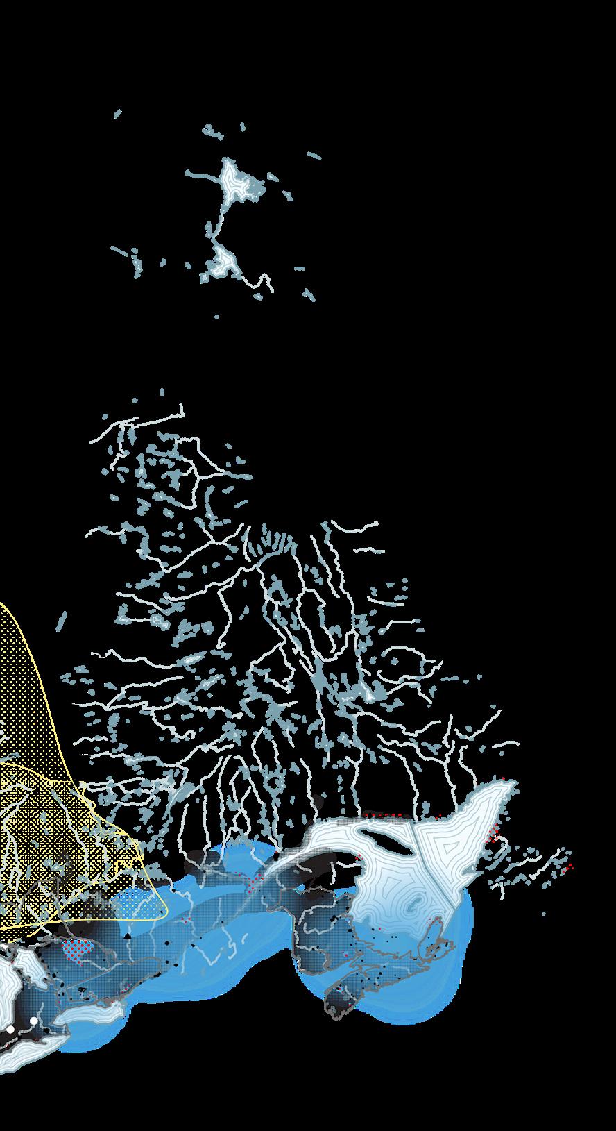
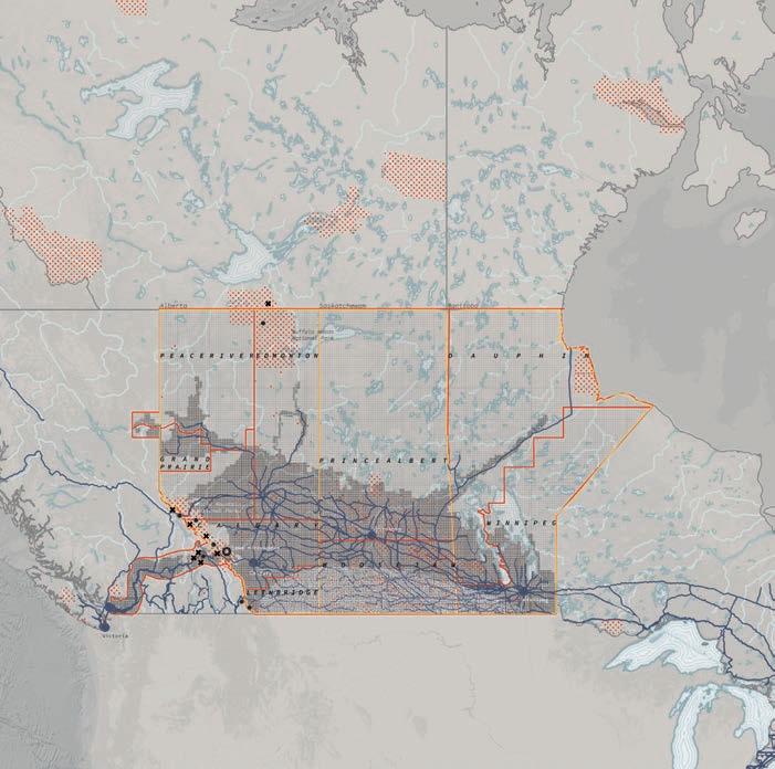
1930s Settled Land: Displacement and Ecocide
Residential Schools
Policed Public Land
Lost Tribal Band Ranges
Tribal Band Ranges
First Nations Reserves
Private Land
Dust Bowl Extent
Treatise areas
Extraction Dump Sites
the Indian Act made attendance at Indian Residential Schools compulsory for Treaty-status children between the ages of 7 and 15.
“He found his son, frozen to death.”
Wahgoshig Mattagami
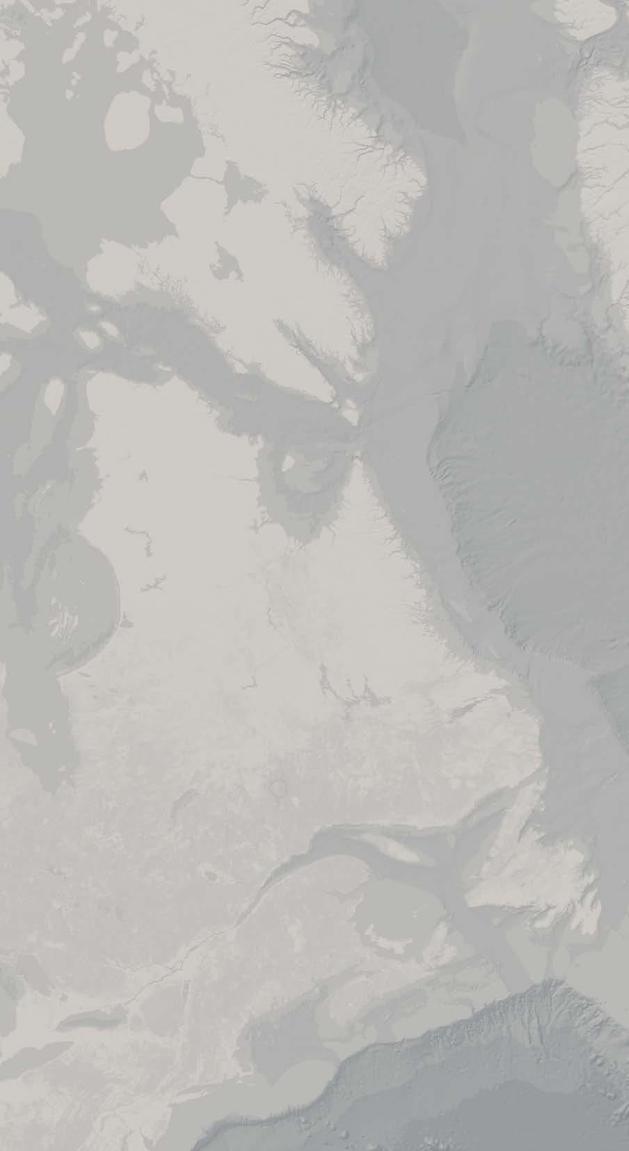
1930s Settled Land: Final Extent of DLS and Private Land
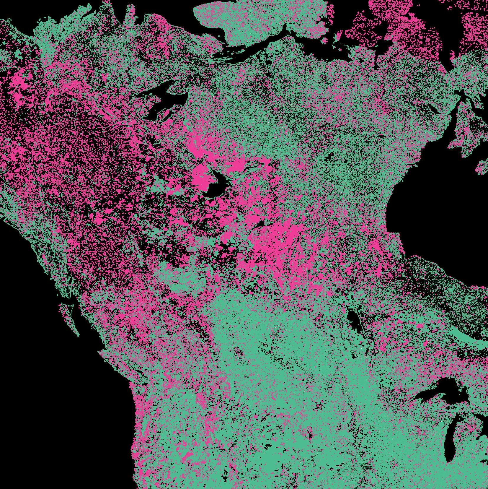
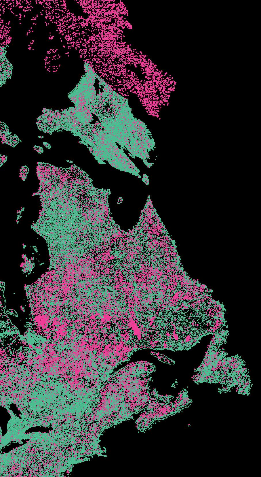
Indirect Anthropogenic Changes
Direct Anthropogenic Changes
Indirect Changes refer to cover change and loss due to human influence after an anthropogenic event. This includes such as invasive species, acid deposition, unprecedented forest fires and invasive species.
Direct Changes refer to direct human contact and alteration of land to suit their needs. This includes actions of logging, mining, agriculture and urban development.
This data was created by reconstructing landcover of the 1500s using FORE-SCE and using a LULC two raster image change detection of 2020 land cover information provided by USGS, in which anthropogenic Biomes are interpreted as ‘Direct Anthropogenic Changes’.
Anthropogenic Biomes, 2020