
Taradale 29 February 1988
Aerial Photos: Frances Girvan Pilot: M. McLure

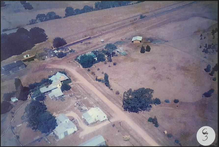
Photo C2: Peg McEwen’s (centre with dam) & Taradale Hall (top left)
Photo C3: Taradale railway Station (top left corner) & Penno’s shearing shed (bottom left corner)
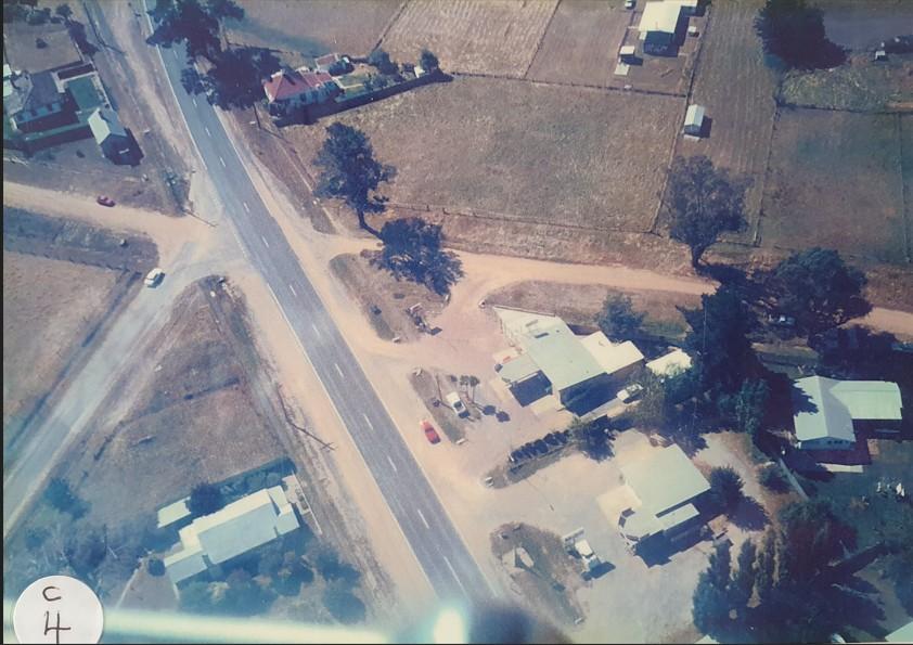
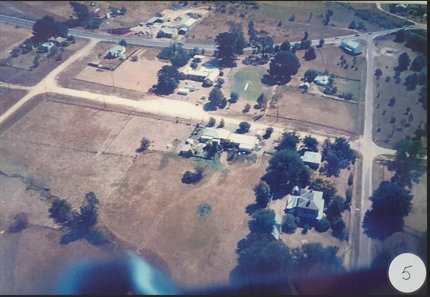
Photo C4: Two service stations bottom right corner) with war memorial in front of Mobil Station (Elaine Grant proprietor)
Photo 5: View from above viaduct looking back over the school (top centre) and “Belnie” double story house, De La Beche Street (bottom right)
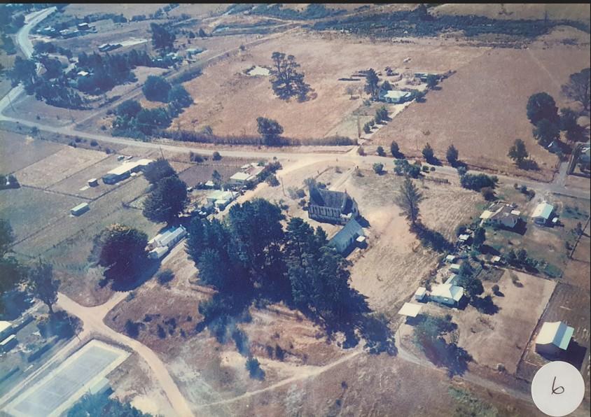
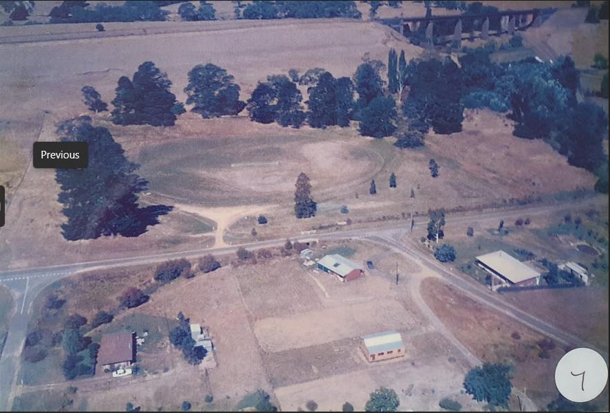
Photo 6: Aerial view of Taradale. Holy Trinity Church (centre), Old tennis courts (bottom left)
Photo 7: Looking from west to east towards cricket ground and the viaduct
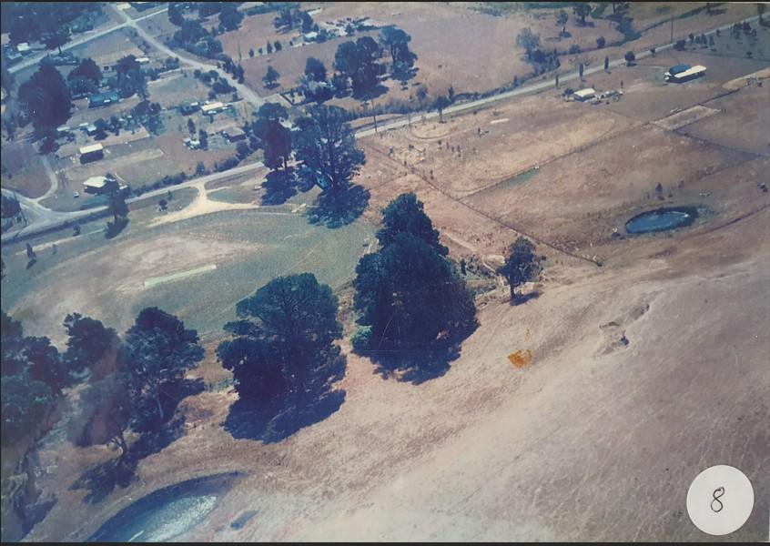
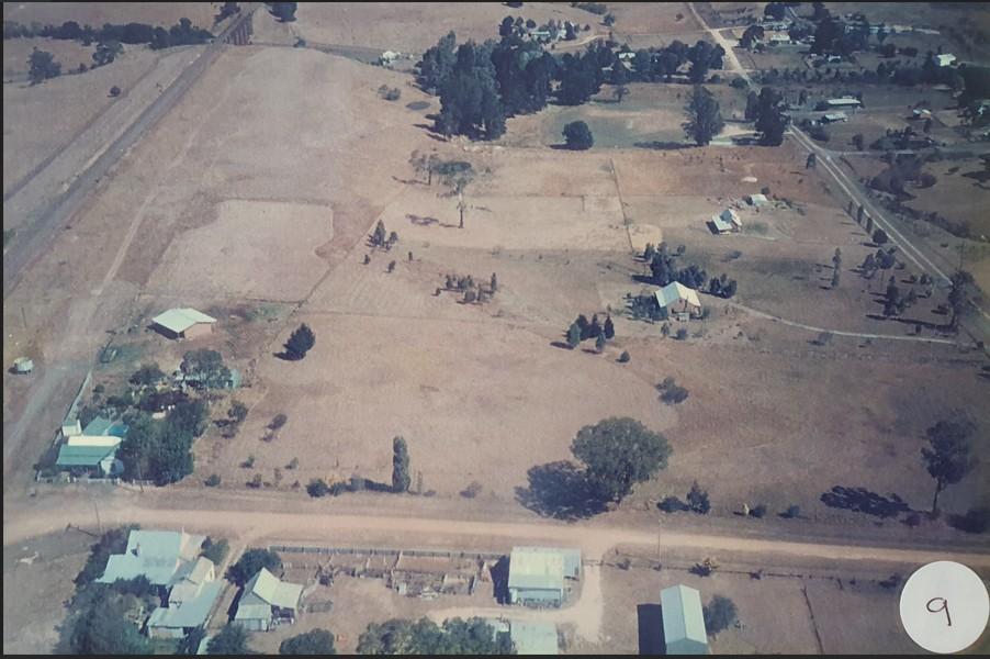
Photo 8: Looking towards the west from above railway line and over the cricket ground
Photo 9: J & J Jerman house centre left with new roof. Penno’s shearing shed (bottom in Station Street)). Railway line (no Talbots Lane in 1988) & viaduct (top left)
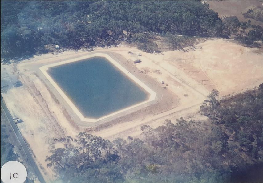
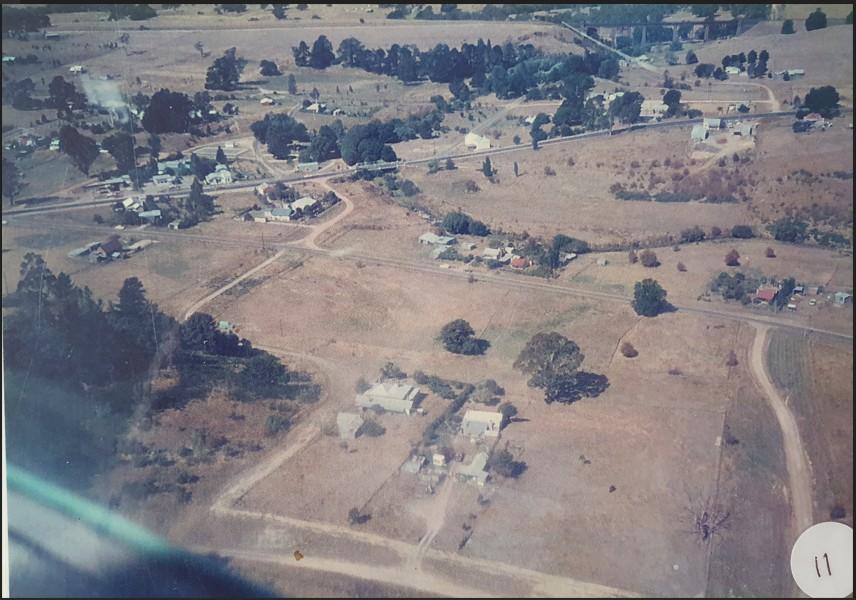
Photo 10: Taradale Water Basin (happy to hear from anyone who knows where this is)
Photo 11: Hookey House “Rose Villa” & McAlpine Cottage (centre bottom). Centre left Cribbes Stables. Railway line & viaduct (along the top & top right)
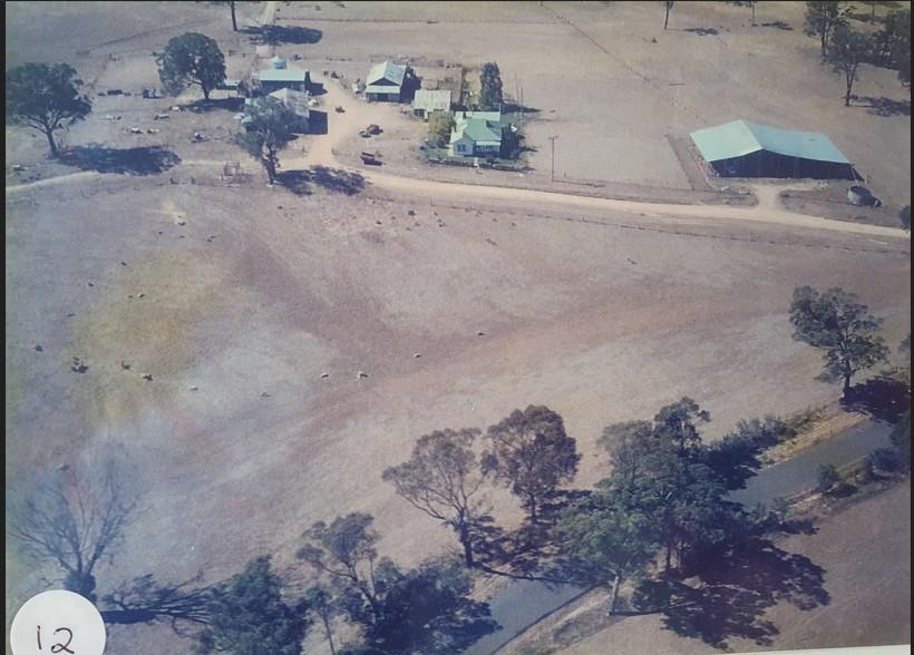
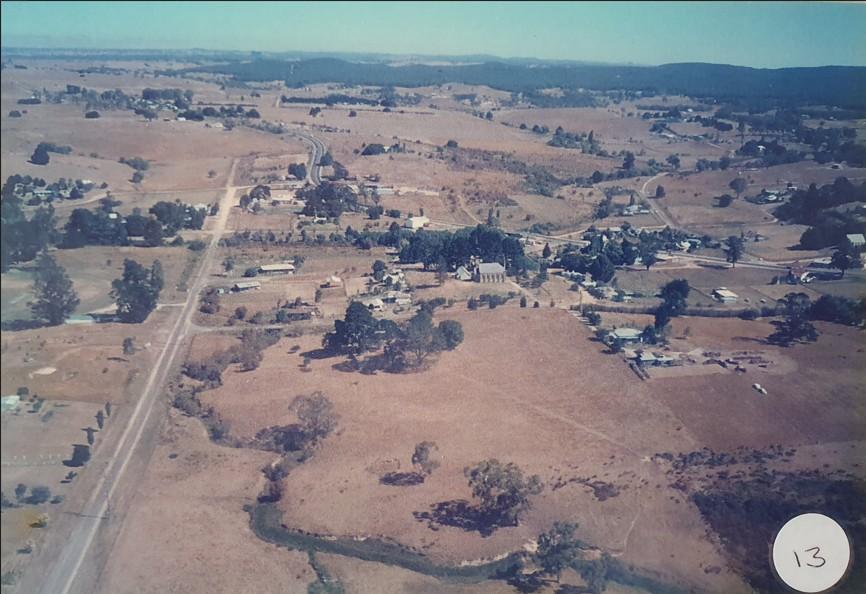
Photo 12: “Woodthorpe’, N&F Girvan farm, Metcalfe
Photo 13: Looking south, Left hand side is Potts Rd/Lyell St & Holy Trinity Church (centre). Kangaroo Creek (foreground)
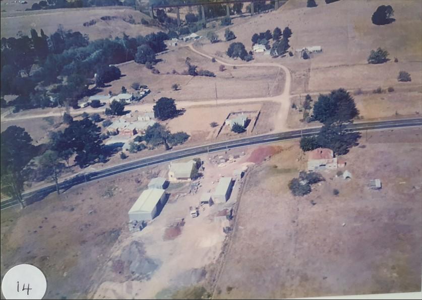
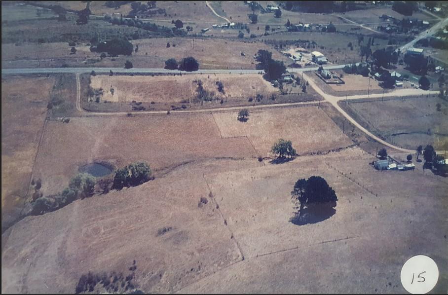
Photo 14: Maltby’s slate yard (now Castlemaine Slate) & school looking towards viaduct. School residence (centre), Right centre is the O’Keefe house (red roof) which has since been demolished.
Photo 15: Slate Yard & school (top right). Greg Nener’s house, Charles Street (centre right)
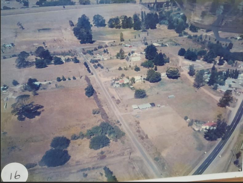
Photo 16: Looking east towards viaduct. Davy Street running through centre of photo and highway bottom right