EXPERIENCE
CARMILA
CLAIRVIEW CLERMONT
COPPABELLA
DYSART
FLAGGY ROCK
GLENDEN
GREENHILL
ILBILBIE MIDDLEMOUNT
MORANBAH
NEBO
ST LAWRENCE

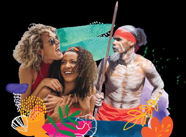
CONTENTS 03 Introduction 04 Find A Road Less Travelled 05 Regional Map 06 Driving Routes 07 Experience Isaac Coast 12 Experience Inland Isaac 18 Peak Range National Park 22 Experience the Road Less Travelled 28 Experience The Great Inland Way 30 72 Iconic Isaac Experiences Back Cover Contacts Isaac Regional Council acknowledges the Koinjmal, Widi , Birriah, Barada Kabalbara Yetimarala, Jangga, Barada Barna, Western Kangoulu and Wirdi Peoples as the Traditional Custodians of the lands and waters throughout the Isaac region and their enduring cultural connection to country and community. We pay our respect to the Elders past, present and emerging for they hold the stories, culture and traditions of Aboriginal and Torres Strait Islander Peoples. 2 EXPERIENCE ISAAC
READY TO EXPLORE THE ROAD LESS TRAVELLED?
STEP BACK IN TIME AND EXPERIENCE ISAAC’S UNSPOILT NATURAL ATTRACTIONS, VAST OPEN LANDSCAPES, RICH COLOURS AND VIBRANT COMMUNITIES.
We invite you to create your own Isaac story, re-energise your spirit and soothe your soul in nature reserved just for you.
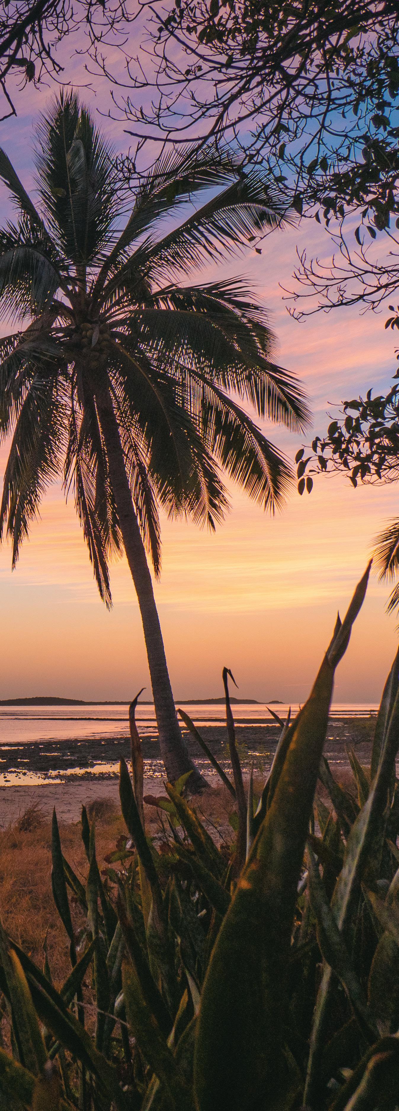
From the deserted islands and seascapes of the Coral Sea to the big skies of the western plains, our region offers travellers an idyllic escape from the every day.
www.isaac.qld.gov.au
DON’T FORGET...
Tag #ourisaac on your social media photos and follow us.
www.facebook/isaacregionalcouncil @isaacregionalcouncil
Cape Palmerston National Park 3 WWW.ISAAC.QLD.GOV.AU
FIND A ROAD LESS TRAVELLED AND EXPLORE THE SCENERY
Isaac has witnessed the affluence of the famous Queensland gold rushes, weathered the devastation of floods and cyclones, endured endless years of heat and drought, seen shifts within agricultural and aqua-cultural pursuits, whole townships shift from one location to another, and found fame and fortune once again in the precious offerings of Mother Earth.
All of this has created a region unique in charm and a character-growing attraction for visitors keen to explore the road less travelled on their journey through Queensland. It’s a place where traditional country qualities live on within modern, vibrant communities.
The best way to explore Isaac is by car during the cooler months of May to October. Contact one of our Council offices to find out more (details on the back cover).
CHARTERS TOWERS REGION
BARCALDINE REGION
4 EXPERIENCE ISAAC

MISTAKE CREEK
WHITSUNDAY REGION
MACKAY REGION
GLENDEN
Mount Britton
Lake Elphinstone
COPPABELLA
MORANBAH
KILCUMMIN
Clermont Historical Centre
CLERMONT
Theresa Creek Dam
Peak Ranges
Lords Table Mountain
Hoods Lagoon Piano in the Tree Gold Fossicking
Copperfield Chimney
CENTRAL HIGHLANDS REGION
VALKYRIE
Nebo Museum
NEBO
ILBILBIE
LOTUS CREEK
DYSART MIDDLEMOUNT
CARMILA
MACKAY CLAIRVIEW
St Lawrence Wetlands and Recreation Grounds
GREENHILL
Yarrawonga Notch Point Dugongs
ST LAWRENCE
CLARKE CREEK
MACKENZIE RIVER
LIVINGSTONE SHIRE
ISAAC REGION
DID YOU KNOW?
The region covers 58,709 square kilometres of fertile plains, rich soils, beaches and coal mines in the mineral-rich Bowen Basin.
5 WWW.ISAAC.QLD.GOV.AU
DRIVING ROUTES ISAAC COAST, GREAT INLAND WAY AND
THE MINING TRAIL
On the Isaac Coast drive you will discover our quaint beach communities nestled along one of the last remaining relatively undeveloped yet accessible stretches of shoreline on the East Coast. Dugong sanctuaries, remote turtle nesting grounds and uninhabited islands offer a unique opportunity to get back to nature and re-energise the mind.
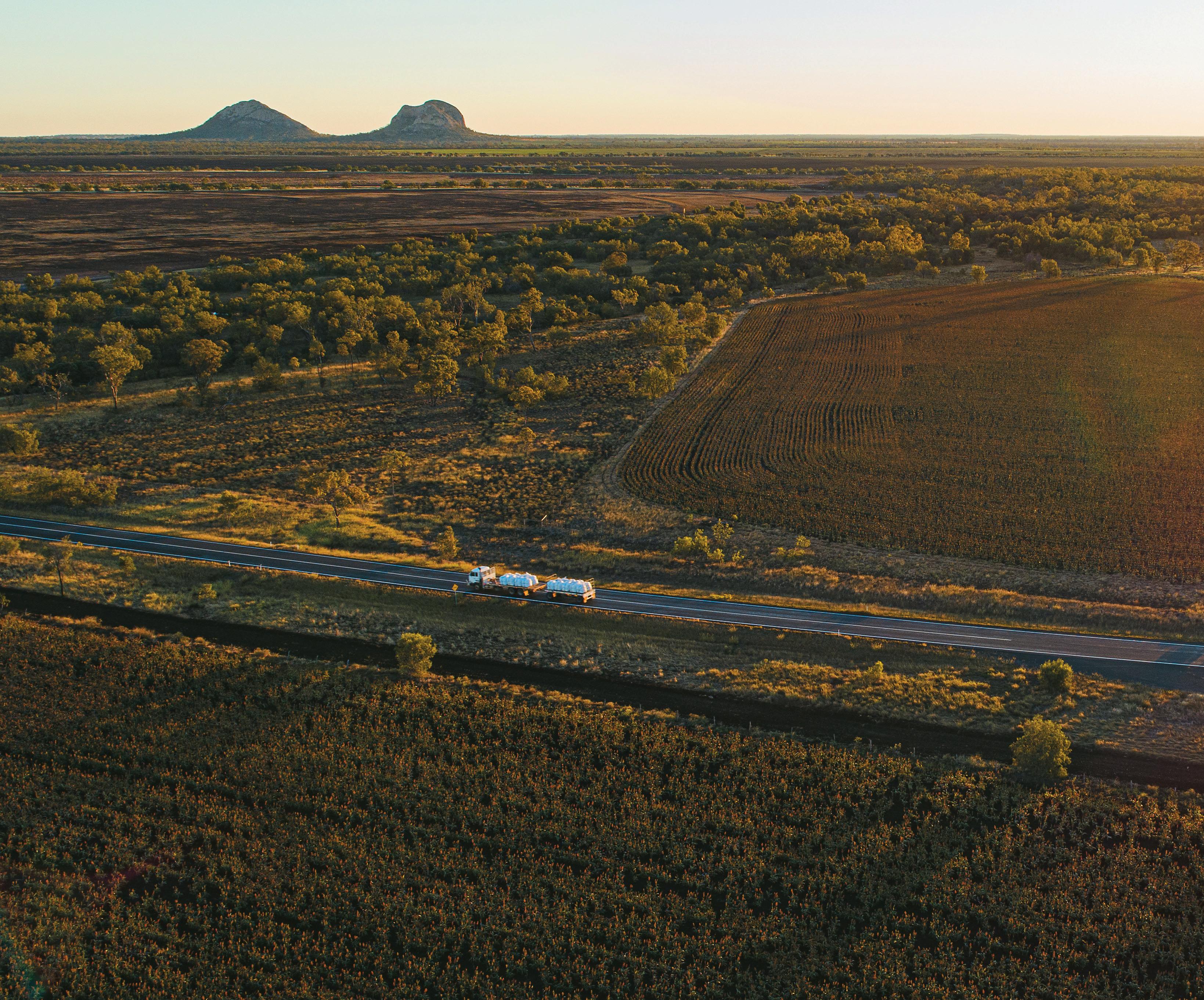
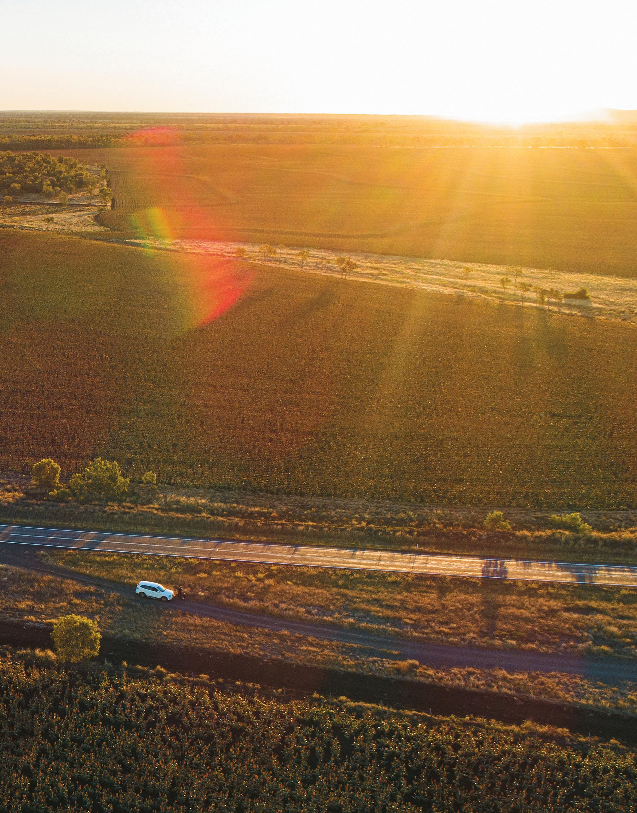
Follow the Great Inland Way, where golden sunflowers line the road with rust-red sorghum, buttery wheat and creamy cotton crops, while majestic mountains and lava plugs form spectacular backdrops on the horizon.
The Mining Trail, a 300 kilometre unique selfdrive trail from Clermont to Mackay, will introduce you to wide, beautiful landscapes, historic towns, vibrant mining communities and impressive manmade works.
Isaac region has a number of connecting road networks of sealed and unsealed roads that can be taken for a rewarding off the beaten track experience. For drive route maps visit www.queensland.com and see Isaac Region Visitor Map on page 5.
6 EXPERIENCE ISAAC
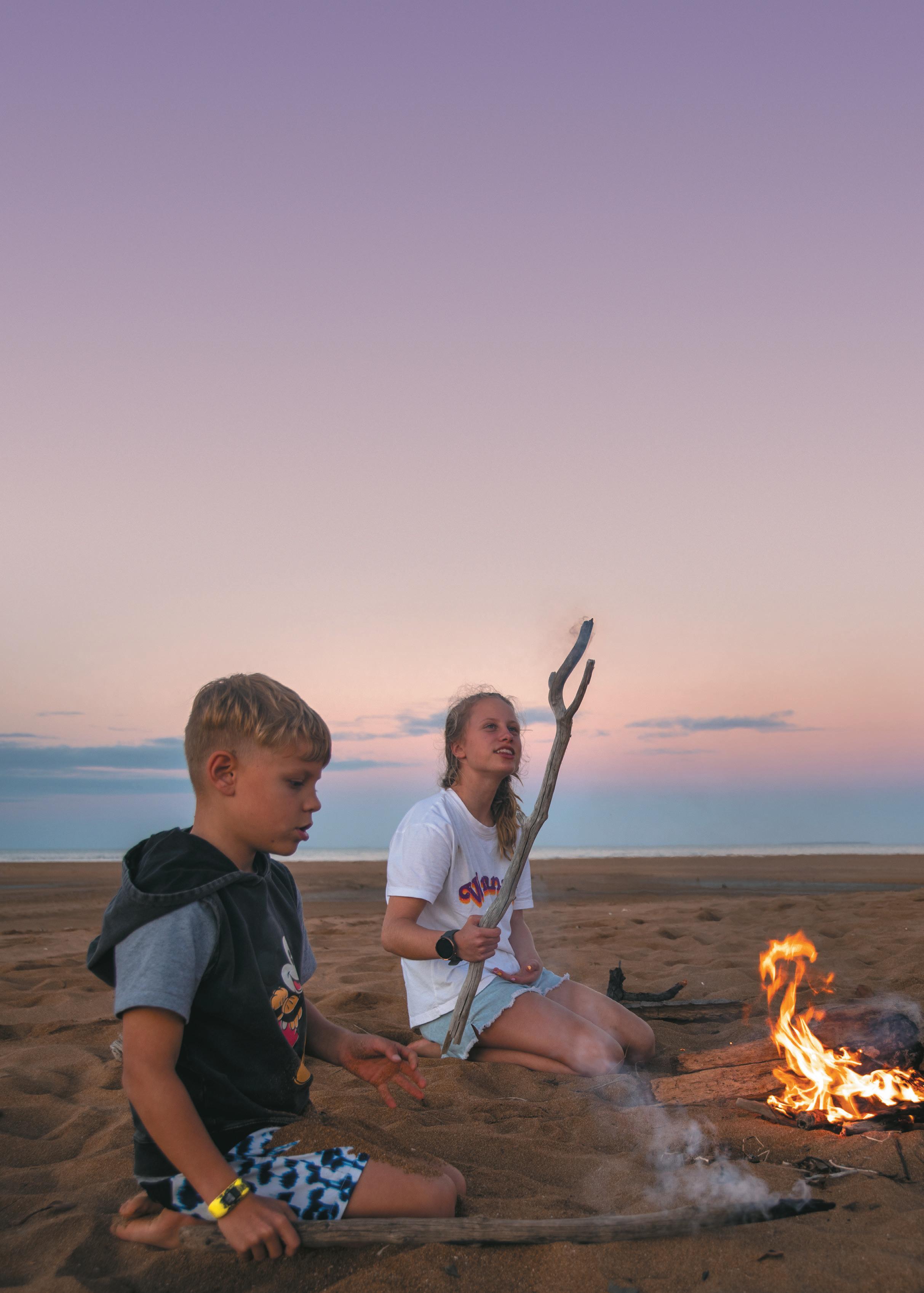
DISCOVER THE ISAAC COAST
From St Lawrence through to Cape Palmerston you can view great wildlife, enjoy fishing, snorkelling, beach walking and swimming opportunities. Some of Queensland’s most picturesque places are in the Isaac region and it is a perfect location for nature lovers to get a glimpse of this relatively untouched paradise.
WAVERLEY CREEK REST AREA
Stop, refresh and stretch your legs as you enter the Isaac Region. Travel just a short distance of 13 kilometres to St Lawrence Recreational Grounds (max 14 nights – small fee applies) – toilets, showers, barbeques, picnic tables and shelters, and a dump point. Water is available. Access to all vehicles.
Please note: No camping is available at the Waverley Creek Rest Area (fines may apply).
CLAIRVIEW
This seaside community is a popular spot for fishing and crabbing. It’s also home to a fully protected dugong sanctuary. Dugongs, an endangered marine mammal, can often be spotted from the shore when they surface to breathe, or in the water, when in a kayak, boat or other recreational vessel. Be sure to slow down your vessel in areas dugongs are known to inhabit.
Exploring Clairview
Wander along the soft sand and set a line straight off the beach.
Watch dugongs basking in their natural habitat.
Relax the day away at one of the many beachside picnic spots.
Use the boat ramp to spend a day on the water and maybe even spot a dugong up close!
Clairview 7 WWW.ISAAC.QLD.GOV.AU
THE ISAAC COAST
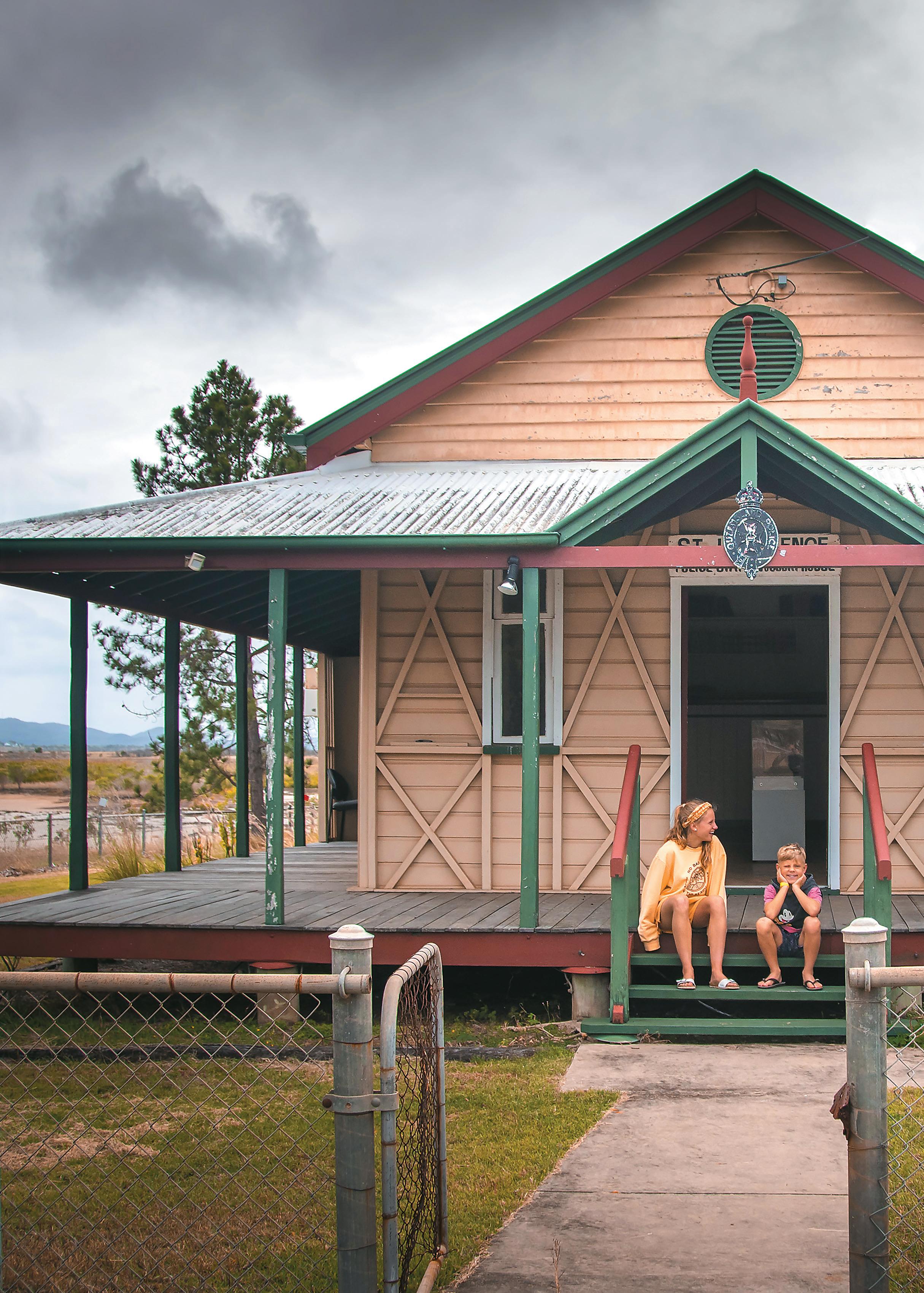
ST LAWRENCE
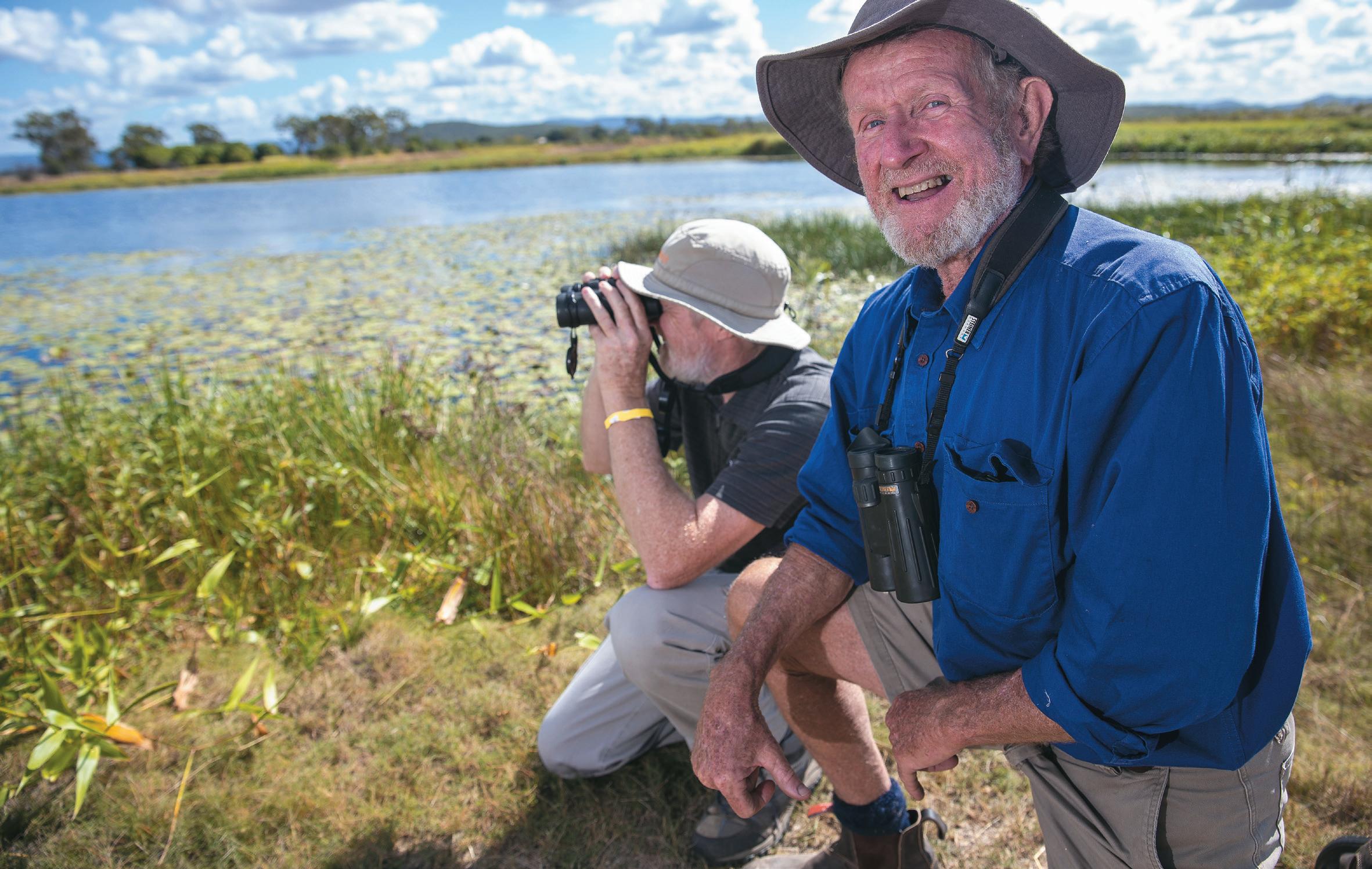
St Lawrence is a quaint, historic town originally built to service the Customs Office for the Port of St Lawrence. It is one of the oldest towns on the Queensland Coast and provides exciting fishing and crabbing opportunities in the nearby creeks and inlets. A bird-watcher’s paradise, the St Lawrence Wetlands are listed in the Directory of Important Wetlands in Australia.
Exploring St Lawrence
Visit the historic, heritagelisted Anglican Church, built in 1898.
Visit St Lawrence Cemetery, the cemetery has many graves dating back to the mid 1800s. A grave register is held at the Council Office and Library.
Discover the St Lawrence Wetlands listed in the Directory of Important Wetlands in Australia. The Wetlands’ depth varies, being at its highest between January – April and lowest between September – November.
Freshwater fish habitat –fish ladders.
Abundant birdlife is present at the Wetlands including nationally threatened waterbirds –92 bird species have been recorded in the area.
Camp at the St Lawrence Recreation Grounds with views of the wetlands for a few
nights’ mud crabbing (max 14 nights), toilets, showers, barbeques, picnic tables and shelters, and a dump point. Water is available. Access to all vehicles.
Drive up Connors Range to Schneider’s Inn Lookout to experience panoramic views of the wetlands, coastline and islands (not recommended for caravans).
Join us as one of nature’s finest wetlands bursts into life! St Lawrence Wetlands Weekend is held on the 2nd weekend of June each year and will tantalise your taste buds, invoke creativity and teach you about a nationally significant coastal wetlands right in our backyard. Trek through the bush for an immersive experience as you tour the wetlands and learn more about endangered birdlife, turtles and reef. Get hands-on and artistic with nature weaving and arts workshops. Enjoy a delicious bushman’s dinner, fresh local chilli mud crabs and taste our finest regional produce at this emerging festival. Make friends with nature and bring the family, with camping available onsite for only $12.50 a site, per night. Vist https:// www.isaac.qld.gov.au/ Community/St-LawrenceWetlands-Weekend for more information.
8 EXPERIENCE ISAAC
FLAGGY ROCK
The recreational campground is set on five acres, is flat to undulating and perfect for overnight accommodation for semi self-contained vehicles only. There is no power available but excellent access for large rigs. Facilities: Electric barbeque, children’s playground and swimming pool.
A fee of $20 (cash) per van, per night applies with a maximum stay of 72 hours. The campground opening times do vary. It is recommended to contact Council’s Customer Service Centre available 24 hours a day, 7 days a week on 1300 ISAACS (1300 472 227) for any updates.
CARMILA
Nestled at the foot of Connors Range, the charming community of Carmila is a blend of beachfront bliss with country character.
The community centre is the major social and sporting hub for the Isaac Coast.
Cane growing is the community’s main industry and is harvested between May and November.
Go off the beaten track at Carmila Beach, an uncrowded stretch of coastline, perfect for fishing enthusiasts with access to the creeks nearby.
An ideal place to launch a boat, otherwise cast a line from land, near the creek mouth.
Sunset fishing is particularly good here for barramundi, mangrove jack, trevally and flathead. Facilities: Camping area (max 14 nights, small fee), toilets, barbeque, picnic tables and boat ramps.
No potable or drinking water available. Visit https://www.isaac.qld.gov.au/ Tourism/Camping-across-Isaac/ Carmila-Beach for more information.
Exploring Carmila
Pull up, bury your toes in the sand and camp for a few nights right on the pristine beachfront.
Launch into the water at sunset from the northern end boat ramp and fish for your dinner (well known for barramundi, mangrove jack, trevally and flathead).
NOTCH POINT, GREENHILL AND ILBILBIE
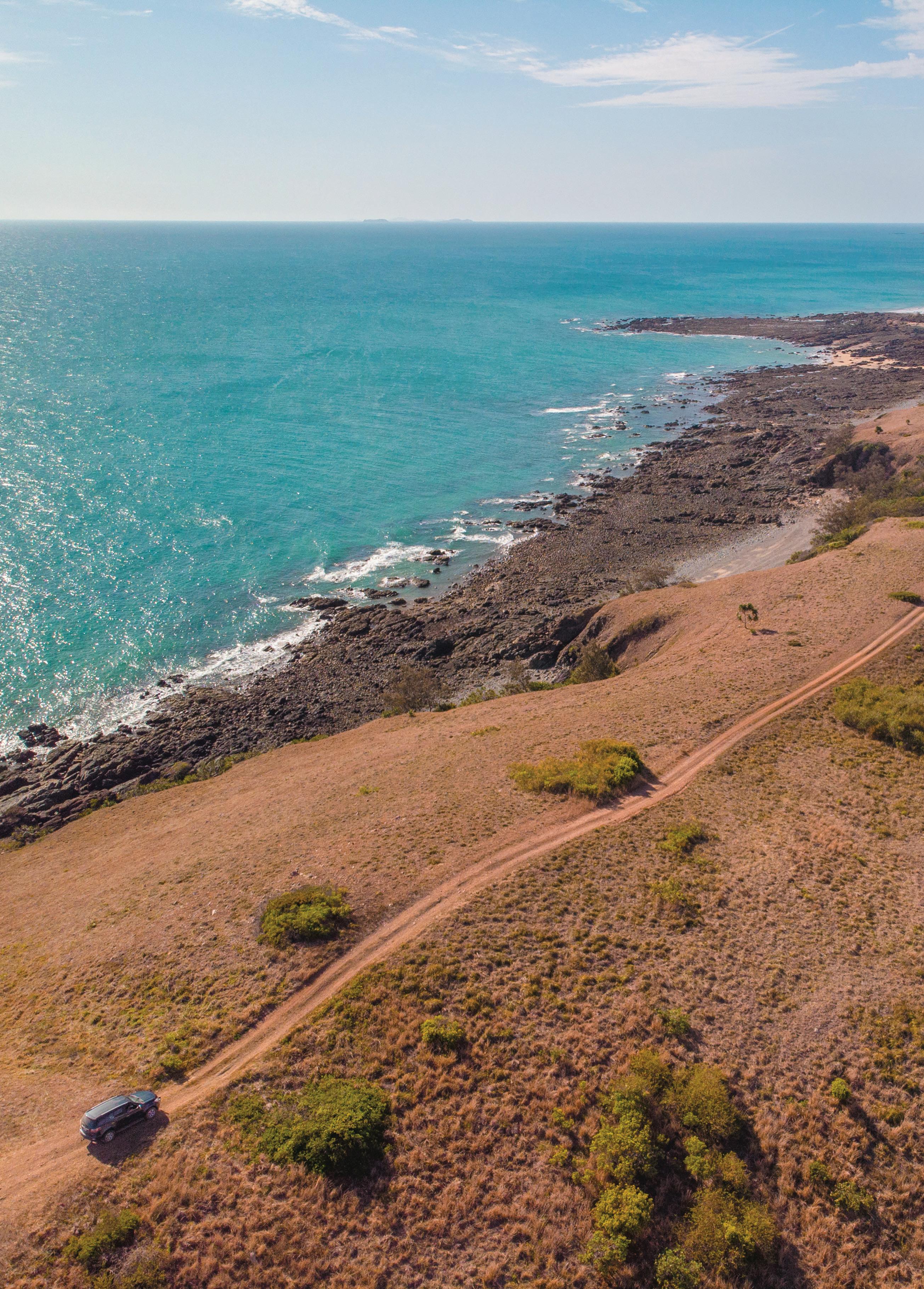
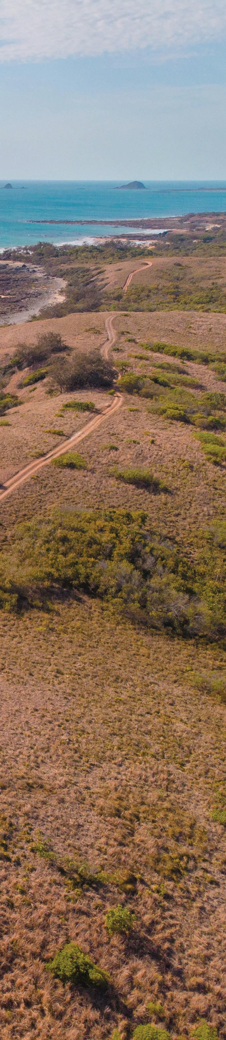
Experience the quiet beauty of the most scenic area of the Isaac Coast. An idyllic location with wonderful views of the ocean and surrounding district. Anglers can enjoy shore, estuary and offshore fishing near local reefs and islands, whilst bushwalkers can take advantage of the magnificent views and beautiful bushland. Access to Cape Palmerston National Park is by 4WD only via Greenhill Road.
Exploring Greenhill and Ilbilbie
Visit Yarrawonga and Notch Point Reserves to go camping, fishing and crabbing. Access to these areas is via high-clearance four-wheel drive only. Yarrawonga and Notch Point Reserve is one of the best fishing spots on the Central Queensland Coast, famous for whiting and flathead.
Cape Palmerston National Park offers spectacular views over the Coral Sea and 4WD opportunities.
DID YOU KNOW?
Turtles nest on local beaches from around mid-October through to January. Please take care not to disturb these wonderful creatures during nesting season.
St Lawrence 9 WWW.ISAAC.QLD.GOV.AU
THE ISAAC COAST
CAPE PALMERSTON NATIONAL PARK
This national park covers 7,200 hectares and boasts sandy dunes, unspoilt beaches and rocky headlands.
The park protects a range of plant communities and threatened animals.
Cape Palmerston’s pristine coastal environment is seemingly untouched, making the surrounding water rich in an abundance of marine life.
Bream, flathead and cod are popular chases in this area, with anglers also reporting catching slender tomheads, mangrove jacks and queenfish.
Fishing off the rocks or off the coast in a tinny will increase your chances of reeling in reef fish or mackerel.
Enjoy windswept rocky headlands, mangroves, swamps, rainforest and sand dunes – part of Cape Palmerston National Park’s rugged beauty.
The park has open eucalypt woodland with ironbark and
popular gums growing on the ridges while paperbarks grow in the gullies.
The distinctive 244 metre Mt Funnel towers over the park.
The False Water-rat lives in the park’s mangroves while Beach Stone-curlews frequent the beaches. Both are considered vulnerable to extinction.
Pied Imperial-pigeons, which visit late winter and spring, are close to the southern limit of their range.
The adjacent waters and the Cape Creek system are part of the Great Barrier Reef Marine Park.
Self-sufficient campers can set up at Windmill Bay, Cape Creek or sleep under the stars right on the beach. Pit toilets and picnic tables available.
Camping fees apply. 4WD vehicles only.
Visit https://www.isaac.qld. gov.au/Tourism/NationalParks-and-State-Forests/ Cape-Palmerston-NationalPark for more information.
10 EXPERIENCE ISAAC
Park access
Access to the park is by 4WD only. Turn off the Bruce Highway at Ilbilbie and drive east towards Greenhill. The park is a further 6.5 kilometres. Allow 45 minutes to reach the Cape Creek camping area from the park boundary. Take care driving in soft sand along the beach and beware of the extreme tidal range.
Carry recovery gear and sufficient fuel (nearest fuel is at Ilbilbie).
Check tide times before you travel. Beach driving is safest on a falling tide.
If you choose to deflate your tyres, follow manufacturer specifications. Lower tyre pressure for easier soft sand driving and reduce track damage. Use caution when driving with deflated tyres.
Re-inflate tyres to drive on hard surfaces. Pack a pressure gauge and pump.
During periods of heavy rain, tracks can become impassable. When travelling along the beach be prepared for soft sand and extreme tides of up to six metres. Be aware that waders also use the beach.
Things to do
The area provides opportunities for a range of nature-based recreation including camping, photography, walking, swimming, fishing, boating and bird watching.
Camping
Basic camping facilities are available at Windmill Bay and Cape Creek camping areas. Bush camping is also permitted in the foredunes of the eastern beach. Camping permits are required, and fees apply. No water is provided at camping areas.
Cultural heritage
A number of cultural sites, such as middens, are protected here. Middens are like Aboriginal rubbish dumps and tell stories of the types of food available and tools used over hundreds of years. These sites are evidence of Aboriginal attachment with this land.
Captain James Cook names Cape Palmerston, Cape Hillsborough and Cape Conway during his voyage in 1770 as he sailed up the Queensland coast.
Care of the park
Take all rubbish with you.
Leave pets at home. They frighten wildlife and can become lost.
Keep food away from wildlife. Feeding can make animals sick and/ or aggressive.
Keep to existing tracks to prevent erosion and vegetation damage.
Collecting firewood in parks is illegal. Wood provides homes for wildlife and nutrients for the soil.
Exploring Cape Palmerston
National Park
Scramble up Cape Palmerston for breathtaking views towards Northumberland Island and Mount Funnel.
Try your luck fishing or crabbing – be aware of stingers (October to May) and estuarine crocodiles.
Go bird watching – see Ospreys and Sea Eagles soaring overhead or White-breasted Wood-swallows in the flowering grass trees. Striking Pied Imperial-pigeons visit the park in late winter and spring. You might see small flocks feeding on fruit in the many native fig trees.
Go animal watching – try and spot the rare False Water-rat and Beach Stone-curlews.
Other things to do include boating, canoeing, water activities, picnics, scenic drives and nature studies.
11 WWW.ISAAC.QLD.GOV.AU
Cape Palmerston National Park
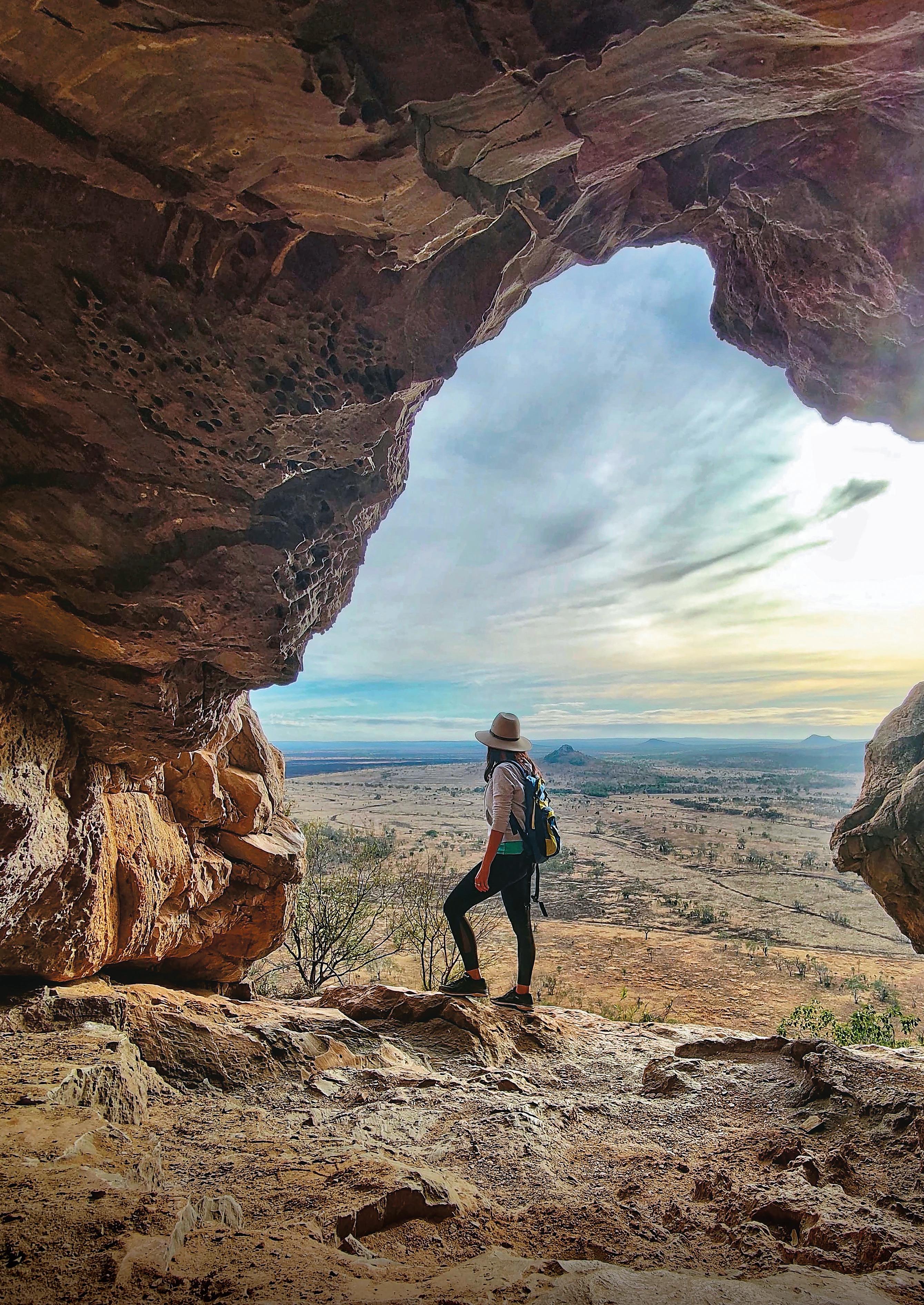
EXPERIENCE INLAND ISAAC
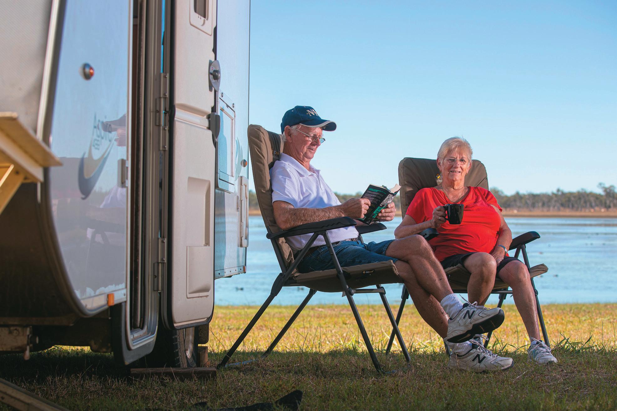
IF YOU ARE DREAMING OF GETTING OFF THE BEATEN TRACK DISCOVERING QUEENSLAND’S MOST ACCESSIBLE GOLDFIELDS, STUNNING NATIONAL PARKS AND PEAKS STEEPED IN CULTURAL SIGNIFICANCE THEN A VISIT TO THE PLAINS OF THE ISAAC REGION OFFERS SOME OF THE MOST UNIQUE PANORAMAS IN QUEENSLAND. EXPERIENCE THE ULTIMATE FREEDOM OF THE REGION AS A SELF-SUFFICIENT CAMPER, AN RV TRAVELLER OR GLAMPER.
12 EXPERIENCE ISAAC
Clermont Historical Centre
FUN FACT
It is estimated that more than 7,380kg of gold was recovered in the Clermont Goldfields between 1861 and 1901.
CLERMONT
Clermont is one of the most historic towns in northern Australia, having a colourful past, rich in drama and laced with tragedy.
It was the first inland settlement in the tropics, making it a frontier town in the truest sense of the word.
Something of that frontier atmosphere can still be found here without having to look too long.
Behind its small-town façade and hidden amongst the new prosperity are the remnants of earlier times from the days of gold rushes, copper mines, timber getters, shearers, stockmen and squatters.
Mining development has brought many of the consumer comforts of the town, but the attitude of the people is still one of rugged individualism.
Reconnect with the Isaac region’s resource heritage and try your hand at striking fortune in Queensland’s famous gold rush town.
Visitor Information Centre: The Clermont Visitor Information Centre (located inside the Clermont Historical Centre) is your one stop shop for all the information you need.
Manned by passionate local volunteers who stand ready to share advice on things to do, where to stay and how to find that golden nugget in Clermont.
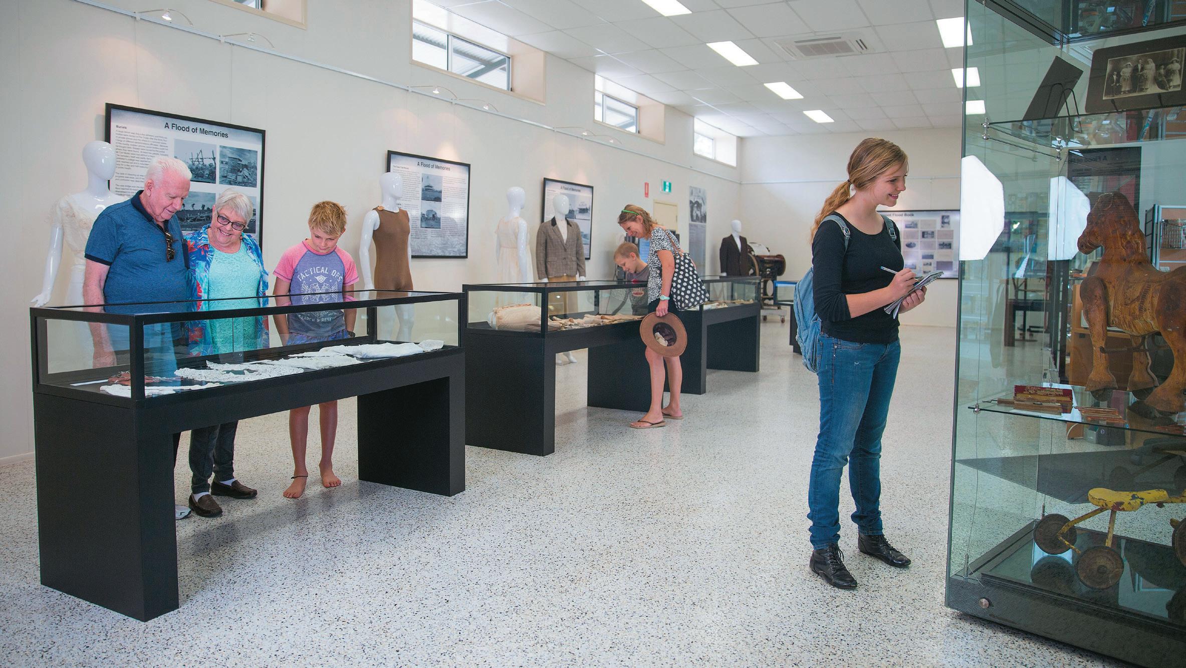
Clermont Historical Centre: Nestled right on the Gregory Highway, the Clermont Historical Centre offers an opportunity to immerse yourself in the rich and captivating history of a town that has stood for over 150 years.
Come and experience the history of the district, from gold rush, to the birth of the 1891 Shearer’s Strike.
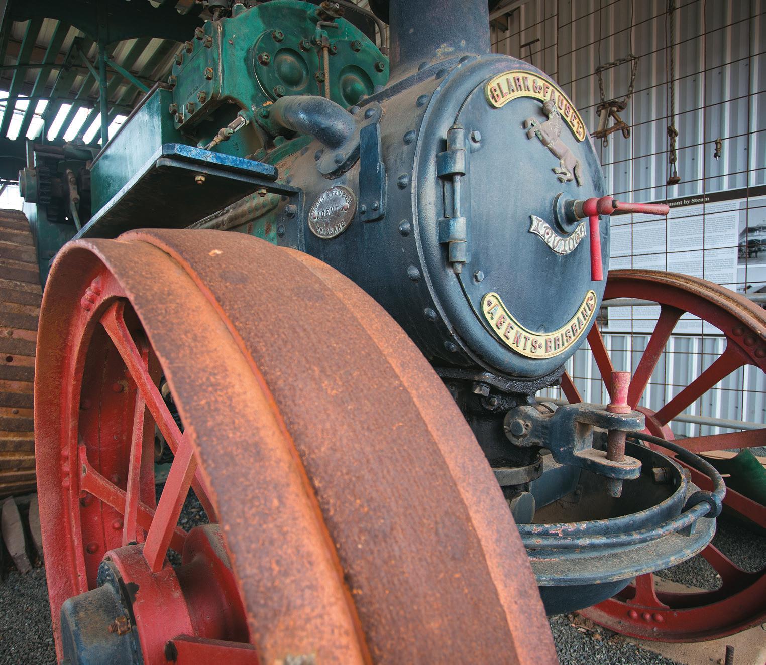
Learn about the first mining of coal at Blair Athol and the devastation of the 1916 flood, which led to the heroic effort of our iconic Aveling and Porter Steam Engine. Browse our eclectic and extensive collections – we guarantee to transport you back in time.
Located 2 kilometres north of Clermont along the Gregory Highway, the centre contains over 8000 artefacts reflecting the rich and sometimes tragic history of Clermont and its surrounding region.
Gemini Peaks, Peak Downs Highway
13 WWW.ISAAC.QLD.GOV.AU
Clermont Historical Centre
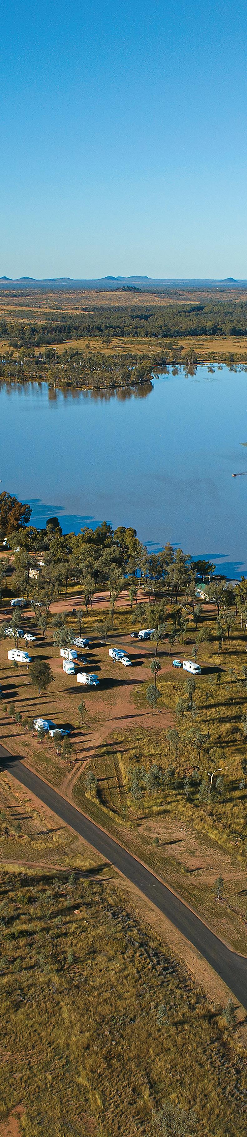
THERESA CREEK DAM
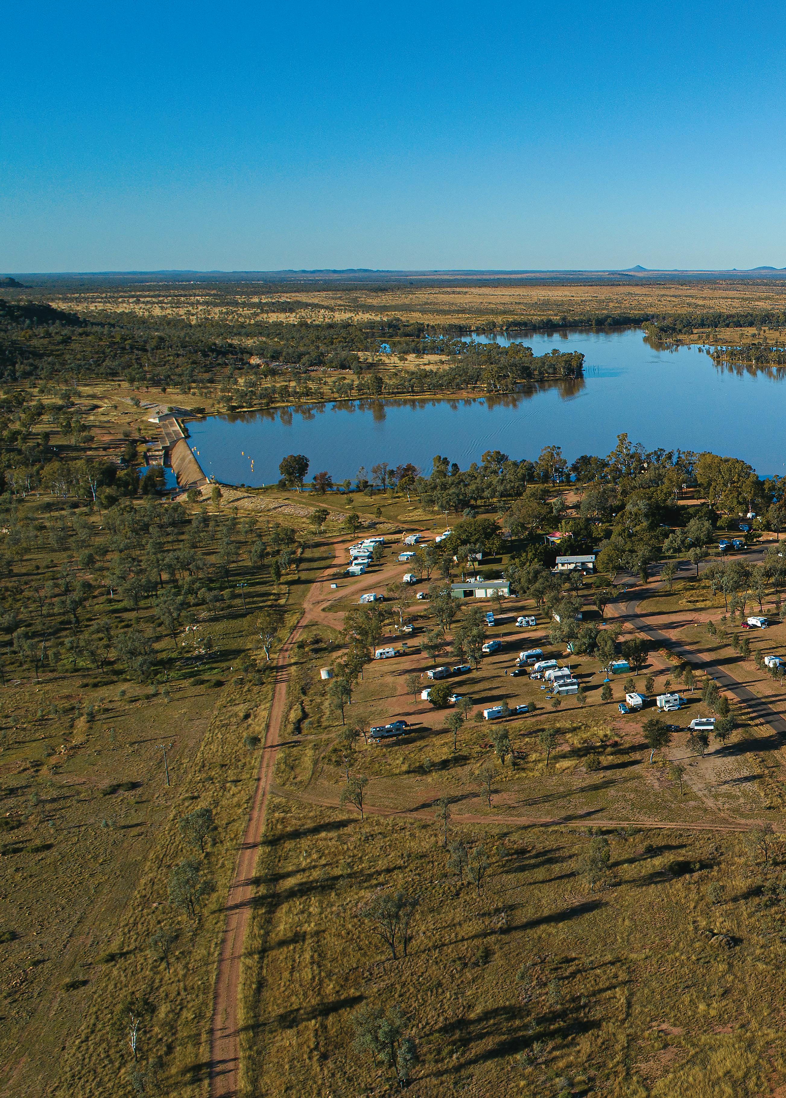
An ideal recreation area for families, Theresa Creek Dam is located 22 kilometres south west of Clermont, was built in 1983 and is situated on 30 hectares. It is one of the most idyllic camping spots in the Isaac region.
Pitch your tent, pull up your caravan or camping trailer and make Theresa Creek Dam campground your base to explore the region.
Enjoy swimming, canoeing, water skiing, jet boating and fishing… or just sit back and relax.
Red Claw crayfish are the main target species in the dam. You can also chase Barramundi, Golden Perch, Eel-Tailed Catfish, Sleepy Cod, Silver Perch and Bony Bream.
Fishing permits are required with the exception of Red Claw (possession limit of 40, no size limit). Access www.qld.gov.au/recreation/activities/ boating-fishing/rec-fishing/dams or Australia Post.
There are two boat ramps to choose from with bitumen approach all the way. Land-based anglers and Red Claw hunters can find plenty of spots to access the dam.
Find shaded picnic tables, barbeques, playground, swimming areas, food kiosk, 6 x 6 camping shelters, showers, toilets and dump point provided.
Spend the evening on the shores of the dam. Camping fees apply. Visit https://www.isaac.qld.gov.au/ Tourism/Camping-across-Isaac/ Theresa-Creek-Dam to book online.
14 EXPERIENCE ISAAC
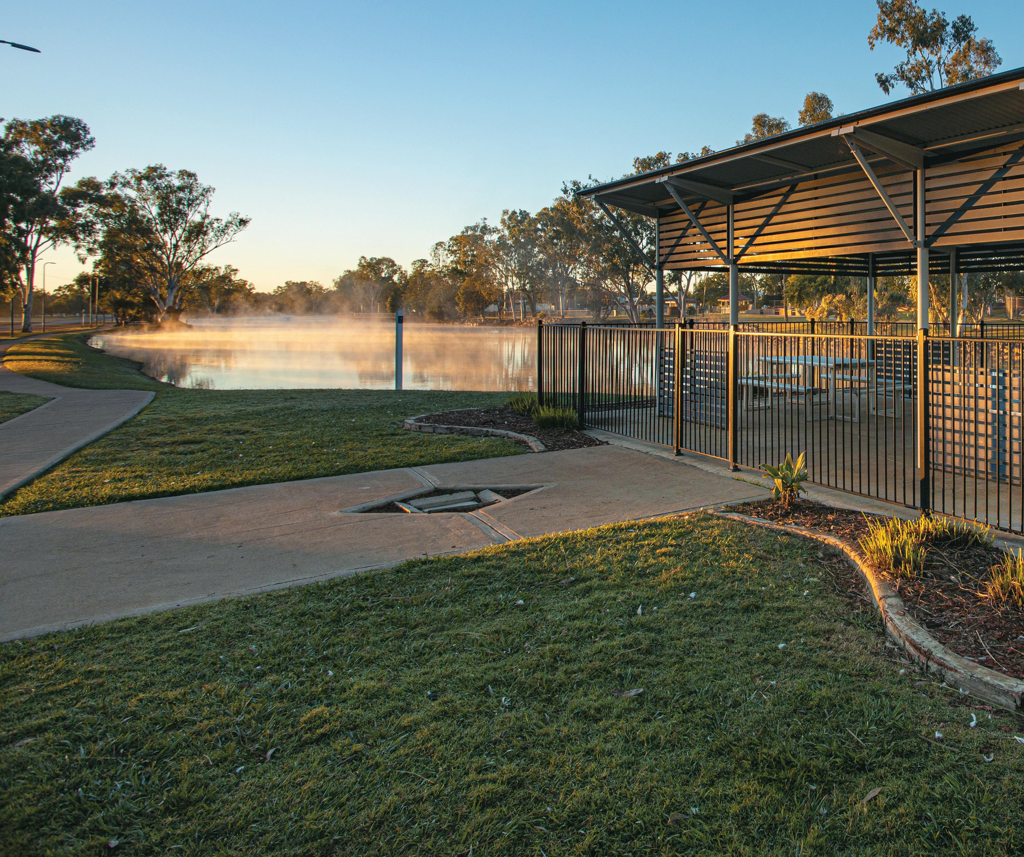
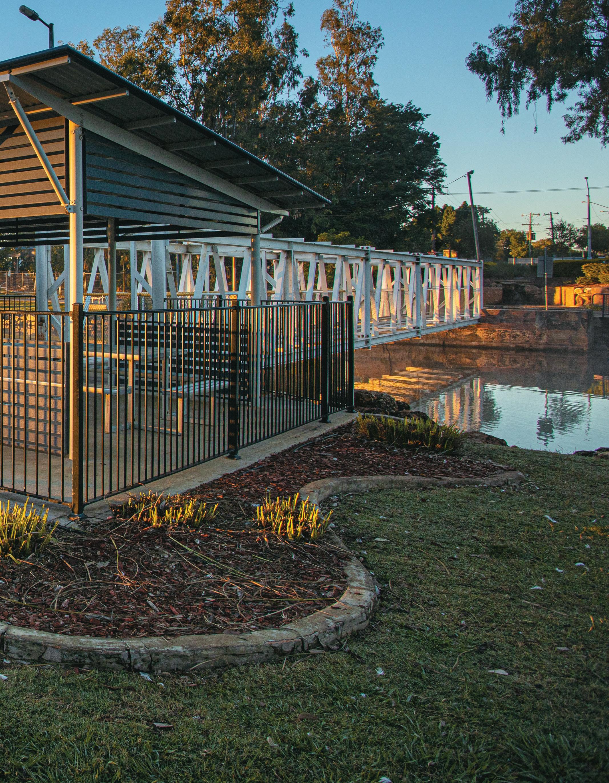
Hoods Lagoon, Clermont
Stretching along Drummond Street, Hoods Lagoon is a scenic natural watercourse full of birds and wildlife. In 1861, owners of Langton Downs, Mr James Hood and Mr Manning, sent several station hands to build a hut near a lagoon on their holding. Two of the employees had worked the Victorian goldfields and acting on instincts, discovered gold in a nearby gully. As word about the discovery spread, prospectors of all nationalities flocked to the area with dreams of striking it rich. Gold fever was in the air. Viewed as a reliable water source, the prospectors camped around the lagoon and the site was aptly named ‘Diggings Lagoon’. The lagoon was later named Hoods Lagoon, after James Hood. This was the site from which the town of Clermont was born. Today, where the landscape is now dotted with the trees of Ivan Bettridge Park and wide-open spaces, streets lined with houses and businesses once existed.
Follow the lagoon’s winding footpaths and boardwalks and take in Clermont’s rich and diverse history. Memorials, monuments and sculptures tell the stories of pioneers of times gone by, indigenous heritage and native wildlife. These are including, but not limited to, Mother Mary MacKillop, The Gallipoli Sniper - Billy Sing, our district’s war veterans and the Northern Hairy Nosed Wombat. The full circuit of the lagoon is approximately 1.8 kilometres long and is open day and night.
Exploring Clermont
Ensure your first stop is to visit the Clermont Visitor Information Centre (located at the Clermont Historical Centre) for advice on things to do, things to see, where to eat and local treasures – direct from local staff.
Visit the Clermont Historical Centre to experience the history of the Clermont district.
Go for a scenic walk around the lagoon and see the 1916 flood memorial area (including the piano in the tree), war memorial, Billy Sing memorial, Mary MacKillop grotto, indigenous heritage site and more.
Pub crawl Clermont’s historic pubs!
Visit Theresa Creek Dam for a ski, swim, fish, camp or for a scenic lunch at the kiosk.
View the railway station and murals and find the green frogs located on each carriage.
Visit the Clermont Library for Free Wi-Fi.
Take a stroll through Rose Harris Park – Capella Street. Named after local identity, Rose Harris, in recognition of her services to the community during the 1916 flood. Rose and her father were responsible for saving five lives. Rose operated a saddlers business for many years and was believed to be the only female saddler in Australia at the time.
Clermont is famous and popular for its gold fossicking – try your luck at striking gold at one of its 11 General Permission Areas.
Go for a drive to visit Copperfield and learn about the town that was.
15 WWW.ISAAC.QLD.GOV.AU
Theresa Creek Dam, Clermont
STRIKING GOLD HISTORY
For nearly 160 years, the lure of gold has drawn eager prospectors to the central Queensland town of Clermont. Declared a goldfield in 1862, the Clermont discovery triggered one of Queensland’s major gold rushes. Clermont’s heritage, with its tales of tragedy, triumph and treasure, continue to intrigue visitors both young and old. This is Queensland’s most accessible goldfields, with their alluvial gravels making it ideal to strike it lucky and win the gold from the ground. Visitors need only a metal detector, a pick, a fossicking licence, maps of the 11 Local General Permission Areas, basic bush safety gear and an adventurous spirit to take advantage of this modern-day gold rush. Visit https://www.qld.gov.au/ recreation/activities/areas-facilities/fossicking/central-gold for more inforamtion
The Great Flood of 1916
This flood is perhaps the most tragic chapter of Clermont’s history. On 27 December 1916, a cyclone crossed the coast between Bowen and Mackay. Rain poured down in the catchments of Wolfang and then later Sandy Creek.
The 1916 flood marker on the corner of Capricorn and Drummond Streets depicts the height of the flood waters and displays the names of the perished.
The ‘Piano in the Tree’ in Capricorn Street (opposite Ivan Bettridge Park) tells another aspect of the 1916 flood story.
Due to the height of the flood water, when the clean-up of debris began, many foreign objects were found to be stuck in the treetops.
The most unusual of these was, of course, a piano stuck in a tree. There were in fact three pianos found wedged between tree limbs after the flood waters had receded. Today, the Piano in the Tree stands as a stark reminder of the height and ravaging forces of the flood water.
Pub Crawl - Clermont’s Historic Pubs
The people of Clermont have always been a determined, resilient bunch.
After the Great Flood of 1916, it was the people that decided the town should be moved to higher ground. In 1915, Clermont had boasted of six hotels lining Drummond Street.
After the flood, only three remained standing - the Grand Hotel, the Leo
Hotel and the Commercial Hotel. It was decided that they would be moved to the site of the new town in Capella Street.
Each pub had its turn; they were raised on jacks, and timber rails were laid underneath it, stretching for about 100 metres ahead.
The Aveling and Porter #6803 winched the building slowly up the track until it reached the end of the line. The rails were collected and laid down for another 100 metres until they reached their new homes.
The Aveling and Porter Steam Traction Engine is fully operational and on display at the Clermont Historical Centre.
The Commercial Hotel was originally
16 EXPERIENCE ISAAC
built in the early 1870s, on the corner of Capricorn and Drummond Streets.
Built in a signature ‘L’ shape, it was cut in half before its maiden voyage to its current site.
It is recorded that during the flood a horse ran up the stairs and took refuge on the upper level!
The Leo Hotel has been around since the mid-1860s.
The current building was built in 1900, the first building being demolished by order of the licensing commission. Today it is said that a ghost haunts the upper level, but don’t worry, I’m sure you will be safe in the bar! The Grand Hotel, whilst not the original building moved in 1917, was established in 1898. The
old pub burnt down in the early 1980s, like many old pubs are prone to do. It is historically remembered as continuing trade whilst being moved.
Copperfield – Queensland’s First Copper Mine
In 1861, a 10-metre wall of solid copper ore was discovered near Clermont by Jack Mollard. Queensland’s first copper mine, the Peak Downs Copper Mining Company, smelted its first copper in late 1864 and continued until its final closure in 1907, due to falling copper prices and poor-quality ore.
It is difficult to imagine that Copperfield was once a bustling town of over 2,000 people. At the pinnacle of its development in 1874, the town boasted of six hotels, three butchers, three
FUN FACT
The Copper from Copperfield Mine was transported by bullock, horse and dray all the way to the Port of St Lawrence.
blacksmiths, a newsagent, six stores, a baker, two auctioneers, a saddlery and a town newspaper called the Copperfield Miner
The site of the Copperfield township and mine sit 4 kilometres south of Clermont and stand as a testimony to the changing fortunes of the mining industry. Today all that remains of this town’s thriving past is the lone Copperfield Chimney, the Copperfield Store and the Copperfield Cemetery.
The single chimney stack that remains was once one of more than 20. The bricks were made in a kiln on Sandy Creek by Charles George Bettridge, an English bricklayer who settled in Copperfield. Charles Bettridge is also responsible for the construction of the chimneys at Copperfield.
The Copperfield Store was originally the town newsagency, ‘Howard Smith Tobacconist and Newsagent’. In later years, as the population declined, the store began to sell more general goods, trading all the way until 1975, standing as the last remnant of a once bustling main street. The Chimney and Store can be found on the Rubyvale Road. The Copperfield Store is adjacent to the road, approximately 4 kilometres outside Clermont, you can’t miss it! Access to the Copperfield Chimney can be found 500 metres past the store, on the right, look for the sign!
The Copperfield Cemetery is located on the right-hand side of the Rubyvale Road, approximately 1 kilometre past the Theresa Creek Dam turn off.
The cemetery, whilst consisting of under 20 headstones, is the site of over 150 graves, the names of whom can be found on a large plaque toward the rear of the cemetery.
The echo of lives lived and lost in this slice of Australia’s pioneering past can be heard here.
Hoods Lagoon, Clermont
17 WWW.ISAAC.QLD.GOV.AU
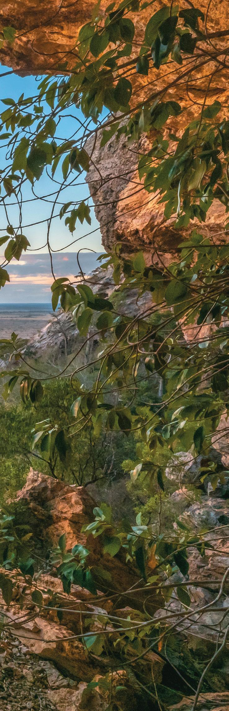
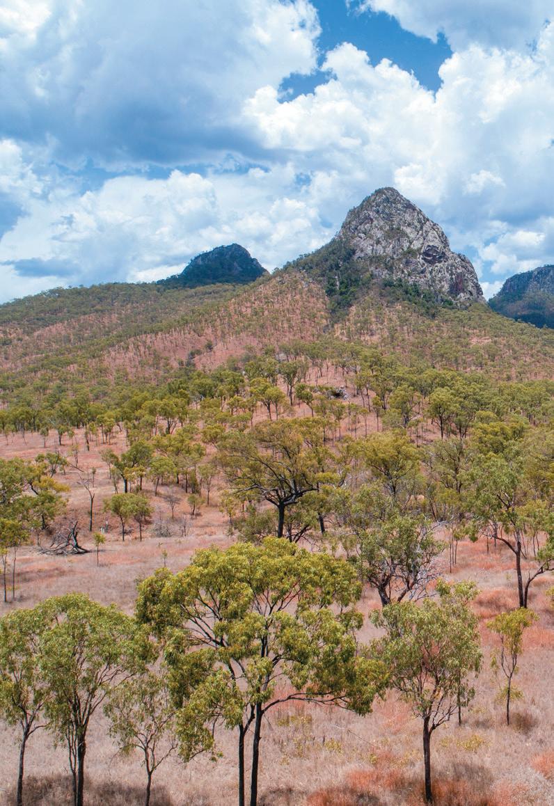
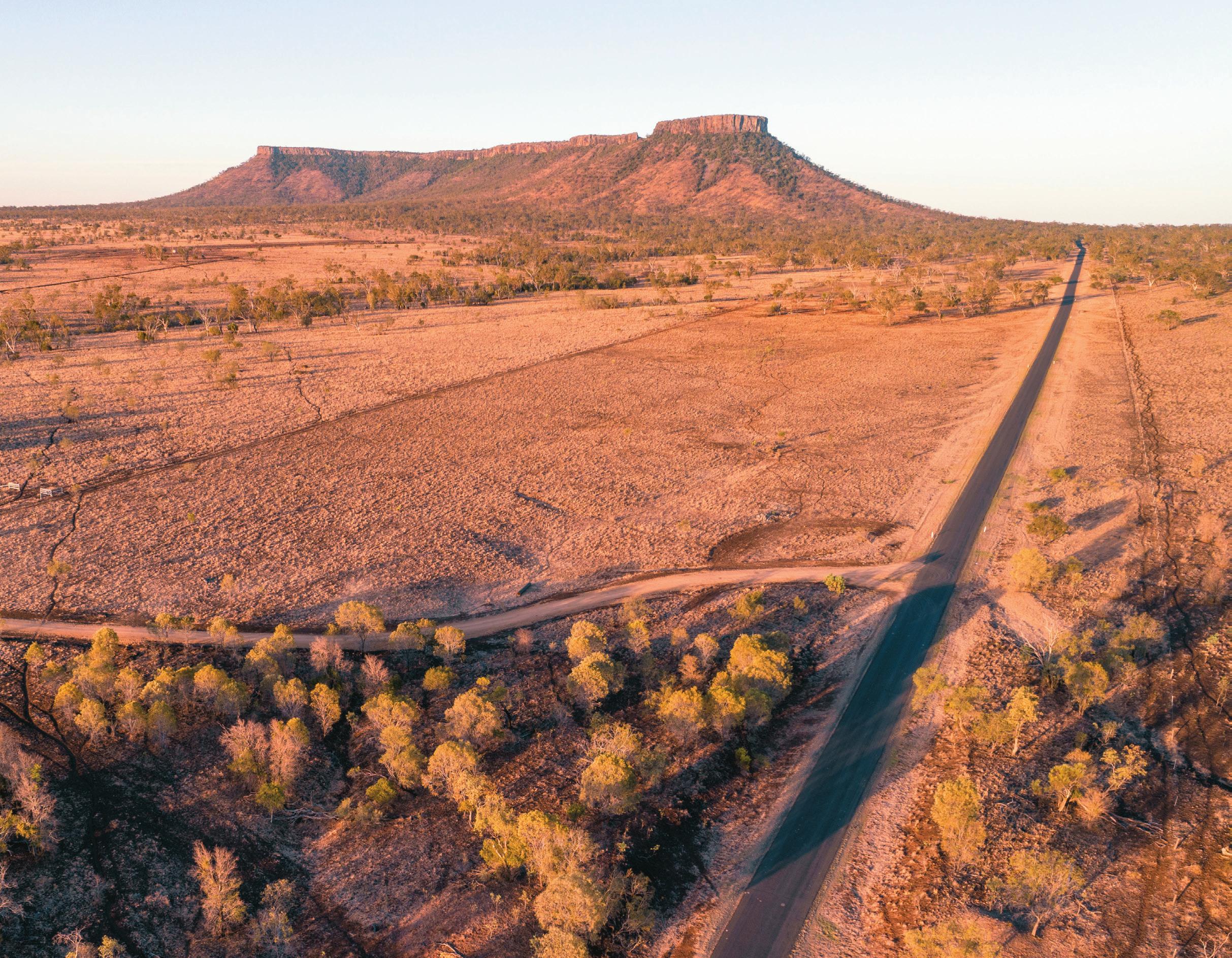
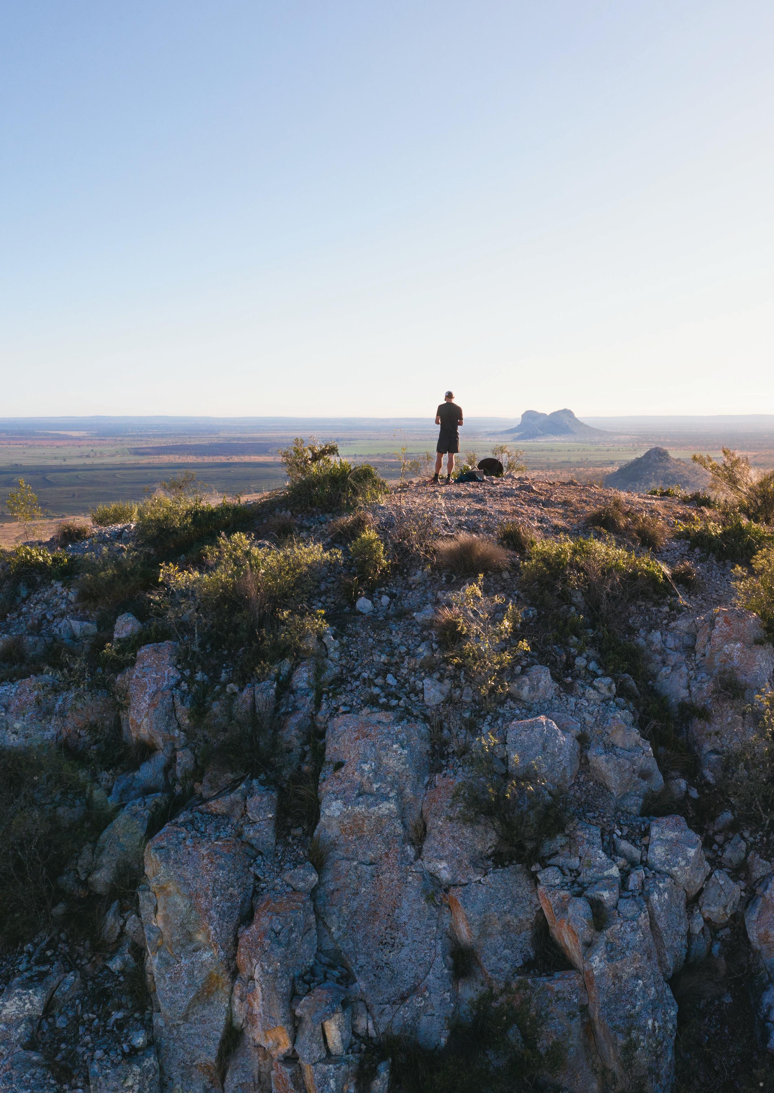
PEAK RANGE NATIONAL PARK
FOR A SCENIC DRIVE, TRAVEL ALONG THE PEAK DOWNS HIGHWAY FOR PANORAMIC VIEWS OF THE PEAK RANGE.
THE PEAK RANGE IS A CHAIN OF PROMINENT AND PICTURESQUE VOLCANIC MOUNTAINS BETWEEN MORANBAH, CLERMONT AND DYSART.
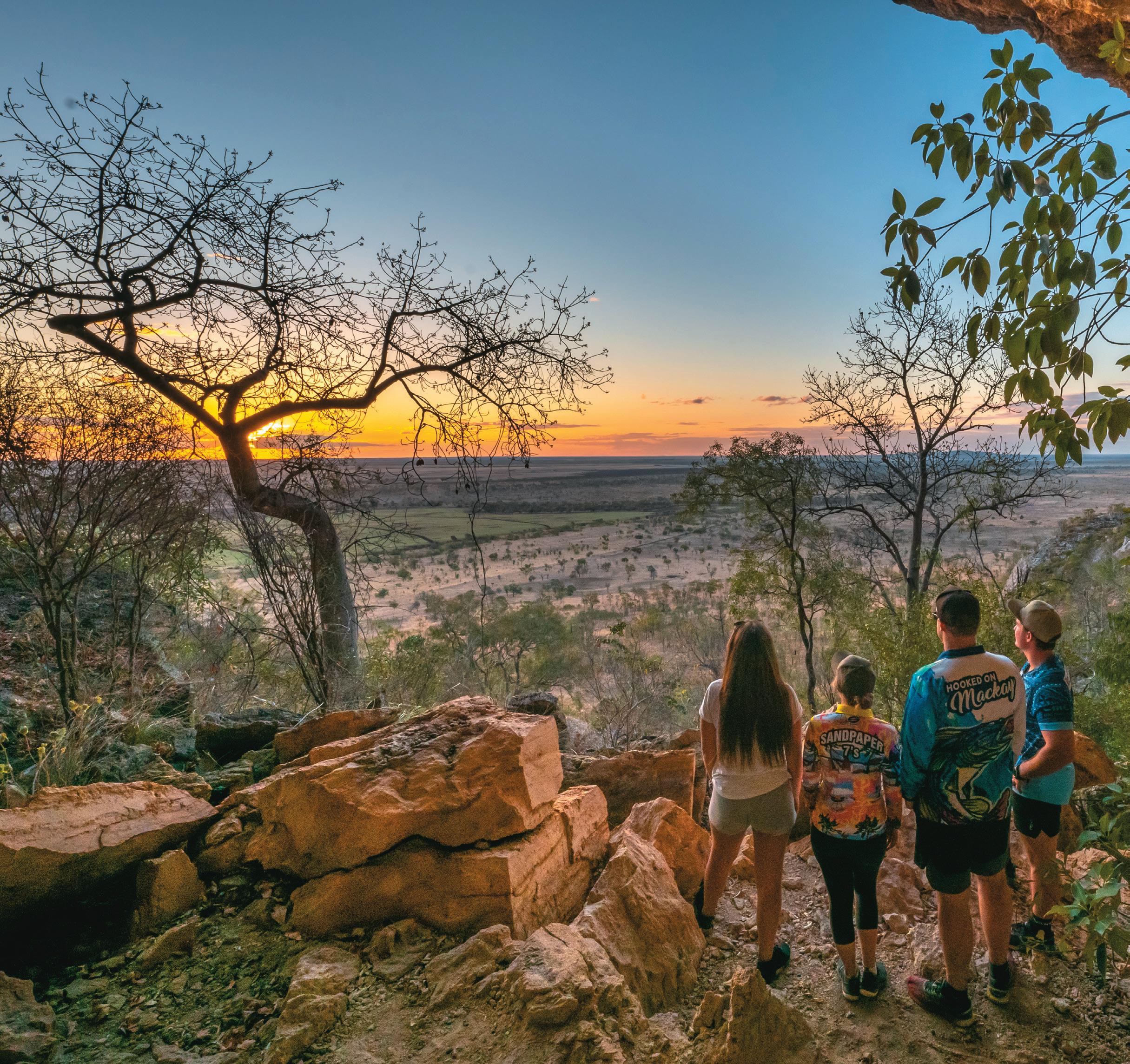
The sharp peaks are visible from a considerable distance across the flat country plains and are most spectacular viewed at sunrise and sunset.
The Peak Range is part of the world’s longest continental volcanic chain, the Cosgrove hotspot. They are a geological marvel and thing of beauty. The Peak Range is underlain by an extensive sequence of basalt flows and rhyolite/ trachyte intrusive bodies, which erupted and emplaced between 26 and 30 million years ago.
Visitors to Peak Range National Park
enjoy the natural settings through bushwalking, photography, scenic views and exploring the spectacular geological features. There is also historical interest due to the Leichhardt journey passing through the area.
Camping
Camping is prohibited at all peaks.
Site Facilities
The Peak Range National Park and its peaks have limited facilities. Parking space is available near each of the national park roadside entry signs.
Safety when undertaking walks or activities in the park
Peak Range National Park provides a remote natural setting with no motorised vehicle access, facilities or defined walking tracks. Visitors must be totally self-reliant and have a reliable call in schedule. Fires and camping are prohibited. Please ensure you are environmentally conscious, respectful and remove all rubbish.
For more information, please contact Queensland Parks and Wildlife on (07) 4983 1211.
18 EXPERIENCE ISAAC
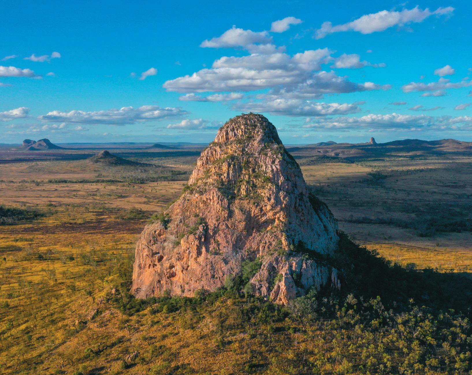
WOLFANG PEAK
Towering above the surrounding flat agricultural land at a majestic 572 metres and 172 hectares, it’s Wolfang Peak that catches the eye first as you drive along the Peak Downs highway from Clermont.
Its distinct and iconic shape, like a “fang”, gives path to its name. It’s a rhyolite plug once encased in basalt that’s long since eroded away.
It has scenic and geological values ... look out for the giant St Andrews spiders.
The peak’s sharp rise can be hazardous and cliff-based activities are not recommended.
The slope below its bare volcanic peak carries an open scrub giving way to open grassland and grassy Eucalyptus orgadophila woodland.
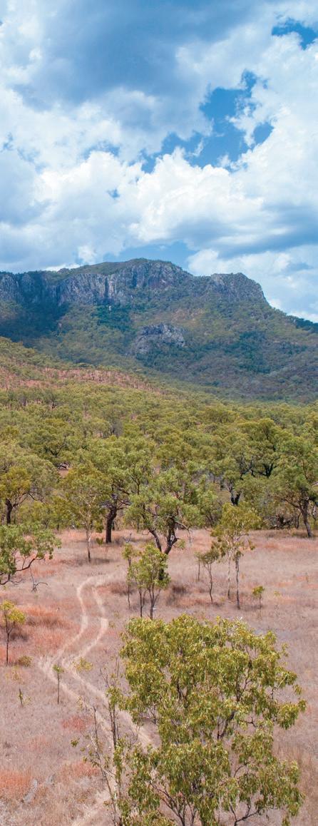
LORDS TABLE MOUNTAIN
Located 35 kilometres east of Clermont or 40 kilometres west of Dysart along the Clermont-Dysart Road lays Lord’s Table Mountain. Lords Table is the largest and maybe most unique of the peaks. Introduce yourself to the brilliant hues and unusual shapes of this majestic mountain, while marvelling at the peak’s sheer size and scope!
Centrally located amongst the Peak Range National Park, the mountain itself is 320 metres high and a flattopped plateau, with Anvil Peak being the highest point, at the southern end. This section compromises 761 hectares
and supports the largest area of dry rainforest in the Peak Range.
It was named by Ludwig Leichhardt in 1845 and is mainly open eucalypt woodland, dry vine scrubs and mallee eucalypt at the top of the mountain. Road access to the mountain is via the Huntley road. There is a picnic table and rest area at its scenic base.
Climbing up to the saddle – another track-free endeavour – provides glorious views of the surrounding farmland taking advantage of this rich volcanic soil. Ensure you have a camera and plenty of water.
Peaks Wolfang Peak 19 WWW.ISAAC.QLD.GOV.AU
Gemini
PEAK RANGE NATIONAL PARK
GEMINI PEAKS
Gemini Mountains is one of four sections that belong to the Peak Ranges National Park group.
Other sections include Wolfang Peak, Eastern Peak and Lord’s Table Mountain.
The range has been built up by basalt lava flows, which erupted from the Peak Range Volcano, a ‘hot spot’ volcano between 32 and 29 million years ago.
The peaks are intrusive volcanic plugs of resistant rhyolite and trachyte.
The Peak Ranges form some of the most spectacular scenery in the Central Highlands.
Located approximately 45 kilometres east of Clermont, the Gemini Peaks are two volcanic formations with open eucalypt woodland.
FUN FACT
The two Gemini Peaks are called Mount Castor and Mount Pollux and they are named after the twin brothers in Greek and Roman mythology. Together in mythology they are called the Dioscuri.
20 EXPERIENCE ISAAC
GEMINI PEAKS
The spectacular volcanic peaks (Mount Castor and Mount Pollux) are part of the Gemini Mountains section. A national park 787 hectares in size, Gemini National Park is located approximately 60 kilometres east of Clermont on the Peak Downs Highway.
The park fronts the northern side of this highway, is sign posted and is best accessed via the gate on the Clermont side of the park. Mount Castor and Mount Pollux are rounded plugs of rhyolite. Mount Castor has long cooling columns and small caverns from erosion of chemically softened rock.
The Peak Ranges have significant European cultural heritage value. Ludwig Leichhardt was the first European to sight the range on the January 18th, 1845. Many of the peaks were named after participants and supporters of the Leichhardt expedition. A monument detailing the journey can be found on the Dysart-Clermont Road and survey markers exist on Gemini Mountains.
Sheep husbandry was previously one of the main past land-uses in the area. This has subsequently been replaced by cattle and dry land cropping.
Of particular interest is the endangered daisy Belyando Cobbler’s Peg or ‘Tiocinica retroflexa’ found in the black soils of the park.
Safety when undertaking walks or activities in the park
Peak Range National Park provides a remote natural setting with no motorised vehicle access, facilities or defined walking tracks. Visitors must be totally self-reliant and have a reliable call-in schedule.
Parking
There is room to park your vehicle just inside the gate at Gemini National Park when it is dry. The black soil is notorious for getting vehicles bogged when it is wet and we recommend a fine day for undertaking the walk to avoid these wet weather issues.
What to wear and what to take
Wear comfortable, protective footwear – never thongs, high heels, new shoes or dress shoes. Your walk won’t be much fun if you get blisters or sprain an ankle.
Dress for the track conditions and weather. You get warm as you walk so wear layers you can take off easily and replace when you stop and cool down. Light weight, long sleeved shirts and trousers minimise scratches, stings,
bites and sunburn. Wear loose clothes –walking in tight clothes is uncomfortable and can cause rashes. Don’t wear clothes you don’t want to get dirty.
Wear a hat and sunscreen to avoid painful sunburn.
Always carry plenty of drinking water. Bushwalking is thirsty work.
Wear insect repellent to discourage biting and sucking insects.
Carry a first-aid kit and know how to use it.
A mobile phone or satellite phone (with spare battery) and/or Personal Locator Beacon (PLB) are recommended for remote bushwalking.
Most importantly, don’t forget your camera.
Be sure to let someone know where you are going, number of people going with you and what time you plan to return. This way the authorities can be alerted if something happens and you do not return as expected.
Brief details of recommended walk
There is no vehicle access within the park. Visitors can walk into Gemini Mountains via fire control lines. There is no marked trail for this walk, the terrain is uneven and good footwear is a must.
The best access with the gentlest gradient up Mount Pollux can be accessed by:
Heading north walking approximately 4.5 kilometres along the western fire break of Gemini.
Follow this fire break over the rise past the neighbour’s dams.
Continue until you are just short of a water course that runs between Mount Pollux and Mount Castor where it meets the Western fire break you have been walking on.
Leave the fire break at this location and head east for approximately 500 metres until you are between the two main peaks of Mount Pollux and Mount Castor.
You can then head up the gentlest incline on Mount Pollux choosing your own path to the top of the mountain.
Once at the top you can return the way you came.
Gemini Peaks 21 WWW.ISAAC.QLD.GOV.AU
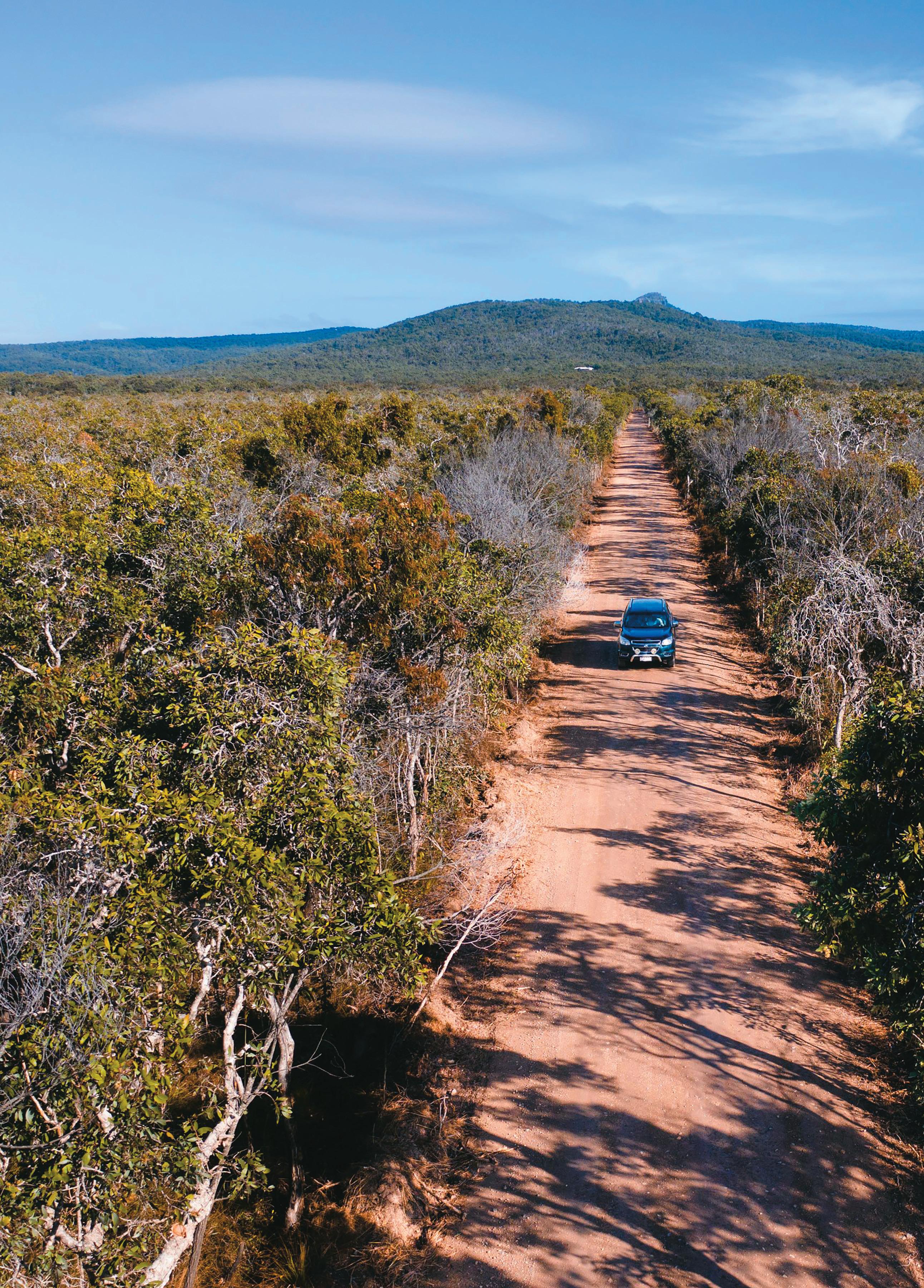
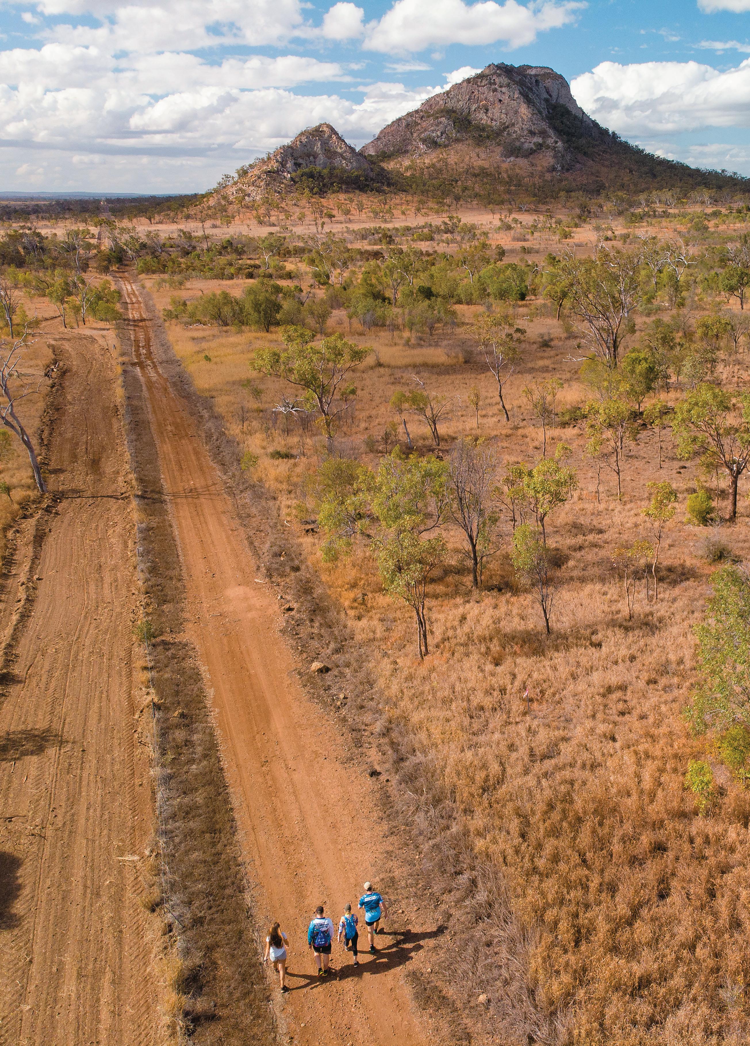
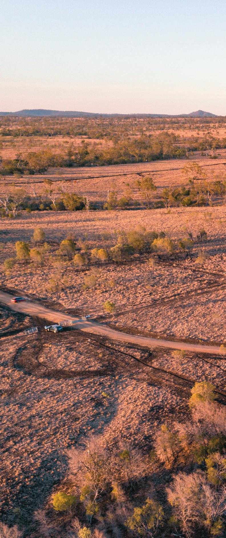
THE ROAD LESS TRAVELLED EXPERIENCE
MORANBAH
Moranbah was created for mining of the abundant coal resources in the region and the miners and their families in the 1970s.
Today Moranbah takes pleasure in an abundance of modern facilities.
The shaded town centre with free public Wi-Fi creates a relaxing atmosphere to enjoy a coffee break, bite to eat and recharge the batteries.
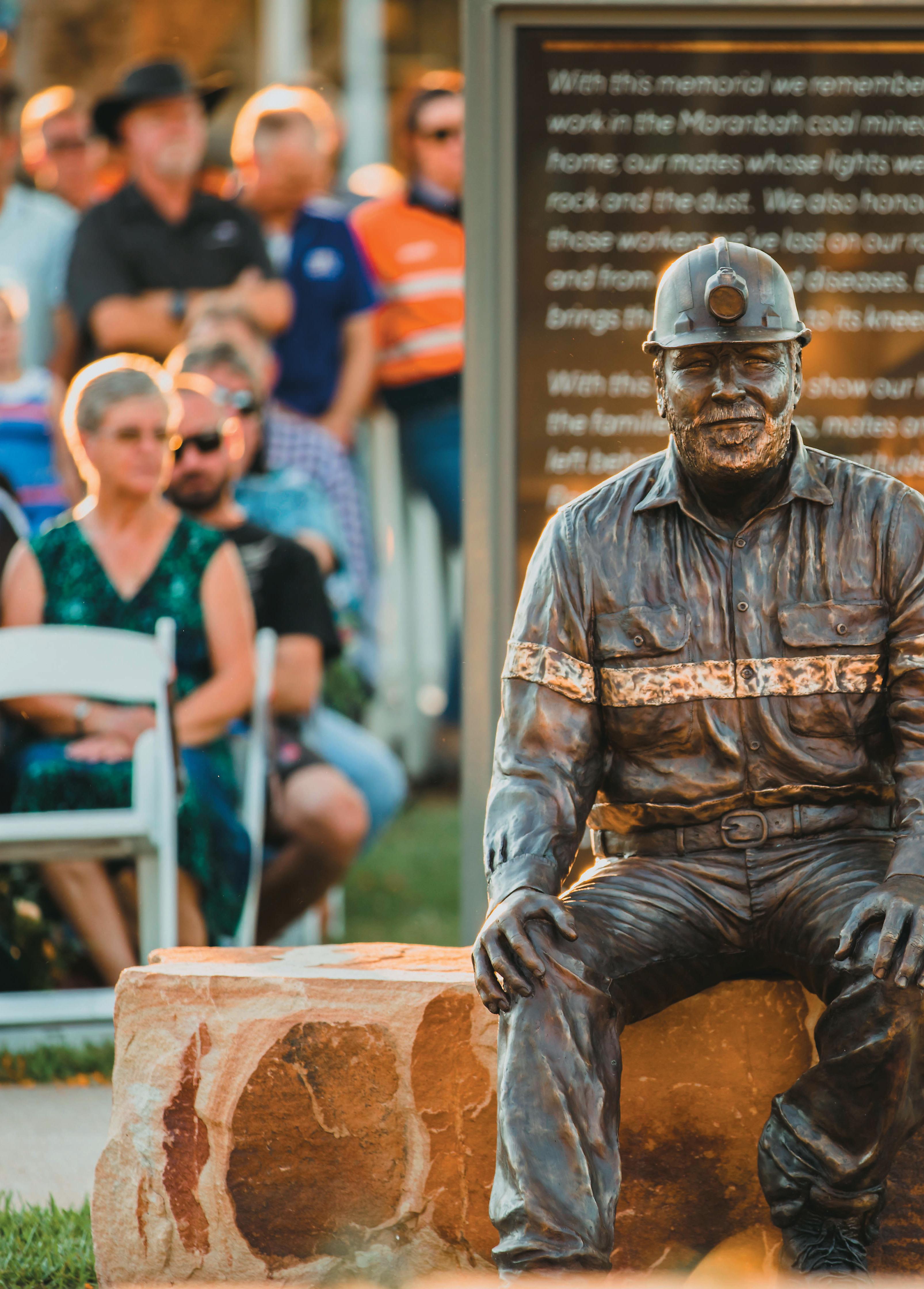
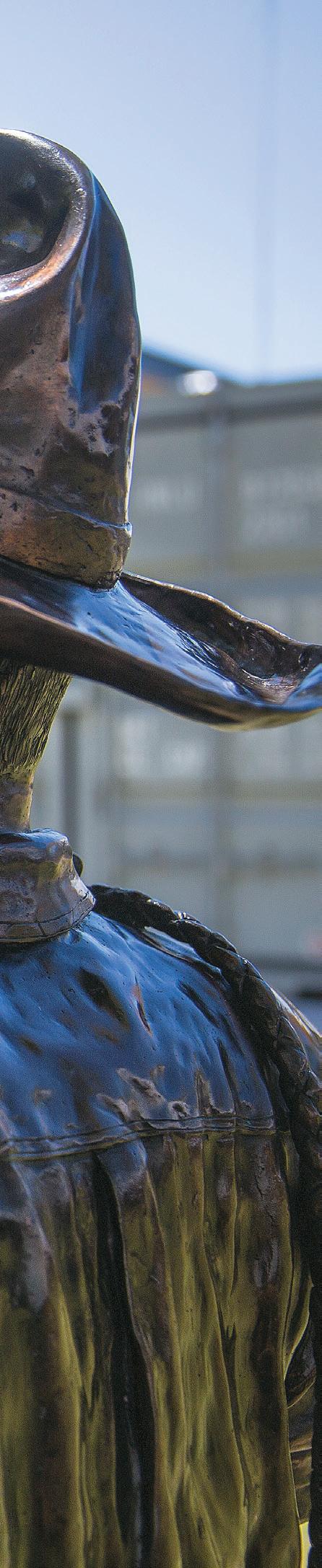
Miners’ Memorial
The sculpture commemorates the miners who have lost their lives while working on the Moranbah coalfields. Plaques list the names of the miners who lost their lives as well as an additional plaque honouring miners who have lost their lives on the region`s road, in work camps and on their way to and from work.
View this memorial in Moranbah Town Square Park.
Exploring Moranbah
Follow the one-kilometre Federation Walk at Moranbah’s entrance to town’s Big Red Rhino Bucket.
Visit the Coalface Art Gallery to view local artistic talent emerging from the area.
Browse the local cultural stories and traditional art display around the library in the town centre.
Spend time reflecting with the region’s tragic history at the beautifully respectful miners’ memorial.
Refresh at the Greg Cruickshank Aquatic Centre pools.
22 EXPERIENCE ISAAC
LAKE ELPHINSTONE
A short drive from Glenden is one of the region’s best natural highlights, Lake Elphinstone. As one of the region’s only natural permanent water bodies the lake would have been an important source of food and water for Aboriginal tribes.
European maps suggest Lake Elphinstone was a traditional meeting point for the Jangga, Barada Barna and Wiri peoples.
Rock art paintings are known to exist at nearby Burton Downs. Following European settlement the lake supported the township of Elphinstone, long since disbanded.
Today, Lake Elphinstone is a popular spot among locals and visitors. Set up camp for the night then relax while the setting sun turns the lake gold. In the morning try fishing, bushwalking or kayaking.
GLENDEN
Turn off the Peak Downs highway to visit Glenden, a modern mining town built in 1981 by the Mount Isa Mining Company.
Glenden offers groceries, fuel, other supplies and medical services and is a great place to stop and grab a coffee and a bite to eat, or stock up before heading to Lake Elphinstone. Please note there is no potable water at Lake Elphinstone however Glenden has both potable water and a dump point for convenience before you head out.
Lake Elphinstone was noted as a meeting point for
Water sports enthusiasts can indulge in water skiing and jet skiing.
Listed on the National Register of Important Wetlands in recognition of its environmental values, the lake also offers bird watching and wildlife encounters. Visit https://www.isaac.qld. gov.au/Tourism/Camping-across-Isaac/LakeElphinstone for more information.
A boat ramp and basic amenities are available including:
Toilets
Showers
Boat Ramp
Picnic tables
the Jangga, Barada Barna and Wiri Peoples.
Exploring Glenden
Visit Lake Elphinstone for a day on the water or pull up and camp for a few nights.
Bird watch or enjoy wildlife at Lake Elphinstone, listed on the National Register of Important Wetlands.
Camp for free at Maddern Oval. This campground offers toilets and a dump point. Camping in tents is not permitted.
Lake Elphinstone
23 WWW.ISAAC.QLD.GOV.AU
Moranbah Miners’ Memorial
THE ROAD LESS TRAVELLED EXPERIENCE
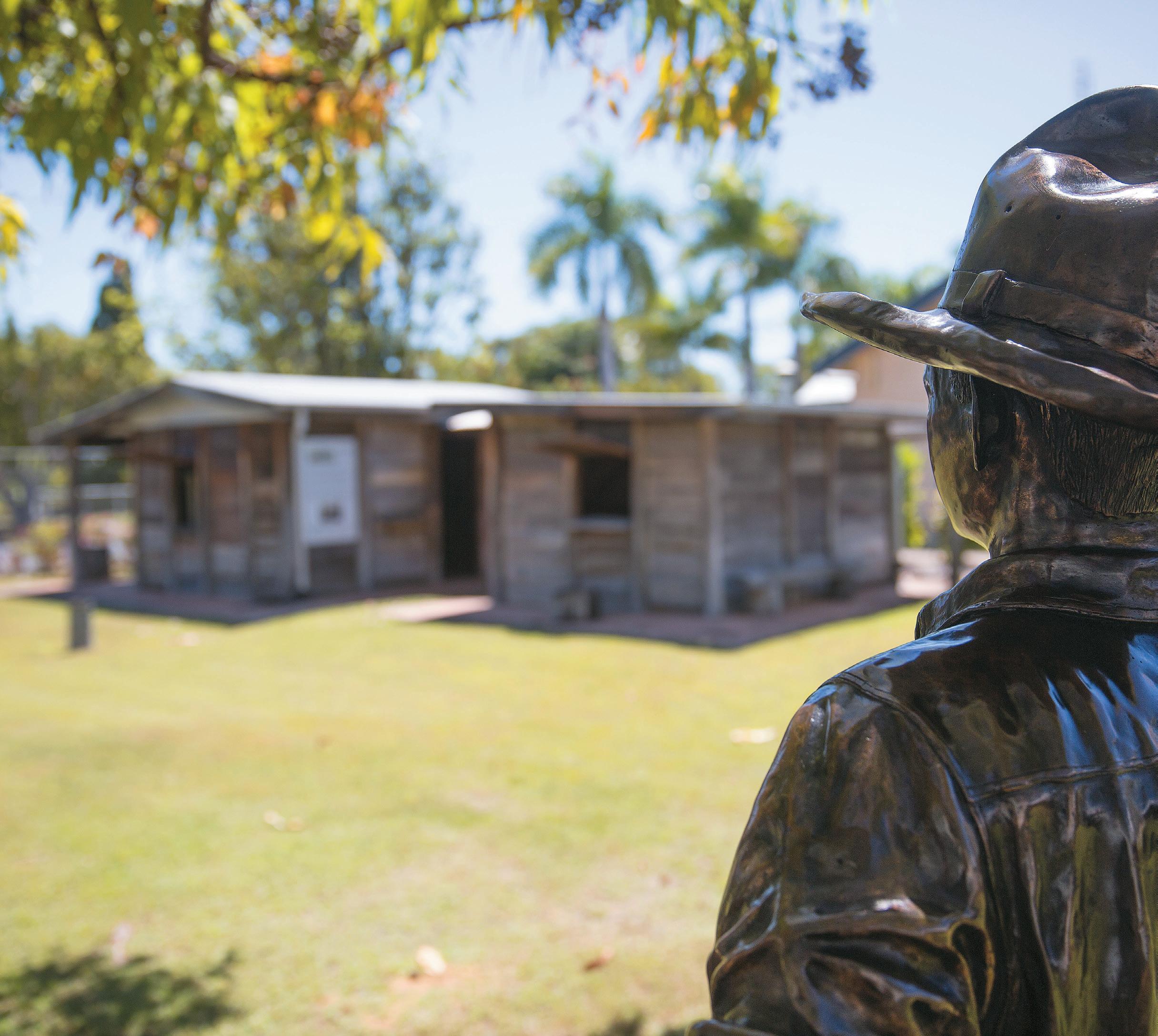
HISTORIC NEBO MUSEUM
Stop in at the Historic Nebo Museum to explore many local stories and view artefacts ranging from the prehistoric megafauna to relics from Grandma’s house.
Today’s museum, in Reynolds Street, is a reminder of the effort of the pioneers of the past. It features the original Nebo Court House and Police Station, a gaol holding cell, historic slab huts, machinery shed and a modern exhibition hall.
Spend some more time in and around Nebo:
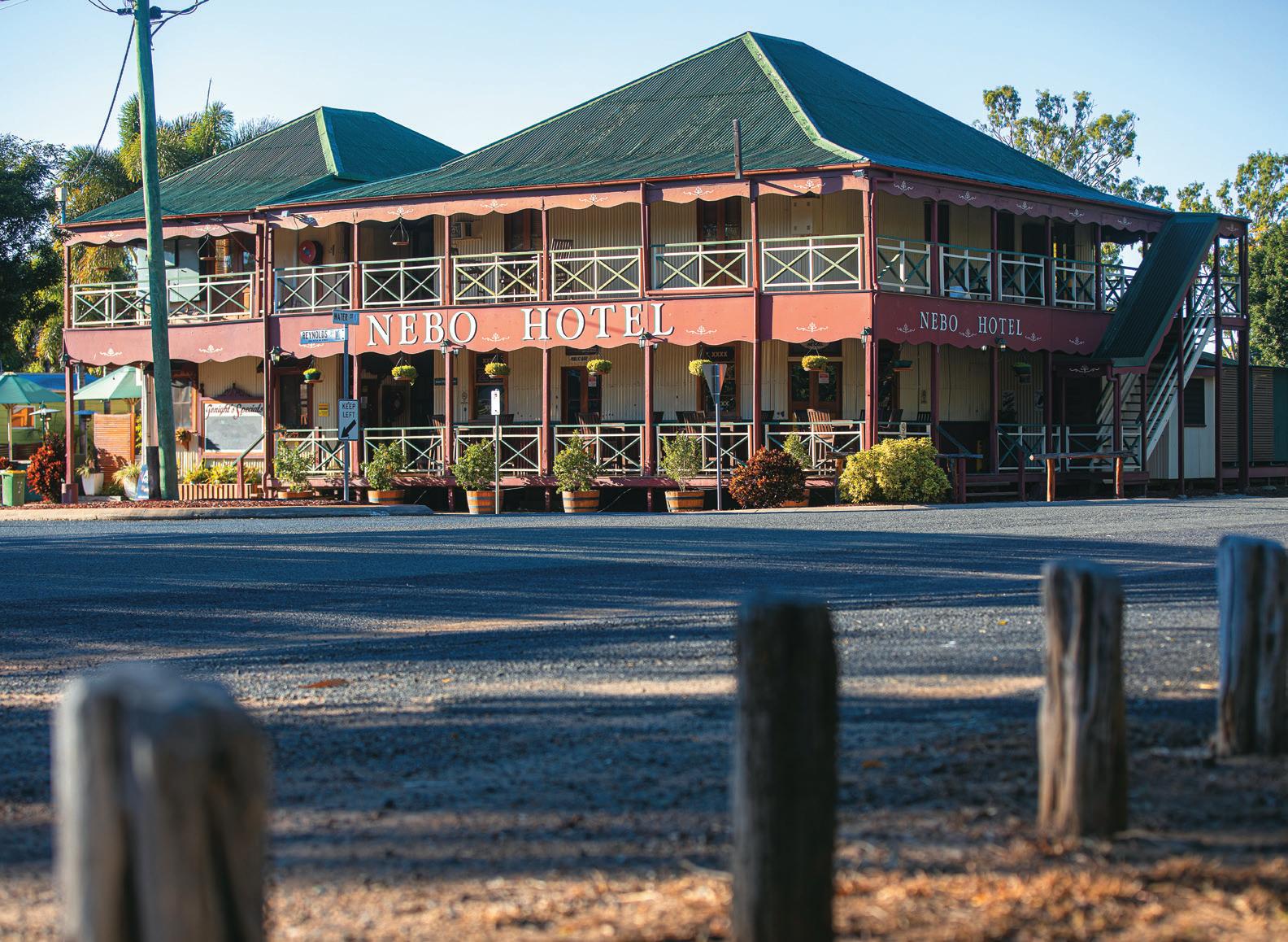
Visit the heritage-listed Nebo Hotel for great food and a cool ale.
Immerse yourself in history and culture by visiting the 260 metres of Nebo murals which depict significant people and events in Australian history. Located at the Civeo camp.
Visit the historic Nebo cemetery.
Walk along the Bill Bruce walkway and take in the tranquil sights and sounds of the Nebo Creek.
Enjoy the Nebo Rodeo annually in May, being the largest one day Rodeo in Australia.
Discover Mount Britton and the old town site.
Bushwalk and camp at Homevale National Park and Moonlight Dam.
Walk part of the Bicentennial Trail.
Picnic at Lake Elphinstone.
24 EXPERIENCE ISAAC
Nebo Hotel
NEBO
The first European to travel through the area now known as Nebo was Ludwig Leichhardt in 1845, followed in 1856 by William Landsborough who named most of the surrounding features. The town was surveyed in 1865, the official name at that time being Fort Cooper, however the name was changed in 1923 by popular demand to Nebo, after Nebo Creek.
During the early decades Nebo’s primary production was sheep, however when the area proved unsuitable for sheep, they were replaced by cattle. Until the 1940s cattle were taken by drovers to market in Mackay. This trip took several days, and overnight camps were located along the route which is roughly where the Peak Downs Highway is now. Many a fine race, stock and thoroughbred horses were bred in and around Nebo and in the earlier years many were exported to the Indian army. The strong connection with horses and horse sports continues today with the Nebo Showgrounds being the host venue for many events such as the Nebo Rodeo, campdrafts, cutting, barrel racing, polocrosse and pony club events throughout the years.
MOUNT BRITTON
Re-live the gold rush era at Mount Britton
Walk in the footsteps of the gold rush pioneers at Mount Britton, a once-thriving gold mining town established in 1880. While the buildings are long gone, the old grid of streets are dotted with interpretive signage that retains a sense of what once existed.
Approximately 35 minutes’ drive north-east of Nebo, it’s an easily accessible area offering the opportunity for day trippers or self-sufficient campers to pull up, relax and explore more of the area. With no fees or time limits, the expansive grassy camp provides water, picnic shelters and a toilet. Mount Britton is a relaxing retreat where you can relive a rich history, stoke a campfire and awaken to unbelievable scenes.
A lookout above camp provides great views of the surrounding landmarks that explorer William Landsborough named in 1856: Mount Britton, the Marling Spikes’ weather-beaten trio of rock spires and the dazzling Sydney Heads with sheer cliffs that glow with vibrant yellow and red shades as the sun rises and sets.
Camping
Camping is free and permitted at Mount Britton for the self-sufficient camper. Visit https://www. isaac.qld.gov.au/Tourism/Camping-acrossIsaac/Mount-Britton for more information.
HOMEVALE NATIONAL PARK
Homevale National Park is 50 kilometres north of Nebo. Cliffs, peaks and spires are prominent here. Thirty million years ago a series of eruptions covered older basalt rocks with lava, creating hard granite formations. Over time, basalt eroded away more easily leaving the spectacular Diamond Cliffs, Marling Spikes and Sydney Heads you see today. Forming along the Bowen Basin, these volcanoes also produced gold deposits and fertile basalt soils now supporting diverse plant life. Important fossil localities are also present with fossils dating from the Permian Period (280-225 million years ago).
Camping
Camping at Moonlight Dam is available for a small fee to people who have organised a permit through Queensland Parks and Wildlife Service at Mackay or Eungella. Alternatively permits can be arranged by phoning 13 QGOV (13 74 68). Commercial cabin-style accommodation and motels are available in Eungella and Nebo.
Moonlight Dam offers classic camping facilities with water and toilets. Open fires are not permitted.
Exploring Homevale National Park
Mackay Highlands Great Walk (Eungella – Mount Britton) 62 kilometres one way (3-5 days). Grade: Moderate to difficult. The Mackay Highlands Great Walk is 56 kilometres long and takes 3-5 days to walk. It is recommended for experienced walkers with high fitness levels. Experience rainforest and palm groves, quiet roads and farming communities, cliffs and peaks. It is recommended that you contact Queensland Parks and Wildlife Service prior to walking this track.
Drive from Moonlight Dam to Mount Britton –15 kilometres one way (20 minute drive). This is a gravel road suitable only for 4WD vehicles. Please watch for walkers on shared sections. This short drive takes you to Mount Britton, an old gold mining township. All building are gone but Isaac Regional Council maintains the markers on the original streets and presents historical photographs to give you a glimpse of the town in the 1880s.
Nebo Museum
25 WWW.ISAAC.QLD.GOV.AU
Mount Britton
THE ROAD LESS TRAVELLED EXPERIENCE
DYSART
Take a detour to visit Dysart and Middlemount; friendly communities with modern facilities. Established in 1973, Dysart caters to the Saraji coal mine and the many surrounding cattle and grain properties.
Dysart’s natural landscape, including the beautiful Peak Range National Park, is a great setting for outdoor recreational activities such as hiking and mountain biking. The Dysart Recreation Centre also facilitates an active lifestyle, offering social sports and weekly classes.
Exploring Dysart
The Dysart Recreation Centre, or ‘Rec’ Centre to the locals, officially opened on September 3rd, 2011. The facility covers a staggering 2700 square metres and includes two multi-purpose courts, a youth centre, community gym and rooms available for multiple activities.
Classes are held weekly for all ages, from toddlers to seniors. Social sports are also offered at the centre including volleyball, netball and basketball fixtures which are all open to the public.
A belly dump truck and coal wagon stand at the entrance to the town as testament to its coal mining foundations.
Appreciate the beauty of the Lord’s Table Mountain, a 320-metre high, flat-topped plateau, centrally located within the Peak Range National Park. Enjoy a picnic at the scenic base on Huntley Road.
Enjoy a round of golf set against great countryside views.
Travelling from Dysart to Moranbah you will drive through the middle of Peak Downs Mine with a large pit operating on either side of you as you travel.
FUN FACT
Locals talk of dinosaur footprints preserved in rock formations in creek beds between Dysart and Middlemount.

26 EXPERIENCE ISAAC
MIDDLEMOUNT
The town dates from the early 1980s, serving as a dormitory settlement of the German Creek and Foxleigh open cut coal mines and virtually sprang up overnight. Middlemount is a relaxed town with many services and facilities to explore. The community enjoys a friendly and tidy shopping area in its town centre, and features a large community centre, skate park, restaurants, well equipped parks, golf course and other great sporting facilities.
A beautiful drive with plenty of van parking and access to Blue Mountain only a short drive from the town centre provides a shaded picnic area that overlooks the agricultural surrounds. This is also the only location in Isaac where you can stop and view a working coal mine.
Middlemount is thriving with the feeling of community spirit which is evident in the many well-run events within the community.
Exploring Middlemount
Visit Blue Mountain Park, the best vantage point to view an open cut mine in operation in the region (this is also a perfect spot for bird watchers and photographers).
Go to a Middlemount Race Day; renowned for the unique Dachshund races’ – if you’re visiting during August this race is not to be missed.
Middlemount Golf Course – one of the best 9 hole courses in the Central Highlands. Picture perfect fairways and extremely fast greens.
Relax on the deck of the Clubhouse, enjoy watching the sun go down and the wallabies
Take a dip and refresh in the towns 50 metre swimming pool.
Lords Table Mountain
27 WWW.ISAAC.QLD.GOV.AU
Dachshund races, Middlemount
THE GREAT INLAND WAY EXPERIENCE
THE ULTIMATE AUSSIE ROAD TRIP
This fully sealed route offers easy driving distance between a variety of charming towns and bustling regional centres, each of which possess their own character and a range of visitor services and unique attractions. Experience a changing landscape as you weave your way through the quintessential Aussie bushland of the southern states to the wide-open spaces of the Outback and up to the tropical heart of Queensland – where the rainforest meets the reef. We can’t wait to see you soon.
Clermont (see page 13) lies on the Great Inland Way and provides a great location for a few days stopover with plenty to see and do.
https://www. greatinlandway.com.au/
MAZEPPA NATIONAL PARK
Mazeppa National Park is located 75 kilometres north-west of Clermont. Here there are remnant brigalow and gidgee scrub and eucalypt woodland set on black soil plains. This provides a perfect habitat for many native bird species including the Double-bar Finch and the Plum-headed Finch. The park is a lovely wildlife refuge and is perfect for self-sufficient campers and walkers. Make sure you wear appropriate clothes and take plenty of water. Visit https:// www.isaac.qld.gov.au/Tourism/NationalParks-and-State-Forests/MazeppaNational-Park for more information.
Park Access
Mazeppa National Park only has walking access. Conventional access can be made via the Gregory Development Road 75 kilometres north-west of Clermont.
Camping
Day trips are preferred, however bush camping is permitted with a camping permit pre-approved and collected from the Queensland Parks and Wildlife Service Offices in Emerald or Clermont.
Campers must be self-contained and ensure they bring all their own water, gas stove and equipment.
Site Facilities
This park has no facilities and fires are strictly prohibited. Please ensure all rubbish is removed from the park.
Exploring Mazeppa National Park
Bush camping
Bushwalking and hiking
Bird and animal watching
Camping and picnics
Photography
BELYANDO CROSSING
Belyando Crossing is a small settlement near the intersection of the Gregory Development Road (Clermont to Charters Towers) and Bowen Development Road comprising a roadhouse with basic caravan park and budget accommodation rooms.
It is the only point along the 368 kilometres between Clermont and Charters Towers to service travellers, other than Cape River, which is a rest stop with amenities.
28 EXPERIENCE ISAAC
St Lawrence Wetlands


SCAN THE QR CODE FOR MORE INFORMATION OR FOLLOW ISAAC REGIONAL COUNCIL ON FACEBOOK FOOD • ART • CULTURE • ENVIRONMENT EVERY JUNE ST LAWRENCE RECREATION GROUNDS St Lawrence 29 WWW.ISAAC.QLD.GOV.AU
ICONIC ISAAC EXPERIENCES
STEP BACK IN TIME AND EXPERIENCE ISAAC’S UNSPOILT NATURAL ATTRACTIONS, VAST OPEN LANDSCAPES, RICH COLOURS AND VIBRANT COMMUNITIES.
ISAAC COAST
1. Stop, refresh and stretch your legs at Waverley Creek rest area as you enter the Isaac Region
2. Experience turtles nesting on local beaches, mid-October to January
ST LAWRENCE
3. Discover the renowned St Lawrence Wetlands, home to abundant birdlife and waterbirds
4. Camp at the recreation grounds with views to the wetlands
5. Throw in the crab pots - you’re sure to have an amazing dinner at St Lawrence
6. Enjoy a self-guided tour of the township with its many historic buildings
7. Watch some of the largest tides in Queensland race up the St Lawrence river
8. Visit St Lawrence Wetland Weekend in June for a celebration of local environment, birdlife, indigenous history, local produce and cuisine
9. Drive up Connors Range to Schneider’s Inn lookout with views of the wetlands and islands
CLAIRVIEW
10. Clairview Beach, where the highway meets the ocean. Swim or kayak and watch out for dugongs, turtles and other friendly wildlife
11. An ideal highway break - BarraCrab Caravan Park with its beachfront bar and dining
CARMILA
18. Camp for a few nights right on the pristine Carmila beachfront
19. Launch into the water at sunset from the northern end boat ramp and fish for dinner – barramundi, mangrove jack, trevally or flathead
GREENHILL AND ILBILBIE
20. Bushwalk to experience magnificent views and bushland paths at Greenhill and Ilbilbie
CAPE PALMERSTON NATIONAL PARK
21. Enjoy the spectacular views over the Coral Sea and the 4WD opportunities
22. Go bird watching. Spot the rare False Water-rat and Beach Stone-curlews
23. Take a perfect picture in front of the distinctive 344 metre Mount Funnel
24. Hike up Cape Palmerston for stunning views out to Mount Funnel and Northumberland Island
25. Enjoy canoeing and water activities in the pristine waters of the national park
26. Pack a swag in your 4WD and enjoy bush camping at Windmill Bay, Cape Creek camping area and Cape Palmerston (permits apply)
NOTCH POINT
WE INVITE YOU to create your own Isaac Story, re-energise your spirit and soothe your soul in nature reserved just for you. From the deserted islands and seascapes of the Coral Sea to the big skies of the western plains, our region offers travellers an idyllic escape from the every day.
12. Venture out to the mudflats, wander along the soft sand or fish off the beach
13. Use the boat ramp and enjoy a day on the water. Spot a dugong up close!
14. Take your Instagram shot at the solitary dead tree - the most photographed tree in the region
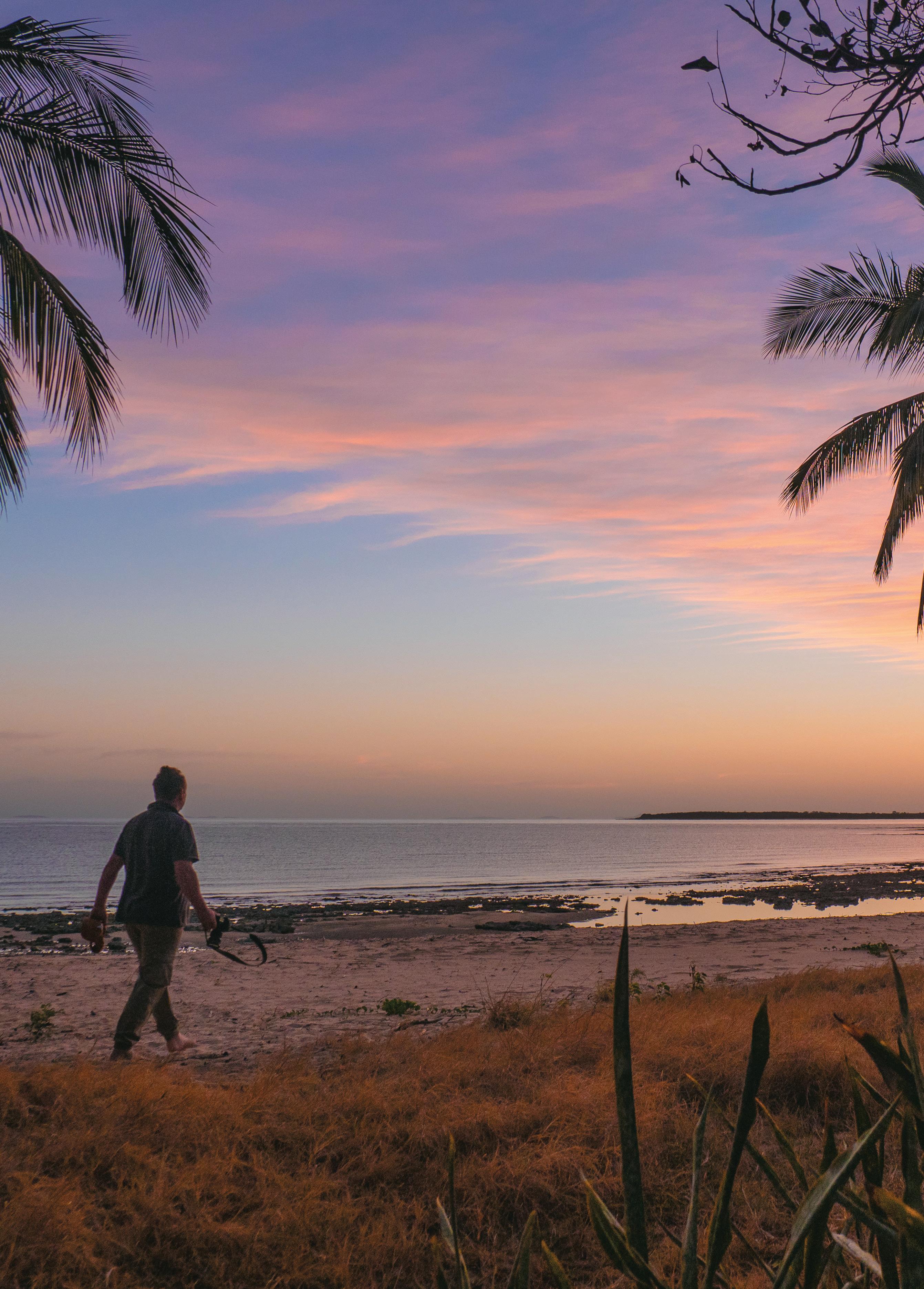
15. Enjoy the spectacular sunsets or Jacob’s Ladder/Stairway to heaven moonrise
16. Brandy Bottle Camping and Recreation Reserve with its challenging 9 hole golf course. A perfect place to kick back and relax
FLAGGY ROCK
17. Flaggy Rock Community Centre and RV stop. A welcoming rest stop or stay awhile. Swimming pool facility available.
27. Visit Yarrawonga and Notch Point Reserves to go camping, fishing and crabbing
INLAND
28. The great Isaac Pub and Pie Crawl: St Lawrence Hotel, Carmila Hotel, Historic Nebo Hotel, Moranbah Workers Club, Moranbah Bakery, Town Square Pies & Takeaway, Commercial Hotel Clermont, Bluemac Bakehouse Clermont, Jolly Collier Hotel Dysart, Dysart Bakery and Cakes, Middlemount Hotel and Middlemount Bakery
29. Drive the St Lawrence Range and see the Olympic torch relay site and monument on the way to May Downs Road or Lotus Creek and the newly rebuilt homestead
72
30 EXPERIENCE ISAAC
30. Stop, rest and refresh at the Isaac River rest area – 20 kilometres from Moranbah heading north-east
31. Fish like a local off the Connors River, Lotus Creek or Funnel Creek banks or enjoy a relaxing picnic
NEBO
32. Visit the historic town of Nebo, once known as ‘Fort Cooper’
33. Enjoy Nebo Historical Museum - a tribute to the old pioneers
34. Stop for lunch at the heritage-listed Nebo Hotel
35. Discover Mount Britton, visit the old town site and camp under the stars. Stay a few nights - it’s free!
36. Walk the national park for fossil localities dating from the Permain Period - 280225 million years ago
37. It’s Rodeo time! If you’re visiting Nebo the last weekend in May, there will be plenty of cowboy action (bookings essential)
38. Take a drive to Homevale National Park and enjoy the prominent cliffs, peaks and spires
39. Visit the spectacular Diamond Cliffs, Marling Spikes and Sydney Heads that form along the Bowen Basin
40. Denham Range to Moonlight Dam is a great 16.2 kilometre walk (one way, 5.5-8 hours, extremely steep descents are a challenge). Enjoy the surrounding mountain ranges and sharp peaks
41. Enjoy a quiet camp on the edge of Moonlight Dam - a popular place for bird watching
42. Test your 4WD skills with a self-guided tour through Homevale National Park which links up with Eungella and Mackay Highlands drive. The gravel tracks will give a different view of the rainforesthome to over 100 bird species
DYSART
43. Enjoy wide-open spaces with a drive to Dysart, established in 1973 as a mining town and surrounded by cattle and grain properties
44. Stop at the Dysart entrance to view a belly dump truck and coal wagon - testament to the town’s coal mining foundations
45. At Dysart’s Recreational Centre, you’ll be amazed at what’s on offer
46. Enjoy a round of golf while experiencing great views of the countryside with its rolling hills and landscapes offering a challenging yet fun 8 holes of play
47. Appreciate the beauty of the Lord’s Table Mountain, a 320 metre high, flat-topped plateau, centrally located within the Peak Range National Park. Enjoy a picnic at the scenic base on Huntley Road
MIDDLEMOUNT
48. Middlemount town, originally built for miners and their families, has evolved into an agricultural centre for the farming community
49. Middlemount Golf Course - one of the best 9 hole courses in the Central Highlands. Picture perfect fairways and extremely fast greens
50. Visit Blue Mountain Park for panoramic views, bird watching and photography. Picnic tables, barbeques and children’s play area
51. An event with a difference –Middlemount Race Day (August) is renowned for the Dachshund Races
CLERMONT
52. Clermont Visitor Information Centre has advice on things to do and see, where to eat and local treasures
53. Travel back in time with a visit to Clermont Historical Centre. See the steam engine that moved the township after the 1916 flood. Clermont was the first inland settlement in the tropics and showcases the gold rush era, copper mines, timber getters, shearers, stock men, squatters and much more
54. Get off the beaten track and discover Queensland’s most accessible goldfields... did you know that Clermont is home to 11 General Permission Areas?
55. Try your luck at striking gold at Queensland’s most accessible goldfields
56. Walk in the footsteps of the gold rush pioneers and visit the Outback Prospectors to buy or hire your gear, grab a map and hear great tips on how to find gold
57. Walk around Hoods Lagoon and Centenary Park for an insightful look into the human history of Clermont, including the 1916 Flood Memorial, the Piano in the Tree, Sister Mary MacKillop
Grotto, Billy Sing Memorial, Aboriginal Monument, the War Memorial and much more
58. Visit the railway station, see the town murals and discover the green frogs that artist Glen Gillard has hidden on the wagons
59. Be in town late May for the Clermont Agricultural Show
60. Bring the whole family to one of the most idyllic camping spots in the region. Camp, fish, ski or simply relax at Theresa Creek Dam and enjoy a tasty meal at the kiosk. The dam is stocked with Red Claw crayfish and fresh water species (permit required)
61. Delve a little deeper into Clermont’s history - visit the cemetery where some headstones date back to 1860s
62. Rose Harris Park - named after local identity and saddler. Rose and her father saved five lives in the 1916 floods. A perfect place for a picnic
63. A three-day event in September you won’t want to miss – Twin Hills Campdraft, Rodeo and Races
MORANBAH
64. Visit the Miners’ Memorial in Moranbah Town Square. A fitting tribute and peaceful place of remembrance for our fallen miners
65. Browse the many quirky shops for unique items to remind you of your visit
66. Let the kids cool off in the ‘splash zone’ at the Aquatic Centre
67. Follow the one-kilometre Federation Walk at Moranbah’s entrance to the town’s big red rhino bucket
68. The Grosvenor Complex in Town Square houses the Tourist Visitor Information and Coalface Art Gallery showcasing local artistic talent
69. Don’t miss the Spring Races at Treasure Park every November.
GLENDEN
70. Visit the modern mining town of Glenden - built in 1981 by Mount Isa Mining Company
71. Bird watch or enjoy wildlife at Lake Elphinstone, listed on the National Register of Important Wetlands
72. Camp at Lake Elphinstone – a meeting point for the Jangga, Barada Barna and Wiri Peoples
31 WWW.ISAAC.QLD.GOV.AU
(Open Monday to Friday, 8.30am to 5pm)
Clermont Office
21 Daintree Street CLERMONT QLD 4721
Dysart Office
18 Shannon Crescent DYSART QLD 4745
Glenden Office
Town Shopping Centre
17-27 Perry Drive GLENDEN QLD 4743
Middlemount Office
11 Carter Place MIDDLEMOUNT QLD 4746
Moranbah Office
Grosvenor Complex
1 Batchelor Parade MORANBAH QLD 4744
Nebo Office
14 Reynolds Street NEBO QLD 4742
St Lawrence Office
36 Macartney Street ST LAWRENCE QLD 4707
OTHER WAYS TO CONTACT US
1300 ISAACS (1300 47 22 27)
isaac.qld.gov.au
PO Box 97 MORANBAH Q 4744
records@isaac.qld.gov.au
isaacregionalcouncil
isaacregionalcouncil isaacrcouncil
Search isaac-regional-council
www.mackayisaac.com
www.facebook.com/mackayisaactourism @visitmackayisaac
All
© Isaac Regional Council

ISAAC REGIONAL COUNCIL OFFICES
content
care has been taken to ensure
is complete and accurate. However, Isaac Regional Council does not guarantee it is without error. Re-published December 2023.
FOR MORE INFORMATION
FOLLOW US ON SOCIAL MEDIA


