International Research Journal of Engineering and Technology (IRJET)
e-ISSN: 2395-0056
Volume: 07 Issue: 04 | Apr 2020
p-ISSN: 2395-0072
www.irjet.net
Crash Clusters on NH-52 by using Google Maps Sunny Tawar1, Sachin Dass2 1Assistant
Professor, Civil Engineering Department, Central University of Haryana, Jant-Pali, Mahendergarh, Haryana, India 2Assistant Professor, Department of Civil Engineering, Deenbandhu Chhotu Ram University of Science and Technology, Murthal, Sonipat, Haryana, India ---------------------------------------------------------------------***----------------------------------------------------------------------
Abstract – Road crashes in India directly affects the
economy to a large extent and various lives every year. Road Safety in India is also a major concern among the people daily as the number of crashes are increasing every second, every minute and every hour of the day. This paper generally deals with the study and to analyze crash clusters in Hisar city on NH-52 in the state of Haryana, India and also to see the real image of clusters as by using Google Maps by analyzing the adequate frequency of the crash clusters according to the type of crashes and other considerations. The fatal and non-fatal crashes both have been considered for creating crash clusters on NH-52. The crash rate has also been calculated considering the fatal and non-fatal crashes.
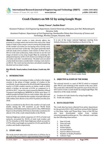
It is one of the major national highways starting from Ambala, Haryana to Pali, Rajsthan as shown in Fig. -1:
Key Words: Road crashes, Crash cluster, Crash rate, NH52 Fig -1: Stretch under Study
1. INTRODUCTION Road crashes are increasing in India, as India is the largest country in the phase of larger number of crashes in the worldwide. As per data given by World Health Organization, nearly 4, 67,044 crashes reports on Indian roads in 2018, which is further an increase of 0.5% as compared to 4, 64,910 in 2017. As per the report issued by Ministry of Road Transport and Highways (MORTH) in 2018, more than 1.5 million people lost their lives in road crashes. Also, the road crash severity calculated by the number of people killed per 100 crashes, have shown a rise of 0.6 % points as in the year 2018. India is considered as the first in the number of road crash deaths among the 199 countries as per World Road Statistics, 2018 followed by China and U.S. Also, WHO Global Report on Road Safety 2018 shows that India constitutes for almost 11% of the crash related deaths in the World. National Highways which comprises of 1.94 % of total road network, accounted for 30.2% of total road crashes and 35.7% of deaths in 2018. State Highways which account for 2.97% of the road length accounted for 25.2% and 26.8% of crashes and deaths respectively.
2. STUDY AREA The study stretch taken into consideration is of Hisar city in the state of Haryana which is approximately 8 kms in length. Š 2020, IRJET
|
Impact Factor value: 7.529
|
3. OBJECTIVE & SCOPE OF THE WORK The selected stretch is a part of NH-52 which is renamed after NH-65 and widening of the stretch in the year 2016. The crash data collected for the past five years from 2011 to 2015 and to create a crash cluster by using Google Maps. The objectives of the study include: a) Creation of crash clusters by using Google Maps. b) Crash rate analysis.
4. DATA COLLECTION The crash data has been collected from police department for the period of 2011-2015 and from various Police Stations i.e City Hisar, Sadar and Thana Hisar. Some of the FIR has also been downloaded online from website www.haryanapoliceonline.gov.in. The collected crash data has the following observations: 1. 2. 3. 4. 5. 6. 7. 8.
Date of Crash. Time of Crash Day of Crash Victim Vehicle Accused Vehicle. Injuries (Minor/Grievous). Number of deaths/Fatalities Collision Type
ISO 9001:2008 Certified Journal
|
Page 5995