International Research Journal of Engineering and Technology (IRJET)
e-ISSN: 2395-0056
Volume: 06 Issue: 12 | Dec 2019
p-ISSN: 2395-0072
www.irjet.net
Water Level Fluctuation in Nainital Lake and its Correlation with Rainfall and LULC Change Rishabh Singh1, Chiranjeev Pant2 1B.
Tech, College of Technology, GBPUAT Tech, College of Technology, GBPUAT ---------------------------------------------------------------------***---------------------------------------------------------------------2B.
Abstract - The Nainital lake is an important source of
water for the local population and is also of importance due to its tourist attraction. Over the years the water level in the Nainital lake has fluctuated and stayed below its ideal level. In this study linear regression and coefficient of correlation were used to establish a relationship between rainfall and lake water level, and built-up area and lake water level for a period of 7 years from 2010 to 2016. It was observed that both decreasing rainfall and increasing built-up area trends matched the trend of the decreasing lake water levels. Rainfall had a very weak correlation with the lake water levels (R = -0.35482), whereas built-up area showed a stronger correlation (R = 0.8917).This implied that though both factors may play a role in the decreasing water levels in the lake, increase in built-up area was far more influential as compared to rainfall. Key Words: Nainital lake, built-up area, rainfall, lake water levels
1. INTRODUCTION
the Nainital Fault Line (Valdiya, 1988) approximately 40-50 thousand years ago (Singhvi et al., 1994). The lake is a major source of water supply for the population of Nainital (Singh and Gopal 1999). The lake depth varies from 27.3 m at the deepest point to close to 3 m at the most shallow point (Choudhary et al.,2012).
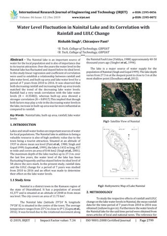
Fig1- Satellite View of Nainital
Lakes and small water bodies are important sources of water for local populations. The Nainital lake in addition to being a valuable resource is also of high aesthetic value due to the town being a tourist attraction. Situated at an altitude of 1937 m above mean sea level (Pant et al., 1980; Singh and Gopal 1999; Gupta et al., 1999), the lake is 1432 m long, 457 m wide and covers an area of 0.46 km2 (Singh et al., 2001). The maximum depth of the lake reaches up to 27.3 m. over the last few years, the water level of the lake has been fluctuating frequently and has stayed below its ideal level of 5ft above the zero mark. In the present study, rainfall data and the LULC change for a period of 7 years was studied from 2010 to 2016 and an effort was made to determine their effect on the lake water levels.
1.1 Study Area Nainital is a district town in the Kumaon region of the state of Uttarakhand. It has a population of around 41,377 and is situated at an altitude of 2048 m from mean sea level. The city covers an area of 11.73 km2.
Fig2- Bathymetric Map of Lake Nainital
2. METHODOLOGY
The Nainital lake (latitude 29°24’ N, longitude 79°28’ E) is situated in the centre of the town. The average temperature ranges from 250 C to close to 00 C (Gupta et al., 2016). It was formed due to the rotational movement along
To study the respective effects of rainfall and LULC change on the lake water levels in Nainital, the mean rainfall data for the time period of 7 years from 2010 to 2016 was obtained (indiawris.gov.in). Furthermore the water levels of the Nainital lake for the said time period were obtained from news articles of local and national news. The reference for
© 2019, IRJET
ISO 9001:2008 Certified Journal
|
Impact Factor value: 7.34
|
|
Page 2799