International Research Journal of Engineering and Technology (IRJET)
e-ISSN: 2395-0056
Volume: 06 Issue: 12 | Dec 2019 www.irjet.net
p-ISSN: 2395-0072
Control Center Viewing of UAS-based Real-Time Sensor and Video Measurements at an Electric Utility Facility Peter L. Fuhr*, Kenneth Woodworth, Gary Hahn, Jason Richards, William Monday 1Oak
Ridge National Laboratory, One Bethel Valley Road, Oak Ridge, Tennessee, 37831 USA ----------------------------------------------------------------------***--------------------------------------------------------------------Abstract – Drones equipped with video cameras, LIDAR and thermal imagers have been demonstrated in industrial and utility settings. In such instances, the images are typically locally stored onboard the drone then retrieved from the image storage media and analyzed. We report on a project involving the transport and display of measurements and thermal and visual video streams into a utility control center. Relying on an integrated multimedia communications network, realtime control center viewing of sensor readings and image streams is achieved. Details of this activity are reported.
Alternatively labelled unmanned aircraft systems, unmanned aerial vehicles, or simply drones, small UASs (sUASs) are becoming readily accessible for commercial, governmental, and private use across a myriad of far-ranging applications [1,2].
Key Words: wireless sensors, drones, communications
2. Installation, Location and Components Details
1. Introduction
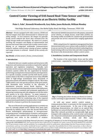
The location of the sensor-laden drone and the utility control center – separated by 7.44km- is illustrated in Figure 1.
While using drones for vegetation management has been demonstrated and is now commercially available for utilities to use as a service [3], our efforts involved conducting dronebased sensing with a real-time data and video transport from the drone to the demonstration utility’s control center.
Industrial sites are complex systems and structures with inspection and maintenance procedures required for optimal operation and regulatory compliance. Typically, such activities involve sensors and systems being installed at key locations (assets) within the site augmented by humans performing varying levels of measurements and inspections. As a specific example, consider just the bulk electric power system which in the USA is comprised of more than 200,000 miles of high-voltage transmission lines, thousands of generation plants and millions of digital controls. More than 1,800 entities own and operate portions of the grid system, with thousands more involved in the operation of distribution networks across North America. The interconnected and interdependent nature of the bulk power system requires a consistent and systematic application of measuring, monitoring and risk mitigation across the entire grid system to be truly effective. In many instances a question arises regarding the potential use of unmanned aerial systems (UAS) for conducting some of the required measurements particularly in locations where it may be more difficult for a human to perform the measurement.
Fig. 1. Training site (where drones are flown) to Control Center (viewing) is approximately 7.44km (urban setting). As with any sensor and/or control system, a communications fabric is necessary for the transport of the signals and measurements. In the case of this specific technology demonstration, we relied on an optical fiber backbone core network that the utility has in place. This 1-10 Gbps fiber network provided an exceptionally high speed transport with endpoints at the control center and training site. A layered communication system, illustrated in Figure 2, incorporating wireless, wired, and fiber optic
The use of drones for sensing applications is certainly not new for remotely piloted aerial vehicles have been used, primarily by military forces, since the Second World War. Recent technological advancements in microprocessor computing power, miniaturization of sensors, and purposebuilt software have enabled UAS technology to establish a significant new niche in the evolution of aviation.
This work was conducted at Oak Ridge National Laboratory, managed by UT-Battelle LLC for the US Department of Energy (DOE) under contract DE- AC05-00OR22725. This manuscript has been authored by UT-Battelle LLC under contract DE-AC05-00OR22725 with DOE. The US government retains and the publisher, by accepting the article for publication, acknowledges that the US government retains a nonexclusive, paid-up, irrevocable, worldwide license to publish or reproduce the published form of this manuscript, or allow others to do so, for US government purposes. DOE will provide public access to these results of federally sponsored research in accordance with the DOE Public Access Plan (http://energy.gov/downloads/doe-public-access-plan).
© 2019, IRJET
|
Impact Factor value: 7.34
|
ISO 9001:2008 Certified Journal
|
Page 2703