TitleCo: WESTERNTITLE&ESCROWCO Sentry Dynamics, Inc. and its customers make no representations, warranties or conditions, express or implied, as to the accuracy or completeness of information contained in this report.
Deschutes County Property Information
Report Date: 12/8/2025 10:12:02 AM
The information and maps presented in this report are provided for your convenience. Every reasonable effort has been made to assure the accuracy of the data and associated maps. Deschutes County makes no warranty, representation or guarantee as to the content, sequence, accuracy, timeliness or completeness of any of the data provided herein. Deschutes County explicitly disclaims any representations and warranties, including, without limitation, the implied warranties of merchantability and fitness for a particular purpose. Deschutes County shall assume no liability for any errors, omissions, or inaccuracies in the information provided regardless of how caused. Deschutes County assumes no liability for any decisions made or actions taken or not taken by the user of this information or data furnished hereunder.
Warnings, Notations, and Special Assessments
Review of digital records maintained by the Deschutes County Assessor’s Office, Tax Office, Finance Office, and the Community Development Department indicates that there are no special tax, assessment or property development related notations associated with this account. However, independent verification of the presence of other Deschutes County tax, assessment, development, and additional property related considerations is recommended. Confirmation is commonly provided by title companies, real estate agents, developers, engineering and surveying firms, and other parties who are involved in property transactions or property development. In addition, County departments may be contacted directly to discuss the information.
Tax Payment History
Land Characteristics
Development Summary
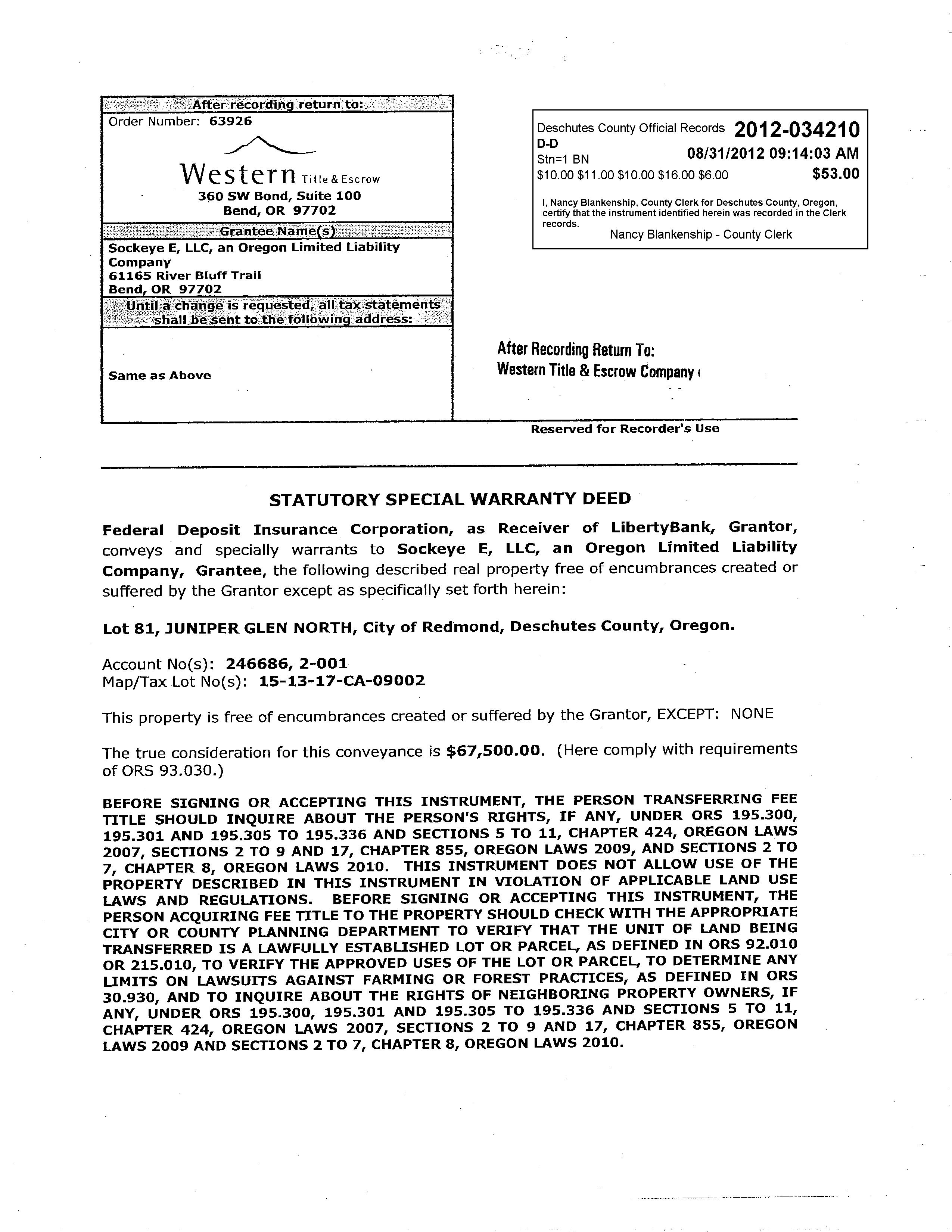
STATEMENT OF TAX ACCOUNT
Please include this coupon with payment. Please do not staple, paper clip or tape your payment.
Please select payment option
Payment Due One-Third Payment (No Discount) Next Payment Due
Payment Due November 17, 2025
address change form on reverse) Full Payment (3% Discount) Two-Thirds Payment (2% Discount)
Please make checks payable to Deschutes County
$3,946.08
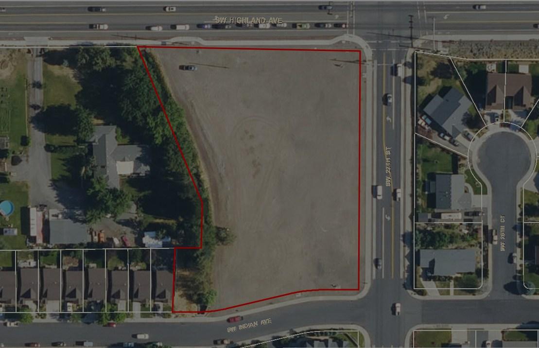
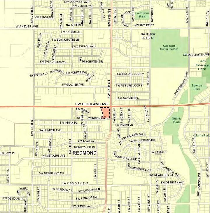
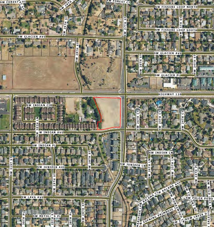
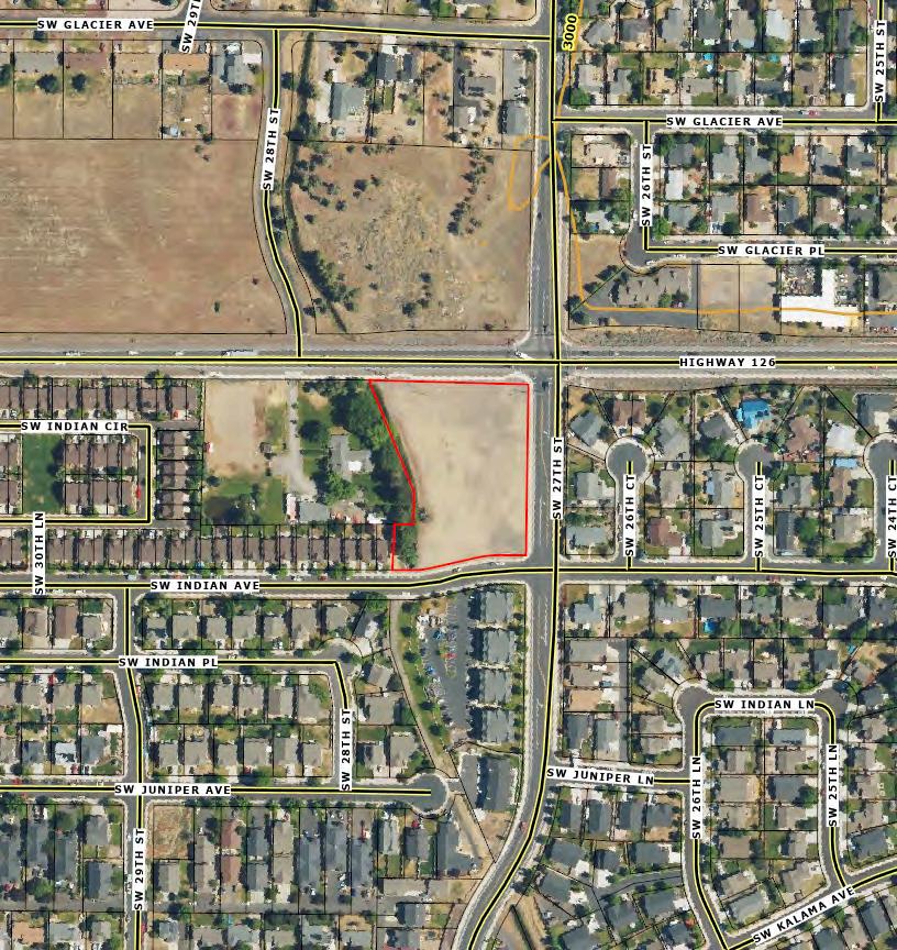
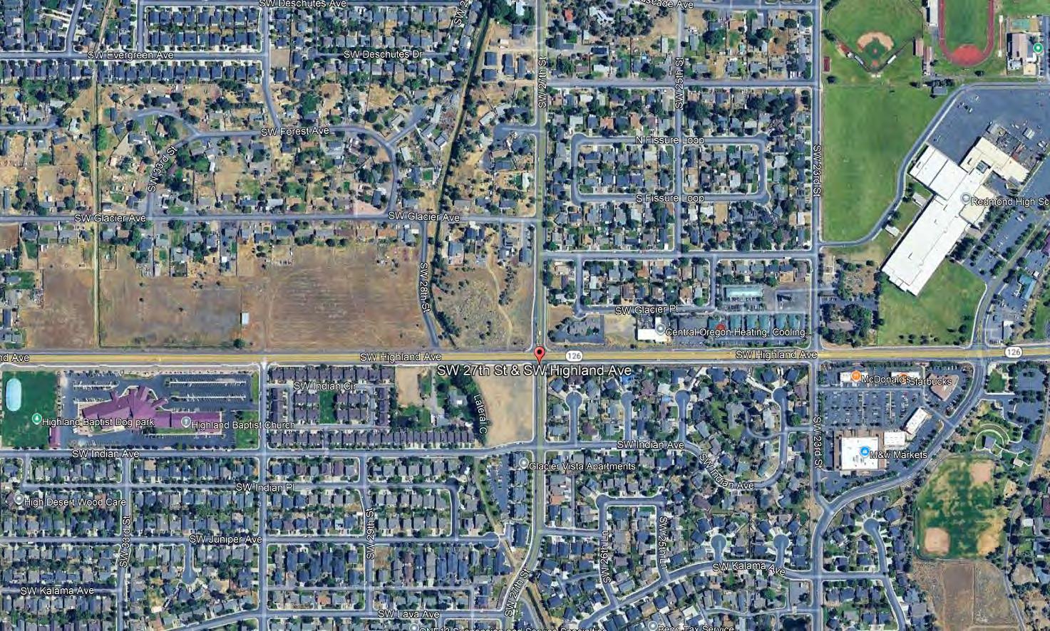
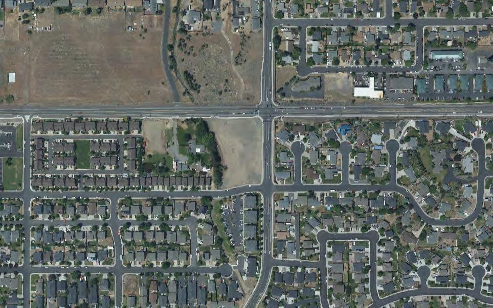
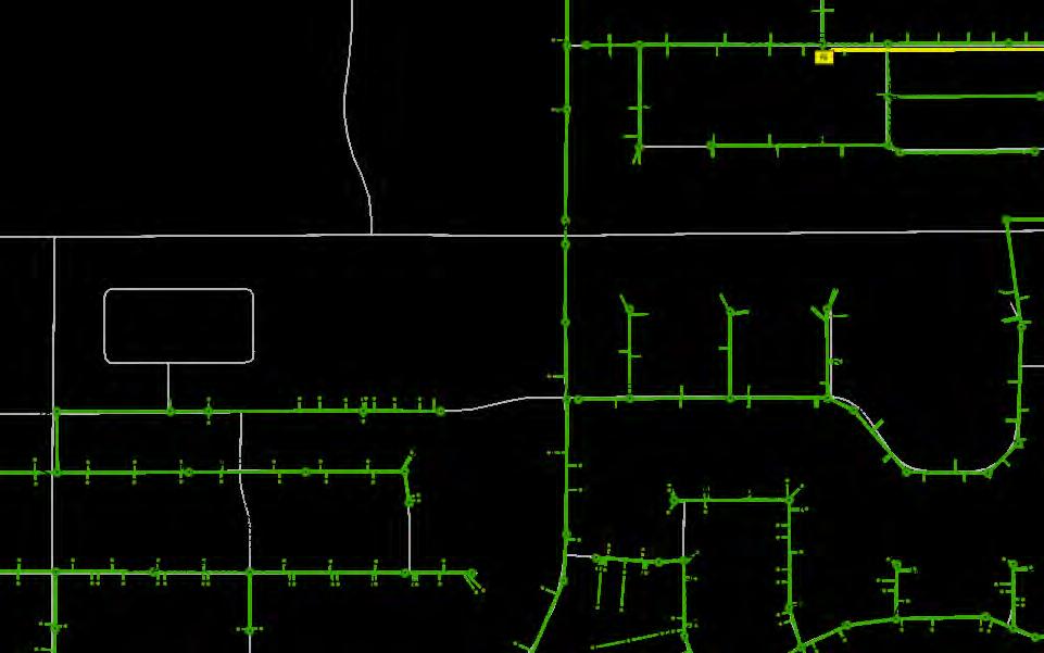
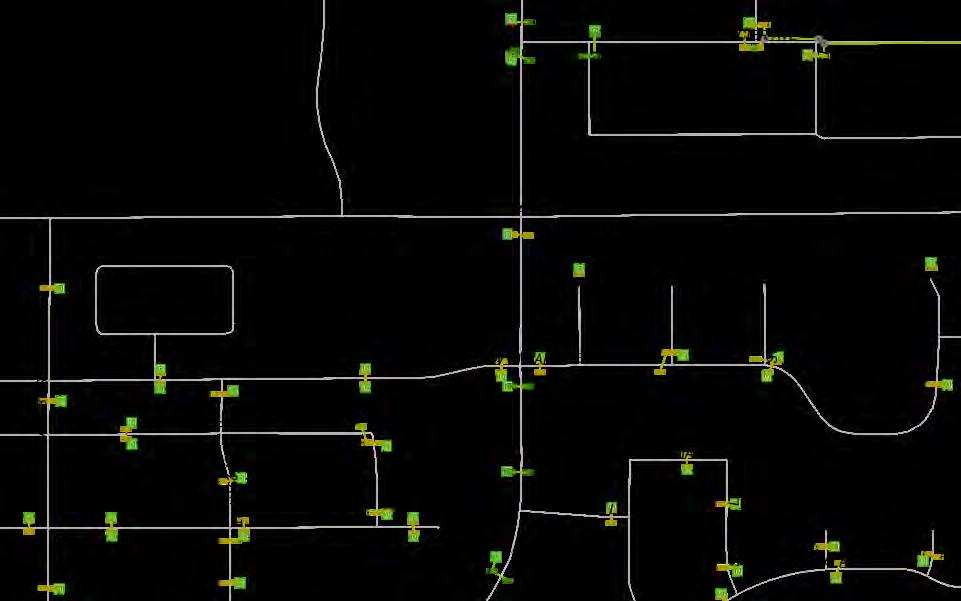
Deschutes County GIS
Map and Taxlot: 151317CA09002
Covenants, Conditions and Restrictions
CC&R’s Hard Copy Available Upon Request Or Click the Hyperlink on the next page to view Electronically
TIMOTHY R. RALSTON AND CANO CORPORATION, an Oregon Corporation, as tenants in common, "Grantor"
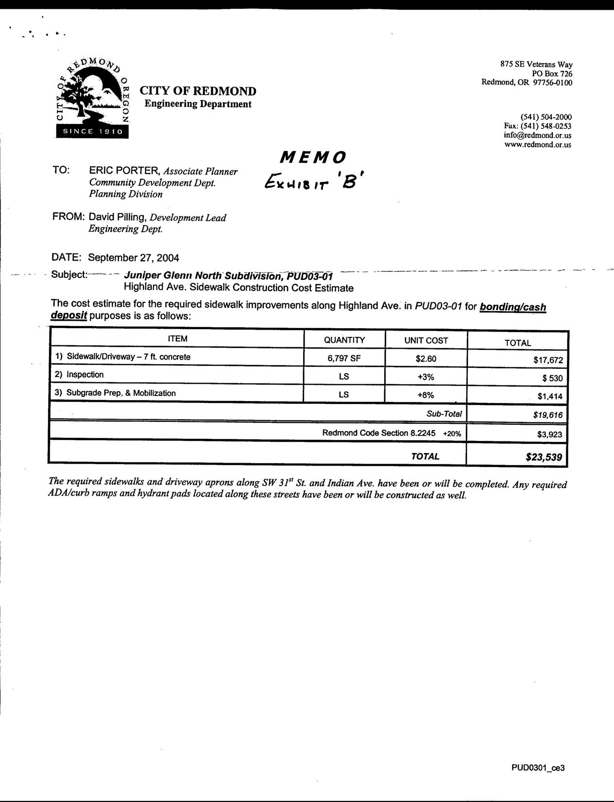
CITY OF REDMOND, an Oregon Municipal Corporation, "Grantee"
AFFECTED PROPERTY:
Grantor is currently the owner of the following described real property (property) located in Deschutes County,Oregon:
As shown on the attached legal description of property in EXHIBIT A". 3. GRANT OFEASEMENT:
Grantor does hereby grant unto the Grantee, its successors and assigns, and Grantee hereby accepts, a Public Utility Easement (PUE) for a portion ofGrantor's property as shown in the map attached as "B" and more fully described in EXHIBIT "C", which are incorporated herein.
STATEMENT OF PURPOSE:
The easement described above shall be used to construct and maintain public utilities (utilities) and for unrestricted ingress and egress to Grantor's property forthe purpose of installing, repairing, testing, maintaining, and replacing the utilities and related facilities.
TYPEOF EASEMENT: or
The easement (PUE) described above shallbenon-exclusiveexcept that Grantee and utilities shall have the exclusive right to construct, install, maintain and operate the utilities, their equipment and all related facilities above and below ground within thePUE including the rightof access to such facilitiesandthe right to require the removal of any obstructions including trees and vegetation that may be placed within the PUE at Grantor's expense. Grantor may use the surface of the PUE provided such use does not interfere with Grantee's rights contained in this easement. Grantor shall not permit any other use utilities to be located in the PUE without the written consent of Grantee.Approved uses within the PUE shall consist of, but are not limited to, landscaping, paved driveway or parking areas, trails, paths, sidewalks or other uses that will not affect the ability of the City or utilities to access the PUE. Prohibited uses shall consist of, but are not limited to, permanentstructures, buildings, or any other obstruction, excavation or alterationofthePUE. The PUE shall perpetually encumber the property.
MAINTENANC :
Grantee and utilities shall be responsible for the maintenance of the utilities and related facilities located within the PUE. Grantor shall be responsible for landscape and surface maintenance within the easement. Grantee's use of the easement shall not unreasonably interfere with Grantor's use of its property.
INDEMNIFICATION:
The Grantor does hereby agree to defend, hold harmless, and indemnify Grantee, its successors and assigns, from any claim of liability or any other claim involving the utilities, or arising out of the Grantee's use of the easement described above.
REMEDIES:
In addition to all other remedies allowed by law,theparties,their successors and assigns, shall have the right to seek injunctive reliefforthe enforcement ofthetermsand conditions ofthisagreement.
BINDING EFFECT ON SUCCESSOR INTERESTS:
Unofficial Copy
The terms, conditions and provisions of this agreement shall extend to, be binding upon and inure to the benefit of the heirs, personal representatives and assigns of the parties.
ATTORNEY FEE:
In case suit or action is instituted in connection with this agreement, the prevailing party shall be entitled to recover from the losing party such sums as the court may adjudge reasonable as attorney fees and costs in such suit or action, or upon appeal.
DATED this 12th dayof April
GRANTOR:
By: AMOTHY R. RALSTON
GRANTEE: 2007.
MICHAEL PATTERSON, City Manager
City of Redmond
By: CANO CORPORATION
STATEOF regon County of multnomah*
Personallyappeared before me this 12th day of April 2007
TIMOTHY R. RÁLTON, and acknowledged the foregoing instrument tobehis voluntary act and deed.
By: Garnetta Cratirca Notary
Public for Stat of Oregon My Commission expires:
STATE OF oregon
County of muunomah Ss.
Personally appeared before methis 12th day of April Tim Ralston ,2007, for CANO CORPORATION, and acknowledged the foregoing instrument to be his/ and CANO CORPORATION 's voluntary act anddeed.
President Dy GannettaCraptree
Notary Public for State of ODregon
My Commission expires: 10/19/2010
Unofficial Copy
STATE OF OREGON ) ) ss.
County of Deschutes )
Personally appeared before methis 20th day of April 2007, MICHAEL PATTERSON, City Manager for the City of Redmond and acknowledged the foregoing instrument to be his and theCityof Redmond's voluntary act and deed, andaccepted the easement on behalf of the City of Redmond.
ByKillyMorse
Notary Publie for Oregon
My Commission Expires:
EXHIBIT
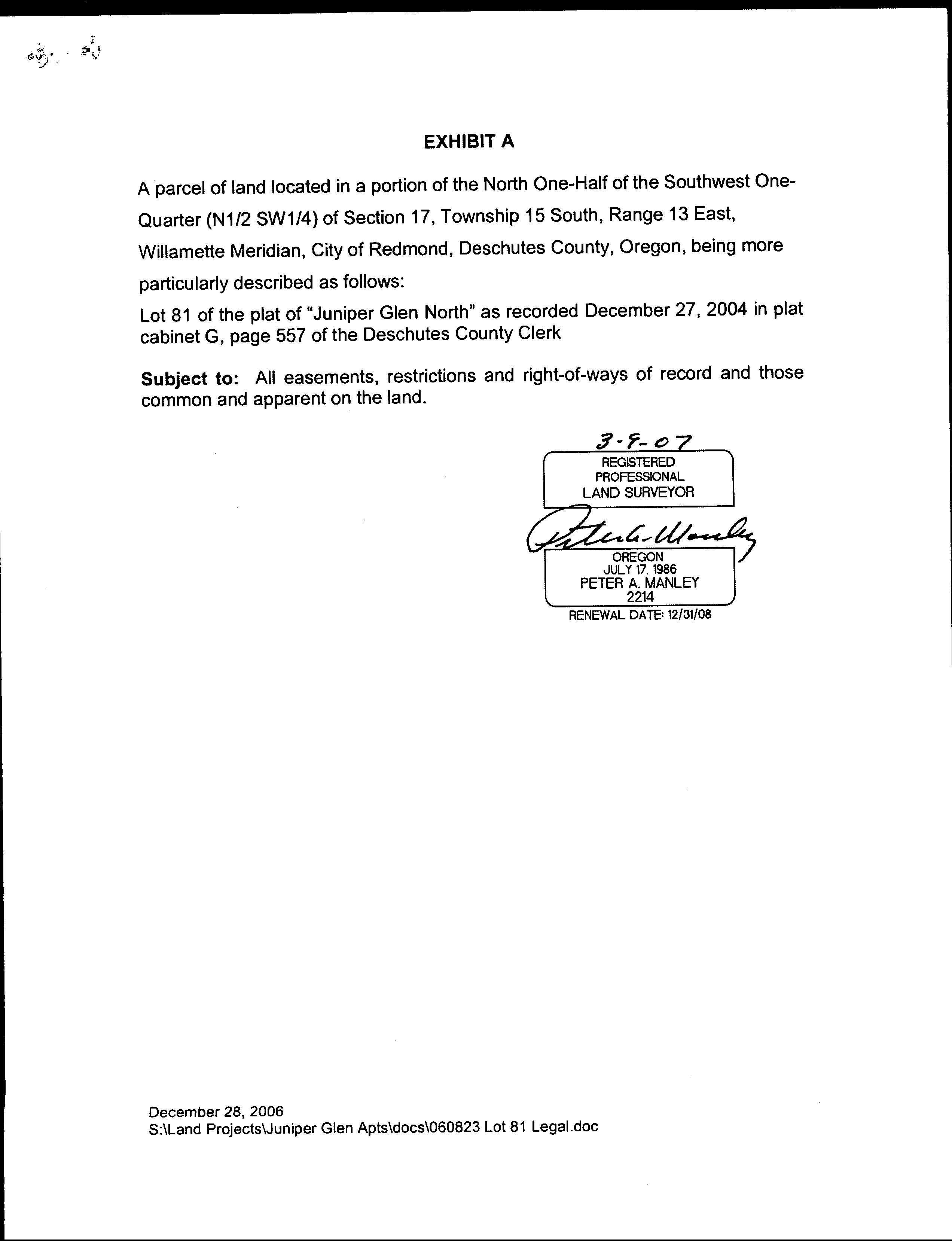
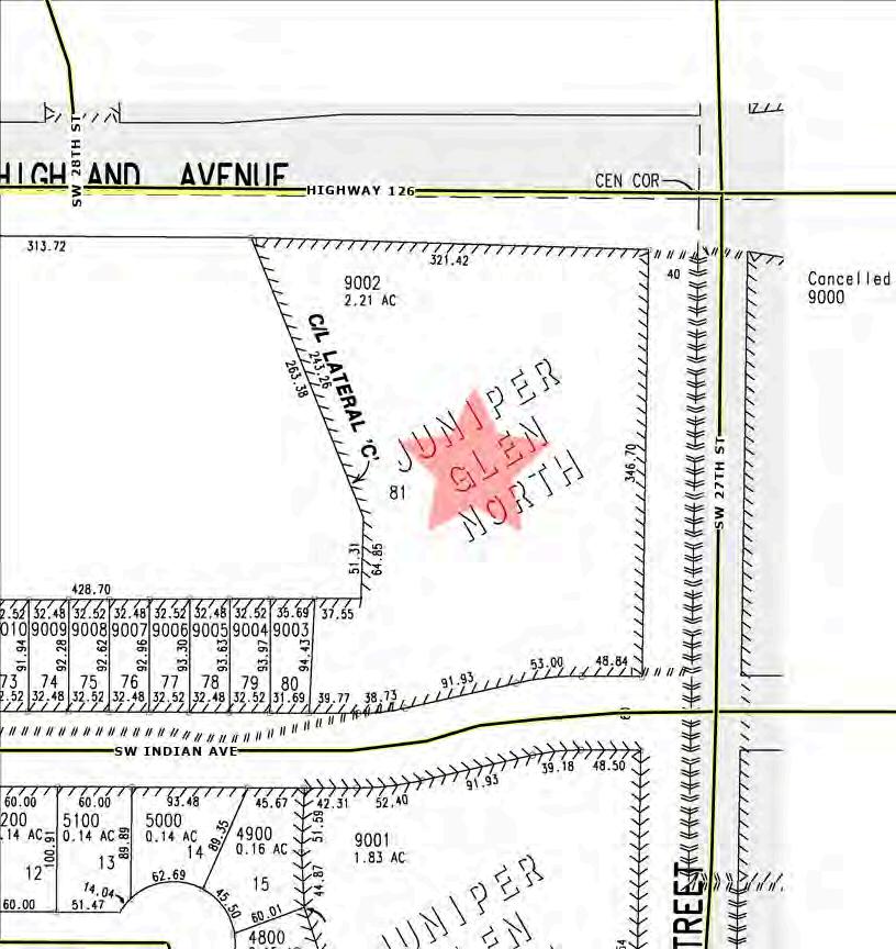
Aparcel of land located in a portion of the North One-Half of the Southwest OneQuarter (N1/2 SW1/4) of Section 17, Township 15 South, Range 13 East, Willamette Meridian, City of Redmond, Deschutes County, Oregon, being more particularly described as follows: Lot 81 of the plat of "Juniper Glen North" as recorded December 27, 2004 in plat cabinet G, page 557 of theDeschutes County Clerk
Subject to: All easements, restrictions and right-of-ways of record andthose common and apparent on the land.
3-9-07 REGISTERED PROFESSIONAL LAND SURVEYOR
Unofficial Copy
OREGON JULY 17. 1986 PETER A. MANLEY 2214
RENEWAL DATE: 12/31/08
December 28, 2006
S:\Land Projects\Juniper Glen Apts\docs\060823 Lot 81 Legal.do
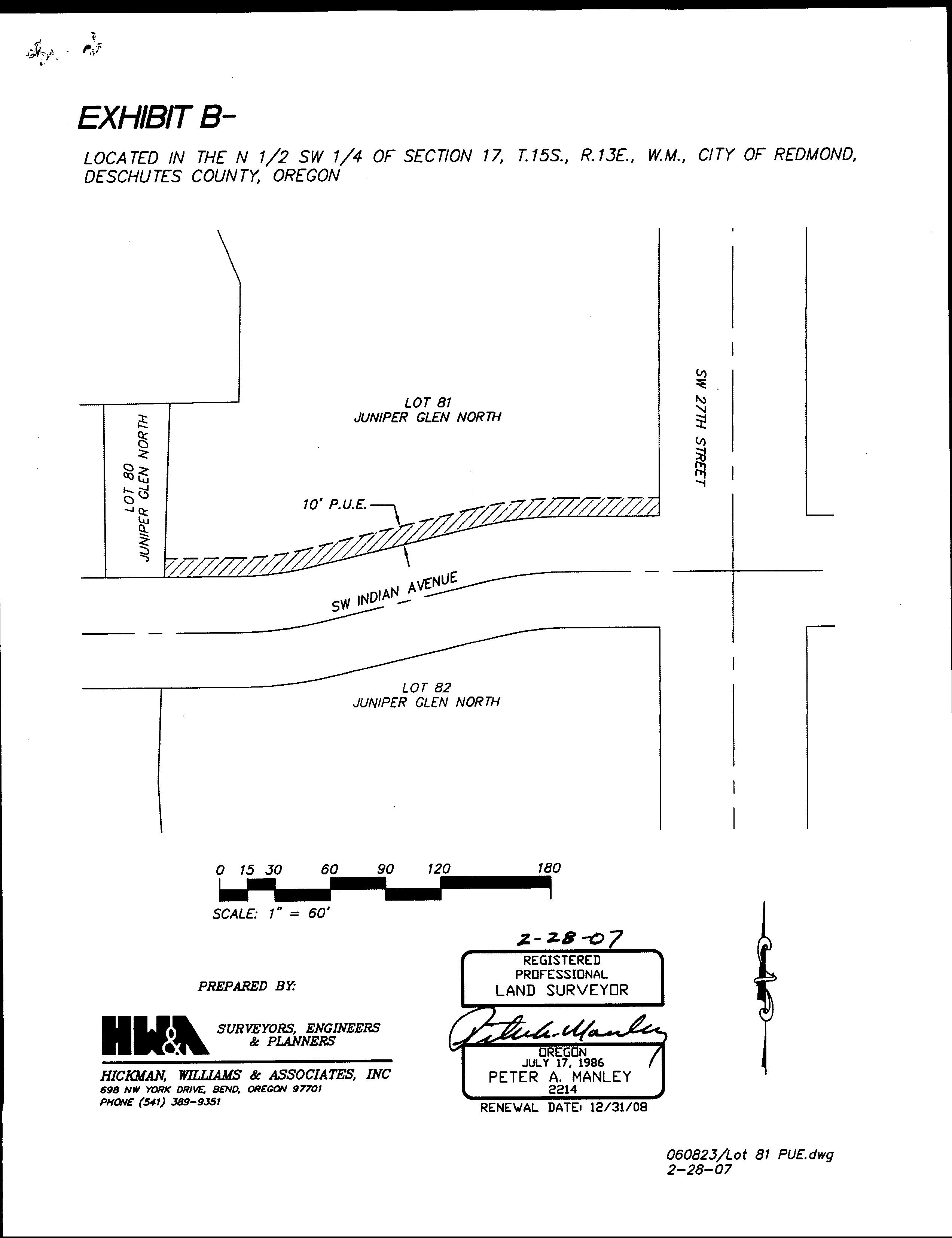
EXHIBIT B-
LOCATED IN THE N 1/2 SW 1/4 OF SECTION 17, T.15S., R.13E., W.M., CITY OF REDMOND, DESCHUTES COUNTY, OREGON
Unofficial Copy
2-28-07
EXHIBIT
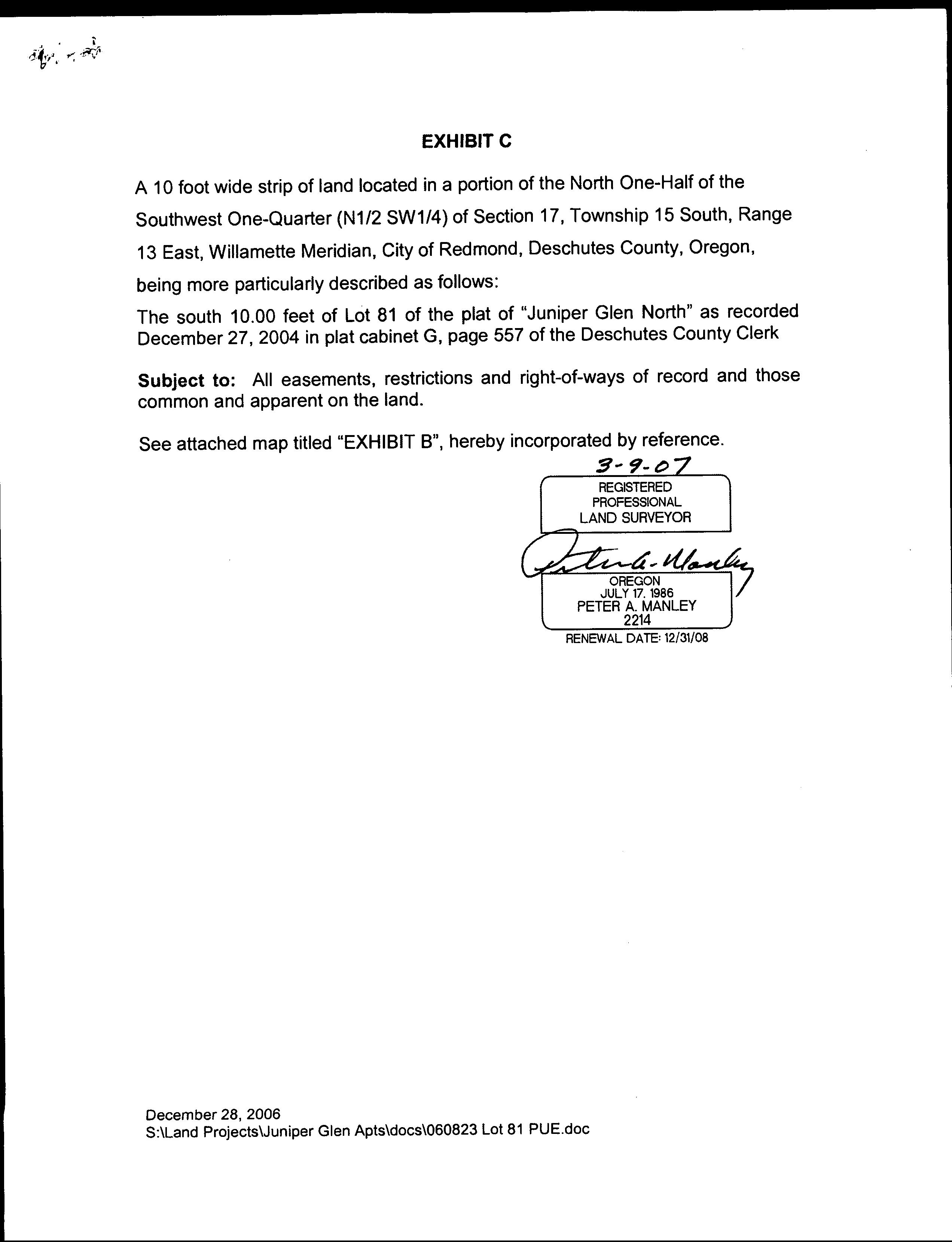
A 10 footwide strip of land located in a portion of the North One-Half of the Southwest One-Quarter (N1/2 SW1/4) of Section 17, Township 15 South, Range 13 East, Willamette Meridian, City of Redmond, Deschutes County, Oregon, being more particularly described as follows: The south 10.00 feetofLot 81 of the plat of "Juniper Glen North" as recorded December27, 2004 in plat cabinet G, page 557 of the Deschutes County Clerk
Subject to: All easements, restrictions and right-of-ways of record and those common and apparent on the land.
See attached map titled "EXHIBIT B", hereby incorporated by reference.
3-9-07Z REGISTERED PROFESSIONAL LAND SURVEYOR
Unofficial Copy
OREGON JULY 17. 1986 PETER A. MANLEY 2214
RENEWAL DATE: 12/31/08
December 28, 2006
S:\Land Projects\Juniper Glen Apts\docs\060823 Lot 81 PUE.doc
10/29/2025 Engineering Engr Approved Site Plan
10/29/2025 Engineering Lane & Road Closure Notifications
10/29/2025 Engineering inspection packet
View Document
View Document
View Document
View Document
Date
10/29/2025 Public Works Permit
711-22-000236-PLNG
10/21/2022 Application Materials
10/21/2022 Application Materials
10/31/2022 Decision Document
711-22-000235-PLNG
10/21/2022 Application Materials
10/21/2022 Application Materials
711-20-000132-PLNG
10/27/2020 Application Materials
10/2/2020 Application Materials
9/11/2025 Other Planning Document
711-20-000039-PD
2/20/2020 Application Materials
711-25-000157-PW View Document
711-22-000236-PLNG View Document
711-22-000236-PLNG View Document
711-22-000236-PLNG View Document
711-22-000235-PLNG View Document
711-22-000235-PLNG View Document
711-20-000132-PLNG View Document
711-20-000132-PLNG View Document
711-20-000132-PLNG View Document
711-20-000039-PD View Document
Parcel ID: 246686
TaxAccount #: 151317CA09002
Redmond OR 97756
This map/plat is being furnished as an aid in locating the herein described land in relation to adjoining streets, natural boundaries and other land, and is not a survey of the land depicted. Except to the extent a policy of title insurance is expressly modified by endorsement, if any, the company does not insure dimensions, distances, location of easements, acreage or other matters shown thereon.
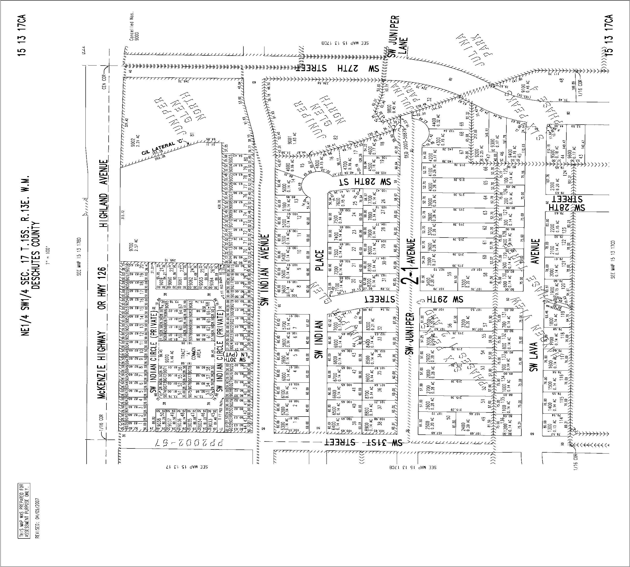
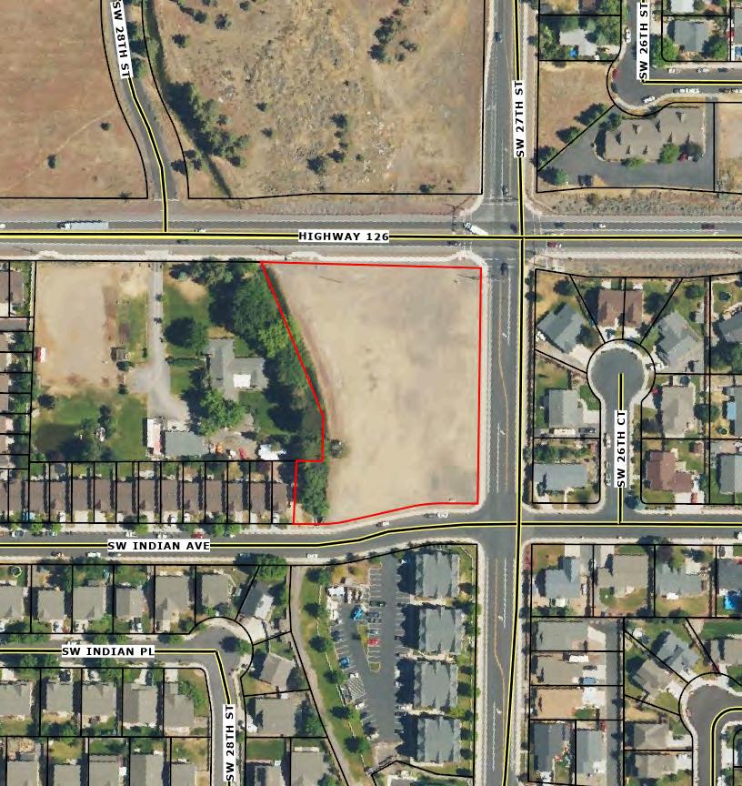
Assessor Map
Parcel ID: 246686
TaxAccount #: 151317CA09002
Redmond OR 97756
This map/plat is being furnished as an aid in locating the herein described land in relation to adjoining streets, natural boundaries and other land, and is not a survey of the land depicted. Except to the extent a policy of title insurance is expressly modified by endorsement, if any, the company does not insure dimensions, distances, location of easements, acreage or other matters shown thereon.
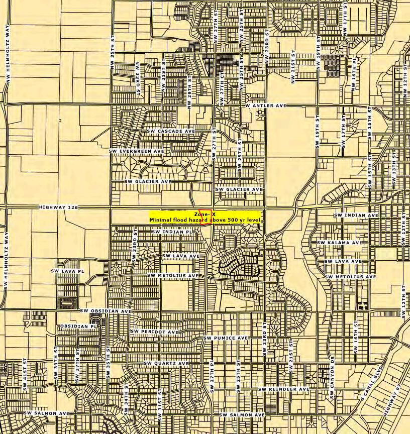
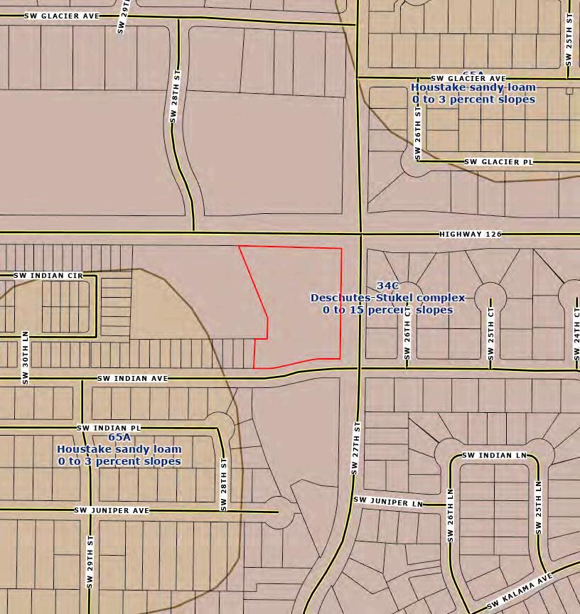
Soil Map
Parcel ID: 246686
TaxAccount #: 151317CA09002
Redmond OR 97756
This map/plat is being furnished as an aid in locating the herein described land in relation to adjoining streets, natural boundaries and other land, and is not a survey of the land depicted. Except to the extent a policy of title insurance is expressly modified by endorsement, if any, the company does not insure dimensions, distances, location of easements, acreage or other matters shown thereon.
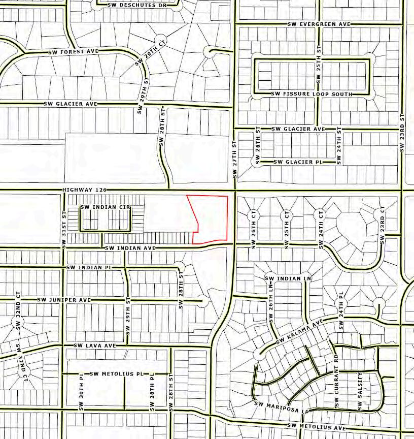
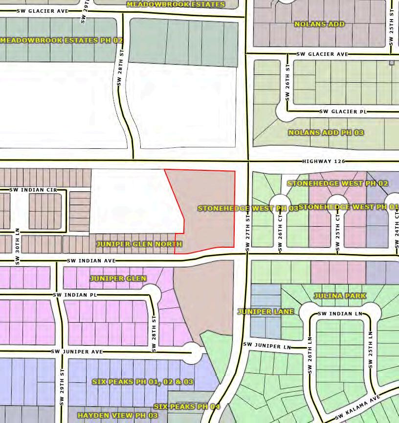
Subdivision Map
Parcel ID: 246686
TaxAccount #: 151317CA09002
Redmond OR 97756
This map/plat is being furnished as an aid in locating the herein described land in relation to adjoining streets, natural boundaries and other land, and is not a survey of the land depicted. Except to the extent a policy of title insurance is expressly modified by endorsement, if any, the company does not insure dimensions, distances, location of easements, acreage or other matters shown thereon.
Parcel ID: 246686
TaxAccount #: 151317CA09002
Redmond OR
This map/plat is being furnished as an aid in locating the herein described land in relation to adjoining streets, natural boundaries and other land, and is not a survey of the land depicted. Except to the extent a policy of title insurance is expressly modified by endorsement, if any, the company does not insure dimensions, distances, location of easements, acreage or other matters shown thereon.
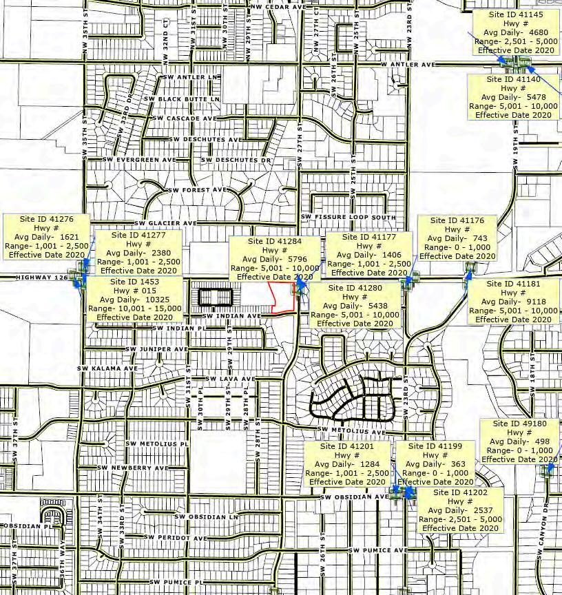
Surrounding Businesses
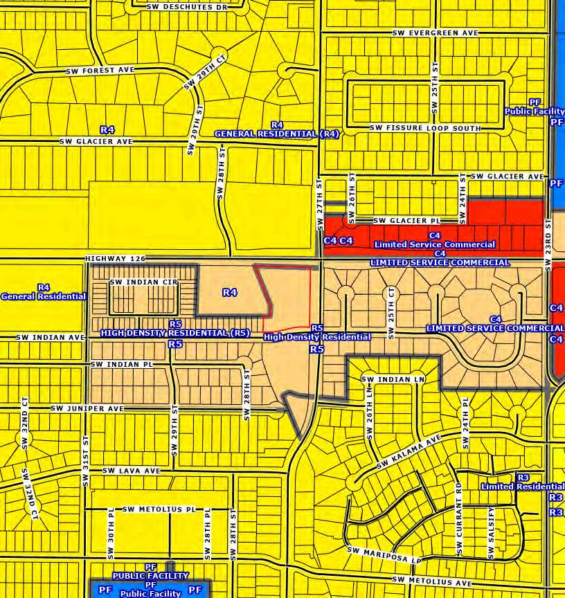
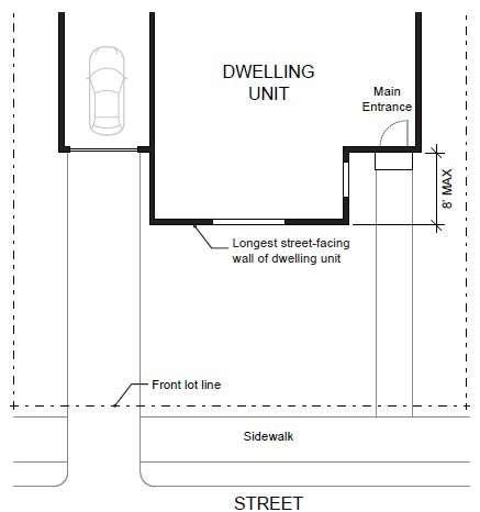
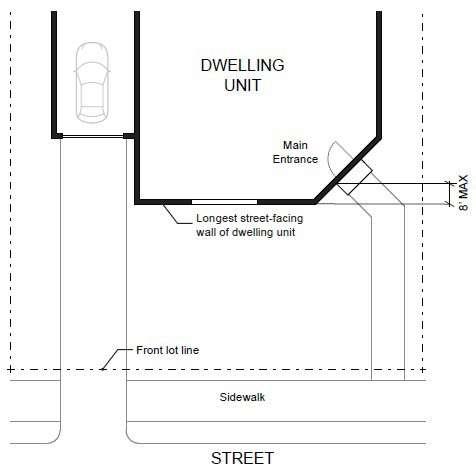
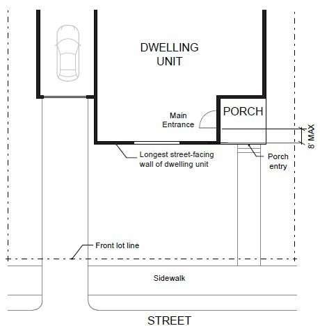
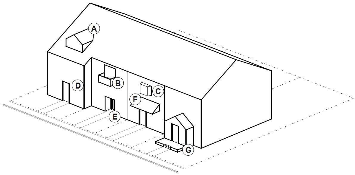
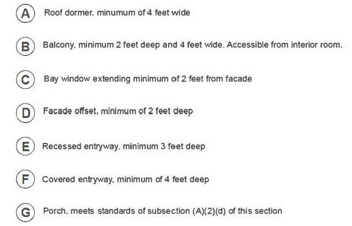
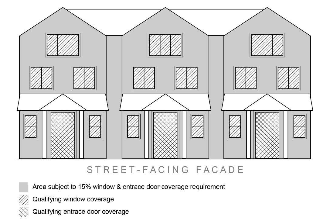
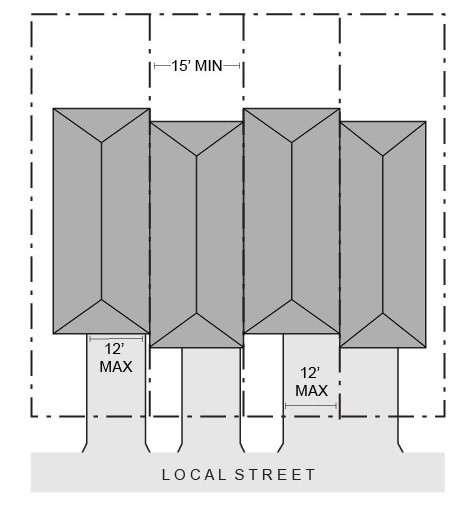
REDMOND CODE
CHAPTER 8
DEVELOPMENT REGULATIONS
The contents of Chapter Development Regulations can be found here: