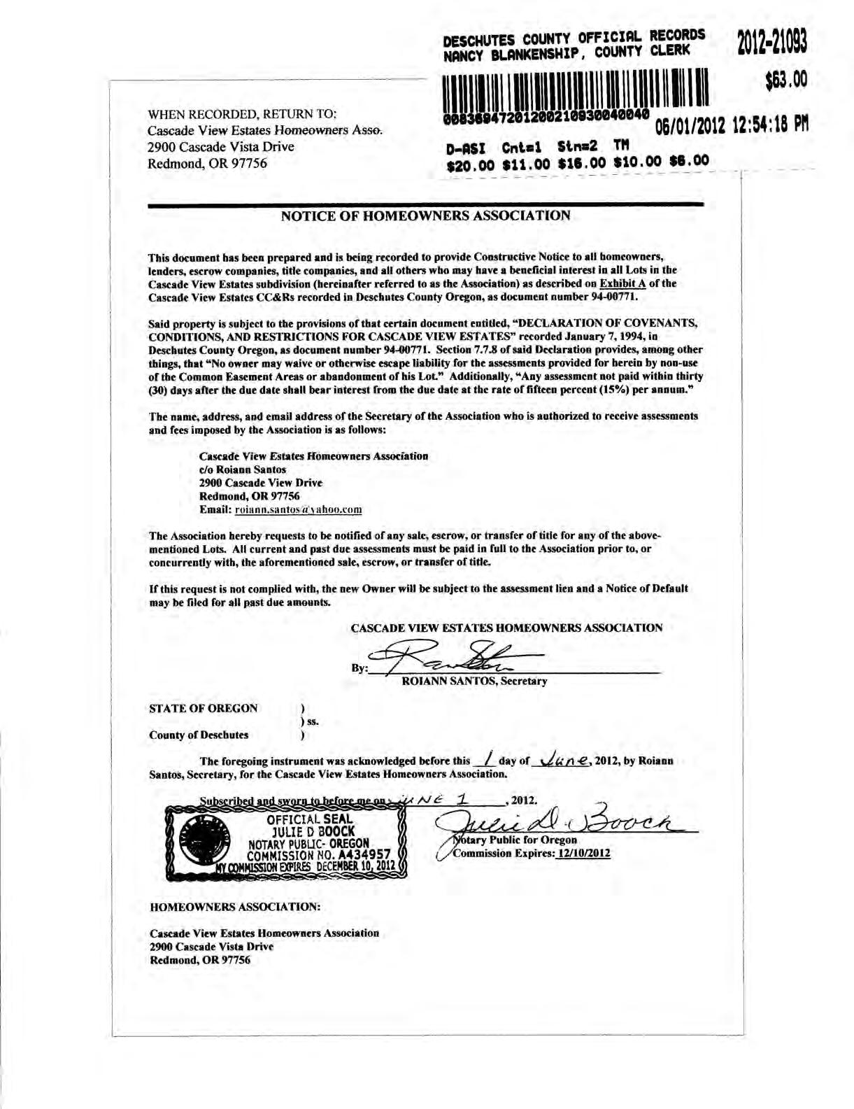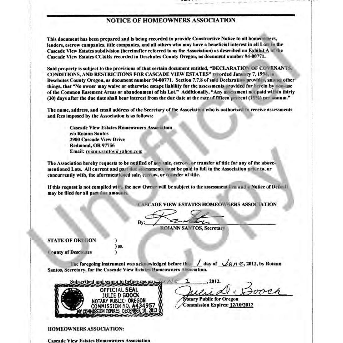
DECLARATION
KNOW ATION, THE LAND SHOWN O BE SURVEYED AND PLATTED INTO LOTS AND PUBLIC STREET CONSTRUCTION EASEMENT ALONG EACH PROPERTY LINE AS SHO NOTED ON THIS PLAT AND HEREBY DEDICATES TO THE SAID PLAT OF "CASCADE VIEW ESTATES PHASE 8" HENCEFORTH TO BE SO KNOWN.
BY ttii
PETE WILSON. PRESIDENT. PACIFIC NORTHWEST DEVELOPMENT CORPORATION
STATE OF OREGON ss. COUNTY OF MULTNOMAH)
THIS INSTRUMENT WAS ACKNOMEDOED
CASCADE VIEW ESTATES PHASE 8
LOCATED IN THE SOUTHEAST QUARTER OF THE NORTHEAST QUARTER (SE 1/4, NE 1/4) AND THE SOUTH HALF OF THE NORTHEAST QUARTER OF THE NORTHEAST QUARTER (S 1/2, NE 1/4, NE 1/4) OF SECTION 30, TOWNSHIP 15 SOUTH, RANGE 13 EAST, WILLAMETTE MERIDIAN, CITY OF REDMOND, DESCHUTES COUNTY, OREGON APRIL 2003
SURVEYORS CERTIFICAT
IAN NUMENTS, PHASE 8. TO THE NOR
BEGINNING AT A 5/8-INCH REBAR WITH YELLOW PLASTIC CAP MARK NORTHEAST RIGHT128 NORT WAY NORT ALON THEN '20 1052
55 FEET: THENCE SOUTH 2151'56 SOUT ASCADE VIEW ESTATES, PHASE 6 AN CASCADE VIEW ESTATES, PHASE 7; THENCE ALONG THE WE SAID PHASE 7 THE FOLLOWING SIX (6) COURSES, SOUTH THENCE SOUTH 0000'04" EAST, 276.00 FEET; THENCE SOUTH FEET; THENCE SOUTH 62'44'37" WEST, 260.00 FEET; THENG
NARRATIVE
URPOS CASCADE
NORTHWEST DEVELOPMENT CORPORATION AND IS ADJOINED BYCASCADE VEW ESTATES PHASE 6, AND CASCADE VEW ESTATES PHASE 7.
EARIN BO PHASE 7 URVEY RECORDS AS CS15085 4'37" EAS
THE NORTH AND WEST BOUNDARIES OF CASCADE VIEW ESTATES PHASE 7 AND THE ASE 6 WERE HELD PER THE FOU MONUMENTS AS SHOWN. THE NORTHEAST LINE OF THE BPA EASEMENT WAS ESTABLISHED BY HOLDING THE LINE AS COMPUTED IN PHASE 7 AND EXTENDING THE LINES NOR THWESTERLY TO FORM THE WEST BOUNDARY OF THIS PHASE. THE REMAINDER CASCADE VEW ESTATES MASTER PLAN
CASCADE VIEW ESTATES PHASE
LOCATED IN THE SOUTHEAST QUARTER OF THE NORTHEAST QUARTER (SE 1/4, NE 1/4) AND THE SOUTH HALF OF THE NORTHEAST QUARTER OF THE NORTHEAST QUARTER (S 1/2, NE 1/4, NE 1/4) OF SECTION 30, TOWNSHIP 15 SOUTH, RANGE 13 EAST. WILLAMETTE MERIDIAN, CITY OF REDMOND, DESCHUTES COUNTY, OREGON
LEGEND
A) THE PLAT OF CASCADE MEW ESTATES PHASE SURVEY RECORDS AS CS15085.
RECORDED BY WESTERN TITLE & ESONOA
DECLARATION OF COVENANTS, CONDITIONS AND RESTRICTIONS FOR CASCADE VIEW ESTATES
6th omw
These Covenants, Conditions, and Restrictions are made this 4thr day of January, 1994, by PACIFIC NORTHWEST DEVELOPMENT CORPORATION, an Oregon Corporation, hereinafter referred to as "Declarant", as Owner of the real property in the City of Redmond, Deschutes County, State of Oregon, described in Exhibit "A", attached hereto, and incorporated by reference herein.
The property, described in Exhibit "A" is hereby subject to these Covenants, Conditions, and Restrictions and will be known as Cascade View Estates, hereinafter referred to as Cascade View Estates.
Cascade View Estates is being developed as a residential community. Except where this Declaration for Cascade View Estates conflicts with any applicable government municipal regulations, this Declaration shall be binding upon all property subject to this Declaration and its Owners and their successors in interest as set forth herein. In the event any of the development standards or use use restrictions of this Declaration should conflict with a more restrictive standard or requirement set by an applicable zoning ordinance of the City of Redmond and/or Deschutes County, the more restrictive standard or requirement of the applicable City of Redmond and/or Deschutes County ordinances shall apply.
Section 1. DEFINITIONS
1.1 Cascade View Estates. The term "Cascade View Estates" shall mean all of the real property now or hereafter made subject to this Declaration.
1.2 Declarant. The term "Declarant" shall mean Pacific Northwest Development Corporation, an Oregon Corporation, or its successors in interest.
1.3 Block. The term "Block" shall mean those areas designated as Blocks on subdivision or partition maps according to the records of City of Redmond and/or Deschutes County.
1.4 Lot. The term "Lot" shall mean each Lot described on a subdivision plat or partition map to any alteration thereof as may be made by a valid Lot line adjustment.
1.5 Declaration. The term "Declaration" shall mean this Declaration of Covenants, Conditions, and Restrictions for Cascade View Estates.
-1- DECLARATION
1.6 Homesite. The term "Homesite" shall mean a Lot as defined herein.
1.7 Owner. The term "Owner" shall mean and refer to either all holders of fee title to any Lot, or any other person or persons entitled to possession of the Lot pursuant to a contract or lease.
1.8 Improvements. The term "Improvements" shall include, but not belimited to, any buildings, outbuildings, private roads, driveways, parking areas, fences, and barriers, retaining walls and stairs, decks, hedges, windbreaks, planting, planted trees and shrubs, signs, storage areas and all other structures or exterior landscaping (including any irrigation systems), vegetation or ground cover ofevery type and every kind above the land surface.
1.9 Streets. The term "Streets" shall mean any street, highway or other thoroughfare within or adjacent to Cascade View Estates and shown on any recorded subdivision or partition map, or survey map of record, whether designated thereon as street, boulevard, place, drive, road, terrace, way, lane, circle or otherwise.
1.10 Association. The term "Association" shall mean and refer to Cascade View Estates Homeowners' Association, Inc. its successors and assigns.
1.11 Properties. The term "Properties" shall mean and refer to that certain real property hereinbefore described and such additions thereto as may hereafter bebrought within the Cascade View Estates Subdivision and the jurisdiction of the Association.
1.12 Common Easement Areas. The term "Common Easement Areas" shall mean that portion of the easements shown on the plat or plats of Cascade View Estates that front on Reservoir Drive and the main entrance onto 36th Street from Reservoir Drive. Said common easement areas shall be dedicated to the Association for common use to be used for landscaping, fencing, signage, utilities, and for any other useful purposes for the conveniences of all Owners in the subdivision as determined by the Association or Declarant. The Common Easement Areas shall be and are hereby dedicated to the Association in perpetuity.
Section 2. PROPERTY SUBJEC T THE COVENANTS, CONDITIONS, AND RESTRICTIONS FOR CASCADE VIEW ESTATES.
2.1 General Declaration Creating Cascade View Estates. Declarant hereby declares that all of the real property located in Deschutes County, Oregon described in Exhibit "A" is and shall be subject to the Covenants, Conditions and Restrictions setforthinthis Declaration for the purpose of protecting the desirability and attractiveness of said real property. All of the Covenants, Conditions, and Restrictions shall run with all of the land subject to this Declaration and shall be binding upon and inure to the benefit of Declarant, all Owners, and theirsuccessors in interest.
-2- DECLARATION
2.2 Addition of Other Real Property by Declarant.
(a) Declarant may,atany time during the term of this Declaration, add all or a portion of any land now or hereafter owned by Declarant to the property which is covered by this Declaration. Upon recording of a notice of addition of real property, the provisions of this Declaration specified in the noticeshall apply to the added property in the same manner as if it were originally covered by this Declaration. Thereafter, to the extent this Declaration is made applicable thereto, the rights, powers and responsibilities of Declarant and Owners of Lots within such added property shall be the same as those regarding the property described in Exhibit "A".
(b) The notice of addition ofreal property referredto above shall contain at leastthe following provisions:
(1) A reference to this Declaration stating the date of recording and the recording information where the Declaration is recorded.
(2) A statement that the provisions of this Declaration or some specified part thereof shall apply to such added real property.
(3) A legal description of such added real property.
(4) Such other or different covenants, conditions, and restrictions as Declarant shall, in its discretion, specify to regulate and control the use, occupancy, and Improvement of such added real property.
Section 3. ARCHITECTURAL REVIEW COMMITTEE
3.1 Responsibility. The Architectural Review Committee will be responsible for the approval of plans and specifications for the development or improvement of any building, structure, or other Improvements on any Lot, including landscaping and exterior painting.
3.2 Membership. The Architectural Review Committee shall consist of four members, and shall initially be composed of Pete Wilson, Herb Hatfield, Joan Crew, and Steve Wilson. By a majority vote, the committee may designate a representative to act for it. In case of death or resignation of any committee member, the remaining member or members shall have full authority to designate a successor. Neither the members of the committee or its designated representative shall be entitled to any compensation for services performed by said members. In the event that the deaths or resignations of all members of the committee shall occur without successors having been appointed, the majority of the Owners shall have full power to designate successors.
3.3 Action. Except as otherwise provided herein, a majority of the Architectural Review Committee shall have power to act on behalf of the committee without the necessity of -3- DECLARATION
a meeting and without the necessity of consulting the remaining members of the committee. The committee may render its decisions only by written instrument setting forth the actions taken by the members consenting thereto.
3.4 Failure to Act. In the event the committee, or its designated representative, fails approve or disapprove plans and specifications within 30 days after the same have been submitted to it in writing, approval will not be required and these provisions shall be deemed to have been fully complied with.
3.5 Nonwaiver. Consent by the Architectural Review Committee to any matter proposed to it or within its jurisdiction shall not be deemed to constitute a precedent or waiver impairing its right to withhold approval as to any similar matter thereafter proposed or submitted to it for consent.
3.6 Liability. No member of the Architectural Review Committee shall be liableto any Owner for any damage, loss, prejudice suffered or claimed on account of any actions or failure to act on the part of thecommittee or any member, provided thatthecommittee members acted in good faith and were not guilty of gross negligence.
Section 4. RESTRICTIONS
4.1 Occupancy. No Owner shall occupy, use or permit his Lot or any part thereof to be used for any purpose other than a private, single family residence for the Owner, except that an Owner may rent the residence for periods of not less than month-to-month.
4.2 Improvements. Each Lot within Cascade View Estates shall be maintained in a clean andattractive condition. In addition, each Lot shall be fully landscaped (including front, side and back yards) no later than, (a) six (6) months after posting "Notice of Completion", or (b) six (6) months from date dwelling is occupied, whichever occurs first.
4.3 Approval Required. No Improvement shall be erected, placed, altered, maintained, or permitted to remain on any land subject to this Declaration until final plans and specifications have been approved in writing by the Architectural Review Committee.
4.4 Appearance. All garbage, trash, cuttings, refuse, garbage and refuse containers, clothes drying apparatus, and otherservice facilities located on the Lot shall be screened from view of the street and adjoining property owners in a manner approved by the Architectural Review Committee.
4.5 Construction and Alteration. Nothing shall be altered or constructed in or removed from or placed on a Lot except with the prior written consent of the Architectural Review Committee.
-4- DECLARATION
4.6 Nuisances. No obnoxious, offensive, or commercial activity or pursuit shall be carried on upon any Lot therein nor shall anything be done thereon which may be an annoyance or nuisance to the other Owners. Boundary fences, walls or hedges shall be kept in good condition and repair. Each Lot and its landscaping shall be kept neat and tidy, and free of weeds, pests, and diseases. Lawns must be cut sufficiently and maintained year round so that they do not become eyesores and detrimental to the values of other properties. Trees and shrubs shall be trimmed and pruned and not allowed to encroach on any other Lot, sidewalk or street.
4.7 Vacant Lot. The Owner of a vacant Lot shall maintain the landscaping in a groomed and attractive manner so that the Lot does not become an eyesore and detrimental to the values of other properties. If a Lotis not properly maintained, the Association shall notify the Owner of the violation. The notice shall be sent to the Owner at his last known address. Owner shall have fifteen (15) days from date of notice to correct the violation. If the violation is not corrected within fifteen (15) days the Association may complete the work at Owner's expense. If the cost is not reimbursed to the Association within thirty (30) days from written notification to the Owner, the Association may file a lien against theOwner's Lot. Said lien shall bear interest at the rate of fifteen percent (15%) perannum until paid and the lien shall be subject to foreclosure as provided by this Declaration and Oregon law.
4.8 Signs. No sign of any kind shall be displayed to public view on or from any Lot without the Declarant's prior written consent, provided, however, that an Owner may display not more than one (1) "for sale" sign per Lot. Said sign shall be limited in size to notmore than four (4) square feet.
4.9 Exterior Lighting or Noise Making Device. No exterior lighting or noise making device shall be placed on a Lot or any portion thereof without the prior written consent of the Architectural Review Committee.
4.10 Antennas. No television antenna, radio antenna, satellite antenna, or other device shall be placed on any Lot without the prior written consent of the Architectural Review Committee.
4.11 Limitation on Transfer. No Owner shall transfer either by conveyance, contract of sale or lease any interest in his Lotwhich would resultin ownership of such Lot being held by more than ten (10) persons.
4.12 Utilities. No above-ground utilities, pipes or wires shall be used to connect Improvements with supplying facilities.
4.13 Parking. A minimum of two (2) parking places must be provided for each Lot. No boats, trailers, buses, motor homes, commercial vehicles, trucks larger than one ton, disabled vehicles or other similar vehicles shall be parked or stored on any Lot or in any street in a position whereby said vehicles willbevisiblefrom the street or from the homes on other Lots.
-5- DECLARATION
4.14 Fence, Sign and Utility Easements. Declarant hereby reserves a nonexclusive easement as shown on the official plats of Cascade View Estates for the purpose of the installation, maintenance and repair of a fence, entrance sign, utilities, and a rock or brick sign standard. Construction will be of such material as Declarant, in its sole discretion, shall deem appropriate. No Owner shall make any repair, change or alteration of these Improvements without the prior written approval of the Declarant, Architectural Review Committee, or Association.
4.15 Utilities Easement. CertainLots within Cascade View Estates are subject to utility line easement as shown on the official plats. This is a nonexclusive easement for the installation, maintenance and repair of underground utilities. No Improvement or structure of any kind, except a boundary fence, shall be permitted on the easement. Any landscaping or fencing placed upon the easement shall be done only in accordance withany applicable standards established by the City of Redmond and/or Deschutes County. Neither the City of Redmond and/or Deschutes County, nor Declarant shall be responsible for restoring any landscaping or fencing in the eventthe City of Redmond and/or Deschutes County are required to enter upon the easement for the purposes set forth herein.
4.16 Lot Area, Width, Set-Back Lines. Lot area, width, and building set-back lines shall be in accordance with the requirements of the applicable City of Redmond and/or Deschutes County Zoning and Land Use Regulations, and as shown on thePlat of Cascade View Estates.
4.17 Livestock, Poultry, and Pets. No animals, livestock, or poultry of any kind shall be raised, bred or kept on any Lot, except that dogs, cats, or other household pets may be kept provided that they are not kept, bred or maintained for any commercial purposes.
4.18 Sight Distance at Intersection. Regarding corner Lots, no fence, wall, or shrub planting which obstruct sight lines at elevations between two (2) and six (6) feet above roadways shall be placed or permitted to remain within the triangular area formed by thestreet property lines and a line connecting them at points 25 feet from the intersection of the street lines, or, in the case of a rounded corner lot, 25 feet from the intersection of the extended street property lines. However, the applicable standards of the City of Redmond or Deschutes County shall apply if such standards are more restrictive.
These sight distance limitations shall apply on all Lots withinthe first ten (10) feet of a street right-of-way line. No trees shall be permitted to remain within such distances unless the foliage line is maintained at sufficient height to prevent obstruction of such sight lines, or, if the City of Redmond and/or Deschutes County sight line limitations standard is more restrictive, the more restrictive standard shall apply.
4.19 Walls and Fences. Except as otherwise provided in Section 4.18 above, side and rear setback spaces may have a fence constructed to a height of six (6) feet and may be a solid fence. No boundary line hedge or shrubbery shall be permitted with a height of more than six (6) feet. No wall or fence of any height shall be constructed on any Lot until after the height,
-6- DECLARATION
type, design and approximate location therefore, shall have been approved in writing by the Architectural Review Committee. The heights or elevations of any wall or fence shall be measured from the existing elevations of the property at or along the applicable points or lines.
4.20 Temporary Structures and Mobile Homes. No structure of a temporary character, trailer, basement, tent, shack, garage, barn, or other outbuilding shall be erected, placed or used on any Lot at any time, either temporarily or permanently. No prefabricated or mobile home shall be permitted on anyLot unless approved in writing by the Architectural Review Committee.
4.21 Licensed Contractors. The principal structure on each Lot shall be constructed by a licensed building contractor only. No amateur home building will be allowed on any Lot.
4.22 Firearms and Related Activity. No firearm, crossbow, bow and arrow, or air gun, including without limitation, BBtype or pellet guns shall be used within the subdivision.
4.23 Clothes Drying Area. No portion of any Lot shall be used as a drying or hanging area for laundry of any kind where it can be viewed from any street or adjacent house.
4.24 Water and Sewer Supply. No individual water supply system or sewage disposal system shall be permitted on any Lot.
4.25 Severability. Invalidation of any use of these covenants by judgment or court order shall in no way affect any of the other provisions, which shall remain in full force and effect.
Section 5. PROPERTY RIGHTS
Owners' Easements of Enjovment. Every Owner shall have a right and easement of enjoyment in and to the CommonEasementArea which shall be appurtenant to and shall pass with the title to every Lot, subject to the following provisions:
(a) The right of the Association to charge fees for the maintenance of the Common EasementArea;
(b) The right of the Association to suspend the voting rights of an Owner for any period during which any assessment against his Lotremains unpaid;
(c) The right of the Association to dedicate or transfer all or any part of the Common Easement Areas to any public agency, authority, or utility for such purposes and subject to approval of at least 80% of the combined vote of each voting class of members.
-7- DECLARATION
Section 6. CASCADE VIEW ESTATE HOMEOWNER'S ASSOCIATION
6.1 The Association shall havethe powers of a homeowner's association as provided in ORS 94.630, as may be amended from time to time.
6.2 Every Owner of a Lot which is subject to assessment shall be a member of the Association. Membership shall be appurtenant to and may not be separated from ownership of any Lot which is subject to assessment.
6.3 The Association shall have two classes of members:
Class A.: Class A members shall be all owners with the exception of the Declarant and shall be entitled to one vote for each Lot owned. When more than one person holds an interest in any Lot, all such persons shall be members. The vote for such Lot shall be exercised as they among themselves determine. In absence of agreement, the vote of the Lot Owners shall be divided on a pro-rata basis as provided in the Bylaws of the Association.
Class B: The sole Class B member shall be Declarant, which shall be entitled to three (3) votes for each Lot owned. The Class B member shall become a Class A member when the total votes outstanding of Class A members equals the total votes of the Class B member, or all of the Lots owned by the Declarant have been sold.
Section 7. ASSESSMENT OF COMMON EXPENSES
7.1
Assessments. The Association shall assess all common expenses pro-rata according to the number of lots in Cascade View Estates. Any common expense assessment or any installment of the assessment past due shall bear interest at the rate of 15% perannum or such other rate as may be established by resolution of the Board of Directors of the Association. Any common expense or any part of a common expense benefiting fewer than all of the Lots may be assessed exclusively against the Lots benefitted. If any common expense is clearly the fault of any owner, the Association may assess the expense exclusively against the Lot of such owner.
7.2
Purpose of Assessment. The assessments levied by the Association shall be used exclusively for the Improvement and maintenance ofthe Common Easement Areas. Maintenance shall include weeding, watering, mowing, edging,fertilizing, pruning, and planting of landscaped areas, and repair of fencing, walls and signs.
7.3
Maximum Annual Assessment. Until January 1st of the year immediately following the conveyance ofthe first Lot to an Owner, the maximum annual assessment shall be FIFTY AND NO/100 DOLLARS ($50.00) per Lot. Beginning January 1st of the year immediately following conveyance of the first Lot to an Owner, increases in the maximum annual -8- DECLARATION
assessment shall not exceed three percent (3%)of the previous year's maximum assessment unless otherwise approved by a majority of the total votes of the members of the Association.
7.4 Special Assessments for Capital Improvements. In addition to the annual assessments, the Association may make special assessments for the purpose of defraying, in whole or in part, the cost of any construction, reconstruction, repair or replacement of Improvements upon the Common Easement Areas, including fixtures and personal property related thereto, as approved by a majority of the total votes of the members of the Association.
7.5 Notice and Quorum for any Action Authorized Under 7.3 and 7.4. Written notice of any meeting called for the purpose of taking any action authorized under7.3 and 7.4 shall be sent to all members not lessthan thirty (30) days or more than sixty (60) days in advance of the meeting. At the first such meeting called, the presence of members or of proxies entitled tocast sixty percent (60%) of all the votes of each class of membership shall constitute a quorum. If the required quorum is not present, another meeting may be called subject to the same notice requirement, and the required quorum at the subsequent meeting shall be one-half (1/2) of the required quorum at the preceding meeting. No such subsequent meeting shall be held more than sixty (60) days following the preceding meeting.
7.6 Uniform Rate of Assessment. Both annual and special assessments must be fixed at a uniform rate for allLots.
7.7 Date of Commencement of Annual Assessments: Due Dates. The annual assessments provided for herein shall commence as to all Lots on the first (1st) day of the month following the conveyance and/or plat recording showing the Common Easement Areas. The first (1st) annual assessment shall be adjusted according to the number of months remaining in the calendar year. The Board of Directors of the Association shall fix the amount of the annual assessment against each Lot at least thirty (30) days in advance of each annual assessmentperiod. Written notice of the annual assessment shall be sent to each Owner. The due dates shall be established by the Board of Directors. The Association shall, upon demand, and for a reasonable charge, furnish a certificate signed by an officer of the Association setting forth whether the assessments on a specified Lot have been paid.
7.8 Effect of Non-Payment of Assessments: Remedies of the Association. Any assessment not paid within thirty (30) days after the due date shall bear interest from the due date at the rate of fifteen percent (15%) per annum. The Association may bring an action at law against theOwner personally obligated to pay the same, or foreclose the lien against the property. No Owner may waive or otherwise escape liability for the assessments provided for herein by non-use of the Common Easement Areas or abandonment of his Lot.
7.9 Lien for Unpaid Assessments. In accordance with ORS 94.709, the Association shall have a lien on a lot for any assessment levied against thelot or any fines imposed under the Declaration or Bylaws against the owner of the lot from the date on which the assessment or fine is due. If an assessment is payable in installments, the full amount of the assessment is
-9- DECLARATION
a lien from thedate the first installment of the assessment becomes due. A lien created under this section 7.9 is prior to a homestead exemption and all other liens and encumbrances on a Lot, except:
(a) A first mortgage or trust deed;
(b) A lien for real estate taxes and other governmental assessment or charges; and
(c) Liens and encumbrances recorded before the recordation of the Declaration.
Section 8. TRANSFER OF ADMINISTRATIVE RESPONSIBILITY.
OnJune 15, 2000, or not later than one hundred twenty (120) days after Lots representing seventy-five percent (75%) of the votes have been conveyed, whichever shall first occur, Declarant shall call a meeting for the purpose of turning over administrative responsibility for the community to the Association. Notice shall be as provided in the By-Laws. At the meeting, the Declarant shall turn over to the Association the responsibility for the administration of the community and the Association shall acceptthe administrative responsibility from the Declarant. Not later than the sixtieth (60th) day after the Declarant has conveyed the Lots representing fifty percent (50%) of the votes in the community, the Declarant shall call a meeting of Owners for the purpose of selecting a transitional advisory committee to assist in the transfer of administrative authority.
Section 9. MORTGAGEE RIGHTS.
The following provisions are forthe benefit of holders, insurers, or guarantors of first mortgages on Lots in Cascade View Estates. To the extent applicable, necessary, or proper, the provisions of this Section 9. apply to both this Declaration and to the By-laws of Cascade View Estates Homeowners' Association. Where indicated, these provisions apply only to eligible holders, as hereinafter defined.
9.1 Notices of Action. An institutional holder, insurer, or guarantor of a first mortgage, who provides written request to the Association (such request to state the name and address of such holder, insurer, or guarantor and the unit number), (therefore becoming an eligible holder), will be entitled to timely writtennotice of:
(a) Any proposed termination of the Association;
(b) Any condemnation loss or any casualty loss which affects a material portion of the Properties or which affects any Lot on which there is a first mortgage held, insured, or guaranteed by such eligible holder;
-10- DECLARATION
(c) Any delinquency in the payment of assessments or charges owed by an Owner of a Lot subject to the mortgage of such eligible holder, insurer, or guarantor, where such delinquency has continued for a period of sixty (60) days;
(d) Any lapse, cancellation, or material modification of any insurance policy or fidelity bond maintained by the Association; or
(e) Any proposed action which would require the consent of eligible holders, as required in Section 2 and 3 of this Article.
9.2 Amendments to Documents.
(a) The consent of at least seventy-five percent (75%) of members and of the Declarant so long as it owns any land subject to this Declaration and the approval of the eligible holders of first mortgages on Lots to which at least seventy-five percent (75%) of the votes of units subject to a mortgage appertain, shall be required to terminate the Association.
(b) The consent of at least sixty-seven percent (67%) of the members and of the Declarant so long as it owns any land subject to this Declaration and the approval of eligible holders of first mortgages on Lots to which at least fifty-one percent (51%) of the votes of Lots subject to a mortgage appertain, shall be required materially to amend any provisions of the Declaration, By-laws, or Articles of Incorporation of the Association, or to add any material provisions thereto, which establish, provide for, govern, or regulate any of the following:
(i) Voting;
(ii) Assessments, assessment liens, or subordination of such liens;
(iii) Reserves for maintenance, repair, and replacement of the Common Area;
(iv) Insurance or fidelity bonds;
(v) Rights to use of the Common Area;
(vi) Responsibility for maintenanceand repair of the Properties;
(vii) Expansion or contraction of the Properties or the addition, annexation, withdrawal of Properties to or from the Association;
(viii) Boundaries of any Lot;
(ix) Leasing of Lots; or
(x) Imposition of any right of first refusal or similar restriction of the right of any Owner to sell, transfer, or otherwise conveyhis or her Lot; -11- DECLARATION
(xi) Establishment of self-management by the Association where professional management has been required by an eligible holder; or
(xii) Any provisions included in the Declaration, By-laws, or Articles of Incorporation which are for the express benefit of holders, guarantors, or insurers of first mortgages on Lots.
9.3 Special FHLMC Provision. So long as required by the mortgage corporation, the following provisions apply in addition to and not in lieu of the foregoing two Sections of this Article. Unless seventy-five percent (75%) of the first mortgagees or Owners give their consent, the Association shall not:
(a) By act or omission seek to abandon, partition, subdivide, encumber, sell, or transfer the Common Area which the Association owns, directly or indirectly (the granting of easements for public utilities or for other public purposes consistent with the intended use of the Properties shall not be deemed a transfer);
(b) Change the method of determining the obligations, assessments, dues, or other charges which may be levied against an Owner; or
(c) By act or omission change, waive, or abandon any scheme of regulations enforcement thereof pertaining to the architectural design or the exterior appearance and maintenance of Lots and of the Common Area;
(d) Fail to maintain fire and extended coverage insurance, as required by this Declaration; or
(e) Use hazard insurance proceeds for any Common Area losses for other than the repair, replacement, or reconstruction of such Properties.
The provisions of this Section 9.3 shall notbeconstrued to reduce the percentage vote that must be obtained from mortgagees or Owners where a larger percentage vote is otherwise required for any of the actions contained in this Section.
First mortgagees may, jointly or singly, pay taxes or other charges which are in default and which may or have become a charge against the Common Area and may pay overdue premiums on casualty insurance policies, or secure new casualty insurance coverage upon the lapse of a policy, for the Common Area, and first mortgagees making such payment shall be entitled to immediate reimbursement from the Association.
It is Declarant's intention that the development qualify for the possible sale of mortgages encumbering Lots to the Federal National Mortgage Association and/or the Federal Home Loan Mortgage Corporation. The requirements contained in this Section are to effectuate that purpose. Should either the Federal Home Loan Mortgage Corporation or the Federal National Mortgage
Association subsequently delete any of their respective requirements which necessitate the provisions of this Section or make any such requirements less stringent, this Section shall automatically be amended to reflect such changes.
Section 10. DURATION AND AMENDMENT OF THIS DECLARATION.
10.1 Duration. The Covenants, Conditions, and Restrictions of Cascade View Estates shall continue to remain in full force and effect at all times with respect to all property, and each part thereof, now or hereafter made subject thereto (subject however, to the right to amend and repeal as provided for herein) for a period of thirty years from the date this Declaration is recorded. However, unless within one year from the date of said termination, there shall be recorded an instrument directing the termination of this Declaration signed by Owners of not less than fifty-one percent (51%) of the Lots then subject to this Declaration, this Declaration, as in effect immediately prior to the expiration date, shall be continued automatically without further notice for an additional period of ten years and thereafter for successive periods of ten years unless within one year prior to the expiration of such period the Covenants, Conditions and Restrictions for Cascade View Estates are terminated as set forth above in this section.
10.2 Amendment. This Declaration or any provision thereof, or any Covenant, Condition or Restriction contained herein, may be terminated, extended, modified or amended, as to the whole of said property or any part thereof with a written consent of the Owners representing seventy five percent (75%) of the total votes, provided that only fifty-one percent (51%) of the total votes shall be required to amend the Declaration regarding age restrictions, limitations on occupancy or limitations on rental or leasing of Owners' residences. All amendments shall be recorded in Deschutes County, Oregon.
10.3 Recordation. Any amendment, deletion, or repeal of this Declaration shall not become effective until recorded in the Official Records of Deschutes County, Oregon.
Section 11. ENFORCEMENT.
11.1 Enforcement. The Association, Architectural Review Committee, or any Owner, shall have the right to enforce, by any proceeding at law or in equity, all restrictions,conditions, covenants, reservations, liens and charges now or hereafter imposed by the provisions of this declaration. Failure by the Association or by any Owner to enforce any covenant or restriction herein contained shall in no event be deemed a waiver of the right to do so thereafter.
11.2 In the event that legal suit or legal action is instituted for the enforcement of this Declaration or for any remedy for the breach of this Declaration, the prevailing party shall recover that party's reasonable attorney fees incurred in such suit or action (or any appeal therefrom) as adjudged by the trial or appellate court.
Section 12. EFFECTOF DECLARATION.
The Covenants, Conditions, and Restrictions of this declaration shall run with the land included in Cascade ViewEstates and shall bind, benefit, and burden each Lotin Cascade View Estates, including any additions thereto. The terms of this Declarationshall inure to the benefit and shall bind Declarant, all successors and assigns of Declarant and all Owners of any Lot in Cascade View Estates, their successors, assigns, heirs, administrators, executors, mortgagees, lessees, invitees or any other party claiming or deriving any right, title, or interest or use in or to anyreal property in Cascade View Estates. The use restrictions set forthin Section 4 of this declaration shall be binding upon all Owners, lessees, licensees, occupants and users of the property known as Cascade View Estates and their successors in interest as set forth in this declaration, including anyperson who holds such interests as security for the payment of any obligation including any mortgagee or other security holder in actual possession of any Lot by foreclosure or otherwise and any other person taking title from such security holder. ith omw of IN WITNESS WHEREOF, the Declarant has executed this Declaration this 4th day January 1994.
PACIFIC NORTHWEST DEVELOPMENT.CORPORATION
By:
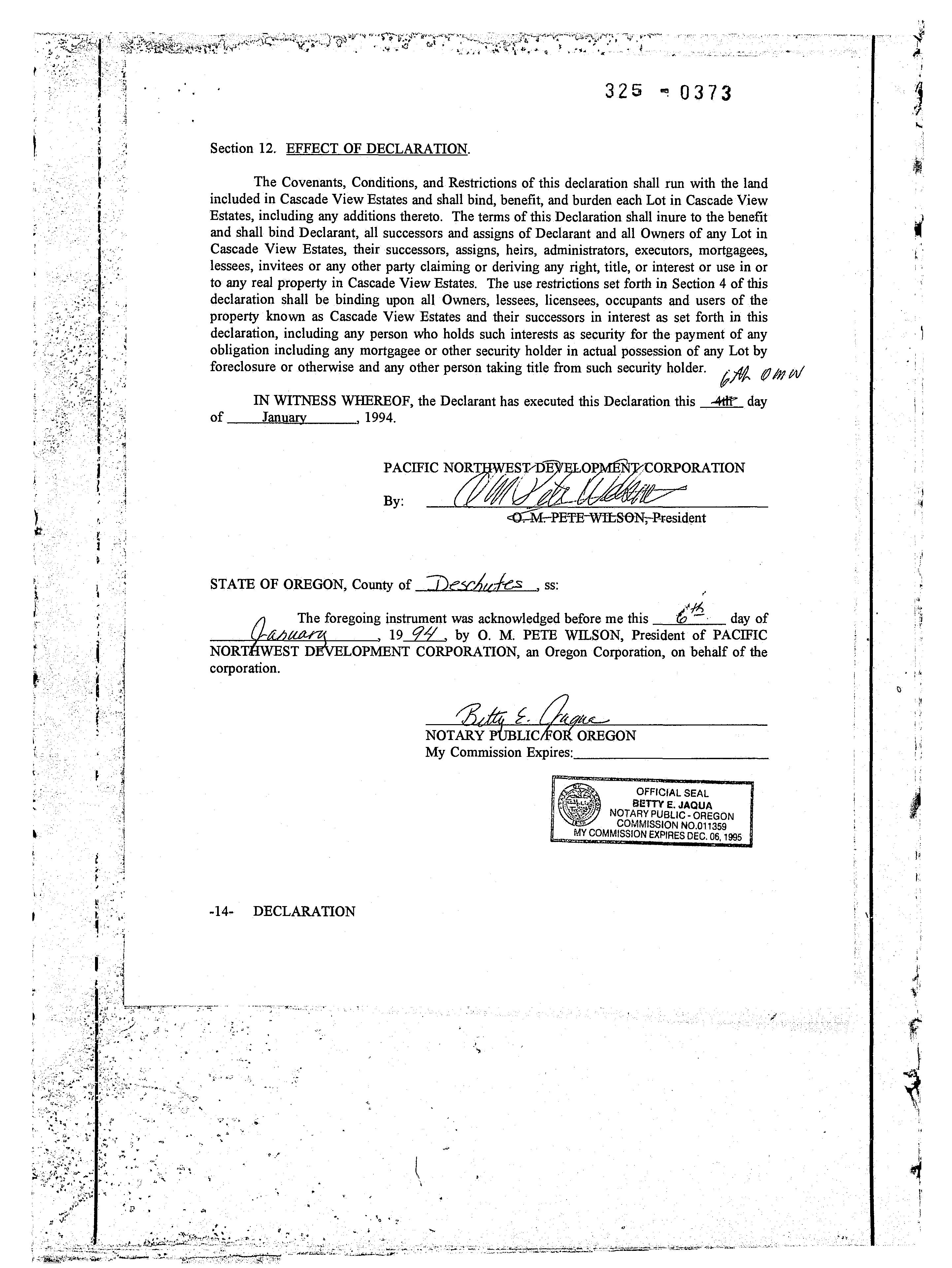
OM- TE WILSON,-President
STATE OF OREGON, County of Deschutes, ss:
The forepoing inatrunot was aeknowledped before me this 65 day of auary 19 94, by O. M. PETE WILSON, President of PACIFIC NORTHWEST DEVELOPMENT CORPORATION, an Oregon Corporation, on behalf of the corporation.
Bety &. Pame
NOTARY PUBLIC/FOR OREGON
My Commission Expires: -14- DECLARATION
OFFICIAL SEAL
BETTY E. JAQUA NOTARY PUBLIC-OREGONCOMMISSION NO 01135ON MYCOMMISSION EXPIE011350 C.06. 1995
The undersigned Beneficiaries of the Trust Deed dated April 29, 1993 and recorded on May 3, 1993 inBook 297, Page 1749, herebyjoin inthis Declaration and subordinate their rights under the said Trust Deed to this Declaration this 6edaey of amary 1993.1994.
LOTTIE H. FLINT AND RUSSELL T. FLINT, CO-TRUSTEES OF THE LOTTIE H. FLINT
TRUST U/T/A DATED 8/5/91 AS TO AN UNDIVIDED ONE-HALF INTEREST, AN ESTATE IN FEE SIMPLE AS TENANTS IN COMMON.
ttc
LOTTIE H. FLÍNT, Trustee
RUSSELL T. FLINT, Trustee
STATE OF OREGON, County of Deschutes ss:
The foregoing instrument was acknowledged before me this 6/5 day of aaary 19.94 by LOTHE H. FLINT AND RUSSELL T. FLINT, CO- Trustees of the Lottie H. Flint Trust U/T/A dated 8/5/91 as to an undivided one-half interest, an estate in fee simple as tenants in common.
Bete & Gagrs
NOTARY PUBLIC FOR OREGON My Commission Expires:
RUSSELL T. FLINTANDLOTTIEH.FLINT, CO-TRUSTEESOFTHERUSSELL T. FLINT TRUST U/T/A DATED 8/5/91 AS TO AN UNDIVIDED ONE-HALF INTEREST, AN ESTATE IN FEE SIMPLE AS TENANTS IN COMMON.
tt , h
RUSSELL T. FLINT, Trustee
LOTTIE H. FLINT, Trustee
STATE OF OREGON, County of Deschut ss:
The foregoing instrument was acknowledged before me this 6 1 day of 1994, by RUSSELL T. FLINT AND LOTTIE H. FLINT, COTrustees of the Russell T. Flint Trust U/T/A dated 8/5/91 as to an undivided one-half interest, an estate in fee simple as tenants in common.
-15- DECLARATION
NOTÁRY PUBLIC FØR OREGON
Bett E. ngan
My Commission Expires:
JAQUA
06, 1995
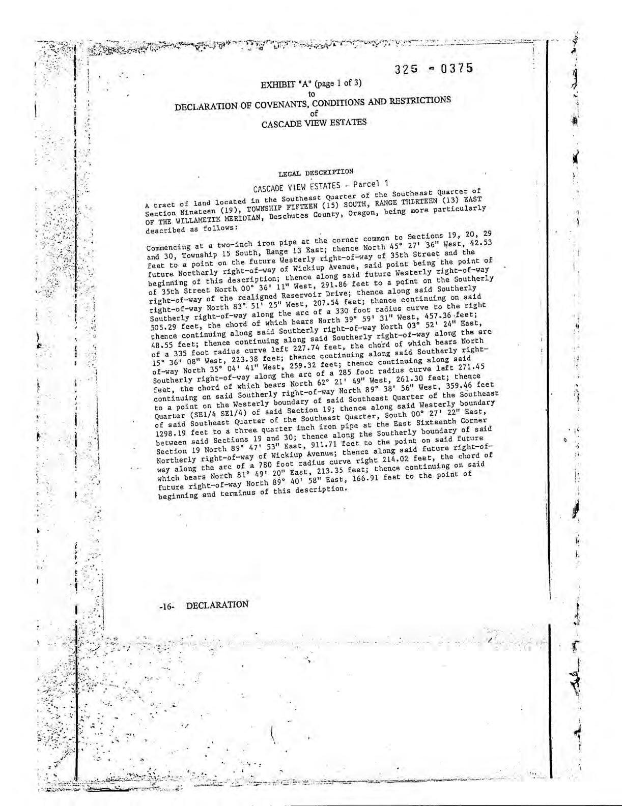
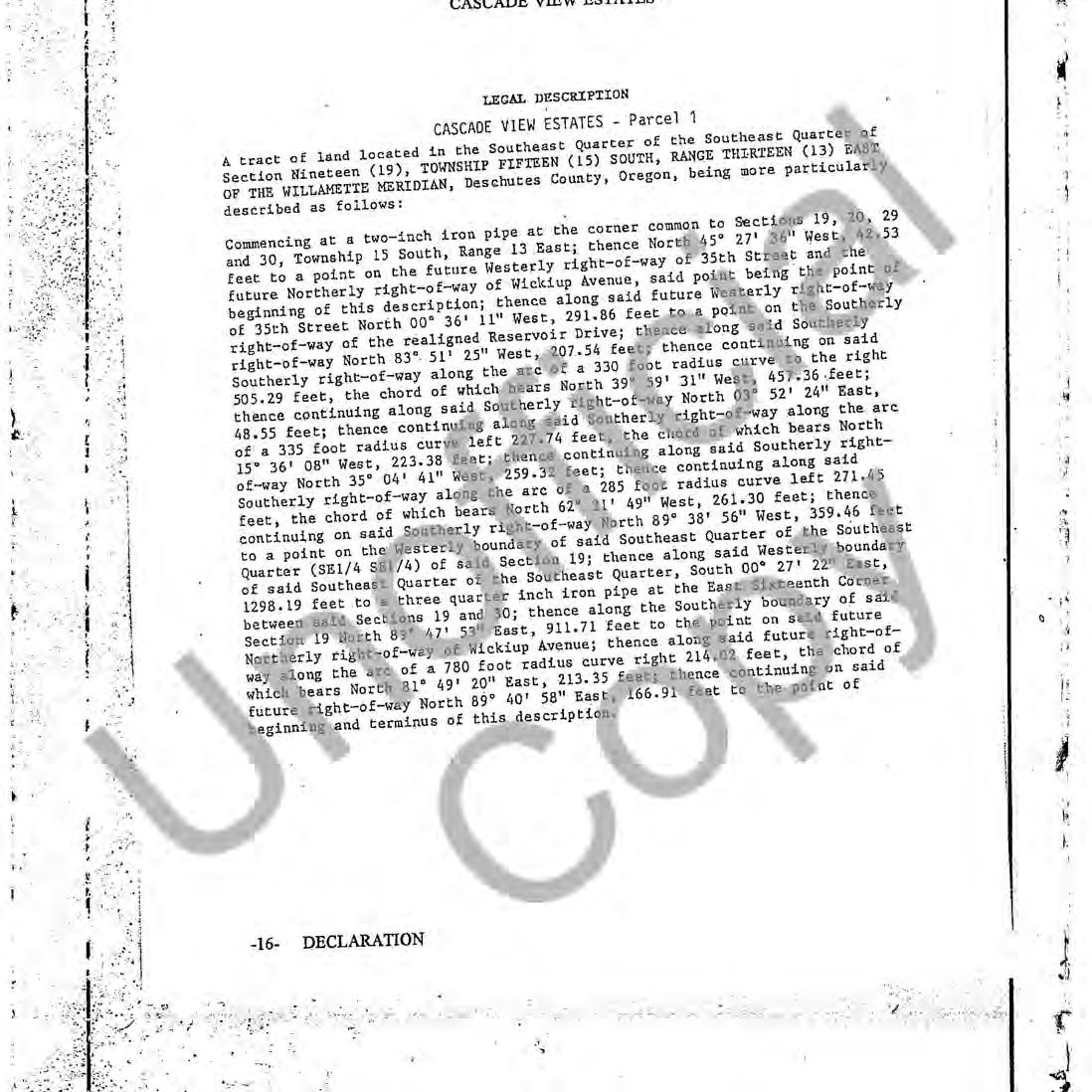
EXHIBIT "A" (page 1 of 3)
to
DECLARATION OF COVENANTS, CONDITIONS AND RESTRICTIONS of CASCADE VIEW ESTATES
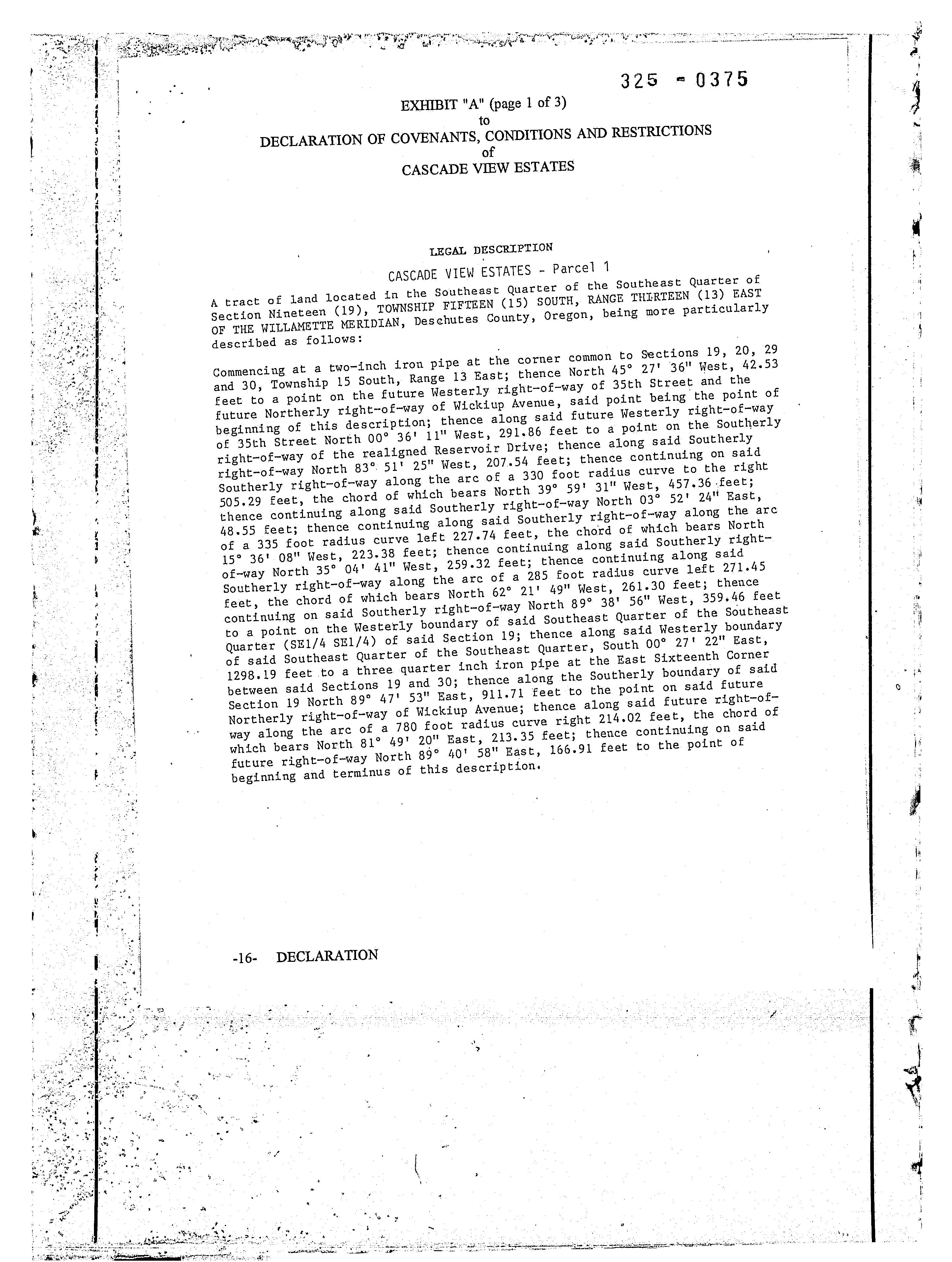
LEGAL DESCRIPTION
CASCADE VIEW ESTATES - Parcel 1
A tract of land located in the Southeast Quarter of the Southeast Quarter of Section Nineteen (19), TOWNSHIP FIFTEEN (15) SOUTH, RANGE THIRTEEN (13) EAST OF THE WILLAMETTE MERIDIAN, Deschutes County, Oregon, being more particularly described as follows:
Commencing at a two-inch iron pipe at the corner common to Sections 19, 20, 29 and 30, Township 15 South, Range 13 East; thence North 45° 27' 36" West, 42.53 feet to a point on the future Westerly right-of-way of 35th Street and the future Northerly right-of-way of Wickiup Avenue, said point being the point of beginning of this description; thence along said future Westerly right-of-way of 35th Street North 00° 36' 11" West, 291.86 feet to a point on the Southerly right-of-way of the realigned Reservoir Drive; thence along said Southerly right-of-way North 83° 51' 25" West, 207.54 feet; thence continuing on sai Southerly right-of-way along the arc of a 330 foot radius curve to the right 505.29 feet, the chord of which bears North 39° 59' 31" West, 457.36 feet; thence continuing along said Southerly right-of-way North 03° 52' 24" East, 48.55 feet; thence continuing along said Southerly right-of-way along the arc of a 335 foot radius curve left 227.74 feet, the chord of which bears North 15° 36' 08" West, 223.38 feet; thence continuing along said Southerly rightof-way North 35° 04' 41" West, 259.32 feet; thence continuing along sald Southerly right-of-way along the arc of a 285 foot radius curve left 271.45 feet, the chord of which bears North 62° 21' 49" West, 261.30 feet; thence continuing on said Southerly right-of-way North 89° 38' 56" West, 359.46 feet to a point on the Westerly boundary of said Southeast Quarter of the Southeast Quarter (SE1/4 SE1/4) of said Section 19; thence along said Westerly boundary of said Southeast Quarter of the Southeast Quarter, South 00° 27' 22" East, 1298.19 feet to a three quarter inchiron pipe at the East Sixteenth Corner between said Sections 19 and 30; thence along the Southerly boundary of said Section 19 North 89° 47' 53" East, 911.71 feet to the point on said future Northerly right-of-way of Wickiup Avenue; thence along said future right-ofway along the arc of a 780 foot radius curve right 214.02 feet, the chordof which bears North 81° 49' 20" East, 213.35 feet; thence continuing on said future right-of-way North 89° 40' 58" East, 166.91 feet to the point of beginning and terminus of this description.
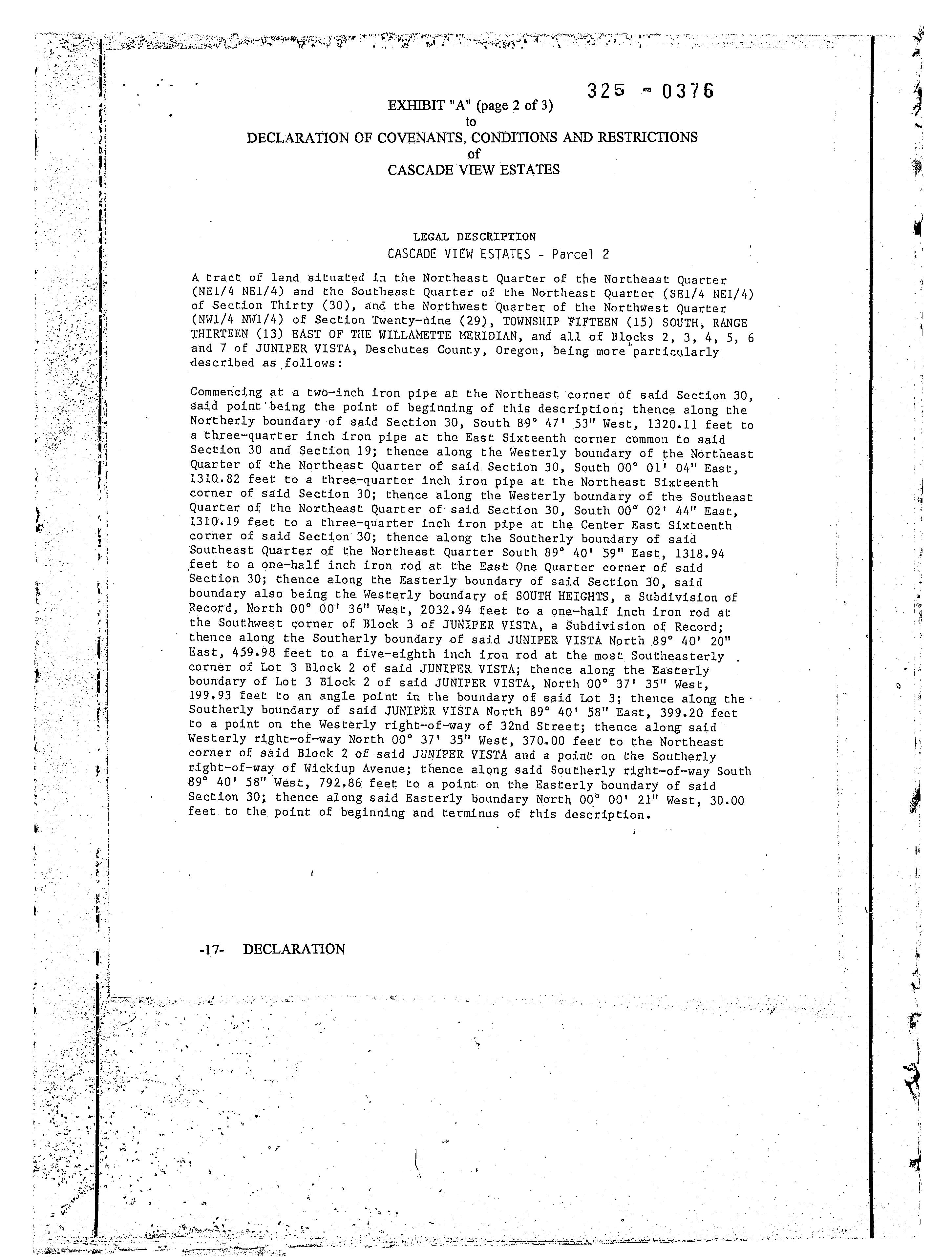
EXHIBIT"A" (page 2 of 3) to
DECLARATION OF COVENANTS, CONDITIONS AND RESTRICTIONS of CASCADE VIEW ESTATES
LEGAL DESCRIPTION
CASCADE VIEW ESTATES - Parcel 2
A tract of land situated in the Northeast Quarter of the Northeast Quarter (NE1/4 NEl/4) and the Southeast Quarter of the Northeast Quarter (SE1/4 NE1/4) of Section Thirty (30), and the Northwest Quarter of the Northwest Quarter (NW1/4 NWI/4) of Section Twenty-nine (29), TOWNSHIP FIFTEEN (15) SOUTH, RANGE THIRTEEN (13) EAST OF THE WILLAMETTE MERIDIAN, and all of Blocks 2, 3, 4,5 6 and 7 of JUNIPER VISTA, Deschutes County, Oregon, being more particularly described as follows:
Commencing at a two-inch iron pipe at the Northeast corner of sald Section 30, to said point being the point of beginning of this description; thence along the Northerly boundary of said Section 30, South 89° 47' 53" West, 1320.11 feet a three-quarter inch iron pipe at the East Sixteenth corner common to said Section 30 and Section 19; thence along the Westerly boundary of the Northeast Quarter of the Northeast Quarter of said Section 30, South 00° 01' 04" East, 1310.82 feet to a three-quarter inch iron pipe at the Northeast Sixteenth corner of said Section 30; thence along the Westerly boundary of the Southeast Quarter of the Northeast Quarter of said Section 30, South 00° 02' 44" East, 1310.19 feet to a three-quarter inch iron pipe at the Center East Sixteenth corner of said Section 30; thence along the Southerly boundary of said Southeast Quarter of the Northeast Quarter South 89° 40' 59" East, 1318.94 feet to a one-half inch iron rod at the East One Quarter corner of said Section 30; thence along the Easterly boundary of said Section 30, said boundary also being the Westerly boundary of SOUTH HEIGHTS, a Subdivision of Record, North 00° 00' 36" West, 2032.94 feet to a one-half inch iron rod at the Southwest corner of Block 3 of JUNIPER VISTA, a Subdivision of Record; thence along the Southerly boundary of said JUNIPER VISTA North 89° 40' 20" East, 459.98 feet to a five-eighth inch iron rod at the most Southeasterly. corner of Lot 3 Block 2 of said JUNIPER VISTA; thence along the Easterly boundary of Lot 3 Block 2 of said JUNIPER VISTA, North 00° 37' 35" West, 199.93 feet to an angle point in the boundary of said Lot 3; thence along the Southerly boundary of said JUNIPER VISTA North 89° 40' 58" East, 399.20 feet to a point on the Westerly right-of-way of 32nd Street; thence along said Westerly right-of-way North 00° 37' 35" West, 370.00 feet to the Northeast corner of said Block 2 of sald JUNIPER VISTA and a point on the Southerly right-of-way of Wickiup Avenue; thence along said Southerly right-of-way South 89° 40' 58" West, 792.86 feet to a point on the Easterly boundary of said Section 30; thence along said Easterly boundary North 00° 00' 21" West, 30.00 feet to the point of beginning and terminus of this description.
DECLARATION
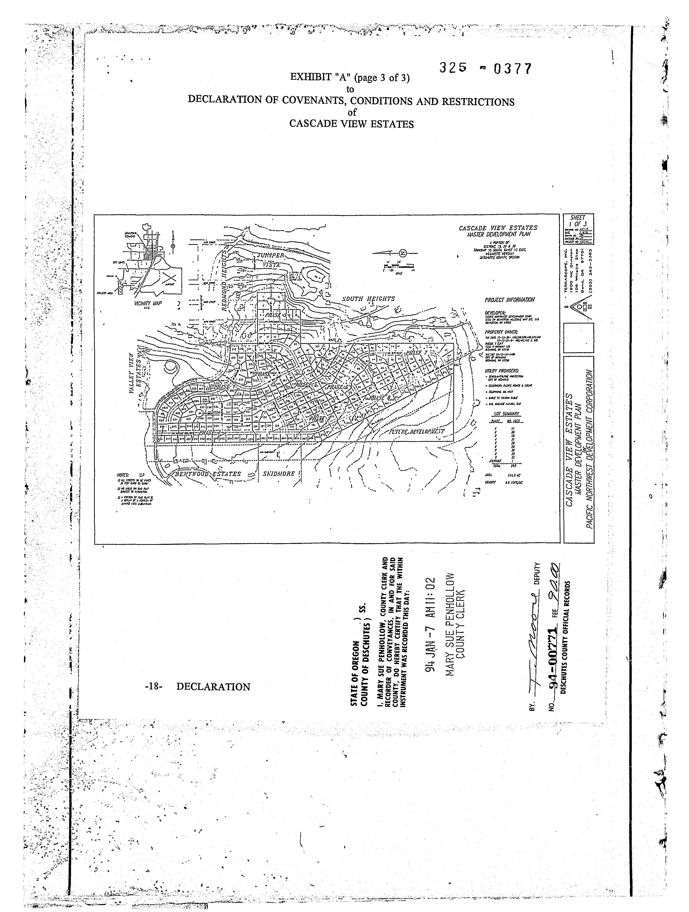
EXHIBIT "A" (page 3 of 3)
to DECLARATION OF COVENANTS, CONDITIONS AND RESTRICTIONS of CASCADE VIEW ESTATES
RECORDED BY
WESTERN TITLE & ESCROW CO. 302794-VB Courtesy
AFTER RECORDING RETURN TO:
Pacific NW Development Corp. 9725 SW Beaverton-Hillsdale Hwy #110
Beaverton, OR 97005
CORRECTION RECORDING OF LEGAL DESCRIPTION FOR DECLARATION OF COVENANTS, CONDITIONS AND RESTRICTIONS FOR CASCADE VIEW ESTATES
The property described as the East 119.14' of Block 2 JUNIPER VISTA, Section 29, T15S, R13E of the Willamette Meridian, Deschutes County, Oregon (the "Real Property") was inadvertently included in the legal description when the original Declaration ofCovenants, Conditions and Restrictions for Cascade View Estates were recorded on January 7, 1994 as Fee No. 9400771 in Deschutes County Records. The Real Property was not included in the plat of the subdivision for Cascade View Estates as approved by the local planning authority, and Declarant wishes to conform the Declaration to the approval of the subdivision of Cascade View Estates by the local planning authority and therefore the Real Property is deleted from the legal description attached to the Declaration and it is not subject to the Declaration.
DECLARANT:
PACIFIC NORTHWEST DEVELOPMENT CORPORATION
By President
The above correction is hereby acknowledged and agreed to bythe Cascade View Estates Homeowners Association, Inc.
CASCADE VIEW ESTATES HOMEOWNERS ASSOCIATION, INC.
By: Vice President
Page 1 - CORRECTION RECORDING OF LEGAL DESCRIPTION
STATE OF OREGON
County of Washington C ss.
This instrument as acknowledged before me on August 8, 1997 by O.M. "Pete" Wilson as President ofPacific Northwest Development Corporation.
OFFICIAL SEAL
JANICE M. JENSEN
NOTARY COMMISSIONPUBLIC-OREGON NO. 030334 MY COMMISSION EXPIRES FEB. 7, 1998
STATE OF OREGON ss.
County ofWashington
Chaice M.Jensen
Notary Public for Oregon My Commission Expires: 2/7198
This instrument as acknowledged before me on August 8, 1997 by Joan Crew as VicePresident ofCascade View Estates Homeowners Association, Inc.
OFFICIAL SEAL
JANICE M. JENSEN
NOTARY COMMISSIONPUBLIC-OREGON NO. 030334 MY COMMISSION EXPIRES FEB. 7,1998
529\000\cascor.ccr(dt)
JaniaM. Jean
Notary Public for Oregon My Commission Expires: 2/7/98
STATE OF OREGONS5. COUNTY OF DESCHUTES)
I, MARY SUE PENHOLLOW, COUNTY CLERK AND RECORDER OF CONVEYANCES, IN AND FOR SAID COUNTY, DO HEREBY CERTIFY THAT THE WITHIN INSTRUMENT WAS RECORDED THIS DAY: 97 JUL 10 AMII: 10 MARY SUE PENHOLLOW COUNTY CLERK BY.
FEE 10.00 DESCHUTES COUNTY OFFICIAL RECORDS