


66 S.E. D STREET, SUITE E MADRAS, OR 97741 (541) 475-4458
9-Jun-2025

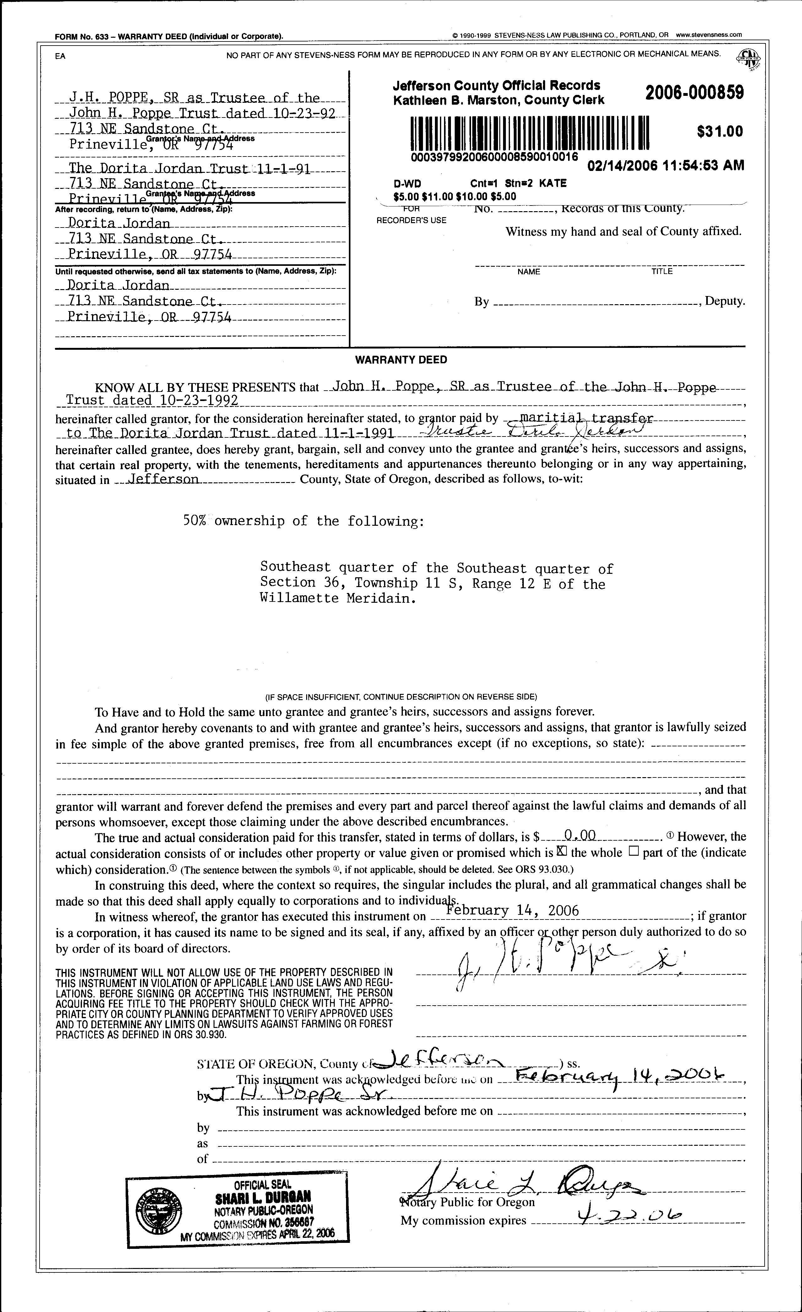
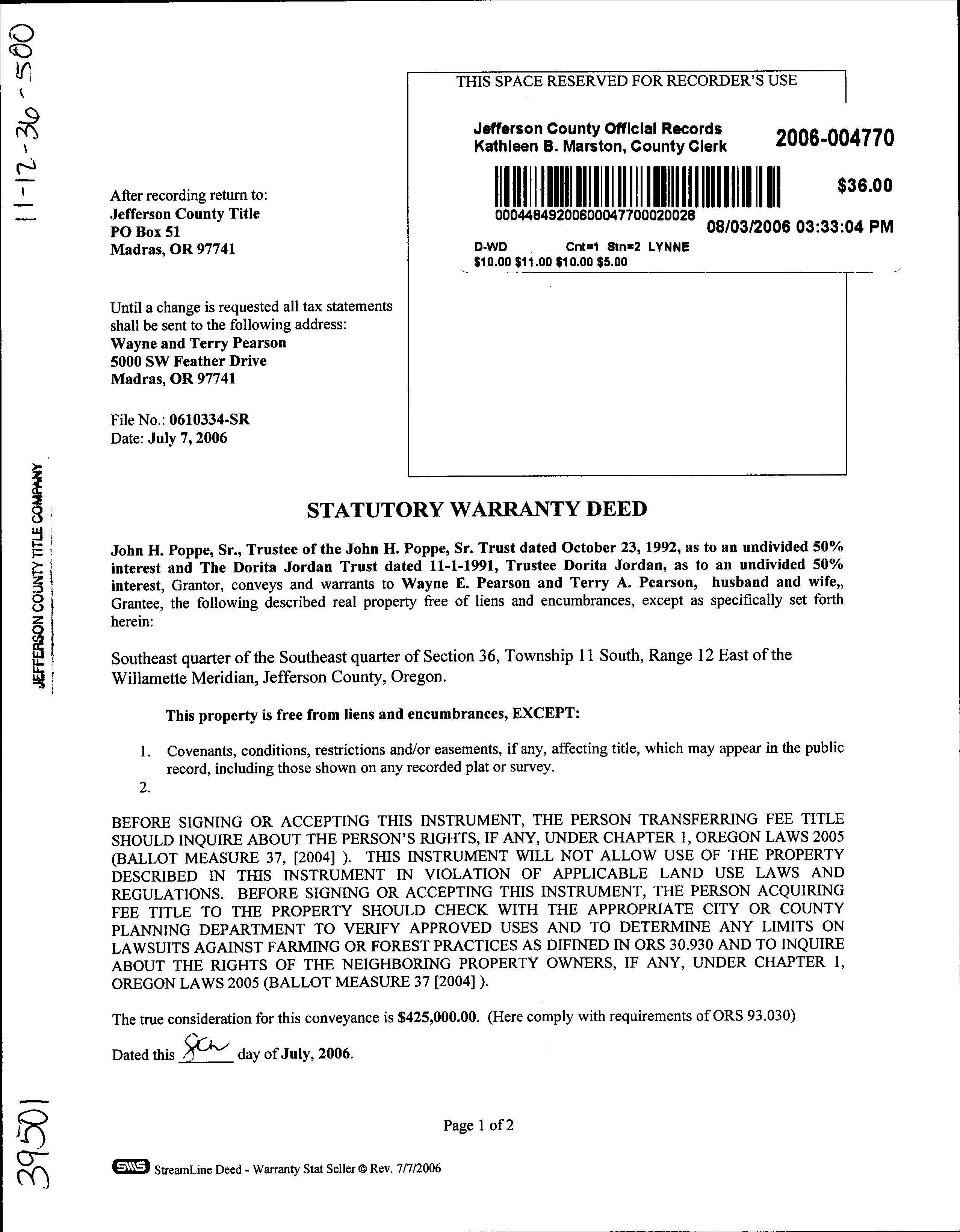
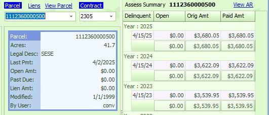
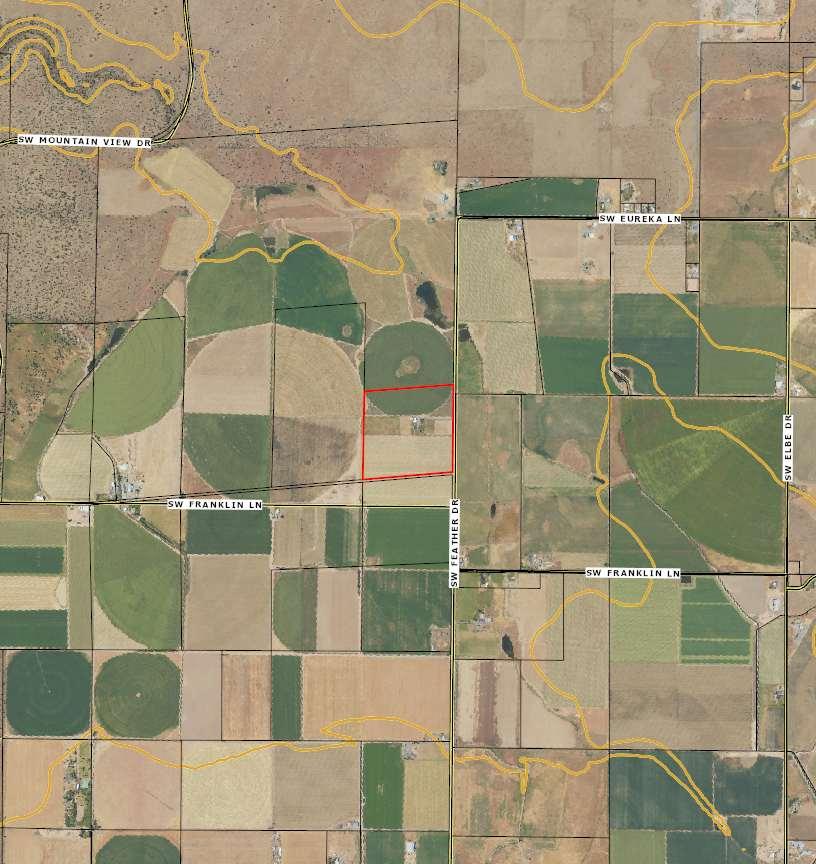
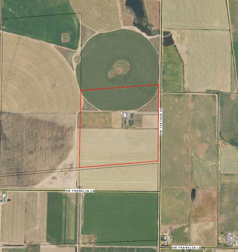
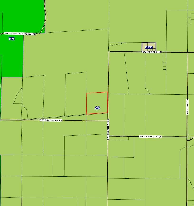
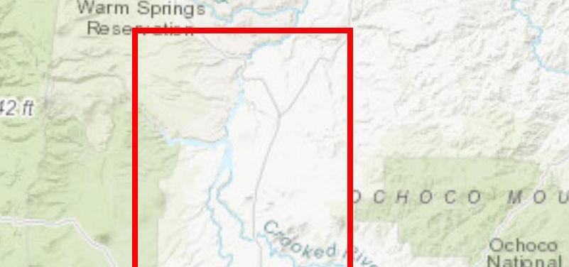
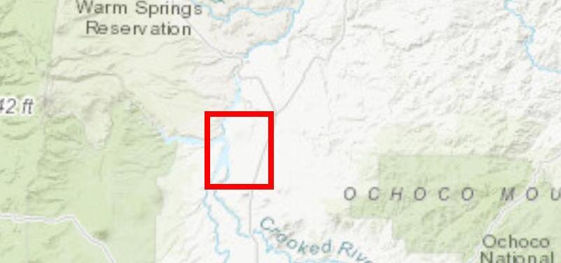
For this parcel of land the water rights are as follows:
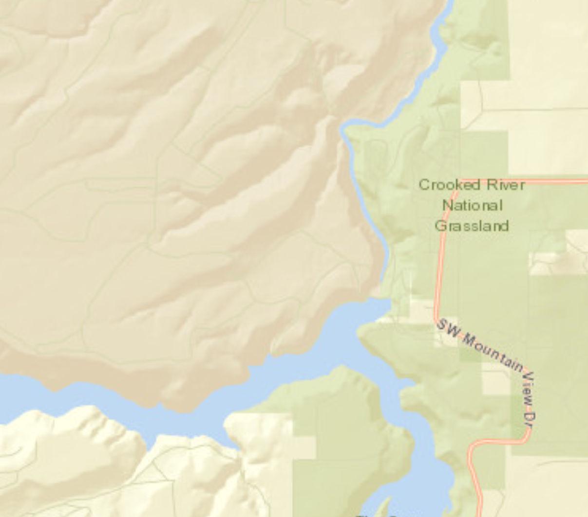
Deschutes River 17.2
Crooked River: 24.5
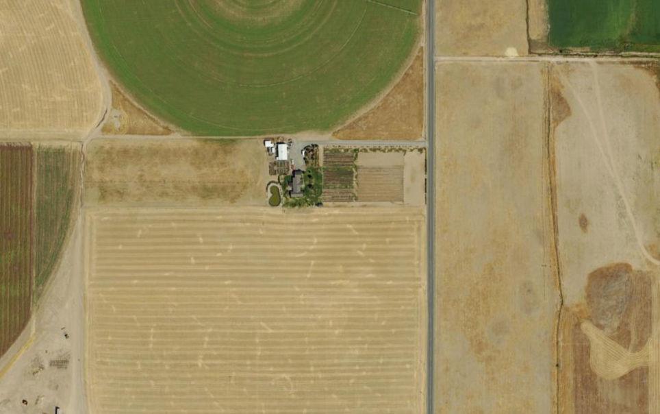
Total Irrigatable Acres: 41.7
Below is a list of the annual charges; bills are sent out in December, delinquent after April 15. All fees for this lot have been paid for 2025.
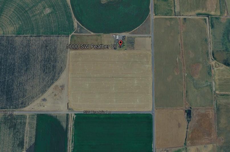
Property is currently being leased to Roff Farms.


Madras Land Use Zones
https://madras.municipal.codes/MMC/18.15
Jefferson County Zoning Ordinance
https://www.jeffco.net/media/24901
Three Rivers Volunteer Fire Department
Sisters - Camp Sherman RFPDForest Service
Warm Springs Fire & Safety
Crooked River
Ranch Rural Fire Protection District
Jefferson County Rural Fire Protection District #1 - Madras
Jefferson County Rural Fire Protection
District #1City of Culver
Crooked River
Ranch Rural Fire Protection District

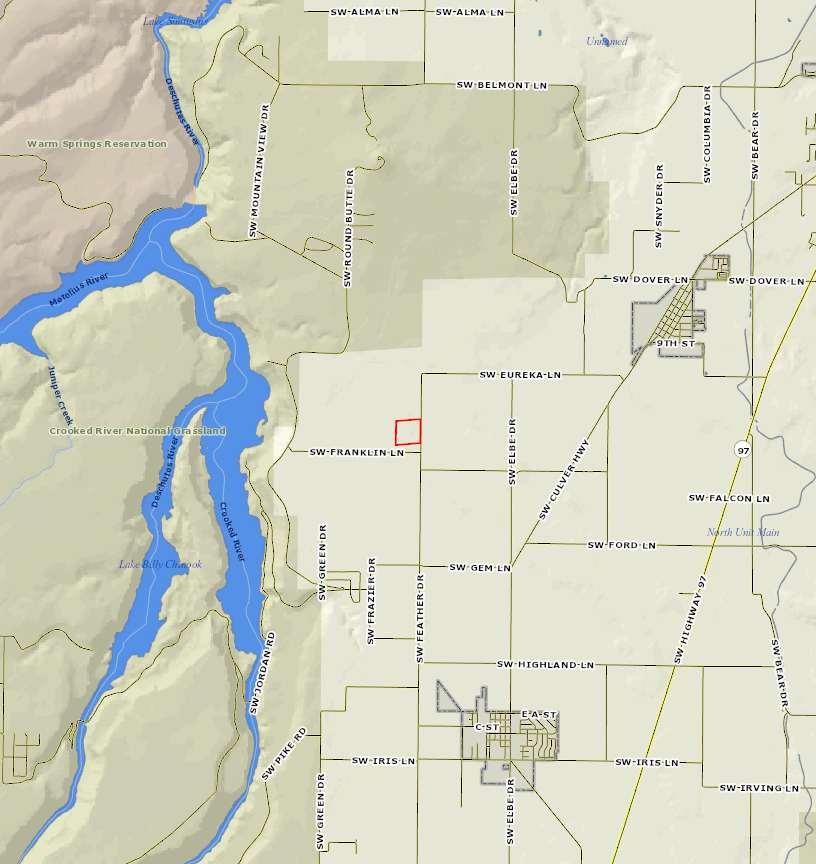
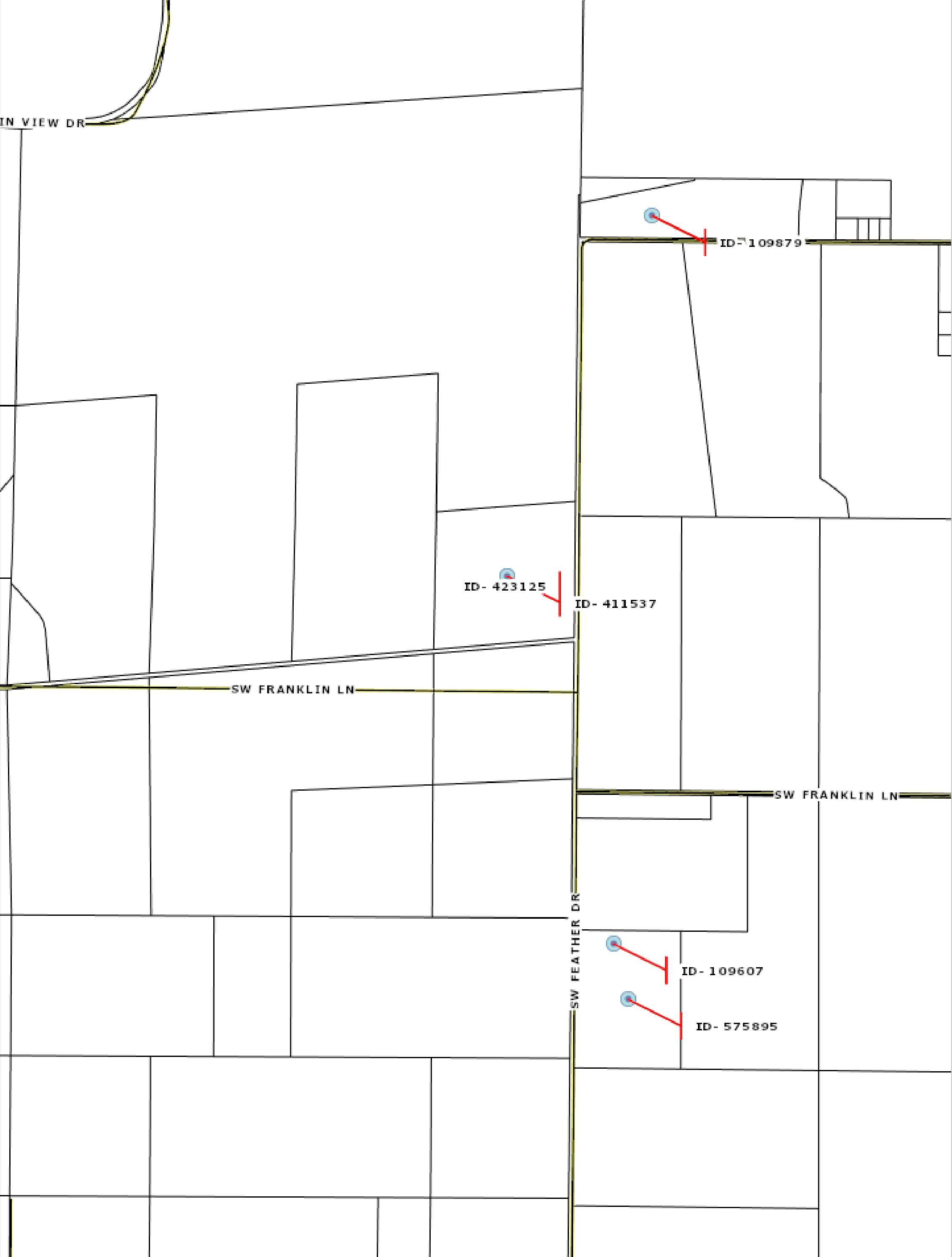
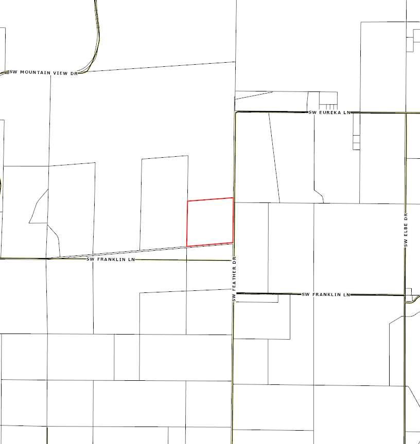
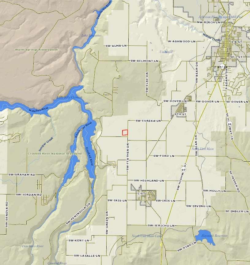
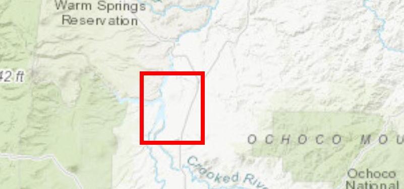
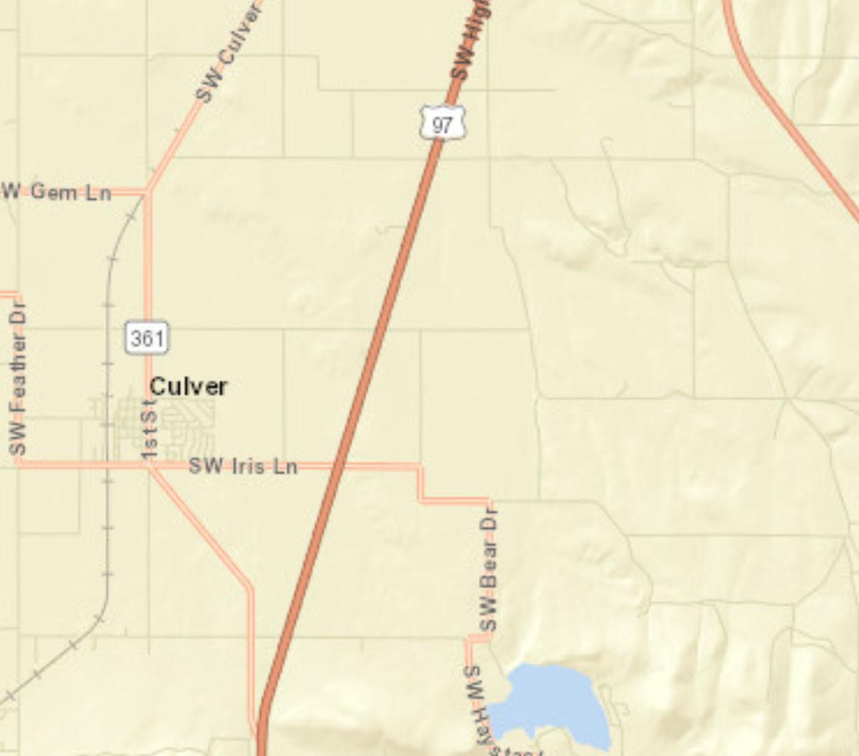
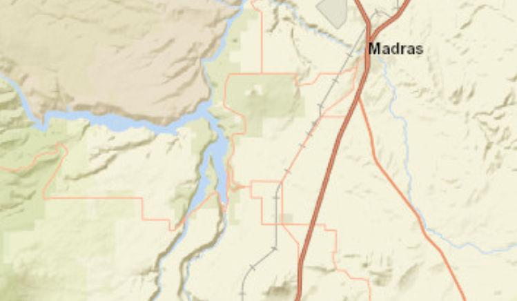
5000 SW Feather Dr, Madras, Oregon, 97741
Prepared by Esri Rings: 1, 3, 5 mile radii Latitude: 44.56946 Longitude: -121.23199


5000 SW Feather Dr, Madras, Oregon, 97741
5000 SW Feather Dr, Madras, Oregon, 97741
Ring: 1 mile radius
5000 SW Feather Dr, Madras, Oregon, 97741
Ring: 1 mile radius
POPULATION AGE 5+ YEARS BY LANGUAGE SPOKEN AT HOME AND ABILITY TO SPEAK ENGLISH Total
5 to 17 years
18 to 64 years
Source: U.S. Census Bureau, 2018-2022 American Community Survey
5000 SW Feather Dr, Madras, Oregon, 97741
Source: U.S. Census Bureau, 2018-2022 American
5000 SW Feather Dr, Madras, Oregon, 97741
Ring: 1 mile radius
WORKERS AGE 16+ YEARS BY MEANS OF TRANSPORTATION TO WORK
WORKERS
Source: U.S. Census Bureau, 2018-2022 American Community Survey Reliability:
5000 SW Feather Dr, Madras, Oregon, 97741
Ring: 1 mile radius
5000 SW Feather Dr, Madras, Oregon, 97741
Ring: 1 mile radius
BY RATIO OF INCOME TO POVERTY
CIVILIAN POPULATION AGE 18 OR OLDER BY VETERAN STATUS
CIVILIAN VETERANS AGE 18 OR OLDER BY PERIOD OF
Source:
5000 SW Feather Dr, Madras, Oregon, 97741
Ring: 1 mile radius
Data Note: N/A means not available. Population by Ratio of Income to Poverty Level represents persons for whom poverty status is determined. Household income represents income in 2022, adjusted for inflation.
2018-2022 ACS Estimate: The American Community Survey (ACS) replaces census sample data. Esri is releasing the 2018-2022 ACS estimates, five-year period data collected monthly from January 1, 2018 through December 31, 2022. Although the ACS includes many of the subjects previously covered by the decennial census sample, there are significant differences between the two surveys including fundamental differences in survey design and residency rules.
Margin of error (MOE): The MOE is a measure of the variability of the estimate due to sampling error. MOEs enable the data user to measure the range of uncertainty for each estimate with 90 percent confidence. The range of uncertainty is called the confidence interval, and it is calculated by taking the estimate +/- the MOE. For example, if the ACS reports an estimate of 100 with an MOE of +/- 20, then you can be 90 percent certain the value for the whole population falls between 80 and 120.
Reliability: These symbols represent threshold values that Esri has established from the Coefficients of Variation (CV) to designate the usability of the estimates. The CV measures the amount of sampling error relative to the size of the estimate, expressed as a percentage.
High Reliability: Small CVs (less than or equal to 12 percent) are flagged green to indicate that the sampling error is small relative to the estimate and the estimate is reasonably reliable.
Medium Reliability: Estimates with CVs between 12 and 40 are flagged yellow-use with caution.
Low Reliability: Large CVs (over 40 percent) are flagged red to indicate that the sampling error is large relative to the estimate. The estimate is considered very unreliable.
Source: U.S. Census Bureau, 2018-2022 American Community Survey Reliability: high medium low June 09, 2025
5000 SW Feather Dr, Madras, Oregon, 97741
5000 SW Feather Dr, Madras, Oregon, 97741
Ring: 3 mile radius
5000 SW Feather Dr, Madras, Oregon, 97741
Ring: 3 mile radius
POPULATION AGE 5+ YEARS BY LANGUAGE SPOKEN AT HOME AND ABILITY TO SPEAK ENGLISH
Source: U.S. Census Bureau, 2018-2022 American Community Survey
5000 SW Feather Dr, Madras, Oregon, 97741
Ring: 3 mile radius
Source: U.S. Census Bureau, 2018-2022 American Community Survey
5000 SW Feather Dr, Madras, Oregon, 97741
Ring: 3 mile radius
WORKERS AGE 16+ YEARS BY MEANS OF TRANSPORTATION TO WORK
Source: U.S. Census Bureau, 2018-2022 American Community Survey Reliability:
5000 SW Feather Dr, Madras, Oregon, 97741
5000 SW Feather Dr, Madras, Oregon, 97741
Ring: 3 mile radius
BY RATIO OF INCOME TO POVERTY
CIVILIAN POPULATION AGE 18 OR OLDER BY VETERAN STATUS
CIVILIAN VETERANS AGE 18 OR OLDER BY PERIOD OF
Source:
5000 SW Feather Dr, Madras, Oregon, 97741
Ring: 3 mile radius
by
Data Note: N/A means not available. Population by Ratio of Income to Poverty Level represents persons for whom poverty status is determined. Household income represents income in 2022, adjusted for inflation.
2018-2022 ACS Estimate: The American Community Survey (ACS) replaces census sample data. Esri is releasing the 2018-2022 ACS estimates, five-year period data collected monthly from January 1, 2018 through December 31, 2022. Although the ACS includes many of the subjects previously covered by the decennial census sample, there are significant differences between the two surveys including fundamental differences in survey design and residency rules.
Margin of error (MOE): The MOE is a measure of the variability of the estimate due to sampling error. MOEs enable the data user to measure the range of uncertainty for each estimate with 90 percent confidence. The range of uncertainty is called the confidence interval, and it is calculated by taking the estimate +/- the MOE. For example, if the ACS reports an estimate of 100 with an MOE of +/- 20, then you can be 90 percent certain the value for the whole population falls between 80 and 120.
Reliability: These symbols represent threshold values that Esri has established from the Coefficients of Variation (CV) to designate the usability of the estimates. The CV measures the amount of sampling error relative to the size of the estimate, expressed as a percentage.
High Reliability: Small CVs (less than or equal to 12 percent) are flagged green to indicate that the sampling error is small relative to the estimate and the estimate is reasonably reliable.
Medium Reliability: Estimates with CVs between 12 and 40 are flagged yellow-use with caution.
Low Reliability: Large CVs (over 40 percent) are flagged red to indicate that the sampling error is large relative to the estimate. The estimate is considered very unreliable.
Source: U.S. Census Bureau, 2018-2022 American Community Survey Reliability: high medium low June 09, 2025
5000 SW Feather Dr, Madras, Oregon, 97741
Ring: 5 mile radius
5000 SW Feather Dr, Madras, Oregon, 97741
Ring: 5 mile radius
HOUSEHOLDS
Source: U.S. Census Bureau, 2018-2022 American Community Survey
5000 SW Feather Dr, Madras, Oregon, 97741
Ring: 5 mile radius
POPULATION AGE 5+ YEARS BY LANGUAGE SPOKEN AT HOME AND ABILITY TO SPEAK ENGLISH
5 to 17 years
18 to 64 years
5000 SW Feather Dr, Madras, Oregon, 97741
Ring: 5 mile radius
WORKERS AGE 16+ YEARS BY PLACE OF WORK
5000 SW Feather Dr, Madras, Oregon, 97741
Ring: 5 mile radius
WORKERS AGE 16+ YEARS BY MEANS OF TRANSPORTATION TO WORK
Source: U.S. Census Bureau, 2018-2022 American Community Survey
5000 SW Feather Dr, Madras, Oregon, 97741
5000 SW Feather Dr, Madras, Oregon, 97741
Ring: 5 mile radius
BY RATIO OF INCOME TO POVERTY
CIVILIAN POPULATION AGE 18 OR OLDER BY VETERAN STATUS
CIVILIAN VETERANS AGE 18 OR OLDER BY
Source:
5000 SW Feather Dr, Madras, Oregon, 97741
Ring: 5 mile radius
Data Note: N/A means not available. Population by Ratio of Income to Poverty Level represents persons for whom poverty status is determined. Household income represents income in 2022, adjusted for inflation.
2018-2022 ACS Estimate: The American Community Survey (ACS) replaces census sample data. Esri is releasing the 2018-2022 ACS estimates, five-year period data collected monthly from January 1, 2018 through December 31, 2022. Although the ACS includes many of the subjects previously covered by the decennial census sample, there are significant differences between the two surveys including fundamental differences in survey design and residency rules.
Margin of error (MOE): The MOE is a measure of the variability of the estimate due to sampling error. MOEs enable the data user to measure the range of uncertainty for each estimate with 90 percent confidence. The range of uncertainty is called the confidence interval, and it is calculated by taking the estimate +/- the MOE. For example, if the ACS reports an estimate of 100 with an MOE of +/- 20, then you can be 90 percent certain the value for the whole population falls between 80 and 120.
Reliability: These symbols represent threshold values that Esri has established from the Coefficients of Variation (CV) to designate the usability of the estimates. The CV measures the amount of sampling error relative to the size of the estimate, expressed as a percentage.
High Reliability: Small CVs (less than or equal to 12 percent) are flagged green to indicate that the sampling error is small relative to the estimate and the estimate is reasonably reliable.
Medium Reliability: Estimates with CVs between 12 and 40 are flagged yellow-use with caution.
Low Reliability: Large CVs (over 40 percent) are flagged red to indicate that the sampling error is large relative to the estimate. The estimate is considered very unreliable.
Source: U.S. Census Bureau, 2018-2022 American Community Survey Reliability: high medium low June 09, 2025
Data Note: Household population includes persons not residing in group quarters. Average Household Size is the household population divided by total households. Persons in families include the householder and persons related to the householder by birth, marriage, or adoption. Per Capita Income represents the income received by all persons aged 15 years and over divided by the total population.
Source: Esri forecasts for 2024 and 2029. U.S. Census Bureau 2000 and 2010 decennial Census data converted by Esri into 2020 geography. June 09, 2025
5000 SW Feather Dr, Madras, Oregon, 97741
Rings: 1, 3, 5 mile radii
2024
2029 Owner Occupied Housing Units by Value
$1,000,000 - $1,499,999
$1,500,000
Data Note: Income represents the preceding year, expressed in current dollars. Household income includes wage and salary earnings, interest dividends, net rents, pensions, SSI and welfare payments, child support, and alimony.
Source: Esri forecasts for 2024 and 2029. U.S. Census Bureau 2000 and 2010 decennial Census data converted by Esri into 2020 geography. June 09, 2025
5000 SW Feather Dr, Madras, Oregon, 97741
Source: Esri forecasts for 2024 and 2029. U.S. Census Bureau 2000 and 2010 decennial Census data converted by Esri into 2020 geography. June
5000 SW Feather Dr, Madras, Oregon, 97741
Rings: 1, 3, 5 mile radii
Data Note: Persons of Hispanic Origin may be of any race. The Diversity Index measures the probability that two people from the same area will be from different race/ethnic groups.
Source: Esri forecasts for 2024 and 2029. U.S. Census Bureau 2000 and 2010 decennial Census data converted by Esri into 2020 geography. June 09, 2025
5000 SW Feather Dr, Madras, Oregon, 97741
Rings: 1, 3, 5 mile radii
2020 Population by Relationship and Household Type
Source: Esri forecasts for 2024 and 2029. U.S. Census Bureau 2000 and 2010 decennial Census data converted by Esri into 2020 geography. June 09, 2025
5000 SW Feather Dr, Madras, Oregon, 97741
Source: Esri forecasts for 2024 and 2029. U.S. Census Bureau 2000 and 2010 decennial Census data converted by Esri into 2020 geography. June 09, 2025
5000 SW Feather Dr, Madras, Oregon, 97741
Rings: 1, 3, 5 mile radii
Data Note: Households with children include any households with people under age 18, related or not. Multigenerational households are families with 3 or more parent-child relationships. Unmarried partner households are usually classified as nonfamily households unless there is another member of the household related to the householder. Multigenerational and unmarried partner households are reported only to the tract level. Esri estimated block group data, which is used to estimate polygons or non-standard geography.
Source: Esri forecasts for 2024 and 2029. U.S. Census Bureau 2000 and 2010 decennial Census data converted by Esri into 2020 geography. June 09, 2025
Data Note: Consumer spending shows the amount spent on a variety of goods and services by households that reside in the area. Expenditures are shown by broad budget categories that are not mutually exclusive. Consumer spending does not equal business revenue. Total and Average Amount Spent Per Household represent annual figures. The Spending Potential Index represents the amount spent in the area relative to a national average of 100.
Source: Consumer Spending data are derived from the 2019 and 2020 Consumer Expenditure Surveys, Bureau of Labor Statistics. Esri.
Source: Esri forecasts for 2024 and 2029. U.S. Census Bureau 2000 and 2010 decennial Census data converted by Esri into 2020 geography. June 09, 2025
5000 SW Feather Dr, Madras, Oregon, 97741 Prepared by Esri Rings: 1, 3, 5 mile radii Latitude: 44.56946 Longitude: -121.23199


Source: ©2024 Kalibrate Technologies (Q4 2024).
June 09, 2025