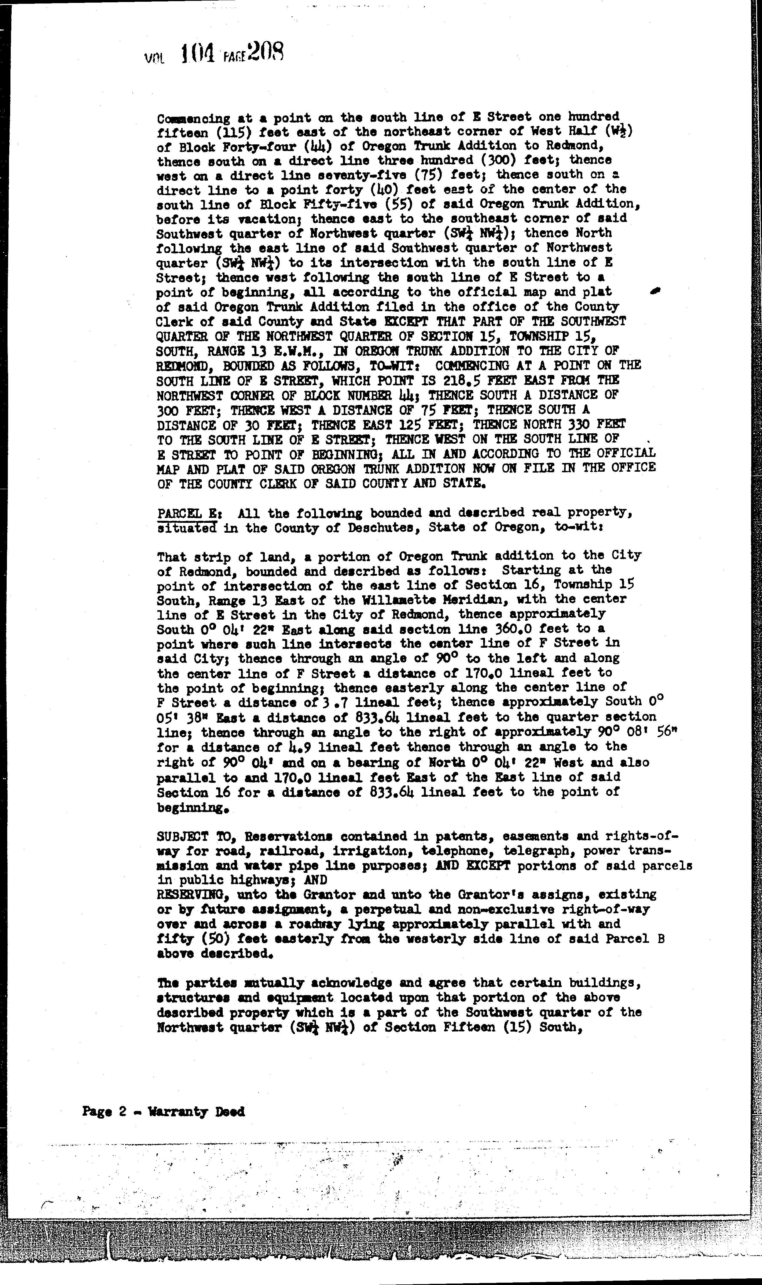
The information and maps presented in this report are provided for your convenience. Every reasonable effort has been made to assure the accuracy of the data and associated maps. Deschutes County makes no warranty, representation or guarantee as to the content, sequence, accuracy, timeliness or completeness of any of the data provided herein. Deschutes County explicitly disclaims any representations and warranties, including, without limitation, the implied warranties of merchantability and fitness for a particular purpose. Deschutes County shall assume no liability for any errors, omissions, or inaccuracies in the information provided regardless of how caused. Deschutes County assumes no liability for any decisions made or actions taken or not taken by the user of this information or data furnished hereunder.
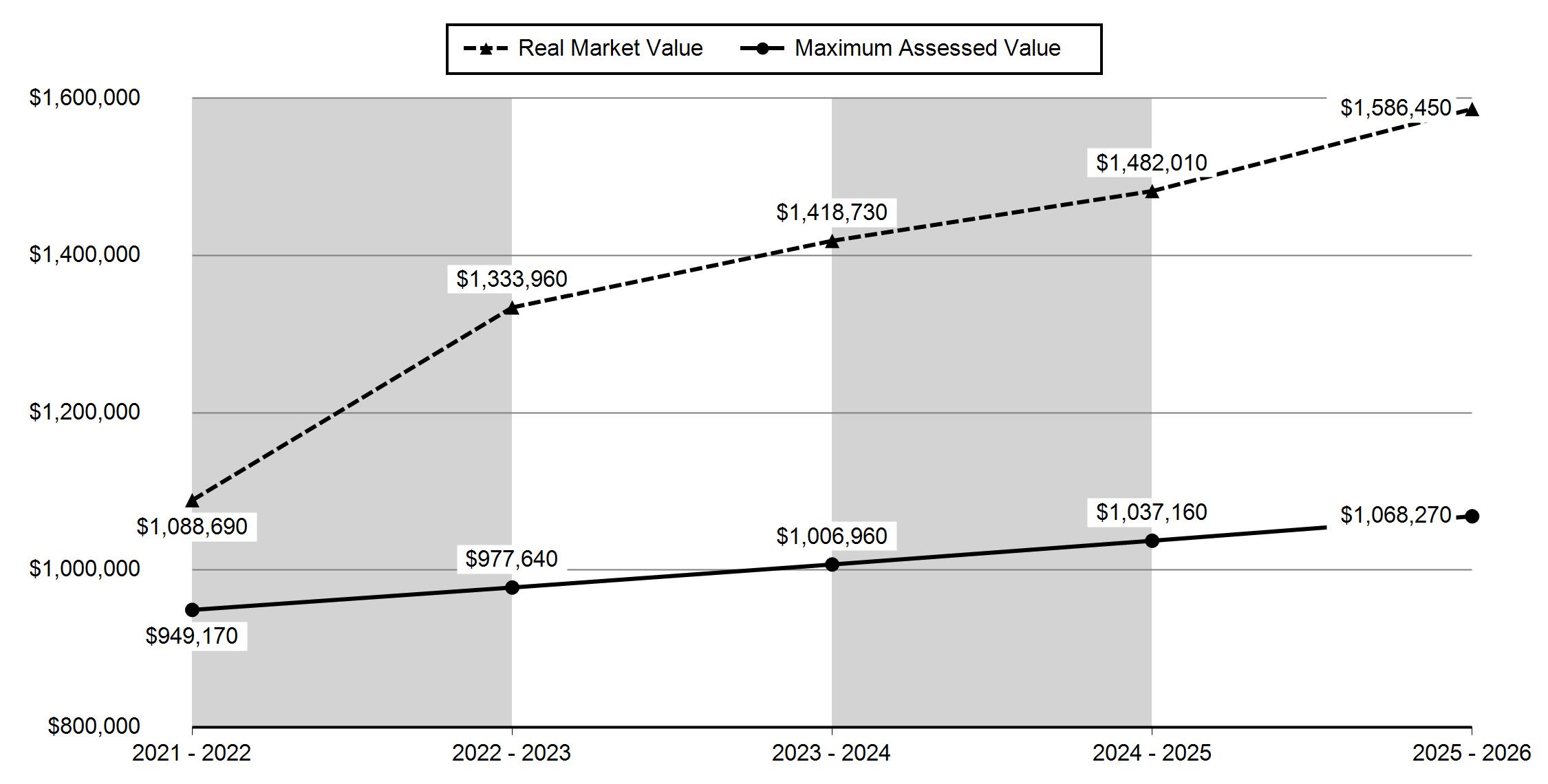
Summary
Warnings, Notations, and Special Assessments
Review of digital records maintained by the Deschutes County Assessor’s Office, Tax Office, Finance Office, and the Community Development Department indicates that there are no special tax, assessment or property development related notations associated with this account. However, independent verification of the presence of other Deschutes County tax, assessment, development, and additional property related considerations is recommended. Confirmation is commonly provided by title companies, real estate agents, developers, engineering and surveying firms, and other parties who are involved in property transactions or property development. In addition, County departments may be contacted directly to discuss the information.
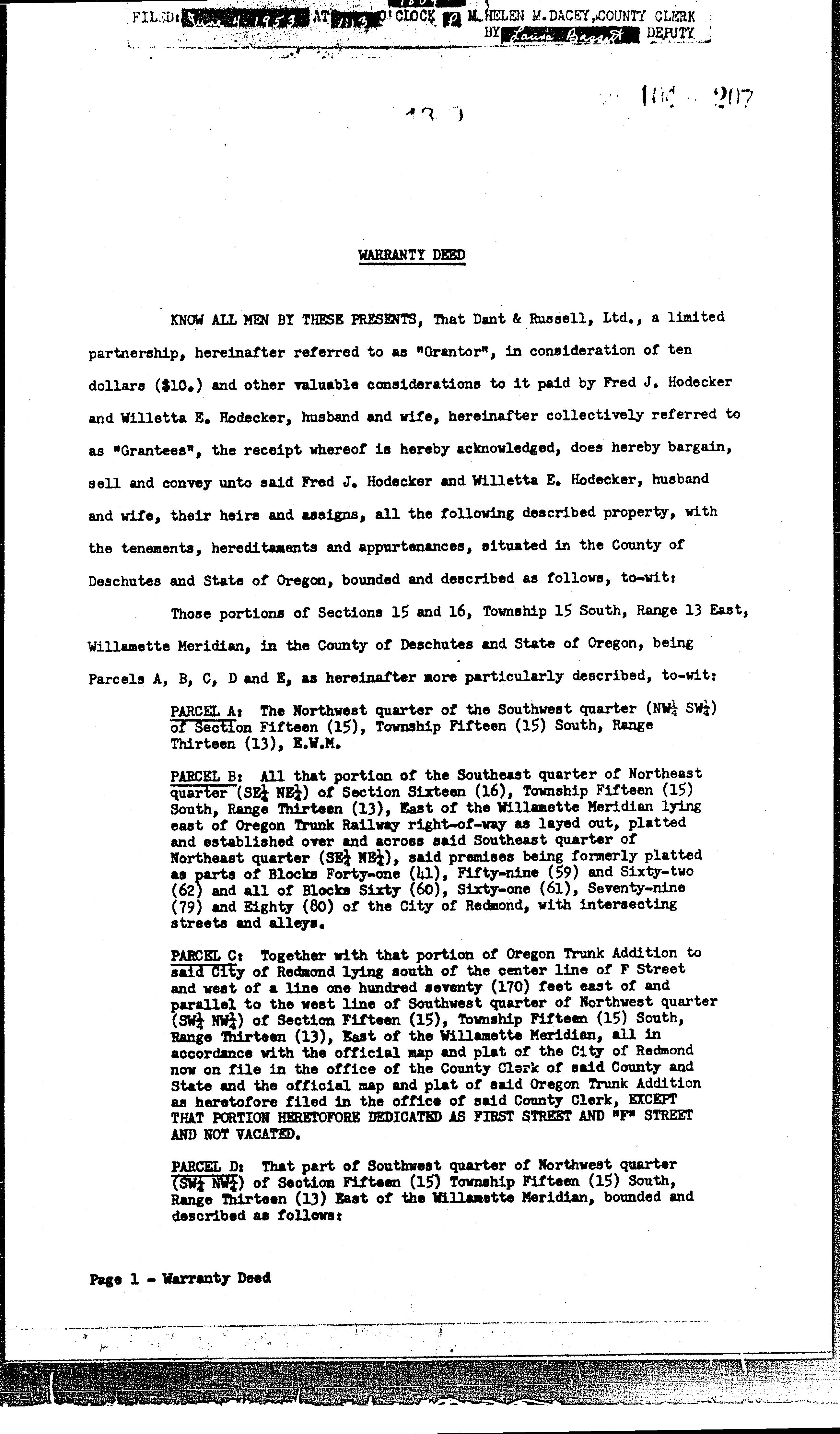
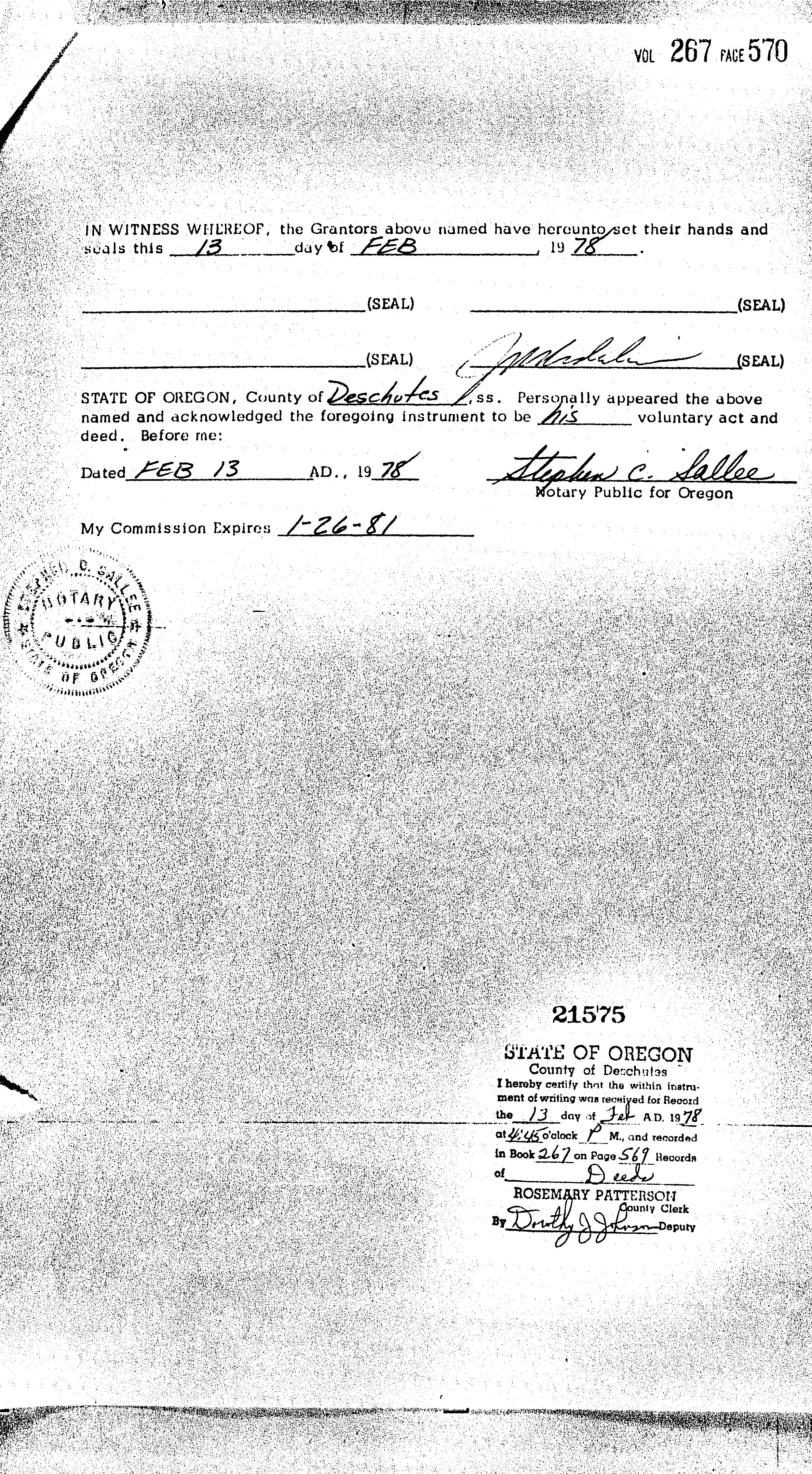
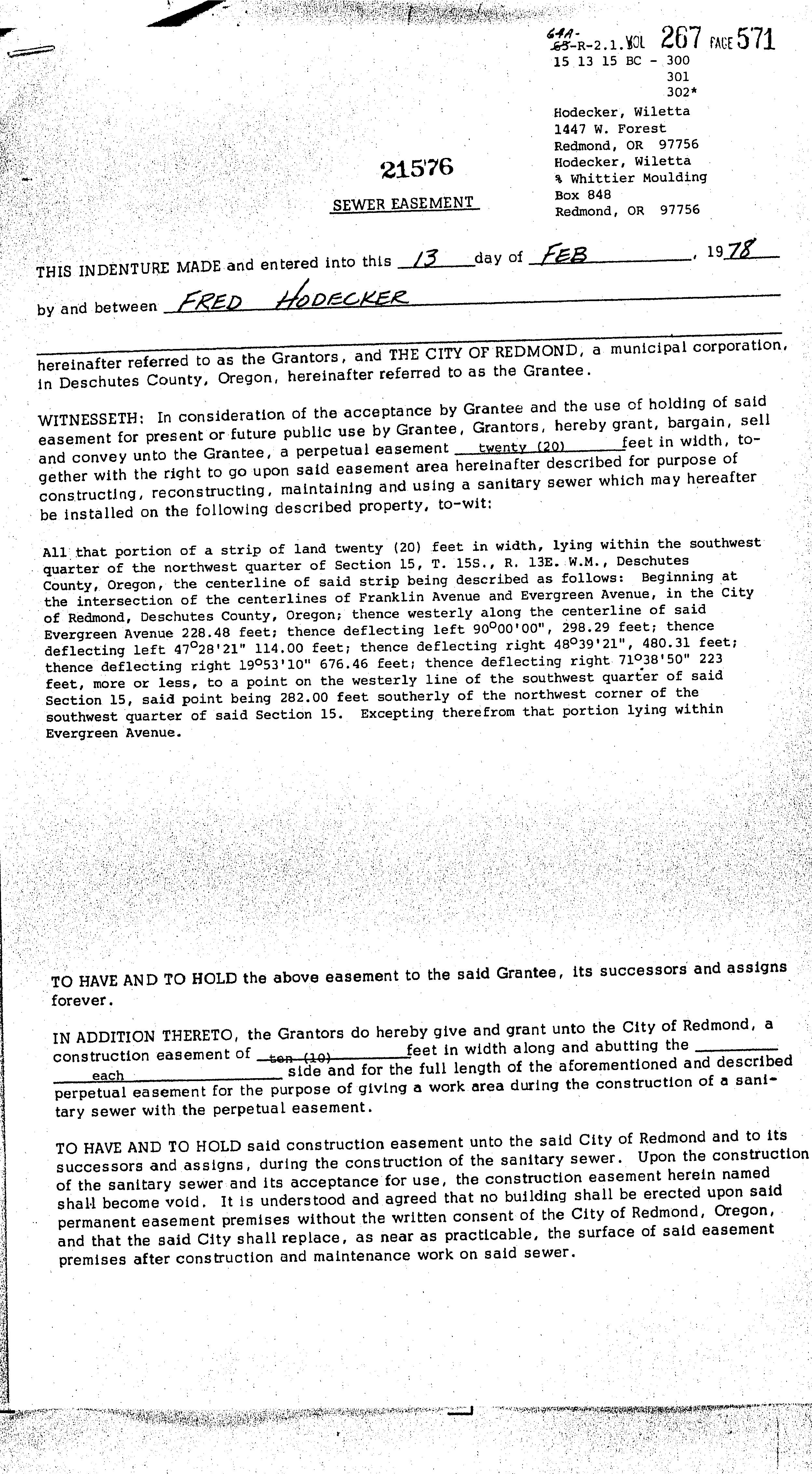
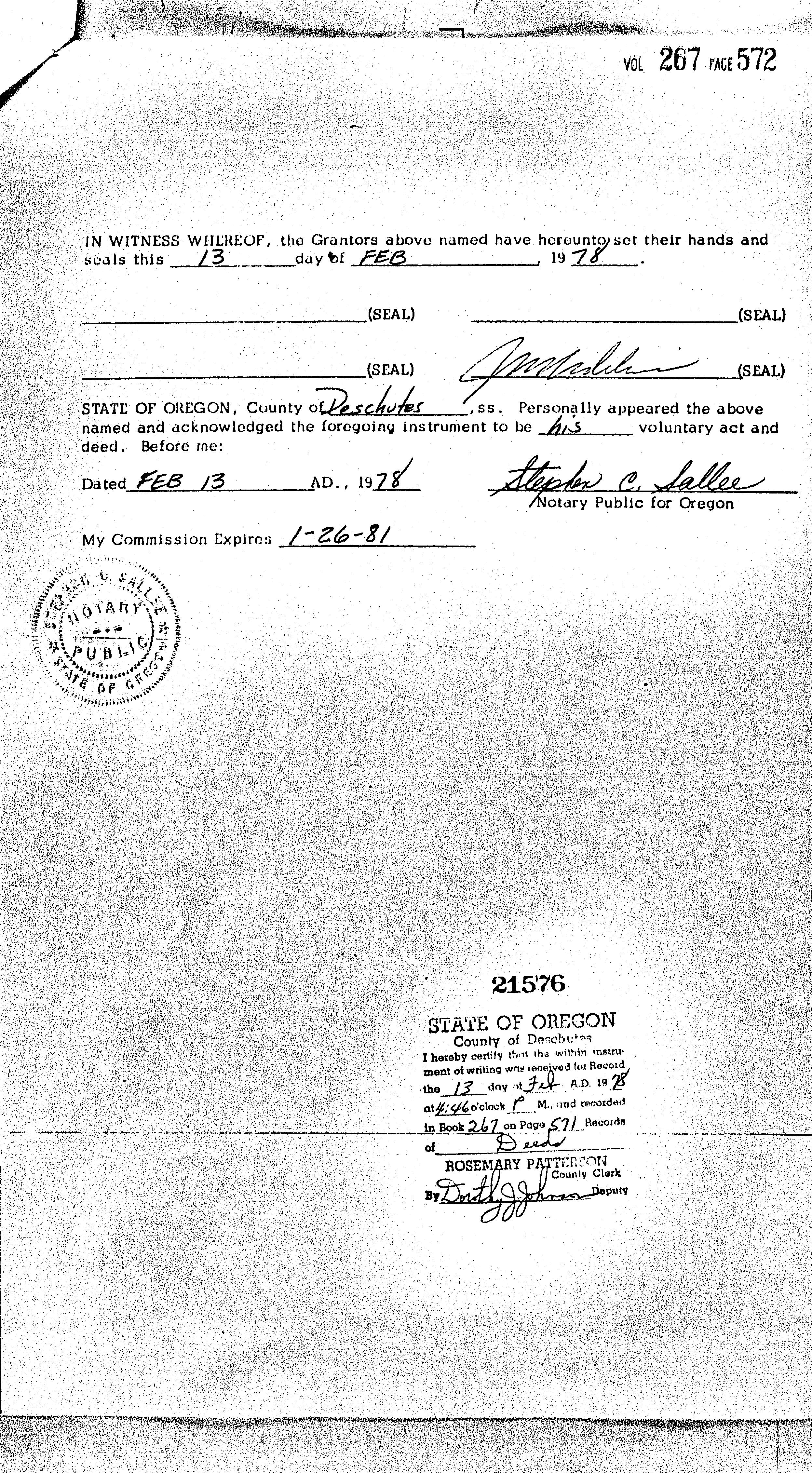
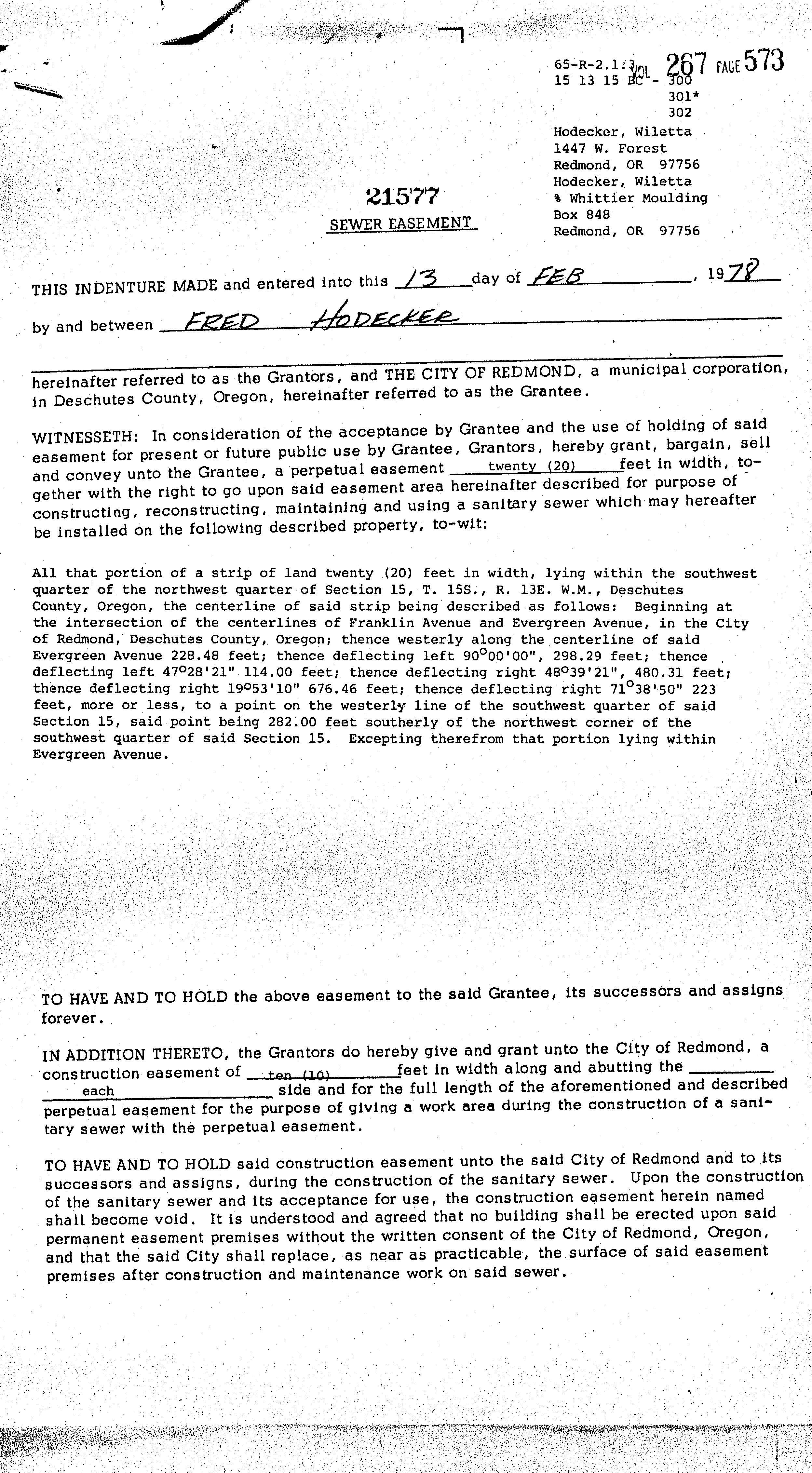
OWNER FRED HODECKER INC,
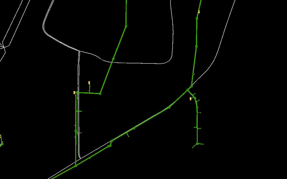
Related accounts apply to a property that may be on one map and tax lot but
a property is in multiple tax code areas. In other cases there may be
this property that is not in the same ownership as the land.
or a
465 SW RIMROCK DR, REDMOND, OR 97756
LIBRARY DISTRICT DESCHUTES PUBLIC LIBRARY (541) 617-7050 601 NW WALL ST, BEND, OR 97703 WATER SERVICE PROVIDER REDMOND WATER DEPARTMENT (541)
711-B59915
711-B67133
711-B95-510801
711-B72134
711-B50734
711-B97-701701
711-24-000015-
Permit Detail
Building Permit Details
Date Init. Comments
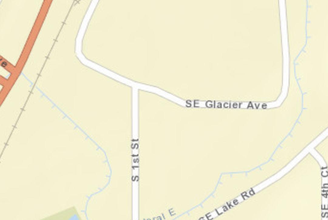
08/17/2010 TAG GC OLD SITUS=120 GLACIER SE, RE OLD SERIAL # 122991
05/14/1981 OLD FINAL OK.
04/27/1981 OLD BUILDING OCCUPIED AND IN USE.
02/24/1981 OLD FRAMING OK.
01/16/1981 OLD FOOTING FOR BARN COLUM AND BEAMS.
12/16/1980 OLD IN FRAMING STAGE NOT READY FOR FRAME ATTIC.6-16-81
12/01/1980 OLD MET W ENGINEER OWNER AND BUILDER.
11/28/1980 OLD OK TO POUR CRIB WALL PENDING RECEPTS OF WAIVER.
Building Permit Details
711-24-000015-STR
Permit Number: FRED HODECKER INC
Contractor:
Permit Name: SEE PROPERTY OWNER INFORMATION
Commercial Building Class:
Addition - Commercial Class of Work:
Building Use:
Inspections
Midstate Fertilizer-add climate controlled enclosure inside current exsisting structure. Existing 1200sf space, will add 300sf within that space.
Date Init. Comments
07/03/2024 Ryan 9995 Final PW -- Insp Completed : Approved
06/25/2024 Alex 1999 Final Building -- Insp Completed : Approved
01/18/2024 Alex 1260 Framing -- Insp Completed : Approved 01/18/2024 Alex 1460 Insulation -- Insp Completed : Approved
Building Permit Details
711-23-000222-STR
Permit Number: FRED HODECKER INC
Contractor:
Permit Name: TOOL TECH LLC
Commercial Building Class:
Alteration - Commercial Class of Work:
US Cellular to add 3 C-Band and 3 DoD RRH w/ integrated antenna, RUSDC, cable and jumpers. No groundwork and no electrical work will occur. The height of the tower will not increase. Building Use:
Inspections
Date Init. Comments
07/21/2023 Alex 1999 Final Building -- Insp Completed : Approved
Building Permit Details
711-22-002160-STR
Permit Number: FRED HODECKER INC
Permit Name:
Contractor:
CAPITAL TOWER & COMMUNICATIONS INC
Commercial Building Class:
Building Use:
Alteration - Commercial Class of Work: ALT TO EXISTING CELL TOWER - adding (3) RRUs, adding (1) raycap, adding (1) line of hybrid cable. adding upper handrail kit to existing platform mountNo changes to ground space or tower height. Please see construction drawings for complete scope of work.
US Cellular will be replacing antennas and RRUs on the existing tower. There will be no changes to the height of the tower, no ground work will be performed, and no electrical work will be performed.
11/19/2019 Application Date: 11/26/2019 Issue Date: 10/01/2020 Final Date:
Inspections
Date Init. Comments
06/19/2020 Aaron 1999 Final Building -- Insp Completed : Approved
Building Permit Details
711-17-001810-STR
Permit Number: FRED HODECKER INC
Permit Name:
Contractor:
Commercial Building Class:
Replacement - Commercial Class of Work:
Building Use:
Cell Tower - remove 9 antennas and ancillary equipment on an existing cell tower and install 6 new antennas and ancillary equipment onto the same tower.
Inspections
No inspection records found.
Building Permit Details
711-16-001934-STR
Permit Number: FRED HODECKER INC
Permit Name: SAC WIRELESS LLC
Contractor: 12/28/2016 Application Date: 01/26/2017 Issue Date: 04/04/2018 Final Date:
Commercial Building Class: Alteration - Commercial Class of Work:
Building Use:
Replace and add equipment to an existing antenna array on an existing tower. This project will not increase the tower height or footprint and no ground work will occur.
Inspections
Date Init. Comments
10/19/2017 Alex 1999 Final Building**Final building already approved 6/2/17. -- Insp Completed : Approved
06/02/2017 Aaron 1999 Final Building -- Insp Completed : Approved
06/11/2014 Gary 1999 Final Building -- Insp Completed : Approved
Building Permit Details
711-B72134
Permit Number: FRED HODECKER INC,
Contractor:
Permit Name: SPECIALTY TOWER SERVICES INC
Building Use:
Commercial Building Class: REMOVAL OF 3 ANTENNAS REPLACING W/6 NEW ANTENNAS ON EXISTING 130' SST TOWER AT 133' Class of Work: REMOVAL OF 3 ANTENNAS REPLACING W/6 NEW ANTENNAS ON EXISTING 130' SST TOWER AT 133'
02/03/2014 Application Date: 04/10/2014 Issue Date: 07/24/2014 Final Date:
03/05/2013 Application Date: 04/05/2013 Issue Date: 08/27/2013 Final Date:
08/27/2013 GWL 1999 Final Building**AUTO EMAIL WENT OUT FOR COFO NO COFO REQUIRED. 04/05/2013 PMT REC FED EX PACKAGE WITH A CHECK# 23472 IN THE AMOUNT OF $133.07, THEY ASKED US TO EMAIL THEM A COPY OF THE PERMIT TO NICOLE.GOI@FAULKANDFOSTER.COM. I EMAILED COPY OF PERMIT. THE PERMIT IS IN THE PICK UP BOX
04/02/2013 PMT REC EMAIL FROM DAN HOOVER W/BLDG PERMIT APPLICATION SHOWING THE CONTRACTOR INFO, I FILED PERMIT IN PICK UP ROLLING BIN UNDER S FOR SPECIALTY TOWER, I EMAILED JACKIE TO SEE IF THEY HAVE A BL,I SCANNED APPLICATIONS & FILED BLDG DEPT COPY IN NON LINK BLDG BOOK.
04/01/2013 PMT DAN HOOVER CALLED HE IS W/FAULK REAL ESTATE HANDLING THIS ON BEHALF OF US CELLULAR MARCK & HIM WORK FOR SAME COMPANY. I ADV WE DON'T HAVE THE CONTRACTOR'S INFO. I ADV I COULD FAX HIM THE APPLICATION & HE CAN ADD THE CONTRACTORS INFO. EMAIL IS DAN.HOOVER@FAULKANDFOSTER.COM PH# 318348-2297 AND HE ASKED ME TO PUT IN SUBJECT LINE SITE#349372.
04/01/2013 PMT I TRIED TO CALL MARCK SAWYER TO FIND OUT CONTRACTOR'S INFO. WE STILL NEED THIS INFO BEFORE WE CAN ISSUE HE IS NO LONGER HANDLING THIS PROJECT HE WILL HAVE SOMEBODY CALL ME TODAY.
03/25/2013 PMT I TRIED TO CALL MARCK SAWYER TO FIND OUT CONTRACTOR'S INFO WE NEED THAT BEFORE WE CAN ISSUE THIS PERMIT CHANGED STATUS TO I FOR INCOMPLETE. NO ANSWER @ 2:27 PM LM ON VM.
03/25/2013 PMT REC EMAIL FROM DAVID P ADV THIS:No comments David Pilling
03/21/2013
03/20/2013
03/14/2013
03/08/2013
03/07/2013
PMT APPLICATION DOESN'T HAVE CONTRACTOR'S INFO WE NEED THAT BEFORE WE CAN ISSUE THIS PERMIT.
PMT PER HEATHER ALL BLDG PERMITS ARE TO BE ROUTED TO DAVID P FOR PW'S REVIEW. I EMAILED DAVID ON THIS PERMIT.
GWL APPROVED AND RETURNED TO BIN #29
PMT REC FED EX W/2ND COPY OF PLANS PLACED IN BIN.
PMT REC A CHECK# 23185, $108.15 FOR DEPOSIT ON PERMIT CK WAS FROM FAULK & FOSTER REAL ESTATE INC P.O. BOX 2568 MONROE, LA 71207-2568 318-325-4666. I RECEIPTED THE CK.
03/06/2013 PMT REC EMAIL FROM PLANNING SEAN ADV THIS:OK with Planning (collocation).
03/05/2013 PMT I CALLED MARCK BACK I NOTICED HE ONLY SUBMITTED ONE COPY OF THE STRUCTURAL ANALYSIS REPORT SO I ASKED HIM TO SEND ANOTHER COPY. HE SAID HE WILL.
03/05/2013 PMT PLANS & APPLICATION PLACED IN BIN#29. I EMAILED GARY & SEAN OF PLANS SUBMITTAL.
03/05/2013 PMT REC APPLICATION & TWO SETS OF PLANS VIA FED EX NO CHECK WAS INCLUDED FOR REVIEW. I CALLED SPW MARCK ADV WE NEED A CHECK FOR PLAN REVIEW FEE HE WILL FED EX OVER CHECK. I SENT EMAIL TO GARY TO DO PLAN REVIEW.
Building Permit Details
711-B67919
Permit Number: FRED HODECKER INC,
Contractor:
Permit Name: CENTRAL OREGON ROOFING
10/06/2008 Application Date: 10/09/2008 Issue Date: 05/01/2009 Final Date:
Finaled Status:
RE-ROOF, USING 30 YR ARCH.
Building Use:
Class of Work: RE-ROOF, USING 30 YR ARCH.
Inspections Date
05/04/2009 SFJ 1620 Roofing -- Insp Cancelled : Information Only
05/04/2009 SFJ 1999 Final Building -- Insp Cancelled : Information Only
05/01/2009 RRN 1999 Final Building -- Insp Completed : Approved
04/30/2009 RFG CONTACTED CAROL TO ADVISE THAT THIS PERMIT WAS NEVER INSPECTED NOR FINALED. SHE ASKED TO SCHEDULE THIS FOR MONDAY.
10/09/2008 JMA RCV'D PAYMENT VIA MAIL/MAILED PERMIT TO 63291 NELS ANDERSON BEND 97701
10/07/2008 JEC Finace approval not required for Ti
10/07/2008 JEC Listed primary IS licensed w/City 10/06/2008 RFG APPLI IMAGED & FILED IN NON-LINK BLDG LOG 2008. 10/06/2008 RFG SPK W/CAROL ADVISED RE-ROOF PERMIT READY FOR PICK UP W/AMT OWING. PERMIT IN ROLLING BIN UNDER "C".
Building Permit Details
711-B67133
Permit Number: FRED HODECKER INC,
Contractor:
Permit Name: TECHNOLOGY ASSOCIATES INTERNATIONAL CORP
Commercial Building Class:
05/05/2008 Application Date: 06/12/2008 Issue Date: 01/02/2009 Final Date:
Finaled Status:
ADD NEW ANTENNA TO EXISTING POLE
Building Use:
Class of Work: ADD NEW ANTENNA TO EXISTING POLE
Inspections
Date Init. Comments
Square Feet: Bedrooms: Stories: Y On Sewer: $16,600 Permit Valuation:
04/24/2023 JMOO N • Permit documents kept in CDD file room until ready for destruction. • Did not find a C of O with paperwork.
07/31/2009 PMT PULLED FILE FROM ACTIVE FILES WILL FILE IN ARCHIVING,FINAL HAS BEEN COMPLETED. NOT SURE WHY I DIDN'T PULL IT READING MY PREV COMMENTS.
01/22/2009 PMT FU ON TASK TO VERIFY THIS PERMIT HAS BEEN FINALED. FINAL DONE 01/02/09.
01/02/2009 DKP 1999 Final Building -- Insp Completed : Approved
12/17/2008
PMT THIS PERMIT CAME UP ON PERMIT LIST TO EXPIRE,MAILED POST CARD TO LISTED CONTRACTOR TECHNOLOGY ASSOCIATES INTERNATIONAL CORP. FU TASK SET FOR 01/19/09.
06/09/2008 PMT EMAILED JEFF & CALLED ADV PERMIT IS READY & AMT OWING. PLACED IN PICK UP AREA UNDER PERMIT #.
06/06/2008 PMT REC APPLICATION SIGNED BY GREGORY HODECKER PER EMAIL FROM JEFF PLACED COPY OF APPLICATION IN FILE W/CONTRACTOR'S INFORMATION.
05/30/2008 PMT JEFF CALLED 503-545-7344 HE WILL GET THE INFO TO US AS SOON AS HE GETS THE LETTER FROM OWNER.
05/19/2008
PMT REC EMAIL FROM JEFF ADV THIS:Sorry it has taken so long to get back to you. I was out sick all last week. I hope to be able to get this info back to you by tomorrow. Thank you,
05/15/2008 PMT LM ON VM FOR JEFF ALSO,FU ON INCOMPLETE LETTER SET FOR 05/22.
05/14/2008
05/14/2008
JMA RCV'D FAX CC OF ENGINEER STAMP/FWD TASK TO DOUG
PMT APPLICATION NEEDS SIGNATURE OF OWNER OR WE NEED A LETTER FROM OWNER ADV OK FOR THIS PERMIT,ALSO NEED CONTRACTOR'S INFO NOT LISTED ON APPLICATION EMAILED JEFF ALSO COPY OF APPLICATION AND ADV INFO WE NEED & PUT COPY OF EMAIL IN FILE. NEED OWNERS APPROVAL,CONTRACTOR'S NAME & CCB INFO & VALUATION OF PROJECT LISTED ON APPLICATION. BEFORE WE CAN ISSUE SO PUT FILE BACK IN BIN UNTIL WE RECEIVE THE INFO WE NEED. MAILED INCOMPLETE LETTER ALSO. THERE IS A VALUE LISTED ON COMPUTER BUT NOTHING LISTED ON THE APPLICATION HOPEFULLY WE CAN GET SOMETHING IN WRITING OF WHAT THE VALUE IS.
05/14/2008 PMT DISCUSSED PLAN W/DOUG THE ONLY THING I NEED TO DO IS ADD THE ENG TO BOTH SETS OF PLANS & THEN PLAN IS READY TO ISSUE.
05/13/2008 DMA PLAN APPROVED. PLAN CALCULATIONS ARE A PROPRIETARY SOFTWARE PROGRAM AND ARE REQUIRED TO BE STAMPED BY THE ENGINEER RESPONSIBLE FOR ISSUING THEM. HOWEVER, THE NATURE OF THE WORK IS MINOR; IN A FENCED AREA AND DOES NOT POSE A HAZARD TO THE PUBLIC . THIS PLAN MAY BE ISSUED, BUT I HAVE REQUESTED THE ENGINEERS STAMP AND SIGNATURE FOR THE RECORD. ACCEPT APPLICANTS VALUATION. PLAN RETURNED TO BIN 20 AND TASK SENT TO PAMELA-T.
05/07/2008 JEC Finance approval not required for TI
05/07/2008 JEC No listed contractor for review
05/06/2008 AEG ASSIGNED BIN 20, SENT DOUG & PAMELA A TASK
Building Permit Details
711-B59915
Permit Number: FRED HODECKER INC,
Contractor:
Permit Name: UNITED FENCE CONTACTORS INC
Commercial Building Class: REPLACING 8' CYCLONE FENCE Class of Work: REPLACING 8' CYCLONE FENCE
Building Use:
Inspections
Date Init. Comments
Square Feet: Bedrooms: Stories: Y On Sewer: $0 Permit Valuation:
09/06/2007 PMT GARY GAVE PLANS TO ME SAID HE WENT TO SITE & THIS FENCE WAS NEVER BUILT SO WE NEED TO VOID THIS PERMIT, PLACED PLANS IN DESTRUCTION AREA TO BE DESTROYED 03/06/08. 11/06/2006 PMT GARY CAME TO ME HE WAS GOING TO DO A SITE VISIT COULDN'T FIND SITE,TRIED TO PULL UP MADE FROM TAX LOT THE TAX LOT HAS BEEN CANCELLED PUT IN ADDRESS AND A NEW TAX LOT NUMBER CAME UP ADDED THE NEW TAX LOT NUMBER FOR GARY & SHOWED HIM THE MAP.
10/17/2006 PMT CALLED CONTRACTOR SPW LOU SAID THEY DIDN'T DO THE JOB,WILL GIVE THE PLANS TO GARY & SEE IF HE CAN DO A SITE VISIT TO SEE IF THERE IS A FENCE ON THIS SITE & IF A BLDG PLAN REVIEW IS REQUIRED,I THINK WE JUST NEED A VALUE TO CALCULATE FEES & ISSUE A PERMIT IF THE FENCE WAS ACTUALLY PUT UP.
10/02/2006 WCS REVIEWED BUILDING PERMIT, ERIC HAS ALREADY SIGNED OFF THE PERMIT IN AUGUST. RETURNED PERMIT TO BUILDING (PAMELA THOMAS)
09/27/2006 PMT THE PAPERWORK I HAD GIVEN TO ERIC APPEARED TO BE WHAT PLANNING ASKED FOR THE LANDSCAPE PLAN & FENCE INFO GAVE TO GAIL TO SEE IF ANOTHER PLANNER CAN HELP WITH THIS.
09/01/2006 PMT REC NOTE BACK FROM ERIC THAT SAID THEY DIDN'T DO WHAT THEY NEEDED TO YET.
08/23/2006 PMT GOING THROUGH PAPERWORK FROM CHUCK WOOLSEY'S OFFICE FOUND THIS PERMIT,GAVE TO ERIC TO SEE IF THEY HAVE COMPLETED WHAT THEY NEEDED TO FOR PLANNING.
08/26/2005 RFG FORWARDED (2) SET TO BLDG/CEW.
08/25/2005 RFG REC'VD PLANNING RESPONSE: DON'T ISSUE UNTIL APPLICANT SUBMITS LANDSCAPE, FENCE, AND SITE PLANS.
Building Permit Details
711-B50654
Permit Number: FRED HODECKER INC
Permit Name: SINCLAIR,MICHAEL
Contractor: 12/03/2002 Application Date: 12/19/2002 Issue Date: Final Date:
Class of Work:
Building Use:
Inspections
CIVIL WORK TO FORM FOUNDATION FOR PREFAB CONCRETE SHELTER & TOWER FOUDATION. PLACE SHELTER & RAISE TOWER
CIVIL WORK TO FORM FOUNDATION FOR PREFAB CONCRETE SHELTER & TOWER FOUDATION. PLACE SHELTER & RAISE TOWER
Date Init. Comments
01/10/2024 JMOO N • Site plan sent to City Recorder for destruction per Oregon record retention specifications. Permit expired.
01/09/2024 PTHO MAS Judy asked me about this permit and if it is really expired. Checked and tax lot number was incorrect based on address and confirmed by arial this is the correct lot with structures on it.
01/14/2011 PMT REVIEWING PERMITS FOR SWAPING OUT ANTENNAS FOUND THAT THIS TAX LOT HAS THE ADDRESS 120 SE GLACIER BUT THE TAX LOT 151315BC00300 ALSO HAS THE ADDRESS 120 SE GLACIER. DIAL ONLY SHOWS THE ADDRESS ON TAX LOT 300 SO NEED TO CONFIRM IF WE NEED TO CHANGE ADDRESS FOR THIS TAX LOT MOST LIKELY THAT IS WHAT IS GOING TO HAPPEN.
12/29/2005 PMT MIKE SINCLAIR CALLED WANTED TO FINDOUT WHAT TO DO HE RECEIVED A CARD AND JUST FOUND IT AND THE PERMIT HAS EXPIRED,ADV NEEDS TO PAY SPECIAL INSPECTION FEE $50 TO HAVE A FINAL INSPEC,THE $50 PAYS FOR ONE INSPECTION, HE THINKS HE MIGHT HAVE THE RECORD OF INSPECTIONS ADV TO GET US A COPY IF HE CAN.
10/27/2005 PMT NO RESPONSE TO POSTCARD - ARCHIVED - NO C OF O ISSUED /S.MILLS
09/26/2005 PMT MAILED CARD TO INFORM THAT B50654 & E65324 WILL EXPIRE IN 30 DAYS. /S.MILLS
Building Permit Details
711-B50734
Permit Number: FRED HODECKER INC,
Permit Name:
Contractor:
Class of Work:
Commercial Building Class: RELOCATE PANEL ANTENNAS ON EXISTING MONOPOLE/OWNER WITHDREW HIS APPLICATION & PD THE PLAN CHECK BALANCE OF $123.82
RELOCATE PANEL ANTENNAS ON EXISTING MONOPOLE/OWNER WITHDREW HIS APPLICATION & PD THE PLAN CHECK BALANCE OF $123.82 Building Use:
Inspections
No inspection records found.
Building Permit Details
Permit Number:
Permit Name: Contractor:
711-B02-2601
Inspections
No inspection records found.
Permit Number:
Permit Name:
Contractor:
Building Permit Details Commercial
711-B01-329701
Inspections
No inspection records found.
Permit Number:
Permit Name:
Contractor:
711-B00-154002
Inspections
No inspection records found.
Permit Number:
Permit Name:
Contractor:
711-B97-701701
Inspections
No inspection records found.
Permit Number:
Permit Name:
Contractor:
711-B97-701702
Inspections
No inspection records found.
Permit Number:
Permit Name:
Contractor:
711-B95-510801
Inspections
No inspection records found.
Electrical Permit Details
Permit Number:
Permit Name:
Contractor:
247-E16968
HODECKER FRED INC
CHET'S ELECTRIC
Commercial Building Class: New Construction Class of Work:
Service Description:
Building Use: Linked Permit:
02/26/1992 Application Date: 02/26/1992 Issue Date: 09/01/1992 Final Date:
ADDED SERVICE IN WAREHOUSE
100 AMP SERVICE,FEEDERS, INSTALLATION, ALTERATIONS OR RELOCATION(1)
Inspections
Date Init. Comments
08/17/2010 TAG GC OLD SITUS=120 SW GLACIER AVE,REDMOND OLD SERIAL # 122991
09/01/1992 CER FINAL APPROVED
03/25/1992 CER SERVICE APPROVED
02/26/1992 LEL ADDED 50 AMP SERVICE
02/26/1992 LEL NO PLAN REVIEW REQ. PER CHUCK D.
Electrical Permit Details
Permit Number:
Permit Name:
Contractor:
711-21-001861-ELEC
FRED HODECKER INC
MASTEC NETWORK SOLUTIONS LLC
Commercial Building Class:
Alteration - Industrial Class of Work:
Service Description:
Services 200 amps or less
Inspections
Date Init. Comments
Building Use: Linked Permit:
08/04/2021 Application Date: 08/05/2021 Issue Date: 08/17/2021 Final Date:
Finaled Status:
Finaled Status:
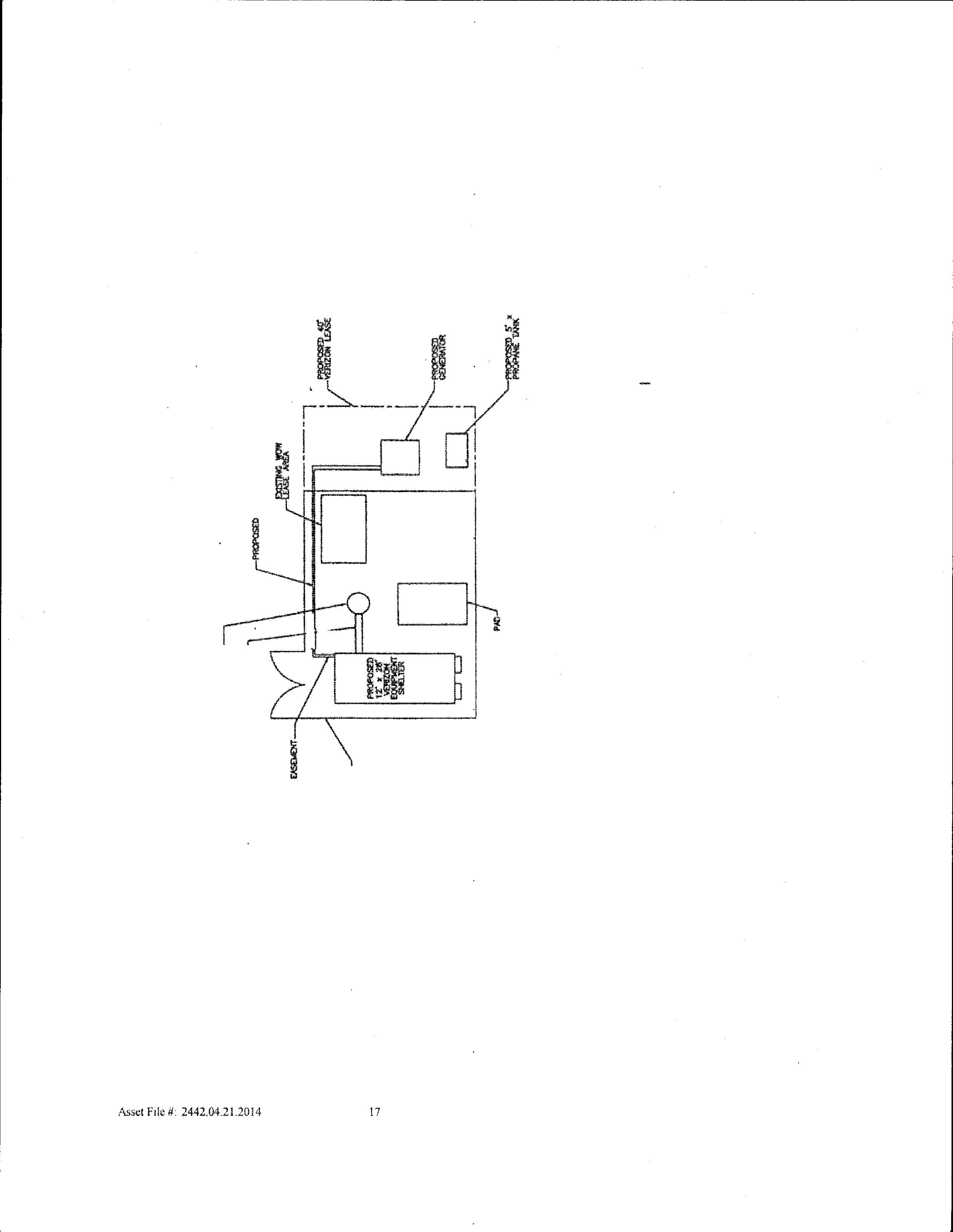
replacing old 200amp pad mounted load center with new 200amp panel with ATS, and new 45kw generator. Plus a 200 amp feeder.
Commercial Building Class: New - Industrial Class of Work:
Service Description:
Other - plumbing
Inspections
09/22/2020
09/14/2020
07/14/2020 Application Date: 07/15/2020 Issue Date: 02/25/2021 Final Date:
Linked Permit:
James 3999 Final Plumbing**According to the contractor, this manhole was approved for cover by Corissa Holmes and was covered before building department had an opportunity to inspect the exterior connections to the sanitary sewer piping. -- Insp Completed : Accepted
James 3999 Final Plumbing**The interior channel through the manhole looks fine, the part of the work I really needed to see was the connections to the sewer pipe system outside of the manhole. -- Insp Cancelled : Denied
09/03/2020 James 3999 Final Plumbing**Could not readily locate property. Provide better directions to, or better description of property location. -Insp Cancelled : No Access
Plumbing Permit Details
Permit Number:
Permit Name:
Contractor:
711-P28747
FRED HODECKER INC,
FRED HODECKER INC,
Commercial Building Class: New Construction Class of Work:
Service Description:
Inspections
Date Init. Comments
Linked Permit:
10/11/2005 Application Date: 10/11/2005 Issue Date: Final Date: Expired Status:
10/11/2005 RFG PLACED THIS PLUMBING PERMIT W/WATER CONNECTION WORK ORDER COPY IN THE NON-LINK PERMIT. COULD NOT TRACK THE BLDG FILE.
Plumbing Permit Details
Permit Number:
Permit Name:
Contractor:
711-P97-738801
Commercial Building Class: Class of Work:
Service Description:
Linked Permit:
06/09/1997 Application Date: 06/09/1997 Issue Date: Final Date:
Finaled Status:
Inspections
No inspection records found.
Plumbing Permit Details
Permit Number:
Permit Name:
711-P97-701703
Service Description:
Inspections
Assessor's Office Supplemental Information
STATEMENT OF TAX ACCOUNT
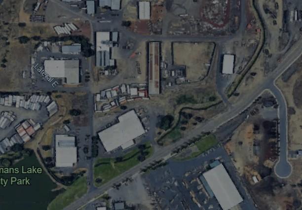
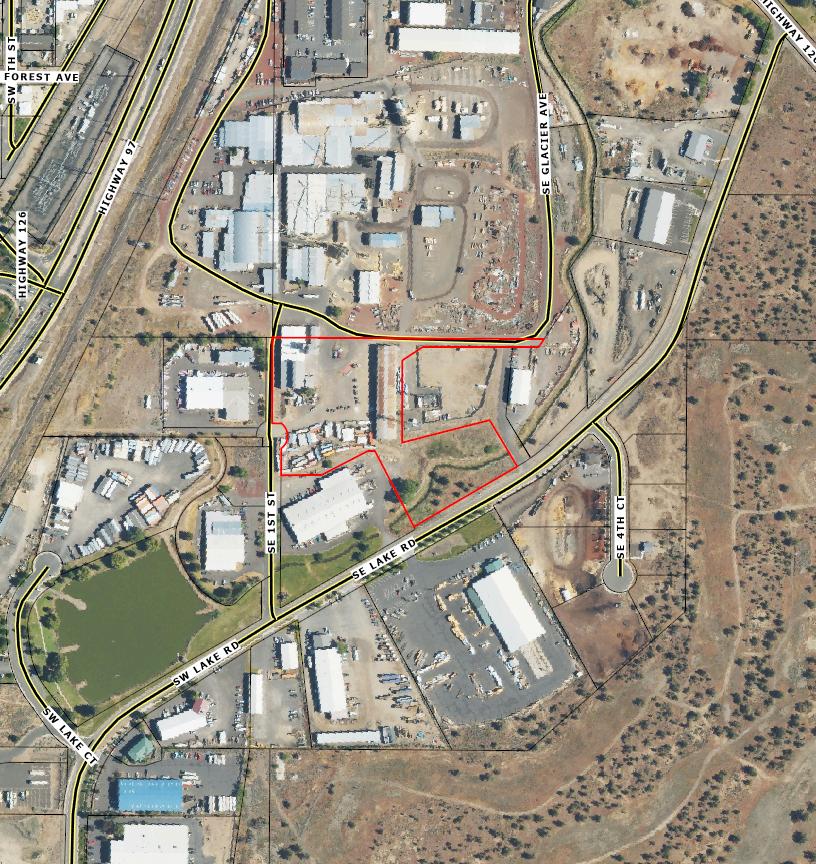
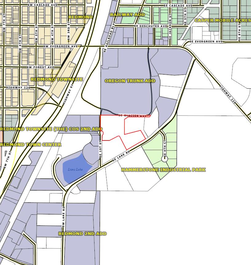
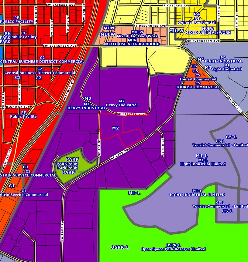
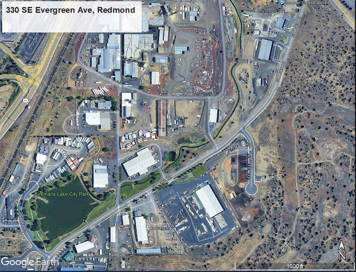
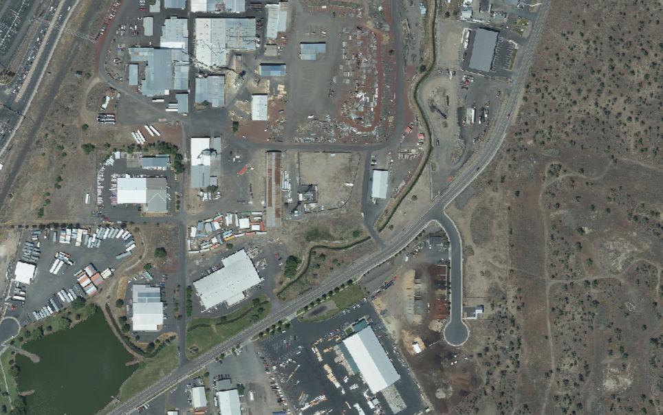
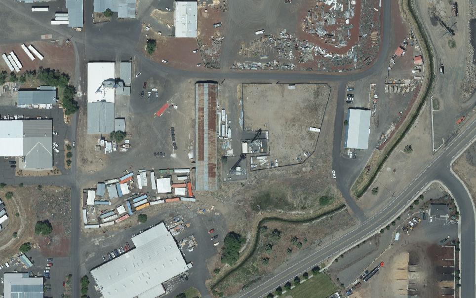
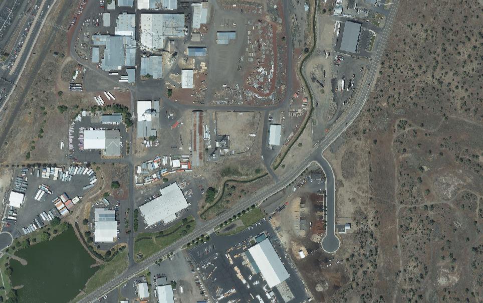
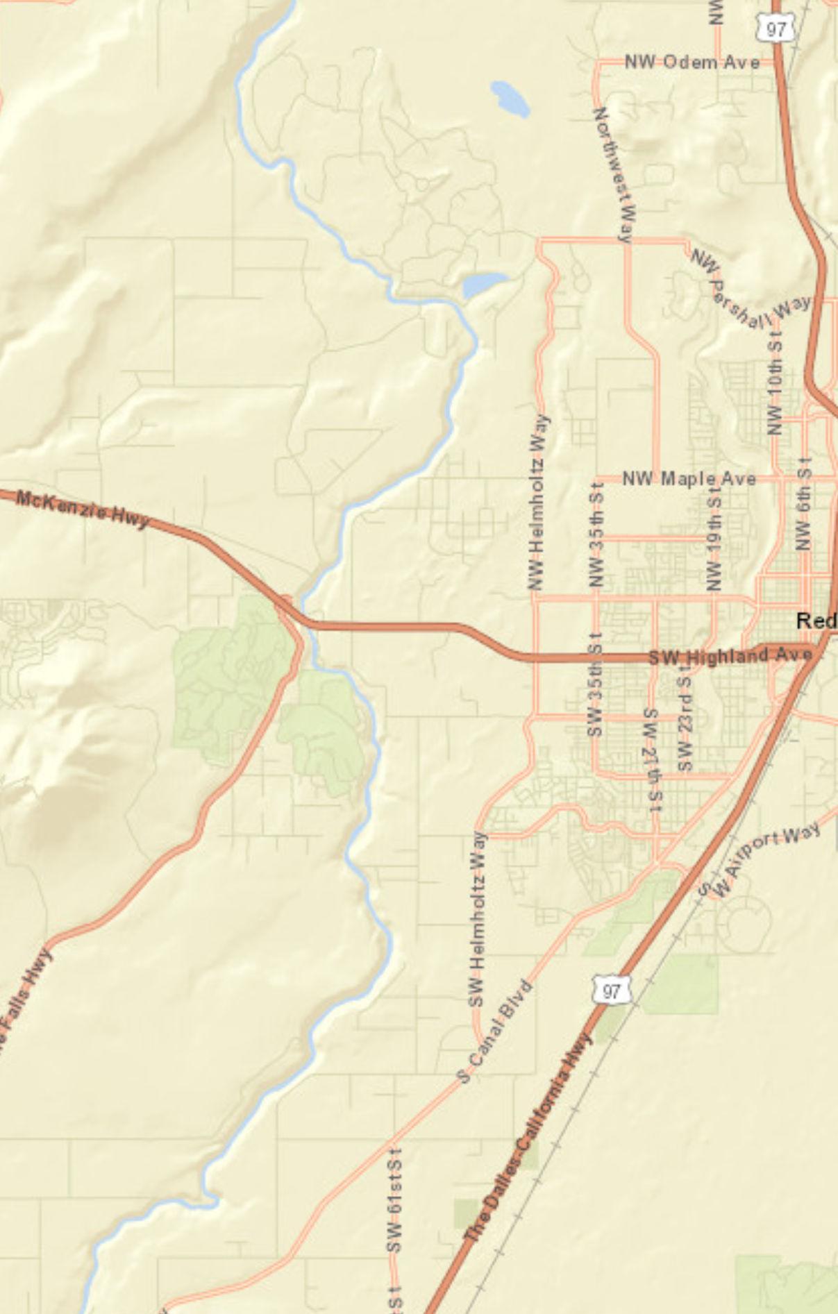
330 SE EVERGREEN AVE REDMOND SITUS ADDRESS:
Please include this coupon with payment. Please do not staple, paper clip or tape your payment.
Please select payment option
(3% Discount) Two-Thirds
Payment Due November 17, 2025
$21,128.14
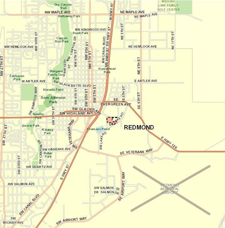
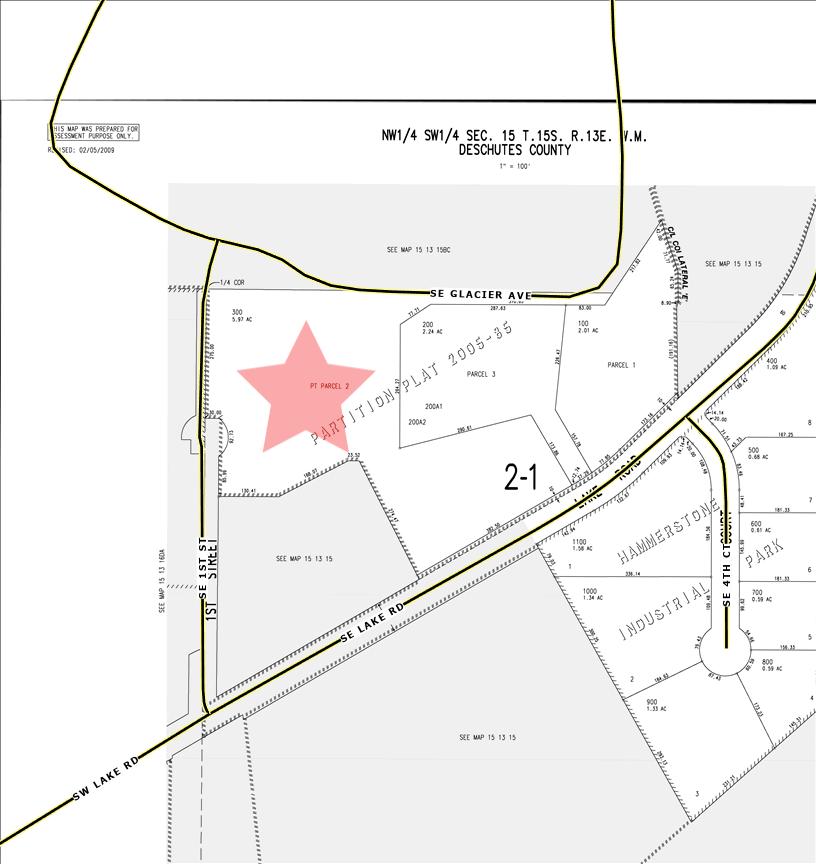
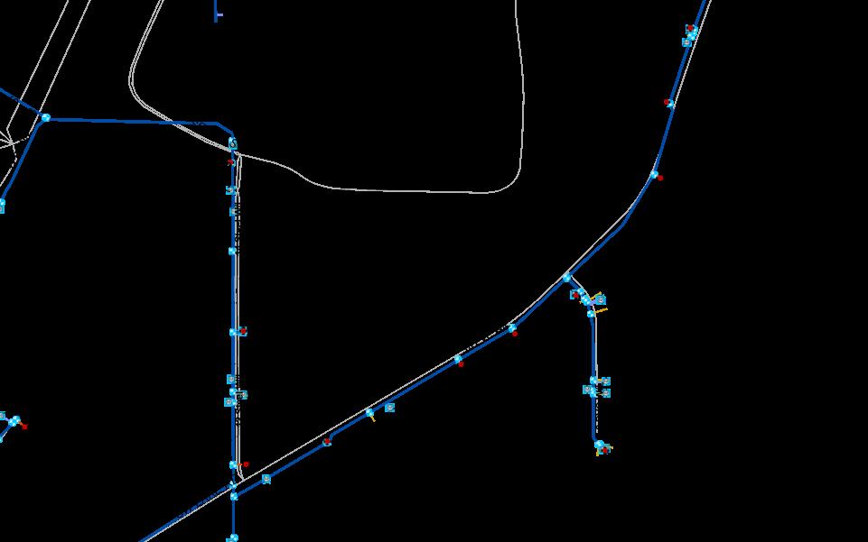
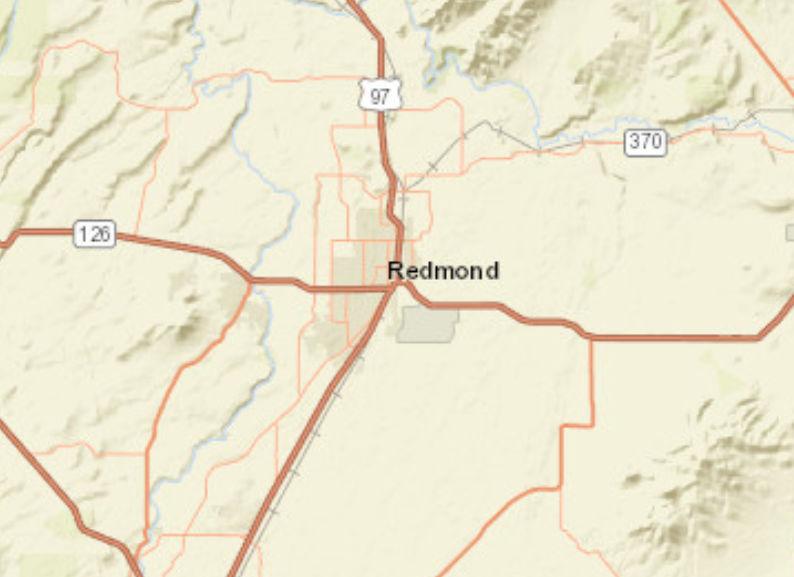
Roa d Map
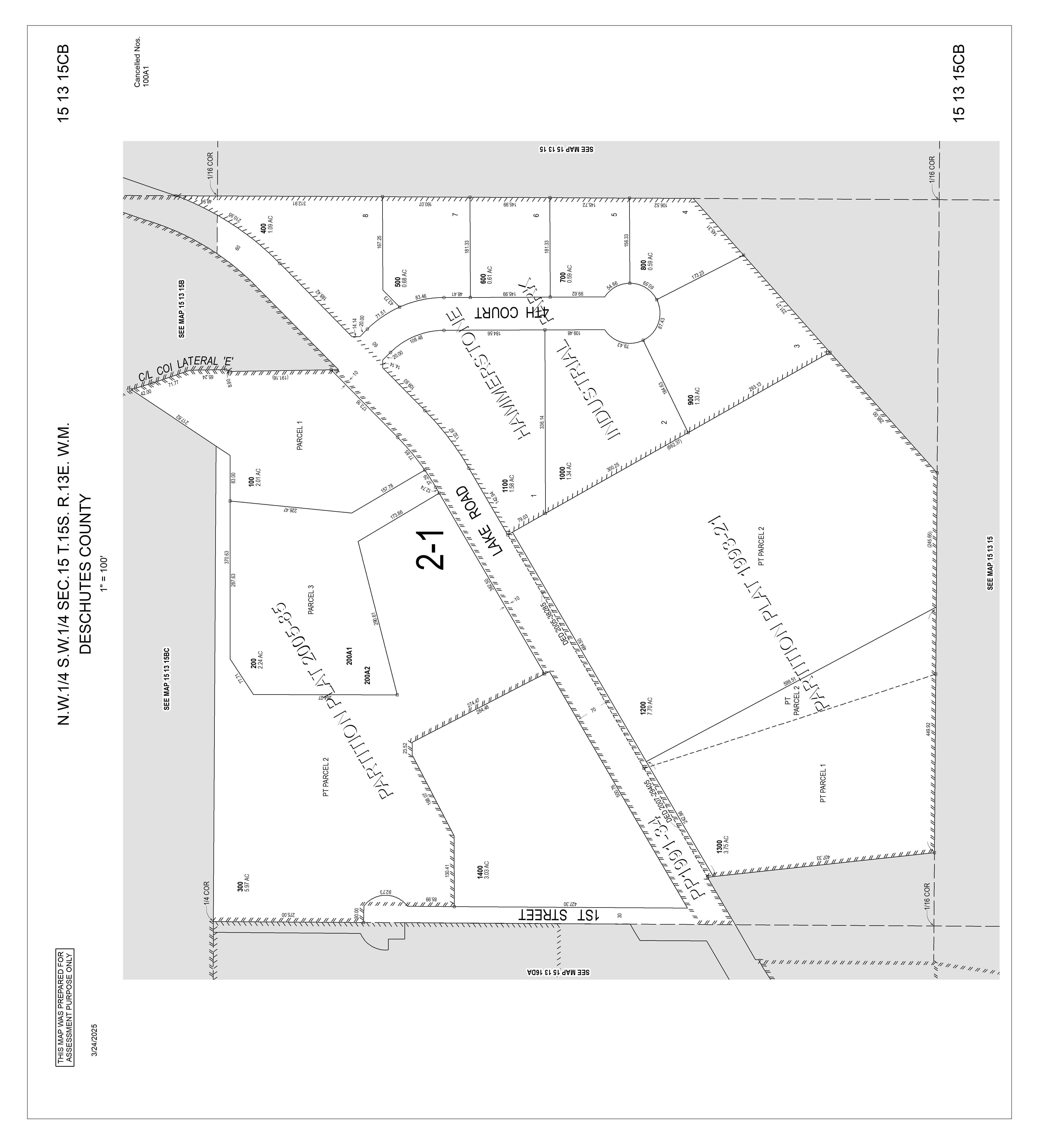
TaxAccount #: 151315CB00300
330 SE EvergreenAve, Redmond OR 97756
This map/plat is being furnished as an aid in locating the herein described land in relation to adjoining streets, natural boundaries and other land, and is not a survey of the land depicted Except to the extent a policy of title insurance is expressly modified by endorsement, if any, the company does not insure dimensions, distances, location of easements, acreage or other matters shown thereon
Parcel ID: 267732
Parcel ID: 267732
TaxAccount #: 151315CB00300
330 SE EvergreenAve, Redmond OR 97756
This map/plat is being furnished as an aid in locating the herein described land in relation to adjoining streets, natural boundaries and other land, and is not a survey of the land depicted Except to the extent a policy of title insurance is expressly modified by endorsement, if any, the company does not insure dimensions, distances, location of easements, acreage or other matters shown thereon
ID: 267732
TaxAccount #: 151315CB00300
330 SE EvergreenAve, Redmond OR 97756
This map/plat is being furnished as an aid in locating the herein described land in relation to adjoining streets, natural boundaries and other land, and is not a survey of the land depicted Except to the extent a policy of title insurance is expressly modified by endorsement, if any, the company does not insure dimensions, distances, location of easements, acreage or other matters shown thereon
Parcel
Parcel ID: 267732
TaxAccount #: 151315CB00300
330 SE EvergreenAve, Redmond OR 97756
This map/plat is being furnished as an aid in locating the herein described land in relation to adjoining streets, natural boundaries and other land, and is not a survey of the land depicted Except to the extent a policy of title insurance is expressly modified by endorsement, if any, the company does not insure dimensions, distances, location of easements, acreage or other matters shown thereon
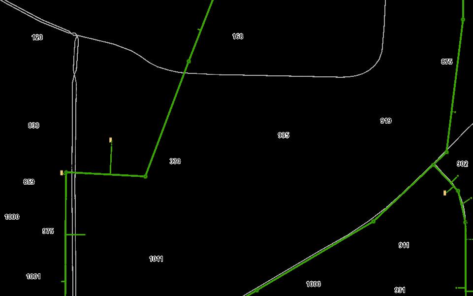
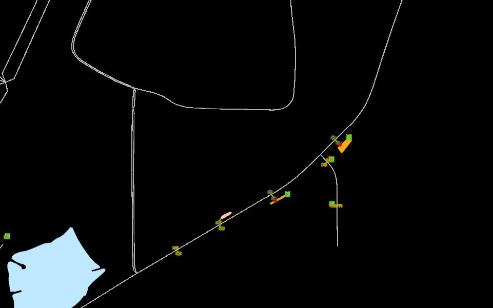
Well Map
This map/plat is being furnished as an aid in locating the herein described land in relation to adjoining streets, natural boundaries and other land, and is not a survey of the land depicted Except to the extent a policy of title insurance is expressly modified by endorsement, if any, the company does not insure dimensions, distances, location of easements, acreage or other matters shown thereon
Parcel ID: 267732
TaxAccount #: 151315CB00300
330 SE EvergreenAve, Redmond OR 97756
This map/plat is being furnished as an aid in locating the herein described land in relation to adjoining streets, natural boundaries and other land, and is not a survey of the land depicted Except to the extent a policy of title insurance is expressly modified by endorsement, if any, the company does not insure dimensions, distances, location of easements, acreage or other matters shown thereon
REDMOND CODE
CHAPTER 8
DEVELOPMENT REGULATIONS
The contents of Chapter Development Regulations can be found here: https://issuu.com/infodeschutestitle/docs/city_of_redmond_oregon_development_regulations?fr=xKAE
Households by Presence of People Under 18 by Household Type
- 2023
Population by Ratio of Income to Poverty
- 2023
Population Age 5 to 17 by Language Spoken
- 2023
Population Age 18 to 64 by Language Spoken
2019 - 2023
Population Age 65+ by Language Spoken
Workers Age 16+ By Means of Transportation
Workers
Age 16+ By Travel Time to Work
Sex by Class of Worker
2023
2019 - 2023
Source: U.S. Census 2019-2023 American Community Survey. Data Note: N/A means not available. Ratio of Income to Poverty Level represents persons for whom poverty status is determined. Household income represents income in 2023, adjusted for inflation.
Margin of error (MOE): The MOE is a measure of the variability of the estimate due to sampling error. MOEs enable the data user to measure the range of uncertainty for each estimate with 90 percent confidence. The range of uncertainty is called the confidence interval, and it is calculated by taking the estimate +/- the MOE. For example, if the ACS reports an estimate of 100 with an MOE of +/- 20, then you can be 90 percent certain the value for the whole population falls between 80 and 120.
Reliability: Symbols represent threshold values Esri has established from the Coefficients of Variation (CV) to designate the usability of the estimates. The CV measures the amount of sampling error relative to the size of the estimate, expressed as a percentage.
High Reliability: Small CVs (less than or equal to 12 percent) are flagged green and are considered reasonably reliable.
Medium Reliability: Estimates with CVs between 12 and 40 are flagged yellow and should be used with caution.
ACS Population Summary
330 SE Evergreen Ave, Redmond, Oregon, 97756
Ring: 3 mile radius
Household Type by Relatives and Non-relatives
Households by Disability Status
Households by Presence of People Under 18 by Household Type
2023
2019 - 2023
Population Age 5 to 17 by Language Spoken
- 2023
Population Age 18 to 64 by Language Spoken
2019 - 2023
Population Age 65+ by Language Spoken
Workers Age 16+ By Means of Transportation
Workers Age 16+ By Travel Time to Work
2019 - 2023
Sex by Class of Worker
Females Age 20-64 by Age of Children
2019 - 2023
Population and Presence of a Computer
Households and Internet Subscriptions
- 2023
2019 - 2023
Source: U.S. Census 2019-2023 American Community Survey. Data Note: N/A means not available. Ratio of Income to Poverty Level represents persons for whom poverty status is determined. Household income represents income in 2023, adjusted for inflation.
Margin of error (MOE): The MOE is a measure of the variability of the estimate due to sampling error. MOEs enable the data user to measure the range of uncertainty for each estimate with 90 percent confidence. The range of uncertainty is called the confidence interval, and it is calculated by taking the estimate +/- the MOE. For example, if the ACS reports an estimate of 100 with an MOE of +/- 20, then you can be 90 percent certain the value for the whole population falls between 80 and 120.
Reliability: Symbols represent threshold values Esri has established from the Coefficients of Variation (CV) to designate the usability of the estimates. The CV measures the amount of sampling error relative to the size of the estimate, expressed as a percentage.
High Reliability: Small CVs (less than or equal to 12 percent) are flagged green and are considered reasonably reliable.
Medium Reliability: Estimates with CVs between 12 and 40 are flagged yellow and should be used with caution.
Low Reliability: Large CVs (over 40 percent) are flagged red and are considered very unreliable.
ACS Population Summary
330 SE Evergreen Ave, Redmond, Oregon, 97756
Ring: 5 mile radius
Household Type by Relatives and Non-relatives
Households by Disability Status
Population Age 3+ by School Enrollment
Households by Presence of People Under 18 by Household Type
2019 -
2023
Population by Ratio of Income to Poverty
2019 - 2023
Population Age 5 to 17 by Language Spoken
- 2023
Population Age 18 to 64 by Language Spoken
2019 - 2023
Population Age 65+ by Language Spoken
Workers Age 16+ By Means of Transportation
Workers Age 16+ By Travel Time to Work
2019 - 2023
Sex by Class of Worker
Females Age 20-64 by Age of Children
2019 - 2023
Population and Presence of a Computer
Households and Internet Subscriptions
- 2023
2019 - 2023
Source: U.S. Census 2019-2023 American Community Survey. Data Note: N/A means not available. Ratio of Income to Poverty Level represents persons for whom poverty status is determined. Household income represents income in 2023, adjusted for inflation.
Margin of error (MOE): The MOE is a measure of the variability of the estimate due to sampling error. MOEs enable the data user to measure the range of uncertainty for each estimate with 90 percent confidence. The range of uncertainty is called the confidence interval, and it is calculated by taking the estimate +/- the MOE. For example, if the ACS reports an estimate of 100 with an MOE of +/- 20, then you can be 90 percent certain the value for the whole population falls between 80 and 120.
Reliability: Symbols represent threshold values Esri has established from the Coefficients of Variation (CV) to designate the usability of the estimates. The CV measures the amount of sampling error relative to the size of the estimate, expressed as a percentage.
High Reliability: Small CVs (less than or equal to 12 percent) are flagged green and are considered reasonably reliable.
Medium Reliability: Estimates with CVs between 12 and 40 are flagged yellow and should be used with caution.
Low Reliability: Large CVs (over 40 percent) are flagged red and are considered very unreliable.
Market Profile
2025 Households by Income
$15,000-19,999
$45,000-49,999
Housing Unit Summary
2025 Population by Age
2025 Population 15+ by Marital Status
2020 Population by Race/Ethnicity
2025 Population by Race/Ethnicity
2025 Employed Pop 16+ by Occupation
2025 Employed Pop 16+ by Occupation
2025 Civilian Population 16+ in Labor Force
: Esri forecasts for
and
U.S.
2025 Consumer Spending
Top Tapestry Segment
Moderate Metros (C6): Dreambelt (K5): Dreambelt (K5):
This segment is characterized by young, suburban households with moderate incomes.
Learn more about this segment...
This segment is characterized by middleaged Western suburbanites with high rent and home prices.
Learn more about this segment...
This segment is characterized by middleaged Western suburbanites with high rent and home prices.
Learn more about this segment...
Data Note: Household population includes persons not residing in group quarters. Average Household Size is the household population divided by total households. Persons in families include the householder and persons related to the householder by birth, marriage, or adoption. Per Capita Income represents the income received by all persons aged 15 years and over divided by the total population.
Income represents the preceding year, expressed in current dollars. Household income includes wage and salary earnings, interest dividends, net rents, pensions, SSI and welfare payments, child support, and alimony.
Persons of Hispanic Origin may be of any race. The Diversity Index measures the probability that two people from the same area will be from different race/ethnic groups.
Consumer spending shows the amount spent on a variety of goods and services by households that reside in the area. Expenditures are shown by broad budget categories that are not mutually exclusive. Consumer spending does not equal business revenue. Total and Average Amount Spent Per Household represent annual figures. The Spending Potential Index represents the amount spent in the area relative to a national average of 100.
Source: Esri forecasts for 2025 and 2030. U.S. Census 2010 and 2020 Census data converted by Esri into 2020 geography. Consumer Spending data are derived from the 2022 and 2023 Consumer Expenditure Surveys, Bureau of Labor Statistics.
Traffic Count Map
Rings: 1, 3, 5 mile radii
Source: Traffic Counts (2025)
Terrebonne
1. By the one-time payment of a non-refundable parking and mobility improvement fee to the City in the amount established in the City’s Fee Schedule, paid prior to the issuance of Certificate of Occupancy. Fees collected shall be used to fund parking, street improvements or facilities to improve mobility or enhance pedestrian connectivity and safety in the Downtown OverlayDistrict.
2. From time to time the City shall establish the value of off-street parking facilities on a per parking space basis, used to establish the above parkingandmobilityimprovement fee.
3. The City Engineering shall evaluate development proposals requesting to pay an in-lieu fee through conducting a Transportation System Analysis or parkingstudy.
4. Any such request for parking in-lieu may be denied or reduced by the Community Development Director, or designee. The Director, or designee, shalldetermine:
a. Whether there is sufficient alternative parking within a two to fourblockradiusoftheproject location.
b. Whether approval of the request would have an adverse effect on surroundingneighborhoods.
c. Whether the request meets the Purpose and Intent of the Downtown OverlayDistrictZone.
d. Compliance with the Redmond Comprehensive Plan 2040 and supportplans, as amended.
1. LLI Zone Regulations. Thefollowing standardsandregulationsapplyintheLLI Zone:
A. The lot shall adhere to the designation as acknowledged by the Central Oregon IntergovernmentalCouncil.
B. No property that is zoned LLI can be rezoned to another zone within ten years of theLLI designation.
C. The minimum lot size is 50 acres. Division or separation of lots or parcels within the site to new lots or parcels less than the minimum lot size is not allowed until thesiteis developedwith a primarytradedsectoruserequiringalargelot.
D. Allowedusesaretradedsectorusesas provided in Section 2.
E. Usesallowedtosupportaprimaryuserincluded:
1. Subordinate industrial uses that rely upon and support the primary traded sectoruse;
2. Service commercial uses that support the traded sector uses if they are limitedto7500squarefeet per use; and
3. Retail uses accessory to a traded sector use and limited to 7500 square feet.
F. Conceptual Phased Site Development Plan. A Conceptual Phased Site Development Plan is required for each primary traded-sector use as part of the
Site and Design Review process in addition to the criteria and requirements outlined in Article IV of this code. In addition to the requirements outlined in Section 8.3025, the following elements shall be considered as part of the ConceptualPhased SiteDevelopment Plan:
1. Open Space. Generally identifylandprovidedfor openspaceonthesite.
2. Connectivity and Trail Networks. A conceptual transportation plan for streets, pedestrians connectivity and trail networks. E.g., Connection of bicycle routes and pedestrian network for utility and recreational purposes.
3. Site Design. Describe how the design elements (i.e., streets, open spaces, signage, and architecture) are integrated and coordinated throughout thesite.
4. Analysis of Anticipated Utility Consumption by Phase. Analysis of theanticipatedutility consumption by phasefor wastewater, water,power, natural gas, and other utility infrastructure necessary to support the development.
2. LLI Zone Uses Permitted. The following uses are allowed outright or conditionally in theLargeLotIndustrialZone:
O PerORS285B.280,tradedsectormeansindustriesinwhich memberfirmsselltheirgoodsorservicesintomarketsforwhich nationalorinternationalcompetitionexists,aswellasusesand servicesthatdirectlybenefittradedsectoruses.Alloweduses includemanufacturing,processingplants,distributioncenter, warehousing,researchanddevelopment,andhighereducation institutions
Subordinate Industrial Uses
Service Commercial Uses
Retail Uses
O Afteraprimarytraded-sectorusehasbeensited,subordinate industrialusesareallowed.Subordinatemeansindustriesthat relyuponandsupportaprimarytradedsectoruse
C Afteraprimarytraded-sectorusehasbeensited,service commercialusesareallowedthatsupportthetradedsectoruses andshallbelimitedto7500squarefeetperstructure
C Afteraprimarytraded-sectorusehasbeensited,retailuses,and eatinganddrinkingestablishmentsareallowedasaconditional useandshallbelimitedto7500squarefeetperuseinthe structure.
8.0190Table C, Uses Permitted. The following uses identified below are allowed outright or conditionally in each of the Commercial and Industrial zones. Outright or conditional uses in the M-1.5 zone may be permitted Conditionally in the M-1 or M-2 zones; this allowance doesnot applyfor usesNot Allowed (“N”).
8.0195Table D, Minimum Standards. The following minimum standards are required in each oftheCommercialandIndustrialzonesas follows(alldistances aremeasuredinfeet):
Minimum Yard Setbacks
Note: Residential uses permitted in Commercial and Industrial zonesshall besubject to thedensity standardsfor theR-5 zone, except for the Downtown Overlay District and theC-2 and C-3 zones, for which thereisno maximum density standard.
A Arearyardabuttinganalleyshallbe25feetfromthepropertylinetofoundationwhenthealleyisusedtoservicethecommercialestablishment and10feetinothercases.
B Maximumbuildingheightislimitedto45feetforallstructureswithinonefullcityblockofaresidentialzone.Whereallowedbuildingsover45 feetshallconformtheUpperFloorSetbackStandardsintheDowntownOverlayZoneSiteandDesignStandardsinSection8.0175(5).
C RearyardsalongthenorthsideofHighlandAvenue/Highway126betweenSW23rdandSW27thStreetsshallhaveaminimumarterial setbackof25feet.Allotherrearsetbacksadjacenttoarterialsshallbe50feet.
D TheminimumsetbackbetweenastructureandanexistinguseintheC-5zoneshallbe5feetfromthepropertylineand10feetfromany adjacentstructureonthesubjectsiteoradjacentproperty.
E Nouselocatedinanindustrialzoneadjacenttooracrossthestreetfromaresidentialzoneshallexceed60%ofthelotareaincludingbuildings, storageorfacilities,andoff-streetparkingandloading.
F Theminimumsideyardinanindustrialzoneshallbe10feetfor1and2storybuildingsand15feetfor3storybuildings.
G Maximumbuildingheightislimitedto50feetforallstructureswithinonefullcityblockofaresidentialzone.Whereallowed,buildingsover50 feetshallconformtheDowntownOverlayDistrictSiteandDesignStandardsinSection8.0175(5).Themaximumbuildingheightforstructures westofSW5th Streetis60feet.Themaximumbuildingheightforstructureseastof5th Streetis75feetandmaybeincreasedabove75feetifa ConditionalUsePermitforthestructureisapprovedbyaHearingsandReviewAuthority.
H Existingzero-lotlinestructuresasofAugust12,2008,shallbeexemptfromthisstandard.Atthetimethefrontfaçadeofabuildingorabuilding isdemolishedasdefinedbythisCode,thenthebuildingshallcomplywiththisstandardunlessavarianceisapproved.
I Fullblockdevelopmentsrequireaminimumof50percentofthebuildingfaçadetobedevelopedtotheminimumsetback.Asphaltandirrigated turfareprohibitedinthefrontyardsetback(concrete,pavers,landscapingareallowed).