The information and maps presented in this report are provided for your convenience. Every reasonable effort has been made to assure the accuracy of the data and associated maps. Deschutes County makes no warranty, representation or guarantee as to the content, sequence, accuracy, timeliness or completeness of any of the data provided herein. Deschutes County explicitly disclaims any representations and warranties, including, without limitation, the implied warranties of merchantability and fitness for a particular purpose. Deschutes County shall assume no liability for any errors, omissions, or inaccuracies in the information provided regardless of how caused. Deschutes County assumes no liability for any decisions made or actions taken or not taken by the user of this information or data furnished hereunder.
Summary
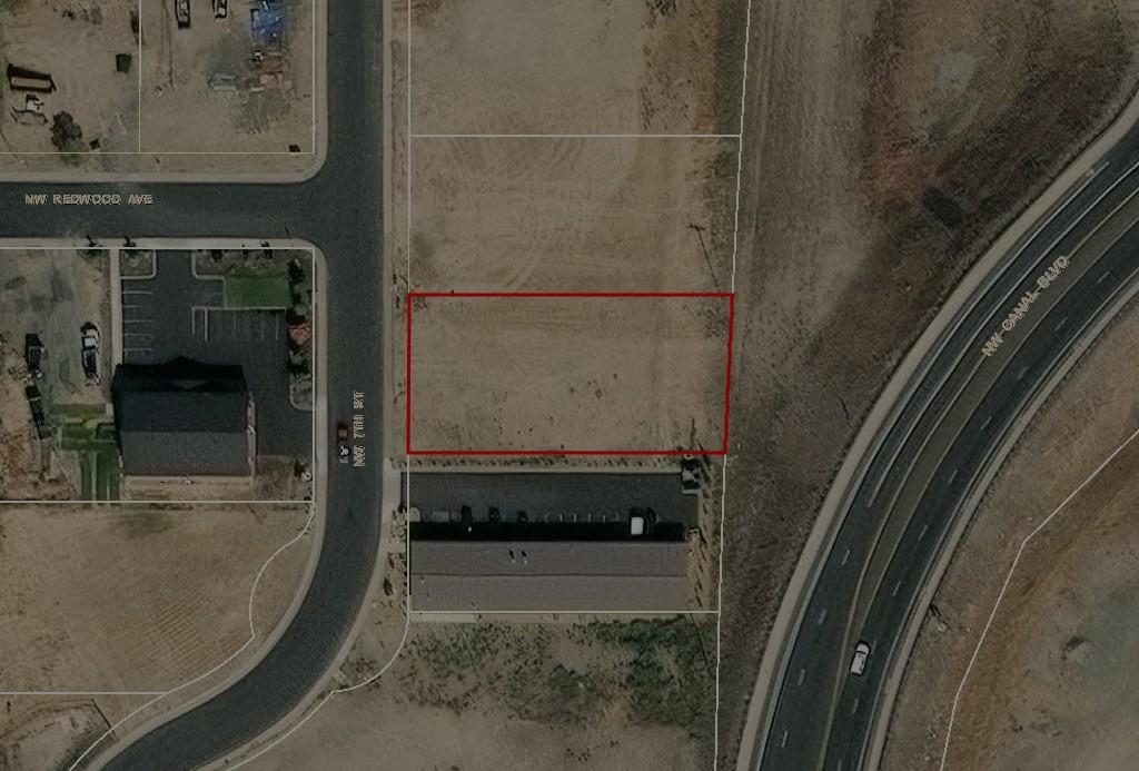
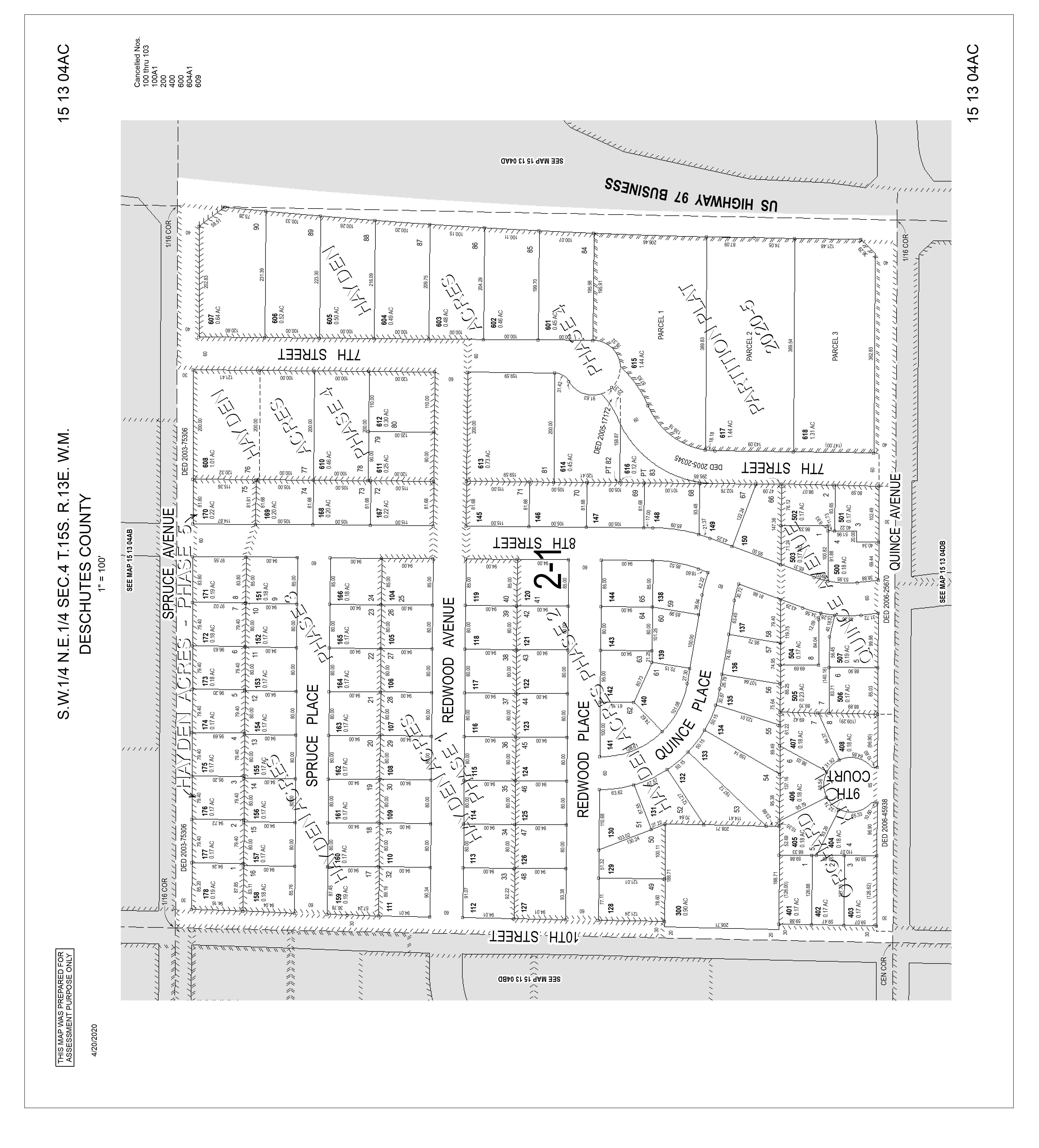
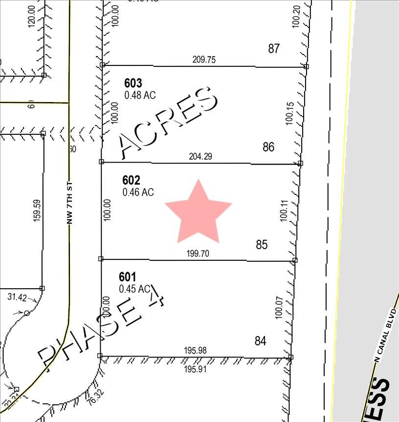
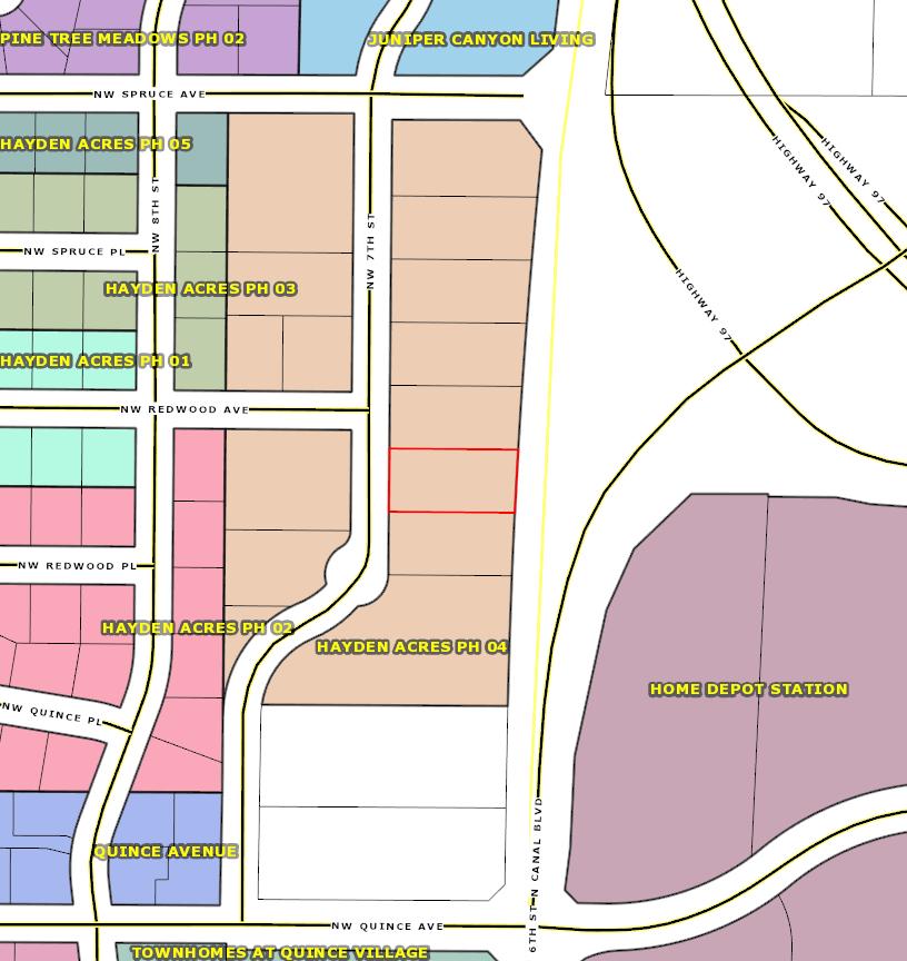
ACRES PHASE 4
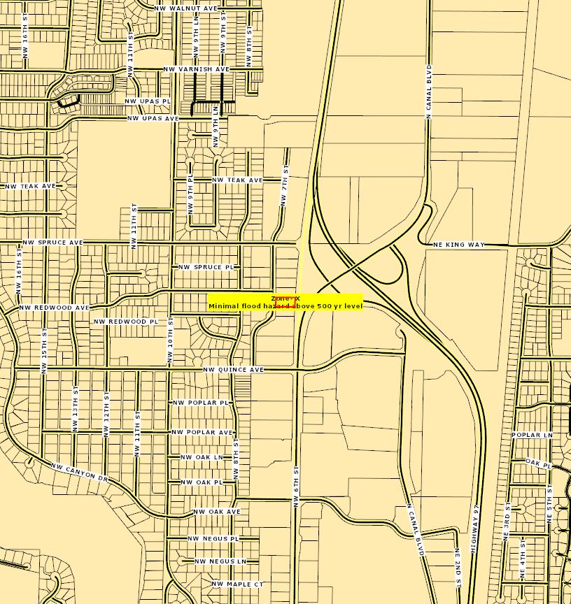
Warnings, Notations, and Special Assessments
Review of digital records maintained by the Deschutes County Assessor’s Office, Tax Office, Finance Office, and the Community Development Department indicates that there are no special tax, assessment or property development related notations associated with this account. However, independent verification of the presence of other Deschutes County tax, assessment, development, and additional property related considerations is recommended. Confirmation is commonly provided by title companies, real estate agents, developers, engineering and surveying firms, and other parties who are involved in property transactions or property development. In addition, County departments may be contacted directly to discuss the information.
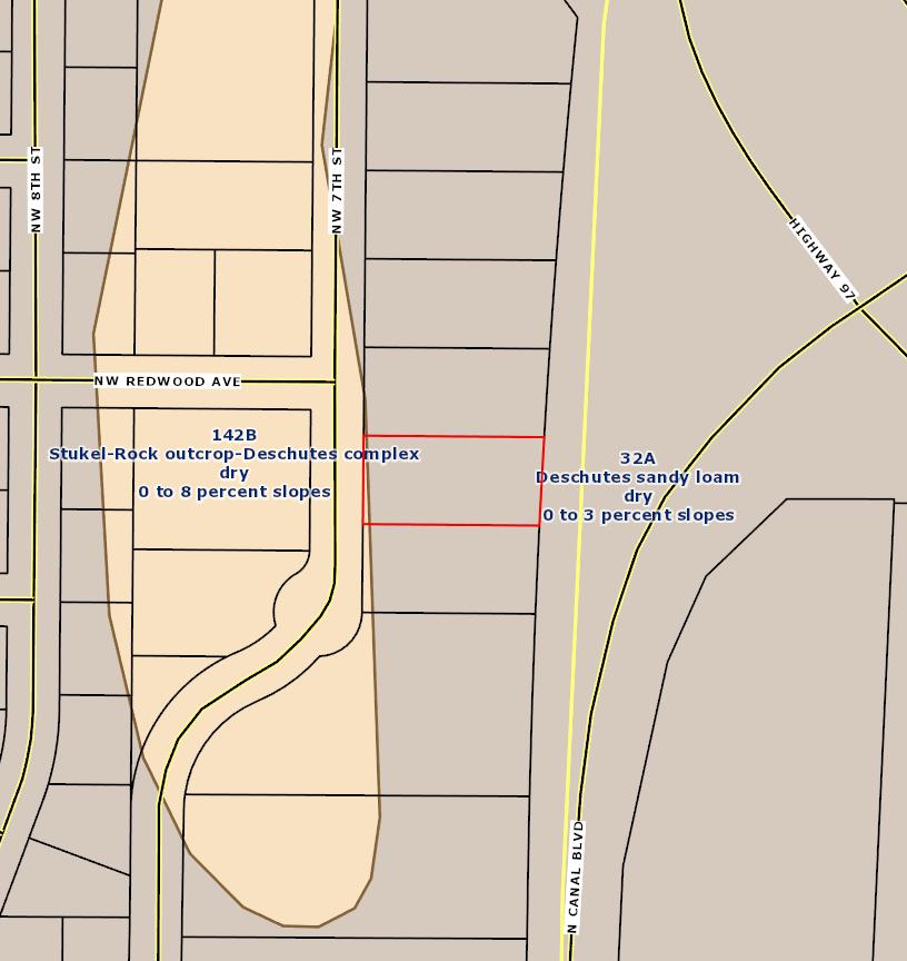
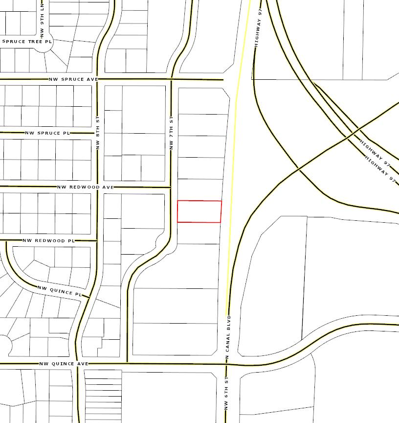
Land Characteristics
COUNTY SERVICES DESCHUTES COUNTY (541) 388-6570 1300 NW WALL ST, BEND, OR 97703 FIRE DISTRICT REDMOND FIRE AND RESCUE (541) 504-5000 341 NW DOGWOOD AVE, REDMOND, OR 97756
SCHOOL DISTRICT REDMOND SCHOOL DISTRICT (541) 923-5437 145 SE SALMON AVE, REDMOND, OR 97756
ELEMENTARY SCHOOL ATTENDANCE AREA TOM McCALL ELEMENTARY SCHOOL (541) 526-6400 1200 NW UPAS AVE, REDMOND, OR 97756 MIDDLE SCHOOL ATTENDANCE AREA ELTON GREGORY MIDDLE SCHOOL (541) 526-6440 1220 NW UPAS AVE, REDMOND, OR 97756
HIGH SCHOOL ATTENDANCE AREA REDMOND HIGH SCHOOL (541) 923-4800 675 SW RIMROCK, REDMOND, OR 97756
EDUCATION SERVICE TAX DISTRICT HIGH DESERT EDUCATION SERVICE DISTRICT (541) 693-5600 145 SE SALMON AVE, REDMOND, OR 97756
COLLEGE TAX DISTRICT CENTRAL OREGON COMMUNITY COLLEGE (541) 383-7700 2600 NW COLLEGE WAY, BEND, OR 97703
PARK & RECREATION DISTRICT REDMOND AREA PARK & RECREATION DISTRICT (541) 548-7275 465 SW RIMROCK DR, REDMOND, OR 97756
LIBRARY DISTRICT DESCHUTES PUBLIC LIBRARY (541) 617-7050 601 NW WALL ST, BEND, OR 97703
WATER SERVICE PROVIDER REDMOND WATER DEPARTMENT (541)
STATEMENT OF TAX ACCOUNT
SMOLICH, MICHAEL 60877 SW DEER CREEK PL BEND OR 97702
20-May-2025
JULY 1, 2024 TO JUNE 30, 2025
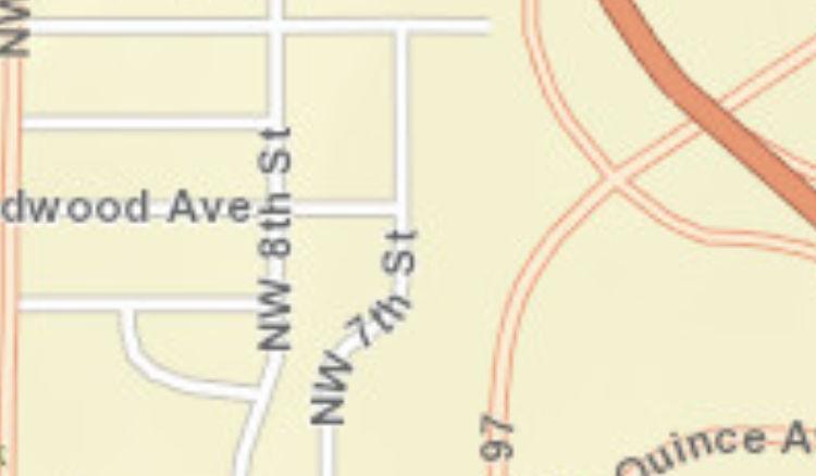
SITUS ADDRESS:
2604 NW 7TH ST REDMOND
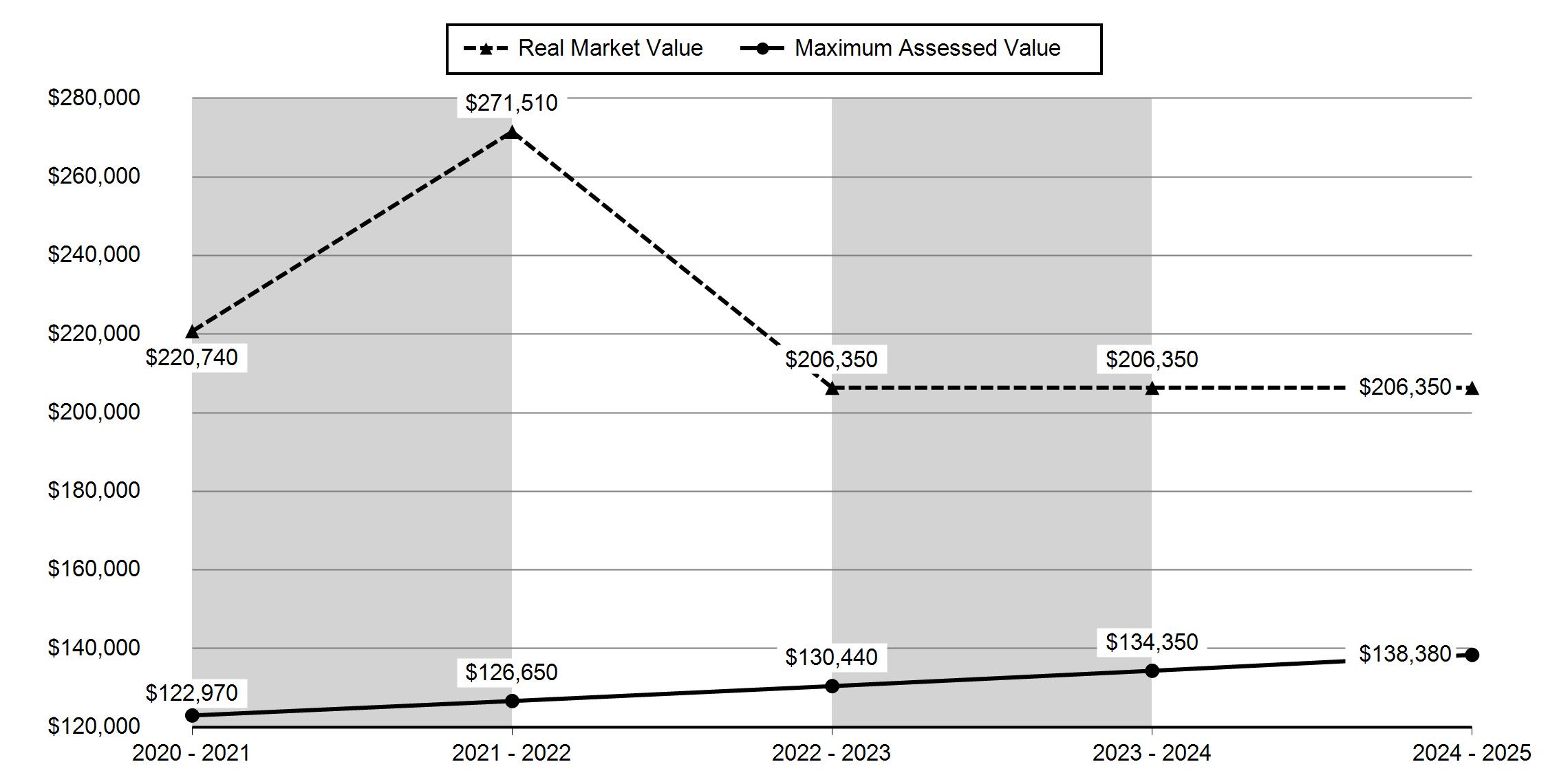
If your net taxable value has grown by more than 3% from last year and you have any questions, please contact the Assessor's office at +1 (541) 388-6508.
Full Payment with 3% Discount Discount is lost after due date and interest may apply PAYMENT OPTIONS: * Online
$2,704.54
* By Mail to Deschutes County Tax, PO Box 7559 Bend OR 97708-7559
* Drop Box located at 1300 NW Wall Street, Bend or 411 SW 9th
Please include this coupon with payment. Please do not staple, paper clip or tape your payment.
Payment Due November 15, 2024
Please select payment option
Full Payment (3% Discount)
One-Third Payment (No Discount) Next Payment Due
Two-Thirds Payment (2% Discount) Next Payment Due
Please make checks payable to Deschutes County Tax Collector
Source: U.S. Census Bureau, 2018-2022 American Community Survey
ACS Population Summary
2604 NW 7th St, Redmond, Oregon, 97756
Ring: 1 mile radius
POPULATION AGE 5+ YEARS BY LANGUAGE SPOKEN AT HOME AND ABILITY TO SPEAK ENGLISH
18 to 64 years
ACS Population Summary
2604 NW 7th St, Redmond, Oregon, 97756
Ring: 1 mile radius
WORKERS AGE 16+ YEARS BY PLACE OF WORK
ACS Population Summary
2604 NW 7th St, Redmond, Oregon, 97756
Ring: 1 mile radius
WORKERS AGE 16+ YEARS BY MEANS OF TRANSPORTATION TO
WORKERS AGE
FEMALES AGE 20-64 YEARS BY AGE OF OWN CHILDREN AND EMPLOYMENT STATUS
Source: U.S. Census Bureau, 2018-2022 American Community Survey
ACS Population Summary
2604 NW 7th St, Redmond, Oregon, 97756
Ring: 1 mile radius
ACS Population Summary
2604 NW 7th St, Redmond, Oregon, 97756
Ring: 1 mile radius
BY RATIO OF INCOME TO POVERTY
CIVILIAN POPULATION AGE 18 OR OLDER BY VETERAN STATUS
CIVILIAN VETERANS AGE 18 OR OLDER BY PERIOD OF
HOUSEHOLDS BY POVERTY STATUS
Source: U.S. Census Bureau, 2018-2022 American Community Survey
ACS Population Summary
2604 NW 7th St, Redmond, Oregon, 97756
Ring: 1 mile radius
Data Note: N/A means not available. Population by Ratio of Income to Poverty Level represents persons for whom poverty status is determined. Household income represents income in 2022, adjusted for inflation.
2018-2022 ACS Estimate: The American Community Survey (ACS) replaces census sample data. Esri is releasing the 2018-2022 ACS estimates, five-year period data collected monthly from January 1, 2018 through December 31, 2022. Although the ACS includes many of the subjects previously covered by the decennial census sample, there are significant differences between the two surveys including fundamental differences in survey design and residency rules.
Margin of error (MOE): The MOE is a measure of the variability of the estimate due to sampling error. MOEs enable the data user to measure the range of uncertainty for each estimate with 90 percent confidence. The range of uncertainty is called the confidence interval, and it is calculated by taking the estimate +/- the MOE. For example, if the ACS reports an estimate of 100 with an MOE of +/- 20, then you can be 90 percent certain the value for the whole population falls between 80 and 120.
Reliability: These symbols represent threshold values that Esri has established from the Coefficients of Variation (CV) to designate the usability of the estimates. The CV measures the amount of sampling error relative to the size of the estimate, expressed as a percentage.
High Reliability: Small CVs (less than or equal to 12 percent) are flagged green to indicate that the sampling error is small relative to the estimate and the estimate is reasonably reliable.
Medium Reliability: Estimates with CVs between 12 and 40 are flagged yellow-use with caution.
Low Reliability: Large CVs (over 40 percent) are flagged red to indicate that the sampling error is large relative to the estimate. The estimate is considered very unreliable.
Source: U.S. Census Bureau, 2018-2022 American Community Survey Reliability: high medium low May 21, 2025
ACS Population Summary
2604 NW 7th St, Redmond, Oregon, 97756
Ring: 3 mile radius
AGE 3+ YEARS BY SCHOOL ENROLLMENT
ACS Population Summary
2604 NW 7th St, Redmond, Oregon, 97756
Ring: 3 mile radius
Source: U.S. Census Bureau, 2018-2022 American Community Survey
ACS Population Summary
2604 NW 7th St, Redmond, Oregon, 97756
Ring: 3 mile radius
POPULATION AGE 5+ YEARS BY LANGUAGE SPOKEN AT HOME AND ABILITY TO SPEAK ENGLISH
5 to 17 years
18 to 64 years
65 years and over
Source: U.S. Census Bureau, 2018-2022 American Community Survey
ACS Population Summary
2604 NW 7th St, Redmond, Oregon, 97756
Ring: 3 mile radius
WORKERS
AGE 16+ YEARS BY PLACE OF WORK
POPULATION IN HOUSEHOLDS AND PRESENCE OF A COMPUTER
HOUSEHOLDS AND INTERNET SUBSCRIPTIONS
U.S.
ACS Population Summary
2604 NW 7th St, Redmond, Oregon, 97756
Ring: 3 mile radius
WORKERS AGE 16+ YEARS BY MEANS OF TRANSPORTATION TO WORK
FEMALES AGE 20-64 YEARS BY AGE OF OWN CHILDREN AND EMPLOYMENT STATUS
ACS Population Summary
2604 NW 7th St, Redmond, Oregon, 97756
Ring: 3 mile radius
ACS Population Summary
2604 NW 7th St, Redmond, Oregon, 97756
Ring: 3 mile radius
BY RATIO OF INCOME TO POVERTY
CIVILIAN POPULATION AGE 18 OR OLDER BY VETERAN STATUS
CIVILIAN VETERANS AGE 18 OR OLDER BY PERIOD OF
Source: U.S.
ACS Population Summary
2604 NW 7th St, Redmond, Oregon, 97756
Ring: 3 mile radius
Data Note: N/A means not available. Population by Ratio of Income to Poverty Level represents persons for whom poverty status is determined. Household income represents income in 2022, adjusted for inflation.
2018-2022 ACS Estimate: The American Community Survey (ACS) replaces census sample data. Esri is releasing the 2018-2022 ACS estimates, five-year period data collected monthly from January 1, 2018 through December 31, 2022. Although the ACS includes many of the subjects previously covered by the decennial census sample, there are significant differences between the two surveys including fundamental differences in survey design and residency rules.
Margin of error (MOE): The MOE is a measure of the variability of the estimate due to sampling error. MOEs enable the data user to measure the range of uncertainty for each estimate with 90 percent confidence. The range of uncertainty is called the confidence interval, and it is calculated by taking the estimate +/- the MOE. For example, if the ACS reports an estimate of 100 with an MOE of +/- 20, then you can be 90 percent certain the value for the whole population falls between 80 and 120.
Reliability: These symbols represent threshold values that Esri has established from the Coefficients of Variation (CV) to designate the usability of the estimates. The CV measures the amount of sampling error relative to the size of the estimate, expressed as a percentage.
High Reliability: Small CVs (less than or equal to 12 percent) are flagged green to indicate that the sampling error is small relative to the estimate and the estimate is reasonably reliable.
Medium Reliability: Estimates with CVs between 12 and 40 are flagged yellow-use with caution.
Low Reliability: Large CVs (over 40 percent) are flagged red to indicate that the sampling error is large relative to the estimate. The estimate is considered very unreliable.
Source: U.S. Census Bureau, 2018-2022 American Community Survey
Reliability: high medium low May 21, 2025
ACS Population Summary
2604 NW 7th St, Redmond, Oregon, 97756
Ring: 5 mile radius
AGE 3+ YEARS BY SCHOOL ENROLLMENT
ACS Population Summary
2604 NW 7th St, Redmond, Oregon, 97756
Ring: 5 mile radius
HOUSEHOLDS BY PRESENCE OF PEOPLE 65 YEARS AND OVER, HOUSEHOLD SIZE AND HOUSEHOLD TYPE
ACS Population Summary
2604 NW 7th St, Redmond, Oregon, 97756
Ring: 5 mile radius
POPULATION AGE 5+ YEARS BY LANGUAGE SPOKEN AT HOME AND ABILITY TO SPEAK ENGLISH
5 to 17 years
18 to 64 years
Source:
65 years and over
ACS Population Summary
2604 NW 7th St, Redmond, Oregon, 97756
Ring: 5 mile radius
WORKERS AGE 16+ YEARS BY PLACE OF WORK
POPULATION IN HOUSEHOLDS AND PRESENCE OF A COMPUTER
ACS Population Summary
2604 NW 7th St, Redmond, Oregon, 97756
Ring: 5 mile radius
WORKERS AGE 16+ YEARS BY MEANS OF TRANSPORTATION TO WORK
WORKERS
ACS Population Summary
2604 NW 7th St, Redmond, Oregon, 97756
Ring: 5 mile radius
ACS Population Summary
2604 NW 7th St, Redmond, Oregon, 97756
Ring: 5 mile radius
BY RATIO OF INCOME TO POVERTY
CIVILIAN POPULATION AGE 18 OR OLDER BY VETERAN STATUS
CIVILIAN VETERANS AGE 18 OR OLDER BY PERIOD OF MILITARY SERVICE
HOUSEHOLDS BY POVERTY STATUS
Source:
ACS Population Summary
2604 NW 7th St, Redmond, Oregon, 97756
Ring: 5 mile radius
Data Note: N/A means not available. Population by Ratio of Income to Poverty Level represents persons for whom poverty status is determined. Household income represents income in 2022, adjusted for inflation.
2018-2022 ACS Estimate: The American Community Survey (ACS) replaces census sample data. Esri is releasing the 2018-2022 ACS estimates, five-year period data collected monthly from January 1, 2018 through December 31, 2022. Although the ACS includes many of the subjects previously covered by the decennial census sample, there are significant differences between the two surveys including fundamental differences in survey design and residency rules.
Margin of error (MOE): The MOE is a measure of the variability of the estimate due to sampling error. MOEs enable the data user to measure the range of uncertainty for each estimate with 90 percent confidence. The range of uncertainty is called the confidence interval, and it is calculated by taking the estimate +/- the MOE. For example, if the ACS reports an estimate of 100 with an MOE of +/- 20, then you can be 90 percent certain the value for the whole population falls between 80 and 120.
Reliability: These symbols represent threshold values that Esri has established from the Coefficients of Variation (CV) to designate the usability of the estimates. The CV measures the amount of sampling error relative to the size of the estimate, expressed as a percentage.
High Reliability: Small CVs (less than or equal to 12 percent) are flagged green to indicate that the sampling error is small relative to the estimate and the estimate is reasonably reliable.
Medium Reliability: Estimates with CVs between 12 and 40 are flagged yellow-use with caution.
Low Reliability: Large CVs (over 40 percent) are flagged red to indicate that the sampling error is large relative to the estimate. The estimate is considered very unreliable.
Source: U.S. Census Bureau, 2018-2022 American Community Survey
Reliability: high medium low May 21, 2025
Market Profile
Data Note: Household population includes persons not residing in group quarters. Average Household Size is the household population divided by total households. Persons in families include the householder and persons related to the householder by birth, marriage, or adoption. Per Capita Income represents the income received by all persons aged 15 years and over divided by the total population.
Source: Esri forecasts for 2024 and 2029. U.S. Census Bureau 2000 and 2010 decennial Census data converted by Esri into 2020 geography. May 21, 2025
2024 Households by Income
Market Profile
2604 NW 7th St, Redmond, Oregon, 97756
Rings: 1, 3, 5 mile radii
$1,000,000
Data Note: Income represents the preceding year, expressed in current dollars. Household income includes wage and salary earnings, interest dividends, net rents, pensions, SSI and welfare payments, child support, and alimony.
Source: Esri forecasts for 2024 and 2029. U.S. Census Bureau 2000 and 2010 decennial Census data converted by Esri into 2020 geography. May 21, 2025
Source: Esri forecasts for 2024 and 2029. U.S. Census Bureau 2000 and 2010 decennial Census data converted by Esri into 2020 geography.
Market Profile
2604 NW 7th St, Redmond, Oregon, 97756
Rings: 1, 3, 5 mile radii
Data Note: Persons of Hispanic Origin may be of any race. The Diversity Index measures the probability that two people from the same area will be from different race/ethnic groups.
Source: Esri forecasts for 2024 and 2029. U.S. Census Bureau 2000 and 2010 decennial Census data converted by Esri into 2020 geography.
Market Profile
2604 NW 7th St, Redmond, Oregon, 97756
Rings: 1, 3, 5 mile radii
2020 Population by Relationship and Household Type
Source: Esri forecasts for 2024 and 2029. U.S. Census Bureau 2000 and 2010 decennial
Market Profile
2604 NW 7th St, Redmond, Oregon, 97756
Source: Esri forecasts for 2024 and 2029. U.S. Census Bureau 2000 and 2010 decennial
Market Profile
2604 NW 7th St, Redmond, Oregon, 97756
1, 3, 5 mile radii
Data Note: Households with children include any households with people under age 18, related or not. Multigenerational households are families with 3 or more parent-child relationships. Unmarried partner households are usually classified as nonfamily households unless there is another member of the household related to the householder. Multigenerational and unmarried partner households are reported only to the tract level. Esri estimated block group data, which is used to estimate polygons or non-standard geography.
Source: Esri forecasts for 2024 and 2029. U.S. Census Bureau 2000 and 2010 decennial Census data converted by Esri into 2020 geography. May 21, 2025
Data Note: Consumer spending shows the amount spent on a variety of goods and services by households that reside in the area. Expenditures are shown by broad budget categories that are not mutually exclusive. Consumer spending does not equal business revenue. Total and Average Amount Spent Per Household represent annual figures. The Spending Potential Index represents the amount spent in the area relative to a national average of 100.
Source: Consumer Spending data are derived from the 2019 and 2020 Consumer Expenditure Surveys, Bureau of Labor Statistics. Esri.
Source: Esri forecasts for 2024 and 2029. U.S. Census Bureau 2000 and 2010 decennial Census data converted by Esri into 2020 geography. May 21, 2025
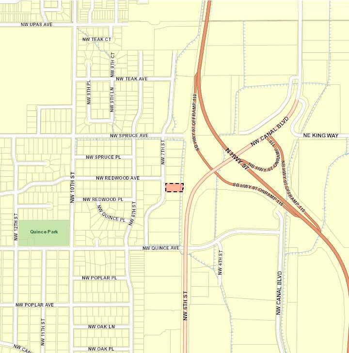
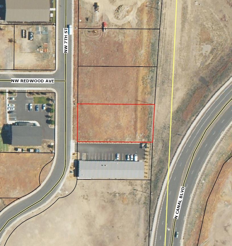
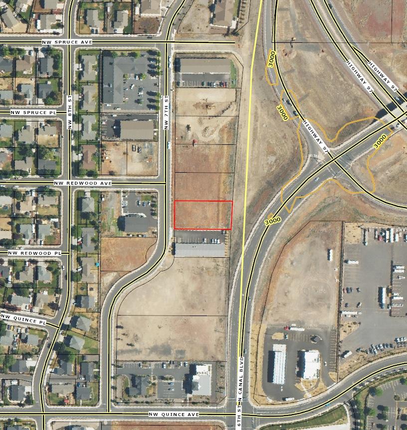
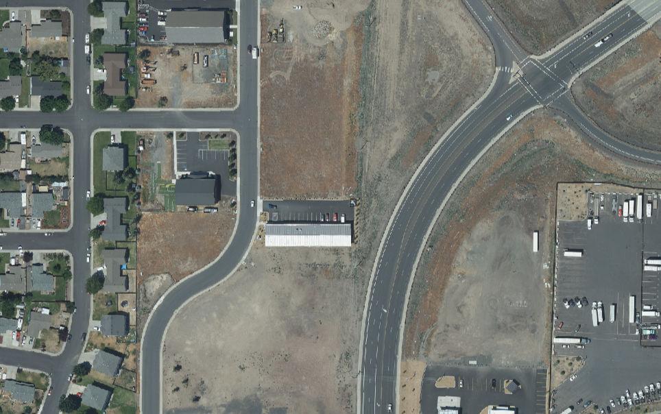
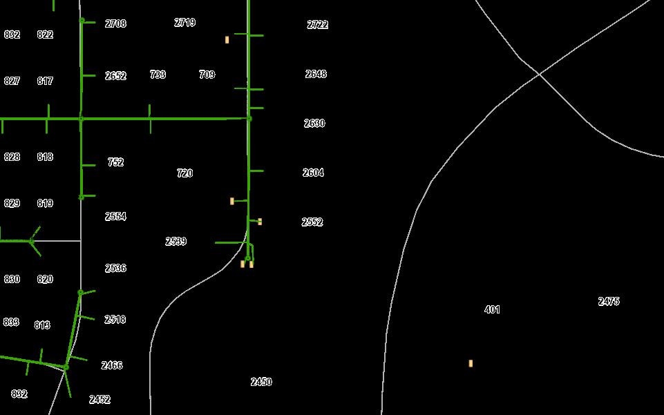
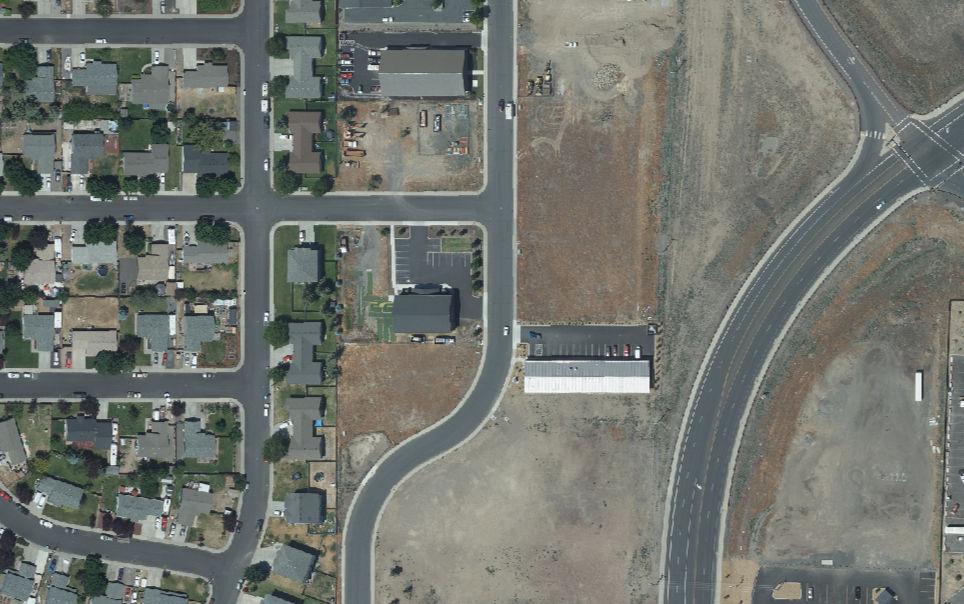
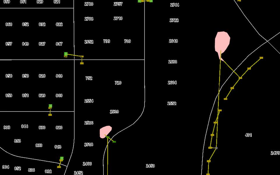
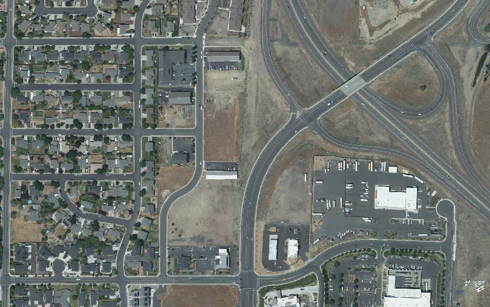
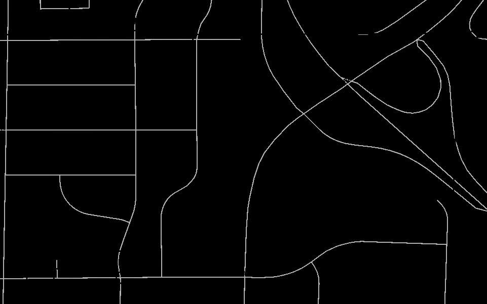
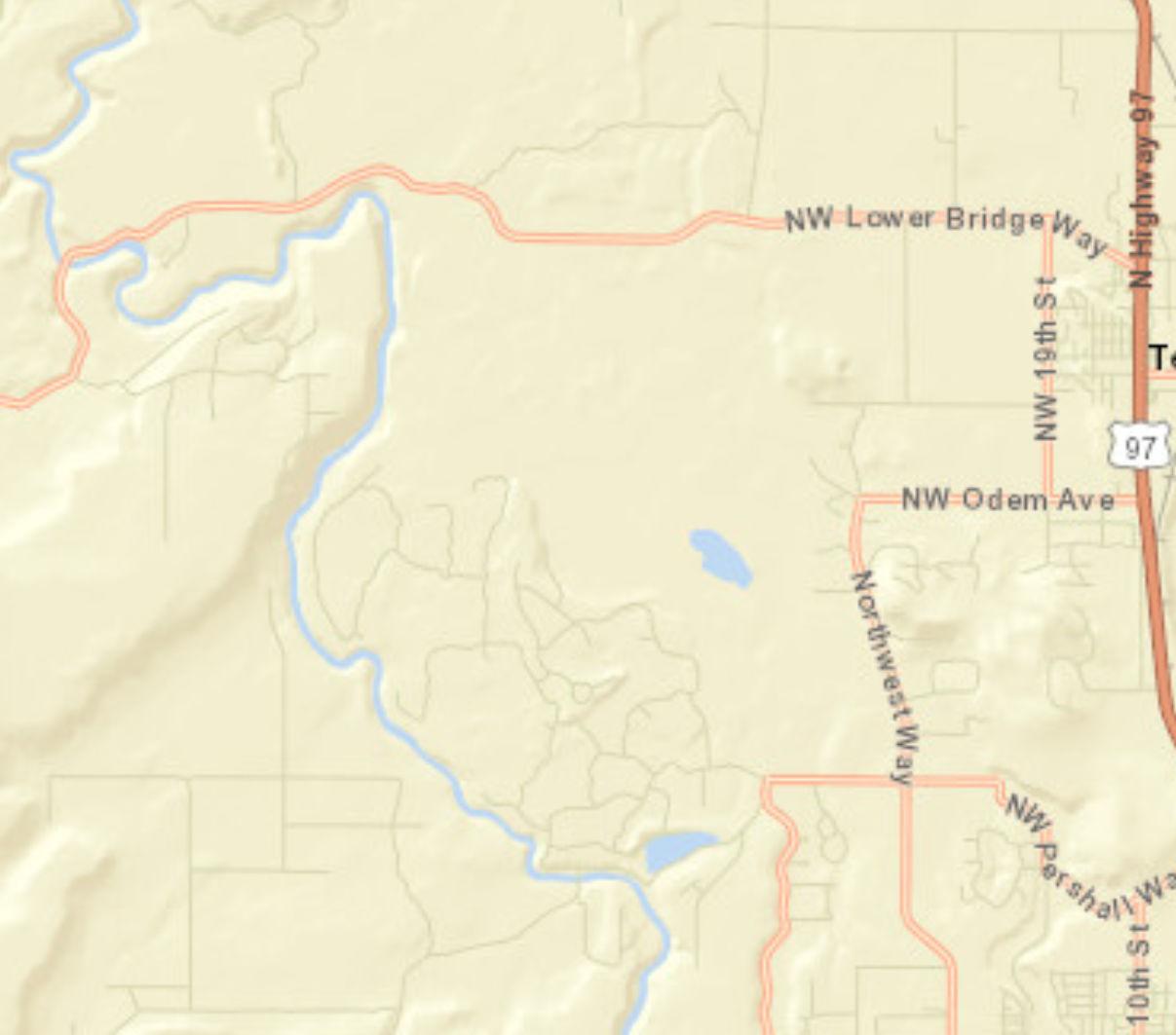
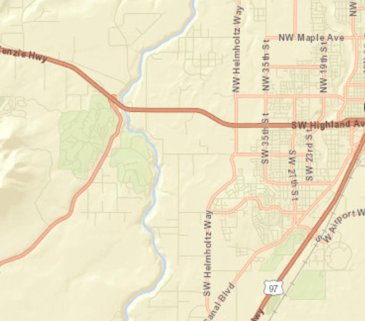
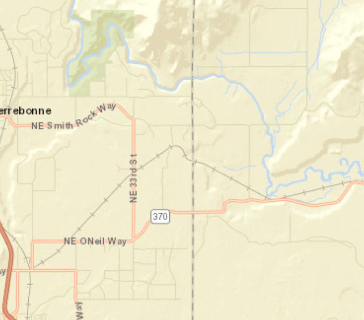
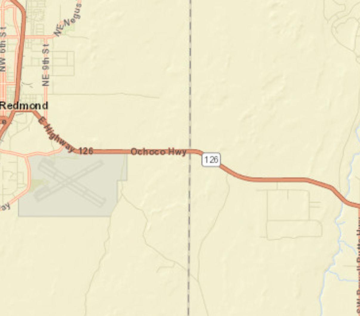
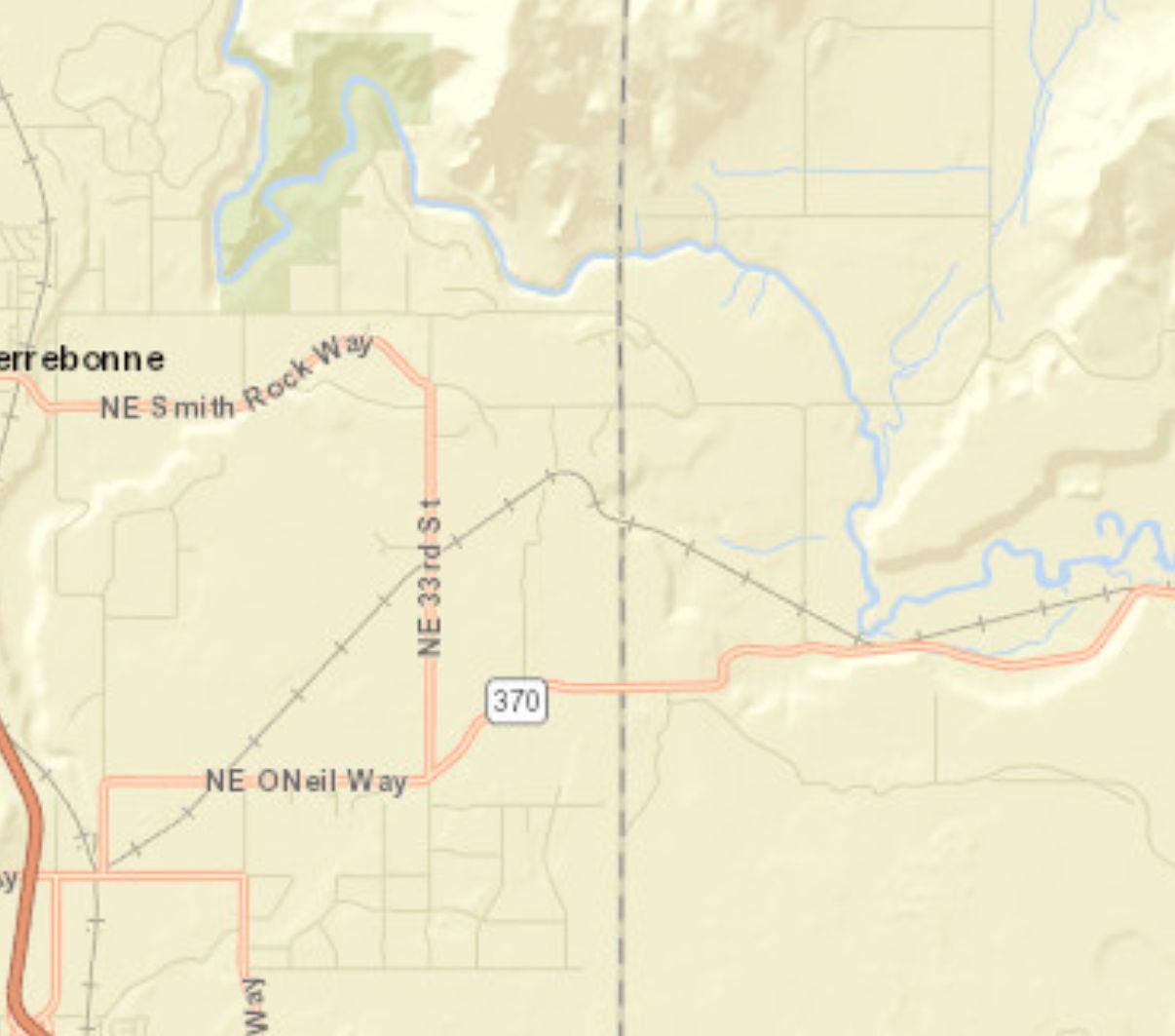
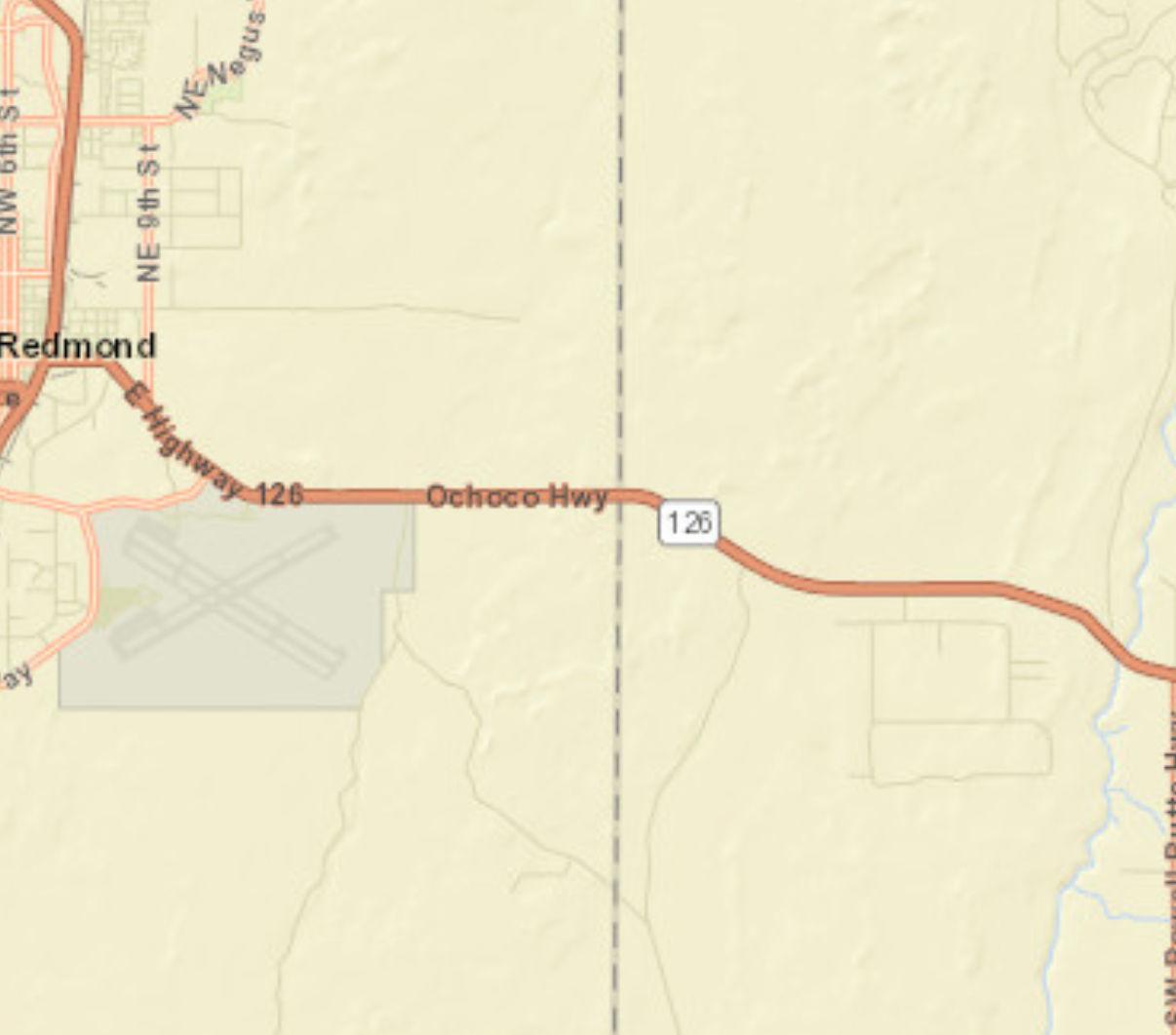
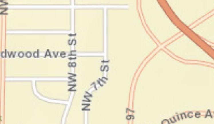
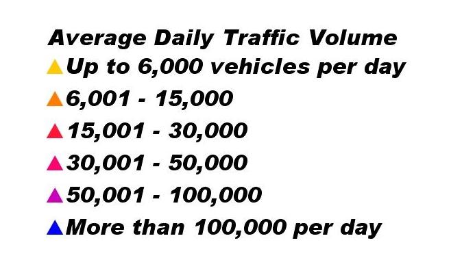
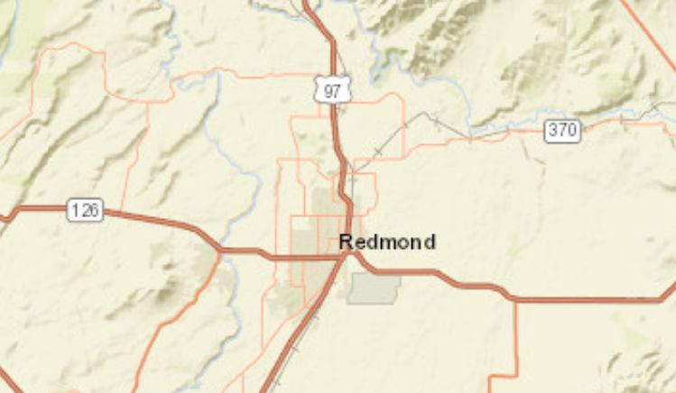
Traffic Count Map
2604 NW 7th St, Redmond, Oregon, 97756
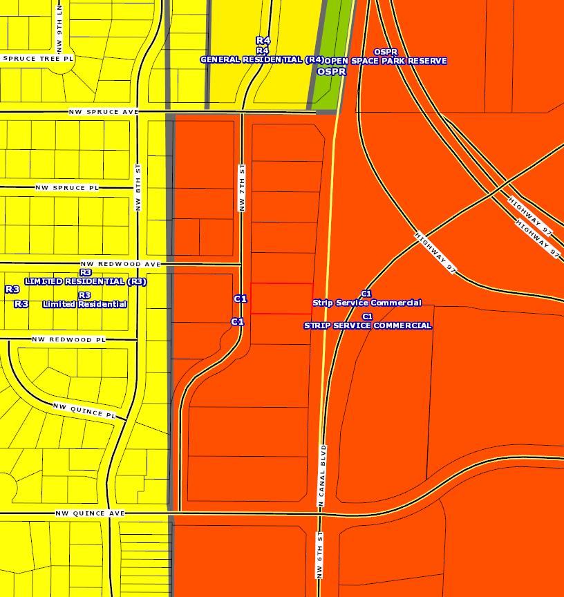
COMMERCIAL USE AND INDUSTRIAL USE ZONES
8.0150Strip-Service Commercial C-1 Zone.
8.0155Central Business District Commercial (CBD)C-2 Zone.
8.0160Special-Service Commercial C-3 Zone.
8.0165Limited Service Commercial C-4Zone.
8.0166Limited Service Commercial C-4A Zone: Except as provided in 8.0190 and 8.0195, the standards and criteria for development in the C-4A Zone shall apply to development in the C-4A Zone.
8.0170Tourist Commercial C-5 Zone.
8.0175Downtown Overlay District. In the DowntownOverlay District, the following regulations shall apply:
1. Purpose. The purposeof the Downtown Overlay District is to promote and sustain:
A. Economic Growth - Assure opportunities for a stable, vital, diverse, and competitive economy in the heart of the city.
B. Vibrant Downtown - Strengthen downtown as avibrant,mixed-use district that draws a wide spectrum of residents and visitors.
C. Downtown Appearance - Improve and enhancethe appearance of the built environment and natural features throughout downtown, especially along primary commercial corridors, and other major arterials.
D. Historic Character - Preserve and retain historic structures and cultural resourcesthroughout downtown.
E. Pedestrian Environment - Improve and enhance the pedestrian environment throughout downtown, as well as the pedestrianconnections to surrounding neighborhoods and civic resources.
2. Intent. The intent of the Downtown Overlay District is to:
A. Encourage avibrant mix of pedestrian-oriented uses, including residential, shopping and entertainment uses;
B. Increase the density and intensity of development;
C. Establish height, bulk, and lot coverage regulations that balance existing urban fabric with a desired character for downtown;
D. Promote active ground floors by regulating the quantity and location of doors and windows;
E. Establish standards for setbacks and landscaping that encourage and promote a strong pedestrian environment.
F. Establish parking and access standards that support pedestrian activity.
3. Uses Permitted. (Please see 8.0190 TableC)
4. Development Standards. In the Downtown Overlay District, the following dimensional standards shall apply:
A. Minimum Building Setback: Two (2) feet. Surface treatment needs to be of similar nature as adjoining sidewalk.
B. Maximum Building Setback: Ten (10) feet. Surface treatment beyond two feet from the sidewalk needs to be landscaped or treated with decorative pavers. Use of irrigated turf or asphalt is prohibited. For full-block developments, a minimum of 50% of the primary street-facing building façade must be located at the minimum two (2) feet setback as described in 4.A.
C. Minimum LandscapedArea: No minimum landscaping requirement.
D.
Ground Floor Windows: Ground floor windows must be at least 50% of the building length and 50%of the street-facing façade to a minimum height of 10’-0” above finished right-of-way. If the site has two or more frontages, the Ground Floor Window standards is only required on the primary façade. The other façade has a minimum requirement of 50% of the building length and 25% of the ground floor wall area. Windows arerequired tobe transparent.
Please note: Ground floor wall area is defined as all wall areas up to ten (10) feet above the finished grade.
Ground Floor Windows – Residential Use: 25% of the ground floor wall area must be transparent.
E. Main Entrance: The front door to all buildings must be oriented to the primary street. In the event that a building is located on the corner, the front doorshould be oriented directly to the corner or located within fifty (50) feet of the corner of the primary street.
F. Pedestrian Connection from Front Door to the Street: Create a straight-line connection from the front door tothe primary street sidewalks.
G. Exterior Display and Storage: Permanent storage between the building and the street is prohibited.
H. Screening HVAC Equipment: Screen rooftop mechanical equipment through extended parapets or other roof forms that are integrated into the overall composition of the building. Screen ground floor mechanical equipment. Renewable energy generation devicesmay be exempt from screening, subject to site and design review by a hearings body.
I. Parking andAccess: Parking between the building and the primary street is prohibited.
5. Building Height. The intent of the building height standards is to set guidelines to assist the development in the downtowncore that increase economic activity, capital value and encourage investment in the downtown core. The following guidelines provide performance standards that encourage innovative design and development techniques within specific parameters. They are generally prioritized to include the following:
Compatibility with existing downtown buildings and surrounding residential neighborhoods; Human scale related to building design, including height and massing, and its impact on solar access and views; Multi-story and mixed-use buildings for increased density and diversified use on premium land inthe urban core; Development incentives for increased height, based on Performance Bonuses.
A. Maximum Height: Themaximum height allowed for the downtown overlay district for all structures that are not within one full city block of a residential zone and west of SW 5th Street is sixty (60) feet, and east of SW 5th Street is 75 feet. The maximum height of structures east of 5th Street may be increased if a Conditional Use Permit for the structure is approved by aHearings Body. The following standards shall apply to structures in the DowntownOverlay District.
1. Street Wall Height: Maximum street wall façade height for the downtown overlay district for all structures that are not within one full city block of aresidential zone is forty-five (45) feet.
2. Upper-floor Setback: Buildings taller than forty-five (45) feet must step back upper stories by at least 10 feet measured from the façade of the street wallfacing the street, public park, or open space.
3. Residential Buffer Zone: All buildings in the Downtown Overlay District
within one full city block adjacent to a residential zone shall be considered to be part of the Residential Buffer Zone, wherein the following height standards apply:
a. Maximum Height: The maximum height allowed for all structures within the Residential Zone Buffer is fifty (50) feet.
b. Street Wall Height: Maximum street wall façade height for structures withinthe Residential Zone Buffer is thirty-five (35) feet.
c. Upper Floor Setback Requirements: Buildings taller than thirtyfive (35) feet must step back upper stories by at least 10 feet measured from the façade of the street wall facing the street, alleyway, public park, or open space.
B. Architectural Standards for Buildings Taller Than 45 Feet: In addition to the existing Site and Design Review criteria and Downtown Overlay District Design Standards, the following architectural standards will apply to all buildings taller than forty-five(45) feet.
1. On upper floors use windows and/or architectural features that provide interest on all four sides of the building when permitted within the building code.
2. Abrupt changes in building heights and/or roof orientation should be diminished by offsets of building form and mass.
3. Use recesses and projections to visually divide building surfaces into smaller scaleelements.
4. Use color tovisually reduce the size, bulk, and scale of the building.
5. Buildings sixty feet or over shall provide rooflines with articulated features.
6. Location of back flow prevention devices and the fire sprinkler riser must be identified on project plans submitted for site and design review and shall be located inside the building.
C. Buildings within the Downtown Overlay District shall only be permitted to exceed 75 feet if they comply with the standards set forthbelow.
1. Performance Bonus: Additional building height above 75 feet may be approved if the project achieves a minimum of twelve (12) points from the following:
Affordable Housing: The project provides affordable housing, per City standards, for low- and moderate-income households, as a percentage of the total number of residential units built. 3points for 10%, 4 points for 15%,and 5 points for 20% of total number of residential units built for affordable housing.
Workforce Housing: The project provides workforce housing, per City standards. 1 point for 10%, and 2 points for 20% of total number of residential uses built for workforce housing.
Public Plaza: The project incorporates a public plaza which is at least 5% of the gross site area. Theplaza shall be on the street side of the building, and open and free to the public at alltimes and shallremain for a period of at least ten years. 1 point per 5% public plaza space, with a maximum of 4 points.
Public Art: 0.5% of the overall project budget is set aside for an on-site public art project that shallremain for the life of the building, or 1.0% of the overall project budget is provided to the City for off-site public art shallbe awarded 2
3 - 5 pts.
1 – 2 pts.
1 - 4 pts.
2 - 4 pts.
points. Increasing thesepercentages to 0.75 % and 1.5% respectively increases the number of points awarded to 3. Increasing these percentages to 1.0% and 2.0 % respectively increases the points awarded to 4.
View Access and Preservation: The project provides a public viewing deck or decks, or similar features, which are at least 5% of the gross site area. The viewing deck(s) should be located at least sixty (60) feet above ground level and provide significant free public access to views of surrounding Central Oregon features, such as the Cascade Mountains and Smith Rocks, and shall remainfor a period of at least ten years.
Economic Vitality: The project provides additional economic benefit to the City by providing retail sales and/or hospitality uses on multiple levels. Total floor area dedicated to entertainment, eating anddrinking, retail services,and service commercial uses as presented in Section 8.0190, Table C of the Redmond Development Code, must equal or exceed 75% of the building footprint and shall remain for a period of 5 years will be awarded 4 points. One additional point will be awarded for each additional 25% of floor area (as defined by the building footprint) for retail, entertainment or hospitality uses up to amaximum of 8 points.
Historic Preservation: The project provides forpreservation or adaptive reuse of all buildings on the City’s Inventory of Historic Resources located on the project site in amanner consistent with the Secretary of the Interior’s Standards for the Treatment of Historic Resources shall beawarded 2 points. The Hearings Body may increase the points up to 4 points for projects on the National Register of Historic Places. As an alternative, 1.0% of the overall project budget is provided for a specific historic preservation project that will be completed within a specific timeframe in the Cityof Redmond or is provided to the Redmond Historic Commission for historic Redmond projects (not operations) shallbe awarded 2 points. The provision of 2% of the overall project budget will receive 4 points.
Sustainable Building: Project is built to LEED standards, or equivalent green building practices. It will be up tothe applicant toprovide material supporting equivalent building practices. (Certified is awarded 2 points, Silver certification is awarded 3 points, Gold certification is awarded 4 Points, and Platinum is awarded 5 points.)
Parking: In addition to the required parking for the development, the project provides at least 7 on-site parking spaces for public use between 8:00 – 6:00 PM that shall remain for the life of the building. 1 point per 7 public parking spaces, with amaximum of 5 points.
Total:
2.
Building Bulk for Buildings over 60 feet in Height:
4 - 8 pts.
2 - 4 pts.
2 - 5 pts.
1 - 5 pts.
36 pts.
a. Floor Area Ratio (FAR): Buildings between sixty (60) feet and eighty-five (85) feet shall have a maximum floor area ratio of 4.0.
Buildings eighty-five (85) feet and taller shall have a maximum floor area ratio of 5.0. Floor Area Ratio (FAR) is a method of calculating allowable floor area in a development as a means of controlling “bulk” and “massing” of larger developments, often encouraging setbacks and step backs, and progressively slender upper floors.
3. Application Requirements for Buildings Over 75 Feet: Planning applications submitted for new buildings over 75 feet tall shall include the following additional items to assist the City in the analysis and decisionmaking process.
a. Three-Dimensional Digital Model: A complete threedimensional digital model of the proposed building.
b. Solid WasteManagement Plan: A solid wastemanagement plan to showhow the project meets or exceedsthe City’s Solid Waste Guidelines, to the approval of the Utilities Director.
c. Utilities InfrastructureAnalysis: An engineer’s evaluation of existing utilities infrastructure and recommendations to ensurethat the project will have adequate water pressure for domestic use and fire flows andthat the collection system in the area surrounding the project is sufficient to meet the project’s impact.
d. Emergency Services Access Plan: A written and graphic plan, created in consultation with the City’s FireMarshal to showhow access to site and upper floors for emergency response personnel will be provided.
e. Public Safety Plan: A security plan, created in consultation with the Police Department for all proposed buildings that include publicly accessible areas such as parking garages, courtyards, public stairways, elevators, and decks.
4. Height Design Departure: In addition to the availability of variances as noted in 8.0700 – 8.0720, a design departure procedure will be established to allow a project to achieve flexibility in the application of prescriptive development standards and height performance bonuses (limited to two height performance bonuses). A 20% departure may be granted administratively. In order to allow a departure from a code standard, an applicant must demonstrate that it would result in a development that better meets the intent of the purpose of the regulation and applicable design guidelines.
6. Design Standards. Any change to the exterior of a building or a property shall be reviewed by the Community Development Department pursuant to ArticleIV Section 8.3040 of the Redmond Development Code.
7. Off-Street Parking. Subject to the standards of 8.0505 –8.0515.
A. Fee-In-Lieu of Parking: The purpose of these provisions is to allow development in the Downtown Overlay District to reduce the number of off-street parking spaces through payment of a fee in order to meet the parking requirements set forth in this Code. These provisions may be utilized for parking required for new construction or for an increase in required parking resulting from the change of use of an existing building.
Payment made to the City in-lieu of supplying the required off-street parking spaces for a project in the Downtown Overlay District may be provided as follows:
1. By the one-time payment of a non-refundable parking and mobility improvement fee to the City in the amount established in the City’s Fee Schedule, paid prior to the issuance of Certificate of Occupancy. Fees collected shall be used to fund parking, street improvements or facilities to improve mobility or enhance pedestrian connectivity and safety in the Downtown Overlay District.
2. From time to time the City shall establish the value of off-street parking facilities on a per parking space basis, used to establish the above parking and mobility improvement fee.
3. The City Engineering shall evaluate development proposals requesting to pay an in-lieu fee through conducting a Transportation System Analysis or parking study.
4. Any such request for parking in-lieu may be denied or reduced by the Community Development Director, or designee. The Director, or designee, shall determine:
a. Whether there is sufficient alternative parking within a two to fourblock radius of the project location.
b. Whether approval of the request would have an adverse effect on surrounding neighborhoods.
c. Whether the request meets the Purpose and Intent of the Downtown Overlay District Zone.
d. Compliance with the Redmond Comprehensive Plan 2040 and support plans, as amended.
[Section 8.0175 amended by Ord. #2016-17 passed January 31, 2017]
[Section 8.0175 amended by Ord. #2022-04 passed June 28, 2022]
[Section 8.0175 amended by Ord. #2022-09 passed December 13, 2022]
[Section 8.0175 amended by Ord. #2023-07 passed December 19, 2023]
8.0180Light Industrial (M-1) Zone.
8.0182General Industrial (M-1.5) Zone.
8.0185Heavy Industrial (M-2) Zone.
8.0186Large Lot Industrial (LLI) Zone.
1. LLI Zone Regulations. The following standards and regulations apply inthe LLI Zone:
A. The lot shall adhere to the designation as acknowledged by the Central Oregon IntergovernmentalCouncil.
B. No property that is zoned LLI can be rezoned to another zone within ten years of the LLI designation.
C. The minimum lot size is 50 acres. Division or separation of lots or parcels within the site to new lots or parcels less than the minimum lot size is not allowed until the site is developed with a primarytraded sector use requiring a large lot.
D. Allowed uses are tradedsector uses as provided in Section 2.
E. Uses allowed tosupport a primary user included:
1. Subordinate industrial uses that rely upon and support the primary traded sector use;
2. Service commercial uses that support the traded sector uses if they are limited to7500 square feet per use; and
3. Retail uses accessory to a traded sector use and limited to 7500 square feet.
F. Conceptual Phased Site Development Plan. A Conceptual Phased Site Development Plan is required for each primary traded-sector use as part of the
Site and Design Review process in addition to the criteria and requirements outlined in Article IV of this code. In addition to the requirements outlined in Section 8.3025, the following elements shall be considered as part of the Conceptual Phased SiteDevelopment Plan:
1. Open Space. Generally identify land provided for open space on the site.
2. Connectivity and Trail Networks. A conceptual transportation plan for streets, pedestrians connectivity and trail networks. E.g., Connection of bicycle routes and pedestrian network for utility and recreational purposes.
3. Site Design. Describe how the design elements (i.e., streets, open spaces, signage, and architecture) are integrated and coordinated throughout the site.
4. Analysis of Anticipated Utility Consumption by Phase. Analysis of the anticipated utility consumption by phase for wastewater, water, power, natural gas, and other utility infrastructure necessary to support the development.
2. LLI Zone Uses Permitted. The following uses are allowed outright or conditionally in the Large Lot Industrial Zone:
O PerORS285B.280,tradedsectormeansindustriesinwhich memberfirmsselltheirgoodsorservicesintomarketsforwhich nationalorinternationalcompetitionexists,aswellasusesand servicesthatdirectlybenefittradedsectoruses.Alloweduses includemanufacturing,processingplants,distributioncenter, warehousing,researchanddevelopment,andhighereducation institutions
Subordinate Industrial Uses
Service Commercial Uses
Retail Uses
O Afteraprimarytraded-sectorusehasbeensited,subordinate industrialusesareallowed.Subordinatemeansindustriesthat relyuponandsupportaprimarytradedsectoruse
C Afteraprimarytraded-sectorusehasbeensited,service commercialusesareallowedthatsupportthetradedsectoruses andshallbelimitedto7500squarefeetperstructure
C Afteraprimarytraded-sectorusehasbeensited,retailuses,and eatinganddrinkingestablishmentsareallowedasaconditional useandshallbelimitedto7500squarefeetperuseinthe structure.
O=Outrightuses,C=ConditionalUses
3. Minimum Standards. See Table D, 8.0195.
[Section 8.0186 added by Ord. #2015-11 passedSeptember 22, 2015] [Section 8.0186 amended by Ord. #2022-09 passed December 13, 2022]
8.0190Table C, Uses Permitted. The following uses identified below are allowed outright or conditionally in each of the Commercial and Industrial zones. Outright or conditional uses in the M-1.5 zone may be permitted Conditionally in the M-1 or M-2 zones; this allowance does not apply for uses Not Allowed (“N”).
8.0195Table D, Minimum Standards. The following minimum standards are required in each of the Commercial and Industrial zones as follows (alldistances aremeasured in feet):
Minimum Yard Setbacks
Note: Residential uses permitted in Commercial and Industrial zonesshall besubject to thedensity standardsfor theR-5 zone, except for the Downtown Overlay District and theC-2 and C-3 zones, for which thereisno maximum density standard.
A Arearyardabuttinganalleyshallbe25feetfromthepropertylinetofoundationwhenthealleyisusedtoservicethecommercialestablishment and10feetinothercases.
B Maximumbuildingheightislimitedto45feetforallstructureswithinonefullcityblockofaresidentialzone.Whereallowedbuildingsover45 feetshallconformtheUpperFloorSetbackStandardsintheDowntownOverlayZoneSiteandDesignStandardsinSection8.0175(5).
C RearyardsalongthenorthsideofHighlandAvenue/Highway126betweenSW23rdandSW27thStreetsshallhaveaminimumarterial setbackof25feet.Allotherrearsetbacksadjacenttoarterialsshallbe50feet.
D TheminimumsetbackbetweenastructureandanexistinguseintheC-5zoneshallbe5feetfromthepropertylineand10feetfromany adjacentstructureonthesubjectsiteoradjacentproperty.
E Nouselocatedinanindustrialzoneadjacenttooracrossthestreetfromaresidentialzoneshallexceed60%ofthelotareaincludingbuildings, storageorfacilities,andoff-streetparkingandloading.
F Theminimumsideyardinanindustrialzoneshallbe10feetfor1and2storybuildingsand15feetfor3storybuildings.
G Maximumbuildingheightislimitedto50feetforallstructureswithinonefullcityblockofaresidentialzone.Whereallowed,buildingsover50 feetshallconformtheDowntownOverlayDistrictSiteandDesignStandardsinSection8.0175(5).Themaximumbuildingheightforstructures westofSW5th Streetis60feet.Themaximumbuildingheightforstructureseastof5th Streetis75feetandmaybeincreasedabove75feetifa ConditionalUsePermitforthestructureisapprovedbyaHearingsandReviewAuthority.
H Existingzero-lotlinestructuresasofAugust12,2008,shallbeexemptfromthisstandard.Atthetimethefrontfaçadeofabuildingorabuilding isdemolishedasdefinedbythisCode,thenthebuildingshallcomplywiththisstandardunlessavarianceisapproved.
I Fullblockdevelopmentsrequireaminimumof50percentofthebuildingfaçadetobedevelopedtotheminimumsetback.Asphaltandirrigated turfareprohibitedinthefrontyardsetback(concrete,pavers,landscapingareallowed).
[Section 8.0195 amended by Ord. #2012-10 passed August 14, 2012]
[Section 8.0195 amended by Ord. #2014-12 passed May 27, 2014]
[Section 8.0195 amended by Ord. #2015-11 passed September 22, 2015]
[Section 8.0195 amended by Ord. #2018-09 passed September 11, 2018]
[Section 8.0195 amended by Ord. #2020-15 passed November 10, 2020]
[Section 8.0195 amended by Ord. #2022-04 passed June 28, 2022]
[Section 8.0195 amended by Ord. #2023-07 passed December 19, 2023]