 Ralph Rapson Traveling Fellowship - 2020 Matthew Tierney, AIA


 Ralph Rapson Traveling Fellowship - 2020 Matthew Tierney, AIA
A collection of travel vignettes documenting and re-imagining examples of Mexican architecture and public spaces through the lenses of craft, food, colonialism, and human-environment relationships.
Section 0...................................................................Competition and Background
Section 1
Ciudad Oaxaca de Juarez
Section 2...................................................................Afuera - Central Valley
Section 3...................................................................Mexico City (CDMX)

I have learned an immense amount of useful architectural knowledge through my love of food, landscapes, and self-supported travel across different many different regions and geographies. I believe this is a unique lens with which an architect can see into peoples’ lives, their homes, their bioregion, and glean lessons that are not readily available unless immersed in the experience as a human, moving slowly enough to absorb what is happening in daily life. I believe that immersing myself in the culture and place of Oaxaca State will have a positive effect on the way that I design all types of architecture for a broader set of objectives that encompasses culture, climate, infrastructure, technology and more.
Food, water, and energy intrinsically connects things that are otherwise not entangled. These relationships and dependencies trickle down, much like water itself, (another topic which will undoubtedly be woven through the story). It would be a gift to be able to immerse myself in a completely new place and do so with an architectural eye. As an architect, cook, cyclist, and adventurer, I wish to immerse myself in the Mexican Indigenous and Oaxacan urban culture’s productive landscapes. I wish to explore and document
Traditional ecological knowledge (TEK) and the trajectory of contemporary urban society continue to clash. Yet, there are shared values, prospects, and goals embedded in food as a means of teaching and creating community that is invested in place. Architecture, and the design process serves as a vehicle to investigate and reimagine more productive shared futures that tangle ecology, recreation, community, and culture. These principles can connect people of many coats and colors through shared land management, traditional food production/preparation, healthy lifestyle, and placebased cuisine. These practices embed a person in place. If sustainability is to be a primary tenet of urban life in Minneapolis, this project emphasizes the importance of Traditional Ecological Knowledge (TEK) in creating respect, understanding, and value of our shared ecological and cultural resources and by doing so, creates a wealth of indigenous culinary knowledge sharing and development.
The project site, just south of a small passage between Lake of the Isles and Bde Maka Ska has seen multiple histories. From early Dakota settlement to its contemporary use as a recreation and leisure site. There is a deep palimpset here. By creating multiple zones for TEK teaching and learning and traditional food harvest throughout the expanded site (to include the channel and other vegetated area) this project enlists food to help contemporary Minnesotans celebrate the multiple histories that make this place so special to so many people.
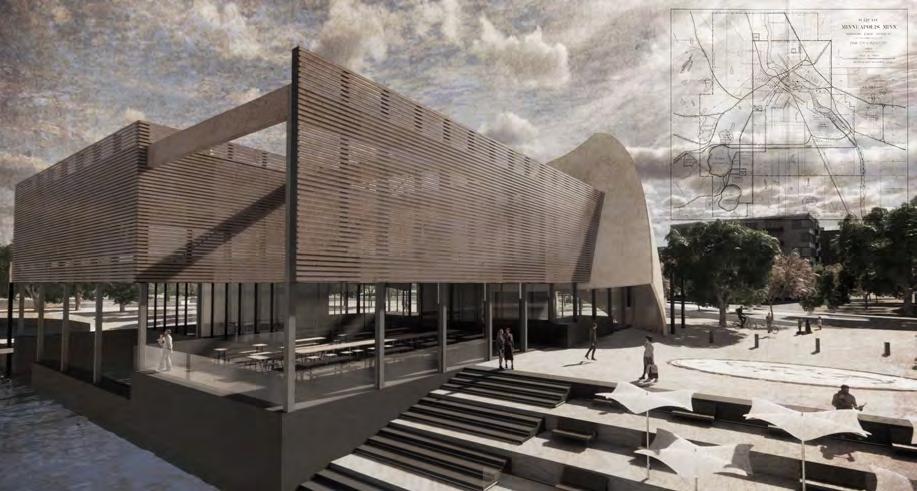




Ralph Rapson Traveling Fellowship - 2020 Final Competition Boards
Matthew Tierney, AIA

the physical structures for food’s storage and processing. I wish to participate in the cultural traditions and techniques for food preparation and preservation and the spaces and places that food is consumed both in rural and urban areas. Lastly, I wish to study and learn from Oaxaca’s contemporary architecture, its urban design, and public spaces.
I am compelled to pursue this topic not only to have the opportunity to experience a completely different place where I’m familiar with the local language, but also to bring new perspective into my own food architectures: I am actively involved in a 1000-acre century farmstead in central Minnesota that is going through a generational shift and has the opportunity to reinvent itself in a sustainable, architecturally rich, and meaningful way.


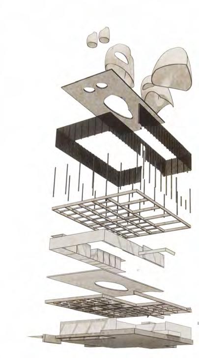
Sailing is a deeply rooted tradition in Minneapolis lakes during spring, summer and fall. Sails are manipulated to allow wind to bring the boat in almost any direction. Combinations of main, jib, and spinnaker sails on small boats can make a day with only a small amount of wind on Bde Maka Ska into a fuel free activity.
seedbank and kitchen office and interpretive area faces north night flushing/ventilation + diffuse northern lighting open office area faces north night flushing/ventilation + diffuse northern lighting
main entry faces east night flushing/ventilation + morning daylighting faces northwest convective cooling/exhaust + diffuse light to kitchen
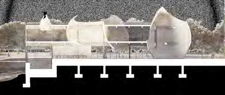
sky catchers_2/3/4 W
section through entry + interpretive + offices


office space and meeting areas are housed on the second level and have beautiful views to the north with common spaces on the south and larger meeting rooms on the west.

plaza section + south elevation W
section through kitchen + seed bank
indoor and outdoor dining areas connect in fair weather to provide gathering space for 120+.
seed bank and kitchen connect the two dining areas and provide direct access to loading and the plaza.
stepped areas provide access to the water’s edge for able bodied individuals
constellation map in plaza provides night time programming and connects indigenous knowledge with the night sky.
sky catcher_1 W
section through kitchen + seed bank
informational stations in plaza provide changing climate data and historical anecdotes.
ramped access to canoe launch travels through a floodable area and connects to the water’s edge
seasonal canoe rental/ launch utilizes the existing infrastructure of the sailing piers and bike/scooter repair locates directly off the bike path.
outdoor staging area provides easy access into the water and allows canoes to be stored outside during fair weather maximizing the storage capacity of the building.


ecologically chaotic (balanced) isolated/simplified selection/ processing cultural ecologies create endemically suited selected for inherent renewable abundance waste = food structure comes from variety

bio-cultural products
(imbalance)

suited to climate inherent traits resource
craft/ utilization
bio-cultural products (balanced)

the complex interactions of humans and their surrounding environment. these interactions create culturally rich products that entangle human and ecological processes, flows, and biproducts in sustainable ways.

A

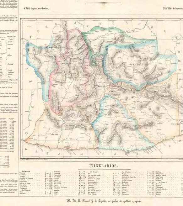
 social-ecological spatial framework for policy design towards sustainability: Mexico as a study case. December 2014 (Fig. 3. Socio-ecoregions of Oaxaca)
Fig. 1 Distribution of main vegetation types in Oaxaca, México (INEGI 2002)
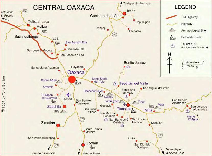
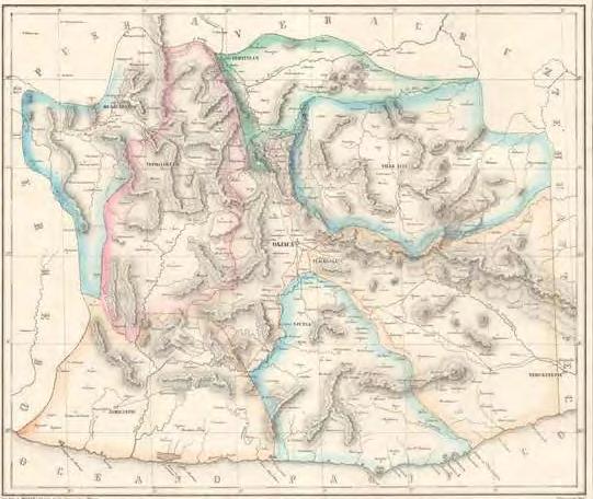
Oaxaca state has one of most biologically and linguistically diverse compositions in all of the world. These two items are inextricably linked by the unique geological and anthropological “stocks” that made the central valley the equivilent of the fertile crescent of the Americas. The map at the left shows the coincidence of this overlay. Only two other places in the Americas surpass Oaxaca for the sheer variety of biodiversity: Costa Rica and Columbia. Linguistically, Oaxaca represents the most well preserved and diverse areas in all of the country and in the world.
embedded





A collection of travel vignettes documenting and re-imagining examples of Mexican architecture and public spaces through the lenses of craft, food, colonialism, and human-environment relationships.
Monte Alban Rural Ramble Bike Route
Archivo General de Estado Oaxaca Building Contemporary Architecture
The School of Visual Arts of Oaxaca Contemporary Architecture
Orchid Educational Pavilion / FGP Atelier Contemporary Architecture/Installation Around ancient
The Monte Albán and Cuilapan Rural Ramble is a challenging, roughstuff day ride that passes by the Zapotec ruins of Monte Albán en route to the Ex-Monastry of Cuilapan – a complex set in Oaxaca’s Valle Grande and Ejutla area. You can trim it down to the single loop, but I recommend the full figure of eight as it’s a wonderful showcase for Oaxaca’s traditional farming practises and inter-cropping – a combination of corn, squash, and beans to help fortify the soil and keep pests away.
Church of Santo Domingo de Guzmán Ancient Site w/ Ethnobotanical Gardens
https://ridewithgps.com/routes/34235709
Centro Cultural San Pablo Academic Hybrid Contemporary/Ancient
The Monastery of Santiago Apóstol, Oaxaca Unfinished Ancient/Colonial Site
Cuilapam de Guerrero
Museo de Arte Prehispánico de México
Santiago Matatlan
Abandoned/Unfinished Church
Rufino Tamayo Museum of Pre Columbian Art
Mezcal Tasting and tours of the Agave Fields
https://coyoteaventuras.com/project/mezcal-experience/
San Felipe Tejalapam Day Ride out to Ridge Top. Rent Bikes for the day and ride?
https://ridewithgps.com/routes/33036625
Street Art and Walking Tour of Oaxaca Walk around the city, shop, eat, be merry
Centro de las Artes de San Agustín Dayride out to this site. Contemporary and Ancient Arch
https://ridewithgps.com/routes/34144461
Teotitlán del Valle Community Cultural Center Contemporary Architecture and Day Ride
https://ridewithgps.com/routes/34236358/
Bike Route 1 Nov7-19
Arch 0.5 Nov7-19
Arch 0.5 Nov7-19
Arch 0.5 Nov7-19
Arch 0.25 Nov7-19
Arch 0.25 Nov7-19
Arch 1 Nov7-19
Arch 1 Nov7-19
Various 0.25 Nov27
Pueblo 1 Nov4
Bike Route 1 Nov7-19
Various 1 Nov7-19
Bike Route 1 Nov7-19
Bike Route 1 Nov7-19
Santa Maria Atzompa Pottery Village Pueblo 1
San José del Pacífico Grand Dirt Tour, Oaxaca Big Loop around Oaxaca to the south
Teotitlán del Valle Textile Village and visit ruins @ Dainzu
San Pablo Villa de Mitla, or simply Mitla, Pueblo Magicos/Ancient Site
La Meca - San Sebastian Tutla Climbing Crag on Outskirts of Oaxaca. Coyote Guides does trips here too.
Bike Route 9 Nov19-Nov27
Pueblo 0.5 Dec2-Dec8
Pueblo 2 Dec2-Dec8
https://coyoteaventuras.com/project/morning-climbing-sansebastian-tutla/ Climbing 1 Dec11-Dec24
Tlacolula Sunday Market. On the Bikepack route out to Milta Valley Pueblo 0.5 Sunday
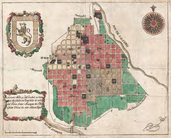
A collection of travel vignettes documenting and re-imagining examples of Mexican architecture and public spaces through the lenses of craft, food, colonialism, and human-environment relationships.
Sierra Norte and East Loops
La Cumbre Ixtepeji
Ixtlan de Juarez
Pueblos Mancomunados
San Pablo Cuatro Venados
Hebras de Ixtepeji
Santiago Apoala
Tamazulapam del Progreso
Santo Domingo Yanhuitlán
Mountain Biking and Eco Tourism. 2 Day MTB Enduro Tour w/ Overnight Cabin and Bike
https://coyoteaventuras.com/project/2day-cumbre-ixtepeji-trails/ MTB 2 Nov27-Dec2
Best place for exploring the Sierra Norte. Go to Santa Catarina Ixtepeji @ Headwaters of the Rio Grande . Reserve through the visitors center (9515167898) p 279
Small towns scattered around Sierra Norte (^^^Can make reservations through Expediciones Sierra Norte)
Waterfall, Hike, and Bike Tour w/ Coyote Aventuras (Leaves from Oaxaca City Center)
Hike/Bike 1 Nov27-Dec2
Pueblos 2 Nov27-Dec2
https://coyoteaventuras.com/project/waterfalls-experience-hike-bike/ Hike/Bike 1 Nov 3
Northern area of Oaxaca. Weekend Trip. MTB opps
https://ridewithgps.com/routes/36232897
Apoala Oaxaca waterfall, walk the trail to the twin rocks, or take the steep climb up the Mirador trail. The Mirador trail boasts two incredible spots to gawk at the lush and fertile mountains. The village only has a few restaurants and a few sparse tiendas. Make sure to stock up on snacks, fresh produce, and stop at the ATM in Nochixtlan.
Small Village with Eco tourism and cool gardens
Those interested inn the unique landscape of the surrounding landscape may want to stop at the Geopark Mixteca Alta, this eco-center offers a wide range of hiking routes focusing on geotourism.
MTB 3 Nov27-Dec2
Hike/Bike 1 Nov 3
Pueblo 1 Nov27-Dec2
Pueblo 1 Nov27-Dec2
A collection of travel vignettes documenting and re-imagining examples of Mexican architecture and public spaces through the lenses of craft, food, colonialism, and human-environment relationships.
CDMX
Chapultepec
Urban Forest/Garden Landscape1Dec 3-8
Museo Jumex Contemporary Architecture
Castillo De Chapultepec Contemporary Architecture
Arch 0.5 Dec 3-8
Arch 0.5 Dec 3-8
Museo Nacional de Antropologico Contemporary Architecture/Installation Around ancient Arch 0.5 Dec 3-8
Museo Rufino Tamayo Rufino Tamayo Museum of Pre Columbian Art
Arch0.25Dec 3-8
Jardin Botanico De Chapultepec Urban Forest/Garden Landscape0.25Dec 3-8
Roma Norte Neighborhood Urban1Dec 3-8
Polanco Neighborhood Urban1Dec 3-8
Templo Mayor Ruins Ancient Aztec/Zapotec Site in CDMX urban core
Catedral Municipo De CDMX Colonial church built on Zapotec Ruins
Bellas Artes Museum/public space
Arch0.25Dec 3-8
Arch1Dec 3-8
Arch1Dec 3-8








1. Reforma - probably the most upscale part of Oaxaca. Tons of shops, restaurants, nice houses, and the place where you can find a lot of modern amenities that aren’t available in centro or other neighborhoods. Stay here if you don’t want to be so close to centro and want more of a upscale experience.
2. Xochimilco - Where a lot of artists, young expats, couples, and families live. This neighborhood stretches across the highway a bit and follows the aqueduct down into the northwestern part of what is generally considered Centro. An awesome mix of regular vintage shops, coffee/cafe, nice restaurants, galleries, and apartments/houses. Stay here if you want to be near the centro but want a more art and a mix of small/hip shops and restaurants.
3. Centro - This is where most of the things that appear on tourists’ instagram is found. Not that this is bad by any means! The Centro is the spot for so many things that are well worth seeing or living around. Stay here if you want to be close to just about everything. You may pay a bit more but this neighborhood is amazing if you are short on time and don’t want to have a “life in Oaxaca” experience in Reforma, Xochimilco, or Jalatlaco.
4. Jalatlaco - One of the oldest neighborhoods in Oaxaca. It just oozes with old world vibes . Small streets and alleys paved in cobblestones from the Rio Atoyac and coffeeshops/restaurants galore. Definitely one of those parts of the city that instantly transports you. Stay here if you want to be near centro, don’t want to be north of the highway in Reforma and/or want the most charming area of Oaxaca.
5. Western Centro - This neighborhood is a great mix of what you will find in Xochimilco , Zocalo/Market and the Centro. Good access to everything, good food, bars, small markets, shops, and you are outside of the main area which keeps it relatively quiet. Stay here if you want to be close to centro, don’t need to be in the arts or old school mix all the time, and want a relatively low tourist count around you.
6. Zocalo/Abastos - The further south you go in Centro, the more it feels like a more bustling market-centric focus. The main Zocalo, Market 20 de Noviembre, Market Benito Juarez, and the sprawling Central de Abastos Market seem to dominate the feel of this neighborhood. Stay here if you want to be near the markets and larger stores. This area is best to visit, not stay in my opinion.

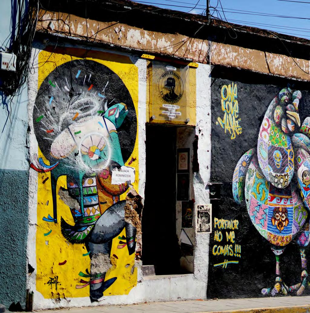
 Calle Profirio Diaz Oaxaca de Juarez, Mexico
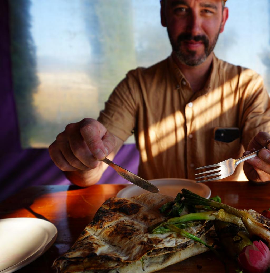
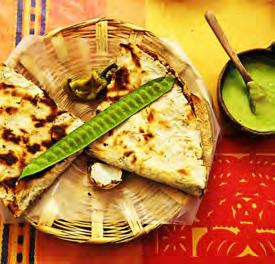
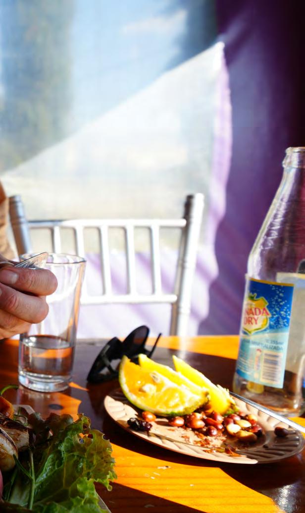 Tlayudas @ lunchtime
San Bartolo Coyotepec, Oaxaca

 El Llano Urban Park/Plaza Oaxaca de Juarez, Mexico

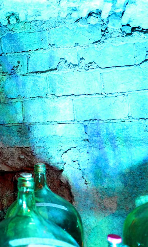 Xochilmilco Neighborhood Oaxaca de Juarez, Mexico

 Centro Cultural De San Pablo Oaxaca de Juarez, Mexico
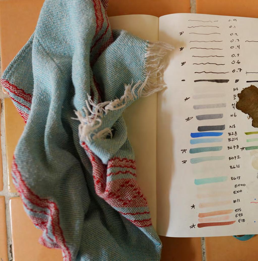
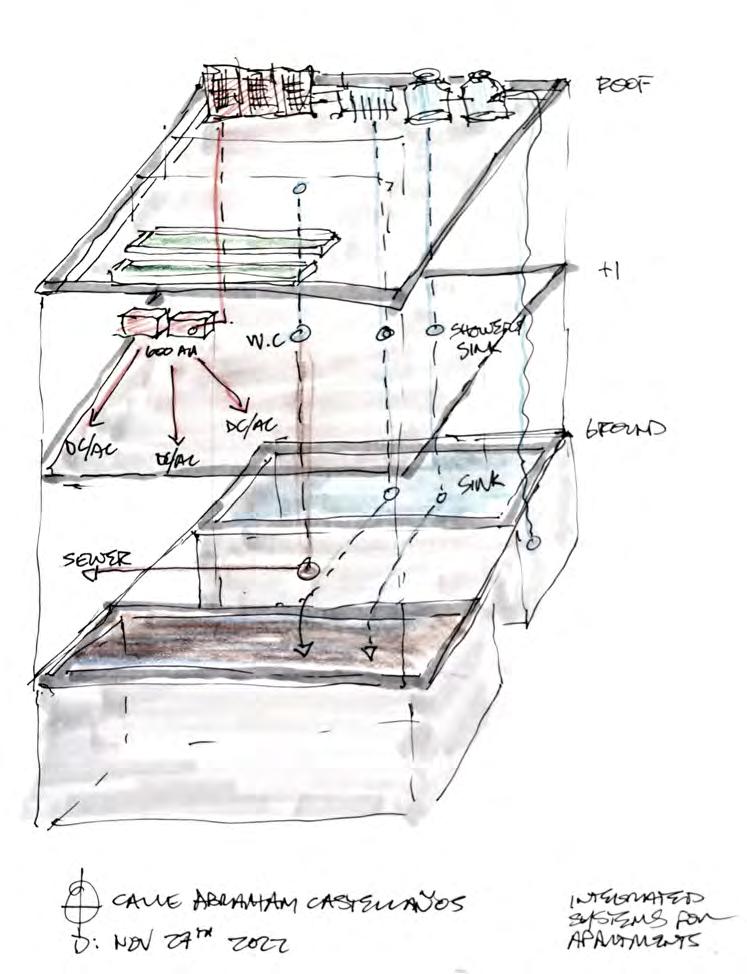
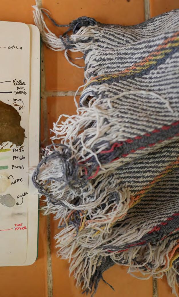 Calle Abraham Castellanos Oaxaca de Juarez, Mexico
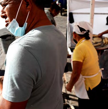
Oaxaca is a magical place. Ancient buildings, vibrant colors billowing out of storefronts, cobblestone streets, people moving, weddings, music, dance, warm nights, amzing food, steam and smoke from street vendors catching the down light of the streetlamp. One of the most amazing places you could imagine, let alone visit and have the chance to live in for a few months.

There are little moments in this city that can steal your heart.


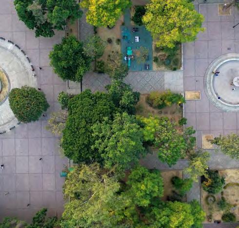
A bustling plaza at almost all hours of the day. Kids, workers, teens, houseless all seemingly recharging. Depening on the hour of the day, people are either (1) hiding under the shade of a copal tree that would be trimmed back from the street in any other place in the world or (2) out in the sunshine chasing the last rays of sun in
small clusters around the plaza. Situated in the heart of Oaxaca’s historic Centro neighborhood the the public plaza, The New Spanish Boroque style architecture had a flip flop life between army barracks and secular space, It’s currently being used as the Templo de Santo Domingo Guzman.

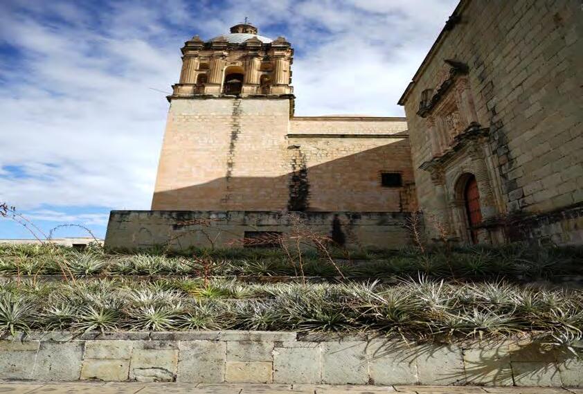
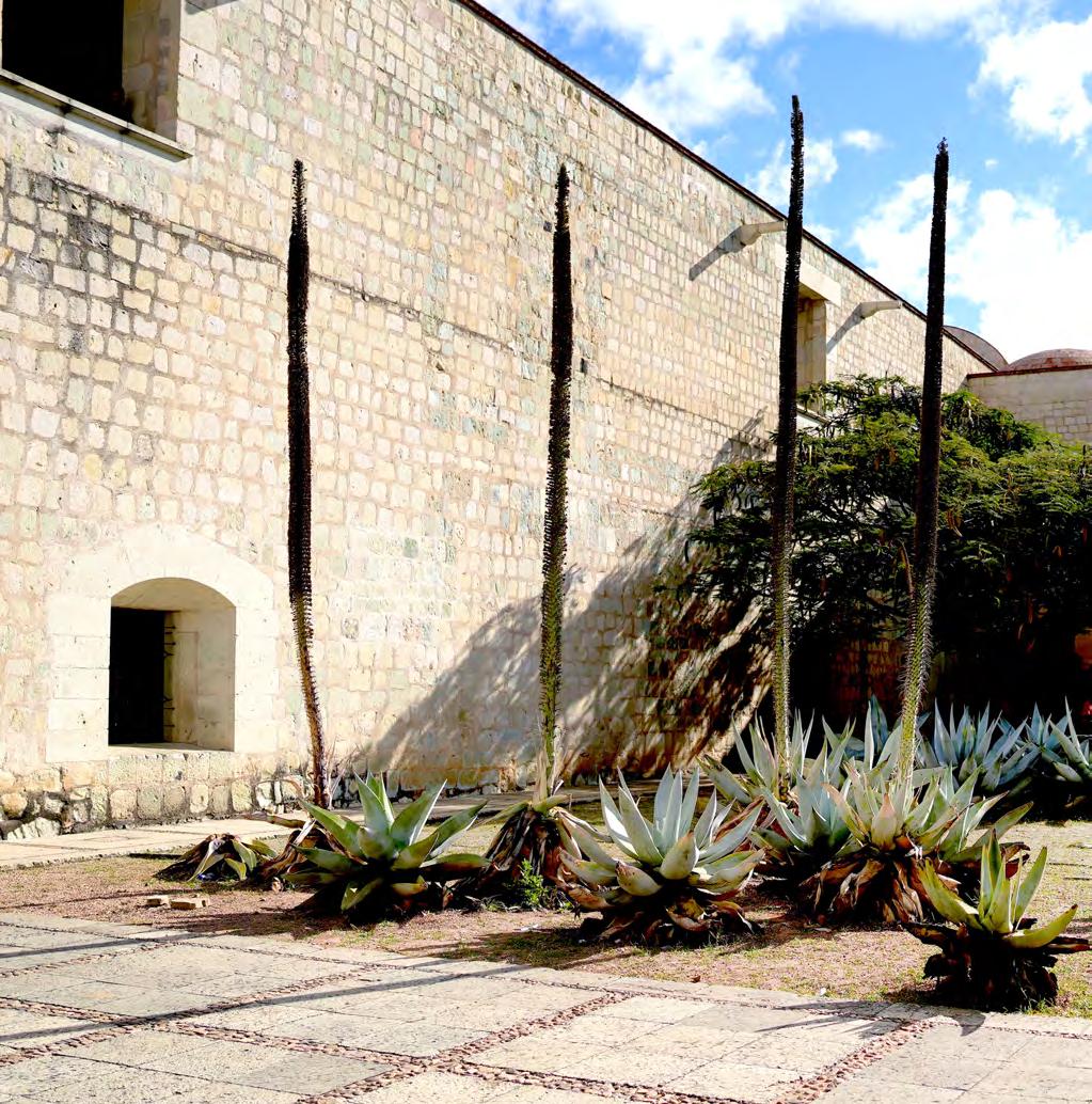
Beneath the plaza’s rows of agave, (some of which have been left to go to seed) there is a 2m deep ~300’x300’ cistern that takes the water from the entire roof and surface flow and diverts it into storage for dry weather. Countless seating heights along stairways and proportions that just make people want to gather. Tree limbs hang over the sidewalk and street creating a little pocket that you can duck into, if only for a moment while passing by to escape the midday sun. Countless things happen naturally in this space every day - some things are mundane, some are more important than I’ll ever know,

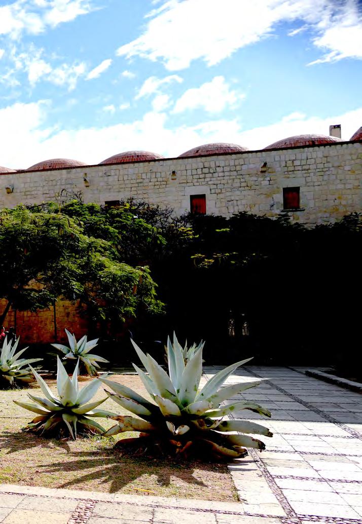 Templo St. Domingo de Guzman Oaxaca de Juarez, Mexico
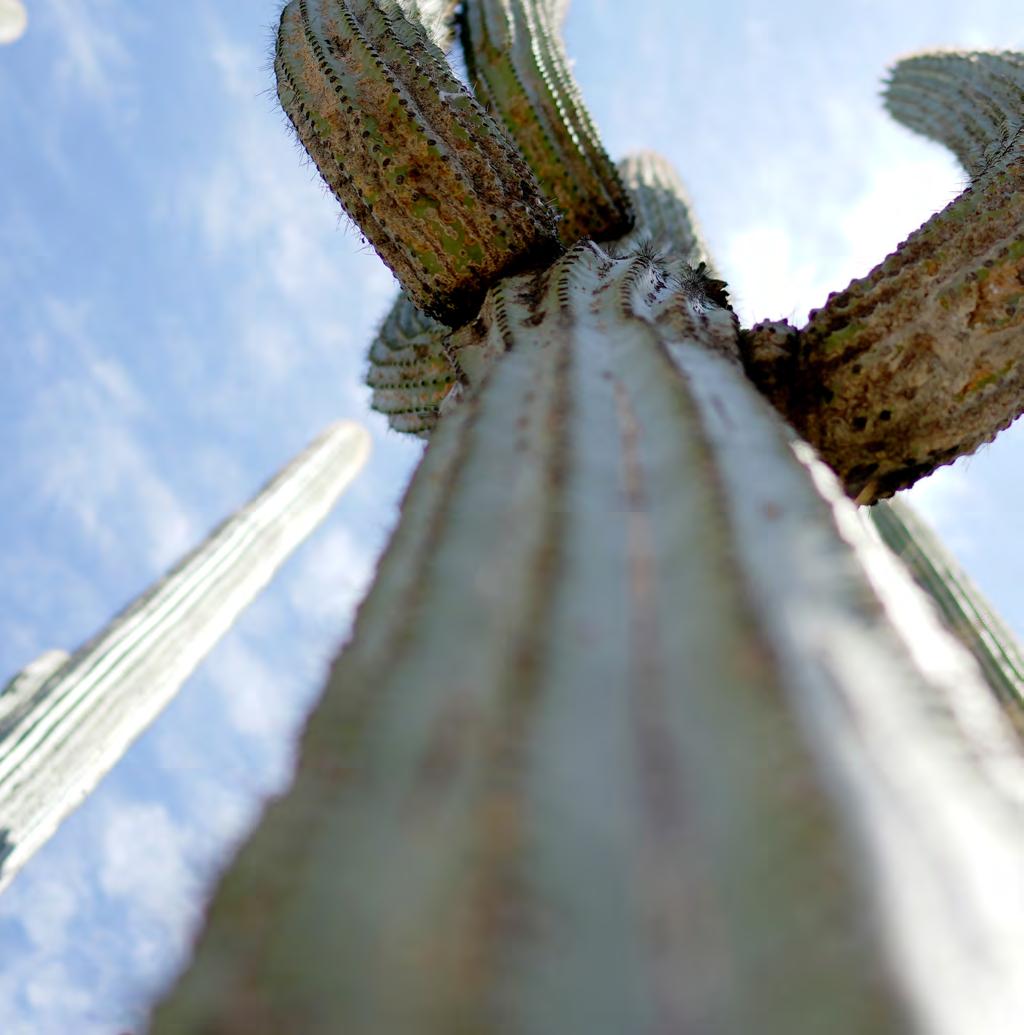
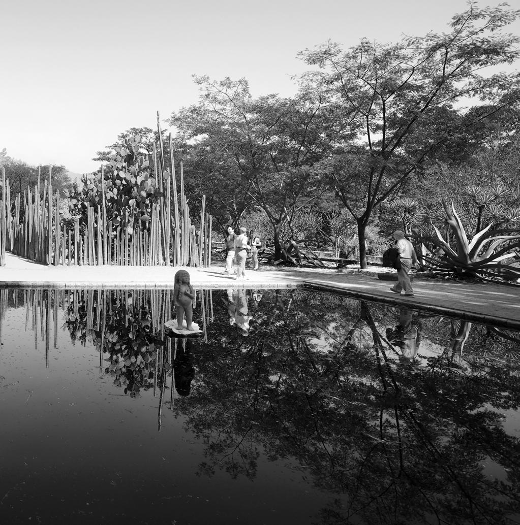
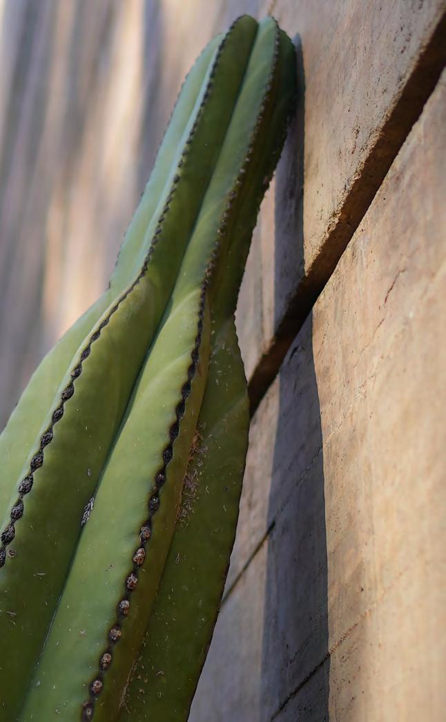
The real magic of St. Domingo De Guzman (...in my humble opinion) is the ethnobotanical wonderland that hides behind the church and formal plaza area. A garden devoted to the human/ nature interactions that made this the birthplace of corn, the production of world changing red dyes made from the Cochineal beetle, the scent of copal wood burning in a little brass cup, floating down the breeze, An amazingly layered space in the middle of the city. At once there are remnants of the military barracks, 20’ tall organ pipe cacti reaching for the sky, limestone mortar kilns, and instagram photoshoots coexisting within the walls of this little piece of magic.
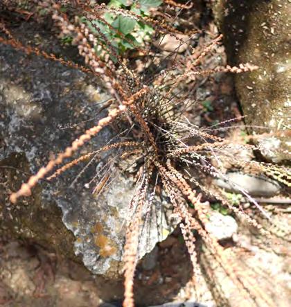


Ethno - Vegetation
I. Vegetation of the Valley of Oaxaca
II. Rock Garden

III. Medicinal Plants
IV. Indigenous Agriculture
V. Orchards and Plots
VI. Tropical Rainforest
VII. Mountain Forest
VIII. Plants related to Oaxacan culture
IX. Tropical Dry Forest
X. Plants from the driest areas of Oaxaca
XI. Patio del Huaje

B. Luis Zarate Sculpture
C. Jorge Yaspic Sculpture
D. The Greenhouse
E. Old Street
F. 16th-century archaeological pond
G. Ceramic Oven
H. 16th-century lime kilns
I. Laundry
J. Francisco Toledo Sculpture


Single stones are first drilled and then individually nailed with long 6-8” nails to secure them to the ground below without using mortar. A natural and pervious way to create paving that allows water to be directed to the massive cistern lying beneath the plaza and to infiltrate and be taken up by the plants in the jardin.
(from above) The patterns of the planting beds are based off of weaving and textile patterns used in the region. A amazing crenelation of rectilinear lines that create small pockets of space, some raised, some at grade. What a wonderful variety of plants and ways to experience them.

There are old vestiges of Benedictian and Mexican military occupation sprinkled throughout the garden. A bleached and reddened pit in the ground... a limestone kiln that made the mortar for the blockwork of the church and the massive walls surrounding the jardin etnobotanico. Reaching about 20’ into the sky, these walls completely obscure the fact that you are inside of a city. The kilns, mixing basins, and other artifacts let the many historic layers of this space open up.

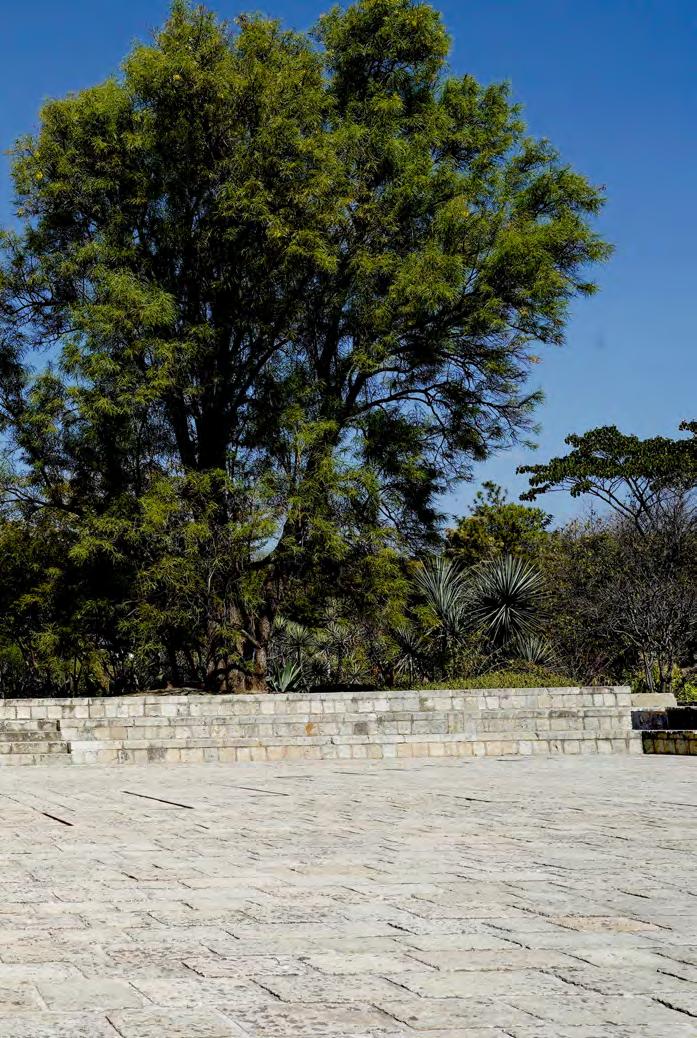 Jardin Etnobotanico Oaxaca de Juarez, Mexico

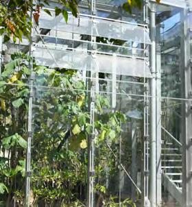

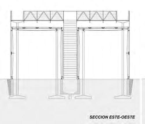
 Tucked back into the corner of the garden, a beautiful passive greenhouse structure designed by Mexican architect Francisco Gonzalez-Pulido [Orchid Educational Pavilion / ]v. Geothermal heat sources and it’s glassy exterior combine to allow for plants that are better suited to more tropical climes than can be found in the city down in the valley.
drawings by FGP Atelier


 drawings by FGP Atelier

The greenhouse is divided in half by a staircase that leads up to the catwalk, encircling the glazed spaces below. Top down view of the jungle below was a fun break from the experience on the ground. One side houses many types of orchid and the other, less fragile plants. Adjustable windows both on the vertical and horizontal roof provides an optimized climate for the plants grown here.
 drawings by FGP Atelier

 Jardin Etnobotanico Oaxaca de Juarez, Mexico
 Jardin Etnobotanico Oaxaca de Juarez, Mexico

Milpas
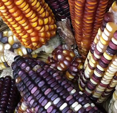
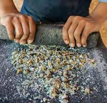
The perfect combination... corn that grows quickly and provides a stalk for the beans to grow on. Beans that are nitrogen fixers for the soil use the sturdy foundations above ground and provide all the nutrients underneath. The last piece of the puzzle is the squash, growing on the ground and thriving with its sisters out in the sun.



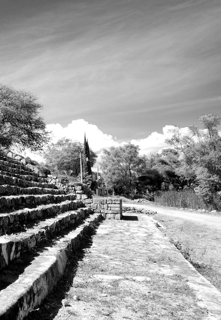

 San José el Mogote North Valley Oaxaca, Mexico
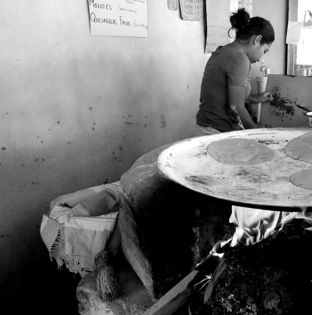

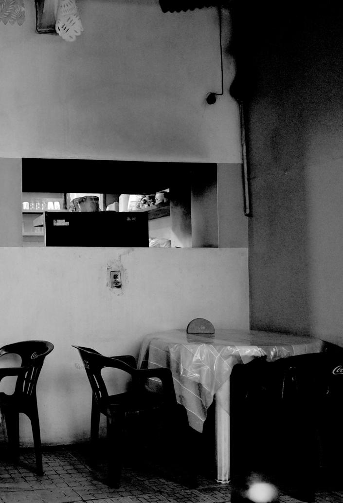
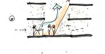
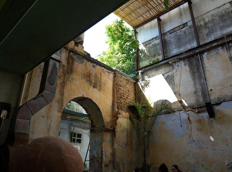
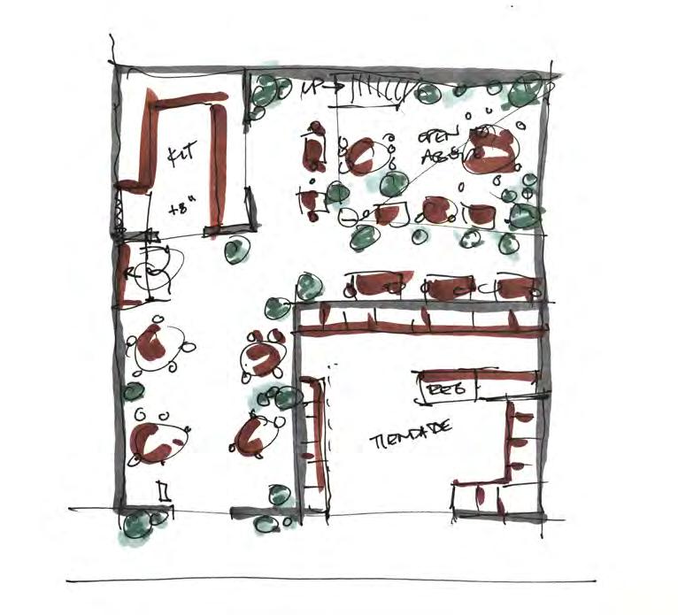
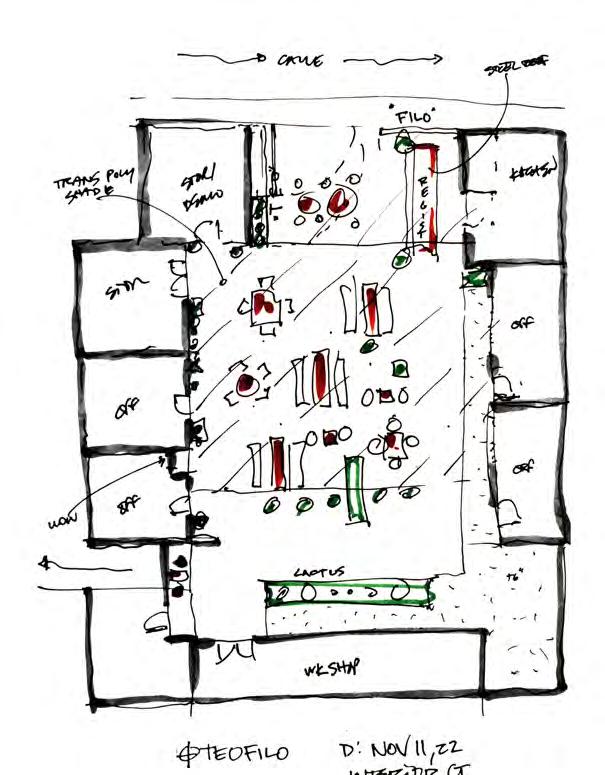
There are various ways that buildings in this climate deal with light, wind, smoke, and heat. While not an exhaustive catalog of options, these 4 seem to be very common (and sometimes clever) ways that pop up all over the city.
Cocina Doña Gris Near Viguera Oaxaca de Juarez, Mexico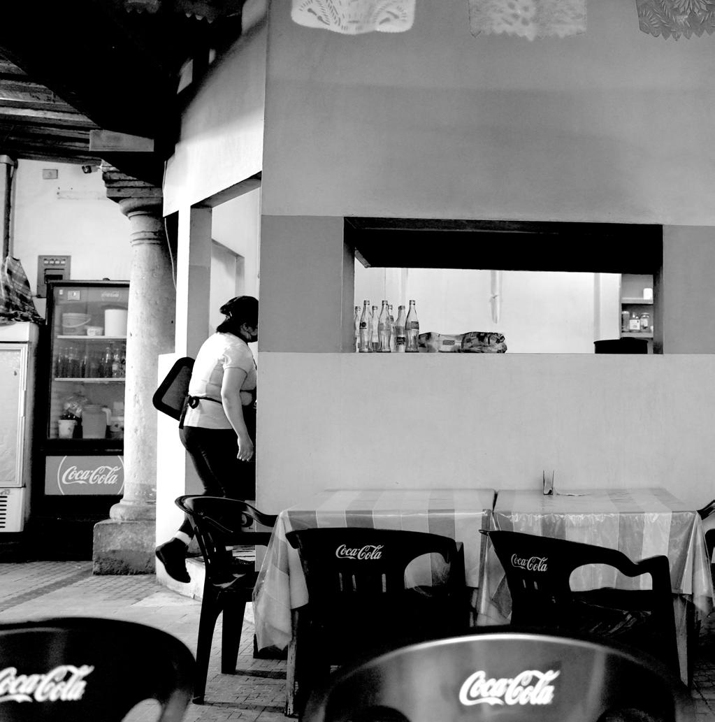
 Cafe Royalty
Oaxaca de Juarez, Mexico

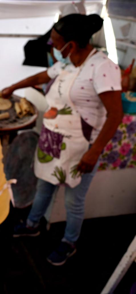
The first typology is a simple, but effective one. A shop opens its front door and has the cooking surface/area immediately at the sidewalk’s edge. Smoke from the comal escapes directly to the outdoors and customers are able to wait on the sidewalk for their order or step inside if they want. The inside of the cocina remains relatively smoke free, cool, and in shade.

The second typology is one that is a play off the ubiquitous courtyard scheme but adds the cooking component. Usually accessed from a small, dark corridor off the street, the space opens to the sky for sunlight, fresh air, and a dramatic upward focused space. Cooking smoke/fumes escape upwards and depending on the time of day, people cluster in pockets of shade around the edges while they eat/drink.

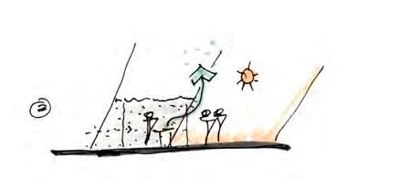
The third typology is one that is only found on the street, outside of the walls of a building. A small cart is positioned at the end of a block - cuadra - and a shade structure is assembled around the cart. The shade structure keeps the food relatively cool. Small plastic stools are scattered around the cart, sometimes well into the vehicular way and people are free to eat in the open air. The comal and a few other standard cooking aparatus are usually positioned under the shade structure but open to the breeze.

The last typology is not necessarily optimal for smoke removal, daylight, or... any of the things we usually associate with comfortable dining space. This spatial arrangement is a long hall with many vendors all cooking under a more or less continuous shade structure or solid ceiling. The temperature is at least 7 degrees warmer than the ambient air outside and smoke fills under the “roof”. It definitely creates an atmosphere that feels authentically “Mexico” but is not optimal for wind, light, smoke, or thermal comfort.












 Templo de Nuestra Señora Del Patrocinio Oaxaca de Juarez, Mexico

 Archivo General del Estado de Oaxaca Oaxaca de Juarez, Mexico

 Archivo General del Estado de Oaxaca Oaxaca de Juarez, Mexico

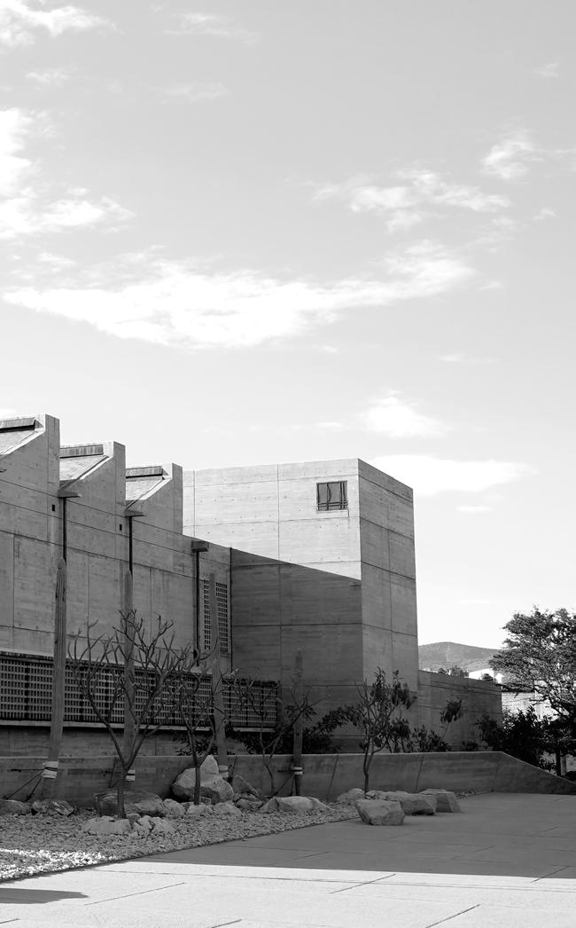 Archivo General del Estado de Oaxaca Oaxaca de Juarez, Mexico
Centro Cultural de San Pablo
Oaxaca de Juarez, Mexico

Centro Cultural de San Pablo is an amazing little zone that pulls off of the street into an umbrella filled courtyard. A perfect place to grab a beverage and hang in the garden like atmosphere. Inside the buildings, there are events and exhibits that rotate through.


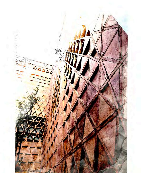

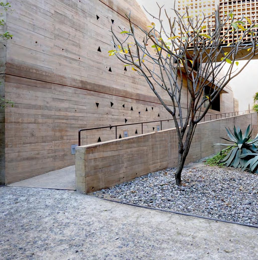
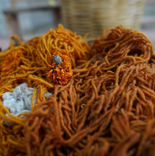
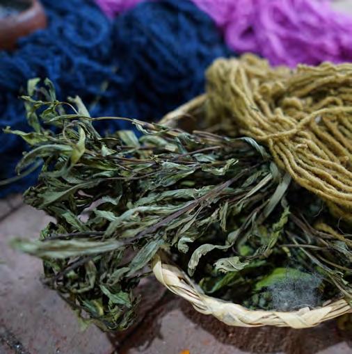
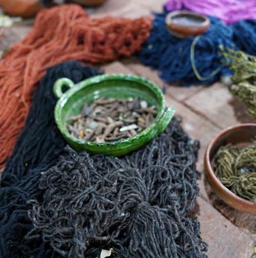
Oaxaca is a wellspring of textile goods. With a weaving tradition that has endured ages, the craft is still alive and well in the Oaxaca valley and especially in the small town of Teotitlan de Valle just to the east of Oaxaca de Juarez. That tradition and some of the softgoods that are still created through that process are on display here. The architecture is so sympathetic without being gawdy or obvious. Inverted and tesselated equilateral triangles just dance light across the wall of the atrium right after you enter through a dark and somewhat low hall. A classic Oaxaca architectural move. Compression and a total release through an amazing plant/light/water filled space all to yourself.




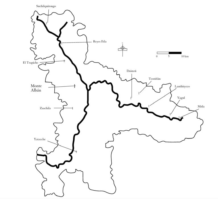
1. Etla - The vall that stretches to the northwest of Ciudad Oaxaca de Juarez has a wonderful mix of agricultural, art, culinary, historical and residential interest. Recently, this area has grown rapidly in population with many people choosing to be just outside of Oaxaca in the foothills of the Sierra Norte.
2. Monte Alban- Arguably the most important Zapotec/Mixtec archelogical site in the entire state. On par with the imporance of Teotihucan and Tenochitlan in present day Mexico City. A powerful and amazing array of structures atop a flattened mountain make this is an incredible piece of Mesoamerican history.
3. The South Valley - Venturing south of Oaxaca city is most commonly a trip to the airport that lies about 30-40mins away from Centro. Beyond the airport there lies another amazing valley filled with cultural and ecological wonders. Archeological sites like Zachilla and artisan pueblos such as Ocotlan de Morelos make this another vast area to explore. For those on bike, this is the best route out of Oaxaca towards the coast.
4. Mitla , Yagul, and Santa Maria Matatlan - To the east of the city, you will pass the amazing Tule tree, (claimed to be the stoutest tree in the world) on your way to the archeological sites of Mitla and Yagul and the hotbed of mezcal production in Matatlan. This valley is fairly flat but is flanked by towering mountains to the north. Routes for bikepacking and tourism abound and don’t have the same amount of elevation gain that makes other routes in the Oaxaca valley so challenging.
5. Sierra Norte and Pueblos Mancomunados - To the northeast of Ciudad Oaxaca de Juarez, the absolutely stunning Pueblos Mancomunados are nestled into the verdant mountains. Make sure you catch your breath in Oaxaca or somewhere in the valley before spending too much time (especially strenuous activities) in this part of Oaxaca. Base elevations of pueblos like Cujimoloyes are about ~10,000’ above sea level so you can definitely feel the altidude. This area is absolutely a “do not miss” experience for those interested in Zapotec culture, immersive biodiversity, and some of the most stunning mountain valley views to be had anywhere.


CUSTOM REAR ALLOY RACK
PORTLAND DESIGN WORKS WATERPROOF ROLL
(SUBSTITUTE OUTERSHELL SEAT BAG FOR LIGHT TRIPS)
FRAME : SURLY OGRE (LARGE) 2022 COLOR: CHAMPAGNE SUPERNOVA
BROOKS B17 STD
TUBES (2X)
(2) REVELATE DESIGNS TOP TUBE BAGS
KLITE DYNAMO CHARGER +
(2) LITHIUM CHARGING BLOCKS
ORTLIEB LIGHTWEIGHT WATERPROOF PANIERS (X2)
DT SWISS 350 XD 12SP CL
12X148 BOOST REAR HUB
10-52T SRAM GX 12SP CASSETTE
SRAM XO1 12SP REAR MECH
SRAM XX1 12SP CHAIN
ROGUE PANDA
CUSTOM DOUBLE
DECKER FRAME BAG
TENT POLES
TOOL BOTTLE IN CAGE
GARMIN EDGE 830

GARMIN INREACH MINI
SALSA ANYTHING CRADLE AND DRY BAG SYSTEM
REVELATE DESIGNS FEED BAGS (X2)
BONTRAGER XR2 TEAM ISSUE TIRES (29X2.6 F/R)
DYNAMO HUB ORTLIEB MINI FORK PANIERS (X2)
W/ QUICK LOK SYSTEM
SHUTTER PRECISION
SPANK OOZY TRAIL +++ 29 (35MM ID) RIMS
GORILLA TAPE
STANS SEALANT
RESERVE FILLMORE STEMS
 Santa María Atzompa Oaxaca De Juarez (North Valley), Mexico


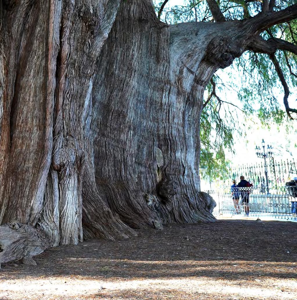
 Santa Maria Del Tule Oaxaca De Juarez (East Valley)
 Presa las Jacarandas Near San Pablo de Etla Oaxaca (North Valley), Mexico

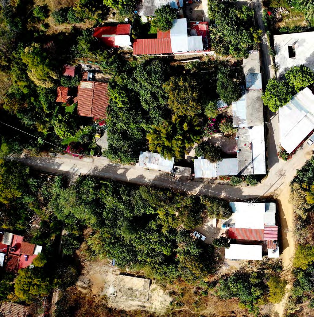 San Augustine de Etla Oaxaca (North Valley), Mexico
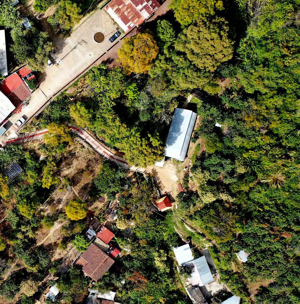
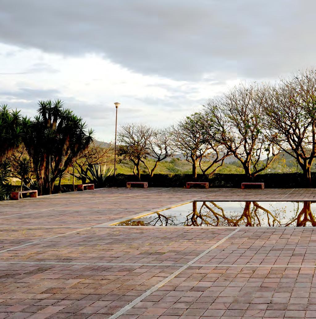


St. Augustine de Etla is perched high above Oaxaca. After the original source of Oaxaca’s water in San Felipe de Agua was depleted and the Rio Atoyac became severly contaminated by the waste of the growing city, the small community of San Augustine de Etla became the main source of fresh water for the city of Oaxaca. I traced the route of water from my tap to the source over the course of a steep day on my bike. Riding past tiny communities and farmlands
filled with corn, squash, beans, and flowers I could see how topography and availability of water plays such an important role in the life of the city and the countryside alike. I rode past small dams and reservoirs along the small trickle of the Rio Grande that were wellsprings of plant and animal life but weird constructions in an otherwise wild landscape.

Sunset was a truly spectacular time to be on top of the hill. Absolute still water of only about 4 inches reflected the trees and clouds with perfect clarity. The amazing reuse of water in this place is both reminiscent of the bygone industry that once churned here but also of the new role that St. Augustine de Etla plays in providing most of the fresh water for Oaxaca de Juarez.
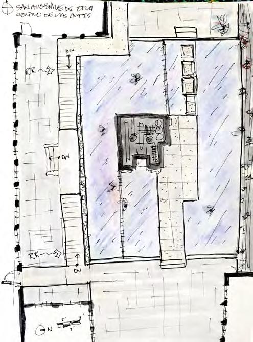
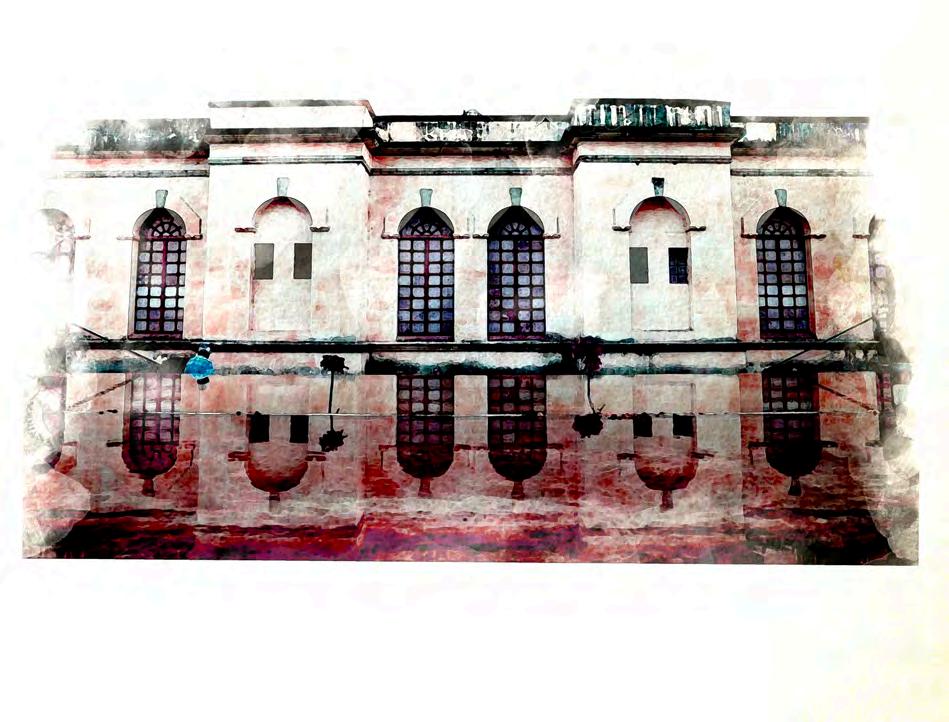
Once I caught my breath at the top of the Sierra Norte, the Centro de Artes San Augustine, known as CaSa, was an amazing spot to explore for the evening. A disused paper factory was transformed by Architect Claudina López Morales into a truly wonderful place for artists to practice in residency and to house changing exhibitions mostly focused on print material and photography. One of the most thoughtful and beautiful adaptive reuse projects I’ve ever seen :))

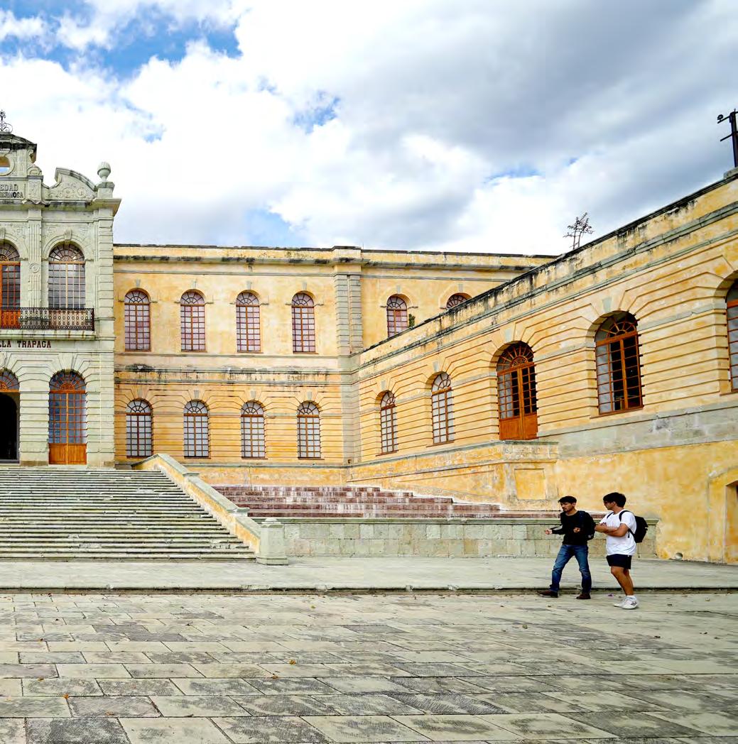
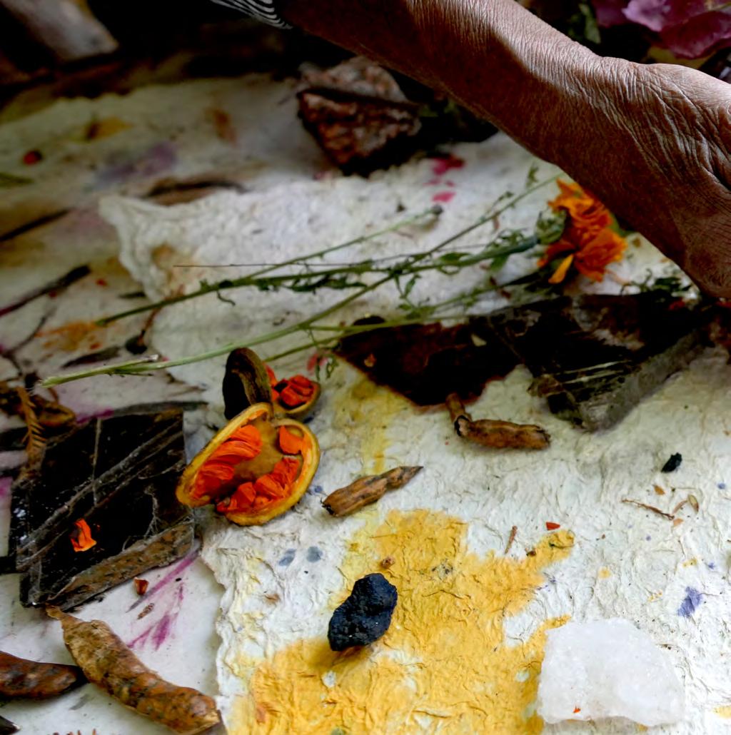 Taller Arte Papel (Paper Art Workshop)
San Augustine de Etla Oaxaca (North Valley), Mexico
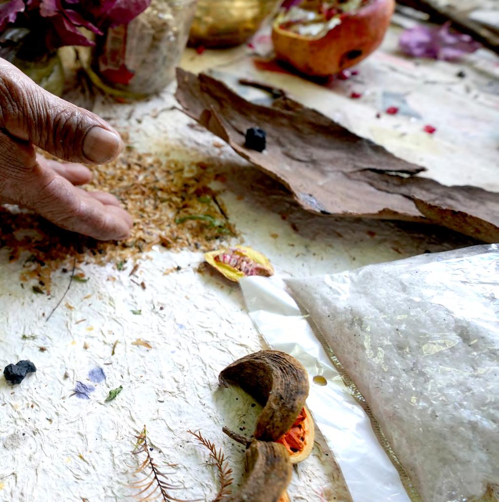


 Taller Arte Papel (Paper Art Workshop) San Augustine de Etla Oaxaca (North Valley), Mexico

 Taller Arte Papel (Paper Art Workshop) San Augustine de Etla Oaxaca (North Valley), Mexico
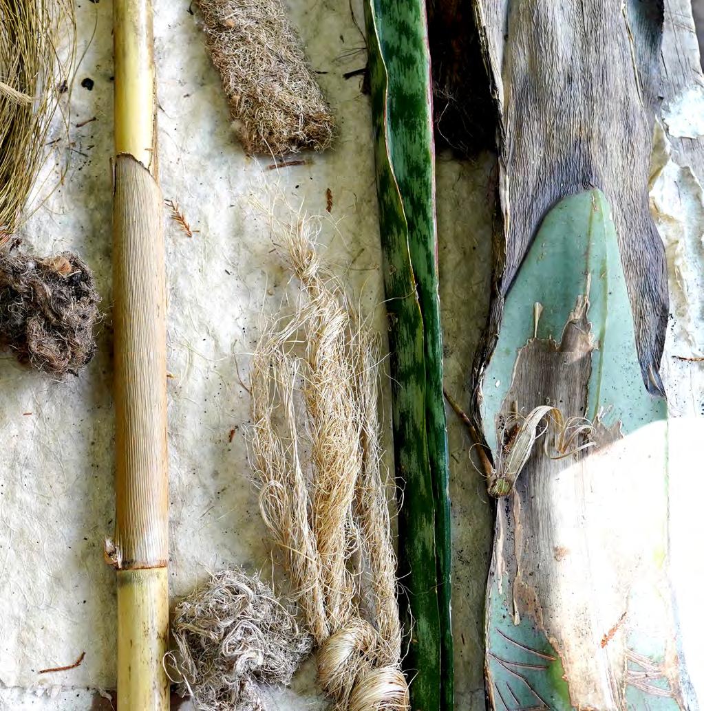
 La planta - Hydroelectric Power Plant near San Augustine de Etla Oaxaca (North Valley), Mexico


 Presa las Jacarandas
Near San Pablo de Etla Oaxaca (North Valley), Mexico

 Punto Trino Teotitlan de Valle, Oaxaca

 Pueblos mancomunados Benito Juarez Oaxaca - Sierra Norte

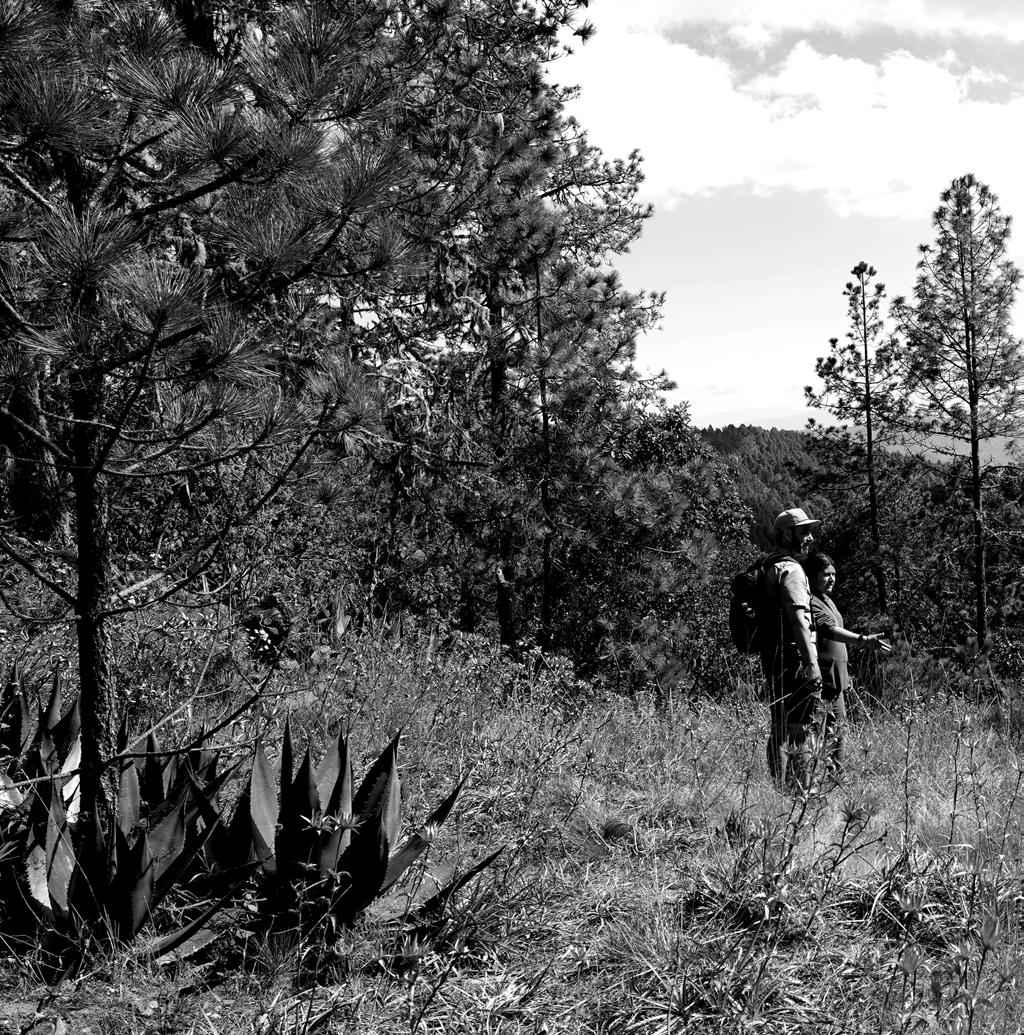 Pueblos mancomunados Benito Juarez Oaxaca - Sierra Norte



 Teotitlán del Valle
Oaxaca - Sierra Norte

 Teotitlán del Valle Oaxaca - Sierra Norte



 Punto Trino
Teotihuacan, Oaxaca

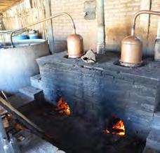
One of the most interesting palenques in Matatlan (just east of the city about 30-40mins) is Gracias a Dios. They are making some very sustainable moves both with the building/operation and with their agricultural strategy. This mezcalaria has started to reuse its spent hull (the fibrous mash that is fermented before being boiled/distilled) for earthen bricks. They are using solar power for all electricity and are storing water on site in cisterns.


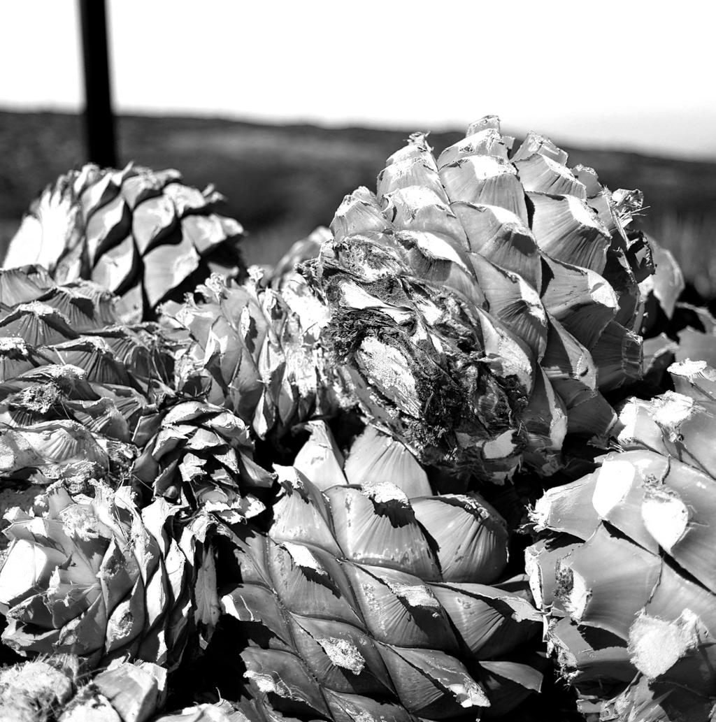

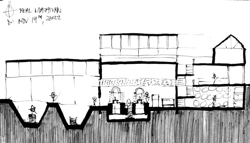

The agave espadin takes about 7-9 years to reach maturity. When it is harvested, the piña alone (leaves are cut off leaving a pineapple shaped ball) can weigh as much as 300lbs! Between rows of Espadin, other crops are grown. Calabaza (Pumpkin), squash, frijoles (beans), flor de los muertos, and others. This is a sort of agave milpa that has many harvests for each agave harvest.


In addition to the sustainable practices being employed in the building, Gracias a Dios is starting to replant wild agave species that are being used to produce the vast majority of mezcals other than “Espadin”. These wild species are all unique... different in size, shape, time to maturity, taste, climate, atitude, and so much more. It really is a close companion to the Terroir found in in French wines, or Argentine Mendoza Zone, terruño in Spanish. A mexican Provence!


The central valleys of Mexico have some of the richest anthropological history of anywhere in the world. Dozens of highly advanced agricultural and indigenous cultures have developed in these fertile pieces of land. The Olmec, Toltec, Mexica, Zapotec, Mixtec, Aztec, and many more developed some of the most advanced cities, ceremonial structures, agricultural practices and trade systems in the entire world. THere is no shortage of sites accessible from Oaxaca. The following pages contain a non-exhaustive collection of some of the most important sites.

The partially excavated civic ceremonial center of the Monte Albán site is situated atop an artificially leveled ridge. It has an elevation of about 1,940 m (6,400 ft) above mean sea level and rises some 400 m (1,300 ft) from the valley floor, in an easily defensible location. In addition to the monumental core, the site is characterized by several hundred artificial terraces, and a dozen clusters of mounded architecture covering the entire ridgeline and surrounding flanks. [1] The archaeological ruins on the nearby Atzompa and El Gallo hills to the north are traditionally considered to be an integral part of the ancient city as well.
Besides being one of the earliest cities of Mesoamerica, Monte Albán was important for nearly one thousand years as the pre-eminent Zapotec socio-political and economic center. Founded toward the end of the Middle Formative period at around 500 BC, by the Terminal Formative (c. 100 BC –AD 200) Monte Albán had become the capital of a large-scale expansionist polity that dominated much of the Oaxacan highlands and interacted with other Mesoamerican regional states, such as Teotihuacan to the north.
(Paddock 1983; Marcus 1983)
Wiki - Monte Alban
Ref: Blanton, Richard E. (1978). Monte Albán: Settlement Patterns at the Ancient Zapotec Capital. New York: Academic Press


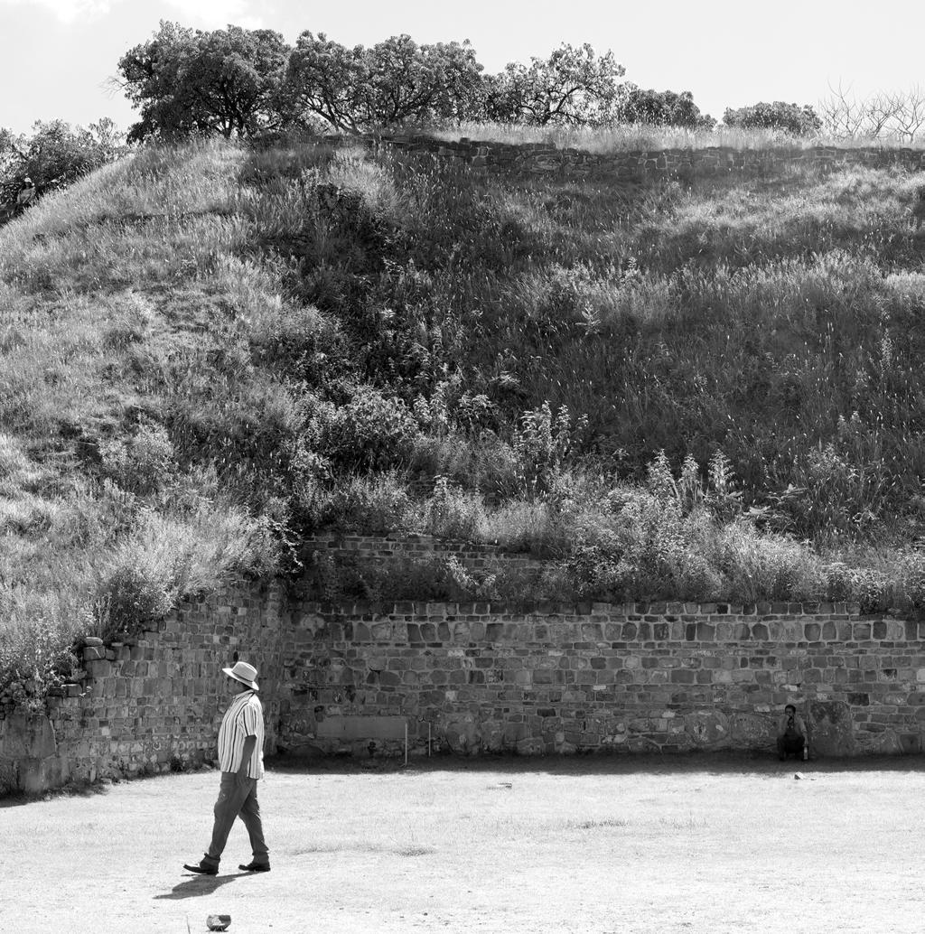
 Monte Alban South Valley Oaxaca, Mexico

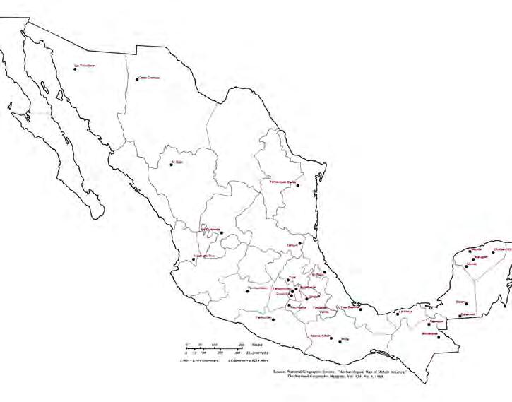

Teotihuacan
The name Teōtīhuacān was given by the Nahuatl-speaking Aztecs centuries after the fall of the city around 550 CE. The term has been glossed as “birthplace of the gods”, or “place where gods were born”,[10] reflecting Nahua creation myths that were said to occur in Teotihuacan. Nahuatl scholar Thelma D. Sullivan interprets the name as “place of those who have the road of the gods.”[11] This is because the Aztecs believed that the gods created the universe at that site. The name is pronounced [te.otiwakan] in Nahuatl, with the accent on the syllable wa. By normal Nahuatl orthographic conventions, a written accent would not appear in that position. Both this pronunciation and the Spanish pronunciation [te.otiwakan] are used, and both spellings appear in this article.
The original name of the city is unknown, but it appears in hieroglyphic texts from the Maya region as puh, or “Place of Reeds”.[12] This suggests that, in the Maya civilization of the Classic period, Teotihuacan was understood as a Place of Reeds similar to other Postclassic Central Mexican settlements that took the name of Tollan, such as Tula-Hidalgo and Cholula.
Archaeology of Native North America by Dean R. Snow. Millon (1993), p. 34. Mathews and Schele (1997, p. 39) Wiki-Teotihuacan

https://www.researchgate.net/publication/231997323/figure/fig3/AS:300613964451840@1448683362092/Map-of-epicentral-Teotihuacan-showing-the-location-of-the-Conjunto-de-los-Glifos-of-La.png


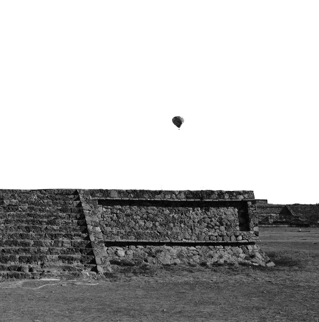


Tenochitlan was the capital city of the Aztec empire. Once home to a quarter million people, this was undoubtedly one of the greatest cities of all time. This place was found around by the Mexica whoch quickly created one of the most advanced and large cities in the world at the time... built right on top of Lake Texoco. Imagine a water-based, meso-american rome. Highly organized into 4 zones and taking advantage of freshwater inflows from the mountains surrounding.
 Woodcut map of Tenochitlan and Lake Texacoco 1524 by Friedrich Peypus

Tenochitlan fell to the Spaniards and was reduced to a shell of what it once was. Barely noticible. The ancient pyramids and buildings’ stones were dismantled and reused to make the new Spanish Style architecture that all but erases any sign of what was before.

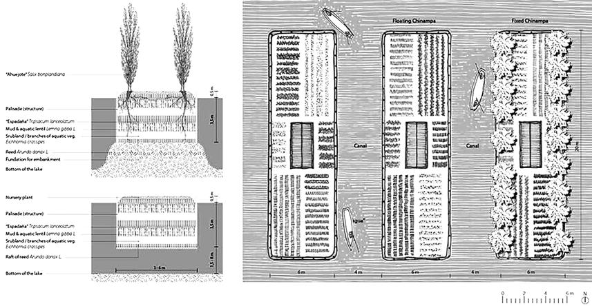

source: www.motherjones.com
2019.Catalina Rey Hernandez Detail-plan-and-section-of-Chinampas-water-system.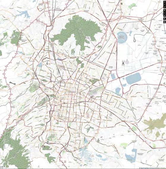
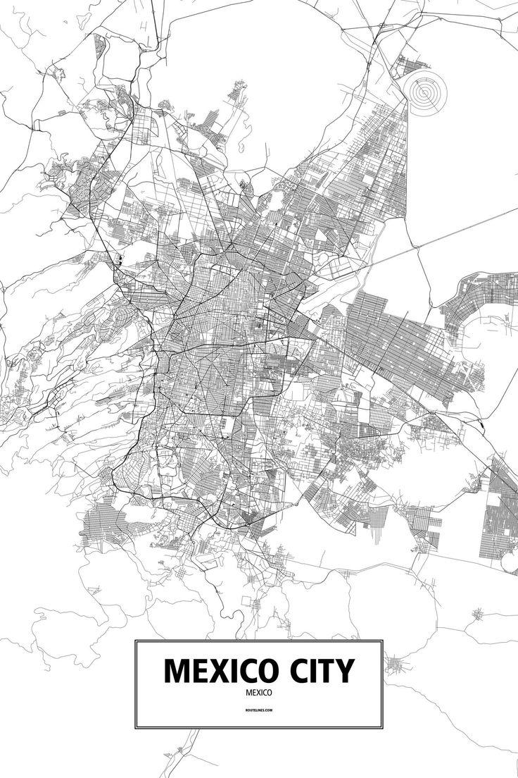
Sadly, but similar to almost every city in the world, Mexico city has a water problem - a really big one. Since most of the land that Mexico City is built on once was a lake, you may be able to guess the problem pretty easily. Its sinking! Increasing population creates higher demand of a mostly fixed asset. The main water source for the city was the lake and it’s feeders but every time the city expanded, it’s water needs also expanded. Basically Mexico city is pumping more water out of Lake Texoco (a submerged groundwater source at this point) than it receives annually and because of that loss in volume, the city shifts downwards with the water level.
Mexico City, affectionatly (and efficiently) known as CDMX, was founded on the lake Texoco. As legend goes, the site was selected because an eagle was seen on the west end of the lake holding a snake in its mouth on top of the prikly pear tree. Since that day, Mexico City has been creating land where there previously was water. This was first shown through the development of the massive and land defiant, Tenochtitlan. Further, inhabitants of this place have been creating land where there was none forever. Throughout aztec times and into the future, this lake provided tons of food by means of its extensive canal and chinampas style of agriculture. This land management/production strategy made artificial islands by sinking and planting water loving trees in a row and then filling the flooded volume with fertilized soils.
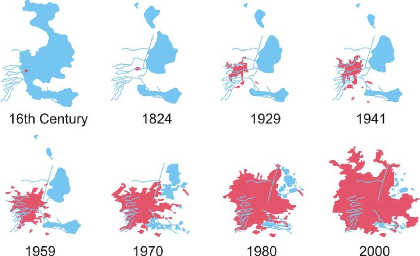
Mexico City: Reconnecting an inland metropolis to water September 2014 Conference: 50th ISOCARP Congress.
Urban Transformations: Cities and WaterAt: Gdynia, Poland
source: Online Image: https://i.pinimg.com/736x/b6/dc/be/b6dcbe6c5d5dae4cfa14a1bf1ef5da19.jpg

There are countless examples of how this lake was manipulated over time to become the bohemoth of an urban expanse that we now know as CDMX. I needed to visit this place for a week just to feel what a contrast it was to Oaxaca and what the big city had to say about things new and old. It had plenty of modern and ancient architecture to keep me busy for a lifetime.


1
CURRENT CONDITIONS:
SINGLE FAMILY HOME
AVG 3-4 PPL
~1000 GAL/PERSON/MONTH
ALL WATER FROM MUNICIPAL SYSTEMS

MUNICIPAL WATER
DEMAND
SEWER + SURFACE RUNOFF TO RIVER
POTABLE WATER
USE FOR NONPOTABLE ACTIVITIES

ADD GREYWATER REUSE: SINGLE FAMILY HOME
AVG 3-4 PPL
~1000 GAL/PERSON/MONTH

MUNICIPAL WATER DEMAND SEWER + SURFACE RUNOFF TO RIVER
POTABLE WATER USE FOR NONPOTABLE ACTIVITIES

ADD GREYWATER REUSE
RAINWATER HARVESTING: SINGLE FAMILY HOME
AVG 3-4 PPL
~1000 GAL/PERSON/MONTH 3

MUNICIPAL WATER DEMAND
SEWER + SURFACE RUNOFF TO RIVER
POTABLE WATER USE FOR NONPOTABLE ACTIVITIES


Museo Soumaya sits in the upscale Polanco area of CDMX. It is a private museum and non-profit cultural institution. The cuvy and armor-like exterior clad in shining metal hexagons has over 66,000 works from 30 centuries of art including sculptures from PreHispanic Mesoamerica, 19th- and 20th-century Mexican art and an extensive repertoire of works by European old masters and masters of modern western art. A complex set of stairs and ramps make their way up to the museum entrance almost 20’ above the sidewalk surface. A great piece of modern architecture in CDMX and a wonderful collection to boot!
Museo Soumaya Mexico City (CDMX)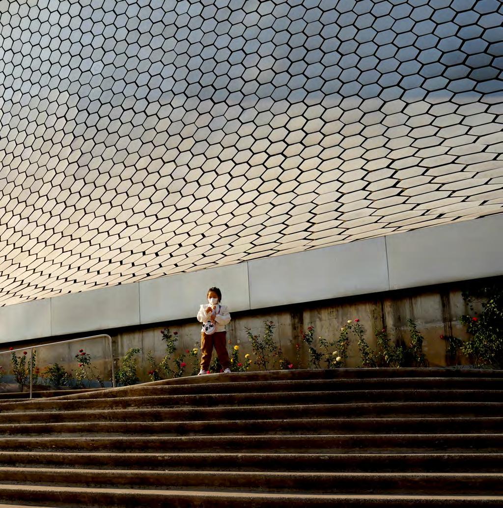


The eastern end of Chapultepec houses the majority of the touristic attractions including the castillo and a cluster of trails. Further west, the lake and botanical gardens occupy a huge area. Further west still the trails and general experience become less populated and more secluded. All are amazing experiences. When you are done head north towards the Museo Nacional de Antropologico and Museo Tamayo (Both are incredible in their own right and just across one of the most beautiful avenidas in all of Mexico City.
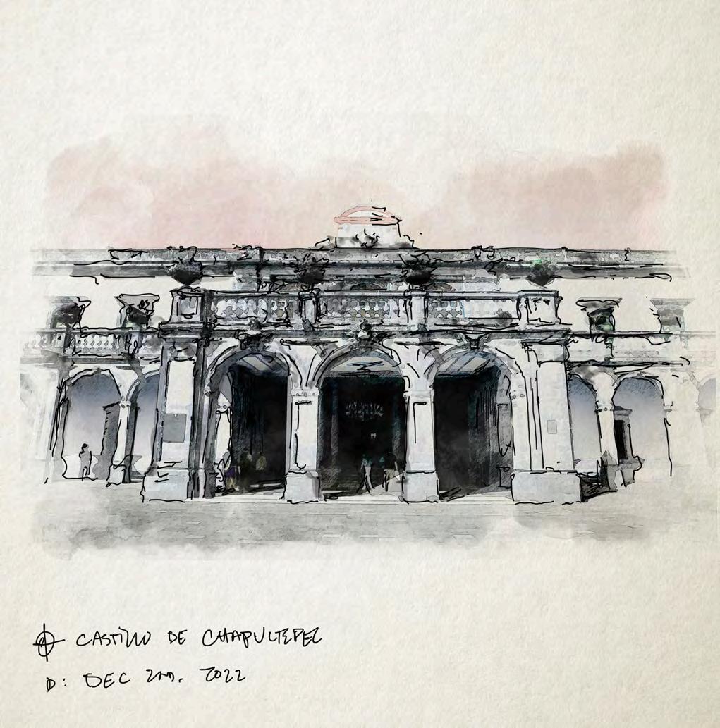
Inside of the massive urban expanse that is Mexico City, there exists a proportionally massive forest. Inside of this oasis (Aside from the forest itself) is a botanical garden, El Castillo de Chapultepec, a lake, walking/running/biking trails, and a massive food court, among other attractions. Part of the magic of this place, much like that of Central Park in NYC is just the fact that it exists in such a city. The other part is that the castle (El Castillo) and the richness of plant/tree specimens are amazingly well maintained.
 Museo Nacional de Anthropologico Mexico City (CDMX)

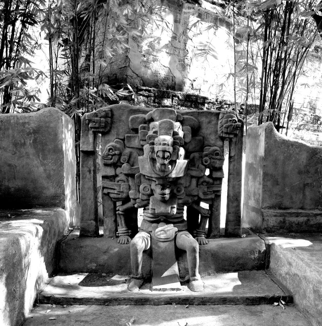

The Museum of Anthropology is an absolute delight. The architecture is such a unique combination of modern and ancient. Sometimes clashing, sometimes melding into an aesthetic that could be futuristic. The landscape surrounding the museum is probably as interesting as the content of its extremely robust and well curated exhibitions on the prehispanic cultures of Mexico. This is equally a required destination in CDMX: The amazing architectural and landscape design as well as the most immersive and beautifully displayed lesson on prehispanic Mexico is not to be missed.


Gertrud Louise Goldschmidt (Gego)
Sin Titulo 1960
Coleccion Fundacion Gego en The Museum of Fine Arts Houston
Meuso Jumex exhibit 2023

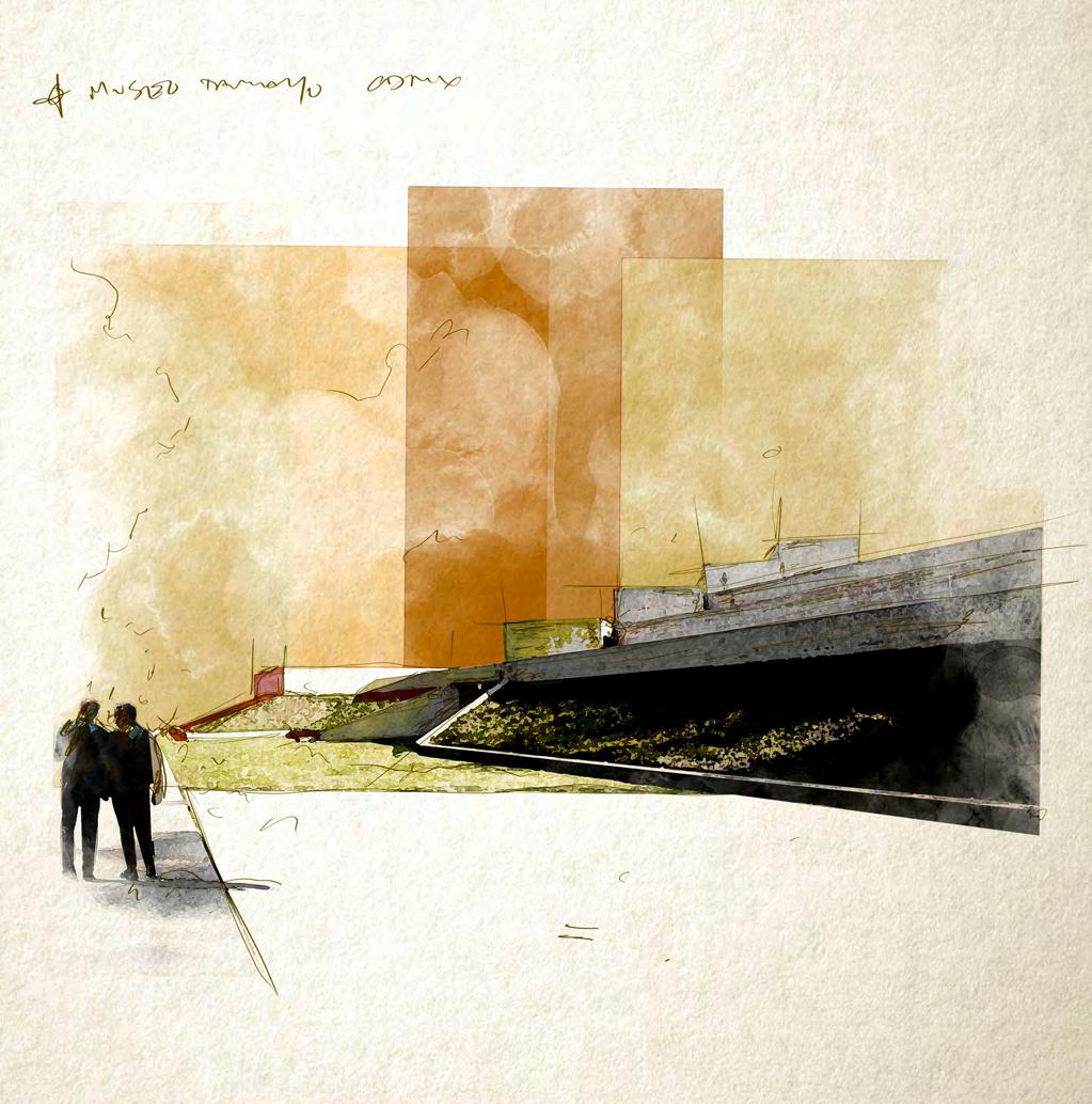
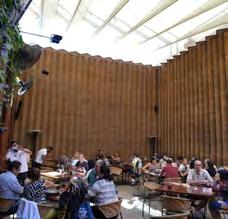
Museo Tamayo Arte Contemporano is a stunningly simple building from the exterior. The museum was designed by Teodoro González de León and Abraham Zabludovsky. The stepped, stretched horizontal and monolithic forms are drawn from from pre-Hispanic architecture like nearby Teotitlan and Tenochitlan. Sloped gardens and the silouhette of light masonry forms against the CDMX sky are a fitting clash in this place of old and new. Contemporary art in a building that channels the architecture of 2000 + years ago.

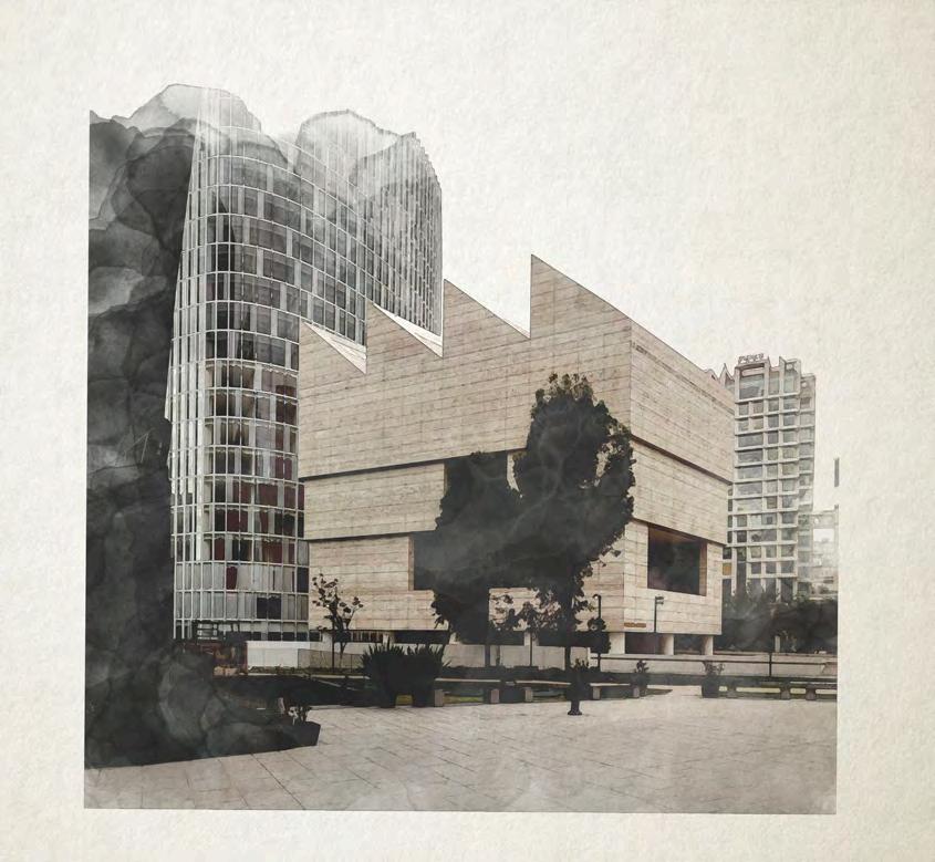
Museo Jumex CDMX houses a rotating collection of contemporary art ranging from sculpture to print. The building is a masterful work of architecture by David Chipperfield Architects (One of my favorite firms). Consistent with the work of this UK office, the building fits into its surroundings with a quiet, utilitarian, but ultimately beautiful silouhette. Roof monitors and carefully crafted aperatures bring soft, even, natural light into the gallery spaces below.
Source: https://www.archdaily.com/641093/museo-jumex-david-chipperfield-architects


A somewhat monotone palette of limestone panels, excellent formed concrete and bold black and wooden accents make this place feel timeless but decidedly modern in it’s construction. Public spaces snake their way among the galleries and make the experience feel like one is both observing the art and the city simultaneously. A mix of streetlife, elevated views, stunning art, and well crafted architecture make this place very special.
Source: https://www.archdaily.com/641093/museo-jumex-david-chipperfield-architects

ecologically chaotic (balanced) isolated/simplified selection/ processing cultural ecologies create endemically suited selected for inherent renewable abundance waste = food structure comes from variety

bio-cultural products
(imbalance)

suited to climate inherent traits resource
craft/ utilization
bio-cultural products (balanced)

the complex interactions of humans and their surrounding environment. these interactions create culturally rich products that entangle human and ecological processes, flows, and biproducts in sustainable ways.


ecologically embedded selection stone corn processing cultural ecologies create


 Ralph Rapson Traveling Fellowship - 2020 Matthew Tierney, AIA