ORTFOLIO ACADEMIC
Ikemefuna Onyiuke


I'm an Urbanism major at Carleton University's Barchelors program. My passion for urban design is rooted in my desire to build spaces that foster community and growth. I'm dedicated to creating spaces that balance environmental sustainability with people-centered solutions to improve the quality of life for every resident.
:
onyiukeikemefuna@gmail.com
+1 (204) 330 8439
Bachelor of Architectural Studies - Urbanism
Carleton University
2021 - Prese nt Ottawa, ON
Urban Strategies
Urban Design Intern Toronto, Ontario
Sept 2024 - April 2025
Finalists
Terraviva Competitions
Technical/design
BIM CAD GIS
3d Modelling
Collaborated with Project Managers and allocation teams to ensure timely, high-quality deliverables for multiple projects, including Planning Justification Reports, Zoning Bylaw Amendments, and Masterplans. Supported urban design development, creating diagrams and graphics to convey key concepts, and assisted with proposal writing, report layout, and production.
Architecture49
Student Intern Winnipeg, Manitoba
May 2022 - August 2022
Rendering
Adobe CC
Physical Modelling
Clerical Work
June 2023
Researched and compiled material spec sheets for sustainable community spaces using Excel/Word, liaised with manufacturers, and explored online resources. Conducted site analyses for furniture store renovations serving indigenous communities. Edited architectural drawings and diagrams on Revit, Photoshop, and Illustrator to create complete drawing sets.
Physical Modelling
Revit - AutoCAD - ArcGIS
Sketchup - Rhinoceros3D - ArchiCAD
Vray - D5 Render - Twinmotion
Photoshop - Illustrator - InDesign
Lasercutting and 3D printing
Printing - Scanning - File Management
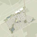
Suburb Masterplanning for New Expansion Area
Ottawa, Ontario
IKEMEFUNA
w/ Kasper
Barynin + Amos Stapper
ROLES: Co-designer, planner
DATE: 2024
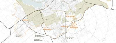
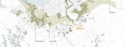
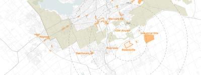
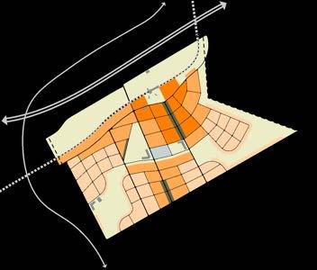
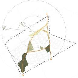
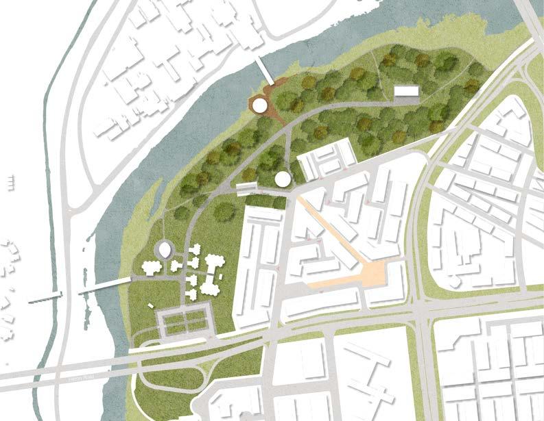
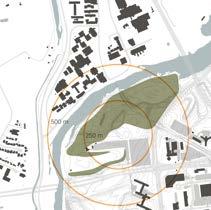
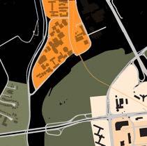
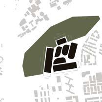
Ottawa's urban boundary, 2021, has beeen expanded to include the area around the new O-Train station at Bowesville. In an area comprising 450ha, with a minimum density target of 120 uph within 400m radius from the transit station. Designers were tasked with masterplanning a transit oriented, climate conscious suburb that improved the standards of living for all residents.
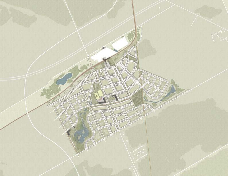
Nurbia* is a cohesion between North American ideals and European standards to create a healthier suburb built on horticultural biodiversity, pedestrianism, and community engagement.
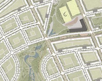
Nurbia's site, currently known as bowesville, is situated in the vicinity of barrhaven and riverside on the outskirts of southern ottawa. It has been part of an expansion project over the past ten years that extends ottawa's boundaries and reimagines the city's periphery.
To further develop bowesville, nurbia proposes to extend the line 2 (l2) train even further and connect it, through the periphery, to barrhaven and eventually kanata. Then, it introduces the line 3 (l3) train to make up for the lack of public transit in ottawa's core.
Nurbia* also comes with bikeway 300 which utilizes the green belt as an experiential way of traveling across ottawa. Finally the highway "500" is added which runs the perimeter of ottawa and connects highway 416 and 417, a design decision fueled by the anticipation of potential future growth in ottawa.
CLOSE PROXIMITY TO NATURE
SURROUNDED BY COMMERCIAL AMMENITIES
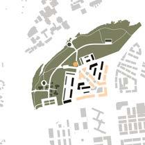
Bowesville can be walked across within 20 minutes. So, it was imperative to create a neighborhood centered around walking and biking. Utilizing a circular grid that originates around the train station as the point of interest to the community. The train is to be fully utilized with direct access to major routes and the bus station.
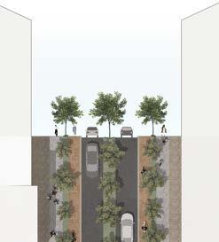
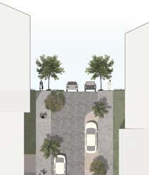
Nurbia has 3 road typologies. Major roads have been designed with bike paths to siphon traffic from local quiet roads. Tertiary roads follow similar design principles to many european cities, where the surface's facade carries onto the road, sometimes with no delineation as to where it starts and ends.
All streets use a mixture of infiltration and water retention to manage stormwater, however, main streets feature boulevards that collect water through their shape while the others have gutters.
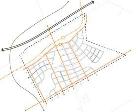


Nurbia is tailored to meet the diverse needs of ottawa's population, with a particular focus on the elderly, family, and commuters.These demographics serve as the underlying princple of density allocation throughout the site. To support commuting, higher densities are provided surrounding the train station [380 pph, 120 uph, 4,500 people]. This is followed with a ring of medium density, housing the bulk of the population [180 Pph, 56 uph, 6,745 people], to create a smooth transition into the low density family units [80pph, 22 uph, 2,545 people].
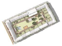
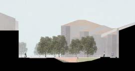
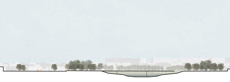
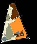
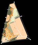
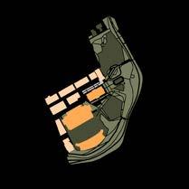
In line with the ongoing development of the cities' Park and Recreation Facilities Master Plan, Nurbia is bounded by a network of parks and facilities that form a green loop throughout the site. The community center, school grounds, and stormwater magagement reservoirs are all consolidated around the train station with future development in mind. They provide an alternate route for the community, a transition from an urban plaza with green landscape integration to natural park designed around reservoirs, elevated walking paths, and diverse ecosystems [as represented through various shades of Green].
1. Train Station & Bus Stop
2. Community Center
3. Reservoir
4. Parkette
5. Farmland
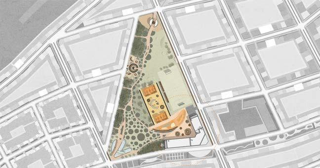
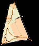
POROUS CIRCULATION Sports & Recreation
The community serves as an important junction and major point of connection. With a system of paths it connects and ties together the entire site with only 5 - 10 minutes of walking.
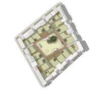
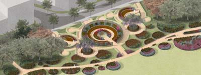
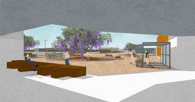
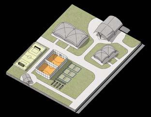
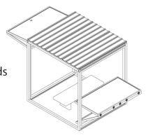
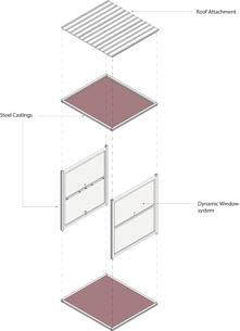
The community center is programmed with a pavillion, a maze, a splashpad, and most importantly the community center building itself with carefully placed outdoor sports fields.
The community center features a blend of ecology with a focus on ornamentation. However, these are not just pretty flowers, these are all pollinator plants specifically chosen to improve biodiversity on the site while also functioning as wayfinding.
The community center uses a beautiful botannical garden chain to adorn the sites main path and thus creates a new unique experience as nurbia's residents traverse it.
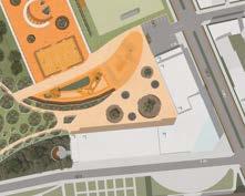
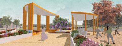
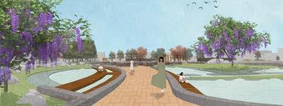


The community center building contains programming that gives nurbia's residents a reason to come to the site. On the second floor, there's a library and dedicated weight room . On the ground floor, it has a gallery, reception, a cafe, a multipurpose room, an indoor gymnasium, an indoor pool, a sauna, and interior courtyard seating that uses paving textures to differentiate spaces.
Communit y Meeting
PAVING PATTERNS
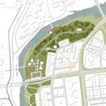
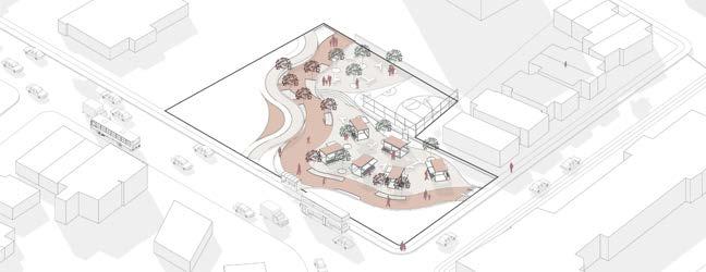
Public Space and Park Design
Ottawa, Ontario
IKEMEFUNA ONYIUKE w/ Ahmad Assi, Sophie Dupont, Awj Abboud
ROLES: Co-designer, planner
DATE: 2023
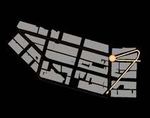
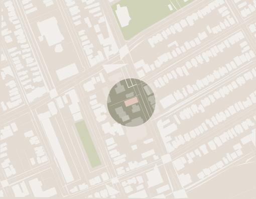
The project is located on a 45-acre existing site and asks to research, document and critique urban systems, infrastructures, and planning policies that come to bear on these sites.
The site is a unique segment of the city of ottawa, demonstrating the limitations of single-use zoning located within a transit-oriented urban core experiencing rapid growth.
The project offers to test various scenarios on the site in response to the political, social, and economical concerns discovered and prepare a comprehensive masterplan and design guidelines which aim to negotiate issues of social equity, accessibility, climate resilience, post-carbon economies and housing affordability, all the while recognizing the limits of our disciplinary tools.
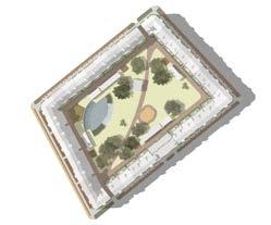
The entire site is 45-acres around and is predominantly owned by the NCC. It is currently the location for Vincent Massey Park, however, it is severly underutilized. Due to its proximity to Carleton University, the Rideau Canal, and the surrounding park-land, the site has the potential for so much more.
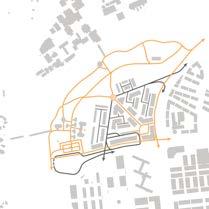
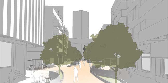
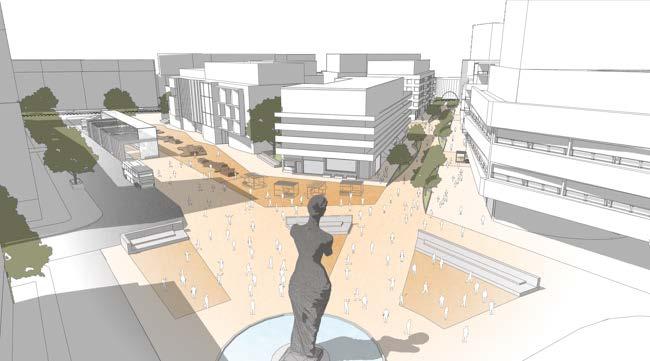
Through fervent research into the Site's existing conditions and taking precedence from similar successful designs, Confederation Heights proposes a reason for the surrounding families to leave their homes. It proposes a pedestrian commercial street that connects to permeable green open spaces. It proposes activated facades and blocks to line this Pedestrian street. It proposes green open spaces propgrammed with evenly dispersed community-based activities. It proposes a better Confederation Heights.

CIRCULATION
CIRCULATION
BLOCK SIZING
PARK DESIGN
The park is designed around a central trail that guides users through all activites while allowing for a scenic views between destinations. It is built to cater to Carleton University students/employees as well as Confederation heights resident families. It reinvigorates unused NCC park land while maximizing its commercial potential. The park serves as the introduction into the urban neighbourhood. It connects to the surrounding park area and directly leads into the neihbnourhoods commercial pedestrian main street.
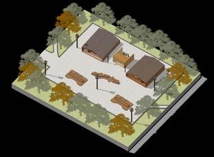
This area utilizes the existing canopy structures but redistributes them along the established desire lines. In addition, it introduces outdoor sports facilities. It is intended for families within the resident community.
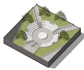
This area introduces an inset amphitheatre at the junction between the soft scpae and the hardscape. It is intended to be utilized by Carleton students as well as residents for public cultural performances and festivals.
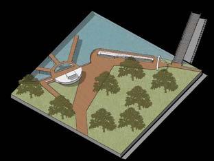
Due to its proximity to Carleton University and the Rideau Canal, this area introduces boating activities for the summer. It is also intended to serve as the entrance to the park from Carleton University.
This area is embedded within the most forested area of the Park. After researching, it was noted that the area had the development potential for camping grounds. In addition, it also acts as a pitstop on the park trail.
the pedestrian path outlines the central gathering space before terminating at the NCC Cultural Aand offering a new unique level of interaction for the market stalls.
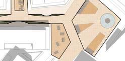
The Path is also surrounded by urban open spaces to allow for traders and shop owners to bring their store out onto the street. The open spaces are lined with beautiful murals and storefronts to animate the cultural life at grade.
PLYMOUTH AND BRONSON
2023 Terraviva Tactical Urbanism Competition | Finalists Ottawa, Ontario
IKEMEFUNA ONYIUKE w/ Sarah Cichon + Charbel Gangnon + Ken Gill + Amos Stapper
ROLES: Co-designer, planner
DATE: 2023
The challenge of this competition is to imagine more inclusive, safe, resilient, and sustainable public spaces. Exploring the potentialities of Tactical Urbanism, designers are encouraged to propose ingenious and unconventional projects capable of transforming a public space with a hidden potential, an underused urban area or even a neglected residual plot. There are no restrictions regarding the neighbourhood, town or city where you should develop your intervention. The possible locations are endless and what really matters is the reason why you have chosen a specific one. Designers are therefore encouraged to support the selection of a particular site thought the project itself.
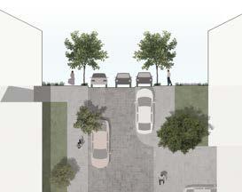
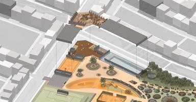
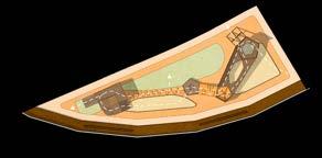
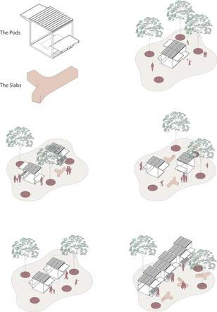
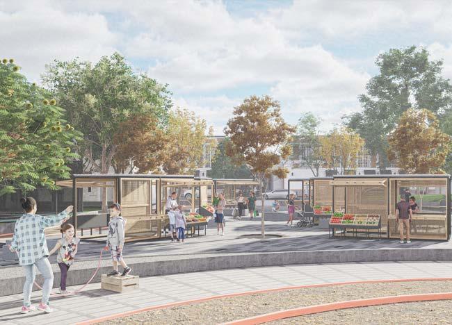
Project Bronson is a tactical intervention on an underutilized snow collection lot in a student-populated area close to Carleton University. It was designed to improve the everyday lives of those living in this community by addressing transit waiting areas. However, it goes beyond this by suggesting community building spaces as well.
The main program for the site is the marketplace. A transformable paved area containing multiple pods in which vendors can sell items in the summer and for students to study in the fall.
Project Bronson is located in a predominantly student neighbourhood. The proposed plot is currently an empty lot used for snow collection in the winter. The land is utilized for less than half the year and obstructs students from public transit.
Thus, we aim to create an interactive hub for all residents in the area. Focusing on accessible transit, we created a large path through our site which connects two sides of the neighbourhood to the bus stop. Our interactive urban design allows for numerous activities such as a multi-use marketplace, a native wildlife-friendly community garden, and a basketball court.
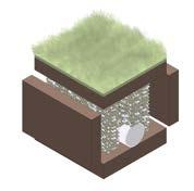
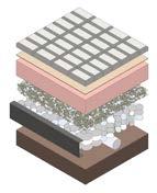
Surrounding the path, a green lawn encloses our lively space, allowing for it to be used for snow collection as it is now. we decided that the lawn should be a hill and that our path contains French drains and open pavers. This will allow for water to flow away from our path creating a dry space to walk.
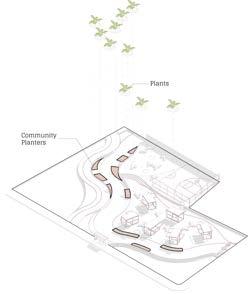
The plant initiative seeks to create a community garden through planters along the space's walking path. It aims to create a community bonding experience that fosters urban horticulture by encouraging neighbourhood residents to come together and plant native wildlife-friendly plants/ trees. A full list of recommended plants will be made available on-site. This list will include non-invasive plant species recommended by the government of Ottawa, such as:
Wild strawberries
Fragaria Virginia Purple
Flowered Raspberries
Rubus Odoratus Pin Cherry trees
Prunus Pennsylvania
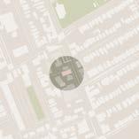
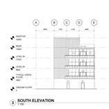
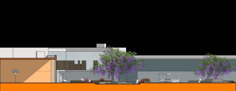
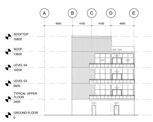
New Multi-use Building Development Ottawa, Ontario
IKEMEFUNA ONYIUKE w/ Venus Chau, Ava Appleby, Jack Dawson, Brooke Faith
ROLES: Co-designer
DATE: 2023
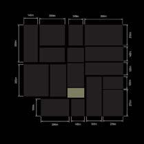
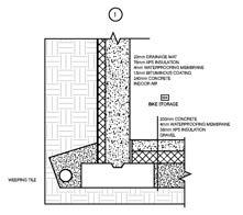
The properties at 646, 642, 638 Somerset St. West are slated to be developed into a new multi-use building. It is currently zoned TM (Traditional Main Street) and the developer is looking to maximize the buildable area. The total floor area will be approximately 500-600 sq.m. with 4-6 floors above grade and 1 level of basement parking. The ground floor will have commercial space which will be rented out at a later date. The new building must be designed to conform to the existing by-laws. For this phase of the application the building will be a 'Core & Shell" building which will assume that the owner will construct the building and then do interior renovations at a later time to divide up the space. Therefore, only essential interior spaces are required for this phase.
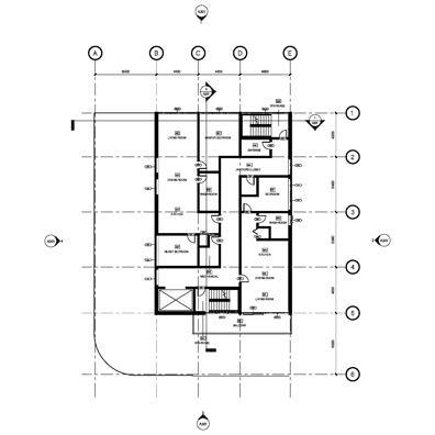
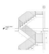
TYPICAL UPPER | PLAN
BASEMENT | PLAN
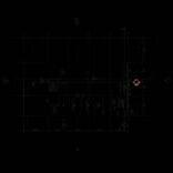
GROUND | PLAN
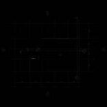
ROOF | PLAN
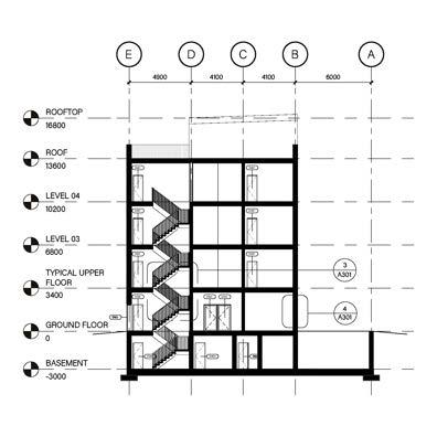
TRANSVERSE | SECTION
FOUNDATION | DETAIL