10 XI November 2022 https://doi.org/10.22214/ijraset.2022.47389
ISSN: 2321 9653; IC Value: 45.98; SJ Impact Factor: 7.538
Volume 10 Issue XI Nov 2022 Available at www.ijraset.com

ISSN: 2321 9653; IC Value: 45.98; SJ Impact Factor: 7.538
Volume 10 Issue XI Nov 2022 Available at www.ijraset.com
1
M.Tech Scholar, 2Assitant Professor, CED, School of Engineering and Technology, Sandip University, Nashik, India
Abstract: The increasing vehicular traffic on roads is growing issue in today’s life. This leads to the congestion on the streets and degrades safe and efficient movement of traffic. This is becoming an important issue in the urban premises. It is observed that traffic congestions take place majorly at the intersections where the entering and exiting traffic from the towns to the highways creates conflicts due to improper movement. This study intended to examine flow of traffic at an intersection on Badlapur Katai road in state of Maharashtra. The location is a part suburban areas of Mumbai metropolitan city. The Majority population is of working class also the industrial development in this area is high due to MIDC and thus the road carries huge traffic during peak hours. The study comprises of collection of the current traffic volume data, projection of the traffic for next 20 years and analysing the intersection for its serviceability. The outcomes may show the requirement of improvement of intersection as grade separated intersection.
Keywords: Badlapur, Katai, traffic, Congestion, Grade separation, Intersection Design, Improvement.

Intersection design influences the capacity of the corridor and the safe movement of conflicting directions. The pattern of the traffic movements at the intersection and the volume of traffic on each approach, during on peak period of the day determine the lane widths required including the auxiliary lanes, traffic control devices and channelization, wherever necessary. The arrangement of the islands and shape, length of the auxiliary lanes also differs based upon the type of intersection. The general design principles of intersection design are the approach speeds, restriction on available land, sight distance available and the presence of the larger volume of all the road users in urban areas, although it is necessary that there should be an application of the knowledge about the local conditions while interpreting and arriving at the solution in terms of design. Intersections should have uniform design standards so that even a new comer in the area anticipates what to expect at the intersections.
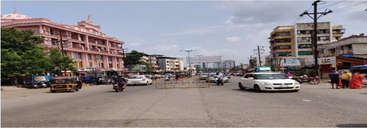
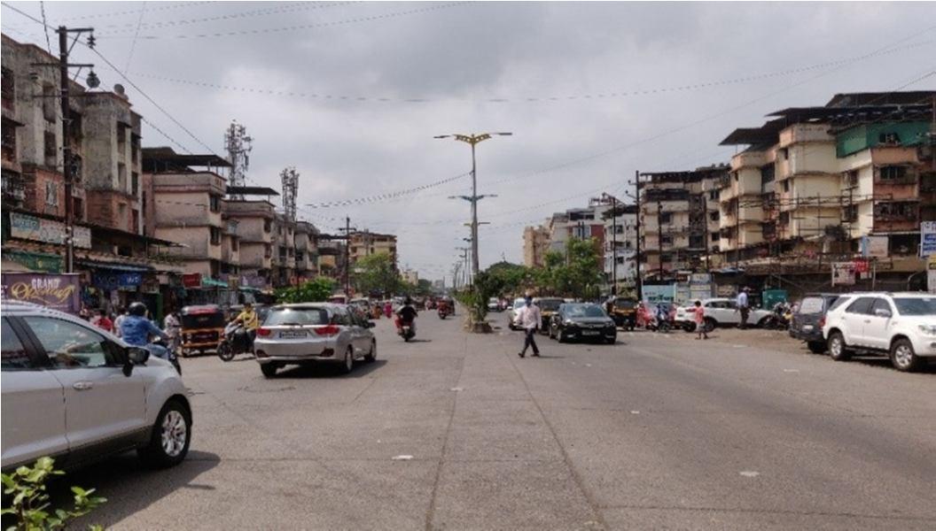
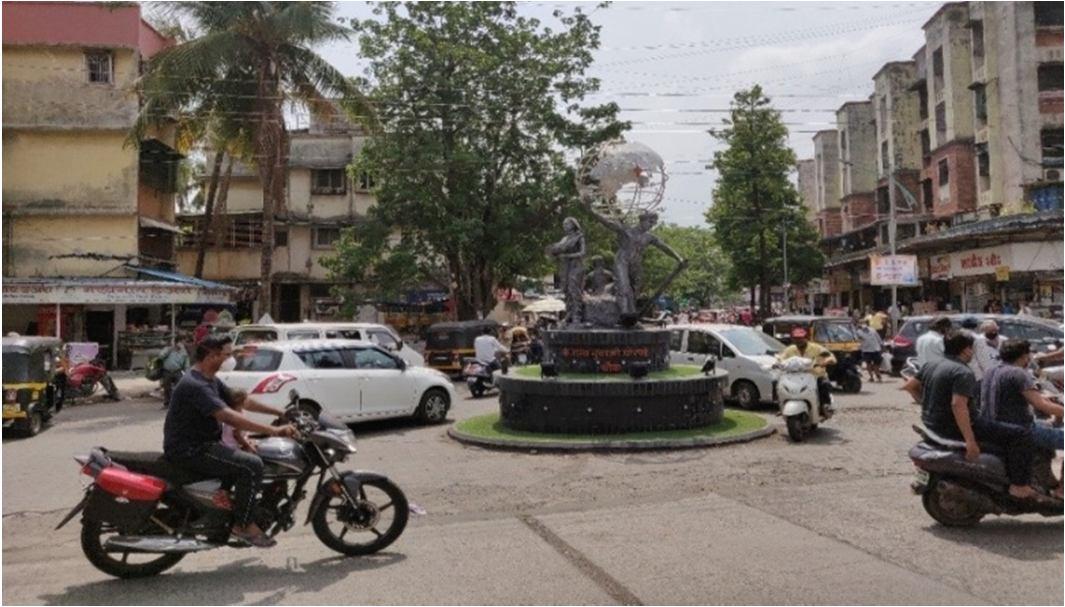
Badlapur has become rapidly growing place attracting large traffic movement due to both residential and industrial development in its vicinity. The Badlapur Katai road is the major link carrying huge traffic of light as well as heavy type of vehicles from Mumbai to suburban areas. Additionally, it is also carrying traffic towards Pune generated from central portion of Mumbai suburban. Ghorpade Chowk is the important junction on the road where major merging of traffic from Badlapur Town happens which leads to congestion. So there is need of proper study and upgradation of the intersection.
The primary objective is to study the traffic condition at the intersection in the statistical form and to evaluate the performance of the intersection on the basis of the parameters such as Vehicle travel time. This can be done using the VISSIM software. Some necessary improvements at the intersections are also proposed in this thesis considering the future growth of the traffic at the particular locations.
A. To analyses the current traffic flow at the intersection. The assessment of performance of the existing intersections is a necessary step in view of achieving the congestion free traffic movement at the intersection. Hence the current intersection layout is being analyzed for its performance. This can be done with help of the traffic count surveys and the simulation models.
ISSN: 2321 9653; IC Value: 45.98; SJ Impact Factor: 7.538 Volume 10 Issue XI Nov 2022 Available at www.ijraset.com
B. To analyse the intersection for projected traffic conditions. The traffic congestion issues are going to increase in the coming future. Hence it is necessary to evaluate the intersection for the future traffic conditions. Hence traffic projection becomes essential step. This objective can be achieved with help of suitable traffic growth factors. Further the intersection can be evaluated for future traffic conditions.
C. To reduce the number and severity of potential conflicts between cars, buses, trucks, bicycles and the pedestrians and minimize delay for through traffic. The primary reason behind the congestion at the intersection is the disturbance to the through traffic due to the local traffic and the pedestrians in the urban areas. Hence this objective can be achieved by proposing improvements such as signalized junction or rotary junction or grade separated intersection. The pedestrian’s safety is also a major consideration while designing any intersection in urban areas.
D. To find usefulness of the simulation software VISSIM in designing of roads. The above mentioned objectives are achieved on the basis of the evaluation of the design with help of the simulation model created using the VISSIM software. Hence to analyze the usefulness of the simulation software in view of cost saving and time saving is the objective of this thesis.
After analyzing the problem statement and going thoroughly through the context and the need, existing literature review has been done to get an essence of the required research. This work was supportive to fix the outline of the work, which is to be carried out. As observed from the brief review of existing literature, many studies have incorporated their work on analyzing the roundabouts or other complex type of intersections for their efficiency or the performance. But there was very petite work observed to be done on the straight sections of roads, especially within the cities.
The intercity roads connecting the major areas of the city are prone to face lots of congestions, not only during peak hours, but also during off peak hours. The lateral interactions of such straight road sections result into deprived capacity of the system, with unexpected delays experienced by the users which are the failure of the system design. Hence, a proper study is to be done in order to understand the complex behavior of traffic.
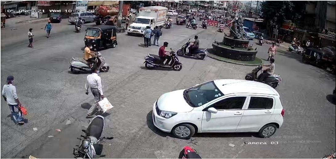
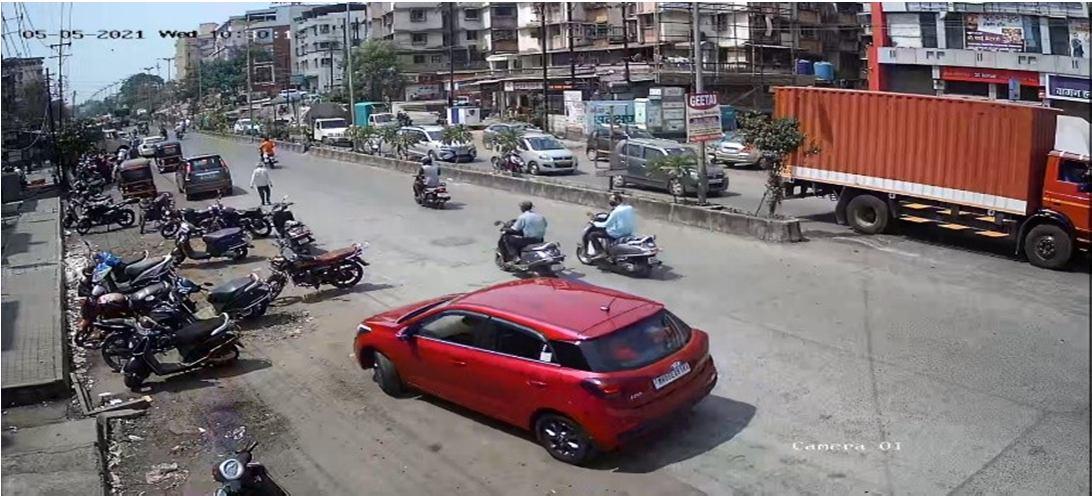
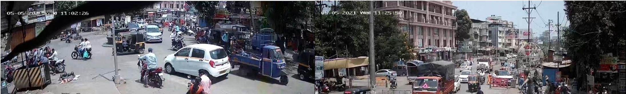
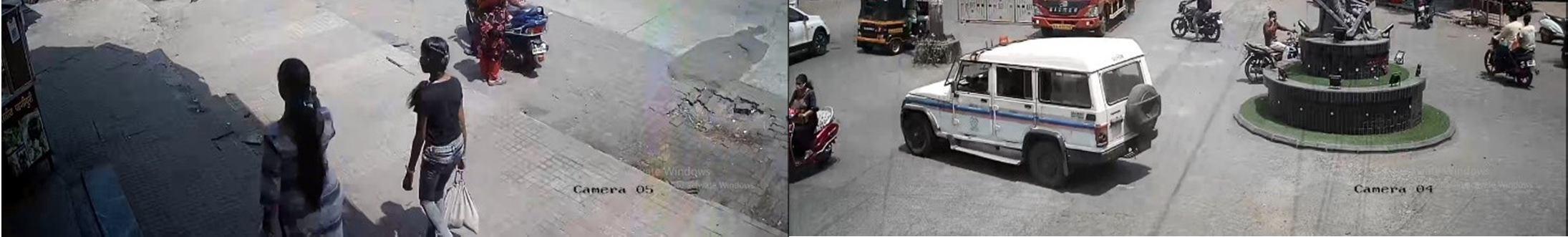
A junction location was selected in the present study. The study section was a 3 arm junction carrying traffic from city to the highway. For this video graphic data collection method was used. A wide lens cameras were placed at junction location on pole for a clear view of the vehicles. This data was analyzed manually. The fundamental traffic parameters such as volume and density data were extracted from the video on a wide screen. The overall traffic was converted into five main types of vehicles for ease in the analysis, namely two Wheeler (2W), Car, Bus and Heavy Goods Vehicle (HGV). One category of vehicle was extracted at a time, to avoid the possible errors. Further, these parameters of traffic were modelled in to simulation software PTV VISSIM. From this data vehicle travel time was calculated to cross the junction in all directions for current scenario. The proposal showing Solution to the traffic congestion is developed following the guidelines from IRC code. The Proposed improvement is designed so as to accommodate the proposed improvement within available ROW. The proposed improvement is then re verified with vehicle travel time data using VISSIM software.
The project site was visited and details such as road width, adjacent buildings, Type of land use and other connectivity to the road are identified. Existing cross sectional details are taken by measuring with tape. The road components such as median, carriageway, paved shoulder, soft shoulder, Road side drain are measured. The type of approach road is identified and it’s graded accordingly. The DP map available at the corresponding Municipal Corporation can be utilized for Identifying the exact ROW.
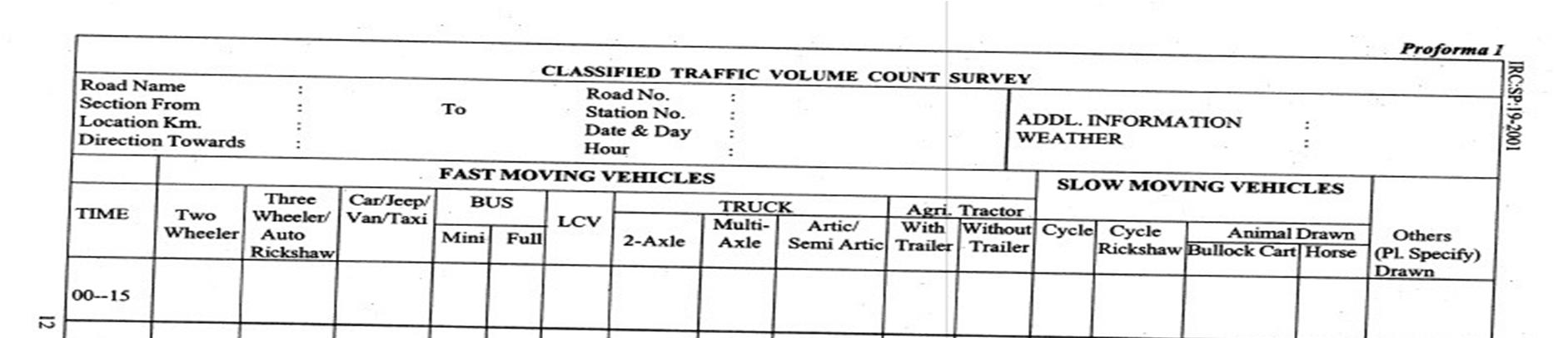
The Intersection volume count survey is done to understand traffic characteristics of each arm of intersection and to assess the need of signal control, grade separator etc. Intersection volume count survey was carried out junction on the project highway. The traffic on all arms is then checked to satisfy IRC specifications for signalization and for Grade separator if required. If the total peak hour traffic at intersection is more than 10,000 PCU/hr., then grade separator is warranted.
ISSN: 2321 9653; IC Value: 45.98; SJ Impact Factor: 7.538 Volume 10 Issue XI Nov 2022 Available at www.ijraset.com
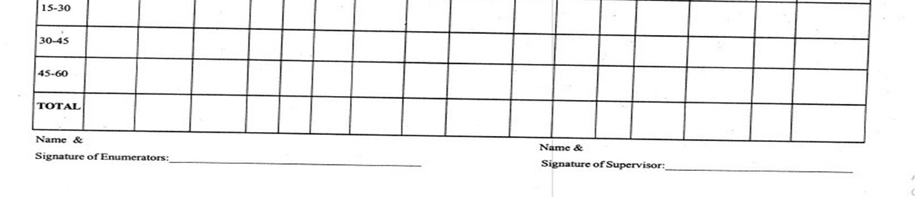
The one day traffic count is to be performed at the Intersection collecting the details of all the vehicles coming from each arm. The data is collected for 24 Hrs. at 15 min interval as per the Guidelines of the IRC: SP: 19 2001.The collected data is compiled in per Hour format to obtain Average Daily Traffic and Peak Hour Traffic data at the Intersection.
The traffic data is also projected for assessing the future growth of the traffic. The Growth rates shall be produced on the bases of historical data like vehicle registration data from the local authority. In case of unavailability of the historical data growth rate of 7.5 can be adopted as per the guidelines in IRC: SP: 90 2010. In case of Grade separated structure the design life of 20 years shall be taken in consideration.
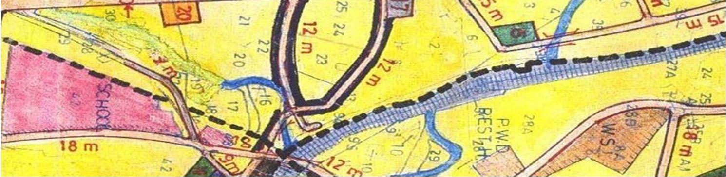
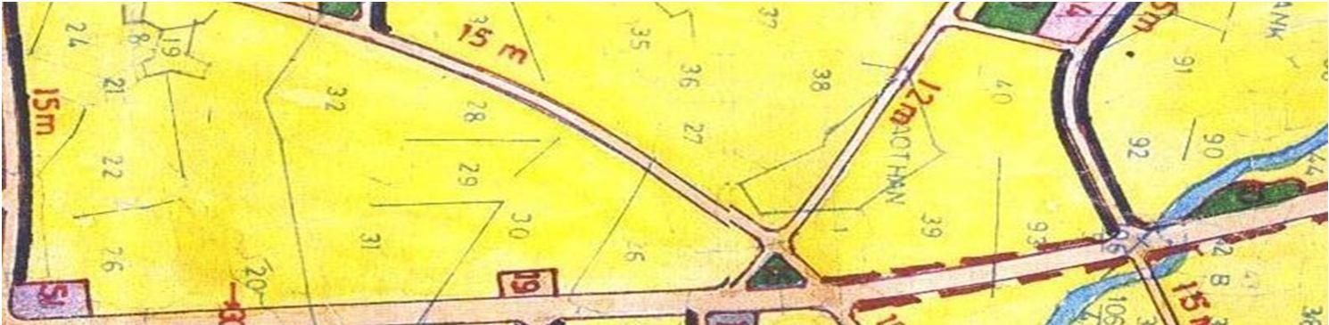
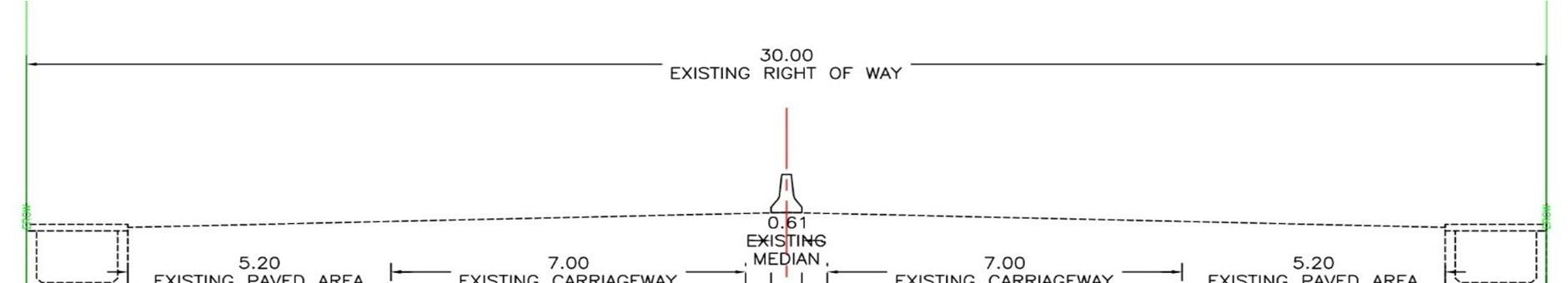
The governing body at the study area is Kulgaon Badlapur Municipal Corporation. The Major road passes through the Town acting as the important 4 lane road. This road carries heavy traffic towards Pune via Karjat Link road. The road improvements are usually done within the existing available ROW i.e. Right of ways. But in case of heavy Traffic conditions for the widening purpose of the road additional land can be acquired by the road development authorities. But that includes huge cost of land acquisition. The ROW details of this major road are derived from the DP map. The DP map obtained from the website of the Kulgaon Badlapur Municipal Corporation shows the DP width of the Badlapur Katai Road passing through the town to be 30m.
ISSN: 2321 9653; IC Value: 45.98; SJ Impact Factor: 7.538 Volume 10 Issue XI Nov 2022 Available at www.ijraset.com
3.00 AM 4.00 AM 405 803 206 118 184 309 2025
4.00 AM 5.00 AM 570 610 240 199 139 526 2284
5.00 AM 6.00 AM 770 753 167 231 203 469 2593
6.00 AM 7.00 AM 1075 872 234 240 566 509 3496
7.00 AM 8.00 AM 1731 1694 572 437 767 620 5821
8.00 AM 9.00 AM 1771 2282 585 758 573 1098 7067
9.00 AM 10.00 AM 2083 1702 710 661 479 1009 6644
10.00 AM 11.00 AM 1928 1723 939 758 491 973 6812
11.00 AM 12.00 PM 2114 2261 757 831 680 905 7548
Tota l 32776 36777 8386 9489 8822 14027 110277
%Trafficw.r.t.total Traffic 29.72 33.35 7.60 8.60 8.00 12.72 100.00
Name of Intersection: Ch : Ghorpade Chowk
Date of Survey : 03/05/2021 04/05/2021
Peak Hour Time Peak Hour Traffic Peak Hour Traffic
From To 7667 7548
Day : MONDAY 11.00 AM 12.00PM Veh./ Hr PCU / Hr Traffic Direction Vehicles per Day PCUper Day
Arm From To
Peak Hour Traffic
% Peak Hour Trafficin each direction
Peak Hour Traffic
% Peak Hour Trafficin each direction
1 To 3 Karjat Ambernath 20081 32776 2007 26.18 2114 28.01
3 To 1 Ambernath Karjat 37306 36777 2085 27.19 2261 29.95
2 To 1 Badlapur Karjat 6778 8822 807 10.53 680 9.01
1 To 2 Karjat Badlapur 12851 14027 1095 14.28 905 11.99
2 To 3 Badlapur Ambernath 6269 8386 947 12.35 757 10.03
3 To 2 Ambernath Badlapur 7747 9489 726 9.47 831 11.01 Total Traffic in All arms 91032 110277 7667 100.00 7548 100.00
The above table indicates that the total traffic of 110277 PCU/Day crosses across the intersection. The major traffic flow is between Ambernath Karjat & Karjat Ambernath, which combined covers 63.07% of the total traffic. Whereas this traffic gets interrupted due to traffic entering and exiting traffic from the Badlapur town which is 36.93%. The traffic required to evaluate the performance of the intersection is in terms of the Peak Hour Traffic. Hence the peak hour has been identified from the collected data. The details of the peak hour taffic are as follows. It is found that the peak hour is between 11AM to 12PM in the Day. During the peak Hour the total traffic at junction is 7548 PCU/Hr. Even when the major road is 4 lane road but the Approach road from the town is only 12m wide DP road traffic congestion causes a lot of time for vehicles to cross the junction.
ISSN: 2321 9653; IC Value: 45.98; SJ Impact Factor: 7.538 Volume 10 Issue XI Nov 2022 Available at www.ijraset.com
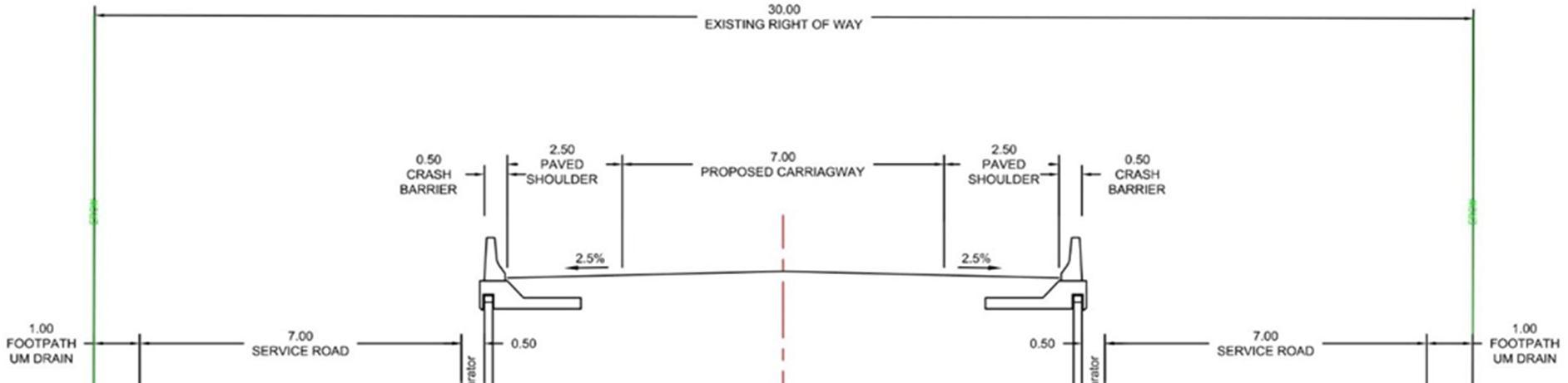
The existing toad is a 4 lane road, hence as per the Manual for 4 Lanning, IRC: SP:84 2019 a 6 lane grade separator (VUP) shall be provided with 2 lane service roads on the both sides. Since the road is crossing through a densely habituated area widening of the right of way is not possible. If the VUP is designed as per the IRC standards the required width of the Road will be higher than the existing DP width of 30m. Hence substandard geometry is proposed. Following is the TCS showing the proposed improvements.
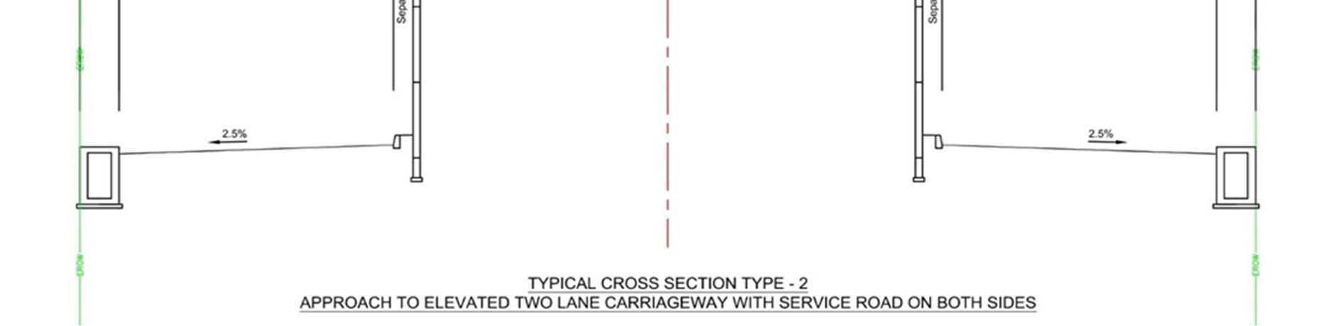
The VUP having 2 lanes with paved shoulder is proposed to carry the through traffic betweenKarjat & Ambernath. Also 2 lane service road is proposed on both sides of the VUP along with Footpath cum drain to carry the storm water. This will eliminate the 60% traffic from getting disturbed at the junction as the VUP will offer the free flow to the through traffic. The only movements that will occur at grade are of entering and exiting traffic from the Badlapur Town. Following are the Plan & Profile diagrams of the proposed VUP at Ghorpade Chowk Intersection of Badlapur Katai road with Old DP road. The Horizontal as well as the vertical geometry is design for a design speed of 80kmph. The Proposed VUP is having width of 20m and the Vertical clearance of the VUP is of 5.5m. The total length of the separator is of 700m. The service roads will meet the DP road at the junction. Minimum turning radius of 15m is given at the junction to get the clear sight at the junction. Proper installation of the road signs boards and the road markings is necessary to get the most efficient performance of the VUP. Now to check the efficiency of the intersection the vehicle travel time test shall be performed for this design with projected traffic.
The Travel time taken by the vehicle too cross the junction in existing scenario and in case of the proposed improvements scenario has been compared to get the idea about the efficiency of the improvements. Following is chart showing details of vehicle travel time.
Name From To Travel Time for ExistingJunction Design (sec.)
Travel Time for ProposedJunction Design (sec.)
Savingin Time (sec.)
A Ambernath Badlapur 59.03 78.55 19.52
B Ambernath Karjat 42.87 NA
C Badlapur Karjat 208.01 126.70 81.31
D Badlapur Ambernath 241.79 165.09 76.70
E Karjat Ambernath 96.70 NA
F Karjat Badlapur 164.04 27.75 136.29
ISSN: 2321 9653; IC Value: 45.98; SJ Impact Factor: 7.538 Volume 10 Issue XI Nov 2022 Available at www.ijraset.com
It is seen that even after increase in the volume the travel time taken by the vehicles on 5 directions out of 6 is reduced. Hence this can be considered as the possible solution for the traffic. Further the first direction i.e. Ambernath Badlapur the vehicle travel time is seen to be increasing this problem can be solved by providing dedicated left turning lane as chainage 0+300 Km. as an existing DP road is connecting to major highway and goes parallel to the approach road.
It is found very much helpful to make use of simulation software such as VISSIM for getting the fare idea about the performance of the design on the basis of various parameters.
At the end of my dissertation, it is a pleasant task to express my thanks to all those whocontributed in many ways to the success of this study and made it an unforgettable experience forme.
I would like to express my sincere gratitude to Mrs. Madhuri Nikam for his excellent guidance and continuous encouragement during course of my work. I truly appreciate for his vast knowledge and delight supervision and advice.
My special thanks to Prof. Dr. P. L. Naktode Head of Civil Engineering Department forhis constant inspiration and all the facilities provided to successfully complete this work.
I would also like to thank Prof. Dr. Anil Maheshwari Dean of the Institute who has provided me this opportunity to present this seminar.
I would also like to thank to all the faculty members of the department for their valuableguidance and support during the course of my work. Also, I would like to thank all my friends whohave directly or indirectly helped me in my project work throughout the course.
[1] T. R. Morais Et al., "Road Intersection Analysis Case Study in a Intersection in the City of Palmas TO7" International Journal of Advanced Engineering Research and Science (IJAERS) [Vol 6, Issue 7, Jul 2019].
[2] Kartikeya Jha Et al., "Modeling Growth Trend and Forecasting Techniques for Vehicular Population in India" International Journal for Traffic and Transport Engineering, 2013, 3(2): 139 158.
[3] Geethu Lal Et al., "Sustainable Traffic Improvement for urban Road Intersections Of Developing Countries: A Case Study of Ettumanoor, India" Global Colloquium in Recent Advancement and Effectual Researches in Engineering, Science and Technology (RAEREST 2016).
[4] Mira Patel "Solution for Reduction of Traffic Congestion: A Case Study of Thaltej Rotary Intersection" International Journal of Applied Engineering and Technology ISSN: 2277 212X (Online) 2014 Vol. 4 (1) January March.
[5] H. J. Ruskin Et al., "Modeling Traffic Flow at an Urban Unsignalized Intersection" Conference Paper in Lecture Notes in Computer Science · April 2002, School of Computer Applications, Dublin City University, Dublin 9, Ireland.
[6] Tolu Isaac Atomode Et al., "Assessment of Traffic Delay Problems and Characteristics at Urban Road Intersections: A Case Study of Ilorin, Nigeria" IOSR Journal of Humanities and Social Science · January 2013.
[7] B. Maitra Et al., "Modeling Traffic Impact of Flyover at an Urban Intersection Under Mixed Traffic Environment" European Transport \ Trasporti Europei n. 27 (2004): 57 68.
[8] Sharukh Marfani Et al., "Traffic Improvement for Urban Road Intersection, Surat" International Research Journal of Engineering and Technology (IRJET), Volume: 05 Issue: 03 | Mar 2018