
10 VII July 2022 https://doi.org/10.22214/ijraset.2022.45927

I. INTRODUCTION
Design of Water Supply Scheme: A Case Study of Nangargaon Village
In the selected Village, there is scarcity of water to overcome this problem we are going to design water supply scheme as well as suggesting measures for recharging of borewell and spring in this area.
B. To study existing water supply arrangement. C. To estimate the quantity of water required for the users in Selected Village. D. To estimate the quantity of water available in the selected source. E. To propose the location of storage tank of required capacity to meet the gap between required water & available water.
International Journal for Research in Applied Science & Engineering Technology (IJRASET) ISSN: 2321 9653; IC Value: 45.98; SJ Impact Factor: 7.538 Volume 10 Issue VII July 2022 Available at www.ijraset.com 4178©IJRASET: All Rights are Reserved | SJ Impact Factor 7.538 | ISRA Journal Impact Factor 7.894 |
Mr. Vidyanand S.Kadam1 , Mr. Satish S.Kotwal2 , Mr. Mayur M. More3 , Mr. Nitish A.Mohite4 , Patil Rutuja K.5 , Gavate Sourabh D 6 , Mohite Sneha S 7 , Pawar Ashitosh E 8 ,Desai Prashant H.9 1, 2, 3, 4Assistant Professor, Department of Civil Engineering, BVCOE, Kolhapur 5, 6, 7, 8, 9B.Tech. Students Department of Civil Engineering, BVCOE, Kolhapur
A. To supply safe and wholesome water to consumers.
The total volume of water on Earth is estimated at 1.386 billion km³ (333 million cubic miles), with 97.5% being salt water and 2.5% being fresh water. Of the fresh water, only 0.3% is in liquid form on the surface. Providing safe drinking water for the entire population in the country has become a challenging task of the Governments and all Sector Institutions. In order to fulfil the water demand of the continuously growing population we need to provide the sufficient and uniform quantity of water through the designed network of pipes is known as water supply. In most rural communities in India, the prevailing water supply conditions are very different from urban installations. Usually, the number of people to be served by such a water supply scheme is small and the low population density makes piped distribution of the water costly. On the other hand, rural population often is very poor and, particularly in subsistence farming communities’ little money can be raised. Thus, in providing water supply systems to rural communities, factors such as organization, administration, community involvement and finance are properly blended in order to achieve an economical water supply system.
The general features of the area like information about the main water source, population of the area, demand of water, requirement of the pumps, distribution network and water tanks are essential for efficient design of water distribution system. Existing source of water is limited hence in an order to provide deficient quantity of water by borewell recharging and ground water recharging for spring. Also roof top rain water harvesting potential is estimated. It can be used in case of scarcity.
II. OBJECTIVES
Abstract: Design of water supply scheme in around Rural Areas. During classify toward fulfil the water command of the constantly rising population, it is necessary toward supply the plenty with consistent capacity of water through the designed system of pipe. intended for this use the particulars provide via the IPH (Irrigation and Public Health Department) department, the common features of the region similar to in order on the chief water basis, population of the region, insist of water, requirement of the pumps, distribution network and water tanks are essential for efficient design of water distribution system. Water distribution system deals with the supplying of potable water for a village which can be useful for both drinking and wholesome purpose. The main stages of distribution system are collection works, transmission works, purification works and distribution works. It includes estimation of future population (population forecasting) by using various methods, layout of pipes and design of valves and joints, finding out the head losses etc.
Keywords: Water supply scheme, Water distribution system, supplying potable water ,QGIS, Watershed management


International Journal for Research in Applied Science & Engineering Technology (IJRASET) ISSN: 2321 9653; IC Value: 45.98; SJ Impact Factor: 7.538 Volume 10 Issue VII July 2022 Available at www.ijraset.com 4179©IJRASET: All Rights are Reserved | SJ Impact Factor 7.538 | ISRA Journal Impact Factor 7.894 | III. METHODOLOGY
Conclusionand
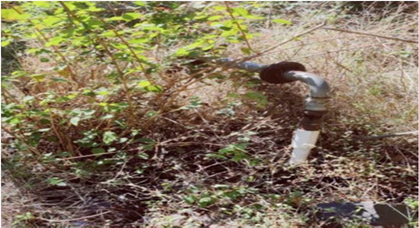
FIG 5. Existing Bore well
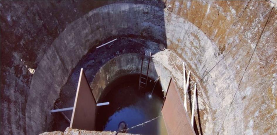
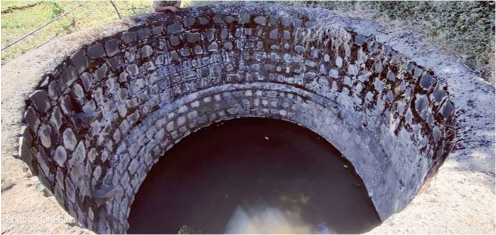
FIG 3. Existing Jack well FIG 4. Existing Spring
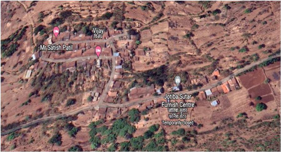
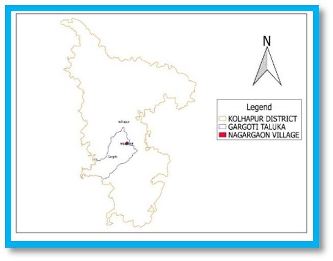
FIG 1. Geographical Map of Nangargaon village, Tal. Bhudargad, Dist. Kolhapur
The village Nangargaon is selected for Design of water supply scheme. Area of Nangargaon village situated at a distance of about 10 km from the Gargoti, Taluka Bhudargad and District Kolhapur. At present the main water resource of the study area is Well and Borewell. The village of Nangargaon is divided into various zones for proper distribution of water. The economical water distribution system is designed in present study for village. The area of the village is about 591 Ha and population of village is 1463 peoples as per 2011 census of India. There are 230 houses in this village and they are divided into four lanes. We had a visit to Nangargaon village and have collected some information regarding this village. Population count in this village is around 1463 people only (census of India 2011). No of houses situated there are around 230 houses 591 hector area of village. Village is located at hilly station. The village have water supply source form well & borewell & spring for the other sources. & borewell & spring for other sources & borewell is for drinking water. Where, borewell & spring is situated at downstream side & village. Water of well & borewell is first collected in the ESR by 10 Hp pump & then distributed to the village by gravity. ESR is from 30 feet high above ground level. The village have dead end pipe connections, almost 108 pipe connections are there among which the pipe from jack well line is of PVC pipe.
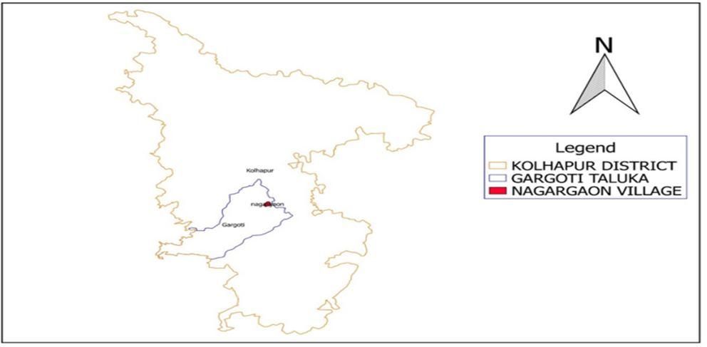
FIG 2. Location Map
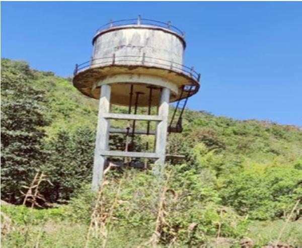
FIG 6. Existing ESR Selection of study area. Collection of data. Data analysis. Rechargingtechnique of Borewell and Spring Result
International Journal for Research in Applied Science & Engineering Technology (IJRASET) ISSN: 2321 9653; IC Value: 45.98; SJ Impact Factor: 7.538 Volume 10 Issue VII July 2022 Available at www.ijraset.com 4180©IJRASET: All Rights are Reserved | SJ Impact Factor 7.538 | ISRA Journal Impact Factor 7.894 | A. Population Forecasting For Nangargaon Village Immediate stage population is considered in 2021 and ultimate stage population is considered in 2061 by considering a design period of 50 yrs. Table 1: Population Data YEARS POPULATION 1991 492 2001 650 2011 876 Table 2: Estimation of Population Sr. No. Methods POPULATION 2021 2031 2041 2051 2061 1 Arithmetical Method 1068 1200 1452 1644 1836 2 Incremental Increase Method 1168 1559 2050 2446 3704 3 Geometric Increase Method 1137 1331 1526 1722 1919 B. Water Budget Calculation Demand of Water: The standard norm for demand are given below: Types of Domesticdemand:purpose = 55 60% of total demand. Civic or public purpose = 5 10%of total demand. Industrial demand = 10 20 % of total demand. Institutional & commercial demand = 5 10 % of total demand. The demand of water is calculated as per standard norm as 135 litres/capita/day and all other demands like civic, institutional, business of the village are also considered as per standard norms. C. Requirement of Water Supply for Nangargaon Village 1) Water requirement at immediate stage 2021 will be = 152 m3/day. 2) Water requirement at ultimate stage 2061 will be = 336 m3/day. 3) Therefore, water requirement at ultimate stage in whole year =0.122Mm3 D. To Study of Available Water 1) Available water in summer season (Month May) 360000 lit. 2) Actual required water in summer season (Month May) 3547800 lit. 3) Difference in Required water and Actual water 3187800 lit. Table 3: Drinking Water Quality Test of Existing Sources Sr. No. Characteristics Spring Borewell Lake DesirableLimits Units 1 Turbidity 4.8 3.53 4.1 5 NTU 2 Colour 5 Hazenunit3 Odour Unobjectionable Unobjectionable Unobjectionable Unobjectionable4 Taste Agree. Agree. Agreeable 5 PH Value 6.53 8.32 7.56 6.5 to 8.5 6 Total Hardness 126 156 167 300 Mg/L 7 Chlorides 185 223 196 250 Mg/L 8 Dissolved Solids 250 315 412 500 Mg/L 9 Nitrogen content 33 36 44 45 Mg/L 10 Alkalinity 185 175 181 200 Mg/L 11 Residual Chlorine 0.13 0.35 0.39 0.2 ppm
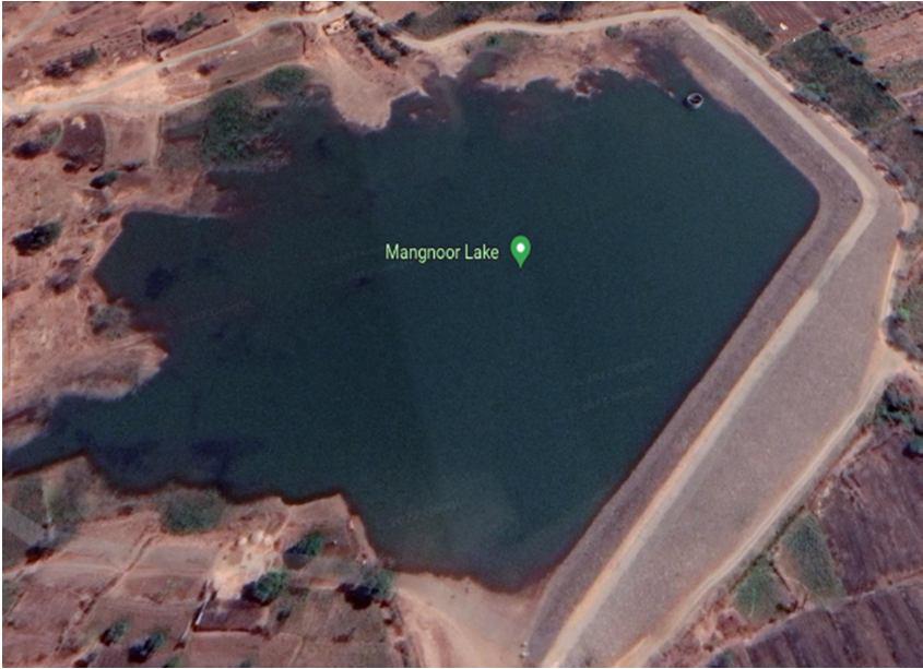
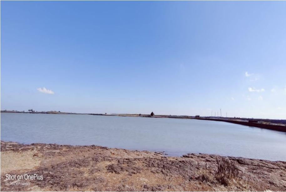
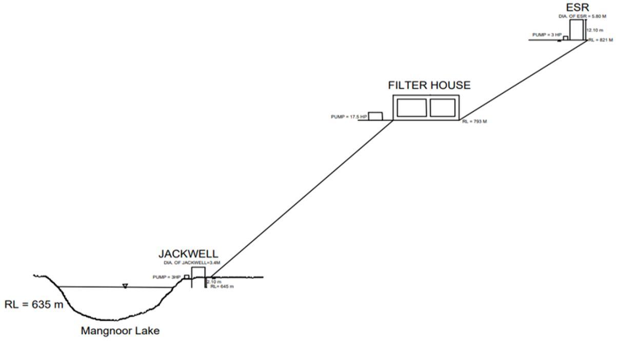
International Journal for Research in Applied Science & Engineering Technology (IJRASET) ISSN: 2321 9653; IC Value: 45.98; SJ Impact Factor: 7.538 Volume 10 Issue VII July 2022 Available at www.ijraset.com 4181©IJRASET: All Rights are Reserved | SJ Impact Factor 7.538 | ISRA Journal Impact Factor 7.894 | E. Selection of Source for Scheme FIG 7. Geographical Map of Mangnoor Lake FIG 8. Mangnoor Lake F. Layout of Whole Structure FIG 9. Layout of Whole Structure G. Head Calculation And Provision Of Pumps 1) Source of water : Existing lake 2) Head of the Jack well from the lake level : 40m 3) 3HP 3 stage pump of model V6. This pump having capacity of 450 LPM 4) Filtered water is transferred to E.S.R. 5) Head from the filter house : 38m (calculated) 6) 3HP 3 stage pump which have 170LPM of capacity for distribution of water FIG 10. Layout of Filter House


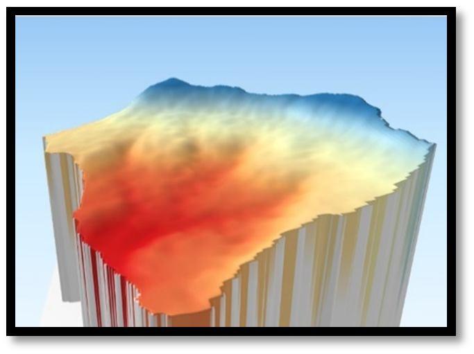
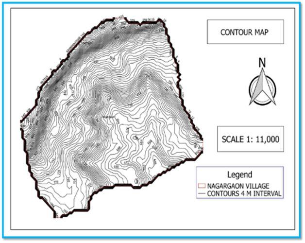
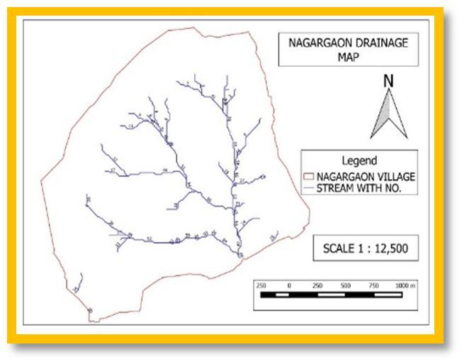
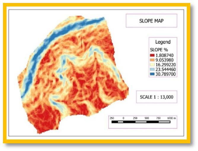
International Journal for Research in Applied Science & Engineering Technology (IJRASET) ISSN: 2321 9653; IC Value: 45.98; SJ Impact Factor: 7.538 Volume 10 Issue VII July 2022 Available at www.ijraset.com 4182©IJRASET: All Rights are Reserved | SJ Impact Factor 7.538 | ISRA Journal Impact Factor 7.894 | H. Watershed Development Plan in The Catchment Of Source (Spring & Bore Well) 1) Watershed: A watershed ‘which is an independent hydrological unit can be defined as the drainage basin or catchment area of a particular stream or river. 2) Watershed management: One of the definitions of watershed management is “the process of creating and implementing plans, programs, and projects to sustain and enhance watershed functions that affect the plant, animal, and human communities within a watershed boundary. 3) Methodology a) MAPS: a. Digital Elevation Model (Alos Pulsar E trex(5m)), contour map, satellite image of USGS Landset 2 of Nangargaon village, Kolhapur toposheet from Bhavan. b) SOFTWARE: a GIS 2.10, b. Erdas 9.1. c) Global Mapper c) QGIS Swat Analysis: This was used to obtain all other maps like drainage pattern map, contour map, elevation map & stream line map. Maps Generated using QGIS software FIG 11. Location map FIG 12. Terrain map FIG 13. Stream line map FIG 14. Contour map FIG 15. Drainage map FIG 16. Slope map IV. RESULTS AND DISCUSSION Table 4: Result Sr. no Name of Structure NumberStructureof 1 Gabion Structure 13 2 Loose Boulder Structure 26 3 Check Dam 1 4 Farm Pond 1 5 Storage Reservoir 3

[3] Advance Reinforced Concrete Design IS 456 2000, By N Krishna Raju, Third Edition, CBS Publishers and Distributors.
[14] Nitish A. Mohite, Vinayak B. Patil,” Structural Analysis of Steel Transmission Tower for different Risk Coefficients A Case Study”, International Journal for Research in Applied Science & Engineering Technology, Volume 7 Issue VII, pp.1295 1300, July 2019.
[12] Nitish A. Mohite, Mayur M. More, Vidyanand S. Kadam, Satish S. Kotwal” Comparative seismic analysis study of G+ 20 story building with flat slab and conventional slab using ETABS”, International Journal for Research in Applied Science & Engineering Technology, Volume 9, Issue XI, pp.32 38,November 2021.
[20] Application And Validation of Regression Analysis in The Prediction of Stability Value In Cold Bituminous Emulsion Mix, Mayur M.More,Vidyanand S.Kadam International Journal of Advance Research In Science and Engineering, Volume 7, issue 1, Pages 210 218,2018
[19] Experimental Investigation of Effect of Shrinkage Reducing Admixture on Shrinkage Cracking of Concrete, Mayur M.More , Vidyanand S. Kadam , Satish S. Kotwal , Volume 7, Special Issue 01, March 2018
[16] Satish S. Kotwal, Vidyanand S. Kadam, Mayur M.More, Ananda S Patil, Nitish A Mohite ,” A Literature Review on Beam Column Joints with Different Loading Condition and Methods of Strengthening”, International Journal for Research in Applied Science & Engineering Technology, Volume 10 Issue V, pp.4017 4022, May 2022.
[8] Uzair (Sam) Shamsi “GIS Applications for Water Distribution Systems”
E. Along with these provisions we have suggested a plan for borewell recharging techniques and ground water recharging techniques for spring by using QGIS software.
V. CONCLUSION
[7] SS. Asadi, A.Ashok, Akhil Gurijala,. 2020. “A Study on Water Distribution Network in Around Rural and Urban Areas”. International Journal of Advanced Science and Technology.
D. We had designed now whole scheme of water supply to the village for that we pull up the water from the source of Mangnoor lake to the designed jack well for this we planned to provide a 3 HP of pump. This jack well of water then transferred to the designed filter house for this we have provide 17.5 HP of pump. Then filtered water is to be transferred to the ESR by 3HP of pump.
[18] Effect of Zone Factor on Seismic Parameters of RC Building , Satish S. Kotwal , Vidyanand S. Kadam , Mayur M. More ,International Journal for research and development in technology , International Journal of Advance Research In Science and Engineering , Volume 12,Issue 1, 2019
B. After visiting and observing this village, we come to know that there is scarcity of water in this village. The area consumed by this village is 591 Ha. and population of village 1463 as per 2011 census of India. There are 230 houses and they are divided into four lanes.
[13] Mr. Nitish A. Mohite, Mr. P.K.Joshi, Dr. W. N. Deulkar:” Comparative Analysis of RCC and Steel Concrete Composite (B+G+ 11 Storey) Building”, IJSRP Volume 5, Issue 10, October 2015 edition.
G. The filtration unit is designed with basis components as rapid sand filter and chlorination units. Also the structural design of filtration units is carried out.
[1] Water Supply Engineering Environmental Engineering (Volume 1) By Dr. B.C.Punmia
International Journal for Research in Applied Science & Engineering Technology (IJRASET) ISSN: 2321 9653; IC Value: 45.98; SJ Impact Factor: 7.538 Volume 10 Issue VII July 2022 Available at www.ijraset.com 4183©IJRASET: All Rights are Reserved | SJ Impact Factor 7.538 | ISRA Journal Impact Factor 7.894 |
[9] J. R. Julius, R. Angeline Prabhavathy, G. Ravikumar, ‘Rainwater Harvesting (RWH) A Review’, International Journal of Innovative Research & Development, May, 2013, Vol 2 Issue 5, pp. 926 937
[11] Joshi G.S & V. N. Mehta (2017) DESIGN OF RURAL WATER SUPPLY SYSTEM USING BRANCH 3.0 A CASE STUDY FOR NAVA SHIHORA REGION, INDIA.
C. After surveying all above the conditions of this village are come to know that the source having by this village should not fulfilled the water demand of the village Nangargoan. Hence, we decided to provide a proper water supply scheme to the village.
[2] Surveying Volume 1 by B. C. Punmia, Ashok Kumar Jain and Arun Kumar Jain
[15] Nitish A. Mohite, Vinayak B. Patil,” Response Spectrum Analysis of G+ 15 Story Building with and without Base Isolation System”, International Journal for Research in Applied Science & Engineering Technology, Volume 9 Issue V,pp.1265 1269, May 2021.
[10] Reference Book Environmental Engineering I WATER SUPPLY ENGINEERING By Dr. B. C. Punmia , Er. Ashok Kumar, Dr. Arun Kumar Jain.
F. The capacity of existing ESR is less Hence new ESR is suggested. 1 lack of capacity structural design of purposed ESR is done.
REFERENCES
[17] A Review Paper On Base Isolators Subjected to Near Field (NF), Far Field (FF) And Low Frequency Earthquakes, Mayur M.More , Vidyanand S. Kadam , Girish M. Malu , International Journal for research in applied science and engineering technology , Volume 9, Issue V,2021.
A. The project "Design of water supply scheme for rural area'' is related to the subject of water supply and irrigation engineering. The reason of choosing this subject is to fulfil the water supply demand in the selected village. This village is located in Taluka Bhudargad name Nangargaon where this village is facing water supply problems.
[21] Comparison Experimental & Analytical Results of Lightweight Reinforced Concrete Beam Strengthened with GFRP Strips, Gautam S. Adure, Mayur M. More, International Journal of Innovative Research in Science, Engineering and Technology, Volume 6, Issue1, Pages 219 226,2017
[6] Hydraulics Fluid Mechanics and Fluid Machines 9th Edition by S. Ramamrutham, Publisher: Dhanpat Rai Books
[4] Environmental Engineering and Water Supply Engineering Vol.1 Santosh Kumar Garg, Khanna Publishers [5] Water Supply Engineering Volume by Dr. P.N. MODI, Standard Book House Since 1960
[23] Seismic Evaluation of Retrofitted RC Frame Building Using Shear Wall and Steel Braces, Manoj M More, Ajeet N. Nikam, Mayur.M.More, International Journal of Innovative Research in Science, Engineering and Technology, Volume 5, Issue 8, Pages15688 1698,2016
International Journal for Research in Applied Science & Engineering Technology (IJRASET) ISSN: 2321 9653; IC Value: 45.98; SJ Impact Factor: 7.538 Volume 10 Issue VII July 2022 Available at www.ijraset.com 4184©IJRASET: All Rights are Reserved | SJ Impact Factor 7.538 | ISRA Journal Impact Factor 7.894 |
[22] Effect of Length, Width & Thickness of GFRP on Strengthening of uncracked Reinforced Light Weight Concrete Beam, Dr.H.S.Jadhav, Mayur.M.More, International Journal of Engineering Research Online, Volume 4, Issue 2, Pages 285 291, 2016
[24] Nitish A. Mohite, Mayur M. More, An Evaluation of Road Safety Performance for Selected Road Stretches in Kolhapur City, ”, International Journal for Research in Applied Science & Engineering Technology, Volume 10 Issue VII, pp.1549 1554, July 2022.