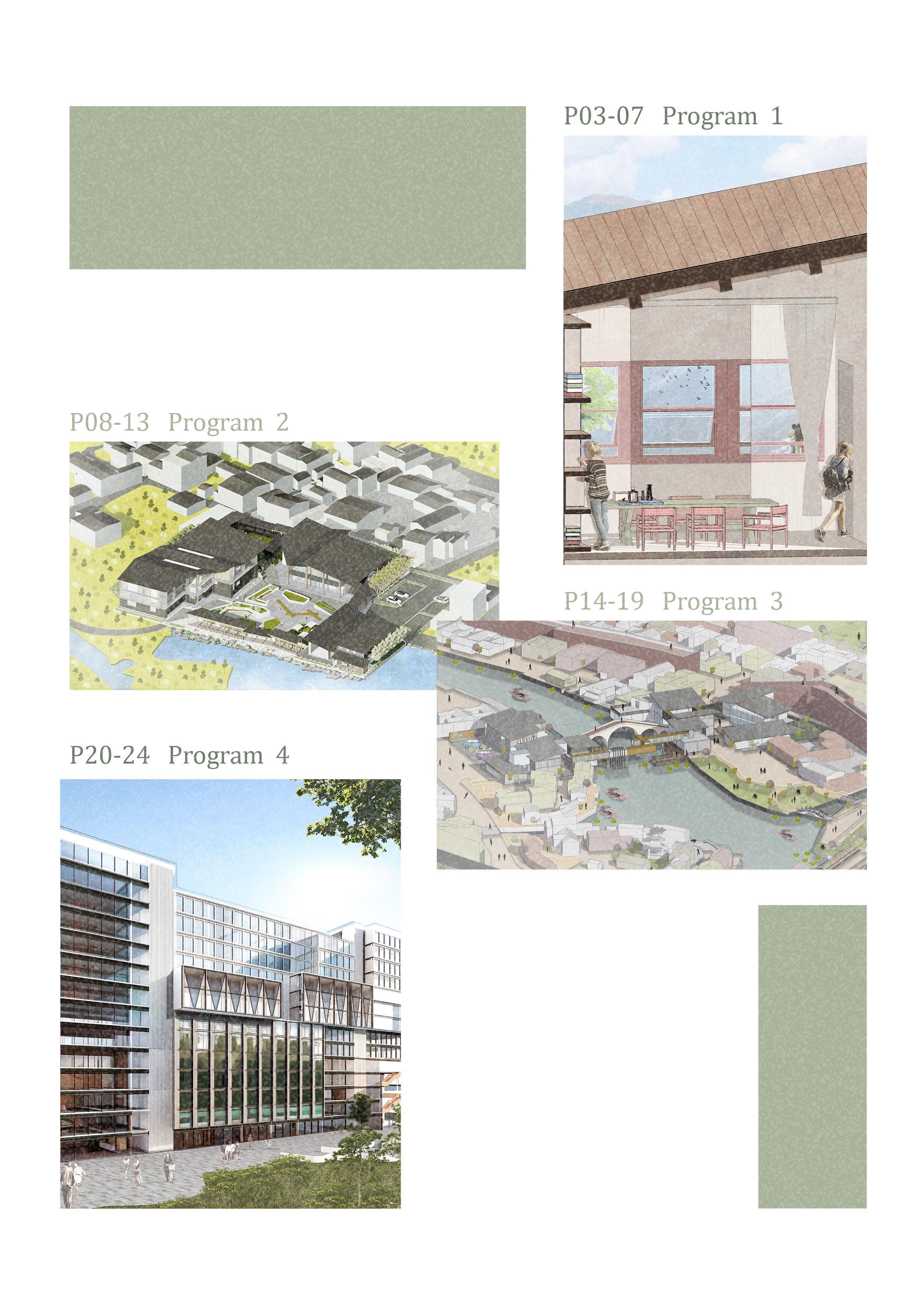
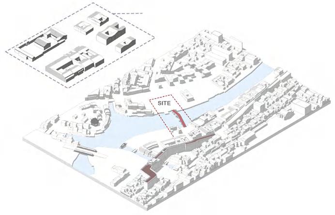
Aoraki Mount Cook Hiking Experience: Landscapes Through Windows
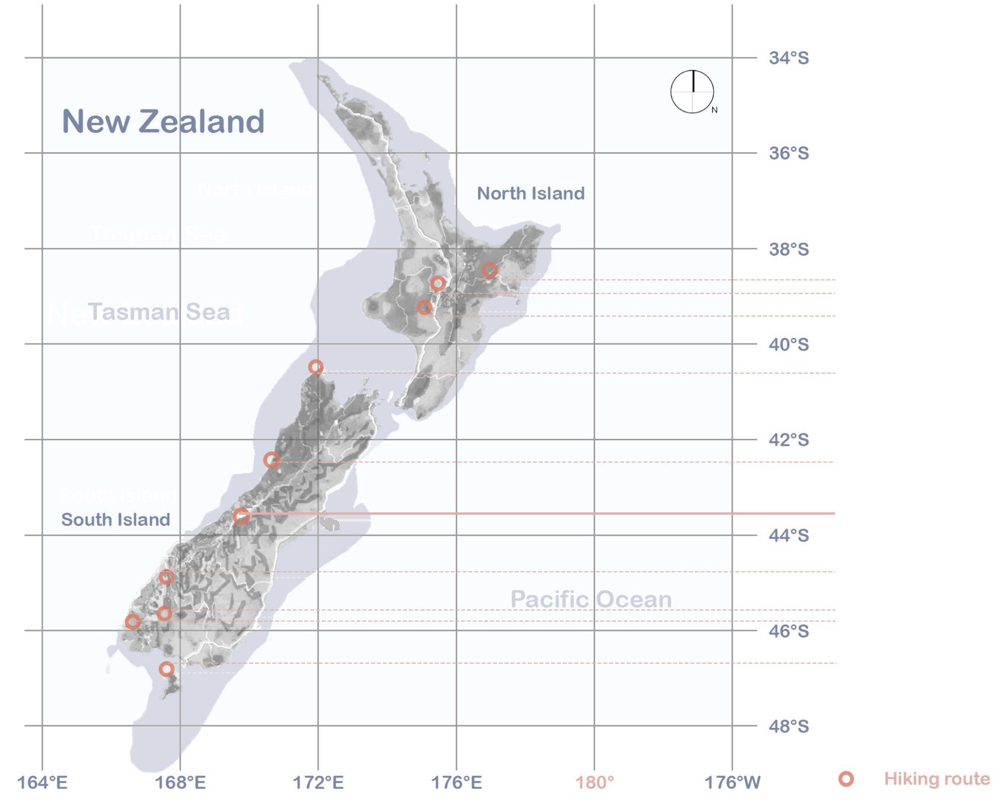
Location: Sealy Tarns Track, Mount Cook National Park, New Zealand
Program Statement: 01
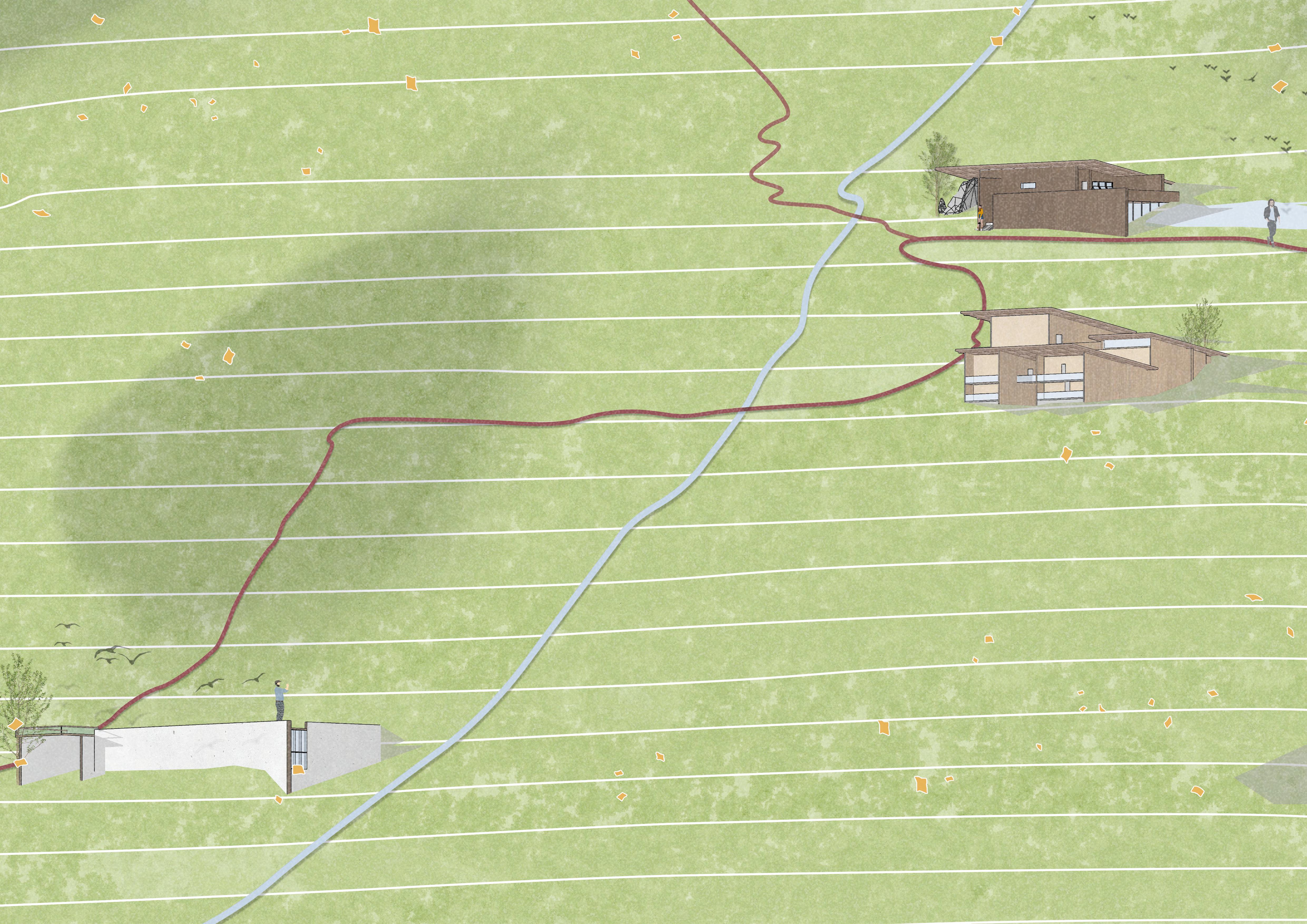
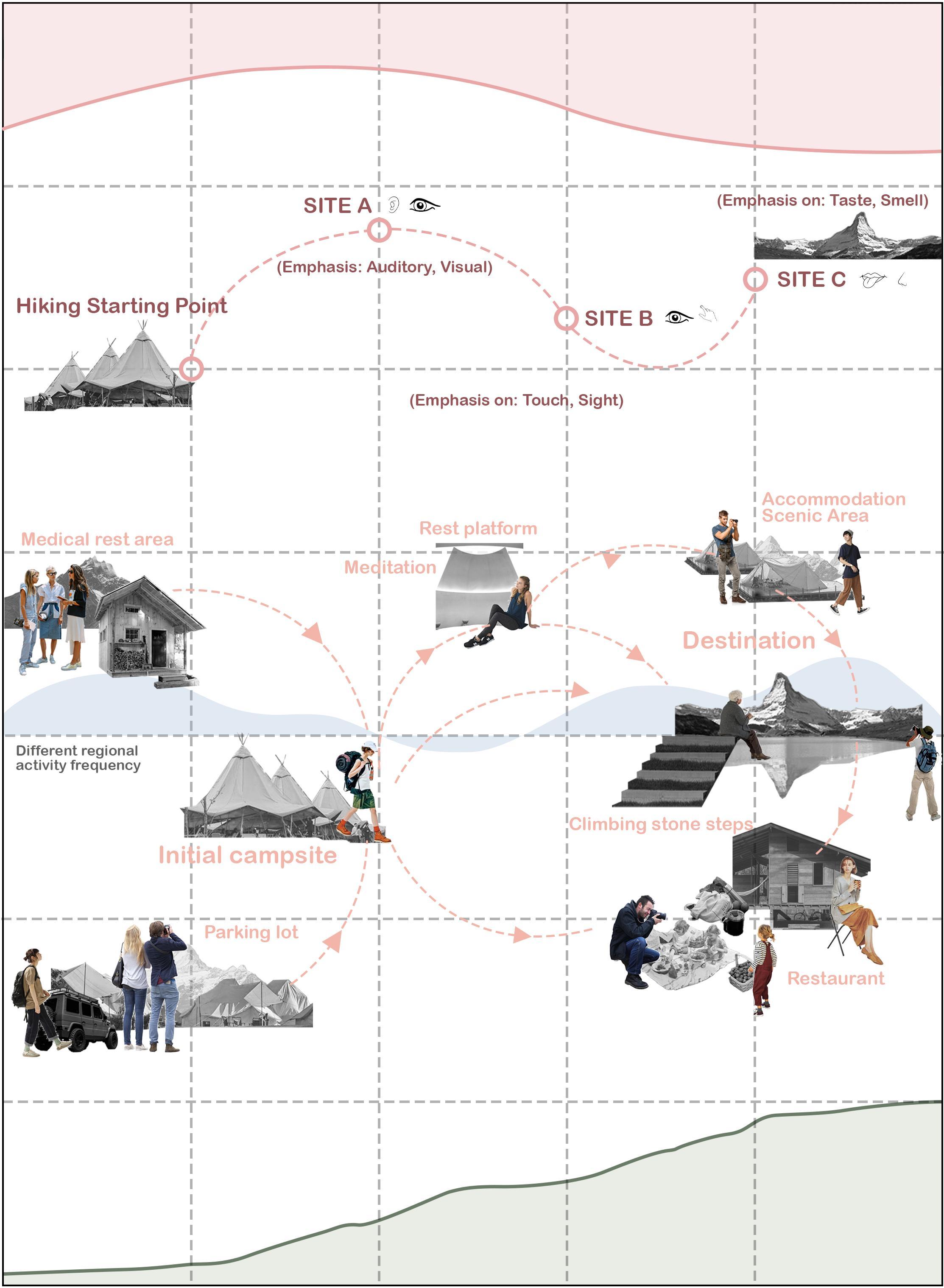
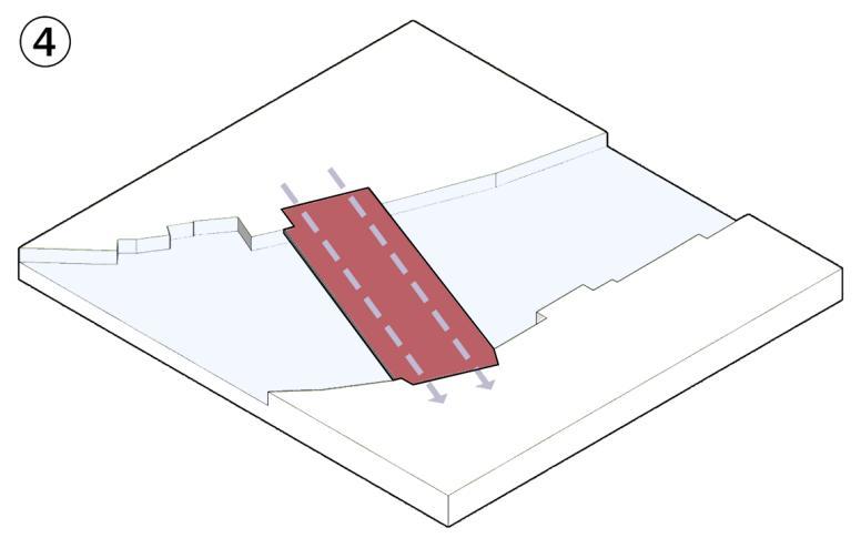
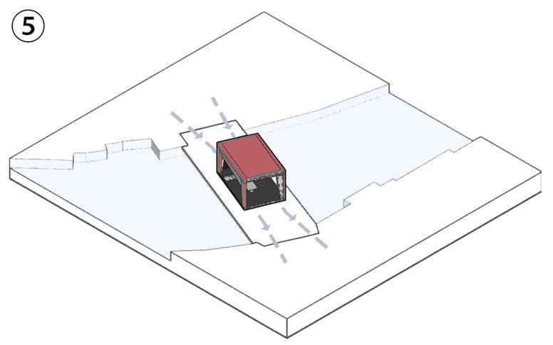
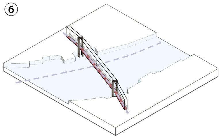
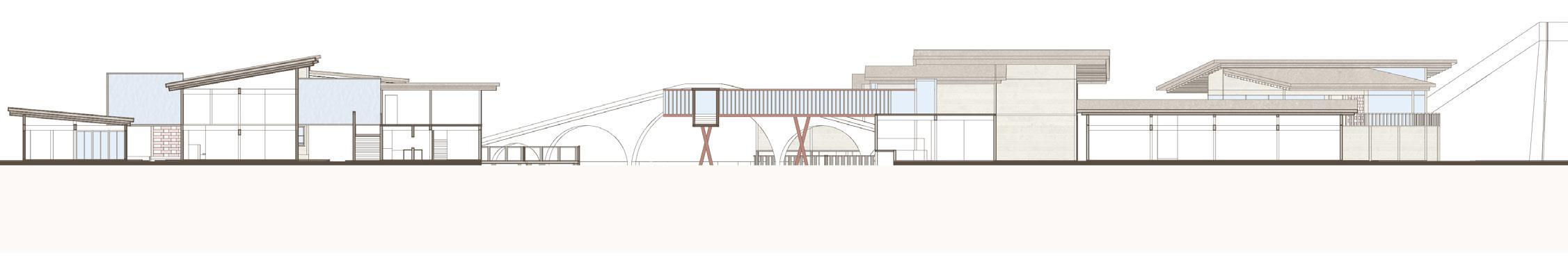
This project enhances the Sealy Tarns Track hiking experience through three thoughtfully integrated functions: a subterranean meditation space, a terraced guesthouse, and a mountaintop bistro. Designed to harmonize with the natural landscape, these interventions minimize ecological impact while enriching the journey.
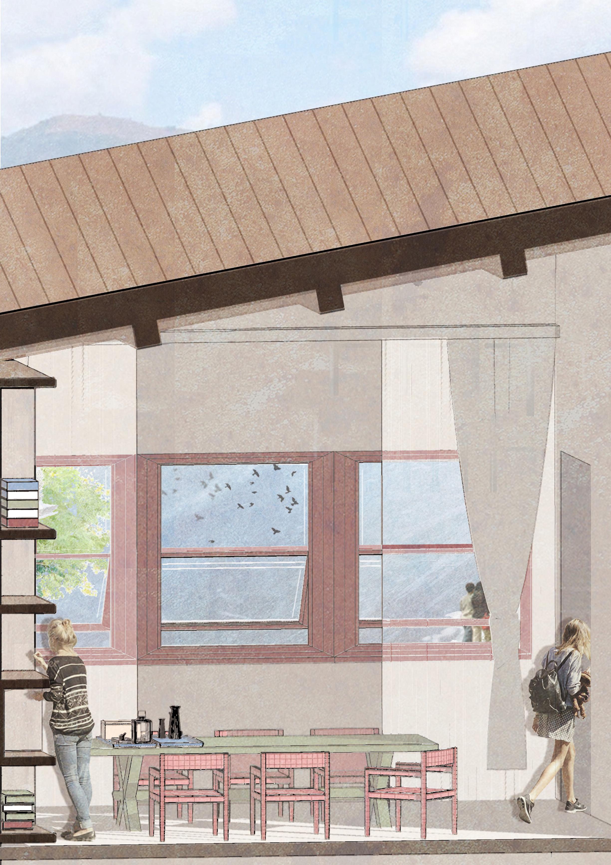
Using site-responsive wall structures, the design seamlessly blends with the mountain’s contours. The meditation space, located at the trail’s midpoint, offers serenity with narrow windows framing curated greenery. Further uphill, the terraced guesthouse provides diverse accommodations and panoramic views through carefully positioned windows. At the summit, the bistro features expansive glass openings that frame breathtaking lake and mountain vistas, creating a vibrant social hub.
By combining functional spaces with diverse window designs, the project redefines the connection between hikers and their surroundings, offering a visually and experientially immersive journey.
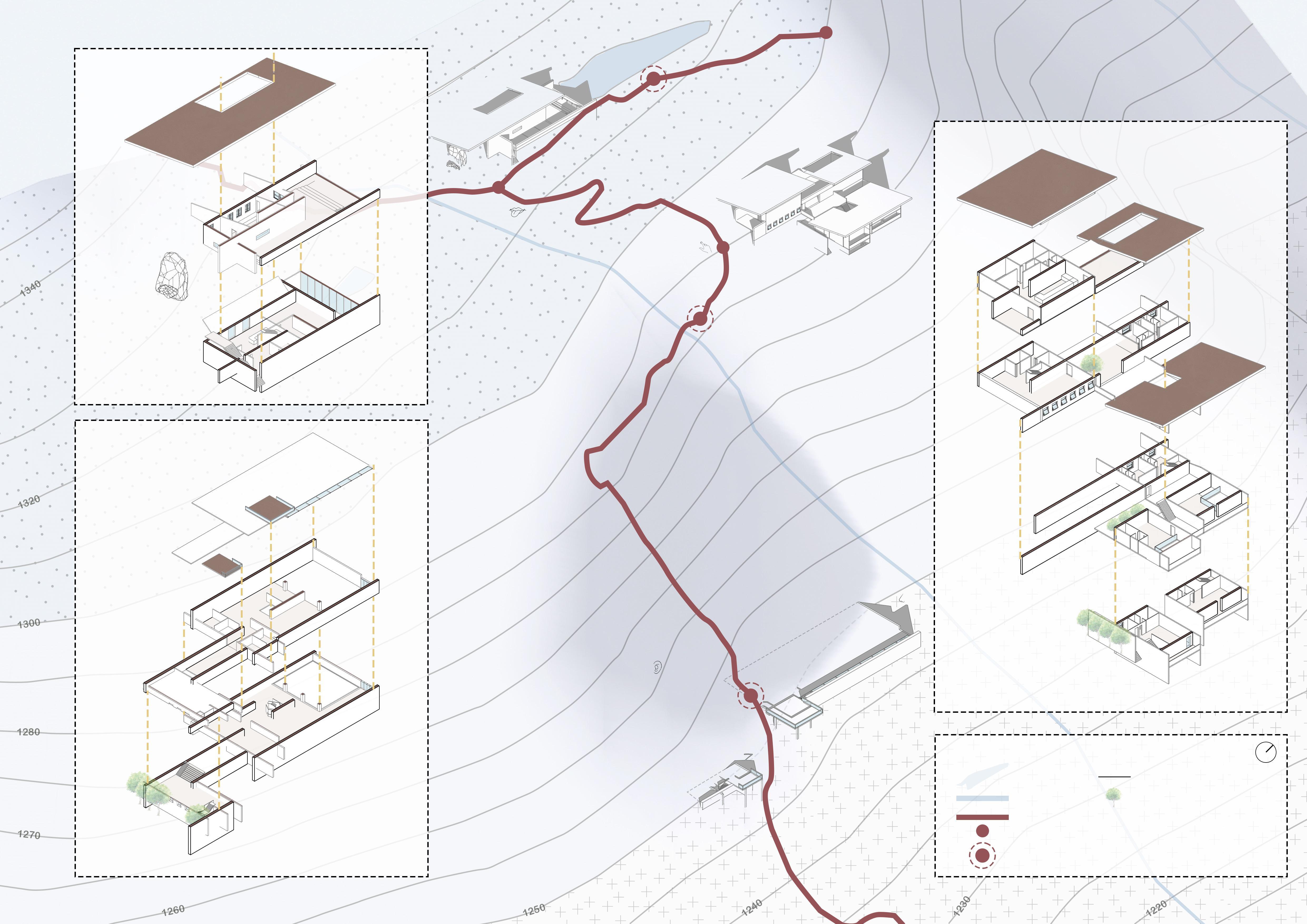
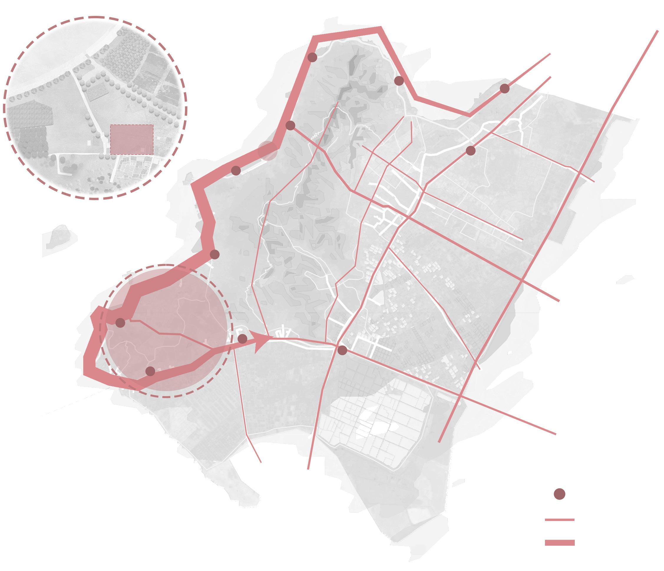
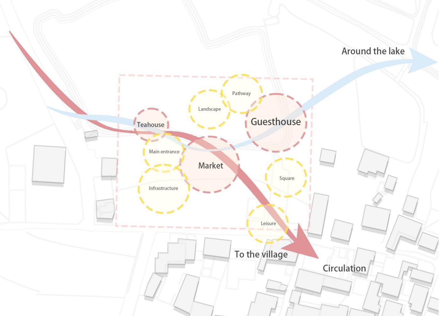
Route Analysis Map:
The dynamic and static analysis, route analysis, and altitude analysis along the Sealy Tarns Track are illustrated.
Lake Waikaremoana
Whanganui Track
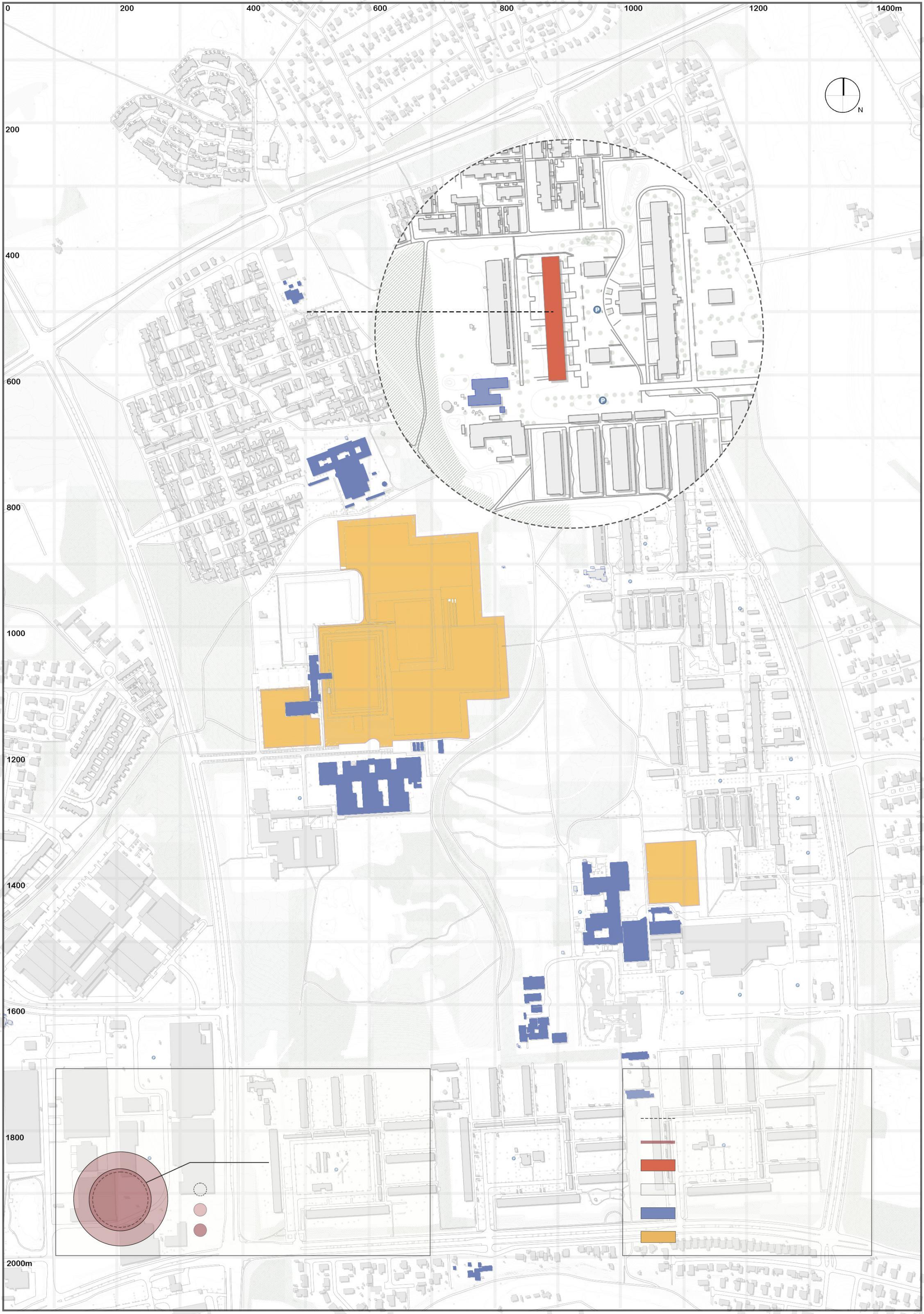
Classification of Population and Function:
Tongariro Northern Circuit
Abel Tasman Coast Track
Heaphy Track
Sealy Tarns Track
Routeburn Track
Mildford Track
Kepler Track
Rakiura Track
1053.0m
Foot of the mountain White Horse Camp
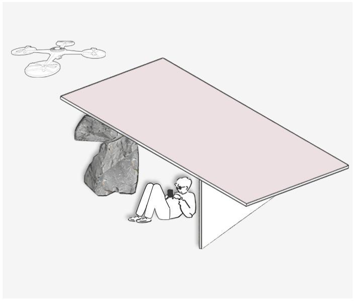
Halfway up the moutain meditation sapce
End of the hike Bistro
Concept Development:
People have a tendency to integrate with and challenge nature. Therefore, how to strengthen the connection between architecture and the mountainous terrain without significantly disrupting the natural landscape becomes a crucial issue. As a result, various interaction methods and boundary transition concepts have been proposed for different spatial contexts to achieve this integration.
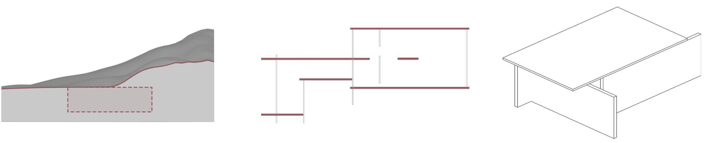
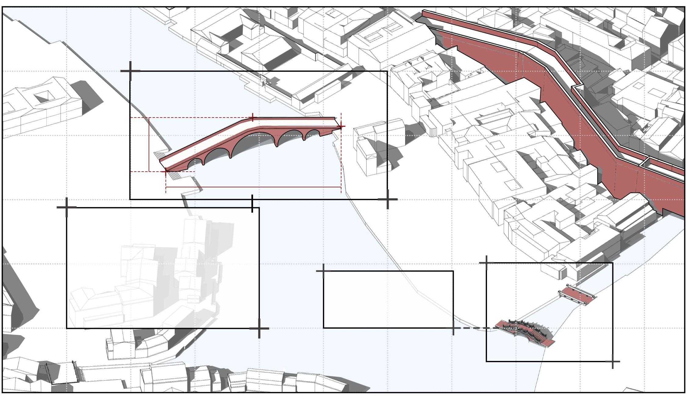
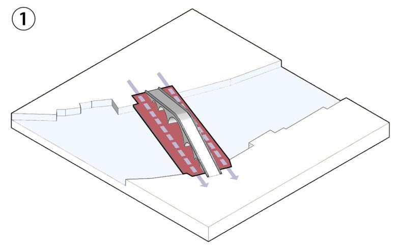
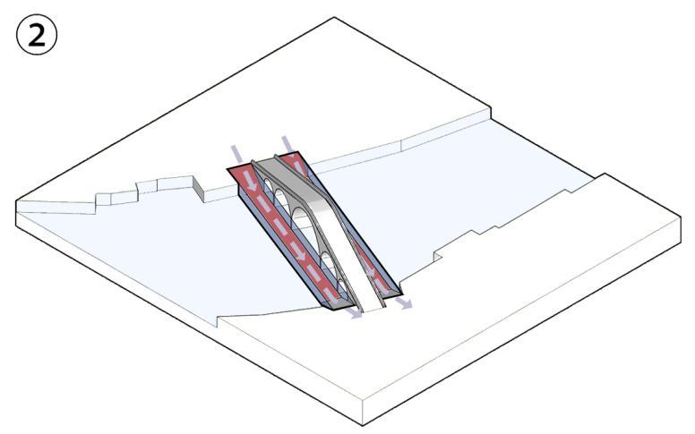
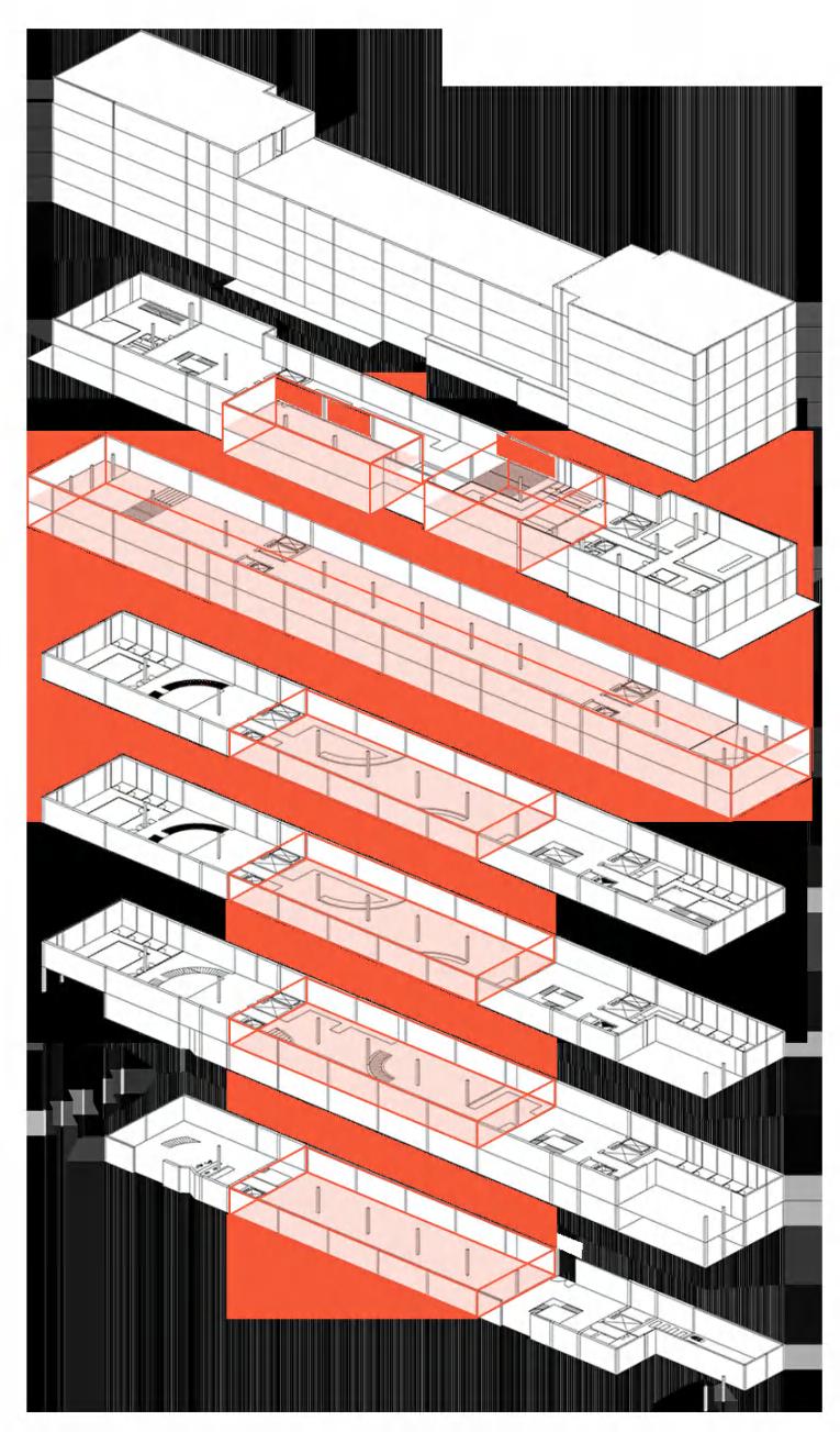
Site A: Mid-Mountain Meditation Space
The relationship between architecture and mountains:
Different types of meditation spaces:
The relationship between architecture and mountains:
Different types of meditation spaces:
The relationship between architecture and mountains:
Half-embedded, half-exposed
Different types of boundary transitions:
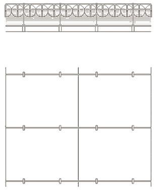
In the transition between architecture and nature, various types of 'gray spaces' emerge. Roofs, beyond their traditional function, offer a range of possibilities for creating seamless connections with the natural environment. These spaces can serve as platforms for integrating green spaces, enhancing environmental interactions, and fostering a more fluid transition between built and natural landscapes.
1. The first image illustrates the integration of natural rock formations with the rooftop structure to create a multi-functional space for rest and shelter. This design allows the space to be used for camping, providing refuge from the wind, and offering a tranquil environment for outdoor activities, thereby blending nature with architecture to enhance user experience in a natural setting.
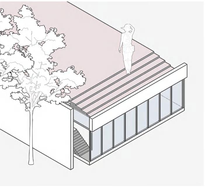
2. The second image emphasizes the rooftop’s capacity to incorporate natural light through strategically placed openings. These apertures not only allow the interior to be bathed in daylight but also enable users to ascend to the rooftop and enjoy panoramic views, effectively connecting the indoor space with the external environment and enhancing the aesthetic and functional qualities of the design.
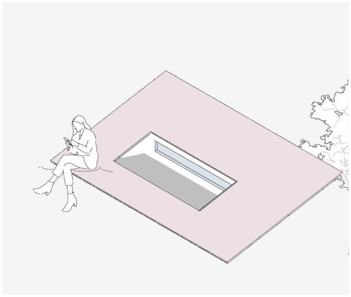
3. The third image highlights the dual functionality of the rooftop, which serves both as a traditional roof and as a viewing platform. This multi-use feature transforms the rooftop into a dynamic space where users can engage in leisure activities while enjoying scenic vistas, creating a versatile and accessible area for relaxation and observation.
This page outlines functional design concepts for various sites, considering the unique needs of different user groups. It emphasizes the adaptation of architectural boundaries to suit diverse activities and environments, with particular attention to how these spaces accommodate specific requirements and enhance the functionality of each site.
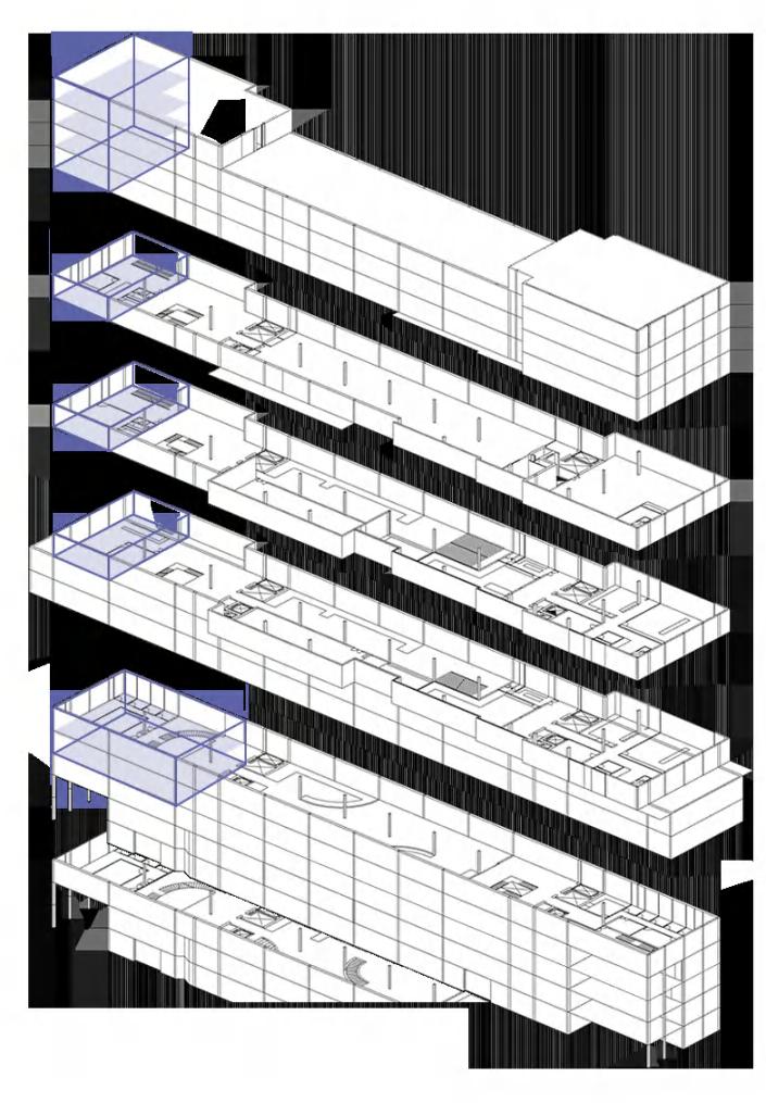
Site B: Mountain View Guesthouse
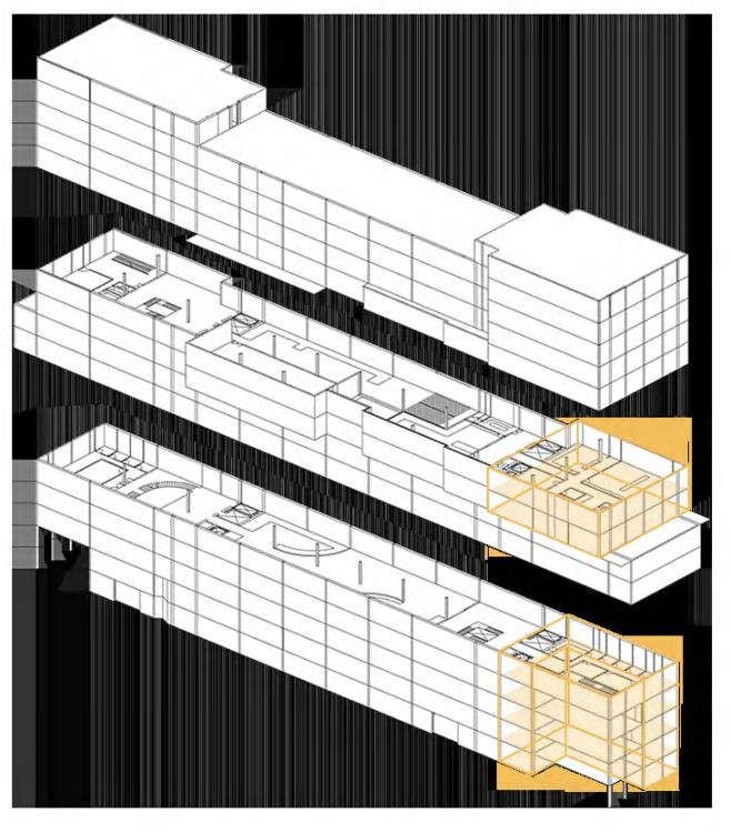
Site C: Mountain Summit Bistro
Embedded inside the mountain
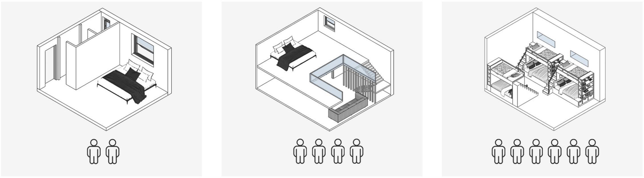
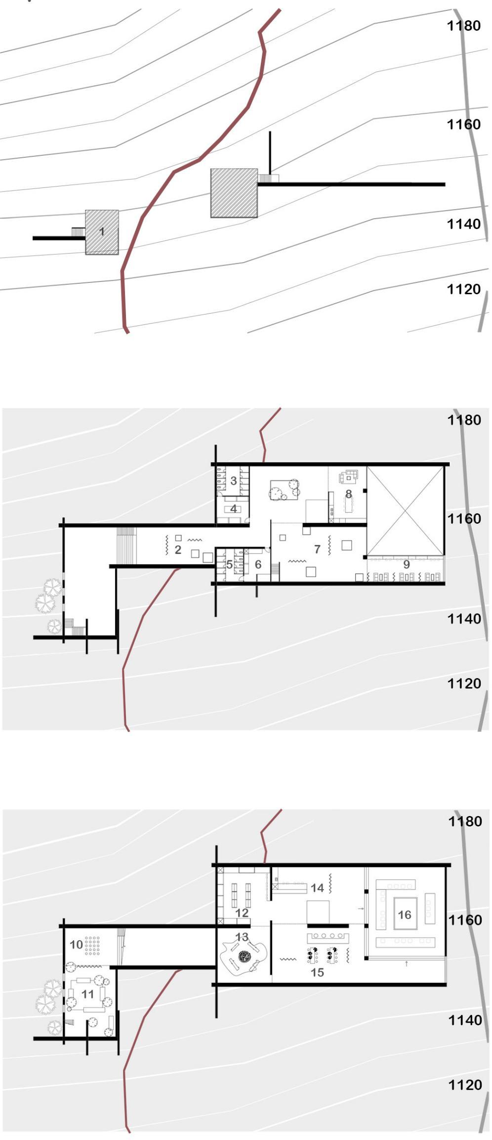
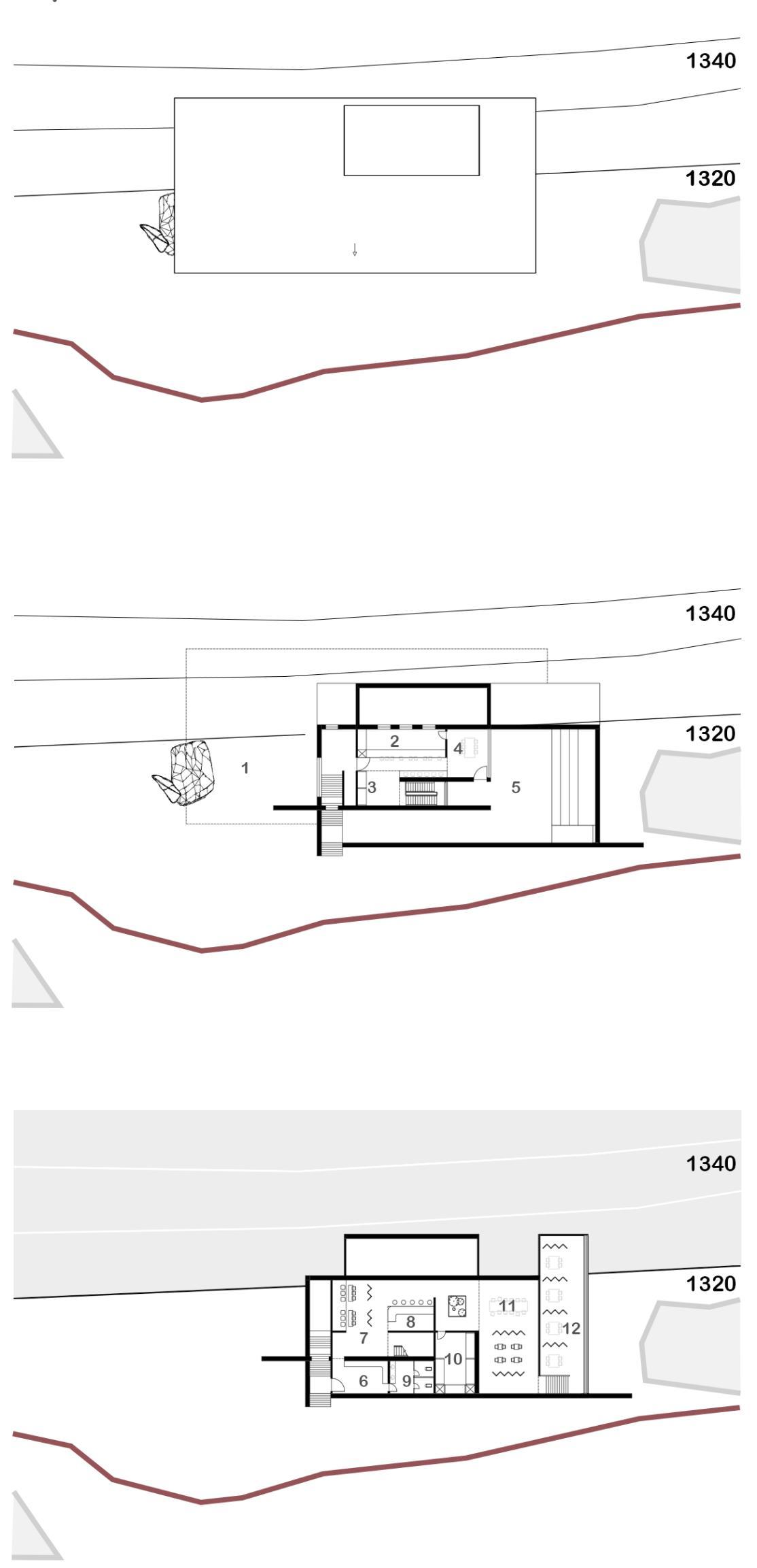
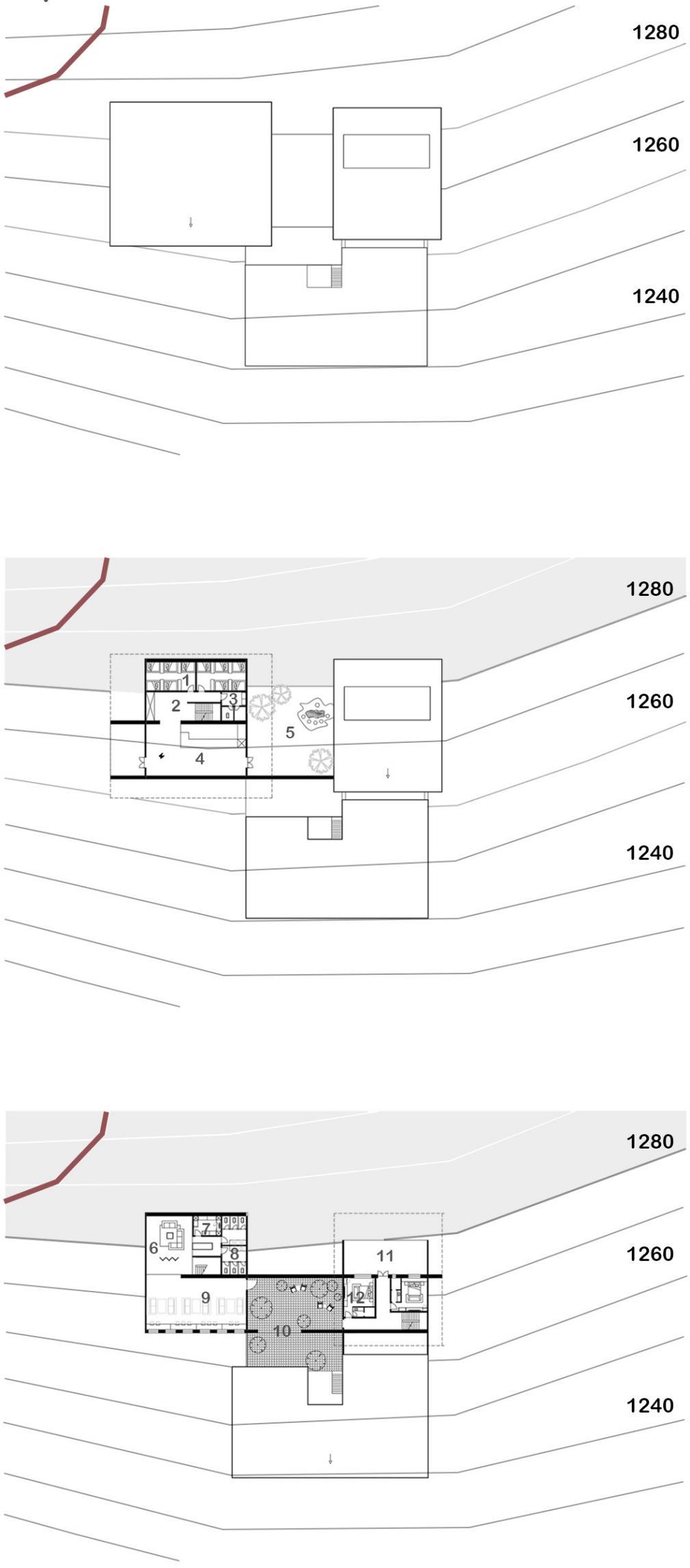
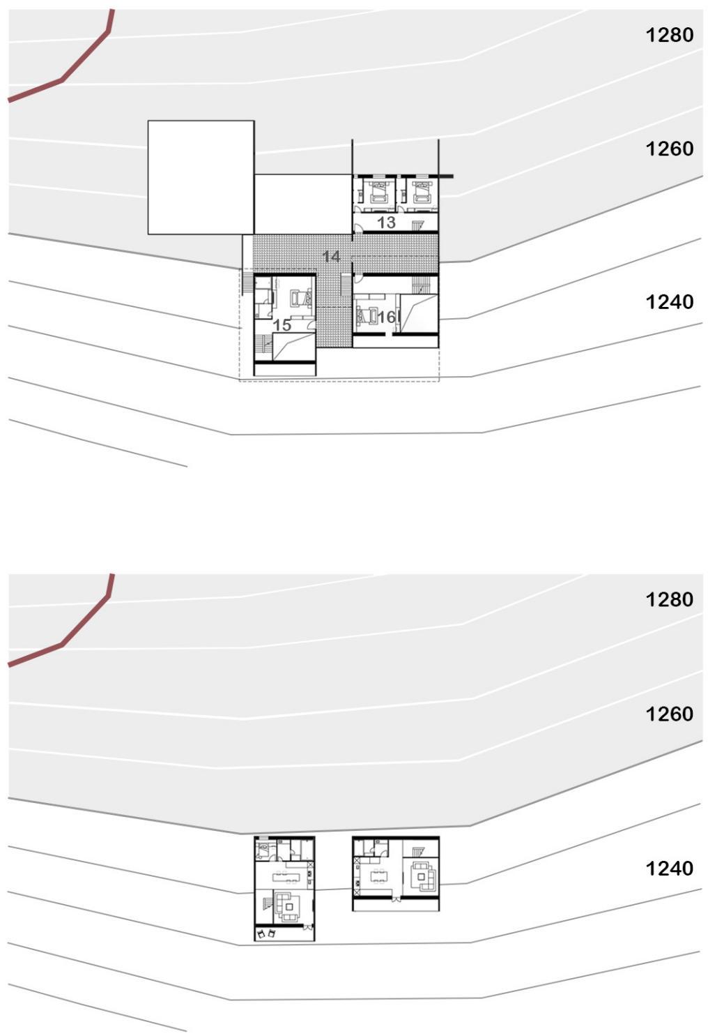
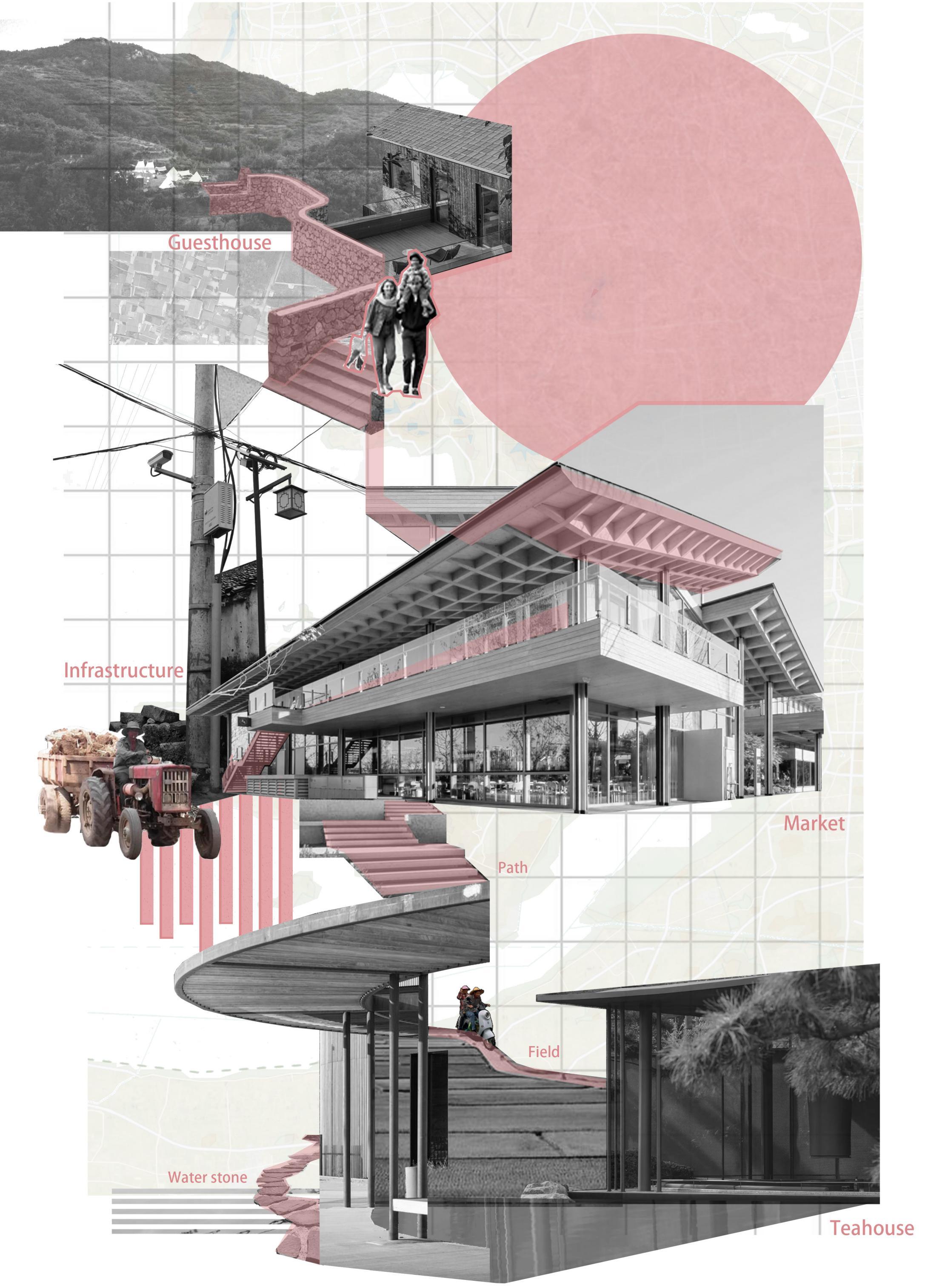
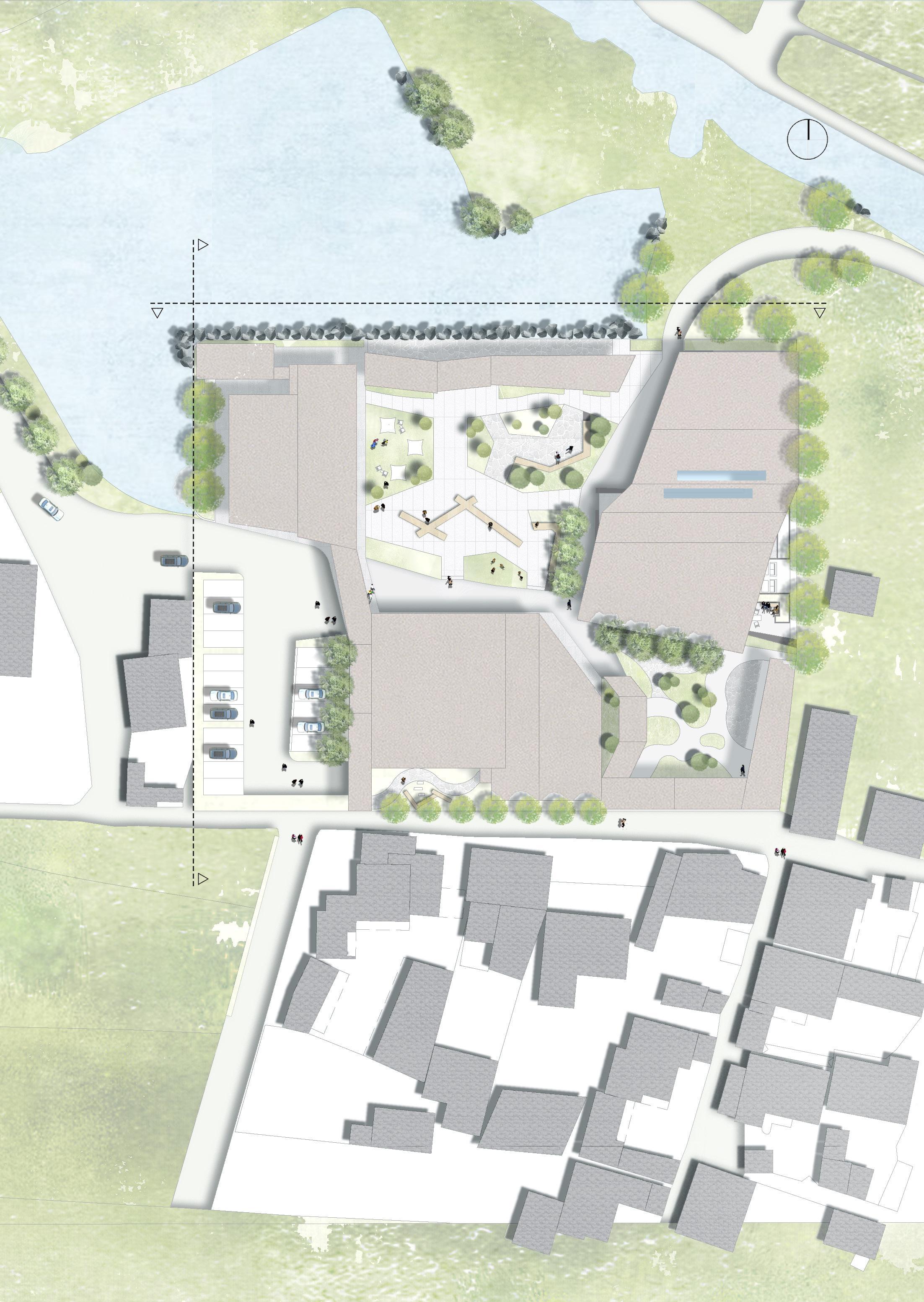
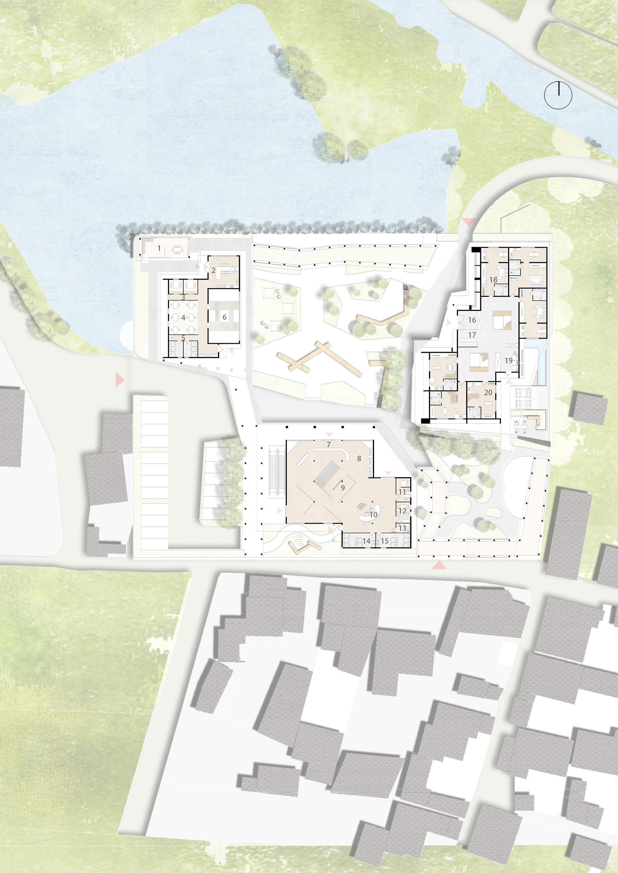
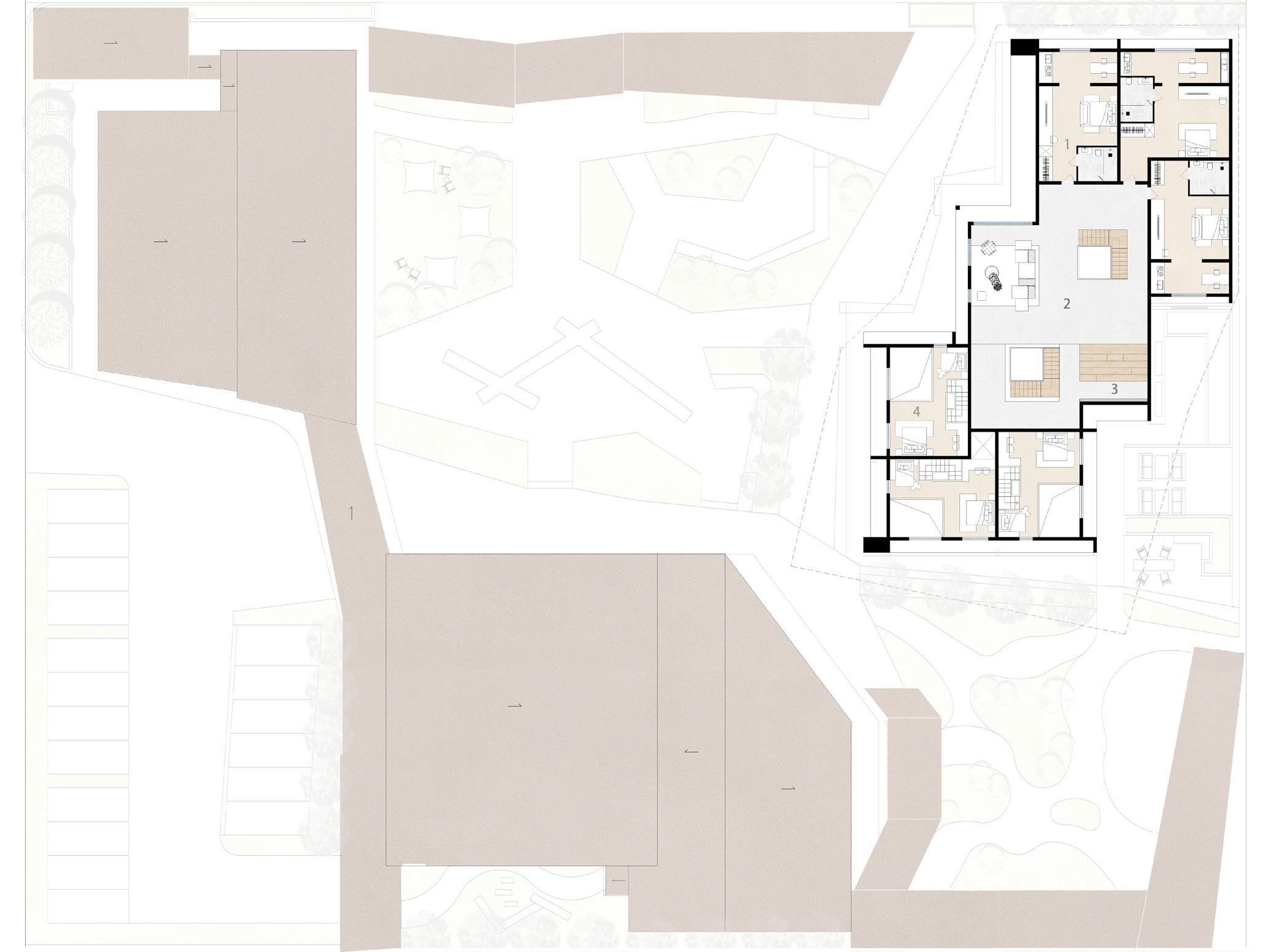
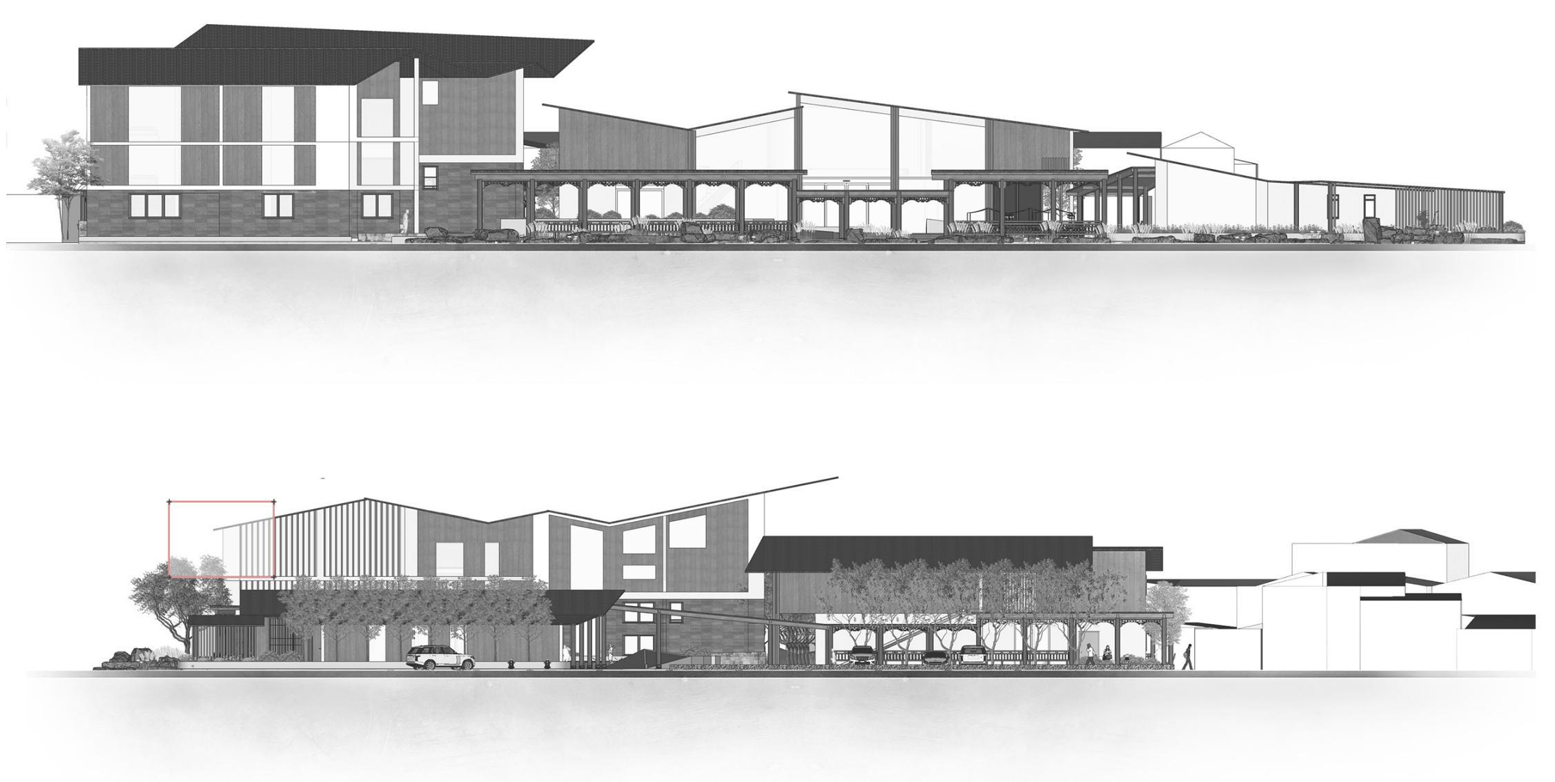
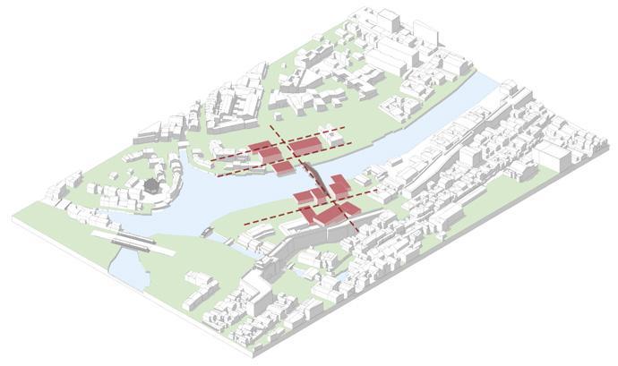
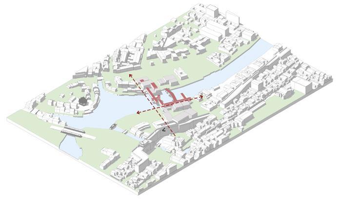
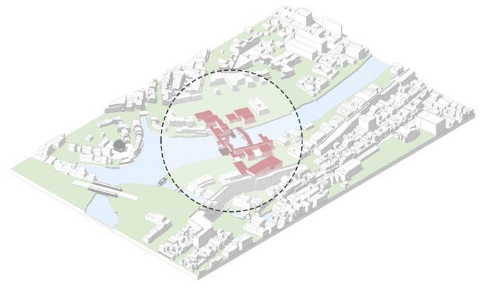
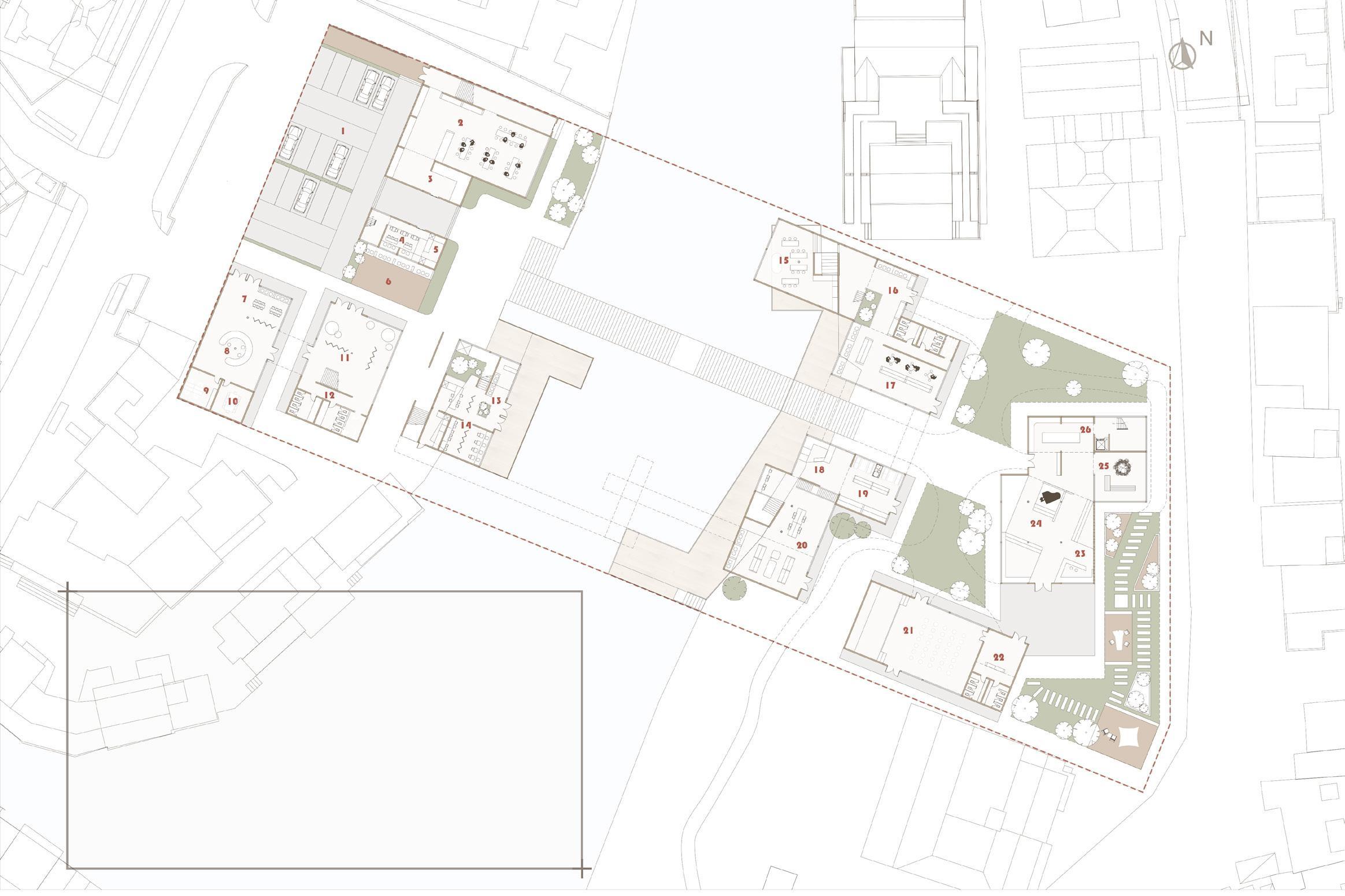
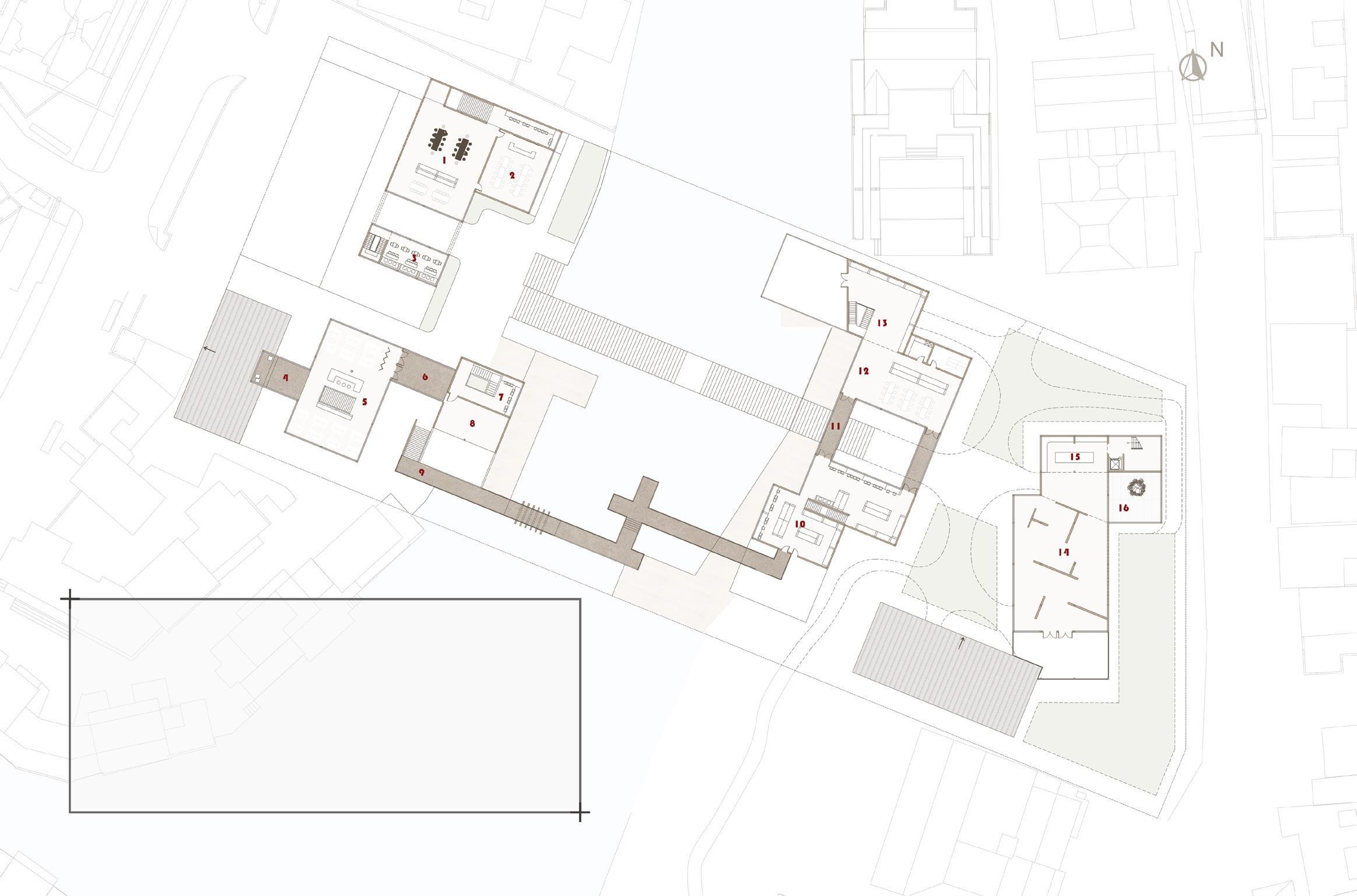
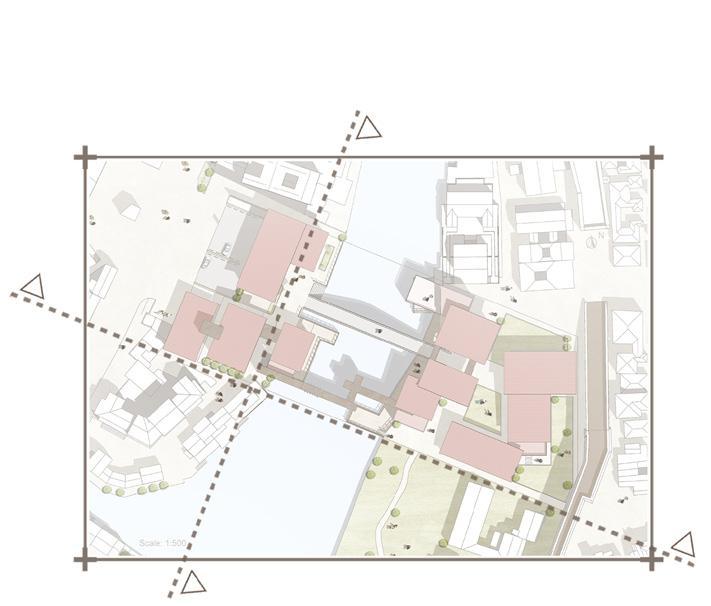
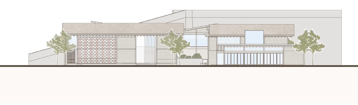
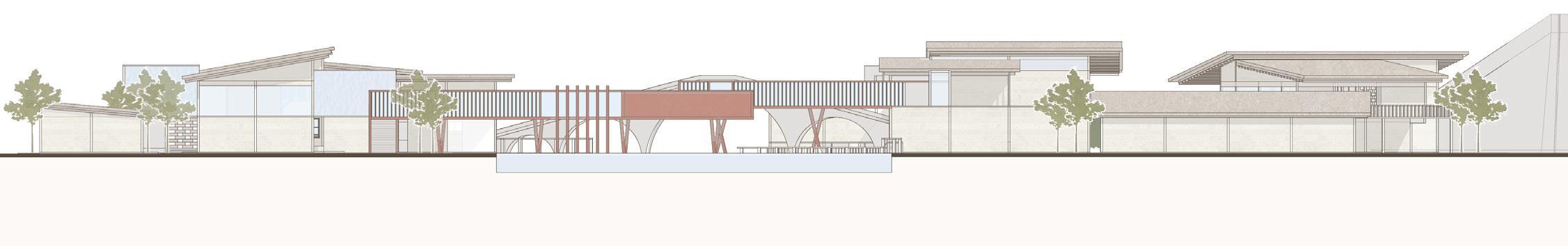
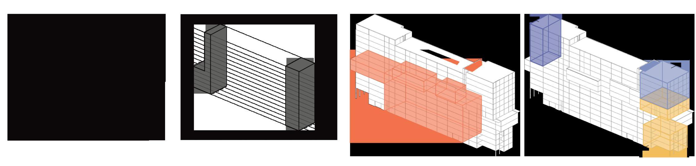
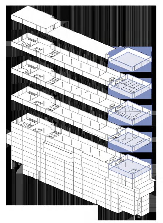
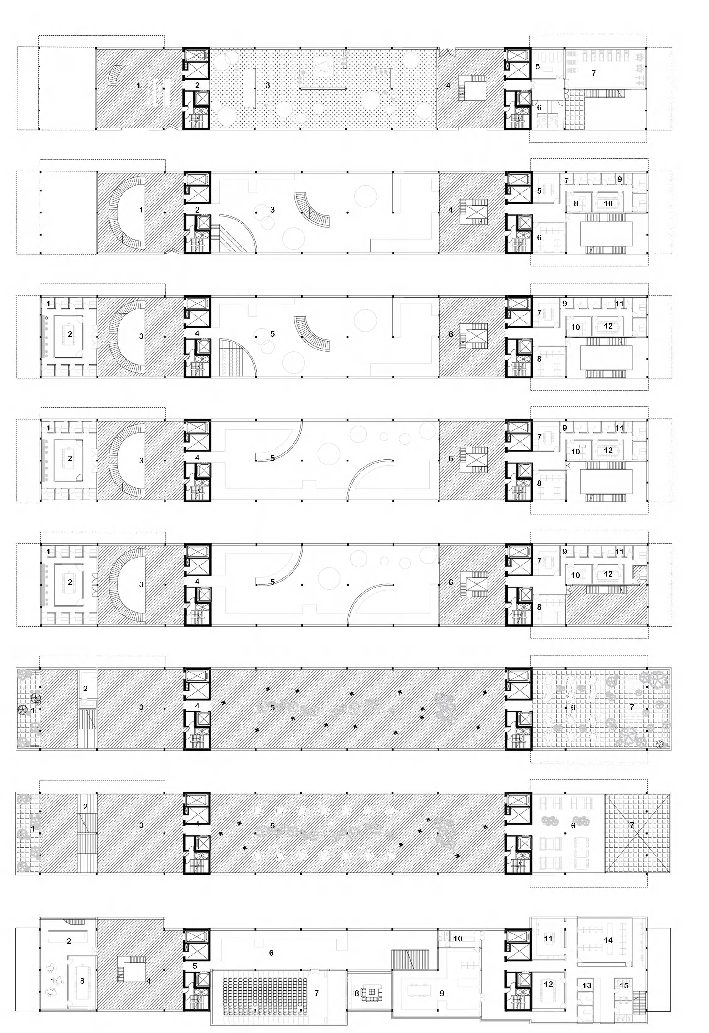
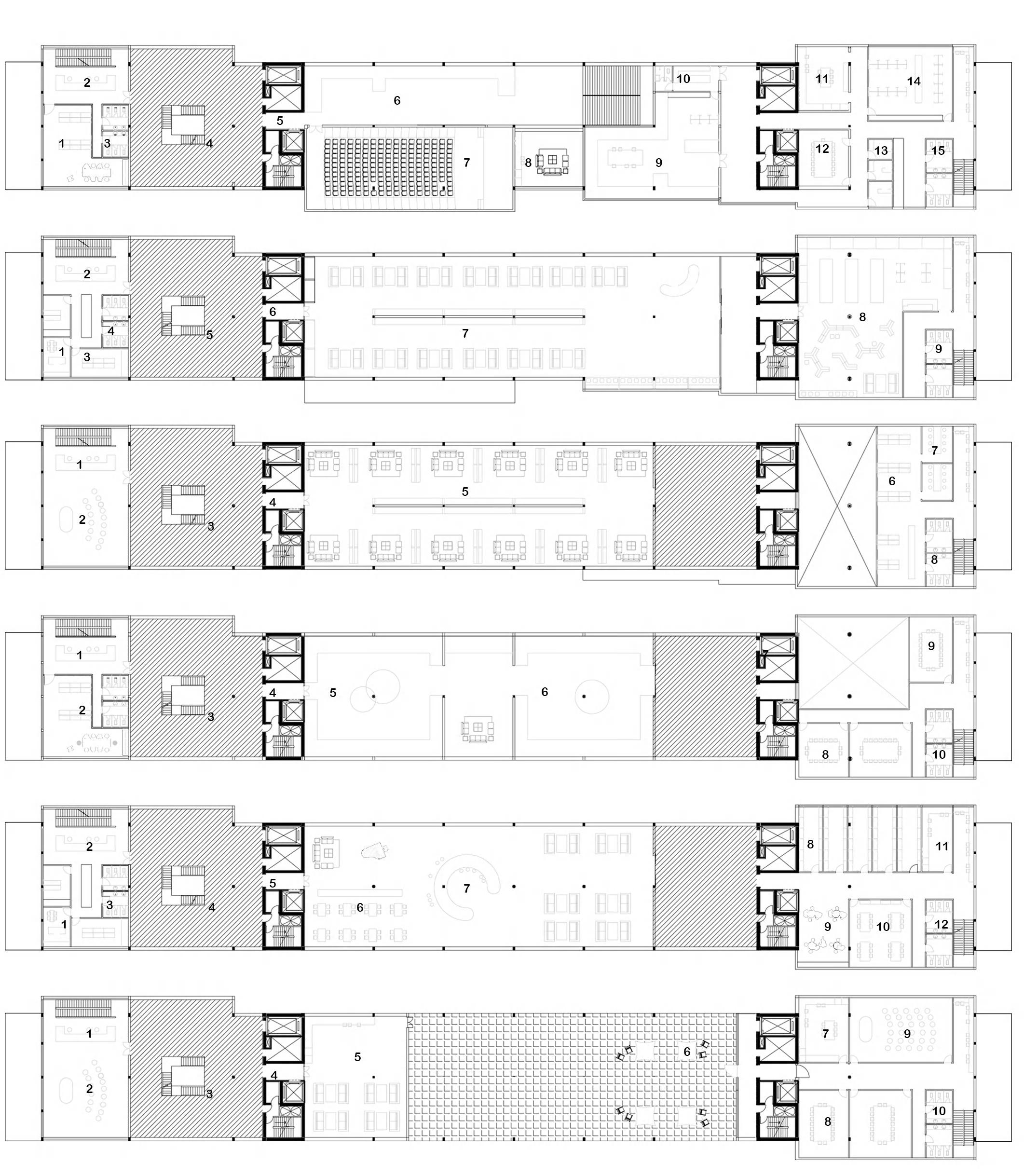
The project along the Sealy Tarns Track features three key architectural interventions designed to harmonize with the natural landscape and enhance the visitor experience. At the track’s midpoint, the Mid-Mountain Meditation Space provides a tranquil retreat, complete with an observation platform and dedicated meditation areas equipped with essential infrastructure. Two-thirds along the track, the Mountain View Guesthouse offers four levels of accommodation, featuring various room types for different group sizes, a central dining hall, and scenic platforms. At the track's endpoint, the Mountain Summit Bistro, a two-story structure partially embedded into the mountainside, offers dining and rest with breathtaking lake views. Each space is thoughtfully designed to promote relaxation, connection to the landscape, and personal reflection, enriching both the aesthetic and functional value of the region.
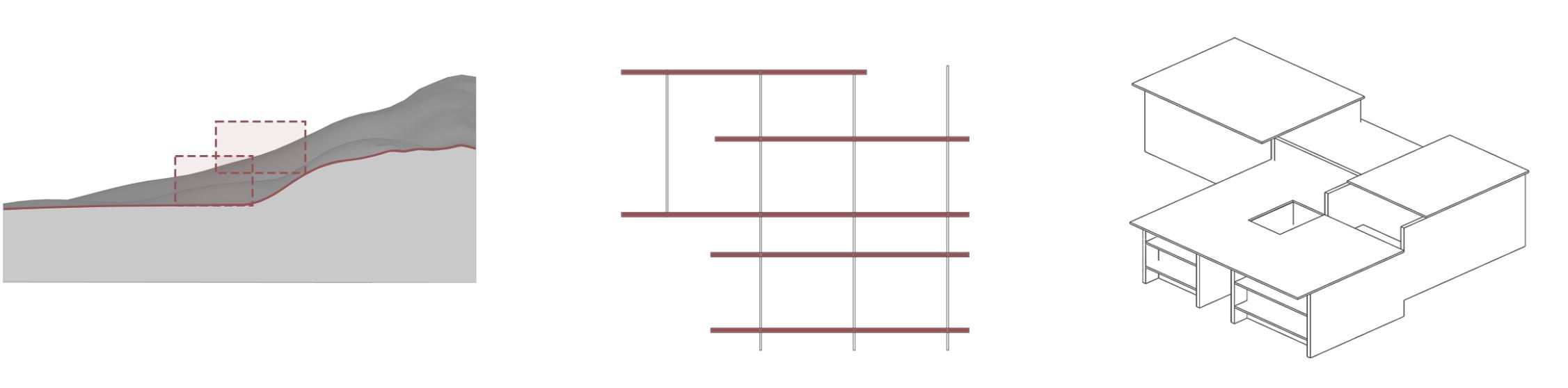
To minimize disruption to the site and integrate seamlessly with the natural landscape, the design employs the use of fragment walls to connect the site with the building.
Bird's eye view of the site Exploded View SITE A
Tarns
Site B: Mountain View Guesthouse
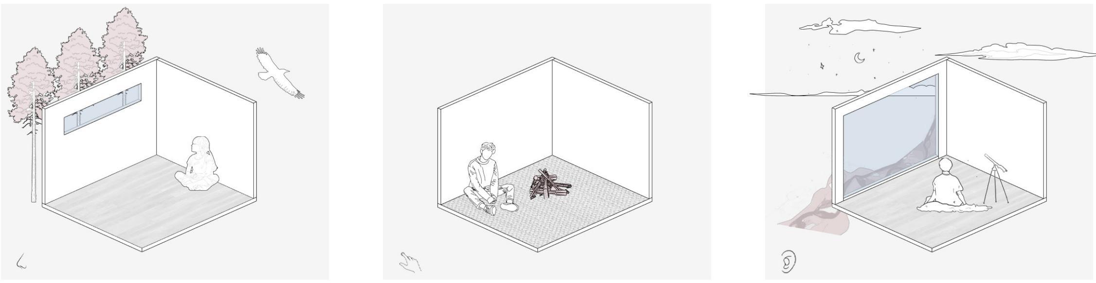
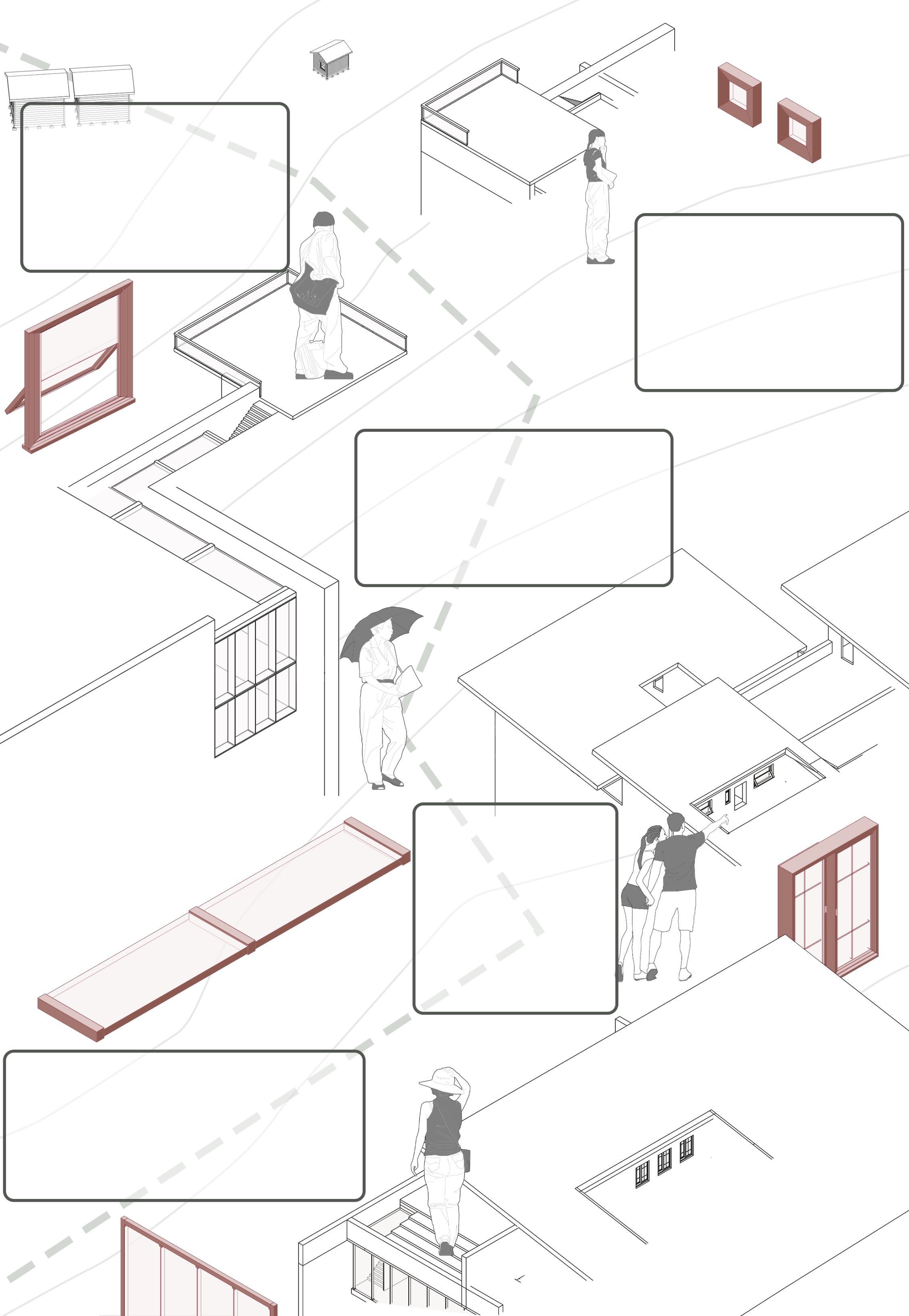
The Hike Behind the Window: Human stories behind different types of windows
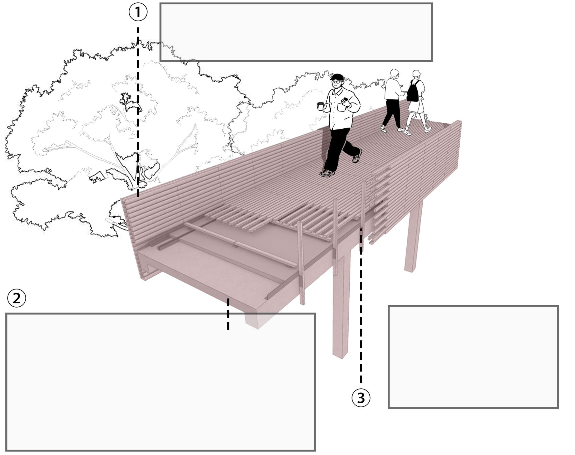
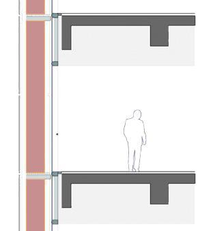
The glass railings on the observation platform merge seamlessly with the natural environment, providing unobstructed views from every angle, whether overlooking the mountain’s base or the surrounding landscape.
Further along the trail, a terraced guesthouse emerges, designed to follow the contours of the mountain and offer diverse perspectives through its carefully positioned windows.
Descending from the platform leads to a tranquil meditation space, where even the smallest windows frame curated greenery, integrating nature into the reflective experience.
At the mountaintop, the lakeside bistro combines sweeping vistas with versatile dining options, offering both indoor seating and outdoor picnic spaces, creating a vibrant, multi-functional gathering spot.
Rooms in the guesthouse cater to varying preferences, with windows oriented to frame either the summit above or the valley below, combining architectural diversity with functional views.
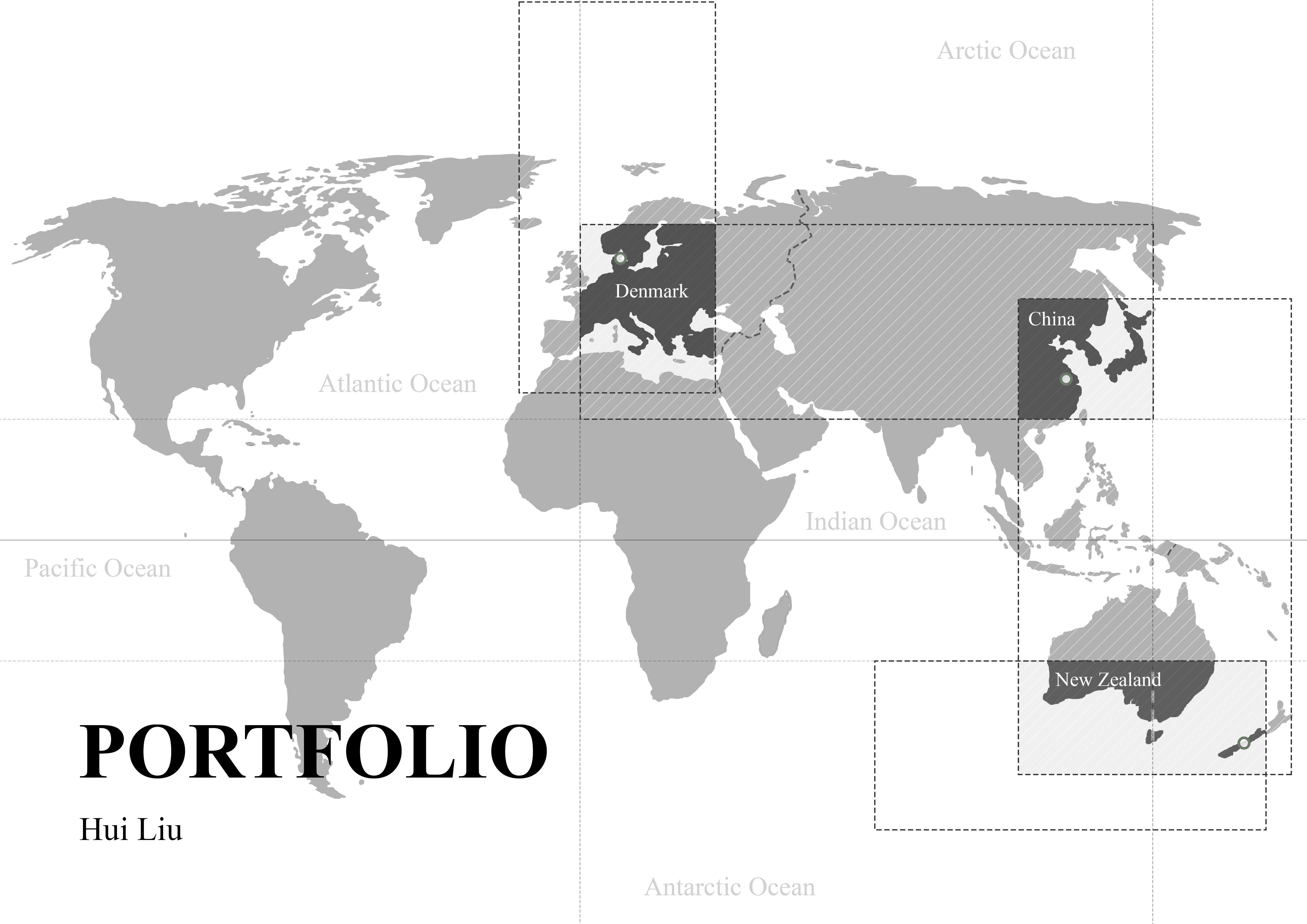
Yin: A Boutique Homestay and Rural Development Hub
Location: Dongshan Town, Suzhou, Jiangsu Province, China
Program Statement: 02
Dongshan Town, known for its picturesque Taihu Lake scenery and cultural heritage, faces challenges due to its remote location and declining population. The aging demographic and limited economic activity have left the local economy stagnant, with insufficient infrastructure and few opportunities for young residents or visitors.
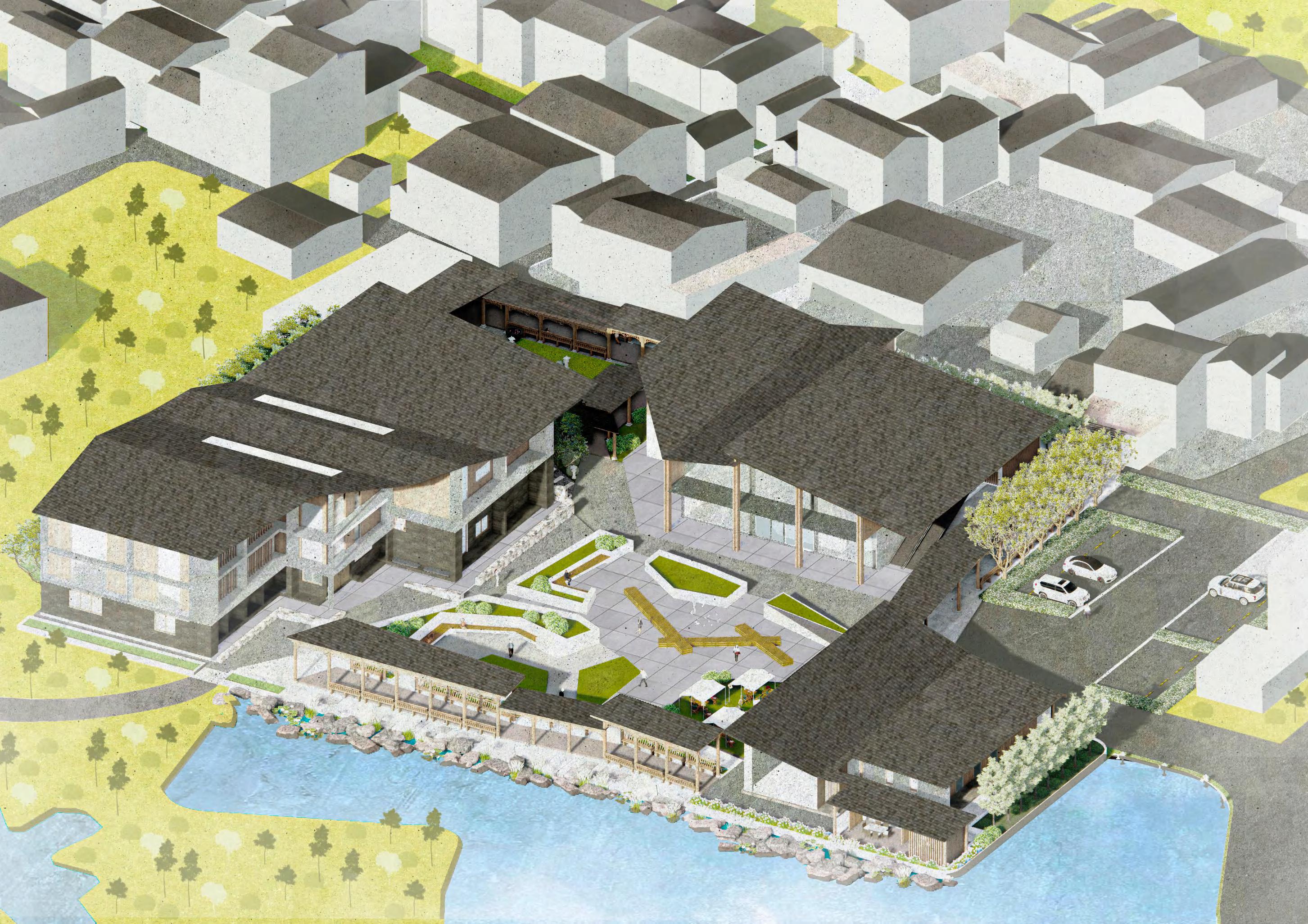
This project proposes the development of a rural hospitality and commercial complex centered around a boutique homestay, complemented by a marketplace, a tearoom, a parking lot, and traditional pavilions. By leveraging the town's natural beauty and cultural assets, the complex aims to attract tourists, provide local employment opportunities, and foster economic growth. The marketplace will showcase regional products, while the tearoom and pavilions will offer spaces for cultural exchange and relaxation, creating a destination that appeals to both residents and visitors.
Through thoughtful design and community-oriented planning, this initiative aspires to revitalize Dongshan Town by blending modern amenities with traditional aesthetics, ultimately transforming it into a vibrant hub of activity and a model for sustainable rural development.
Basic information about the site:
Dongshan Town, located in southeastern Suzhou, Jiangsu Province, has a rich history dating back over 1,500 years. Situated within the Yangtze River Delta, the town benefits from its fertile landscape, shaped by rivers and lakes, supporting agriculture such as tea, silk, and rice production. Historically part of the Wu State and later the Wuxian Prefecture, Dongshan has evolved through various cultural and economic shifts. Today, the town combines its historical heritage with efforts towards sustainable development, serving as a model for integrating ecological preservation and modern growth.
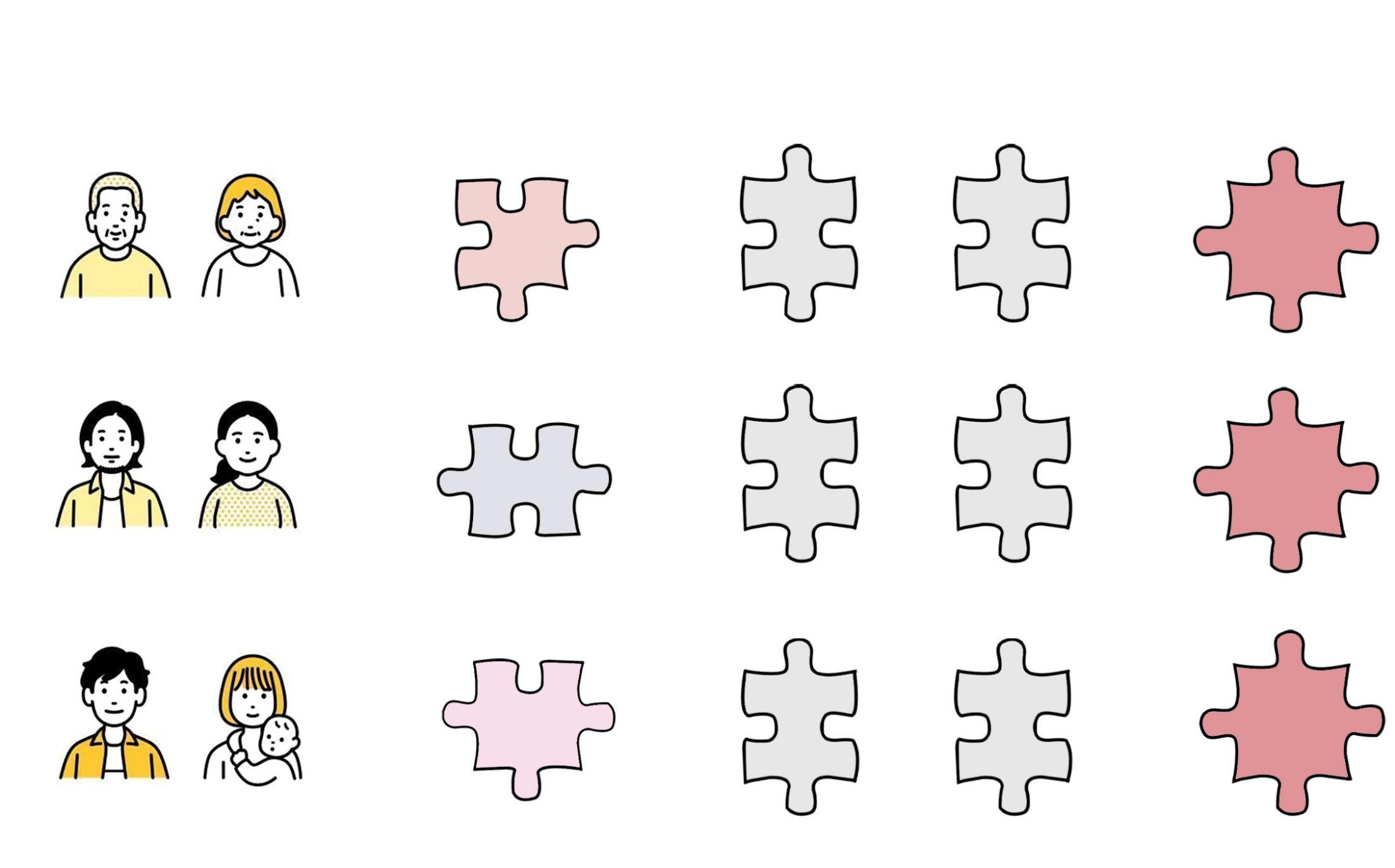
Diverse Needs and Functional Space Solutions in Dongshan:
Due to its relatively remote location from urban centers, Dongshan Town has experienced significant population decline. The remaining residents are predominantly middle-aged and elderly individuals engaged in agriculture, with a smaller proportion of left-behind children and young adults residing in the area. As a result, the overall demographic of the town tends to be older.
Dongshan Town
Suzhou, Jiangsu Provience
(30° N, 120°E)
Legand:
Bus station
Secondary roads
Primary roads
Climate:
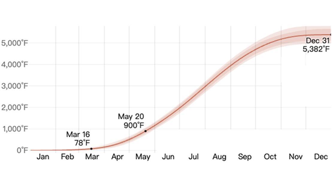
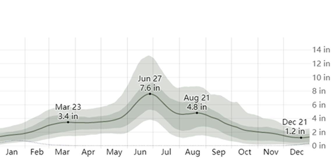
Dongshan Town, located in the southern region of Jiangsu Province, experiences a humid subtropical climate characterized by distinct seasons. Summers are hot and humid, while winters are cold and dry. The town receives abundant rainfall, particularly during the monsoon season, and has an average annual temperature of approximately 15°C to 17°C. This climate is conducive to diverse agricultural activities, providing a stable environment for crop cultivation.
The favorable climate in Dongshan Town, with its moderate temperatures and sufficient precipitation, creates ideal conditions for the growth of a wide range of crops. The region’s fertile soil, coupled with an adequate water supply, supports high agricultural productivity. Particularly, the conditions are well-suited for the cultivation of rice, vegetables, and fruits, contributing to a strong agricultural economy in the area.
Agriculture:
Dongshan Township is rich in agricultural produce, with a wide variety of crops and large yields. Most of the villages practice an annual cropping pattern, which ensures high productivity throughout the year. This agricultural abundance plays a key role in the local economy.
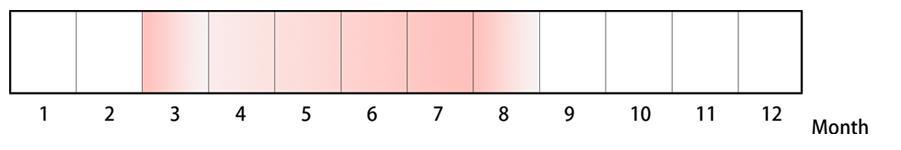
High-frequency period of
Growing Degree Days in Dongshan
Average Monthly Rainfall in Dongshan
crop cultivation:
The distribution map of sowing frequency of commonly cultivated crops in Dongshan Town:
Tea
Red bayberry
Orange
Loquat
Chestnut
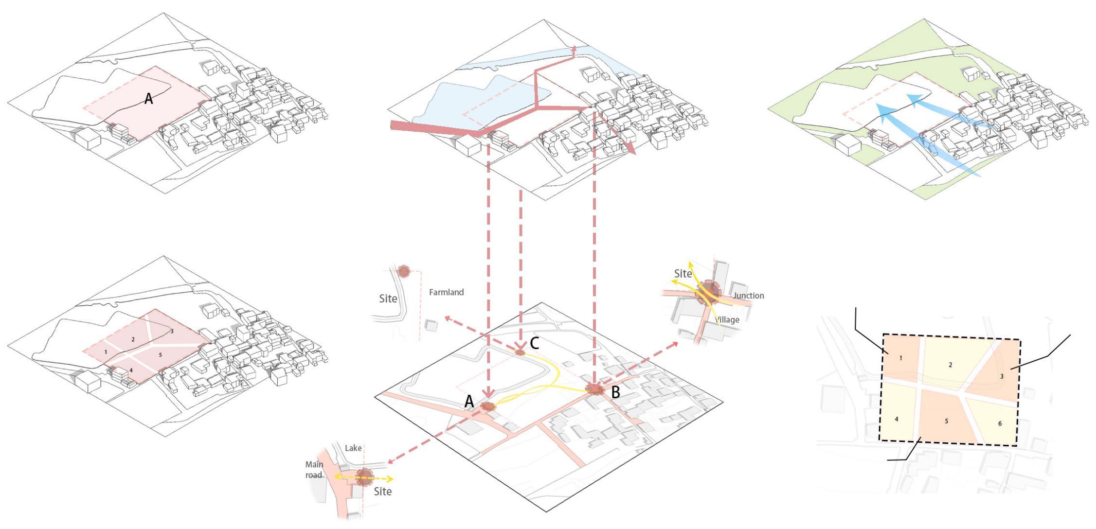
Site status and strategy analysis:
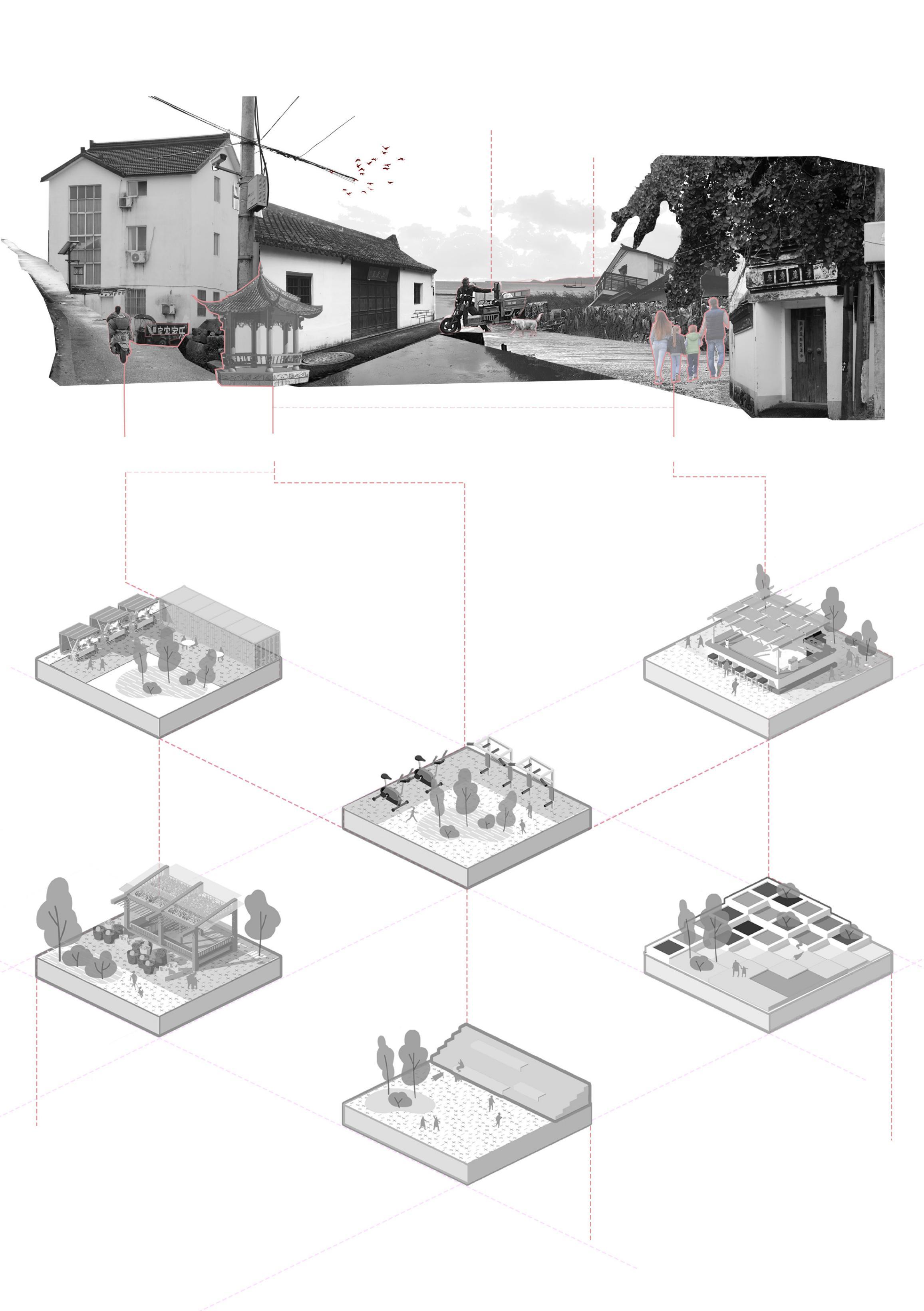
Upon conducting a more in-depth investigation of the surrounding area, several issues within the village were identified
Excellent ecological environment
Upon arriving in Dongshan Town, travelers follow a stone-paved path past historic countryside buildings to reach the guesthouse, nestled by the mountains and lake. After parking, they can explore the market, enjoy tea by the water, watch villagers' daily activities, and take in the peaceful rural scenery.
Insufficient
Lack of gathering space. Lack of young people and passengers.
Market Culture
Fitness Square
Civic Plaza
Landscape
Selling Local Agricultural Products
Creative Dining Products
Concept analysis:
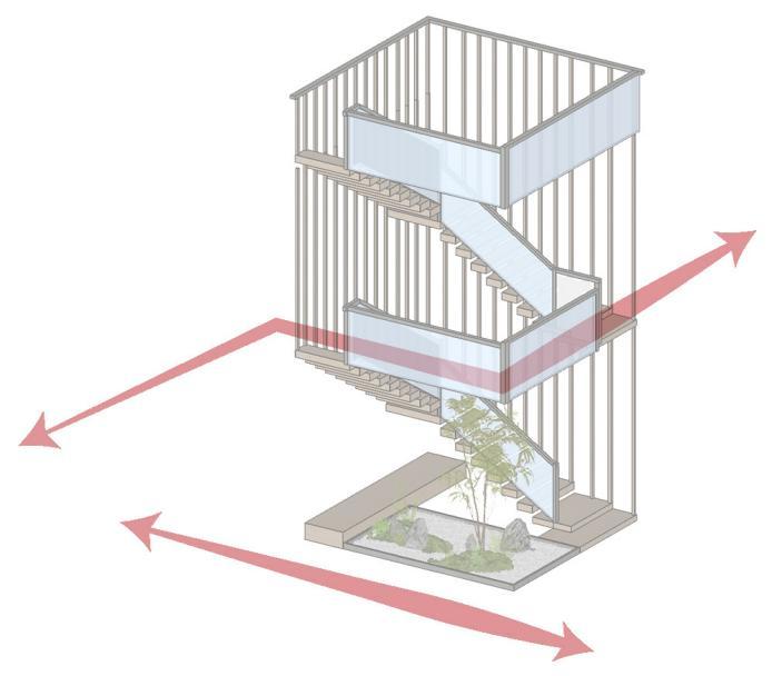
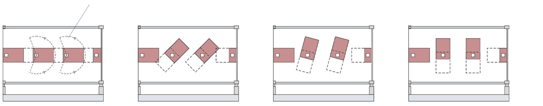
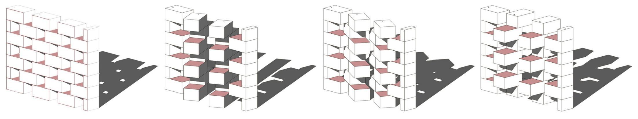
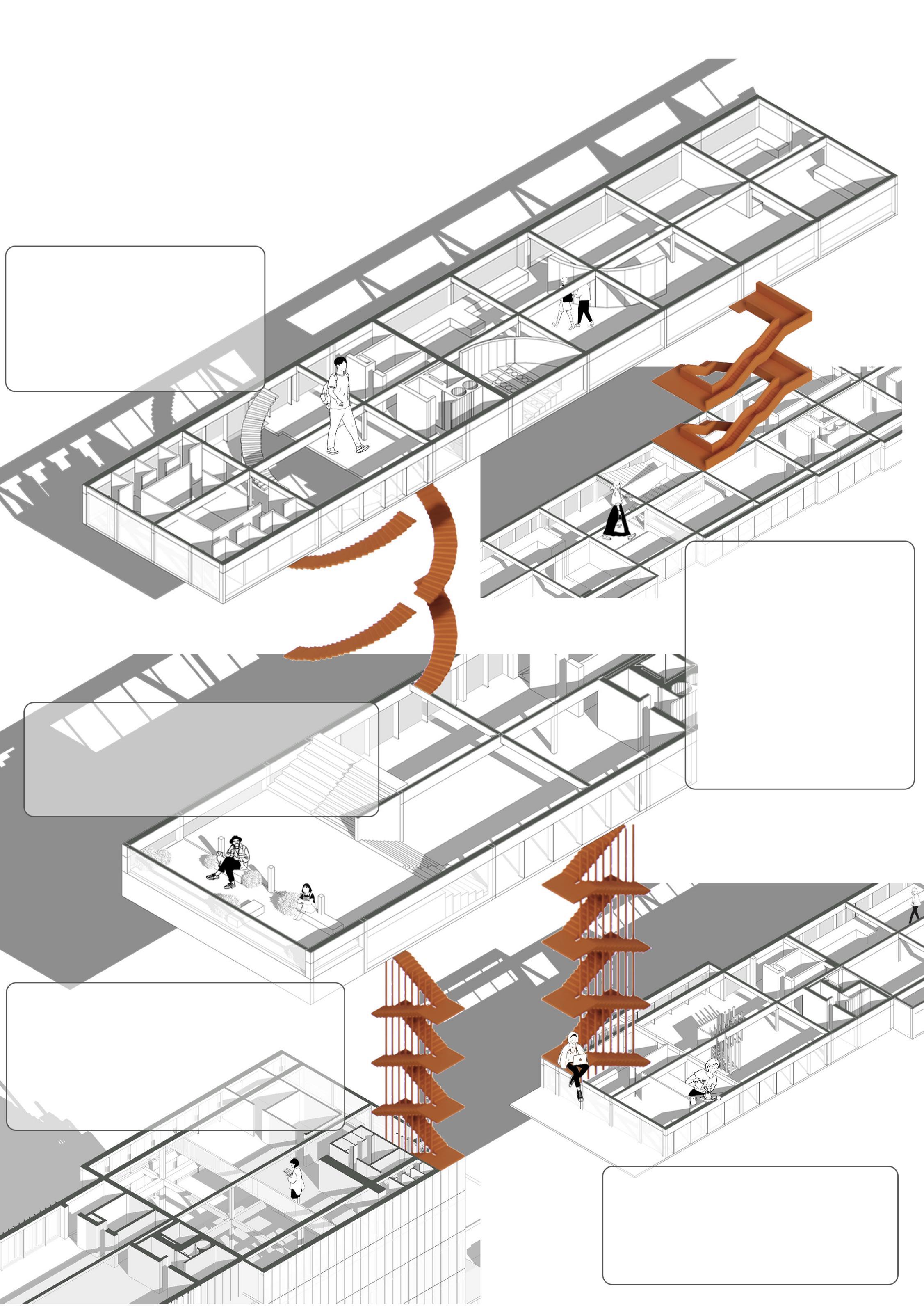
Brainstorming: Different forms of stairs
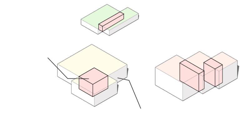
In the context of architectural spatial organization, the design can incorporate connecting staircases within the overlapping intersecting spaces. These staircases, through their various access points, serve to link spaces of different functions and typologies.
Based on the distribution pattern of the buildings within the site, a similar ‘+’ typology layout was identified. The key focus of the design lies in the rational allocation of intersecting spaces and other areas.
Site
Bubble Diagram:
Second Floor Plan:
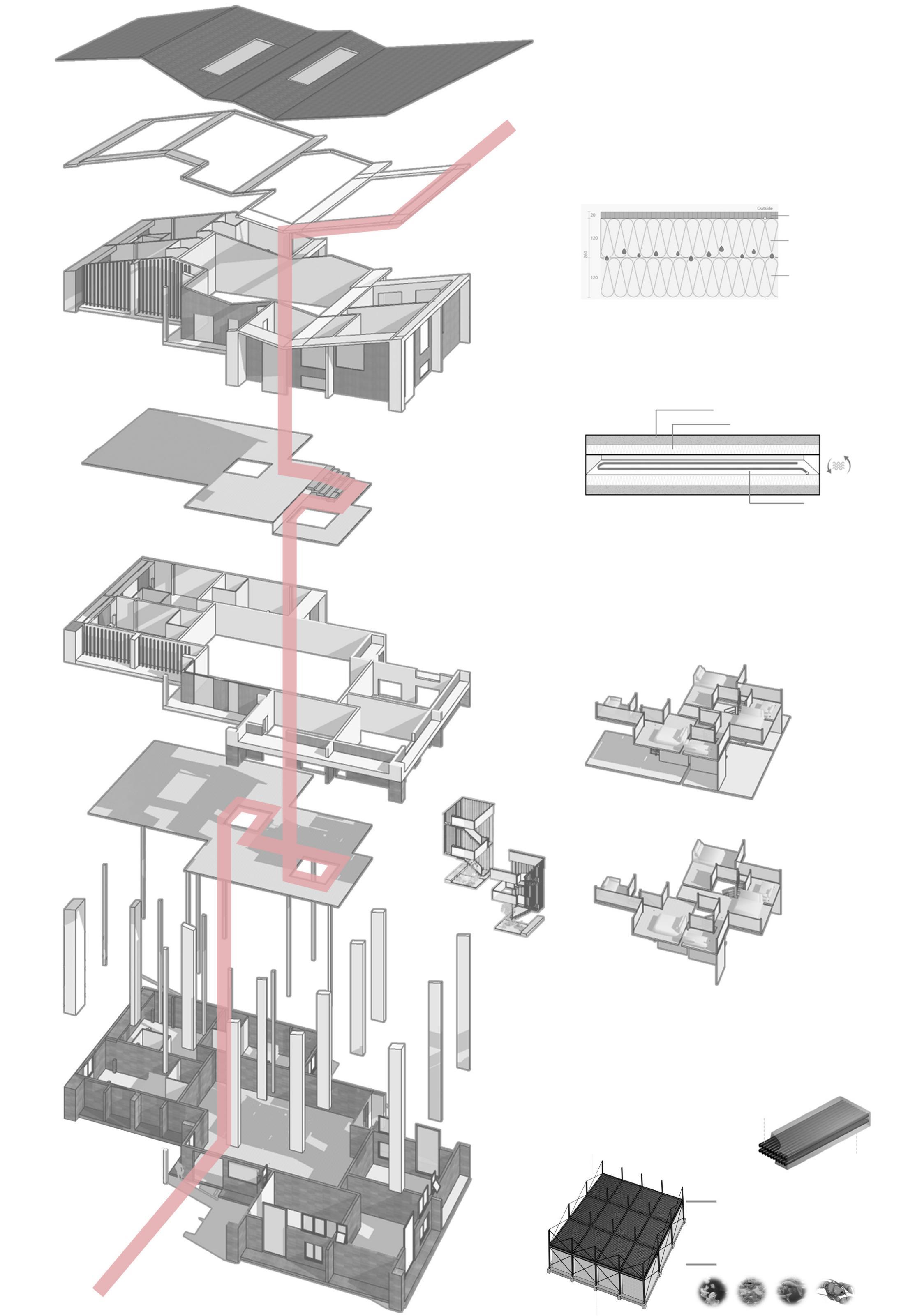
Technical Drawings:
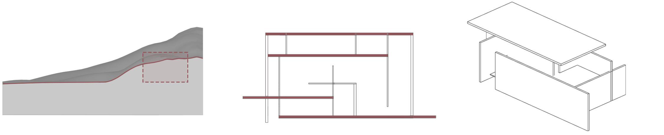
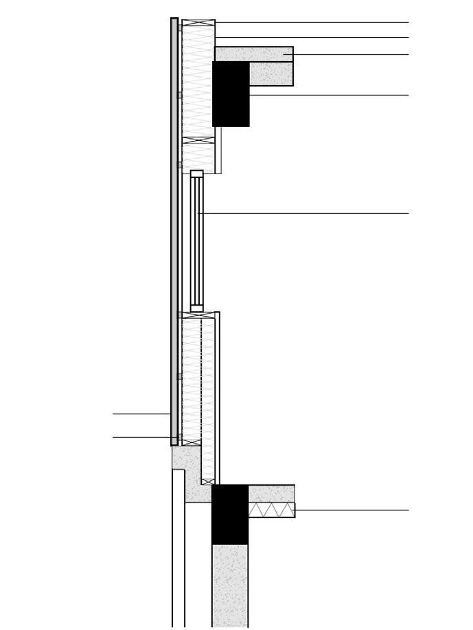
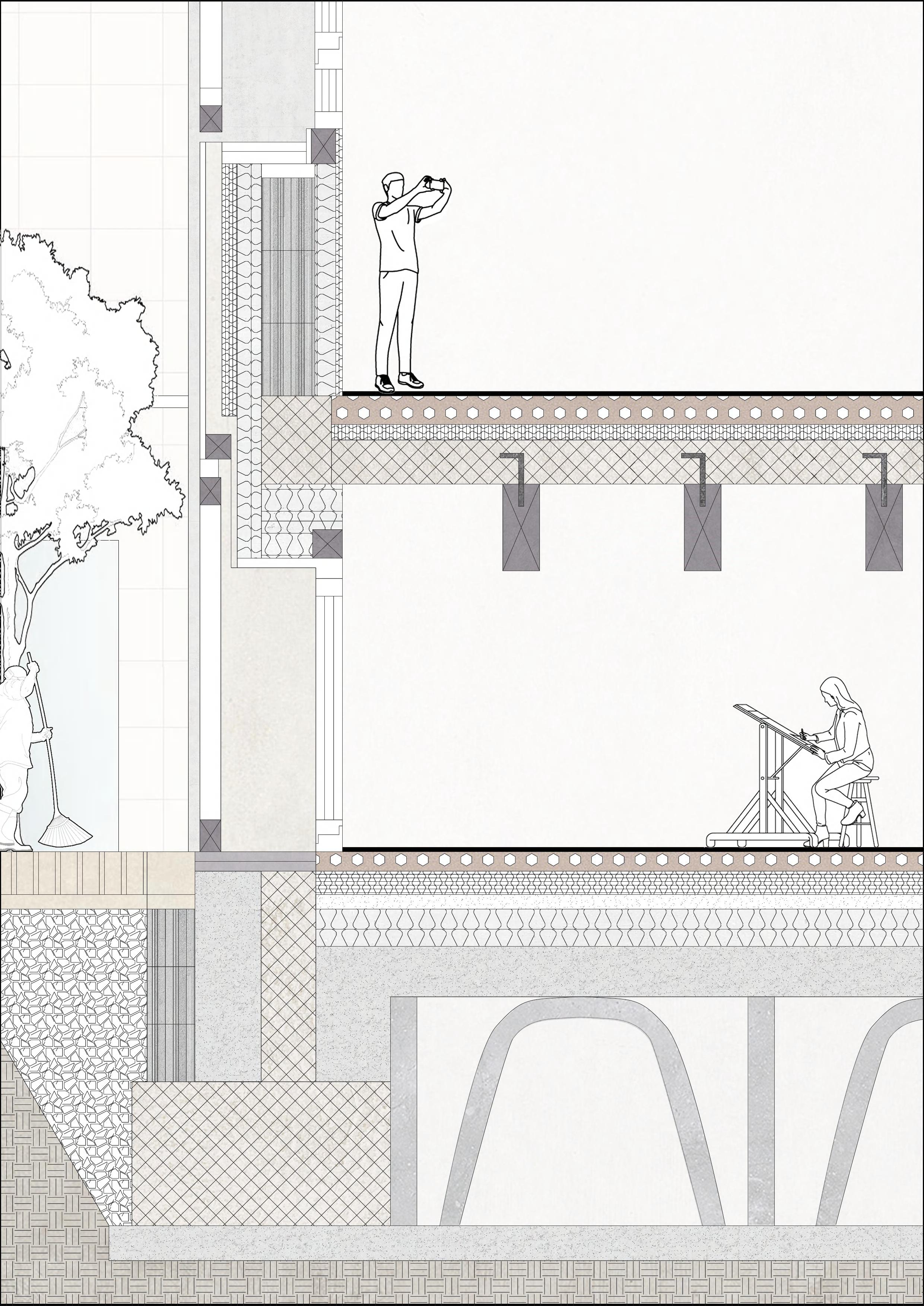
The wall-to-floor connection utilizes a concrete base, reinforced with foam-filled cavities and mineral fiber insulation, ensuring both thermal and acoustic insulation. The crossbeam and ceiling panels are designed to integrate seamlessly with the building's structural frame, while metal connections enhance the durability and stability of the structure.
This thoughtful approach to the connections enhances the overall strength of the building while maintaining energy efficiency and comfort.
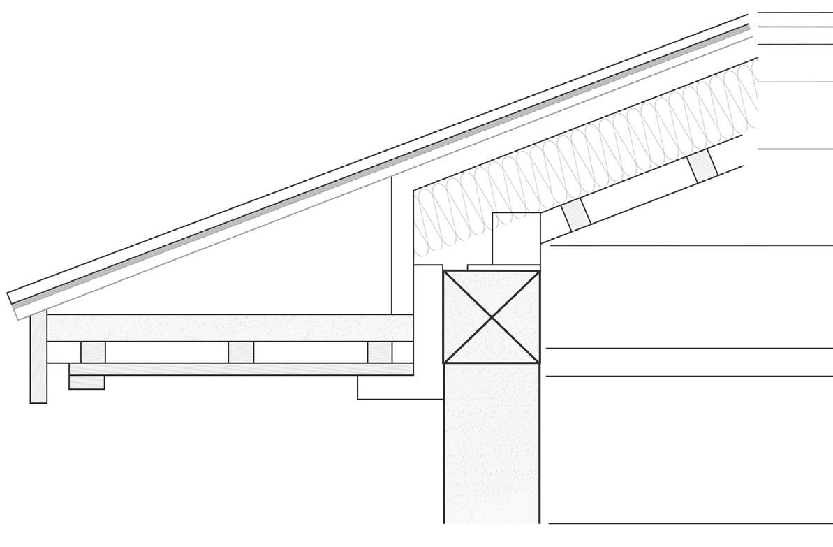
The wall-to-roof connection is designed with a combination of asphalt shingles, roof underlayment, and rigid insulation to ensure both structural integrity and thermal efficiency. The attic insulation enhances the building's energy performance, while the crossbeam and load-bearing columns provide the necessary support for the roof structure. Additionally, the integration of glass windows within the design promotes natural light infiltration while maintaining insulation standards, contributing to overall energy savings.
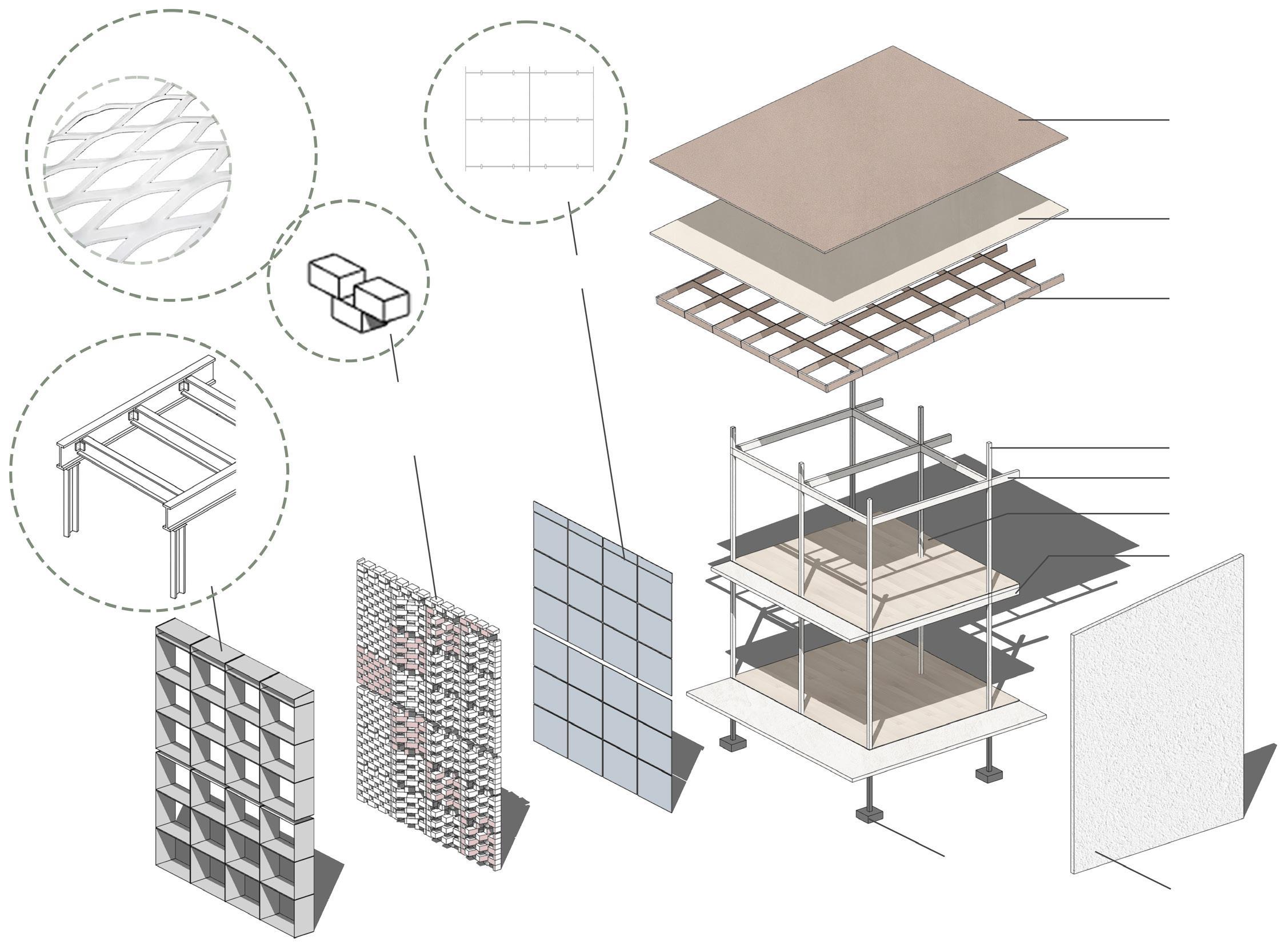
Exploded view of the structure:
The exploded view reveals the building’s layered structure, with fiber-reinforced concrete cladding and insulated floor slabs incorporating a low-density heating and cooling system. The duplex suites cater to various traveler needs, and the sustainable basement features a water-based floating foundation made from recycled materials, aligning with the project’s
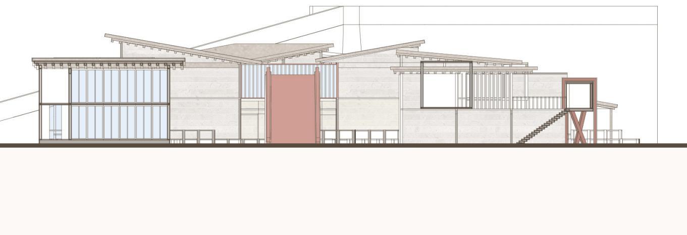
Elevation B:
Ground Floor
First Floor
Second Floor
Rooftop
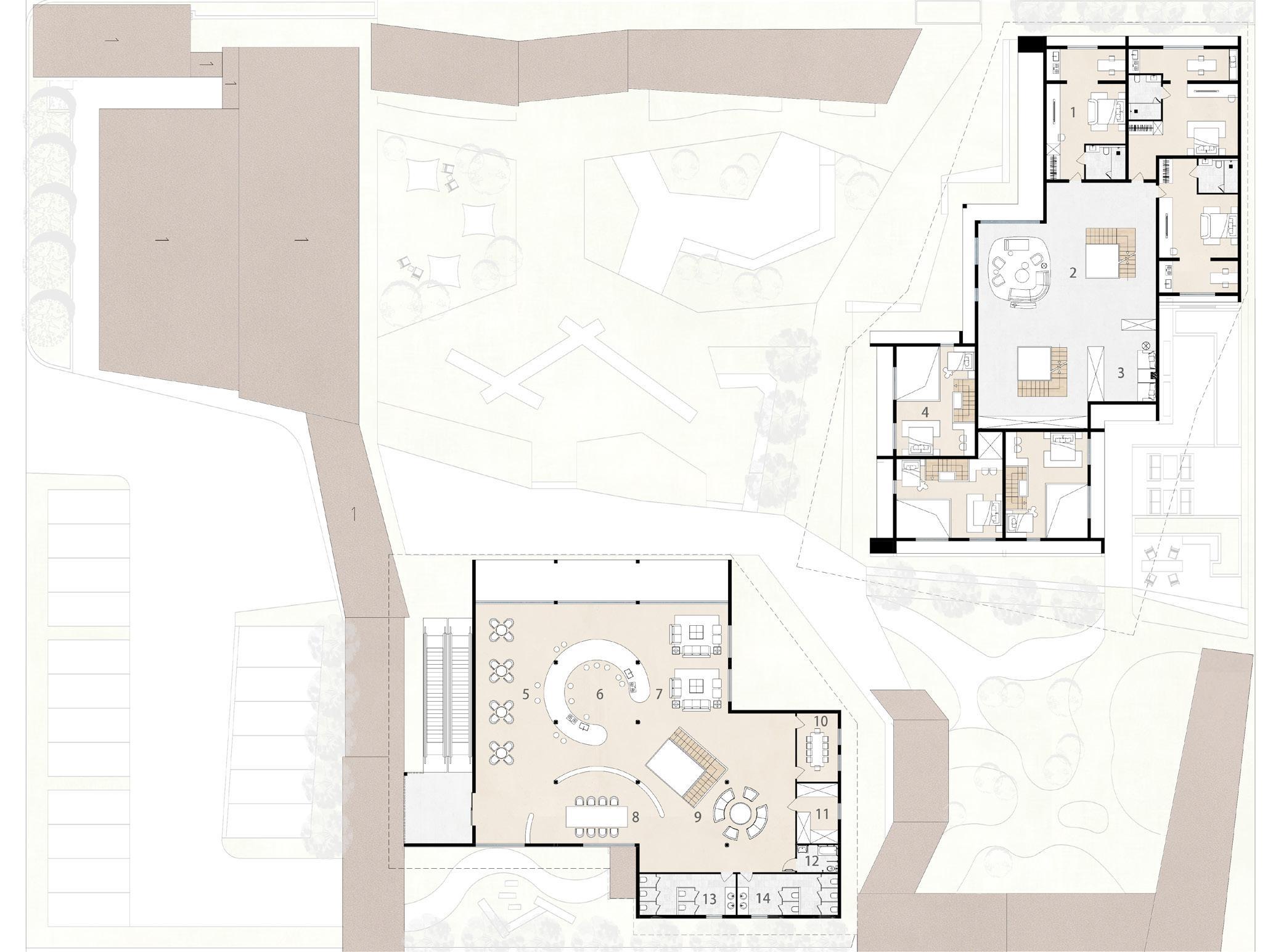
Type 2: Parent-child duplex suites for travellers with children.
materials:
Crafting Community: A Heritage Hub
Location: Suzhou, Jiangsu Province, China
Program Statement:
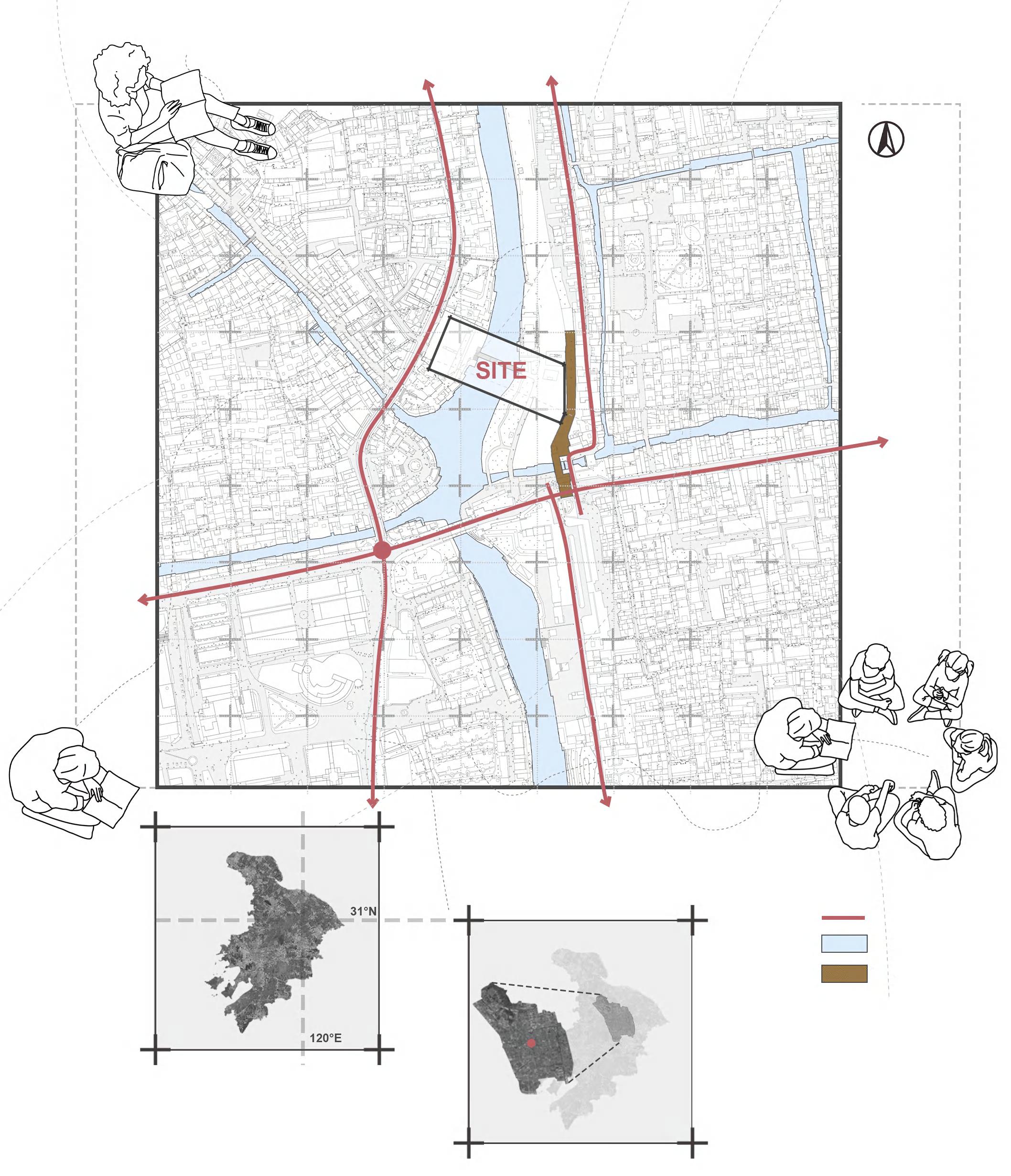
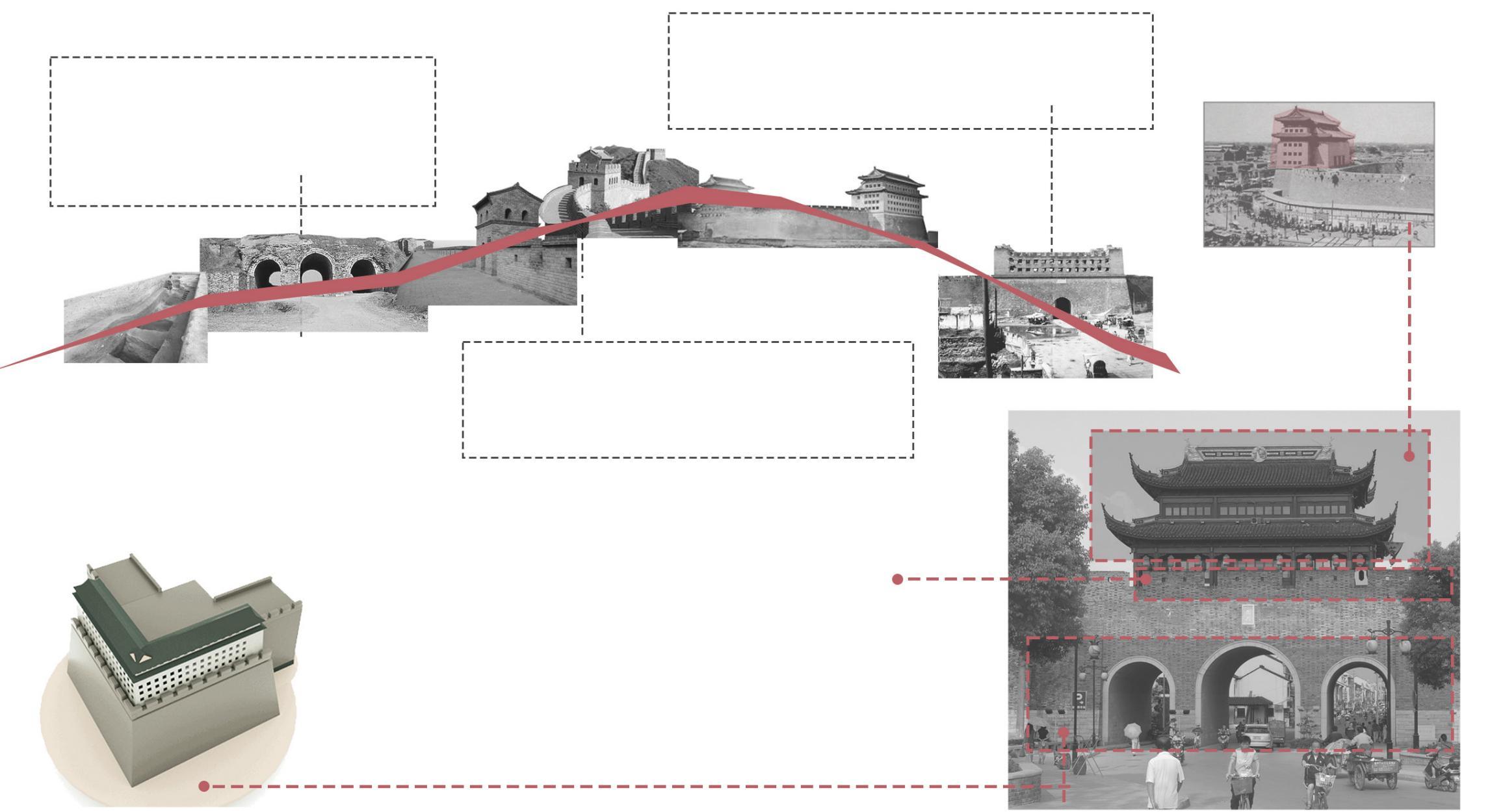
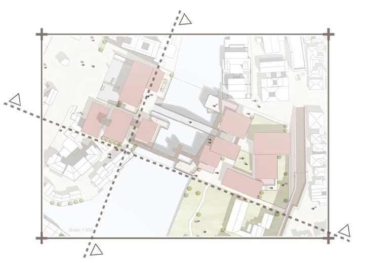
Suzhou, a city renowned for its over 2,500 years of cultural heritage and intricate canal system, is characterized by its historic moat encircling the old city. Originally built as a defensive structure, the moat later became an essential part of Suzhou's water transport network, connecting internal canals to external waterways like the Wusong and Xu Rivers. This unique interaction of water and land fostered a thriving public life, immortalized in Xu Yang's Prosperous Suzhou painting of 1759.
In the modern era, the Suzhou moat has evolved into a vibrant space for leisure and cultural exploration. Recent developments, such as the old city green trail, have integrated this historic area into the daily lives of residents and visitors alike, blending heritage conservation with urban functionality.
This project envisions the creation of a Neighborhood Center along the Suzhou moat, designed to serve as a dynamic space that harmonizes historical preservation, ecological balance, and community engagement. By incorporating pedestrian connections, inclusive design principles, and sustainable practices, the center will act as a bridge between Suzhou's rich past and its progressive future, offering a multifunctional hub for both residents and tourists.
This work aims to explore the intricate relationship between land and water, tradition and innovation, through architecture that responds to both the site’s historical significance and the demands of contemporary urban life.
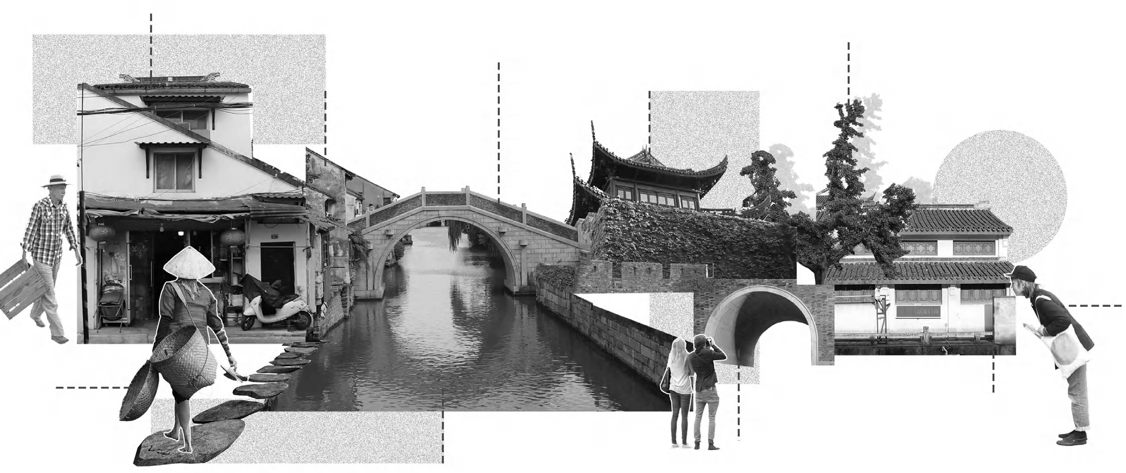
The Chāngmén area, located in the northwest of Suzhou’s ancient city, is a historically and culturally rich district. Once a key gateway and commercial hub, it flourished during the Ming and Qing periods, shaping a dynamic urban culture that blended trade, craftsmanship, and community life. Today, while its historical landmarks and traditional markets remain, the area has evolved into a diverse and fluid urban space, where long-term residents, migrants, and visitors interact closely, creating both cultural vibrancy and social challenges.
The Changmen area is located in the historic center of Suzhou, traditionally serving as a transportation hub. As a result, it has a relatively high population density and strong population mobility. The resident population primarily consists of middle-aged and elderly individuals, as well as teenagers, while the transient population mainly includes middle-aged workers and young travelers.
Analysis of the current situation of the site:
Location:
Given the complex demographic landscape and frequent population exchanges, there is a growing need for a space that fosters community identity and social connection. This project proposes the establishment of a community center that serves as a bridge between different groups, providing public services, cultural activities, and opportunities for engagement.
Located at the intersection of the old and new urban fabric, adjacent to the historic city wall and the Grand Canal, the site offers a unique opportunity to reconnect past and present. By strengthening local bonds and enhancing social inclusivity, the center aims to create a more connected and resilient urban environment while preserving Chāngmén’s historical essence.
Preserving traditional historic buildings is crucial, as they embody cultural heritage and reflect the area's historical evolution. However, challenges exist for both residents and tourists. For residents, aging structures and inadequate infrastructure affect daily life, while for tourists, limited accessibility and fragmented preservation efforts hinder their experience of Jiangnan’s rich cultural landscape. To foster a more integrated and harmonious environment, it is essential to create spaces that facilitate interaction between locals and visitors. As a consequence, this project envisions a community center and supporting infrastructure that enhance social engagement, strengthen cultural identity, and improve overall well-being and sense of belonging for all.
Suzhou, Jiangsu Province, China
Original Vegetation
Tourists
The two most important influences that required to be considered within the site: the old bridge and the old city wall.
It is named after the five rivers that converge here. Five dragon bridge is the entrance to the water of Taihu Lake in the south of Suzhou City, and it is a stone-arched bridge with five bridges, which is the southeastern barrier of Suzhou City.
The main types of bridges around the site are flat, corridor and arch bridges. Height of approximately 12 m Width of approximately 52.3 m
The morphologica evolution and selection of ancient bridges:
1. Retention of the original bridge:
1.Building a new full platform directly under-neath the old bridge (the space of the bridgeopening can also be utilised)
2.Build sunken passages on both sides of the old bridae with water views.
3.Remove the old bridge and build a new connecting platform.
2. Dismantling of the original bridge:
4. Add pontoon devices to connect the non-stop pontoon platforms to form a new bridge.
5. lncorporation of pavilions to increase thediversity of spaces through which they pass.
6. lnstallation of suspension bridges to increase usable space and connectivity.
Timber (for parapets and bridge decking):
Light weight, easy to construct and replace.Renewable resource,environmentally friendly. Reinforced concrete (Used for the main structure of bridges, such as piers and bridge deck bases):
Metal connectors (for connecting timber to concrete structures):
Provide a strong connection to ensure overall structural stability.
High strength, provides stable structural support.Durabe and resistant to environmenta erosion by wind and rain. Plasticity,suitable for yarious shapes and design requirements.
Analysis of ramparts within the site:
Tourist
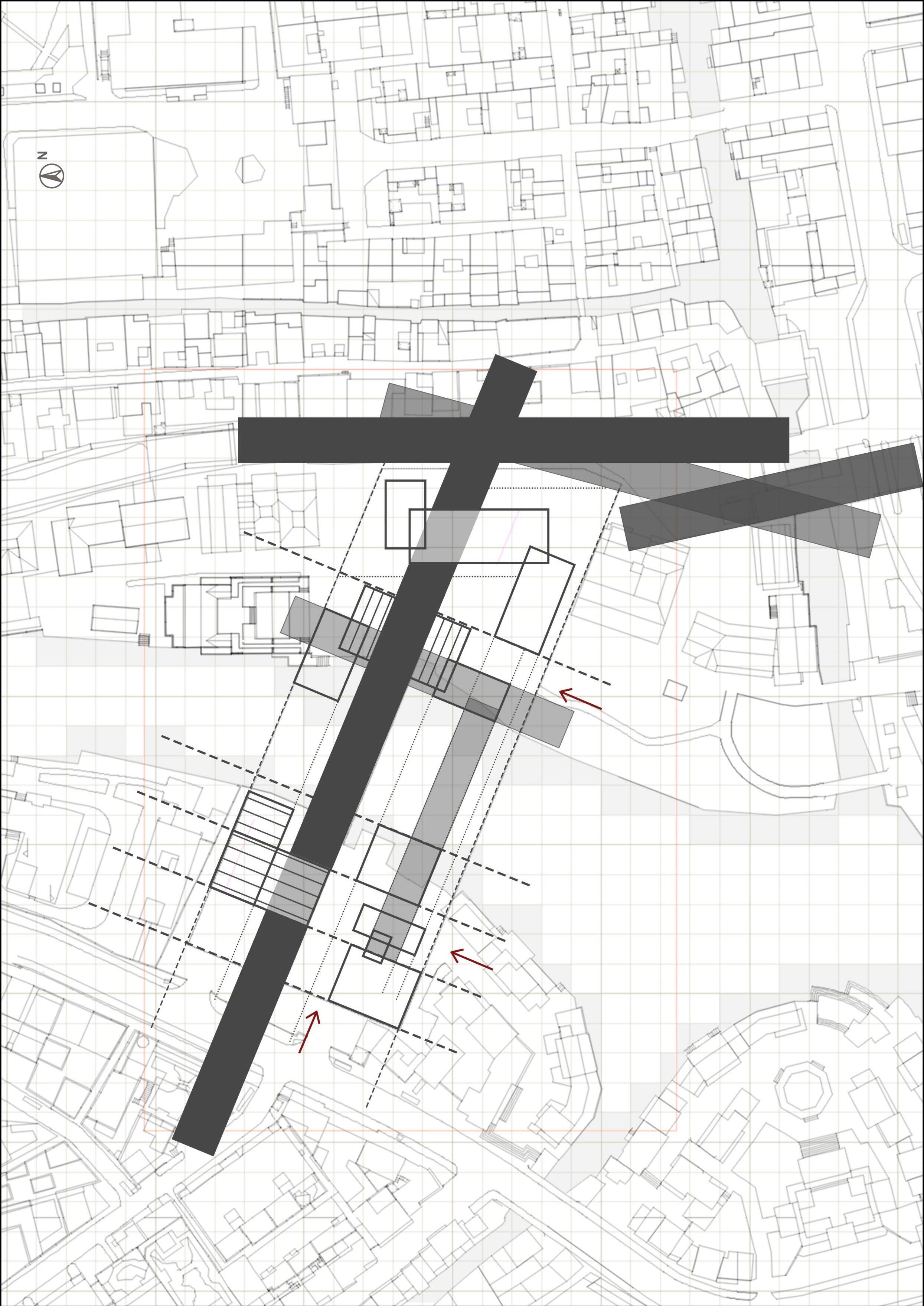
1. Demolition of buildings on the site versus retention of the original bridge.
2. Arrange the blocks according to the axis of conceptual drawing.
3. Increase the connection between the blocks.
4. Adjust the angle to connect the river bank.
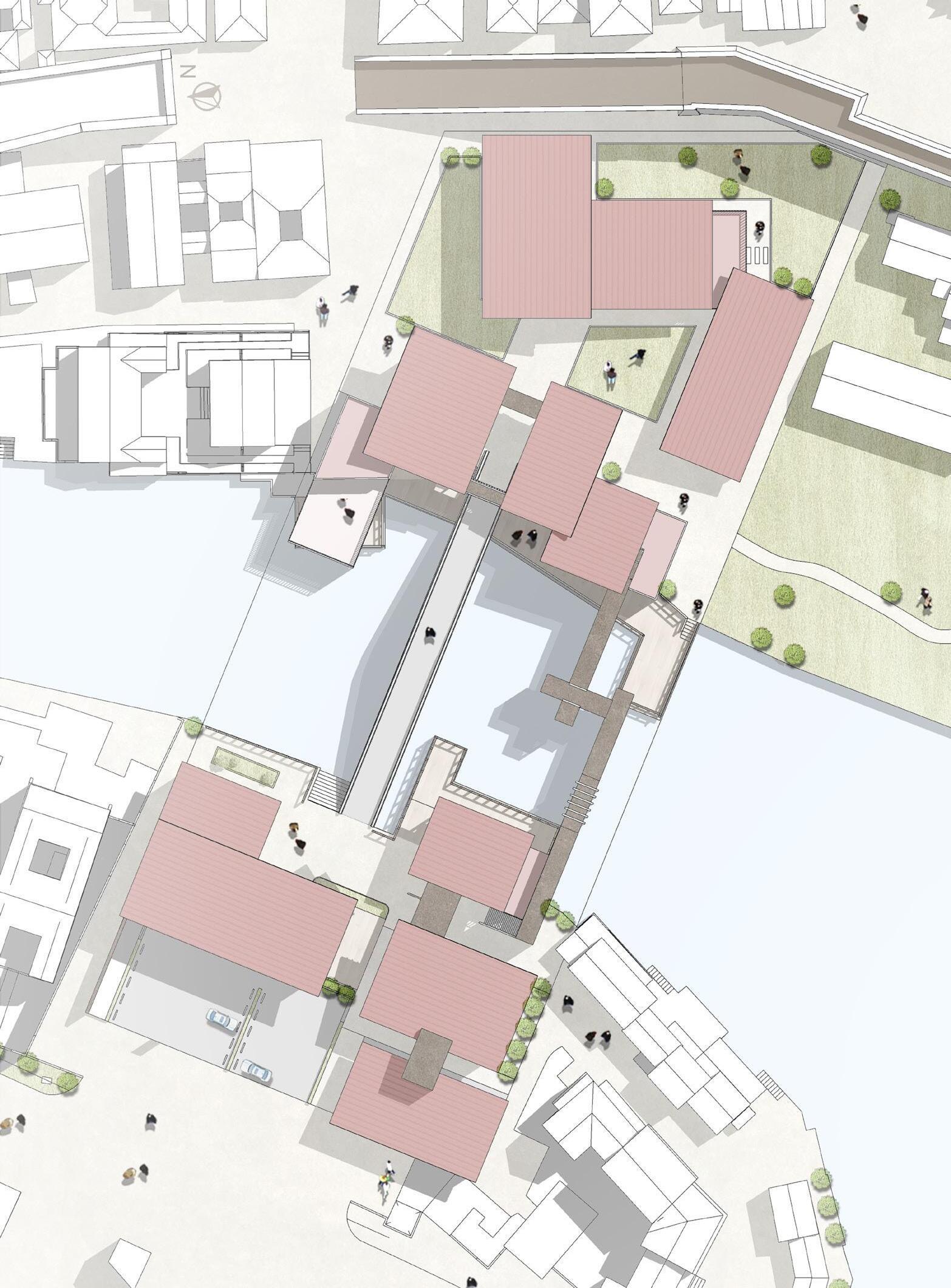
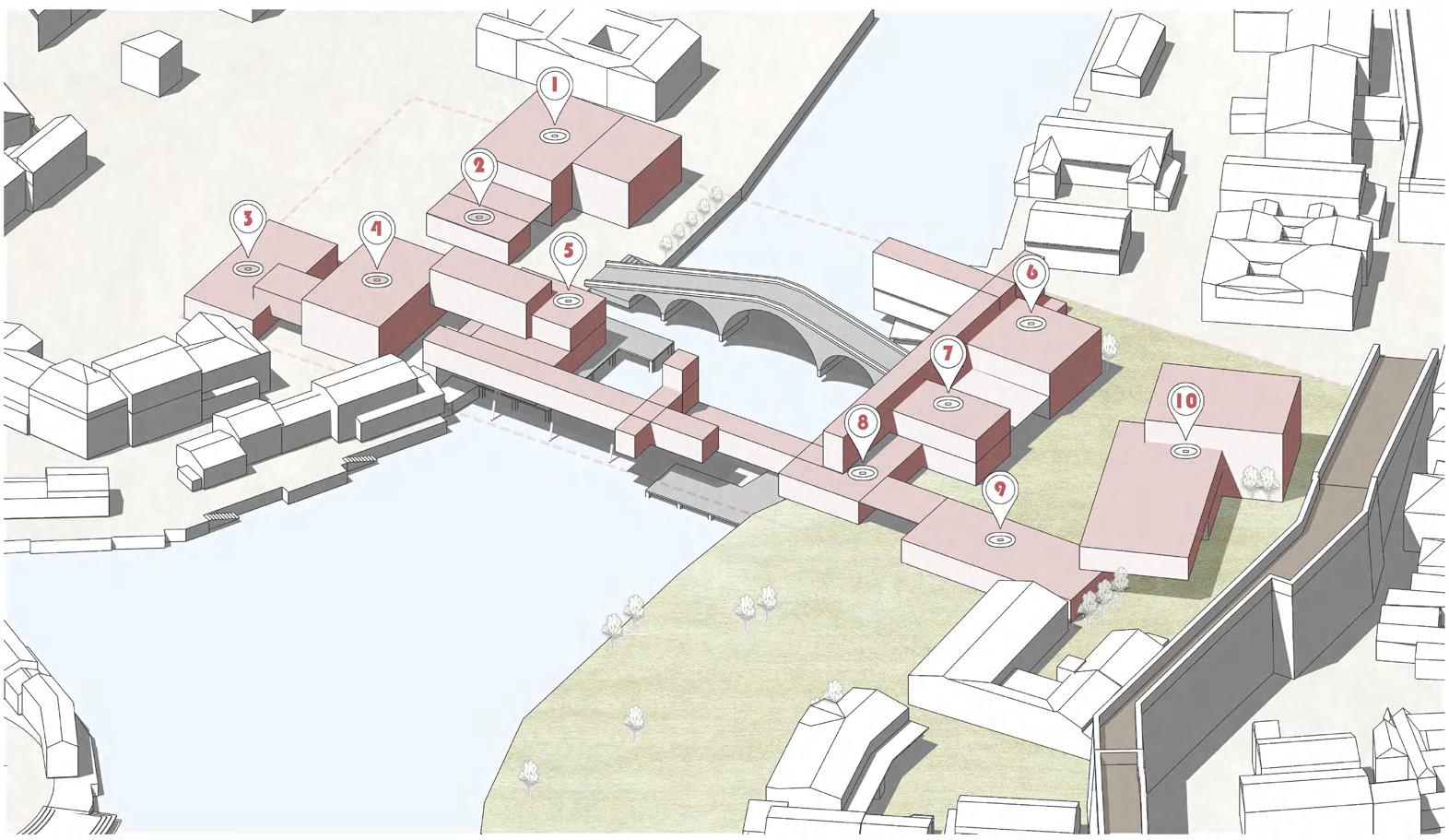
1. workshop
2. Coffee
3. Visitor Information Centre
4. Visitor Recreation and Hosting Centre
5. Speciality Restaurants 6. Neighbourhood Community Centre
7. Coffee 8. Library 9. Lecture 10. Non-Recreational Walled City Museum
Legand:
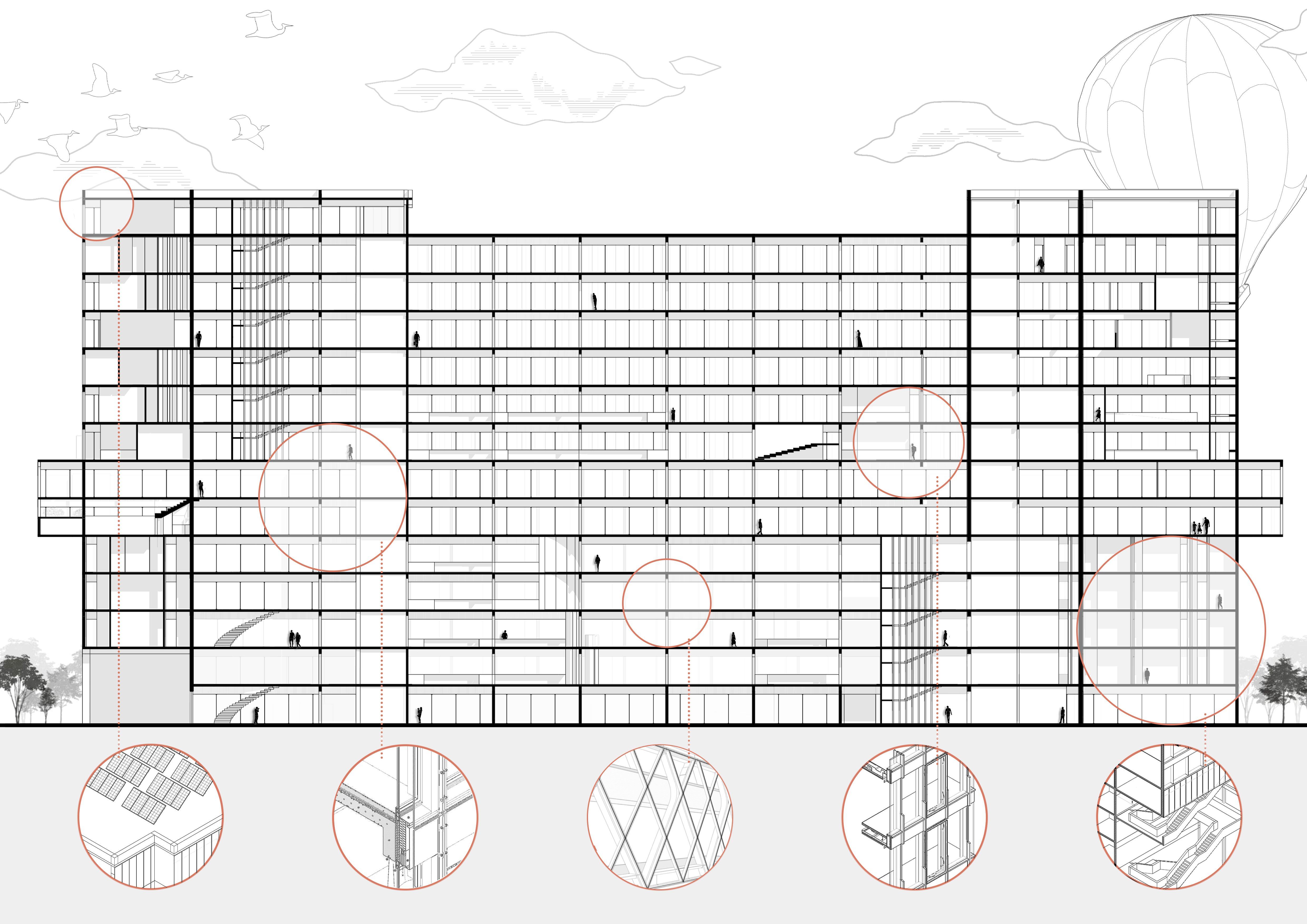
Detailed Section Diagram Structure and Material
Section Material Analysis:
This architectural section drawing presents a detailed analysis of structural and material composition, emphasizing load distribution, spatial functionality, and construction techniques. The diagram illustrates a multi-level framework integrating reinforced concrete, masonry, and composite materials to ensure stability and durability. The structural elements, including beams, columns, and foundations, are strategically arranged to support vertical and lateral loads, optimizing both strength and material efficiency.
Additionally, the sectional perspective highlights human interactions within the built environment, demonstrating the spatial hierarchy and accessibility of different levels. This analysis serves as a critical exploration of architectural tectonics, materiality, and their impact on spatial experiences.
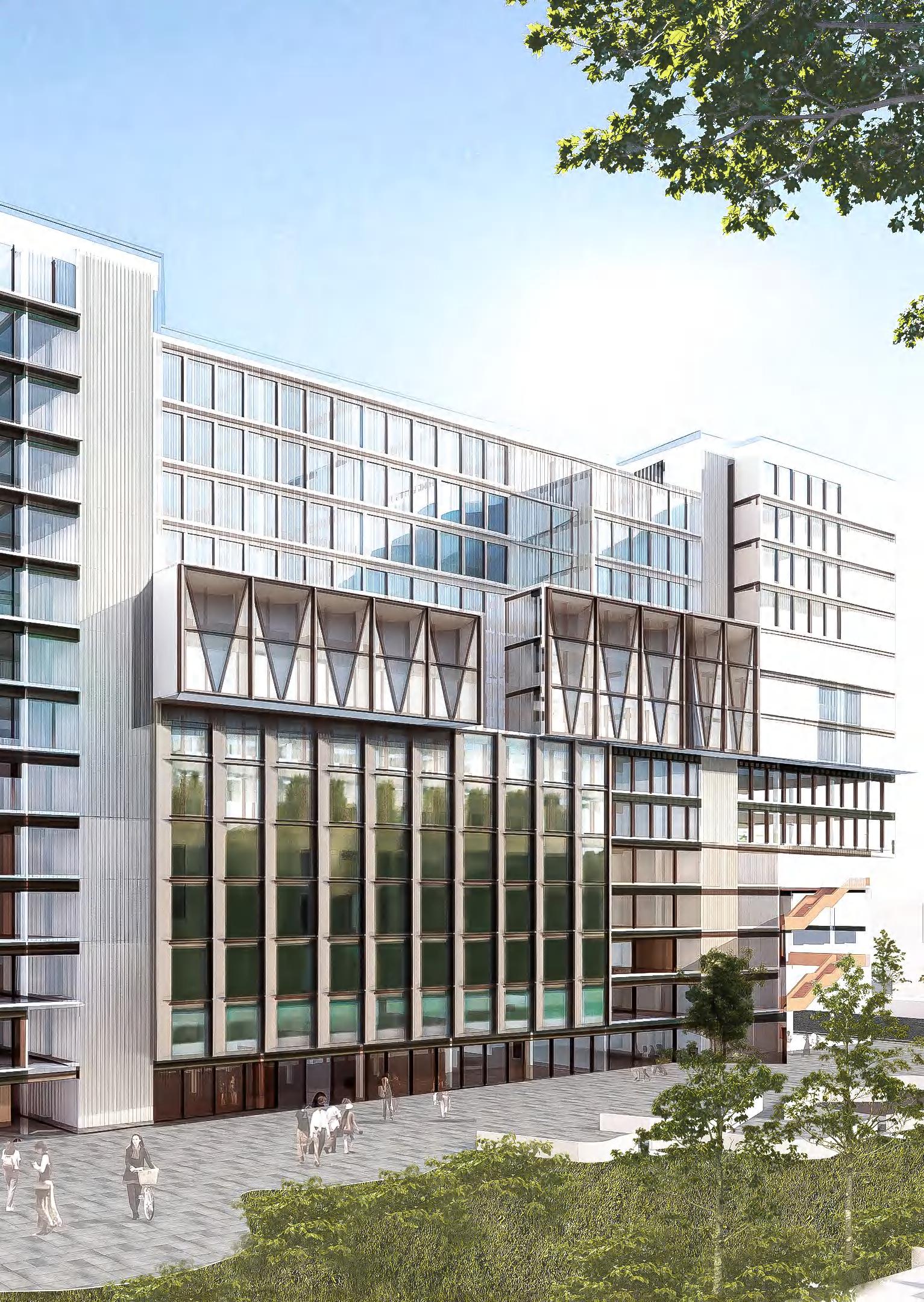
Façade and Sustainability Analysis:
①Brick walls with different arrangements: ②Incorporation of borders and fixed shafts.
To ensure adequate ventilation,the bricks are staggered in theirarrangement.
diagram of the concept rotation angle plane:
③Schematic
04
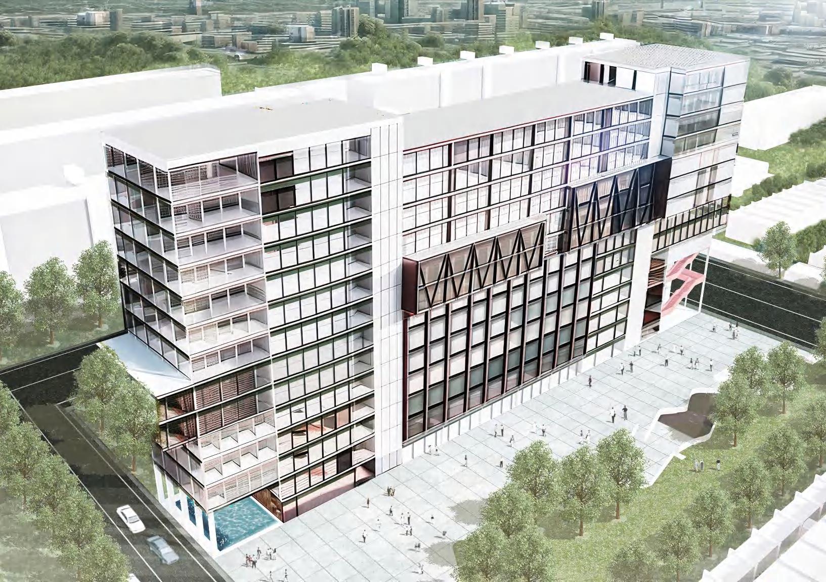
Revitalizing Urban Margins: A Multi-functional Science Center
Location: Vollsmose, Denmark
Program Statement:
Vollsmose, a neighborhood in Denmark with high unemployment and poverty rates, exemplifies the social and economic challenges faced by marginalized urban communities. Historical inequities and limited access to education and jobs have created barriers to upward mobility, while the concentration of poverty perpetuates systemic issues.
To address these challenges, this project proposes a multi-functional science center designed to serve as a community hub. Combining governmental, educational, and commercial functions, the center includes research labs, educational spaces, co-working areas, and public amenities. It aims to provide residents with better access to social services, increase employment opportunities, and foster social inclusion. By integrating skill-building programs and inclusive economic initiatives, the center promotes sustainable development while revitalizing the neighborhood.
This initiative seeks to transform Vollsmose into a vibrant, inclusive space that bridges social divides, enhances individual livelihoods, and supports community resilience and growth.
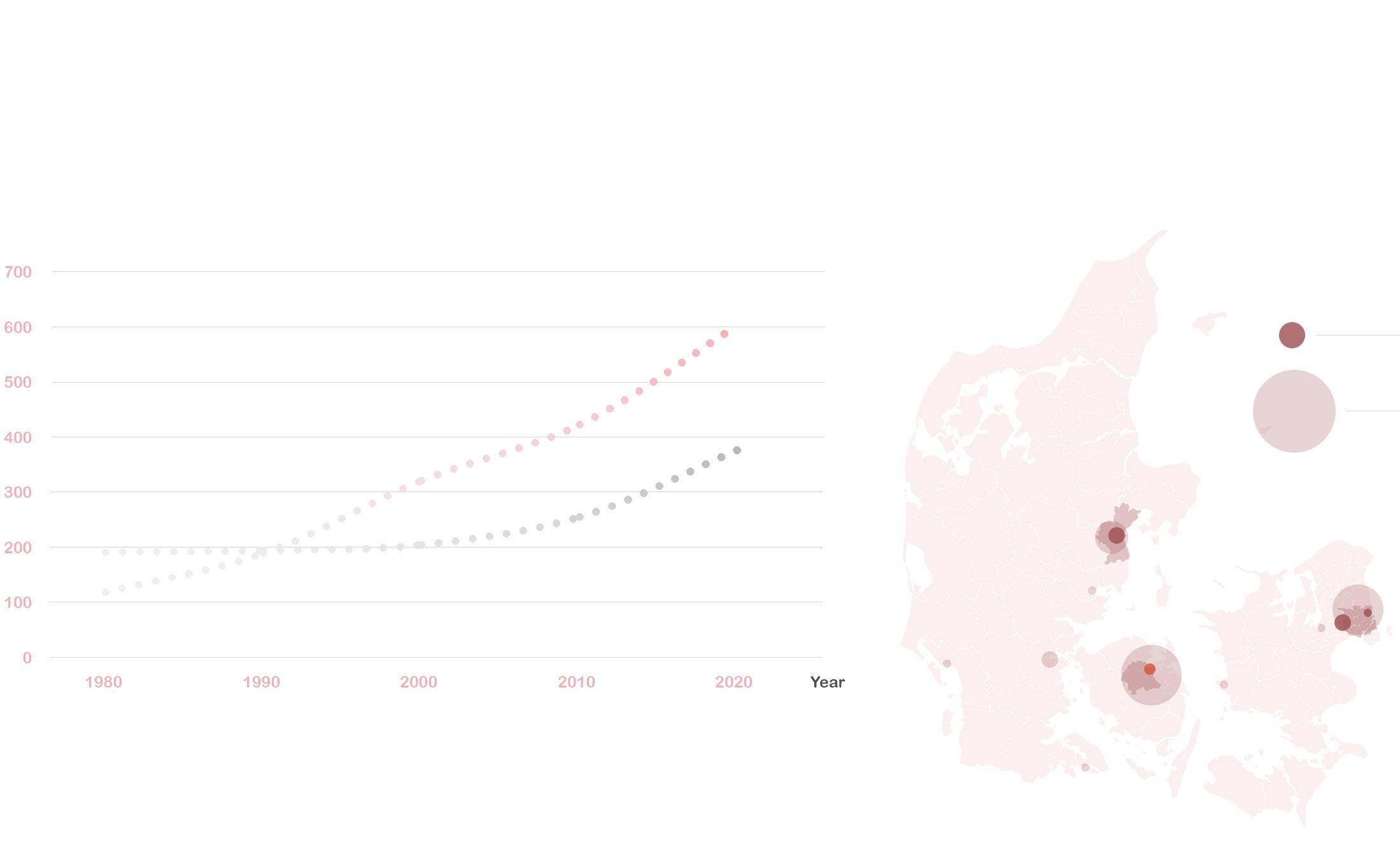
Demographic changes in Denmark:
In Denmark, a "parallel society" refers to communities where immigrant and minority groups, often labeled as "non-Western," live in isolation from the mainstream society. This isolation is marked by high unemployment, low educational attainment, and economic disadvantage. Such areas are seen as culturally and socially segregated, prompting the government to implement urban redevelopment plans aimed at improving integration and reducing disparities.
Denmark's Population Growth Line Chart
The chart shows a steady rise in non-Western immigrants in Denmark, now at 8.5%, compared to stable Western immigrant numbers. This growing gap suggests the development of a "parallel society," with non-Western immigrants facing integration challenges.
Denmark's Population Growth Line Chart
Denmark's Population Growth Line Chart
Functional Distribution Map in Vollsmose :
VOLLSMOSE
Diverse
Day trip to Museum of Science and Technology:
Alex's family is a "non Western population" living in Vollsmose. Due to the opening of the local science museum, both his father and mother have had the opportunity to obtain different types of jobs. Therefore, Alex decided to visit and study at the science museum with his parents over the weekend.
In the morning, Alex wandered around the exhibition halls on the second floor, discovering various themed exhibits.
At noon, Alex had lunch with his parents in the dining area on the middle floor, surrounded by lush greenery and offering a beautiful view.
He then slowly made his way up the spiral staircase to his mother's open research lab. The exhibition halls and the lab were separated by just a single layer of glass, so Alex could clearly see his mother's experiments.
In the afternoon, Alex went to the self-study area on the third floor of the library on the 11th floor. The space offered various sized meeting rooms and study zones, creating an excellent atmosphere for learning.
Meanwhile, Alex's father took the stairs to the government department where he worked to continue his duties.