1972 Larsen Field Trip

Page 1

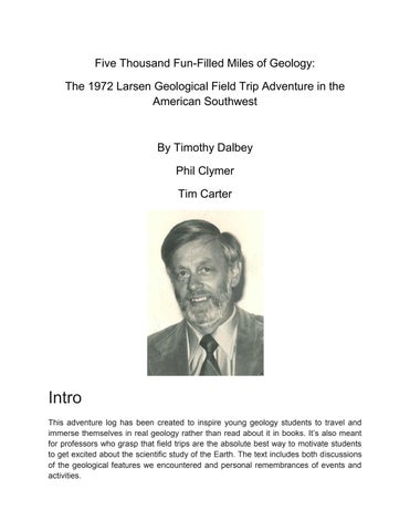
Five Thousand Fun-Filled Miles of Geology:

The 1972 Larsen Geological Field Trip Adventure in the American Southwest

Intro

This adventure log has been created to inspire young geology students to travel and immerse themselves in real geology rather than read about it in books. It’s also meant for professors who grasp that field trips are the absolute best way to motivate students to get excited about the scientific study of the Earth. The text includes both discussions of the geological features we encountered and personal remembrances of events and activities.

This is a collaboration of three strangers that met on the infamous University of Cincinnati 1972 Geology 271 Demonstration Field Trip taught by Dr. Len Larsen. Those three are Tim Carter, Phil Clymer, and Tim Dalbey. Carter went on to become a custom home builder and media personality while Clymer pursued geology as a career and Dalbey obtained a PhD in archaeology.

PHIL CLYMER content: This year is the 50th anniversary of a fondly remembered event in the academic lives of a small group of aspiring geologists at the University of Cincinnati in 1972. The Geology 271 Demonstration Field Trip was scheduled for a two week journey to the Four Corners area of the Southwest USA. Tim Dalbey’s road log measured the distance traveled as 4,831 miles, and the trip itinerary included stops at the Grand Canyon, Bryce, Zion, Petrified Forest and numerous other national and state parks.

TIM CARTER content: The field trip was led by Dr. Leonard Larsen, a seasoned geologist whose main focus was hard-rock, igneous and metamorphic geology. It was an immersive experience to a new geology student to put it mildly.

Spending two weeks looking at the exposed bedrock of the Southwest USA is one way to get a young geology student excited about the science. It can also be a humbling experience if you absorb the enormity of it as can happen walking into and out of the Grand Canyon.

Dr. Larsen was the ideal teacher for this trip because he felt most at home at rock outcroppings. His mild manner and chortle laugh put all of us at ease in hours. It was a daunting challenge to take sixteen students on a cross-country geology field trip.

There was a meeting in the spring quarter prior to the field trip. Dr. Larsen gave a short talk about what we should expect and what would be expected of us. He gave some advice about equipment to take along, such as binoculars, field boots, camping gear, etc., and asked for volunteers to supply cars or trucks. The estimated cost of the trip was placed at $300. Three hundred for such a trip seems fictional now, but our greatest expense was gasoline and it was a whopping thirty six cents a gallon.

This grouping of students consisted mainly of second-year geology majors, and most had taken only the five-hour Introduction to Geology class. Thus, most of us were strangers to each other.

Phil: Our assembly point was in a small parking lot adjacent to Old Tech, the home of U.C. Geology. Our entourage consisted of sixteen student participants; Ken Appel, Steve Berniius, LeRon Bielak, Tim Carter, Phil Clymer, Lon Cooper, Tim Dalbey, Mike Fein, Dennis Gillespie, Jim Grotke, Mike Honnert, Tom Parker, Ken Paul, Joe Ulmschneider, Jack Wunder, and Helen Young, and the leader, Dr. Len Larsen

These seventeen people were shoehorned into four vehicles:

● UC Geology department’s red International Harvester station wagon nicknamed Big Red

● Ken Apple’s powder-blue pickup truck with a protective aluminum cap over the bed

● Dr. Larsen’s beige Oldsmobile sedan

● Helen Young’s Chevy Nova

The group left campus about 9:30 a.m. and the plan was to drive in shifts straight through to Albuquerque. Please note, road maps showing geological stops in New Mexico, Arizona, Utah, and Colorado are included at the end of this document.

Tim Carter: Tuesday, September 5, the day of departure all of us met on a muggy Cincinnati morning. I had a backpack with extra clothes, a sleeping bag, my single-lens reflex 35mm camera, and the required notebook. My guess is my Dad drove me up and dropped me off as I have no memory walking from home with all this gear.

I can’t remember anything Dr. Larsen must have said as he addressed us once everyone was there. At some point he talked about how important it was to make accurate sketches in our notebooks at all road stops. Photos give a false sense of security by themselves. There might be things you notice and draw in a notebook that you might not pick out of a photo months or years later. A sketch plus written notes about what you see at a road stop are best.

There were no cell phones in those days and our caravan lacked CB radios. Dr. Larsen said if you get separated in the caravan, go to the next town’s main post office and wait.

I have no clue how this would have worked had a car fallen behind or broke down and the other three just kept motoring down the interstate highway at 70 mph!

Tim Dalbey comments: We started at Cincinnati hoping to get to Albuquerque, New Mexico by 6 Sep. The first day we crossed four states (Ohio - west part), Indiana, Illinois, Missouri) and 200 million years of geologic history from the Ordovician to the

end of the Pennsylvanian traveling through topography that had been glaciated in the Plio-Pleistocene.

We headed west from Clifton to I-75 to get to I-74 (partly under construction also using U.S Hwy. 52) for Indianapolis, Indiana, across the Mill creek valley choked with the latest Wisconsinan Miami Lobe glacial outwash (Tazewell and Cary tills) deposited in a channel 100 to 150 feet deep ca. 14 kyr ago. We are heading northwest on I-74 passing through roadcuts of late Ordovician (488-443 mya) that contain the paleontologically famous Cincinnatian series (451-443 mya), where some of the most fossiliferous invertebrate limestones in the world have been studied for over 175 years and represent over 470 genera, > 1,200 species from various tidal environments of marine shallow seas. The marine deposits include ca. 1,000 feet of limestones, shales, marls and limey mudstones capped by glacial till and alluvium from three glaciers that made into this part of Cincinnati, the Kansan, Illinoian and Wisconsinan. As we travel on I-74 we pass though outcrops of the Maysvillian Stage (Fairview, Bellevue, Corryville, Mt. Auburn sequences), and closer to Indiana we pass into the Richmondian Stage (Sunset/Oregonia, Waynesville, Liberty, Whitewater, Saluda sequences), last sequences occur in Indiana. The Ordovician outcrops along I-74 almost to Indianapolis with a narrow band of Silurian before Indianapolis.

The fossiliferous deposits are the result of the equatorial Iapetus oceanic sea shelves with shallow seas surrounding the north to northeast trending Cincinnati Arch (Lexington Platform), a structural uplift (anticline) east of the Illinois basin, southeast of the Michigan basin and west of the Appalachian basin that was still present later during the Devonian. Meanwhile, the Taconian orogeny rising to the east adding sediments to the Appalachian basin (foreland basin) on the east side of the arch perhaps forcing the uplift combined with Cambrian uplift from below as part of the southern platform of the North American craton (Laurentian land mass). The fossiliferous Cincinnatian series represents marine bio-lithofacies deposits across peritidal shallow deposits, shallow subtidal facies, deep subtidal facies, to offshore facies with lagoon, shoal, barrier and inlet restricted zones. Invertebrate species of the "peritidal" shallow facies includes a sparse fauna of bryozoans, ostracods, brachiopods, stromatoporoids, ripples, burrows and desiccation cracks of the Saluda formation in Indiana. Common invertebrates of the "shallow subtidal" facies include thicker shelled brachiopods: Platystrophia sp., Herbertellasp., Rafinesquina sp., bryozoan masses making up fossil hash in the bioturbated low tide zone of the Bellevue,Mt. Auburn, Oregonia and Whitewater formations. In the "deep subtidal" facies fossils include brachiopods and bryozoans ranging between the shallow subtidal and offshore facies all deposited as storm beds with numerous trace fossils (holes, burrows and tracks) found in the Fairview, Corryville, Sunset and Liberty formations in Indiana. The "offshore" facies consists of thin skeletal crinoid grainstones deposited by possibly hurricane force storms with relatively small

brachiopods Dalmanella sp., Sowerbyella sp., trilobites such as Flexicalymene sp. and Cryptolithus sp. plus other bryozoans, molluscs, with less breakage and numerous trace fossils common in the Waynesville formation in Indiana. The marine fauna represents what has been called the "Ordovician radiation" (aka. Great Ordovician Biodiversification Event [GOBE]) that went well beyond the "Cambrian explosion" adding significantly more genera to the Phanerozoic marine bio-communities where carbonate (aragonite) shell secreting organisms attached to the shallow marine carbonate shelves.

The uppermost fossiliferous Cincinnatian series of marine invertebrates found mostly in Indiana as we travel west on I-74 represent a large mass extinction event affecting ca. 80-85 percent of the fauna, the first of the five major extinction events on the planet. Cold glacial conditions during the Hirnantian and temperature change affected the marine environment, lowering epicontinental sea level exposing shelf communities like those living on the "arch." This was followed by a long period of no deposition ca. 447444 mya creating an unconformity before warm shallow seas of the Silurian inundated the shelf when the land mass was near the equator and a tropical climate when marine organisms flourished. Large reefs were common in the middle to late Silurian in the southwest with quiet areas like lagoons and reefs where brachiopods, crinoids and corals lived in the shallow seas. Most of this bedrock is buried in the southwest.

I-74 crosses the Whitewater River, another original north flowing Teays river in preglacial time that was clogged by glacial outwash that reversed the drainage to the Great Miami river, then to the Ohio river. The interstate roughly parallels the Shelbyville moraine (ca. 21 kyr) of the Wisconsinan glacier flat Tipton till plain most of the way to Indianapolis overlying Brassfield limestone bedrock that lies unconformably over Cincinnatian Series Ordovician bedrock.

We got to Indianapolis at 10:40 AM after traveling 107 miles, then we headed for I-465 around the city to I-70 heading southwest towards Terre Haute, Indiana in the southwest corner of the state. Most of the topography of southwest Indiana along I-70 is relatively flat agricultural lands as a result of glaciation that left behind moraines, eskers and kames mostly from the Illinoian glacier that almost reached Terre Haute. At Terre Haute we crossed the Wabash river that was once part of the north draining catchment of the Teays river during preglacial times that became a major glacial outwash channel one to two miles wide and the largest northern tributary of the Ohio river.

Phil: First Stop - (Unscheduled) Indianapolis – One of the students discovered that his wallet was missing, and it was considered critical as it contained his field trip money. Was it lost, stolen, or forgotten? He called his wife to have her check if the wallet was on his desk. But she wasn’t yet home so we delayed an hour and a half for the call to be

completed. Yes, it was on his desk. Larsen advanced LeRon the money for his trip expenses.

Dalbey: From Indianapolis we traveled southwest crossing Devonian, Mississippian and Pennsylvanian (Carboniferous) Paleozoic bedrock that was deposited offshore from the slope of the Cincinnati Arch into the Illinois basin. The Paleozoic bedrock is mostly buried by glacial deposits to Terre Haute on I-70 to St. Louis, Missouri. Subsurface Devonian bedrock also reflects deposits from a shallow sea with diverse marine invertebrate fauna mostly of rugose and tabulate corals forming barrier reefs in a north to south orientation in a narrow basin. Sediments from the Cincinnati Arch built up and extended into deeper parts of the Illinois basin where deeply buried marine limestones, dolomite with siliceous cherts with marine carbonaceous shale bedrock in the upper sections. To the southwest remnants of "Patch" reefs throughout the Silurian and Barrier reefs that formed around lagoons and in arcs near Terre Haute can be seen occasionally in outcrops. Late Devonian inland seas changed to gray and black limy muds from infusion of high amounts of algae and organic plant matter known as the "Black shales" a source for oil and gas. Influx of late Devonian sediment coming from the Acadian orogeny to the east lasted for 50 million years into the middle Mississippian (359-323 mya) and Pennsylvanian (322-299 ya) aka. Carboniferous subperiods.

Flat glacial till plains and agricultural land continues along I-70 in Illinois from the border at Terre Haute, Indiana to St. Louis, Missouri. Sediments coming from the eastern Acadian orogeny formed huge equatorial deltas of clay, silt and sand that reached further west across the Illinois basin where marine communities of crinoids, bryozoans, brachiopods, gastropods, various other bivalves and trace fossils predominated in a humid warm carbonate environment. Swamps and wetlands spread across exposed land areas for nearly 60 million years (36 my Mississippian, 25 my Pennsylvanian) where plant material from lycopods, conifers, seed ferns formed coal deposits while the very southwest remained a shallow sea. In the southwest Carboniferous bedrock exposures of shale, sandstone and limestone bedrock is mostly buried under till plains. The Carboniferous of Indiana continues into southern Illinois as sea level fluctuations and glaciers near the south pole migrated creating alternating periods of marine inundation and dry land where Mississippian period limestones and marine fossils and early sharks occur. Later Pennsylvanian bedrock exposes clay, silt and sand of large riverine deltas with swamps where coal was formed and the swamps contained a wide variety of plants and animals.

We reached St. Louis after 268 miles at 4:40 PM and exited I-74 south to take I-255 around St. Louis, passed Cahokia, a famous huge Native American site in route to I-44 heading southwest for Springfield, Missouri. The Missouri river and the Illinois river flow into the Mississippi river in north St. Louis, the Meramac from the west out of the

Ozarks, the Kaskaskia from the north out of Illinois to the south near where the Ohio river (combined with the Green, Cumberland and Tennessee rivers) flows into the Mississippi river at Cairo, Illinois. The Mississippi river where St. Louis occurs was the major outwash channel for all the glaciers and most of the continent before the glaciers as outwash buries bedrock 100-150 feet deep in the channel. Mississippian age cherty limestone, with some dolomite is known as the St. Louis limestone along with the glacial terraces forming 100-200 feet high cliffs along the west side of the Mississippi. The west bank making up most of the city was mostly covered with glacial alluvium, till, outwash terraces and loess, now many of the terraces have been modified by land development. The Mississippi river channel on the east is a wide floodplain of braided streams and wetlands where large rivers from the north and east flow into the river draining much of the northeastern U.S.

Heading southwest on I-44 from St. Louis, Missouri towards Rolla, Missouri we start into the Ozark Plateau made up of Precambrian, Cambrian and Ordovician age bedrock. The Plateau bedrock consists of limestone, dolomite, shale, sandstone and chert higher in the east (part of an asymmetrical structural dome) where Precambrian granite and porphyries of the Saint Francois Mountains to the southeast are exposed from erosion and slopes lower in the west towards Oklahoma in the southwest. We travel through the north part of the Courtois Hills of the Saint Francois mountains with steep relief and valleys 400 - 800 feet deep some of the most rugged topography in the Ozark Plateau out onto the Central Plateau (aka Salem Plateau) region. Lead, zinc and timber are the major economic products from this region.

The Central Plateau ca. mean height of 1,000 ft. asl is mostly relative low relief of 300 feet along the bluff lined Gasconade river flowing north to the Missouri river through low and rolling with Ordovician bedrock consisting of limestones with chert, dolomite and sandstone in a karst environment of springs, underground streams, sinkholes and caves. We pass through the city of Rolla in the center of the Central Plateau known for mining ore deposits of iron, pyrite, lead, barite, goethite left behind from eroded Pennsylvanian bedrock in sinks among the karst depressions.

After Rolla we pass U. S. Army base Ft. Leonard Wood on our way to Springfield, MO. The Springfield Plateau is a gently westward sloping area of Mississippian age bedrock and more karst features and caves. In the Springfield, Missouri area the James river flows south into the northern Arkansas Chain O' Lakes region. In the southwest part of the Springfield Plateau the Spring river flows northwestward to westward over into southwest Kansas and then south meeting up with Shoal creek that flows west, south of Joplin, Missouri at Lowell, Kansas. West of Joplin the three state lines of Missouri, Kansas and Oklahoma come together southeast of Baxter Springs, Kansas and the streams flow south to Baxter Springs, Kansas, across the Oklahoma state line towards

Wyandotte, Oklahoma where it meets the confluence of the Neosho river at the northern limit of the Grand Lake Of The Cherokees. All this land consists of grassland prairies and agricultural fields. After Springfield, Missouri we have traveled another 220 miles and it is after 9 PM when we get into Oklahoma and dark as night time is upon us we keep driving I-44 through the night through Oklahoma to get to Albuquerque, New Mexico the next day.

Phil: First Beer Run (not much of one, actually) Coors didn't distribute east of the Mississippi back in those days, so it was coveted by many easterners. The first gas station we hit in eastern Oklahoma sold beer and was within the distribution area for Coors, so we bought a six pack just to sample the wares. “Don't drink them on the lot!”, the attendant warned. He could lose his beer sales license.

Dalbey: After leaving the Ordovician of the Ozark Central Plateau at Rolla and heading southwest into Mississippian bedrock of the Springfield Platform that continues into northeastern Oklahoma we traveled southwest from Joplin, Missouri as it got dark going into Oklahoma on I-44 (Will Rogers Turnpike) towards Tulsa, Oklahoma. Once we left Rolla, Missouri and the north Ordovician plateau of the Gasconade river valley we entered into Mississippian bedrock, Springfield Plateau as there is a huge unconformity with the Silurian and Devonian missing, eroded or never deposited.

On the way to Springfield and then onto Joplin, Missouri we are traveling over Mississippian cherty karst limestone up to 1,800 ft. asl that continues into eight northeastern counties of Oklahoma and southeastern Kansas. Southern slopes consist of shortleaf pine, hardwood (Post oak) forests and what once was extensive prairies. The Springfield Plateau consists of the southern outcropping bedrock of lower early Kinderhookian/Osagean Series of marine shelves along Shoal creek near Joplin unconformably overlain by younger Mississippian marine shelf Meramecian Series of the Spring river catchment. Heading westward we enter the youngest Chesterian Series of the Mississippian and into the Cherokee series of the Pennsylvanian in Oklahoma as we near Miami, Oklahoma and cross the Neosho River. Further to the southwest, towards Tulsa on I-44 are the cyclical sandstones, siltstones, shales, clays and coal of the Desmoinesian of late Pennsylvanian. The Cherokee Platform was located 10-15 south of the equator during middle Mississippoian times developed on a carbonate platform that has been drilled for oil and gas in Oklahoma, Kansas and Missouri. The area is now considered the "Osage" plains and represents an old peneplain dissected by streams with 400 ft. of relief from 700 - 1,100 ft. asl. East of Tulsa at Catoosa a northern escarpment with Cross Timbers forest remnants along the Verdigris River on the south is the Sandstone Hills with some steep walled canyons. At Tulsa (185 miles west of Springfield, Missouri it was 12:10 AM on Wednesday, 6 September) we remained on I-44 and kept driving, crossing the Arkansas river with steep embankments

of lenticular sandstone, shale and limestone of the Cherokee Plateau. Past Tulsa, west of Bristow, Oklahoma ca. 40 miles west we passed through the Virgilian Series of Upper Pennsylvanian bedrock on the periphery of the tectonically active Nemaha Trend that runs north into Kansas and Nebraska from Oklahoma City. At Witcher, Oklahoma we went south 30 miles on I-35 to Oklahoma City (total 114 miles) arriving there at 2:30 AM, and followed I-40 west towards New Mexico. I-40 parallels the North Canadian river through the city until we crossed the river on the west side of the city headed for El Reno in Canadian county.

The Nemaha Trend structure occurs west of the Humboldt fault line that runs from the Oklahoma City area north into Kansas and southern Nebraska. The Nemaha Trend represents a buried range of Precambrian/Phanerozoic mountains of a mid-continent rift system of Ancestral (Rocky?) Mountains that may represent an aulacogen that was active during the middle Mississippian Period (340 mya) and continued active into the Pennsylvanian as thrust faulting occurred across the range. Broad areas were raising and lowering, receiving large amounts of sediment forming marine Pennsylvanian shelfs of sand, silt and clay up to 2,000 to 5,000 feet thick.

After relatively stable shallow seas that resulted in limestone/chert deposits of the lower to middle Mississippian basins subsided in southern Oklahoma where sediments built up deep deposits while northern platforms in central and north central Mississippian bedrock eroded, creating an unconformity in the early Pennsylvanian. The Pennsylvanian was a time of orogenic uplift and basin subsidence in the south while broad areas of platforms were rising and lowering in the north. Sediments in the Ouachita, Arbuckle and Wichita basins were consolidating, uplifting, causing deformation from faulting and folding that led to forming major mountain ranges. Each range had a nearby adjacent deep basin (12,000+ feet), such as the Ouachitas in the southeast with the Arkoma basin on the north bordered by the Ozark Plateau. The Arbuckle range in the south central area had the Ardmore basin on the northeast and Marietta basin on the south. The Wichita range had the Anadarko basin (16,00040,000 feet deep) on the north that also received sediments from an ancestral mountain range (Rockies) on the west and the Hollis basin on the south. The Pennsylvanian bedrock contains more petroleum reservoirs than any other rocks in Oklahoma as these sediments contain abundant animal and plant fossil remains from 30 my of pulses of orogenic mountain building. Uplift across the southern orogenic belt (Arkansas to east Texas) exposed older fossiliferous and mineral bearing bedrock (Precambrian to Mississippian) to erosion at various locations throughout various times during the Pennsylvanian.

Each basin contains significant natural resources such as the Arkoma basin in the east and south of Tulsa known for coal deposits from swamps during the Desmoinesian

(315-307 mya) during the rise of amphibians, reptilians, and synapsids, all followed by an extinction event 305 mya known as the Carboniferous Rainforest Collapse. In the Virgilian (304-299 mya), the latest in the Pennsylvanian period the Arbuckle mountains reach their maximum height and have hydrocarbon deposits and the most diverse mineral deposits in Oklahoma. The Ardmore basin has significant hydrocarbon reserves as does the Anadarko basin in central and west Oklahoma. The Oklahoma area is still located near the equator and central part of the land mass Laurasia within the supercontinent of Pangea in the Virgilian (the last Pennsylvanian period) before a long unconformity before the Permian.

The east to west I-40 corridor goes through the relatively flat Central Plains short grassland prairie of Oklahoma north of the mountain ranges to the south discussed above. We are traveling in the largest geographic region of Oklahoma known as the Red Bed Plains that run north and south through Oklahoma consisting of flat plains, dunes, rolling hills, layered shale, stratified sandstone, and red mudstone. Not much surface geology to see along this stretch even if there was light, Route 66 (old well known TV program) converges with I-40 east of Weatherford, Oklahoma as we crossed the Canadian river entering the Anadarko platform at the shallow end of the huge subsurface Anadarko basin that reaches into west Texas. After the Red Bed region heading west we travel into the Gypsum Hills, a semi-arid plain with mixed grassland prairie, gypsum outcrops, rolling hills, mesas, buttes, dunes, caves, and shallow canyons. In the subsurface the west Anadarko basin reaches as deep as 40,000 feet (ca. 8 miles) near the town of Erick in Beckham County, near the Texas border. The basin is bounded by the Wichita-Amarillo uplift with numerous W-E trending faults on the south side of the basin, the Nemaha Trend (fault line) on the east, the Anadarko Platform to the north, and the earliest of the Rocky mountain orogenies to the northwest. The basin is the largest and most significant natural gas resource basin in the U.S. with large petroleum (crude) reserves, helium, and iodine. Most of the mountain building processes were completed and located where they are today, however, ranges today have lowered from their original height after 300 my of erosion and burial by sediment like in the Wichitas. The land surface west of Oklahoma City is part of the Great Plains and continues into the panhandle of Texas as we head towards Amarillo, Texas.

We crossed the Texas state line on I-40 at the town of Erick, Beckham County Oklahoma and into Wheeler County, Texas to start a short drive across the Texas Panhandle to Amarillo, and then, west to Tucumcari, New Mexico. The Panhandle is made up of complex geologic events such as the Amarillo-Wichita uplift, an east to west trending arch that I-40 follows toward Amarillo with the Wichita uplift extension oriented north into Oklahoma and Kansas bordering the huge Hugoton natural gas field. West of the Anadarko basin the bedrock changes to subsurface Permian bedrock of the earliest

Wolfcampian (Red beds, 295-280 mya), followed by the Leonardian (280-270 mya Red beds, anhydrite, major extinction event 273 mya), Guadalupian (13 my long, extinction, tropical to cold and dry 270-258 mya) and Ochoan (evaporites 258-250 mya, P/Tr largest biotic extinction boundary 252 mya) series mostly consisting of bedded limestones, sandstones, shales and peritidal dolomites. Sediments from the uplifts including the Bravo Dome on the southwest, and the Amarillo-Wichita uplift on the southeast are deposited in the Dalhart basin and Palo Duro basin. Faulting and downwarping had ceased by the end of the Pennsylvanian and basin filling continued through the early Permian Wolfcampanian through most of the Panhandle but structural deformation continued northwest along the Cimarron uplift. The Dalhart basin is west of the uplift and the Palo Duro basin is south of the faults where deep sediments from the uplift were deposited into the basins and were uplifted again exposing Palo Duro canyon red bed stratigraphy to erosion forming the second largest canyon in the U.S. 20 miles south of Amarillo. The surface of Palo Duro canyon rims and other mesas, buttes, and crested surfaces are covered by the Caprock that formed ca. 2 mya. Stream erosion down cutting through the Permian Ochoan Series (280-250 mya) bedrock exposed the Quartermaster formation "red beds" of shale, siltstone, sandstone and mudstone predominant in Palo Duro canyon. The "red" and "yellow" hues in the canyon and mesas stratified bedrock comes from oxidation of iron and sulfide minerals such as hematite, goethite, limonite and sulfur minerals weathered from the sediments. Ash beds in the lower Quartermaster formation of the Ochoan series have been K/Ar dated to the greatest mass biotic extinction event the planet has ever experienced at the P/Tr boundary 252 mya.

It was dark when we crossed the flat prairie to rolling plains from Oklahoma City into the Texas Panhandle. The Rolling Plains are now a short grass semi-arid prairie but was a high to medium grass (Buffalo grass, Blue Stem, Blue Grama, Sideoats Grama, etc.) prairie before European settlement. There are a few yellow-red beds outcropping in basins, mesas, cuestas and sand dunes in the short grassland also known as the Caprock as we get closer to Amarillo the topography gently elevates. The Caprock is a north to south escarpment of 50-100 feet high red to tan rock cliffs on the east, 200 miles long, relatively flat gently east sloping plateau rising as much as ca. 1,000 feet asl to the west. The Caprock occurs between the rolling North Central Plains of Texas and Oklahoma, and the High Plains of the Llano Estacado to the west, and the north bank of the Canadian river on the north. Towns along the meandering east edge of the escarpment originate from Mesquite on the south, north to Quitaque (Kit-ta-Kway) where Caprock State Park is located at the south end of the 120 mile long Palo Duro Canyon (second largest canyon in the U.S), eroded by Prairie Dog Town Fork of the Red river, north to Goodnight 20 miles south of Amarillo and I-40. We arrived at Amarillo, Texas at 7:30 AM for a pit stop 320 miles west of Oklahoma City on 6 September 1972.

Thirty-five miles north of Amarillo on Hwy. 136 is the town of Fritch, west of town is Lake Meredith and the Alibates Flint Quarries National Monument that is part of the Ogallala Formation. The quarries occur on top of mesas with over 700 surface mined pits used extensively by Native Americans as far back as 12,000 years ago. The flint or agatized dolomite is multi-colored with red dominant mixed mostly with blue, gray, white and tan colors. It has been found over one thousand miles away and considered as a trade item for stone tool use. The Antelope Creek culture (AD 1200-1450) that lived along the Canadian river used the flint extensively.

In the Palo Duro canyon the Ogallala Formation (23-5 mya) at the top of the canyon surface unconformably overlies Triassic Dockum Group. The Triassic consists of basal nonmarine Tecovas formation shale, siltstone and sandstone of a low relief floodplain followed by a disconformity and the Trujillo sandstone that form cliffs in the canyon. The basal sandstones are Permian (Quartermaster formation) bedrock on the canyon floor followed by a long disconformity. The Quartermaster formation consists of overlapping alluvial fans created from eroding western mountains in the uplifted Interior seaway that became the High Plains. The derived sediments of sand, gravel and cobbles became solidified with CaCO3 (caliche) and silica forming a cemented "hardpan" (subsurface petrocalcic zone). Later, in the early Pleistocene the Ogallala formation was covered by fine wind blown dust sediments that formed the white Blanco formation consisting of calcium carbonates derived from the Ogallala formation below throughout the High Plains and the Llano Estacado to the west into New Mexico (See September 18 for more Ogallala formation description).

The "red beds" began as we went west of Amarillo on I-40 ascending the Llano Estacado (trans. "staked plains") at Adrian, Texas towards Tucumcari, New Mexico. The Llano Estacado (LE from here on) spans 150 miles west to east across the north scarp of the Canadian river corridor into Oklahoma, then into Texas, and the scarp south from Adrian, Texas ca. 250 miles to Hobbs, New Mexico, west to Roswell, New Mexico, and northwest along the Pecos river corridor with the Mescalero Ridge escarpment forming the west edge of the LE and east bank of the Pecos river. In the area south around Roswell, New Mexico evaporites containing potassium and chloride white salts from an old, mostly likely, marine sea where rudists colonies and brachiopods have been recorded on the periphery of the Delaware basin reflecting a warm shallow equatorial Permian sea.

On the south the LE transitions into the Edwards Plateau continuing south and the Guadalupe Mountains. The LE is made up of playas, canyons (breaks), flatlands, windblown dunes, Blancan formation white cap caliche "hardpan" flat surface, water, hot summers and cold winters. The Ogallala formation discussed above makes up the sediments of the subsurface of this tableland capped by caliche as described

previously, unconformably overlying Triassic and Permian bedrock. The climate is semiarid with savannah sparse short prairie grassland (many prairie species such as silver bluestem, Buffalo grass, (invasive KR bluestem and Johnson grass), most common sage, snakeweed, and shrub sumac vegetation with open parkland trees of: pinon, juniper, hackberry, walnut, mesquite and cottonwood trees spaced thinly over red colored (Fe oxidation) sandy soil. Winds and water have eroded less resistant bedrock leaving behind dunes, mesas, cuestas and buttes.

As we travel further west on I-40 through the red soil of the LE we pass many isolated mesas that resemble planed off hills with steep scarp-like sides capped by resistant Blancan formation "hardpan." Mesas are smaller in area (ca. < 15 sq. km.) than cuestas that have one steep scarp side and a sloping backside of a much larger area than a mesa. Buttes are small weathered remnants, often of mesas with resistant caprock where steep sides of sedimentary bedrock of sandstone, shale, and mudstone that form "pillars" as in "Garden of the Gods" near Colorado Springs (see Monday 18 Sep of this guide). Buttes are larger sedimentary structures unlike "hoodoos" as seen in Bryce canyon. Most of the mesas we saw have a slope to the east away from the Rockies towards Oklahoma. The bedrock was Cretaceous that had been eroded away after uplift and erosion of the mountains to the west.

West from San Jon, New Mexico on the LE, closer to Tucumcari we entered the Tucumcari basin, an ancestral Rocky mountain structural depositional basin from the Pennsylvanian into the Permian. The present topography consists of high plains, rolling hills of the LE underlain by Triassic red beds (Dockum GroupChinle), mesas formed as erosional remnants of Jurassic (mostly Morrison formation), and Cretaceous (mostly Dakota sandstone) caprock. The sediments around Tucumcari are Jurassic, mostly Morrison formation consisting of siltstone, sandstone and shale/mudstone and thin limestone layers from continental terrestrial deposits that contain uranium ore and some dinosaur remains. The Jurassic Exeter and mostly Morrison formations overlie the Triassic separated by a disconformity, followed by promontory caps of Cretaceous sandstones and shales. The subsurface geology is complex consisting of faults, uplifts, mountain ranges, Bravo Dome, deep elevator (long troughs) sub-basins next to uplift flanks, or adjoining shelf areas. The "red" color of the soil surface is from iron oxides such as goethite weathering to hematite. Forty miles into New Mexico we came to the first mountain peak (one named Saddle Back mesa) at 5,000 ft. asl south of Tucumcari.

After Tucumcari, ca. 100 miles west of the Texas border we have finally reached the main interest of the field trip, the Colorado plateau, albeit the foothills of the Colorado Plateau, all the way to Santa Rosa ca. 60 miles west of Tucumcari on the banks of the Pecos river and the west edge of the LE. Santa Rosa is located at a huge six mile diameter limestone sink where porous caverns in subsurface limestone were eroded by

underground water (Pleistocene or unknown age) that eventually caved in leaving rigid sandstone bluffs around the sink with peripheral drapes of alluvium 250-400 feet that were later eroded after uplift in the area creating the prominent canyon. The Santa Rosa formation of the Dockum Group consists of sandstones and mudstones of the mid to late Triassic Carnian age (237-227 mya), that is also fossiliferous with diversified flora and fauna including synapsids (mammal-like reptiles, dicynodonts and cynodonts) from the lacustrine Los Esteros mudstones. The lower Dockum Group Santa Rosa formation (Moenkopi of some authors in N. Mex.) exists as an aquifer in west Texas and does not crop out in the lower Dockum at Palo Duro canyon. However, terrestrial Triassic formations around Santa Rosa are contiguous with Tecovas after Santa Rosa, followed by Trujillo sandstones and later Redonda, not the Ogallala as in Texas. The Triassic stratigraphic nomenclature has many authors with varied strata interpretations, but there is some consensus to indicate from central New Mexico, to east of Amarillo, Texas the Triassic along the I-40 corridor was one continuous land mass with varied biolithofacies ca. 240-220 mya.

An hour west from Santa Rosa on I-40 we came to Clines Corner in the Basin and Range part of New Mexico of the Rio Grande valley with upper Triassic Redonda bedrock. Fifteen minutes south is the Pedernal Hills with an 8,000 foot peak, part of the Pedernal Uplift bordering the Tucumcari basin, Bravo Dome, and the slight Frio Uplift that separates it from the Palo Duro basin to the east. South of the Pedernal Uplift is the Sacramento Uplift and mountain range with peaks almost 10,000 feet asl. To the north of Clines Corner is the Sangre de Cristo mountains with Wheeler Peak at over 13,000 ft. asl. These two mountain ranges in part help form the Rocky mountain front range to the north. As we go west from Clines Corner to Albuquerque we pass through the closed flat basin of Estancia valley with seasonal north-south playas from ca. 6,000 ft. asl to 9,000 ft. asl. bounded by the Manzano mountains to the west, Pedernal hills on the east and Chupadera mesa, and the Sante Fe high plateau on the north. The late Paleozoic structural basin floor bedrock dips slightly east with slightly brackish groundwater. As we get closer to Albuquerque we can now see Sandia peak of the Sandia mountains to the north and Manzano (Spanish for apple tree) mountains to the south of I-40. Both ranges run north and south and are considered the Sandia-Manzano mountains, separated by the Manzanitas mountains and Tijeras canyon in the center.

The Sandia mountains are younger than the Sangre de Cristo mountains and not part of the Rocky mountains a relatively short distance to the east and north but consist of old Proterozoic metamorphic rocks and late Paleozoic rocks. The Sandia mountains were uplifted ca. 10 million years ago as part of the Rio Grande rift forming the east boundary of the Albuquerque basin. One explanation for these older rocks is that during the Mesozoic the late Paleozoic continent was becoming emergent giving rise to continental conditions with swamps, bogs and alluvium as we saw to the east. Tectonics were

occurring and as uplift occurred sediments from the uplift were deposited in nearby basins such as the closed San Luis basin to the north of Albuquerque between the Sangre de Cristo uplift and the Tertiary volcanics to the northwest, and the San Juan basin to the west of Albuquerque. At the top of the Sandia mountains (highest Sandia Crest 10,678 ft. asl) limestone strata of the Pennsylvanian 300 mya outcrop. The pinkish hue to the mountains is provided by potassium feldspar in the granite as we observed huge blocks of the pinkish granite and green micaceous possibly metamorphic rocks that were probably Precambrian along the road. There was some folding of reddish beds at tops of features and many occurrences of normal and reverse faults. The granites were jointed and cross wedged with exfoliation observed on some granites with zeolites that could be spotted from the vehicle as we passed. Zeolites occur in metamorphic rocks as hydrous aluminum silicates, or alkali earth metals. They can occur in amygdales and cavities in volcanic rocks and in other late stage hydrothermal environments They have close affinities to feldspathoids such as nepheline and other lower silica content minerals.

For a perspective from the top of the mountain one can see the Sangre de Cristo mountains, Jemez mountains, Mt. Chicoma (11,561 ft. asl) to the south, Mt. Taylor (11,305 ft. asl) of the San Mateo to the west, Magdalena mountains (South Baldy peak 10,783 ft.asl) to the southwest, and the Manzano mountains (Manzano peak 10,098 ft. asl) south of Albuquerque. Now look to the east towards Amarillo across the Estancia valley we just came through and further in the distance all the mostly Triassic sediments discussed previously and the mass tilting eastward and the climbing in elevation as we traveled west.

The Sandia and Manzano mountains form an east tilted fault block of the east edge of the Albuquerque half-graben basin of the Rio Grande rift. The Albuquerque basin at ca. 4,700 (ft. asl) is the oldest of the three major basins in the Rio Grande rift valley with sediments over 20,000 feet deep forming the Santa Fe group from fifteen to one million years ago and is the aquifer for Albuquerque. There were volcanic eruptions in the west basin ca. seven miles west of where the city is located as late as 156,000 years ago as part of the Pleistocene where basalts and andesite have been partially covered by wind blown sand sheets and dunes as part of the basin geomorphology. On the west of the basin Mesa Lucero an example of volcanic field 27.5 mya and other volcanic events up to two million years ago.

The Cordilleran orogeny, a long mountain building process that began mainly in the Jurassic and late Cretaceous, including volcanics in the mid-Cenozoic, San Andreas basin and range rifting in the late Cenozoic. The Laramide orogeny from 80-35 mya at the end of the Mesozoic into the early Cenozoic followed by the mid-Tertiary volcanics 40-25 mya, all contributed to the formation of the uplifted (1 km) Colorado plateau 80-50

mya and again uplifted (1.5km) 40-5 mya. At Albuquerque we finally reached the object of the field trip, the Colorado plateau. We arrived at Albuquerque at 1:30 PM on 6 September (Wednesday) after traveling 281 miles from Amarillo, Texas. and almost 30 hours since the beginning of the trip on the 5th. We stopped at a KOA located on Coors Pike and witnessed a sensational sunset followed by rain most of the night, the first night we slept on the ground.

Phil: Second Stop (also unscheduled) - During the night the four car caravan lost one of the members. Tail-end Charlie was unable to keep pace and the rest of the caravan made a wrong turn. The stray vehicle followed the prescribed route and instead of catching up managed to pass the other vehicles that were on the unexpected detour. So we had an opportunity to test the effectiveness of the-next-post-office rule. In this case it was Albuquerque. We drove past the post office and there were the lost souls leaning against the wall.

Camp dinner in Albuquerque the first night, September 6, was served up at a KOA. After the camp was secured, a food and drink run was initiated. For the 17 people, the run crew returned with several buckets of Kentucky Fried Chicken, two six packs of Coke, and three cases of beer. I asked why they got so much beer and was told that's only four beers apiece. I believe two cases remained untouched that evening.

Tim Carter: Once we arrived at Albuquerque, we were exhausted. It was a 32-hour brutal drive. I still hardly knew anyone except Phil, Mike Honnert, Tom Parker, and Steve Bernius who were also in Big Red.

I have a memory that our campsite was on a slight hill with flat platforms cut into it. We watched the sunset and it was one of the most vivid ones I had ever seen. I don’t recall ever just slowly watching the sky transform across the color range, and in order, of an actual rainbow. The high clouds just magically changed colors until we were swallowed by darkness and the flickering lights of ABQ. From the KOA we could see the magnificent Sandia Peak rising to an elevation of 10,678 feet to the east of Albuquerque. The Manzano Mountains were visible to the southeast.

Out West there’s so much sky with no trees blocking the view in most places. Cincinnati had too many trees blocking sunsets. I only was ever able to see a true sunset on my paper route years before watching the sun set behind the bluff across the Mill Creek Valley.

I know I slept under the stars. I’m sure most of us did this every night. We had the department’s platoon-size canvas shelter but if the weather was clear we didn’t bother to erect it. We must have smelled like a sewer. But sleeping in the open allowed a

spectacular view of the starry skies, with an occasional lagniappe of a glimpse of a shooting star.

Dalbey: When we arrived in Albuquerque (refer to ABQ now on) on the evening of the 6th we had to cross the Rio Grande river to the west side of town on I-40. When we crossed the river we crossed the Rio Grande rift valley, a 1,000 km north to south trending alignment of faults from central Colorado to Chihuahua, Mexico. The rift is one of five in the world (comparable to the East African Rift), not on a plate margin, but where the crust thins and pulls apart. The faulting in the rift consists of many east-west tilting half grabens, four major half-grabens, where lava, volcanic ash and sediments from surrounding mountains built up as the Colorado plateau plate began moving away from the High Plains (Llano Estacado, [LE]) plate causing an east-west extension of the crust to thin bisecting the state of New Mexico (refer to as NM). The Earth's crust arched, weakened and spread apart from magma rising below that began to the south 36 mya, 26-29 mya in ABQ area, and as late as 10-16 mya in the north where it is narrow from ABQ northward but widens to the south. Some sections of the rift dropped by over 20,000 ft. (8,000 m) filling later with over 15,000 ft. of sediments as the plateau rose 1,500 ft. from tectonic activity. The course of the Rio Grande river is controlled by the rift, and the current river flow represents a riverine system that was superimposed in the basin, that began flowing only 3-4 mya. At 8:00 AM Thursday 7 September, we started out going west on Hwy. 66/I-40 out of ABQ traveling over Quaternary sediments deposited from the mountains around ABQ. It became clear once we entered NM that we were traveling in mesa country and as we approached ABQ we were in the land of volcanism as we advanced onto the Colorado Plateau.

A short distance west of ABQ we went over the Rio Puerco river, a tributary of the Rio Grande. As we drove further west across what appears to be the flat desert of the ABQ basin, the largest of the four major rift basins is covered with Plio-Pleistocene Sante Fe group sediments 100-400 ft. deep. The Rio Grande river started downcutting the three million year old Sante Fe group sediments about 1.2 mya ago before the localized volcanic eruptions began. Within the first five to seven miles to the north is the ABQ volcanic fields that erupted 200-156,000 years ago forming Ceja mesa along a five mile linear field consisting of six large cones, 10 smaller spatter cones, some individual spatter cones occurring along fissures. The Vulcan cone is the highest of the spatter cones at 200 feet among the other five in the long chain of volcanoes with Black volcano still active. Petroglyph National monument is located in this volcanic field and displays 25,000 rock art engravings on tholeiitic basalt 3.5 miles north of I-40.

The high mountain range we see as we look northwest from Mesita and Laguna is the San Mateo (aka. earlier as the Cebolleta - "tender onion," Spanish) mountains where the composite stratovolcano Mt. Taylor (ca. 11,300 ft. asl) erupted producing a large

trachybasalt lava field to the northeast partly covered by the Cibola National forest. The volcanic field overlies Cretaceous sedimentary rocks and is part of the Jemez Lineament (JL), a 500 mile long alignment that varies from 10 to ca.100 miles wide at 10 volcanic centers that run from east central Arizona, northeast through NM to southeast Colorado. The eruptions along the JL have gone on since 1.7 bya but have been more active since the Miocene. The JL has produced about every landform and structure known to be associated with volcanoes. Mt. Taylor was active 4.3 to 1.5 mya and has been mined for uranium and vanadium for 40+ years.

To the west the San Juan basin is a structural depression with 3,000 feet of variation in elevation that contains Chaco canyon, Farmington and Santa Fe with the continental divide on the west part of the basin. The land mass plate that became the basin has been in existence since the Precambrian in some form or another as it moved from the southern hemisphere, to the equator, and later to the northern hemisphere. The basin has a long geologic record providing a source for oil, gas, and methane rich coal beds. During the Jurassic, a collision of the terrestrial Farallon plate with the North American terrestrial plate caused subduction of the western margin of Farallon under the North American plate causing a depression in the interior that created shallow marine environments that filled the Western Interior Seaway by the early Cretaceous. Continued subduction of the Farallon plate caused uplift of the Rocky mountains and the Laramide orogeny. This resulted in the extension of the Rio Grande rift and volcanism elevating the plate eventually creating the San Juan river drainage east to west across the north part of the basin to the Colorado river at Lake Powell.

On I-40 we traveled west through Triassic beds skirting around to the north side of the ca. 7,000 ft. asl. Flower mountain as we headed into Jurassic beds west of Mesita at Stop 1 and Laguna at Stop 2. A couple of miles down the road we observed the buff colored Todilto limestone at the outcrop base followed by red beds of the Morrison formation consisting of the Summerville and Bluff sandstone capped by Zuni sandstone. At the stops we collected chert and jasper from the surface. From here, we could see buttes, mesas and cuestas with slumping debris covering the lower beds. The arid climate combined with the lack of vegetation makes the erosion processes occur rapidly. The whole area is streaked with washes that have flooded and eroded the surface for millennia. This process has gone on for a long time as loose sediments have been eroded by wind and water causing mesa formation. The Mesita and Laguna area falls at the east end of the Grants Mining District, an area of the largest open pit uranium and vanadium mine (Jackpile-Paguate mine, 10 miles north) in the U.S. where over 5,000 mining claims have been made in the area. The main source rock for the uranium is the Jurassic Morrison formation (157 -150 mya) sandstones that occur along the southern boundary of the San Juan basin that runs along the north side of I-40 north into southern Colorado. It is thought that the origin of the uranium is cosmogenic coming

from supernovae explosions in space multitudinous times since 6 bya, or perhaps neutron stars colliding producing huge amounts of heavy elements such as uranium in the solar system, or both, worked into the lithosphere released through magmas as continents moved, as a simple scenario of a complex process.

In the distance we can see the Zuni mountains to the southwest of Mesita and Laguna that trend northwest with I-40 running on the north side towards Grants and northwest to Gallup NM. As we go west from Laguna I-40 runs along the south boundary of the San Juan basin and is surrounded by Permian, Triassic and Jurassic strata. The process described above may be exemplified by the erosion of the lithosphere there. Precambrian granites containing uranium have been eroded for eons, and as the rock becomes soluble with groundwater uranium leaches out of the bedrock, where it is estimated that 20,000 feet of Cretaceous and other sedimentary rocks have been eroded away from the highest part of the range but appear to the west and northeast in the San Juan basin. The uranium derived from the uplift of the Precambrian granites and metamorphic rocks that occurred during the Pennsylvanian period forming the ancestral Rockies as well as later when the mountains were uplifted again and formed during the Laramide orogeny 80-40 mya. Since then, the weathered and eroded Zuni mountain (peaks > 9,200 ft. asl) to the south of I-40 and parts of the mineral district have been covered by other parts of the the patchy Cibola National forest and home to four Native American tribes: Laguna pueblo, Acoma pueblo, Zuni reservation, and Navajo reservation. The short 60 mile long San Jose river flows east from the Zuni mountains headwater at the Continental Divide, flows roughly parallel to I-40 where it meets the Puerco river west of ABQ before flowing into the Rio Grande at ABQ.

A cinder cone formed during the eruption of the basalt was visible in the distance. The McCarty Basalt flow is part of the Zuni-Bandera Volcanic Field, which covers over 900 square miles. The youngest flows in the field happened 3,000 years ago.

#2. Stop at Bandera Crater. This is the second youngest eruption in the volcanic field, from around 10,000 years ago. The primary cinder cone is 500 feet tall, 3,000 feet wide, and 800 feet deep. There is a southwestern-side breach that allows access to the central part of the volcano.

Despite there being a sign warning against entering the crater proper, one of the more adventurous, or foolhardy, members of our tribe worked his way to the bottom. I can only say I hope it was worth it, at the expense of a long vertical climb back to the rim. Joe Ulmschneider was one of these adventurous souls who scurried across the basalt skree in the blazing sun.

Bandera Crater is also noted for its spectacular ice caves. The caves are part of the lava tube system that allowed basalt to flow away from the crater. The tubes are now mostly collapsed but in the recesses that remain ice forms and in most cases persists throughout the entire year.

The brochures supplied by the Bandera owners stated that the ice formed by cold air infiltrating the lava tubes during the winter months, but Dr. Larsen suggested that entrapped volatiles seeping from the basalts caused evaporative cooling and were likely responsible for the ice formation and preservation.

Dalbey: After Stop 2 we observed aeolian fossil sand dunes and lava layers in the sediments. Cebollita peak at ca. 8,800 ft. asl could be seen to the south as we crossed the Cebollita mesa. Faulting occurred as it looked like steps in the Jurassic strata. Cebollita mountains were covered with lava flows, some Tertiary in age and outcropped in columnar jointing. When the lava cools it would shrink causing tensile jointing perpendicular to the flow as the lava splits into long vertical prisms or columns. At Stop 3 we observed more basaltic volcanism from fissure flows as I-40 cuts through the McCarty lava flow where we observed extremely rough 'A'a lava flow and broken crusts of pahoehoe lava flow near the town of McCarty. Olivine crystals very small in size were observed in the basalt. All of the lava flows in the area were 'A'a named from lava flows in Hawaii composed of very rough vesicle flows. The vesicles reveal as the lava cools gasses escaping would rise and some were trapped making the basalt porous. Some pahoehoe lava flows were also observed in this area as they appear ropy, smooth or hummocky, as they advance in a series of small lobes. On top of a mesa off the road (I40) we observed the 3,000 year old McCarty's ash flow, volcanic tuffs, rhyolite, and granitic rock, part of the massive Zuni-Bandera volcanic field. The ash flow represented a liquified flow part of the Mt. Taylor volcanic field.

We had been traveling west on I-40/Hwy. 66, at Grants we went south on Hwy. 53 through the east part of the Zuni mountain range over Cebollita mesa to the east and Malpais (Spanish for "badlands") and the Zuni-Bandera volcanic field on the southwest side of the road as part of the Jemez Lineament discussed above. Highway 53 takes a southern route circumventing the >10,000 feet Gallo peak as the road turns west towards Ice cave and Bandera volcanic crater, and then El Morro. On our way we are passing through a large part of the Cibola National forest with pines growing in sediments of weathered granite. We stopped at Bandera crater, a tertiary cinder cone 900 feet high and we walked several various trails. The first trail we walked over 'A'a lava that was very rough and viscous at the bottom of the cone. An ice cave occurred in the midst of this lava flow where a cavity in the lava filled with trapped groundwater, creating an eight foot blue-green ice wall that never melts. The cave temperature ranges from -1 to 50 degrees at the warmest but averages yearly ca. 31 degrees

Fahrenheit. The lava occurs in spatter formations as if when cooled it just froze in place. The lava flow is very recent and Bandera crater is one of the best examples of a cinder cone volcano in the United States. The trees around the volcano are misformed as we observed a ponderosa pine log twisted like a wash cloth by the lava. There are cavities in the lava such as Ice cave and many others forming tubes and "hornitos' that were created by the raising of lava bursting through a lava tube as Tom Parker posed for a photo next to a 'hornito.'

After walking through the cave and over the lava flows we ascended the cinder cone to the north rim. The volcano is ca. 800 ft. deep and 1,400 feet across The solid material we came upon was viscous and loose volcanic ash, lapilli of different shapes and sizes, and volcanic bombs. The prevailing winds affect the volcanic emissions at the time of eruption, the finer particles are carried the furthest out from the center while the larger fusiforms and bombs are closer. The lava emitted was alkaline olivine basalt, along with silica mostly as the matrix with olivine included quartz and feldspathoid phenocrysts. The quartz might indicate some of the sediment existing before the eruption that somehow fell into the magma and was metamorphosed and ejected. Lapilli and fusiform bombs represent liquefied ejecta that solidify in the atmosphere. Lapilli are longer than wide, angular, small elongated cinders usually less than 1.5 inches in cylindrical, blob, or tear-shaped that develop different colors due to the presence of mineral oxides. Bombs are larger, more rounded, often hollow, fusiforms are spindle shaped and larger than lapilli, but some were angular and all have a very rough surface. We collected lapilli and bombs on the crater rim but did not go down into the crater as the cone slopes cinders were too loose and unsafe. Outside the volcano cone we collected fusiform bombs with sandstone inside around crystals of olivine and feldspars. Some of the tephra (volcanic ejecta) samples were given to Dr. Larsen as he is interested in the pyroclastic material inside the bombs, when analyzed might be good for telling him about material in the mantle

Phil Clymer notes: #3 The trip was not just for geology, Dr. Larsen included cultural stops as well. One such stop was El Morro National Monument and Inscription Rock. Ancient Puebloans established a settlement on the mesa overlooking a natural spring. The mesa was formed from loosely consolidated Jurassic-age Zuni Sandstone, and capped by Cretaceous-age Dakota Sandstone. Built in the late 1200s it was occupied for nearly 200 years. The people made a good opportunity to post graffiti on the stone wall behind the spring. Spanish visitors encountered the site in the early 1600s and continued the tradition of wall writing. Following the Spanish, both locals and tourists added their marks until it was outlawed in 1907 when it was designated a national landmark.

Dalbey: After Bandera crater we headed west on Hwy. 53 and went to El Morro National Monument located on top of Jurassic Zuni yellow tan sandstone (prehistoric sand dune field) canyon capped by reddish to gray Cretaceous Dakota sandstone. The promontory side of a cuesta that was occupied by ancestral Puebloan cultures from AD 1250 to 1325 lived in a 355 room pueblo housing ca. 600 people with a perennial spring at the bottom of the outcrop. Cultural material related to the Spanish entrada by Vasquez de Coronado ca. 1540-1542 looking for "Golden Cities" have been found at El Morro marking the earliest European occupation in the southwest and the nation's second declared National monument after Devil's Tower in Wyoming. After El Morro we went west on Hwy. 53 a short distance and we crossed the Continental Divide and turned north to Hwy. 32 headed north towards Quemada where the Quemada volcanic field is found containing scoria cones, silicic domes, numerous vents, maar lakes (shallow vents), some formed in the Pleistocene. On Hwy. 36 the road makes an abrupt left (west) to the very small town of Fence Lake. Hwy. 36 goes north as we observed ca. 60 feet of volcanic conglomerate exposed at the base of outcrops. This was capped by an unconformity and ca. 250 feet of late Cretaceous Zuni sandstone that ran all the way through the Zuni reservation as we crossed Hwy. 53 to take Hwy. 602 into Gallup, NM. In the Gallup area outcrops of the late Cretaceous Gallup sandstone occur unconformably over Jurassic age Morrison formation within the Gallup-Zuni basin at Gallup, NM. We finally stopped at Gallup and stayed the night at a KOA.

Friday 8 Sep 1972 we left Gallup NM and headed west on I-40 into Arizona towards the Petrified Forest and the Painted Desert, stopping for the night in Winslow, Arizona.

On the way to Gallup, we passed through late middle Jurassic Zuni Formation bedrock, part of the San Rafael Group that is part of a large plateau in northwestern NM that extends into Arizona northwest to the Grand Canyon. All of the time that we have been traveling west on mostly Interstates we have passed through 355 million years of geologic time from the Ordovician ca. 500 mya in western Ohio to the late Jurassic ca. 145 mya in west New Mexico arriving in the Zuni Mountains in Gallup, New Mexico.

After spending the night at a KOA along I-40 in Gallup, New Mexico (NM) we started out the next morning still driving west along the southwestern edge of the San Juan basin. Around Gallup, NM many remnants of the Navajo monogenetic volcanic field occur. The volcanics erupted ca. 25 +/- 1 mya can be seen in a north to northwest trend line of the East Defiance Monocline along the NM state line north to the famous Ship Rock volcanic neck remnant, where the Mesaverde Hogback Monocline trends northeast into Colorado. To the west roughly paralleling Hwy. 190 the Defiance Uplift Monocline trends north and south to Chinle, AZ perpendicular to Canyon de Chelly (pronounced de-shay). Other monoclines extend north to the Chuska Mountains, the Carrizo Mountains and west to Kayenta, AZ. All through the Defiance Plateau volcanic fields contain ultramafic,

ultrapotassic, igneous dark colored rocks in small volume deposits known as lamprophyres that are associated with deep possibly asthenosphere or mantle intrusive igneous sources with mineral names such as minette, vogesite, kimberlite (diamond source) found around volcanic pipes, diatremes and dikes from deep continental crust sources. Minette is one type of dark colored rock found associated with the Navajo volcanic field intrusives nearby south of Gallup that is composed of alkali feldspars, biotite, phlogopite, diopside (pyroxene) and olivine as large phenocryst crystals.

Riding along looking at stratified layers of bedrock you would never know that there was at least a 17 million year hiatus after the Permian of no deposition of the lower Triassic. This is a result of erosion and subduction along continental margins of Pangea. After the long hiatus the earliest sediments were deposited in an arid riverine coastal plain foreland basin consisting of fluvial, lacustrine and palustrine conditions in an aeolian terrestrial environment, that made up the early middle Triassic Moenkopi grayish red beds. Some fauna made it through the extinction event such as Dicynodont Therapsids (such as Lystrosaurus sp.), Proterosuchids (Proterosuchus sp.), and Synapsids (protomammals). But the archosauriformes that were in the late Permian that made it through to the Triassic multiplied as it was the time of archosauriformes radiation that includes numerous crocodyliformes, pterosaurs, dinosauria and birds. The first dinosaurs occurred in the early Triassic from 243 to 233 mya with Coelophysis sp. dating to 230 mya in northern NM. Archosaurs (reptilian forms) have been recovered from the very colorful Dockum group in west Texas, to the Santa Rosa formation (also Dockum) in eastern NM, westward to the Chinle Formation through to Flagstaff, AZ a distance of almost 700 miles of Triassic bedrock formations.

Ever since west Texas, as we traveled westward, we have seen persistent discontinuous middle to upper Triassic stratified bedrock formations. However, these sediments are not the first after the large Permian - Triassic (P/T) extinction event that occurred 252 mya where an estimated 90 (+/- 5) percent in of the fauna and flora on earth ceased to exist. After that event, inland continental conditions during the early Triassic were generally hot and arid even into polar regions. Early Triassic oceans were in crisis due to anoxia, influx of alkaline volcanic sediments, atmospheric levels of O2 decreased while CO2 increased in a depleted O2 atmosphere including oceanic circulation changes. Life after the extinction event took possibly 30 million years to recover, by then, the supercontinent Pangea was starting to rift into two large land masses. Gondwana to the south and Laurasia to the north with the large Laurentian craton landmass towards the center of Laurasia. The area that was to become NM and AZ was on the equatorial southwestern margin adjacent to offshore rifted accretionary land masses and a long linear chain of offshore volcanism. Sediments of coastal riverine environments were created that were favorable for flora/fauna to survive that also supported the flora that made it through the extinction. Through the boundary

climate changed rapidly due to the eco-crisis causing reduced precipitation, and increased temperatures, as gymnosperms were replaced by lycopods (mosses, quillworts, spike mosses), Isoetales, horsetail, ferns, and larger lycophyte tree like plants Lepidodendron sp. prevailed. These environments of various continental terrestrial deposits along with the post P/T extinction relict flora/fauna represent survival in a southeast to northwest flowing fluvial system in an equatorial Laurasia craton backarc floodplain with volcanism to the west and southwest of what is now the Colorado plateau in the Four Corners area of the U.S. These environments supported vegetation such as cycads, gymnosperms (cone and seed bearing plants [no fruit], common species was Glossopteris sp.), conifers, gingko and other seed/cone bearing plants. Through the boundary climate changed rapidly due to the eco-crisis causing reduced precipitation, and increased temperatures, as gymnosperms were replaced by lycopods (mosses, quillworts, spike mosses), Isoetales, horsetail, ferns, and larger lycophyte tree like plants Lepidodendron sp.

A side note: on our way west on I-40 from Gallup, NM heading towards Holbrook AZ, we entered the immense Painted Desert that spreads from I-40 northward to the east end of the Grand Canyon (7,500 sq. mi.) that also includes the canyons of Little Colorado river that drains of the Defiance Plateau northwestward and also includes the Petrified Forest (230 sq. mi.) on the southern end of the Painted Desert. The Defiance Plateau is a small domed uplifted block in the northeast quarter of NM with elevations ranging from 6,000 to 7,000 ft. asl.

We should have made a four hour side trip that morning after traveling 50 miles west on I-40 to Chambers, AZ, then turned north on Hwy. 191, well into the Navajo Reservation for another 80 miles for the 1.15 hour ride to Chinle, AZ, but instead we went onto the Petrified Forest where we spent most of the day. At Chinle take Rte. 7 east along the South Rim road of the spectacular Canyon de Chelly in the heart of the Defiance Plateau. What makes the E to W oriented canyons known as Canyon del Muerto on the north, Monument Canyon (middle), Canyon de Chelly on the south geologically so unique is the Defiance Plateau represents an island of uplifted Permian strata tilted west in the middle of Mesozoic sedimentary strata isolated from other Permian strata that does not extend laterally. The uplift took place ca. 63 mya and again 3 mya. The strata making up the canyons in the plateau overlie Precambrian bedrock and consist of 1,000 feet of stratified mostly vivid bright vertical maroon red, red orange, orange to tan walls of the De Chelly Sandstone that occur between detrital early Permian Supai Formation sediments at the bottom and an unconformity (P/TR boundary) on top of the De Chelly Sandstone that precedes the Shinarump Member that caps the later Chinle Formation at the end of the Triassic. The basal earliest Triassic Moenkopi Formation does not occur in Canyon de Chelly caused by an erosional unconformity but does occur in Beautiful Valley north of Chinle. The White House Member makes up ca. 600 feet of the

vertical 850 feet De Chelly Sandstone walls that consist of large aeolian tangential cross-stratified dunes (10-50 feet tall) that was once part of a large erg (cf. Sahara Desert) formed by proposed mega-monsoonal winds/rains from the south blowing northward. Calcium carbonate in the dunes eroded away leaving elevated pockets in the dunes where later Anasazi Native Americans built their cliff dwellings at well known places such as Antelope House, White House and Mummy Cave, to name a few.

Ancestral Native Americans that lived in the canyons include: Archaic hunter-gatherers for longer than 2,300 years followed by the people known as Basketmakers (200 bpAD 750) that lived in the canyon for 950 years who were horticulturist with cotton, raised turkeys, weavers, ceramicist and rock artists. They were followed by the Anasazi/Pueblo (AD 750-1300) people that built cliff dwellings, farming hamlets, ceramic specialist, traders, and considered the canyon a social and ceremonial spiritual landscape. Then, the Hopi (AD1300-1600) followed living a Pueblo life style that ended because of drought, conflict, disease, as they migrated south along Little Colorado river establishing villages with seasonal farming, migrating to canyons and pilgrimages until the Navajo entered the canyon ca. 400 years ago (ca. AD1600-1863). They raised domesticate sheep and goats, corn and peaches, all coming to an end with warfare with other Navajo, Spanish, Utes and U.S military campaigns. The canyons are still considered the Navajo homeland and have enlarged to the Four Corners of AZ, UT, CO, NM.

Ever since ABQ we entered the realm of varying uplifted geologic blocks, plateaus, basins and volcanics of the complex Colorado Plateau. From the younger San Rafael Group south of the San Juan Basin, as we travel west, we travel back in time to the late Triassic Chinle Formation through the formations of the earliest middle Jurassic Glen Canyon group that is made up of well known geological formations. The earliest Jurassic Formation in the group is missing due to a huge unconformity and extinction at the end of Triassic Chinle Formation also a time of major volcanism at the end of the Triassic.

The Glen Canyon Group represents Pangaean equatorial continental aeolian deposits in a foreland basin that received sediments weathered from the Sevier Mountains source area (Nevada, Utah to the west and northwest) that alternates with other formations and sediments that reflect river, lake, lacustrine, floodplain environments and back to aeolian formations from arid environments. The group starts with the basal earliest middle Jurassic Wingate Formation (terrestrial, aeolian, facies) that lies unconformably over late Triassic Chinle Formation. The Wingate strata consist of massive orange to red (up to 400 ft.) oxidized aeolian wind blown relict cross-bedded sand dunes and laminar bedding of deserts and sandstones that outcrop as cliff faces 15-20 miles east of Gallup. The Wingate may have begun in the latest Triassic but

earlier deposits have been eroded. Prevailing winds were from the south to southeast with dunes estimated at 100-150 feet high. The Wingate formation extends to the north, it started possibly as early as 210 mya in the late Triassic but contains a huge marine extinction event that occurred ca. 201 mya.

The Wingate Formation (ca. 210-200 mya) is followed stratigraphically and laterally to the west by the later Moenave Formation (terrestrial facies - rivers, lakes and floodplains) that occurs on uplifted and eroded Chinle surfaces. The Wingate and Moenave could be viewed as time equivalent contiguous lateral environments that contain an unconformity of ca. 10 million years. Later sediments were deposited in a northeast to southwest trending foreland basin trough. These earlier Glen Canyon groups of Pangaean continental terrestrial formations in NM/AZ occurred while a marine extinction and hiatus event (ca. 76 percent of marine fauna extirpated) was in progress. Pangaea had begun to break up earlier, with Laurasia (including Laurentia - aka. North America craton) drifting north and Gondwana south. Volcanism occurred along an extensive western margin oceanic ridge, while more volcanism was established in the central Laurasian continent caused by the Laurentia Central Atlantic Magmatic Province (CAMP, my emphasis). The global climate was changing, more humid and rain equatorially, overall warmer, polar caps minimal, ocean acidifying from volcanism, anoxic ocean that occurred during and at the end of the late Triassic Chinle formation during the deposition of the Wingate/Moenave formations. The hiatus opened an ecological niche where dinosaurs evolved and the Sundance sea made several transgressions/regressions into the area before finally separating the middle Jurassic from the late Jurassic.

Then, the Kayenta Formation (ca. 188-183 mya) follows, consisting of more continental Laurasian interbedded arid red to brown fluvial mudstones, siltstones, sandstones becoming more extensive to the north. The formation is up to 400 feet thick of maroon, dark red, red to lavender beds among more massive cross-bedded tan, buff pinkish red with some limestone formed in the same basin as the where it intergrades with facies of the Moenave formation.

The last late middle Jurassic formation is the massive Navajo Sandstone Formation (ca. 190 mya) that reflects an arid environment of wind swept surfaces creating large meter size migrating cross-bedded dunes and monsoonal rains during cooler periods. Pangaea, where a massive area of the western terrestrial continent formed an erg or a sand sea (comparable to the Sahara desert) that is estimated to be the largest on earth, also where extensive erosion occurred before the deposition of the San Rafael late Jurassic deposition. The formation intergrades with the earlier Kayenta Formation. Altogether, the Glen Canyon Group in some areas can form stratified outcrops over 2,300 feet high, consisting of bluffs, cliffs, mesas, cuestas, domes and large cross-

bedding of sandstones often consisting of alternating laminated white, tan to light pink in color. The colors are from iron oxides in the sediments and the red color dissolution by water percolating through the sediments over time.

The later Jurassic formations of the Colorado Plateau vary from basin to basin and are not consistent throughout due to faulting, uplifted block movements, erosion and several unconformities (n=5) therefore, in the northwest area of NM near Gallup the San Rafael Group in the San Juan Basin consists of five major strata and four unconformities. In this area of northwest NM the early middle Jurassic begins with an unconformity followed by the massive Entrada Formation of red silty-sandstones and mudstones in some areas overlie the late Triassic Chinle Formation. The Entrada Formation is followed by the Todilto Formation that consists of brief periods of coastal lagoonal shaly sediments from the Sundance Sea, interspersed by influxes of freshwater runoff, arid periods of carbonate deposits capped by evaporites. The aeolian Bluff Formation is preceded by the late Jurassic Summerville Formation consisting of red mudstones with thin interbedded red and green sandstones, sauropod tracks, influenced by intervals of the Sundance Sea and freshwater sources. The Zuni Sandstone (fluvial, lacustrine to aeolian deposits in the Zuni Mountains) overlies the Bluff Formation (massive aeolian wind-blown sandstones). The late Jurassic was ending with the final transgression of the Sundance Sea. The Sundance Sea was an epeiric sea that extended southward from a northern sea that transgressed and regressed several times over long periods of time separated by erosion hiatuses during the mid to late Jurassic. Later, highlands to the west uplifted depositing terrestrial sediments over marine Sundance Formation sediments 157-168 mya hundreds of meters thick before forming the fossil rich late Jurassic Morrison Formation.

The late Jurassic is capped by the famous Morrison Formation dating to 157-146 mya. Highlands to the west uplifted and eroded depositing terrestrial sediments over marine Sundance Formation sediments 157-168 mya amounting to hundreds of meters thick forming the fossil rich late Jurassic Morrison Formation. The sediments covered a vast area where lateral shifts, faults, orogenies in various terrestrial environments causing differential exposures, but generally arid to the south (NM, AZ) and swampy to the north (NV, MT). These environments supported fossil tetrapods and dinosaurs that were deposited in 750 feet of fluvial mudstones, siltstones, sandstones and limestone. Therefore, as we travel west from the Zuni Mountains, Gallup and head for Chambers AZ as discussed in a "side note” previously, we mostly go back in time. However, these early observations of the formations we got a glimpse of through NM provided us a preview of some of the ca. 3,000 feet of geological strata sections of the late Triassic, middle Jurassic Glen Canyon Group, and the mid to late Jurassic San Rafael Group to come when we travel north towards the Grand Canyon, Utah and beyond.

Meanwhile, that morning as we drove west on I-40 ca. 85 miles out of the view of the colorful cliffs and mountains of the Jurassic Glen Canyon Group and the San Rafael Group and we traveled back in time, after unfortunately, bypassing Hwy. 190 at Chambers, AZ to go north to Chinle and Canyon de Chelly. We entered back into the Triassic period and the expansive 7,500 sq. mi Painted Desert at elevations ca.6,200 ft. asl. It consists of some of the most colorful landscapes anywhere in the world. Today, wind, rain and streams are eroding more of the Chinle Formation sediments at a rate of 6-10 mm a year revealing more and more petrified wood in the Chinle. The early Triassic Moenkopi Formation made up of coastal plain marine and fresh deposits 300600 feet thick has been eroded. The Painted Desert consists mostly of the Chinle Formation with a basal thin conglomerate Shinarump Member unconformably over the Moenkopi Formation. The Chinle Formation consists of five members: the Lower Petrified Forest shales and sandstones, followed by the Sonsela Sandstone that contains most of the petrified wood in the Petrified Forest, however this member is missing due to erosion in some areas. The Upper Petrified Forest Member consists of shales and sandstones with volcanic activity and ash falls in a western sea. Owl Rock is the last member that includes gypsiferous clays deposited in lagoons with more volcanic activity and ash falls in a western sea. Throughout the Chinle environmental deposition vegetation was uprooted during flooding and quickly buried organics, preserving and preventing disaggregation of trees while groundwater permineralized the wood from trees with silica while inundated. Deposition of several thousand feet of Jurassic and Cretaceous sediments were later eroded away. Tertiary uplift, warping, Laramide Orogeny combined with the Defiance Uplift caused more erosion of the Jurassic, Cretaceous and Triassic sediments as new mountains off the coast cut off Panthalassic (later Pacific ocean) more moisture from the prevailing southwestern winds.

All this contributed to about a 200 million year unconformity that ended ca. 2-4 mya when sedimentation and volcanism from the Bidahochi Formation with three members totalling ca. 500 feet thick occurred covering the Chinle Formation in the Painted Desert by adding basalt debris from vents in the northwest part of the Petrified Forest helping to preserve and slow erosion of the Painted Desert. A large lake (named Hopi or Bidahochi) formed over ca. 30 percent of the Painted Desert along with other smaller lakes and lakes in the San Juan Basin and Black Mesa Basin totaling 6,200 sq. mi. Bidahochi volcanic lava flows cap many of the mesas in the Petrified Forest but much of the Bidahochi has eroded. It has been proposed that Lake Bidahochi may have had something to do with the original incision of the Grand Canyon where it overtopped it's western lake margin resulting in rapid incision and formation of the canyon. There are many hypotheses concerning this event involving the Colorado river backing up and draining to the south opening up what we know as the Gulf of California today.

During the Triassic subduction along the western Laurasian plate margin of Pangea generated the cordilleran volcanic arcs throughout the Mesozoic and the volcanoes that contributed an influx of ash and lava material to the Petrified Forest and the Painted Desert. Volcanoes during the late Triassic and later such as Hopi Buttes and the Navajo Volcanic Field deposited abundant ash that weathers to bentonite a type of clay mineral that swells in mudstones that can be used for dating past geologic events. In the large area of the Painted Desert ash deposits were spread across terrestrial broad alluvial flood plains.

Phil Clymer comments: #4 Painted Desert, September 8: The colors of the Painted Desert are mind blowing. Perhaps one expects a desert landscape to be predominately brown and tan, but what we found was a palette of colors. The colors change hues throughout the day with the shifting position of the sun. When low on the horizon sunlight travels a greater distance through the atmosphere and the longer wavelength blue and green components are filtered out. When the sun is high in the sky the sunlight travels a shorter distance through the atmosphere resulting in less filtering thus the longer wavelengths predominate. The shift in dominant wavelength is what causes the hues to change.

There was a ranger station at the road entrance to the Painted Desert National Park. We pulled up to the window and started chatting with the ranger on duty. After a short time she asked, “Do you have any rocks?” We were taken aback, we were riding in a big red van that had GEOLOGY DEPARTMENT in bold black print on the driver’s door. It was early in the trip so as a matter of fact we had only one rock, which we had purchased at Bandera crater. It was a chunk of olivine lherzolite xenolith, a variety of peridotite in a basalt matrix collected from a flow at Peridot Mesa, Arizona. She asked to see it so we pulled it out.

Is she going to confiscate it, we wonder? Finding a peridotite on the surface in the Painted Desert would be about as likely as finding debris from the Hindenburg. Apparently satisfied, she gave us a piece of paper with “ROCK” hand written on it, then added a length of masking tape for which to attach the “receipt” to the rock. Apparently a group of budding geologists needed a label to assist in identifying our subject matters. We roared with laughter.

Stop 5 The Petrified Forest is composed of the Triassic Chinle Formation, the same rock units as the Painted Desert. It has rainbow tinted silica embedded logs all over the place. Tree trunks either floated down the rivers, or simply fell in. They eventually became waterlogged and sank to the bottom where they became mired in the mud. The low oxygen content of the sediment helped preserve the wood. The logs became deeply buried and over millions of years mineralized water slowly filtered through the

wood depositing silica and trace minerals that supply the rainbow of colors found within the petrified wood.

There were signs all about, NO COLLECTING! It was obvious that they were serious about enforcing this. We sighted a ranger on horseback stationed behind a stone wall. The height was such that his binoculars just cleared the top of the wall. From the other side all you could see was a ranger hat sitting on top of a pair of binoculars. He was viewing a group of tourists a number of yards away.

We saw no cavalry charge but would not have been surprised had someone tried to pocket a piece of the precious wood lying loose on the ground. The visitors’ center had a large exhibit of letters and petrified wood samples mailed back to the Park from guiltridden former visitors.

Tim Dalbey continues: Before Holbrook, AZ we entered the Petrified Forest National Park, a small southern area of 230 sq. mi. at the south end of the Painted Desert at elevations from 5,200 to 6,200 ft. asl. Most of the above descriptions about the late Triassic Chinle Formation apply to the Petrified Forest except more of the vegetation (ie. tree trunks, etc.) of the Petrified Forest is exposed in this small area. The Chinle Formation outcrops of the late Triassic were deposited 205 to 227 mya. The colors are from the mineral elements in the sediments that contain iron, magnesium oxides, that occur in the mudstone, siltstone and sandstones mixed with volcanics. The colors range from the whole gamut of red, maroon, pink, orange, brown, tans, gray, gray-white, to black. The stratigraphy in the Chinle Formation listed above are all made up of terrestrial clays, silt, sand and volcanics (ash, tephra) ca. 1,700 feet thick deposited when the global climate was warmer (mean temperature then estimated at 25º C (77º F current mean global temperature is ca. 14º C or 57º F). The "badlands" topography is the result of climate on the alternating layers of fine grained relatively soft and coarser grained sediments among more resistant rock. Sandstones, conglomerates and lava flows resist erosion forming low elevation cliffs and mesas. The less inundated cemented sediments erode rapidly and produce sloping hillsides with talus that cover underlying stratigraphy. The sediments in the Chinle Formation were deposited by streams meandering across a broad floodplain of low relief. The streams originated from the south southwest in the mountainous Mogollon Highlands that existed offshore during the late Triassic. The streams flowed from the volcanic uplands carrying sediments to the area of the Petrified Forest, further north and northwest the sediments were deposited in an inland lake. This area in the Triassic was broad and flat with low relief volcanic maar-diatremes that were part of the Hopi Buttes and Navajo volcanic fields. Extinct conifer trees Araucarioxylon arizonicum grew up to 200 feet tall, and ca. 10 feet in diameter in the uplands and on the slopes were washed into fluvial flatlands. Most of the colorful large fossilized tree trunks sections we see lying on the surface are

from the large extinct conifers mentioned above that became buried in alluvium. The colors come from permineralization or petrification that may have been fairly rapid but through time and burial as the organic cellular structure of the is wood is replaced, upon aerial exposure and oxidation, the various minerals turned color to their oxidized state: (white and tan - silica dioxide, all shades of red - iron and goethite, black - carbon [wood] or pyrite + iron [hydrogen sulfide], black, purple and blue - manganese oxide, green - very rare from reduced environments of chlorine - iron hydroxides). The colorful petrified logs and tree trunks are often considered chalcedony and there are also rarer opaline, jasper, and translucent agates.

The entire area has been downcut by small dendritic flash flood streams that deposit their alluvium at the base of slopes all part of the Puerco (trans. from Spanish meaning "dirty" with sediment) river system in the park. The larger Painted Desert and the Petrified Forest within are eroded by the Puerco river system that flows southwest out from Gallup, NM downcutting through the Defiance plateau as discussed above. To the west of the Petrified Forest and to the north of the Painted Desert an area of badlands called the Hopi Buttes volcanic field occurred in the late Miocene. Within this area of an arid plateau consisting of red sandstones, shale and mudstones, buttes capped by lava flows from the monogenetic large ca. 1,200 sq. mi. lava field occur that comprise small cinder cones along with ca. 300 maars (small low relief broad volcanic craters where magma and ground water collide causing violent steam explosions) and diatremes (gaseous explosion when molten magma rises through a crack in the bedrock and contacts groundwater causing vapor and gaseous explosions).

The Petrified Forest is a showcase for enabling paleontologists to get an idea of what life was like in the late Triassic. The great quantities of petrified wood and fossils tell the story of conditions more than 200 mya (225-205 mya). Conditions were such that large quantities of tree trunks, cycads, ferns, fern fronds, leaves, other plants, plus animals were preserved. Tree leaves, cones, reproductive organs, ovaries, and other smaller parts of plants were preserved by compression but this was a time before flowering plants. The organic material is pressed out by the weight of the sediment load that turns to rock above. The fossil plant remains look like thin layers of carbon pressed between two sedimentary rock layers as fine layers of shale can be split open revealing fossil leaves. The larger tree trunks, bones and teeth are porous and voids are filled with liquids that carry silica in solution. The sediments that eroded down from the southern and western mountains to form the Chinle Formation created swampy conditions that prevailed where organics would get buried in the swampy soils and oxygen was depleted that retarded decay. The silica in solution percolated into the pores of the tree trunks and formed minute crystals of quartz. The quartz solution filled the cavity and duplicated the original microscopic structure of the wood tissues. In some cases cell walls broke down and the crystals were larger forming larger crystals in the cavities,

where amethyst, other quartzes, and other semi-precious gemstones were formed. The colors in the petrified logs most likely came from iron in the solution providing all colors of red hues, yellow from sulfur, brown from organics, blue and green from copper, while black came from carbon and magnesium. We wandered through the amazing chunks of the petrified tree trunks, walked some of the trails, went to various vista views, took many photographs, then went to the visitors center before we left for the day. At the center I bought a Petrified Forest T-shirt that depicted a herd of Triceratopsians running from some predator. This was before what we know now about dinosaur evolution.

Phil Clymer comments: Proposed stop - September 8 - Winslow, Arizona - We spent the night in a campground in Winslow. I suggested that we park the van and get out and stand on the corner. The fellows looked at me like I had lobsters crawling out of my ears. They didn’t catch the meaning. “You know, like in the song, “I’m standing on a corner in Winslow Arizona.” The song “Take It Easy” had been released by the Eagles early that year. It was written by Jackson Browne and Glen Fry of the Eagles. Jackson had been stranded in Winslow when his car broke down so the song was based on a personal experience.

Winslow has created a tourist stop at the intersection of Kinsley and 2nd Street in the beautiful downtown district. They painted a huge Highway 66 logo on the pavement and placed a bronze statue on the north corner of a man holding a guitar. A sign was erected that reads “Standing on the corner”. They have constructed a stop for tourists to take selfies in front of the ‘Standing’ sign.

Dalbey continues: Stop #6 The next morning Saturday 9 September 1972 we departed Winslow, AZ for the privately owned National Natural Landmark designated in 1967 as Barringer crater (aka. Meteor Crater) going west on I-40 ca. 20-30 miles, and a five mile road south of I-40 reaching the crater in about a half hour. The group hiked to the bottom of the crater for a photograph. The elevation at the rim is ca. 5,600 and the bottom is 5,200, about four hundred feet to the bottom. The crater represents an impact crater that hit the area ca. 50,000 years ago during the Pleistocene impacting the local bedrock. The meteor impacted the local bedrock penetrating ca. 700 feet down to the quartz rich Coconino Sandstone, since then the crater has infilled with sediments. The pressure and high heat from the impact altered the silica in the sandstone to coesite and stishovite, both polymorphs of quartz found at the crater. The sandstone is Permian in age. According to estimations by Shoemaker, an astrogeologist, the meteor was traveling about 136,000 mph at impact. The size of the meteor mass was estimated at 81 feet in diameter and left a crater ca. 700 feet deep, about 0.8 mile in diameter and three miles in circumference. The meteor vaporized inside the crater. The high pressure SiO2 polymorphs (coesite, stishovite) were found as spherules after the Fe and Ni (nickel) had vaporized. Upon impact the Permian sandstone beds were thrown up and

over forming the crater rim 150 feet higher than the surrounding surface that revealed reverse stratigraphy with the older Coconino Sandstone boulders on top of the rim. Blocks of earlier Coconino Sandstone were thrust out (see freehand pen sketch in notebook) and over the later younger Moenkopi sandstone and the Kaibab Limestone debris. Upon impact kinetic energy had been converted to heat forming the minerals coesite and stishovite. After the impact the Coconino Sandstone has as much as 17 percent coesite. Coesite is produced at 450 to 800 degrees centigrade under 38,000 atm of pressure while stishovite forms at higher temperatures and pressures both unique to Meteor Crater. Stishovite is a high density form of silica and has been synthesized at 130,000 atm pressure with temperatures as high as >1,200 C. The importance of these minerals from the crater have also been found on the moon. This explains and reinforces the interpretation that the craters on the moon are from space meteor or asteroid impacts. We walked around the rim for a mile or so, blocks of sandstone all different sizes, some the size of tool sheds were strewn on the rim, up to 150 feet high above the surrounding surface. We found iron and magnesium oxidation, geodes of quartz, but meteor fragments were not found. We descended the crater and met up at the bottom where some drilling rig material had been left at a drilling site and remains of an airplane that was in a crash were also piled in this location. We ascended the 400 foot incline of the west side sloping wall of the crater and rested, then we got back to I-40 and proceeded to Flagstaff, AZ for lunch. From there we headed north on Hwy. 180 across the San Francisco plateau to the south side of the Grand canyon.

7 Grand Canyon - What can you say about a world-class hole in the ground? On repeated trips to the South Rim, we witnessed carloads and busloads of noisy tourists hurrying to the overlook only to be rendered mute when reaching the rim, as were we. The vastness of the canyon and the radiant colors overwhelmed the senses.

We, being geologists, standing on the edge of another precipice, were once again compelled to advance to the bottom! We chose the Kaibab Trail for the descent. It is shorter and steeper than the Bright Angel Trail. Kaibab is six and a half miles long with an elevation change of 4,800 feet. The Kaibob is the more direct route and has fewer view obstructions. The trial is well supplied with signs marking the numerous geological and cultural points of interest.

Tim Carter recalls hiking down this steep trail. “Days before Dr. Larsen warned us all to clip our toenails. Failure to do this would result in severe discomfort as the trail is so steep that your toes get jammed into the front of your hiking boots. It was sage advice.

We worked the geology as a group on the descent to the approximate top of the inner gorge and then broke into small groups to complete the hike to Phantom Ranch. We

worked the inner gorge geology on the way out the following morning. Dr. Larsen would stop from time to time to explain the rock sequences and contacts along the trail.

Illustration courtesy of the Department of GeoScience - University of Iowa

It was blazing hot and got hotter the closer one got to the river. Phantom Ranch is generally 25 degrees warmer than the ground surface at the South Rim simply due to the increased thickness of the atmosphere. Tim Carter recalls being tired and hungry crossing the pedestrian suspension bridge over the river. “It was only about 1/4 mile from the bridge to the small side canyon that led to Phantom Ranch.

We overnighted September 10 at the Phantom Ranch Campground. Much to our delight we discovered a small cafe where food and drinks could be obtained. There was NO CARRYOUT! Something the Park Service takes very seriously is trash at the bottom of the canyon. Everything carried in also has to be carried out, including empty Coors cans. We slept under the stars that night tucked against the canyon wall on a gravel and sand point bar above Bright Angel Creek that fed into the Colorado River.

Phil recalls: The Grand Canyon Park has a policy against collecting fossil, mineral, or rock specimens. This is a dilemma for geologists as these things are our bread and butter. We understand and respect the ban on fossils and minerals, such as the wood at Petrified Forest. But a chunk of Zoroaster granite from the bottom of the canyon isn’t likely to appear on anyone’s inventory list and will hardly be missed So I confess! I carried out a fist size piece of Zoroaster granite. It remains to this day one of my favorite possessions. They can have it back when I die.

We commenced the hike out the morning of September 11 using the Bright Angel Trail. It is just over 15 miles in length with an elevation change of 4,500 feet. Once again all the geological contacts were well marked, and there were several much appreciated water stations. As I recall the hike took us at least eight hours. Most of us celebrated at the Bright Angel Lodge with a steak dinner that evening.

Tim Dalbey: We spent the night of September 11 back at the Grand Canyon campground and headed toward Zion the next morning traveling east to Marble Canyon Gorge and the Little Colorado Overlook. We then turned north and crossed into Utah, making a brief stop at the Glen Canyon Dam.

Phil: Stop #8 Zion, September 12. The primary feature of Zion National Park is a 15 mile long, 2,500’ deep canyon, carved into the Jurassic-age Navajo Sandstone by the North Fork of the Virgin River. There is a two-lane road that leads to the bottom of the canyon and includes a tunnel over one mile long that is carved into the sandstone of the cliff face. We camped at the facilities at the bottom of the canyon.

The spectacular cliff faces are created by erosion along fracture traces. Over time, water seeping into the fractures erodes their sides, thus widening the cracks and increasing the volume of water that can enter, again increasing the rate of erosion.

Dalbey: On Wednesday Sep 13 after breaking camp we rode around Zion Canyon some more and saw White Cliffs and the Great Arch in the Navajo sandstone. We viewed stratigraphic units of Moenave sand, Shinarump conglomerate below an unconformity of Upper Triassic to lower Triassic age, and Moenkopi silts and shales at the bottom of the canyon. Later, we traveled along the Sevier fault and turned east toward Bryce canyon.

A fist sized sample of Zoroaster Granite borrowed from the bottom of the canyon.

9 September 13 Bryce Canyon was carved out of the Paunsaugunt Plateau following a Cretaceous/Eocene uplift, but it isn’t really a canyon but an interlocking series of sandstone ridges carved by wind and rain into spires, called hoodoos, that resemble chess pieces sticking out of the ground. The host rock is the Tertiary age Claron Formation. Once again, erosion following fracture traces is responsible for the vertical component of the features. Layers slightly more resistant to erosion cap the hoodoos in an umbrella effect that protects the underlying layers.

Tim Dalbey recalls that after Bryce Canyon we continued north on 89 through pink cliffs of the Wasatch formation. This is part of the Circle Cliffs of the Grand Staircase Escalante National Monument. We stopped along the road to look at conglomerate layers of basaltic-dioritic boulders. Continuing north we came to the town of Circleville, which is the boyhood home of notorious outlaw Butch Cassidy. We then traversed the forests of the Fishlake National Park, and turned east to find a campground at Otter Creek Reservoir.

September 14, Stop #10 Henry Mountains - We awoke to Otter Creek Reservoir covered with geese, ducks, and herons that had flown in during the early morning. We traveled east across the Capitol Reef towards Hanksville, and then south to the Henry Mountains.

Phil: The Henry Mountains are composed of Tertiary-age volcanics that intruded Morrison Formation sediments of Jurassic age. The amazing feature of the mountains is their laccolith shape. The magmatic pipes forced the molten rock toward the surface but without enough force for it to break through. The overlying rock units were forced upward and the magmas cooled into mushroom shapes.

We were awarded some free time for independent exploration. We stumbled upon a flat dusty field devoid of any trace of vegetation, but we discovered an erosional surface that was heavily littered with gryphaea and other fossils.

In the campground, we ran into another geological field trip group from somewhere in California. Mike Honnert delighted the whole crowd with his infamous jungle bird calls.

Friday, September 15 - On the following day we continued exploring the Henrys by way of a gravel road. We suffered a mishap when a stone punched a hole in the gas tank of Dr. Larsen’s car. Tim Dalbey applied a temporary fix of a tee shirt wrapped around a wood spike, which slowed the leak sufficiently for the car to be driven at a rapid pace to a gas station in Hanksville, Utah, where a fiberglass patch was applied.

Dr. Larsen, Mike Fein, and I stayed with the car, with plans to catch up with the group at the next stop. We dined in a small cafe where the owner had desert landscapes painted on a canvas of sheets of mica for sale. We examined them closely, admiring the mica. The paintings were a terrible waste of mica.

Stop #12 Arches and Canyonlands - Tim Dalbey recalls: Upon leaving Hanksville we traveled east towards Moab, Utah. We crossed the Circle Cliffs and the San Rafael Swell in a valley 8,000 feet in elevation of Jurassic Entrada sandstones. We spent a day on the road tours of Arches viewing the world’s densest collection of natural bridges and arches. Salt movement from a deep-seated evaporite layer has dramatically influenced

the formation of the spectacular cliff faces and allowed the arches creation. A feature in Canyonlands called Upheaval Dome has been explained by two different methods. Relying on the known presence of deep-seated evaporites, it has been called a salt dome. Seismic data interpretation plus the presence of high-pressure polymorphs of silica suggest it originated with a meteor strike. The later is currently the favored theory.

We spent the night of September 15 at a KOA in Moab.

Saturday, September 16

Tim Dalbey remembers that we left the Moab KOA and headed for Canyonlands about 25 miles to the southwest. The Moab area is a big mining area for salt, potash, sulfates, and uranium (Madame Currie's uranium came from here). During the Pennsylvanian evaporite deposits west of Moab were created by uplift cutting off drainage of an inland sea later buried by wind-blown sediments

Dr. Larsen was a licensed pilot. He had arranged the rental of a Piper Cub four-seat plane. It seems improbable now but we rented the plane for $15/hour. The first group took off about 8 a.m. At that early hour the heat spirals rising from the desert had not yet formed. The later riders experienced some strong turbulence as the land surface heated.

Tim Dalbey recorded that Dr. Larsen flew the plane and the group took turns in teams of three flying over the Canyonlands high plateaus cut by the Green and Colorado rivers. We flew over Canyonlands and it is one of the best ways to see and understand what the geology is like. We then flew over Arches National monument, then eastward over the Dolores river, observing canyons, fluvial deposits, and a faulted valley delineating a graben where Moab is located. Then we turned southwestward to Dead Horse Point State Park, over an anticline west of Moab to Upheaval Dome that is being eroded in the center where the least resistant sediments are located. Steep escarpments from faulting occurs in Upheaval Canyon, flying west and south over more exposed uplifted vertical and tilted layers of rock from faulting, looking south down the escarpment of the strike and fault of a graben. We flew southward over "Horseshoe bend" in the Green river over several views of upwarped salt deposits dissolved out of early Permian strata. We flew over a commercial salt and potash facility using the floodplain for drying the deposits. Continued flying in a s southern direction over cliffs of "stepped" topography cut by the Colorado, another large "Horseshoe" bend of a 270 degree meander loop. north of the Confluence Overlook point where the Green and Colorado rivers merge, forming the Colorado river that cut the deep Cataract canyon above Lake Powell. We flew to the west side of the Colorado river over the "Land of Standing Rocks," and then made a loop to the southeast towards Horse Canyon and then returned to the airport after an hour and 25 minutes in the air. The next group was waiting when we landed.

Flight path of air tour.

Dalbey continues: While we were flying the rest of the group traveled to the east and southeast of Moab 40 miles to Manti La Sal National Forest in the La Sal mountain range. These mountains with peaks as high as 13,000 feet were formed by igneous intrusions contemporaneous with the Henry Mountains intrusions. We stopped along mountain roads and collected quartzite, tuffs, breccia, conglomerates, sandstones, diorite, syenite, and porphyritics with small hornblende crystals and large white feldspar crystals.

Phil: The plane ride was especially exciting for me as it was my first time in an airplane of any kind. We flew over both parks getting the elevation advantage of expanded vistas. The most spectacular feature we saw was actually man-made. There is a potash mine that extracts the mineral from the salt layer by solution. The outflow is pumped to the surface and into storage tanks resembling huge swimming pools, where the water content is allowed to evaporate. A grouping of these pools was located on top of one of the Canyonlands mesas. The effect was surreal. The stark blues and greens of the evaporation tanks contrasted strongly with the reds, browns, and oranges of the exposed bedrock. We learned later that the blue color results from a dye that is added to the salt solution to increase sunlight absorption, thus shortening the evaporation time.

After the air adventure and sample collecting we headed east to Montrose, Colorado and camped for the night.

Stop #13 Black Canyon of the Gunnison September 17 - The Black Canyon was carved by the Gunnison River following a series of tectonic events and is currently seated in pre-Cambrian gneisses and schists. It is busily grinding its way deeper even as we speak, as the river has a steeper gradient than the Colorado in the Grand Canyon. The Black Canyon currently is 1,700 feet deep in places, and the sides of the canyon are so steep that some parts receive only minutes of sunlight each day. We viewed the Gunnison Canyon from the scenic overlooks within the National Park.

Tim Dalbey continues: We left the Montrose campground in the morning heading for Black Canyon of the Gunnison. We Drove over rolling topography entering the south rim of the canyon at Tomichi Point on Hwy. 347 overlooking the sheer bedrock walls of the canyon running west to east. Bedrock in the area is PreCambrian, Cambrian, Jurassic to Cretaceous shales and Tertiary volcanics from Montrose to Gunnison. The plateau has been uplifted several times and the Gunnison river now cuts through younger deposits. We drove along rim road to the Painted Wall where 1.8 billion year old basement rock of the Pre-Cambrian composed of dark reddish brown gneiss and schist contrasted by igneous pinkish/white pegmatite bands of muscovite and potassium feldspar intrusives exposed on the vertical fault/folded walls of the canyon. Above the massive angular igneous and metamorphic basement bedrock there is an abrupt change, an unconformity, where nearly the entire 300 million years of the Paleozoic is missing. The Mesozoic is present with the Entrada sandstone as we entered on the west, and the Morrison formation known for its fossils can be seen overlying the Painted Wall. The Cretaceous Mancos shale is exposed also along the road from Delta to Montrose.

As a "hot rocker" Dr. Larsen got into to a long discussion about metamorphism and metasomatism that park literature was not clear about, but BCG was the premier igneous and metamorphic showcase of the trip with nearly 1,500 vertical feet exposed. The canyon represents a mountain geologic cross-section turned on its side exposed from uplift/faulting/folding with pinkish to white pegmatite intrusives angling mostly horizontally through as seen at the "Painted Wall" overlook. The Grand Canyon was the only other place with Pre-Cambrian to Cambrian large exposures but nothing like this. The basement Pre-Cambrian metamorphic rock consist of "exfoliated" (bedrock that was once layered) composed of banded schists and gneiss that formed as a result of tremendous stress and pressure, heat and burial, as opposed to "non-foliated" metamorphics formed by heat such as hornfels and quartzites. Generally, dark bands in schist are mafic and light bands are felsic. The dark mafic bands consist mostly of iron, magnesium and less than 45 percent silica while the felsic (feldspathic) lighter bands are made up of potassium, aluminum and silica as much as 65 percent. Gneisses are heated more nearing the igneous phase where felsic bands melt and become disoriented while mafics form straight bands. If higher temperatures occur mafics

become migmatites. Volumes and multitudes of research reports have been written on the igneous and metamorphic activity that went on here, way too lengthy to go into as we just touched on some of the highlights.

One of the outstanding features is the pegmatites mentioned above. The darker massive canyon walls consist of igneous darker gabbros, diorites, and granites that were uplifted as seen on the north side of the canyon at the "Painted Wall," streaked with what appears to be the best examples of pinkish-white to white pegmatite intrusives on the field trip, if not in North America. The hot magma intrusives were forced through cracks and fissures in the bedrock where the siliceous aqueous solutions cooled slowly forming the large crystals of muscovite and alkali feldspars such as orthoclase among others. Pegmatites were formed in two liquid phases, one consisting of a silica melt phase and the other an aqueous water melt phase with volatiles. The igneous granitic pegmatite intrusives consist of magma that cools into large interlocking crystals measuring 0.5 in. to 3 ft. (in some instances larger) mostly of quartz, potassium feldspars and micas introduced in the late liquid magma phase.

In my field notebook I drew five sequential isometric block diagrams of how the BCG formed and I will spare the reader those details. The diagrams were accompanied by nine photographs of the Gunnison canyon and river, Painted Wall, and the narrowness of the gorge at ca.1,300 ft. wide at the rim, narrowing to about 40 ft. wide at some points at the bottom. The Mesozoic bedrock starting with the Jurassic beds overlies a huge unconformity with the igneous canyon below, these can be seen as we headed eastward toward the town of Gunnison and the Cripple creek mining area.

Next we headed east towards the town of Gunnison. We traveled through middle Cretaceous Mowry, Frontier and Mancos formations as the 14,000 foot San Juan mountains came into view. These mountains formed mostly during the Oligocene as a huge volcanic field with granite batholith intrusives culminating the 2 billion year history of orogenic mountain building and other tectonics. From the road the jagged volcanic peaks appear to have been glaciated as if remnants of aretes and cirques.

Highway 50 parallels the west-northwest striking Cimarron fault, a remnant of the Laramide orogeny and Gunnison uplift exposing Pre-Cambrian rocks on the left side of the road. On the right side is the slumped Cretaceous age Mancos shale 45 miles west of Gunnison. We came to the 9,000 ft. elevation Blue Mesa reservoir, largest in Colorado, created by Blue Mesa dam holding back Gunnison river water. Blue Mesa formed during one of the four Cimarron jointed faults. Cliff exposures showed welded volcanic ash flows. We went through Gunnison and stopped east of the town along the road to look at outcrops. We collected metamorphic rocks, gneisses, quartzites, granites, as well as igneous gabbros, diorites and some other coarse and fine grain

rocks. Sedimentary rocks were shales and limestones from mud flows. Some discussion commenced about the origin of these rocks, if they were deposited as glacial tillites or mud flows. For them to be from tillites they would have been polished and or striated, and these showed no polish. Breccias and andesites in the area indicated volcanic origins, but we were unsure what the feature we were looking at represented. From here we traveled east over 11,000+ ft. high Monarch Pass over the Continental Divide into and through the headwaters of the Arkansas river valley of fluvial deposits. These deposits consisted of Pre-Cambrian granite boulders all part of the Tertiary volcanics out flow from the Sawatch Mountains. Headwaters of the Arkansas river occur north of Leadville high in the Sawatch Mountains north of Salida. We had passed through Gunnison National forest and the southern end of the Sawatch mountains and the very north eastern end of the San Juan Mountains.

Traveling on the west side of Salida we passed through alluvial fan deposits of sorted glacial outwash draining glaciers of the Sawatch range where mining companies work many of these areas north and south of Hwy. 50. To the east side of Salida we passed more mining areas, the south end of the well known Cripple Creek mining area, and no, we didn't break out in song, "Up on Cripple Creek," by the rock group "The Band," although, yours truly couldn't resist humming the song to the chagrin of others in the car. Salida is located strategically at the confluence of three major mountain ranges: San Juan mountains to the southwest, Mosquito/Sawatch to the north/northwest, and the Sangre de Cristo mountains to the south-southeast.

Traveling east of Salida on Hwy. 50 we passed through a basin (graben) traversing more volcanic dikes and fissures that were mined for minerals and gold in the Cripple creek area. Mining areas are from Miocene volcanism. The basin is filled with volcanic and non-volcanic deposits from glacial and fluvial erosion that were exposed by steeply dipping faults, then covered by welded tuffs, andesite and basaltic lahars, and flow breccias to the north from intense eruptions.

We visited the Royal Gorge at Royal Gorge Park where there is a suspension bridge spanning the canyon and Arkansas River. There was no need to hike to the bottom of the canyon as one can both respect and admire the views from the bridge fully 1,000 feet over the river. The bridge had wooden plank flooring and the boards seem widely spaced to the faint at heart, the gaps between are wide enough to see clearly to the bottom.

The chasm passes through Pre-Cambrian igneous granites and metamorphic gneiss, schist and quartzite after uplift some 5 million years ago. A touristy area so we made a short stop to look at the canyon from the bridge and then headed back out west of Canon City through the Grape creek fault zone and sediments to the northwest This

route took us through the west flank of the "Thirtynine Mile Volcanic Field of igneous tuffs, andesite, lahars and lava flows that began in the Oligocene from 36-27 mya. We passed by several high peaks of the Thirtynine Mile Volcanic Field over 11,000 ft asl on both sides of the road through the town of Guffy, (Mt Guffy >8.600 ft.) on our way to Antero reservoir. Higher peaks of the Sawatch could be seen to the west such as the 14,400 ft. Mt. Elbert in the Sawatch range.

Sunday night we stayed at Antero reservoir that was created by damming the middle reach of the South Platte river. Mt. Antero is the highest peak in the southern Sawatch mountains at 14,269 ft. asl. over 7,000 ft. above Salida. It is a couple hundred feet lower than Mt. Elbert at 14,440 ft. asl. north near Leadville. Mt. Elbert is the highest in the Sawatch mountains and in Colorado. Mt. Antero formed as a huge intrusive batholith consisting of granite, andesite, quartz and monzonite.

It was already beginning to snow in the higher peaks of the Sawatch Mountains. On the morning of Monday Sep 18th we left the Precambrian Proterozoic volcanic bedrock (2.5 to 0.54 bya) area of the Antero recreation reservoir (south Platte river) heading east on Hwy. 24 toward the town of Hartsel and Wilkerson Pass at 9,507 ft. asl formed from metamorphic rocks dating back 1.7 bya and the Puma Hills. Once through the pass on we entered Pike National forest with 11,300 ft. asl Badger peak we could see to the north, then passed through the town of Lake George on to Florissant Fossil Beds National Monument.

Florissant Stop #14. We are now in the Rocky Mountains Front Range. Towards the end of the Laramide Orogeny volcanic lahars interrupted stream flows. North flowing streams (now Grape creek) were redirected southward by the lahars penetrating the valley. Mt. Guffy (ca. 8,700 ft. asl), a volcanic eruption center 34 mya spewed volcanic ash over the entire area as part of the Thirtynine Mile Volcanic Field where waters of streams like Grape creek part of the South Platte river drainage got dammed. Diatoms and freshwater life (fish, insects, other plants and animals) fell to the bottom of a 12 mile by 2 mile wide lake and were buried by fine clay sediments, ash and tuffs. There were several lake/sedimentation events over the years amounting to ca. 230 ft. deep deposits with large redwood and sequoia trees ca. 1,000 years old and 15 ft. in diameter preserved in the lowest deposits. From absolute dates indicate that some "diatom rain" went on for 5,000 years at a time for over 10 my (34-24 mya). This diatom/ash fall created the conditions for excellent burial conditions preserving fossil remains of over 60,000 species including fruits and leaves from plants such as sequoia tree stumps, giant redwoods related to the giant California species, pine, walnut, willow, oak, and maple to list a few larger plants and vertebrates such as fish numbering over 200 species. From over 60,000 excellent preserved specimens, up to 1,700 species identified, of those over 1,500 species are insects such as bees, wasps, dragonflies,

butterflies, earwigs, beetles, even tse tse fly, to list a few that were buried in lake layer fine sediments. Below the Oligocene beds lies Wall Mountain tuffs (ca. 37 mya), part of the Laramide orogeny that began 70 mya.

We left Florissant and headed east on Hwy 24 for Colorado Springs passing Hwy. 67 that goes to the Cripple Creek gold mines to the south. The mining area is PreCambrian 1.1 bya Pikes Peak granite basement rock intruded and overlain by mostly Miocene volcanic and non-volcanic rocks. The basin subsided along vertical steeply dipping faults cut by dikes and sills. As mountains uplifted from the Laramide Orogeny beginning 70-80 mya eroded sediment from the mountains filled the basin later buried by breccia and intense igneous activity that followed. Fissure eruptions with magma injections account for the mineralization. Later, mining followed the fissures to recover gold. Then, east through Pike National Forest towards the "Red Rocks" and Manitou Springs at the foot of Pikes Peak. Many aquifers formed in limestone along the junction of the Ute and Rampart faults where Rocky mountain blocks and the Great Plains blocks to the east collide.

Pikes Peak was formed by a 1.1 bya batholith granitic intrusive. Later, uplift during the Laramide orogeny ca. 50 mya resulted in elevations over 20,000 feet in the Front Range. The peak now stands at just over 14,000 ft. asl. with flanking monoclines and monadnocks formed from several erosional cycles lowering the entire Front Range. These sediments formed the High Plains across the eastern Colorado plateau and Kansas. Pikes Peak granite is one of the oldest granites in the U.S. consisting mostly of potassium feldspar (pinkish color), quartz (gray) and biotite mica (black). We drove to the visitor center at the top of the peak and looked out from the observation area and took photographs. I added several physiographic/geomorphic illustrations of the area showing how glacial moraines, landslides, slumping, and steep erosional runoff lowered the peaks and cut deep valleys during Pleistocene glaciation. We drove down the winding road to Hwy. 24 and headed east towards "Garden of the Gods," about an hour away.

We entered the "Garden of the Gods" south entrance towards the "Gateway" that is on the north side of Hwy. 24 northwest of Colorado Springs. The "Garden" consists of horizontally layered ca. 320 mya Late Paleozoic (Carboniferous to Permian), mostly, red, pink, white sandstones, Mesozoic conglomerates and limestone that were deposited along a desertic shoreline, deformation by the Rampart fault, uplift, with vertical tilted bedrock through Tertiary and later glaciers. Bedrock was faulted and tilted

during the Laramide orogeny and vertically eroded during Pleistocene glaciation leaving behind more resistant pinnacles, spires and fins known as: the Cathedral Spires, Three Graces, Tower of Babel, and the Gateway (late Cretaceous) with it's view of Pikes Peak looming high above in the background, and Balanced rock. Many of the upright exposures are of different geologic ages tending older to the southern red beds of the Jurassic Morrison formation and Dakota sandstone Cretaceous in age. The upright age differences come from "horsetail" and drag faulting (anticlines, synclines, etc.) where fractures in the bedrock splay out asymmetrically on one side from a main fault such as the Rampart fault. We went to the small visitors center for literature on the park. We found that the park was poorly developed, although there were trails throughout as we drove through stopping to look at the geologic features.

We left Colorado Springs later in the afternoon and headed east on Hwy. 94 driving from the Front Range into rolling topography of the Colorado Piedmont (ca. 6,5004,500 ft.asl, spreading out for nearly 21,000 sq. mi.) part of the Great Plains Physiographic Province manifested as an old erosion surface with escarpments from arid climate periods that eroded down the surface in places to the lower Cretaceous Dakota sandstone that underlies the piedmont. Sandstone is exposed on the surfaces as well as other Plio/Pleistocene beds. The plateau along the road we traveled dips eastward dropping from ca. 5,000 to 4,000 ft. asl at the Kansas state line. A domal structure from the North American plate below Kansas caused Cretaceous age Niobrara marine limestone to warp upward and erode exposing Pierre shale. The piedmont dissected escarpment, in places 400 ft. high towards Pueblo and creates the headwaters of the Smoky Hill and Republican rivers and is crossed by the Arkansas river to the south and the South Platte river to the north.

We descended from the piedmont to the High Plains (ca. 4,500 to 2,500 ft. asl) as we crossed flat fluvial plains that were once huge alluvial fans that consist of clay, silt, sand, gravels and cobbles, all reworked over millions of years and deflated by streams such as the Platte to the north, Arkansas and Canadian rivers in the central part, and Red river to the south for almost 35-20 million years. The sediments were eroded from west to east from the Rocky mountains that were once ca. 20,000 feet high. The alluvium is underlain by Mesozoic bedrock. We are heading towards Hays, Kansas and the Central Lowlands ca. 2,000 ft.asl. There is a large several million year erosional unconformity cut by streams flowing eastward-southeastward out of the Front Range leaving a dissected truncated surface where late Miocene sedimentary deposits that filled valley

cuts from plate upwarping in the Miocene about 33 mya. This resulted in deposition of Miocene to Pliocene and current (12 mya to present) sediment deposits up to 900 ft. thick called the Ogallala formation that covered eight states of the High Plains from what is now the Dakotas south to west Texas. The Ogallala formation mostly consists of aeolian sediments wind blown across dry alluvial fans, or infilled playa deposits resulting in subsurface carbonate buildup forming residual caliche, marl, sandstone, agate, chert, ash, and limestone from aridity and climate warming. Due to percolation of rainwater and streams on the pre-Ogallala surface water in the late Miocene-Pliocene was retained in the sediments and created the Ogallala aquifer, one of the largest in the world in portions of eight states. Four North America Land Mammal Ages (NALMA) occur in the Ogallala formation from the Pliocene to Miocene: Blancan (2.5-5 mya), Hemphillian (5-10 mya), Clarendonian (10-13.5 mya), and Barstovian (13.5-16 mya). This was followed by the Pleistocene glaciations that reached into northern Kansas and alluvium from the glacial outwash since ca. 2.5 mya. The land mammal ages reflect early adaptations to the Great Plains varying savannah/steppic grassland environments that formed mollisols, one of largest in extent semi-arid savannah grasslands on earth reaching from high in Canada to southern Texas. The grasslands supported early mammalian forms of animals such as: horses, tapirs, rhinos, camels, cats (Smilodons), bears, elephantidae, sloths, llamas, lion, to name a few. After crossing ca. 370 miles of the High Plains, the second largest geographic province in the U.S. we stayed Monday night in central Kansas at a campground outside of Hays, Kansas. The high plains ended in a series of cuestas off the Ogallala (Niobrara limestone Cretaceous in age) forming the Ft. Hays escarpment lowering to the Plains Border west of the Central Lowlands of the Great Plains.

Tuesday morning 19 September 1972 we had entered the Plains Border of the Central Lowlands of the Great Plains the largest geographic province in the U. S. over 585,000 square miles. Kansas is roughly divided north and south by the High Plains on the west and Central Lowlands in the east of the Great Plains Physiographic Province.

Flame-out in Kansas

Phil: This was our last day of our geologic odyssey and so we began the long trek homeward. Our next overnight stay was in the Ogallala rest area astride Interstate 70 about 100 miles from the Colorado-Kansas state line. We unpacked and settled in for the night when we heard a mighty shout: YOUR TRUCK IS ON FIRE!!!!! A quick glance

revealed flames and smoke issuing forth from the dashboard of Old Red. For most of the trip we had to deal with an electrical short in Old Red. I believe activating either the horn or windshield wiper would cause a short circuit and blow the fuse. We had a supply of extra fuses and easy access to the fuse box on the front dashboard, but by the end of the trip all we had left were 30 amp fuses. We may have left the wrong one in when we parked for the night.

The fire caused excitement for a few minutes, but someone grabbed a cooler full of ice water to douse the flames. Pouring water on an electrical fire is perhaps not the wisest solution but it was effective and no one was electrocuted. The damage was limited to the dash and steering column, but of course the vehicle was not drivable. Having the repairs done in Kansas would have delayed the trip’s completion by at least a day. Jack Wunder remembers Dr. Larsen sitting alone on a park bench in the rest area looking understandably distraught, wondering how he was going to resolve the situation. Nonetheless, he persevered and arrived at a workable plan. We rented a tow bar and Ken Apple offered up his pickup truck for the approximately 800-mile trek back to the UC campus. The five of us assigned to Big Red rode in it hoping that the tow bar never failed. If it did, the person in the driver’s seat would have to brake and steer to safety.

Dalbey: Tuesday morning 19 September 1972 at Hays, Kansas we had entered the Plains Border of the Central Lowlands of the Great Plains the largest geographic province in the U. S. over 585,000 square miles. Kansas is roughly divided north and south by the High Plains on the west and Central Lowlands in the east of the Great Plains Physiographic Province. We left the lower Cretaceous (100-94 mya) Dakota sandstone and shales (non-marine) of the plateau that were deposited at the edge of a north-south trending marine sea between the Rocky mountains to the west and the continental plate on the east. The High Plains, Castle Rock, Niobrara formation, outcrop provides an excellent example of the Smoky Hill formation near Quinter, Kansas ca. 50 miles west of Hays, Kansas. The High Plains of Kansas once extended further east but the east-southeast trending streams such as Republican, Saline, Solomon, Smoky Hill, Arkansas, Cimarron, North Canadian, and Medicine Lodge rivers dissected and eroded higher less residual bedrock leaving exposed bluffs of Niobrara, Smoky Hills Chalk and Fort Hays limestone along their channels. The marine, fossiliferous limestone of the Niobrara formation (ca. 88-82 mya) overlies the Ft. Hays limestone of the Smoky Hills throughout central Kansas. East of Ft. Hays, Kansas the Fort Hays limestone member underlies the Smoky Hills member of the Plains Border section and much of the larger Cretaceous Central Lowlands of the Great Plains. Almost the entire Cretaceous marine sequence is known for large marine fauna that include plesiosaurs, pliosaurs,

mosasaurs, huge Xiphactinus fish, and large flying pterosaurs, to name a few. This leg of the trip we traveled from Hays, Kansas to Columbia, Missouri, ca. 400 miles and six hours with a car in tow (much of the prairie write up is my emphasis b/c I am a strong advocate for prairies and have written about them)

Ever since leaving Colorado we have been crossing the Great Plains Physiographic Province that extends from Manitoba, Sascatchewan, Canada south >2000 miles to the Texas coast and stretches west to east over 500 miles sq. miles consisting of Tall Grass (east), Mixed Grass (center), and Short Grass prairie provinces, now reduced to less than 10 percent of the original extent. Tall grass prairies consisted of Big Bluestem, Little Bluestem, Switchgrass and Indiangrass (known as the "Big Four" grasses), that grew from 5 ft. to over 7 ft. tall, some reaching up to 9 ft. tall. Several stands of trees such as oaks (Post, Blackjack), Hickories (creating savannahs) and shorter trees occur with numerous forbs such as sunflowers, rosinweed, gayfeathers, asters, coneflowers, milkweeds and hundreds more that bloom at different times most of the year and supported huge bird, insect, and animal populations.

The Central Lowlands is the largest geographic province in the U. S. over at 585,000 sq. miles. Kansas is roughly divided north and south by the High Plains on the west and Central Lowlands in the east of the Great Plains Physiographic Province. East of Salina, Kansas going towards Junction City, we entered the north-south trending bedrock (Nebraska into Oklahoma) of the Flint Hills known for Permian age chert that lies on the surface after weathering out from the thin marine limestone deposits that cap hilltops along I-70 all the way east to Manhattan, Kansas. The multi-colored taupe gray chert was sought after in prehistory for tool making by Native Americans.

The Central Lowlands also represents the largest area of tall grass prairie in the U.S. at 400,000 sq. mi. now reduced nearly 98 percent to a few preserves like the 17 sq. mi. Flint Hills preserve. Several prairie preserves are located in the Flint Hills eco-zone such as the National Tallgrass Prairie Preserve located about one hour south of Junction City as well as other small remnant prairies throughout the Flint Hills province from Nebraska to Oklahoma. Except for perhaps some rain forest areas of Brazil, the U.S. prairies support one of the highest biodiversity ecoregions on earth.

Currently known, there have been many glacial periods (proposed ca. 11) over the last 2.6 million years considered the Pleistocene ending ca. 12,000 kyr. When we took the geology trip in 1972 there were mostly four major glaciations/interglaciations known:

Nebraskan/Aftonian the oldest (ca. 1-2 mya), Kansan/Yarmouth (1.0-0.50 mya), Illinoian/Eemian (0.350-130 mya), Wisconsinan/Holocene (.0.100-012 mya). Early PreIllinoian glacial (Nebraskan and Kansan) lobes reached into the northeast corner of Kansas ca. 75 miles from where Illinois is now located and extended as far south as where Topeka and the I-70 corridor are now located.

The southwestern lobe of the early glaciers (Nebraskan and Kansan) displaced erratics (non-local bedrock from a distance) ranging from cobble to house size that occur in an arc along the north to south flowing Big Blue river at Barneston, Nebraska near the Kansas border, south to Wamego, Kansas (ca. 70 mi.), then east to Topeka (ca. 50 mi.). The deposited erratics consist of quartzite, granite, agate, iron ore, volcanics, copper and catlinite that originated from as far as north as 300-400 miles incorporated in glaciers, then deposited from terminal moraines as the ice melted in a 15 mile zone north of I-70 from Wamego to Topeka.

At Junction City (on I-70, the route we are traveling towards Topeka to Kansas City [KC], Kansas, ca. 130 mi.) we passed the confluence of the Republican river that flows from the northwest to the Smoky Hills river from the southwest forming the east flowing Kansas river that follows the southern limit of Pre-Illinoian glaciation within the erratic boulder field. Before the glaciers, the ancestral Missouri river was a minor tributary of the wide ancestral Kansas river. The Kansas river flows roughly parallel to I-70 as we head towards (KC) where it meets the Missouri river. The glaciers wiped out the previous drainage as the Kansas river now generally flows west to east along an alignment arc (most likely created over time by early glacial terminal moraines, now eroded) ca. 15 miles north of the I-70 corridor from Junction City to Wamego to Topeka, Kansas to the confluence with the Missouri river at KC. At the height of glaciation tundra arctic conditions were prevalent, as glaciers waxed and waned with varying environmental conditions of tundra poplar and aspen forests alternating with spruce, fir, and pine taiga environments, leaving behind in their wake dissected till plains of varying covered with loess (of varying depth (one foot to 300 ft.) and grasslands across the plains.

Paleozoic swampy shaley bedrock (created coal) of late Pennsylvanian seas transgressed onto land and regressed to shallow seas later to conformably form Permian limestones of shallow marine bedrock age 270-300 mym. Millions of years later prior to northern continental glaciation all the rivers in northern Missouri, the Dakotas,

east Montana and Minnesota flowed north. The glaciers reversed the flow of rivers, filling paleo-channels with alluvium, leveled and planed the topography of an area that was once on the coast of Gondwana. Paleozoic bedrock bluffs are covered by wind blown loess up to 75 ft. along the rivers while the same bedrock in the Missouri river channel is filled with 100-150 ft. of alluvium derived from glacial outwash. We mostly bypassed Kansas City but we could see 200 ft. high bluffs along the rivers covered with glacial deposits and several limestone outcrops with several faults as we headed 125 miles east towards Columbia, Missouri.

The Missouri river is the longest in the U.S., the section we are following runs north of I70 roughly paralleling the river to Columbia where the river course turns southeastward all the way east to St. Louis. I-70 crosses more of the Central Dissected Till Plains that we saw in Kansas where the Pleistocene glaciers leveled much of the topography. Most of the hills and valleys of the dissected till plains were filled in and covered with savannah and grass lands still in the Central Lowlands of the Great Plains Physiographic Province where the till plains supported wetlands, marshes, ponds, windblown floodplains and sandbars.

Wednesday 20 September: After spending the night outside Columbia, Missouri with Big Red still in tow, we headed east across more of the dissected till plains on I-70 to St. Louis where we first observed Ordovician outcrops. The structure of the area is on the northern periphery of the Ozark Uplift bordered by the Missouri river starting east from Jefferson City, Missouri to St. Louis. The igneous uplift intrusive dates to ca. 1.5 bya representing a domal feature (anticline) that eroded for ca. 1.25 bya into an off shore Laurentia marine basin that was uplifted during the Carboniferous Ouachita orogeny creating in part the Ozark Paleozoic sedimentary plateau that has been eroding since. The uplift is centered to the southeast in the Saint Francois Mountains created during Precambrian igneous mountain orogenic activity.

At St. Louis we crossed the confluence of the Mississippi and the Missouri rivers St. Louis is the hub where numerous major river corridors come together within ca. 100 miles as a result of glaciation (G), geology and physiography/topography (PT), from north to south: Mississippi (G), Illinois (G), Missouri (G), Meramec (PT), Kaskaskia (G) forming one of the largest riverine corridors in the world.

From Columbia, Missouri we traveled I-70 ca. 465 miles over eight hours on to get to Cincinnati. From St. Louis to Cincinnati we back tracked over the same route we took

when we left Cincinnati for the southwest so the geology is the same. See the geology descriptions at the beginning of the report that cover Cincinnati to Albuquerque.

CONCLUSION

The trip was a tremendous success for all of us. We saw amazing places and things, and learned a lot of geology. We functioned as a coordinated group and enjoyed what could be called a two week working vacation. Friendships were seeded that grew and developed into life-long relationships.

All sixteen members of this tribe of budding geologists felt a deep gratitude toward this kind and knowledgeable man who gave freely of his time to share his experience in the science of geology that he loved so dearly. He gifted us with memories that have lasted a lifetime.

But perhaps the summary of the trip is best expressed in the words of Dr. Larsen.

To the trip participants:

“The trip stands in my memory as enjoyable and successful. I particularly enjoyed the good fellowship. As a group and individually I enjoyed being with you, and I want to thank you for your cooperation and enthusiasm. It really made the trip outstanding for me.”

Leonard Larsen, October 3, 1972.

“P.S. A refund of $3.10 is due some of you. I will send it in the mail sometime soon.”

New Mexico portion of trip.

Arizona portion of trip.

Utah portion of trip.

Colorado portion of trip.

Issuu converts static files into: digital portfolios, online yearbooks, online catalogs, digital photo albums and more. Sign up and create your flipbook.