


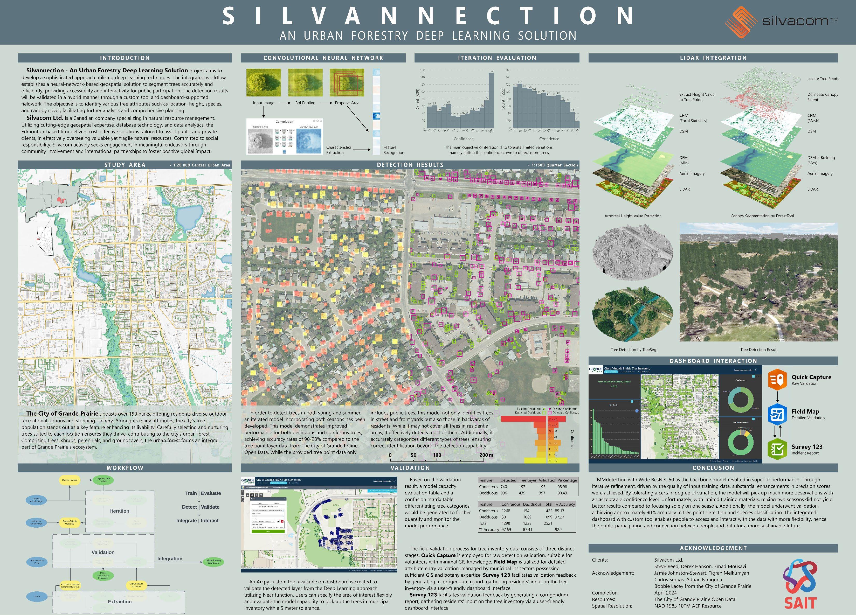
| 1.Capstone Project (Deep Learning object detection, LiDAR-derived canopy segmentation, and dashboard)
An intellectual and interactive urban forestry deep learning solution for the City of Grande Prairie (2024.04)
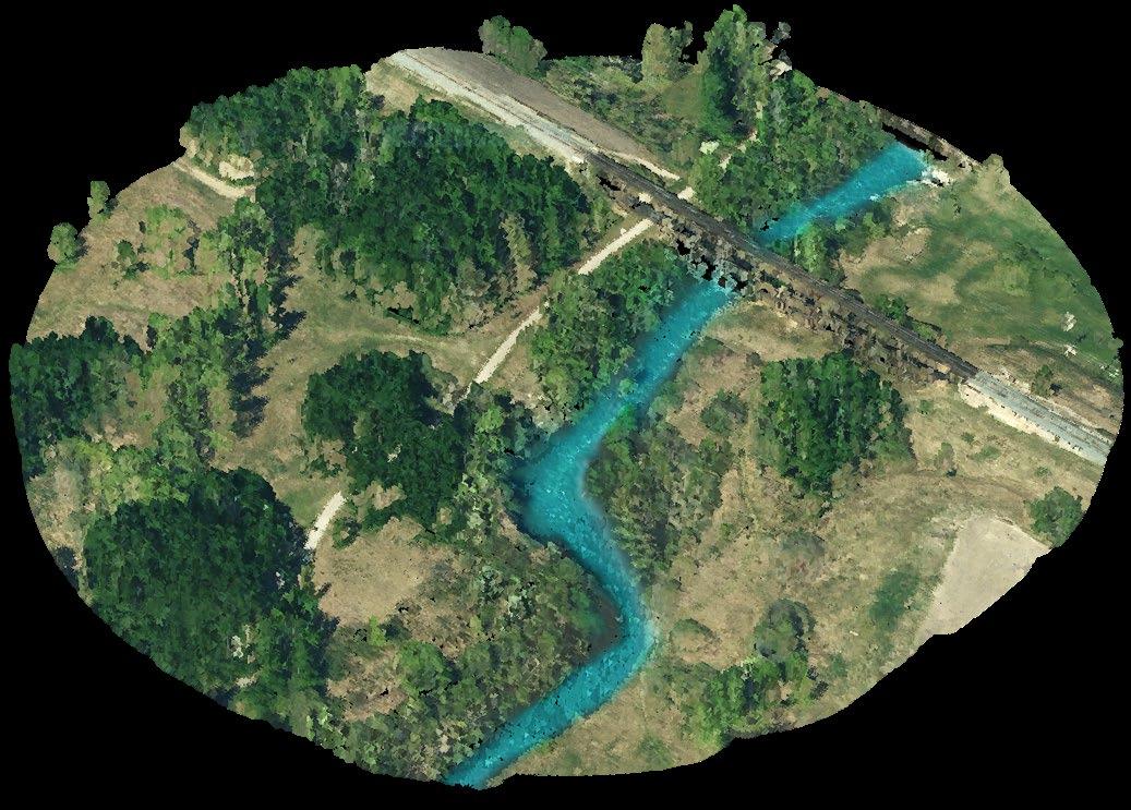
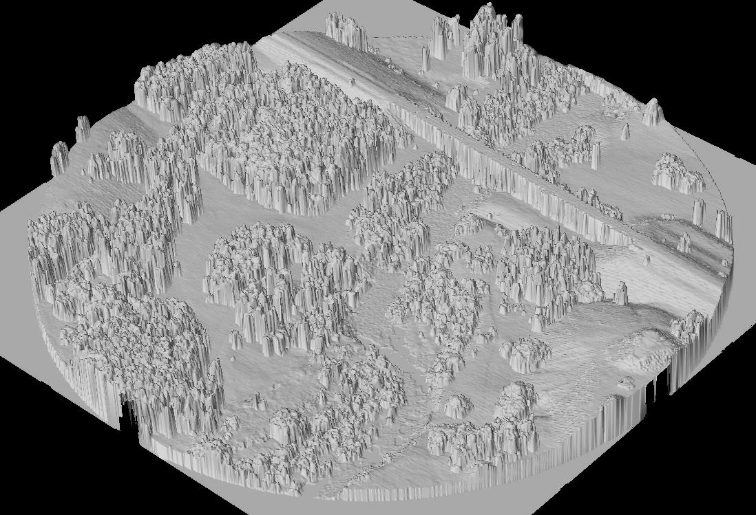
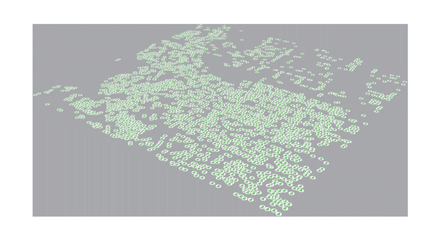
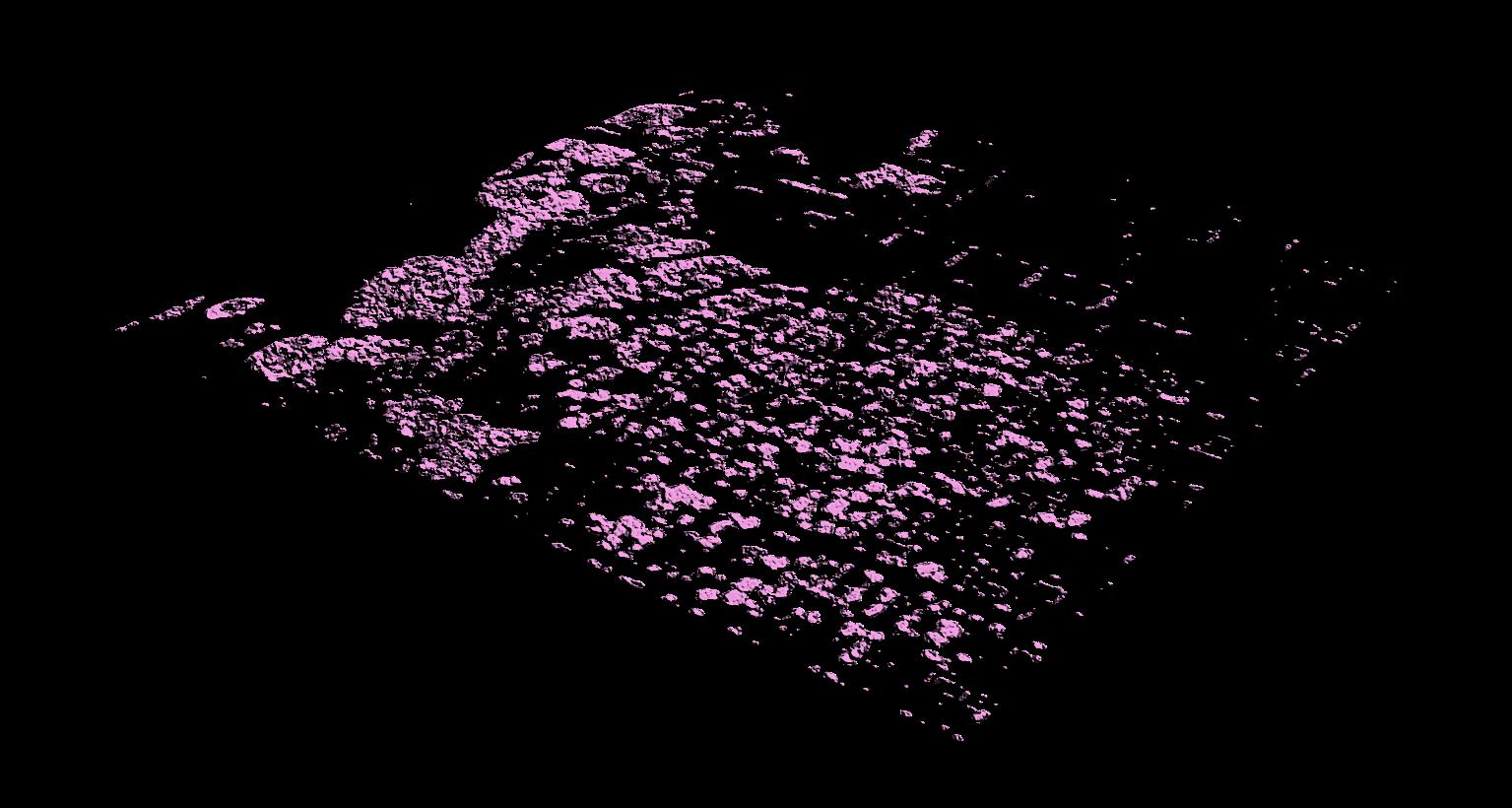
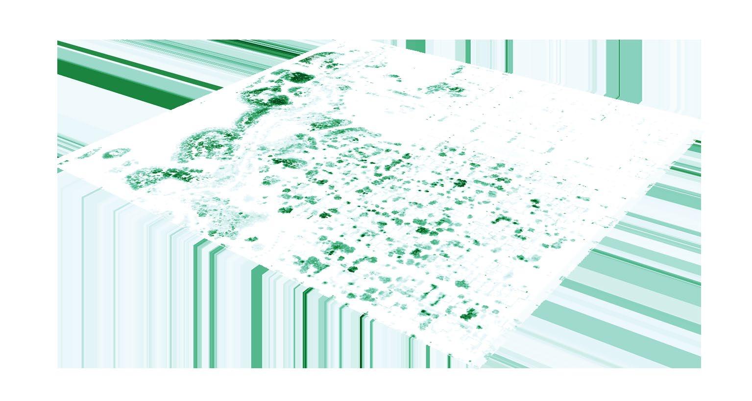
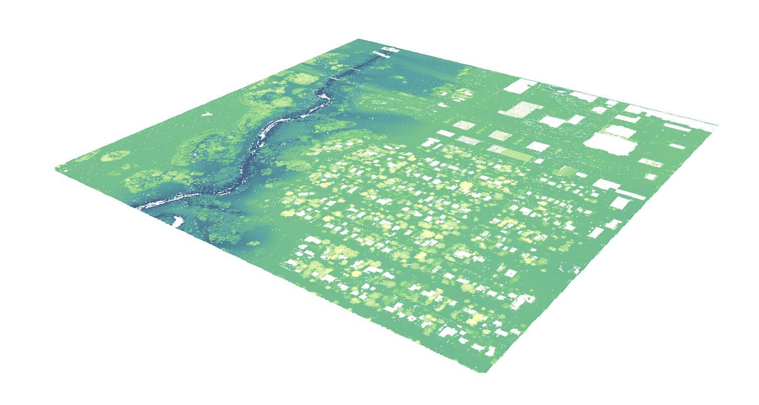
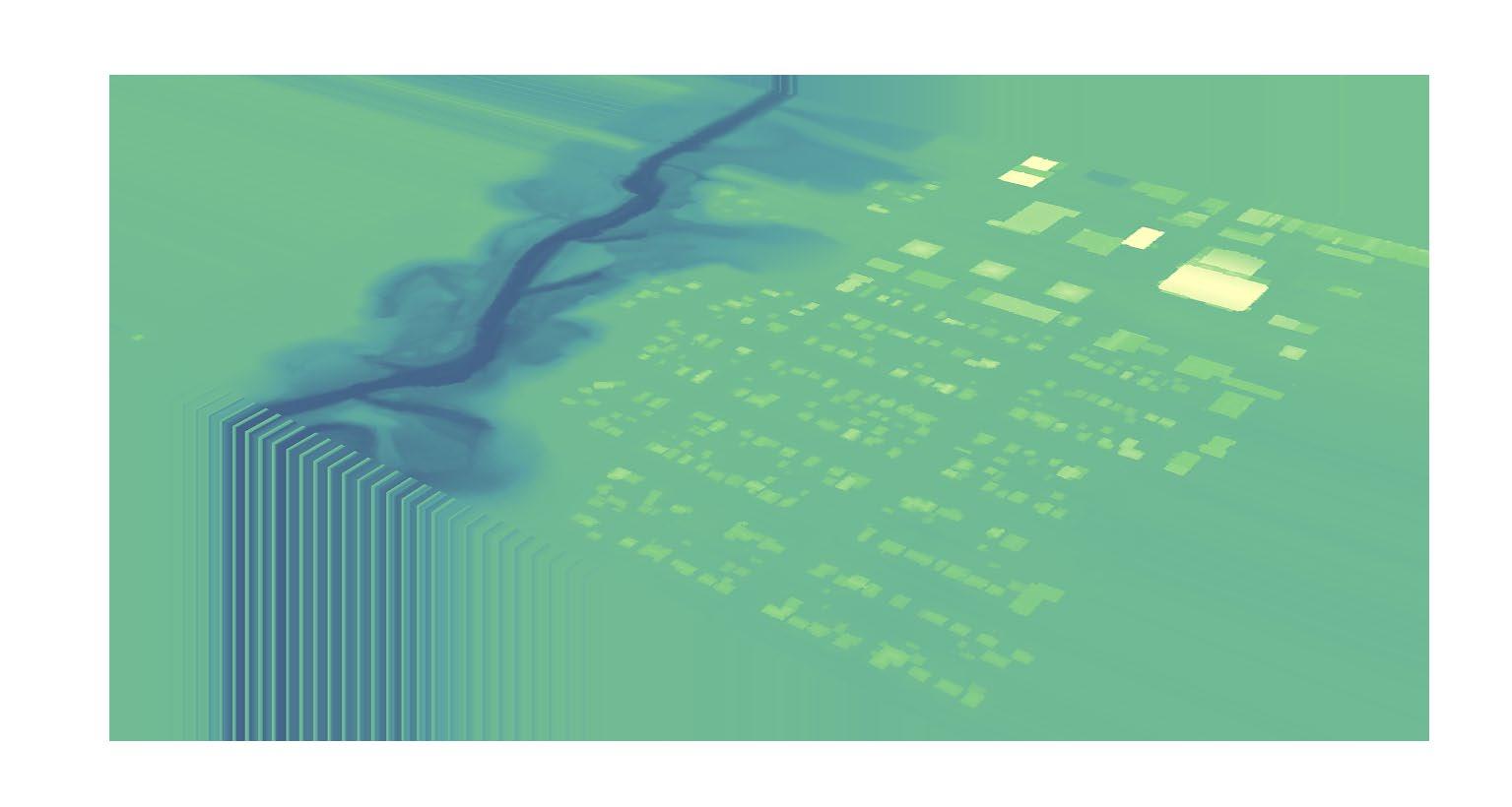
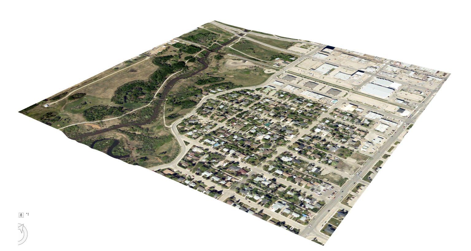
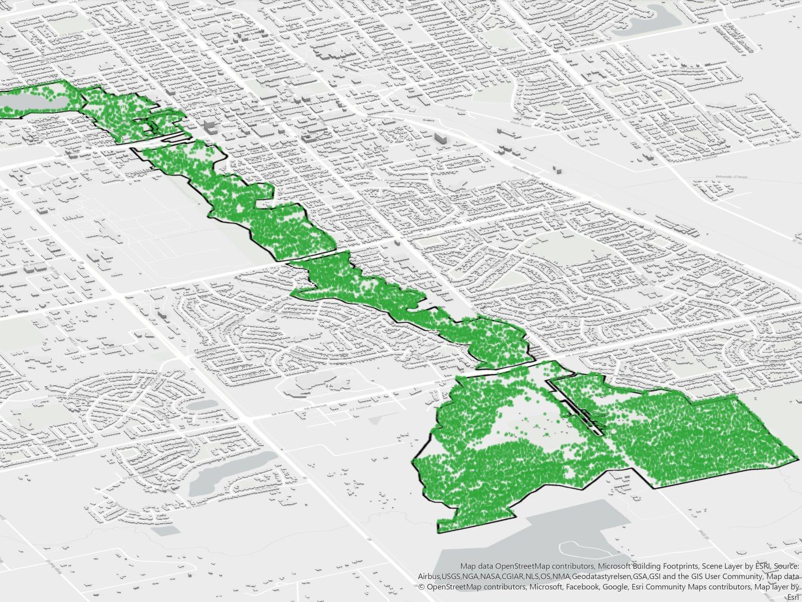
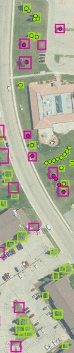
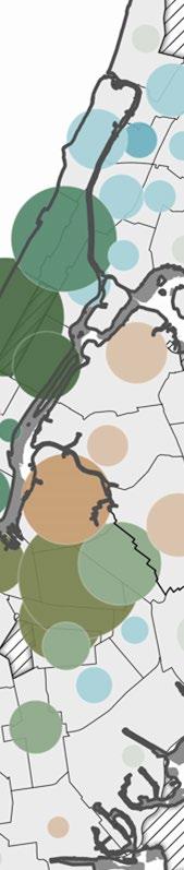
LiDAR-Derived Tree Point Location and Canopy Segmentation
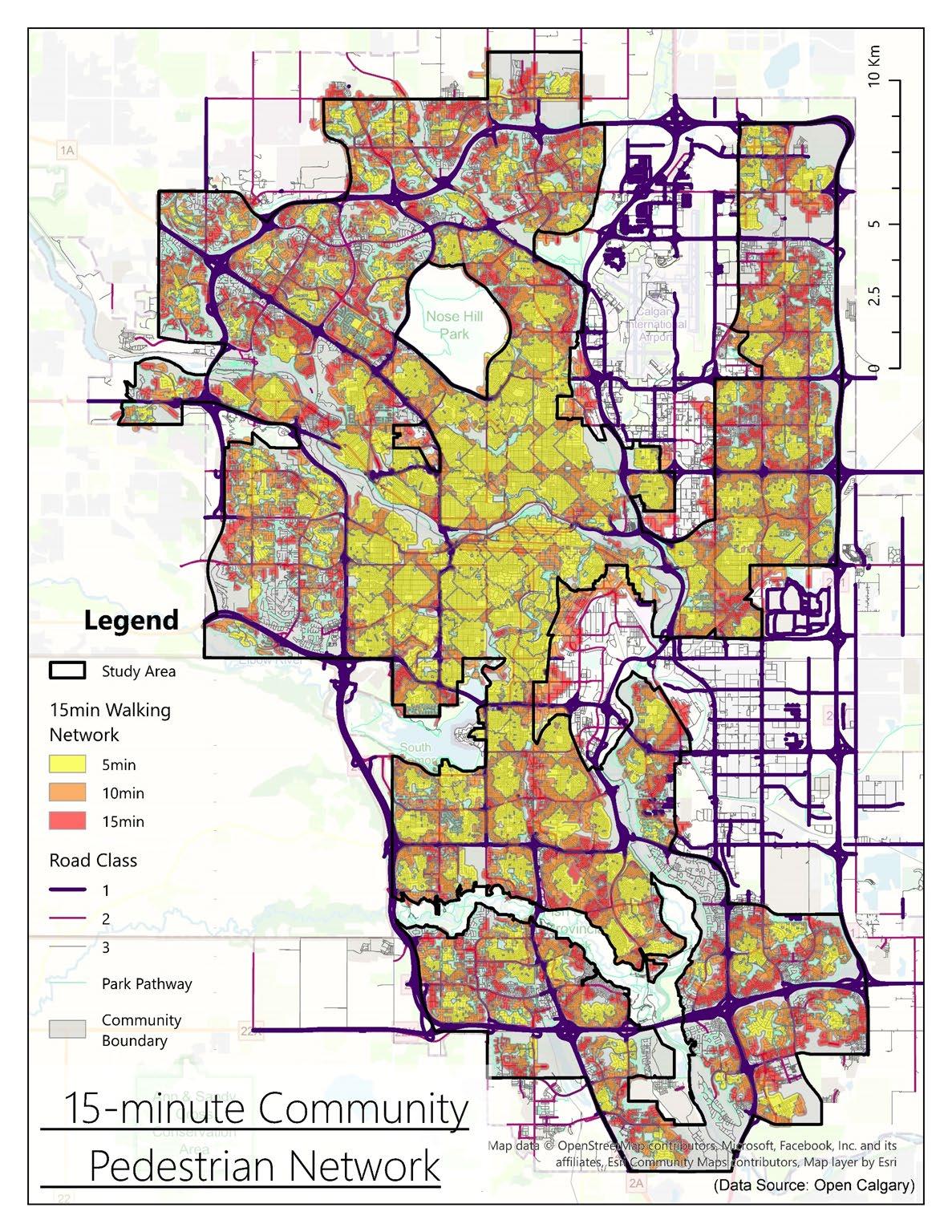
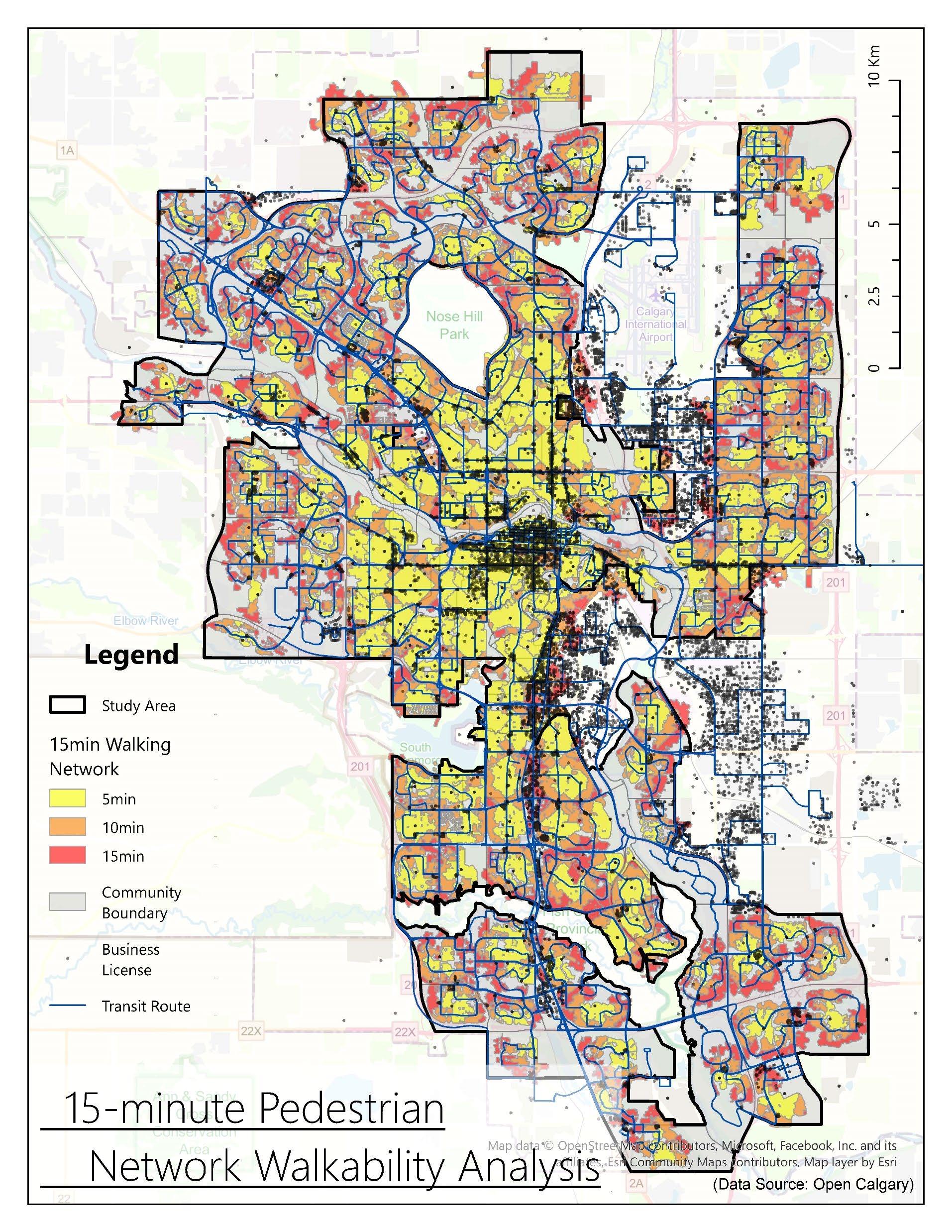
2.Geospatial Data Analysis (exploratory regression, network analysis, spatial autocorrelation, bivariate LISA, GWR)
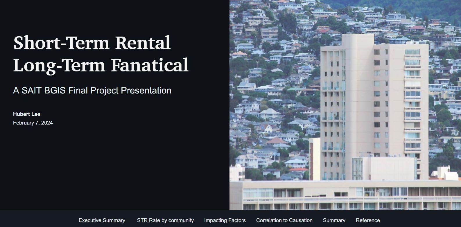
A StoryMap exploration of spatial heterogeneity and correlated factors of Calgary’s short-term rental abuse phenomenon (2024.02)
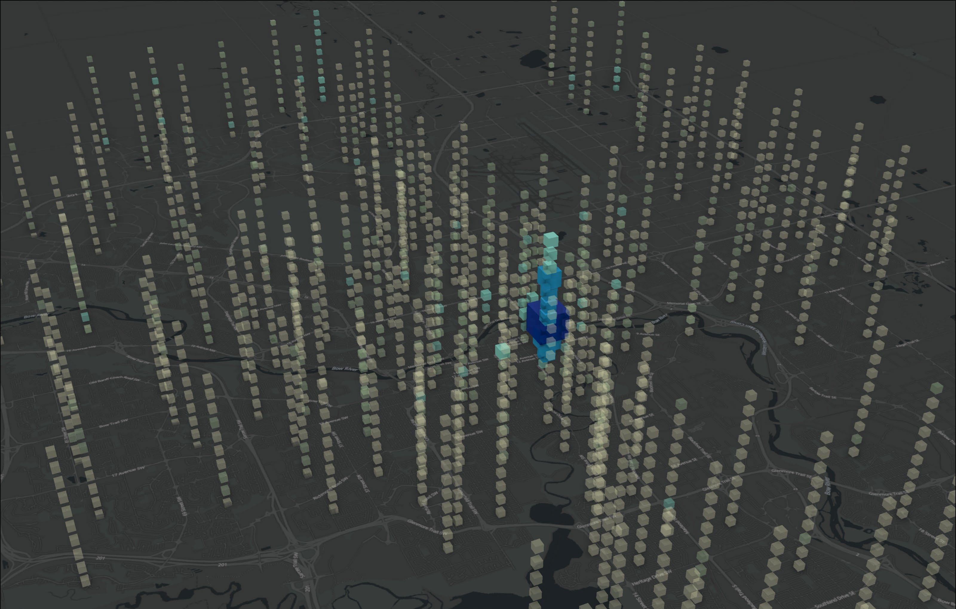
| Space-Time Pattern Mining
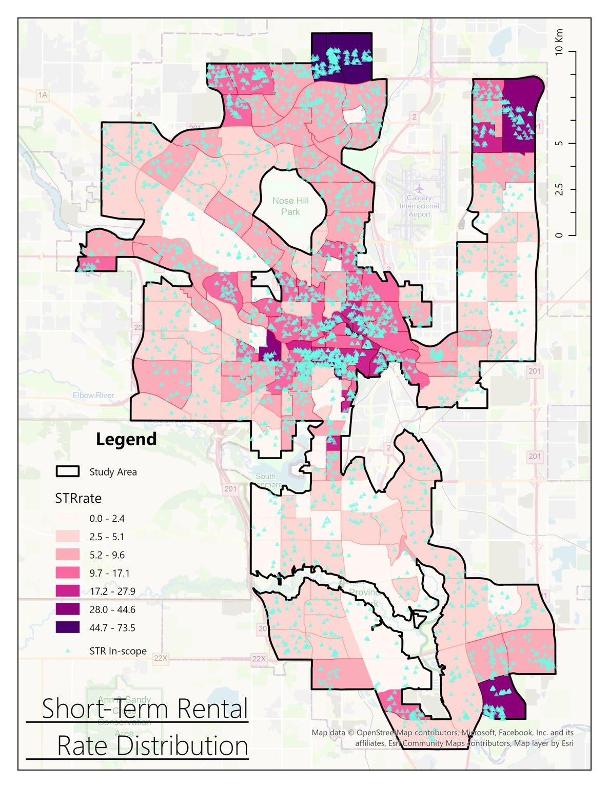
Inspect the spatiotemporal trend with 3D cubes aggregating the STR instances in each community.
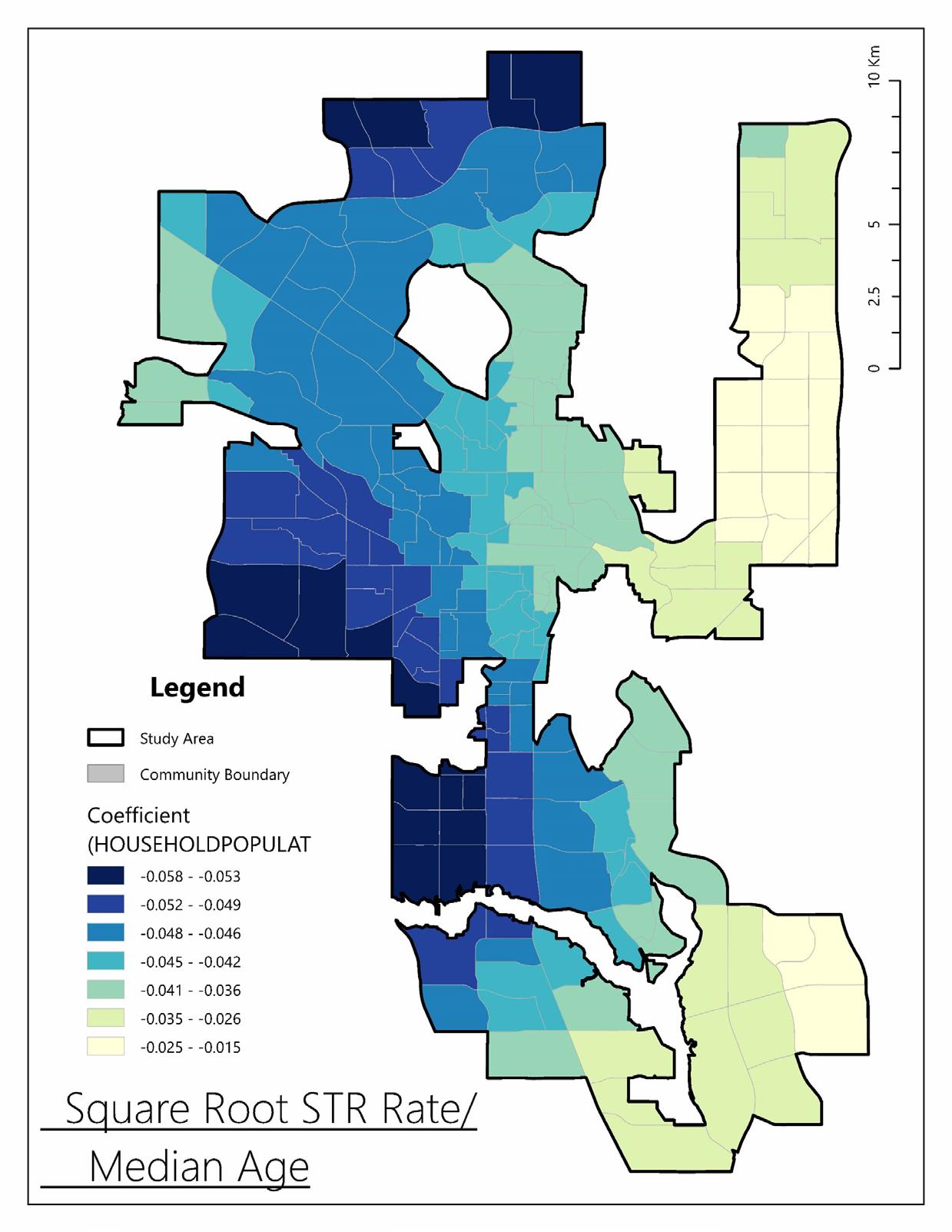
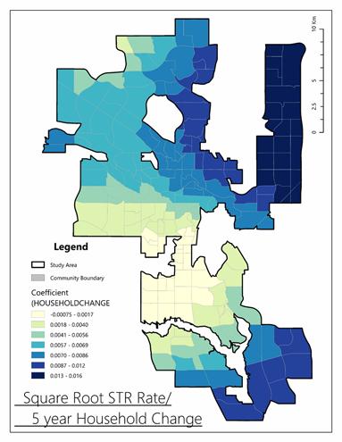
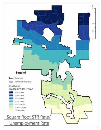
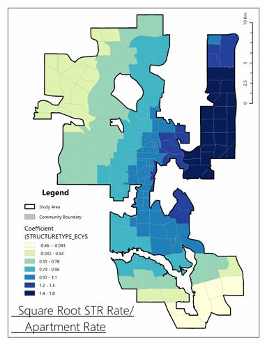
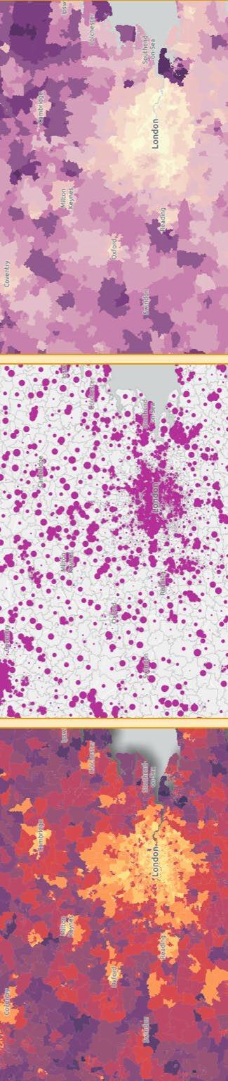
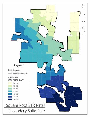
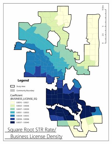
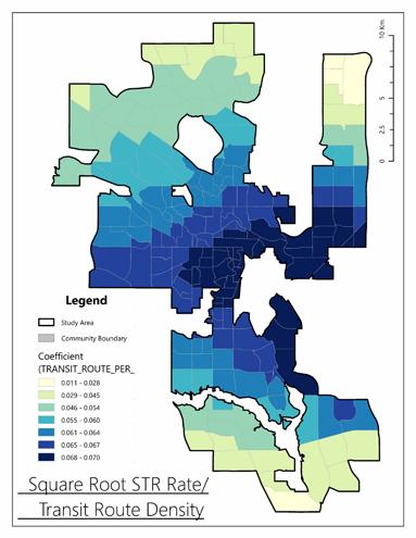
| GWR Explanatory Variable Coefficient
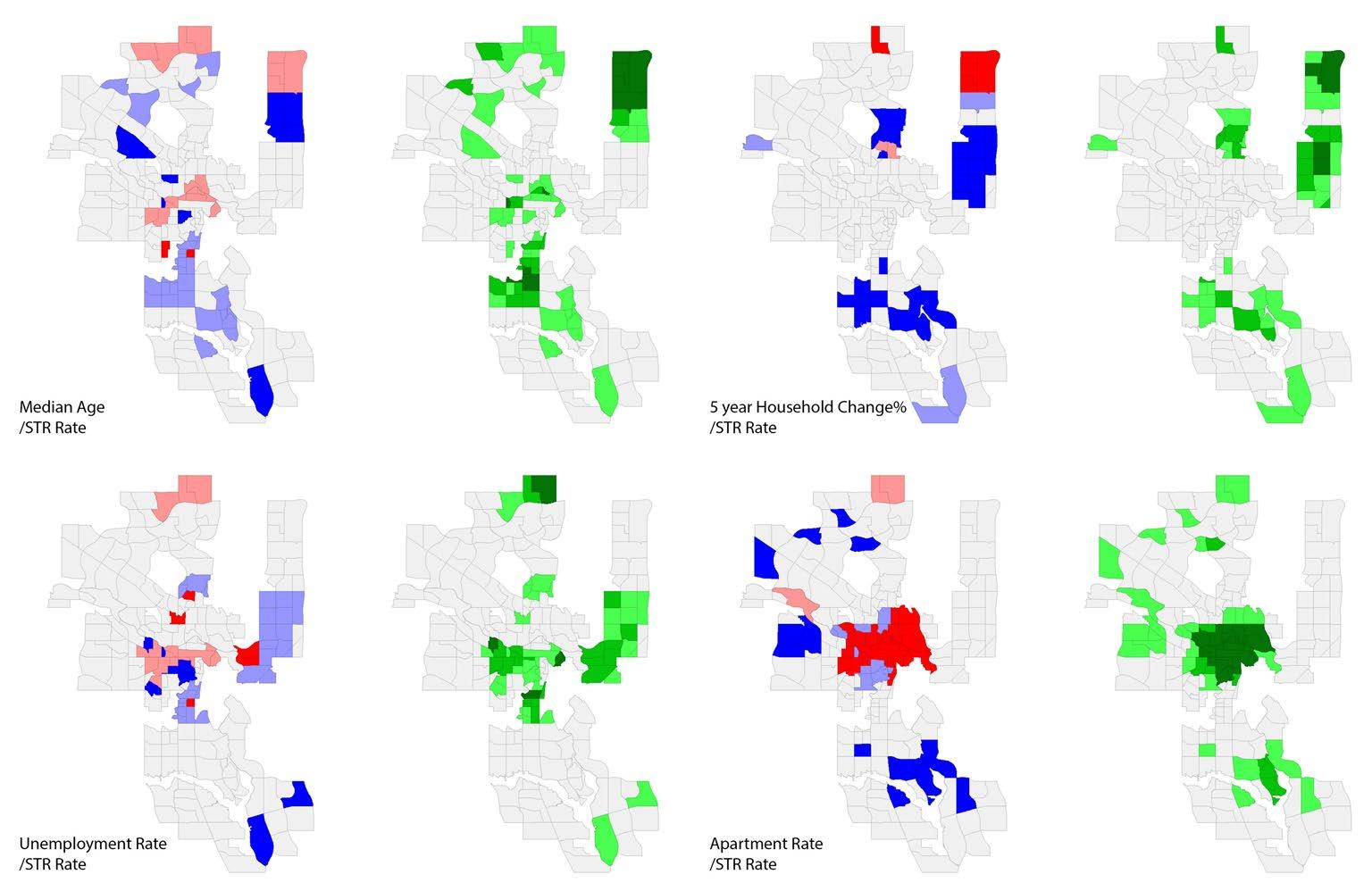
| Bivariate Local Moran’s I Cluster and Significance Map
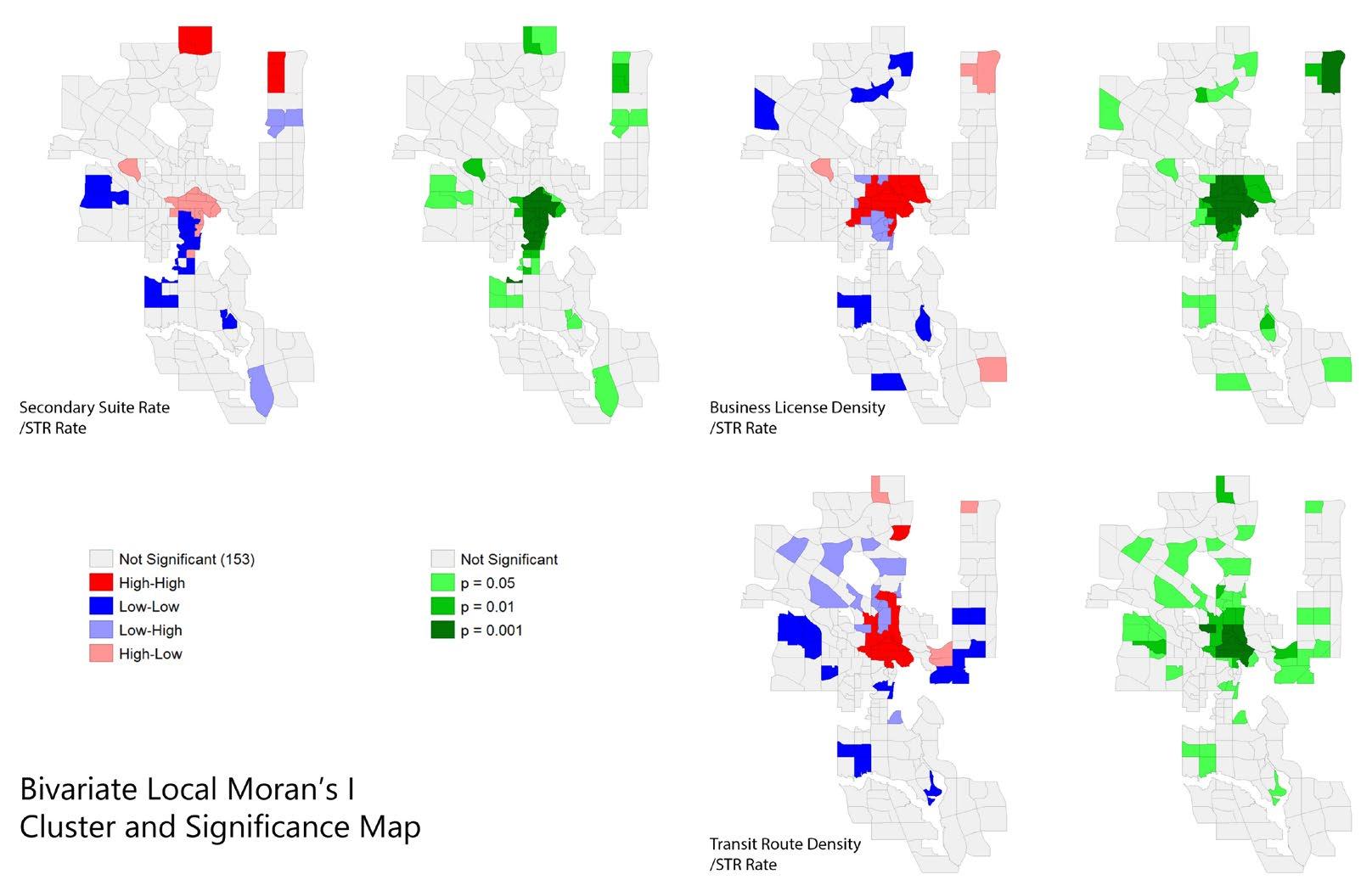
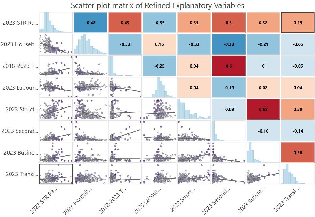
| GWR(Geographically Weighted Regression ) and Bivariate LISA(Local Indicators of Spatial Association)
Revealed the spatial significance and dominant tendency of 7 strong-correlated factors across the area of interest.
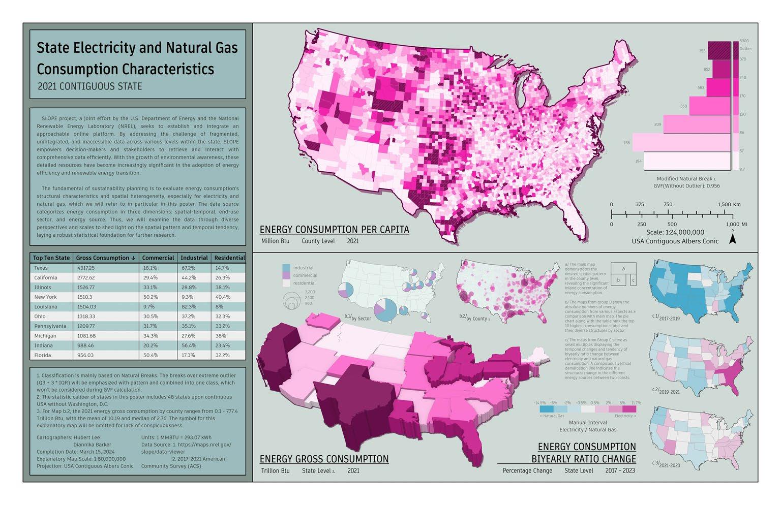
Pie Charts & Graduated Color Map
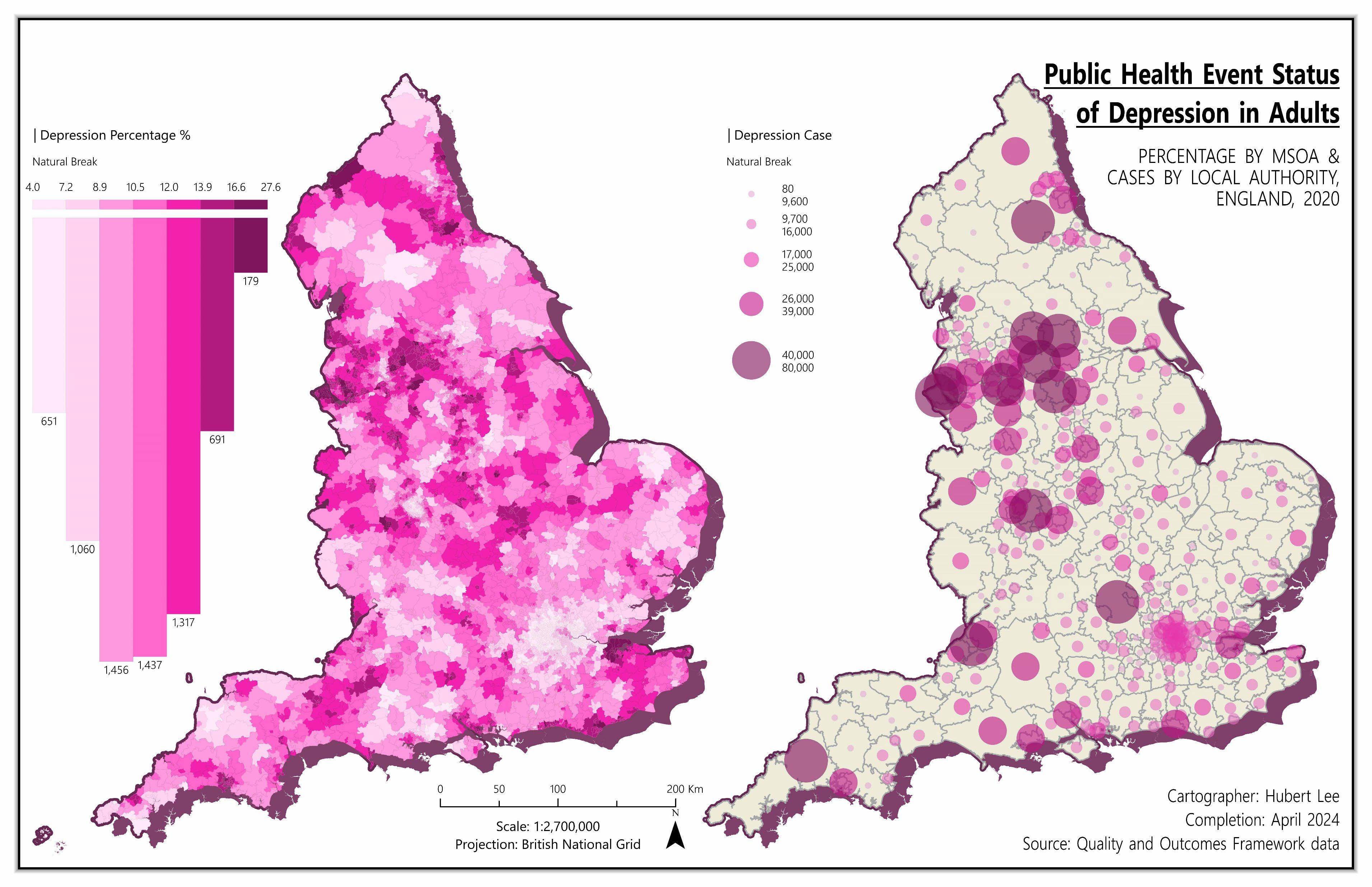
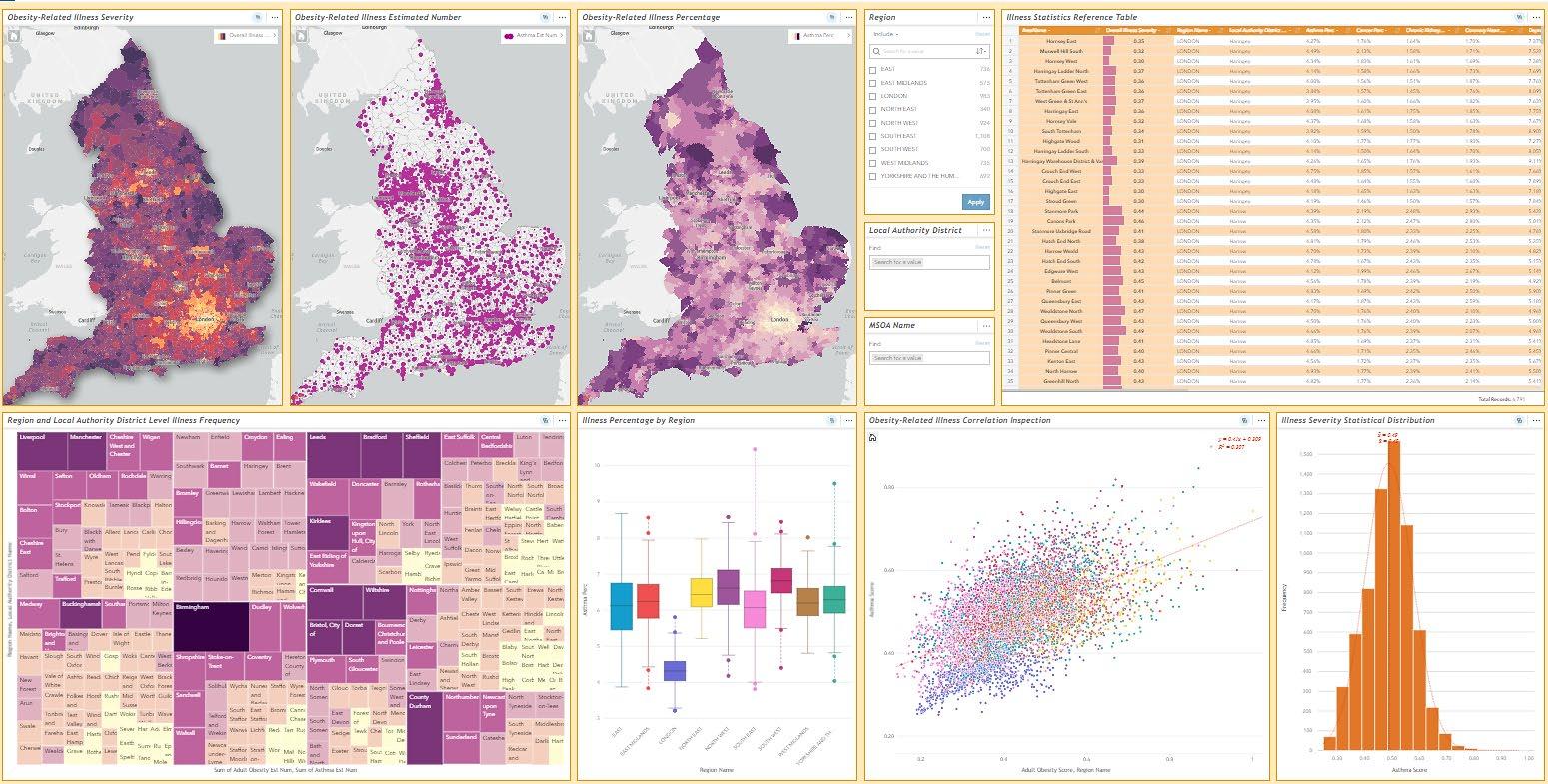
Graduated Color & Graduated Symbols Maps
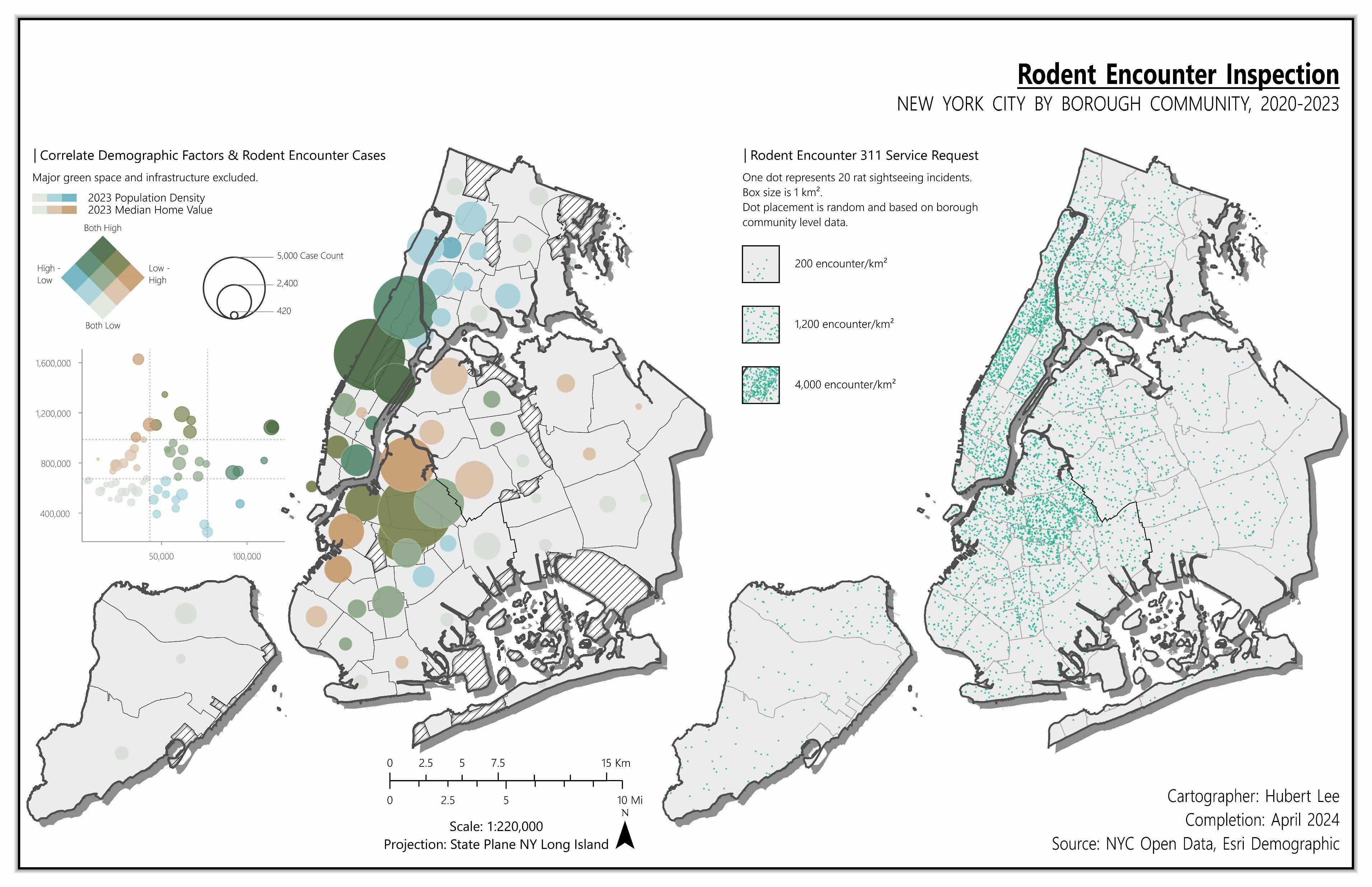
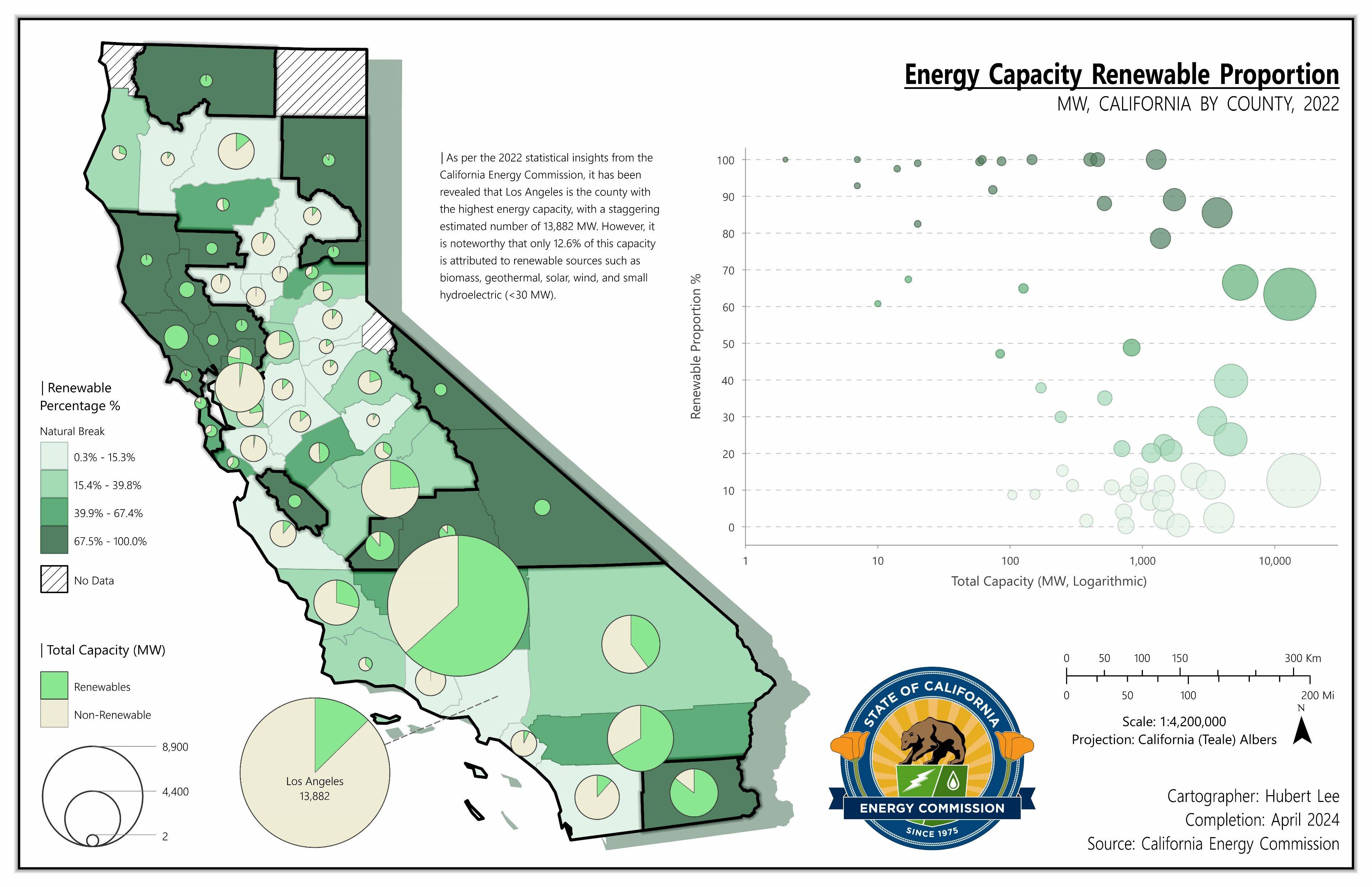
Bivariate Graduated Symbols & Dot Density Maps
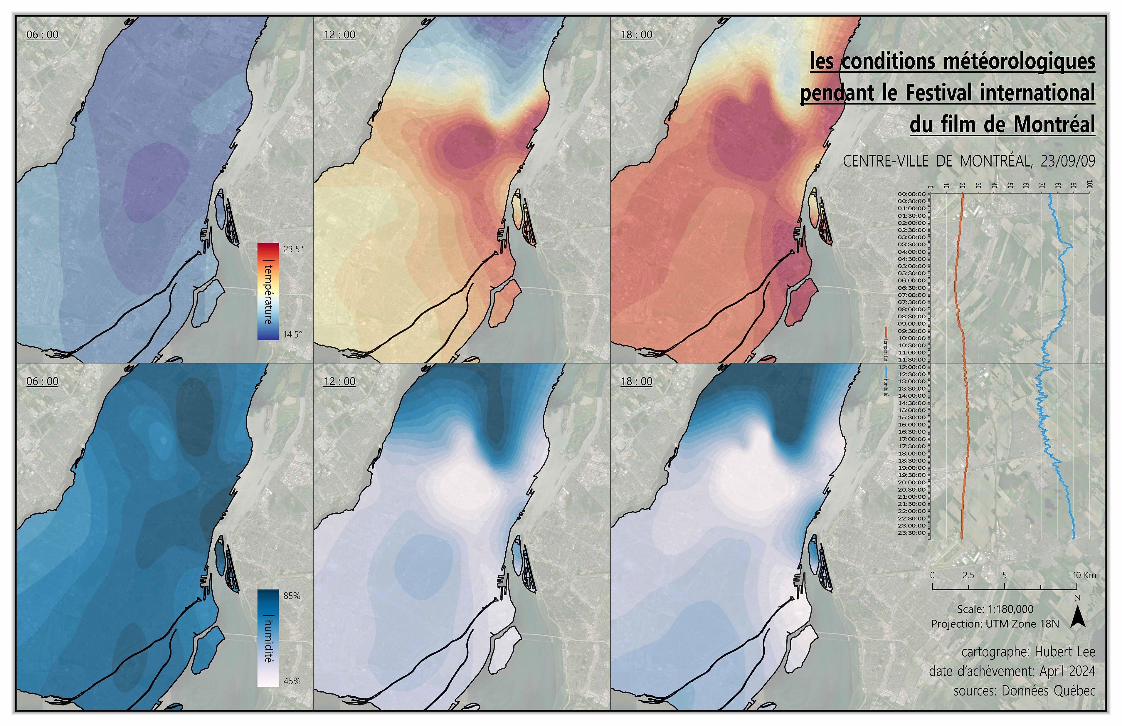
Interpolated Raster Small Multiples
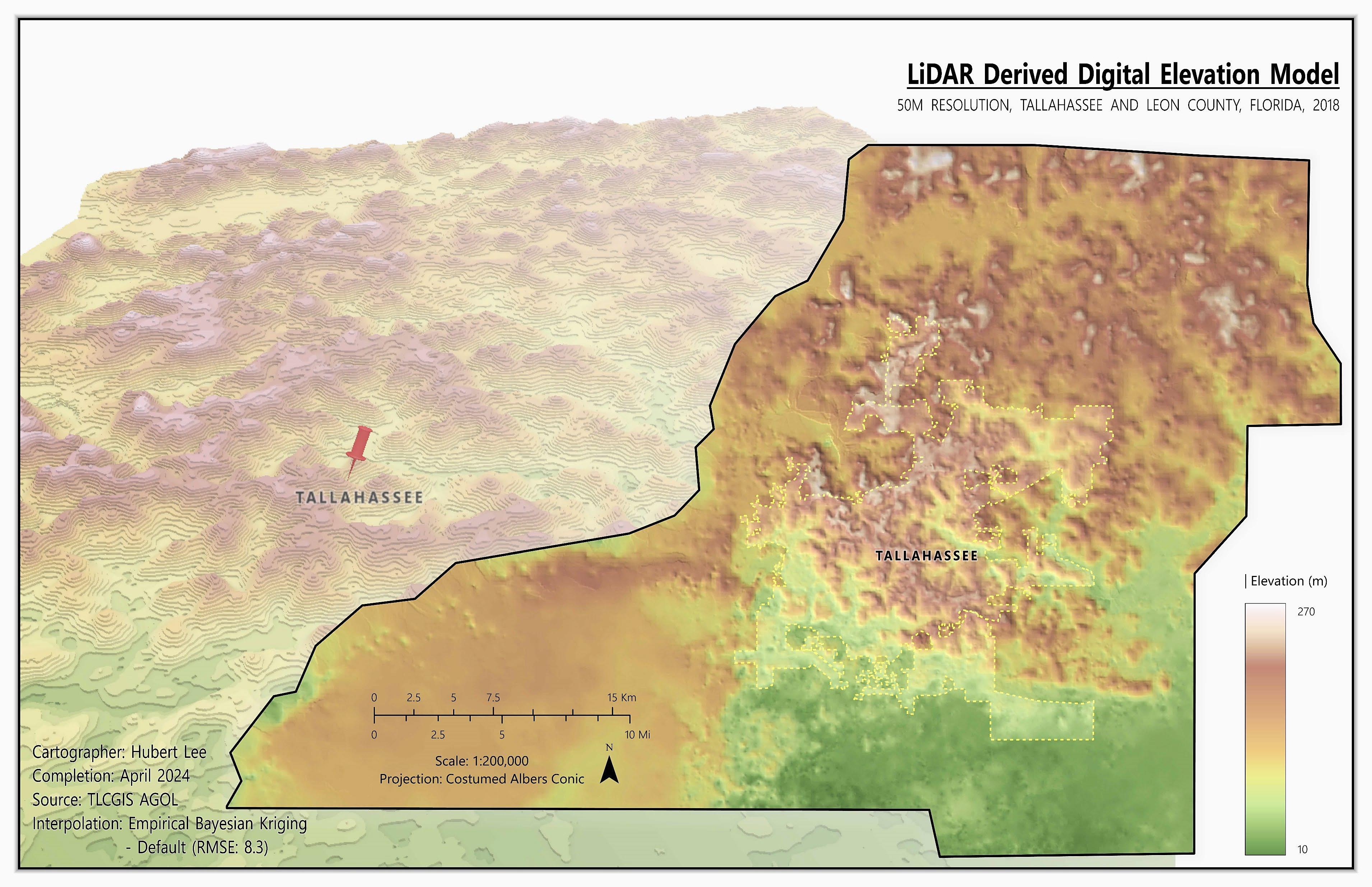
Isometric Map & 3D Contour Scene
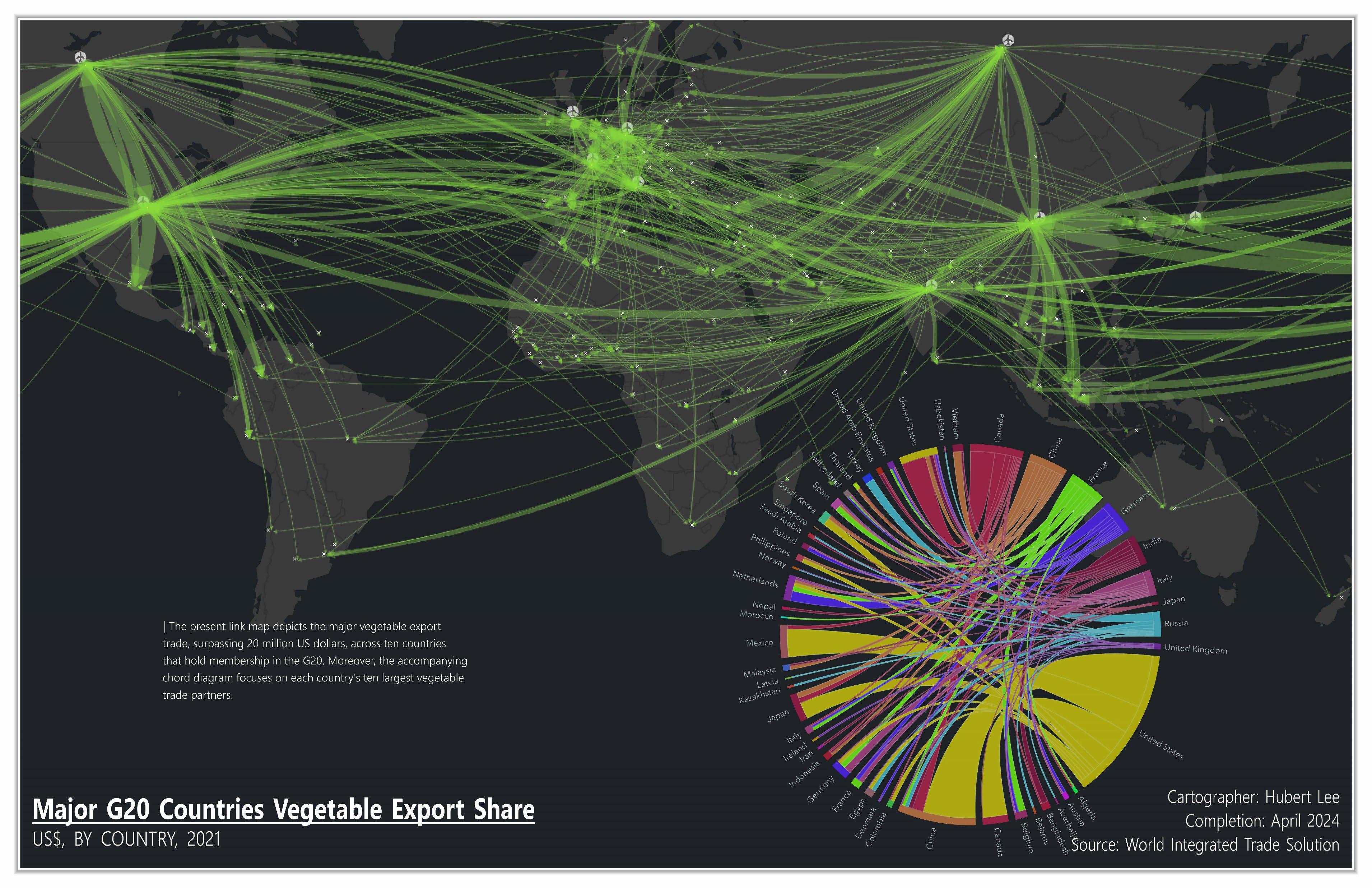
Link Map & Chord Diagram