A Place Plan is a strategic planning tool used by Council to guide the future development and enhancement of specific towns and villages through a placebased, community-led approach.
It aims to capture the unique identity, strengths and aspirations of each location by engaging with residents, businesses and stakeholders to cocreate a shared vision for the area. Rather than addressing issues in isolation, a Place Plan considers the social, cultural, environmental and economic dimensions of a place to ensure that future growth is sustainable, locally appropriate, and reflective of community values.
Place Plans should align with Council’s existing strategic framework, including Council’s Local Strategic Planning Statement and Community Strategic Plan, as well as the State Government’s strategic policies and state-wide objectives. This ensures the preservation of local character, strengthening of community connections, and the delivery of targeted improvements.
The Glenorie Village Place Plan is the culmination of a collaborative planning effort to guide the future of Glenorie as a vibrant, resilient, and well-serviced rural village. Developed by Hornsby Shire Council in consultation with GLN Planning and a range of specialist subconsultants, this Place Plan responds to the unique role Glenorie plays in supporting the northern rural communities of Hornsby Shire. It sets out a clear direction for growing Glenorie sustainably, enhancing local infrastructure, and preserving the village’s unique rural character – ensuring Glenorie remains a valued place to live, work, and visit.
The development of this Place Plan has been shaped by meaningful engagement with the Glenorie community. Through the consultation period, residents, business owners, and stakeholders shared their aspirations, concerns, and ideas for the future of Glenorie Village. Council has carefully considered this feedback and integrated it into the planning process, ensuring the Place Plan reflects local values and priorities.
This Place Plan applies to the eastern side of Old Northern Road in Hornsby Shire and has been informed by input from a range of stakeholders, including relevant government agencies and local service providers such as Sydney Water and the Rural Fire Service, as well as close collaboration with The Hills Shire Council to ensure alignment across local government boundaries.
The Glenorie Village Place Plan has been informed by a number of strategic projects undertaken by Hornsby Shire Council. These documents are listed below, and assist to provide important context, background information, and policy direction to the Place Plan. Together, they inform the development of the Place Plan to ensure it aligns with Council’s broader strategic objectives and reflects the community’s values and aspirations for Glenorie.
The Hornsby Rural Lands Study (RLS), released in 2022, sets the strategic direction for managing the rural lands of Hornsby Shire. It identifies opportunities to support sustainable land use, protect rural and environmental values, and reinforce the role of rural villages in the Shire. The Glenorie Village Place Plan forms one of the strategic investigations recommended by the RLS.
The Opportunities and Constraints Paper (OCP), released in late 2024, outlines the early findings of planning and environmental investigations in and around Glenorie Village. It draws on a number of supporting documents to identify land capable of meeting the State Government’s strategic planning framework, while addressing overall land capability and suitability considerations.
The Feedback Summary Report, released in early 2025, outlines community feedback from targeted consultation held in November and December 2024. Local residents, landowners, and stakeholder groups provided feedback on the early findings of the draft OCP. Key insights from this engagement informed the development of the Glenorie Village Place Plan and Investigation Report.
The Glenorie Village Investigation Report (GVIR), released alongside this Place Plan, outlines the key considerations for change, the development of Glenorie Village, and the implementation pathway. Acting on the recommendations laid out in the RLS, the GVIR builds on the evidence base from the OCP and incorporates the feedback heard from the community.
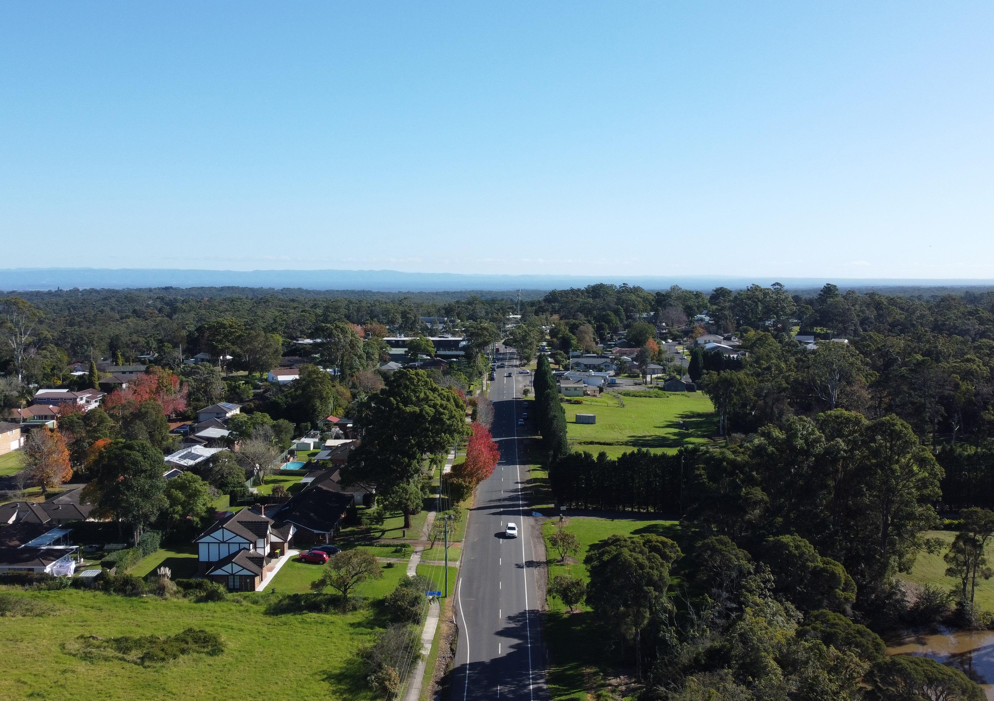
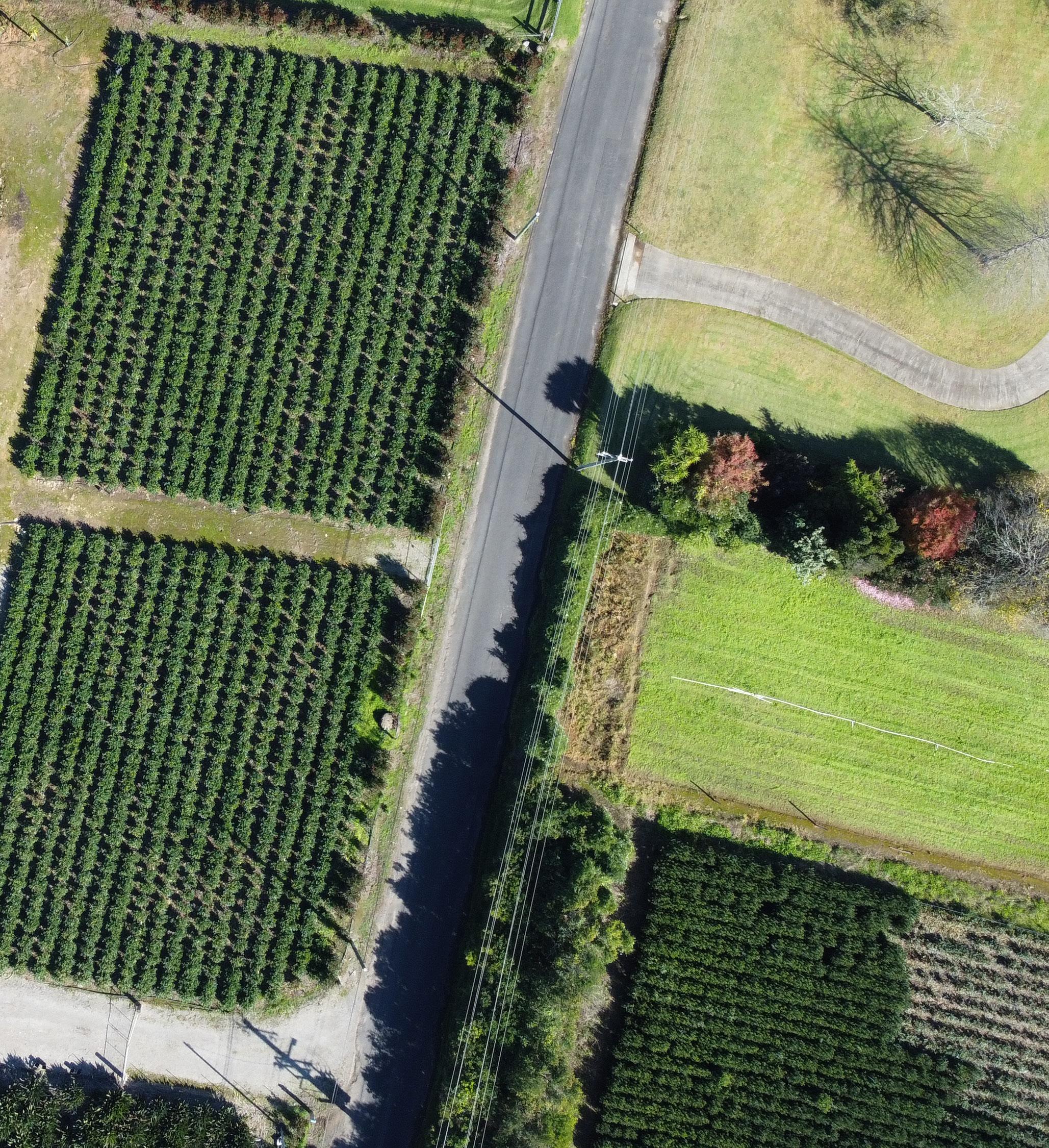
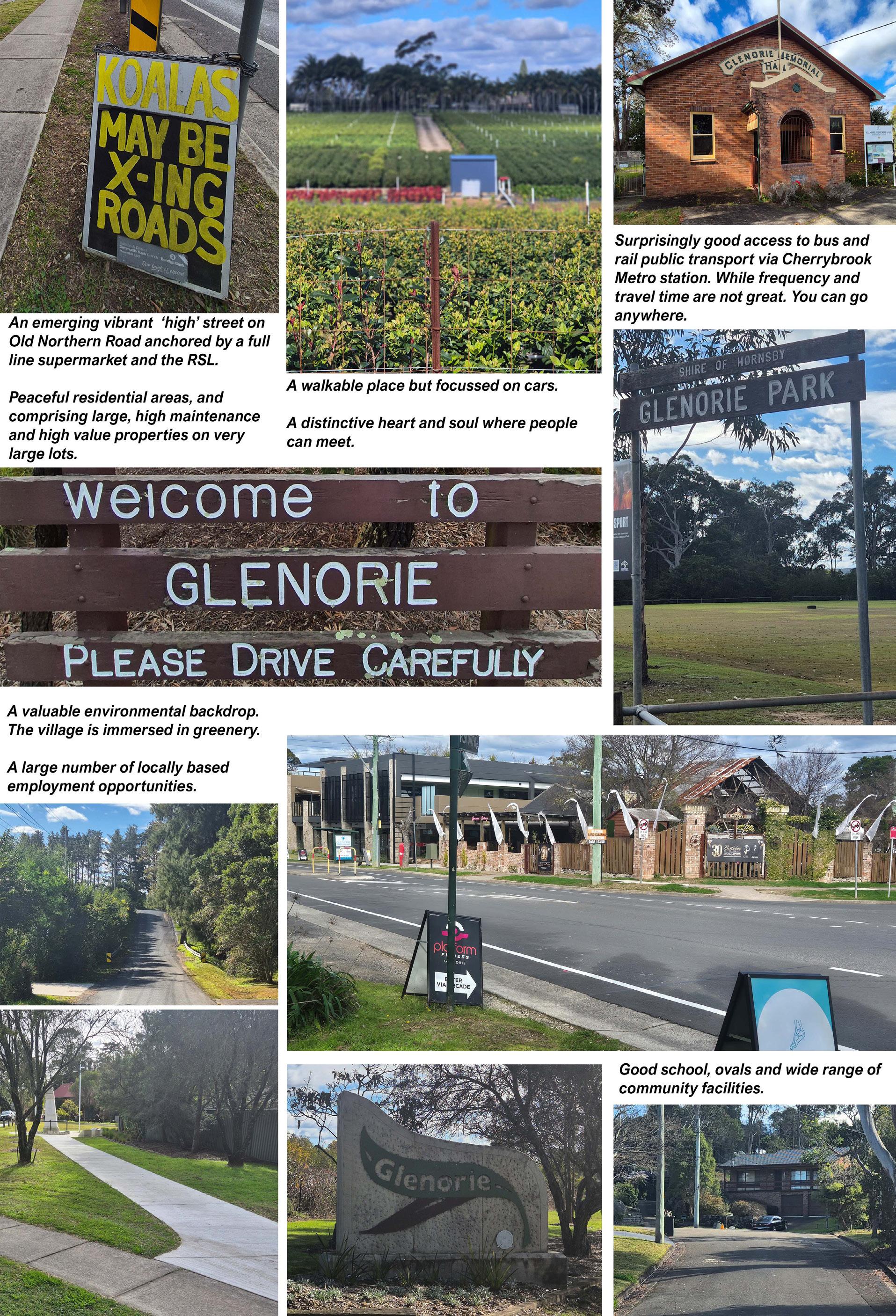
Glenorie is a rural village located in the northern part of Sydney, lying within both Hornsby Shire and The Hills Shire. Characterised by bushland, agriculture, and residential lots closer to the village centre, Glenorie Village provides essential services for those living rurally along Old Northern Road.
The original inhabitants of the Glenorie area are known as the Darug People, who lived on and cared for the land for thousands of years prior to European settlement. Non-Indigenous landholders have been present in Glenorie since the construction of the Great North Road in the early 19th century, when the suburb was known as North Dural.
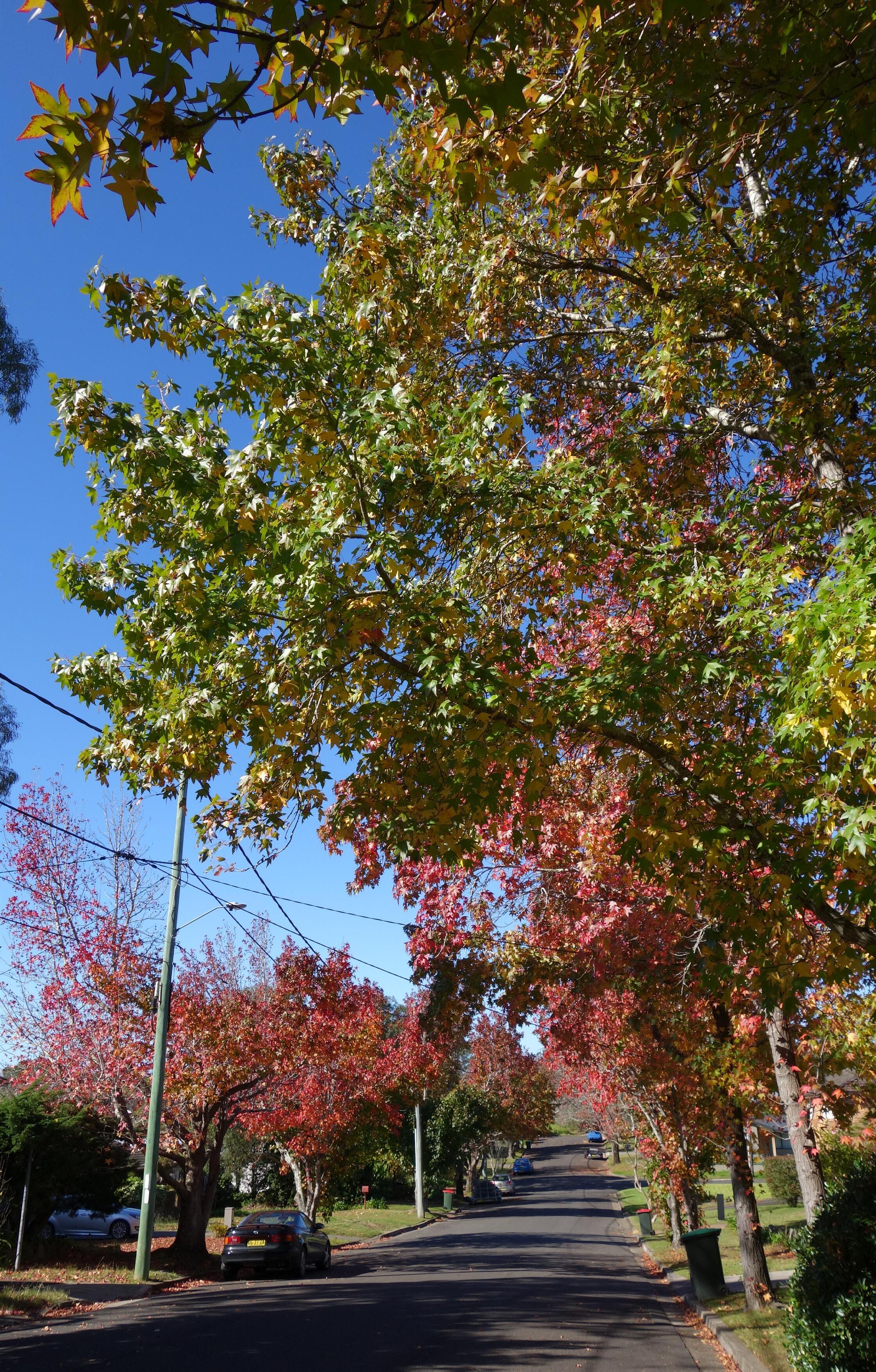
The residential subdivision of Glenorie Village began in the mid-1970s, with new lots established on the eastern side of Old Northern Road within Hornsby Shire. Despite this residential development, the village has successfully retained its rural character, with a strong connection to its agricultural roots continuing to define the area.
Today, Glenorie plays an important role as a rural village, presenting a unique blend of agricultural heritage, natural beauty, and community-focussed living. It supports a semi-rural lifestyle while contributing to the broader region through local food production, tourism, and small-scale enterprises.
District views are limited to streetscape vistas.
Green edge (backdrop) to village.
The centre of Glenorie Village is a memorable focal point that strongly defines the identity of the village.
The focus of horticultural and residential activities are distinctive character precincts.
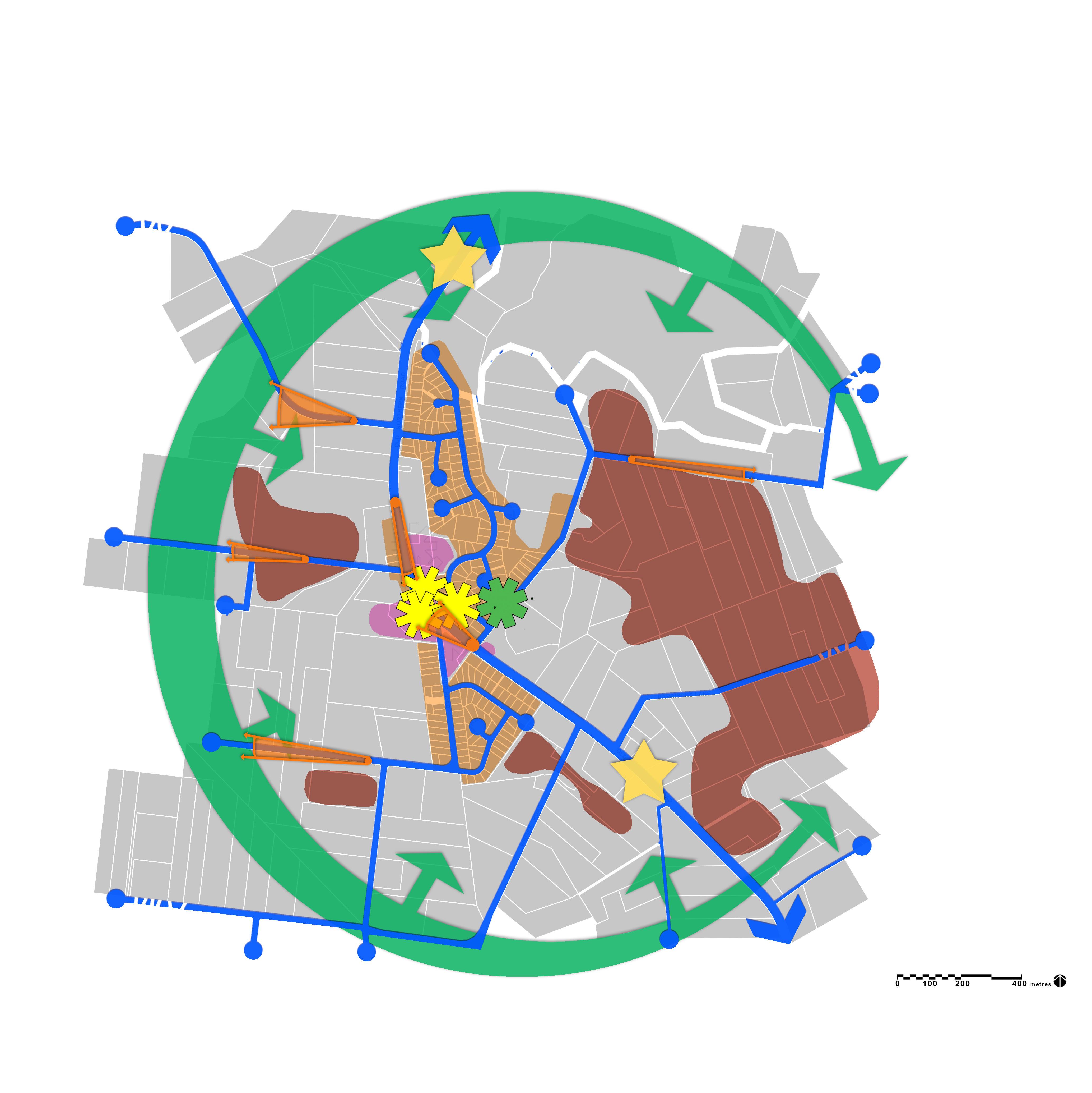
The village centre contains a concentration of local landmarks (buildings and vegetation).
Village gateways are established by signage.
The Old Northern Road is the principal pathway. All other pathways are disconnected (cul-de-sacs).
Consultation was held with the Glenorie Community in November and December 2024. The community provided feedback through an online survey, by writing in to Council, and in two community sessions held at Glenorie RSL. Below are some key stats and themes collected from the community consultation period.
Top areas for improvements

Constraints to consider

Lot

4,066


Strengthen the heart of the village
Enhance the central area of Glenorie Village by improving public spaces, transport systems, and accessibility to homes and businesses.
Encourage housing diversity
Promote a more diverse and accessible range of housing in Glenorie Village to meet the changing needs and expectations of the Glenorie Community.
Protect ecologically sensitive areas
Safeguard the natural landscapes and ecosystems of Glenorie by preserving areas with biodiversity and riparian value and keeping development away from hazard prone areas.
Retain the rural character of Glenorie
Retain and preserve the distinctive rural charm and heritage of Glenorie by safeguarding agricultural lands, supporting rural employment, and minimising conflicts between rural activity and adjoining land uses.
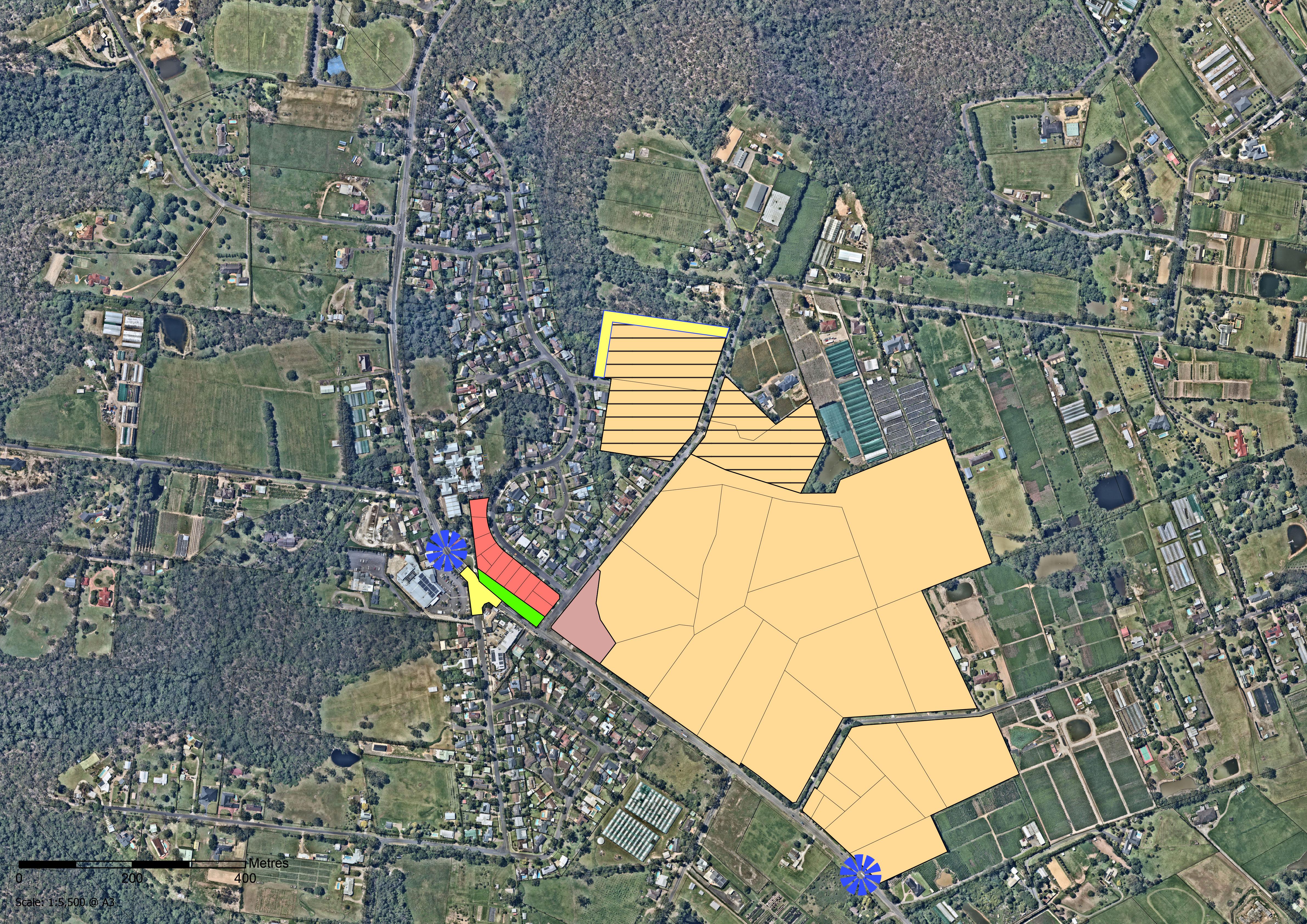
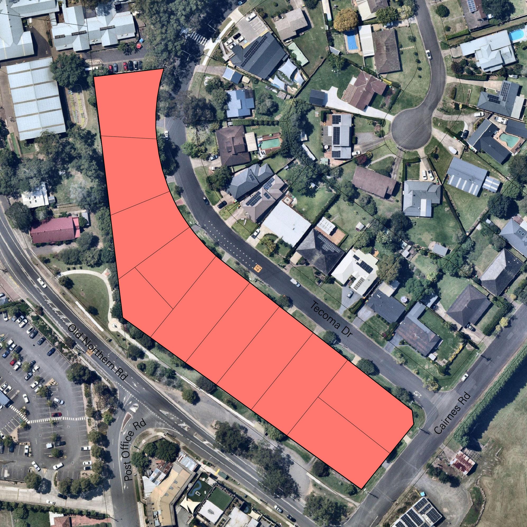
Townhouses adjacent to Old Northern Road
New road
Entry statements
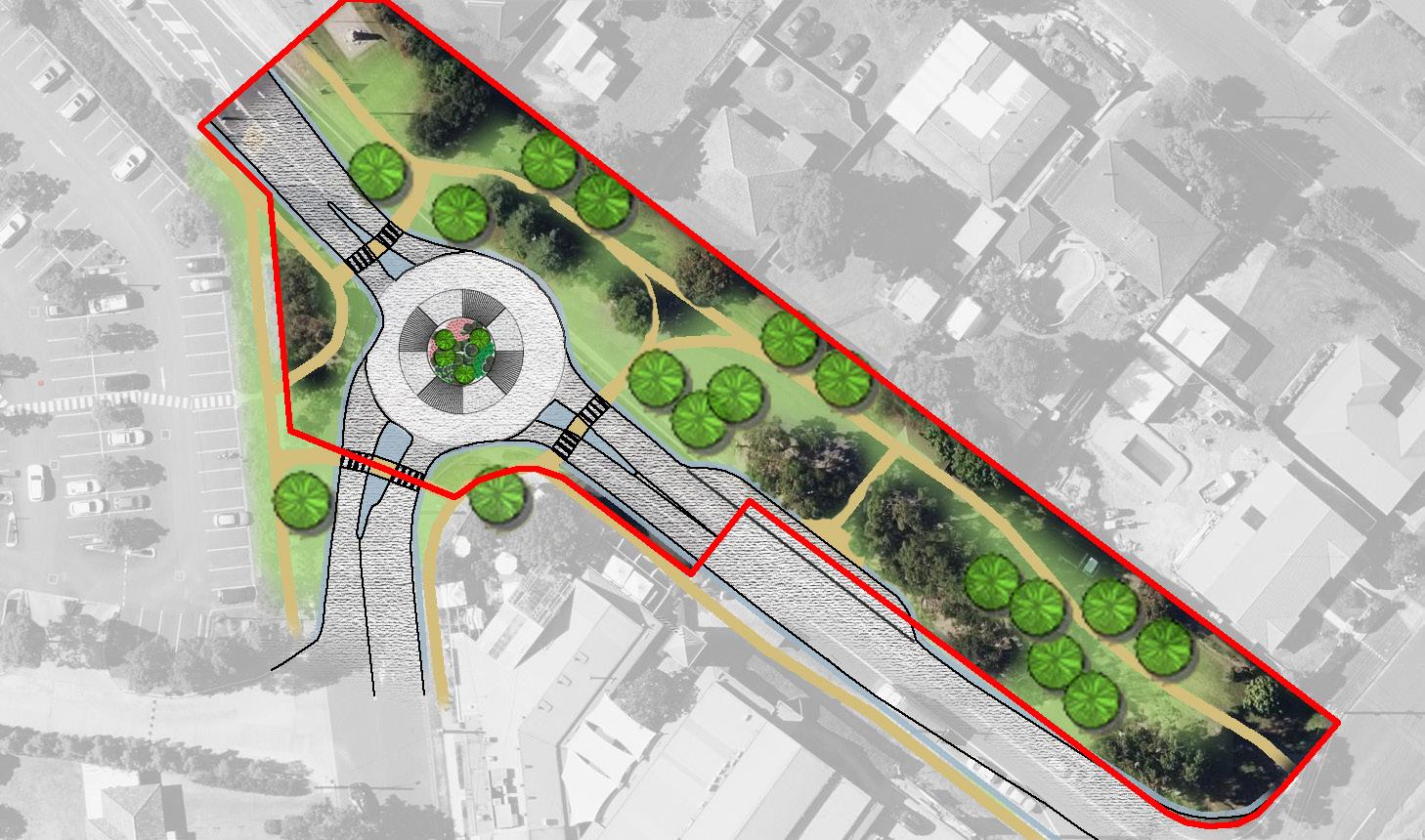
New roundabout and crossings
New open space linking to Glenorie Memorial Hall
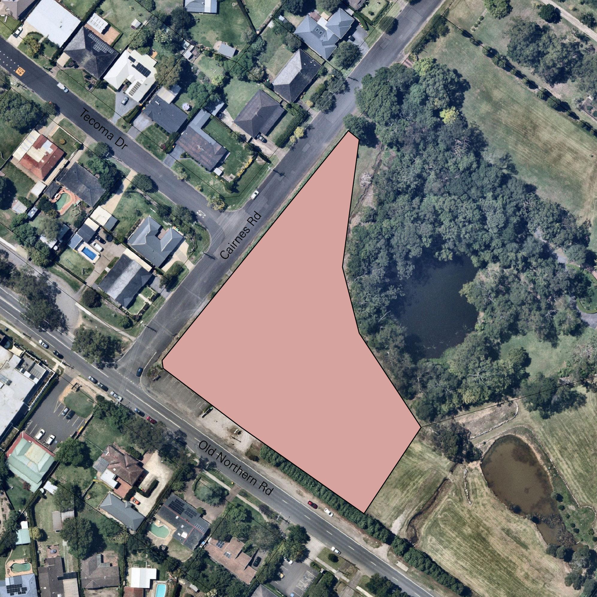
Commercial & Residential on current shop site
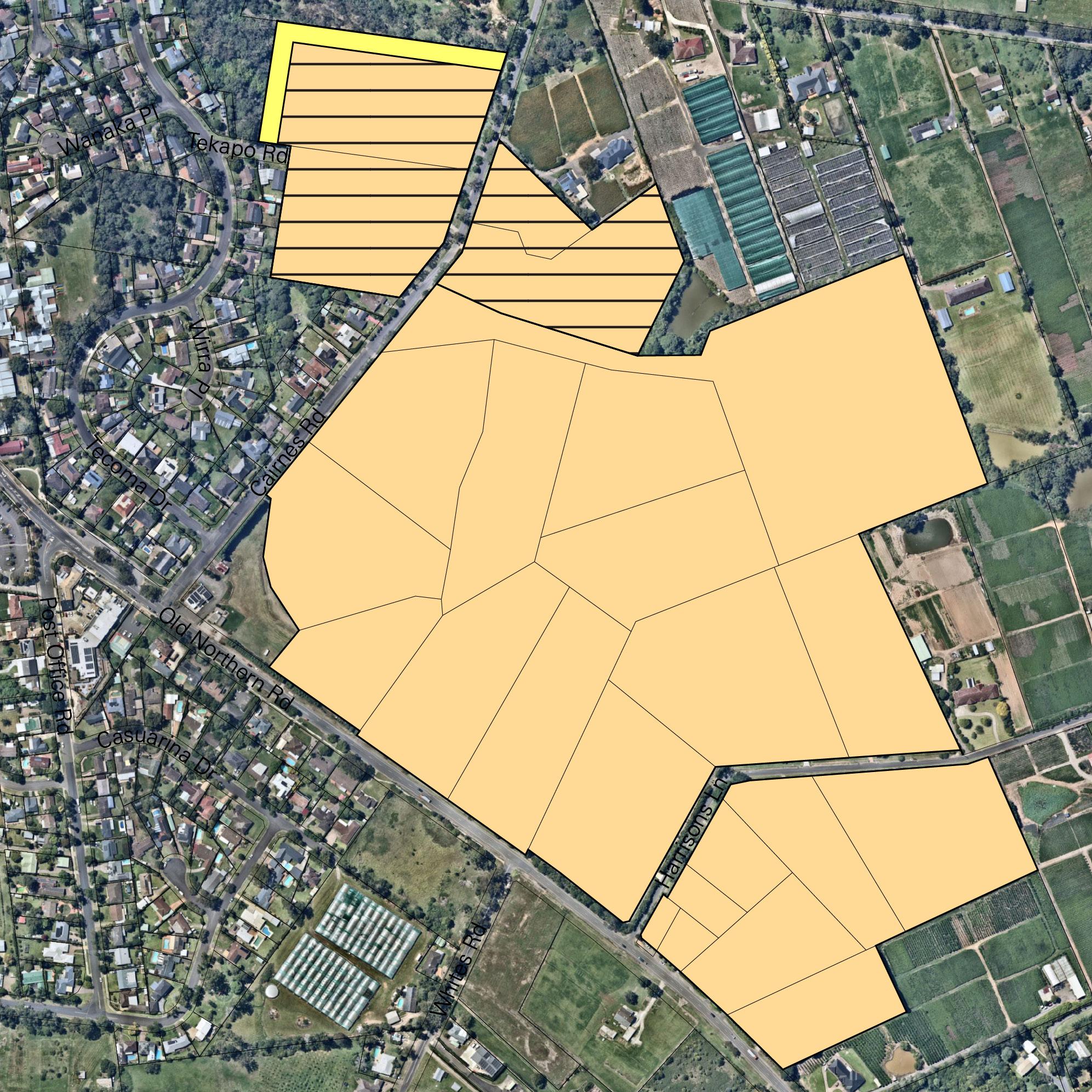
Small rural lots adjacent to the Village (4,000m2)
Small rural lots adjacent to the Village (5,000m2)
Entry statements
Transition large lots adjacent to the existing village to smaller rural lifestyle lots of 4,000m2 and 5,000m2.
Community consultation indicated that these sizes would help retain Glenorie’s rural character while supporting greater housing diversity. They also provide sufficient space for onsite sewerage management and the protection of environmentally sensitive areas.
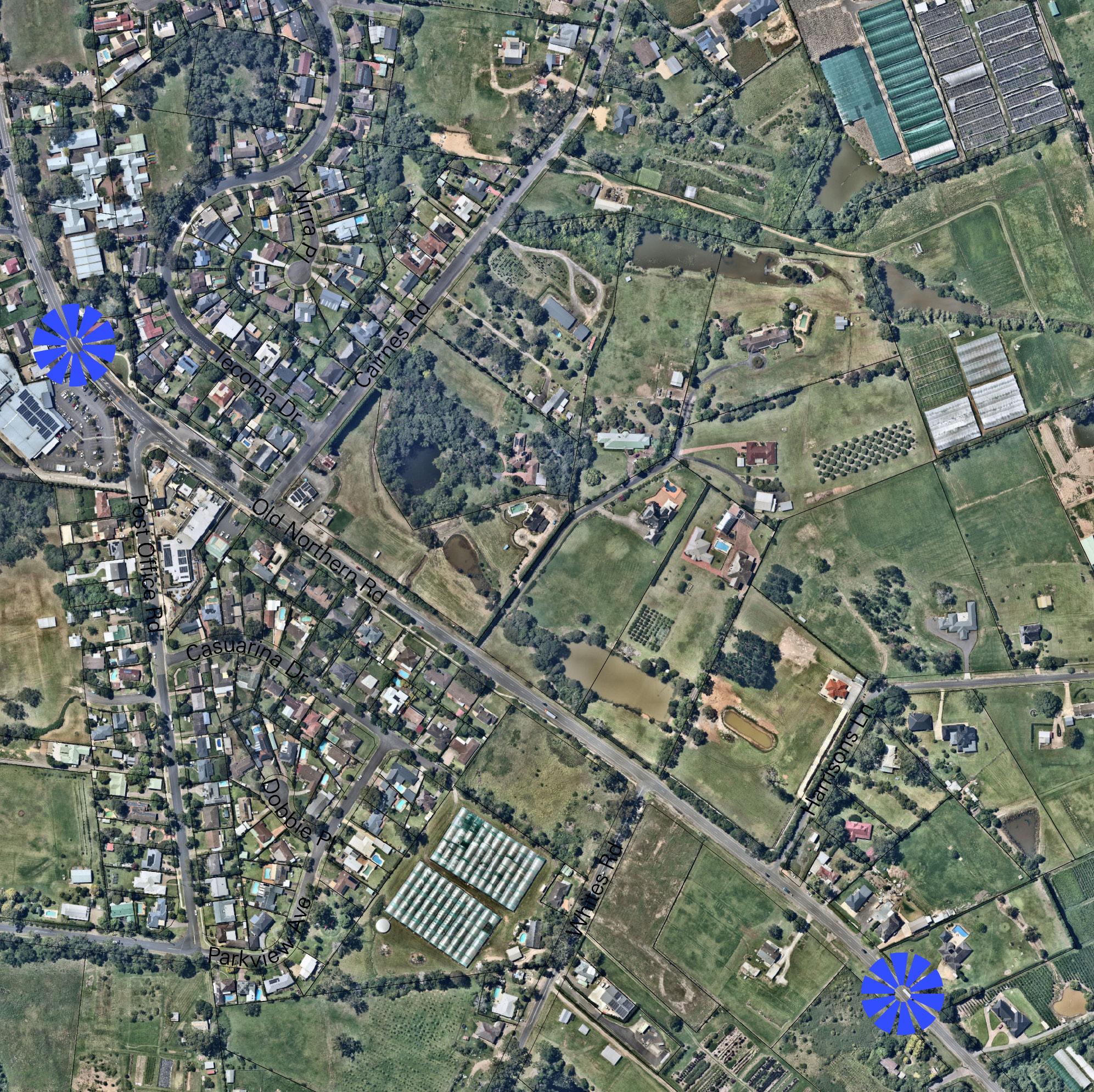
Lots to the northwest of Cairnes Road, and partially to the east, have been assigned a minimum lot size of 4,000m2. This land is closer to the existing Glenorie Village and is generally devoid of riparian vegetation.
Given its proximity to bushfire prone land in the north, any subdivision would need to include a perimeter road to function as an Asset Protection Zone, as well as a new connection between the village and Cairnes Road.
Elsewhere, a 5,000m2 lot size has been selected due to the significant constraints associated with Glenorie Creek. Although highly modified with dam structures, and in some areas, cleared of vegetation, it still retains biodiversity value and its alignment limits development along Old Northern Road due to flooding risks.
Importantly, both areas have limited agricultural use, in contrast to the more intensive agricultural activities occurring further east.
New Road - To facilitate and open up key areas for development, a new road is proposed to be built around the perimeter of Lot 91 DP 585835. This road would connect Tekapo Road and Cairnes Road, providing a buffer from agricultural uses and for bushfire protection purposes.

Transition the existing low density dwellings fronting Old Northern Road to townhouses to strengthen the Glenorie community by enabling a greater diversity of housing types close to shops, services, and transport.
Focussing new medium density housing within the existing village footprint as infill development will help protect the surrounding rural and environmentally sensitive areas from further fragmentation and speculation. These sites will also have high visibility – being located adjacent to the proposed new open space and bus stop – and have the potential to activate and enhance the village streetscape.
Townhouse or villa development with a maximum height of two storeys will ensure that new development remains in keeping with the existing village character.
Constraintsrelatedtothecapacityforwastewaterservicing bySydneyWatermeanthisvisionisunlikelytoberealised in the short term. However, identifying the preferred location and development typology now provides a clear long-term direction for future infrastructure planning and investment

Permit a mix of business and residential uses on the corner of Old Northern Road and Cairnes Road to help meet the Glenorie community’s desire for more shops and services closer to the village centre.
This location offers close proximity to existing shops and services on the western side of Old Northern Road and the new open space and bus stop.
Either shop top housing, or a mixture of businesses and townhouses, will ensure that new development complements the existing shops and bookends the commercial area.
Constraints related to the capacity for wastewater servicingbySydneyWatermeanthisvisionwouldneedto be supported by onsite sewerage or otherwise is unlikely to be realised in the short term. However, identifying the preferred location and development typology now providesaclearlong-termdirectionforfutureinfrastructure planning and investment

Connections across Old Northern Road
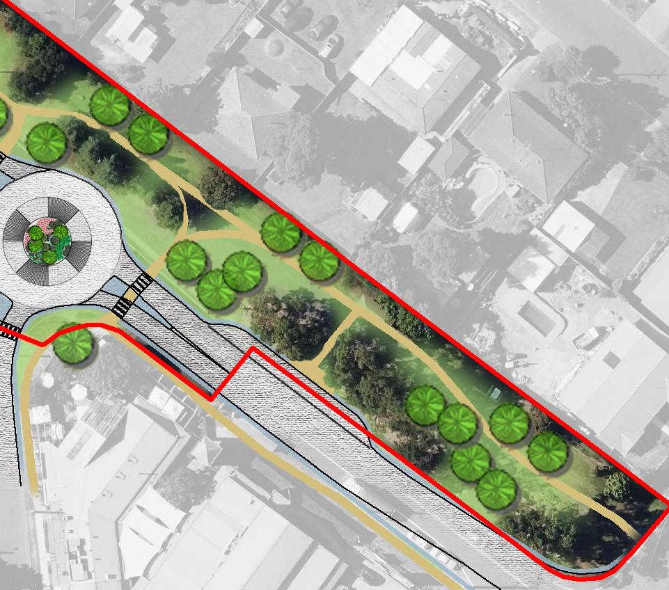
Integrate with Glenorie Memorial Hall Park
Better connections to commercial areas
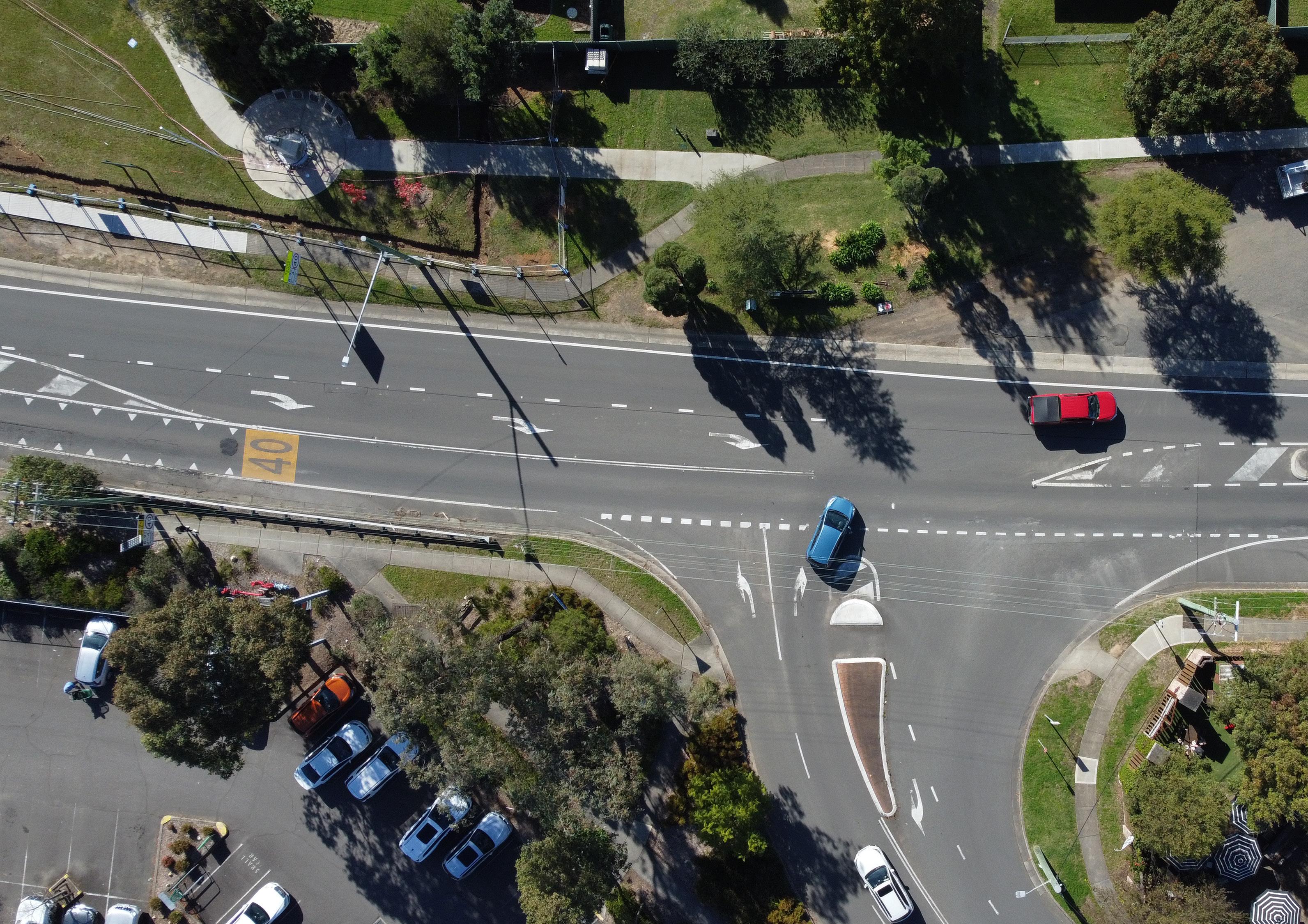
Install a roundabout at the intersection between Old Northern Road and Post Office Road. This roundabout would provide formal pedestrian refuges on each approach while maintaining a minimal visual impact. It is also expected to reduce vehicle speeds through the village centre and improve traffic capacity. Implementation of the roundabout is subject to further discussion with The Hills Shire Council and Transport for New South Wales.
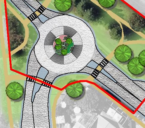
Transform the underutilised area currently used as a bus turnaround into an open space with pedestrian pathways. The Glenorie Community overwhelmingly identified the village atmosphere as a key asset to be preserved in any future place plan. This vibrant space will connect with the existing war memorial and community hall and will include a new bus bay along with landscaping improvements.
Add clearly articulated entry statements adjacent to Harrisons Lane in the south and adjacent to the school, complementing existing speed restrictions.
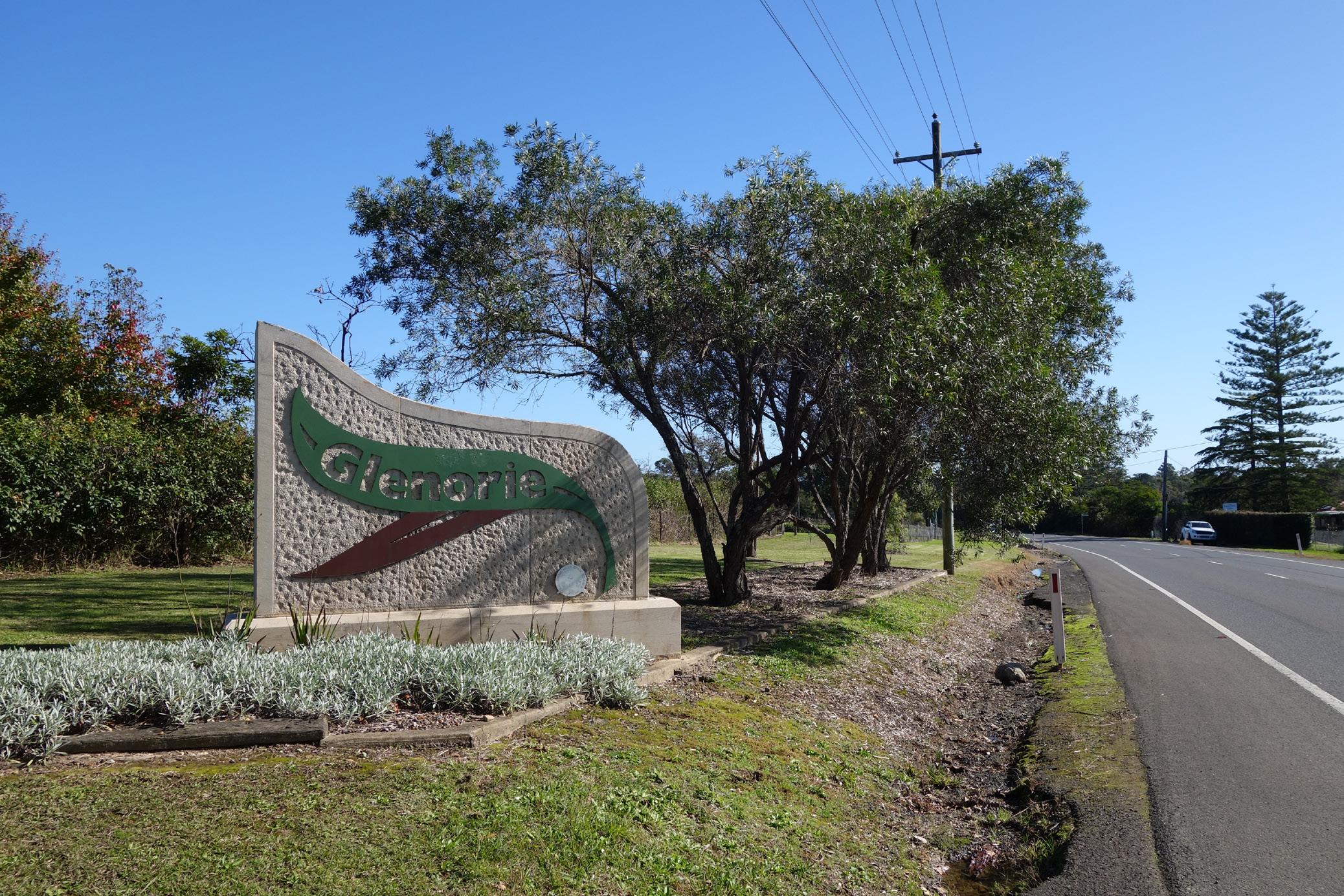
Glenorie Village currently lacks a defined entry statement. In coordination with The Hills Shire Council, this could be enhanced through a coordinated landscaping design paired with subtle changes to the pavement at key points. A better entry statement will assist in providing a sense of arrival to Glenorie, creating a visual cue to drivers that they are entering the village.
Implementation of the Glenorie Village Place Plan will be undertaken over time, and is subject to cooperation with The Hills Shire Council, Transport for New South Wales, Sydney Water, and other relevant State Government Agencies. The below table outlines the key implementation pathways for each of the actions.
Action 1 - Small rural lots Planning Proposal and updated contributions framework to fund and deliver perimeter road
Action 2 - Townhouses Planning Proposal (subject to Sydney Water capacity)
Action 3 - Commercial & residential Planning Proposal
Action 4a - Roundabout Updated contributions framework to fund and deliver
Action 4b - Open space connection Updated contributions framework to fund and deliver
Action 5 - Entry statements Updated contributions framework to fund and deliver