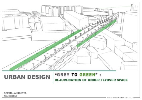
URBAN DESIGN|GREY TO GREEN “ GREY TO GREEN ” : REJUVENATION OF UNDER FLYOVER SPACE SEEMALA 16UG06055HRUDYA URBAN DESIGN
The idea is to provide a PUBLIC SPACE to the ward providing all the essential amenities likeSeatingKiosks
The ward lacks a public space despite having lot of scope and only the motor vehicles are given more preference and less to pedestrian movement.
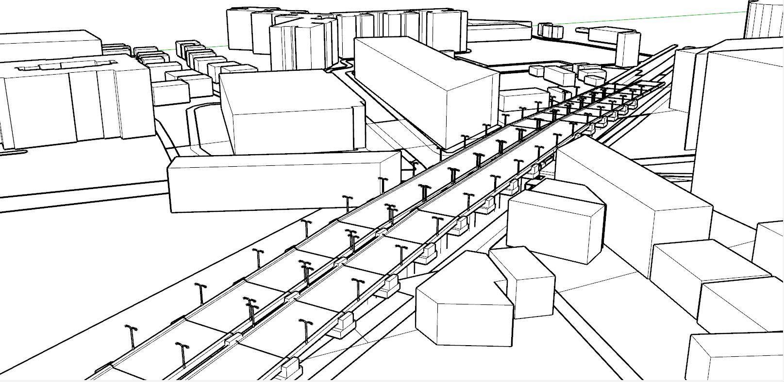
SPACES | Adaptive re-use of urban voids - Under the flyover (T9)
URBAN DESIGN|GREY TO GREEN ‘GREY TO GREEN’ - REJUVENATION OF UNDER FLYOVER
The main objective of the project is to provide a public space giving all the necessary essential amenities, improvising the walkability as well as giving a green buffer along the stretch .The area chosen is the under flyover space of doddanakundi flyover. It is one of the most prominent areas as many people use that zone to go to their respective destinations. It’s a road connecting to many other major roads. The site consists of many IT companies and has a mall opposite to it. Taking these into consideration, it gives an opportunity to create a major pause point catering all kinds of users. This also gives an opportunity to improve and organize traffic flow and walkability to make the space in to a better public space. Objective of the project-
DESIGN BRIEF :
BetterWaterVendorsareaszonesdipensersparkingfacilities etc And also giving a Green buffer throughout the stretch to create a sense of belonging to the area.
URBAN VOIDS TYPOLOGIES : Urban voids are all areas in a city, whose functions and designs have not yet been decided upon conclusively. It is also a space that is underused, misused or abandoned leftover spaces within the city.
Lost spaces are the undesirable urban areas that are in need to redesign- anti spaces, making a positive contribution to the surroundings.
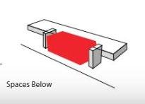
Spaces Below: Spaces below infrastructural element such as elevated railway lines. Motorway flyover.
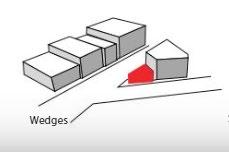
Wedges: The result of intersection of conflicting urban grids or infrastructural lines
URBAN DESIGN|GREY TO GREEN WHAT ARE URBAN VOIDS ?
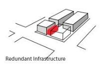
Redundant infrastructure: infrastructure which is not in use anymore
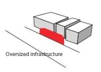
Oversized infrastructure: Overestimated spaces for traffic
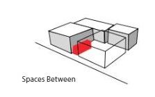
Spaces between: The result after urban demolition.
C A S E S T U D Y
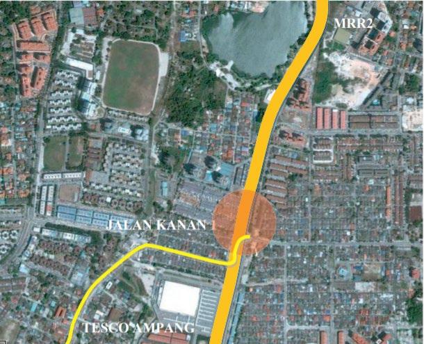
While the MRR2 connects to different township in Kuala Lumpur, u nderneath its flyover, Jalan Kanan 1 provides connection to the immediate surroundings of Kampung Pandan Luar and Kampung Pandan Dalam in which facilities and amenities of both sides completes each other such as the food court and eatery, schools, institutions, religious facilities, retail, commercial and offices. The compact grains of both areas lack the foremost important amenity in urban setting, namely a public open space where freedom and various activities could happen.
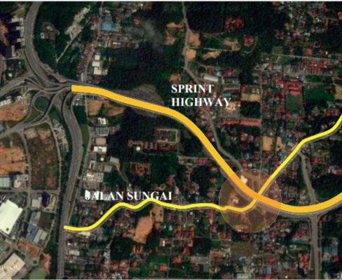
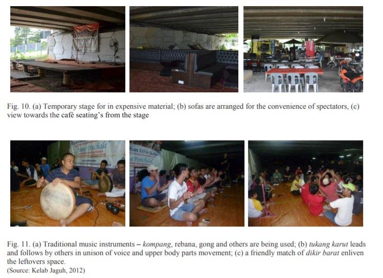
Case studies 2: under the flyover of Penchala Link at Jalan Sungai Penchala, Kuala Lumpur The Penchala Link is a 5.5 km link that provides connection between the Lebuh Raya DamansaraPuchong (LDP) in the west and Jalan Bukit Kiara at Mont Kiara in the east, a direct link to and from Kuala Lumpur avoiding commuting along the congested Jalan Damansara and Jalan Kepong, as well as an alternative highway of North Klang Valley Expressway - NKVE. Penchala Link passes across a Malay Reserved land of Kampung Sungai Penchala that consists of smaller villages namely Kampung Penchala Indah, Kampung Palimbayan and Kampung Palimbayan Indah. Set in a village setting, the ambiance of Kampung Sungai Penchala differs from the rush and crowd of surrounding urbanized areas of Taman Tun Dr Ismail and Damansara Perdana.
Case studies 1: under the flyover of MRR2 at Jalan Kanan 1, Kuala Lumpur
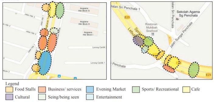
Cultural activities Under the flyover of Penchala Link, a unique practice of cultural activities is seen on alternate Friday nights. Where a small community of Kelantanese that live in the area sometimes fill their leisure time with dikir barat, a form of traditional performance.
URBAN DESIGN|GREY TO GREEN
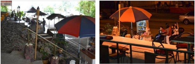
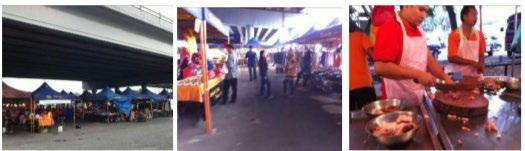
Food stalls are seen in both case studies though varies in numbers, operation time and location. Under the MRR2 Jalan Kanan 1, the location of food stalls are scattered but still maintain a direct relationship to the roadside; Evening market Evening market or locally known as pasar tani is held twice weekly under the MRR2 flyover
Fig. 3. Types of activities under the flyovers of (a) MRR2 at Jalan Kanan 1; (b) Penchala Link at Jalan Sungai Penchala
The MRR2 or Kuala Lumpur Middle Ring Road 2 is one of the important roads in Kuala Lumpur spanning 35 km, it was a project of Public Works Department. It was constructed in 1992 and started to operate in 2002. Today MRR2 provides connection to various highways in Kuala Lumpur and Selangor.
Fig. 1. The location of study area under the flyover of MRR2 at Jalan Kanan 1 (Source: Google Earth Image retrieved and modified by the author, August 2012) Fig. 2. The location of study area under the flyover of Penchala Link at Jalan Sun gai Penchala
Food stalls
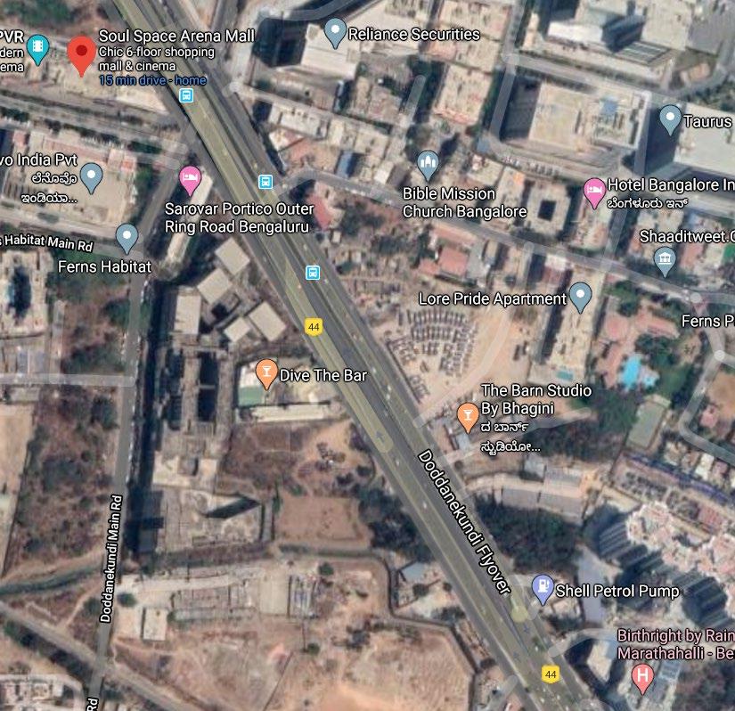
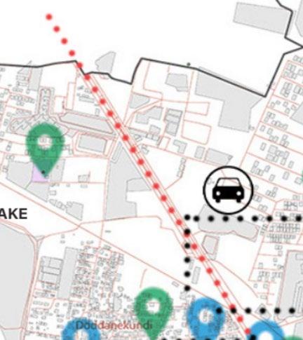
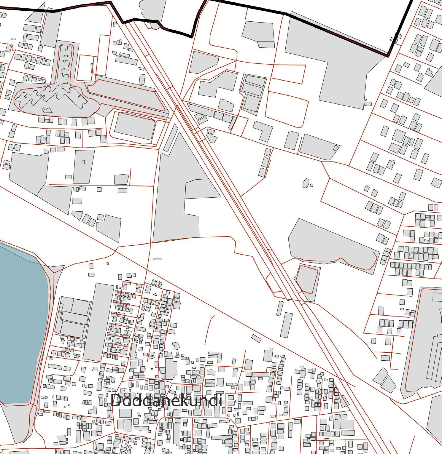
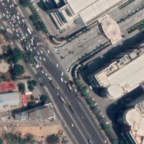
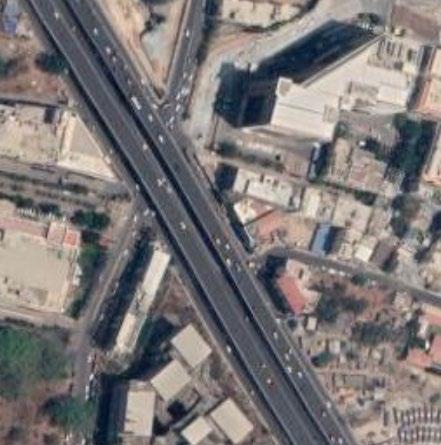
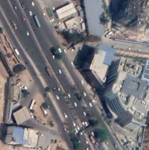
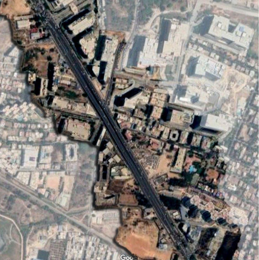
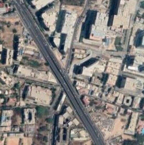
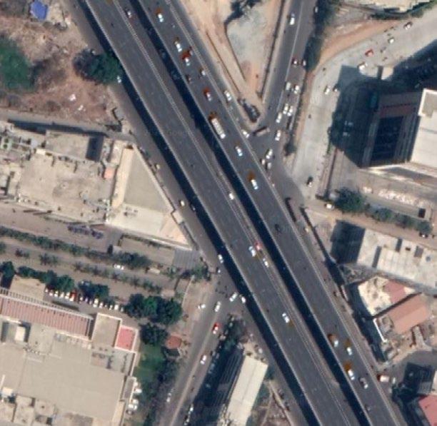
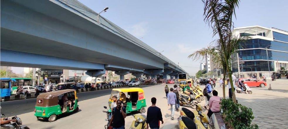
SITE : DODDENAKUNDI FLYOVER, OUTER RING ROAD.
LOCATION
Mostly commercial activities( eateries ) on either side of the roads, and also has a mall on one side.
LEGENDroadBusstop(no shelter)
The IT parks also come under this area , giving more scope for the area to be used largely.
Site - Doddanekundi Flyover, Outer Ring Road.
Most used road on the basis of connectivity , bringing lot of people to the site as a pause point.
Doddanekundi Flyover service
Criteria for site selection -
The site is located at one of the busiest roads ( during peak times only ). The presence ofITMallTech residentialcommercialparksandspaces gives the scope, as they would be the stakeholders of the developed space.
The IT belt throughout the stretch and the Mall gives the higest scope , as the site can be integrated with them to make a better public space. Gives the advantage of easing the traffic congestion and developing the walkability. N
SITE & SITE SELECTION CRITERIA
URBAN DESIGN|GREY TO GREEN
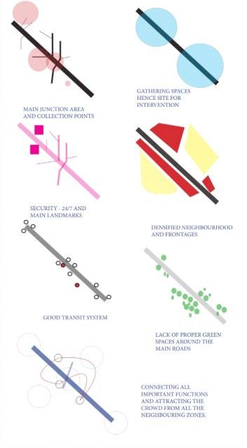
URBAN DESIGN|GREY TO GREEN THREATSOPPURTUNITIESWEAKNESSESSTRENGTHS • Presence of malls and IT companies • (anchor points) • Caters all kind of users • Urban village • Presence of public toilet ( public utilities) • Many commercial spaces • Redesigning of bus stop • Developing a public space under the flyover. • Making it more pedestrian friendly • Providing green belts. • Encroachment of the space for parking • close to junction • congestion due to traffic • No designated bus stops • No proper footpaths • Unorganised traffic flow • Accident prone zones • If not treated well, can become defunct space.
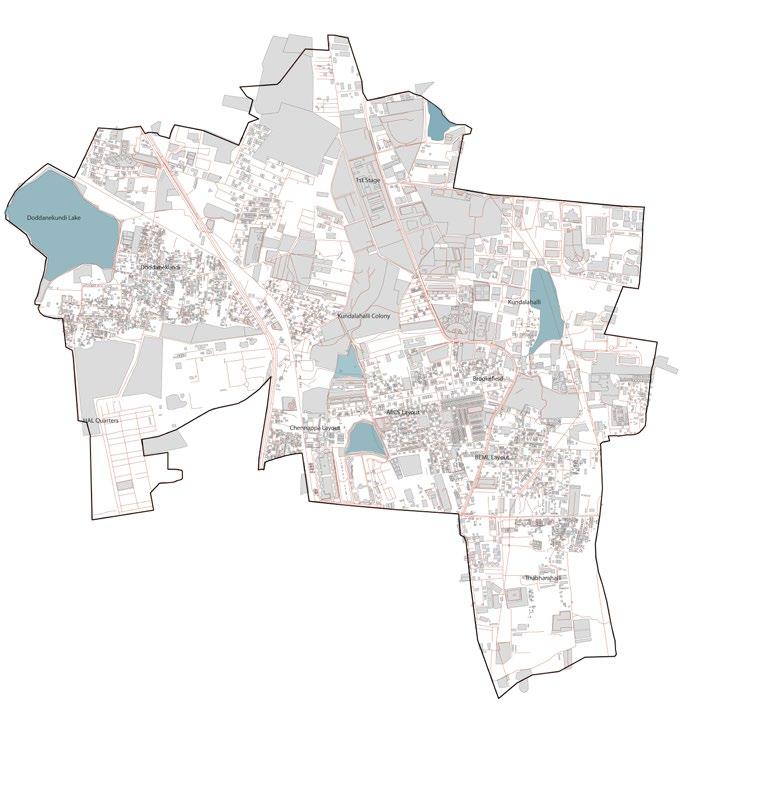
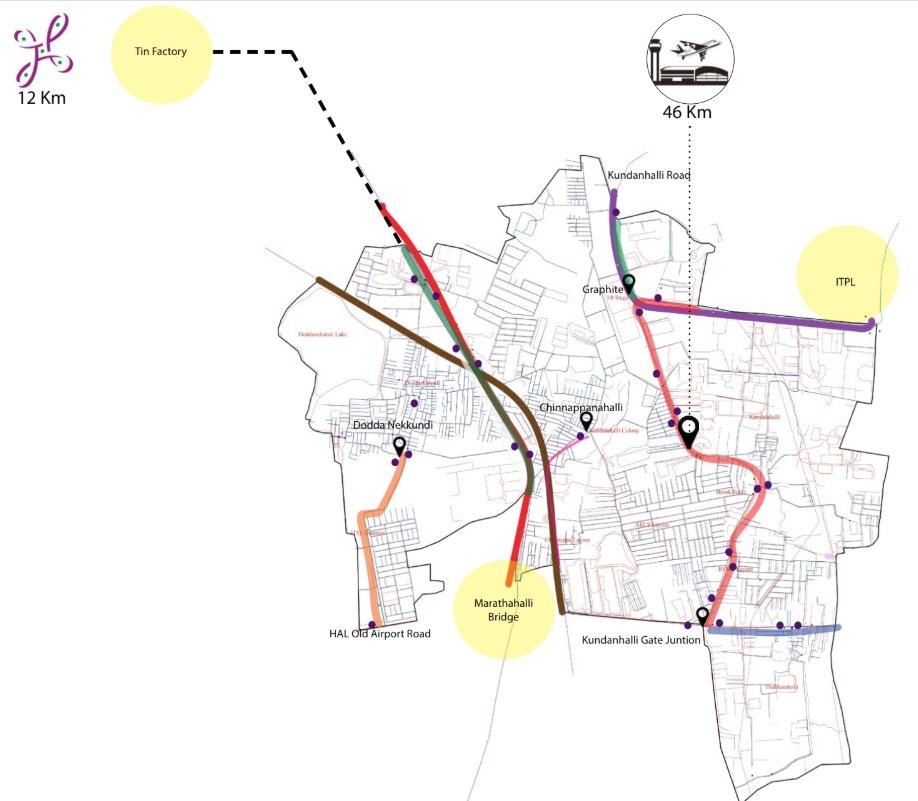
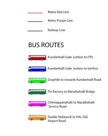
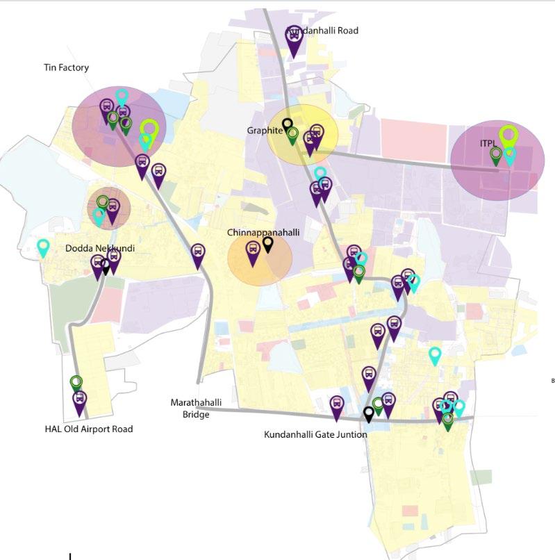
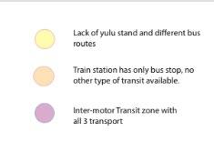
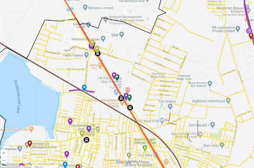
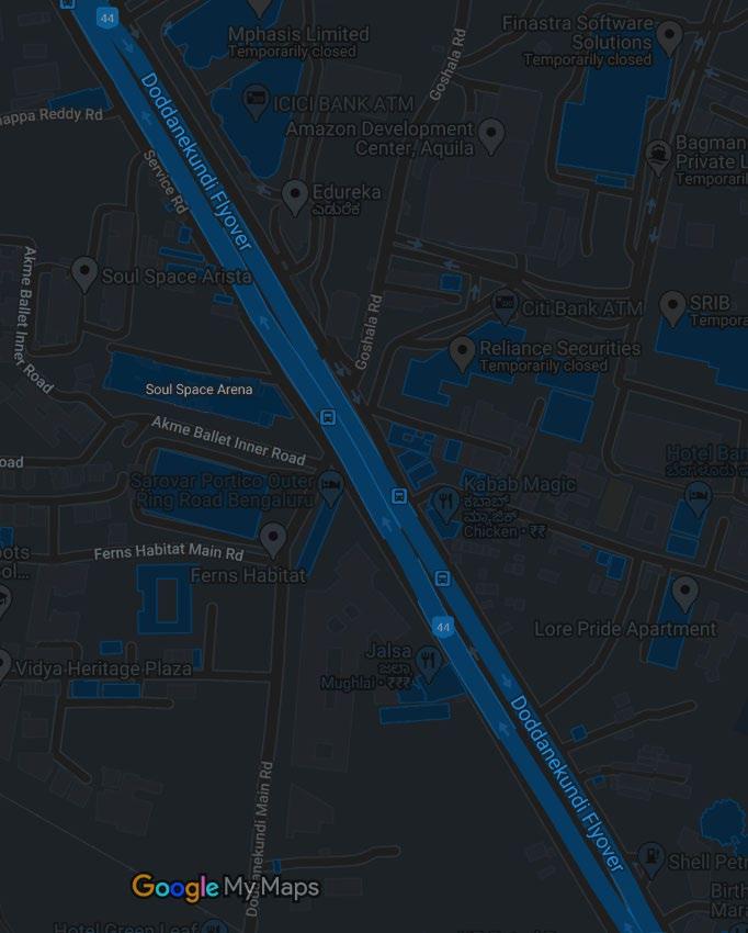
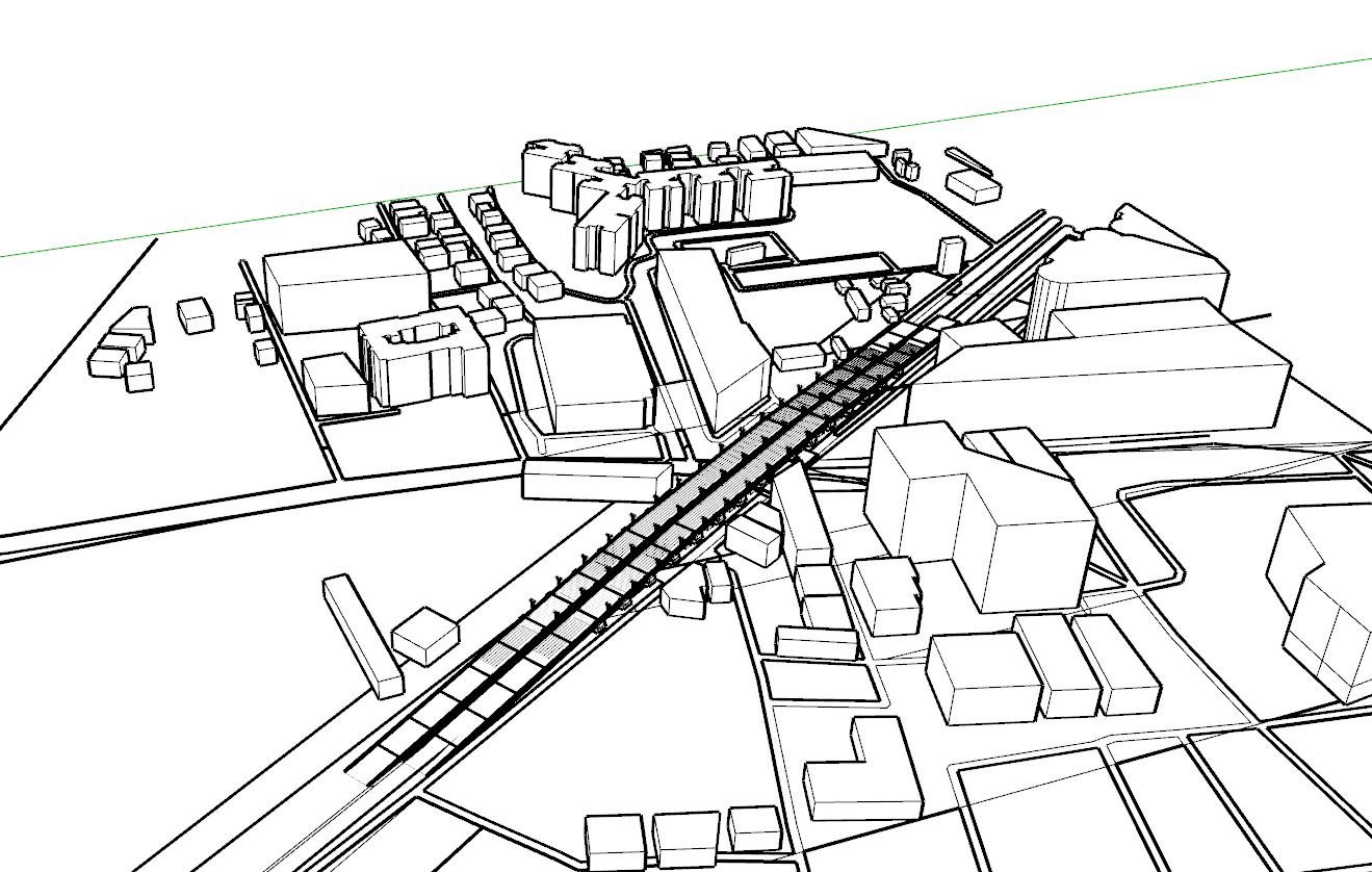
URBAN DESIGN|GREY TO GREEN CONNECTIVITY- WARD LEVEL
From the maps we can infer that there is major connectivity to the ward from the site and it also has a very good transportation system and connectivity, with a future metro line proposal along the site.
SITE SITE
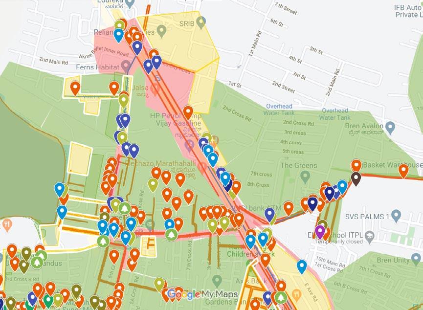
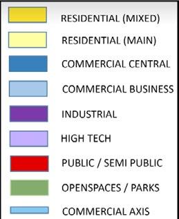
LAYER UNDERSTANDING FROM BASE MAP
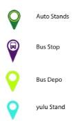
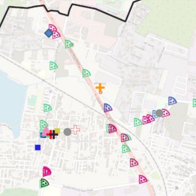
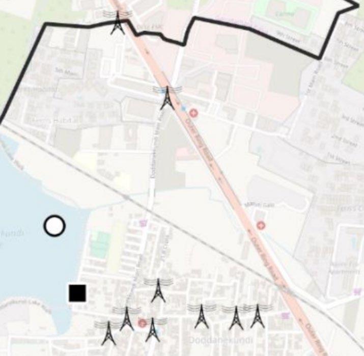
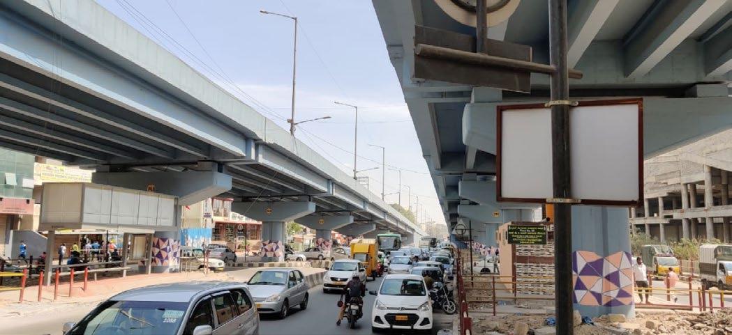
URBAN DESIGN|GREY TO GREEN TRANSPORTATION LAYERINFERS THE PRESENCE OF BUS STOPS, AND AUTO STANDS, AND THE CONGESTION POINTS AT THE GIVEN AREA. OPEN SPACES AND PARKSNOT MANY OPEN SPACES AROUND THE SITE , AND LESS GREEN SPACE, GIVES AN OPPORTUNITY TO MAKE THE SPACE MORE GREEN AND OPEN PUBLIC AND SEMI PUBLICPRESENCE OF MANY COMMERCIAL SPACES (EATERIES) AND VENDORS AROUND THE SITE. AND ALSO A MALL RIGHT OPPOSITE TOTHE SITE. PUBLIC UTILITIESPRESENCE OF POWER LINES ALONG THE SITE . A PUBLIC TOILET UNDER THE FLYOVER ( PAY AND USE) STREETS AND INFRASTRUCTUREMOST ACTIVE ZONE AT THE MAIN ROAD , (AREA CHOSEN , DODDANEKUNDI FLYOVER ) AND THE REST ARE LOW ACTIVITY ZONE (RESIDENCE), ALSO CONSISTS OF MANY VENDOR ZONES, HAS BROKEN OR NARROW FOOTPATHS LAKEWATER-AT AN EASY PROXIMITY FROM THE AREA , AND A WELL CONNECT ED SEWERAGE SYSTEM. CAMPUSES AND SCHOOLSIT COMPANIES OPPOSITE THE FLY OVER , GIVES MORE SCOPE FOR HAVING MORE USERS IN THE PUBLIC SPACE CREATED. HOUSINGPRESENCE OF RESIDENTIAL ZONE AWAY FROM THE MAIN ROAD , YET EASILY ACCESSIBLE LAND USEMOSTLY COMMERCIAL AROUND THE SITE , WITH A PRESENCE OF MALL AND IT COMPANIES AROUND THE FLYOVER MOST BEING COVERED WITH RESIDENTIAL ZONES.

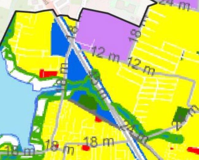
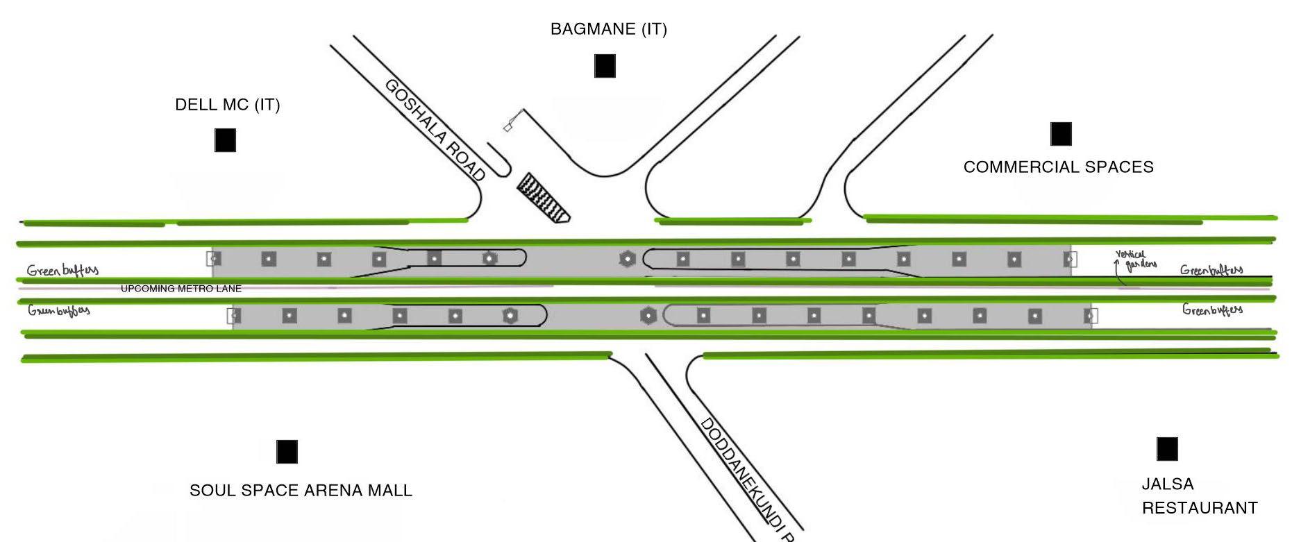
URBAN DESIGN|GREY TO GREEN A B MAJOR INTERMEDIATELEGENDROAD ROADS SOULRESIDENTIALSPACE ARENA MALL RAINBOW HOSPITAL IT COMPANIES CONNECTIVITYA- towards mahadevpura B-towards karthik nagar Large connectivity to the ward (Towards Karthik nagar, Marathalli, etc in the ward as well as to the nearest residential and IT tech parks. Prominant landmarks - Soul space arena mall, IT companies, Rainbow Hospital DODDANEKUNDIFLYOVER CONNECTIVITY AND LAND USE DODDANEKUNDIFLYOVER COMMERCIALRESIDENTIALLEGEND OPEN PUBLICSPACESANDSEMI PUBLIC VACANT IT COMPANIESLAND USEFrom the above we can infer that most land uses are at a closer proximity to the flyover closest being the commercial, then the IT companies. easy access to the residential as well.

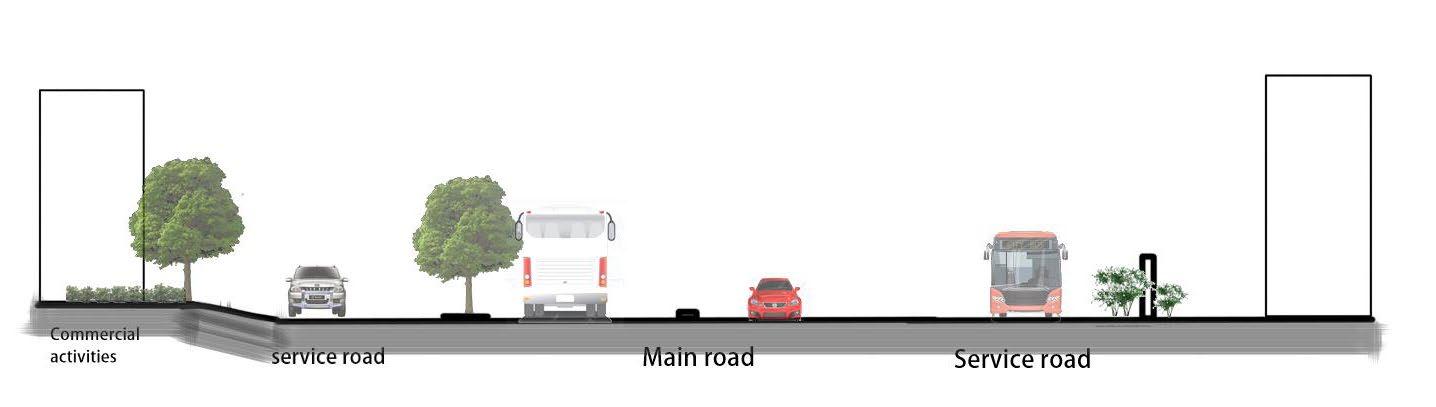
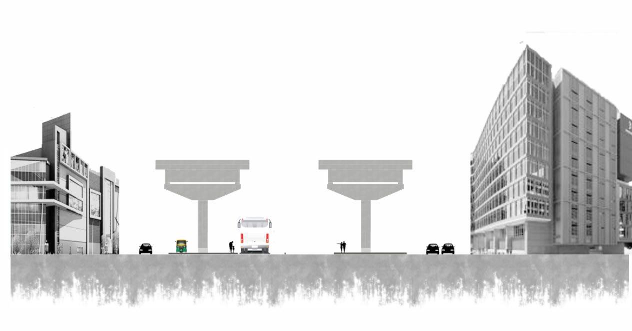
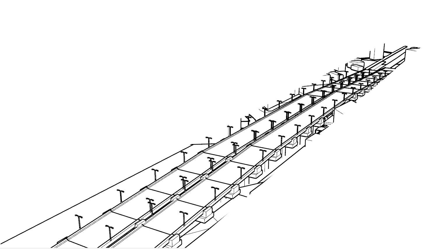
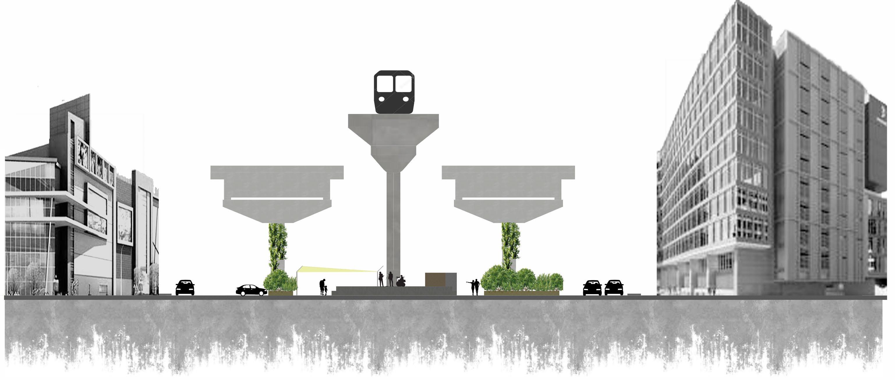
URBAN DESIGN|GREY TO GREEN start point - near DELL EMC Middle of the flyover extent End point - near Rainbow Hospital Understanding the site by conceptual sections1. Start of flyover- A major road largely used by the IT employees , students and other users (continuous vehicular movement ) 2. Middle of the flyover - Has an underflyover space connecting to various residential and working spaces. also has a mall opposite to the void space, and a bus stop under it, and also catering other users who use the space. mostly use as a pause point. 3. End point - major traffic congestion point, having a hospital as a landmark, also connects to residential areas from the service road adjacent to it. CommercialServiceService8metersroadroad Main Flyoverroad Main road Main road End of FlyoverService roadService road Petrol MphasisbunkLtd.12meters 12meters 8meters 8meters 12meters 12meters 12meters 8meters yx z yx z Section xx Section zz Flyover length - 790meters Traffic flow of the flyover2 flyovers with one way traffic each. Width - 11meters each. N 7.5 m 11m 12 meters 12 meters meters8 Service Road (two way) Under FlyoverspaceFlyover Flyover Main road (one12way)meters Under Flyover space Service Road (one way) 11 meters 7.5m SOUL SPACE ARENA MALL STANDAUTO BUS STOP BAGMANE SECTION YY
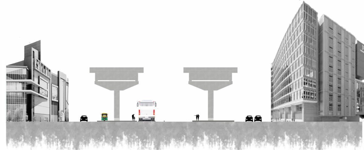
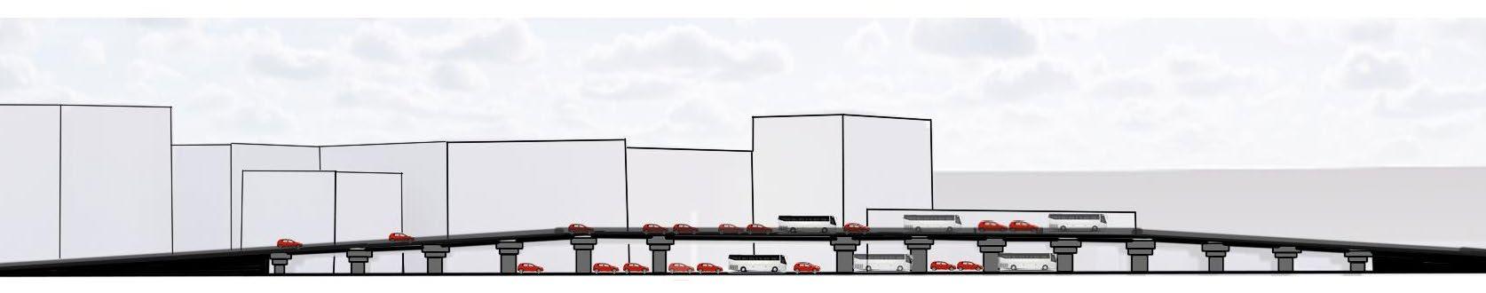
URBAN DESIGN|GREY TO GREEN Understanding the space by conceptual sectionsLONGITUDNAL SECTIONThe section is cut along the flyover such that the IT companies and commercial buildings are viewd. The section cut indicates that the traffic density is similar on the top and below, with very less to no vegetation. Mphasis Ltd. Section yy Edureka Bagmane Commercial spaces Land for parking of Private vehicles y y
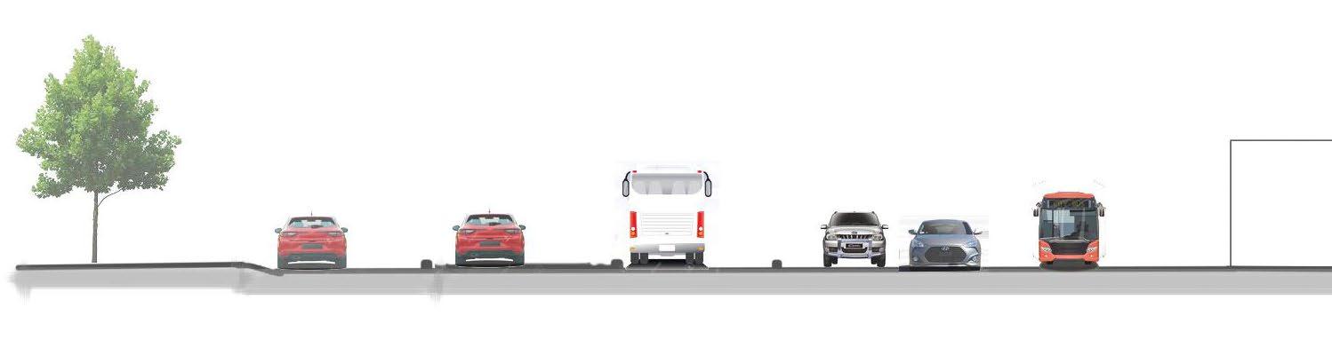
URBAN DESIGN|GREY TO GREEN TRAFFIC ANALYSISUNDERSTANDING ROAD WIDTHS X X ROAD WIDTHSa. MAIN ROAD - ABOUT 12 METERS ( ONE WAY, TOWARDS MAHADEVPURA) b. SERVICE ROAD 1 - ABOUT 7-8 METERS ( ONE WAY TOWARDS RAINBOW HOSPITAL) c. SERVICE ROAD 2 - ABOUT 7-8 METERS ( TWO WAY , NEXT TO SOUL SPACE ARENA MALL ) d. FLYOVER - 2 FLYOVERS, BOTH ARE ONE WAY , ABOUT 12METERS WIDE. Peak hours of traffic : caused mostly by the working people (IT employees), college students etc. Morning - 8-10am Evening - 5-8pm 7.5 meters 11 meters 12 meters 12 meters meters8 Service Road (two way) Under FlyoverspaceFlyover Flyover Main road (one way) 12 meters Under Flyover space Service Road (one way) 11 meters 7.5meters SOUL SPACE ARENA MALL STANDAUTO BUS STOP BAGMANE SECTION XX

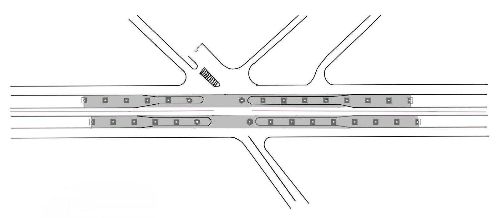
URBAN DESIGN|GREY TO GREEN A B FLYOVER TRAFFIC NODES TRAFFIC NODES - Maximum congestion due to vehicular and pedestrian movements. BUS STOPS LEGEND LEGEND LEGEND SERVICE ROAD LANDMARKS Most important landmarks in the area, with close proximity to the bus stops UNDER FLYOVER MAIN ROAD INTERMEDIATE ROADS A - Towards Mahadevpura B Towards karthik nagar NOTE: Arrows indicating the direction of traffic flow TRAFFICROADS ANALYSISNODES BUS STOPS AND LANDMARKS N
URBAN DESIGN|GREY TO GREEN A A A B B B FLYOVER TRAFFIC FROM ‘A’ TO ‘B’ under flyover. FLYOVER LEGEND LEGEND LEGEND SERVICE ROAD TRAFFIC FROM INTERMEDIATE ROAD SERVICE ROAD UNDER FLYOVER MAIN ROAD METRO LANE/ROAD UNDER FLYOVER INTERMEDIATE ROADS INTERMEDIATE ROADS A - Towards Mahadevpura B Towards karthik nagar NOTE: Arrows indicating the direction of traffic flow EXISTING TRAFFIC FLOW vehicular movement FUTURE PROJECTMETRO LINE A - Towards Mahadevpura B Towards karthik nagar NOTE: Arrows indicating the direction of traffic flow A - Towards Mahadevpura B Towards karthik nagar TRAFFIC NODESHIGH CONGESTION TRAFFIC NODESHIGH CONGESTION TRAFFIC NODESLESS CONGESTION
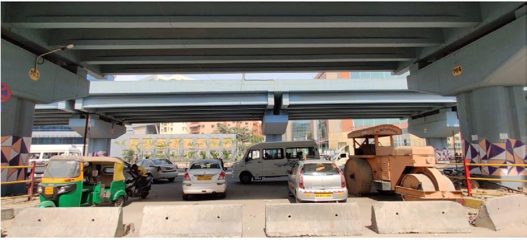
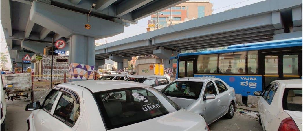
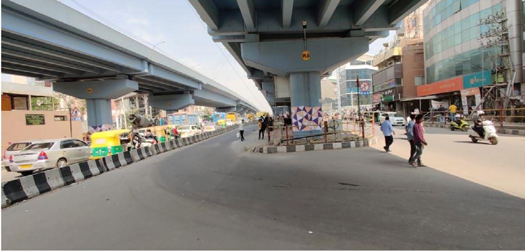
URBAN DESIGN|GREY TO GREEN 5x20=100M 50.00M 8x20=160M SOUL SPACE ARENA MALL DELL EMC BAGMANE DODDANEKUNDIROAD GHOSHALAROAD DETAIL STUDY OF THE FLYOVER SPIN E INFERENCES1. Total void space under flyover is about 310 meters, with the pillars gap of 20 meters center to center, and is about 8 meters high 2. Most of the space under flyover is being occupied by cabs for parking, this is one of the reasons for road congestion 3. There is a pay and use public restroom in the void space. 4. No proper pedestrian lanes provided,most of the footpaths are narrow and broken. PAY AND USE PUBLIC TOILET CONGESTION FROM KARTHIK NAGAR TO MAHADEVPURA ( ONE WAY ) CABS AND AUTOS PARKED UNDER FLYOVER BETWEEN P3 AND P4. CABS AND AUTOS PARKED UNDER FLYOVER BETWEEN P8 AND P9. ONE WAY ROUTE ON THE MAIN ROAD TOWARDSMAHADEVPURA.INFRONTOFBAGMANE BUS STOP (NO SHELTER) NODE LEGENDBUSSTOP (SHELTERED) NEAREST LANDMARKS AUTO STAND
URBAN DESIGN|GREY TO GREEN LIST OF USERS AND STAKEHOLDERSAuto drivers and cab drivers Bus Peoplecommuterscomingto malls ITStudentsEmployees Residents of the area People coming to commercial shops Children Handicapped people Elderly PeopleWatchmanpassing by the flyover USERS AND STAKEHOLDERS CORE UNDER FLYOVER Auto and cab drivers, Vendors Bus commuters INDIRECTDIRECT Residents IT employeesMallvisitors(bike)RentalsStudents zoneCommercialvisitors Visitors Vehicular movement collectorsGarbage Govt. officials


ZONINGCONCEPT
in the form of vertical gardens on the
is
is
shrubs, bushes and grass for the
Main idea and concept is focusing on creating GREEN which achieved buffers to the void space which will be used. The buffering done pillars and, by using ground zoning and the area program has been
SPACE ,
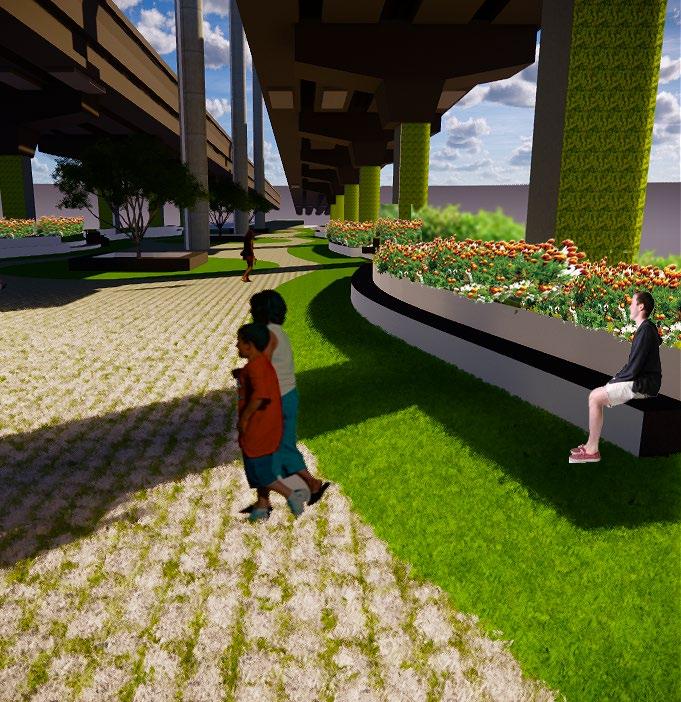
level , thus , creating a space which is AREA PROGRAM TRANSPORT HUBSeating area with charging BusCabAutoportals.unionparkingstops Kiosks Public toilet Storage area (recyclable waste) Yulu zone CULTURAL AREA Seating area with charging Displayportals. area Mini Library Multipurpose area(flee markets, vendor zones etc) Food street Water dispensers , kiosks PARK Seating area with charging portals. Green belt. Parking of emergency vehicles and 2 wheelers. The
done in order to create more of a sense of belonging of the area considering the nearest landmarks as anchor points. More like to create a connectivity and stitching the urban void fabric with the existing one. URBAN DESIGN|GREY TO GREEN
by providing green

MajorFlyoverNode
The U turn from karthik nagar to alpine eco road has been shifted 400meters away from the start of flyover. (Towards A side)
B B A A URBAN DESIGN|GREY TO GREEN N N
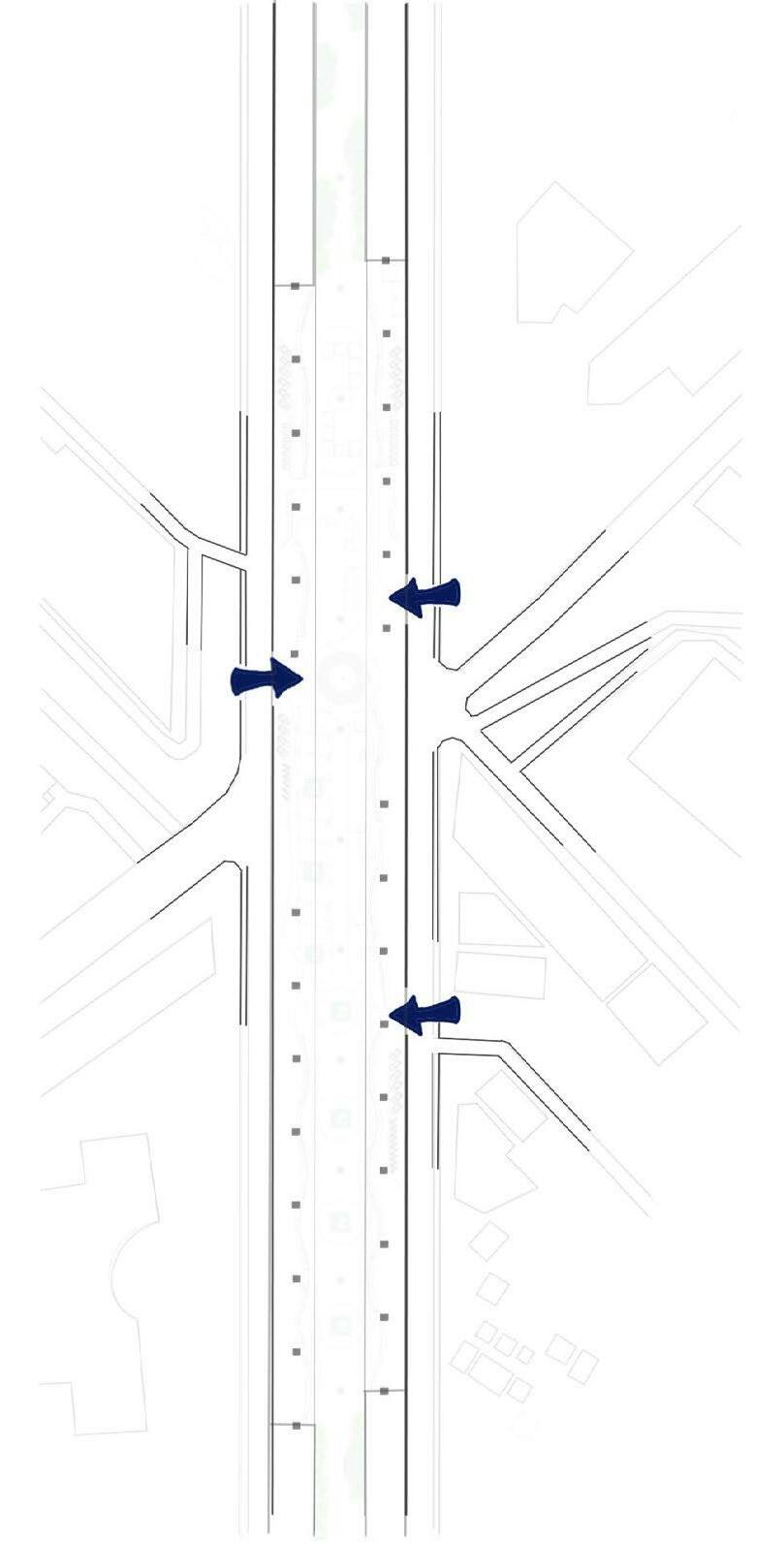
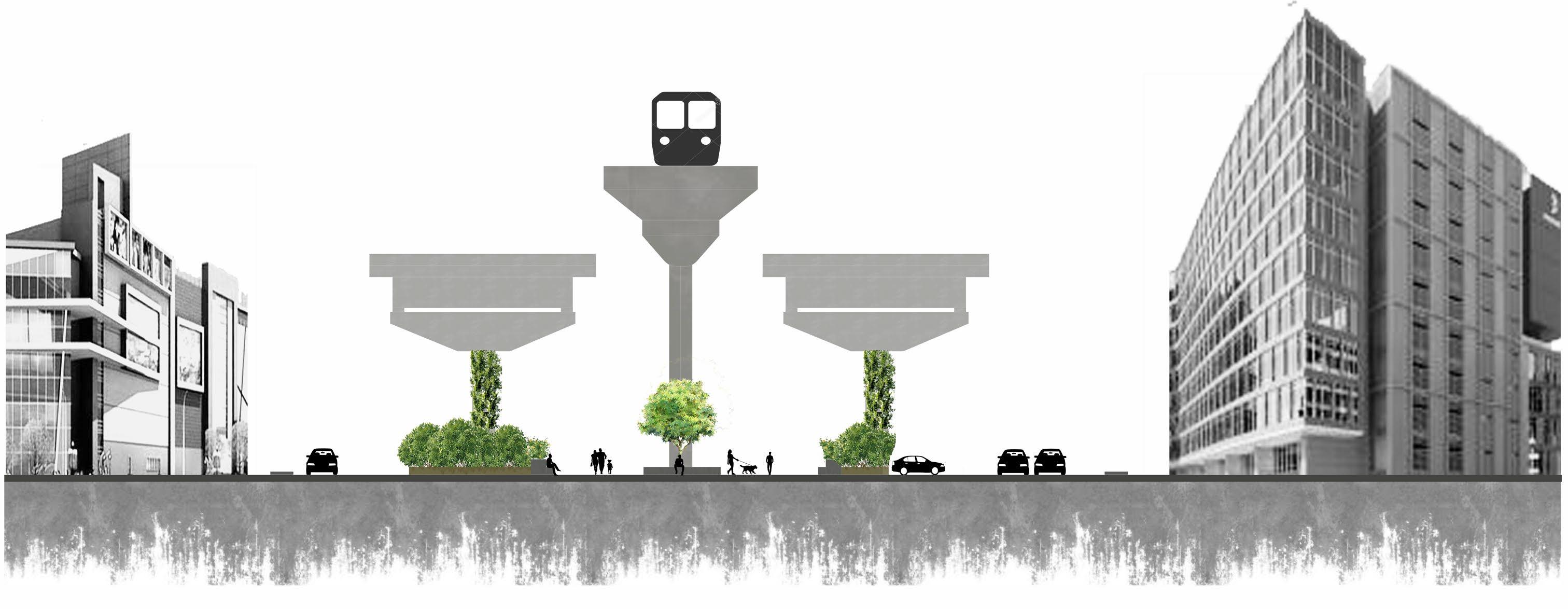
STRATEGIES : TRAFFIC FLOW STRATEGY Flyover traffic flow Existing Traffic condition Proposed Traffic condition Strategy
A- Towards mahadevpura B-Towards Karthik nagar ClosingSTRATEGY-the under flyover main road to completely pedestrianise it, thus, getting more area under the site to rejuvenate.
Vehicular movement towards B Traffic flow on service road Upcoming metro line/Pedestrian lane
U turn point Traffic flow under flyover main road
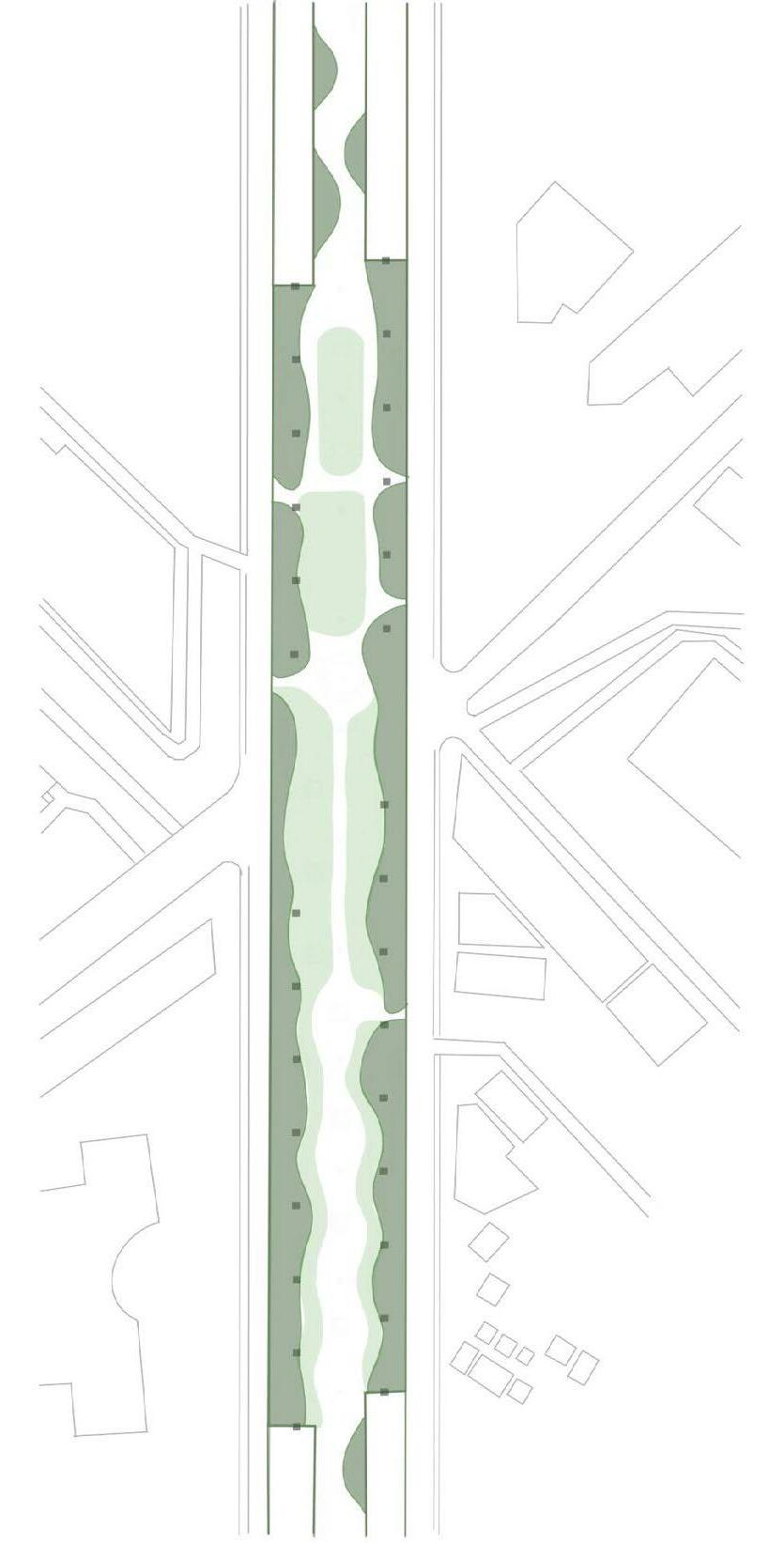
3 Major entry points near the residential junctions for easy access and movement Dense green buffers at the extreme sides followed by green patches which is less dense. This is to create the difference in gradience of the buffers. Activity zones are to be placed in the center with the green buffers as a cushioning element and the walking path around the activities for a better experience.
ENTRY POINTS BUFFER AND GREEN PATCHES ACTIVITY ZONES AND WALKING PATHS
STRATEGIES : DESIGN STRATEGY URBAN DESIGN|GREY TO GREEN
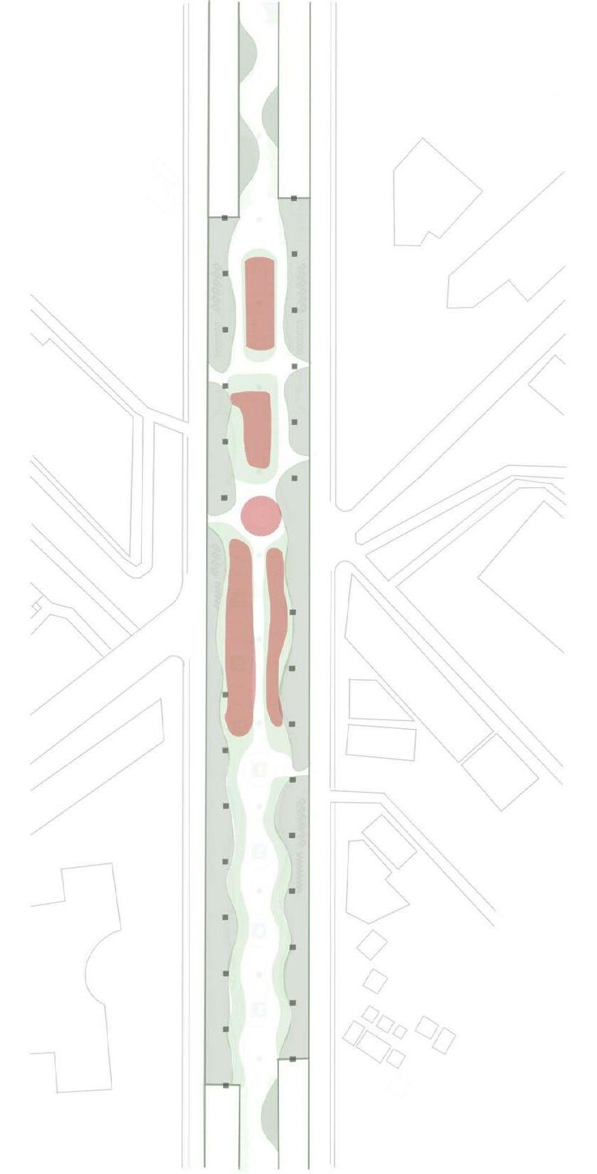
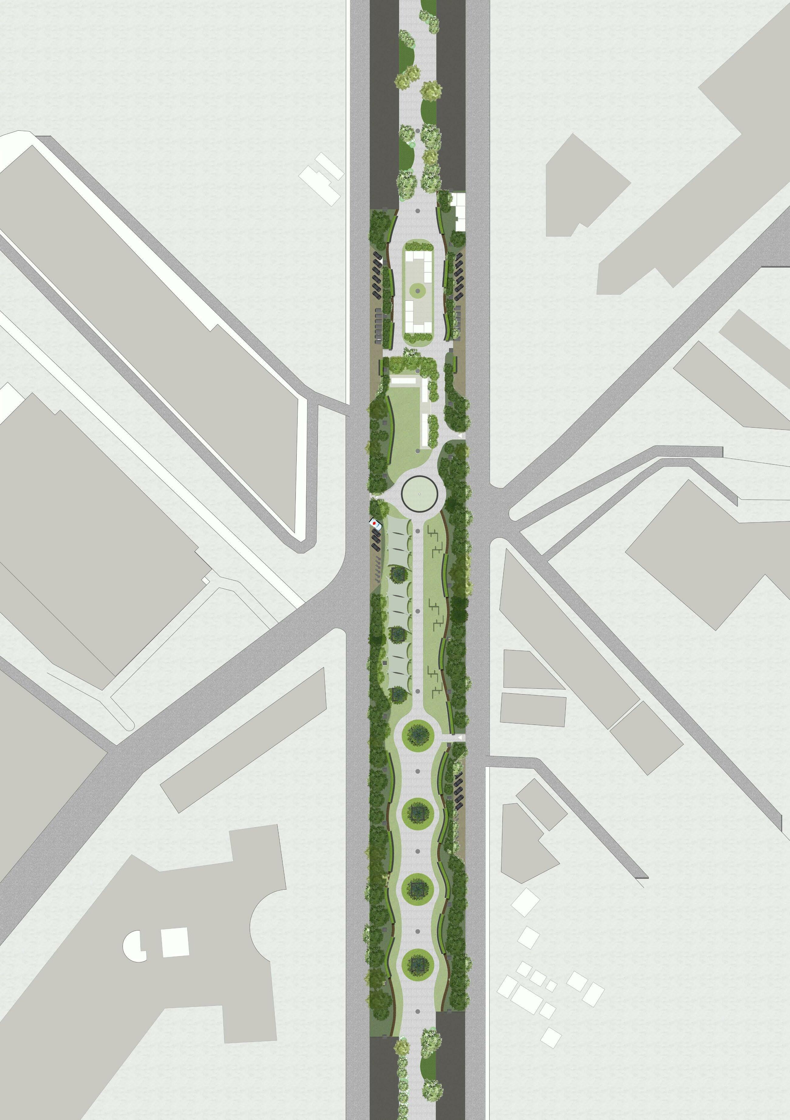
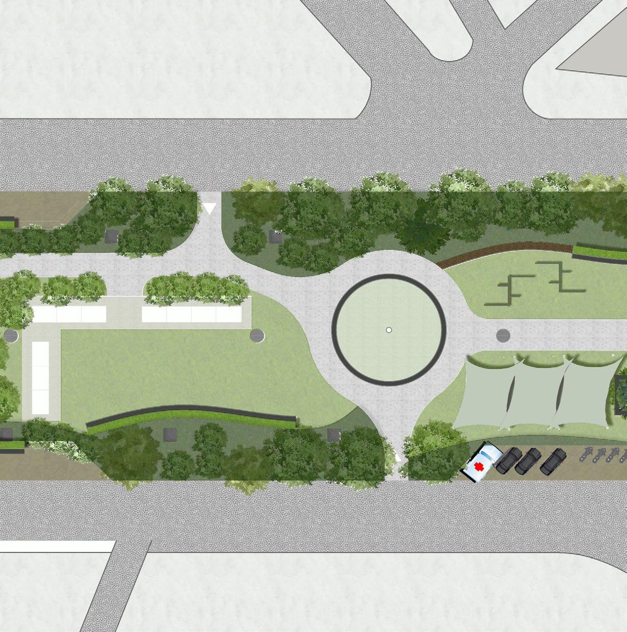
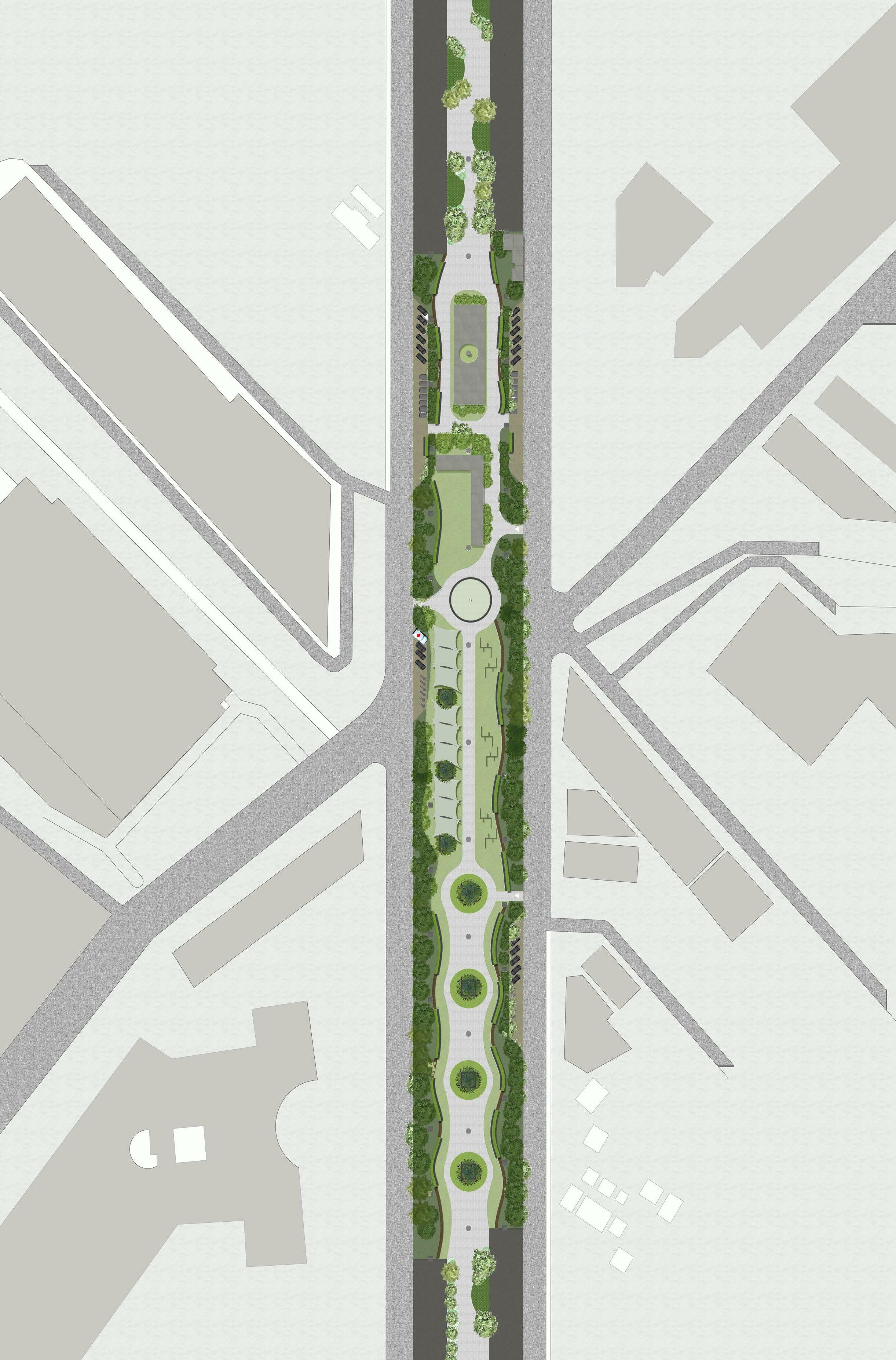
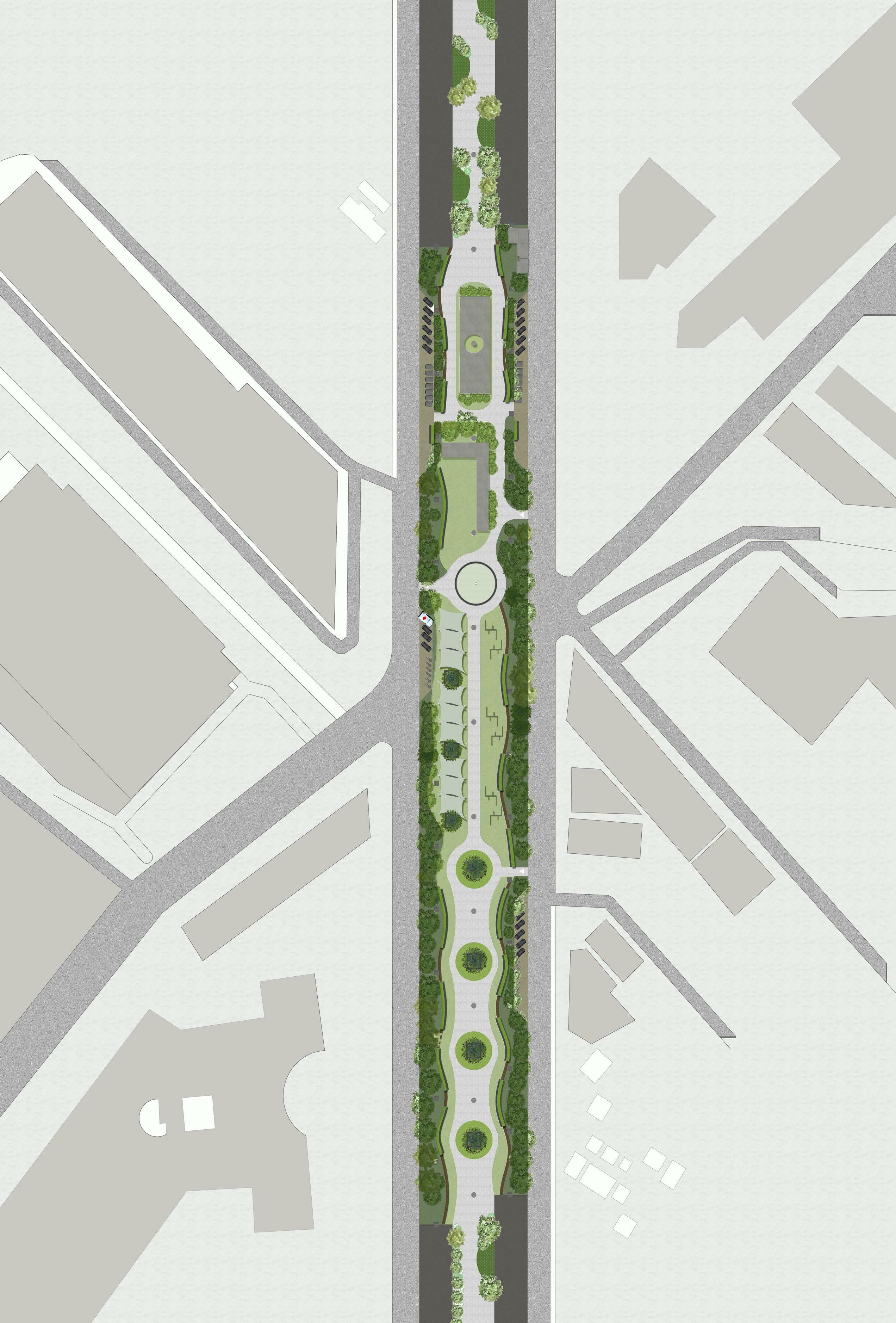
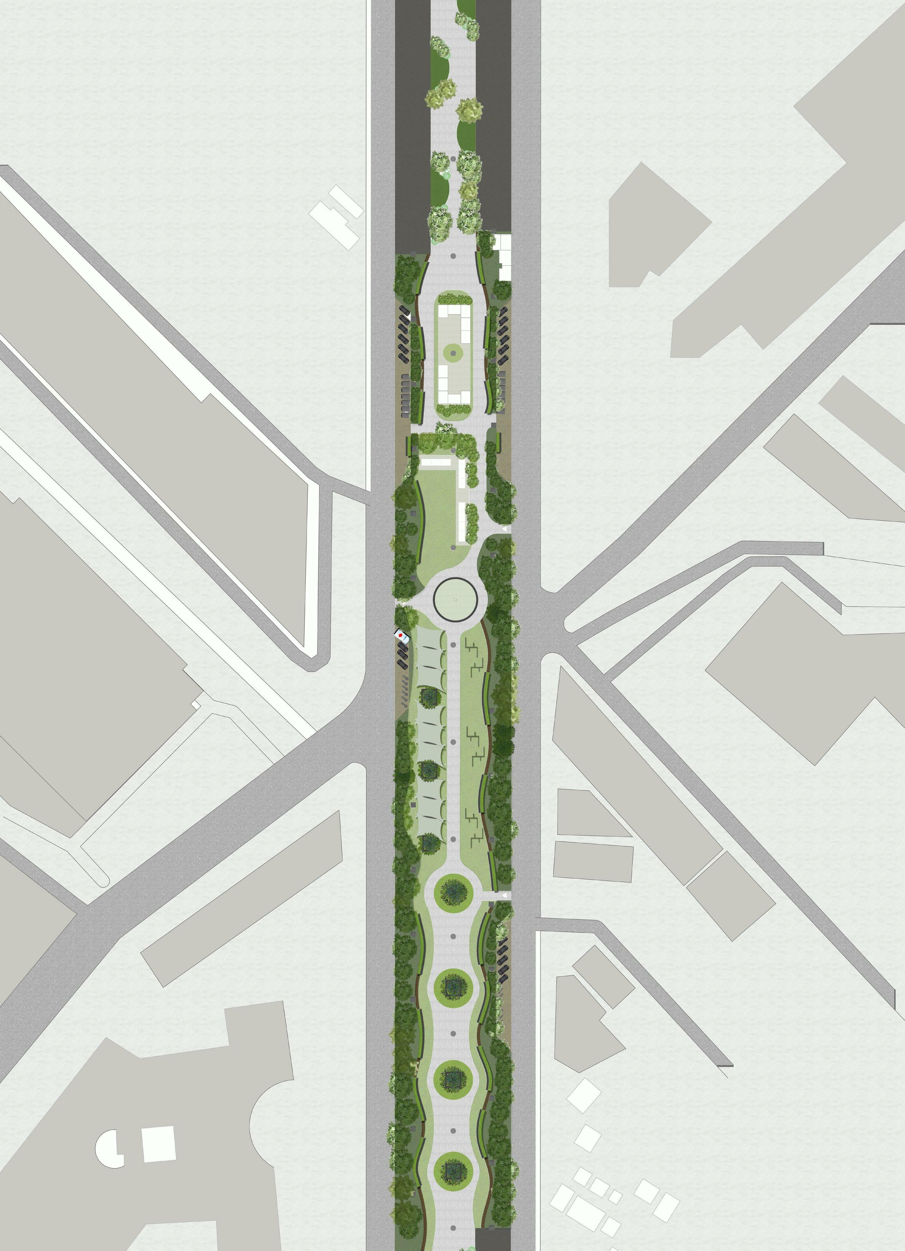
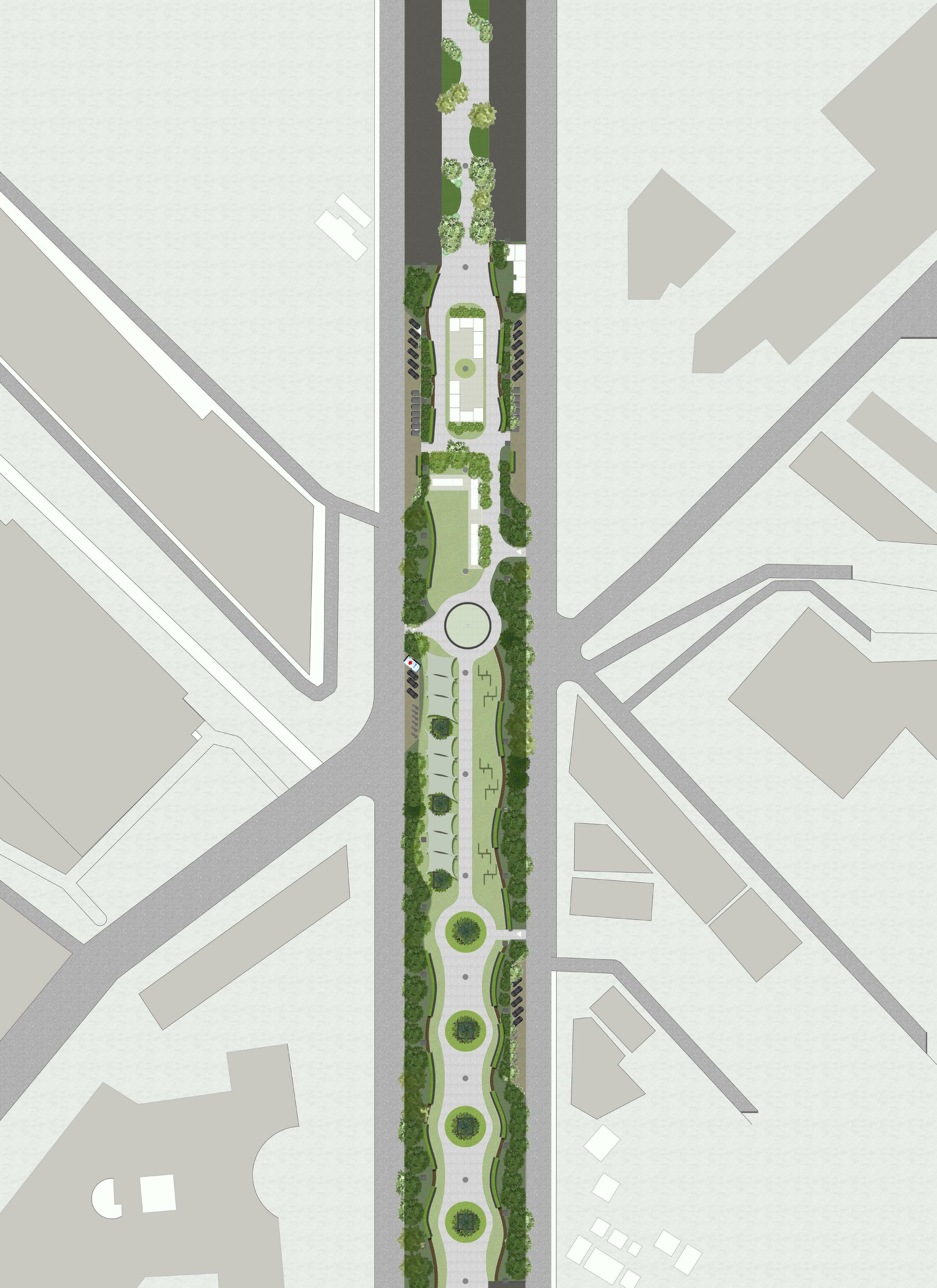
URBAN DESIGN | GREY TO GREEN MASTER PLAN T R ANSPO R T H UB CULTU R AL Z ONE PA RK ESSENTIALS The Design consists of 3 types of zonesTransport hub and essentials Cultural zone Park These are zoned in accordance to the exisiting users of the space as well as taking the mall and IT companies as the anchor points wrt the users,and is also in a close proximity to the residential areas nearby. SOUL SPACE ARENA MALL DELL EMC BAGMANECOMMERCIAL IDEB MALL (UNDER CONSTRUCTION) DODDANEKUNDIROAD(TOWARDSRESIDENTIALZONE) TOWARDSGOSHALAROADRESIDENTIAL N
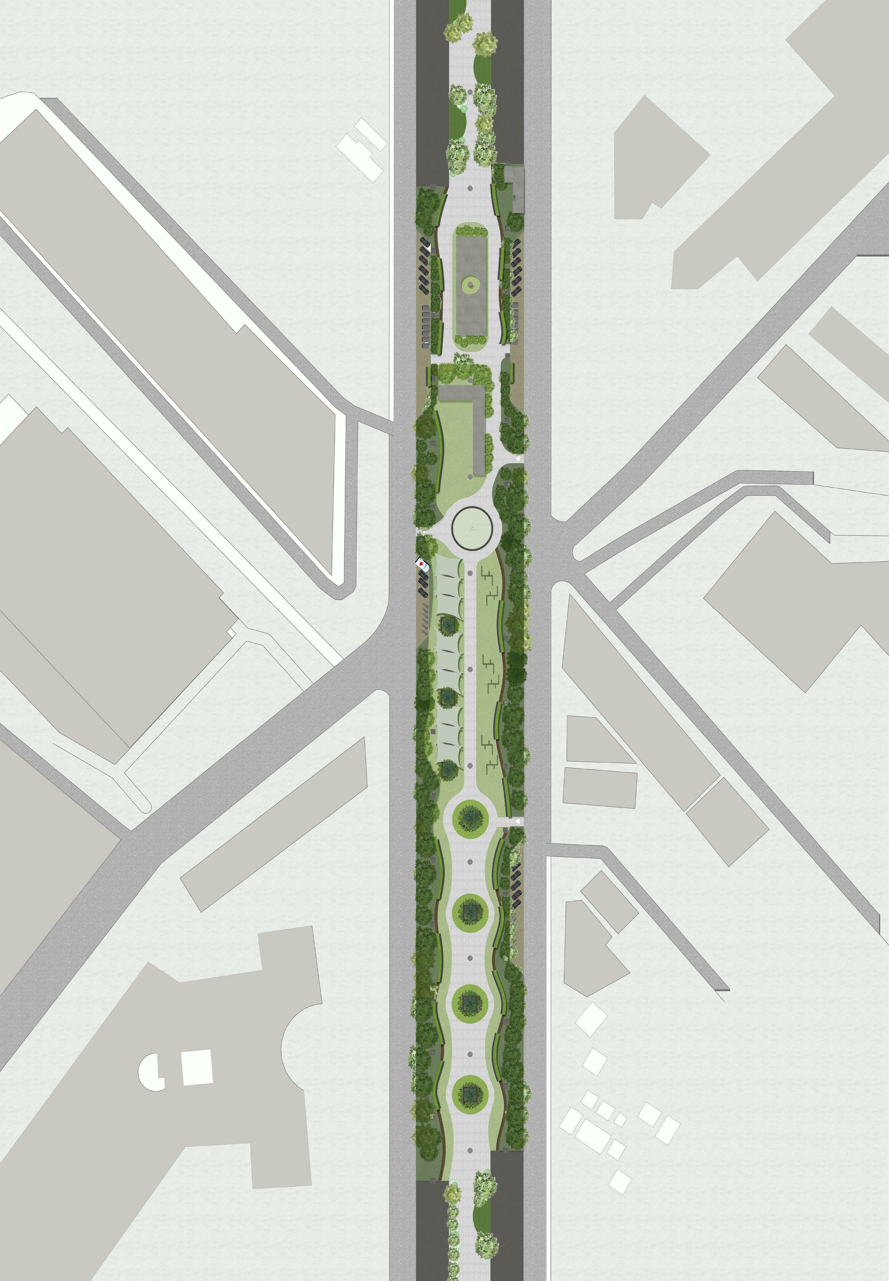
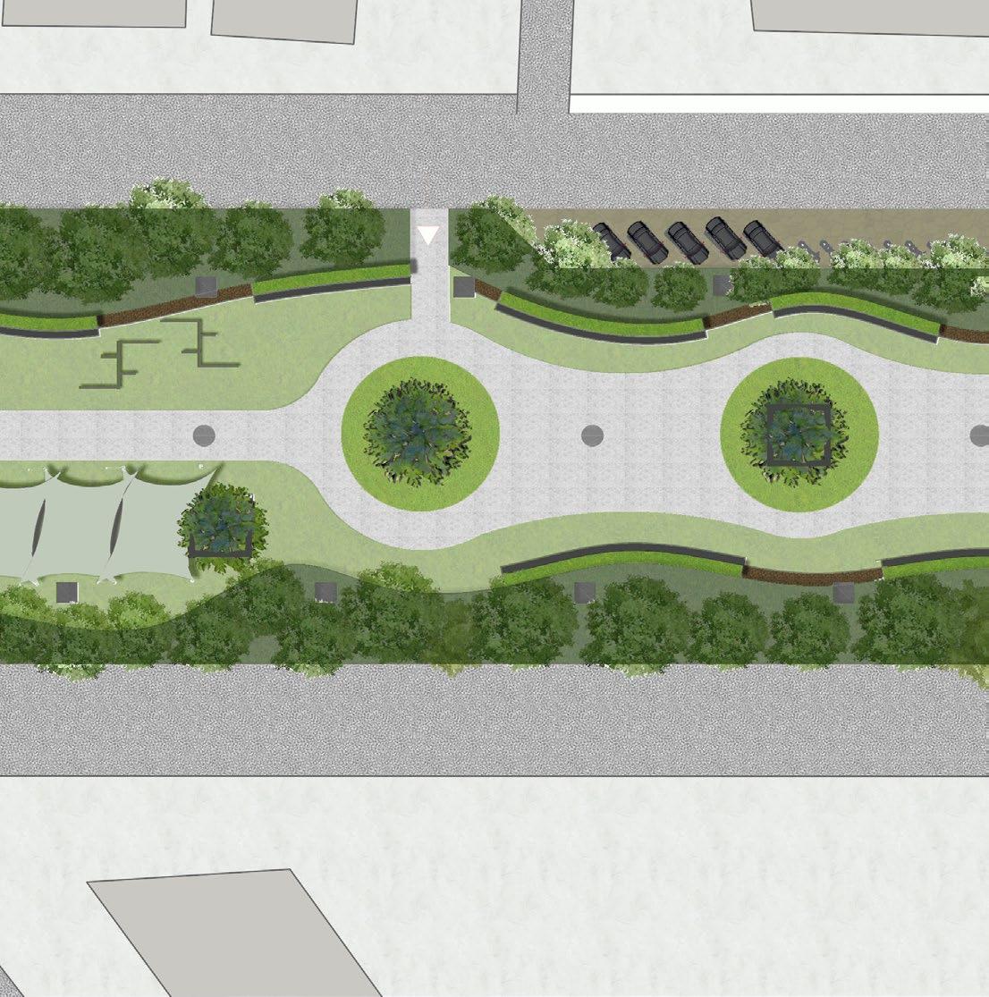
URBAN DESIGN | GREY TO GREEN DETAIL PLAN Cab Parking TRANSPORT HUB AND ESSENTIALS CULTURAL ZONE PARK AND SEATING 3.B’lore2.Eatery1.Juice-KiosksLEGENDshop1 4.Nandini 6.Coconut5.ATM vendor 7.Water dispensers 9.Medical8.Stationaryshop 10.General store 11. Seating with charging portals 12.Storage 1.FoodLEGENDstalls (during evenings) 2.Seating with charging portals 3.Stage with seating (for perfomance) 4.Display and books zone 5.Multipurpose area -Day time: workshops - Evenings: Flea markets LEGEND 1. Seating area with a tree 2. Seating with charge portals 3. Walkway 3 4 5 1 1 3 3 4 5 2 2 2 1 6 87 E E E E E 910 11 12 13 Cab Parking Emergency vehicles parking Emergency vehicles parking KIOSKS Auto stand Auto stand Bus stand Bus stand N
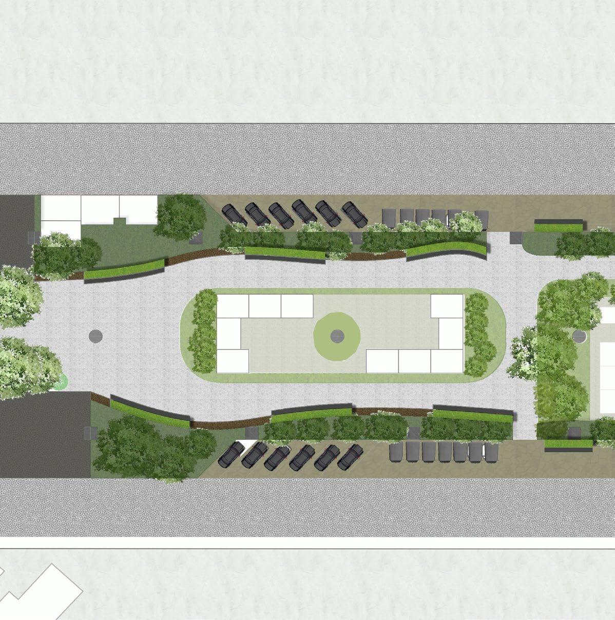
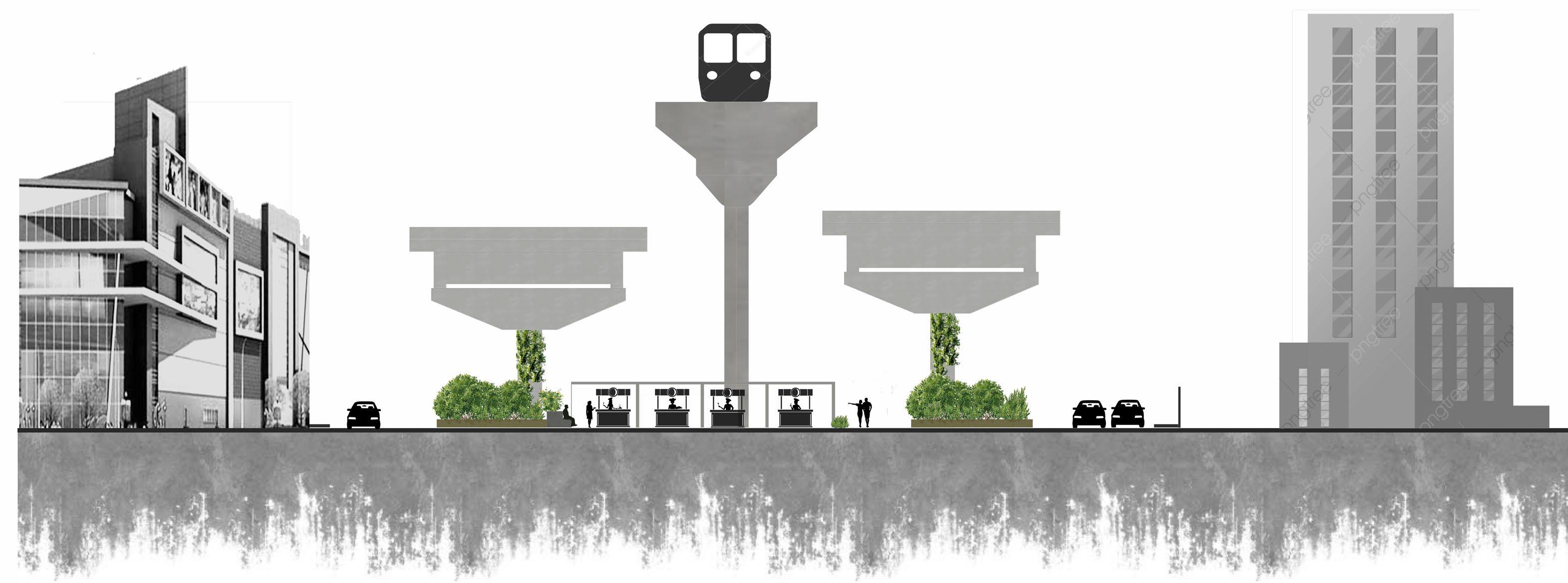
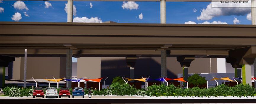
URBAN DESIGN | GREY TO GREEN S E C T I O N S Section showing the kiosk spaces and the transport hub Section through the food stalls Service Road DELL EMC Service RoadparkingCabbufferDense Dense buffer Dense buffer bufferDenseWalking path Walking path Walking pathKiosks Food stalls DELL EMC AB B A N
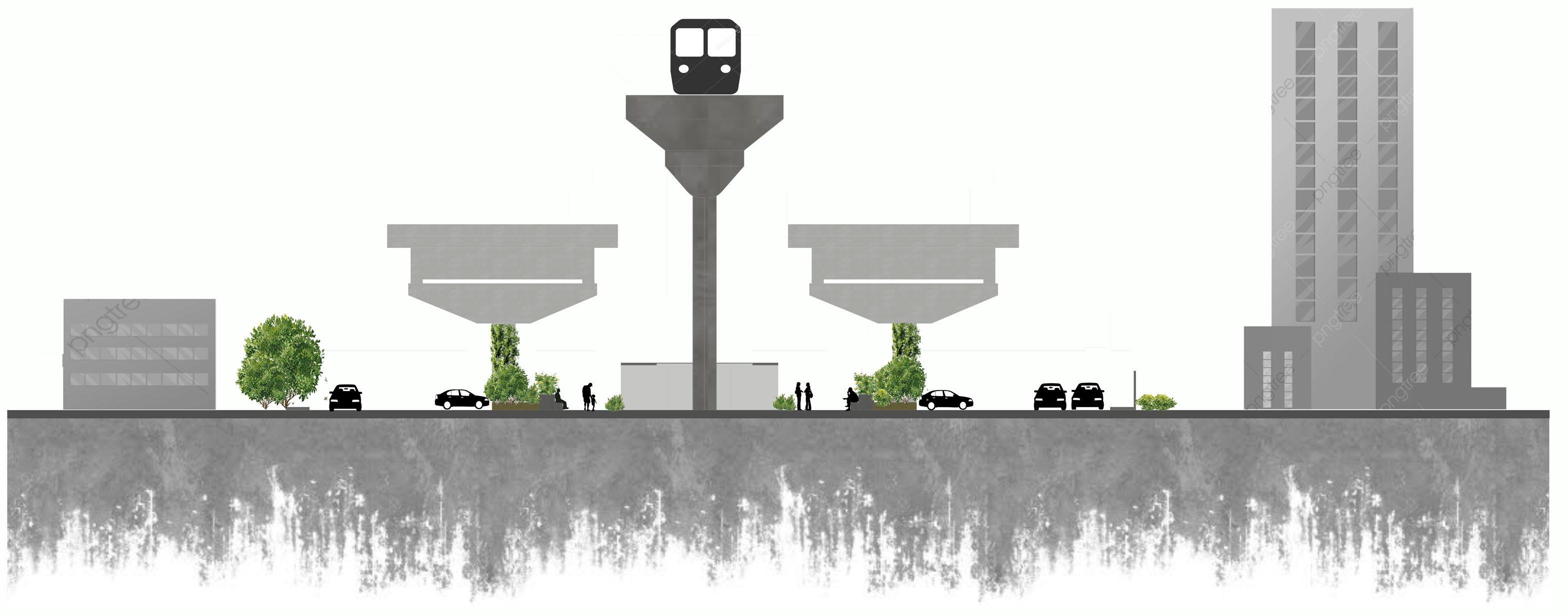
URBAN DESIGN | GREY TO GREEN Section showing the cultural zone with multipurpose area and the display and books zone Section showing the park side Service Road Service RoadParking Multipurpose Bagmane tech Bagmaneparktech park Central stageDisplay and book zone BufferBufferWalkway WalkwaywithSeatingtree Walkway S E C T I O N S X Y Y X N
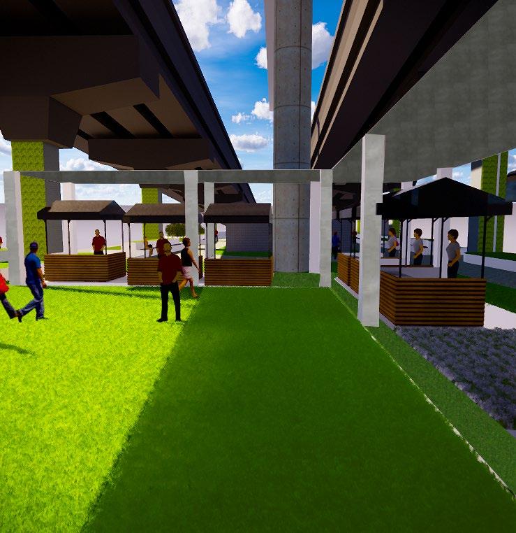
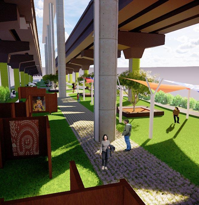
URBAN DESIGN | GREY TO GREEN V I E W S View showing the kiosks area View showing the food stalls N
Viewing the multipurpose area and display area from the central stage.
Viewing the multipurpose area and display area.
URBAN DESIGN | GREY TO GREEN V I E W S
N
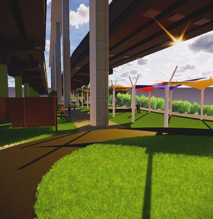
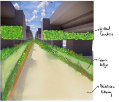
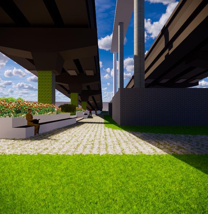
URBAN DESIGN | GREY TO GREEN V I E W S Viewing the park side with lush green and seating area for the people D C D C N
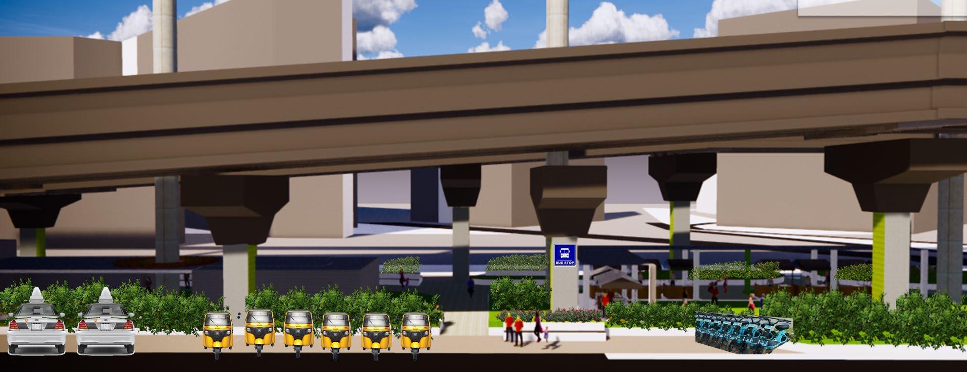
URBAN DESIGN | GREY TO GREEN V I E W S - E L E V A T I O N S ELEVATION AT CC - Multipurpose area and display zone ELEVATION AT DD- Transport hub and essentials
URBAN DESIGN|GREY TO GREEN