MY PROJECTS
Planning Studio- III Transport Management Plan, Udaipur
Planning Studio- IV
Local Area Plan, Sarangpur Chandigarh
Planning Studio- V
Comprehensive Development Plan, Puri Town
Planning Studio- VI
Sustainable Development Plan, Imphal City
Planning StudioVII
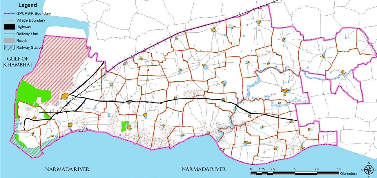
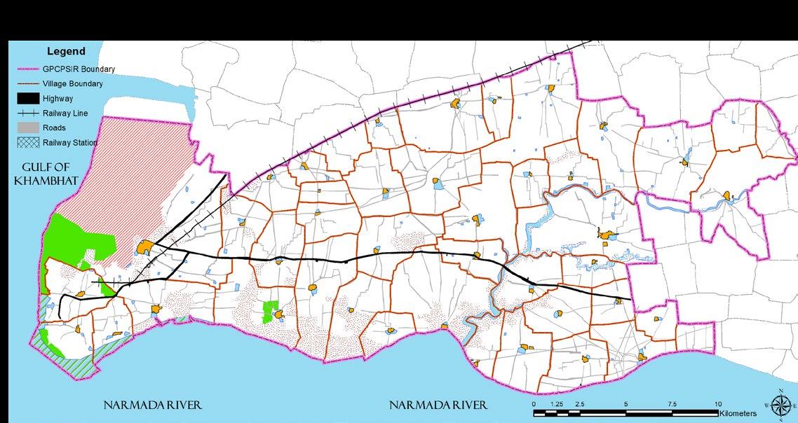
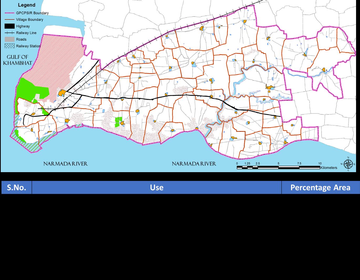
Regional Development Plan, GPCPSIR
Planning Thesis
6 5 4 3 2 1
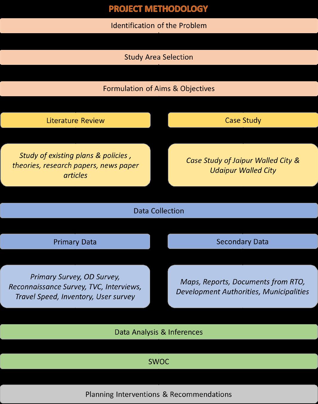
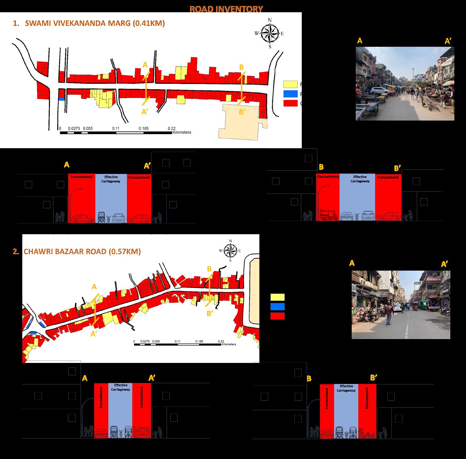
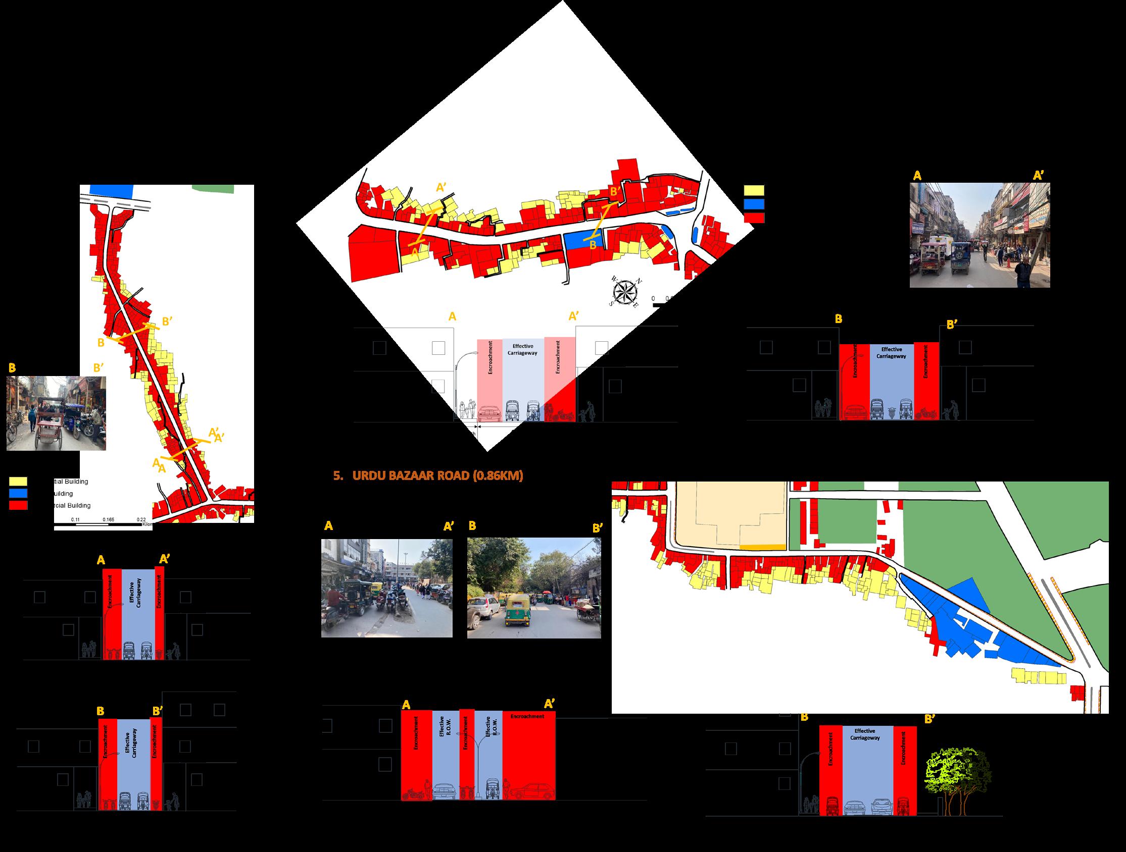
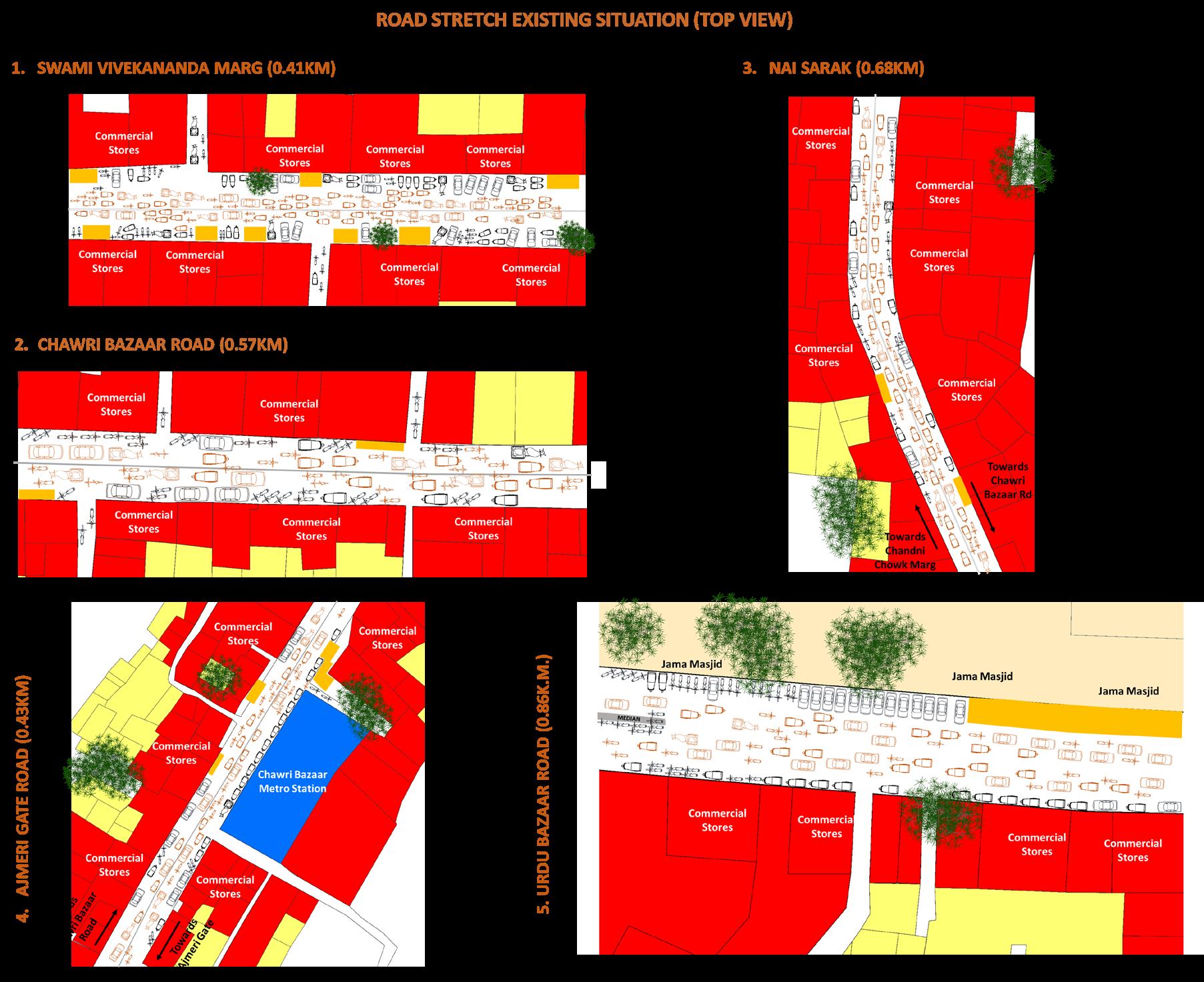
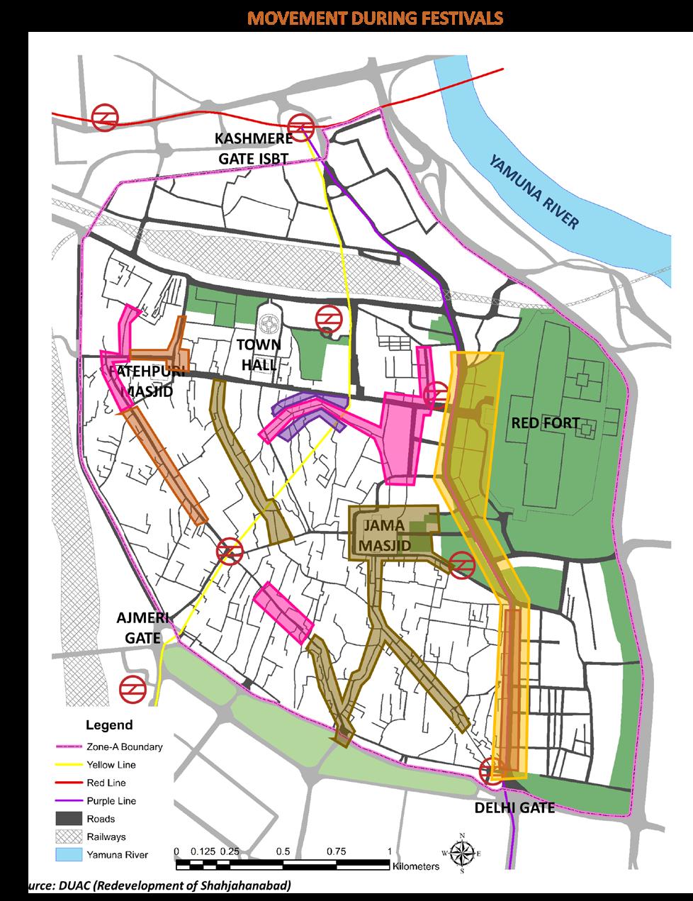
Planning Studio- III (Transport Management Plan, Udaipur )
The aim of the project was to provide functional, efficient mean of transportation by integrating all modes of transport in a network which will boost tourism
Introduction: Set in the heart of Udaipur city, the walled city is built upon a rich cultural and historical fabric. The city has narrow medieval lanes that lead to temples and historic monuments
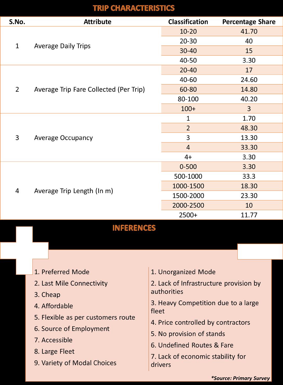
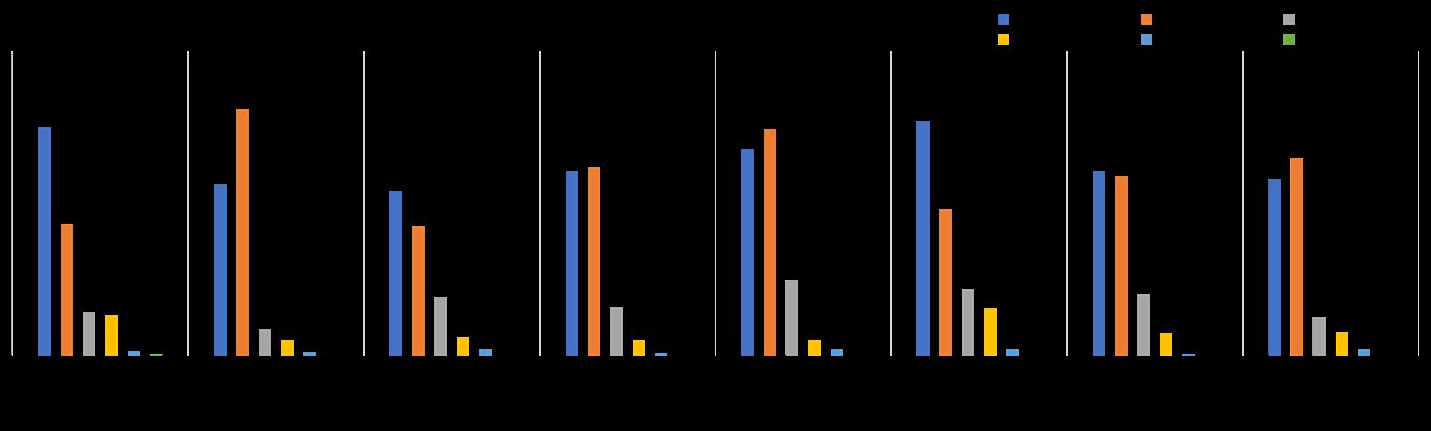
TRAFFIC CHARACTERISTICS
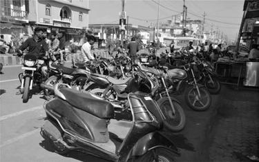
Unauthorized On-Street Parking Heavy Congestion
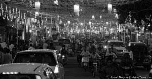
Lack of IPT system
Lack of provisions for NMT users
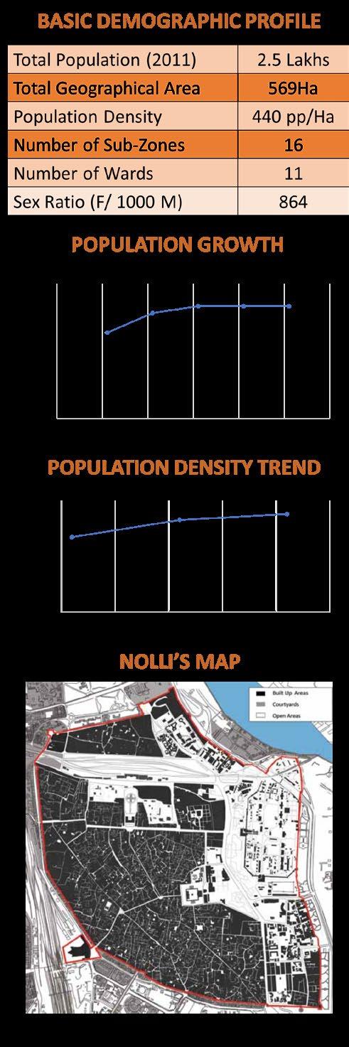
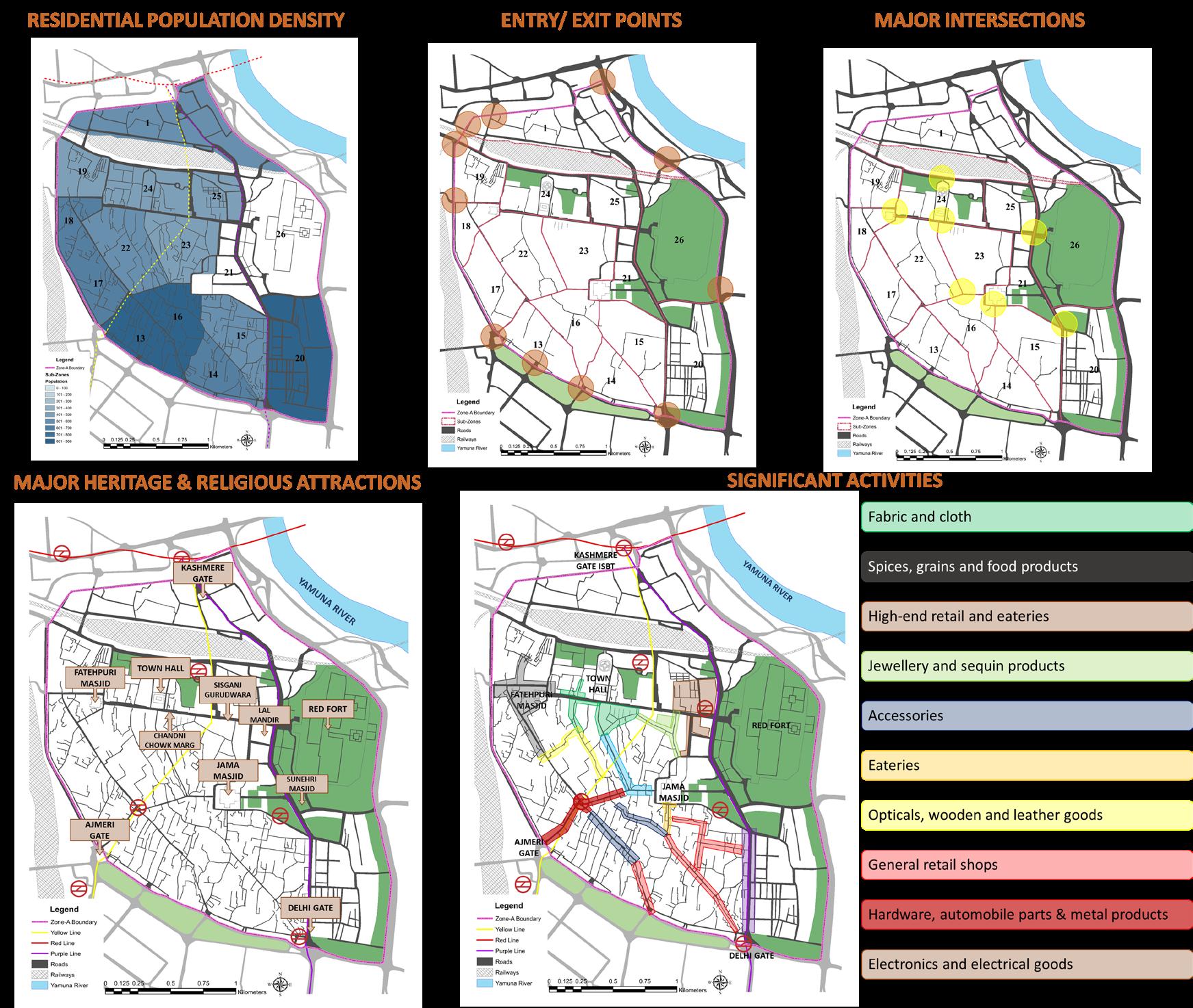
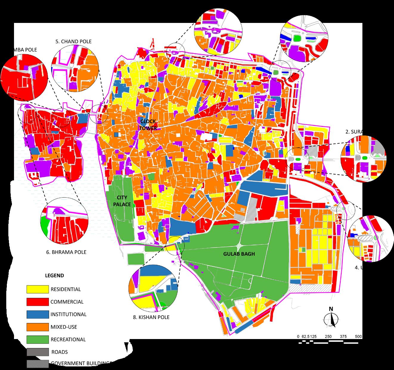
LANDUSE
INTRODUCTION
Planning Studio- III (Transport Management Plan, Udaipur )
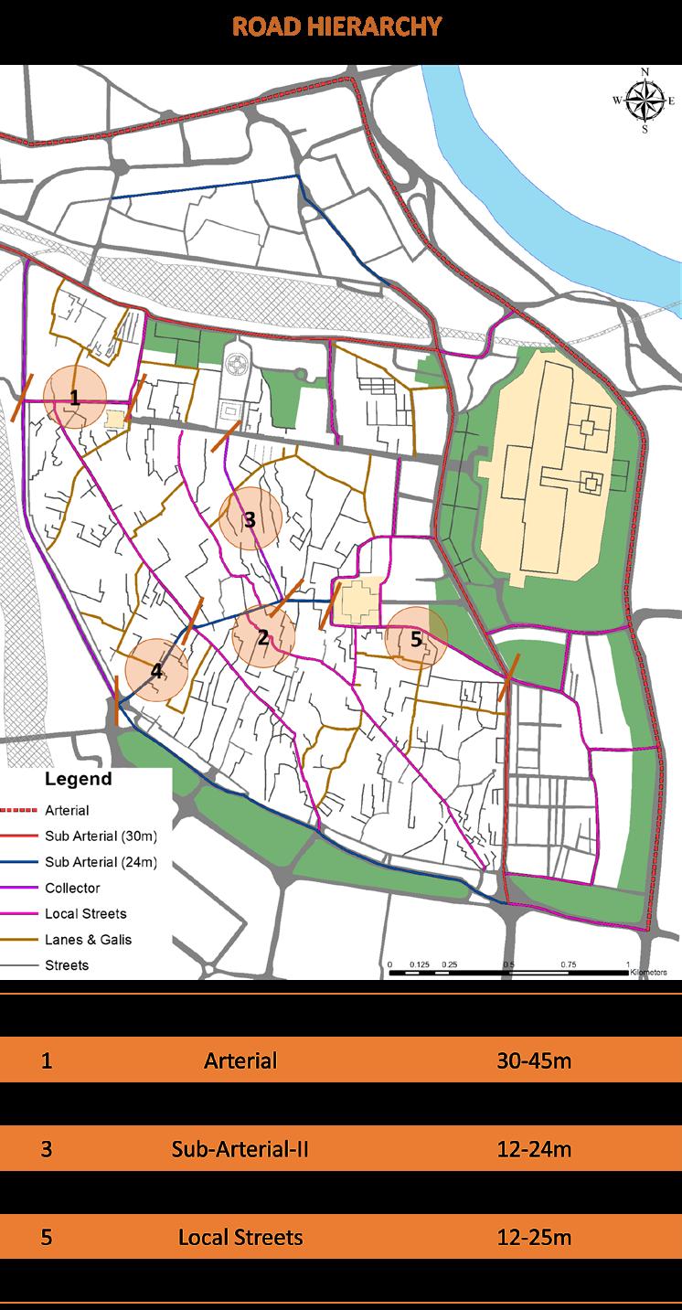
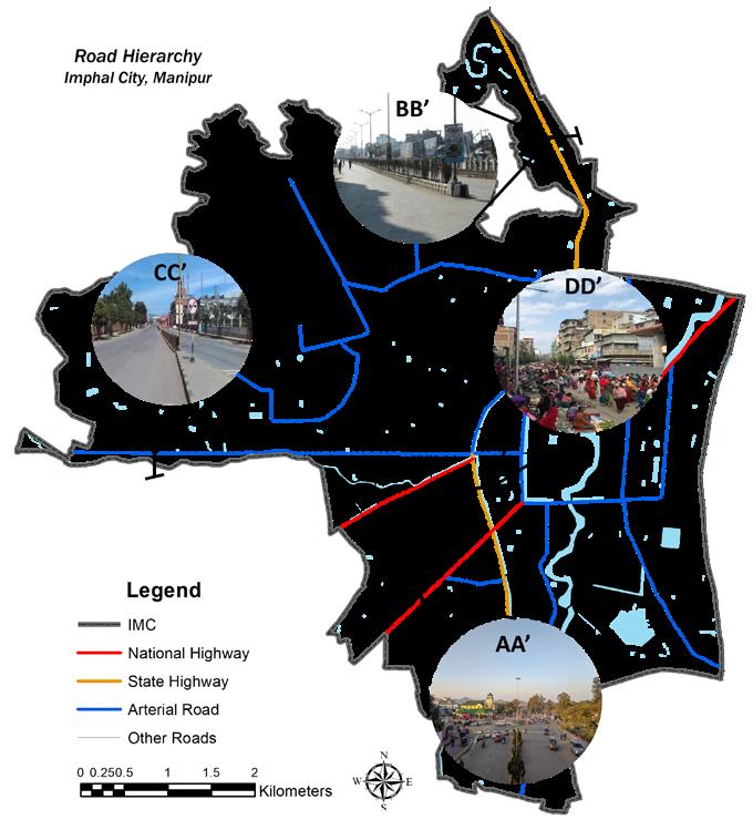
ROAD HIERARCHY
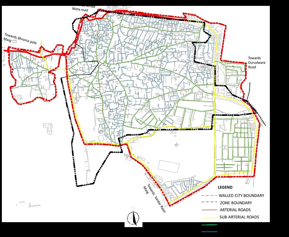
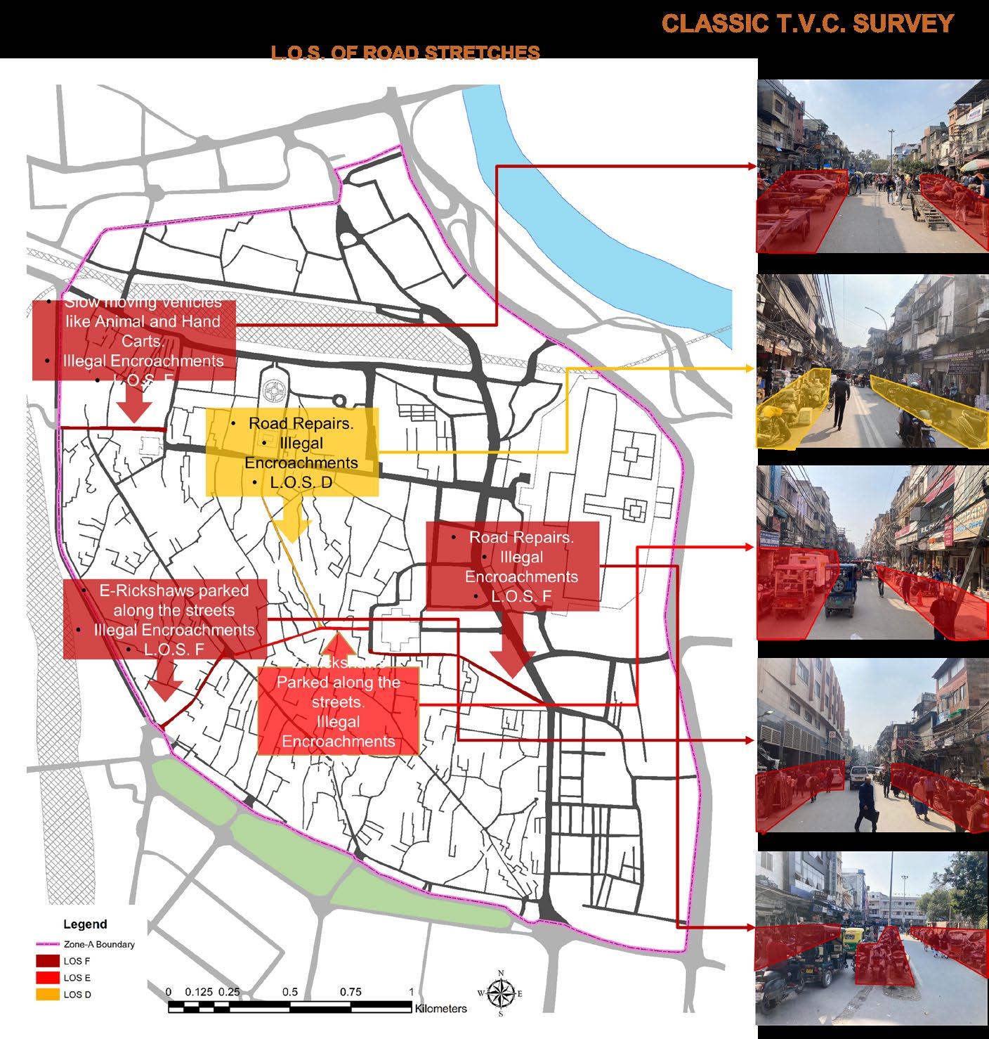
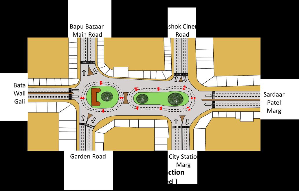
TVC
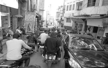
4 junctions (Delhi Gate ,Hathipole ,Udaipole and Kishanpole ) ,3 TJunctions and 1 Street were identified as the most busiest and problematic spots. Delhi Gate ,Suraj pole and Udaipole were the busiest amongst all the spots .
• Unauthorized auto stand on ARM-1 .
• Traffic mis-management .
• The Vikram Autos cover more than 60% of the road area by encroachment which leads to the traffic congestion.
INFERENCE ANALYSIS
IDENTIFIED ISSUES
• Footpaths and pedestrian crossing facilities are not available.
• Roads are encroached by private vehicles for parking causing congestion.
• Vendor encroachment on service roads blocks way for vehicles
• There are no proper stands, no regulations on autos No authorized parking is provided.
• City is completely devoid of bicycle friendly facilities such as cycle tracks and bicycle parking lots.
• Heavy traffic on the boundary of the city causing congestions
OPORTUNITIES
• Scope of improvement like taking concern about pedestrians crossing facility and cycle paths.
• Being a pedestrian city, more scope of sustainable projects
• General improvements in transportation network.
• Scope of improvement in public transport facilities which are not accessible to all.
• Scope for providing movement facilities to children, senior citizens and differently abled who cannot walk in a big city.
• Increase in tourism by proper public transport connectivity.
• Proper development of drainage systems as to close open drainages and using that area for pedestrian facility
RECOMMENDATIONS
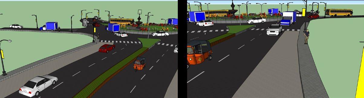
Efficient traffic movement through the twin intersections with minimal conflicts and delays
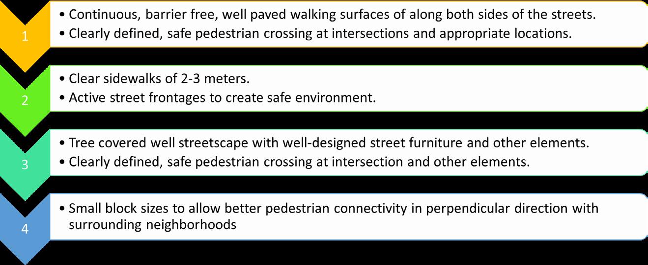
A safe and comfortable pedestrian and cyclist environment. This shall include wide comfortable and landscaped pedestrian plaza
Defined spaces for vending outside the pedestrian and vehicular movement lines
Planning Studio- III (Transport Management Plan, Udaipur )
ANALYSIS
Planning Studio- III (Transport Management Plan, Udaipur )

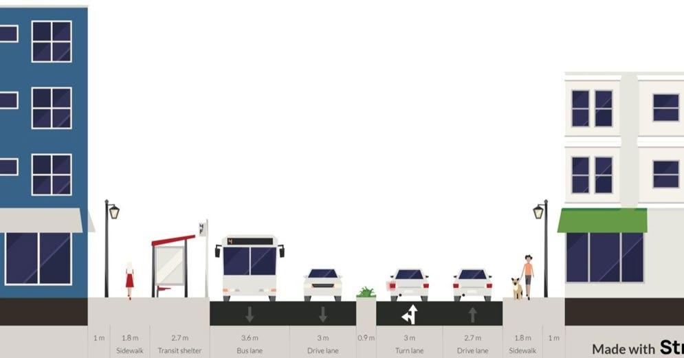
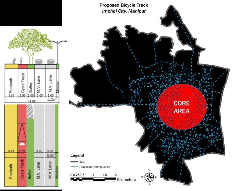
Cycle paths are provided on the inner street network of the walled city where market places are present.
The entry of motorised vehicles will be restricted on these roads since the roads have been pedestrianised.
3m cycle paths and 2 m footpaths (on both sides) on these roads
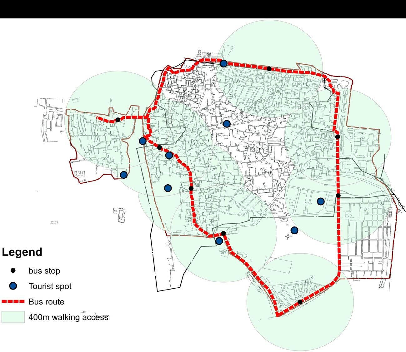
PROPOSALS AND RECOMMENDATION
The aim of the project was to develop the infrastructure in order to enhance the quality of life of the population & achieve self sufficiency.
The objectives were to :
• To enhance the infrastructure
• To redevelop the open spaces
• To manage resources for future generation to use
LANDUSE MAP
SARANGPUR, CHANDIGARH,INDIA
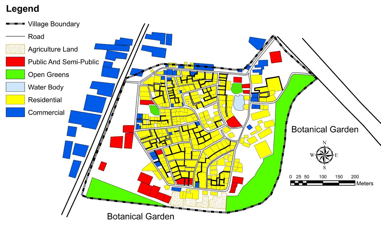
IDENTIFIED ISSUES
Transportation
• Footpaths are not provided on main roads.
• No authorised parking is provided.
• Autos are not accessible to all area.
• Roads are encroached by housing development.
Physical Infrastructure
• Absence of primary water treatment plant.
• Waste collection process in not efficient.
• Absence of sewage treatment plant.
• Absence of big commercial complex
• People in primary activity are earning very low income Economy
Planning Studio- IV (Local Area Plan, Sarangpur Village, Chandigarh)
INTRODUCTION
Planning Studio- IV (Local Area Plan, Sarangpur Village, Chandigarh)
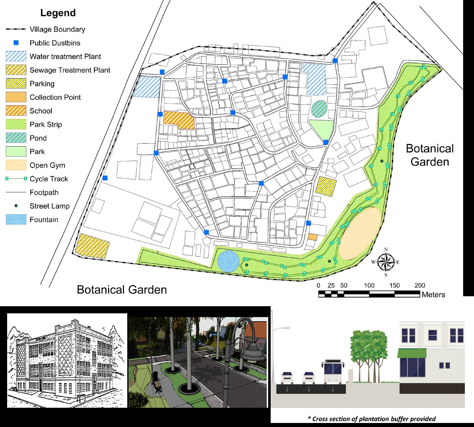
MAJOR PROPOSALS AND RECOMMENDATIONS PROPOSED MAP PROPOSALS
• Removal of encroachments by households in the roads
• Policies on Land-use , encroachments and Parking HOUSING
ECONOMY
• Policies on formation of an association for retail store owners within Sarangpur for efficient functioning
CIRCULATION
• Road widening by removing encroachments
• Parking
• Provision for Streetlights, Road marking, footpaths, & benches.
PHYSICAL INFRA
• Water Treatment Plant
• Sewage Treatment Plant
• Dustbins
• Policies for waste collection method and routes
SOCIAL INFRA
• Sr. Secondary School
• Park strip along southern and Eastern periphery
• Rejuvenation of lake and existing park
AND RECOMMENDATION
The aim of the project was To develop Puri town as a vibrant tourist destination by weaving within it’s social, economic and disaster management while augmenting the tourism development hence improving the quality of life and sustaining the growth with regional development
The objectives were to :
• To study and collect data on existing conditions on physical and socioeconomic aspects related to development plans of puri town
• To analyze the collected data and identify the gaps
• To frame the strategies for improvising the existing conditions supporting tourism sector in the town
• To study and analyze the existing traffic conditions and management to find the gaps in the tourism sector
• evaluate the heritage conservation plan in puri town for addressing the existing conditions supporting tourism sector
• To assess the implementation of disaster management guidelines and give proposals according to the existing situations
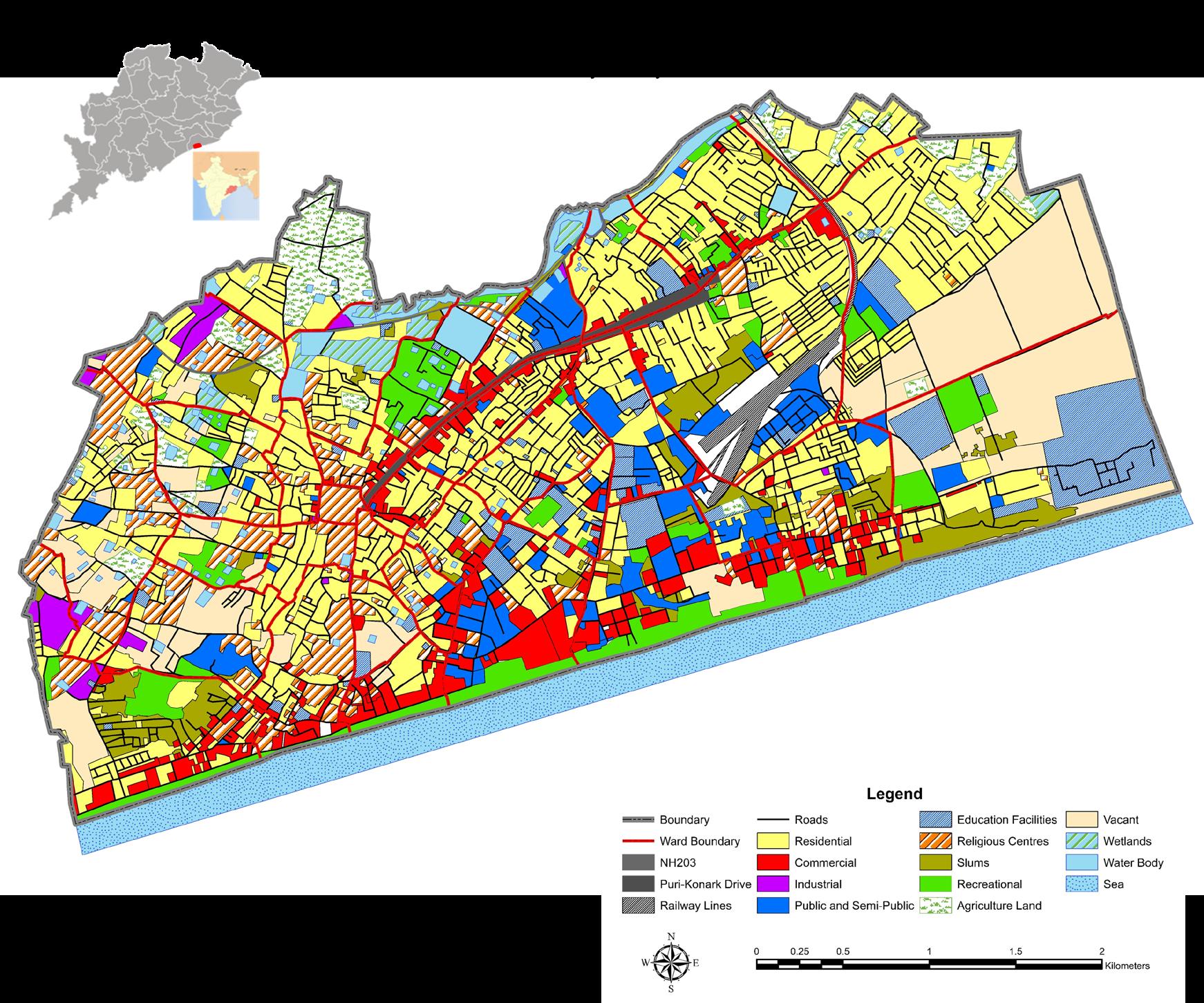
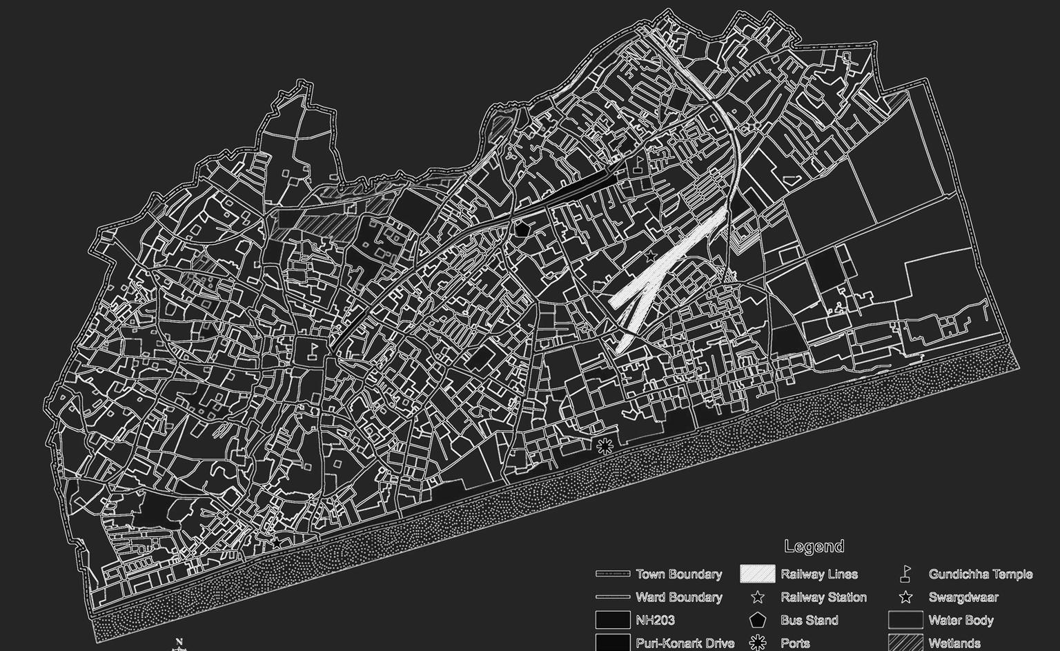
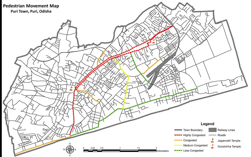
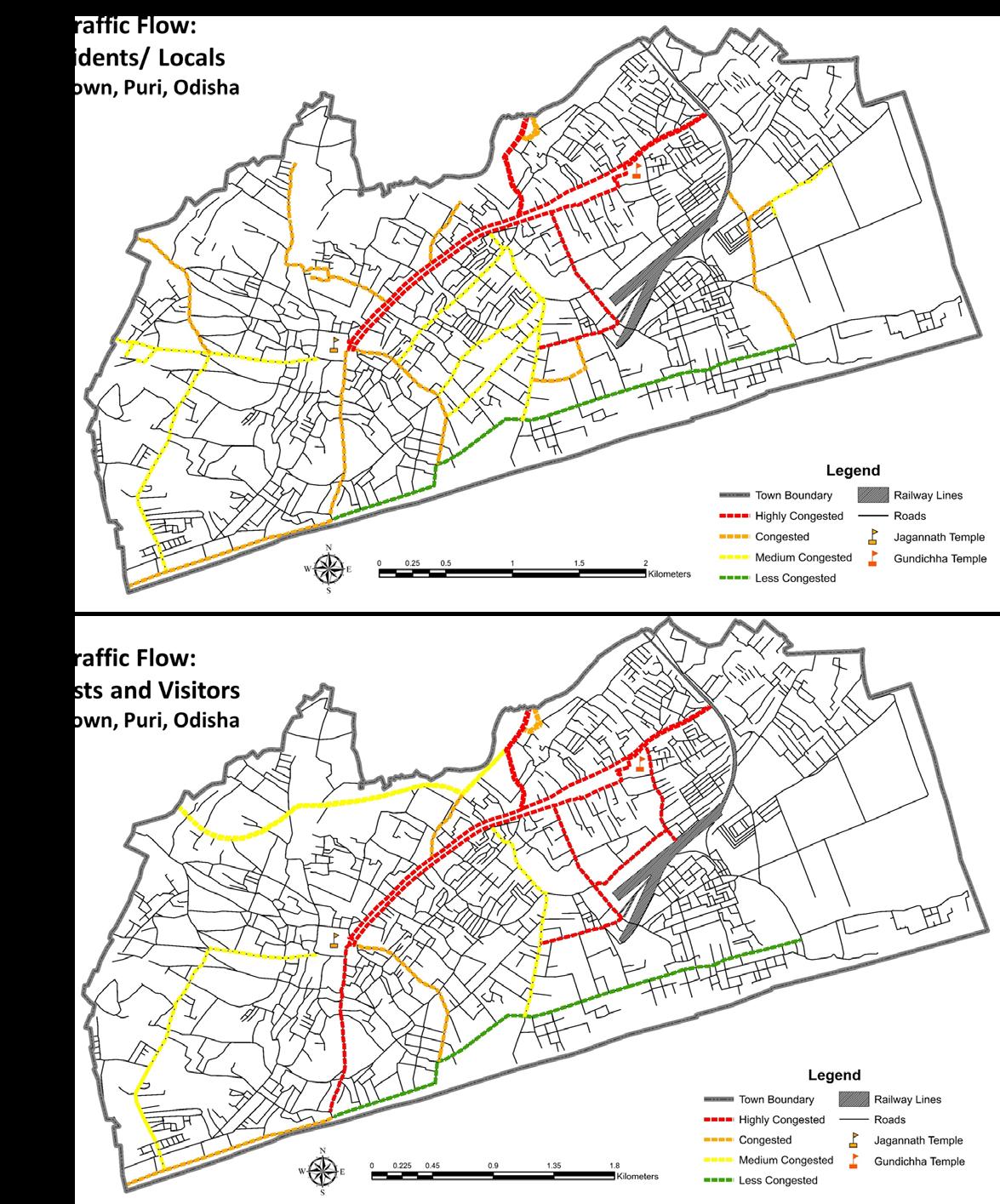
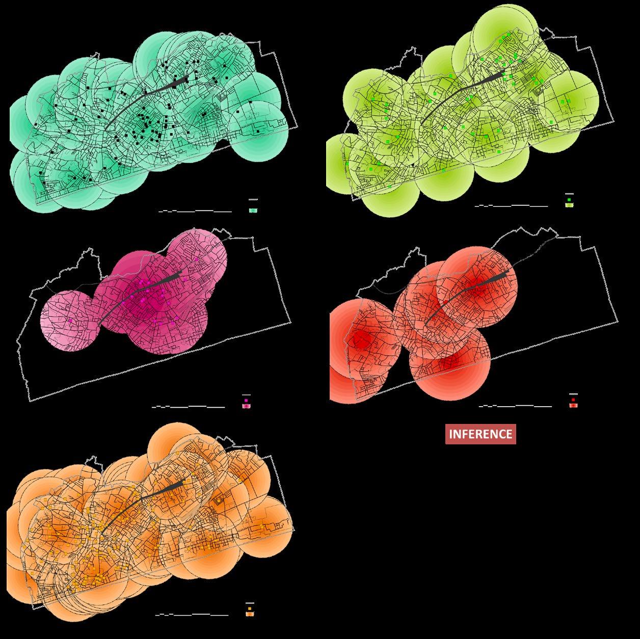
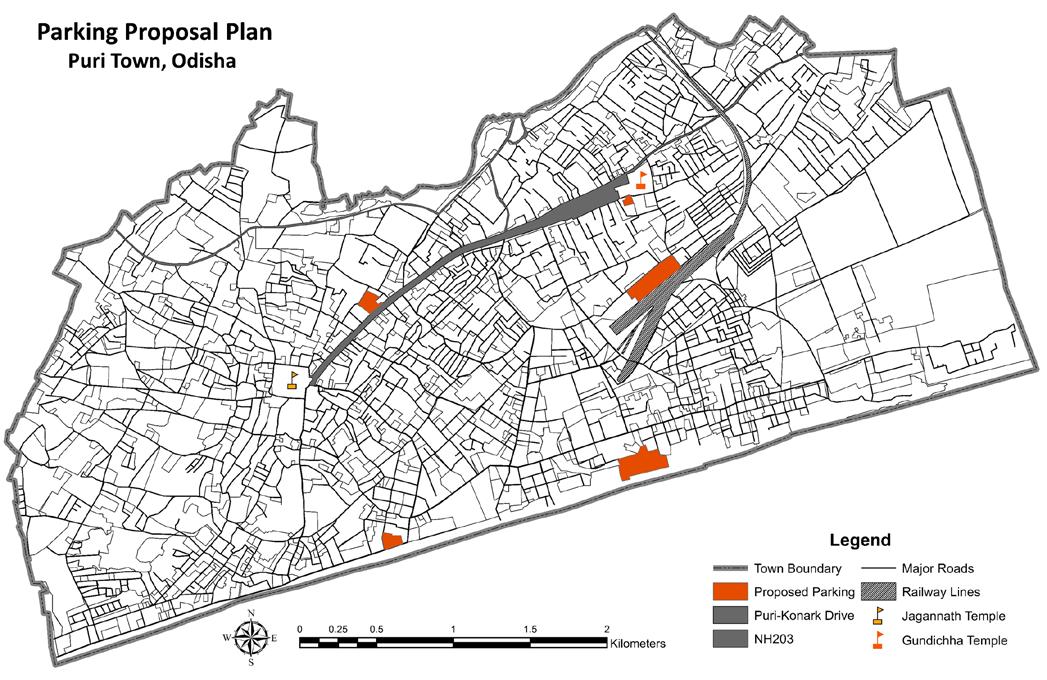
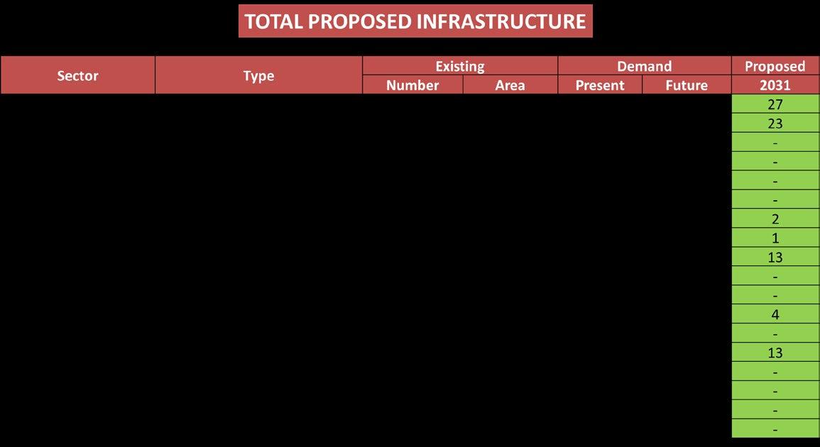
Planning Studio- V (Puri Town Comprehensive Development Plan, Puri, Odisha)
INTRODUCTION
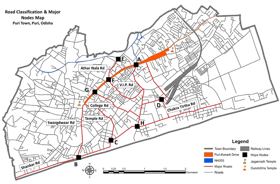
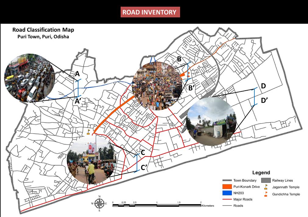
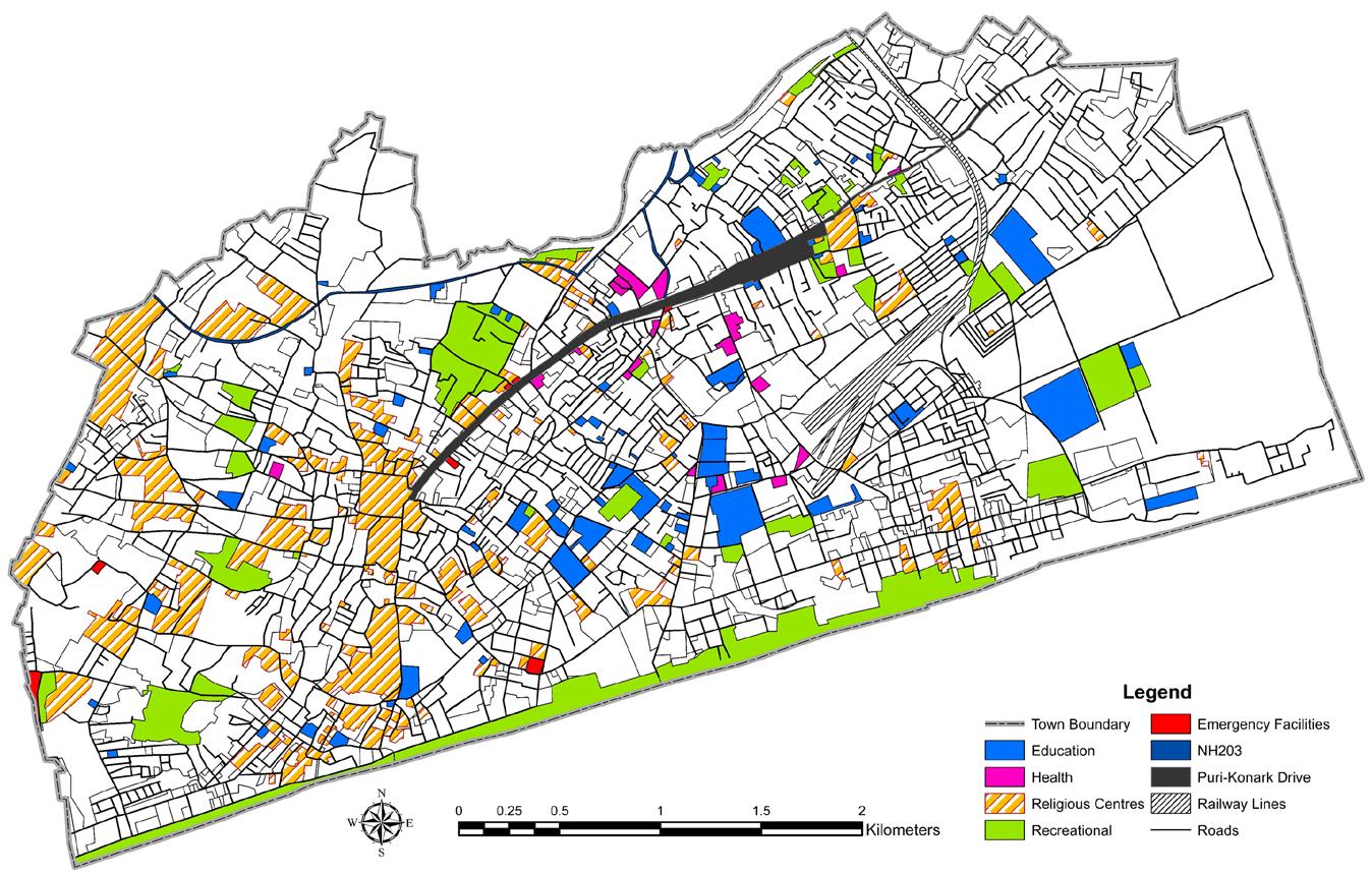
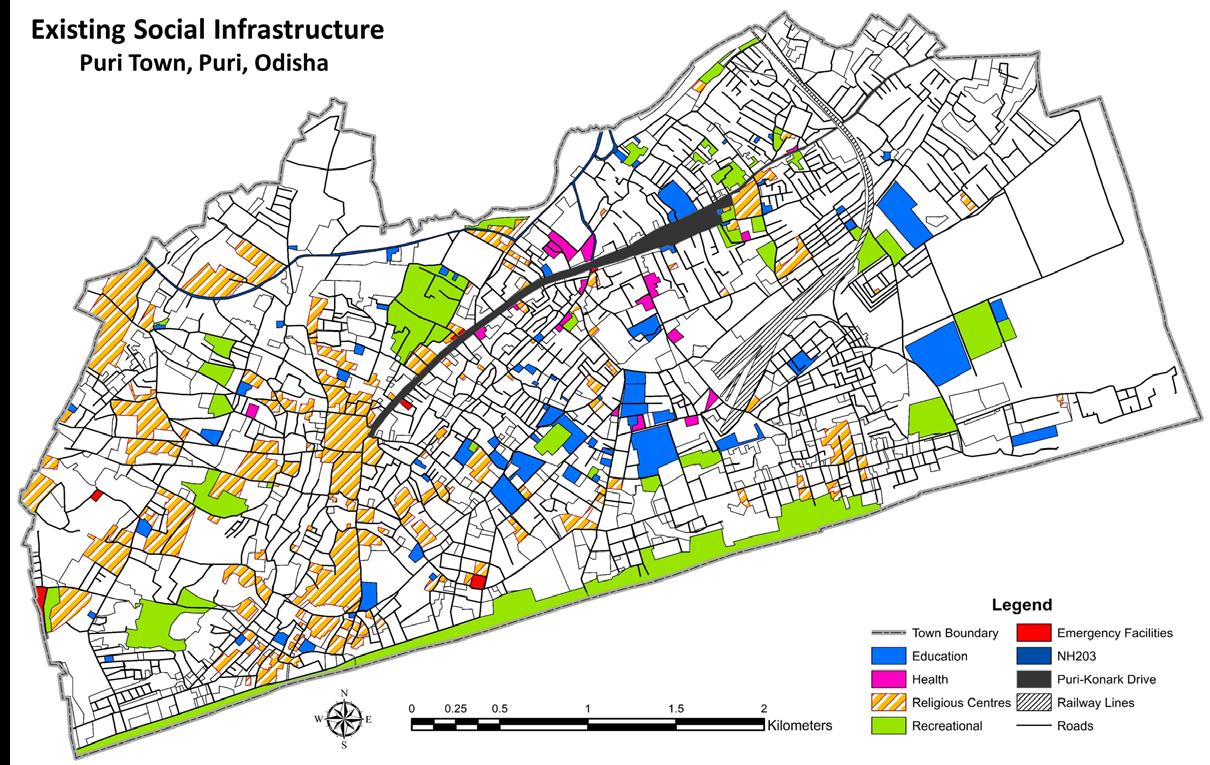
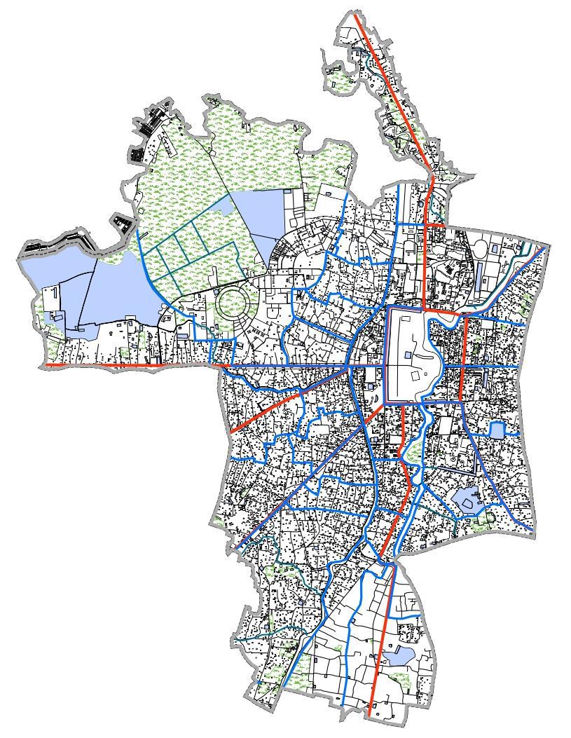
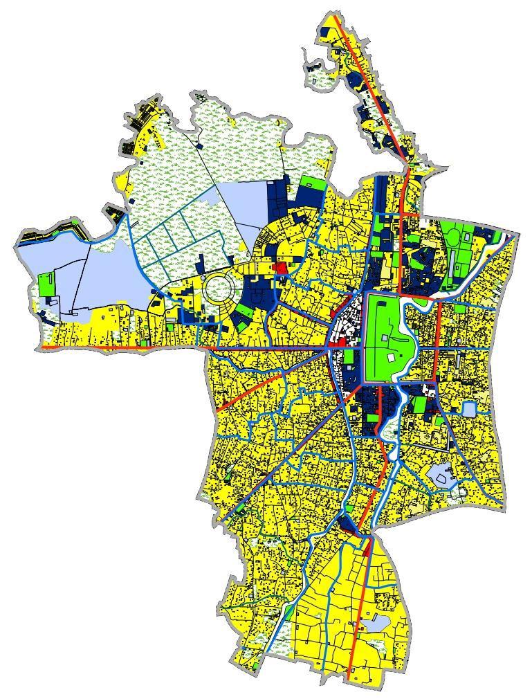
In Puri Town the road type is classified under 4 categories i.e., National Highway , Puri-Konark Drive, Major Roads and Other Roads.
The total road network within Puri Town is 211.83 KM long which covers 1.4 square kilometre of area which is 8.59% of total town area.
The NH203 and the major roads are connected to the main trunk within the centre of the city ( Puri-Konark Drive) which is the reason for formation of many major nodes of Puri town on that particular stretch which makes it a hotspot.
Studio- V (Puri Town Comprehensive Development Plan, Puri, Odisha)
Planning
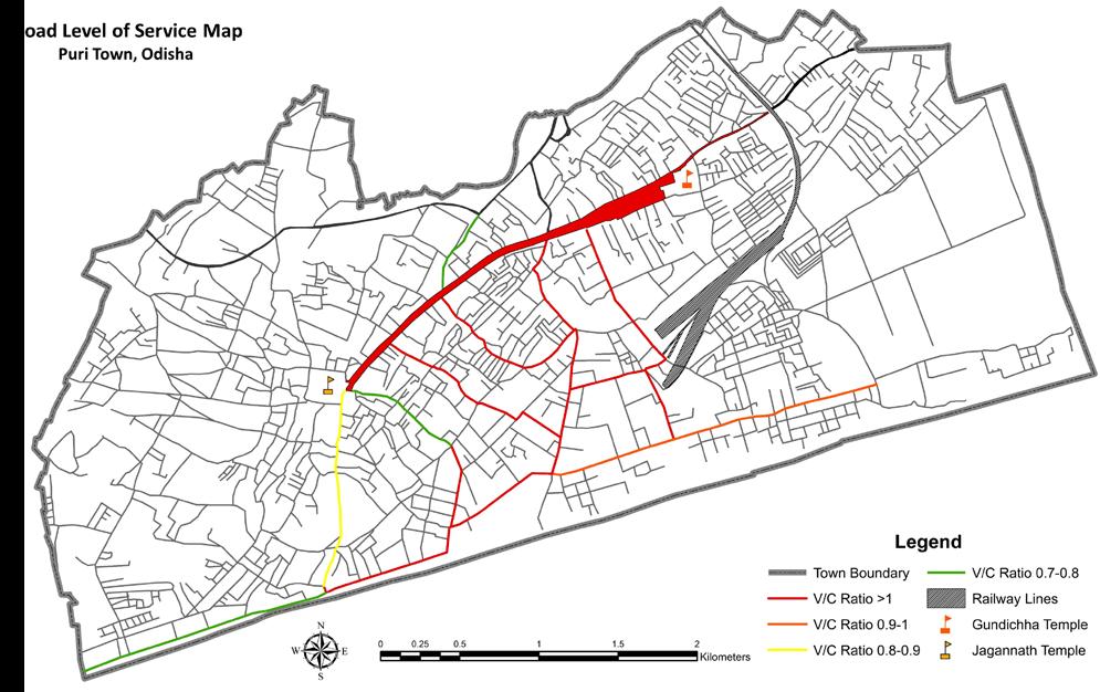
ANALYSIS
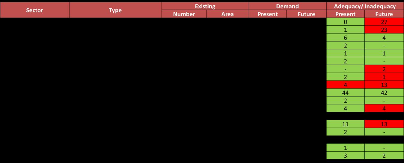
Total Area provided to Transportation sector is 8.59% which is less than the standards set by the URDPFI.
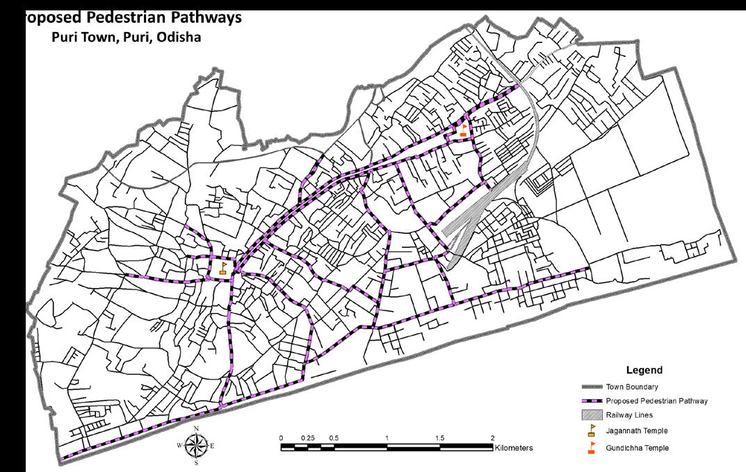
The existing pedestrian pathway network is not strong enough to cater heavy pedestrian movement and it also lacks basic facilities for pedestrians.
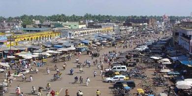
There is a lot of encroachment on streets especially on Grand Road. It is encroached by local vendors and flower stalls on both sides reducing the R.O.W.
The parking situation of town is also weak as the demand is much greater than that of availability. Thus it is important to strengthen the parking sector.
Public Transport is another aspect that needs immediate attention. There is a lack of mass transit facilities.
The existing condition of terminals, bus stops and other facilities is highly inadequate and ill managed.
Major traffic within Puri city is generated in the Grand road, Marine drive road and Station road areas where specific interventions must be proposed
Studio- V (Puri Town
Plan, Puri, Odisha)
Planning
Comprehensive Development
ANALYSIS
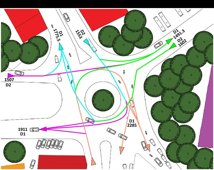
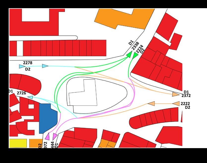
ACCESSIBILITY STUDY
Planning Studio- V (Puri Town Comprehensive Development Plan, Puri, Odisha) ANALYSIS
IDENTIFIED ISSUES
• Lack of mass transportation system for intra-city movement
• Lack of Parking Facilities
• Poor pedestrian pathway facilities
• Traffic congestions on Grand Road and its connecting roads
• Poor traffic management during Rath Yatra
• Lack of primary schools for present and future population
• Weak health infrastructure to support population in 2031
• Lack of community parks
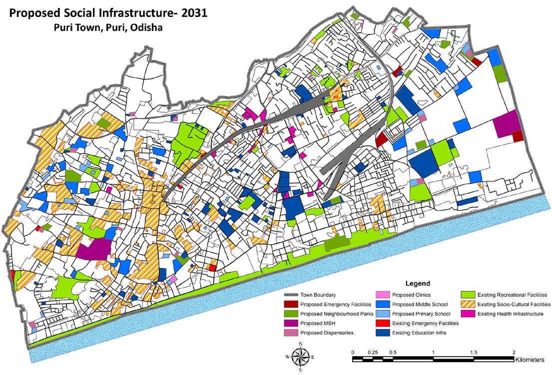
• Lack of Social Infrastructure facilities in Western part of town
OPORTUNITIES
• Improvement of pedestrian facilities especially on Grand Road
• Improvement of existing parking facilities and proposals for new
• Introduction of Mass Transportation options
• Developing the Grand Road and the tourist popular routes
• Proposal for construction of Social Infrastructure facilities in town
• Redistribution of emergency facilities to increase their coverage area
• Improvement of Health Infrastructure to support population in 2031.
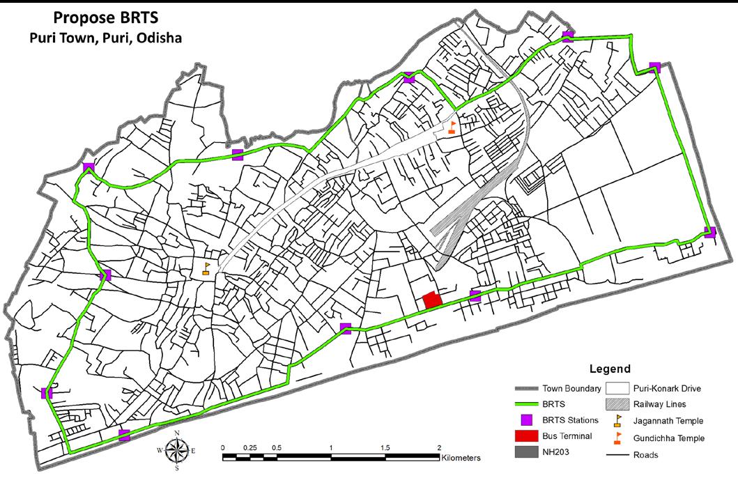
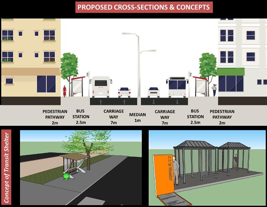
PROPOSALS AND RECOMMENDATION
Studio- V (Puri Town
Plan, Puri, Odisha)
Planning
Comprehensive Development
ANALYSIS
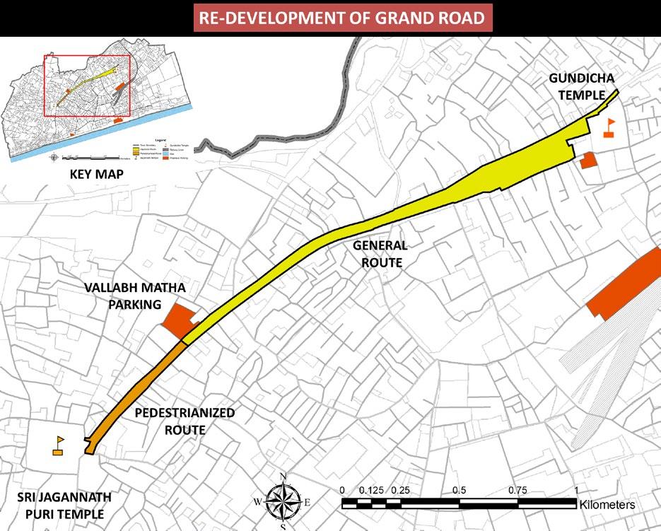
The Road beyond Vallabh Math Parking is proposed to be Pedestrianized as the average Road width decreases and for pedestrian safety as well as to reduce the congestion and noise pollution on the Grand Road.
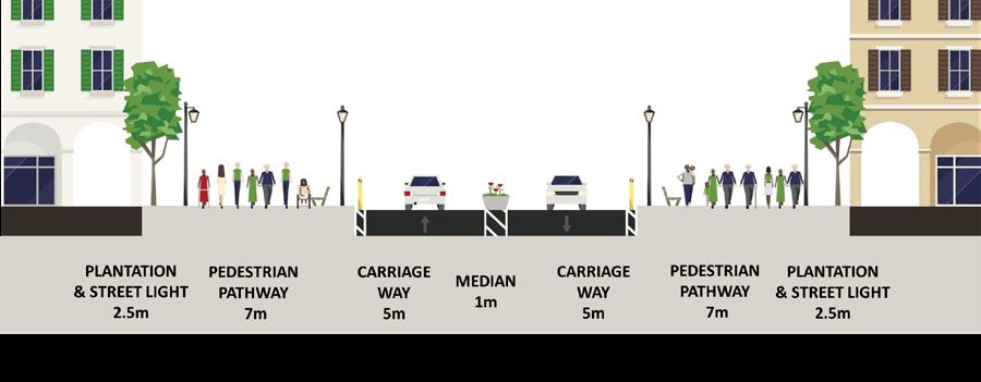
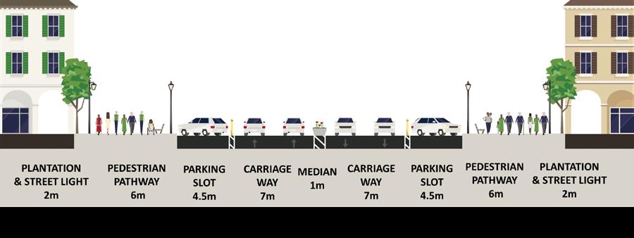
On the General Route all the encroachments will be removed and painted pedestrian pathways will be provided. Also lanes will be defined and as there are no lanes on the Grand Road.
Comprehensive
PROPOSALS AND RECOMMENDATION
Planning Studio- V (Puri Town
Development Plan, Puri, Odisha)

PROPOSALS AND RECOMMENDATION
Planning Studio- V (Puri Town Comprehensive Development Plan, Puri, Odisha)
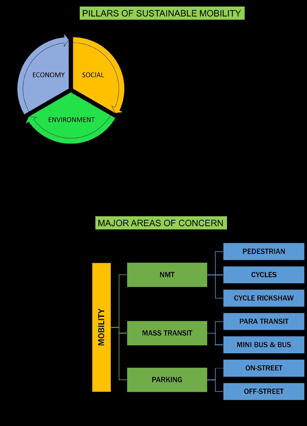
The aim of the project was to prepare an action plan for the sustainable development in Imphal, Manipur. The objectives were to :
• To understand existing conditions on Environmental, social and economic aspects related to the sustainable plans of different cities globally.
• Selection of the study area which needs an environmental management plan.
• Identification of the gaps related to sustainable development within the study area.
• To frame the strategies and policies for improvising the existing conditions supporting sustainability in the city.
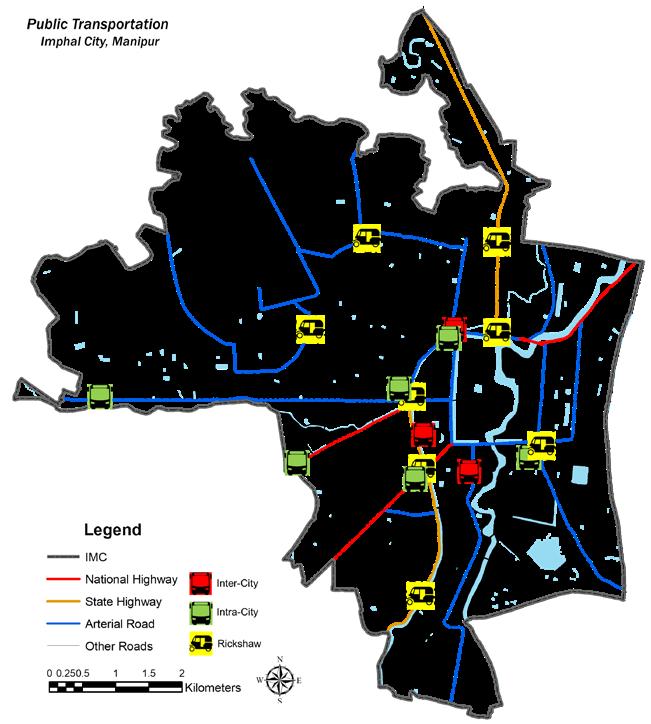
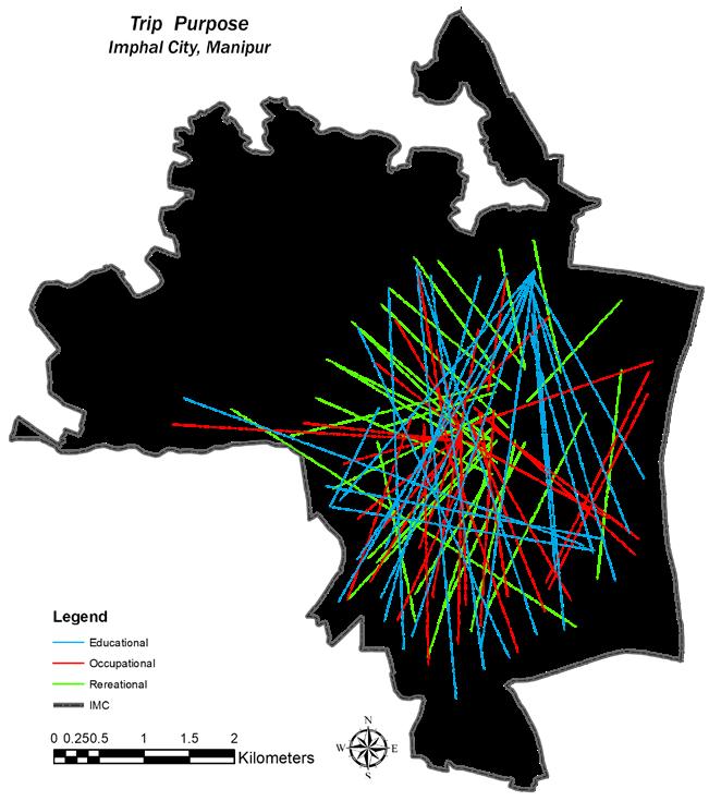
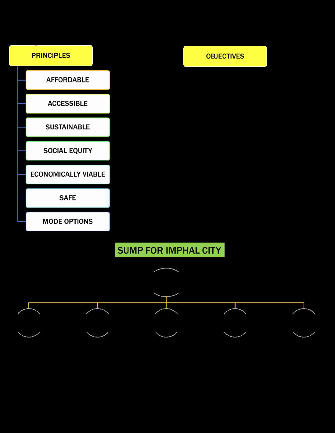
Planning Studio- VI (Imphal Sustainability Development Plan, Imphal, Manipur)
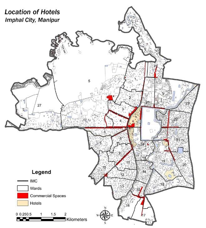
INTRODUCTION BASE MAP LANDUSE MAP
Planning Studio- VI (Imphal Sustainability Development Plan, Imphal, Manipur)
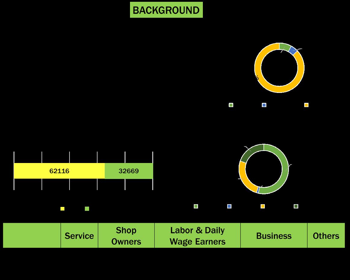
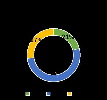
• The maximum tourist inflow in Imphal is in the month of June, July and August.
• Almost 46% of the total tourist visiting annually visit in the peak time. The major reason behind this is the Climate and Weather of Imphal.
• At present the places open to foreign tourists are: Loktak Lake, Moirang; INA Memorial, Moirang; Keibul Lamjao Wildlife Sanctuary, Waithou Lake, Thoubal; and the Khongjom War Memorial, Thoubal.
ANALYSIS
Planning Studio- VI (Imphal Sustainability Development Plan, Imphal, Manipur)
ANALYSIS
Planning Studio- VI (Imphal Sustainability Development Plan, Imphal, Manipur)
ISSUES AND GAPS IDENTIFIED
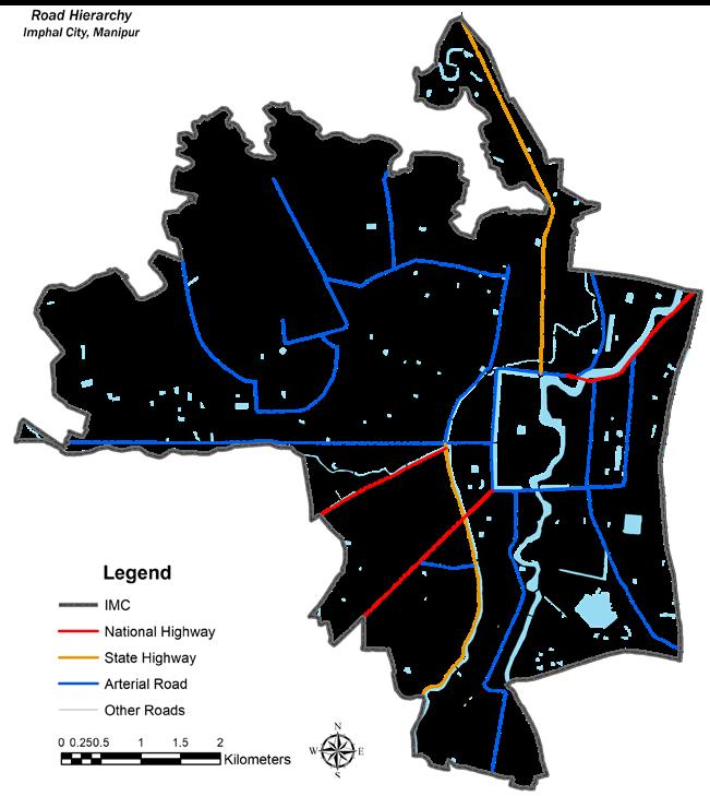
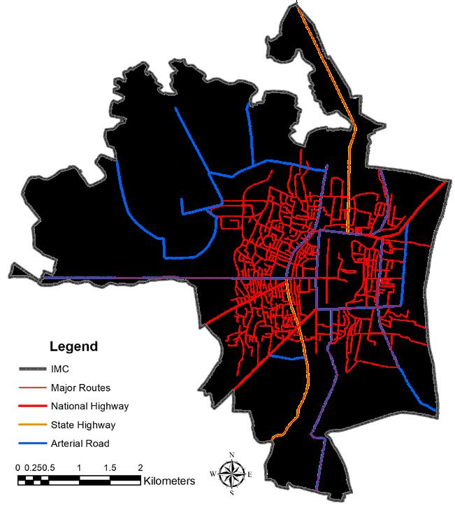
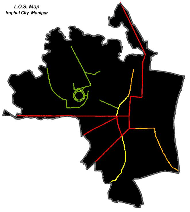
Total Area provided to Transportation sector is 7.59% which is less than the standards set by the URDPFI.
The road width throughout the city is not sufficient for such heavy vehicle movement
The existing pedestrian pathway network is not strong enough to cater heavy pedestrian movement and it also lacks basic facilities for pedestrians.
The parking situation of city is also weak as the demand is much greater than that of availability. Thus it is important to strengthen the parking sector.
There is a lot of encroachment on streets especially in the core areas because of on-street parking
The existing condition of terminals, bus stops and other facilities is highly inadequate and ill managed.
Public Transport is another aspect that needs immediate attention. There is a lack of mass transit facilities.
The city requires immediate attention on the NMT transit as it is the most prominent aspect when we are talking about sustainable mobility within Imphal city.
ANALYSIS
Planning Studio- VI (Imphal Sustainability Development Plan, Imphal, Manipur)
IDENTIFIED ISSUES
• The rising pollution in the river because of the proximity of the core region around the river
• Weak infrastructure support in market places and lack of plaza’s and other socio-economic places.
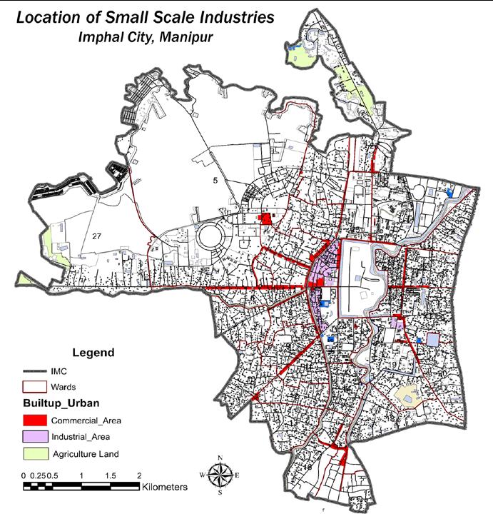
• Absence of manufacturing units and industries in the city
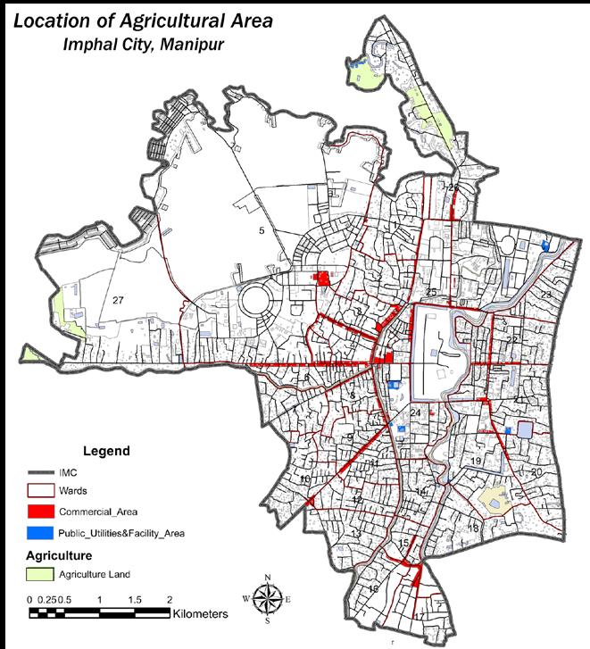
• Decline in the contribution of agricultural activities in Imphal’s economy
• Increasing tourism and population within the city means requirement for more vehicles and more vehicular movement which is affecting the environment as the pollution levels are rising.
• Lack of mass transportation modes for intracity movement
• Weak pedestrian safety as there is a huge deficit in existing pedestrian pathway length
• Absence of a railway station within the city for mass intercity movement and goods movement
• Lack of mass transportation means within the city Poor pedestrian facilities
• Insufficient infrastructure of cycle riders
OPORTUNITIES
• Improving the waste management in the core market area so as to reduce the dumping of solid waste in the river.
• Providing more job opportunities to unemployed people in tourism sector, handicrafts industry and other services
• Strengthening the existing the structure of economy and giving more exposure and support to the small scale industries of handicrafts and other goods
• Boosting tourism and its supporting activities
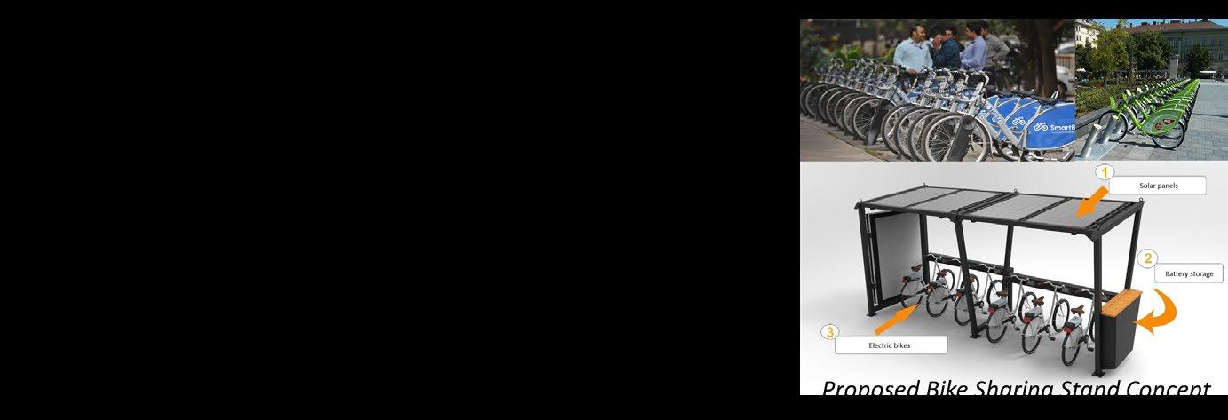
• Enhancing the NMT modes and mass transportation to control the rising pollution level
• Focus on pedestrian safety and making the city more walkable so as to make city more sustainable
• Improve intracity mass transportation movement
• Improve existing pedestrian pathways and increase the pathway length in the city
• Enhancing and Improving NMT services within the city
ANALYSIS
Planning Studio- VI (Imphal Sustainability Development Plan, Imphal, Manipur)
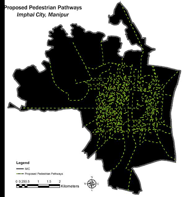
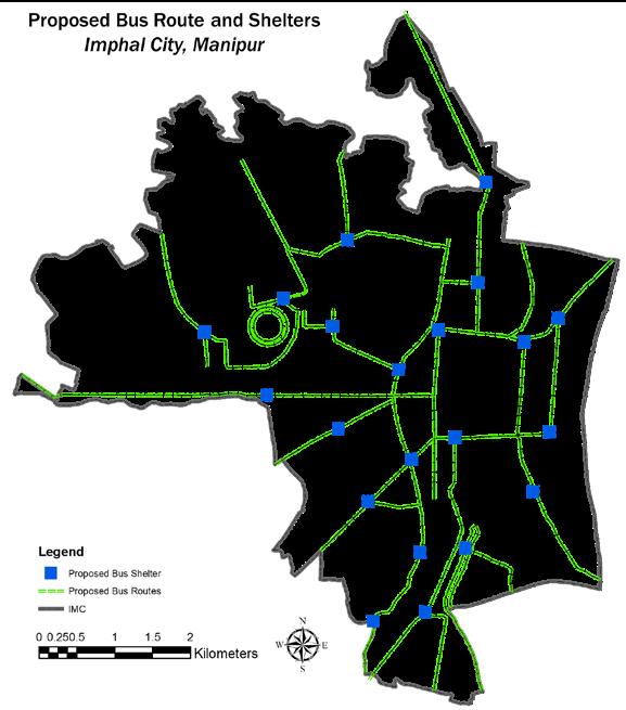
PROPOSALS AND RECOMMENDATION
The aim of the project was to develop the region as a chemical and petrochemical center, with internal and external infrastructural facilities to promote a coherent industrial sector to thrive throughout the area identified by the GPCPSIRDA.
The objectives were to :
• To alleviate poverty through job opportunities with the help of industrial development
• To lead the development in such a way that it doesn’t hinder the surroundings while conserving the environment of the region
• To provide better quality of life through housing and social infrastructure for the people living there
• To improve inter and intra –regional linkages between the different SEZ and SIR and rural areas
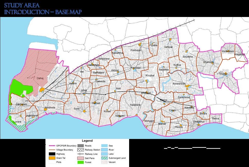
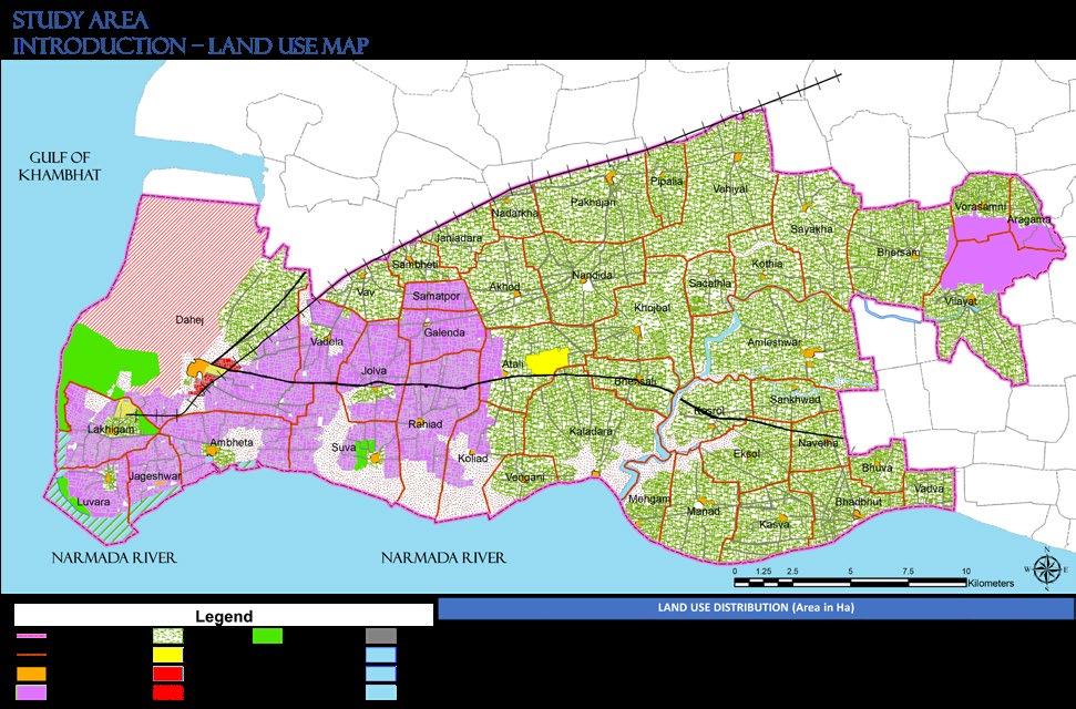
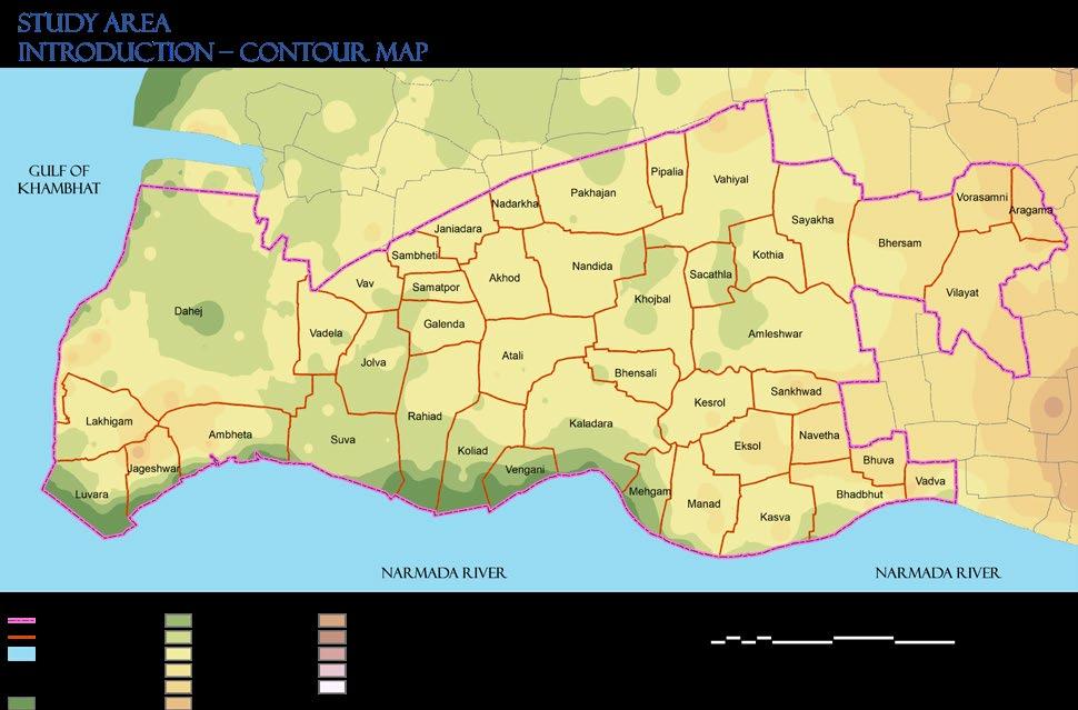
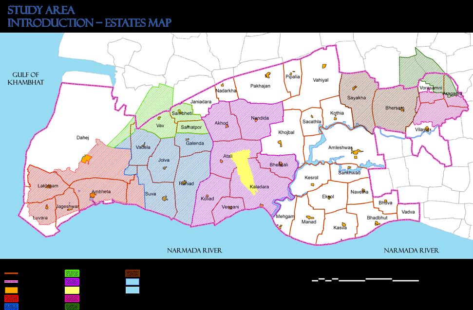
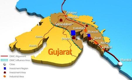
Planning Studio- VII (Regional Development Plan, GPCPSIR, Bharuch, Gujarat)
INTRODUCTION
Planning Studio- VII (Regional Development Plan, GPCPSIR, Bharuch, Gujarat)
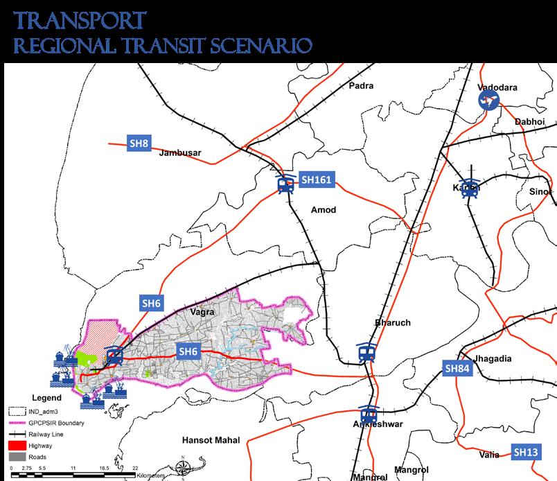
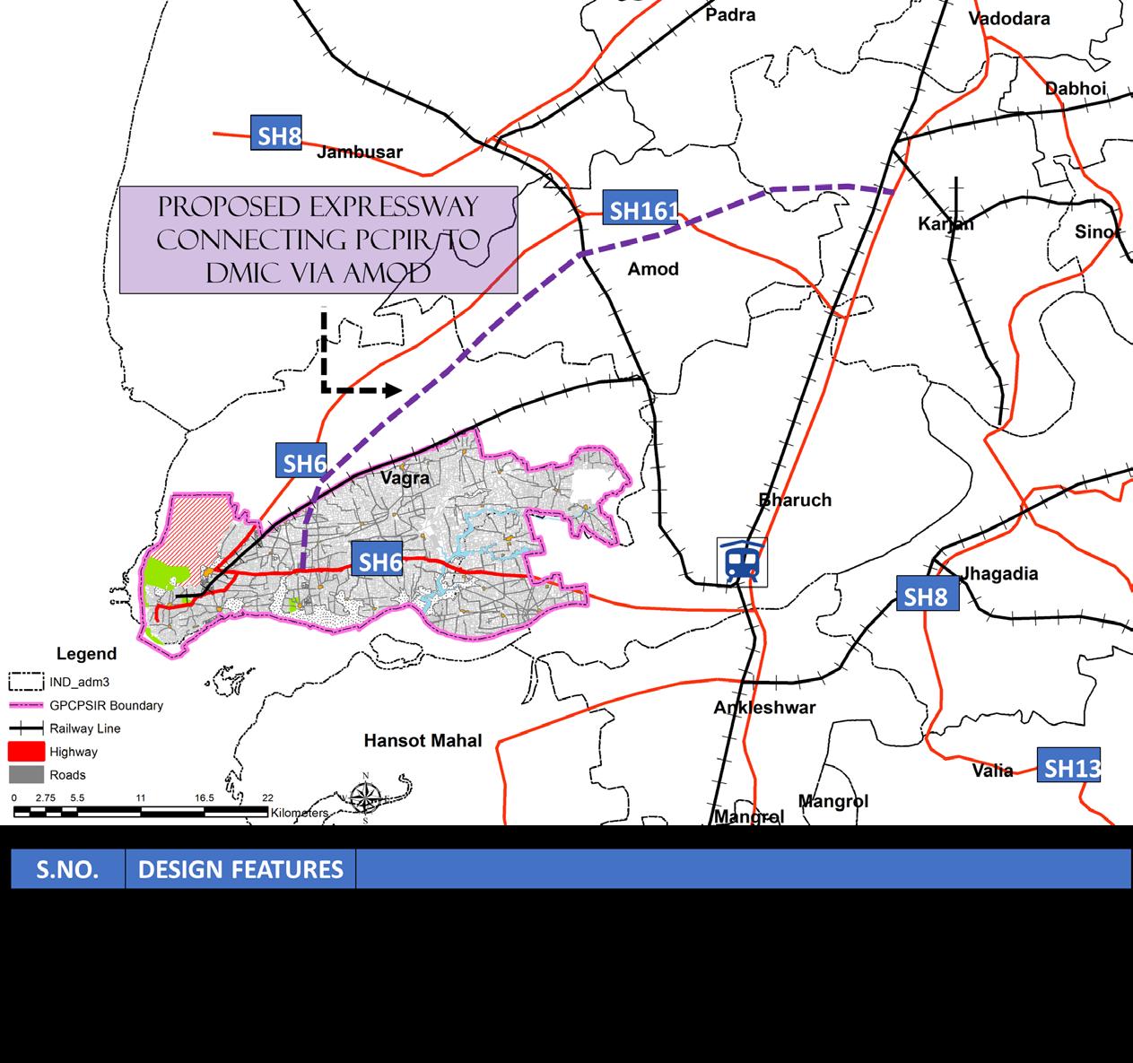
GPCPSIR has the advantages of domestic airports within 100 kms (Vadodara and Surat) and international airports within 200 kms distance (Ahmedabad and Mumbai).
Railways in Bharuch Region
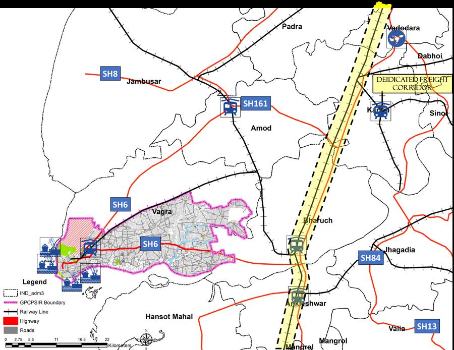
ANALYSIS
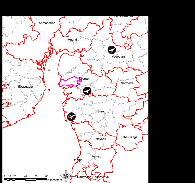
Modernization of Ahmedabad
Airport: Modernization of Ahmedabad International Airport has been initiated by the Airport Authority of India (AAI) at a total cost of Rs 1750 Million.
Expansion of Surat Airport: Airport Authority of India has commenced the expansion of Surat Airport at a cost of 350 million.
Airstrip at Ankleshwar: Ankleshwar
Airport is a greenfield airport being constructed at village Mandva on National Highway 8 near Ankleshwar.
Planning Studio- VII (Regional Development Plan, GPCPSIR, Bharuch, Gujarat) ANALYSIS
ANALYSIS
Planning Studio- VII (Regional Development Plan, GPCPSIR, Bharuch, Gujarat)
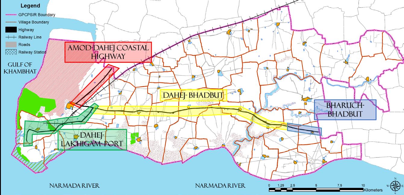
Issues Identified
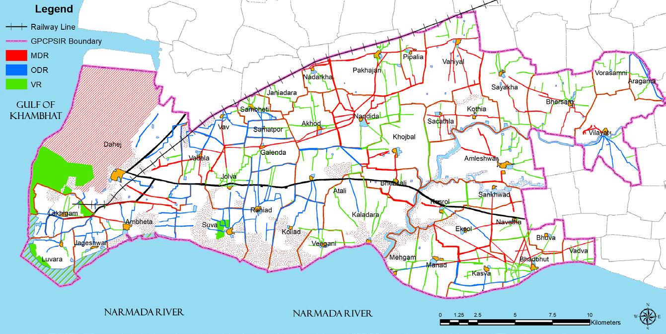
ROADWAYS
Weak internal road network.
The R.O.W . of existing highway stretches is less than the R.O.W . mentioned in the guideline.
Absence of public transport services in the region for the movement of people in the region.
Absence of parking services and truck bays/ lots.
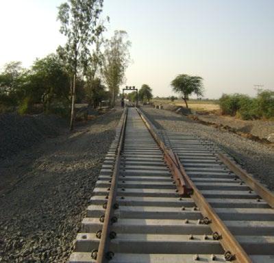
RAILWAYS
The railway lines are not connected directly to the nearby SIZ areas and major towns.
A separate railway station for the movement of people is absent.
The railway station is located away from the ports located in the western part of the region.
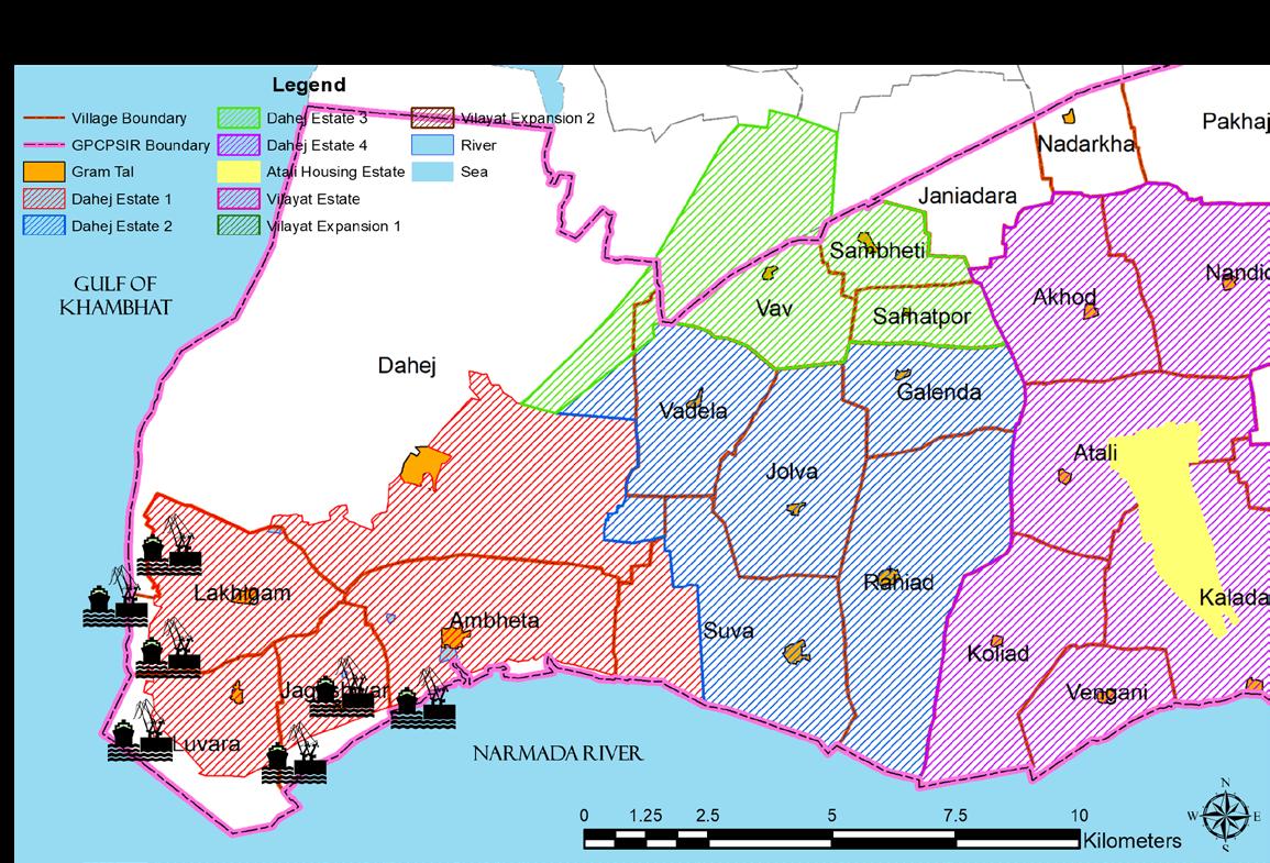
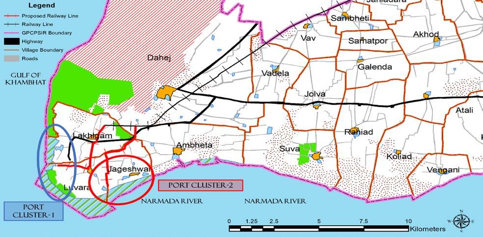
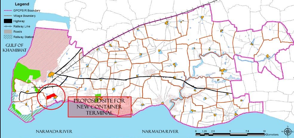
WATERWAYS Presently, there is no container terminal in GPCPSIR area. Ship building and repairing industry is absent
The existing port of Dahej’s cargo handling capacity is very low compared to other ports
AIRWAYS Absence of a airport in the region for the movement of goods and people. Nearest airport strip in Ankleshwar is still under construction. Nearest International airport is more than 250KM away from the GPCPSI region.
OPPORTUNITIES
A new Expressway and road widening of all highway stretches project
Construction of new ODR, MDR and VDR
Extension of existing BG railway line towards the port.
A new railway station for passenger movement
Construction of a new Container Terminal
A new Public Transport system that includes BRTS, IPT & NMT
New BG railway line to connect GPCPSIR with nearby SIZ and major districts
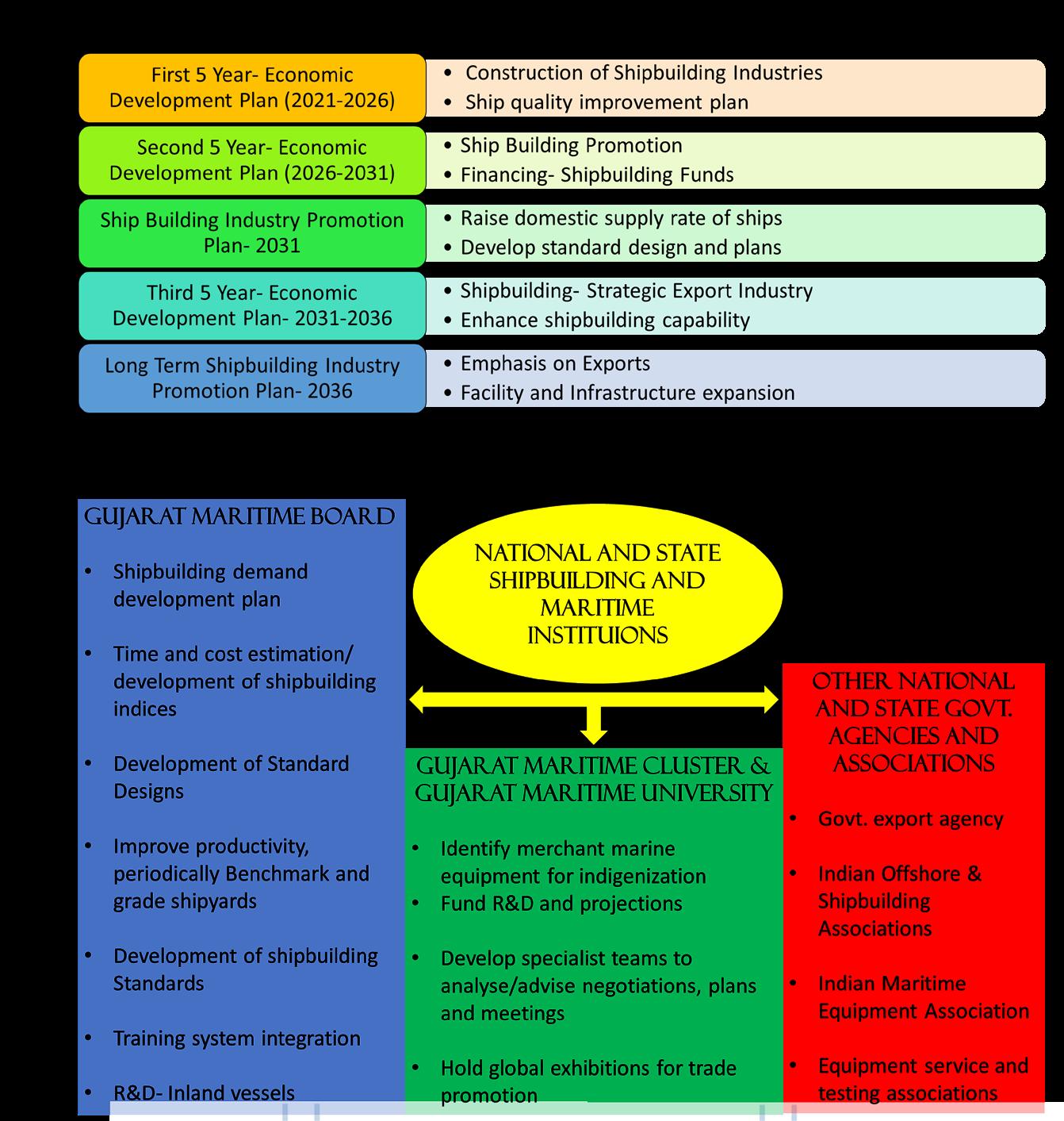
A new ship building and repairing industry
Addition of more ro-ro jetties in existing ports for the movement of people.
Increasing the existing capacity to 60MMTPA
Introduction of a smart transit app to connect all the public transit services
New guidelines for provision of parking bays and parking lots in the region
Construction of a Transport Nagar
A new airstrip at GPCPSIR
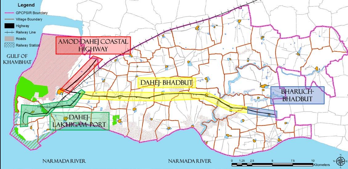
Construction of a road connecting Vilayat and Bhadbut to Ankleshwar
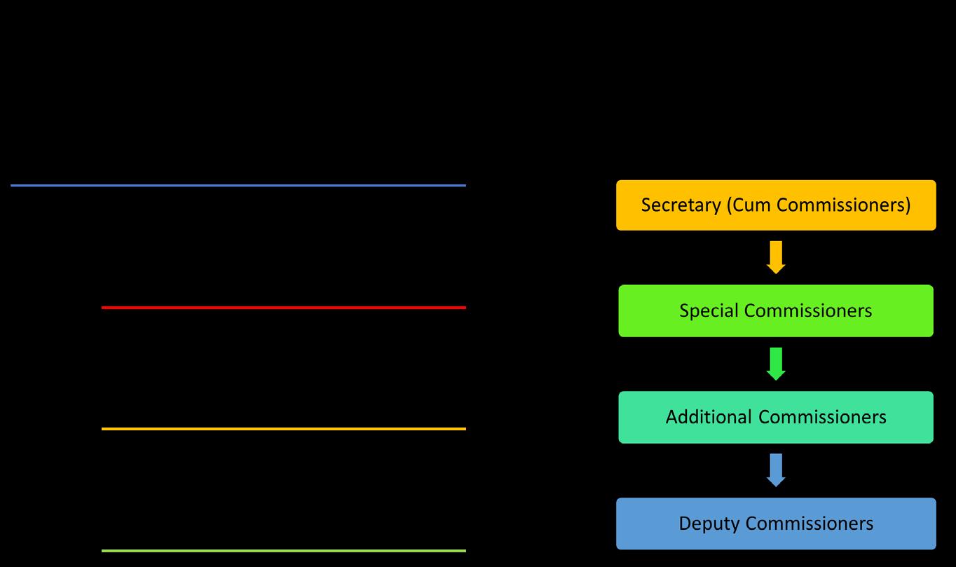
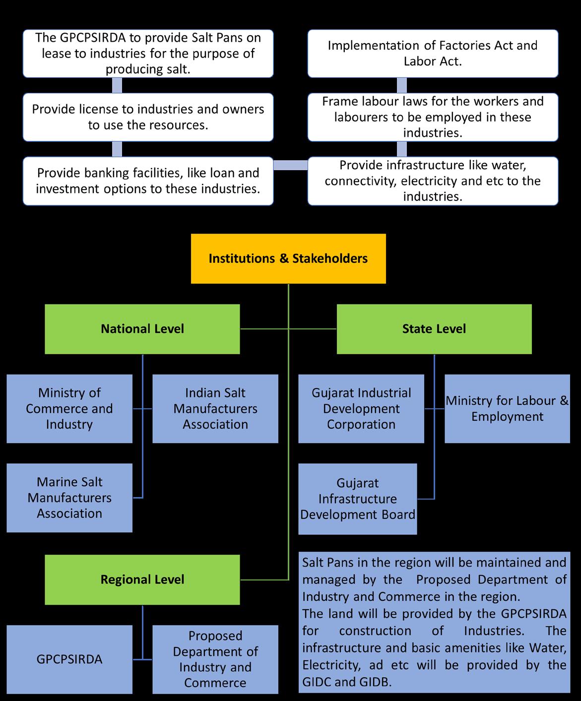
Provision for forming a new transportation department
Planning Studio- VII (Regional Development Plan, GPCPSIR, Bharuch, Gujarat)
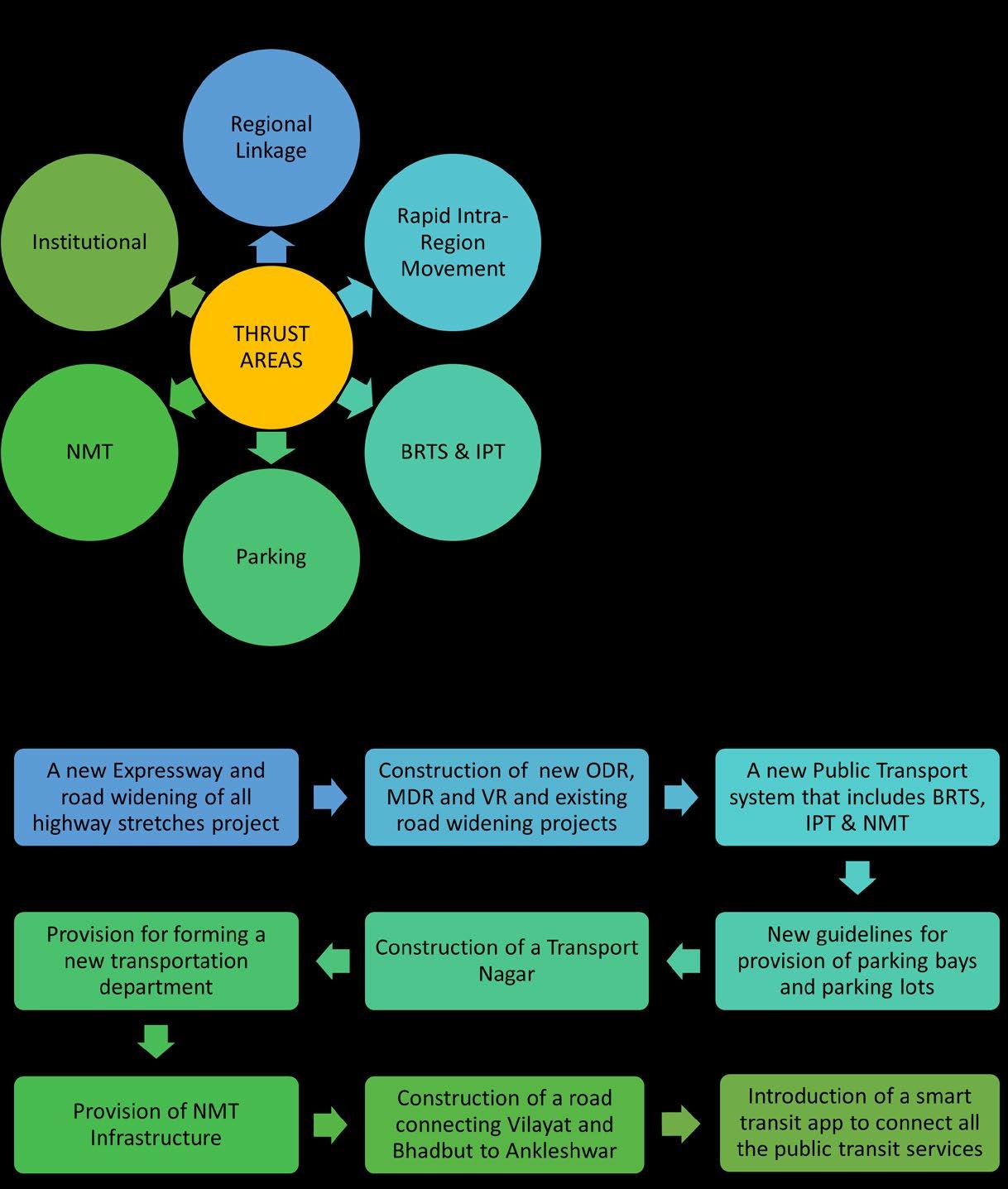
PROPOSALS AND RECOMMENDATION
Planning Studio- VII (Regional Development Plan, GPCPSIR, Bharuch, Gujarat)

PROPOSALS AND RECOMMENDATION
Planning Studio- VII (Regional Development Plan, GPCPSIR, Bharuch, Gujarat)


PROPOSALS AND RECOMMENDATION
Planning Studio- VII (Regional Development Plan, GPCPSIR, Bharuch, Gujarat)


PROPOSALS AND RECOMMENDATION S. N o Name No. of Berths and Jetty Details Type of Ownership Type of Materials Handled Existing Capacity (MMTPA ) Proposed Capacity (MMTPA) Propose d No. of Jetties Ro-Ro Jetty Service 1 BIRLA COPPER 1, Berthing Capacity of vessel up to 70,000 DWT in fair weather. Can Handle Gearless Vessel, Daft Private Sector Copper smelter and fertilizer as well as its raw materials 5 7 2 2 GCPTCL 1, a large service platform Accommodating seven unloading / loading arms, etc., which can cater to ships of various sizes, makes & standards. Joint Sector Hazardous liquid & gaseous chemicals 4.80 6 2 3 PETRONET (LNG) 1, Length: 360M Joint Sector Liquefied Natural Gas 10.00 12 3 4 IPCL 1, Length: 49 m Private Sector Liquid Fuel 3.50 3.50 1 5 OLD PORT DAHEJ 1, Jetty length is 104.00 meter Government Owned -GMB General Cargo 0.3 10 3 6 General Cargo Port (Petronet Adani) North of Petronet Jetty, Two berths with a draft of 14 meters, Ro-Ro Jetty for project cargo movement through barge, GovernmentGMB General Cargo 12 15 3 7 Port Facilites plus Container Berth North of Birla Copper Jetty Sandesara Group having technical collaboration with Virginia Port Authority, USA. Liquid and Solid cargo 2.5 8 2
Planning Studio- VII (Regional Development Plan, GPCPSIR, Bharuch, Gujarat)
PROPOSALS AND RECOMMENDATION