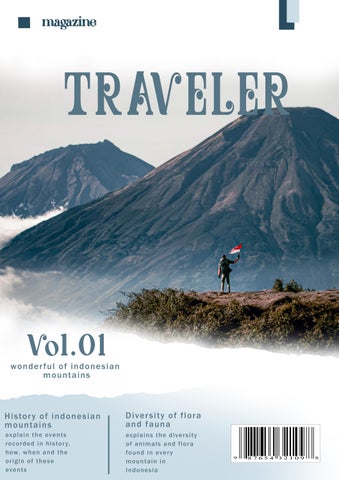
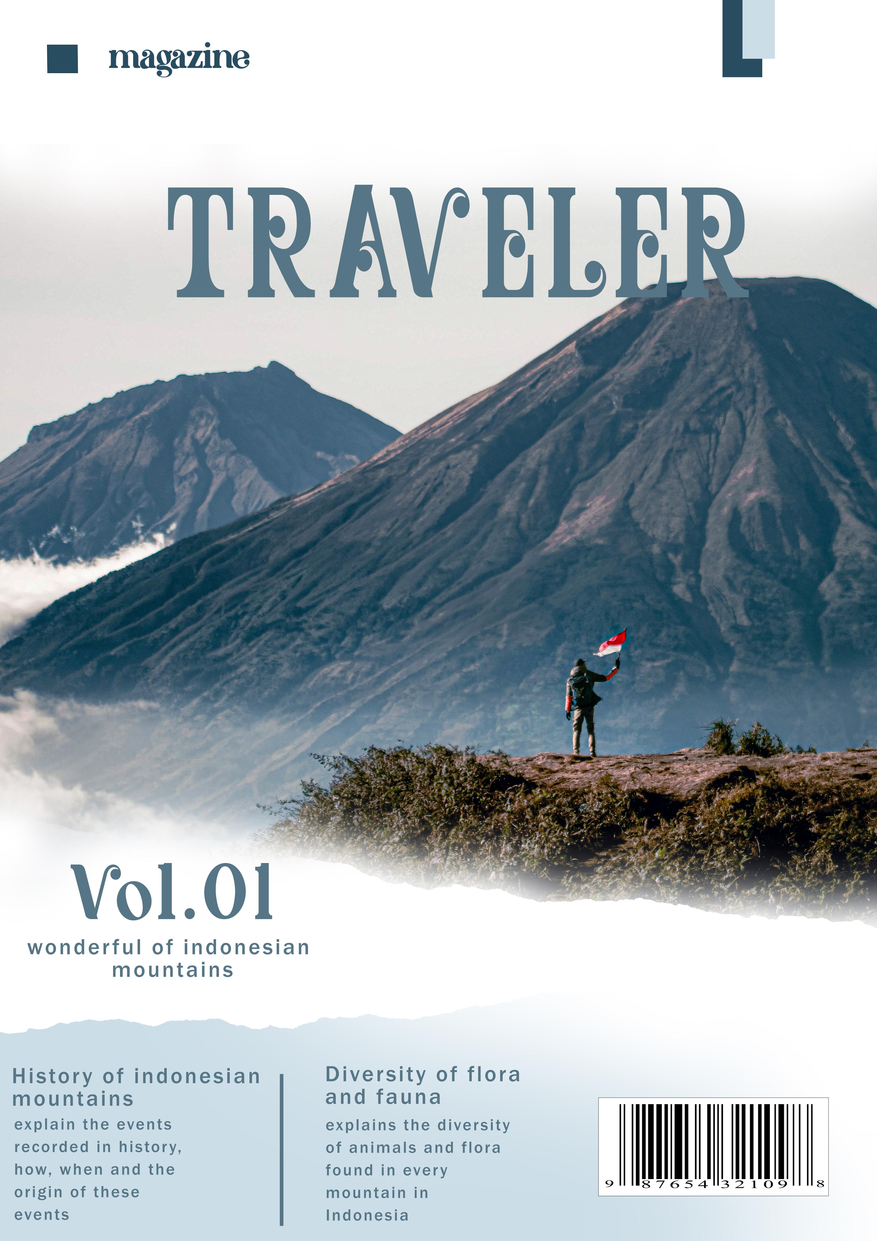
PERCEIVING LUMAJANG : GUNUNG SEMERU
Lumajang is an area that has many tourist attractions from the mainland to its beaches and of the many tourist attractions, Mount Semeru is a tourist destination for nature lovers, especially climbers. This mountain is very well known by the people of Indonesia because of the beauty that is presented. In addition to its beauty , there are also various types of flora and fauna found on the mountain and the history that is stored.
check point
“HISTORY AND BEAUTY OF SEMERU.”
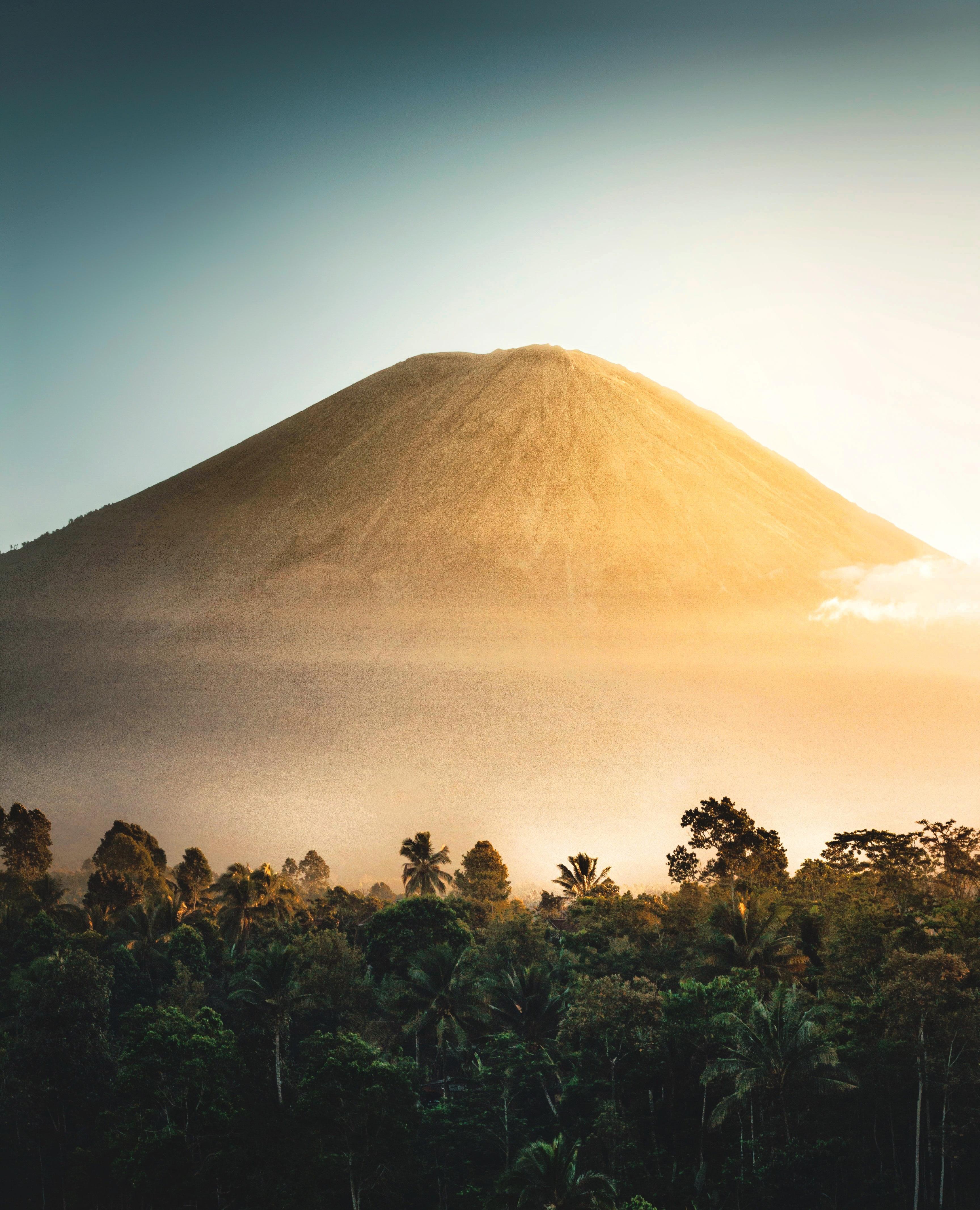
THIS IS SEMERU
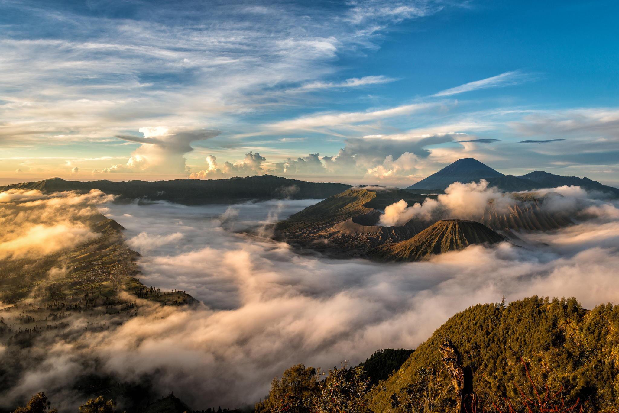
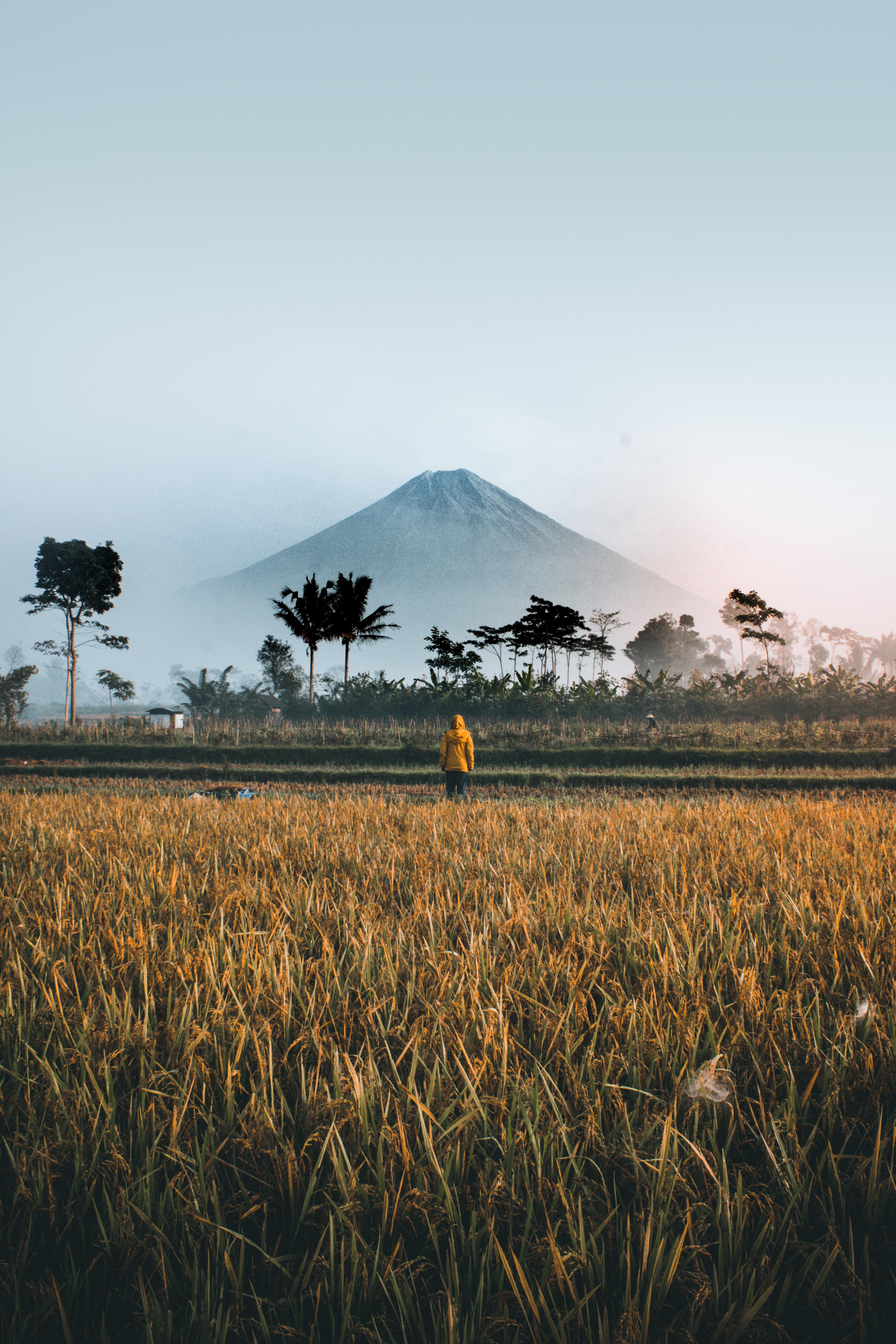
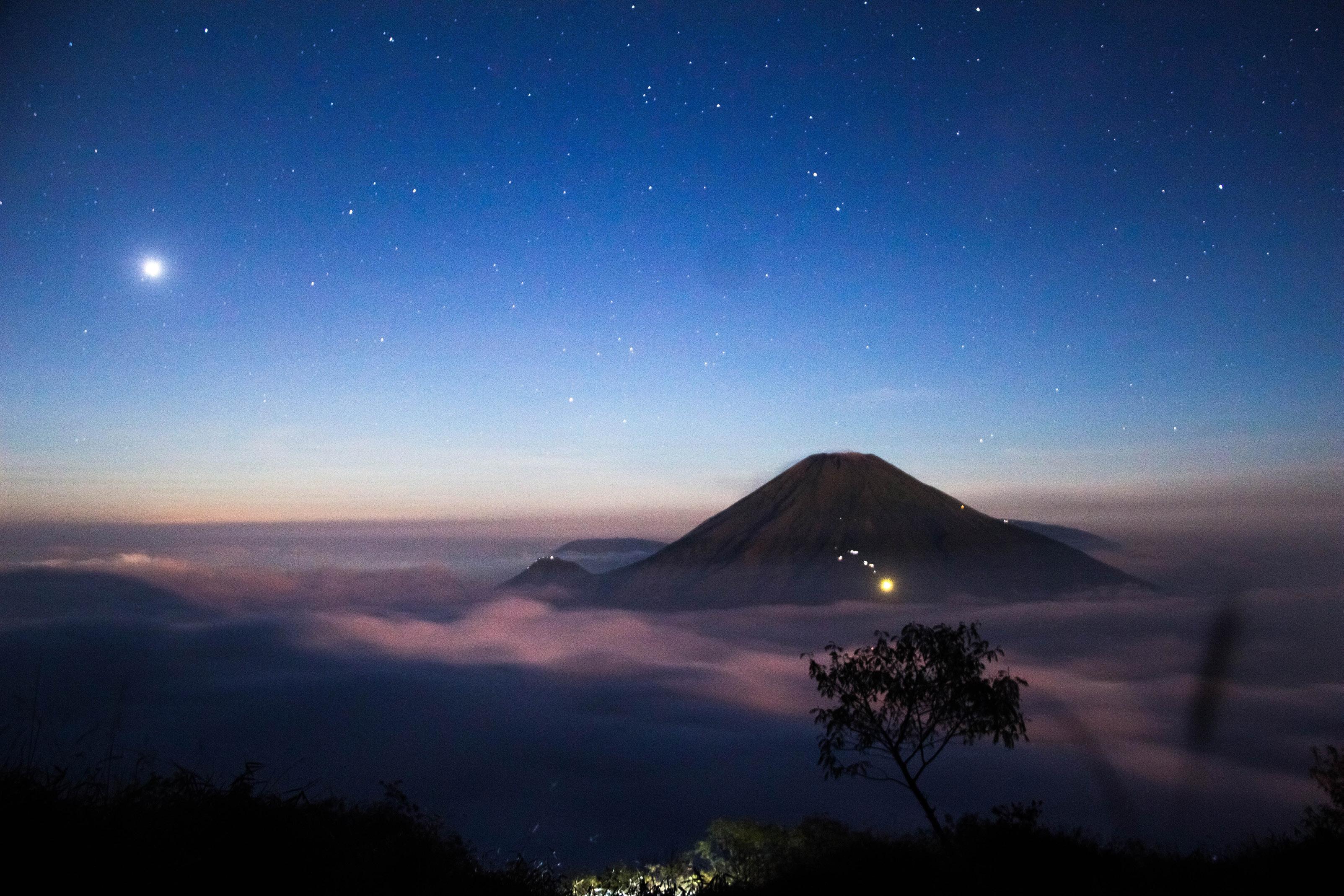
Mount Semeru or Mount Meru is a conical volcano in East Java, Indonesia. Mount Semeru is the highest mountain on the island of Java, with the peak Mahameru, 3,676 meters above sea level (masl). This mountain was formed due to subduction The Indo-Australian under Eurasian Plate. Mount Semeru is also the third highest volcano in Indonesia after Mount Kerinci in Sumatra and Mount Rinjani in West Nusa Tenggara. The crater at the top of Mount Semeru is known as Jonggring Saloko. Administratively, Mount Semeru is included in the territory of two districts, namely Malang Regency and Lumajang Regency, East Java Province. This mountain is included in the Bromo Tengger Semeru National Park. Semeru has a Dipterocarp Hill, Upper Dipterocarp, Montane forest, and Ericaceous Forest or mountain forest. The geographical position of Semeru is between 8°06’ South Latitude and 112°55’ East.
In 1913 and 1946 the Jonggring Saloka Crater had a dome with a height of 3,744.8 m until the end of November 1973. To the south, this dome breaks into the rim of the crater causing lava flows to the south side covering the Pronojiwo and Candipuro in Lumajang.
THE FIRST CLIMBERS
geologist Dutch. They took the route from the southwest via Widodaren. Furthermore, Junghuhn (1945), a Dutch botanist, climbed from the north via Mount Ayek-ayek, Mount Inder-inder and Mount Kepolo. In 1911, Van Gogh and Heim went through the north slope and after 1945 climbing was generally done via the north slope through Ranu Pani and Ranu Kumbolo until now.
LEGEND OF MOUNT SEMERU
According to the belief of the Javanese people written in the ancient book Tantu Pagelaran which dates back to the 15th century, long ago the island of Java was floating in the vast ocean, oscillating and always shaking. The Gods decided to nail the island of Java by moving Mount Meru in India to the top of the island of Java.
Lord Vishnu transformed into a giant tortoise carrying the mountain on his back, while Lord Brahma transformed into a long snake that wrapped his body around the mountain and the turtle’s body so that the mountain could be transported safely.
The gods put it on top of the mountain the first island they encountered, namely in the western part of Java Island. But the weight of the mountain caused the eastern end of the island to lift up. Then they moved it to the eastern part of the island of Java.
FLORA & FAUNA
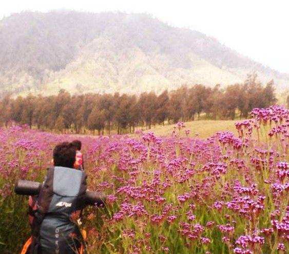
There are various types of flora in the Mount Semeru area, but many are dominated by cypress, acacia, pine, and Jamuju. Whereas the undergrowth is dominated by kirinyuh, reeds, tembelekan, harendong and white edelwiss. Edelwis are also commonly found on the slopes to the top of Semeru. There is also an endemic species of orchid that lives around the southern part of Mount Semeru, namely the Slipper Orchid.
Many fauna inhabit Mount Semeru, including: panthers, budengs, mongooses, deer, mouse deer, etc. Meanwhile, in Ranu Kumbolo there are grouse that are still living wild.
https://pin.it/130OTex
“the beautiful OF rinjani.”
THIS IS RINJANI
Mount Rinjani is a mountain located on Lombok, West Nusa Tenggara. The mountain which is volcano in Indonesia with an altitude of 3,726 masl and is located at latitude 8º25’ South Latitude and 116º28’ East Longitude is a favorite mountain for Indonesian climbers because of its beautiful scenery. This mountain is part of Mount Rinjani National Park which has an area of around 41,330 ha and it will be proposed to increase it so that it becomes 76,000 ha to the west and east.
Administratively this mountain is within the territory of three districts: East, Centraland North Lombok.
Mount Rinjani, with the highest point at 3,726 masl, dominates most of the views of the northern part of Lombok Island.
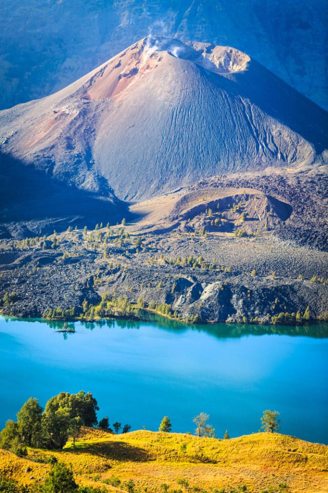
To the west of the Rinjani cone there is a caldera with an area of about 3,500 m × 4,800 m, extending east and west. In this caldera there is Segara Anak (segara = sea, lake) with an area of 11,000,000 square meters and a depth of 230 m. The water that flows from this lake forms a very beautiful waterfall, flowing through a steep ravine. In Segara Anak there are many carp and mujair so they are often used for fishing. The southern part of the lake is called Segara Endut.
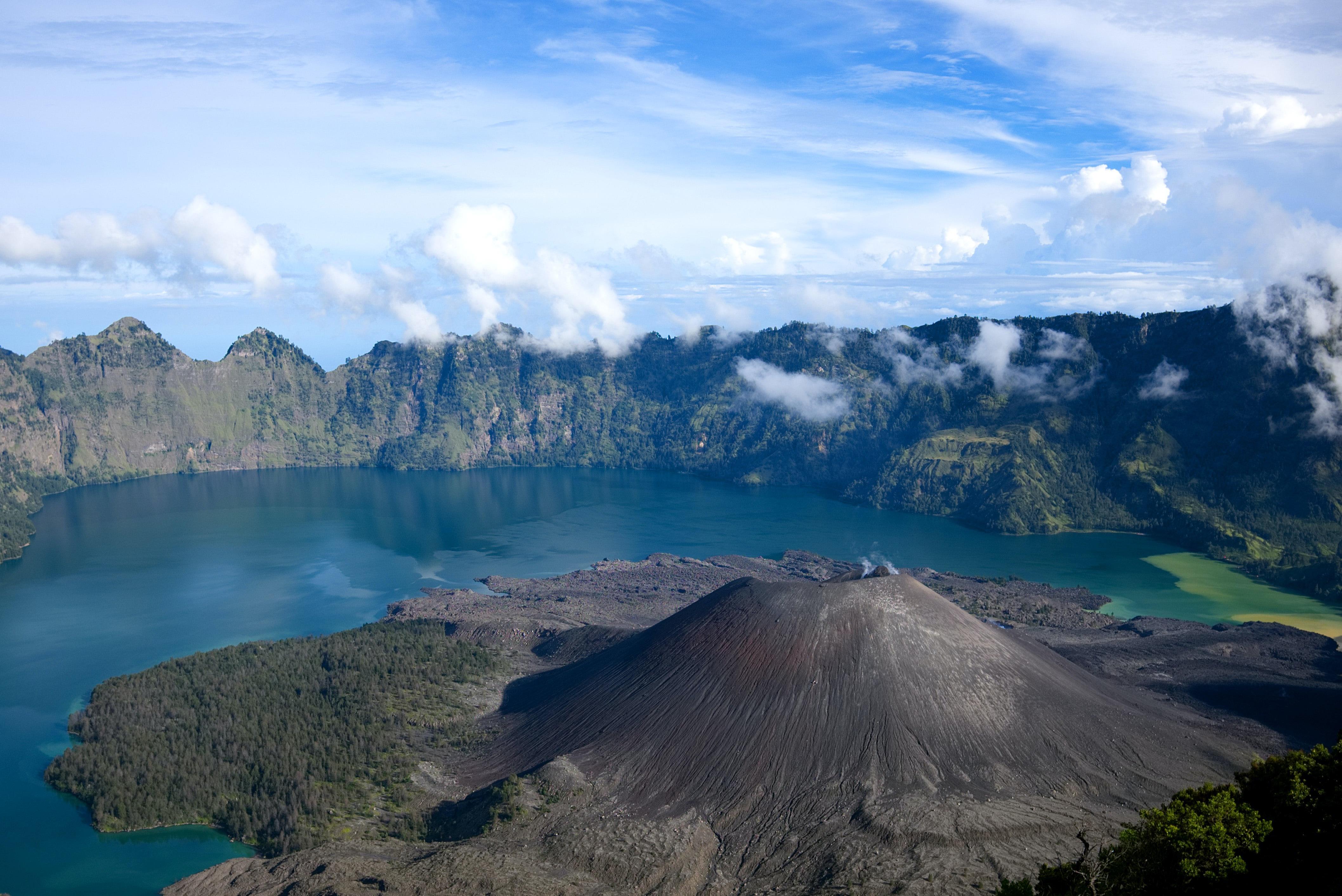
On the east side of the caldera is Gunung Baru (or Mount Barujari) which has a 170m×200 m crater with an altitude of
2,296 – 2,376 m asl. This small mountain last erupted on 25 October 2015 and 3 November 2015, having previously been recorded as having erupted in May 2009 and in 2004.If the 2004 eruption did not result in casualties, this 2009 eruption has indirectly claimed 31 lives, due to floodingat Kokok (Sungai) Tanggek due to the pressure of lava into Segara Anak. Previously, Mount Barujari had been recorded as having erupted in 1944 (as well as its formation), 1966 and 1994.
FLORA & FAUNA
The rich flora of this national park area is one of its main attractions. The types of flora found also vary and follow the path of the mountain height. At the highest peak that is the target is the edelweiss flower.
The flora that grows in the Mount Rinjani National Park area can be divided into three based on the height of the mountain.
The three types are areas with elevations below 1,000 meters above sea level, above 1,000 meters above sea level, and mountain peaks.
Areas that are below 1,000 meters above sea level grow garu (Dysoxylum), neem (Azadirachta argentea), lambudu (Lasianthus), banyan (Ficus superba), forest opium (Gossampinus heptophylla), and deduren (Agalaia argentea).Various types of fauna are scattered throughout the area of Mount Rinjani National Park, ranging from species that are often found, endemic animals,
to protected ones. The natural condition of this area is indeed a paradise for all kinds of animals.
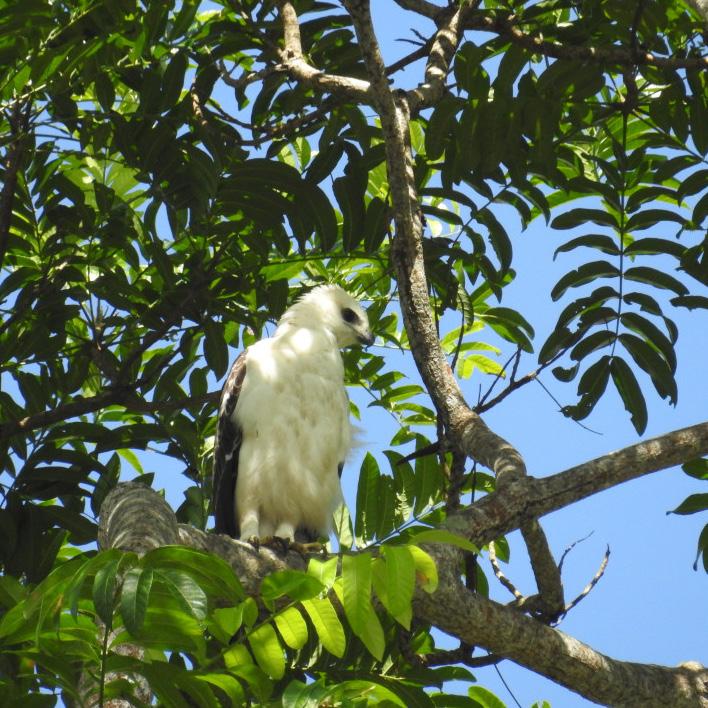
Several types of fauna that will be found throughout this national park area include porcupines (Hystrix javanica), wild boar (Sus vittatus), deer (Cervus timorensis), long-tailed monkeys (Macaca fascicularis), deer (Muntiacus muntjak), langurs (Trachypithecus auratus), and the fruit bat (Macroglossus minimus).
The types of birds that live in this area are the uncal buau (Macropygia emiliana), aris nusa Tenggara (Zoothera dohertyi), white walik (Ptilinopus cinctus), and honey bird (Lichmera lombokia).
Meanwhile, the endemic animal species that inhabit the TNGR is the rinjani civet (Paraoxurus hemaproditus rinjanicus). This species is also very important to be conserved to ensure its sustainability.
https://www.rinjaninationalpark.id/
PERCEIVING Lombok: GUNUNG rinjani
Lombok has lots of tourist attractions from beaches to even nature reserves, but of the many tourist destinations, Mount Rinjani is a tourist spot that is no less beautiful and an attraction for visitors to come. This mountain is so enchanting that Indonesian people are very familiar with it. Apart from its beauty, there are also flora, fauna and history found in Rinjani.
check point
PERCEIVING central java: GUNUNG sumbing
Central Java has lots of tourist attractions ranging from beaches to even nature reserves, but of the many tourist destinations, Mount Sumbing is a tourist spot that is no less beautiful and an attraction for visitors to come. This mountain is so enchanting that the people of Indonesia are very familiar with it. Apart from its beauty, there are also flora, fauna and history found on Sumbing Mountain.
check point
“the great OF SUMBING.”
THIS MOUNT SUMBING
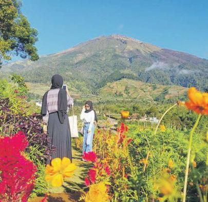
Mount Sumbing is a volcano located in Central Java, Indonesia. (Peak altitude of 3,371 masl), Mount Sumbing is the third highest mountain on the island of Java after Mount Semeru and Mount Slamet. This mountain is administratively located in three districts, namely Magelang Regency; Temanggung Regency; and Wonosobo Regency. Together with Mount Sindoro, Mount Sumbing forms twin mountain landscapes, such as Mount Merapi and Mount Merbabu, when viewed from the direction of Temanggung. The gap between this mountain and Mount Sindoro is traversed by a provincial road that connects the city of Temanggung and the city of Wonosobo. This road is commonly known as “Kledung Pass”.
In historical records, before it was named Mount Sumbing, this mountain was named Mount Sembung. This is based on the Bujangga Manik When he passed the Dieng plateau, the
last eruption was recorded in 1730, which formed a lava dome with lava flow towards the lowest crater rim. Mount Sumbing has a Dipterocarp Hill, Upper Dipterocarp, Montane forest, and Ericaceous Forest or mountain forest. Most of the mountain slope area has been used for agricultural land.
HIKING
The most popular hiking trail for Mount Sumbing is via the Garung post. Garung is a village at the northern foot of Mount Sumbing, in the Kledung Pass. Close to Garung Village there is also a basecamp for climbing Mount Sindoro. Apart from that, there are also other routes such as Bowongso, Cepit, Lamuk, Banaran, Need Kaliangkrik, and Mangli Kaliangkrik. The location of Mount Sumbing and Mount Sindoro face each other. Many people say that Mount Sumbing-Sindoro is a twin mountain like Mount Merapi-Merbabu. track than Mount Sindoro due to the steep slope gradient and longer route.
The height is not much different, and also the natural conditions of the mountains are almost the same. However, for climbers, Mount Sumbing has a heavier
Flora Potential The diversity of flora in the TNGMb area varies with elevation and is divided into several ecosystems, namely tropical zone ecosystems (0-1000 masl), sub-mountain zones (1000-1500 masl); mountainous zone (1500-2400 m asl); and the subalpine zone (>2400 m asl). Tropical zone and submountain zone ecosystems have vegetation types that are not too significant different. The type of Acacia decurens is a type of vegetation that is found in almost all types of ecosystems because it is a pioneer plant species that has a relatively high level of adaptation.
https://unsplash.com/photos/koJsgW-