
8 minute read
Trail Ridge Road


by Barb Boyer Buck
Trail Ridge Road is the most accessible way to see Rocky Mountain National Park's stunning vistas and varied ecosystems as you change elevations. It's the highest paved continuous highway in the country reaching elevations of more than 12,000 feet before continuing on as Highway 34 on both sides of the Continental Divide within the national park's boundaries. It connects the communities of Estes Park and Grand Lake, and is a visual demonstration of how different the east side of Rocky is from the west side.
Advertisement

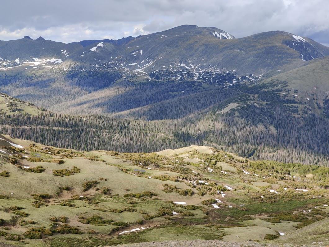
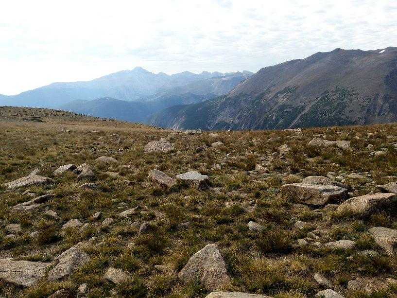
September, 2018, west side
Photo by Barb Boyer Buck
Most people start their Trail Ridge Road tour on the east side of the Divide, which is most accessible from the Front Range. The majority of Rocky's four million-plus annual visitors travel through Estes Park and this community thrives during the months the road is open. After going “up and over” many stop in Grand Lake, a small town also supported by tourism.
When I host visitors to my home in Estes Park, going up and over Trail Ridge Road is always on the agenda.

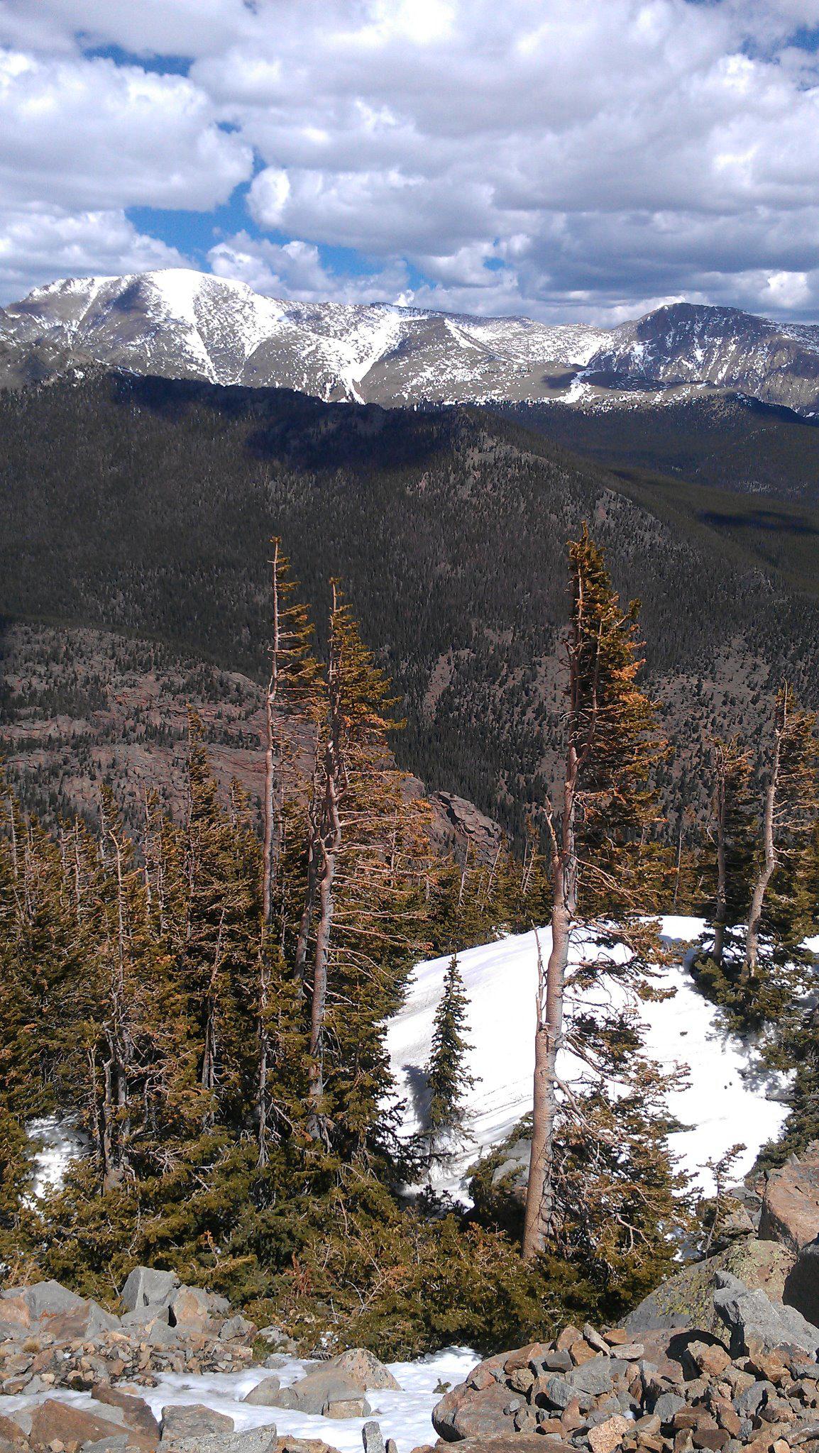
July, 2013, atop Trail Ridge Road
Photo by Barb Boyer Buck
When it's closed (generally October through most of May), I take them as far as the road is open and we walk up a bit. It's always a pleasure to walk on this road when it's closed, seeing perspectives otherwise not available. aside from RMNP's entrance fees, it won't cost you anything but time, fuel, and a little bit of gumption. I remember being at the Alpine Visitor's Center (at Fall River Pass) once when a request came over a loudspeaker. “There's a woman who drove up Trail Ridge Road but is too frightened to drive back down, can anyone help by driving her car back to Estes Park?”
For those who drive on this road often, this can elicit a chuckle – but honestly, for those who are afraid of heights, I suppose it's not easy at all to drive Trail Ridge Road. If I hadn't been alone with no one to drive my car back, I would have helped this woman.

July, 2020
Photo by Barb Boyer Buck
Another time I was asked: “how do you keep from driving off the road on Trail Ridge?” I met this queson with a blank stare. I just don't drive off the road, I wanted to say, but instead I said, “stay in your lane on the highway, and you won't go off the road as long as it's dry and clear.”
Over the years and indeed ever since he was born, my son and I have traveled this road many, many times and every time, it's a little different.
May, 2018
Photo by Barb Boyer Buck
My favorite story was when he was three, and we were on our first day of an eight-day road trip, our first solo adventure since the divorce.
It was Memorial Day weekend, shortly aer the road had “opened” for the season and we were headed out to see five national parks in Colorado, Utah, and Wyoming. Rocky Mountain National Park is in my backyard and we were just driving through it, but I considered it one of the five. Turns out, this leg of the journey was one of the most adventurous we were to have.

August, 2019
Photo by Barb Boyer Buck
“Mommy, I have to use the potty!”
I glanced up at my rear-view mirror. Scott was squirming in his car seat. But the weather conditions insisted I concentrate on the road. I gripped the steering wheel a bit tighter and peered through the blizzard.
It was nearly white-out conditions on Trail Ridge Road although when we had started out that day, it was warm and sunny at lower elevations. In fact, both my son and I were dressed in shorts and t-shirts, comfortable clothes for the road trip. Scott had been recently potty-trained but I had put a diaper on him that morning, just in case.
April, 2012
Photo by Barb Boyer Buck
“Just use your diaper,” I said, carefully avoiding a man wearing loafers and a Member's Only leather jacket who was trying to push his car, which was sideways on the road. Scott began to whimper.
“No! I use the potty now!”
There are restrooms at the Alpine Visitor's Center, but there was no way to know how far that was from where we were. Even though I know the road quite well, there were no landmarks visible.
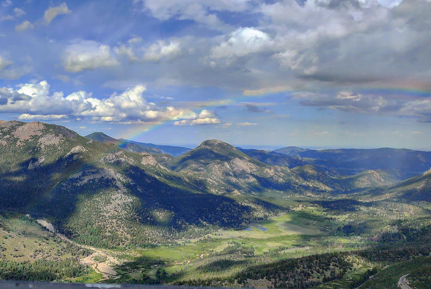
Rainbow at Rainbow Curve. June, 2020.
I considered turning around but decided it was better to keep going forward. Later, I learned the road had been closed behind me so that was really all I could have done anyway.
“Well, there are no bathrooms here,” I said, gesturing to the snowstorm outside. Scott continued to whine and complain, loudly.
I tried to tune that out as I white-knuckled my way through the highest section of Trail Ridge Road, above treeline at approximately 12,000 feet. I could barely discern the long poles installed on both sides of the road, but I was glad for whatever I could see. These poles are installed so snow-plow operators can find the edges of the road when it was first cleared in early summer.

West side, July, 2018
Photo by Barb Boyer Buck
There's no real way to plan for this kind of thing – getting caught in a blizzard atop Trail Ridge Road can happen in a matter of minutes, any time of year. Weather conditions change rapidly and fairly unpredictably and it pays to be prepared for anything. I thought we were prepared; camping was part of this adventure and I had packed every piece of gear I had, along with warm clothing and provisions.
But I realized my packing mistake when I finally reached the visitor's center and pulled up next to the bathrooms on the north end of the parking lot. Everything was stored in the trunk and when I jumped out of the car to retrieve our coats, it felt like my legs were being sandblasted by the wind-driven, hard snow. Instead of the coats, I grabbed a blanket that was in the back seat and carefully wrapped Scott in it before I carried him to the bathroom.
He started whining again when I sat him on the toilet seat.
“What's wrong now??” I asked him. Tears began flowing down his red cheeks.
“I can't go – it's blowing my butt!”
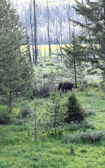
Female moose on the west side, 2017
Photo by Barb Boyer Buck
There was nothing to do but wrap him back up in the blanket up and take him to the car. As we began descending on the west side of Rocky, the wind eventually stopped, the snow turned into rain, and Scott fell asleep in his car seat. I pulled up to another bathroom. “Here's a bathroom where the wind won't blow your butt!” I announced, triumphant.
Scott was groggy as he was waking up.
“I don't have to go anymore.”

RMNP graphic
Steep drop-offs, hairpin turns, and traffic are conditions of Trail Ridge Road during summer, and on the rare occasions when a sudden snow-storm blows in during the months it's open these can present a danger. There are several other dangers related to weather and elevation you should look out for, too.
Above treeline, a person standing near the tundra is the tallest thing around and can easily attract lightening. If you notice storm clouds nearby and especially if the hair on your arms stands up – get back in the car immediately or crouch as low as possible on rubber-soled shoes.
August, 2016
Photo by Barb Boyer Buck
The elevation may cause issues for those with heart condions and everyone experiences extreme fatigue after going up and over and back again. Electrolytes will help keep you hydrated and energized for this journey.
NPS began construction on Trail Ridge Road in 1929 and the road reached Grand Lake in 1938. It roughly follows the Native American summer trail that had been used for centuries by the Arapaho and Ute. Rock cairns, the ancient game runs with which mountain buffalo and elk were hunted, are still visible along this road.

A marmot at Forest Canyon Overlook
Photo by Barb Boyer Buck
Other cultural sites along Trail Ridge Road are located along the Tundra Communities Trail, a short hike that starts at the Rock Cut. Along this route are interpreve signs about the tundra and a memorial to Roger Toll, NPS past superintendent for Rocky, Yellowstone, and Mount Rainier national parks. In the Kawuneeche Valley, a homestead ranch once belonging to the Holzwarth family is preserved as an interpreve site.
Do yourself a favor and explore the many moods of Trail Ridge Road on your next trip to Rocky Mountain National Park, but remember, it's a trip you need to prepare for.

October, 2020
Photo by Barb Boyer Buck
Bring lots of layers, sun protection, Gatorade and/or water, and snacks. Plan on at least a half a day and stop at all the pull-outs and overlooks for amazing vistas and a chance to see marmots, pikas, or elk. Stay off the tundra (except while on a trail) – the plants are extremely fragile and can be irreparably damaged if trod upon.
In the next two articles, Murray Selleck and Dave Rusk ski up the closed Trail Ridge Road from either side on the same day and detail their adventures. In Dave's article, we've included a video diary of the trip filmed by his brother, Kip.
These stories demonstrate that Trail Ridge Road is truly a year-round attraction.

www.snowygrass.com


