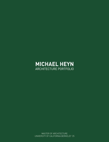
MICHAEL
HEYN
ARCHITECTURE PORTFOLIO
MASTER OF ARCHITECTURE
UNIVERSITY OF CALIFORNIA BERKELEY ‘25

HEYN
MASTER OF ARCHITECTURE
UNIVERSITY OF CALIFORNIA BERKELEY ‘25
SEMESTER SPRING 2024
INSTRUCTOR GEORGIOS EFTAXIOPOLOUS
UC BERKELEY
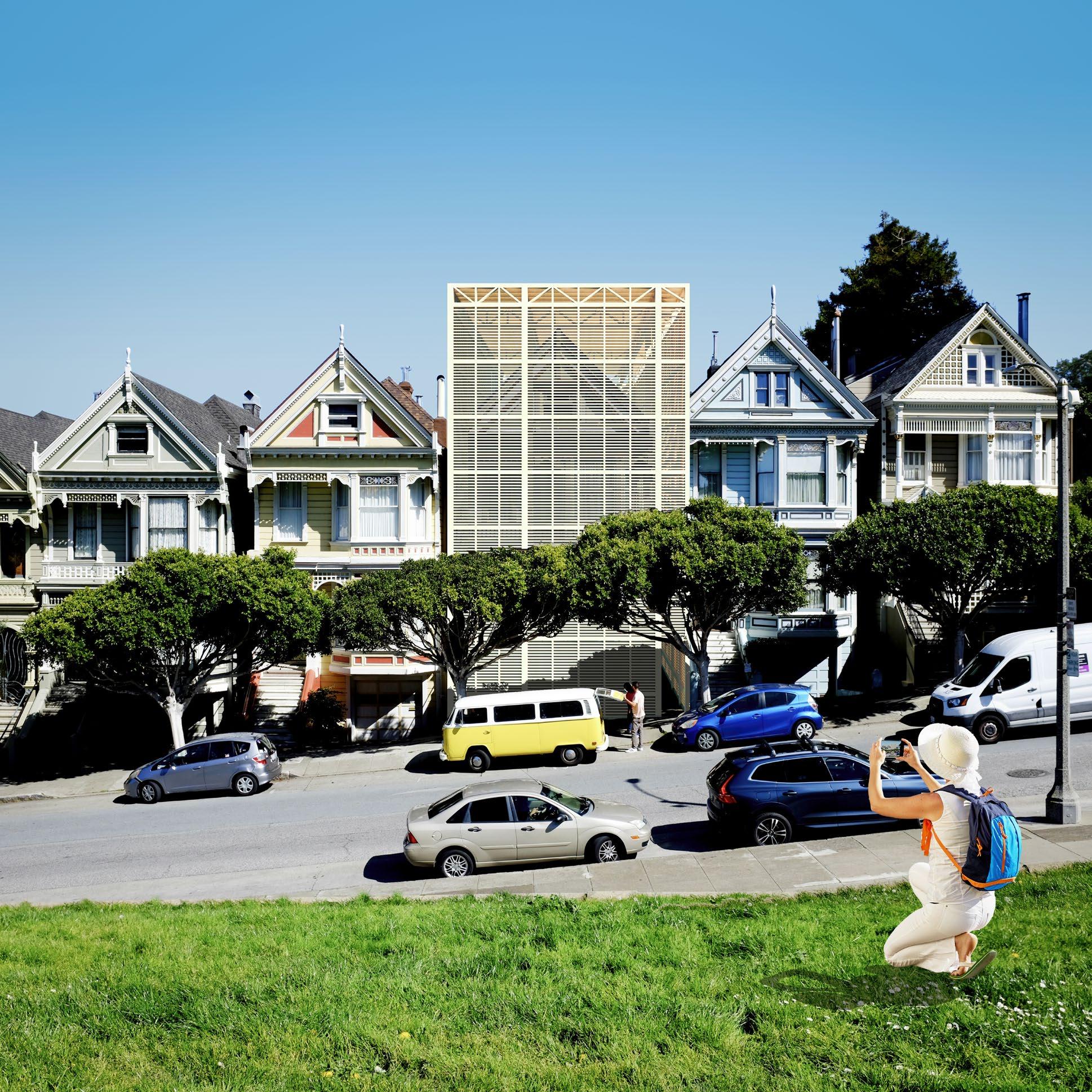
LOCATION SAN FRANCISCO, CA
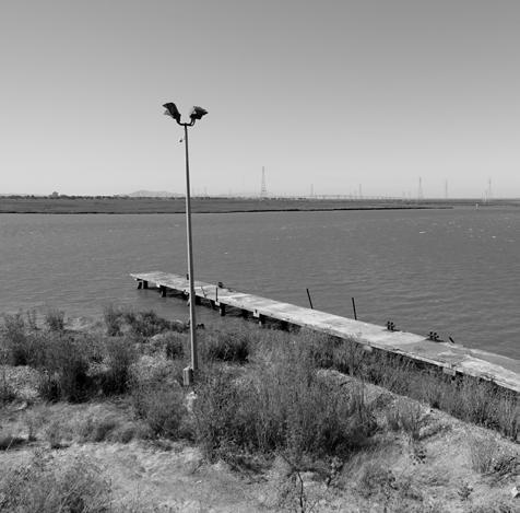
Since the beginning of San Francisco’s Western history, the area known today as Alamo Square has been a site of public benefit. In the early 1800s, the site was revered for its watering hole, making it a checkpoint along the horseback trail between the Mission Dolores and the Presidio fortress when the land was under Spanish rule. In the 1850s, when the land West of Larkin Street was parceled by the city grid, the site was officially dedicated as a public park by Mayor James Van Ness, safeguarding it from residential and commercial construction. In 1860, county clerk Thomas Hayes extended the railway from Market Street to Alamo Square, when the hills were regraded to allow for the development of residences around its perimeter. Among these developments were the Painted Ladies, built in the 1890s, which began to influence the identity of the Square decades later.
For much of the twentieth century, the Square was a source of refuge for San Franciscans. During the 1906 earthquake and subsequent fire, locals watched the city below rise in flames and took shelter in the park where resources and tents were shared. Later, when much of the Western Addition was demolished beginning in the 1950s, many displaced residents crammed into the homes surrounding the Square. In the countercultural revolutions of the late ‘60s, hippies settled in the same houses in quantities that defied occupancy codes.
Today, the Square remains beloved by the public, where tourists flock every day of the week and locals gather in droves on the weekends. While the Square and its adjacent historic properties have always reflected the broader urban and social conditions of the city, the Painted Ladies clearly express a unique moment in post-pandemic capitalism. As San Francisco struggles with one of the worst housing crises in the country and average renters dedicate a third of their earnings to rent, one Painted Lady is uninhabited. Even in its neglected, damaged physical state, it is listed on the market for $3.5 million...
1. “Analagous Drawing” depicting four major historical periods from the perspective of Alamo Square.
2. View from Alamo Square.
In a city full of unhoused and struggling families, this iconic American home acts only as a vessel for storing capital value
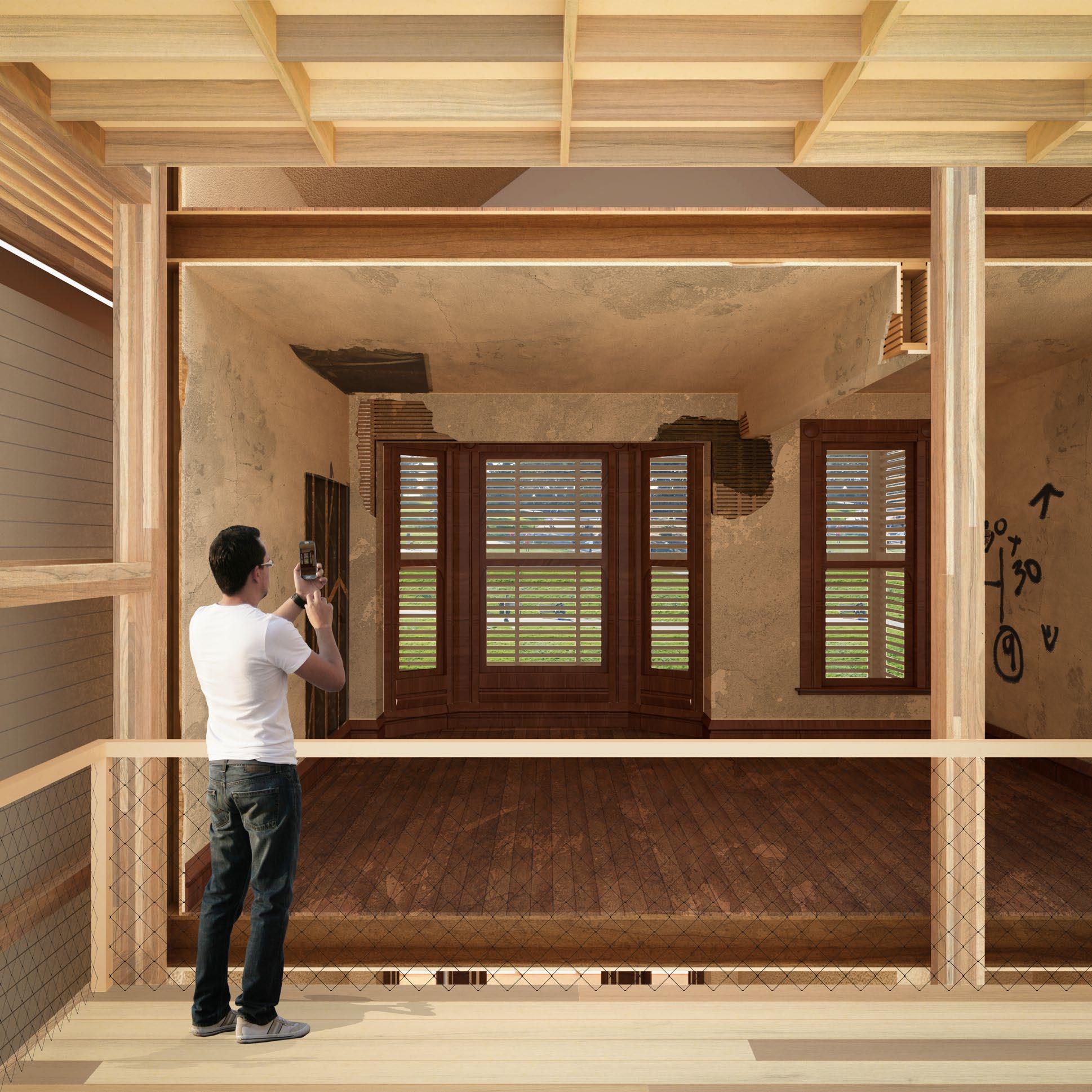
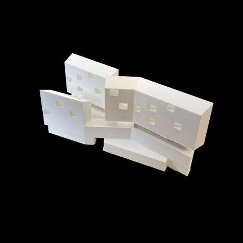
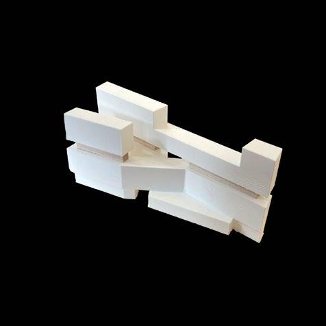
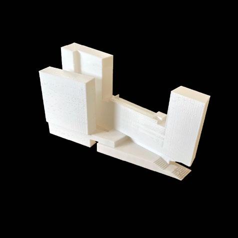
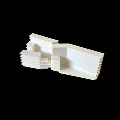
After many months of remaining untouched on the market, this property is acquired by the National Park Service through the Land Resources Division. The NPS repurposes the house as a dedicated site of cultural value by preserving its facade within a shelter for protection from rain and sun. By tactically splitting the house into two and removing the rear from the lot, the interior of the front rooms are exposed for public viewing. Any interested person may access the Park Service’s shelter to see inside the home and view the historic house exactly as it is at this unique point of its lifespan.
Additionally, the NPS re-orients the newly-opened rear of the lot for public use by introducing a tap that connects to the natural springs below ground; the public can thus regain access to the site’s abundant springs that were once accessed by the Square’s watering hole. The presence of the tap is not simply a common-pool resource, it is a commons in the sense that its value is more than that of the resource alone. It is the resource-security that it provides to those in need of clean drinking water and it is the social value that it provides to locals who meet and enlarge their circles as a consequence of accessing the fountain. The depletion of the resource is moderated by the small size of the lot, limiting the amount of citizens who can use it each day.
Through the Park Service’s intervention, the Painted Lady and its yard are transformed. The house is preserved as a facade and sheltered, calling attention to the function of property as storage for capital value to the detriment of the people. The yard, once only a fraction of the total length of the plot, is transformed from a private space into a commons through the resource that defined the area’s significance in the earliest period of San Francisco’s Western history.
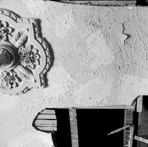
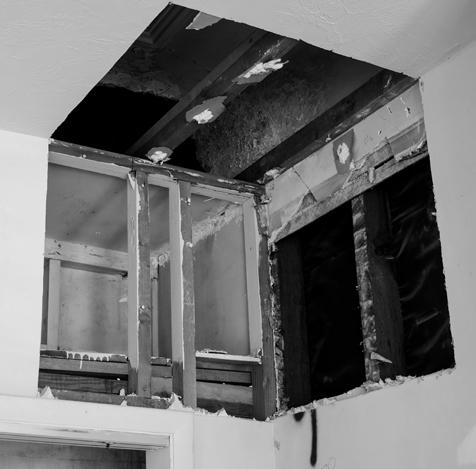
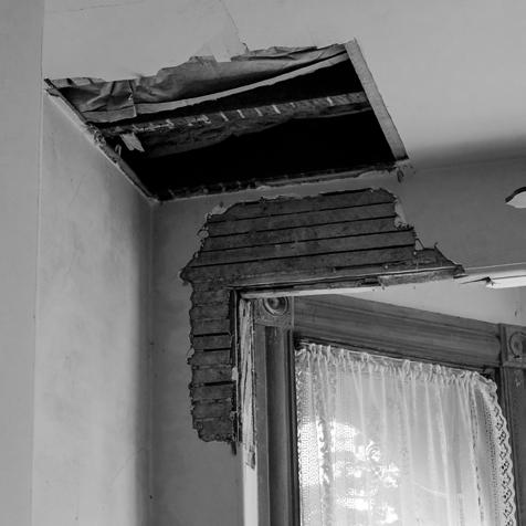
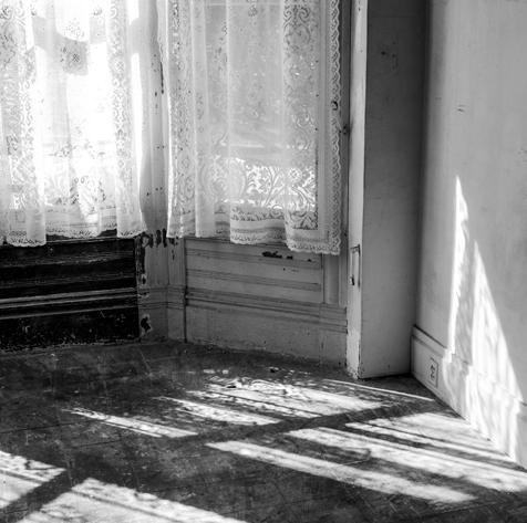
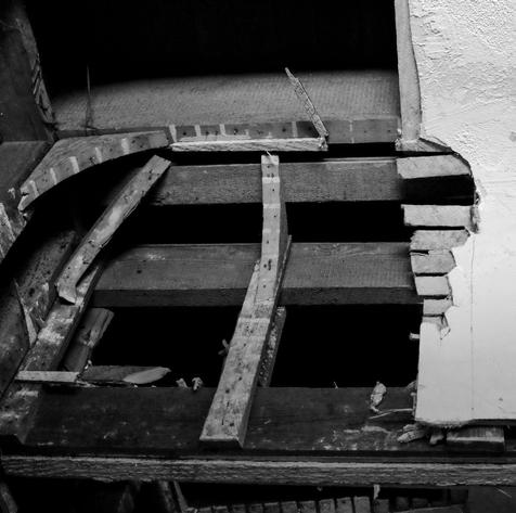
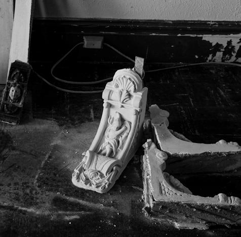
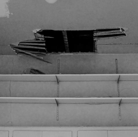
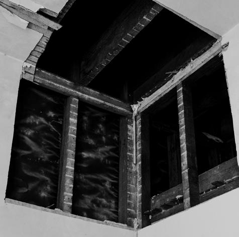
3. Photographs of the Pink Painted Lady interior, March 2024.
4. Elevation of the proposed shelter in “Postcard Row.”
5. Section through the Pink Painted Lady and proposed shelter.

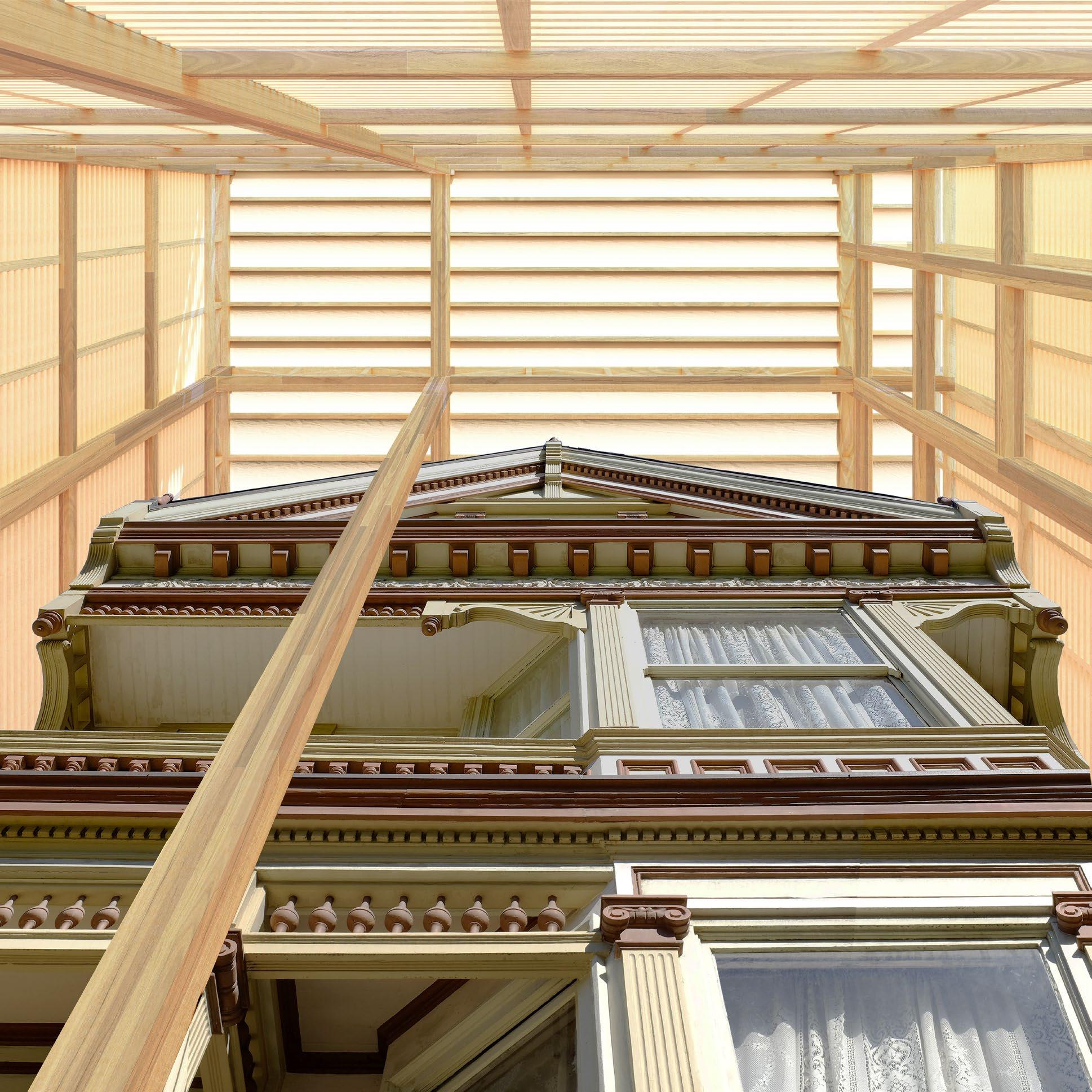
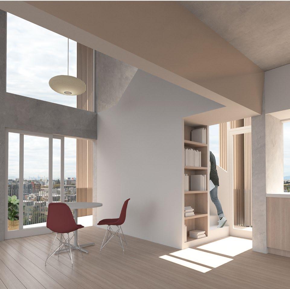
8. View between the existing facade and proposed shelter. 9. View of existing interior from shelter.
PARTNER MEGAN LAU
SEMESTER FALL 2024
INSTRUCTOR DAVID JAEHNING
UC BERKELEY
LOCATION REDWOOD CITY, CA
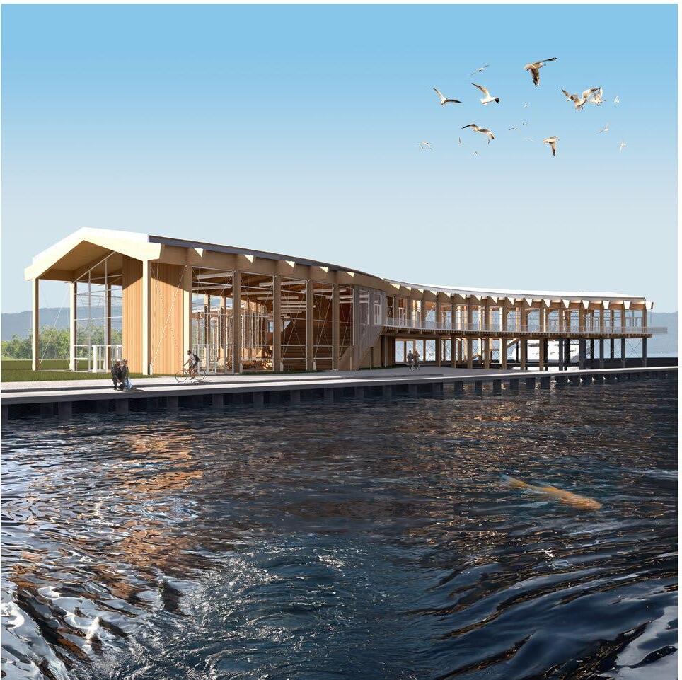
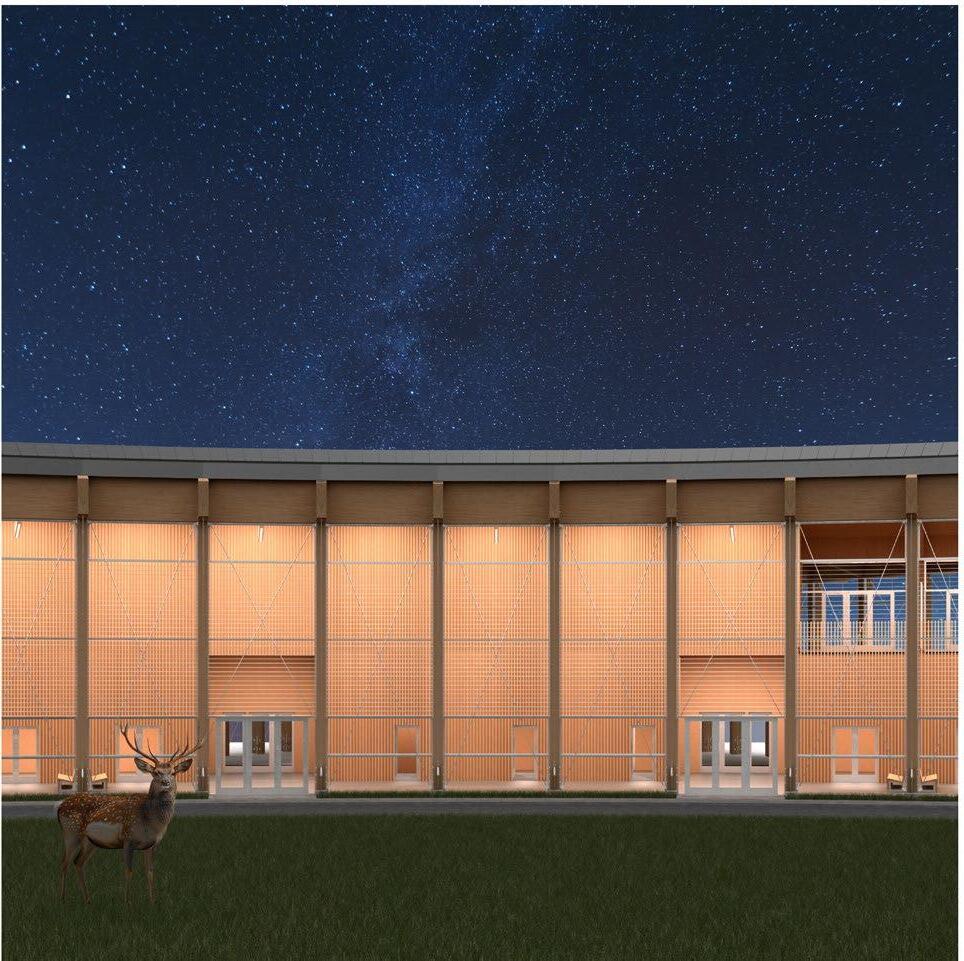
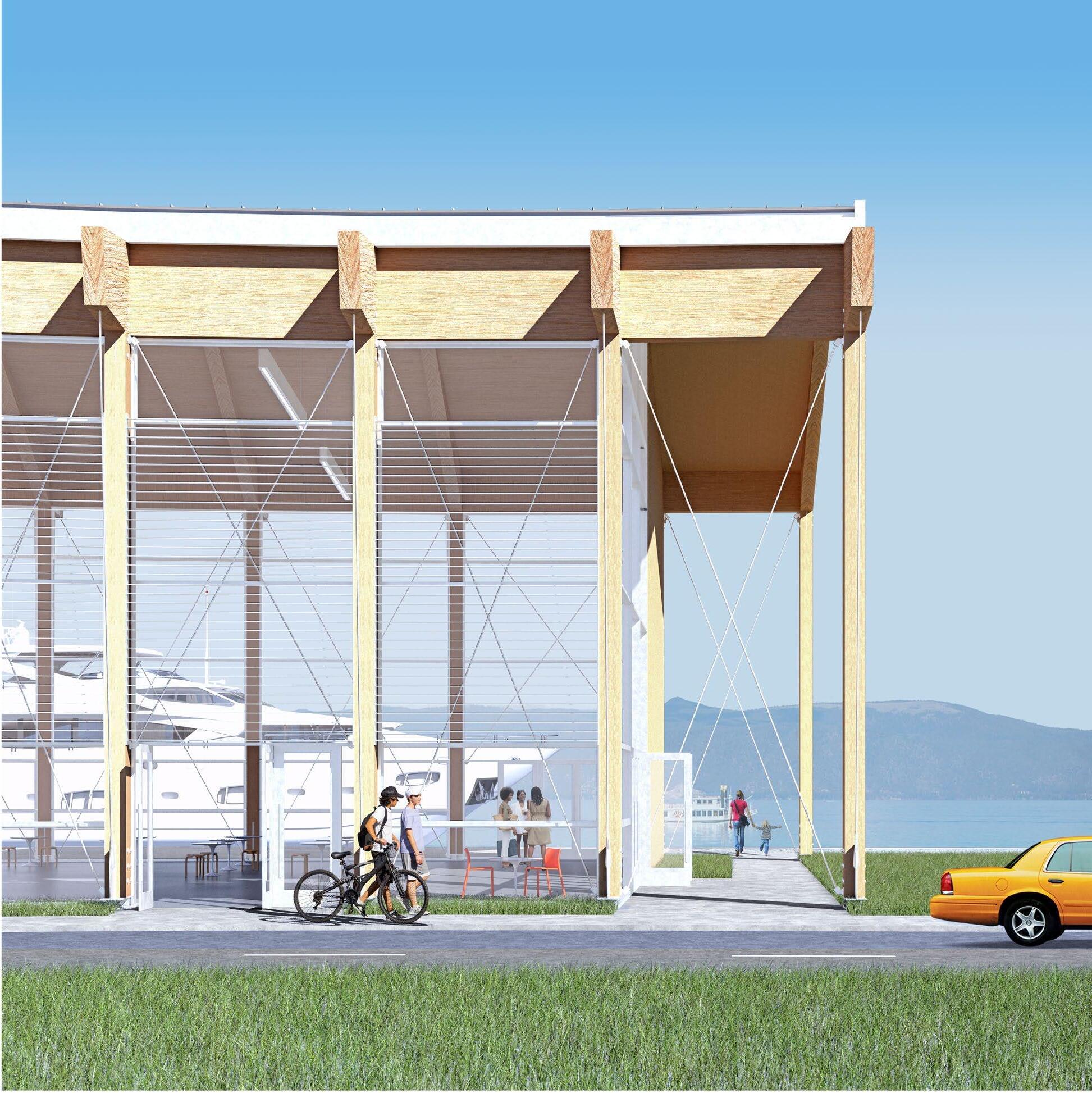
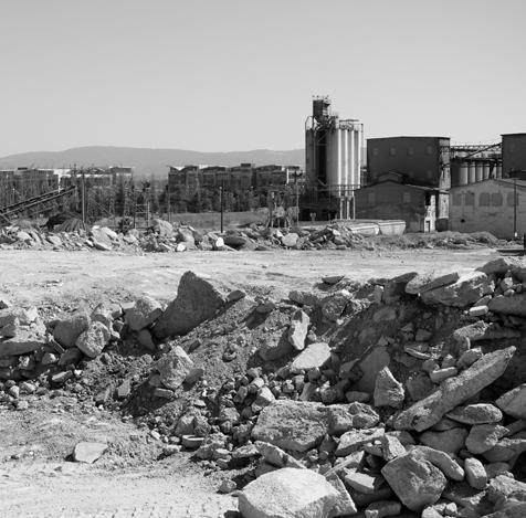
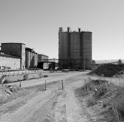
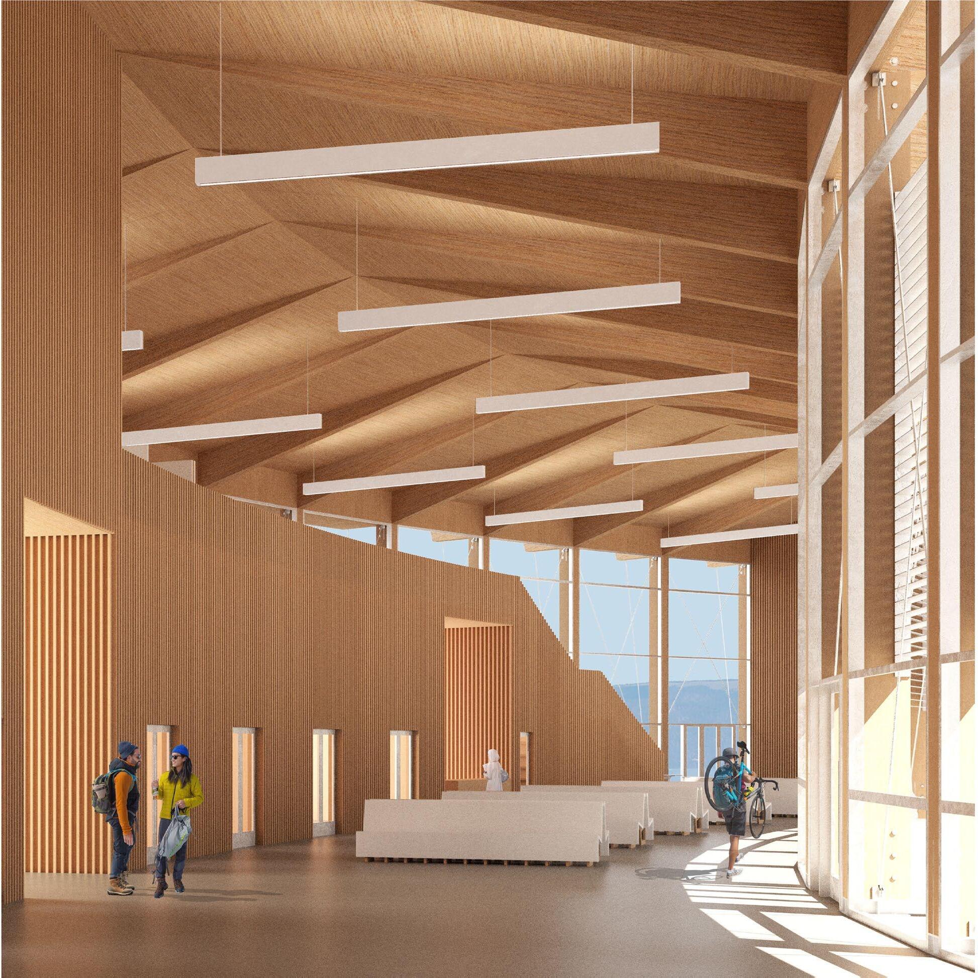
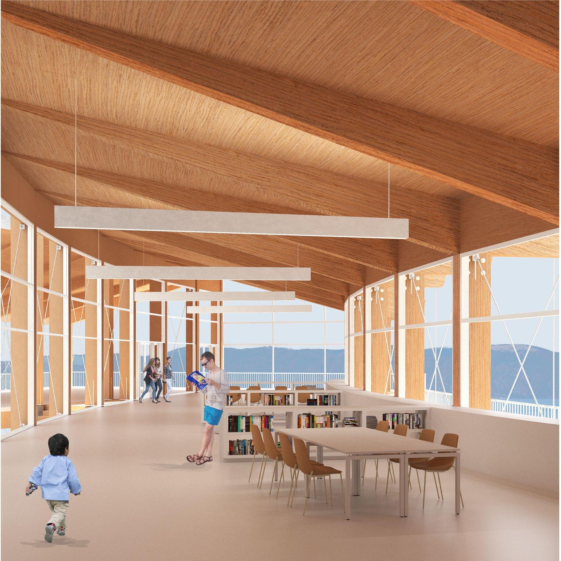
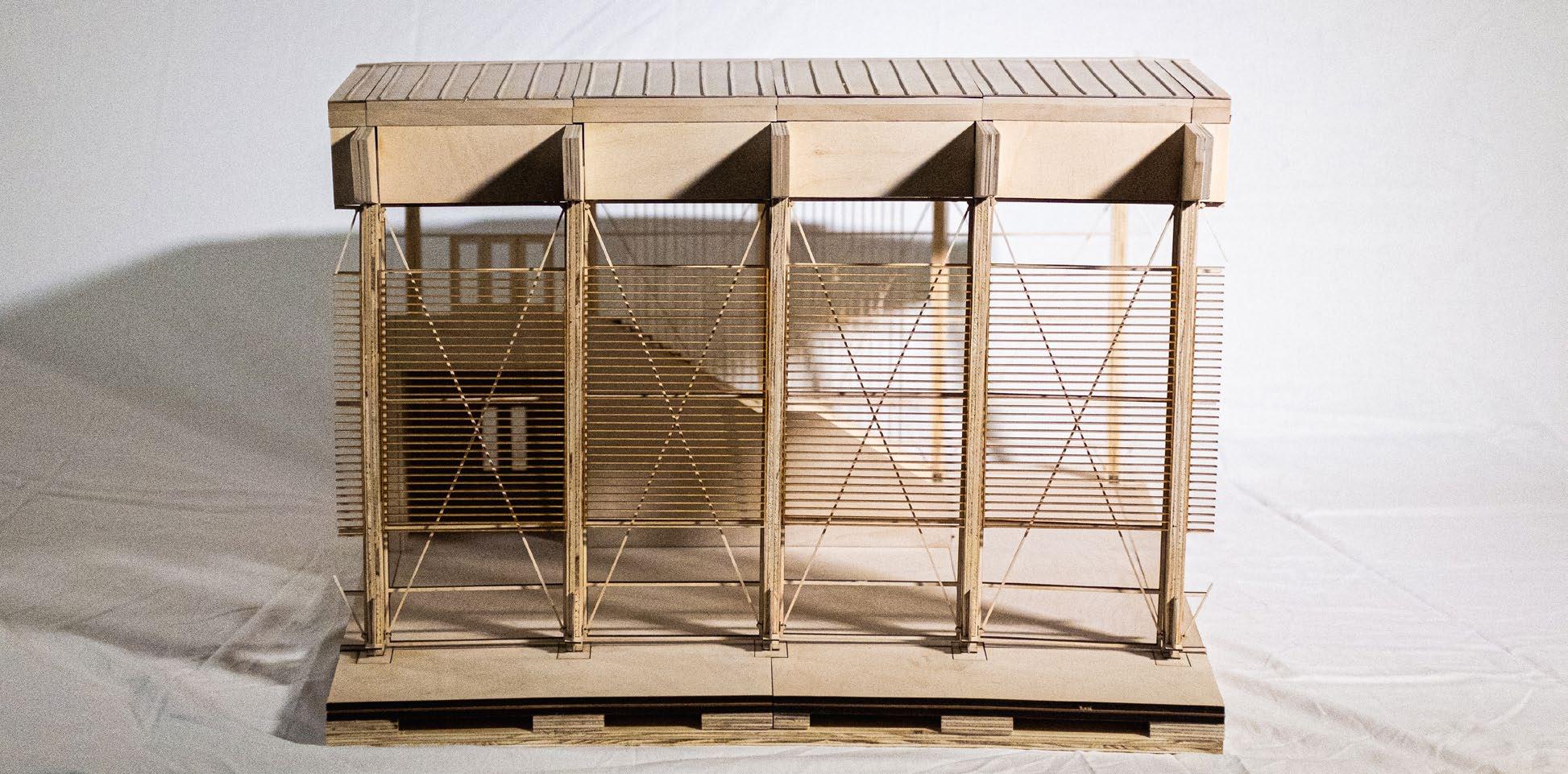
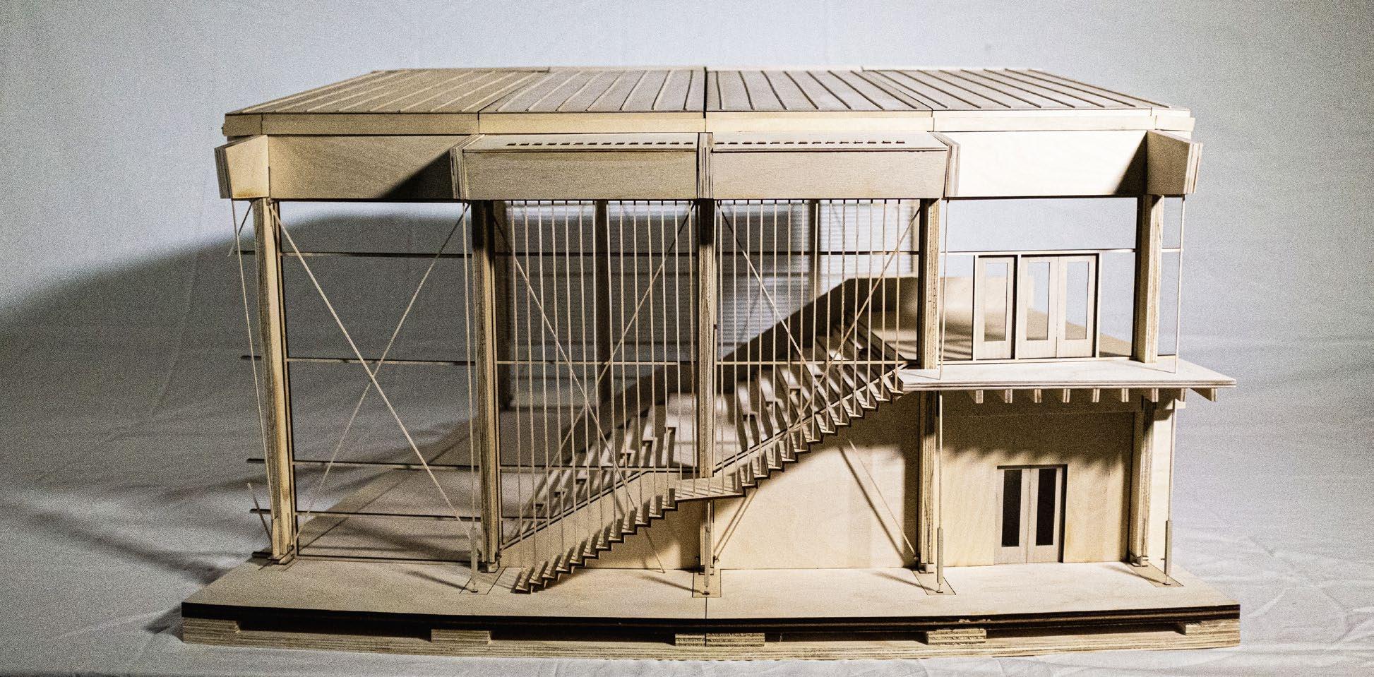
The Redwood City Ferry Terminal is a proposal for the San Francisco Bay Ferry 2050 Service Vision. For decades, the Redwood Creek thrived as a business corridor for the South Bay; after years of inactivity, this proposal brings new life to the Port of Redwood City in the form of a Mass Timber public terminal.
The primary intention for the project is to integrate the terminal with the sweeping shoreline at the North end of the region’s old cement manufactory. As a place of transition, a ferry terminal’s most fundamental function is in its bridging land and water; thus, all of the design decisions behind the building reflect this notion of the building type.
An immediate investigation of the site revealed a gradient of coarse to fine grain material from the on-site cement, sand and gravel production of the twentieth century. This gradient accentuated the sweeping motion of the shoreline and dictated our positioning of the building’s program; the terminal would hold to the sweep and orchestrate the movement of arrivals and departures.
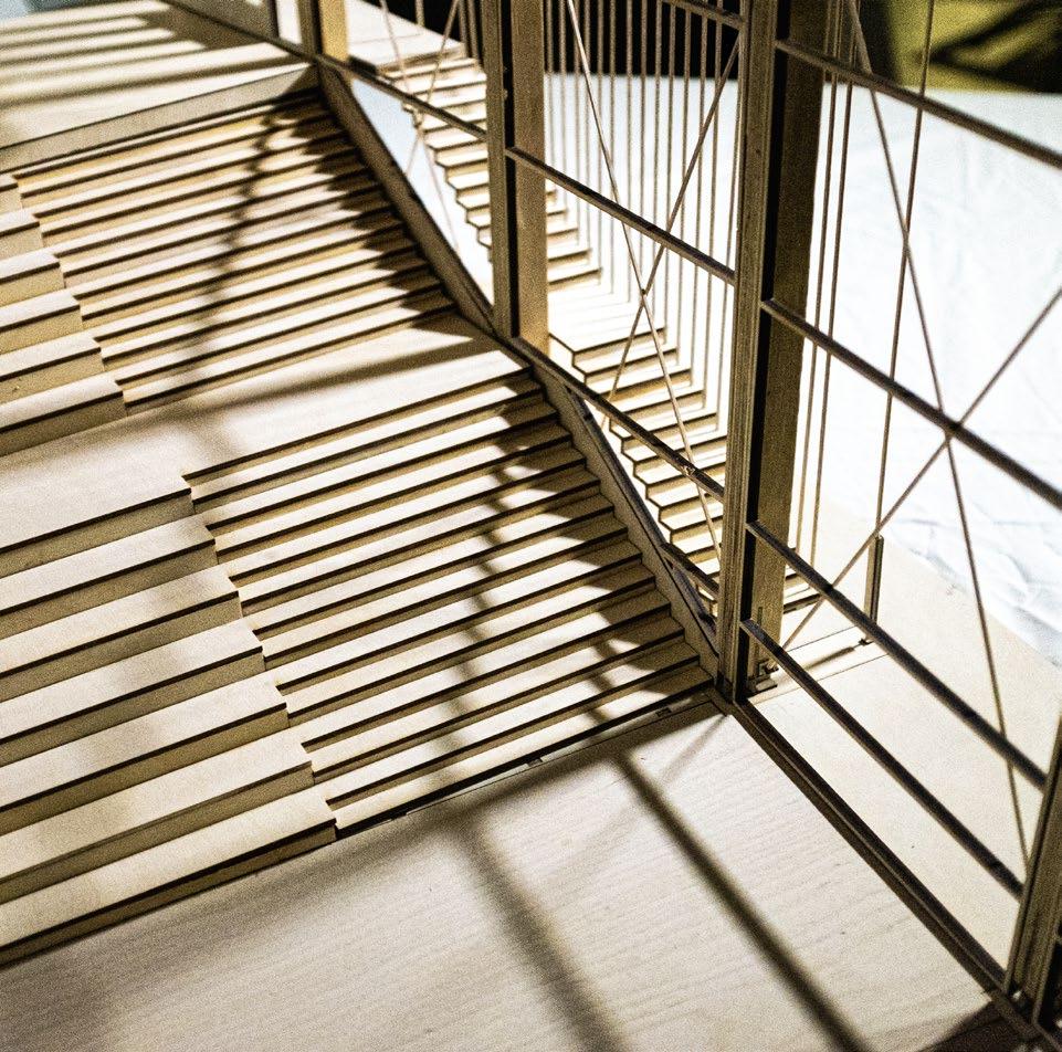
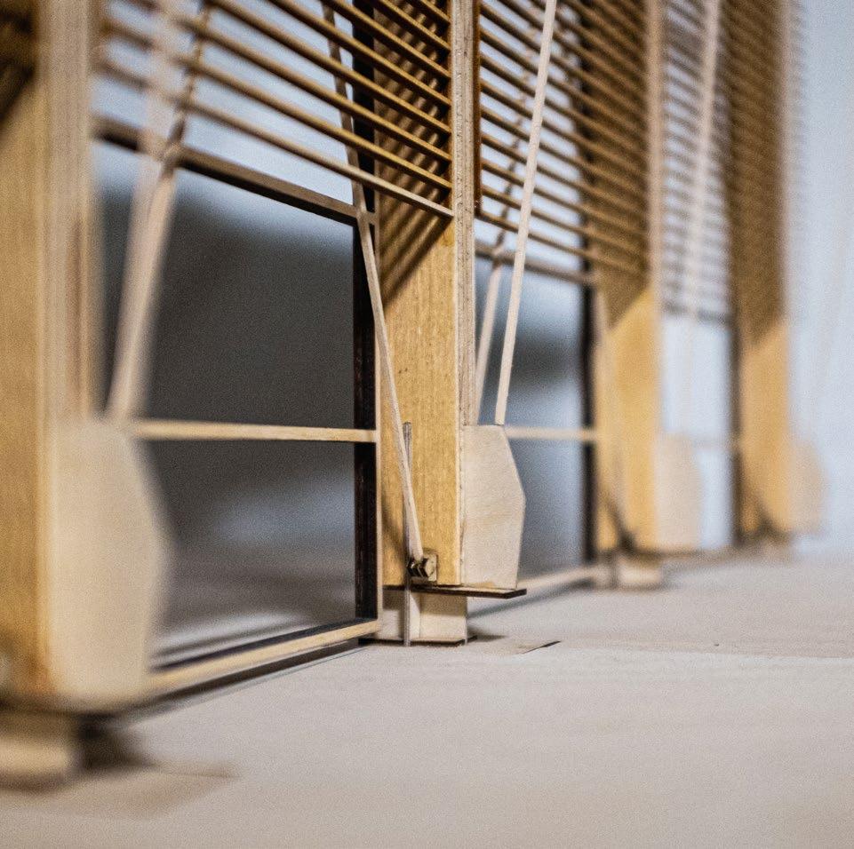
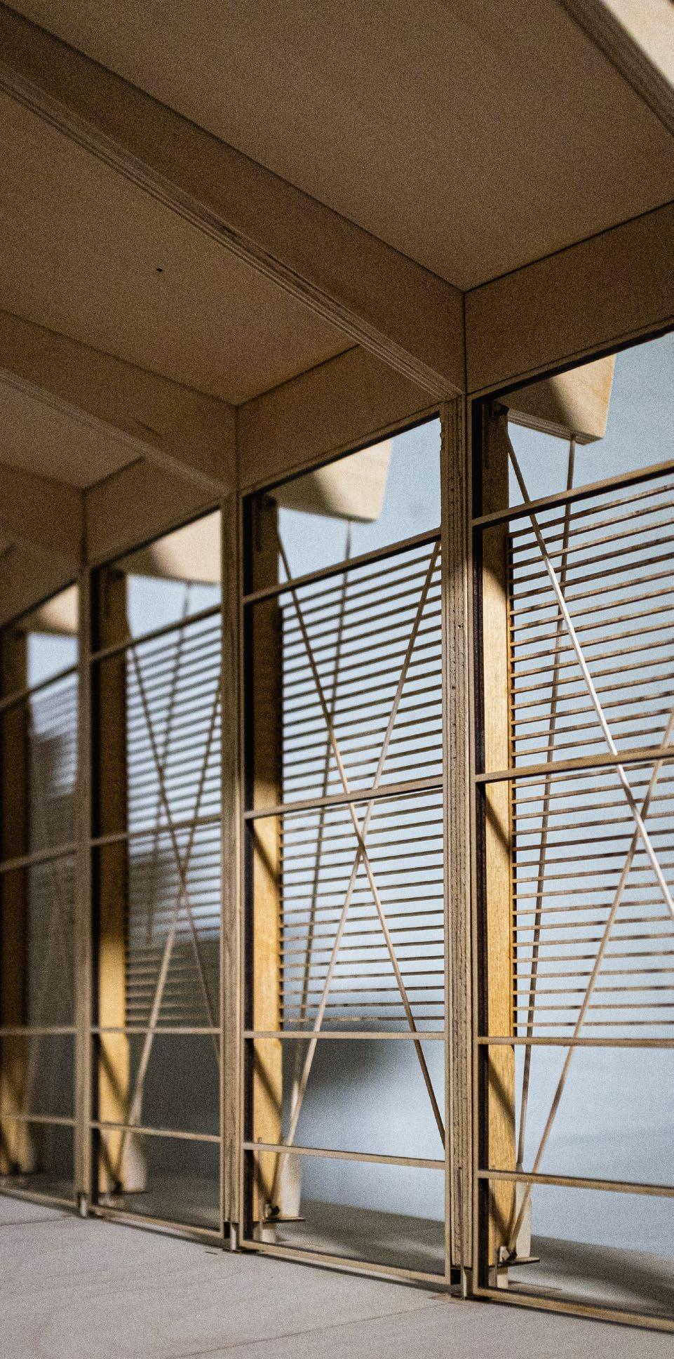
Keeping in mind the intention of integrating building and site, we established the portal frame typology to prioritize a sense of lightweight construction and transparency that reinforces the notion of the terminal as a bridge between land and water. The portal frame offered an architectural language that can be repeated along the sweep and adapted wherever necessary without detracting from a cohesive architectural identity.
In addition to serving ferry passengers, the Terminal hosts an annex space for the nearby Redwood City Marine Science Institute. The building’s second floor is allocated for educational labs, marine science galleries and a literature resource room; at the ground level, the Terminal’s interior transitions to the bayside bicycle trail and an interactive educational dock.
1. Daytime view of terminal from ferry (above), nighttime view of front facade.
2. Entrance to arrival-departure hall, facing the San Francisco Bay.
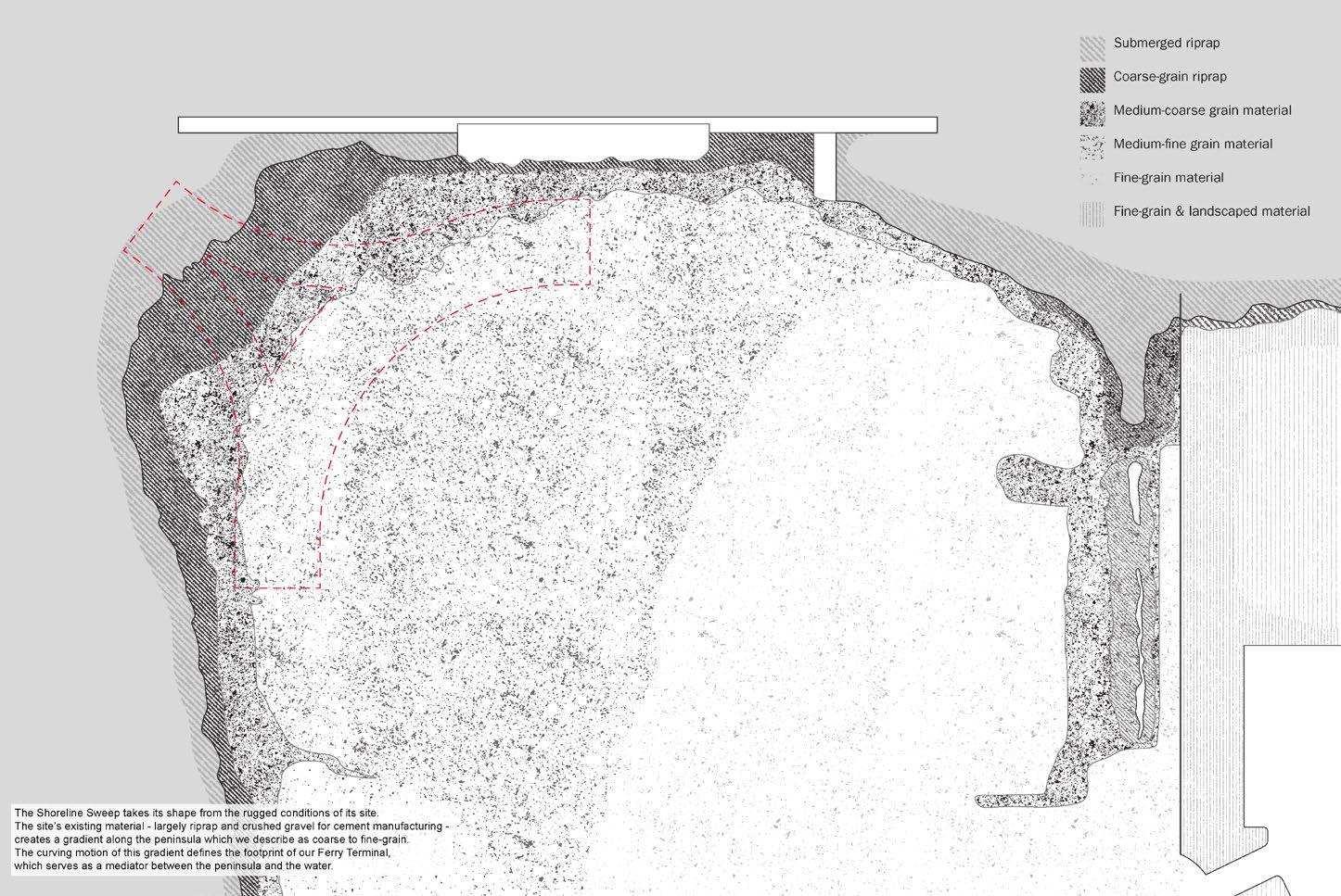
3. Site with proposal in red; illustrating the gradient of existing material, from coarse to fine-grain.
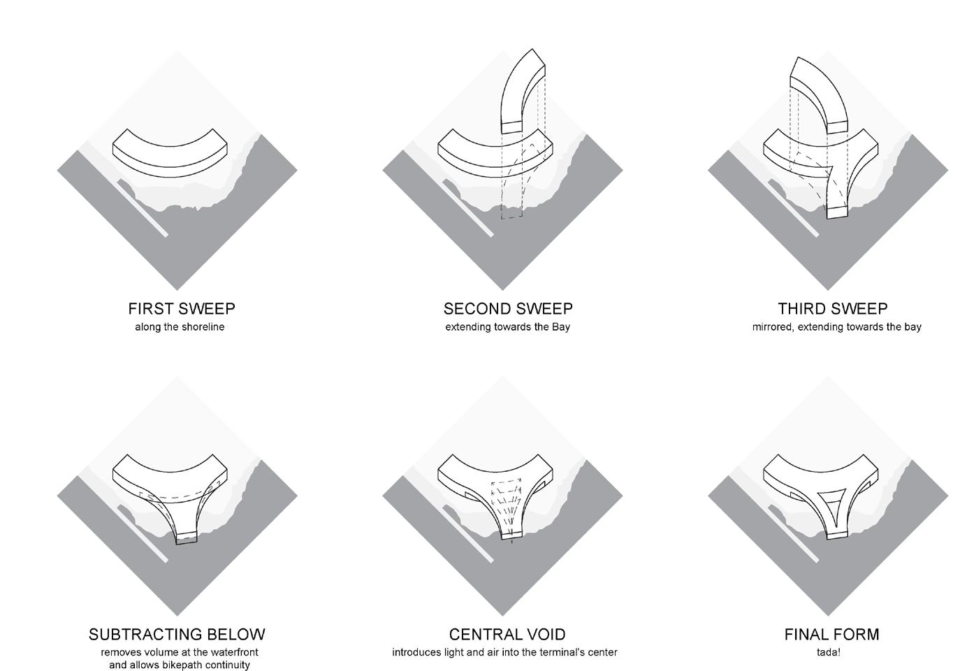
4. Form-finding axonometric diagrams.
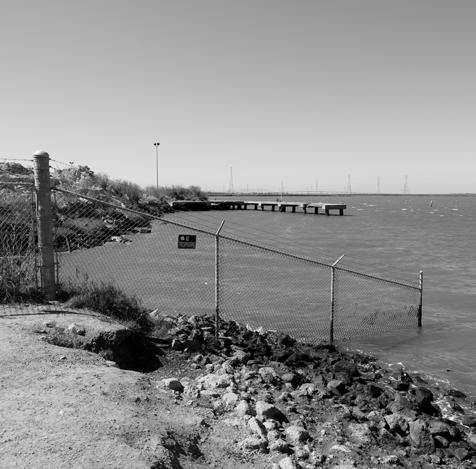
5. Existing site photographs.
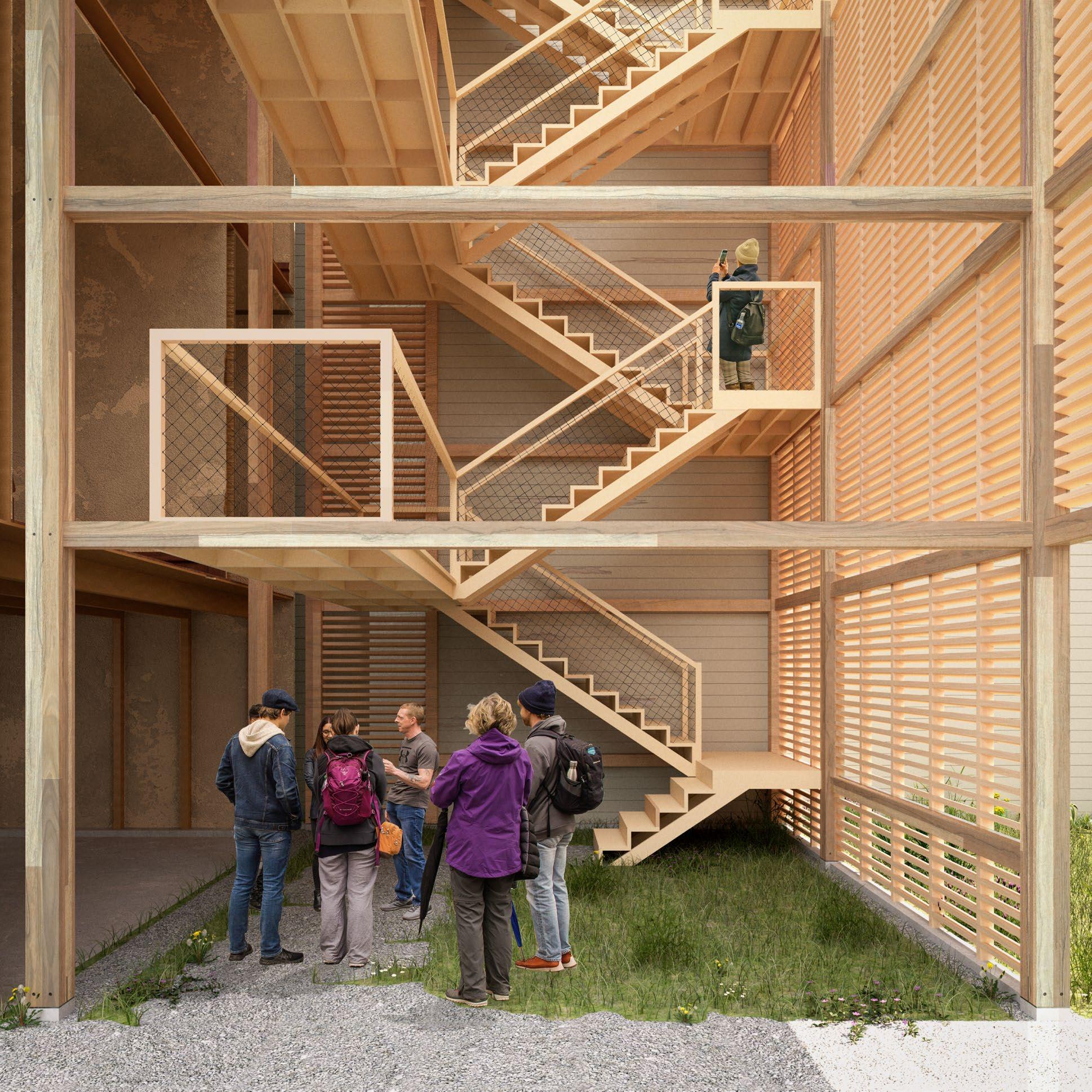
6. Enlarged section, elevation of timber frame structure.

7. Section-perspective of building systems:
1. Roof Assembly: Standing Seam Metal Roof, Plywood Underlayment, Insulation, Vapor Barrier, 9-ply CLT.
2. Structural Frame Assembly: Glulam Beam, Glulam Column, Steel Tie-rod, Steel Knife Plate, Concrete Foundation.
3. Curtain Wall Assembly: Louver Shading Screen, Cable Bracing, Glazing + Glulam Beam.
4. Floor Assembly: Radiant Floor, Reinforced Concrete Slab, Vapor Barrier, Rigid Insulation, Gravel Layer over Compacted Earth.
5. Sidewalk Assembly: Reinforced Concrete Sidewalk over Compacted Earth.


Ground plan. 9. View of arrival-departure hall.


SEMESTER FALL 2023
INSTRUCTOR RÁMON GÁMEZ
NICOLÁS MARURI
UC BERKELEY
LOCATION OAKLAND, CA
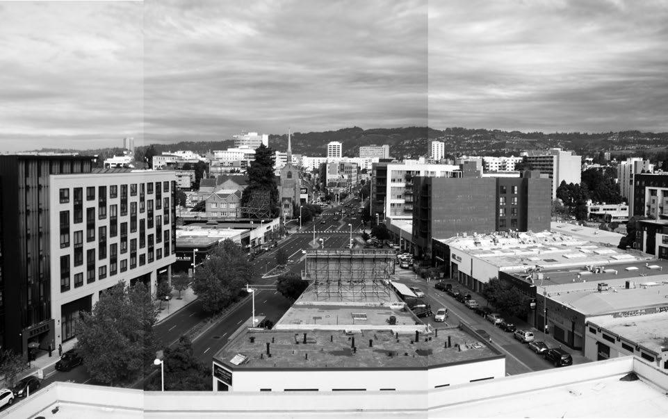
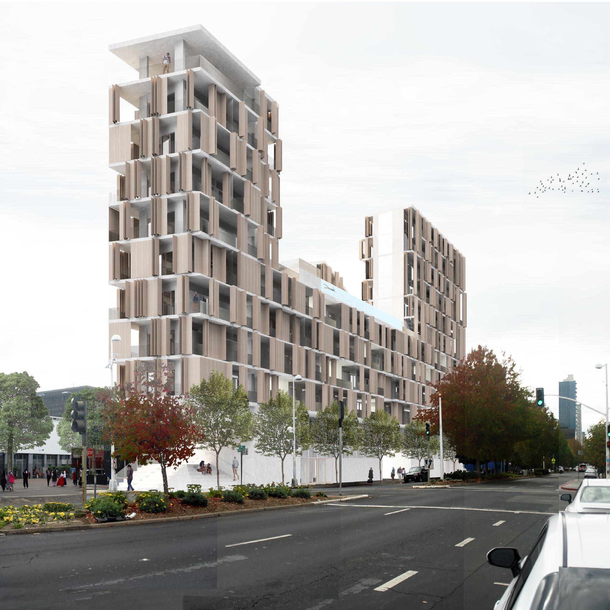
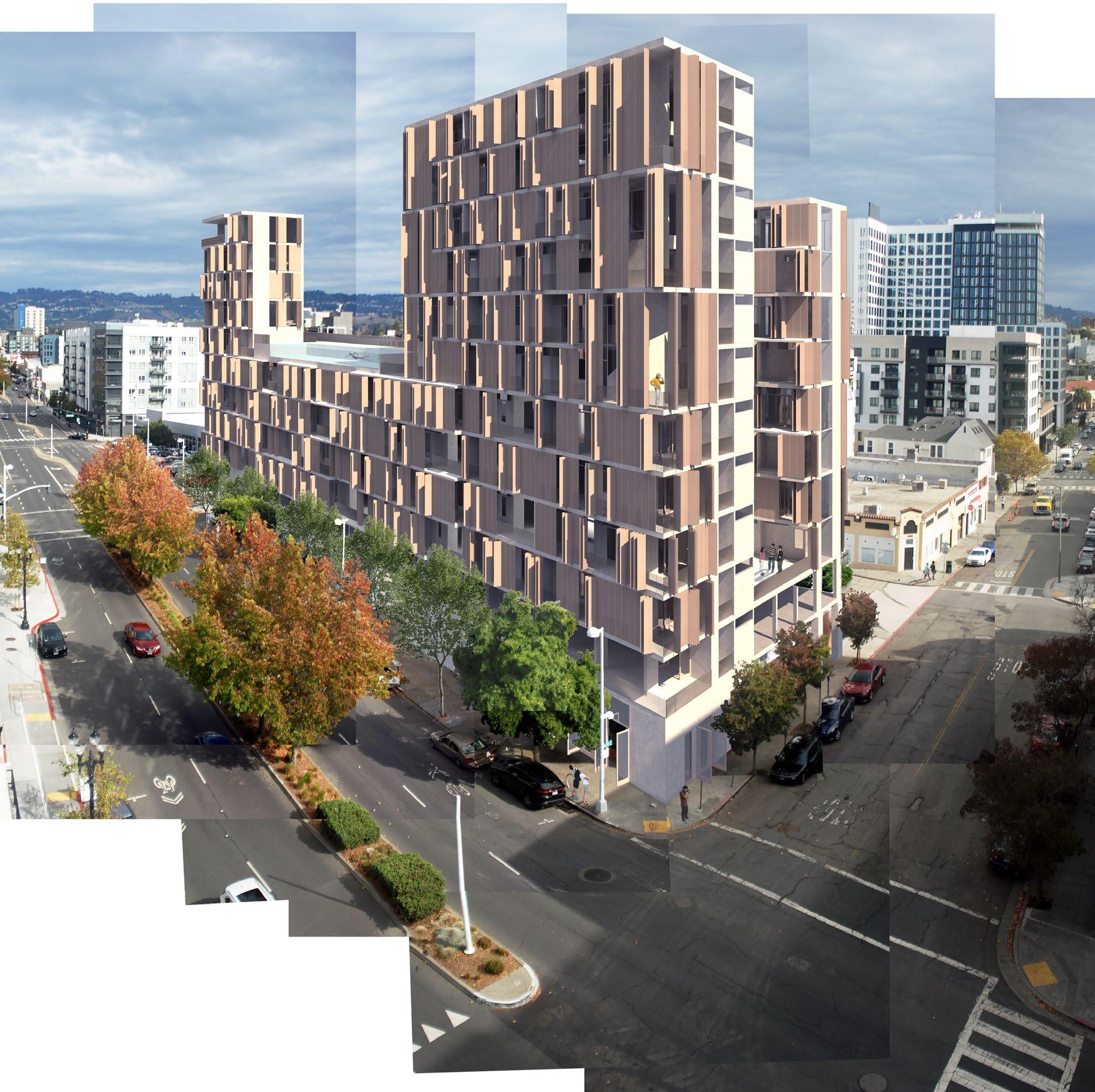
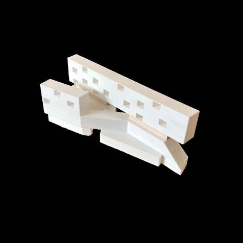
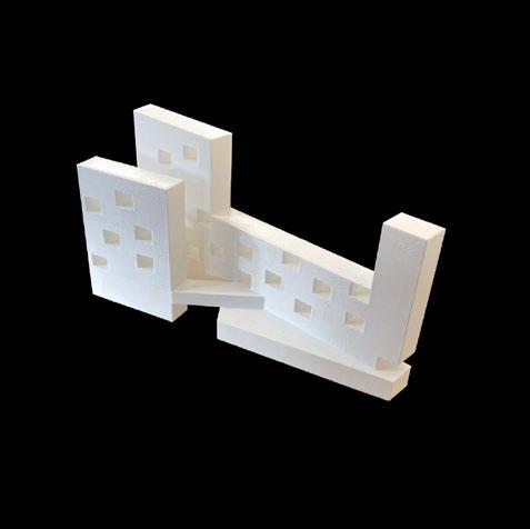
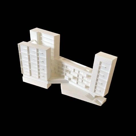
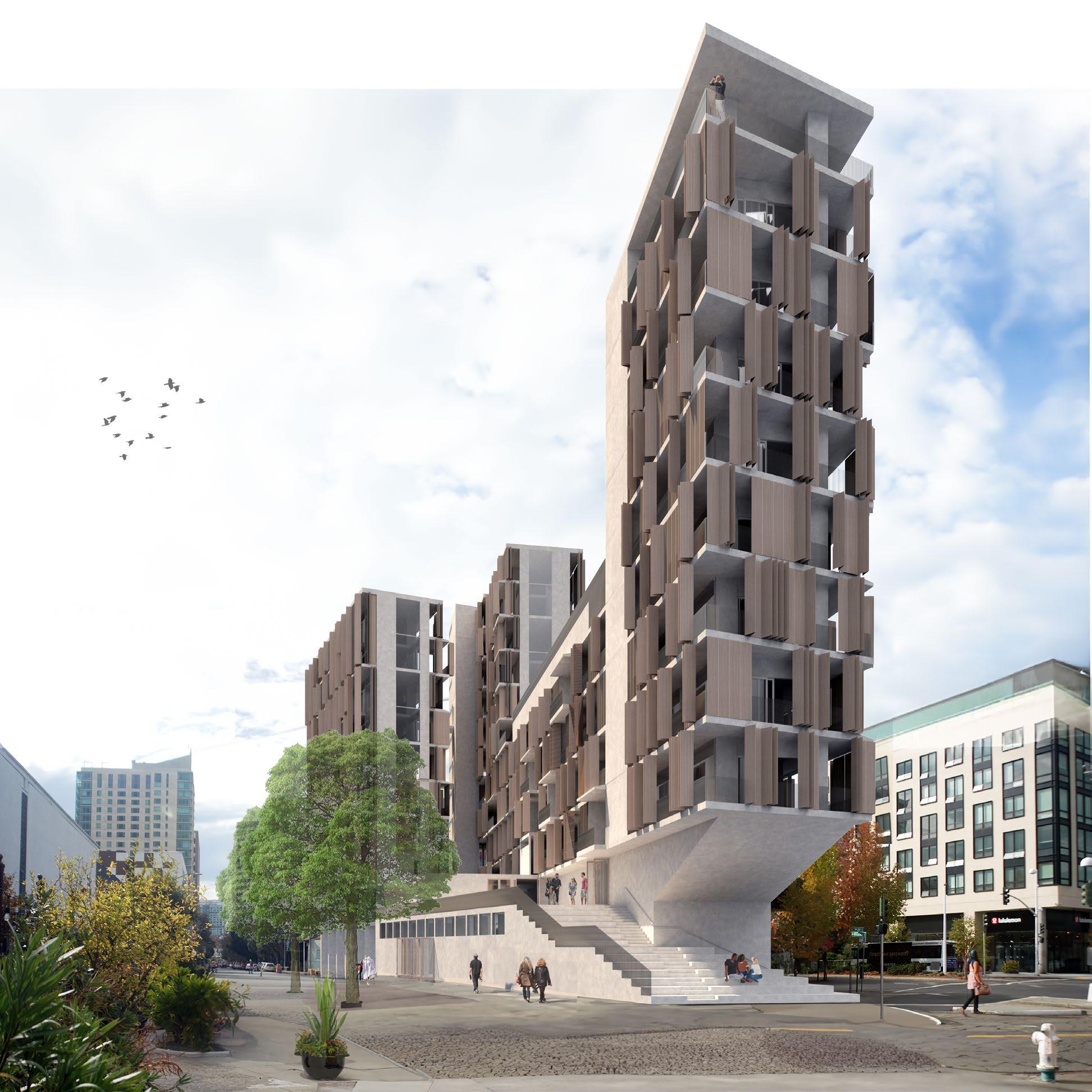
Located at the intersection of Oakland’s Broadway and Webster streets, the Wedge occupies a site characterized by its accessibility from all sides. The three corners of the site reflect different urban conditions at each point, giving rise to the potential for a flexible architecture that reflects these changes in urbanism.
Flexibility is at the foundation of this housing project. At the scale of the living units, the serving spaces are organized along the periphery of the living spaces, liberating the center for whatever use the resident desires. The kitchens and bathrooms (blue, below and left) mirror the folding storage zones (green, below and left) and allow compact spaces to feel light and airy. These “bands” of service spaces alternate on both sides of the block, allowing a change in orientation of the units at different points of the building. At some points, the openings are oriented towards the neighborly Webster street; at others, the openings frame views of the San Francisco skyline and Marin County to the West.
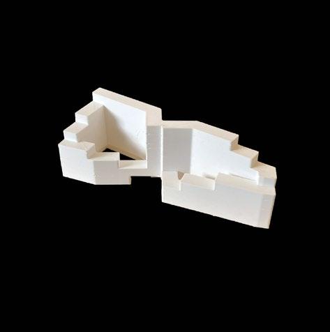
This flexibility at the nuclear scale extends to the volumetric layout of the building. While the units cluster at certain points of the site and diffuse at others, the overall impression of the building is one of sensitivity to site and urban scale.


1. Site between Broadway and Webster, downtown Oakland.
2. Plan of typical unit layouts, second floor above first floor.
3. Existing site photograph.
4. View from Northwest corner.
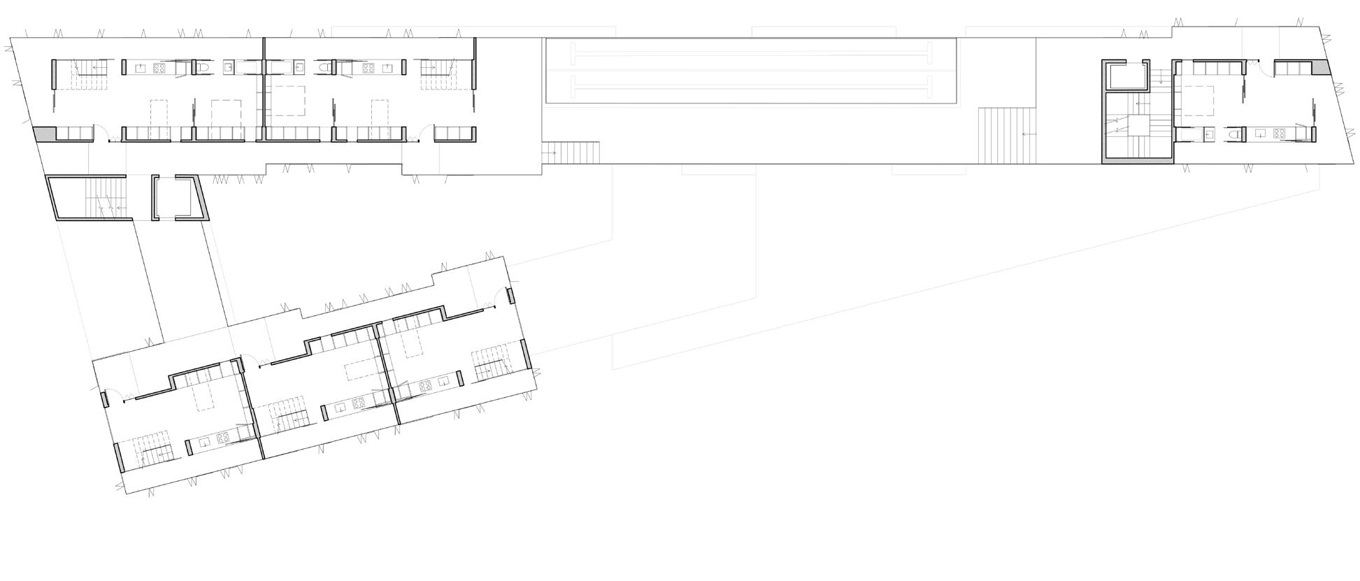
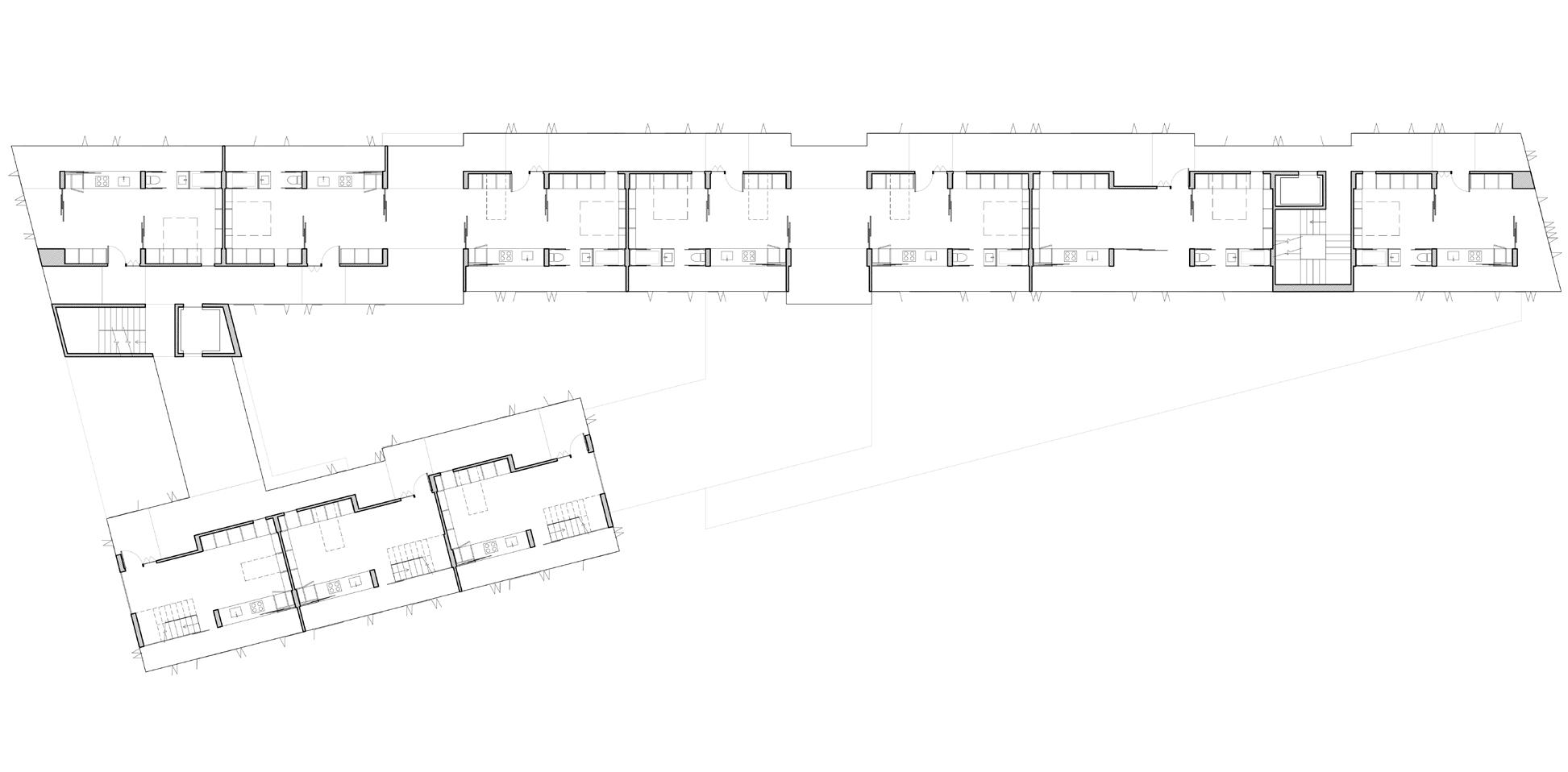
5. Typical plan, upper levels (above). Typical plan, lower levels (below).
SEMESTER FALL 2020
INSTRUCTOR JOSS KIELY
UNIVERSITY OF CINCINNATI
LOCATION DAYTON, OH
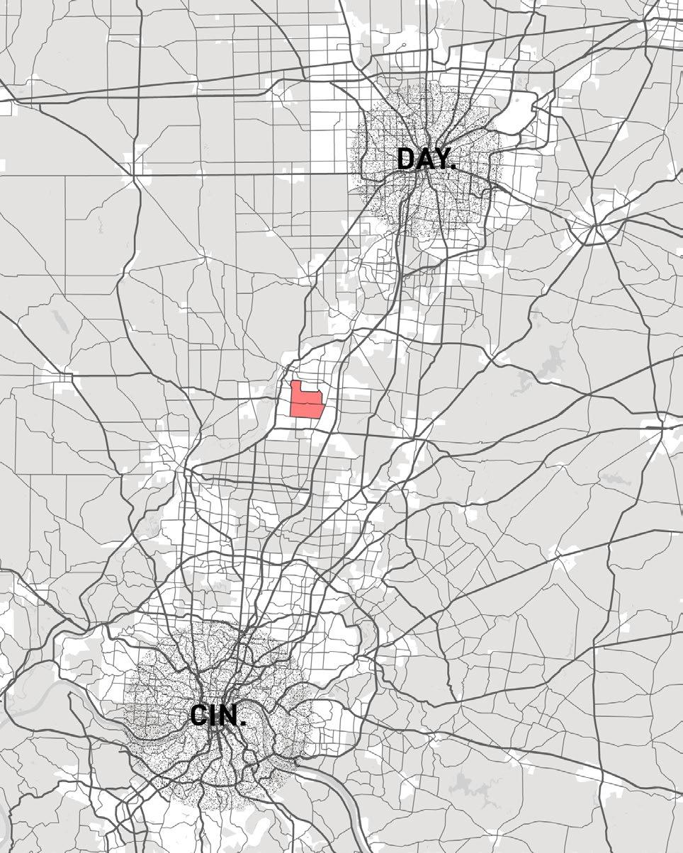
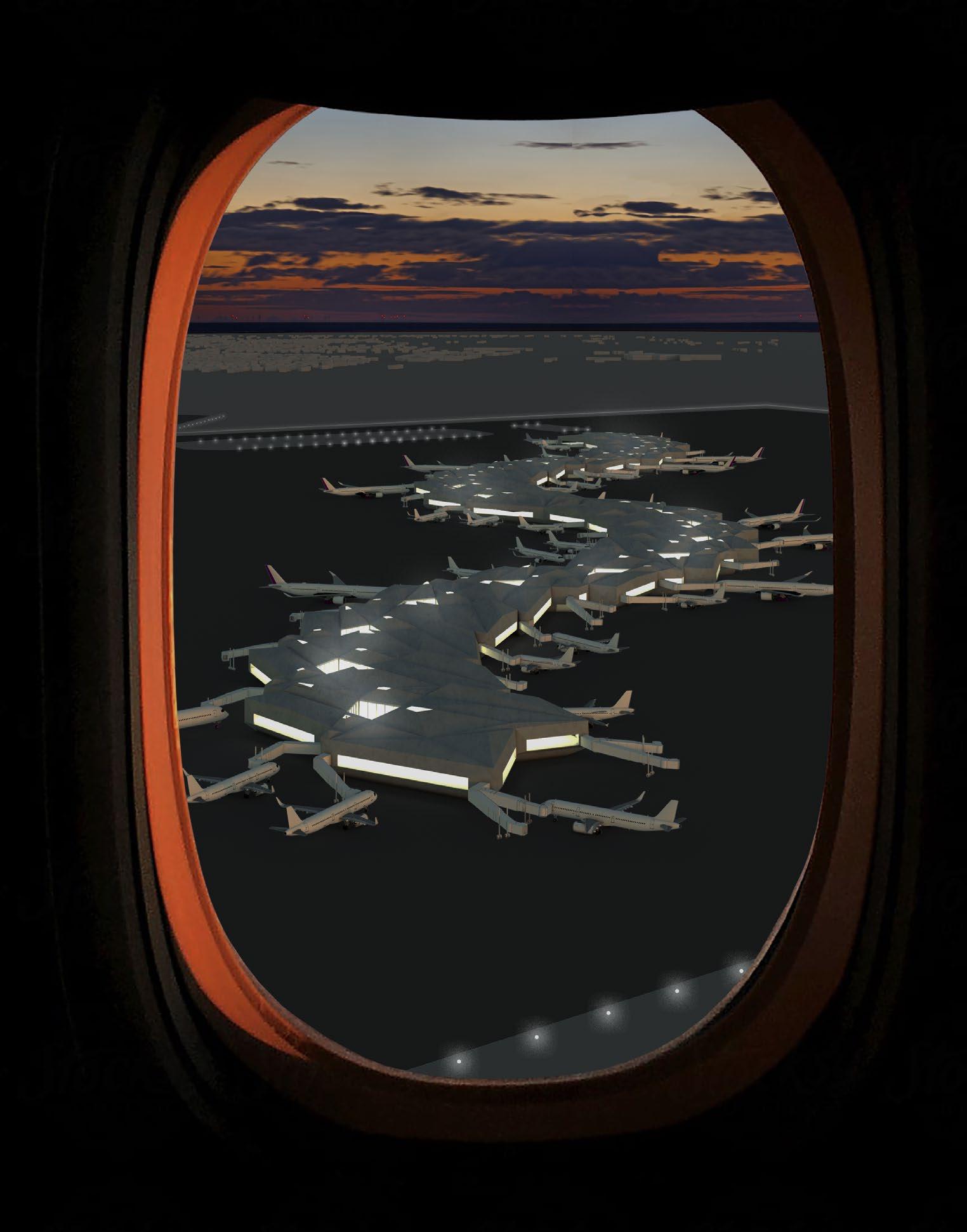
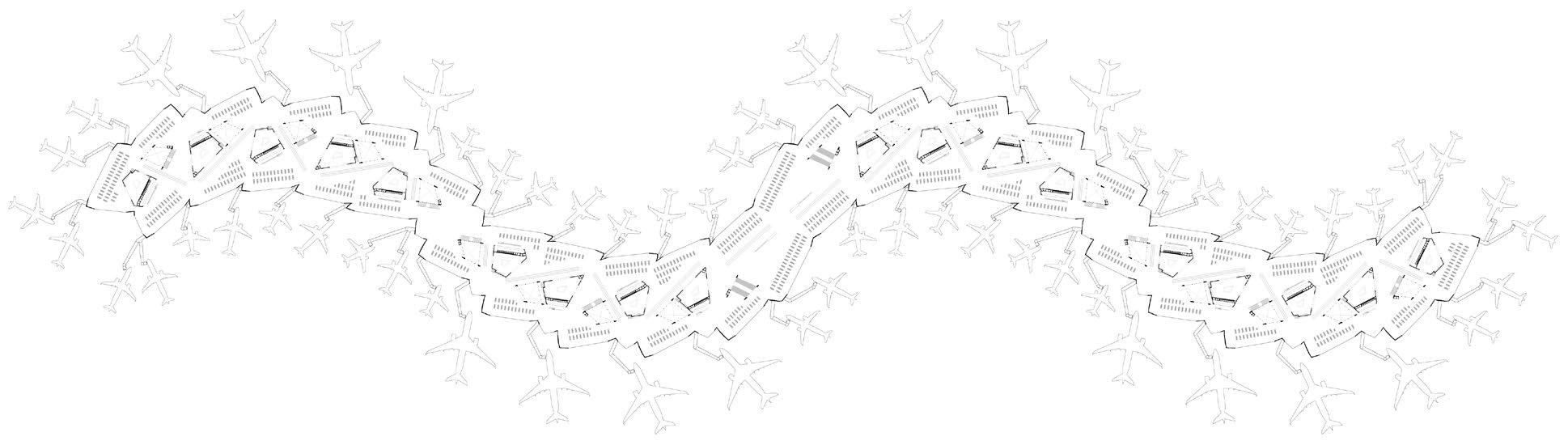
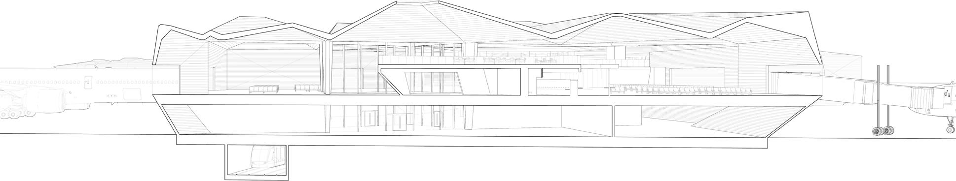
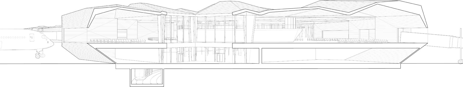
Situated directly between two of Ohio’s major metropolitan areas, the AirLandPortScape is a proposal for a international airport hub to serve both Cincinnati and Dayton
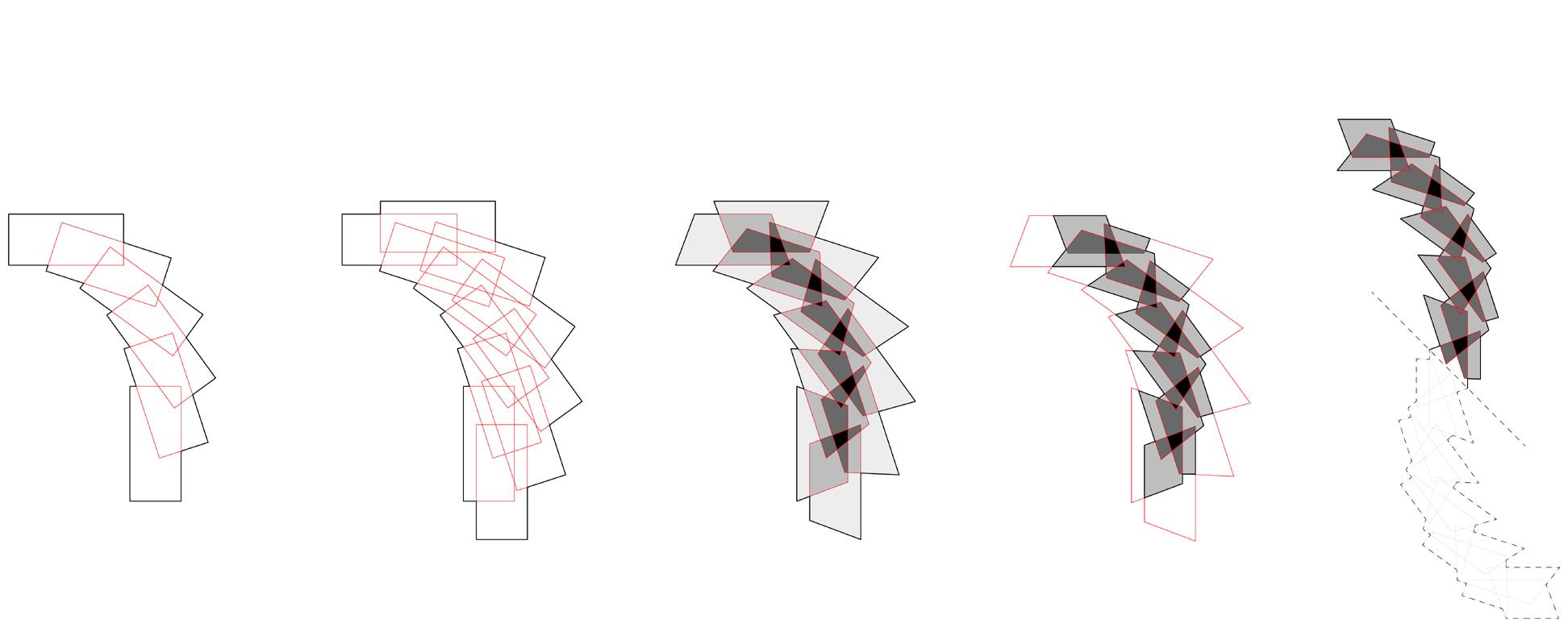
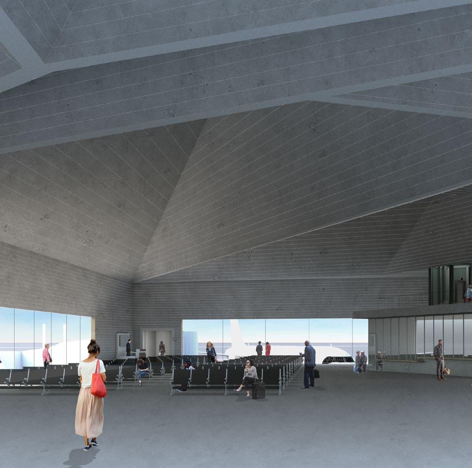
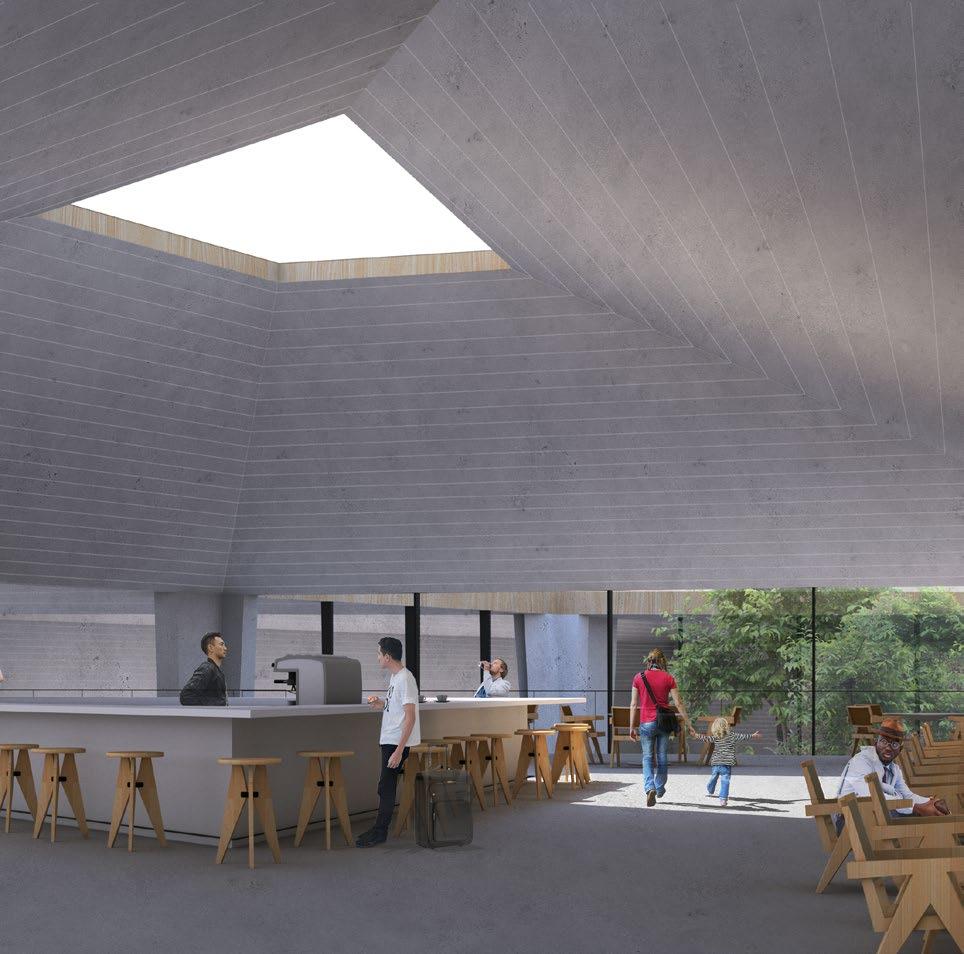
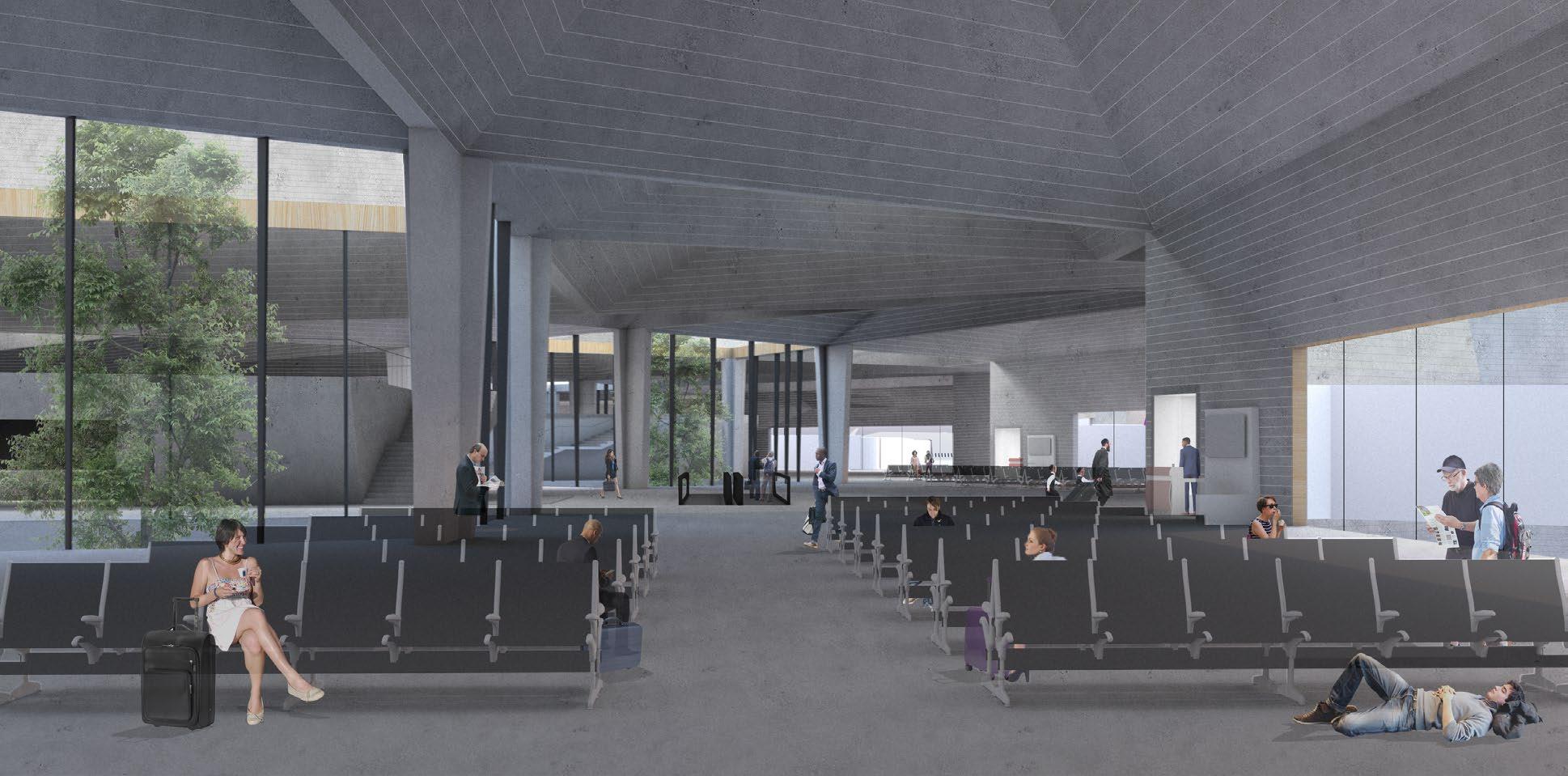
At the foundation of the terminal’s design is the concept of an architecture that reflects the motion of its inhabitants - in a word, travel - articulated as a series of identical geometries in motion (see figure to the below to the left). Progressing from one end to the other, the diagram of resultant overlapping geometries generates the terminal’s plan and defines its form. The most heavily overlapped areas of the diagram develop into oculi in the sculptural roofscape, choreographing the zones below. Along the terminal’s spine are the zones of congregation, such as courtyards, atriums, commerce and dining. Along the building’s outer edges are the travelers points of departure, or the gates and waiting areas.
1. Site between Cincinnati and Dayton, Ohio.
2. Form-finding left to right: Progression, Multiplication, Overlap, Removal, Mirror.
3. View of terminal from aircraft.
4. Ground level plan.
5. Section perspectives through Oculus and Commercial Block and Passenger Gates (above), through Courtyard and Passenger Gates (below).
3. Interior Views; Passenger Gates (above left and below), Mezzanine Cafe (above right).
SEMESTER SUMMER 2020
INTERNATIONAL COMPETITION
ADVISOR JOSS KIELY
LOCATION VIDZEME, LATVIA
1. Site plan.
2. Existing site photograph.
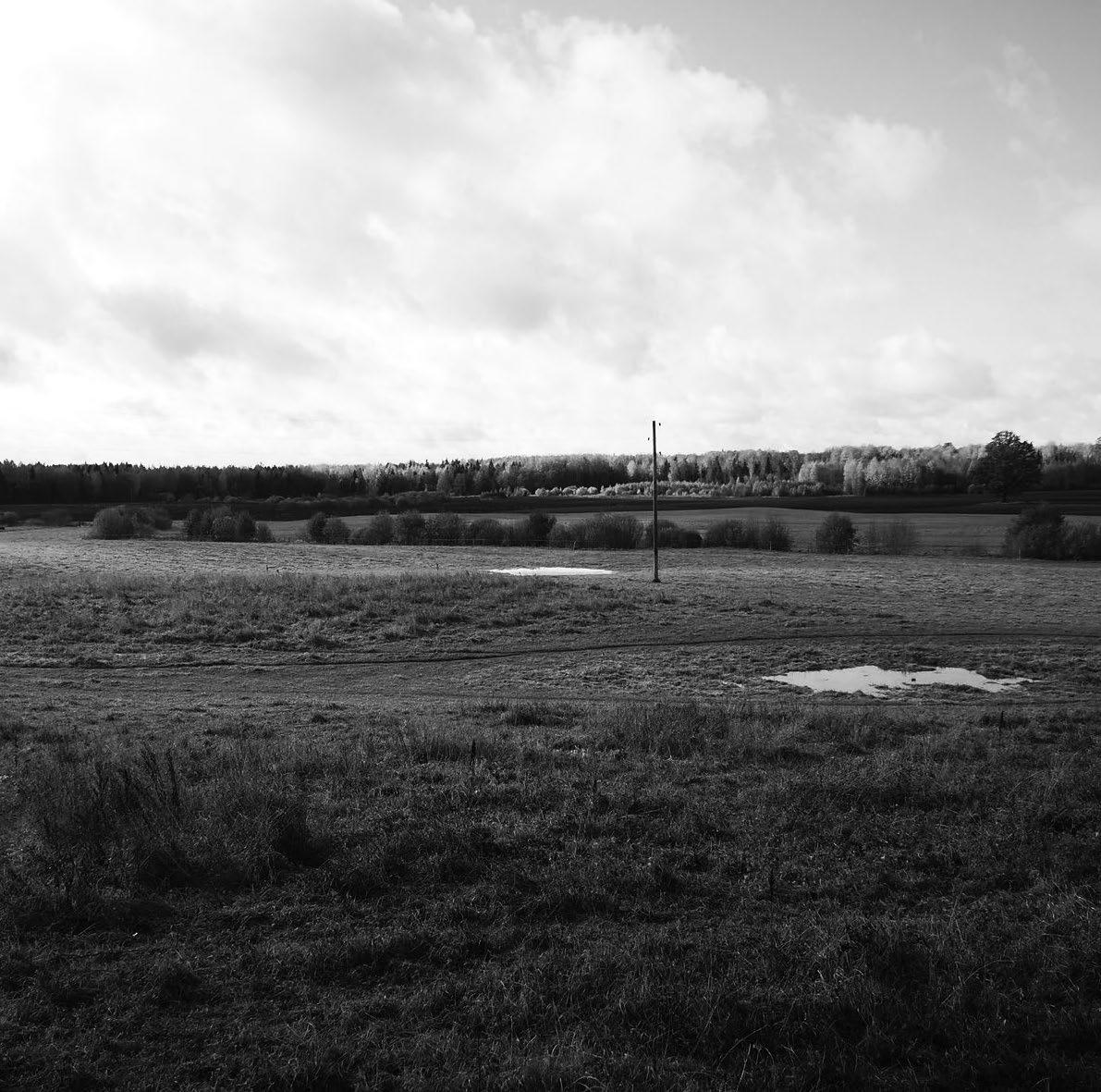
3. View from approach.
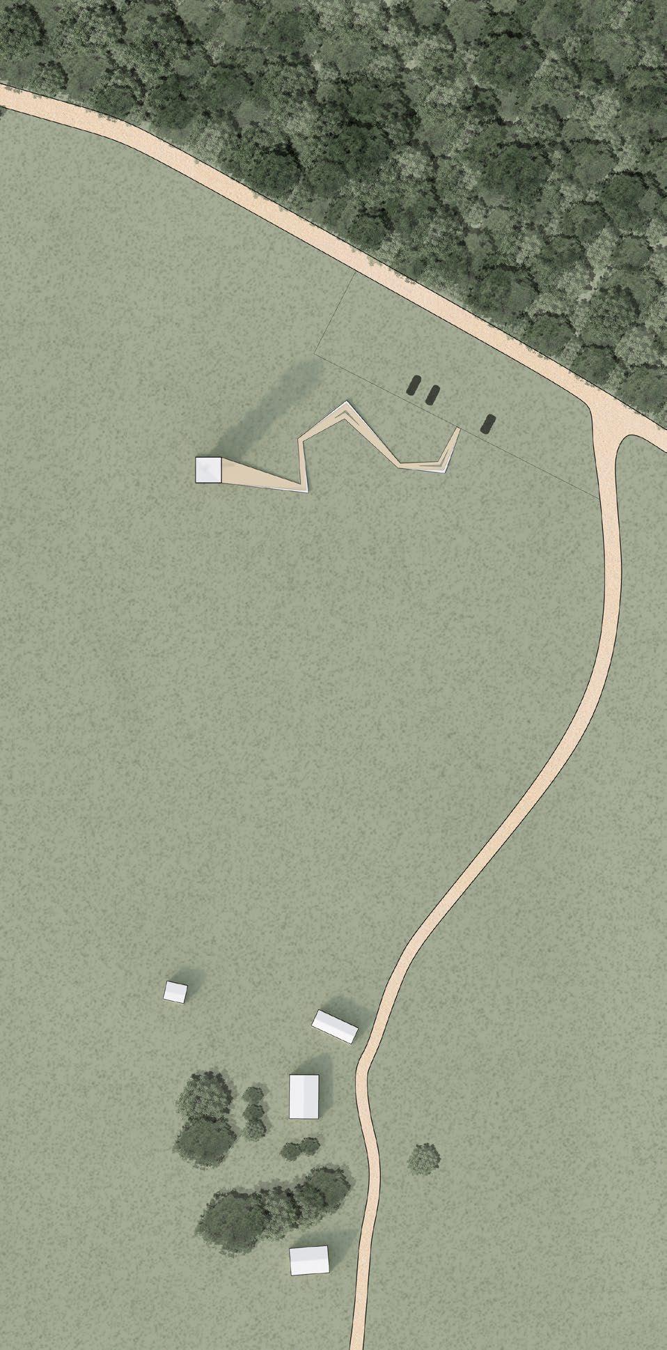
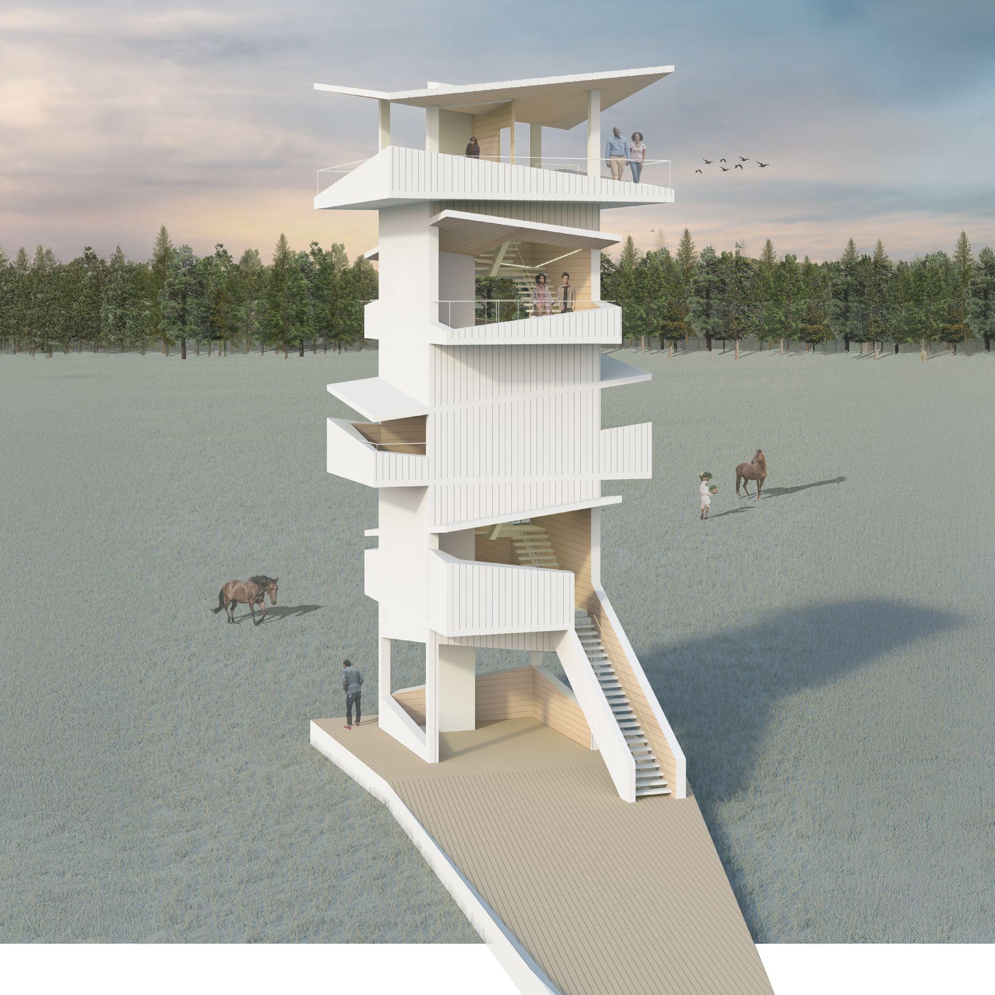
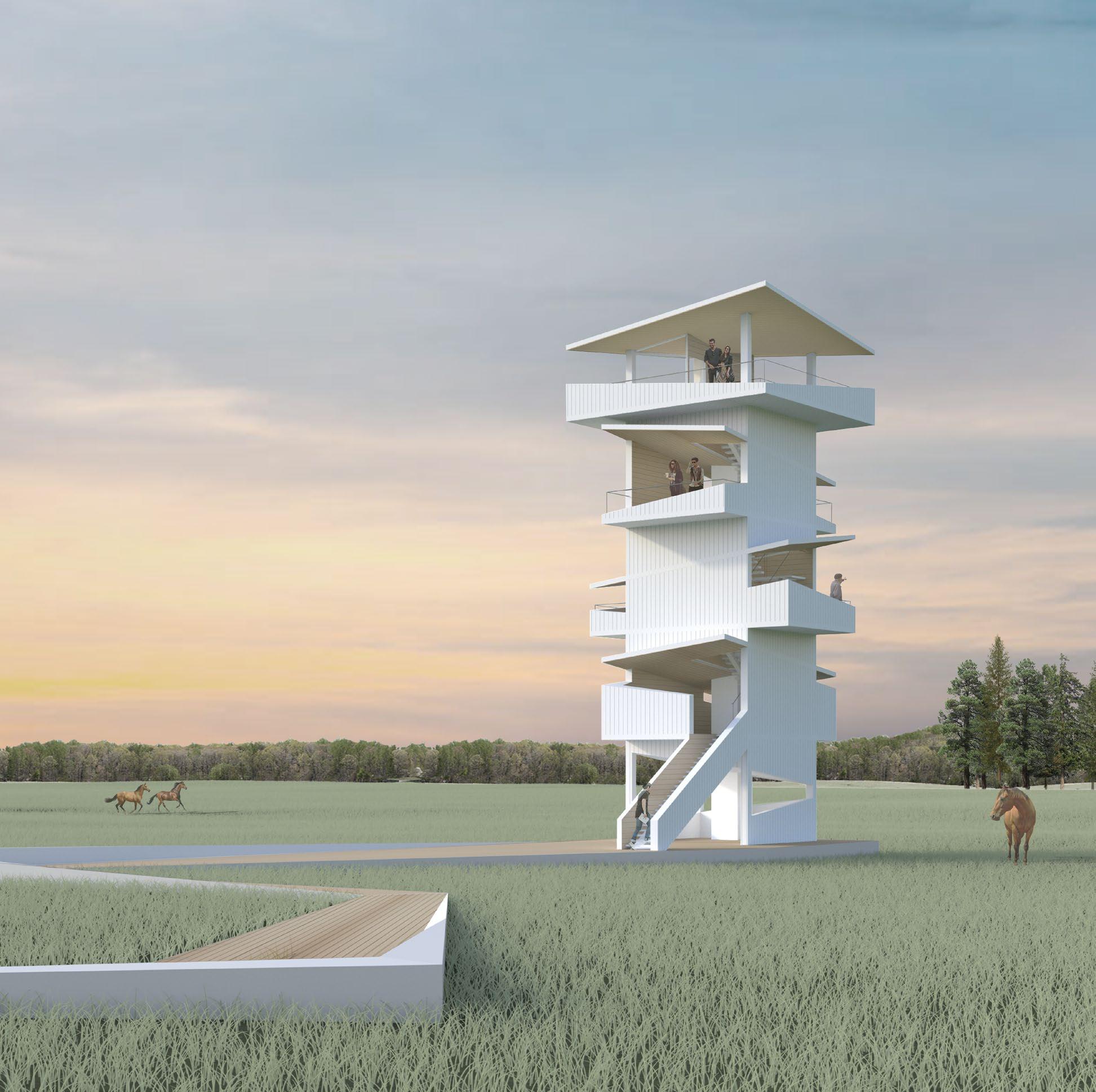
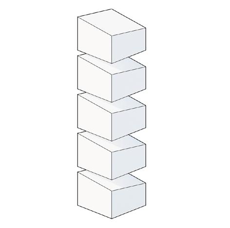
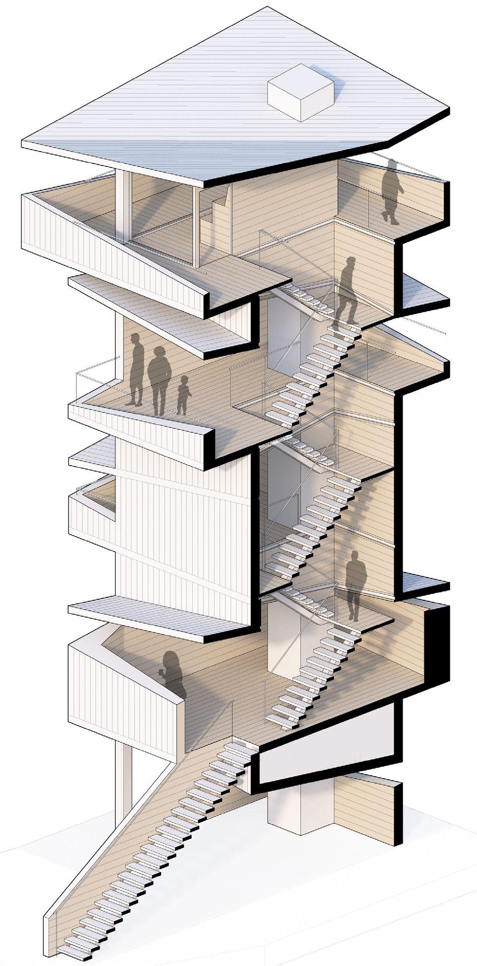
Tucked away in the North Vidzeme Biosphere Reserve, the Stable Stack observation tower offers visitors of Kurgi Farm a unique way of engaging with the Latvian countryside.
Providing guests refuge from city life, Stable Stack draws inspiration from the very heritage that defines the local community: horse breeding. By transforming the horse stable - with its horizontal emphasis and pitched roofinto the vertical typology of an observation tower, Stable Stack simultaneously locates itself as a part of Kurgi Farm and stands independently as an icon in its own right.

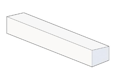
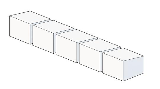
4. From vernacular to proposal:
Traditional Vernacular (upper left): The initial form evokes the basic imagery of a horse stable.
Segment (upper right): Segmenting the initial form establishes independent enclosures.
Stack (center left): Stacking the enclosures creates the basic typology of an observation tower.
Rotate (center right): Rotating the enclosures allows external views in different directions.
Stretch (lower left): Stretching the enclosures accentuate the direction of their views.
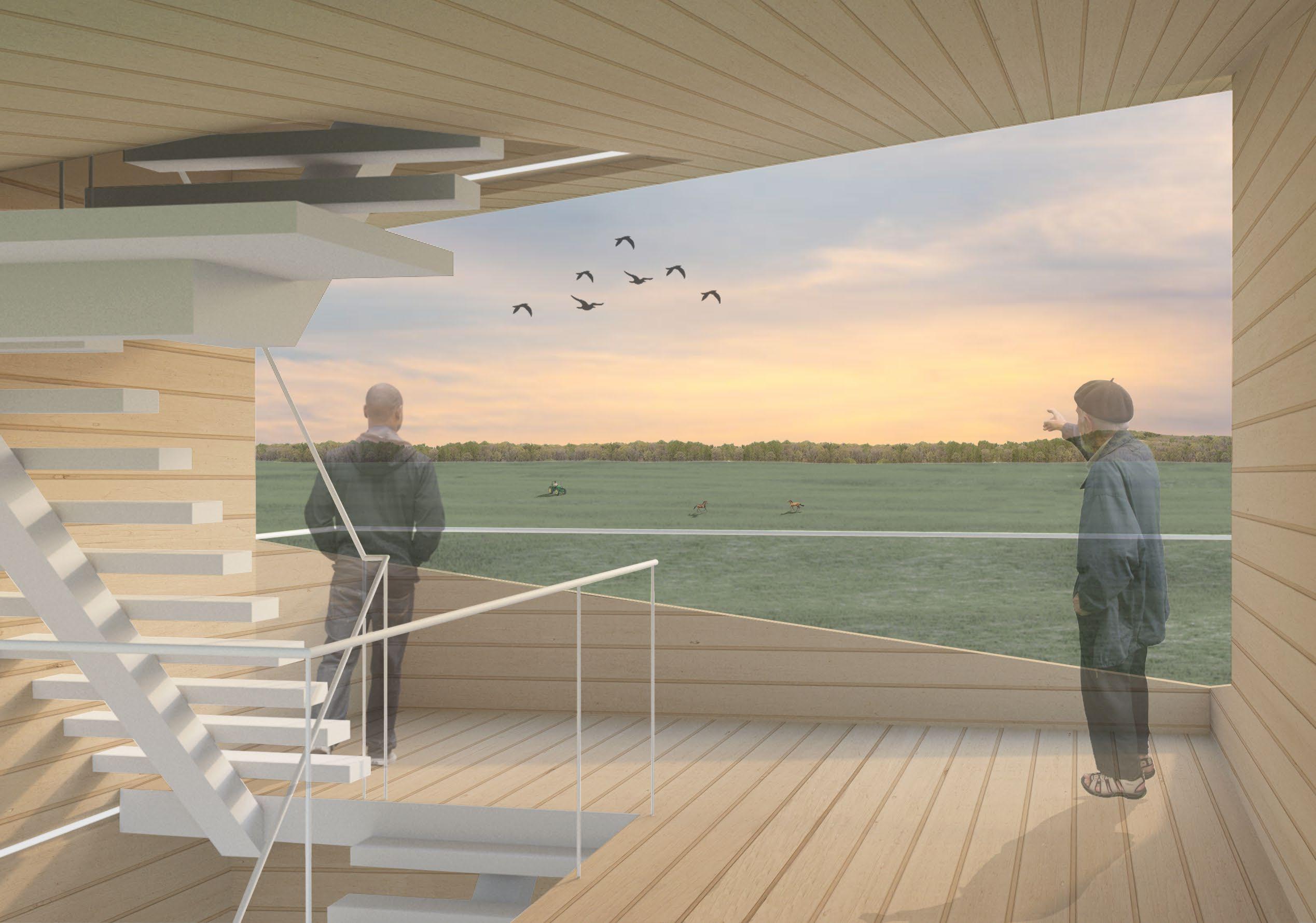
Open (lower right): Opening the enclosures at different rates creates a hierarchy of porosity and view. As the guest ascends, more of the property is revealed.
5. Cutaway axon of tower.
6. View from fourth floor.
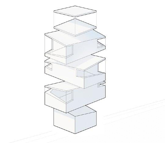
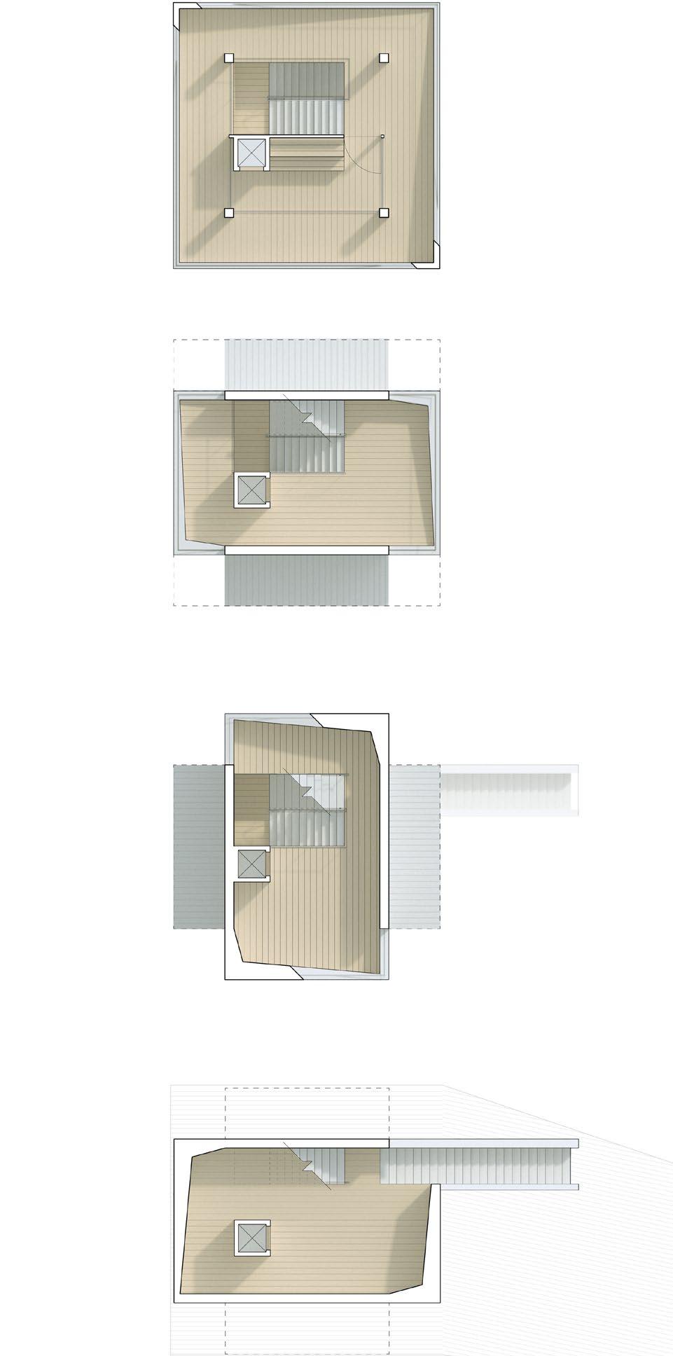
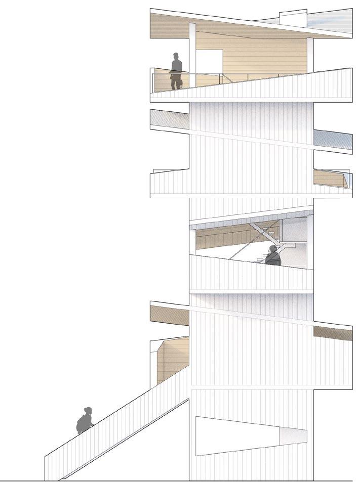
7. Tower plans.
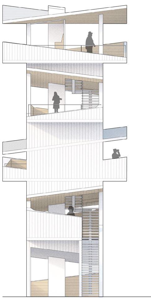
8. East/front elevation (above).
North/side elevation (below).
9. Perspectival view.