Hassya Edina Tamma


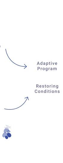
selected work 2023-2024


selected work 2023-2024
+61478549410 | hassyaedina@gmail.com | www.linkedin.com/in/hassyaedinatamma
Master of Urban Design graduate from the University of Melbourne with expertise in architecture and placemaking, alongside a strong interest in sustainability and transport. Skilled in graphic design and collaborative teamwork, committed to creating vibrant, community-focused urban spaces that strengthen connections between people and places.

Master of Urban Design
University of Melbourne
Accredited by the Planning Institute of Australia (PIA)
Grade H2A (Second Class Honours Division A); GPA 3.49 / 4.00
Feb 2023 - Dec 2024
Relevant coursework: Urban Design Studio, Urban Design Thesis, Urban Design Theory, Shaping of Urban Design, Placemaking for the Built Environment, Inclusive Cities, Planning Law and Statutory Planning, Strategic Plan Making, Energy and Carbon in the Built Environment
Bachelor of Architecture
Parahyangan Catholic University
Grade H2A (Second Class Honours Division A); GPA 3.43 / 4.00
Researched night markets as urban activators for a Master of Urban Design thesis
Aug 2017 - Oct 2021
Exploring their impact on revitalising Melbourne’s suburban public spaces. Investigated their contributions to the Night-Time Economy, inclusivity, and community connections, with the goal of extending Melbourne’s 24-hour city beyond the CBD. Presented findings at MSDx Summer 2024 on 21 November 2024
Conducted research for Bachelor Final Thesis on Townscape Harmony Impression Based On Physical-Spatial Aspects in Padang Old Town (Study Object: The Southside Area of Batang Arau River)
Investigated the correlation and composition of physical-spatial elements in the southside area of Batang Arau River, analysing their impact on the townscape’s impression. Findings revealed that final impressions are shaped by both physical structures and community activities, challenging initial perceptions. Research was presented at the Skripsi Awards 2021-2, hosted by the Department of Architecture, Parahyangan Catholic University, on October 16, 2021
Freelance Architectural and Interior Designer
In The HAWS, Jakarta-Bandung, Indonesia
Junior Architect
Mamostudio, South Tangerang, Indonesia
Design Graduate Merit Scholarship
University of Melbourne
Melbourne Global Graduate Scholarship University of Melbourne
Architectural Final Project Nominee
SAA Awards 36
Parahyangan Catholic University
Architectural Research Final Thesis Nominee
Skripsi Awards 2021-2
Parahyangan Catholic University
ArchiCAD, Rhino, and Grasshopper Application Training
MORPH Digital Architectural Training, Bandung, Indonesia
Head of Publication and Documentation Division (Design Camp)
Academic and Professionalism Department in Unpar (HMPSArs), Bandung, Indonesia


3D Modelling
ArchiCAD (BIM), SketchUp, Rhino
2D Drafting AutoCAD
Adobe
Photoshop, Illustrator, InDesign, Premiere
Microsoft Office
Ms. Word, Ms. Excel, Ms. Power Point
Rendering
Twinmotion, Lumion, Vray, Enscape
English (Professional Working Proficiency) Indonesian (Native Proficiency)
Dr. David Mah
Senior Lecturer in Architecture and Urban Design, University of Melbourne
Master of Urban Design Course Coordinator david.mah@unimelb.edu.au
Ar. Adi Purnomo
Founder and Design Principal Architect, Mamostudio Employer mamostudio.adm@gmail.com
*This portfolio contains collaborative drawings and design work produced as part of a team effort. My specific contributions—whether in design thinking, drawings, or other aspects—are clearly indicated within each project.

Nightscape of A City: Night Market as Urban Activator
Climate-Reslient Sensitive Urban Bridge
Transformative Mobilities in Albury
Urban Supplement
Beyond Barriers: Creating
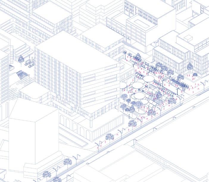
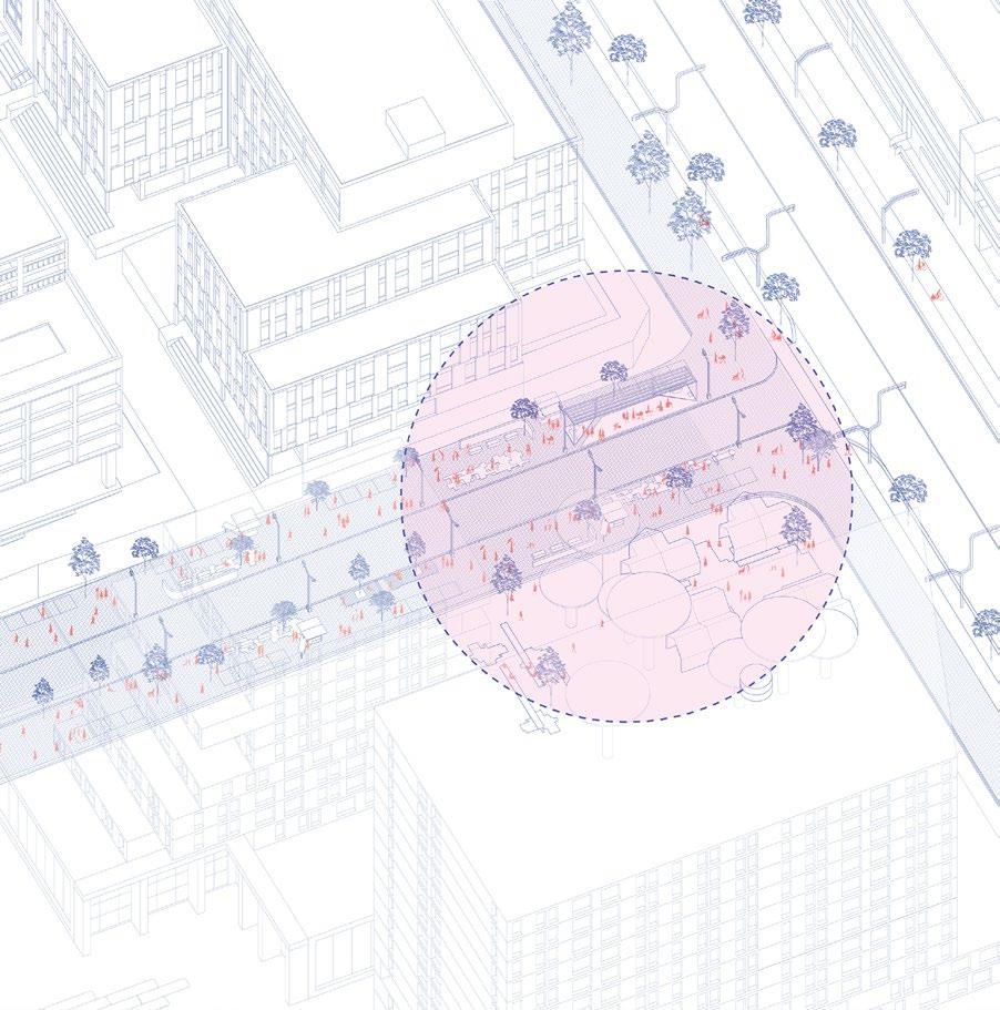
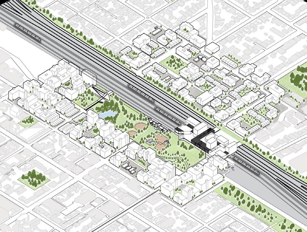
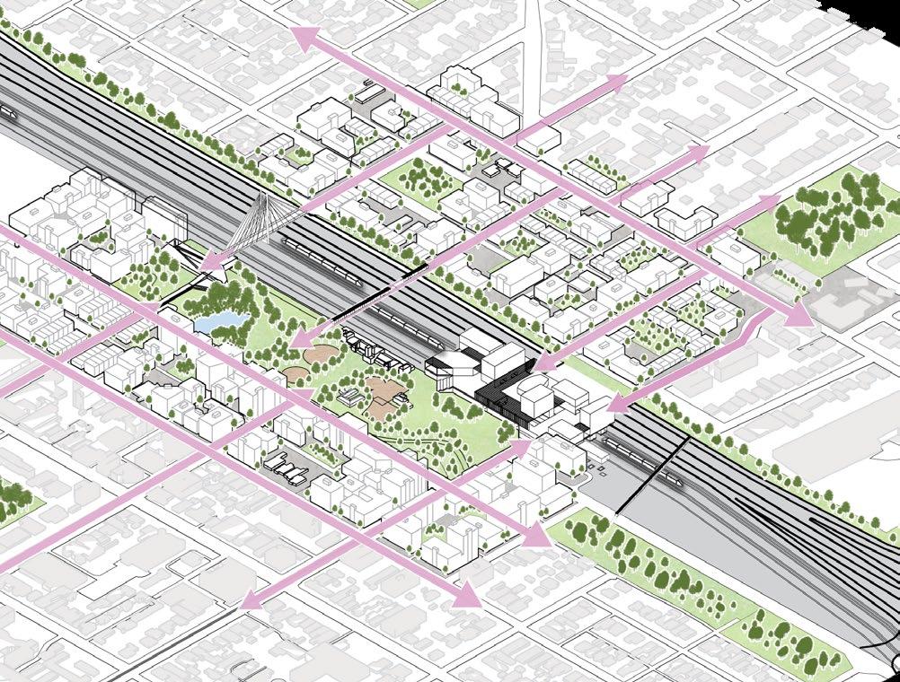
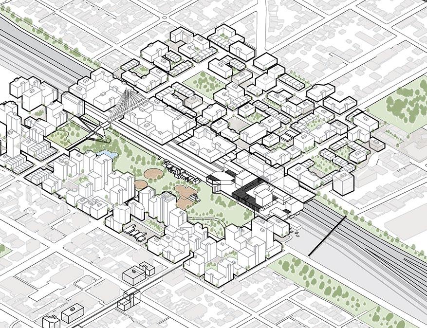
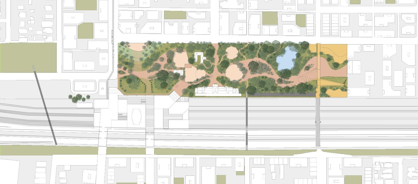
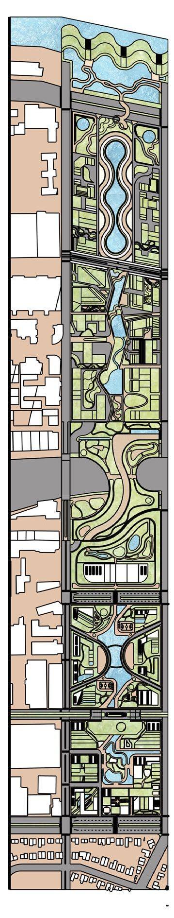
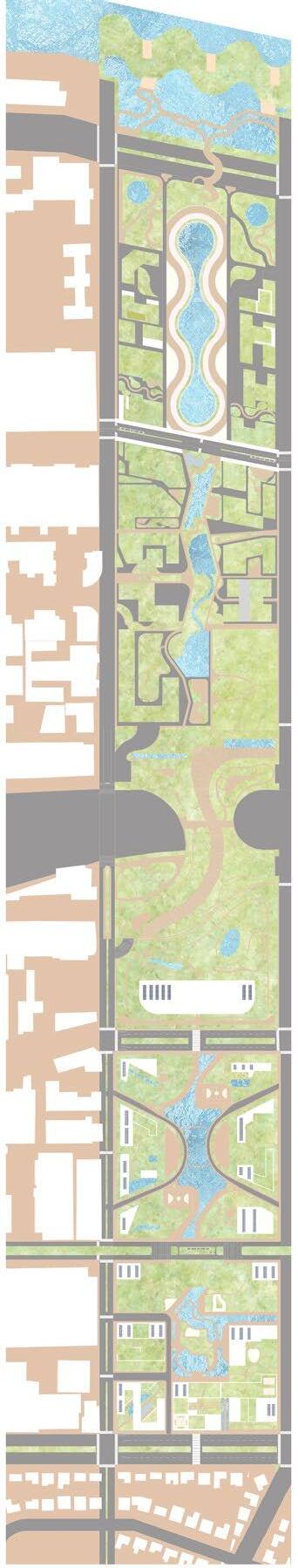
Urban Design Thesis// Summer 2024 Ringwood Activity Centre, Victoria
Subject Coordinator: Prof. David Mah
Responsibilities: research and application on bigger scheme of the city full version booklet: reserach: https://drive.google.com/file/d/1a9Yilfjtu9U6NdZoIrJYzdd8y1dJmfvz/view?usp=sharing final: https://drive.google.com/file/d/1DUoSkZ2KD3Ttj-mPubH0Z1ZCR73Ssbn4/view?usp=sharing

Currently, the most vibrant nighttime activities in Victoria are happening in Melbourne. However, it’s important to recognize that vibrant nighttime environments don’t have to be limited to urban areas; they can also thrive in suburban settings. Residents of suburban areas often tend to stay indoors after 7 PM, while those in urban areas may still be active—running errands, meeting friends, exercising outdoors in parks or gyms, or even just taking a walk.
To enhance the nighttime quality of the city overall, these activities should be embraced and supported by improving the overall aspect of the nighttime environment in suburban areas.
What strategies can be implemented to enhance the activation and enjoyment of Melbourne’s suburban public spaces during nighttime, making them as vibrant and welcoming as they are during daytime?
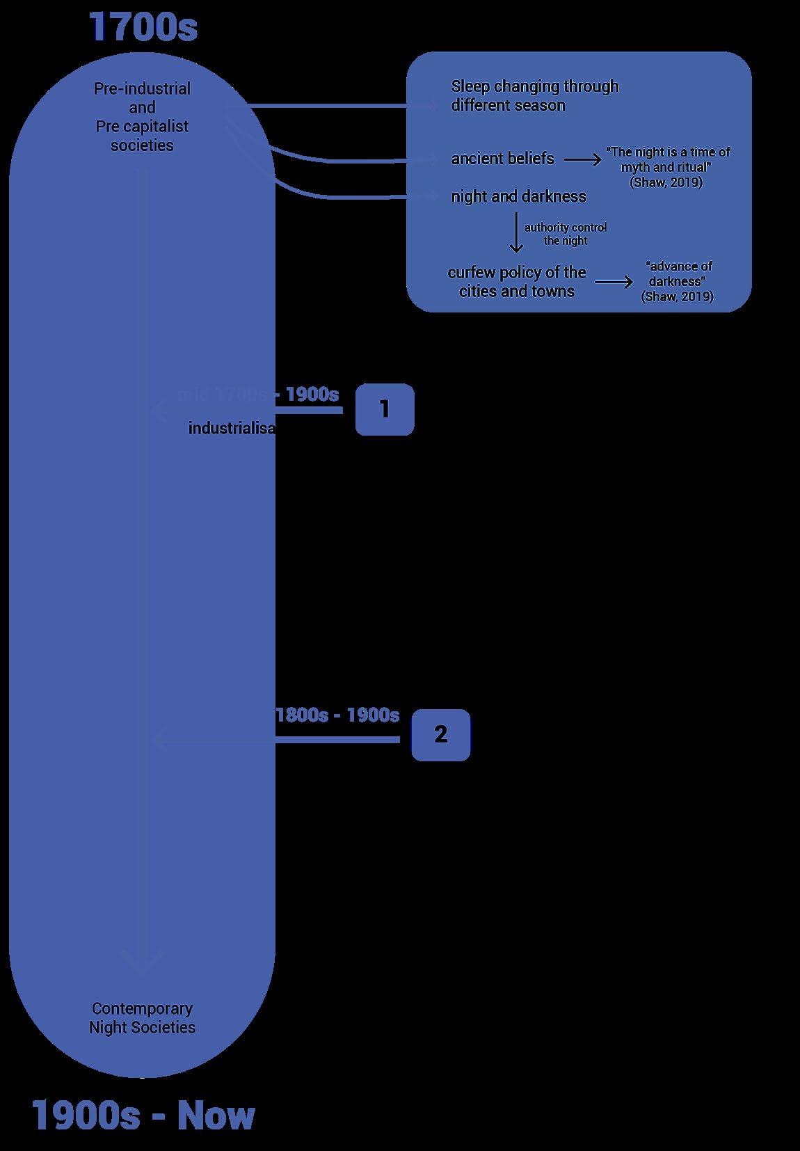
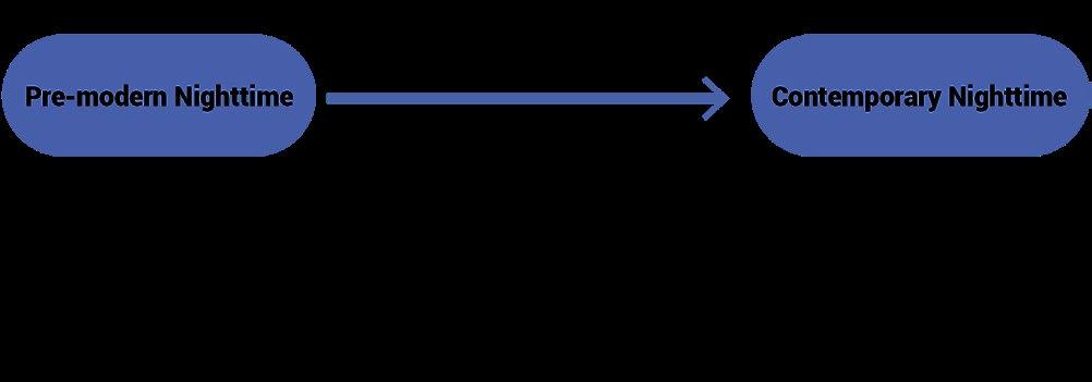
Nighttime activities have changed over time. In the pre-industrial era, night was mainly for rest, associated with myths and rituals. People stayed indoors, and curfews were common, making cities quiet after dark. The introduction of street lighting with electricity allowed people to extend their activities into the night, reducing safety concerns. This sparked the growth of nighttime activity. As businesses started operating 24/7 during the capitalist era, the demand for night workers increased, leading to the rise of the nighttime economy. By the late 19th century, this shift was further driven by globalisation.
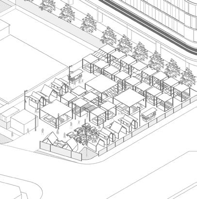
Public spaces activation program: Night Market
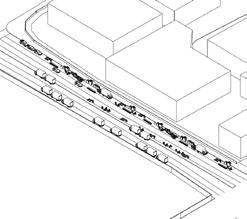

Night market are predominantly urban activators in cities of global south. However, in the global north, such of markets tend to be more of a top-down process ,initiated by government provision rather than by the people themselves. Therefore, how can night market be incorporated into Melbourne’s suburban areas, given the governance characteristics as global north system?
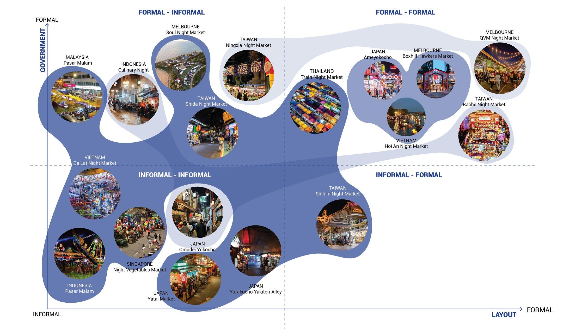
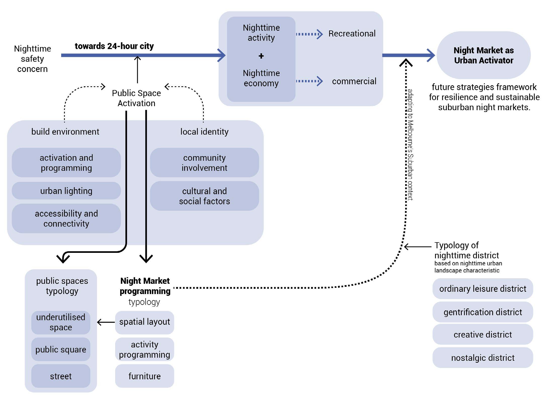


Nightscape of a City explores how nighttime activities and the nighttime economy are connected and have become an essential part of contemporary urban life, driving social, cultural, and economic vibrancy in cities. By looking at global and local case studies on nighttime activity in public spaces, with a focus on night markets, this research highlights the potential of night markets to transform Melbourne’s suburban public spaces. With insights from global practices tailored to Melbourne’s policy landscape and suburban context, night markets can help address gaps in public space usage, foster inclusivity, and create a stronger sense of safety and community.
Bringing night markets into suburban areas requires a multi-layered approach that combines historical awareness, cultural sensitivity, and creative urban design strategies. By adapting global ideas to fit Melbourne’s suburban context, this study imagines a future where night markets become hubs for community interaction and suburban revitalisation, leading the way to a 24-hour city that thrives beyond the city centre.
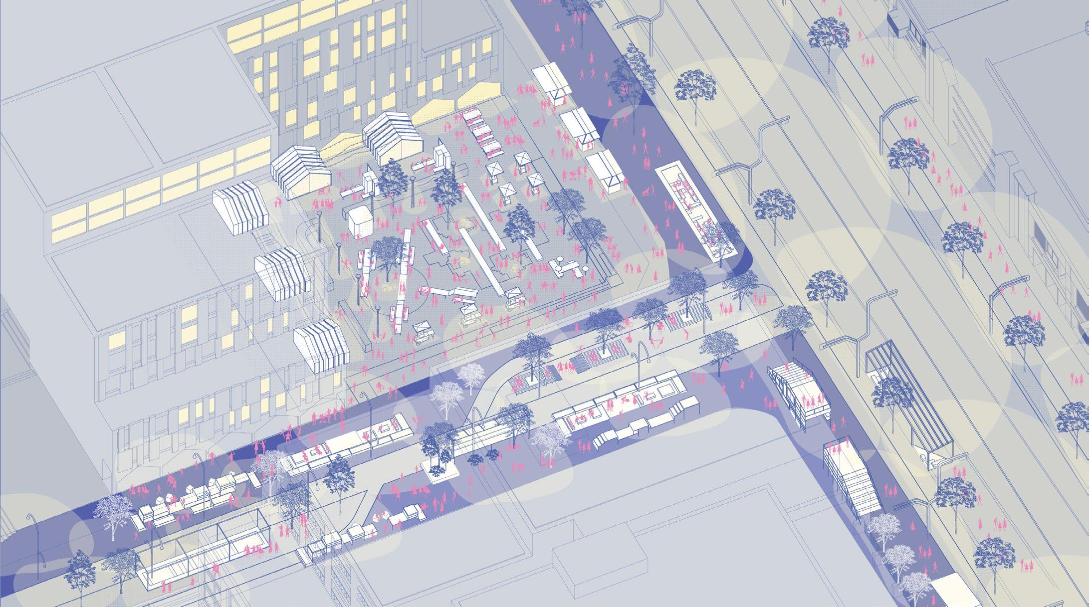
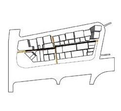
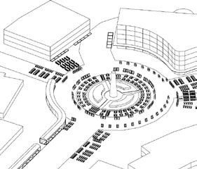
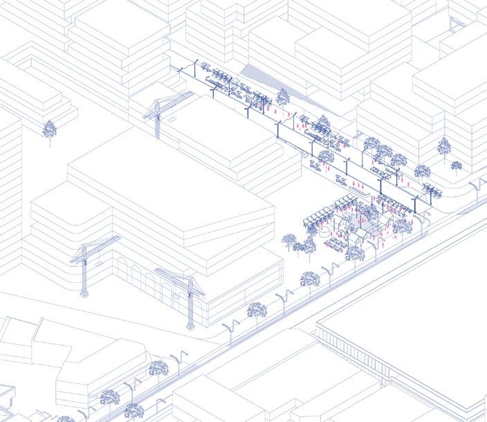
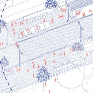
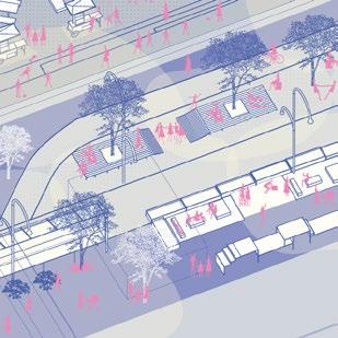
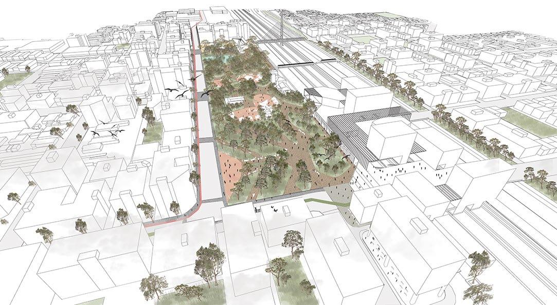
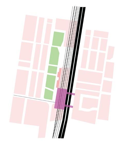
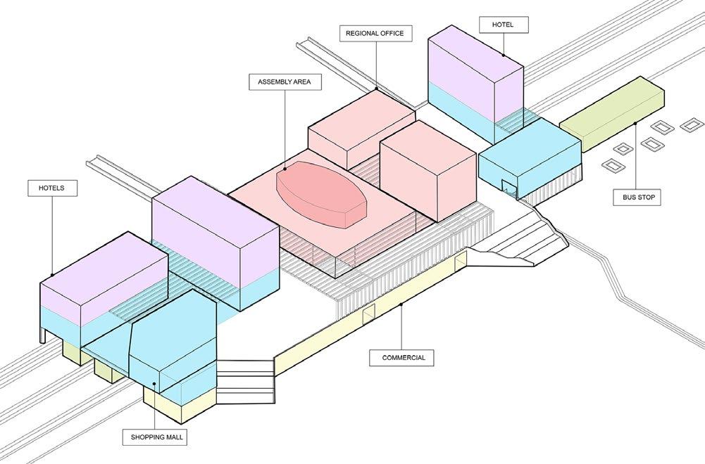
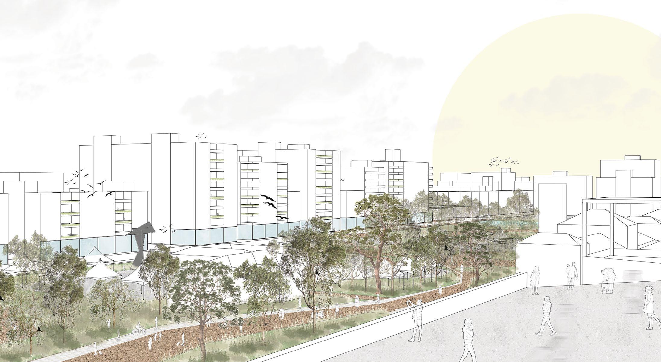
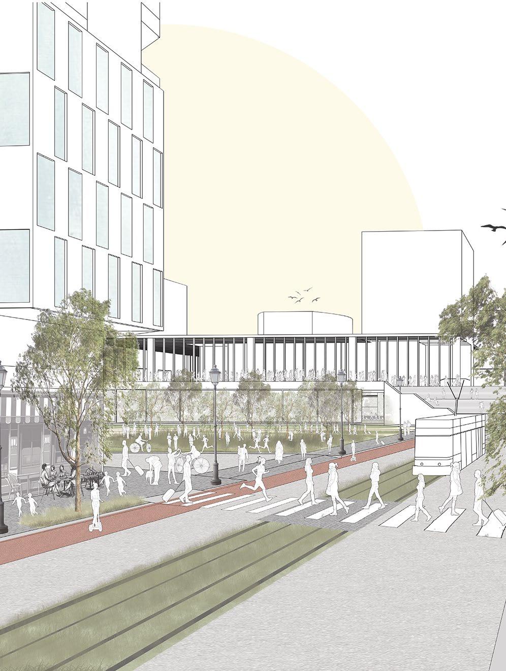
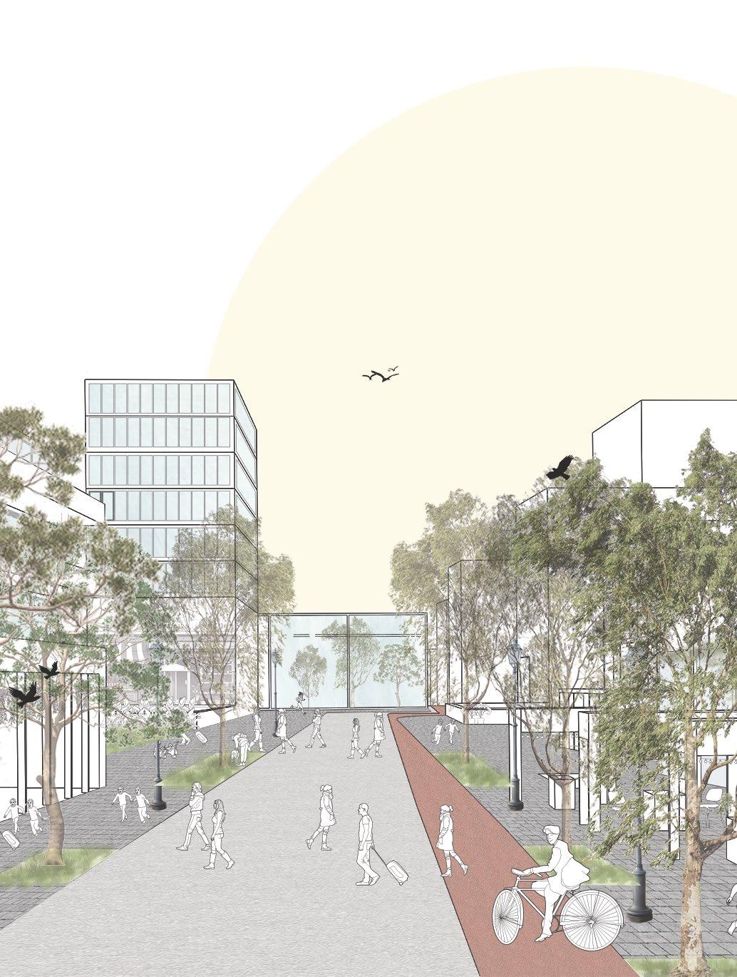
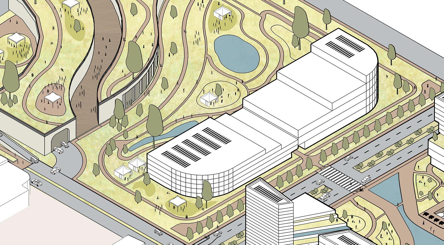
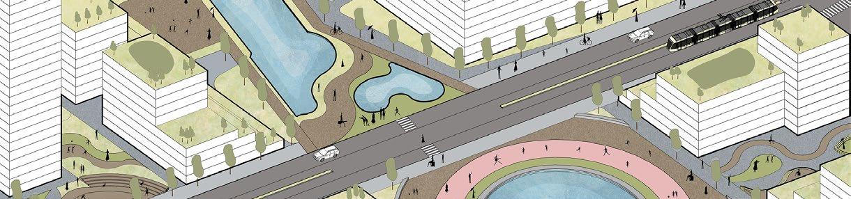
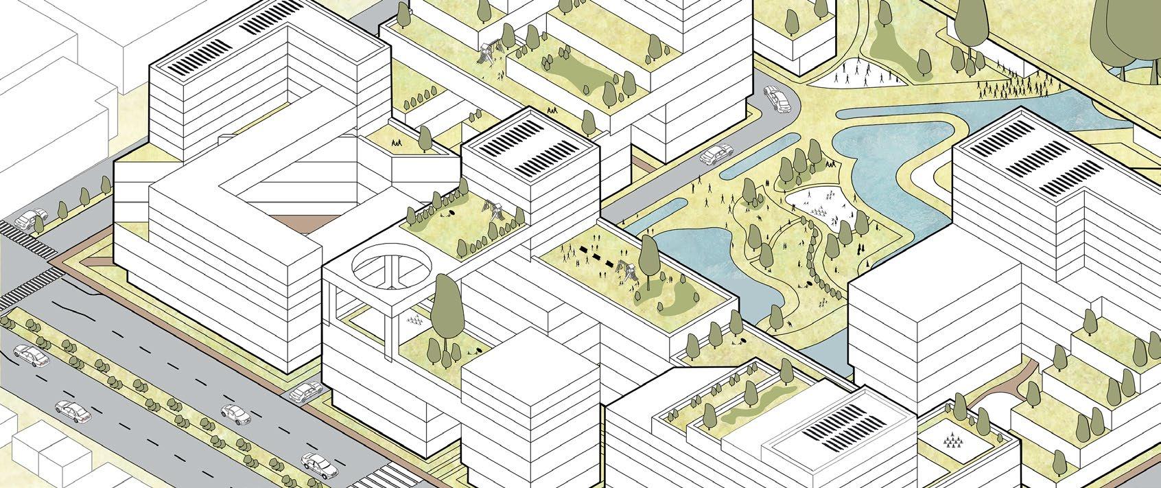
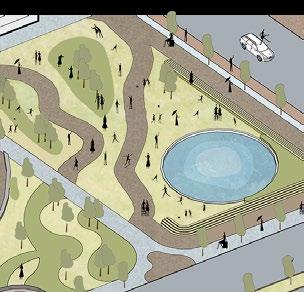
Ringwood Activity Centre
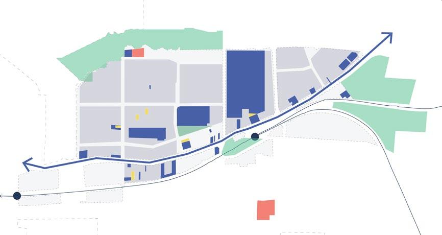
Ringwood Activity Centre
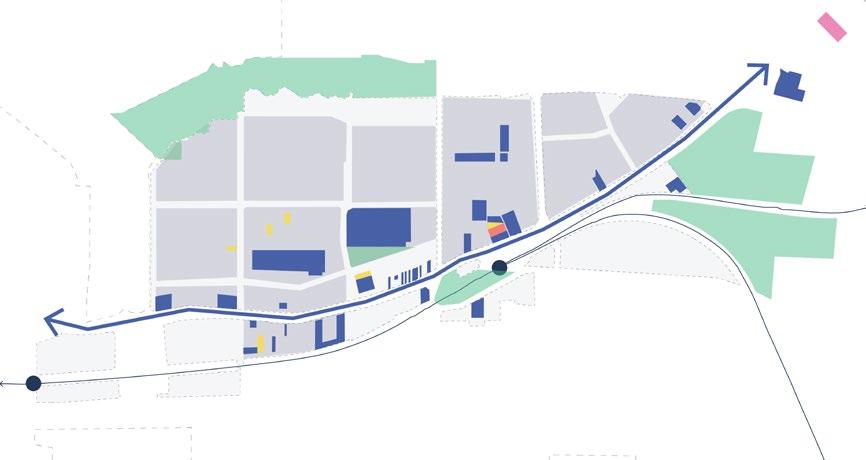
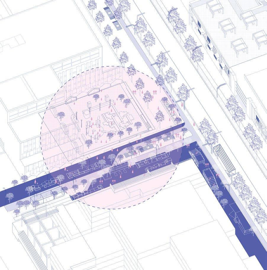
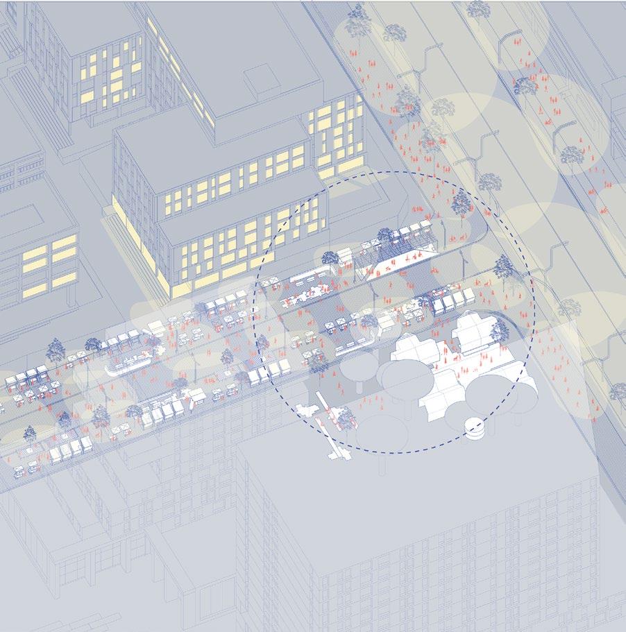
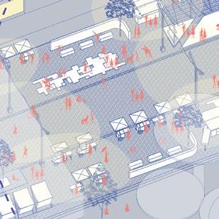
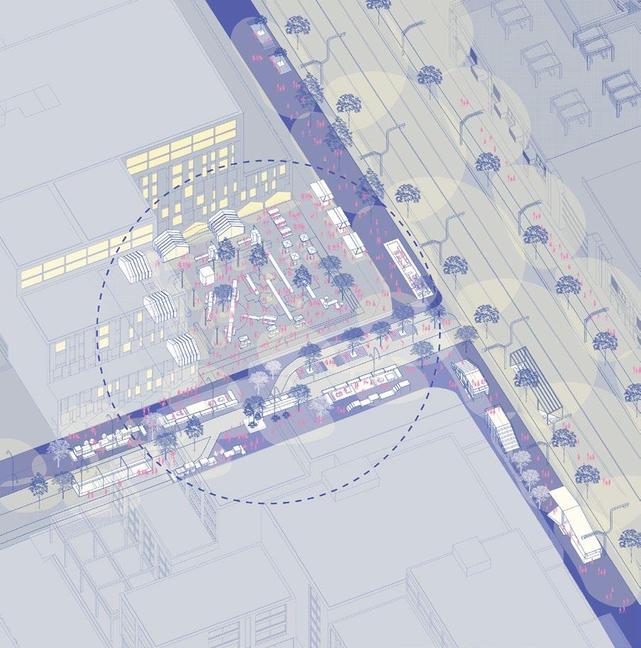
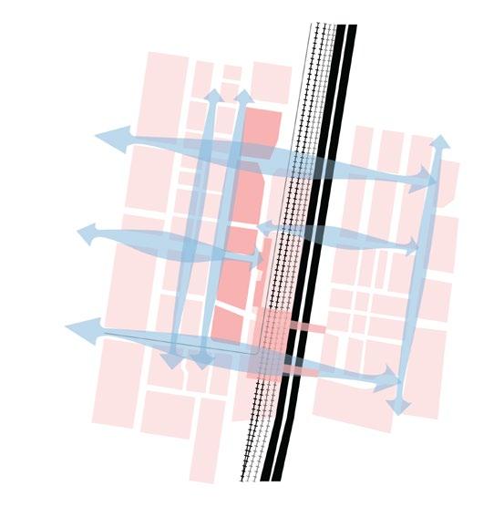
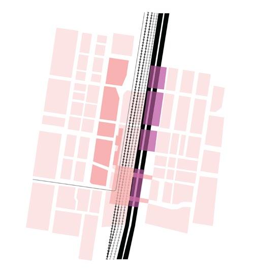
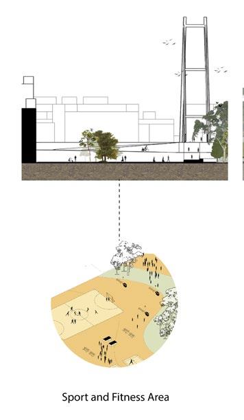
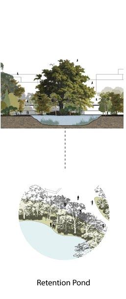
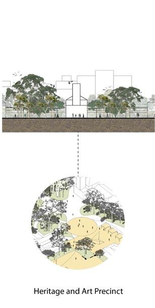
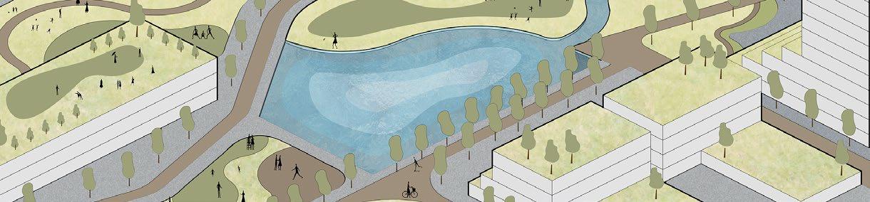
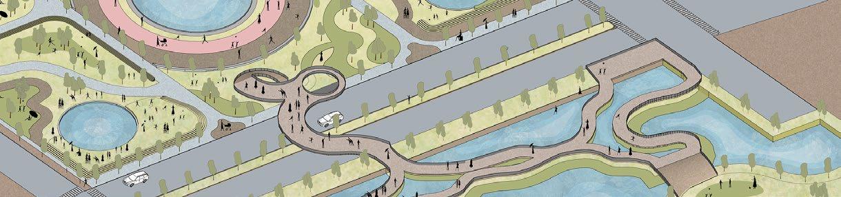
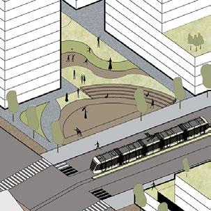
To activate the Ringwood area at night, particularly the Activity Centre, we will introduce several night markets in different districts, each with its own distinct characteristics. This strategy will help keep the Activity Centre lively at night. To successfully develop nighttime activity, we must ensure the quality of public infrastructure, such as street furniture, and cultivate active edges within dense areas to support future main events like night markets. This approach will also gradually foster a sense of safety and security among resvidents, encouraging them to enjoy nighttime strolls around the city without fear.
As Gruen and Smith (1960) discussed in the Dumbbell Theory for shopping malls, a similar concept applies to the connection between the station and the temporary night market in the Eastland Parking Building. The station and multifunctional space in the parking building serve as anchors, with Ringwood Road connecting them. This road, lined with active edges like shopfronts and restaurants, enhances pedestrian engagement and links to other areas designated for future night markets, creating a dynamic, interconnected urban space.
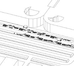
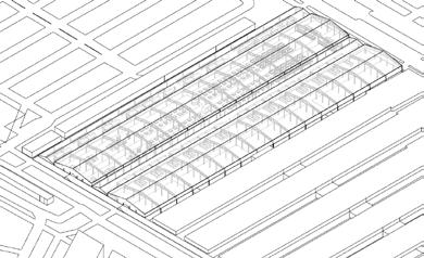
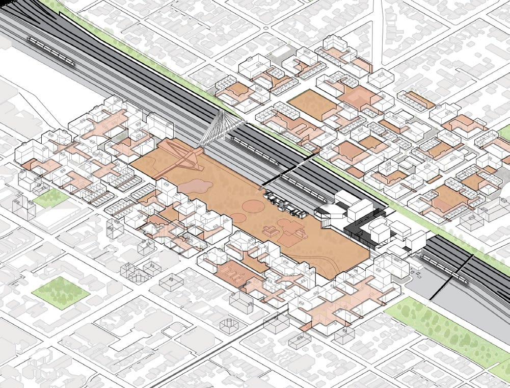
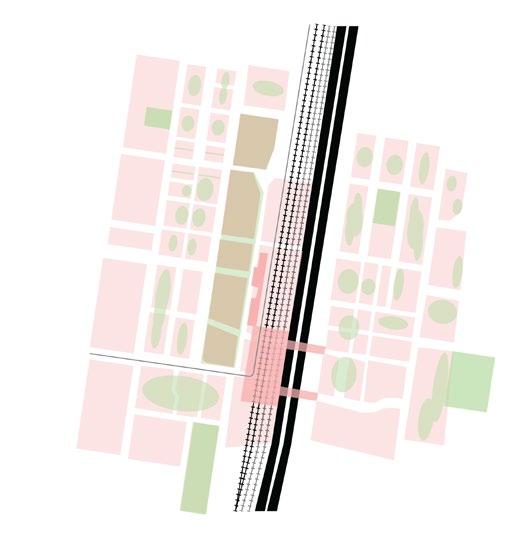
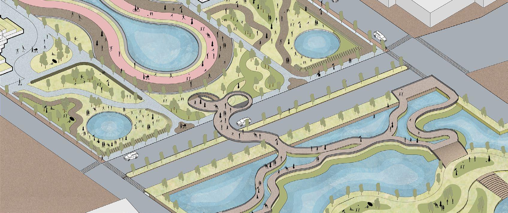
Night Market Development : informality towards more formalised typology


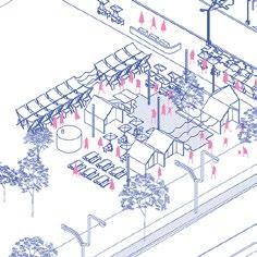
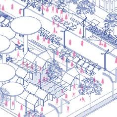
temporary night market in a carpark can evolve into a permanent structure integrated with privately-owned public spaces (POPS). This transformation enhances vibrancy, accessibility, and social interaction, strengthening connections between the market, the community, and the urban environment.
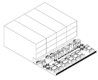
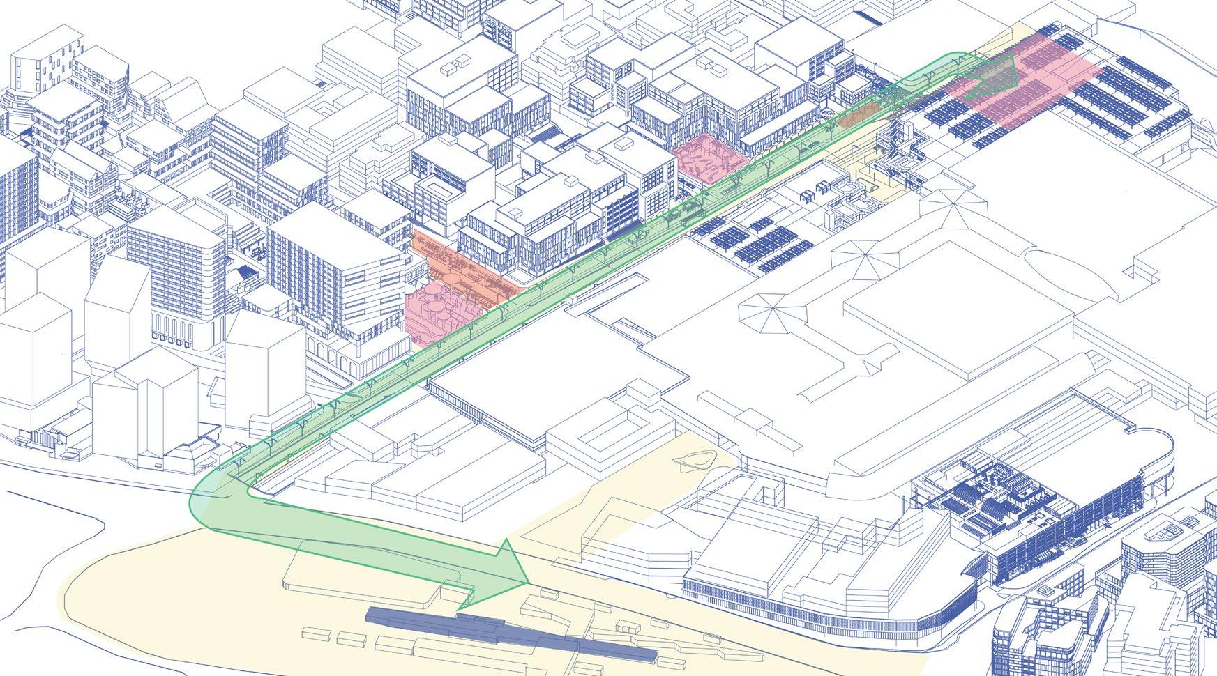
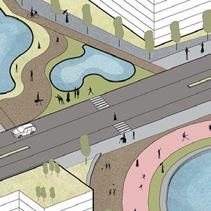
During the day, the street operates as a main vehicular and bus route, with limited hawker kiosks to avoid disrupting transit and maintain accessibility. At night, it transforms into a vibrant hub with two night market types: a street market for goods and packaged food and an on-site market for hot food in semi-permanent structures. These markets, connected to surrounding buildings, blend formal and informal spaces, offering flexibility, lively interactions, and diverse experiences for vendors and visitors.
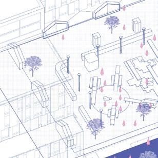
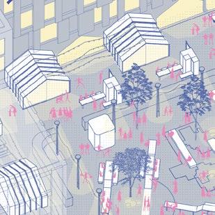
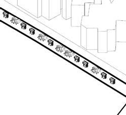
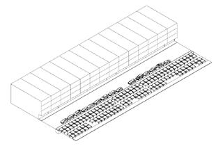
During the day, the garden street serves as an open public space, with market furniture folded away and doubling as shopfront-like fixtures to draw interest. In the evening, it transforms into a semi-permanent market, where kiosks extend from building facades to host vendors specialising in food and art. Partnering with local artists and vendors, the market offers a dynamic atmosphere, with tactical furniture promoting playful interaction and strengthening community connections while activating the space.
Urban Design Studio C // Winter 2024 Docklands, City of Melbourne, Victoria
Teammate: Andrea D’Silva, Annika Dillon, Zhi Yi Chung
Subject Coordinator: Prof. Justyna Karakiewicz
Responsibilities: ecological research, urban design strategic plan, urban phase section, urban section (c), inundation scenarios
full version booklet: https://drive.google.com/file/d/1jn8gJaByopuzagWuETxdllfyeXYgSGDn/view?usp=sharing
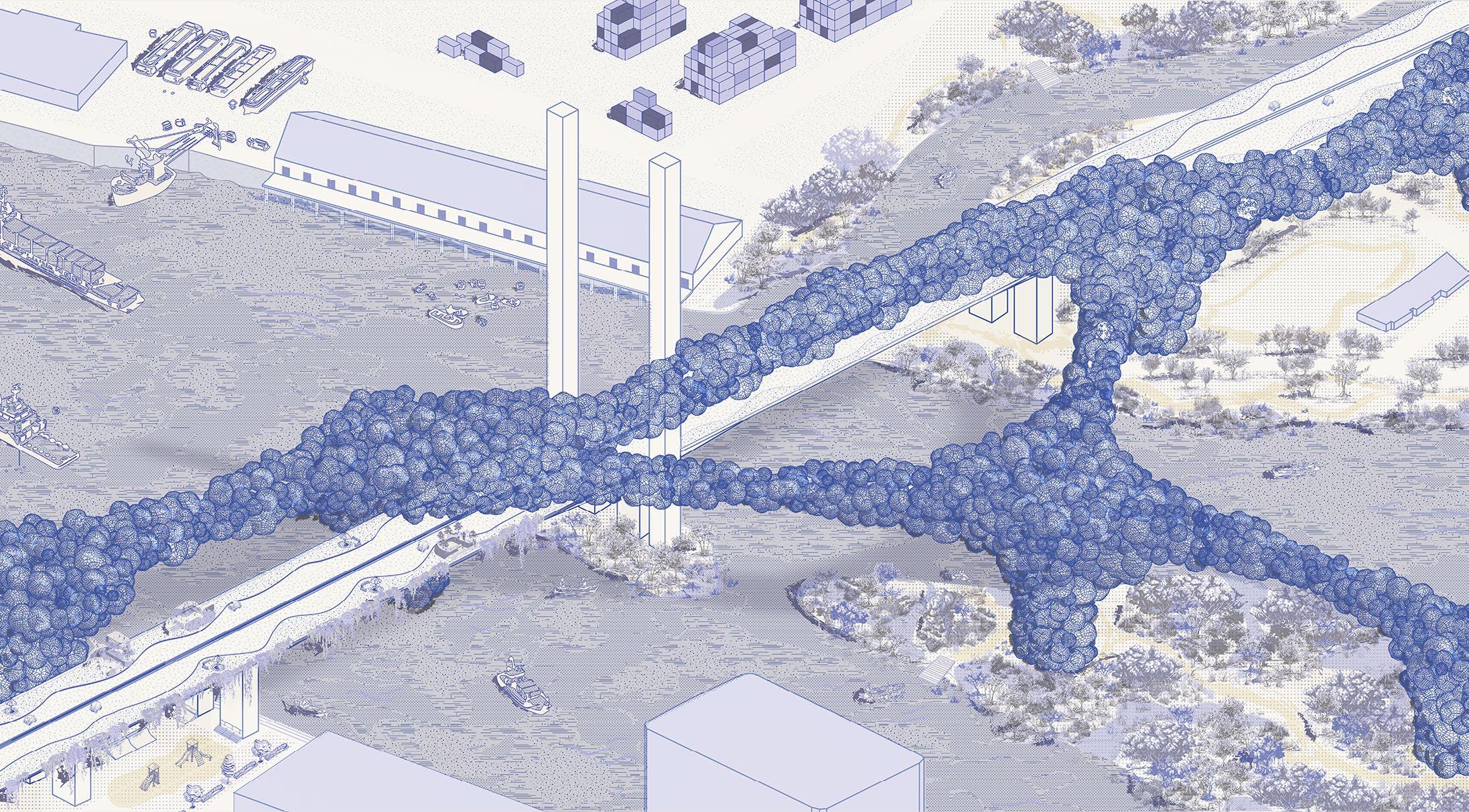
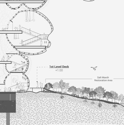
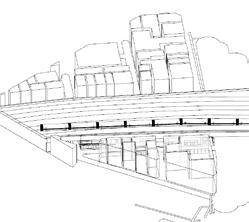
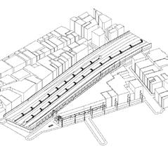
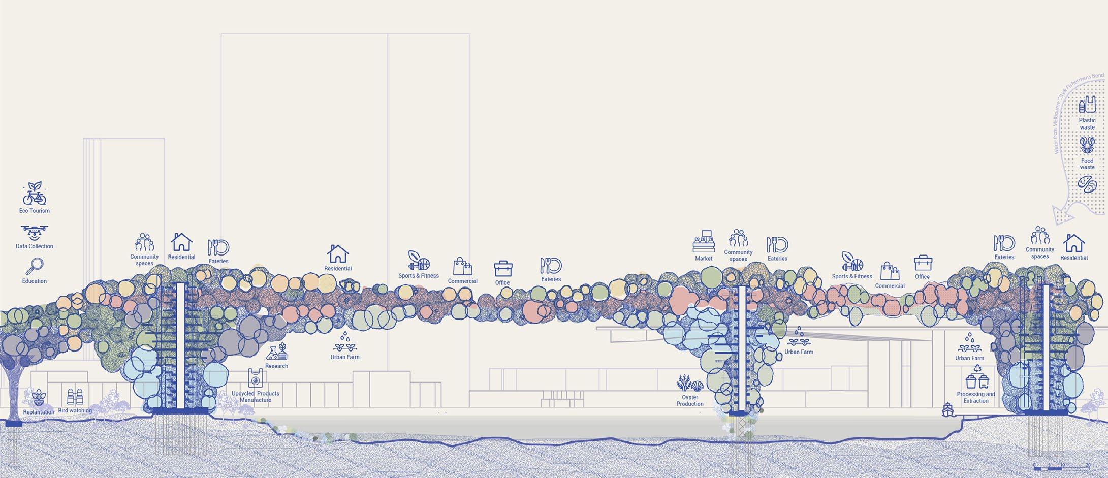
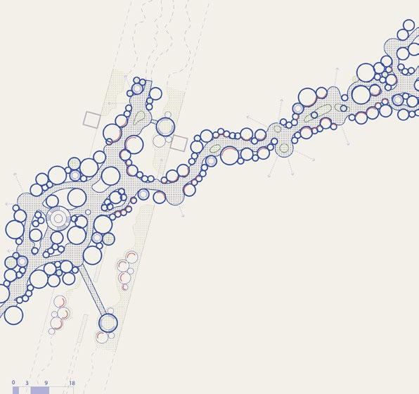
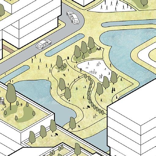
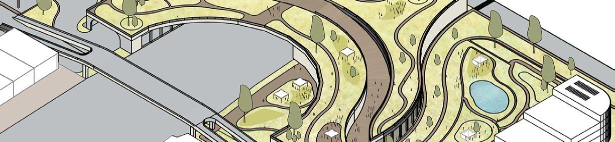
Within the context of a flooded Docklands region, this cellular bridge re-instates community living and public connectivity, morphing from ecologically sensitive materials, re-purposed objects and biomaterials grown on site.
How can a ‘living’ bridge self-evolve, restore, and stimulate social progress whilst protecting local ecologies through the fusion of city, industrial and public life?
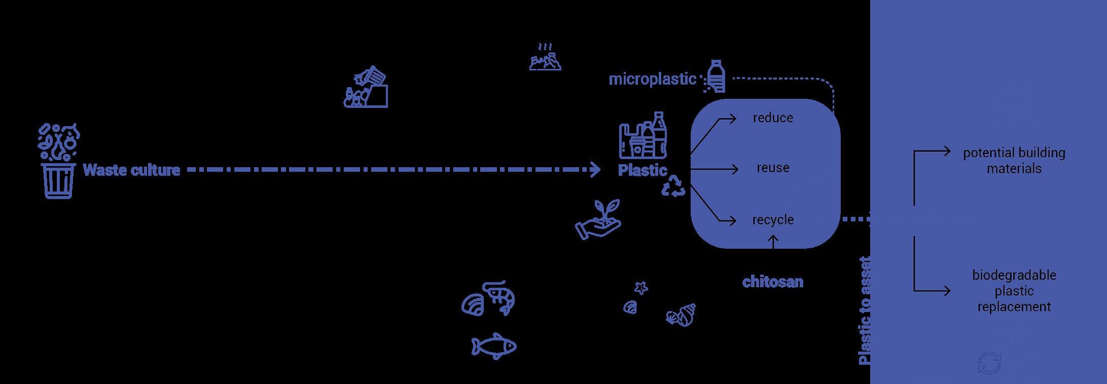
Rethinking Waste: From Pollution to Biomaterials
Plastic waste, especially from packaging and construction, fuels environmental pollution and microplastic contamination. Chitosan, derived from seafood waste, offers a sustainable alternative—biodegradable, durable, and antimicrobial. By reimagining waste as a resource, we can drive ecological restoration and sustainable material innovation.
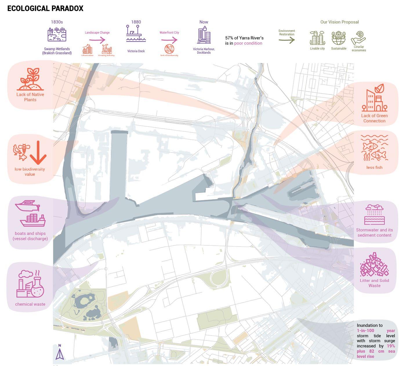
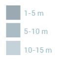
As seen on this map, the green spaces are fragmented, disrupting ecological habitat continuity and diminishing social benefits. Docklands and Fishermen Bends are in a floodprone area, hence, making these areas susceptible to further segregation.
Docklands evolved from a swamp in the 1830s to Victoria Dock in the 1880s and later into a waterfront city. Currently, 57% of Yarra River waters are in poor condition due to pollution. The area faces biodiversity loss, weak green connections, and future flood risks. Despite this, strategic biodiversity efforts offer hope for ecological recovery.
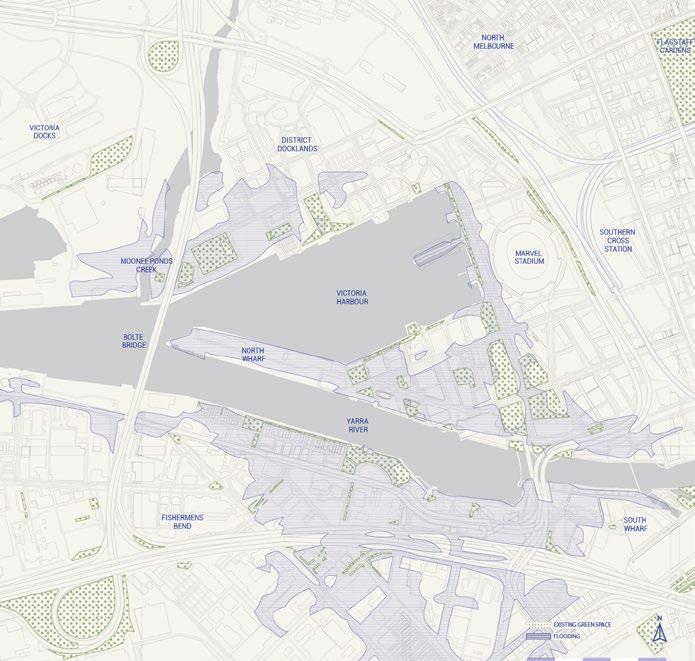
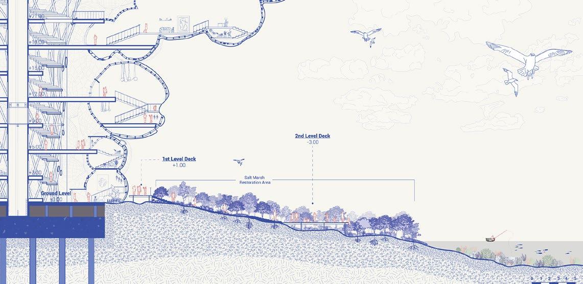
To combat these issues we are proposing green corridors to reconnect the existing green spaces and establish permeable open spaces for social and ecological connectivity. North wharf will be restored into a wetland acting as a natural buffer during heavy rainfalls or flooding event.
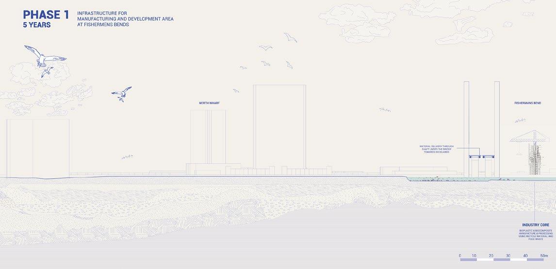
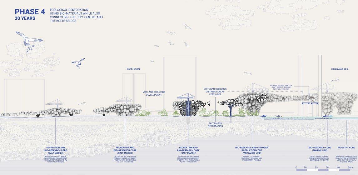
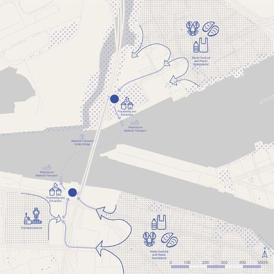
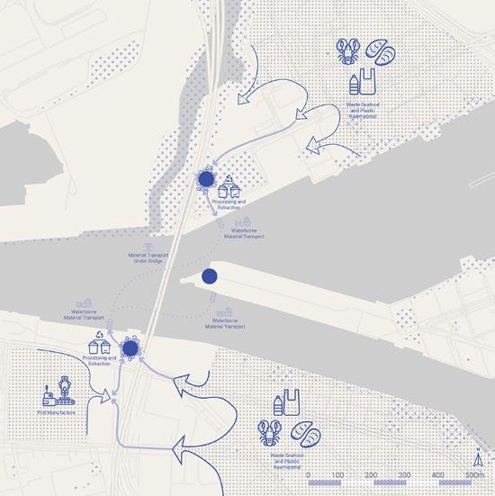
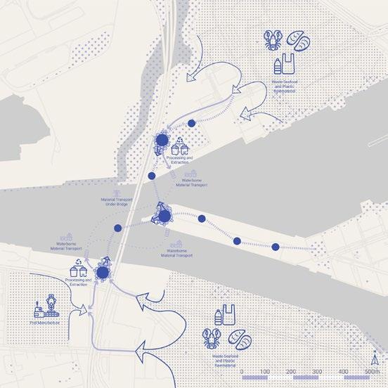
Phase 1 (0 years) focuses on establishing the industrial core in Fisherman’s Bend and Docklands, with materials transported via a shaft under the Bolte Bridge.
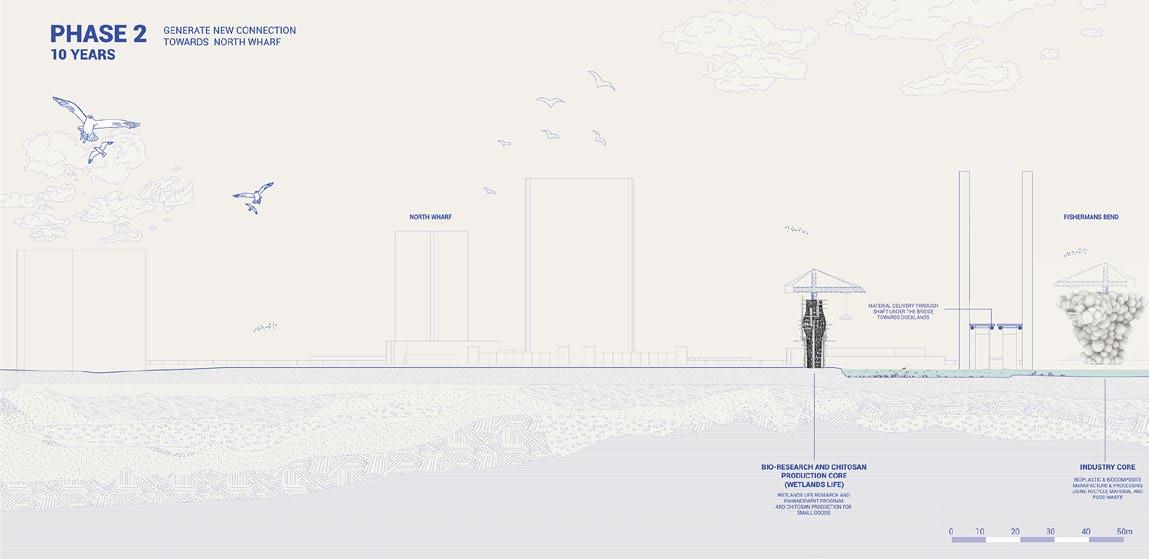
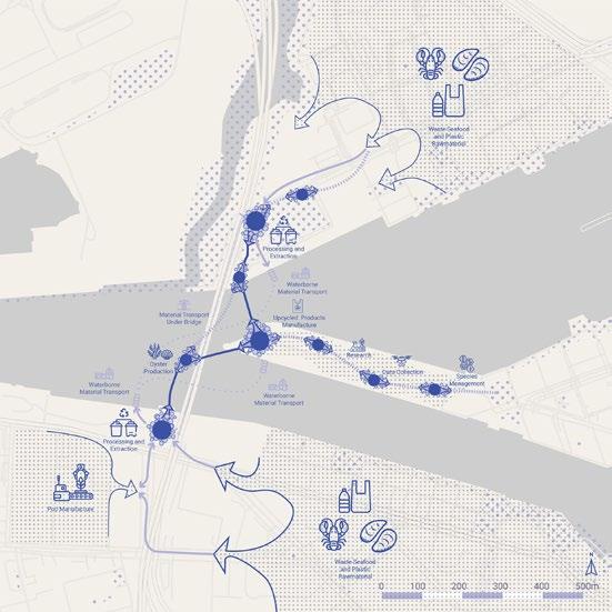
Phase 2 (10 years) introduces a bioresearch and chitosan production hub at North Wharf, completing the industrial core and initiating pod growth.
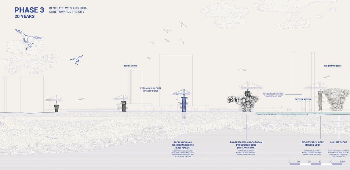
Phase 3 (20 years) expands the research cores and adds secondary cores in North Wharf to enhance city connections.
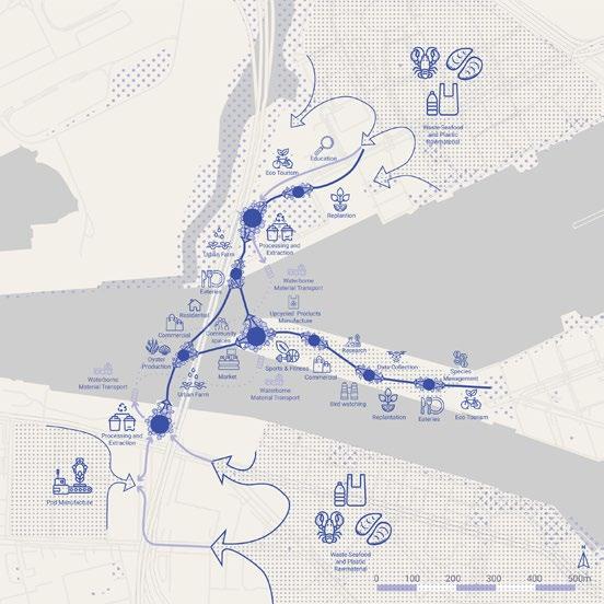
Phase 4 (30 years) sees widespread pod attachments, forming bridge connections and emphasizing wetlands restoration. In the
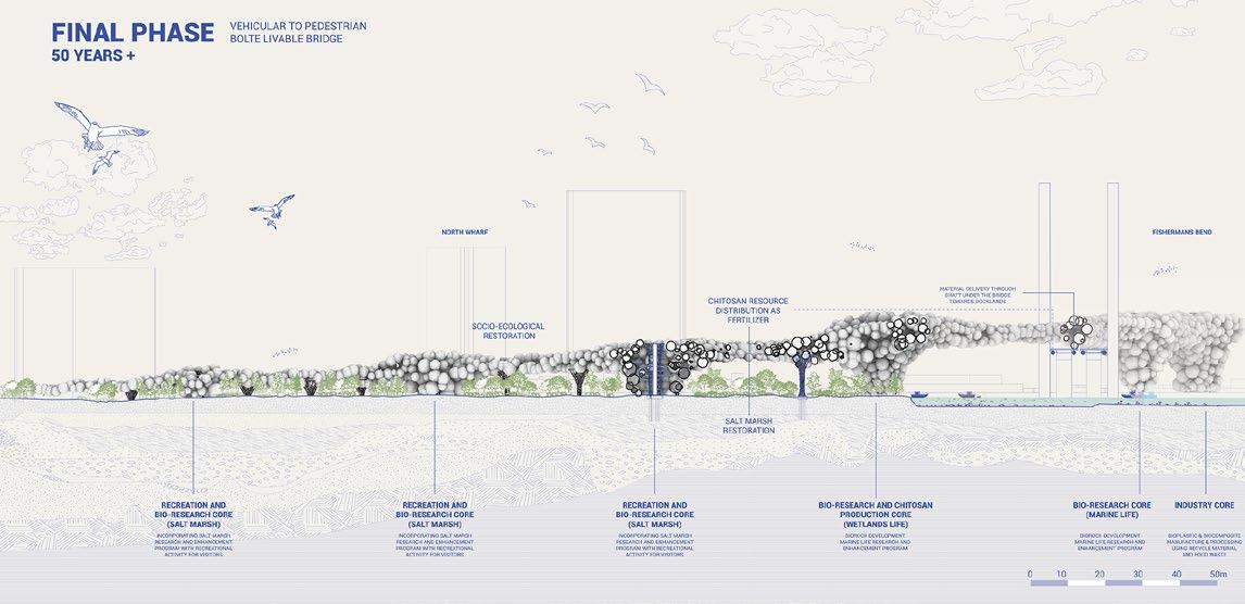
Final Phase (50 years), the bridge network and restored landscape are complete, with the Bolte Bridge becoming pedestrian-accessible, achieving socio-ecological restoration.


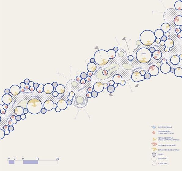
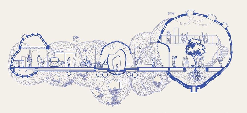
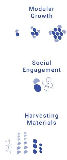
Activates pod bridges with shared paths for zero-emission transport, enhancing connectivity, safety, and vibrancy through technology.
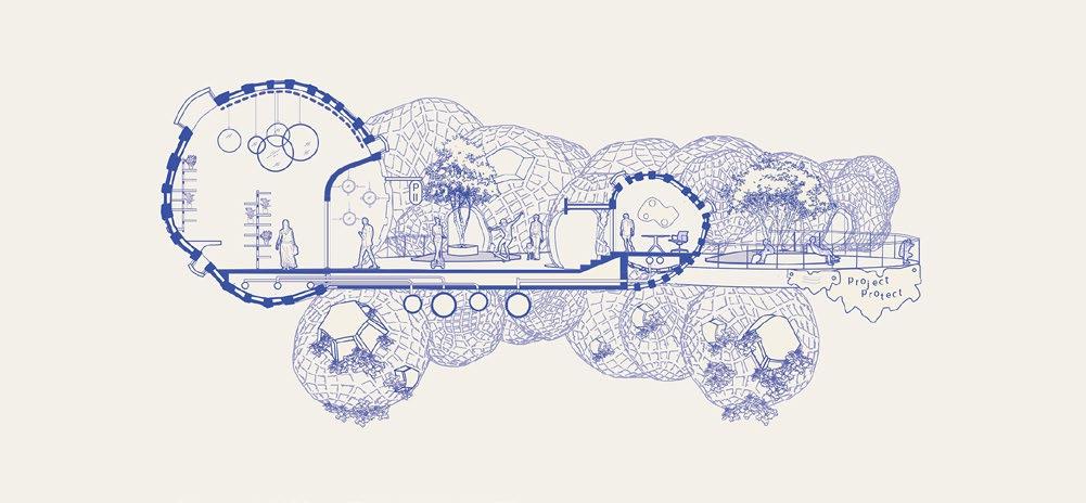
Creates an accessible, varied interface for central public areas, supporting diverse functions. Promotes chitosan for buildings and amenities.
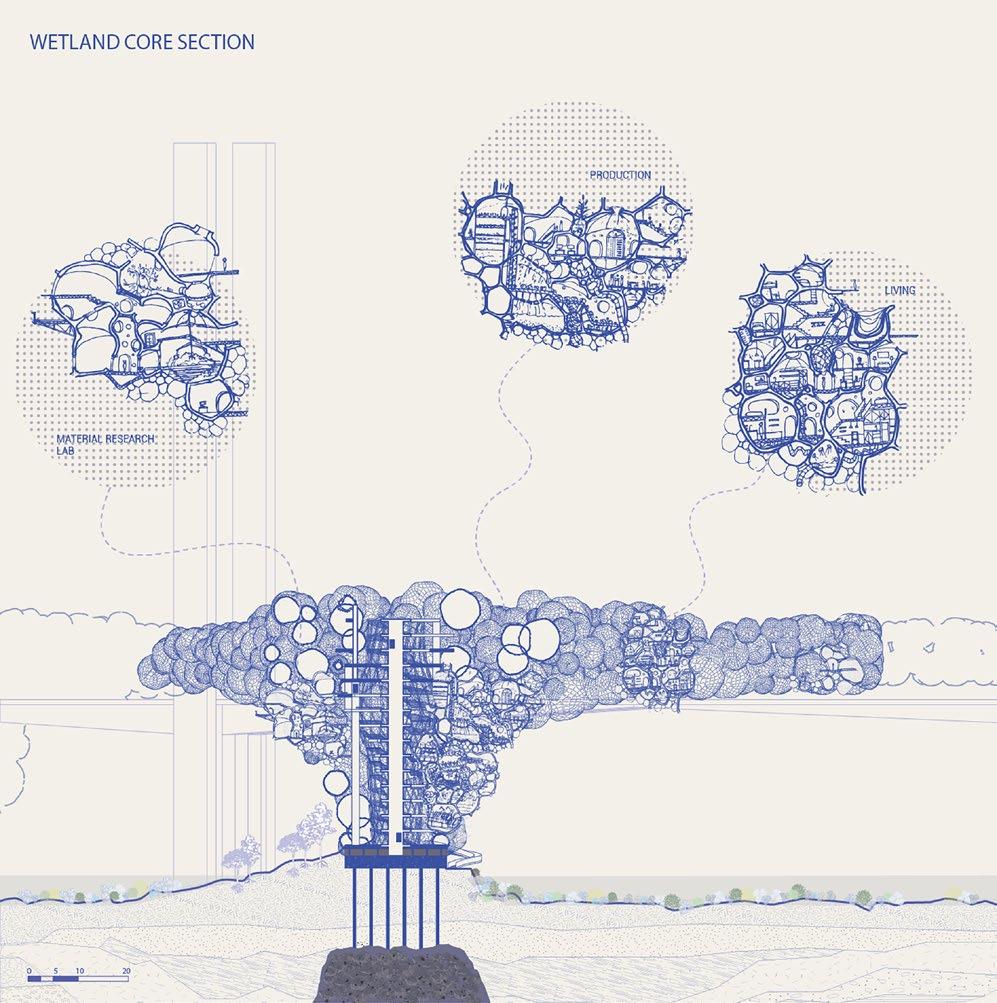
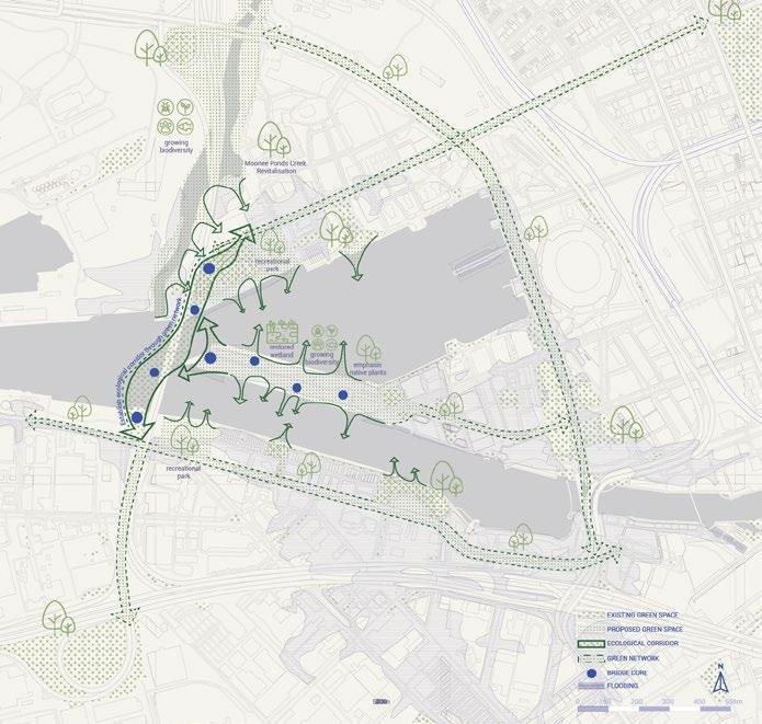
A collaborative multi-sector setup with vertical navigation through a central core and shared spaces. Research and production zones sit near the water for material access and monitoring, while community living rises for better public connectivity.


Central public path, with active edges opening inwards mixed use spaces, and playing with visual and physical permeability. Allowing for different spatial experiences and open space typologies.
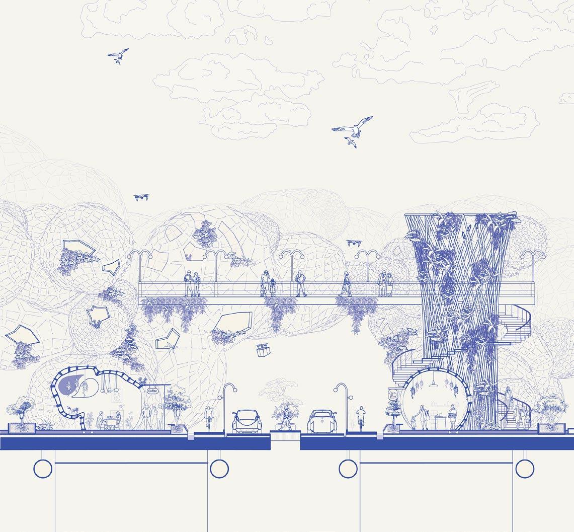
Dedicated spaces for commercial activity and public transportation such as ZEVs, bicycles, and pedestrians.
- NO FLOOD
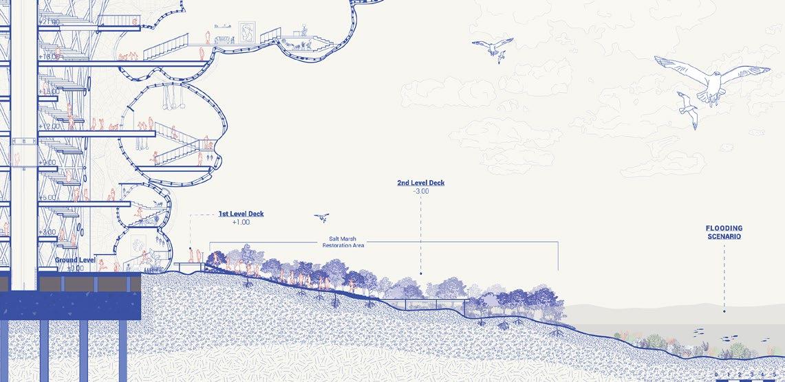
- FLOOD
Urban Design Studio B // Summer 2023
Albury, New South Wales
Teammate: Sarah Safira Indah Putri, Andrea D’Silva, Sanika Sunil Shinde
Subject Coordinators: Dr. James Whitten, Dr. Iain Lawrie
Responsibilities: Urban Design Strategic Planning, Landscape planning, 3D landscape and visualisation, perspective illustrations full version booklet: https://drive.google.com/file/d/17JpN4tHpIMNFX5D5jHzjMpiwpb9lwrqW/view?usp=sharing
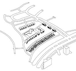
Albury is located in southern New South Wales, right on the border of Victoria, with the future High-Speed Rail proposal between connecting 2 major cities Melbourne and Sydney, Albury has potential to grow exponentially. Realising this, our proposal aims to provide a future scenario cater to its best potential.
Existing Scenario of Albury
The station area is congested with big-box retail and underdeveloped landscaping. Dean Street has heritage buildings, while the city features small-scale commercial and residential developments, with few institutional or hospitality buildings. The east is dominated by mono-functional suburban houses.
Hume Highway runs through Albury from north to south as its main freight transport towards Wodonga and Levington, dividing the city into two halves. It is surrounded by hilly terrain and the Murray river on the south. as the traditional custodians of the land.
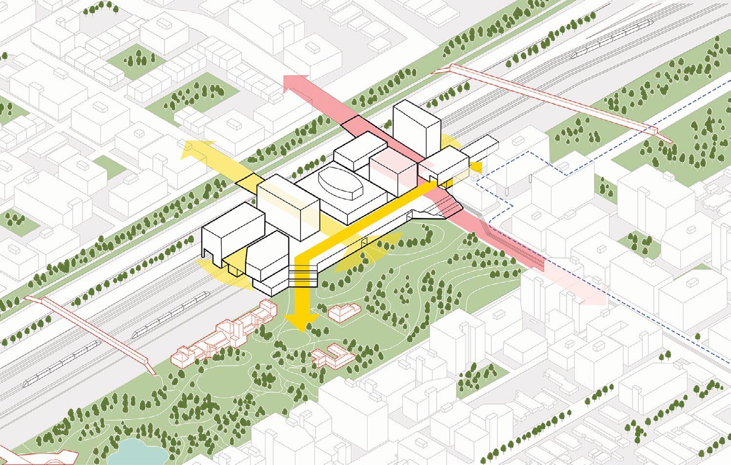
We aim to address severance from the Hume Highway, railway, and underutilised land, while preserving Albury’s heritage, including Aboriginal heritage. The new High-Speed Rail will drive urban development, with a central urban living room acting as a meeting point for social interaction and biodiversity.
East West Connection Pocket open spaces and public spaces 100 year plan to deck over Hume Highway
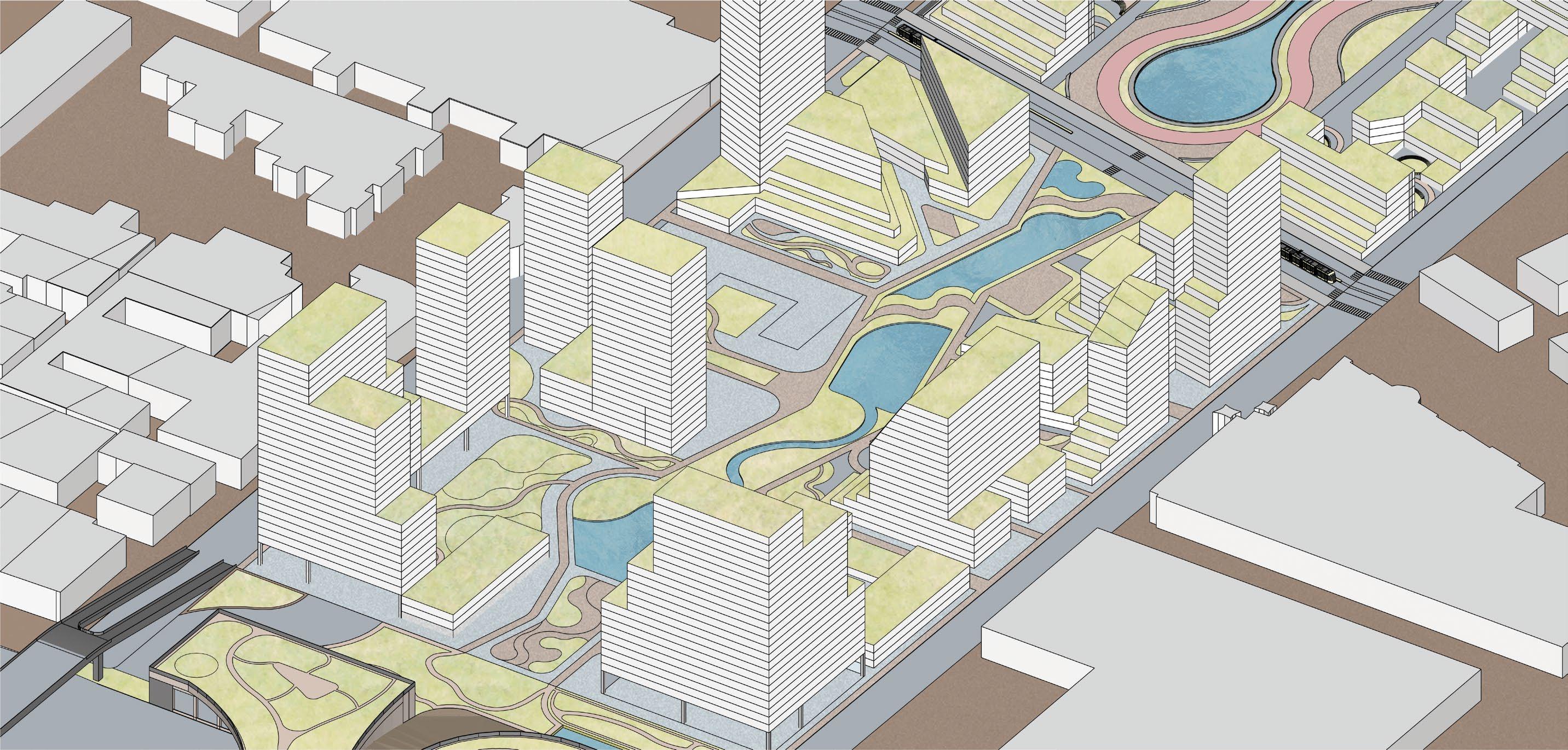
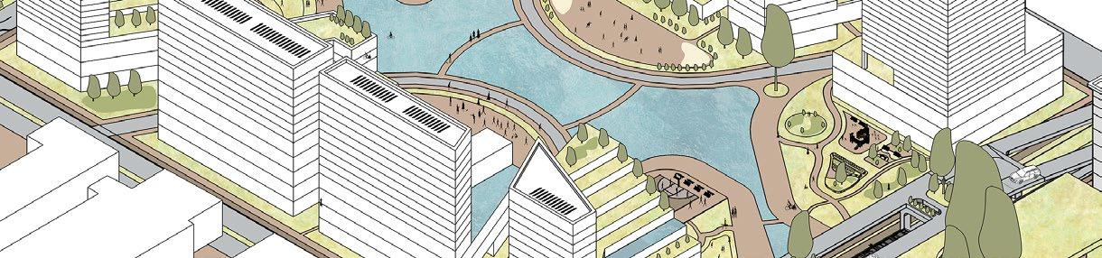
We propose an ‘Urban Living Room’ at Albury’s centre, strengthening green links while connecting colonial, pre-colonial, and contemporary narratives amid High-Speed Rail-driven growth. Inspired by Wiradjuri art on the Wagirra Trail, the design ties the landscape to the riverbank. Serving as a civic and transport hub, it unites east-west development, the old and new stations, and diverse transit modes, creating a community-focused space.
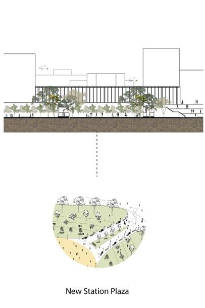
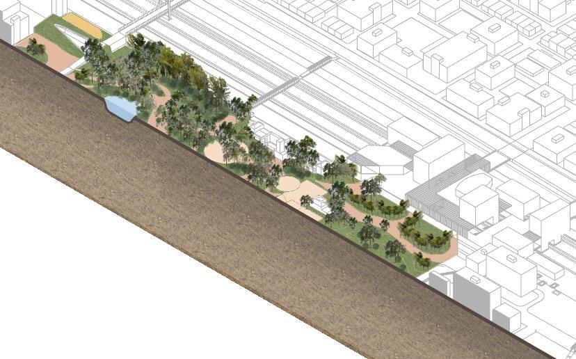
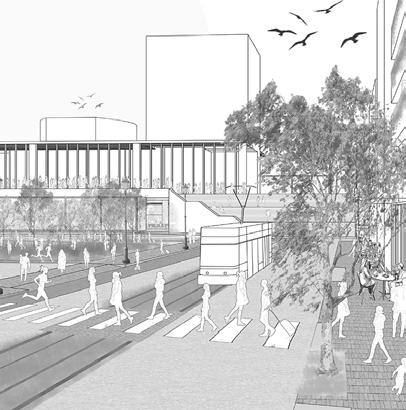
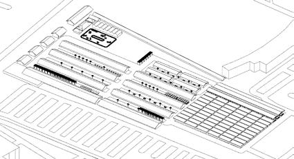
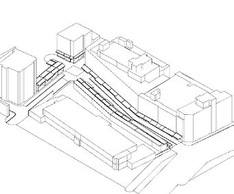
The new HSR station is located beside the old Albury station, right across Hume Street in order to reactivate it and strengthen the eastwest connection. Reconnecting the suburbs, the station acts as a city-bridge with a transition of compact and dense pedestrian friendly development. In regards to the state significance, the station becomes a civic and regional centre for Albury and woodanga. Two more bridges have been added to the 3 existing three, one opening up to hume street and the other opening up to a terrace overlooking the urban living room.
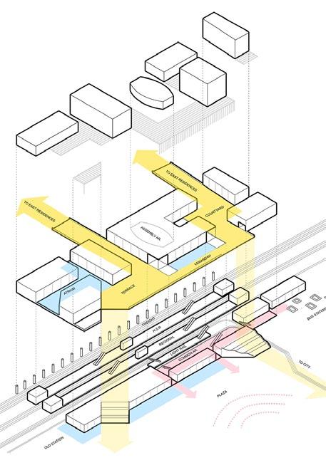
The station design has 3 platforms for light rail, hSR and regional train lines that open into a common area which seamlessly connects to an external bus station, It also has an activated front along the garden with commercial activities on the ground floor. For the first floor which serves as our main east west connection we also focused on creating an environment with different spatial experiences with courtyards, verandahs, atriums, and terraces
challenges the idea of private developments near station areas by creating a sustainable, equitable space that welcomes everyone.
It provides a public transport-focused corridor fast-tracking future developments on the poorly developed Hume street.
Urban Design Studio A // Winter 2023 Fisherman’s Bend, City of Melbourne, Victoria
Teammate: Sarah Safira Indah Putri
Subject Coordinators: Leire Asensio Villoria, Onur Tumturk
Responsibilities: Urban Design Strategic Planning, 3D and visualisation full version booklet:https://drive.google.com/file/d/1AJ3BQYkj5Fm1Q8hUzbpLZ1Cmt1Xu8ijL/view?usp=drive_link
The Fisherman’s Bend have a masterplan to be a place for create NEIC (National Employment and Innovation Centre). The major problems that occur in this area is flooding and being used as an industrial area which is categorized as the secondary industry for the manufacturer. The NEIC built a vision to shift the “industry” into tertiary and quaternary industry which create intangible products from it (service and technology). From this phenomenon and vision of Fisherman’s Bend future development, the design has aim to create a brand new space for enhancing the society and support goverment’s plan to make NEIC happen.
Enhancing meaning to embrace the background of its nature history, to increase the sociological aspects to create a better community, and being resilient to the flooding issue.
Collaborative Space
Natural Disaster Mitigation Area
Recreational Area
Transitional Area
Activity Center
Residential + Retail (Mixed-Use)
Transitional Area
Connectivity Zone
Transitional Area
Activity Centre
Residential Area
by Hassya
Car Park
This carpark is used for the visitor who bring their vehicle to this area. The block surrounds, especially for PICA visitor because the parking is not provided outside this intended car parking and building area.
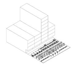
This market is intended to be a local shop to engage people and visitor with community market
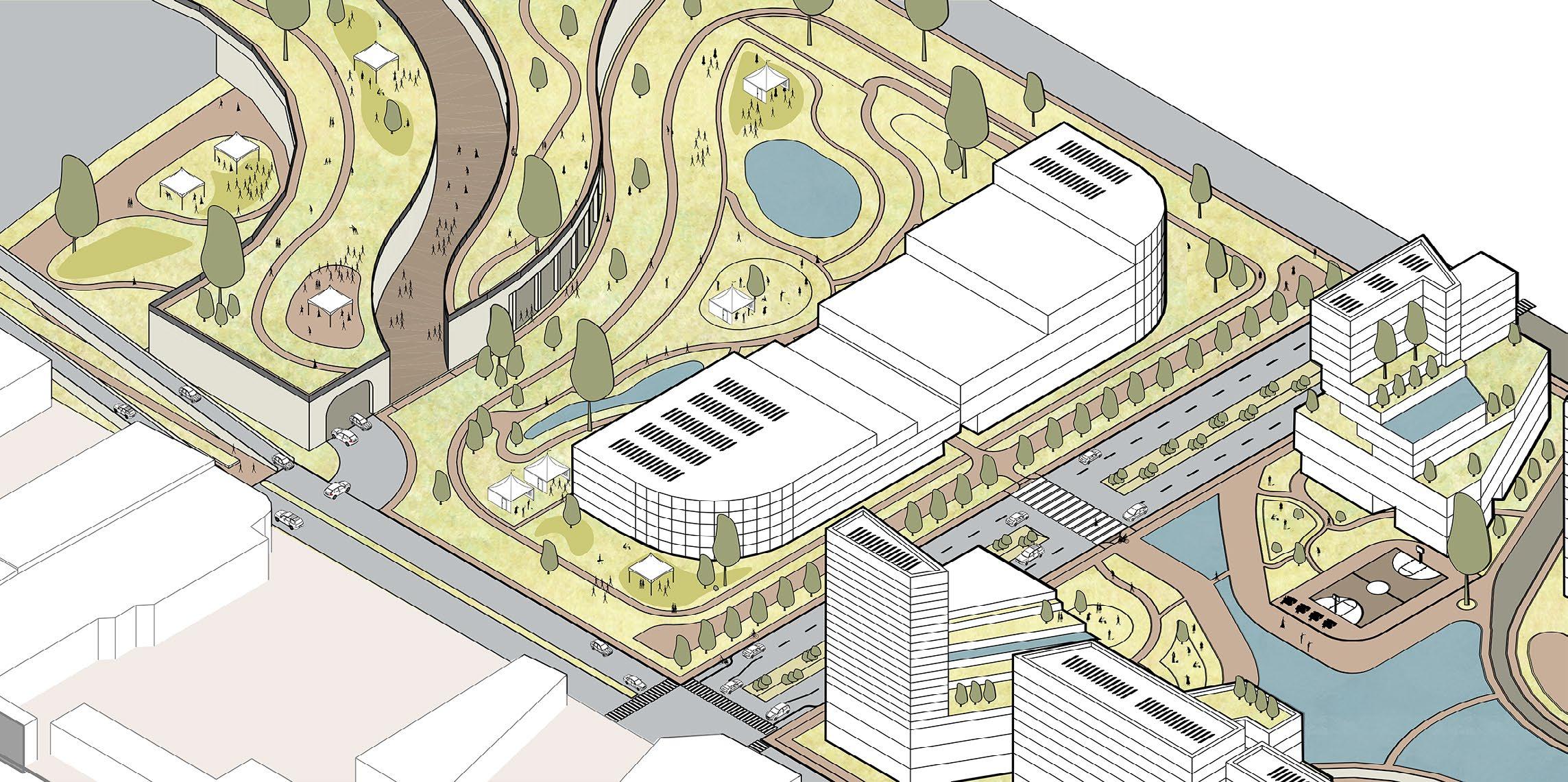
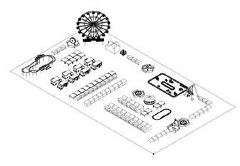
Urban Scenario PICA Market Day
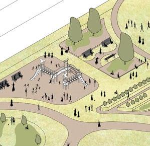
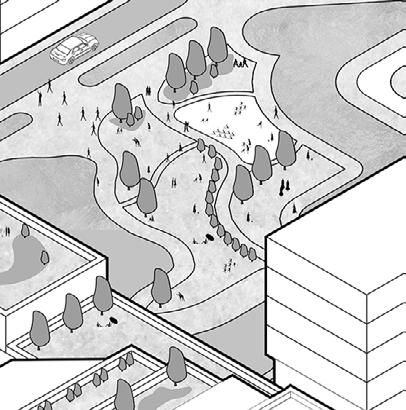
As an activity center, this area includes playgrounds for children to enjoy, while also offering space for parents to relax during their visit. The site is surrounded by a park and herb garden, enhancing the overall experience.
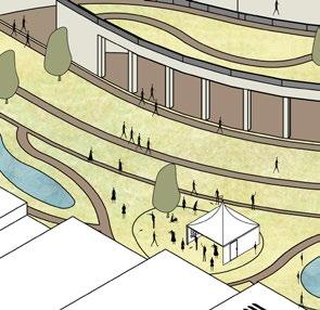
The PICA area is currently used for art center where the local band or singer concert most likely to held. PICA became tourist attraction for the area itself, so the green area and intentional flexible landscape will enhance the tourist experience as well.
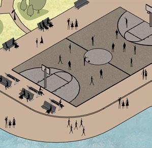
The area includes a playground, flexible spaces, and two public basketball courts, attracting youth and fostering diverse activities in line with the center’s purpose.
Urban Scenario Daily Activity in The Activity Park
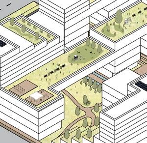
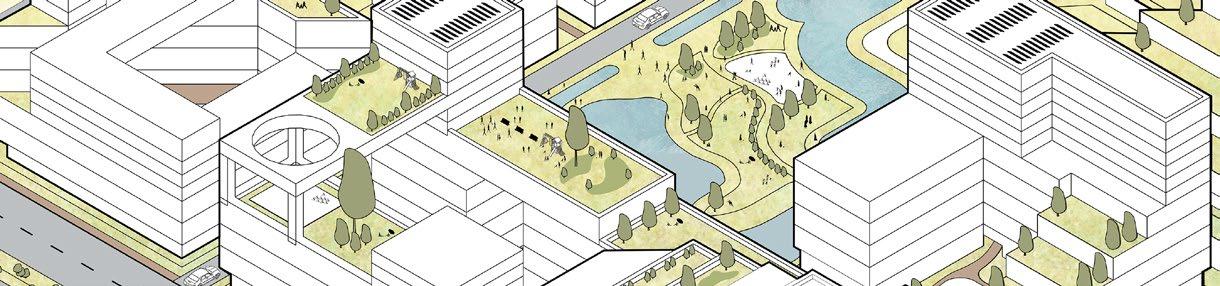
Roof Garden
This roof garden, located within the mixeduse building, offers apartment residents access to open space. The landscaping combines softscape and hardscape elements to support a variety of activities.
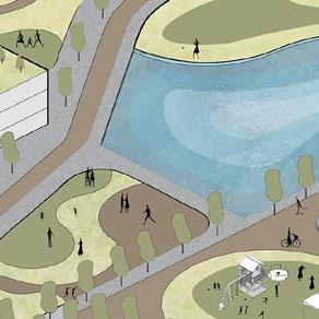
This area mostly designed to be a water retention pond. the massive water area are intended to be a tourism spot for people to visit. The water retention pond located right in the front of PICA entrance.
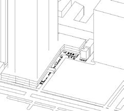
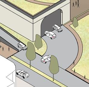
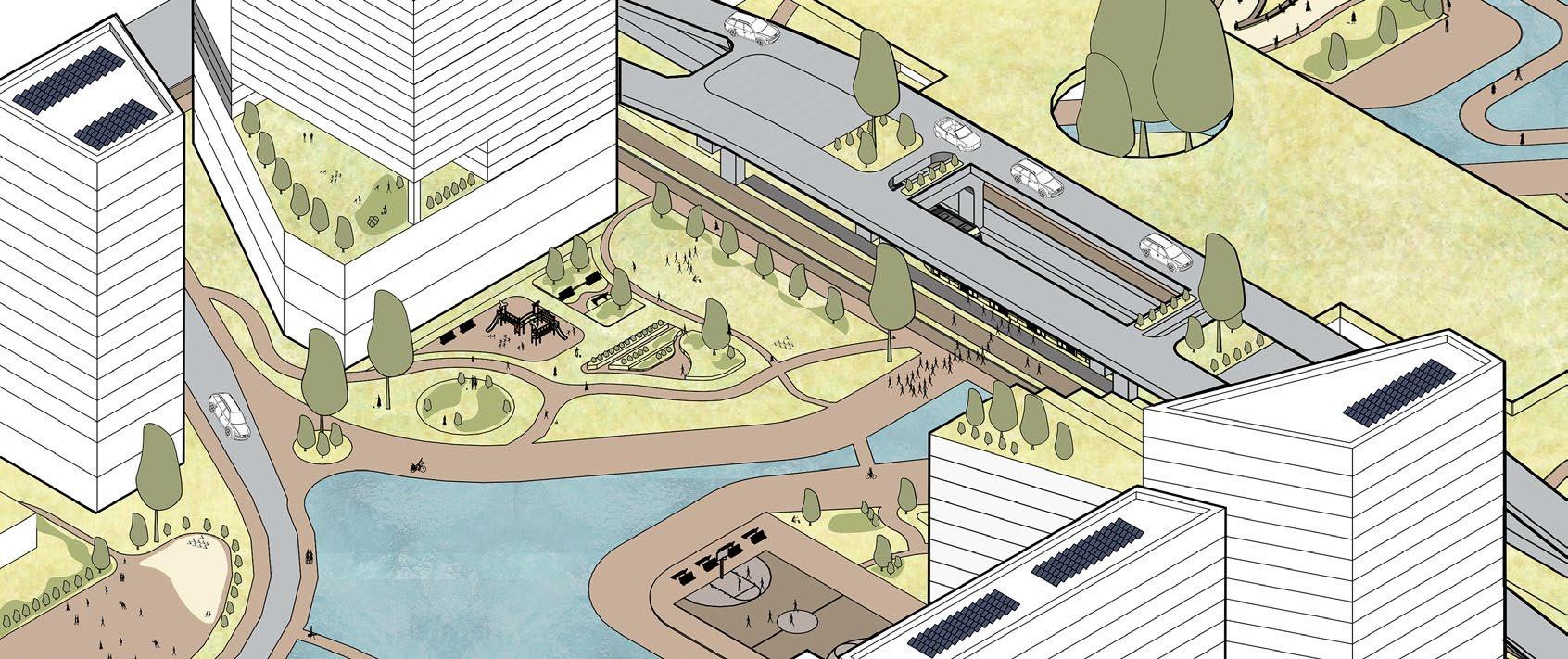
Train and Tram Station
The Metro Station will be integrated with the tram station, ensuring a safe, car-free transfer zone for public transport users. Pedestrians can directly access the laneway upon disembarking.
Urban Scenario Daily Activity in The Residential Area
This area has the main function as an urban wetland for retaining the flood. The surrounding also additionally being retention green area. Many bushes and trees also will help the land to absorb more water to prevent the worse flooding.
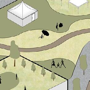
Multifunctional space that works both for flooding intervention, as well as open space free for collaboration - whether it’s a market, festival, this area provided the need for social interaction within the diverse community.
by Sarah Water Sensitive Design
Large area dedicated as a water retaining basin to support the influx of water from flooding as well as rainwater which could also be use for harvesting in an urban farm, or everyday uses.
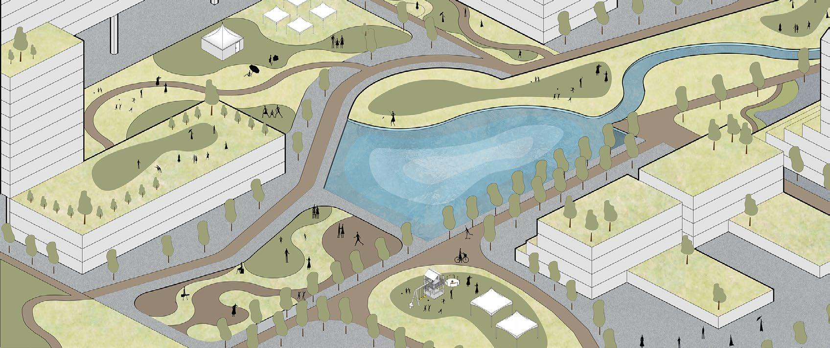
Instead of a typical tram stop, an amphitheatre offers space for waiting, resting, and daily activities, while also supporting performances like busking.
This area is dedicated for a transition from the water retaining basin towards underbridge car parking which is also connected with a bridge to the other side of the site. Not just an empty space, but its also an area open for many kinds of activities.
A tram is proposed by the Victoria Goverment to provide public transport need to the site. To connect both area that is divided by tram roads, a pelican crossing is provided for pedestrian.
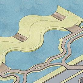
This bridge safely connects visitors to Fishermans Bend amid rising sea levels while also serving as a scenic attraction, offering a 360-degree viewing experience.
The water retaining basin does not stop in one area, it works just like a river. From the main sea water level inundation toward a flooding-prone area, water pockets are available to contain the water.
As the water flows towards the site, 2 steps before it goes out of control: the water is catched by the water basin and also absorbed by the green area.
The unique shape of water droplets that contiinues to flow towards the end is also used for tourist attraction to better understand the area and opening a new open space activity to be use for people of all ages.
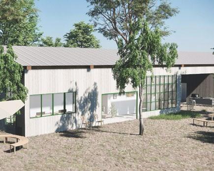
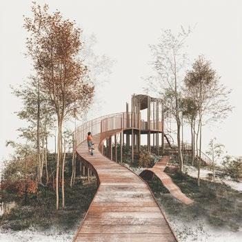
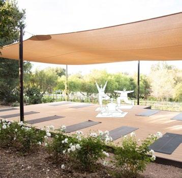
Mark’s Country Place, Kyneton, Victoria
Teammate: Xiaoman Ye, Launay Kang, Vismay Patel
Subject Coordinator: Prof. Derlie Mateo-Babiano
Responsibilities: placemaking strategy discussion, stakeholder analysis matrix, implementation timeline and place activation plan (tactical actions)
full version report: https://drive.google.com/file/d/1yEi5JvJh9a6xOw-ukoyiEJaZ9_0RCXtf/view?usp=sharing
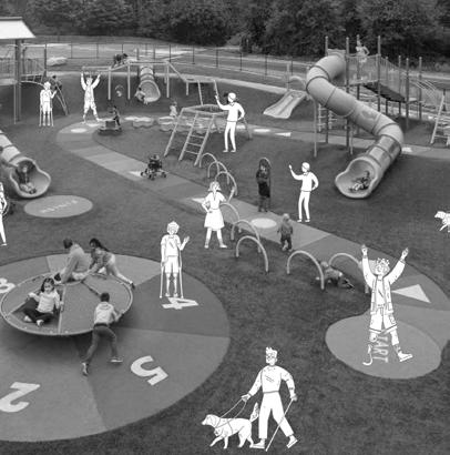
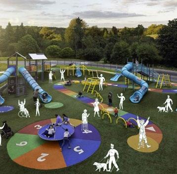
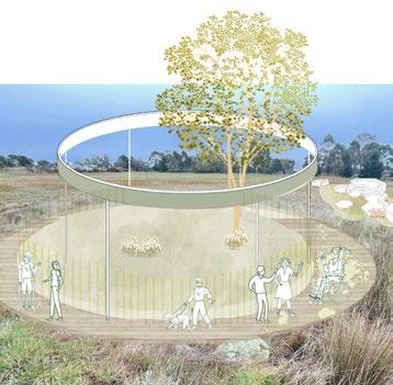
This placemaking project at Mark’s Country Place in Kyneton, Victoria, envisions an inclusive, sustainable hub that fosters social connection and well-being for people with disabilities and the broader community. It integrates universal accessibility, sensory gardens, meditation spaces, and nature-based experiences while prioritising environmental
sustainability. Designed through a participatory approach, the project reflects local needs and values, ensuring equitable access to recreational and therapeutic spaces. A phased implementation strategy allows for adaptability, with ongoing evaluation to refine spaces and programs for long-term impact.


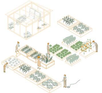
Set in a biodiverse rural landscape near Melbourne, this placemaking project integrates native flora and fauna while addressing environmental challenges.


Incorporate the existing flora and fauna


Introduce new build structure to the site

Introduce notable experience for people with disability

This placemaking strategy presents a comprehensive approach to transforming Mark’s Country Place into a vibrant, functional community hub. It prioritises environmental sustainability, enhances inclusivity, and fosters public engagement, creating a dynamic space that encourages meaningful interactions and connections.
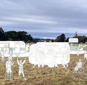
Temporary
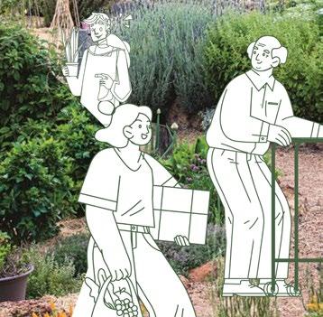
Effective placemaking thrives on multi-stakeholder collaboration, engaging governments, developers, and communities to align regulatory, financial, and social goals. By integrating diverse perspectives—economic viability from developers and social priorities from communities—placemakers can navigate legal frameworks, secure funding, and design spaces that holistically balance social, environmental, economic, and cultural contexts.
assess and track the quality of life and overall wellbeing of people within local scope area. decision-making towards resident’s wellbeing improvement (healthy, financial, and social sectors).
This placemaking proposal incorporates evaluation frameworks to ensure project objectives are met. The Urban Experience Framework assesses place attachment through factors like ambient comfort, mobility, and safety, capturing qualitative and quantitative data to gauge users’ sense of belonging. CITYKeys is adapted for ecological health evaluation, focusing on resource management indicators such as water and waste to align with sustainability goals. Biophilia indicators measure connections with nature, including urban green spaces, biodiversity, and urban heat island effects. Lastly, Local Wellbeing Indicators track social inclusion and cohesion, offering insights into quality of life and informing future improvements for community well-being.

+61478549410 | hassyaedina@gmail.com | www.linkedin.com/in/hassyaedinatamma