Landscape Architecture Portfolio
 Hannah Kohler
Bachelor of Landscape Architecture (Honours) University of New South Wales
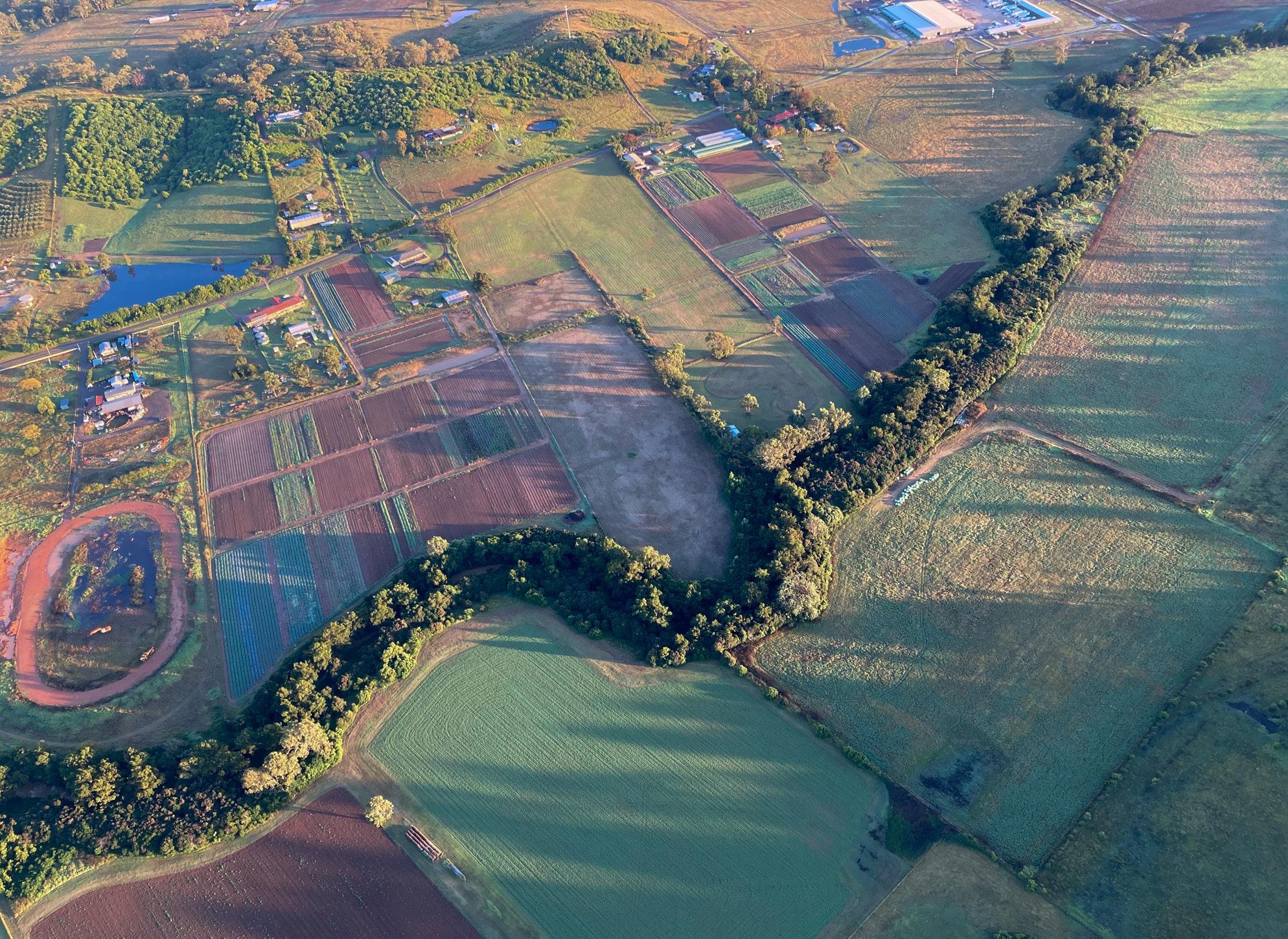
Photograph: Hot air ballooning across Camden Valley, a landscape in my travels
Source: Kohler, 2021
Hannah Kohler
Bachelor of Landscape Architecture (Honours) University of New South Wales
Photograph: Hot air ballooning across Camden Valley, a landscape in my travels
Source: Kohler, 2021
Acknowledgement of Country
I would like to acknowledge and pay my respects to the Wodi Wodi people, who are the traditional custodians of the Dharawal nation where I live and work. I would like to extend that to the Gadigal people of the Darug nation, where I participate in my studies, whose traditions and knowledge systems inform my current designs.

I acknowledge elders past, present, and emerging. I would like to personally thank them for their contributions and knowledge. I commit to respecting and working with Country in all future designs, and working with traditional owners across all projects so that their culture can flourish through future generations.
I acknowledge that this was, is, and always will be Aboriginal land.
Photograph: Above the sunrise Source: Kohler, 2021
i
Contents
Acknowledgement of Country i
Contents ii
Personal Statement 1-2
CV 3-4
Angus: A Resilient Suburb 5-6
Hidden Heights Adventure Park: Doorway into the Wild 7-8
Hidden in the Layers 9-10
Planting Design 11-12
Landscape Documentation 13-14
Group Advocacy Paper & Other Achievements 15-16
 Photograph: Above the sunrise Source: Kohler, 2021
ii
Hannah Kohler
My name is Hannah Kohler and I will be shortly entering my 4th year of a Bachelor of Landscape Architecture with Honours at the University of New South Wales. Throughout my second and third years, I have enjoyed working alongside and being a part of the team at Taylor Brammer Landscape Architects in Austinmer, learning invaluable skills that I have been able to translate into my studies.
Growing up, I had the privilege of spending my family holidays touring in our caravan around Australia, from the coastline of Tasmania to the hot, dry far reaches of the Kimberley in Western Australia. These memories and experiences have played a core role in my love for nature, the Australian landscape, and its flora and fauna species. Exploration of these landscapes has revealed such a beauty that I think so many people should experience.
I have always been a very creative person, whether that be through drawing, painting, crocheting or photography and after completing year 12 and studying environmental science and visual arts I felt that landscape architecture would harmoniously bring together my two passions.
Wollongong, Australia
Email: hannahrk2001@gmail.com
Mobile: 0421022276
As I reach the end of my degree, I am excited to create spaces that will draw people together into nature and allow them to experience the beauty that remains in my memory all these years later. Being sensitive to and working with Country, I hope to create exciting, sustainable, and accessible spaces that will help to form core memories for so many others, drawing people together and fostering a sense of community.
Beyond these aspirations, I continue to enjoy different modes of art making, going to the beach, spending time with my family, and being involved in leading a youth group and band at my church.
2
CV
Experience Education Achievements
Student Landscape Architect


Taylor Brammer Landscape Architects (2021 – Present)
Front End Team Member Woolworths (2020 – Present)

Youth Leader Woonona Presbyterian Community Church Youth Group Yconnect (2019 – Present)
Nursery Volunteer Jamberoo Native Nursery (2021 – 2022)
Technologocial Skill


Higher School Certificate Wollongong High School of the Performing Arts (2014 – 2019)
Bachelor of Landscape Architecture (Honours) University of New South Wales (2020 – 2023)
Art Express Exhibition 2020 Goulburn Regional Art Gallery
Griffith Regional Art Gallery (cancelled due to COVID)
Yr12 Major Work Now Exhibiting, 2022 Minnamurra Rainforest Centre
UNSW Dean Merits List 2020 2021 Photoshop
Photograph: Rivers of New Zealand
Source: Kohler, 2018

Indesign SketchUp AutoCAD Illustrator Hand Drawing 4
Medium desntiy housing Town centre Community farm Parks Pocket parks

Existing heritage sites Exisitng cemetery Existing school

Across each term, assignments progressed with the intention of being able to prepare a masterplan for the desired population increase in the suburb of Angus. A flood affected area in Western Sydney, my design looked to create a resilient suburb that could cope with potential periodic inundation in order to reduce reliance on existing roads that also get flooded.


Angus
Landscape Studio 5: Site Planning, Systems and Performance
Studio 6: Landscape Performance and Site Design Year Term 1 & 2, 2022 Assignment Assignment 3: Re-imaging Angus and Eastern Creek Assignment 6: A Masterplan for Angus
Marsden Park North, Sydney
A Resilient Suburb Subject
Landscape
Location Angus,
Brief
Low density housing – Majority of housing
17 Key Features
Existing wetlands Shopping centre Sporting facilities Environmental conservation area Mountain biking track Board walk Constructed wetlands Mass planting 1 2 3 4 5 6 7 8 9 10 11 12 13 14 15 16
Analysis of runoff via ridges and gulleys Existing Street Analysis


Design Principles Design Features Community farm Parks Board walk Constructed wetlands Mass planting 4 5 14 3 8 17 15 16 17 2 - Facilitate opportunites to create a selfsufficient community during times of disaster 4 - Form an inclusive transport and 3 - Support existing and strengthen existing ecological communities 5 - Create community transport and pedestrian network Environmental Mountain Board Constructed Mass 13 14 15 16 17 3 - Support existing and strengthen existing ecological communities 4 - Form an inclusive and sustainable transport and pedestrian network Community farm Parks 5 1 - Create attractive and biologically diverse water management systems 3 - Support existing and strengthen existing ecological communities 5 - Create opportunities that engage the community and encourage an active and 2 - Facilitate opportunites to create a selfsufficient community during times of disaster 4 - Form an inclusive and sustainable transport and pedestrian network Design Features Environmental conservation areas 4 15 8 7 13 diverse 3 - Support existing and strengthen existing ecological communities 5 - Create opportunities that engage the community and encourage an active and healthy lifestyle 2 - Facilitate opportunites to create a selfsufficient community during times of disaster 4 - Form an inclusive and sustainable transport and pedestrian network Design Features Low density housing - Majority of housing Medium density housing - The two blocks adjacent Town centre Community farm Parks Pocket parks Existing heritage sites Existing cemetery Existing school Exisiting wetlands Shopping centre Sporting facilities Environmental conservation areas Mountain biking track Board walk Constructed wetlands Mass planting 1 2 3 4 5 6 7 8 9 10 12 7 9 4 15 15 4 14 11 3 13 8 6 6 17 7 11 12 13 14 15 16 17 1. Create attractive and biologically diverse water management systems 2. Facilitate opportunites to create a self-sufficient community during times of disaster 3. Support existing and strengthen existing ecological communities 5. Create opportunities that engage the community and encourage an active and healthy lifestyle 4. Form an inclusive and sustainable transport and pedestrian network N 6
Reinventing the program of Moore Park Golf Course, giving half of the space back to the community to create a space that could be a backyard for those in dense urban living, in the surrounding suburbs of Kensington, Zetland, Waterloo, Redfern and Surry Hills.


Located in the far north of the site the Hidden Heights Adventure Park became a space inspired by Moore Park Zoological Gardens, offering activities including a Hippo Splash Pad, Monkey Trails highropes course, and Big Playground.

Heights Adventure Park Doorway into the wild 1. Hippo splash pad 2. Water slide 3. Seating mounds 4. Monkey Trails highropes 5. Big slide 6. Big climbing frame 7. Tunnels 8. Flying fox 9. Climbing wall 1 2 3 4 4 4 4 4 5 6 8 9 9 10 11 12 13 14 15 16 17 7 18 Imagine Inspire Excite Discover Subject Landscape Studio 7: Design with a Complex Program Year Term 3, 2022 Assignment Assignment 3: Exploring the Concept (derived from a group masterplan in assignment 1)
Hidden
Location Moore Park Golf Course, Sydney Brief
Principles N


highropes course 10. Swings 11. Accessible play 12. Trampolines 13. Kids learn to ride 14. Water play 15. Views to the city 16. Hammocks 17. Cafe 18. Ammenities Zoning of Group Masterplan Monkey Trails
8
Big Playground Hippo Splash Pad
and structures. Interventions were designed to be in keeping with the space, enhancing and transforming the space.


Elements of Storytelling Analysed in Plan Using Colour to Highlight Elements in Analysis Views Exposed Site Structures and their Materiality Original Coastline Experimenting with using the same plan to capture different experiences or features of a site. Using 0.5 and 0.3 pens with an orange felt tip pen to mark the detailed site so that it stands out within the analysis Creates contrast to the black 0.3 & 0.8 pen markings liked using colour to mark out the mos significant paths along a path. Orange coloured pencil used. added colour to one plant to experiment but decided that colour should only represent one thing in the diagrams Orange arrows highlight the importance of different planting
in the Layers Subject Landscape Studio 2: Design Process Year Term 3, 2020 Assignment Assignment 2: Exploring the Concept Location Cockatoo Island Sydney Brief
materials
Hidden in the Layers of Cockatoo Island Site Textures - Rubbings completed in 4B Pencils Sandstone Wooden Sleepers Industrial Beams Rusted Corrugated Field Analysis Diagrams & Sketches Testing of hatching create surface I enjoyed working in perspective here to expose the textures of the island. Testing out using a range of pen weight to create depth in a perspectice sketch Creating markings using a range of pen sizes including 0.2, 0.3 & 0.5 Section of silo located Site Sketches Site Textures Site analysis of views, existing vegetation, buildings, and original coastline of the island
Hidden
Through the process of sketch and hand model making, analysis of the site at Cockatoo Island, revealed hidden layers embedded in the history through
and the shade created by them. sized squares.
Model Making located within the cliff face
Screwed up paper helps create the form of the rock wall and the rough sea/waves. Thick cardboard mimics the concrete walls.
Working at 1:50 was helpful as it allowed me to set in intricacies like the stairs and be able to photograph them in a way that could be drawn.

Site model created to be a base for perspective drawing


Experimented with creating lighting effects are by removing graphite from the smudged sky
Models at 1:100
Reflecting Amongest the Native and Protected Planting Coastline to the Water’s Edge
From Project 1 @ 1:50
and Protected Planting twon garden beds the surface
Water Walk
Rough models are created with paper, cardboard and masking tape to model form.

Used 4B, 6B and 8B pencils to create the different textures, materials and shadows.

The place where water can flow down between the two walls marking the original coastline
Rough models are created with paper, cardboard and masking


me to set in intricacies like the Reflecting Amongest the Native and Protected Planting can flow down between the two
Editing the image to black and white helps to exaggerate the shad ows making it easier to transfer into a drawing.
Looking down the path between the twon garden beds that mark the original coastline on the surface
Dipping ones toes into the water after climbing out over
Using models can help set up perspectives to draw and has helped me to add the right textures/materials into the design to imagine the
original coastline carved out between
beneath the canopy of shade
Dipping ones toes into the water after the original coastline
Climbing out over the water creating a place to reflect.
Plan and section of one main intervention within the site

Climbing out over the water creating A place to reflect upon stories beneath the canopy of

Looking down the original coastline carved out between
10
Planting Design

Subject Planting Design Year

Term 3, 2020 Assignment Assignment 1: Herbarium Assignment 3: Planting Design
Location Waverton Coal Loader, Balls Head, Sydney
Brief
Drawn herbarium accurately depicting the overall form and appearance of various planting species, to help inform future planting designs.


Create a detailed planting design for an area of the Coal Loader at Balls Head on Sydney Harbour. To include both indigenous and exotic plant species suitable for the conditions of the site.

Subject Area Plan Coal Loader, Balls Head Waverton

Stenocarpus sinuatis Telopea speciosissima Scale 0M 2 4 10M 2 1:200 1:200 @ A3
Cupaniopsis anarcardiodes


Angophora hispida
Banksia spinulosa ‘Bush Candles’
Melaleuca thymifolia


Erysimum ‘Bowles’s Mauve’
Cistus creticus
Leucospermum cordifolium
Westringia fruticosa ‘Grey Box’
Correa alba
Hardenbergia violacea ‘Meema’
Angiozanthos humilis x flavidus ‘Landscape Tangerine’
Cordyline ‘Pink Passion’
Carex ‘Ice Dance’
Liriope muscari ‘Just Right’
Liriope muscari ‘Samantha’
Juncus usitatus
Carex appressa
Ficinia nodosa


Myoporum parvifolium purpurea
Viola hederacea
Lawn

Scale 0M 1 2 5M 1 1:100 1:100 @ A3 Subject Area Plan Coal Loader, Balls Head Waverton Banksia integrifolia
‘Belgium Hybrid’
Clivia
12
Landscape
Brief

Working by hand, learning the fundamentals of grading a site and applying the right levels to the site.
Run adjacent to Landscape Studio 4, work in this course aimed to develop a set of scale details of custom furniture and fixings utilised within our studio project. Details built to Australian Standards were to depict finishes, transitions, and furniture.

Documentation + 13.000 PROPOSED SPOT HEIGHT EX + 13.000 EXISTING SPOT HEIGHT +TW 13.000 PROPOSED TOP OF WALL HEIGHT +BW 13.000 PROPOSED BOTTOM OF WALL HEIGHT PROPOSED CONTOUR EXISTING CONTOUR GRADIENT GARDEN BED LOW POINT EXTENT OF WORKS
Documentation 1 & 2
PROPOSED TREE - REFER TO PLANTING PLAN AND SCHEDULE EXISTING TREE + O FULL SCALE | A3 SHEET SCALE 1:200 0 0.5 1 2 Subject Landscape
Year Term 1 & 2, 2021 Assignment Assignment 2: Grading a site Assignment 3: Documenting a Project
CONCRETE AND WOODEN SEAT SECTION SCALE 1:10 @ A3

TIMBER BRIDGE DECKING SECTION SCALE 1:10 @ A3

STAIR SECTION SCALE 1:20 @ A3


HANNAH KOHLER z5311025 LAND2272 GREEN WAY - RETREAT INTO THE NATURAL 36 FURNITURE TYPE 1 DETAIL: CONCRETE AND WOOD SEAT PRELIMINARY SKETCHES
14
Group Advocacy Paper & Other Acheivements
Overview

As populations rapidly increase in Western Sydney and the need for affordable housing grows, AILA is proposing that all new residential developments within Blacktown Council become ‘agrihoods’. Agrihoods are communities that combine local fruit and vegetable farming and biodiversity conservation with residential living to address the issues of climate change and food insecurity. In order to achieve this changes to development policy must be enforced throughout the construction and lifespan of future Agrihoods within the Blacktown City Council in order to maintain liveable, sustainable, and connected communities.
The Role of Landscape Architecture
One of the central roles of a landscape architect in the development of agrihoods is to advocate and establish a means to educate the residents and the younger generation on the importance of growing their own local, fresh produce to improve urban food security Landscape architecture, in the development of agrihoods, also provides equality amongst a community, allowing all residents and people within the community, regardless of status, to access these essential resources.
Recommendations
1. Recommendations that change the practice of landscape architecture
- All new residential agrihood developments in Western Sydney must conserve and restore at least 30% of terrestrial biodiversity
- All new residential agrihood developments on former agricultural lands or peri-urban regions of Western Sydney must provide at least 21% of land for urban cropland farming
2. Recommendations that change policy
- Verges to be widened
- Irrigation systems to be included within the verge... Agricultural planting must be connected to swales located on the other side of the road
- Verge planting must be regularly maintained, supporting visual amenity and Agrihood productivity. Must be of either an edible variety or one that supports biodiversity.
- No height limits to be placed on planting provided sightlines are maintained at intersections.
- Approved street trees to provide either biodiversity value within the immediate development and broader Sydney context to maintain green networks, or be a food source for the community.

3. Recommendations that changes attitudes/behaviours
- School students must visit Agrihoods for a minimum of one hour per week, as part of the education curriculum
- All residents must own and use a compost bin to reduce waste
4. Recommendations that nominates investment and funding to address and make change around the issue
- Local cafes and restaurants’ ingredients bought must consist of at least 70% produce from the Agrihoods
- Farmers markets must sell locally grown produce and be held at least once a week
Excerpt from Group Advocacy Paper – Representing
AILA
WHITE PAPER FOR AGRIHOODS IN
COUNCIL Austral an Institute of Landscape Architects (AILA)
Members Danae Koukos z5312046) Hannah Kohler (z5311025 Ju ia Shreeve (z5316835 Madeleine H z5312572) 2
BLACKTOWN
NSW
Ecological Invasion – Yr 12 Major Work
My body of work explored the destruction of Australian native species due to the introduction of foreign species into the ecosystem. Since European settlement, the Australian native fauna population has crumbled, with many creatures at risk of extinction. The fragmentation of the native animals further amplifies the vulnerability and collapse of indigenous fauna populations.


My passion for art and native ecologies has driven much of my desire to create landscapes that will support both human and animal communities.


16
Bottom Right: Exhibiting at Gouburn Regional Art Gallery. Below: Currently being exhibited at Minnamurra Rainforest Centre
Bottom right source: ArtExpress, 2019
