
THE WEATHER AUTHORITY Early Forecast for the Season How WINK Tracked Hurricane Ian, a Once-in-a-Lifetime Storm Prepare Now To Protect Your Family, Your Home, Your Boat and Your Pets The Dangers of Storm Surge How and Where to Find Safe Shelter in a Storm
HURRICANE GUIDE 2023
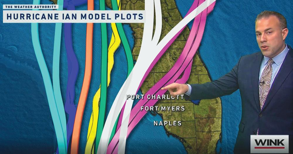
Matt Devitt WINK Chief Meteorologist
HURRICANE CLEAN UPSeparating Your Debris
Debris should be placed curbside, without blocking the roadway or storm drains.
Any debris placed from the sidewalk toward your proper ty will not be picked up. HOUSEHOLD
* The brush will be ground into mulch, so plastic must be avoided.
DEBRIS SEPARATION
Separate debris into the six categories shown.
DO NOT STACK OR LEAN
Placing debris near or on trees, poles, or other structures makes removal di cult. This includes re hydrants and meters.
UNSURE
WHERE TO PLACE DEBRIS?
If you don’t have a sidewalk, ditch, or utility line in front of your house, place debris at the edge of your proper ty before the curb
FREQUENTLY ASKED QUESTIONS ABOUT HURRICANE CLEAN UP

What is the di erence between storm-related debris and regular household trash?
Storm debris includes any trees, tree limbs and shrubs that went down in the hurricane. Regular household trash is what you would throw away in a typical week.
When will the storm debris be collected from my curb and what should I do to prepare?
There is no schedule for when storm debris will be collected from your neighborhood, but be assured that it will. Cleanup e orts take time.
When will my regular household collections resume?
Regular collections of garbage, recycling and your normal weekly yard waste resume as soon as it is safe for collection crews to do so.
PICKUP ZONE
NO
HAZARDOUS WASTE Check with your
ELECTRONICS Computers Radios Stereos Televisions Other devices with a cord
&
GOODS Air conditioners Dishwashers Freezers Refrigerators Stoves Washers, dr yers Water heaters CONSTRUCTION & DEMOLITION DEBRIS Building materials Carpet Dr ywall Furniture Lumber Mattresses Plumbing VEGETATIVE DEBRIS Leaves (do not
in
*
Logs Plants Tree branches Normal Household Trash Normal household trash and bagged debris of any kind will
be
local government.
APPLIANCES
WHITE
put
bags)
If you have a lot of leaves and small twigs in plastic bags, please set those aside from any brush piles.
not
picked up with disaster debris You should continue to follow your normal garbage removal schedule
P RE PA R E YOUR P ROPERTY FOR ST O RM SEASON BEFORE JUNE 1
• Cut back any trees or branches that contact your house, pool cage, shed or other buildings.
• Thin foliage so wind can blow freely through branches and decrease chances the plant will become uprooted.
• Clean your property of any items that could become a projectile during a storm such as old lumber, broken lawn furniture, etc., and place them at the curb on your regular waste collection day.

• Place trimmings at the curb on your regular collection day. Yard waste must be containerized in a separate yard waste container, paper lawn and leaf bag, or bundled. Yard waste in plastic bags will not be collected. CH

Containers and bundles cannot weigh more than 40 lbs. each. Limbs cannot be more than 6 feet in length or 10 inches in diameter.
C
Containers and bundles cannot weigh more than 50 lbs. each. Limbs cannot be more than 4 feet in length or 4 inches in diameter. A total of ten 45gallon containers or ten bundles of yard waste may be placed curbside.
Once a storm is named or a hurricane watch / warning is issued:
• Place garbage and recycle carts inside or secure them so they cannot blow or float away due to strong winds or storm surge.
• Do not cut down trees or do any major yard work. Mass cutting produces a burden on the normal collection process.
• Do not begin construction projects that produce debris unless absolutely necessary to protect life and property.
• Secure all debris, and do not place materials of any kind at the curb during a Watch or Warning period.
• Services may be suspended and facilities may close early to prepare for the storm. Residents should monitor local media and their county government websites or social media platforms for information on collection service statuses and any changes to disposal facility operations.
L EE C OUNTY
Containers and bundles cannot weigh more than 50 lbs. each. Limbs cannot be more than 6 feet in length. Up to 50 lbs. of unbundled palm fronds may be placed at the curb.
After the storm has passed:
• Most important – keep storm debris separate from your regular household garbage and recycling.
• Storm debris should be sorted into separate piles for garbage, yard waste, appliances, furniture & other bulky waste, appliances and construction debris as shown in the diagram to the left. Check with your local government regarding set out of household hazardous waste.
• Pick up will generally be done with a mechanized claw truck so it’s important that you not set debris over buried electric/phone lines, water meters, hydrants or mailboxes. Inspectors will tour each part of the county to determine where collection needs are greatest.
• Be patient. Following a storm, the No. 1 priority is the health and safety of our community and restoration of the county. When collection services resume, place garbage curbside away from storm-related debris on your regular collection service day.
• Debris collection guidance and recovery process updates will be available through local media and on county government websites and social media platforms.

C O
A RLOT TE
UN TY
O L L IE R C O UN T Y
www.charlottecountyfl.gov 941-764-4360 www.colliercountyfl.gov 239-252-2380 www.leegov.com/solidwaste 239-533-8000


HADINGER Flooring Est. 1931 6401 North Airport-Pulling Road • Naples, FL 34109 Mon - Fri 9-5:30pm • Sat 10-5pm 239-566-7100 • hadingerflooring.com “A family name you can trust” WE LISTEN . WE DESIGN . WE PLEASE .
WATERPROOF FLOORING


Luxury Vinyl


We focus on those ideas every day.
 ONLY WHITE GLOVE DEALER IN SOUTHWEST FLORIDA
BREAKTHROUGH FLOORS for everyone who loves to break a sweat Waterproof • Kidproof • Petproof
MOLD. BY THE TIME YOU SEE IT, YOU’RE ALREADY BREATHING IT.
A SAFER ENVIRONMENT BEGINS WITH PROFESSIONAL MOLD TESTING AND ASSESSMENT
Our mold cleanup experts understand that mold poses serious threats to you and your family’s health and safety, which is why we treat mold cleanup as an urgent situation. Our South Florida team is available 24 hours a day, 7 days a week to assist you in restoring your property to a clean, safe state. If you’ve noticed a musty smell, recently experienced flooding or water damage, or have seen visible signs of mold growth, it’s important to have fast, thorough, and effective mold cleanup.
Our team of professionals uses state-of-the-art equipment and techniques to identify and assess any mold problems in your property. From airborne spore testing to surface swabs, we leave no stone unturned in our search for mold. But we don’t just stop at identifying the problem. We also provide comprehensive assessments that give you a clear understanding of the severity of the mold issue and the steps needed to resolve it.

WATER AND MOLD MITIGATION AND REMEDIATION YOU CAN COUNT ON
Introducing the ultimate solution to your water damage and mold problems! Our top-rated water mitigation and mold remediation team has got you covered.
Licensed Florida Mold Assessor #MRSA4151 | Licensed Florida Mold Remediator #MRSR4262 IICRC Certified Water Damage Restoration | IICRC Certified Applied Structural Drying IICRC Certified BioHazard/Trauma | NORMI Certified Odor Control Specialist IICRC Certified Sanitization Specialist | OSHA HAZWOPER | IICRC #63665450 | NORMI#30343
Don’t let water damage and mold ruin your home or business. Our experts specialize in quickly identifying and mitigating water damage, as well as safely removing and remediating mold to ensure your property is restored to its pre-damage condition.


We use cutting-edge technology and proven techniques to effectively and efficiently address any water or mold-related issues.

With our help, you can enjoy the peace of mind that comes with knowing your property is safe and healthy. Don’t wait until it’s too late - contact us today to schedule a consultation and take the first step towards a happier, healthier property.

Call 239-444-MOLD (6653) today or visit www.alldryswfl.com.
FROM TESTING AND ASSESSMENT TO WATER MITIGATION AND MOLD REMEDIATION, YOU’LL BREATHE EASIER WITH ALL DRY SWFL
A MESSAGE FROM MATT DEVITT

Welcome to the 2023 WINK News Hurricane Guide. Hurricane season is here, and for the next six months, the WINK Weather Team will constantly monitor for tropical depressions, tropical storms and hurricanes that could be potential threats.
The 2022 Hurricane Season was one we’ll never forget. Hurricane Ian strengthened to a Category 5 hurricane off the Southwest Florida coast before bringing 15 feet of storm surge to Fort Myers Beach, the highest level ever recorded in our area. The hurricane, in hours, even minutes, changed lives and the place we call home as it made landfall as a Category 4 with 150 mph wind.
As we try to get our lives back together again, what can we learn from Ian to better prepare us for future hurricane seasons? Here are my Top 3 Recommendations:
#1 Don’t compare previous storm experiences to prepare for approaching storms. For example, “I was fine during Charley” or “The surge wasn’t bad where I live during Irma, so I’m not worried about this hurricane” are incorrect approaches. Every storm is different, including the impacts they can bring.
#2 Don’t focus solely on the center line of the forecast cone. Some did that during Ian, letting their guard down while thinking the storm was going north. Despite daily adjustments in the track, it’s important to note that Lee County, where the storm eventually made landfall, never left the forecast cone at any point. Anywhere in that cone highlights where the center could go, and impacts could even be felt outside of it. I will remove the center line of the WINK Forecast Cone this season to reinforce that with a clearer understanding of a storm’s possible threat.
#3 If told to evacuate because of the potential for life-threatening storm surge, please do so. You don’t have to evacuate across the state. Just get to higher ground and away from the Gulf. Never take a chance with your life or the lives of the people (and pets) that you love.
The 2023 Hurricane Season outlook includes less La Niña influence than in recent years and potentially more influence from El Niño. El Niño, which means warmer than average water temperatures in the Eastern Pacific, can increase wind shear across the Atlantic and lower tropical activity. That would be a positive step, but it doesn’t mean hurricanes can’t still occur. In fact, 1992 was an El Niño year and it still produced a historic storm: Category 5 Hurricane Andrew. As Andrew and Ian both showed, “All it takes is one storm” to make it an active season.
Keep this helpful guide with you and remain vigilant during hurricane season. My best advice is to prepare now when the weather is quiet. Don’t wait until a hurricane is on the way to gather supplies and develop a plan for your family.
I’ll be here every step of the way, guiding you through any future storms that decide to come our way, just like last year with Hurricane Ian. Trust WINK, The Weather Authority, to deliver accurate information 24/7 all season long. Let’s have a much quieter and safer 2023!
6 HURRICANE GUIDE 2023
HURRICANE GUIDE 2023
Anna Nguyen
WINK NEWS CHIEF METEOROLOGIST


In-Store and Online at CityMattress.com NAPLES | NORTH NAPLES | ESTERO | SOUTH FORT MYERS | FORT MYERS HOURS Saturday 9 am - 6 pm • Sunday 11 am - 5 pm • Monday-Friday 9 am - 8 pm Family Owned since 1964 Value, Selection, Quality and Service all at the Guaranteed Lowest Prices Free Local Delivery Interest-Free Financing 90-Night Comfort Guarantee The Most Experienced Sleep Experts For Every Comfort, For Every Budget. A MATTRESS...
CONTENT
6
A message from Matt Devitt
The chief meteorologist for WINK News, The Weather Authority, introduces this year’s guide.

10
Prepare now for the season ahead
Now is the time to prepare for a hurricane. The 2023 WINK News Hurricane Guide is your source for storm information.

12
The 2023 hurricane outlook
The first 2023 Atlantic hurricane season outlook from the Colorado State University hurricane research team calls for a slightly below-average season.
16
Terms to know
Storm surges, tornadoes and other hazards; learn these terms to stay safe.
18
The Saffir-Simpson Hurricane Scale
How to rate a storm’s intensity.
19
Hurricane tracking map
A pull-out map charting where Atlantic hurricanes can form.
20
Southwest Florida evacuation zones
A handy map to help you determine the zone you live in and what that means.
22
Know your risks
Any hurricane can be destructive and potentially deadly. Make sure you take the risks seriously.
24
The dangers of storm surge and flooding
See how fast and how destructive storm surge and flooding can be, during and after a storm.
26
Special Section: Hurricane Ian, a Once-in-a-Lifetime Storm
42
Preparing your family
From communication plans to supply lists, everything you’ll need to help your family deal with a storm.
46
Preparing your home/ Preparing your boat
Tips and precautions to help protect your home and your boat from storm damage.
50
Ensuring your mental and physical health
How to stay mentally and physically strong before, during and after a hurricane.
54
After the storm
Know the dangers to look for after the hurricane and during recovery and repair.
58
Dangers of electricity
Tips to safely avoid the post-hurricane dangers of downed power lines, household wiring and even electric vehicles.
60
Updating your insurance
Know what your home insurance policy covers and what you need to keep it current.
64
Keeping Floridians safe
Florida Gov. Ron DeSantis writes his priority is the safety of every resident of the Sunshine State.
66
On high alert
How to avoid scams after a hurricane.
70
Evacuating to a shelter
If evacuation orders are issued, heed them even it means going to a shelter. Understand these tips before you arrive.
74
Area shelters and refuges of last resort
A list of Southwest Florida-area shelters, helpful information, resources and a map.
78
Important area phone numbers and websites
The numbers and websites you need before, during and after a hurricane.
80
Always there WINK News, The Weather Authority, stays with you in a hurricane.
8 HURRICANE GUIDE 2023
Jerry Pomales; WINK
HURRICANE GUIDE 2023


recovery, it’s important to be ready for the next disaster before it happens. Learn your evacuation route Assemble a disaster supplies kit Always follow instructions from local officials Download the FEMA App for real-time weather alerts and preparedness tips: READY.GOV/FEMA-APP For questions about your FEMA application, call: 1-800-621-3362
PREPARE NOW FOR THE SEASON AHEAD
TWhe time to get ready for hurricane season is now. When a storm is nearing Southwest Florida, it’s far too late to prepare.

Hurricane season runs from June 1 to Nov. 30, and you should prepare for a major storm to strike Southwest Florida at any time during that period. We always hope for a mild, inactive hurricane season, but anyone who has been through any hurricane of any strength will tell you it’s an experience they don’t want to revisit. And, while Hurricane Ian was hopefully a once-in-100-years storm, the scars it left across Southwest Florida attest to the power of any storm to bring destructive winds, flooding, and storm surge that can reduce homes to rubble, smash trees into toothpicks, disrupt lives, and turn entire communities into disaster areas.
The 2023 WINK News Hurricane Guide will help you and your family avoid those types of calamities. Assembled by WINK News, The Weather Authority, this guide will help you prepare for the upcoming hurricane season. Keep a copy of the 2023 WINK News Hurricane Guide handy throughout the coming hurricane season so that you can plan to protect your family, home, and property. This guide will help you understand the types of supplies you will need; how to create a communication plan and evacuation strategy; and how to deal with the physical, emotional, and financial effects of a hurricane.
The most important thing you can take from this guide is that making comprehensive preparations and taking preventative measures ahead of time can make a huge difference when it comes to safely surviving a hurricane. Planning ahead and staying informed and alert will help you, your family and your friends successfully make it through another hurricane season.
The 2023 WINK News Hurricane Guide can help you. Please use it to keep yourself, your family and your property safe and sound.
10 HURRICANE GUIDE 2023 Getty
HURRICANE
GUIDE 2023
Naples Shutter offers the quickest turnaround and most experienced installers to protect your home in time for the 2023 hurricane season! AstroGuard Hurricane Fabric is the all-around smartest choice to defend against wind, water and flying debris.


• Insurance approved
• Florida Building Code approved

• Miami-Dade approved
• Blocks 99% of wind and rain
• Category 5 wind load tested
• Protection from flying debris
• Rapid deployment
• 100% UV resistant
• Translucent; lets light in
• Lightweight
• Compact for easy storage
• 10-year limited warranty

“Our AstroGuard was installed last week! Rather than dreading the season, we can now rest more comfortably.” –Barbara M.
“We bought AstroGuard from you last Fall...it worked beyond our expectations! The best part was putting it along the perimeter of the lanai. Not a bit of damage. Thanks for selling us a great product.” –Daphne & Bob S.
CALL 239.566.8161 FOR A FREE IN-HOME ESTIMATE, OR VISIT OUR SHOWROOM TODAY! 1025 Power Street, Naples, FL 34104 239.566.8161 www.NaplesShutter.com Showroom Hours: 8:30am–5:00pm M–F info@NaplesShutter.com Coupon must be presented at time of estimate. Coupon cannot be used in conjunction with any other special offers. Only one coupon per household. Minimum order of 400 square feet installed by Naples Shutter. Expires 12/31/23. SAVE $300 on AstroGuard Hurricane Fabric STRONGER. SAFER. MORE AFFORDABLE. EASIER TO DEPLOY. AstroGuard Hurricane Fabric Delivered a 100% Success Rate During Hurricane Irma—a Category 4 Storm
NO supply chain issues! Quick install, usually within 2-3 weeks. NO price inflation! Same price as 5 years ago. WE ALSO PROVIDE: MOTORIZED ROLLDOWN SHUTTERS BAHAMA SHUTTERS ACCORDIONS • METAL PANELS
THE 2023 HURRICANE OUTLOOK
RESEARCHERS PREDICT A SLIGHTLY BELOW-AVERAGE SEASON
ter issued an El Niño watch which noted that conditions are favorable for the development of an El Niño weather pattern.
“They (NOAA) have an 82% chance of El Niño for August through October, which are the peak three months of the hurricane season, and that’s an extremely aggressive forecast. That’s a really high probability, this far out,” says Dr. Phil Klotzbach, a research scientist with the Department of Atmospheric Science at Colorado State University. “When you have that El Nino, it tends to increase those upperlevel winds. They tear apart hurricanes in the Atlantic as they’re trying to develop and intensify. So basically, it tends to reduce the odds of storms forming and reduce the odds of them especially becoming really strong. That’s not to say we haven’t had significant hurricanes in El Niño years, but it tends to reduce the odds. A lot of that is also how strong that El Niño gets. The stronger (the El Niño), the more shear and detrimental impacts it has on hurricanes.”
Hurricane researchers at Colorado State University have issued their first 2023 Atlantic hurricane season forecast, and they’re calling for a season with activity slightly below normal.

The 2023 Atlantic hurricane season runs from June 1 to Nov. 30. The research team at the CSU Tropical Meteorology Project predicts there will be 13 named storms this year and that six of these named storms will become hurricanes. The CSU team believes two of those six storms will reach major hurricane status. A major hurricane has sustained winds of at least 111 miles per hour and classified as a Category 3, 4 or 5 on the Saffir-Simpson scale.
The most prominent factor affecting this year’s forecast is the expected presence of an El Niño climate pattern. El Niño means warmer-than-normal water in the Pacific, and it can generate upper-level westerly winds across the Caribbean and into the tropical Atlantic. These upper-level winds, called shear, can help tear hurricanes apart. On the day the CSU report was released in April, the National Oceanic and Atmospheric Administration’s Climate Prediction Cen-
While a significant El Niño may well have an adverse effect on hurricane formation, Klotzbach cautions that the warmerthan-average temperatures in the Caribbean and subtropical Atlantic could still create a busy hurricane season.
“We’re only going slightly below normal (with the outlook), and the big reason why that’s the case is because the Atlantic right now, the eastern and central tropical and subtropical Atlantic, is much warmer than normal. If we
12 HURRICANE GUIDE 2023 Getty
HURRICANE FORECAST 2023
2023
HURRICANE GUIDE


Windows • Doors • Shutters • Lanai Enclosures Roll Downs • Accordions • Clear Panels • Hurricane Screens • Impact Windows & Doors Motors 100% Warranted for 8 Years! www.highwindshutters.com FREE ESTIMATES LEE & COLLIER: 239-590-9463 OTHER AREAS 1-877-990-WIND (9463) $350 OFF ANY NEW ORDER CALL FOR DETAILS BEST PRICES IN TOWN LICENSED & INSURED FLORIDA STATE #CGC1523911 It’s Hurricane Season ARE YOU PREPARED? THE SHIELD HURRICANE SCREEN Strong & Versatile See Through Protection from Rain, Wind, Insects & Violent Hurricanes Serving Florida Residents from Marco Island to Sarasota
2023 Storm Names
The following names have been selected for storms in the Atlantic Basin during the 2023 hurricane season.
didn’t have a potential really robust El Niño, the Atlantic right now would be quite conducive for an active season,” he says. “It seems kind of a tug-of-war between these two factors whereby the Atlantic is very warm but also the El Nino looks to be coming on pretty quickly. It’s hopefully a race to get El Niño quickly enough so that the warm Atlantic won’t necessarily really matter as much, because when you have a strong enough El Niño, that tends to really dominate.”
The hurricane research team at CSU anticipates a 44% probability of at least one major hurricane making landfall somewhere along the coastline of the United States in 2023. The average for the years between 1880 and 2020 was 43%. The team puts the chances of a major hurricane landing along the East Coast of the United States, including the Florida peninsula, at 22%; the 140-year average was 21%. The team estimates that the chance of a major hurricane hitting the Gulf Coast— from the Florida panhandle westward to Brownsville, Texas—is 28%. The average from 1880 to 2020 is 27%.
senior meteorologist and lead hurricane forecaster at AccuWeather, cautions that Florida might still be at risk.
“Based on climatology and the evolving El Niño pattern during August through October, the highest chance for direct and significant impacts will be from the Florida Panhandle around the entire state of Florida to the Carolina coast,” Kottlowski said in a release. “There appears to be a lower chance for direct impacts over the western Gulf of Mexico and for the Northeast U.S.”
In addition, Kottlowski also warned that regardless of this season’s forecast, Southwest Florida residents should still prepare for any hurricane contingency. “Even if this season were to turn out to be less active than normal, abundant warm water could lead to the development of a couple of very strong hurricanes, as we saw with Ian,” he said. “Anyone living near or at the coast must have a hurricane plan in place to deal with what could be a lifethreatening or very damaging hurricane. Now is the time to create or update your plan.”
The World Meteorological Organization maintains rotating lists of names for each of 10 tropical cyclone basins. In the Atlantic, for instance, tropical cyclones receive names in alphabetical order, and women’s and men’s names are alternated. The Atlantic list covers just 21 letters of the alphabet, as it is difficult to find enough appropriate names that start with Q, U, X, Y and Z.
In very active hurricane seasons, there may be more named storms than there are names on the primary list. When that occurs, rather than using Greek letters—as the WMO has in the past—the organization uses a new list of supplemental storm names.
This is the 40th year that the CSU hurricane research team has issued its seasonal hurricane forecast for the Atlantic basin. So far, the 2023 season is exhibiting characteristics similar to hurricane seasons in 1969, 2002, 2004, 2006, 2009, 2012, 2014 and 2015, all of which presented nearnormal to just-below-normal Atlantic hurricane activity. The CSU team will issue updates to its forecast on June 1, July 6 and August 3.
AccuWeather released its forecast earlier in the spring and is also projecting a season with slightly less activity. The AccuWeather team forecasts between 11 and 15 named storms for the 2023 Atlantic hurricane season, including four to eight hurricanes and one to three major hurricanes listed as Category 3 or higher. The report predicts two to four will have direct impacts on the United States.
Despite the predictions of a less-active season, Dan Kottlowski, expert
No matter how the 2023 hurricane season plays out, both Klotzbach and Kottlowski agree that early preparation is key. Know where you live in relation to evacuation zones; understand your potential vulnerability to high winds, heavy rain and storm surge; and have a plan to ensure you and your family’s safety should a hurricane or tropical storm threaten. Don’t let a forecast of a mild season lead to a lack of planning—and remember that every storm, regardless of strength, can be dangerous.
“Whether you’ve been hit hard (by a hurricane) or not hit in a long time, doesn’t necessarily mean you are due or you’re not. Last year we had eight hurricanes. This year, we’re forecasting six, but we can’t say where they’re going to go,” Klotzbach says. “In general, odds are lower that you’re going to get hit in a quieter season, but certainly they’re never zero. It just takes that one hurricane to make it a busy season for you.”
14 HURRICANE GUIDE 2023
ARLENE BRET CINDY DON EMILY FRANKLIN GERT HAROLD IDALIA JOSE KATIA LEE MARGOT NIGEL OPHELIA PHILIPPE RINA SEAN TAMMY VINCE WHITNEY


Expressions Wood Flooring Color: Lyric IN STOCK 2400 Trade Center Way, Naples 239.598.6800 16240 US 41 South, Fort Myers 239.482.7600 WayneWiles.com
LEARN THESE TERMS
CENTER: The vertical axis of a tropical cyclone, usually defined by the location of minimum wind or minimum pressure.
EL NIÑO: The abnormal weather pattern caused by warmer-than-normal water in the central and eastern Pacific along the equator. When the tropical Pacific is warmer than normal, winds at upper levels (about 30,000 feet) of the atmosphere in the tropical Atlantic are stronger than normal, which tears apart hurricanes as they are forming. The strength or weakness of the El Niño pattern can help determine the severity of a hurricane season.
EYE: The relatively calm area in the center of a hurricane. It can range from 5 miles to more than 50 miles wide.
EYE WALL: A doughnut-shaped zone of the highest winds and heavy rain surrounding the eye.

FEEDER BANDS: Thunderstorms that spiral into and around the center of a tropical system. A typical storm may have three or more bands, usually 40 to 80 miles apart.
GALE WARNING: According to the National Oceanic and Atmospheric Administration, this is a warning that indicates 1-minute sustained surface winds in the range of 39 mph to 54 mph.
HIGH WIND WARNING: NOAA notes that this is issued when 1-minute average surface winds of 40 mph or greater last for one hour or longer, or winds gusting to 58 mph or greater regardless of duration are either expected or observed over land.
HURRICANE WARNING: Issued when hurricane conditions—winds of 74 mph or greater—are expected within 36 hours.
HURRICANE WATCH: Issued when hurricane conditions are possible within 48 hours.
LANDFALL: When the surface center of a tropical cyclone intersects with the coastline.
LA NIÑA: This is the opposite of El Niño and is marked by coolerthan-average eastern Pacific waters. This pattern can contribute to an increase in Atlantic tropical activity by weakening wind shear, which enables storms to develop and intensify.
MAJOR HURRICANE: A storm with winds of 111 mph or higher.
RIGHT FRONT QUADRANT: In our hemisphere, this is the most destructive part of a hurricane, usually having the strongest winds, roughest seas and highest storm surges. This section of the storm is located in the eyewall to the right of the eye, based on the direction in which the storm is traveling.
SMALL CRAFT ADVISORY: A type of wind warning issued by the National Weather Service when winds have reached—or are expected to reach within 12 hours—a speed marginally less than gale force.
STORM SURGE: This occurs when ocean water is pushed toward the shore by the force of the winds swirling around the storm. When this advancing surge combines with the normal tides, water levels may increase by 15 feet or more.

TROPICAL CYCLONE: These rotating, organized systems of clouds and thunderstorms originate over warm tropical or subtropical waters and are characterized by low atmospheric pressure, high winds and heavy rain.
TROPICAL DEPRESSION: This type of storm forms when a low-pressure area is accompanied by thunderstorms producing a circular wind flow with maximum sustained speeds of less than 39 mph.
TROPICAL DISTURBANCE: An area of thunderstorms that maintains its intensity for at least 24 hours.
TROPICAL STORM: A warm-centered, low-pressure circulation with highest sustained winds between 39 and 73 mph.
WIND SHEAR: Upper-level winds that can blow the tops off hurricanes and prevent vertical development, weakening or destroying them.
16 HURRICANE GUIDE 2023 Getty
HURRICANE GUIDE 2023
Water Treatment - Well Drilling - Service and Repair - Since 1983


BEFORE THE STORM
Have a backup plan for water in case you lose power, have damage to your equipment, or your well is compromised. Learn where your electrical and water shutoffs are and how to use them.
Check if your well is able to be run off a generator.


Secure loose items around your water treatment equipment to help prevent damage.

YOUR STORM PREP PARTNER
Whole Home Reverse Osmosis available with up to 500 gallons of clean water storage.
A microbiological filter provides clean water for drinking and cooking, even during a boil water notice.

Ensure your system is clean and functional with regular service and maintenance.

AFTER THE STORM
Electrical hazard: Stay away from flooded pumps and other equipment.
After power is restored, flush systems and reset controls.


A change in look, smell, or taste of water can indicate a compromised well.
If your well or septic system has been damaged have a qualified professional:
Clean pump and turn it on Flush out your well
Disinfect your well

Consider testing water before use
Serving Lee and Collier since 1983
Schedule an estimate or service today:


(239) 455-3131


Golden Gate Well Drilling 1822 40th Terrace SW
Naples, FL 34116
info@ggwelldrilling.com

THE SAFFIR-SIMPSON HURRICANE SCALE
The Saffir-Simpson Hurricane Scale rates storms by Categories 1 through 5 based on their intensity. These categories may change as a hurricane becomes stronger or weaker during the course of the storm.
980-994 74-95
Very dangerous winds will produce some damage
Possibility of getting struck by flying or falling debris that could injure or kill
Older mobile homes (pre-1994) could be destroyed, especially if they are not anchored properly
Extremely dangerous winds will cause extensive damage
Substantial risk of injury or death to people, livestock and pets due to flying or falling debris
Older mobile homes (pre-1994) have a very high chance of being destroyed. Newer ones are at risk
Devastating damage will occur
920-944
130-156
Catastrophic damage will occur
Less than 920
157+
Catastrophic damage will occur
High risk of injury or death to people, livestock and pets due to flying or falling debris
Very high risk of injury or death to people, livestock and pets due to flying or falling debris
Very high risk of injury or death due to flying or falling debris even if indoors
Some poorly constructed homes can experience damage Some buildings’ roofs and siding coverings could be removed
Some poorly constructed homes have a high chance of damage Unreinforced masonry walls can collapse
Nearly all older mobile homes (pre-1994) will be destroyed. Most newer mobile homes will sustain damage
Poorly constructed homes can be destroyed by the removal of roof and exterior walls
High percentage of roof and siding damage
Nearly all older and newer mobile homes will be destroyed Poorly constructed homes’ walls can collapse and roof structures can be lost
Almost complete destruction of mobile homes
High percentage of homes will be destroyed
Large branches of trees will snap and shallow-rooted trees will topple
Extensive damage to powerlines and poles. Power outages for a few days
Hurricane Dolly (2008)
Many shallow-rooted trees will be snapped or uprooted Near-total power loss is expected with outages that could last for days to weeks
Many shallow-rooted trees will be snapped or uprooted Electricity and water will be unavailable for days to weeks after the storm
High percentage of damage to top floors. Steel frames can collapse
Most trees will snap or uproot and power poles will be downed
High percentage of buildings will be destroyed
Nearly all trees will snap or uproot and power poles will be downed
Hurricane Frances (2004)
Hurricane Ivan (2004)
Power outages will last for weeks to possibly months. Most of the area will be uninhabitable for weeks
Hurricane Ian (2022)
Power outages will last for weeks to possibly months. Most of the area will be uninhabitable for weeks to months
Hurricane Andrew (1992)
18 HURRICANE GUIDE 2023
Category Barometric Pressure (Millibars) Winds (MPH) Summary People, Livestock and Pets Mobile Homes Frame Homes Apartments, Shopping Centers and Buildings Trees Power and Water Example 965-979 96-110
945-964
111-129
PREPARATION


ISLAND CAPTIVA
GRANDE SARASOTA COUNTY
PORT CHARLOTTE
CAPE CORAL
PINE
BOCA
CHARLOTTE COUNTY LEE COUNTY
PUNTA GORDA FORT MYERS LEHIGH ACRES NORTH FORT MYERS
HURRICANE GUIDE 2023
E
is the least vulnerable area. Well-prepared and well-protected buildings should be safe in all but catastrophic events. Wind, including tornadoes, poses the most significant danger in Zone E.
D
SOUTHWEST FLORIDA EVACUATION ZONES
C
is one of the least vulnerable areas. Well-prepared and well-protected buildings should be safe during most storms. However, if evacuations are required, the safest option may be to travel to the East Coast.
is vulnerable to hurricane impacts. A large or powerful hurricane from the Gulf may require evacuations for surge or wind. Wind can pose a danger to unprepared or poorly constructed homes.
is very vulnerable and will experience significant impacts from land-falling storms. Evacuation will often be required for a hurricane coming from the Gulf. Winds in exiting storms may also require evacuation. Zone B is still vulnerable to potentially fatal levels of storm surge and some wave action. A

B
is most vulnerable to hurricanes and will be first to be impacted by a land-falling storm. Evacuation is often required for any named storm coming from the Gulf and it also may be necessary for exiting storms. Potentially fatal storm surge and large, crashing waves are the most extreme dangers.
SOURCE: Lee County Emergency Management. For more information: leegov.com/publicsafety/emergencymanagement/knowyourzone
MARCO ISLAND NAPLES BONITA SPRINGS SANIBEL ISLAND COLLIER COUNTY
GUIDE 2023
KNOW YOUR RISKS
As Hurricane Ian tragically reminded us, hurricanes can be highly destructive and potentially deadly. That’s why, regardless of its rating, you should treat every hurricane—and the dangers associated with it—very seriously.
In other words, you need to know your risks.
Taking the risks of any hurricane lightly is a big mistake. Those who do should consider themselves lucky to make it through the storm unscathed. Even if they do avoid the worst consequences of a strong hurricane, they could still find themselves waiting in long lines for essentials such as ice, water and food after the storm. Their luck may also include having friends and family who did prepare ahead of time and are
willing to help them out with shelter and supplies once a hurricane has passed. Most people, however, don’t want to test their luck and risk finding themselves in either position.
There’s nothing fun about a hurricane. It shouldn’t be considered a test of bravado or a spectator sport. You should always understand what you’re facing.
Just how bad could a landfalling hurricane be?
A Category 3 storm can send trees and tree limbs through windows and roofs while taking down power lines and destroying smaller homes. As Hurricane Ian demonstrated, a powerful Category 4 hurricane carries the strength to cause complete building failure and overwhelming storm surge, while a Category 5 can cause even greater and more widespread
destruction. Any hurricane, regardless of size or strength, has the potential to cause catastrophic flooding almost anywhere.
In 2017, Hurricane Irma made landfall on Marco Island as a Category 3 storm. The storm led to the deaths of 129 people, and the National Hurricane Center estimated the storm caused about $50 billion in overall damage. Approximately 6.5 million Floridians were ordered to evacuate, with 77,000 of them finding refuge in 450 shelters, according to The Wall Street Journal.

On Sept. 28, 2022, Hurricane Ian made landfall on Cayo Costa Island as a Category 4 hurricane. The 150 mph winds pushed a 14-foot storm over Fort Myers Beach, the highest ever recorded in Southwest Florida. When it was over, 149 people had died, which made it the deadliest hurricane to strike Florida since 1935. In addition, according to the National Oceanic and Atmospheric Association, Hurricane Ian’s $113 billion in damage made it the costliest hurricane in state history and the third-costliest in U.S. history.
Be prepared. Stay informed. Above all, keep safe. Don’t try to ride out a hurricane if you don’t have to. If there’s a call for evacuations, then do what’s necessary to get yourself and your loved ones out of harm’s way as soon as possible. The dangers presented by a hurricane cannot be stressed enough. Understanding the risks created by any hurricane is an important first step toward safely surviving the season.

22 HURRICANE GUIDE 2023
Dennis Wright
HURRICANE


We’ve got comfort down to a ‘Tee’ 239.992.7300 ComfortCaddies.com Local Family Owned and Operated LIC# CAC1821596 AIR CONDITIONING • 24 Hour Emergency Service • AC Replacements/Free Estimates • Complete Maintenance Agreements APPLIANCES • Repair & Service • All Makes & Models
THE DANGERS OF STORM SURGE
Paul Barnett remembers the day he and his wife Janice came home after Hurricane Ian to find their historic bungalow near downtown Fort Myers had flooded . “When we walked in, it was an unbelievable sight,” Barnett recalls. “The refrigerator was upside down, things had floated around to different rooms, there was mud everywhere. We were heartsick.”
They walked through the house, cataloging what had been destroyed: an antique barrel desk held together with horse glue, now falling apart; filing cabinets filled with a wet mush of important papers; most of Barnett’s clothes. “I’m tall,” he says, “so all my long-sleeved shirts and pants were hanging down into the muck.”
In the garage, Barnett found his cherry-red ’63 Cadillac convertible waterlogged. “I’d spent the past four years restoring it mechanically and cosmetically,” Barnett says. “It was as close to perfect as you can get.”
The Barnetts and many others never counted on the kind of flooding brought by Hurricane Ian. They’re not alone, said Dr. Cody Fritz, storm surge specialist at NOAA’s National Hurricane Center in Miami. “In the
aftermath of Hurricane Ian, the devastation witnessed in Fort Myers and on Fort Myers Beach showcased just how powerful and dangerous storm surge can be. Storm surge can inundate communities quickly with devastating force, powerful enough to move cars and boats and even wipe homes off their foundation. For this reason, storm surge has historically been the leading cause of death from tropical cyclones.”
In addition, it’s not just communities directly on the coast that need to be wary of dangerous storm surge. As Hurricane Ian proved, nearly every place across Southwest Florida is susceptible to the dangers of flooding.
“Storm surge is often one of the greatest dangers to life and property from a hurricane,” says Caitlyn Gillespie, deputy state meteorologist with the Florida Division of Emergency Management. “And it’s not solely devastating along the coastline. It’s an inland threat, as well.”
Gillespie warns that those in the path of a weather event should not rely on a storm’s category number as a predictor of safety. “Even Categories 1 and 2 can produce significant lifethreatening storm surge,” she says. “A
mere six inches of rushing flood water can knock over a standing adult. It takes only two feet of water to sweep away most vehicles. Water is extremely powerful. It’s not something to mess around with.”
KNOW YOUR ZONE, KNOW YOUR HOME
The Florida Division of Emergency Management is encouraging all Florida residents to determine the risks of their living situation long before hurricane season arrives. The first step is determining which evacuation zone a home is located in. Check the map on pg. 20 or visit floridadisaster. org/know, which provides a link to the Know Your Zone Map, a detailed aerial map of the state of Florida with each flood zone indicated by color. The map is searchable by address.
Once residents have determined their evacuation zone, they should be alert to evacuation orders as a storm approaches. WINK, the Weather Authority, will broadcast evacuation orders as they arrive. Anyone living in a low-lying, flood-prone area, a mobile home or an otherwise unsafe structure should evacuate with Zone A.
If a resident’s home is not in an evacuation zone, they must determine if their home is safe enough to withstand a hurricane. Take the home’s elevation into account. The higher off the ground a house sits, the better chance it has of withstanding devastating flood waters. If a resident has any doubts about whether their home might potentially flood during a storm, then they should evacuate.
For the Barnetts, coming home to a flooded house was devastating. But the alternative had they stayed would have been much worse. Thankfully, they were far away from Southwest Florida when their home flooded. “We were lucky,” Barnett says.
That luck came because of careful planning and the wise move to evacuate. When flood waters threaten, choosing to leave is often the safest and the smartest decision.

24 HURRICANE GUIDE 2023 Getty
HURRICANE GUIDE 2023
HURRICANE IAN’S LESSONS ON THE POWER OF WATER
For unexpected and lifechanging events leading to property damage, get the compensation you deserve with a relentless attorney on your side. Aloia Roland will help convince insurance companies to honor their commitment to you.


THE WEATHER AUT HORITY 25 Reliable / re-li-a-ble / adjective 1. consistently good in quality and performance; able to be trusted. Synonyms: dependable, solid, ATTORNEYS AT LAW Fighting to get our community what they deserve. Our Dedicated Service to Southwest Florida Defines Us. Offices: 2222 Second Street, Ft. Myers, FL 33901 | 1222 47th Street, Cape Coral, FL 33904 Telephone: 239.791.7950 | Website: LawDefined.com

TRACKING HURRICANE IAN
On Sept. 14, 2022, the WINK Weather Team started to track a tropical wave leaving Africa with signs of development ahead as it took a long trek across the Atlantic.

Nine days later, on Friday, Sept. 23, that system developed into a Tropical Depression, accompanied by the first issuance of a forecast cone. Its track was projected directly toward Southwest Florida as a possible major hurricane with landfall on the following Wednesday.
Later that night Tropical Storm Ian formed, and confirmed the need to take this storm seriously.
THE WEATHER AUT HORITY 27
THE STORM THAT CHANGED SOUTHWEST FLORIDA FOREVER
Getty
HURRICANE GUIDE 2023
HURRICANE GUIDE 2023
While there was a temporary shift of the forecast cone west toward the Panhandle at the beginning of the weekend, by Saturday afternoon and evening, Chief Meteorologist Matt Devitt and his computer models first detected Ian’s potential track heading closer to Southwest Florida. By Sunday, models continued to trend east, solidifying the threat as the storm grew stronger and more organized. At 11 o’clock that night, the National Hurricane Center issued a Storm Surge Watch for Southwest Florida, calling for up to 4 to 7 feet of saltwater flooding for Lee County. Early Monday morning, Sept. 26, Ian strengthened into a hurricane.

28 HURRICANE GUIDE 2023 WINK
SHUTTERS

Accordions

Aluminum Roll-Ups
Bahamas
Colonials
Corrugated Panel

Hurricane Screens


WINDOWS
Single & Double Hung
Horizontal Rollers
Awning
Casement
Picture
Architectural
DOORS
French

Sliding
Fiberglass
From everyday life to peak storm conditions, All-American provides builder and hurricane protection solutions to communities throughout the state of Florida. With one of the largest collections of shutter, window, and door products on the market, All-American specializes in the development and improvement of residential, corporate, and commercial spaces to serve the needs of homeowners, property managers, developers and builders.
THE WEATHER AUT HORITY 29
ME
SCAN
Pay O % Sales Tax Now Through June 2024 CALL FOR A FREE CONSULTATION West Palm Beach / East Coast 561-712-9882 Fort Myers + Tampa / West Coast 239-433-4100 Toll Free 866-712-9882 Dependable. Scalable. Affordable. Protect a legacy. Build a life. SCHEDULE A MEETING WITH OUR SALES TEAM TODAY
rain check needed.
available with affordable payment plans. See full details at aashuttersglass.com/financing
No
Financing
HURRICANE GUIDE 2023
One of the most critical parts of the Hurricane Ian timeline happened at 5 p.m. that day, with the upgrade to a Storm Surge Warning, which is a life-threatening condition. Charlotte County issued evacuation orders 90 minutes earlier. Despite the warning, Lee and Collier Counties decided to wait before issuing mandatory evacuations.
At 2:30 a.m. on Tuesday, Ian grew to a Category 3 Major Hurricane. By 5 a.m., the Hurricane Warnings included Lee County, but officials did not issue evacuation warnings until 7 a.m. A difference of 15 hours later than Charlotte County. At 11 a.m., the Hurricane Watch included Collier County, and became a Hurricane Warning at 5 p.m. At that time, the first evacuation orders came from Collier


30 HURRICANE GUIDE 2023 WINK
More than 30 years in Southwest Florida and over 30,000 satisfied customers. A level of old-world craftsmanship, attention to detail and professionalism on every job, large or small–and a sterling reputation built one satisfied customer at a time.


We do all custom work in our own machine shop. Granite tops, cabinets, doors, we build to fit–no shortcuts. We offer a lifetime warranty on all the products we make for as long as you own your home.

No deposit required on any job that can start right away!


THE WEATHER AUT HORITY 31 Your Dream Kitchen or Bath? Go for WOW. www.GO4WOW.com • 239-332-3020 Licensed and Insured Certified Building Contractor #CBC 1253280 Naples Showroom 6425 Naples Blvd. (In front of Lowes) | Monday-Saturday 9am-5pm Fort Myers Showroom 14680 S. Tamiami Trail | Monday-Saturday 9am-5pm Marco Island Showroom 601 E. Elkcam Circle | Monday-Friday 9am-4pm | Saturday 10am-3pm
CALL TO SCHEDULE YOUR FREE IN-HOME CONSULTATION TODAY!
“Since 1988, your complete satisfaction has been my first and foremost priority.”
Tony, Sr Founder & Owner
HURRICANE GUIDE 2023
County, which came less than 24 hours before Ian made landfall with 6 to 11 feet of surge throughout the county.

During all that time, Hurricane Ian continued to intensify over warm waters and low wind shear, doubling its size and wind speeds. The storm increased from a 45 mph Tropical Storm to a 160 mph Category 5 hurricane in just 63 hours. Ian had now become just the second known Category 5 hurricane offshore of Southwest Florida in recorded history (the other was the 1935 Labor Day Hurricane). Shortly after that peak intensity, the National Hurricane Center issued its final storm surge forecast at 9 a.m. Wednesday, calling for 12 to 18 feet of storm surge in Lee County.

32 HURRICANE GUIDE 2023 WINK
HOME WATCH SERVICES

What is Home Watch? It is a risk mitigation service. It’s someone checking on your home while you are away. So much can happen in your absence, and you need to know about it. If you are away from your Southwest Florida home for stretches of time, you need to have someone checking on your unoccupied place, advocating for you and your best interests.
Home Watchers that are Members of the National Home Watch Association:
• Have all passed criminal background checks.
• Carry the correct insurance and bonding in order to protect the client and their property.
• Receive ongoing education.
• Act as their client’s advocate during their absence.
HOME WATCHERS CAN ASSIST WITH PRE & POST STORM SERVICES
PRE STORM
● FOLLOW HOMEOWNER’S ACTION PLAN
● TAKE TIME & DATE STAMPED PICTURES / VIDEOS FOR DOCUMENTATION
● COMMUNICATE WITH HOMEOWNER
POST STORM
● PROPERTY INSPECTED FOR STORM DAMAGE
● CONTACT HOMEOWNER
● SEND HOMEOWNER PICTURES / VIDEOS OF ANY OBVIOUS DAMAGE
Companies represented in photo:
1-Stop Home Watch Service; All Around Home Watch Services; Allied Home Watch; Alpha Home Watch and Handyman Services; Always There Home Watch; Check My Home; Checkmate Home Watch; Coastline Cottage Home Watch; Coconut Home Watch; Custom Home and Marine Watch; Deep Creek Home Watch; Eagle View HomeWatch; Elite Home Watch Plus of SWFL; EZ Breezy Home Watch Services; Gold Shield Home Watch; Gulfcoast Supreme; Homewatch Services Etc.; Hudnall's Home Check Services; Islander Home Watch Services; JetSet HomeWatch; Keen Eye Home Watch Services; Leddy Defense Pro Home W atch Services; MyHomeViz Home Watch; Naples Area Home Watch; Nosey Neighbor Home Watch; Province Property Group; Sentry Home Watch; Sun Seeker Home Watch; Sunshine State's Best Home Inspection & Home Watch; Toll Family Home Watch Services; Until You Return Homewatch
For a list of NHWA accredited, bonded, and insured Home Watchers in Southwest Florida, please visit:
www.nationalhomewatchassociation.org/florida-home-watch-companies
 Carl Lorenzini, Chapter Lead and Members of the Southwest Florida Chapter of the NHWA
HURRICANE GUIDE 2023
In the days and hours leading up to landfall, the WINK Weather Team calmly guided you through it all with updates on-air and online. It also had another incredibly powerful tool available: Southwest Florida’s most powerful radar. WINK Live Doppler 3X, with its million watts of power, was able to analyze the storm with better definition and detail than any other radar in the state. In fact, just before the hurricane made landfall, WINK Live Doppler 3X picked up on winds in the storm up to 160 mph!
Officially, Ian made landfall at 3:05 p.m. Wednesday, Sept. 28, as a Category 4 hurricane with 150 mph winds along the coast of Cayo Costa. Hurricane Ian

34 HURRICANE GUIDE 2023 WINK

eventually produced a storm surge of at least 15 feet along Fort Myers Beach—the highest storm surge ever recorded in Southwest Florida—and became the deadliest Florida hurricane since 1935, with nearly 150 people losing their lives. As of March 2023, the storm has been responsible for $113 billion in damages, making it the thirdcostliest hurricane on record.
Remember that Hurricane Ian will not define our community. We will recover and rebuild back to what we remember and love. The WINK Weather Team was with you before, during and after the storm, and that will never change with any hurricanes that decide to come our way. You can always trust WINK, the Weather Authority.

36 HURRICANE GUIDE 2023 WINK
HURRICANE GUIDE 2023


Installation by true professionals + service by the best in the business - that’s buying with confidence! FREE DELIVERY & HAUL AWAY! FORT MYERS Kitchen Showroom Location 14680 South Tamiami Trail 239-437-9134 CAPE CORAL 1780 NE Pine Island Rd. In the Target Plaza 239-242-9328 NAPLES 6425 Naples Blvd. Next to Lowes & Costco 239-202-0699 GoodDealsAppliances.com GOOD DEALS APPLIANCES HAS ALL YOUR APPLIANCE NEEDS. Our Warehouses are fully stocked with truckloads of appliances being delivered every day. WE ARE HERE FOR YOU! GOOD DEALS APPLIANCES IS A FAMILY OWNED BUSINESS, SINCE 1996.
CHANGED FOREVER
Any hurricane can damage homes and businesses, endangering and disrupting lives. But after assessing the human toll of a storm, we are also left to consider what we’ve lost as a community. While Hurricane Ian affected each of us as individuals in different ways, it also took a toll on many of the landmarks that have been a part of all of our lives. Some of those landmarks will be restored and rebuilt, some will be reimagined … but others may be gone forever. In viewing these images of several of Southwest Florida’s most notable landmarks, we remember what may be lost, and hope that our communities can continue to rebuild, rejuvenate and recover.


38 HURRICANE GUIDE 2023 Brian Tietz; Getty HURRICANE GUIDE 2023
Sanibel Island Lighthouse
Pine Island Road, Matlacha
Fort Myers Beach Shrimp Boats
Fort Myers Beach Hooter’s Restaurant
Fort Myers Beach Times Square
Building along Estero Blvd.
THE WEATHER AUT HORITY 39
WITH STORM PROTECTION

PROTECTED
FROM ADVANCED HURRICANE TECHNOLOGY, YOUR LIFE IS Meet Harry “Five Star Technician” Cane
SOLUTIONS
AHT has been making the best hurricane protection right here in Southwest Florida since 2003.

• Protection: Strong barrier against the wind and flying debris.
• Security: Deter burglars and intruders.
• Energy Efficiency: Reduce energy costs by blocking out sunlight and reducing heat gain in the summer.
• Storm Preparedness: Offers peace of mind and helps you feel more prepared in the event of a storm.
• Increased Property Value: Desirable feature for potential buyers.
Perfected. Protected. Connected.
Call 239.594.7722 or visit AHTShutters.com to find out how we can protect your world. AHT MEANS QUALITY. PRODUCTS AND SERVICES • Accordion Shutters • Hurricane Screens • Mosquito Screens • Rolldown Shutters • Installation & Repair • Repair of All Brands
Motor Repair or Replacement
Hurricane-Impact Rated Windows & Doors Southwest Florida’s premier manufacturer of hurricane protection.
•
•
PREPARING YOUR FAMILY
MAKE A FAMILY COMMUNICATION PLAN
Some disasters strike without any warning, and family members may not all be in the same place when a hurricane hits. How will you get in touch with each other? Where will you meet? What if your neighborhood is being evacuated? It’s important to make a plan now so that you will know what to do, how to find each other and how to communicate in an emergency.
• Pick the same person for each family member to call or email, so that everyone has a single point of contact. It might be easier to reach someone who’s out of town or outside the state.
• Program that contact person as “ICE” (“In Case of Emergency”) in your cell phone. If you’re hurt, emergency personnel often will check your ICE listings to reach someone you know. Notify the person you’ve listed that he or she is your emergency contact.
• Be sure every member of your family knows the emergency contact’s phone number and has a cell phone or a prepaid phone card to call that person.
• Text, don’t talk, unless it’s an emergency. It may be easier to text and you won’t tie up phone lines for emergency workers. Text messages can often get around network disruptions when phone calls can’t.
• Keep your family’s contact info and meeting spot location in your backpack, wallet, cell phone or taped inside your school notebook.
• Designate someone from outside the area to be the primary contact for
out-of-town relatives and friends to check on your well-being. Following a hurricane, landlines and cell phones may be out of service for extended periods.
BE PREPARED AND STAY AWARE
When faced with hazardous weather conditions, it’s important to be prepared and stay aware. A communication plan is only part of what you’ll need to outline with your family when faced with a hurricane. Please get everybody together today so that you can map out a plan for how to respond to a natural disaster. Here are some ideas:
• Discuss the type of hazards that could affect your family.
• Know your home’s vulnerability to storm dangers.
• Decide your evacuation route and destination. Plan to go to family or friends who live in safer areas. Use county evacuation shelters only as a last resort.

• Outline an alternate plan in case your friends are out of town, your evacuation route is flooded or other unforeseen circumstances arise.
• Put together a family communication plan as outlined above.
• Plan what you will do with your pets if you need to evacuate.
• Review your homeowners and flood insurance policies and keep them with you in a secure, waterproof place. When a storm hits is the wrong time to check if you have the proper insurance.
• Register individuals with special needs with your county’s emergency management office.
• Make a list of prescription medicines that you will need to refill and take with you.
• Stock non-perishable emergency supplies and food.
• Prepare a disaster supply kit.

PREPARE YOUR PETS
There needs to be a plan for your pets too. Consider two different pet emergency kits:
• In one, put everything your pets will need to stay where you are.
•The other should be a lightweight smaller version to use if you and your pets have to get away.
• For more information and a detailed list of disaster preparedness tips pets, go to aspca.org.

Getty 42 HURRICANE GUIDE 2023
PREPARATION
HURRICANE GUIDE 2023


Fort Myers • Naples • Cape Coral • Punta Gorda • Lehigh Acres Jonathan M. Frantz, MD, FACS Dial **2020 on Mobile 239.418.0999 | BetterVision.net Voted Best Cataract and Best LASIK Surgeon by News-Press Readers #1 PanOptix Surgeon in the State of Florida (Alcon Data 2022) Frantz EyeCare is the largest, physician-owned and led multi-specialty eye practice in Southwest Florida. Our team of highly-trained specialists provide premium care in bladeless laser cataract surgery with lens enhancements, laser vision correction to include LASIK, SMILE, EVO Visian, PRK and Refractive Lens Exchange, the treatment of eye diseases relating to the cornea, glaucoma, diabetic retinopathy, macular degeneration, dry eye, oculoplastic services, as well as comprehensive eye examinations. Our Sole Focus - Is YOUR Better Vision! With a CLEAR SOLUTION designed to meet the needs of your individual eyes! RESTORE Your Vision
Supplies are a critical part of every family’s health and safety. They should be gathered well in advance of hurricane season each year. It pays to be prepared.
Once a storm is imminent, time to shop will be limited. If supplies are available, you will have to search for them. Many Southwest Florida residents experienced shortages of storm necessities during the more active recent hurricane seasons.
SPECIAL NEEDS
account numbers
• Family records (birth, marriage, death certificates)
TOOLS & SUPPLIES
• Battery-operated radio or TV
THE ESSENTIALS
These are the supplies you should always have on hand. Be sure to place the items that you will most likely need for an evacuation in an easy-to-carry container.
• A minimum of one gallon of water per person per day. Keep at least a three-day supply per person on hand.
• Additional water for food preparation and sanitation.
• Bags of ice.
• Partially fill plastic one-liter or larger soft drink bottles with water and place in the freezer. The bottles will freeze without cracking. If the power goes out, the frozen water will help keep the freezer cool. When the ice melts, the water will be drinkable.

• Fill up your car’s gas tank, as well as portable gas canisters. Make sure those canisters are stored safely.
• Keep cash handy. Banks may not be open. ATMs may not be accessible.
If you have family members with special requirements, such as infants and elderly or disabled persons, remember to include items and supplies that may be unique to their special situation. That may mean setting aside anything from extra diapers and baby formula to special medications and a spare walker.
MEDICAL SUPPLIES
• First-aid kit for your home. For how to stock your kit, consult the American Red Cross at redcross. org


• First aid kit for your car
• Insulin
• Denture needs
• Prescription drugs (minimum two-week supply)
• A supply of aspirin or non-aspirin pain reliever
• Contact lenses and supplies
• Record of credit card account numbers and companies
• Inventory of valuable household goods—with pictures, if possible
• Copy of will, insurance policies, deeds, stocks and bonds
• Copy of passports, social security cards and immunization records
• Flashlight and lanterns
• Extra batteries and extra bulbs
• Lighter or match es for your grill
• Antenna for your TV
• Extension cords (heavy duty and three-pronged)
• Manual can opener/utility knife
• Plastic sheeting/ tarps
• Duct tape
• Generator
• Gas cans
• Old towels for clean up
• Paper cups, plates and utensils
• Plastic trash bags
• Full propane tank
• Charcoal and lighter fluid
• Camp stove
GROCERIES
• Baby formula
• Bread
• Crackers
• Canned fruits
• Canned juice
• Canned meats
• Canned vegetables
• Dry cereal
• Instant coffee and tea
• Peanut butter
• Quick-energy snacks
• Ready-to-eat soups
• Eyeglasses, along with a spare pair, if you have one
• Heart and high blood pressure medicine
• Insect repellent

• Itch-relief cream
SANITATION
• Disinfectant
• Toilet paper, towelettes, paper towels
• Soap and liquid detergent
• Personal hygiene items
• Household chlorine bleach
• Large bucket or trash can with lid for storing water to flush toilets
• Sterno
• Thermos for hot food
• Coolers with ice for cold food
• Tree saw for cutting fallen limbs

• Hand tools: knife, axe, pliers, screwdrivers, wrench
• Hammer and nails
• Fire extinguisher
• Fix-a-flat
• Mops, buckets and cleaning supplies

44 HURRICANE GUIDE 2023 Getty PREPARATION
GET YOUR SUPPLIES NOW: FOLLOW THESE CHECKLISTS


Naples East 4000 Tamiami Trail East (239) 775-6000 Naples North 1970 J&C Boulevard (239) 513-1100 We will REFILL your LP Tank BEFORE and AFTER a Storm! PROPANE HOURS: Mon-Sat 9am-5pm www.grillandfill.com Grill & Fill Inc. NOW would be a good time! Stay PREPARED and avoid the lines! SINCE 1989
HURRICANE GUIDE 2023
to hurricane winds. The bolts and pins used to secure those types of doors are typically not strong enough to withstand hurricaneforce winds. When preparing your home, check with a local hardware store or building supplies retailer to determine the bolt system that will provide the strongest protection for your doors.
• GARAGE DOORS
PREPARATION
PREPARING YOUR HOME
While it’s good advice to prepare your home for a hurricane, there is no one-size-fits-all plan for every homeowner. However, though every home is different, there are precautions, both big and small, that all homeowners can take to help protect their home and property. The larger steps may involve strengthening or updating the structure of your house, its electrical system or plumbing. Those types of projects can vary in cost and complexity, but the bigger jobs are best suited to professional contractors who are licensed to work in Florida.
However, there are several precautions that you can take on your own to prepare and protect your home.
• WINDOWS
Perhaps the easiest and most effective way to protect your home from a variety of hurricane-related damage is to install storm shutters over all exposed windows and glass surfaces. Do not overlook this precaution.

Cover and protect every window, French door, glass door and skylight in your home. Various manufactured storm shutters are available and can be made from steel, aluminum or heavy-duty plastic. In addition, homemade plywood shutters, if properly constructed and installed, can provide significant protection from hurricane-force winds and flying debris.
•
ROOF
As it can be compromised by high winds and debris, the roof of your home is especially vulnerable to hurricane damage. Proper roof construction is essential. An inspection of your roof by a qualified building professional can determine whether it needs reinforcement. The small investment you make before the storm can save thousands of dollars in damage when a hurricane hits.
• DOORS
While they may seem solid and sturdy, homes with double-entry doors that have one active door and one that is inactive can be vulnerable
Hurricane-force winds can easily compromise double-wide doors for two-car garages, leaving the rest of your home vulnerable to more damage. However, some garage doors can be reinforced with retrofit kits. Check with your local hardware or building supplies store or to see if there’s a retrofit kit available for your garage door.
• MOBILE HOMES REQUIRE SPECIAL PRECAUTIONS
Mobile homes are particularly vulnerable to hurricane-force winds. Anchor the mobile home with overthe-top, or frame ties. When a storm threatens, do what you can to secure your home, then take refuge with friends or relatives or go to a public shelter. Do not try to ride out a hurricane in a mobile home under any circumstance. Always follow mandatory evacuation orders if they are issued.
Once you’ve securely anchored your mobile home, make sure to:
• Pack breakables in boxes.
• Remove mirrors.
• Wrap mirrors and lamps in blankets and place them in the bathtub or shower.
• Install hurricane shutters or securely cover all windows with pre-cut plywood.
• Shut off utilities and propane tanks; disconnect electricity, sewer and water lines.
46 HURRICANE GUIDE 2023 Getty


PREPARATION
PREPARING YOUR BOAT
Abundant beaches, inland waterways and land slightly above the level of the blue waters of the Gulf of Mexico are what make Southwest Florida a boater’s paradise. However, those features also mean boats are especially vulnerable to damage during tropical storms and hurricanes.

While the type of vessel, local boating environment and available storage options may vary, all boat owners need a plan specifically designed to protect their craft. To get an understanding of the planning and preparation needed to protect your boat before the storm hits, use these precautions and checklists as general guidelines.
GENERAL PRECAUTIONS FOR YOUR BOAT
• Inspect your boat to ensure it is in sound condition. Be sure to check the hull, deck hardware, rigging, ground tackle, machinery and electronics.

• Double check to make sure batteries are charged, bilge pumps are operable, fuel tanks are full, fuel filters are clean, cockpit drains are free and clear, firefighting equipment is in good working condition
and lifesaving equipment is easily accessible and in good shape.
• Enhance and increase the watertight integrity of your boat by sealing all doors, windows and hatches with waterproof duct tape.
• Secure every item on your boat. Remove and/or secure any and all deck gear, portable gear, radio antennas, outriggers, chairs, deck boxes, cushions, bimini tops and side/canvas curtains, sails, boom, canister rafts and dinghies.
• Establish a hurricane action plan specific to your vessel. If you intend to move your boat to a safer location, and you have sufficient notice, do it at least 48 to 72 hours before the storm is due to hit the area. To understand how long the trip will take and any obstacles you may encounter, rehearse your planned boat movement, including actually visiting the alternate dock or hurricane mooring/anchoring site.
• Inspect your boat’s deck hardware to ensure it is suitable for your mooring arrangements. Check the size and structural attachment of the primary chocks, cleats, bitts, bollards and winches. As these are high-load/high-stress points, they should have substantial backing plates secured with bolts of commensurate size.
• Pay close attention to avoid chafing of mooring lines. A double neoprene hose arrangement has proven to be effective, successful chafing gear.
• Storm moorings should have doubled lines, whether they’re located dockside or elsewhere. For the second set of lines, use a size larger than the normal lines, including spring lines at a dock.
• Compile a list of important phone numbers in your phone’s contacts, and keep a hard copy just in case. The list should include contact numbers for your insurance agent, harbor master and marina facility, plus the United States Coast Guard and National Weather Service.
• Purchase all the materials you’ll need ahead of time. That includes additional lengths of mooring lines, screw anchors, fenders, fender boards, chafing gear and anchors.
• Put together an inventory of all boat equipment. Note the items to be removed from your boat and keep copies of your equipment inventory aboard the vessel and onshore. Take photos to document the current condition of your boat—inside and out—and keep them along with all your other records.
• Make sure your insurance policy is up-to-date. Read and review the policy thoroughly before the beginning of hurricane season. Most boat insurance policies include a great deal of helpful and advisory information about what boat owners should—and should not—do if they incur loss or damage to their vessel due to a hurricane or tropical storm.
48 HURRICANE GUIDE 2023
Dennis Wright; David Dorsey
HURRICANE GUIDE
2023
DON’ T GET LEFT IN THE DARK.
BosElectric .com

Bo’s Electric is your WHOLE HOME GENERATOR EXPERT


PROUDLY SERVING SOUTHWEST FLORIDA FOR 50 YEARS
FAMILY & VETERAN OPERATED
NEED A GENERATOR?
ALREADY HAVE A GENERATOR?
CERTIFIED TECHNICIANS & ELECTRICIANS

LICENSED CONTRACTORS

“I had a generator installed a little over a year ago and have already had it save me from outages at least 3x. Every time it came on and worked flawlessly.”
-Steve L .
HEALTH CARE AND HURRICANES
Natural disasters don’t just leave property damage: Mental, emotional and physical effects can linger long after a storm fades. We asked health professionals to share their best tips to keep your whole health in shape before and after a hurricane.


PRE-STORM CARE
• Create a checklist
Make a checklist of all the things you need to have and do before a hurricane. “One of the biggest faults of trauma is that it takes away your sense of control, and that’s what makes it so scary. So, anything you can do to bolster your control will help you feel less anxious, scared and overwhelmed,” says Vanessa McElreath, a licensed psychotherapist and Certified Clinical Trauma Professional.
• Extend your timeline
Two to three days of goods won’t do it. “We really need to be shooting more for that seven-day sustainment,” Gloria Graham, Lee Health’s system director of public safety, says. Plan for any resources you need access to, such as special-needs shelters that support oxygen usage. Get bottled water, batteries, basic pain relievers, a first aid kit and power equipment to last at least a week.
• Prioritize prescriptions
Make sure you’re stocked up on any prescription medicine and medical supplies. Be sure you’re able to store them properly, too. For instance, have extra ice on hand for meds meant to be refrigerated.
• Buy non-perishable food
“We encourage people to stock up on non-perishable foods and make sure to have the capability to open those non-perishable foods,” Graham says. “You don’t want to trade dealing with an emergency with consuming food that should no longer be consumed.”
• Work on your wellbeing
How fully resourced you are emotionally before disaster will make you more resilient when it strikes. McElreath says, “Take care of your eating, sleeping, the way you move, and stay connected to resources,” such as a 12-step program, church, friends or a therapist.
50 HURRICANE GUIDE 2023 Getty
TO NURTURE YOURSELF
A NATURAL DISASTER
HURRICANE GUIDE 2023 HOW
WHEN
IS NEAR
DON’T JUST PREPARE TO STAY SAFE. PLAN TO STAY HEALTHY.
When it comes to storm preparation, make sure to protect what matters most. Follow these important tips to ensure the health and safety of your family.
BEFORE THE STORM
Create a medication list with strength and dosages and request refills at least three days in advance. Prepare a medical bag for medications, medical supplies, emergency contacts, healthcare provider list, mobile phone and charger, and solar charging kit. Make sure your First Aid Kit is ready and stocked with essentials.
If you need electricity for medical equipment, preregister for a Special Needs Shelter at Leegov.com.
If you evacuate, take your medical bag with you. Check PPCSWFL.com for regularly updated PPC office openings and/or closings.
A PPC physician is on call for non-emergencies when PPC offices are closed.
AFTER THE STORM
Take care of yourself: Drink lots of fluids, take breaks from the heat, and be sure to rest. Call in medication refills as soon as possible and allow at least 72 hours for refill requests. Call 211 to locate United Way lists of water supplies, food banks, and financial assistance Request FEMA promptly. Apply at DisasterAssistance.gov or call 1-800-621-3362.

THE WEATHER AUT HORITY 51 LET OUR FAMILY TAKE CARE OF YOUR FAMILY. PPCSWFL.com | (239) 275-5522 Cape Coral | Fort Myers | Lehigh Acres
HEALTHY CHECKLIST
HURRICANE
HURRICANE GUIDE 2023
• Treat emotional upticks
“When we hear there’s an impending hurricane, our body starts anticipating that threat,” McElreath says. Do what your body needs to do— move, cry, take deep breaths—to let those hormones out, so clearer decisions can be made in a less hypervigilant state.
• Learn about telehealth
Talk with your physician about telehealth, so you’re not trying to figure out how appointments work poststorm. Telehealth treatment “might be the difference between having to get in the car and be in a place that may be very busy versus being able to be in the comfort of a location you choose and to receive that one-onone care,” Graham says.
POST-STORM RECOVERY
• Feel your feelings
When your body is recovering from fight-or-flight mode, it’s consolidating resources, McElreath says. Feeling mentally drained, irritable, tired, sad and lonely are all common emotional responses.
“You’re allowed to feel anything that comes up, and comparing only complicates your ability to move through and grieve,” McElreath says. “It’s so normal and human to feel something even if you didn’t experience loss.”
• Offer support
There’s enough space to feel sad and show up for people in your corner. Embrace the discomfort and just listen. “Most of the time, grief just needs to be witnessed. It doesn’t
need to be rescued, and there’s no rescue that can really happen,” McElreath says.
• Limit trauma exposure
“Even though our minds know the disaster is over, our bodies may not have caught up or believe it because we’re driving around town, seeing devastation everywhere and nothing looks the same,” McElreath says. Limit household exposure to the effects of the disaster so the body can feel safe again.

• Share new perspectives
Natural disasters have a way of reminding us how precious life is and to prioritize accordingly. If you have difficulty getting back to work and being present, McElreath suggests sharing those feelings out loud. “Sometimes just naming it is enough because you usually get a ‘me too’ from someone.”
• Keep generators at a distance
“It’s critical that the generator is outside and away from the house so that carbon monoxide is not getting into the living quarters. It may create another problem for you and your family,” Graham says.
• Stay in motion
Jumping jacks or shaking it out to music can significantly affect your well-being. “It gives your body that sense of control which is taken away in a traumatic experience,” McElreath says.
• Just breathe
“When you’re running from a disaster, it’s physically impossible to take a deep breath, so when you can take a deep breath when your body is in fight or flight, it signals to your brain the threat is gone and it gets you out of that sympathetic state,” McElreath says.
• Know help is available
“We all want to ideally have as wide of a window of tolerance as we can so when big stuff happens, we’re not going to spill over outside that window,” McElreath says. If your feelings are getting in the way of your social and occupational functioning, it’s a good time to get support. Ask your health care providers about their ability to care for the community during a hurricane to know how to receive care when it comes.
52 HURRICANE GUIDE 2023 Getty


IS YOUR HOME PROTECTED FOR HURRICANES? IMPACT RESISTANT Windows, Entry Doors, Sliding Glass Doors CALL US TODAY! (239) 308-6868 WWW.FLORIDAWINDOWGEEKS.COM License #CGC1530929 Roll Down Screens, Aluminum Shutters, Accordion Shutters CALL TODAY FOR YOUR ESTIMATE!FREE
AFTER THE STORM
Though a storm has passed, many dangers can remain in its wake. During this clean-up and repair period, your primary focus should be on keeping yourself safe, as well as ensuring that your family, friends, neighbors and emergency workers also stay safe. If you find yourself in a risky or dangerous situation during this time, always err on the side of caution.
In the aftermath of a hurricane, any needed relief supplies and other types of aid will typically arrive as quickly as possible. Often, special disaster teams will be sent to damage scenes by insurance companies, as well as by the state and federal governments along with a host of private organizations.
It’s important to understand, however, that it could take several days for any help to arrive at disaster sites. Not only does it take time to gather and load the unique supplies that the area may require, but roadways may be blocked by debris and rendered unsafe for travel. This is why it’s so very important to make sure you have enough ice, water and food to sustain you and your family for at least three days.
WHAT TO EXPECT
Hurricanes are traumatic experiences—both physically and emotionally. The recovery process can be the hardest part of all.
After a particularly strong storm, there may be debris scattered across roads, parking lots and yards. Nice, neat neighborhoods that existed before the hurricane might now be covered with fallen trees and limbs, gutters and other wreckage. Homes and businesses might be damaged or destroyed. There may be no water, sewer, electrical or telephone service and no air conditioning or refrigeration. Roadways could be blocked for days or even weeks.
Everyone is affected in some way by a hurricane. Having to return to your home or business, assess damage and clean up can be very difficult tasks. By remaining calm, patient and understanding, you can help ensure that this time is safe and productive for everyone.
Here are some post-storm procedures and considerations—as well as some important information on disaster assistance and generator safety—to keep in mind during any recovery.
FIRST THINGS FIRST
• Return home only after authorities say it is safe to do so. Follow any specific reentry procedures that may have been put in place. Stay tuned to WINK News, The Weather Authority, and winknews.com for recovery information.
• Try to help injured or trapped persons as best you can, but do not move serious-
ly injured people unless they are in immediate danger of further injury. Call for help. Give first aid where appropriate.
• Avoid loose or dangling power lines. Report them immediately to the power company, police or fire department.
• Drive only if absolutely necessary and avoid flooded roads and washed-out bridges. Allow emergency crews to remove fallen power lines and other hazardous debris.
• Enter your home with caution. Open doors and windows to ventilate or dry your home. Beware of snakes, insects and animals that may have been driven to higher ground by flood water.
• Check for gas leaks. If you smell gas or hear a blowing or hissing noise, open a window and quickly leave the building. Turn off the gas at the outside main valve and if you can, call the gas company. If you turn off the gas for any reason, it must be turned back on only by a professional.
• Look for electrical system damage. If you see sparks or broken or frayed wires, or if you smell hot insulation, turn off the electricity at the main fuse box or circuit breaker.
• Check for sewage and water line damage. If you suspect sewage lines are damaged, avoid using the toilets and call a plumber. If water pipes are damaged, contact the water company and avoid tap water.
• Keep your refrigerator closed as much as possible to protect food from spoiling. Discard any spoiled foods.
• Photograph any damage to your house and its contents for insurance claims. Save receipts—including those for temporary lodging and food—for

Getty 54 HURRICANE GUIDE 2023
HURRICANE GUIDE 2023


239.591.0600 Locally Owned and Operated Franchise GlassDoctor.com/Naples 6845 Taylor Rd. Naples, FL 34109 If the windows in your home or business need repair or replacement following a hurricane, Glass Doctor® offers the emergency glass services you need. We respond to calls 24/7, providing emergency board up services to damaged sites followed up by timely glass replacement to get your home or business back to normal. We’ll Also Fix Your Showers! With Glass Doctor® by your side through the entire process, we’ll turn your shower or tub enclosure into the focal point of the room. We’re primed and ready to handle any design restrictions or progressive design ideas. Hurricane Damage? We’ll Fix Your Panes!
reimbursement. Save all receipts, cancelled checks, bills and other documents received for repair work or temporary lodging.
WHAT THE STORM LEAVES BEHIND
• Storm Debris
After a hurricane, it will become necessary to separate your curb-side trash. Debris from the clean-up/recovery will be accepted by priority.
• As soon as roads are cleared, raw garbage such as animal, fruit or vegetable waste will be collected.
• The second priority will be normal household garbage including food waste.
• The third priority is yard waste. Place trees and branches in smaller piles that can be easily handled by collection personnel.
• And finally, the last priority will be construction debris such as lumber, roofing, concrete and similar materials.
• Your county may accept food waste at the local waste management facility. Contact the facility for drop-off hours.
• Do not block roads with trash.
• Storm Debris Removal
Information
• Charlotte: (941) 575-3600
• Collier: (239) 252-2380
• DeSoto: (863) 993-4831
• Glades: (863) 946-6020
• Hendry: (863) 675-5222
• Unincorporated Lee: (239) 533-8000
CLEANING UP AROUND AND ABOUT THE HOUSE
• Household Priorities
• Pump or bail water out of the
house as soon as possible.
• Open the windows to let the house air out and give the walls and floors a chance to dry.
• Shovel mud out before it can dry, then scrub floors and walls with a brush and mild soap and water.
• Unplug all appliances as a general safety precaution.
• Stoves and Ovens
• Clean the outside with a grease cutter, then with detergent and water.
• Clean the inside with conventional oven cleaner.
• Refrigerators and Freezers
• Wash the inside and plastic door gasket with detergent and water.
• Rinse with a cloth and clear water. Wipe dry.
• Washers and Dryers
• Pour a disinfectant into the empty washer. Run a 15-minute cycle using the hot water setting.
• Unplug the dryer and wipe the drum and dryer door with a cloth dipped in disinfectant solution.
• Rinse with a cloth dipped in clear water.
• Leave the dryer door open until all parts are dry, preferably overnight.
• Leave the dishwasher door open until all parts are dry.
• Books and Papers
• Place books on end with leaves separated. When they are partially dry, pile and press books. Alternate drying and pressing until fully dry.
• If books and papers are very damp, sprinkle corn starch between the pages to absorb moisture. Leave for several hours, then brush off.
• When papers and books are almost dry, try using an electric iron set on low heat to flatten the pages.
• Separate pages to prevent odors.
• When books are completely dry, close them and clamp them closed to help them retain their shape.
• Photocopy important papers because they may quickly disintegrate, even if they have dried out.
• Swimming Pools
• Remove debris by hand and lower the water level to normal.
• Add a chlorinator, as in the form of the 10% hypochlorite granules commonly known as shock.
• Super chlorinate again and clean the filter frequently until the pool is back to normal.
• Have the gas company reconnect the heater line. Hire a contractor if your pool needs structural repairs.
• Looting/Curfew
After a hurricane, homes with walls blown away and windows blown out become easy targets. For fear of looting, many residents stay in their damaged homes to protect their valuables. However, crime is actually statistically lower after a disaster. Night time curfews may be enacted to combat theft and vandalism.
AVOIDING GENERATOR HAZARDS
• Be Safe, Not Sorry
• Every year, 70 people in the United States die from generator-related carbon monoxide deaths and thousands more are injured. Here’s how you can avoid becoming a statistic.
• Read the owner’s manual and follow manufacturer’s recommendations.
• Do not use a generator until it is properly grounded.
• Plug devices directly into the generator. Never backfeed your house circuits or connect your generator to your house wiring.
• Do not overload the generator capacity.
• Be aware of carbon monoxide poisoning. Never use a generator indoors, outside under a window, on a covered patio or in any space without adequate ventilation.
• Keep flammable items away. The exhaust system is very hot.
• Never refuel a generator inside your home or while it is hot. A serious fire could result.
• Prevent electric shock. Do not use in wet areas.
56 HURRICANE GUIDE 2023
HURRICANE GUIDE 2023


THE WEATHER AUT HORITY 57 Roofing and Construction PRIDE | HONESTY | INTEGRITY | TEAMWORK Proudly Serving Southwest Florida for over 20 Years! KleinbergerCorporation.com TILE METAL SHINGLES FLAT ROOFS REPAIR Maintenance Call now for immediate assistance: 239-692-8510 Corporate Headquarters: 3522 Plover Avenue, Naples, FL 34117 LOCAL TRUSTED LICENSED Don’t trust unlicensed or out-of-town roofers to handle your storm damage! We are local and are currently servicing your area right now! LIC# CGC 061507 Lic.# CCC1327195
DANGERS OF ELECTRICITY
Following a hurricane, electrical equipment, downed power lines and household wiring can all pose potential hazards. Here’s how to safely contend with such problems.
• If your electrical equipment is wet or near water, switch off the main breaker. If you must enter flood water to reach the main switch, call an electrician to do it.
• Do not turn electrical equipment back on until it has been professionally inspected.
• Stay clear of downed power lines—they may still be energized and dangerous. Beware of water contacting downed lines.
• Do not trim trees or remove debris near downed power lines.
• Do not pile debris near electrical lines or electrical equipment.

• If appliances were on when power was lost, make sure all appliances are turned off. If left on, they could pose fire hazards.
• Avoid using candles. Use flashlights or battery-powered lanterns.
• If you spot a downed power line, report it to the utility company.
• HOW IS POWER RESTORED AFTER A STORM?
• After a storm has passed, your electric provider quickly begins to assess the damage to the electric system.
• Your electric provider then begins restoring power to essential services such as hospitals, traffic signals, shelters, communication centers and law enforcement agencies.
• Next, power is restored to the greatest number of customers in the shortest time.
• Finally, individual services are restored, or those needing reconnection after repairs to damaged systems.
• WHAT IF MY NEIGHBOR HAS POWER BUT I DON’T?
First, check all circuit breakers by resetting them. If your breakers aren’t the problem, then:
• You may be on another power feeder line or power transformer.
• The transformer serving your location may be damaged. These are the last system devices to be repaired, as resources are focused on restoring the greatest number of customers first.
• Your weather head conduit (the
pipe and wire extending above your roof) may be damaged or bent. An electrician must repair it and it must be inspected before restoring power.
• Your home has its own underground service and it may be damaged. If so, you must have it repaired by an electrician and inspected before power can be restored.
• If none of this is the case, and your neighbor’s power is on while yours is still out, call your utility.
• ABOUT ELECTRONICS
• If an electronic appliance has been subject to rain or flood water, it may not be salvageable, and do-ityourself repair can be dangerous. Use caution around wet electronics, especially if you’re trying to repair or restore them.
• Never open an electronic appliance to dry the inside.
• Unplug items and let them dry thoroughly. Don’t assume that because the outside is dry, the inside has dried.
• Place the equipment in the sun, but monitor it closely. Bright sunlight can damage liquid crystal displays (LCDs).
• If you see smoke or hear crackling sounds, unplug it immediately and take it for repair.
• ABOUT ELECTRIC VEHICLES
Flood waters, and especially salt water, can damage an electric vehicle’s battery, causing it to short-circuit, discharge its stored energy and ignite and burn. To minimize your risks of electric vehicle (EV) fires after a storm, follow these steps.
• If a car is submerged in salt water, unplug it from the wall before power is restored.
• Always assume the battery and associated components are energized and fully charged.
• Do not start or drive an electric vehicle that has been flooded until it has been checked out by a professional.
• If your EV has flooded, put it in neutral (the steps for doing so without turning it on vary by vehicle) and move it at least 50 feet from any structure, vehicle or combustible.
58 HURRICANE GUIDE 2023 WINK
HURRICANE GUIDE 2023
We are prepared for storm season!
THE PLAN
LCEC has a comprehensive hurricane restoration plan enhanced by years of storm season experience. We update and practice our response plan through annual employee training and simulations. We also work with our restoration partners, mutual aid utilities, suppliers, and vendors to ensure they are also ready when needed.

OUR TRACK RECORD
After the devastation of Hurricane Ian, LCEC was able to restore power quickly and safely throughout the sixcounty service territory. Thanks to the support of 400 employees and 2,500 utility workers who joined the effort, all customers who could receive power were able to begin rebuilding their lives again.
BUILDING A RESILIENT ELECTRIC SYSTEM
LCEC continually strengthens the electric infrastructure through ongoing maintenance, vegetation management, facilities inspections, and replacements or upgrades of equipment, and utilization of technology.
AFTER A MAJOR EVENT... HERE’S HOW THE RESTORATION PROCESS WORKS
1. The first step in our restoration plan is damage assessment, which includes physical inspection of our facilities. Once damage assessments have been made, LCEC begins repairs.
2. Next, we repair main circuits, and restore critical facilities such as hospitals, police, and fire stations.
3. The next goal is to repair lines that get the greatest number of customers on as soon as possible.
4. At last, LCEC begins restoring power to those small pockets or individuals still without power.
www.lcec.net
HURRICANE GUIDE 2023
THE DAMAGE IS DONE
WHAT TO KNOW ABOUT FILING AN INSURANCECLAIM POST-HURRICANE
There are two significant issues The McIntyre Law Firm Managing Partner Garrett McIntyre sees for homeowners handling insurance claims after a hurricane. “Either a partial payment or the insurance carrier is trying to string payments along,” he says.


Industry experts offered tips to understand the insurance claim process better so you can avoid sticky situations like this when your home needs help.
PLAN AHEAD
• Review your coverage
Don’t wait until a hurricane hits to see how you’re protected. “With home insurance, it’s very good to reevaluate it every year when it
comes up for renewal,” says Cathy Sink, owner of Cathy Sink Agency in Fort Myers.
Make sure you have hurricane and wind protection on your policy and review your deductibles, which are very different and separate from standard protection for fire, theft, vandalism and other concerns. “Please read your policy or sit down with
your agent and have them go over it with you,” McIntyre says. The more knowledge your insurance agent has on natural disasters specific to the region, the better they’ll help you understand what you need.

• Document everything
Get a copy of your insurance policy before a hurricane, so it’s not the one piece of paperwork holding you back should you have a claim to file. If it’s accessible online, make sure you know your account information. Then, take photos of everything in your house beforehand, and send them to yourself or back them up elsewhere in case you lose your digital device during the storm. “One of the biggest reasons an insurance company will deny claims is because they will say it’s pre-existing damage,” McIntyre says.
• Protect your property
Don’t leave your belongings up to fate. “It’s your responsibility to protect your home, and your policy says that,” Sink says. Put up storm shutters, sandbags and more. “Insurance companies want you to do your part. Prepare your home the best you can, and then evacuate if you need to.”
60 HURRICANE GUIDE 2023
Evanto


Protect the home you love. 18078089 Allstate home products not available in FL, and may also not be available in certain areas of other states. Policies may be written by a non-affiliated third-party company. Insurance subject to terms, conditions and availability. Allstate Fire and Casualty Insurance Company & affiliates: 2775 Sanders Rd Northbrook, IL. ©2016 Allstate Insurance Co. Proud to offer Good Hands® protection to our community. CATHY SINK AGENCY 239-561-8600 13111 PAUL J DOHERTY PKWY UNIT 110 FORT MYERS cathysink@allstate.com If you need home coverage, I can help. I live and work right here in our community. I know what the homes are like in the area. So I can offer advice you can trust to help you get the protection that fits your needs. If you’re ready to talk home insurance or need some advice about protecting all that’s important to you, call me today.
DEALING WITH DAMAGE
• Act fast
Report damage to your home as soon as possible, regardless of severity. “Get your claim in right away, even if it seems minor. Those minor things can come back and cause damage later,” Sink says. “If it was not reported before, it can cause confusion and go against you when you file a new claim.”
Don’t rule out other avenues to receive help while waiting, such as FEMA, or you could miss out on significantly more money. “When in doubt, file a claim with everyone. The worst thing that can happen is they deny it,” McIntyre says.


• Document … again
“Make sure you have plenty of documentation of what you’re dealing with,” Sink says. Take pictures and videos of the aftermath — while exercising caution, especially in slippery conditions.

Mitigate destruction but avoid doing hefty self-repairs, which can increase damage or cause injury. Instead, call a licensed and insured contractor. Before that, check if your policy says a preferred contractor must do the work.
• Save and share receipts
“There’s nothing really to hide with insurance companies,” McIntyre says. Provide all the related information, documentation and written quotes from contractors. “If you’re not submitting your receipts, you’re not going to get reimbursed,” he says.
• Know the process
Most homeowner policies are paid at replacement costs, but replacement cost only begins when you decide to replace what you lost. The insurance company’s first step is to give you money for what you had, which might be significantly less than ex-
pected, depending on the conditions. For example, if you lose a roof that is 10 years old, the insurance company will cite depreciation, so you won’t immediately get the cost of a new roof. The rest will come after you sign a contract with a roofer and begin the roof replacement process.
• Hire help if needed
There are two key stages to hiring an attorney for insurance claims, McIntyre said: If you get any kind of denial or underpayment for a claim and don’t understand why, or if you need help managing the claim-filing process.
62 HURRICANE GUIDE 2023
HURRICANE GUIDE 2023
Evanto


 HURRICANE GUIDE 2023
KEEPING FLORIDIANS SAFE
As governor, protecting the great State of Florida and its citizens is my number one priority. This past year, we saw the devastating impacts of two major hurricanes that directly hit our state. In the months since landfall, we have seen communities band together and show great strength and resilience through the ongoing recovery. After the cameras left and the dust settled, Florida has continued to cut through bureaucracy and find ways to support impacted Floridians. Even as we continue this process, I want to encourage all Floridians to begin preparations for the upcoming 2023 Atlantic Hurricane Season.
Since I took office in 2019, Florida has been impacted by several tropical cyclones and hurricanes, including Hurricanes Ian and Nicole in 2022. Before landfall, my administration and the Florida Division of Emergency Management worked around the clock to initiate the fastest disaster response on record, with search and rescue operations beginning just hours after landfall.
We also cut through red tape to initiate a swift recovery and restore the homes and businesses in impacted areas. Thanks to the hard work of the Florida Department of Transportation, we were able to repair the Pine Island Bridge in just three days and the Sanibel Causeway in just 15 days. The Florida Division of Emergency Management deployed food and water to support the needs of survivors in the immediate aftermath of the storm, including over 4 million hot meals, over 15 million Meals Ready to Eat (MREs), over 500,000 food boxes and over 2 million cleanup/hygiene kits. According to the FEMA Region IV Response Division, this is more food and water delivered to impacted citizens in the aftermath of a disaster than any other state in the southeast since 2017. This effort would not have been possible without the generosity of many fellow Floridians and friends from out of state who contributed to the Florida Disaster Fund, an initiative launched by First Lady Casey DeSantis that has since raised over $60 million to help impacted Floridians
By Ron DeSantis, Florida Governor

recover and rebuild. These highlights are just a few ways we have responded to our recent hurricanes, and I am happy that Florida’s road to recovery has succeeded.
As we enter the 2023 Atlantic Hurricane Season, I urge all Floridians to reflect on the severe impacts of Hurricanes Ian and Nicole and take the time now to prepare for the 2023 Atlantic Hurricane Season. Our state is hard at work preparing our staff and ensuring resources are in place so we can respond quickly in any natural disaster, just as we did this year. My office, the Florida Division of Emergency Management, other state agencies and our private-sector partners work yearround to ensure residents and communities statewide are equipped with the tools they need during a disaster.
The first step toward hurricane preparedness is planning for you and your family. Take the time to learn if you live in an evacuation zone and your home’s ability to withstand hurricane-force winds. Your family plan should include a potential evacuation route, a plan for shelter and a family communication plan. Remember to include any household pets in these plans, as well. If a storm threatens your area, you should secure your residence and any outdoor belongings to reduce damages. Building a disaster supply kit that includes food and water for at least seven days, medications and copies of important documents is also critical to disaster preparedness. You can find additional resources for creating your disaster plan at FloridaDisaster.org/ PlanPrepare.
Additionally, if you or a family member are disabled or would require additional assistance during a disaster, I encourage you to register for Florida’s Special Needs Registry at snr.flhealthresponse.com. This registry provides first responders and local emergency managers with valuable information to help you prepare for disasters.
I hope Florida will not endure another devastating storm like Hurricane Ian this year. However, I am confident in our state’s record-breaking disaster response abilities and Floridians’ resilience. I encourage you to be prepared in advance and utilize the many resources at FloridaDisaster.org. I will do everything in my power to ensure all Floridians have the resources they need both before and after a storm to come out safe and stronger together. Courtesy of the Office of the Governor
64 HURRICANE GUIDE 2023
BE EVERYTHING
Countless graduates of Hodges University have gone on to be Southwest Florida first responders including EMTs, paramedics, nurses, and more. The very people you count on to help you stay on your feet before, during, and after a hurricane. Join us and discover how you can be everything you want to be. Stay near and go far at Hodges University.


Hodges University is an equal access, equal opportunity organization Hodges.edu 239-938-7700 Admissions@hodges.edu
Graduating first responders for over 30 years
HURRICANE GUIDE 2023
ON HIGH ALERT
HOW TO AVOID SCAMS AFTER A HURRICANE
The worst is over, you think, as you wave goodbye to the hero-without-a-cape contractor who arrived at your door like magic offering to repair your disheveled home post-hurricane.
Months later, when he’s taken off with the cash you paid in advance and not lifted a finger, you realize just how wrong you were.
It’s just one of the many types of fraud cases reported in Southwest Florida after storms.
“The main issue we experience regarding hurricane scams is unlicensed contracting fraud,” says Lt. Chad Parker of the Criminal Investigations Division, Financial Crimes Bureau at the Collier County Sheriff’s office. “Fraudulent contractors come to town, request upfront funds to perform the work and leave with the victims’ funds. Or, they are unlicensed to perform the work for which they are hired.”
Sheriff’s offices also receive reports of businesses over-charging for their products or services, or people fraudulently posing as relief representatives, said Claudette Smith, public information officer at the Charlotte County Sheriff’s Office. These criminals tend to roll through town when communities are in dire need of help.
“Unfortunately, predators come to the areas that have been hit by devastation because people are in distress,” Smith says. “There are people who are desperate and in need of assistance, and those are the people scammers are targeting.”
If you find yourself in a vulnerable state after a storm, here are ways to protect yourself from scammers.
• Keep your personal information private
Scammers can make clever calls to gain personal details, so don’t open up to just anyone. “We always tell people if you don’t recognize a number, don’t answer it,” Smith says. “If it’s someone you know or someone who really needs to get hold of you, they’re going to leave a message, and you can listen to that message and call them back.” Verify the contact you’re speaking with before sharing any personal information.
• Make sure workers are equipped to assist “Homeowners need to check if a contractor is licensed and insured before hiring them or handing over any monies,” Parker says. If someone is not licensed to do business in Florida, they won’t be adequately insured. So, if you hire someone to repair your roof and there’s an issue with it, you’ll be in an even bigger mess than you were before. (Plus, unlicensed contracting is a felony during a state of emergency.) Smith recommends getting recommendations for reputable businesses through friends, family and county business inspectors. “Don’t just use Google or Facebook, because they’re not always credible.”


• Take extra steps to get the truth
Just because someone in Federal Emergency Management Agency gear knocks on your door doesn’t mean they’re actually from FEMA. “Unfortunately, scammers go above
66 HURRICANE GUIDE 2023 Getty
*SPECIAL PROMOTION*
*No Money Down*
Est. Monthly Payments for Windows: $90
Projected Monthly Energy Savings: ($50)

Projected Monthly Savings on Insurance: ($40)
Actual Monthly Cost for New Windows: $0
Figures are based on a home with 12 windows, and average electric bill of $150 per month and an annual premium on property insurance of $1800.

For your reference: HURRICANE GUIDE 2023
• To verify if a contractor is licensed in Florida, visit dos.myflorida.com/sunbiz/
• For disaster assistance, visit disasterassistance. gov and FEMA.gov
• To file a price gouging report, call (866) 9.NO. SCAM or visit myfloridalegal.com
• If you suspect a scam, contact your local sheriff’s office:
Charlotte County Sheriff’s Office:
☎ 941.631.2101
Collier County Sheriff’s Office:
☎ 239.252.9300
and beyond sometimes to make their scams look credible,” Smith says. It’s up to you to vet the people promising you relief. “We need you to go above and beyond to ensure the person you’re dealing with is credible. You can always go to the FEMA helpline to make sure people are who they say they are.”
• Avoid overpaying for products
Don’t let retailers and service providers charge you an exorbitant amount for necessities such as hotels, ice, water and generators because of a spike in demand. It’s called price gouging, and it’s illegal. Instead of paying the price, report the high costs to the Florida Office of the Attorney General.
• Give back wisely
If you’re in a position to provide financial assistance to hurricane sur-
vivors, avoid contributing to independent fundraisers. “If you donate to a random GoFundMe, you have no idea where that money is going,” Smith says. Instead, try a community foundation or other established entity that can tell you precisely who benefits. If you donate to a cause directly, do your due diligence. “Vet your organizations and make sure the charities are reputable,” Smith adds.

• Practice patience
It can take a long time to heal from a natural disaster, but the process is even longer when you fall for ill-intentioned actions out of desperation. “If you hire the wrong person to do the work, you may be in an even tougher spot afterward,” Smith says. “You want to make sure the work is done appropriately and correctly, so you’re not even paying more money and having it redone.”
Glades County Sheriff’s Office:
☎ 863.946.1600
Hendry County Sheriff’s Office:
☎ 863.674.5600
Lee County Sheriff’s Office:
☎ 239.477.1000
68 HURRICANE GUIDE 2023 Getty
• Uploads as fast as downloads
• 99.9% reliable* network
*Based on network uptime or availability.
• Game with virtually no lag
• All with unlimited data and no annual contract

THE WEATHER AUT HORITY 69
EVACUATING TO A SHELTER
If an evacuation order has been issued, officials stress that you make every effort to leave the area. Evacuation options that may be better than going to a public shelter include:

• Staying at your house if you are not in an area under an evacuation order, or if you do not live in a mobile or manufactured home.
• Going to the home of a friend or family member who lives outside the evacuation zones.
• Checking into a hotel or motel that’s outside the evacuation zones.
• Traveling to a part of Florida not under an evacuation order.
• What You Need To Know About Shelters
If you have no safe place to go, head for a shelter. Lists of local shelters are available on county websites, as well as in this guide. When planning where you’ll go, remember that some locations may not be open and operating if they are too close to the storm and its path. Follow WINK News, The Weather Authority, via website, television or radio for the latest information.
If you must go to a shelter, here are some things for you to consider:
• There is a shortage of evacuation shelters. If you have a safe place to evacuate to, plan to use that alternate location rather than a public shelter.
• Shelters are not hotels. They do not provide any conveniences or luxuries. Bring your family’s disaster supply kit to ensure proper provisions.
• Food and water should be available, but there may be a slight delay in initial service.
• Cots are not provided in general-population shelters.

• Weapons, smoking or alcoholic beverages ARE NOT allowed in shelters. In fact, showing up with weapons or liquor under any circumstances could get you arrested.
• Service animals are allowed at all shelters, but family pets are not allowed in public shelters. Pets are permitted only in shelters designated as “pet-friendly.”
All service animals must have vaccination records and be caged. You must also provide their food, water, leash and waste management.
70 HURRICANE GUIDE 2023 Getty
HURRICANE GUIDE 2023


HURRICANE GUIDE 2023
• Items to bring to a shelter
• Drinking water
• Snacks or special foods, including foods for special dietary requirements
• Lawn chair
• Bed roll
• Pillows and blankets
• Books, magazines or electronics with headphones
• Medications
• Change of clothing
• Personal hygiene items (toothbrush, toothpaste, hand sanitizer, etc.)
• Important documents and ID (driver’s license or passport, proof of residence, etc.)
• If you are medically vulnerable, you should also remember to bring your own personal health equipment and hygiene products
• About Special Needs Shelters
A special needs shelter is a temporary emergency facility capable of providing care to residents whose medical condition may require the use of electrical equipment, oxygen or dialysis, as well as to individuals with physical or cognitive conditions requiring assistance from medical professionals. Those eligible to go to a special needs shelter should pre-register with Emergency Management. Here’s what you should know about special needs shelters:
• You must register every year. Your application is good for one calendar year only.
• You must have a companion or caregiver accompany you during your time at the shelter. Typically, there are a limited number of staff on hand.
• You will receive a confirmation letter and instructions advising you that you’re on the registry for a special needs shelter, and what to expect if those shelters are opening.
• Although special needs shelters provide more care than a general shelter, they do not provide the level of care found in a medical facility.
• About Pet-Friendly Shelters
Prepare a pet supply kit that includes:

• Non-perishable food
• Water
• Medications
• Sturdy cage or carrier
• Collar and leash
• Up-to-date vaccination records
• Also consider:
• If you don’t have transportation to a public shelter, local bus services run routes directly to shelters free of charge during evacuations. You can also request an Uber ride free of charge through the Uber app.
• Keeping several photos of your pet with you to help with identification if you’re separated.
• Placing identification on your pet’s collar.
• Using a microchip to identify your pet. Check with your county tosee if your local animal services department offers a microchipping program.
72 HURRICANE GUIDE 2023 Getty


THE WEATHER AUT HORITY 73 • Coin & Jewelry LLC Since 1975 www.gulfcoastcoin.com 800-465-3909 Visit any of our convenient locations to help with your coin, diamond, jewelry and collectible needs. GULFCOAST AU3173 GCJB AB 1389 WE ARE CELEBR ATING OVER 49 YE ARS IN BUSINESS BU Y I NG SELLING APPRAISING AUCTIONING Private Bank Vault Depository in Fort Myers. Fully insured by Lloyds of London Inter national Market makers for over 49 years • Dealers in ALL high-end personal property Rare Coins Rolex Watches Fine Art Designer Jewelry Apparel Watches High-End Handbags All Sterling Toys China U.S. Gold Estate Jewelry All Collectibles Waterford T iffany & Co. Vintage Books Pottery Figurines Firearms Bronzes Paper Money New Jewelry Pocket Watches Antiques Estate Liquidation Crystal Cuff Links Luxury Accessories Appraisals Vintage Documents Diamonds All Bullion Products Gemstones Hermès David Yurman Vintage W ines Louis Vuitton Chopard Vintage Posters John Hardy Buy/Sell ALL precious metals products - Private insured depository available. Professional Numismatic Guild #654 • Life Member American Numismatic Assoc #1980 • Life Member Florida United Numismatists #182 Life Member Georgia Numismatic Assoc #122 • Life Member Silver Dollar Roundtable • International Society of Appraisers • Life Member Florida Association of Auctioneeers M ICH A EL & DEN ISE JOYCE Our Auctions are conducted in our galleries and on the internet selling in 50 different countries. We can liquidate your valuables for top dollar. Fort Myers 14181 S. Tamiami Trail #110 Fort Myers, FL 33912 Ph: 239-939-5636 Mike Joyce - Cell: 239-218-5764 Email: mike@gulfcoastcoin.com Bonita Springs The Prado at Spring Creek 25249 Chamber of Commerce Dr Bonita Springs, FL 34135 239-333-2646
HURRICANE GUIDE 2023
AREA SHELTERS AND REFUGES OF LAST RESORT
CHARLOTTE COUNTY
Emergency Operations Center
☎ (941) 833-4000
Charlottecountyfl.gov/ departments/public-safety/ emergency-management/
☛ PLEASE NOTE: Do not depend on a particular shelter or refuge. Sites may, or may not, be opened depending on the size of the storm and the predicted landfall area.
*All Charlotte County shelters are pet-friendly.
PORT CHARLOTTE
• Harold Ave. Regional Park Recreation Center, 23400 Harold Ave.
• Kingsway Elementary School, 23300 Quasar Blvd.
• Liberty Elementary School, 370 Atwater St.
• Neil Armstrong Elementary, 22100 Breezeswept Ave.
COLLIER COUNTY
Emergency Operations Center
☎ (239) 252-3600
Colliergov.net/em
☛ PLEASE NOTE:
Listen to local radio, television and visit Colliercountyfl.gov/ government/county-manageroperations/divisions/emergencymanagement/shelter-info for additional shelter openings.
*Pets are accepted at all of the below elementary and middle schools.
IMMOKALEE
• Eden Park Elementary School, 3650 Westclox St.
• Highlands Elementary, 1101 Lake Trafford Rd.
• Immokalee High School, 701 Immokalee Dr.
• Immokalee Middle School, 401 N. 9th St.
• Lake Trafford Elementary, 3500 Lake Trafford Rd.
• Pinecrest Elementary, 313 S 9th St.
• Village Oaks Elementary, 1601 FL-29
NAPLES
• Barron Collier High School, 5600 Cougar Dr.
• Big Cypress Elementary School, 3250 Golden Gate Blvd. W
• Corkscrew Middle School, 1165 County Rd. 858
• Cypress Palm Middle, 4255 18th Ave. NE
• Golden Gate High School, 2925 Titan Way
• Golden Gate Middle School, 2701 48th Terrace SW
• Golden Terrace Elementary School, 2711 44th Terrace SW
• Gulf Coast High School, 7878 Shark Way
• Laurel Oak Elementary, 7800 Immokalee Rd.
• Lely High School, 1 Lely High School Blvd.
• Mike Davis Elementary School, 3215 Magnolia Pond Dr.
• Naples High School, 1100 Golden Eagle Cir.
• North Collier Regional Park,15000 Livingston Rd.
• North Naples Middle School, 16165 Learning Ln.
• Oakridge Middle School, 14975 Collier Blvd.
• Palmetto Ridge High School, Special needs shelter, 1655 Victory Ln.
• Parkside Elementary, 5322 Texas Ave.
• Pelican Marsh Elementary, 9480 Airport-Pulling Rd.
• Sabal Palm Elementary School, 4095 18th Ave NE
• Vineyards Elementary, 6225 Arbor Blvd. W
DESOTO COUNTY
Emergency Operations Center
☎ (863) 993-4831
Desotobocc.com
ARCADIA
• Turner Agri-Civic Center, 2250 N.E. Roan St.–Pet Friendly with proof of vaccination
• South Florida State College, DeSoto campus, 600 W. College Drive – Pre-Approved Special Needs Only. Apply at:
Desotobocc.com/news_dept/ emergency_management/ special-needs-shelterinformation-and-registration

74 HURRICANE GUIDE 2023
Dennis Wright
GLADES COUNTY
Emergency Operations Center
☎ (863) 946-6020
Myglades.com/departments/ public_safety/emergency_ management/index.php
☛ PLEASE NOTE:
Not all shelters will be open in the event of an emergency.
BUCKHEAD RIDGE
• Buckhead Ridge VFW, 29012 E. State Road 78
LAKEPORT
• Maple Grove Baptist Church, 12777 State Road 78
MOORE HAVEN
• Moore Haven Middle/High School, 700 Terrier Pride Road–Moore Haven High is Pet-Friendly
• Ortona Community Center, 2130 Ortona Locks Rd.
MUSE
• Muse Community Center, 3897 Loblolly Bay Road
• West Glades Elementary, 2586 State Highway 731–Special Needs and Pet-Friendly
HENDRY COUNTY
Emergency Operations Center
☎ (863) 674-5400
Hendryfla.net/emergency_ management.php
☛ PLEASE NOTE: The locations listed below are the county’s primary shelters. Secondary storm shelters will be opened only if needed.
CLEWISTON
• Clewiston High School, 1501 S. Francisco St.
• Pioneer Community Center, 910 Panama Ave.
LABELLE
• Labelle Middle School, 8000 E. Cowboy Way
• West Glades School, 2586 S. County Road 731 SW–Special Needs Only. Must Pre-Register.
LEE COUNTY
Emergency Operations Center
☎ (239) 533-0622 Leeeoc.com
☛ PLEASE NOTE: Not all shelters will be open in the event of an emergency.
BONITA SPRINGS
• Bonita Springs YMCA, 27200 Kent Road
CAPE CORAL
• Island Coast High School, 2125 De Navarra Parkway
ESTERO
• Estero Recreation Center, 9200 Corkscrew Palms Blvd.
• Hertz Arena, 11000 Everblades Parkway

FORT MYERS
• Dunbar High School, 3800 Edison Ave.
• Gateway High School, 13820 Griffin Drive
• S. Fort Myers High School, 14020 Plantation Road
• Treeline Elementary School, 10900 Treeline Ave.
LEHIGH ACRES
• E. Lee County High School, 715 Thomas Sherwin Ave.
• Harns Marsh Elementary School, 1800 Unice Ave. N.
• Harns Marsh Middle School, 1820 Unice Ave. N.
• Mirror Lakes Elementary School, 525 Charwood Ave. S.
• Tortuga Preserve Elementary, 33981, 1711 Gunnery Road
• Varsity Lakes Middle School, 801 Gunnery Road
• Veterans Park Recreation Center, 55 Homestead Road S.
NORTH FORT MYERS
• N. Fort Myers Academy of the Arts, 1856 Arts Way

• N. Fort Myers Recreation Center, 2000 N. Recreation Park Way
SAN CARLOS PARK
• Alico Arena, 12181 FGCU Lake Parkway E.

TICE
• Manatee Elementary School, 5301 Tice St.
• Oak Hammock Middle School, 5321 Tice St.
THE WEATHER AUT HORITY 75

Liberty Elementary School SANIBEL PORT CHARLOTTE FORT MYERS PUNTA GORDA Neil ArmstrongElementary School CAPE CORAL Island Coast High School Harns Marsh Middle School Harns Marsh Elementary School Mirror Lake Elementary School E. Lee County High School Veterans Park Recreation Center Hertz Arena S. Fort Myers High School Estero Recreation Center GatewayHigh School CHARLOTTE COUNTY LEE COUNTY Harold Ave. Regional Park Recreation Center LEHIGH ACRES Treeline Elementary School TortugaPreserve Elementary N. Fort MyersAcademy of the Arts N. Fort Myers Recreation Center KingwayElementary School Alico Arena Manatee Elementary School Oak Hammock Middle School Dunbar High School Varsity Lake Middle School
Eden Park Elementary School
Lake Trafford Elementary
IMMOKALEE
Immokalee High School
Immokalee Middle School
Highlands Elementary
BONITA SPRINGS
Village Oaks Elementary School
Pinecrest Elementary School
Palmetto Ridge High School
Cypress Palm Middle School
Corkscrew Middle School
Bonita Springs YMCA Gulf Coast High School
North Naples Middle School
Sabal Palm Elementary School
Big Cypress Elementary School
Laurel Oak Elementary School
Oakridge Middle School Golden Gate High School
Vineyard Elementary School
Golden Terrace Elementary School
COLLIER COUNTY
NAPLES
Pelican Marsh Elementary School
Barron Collier High School
Lely High School
Naples High School Mike Davis Elementary School
Golden Gate Middle School
Parkside Elementary School
HURRICANE GUIDE 2023
AREA SHELTERS AND REFUGES OF LAST RESORT

Do not depend on a particular shelter or refuge being open during a hurricane. Sites may, or may not, be opened depending on the size of the storm and the predicted landfall area. There often is a shortage of evacuation shelters. If you have a safe place to evacuate to, plan to use that alternate location rather than a public shelter. Shelters are not hotels. They can not provide any conveniences or luxuries. Bring your family’s disaster supply kit to ensure proper provisions.
NOTE: Map pin locations are approximate. Please refer to the shelter list on pg. 74 for an exact shelter address.
N o r t h C o l l i e r R e g i o n a l P a r k
IMPORTANT AREA
PHONE NUMBERS AND WEBSITES
Emergency Operations Centers
☎ Lee: (239) 533-0622
☎ Collier: (239) 252-3600
☎ Charlotte: (941) 833-4000
☎ DeSoto: (863) 993-4831
☎ Glades: (863) 946-6020
☎ Hendry: (863) 674-5400
Hotlines
• Federal Emergency Management Agency
Disaster Assistance/
Registration:
☎ (800) 621-3362 , TTY: (800) 462-7585
• United States Small Business Administration:
☎ (800) 659-2955, TTY: 7-1-1
• National Center for Disaster Fraud Hotline:
☎ (866) 720-5721
• State of Florida Emergency Info
☎ (800) 342-3557
• Florida Department of Financial Services
Disaster Assistance Helpline:
☎ (877) 693-5236 or
☎ (850) 413-3089
• Red Cross Food, Shelter and Financial Assistance:
☎ (866) 438-4636
• Department of Children and Families Information for Southwest Florida:
☎ (813) 558-5500
• Area Agency on Aging for Southwest Florida
Elder Helpline:
☎ (800) 963-5337
• Florida Attorney General’s Price Gouging Hotline:
☎ (866) 966-7226
• Florida Department of Business and Professional Regulation Unlicensed Activities Hotline:
☎ (866) 532-1440
• Florida Department of Business and Professional Regulation (to verify contractor licenses):
☎ (850) 487-1395
• Agricultural and Consumer Services:
☎ (800) 435-7352
• Domestic Animal Services:
☎ (239) 533-7387–Lee
☎ (239) 252-7387–Collier
Online Resources
• nhc.noaa.gov: The National Oceanic and Atmospheric Administration experts at the National Hurricane Center are leading authorities on Atlantic Basin hurricanes and tropical storms.
• floridadisaster.org: This is the state’s Emergency Operations Center’s website for up-to-date, statewide information, news alerts and contact information about storms, evacuations, storm surge and shelter information.
• hotels.petswelcome.com for pet friendly lodging in Florida.
Contractor Information
• Division of Workers’ Compensation:
☎ (800) 342-1741
• Florida Association of Electrical Contractors:
☎ (407) 260-1511
• Florida Wall and Ceiling Contractors Association:
☎ (407) 260-1313
• Associated Builders and Contractors of Florida:
☎ (813) 879-8064
American Red Cross Offices
• Collier, Glades, Hendry, Highlands and Lee:
☎ (239) 596-6868 or redcross.org/southflorida
• Charlotte, DeSoto, Manatee and Sarasota:
☎ (941) 379-9300 or redcross.org/local/ florida/central-florida/ about-us/locations/ southwest-florida.html
Power Companies
• FPL:
☎ (800) 468-8243
• Lee County Electric Cooperative:
☎ (800) 599-2356
• Glades Electric Co-Op:
☎ (863) 946-6200
Donation Information
• You can donate food, water and money: Harry Chapin Food Bank, 3760 Fowler St., Fort Myers.
☎ (239) 334-7007 or harrychapinfoodbank.org.
• Salvation Army Donation Hotline:
☎ (800) 725-2769
• American Red Cross:
☎ (800) 435-7669
Agency Help
• fema.gov: This is the Federal Emergency Management Agency website, and the official website for the National Flood Insurance Program. It offers detailed instructions on how to prepare for natural disasters, including action plans and safe rooms.
• redcross.org: The American Red Cross keeps residents informed about response and recovery operations.
• myfloridacfo.com: In the event of a storm, the Florida Department of Financial Services can assist with banking and insurance concerns.
• flash.org:
The Federal Alliance for Safe Homes, dedicated to promoting disaster safety and property loss mitigation.
• fmo.org: The Federation of Manufactured Home Owners is a consumeradvocacy group that promotes hurricane safety.
78 HURRICANE GUIDE 2023
HURRICANE GUIDE 2023


Best Floor Covering Values Every Day Since 1951.
pride ourselves in the quality of products, workmanship, and installation. Our job is not complete until you are satisfied. Our experienced sales staff will help coordinate your selections and promptly estimate your project. The Best Floor Covering Values Every Day Since 1951. Endura - Lighthouse IN STOCK The Best Floor Covering Values Every Day Since 1951. We pride ourselves in the quality of products, workmanship, and installation. Our job is not complete until you are satisfied. Our experienced sales staff will help coordinate your selections and promptly estimate your project. Our job is not complete until you are satisfied. Our experienced sales staff will help coordinate your selections and promptly estimate your project. workmanship, and installation. Our job is not complete until you are satisfied. Our experienced sales staff will help coordinate your selections and promptly estimate your project. We pride ourselves in the quality of products, workmanship, and installation. Our job is not complete until you are satisfied. Our experienced sales staff will help coordinate your selections and promptly estimate your project. 941.639.2610 239.597.2195 239.936.6900
The
We
HURRICANE GUIDE 2023
ALWAYS THERE
WINK NEWS, THE WEATHER AUTHORITY, STAYS WITH YOU DURING A HURRICANE
When a hurricane hits, you may have to evacuate your home—but you can always take WINK News, the Weather Authority, with you, wherever you go. Even if you can’t watch TV, you can still stay informed with the upto-the-minute storm coverage Southwest Florida relies on from WINK News, The Weather Authority.
Reports from WINK News Chief Meteorologist Matt Devitt and the entire Weather Authority team are available over radio, online or on your smartphone. You can follow storm coverage on 96.9 WINK-FM or 97.7-FM Latino, and watch live reports at WINKnews.com or on the WINK News app.
Whenever severe weather strikes, you can always trust WINK News, The Weather Authority, to keep you informed with the latest, most accurate updates available anywhere, anytime and anyplace.

80 HURRICANE GUIDE 2023
Jerry Pomales


|
Prepare for the
Hurricane Readiness Guide
Now is the time to prepare.
The Atlantic hurricane season lasts from June 1 to November 30. Don’t be caught off guard!
• Survey what you have at home, and restock any items necessary for evacuation or two weeks of sheltering.
• Plan with your family.
• Get organized and ready for an emergency.
• Stay informed so you’ll know when a storm is coming.
Be sure to visit publix.com/storm.
You’ll find helpful checklists for emergency supplies and nonperishable foods, links to expert resources, and more.
WHERE HURRICANES FORM

This hurricane tracking map charts the areas of the Atlantic, Caribbean and Gulf of Mexico where these powerful storms are most likely to form. These are also the regions that often bear the brunt hurricanes’ destructive forces. Although we typically consider hurricanes to be tropical phenomena, weather changes off of Africa’s west coast have an impact on how these storms are created. And those hurricanes can affect normal weather patterns far to the north and south of Florida and the Gulf states.

GA AL MS TN AR LA TX MEXICO GUATEMALA HONDURAS NICARAGUA COSTA RICA PANAMA COLOMBIA EL SALVADOR BELIZE CAYMAN ISLANDS JAMAICA BAHAMAS BERMUDA 100 ° W 95 ° W 90 ° W 85 ° W 80 ° W 75 ° W 70 ° W 65 ° W 60 ° W 100 ° W 95 ° W 90 ° W 85 ° W 80 ° W 75 ° W 70 ° W 65 ° W 60 ° W 55 ° W 50 ° W 45 ° W 40 ° W 35 ° W 30 ° W 25 ° W 20 ° W 15 ° W 90 ° W 85 ° W 80 ° W 30 ° N 25 ° N 30 ° N 25 ° N 20 ° N 20 ° N 40 ° N 45 ° N 15 ° N 15 ° N 35 ° N 10 ° N 10 ° N 30 ° N 5 ° N 5 ° N 25 ° N HAITI DOMINICAN REPUBLIC PUERTO RICO ST. KITTS & NEVIS ANGUILLA ST. MARTIN ANTIGUA GUADALUPE DOMINICA MARTINIQUE BARBADOS TOBAGO TRINIDAD ST. LUCIA GRENADA VENEZUELA GUINEABISSAU SENEGAL MAURITANIA WESTERN SAHARA GUYANA CUBA OK MO IL IN NY VT ME NEW BRUNSWICK NOVA SCOTIA NH MA CT RI KY OH KS NE IA SD SC NC VA WV PA NJ DE MD FL Portland Boston New York Ocean City Norfolk Cape Hatteras Wilmington Charleston Jacksonville Daytona Beach Vero Beach Miami 900 750 450 600 300 150 159 300 450 600 750 900 1050 1200 1350 1500 1650 1800 1950 2100 2250 2400 2550 2700 2850 3000 3150 3300 3450 3600 Tampa Mobile New Orleans Galveston Corpus Christi BrownsvilleeBrownsville Tampico Veracruz Cancun Fort Myers Naples Key West
NEW ORLEANS GULFPORT MOBILE PENSACOLA APALACHICOLA TALLAHASSEE JACKSONVILLE DAYTONA BEACH PALM BEACH MIAMI TAMPA PUNTA GORDA FORT MYERS KEY WEST CUBA BAHAMAS FORT LAUDERDALE NAPLES Dakar CANARY ISLANDS Tallahassee MI WI MN ND ND


STOR " N O O O C O M P R O M 2 3 9 . 9 3 9 . 7 0 9 3 C A L L F O R Y O U R F R E E E S T I M A T E LICENSED & INSURED #EC0001201 * LI45107 www.allphase-electric.com ALWAYS SERVING FOR OVER 30 YEARS PWR CELL BATTERY WITH SOLAR V O T E D # 1 G E N E R A C Servicing all of Southwest Florida 239.747.7676 plumbingnerds.com WEKNOWOURSH #T. (About Plumbing) BECAUSE THE LAST THING YOU NEED DURING A HURRICANE IS MORE WATER. Scan Here for Current Storm Information THE WEATHER AUTHORITY HURRICANE TRACKING MAP
