


March 2024 BUILDING BACK BETTER AFTER FLOODS PROTECTING THE GREAT ARTESIAN BASIN TURTLES IN TROUBLE

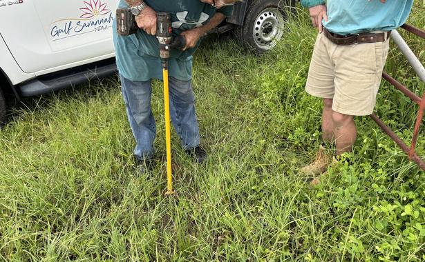
Out doing free soil sampling and pasture consultations for graziers


Introducing

Welcome
Enjoying
Supporting 'Don't Keep It Under Your Hat' — TIACS' farmer-focused mental health campaign


Attending
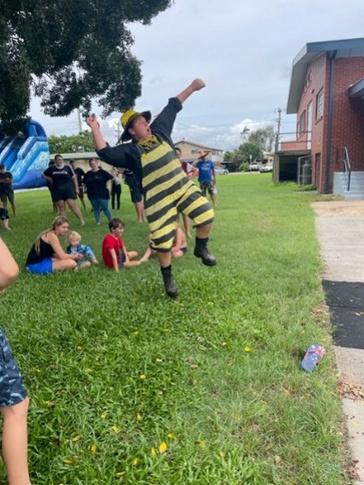
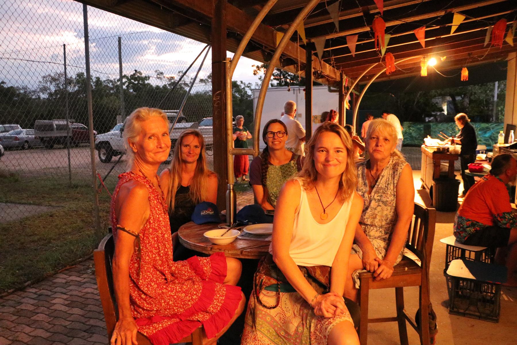
GOOD TIMES IN THE GULF
Thank you to everyone who has joined Gulf Savannah NRM for events, workshops and field days in the last few months here are a few of our favourite highlights!
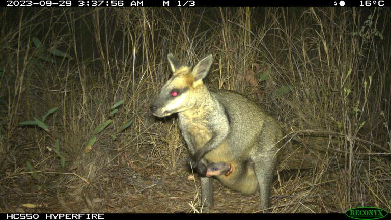
This spectacled hare-wallaby was spotted by our Biodiversity Officer Ed at Blackbraes National Park
Julie — our new Agriculture Projects Officer
to our new trainee Natahlia!
the North Australia Savanna Fire Forum in Darwin
a sausage sizzle at North and West Remote Health's barbecue in Georgetown
A WARM HELLO FROM THE CEO
It’s been a very wet start to the year across much of our region, so its timely that our first Gulf Croaker for 2024 would focus on water.
Managing our water resources sustainably is one of the most pressing issues for scientists and primary producers, and with competing demands on this vital resource from different industries, communities and the environment it’s always going to be a delicate balancing act.
Locally there have been some big steps forward recently with Tanya Plibersek, Minister for the Environment and Water and Glenn Butcher, Minister for Water, announcing that the MareebaDimbulah water efficiency project has saved more than 11,500ML through infrastructure improvements A terrific result, putting more water back into the system
 ZoeWilliams CEO Gulf Savannah NRM
ABOUT GULF SAVANNAH NRM
We're a not-for-profit organisation working to promote healthy landscapes while supporting local people and enterprise. Come say hi at our offices in Georgetown, Croydon and Mareeba.
gulfsavannahnrm.org
40921088
admin@gulfsavannahnrm.org
06 16 18
Understanding Soil Test Results
in
Turtles
Trouble
Building Back Better

KOWANYAMA

KARUMBA
NORMANTON
FLOODRECOVERYINVESTMENT
MAREEBA
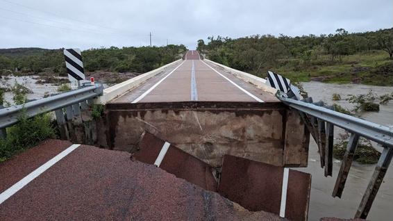
ROUTHCREEKBRIDGEREPAIRED Flooding caused part of the Routh Creek Bridge to collapse leading to the closure of the Gulf Developmental Road between Georgetown and Mount Surprise. Crews from Transport and Main Roads Queensland and Etheridge Shire Council constructed a new rock foundation and bridge pavement to reopen the road in record time.
ISTHATAWEED?
Australia’s first AI-assisted weed identification and management app is available. WeedScan is free and easy to use, simply download the app, upload a photo of a plant you suspect might be a weed, and the app will determine whether it is one of 450 priority weed species. weedscan.org.au.
GEORGETOWN

Local government leaders from across North West Queensland have welcomed priority investment for flood recovery and resilience in the region as part of a $119 million State and Federal Government funding package Source: North West Queensland Regional Organisation of Councils. www.nwqroc.com.au.
G'DAY GULF: ABOUT OUR REGION


9,660 people
live in the Northern Gulf
04
GULF SAVANNAH ROUND UP
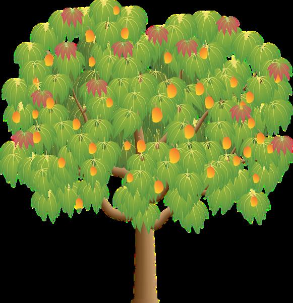
MANGOMANIA
The Department of Agriculture and Fisheries has been conducting a consumer testing panel for mangoes at their Mareeba Research Facility
The tasting included 10 varieties with different colours, shapes and tastes
The results will inform which varieties to focus on for the next stage of research Source: Queensland Agriculture on Facebook
MURALFORMUTCHILBA
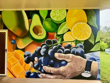
Mutchilba has a bright new mural depicting the township’s rich agricultural ndustry Designed by Lavinia Letheby and community members – the mural on the community hall features cattle, lychees, mangoes, citrus and more.
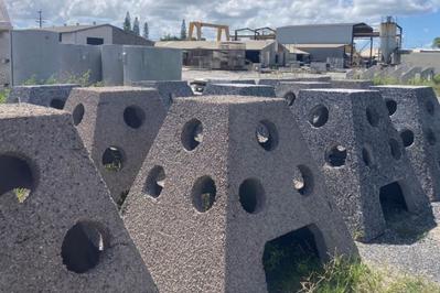
REEFHABITATSDEPLOYED
Carpentaria Shire Council has deployed two artificial reefs offshore from Karumba The reefs are made up of five 2,000 kg pyramid habitat structures with buoys containing Fish Attracting Devices attached.

The area is 196,100 square kilometres

Over 196 reptile, 455 bird and 118 mammal species live here 88% land use is grazing on native pasture
SymbolscourtesyNESPResilientLandscapesHub,nesplandscapeseduau 05

Recovering
 from the floods with a vision for the future.
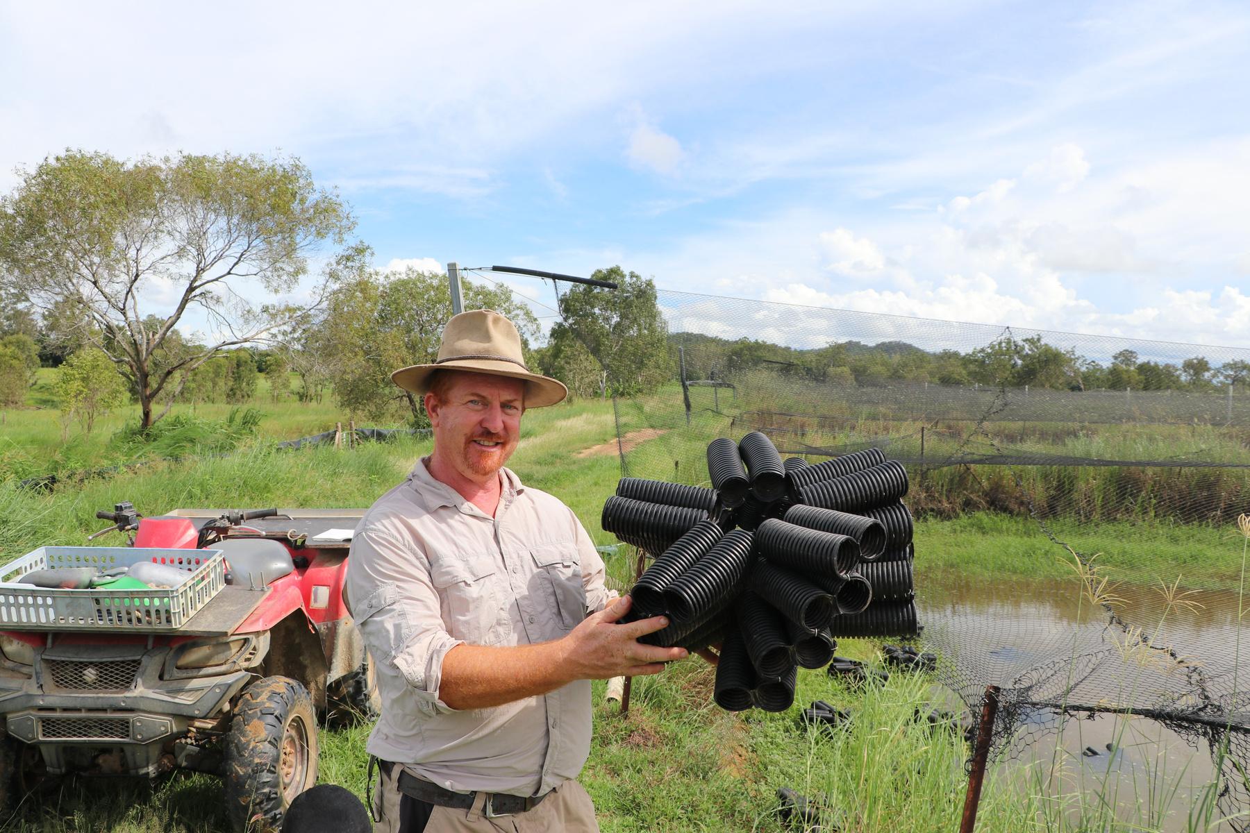
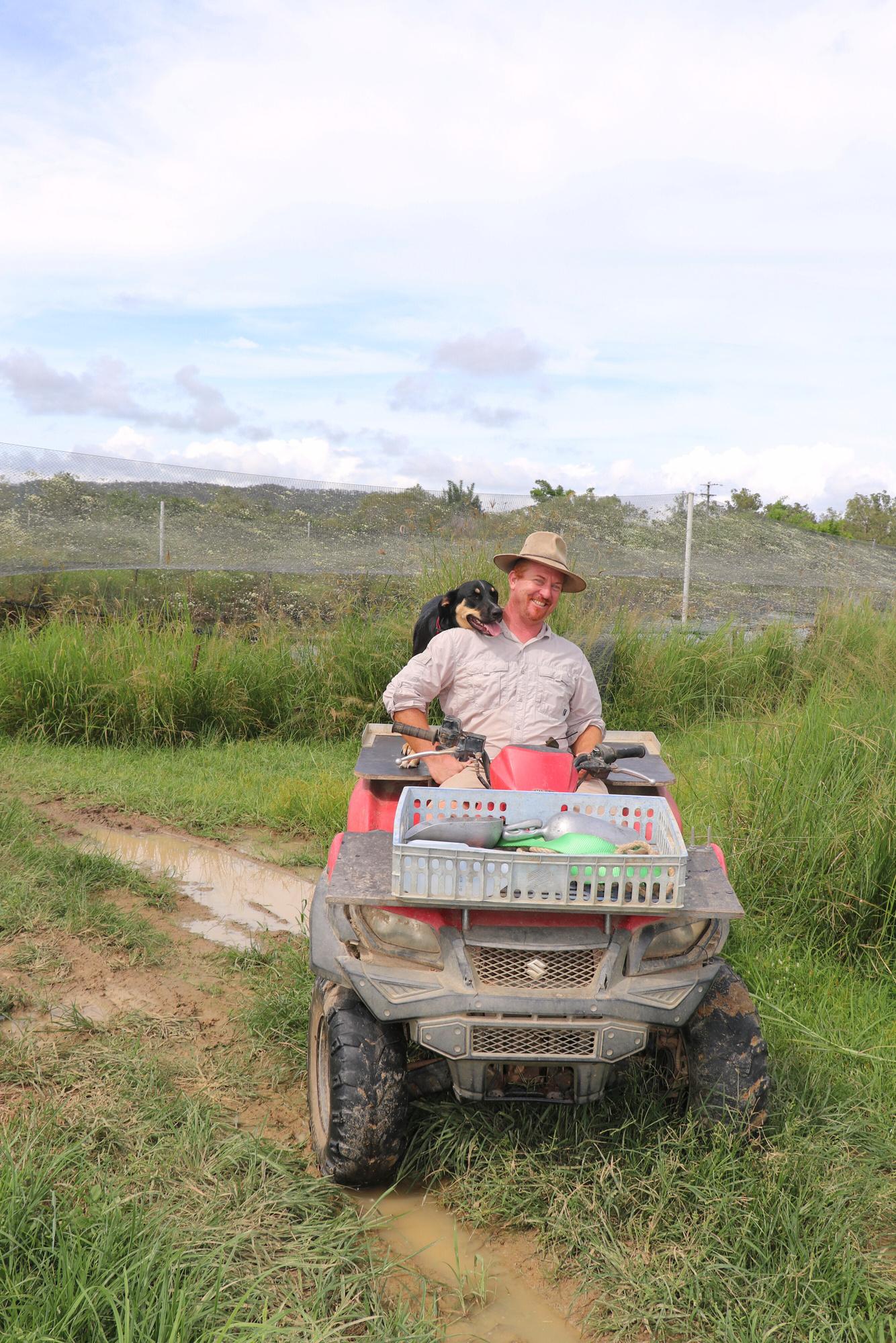
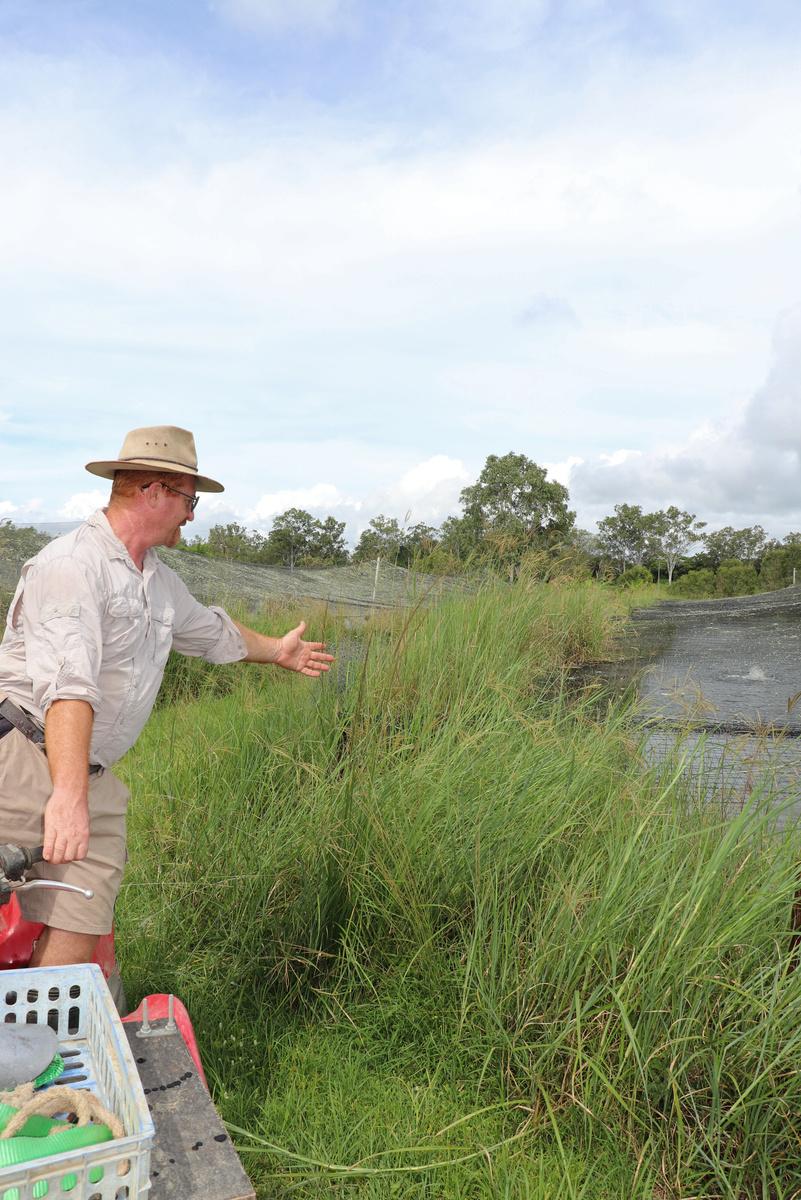
The rain that followed Cyclone Jasper in December wreaked havoc for many in Far North Queensland. Daily totals ranged between 100 and 700 mm, and in some locations five-day rainfall totals exceeded 1500 mm. Rodney Ingersoll’s sustainable aquaculture fish farm near Biboohra was devastated by the flooding, but now he’s on a mission to build back better and the local community are giving him a hand.
‘The neighbours had never seen the river burst its banks Not in my wildest dreams did I expect the water to reach the level it did,’ said Rodney
His aquaculture farm, Barron River Barramundi, suffered huge losses in December but meeting with him, and his dog Aria, on a sunny afternoon a couple of months later he is already laserfocused on the future
bottles were washed away. I lost personal items, fridges, freezers, vehicles, tanks and harvesting equipment All the pumps and electrics were inundated, and I’ve collected five ute loads of my equipment from neighbouring properties I can’t operate as a business at present,’ he explained
In total, the damage and loss of stock added up to $1 5million To compound this, Rodney was denied insurance coverage for flooding
‘This is going to be a hub for aquaponics, aquaculture and sustainability.’
Rodney’s vision for the farm includes creating an education centre, building Indigenous partnerships, providing training to the community and schools, while creating local employment. That’s in addition to expanding the commercial fishery and producing aquaponic vegetables and bush foods for market
‘I’m ready to move forward and showcase what you can do in sustainability We will be using AgTech, automation and AI it’s going to be a future farm ’
But while Rodney’s vision for the future is clear, his current focus is recovery from the flooding
‘It’s been a salvage operation,’ he said ‘We have even had to put off the family moving up here ’
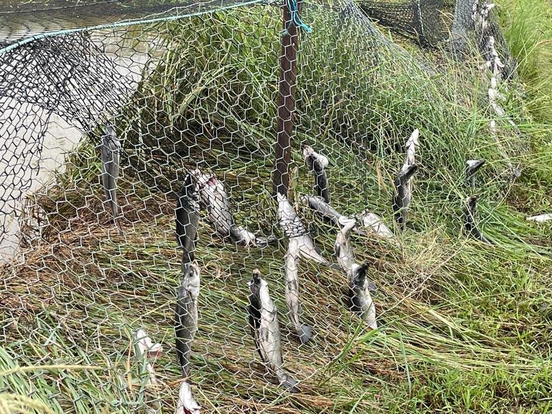
Over 50,000 barramundi and 70,000 redclaw (freshwater crayfish) were lost in the floods ‘I’ve had to drain every pond and remove the rubbish logs, plastic, a lounge chair, even a croc has turned up in one of the ponds.’
‘It was such a mess with bits of metal and equipment everywhere. My living quarters went under, and I had to live in a tent … even my gas
‘My current biggest issues are weeds, they have just taken off since the flooding, equipment loss/failure and not being able to afford labour to help with the clean-up It seems bad now, but I know I will recover ’
Rodney has had quite the life. He received an OBE (a British honour) for his work in Papua New Guinea, where he used his environmental science knowledge to improve the lives of thousands. He built simple infrastructure, creating gravity-fed fresh water delivery systems to villages that reduced the risk of illness from what would have otherwise been a contaminated supply
‘I went as a young ecologist to manage the Baiyer River Wildlife Sanctury in PNG’s Western Highlands I spent 20 years in the country working with a variety of organisations My focus was
07
Thousands of barramundi were lost in the floods
working together with the community to get a common solution, but I had to deal with tribal warfare as well,’ he recalled
Rodney has also worked across Australia in environmental management and sustainability, and built up a large bank of friends, including one that got in touch after the flooding to see if they could help
‘It’s not something I would have done but they set up a GoFundMe … and I wouldn’t be sitting here right now without the $18,000 received so far. I’ve helped out a lot of people in the past, and now they’re helping me.’
‘Someone anonymously donated $10,000 last week and I am in awe of that person they don’t know how much their kindness means.’
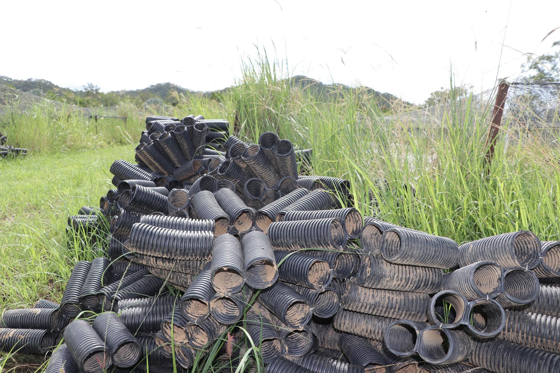
And it’s not just money that has been donated. Mareeba Men’s Shed has been busy creating hundreds of redclaw hotels, which are crayfish habitats built from agricultural pipe. Chickens have been donated, volunteers have helped with the clean-up, and Rodney was sponsored to attend the Evoke Ag Conference in Perth to promote his future farm vision to AgTech leaders
‘I have had to rethink the entire business and devise new income streams and I hope to be making a profit again by next year. I aim to have workshops running soon and I’m reaching out to schools to come and learn about aquaculture and aquaponics.’
Rodney’s biology teacher told him “You can do anything” and he still uses it to motivate himself.
‘It is up to you what impact you leave behind live your passion, purpose, and desires. Even if I don’t achieve everything I’m aiming for, I will have learnt new strategies, made new connections and partnerships, which may lead to something else. Whatever happens I am not going to stop.’
Find out more about Barron River Barramundi at barronriverbarra.com.au or visit Rodney’s GoFundMe webpage at www.gofundme.com/ barron-river-barramundi-farm-flood-recoveryrelief
08
Weeds are a big issue after the flooding
Redclaw hotels made by Mareeba Men’s Shed
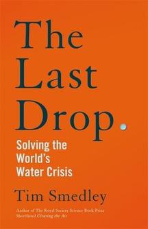
TheLastDrop:SolvingtheWorld’sWaterCrisis
TIM SMEDLEY
Environmental journalist Tim Smedley meets people from experts to activists to find out the causes of water scarcity that is impacting many parts of the world. Water stress –not just scarcity, but also issues caused by pollution – is already driving the first waves of climate refugees The Last Drop offers a fascinating account of the factors that have led us to this point and suggests practical ways to address the crisis

R E A D
ChimpEmpire
DOCUMENTARY | FIND IT ON NETFLIX
Shot in a remote rainforest setting, Chimp Empire exposes facets of chimp life that have never been seen on film before The Ngogo community is the largest known group of chimpanzees in the world, and at the time of filming this series, it had splintered into two competing factions. Filmmakers were present on the front lines for the life-or-death fight for supremacy between the Central and Western groups.
AgriFuturesOnAir
The official podcast channel of AgriFutures Australia –one of the research and development corporations supporting the needs of Australian rural industries
Recent episodes include addressing the 9 8 million tonnes of pre-farm gate waste produced by Australian agriculture annually, and a tour of Ireland’s dairy industry.
PODCAST W A T C H L I S T E N
09
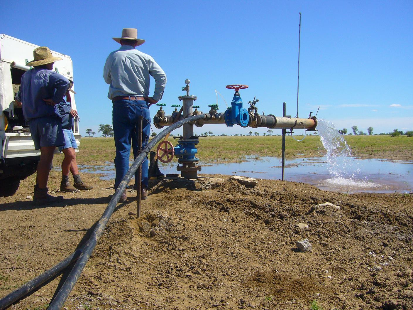

The Great Artesian Basin (GAB) is one of the largest underground water sources in the world and Australia’s biggest ground water basin. For many communities, it is their only reliable source of fresh water, however water loss from uncapped bores and uncontrolled water flows have resulted in reduced pressure and significant environmental challenges.
Every year, 150,000ML of water from the basin is used for livestock and domestic purposes, but a significant proportion is lost through evaporation and seepage in open-air drains.
10
At almost 1.7 million square kilometers, the Great Artesian Basin underlies more than one fifth of the Australian continent and contains several connected geological basins. Approximately two thirds of the GAB is within Queensland, and it is a vital water source for over 80 Queensland communities and 180,000 people.
Hundreds of bores were sunk in the GAB during the 19th Century supporting pastoral development in dry inland areas. After being brought up to the surface, the water was reticulated by thousands of kilometres of openair bore drains However, by the second half of the 20th Century, it was clear the water was not infinite, and pressure began to drop in the GAB
Through the Great Artesian Basin Rehabilitation Program (GABRP), and its predecessor programs, 749 bores have been rehabilitated and approximately 15,000km of open bore drain replaced by piped reticulation This has saved an estimated 226,000ML of water each year with investment of over $239 million from the Australian and Queensland governments, industry, and landholders
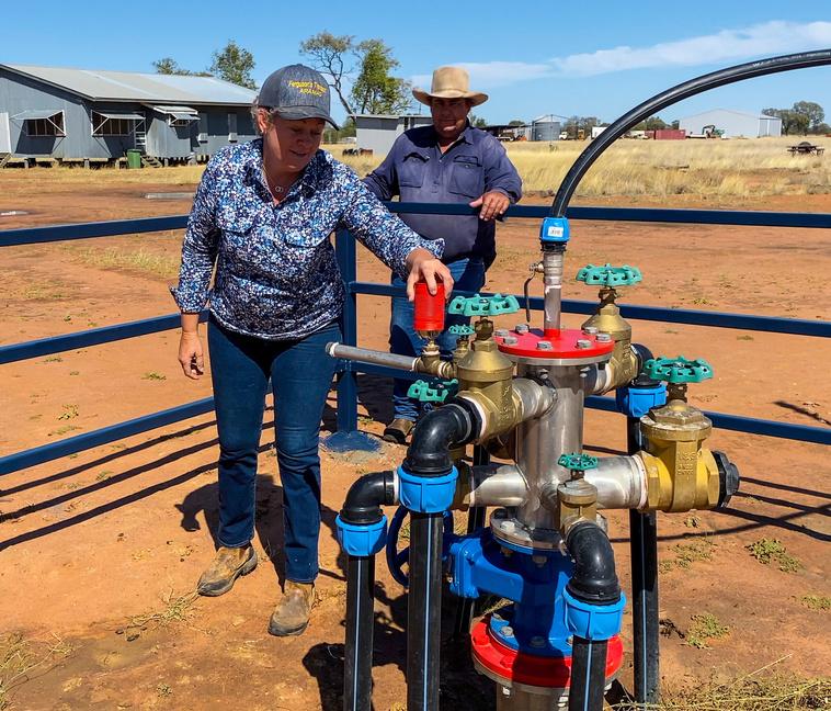
Groundwater pressure is increasing in the Great Artesian Basin thanks to this capping and piping work.
The increased pressure is resulting in the reemergence of natural springs and wetland ecosystems, providing important habitats for native wildlife and plants
Under the water plan Great Artesian Basin and Other Regional Aquifers 2007 (GABORA), existing uncontrolled bores and bore drains must be controlled and made watertight by 2 September 2032. In special circumstances, bores that support significant cultural or environmental values may be exempt.
Research has shown the benefits of capping and piping for graziers can include improvements to water quality and pressure, supply reliability, as well as stock and grazing control Works can also facilitate control of feral animals and reduce degradation around drains

Through funding received from the Queensland and Australian governments under the Improving Great Artesian Basin Drought Resilience program, Desert Channels Queensland, in partnership with NRM groups, was engaged to educate and raise awareness of land manager responsibilities and obligations under the GABORA water plan, the benefits of being watertight and, requirements around the maintenance of existing watertight systems across the GAB
But there is more work to be done. Around 209 free-flowing bores remain uncontrolled, and there is over 4000km of open bore drains in use.
Under the GABORA water plan, landholders that have self-funded their own bore rehabilitation and piping work can make an application to take and use up to 30% of the water saved as an allocation to be used for any purpose.
Whilst no further grant funding is currently available under the GABRP, land managers can register their interest to be included on a mailing list to be notified of future funding opportunities.
Find out more about the GAB rehabilitation programs here: www.business.qld.gov.au/ industries/mining-energy-water/water/ catchments-planning/great-artesianbasin/rehabilitation-program.
11
An open-air bore drain
Checking the pressure


CarpentariaShire
Carpentaria Shire Council is gearing up for the highly anticipated Outback By The Sea Festival scheduled to take place in Normanton and Karumba from 13 to 21 September 2024. Don't miss out on this incredible week-long celebration featuring the iconic barramundi, delectable seafood, vibrant live music, Indigenous cultural displays, and an array of arts and crafts Immerse yourself in the diverse and vibrant atmosphere of the Gulf community
This year's festival introduces a new highlight the Outback and Ocean Film Festival showcasing Australia's latest short films. Local filmmakers will have the exciting opportunity to present their creations on the big screen during this cinematic addition to the festivities. Don't miss your chance to take part in this unique event, promising an unforgettable experience for all attendees.
EtheridgeShire
Etheridge Shire Council is the new owner of approximately 240Ha of industrial land at Georgetown This acquisition opens a whole new chapter of land being available for expansion and development for the community’s commercial sector. Plan and design works are being carried out and upon completion will see Stage 1 of the new industrial precinct start to take shape.


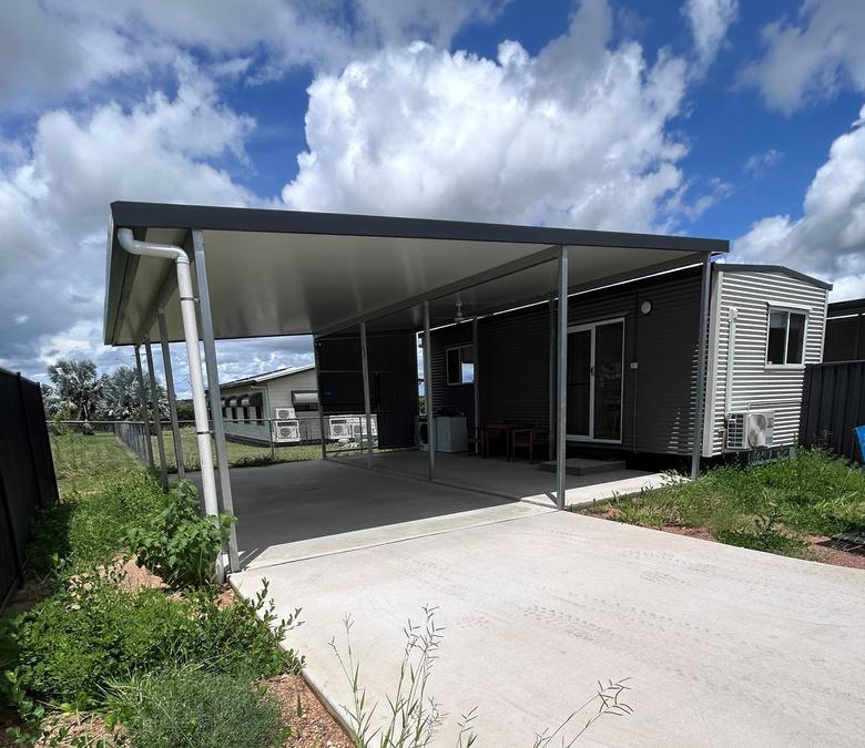
Council has completed the construction of three single person accommodation units These units will be utilised by staff on short stay working periods, benefitting Council in both administrative needs and external workforce requirements The units will help alleviate tourist season accommodation pressures experienced by Council
YOUR LOCAL COUNCIL


Etheridge Shire will commence the 2024 Transport Infrastructure Development Project that will complete the sealing of the ForsaythEinasleigh Road The remaining 10km will be bought up to standard width by Council’s workforce This is a fantastic milestone considering sealing works commenced on this road in the late 1990s Some 72km of bitumen seal has been completed in that time and has certainly made travelling a lot easier Council will also undertake a 3km bitumen seal project on the Kennedy Highway in 2024 As part of this project there will be a reconstruction and reseal of another 3km in the vicinity of Maitland Downs to bring that section back up to standard

MareebaShire
The countdown is on for the iconic Mareeba & Dimbulah Comm Bank Great Wheelbarrow Race 2024 In the late 1800s, miners travelled the region with their families using a wheelbarrow to their possessions and the race is a tribute to these early pione Teams follow the 140km Wheelbarrow Way through rich farml wooded Savannah country, kicking off on Friday 10 May in Ma and concluding on Sunday 12 May 2024 in Chillagoe
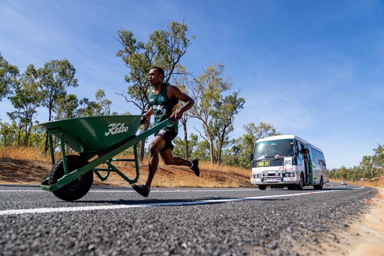
Teams can look forward to the Friday night where they are treated to the incredible community spirit in Dimbulah and the unbeatable country hospitality in Almaden on the Saturday night Since the race began in 2007, teams have raised over $2 5 million for charity Sign up and join us on the road visit www greatwheelbarrowrace com for more information and to register
In other news, Council is continuing to implement the Parks & Open Spaces Strategy The next time you are in Dimbulah, make sure you check out the brand new pump track that has been very popular for local families Council is also making progress on the Bicentennial Lakes Revitalisation Project in Mareeba, which will be completed this year This project will improve the movement of water in the lakes, as well as deliver a new playground, pump track and outdoor facilities and will be a wonderful attraction for residents and visitors
CroydonShire
Croydon kicked off the 2024 event calendar with Australia Day! Residents gathered on a misty Australia Day at beautiful Lake Belmore to celebrate local heroes
Once everyone had enjoyed the barbeque breakfast, Mayor Trevor Pickering took the mic to announce local Australia Day recognitions: Dolly’s Dream Community Challenge took out Event of the Year; Eugene Meldrum was Volunteer of the Year; Andrew Osborne & David White took home the Sports Award, while Brendan Kelly got the Young Sports Award; Jonathan & Ronell Evans were joint Citizen of the Year and Tyler Psaila the Young Citizen


13
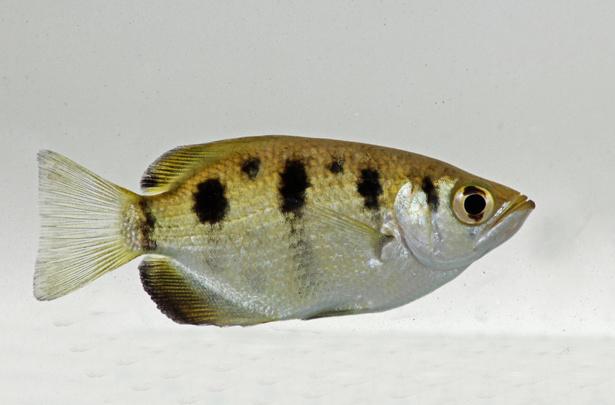
SEVENSPOTARCHERFISHToxoteschatareus
These fish commonly reach 15-20cm in length, with a maximum of 40cm. Their main habitat is brackish mangrove swamps and estuaries, but they also inhabit freshwater river systems and lagoons. Archerfish are omnivorous, consuming insects, fish and floating vegetation They hunt by shooting a jet of water from their mouth (up to 150cm from the water’s surface!) to dislodge invertebrate prey items from overhanging vegetation Though they frequently are found in brackish water systems, they push upstream far into fresh water where they breed Breeding occurs in the wet season when females produce 20,000-150,000 eggs that measure 0 4mm in diameter
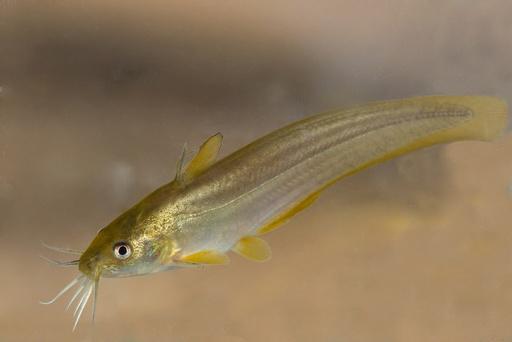
HYRTL'SCATFISHNeosilurushyrtlii
Can attain a maximum size of 40cm, but 10-20cm is more common Brown-yellow in colouration, they have elongated bodies and an eel-like tail Broad head with four pairs of barbels Thick skin that is difficult to penetrate No scales Widespread across Northern Australia, it can inhabit a wide range of freshwater environments from clear, flowing steams to pools, often preferring habitats with dense vegetation Feeds on invertebrates and detritus Like other catfish, Hyrtl’s catfish possess venomous dorsal and pectoral fin spines that can inflict painful stings Breeds at the beginning of the wet season
SPANGLEDPERCHLeiopotheraponunicolor
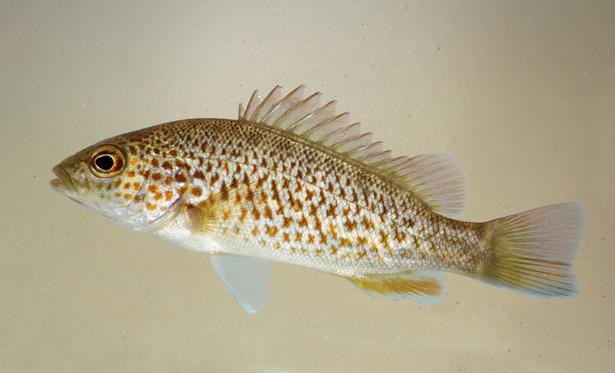
A robust-bodied fish with a large mouth, reaching a maximum size of 30cm (usually smaller). Body silver-grey with many rusty orange spots/flecks, though the pattern can be faded on some specimens Widely distributed across Northern, Central and Eastern Australia, spangled perch inhabit a wide range of freshwater systems from clear, flowing streams to turbid ponds and dams Spawning occurs on summer nights following rising water levels, with eggs hatching after 2 days They are omnivorous species, consuming a variety of invertebrates, fish, plants and algae

14
Photograph © Ryan Francis
Photograph © Ryan Francis
Photograph © Ryan Francis
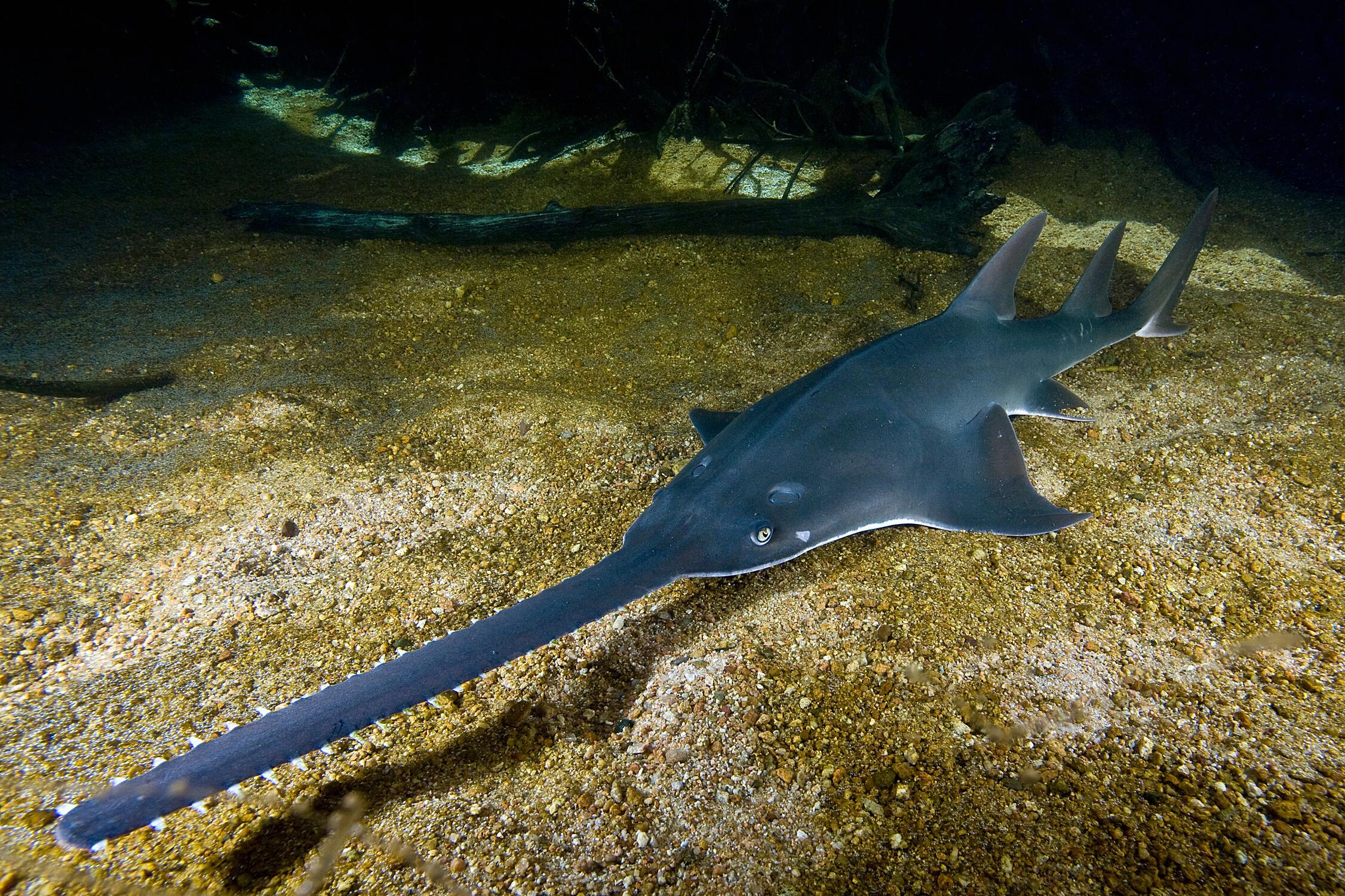
FRESHWATER(LARGETOOTH)SAWFISHPristispristis
Freshwater sawfish can reach 7m, but most adults encountered are 2-2.5m. Grey/brown/olive with a white underside, they have a large rostrum (‘saw’) lined with 1420 evenly spaced pairs of slender ‘teeth’. Having disappeared from much of their historical global habitat, they are classed as Critically Endangered Many aspects of their biology/ecology remain a mystery, but adults are often found in marine environments and estuaries, and appear to venture into rivers to breed (e.g. the Gilbert and Norman rivers). Young animals inhabit river systems up to 400km inland, and after 4-5 years migrate to the sea. Sexual maturity is at 7-10 years. The electroreceptors in their rostrum allow them to detect prey (mainly crustaceans, molluscs and fish) which they incapacitate by slashing their ‘saw’ in a sideways motion
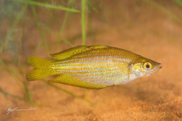
CHEQUEREDRAINBOWFISHMelanotaeniasplendidainornata
A relatively small fish at a maximum of 9-12cm. They have deep bodies of 6-8cm vertically, with males having deeper bodies than females. They can be very colourful (particularly males), with colours and patterns varying greatly in fish from different locations and river systems. They can tolerate a wide range of conditions and live in almost any freshwater habitat In the Northern Gulf region, these fish occupy river systems flowing west into the Gulf of Carpentaria They are omnivorous, and eat a variety of invertebrates and algae

15
Photograph © Simon Fraser University (CC BY 2 0)
Photograph © Ryan Francis
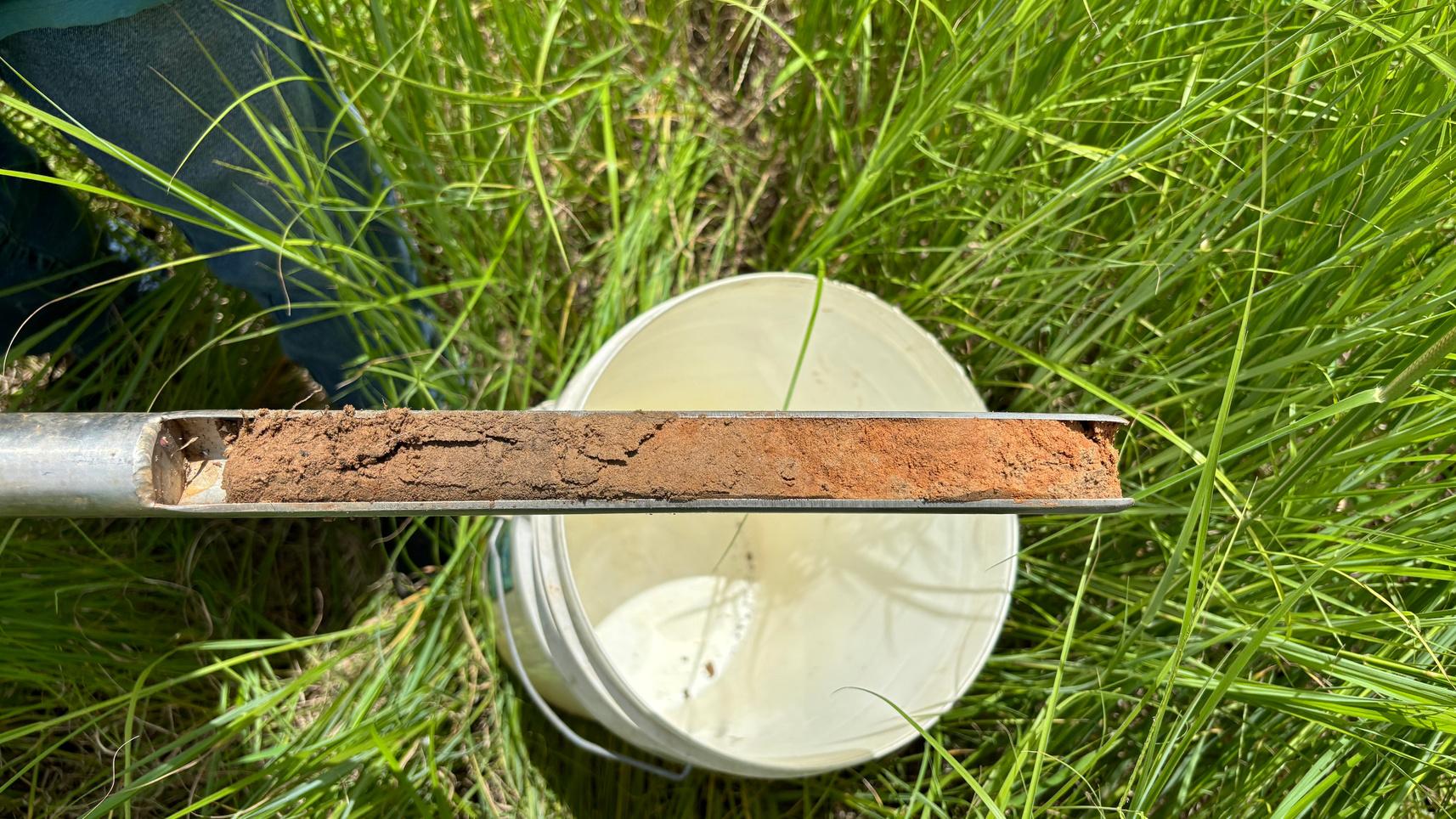

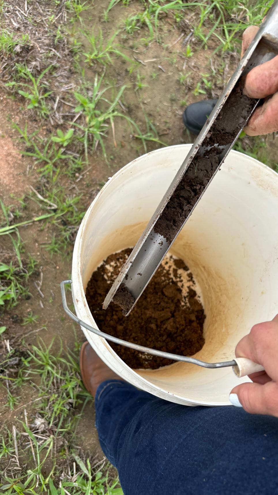
Reading soil samples can be complicated, especially with the extra numbers that come from extensive testing packages. Wouldn’t it be nice to understand what all the numbers tell you about your soil?
In this article we provide an overview of a sample soil report commonly seen in our region. Results are typically broken into four sections chemical and physical, cation exchange capacity, macronutrients, and micronutrients.
Physicalproperties
Soiltexture: Texture is based on mineral composition broken down to parts of clay, silt, and sand
Soilcolour: A visual assessment of the mineral material colour
Chemicalproperties
pH: Nutrient availability is optimised in the majority of pasture grasses and legumes at pH 5 5-6 5 pH influences nutrient availability and cation exchange
Electricalconductivity: This is a measure of salts in the soil, which are extracted in a solution A good level is less than 4 dS/m
16
Organicmatter: Soils in our region are known to be naturally low. Organic matter does not have specific critical levels for extensive grazing.
CationExchangeCapacity(CEC)
CEC is a measure of cations present in the soil. Cations are positively charged ions. A CEC greater than 4 meq/100g, with sodium <1% and aluminum <5% of cations, in extensive grazing country is a good result. CEC can determine calcium, magnesium, and potassium deficiencies.
Macronutrients
Nitrogen is critical for plant energy production. In extensive grazing practices, there are no defined critical limits.
Phosphorus is known to be a limiting nutrient in Australia, and our region is no exception. Phosphorus levels in a Colwell P test below 10 mg/kg will indicate poor plant nutrition and productivity. A common result in our region is between 10 and 20 mg/kg, which may pose issues for legumes establishing root nodes.
Potassium is generally not a major limiting factor on pasture growth in northern Queensland. Critical limits for growth depend on soil type, sandy soils require higher levels to support growth, as potassium is easily leached from soil
Sulphurlevels required for pasture production are low when nitrogen and potassium are limiting Legumes have a greater requirement for sulphur as this supports nitrogen fixation in root nodes
Micronutrients
Micronutrients are at low levels in much of northern Queensland Soil used for extensive grazing is often tested for iron, manganese, zinc, boron, copper, and silicon Low levels will indicate a deficiency, but symptoms are often not pronounced in plants as micronutrients may not be the most limiting nutrient
Howtoreadasoiltest
A good place to start when assessing your results is the soil texture; this will determine the critical limits of, and determine the inputs required for correcting, your soil
These sample soil test results (opposite) show there is an acidity issue (pH), an imbalance of cations that could be causing a calcium
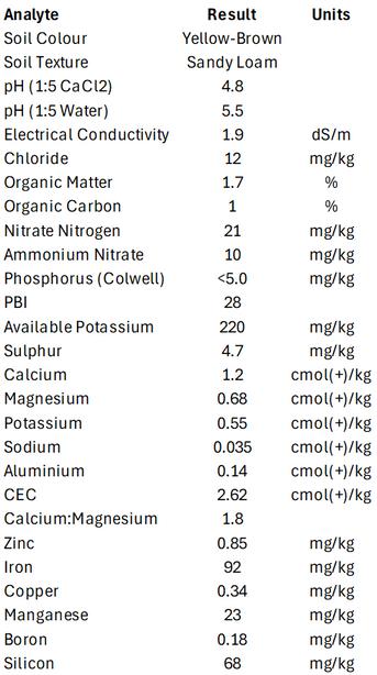
deficiency, a low phosphorus level that would be impacting on plant growth and animal nutrition, and low micronutrient levels
The sample shows a CEC of 2 62, which is a low cation activity for sandy loam soil The results for calcium, magnesium, potassium, sodium, and aluminum are the percentages of each cation and this sample shows an imbalance of cations These results in turn can be used for the calcium:magnesium ratio, and anything under 4 may indicate a calcium deficiency
At less than 20 mg/kg, phosphorus levels are low in this sample, but nitrogen and nitrate levels are good Levels of micronutrients are low but the impact on pasture productivity will not be pronounced as low levels of potassium and calcium will have a greater limiting effect, as well as soil acidity inhibiting nutrient uptake.
All these issues would impact on pasture productivity and quality in extensive grazing practices. For advice on correcting low levels of nutrients and nutrient availability contact an agronomist or soil health consultant.

17


18
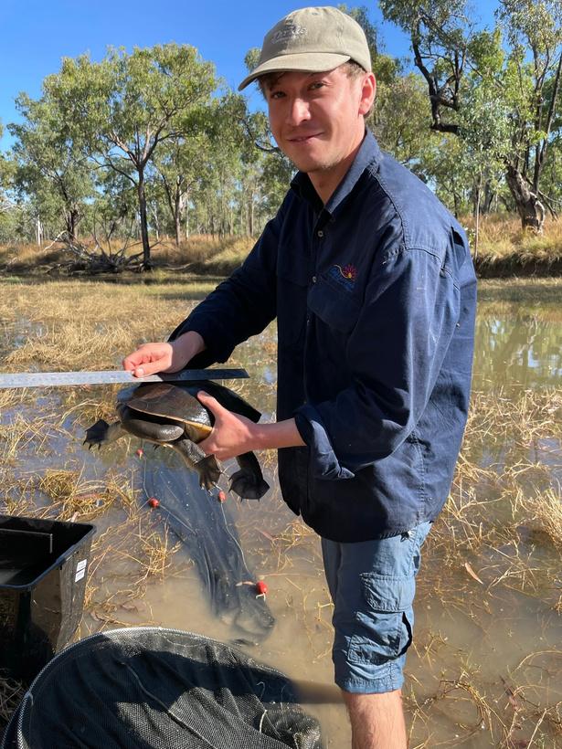
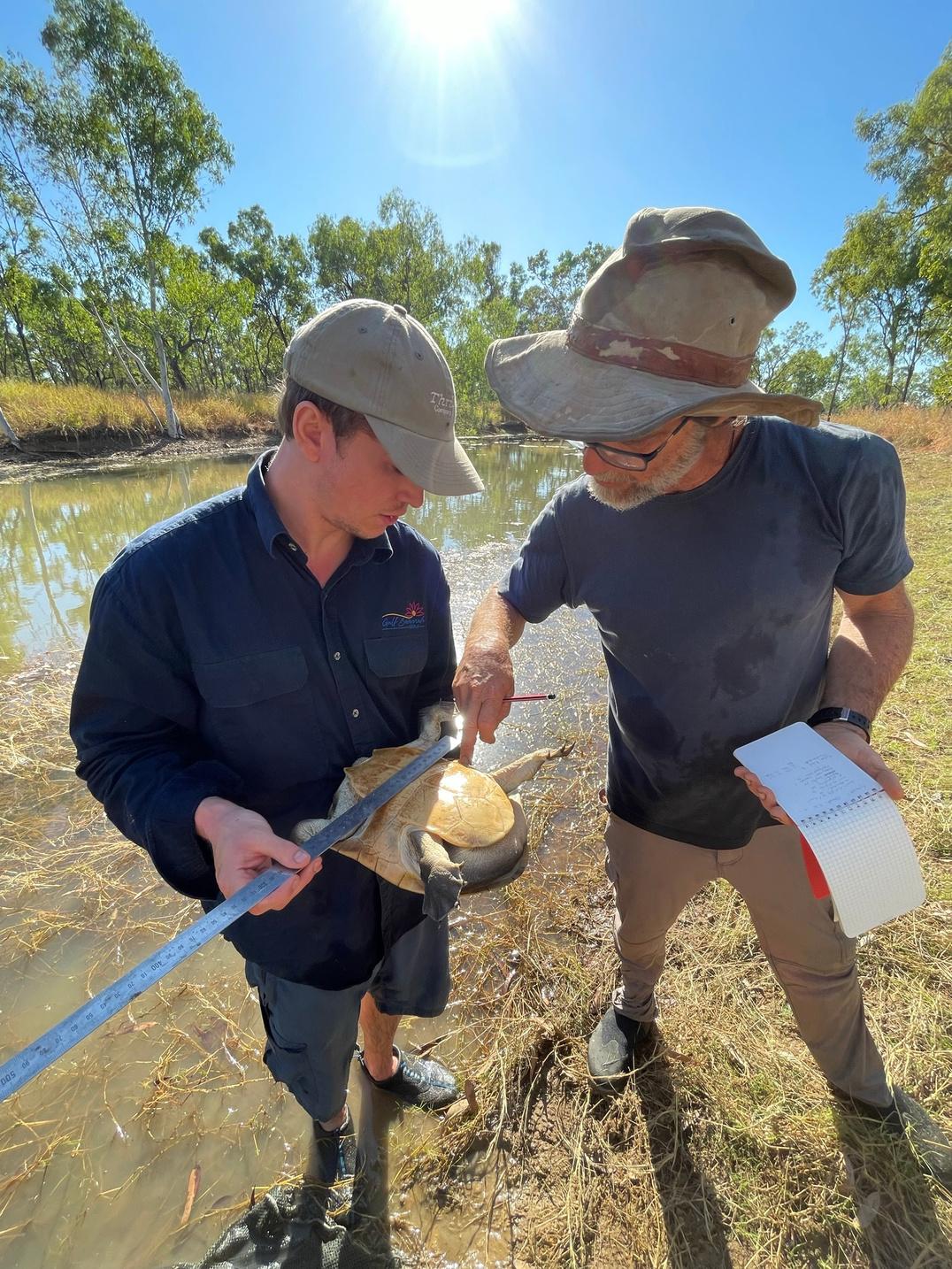
Gulf Savannah NRM’s Dr Edward Evans and freshwater ecologist Jim Tait
About half of the known 25 species of freshwater turtle in Australia are considered threatened and listed as vulnerable, endangered, or critically endangered under the Environment Protection and Biodiversity Conservation Act.
While not federally listed as a threatened species, concerns have been raised about a declining population of northern snake-necked turtles (Chelodina rugosa) at Littleton National Park, located 40 km east of Croydon.
Gulf Savannah NRM and Tagalaka Aboriginal Corporation’s Turtles in Trouble project is investigating these claims, working to establish a baseline population estimate of the northern snakenecked turtle at Littleton, assessing evidence of threats that could be contributing to a decline in turtle numbers, and building the capacity of the Tagalaka people to carry out turtle monitoring and threat-mitigation activities on Country
Feral pigs are one of the main threats identified for northern snake-necked turtles
In environments lacking permanent water, turtles can aestivate this means they bury themselves in mud and river sands during the dryer months when seasonal wetlands and watercourses have dried up, but this makes them particularly vulnerable to predation from pigs, who root and forage for food in dry riverbeds and along the water’s edge.
Pigs also prey on turtle eggs and negatively impact turtle habitat through activities like mud wallowing and destroying the sensitive plant communities at the edges of waterholes.

First Nation Tagalaka people know the northern snake-necked turtle as Yang They respect and appreciate Yang as a favoured traditional food that goes beyond subsistence to a sense of cultural identity, wellbeing, and connection to Country
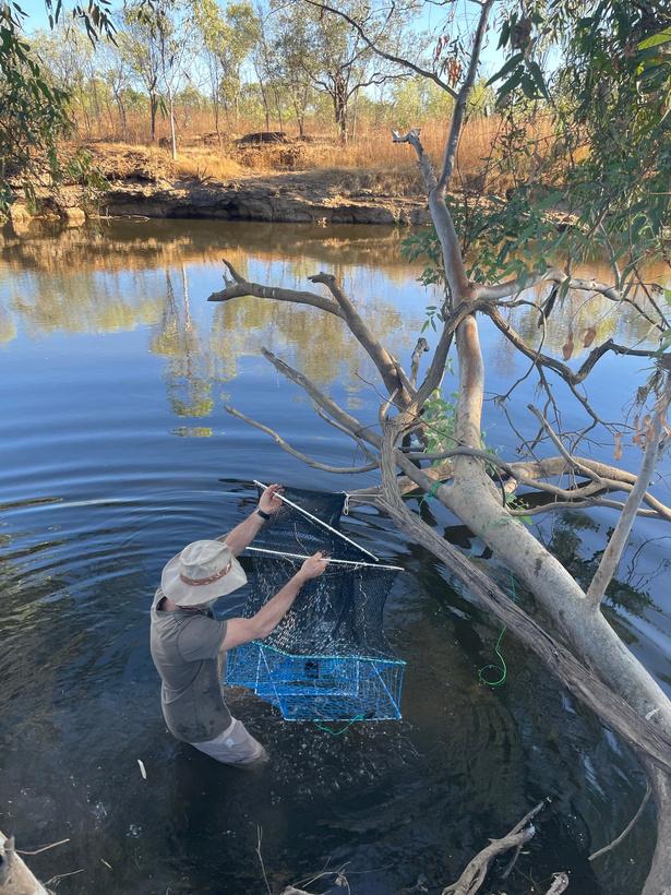

In 2023, Gulf Savannah NRM’s Biodiversity Officer, Dr Edward Evans, along with freshwater ecologist Jim Tait, Tagalaka Aboriginal Corporation RNTBC and the Tagalaka Rangers, conducted two surveys at Littleton National Park These surveys, in June and December, collected population data and observed seasonal characteristics and behaviours
A range of riverine and floodplain sites at the national park were surveyed using a combination of passive fyke nets and baited turtle traps, which are modified crab pots
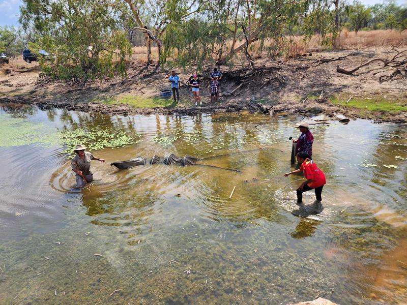

During the June survey, 21 northern snake-necked turtles were caught and released, with this number increasing to 22 in the December survey. Notable differences between the two surveys included variations in trap effectiveness and the size of captured turtles. Intriguingly, no young juvenile
19
turtles were captured in either survey, which may hint at an ageing population structure although young turtles are known to be difficult to detect.
Evidence of pig disturbance was observed across all survey sites, and was most pronounced in vegetated swamp wetlands, with less occurring at riverine sites. This observation suggests pigs may exhibit a preference for wetland habitats due to the availability of food sources such as roots, tubers, and invertebrates like mussels, as well as aestivating turtles that may be present.

The next stage of the project will continue to monitor population numbers and activity immediately following the wet season and identify water holes of ecological and cultural significance suitable for the installation of turtle-friendly fencing an innovative barrier enabling turtle movement while safeguarding their habitat from the detrimental impacts of feral pigs.
The next survey will also include drag netting and evening spot lighting to see if these methods can provide further information on freshwater turtle numbers, with a specific focus on trying to detect juvenile turtles. The survey is planned for the latewet/early-dry season so stayed tuned for updates on this project later in 2024.
This project was funded by generous donations to the Gulf Savannah Future Fund. If you would like to make a tax-deductible donation to support our work on projects like this one, visit our website or give us a call to find out more.
20
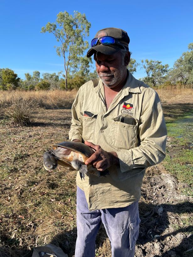
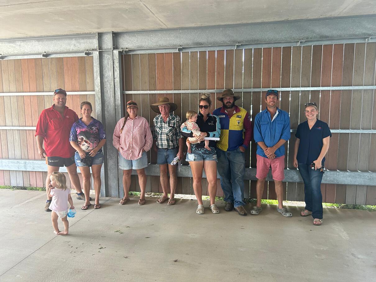
Some of the Turtles in Trouble project team members
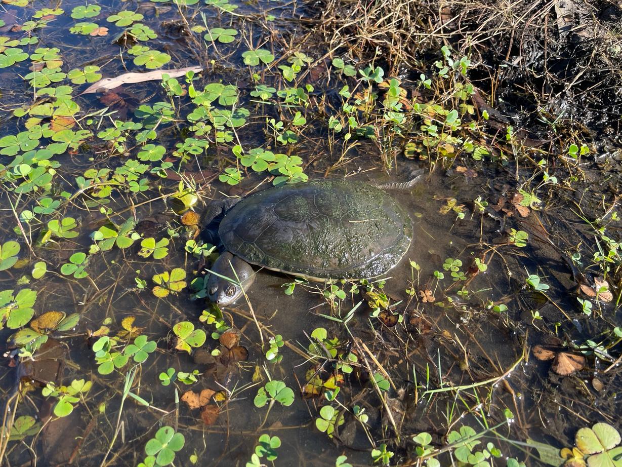
A northern snake-necked turtle in Littleton National Park
Senior Tagalaka Ranger Mark Owens

Kasmin Brotherton is our Drought Resilience Coordinator at Gulf Savannah NRM.
Tellusabitaboutwhereyoucomefrom.
I grew up in the red dirt, lime bluffs and creeks of Chillagoe when it was buzzing annual fun runs, monthly dances, a cracking races and rodeo weekend, school concerts that the whole town came out for, Friday night tennis and lots of space to ride/fall off my horse
WhatmadeyouwanttoworkwithGulf SavannahNRM?
I first came across GSNRM when I was invited to be a part of the Bush Business events Then I started to see their events and programs and was amazed at the range of work they did and how it was so community and people focused. I love what we do, why we do it, and who I get to do it with.
Ifyouhadasuperpower,whatwoulditbe?
To sleep through 3am-itis and then, when I woke up fresh, come up with a workable solution for soft plastics and heal emotional suffering
Wheredidyougoonholidayasakid?
Usually, a creek bed on properties around Chillagoe that we got to in the back of a very full Troopy listening to the same three tapes the whole way Slim Dusty, Foster & Allen, and Charly McClain. When I was around seven, the same Troopy took our family around Australia with deckchairs as seats in the back and my baby sister in a bassinet. Every couple of years we would make the trek down to the Sunshine Coast, where both Mum and Dad’s families were mostly based, and Dreamworld was the most exciting place on earth when we did.
Where’syourhappyplace?
A hammock on a clear day, swimming in fresh water, near gum trees, in libraries
21

FarmMap4D prides itself on providing world-class technology to the grazing rangelands of Australia, bringing big data to the fingertips of those working on some of the country’s largest parcels of land to help inform decision making. What some
might
not
know,
is that this built-for-ease technology was born out of the heartland of the Northern Gulf region and the offices of our very own natural resource management group.
It was in the Georgetown offices, under the banner of Northern Gulf Resource Management Group, that former Chief Executive Officer, Noeline Ikin, showed the visiting Senator Ian McDonald the mapping work that was being done with grazing businesses in the area.
Manually developing layered maps and algorithms to visualise key aspects of properties including land condition trends, pasture utilisation and infrastructure, it was clear to those involved, and those looking on, that this was a leap forward in enabling graziers to manage Australia’s rangelands more profitably and sustainably.
With the opportunity of funding on the horizon, the concept was lifted out of the Northern Gulf to become a central element of the Australian Rangelands Initiative, a 15-year blueprint for the collective 14 NRM members that formed The Australian Rangelands NRM Alliance.
In a nod to its roots, it was named the NRM Spatial Hub, and stage 1 of its development along with its partnership of over 20 organisations, was successfully funded from 2014–2016 through the Australian Government’s National Landcare Program
An extended partnership between the Cooperative Research Centre for Spatial Information, Rangelands NRM Alliance and Meat & Livestock Australia funded a further 12 months to build the hub into the self-sustaining business we now know as FarmMap4D.
It’s come a long way since its first iterations, and today the team at Gulf Savannah NRM continue to use FarmMap4D in various projects that support graziers in their grazing business management decisions. Most recently it was used in our innovative Monitoring and Evaluation project that conducted more than 300 land condition assessments.
22
FarmMap4D can help plan new infrastructure, complete with automatic length calculations
Whataresomeofourfavourite FarmMap4Dfunctions?
Digitalfarmmapping:Using high resolution imagery, property infrastructure and paddocks can be fully mapped and named enabling detailed reports and use of maps in other programs, such as Avenza
Distancefromwateranalysis: Based on water points, the program creates a visual representation of grazing pressures on pasture to identify potentially underutilised areas A great way to visually identify potential future water points to build carrying capacity and land management options
Identify new water points to build carrying capacity
Planningnewinfrastructure:Play with options of new paddocks, pipelines and waterpoints to find the most cost-effective options, complete with elevations and automatic length calculations.
Pasturemonitoring: Analyse changes in groundcover over 30 years, visually see grazing patterns within paddocks and benchmark by land type while highlighting impacts of fire and drought.
For more information on FarmMap4D visit www.farmmap4d.com.au.
Needhelpmappingyourproperty?
During 2024, through the TNQ Drought Hub, Gulf Savannah NRM has a limited number of places for producers in the Northern Gulf region who would like to map their properties to explore how it can build your monitoring and decision-making capacity
For those looking into new infrastructure in the short term, it can also be a great step in completing your business resilience plan and linking with potential funding opportunities.
If you would like to find out more contact Kasmin Brotherton on 0428 913 614 or kasmin.brotherton@gulfsavannahnrm.org.
This program received funding from the Australian Government’s Future Drought Fund.
23
PROJECT UPDATES
Gulf Savannah NRM is delivering a range of projects in regenerative agriculture, biodiversity, fire and drought management, community resilience, and more. Stay up to date with our monthly online newsletter: bit.ly/gsnrm-news
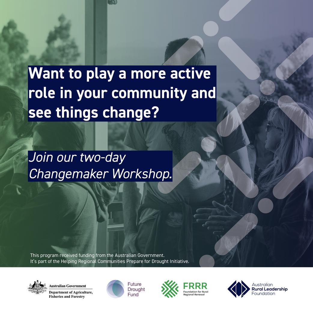
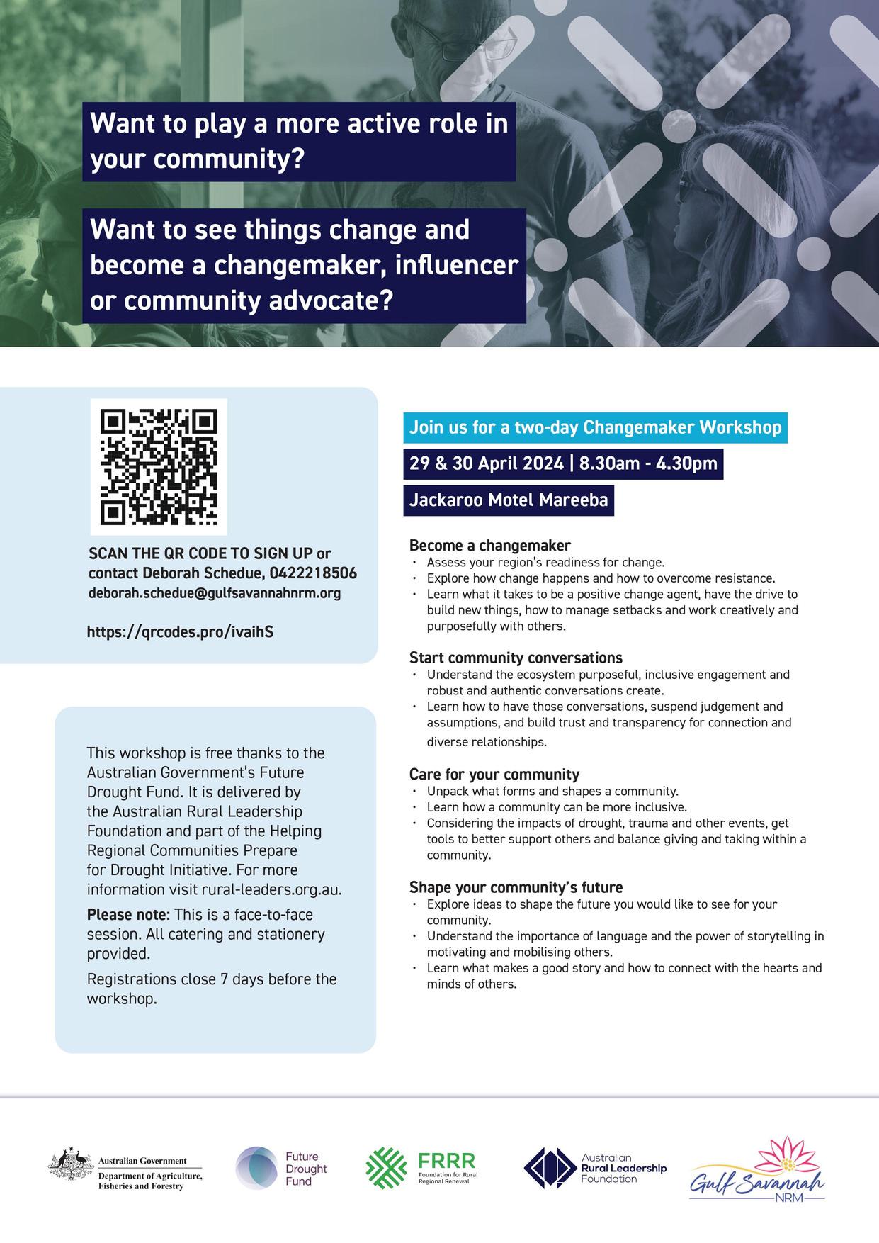
We are thrilled to announce our upcoming ChangemakerWorkshops, a free two-day leadership development workshop for individuals who are passionate about playing an active role in driving positive change within our communities
Organised in collaboration with the Australian Rural Leadership Foundation under the Helping Regional Communities Prepare for Drought Initiative, this workshop aims to equip participants with essential skills and insights for creating meaningful impact
Date:29-30 April 2024 or 2-3 May 2024
Location: Jackaroo Motel, Mareeba
For more details and to book your place, visit gulfsavannahnrm.org/getinvolved
Unlockyourpotentialforpositivechange.
CommunityResilienceGrants
Our Community Resilience Grants program has been supporting not-for-profit community groups in Mareeba, Etheridge, and Croydon Shires
Successful grant recipients included Croydon Men’s Shed, Dimbulah Community Centre (pictured), Koah Sports and Social Club, Mareeba PCYC, and FNQ Wildlife Rescue
‘Funding was instrumental for a range of community projects, including purchasing emergency backup power, facilitating a learner driver mentor program, and providing funds for Australia Day activities, art equipment, and supplies for wildlife carers,’ said Deb Schedue, Gulf Savannah NRM’s Community Resilience Project Officer.
Eligible organisations could apply for up to $2000 for activities promoting social wellbeing and community resilience. The initiative aims to strengthen the ability of communities to adapt or transform in response to drought, for improved economic, environmental, and social wellbeing.
The initiative is part of the Australian Government’s Future Drought Fund and is delivered by the Foundation for Rural Regional Renewal, in partnership with Gulf Savannah NRM
24
FIRESMARTMAREEBASHIRE
Our three-year project to build bushfire resilience in Mareeba Shire concluded in March with a free two-day FNQ Fire Forum, and an opportunity for residents to benefit from remote first aid training
The forum was a chance to learn from bushfire management experts with talks from leading scientists and ranger teams from across the Gulf and Cape York regions
‘The Fire Smart Mareeba Shire project formed cluster groups of properties from high-risk areasthese groups received training in fire management planning, weather forecasts, pasture assessment and more. We also held neighbour days across the region (pictured),’ said Vickie Mylrea, our Regional Fire Coordination Project Officer.
This project received grant funding from the Australian Government.
SMILEFORTHECAMERA
We've just completed our Showcasing Resilient Grazing Landscapes with Better Biodiversity project.
Working with researchers from James Cook University the project tested the effect grazing intensity and land condition had on fauna biodiversity using passive acoustic recording, camera trapping, and pitfall trapping techniques
This project has received funding from the Queensland Rural and Industry Development Authority (QRIDA) and the Australian Government
THENEEMTEAM
We met with Georgetown property owners to talk about the growing issue of Neem trees. This was our second meeting with neighbours from the Gilbert River agriculture district and a chance to tell them about the grant proposal we're putting together to help manage this problem.
Neem is having negative impacts on native plants and animals around Croydon and Etheridge shires.
25

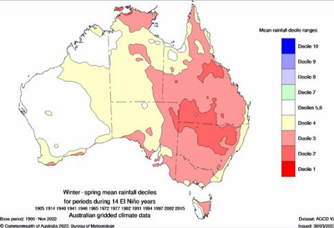
TherehasbeencriticismoftheBureaulately:howcouldtheforecastsbeso wrong,whenweweresupposedtobeinanElNino,whichmeansdrought doesn’tit?Well,doesitmeandrought?No,itcanbetheopposite.Peter CrawfordisfromtheNorthernAustraliaClimateProgram.
Typically, El Nino can mean reduced rainfall, warmer temperatures, reduced tropical cyclone numbers, and later monsoon onset. An El Nino may present all, some, or none, of these features.
Despite what you hear in the media, El Nino does not necessarily mean drought. It’s just that a drought is more possible. The main thing to remember is that El Nino is a climatic condition, not a forecast.
WhenandwheredoesElNinoimpact theAustralianclimate?
El Nino generally affects winter-spring rainfall over much of eastern Australia but has little influence on summer rainfall This rainfall decile map shows how and where rainfall was impacted during 14 El Nino years
There weren’t droughts in all of these years, but most producers in this region would remember the droughts in some recent El Nino years: 1982-83, 1991-92, 1994-95, and 2002-03
DidtheBureauofMeteorologygetitwrong?
Criticism1:TheBureaucalledtheElNinotooearly. The Bureau declared an El Nino a couple of months after other agencies had already done so.
Criticism2:Itwasn’treallyanElNino. Incorrect. Both the Sea Surface Temperature (SST) anomaly threshold and the Southern Oscillation Index (SOI) threshold were more than met, and both indicators were in El Nino territory for several months.
Criticism3:Theforecastswerewrong.
Yes and no. The forecasts for below median rainfall from May to October were very accurate. However, the forecasts for a drier than normal November to January were more or less the opposite of what occurred
It needs to be remembered that long-term forecasts are based on probability. If a forecast says there is a 60% chance of below median rainfall, then there is a 40% chance of above median rainfall Also, forecasts can be wrong due to unforeseen events, such as what occurred in November: a stalled trough system and tropical moisture feeding in from the Coral Sea Sometimesitisthewayaforecastis presentedthatcausesconfusion.
Getthelatestinfo
Want to stay up to date with weather and climate forecasts? Sign up for updates from the Northern Australia Climate Program and you'll get a monthly climate information calendar delivered straight to your inbox!
 Gulf Savannah NRM is proud to be collaborating on this project with the University of Southern Queensland, the Bureau of Meteorology, the UK Met Office, state governments in QLD, NT and WA, and other NRM groups.
BUSINESS DIRECTORY
Would you like to see your Gulf business included in the next Gulf Croaker? Get in touch with us: admin@gulfsavannahnrm.org
CARPENTARIASHIRE
SunsetTavern,Karumba (07) 4745 9183
sunsettavern@bigpond com
LesWilsonBarraDiscoveryCentre (07) 4745 2211
https://barracentre.com.au/
KarumbaSupermarket&Cafe (07) 4745 9188
Find us on Facebook
TheAnimalBar,Karumba 0497 901 266
FerrymanRiverCruise,Karumba (07) 4745 9155
www ferryman net au
PurplePub,Normanton (07) 4745 1324
http://purplepub com au/
AlbionHotel,Normanton (07) 4745 1218
albionhotelnormanton com au
GulflanderMotelCaravanPark, Normanton (07) 4745 1290
gulflandmotelandcaravanpark.com
NormantonAirport&PostOffice (07) 4745 1568
CROYDONSHIRE
CroydonClubHotel (07) 4745 6184
www croydonclubhotel com au
ETHERIDGESHIRE
EinasleighHotel (07) 4062 5222
www facebook com/einasleighhotel
CobboldGorge (07) 4062 5470
www cobboldgorge com au
GeorgetownRoadhouse (07) 4062 1999
jabena@bigpond.com
GeorgetownRodeoAssociation
Facebook: Georgetown Rodeo Association
rodeogeorgetown@gmail.com
BedrockVillage,MtSurprise (07) 4062 3193
www bedrockvillage com au
MAREEBASHIRE
RailwayHotel,Almaden (07) 4094 8307
Find us on Facebook
BiboohraCashStore (07) 4093 2545
ChillagoeObservatoryand EcoLodge (07) 4094 7155
www coel com au
TheHubChillagoe (07) 4094 7111
www chillagoehub com au
ChillagoeCockatooHotel (07) 4094 7168
chillagoecockatoohotel com au
LoudounHouseMuseum, Irvinebank (07) 4096 4020
loudounhouse@skymesh com au
IrvinebankTavern&Cabins (07) 4096 4176
irvinebank@westnet com au
Nine-MileStore,Julatten (07) 4094 1275
ninemilestore4871@gmail com
MountCarbineRoadhouse (07) 4094 3043
mtcarbineroadhouse com
MountCarbineHotel 0400 465 682
mtcarbinehotel@gmail com
MountMolloyCoffeeShop (07) 4094 1175
Find us on Facebook
27
Join us for a two-day Changemaker Workshop 29 & 30 April 2024 | 8.30am – 4.30pm, or 2 & 3 May 2024 | 8.30am – 4.30pm Jackaroo Motel, Mareeba Scan the QR code to sign up or contact Deborah Schedue: 0422 218 506, deborah schedue@gulfsavannahnrm org gulfsavannahnrm.org/getinvolved
