Chris Reed CLIMATE CASE: Sarasota
Chris Reed
Climate Case: Subtropical Urbanism
Climate Case: Sarasota Subtropical Urbanism
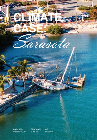
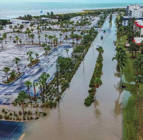
In the fall of 2024, two Hurricanes - Helene and Milton - made landfall directly on the City of Sarasota, Florida, causing flooding and extensive wind and water damage. This followed a series of tropical storms and near misses that produced flooding throughout the region at a frequency and intensity not previously seen. These storm events were a harbinger of a climate in a rapid state of change, with consequences yet to be fully known or experienced.
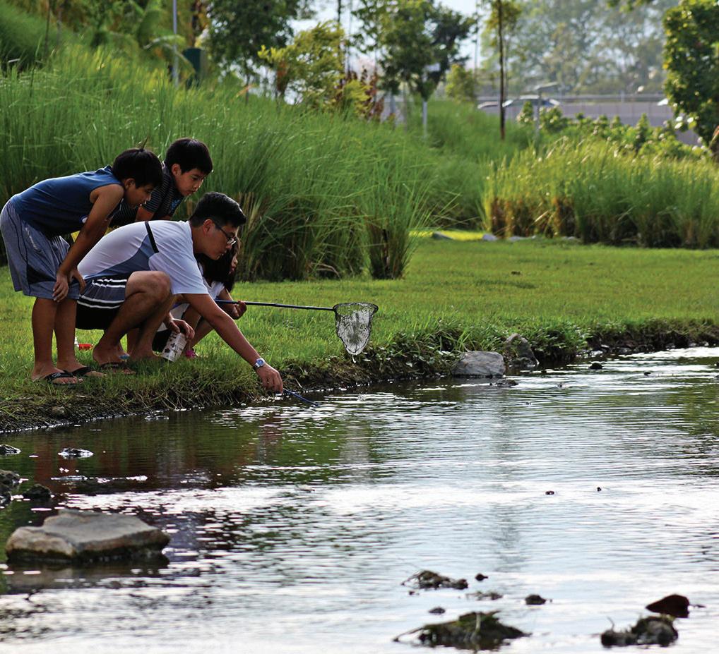
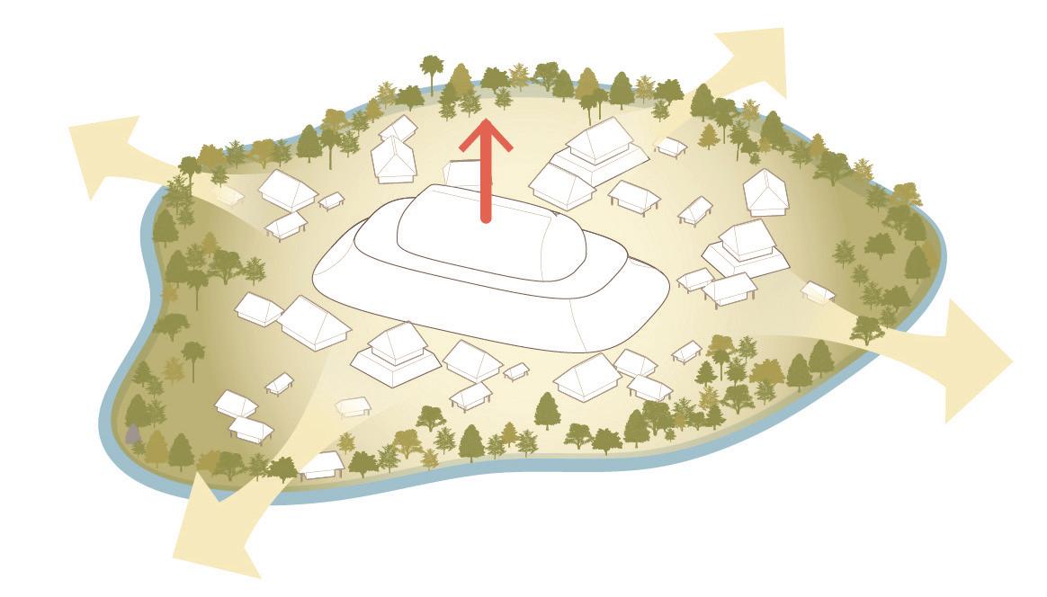
At the prompting of Architecture Sarasota, this project-based seminar was formulated to explore current and future climate threats in and around Sarasota and the Gulf of Mexico, including how historic urban development and land reclamation may have exacerbated them. The ensuing work focused on bringing to light underlying predevelopment conditions, ecologies and cultures that might point toward more holistic, multi-species approaches to human habitation; and speculations on a range of tactics that could allow for ways to live with and adapt to ongoing and projected changes in the environment. Students focused on the Downtown Bayfront, but drew from the rich array of natural and cultural resources throughout the region, including destination beaches, architectural legacies, and outdoor living.
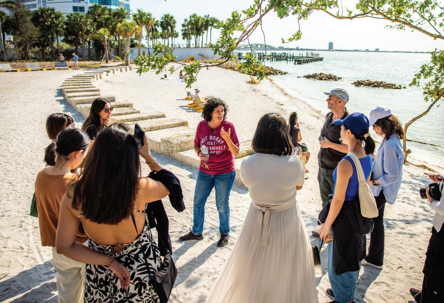
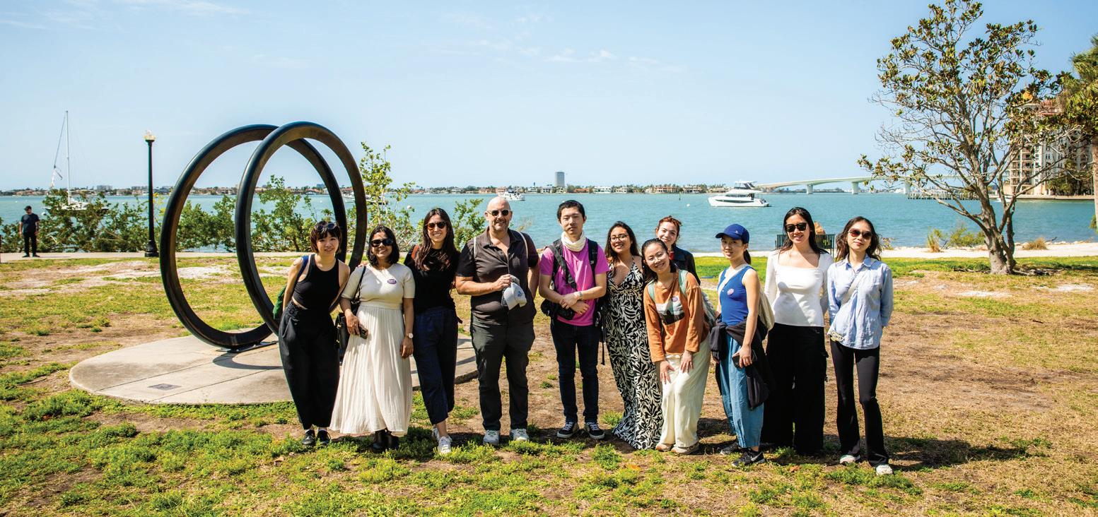
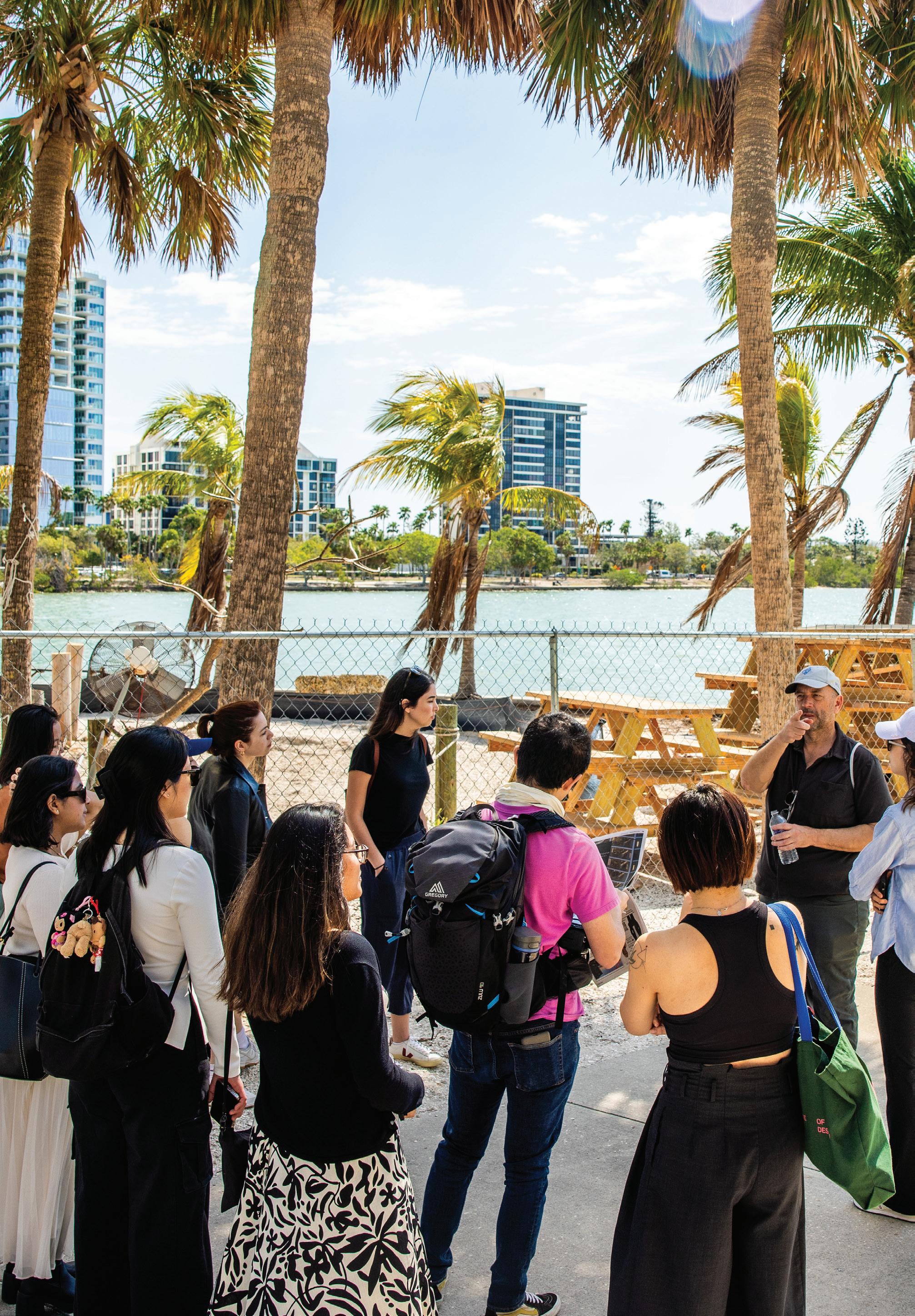
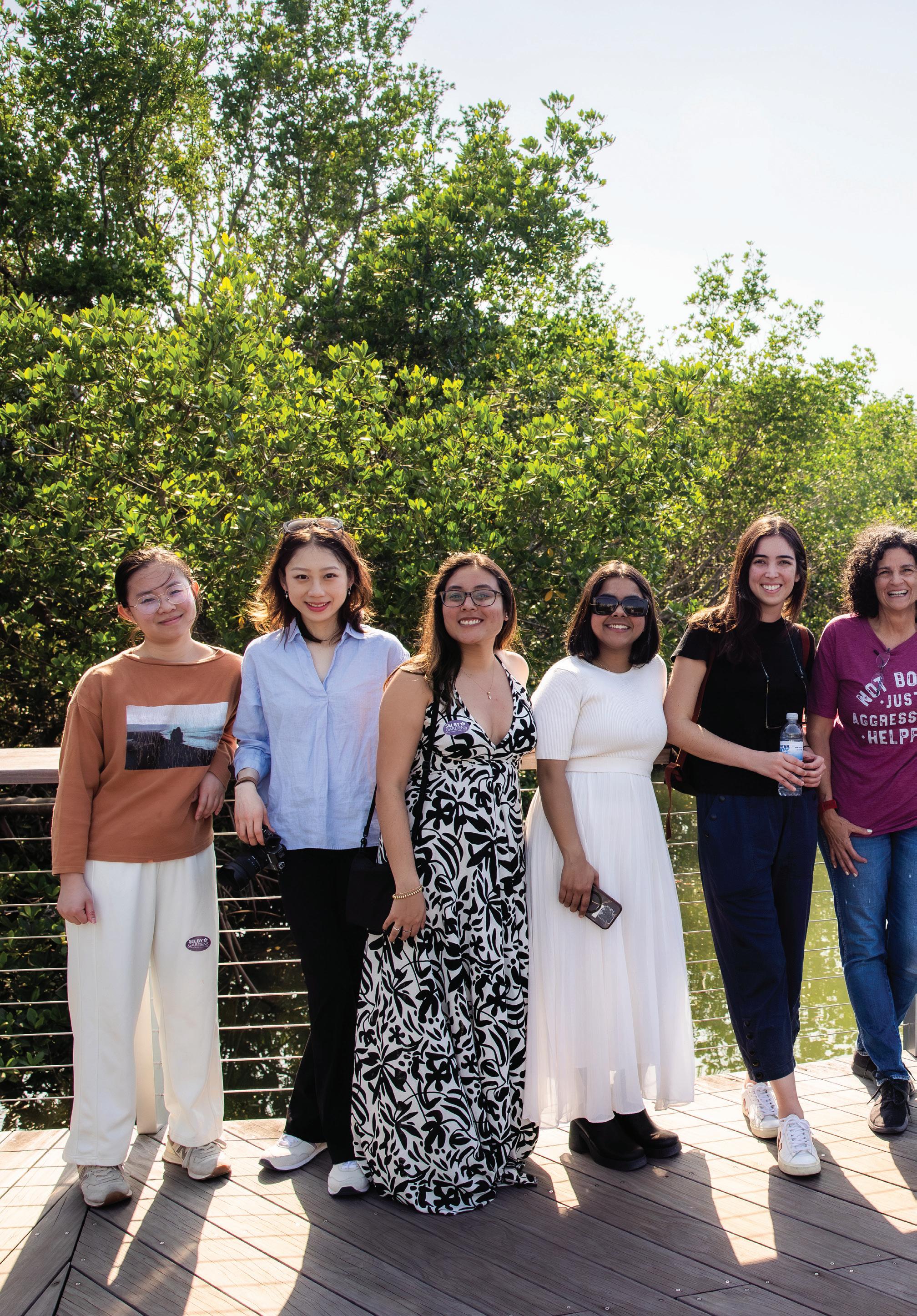
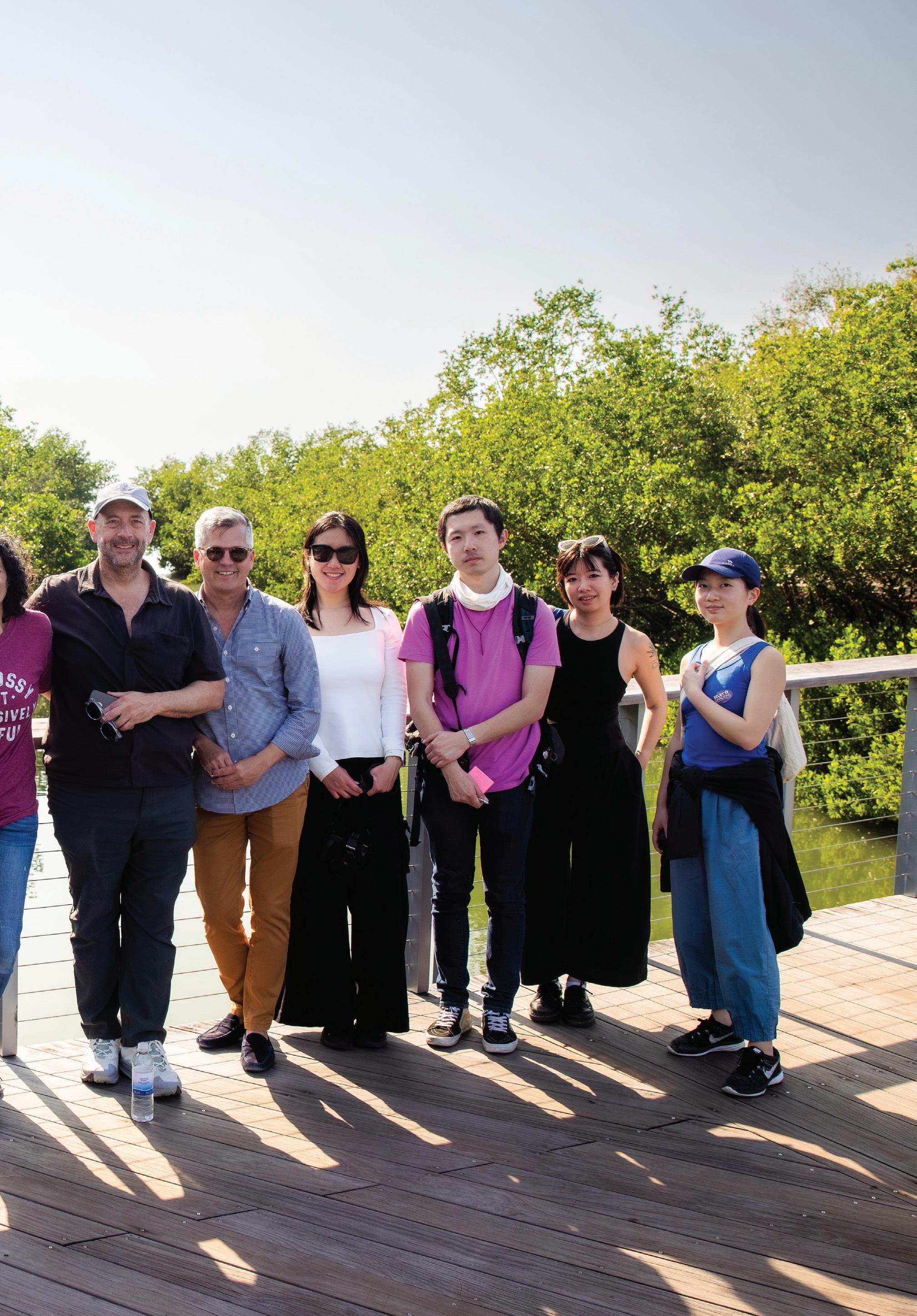
The seminar was run as a collaborative laboratory, with work sessions and research sharing incorporated into seminar meetings, and included a 3-day visit to Sarasota. It culminated with a review of student work that was attended by national experts on climate change, Sarasota leaders and climate advocates, and Harvard professors.
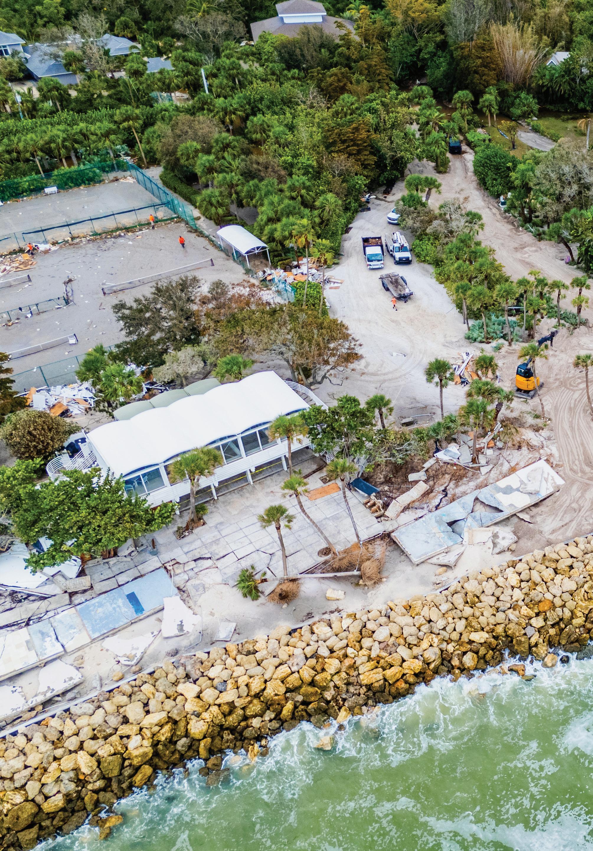
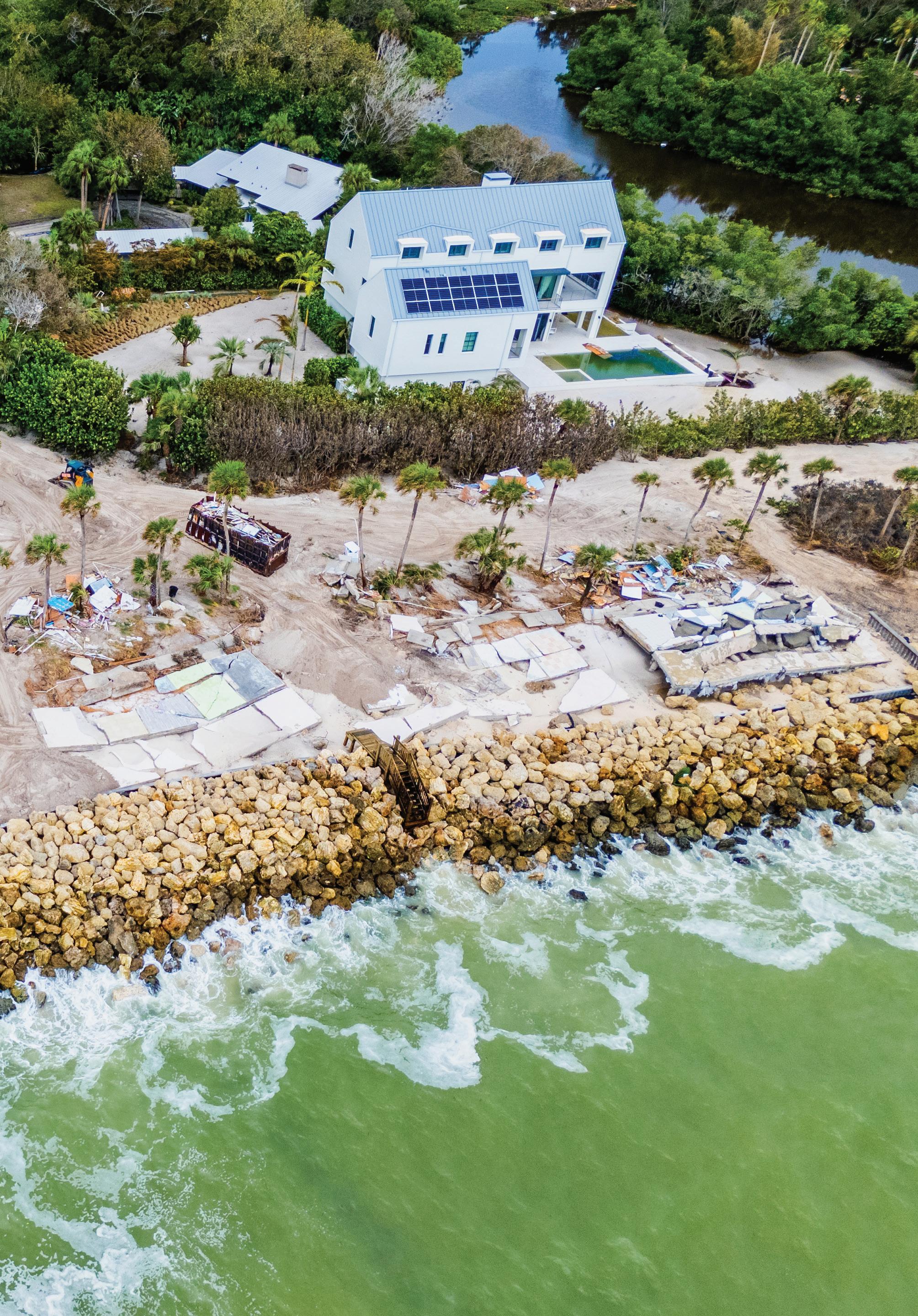
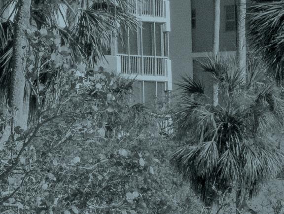
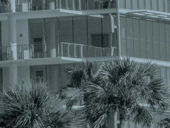
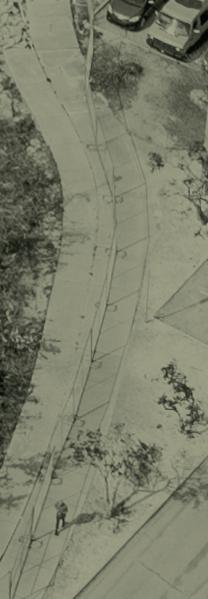
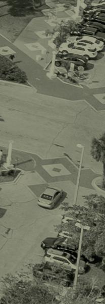
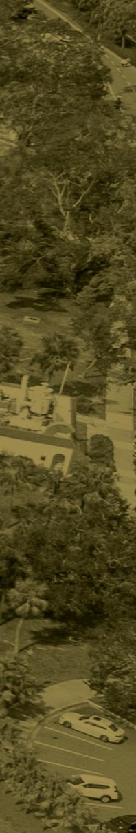
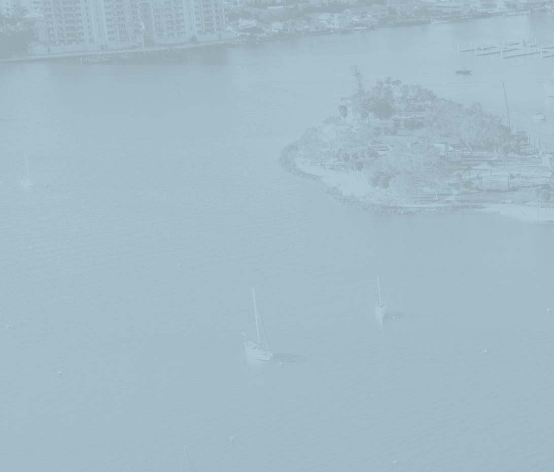
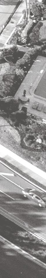
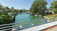
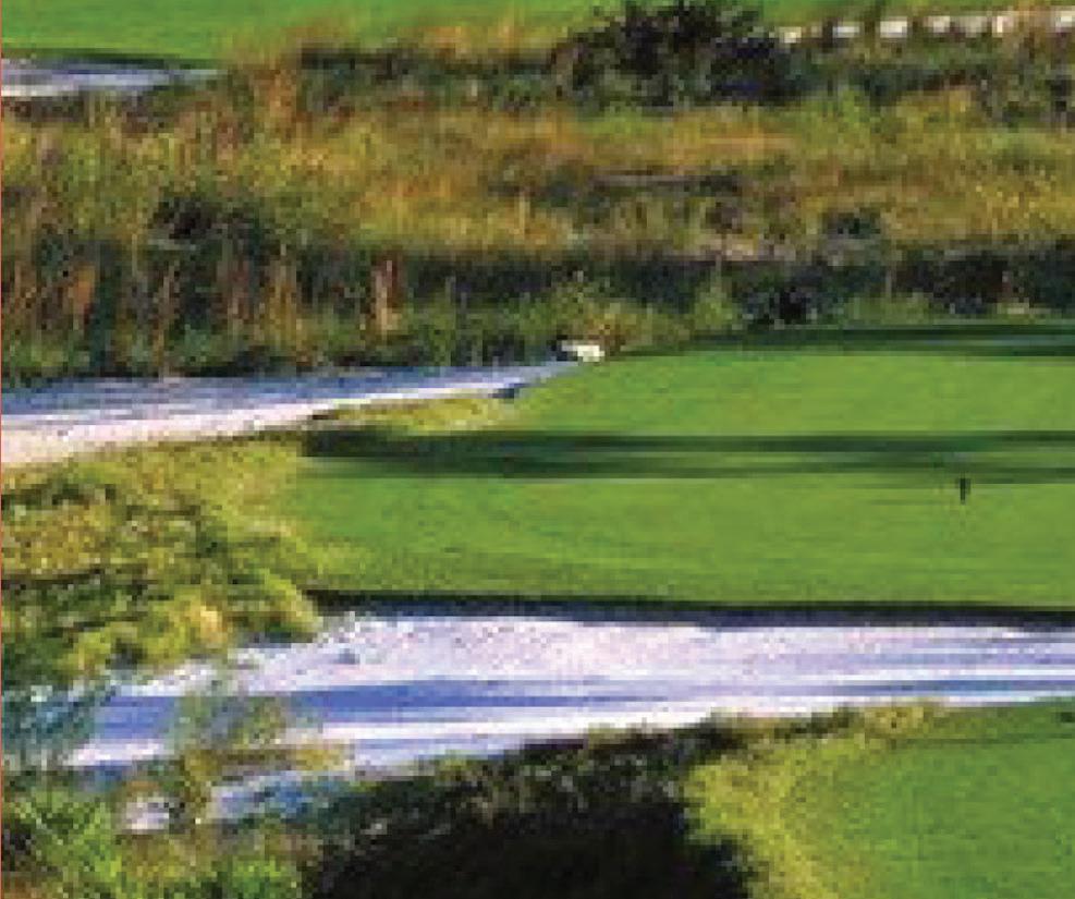
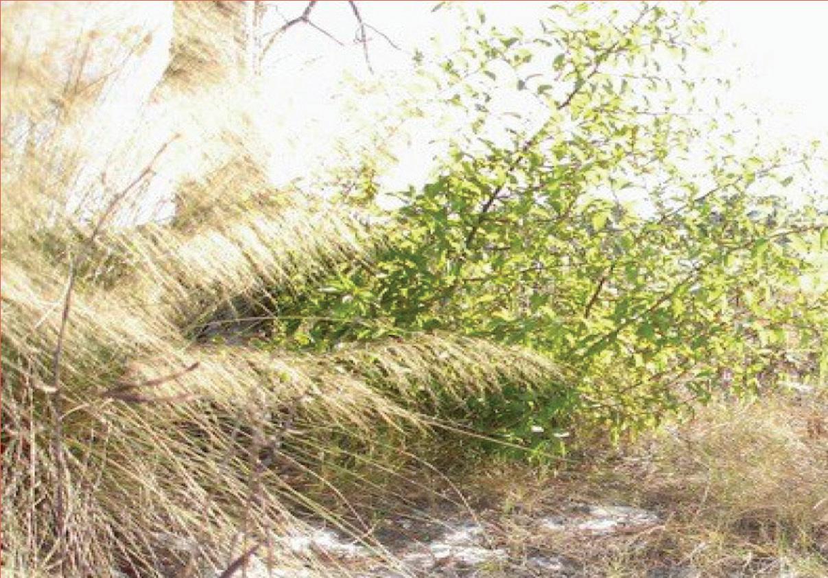
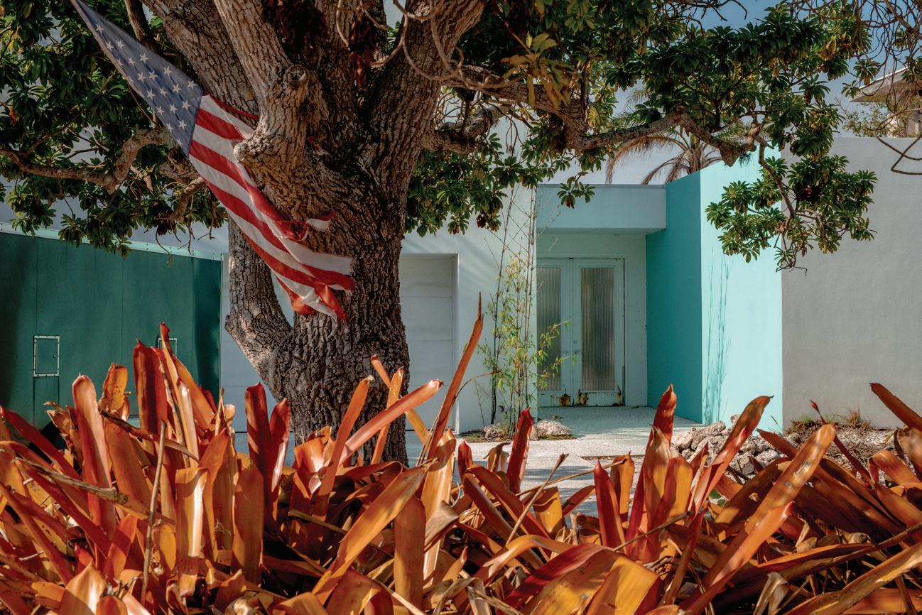
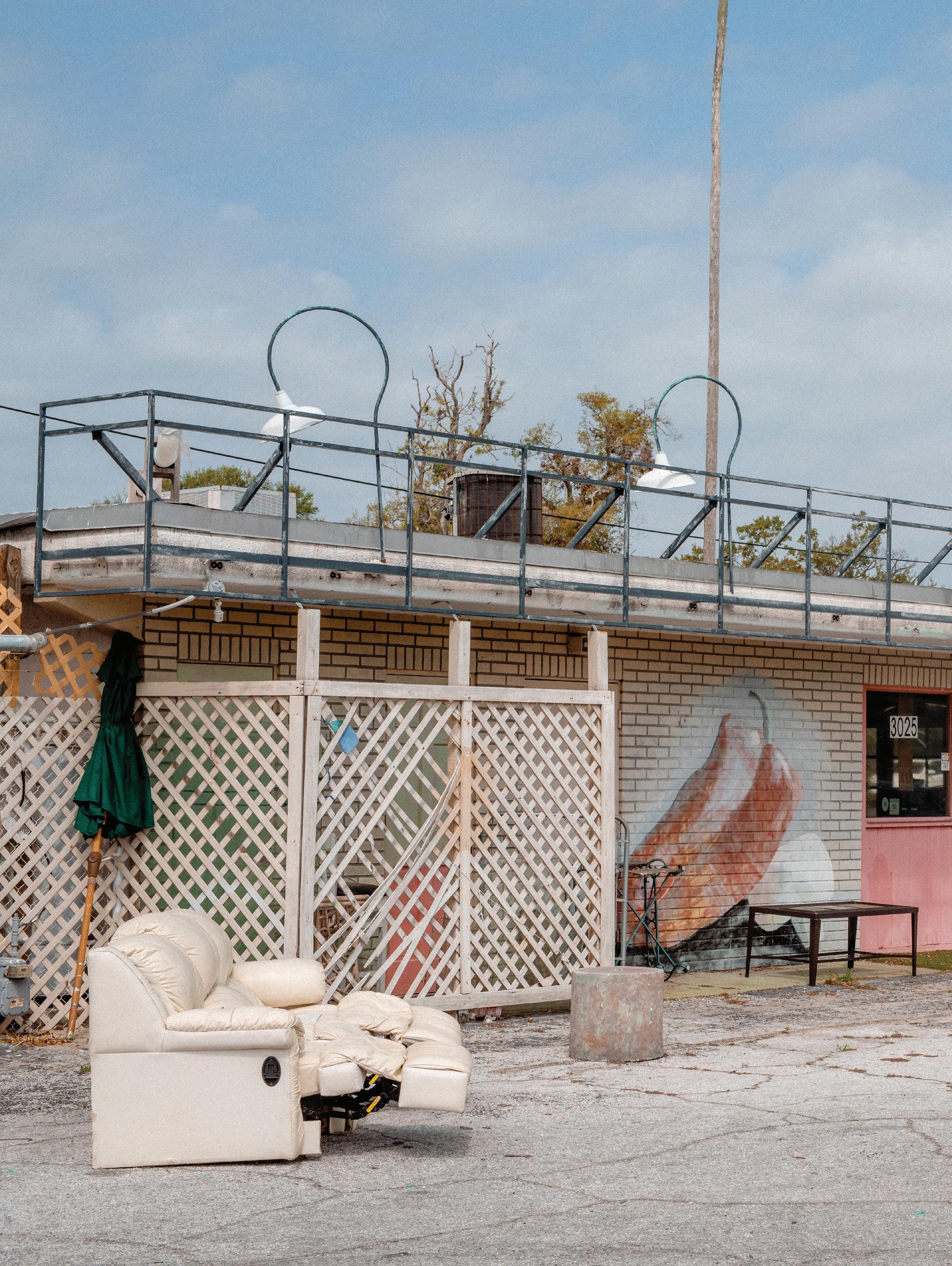
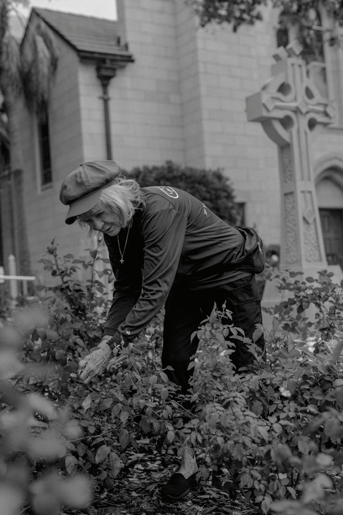
Facing page: Mike Belleme, 2025.
Studio Instructor
Chris Reed
Teaching Assistant
Harish Krishnamoorthy
Students
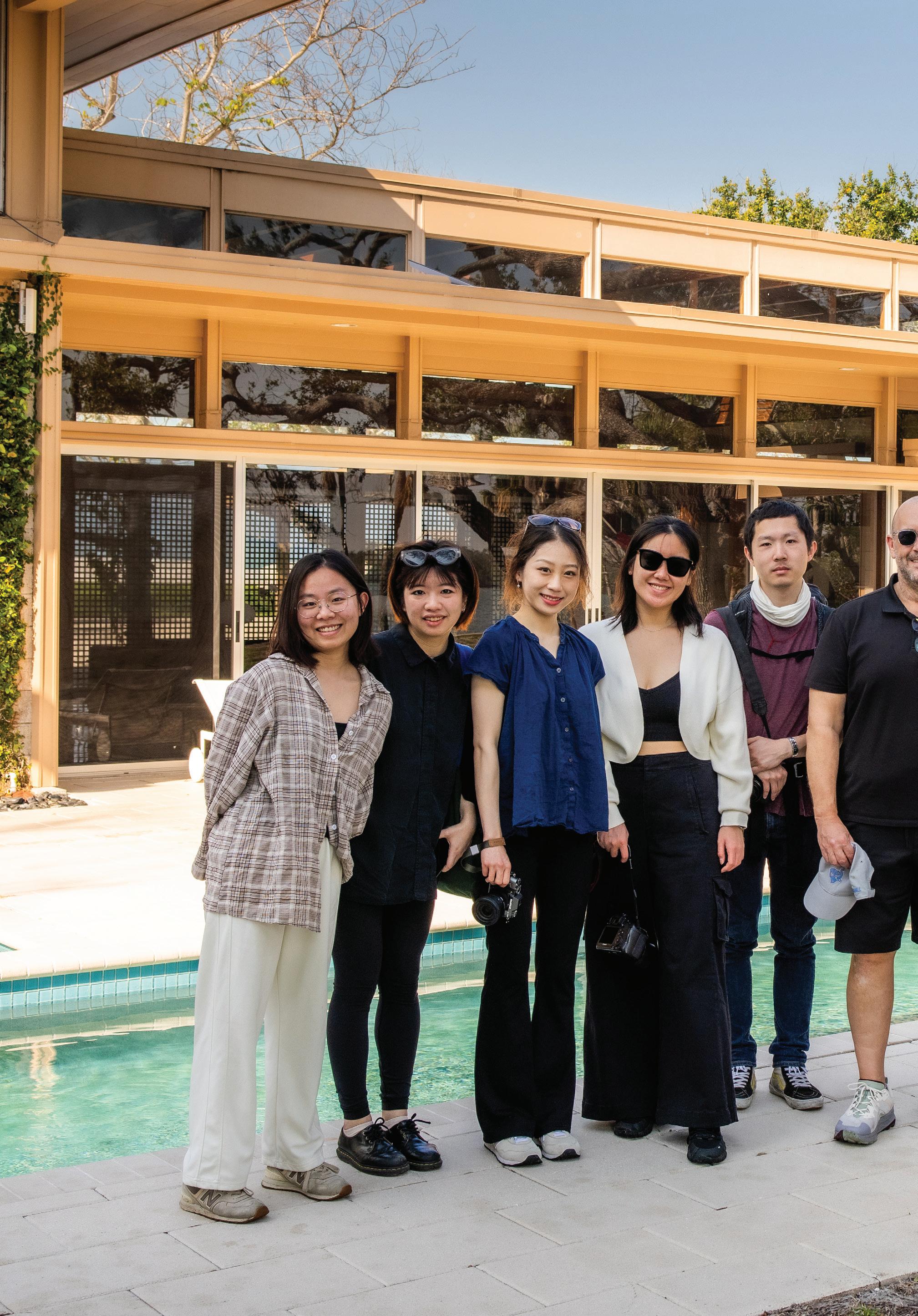
Rimshi Agrawal, Lyna Boulgamh, Romina Cordova Grados, Yushuo Ding, Freya Fu, Hanzhang Lai, Esther Li, Rilia Li, Allen Wang, Kiara Wong Siu
Final Review Critics
Kira Clingen, Steven Cover, Maurice Cox, Candace Damon, Katherine DeSousa, Howard Davis, Sherry Davis, Anne Essner, Morris Hylton III, Purnima Kapur, Ryan Lester, Catherine McCandless, Max Robert Piana, Amy Whitesides.
Site Visit Tour Guides
Diana Shaheen, The Bay Sarasota;Megan Suau and Karl Bernhard, Sweet Spackman.
Seminar Presenters
Kirk Bosma, Woods Hole Group; Shanna Challenger, Environmental Awareness Group; Kira Clingen, Harvard GSD; Candace Damon, HR&A; Rosetta Elkin, Pratt University; Melissa Hew, ARCADIS; Jeffrey Hebert, Brooks Scarpa Architects; Morris Hylton III and Kristine Ziedina, Architecture Sarasota; Nina-Marie Lister, Toronto Metropolitan University; Gena Morgis, SCAPE; Trenton Strackbein, Kimley Horn; Amy Whitesides, Harvard GSD.
The Future of Sarasota’s Bayfront
Morris [Marty] Hylton III
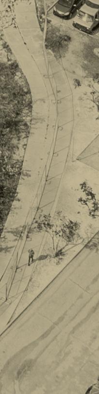
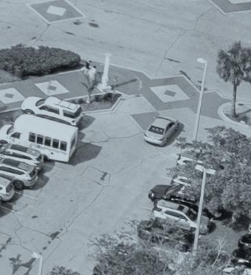
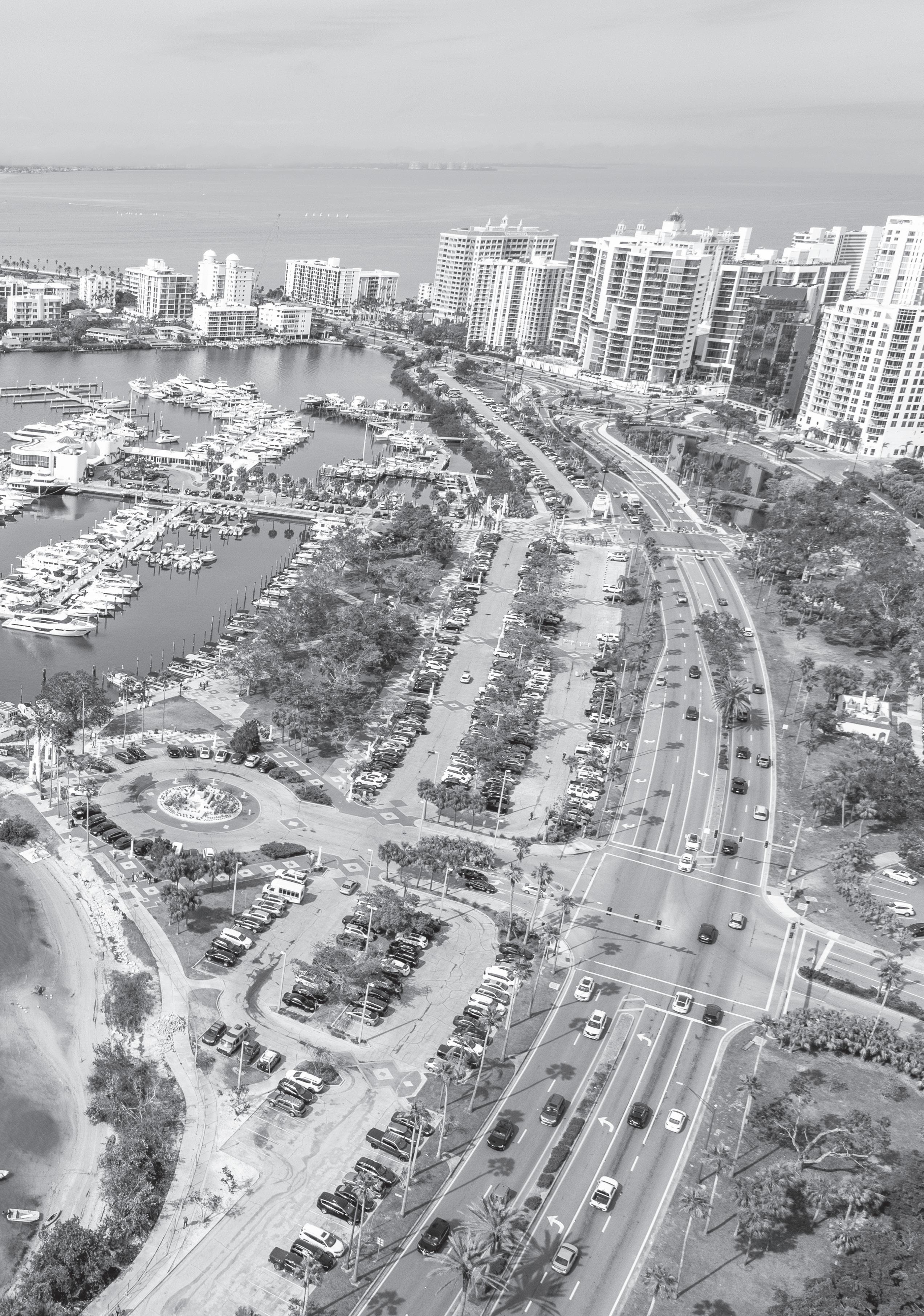
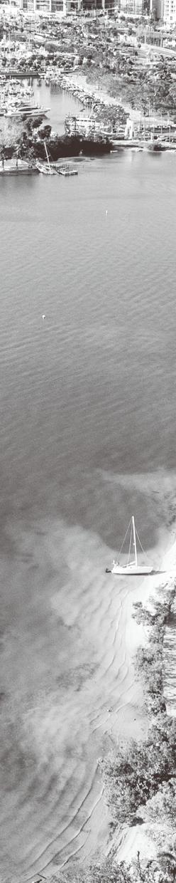
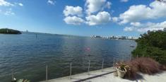
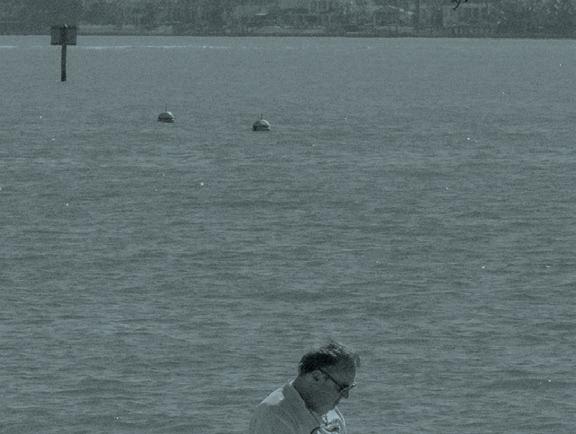
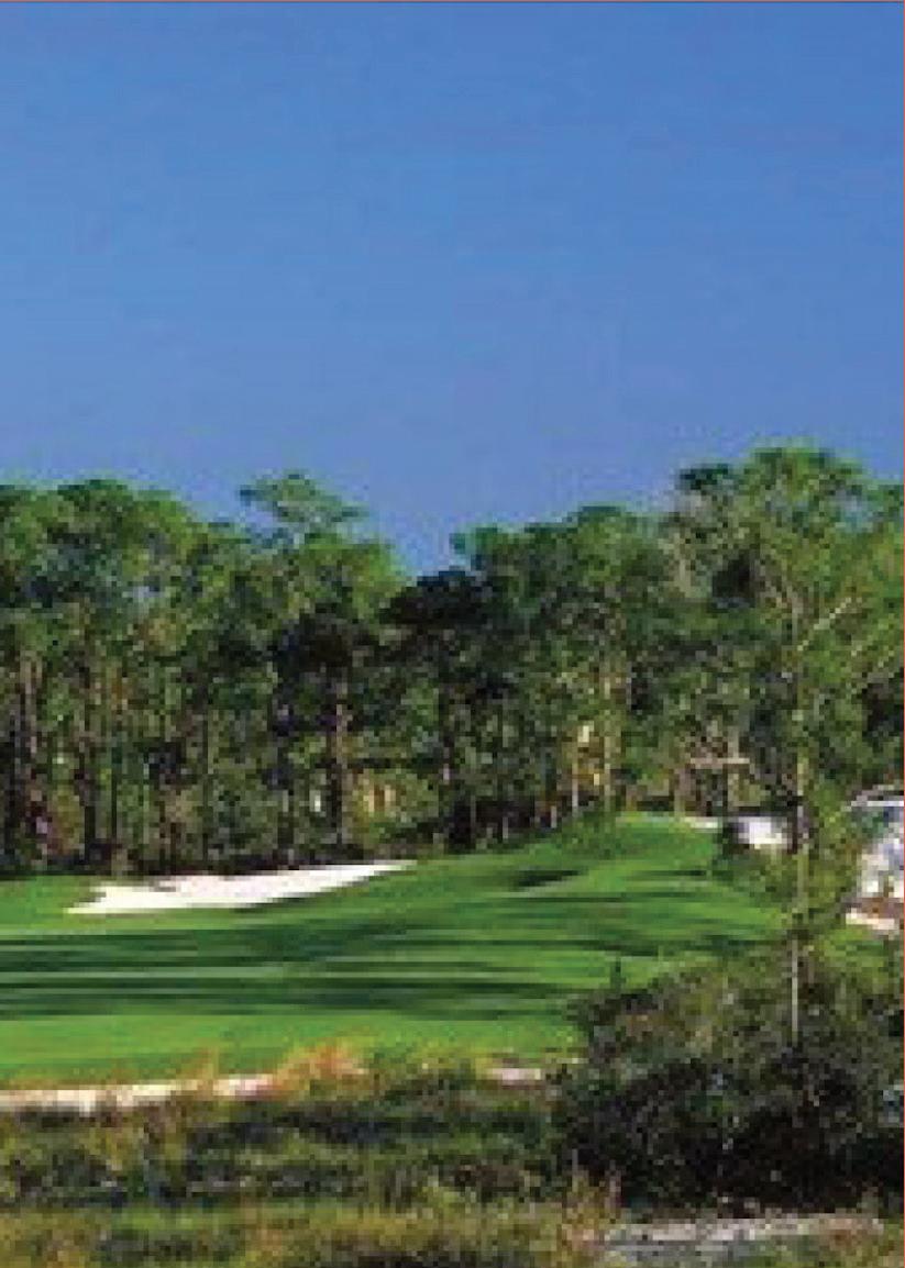
Previous page: Ryan Lester, 2025.
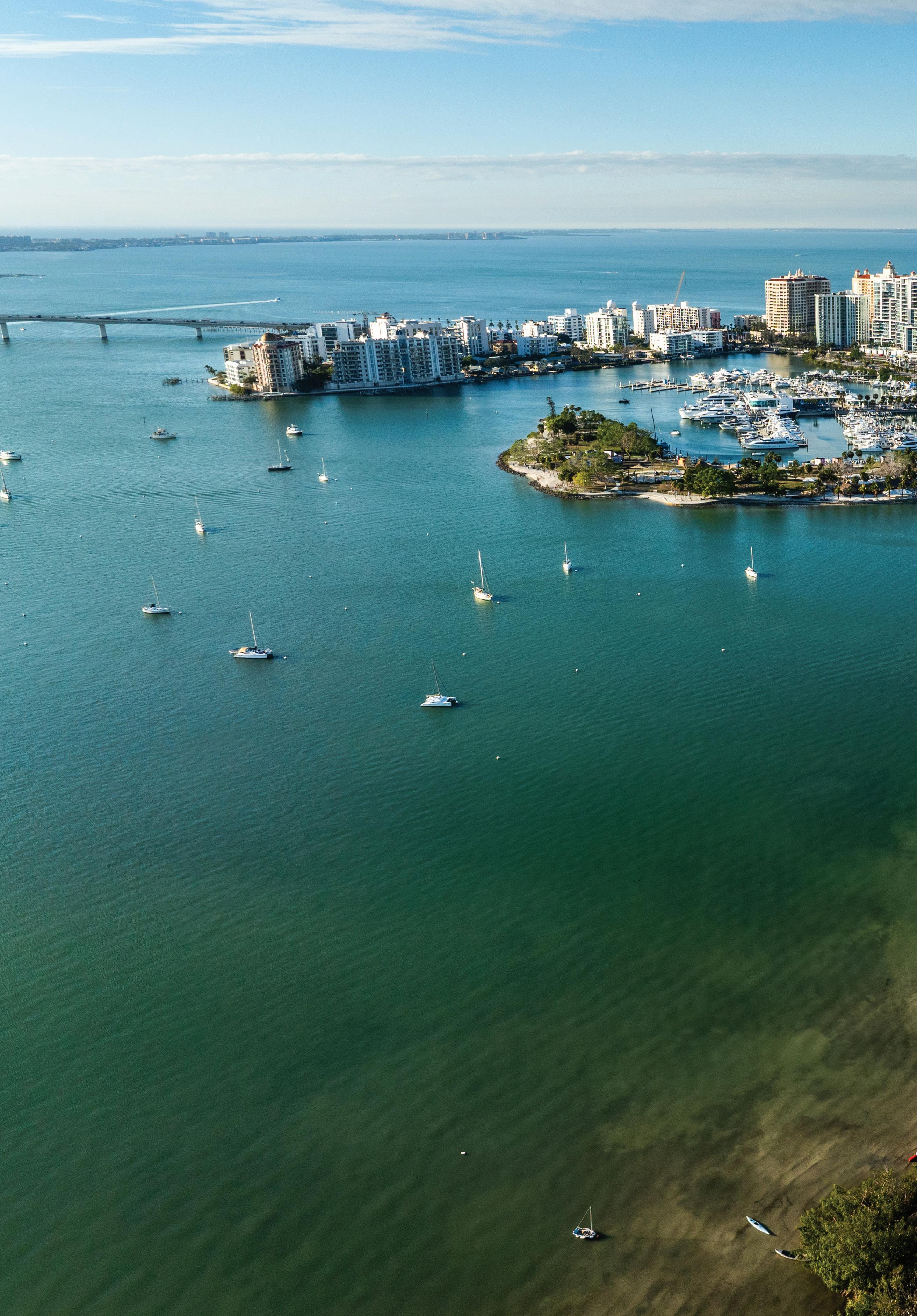
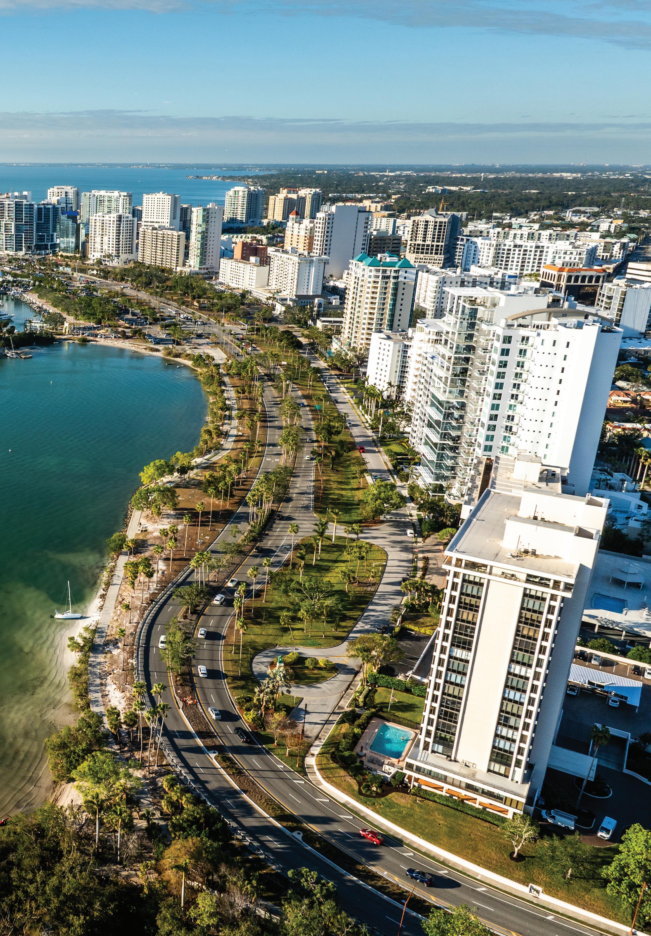
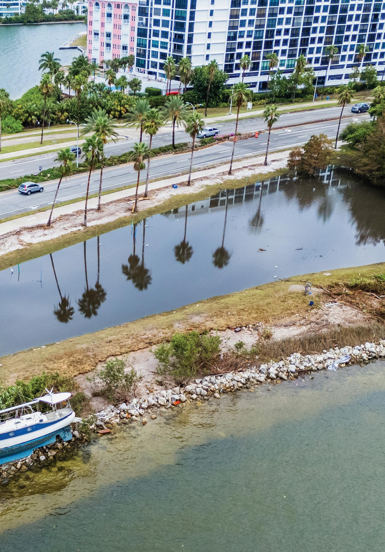
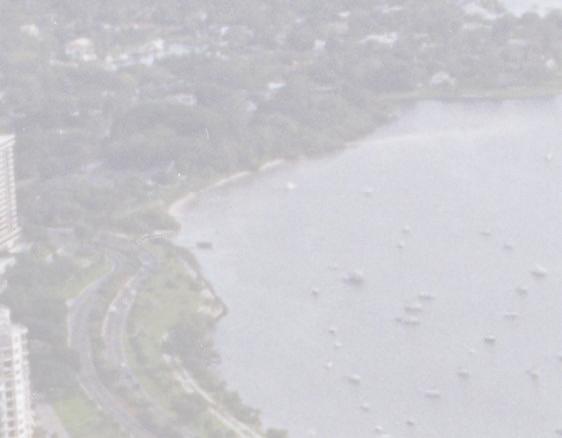
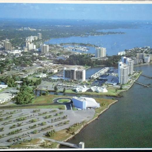
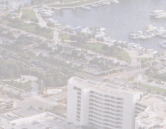
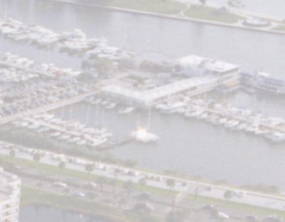
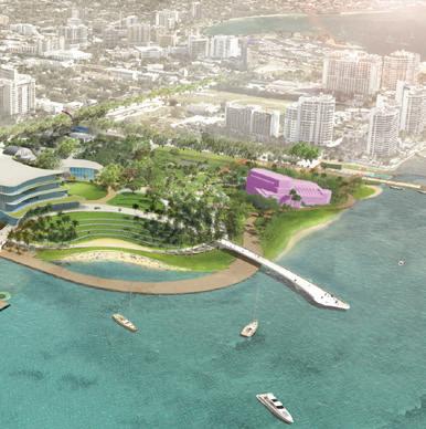
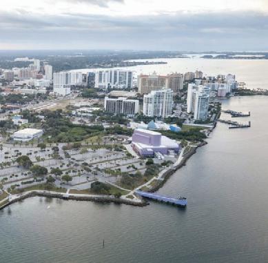
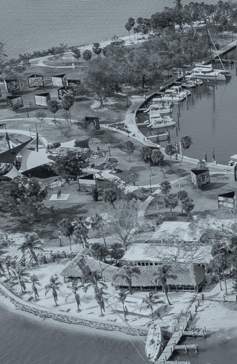
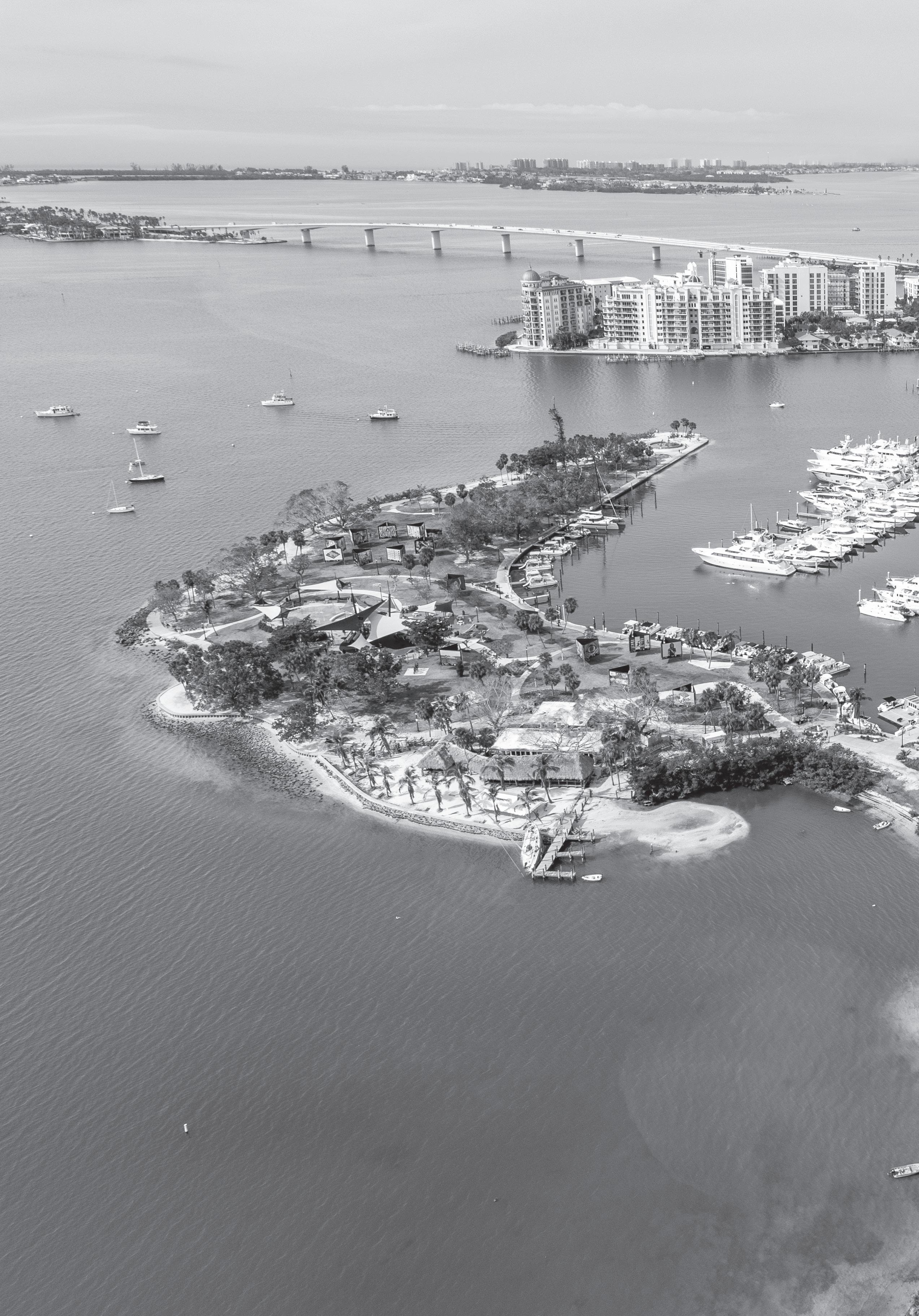
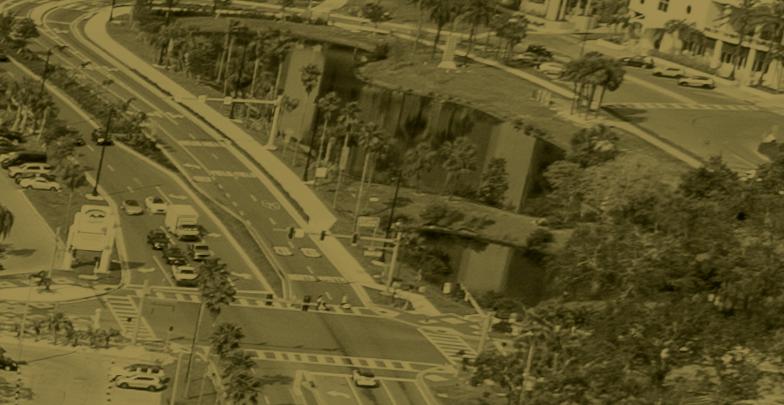
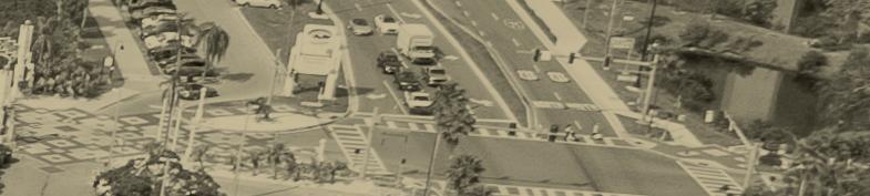
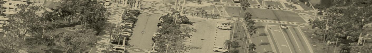
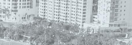
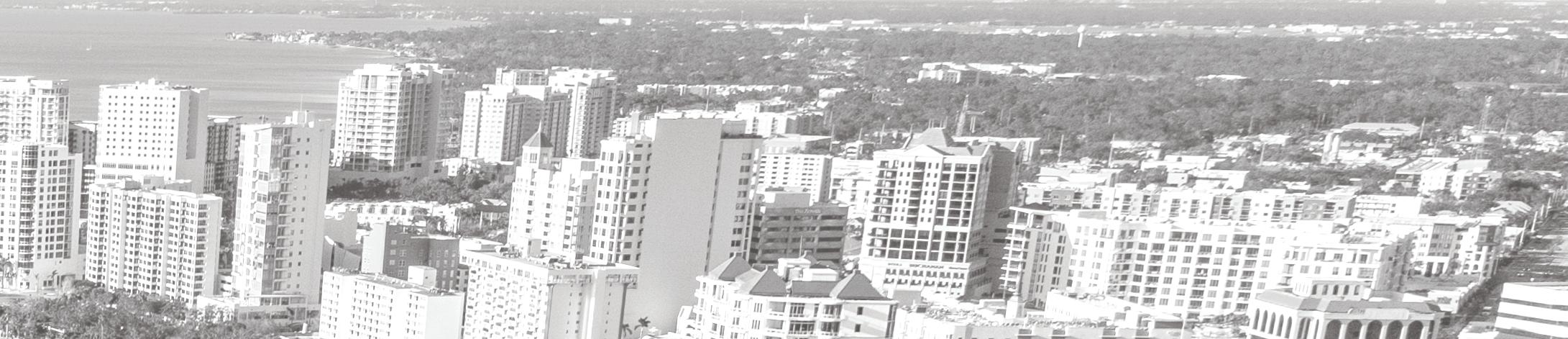
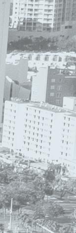
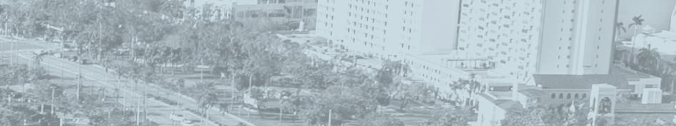
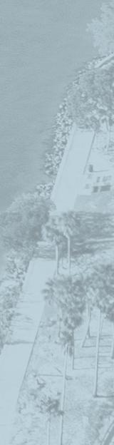
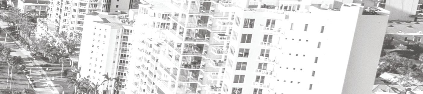
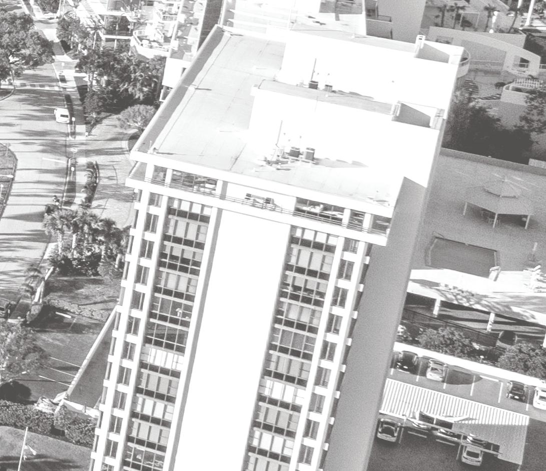
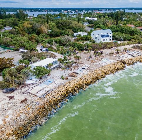
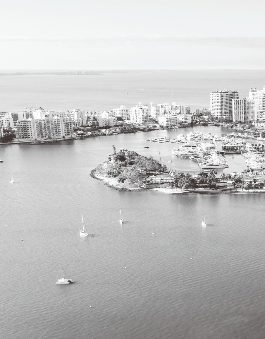
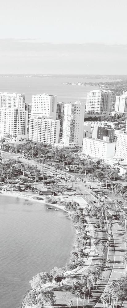
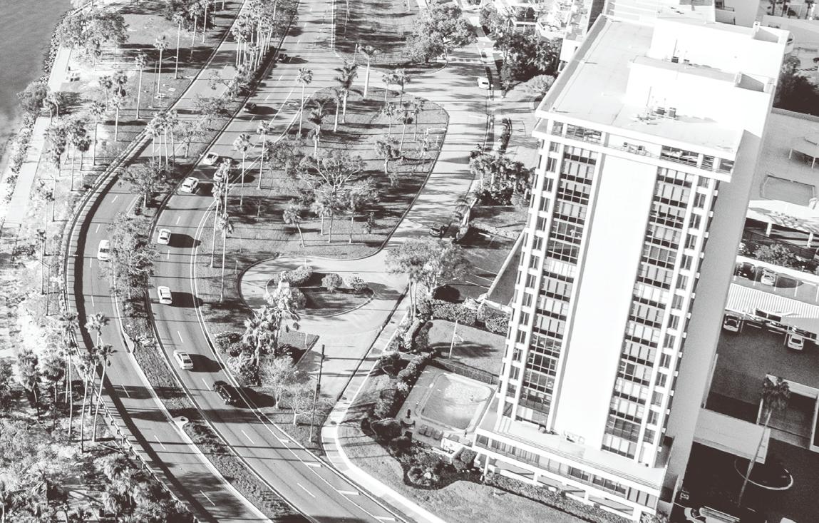
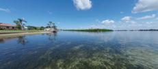
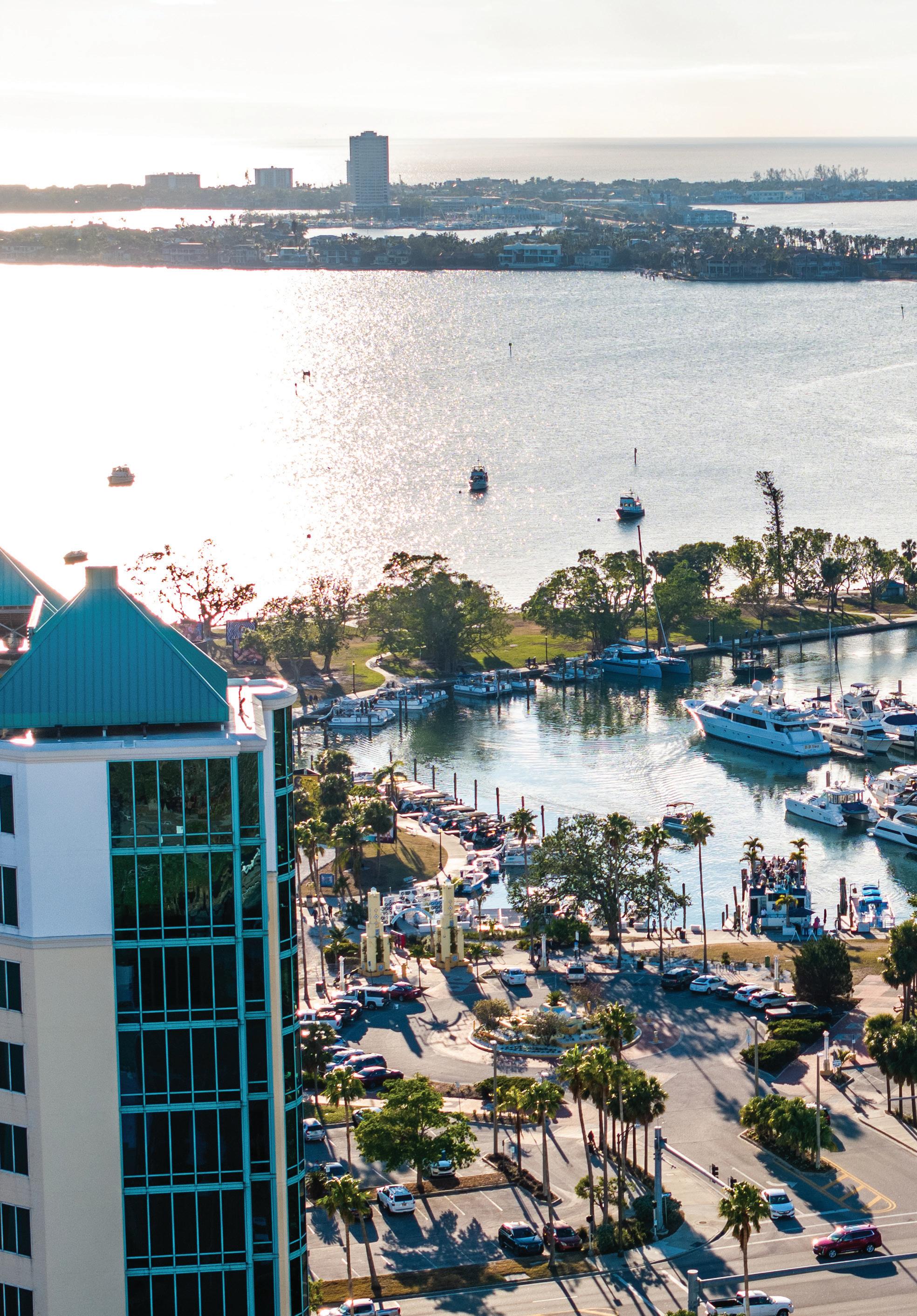
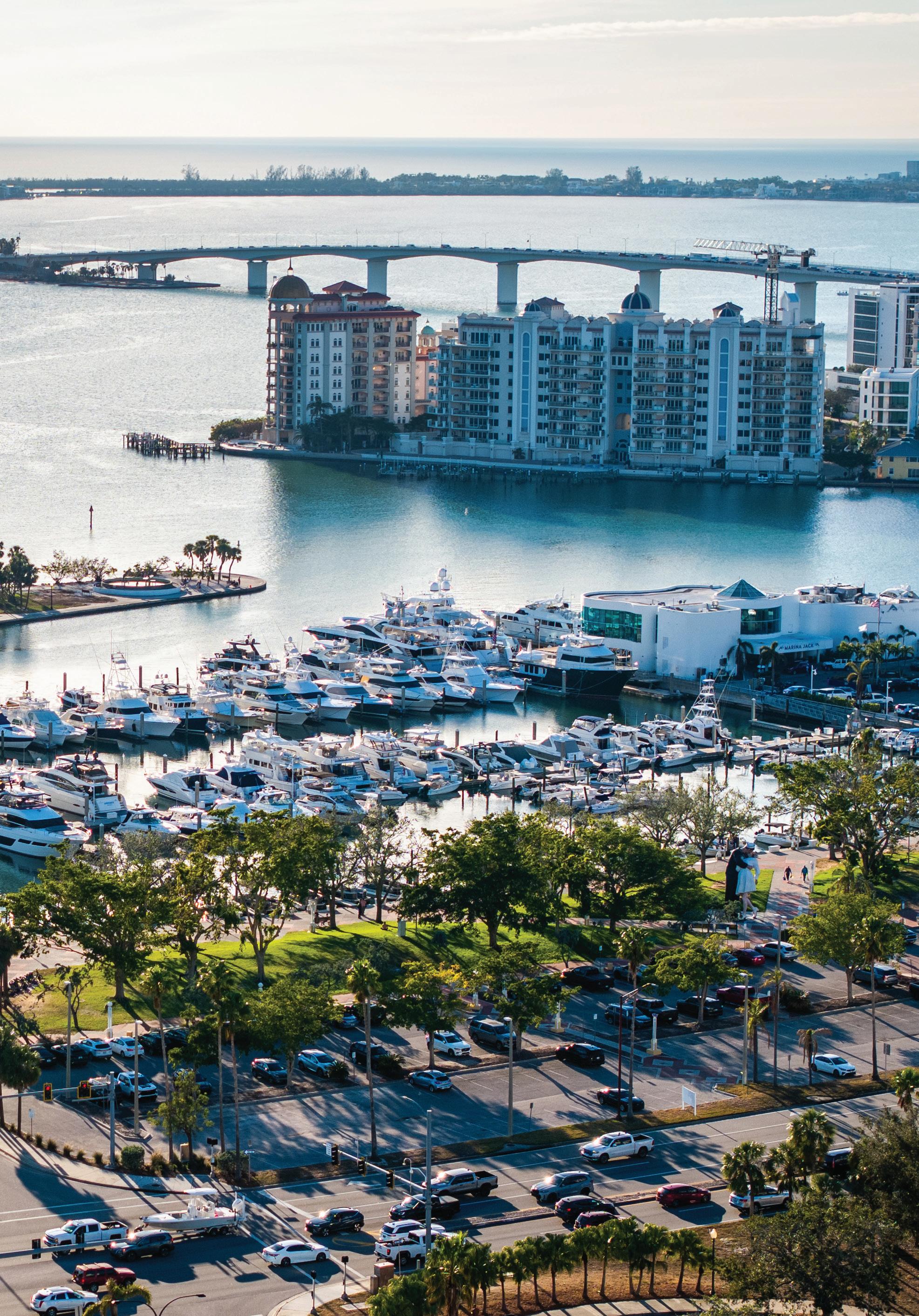
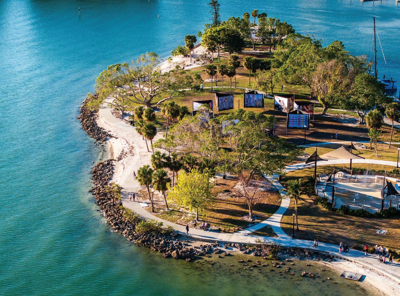
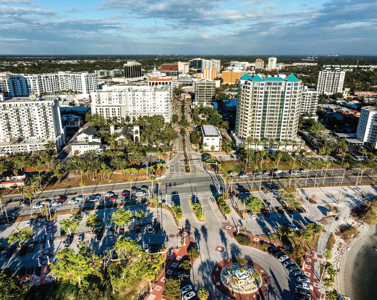
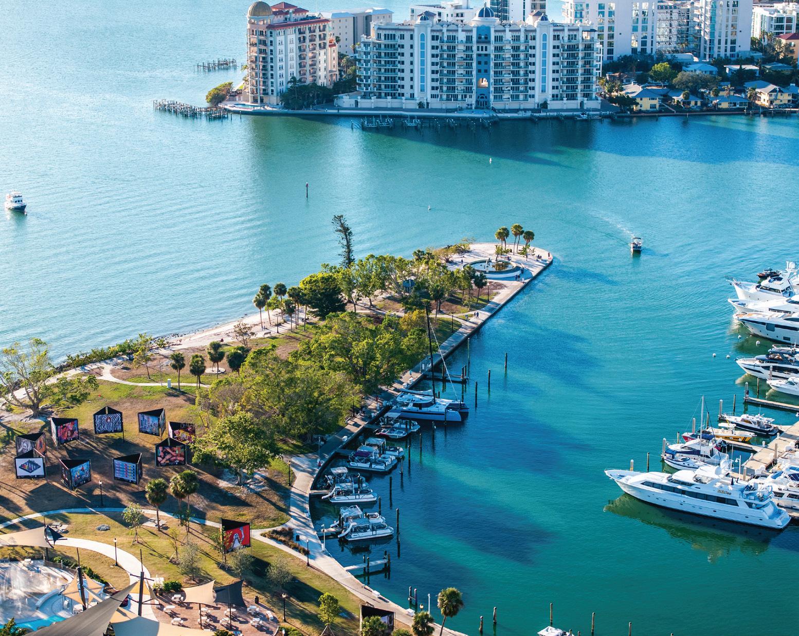
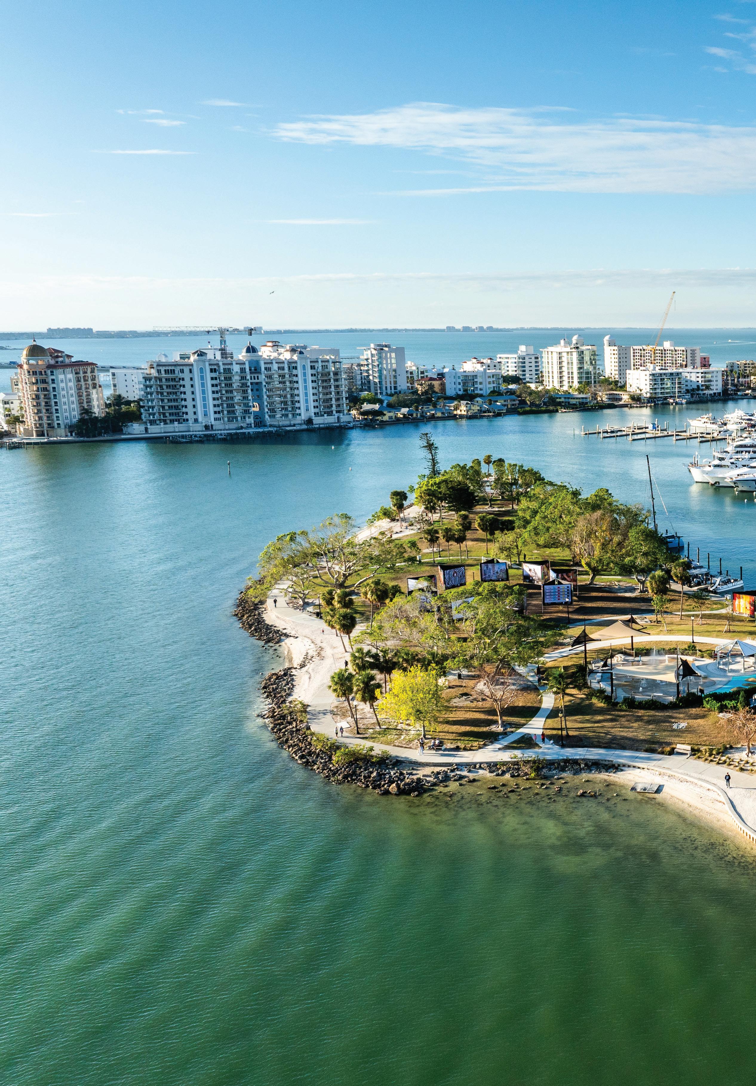
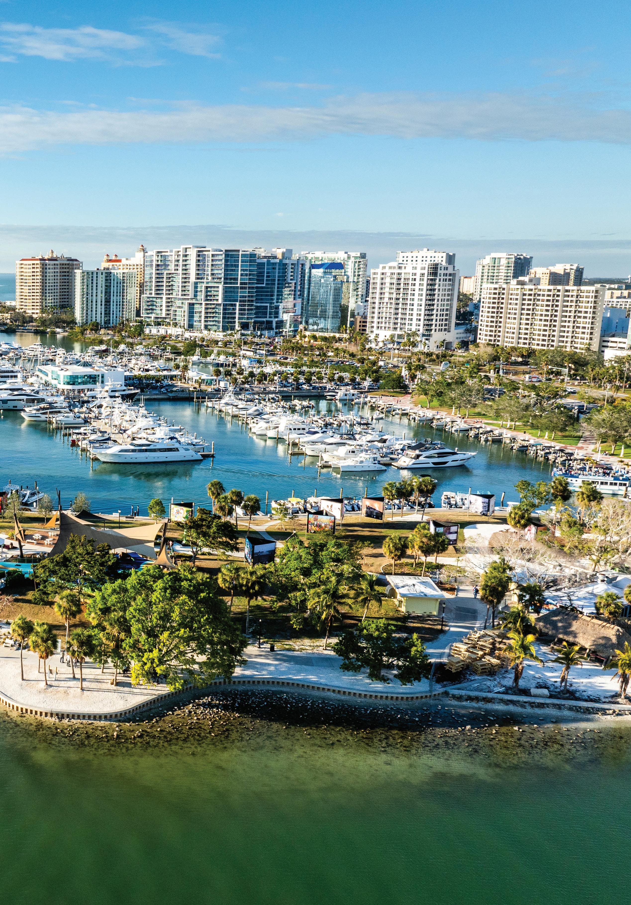
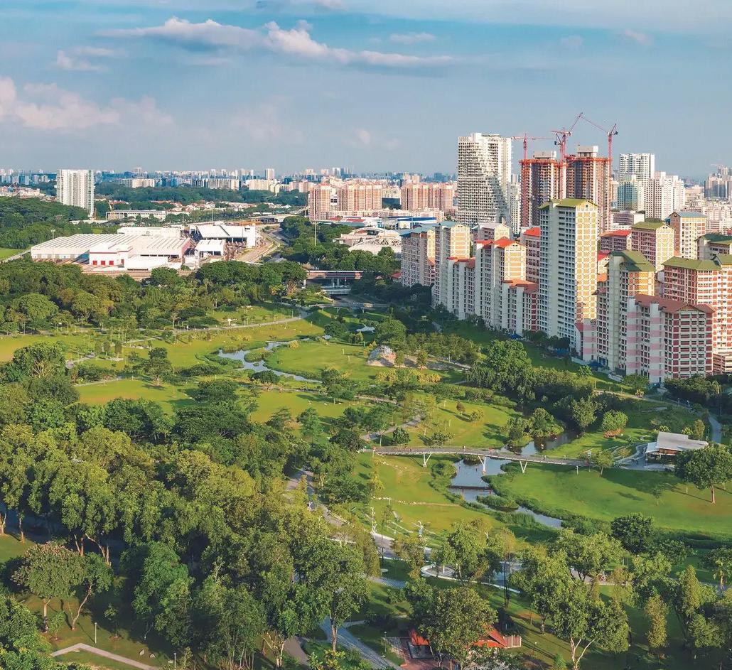
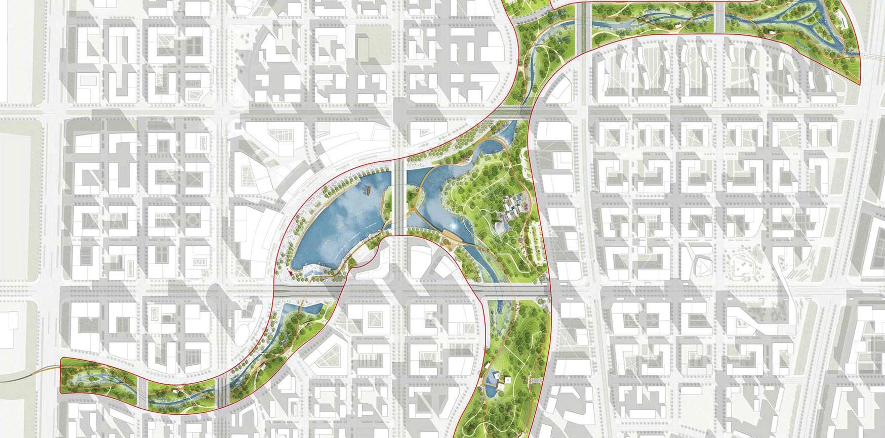
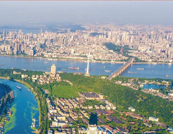
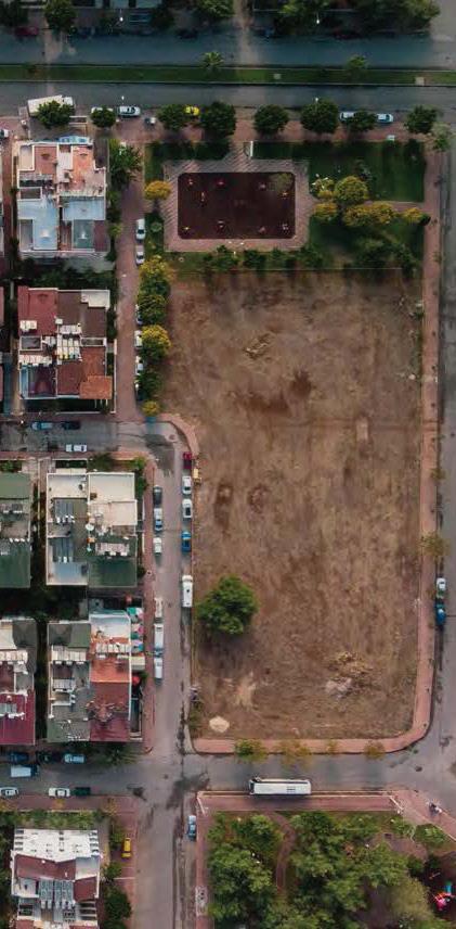
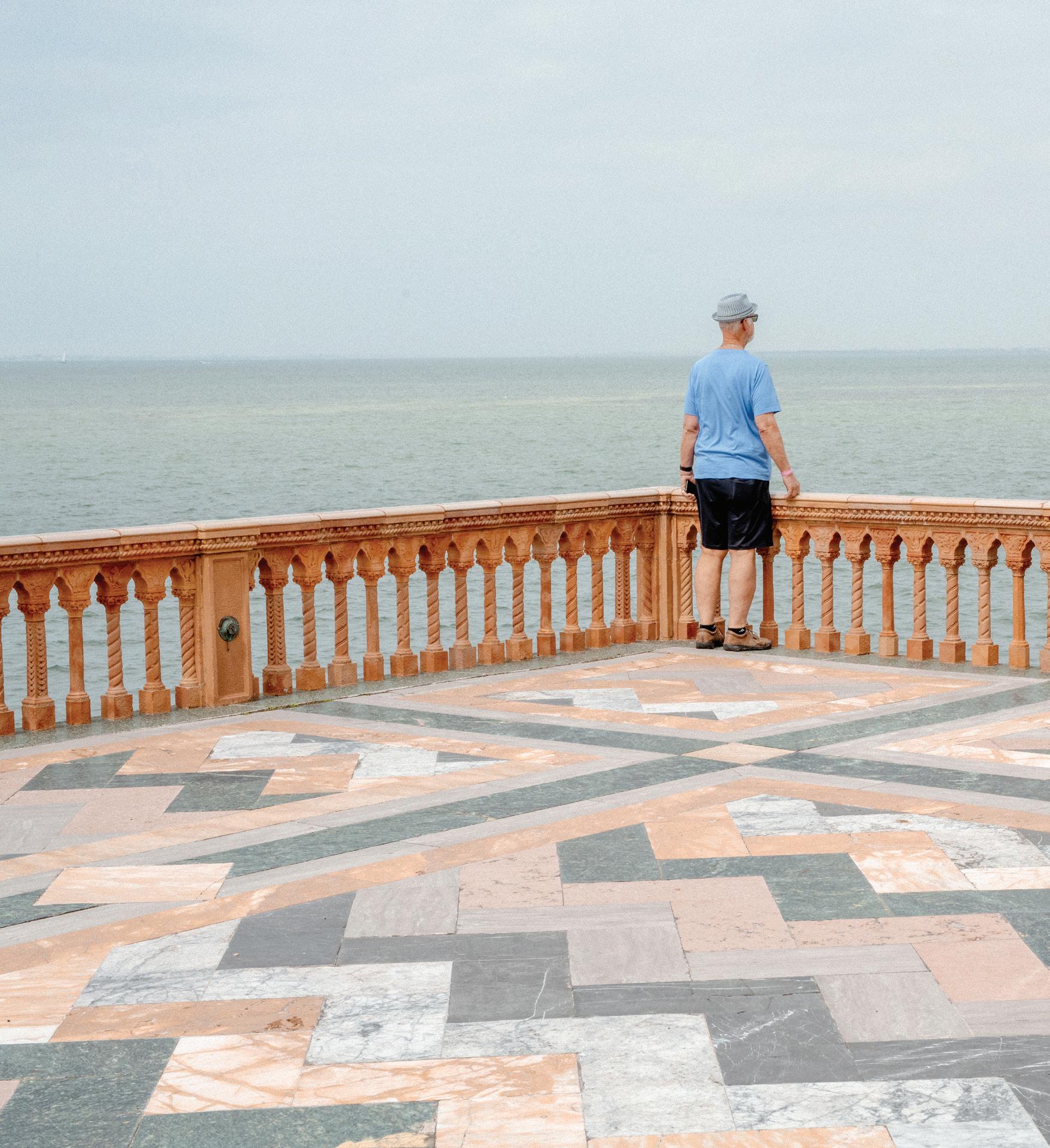
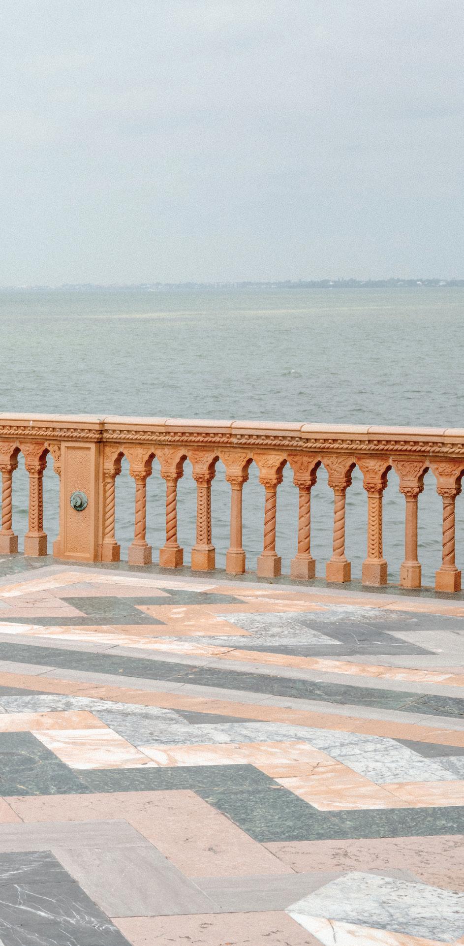
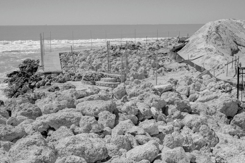
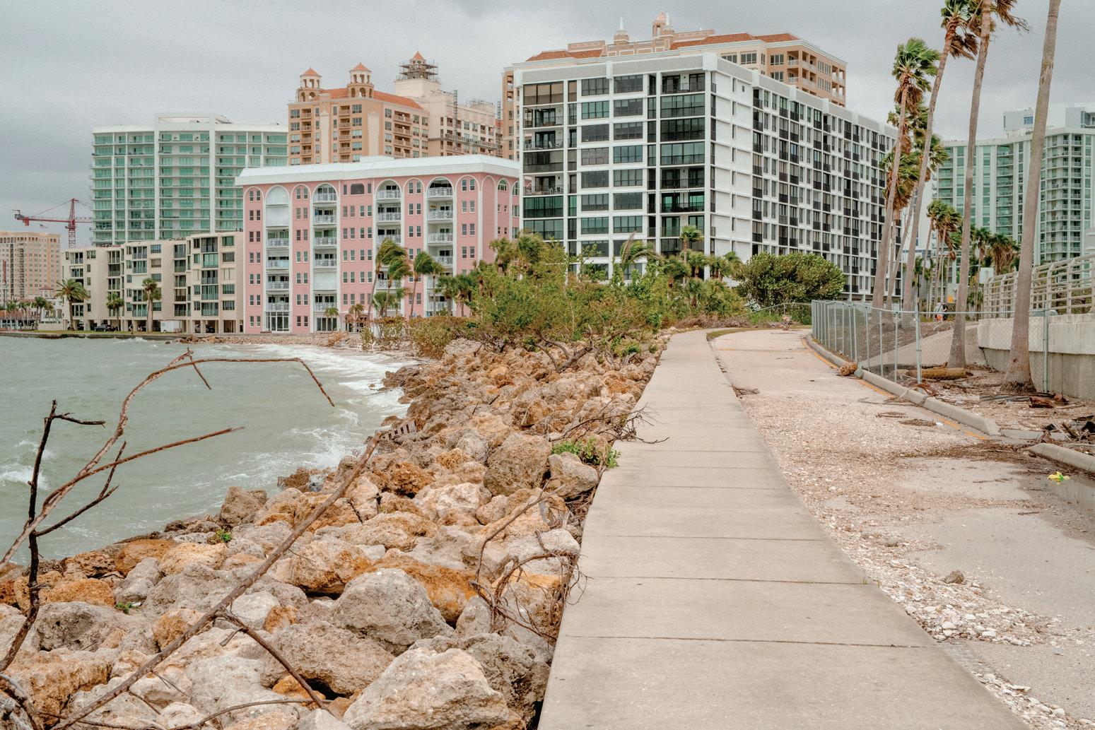
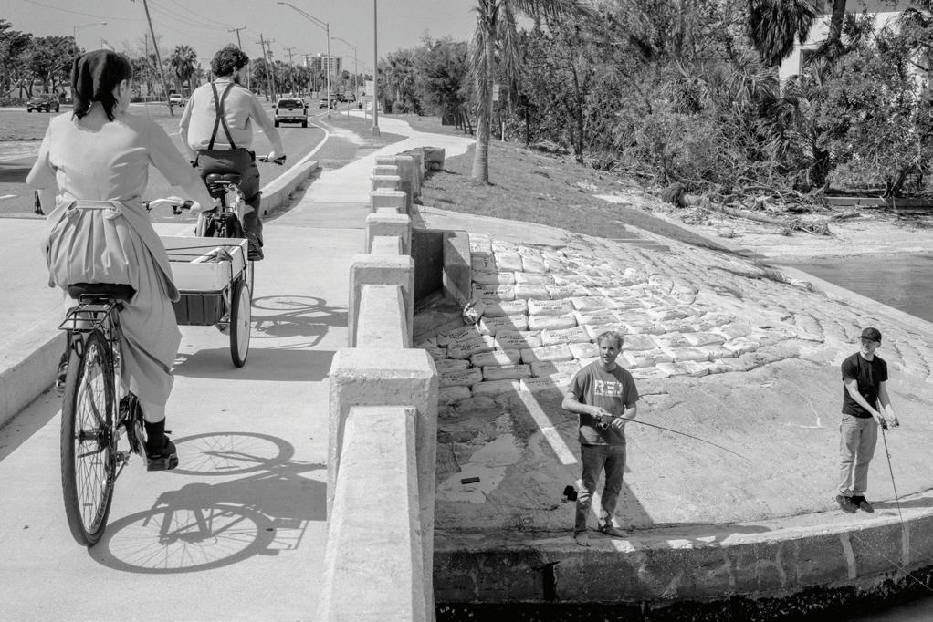
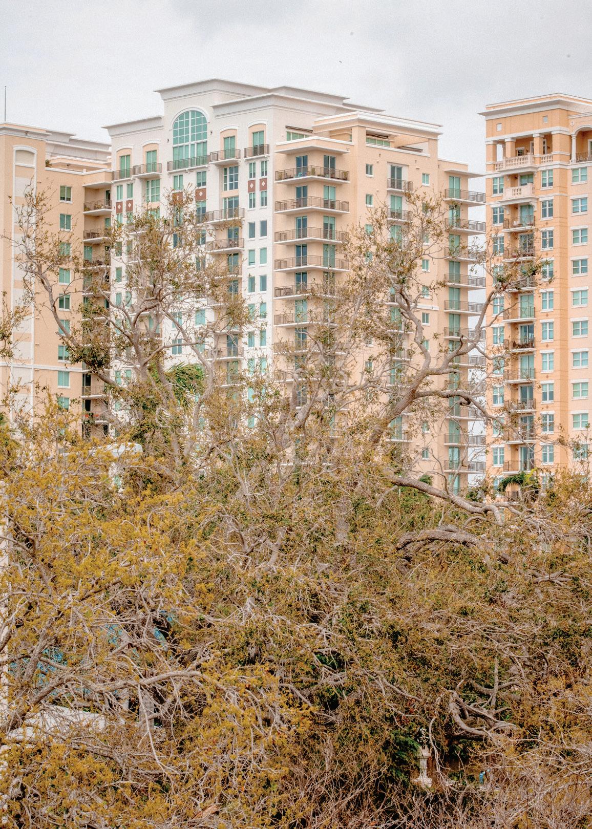
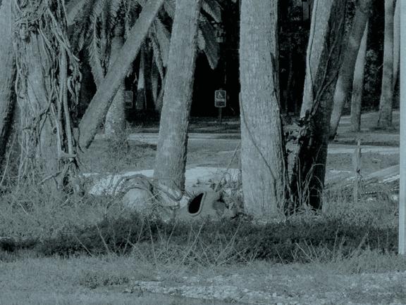
Sarasota’s downtown Bayfront is one of the city’s most utilized and iconic public spaces. It is a place where people walk, gather, celebrate, and reconnect with the water, serving as a shared civic front yard for residents and visitors alike. Few places in Sarasota are as visible or as beloved. Yet despite its constant use and symbolic importance, the Bayfront does not yet perform as well as it could. Shaped by decades of land reclamation, fragmented by infrastructure, and increasingly stressed by climate and coastal impacts, the landscape reflects both the city’s aspirations and its unresolved challenges.
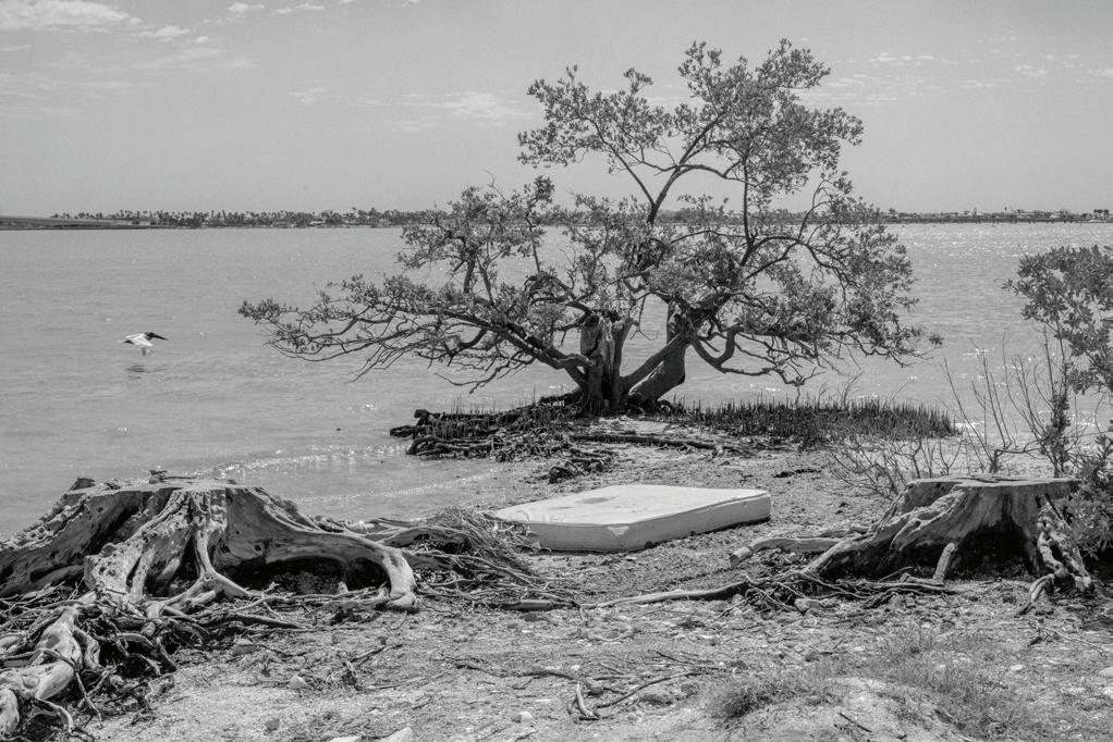
The Bayfront’s physical form tells the story of Sarasota itself. What now appears to be a natural shoreline is largely a constructed edge, shaped by dredging, filling, road building, and shoreline hardening undertaken to support growth and development. These interventions reflect the priorities of their time: economic expansion, automobile access, and the desire to claim land from water rather than accommodate it. In this way, the Bayfront serves as a living record of Sarasota’s evolution from a small coastal settlement to a modern city.
That history has become increasingly consequential as climate conditions change. Rising sea levels, recurrent flooding, stronger storms, and extreme heat are now testing systems that were never designed to absorb them. At the same time, the Bayfront’s layered past, including its former shorelines, altered hydrology, and remnant ecologies, offers essential clues for how it might be adapted. Understanding how the Bayfront came to be is critical to understanding how it can become more resilient in the future.
The Harvard University Graduate School of Design study emerged directly from public dialogue. In 2024 and 2025, Architecture Sarasota convened a Downtown Sarasota lecture and public forum series focused on sustainable urbanism and the future of the city’s core. Six renowned urban experts were invited to participate. Each independently identified the downtown Bayfront as an area requiring attention.
That unsolicited consensus became a turning point. Rather than leaving these observations as commentary, Architecture Sarasota chose to act, leveraging its role as a civic convener and translator of design knowledge to move the conversation from critique to inquiry. The decision to collaborate with Harvard GSD was intended to translate public discourse with rigorous research and to examine the Bayfront not as a single project but as a complex urban, ecological, and climatic system.
At the same time, the City of Sarasota moved forward with initiating a new Downtown Master Plan. These
efforts unfolded in parallel rather than in isolation. The City Commission publicly cited Architecture Sarasota as a catalyst. Together, these actions reflect a broader shift: an understanding that climate adaptation, urban design, and public space stewardship require both institutional leadership and an engaged civic culture.
The Harvard GSD seminar, documented in the Climate Case: Subtropical Urbanism report, reflects a deliberate and strategic approach. Rather than advancing a single prescriptive solution, the work emphasizes education, transparency, and adaptability. Baseline research makes climate risk legible by mapping sea-level rise, stormwater pathways, heat stress, and biodiversity loss, while also revealing historic shorelines and predevelopment ecologies that inform adaptive futures. Global precedents demonstrate how cities can integrate flood protection, ecological restoration, and civic life. The resulting toolkits translate this knowledge into flexible, scalable strategies that can evolve over time.
This approach is deeply rooted in Sarasota’s design culture. The Sarasota School of Architecture established an internationally recognized legacy of innovation grounded in climate intelligence, treating sun, wind, and landscape as generative forces rather than constraints. That legacy set an expectation that design in Sarasota should respond directly to environmental conditions. Today, the challenge is to extend that ethos beyond individual buildings to the scale of urban systems and public landscapes, particularly along the Bayfront.
The Bayfront’s history shows that Sarasota has never been static. It has repeatedly reshaped its edge in response to changing needs and values. The task now is to do so again, intentionally, transparently, and with climate realities firmly in view. By linking public discourse to research and research to action, Sarasota has an opportunity to
transform its most visible civic space into a resilient public landscape that reflects the city’s past, serves its present, and helps secure its future.
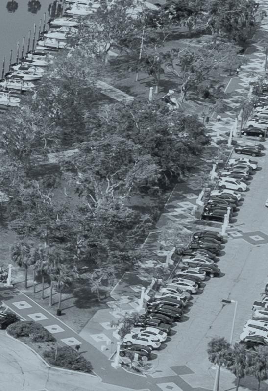
Facing page and Top: Mike Belleme, 2025. Next page: Ryan Lester, 2024.
Living with Climate: The Sarasota Case
Chris Reed
When you work with water, you have to know and respect it. When you labour to subdue it, you have to understand that one day it may rise up and turn all your labours to nothing.
- Graham Swift, Waterland
In geological time the waters will again cover the peninsula and again recede, only to return again. So let us cherish this moment of paradise, relish these years of sun and beauty, and do what we can to keep it pristine.
- John D. MacDonald, Journey to Centennial: Sarasota
The world is changing around us, in ways that are both perceptible and imperceptible; the pace of climate change is quickening, and its ongoing effects and impacts will be dramatic. Sea level rise, storm surge, inland flooding, more frequent and intense rain- and wind-storms and hurricanes, rising temperatures, lack of shade, increasing frequency and severity of drought and wildfire, decreasing biodiversity–all are significantly impacting the ways in which we live and the costs that are to be borne due to their ongoing and multiplying effects.
The threats are real, and both short- and long-term impacts are daunting. But there is opportunity here, and a number of possibilities and questions emerge: How can we adapt to these changes in ways that respond to the dynamics at work and to the benefit of the environment? How can we put forward strategies that better protect people and places by leaning into the threats and forces at work, rather than trying to resist them? How do we do so by improving quality of life for both people and for the creatures that live among us? And how do we make change in thoughtful and knowing ways that might contribute to a slowing or reversal of the broader climate conditions in play?
The work herein documents a semesterlong, interdisciplinary project-based seminar taught at the Harvard University Graduate School of Design. It focuses on applied climate research and adaptation design, examining in detail and through both analytical and projective text and drawings the climate changes that are impacting a densified urban center–in this case, Sarasota, Florida.
The work focuses on uncovering current and impending climate threats; how these threats may have been amplified by current urban development; predevelopment conditions, ecologies and cultures that might point toward more holistic, multi-species approaches to human habitation; case studies and precedents for climate adaptation and resilience strategies from around the world; and speculations on a range of tactics that could allow for ways to live with and adapt to ongoing and projected changes in the environment.
The seminar that produced the work was run as a true collaborative laboratory, with workshop sessions, presentation
by and discussions with climate experts, research-sharing, and studentrun seminars incorporated into class meetings.
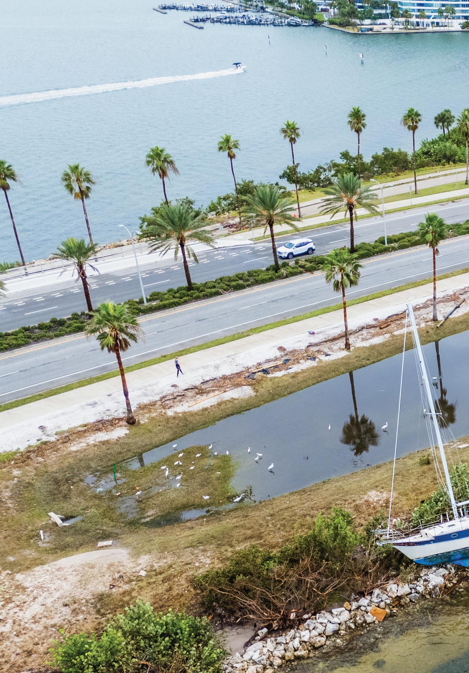
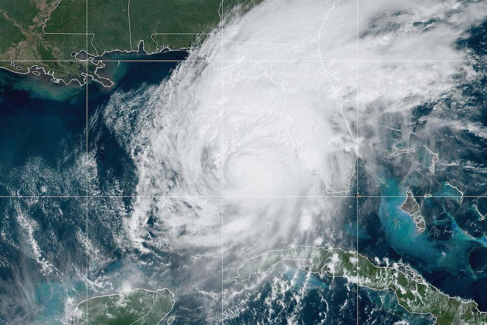
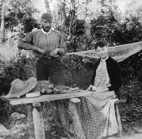
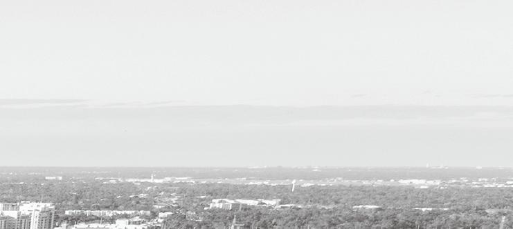
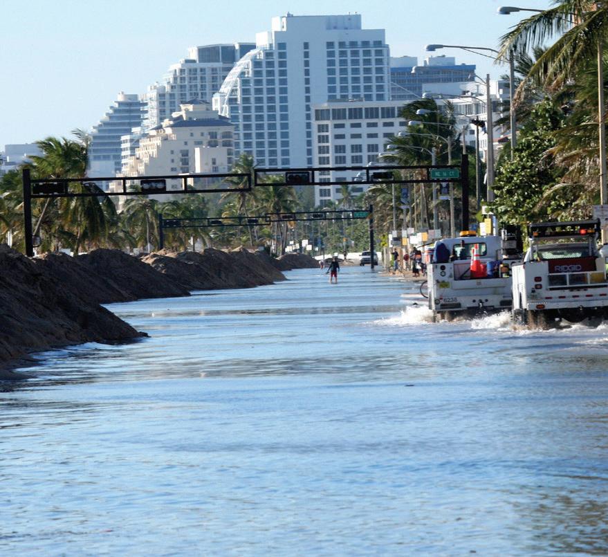
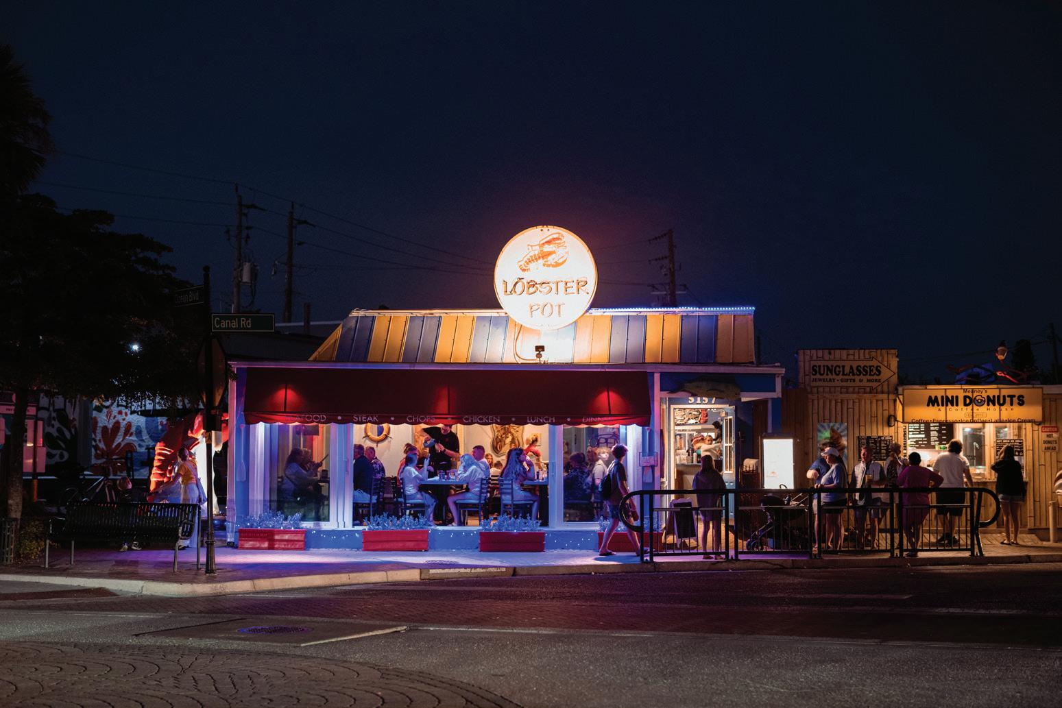
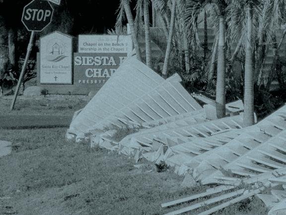
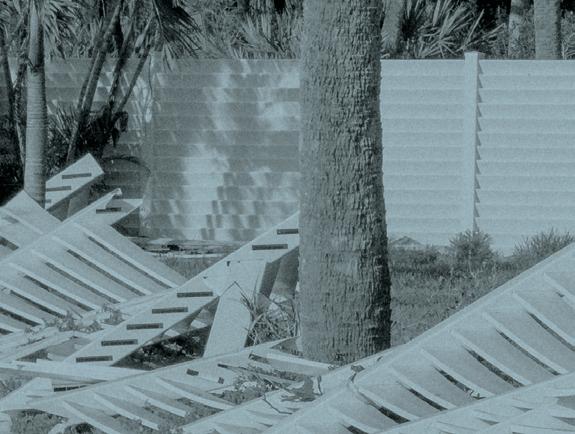
The work focuses on the bayfront of Sarasota, Florida, a subtropical urban center noted for its cultural institutions (Ringling Museum, Architecture Sarasota, etc.), its architectural legacies (in the form of the Sarasota School of Architecture), stunning beaches, and outdoor lifestyle. Sarasota is known more recently due to the direct impacts it has suffered from a series of climateinduced storms. The city was hit by two hurricanes (Helene and Milton) in the fall of 2024, in addition to a number of other unprecedented tropical storms and flooding events throughout the two years prior. Temperatures are rising, and most of the core parts of the city have been declared heat emergency zones. The impacts of all of these are being felt now, and will continue to be felt years into the future.
Students with backgrounds in architecture, landscape architecture,
urban design, planning, and design studies explored, analyzed, and documented (in text and drawings) a wide range of topics, impacts, and implications, including the following:
Current and future climate threats and impacts: sea level rise, storms, stormwater, wind, heat, biodiversity loss (land, water)
Indigenous history, settlement patterns, historical shorelines, and urban development
Resilient ecological and engineering practices
Governance issues, policy, jurisdiction, regulations, and stakeholders
Documentation and communication strategies for conveying the threats and possibilities to wide public audiences
The work of the seminar is collated herein, with the hope that it can propel conversations about climate change, resilience, and adaptation throughout Sarasota, including with city and county
leadership, non-profits like Architecture Sarasota, and concerned citizens and advocates.
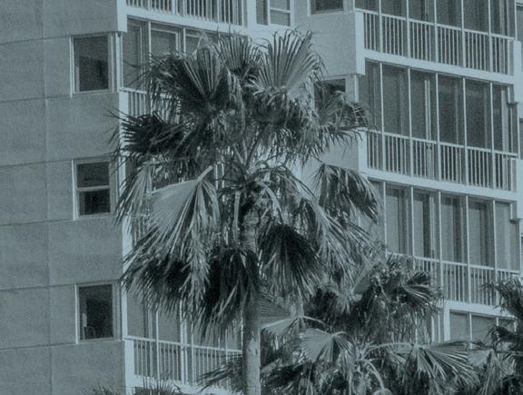
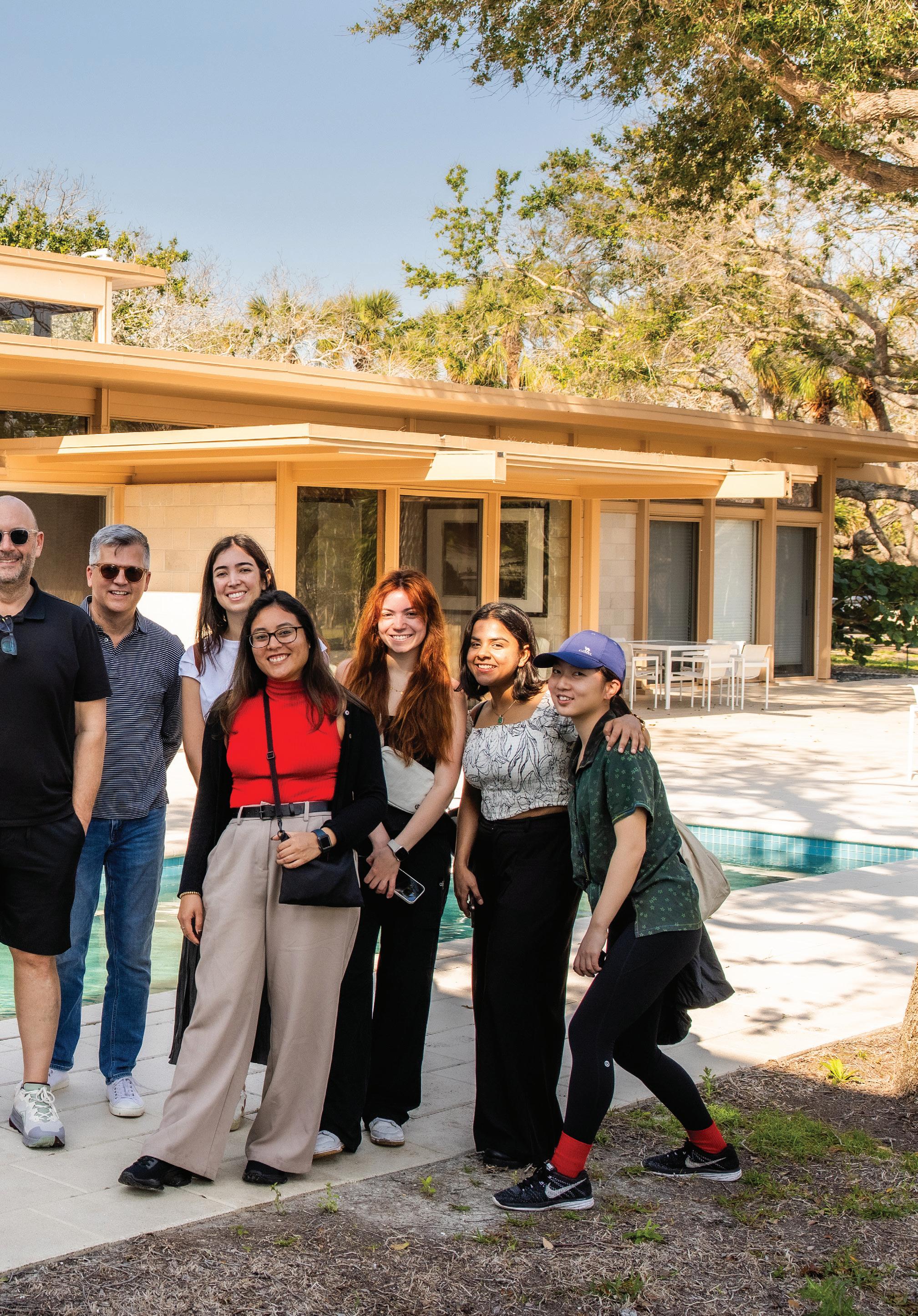
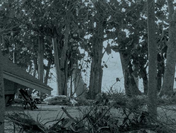
Through the generosity of Architecture Sarasota, students travelled to Sarasota for a 3-day series of site visits and meetings with City of Sarasota leaders, The Bay Park, The Marie Selby Botanical Gardens, and even a few residents. We visited significant architectural works by Paul Rudolph and his many contemporaries, which have become known as the Sarasota School of Architecture and embody a distinct sense of indoor-outdoor living, or living in and with the environment. And we partook of some of the region’s great beaches and eateries as part of our full immersion in city culture.
Chris Reed
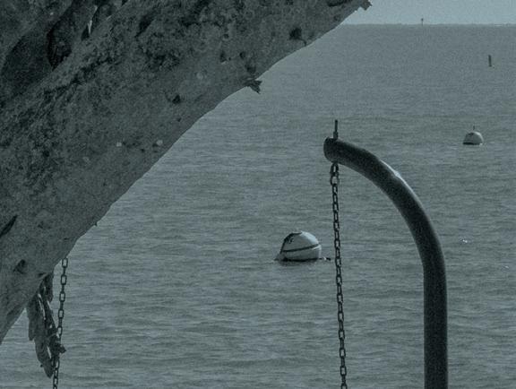
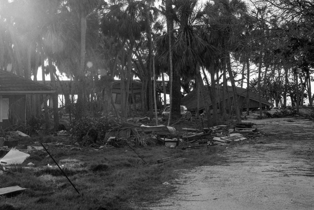
Left: Mike Belleme, 2025.
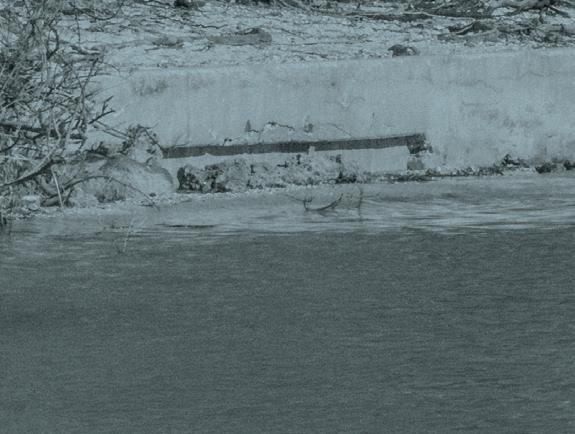
Top: Hurricane Milton 2024, NOAA.
Seminar research and assignments were organized into three parts, as follows and as captured in this document:
BASELINES: CLIMATE IMPACTS AND URBANISM ALONG THE BAYFRONT
Initial research focuses on the issues that are at stake along the bayfront in Sarasota, the climate threats that exist and are projected, and the various human, social, and urban histories that can inform and have impacted the climate conditions faced today. Work will culminate in drawings and text that capture the climate impacts and social/urban histories of the place.
TOUCHSTONES: GLOBAL PRECEDENTS AND CASE STUDIES
Interim research identifies and documents precedents, case studies, and best practices on climate
adaptation and resilient design from around the world. These projects informed student work and research but also serve as terrific learning opportunities for the Sarasota public.
TOOLKITS: ADAPTATION OPPORTUNITIES
The final phase of work focuses on the development of illustrative, threedimensional toolkits of potential adaptation strategies for the Downtown Sarasota Bayfront. Rather than a comprehensive master plan, the toolkits lay out alternate ways that resilient and adaptive design could be applied to address the most pressing climate challenges identified. Topics include environmental, landscape, infrastructural, policy, and economic recommendations and potentials.
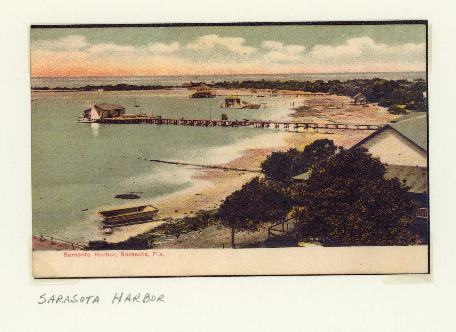
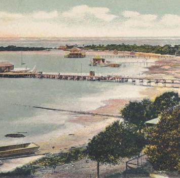
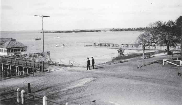
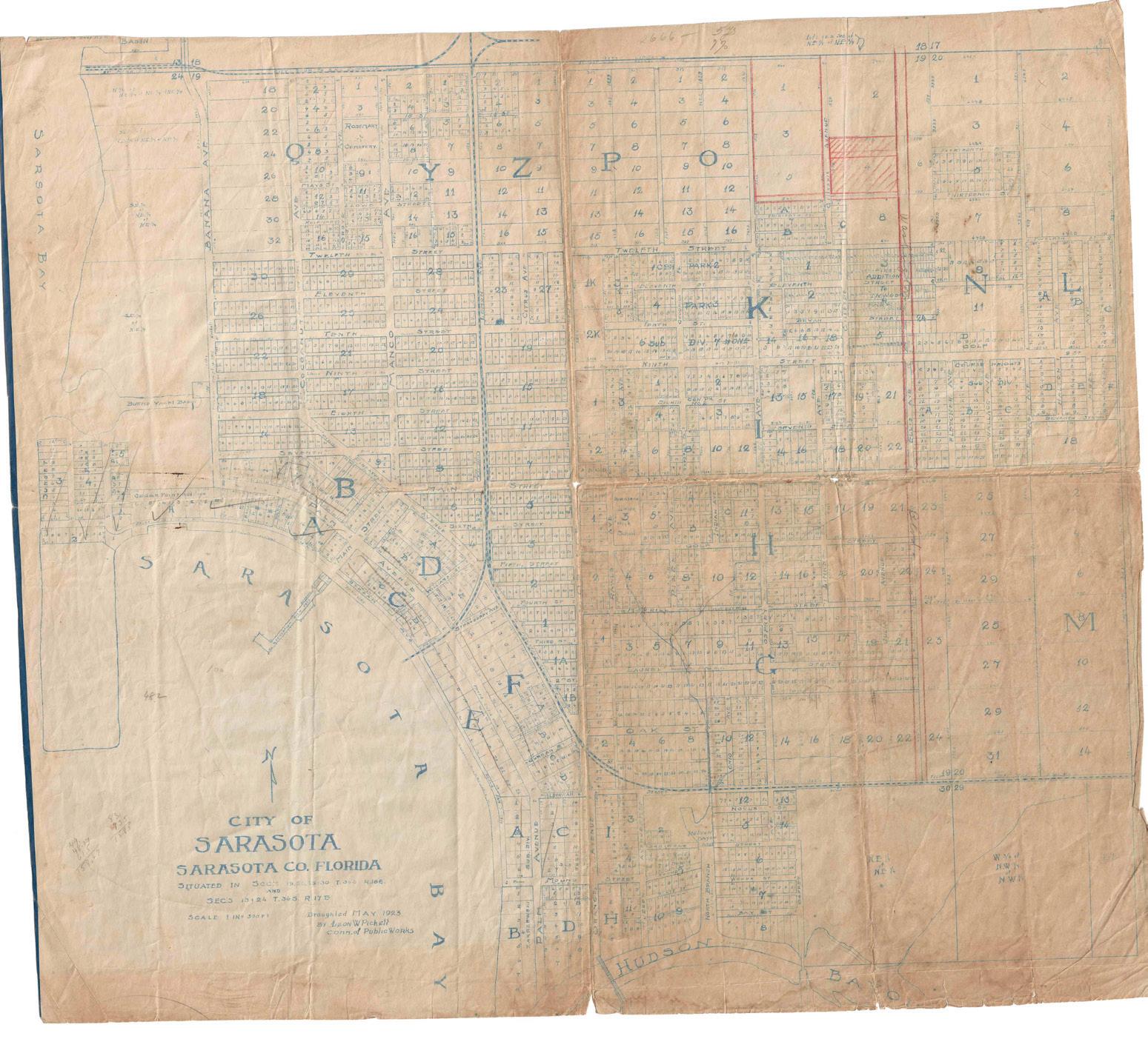
Above: Sarasota Harbor, 1877. Courtesy of Sarasota History Center.
Living with Climate: The Sarasota Case
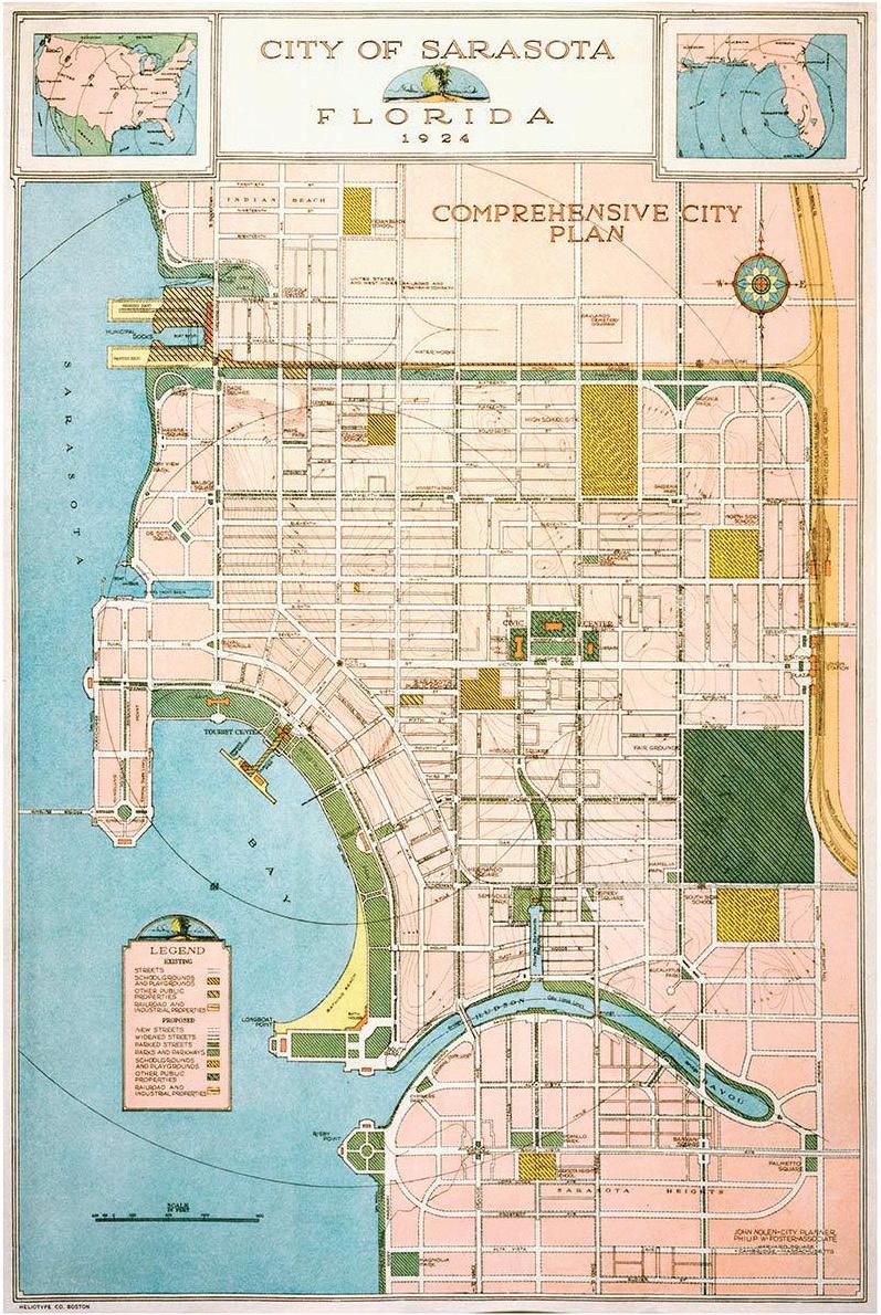
Above: City of Sarasota, Florida Comprehensive City Plan, John Noel, 1924, from Rare Book and Manuscripts Collection, Cornell University Library.
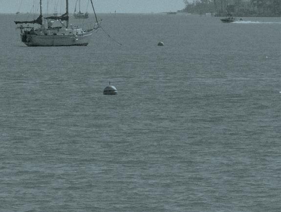
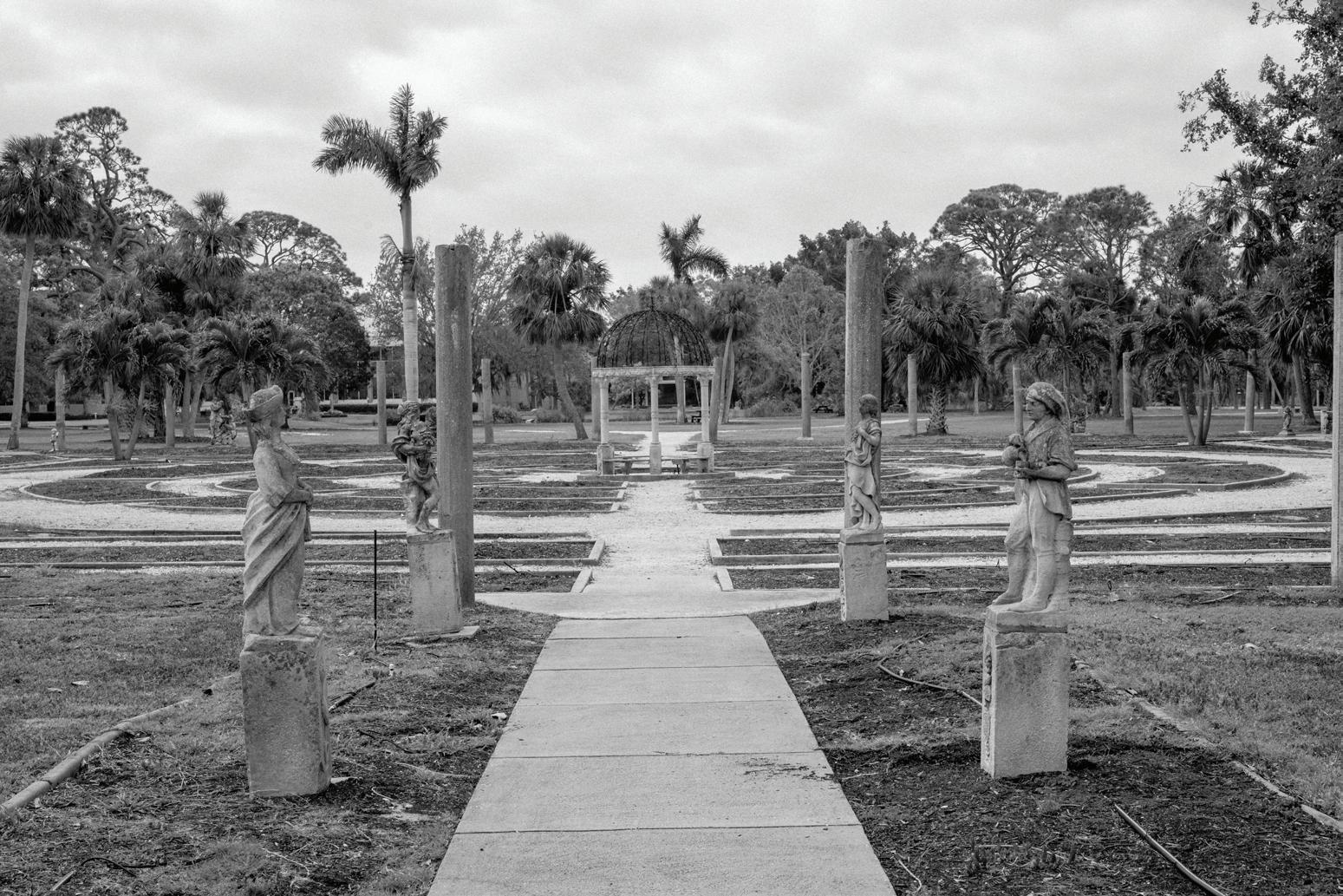
Next page: Ryan Lester, 2024.
Chris Reed


Baselines


Land use, historical shorelines and Indigenous territories
Hanzhang Lai
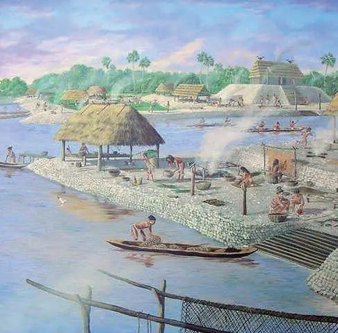
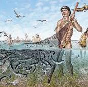
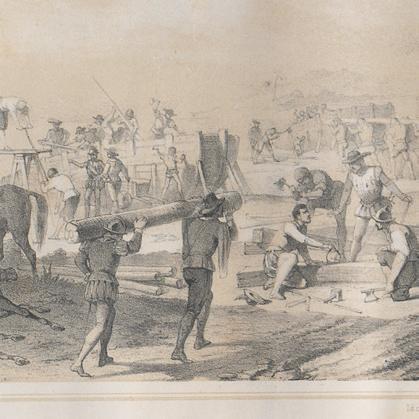
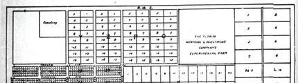
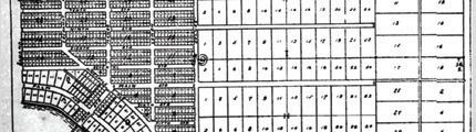
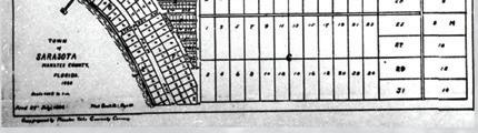
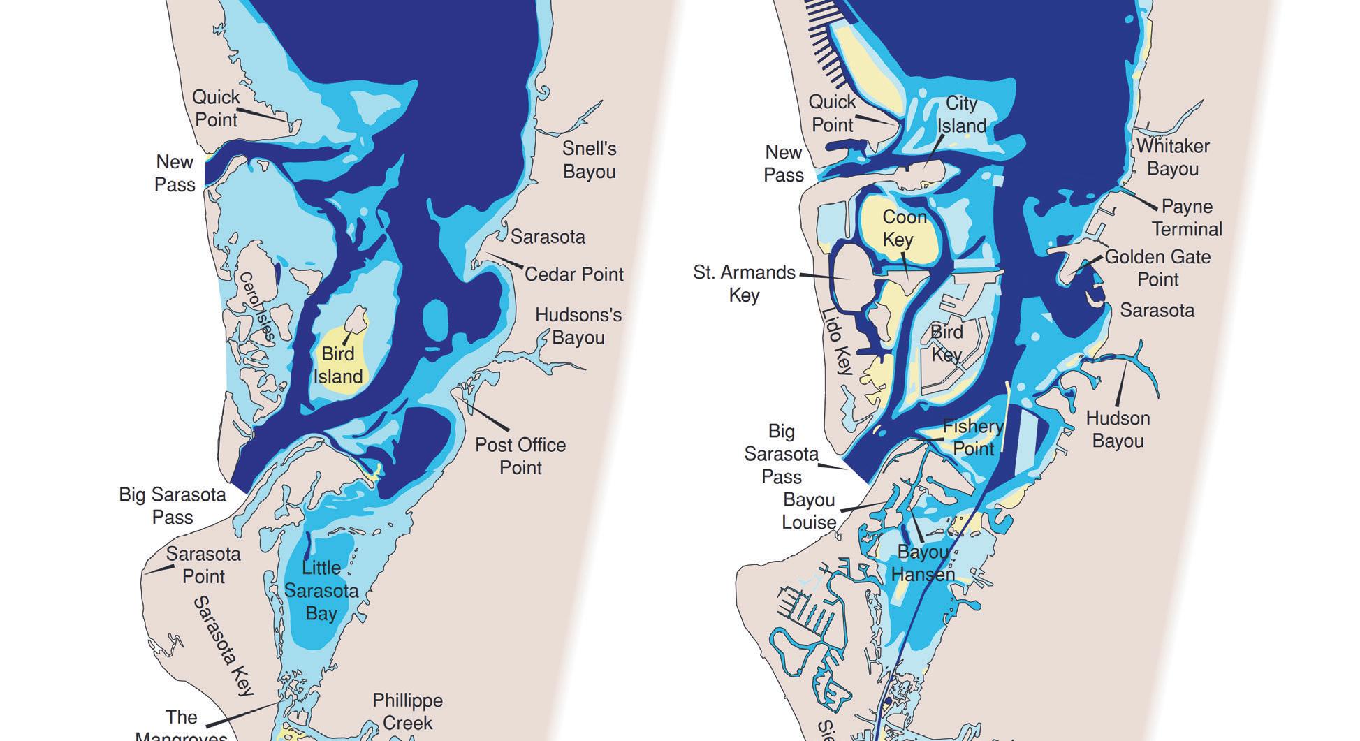
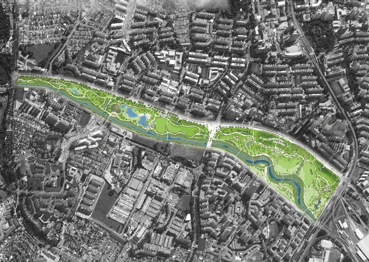
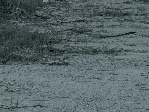
Sarasota’s landscape and society have been shaped by shifting shorelines. Once inland during the Ice Age, it became a tropical coast where the Calusa built water-based societies. Spanish colonization disrupted these lifeways, and by the 1800s settlers transformed the land for cattle and agriculture. Urban growth reshaped the bayfront: dredging, bridges, and highways expanded access to barrier islands but cut downtown off from the water. Richard Paulson’s early grid centered on Main Street guided city growth, reinforced by the railway and later highways that made Sarasota a civic and commercial hub. Today, redevelopment projects like The Bay Park and Downtown Master Plan: 2020 aim to reconnect Sarasota with its waterfront, enhance walkability, and guide future expansion.
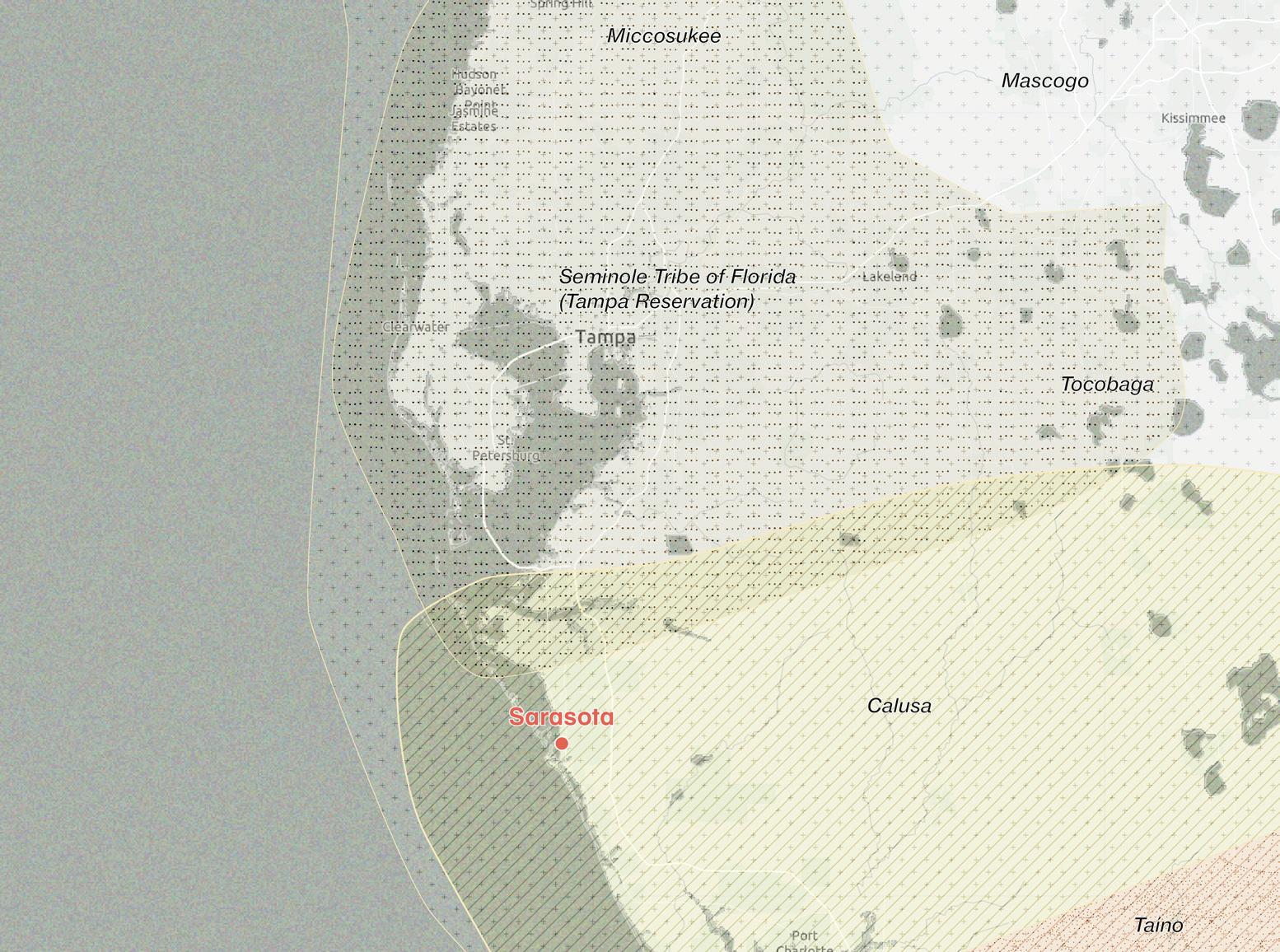


Facing page: Indigenous territories of Florida - 1500 BCE.
Sources: Native Land Digital.
Sarasota was once far from the coast. Sea levels were lower, and the area was dry and inland. As the climate warmed and seas rose, the environment became tropical. Source: National Geographic.
Hanzhang Lai
Above:
12000 - 7500 BCE
Prehistoric Era
The shoreline of the Gulf of Mexico was farther to the west. Paleo-Indians were nomadic hunter-gatherers, likely drawn to the area’s freshwater springs and sinkholes during a time when the region was inland, dry, and much wider than today.
75001000 BCE
Archaic Era
Sarasota
Earth warms, the sea level rises, and the territory becomes more tropical and abundant with bays and streams. Development of village life; better food gathering; fishing in the winter.


1000
Calusa Civilization
The Indigenous group, now known as the Calusa reached its peak in Southwest Florida, build complex societies, relying on fishing rather than farming. Population grew to estimated 20,000 without reliance on agriculture.


End of Calusa Civilization
Florida became U.S. state.
Spanish Contact U.S. Acquisition
The Calusa resist colonization but are devastated by European diseases and warfare, eventually fleeing to Cuba by 1763.
Florida becomes U.S. territory (1821), pioneer homesteads, cattle and citrus, Bertha Palmer’s land acquisitions (late 1800s)


First Grid Layout
J.H. Gillespie take control of the village’s development. In 1902, the town of Sarasota was incorporated. J.H. Gillespie was named its first mayor.


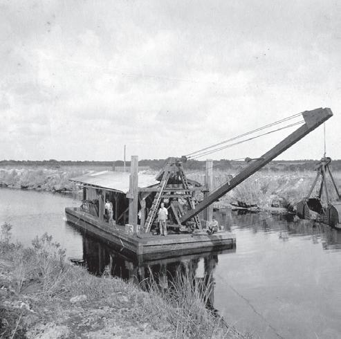
Dredging


Sarasota was established


Dredge-spoil islands were created throughout the Bayduring Intracoastal Waterway (ICW) construction, covering seagrass beds and changing water circulation patterns.


Sarasota reincorporated with a city form of government


1960 - 1980
Urban Decline and Renewal
Economic shifts and population movement to the suburbs led to urban stagnation.

2000
Downtown Master Plan 2020
The Downtown Master Plan 2020, developed by Andrés Duany and DPZ, aimed to revitalize Sarasota’s urban core by promoting walkability, mixed-use density, and reconnecting the city to its bayfront. It introduced form-based codes and street hierarchies to reshape downtown into a more vibrant, pedestrian-oriented environment.
1959
U.S. 41 (Tamiami Trail) Rerouting
2018 -
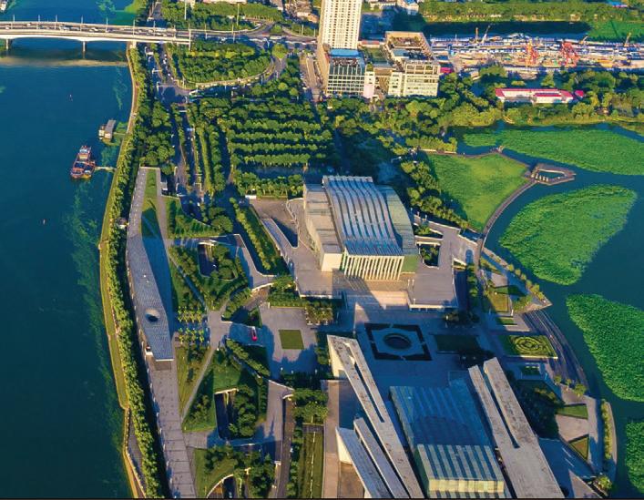
The Bay Sarasota
Major investments in The Bay Sarasota, a 50-acre waterfront redevelopment transforming the former Van Wezel area into a public park, seek to reintegrate public access and ecological restoration into the shoreline.

Baselines:
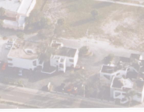
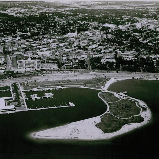
Facing page, top: 1960s aerial photo after filling for Bird Key, courtesy Sarasota History Center.
Facing page, bottom: 1950 Bayfront looking northwest, photographer unknown/ possibly Joseph Steinmetz, courtesy Sarasota History Center.
Above: 1923 City Map, courtesy Sarasota County History Center.
Hanzhang Lai
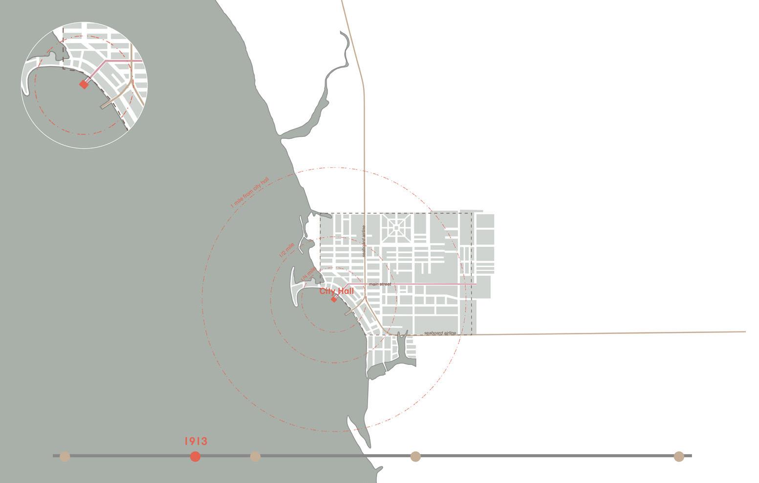
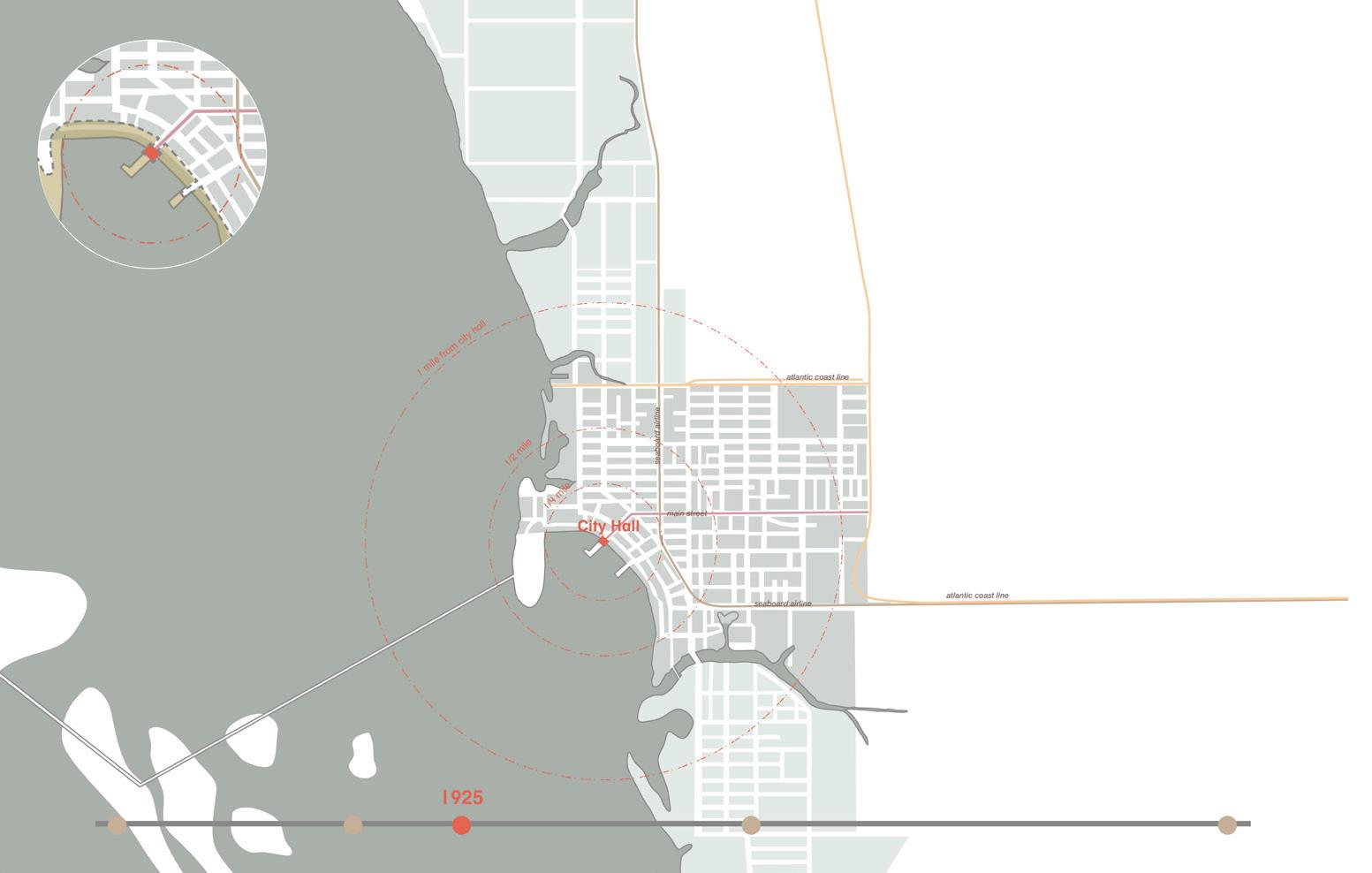
Baselines: Land Use, historical shorelines and Indigenous territories
Above and facing page: Urban expansion over time: 1913, 1925, 1954, and 2024.
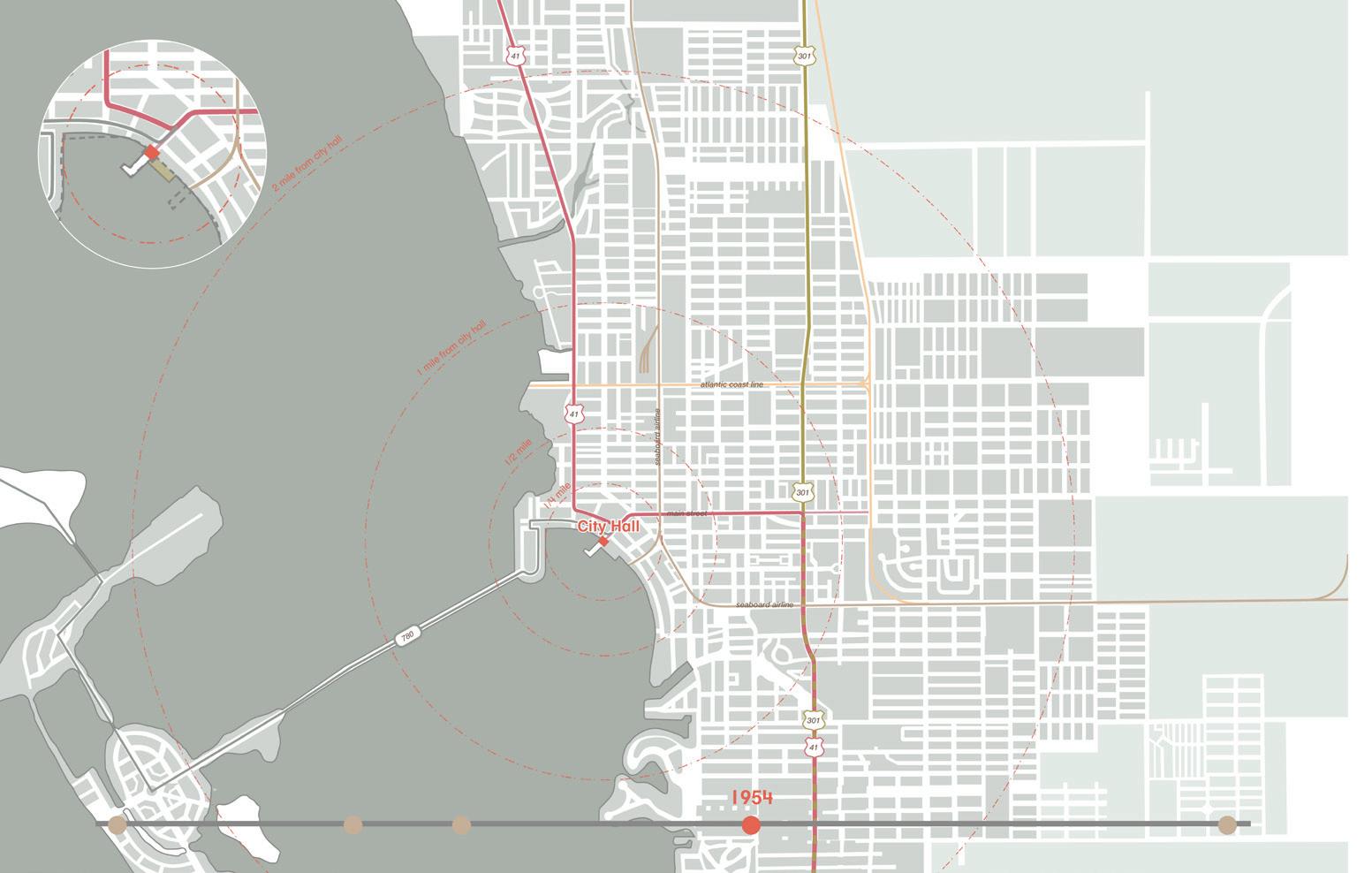
Hanzhang Lai


Sea level rise, stormwater and hurricanes
Freya Fu
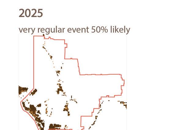
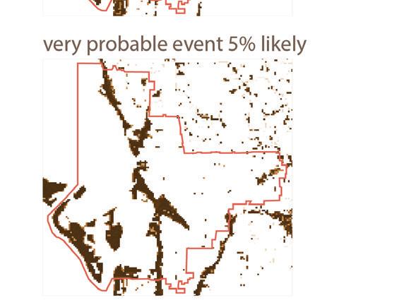
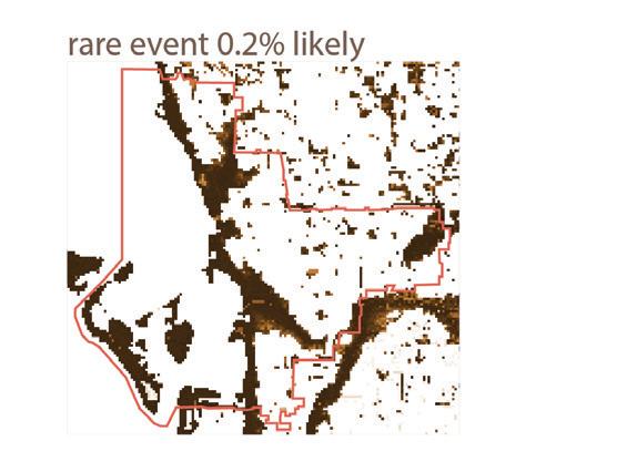
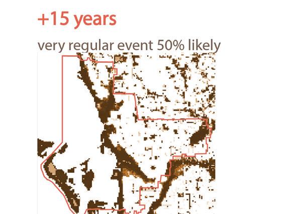
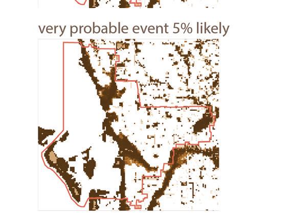
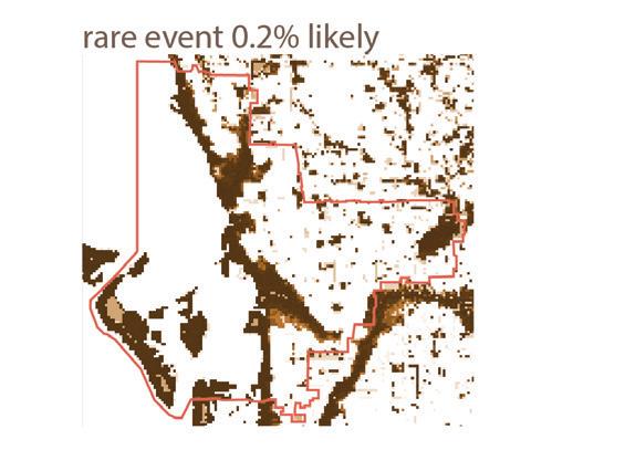
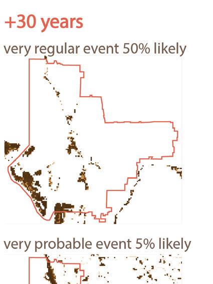
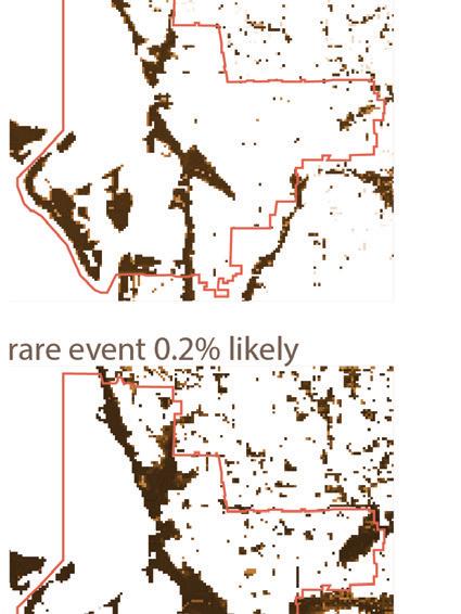
By 2100, Sarasota could see up to 7 feet of sea level rise, flooding barrier islands, neighborhoods, roads, and parks. Rising seas, stronger hurricanes, and higher storm surges make the city especially vulnerable. According to NOAA, projections show 6–10 inches of rise by 2030, 1–2 feet by 2050, and 3–7 feet by 2100, with chronic flooding threatening homes, infrastructure, wetlands, and freshwater supplies. Without adaptation, Sarasota’s waterfront may become a stark warning of unchecked climate risk.

Kiara Wong Siu
Romina Cordova Grados
Baselines: Sea level rise, stormwater, hurricanes


Freya Fu, Kiara Wong Siu, Romina Cordova Grados
Facing page: Flood exposure projections: housing units affected (2025, 2040, 2055). Sources: NOAA, FEMA, FirstStreet.
Above: Timeline of Major Hurricane Events in Sarasota with Affected Housing Units (Historical and Projected to 2055) Sources: NOAA, FEMA, FirstStreet.


Intermediate high
Intermediate level: 3.5ft SLR in 2100

Intermediate low level: 2.5ft SLR
Current and projected flooding levels and areas.

Original coastline


2100 high level: 5ft SLR


High water level scenario:


7ft SLR
Local sea level in 2100

High : 7ft
Intermediate high : 5ft
Intermediate : 3.5ft
Intermediate Low : 2.5ft
High tide flooding area
Surface water
1% annual flood hazard
0.2% annual flood hazard
Flood pathway
Streets
Open channel
Contours
Major outflow point
Primary floodways
0 0.05km N

Bird Key Point


high tide flooding area


possible floodway


Current and projected flooding levels and areas.


Ringling Bridge


Local sea level in 2100
High : 7ft
Intermediate high : 5ft
Intermediate : 3.5ft
Intermediate Low : 2.5ft
High tide flooding area
Parks & open space
Surface water


1% annual flood hazard

0.2% annual flood hazard
Flood pathway
Category 3 hurricane
Tropical storm
Streets
Open channel
Contours
Major outflow point
0 0.5 km N


Current and projected flooding levels and areas.


category3hurricane tropical storm
high tide flooding area 1% annual


major outfalls


annual chance flooding


0.2% annual chance flood hazard Open channels


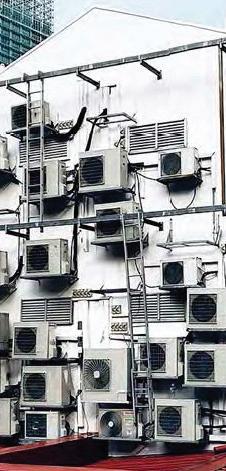
Heat, Shade and Canopy Cover
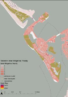
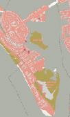
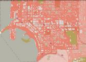
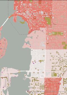
Maps show how Sarasota’s surface materials influence urban heat: parking lots and roads trap the most heat, while parks and trees provide cooling. With extreme heat days increasing, strategies like cooler materials and expanded tree canopy are essential for resilience. The map identifies neighborhoods with the highest heat stress—based on exposure, vulnerability, and limited shade—to guide tree planting and cooling efforts that protect at-risk communities.
Rimshi Agrawal Rilia Li
Asphalt/Concrete Surface Palm Tree
Absorb/radiate heat
Asphalt pavement is heat up by the sun and can reach over 140F. It releases PM2.5 and radiates heat during the night.
Ineffective for shading
Minimal shade, weak cooling impact.


Low-rise Building Glass Tower
Absorber of heat
Traps heat, poor airflow raises indoor temps.
Reflector of heat
Bounces heat outward, worsening heat island effect.


Heat reflecting surfaces.


1
2
3
Roadway (Hot)
Parking Lot (Hot)
Bare Ground (Warm)
Sidewalk (Warm)
Green Surface (Cool)
Palm Tree Canopy
Other Tree Canopy
Conclusion
Surface materials significantly shape
Asphalt surfaces intensify localized heat, while trees and parks offer relief through
As extreme heat days increase, strategic urban design—focused on material choice and canopy coverage—will be key to building a resilient and comfortable city. 1


2
3
Theatre Florida Studio
Biodiversity
Yushuo Ding Esther Li
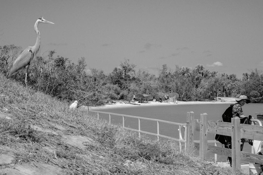
Sarasota Bay seagrass expanded by 702 acres (5.6%) between 2012–2014 and grew 32% regionally from 1950–2016 through restoration and pollution control. After a 2016 peak, however, the bay lost 3,511 acres (26%) by 2020, reaching its lowest level in over a decade by 2022, with 80% of the loss occurring after 2016. According to PBS, Florida saw a record 937 manatee deaths in 2021—10% of the state’s population—largely tied to starvation from seagrass loss, alongside red tide, habitat loss, and boat strikes. Stormwater runoff also threatens shoreline biodiversity, though existing trees already support wildlife and point to opportunities for habitat restoration.
PINE TREE LOCATIONS
SECTION
1:25


PALM TREES LOCATIONS
Sabal Palmetto (Cabbage Palm)
Washingtonia Spp (Washingtonia Palm)
Syagrus Romanzo ana (Queen Palm)
Pinus Elliottii (Slash Pine)
Pinus Elliottii (Slash Pine)
Quercus Laurifolia (Laurel Oak)
Yellow-crowned night heron Nyctanassa violacea
Balanidae
Anhinga
Brown anole Anolis sagrei
BANYAN TREE LOCATIONS
Ficus benghalensis (Banyan)
OAK TREE LOCATIONS


Quercus Virginiana (Live Oak)
Laurifolia
Quercus


Locations of Turtle Stranding in 1980-1990


Locations of Turtle Stranding in 1991-2000


Locations of Turtle Stranding in 2001-2010


Locations of Turtle Stranding in 2011-2020
Locations of Turtle Stranding in 2021-2022


Sciaenops ocellatus SAND
Bird Island: Conceptual section,


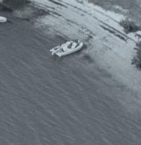
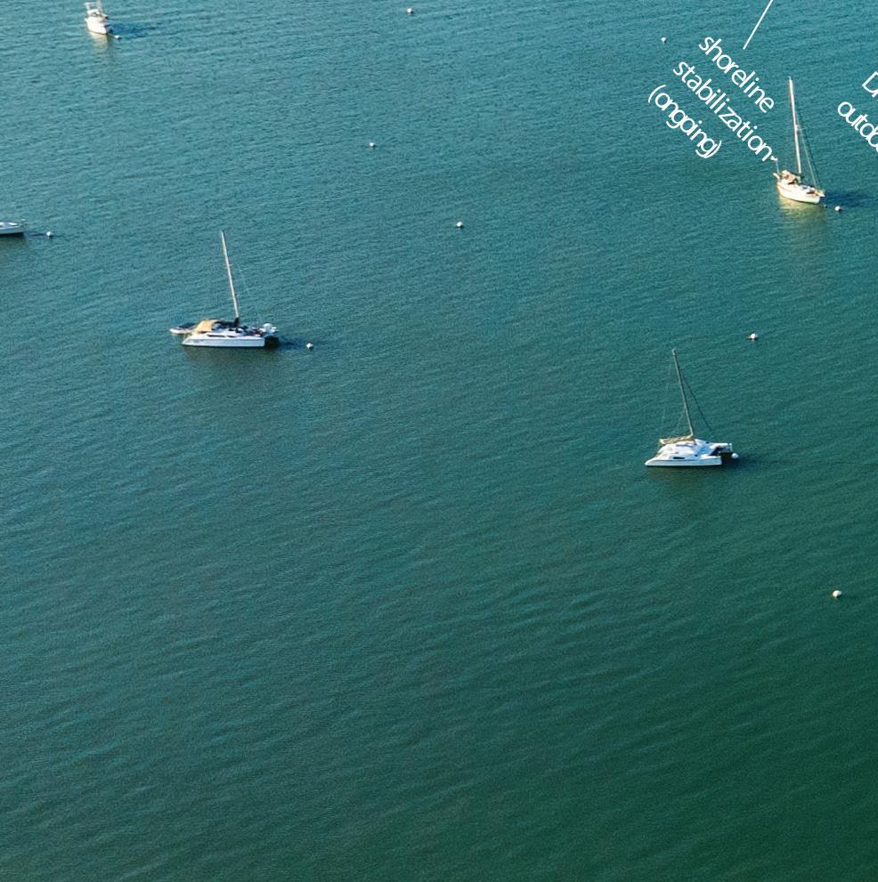
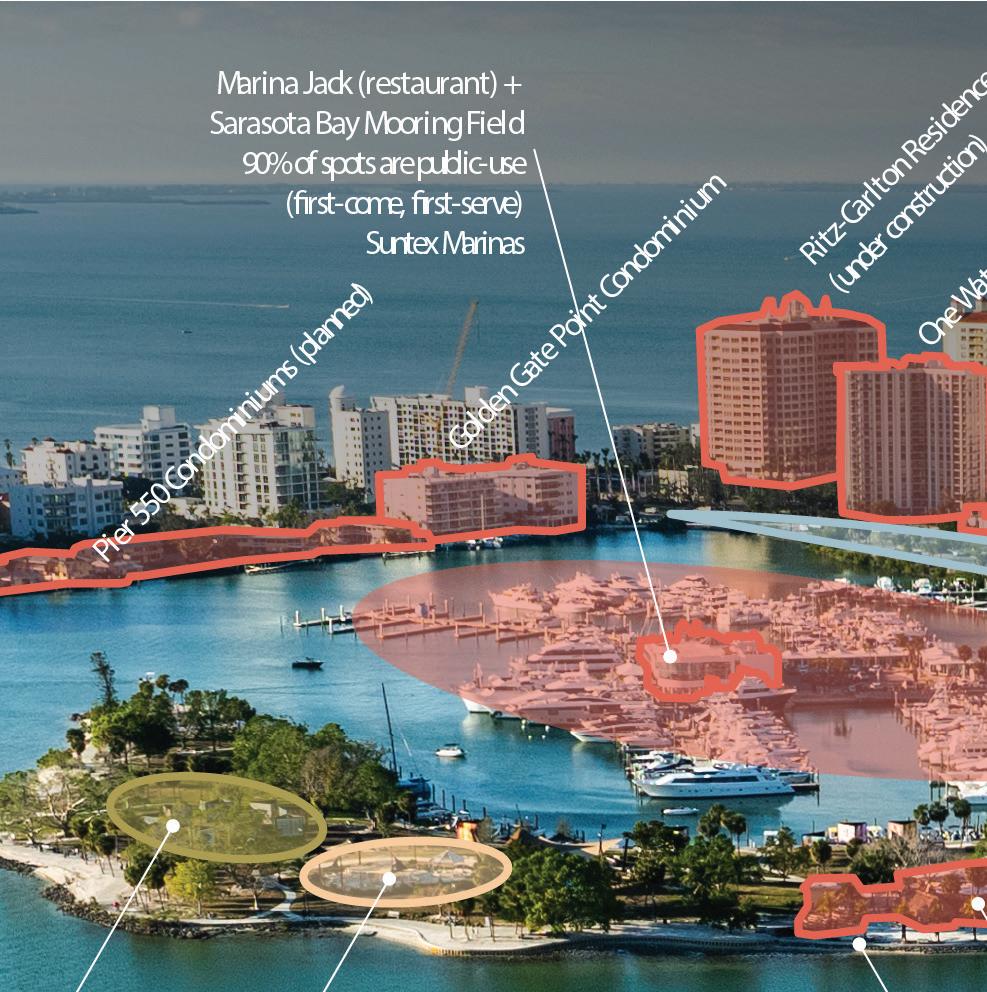
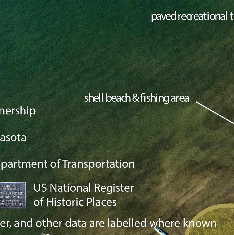
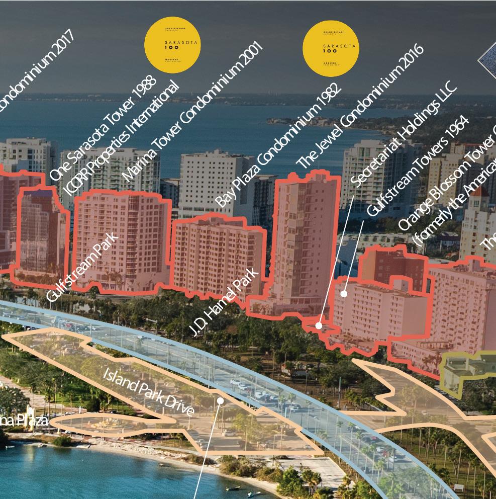
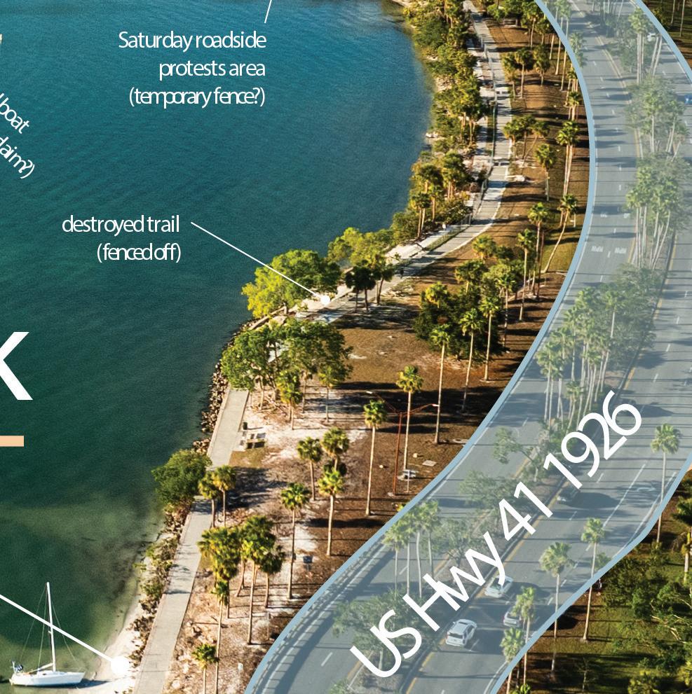
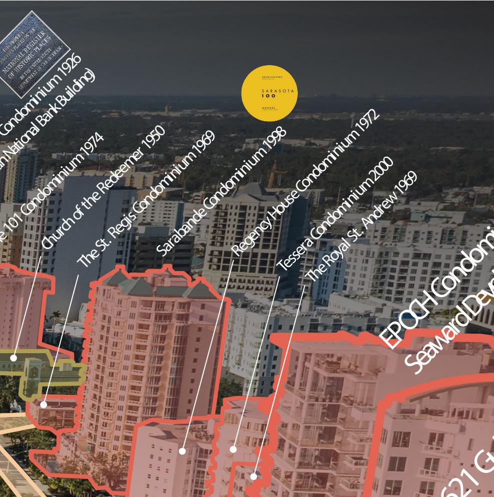
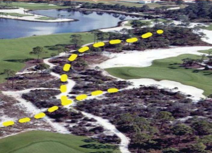
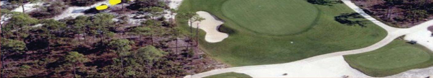
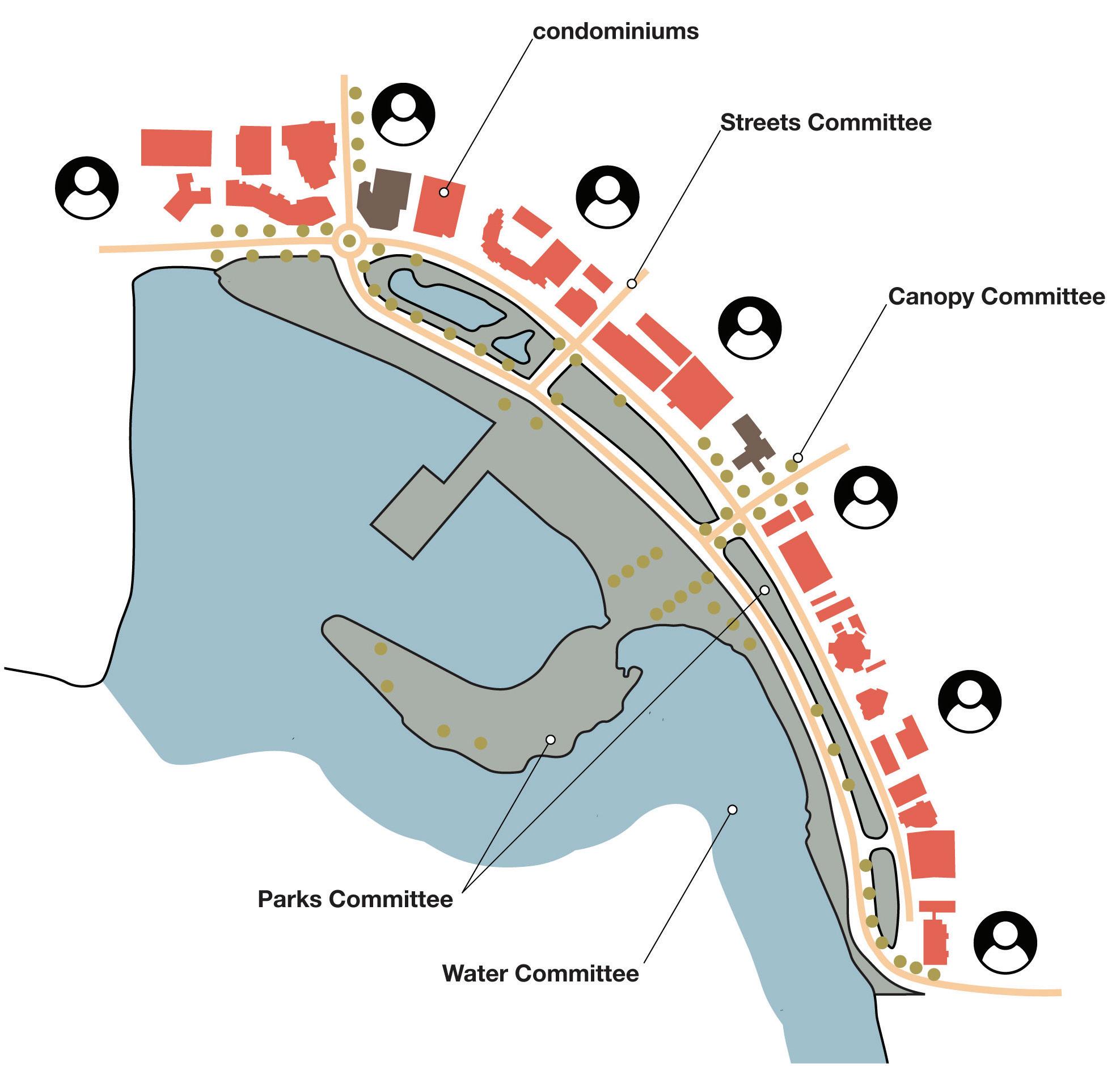
The Sarasota Bayfront is a complex mosaic of jurisdictions and ownership. Most of the site falls under the city, with some county-managed facilities (e.g., Orange Avenue Annex, Selby Library) and state-controlled highways. Waters adjacent to the bayfront are city-managed with county oversight. Land uses range from public greenspace and streets to private condos, marinas, and institutions like churches and gardens, with occasional informal uses such as protests or beached boats. This mix creates challenges, especially during disasters when private vessels often remain docked. Recent work has focused on infrastructure, quality-of-life, and resilience upgrades, while special zoning along the bayfront permits taller construction— up to 8 stories more than in other parts of Sarasota.


Lyna Boulgamh Allen Wang


Lyna Boulgamh, Allen Wang
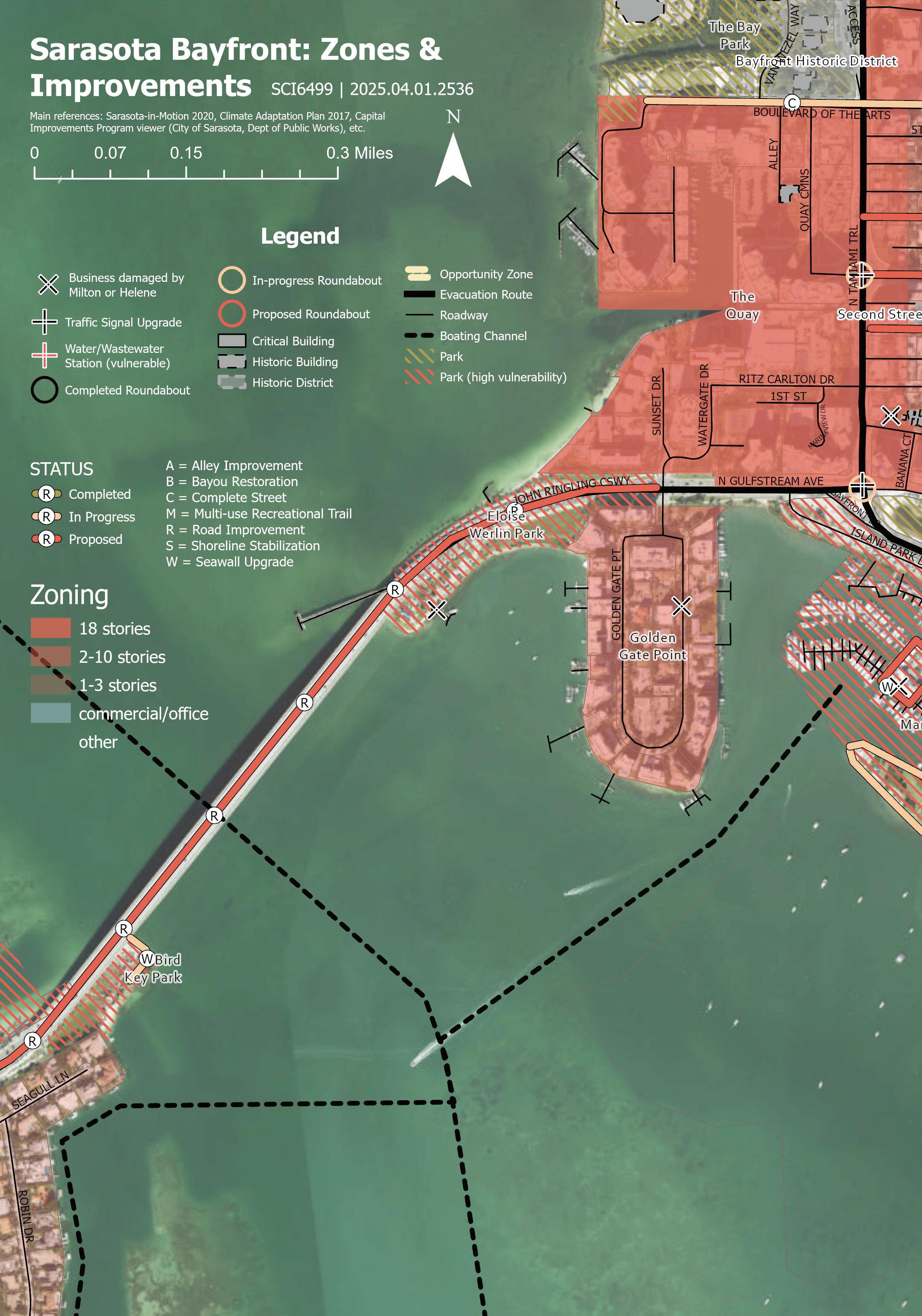

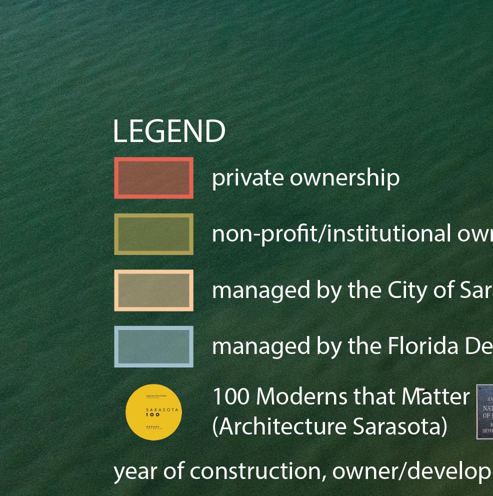
Bayfront ownership and jurisdictions.


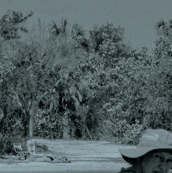
Site Visit


All photographs in this section: Ryan Lester, 2025.
Ryan Lester
Top: Diana Shaheen, Chief Operating Officer of The Bay, gave students a lively tour of the waterfront park and pointed out the site’s climate adaptation strategies.
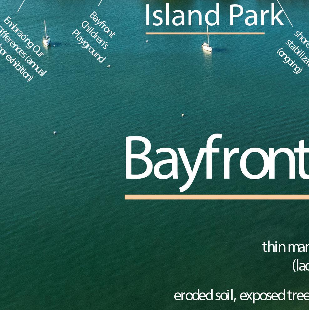
Bottom and facing page: Students and Prof. Chris Reed on Island Park.

Facing page: The class gathered to meet with City of Sarasota staff.
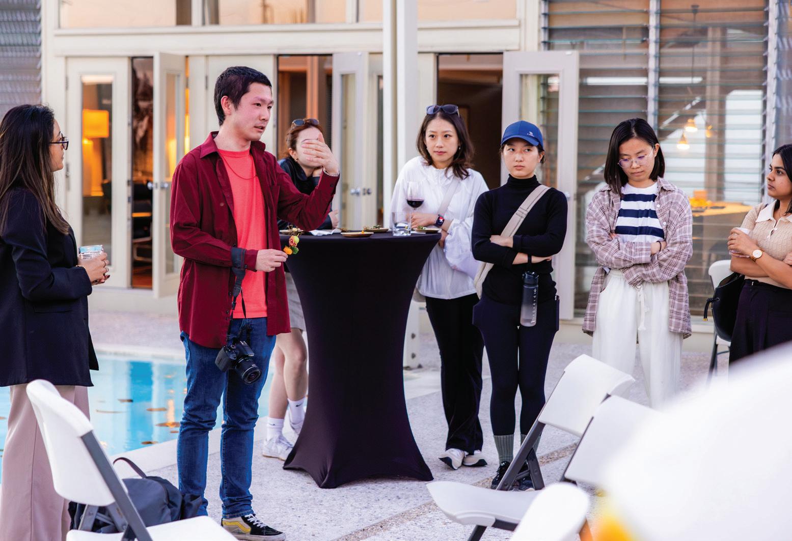
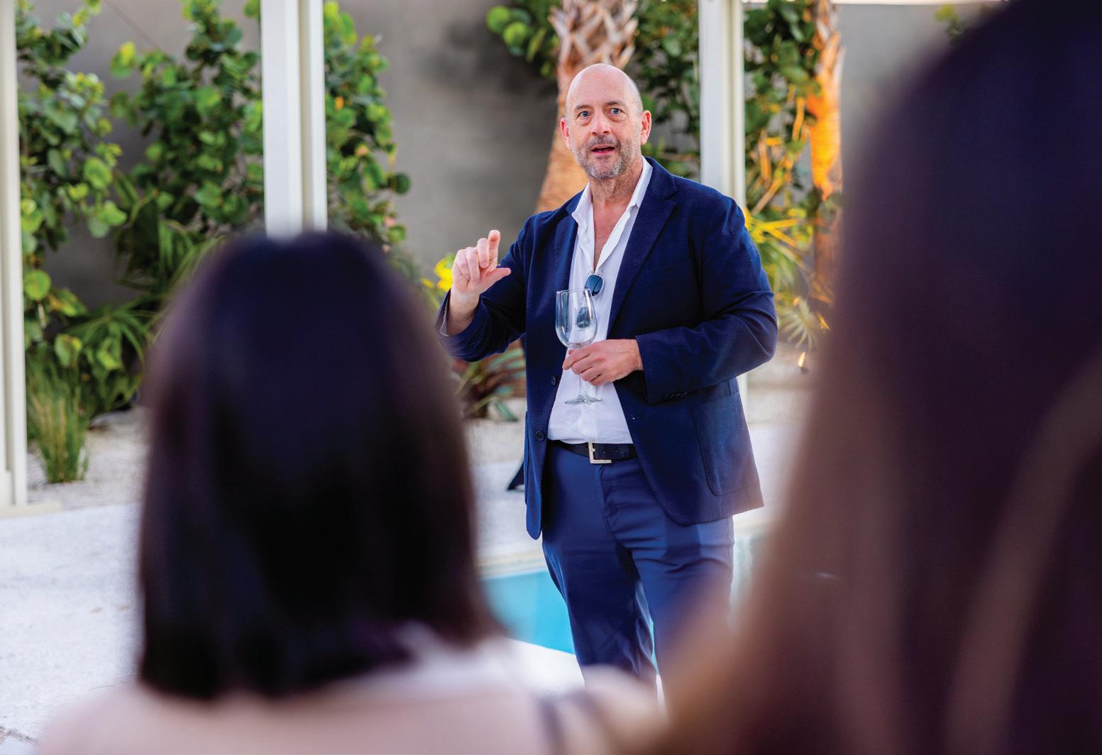
Above: Sarasota Architecture hosted a gathering for their colleagues and the students at Paul Rudolph’s Umbrella House.
Next page: Marty Hylton hosted a tour of architectural gems that are emblematic of the Sarasota School’s design principles of living in and with the landscape.
Ryan Lester


Case Studies


Grados, Freya Fu
Softening the Edge: Hunter’s Point and Bishan-Ang
Kiara Wong, Romina Cordova Grados, Freya Fu
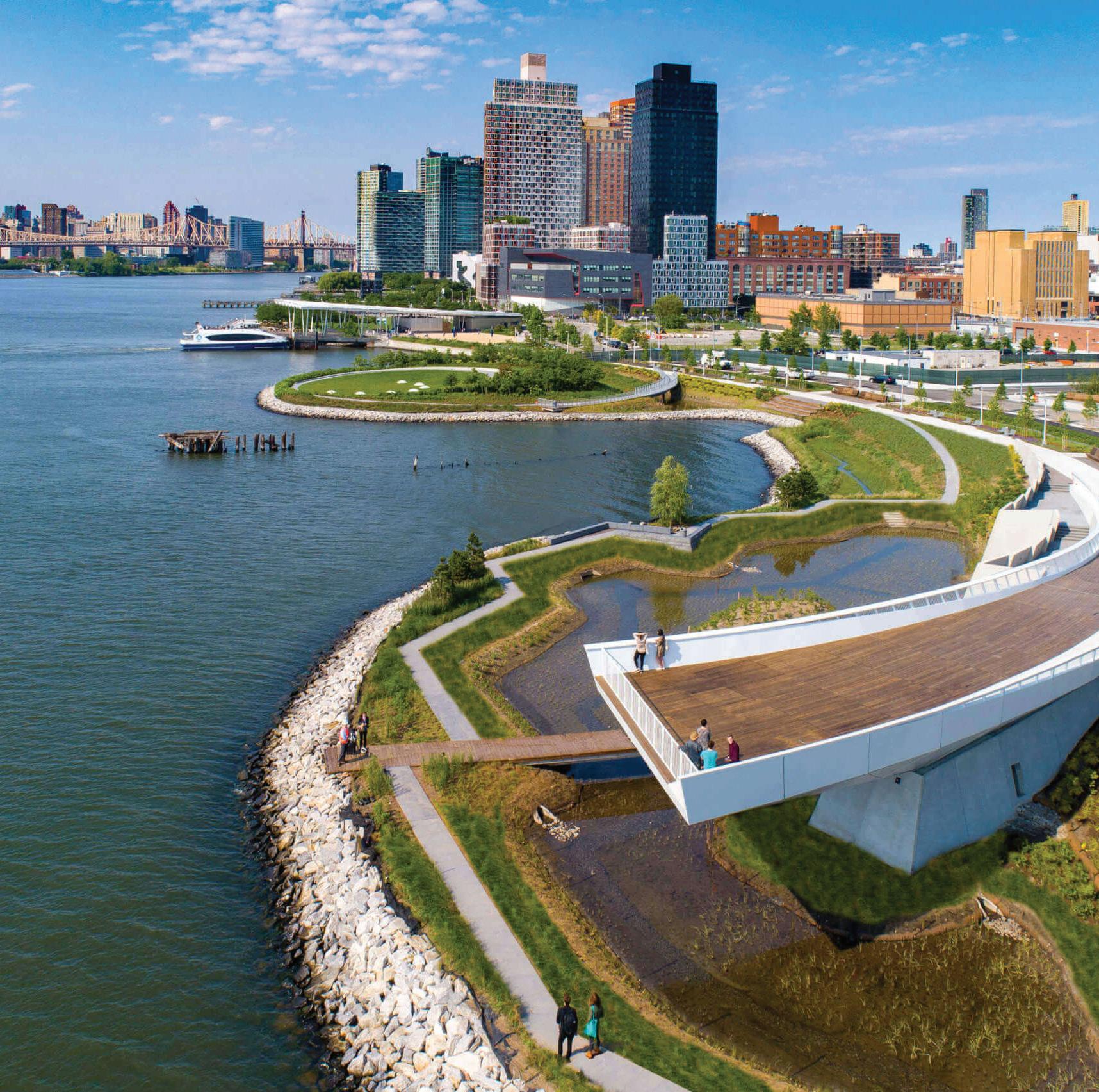
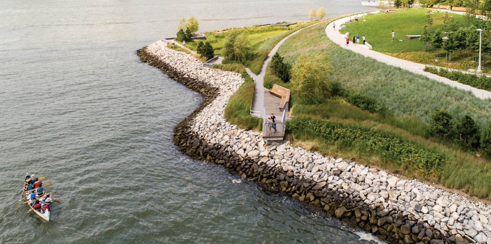
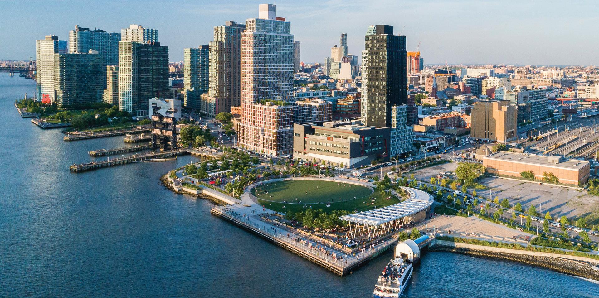
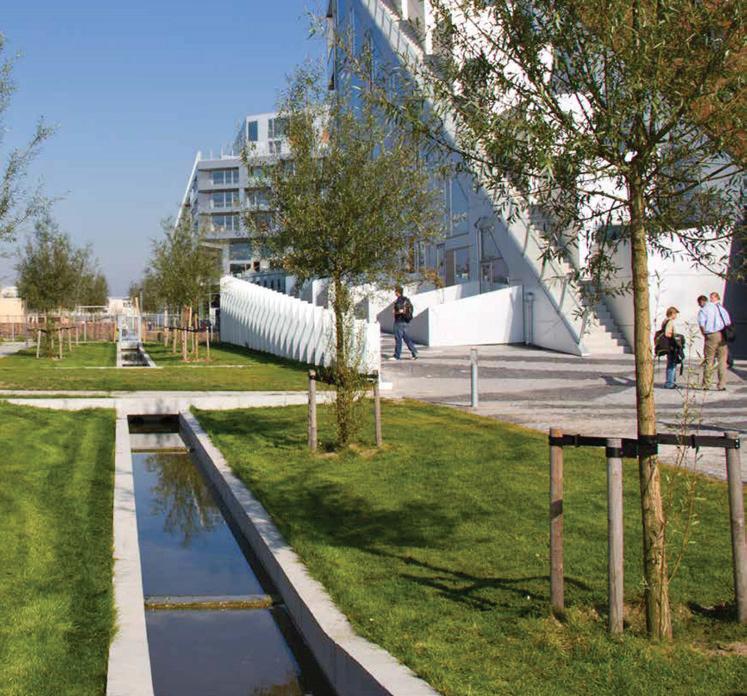
Hunter’s Point South Park in Queens, New York, exemplifies a forward-thinking approach to environmental resilience by turning a vulnerable waterfront into a dynamic public space (1). Designed by SWA/Balsley and Weiss/Manfredi, the project reimagines the East River edge not as a hardened barrier but as a soft, adaptive landscape that responds to rising sea levels and storm surges.
The park uses soft infrastructure strategies such as salt marshes, wetlands, riprap edges, and planted terraces (2), which absorb wave energy, filter stormwater, and create habitats for wildlife. Its topography is shaped to allow controlled flooding while protecting inland areas. Elevated pathways and resilient materials ensure that key spaces remain functional after inundation events, and the waterfront remains accessible even during storms (1). Through these systems, the park not only manages water but also educates visitors about the importance of living with natural processes rather than resisting them.
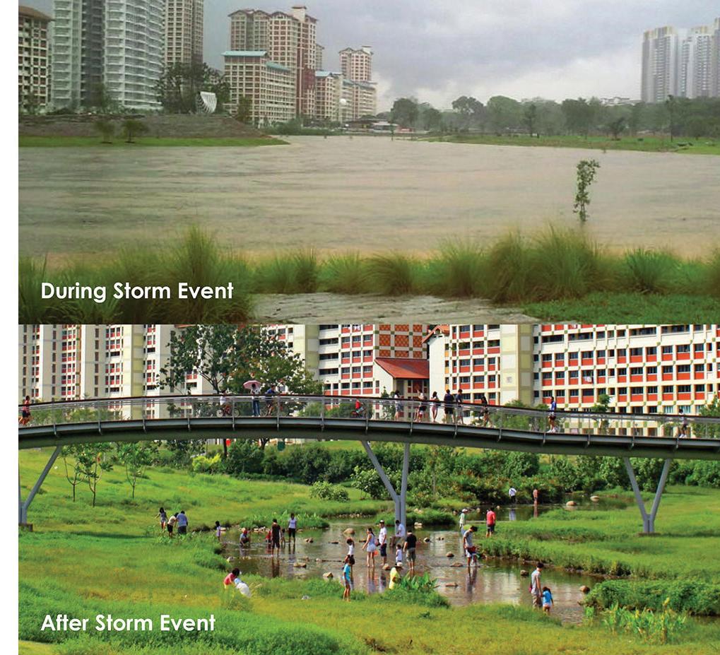
Another example of edge softening is Bishan-Ang Mo Kio Park in Singapore. Once a concrete drainage canal, it was transformed by Ramboll Studio into a naturalized river and floodplain, offering recreational space and biodiversity (3).
Both projects show how resilience and urban life can coexist blurring the line between land and water through ecological design.
Facing page: Once a neglected and contaminated strip of coast in Long Island City, Hunter’s Point South was transformed into an 11-acre ecological park along the East River (4).
Kiara Wong, Romina
Cordova
Top: Landscape architecture, art, and engineering came together in this project, created through a close collaboration between designers Thomas Balsley, Marion Weiss, Michael Manfredi, and Arup’s engineers (1).
Middle: The park’s design incorporates flood-resistant features such as wetlands and gabion edges, along with creative elements like the overlook and the “island” featuring an art installation, blending resilience with urban life (1)
Bottom: The park’s initial phase combined recreation and infrastructure. The large oval green serves as a school athletic field and, during Hurricane Sandy, also held floodwaters (1)
References
1 SWA/Balsley and Weiss/Manfredi. (n.d.). Hunter’s Point South Waterfront Park. SWA Group. Retrieved from https://www.swagroup.com/project/hunters-point-south-waterfront-park/
2 Weiss/Manfredi. (n.d.). Hunter’s Point South Waterfront Park. Weiss/Manfredi. Retrieved from https://www.weissmanfredi.com/project/hunters-point-south-waterfront-park
3 Ramboll. (n.d.). Bishan-Ang Mo Kio Park. Ramboll. Retrieved from https://ramboll.com/projects/ re/bishan-ang-mo-kio-park
4 Hilburg, J. (2019, November 7). Hunter’s Point South Park completes a Queens coastline years in the making. The Architect’s Newspaper. Retrieved from https://www.archpaper.com/2019/11/ hunters-point-south-park-queens-coastline/
Top left: Bishan’s 62-hectare park was reimagined to adapt to the river’s natural dynamics, such as changing water levels, while creating a lush, relaxing space for visitors to escape the city’s bustle (3).
Top right: The river’s changing width mimics the natural flow patterns of river systems, creating diverse habitats for plants, animals, and spaces for people to enjoy.
Bottom: The 2.7-kilometer concrete monsoon drainage channel in Bishan was transformed into a 3-kilometer-long winding natural river. (3)
Kiara Wong, Romina
Cordova
Grados, Freya Fu
Absorbing Urban Floodwaters: Sponge Cities
The concept of “sponge cities” reimagines urban areas as permeable landscapes that absorb, store, and reuse rainwater. This text presents three projects at different scales: a national program, a city-wide plan, and a single-site intervention.
China’s Sponge City Program, launched in 2015, is one of the largest initiatives globally, aiming to make 80% of urban areas resilient to flooding by 2030 (1). Cities like Wuhan and Shanghai lead by example, integrating green roofs, permeable pavements, and restored wetlands to manage extreme rainfall and reduce urban heat.
In Copenhagen, the Cloudburst Plan addresses increasingly frequent cloudburst events (2). Instead of channeling water underground, it uses surface solutions like sunken parks, bluegreen corridors, and multifunctional spaces that temporarily store and direct stormwater, merging flood protection with urban livability.
Similarly, Watersquare Benthemplein in Rotterdam combines water management with public space (3). This stepped plaza temporarily collects rainwater and serves as a recreational and cultural venue when dry. Its site-specific design addresses dense urban conditions while raising public awareness.
While China’s program operates nationally with a strong policy framework, Copenhagen implements a city-wide toolkit, and Rotterdam showcases a localized, design-driven intervention. Together, these projects highlight the importance of integrating water management into urban life to build climate-resilient cities.
Facing page: A rendering by Obermeyer of Xinyuexie Park in Wuhan, designed to enhance the city’s ability to manage stormwater (5).
Kiara Wong, Romina Cordova Grados, Freya Fu
Kiara Wong,
Romina
Cordova
Grados, Freya Fu
Bottom: In Watersquare, three basins collect rainwater: two shallow ones capture local runoff during rain, while a deeper basin fills during heavy rainfall, collecting water from a larger area. When dry, the basins become spaces for skating, sports, and gathering (3).
Top: Xinyuexie Park offers recreational spaces, restores the natural stormwater corridor, connects hills and water bodies, and supports public access and environmental education (5).
Middle: Cloudburst Management Plan shows Copenhagen’s flow routes guide rainwater toward the sea, with line thickness showing the volume of water along the way (2).
References
1 Zevenbergen, C., Fu, D., & Pathirana, A. (2018). Transitioning to Sponge Cities: Challenges and Opportunities to Address Urban Water Problems in China. Water, 10(9), 1230. https://doi.org/10.3390/w10091230
2 City of Copenhagen. (2012). Cloudburst Management Plan 2012. https://international.kk.dk/sites/default/ files/2021-09/Cloudburst%20Management%20plan%202010.pdf
3 De Urbanisten. (n.d.). Watersquare Benthemplein. https://www.urbanisten.nl/work/benthemplein
4 Jing, L. (2019, January 23). Inside China’s leading sponge city’: Wuhan’s war with water. The Guardian. https://www.theguardian.com/cities/2019/jan/23/inside-chinas-leading-sponge-city-wuhans-war-with-water
5 Obermeyer Engineering Consulting. (n.d.). Wuhan Xinyuexie Park. Obermeyer. Retrieved April 4, 2025, from http://www.obermeyer-cn.com/en/project/wuhan-xinyuexie-park

of flood-prone
Top right: The city of Copenhagen aims to expand its blue-green infrastructure by integrating flood management into urban planning, linking water, parks, and urban spaces (2)
Top left: Watersquare was designed as a lively space for young people, combining areas for play, relaxation, and greenery, with water flowing visibly across the plaza to create playful detours. (3)
Bottom: An aerial view
Wuhan, sited where the Yangtze and Han rivers merge. (4)
Kiara Wong,
Romina
Cordova
Grados, Freya Fu
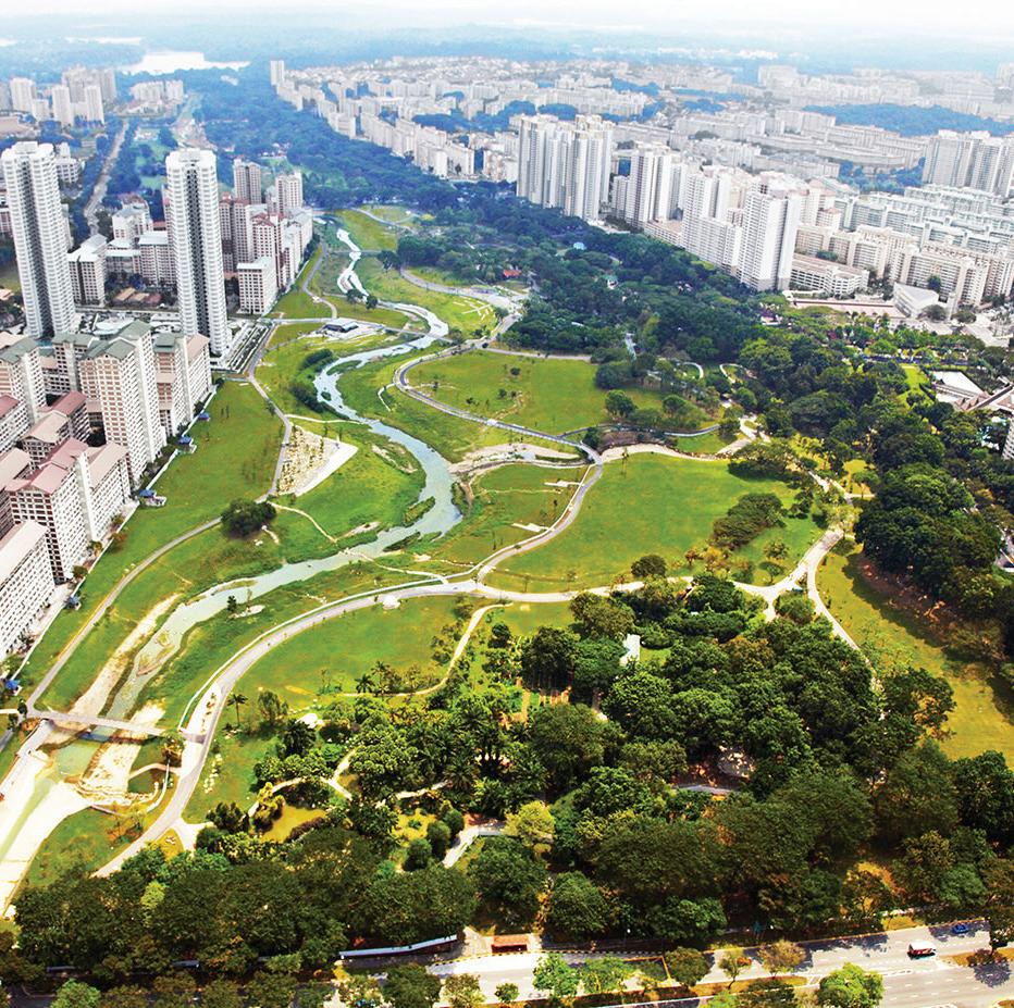
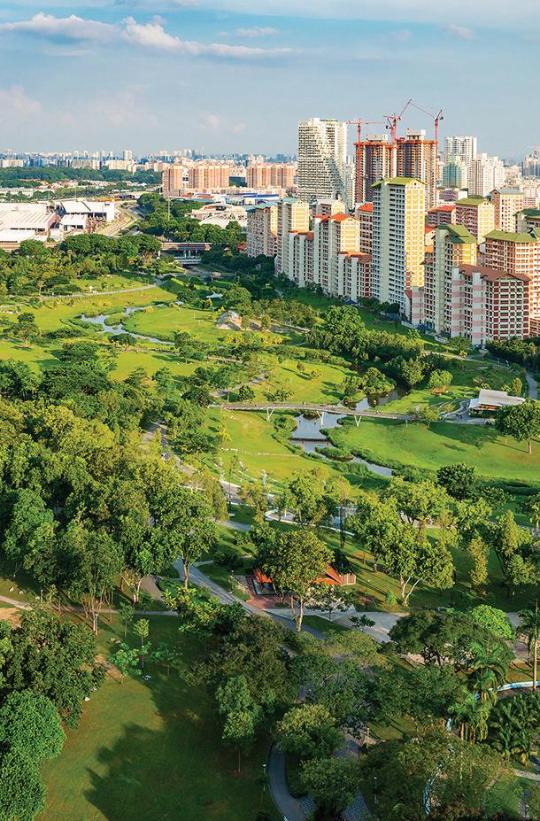
Greening Infrastructure: Bishan-Ang Mo Kio Park
Hanzhang Lai
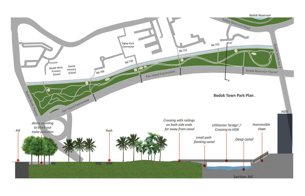
Bishan–Ang Mo Kio Park is a 63-hectare urban park in central Singapore, originally divided by the Kallang River, which had been engineered as a straight concrete canal to manage monsoon flooding. While effective for drainage, the canal created a physical and ecological barrier within the park. In the late 2000s, the site was selected for a major redevelopment focused on integrating flood management with public and ecological functions.
The design replaced the 2.7 km canal with a 3 km naturalized river set within a dynamic floodplain. During heavy rain, the river swells and spreads into adjacent parkland, temporarily storing stormwater before gradually releasing it downstream. This increased the river’s capacity by around 40%, reducing flood risk while keeping the park accessible during dry periods. To ensure resilience in the tropical climate, a one-year bioengineering study tested soil stabilization and plant growth techniques. The result is a landscape that manages water flow, supports native vegetation, and enhances biodiversity without sacrificing public use. The restored river has attracted birds, insects, and even otters, without the need for artificial introduction.
Bishan–Ang Mo Kio Park illustrates a shift in urban flood infrastructure from hard, single-use systems to flexible, multifunctional landscapes.
Facing page: The design transformed conventional flood infrastructure into a multifunctional landscape that manages water while supporting biodiversity, community life, and connection to nature—all within a dense urban setting.
Hanzhang Lai
References
1 Ramboll Studio Dreiseitl, Bishan–Ang Mo Kio Park Aerial View. Source: Indesignlive.
2 Ramboll Studio Dreiseitl, Bishan–Ang Mo Kio Park, 2016. Courtesy of the American Society of Landscape Architects (ASLA).
3 Ramboll Studio Dreiseitl
4 Janice Heng, Bishan Park: Hydrology + Topography, 2015. Courtesy of the RIBA President’s Medals Student Awards. Source: https://www.presidentsmedals.com/showcase/2015/l/1490_20105813544.jpg
5 Ramboll Studio Dreiseitl
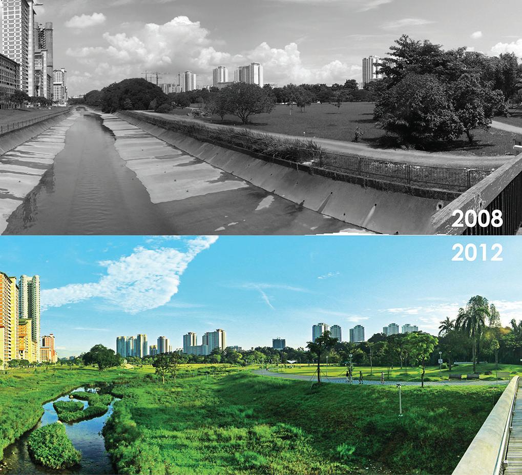
Top Right: The design transformed the river into a dynamic floodplain that safely holds stormwater during heavy rains, then gradually releases it downstream. Within hours, the banks return to dry, usable space for the community.
Bottom: The design transformed 63 hectares of parkland and a 2.7 km concrete drain into a 3 km meandering river, integrating natural processes into the urban fabric. By dissolving hard boundaries, the space now supports overlapping social, ecological, and cultural uses.
Top Left: The design transformed a concrete drainage canal into a naturalized river and public park, increasing stormwater capacity by 40%, boosting biodiversity by 30%, and expanding recreational space by 12%.
Above: The design transformed the park into a 24/7 community hub with plazas for Tai Chi, open fields for play, and quiet nooks for rest and connection.
Hanzhang Lai
Esther Li, Yushuo Ding
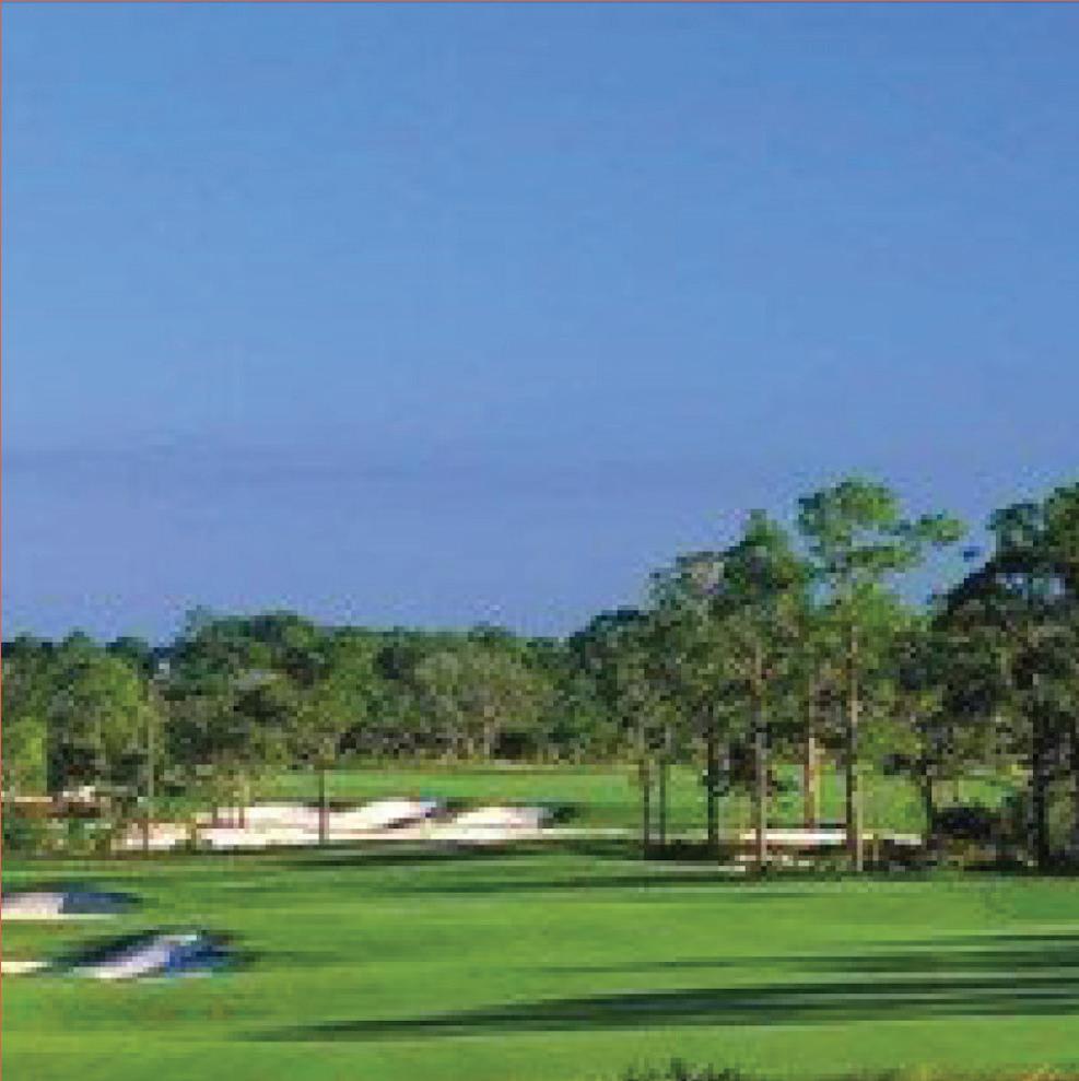
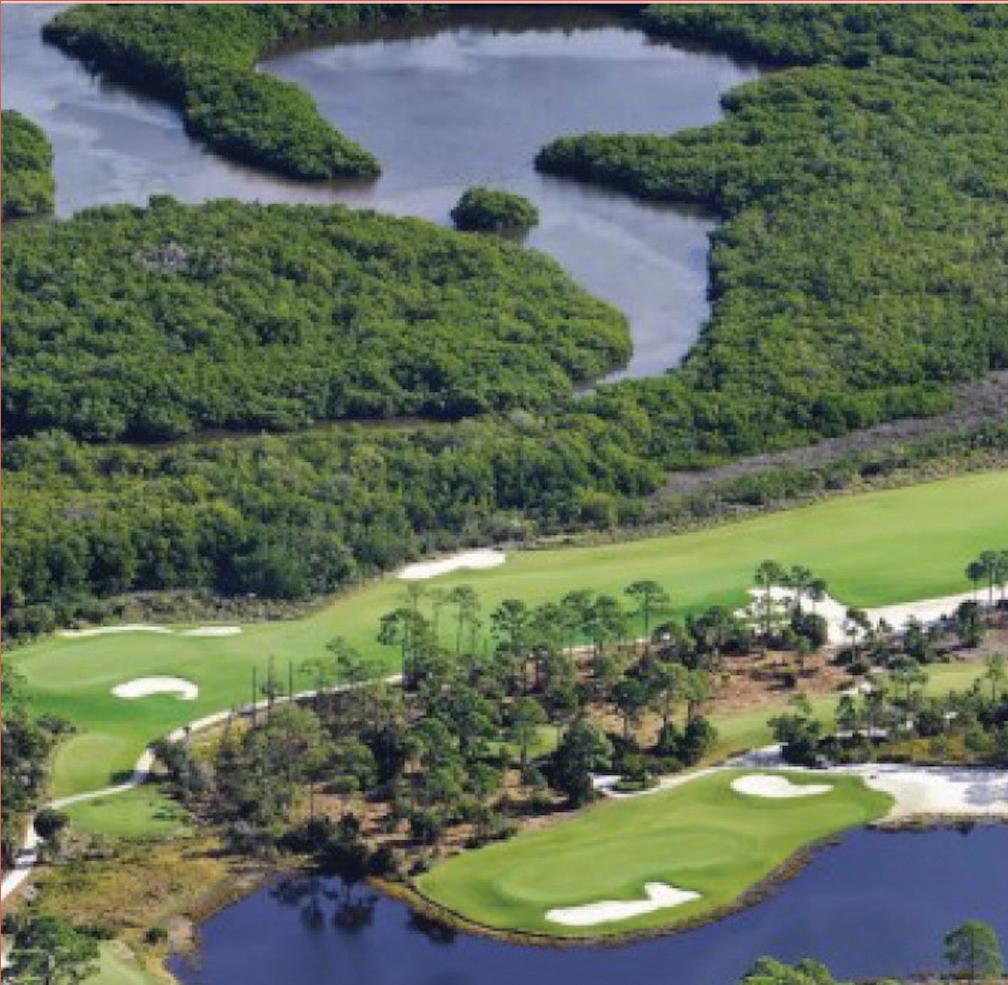
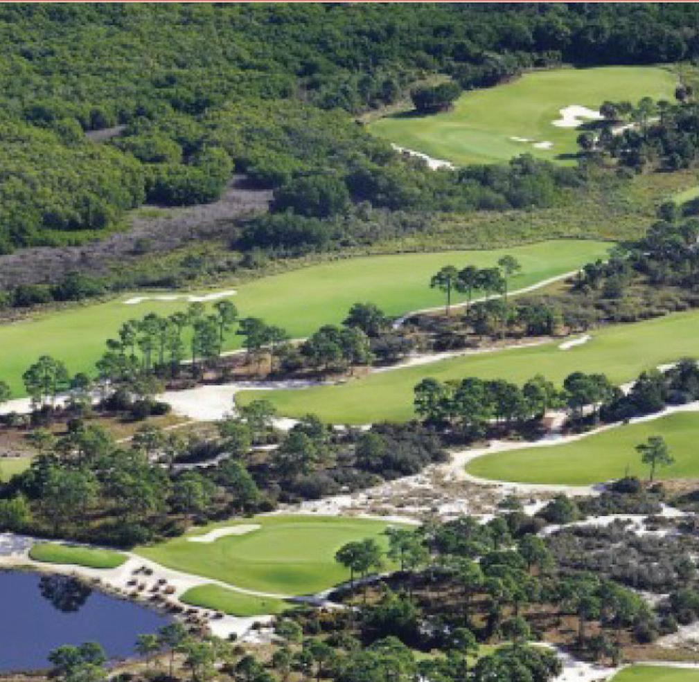
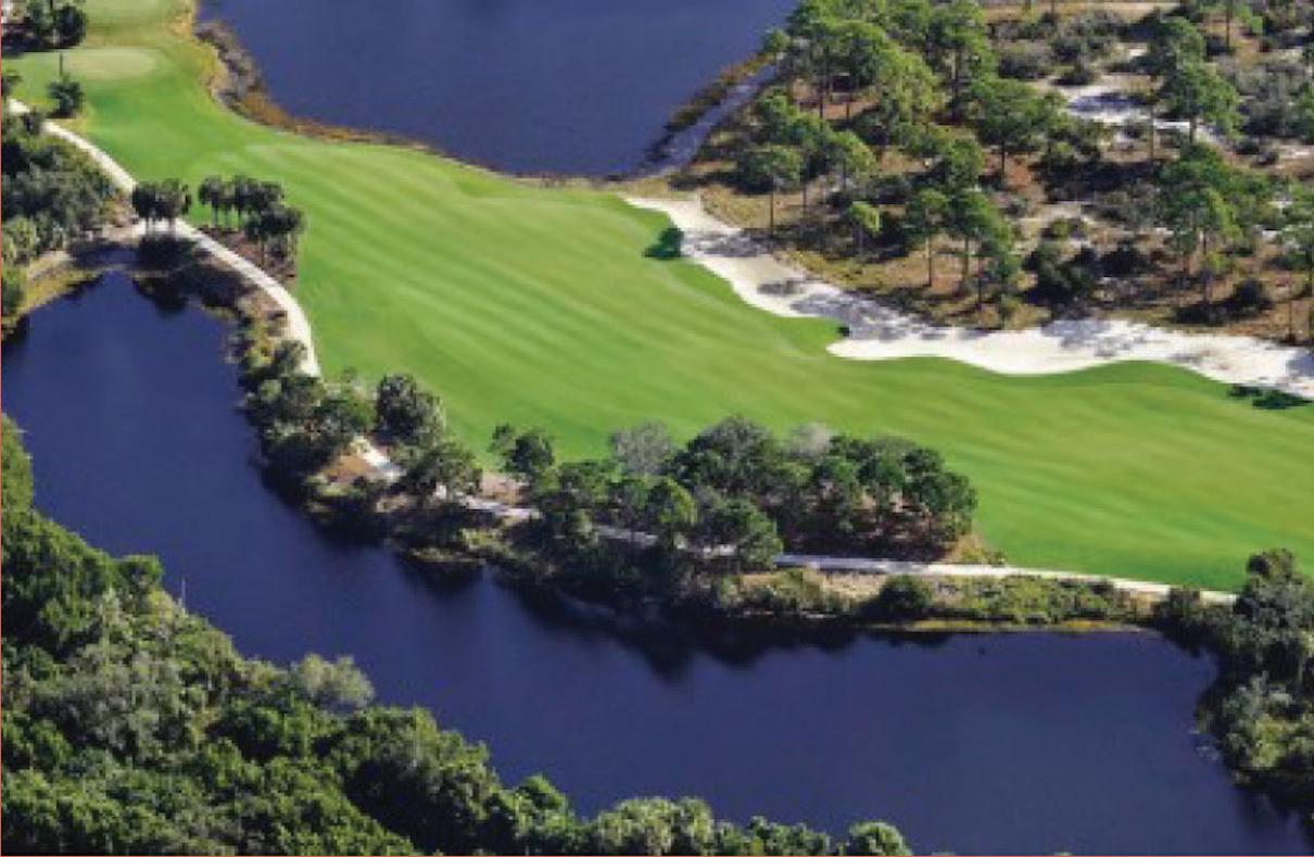
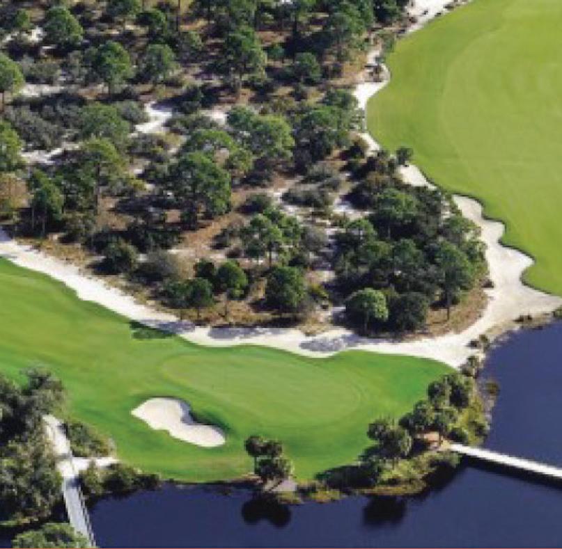
Bringing Biodiversity Back: Old Collier Golf Club
Esther Li Yushuo Ding
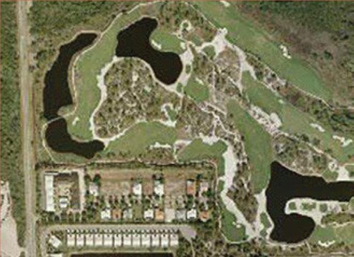
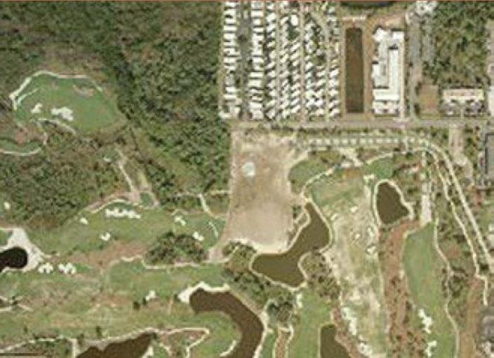
The case study, produced in 2010, is located in Naples, Florida. The project focused on nature preservation within an active, aging golf club. Situated in a tropical savanna zone, the site was previously a greenfield area, comprising mixed uplands and wetland habitats along the Cocohatchee River.
Faced with the challenges of developing a golf course on this ecologically sensitive site, the project team collaborated with Audubon International to create a landscape that benefits both golfers and wildlife. Given the site’s proximity to the Gulf of Mexico, one of the primary challenges was designing for water management. The region was undergoing rapid development and lacked a practical source of fresh water for irrigation.
The design strategy pioneered the “tree to green” use of two types of seashore paspalum (Paspalum vaginatum), a native, salt-tolerant turfgrass that can be irrigated with brackish water (LAF). The selection of salt-tolerant native vegetation reduced the need for irrigation, pesticides, and fertilizers. Additionally, the construction of protective berms redirected water away from sensitive mangrove areas, preserving 53 acres of mangrove and wetland habitats.
As a result of the habitat preservation efforts, the number of bird species observed on-site increased from 60 to 118, including nesting bald eagles, ospreys, and purple martins.


Top: Showing the protected berms divert the runoff away from mangrove and preserve 53 ancres wetlands as a wildlife preserve after the design. Source: Landscape Performance Series
Middle: The after design plan view of the preserved golf club. Showing 109 acres of connectde native uplands scrub habitat.
Source: Landscape Performance Series
Bottom: The plan view of the overall design, including the golf track. Source: Landscape Performance Series
References
1 https://www.landscapeperformance.org/ case-study-briefs/old-collier-golf-club#sustainable-features
2 https://www.landscapeperformance.org/ sites/default/files/Old%20Collier%20 Golf%20Club%20Methods.pdf
Above: Showing theinterconected uplands and native restored habitats in the preserved active gold court
Above: The corridor of native plants and white sugar sand provide habitat. Image Source: Landscape Performance Series
Esther Li, Yushuo Ding
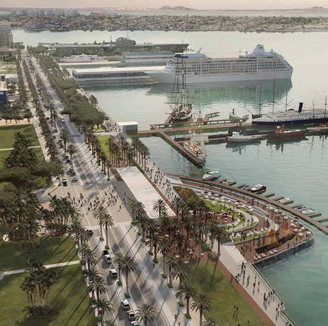
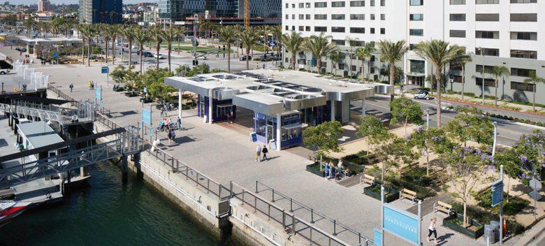
Civilizing the Water’s Edge: San Diego’s North Embarcadero
Hanzhang Lai
The redevelopment of San Diego’s North Embarcadero spans nearly 30 years, from early planning in the 1990s to ongoing public space improvements completed after 2014. The project focuses on transforming a vehicular waterfront edge into a multi-functional civic realm.
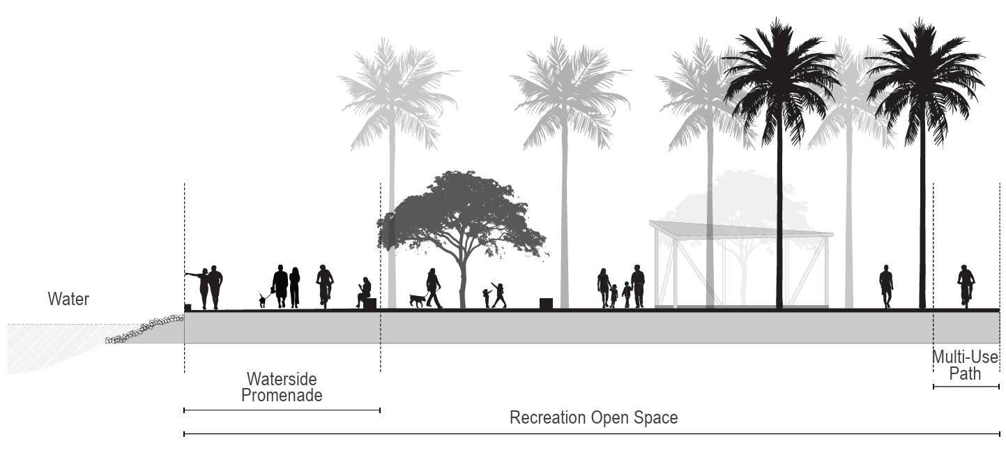
A key intervention was the redesign of North Harbor Drive. Formerly a wide, car-dominated corridor, it now accommodates a 105-foot right-of-way that integrates a continuous 30-foot waterfront promenade, shaded parkways, tree-lined sidewalks, and amenity zones. Travel lanes were consolidated, and pedestrian infrastructure expanded to support multimodal access and improve the experience at the water’s edge.
Public spaces such as County Administration Center Park and Broadway Landing provide green areas, piers, and flexible gathering zones that connect downtown to the bay. Surface materials, furnishings, and stormwater treatments were selected to emphasize durability and environmental performance while enhancing aesthetic continuity.
Design was led by Civitas, working with Civic San Diego, the Port of San Diego, and other agencies over a seven-year period. The project reflects an incremental, site-sensitive approach to adapting existing roadways to meet evolving urban and ecological needs, emphasizing access, public space integration, and long-term waterfront stewardship.
Facing page: The design transformed conventional flood infrastructure into a multifunctional landscape that manages water while supporting biodiversity, community life, and connection to nature—all within a dense urban setting.
Hanzhang Lai
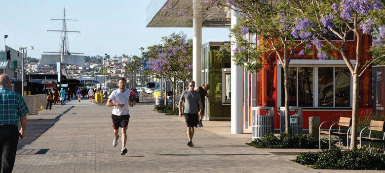
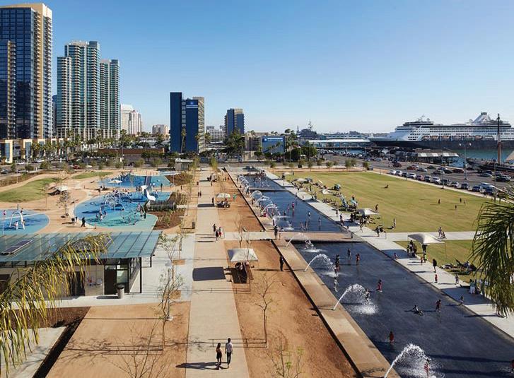
Top and Middle: The coastal linear park.
Bottom: Cross-Section of North Embarcadero Recreation Open Space
1 Civitas / Studio 7G, North Embarcadero Promenade, San Diego. Courtesy of Civitas and Studio 7G.
2 Civitas / Studio 7G, North Embarcadero Promenade, San Diego. Courtesy of Civitas and Studio 7G.
3 Civitas, North Embarcadero Promenade, San Diego. Courtesy of Civitas.
4 Port of San Diego, North Embarcadero Waterside Promenade Cross-Section, 2024. Source: Final Draft Port Master Plan Update, Figure PD3.6.
5 Civitas / Studio 7G, North Embarcadero Promenade, San Diego. Courtesy of Civitas and Studio 7G.
6 Port of San Diego, North Embarcadero Waterside Promenade Cross-Section, 2024. Source: Final Draft Port Master Plan Update, Figure PD3.6.
7 Civitas / Studio 7G, North Embarcadero Promenade, San Diego. Courtesy of Civitas and Studio 7G.
8 Stephen Whalen Photography, North Embarcadero, San Diego, 2014.
Top: Photograph of the promenade with the integrated greenaries.
Middle-bottom: A pier terracing to the water’s edge honors San Diego’s historic tuna fleet
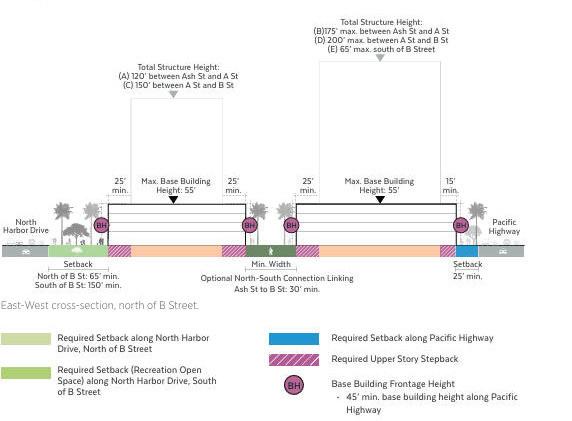
Middle-top: East-West cross-section, north of B Street. Conceptual Diagram of Structure Height and Setbacks
Bottom: A waterfront plaza and promenade strengthens the connections between San Diego and its port.
Hanzhang
Taming Waterfront Boulevards: the Fort Lauderdale Case
Allen Wang
The City of Fort Lauderdale, in collaboration with the Broward Metropolitan Planning Organization (MPO) and the Florida Department of Transportation (FDOT), applied the “Context Sensitive Solutions and Design” (CSS/CSD) framework for resilience to rebuild a section of the State Road A1A after it was flooded in 2012 by Hurricane Sandy and other storms.
Following a community consultation process (via website) that took place alongside recovery efforts, stakeholders recognized the value of building back better from the disaster, rather than rebuilding now then upgrading later. FDOT spearheaded efforts which integrated the city’s Complete Streets Policy (which considers pedestrians, cyclists, and transit users), aligned with the county’s beach nourishment efforts, and engaged local environmental groups to protect sea turtle habitats.
Various improvements included:
• Stormwater drainage by elevating the road and median
• Installation of underground drainage system
• Reducing from four lanes to two (add bike lanes and median)
• Flood/erosion protection via sea wall, wider beach, & dunes
• Improved beach access (pedestrian tunnel and crosswalks)
• Walls to prevent nesting sea turtles from crossing the road
• Improved aesthetics, landscaping, and ADA accessibility
The project was completed in December 2015 for $20.1 million.
Source:
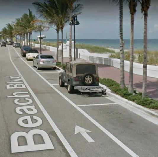
Facing page: Image of the completed project, showing the crosswalk, landscaping, and restructuring of the street. The camera is looking north, with the Hugh Taylor State Park on the left (west) and Fort Lauderdale Beach on the right (east).
FDOT.
References
1 Center for Environmental Excellence by AASHTO. “Integration of Resilience and Context Sensitivity in a Coastal Environment: State Road A1A in Fort Lauderdale, Florida.” https://environment.transportation.org/case_study/integration-of-resilience-and-contextsensitivity-in-a-coastal-environment-state-road-a1a-in-fort-lauderdale-florida/
2 Adaptation Clearinghouse. “Fort Lauderdale, Florida - Highway A1A Redesign Project.” https://www.adaptationclearinghouse.org/ resources/fort-lauderdale-florida-highway-a1a-redesign-project.html
3 Intera. “Design of Coastal Protection Structures for the State Road A1A Emergency Repair.” https://www.intera.com/project/design-ofcoastal-protection-structures-for-the-state-road-a1a-emergency-repair/
4 Local10.com. “A1A restoration repairs begin Monday.” https://www.local10.com/news/2014/07/27/a1a-restoration-repairs-begin-monday/
5 City of Fort Lauderdale, FL. “Complete Streets Policy.” https://www.fortlauderdale.gov/government/departments-i-z/transportation-andmobility/transportation-division/programs-policies-and-initiatives/complete-streets-policy
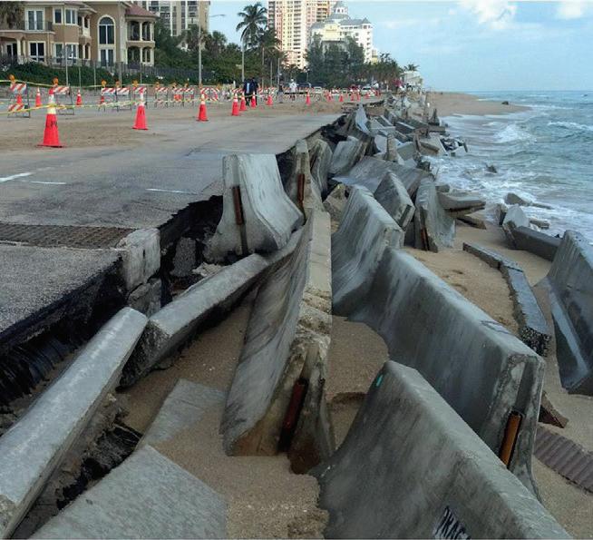
Bottom: Before-and-after photos, showing the crosswalk, landscaping, and restructuring of the street. The camera is looking north, with the Hugh Taylor State Park on the left (west) and Fort Lauderdale Beach on the right (east).
Source: FDOT.
Source: FDOT.
Top Left: Flooding in 2012, with utilities trucks parked in the water and a person wading along the road. Source: FDOT.
Top Right: Concrete barriers, pylons, and washed-away asphalt. Extensive recovery efforts following the storms.
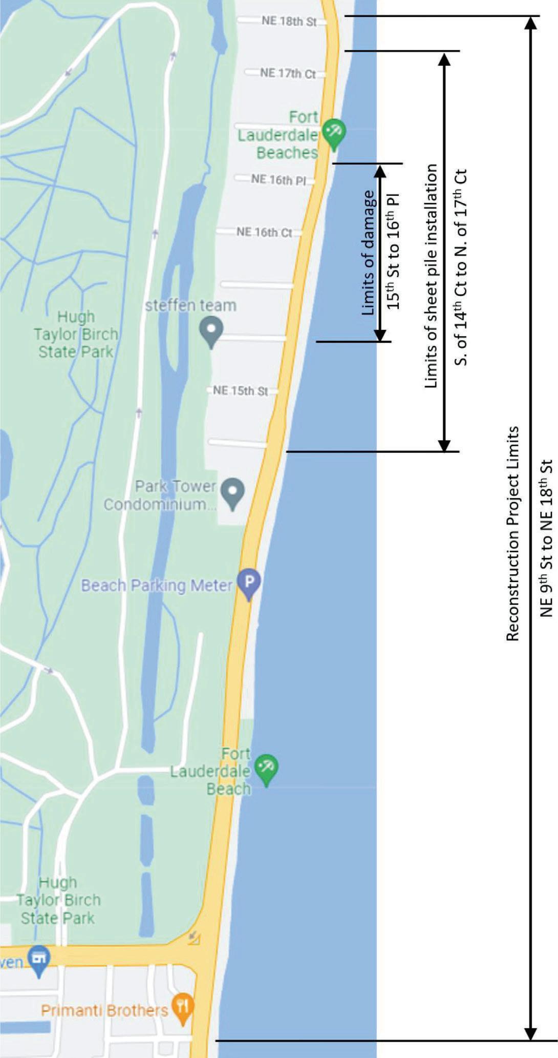
Above: Google Maps screenshot annotated with project boundaries. Sunrise Boulevard is the yellow east-west road at the bottom of the image. Source: Center for Environmental Excellence by AASHTO (the American Association of State Highway and Transportation Officials).
Allen Wang
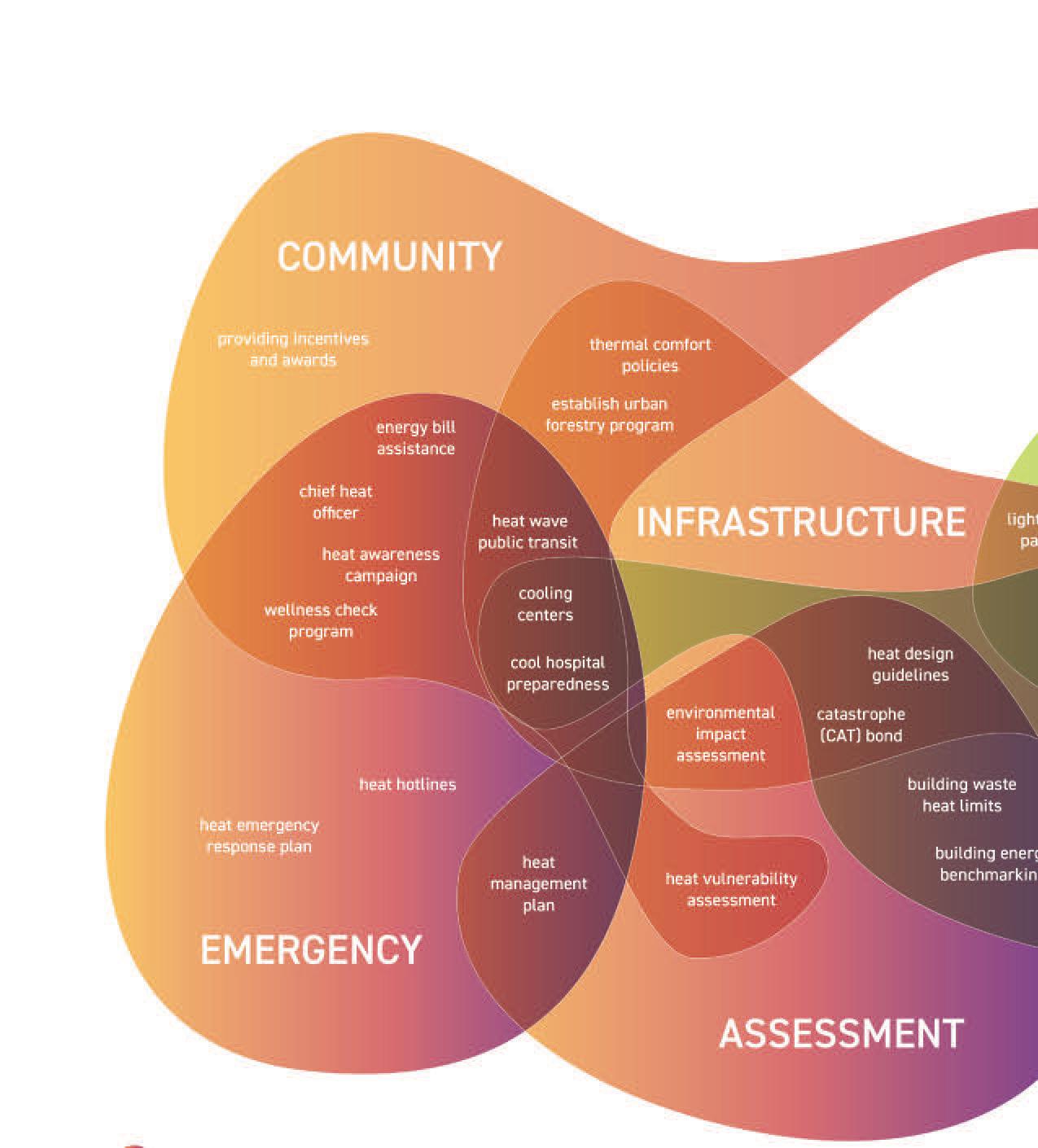
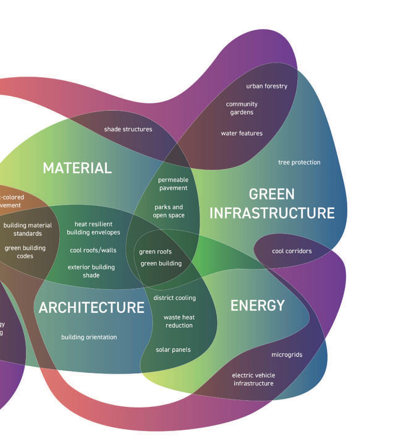
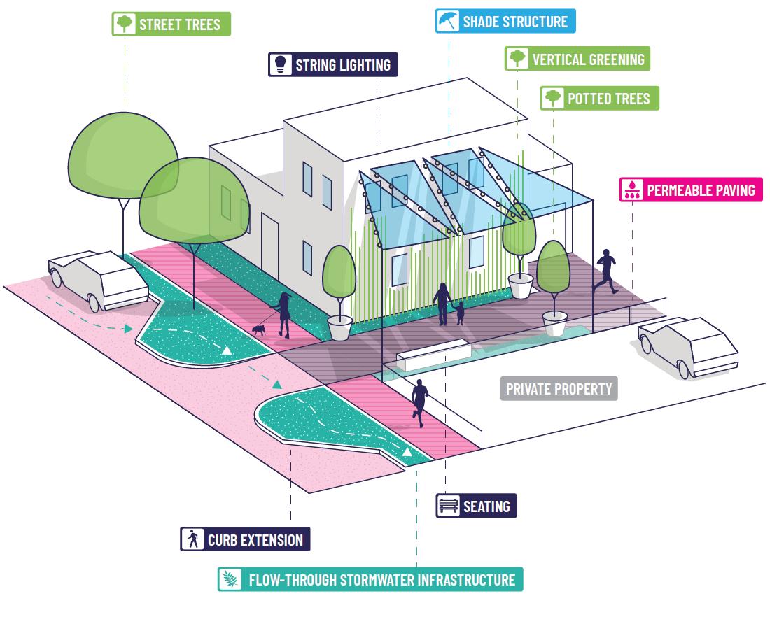
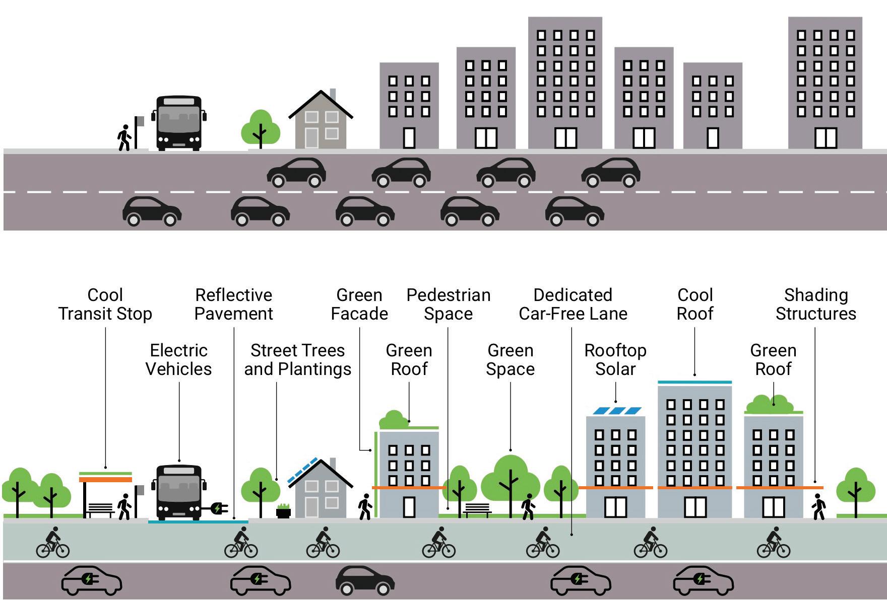
Cooling the City: Tactical Approaches
Rimshi Agrawal, Rilia Li
The SCAG Urban Heat Island Reduction Strategies project, led by Alta Planning + Design, serves as a case study to understand how toolkits can guide tactical, site-specific urban cooling interventions. Through community engagement, spatial analysis, and microclimate assessments, the project identified key elements of urban cooling—such as tree canopy expansion, cool pavement treatments, and green infrastructure retrofits— focused on equitable, low-cost implementation. The outcome was a practical toolkit that city agencies and designers can use to prioritize and integrate heat mitigation strategies into everyday street design.
Using Long Beach and Pasadena as pilots, the toolkit comprises of five key urban cooling strategies. These included the planting of shade trees to provide long-term thermal comfort, the application of cool pavements with high solar reflectance to reduce surface temperatures, and the integration of green infrastructure elements such as bioswales and rain gardens to manage stormwater while cooling the environment. Urban greening—through planters, pocket parks, and vertical vegetation—was also emphasized, particularly in dense neighborhoods. Lastly, the project promoted tactical urbanism techniques, such as shaded seating and painted curb extensions, as quick, low-cost interventions to enhance thermal comfort in public spaces.
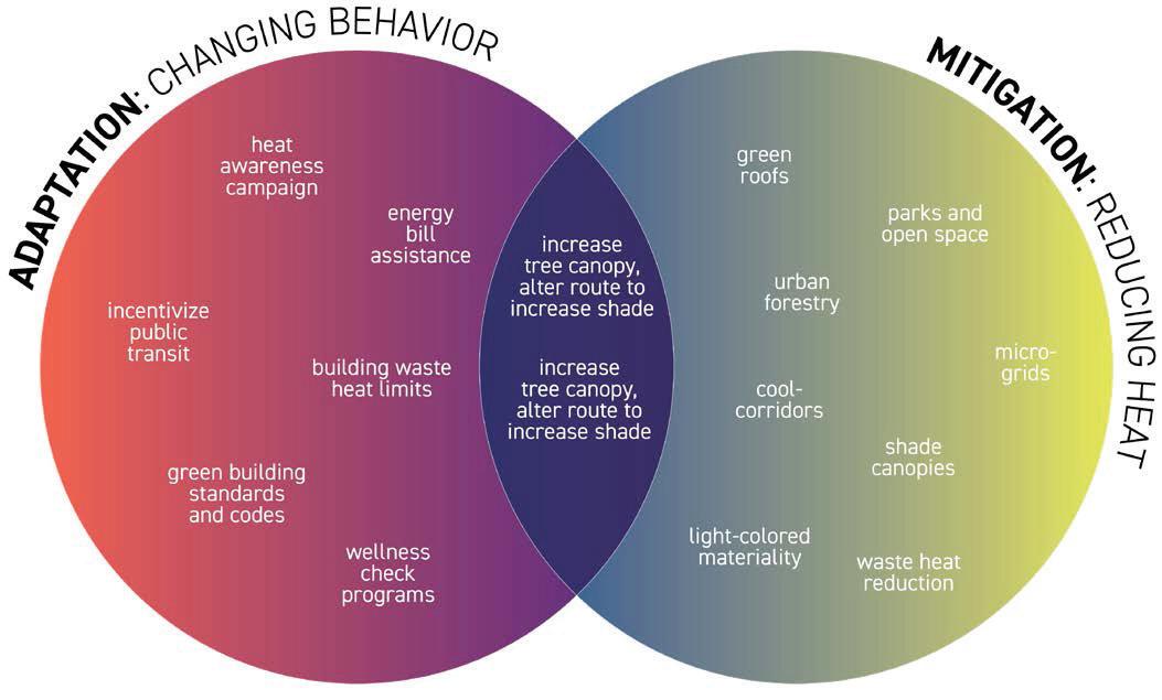
Facing page: Urban heat solutions generally fall into two categories, adaptation and mitigation. Diagram adapted from The Nature Conservancy’s “Heat Action Planning Guide For Neighborhoods of Greater Phoenix” (TNC, 2019) by LAF Thermal toolkit Issue 01.
Rimshi Agrawal, Rilia Li
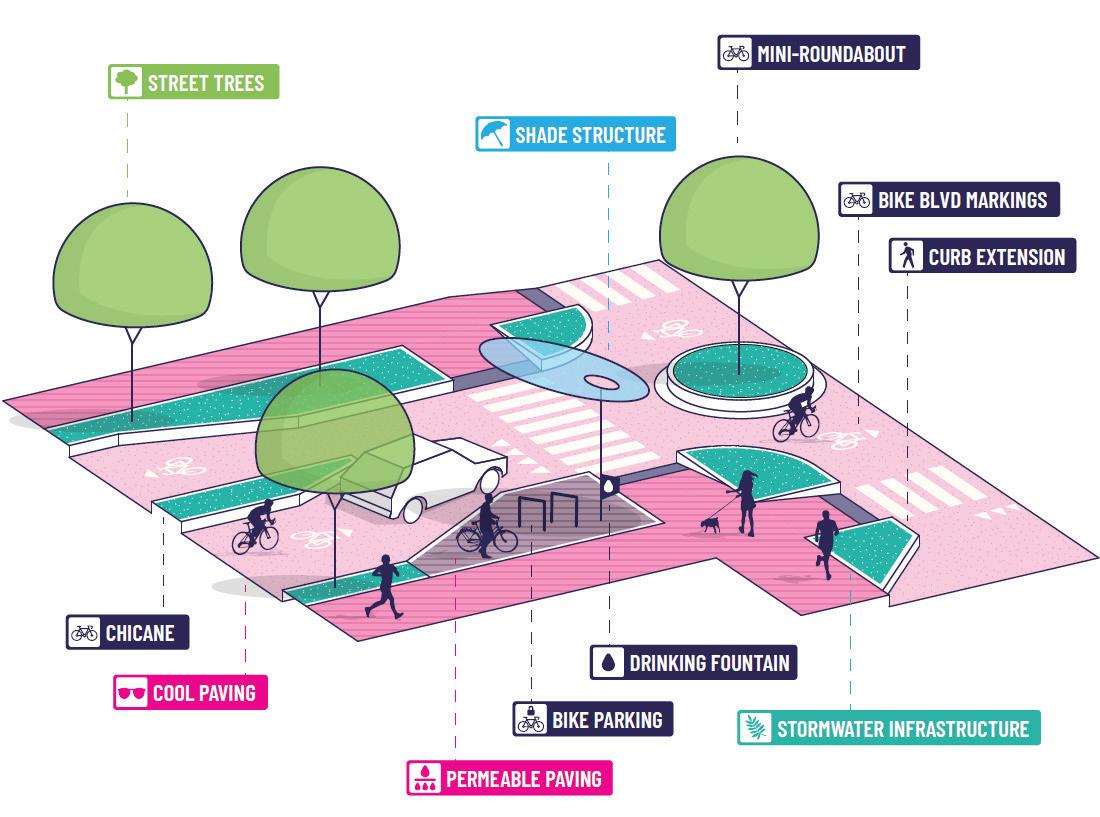
Top: Illustration of multi-modal transit focused cooling strategies, integrating street trees, shade structures, permeable and cool paving, and stormwater infrastructure to enhance thermal comfort
Middle: Illustration showing cool tools for alleyways, featuring shade structures, vertical greening, permeable paving, and seating elements to create more comfortable and walkable microclimates.
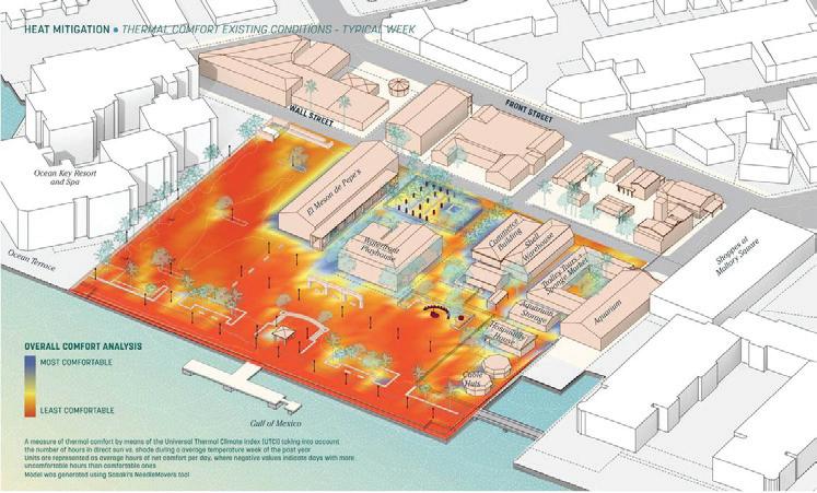
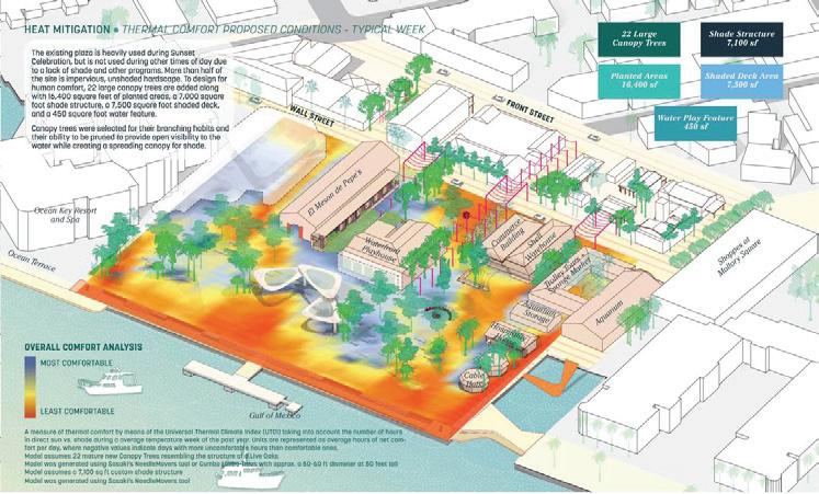
Bottom: Thermal comfort analysis comparing existing conditions and proposed scenarios after deploying cool tools in Mallory Square, a public plaza at the sunny tip of Key West, Florida.


1 Thermal Toolkit: Technologies and Techniques for Visualizing Heat Issue 01, A project of the Landscape Architecture Foundation Deb Mitchell Research Grant. The toolkit offering innovative methods to visualize, measure, and design for urban heat resilience.
https://www.lafoundation.org/ news/2025/01/grant-product-thermaltoolkit
2 SCAG Urban Heat Island Reduction Strategies – Alta Planning + Design. A toolkit developed for Long Beach and Pasadena to reduce urban heat through shade, green infrastructure, and communityinformed strategies.
https://altago.com/projects/scag-urbanheat-island-reduction-strategies/
3 Between Two Buildings: Summer Urbanism by Sasaki; Site specific example of how urban design can mitigate extreme heat, emphasizing equitable public spaces and community resilience.
https://www.sasaki.com/voices/betweentwo-buildings-summer-urbanism/


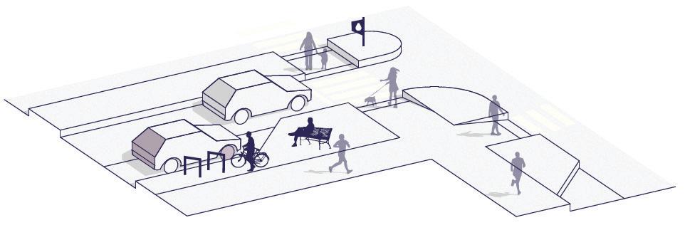
Cooler streets combat the urban heat island effect by increasing the proportion of the street dedicated to vegetation and permeable surfaces, reducing heat absorption, and facilitating walking, biking, and transit. Cool tools, includingstreet trees, green infrastructure, shade structures, cool pavement and hardscape, and cool amenities, are elements of cooler streets.
Rimshi Agrawal, Rilia Li
Scaling Heat Resilience: District to Detail
Rimshi Agrawal, Rilia Li
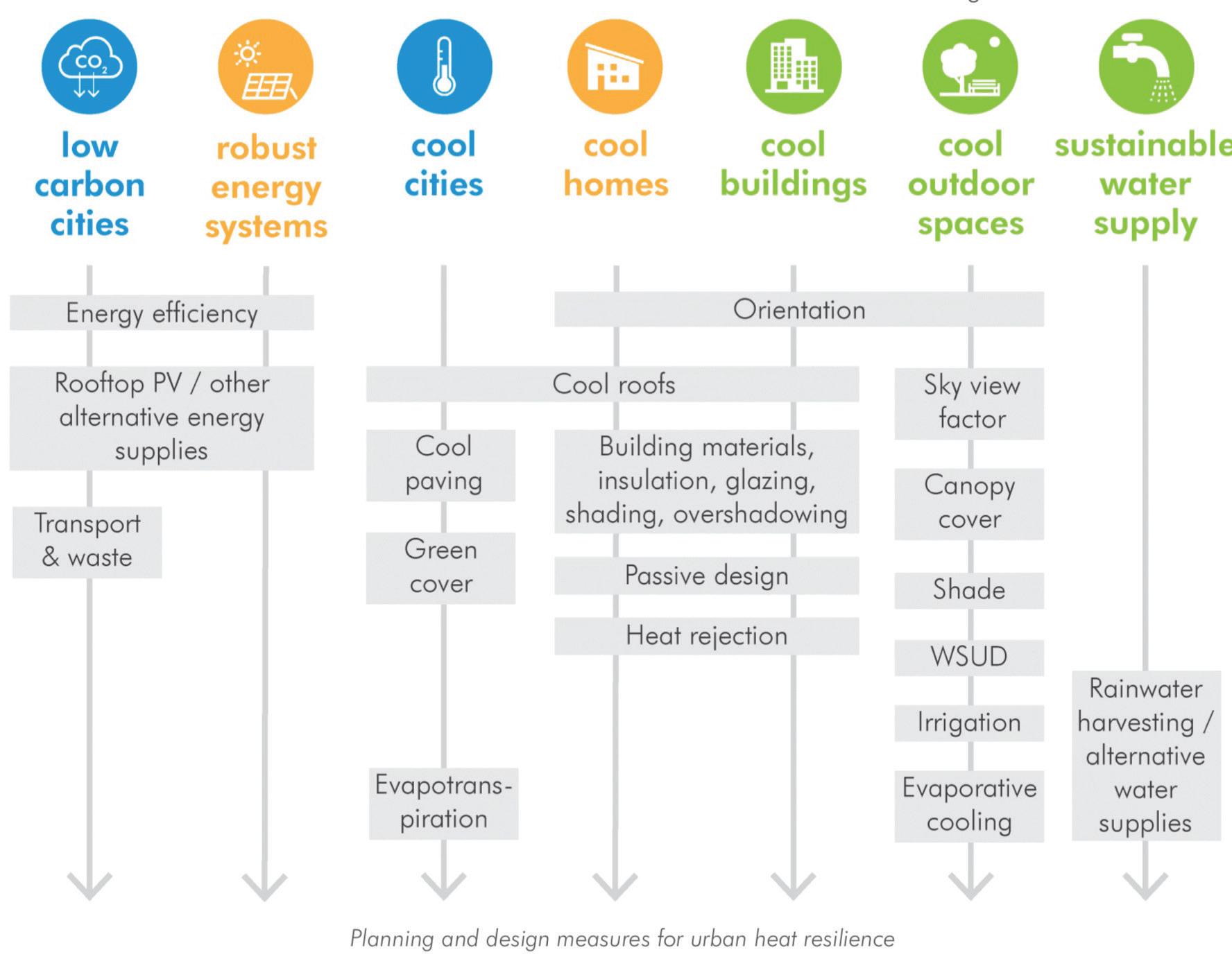
The United Nations Environment Programme’s Beating the Heat:
A Sustainable Cooling Handbook for Cities offers a comprehensive framework for understanding and implementing urban cooling strategies. Unlike localized case studies, this handbook categorizes interventions based on their scale of application, providing a structured approach to sustainable cooling. It delineates strategies across three primary levels: city-wide planning, neighborhood design, and buildingspecific solutions.
City-scale interventions encompass policies and infrastructure projects that influence the urban heat island effect, such as expanding green spaces and enhancing public transportation. Neighborhood-level strategies focus on community-based initiatives like creating shaded communal areas and improving local ventilation. At the building scale, the emphasis is on architectural designs and materials that enhance thermal comfort, including the use of reflective surfaces and natural ventilation systems.
This scalar framework offers a systematic, adaptable toolkit for diverse urban contexts. By categorizing interventions in this manner, the handbook serves as a valuable toolkit for policymakers, urban planners, and stakeholders aiming to implement effective and context-specific cooling solutions.
Rimshi
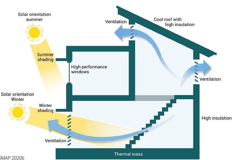

Top: A framework for scaling urban heat resilience categorizing planning and design interventions from district-scale strategies to detailed site interventions.
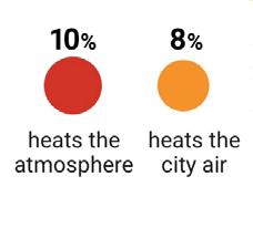
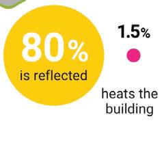
Bottom Right: The albedo effect: comparison of a black and a white flat roof on a summer afternoon with an air temperature of 37°C
Bottom Left: Passive cooling principles adapted from ESMAP 2020b through shading and ventilation to reduce waste heat generated from air-conditioner use.
The conventional urban area has a high proportion of impervious surfaces and single-occupancy vehicles. By comparison, the heat-resilient urban area has a higher proportion of green space, cool surfaces, alternative modes of transport and electric vehicles.
Sources
1 Beating the Heat: A Sustainable Cooling Handbook for Cities – A UNEP guide outlining multi-scalar cooling strategies for cities, from policy to building design. https://www.unep.org/resources/report/ beating-heat-sustainable-cooling-handbook-cities
2 Akbari, H., Menon. S. and Rosenfeld, A. (2009). “Global cooling: increasing worldwide urban albedos to offset CO2”. Climatic Change 94, 275-286. https://doi.org/10.1007/ s10584-008-9515-9
3 C40 Knowledge Hub (2019c). How to adapt your city to extreme heat. August. https:// www.c40knowledgehub.org/s/article/Howto-adapt-your-city-to-extreme-heat.
4 Institute for Market Transformation (2020). Building Performance Standards: A powerful new tool in the fight against climate change. https://www.imt.org/resources/ building-performance-standards-are-a-
Rimshi Agrawal, Rilia
Li


Photo Essay


A Photographer’s First Impressions
Mike Belleme
I experienced Hurricane Helene seven hundred miles north of Sarasota in a small town just east of Asheville, North Carolina, where the incessant rains engorged the Swannanoa river well beyond its banks, sending it barreling through my town ripping dozens of houses right off of their foundations and eliminating almost every business in town. For the first week or so, there was no internet or phone communication. I remember thinking regularly, that if we got hit this bad this far inland, the Gulf Coast of Florida must be completely wiped off the map. The first news I got from Florida was from a photographer friend in Tampa asking if I was alright and saying that from what he understood, we may have actually gotten hit harder than Florida. I couldn’t make sense of how that could be, but was grateful to hear that my friends and family in Florida were ok. For us in Western NC, this was pretty novel, but for the folks in coastal areas especially Florida, it’s come to be part of life, and something to plan for. As North Carolinians rebuild after the flood many of us are questioning if it’s smart to rebuild again in the exact same locations that were obliterated by this storm. Sure, it was a thousand year flood, but what does that really mean anymore? I’m sure the people of Sarasota are asking similar questions especially those in the barrier island communities. What is the threshold of risk and recovery that makes someone willing to uproot from a beautiful vibrant
community that they call home? It feels like an almost impossible question, but one that more and more people are faced with. Within weeks of Helene, the Gulf Coast was hit again by Milton, which lost enough strength by the time it made landfall to not be the cataclysmic hurricane that changes everything, but it could have been and its impact was still life changing for many.
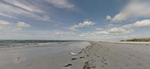
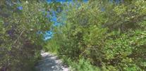
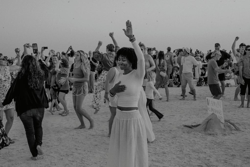
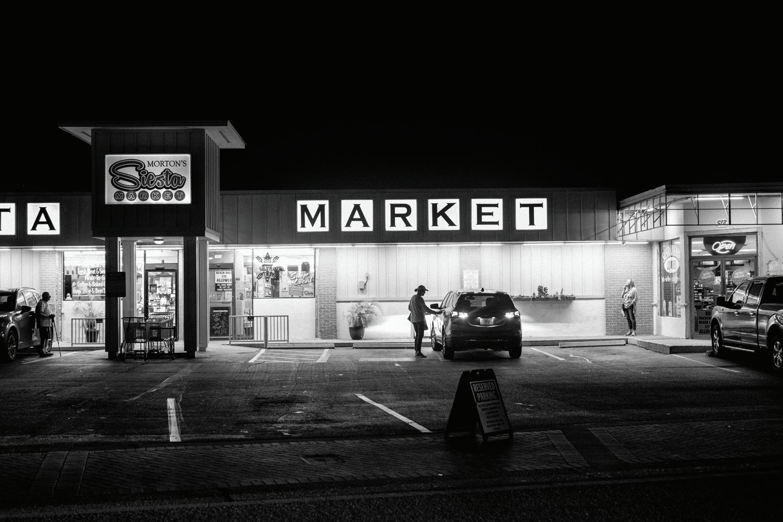
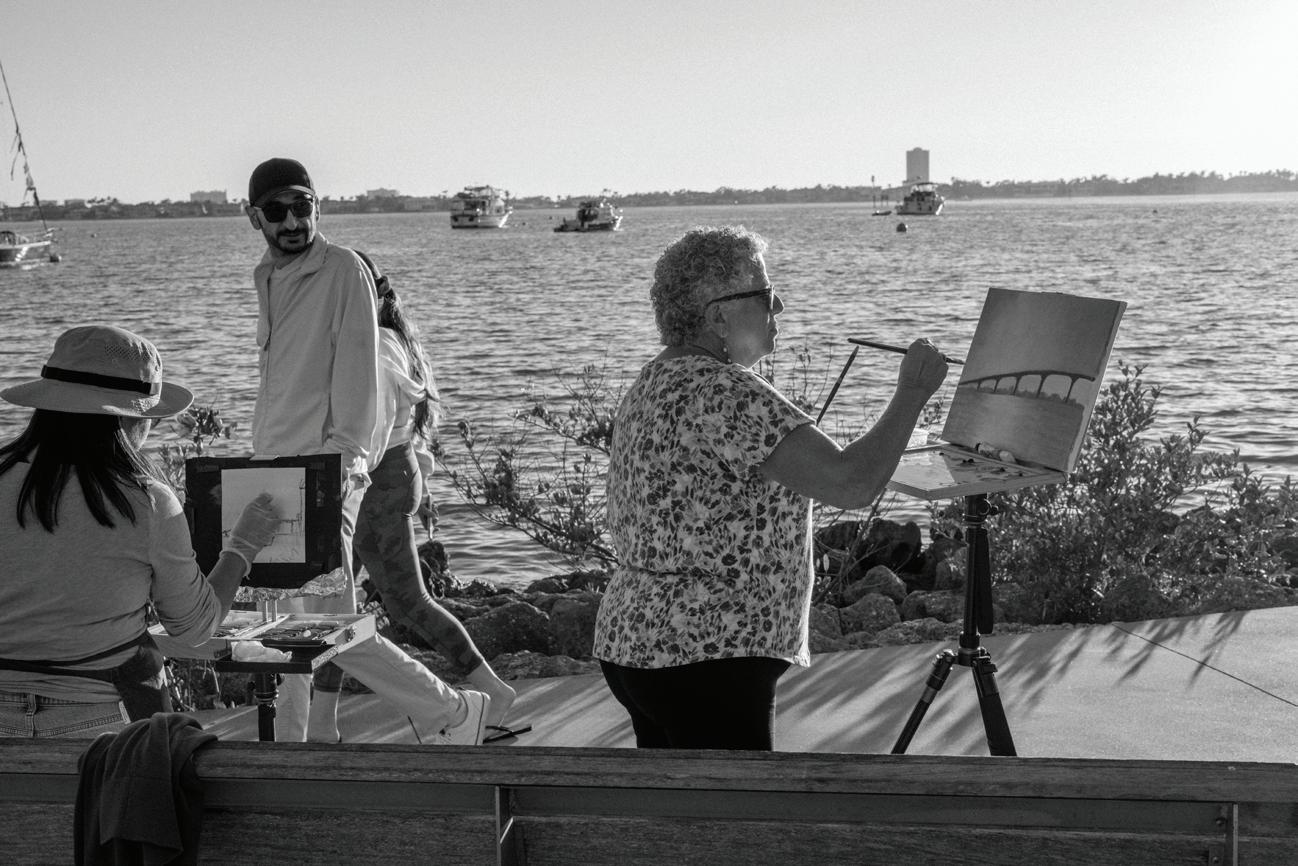
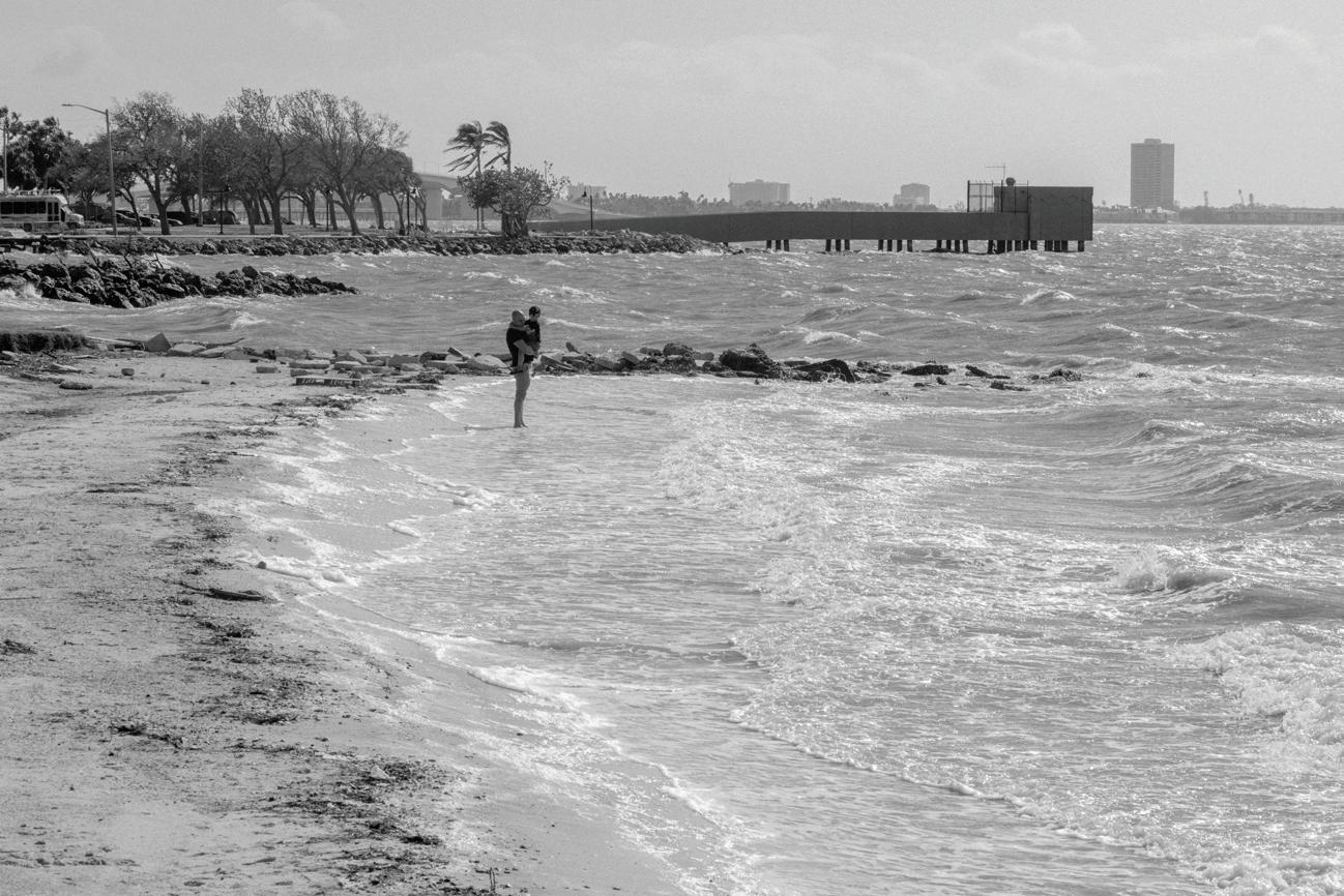
My experience of Sarasota and the barrier islands was guided by my own curiosity and some great local tips from the Architecture Sarasota folks. The hours of traffic that I sat through, and the packed crowds on the beach and streets of Siesta Key speak to how cherished and active these island communities are. Less than half a year after a heavy hit from Helene and Milton, the restaurants, night life, drum circles, and active coastlines tell a story of a vibrant and resilient community that is far from ready to throw in the towel. The photography I’ve done in Western North Carolina since the storm has mostly focused on the destruction and how things were effected and changed after the storm, but the work I made in Sarasota, since it was my first time visiting there, was not about change, I had no reference point for that. Instead I was able to simply see it for all of the complex beauty of its current state. Having fresh eyes is a beautiful thing. Like experiencing a great piece of art for the first time, you never get to have that first impression again and it was a particularly interesting time to be having a first impression of that place. While the people of Sarasota are experiencing a time of transition and liminality and for some maybe the end of a chapter for those that choose to seek life on higher ground. Western North Carolina is proof that even the places that were once considered a climate refuge, are not safe from the increasing pressures of climate change and catastrophe. Running away from the problem is a good way to keep running, so building resilience into our spaces and communities is a must from the mountains to the sea.
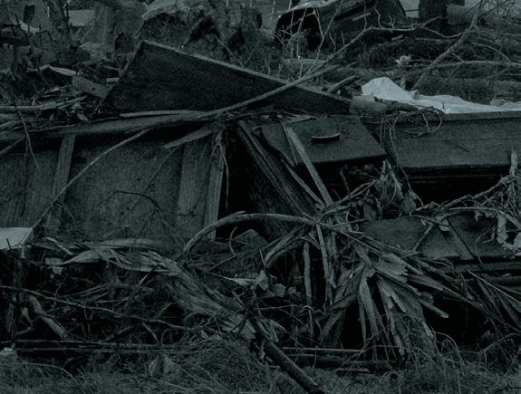
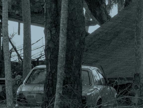
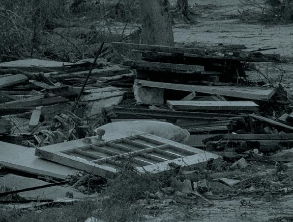
All photographs in this section: Mike Belleme, 2025.


Toolkits


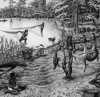
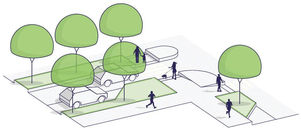
Land use, historical shorelines and Indigenous territories
Elevated Mounds
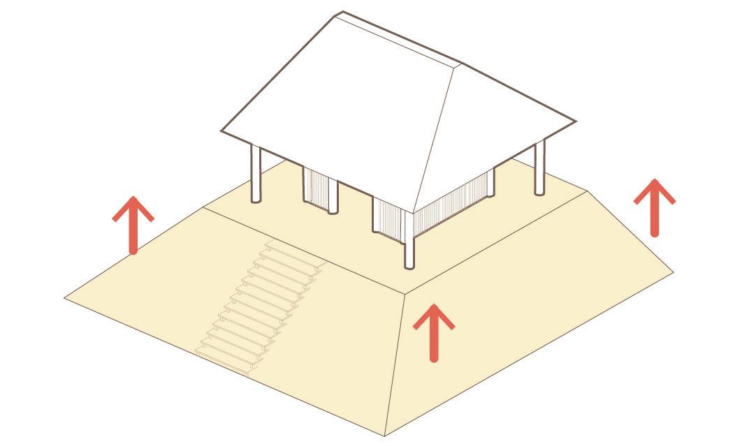
Natural ventilation
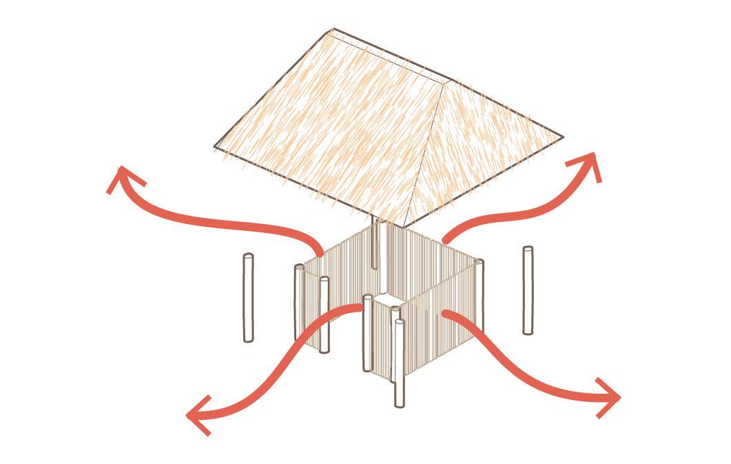
The Calusa built massive shell midden mounds using oyster shells, fish bones, and other refuse to raise their homes above flood-prone estuarine terrain, providing dry, elevated ground resilient to tides and storm surges.
Calusa dwellings were made from palm thatch and wooden poles, designed without walls to promote airflow in the humid subtropical climate, offering natural ventilation and cooling without sealed enclosures.
Stilt Posts
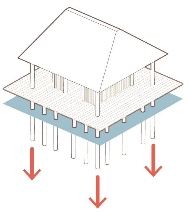
Many Calusa structures were raised on wooden posts driven into soft, wet soil or submerged mudflats, allowing buildings to float above tidal fluctuations and reduce water damage from storms.


Elevated Housing Open Floorplan
Stilt Posts
Hanzhang
Seawall Perimeter
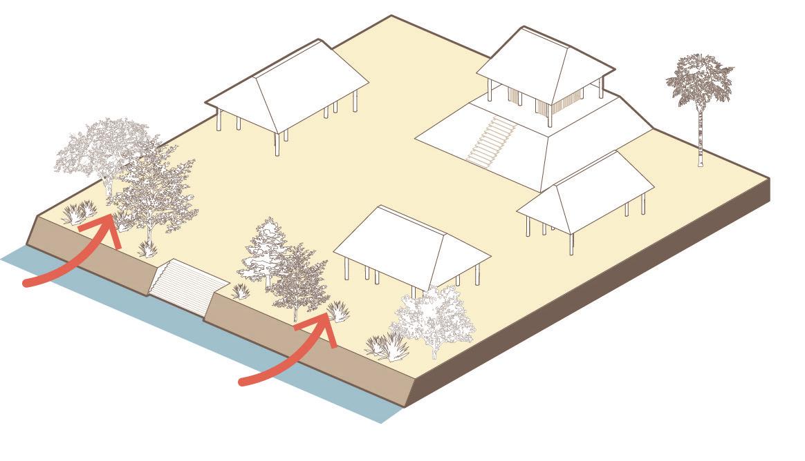
Canal Networks
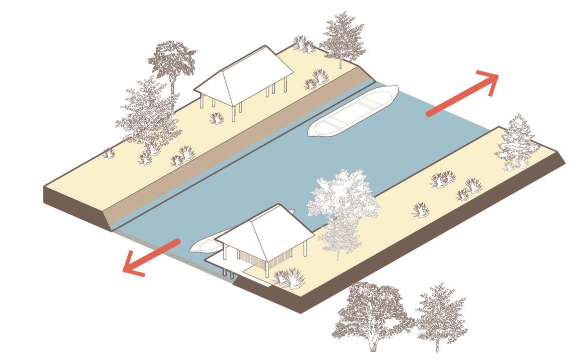
At sites like Mound Key, the Calusa engineered shoreline ridges made from densely packed shell that functioned like primitive seawalls— protecting inner structures from erosion, wave action, and storm surge. They carved extensive canal systems to navigate between settlements, manage water levels, and access inland areas during high tide—an adaptive transport and drainage strategy within wetland terrain.
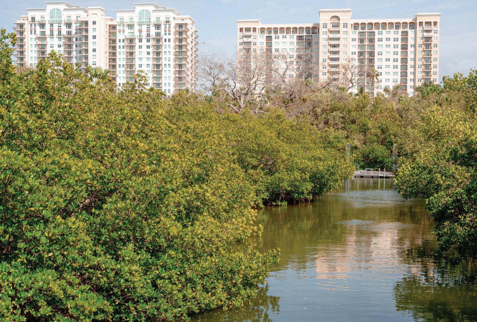
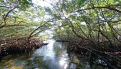
Vegetative Buffer
Calusa settlements often coexisted with mangrove forests, which served as natural buffers against storm surge and coastal erosion, while also providing habitat and material resources.


Seawall Canal Networks
Vegetative Buffer
Hanzhang
Lai
Sea level rise, stormwater and hurricanes
Freya Fu
Kiara Wong Siu
Sea level rise, stormwater and hurricanes
Romina Cordova Grados
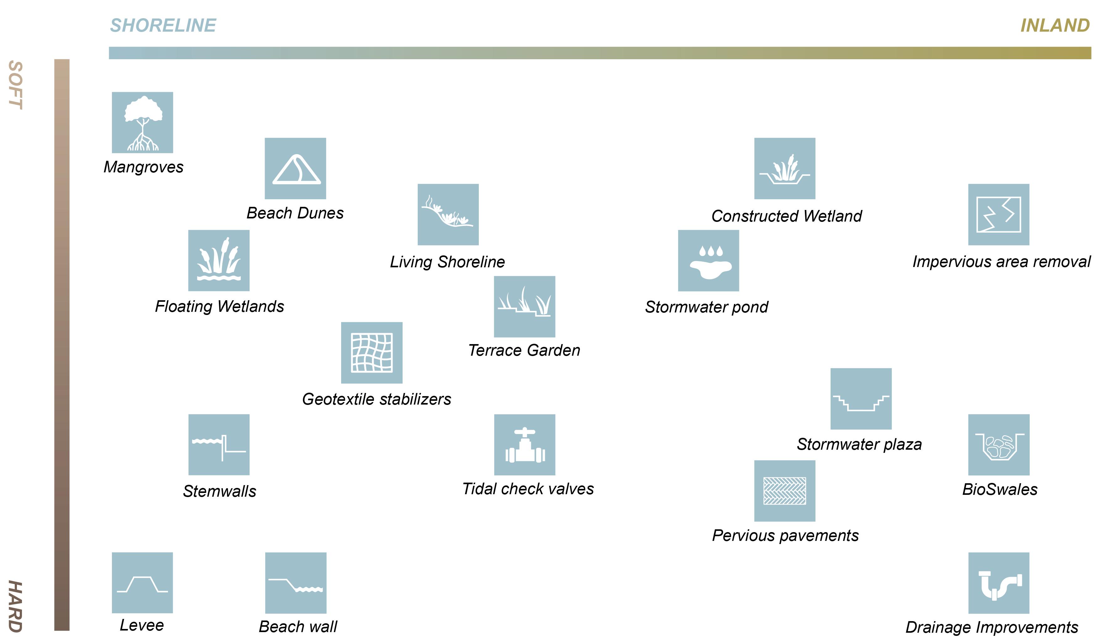
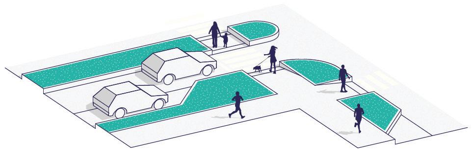
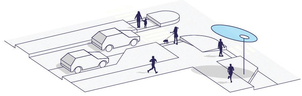
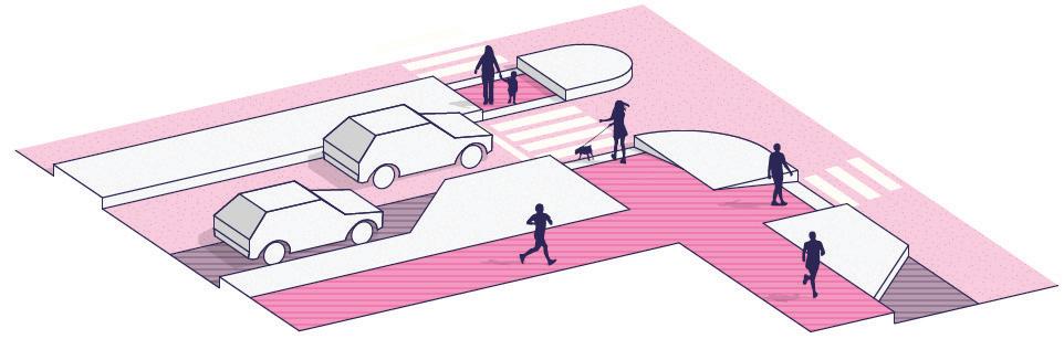
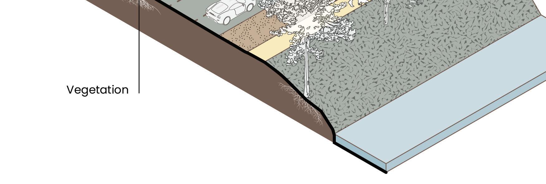
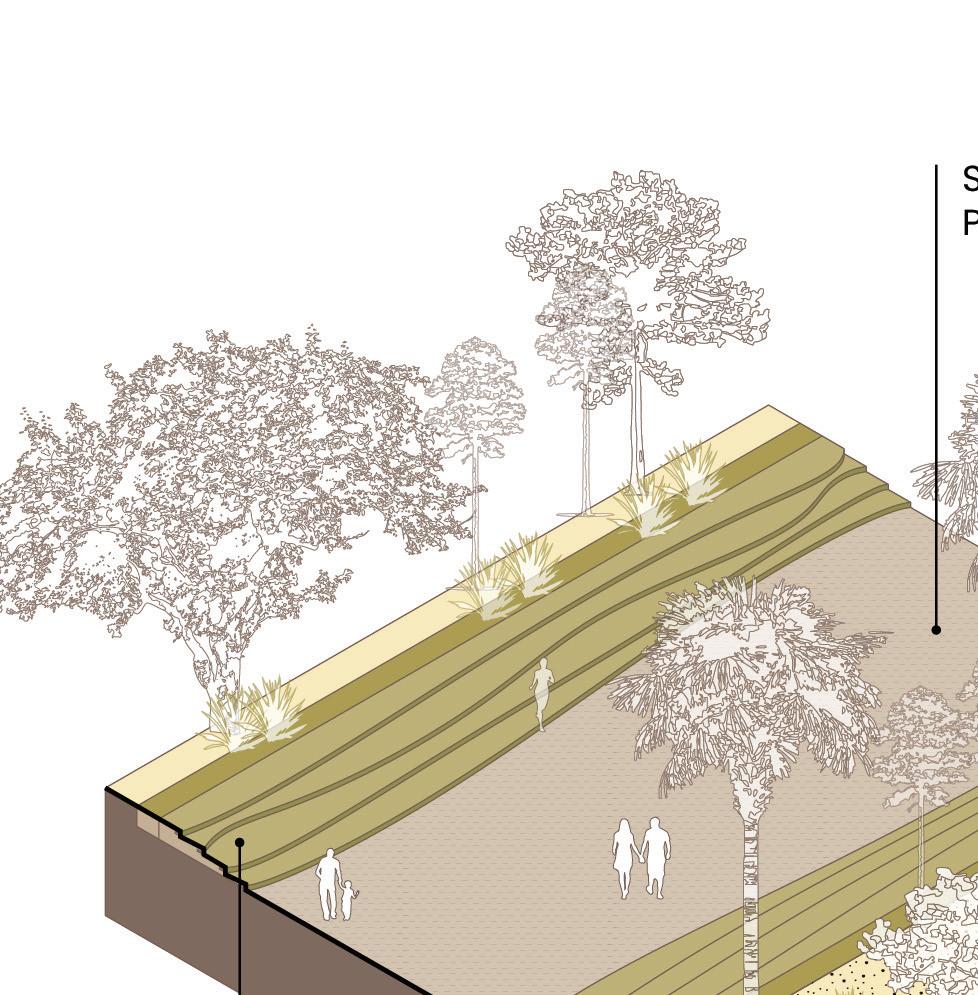
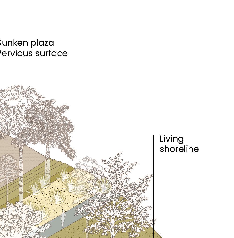
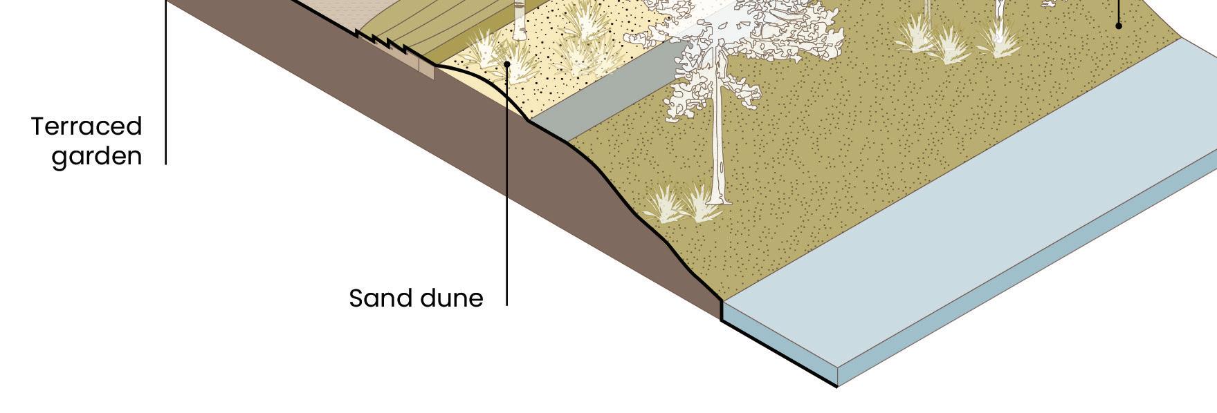
Catalog of adaptation strategies, from hard to soft, and from shoreline to inland.
Kiara Wong, Freya Fu, Romina Cordova
- Dry
Proposed - Dry
Proposed - Dry
Proposed - Dry

Proposed - Flooded

Kiara Wong,
Toolkits: Sea level rise, stormwater, hurricanes
Coastal surge and stormwater adaptation strategies.
Kiara Wong, Freya Fu, Romina Cordova Grados
Proposed - Flooded
Proposed - Flooded
Proposed - Flooded
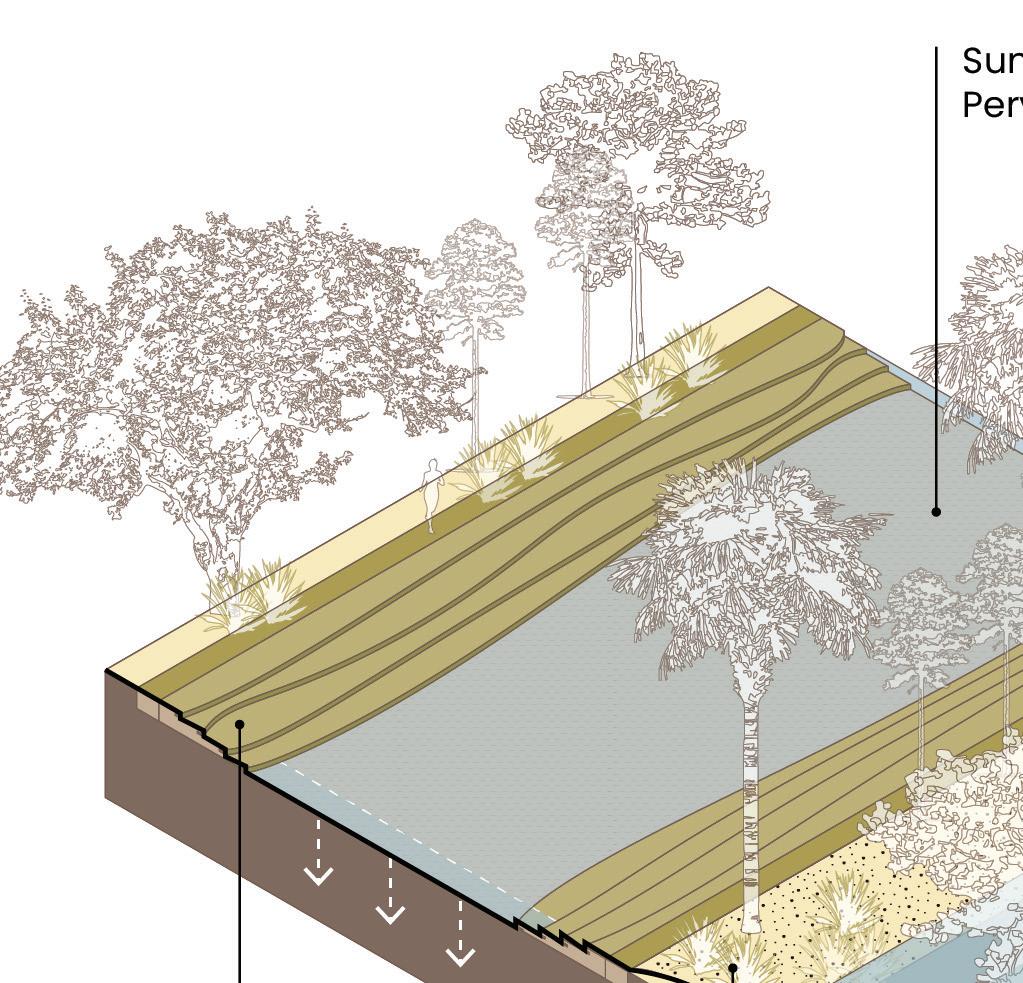
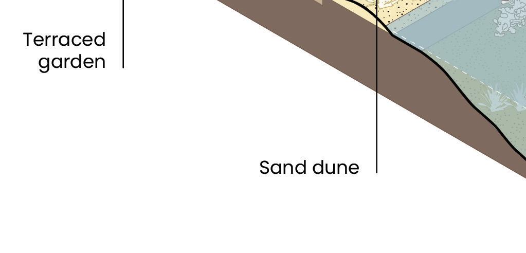
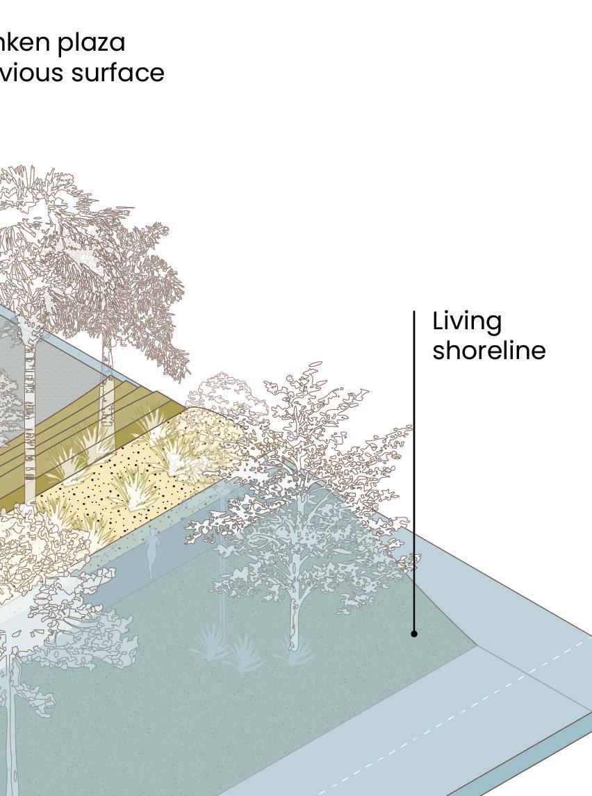


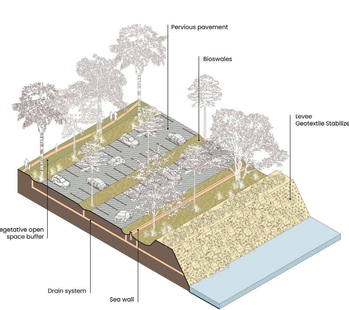
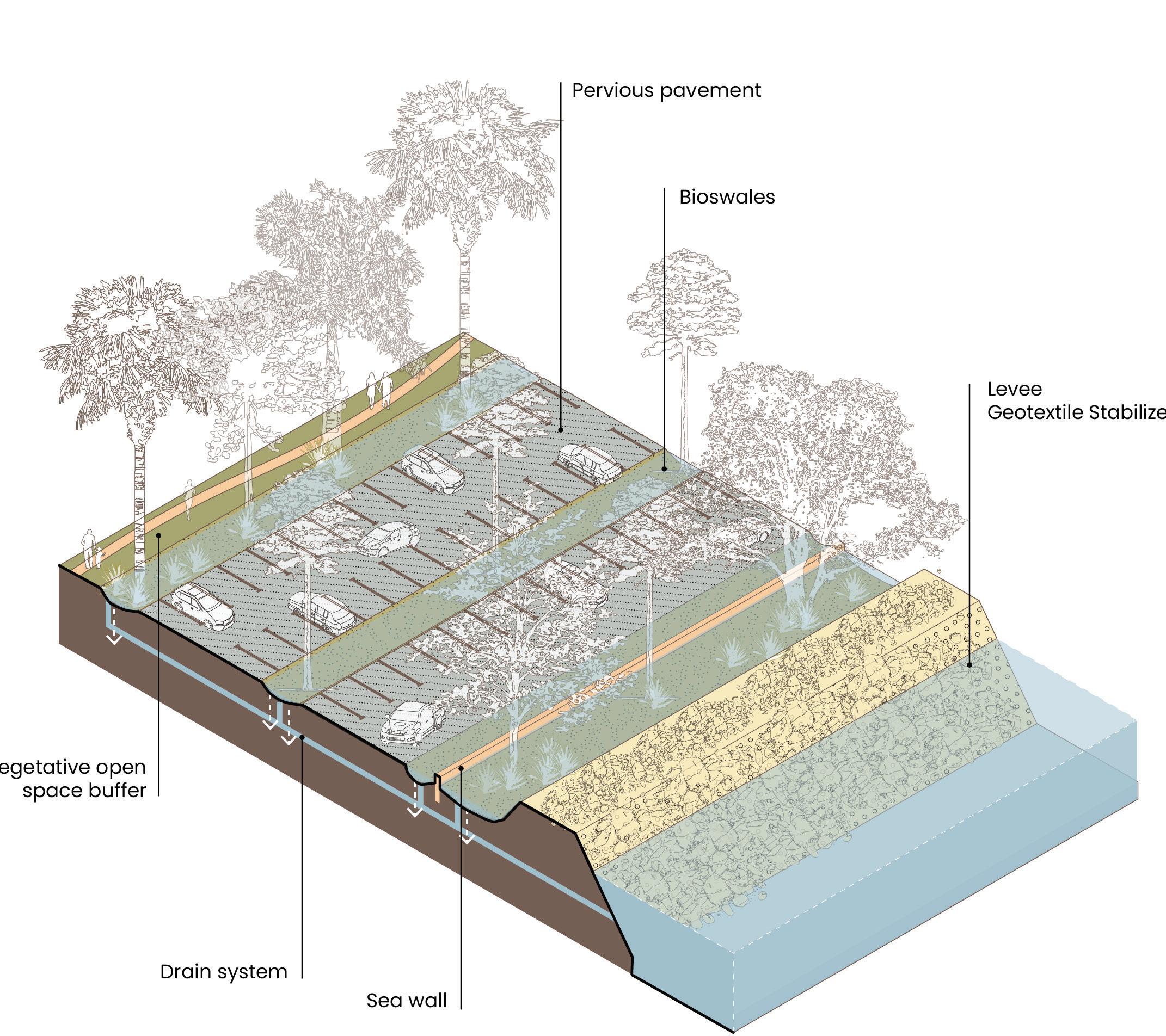
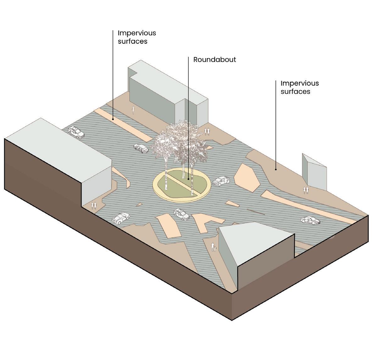
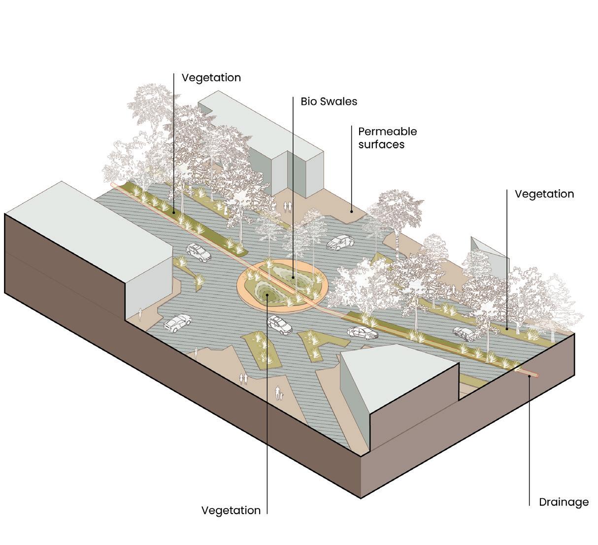
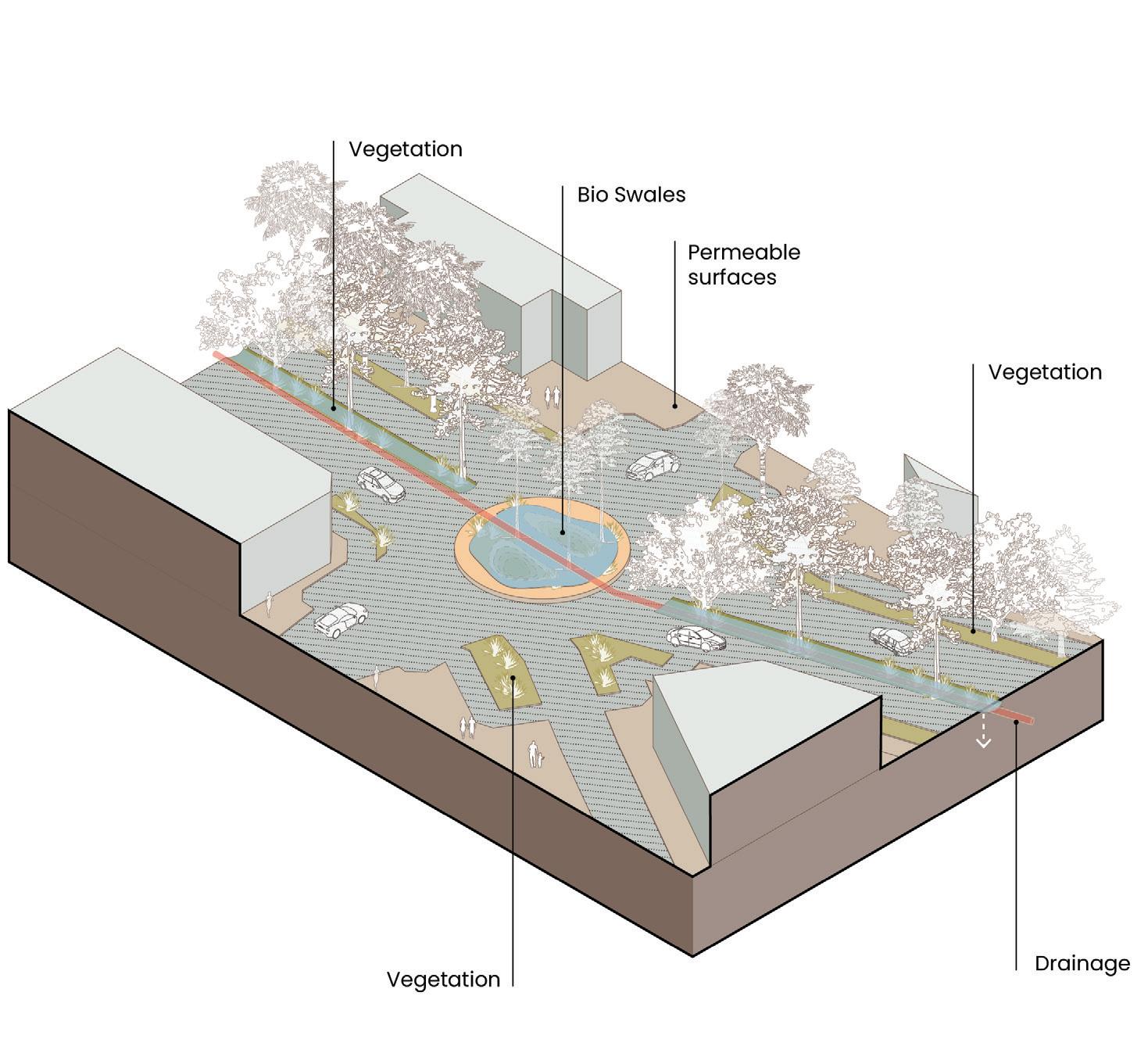
Tidal Check Valves Terraced Gardens Sunken Plaza Pervious pavements Impervious removal Bio Swales Dunes Shoreline
Tidal Check Valves Terraced Gardens Sunken Plaza
Pervious pavements
Impervious removal Bio Swales Sand Dunes Living Shoreline
Freya Fu, Kiara Wong Siu, Romina Cordova Grados
stormwater and hurricanes
Proposed - Dry
Proposed - Dry
Proposed - Flooded
Kiara Wong,
Toolkits: Sea level rise, stormwater, hurricanes
Coastal surge and stormwater adaptation strategies.
Kiara Wong, Freya Fu, Romina Cordova Grados
Proposed - Flooded
Proposed - Flooded
Proposed - Flooded


Freya Fu, Kiara Wong Siu, Romina Cordova Grados
Existing Conditions
- Dry
stormwater and hurricanes

Proposed - Dry
Proposed - Dry
Proposed - Flooded
Kiara Wong,
Toolkits: Sea level rise, stormwater, hurricanes
Kiara Wong, Freya Fu, Romina Cordova Grados
Proposed - Flooded
Proposed - Flooded
Proposed - Flooded


Tidal Check Valves Gardens
Tidal Check Valves
Freya Fu, Kiara Wong Siu, Romina Cordova Grados
Existing Conditions
stormwater and hurricanes
Proposed - Dry
Proposed - Dry
Proposed - Flooded
Kiara Wong,
Toolkits: Sea level rise, stormwater, hurricanes
Kiara Wong, Freya Fu, Romina Cordova Grados
Proposed - Flooded
Proposed - Flooded
Proposed - Flooded


Freya Fu, Kiara Wong Siu, Romina Cordova Grados
Shade and Canopy Cover
Heat, Shade and Canopy Cover
Shade and Canopy Cover


COOL NEIGHBOURHOOD
Rimshi Agrawal, Rilia Li
Heat, Shade and Canopy Cover
Heat vulnerability is best addressed through a multiscalar framework that treats materiality, orientation, and ecological infrastructure as overlapping design levers rather than discrete interventions. By enabling coordinated interventions across the building, neighbourhood, and city scales, this approach supports flexible implementation while amplifying cumulative effects that enhance urban cooling performance.
Heat, Shade and Canopy Cover
and Canopy Cover
Heat,
Shade and Canopy
Heat, Shade and Canopy Cover
Shade and Canopy Cover
Cover
Cover Cool Home: Facade + Roof Strategies
Heat, Shade and Canopy Cover
Cool Home: Facade + Roof Strategies
Cool Home: Facade + Roof Strategies
Cool Home: Facade + Roof Strategies
Rimshi Agrawal, Rilia Li
Rimshi Agrawal, Rilia Li
Rimshi Agrawal, Rilia Li
Rimshi Agrawal, Rilia Li
Rimshi Agrawal, Rilia Li


Existing Conditions
Proposed - Scenario 1
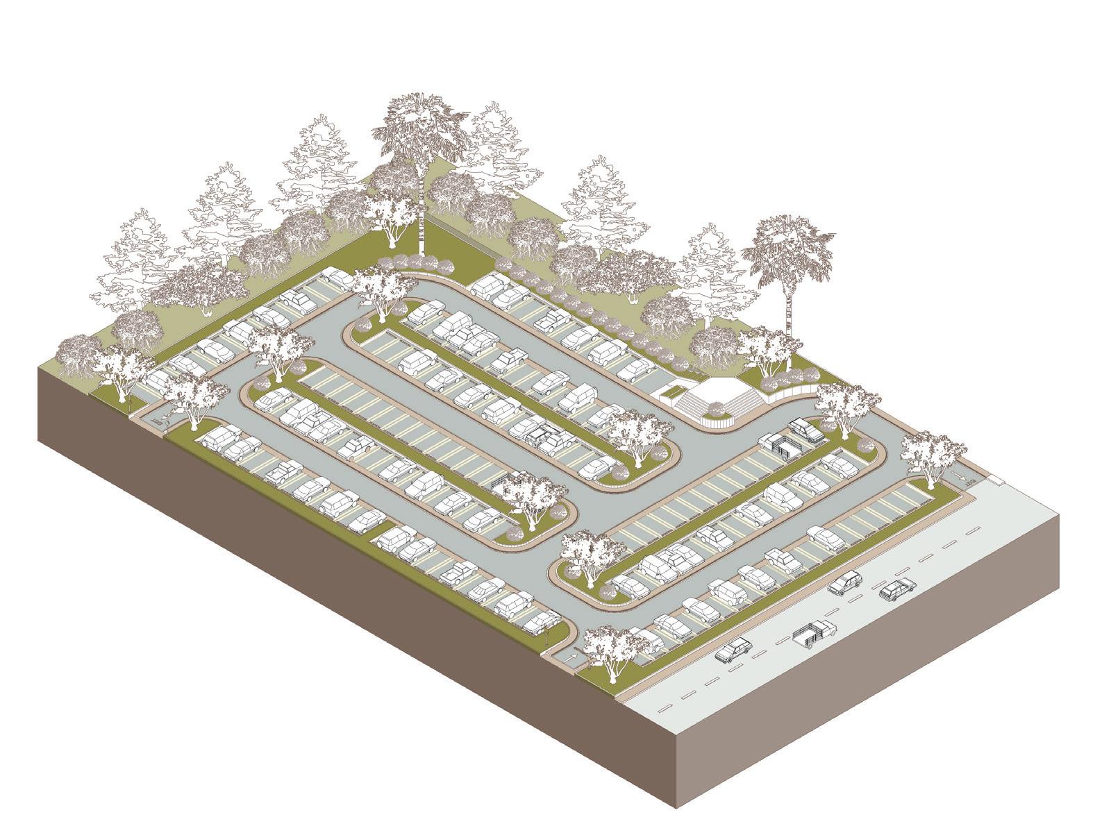
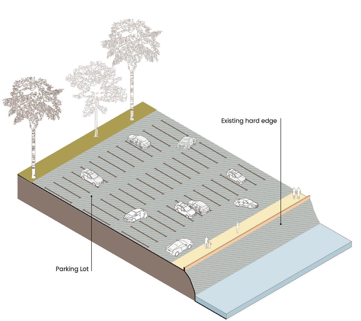
Existing opportunities for intervention were located across the site: expansive asphalt parking fields and impervious surfaces, defined by limited shade and fragmented ecological systems.
In response, the proposal recalibrates surface materiality by introducing permeable treatments and integrating green infrastructure as public space, reducing heatproducing emissions while strengthening habitat continuity
Rimshi
Proposed - Scenario 2
PROPOSED SCENARIO 2
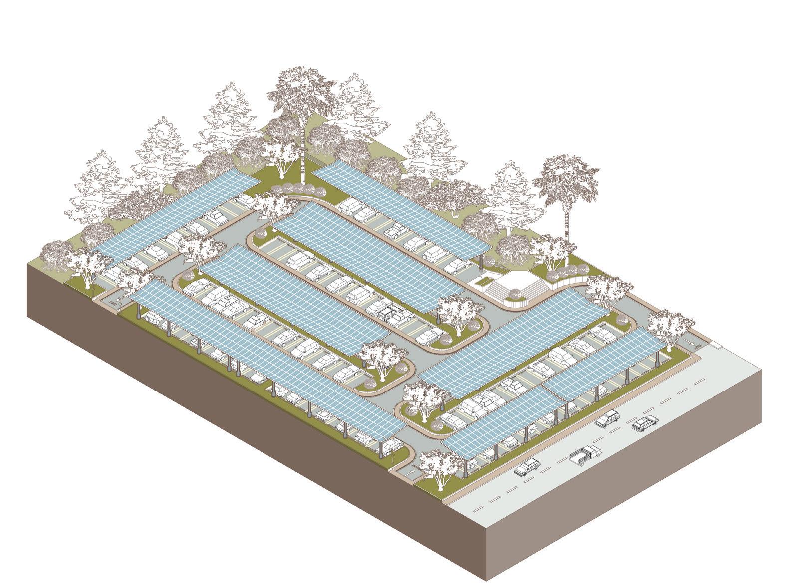
At the overall site scale, these asphalt parking fields are reconceived as permeable landscapes shaded by solar canopies. These interventions couple thermal mitigation with energy production, transforming heat-intensive areas into infrastructural landscapes that simultaneously cool, generate power, and restructure the public domain.
and Canopy
Biodiversity
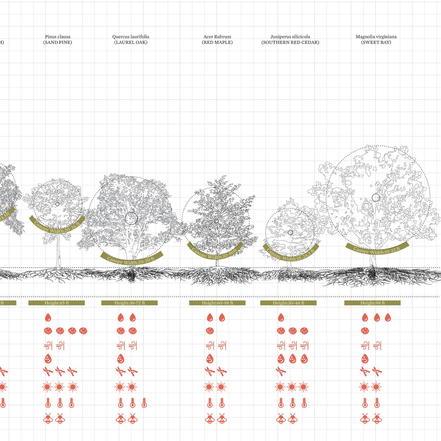
Yushuo Ding Esther Li
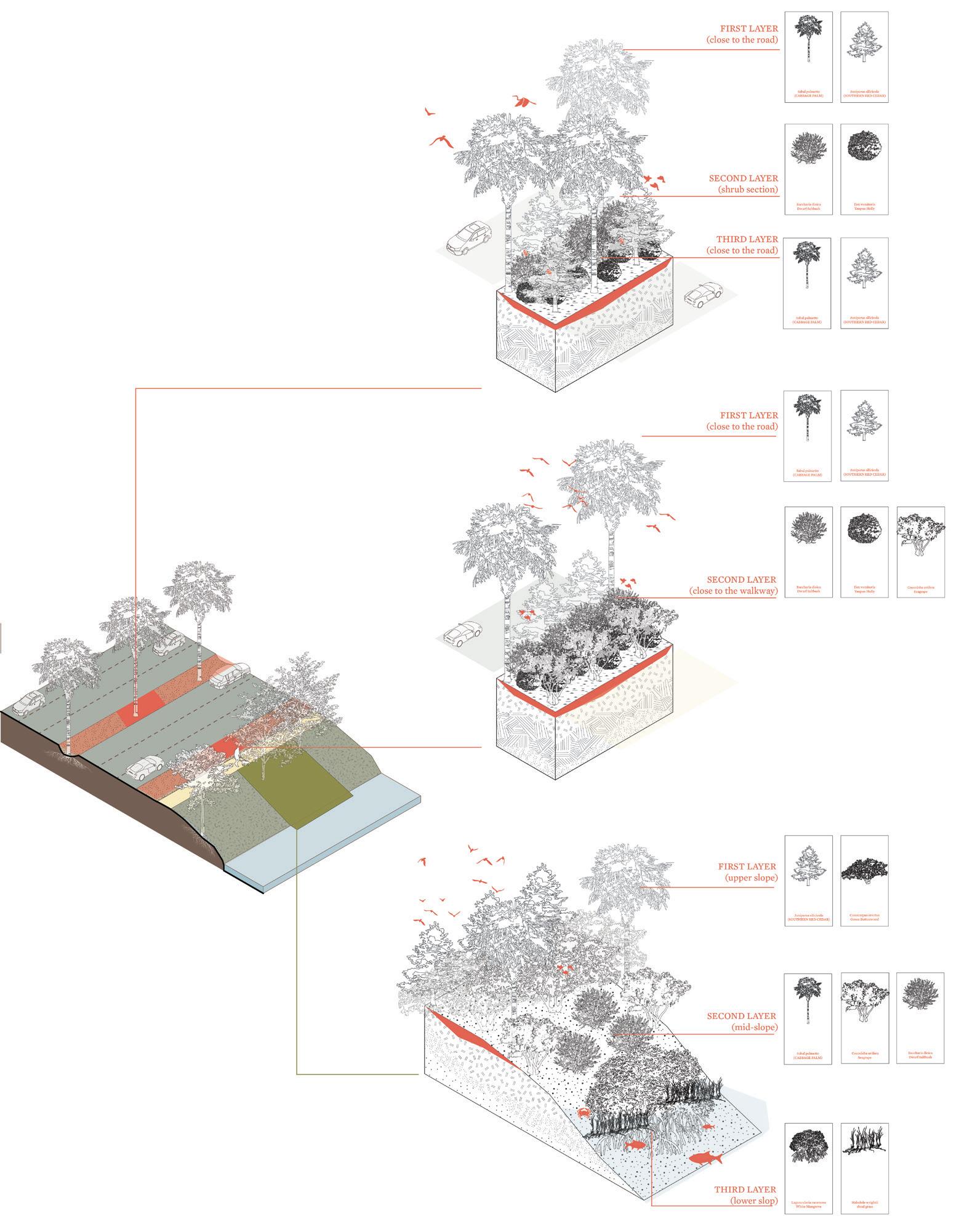
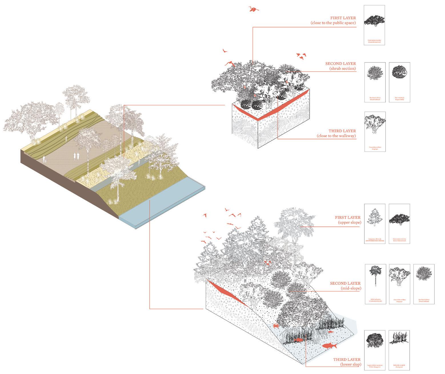
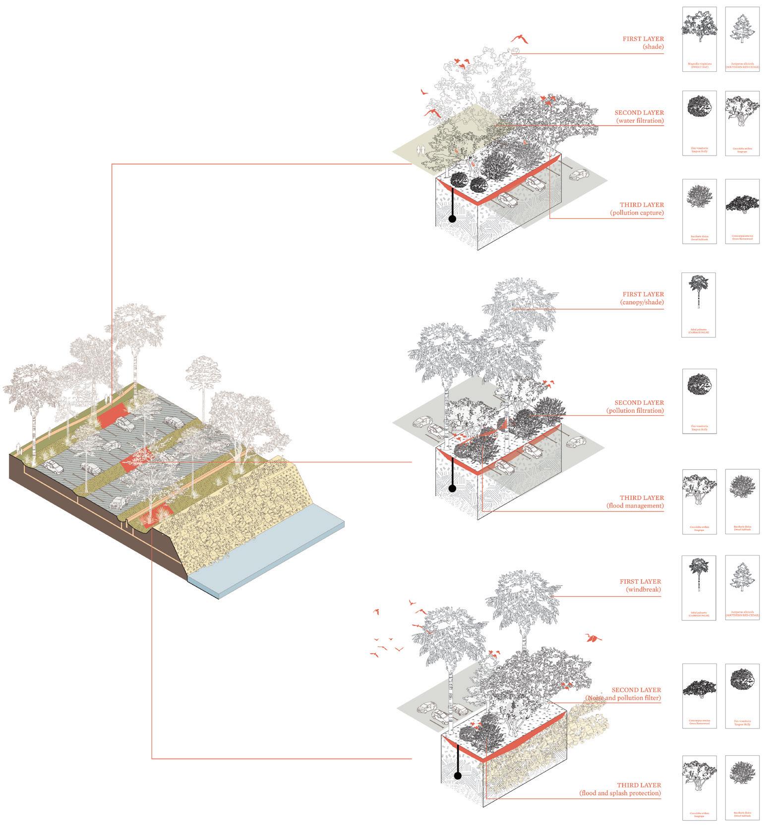
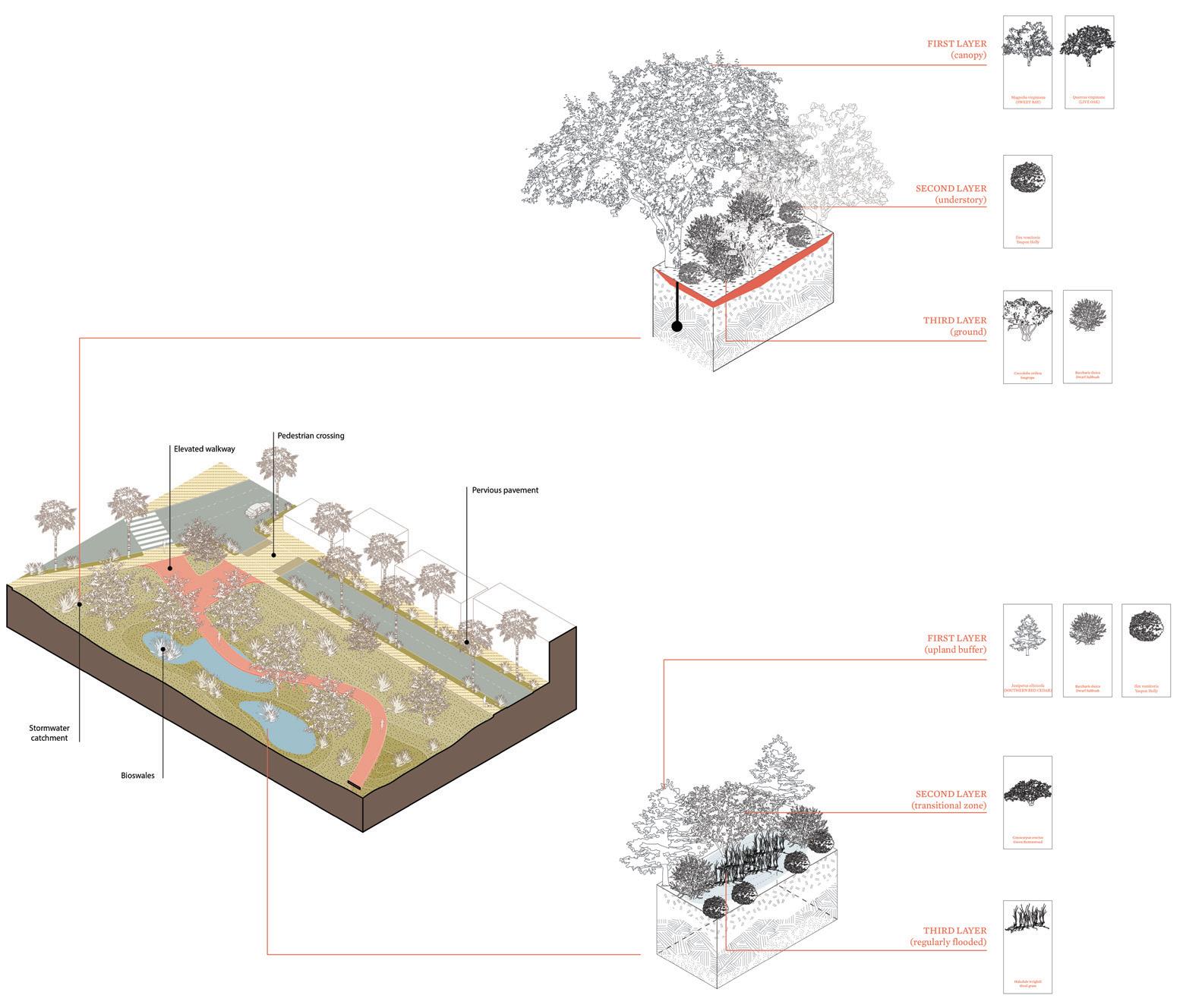
The plant inventory was organized based on eight criteria: water requirement, drought tolerance, wind resilience, salt tolerance, maintenance needs, sun exposure, temperature adaptability, and wildlife support. For each species, the average spread of root systems, canopy width, and mature height was documented.
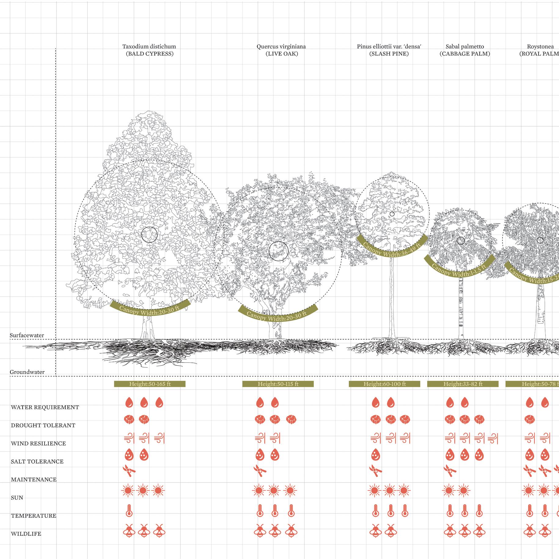
These metrics were selected to support strategic placement, positioning plants where they can enhance comfort, improve microclimates, or provide protection against extreme weather in the bayfront. For example, species with higher salt tolerance are logically sited closer to the shoreline, where they may be exposed to wave surge. This inventory aimed to lay a clear foundation for the Planting Strategy section that follows.
Yushuo Ding, Esther
Yushuo Ding, Esther
Lyna Boulgamh
Wang
Neighborhood Activation: “Friends of the Bayfront”
Allen
Invite residents in nearby condos and residences to join Friends of the Bayfront, a grassroots organization that schedules recurring activities to beautify and conserve the Bayfront while hosting a plethora of community-oriented programming.
Implementation considerations:
Well-connected members of the community should take on leadership roles to engage friends, family, and neighbors. Connect with condominium associations and other local homeowners’ associations for a source of funding and outreach.
Leverage reciprocal benefits in creating a livelier place to live, thus driving up property value. The organization would largely run on volunteers, but could encourage its members to make monetary donations to cover operational costs and the purchases of new assets. Due to the large proportion of snowbirds in the area around the Bayfront, the organization may be more active during the winter and spring when there are more residents in town.
Lyna Boulgamh, Allen Wang
Sarasota City Code: Resilience Amendments
Front page of the Sarasota City Code, on the Municode platform:
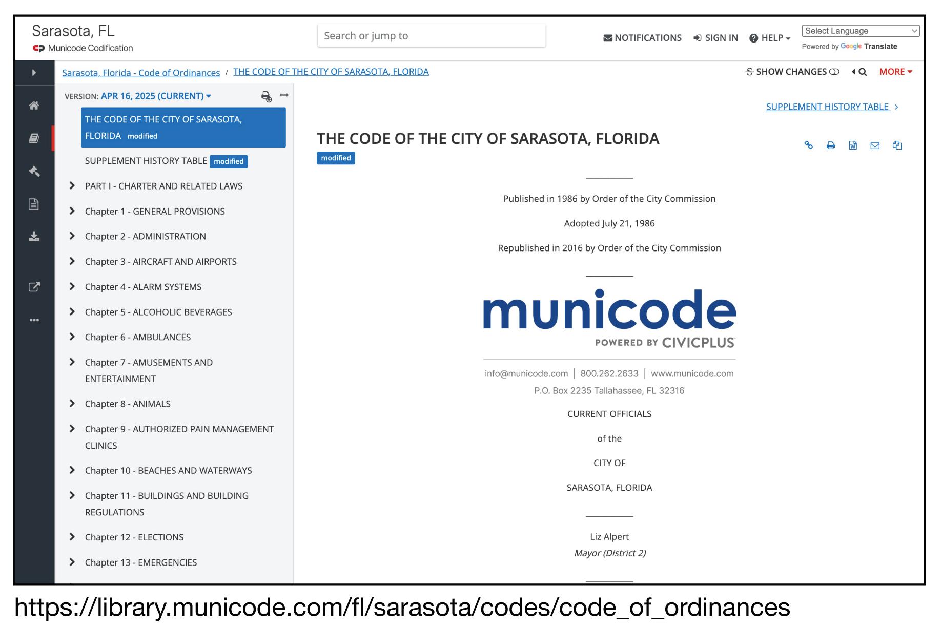
Relevant Chapters
Chapter 10 - Beaches and Waterways - Coastal resilience, habitats
Chapter 11 - Buildings and Building Regulations - Coastal resilience, habitats
Chapter 22 - Parks and Recreation- Coastal resilience, habitats
Chapter 24 - Personnel
Chapter 25 - Planning
Chapter 29.5 - Site Improvements—Engineering Design CriteriaShade & accessibility
Chapter 30 - Streets, Sidewalks and Other Public Places- Coastal resilience, habitats
Chapter 31 - Taxation - Funding for initiatives
Chapter 33 - Traffic and Motor Vehicles
Chapter 35 - Vegetation- Mangroves and urban canopy
Chapter 37 - Water and Sewers - Storm/flood management
Chapter 38 - Zoning - Setbacks, density
Excerpts from the Engineering Design Criteria (Chapter 29.5):
The Sarasota City Code lays out in axiomatic terms the underlying governance structure of the City of Sarasota. Many items in the other toolkits (water, heat, wildlife, etc.) can be implemented through modifications to the City Code and its related documents, such as the Zoning Code and the recentlyrevised Engineering Design Criteria Manual.
Key tenets to guide revisions:
Data-driven decision-making: incorporate clauses to reference the latest charts on flood risk, sea level rise, urban heat island, etc. during decisions and amendment processes. Stricter requirements: ensure elements meet higher baseline standards around safety and ecology. Scoring systems for resiliency: develop a rubric to evaluate new and existing developments; require a minimum score. Harmonized planning: align requirements with those of adjacent municipalities (e.g., Bradenton, Venice) to avoid discontinuities in large-scale projects.
Lyna Boulgamh, Allen Wang
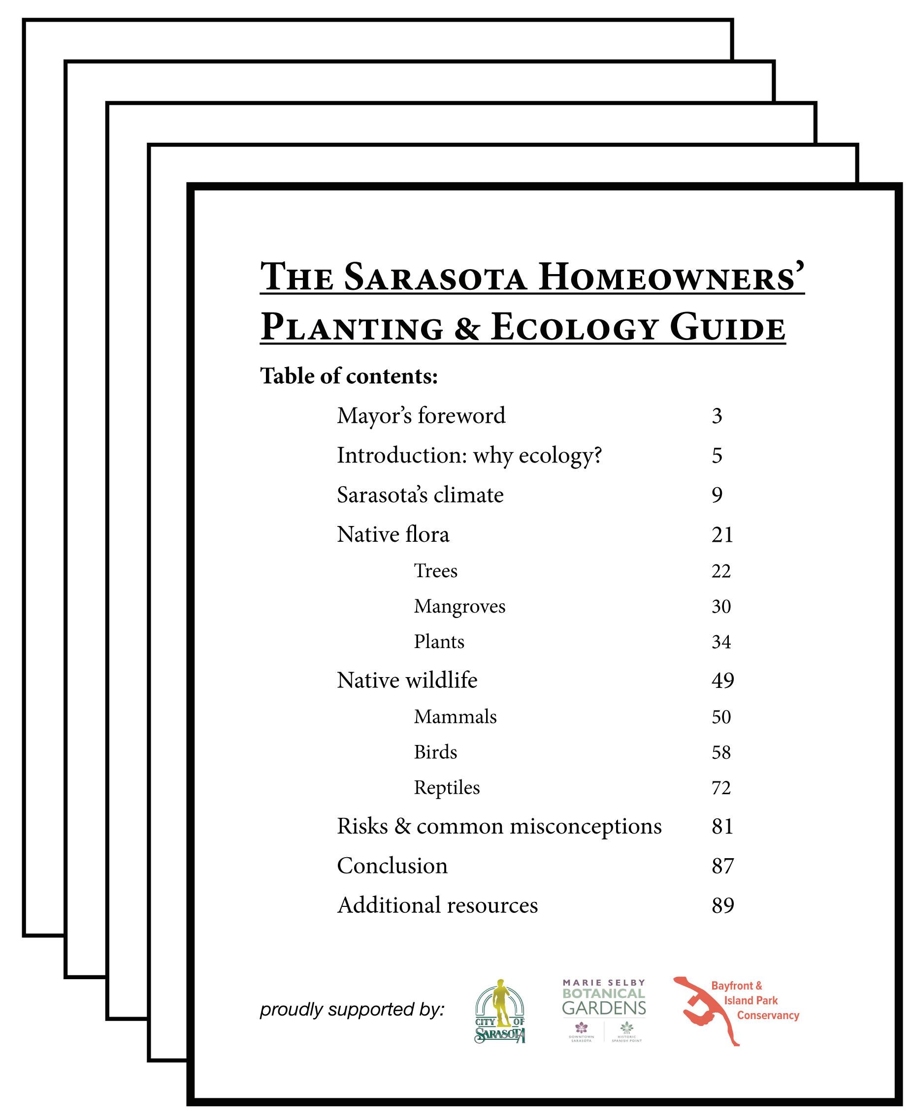
Sarasota Homeowners’
Planting & Ecology
Guide
Sample print layout and table of contents:
Sample page layout and information:
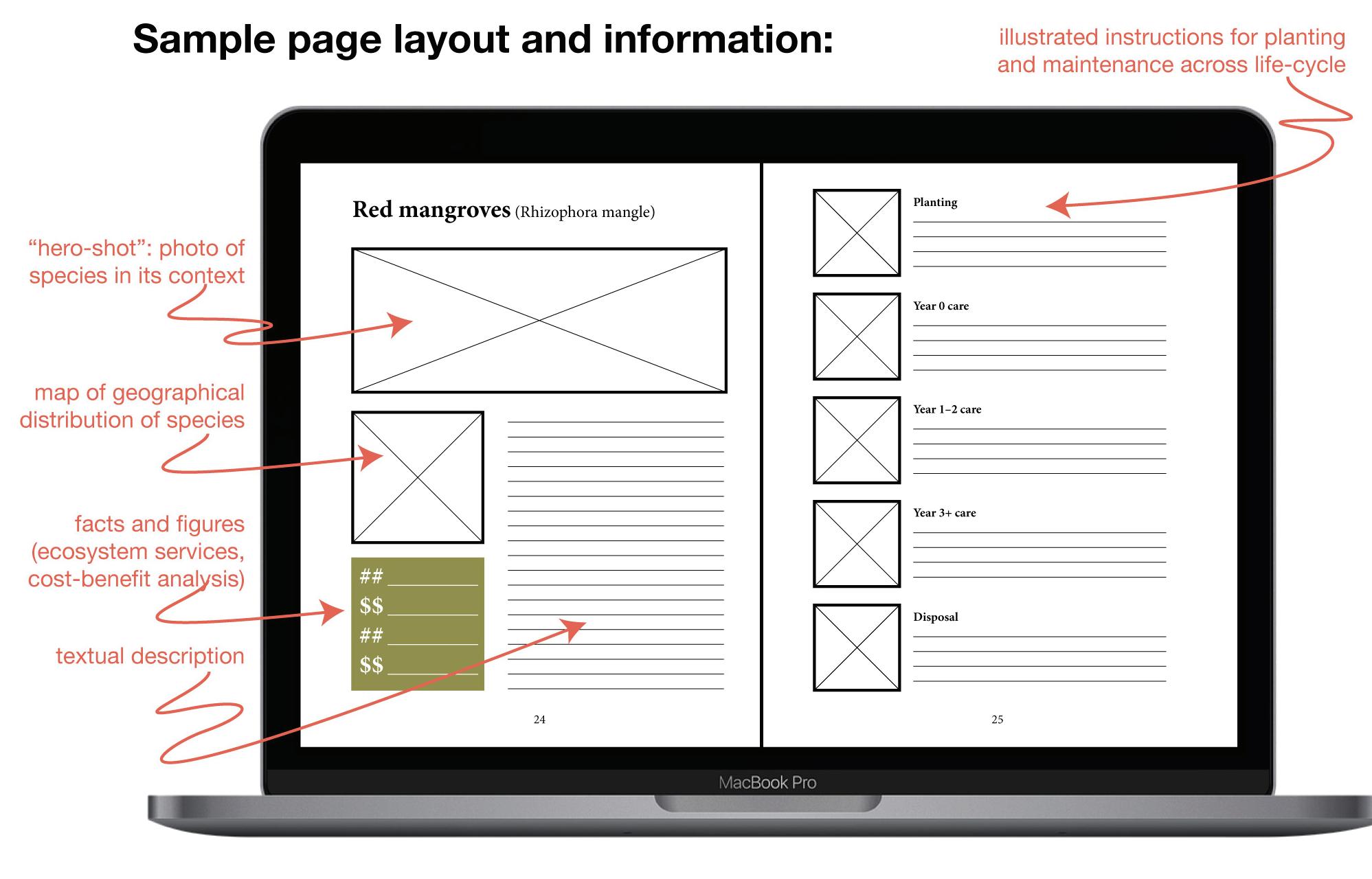
Target audiences:

Create a user-friendly guide to the native flora and fauna of Sarasota’s Bayfront to help local designers, developers, and residents make more ecologically informed choices. Because native plants are better-adapted to local soils and climate, they tend to thrive better than non-native species. Furthermore, the guide should help locals account for local wildlife to avoid harming them. The guide should be available in both printed and electronic formats to maximize accessibility and usability.
Lyna
Boulgamh, Allen Wang
Comprehensive Planning: Road
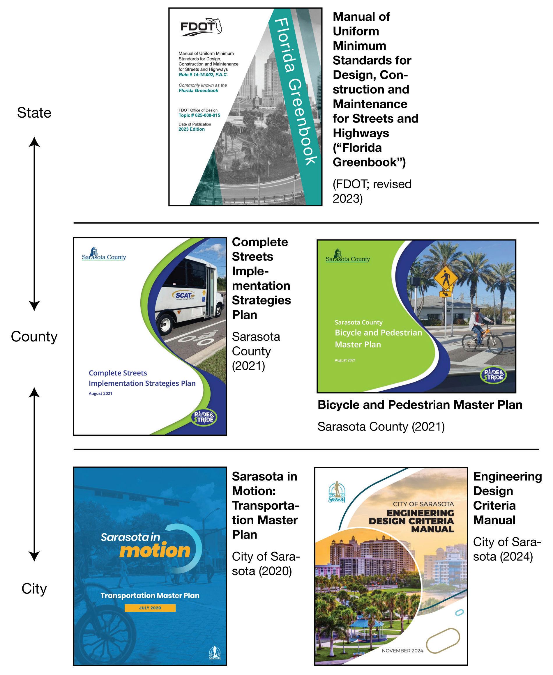
Incorporate best-practices described in the water, heat, and wildlife toolkits into planning practices and engineering standards at the City, County, and State levels. Resolve standards that are overlapping or competing. This will ensure the relevant stakeholders are aware of them and are fully supported in implementing them—both from a policy perspective and from a design perspective.
General principles to inform revisions:
Harmonization: elevating streets and sidewalks while smoothing the transition with adjacent private properties to mitigate flooding risks.
Accessibility: improving public spaces (e.g., pedestrian sidewalks and crossings, especially at roundabouts) following standards prescribed in the Americans with Disabilities Act (ADA).
Motorists last: applying Complete Streets principles to improve usability and convenience for pedestrians, cyclists, and public transit users.
Safety first: achieving “Vision Zero” through strategies that increase road safety, especially at intersections.
Nature as a stakeholder: making considerations for how animals use and live in streets, such as turtle crossings to get to the ocean.
Lyna Boulgamh, Allen Wang
Decision - Making with Hydrodynamic Model Data
Digital visualization via web dashboard (mockup image)

Engage hydrological engineers to develop detailed projections around sea level rise and flood risks based on hydrodynamic physical simulations, which are more precise (but also more complicated and thus costly) than existing FEMA methods. Use this improved data as the basis for all future decision-making around coastal resilience. Disseminate it widely through a public dashboard or website.
The model should have some or all of the following features (identified with reference to the Woods Hole Group’s coastal modelling work in Boston):

Be high resolution (e.g., a 3–7m overland grid) to inform parcel-by-parcel decision-making.
Aggregate data probabilistically across hundreds or thousands of historical storms, rather than selecting a single “representative” storm.
Include physical simulation: model the forces and how they interact with natural barriers, landscape features, and elevation changes.
Account for climate change’s impact on worsening the severity and frequency of storms, potentially through multiple emissions scenarios.
Go beyond still-water simulations; account for wave forces and high winds creating crests that could intermittently splash over barriers. Account for anomalies like king tides and microbursts.
Outputs should include: flood probability, flood depth, flood duration, flood volumes, flood pathways (including backflooding), winds, waves, and currents.
Lyna Boulgamh, Allen Wang
Adaptation Action Areas
Potential Adaptation Action Areas near Downtown Sarasota:
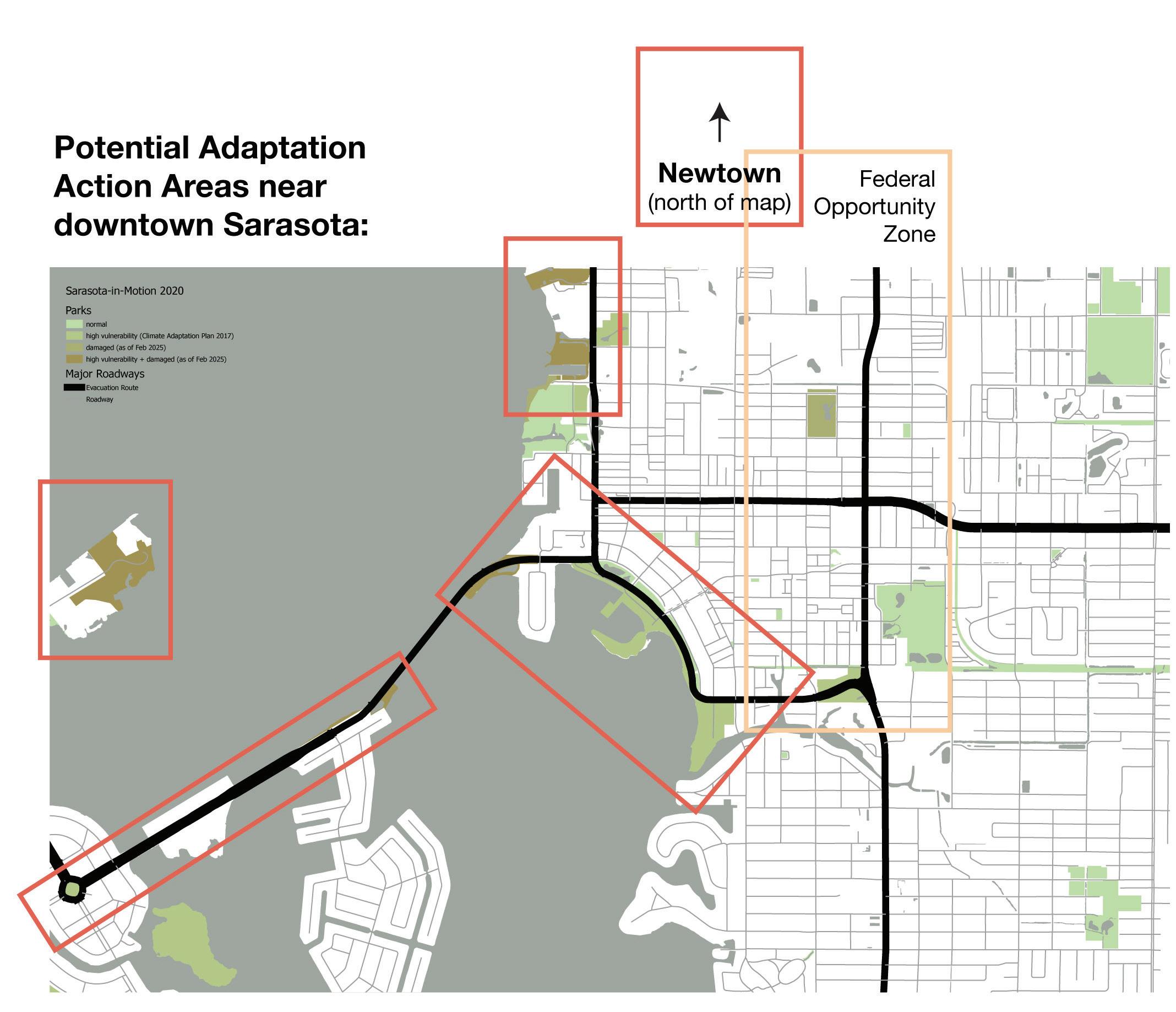
Identify areas of heightened climate risk due to heat, water, or other hazards. Allocate funding to homeowners for identifying, designing, and implementing adaptations against these issues— for example, drainage, flood control, tree planting. Alternative titles: Coastal Resilience Overlay Zones, Climate Risk Assessment Program.
Potential criteria for determining an Adaptation Action Area: Damage from recent hurricanes and tropical storms.
1 2 3 4 5 1 2 3 4
Location in an area at risk of sea level rise or stormwater damage, based on projections.
Location in an area deemed at high risk of heat vulnerability. Proximity to sites and buildings of cultural or historic importance.
High proportion of residents from underserved demographics.
Potential resources available for owners in Adaptation Action Areas:
Design consultations to assess risk and identify feasible interventions to mitigate risk.
Disaster insurance at government-subsidized rates. Reimbursements available for risk mitigations, including waterproofing, elevating buildings, bioswales, tree planting, etc.
Property buy-back program at market rates to encourage relocating to areas of lower climate vulnerability.
Regional Planning: Resiliency Compacts
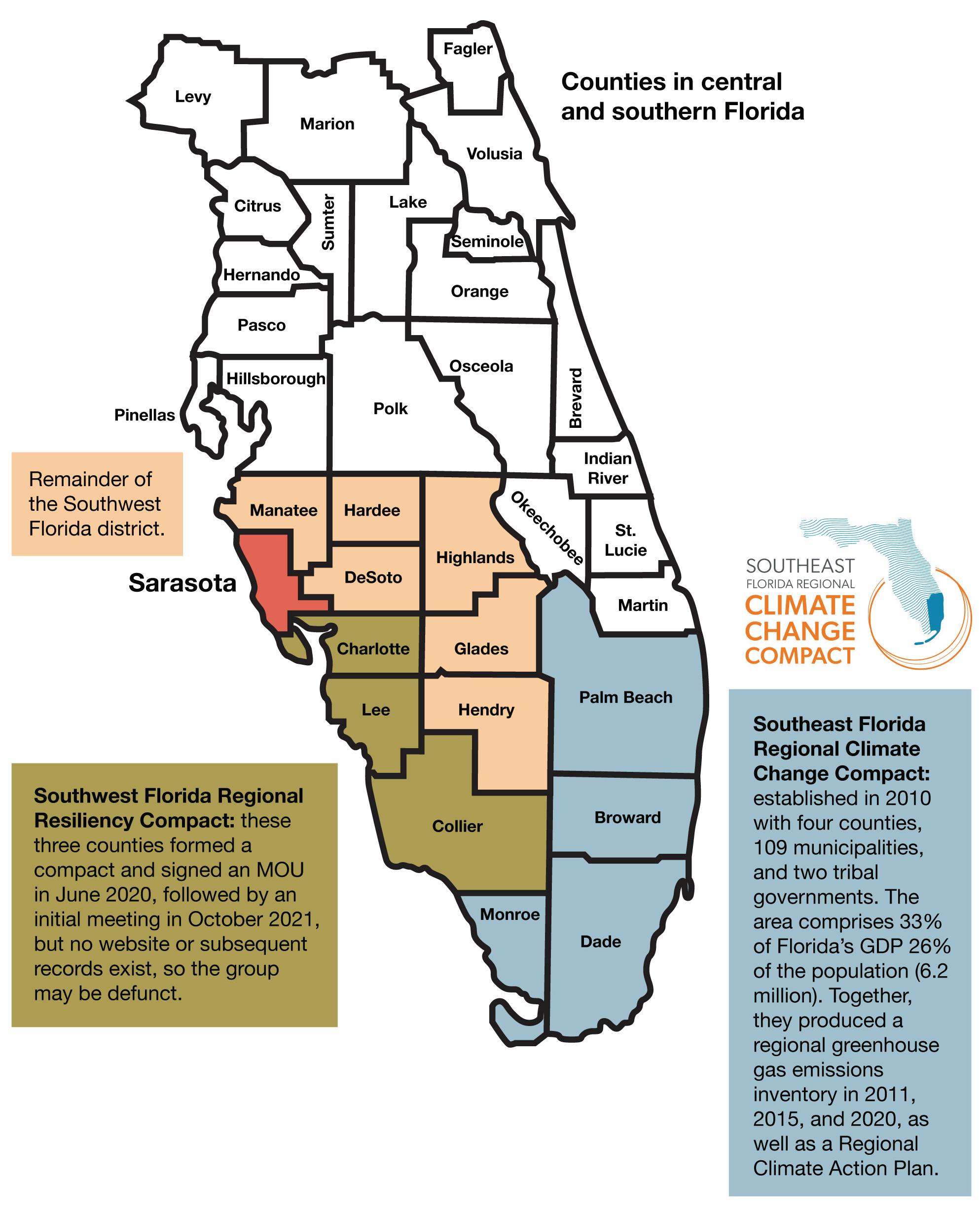
Build partnerships at the regional level to pool resources and align on common standards and projections with other counties and municipalities that share ecological conditions (e.g., climate, watersheds, wildlife), cultural values, and economic characteristics with Sarasota.
Follow the lead of the four counties in Southeast Florida who have already established a Regional Climate Change Compact. Sarasota County and Manatee County could align with the Southwest Florida Regional Resiliency Compact, which consists of the three counties to the south but appears to be defunct. Sarasota County could take the lead in revitalizing this association, in the wake of the recent storms, to develop a shared view of sea level rise projections—and how to mitigate them in regionally-appropriate ways.
Lyna Boulgamh, Allen Wang
Park Conservancy Model (Public-Private Partnership)
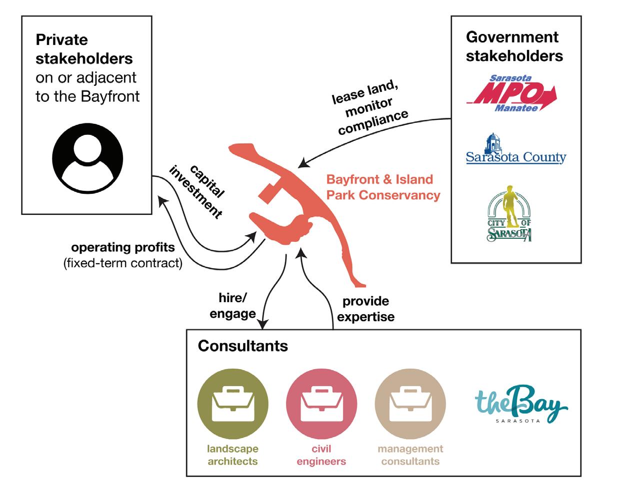
Establish the Bayfront & Island Park Conservancy as a new non-profit organization established to steward the development and maintenance of Sarasota’s Bayfront. It runs daily operations and engages designers and consultants to help improve the Bayfront. Modelled after The Bay Conservancy, the BIPC is led by a board consisting of representatives from the private sector, local residents, non-profits, and city officials.
In a public-private partnership, the government enters into a memorandum where the private sector is given permission to develop and manage an enterprise. The private sector assumes some risk on their investment; in exchange, they are entitled to some portion of the potential profits—especially if they can leverage their agility to run a profitable operation. Meanwhile, the government is able to deliver a public benefit in a shorter timeframe without bearing the full cost of the investment.
Chief Climate & Resilience Officer
Potential placements in the City of Sarasota’s organizational chart
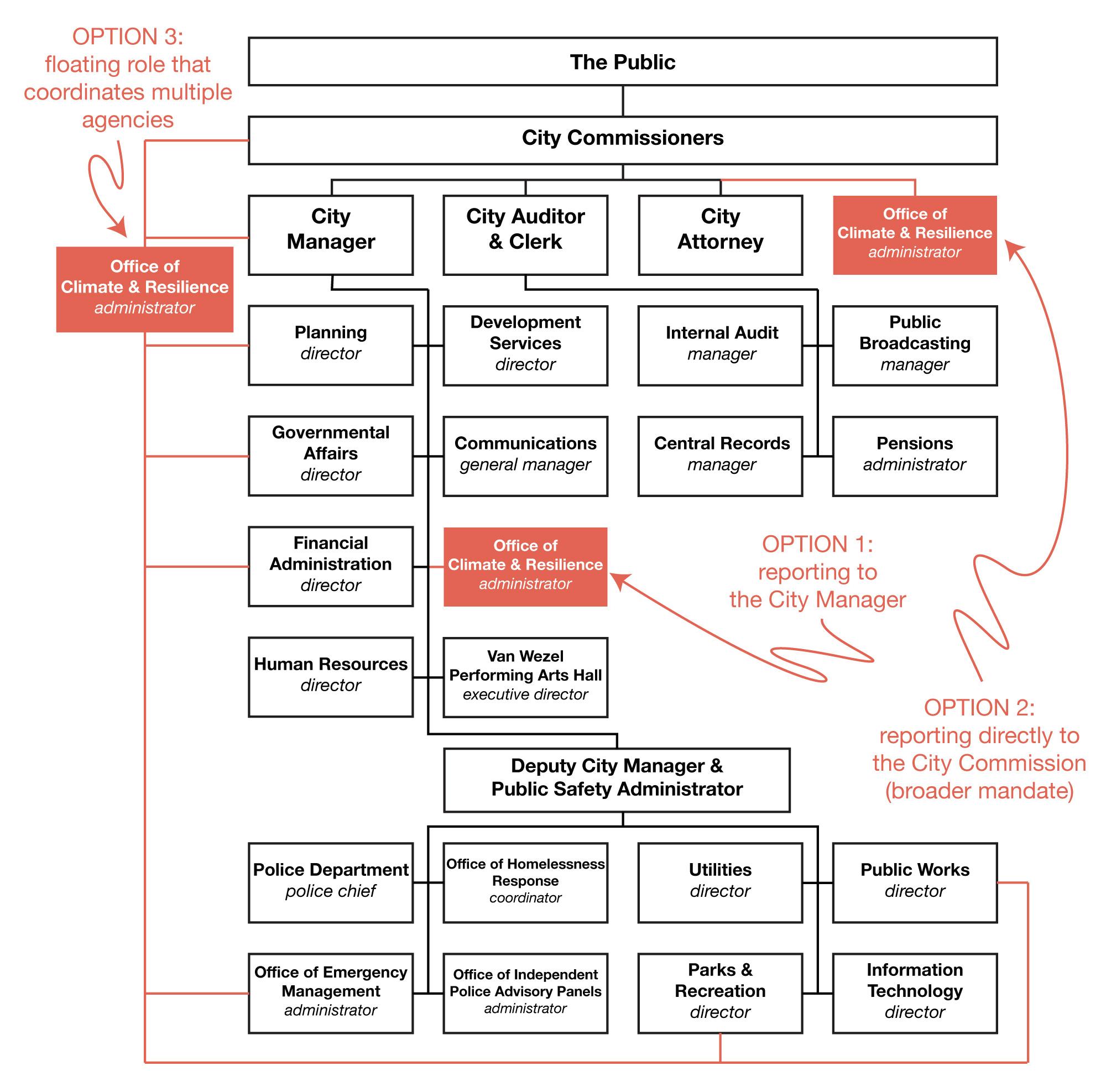
Create a new role at the City or County level dedicated to advancing Sarasota’s climate resilience agenda. This position would coordinate with community and government stakeholders to shape policy, integrate a climate lens into initiatives, and implement adaptation measures (including those in this toolkit). Establishing such a role would also signal the city’s commitment to addressing this urgent issue.
Proposed Duties:
Lead the development and execution of climate and resilience strategies across short, medium, and long-term timescales.
Implement adaptation plans in response to climate change and extreme weather hazards.
Build partnerships and align goals with state, federal, and international priorities.
Engage communities, employees, and partners through communication, training, and negotiation.
Oversee a Climate Resilience Task Force and manage resources toward sustainability goals.
Report regularly to City Council and other stakeholders.
Proposed Qualifications:
Graduate degree in public administration, environmental science, or related fields.
10+ years’ leadership experience in climate resilience or sustainability, ideally in city government or nonprofits.
Expertise in scenario planning, analytics, sustainability reporting, project management, and communication.
Knowledge of climate, environment, health, flooding, and sea level rise policy and regulation.
Proven ability to lead teams, manage budgets, and secure funding.
Certifications like PMP or LEED AP preferred.
Precedents:
Chief Resilience Officer (Houston), Chief Climate Officer (Boston, Cambridge), Chief Heat Officer (Miami-Dade), Climate Director (King County), Climate Chief (Massachusetts).
Climate Resilience Tiger Team
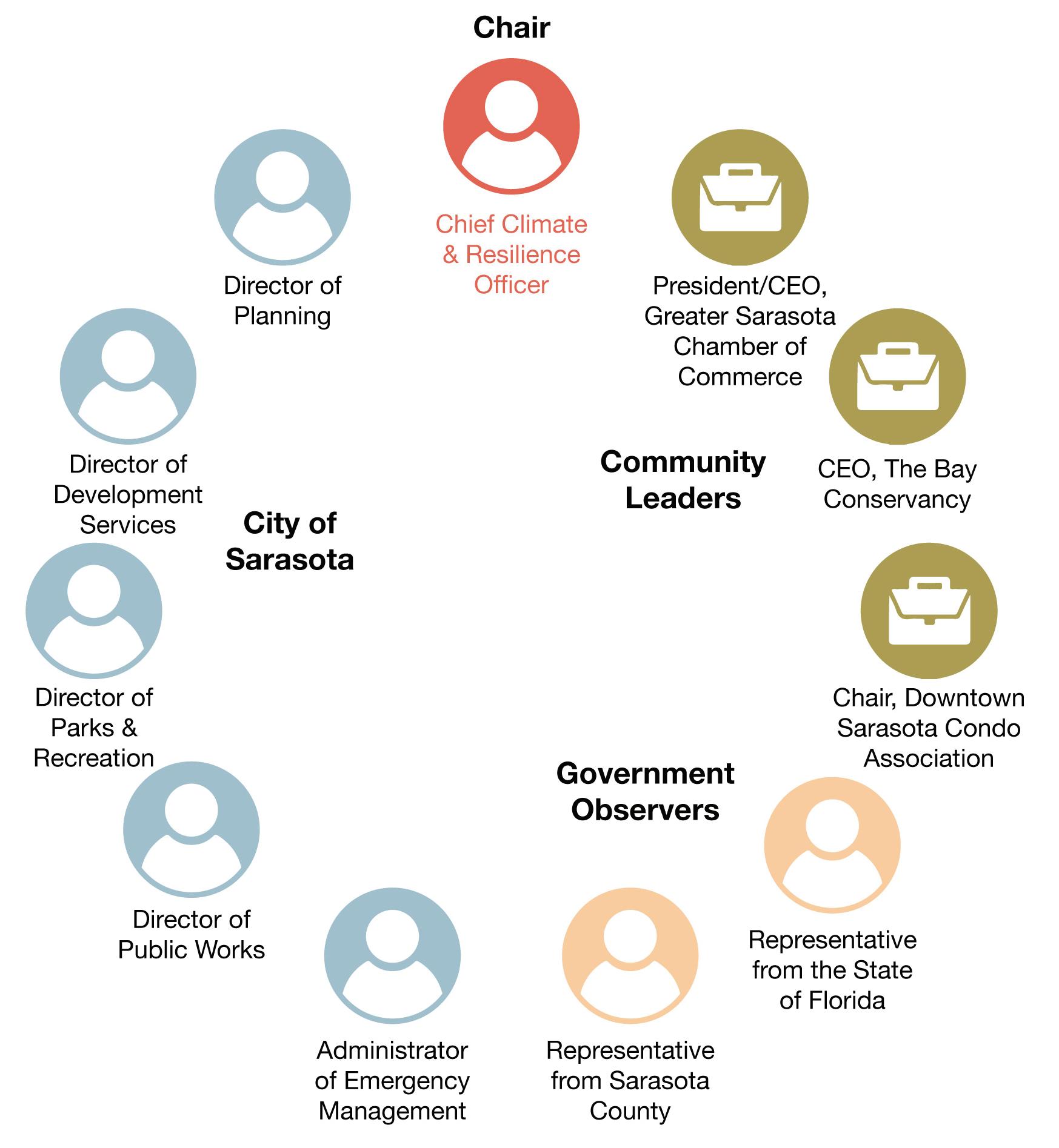
Convene a task force on climate resilience comprising key stakeholders from Sarasota, including heads of relevant city departments, community leaders, and observers from other levels of government. This multidisciplinary team will meet on a regular basis to ideate and coordinate the implementation of initiatives to address climate resilience topics.
Consider leveraging influential and well-connected residents to assist with recruitment. Recruiting from a variety of sectors, including the private sector, will diversify the available capital and soft capital (i.e., networks of influence) for the group. Also account for diverse representation of minority and specialinterest groups (race, religion, income, veterans, persons with disabilities, etc.) to enrich the tiger team’s decision-making with a wide gamut of lived experiences, ensuring a more holistic and inclusive result.


Integrated Strategies


Shoreline Climate Adaptation
2100 Sea Level Rise
High: 7ft
Intermediate High: 5ft
Intermediate: 3.5ft
Intermediaete low: 2ft Biodiversity, storm surge, and wave


Syringodium filiforme
MANATEE GRASS Centropomus undecimalis
SNOOK FISH
Trichechus Manatus
WEST INDIAN MANATEE
Sciaenops RED
Thalassia testudinum TURTLE GRASS
SHARP-TAILED SPARROWS


Ammodramus caudacutus
Rhizophora mangle
RED MANGROVE
Laguncularia racemosa
WHITE MANGROVE
Sciaenops Ocellatus
RED DRUM
Ardea Alba
GREAT EGRET
Spartina alterniflora SMOOTH CORDGRASS
Caretta caretta LOGGERHEAD SEA TURTLE
Haematopus palliatus AMERICAN OYSTERCATCHER
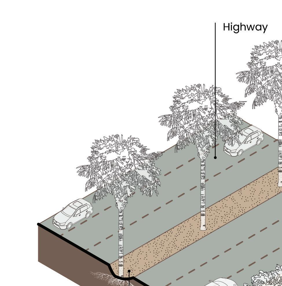
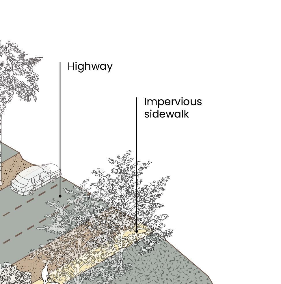
Shoreline Public Parking Reduction of Impervious Surfaces
2100 Sea Level Rise
High: 7ft
Intermediate High: 5ft
Intermediate: 3.5ft
Intermediaete low: 2ft
2% Sloped Road
Tree Canopy Shade
Porous Grass Pavers
Coccoloba uvifera
SEAGRAPE
Mimus polyglottos
NORTHERN MOCKINGBIRD
Sabal palmetto
CABBAGE PALM
Serenoa Repens SAW PALMETTO
BioSwale
Porous Grass Pavers
Callophrys Gryneus
JUNIPER HAIRSTREAK BUTTERFLY
Conocarpus Erectus
GREEN BUTTONWOOD
Baccharis dioica
DWARF SALTBUSH
Lasiurus Seminolus
SEMINOLE BAT
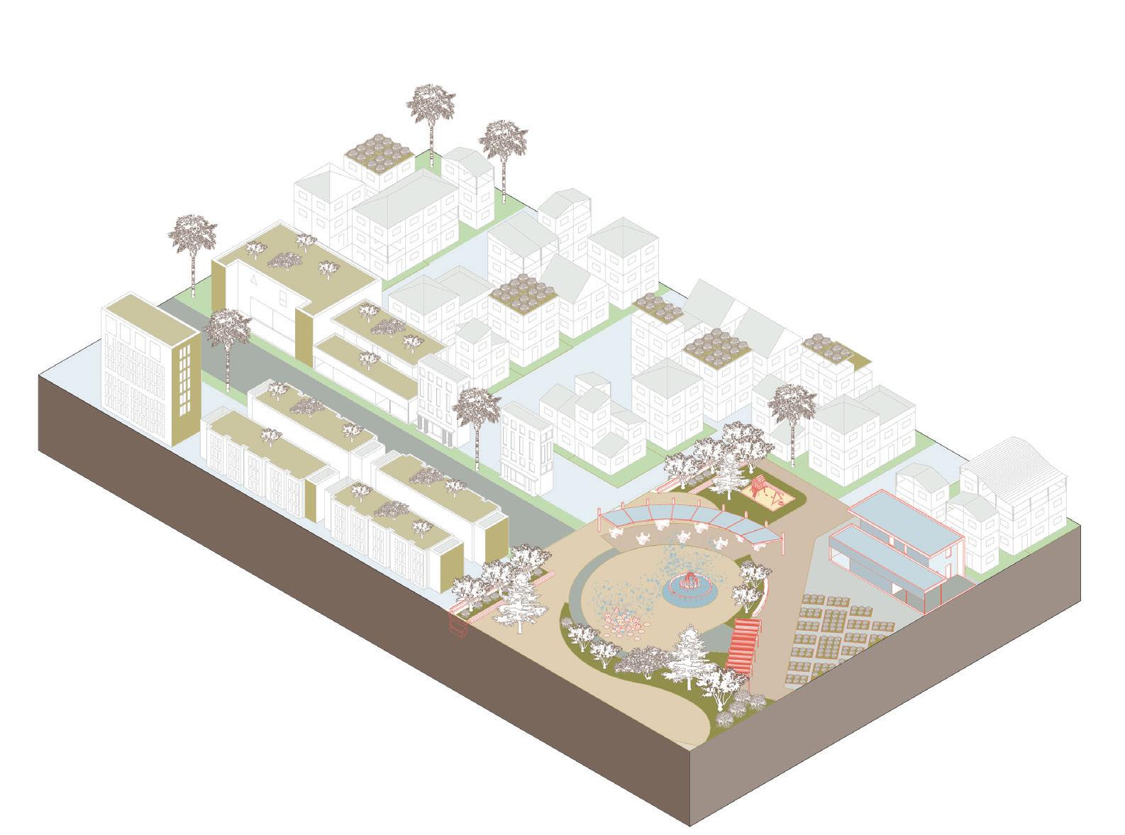
Sunken Plaza Flexible Public Space
2100
Sea Level Rise
High: 7ft
Intermediate High: 5ft
Intermediate: 3.5ft
Intermediaete low: 2ft
Coastal surge and flooding, stormwater, heat and biodiversity adaptation strategies integrated as lush, active public spaces.
Porous Terraced Surface
Coccoloba uvifera SEAGRAPE
Mimus polyglottos
NORTHERN MOCKINGBIRD
Sabal palmetto
CABBAGE PALM
Tree Canopy Shade
RED-HEADED WOODPECKER
Melanerpes erythrocephalus
Nymphalis antiopa MOURNING CLOAK
BioSwale
Permeable Surfaces
Permeable Surfaces
Quercus virginiana
LIVE OAK
Aramus guarauna LIMPKIN
Artificial Wetlands Stormwater Control
2100 Sea Level Rise
High: 7ft
Intermediate High: 5ft
Intermediate: 3.5ft
Intermediaete low: 2ft
Shaded Seating
Deck Structure
Green Cooling Corridor
Wetlands
BioSwale
Ilex cassine
DAHOON HOLLY
JUNIPER HAIRSTREAK BUTTERFLY
Retention Wall
Water Filtration
Structure
Callophrys Gryneus
Local Road + Neighborhood Front
2100 Sea Level Rise
High: 7ft
Intermediate High: 5ft
Intermediate: 3.5ft
Intermediaete low: 2ft
BioSwale
BioSwale
Sponge-Bus Stop
Public Transit Incentive
Coccoloba Uvifera
SEAGRAPE
Callophrys Gryneus
JUNIPER HAIRSTREAK BUTTERFLY
Permeable Surfaces
Rooftop Gardens
Parasol Facades
Ilex cassine
DAHOON HOLLY
Inland Road and Playground
Interactive Splash Pads
2100 Sea Level Rise
High: 7ft
Intermediate High: 5ft
Intermediate: 3.5ft
Intermediaete low: 2ft
Pinus clausa
SAND PINE
SCRUB-JAY Aphelocoma coerulescens
BioSwale
Reflective Coating
Ilex cassine
DAHOON HOLLY
Taxodium distichum
BALD CYPRESS
Parasol Facades
CEDAR WAXWINGS
WOOD DUCK Bombycilla Cedrodum Aix Sponsa
BioSwale
BioSwale
Parking and Commercial Core
2100 Sea Level Rise
High: 7ft
Intermediate High: 5ft
Intermediate: 3.5ft
Intermediaete low: 2ft


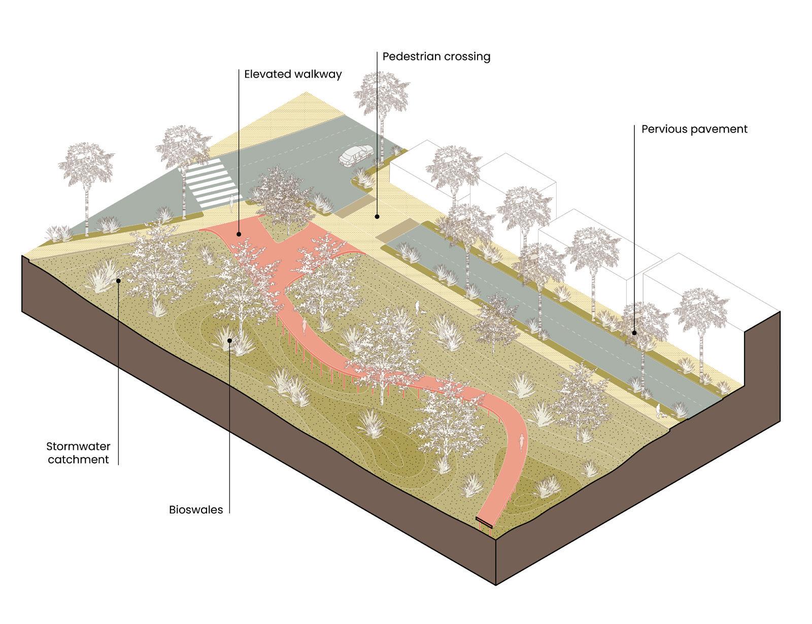
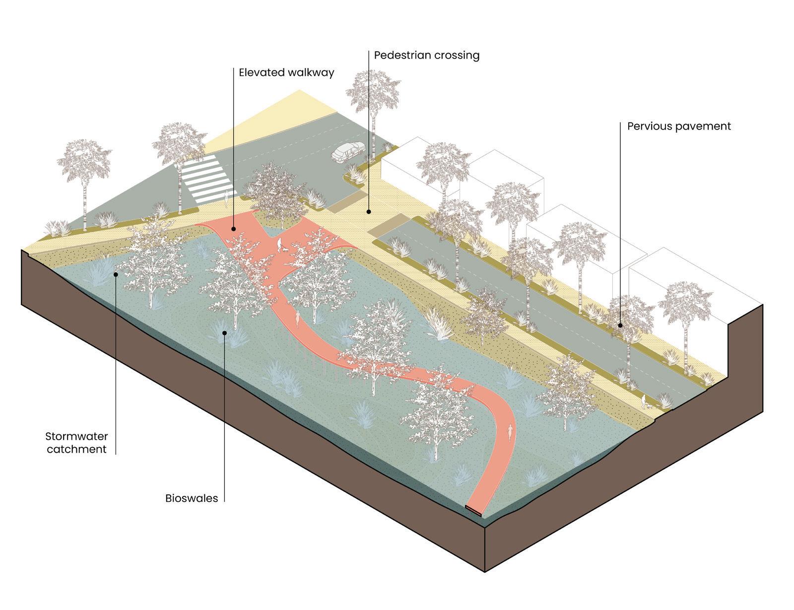
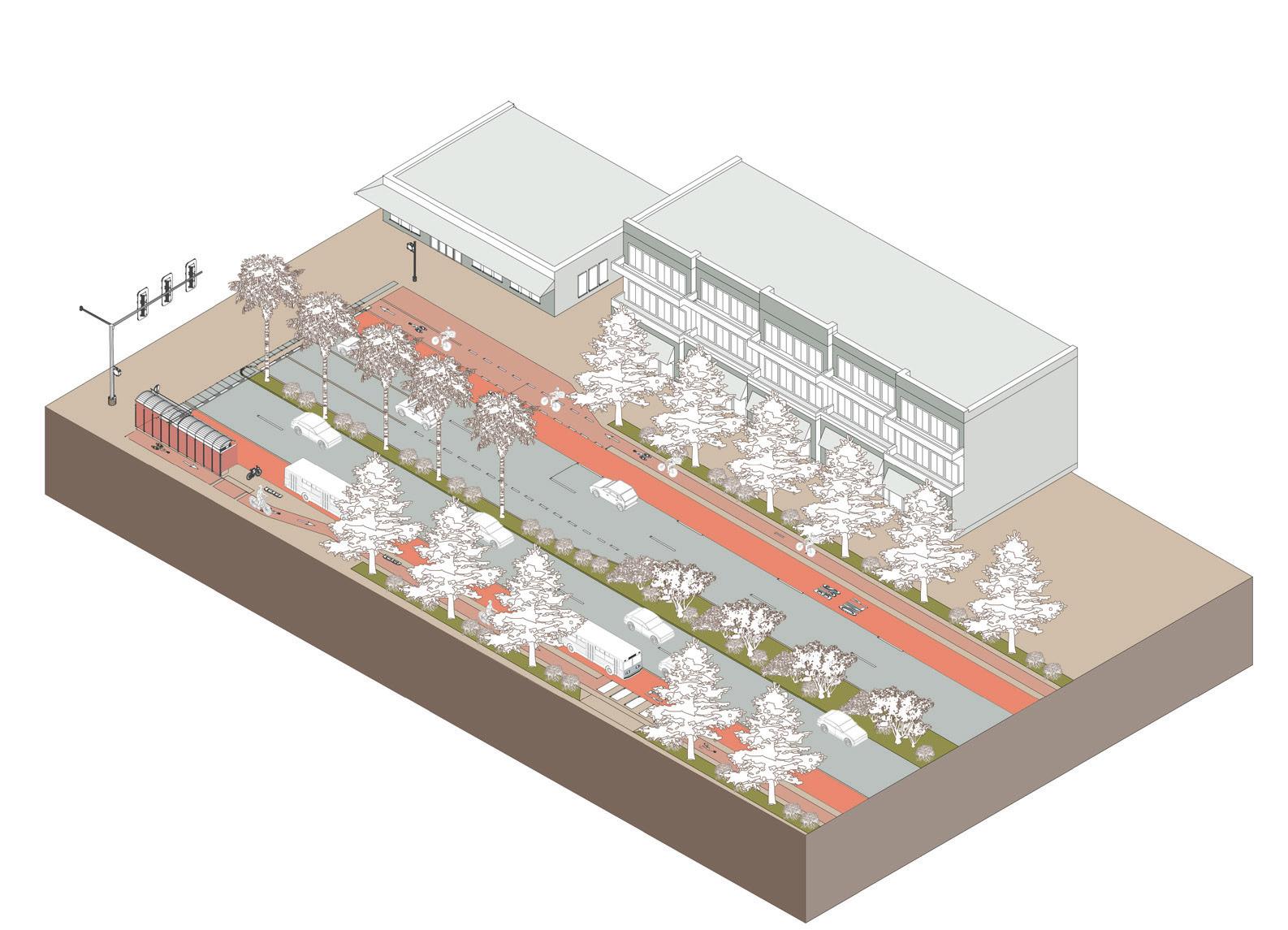
Urban streets can be adapted with stormwater, heat, and biodiversity strategies in the public right-of-way as well as on building facades.
BioSwale

Pinus clausa
SAND PINE
Permeable Surfaces
Parasol Facades
BioSwale
Roundabout Drainage Infrastructure
2100 Sea Level Rise
High: 7ft
Intermediate High: 5ft
Intermediate: 3.5ft
Intermediaete low: 2ft
BioSwale
Cooling Station
Permeable Surfaces
Magnolia virginiana
Mimosa Strigillosa
SWEET BAY
SUNSHINE MIMOSA
Along RINGLING BLVD
Callophrys Gryneus
JUNIPER HAIRSTREAK BUTTERFLY


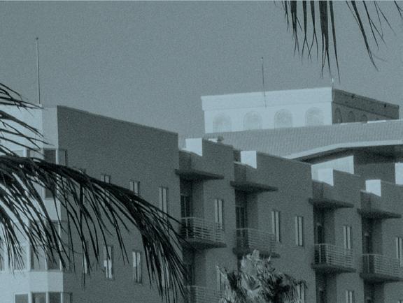
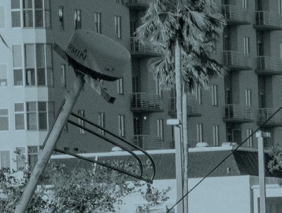


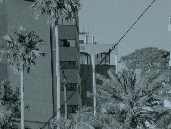
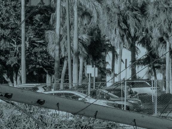


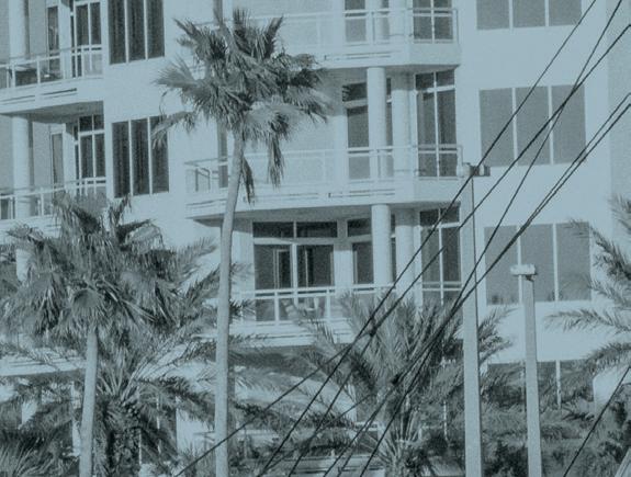


Final Review


All photographs in this section: Ryan Lester, 2025.
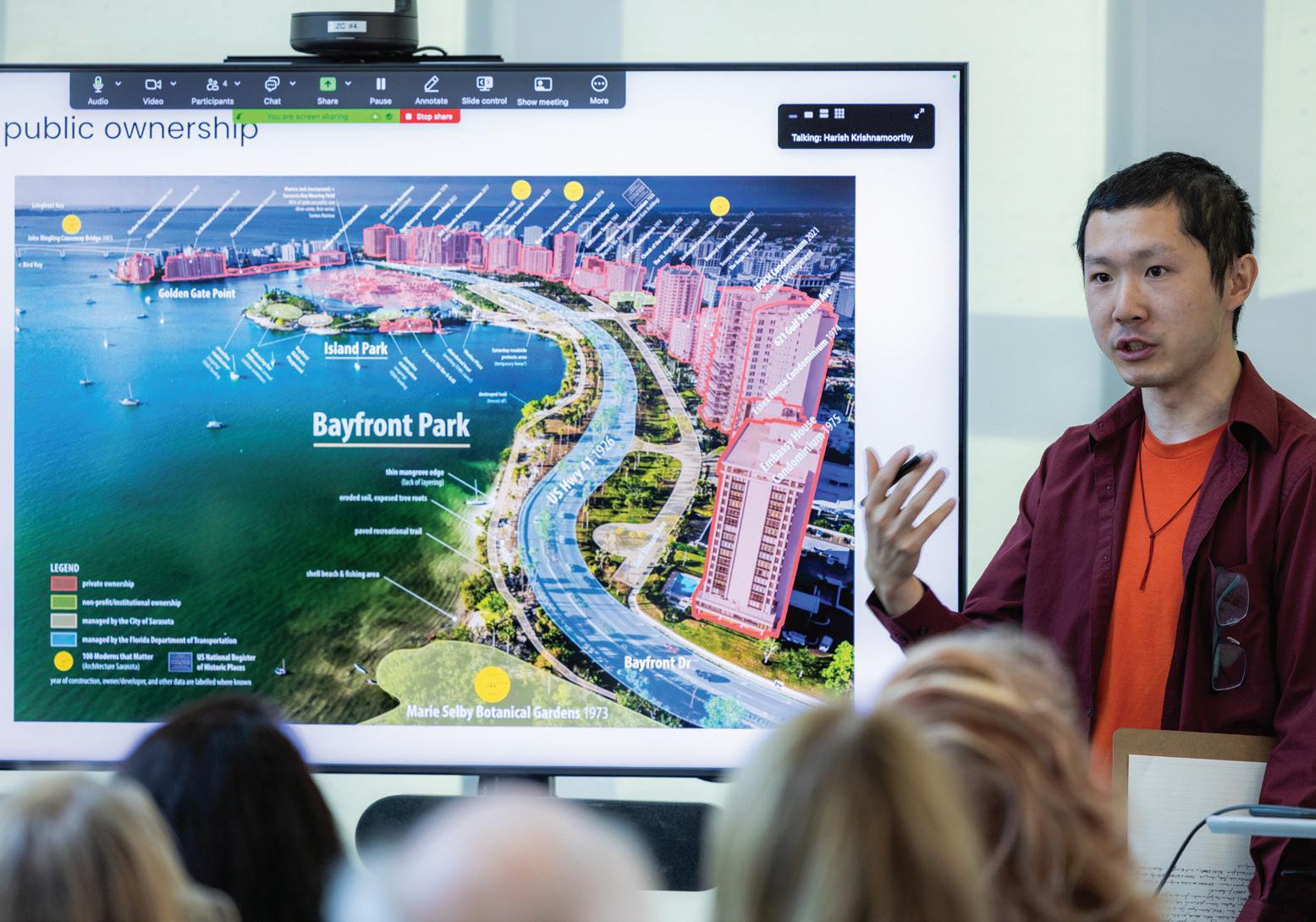

Ryan Lester
A final presentation and discussion of student proposals took place in May of 2025 at Harvard’s Graduate School of Design in Cambridge, Massachusetts. The work was reviewed by national leaders in climate design and adaptation; local leaders and stakeholders from Sarasota; and Harvard faculty.
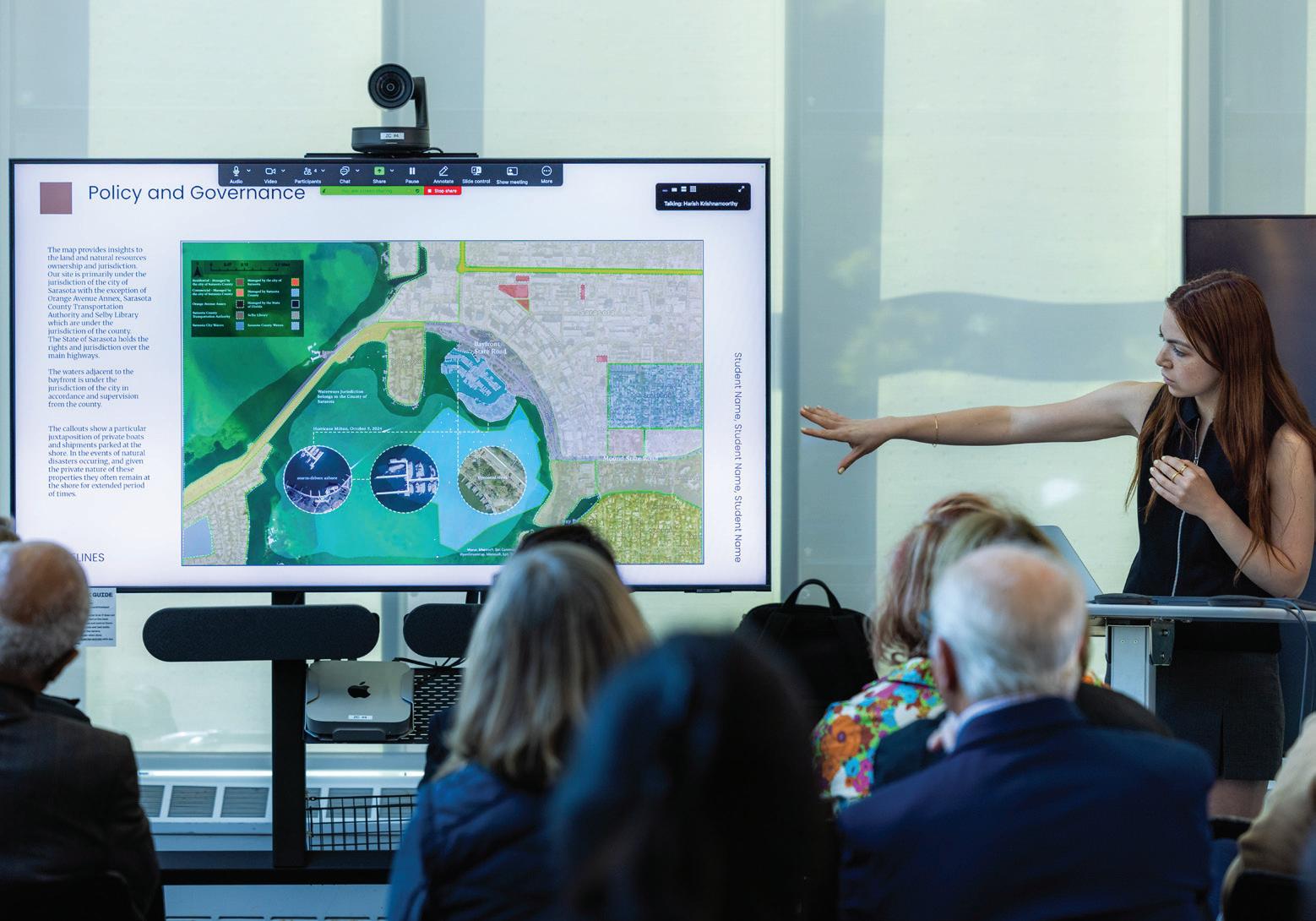

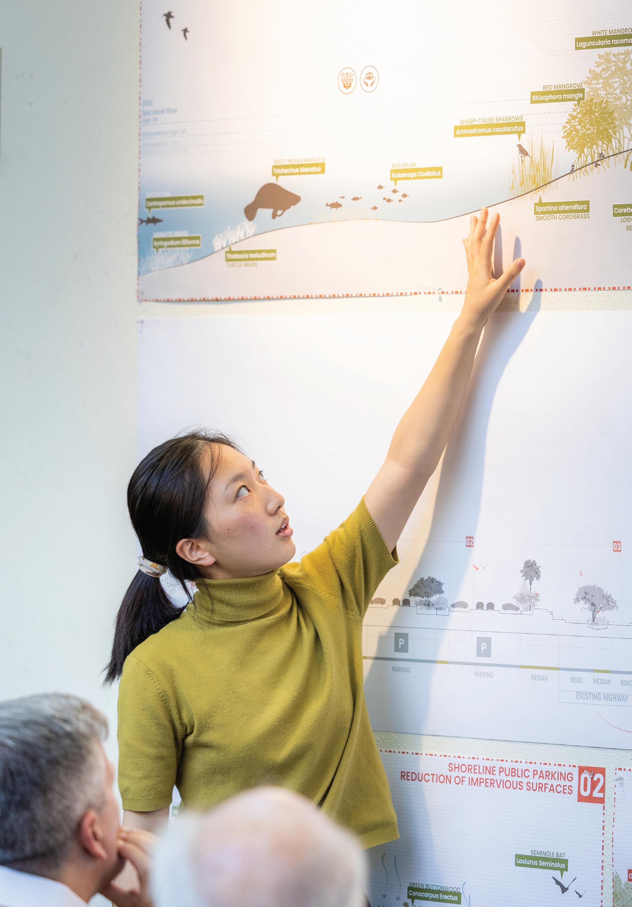
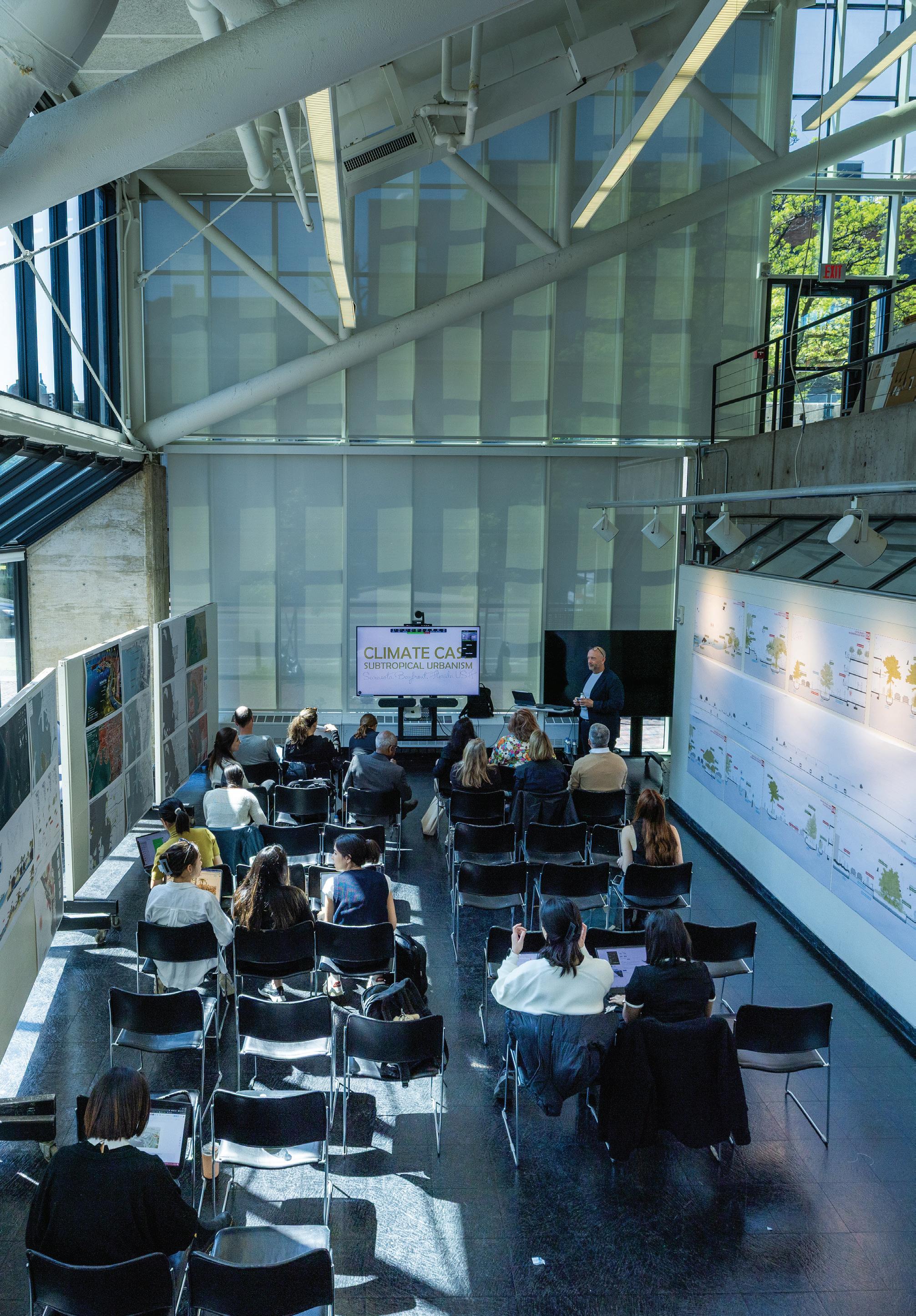
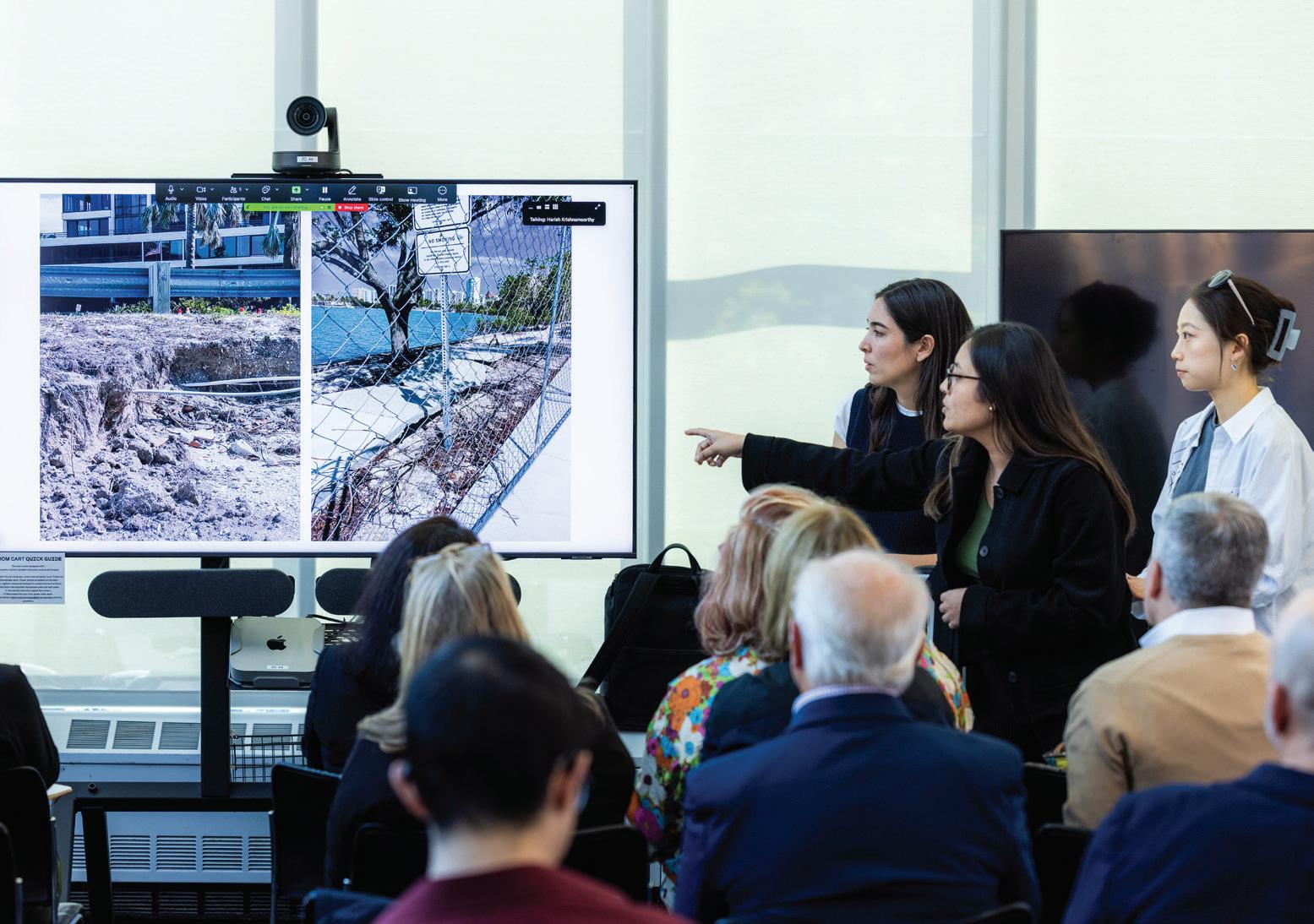

Above: Chris Reed of Harvard’s Graduate School of Design and Marty Hylton of Architecture Sarasota co-hosted the day-long event.
Ryan Lester
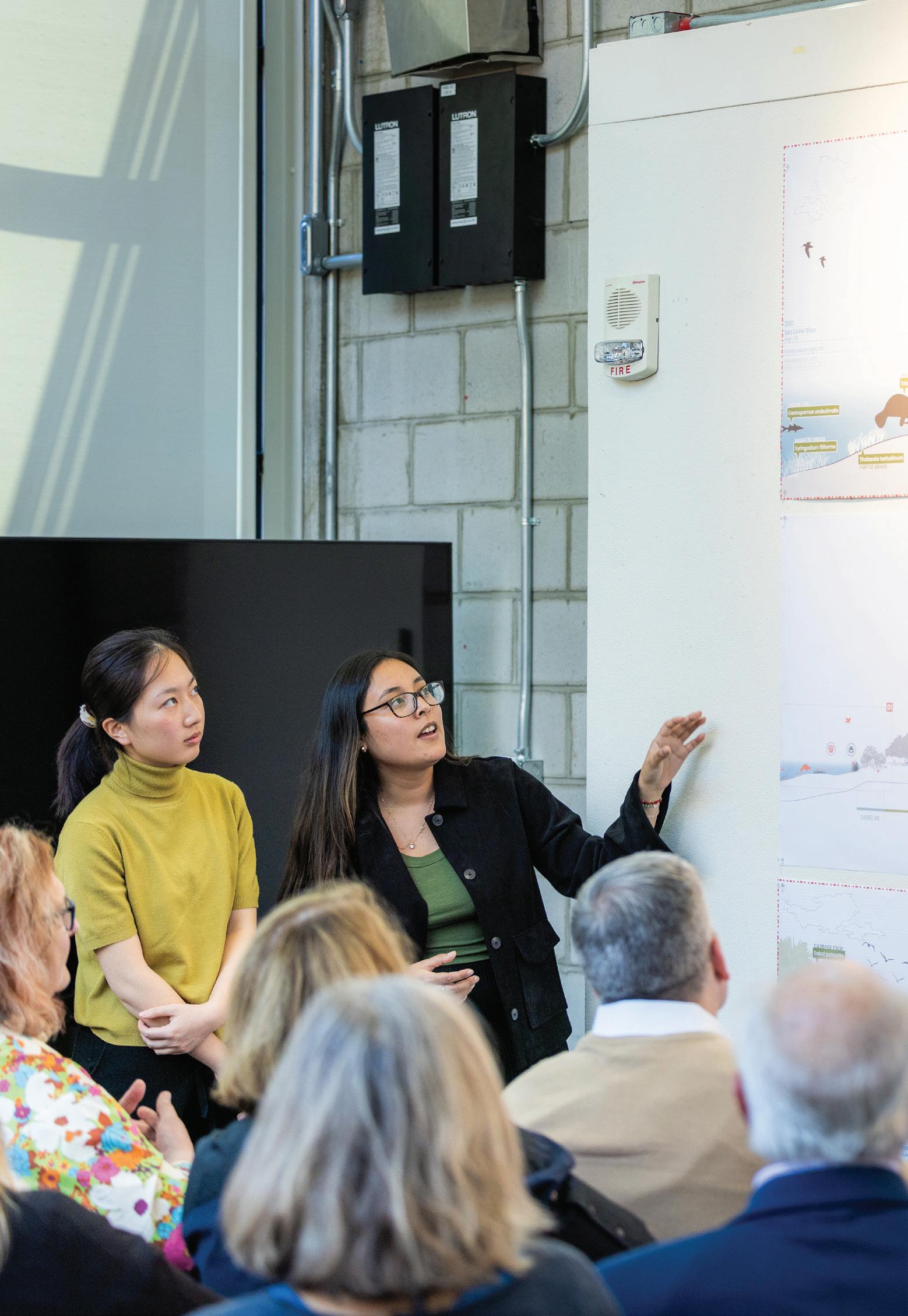
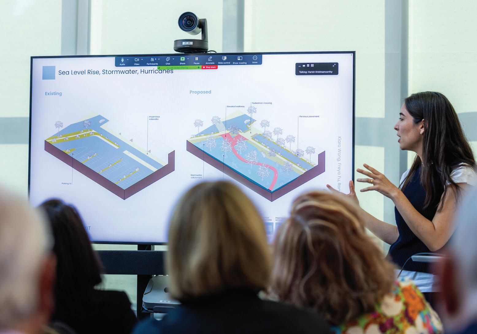

Ryan Lester

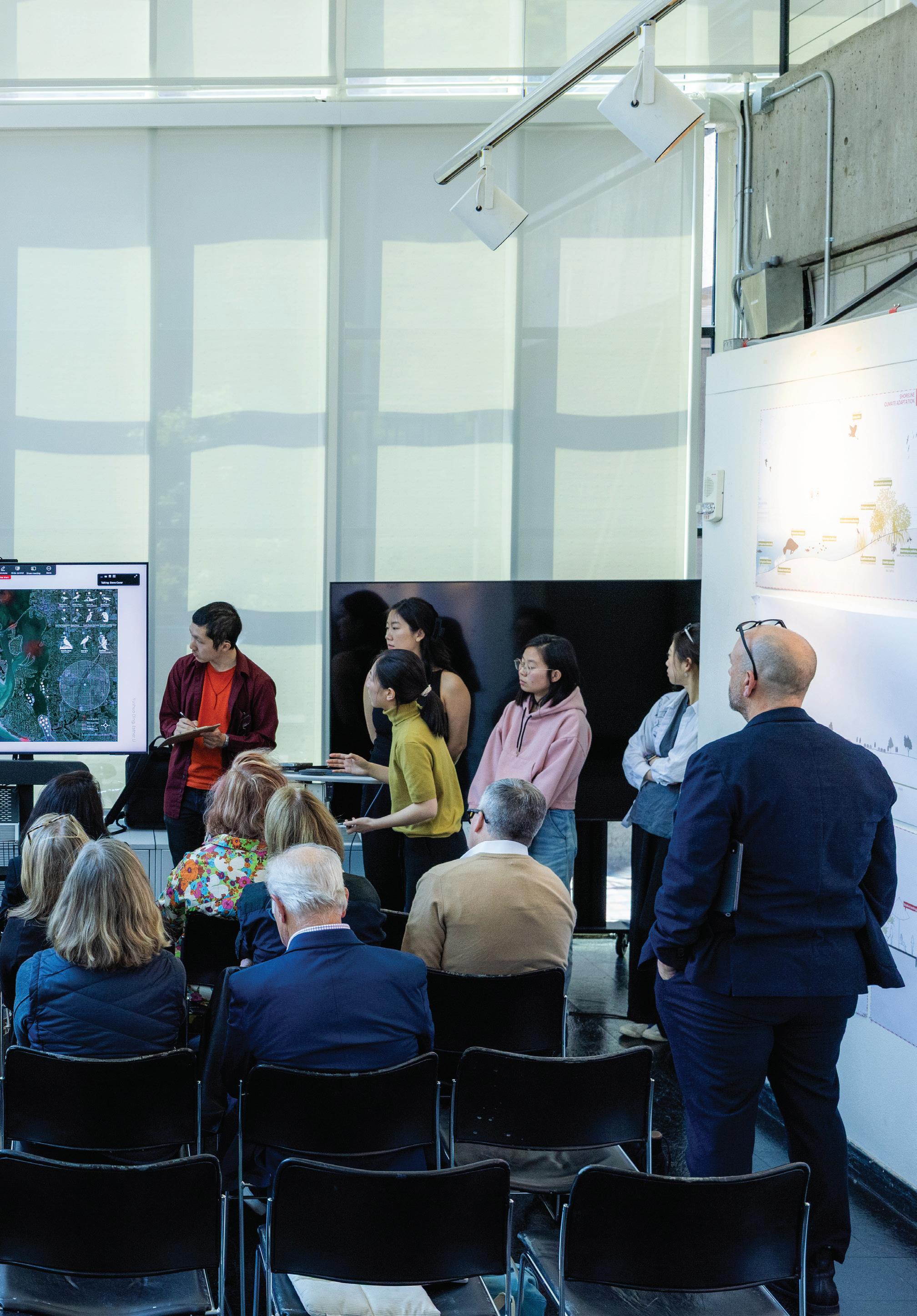
Chris Reed
Chris Reed is Professor in Practice of Landscape Architecture and Co-Director of the Master of Landscape Architecture in Urban Design Program at the Harvard University Graduate School of Design. He is also Founding Director of Stoss Landscape Urbanism. He is recognized internationally as a leading voice in the transformation of landscapes and cities, and he works alternately as a researcher, strategist, teacher, designer, and advisor. Reed is particularly interested in the relationships between landscape and ecology, infrastructure, social spaces, and cities. His work collectively includes urban revitalization initiatives, climate resilience and adaptation efforts, speculative propositions, adaptations of infrastructure and former industrial sites, dynamic and productive landscapes, vibrant public spaces that cultivate a diversity of social uses and cultural traditions, and numerous landscape installations.
His work can be found in cities as diverse as Boston, Los Angeles, St. Louis, Dallas, Detroit, Galveston, Abu Dhabi, and Dongshan, China. His work through Stoss has been recognized with the Cooper-Hewitt National Design Award for Landscape Architecture; the Topos International Landscape Award; the Holcim Award for Sustainability, Grand Prize for North America, for the firm’s work on Resilient Moakley Park in Boston; and various other practice- and project-based awards from Progressive Architecture, the American Society of Landscape Architects, Azure’s AZ Awards, World Landscape Architecture, the Architectural League of New York, the Waterfront Center, EDRA / Places, and the Boston Society of Architects.
Morris [Marty] Hylton III
Morris [Marty] Hylton III has more than 25 years of experience documenting, conserving, and advocating for cultural heritage. Trained as an architect and historic preservationist, Marty specializes in closely collaborating with community stakeholders to develop multifaceted strategies and programs to preserve and manage resources. His research and professional work have focused on the distinct stewardship challenges of 20th-century heritage, particularly sites and buildings of the post-World War II era, and the preparation and recovery of historic sites and communities impacted by natural disasters and coastal communities. Marty is currently President of Architecture Sarasota.
From 2002 to 2007, Marty served as Strategic Initiatives Manager for the World Monuments Fund – an international non-profit with a mission of saving endangered heritage globally. While at WMF, he oversaw recovery efforts along the Mississippi Gulf Coast and New Orleans following Hurricane Katrina and helped create the Modernism at Risk program. For 14 years, Marty served as Director of Historic Preservation at University of Florida where he launched the Envision Heritage program dedicated to harnessing digital technologies for documenting historic buildings and communities. More recently, he was the inaugural National Park Service Historic Architect for Climate Change where he helped create the Climate, Science, and Disaster Response Program for the Cultural Resources, Partnerships, and Science Directorate.
Ryan Lester
Ryan Lester is the Director of Strategic Initiatives and Communications at Architecture Sarasota, where he contributes to the research of urban-scale projects and directs the organization’s public presence. His work sits at the intersection of urban planning, urban analytics, and historic preservation. He holds a master’s degree in Urban and Regional Planning, as well as a bachelor’s degree in Sustainability and the Built Environment, both from the University of Florida. Alongside his career in the built environment, Ryan brings over a decade of experience as a freelance filmmaker, producing projects for organizations such as Google, the National Park Service, and President Biden’s Inaugural Committee.
Mike Belleme
Mike Belleme is a self-taught, Appalachianborn documentary photographer living in Asheville, North Carolina. Belleme’s work intimately examines themes of connection and community and the physical, mental, and social constructs that cultivate and inhibit connection. At the heart of Belleme’s work is a considered approach to contemporary issues that help us explore the seen and unseen forces that dictate how we perceive each other and the world around us. Belleme’s assignment work, primarily focused in the rural Southeastern, United States, can be seen in such publications as The New York Times, Rolling Stone, Time, The Guardian, National Geographic, Elle, Monocle, The Atlantic, LA Times, San Francisco Chronicle, Entrepreneur, Inc., NPR, CNN, MSNBC, The Marshall Project, ProPublica, The Wall Street Journal, Wired, Esquire, Outside, Fortune, Stern, The Fader and many more. Non editorial clients include Intell, Stetson, Airbnb, Google and CitiBank.
Architecture Sarasota stewards the legacy of the Sarasota School of Architecture and provides a forum for the education, advocacy and celebration of good design in the global built environment.
Kristine Ziedina
Kristine Ziedina is a doctoral student at the University of Florida’s Historic Preservation program. Her passion for the history of the built environment started in Latvia, a Northern European country where she was born. She worked as an interior designer and project manager in Latvia, Ukraine, and Azerbaijan.
After relocating to the United States, Kristine continued her education. In 2017, she graduated from Pennsylvania State University with a Bachelor of Arts degree in American Studies. In May 2019, she received her Master’s Degree from the University of Florida (UF) Historic Preservation Program. For her thesis, Kristine explored the history of screen block, one of the mid-century charterdefining materials, in relation to Florida’s built environment. Kristine continues her studies by researching why spaces, places, and landscapes where cultural groups safeguard their heritage are invisible within the National Register of Historic Places (NRHP) framework.
Climate Case: Subtropical Urbanism Instructor
Chris Reed Report Design
Romina Cordova Grados and Yushuo Ding Report Editor
Romina Cordova Grados and Yushuo Ding
Dean and Josep Lluís Sert Professor of Architecture
Sarah Whiting Chair of the Department of Landscape Architecture
Gary Hilderbrand
Copyright © 2026 President and Fellows of Harvard College. All rights reserved. No part of this book may be reproduced in any form without prior written permission from the Harvard University Graduate School of Design.
Cover Image © 2025 Ryan Lester.
Section divider images © 2025 Mike Belleme.
Text and images © 2026 by their authors.
The editors have attempted to acknowledge all sources of images used and apologize for any errors or omissions.
Acknowledgments
Many thanks to the generosity of Architecture Sarasota and the leadership of Marty Hylton, its President, and Anne Essner, its Board Chair: Together they are spurring an important conversation about the relationship between design and the environment that is firmly rooted in Sarasota but has positive implications for the rest of the world. Thanks, too, to our seminar presenters, site visit hosts, and final review critics and commentators, all of whom are listed up front in this document. Harish Krishnamoorthy was an amazing assist in helping with the foundational research for the seminar, and in working with me and the students throughout the semester. Finally, huge appreciation to Romina Cordova Grados and Yushuo Ding, who did a beautiful job compiling and editing this volume.
Harvard University Graduate School of Design
48 Quincy Street Cambridge, MA 02138
gsd.harvard.edu

Seminar Report
Spring 2025
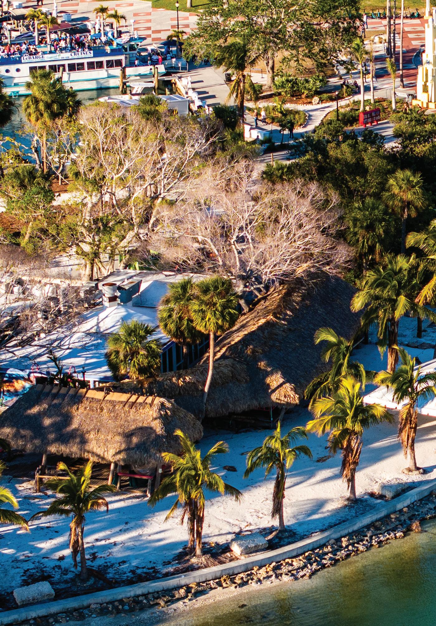
Students
Rimshi
Harvard GSD
Department of Landscape Architecture
Agrawal, Lyna Boulgamh, Romina Cordova Grados, Yushuo Ding, Freya Fu, Hangzhang Lai, Esther Li, Rilia Li, Allen Wang, Kiara Wong Siu