In the spirit of reconciliation, the Geological Society of Australia acknowledges the Traditional Owners of Country throughout Australia and their connections to land, sea and community. We pay our respect to Elders p ast and present and extend that respect to all Aboriginal and Torres Strait Islander readers of TAG . This magazine was produced on the lands of the Kulin Nation, Larrakia and Birpai Countries.
CONTENTS
DINOSAUR DISCOVERER, STEM SUPERSTAR
Paleontologist Adele Pentland shows that STEM is for everyone.
AUSTRALIA’S EARTHQUAKE HAZARD
How can we be prepared and ready to respond when the ground shakes?
‘MY CAR WILL BE THE FASTEST’
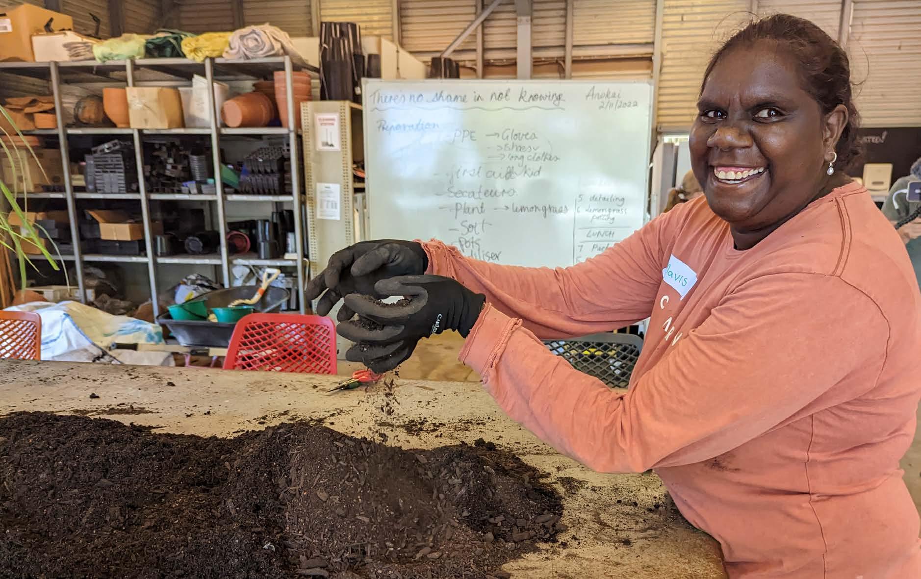
Girls in remote NT are smashing science stereotypes.
TASMANIA’S GLACIAL PAST
A recent field trip explored the rich glacial history in Australia’s south.
NEWS, VIEWS AND UPDATES
Gneiss One! by Emma Rehn
From the (Past) President
From the Editor
MINING THE GAP
A new report spotlights gender pay gaps. Here’s how they hurt Earth Science.
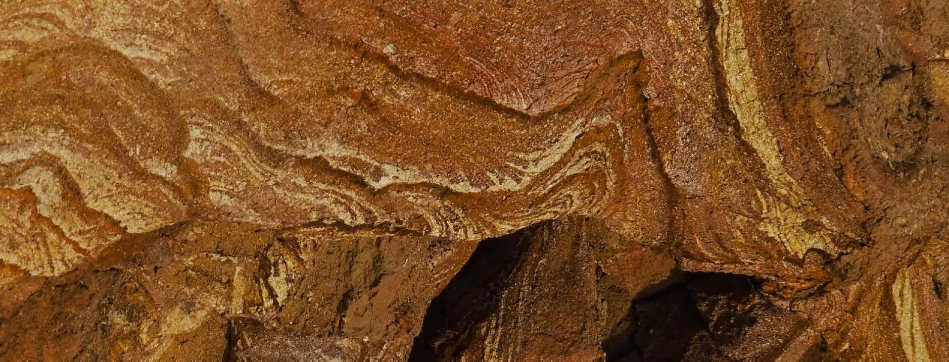
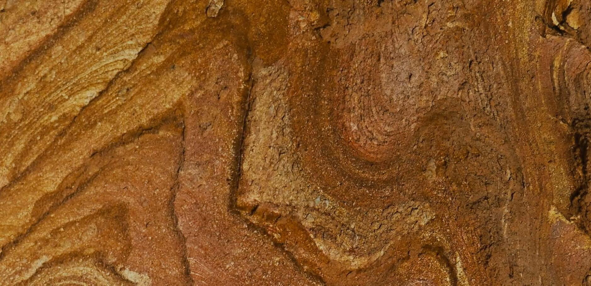
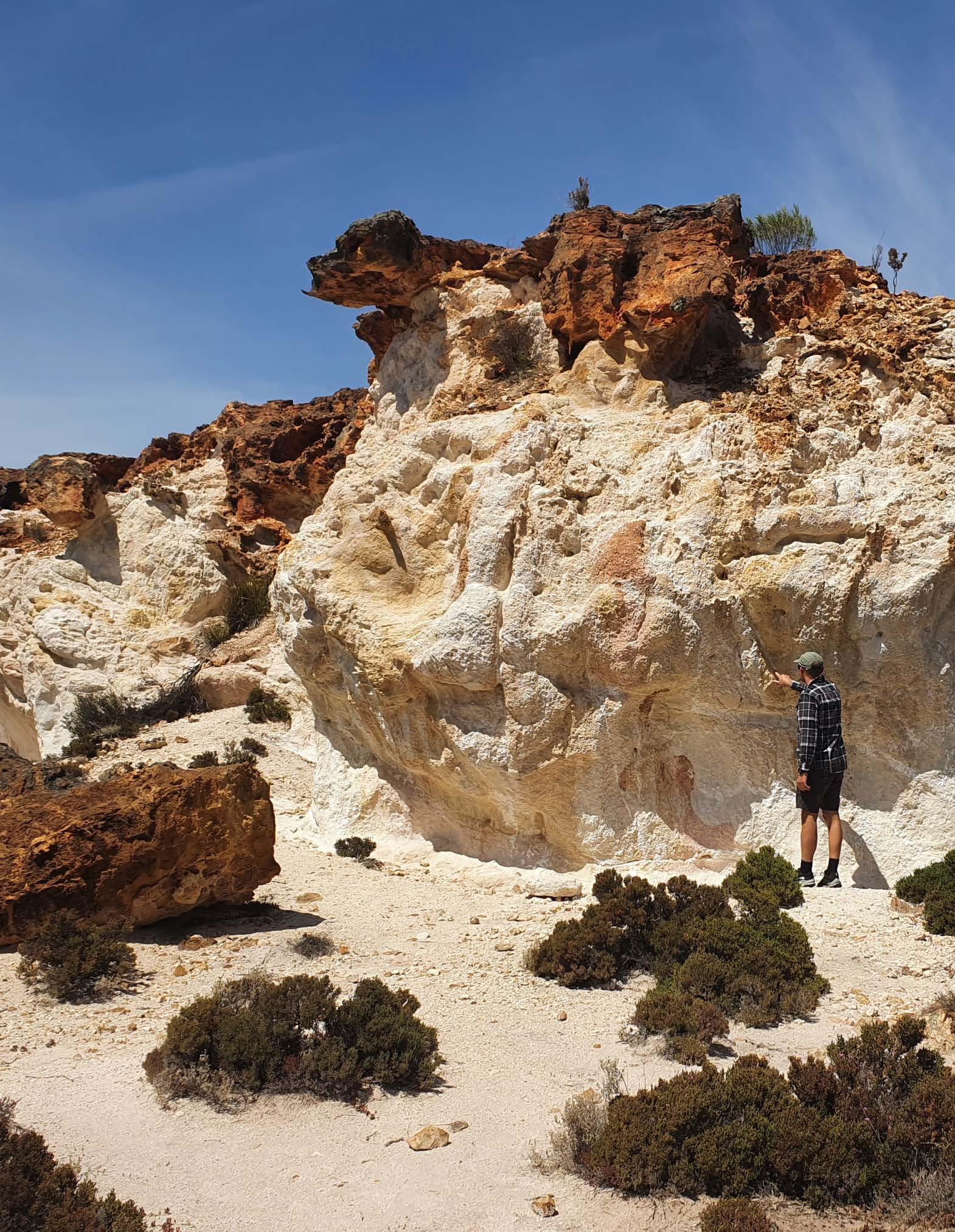
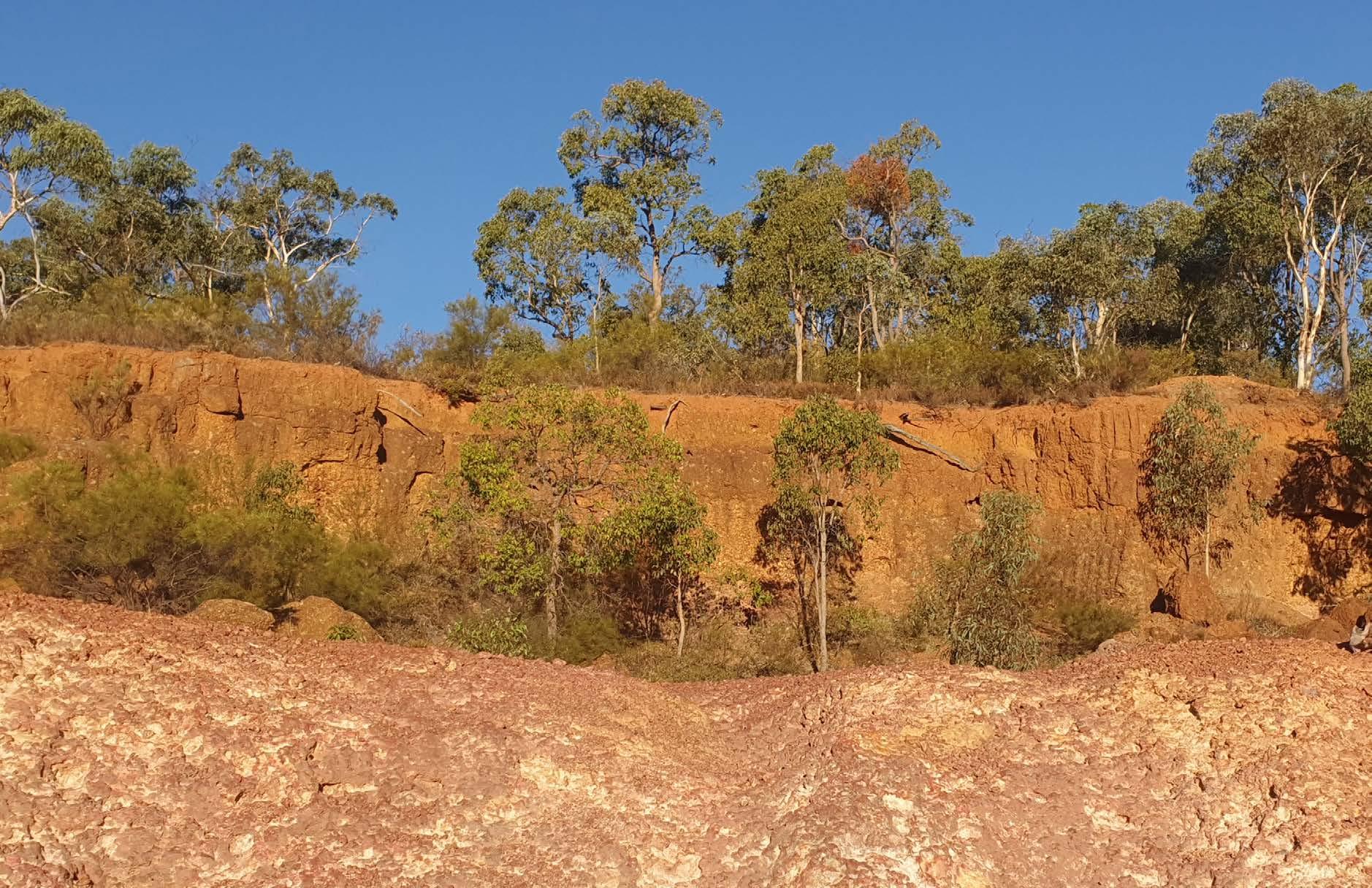
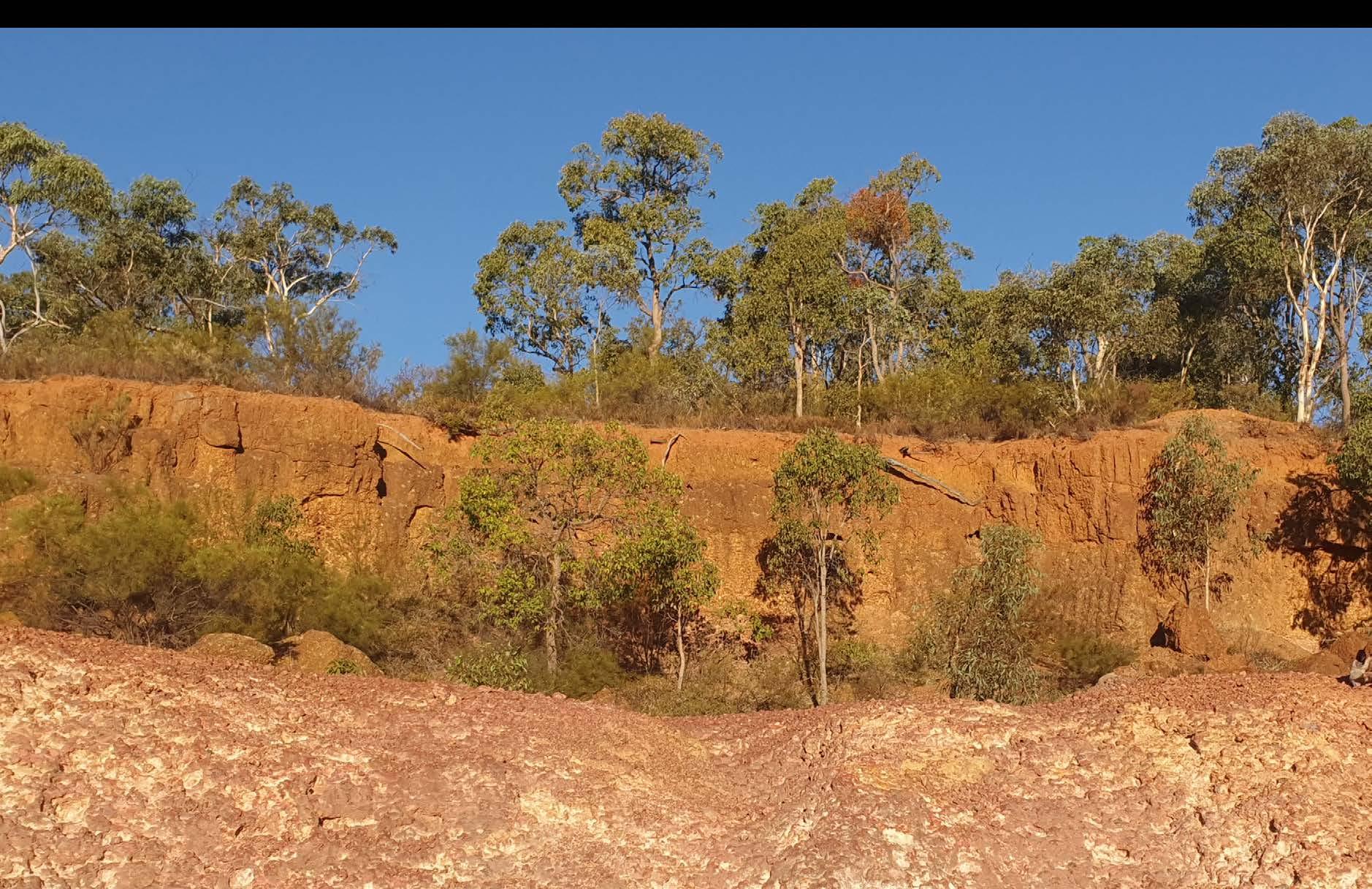
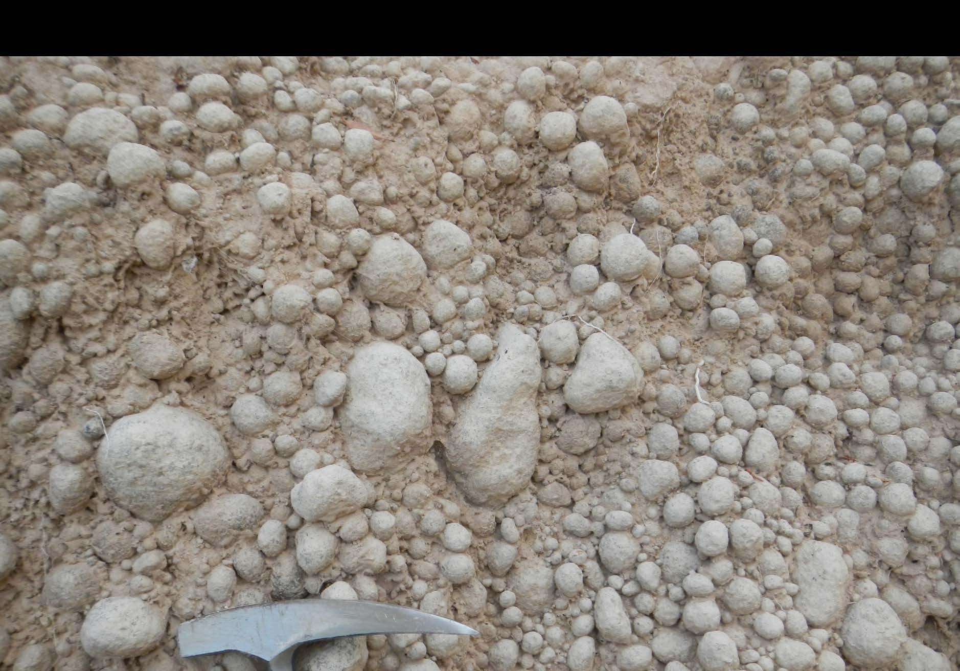
YILGARN CRATON LATERITES
These soils reveal stories from the past and could guide future mineral exploration.
FIRST NATIONS INNOVATION
How Katrina Wruck, 2025 Young Australian of the Year, is challenging the status quo.
Business matters: New policies, new awards
News from the Divisions
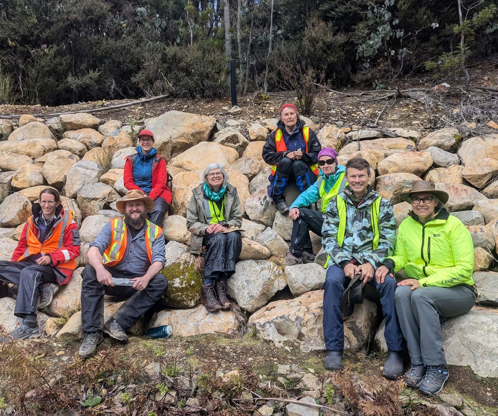
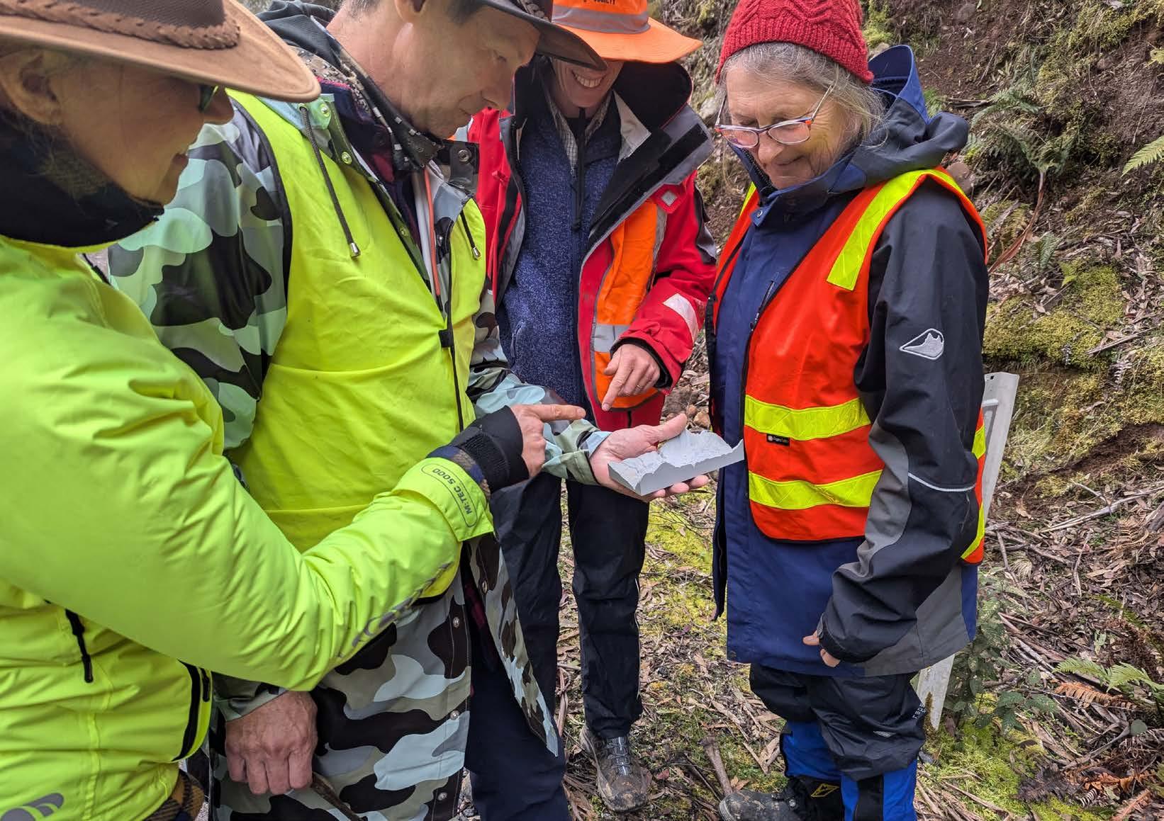
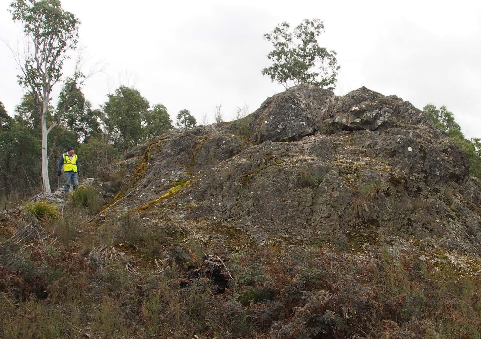
Photos from the field
Using inclusive language: Tips from GICE
Dorothy Hill Medal recipient: Linda Armbrecht
National Rock Garden: Treasure hunting
Early career geoscientists: Meet Indrani Mukherjee
AJES spotlight: Adelaide black granite
Alcheringa spotlight: Tracking dinosaurs in Victoria
Adventures in the field: Lakes, lava and limestone
Rock drives in Northwest Queensland
In memoriam
Cryptic crossword
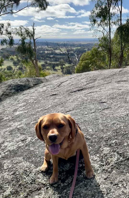
Dogs of GSA: Furry fieldwork friends
Publishing Details
ISSUE 214, JUNE 2025
Registered by Australia Post
Publication No. 100010917
ISSN 0312 4711
COMMISSIONING EDITOR
Athina Mallis
EDITOR IN CHIEF
Emma Berthold
CONSULTING EDITOR
Anthea Batsakis
DESIGN & TYPESETTING
Sarah Jackson
PRODUCTION MANAGER
Amber Jarrett
PRINTED BY
CMYK Colour Online
DISTRIBUTED BY
The Pack Factory, Sydney
CENTRAL BUSINESS OFFICE
PO Box 576, Crows Nest NSW 1585
Email: info@gsa.org.au
Web: www.gsa.org.au
Phone: (02) 9160 8193
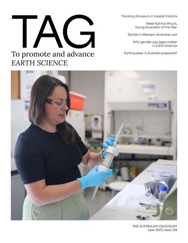
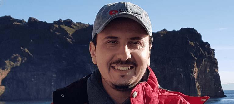
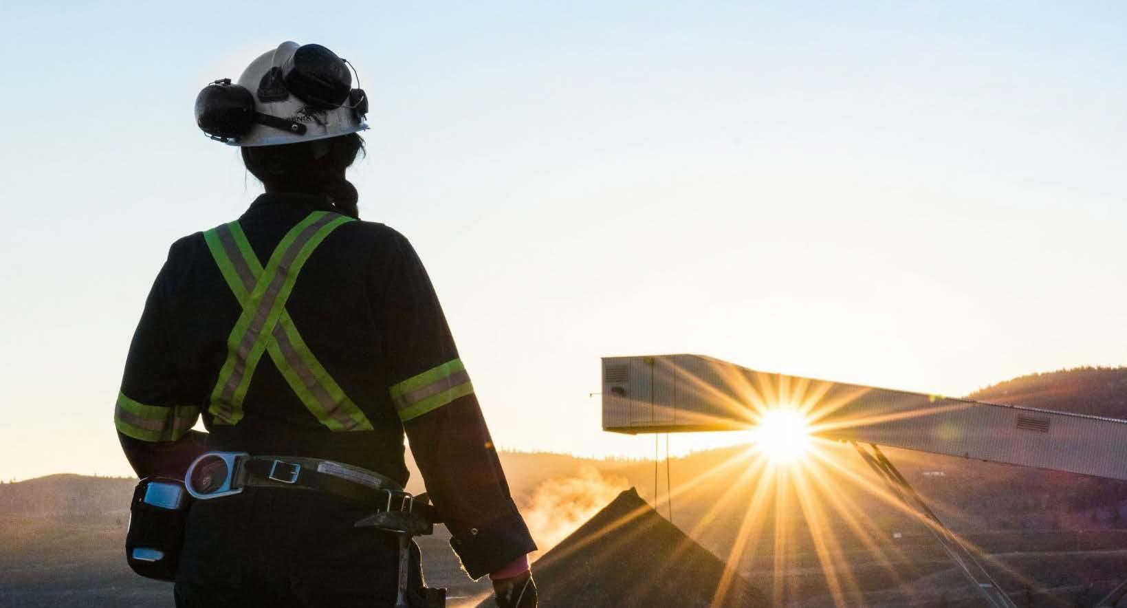
COVER IMAGE
Katrina Wruck, Young Australian of the Year. Read more on page 68
Photo: Megan van Vegten
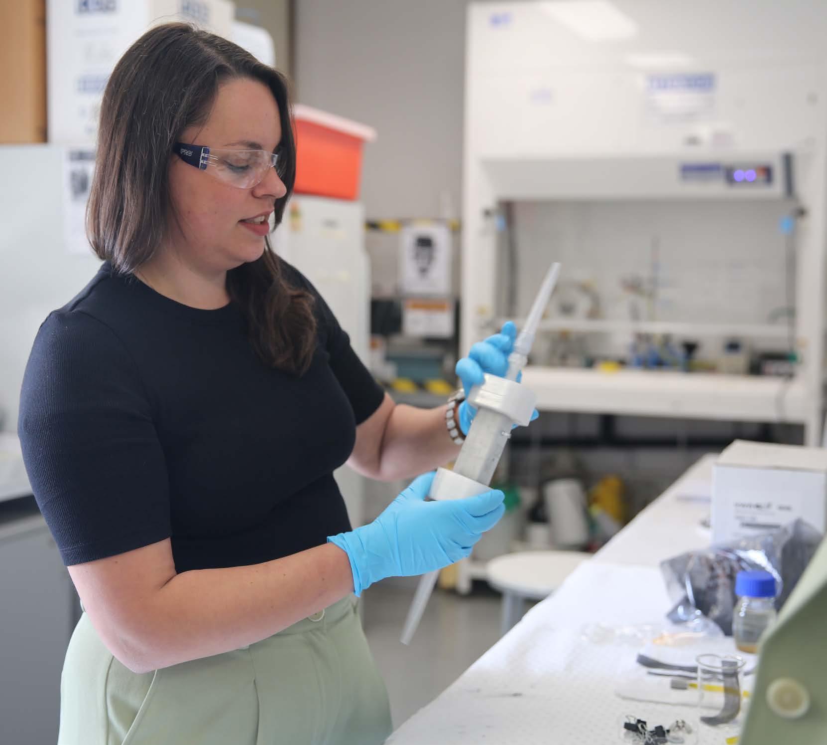
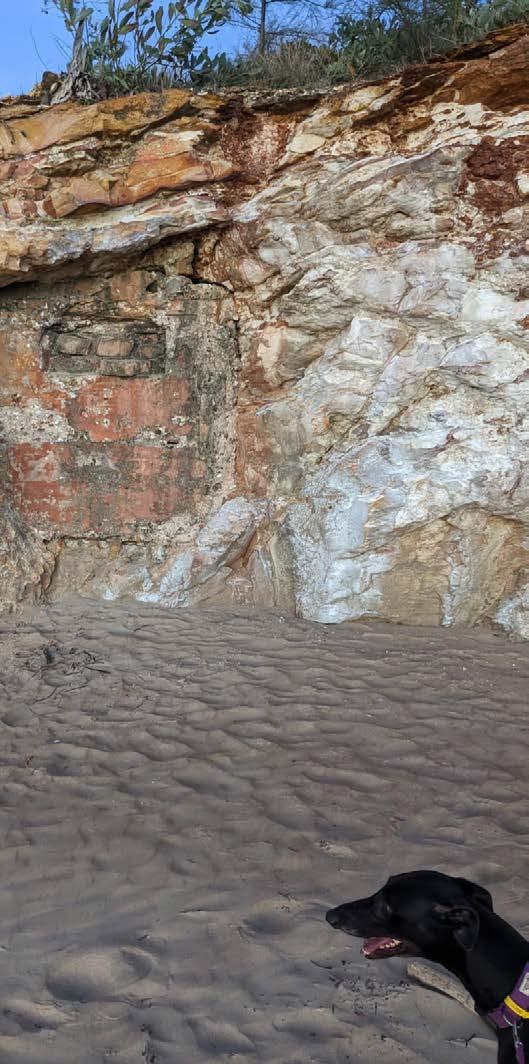
INSIDE COVER IMAGE
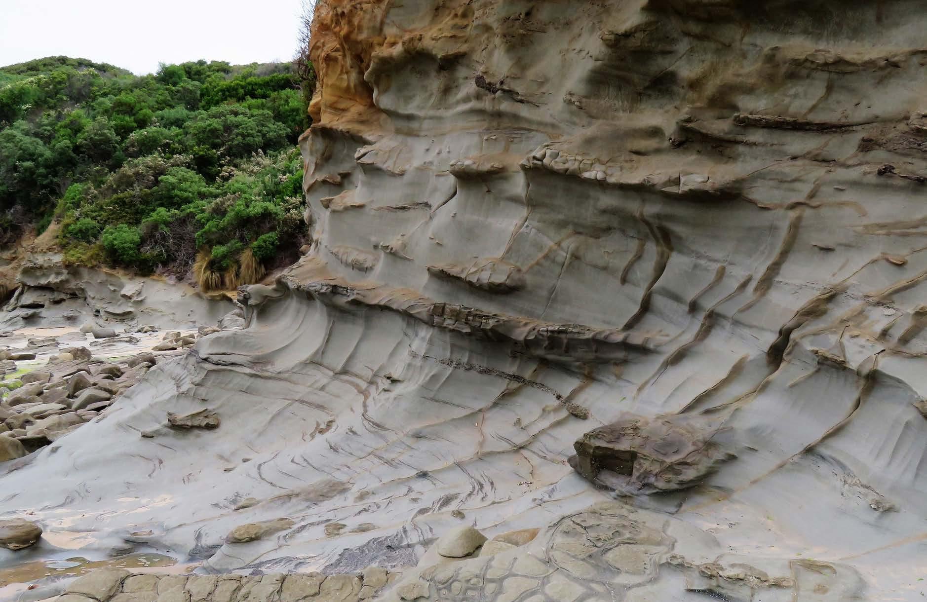
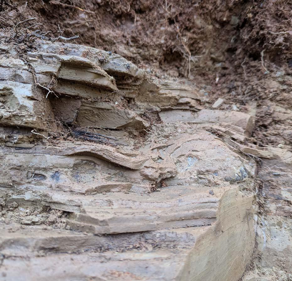
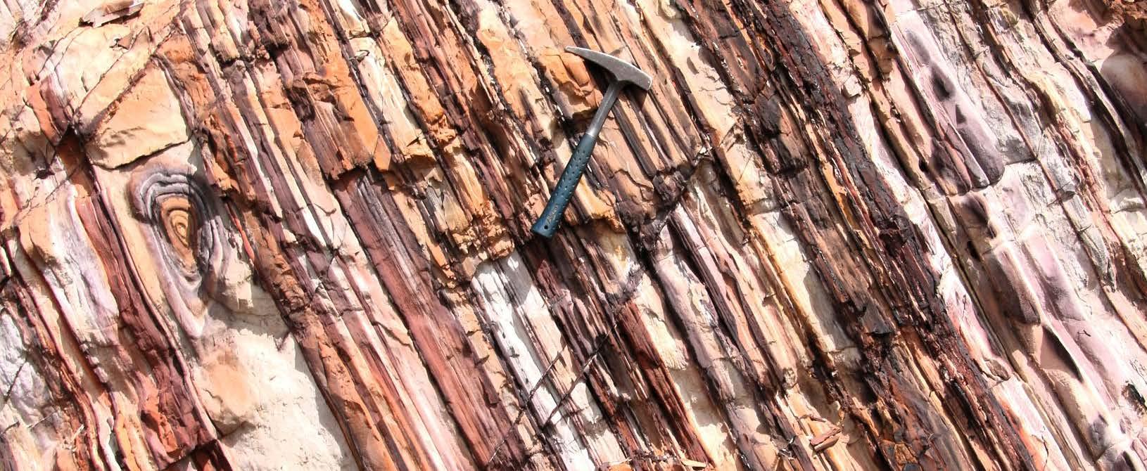
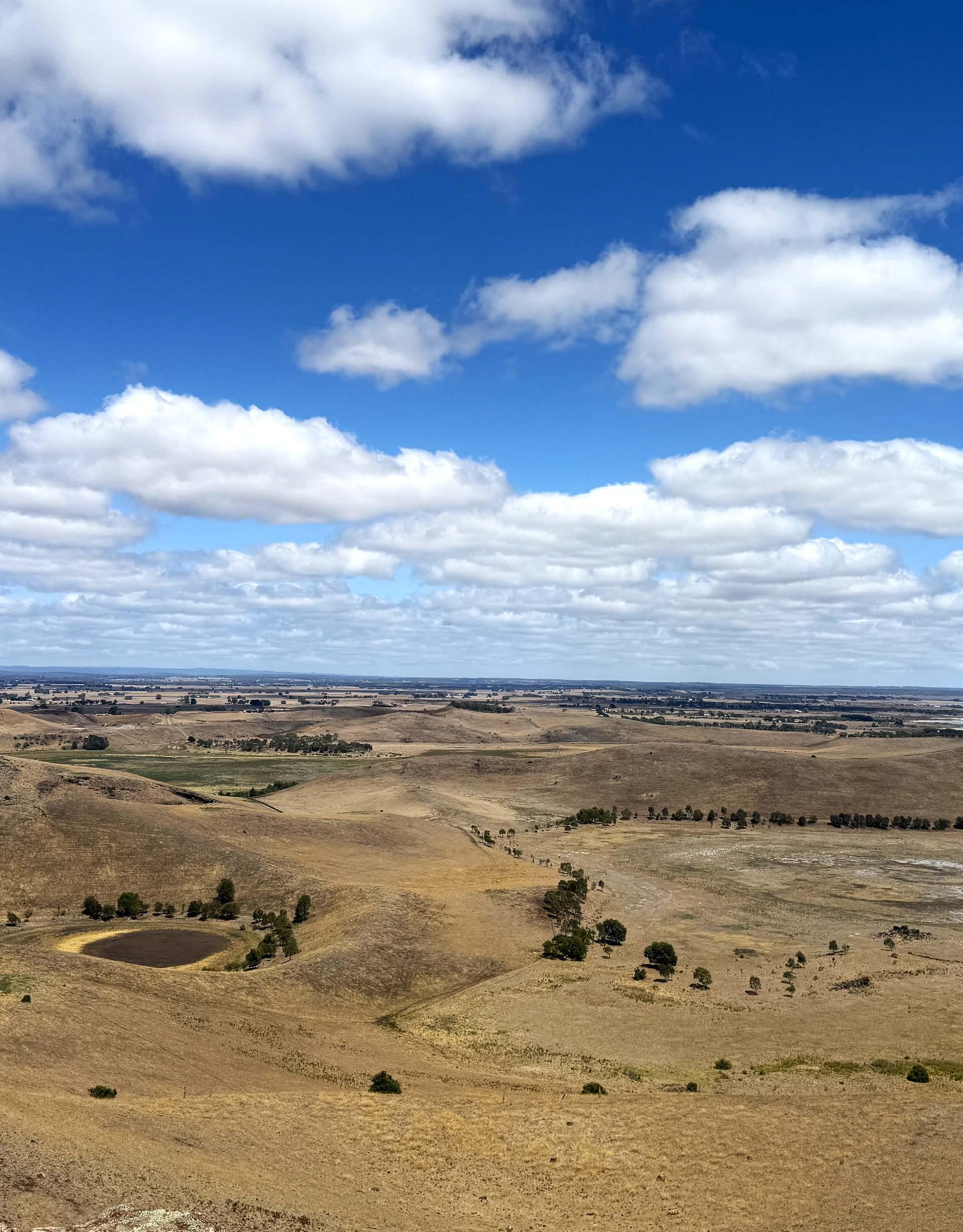
Cliff face view at Urquhart Bluff, along The Great Ocean Road, Victoria
Photo: Sarah Jackson
BACK PAGE IMAGE
Red rock lookout, looking south over the new volcanic province.
Right-hand side: Lake Corangamite.
Photo: Alanis Olesch-Byrne
Please be advised that this publication contains the name and image of a deceased First Nations person.
GENERAL NOTES
The Geological Society of Australia (GSA) is a community that promotes and advances Earth Science across all disciplines, recognising its vital role in understanding, sustaining, and improving the world around us.
The Australian Geologist (TAG) is a quarterly member magazine that includes society news, conference details, special reports, feature articles, book reviews and other items of interest to Earth Scientists. Each issue has a long shelf-life and is read by more than 3,000 geologists, geophysicists, paleontologists, hydrologists, geochemists, cartographers and geoscience educators from Australia and around the world.
SUBMISSIONS
TAG can no longer guarantee acceptance of complete articles without prior notice. Instead, we encourage members to send in their ideas and work with editors to produce new content. If you’d like to get involved, please email tag@gsa.org.au. Artwork must be high resolution 300 dpi or larger.
COPYRIGHT
The Publication is copyright by the GSA Inc unless specifically stated otherwise. However, material in this issue may be used provided acknowledgement is made. Every effort has been made to trace and acknowledge copyright holders of material in this publication. If any rights have been omitted, apologies are offered.
The GSA is a learned society and TAG is published by the Society to provide information for members and as a forum for the expression of their professional interests and opinions. Observations, interpretations and opinions published herein are the responsibility of the contributors and are not necessarily supported by the GSA.
The GSA has taken all reasonable precautions and made all reasonable efforts to ensure the accuracy of material contained in this publication, and makes no warranties, expressed or implied with respect to any of the material contained herein.
BUSINESS CORRESPONDENCE
All business enquiries and correspondence relating to advertising space, inserts and/or subscription matters, should be sent to tag@ gsa.org.au.
AUSTRALIAN EARTH SCIENCES CONVENTION 2026 (AESC2026)
We are thrilled to extend a special invitation for you to join us at the Australian Earth Sciences Convention (AESC) 2026, organised by the Geological Society of Australia (GSA).
Express your interest
GNEISS ONE!
by Emma Rehn
From the (Past) President
Welcome to the June issue of TAG! As you're reading this, our new Governing Council and President should be in place, and I’ll be settling into my new role as Past President. Congratulations and best wishes to all our incoming Councillors — I look forward to seeing where your leadership takes us next.
The role of Past President may not have featured prominently in TAG before, so this seems like a good moment to share what’s ahead. A key part of the role is supporting a smooth handover, retaining observer status on the Governing Council, and offering corporate knowledge and guidance when needed. I’ll also be working closely with the new President on the Governance Committee — an area that will be a focus for us as we continue modernising and streamlining the way our Society operates.
One of the most rewarding parts of the Past President role is chairing the Awards and Fellowships Committee. During my term as President, I’ve met so many incredible geoscientists across Australia, including our passionate
volunteers. Over the next two years, I’m looking forward to celebrating your achievements and documenting more of our Society’s rich history.
This includes overseeing nominations and awards for the GSA National Medals and the Distinguished Fellows, to be presented at the 2026 Australian Earth Sciences Convention (AESC) in Melbourne. I encourage you to take a moment to review the list of past recipients and to consider nominating a colleague whose work deserves to be recognised. Posthumous nominations for Distinguished Fellow are also welcome.
Many of our previous medallists and Distinguished Fellows do not yet have biographies recorded. One of my goals is to fill in these historical gaps. I’ll share more about this in the September issue of TAG
If you have ideas to improve our GSA Awards program, I’d love to hear from you. In this issue’s Business News section, you’ll see a suggestion from Ron Berry and his team proposing affirmative action to address the gender
imbalance in our named awards. Of the 30 GSA awards currently named after individuals, 27 honour men and only three honour women. Renaming some awards to recognise the contributions of women in geoscience is one way we can take meaningful steps toward greater equity and representation.
You can reach me at awards@gsa.org.au
I look forward to receiving your nominations and hope to see many of you at the awards night at AESC 2026 in Melbourne next February.
AMBER JARRETT President
Photo: Amber Jarrett
Business News
From the Editor
Welcome to the June 2025 issue of TAG! This issue marks a time of transition for the magazine. With Athina moving on to a new opportunity, I’ve stepped in to bring this issue to life, with the support of our amazing team.
Social media Code of Conduct
In these pages, we continue our move towards more inclusive storytelling, with more Traditional Owner acknowledgements in our stories, plus some tips for using inclusive language. We hope you find it both thoughtful and engaging.
improved earthquake risk assessment tools, and understanding Antarctic ecosystems.
The Governing Council has updated the Code of Conduct to include a new policy establishing the expectations for all individuals engaging with the GSA on social media.
From Queensland’s mineral landscapes to Tasmania’s glacial past and Western Australia’s Yilgarn Craton, this issue takes you on a journey through Australia’s geological wonders. You’ll also meet inspiring scientists driving change through green chemistry, dinosaur tourism,
A big thanks to our contributors and editorial team for their hard work. We hope you enjoy reading this issue of TAG as much as we’ve enjoyed putting it together!
EMMA BERTHOLD Editor in Chief
TAG 2025 due dates
We’d love to hear your news and ideas for TAG! Please send them to tag@gsa.org.au by the due dates below to keep production on track.
Pitching your feature idea first (before you write a whole article) helps the editorial team avoid duplicate content, offer guidance, and make the writing and editing process smoother for everyone.
For the September issue, please send:
• your ideas for feature stories by 17 June
• GSA division or specialist group news by 1 July.
For the December issue, please send:
• your ideas for feature stories by 22 September
• GSA Division or Specialist Group news by 6 October.
Correction
In previous issues of TAG we misspelled the name of our cryptic crossword creator, Vince Morand. This has now been corrected. TAG apologises for the error.
Social media is a powerful tool for communication, networking and information sharing, but it must be used responsibly to maintain a professional and respectful environment. The GSA recognises that our members and the broader public widely use social media platforms (such as Facebook, LinkedIn and Instagram). While the GSA encourages positive engagement, we are committed to ensuring all interactions remain lawful, professional and aligned with our Code of Conduct.
Inappropriate online behaviour can harm professional reputations, public trust and the integrity of the geoscience community. This policy provides clear guidelines for appropriate social media conduct and aims to protect the GSA’s reputation by ensuring all social media engagement reflects the Society’s values.
Equity, Diversity and Inclusion statement endorsed
Thank you again to our Early Career Geoscientist Advisory Panel (ECGAP) who drafted the GSA’s Equity, Diversity and Inclusion statement. In the March 2025 issue of TAG we noted that the Governing Council unanimously endorsed the statement and asked for member feedback.
Thank you to all members who provided overwhelmingly positive feedback. We have made some slight edits to the statement, including a short acknowledgement the GSA can use in our publications and on our new website. The final version of the statement will be available on the GSA website soon.
Our ECGAP provide us with insights from our students and early career geoscientists. To attract the next generation of talent into our Society, we must do more to be welcoming. The EDI statement is one of many steps we need to take. If you already feel welcome in our community without a statement, that’s a positive thing. This EDI statement is intended to extend that same welcome to those who may not have felt it yet. It’s about ensuring that everyone, regardless of background, feels invited to participate in our Society.
Important update: Specialist Group operating requirements GSA fundraising
The GSA has introduced a new policy for the Closure of Non-operating Specialist Groups (September 2024) to help ensure our Specialist Groups remain active and well-supported.
Specialist Groups must now:
• maintain at least 20 financial GSA members (excluding students)
• have a Chair, Secretary and Treasurer appointed
• submit an annual activity report to the Governing Council.
Groups that do not meet these criteria may be reviewed, placed into suspension, and ultimately closed if not revived within three years.
The GSA encourages all Specialist Groups to reach out if they need assistance to meet these updated requirements, whether with membership call-outs, governance support, or administrative help to continue thriving within the GSA community.
In an effort to create STEM equity for First Nations youth and improve educational outcomes in remote communities across Australia, three GSA volunteers (Keegan McGuffie, Nathan Daczko and Tiah Penny) are taking part in a fundraising challenge to raise vital funds for DeadlyScience.
From 25–30 May, the volunteers will embark upon a six-day trek on the Larapinta Trail for National Reconciliation Week — through landscapes rich in Dreaming stories of the Western Arrernte people. The Larapinta Trail will be the backdrop to reflect on the power of education and the importance of equity. Together, we can walk toward a future of opportunity, empowerment and change for First Nations youth.
Every kilometre we cover helps DeadlyScience provide essential resources such as books, telescopes, robotics kits, and access to STEM education and inspiring mentors. These resources help spark curiosity and empower First Nations youth to become the scientists, engineers and innovators of tomorrow.
The Governing Council has donated $10,000 towards the initiative and has set an additional fundraising target of more than $10,000. Supporting GSA’s fundraising efforts for DeadlyScience demonstrates meaningful action toward reconciliation with First Nations people, and supports the Earth Science sector by increasing the awareness of Earth Science as a career in remote Australia. All donations are tax deductible and will go directly to DeadlyScience to support their work in their missions towards creating STEM equity for First Nations youth.
If you would like to donate, the fundraising page can be found here:
Seeking feedback: Naming future GSA awards
In 2024, the GSA updated its procedures for naming medals and awards. Key changes included removing the option to name awards after living individuals and discouraging naming awards after individuals altogether. These updates aim to reduce the risk of future conflict or reputational harm and reflect good governance principles.
However, GSA's 30 named awards reveal a significant gender imbalance: 90% are named after men, and only 10% after women.
This reflects the historic underrepresentation of women
in geosciences. For over four decades, women have made major contributions to geology in academia, government and industry. Many of these contributions exceed those of the men currently honoured.
Keeping the named awards without providing opportunity to name new awards after women risks perpetuating outdated narratives and diminishing the visibility of women’s achievements. It sends an unintentional but damaging message that contributions from women are less worthy of recognition.
To address this, it is proposed that the Society amend its procedures to give priority to naming future awards
in honour of appropriately qualified posthumous women until gender balance is achieved. Once balance is reached, this principle should remain a consideration, or the practice of naming awards after individuals could be phased out altogether.
Photo: Sarah Jackson
Suggested additions to the current naming procedures
The existing rules are shown in black text and suggested changes are shown against a dark background.
Procedures for the naming of awards for the GSA.
1. Focus on the merit of the award:
Procedure: The naming of the award or medal shall prioritise the merit for which the award is presented (Excellence in Tectonics), rather than emphasising an individual's name.
Reason: This ensures that the award remains inclusive and prevents potential biases associated with a name and maintains the focus on the specific achievement or contribution the award aims to recognise. There may be exceptional circumstances where an award celebrates the life of a person (deceased) who pioneered or was exceptionally influential in a specific field of geology (see below).
2. Restriction on naming after living individuals: Procedure: Medals or awards should not bear the name of any living person, regardless of their contribution to geosciences or the GSA.
Reason Naming an award after a living person can lead to potential conflicts of interest or perceptions of favouritism. Additionally, the individual's future activities might reflect negatively on the reputation and integrity of the award itself.
3. Naming after a deceased distinguished member:
Procedure: Should there be a proposition to name an award or medal after a deceased member, a comprehensive proposal should be presented to the Governing Council (Awards Committee) detailing the contributions of the said member to the field of geosciences. The contributions should have a long-standing impact, and the individual should have displayed exemplary behaviour throughout their association with the GSA.
EXAMPLE
Beginning in 2025, priority should be given to naming future awards in honour of appropriately qualified women to redress the negative impacts of the current gender imbalance in named GSA medals. The gender balance in named awards should reflect the gender balance in the active membership. Once such a balance is achieved, gender balance in named awards should be an ongoing consideration for acceptance of named awards or else, naming of awards after past members stopped altogether.
Reason: In exceptional cases members may wish to honour a deceased member by naming an award after them. Since this is a significant recognition, their contributions must be robust, influential, and long-lasting.
The process ensures that only those who have genuinely had a significant positive influence on geosciences and the GSA are commemorated.
Giving priority to naming future awards after women is intended to achieve gender balance and to mitigate the negative impacts of the existing gender imbalance in named awards. This affirmative action should be reviewed every ten years (starting in 2035) to make sure the rules continue to reflect the needs and aspirations of the Society.
Thank you to Ron Berry, Sebastien Meffre and Matt Fergusson for championing women in geoscience through these amendments.
Please provide your feedback to awards@gsa.org.au by 31 August.
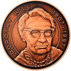
The Dorothy Hill Medal, awarded by the Australian Academy of Science, is one example of an award celebrating exceptional women researchers in Earth Sciences. It honours the late Dorothy Hill for her contributions to Australian Earth Science and her work to make tertiary science education more accessible to women. You can read more about this year's winner, Linda Armbrecht, on pages 24-25.
GSA Distinguished Fellows Nomination process
The Distinguished Fellows of the GSA is a prestigious recognition that honours members who have made outstanding contributions to Society and the broader Earth Science community. The GSA Awards and Fellowship committee encourages members in collaboration with your State or Territory division to identify and nominate deserving individuals with outstanding contributions to the GSA and Earth Sciences.
Selection criteria
Nominees for Distinguished Fellowship must demonstrate exceptional contributions in at least one of the following areas:
Service to the GSA: Significant leadership and impact within the Society, such as holding executive roles, contributing to key committees, or organising major conferences and symposia.
Practical application of Earth Sciences: Influential work in fields such as resource exploration, hydrogeology, geotechnical engineering or natural hazard assessment.
Research contributions: A substantial body of impactful research, including notable publications in peer-reviewed journals or government reports.
Education and training: Leadership in mentoring, supervision, or teaching at undergraduate or postgraduate levels, as well as contributions to workshops or field trips.
Earth Science program administration: Oversight of significant programs that have advanced Earth Sciences or the Earth Science community.
Public outreach: Extensive efforts in communicating Earth Sciences to the general public beyond professional conferences.
Other notable contributions: Any additional impactful work relevant to the field.
All claims in the nomination must be demonstrable and supported by evidence of a significant contribution or excellence recognised by peers.
Nominations must be submitted using the official nomination form and cannot be self-nominated. The GSA Awards Committee will assess each submission before final approval by the Executive Committee. The nominee and nominators will be informed of the outcome following this process.
For further details on the nomination process, please refer to the GSA website:
Posthumous nominations
Posthumous nominations for Distinguished Fellows are also welcome. These nominations must include:
1. a completed nomination form outlining the nominee’s contributions
2. a list of up to five individuals who can provide written statements addressing the selection criteria. These statements should offer insight into the nominee’s impact and achievements in their respective fields.
If you have any questions regarding the process, please contact Peter Betts or Amber Jarrett at info@gsa.org.au.
PETE BETTS and AMBER JARRETT
Past Chair and Chair of the Awards and Fellowship Committee
You Rock Awards
The GSA has established the You Rock award, a new internal award that highlights the amazing efforts of our volunteers who work tirelessly behind the scenes to make the GSA a fantastic place.
Sabin Zahirovic
For many years, Sabin Zahirovic has given an extraordinary amount of his time and energy to the GSA, both nationally and at the state level, and he does it all with unwavering enthusiasm and a big smile.
Sabin currently serves as Chair of the Education and Outreach Specialist Group, a role he has held for several years. He has championed new ways to engage high schools and teachers, including contributing to curriculum development for the Earth and Environmental Science elective with the New South Wales Department of Education. He also represents the GSA on the Australian Geoscience Council’s Education Committee.
Sabin is Chair of the NSW Division, where he and his team have revitalised the program with monthly in-person seminars, careers nights and outreach events such as Science in the Swamp. He stepped into this leadership role during a particularly challenging period for Earth Science departments in NSW universities. Sabin played a visible and vocal role in advocating for Earth Science education and supporting colleagues through the disestablishment of the Earth Science major at University of Wollongong, a situation that took an emotional toll on many in our community.
There will be: - field trips, beachside geology, and social events - workshops, including MAGEMin/THERMOCALC
Second circular in early June
Convenors: David Murphy and Balz Kamber (QUT) Mark Kendrick and Teresa Ubide (UQ) Helen McCoy-West (JCU)
Sabin, thank you for your tireless support of the GSA and your passionate advocacy for Earth Science. You rock!
as a colleague make her not just a standout committee member, but a personal role model.
Jo, thank you for being the foundation of our NT Division. You rock!
Photo: Supplied
NEWS FROM THE DIVISIONS
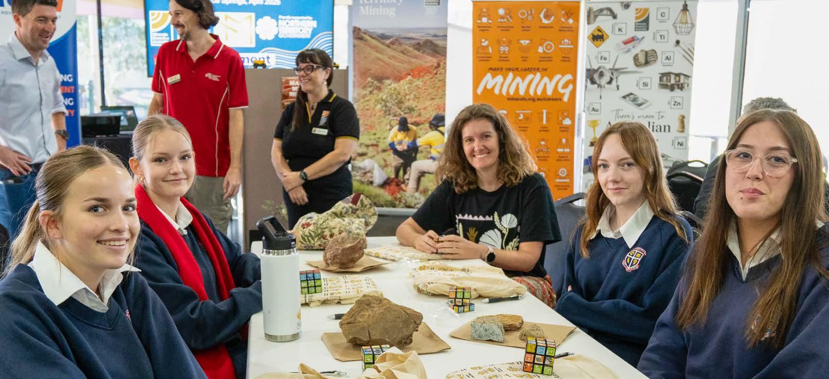
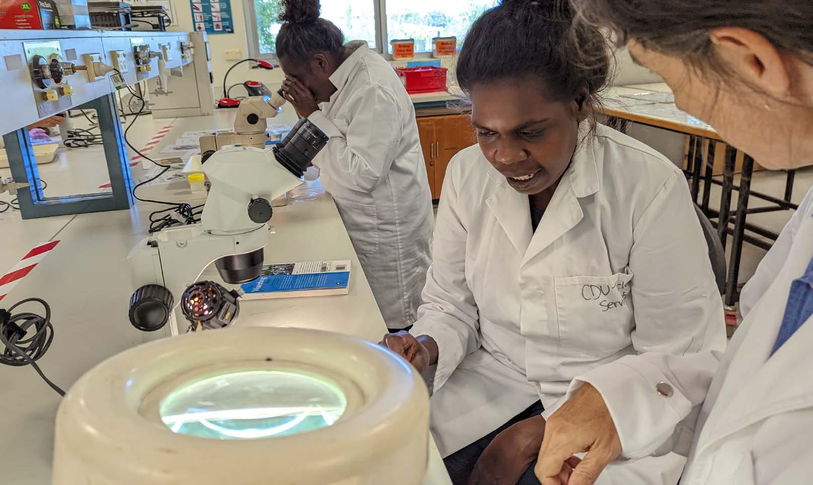
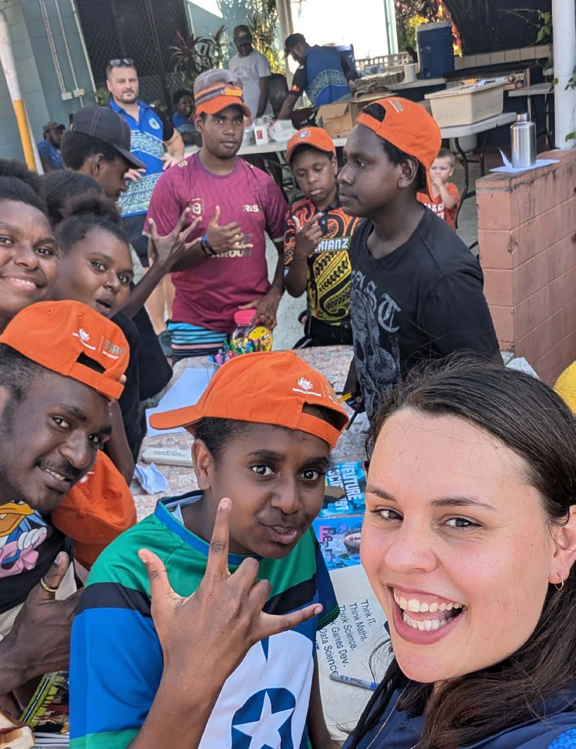
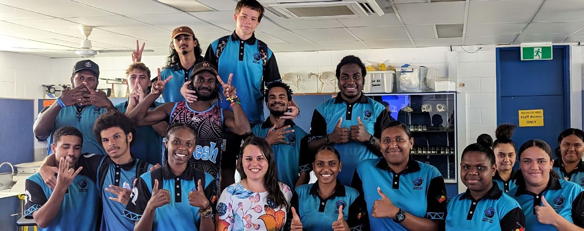
NT students explore Earth Science careers
On 2 April, the world of Earth Science came alive for students in Alice Springs as they took part in the Inspiring Careers in Earth Science Forum — a dynamic, handson event designed to showcase the rich diversity of opportunities in Australia’s resource sector.
The forum was hosted by the Minerals Council of Australia Northern Territory Division in collaboration with AusEarthEd and the GSA NT Division. It aimed to ignite curiosity and demonstrate just how rewarding a future in Earth Sciences can be.
Held at the Alice Springs Golf Club, the day was packed with interactive activities. Students tackled a gold exploration workshop, raced through a high-energy ‘speed careers’ session with professionals from industry, research and government, and even set off on a local excursion to uncover the geological secrets and mineral potential of Central Australia. These immersive experiences helped students connect classroom learning to real-world applications in geology, mining, environmental science and more.
“It was such a joy to see the smiles on students’ faces as they cracked the exploration challenge and struck gold in Tennant Creek,” Amber Jarrett, forum facilitator, says.
“Our program brings together local representatives from industry, government and academia to share insights into careers these students didn’t even know existed.”
The forum was made possible through the generous support of Newmont Australia, with contributions from local industry representatives Arafura Resources Limited, Tennant Minerals, and Megafauna Central, which shared their expertise and passion for the sector.
Special thanks to AusEarthEd educator Lachlan Hallett who ensured the activity ran smoothly, was age-appropriate and curriculum-aligned. Gratitude also goes to the volunteers from the GSA NT Division, who led the field trip to ANZAC Hill and shared their deep knowledge of Alice Springs geology and mineral systems. The field trip was inspired by
GSA NT member Anett Weisheit’s book Behind the Landscape of the Central Ranges.
“With a growing number of mining and resourcing projects in the pipeline, it is essential to grow a local skilled workforce. This is a shared responsibility for industry, government, and educators,” Cathryn Tilmouth, Executive Director of NT for the MCA, says.
The event also highlighted the broader benefits of working in the resources sector, from job diversity and community impact to the chance to work in some of Australia's most unique and beautiful landscapes.
Students and teachers left the day with new knowledge, new connections, and, we hope, new ambitions. Whether they become geologists, engineers, environmental scientists or resource managers, the event sparked plenty of future career ideas — one rock at a time.
ACT Division meeting April 2025
At the Division meeting on 9 April 2025, at Geoscience Australia, Richard Blewett presented on exploring for gold in the central Lachlan Orogen, New South Wales. Richard’s talk captured his passion for the science of gold exploration, and gave the GSA ACT Division members an insight into the interesting geology of the Weethalle region.
Projects such as this highlight the value of precompetitive data. I thoroughly enjoyed seeing the application of many different datasets in their exploration, and cannot wait to hear about the outcome of their drill holes!
Thank you to everyone who attended and stayed for networking after Richard’s talk, and thank you to Geoscience Australia for allowing us to use the Raggatt Theatre. For those who could not attend, but would like to listen to Richard’s talk, it can be found at the GSA’s Youtube channel: @geologicalsocietyaustralia
TIAH PENNY
Chair, ACT Division
New awards for geoscientists in Victoria
While applications for this year have now closed, keep these in mind and nominate an outstanding geoscientist next year!
Find more details via the QR code.
GSA Victoria is excited to announce the establishment of two new awards in 2025 to celebrate early-career and mid-career geoscientists working in Victoria. The Society also continues to recognise career contributions to Victorian geology with the Selwyn Medal.
Photo left: Students from Saint Phillips High School at the event, with the Minister Joshua Burgoyne, Lachlan Hallett, and Amber Jarrett in the background.
Photo: Minerals Council of Australia
Queensland Division supporting emerging scholars
The Queensland Division continued to support student involvement in GSA conferences by offering bursaries to attend Tectonics on the Tablelands, the Structural Geology and Tectonics Specialist Group (SGTSG)’s biennial event held at University of New England, Armidale, in November 2024.
Bursaries of $500 (for Brisbane-based students) and $750 (for Townsville-based students) helped cover travel and accommodation costs. To be eligible, students had to be GSA members with an accepted paper or poster, and submit a short reflection on their experience. Eleven PhD candidates from The University of Queensland, Queensland University of Technology and James Cook University received bursaries.
Here’s what three students had to say about their experience.
Attending the conference was such an enriching experience for me, as I’m just starting my PhD here in Australia. I was able to meet experts in structural geology and tectonics and talk to them firsthand about their research. I am currently studying the New England Orogen, and this conference provided me with invaluable information about the evolution of the region, as well as helpful advice from peers who studied the same area in the past. I would like to express my gratitude to the GSA Qld for their assistance and I look forward to attending the next conference.
SGTSG 2024 presented a welcoming atmosphere, encouraging open discussions between researchers irrespective of their career stage. As a student, this event was important for me to learn how science can be communicated, not only in formal talks and posters but also as small friendly conversations with enthusiastic attendees in a relaxed environment. The conference presented many opportunities for this style of networking as everyone was approachable and genuinely supportive. By the end of the conference, I had made some meaningful connections.
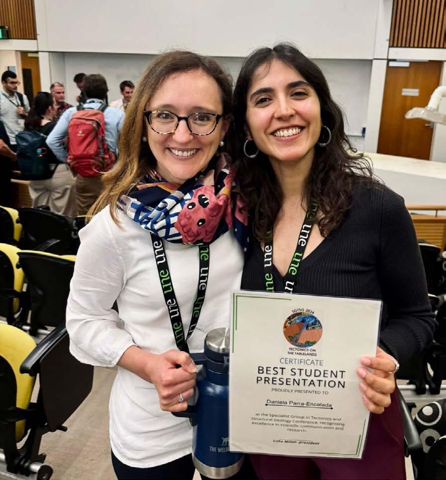
The conference was organised by a fantastic team who created a dynamic and welcoming environment. I had the chance to connect with researchers across Australia working in different disciplines, and the exchange of ideas and discussions that followed were incredibly valuable. I also presented my PhD research at an Australian conference for the first time and was awarded Best Student Presentation. Beyond this recognition, for which am very grateful, I especially appreciate the insightful discussions that followed with researchers familiar with my study area, some of whom have even lived there. This was particularly meaningful to me, as my study area is in my home country, Chile.
JULIUS PASCO School of the Environment, The University of Queensland
EMMA CONWAY James Cook University
DANIELA PARRA-ENCALADA School of the Environment, The University of Queensland
Left: Julius Pasco with his poster. Photo: Julius Pasco
Right: Daniela Parra-Encalada holding her certificate for Best Student Presentation with
Senior
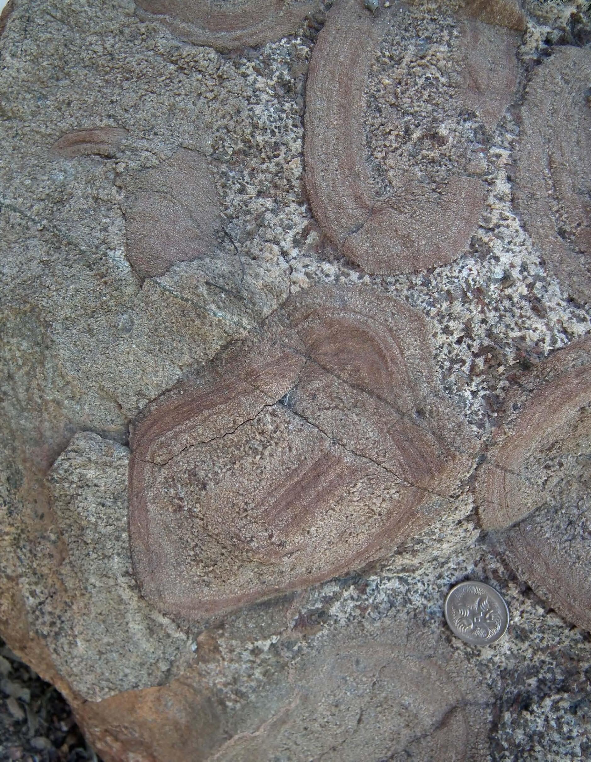
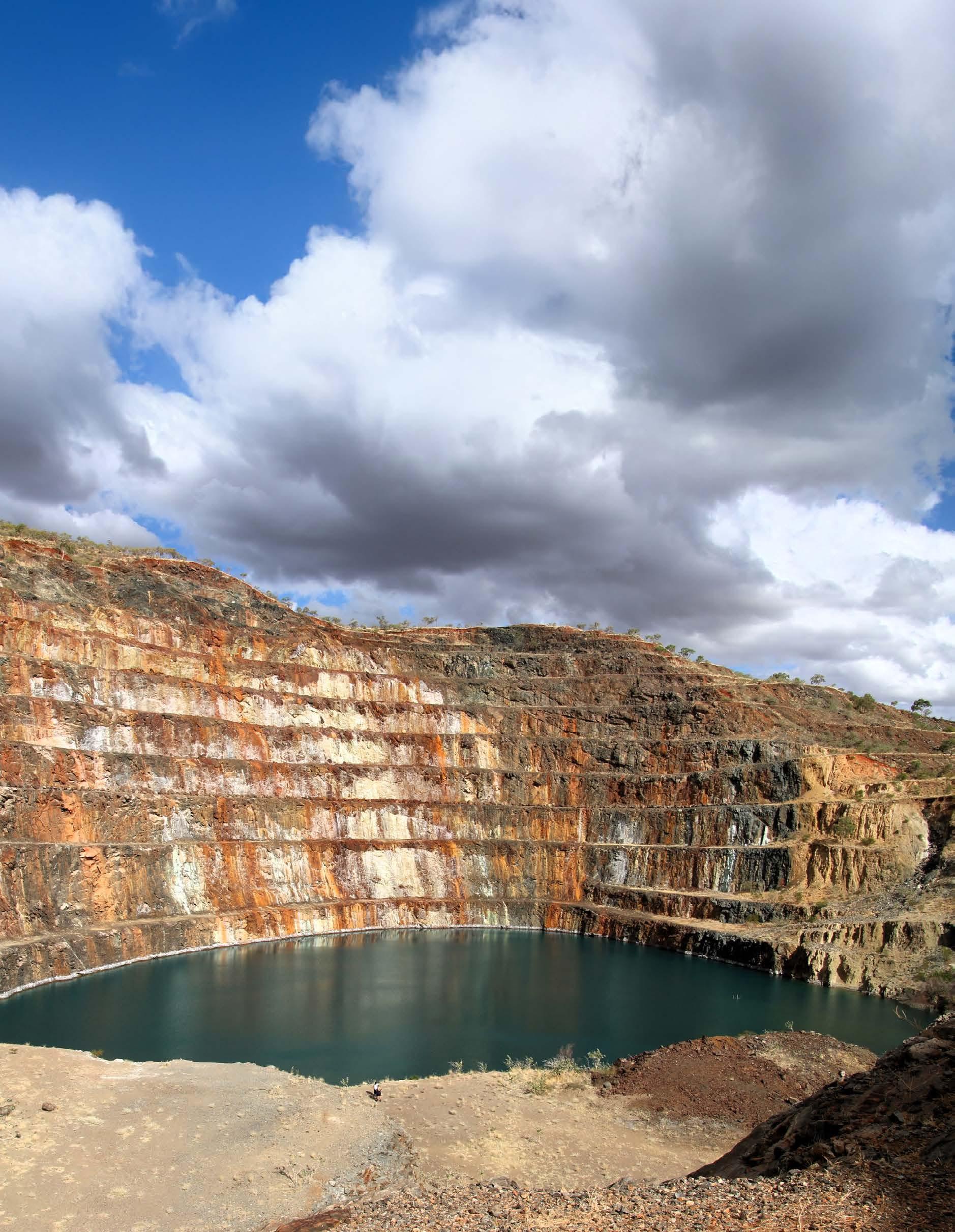
Carl Spandler and I collected this orbicular gabbro from the Stannett Creek Gabbro, situated about 11 kilometres west of Charters Towers in Gudjal Country, Queensland. It came from one of the best of more than 40 individual orb localities that I’ve mapped there. They occur within a central unit, occupying an area of 0.35 square kilometres. The orbs on the boulder illustrate the complexity of their crystallisation history. The boulder is now located in the rock garden outside the James Cook University Library.
LifeMet
from
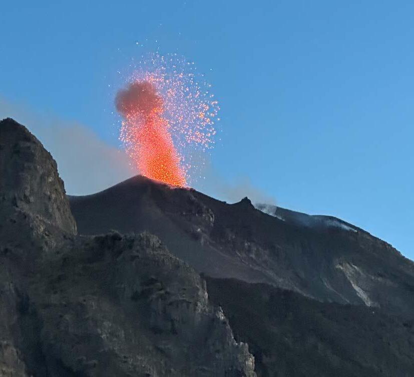
An eruption at Stromboli, one of seven islands that form the Aeolian volcanic arc north of Sicily, in August 2023. Every 10 to 20 minutes, Stromboli launches fireworks of lava, lapilli, ash and smoke hundreds of metres into the air. I took three planes, two boats and a guided hike in unseasonable high winds to reach this viewpoint, just 300 metres away from the multiple volcanic vents that form the stratovolcano's summit. It’s now one of my favourite places in the world.
The
Team
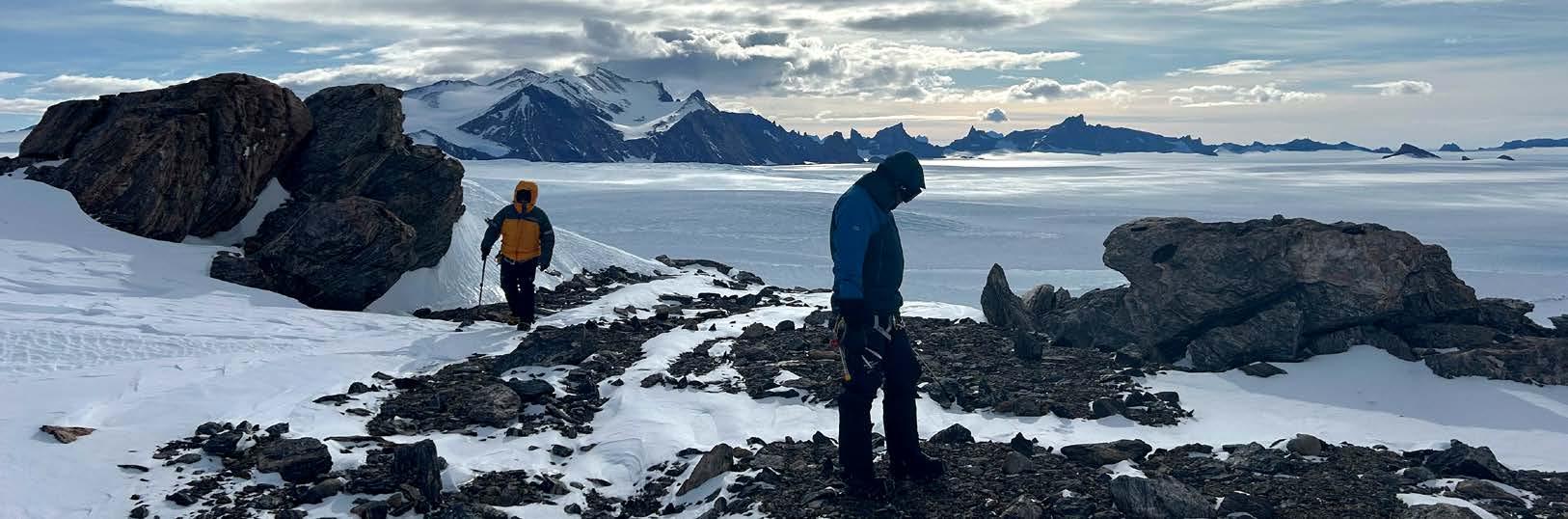
Monash University, consisting of Rachael Lappan, Andy Tomkins, Rachel Kirby, and mountain guide Mark Evans, searching for meteorites in a remote field site in Queen Maud Land, Antarctica.
Mike Rubenach, Retired Member, Former petrology
Lecturer, JCU
Rachel Kirby (she/her), Postdoctoral Research Fellow, Monash University
Emily Finch, Group Manager Microscopy, ANSTO Australian Synchrotron
Amber Jarrett, GSA Past President
Photo: Grace Jaravani
PHOTOS FROM THE FIELD
Tim Munson, Amber Jarrett and Ananyaa Deepak at the Burrell Creek Formation in the Adelaide River area, on the lands of the Kungarakan, Awarai and Larrakia People, Northern Territory.
Using inclusive language and why it matters
Not sure if your language is inclusive when speaking about Aboriginal and Torres Strait Islander peoples in your work? The GSA’s Geoscience Indigenous Collaboration and Engagement Specialist Group (GICE) shares some tips.
At GICE, we provide strategic direction and leadership to the Australian Earth Science community to ensure Earth Science is inclusive of, and equitable for, Aboriginal and Torres Strait Islander peoples: the traditional custodians of the lands, seas, skies and waters where Australian Earth Science is designed, conducted and realised for national human and environmental benefit.
Here, we share some information to support your efforts to build a more respectful and inclusive workplace culture. However, please always check with your Aboriginal and Torres Strait Islander colleagues about what terminology they prefer people to use.
It’s always better to ask than to assume. Your workplace may also have some guidelines to help you.
Tips for respectful and inclusive language:
The term ‘Indigenous’ is correct and reflects international rights and status frameworks. However, some people prefer to use ‘Aboriginal and Torres Strait Islander peoples’ or ‘First Nations’.
Be careful with terms such as ‘First Australians’ or ‘Indigenous Australians’, as some may not identify with these labels.
The phrase ‘Aboriginal and Torres Strait Islanders’ should, in most cases, be accompanied by a noun such as ‘people’, ‘communities’, ‘youth’, etc.
Wherever possible and appropriate, use specific names of the relevant Country or language group like Wiradjuri, Bunuba, Kuku Yalanji, Arrernte or Pitjantjatjara.
Include cultural names, locations and peoples in your reports, publications and maps. When unsure, ask how to do this respectfully.
Many Aboriginal and Torres Strait Islander peoples find the acronym ATSI disrespectful, even if it takes less time to write.
Make sure you are not making sweeping generalisations under the umbrella terms ‘Aboriginal and Torres Strait Islander’ or ‘Indigenous’ that do not reflect regional diversity.
Sometimes the use of the terms ‘Aboriginal and/or Torres Strait Islander’ is appropriate, since significant numbers of people have both ancestries.
Use language and narratives that focus on strengths. While talking about disadvantage can be necessary, balance this with positive ways forward, acknowledging the efforts of Aboriginal and Torres Strait Islander peoples.
GEOSCIENCE INDIGENOUS COLLABORATION AND ENGAGEMENT SPECIALIST GROUP
Supporting Indigenous researchers: A practical guide for supervisors
2023 Reconciliation Action Plan Impact report
Video: Understanding systematic oppression and institutionalised racism
If you’d like to join GICE and get involved, visit our website and scroll to ‘How to join’:
Photo:
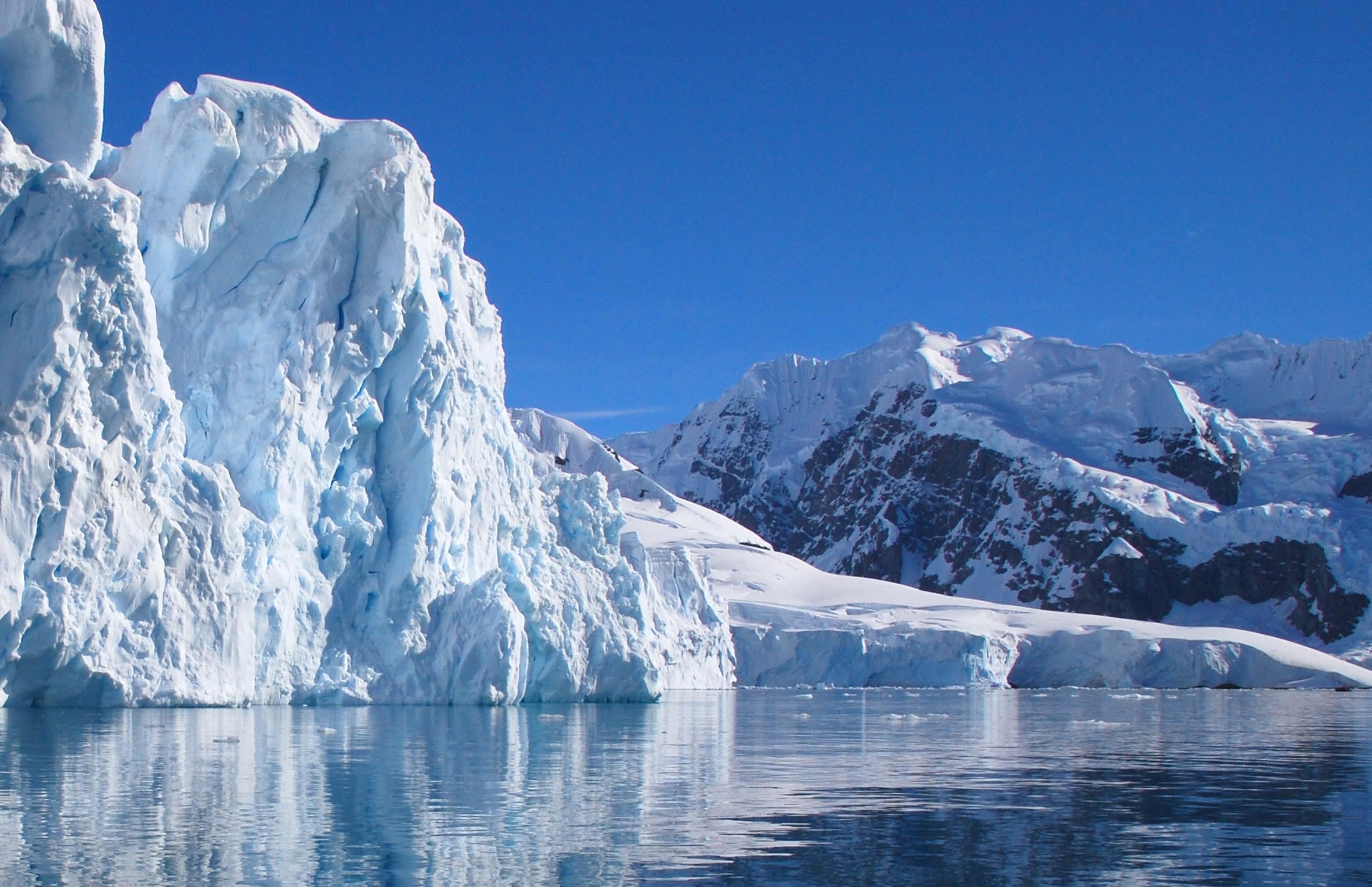
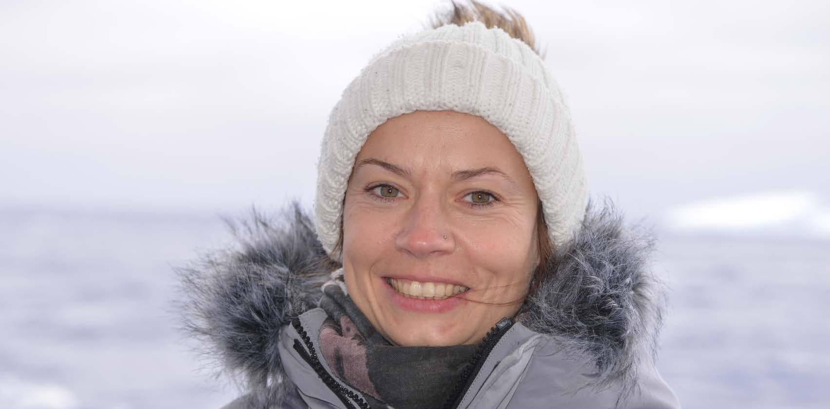
Congratulations Linda Armbrecht, 2025 Dorothy Hill Medal recipient
The Dorothy Hill Medal, awarded by the Australian Academy of Science, celebrates exceptional women researchers in Earth Sciences within ten years of completing their PhD. This year’s recipient, Linda Armbrecht, was recognised for her pioneering marine and Antarctic research, innovative use of paleogenomics, and dedication to addressing climate change.
Linda Armbrecht is an ARC Discovery Early Career Researcher Award Fellow and Senior Lecturer at the Institute for Marine and Antarctic Studies, University of Tasmania. She has extensive expertise in marine and environmental sciences, with a PhD in Biological Oceanography from Macquarie University, a Master in Marine Biology from the University of Bremen and a Bachelor in Biology of Organisms from Osnabrück University in Germany.
Throughout her career, Linda has focused on reconstructing past marine ecosystems, especially the Antarctic environment. She uses sedimentary ancient DNA (sedaDNA)
to investigate how ecosystems and species have changed over hundreds of thousands of years. Her interdisciplinary research brings together marine biology, genomics, bioinformatics, micropaleontology and biostratigraphy, offering valuable insights into the impacts of shifting climates on marine life.
Before joining the Institute for Marine and Antarctic Studies, she was a Research Fellow and ARC Research Associate at the Australian Centre for Ancient DNA, The University of Adelaide, where she led studies into past Scotia Sea biodiversity and harmful algal bloom dynamics off Tasmania. Earlier, she held
“
To date, I've travelled to Antarctica five times, and am about to embark on my sixth expedition to the icy continent leading my own voyage to the completely under-explored Cook Glacier marine region in 2026
”
an Australian Endeavour Postdoctoral Research Fellowship, collaborating with Chris Bowler in Paris, France, to develop sea-ice proxies using marine genomics and transcriptomics.
Linda is also a leader in fostering international collaboration. She has been a member, Vice-Chair and Chair of the Australian and New Zealand International Scientific Drilling Consortium Science Committee over the past few years, a steering committee member of the Past Global Changes (PAGES) PaleoEcoGen Working Group, and is an advisory board member of the international SedaDNA Society. In 2026, she will lead an interdisciplinary RV
Investigator voyage (COOKIES: Cook Ice Ecosystems and Sediments) to study the paleo history (biology, oceanography and geology) of the highly vulnerable East Antarctic Cook Glacier marine region.
“To date, I've travelled to Antarctica five times, and am about to embark on my sixth expedition to the icy continent leading my own voyage to the completely under-explored Cook Glacier marine region in 2026,” Linda says.
Linda’s exceptional contributions to research have been recognised through numerous prestigious awards,
including the 2021 South Australian Young Tall Poppy Science Award, the 2020 Edith Dornwell Medal for Early Career Research Excellence from The University of Adelaide, and the US Antarctica Service Medal.
The 2025 Dorothy Hill Medal celebrates Linda’s remarkable achievements in marine and Antarctic science. Her innovative research and leadership in international collaborations inspire the next generation of geoscientists. Linda’s work honours Dorothy Hill’s legacy and contributes to tackling critical challenges such as climate change.
Congratulations, Linda!
The Australian Academy of Science acknowledges the generous sponsorship provided by the GSA, and Australasian Palaeontologists, The University of Queensland, the Brisbane Girls' Grammar School, Rio Tinto and Woodside Energy.
ALANIS OLESCH-BYRNE, PhD Candidate, University of Melbourne
PETER BETTS, Deputy Dean Engagement and Graduate Research, Faculty of Science, Monash University
Photo: Shutterstock
Linda Armbrecht.
Photo: Andrew Carroll
Outback dinosaur excavator, science communicator, role model
Adele Pentland discovered two new species of pterosaur and collaborates with museums in central-western Queensland to promote tourism across the outback. Now, she’s joined the ranks of the 2025 Superstars of STEM to help shift public perceptions of who can be a scientist.
THE AUSTRALIAN GEOLOGIST | 27
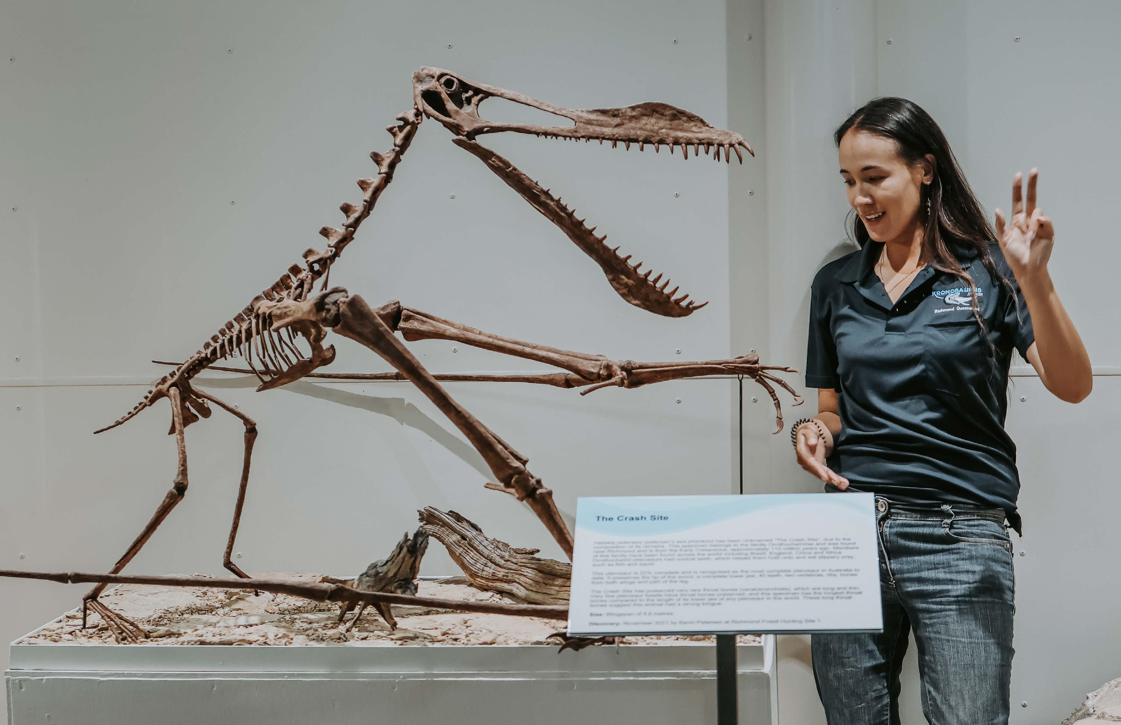
Adele Pentland with a replica model of Anhanguera piscator, taken at the Haliskia peterseni unveiling at Kronosaurus Korner.
Photo: Renee Backer Collective
On 18 April 2025, 60 outstanding scientists, technologists, engineers and mathematicians were officially named Australia’s newest Superstars of STEM. Run by Science & Technology Australia and funded by the Department of Industry, Science and Resources, this initiative equips women and non-binary STEM professionals with the skills, confidence and opportunities to become visible role models in the media and public life.
Over two years, these Superstars will receive intensive training to step into the spotlight: sharing their expertise with the public, inspiring young people in classrooms, and showing that STEM is for everyone.
“We know it’s really hard to be what you can’t see,” says Sandra Gardam, Science & Technology Australia Deputy CEO and Superstars of STEM Program Manager.
“By becoming highly visible role models in the media, these Superstars of STEM are showing our diverse next generations of young people – especially our girls and non-binary kids, regardless of where they live and whatever their background – that STEM is for them.”
A special shout-out goes to the Earth Scientists in this impressive 2025 cohort —congratulations on being recognised as leaders in your fields! Paleontologist and
part-time PhD candidate Adele Pentland is one of those Superstars. We sat down with Adele to ask her more about her research and what it means to be a Superstar of STEM.
What is your field of expertise?
am a final-year PhD candidate at Curtin University, specialising in pterosaurs — flying reptiles that lived during the age of dinosaurs. Under the supervision of Stephen Poropat, Patricia Vickers-Rich and Kliti Grice, my research focuses on the paleobiogeography of Cretaceous pterosaurs from eastern Australia. I have published seven lead-author papers and collaborated with international research teams on nine additional studies describing dinosaurs and other fossils.
My proudest achievements include naming Ferrodraco lentoni and Haliskia peterseni, the most complete pterosaurs ever found in Australia. Both species are on permanent public display in Queensland museums: one at the Australian Age of Dinosaurs Museum of Natural History in Winton on Koa Country, and Kronosaurus Korner in Richmond on Wanamara Country, respectively.
What does it mean for you to be named a ‘Superstar of STEM’?
I’m incredibly humbled to have been selected as part of the current Superstars of STEM cohort. Each year, thousands of
accomplished women and non-binary people apply from across Australia, and only 60 are selected. While I have science communication experience already, including presenting to media and school groups, I was genuinely honoured, and pleasantly surprised to be selected for such a prestigious and competitive program.
It’s inspiring to be part of a program that includes so many women I admire. Among the current Superstars are Liz Reed from The University of Adelaide, whose work on Quaternary cave deposits has contributed to our understanding of megafauna extinctions. Melanie Finch and Emily Finch were two of my Monash University demonstrators, and their enthusiasm for geoscience was truly infectious. Marissa Betts, who leads the Betts Lab at University of New England, is another paleontologist I greatly admire — her research on early Cambrian fossils is shaping how we understand some of the earliest complex life on Earth.
Although these women are incredibly inspiring, I’m also proud to step into this role myself as a mixed-race Superstar of STEM. Representation is powerful, and I hope that by being visible in this space, I can serve as a role model for young girls who love dinosaurs and paleontology.
I want them to feel confident that this field is for them — that their curiosity and passion for the natural world can lead to an exciting and fulfilling career.
What are you working on currently?
My top priority is preparing my thesis for submission so I can apply for postdoctoral research fellowships in 2026. I am also collaborating with my supervisors on geochemical analysis of exceptionally preserved fossils.
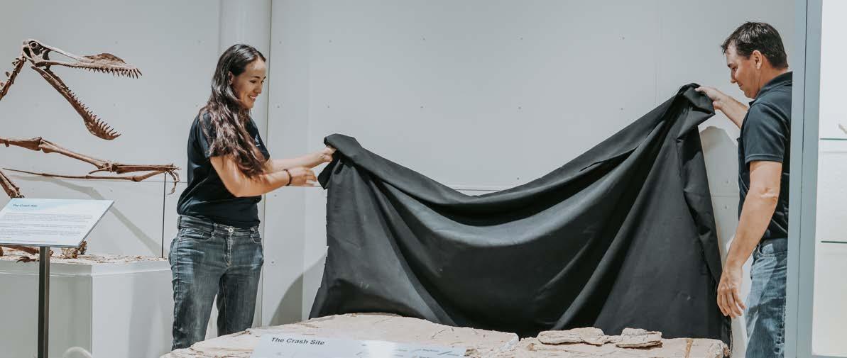
I’m working on describing an exciting pterosaur specimen discovered by Kevin Petersen, the curator of Kronosaurus Korner. Later this year, I will visit Kronosaurus Korner and run science communication workshops with my friend and collaborator Zev Landes, who is developing a series of educational cartoons for the museum.
I am also co-supervising a student completing a third-year research project. I have had limited teaching opportunities, as I lived and worked on a 32,500-acre sheep and cattle station in outback Queensland for most of my PhD. Mentoring a student has been an incredibly rewarding experience, and I hope it marks the beginning of many more opportunities to support emerging researchers.
Why is Earth Science so important right now?
Earth Science has always played an important role in shaping our understanding of the world around us, particularly here in Australia. Understanding geological processes helps us reconstruct past environments, and through studying fossils we can interpret biodiversity shifts through time. This sheds light on ancient ecosystems and offers insights into life on Earth without human influence.
While Australia is generally considered a geologically stable continent with minimal seismic and volcanic activity, Earth Science remains critical to address challenges such as coastal erosion, which threatens infrastructure and may cause habitat loss. By studying these processes, we can better prepare for and mitigate environmental changes, ensuring sustainable development and conservation efforts.
And finally – what’s your favourite dinosaur?
My favourite dinosaur is Diamantinasaurus matildae , one of the most common dinosaurs found in the Upper Cretaceous Winton Formation of central western Queensland. Diamantinasaurus was a type of sauropod, similar to Littlefoot from The Land Before Time or Arlo from Disney’s The Good Dinosaur a large, herbivorous dinosaur with a relatively small head, long neck, long tail, and sturdy, column-like legs. Adult individuals were approximately 16-metres long from nose to tail and stood an impressive 2.5-metres tall at the shoulder.
I have a strong personal connection to Diamantinasaurus having co-authored papers describing its fossils and participated in the excavation of several specimens. I remember the moment I uncovered a beautifully preserved thigh bone, approximately 1.5-meters long, belonging to one of the most complete sauropod skeletons ever found in Australia, a specimen nicknamed Judy. We also found Judy’s gut contents, providing rare, direct evidence of this dinosaur’s diet and ecology. Being part of the discovery of such a well-preserved and scientifically significant specimen has made Diamantinasaurus my absolute favourite dinosaur.
Thanks Adele, and congratulations again!
TAG EDITORIAL TEAM
I hope that by being visible in this space, I can serve as a role model for young girls who love dinosaurs and paleontology
” “
A newly discovered skull of the Cretaceous fish Calamopleurus cylindricus at a site excavated by Universidade Regional do Cariri in Crato, Ceará, Brazil.
Photo: Renan Bantim
Adele Pentland and Kevin Petersen unveiling Haliskia peterseni at Kronosaurus Korner
Photo: Renee Backer Collective
Autumn in the National Rock Garden
Autumn, a beautiful season in Canberra, enhances the visitor experience at the National Rock Garden. It has been several months since their installation, and the rocks of our Stage 1 display (about 30% of the site) have settled in very well. However, we are keen to expand our display, and I am pleased to announce that, following successful fundraising over summer, Stage 2 construction (another 30% of the site) will begin in mid-June and be completed by July, weather permitting.
The National Rock Garden took part in the 2025 ACT Heritage Festival, held from 18 April until 11 May. This year’s theme was ‘Unearthed’, fitting beautifully with our display of deep-
time rocks. Our events included guided and self-guided tours, and we also developed a Treasure Hunt for kids (and curious adults) to explore some of the more interesting features of our rocks. Participants who completed the game received a geological timescale bookmark as a keepsake.
The treasure hunt was designed specifically for the festival and was generously road tested by members of a local yoga class, thanks to one of our committee members. Their feedback helped us fine-tune the game, and great fun was had by all!
More great news: In March, the National Arboretum received GOLD for Ecotourism and SILVER for Excellence
in Accessible Tourism at the 2024 Qantas Australian Tourism Awards. A special Award Celebration Morning Tea was held at the Arboretum in April. Marita Bradshaw, Michelle Cooper and I represented the National Rock Garden at the celebration – in perfect autumn weather, of course.
As a site partner, the National Rock Garden can justifiably be proud of this achievement.
The Treasure Hunt can now be accessed online and enjoyed at any time:
BRAD
PILLANS, Director, National Rock Garden
From pyrite to paleoclimate
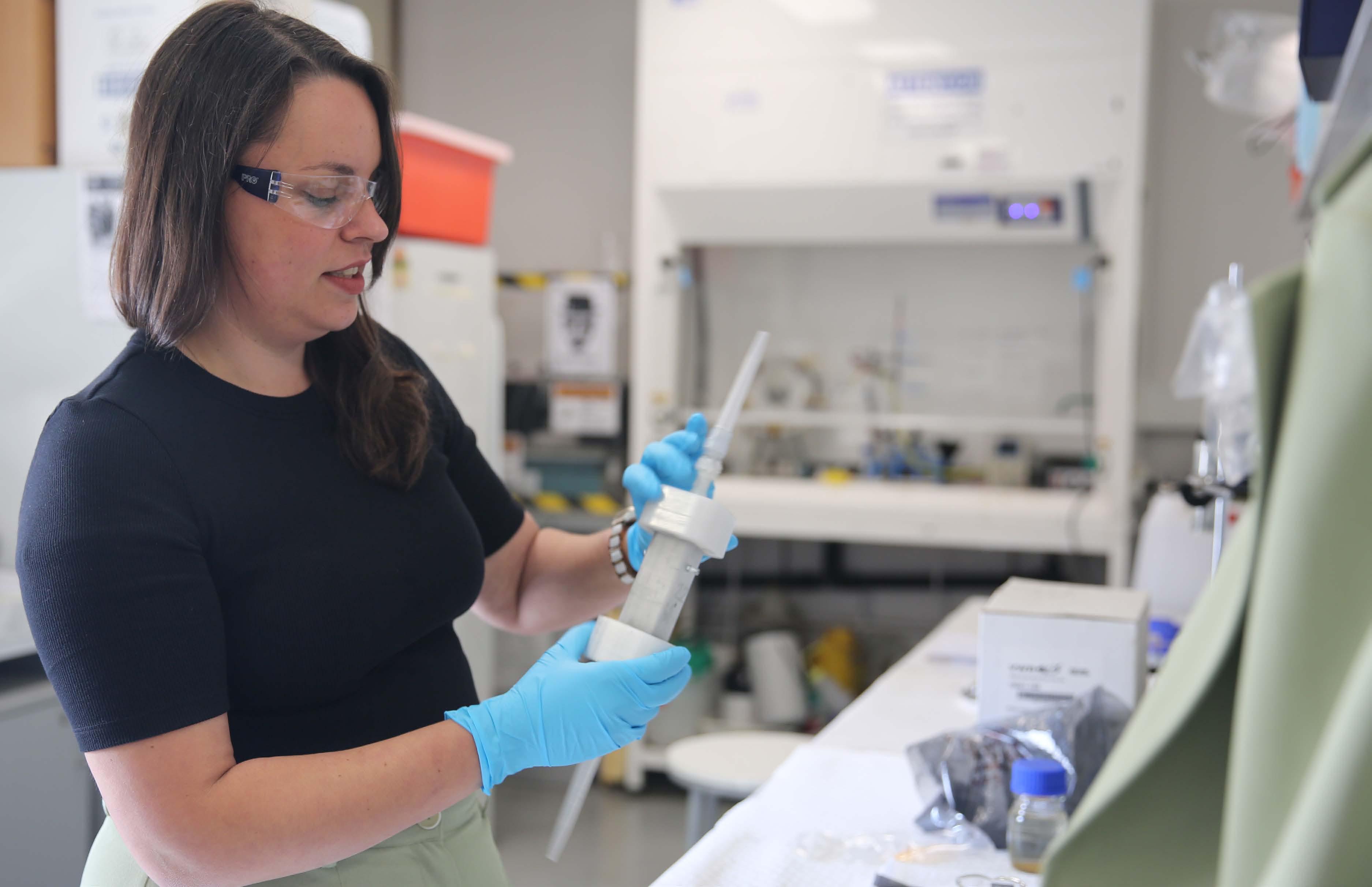
Geochemist Indrani Mukherjee is digging into everything from climate records to critical minerals — and building a more inspiring future for geoscience along the way.
Indrani Mukherjee didn't fall in love with geology straight away. It wasn't until her third year of undergraduate study that something clicked, thanks to "fantastic lecturers at University of Delhi" whose clear and inspiring teaching left a lasting impression.
Fast forward to today, and Indrani is elbowdeep in research that spans everything from cool-water carbonates in the Great Australian Bight to the critical element potential of Australian coal fly ash.
"And somewhere in the middle," she adds, "there's always pyrite."
Her work uses trace element geochemistry to track climate change from the Miocene (a time of warming) to the Pleistocene (cooling), helping us better understand how Earth's climate has evolved — and what that might mean for our future.
Indrani's path into academia began in India, where she completed her undergraduate and master's degrees before moving to Australia in 2014 to start a PhD. She was awarded her doctorate in 2018 and, after several years of postdoctoral research, was appointed lecturer at UNSW Sydney in 2023.
comes with a funky box full of challenges and surprises," she says. But her mantra is simple: "Never give up."
"I channel my inner stubbornness as a strategy; my folks will tell you I have plenty of that."
What excites her most in academia?
Collaboration. "Working with experts in different fields can be extremely enriching for both sides," she says.
She's also a big advocate for mentorship, crediting Mihir Deb, Ross Large and Jacqueline Halpin as key influences on her journey.
In 2023, Indrani was named a Superstar of STEM by Science & Technology Australia — a recognition that reflects not just her research, but also her commitment to outreach and mentorship.
Like many in the field, she's concerned about where things are heading. But that concern is also what drives her.
"I would love to be able to generate passion for geosciences in the younger generation. I think they need to know that our field is what will enable them to look after the future of our planet."
is back!
After a hiatus, the Australasian Geoscience Educators Network (AUGEN) is back in action, with new activities and initiatives already underway!
Founded in 2012 as the Australasian Universities Geoscience Educators Network, AUGEN was established to encourage and support excellence in teaching and learning in geoscience across Australia, New Zealand and the Pacific. Its updated name reflects a broader focus to welcome all geoscience educators beyond the tertiary sector.
geoscience education research projects. Membership is free and open to all with an interest in geoscience education.
A new website is under construction at augengeo.net and you can reach the AUGEN team at augenmail@gmail.com.
"I think knew right from the start I wanted to be in academia," she says. "My PhD experience reinforced that as I absolutely loved my time as a PhD candidate."
Of course, moving countries and building a career come with their share of hurdles.
"Leaving one's home country and establishing themselves in Australia
And if she could follow one big research dream? "I would love to explore for signs of life on early Earth. I am fascinated by how that all played out on Earth all those billions of years ago."
ALANIS OLESCH-BYRNE, Early Career Geoscientist Advisory Panel (ECGAP)
AUGEN enables educators to share resources, build networks and undertake
“Can we find the next clue? A sea-lily (crinoid) fossil in the Canberra limestone?” Marita Bradshaw and members of her yoga class road testing the Treasure Hunt. Photo: Meg Smith
Indrani Mukherjee Photo: Supplied
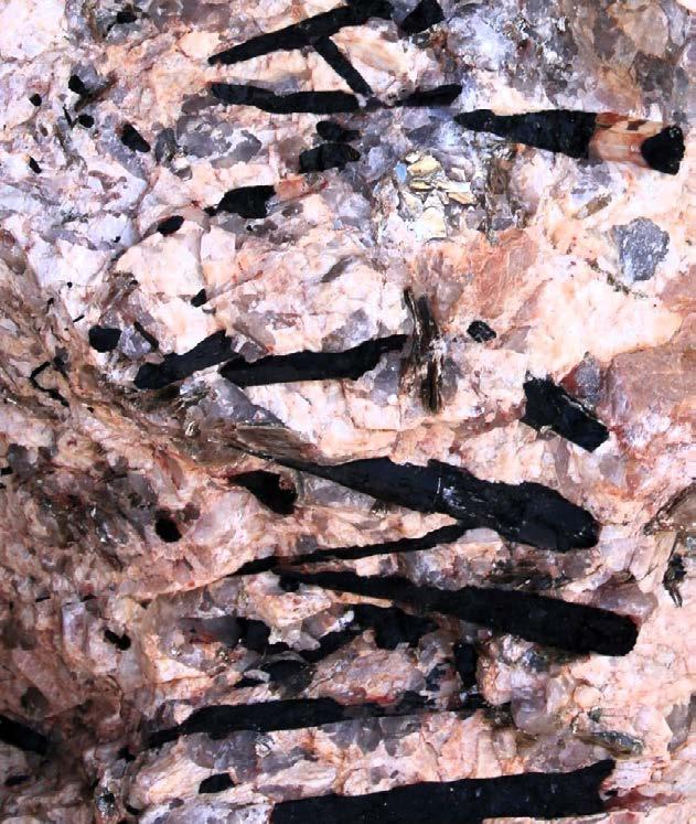
The hidden potential of Adelaide black granite
Australia has some of the oldest and most stable granite on Earth. One type could be ideal for storing nuclear waste, new research in AJES finds.
With nuclear power back in the spotlight as Australia debates its future energy mix, there’s another big question we need to tackle: What might we do with the radioactive waste it produces?
Even without a nuclear energy industry, Australia currently generates about 45 cubic metres of radioactive waste from our existing medical and research facilities every year. Presently, we store this waste at a number of ‘temporary’ facilities scattered across the country. For many reasons, we are yet to confirm a site for the long-term geological disposal facility that we need, regardless of our future nuclear energy policy.
A suitable host rock for a geological disposal facility requires strength, stiffness, stability and low water absorption, porosity and permeability characteristics. Finding such a ‘Goldilocks’ rock can be challenging.
Granitic rocks are found to be the most suitable and host some of the most notable geological disposal facilities worldwide, including Forsmark (Sweden), Aspo (Sweden), Underground Research Laboratory (Canada), Beishan (China), Kamaishi (Japan) and Olkiluoto (Finland).
Australia sits on some of the oldest, most stable and resilient granitic rock formations in the world, located in the Pilbara, Yilgarn and Gawler Cratons. One particularly interesting rock is Adelaide black granite. Since Federation, Adelaide black granite has been widely
used in Australian heritage buildings and monuments due to its durability and aesthetic appeal.
But beyond its good looks, could it also be the perfect candidate for geological waste disposal?
Though studied primarily for its use as a dimension stone, its geological setting, geomechanical and hydrological properties make it a strong candidate.
Adelaide black granite is part of the Black Hill Gabbroic Complex. It was formed in place by three funnel-shaped intrusions that reach at least 3.5 kilometres below the surface. The Black Hill pluton is the most prominent outcrop and has a surface area of about three square kilometres. This pluton has been actively quarried for dimension stone for the past 125 years.
To explore its potential suitability as a host rock for a geological disposal facility, a series of geomechanical tests have been performed on samples sub-cored from a slab retrieved from the Black Hill Quarry. The laboratory tests include density, unconfined compression, triaxial compression and splitting tension.
Compared to other existing, planned or proposed nuclear waste facilities, the results of the geomechanical testing suggest Adelaide black granite’s strength and stiffness properties are superior to other host rocks around the world. Since its emplacement some 487 million years ago, Adelaide black granite has also undergone minimal deformation, and the rock is classified
as ‘massive’ from a geotechnical perspective.
Based on these in situ conditions, it is self-supporting at around 600 metres depth — deeper than many of the world’s current geological disposal sites, which average around 420 metres. Adelaide black granite also seems to have a lower damage potential than Forsmark and the Underground Research Laboratory facilities, based on the potential for strain bursting and spalling at this depth.
Beyond nuclear waste disposal, Adelaide black granite holds promising potential for multi-purpose underground storage and could support other underground applications. This includes carbon dioxide sequestration, hydrogen storage and geothermal energy systems. These applications align with Australia’s broader energy and climate goals, potentially making Adelaide black granite a key resource in future sustainable infrastructure projects.
While the samples obtained from the Black Hill Quarry tested in this study provide critical insights into the potential use of Adelaide black granite for geological disposal facilities, the results underscore the need for further geotechnical and hydrogeological investigations in drillholes at depth.
BRE-ANNE SAINSBURY, Professor of Geomechanics, Deakin University
ABTIN
ROOZ, PhD Candidate, Deakin University
To view the full article, scan the QR code:
Angel of Hahndorf sculpture, which is made of black granite from the Adelaide Black Hill quarry
Photo: Alamy
Bre-Anne Sainsbury Photo: Supplied
From bones to footprints: the polar dinosaur record just
got bigger
New track discoveries from the Wonthaggi Formation tell a story of dinosaurs and early birds roaming Australia’s polar landscapes as the continent drifted away from Antarctica. A recent paper in Alcheringa reveals the details.
Illustration: Emma Rehn
The Wonthaggi Formation (Early Cretaceous, 125–115 million years ago) is well represented by coastal outcrops of clastic sedimentary rocks along Victoria’s coast. Its sediments were originally deposited in freshwater lakes, rivers and floodplains in a riftvalley basin formed when southern Australia began breaking away from Antarctica. However, this former connection between Australia and Antarctica also means Wonthaggi Formation environments were near the South Pole then, which led to its eventual fossil fame. This includes the best-documented assemblage of
polar dinosaur remains in the Southern Hemisphere.
The first known polar dinosaur fossil in the Wonthaggi Formation — a claw from the foot of a large carnivorous theropod — was discovered in 1903. Since then, paleontologists have found many more dinosaur body fossils, especially at the ‘Dinosaur Dreaming’ dig site in Bunurong Country near Inverloch, Victoria. Dinosaur remains are mostly bones and teeth of small herbivorous ornithopods and small to large theropods. Compared to body fossils, dinosaur trace fossils were
apparently rare, represented by only two large theropod tracks that one of us (Martin) recognised in 2006. This was followed by dig-site volunteer Tyler Lamb’s find of a third large theropod track next to the Dinosaur Dreaming site in 2007.
This perceived scarcity of Wonthaggi dinosaur tracks all changed when ace fossil finder Melissa Lowery and her husband Aidan began prospecting coastal outcrops of the Wonthaggi Formation in the early 2020s.
With an uncanny eye for details and patterns, Melissa found dozens of three-toed dinosaur tracks from 2020–2022, all preserved on top surfaces of sandstones and siltstones exposed on marine platforms between the towns of Inverloch and Wonthaggi on the Bunurong coastline.
But because her discoveries happened during the worst of the COVID-19 pandemic, one of us (Martin) could not travel from the US to Australia to help verify and interpret these fossil tracks. Instead, we had to get by with only preliminary descriptions, photographs and measurements.
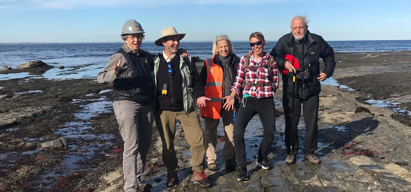
When the pandemic lessened in April 2022 and the Australian government lifted its tourist travel restrictions, Martin and his wife Ruth were able to travel to Victoria for a field study of the tracks. Our field team included us (Anthony, Patricia and Thomas), Ruth, Melissa, Aidan, geologist Michael Hall, paleontologist Doris Seegets-Villiers, and preparator Peter Swinkel. We all worked together during the last few weeks of May 2022 to document the tracks.
Our results surprised us in several ways. For one, within the first two days of field work, Martin began to suspect that most of the smaller (7–14 centimetres long) three-toed tracks were made by a special type of theropod: birds. Why? Because they closely matched bird tracks interpreted from other Early Cretaceous deposits in North America, China and Korea. The tracks were noteworthy as the oldest known in Australia and the rest of the Southern Hemisphere, and their polar setting showed that these ‘early birds’ were perhaps already migrating seasonally. These bird tracks were reported in a 2023 research article in PLOS One
Five of the co-authors in the field site, from left: Patricia Vickers-Rich, Anthony Martin, Doris Seegets-Villiers, Melissa Lowery and Thomas Rich.
Photo: Ruth Schowalter
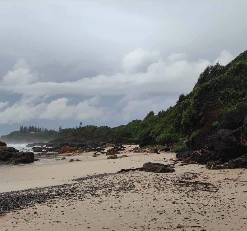
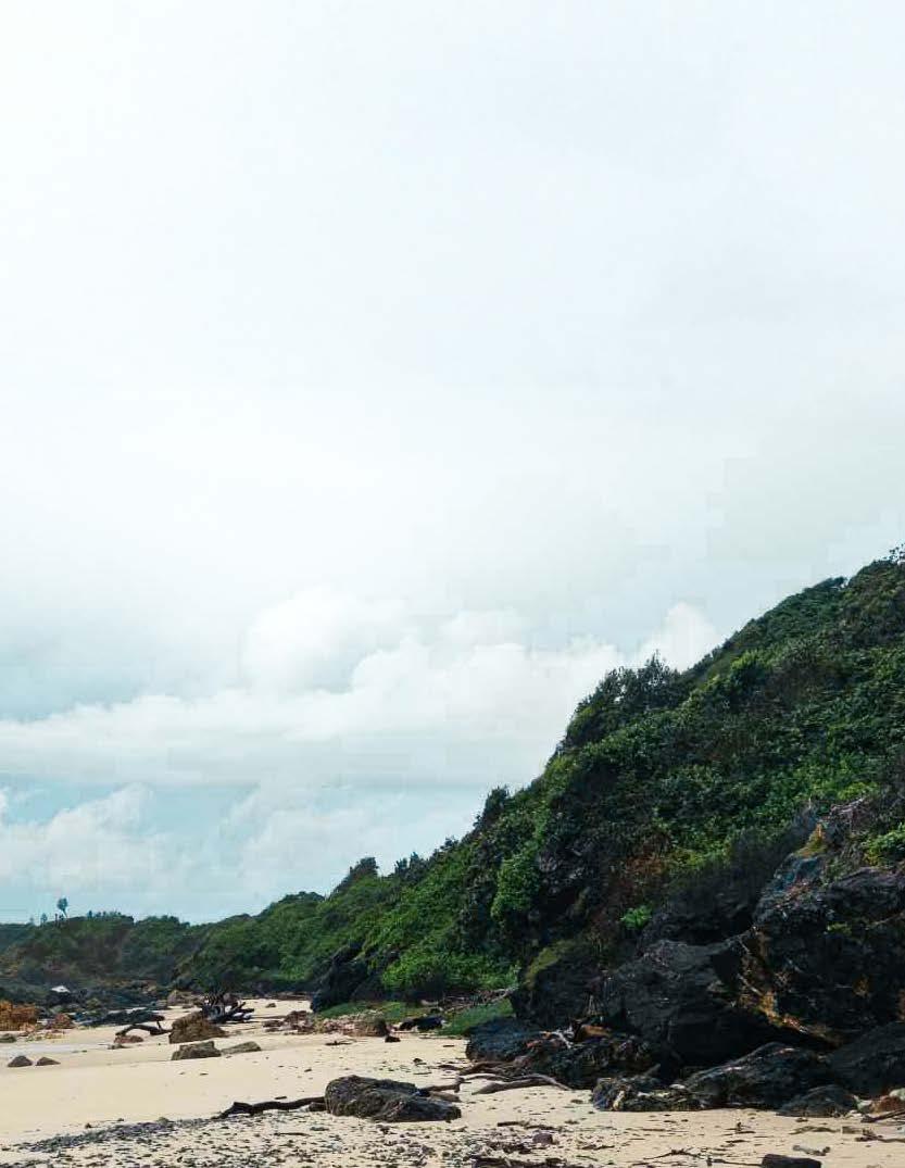
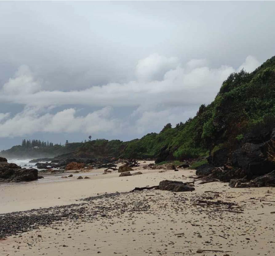
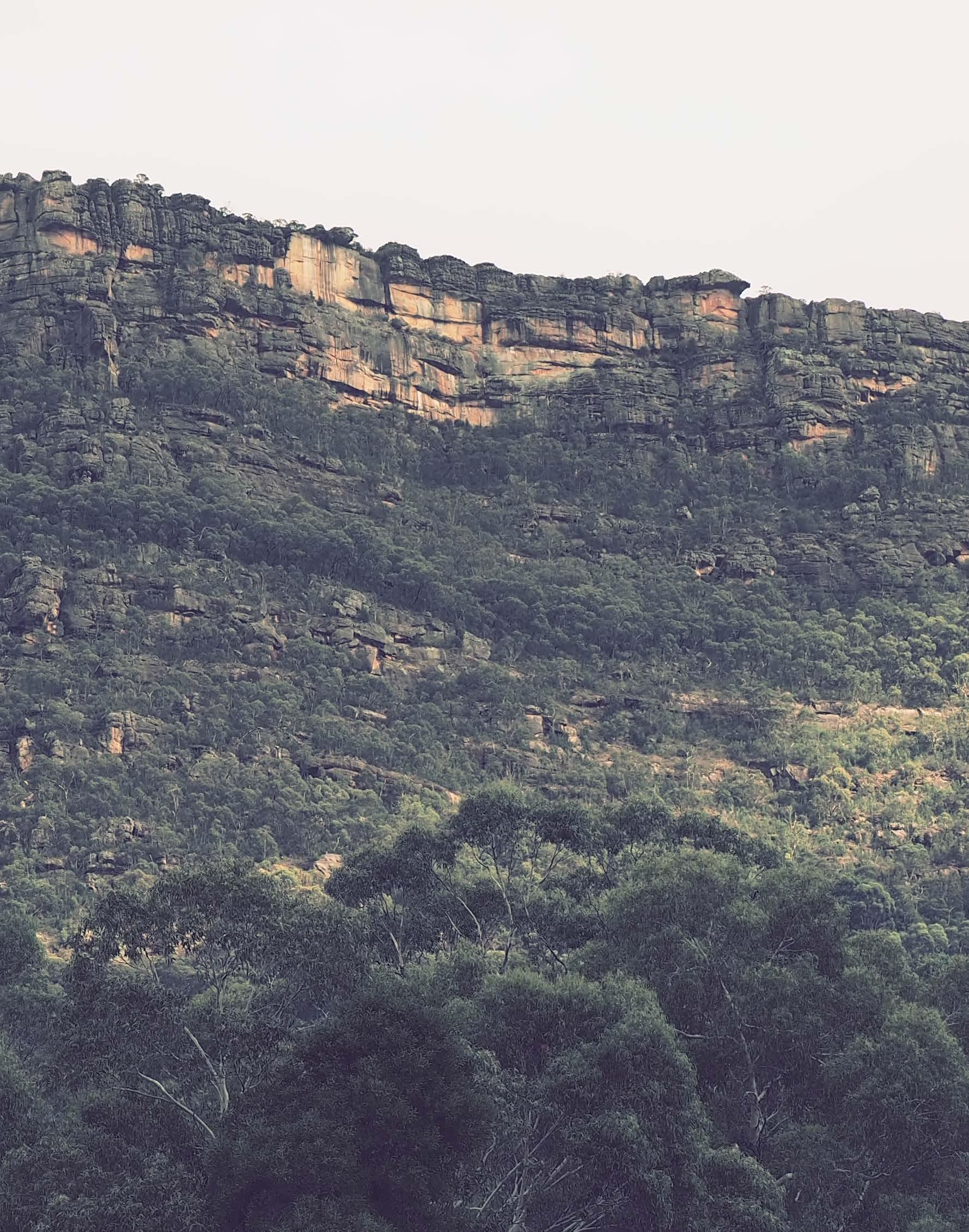
South coast of Victoria near Inverloch
Photo: Shutterstock
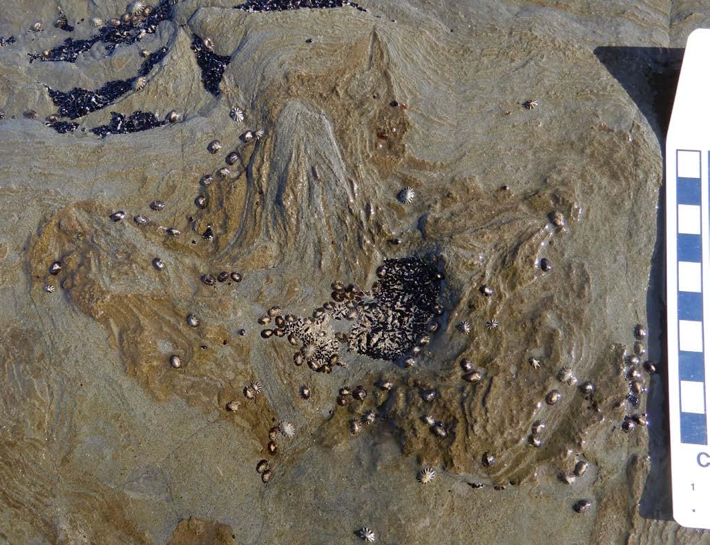
As for the larger three-toed dinosaur tracks, we were again surprised to realise most were made by theropods — and big ones.
How big is ‘big’? Most tracks were 30–40 centimetres long and, when plugged into a formula that multiplies theropod or ornithopod track lengths by 4.0, gives us estimates of dinosaur hip heights. Track lengths accordingly translated into theropods with 1.2–1.9 metre hip heights. In fact, the two biggest theropod tracks, at 44 and 47 centimetres long, were the largest known from the Early Cretaceous of southern Australia.
These were the identifying traits of theropod tracks:
• three forward-pointing toes
• sharp claw imprints on the ends of those toes
• toes thicker than those of bird tracks •track lengths usually longer than wide.
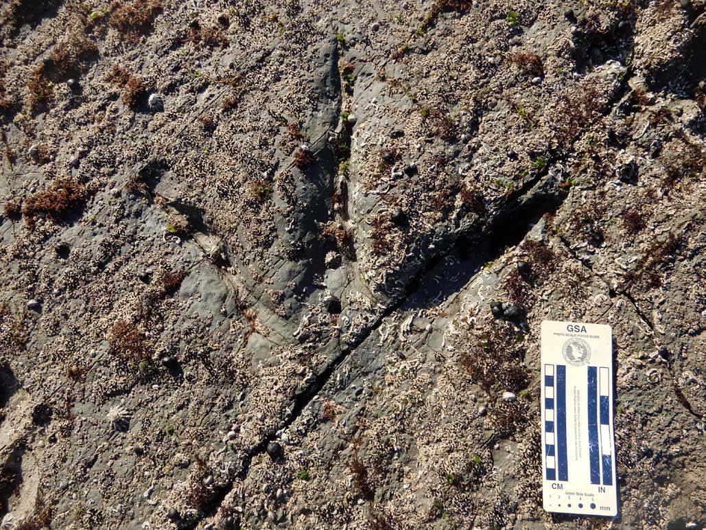
We also found at least three of the three-toed dinosaur tracks likely belonged to small ornithopods.
How small was ‘small’? The same hip-height formula applied to the ornithopod tracks, which were 10–12 centimetres long and implied hip heights of 40–48 centimetres. These tracks also told us the small ornithopods, so well represented by Wonthaggi Formation body fossils, lived in the same places where their teeth and bones were buried.
Ornithopod tracks were identified by:
• their blunt claw imprints
• relatively thicker toes compared to track lengths
• nearly equal lengths and widths.
Wonthaggi Formation beds dip eastward and were eroded into nearly flat marine platforms, a geological circumstance that resulted in narrow bedding-plane exposures of parallel to strike. Such narrow strips of sedimentary surfaces meant nearly all tracks were preserved as individual specimens. The only exception was a lucky one-two sequence of identical, 35-centimetre-long theropod tracks parallel to strike. This allowed us to measure its pace (at roughly 1.3 metres) and trackway width (at approximately half a metre).
When preparing our manuscript about these non-bird dinosaur tracks for submission to Alcheringa we were careful to not only describe the tracks and identify the track makers, but also to point out their paleontological importance.
First, because these theropod and ornithopod tracks were preserved on river floodplains of polar environments, their presence implies dinosaurs were moving through the rift valley after spring thaws and flooding. Second,
we could say that birds, non-bird theropods, and ornithopods lived in the same environments where their transported bones and teeth were buried. Third, the tracks help us to expand our view of the paleoecological relationships in these polar ecosystems, which had birds, large carnivorous dinosaurs, and smaller herbivores likely interacting with one another.
While we have studied only a small sample of tracks so far, we are confident many more will be found in the future, giving us better insights into these unique Cretaceous ecosystems in what is now coastal Victoria.
ANTHONY J MARTIN, Department of Environmental Sciences, Emory University, US
PATRICIA VICKERS-RICH, School of Earth, Atmosphere and Environment, Monash University
THOMAS RICH, Museums Victoria
This ornithopod track is 11-centimetres long. Photo: Anthony Martin
Co-author Melissa Lowery and Anthony Martin examine a track Melissa found. Photo: Ruth Schowalter
A 36-centimentre-long theropod track encrusted with marine life. Photo: Anthony Martin
Lakes, lava and limestone: Hydrogeology in action
From crater lakes to crystallised salt flats, a student field trip through western Victoria reveals how geology and groundwater are deeply intertwined.
I recently helped lead a Hydrogeology and Environmental Geochemistry field trip for Masters students at The University of Melbourne. Accompanied by Ralf Haese, who teaches the course, we explored western Victoria's groundwater systems and geological formations, just a short drive from Melbourne/Naarm.
We started our journey in the Newer Volcanics Province, a landscape shaped by recent volcanic activity and featuring Australia’s youngest volcanoes. Here, students learned about aquifers — underground layers of rock that hold water and allow it to flow through. In this region, the uppermost aquifers primarily comprise basalt, a rock that mostly originated from lava flows from the Late Pleistocene to the Holocene between 4.5 million and 5,000 years ago. The youngest volcano, Mount Gambier/ Berrin, only erupted 4,000–5,000 years ago in an event witnessed by local Boandik peoples.
Basalt is fractured and can be highly porous, containing many tiny holes or void spaces created by gas bubbles as the lava cooled. These fractures and pores allow rainwater to infiltrate and move easily through the rock, rapidly recharging the underlying groundwater reservoir. We discussed these aquifers' crucial role in local agriculture with the Masters students, as farmers rely on them for water to support crops and livestock.
We also observed how variations in lake surface area and depth significantly influence water chemistry, particularly regarding the impact of evaporation on salinity. At Lake Purrumbete, a deep volcanic crater lake near Camperdown on Djargurd Wurrung land, we noted how its relatively small surface area and considerable depth mean evaporation doesn’t contribute much to raising the lake’s salinity. And this makes it resilient to salinisation (salt buildup) during
droughts and a warming climate. With such a stable environment, the lake is a sanctuary for birds, fish and aquatic vegetation.
Additionally, groundwater recharges approximately 17% of Lake Purrumbete's water, showing us how groundwater inflow, evaporation and rainfall interact to shape the lake.
In contrast, our visit to Lake Beeac on Gulidjan land revealed the effects of a larger surface area combined with shallow depth. This hypersaline, terminal lake near Beeac completely evaporated during our visit, leaving a crystallised salt layer (halite). This demonstrated how evaporation in shallow lakes with large surfaces can lead to increased salinity and, in extreme cases, complete evaporation.
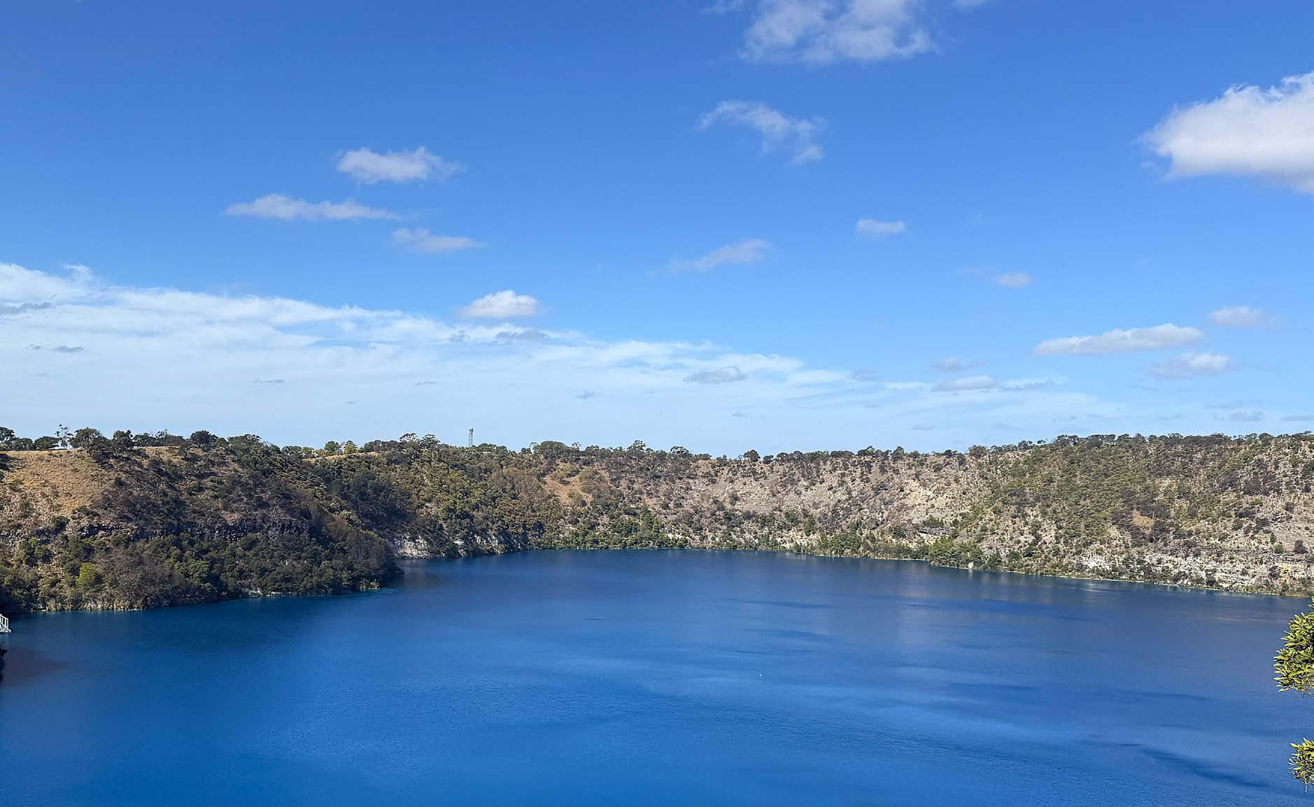
A view looking east over Blue Lake. Photo: Alanis Olesch-Byrne
Ralf and students taking water samples from Little Blue Lake. Photo: Alanis Olesch-Byrne
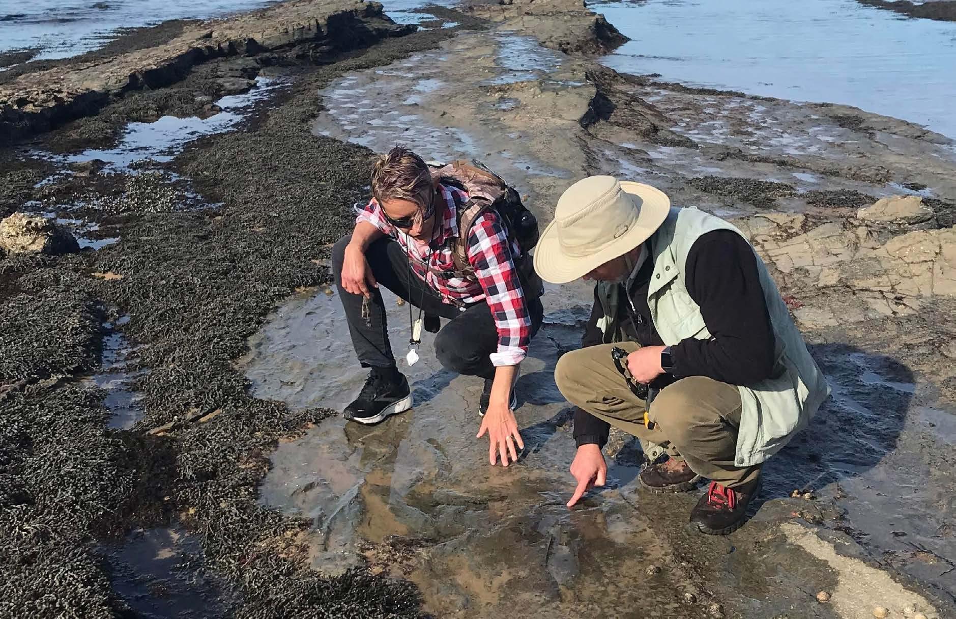
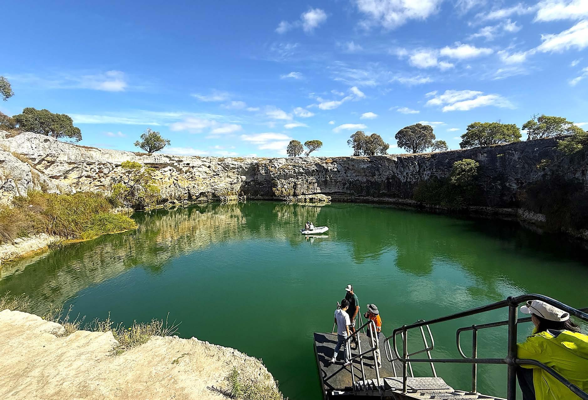
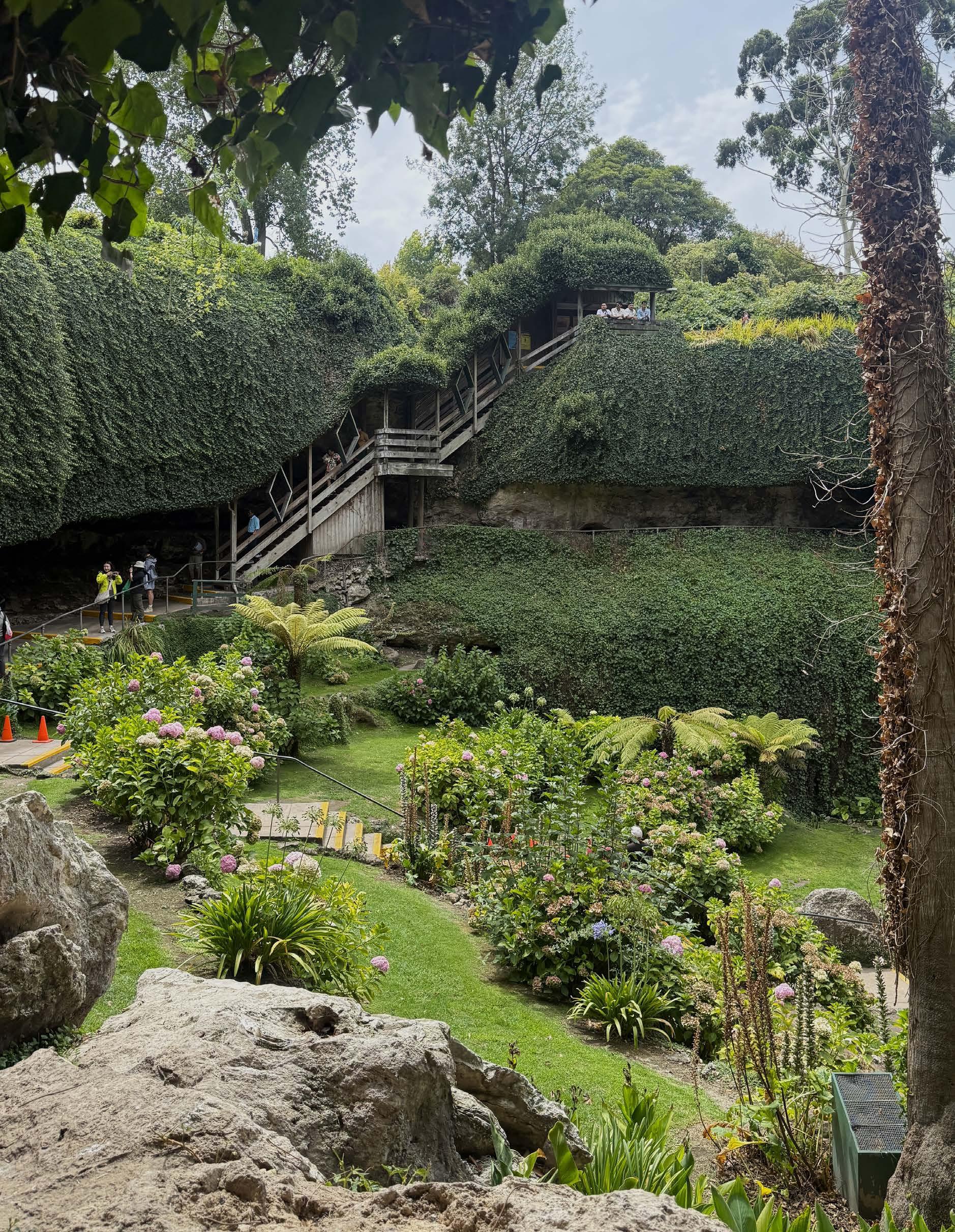
Our trip continued westward toward Mount Gambier, where the geology changed from volcanic rock to limestone. This new environment introduced students to karst aquifers, which differ significantly from basalt aquifers. Limestone is primarily composed of calcium carbonate, which slowly dissolves when it comes into contact with slightly acidic groundwater. Over thousands of years, this dissolution process has created extensive networks of caves, tunnels and sinkholes underground, collectively known as karst formations. Water moves quickly through these underground systems and, at times, makes them highly susceptible to collapse, as we witnessed at the Umpherston Sinkhole/Balumbul. The rapid flow in these systems can facilitate the spreading of contaminants into the groundwater.
Our final stop was Blue Lake/ Warwar and Little Blue Lake near Mount Gambier. Blue Lake is famously vibrant, especially during the summer months, as sunlight scatters very fine particles of calcite suspended in the water. Here, Ralf explained an intriguing natural process that affects these lakes' water clarity. Lake water coming from ambient limestone aquifers form tiny calcite grains in the warm surface water layer during summer, which act like magnets, attracting and binding impurities including microalgae in the water. Once attached, the carbonate grains become heavier and sink to the lakebed. This mechanism, known as calcite precipitation, naturally clarifies the water like a self-cleaning process, and leads to the stunning, deep blue colour of the water, a major tourist attraction for Mount Gambier.
of Australia’s youngest volcanoes, consider visiting the landscapes of western Victoria. From Lake Purrumbete to the salt flats of Lake Beeac, these sites offer a glimpse into the interaction between geology and hydrology. They are accessible and allow visitors to witness the forces shaping our environment. Whether you are a student, educator or a curious explorer, western Victoria serves as an outdoor classroom where we can see Earth science concepts at work.
ALANIS OLESCH-BYRNE, PhD Candidate, The University of Melbourne
RALF HAESE, Professor in Environmental Geochemistry, The University of Melbourne
If you live near Melbourne and find these kinds of geological features interesting or wish to explore some
Inside Umpherston Sinkhole.
Photo: Alanis Olesch-Byrne
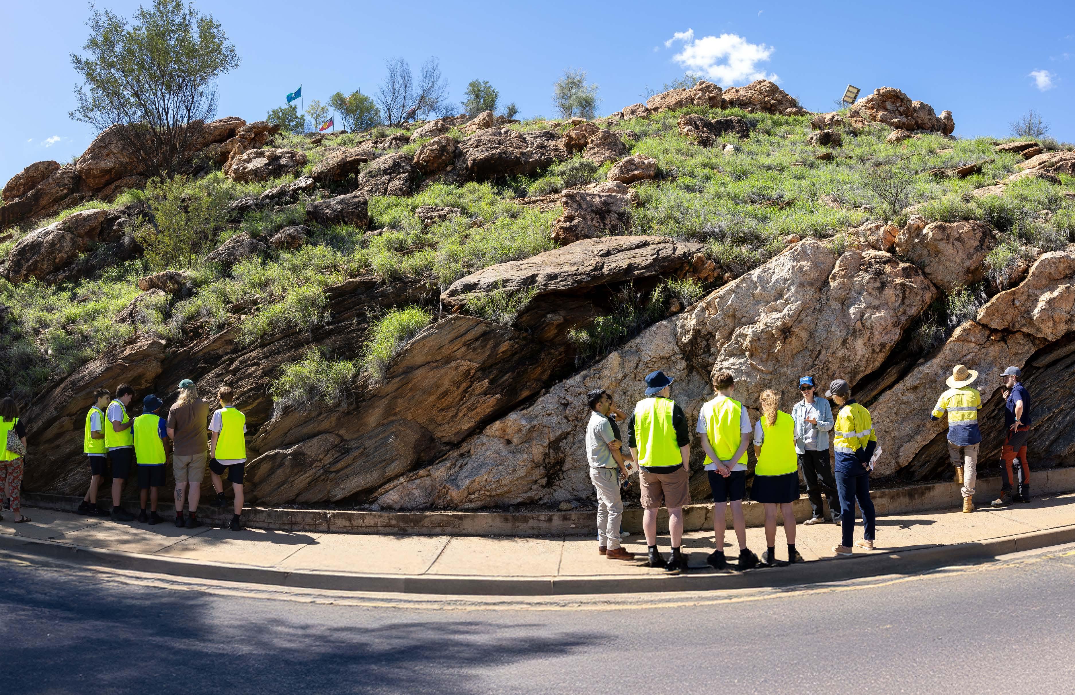
Inspiring careers in Earth Science: Alice Springs High School students on a field trip to Anzac Hill, where they identified a pegmatite outcrop intruding into the Sadadeen Gneiss. The students explored the importance of critical minerals such as lithium in spodumene, and learned that mineral explorers are searching for these minerals in Central Australia.
Photo: Minerals Council of Australia.
The science keeping Australia earthquake-ready
Australia might sit far from the world’s most active fault lines, but that doesn’t mean we’re in the clear. An update to the National Seismic Hazard Assessment sheds new light on Australia’s potential risk for earthquakes – and how we can prepare for them.
Australia isn’t immune from earthquakes. On average, the nation experiences about 100 earthquakes of magnitude 3.0 or larger every year. Potentially destructive earthquakes (over magnitude 5.0) are recorded every year or two.
The specific timing and location of earthquakes are impossible to predict, but scientists can model the likelihood of earthquake shaking occurring in a given area. Understanding Australia’s potential earthquake hazard allows
mitigation strategies to be developed for at-risk communities, making them more resilient to seismic events. That’s where Geoscience Australia comes in.
Geoscience Australia is responsible for providing high quality and trusted advice to the government. This includes monitoring and analysing earthquakes in Australia, which informs decision making for government and emergency managers. This research also informs modern building codes to ensure new
structures can protect lives in the event of an earthquake, and guides the retrofitting of older buildings to improve their resilience to ground shaking.
Now, for the first time since 2018, Geoscience Australia has updated the National Seismic Hazard Assessment, which we use to identify the chance of strong earthquake ground shaking in any given area.
Australia’s earthquake history
The most well-known Australian earthquake happened in Newcastle, New South Wales, on 28 December 1989. This magnitude 5.6 earthquake was one of the most significant natural disasters in Australia’s history, killing 13 people and affecting another 300,000. According to the Insurance Council of Australia, the 1989 Newcastle earthquake remains as Australia’s third most costly natural disaster.
However, this isn’t the largest earthquake recorded in Australia’s history. A magnitude 6.5 earthquake struck the Western Australian town of Meckering in 1968, causing a fault scarp (a ripple in the Earth’s surface) over 30-kilometres long and up to 2-metres high. And even that wasn’t the largest: the highest magnitude earthquake recorded in Australia was a magnitude 6.6 earthquake that struck near Tennant Creek, Northern Territory, in 1988.
Of course, our seismic history goes back much further. For example, the geological record and local First Nations stories show evidence of a series of even larger earthquakes, taking place over tens of thousands of years, that shaped the course of the Murray River. Australia is far from seismically dormant.
Are Australian earthquakes different?
Understanding how and why earthquakes occur in the Australian context is important. Geoscience Australia
Senior Seismologist Trevor Allen says while earthquakes are less common in Australia compared to more geologically active regions such as the Pacific Ring of Fire, earthquakes do happen and do not follow easily recognisable patterns.
“Australia experiences earthquakes more often than people might think,” Trevor says. “A lot of earthquakes in Australia happen in remote areas, so people aren’t necessarily aware they are occurring.
“Think of Australia sitting in the middle of a tectonic plate like it’s sitting in the middle of a pavlova. If the pavlova is being squeezed along all sides, pressure is going to build up in the middle of the pavlova and result in cracks,” he says.
“Those cracks in the pavlova are like the fault lines we have in Australia. Pressure has built up over thousands to millions of years and has to go somewhere. When it’s released, it’s released through earthquakes.”
These ‘intraplate’ earthquakes generally originate at shallow depths (less than 20 kilometres), but can still be of large magnitude.
How do we measure earthquakes?
Seismometers record the intensity and duration of ground shaking generated by an earthquake. The earthquake’s size is measured in magnitude, relating to the amount of energy released and the area of a fault that ruptures. As magnitude increases, the strength of ground shaking, duration and areas impacted increase quickly. For every whole magnitude unit, energy released increases by 32 times.
In Australia we measure earthquakes primarily using the local magnitude
scale (ML), which uses the largest shaking amplitudes measured by seismometers. The local magnitude scale is used primarily for smaller earthquakes. Where enough data is available, particularly in larger earthquakes, we use the moment magnitude scale (MW), which examines the whole shaking record to estimate the total energy released by the earthquake.
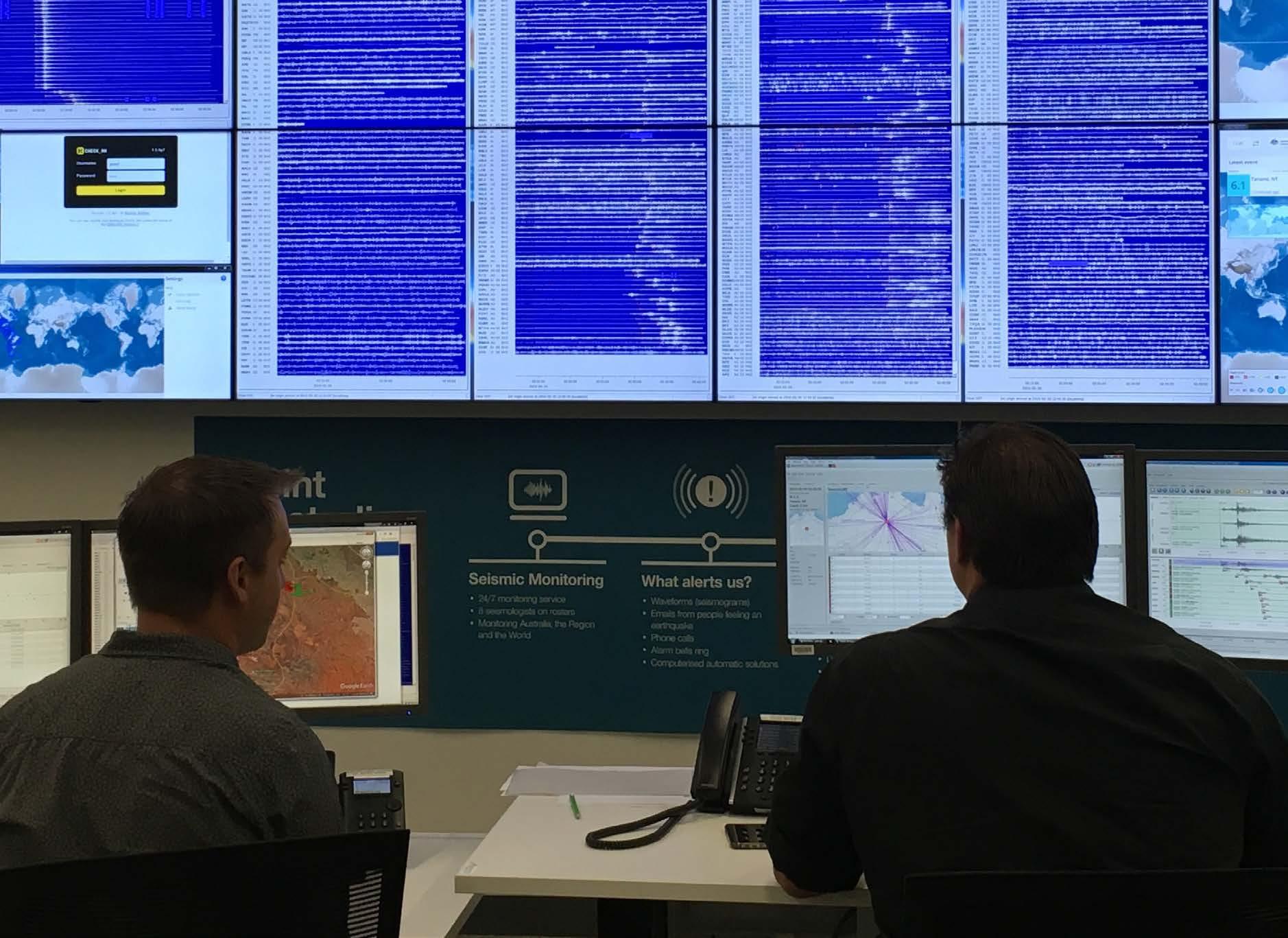
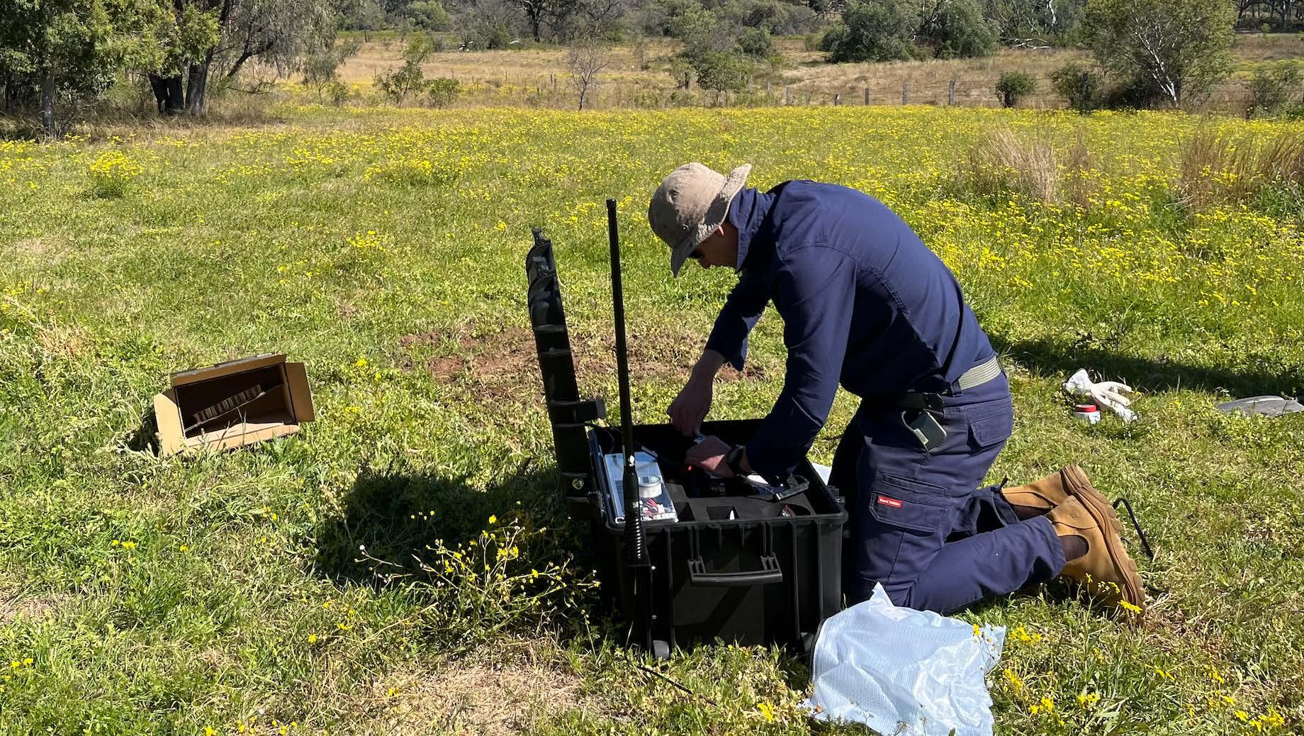
Geoscience Australia operates and maintains the Australian National Seismograph Network to provide the
emergency management sector and the public with rapid notification of Australian earthquakes of magnitude 3.5 or greater.
The National Earthquake Alerts Centre also provides information about smaller earthquakes within Australia that have been felt. It’s staffed 24 hours a day, every day of the year, allowing for timely reporting of earthquake information to government and emergency managers.
How can we reduce earthquake risk?
To minimise the impact of future earthquakes, Geoscience Australia develops the National Seismic Hazard Assessment. This assessment defines the level of earthquake ground shaking across the country that has a given chance of being exceeded in a specific time period. Knowing how the ground-shaking hazard varies across Australia allows emergency managers, government agencies and the engineering sector to prepare for, and respond to, earthquakes.
The National Seismic Hazard Assessment has recently been updated for the first time since 2018. Trevor Allen says the new assessment is based on updated data, models and insights collected from field surveys and earthquake catalogues, as well as from people who have felt an earthquake.
“We have a large body of information
that helps us understand the physical characteristics of earthquakes in Australia and how they impact the landscape around us,” Trevor says.
“Consistent with previous assessments, most areas around Australia are at low to moderate risk of experiencing strong ground shaking. However, our understanding has changed for some regions, such as Darwin and the Latrobe Valley in Victoria.”
Trevor emphasises the change in the assessment of risk doesn’t mean earthquakes will happen more often.
“We aren’t getting more earthquakes or stronger earthquakes all of a sudden,” he says.
“What has changed is how we understand and interpret the risk
of earthquakes occurring and their consequent ground motions.
“The new assessment simply clarifies and improves our understanding of the risks that can be associated with this hazard.”
Geoscience Australia Community Safety
Branch Head John Dawson says the update to the National Seismic Hazard Assessment is important for providing quality science on how we can keep communities safe.
“I’m really proud of this work,” John says. “Keeping our community safe isn’t just about responding when things go wrong. This quality science gives emergency managers, as well as decision makers the information they need to build resilient communities that are better placed to withstand natural hazards.”
What can I do?
If you feel an earthquake, it’s important to act to keep yourself safe. The internationally recognised best advice is to 'Drop, Cover and Hold On':
DROP to your hands and knees to prevent yourself from being knocked down.
COVER your head and neck with one arm and hand, and crawl underneath a sturdy table or desk for protection.
HOLD ON until the shaking stops.
If there is no shelter nearby, crawl next to an interior wall. Stay away from windows, wallmounted objects such as TVs, and shelving that could fall over.
Staying inside during an earthquake is most likely to keep you safe because science, such as the National Seismic Hazard Assessment, has informed building codes to ensure modern buildings prioritise safety of life during strong ground shaking.
If you’re outside when an earthquake hits, you can also be at risk from unsecured masonry (in particular, chimneys and parapets), falling roof tiles, powerlines and other infrastructure. Wherever possible, find an open and empty space without overhead cables and then drop and cover.
Regardless of where you are when an earthquake hits, make sure that you follow any instructions from local emergency services.
After the shaking has stopped and once you are sure that you’re safe, take a minute to submit a Felt Report via earthquakes.ga.gov.au Simply go to the website and click the “I felt this earthquake” button and answer a few quick questions.
“All this information gets fed into regular updates of the National Seismic Hazard Assessment,” Trevor says. “It’s important for us to understand not only the quantitative measurements based on physical readings from our seismometers, but also what people are experiencing and observing when there is an earthquake.
“Every time we record an earthquake in Australia, we learn more about the science and that knowledge feeds into these improved earthquake hazard assessments.”
GEOSCIENCE AUSTRALIA
Find out more about the National Seismic Hazard Assessment and download it here:
Geoscience Australia also provides resources to inform retrofitting older buildings to improve earthquake resilience. Find out more here:
Felt an earthquake?
Record it here:
Quartz
Photo: Supplied
Geoscience Australia installs temporary ‘rapid deployment kits’ in Muswellbrook, New South Wales during the 2024 earthquake sequence. Photo: Geoscience Australia
'My car will be the fastest': Girls in remote NT are smashing science stereotypes
As part of the Radicle Centre team from Charles Darwin University, we run STEM engagement and outreach activities in remote and rural communities across the Northern Territory. We’re consistently amazed by the talent we see from students in these remote regions.
In 2021, we ran a schools’ miniature solar car challenge in the NT. We travelled down the Stuart Highway from Darwin all the way to Alice Springs. One of the most memorable moments of this trip happened at Elliott, a small town in the middle of our itinerary. After spending an hour building their solar car models, students were getting ready for the track race.
A confident 12-year-old girl approached me and stated: “My car will be the fastest.” She was right. It was indeed the fastest, not only at her school, but across the whole NT.
In a society that genuinely fosters talents in science, technology and innovation, this girl would be now, four years later, choosing relevant subjects at her high school and being mentored towards a successful and fulfilling career in the
industry. Unfortunately, this is unlikely to be the reality.
The lack of opportunities for remote girls and women to pursue careers in STEM (Science, Technology, Engineering and Mathematics) is devastating for those who have potential but are not given the chance to develop it. It also comes at a high cost to our society, which is deprived of a diverse STEM workforce and will never benefit from the discoveries and innovations our remote youth could make, if given the opportunity.
We have 20 years of experience between us in STEM outreach work in remote locations, from the Amazon, to Papua New Guinea, and Northern Australia. We have often observed that when a STEM challenge is presented to schools, the girls take the lead on assigning tasks and
guiding the solutions.
It’s a very different scenario to what we usually observe in metropolitan schools, where girls have the preconceived idea that STEM subjects are 'boy’s subjects'.
Context and purpose are also important when considering STEM engagement activities with girls. We have lost count of the number of girls who have approached us over the years during our school visits to tell us that they love science and technology, but cannot face studying more mathematics.
We tell them that, as turtle scientists, we need to know trigonometry to save turtle eggs from flooding. When we ask if they would learn trigonometry and how to calculate cosines to save baby turtles, the answer is always unanimous and loud: YES!
Getting a feel for a Certificate I in Horticulture as part of the First Nations Pre-STEM course.
Photo: Carla Eisemberg
Women from remote communities participating in a First Nations Pre-STEM course.
Photo: Carla Eisemberg
Why better STEM pathways matter
The 2021 ABS Census data shows that First Nations participation in the mining workforce across Australia was only 5%. The participation rate was higher (9%) in the NT, but this is more a reflection of its demography, as it has a higher overall percentage of First Nations people than the rest of the country.
Furthermore, according to Jobs and Skills Australia, the female participation rate for the mining industry across
Australia is 21%. The situation is even worse in the NT. The Mining Insight report from the Industry Skills Advisory Council NT (ISACNT) shows women only account for 15% of the mining workforce. The same report states that most mining companies blame the constant workforce shortages in the NT on the lack of skilled workers, high relocation costs and lack of infrastructure (housing).
NT mines are often near remote communities. Fostering clear and culturally safe STEM pathways in remote communities will create opportunities for remote women to join careers in the mining industry. This would not only generate new sources of incomes in these communities, but it would also empower First Nations people to become more active players in the mining and rehabilitation work of their land.
We already have some truly successful examples in the NT. The Yapa Crew, for instance, provides on-the-job skills training and development for Warlpiri community members in the Tanami. And CSIRO’s award-winning Young Indigenous Women in STEM program implements culturally safe, inclusive practices to provide targeted, longterm support and access to STEM experiences and STEM careers.
What’s more, our Charles Darwin University First Nations pre-STEM course saw ten women from remote communities successfully complete a Certificate III in Aviation (Drones), an extremely relevant and useful tool for working on Country.
These programs, and others like them, are a great start toward improving access for First Nations women and girls to pursue STEM careers. When meaningful and culturally safe opportunities are presented to these talented girls and women, not even the sky is the limit.
CARLA EISEMBERG, Senior Lecturer in STEM Pathways, Charles Darwin University
SARAH SUTCLIFFE, Manager – Radicle Centre, Charles Darwin University
The newly established Radicle Centre for STEM engagement provides outreach, education and training opportunities to those living in the NT and beyond. If you'd like to support our work, scan the QR code below:
Looking at water bugs for the First Nations Pre-STEM course. Photo: Kane Chenoweth
Digging for ‘turtle eggs’ (ping pong balls) at the launch of the Radicle Centre last year.
Photo: Patch Clapp
Tasmania’s glacial past revealed
Lutruwita/Tasmania’s dramatic landscapes hold some of the world’s most comprehensive records of ancient glaciers. GSA Tasmania hosted a recent field trip that took a closer look at some of the rich, diverse geological features on display.
Lutruwita/Tasmania has some of Earth’s best terrestrial records of late-Cenozoic glaciation, including most of Australia’s geologically recent cold-region deposits and landforms. On mainland Australia, Cenozoic glacial records are limited to the high Snowy Mountains and the last glacial cycle. By contrast, Tasmania’s uplands show evidence of at least six separate glaciations during the Early,
Middle, and Late Pleistocene. The last of Tasmania’s glaciers disappeared about 14,000 years ago, but the landscapes left behind offer many insights into southeast Australia’s cryosphere, climate and environments.
GSA Tasmania hosted a glacial geology field trip in northern Tasmania on 5 October 2024 to showcase some of
Tasmania’s glacial features and explain their importance. The group travelled along the upper reaches of the Mersey and Forth rivers, where a wide range of evidence shows that glaciers once flowed through the valleys, fed largely by upland ice caps.
Some field trip participants.
Photo: Nick Roberts
Boulders forming part of last glacial terminal moraine (Late Pleistocene)
Photo: Nick Roberts
Instead of using paper or digital maps, the field trip used 3D-printed models to provide site-specific context and summarise glacier extents and dynamics. Such models are easy and cheap to make using open-access software, freely available Tasmanian LiDAR data, and a 3D printer. These models offer the benefit of tactile interpretation and, unlike the rain-soaked hikers we met returning from a nearby track, they are impervious to weather.
The region’s bedrock geology records important stages in Gondwana’s formation and breakup. The oldest rocks,
from the Neoproterozoic Tyennan Group, began as siliceous shelf sediments that were later metamorphosed and deformed during continental collision. These basement rocks were intruded by granitoids during the Devonian to Carboniferous periods. Above them lie mostly flat-lying Carboniferous–Triassic sedimentary rocks of the Parmeener Supergroup, more than 1-kilometre thick. They record a shift from marine to freshwater deposition along Gondwana’s southeast margin, beginning with Permo–Carboniferous glaciomarine conditions. Extensive Tasmanian Dolerite sills intruded these
layers during Gondwana’s rifting in the Jurassic.
The modern landscape of northcentral Tasmania reflects around 100 million years of erosion. During the Cretaceous and Palaeogene periods, softer Parmeener rocks were worn away, exposing harder dolerite sills that now form many of Tasmania’s well-known peaks and ridges. This includes the Central Plateau flanking Mersey Valley. In the late Oligocene, basaltic lavas periodically flowed along ancient drainage systems and now form remnant upland surfaces between
modern valleys. During the Neogene, rivers cut down through the landscape, carving valleys up to 700-metres deep.
The upper Mersey and Forth valleys contain diverse late-Cenozoic deposits, of which glacial units are particularly prominent. Glacial features include evidence of ice limits, ice-flow directions, and glacier-fed lakes, along with periglacial features such as iceshattered rock, indicating frozen ground.
LiDAR datasets and roadcuts show just how complex Tasmania’s glacial landscapes are. Sharp moraines
mark the limits of Late Pleistocene valley glaciers and, along with nearby organic remains, record ice retreat and environmental change. Some glacial features have been displaced by slope failures, offering insight into landslide frequency, valley-widening processes and post-glacial landscape evolution. Exposed layers of sediment in roadside cuttings and along streams reveal subglacial conditions — such as ice loading and meltwater flow — as well as post-glacial weathering and mineralisation.
During Middle Pleistocene glaciations, glaciers were large enough to flow over low ridges between valleys, leaving a series of broad moraines well beyond the sharp Late Pleistocene ones. The form, extent and number of these older ridges have only recently been recognised using bare-earth LiDAR, particularly along Mersey Valley. Early Pleistocene ice reached much farther down Forth Valley than did younger glaciers. Evidence of those early glaciers includes a large fold in quartzite rock that was sculpted by ice into a roche moutonnée as well as nearby, deeply
Roche moutonnée (Early Pleistocene)
Photo: Nick Roberts
Field trip participants using 3D-printed model.
Photo: Nick Roberts
weathered till that eroded into glacial lake sediments. The latter’s reversed magnetic polarity indicates that a meltwater-fed lake formed more than 780,000 years ago.
These glacial records are important both globally and locally. They provide key opportunities to compare longterm patterns of cryosphere and climate change between the Southern Hemisphere and Northern Hemisphere. Like Tasmania, South America’s Central and Southern Andes, New Zealand’s Southern Alps, and parts of Antarctica also experienced progressively more
restrictive late-Cenozoic glaciers.
This is different from the Northern Hemisphere, where the last (Late Pleistocene) glaciation was especially extensive, obscuring earlier glacial evidence through burial or erosion.
Locally, Tasmania’s glacial deposits can be highly variable and deeply weathered, making them prone to hazards such as landslides and presenting engineering challenges for development and even recreational use.
Within the Southern Hemisphere,
Tasmania’s glacial records are unique in two ways. First, limited tectonic activity and crustal rebound during the Pleistocene make it easier to separate the influences of climate from uplift and erosion across multiple glacial cycles.
Second, humans have lived in glacial Tasmania for far longer than in its postglacial landscapes. The First People, the Palawa, arrived over 45,000 years ago — more than 25,000 years before the last glacial maximum — whereas other
glaciated southern regions saw human arrival much later, from just after the last glacial maximum in the Andes to the late 1800s in Antarctica.
Tasmania’s rich glacial history is gaining more attention and, thanks to the success of the recent GSA field trip, more excursions are being planned to share this growing knowledge. Some of these trips will be linked to upcoming geoscience events. Please contact GSA Tasmania or Mineral Resources Tasmania if you are interested in finding out more.
NICK
ROBERTS, Natural Hazards Geologist, Mineral Resources Tasmania
Glacially sheared laminated lens in till (Middle Pleistocene).
Photo: Nick Roberts
Drop stones and contorted laminae in glaciolacustrine beds (Middle Pleistocene).
Photo: Nick Roberts
Dolerite clast in till with thick post-depositional weathering rind (Early Pleistocene).
The latest Workplace Gender Equality Agency report reveals that pay gaps persist even in industries where women dominate. WOMEESA examines what this means for Earth and Environmental Scientists in Australia.
In March 2025, the Workplace Gender Equality Agency (WGEA) released its second annual tranche of public data on employer gender pay gaps, shining a much-needed spotlight on pay equity across Australia. For those of us working in mining, environmental consulting, geoscience and related male-dominated sectors, the numbers tell a familiar story — but one that is now quantified with greater clarity.
WOMEESA represents women across Earth and Environmental Sciences, many of whom work in industries with deeply entrenched gender imbalances. The
WGEA data confirms what many women have experienced firsthand: women are still underrepresented in higher-paying operational roles, leadership positions, and technical specialist streams.
This imbalance is a significant driver of the gender pay gap: the difference between the average or median remuneration of men compared to that of women. This is not the same as equal pay, where men and women are paid the same for performing the same role, which has been legally required in Australia since 1969. The gender pay gap reflects broader disparities, such as differences
Progress in closing the gender pay gap: A year-on-year analysis
The recent release of the WGEA’s 2023–2024 Employer Gender Pay Gaps Report provides an opportunity to assess the progress made over the past year in addressing gender pay disparities, particularly within male-dominated sectors such as mining.
According to WGEA’s data, the national average total remuneration gender pay gap has seen marginal decline. Specifically, the gap decreased by 0.6% in 2023–2024, from 21.7% in 2022–2023
to 21.1% (excluding CEO salaries, as that data was not included in the 2022–2023 reporting). The improvement is partly attributed to wage increases in lowerpaid, female-dominated industries, such as aged care. Including CEO salaries, the 2023–2024 data report a national average total remuneration gap of 21.8%.
In male-dominated industries, including mining and related sectors, the median gender pay gap has shown a more notable improvement. The data indicates
The numbers behind the rock face
Take BHP, for example. As one of Australia's largest mining companies, BHP has multiple entities reporting to WGEA, including both corporate and operational arms.
The data reveal a stark difference: BHP’s corporate operations show a narrower median gender pay gap and greater female representation in mid-to-senior management. In contrast, its operational businesses — where most on-the-ground
in workplace composition and access to higher-paying roles. Understanding the drivers behind these disparities helps employers take action to reduce the gap.
While the data show some progress, substantial work remains to achieve gender pay equity, particularly in sectors where women have been historically underrepresented. The continued focus on transparent reporting and targeted initiatives is essential to sustain and accelerate this positive trajectory.
a reduction of 1.3% in these industries. This suggests that targeted efforts within these sectors are beginning to yield positive results.
Encouragingly, a majority of employers across various sectors have reported improvements in their gender pay gaps from 2022–2023 to 2023–2024. This trend may reflect increased attention to gender pay disparities, especially in anticipation of WGEA’s publication of employer-specific pay gap data.
mining activity occurs — show a wider median gender pay gap and lower female representation overall.
This divide highlights a structural challenge. Corporate environments are often more conducive to flexible work arrangements, professional development and clearer pathways for women to ascend the ranks. Operational sites, by contrast, still grapple with legacy workplace cultures, fly-in-fly-out rosters
incompatible with family responsibilities, and physical work environments not always designed with inclusivity in mind.
This is not unique to BHP. Across the mining and resources sector, WGEA data consistently show that the highest gender pay gaps are often found in operational arms of businesses: the same places women are least represented.
The pipeline is leaking, and we can’t afford the loss of talent, innovation and diverse perspectives. “”
International Women in Mining (IWIM)
Photo: Supplied
Photo: International Women in Mining (IWIM)
Why this matters for Earth and Environmental Sciences Change is already underway
Earth and Environmental Science professionals play vital roles in both corporate and operational contexts. Whether it’s a geologist mapping ore bodies, a hydrogeologist managing dewatering operations, or an environmental scientist ensuring compliance on a mine site, these are technical roles critical to the industry.
Yet, WGEA’s data show that women in these roles are still clustered at the lower levels of organisations or working
in support rather than leadership. Even when women enter the field, retaining them — particularly through mid-career phases — remains a persistent challenge. The pipeline is leaking, and we can’t afford the loss of talent, innovation and diverse perspectives.
Importantly, the gender pay gap is not just a feature of male-dominated industries. WGEA data show that in many female-dominated sectors, such as education and healthcare, men still
occupy a disproportionate number of executive and high-paying roles. Despite making up the majority of the workforce, women in these sectors continue to earn less on average than their male counterparts.
The gender pay gap isn’t simply about headcount; it’s about who holds influence and who is paid the most. Leadership remains skewed, and structural inequality persists across the board.
Navigating criticism and building inclusive cultures
As the industry moves toward greater gender equity, it’s important to acknowledge and address criticism and pushback, particularly from male employees who may perceive diversity initiatives as a threat to fairness or job security.
In some mining workplaces, this can manifest as scepticism about female hires, resentment toward inclusion policies, or disengagement with equity programs. This resistance, while often stemming from misunderstanding or fear of change, risks undermining progress if left unaddressed.
Equity isn't a zero-sum game — the goal is not to take opportunities away from men, but to ensure women have equal access to opportunities that have long been unevenly distributed. Creating space for open dialogue, inclusive leadership training, and education around unconscious bias are all crucial to shifting workplace cultures in a way that benefits everyone.
Despite these challenges, the publication of the WGEA data is a turning point. It creates transparency and accountability. It allows employees, investors, and the broader public to question why two parts of the same company can have such different outcomes for women. And it gives progressive employers an opportunity to lead by example.
Some organisations are already taking action: setting measurable diversity targets, redesigning rosters, investing in inclusive site infrastructure, and supporting career development for women in technical and leadership roles. These changes don’t happen overnight, but the data gives us a clear starting point.
We call on organisations to dive deeper into their data, to examine not just overall pay gaps but role-specific and sitespecific dynamics. We call on industry leaders to invest in the retention and advancement of women, particularly in technical and operational roles. And we encourage all geoscientists to champion equity in their teams, their departments and their fieldwork.
ERIN MARTIN, President, Women in Earth
and Environmental Sciences in Australasia (WOMEESA)
Note: The above analysis is based on the most recent data available from WGEA as of March 2025.
Photo: International Women in Mining (IWIM)
Ancient landscapes, modern discoveries
Shifting climate conditions continually rewrote Western Australia’s landscapes over millions of years. Now, laterites in the Yilgarn Craton’s surface reveal stories from the past and could guide mineral exploration into the future.
Imagine a time over 25 million years ago, when heat and humidity drenched Western Australia. Relentless rain stripped soluble elements away from basement rocks, leaving behind a crust rich in iron and aluminium. Then, from around 15 million years ago, that changed: arid, drying climates became more prevalent across Australia. Landscapes cracked and fractured, triggering intense chemical reactions that reshaped the terrain into the patchwork of regolith that we see today.
These shifting conditions enabled lateritic regolith profiles to develop in the Yilgarn Craton, an ancient block of continental crust in southern WA dating back roughly 2.8 billion years. Having endured dramatic climate swings and extended periods of tropical weathering,
the craton is now draped in an extensive blanket of lateritic regolith that obscures direct observation of the bedrock.
The definition of ‘laterite’ and other regolith classifications has been a longstanding debate among geologists. Some geologists use ‘laterite’ broadly to describe tropical weathering products, including kaolinitic saprolites (soft, clayrich weathered rocks) and ferrallitic (iron-rich) soils. In contrast, Australian geologists advocate for a more precise classification, refined through the Cooperative Research Centre for Landscape Environments and Mineral Exploration initiative (1995 to 2008).
Researchers increasingly call for clearer distinctions, avoiding the use of ‘laterite’ in iron and aluminium-rich
cemented crusts. Instead, they favour more descriptive terms, such as bauxite, lateritic gravels and ‘ferricrete’ for transported lateritic deposits.
But how do these lateritic formations interact with the Yilgarn Craton landscapes? One of the most striking features is the Menzies Line, a geological boundary through WA that marks a dramatic shift in regolith types. To the southwest, humid conditions have sculpted bauxite-rich profiles, while in the drier northeast, calcretes dominate. Across the region, iron-stained crusts cling to ridges and hills, while valleys are filled with loose, gravelly soils and ironrich layers — remnants of ancient rivers and changing landscapes.
Breakaways in Hyden-Norseman Road, WA, representing strong weathering of Archean quartzites.
Photo: Mario Iglesias-Martinez
Viewing a classic lateritic weathering profile is like peeling back the layers of time. At the surface lies the hardened ferruginous duricrust (iron-rich layer), followed by a mottled zone where reds, yellows and whites mix in a mineral kaleidoscope shaped by fluctuating water tables. Below this, the saprolite retains the ghostly imprint of the original rock, gradually fading into saprock and then fresh bedrock. In places where erosion has taken its toll, only loose pisoliths and nodules remain, scattered like breadcrumbs of geological history.
Pisoliths and nodules, the small iron-rich spheres and pebbles found in lateritic regolith, have long intrigued geologists. Their formation remains a topic of debate, with multiple hypotheses attempting to explain their origins.
Some models suggest they develop in
situ within weathering profiles, where alternating wet and dry cycles cause iron oxides to aggregate into spherical structures. Others propose a transportrelated genesis, where pisoliths form through accretion in dynamic fluvial or colluvial environments. Some argue aluminium-rich pisoliths evolve separately, accumulating aluminium oxides instead of iron oxides as they mature. Another theory suggests pisoliths form through the impact of raindrops on dry, deeply weathered, iron-rich powdery soils during thunderstorms, leading to the aggregation of soil particles into spherical shapes.
Regardless of their origin, these unique formations provide valuable clues about past weathering conditions and landscape evolution.
But beyond their scientific intrigue,
In the Pilbara’s Hamersley Province in Kurrama Country, small, iron-rich spheres have accumulated in ancient river channels, forming massive channel iron deposits that account for nearly half of the region’s iron production. Additionally, lateritic deposits are key hosts of critical minerals for the energy transition. This includes gallium (extracted as a byproduct of bauxite-derived aluminium production), scandium and platinum group elements found in some nickel-cobalt laterites, and rare-earth element-rich clay deposits from granite weathering in the Goldfields-Esperance region. These offer a promising future for securing Australia’s rare-earth element supply.
A nearby example on the outskirts of Perth is the Darling Ranges in Whadjuk Country, home to one of Australia's most economically significant lateritic formations: the bauxite-rich deposits that sustain the country's aluminium
industry. These deposits formed through the intense chemical leaching of granitic rocks, which removed most elements except aluminium and lead to the concentration of gibbsite in the upper regolith. Typically found in welldrained environments, these bauxites are preserved on high plateaus and are the product of prolonged weathering under fluctuating climatic conditions.
Another notable example is Boddington in Wilman Country, Australia’s longestoperating gold mine. While the primary ore at Boddington is largely uneconomic, most of the gold is extracted from bauxitic horizons, underscoring the intricate relationship between lateritic weathering and gold mineralisation.
The laterites of the Yilgarn Craton are far more than just rust-coloured remnants of ancient landscapes. They are keys to unlocking the region’s geological past and critical tools for mineral exploration.
Understanding how these landscapes evolved over millions of years allows geologists to refine exploration strategies, using regolith materials as geochemical indicators of hidden treasures below. But it’s not without its challenges. Interpreting lateritic terrains requires a keen understanding of regolith movement and transformation. Whether surficial samples have been moved or remain in situ has a significant impact on exploration interpretations and identifying reliable targets.
As research continues, lateritic terrains remain at the forefront of geological discovery. The Yilgarn Craton, with its layered history etched into the regolith, continues to offer insights into Earth’s past while guiding the future of mineral exploration in WA.
MARIO IGLESIAS-MARTINEZ and RYAN MANTON, CSIRO Mineral Resources
laterites hold immense economic importance. They are both a challenge and a gift to mineral exploration. The deeply weathered nature of lateritic terrains can obscure hidden ore bodies, but they also provide invaluable geochemical clues. Pisoliths, ferruginous gravels and calcretes serve as excellent sampling media, trapping metal dispersion from buried mineralisation.
Supergene processes near the Earth's surface play a key role in forming economically significant ore deposits within the regolith by oxidising and chemically weathering rocks. This leads to metal enrichment — often by a factor of two to ten. Lateritic terrains are vital sources of base and industrial metals, as well as rare-earth elements, supporting both existing mining operations and exploration for alternative critical metal sources needed for emerging energy technologies.
Ferricrete and mottled zone in Darling Ranges old aggregates quarry in Kelmscott (Banyowla Regional Park, WA). Photo: Mario Iglesias-Martinez
Pedogenic calcrete on the soils of Splinter Rock, WA. Photo: Mario Iglesias-Martinez
The
Young Australian of the Year is championing change and First Nations innovation
Balancing business, research and advocacy, Katrina Wruck is a rising star in green chemistry and First Nations-led science.
Katrina Wruck in a lab at The University of Melbourne with her custom-designed electrochemical catalytic reactor, developed to break down harmful ‘forever chemicals’.
Photo: Megan van Vegten
Katrina Wruck, a materials scientist and proud Mabuygilayg woman with kinship ties to the Panay First Nation, was named the 2025 Young Australian of the Year for her research using science for social good.
She founded Nguki Kula Green Labs, a profit-for-purpose business focused on green chemistry, including an
innovative reusable laundry detergent system. Her research includes low temperature conversion of mining byproducts into the main ingredient in laundry detergent, as well as examining ways to break down harmful ‘forever chemicals’.
A passionate advocate for Indigenous knowledge, she frequently engages
with communities and students, many of whom have never met an Indigenous scientist.
TAG asked Katrina about her research, her business, and why First Nations knowledge is critical for Earth Science discovery and innovation.
Can you tell me a bit about the vision for Nguki Kula Green Labs?
Our vision is to revolutionise laundry care by offering sustainable, science-driven alternatives that challenge the status quo. We’re creating products that are not only effective and affordable, but also designed with circularity in mind — using resources and regenerating them at the end of their life cycle.
Our goal is to improve health and hygiene outcomes, particularly in remote communities impacted by preventable diseases like rheumatic heart disease, by making eco-friendly laundry solutions more accessible.
Looking ahead, we aim to expand into the consumer goods sector to offer everyday Australians a sustainable alternative — one that’s better for people, Country and future generations.
How will reusable laundry detergent help combat rheumatic heart disease in remote Indigenous communities?
In remote communities, the cost of laundry detergent and washing machines is significantly higher due to transport expenses. For families already facing tough choices between basic necessities, essential hygiene products and expensive washing machines can become unaffordable.
Rheumatic heart disease disproportionately affects Indigenous Australians, accounting for 94% of all new reported cases in the Northern Territory between 2013 and 2017.
This preventable disease of poverty often follows untreated strep infections and is linked to broader health and economic inequities, including limited access to lifesaving medication, overcrowded housing, and inadequate sanitation and laundry facilities.
A reusable laundry system offers a sustainable solution. By reducing ongoing costs, limiting chemical discharge into water systems, and improving access to hygiene infrastructure, it has the potential to support healthier living conditions and help lower the incidence of rheumatic heart disease in affected communities.
I understand you’re in the process of commercialising your research. Do you have any advice for other researchers looking to get into industry?
It’s crucial to have a clear plan for protecting your intellectual property. Get professional advice early on and ensure ownership details are clearly documented. This proactive approach can help avoid complications down the road and will set a solid foundation for commercialisation.
Can you describe your career path that led you to this point?
My journey began with what I now call ‘toxic resilience’, pushing through enormous challenges without proper support, often at the cost of my wellbeing and leading to burnout.
Over time, I’ve learned that true success isn’t about endurance alone. It’s about balancing ambition with self-care and making space for rest, relationships and reflection. That shift in mindset has allowed me to build a more sustainable and fulfilling career — one where deep thinking, scientific innovation and personal wellbeing all have a place.
In your acceptance speech for Young Australian of the Year, you said being neurodivergent, black and a woman is the “golden trifecta” of who wasn’t supposed to succeed. What message would you like to send other marginalised people about overcoming society’s barriers? Finding out was neurodivergent — even though that confirmation came later in life — was deeply validating. It helped make sense of the challenges I’d faced in the public school system, at university and in everyday life.
What’s helped me most is building a strong support network of friends, mentors, and allies who stand beside me through the tough times as well as the good. Overcoming barriers begins with knowing your worth — even when the world tries to convince you otherwise. And don’t forget: self-care isn’t selfish, it’s survival. You deserve space, rest, and joy just as much as success.
You’re juggling so many different things: running a business, researching, attending public events and communicating science. How do you find time to do so much?
I’m still finding my balance — it’s an ongoing journey. With the support of my supervisor and mentors, I’ve embraced productivity tools such as Zapier, Evernote and Todoist to help me stay organised.
For me, it’s about adapting, setting boundaries, and accepting that balance isn’t a fixed destination, but something I work on every day.
Katrina with Tagai State College students staying at Kaziw Meta Boarding School, Waiben (Thursday Island), Torres Strait Islands.
Photo: Katrina Wruck
Your work has taken you to Canada and, soon, to New Zealand, for Indigenous knowledge sharing. Can you tell me a bit about the importance of incorporating First Nations knowledge into Earth Science in particular?
Integrating First Nations knowledge, developed over 65,000 years of peer-review, into the Earth Science discipline is an opportunity to recognise the process of science enquiry and discovery without modern equipment.
A prime example of geochemical Traditional Knowledge is the processing of gypsum through controlled dehydration reactions, to successively remove stoichiometric water (the water bound within the crystal structure) until the desired hydrate is achieved.
This technology was developed by several Traditional Owner groups across Australia, each attributing different meanings to gypsum and using it in diverse ways, from rainmaking ceremonies to symbols of mourning.
The process, where over-dehydration
into insoluble anhydrite ( ϐ -CaSO4) renders the material useless for the desired application, was understood empirically. Their chemical process is shown below: CaSO 4 –2H 2 O → ϐ -CaSO₄·0.5H₂O → ϐ-CaSO₄ → ϐ-CaSO4
The product of this geochemical processing was a prized powder used for pigment in the following examples:
• ceremonial and decorative paint (Pitjantjatjara and Yankunytjatjara people, A ṉ angu Pitjantjatjara Yankunytjatjara Lands, SA)
• signposts called “toas” (Dieri people, Killalpaninna, SA)
• ceremonial practices associated with sorry business (Wangkangurru people, Lake Eyre region, SA)
• creating toys for ball rolling (Kalkadoon people, Mount Isa, Qld) and spinning
tops games (Yidinji people, Cairns region, Qld).
Your 2021 paper in Environmental Technology & Innovation pointed out that Escott natural zeolite was characterised incorrectly. How was it previously characterised, and why do you think it flew under the radar for so long?
Escott natural zeolite was originally characterised using methods like X-ray diffraction and bulk X-ray fluorescence, which generally work well for the characterisation of rocks. X-ray fluorescence helps determine the bulk metal oxide content of the entire rock sample, but it doesn’t access individual grains where the ‘zeolite’ grains are. I suspect researchers relied on published data rather than undertaking the more nuanced, individual grain analyses needed for accurate characterisation. The other reason this deposit flew under the radar is because the International Zeolite Association's classification of the heulandite class of
zeolites is based on an arbitrary siliconaluminium ratio cutoff of four, with no clear procedure for determining this value. This is particularly problematic in heterogeneous alumina silicate rocks that contain different mineralogical phases, as each contributes to the bulk silicon-aluminium determination and can deliver an inaccuracy in characterising the heulandite phase.
For example, Escott natural zeolite has a bulk silicon-aluminium ratio of 4.65 (indicative of clinoptilolite), but when electron probe microanalysis targets individual grains, the silicon-aluminium ratio is 3.98 (indicative of heulandite).
What inspired you to question its characterisation?
I noticed my samples of natural zeolite from three different deposits were behaving differently when heated. I decided to investigate further, initially using X-ray fluorescence and X-ray diffraction as explained above.
I then decided to analyse the samples using electron probe microanalysis with
wavelength dispersive spectroscopy, which is similar to X-ray fluorescence but can analyse a very small spot size on polished and mounted samples a few microns in diameter. Individual grains of zeolite were identified and then analysed to determine the siliconaluminium ratio.
The results showed that Escott natural zeolite was incorrectly reported to be Clinoptilolite in several published journal articles.
How available is zeolite in mining byproducts? Why is this byproduct a problem and what’s usually done with it?
Natural zeolite is an abundant and cheap mineral with incredibly useful properties, but is usually used for lowtech applications such as swimming pool filters and slow-release fertiliser. During the beneficiation process, grinding and sieving the rocks produce a siliceous and aluminous dust, which can be hazardous if inhaled and can create nuisance dust clouds, as well as
ongoing costs for long-term storage. Although this byproduct is sometimes repurposed as road base or filler, there’s significant potential to add value by transforming it into advanced materials, such as catalyst supports, environmental remediation agents, or high-performance construction additives.
Overcoming barriers begins with knowing your worth — even when the world tries to convince you otherwise. And don’t forget: self-care isn’t selfish, it’s survival. You deserve space, rest, and joy just as much as success.
Katrina with Tagai State College students.
Photo: Katrina Wruck.
Explore the geological heart of northwest Queensland
See dramatic outcrops, colourful mineral beds, and fossil fields — all just off the beaten track.
Northwest Queensland is emerging as a key geotourism destination, particularly as the Mount Isa mine is now expected to close in 2027. Government agencies are exploring related opportunities for regional economic development.
Geotourism is grounded in the physical landscape, recognising geology as the foundation for ecosystems, culture and society. Queensland is well served by published works of the GSA that highlight this concept, including the 2020 book Rocks and Landscapes of Northwest Queensland by Laurie Hutton and Ian
Withnall. This book details several easily accessible geological tours throughout Mount Isa, Cloncurry and Lawn Hill.
The rocks of the Mount Isa Inlier, in Kalkadoon Country, reflect a deep geological history predating Gondwana’s split from Pangea, which formed around 1.8 billion years ago when, it’s believed, western and northeastern Australia were part of the Nuna supercontinent. These rocks are now visible in the spectacular and dramatic outcrops and landscapes of the Mount Isa region that are easily accessible to visit.
The recommended sites to visit include details of the mining history, such as when Ernest Henry first discovered copper in the region of Cloncurry in 1867. As the resultant Great Australia Mine was developed, Cloncurry was proclaimed as a town in 1884 and became the administration centre for the region. Many of the recommended geological sites are at lookouts, dam sites, picnic areas or at road intersections, most of which are accessible by two-wheel drive vehicles.
Mary Kathleen Uranium open cut mine, accessible 9-kilometres off the Barkly Highway
Photo: Ian Withnall
Exposure of Urquhart Shale on May Downs Road, City of Mount Isa — the host unit of the Mount Isa orebodies
Photo: Ian Withnall
Visitors can see high-strain rocks showing very tight folds, as described on the Top Camp Drive just south of Cloncurry. Other geosites describe good alluvial gold sites ideal for metal detecting (assuming visitors have obtained appropriate prospecting authority). There are also geosites for amethyst fossicking, which can be visited on the Kuridala Drive around 70-kilometres south of Cloncurry.
The region has many old mines, smelter sites and slag piles, especially at Kuridala, and many are listed on the Queensland Heritage Register.
Another fascinating drive is to visit the open-cut Mary Kathleen Uranium Mine mid-way between Cloncurry and Mount Isa on the Barkly Highway. After mining ceased in the 1980s, this
mine site and processing facilities were rehabilitated, and the open-cut mine is well preserved and worth a visit. There are views of the Corella Formation that contain amphibole, pyroxene, garnet and scapolite. Visitors can also explore the Cloncurry Eco Trail and visit the John Flynn Place Museum and Art Gallery.
Find fossils and stromatolites
Fascinating urban sites
One of the best drives with two-wheeldrive accessibility is the geotourism drive around the City of Mount Isa. Many geosites are located within the urban area, with others nearby and close to major roads. The Spillway Lookout provides a good overview of the rocks of the Mount Isa Basin, and the reddish soils of the Eastern Creek Volcanics can be observed with the abutting dramatic, massive thick ridges of the Warrina Park Quartzite. On the way into the town centre near the pumphouse, there is a great colourful outcrop of Moondara Siltstone showing thin, inclined, whitecream and maroon beds of siltstone and very fine-grained sandstone.
Further on, there is an excellent exposure of the Urquhart Shale, which is the host unit of the Mount Isa orebodies. This geosite is a great photo opportunity, as the steeply inclined thin beds are brightly coloured. These were originally black shales with varying amounts of sulfide minerals, which have now oxidised and weathered to different colours, with oxidised pyrite showing as dark brown
bands. As expected, there are gossan outcrops with unusual manganese minerals and rare elements within the Urquhart Shale throughout the city. Other nearby geosites require fourwheel drive access, such as a shallow pit previously mined for pegmatite dyke full of 10-centimetre-wide ‘books’ of muscovite mica. There are other small mines nearby, which were worked for muscovite and beryl.
Also observable are old mining heaps of pegmatite containing long crystals of black tourmaline with some distinctive biotite mica, and with intergrowths of
quartz and potassium feldspar. They have formed a texture resembling cuneiform writing.
Near the Information Centre, the City Lookout gives excellent views of the mine site where John Campbell Miles made his 1923 discovery. The striped copper smelter stack and taller lead smelter stack dominate the ridge. Visitors can book underground tours of the Hard Times Mine at the Information Centre.
It is then worthwhile travelling a further 300-kilometres northwest from Mount Isa to Boodjamulla (previously named Lawn Hill) in Waanyi Country. On the way, just 20-kilometres north of Mount Isa, is the working George Fisher (previously Hilton North) stratiform lead-zinc mine, which works the same Urquhart Shale as hosting the Mount Isa orebody.
Upon reaching the town of Camooweal, in Indjalandji-Dhidhanu Country, heading north towards Boodjamulla and about 10 kilometres after the Riversleigh road junction, there are exceptional and prominent exposures of stromatolites. These are domal stromatolites massed together in a 1 to 1.5-metre-thick limestone beds within the Lady Loretta Formation, one of five known locations within the Mount Isa Region. These stromatolites would have originated at or near the previous water surface.
Near 10-kilometres north of Riversleigh Homestead is the Riversleigh World Heritage Fossil Site, where there is an information shed and a self guided walk with interpretative signage. The geosite shows very well-preserved specimens of a huge range of animals, such as the carnivorous marsupial lion, freshwater crocodiles, large possums, large birds, lizards, bats, platypuses, turtles and kangaroos.
Find the best viewing of fossils back in Mount Isa at the recently renovated Riversleigh Fossil Discovery Centre,
which features innovative and interactive displays.
At Boodjamulla there is evidence of a 20-kilometre circular core of Precambrian rocks of the Lawn Hill Formation that is believed to be an impact structure of a huge ancient meteorite. The recognition of ‘shatter cones’ and ‘shock’ metamorphism (quartz and microdiamonds) further provides evidence of a meteorite impact.
The Boodjamulla region has numerous dominant landscapes with the Lawn Hill Gorge as the scenic jewel of the northwest. At the gorge, the deep blue pools are fed by limestone springs that lie beneath the towering red Constance Sandstone cliffs.
To enrich the geotourism experience, cultural experiences with the region’s various Traditional Owners and language groups are also available at Mount Isa, Cloncurry and Boodjamulla.
DAVID ROBSON, Chair, GSA Geotourism Standing Committee
Outcrop of domal stromatolites massed together in limestone beds within the Lady Loretta Formation
Photo: Ian Withnall
Pegmatite containing long crystals of black tourmaline with some distinctive biotite mica, along a gas pipeline at Mica Creek, Mount Isa.
Photo: Ian Withnall
Pegmatite dyke full of 10-centimetre-wide ‘books’ of muscovite mica, Mount Isa
Photo: Ian Withnall
Outcrop of tight folds near Top Camp, south of Cloncurry Photo: Ian Withnall
John Alfred Talent
18 October 1932 — 27 March 2024
John Talent, formerly of Macquarie University, died in Sydney after a long illness, aged 91.
John was a renowned Australian geologist and paleontologist whose professional accomplishments are chronicled in tributes elsewhere; however, the story of his humble origins and path to a successful international career is little known.
He was born into a working-class family in Melbourne in 1932, at the height of the Great Depression, when national unemployment peaked at 29%. His father, Alfred (Alf) George Talent, like other unemployed men, left home and walked vast distances across rural Australia seeking work to survive those desperate times. By 1936 Alf worked as a fettler with the Victorian Railways, based at Kinnabulla in the Wimmera, and subsequently at other railway settlements nearby — at Turriff in 1939, and at Kurting in 1942. The Railway provided housing for Alf and his family, so John spent his childhood in the flatlands of the Murray Basin where he attended a succession of one-teacher primary schools.
Alf and his family returned to Melbourne in 1945. He ran a wood-yard business selling mallee roots, but in 1948 he suffered the first of several heart attacks, leaving him unable to work. This imposed a degree of poverty on his family, but it qualified John for a Dafydd Lewis Scholarship (DLS) upon matriculation in 1949. This financed his university education through to a PhD and funded the purchase of a motor vehicle for postgraduate fieldwork.
The DLS funded full-time degrees at The University of Melbourne in fields other than theology, arts, music and education for boys from Victorian state schools, whose parents were poor. The strictures of the DLS prevented John from studying arts and languages and steered him towards geology. He later compensated for this by gaining a Bachelor of Arts at his own expense as an evening student, majoring in Fine Arts and French with a minor in Arabic.
John completed his Bachelor of Science in 1952 majoring in geology,
chemistry and mathematics. He completed his Master of Science in 1954, his PhD in 1959 (both in geology), and his Bachelor of Arts in 1966, all at Melbourne university. His PhD was undertaken while working for the Victorian Department of Mines in the period 1955–1967. John met Joan Gwen King at Melbourne university; they married in January 1955 and she became his dedicated personal research assistant for several decades.
John’s career at Macquarie University (1969–2006) was preceded by three overseas postings: a one-year CSIRO postdoctoral scholarship to the Royal Institute of Natural Sciences in Brussels in 1961; a three-month visiting professorship to Caltech in California in October 1967; and 1.5-years
(December 1967 – mid-1969) as the UNESCO Professor of Geology at the University of Dacca (now Dhaka) in East Pakistan (now Bangladesh).
John received honorary appointments to various national and international science and geoscience organisations and he was a titular member of UNESCO’s International Geological Correlation Program (IGCP) Subcommission on Devonian Stratigraphy (1974–2004).
In the 1980s he was also appointed in various capacities to national research institutions and international scientific exchange programs in the USSR and China. These appointments facilitated friendships and research collaboration with European (including Russian), North American and Asian paleontologists. In recognition of his growing international stature, he was elected President of the International Palaeontology Association in 1996 (through to 2002).
John joined the School of Earth Sciences at Sydney’s Macquarie University in mid-1969. His visionary initiatives there propelled the university and its paleontology group into national and international prominence, particularly after John’s most notable research student, Ruth Mawson, joined the lecturing staff in the 1980s. She became John’s indispensable ‘minder’, replacement teacher in his absence, and principal research collaborator. After John and his wife Joan separated in the 1980s, Ruth became John’s second life partner.
In 1992 John and Ruth created the Macquarie University Centre for
Ecostratigraphy and Palaeobiology (MUCEP), which ran for 16 years. It hosted several national and international conferences and meetings they organised (sometimes with others: nine conferences, 11 IGCP meetings, and associated excursions in ten countries through 1976–2008).
In 2002 Ruth, John and colleague Andrew Simpson designed a Museum Studies (MS) program that ran for ten years. It awarded interdisciplinary majors leading to the Bachelor of Arts, Bachelor of Science, Postgraduate Diploma and Masters in MS. It was the only suite of MS programs delivered by a Faculty of Science in Australia, one of only a small number globally, and the first and only MS program offered at undergraduate level in Australia.
John initiated two successful IGCP projects: Project PA 70.18: Timing and nature of events in the Evolution of the Himalayas (1971–1975); and (jointly with French colleague Raimund Feist) Project 421: North Gondwana Mid-Palaeozoic Bioevent/Biogeography Patterns in Relation to Crustal Dynamics (1997–2002). He also exposed the scientific fraud of the Indian paleontologist VJ Gupta in his 1989 paper “The case of the peripatetic fossils” (Nature 338: 613–615), which highlighted John in the mainstream media and the 1990 Australian film The Professor’s New Clothes
John’s last magnum opus was his editorship of the 2012 volume Earth and Life: Global Biodiversity, Extinction Intervals and Biogeographic
Perturbations Through Time, Springer Verlag, 1,100 pp. (35 chapters; 74 authors; published for UNESCO’s International Year of Planet Earth [2008]).
John was a subtly charismatic character and projected an authoritative presence informed by his education, wide reading, and global travel and cultural experiences over many decades. He was also a great spinner of yarns.
As Andrew Simpson wrote: “He was a great raconteur and could have a crowd in stitches telling tales about the places he’d been and the people he’d met. … Between stories, he’d say to nobody in particular, ‘It’s a full life!’”
All of John’s friends and colleagues can attest that he was the living embodiment of his own aphorism.
John is survived by his sister Lois Shrubsole, daughter Nadia, daughterin-law Ewa, and four grandsons. The DLS Trust and the Mary Jane Lewis Scholarship Foundation (for girls) were major beneficiaries in John’s will.
PATRICK CONAGHAN
John Talent at the Lutkho River near Garam Chashma, Chitral, North West Frontier Province, Pakistan, May 2000. Photo: Geoffrey Lane
Torres Bradley Webb
23 September 1985 – 25 February 2025
The GSA mourns the loss of our dear friend and colleague Torres Bradley Webb, who passed away on 25 February 2025.
Torres was a proud Zenadth Kes Le (Torres Strait Islander) man from Erub (Darnley Island) and a deeply respected advocate for cultural inclusion and reconciliation within the geoscience community. He was the loving son of Sarah and Trevor, devoted father to Malakai, cherished brother to Helena and John, and a beloved uncle, nephew and friend.
As a Cultural Capability Advisor at CSIRO, Torres was known for his strength-based approach to collaboration, encouraging others to focus on “what’s strong rather than what’s wrong”. He brought this philosophy into every aspect of his work, helping to build bridges between cultures and disciplines.
Torres played a foundational role in the establishment of the Geoscience Indigenous Collaboration and Engagement (GICE) group within the GSA, which continues to support more inclusive and respectful practices in
geoscientific programs across Australia. His leadership, wisdom, and generosity have left a lasting legacy on our Society and beyond.
Torres is greatly missed and will never be forgotten. His memory and insights continue to guide us in our efforts to build a geoscience community that is welcoming, inclusive and representative of all Australians.
TAG EDITORIAL TEAM
ATTENTION GSA MEMBERS!
You now have access to the world-renowned Practical Geocommunication course.
This course gives you the tools to boost public engagement, influence decision-making and enhance professional visibility. Don’t miss this amazing opportunity.
SCAN THE QR CODE TO LEARN MORE.
Geologize empowers geoscientists to communicate complex topics clearly and effectively, using cutting-edge, neuroscience-based strategies to engage diverse audiences and elevate public understanding.
Photo: CSIRO
Cryptic Geological Crossword
VINCE MORAND
ACROSS
1. I hope to get some marks in this mineral test. (6)
4. Point in direction of crystal surface. (4)
7. Alas, without aluminium it’s just a toxic element. (2)
8. Did you hear there’s a tax on the river bank? (5)
9. Endless talk Alice gave about certain igneous rocks. (7)
10. Component of clastic rocks gets stored in a silo. (5)
11. I coast around a volcanic arc. (6)
12. The extremes of central government can hold a rock together. (6)
15. What would life be without Li? Common and grey. (2)
16. Old friends get together on oceanic hot spot. (7)
17. Transition metal found inside star. (2)
18. It’s pretty simple: this rock has plenty of magnesium. (5)
20. Spoil learner’s calcareous rock. (4)
21. Dean’s confused by volcanic arc. (5)
22. Source of metal found in the middle of forest. (3)
25. Intrusive structure common in the Netherlands? (4)
26. Mistakenly hears Ed was deformed. (7)
27. Yes, Spanish element is common in the crust. (2)
DOWN
1. Intrusion is returning fifty-fifty. (4)
2. It’s just not normal to go back to this fault. (7)
3. Clastic rock in a tree? Strange! (7)
4. This sort of rock fell sick, I hear, after consuming a lot of silica. (6)
5. Clean toys badly with a fine-grained rock. (9)
6. Crazy-sounding sort of rock. (5)
11. Measuring deformation can be a struggle. (6)
12. Rare earth element found at the end of the fence. (2)
13. This girl thinks there are seas on the Moon! (5)
14. Rebuild Ted’s ruin when magma does this. (8)
15. Asbestos minerals can develop this unhealthy habit. (7)
19. Bribery, lies conceal a hexagonal mineral. (5)
23. Last part of tremor felt half-way across the ocean. (1,1,1)
24. Bit of a breeze uncovers critical metals. (1,1,1)
Dogs of GSA
Discover Earth like never before with Wonder, the video podcast by GeoCo, a science media company connecting people to planet through stories of our natural world.
Join co-hosts geologists Holly Cooke and Anthony Reid as they dive into conversations about our beautiful, ancient and dynamic Earth, featuring special guests such as GSA members Kate Selway, Alan Collins, Jacqui Halpin, Indrani Mukherjee, Marissa Betts and Sandra McLaren.
Over 20 episodes now available, exploring everything from volcanoes and glaciers to the deep mantle and ancient supercontinents.
GeoCo - YouTube GeoCo website Wonder, by the Geo Co Podcast on Spotify
Louis at The Granites, Coorong, South Australia, featuring Delamerian Taratap Granodiorite. Photo: Carmen Krapf
Luna at the Dripstone Cliffs, Darwin. This is a closed up machine-gun hidey hole from World War II. Photo: Amber Jarrett
Luna at the Dripstone Cliffs, Darwin Formation. Photo: Amber Jarrett
Hugo at Vivonne Bay, Kangaroo Island. Photo: Bronwyn Camac
Coco sitting on a tor of the Devonian (360–370 million years old) Pyalong Granite at Black Hill Reserve lookout (approximately 614-metres elevation), near Kyneton, home to one of the biggest granite monoliths in Victoria. Photo: Dee Ninis
Feliz having a rest after a hard day's field work at Goldfields Exploration camp near El Callao in Venezuela, 2004. Photo: John Greenfield