TAG
















From the President
Society Update
Standing Committee columns
Heritage Matters
News and views
Mutawintji National Park geotrail
Where is the spring in Alice Springs?
Standley Chasm geotrail
Pine Creek geotourism journey
Endowment Fund awards
Steve Barnes geochemical data collection
Book review
Obituaries
What’s on
Office bearers
Publishing details
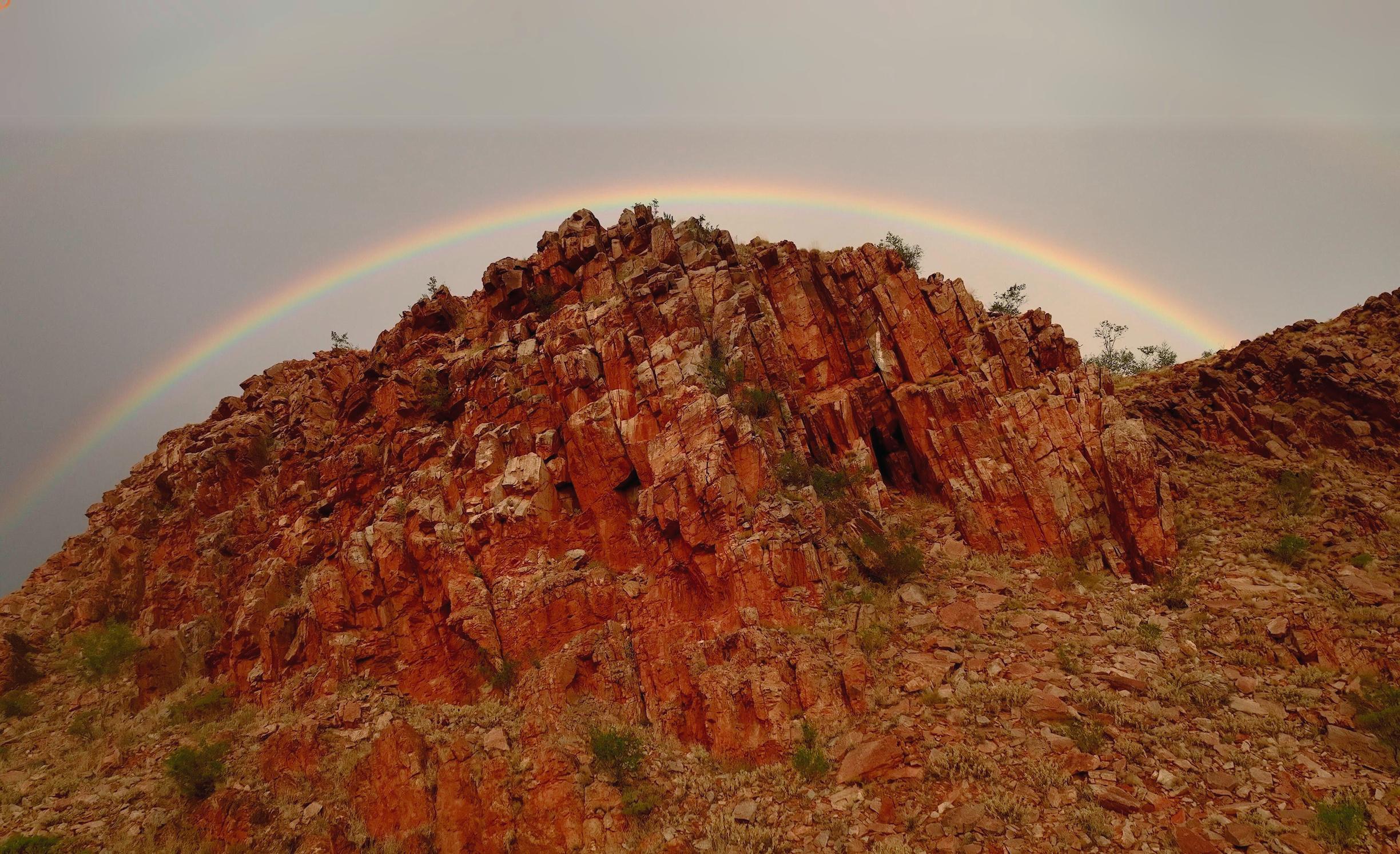
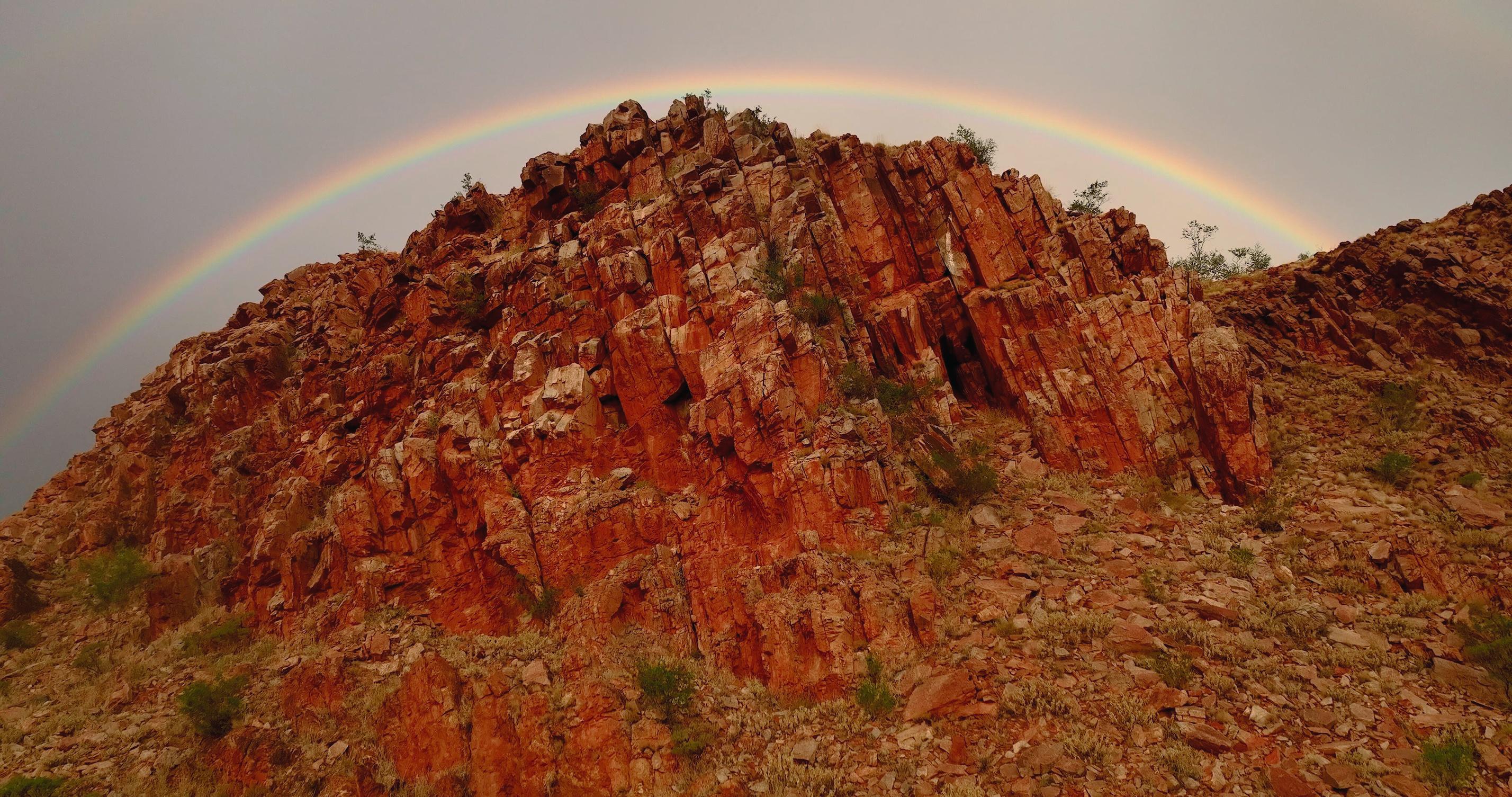
THE AUSTRALIAN GEOLOGIST ISSUE 210, APRIL 2024 Registered by Australia Post Publication No. 100010917 ISSN 0312 4711 Cover image: Rocks of the Heavitree Formation, Amadeus Basin, East MacDonnell Ranges, Arrernte Country, NT. Image courtesy Chris Tangey
FROM THE PRESIDENT

Amber Jarrett
WELCOME TO OUR FIRST EDITION OF TAG FOR 2024.
After 209 issues, we are excited to trial a fresh and colourful approach to your society magazine. I hope you are inspired to share your geoscience stories with the Australian geoscience community — we welcome stories, photos and highlights from all of our members!
The year is already off to a brilliant start. It was fantastic to see Earth Science and the resources industry strongly represented in the Australia Day Awards, providing positive commentary about the benefits of Earth Science to the public. The new Planetary Geoscience Specialist Group held a successful conference in Brisbane in February, the NT Division held their Annual Dinner — always a fabulous night out in Darwin, and we are looking forward to other Divisional and Specialist Group conferences and seminar series restarting. Thanks as always to all our fabulous volunteers who arrange our Divisional and Specialist Group meetings.
The GSA is excited to be collaborating with other Australian societies to amplify our shared values and provide additional benefits to members. We are sponsoring the International Applied Geochemistry Conference, partnering with Gold24, the NSW team are supporting GeoFest24 and the Sydney Basin Symposium. I’m sure more exciting events will be added to our calendar as the year progresses.
I am passionate about leading a modern, professional society where everyone feels welcome, valued and respected. The GSA is committed to providing members with the right skills and training to undertake geoscience and professional growth in a safe and respectful environment. In December 2022, a new positive duty obligation was introduced to all workplaces. This is a legislative requirement to be proactive in the way we approach physical and psychological safety. Stay tuned for consultation and training to help us commit to our positive duties under the Work Health and Safety Act. This is an important step for our journey to be the society of choice for geoscientists across Australia.
Finally, a big congratulations to Darren Holden our cryptic crossword winner from the December TAG. It was great to see so many entries (and I am in awe of anyone able to solve cryptic crosswords).
Best wishes for a successful year ahead, and I hope to see you at our AGM in May, if not sooner.
Thank
you to our TAG contributors
Mark Asendorf
Pete Betts
Margaret Brocx
Patrick Conaghan
Colin Conor
CSIRO
Joan Esterle
John Foden
Dick Glen
Jim Jago
Diane Jorgensen
Bob Major
Luke Milan
Ken McQueen
David Murphy
Anna Petts
Tiah Penny
Angus Robinson
David Robson
Rick Squire
Chris Taylor
Anett Weisheit
Mark Williams
Ian Withnall
Exec teams at GSA HV, NT, Vic, WA


2 THE AUSTRALIAN GEOLOGIST
SOCIETY UPDATE

Business update
The GSA Executive Committee and The Association Specialists (TAS) are working hard behind the scenes to support the GSA
End of financial year
The GSA is closing off the financial year and working on the audit (GSA’s financial year runs 1 January to 31 December) Thank you to everyone for promptly providing financial information to TAS and we look forward to presenting the audited financial statements later in the year
Updated email system
You may have noticed that email correspondence from the GSA is now from ‘GSA Secretariat’. The GSA has migrated to Microsoft 365, and all GSA inboxes (accounts, info, publications) forward to the one shared inbox for TAS to manage This migration means the GSA have a modern, simple and secure system. A big thank you to Michael Jarrett, IT Security Adviser and Network Engineer for supporting the GSA through this transition
Financial reporting
The GSA listened to feedback about the frequency of financial reporting. Under the current contract, TAS provide quarterly financial statements This may not suit our business purposes and we are now setting up a new financial model, migrating from MYOB to Xero This will allow Treasurers to access live updates. We will keep you informed as this transition progresses and will provide training to Treasurers when the system is ready to use.
Square payment system
GSA has subscribed to the payment platform Square, which allows for instant and secure payments You may have used a Square tap-andgo reader at a café or market stall. Divisions and Specialist Groups are able to purchase a Square reader, or set up an online market place to sell books, event tickets or other items. The benefit of Square is that transactions and alerts are instant and directed to your preferred email address, saving double handling by TAS Have a look at the GSA NT Division’s online store as an example: http://gsa-nt.square.site.
Digitisation of GSA publications
During the office closure, all GSA financials, abstracts, journals and other products were packed into colour-coordinated, numbered boxes Unfortunately, the contents inside each box were not fully recorded and we currently cannot fulfil orders for books or abstracts in a timely manner. This was an oversight that we will ultimately need to remedy with volunteer assistance As an interim measure, we are moving all digitised publications online behind the member paywall This will give members instant access to all our products If you require any book or abstract in the near future, please get in touch with TAS for a free digital copy at info@gsa org au
Investment Portfolio update
At the 2023 AGM, it was recommended that the GSA re-examine the federal investment portfolio. The Victorian and Federal Divisions of the GSA have also agreed to merge their investment portfolios After going out to tender to five wealth managers, Evans & Partners have been selected to advise on the newly combined portfolio for the next five years The GSA is now undergoing the process of moving investment providers
Investment Portfolio committee
The Treasurer has established an investment portfolio committee of four members of the GSA and an Observer position The observer is for members who are interested in investing but have no or insufficient experience. The Observer can ask questions in the meetings but cannot vote on investment decisions. If you are interested in observing, please contact info@gsa org au
If you have any questions or feedback regarding GSA Business, please email info@gsa.org.au.
AMBER JARRETT, RICK SQUIRE, TIAH PENNY, PETE BETTS GSA Executive Committee
3 THE AUSTRALIAN GEOLOGIST
STANDING COMMITTEE COLUMNS
The GSA Governing Council is made up of nine Councillors. A new development for the GSA is the establishment of three standing committees with specialist, focused tasks and answerable to the Governing Council These committees will be: i) Communications, ii) Conferences and iii) Safety and Culture We still welcome enthusiastic volunteers to join these standing committees.
Conferences standing committee
Myself and Andy Tomkins from Monash University are enthusiastic founding members of the Conferences Standing Committee and anticipate being joined by four or five other GSA members
The functions of this committee will include an examination of the status of the Australian Earth Sciences Convention (AESC) and to recommend changes to the current model if necessary. We will also actively interact with Specialist Groups and Divisions and keep an eye on key international events to coordinate the ideal nationwide timing of our smaller-scale events, including conferences and workshops
The Society has a long-established routine of mounting a biennial national conference, The Australian Earth Science Convention (AESC). This is one of the GSA’s major (and most expensive) events AESC provides a vital forum where both Australian and international geoscientists with diverse interests and backgrounds can meet to exchange ideas, learn of new developments including those outside one’s specialist fields and reinforce collegial relations between geographically scattered state Divisions.
AESC provides a vital forum where both Australian and international geoscientists with diverse interests and backgrounds can meet to exchange ideas, learn of new developments including those outside one’s specialist fields and reinforce collegial relations between geographically scattered state Divisions
The past decade has seen significant changes in the way the AESC has been planned and mounted In the past, this conference had been a major source of income for the Society and always prompted a significant boost in our membership In contrast, more recent events have been at significant cost to the Society
Members may recall that in the past, the responsibility for hosting and organising the AESC circulated in an established regular sequence from one Division to the next at an interval of between 1 5 and 2 5 years In the past it was also common that events were held in relatively modest settings, including university lecture rooms and small-town municipal council meeting rooms This is in contrast with the more recent (and costly) trend for the Convention to be held in large-scale convention centres with support from professional conference organisers
The latter model, of course, has a range of strong advantages These include the provision of professional-standard exhibition space to house sponsor exhibitors, society booths and poster sessions, as well as efficient maintenance of online registration and charging It also provides access to a large auditorium space capable of seating >500 people for plenary speaker sessions.
The substantial downside for the latter model is of course the need to levy high registration fees, which automatically excludes significant numbers of member registrants including retirees and students. The current model invites potential coordinators to submit bids for future conferences This almost inevitably becomes a competition between convention/exhibition centres around the country (often initiated by them) It also means that the GSA do not control the exact timing and frequency of future AESCs. In the past, the exact dates and location of each succeeding AESC were known and celebrated at the preceding convention This is not the case now, substantially impeding the future planning of potential delegates.
4 THE AUSTRALIAN GEOLOGIST
My personal view is that our AESC is a vital event for the Society and it is important that it continues At the same time, I feel that changes to the current model might be needed, and I urge members to express their opinions and ideas (perhaps through TAG). It is likely that in the future, the Conferences Standing Committee will seek member opinions through a direct survey In finishing, I remind members that the GSA has an MoU with the Geoscience Society of New Zealand (GSNZ, gsnz org nz) This agrees that members of each Society can register for the other’s conferences and events at member registration rates. GSNZ holds national conferences equivalent to our AESC annually, usually in November or early December This year’s meeting will be in Dunedin, and their schedule is established for each year until 2028
JOHN FODEN
Co-chair, Conferences Standing Committee
TAG welcomes letters to the Editor regarding the future of GSA’s conferences and the AESC model. Please email tag@gsa.org.au by COB Friday 31 May 2024 — anonymous letters are also accepted.
Safety and culture
The GSA’s mission is to promote and advance Earth Science. This standing committee will provide members with the tools they will need to plan for and participate in a safe, respectful and welcoming environment
We are still seeking additional members to join our standing committee
Safety in the field
The GSA wants to see our Divisions and Specialist Groups out in the field We will ensure our risk-assessment process is modern and streamlined, and volunteers understand their obligations so we can get back outside and enjoy the geology.
Psychological and psychosocial safety
The GSA has legal obligations under the Work Health and Safety Act to ensure all our volunteers feel safe from discrimination. This is the right thing to do by each other, and it is also the law GSA will be undertaking consultation with members to fulfil our positive duty obligations.
Collaboration for education
The GSA will be collaborating with organisations align with the GSA’s commitment to promote inclusivity, diversity and professional growth The GSA is excited to have signed a Statement of Intent with Queers in Science and a Memorandum of Understanding with Women in Earth and Environmental Sciences in Australasia (WOMEESA) Together, we will share knowledge and build a stronger, more diverse community.
AMBER JARRETT, TIAH PENNY, GRESLEY WAKELIN-KING
Safety and Culture Standing Committee
Communications
The Communications Standing Committee is still seeking volunteers who are interested in refreshing the communications strategy of the Society Please email your interest to info@gsa.org.au.
Canva
The GSA has subscribed to Canva an online, easy-to-use graphic design tool Canva is enabling Divisions and Specialist Groups to make professional flyers, social media tiles and newsletters (This edition of TAG is created using Canva )
GSA will be creating custom brand templates in the Canva tool to ensure we have a professional and consistent look and feel across all Divisions and Specialist Groups
All Divisions and Specialist Groups are welcome to obtain a GSA Canva license Please email tag@gsa.org.au if you are interested, or even if you would like to experiment
5 THE AUSTRALIAN GEOLOGIST
STATEMENT OF INTENT
This Statement of Intent is made and entered into on 06.02.2024 between the Geological Society of Australia (GSA), represented by Amber Jarrett, President of GSA, and QueersInScience (QIS), represented by Kim Kwan, Project Manager of QIS, collectively referred to as "the Parties".
BACKGROUND
The Parties acknowledge their shared commitment to promoting inclusivity, diversity, and professional growth within the scientific community.
PURPOSE
The purpose of this statement of intent is to establish a partnership between the GSA and QIS to collaboratively facilitate, participate in, and promote events and initiatives that will benefit both societies and contribute to a more inclusive and diverse scientific community.
TERMS OF COLLABORATION
Enhanced Diversity and Inclusion: The Parties shall work together to organise activities and/or develop resources that encourage participation from individuals from the queer community. These activities and resources will aim to create an inclusive atmosphere that celebrates individuality and fosters a sense of belonging within the geological and scientific communities.
Knowledge Exchange and Skill Building: The Parties shall facilitate opportunities for members to access each other's resources, workshops, seminars, and educational materials
Expanded Networking Opportunities: Through joint conferences, symposia, and networking events, the Parties shall provide platforms for their members to connect, share experiences, and build professional relationships This expanded network will create new avenues for collaboration, research, and career development.
Joint Outreach and Advocacy: The Parties shall collaborate on advocacy efforts to promote diversity, equity, and inclusion within the scientific community They will jointly advocate for positive changes and support policies that foster an equitable and supportive environment for all scientists.
Event Planning Committee: GSA may seek input from QIS as a fee for service for review of planned events and initiatives
Resource Sharing: GSA and QIS shall explore opportunities to share relevant resources, publications, and educational materials, subject to applicable copyright and intellectual property laws
Duration: This statement of intent shall be valid for a period of 2 years from the date of execution. Upon mutual agreement, the Parties may extend or renew the statement of intent
CONFIDENTIALITY
The Parties agree to treat any confidential information shared during this collaboration with strict confidentiality Confidential information shall not be disclosed to any third party without prior written consent from the disclosing Party.
GENERAL PROVISIONS
This Statement of Intent is not intended to create legally binding obligations and is not legally binding on the Parties
AMENDMENT AND TERMINATION
This statement of intent may be amended or terminated by mutual written agreement of the Parties Either Party may terminate this statement of intent with 30 days’ written notice to the other Party.
SIGNATORIES
This statement of intent is executed by the authorised representatives of the Parties as of the date first written above

 Kim Kwan, QiS
6 THE AUSTRALIAN GEOLOGIST
Amber Jarrett, GSA
MEMORANDUM OF UNDERSTANDING
This Memorandum of Understanding (MoU) is between the Geological Society of Australia (GSA) and Women in Earth and Environmental Sciences Australasia (WOMEESA) Its intent is to mutually benefit members of both societies by maximising involvement and presenting opportunities for promotion and advocacy of equity, diversity and inclusion within Earth and Environmental Sciences
Effective 1st March 2024, the GSA and WOMEESA will:
Cross-facilitate and promote major initiatives and flagship events of both societies through mechanisms such as social media and newsletters.
Seek opportunities to elevate and raise awareness of diversity issues and topics via channels such as social media
Work together to increase networks and encourage connectivity across both societies through activities such as joint sessions at conferences, workshops and networking events
Collaborate on advocacy efforts to raise awareness of gender equity, diversity and inclusion within Earth and Environmental Sciences. The societies will jointly advocate for positive changes and support policies that foster an equitable and supportive environment for all scientists
Commit to co-creating best practice guidance materials for achieving gender representation at professional conferences
Explore opportunities to share relevant resources, publications, and educational materials, subject to applicable copyright and intellectual property laws.
This MoU will be reviewed every three years, or on request by either party
This MoU is signed on behalf of the GSA and WOMEESA


 Erin Martin President, WOMEESA
7 THE AUSTRALIAN GEOLOGIST
Amber Jarrett President, GSA
HERITAGE MATTERS
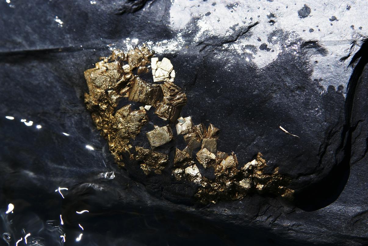
Article and images by Margaret Brocx Chair, Geoheritage Standing Committee
Geoheritage significance of crystals
The science of crystals is complex. Its complexity comes from the wide variation and diversity of minerals, crystal types, sizes, paragenesis and geological setting Added to this, in terms of geoheritage, are the history of localities and any endeavours aimed at preserving globally and nationally important crystal/mineral sites, and posing interesting questions worthy of further research
Crystals are very common. Aside from the regions of its molten interior, Earth could be a crystalline planet, with many types of crystals expressed as thousands of mineral varieties in diverse environments. Some of these crystals are of geoheritage significance This is due to their size, composition, shape, zoning, reaction rims, mineral inclusions, fluid and gas inclusions, twinning, dislocations, exsolution, the unusual occurrence or rarity of a crystal attribute, and their form of aggregation (such as desert roses, or druses)
Macroscale geological features are assessed as important in unravelling Earth’s history, and afforded geoheritage significance Importance should also be given to crystals, where similar principles and patterns are present though generally at smaller scales Some notable crystals of geoheritage significance are the zircon crystals of Jack Hills (the oldest crystals on Earth); giant gypsum in Mexico and Spain; large, well-formed pyrite in Spain; snowball garnets from various locations; and Iceland spar from its type locality
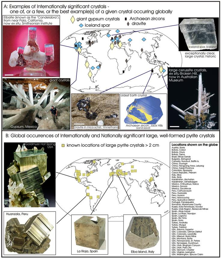
Notable crystal occurrences of geoheritage significance. A. Selected internationally significant crystal/mineral occurrences in a global context (scale bar is 5 cm). B. Global occurrence of internationally and nationally significant large, well-formed pyrite crystals ( >2 cm in size), with examples from some well-known locations
8 THE AUSTRALIAN GEOLOGIST
Weighell & Torfason (2002) provide a list of significant geological phenomena that would be worthy of geoconservation The list below captures the large majority of sites that would have geoheritage significance globally points 1, 2, 3, 8, 9, 10, 14 and 15 apply to crystals and minerals
1 Historically significant sites where original contributions to the understanding of geological processes or principles were inspired
Places where a geological feature, rock type, type specimen of a plant or fossil, or crystal was first recognised and described (ie, type localities)
2 Textbook examples of geological features and processes
3. Paleontological localities and other sites that contain scientifically significant stages in the evolution of the fossil record
4 Features created by wind, water, ice, weathering and mass wasting
5 Caves and karst topography
6. Hot springs, artesian springs and aquifers
7 Geological features that offer research or educational opportunities
8. Outstanding examples of significant stages in Earth’s evolutionary history
9. The variety of related and significant geological features within a small geographical area
11
10. Mines and mining districts that have geological or historical significance
12 Unique or uncommon rock or mineral sites
Geological curiosities such as meteorites or non-volcanic craters
13. Geological features, formations and landscapes that have exceptional natural beauty with existing or potential recreational uses
15
14 Rock and mineral specimen collection sites with existing or potential recreational uses or educational value
REFERENCES
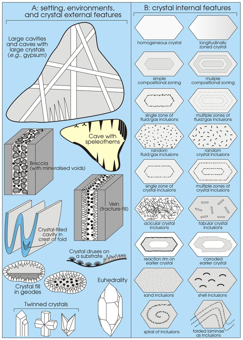
Diagrammaticillustrationof(A)thesettingsandenvironmentsofcrystaloccurrencesandsome externalcrystalfeatures,and(B)therangeofinternalcrystalfeaturesthatareofpotential geoheritagesignificance
While in general we have seen an emphasis on larger-scale aspects of geology for geoheritage and geoconservation, the purpose of this article has been to introduce the concept of crystals, in their own right, as features of potential geoheritage significance worthy of recognition and protection through geoconservation. For more details on the geoheritage significance of crystals and citation of images, see Brocx & Semeniuk (2010)
BrocxM&SemeniukV2010 Thegeoheritagesignificanceofcrystals GeologyToday26,216–225
WeighellT&TorfasonH2002.Geologicalandgeomorphologicalconservation:areviewofglobalEuropeanandnational programmes PaperreadatWorkingGrouponGeologicalHeritage,13September2002,Strasbourg
9 THE AUSTRALIAN GEOLOGIST
NEWS AND VIEWS
Australia Day 2024 Awards
The 2024 Australia Day Honours List awards eight members of the Earth Science and resources community Congratulations to:
Sandra Close, awarded a Member of the Order of Australia (AM) for significant service to the mining and resources sector, and to women as an equal opportunity pioneer and advocate
Natasha Hendrick, awarded a Member of the Order of Australia (AM) for significant service to youth, and to Earth Sciences
Peta Libby, awarded a Member of the Order of Australia (AM) for significant service to the mining and natural resources industry, and to the community
Alex McBratney, awarded a Member of the Order of Australia (AM) for significant service to soil science through research and education, and the development of digital mapping techniques
David Cockshell, awarded the Order of Australia (OAM) for service to the community through a range of organisations, and to geophysics
David Elliott, awarded the Order of Australia (OAM) for service to the community through cofounding the Australian Age of Dinosaurs Museum of Natural History
Dudley Kingsnorth, on being awarded the Order of Australia (OAM) for services to mining, and to the community
Suzy Urbaniak, awarded the Order of Australia (OAM) for service to secondary education and the Earth Sciences
Congratulations to all, and thank you for all you do for Earth Science and our community
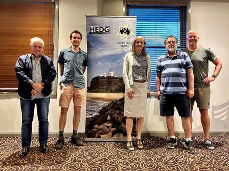
Hunter Valley Branch
The Hunter Earth Science Discussion Group (HEDG) held two presentations in the last quarter of 2023, trialling a couple of new venues in Maitland.
To celebrate Earth Science Week in October, Robert (Bob) Musgrave from the University of Newcastle presented an overview of the Ocean Discovery (Drilling) Program, including his longstanding and continuing involvement with the project The presentation was held at East Maitland Bowling Club, with 25 attendees.
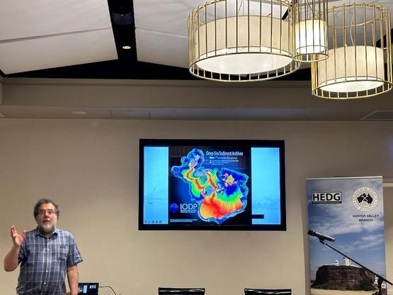
Bob stepped through the history of the program one of the world’s greatest exploration, technology and scientific endeavours and some of the major scientific findings from the program These include investigations of Earth’s crust and upper mantle, hydrothermal systems, oceanic meteorite impacts, ocean floor sedimentation, mid-ocean spreading ridges (leading to better understanding of plate tectonics), Earth processes, and characterising previous climate and oceanic conditions Bob’s work has included the study of paleomagnetism, magnetic remanence, magnetostratigraphy and gas hydrates on expeditions in the southwest and western Pacific Ocean.
Musgrave presents to
v
s
e
re
Bob
HEDG in No
ember 2023 Image
court
sy Phil Gilmo
10 THE AUSTRALIAN GEOLOGIST
In late November, Anthony Budd (MinEx CRC and Geoscience Australia) presented an update of the 10-year MinEx CRC the largest mineral exploration collaboration to 25 attendees at the Hunter River Hotel, East Maitland Anthony described the development and mechanics of coiled-tubing drilling technology deployed in Project 3 of the MinEx CRC the National Drilling Initiative
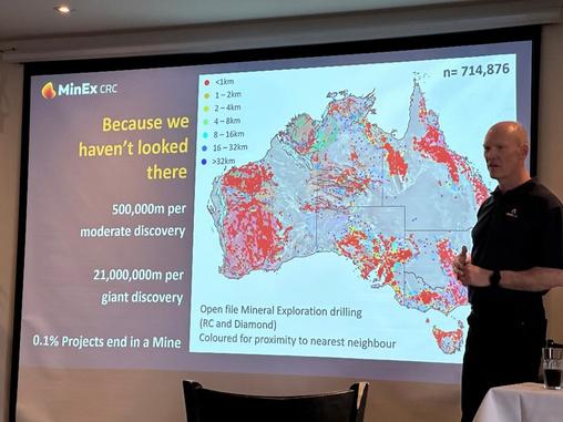
The Initiative’s partners are the geological surveys of NSW, SA and WA and Geoscience Australia, with affiliate support from other state and territory geological surveys. Anthony provided an overview of recent drilling campaigns, comparing the benefits of coiled-tubing drilling with conventional percussion/diamond drilling, and highlighting the geological and mineral systems breakthroughs of the campaigns He also discussed research into drilling optimisation, downhole sensing, real-time data streaming, augmented reality technology for viewing drill core, and analytical and postgraduate research happening through the CRC
NT Division
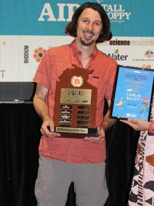
The NT Science Week Awards were running on Territory Time (NT: not today, not tomorrow). Despite being two months late, it was worth the wait to congratulate GSA member Lachlan Hallett for being awarded the coveted STEM Hero of the Year award In 2022, Lachlan headed the Australian Earth Science Education project ‘Soils Across the NT’ This involved 28 remote schools collecting soil samples that were analysed and divided into NT-wide kits. The completed kits were then provided back to students to showcase the incredible soil diversity across the NT This science endeavour offered a valuable resource for future activities Well done, Lachlan!
Vic Division
Student travel grant
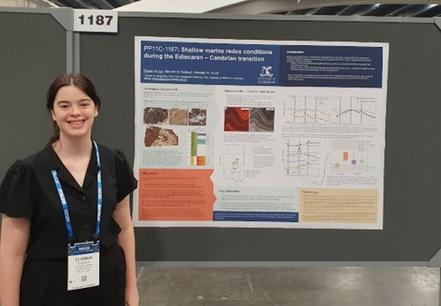
Thanks to the support of a GSA-Vic student travel grant, I was able to attend the AGU annual meeting in December 2023, held in San Francisco I presented a poster of my recent PhD research entitled: ‘Shallow marine redox conditions during the Ediacaran to Cambrian transition ’
My work focuses on the crucial interval of ecological diversification in the late Neoproterozoic and early Phanerozoic I employed both geochemical and sedimentological analysis of carbonates from the Flinders Ranges in SA and the Sichuan region of China to contribute to our understanding of shallow marine depositional environments, with a focus on oxygen levels. My results suggest that rather than the traditional view of a unidirectional increase in oceanic oxygenation in conjunction with the rise of animals during this time, unstable and dysoxic conditions more likely persisted throughout the Ediacaran and Cambrian
Anthony Budd presents to HEDG in November 2023
11 THE AUSTRALIAN GEOLOGIST
GSA Hunter Valley Branch members (L–R) Lindsay Gilligan, Chris Folkes, Rosemary Hegarty, Bob Musgrave and Phil Gilmore at HEDG
Lachlan Hallett accepts the STEM Hero of the Year Award at the 2023 NT Science Week Awards Image courtesy Inspired NT
This is significant, because it indicates that animal evolution and the Cambrian explosion was unlikely to be either a direct consequence, or cause, of increased oceanic oxygenation. Animals were evolving in conditions very different to those in which they thrive today
Presenting my work in the ‘Carbonate Sediments Through Time: Process of Deposition and Diagenesis’ session allowed me to engage with others doing similar research to my own, both postgraduates and scientists with far more experience This was a great way of learning about the variety of problems similar methods are being applied to, and the range of approaches being used to address the same big-picture questions about the interaction between the evolution of Earth’s surface conditions and life that guide my own research
I also really enjoyed the positive engagement I had with those from different subject backgrounds Their differing perspectives made me think about my work in new ways that I hope to be able to incorporate
Outside of my own presentation, the conference provided me with direct exposure to a breadth and depth of science that I have not experienced before It was inspiring to learn about the extraordinary work being done across the world I feel very fortunate to have been supported by GSA-Vic to make my own small contribution
ELOWEN AMOS
WA Division
GSA-WA’s new committee promotes inclusion & diversity
The WA Division proudly presents our recently rejuvenated committee a dynamic force of representatives from academia, industry and government. We’ve kicked off this term with a brainstorming meeting, outlining robust plans and unveiling myriad projects that promise to extend GSA’s reach in WA.
Meet our Executive:
Chair Kailah Thorn, Western Australian Museum
Vice Chair Vickie Cousins, Curtin University
Secretary Sandra Villacorta Chambi, CSIRO Mineral Resources
Treasurer Erin Martin, IGO Ltd & WOMEESA
Governing Council Representative
Margaret Brocx, Murdoch University
General Committee Members:
Simon Crocetta University of Western
Do you have any news, research, anecdotes, or interesting photos you would like to share with your peers?
Submissions to TAG are always welcome!
Email: tag@gsa.org.au
This committee stands on the shoulders of a giant: Pete Kinny (John Curtin Distinguished Emeritus Professor). PK is handing over his role as Convenor of the Awards Subcommittee to Margaret Brocx, after a number of years presenting our best and brightest with polished medals and certificates He also did a fantastic job as Chair for the Australian Earth Sciences Convention in Perth in 2023. We are especially sad to see him leave before serving a term as Chair of this committee
Elowen Amos presenting her poster at the AGU annual meeting in December 2023 Image courtesy Elowen Amos
12 THE AUSTRALIAN GEOLOGIST
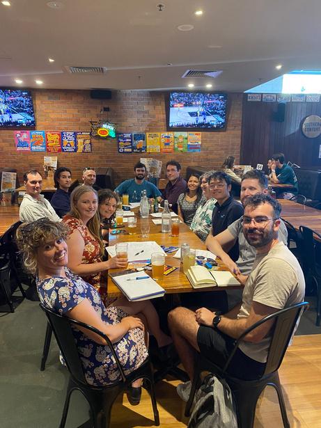
New committee members of GSA-WA Division in their inaugural meeting for planning this year's activities. Image courtesy Sandra Villacorta-Chambi
A primary goal of the committee is to guide GSAWA to projects that foster inclusion and diversity With a blend of experience and innovation, we’re planning engaging monthly talks, along with collaborative projects involving students at Curtin University and The University of Western Australia We are ready for an exciting year filled with collaboration, growth and promotion of our passion for geosciences!
ARGA
The Australian Regolith Geoscientists Alliance (ARGA) Specialist Group is steadily working towards a much more connected membership base We have two key aims building up and maintaining 10 webinars per year, and a special AJES volume with a regolith and critical zone theme
In 2022, ARGA held two well-attended online presentations The first was by Sabin Zahirovic from the University of Sydney In December, PhD Candidate Kathleen Vowles from James Cook University gave a fantastic presentation on her PhD research: ‘Sedimentary provenance & tectonics through detrital zircon geochronology’. Kathleen’s presentation may be found on the GSA’s YouTube channel at: tinyurl com/Kathleen-Vowles, and will eventually also be posted to ARGA’s new YouTube channel!
This year we have some fantastic webinars, so keep an eye on the GSA events emails Nonmembers are always welcome! If you’re interested in sharing your research with like-minded folk this year, get in touch with the committee and secure your spot. Always informal, the webinars make a great platform for sharing and discussing any aspect of regolith science, from termites to gold and fossils.
The 2023 ARGA committee decided that our Specialist Group should aim to publish a Regolith Science thematic issue by 2025 in AJES. We are looking for interest across our membership base (and Friends of ARGA) for potential papers. Guest editors are also needed for this thematic issue
The ARGA committee invites expressions of interest for papers and guest co-editors via secretary@regolith org au We will then plan our next steps
For your interest, a regolith thematic issue was last published in 2016 and was very well received tinyurl.com/tandf-regolith.
Follow ARGA on our socials: tinyurl.com/ARGA-bsky tinyurl com/ARGA-linkedin
Coal geology group
Welcome to 2024 from the GSA Coal Geology Specialist Group. We reported our AGM last year with the new committee members, so feel free to get in touch with us We continue to provide activities for our community through GSA and our corporate members, the Bowen Basin Geologists Group (BBGG) and the NSW Coalfields Geology Council (CGC). We also support the activities of other societies, such as the Petroleum Exploration Society of Australia, Australian Institute of Geologists, as well as GSA national and state branches and their student conferences.
We again had successful attendance for the online Coal Geology Fundamentals course organised by the NSW CGC in November 2023, with more than 200 registrations Many attendees were students and recent graduates, as well as old hats in the coal and coal seam gas industries We thank our speakers Joan Esterle (UQ), Tim Moore (Cipher Consulting), Anthony Williams (A&B Mylec) and Bruce Atkinson (Basacon) The course was financially supported by the NSW CGC, BBGG, Glencore, Yancoal and Centennial.
You can check out the Events web page and we will also send out emails for upcoming events hosted by us, but please also join the BBGG and the Coal Geology Group for events in your home states
The committees for upcoming conferences are busy!
The 42nd Sydney Basin Symposium will be held 21–23 August, 2024 at the Newcastle City Hall If you’d like to help organise it, please contact admin@coalfieldgeologycouncilnsw.org, or submit an abstract via papers@sydneybasinsymposium.net. Download the Call for Papers Flyer at tinyurl com/SBS-call-for-papers for more information.
The Bowen Basin Symposium 2025 is on 22–25 September
There are also international events this year The Society for Organic Petrology (www tsop org) will meet in Ulaanbaatar, Mongolia
14–22 September, and the International Committee for Coal and Organic Petrology (www.iccop.org) will meet 22–28 September in Oviedo, Spain If you like adventure and organic petrology, sign up!
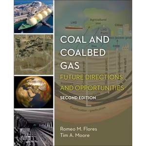
Closer to home, we hosted a book launch on 29 February in Brisbane for the second edition of Coal and Coalbed Gas: Future Directions and Opportunities written by Romeo Flores and Timothy A Moore.
13 THE AUSTRALIAN GEOLOGIST
Understanding organic material in the geological cycle is no easy task, and bringing all that understanding into a single book volume is commendable, to say the least It is no secret that the mere mention of the word ‘coal’ is divisive. Yet, people on either side of the debate have a far from adequate understanding of what coal, much less organic material in general, actually is, the conditions under which it is formed, or its properties and myriad uses
This multidisciplinary book covers everything from exploration of coal and coalbed gas to gas transport in pipelines and tankers, and from the formation of peat to coal use in thermoelectric power plants. You will find topics on local to global environmental and groundwater impacts from development of coal and coalbed gas, as well as discussion of global climate change due to CO and CH emissions from power plants, coal mines and peatlands. The future of organic-rich horizons such as coal is also examined, along with how innovative uses of solid carbon ore sourced from coal can contribute to a world of global, net-zero carbon emissions
This new edition introduces the latest in coal geology research and the engineering of gas extraction. Importantly, the second edition examines how, over the last 10 years, research has both changed focus and where it is conducted. This shift essentially depicts a tale of two worlds one half (Western Europe, North America) moving away from coal and coalbed gas research and production towards cleaner energy resources, while the other half (Asia–Pacific region, Eastern Europe, South America) increases both research and usage of coal These changes are marked by the precipitous fall in coalbed gas production in North America However, at the same time there has been a significant rise in coal and coalbed gas production in Australia, China and India
Check the book out at: tinyurl.com/coal-andcoalbed-gas
SGTSG
SGTSG Tectonics on the Tablelands: 18–22 November 2024
The 2024 Specialist Group in Tectonics and Structural Geology (SGTSG) field conference will be based out of The University of New England (UNE) campus, Armidale, NSW The regional university town of Armidale is situated within the heart of the geologically diverse Southern New England Orogen
The conference is shaping up to be an exciting week, with international speakers including Basil Tikoff, Antonio Langone, Alberto Vitale Brovarone, Wang Lu and Sandra Piazolo. We are also spoilt with an expanding and exciting list of invited speakers from across Australia The full list of confirmed speakers can be viewed on the SGTSG webpage
Registration costs are as follows and payment links will be live via our webpage, www sgtsg org
Early bird members $550 (late registration $650)
Early bird non-members $750 (late registration $850)
Students $275 (late registration $375)
Registration covers the conference, catering, ice-breaker event at Welders Dog Brewery, field trips, public transport from town to the UNE campus, and conference dinner at Petersons Winery The generously discounted student registration price also includes a pre-conference early career geoscientist workshop, and six nights’ accommodation at UNE colleges Scholarship opportunities for students can be found on the SGTSG website under the sponsorship tab Our goal is to encourage a high number of students to attend the meeting.
14 THE AUSTRALIAN GEOLOGIST 2 4
Workshops
A free early career geoscientists’ workshop on pyrolite (open source software for working with geochemical data) is being offered by CSIRO’s Morgan Williams on Sunday 17 November Additionally, Basil Tikoff will be offering a short workshop on the geological application StraboSpot, which is a digital database for experimental geophysical data
Field trips
Our preliminary schedule includes two short (two nights/three days) pre- and post-conference field trips covering local geological highlights Numbers will be capped at ~20 for each field trip and will be filled upon registration on a first-come basis
The pre- and post-conference field trip themes (subject to change) are:
Critical metals and magmatism of the Southern New England an extravaganza of ophiolites and related mineralisation, granites, calderas, ignimbrites and granite related Sn-W-critical metal mineralisation Crossing the contorted orogen this will take in a transect across the New England Orogen from west to east that highlights the key components and places them in context
Possible mid-conference field trips may include:
Wongwibinda Metamorphic Complex explore complexly deformed amphibolite facies migmatites with spectacular collapse structures that formed after melt escape, and also visit the two-mica S-type granites that represent sites of melt accumulation
Ebor volcano in the New England National Park enjoy the scenery as we perch on the edge of the Great Escarpment overlooking panoramic views across World Heritage rainforest to the ocean in the distance
SGTSG committee
Chair Luke Milan, UNE
Treasurer Timothy Chapman, UNE
Secretary Vasileios Chatzaras, The University of Sydney
We are grateful for help our huge team of additional conference organisers:
Nathan Daczko, Macquarie University (MQU)
Kim Jessop, MQU
Robyn Gardner, MQU.
Thanks also to our student advisory group:
Alanis Olesch-Byrne, James Cook University
Jeremy Asimus, University of Tasmania
Aditi Chatterjee, MQU
Transport and accomodation
Patrons will need to organise their own accommodation and transport to Armidale We suggest you book early. From Sydney it is a sixhour car drive to Armidale You can also catch a train, or fly from Sydney via Qantas (Rex Airlines operations are under review). From Brisbane, it’s also a six-hour drive, or you can fly with Link Airways Conference patrons without a vehicle will be provided with free bus travel through Edwards Buses Just show your official conference nametag to the bus driver. Please visit edwardscoaches com au for timetables and routes
For further details see the SGTSG webpage: www sgtsg org
Contact: SGTSG2024@gmail.com
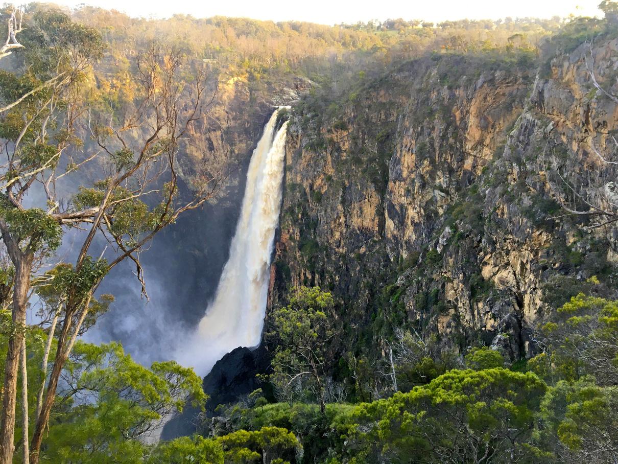
rs Falls, Armidale
courtesy Luke Milan GSA ON LINKEDIN We are excited to have just joined LinkedIn Follow our page and engage with your peers @geologicalsocietyofaustralia Follow the GSA on our other socials, too! Instagram:@geologicalsocietyofaustralia Facebook: @geosocaustralia X (formerly Twitter): @geosocaustralia YouTube: @geologicalsocietyofaustral7059 15 THE AUSTRALIAN GEOLOGIST
Danga
Image
2024 Australian Planetary Conference report
On 5-6 February, Australia’s planetary science community came together for the first time since the COVID pandemic. A lot had changed since our last meeting in 2019 Macquarie University had closed its geoscience program, and ANU had offloaded a large cohort of continuing academics, so the number of planetary science academics in Australia had been cut in half. Thankfully, many of these people were able to relocate to other institutions, and some younger academics had become more prominent. By the time 2024 rolled around, the community had built back up to a similar strength but was now looking fairly different.
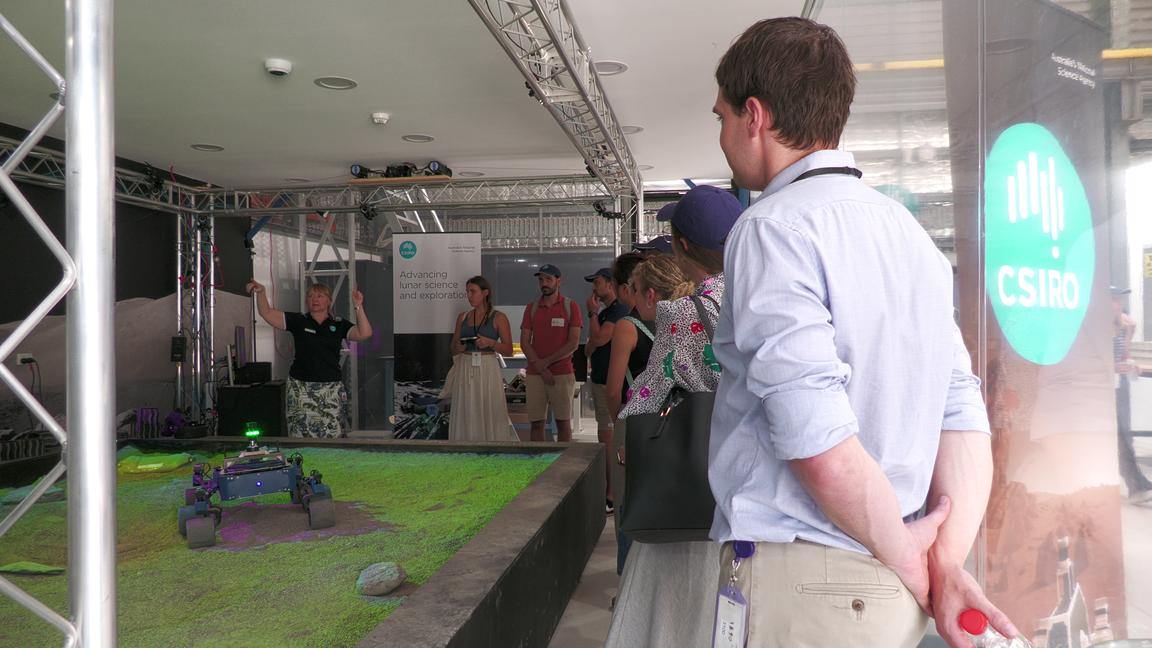
Another difference with previous meetings was that we involved CSIRO and the Australian Space Agency (ASA) in the conference Previously these government agencies had been completely disconnected to the academic community, and so had no way of knowing what research was being done in Australia. This time around, CSIRO co-hosted the conference along with the Queensland University of Technology We spent the first day at QUT listening to talks on the latest research across a broad range of planetary science topics Most of the second day was spent at CSIRO’s Pullenvale offices, where they ran a workshop to find out what science questions and future missions the academic planetary science community saw as important. They also gave us a fantastic tour of the robotics facilities We finished off the conference with an afternoon session on meteorite science back at QUT
From my past experience at the five previous conferences, which had been run under the SSERVI banner (SSERVI = Solar System Exploration Research Institute, linked to NASA), I would say that the 2024 conference was a huge success. About 100 people attended and there was a strong feeling of good will among the community I felt like we achieved a connection between CSIRO and the academic community that we haven't seen before It was good to have a representative along from ASA this time too We expect that this will lead to fruitful collaborations in the near future I think everyone would have come away from the conference with a positive view about the future of planetary science in Australia
The conference organising team consisted primarily of myself from Monash University; Jane Hodgkinson, Jonathon Ralston and Chad Hargrave from CSIRO; and David Flannery and Jayden Fryer from QUT Many other people were involved at various stages, including Nick Carter, Vera Hoogland, Craig James and Anna Campbell Thanks to everyone for organising such a great conference
Regarding next meetings for the planetary science community, people are being strongly encouraged to attend the Australia Space Research Conference in Perth on 2-6 September this year, and then regularly thereafter If we present to the wider space research community as a distinct, large community, we will be more visible across the sector, including to the government
ANDY TOMKINS
Secretary, Specialist Group in Planetary Geoscience and Geodynamics (SGPGG) 2023-25 Governing Councillor
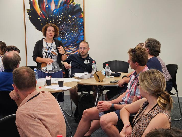
 Katarina Miljkovic discusses the future of planetary science in Australia Images courtesy Craig James
16 THE AUSTRALIAN GEOLOGIST
Jane Hodgkinson describes a rover test bed at CSIRO.
Early career advisory panel
The governing council of the GSA is thrilled to announce the next generation of the Early Career Advisory Panel (ECGAP), an initiative that supports and engages our early career geoscientists This new panel embodies the GSA’s commitment to fostering the growth and development of emerging talents within the geoscience community Comprising five dynamic and passionate members, the ECGAP will play a pivotal role in shaping the future of geosciences and enhancing the influence of early career professionals in the GSA’s activities.
The panel members are a diverse group of individuals, each bringing a wealth of knowledge, experience and enthusiasm to the panel. Maddison Tripp from Curtin University, Leah Lynham from James Cook University, Josh Shea from Cambridge University, Amy Elson from Curtin University and Alanis Olesch-Byrne from James Cook University have been selected for their outstanding applications and their dedication to outreach and communication within the geosciences
Each member’s unique perspective and expertise is expected to drive innovation and inclusivity within the GSA. They will work collectively to address the challenges and opportunities faced by early career geoscientists, ensuring that their voices are heard and their professional needs are met The formation of the ECGAP is a testament to the GSA’s proactive approach to embracing the next generation of geoscientists.
The ECGAP will be mentored by Peter Betts and Chris Taylor, who are current governing councillors Below, we introduce each of the ECGAP panel members and share some of their background.
PETE BETTS & CHRIS TAYLOR Co-Mentors, ECGAP

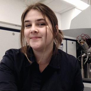
Maddison Tripp
Maddison recently completed a PhD at the WAOrganic and Isotope Geochemistry Centre, Curtin University, where she specialised in the application of organic chemistry to understand exceptional fossilisation. She has a crossdisciplinary skillset and a commitment to scientific excellence and has collaborated with diverse groups of scientists
Maddison has a deep passion for support and inclusivity in the Earth sciences and the wider scientific community With strong organisational and communication skills, she is an experienced public speaker, having presented at local (eg, GSA Earth Sciences Student Symposia, GESSS) and international (eg, Geological Society of America) conferences
An enthusiastic science communicator, Maddison is passionate about the dissemination of scientific knowledge to a broader public audience and is actively involved in science outreach events, engaging both the general public and school students. She sees the ECGAP as an opportunity to be involved in shaping the future of Earth Science in Australia
Josh Shea
Josh is an igneous petrologist and geochemist with a PhD from Macquarie University, and has diverse international experience as a Postdoctoral Research Associate at the University of Cambridge He remains deeply connected to the Australian geoscience community and is committed to solving challenges for early-career geoscientists
Josh’s firsthand experience with the dismantling of geoscience departments and the removal of relevant curricula in Australian universities has sharpened his ability to identify crucial gaps and needs in geoscience education His strong communication skills are key in bridging public perception gaps and promoting geosciences in Australia, particularly in highlighting its global importance
Dedicated to advancing equality, diversity and inclusion in geosciences, Josh actively works to dismantle barriers for under-represented groups and enrich the field with diverse talent His commitment to these principles significantly shapes his professional contributions to geosciences
17 THE AUSTRALIAN GEOLOGIST

Leah Lynham
Leah is undertaking her PhD at James Cook University on the palaeoenvironmental history of the Lefroy Drainage System using sedimentology, palaeontology and geomorphology to investigate the implications of the formation of buried placer Au deposits She has previously completed an internship with CSIRO mineral resources using a Namibian Carbonatite proxy to devise exploration workflows for regolith based carbonatite exploration in the Australian context.
Deeply involved in geoscience education, Leah contributes extensively to outreach efforts at various educational levels and collaborates with organisations such as the CORE Learning Foundation, museums and schools This work aims to increase recruitment and retention in the field, underscoring Australia’s potential in research and resource development As an active member of the GSA, serving on the Regolith Specialist Group and participating in GESSS organisation, Leah has built a strong network essential for their advocacy and outreach activities.
Leah is a dedicated parent with firsthand experience in navigating the challenges of balancing early career development in geosciences with family responsibilities and has been a long-standing advocate for improved support and retention initiatives for parents in early career stages.
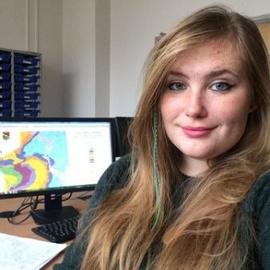
Amy Elson
Amy is a research fellow at Curtin University A geologist with broad training in sedimentology and geochemistry, she specialises in paleoclimate and fossilisation through multiproxy and cross-discipline analyses. Amy has experience spanning both academia and industry and has established multinational and multidisciplinary collaborations, including involvement in the JET and CPCP-2 International Continental Scientific Drilling Program campaigns She will bring an adaptable and logistical approach, along with enthusiasm, motivation, interpersonal skills and creative ideas to the ECGAP
Amy has a strong background in science communication, public outreach, and teaching undergraduate field trips and classes As a Petroleum Exploration Society of Australia-WA committee member, she has experience in committee finances, event planning, and advocating for student interests, offering insights into Australia’s future energy sector Amy has been an American Geophysical Union session convener for an all Early Career Researcher female scientists’ panel, highlighting her advocacy for inclusivity. She hopes to use the ECGAP to bridge academia and industry and to create opportunities for early career researchers
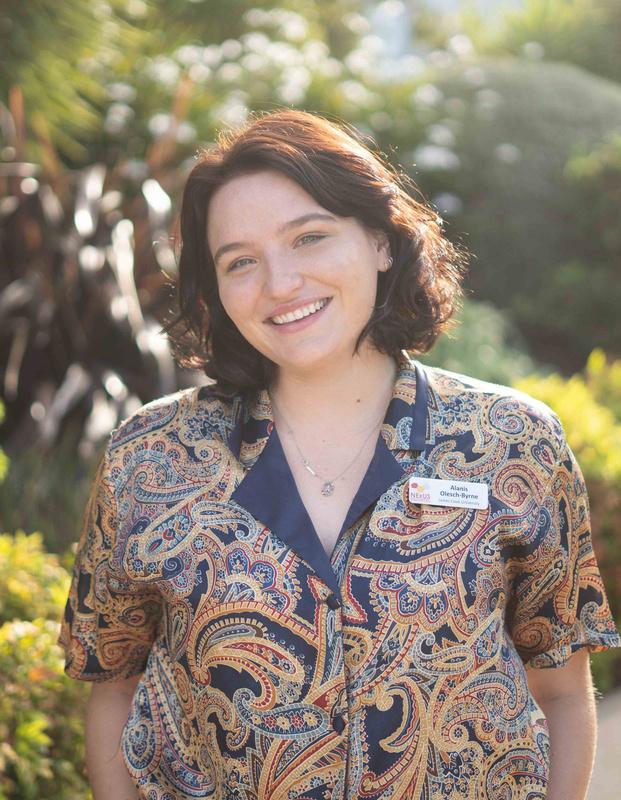
Alanis Olesch-Byrne
Alanis is currently undertaking a PhD at James Cook University, specialising in Rare Earth Elements and Critical Mineral deposits. She has a strong commitment to the geoscience community and is a representative for North Queensland in the GSA Queensland Division, bringing a unique perspective on regional issues. Alanis is on the organising committee of the upcoming SGTSG conference, where she will focus on student representation and involvement
Alanis is also engaged with Women in Earth and Environmental Sciences in Australasia (WOMEESA) as the Secretary and student engagement committee member. She is an advocate for the inclusion of women in academia and has a passion for connecting academia, industry and government.
18 THE AUSTRALIAN GEOLOGIST
Long live the Queensland Geochronology Alliance
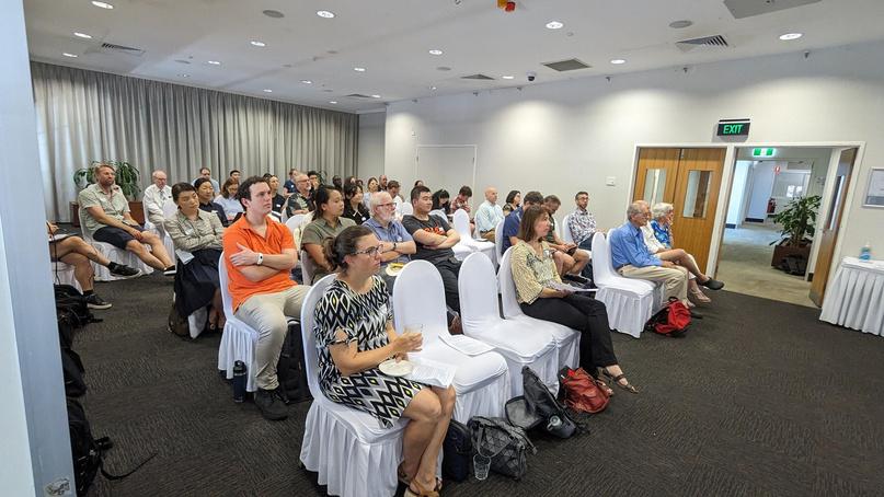
The third annual workshop of the Queensland Geochronology Alliance (QGA) was held at The Ship Inn, in Brisbane on 2 February Our 2024 workshop was attended by over 50 participants from universities (UQ, JCU, QUT, Griffith), CSIRO, Queensland Museum, Queensland Department of Environment, Science, and Innovation, Geological Survey of Queensland, and others from the public and private sector
The QGA would like to sincerely acknowledge GSA-Qld Division for sponsoring the 2024 workshop and hope that this is the beginning of a fruitful collaboration.
Helen McCoy-West from the Economic Geology Research Centre at James Cook University (Townsville) delivered a keynote ‘Magmatism in the Mt Isa Inlier: using geochronology to revise igneous provinces’. Presentations focused on instrumentation, geochronological methods, and case studies. They covered a wide range of topics including archeology, climate and sealevel change, economic geology, environmental science, geochemistry, geochronology, geomorphology and physical geography, hydrogeology, natural hazards and paleontology, highlighting the interdisciplinary nature of QGA.
The QGA provides a platform for members to be appraised of new and ongoing projects, advances in the field, and new and improving dating techniques available The multidisciplinary nature of the alliance is key to informing the community on available techniques and developing new synergies. For example, in the first workshop PhD student Teresa Dixon was connected with Justine Kemp and the Optically Stimulated Luminescence Dating Laboratory at Griffith University, which has been instrumental for Teresa in developing a chronology for sedimentation in recent fluvial sediments in Northern Australia
The QGA evolved from a legacy organisation, Brisbane Geochronology Alliance, which was formed in 2016-2017 as a small expert group of labs in geochronology in Brisbane During the COVID-19 pandemic, a team of early to midcareer researchers in Queensland made a significant effort to reinvigorate this community with an inclusive approach by expanding the membership to experts, users, and general audience of geochronology (broadly speaking). The QGA is intended to be cross-disciplinary and to encompass all research fields that require an understanding of the timing of natural processes from years to billions of years
QGA is coordinated by a group of volunteers. Please contact the Committee (geochron qld@gmail com) or one of the Committee members if you have any questions or feedback
Current Committee members include:
Annie Lau (University of Queensland)
David Murphy (Queensland University of Technology)
Ioan Sanislav (James Cook University)
Justine Kemp (Griffith University) Director, 2021 to 2024
Renjie Zhou (University of Queensland) Director, 2024 to present
DAVID MURPHY
19 THE AUSTRALIAN GEOLOGIST
The large and enthusiastic audience at the QGA workshop
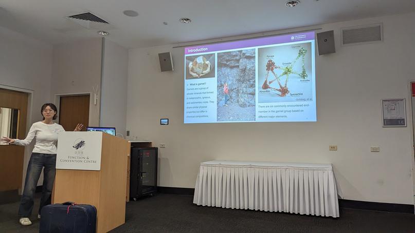
Xin Wang (UQ) presenting on the utility of dating garnet for fingerprinting mineralisation processes Images courtesy David Murphy
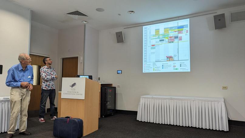
Bill Perkins (GSQ) highlighting the importance of understanding field relationships when considering geochronology
MUTAWINTJI NATIONAL PARK GEOTRAIL
Building collaborative partnerships in western NSW
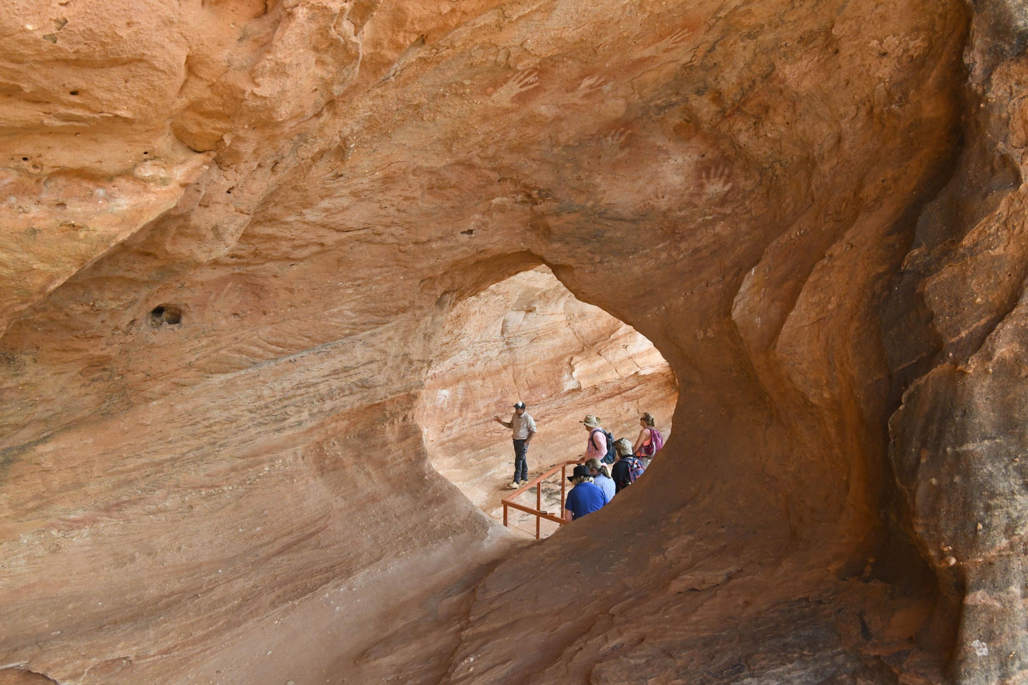
Mutawintji National Park
Geotrail was released to the public in August 2023, by the Geological Survey of NSW (GSNSW)
David Robson describes the geotrail and the significance of a collaborative approach to geotrail development.
By David Robson
Chair, GSA Geotourism Standing Committee
Images courtesy GSNSW
An Aboriginal guide at Mutawintji explains the significance of rock paintings to visitors 20 THE AUSTRALIAN GEOLOGIST
Mutawintji National Park Geotrail
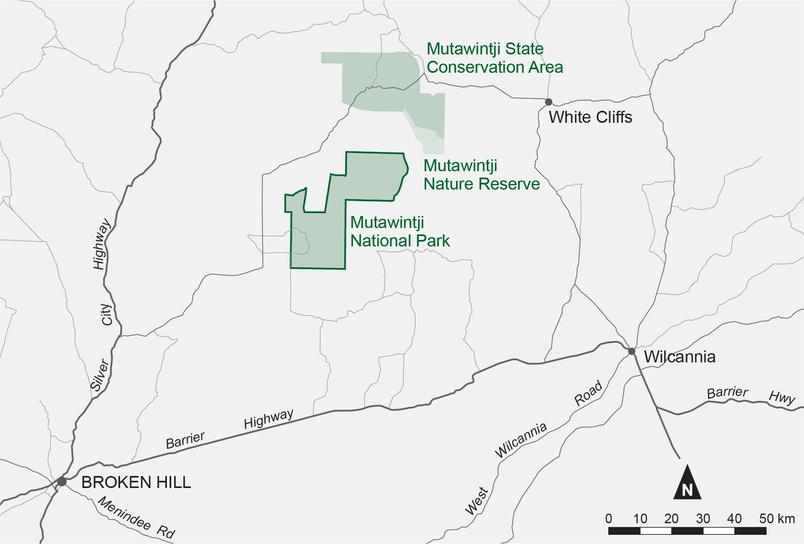
Mutawintji National Park Geotrail is the most recent of four NSW-based geotrails released to the public by the Geological Survey of NSW (GSNSW) Mutawintji Geotrail was released in August 2023, with geotrails for the Port Macquarie, Newcastle Coastal and the Warrumbungle National Park released since 2018 The Mutawintji Geotrail includes four separate tours (18 stops) following existing walking tracks or roads, and covers about 23 km. An extensive road-based geotrail in far western NSW, to be known as the Darling–Barka Geotrail, is also currently in an advanced stage of production by GSNSW
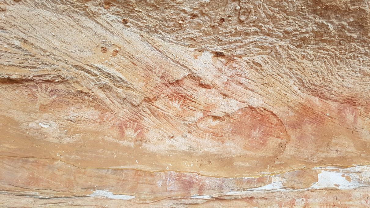
The word ‘Mutawintji’, which is from the Wimpartja Parlku language, means ‘place of green grass and waterholes’ Aboriginal people have been meeting and living in the area for thousands of years Mutawintji is one of the most significant sacred places in western NSW and is a location for trade and celebrations.
GSNSW acknowledges the Traditional Owners of the Mutawintji Lands, the Wanuwakul, Malynuppa, Bungaguli, Wilyakali, and Barkandji people, and pays respect to elders past and present
The geological context at Mutawintji
The geology of the Mutawintji National Park region tells a story that stretches back 650 million years to the late Proterozoic Eon At that time, the region was covered by sea and was located at the eastern edge of the supercontinent Gondwana, near a boundary between Earth’s tectonic plates Plate tectonic forces formed a chain of volcanoes in the Cambrian Period (around 500 Ma). These were later accompanied by three episodes of mountain building, separated by long, quiet periods of erosion and intermittent deposition from the Silurian to Carboniferous periods
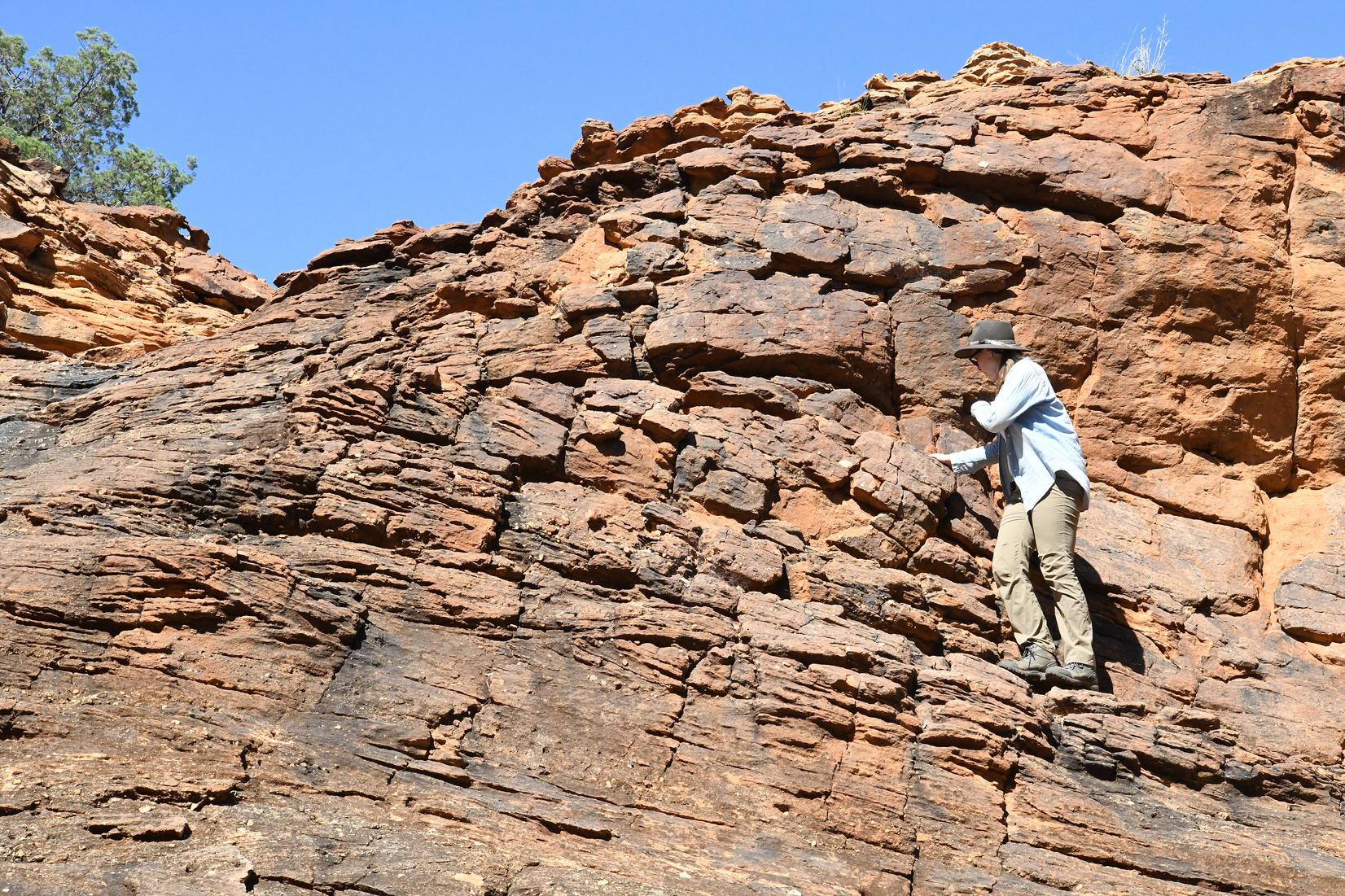
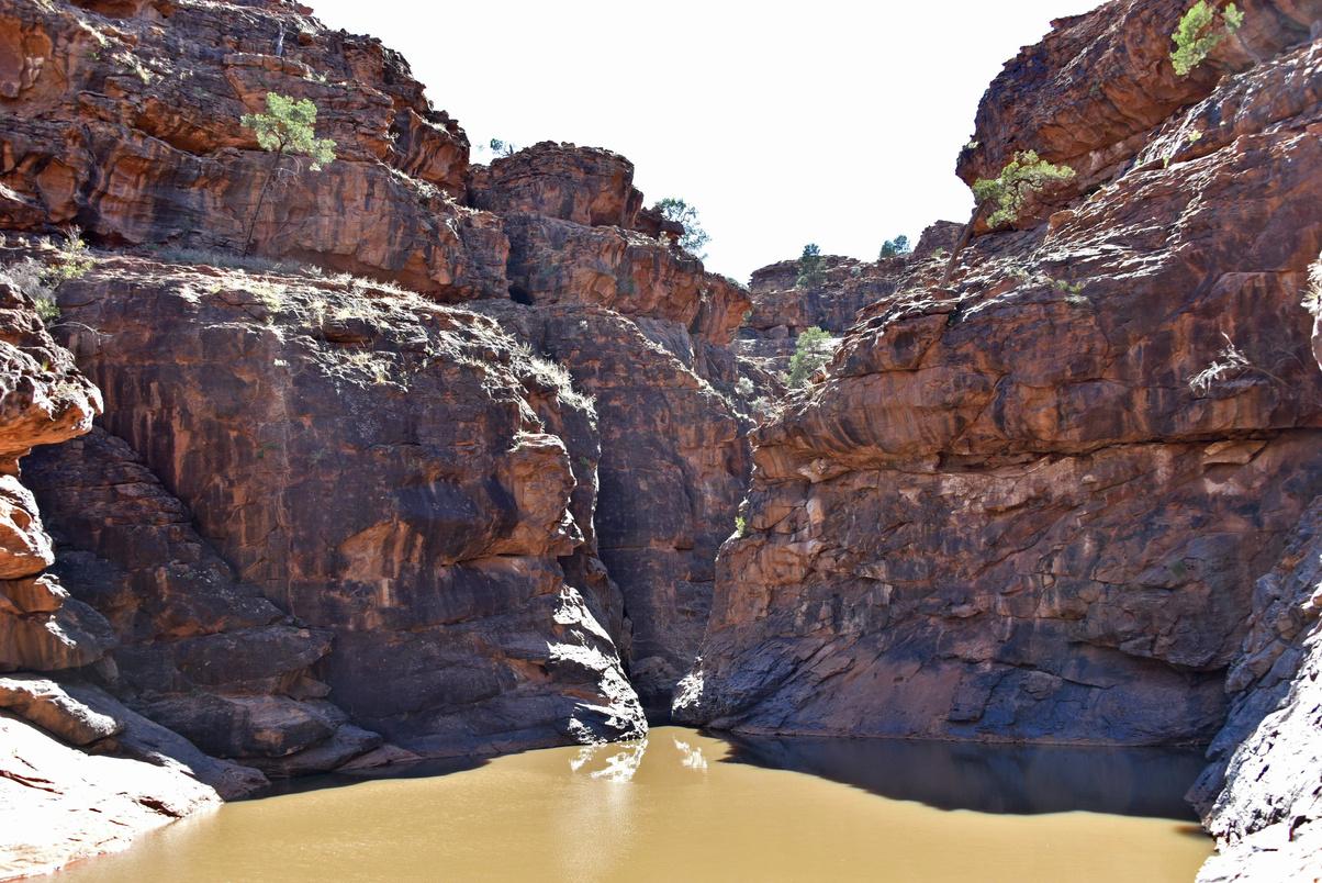
As seen on the Mutawintji Geotrail, rocks formed during the Early to Middle Devonian Period (419–400 Ma) were exposed and formed when a vast, braided river system extended across the area Sediments that eroded from the mountains were deposited by these rivers as a thick layer of pebbly quartz sand and gravel Over time, the sediments were deeply buried and compacted, and then tilted, uplifted and eroded. They now form the ridges and gorges seen at Mutawintji Rising sea-levels (around 146 Ma to 66 Ma) led to an inland sea forming to the north and west of the area Since then, a significant drop in sea-levels has led to the substantial weathering in the landscape that we see today
A collaborative approach to geotrails
GSNSW has always taken a highly collaborative approach to designing and developing geotrails. During concept development, design and production, GSNSW conduct ongoing stakeholder and site custodian engagement with local councils, NSW National Parks and Wildlife Service (NPWS), local Aboriginal land councils or other Aboriginal representative groups, local educational bodies and tourism authorities or operators, and community interest groups GSNSW has also formed a collaborative geotrail-author partnership with the University of Newcastle, accessing Earth Science, natural history and archeological disciplines.
Mutawintji National Park Geotrail location map 21 THE AUSTRALIAN GEOLOGIST
Building long-term collaboration at Mutawintji
A long history of collaboration at Mutawintji has allowed a respectful, trusting relationship to develop with the national park’s custodians over many years The development of the Mutawintji Geotrail was a natural extension of this long collaboration, which also benefited from previous successful geotrail partnerships with NPWS for the Port Macquarie Coastal and Warrumbungle National Park geotrails.
GSNSW began developing ties with landowners and NPWS during large geological mapping programs in the Koonenberry region of western NSW. This began in the mid-1990s, covering twelve 1:100,000 scale map sheets
Two Koonenberry-related geological maps, Nuchea and Grasmere, intersect with the Mutawintji National Park The Koonenberry mapping covered a total of 497 rock units, including 72 new, formally defined units.
During the geological mapping, permission from Mutawintji Traditional Owners to enter sensitive areas was required. To manage land access, GSNSW also worked with NPWS and local landowners, who often took a keen interest in the geological mapping. As mapping and geological investigations proceeded, these relationships grew in a positive manner based on respect and trust
Some rock outcrop sites found during geological mapping of the Mutawintji National Park and Heritage Site contained fossils from Cambrian to Devonian age. GSNSW paleontologist, Ian Percival, investigated and analysed many of these sites One of the fossil sites is located on a prominent outcrop in the Mutawintji Historic Site It features a spectacular view of a large sea animal’s footprints preserved in the desert-varnished Devonian sandstone
Visitors to the Mutawintji Historic Site must be accompanied by Aboriginal guides Bookings are essential (www.nationalparks.nsw.gov.au).
Geological map brochures support collaboration
Both GSNSW and NPWS have recognised the opportunities for visitors to Mutawintji National Park to find out more about the geology of the spectacular rocky landforms along the walking trails. By agreement with the NPWS and the Mutawintji Board of Management, a printed 1:80,000 scale geological brochure map for Mutawintji was produced in 2004 It included a geological map and general information on the geology, fossils and other landform features. The brochure map was updated and reprinted in 2022 with revised geological mapping The Mutawintji Geotrail is a natural extension of the brochure map for visitors
You can find the Geology of Mutawintji National Park 1:80,000 map (2022) at tinyurl com/Mutawintji
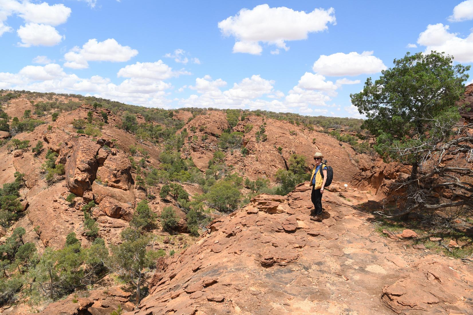
Cait Stuart examining cross-bedded sandstones of the Warna Karnu Group near Geotrail Stop 10 22 THE AUSTRALIAN GEOLOGIST
trails, pathways and roads This approach has often successfully allowed sensitive or fragile sites to be included in GSNSW geotrails. It also greatly helps to provide another layer of geological or complementary information to geotrail locations
For national parks and public sites, overcoming local regulatory, administrative or environmental barriers to installing physical geotrail signage can be challenging Physical geotrail signage can also be expensive and requires a long-term commitment to maintenance. For this reason, GSNSW focuses on digital content for users as they travel along a geotrail from stop to stop GSNSW plans to load geotrail content onto the Australian Geotourism Digital Platform, which is currently under development When it is supportable, the GSNSW encourages the development of physical geotrail signage.
23 THE AUSTRALIAN GEOLOGIST
Meakin at spectacular Homestead Gorge, near Geotrail Stop 10 Massive Devonian sandstone and conglomerate outcrops dominate this section of the geotrail
Simone
riginal rock paintings overprinting cross-bedded sandstones along the Mutawintji Geotrail
Abo
GPS enabling remote site geotrails
The GSNSW uses a smartphone-based app called STQRY for geotrail site content such as text, maps, images, audio and video. Once the geotrail user has downloaded the app and selected the tour, their smartphone’s GPS can be used to navigate to the correct site location This GPS-driven approach works in remote areas of NSW where telephone networks are unavailable, such as at Mutawintji. It’s also an effective way of adding another layer either geological or relevant story content to a location where such information may not have been previously available.
Mutawintji Geotrail products include the geotrail app, which provides a self-guided tour along four routes (with a total of 18 geotrail stops), a free geotrail brochure, and the 1:80,000 scale geological map
For further information see tinyurl com/MNP-geotrail
Input for this article was provided by Guy Fleming on behalf of the GNSW, Department of Regional NSW, and is acknowledged with appreciation.
Fo
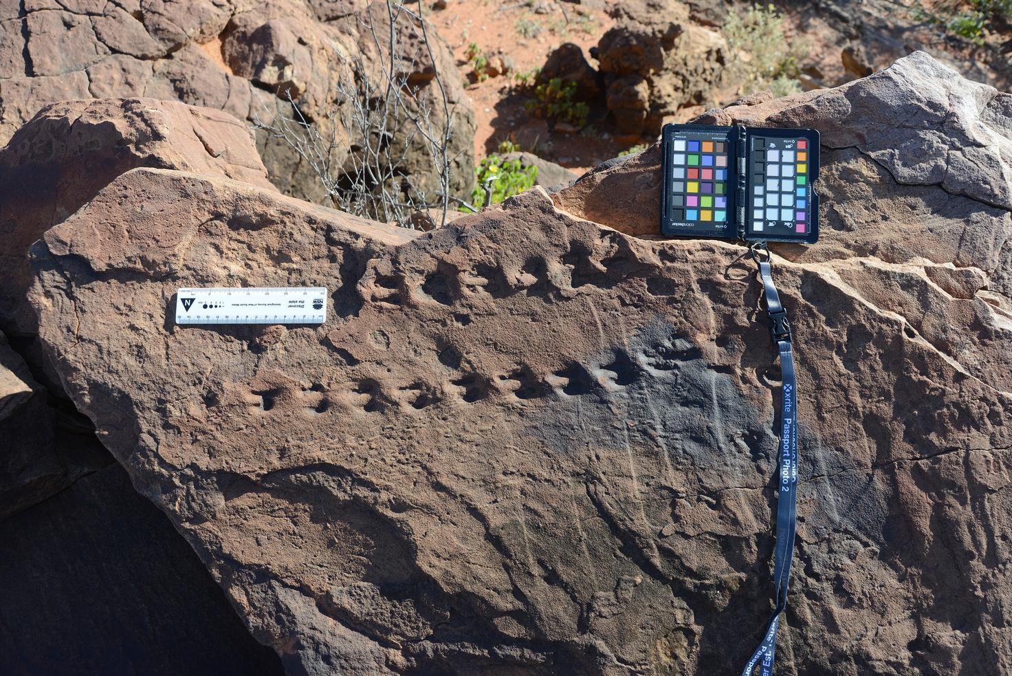
ssilised animal tracks in sandstone, Mutawintji Historic Site 24 THE AUSTRALIAN GEOLOGIST
S
op 13) is a per
t source of water at Mutawintji, so is a very important p
M
utawintji Gorge (Geotrail
t
manen
lace for humans and animals

Have you ever wondered, when you heard about or even visited the town of Alice Springs in arid Central Australia, where the spring in Alice is?
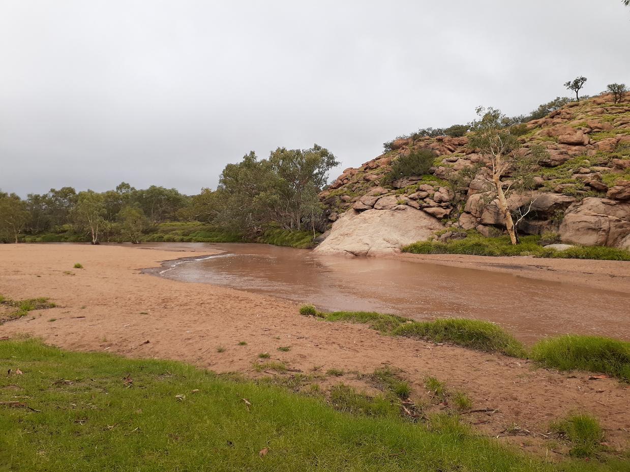
Well, you need to be rather lucky during your visit to see any water in the bed of the Todd River, which runs through the town. Such luck was had in 1872 by a surveyor who saw water pools next to the area where the Telegraph Station was being built. He named the pools ‘Alice Springs’ after the wife of Sir Charles Todd (Todd oversaw the construction of the Overland Telegraph Line). Contrary to the original thoughts, these pools, called Atherreyurre in the local language of the Arrernte people, are not fed by spring water. They only appear after prolonged periods of rain…such as the rain that fell during one weekend in early December 2023.
Interestingly, according to the Bureau of Meteorology, only about 10 mm of rain fell in Alice Springs during that weekend. By itself, this is not enough to fill waterholes, let alone create a flow in the river as seen at the Telegraph Station. Alice Springs experienced an unusually wet November (a total of about 90 mm, which was nearly three times more than the average between 1941 and 2023).
Article and images by Anett
Weisheit
GSA NT Division
The river bed was sufficiently saturated so that slightly higher rainfall in its northern catchment resulted in a steady flow. A maximum depth of about 1.3 m was reached on a Sunday afternoon just north of the Telegraph Station (data from The NT Water Data Portal, Department of Environment, Parks and Water Security). This was sufficient to close some of the river crossings in Alice Springs! A few days later, the river stopped flowing, and once again a waterhole appeared at the original ‘Alice Springs’.
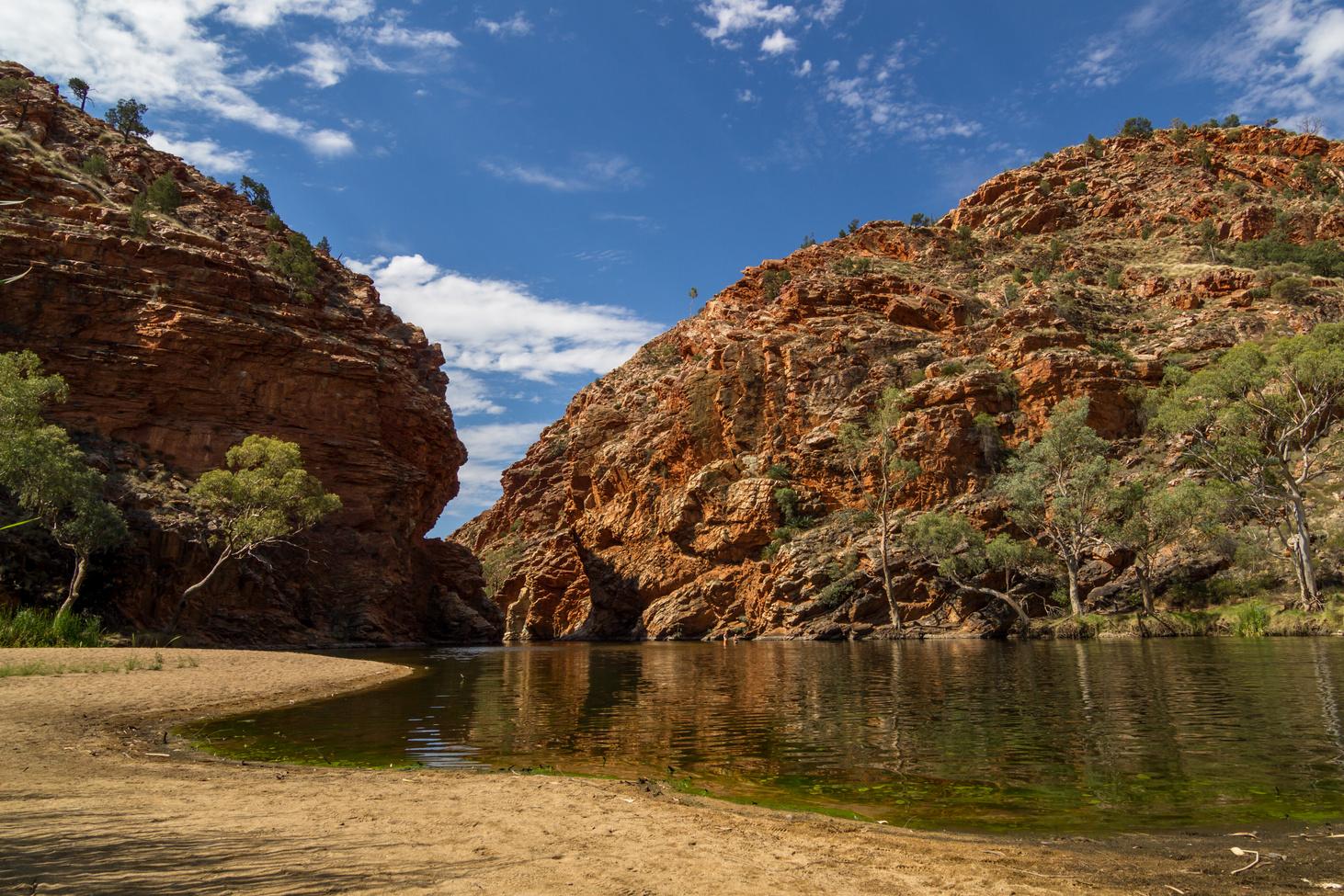
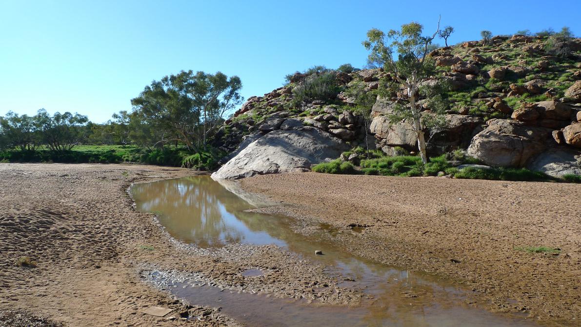
Primarily, there is a geological reason for why a waterhole appears right there after rain. The smooth rock that forms the backdrop of the waterhole is the Alice Springs Granite. This rock is about 1,750 million years old — one of the oldest rocks in this area. It is particularly dense with little fractures, weathering into strong whalebacks and large, round boulders.
The Todd River has carved its way through this rolling granite country, creating a sandy river bed made of quartz and feldspar fragments. The bed is deepest where it is in contact with the granite outcrops, supporting a waterhole long after the last rains have ceased.
A version of this article was published in the Australian Geoscience Council’s Australian Geotourism Development LinkedIn group.
Flowing water in the Todd River is rare and only occurs after prolonged rain. Here viewed from the Alice Springs Telegraph Station.
After rain, a waterhole may persist at the rocky outcrop seen in the above. Contrary to its name 'Alice Springs', it is not a spring and the surface water evaporates quickly.
25 THE AUSTRALIAN GEOLOGIST
ANGKERLE ATWATYE STANDLEY CHASM GEOTRAIL
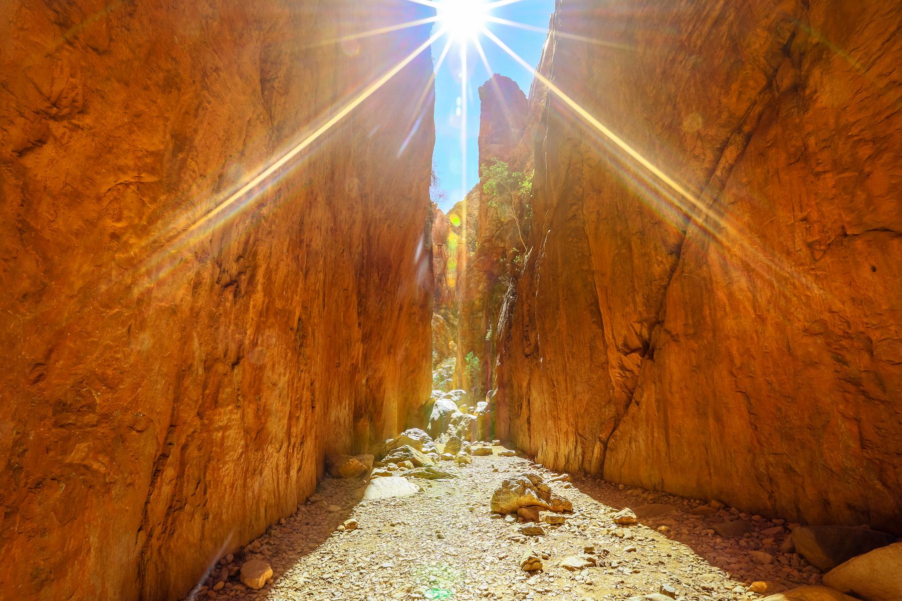
Angkerle Atwatye Standley Chasm is an easily accessible tourist destination west of Alice Springs I have recently produced a geotrail brochure for the site as a personal initiative project, in collaboration with the traditional owners and managers of Angkerle Atwatye Standley Chasm and the GSA through professional geoscience input of GSA members Anett Weisheit, Ian D Lewis and Ken Moule
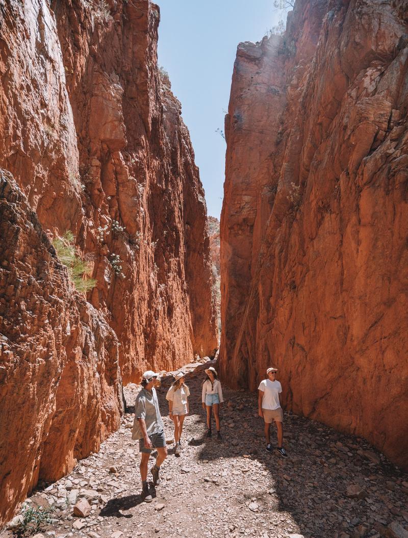
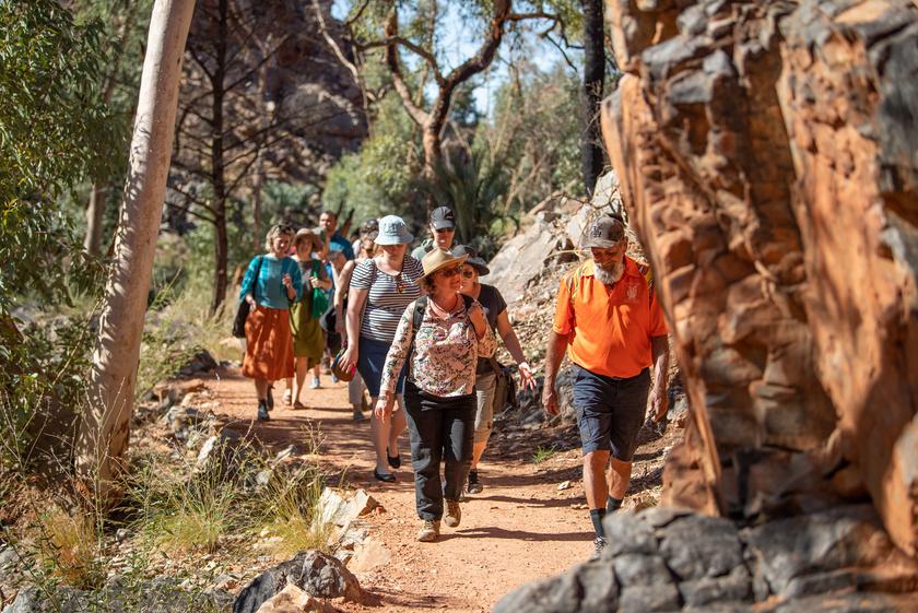
Walking access to the dramatic, 80-m-high, sheer rockface of the chasm is along a wellmaintained Grade 1 wheelchair-accessible path involving a 2 4-km round trip to the chasm itself A major selling point for tourists is the magnificent display of bold red and orange hues that glow deepest under the midday sun Morning and afternoon visitors are more likely to catch a glimpse of the native wildlife
Article and images by
Angus M Robinson Coordinator, National Geotourism Strategy
The completion of the brochure evolved from my personal interest in this attraction, dating back to 2011 At that time I conceived the concept of a ‘Red Centre Geotrail’ as a regional tour package opportunity, comprising a continuous driving circuit using the Meerenie Loop Road in southern NT. This geotrail begins in Yulara with Uluru, and links with key landscapes of the Kata Tjuta National Park, Kings Canyon, selected sites in the West MacDonnell Ranges, and highlights of Alice Springs
In my then role as chair of the GSA Geotourism Standing Committee, the geotrail concept was promoted to various conferences as part of the GSA’s geotourism developmental work In this context, Angkerle Atwatye Standley Chasm, which is 100% owned and operated by the local Arrernte Aboriginal community, was identified as one of the points of interest in the West MacDonnell Ranges.
During my earlier visits, I noted that the only perceived ‘negative’ about a visit to Standley Chasm was the poor quality of the walking track to the chasm from the car park Compared with other locations featured on the tour eg, Uluru, Kata Tjuta, Kings Canyon, and Ormiston Gorge, all of which provided walking tracks of grade 1 and 2 standard Standley Chasm stood out as a noticeable exception Recognising that quality access to geosites is a key must-have in geotrail development, I formally supported the Standley Chasm management in their 2015-dated submission of a grant application for the NT Regional Economic Infrastructure Fund This application was successful and resulted in the upgrade of the walking track.
With access infrastructure having been addressed, a geotrail brochure was an opportunity to create an easily accessible, userfriendly interpretation and communication tool at this key geosite
The Chasm Image courtesy Angkerle Atwatye Standley Chasm management
26 THE AUSTRALIAN GEOLOGIST
I contacted the Traditional Owners and managers of Angkerle Atwatye Standley Chasm at the start of this project to discuss possibilities for a geotourism brochure at their site The idea was enthusiastically received, and ensured involvement by the Traditional Owners throughout the project
True to the ABCs of geotourism, the resulting brochure integrates landscape/geology (A: abiotic) with flora/fauna (B: biotic) and cultural elements (C: culture) It is presented in concise, plain English text with informative figures accessible to the interested tourist A second component of the project provided technical guidance for a proposed digital version of the brochure, using offline mobile phone app technology and built-in GPS
The project’s outcomes are in alignment with three of the goals of the National Geotourism
Strategy of the Australian Geoscience Council:
Goal 1 assessing and promoting new digital technologies to highlight and interpret natural and cultural heritage highlighting geology and landscape
Goal 3 establishing a framework for creating high-quality, sustainable geotrails
Goal 7 developing and enhancing the geoscience interpretation and communication skills of everyone actively involved in the presentation of geosites, thus enabling the provision of accurate and thematic information in an accessible manner
The input from Anett Weisheit, a geologist from Alice Springs, was pivotal Anett had just completed a geological field guide of the worldfamous Larapinta Trail (published by GSA-NT Division; see TAG 207, June 2023) This 226-kmlong hiking trail in Tjoritja/West MacDonnell National Park passes near Standley Chasm. With permission from the Traditional Owners of Standley Chasm, Anett took geological observations around the area and created a basic geological map that is now included in this brochure.
Anett’s clear geological interpretation is illustrated as an example in one section of the fold-out brochure:
“The Western Arrernte people call this ‘the place (Angkerle) where the water (Atwatye) moves between’ Water flow has shaped this chasm for a few million years, but it is young compared to the wide and rounded gorges around Alice Springs Rainwater followed the vertical fracture zone in the quartzite and eroded the chasm wedge by wedge You can see a remaining, partly detached wedge of rock at the northern end of the chasm”.
Anett has also included biotic and cultural heritage features in the brochure content, with the aid of the Traditional Owners of Angkerle Atwatye Standley Chasm
Further input came from Ian Lewis, who travelled from SA to provide invaluable operational experience in developing geotrail brochures. His current role is as honorary director of the Kanawinka Geotrails (Vic and SA). Following discussions with the management of Angkerle Atwatye Standley Chasm, Ian designed the brochure as a double-sided, fold-out document with 12 panels grouped into introductory, historical, geological, hydrological, ecological and cultural topics. He also contributed some of the brochure’s content The management of Standley Chasm have finalised Ian’s draft and designed the layout based on their common branding
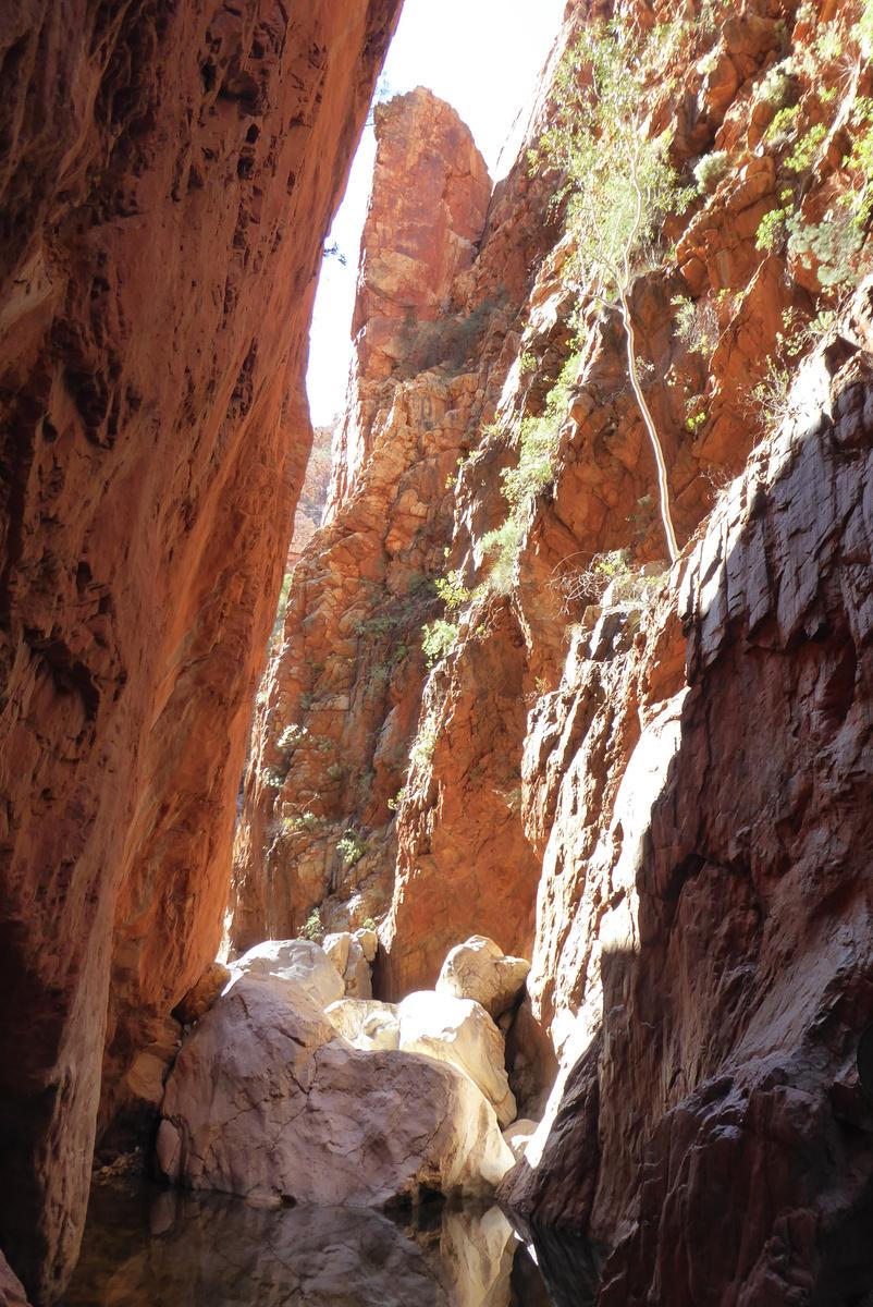
and erosional features of the Chasm. Image courtesy Anett Weisheit
Wedge of quartzite
27 THE AUSTRALIAN GEOLOGIST
Standley Chasm Walking Trail. Image courtesy Angkerle Atwatye Standley Chasm management
Brisbane-based Ken Moule specialises in spatial information and field data systems, and advises on implementing mobile data systems. His specialised report to the Angkerle Atwatye Standley Chasm management describes possibilities for presenting digital information on mobile devices Ken’s work provides considerable assistance for the next stage of developing the visitor experience at Standley Chasm.
In support of the Alice Springs and MacDonnell Ranges 2020 Destination Management Plan, it is believed that the Standley Chasm project will serve as a highly useful geotourism pilot. It will provide a guide to the upgrade of natural and cultural heritage experiences in other key locations along the West MacDonnell Ranges.
These include Simpsons Gap, Ellery Creek, Ormiston Gorge, Redbank Gorge and Glen Helen Gorge. Such standalone brochures can be easily linked to the world-famous Larapinta Trail through the existing geological guidebook
In this respect, it is considered that developing inviting and informative products for these attractions will create an outstanding geotourism experience for the Red Centre a promising candidate for a potential designated Australian GeoRegion
International Applied Geochemistry Symposium (IAGS2024)
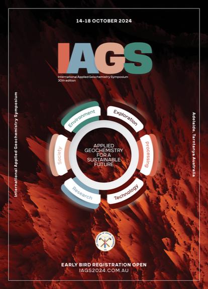
We are thrilled to present to you the 30th International Applied Geochemistry Symposium (IAGS2024), set to take place in the breathtaking landscapes of Adelaide, South Australia from 14 - 18 October 2024.
This Symposium promises to be a pivotal event in the field of Applied Geochemistry, bringing together experts, researchers, and enthusiasts from around the globe.
This Symposium has the theme “Applied Geochemistry for a Sustainable Future”, and will incorporate six sub-themes including Environment, Exploration, Society, Technology, Processing and Research.
The technical program is shaping up to be an exciting opportunity to learn about applications of Geochemistry, and about a broad range of problems facing society today. It is potentially the only chance to learn from your peers and leading experts from across many sectors.
There will also be the opportunity to be involved in some exciting Field Trips throughout the week, as well as pre and post conference. Plus a range of workshops and other gatherings.
Information about all of this and of course getting your Early Bird Registration for the event, is available at iags2024.com.au. We look forward to seeing you there.
28 THE AUSTRALIAN GEOLOGIST
A SIGNIFICANT STEP ON THE GEOTOURISM JOURNEY FOR THE NORTHERN TERRITORY
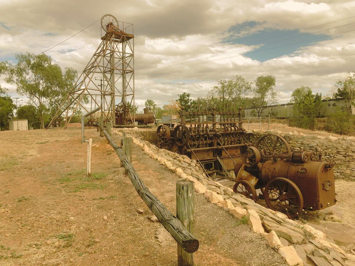
Two websites relating to the Pine Creek Miners Park and Pine Creek Geotrail were released to the public in January 2024.
Mark Asendorf describes the project undertaken by the Darwin Branch of the AusIMM to restore Miners Park and continue geotrail development
Article and images Article and images
by Mark Asendorf by Mark Asendorf
29 THE AUSTRALIAN GEOLOGIST Historic boiler and stamp battery at Miners Park, 2022
Geotourism in the NT had a great leap forward on 25 January 2024 with the release of two (yes, two!) websites by the Australasian Institute of Mining and Metallurgy (AusIMM) Darwin Branch, specifically relating to the small town of Pine Creek, 200 km south of Darwin
Pine Creek was important for the development of the fledging Darwin community This is evident in both the Miners Park attraction and the new geotrail, which celebrates the geoscientific, mining, rail and social heritage of the town and its influence on the overall development of Australia’s Top End.
Project background
In brief and to set the scene for the websites a fortunate discovery of gold in 1871 in the area during the construction of the Overland Telegraph Line initiated a brief gold rush. The effect of this had, and continues to have, a profound influence on the development of the Top End
At its peak, Chinese immigrants, who had flocked to the area of the discovery, numbered in their thousands. They greatly outnumbered all other groups, including European and first, second and third-generation Australian families trying to establish their fortunes. It was a frontier existence, marked with interactions (both positive and negative) with the local Mayali, Wagiman and Jawoyn people in the area Within 20 years, the Northern Australian Railway had been established, linking the goldfields with the ports of Darwin Harbour
What is now known as ‘the waterfront’ and ‘Southport’ near Berry Springs were two of the most prominent ports. This line was extended in later years through Katherine to Birdum, near Larrimah, another 300 km to the south along the Stuart Highway The railway serviced and supported the various defence force stations along the Stuart Highway during WW II.
Nowadays, a trip to Pine Creek is a just a twohour drive from the NT capital, Darwin. But before 1889, when the railway was first constructed, the only option was a difficult overland journey taking days or, depending on the climate and conditions, was sometimes not possible at all
Over the next few decades, the township of Playford (as Pine Creek was originally known) endured and outlasted several other prominent mining camps and settlements that supported the mining activities in the region This includes the first NT gazetted township, Burrundie, located about 40 km to the north-northwest of Pine Creek The town of Playford continued to be referred to as Pine Creek rather than its official name it wasn’t until 2007 that the NT Gazette made the name change official
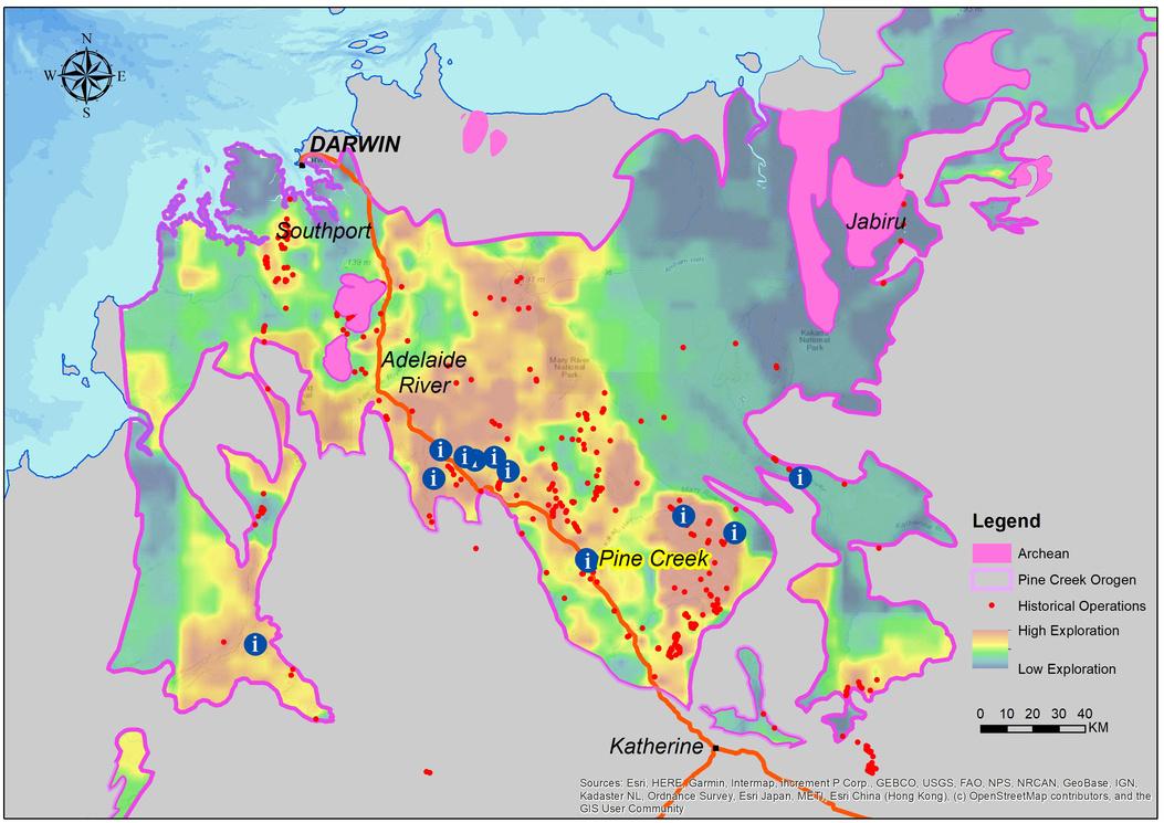
30 THE AUSTRALIAN GEOLOGIST
Pine Creek Miners Park — exhibit origins. Exhibits cover roughly 250 x 100 km. Exploration heatmap produced by Marmel Enterprises from historical mining titles. Image also contains data sourced from Northern Territory Government and Australian Government sourced under CCBY40 licensing
Creation of Miners Park
From 1900 onwards, Pine Creek and the mining and explorations activities in the surrounding region began the feel the influence of industrialisation, resource boom-and-bust cycles, two world wars and of course, social and technological changes Some of these changes are reflected in the machinery located in Miners Park and around the town itself
Fast forward to 1988 Australia’s Bicentennial year and AusIMM Darwin Branch and several other enthusiastic companies, organisations and individuals combined to create Miners Park Constructed on the grounds of the heritage-listed Pine Creek Railway Station, this involved salvaging and transporting equipment from former mining sites in the region to the station Interpretive signage for visitors was also installed.
In 2018, 30 years later, AusIMM Darwin Branch were again involved in upgrading the then-faded and damaged signage A couple of years later, on my way back from visiting family in central Australia, I visited Miners Park and saw it was again in need of some ‘TLC’
As fortune would have it, I was advised to talk to Peter Waggitt, chair of the AusIMM Darwin branch. I knew and had worked with Peter previously, but I wasn’t aware of his connection to Miners Park, and he wasn’t aware of my interests in geoscience, geotourism and geoheritage The scene was thus set for a partnership that has resulted in increased exposure for the town, upgraded physical signage, the release of two dedicated websites, and an opportunity to do more in the future
Miners Park initial priorities and project conception post 2020 to June 2022
Peter and I undertook an initial reconnaissance visit to Pine Creek to determine the state of the signage and what could be achieved with residual funds from AusIMM’s 2018 campaign Aside from the gazebo, which needed replacing, three signs were identified as priorities. These were the Surveyors ‘trig point’, which had faded to near illegibility; and the Enterprise Pit lookout and single-cylinder horizontal steam engine signs, which were both missing and assumed stolen or damaged beyond repair.
Fortunately, we were able to access the original templates and designs for the Miners Park signage With a sprinkling of creativity, we were able to upgrade them and remove older campaign text and graphics that the NT Heritage Branch no longer wanted shown
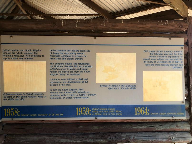
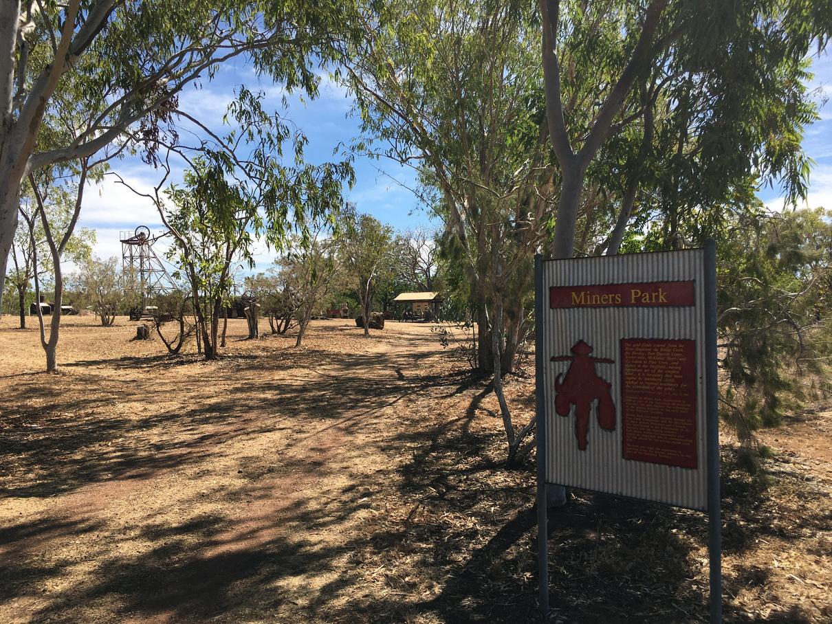
Mark noticed the missing and vandalized
and resolved to try to do something about it.
31 THE AUSTRALIAN GEOLOGIST
Original signage with faded and unreadable photos and diagrams in the wooden gazebo
Miners Park as at it existed in July 2020. Vantage point is the visitor pedestrian entryway from the car park. It was around this time
signage
Our initial visit also exposed the potential for a geotrail. I had seen enough in the town through my ‘geotourism lens’, and from my experience creating the Darwin City Geotrail and my own knowledge of geotourism and the mining and geology in the area realised there was a great, hidden story waiting to be told I mentioned this to Peter, who was very supportive of the idea.
A briefing pack, which included sponsorship options, was developed to explain the geotrail concept, what Peter and I initially envisaged as achievable, and how we planned to proceed. The aim was to supplement AusIMM Darwin’s available funding to secure grants or sponsorships for the capital required to realise our ambitions.
We were fortunate in attracting attention, funding and support from local businesses, and gaining in-principle support from professional bodies, agencies and businesses Plus, through Peter’s efforts under AusIMM Darwin branch submissions, we won a:
$25,000 ‘seed funding’ grant from Regional Development Australia (NT) for the development of a business case for the geotrail
$30,000 Community Benefits Fund grant from the NT Government to replace the gazebo and the eight, 2 x 1-metre signs the gazebo hosted
Peter then engaged me formally through my business, Marmel Enterprises, to develop the business case He decided to manage the replacement of the old wooden gazebo with a new steel structure and the upgrades to signage
Many of our subsequent adventures involved planning, re-planning or discarding unfeasible or complicated ideas and pricing options We also had continuous engagement with numerous stakeholders and made two presentations to the Pine Creek Local Authority in 2022 The first was to advise of the geotrail plans and to gain their endorsement, and the second to advise that we had successfully secured the two grants mentioned above and would be proceeding with the first stages of the work.
Many trips to Pine Creek followed sometimes individually, but mostly together during weekends, when time allowed With each visit, Peter and I learned new facets of the narrative to be told and the places to promote During this time, we acquired material that would later be used for the business case and follow-up activities We also developed a ‘feel’ for how often the various attractions drew visitors who were in the region. Discussions along the way with various stakeholders not only set the scene, but refined aspects of the narrative Having raised awareness of the project and our intentions with authorities and stakeholders, our attention turned to delivery.
The business case was developed as per the grant conditions by the end of financial year 2023, and delivered to Peter as the grant holder for consideration The key findings of the business case were to split the delivery of the town-based geotrail into two separate phases, defer the idea for a ‘regional geotrail’, and develop two separate websites for Miners Park and the geotrail. The following table describes the geotrail components as per the business case
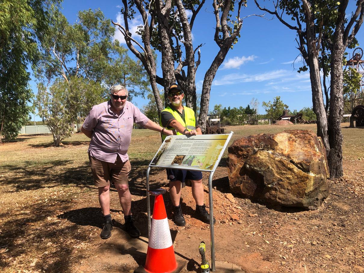
32 THE AUSTRALIAN GEOLOGIST
Peter Waggitt and Mark Asendorf at the newly installed sign for the Iron Blow rock sample at Miners Park
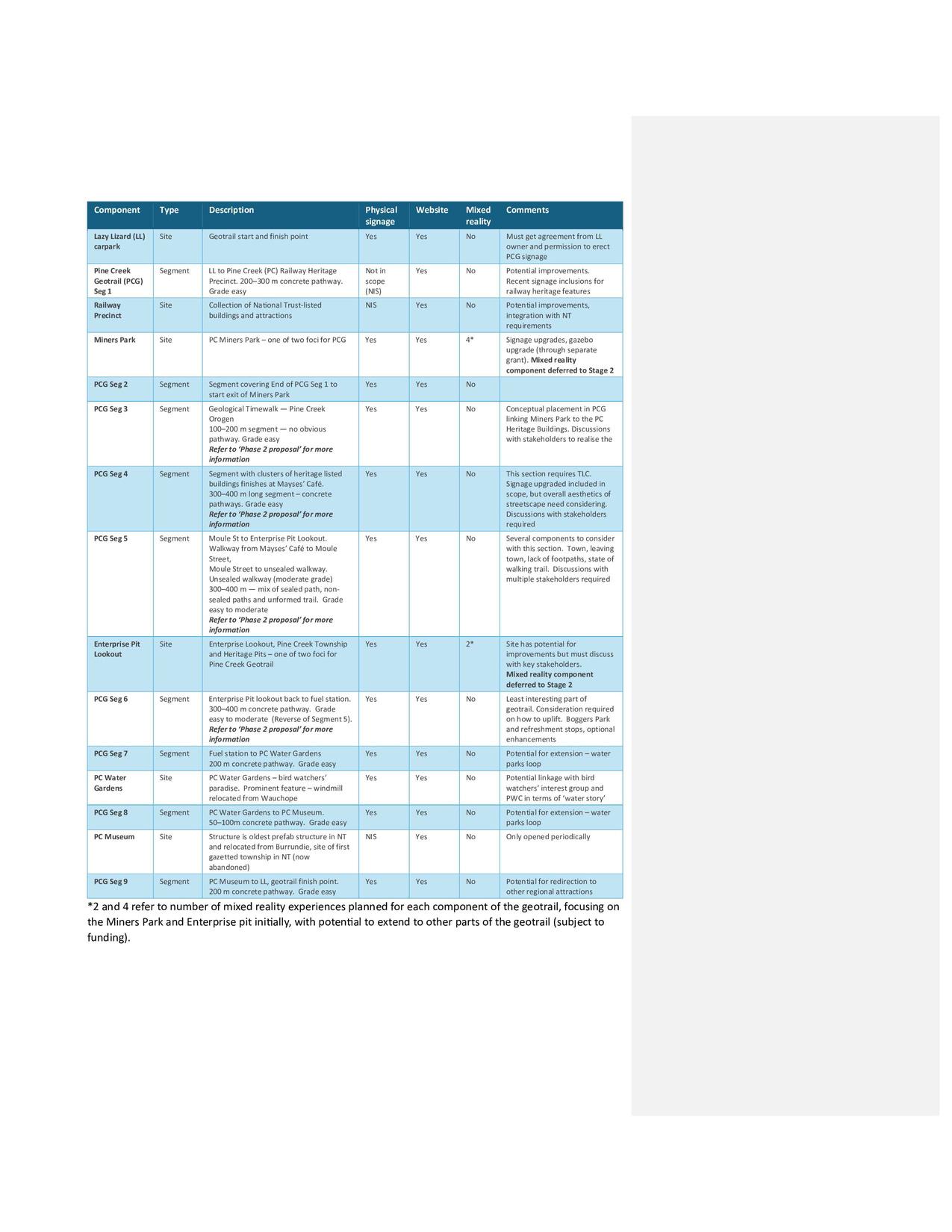
*2 and 4 refer to number of mixed reality experiences planned for each component of the geotrail, focusing on the Miners Park and Enterprise pit initially, with potential to extend to other parts of the geotrail (subject to funding).
Phase 1 delivery and phases 1 and 2 distinction
Phase 1 of the geotrail project contained the elements that could be completed largely within our own resources and capabilities In Phase 2, the bigger, more complex and more expensive components of the geotrail would be tackled
Phase 1 started in August 2023 and consisted of: installing an acknowledgement sign, plus new signage for exhibits that didn’t previously have interpretive signage installing a new sign for the two Heritage shafts at the Enterprise Pit lookout installing new signs at the ‘Iron Blow’ rock sample and the mining pans boiler creating and launching two new, dedicated websites for Miners Park and the geotrail replacing the wooden gazebo with a studier steel structure of similar size replacing seven large-format gazebo signs with signage consistent with the Miners Park aesthetic standard installing a new large-format sign in the gazebo focusing on geotourism, especially in the NT.
Outline and description of the overall geotrail components
We successfully concluded Phase 1 with the finalisation of fieldwork in October 2023, and the launch of the websites on 25 January 2024 as part of an AusIMM Darwin branch event
A geotrail doesn’t happen without the successful alignment of financial support and funding security, good will and support from business, the local community, not for profits and Specialist Groups (such as the GSA and the AusIMM), planning and coordination, people with passion, and entities and individuals with the capacity to deliver The absence, or exclusion of one or more of these elements seriously compromises any project and becomes a serious risk to anything substantial being achieved in less than ‘geological’ timescales.
Phase 1 would not have been possible without the assistance and contribution of many business and government organisations, and enthusiastic individuals
All elements that couldn’t be achieved with available funds, or that exceeded desirable timeframes and available capabilities, have been deferred to Phase 2 This included all geotrail elements that involve additional stakeholder agreement, are more complex and costly to achieve, or generally depend upon the permissions of other individuals or organisations.
Phase 2 recognises that time, money and capacity are finite qualities and attempts to balance what could be achieved quickly to deliver a viable geotourism product with the ultimate vision of the Pine Creek Geotrail as a holistic, integrated experience
Pine Creek Miners Park and Pine Creek Geotrail websites
The Pine Creek Miners Park website is built on the ArcGIS Online platform using the ‘storymap’ configuration.
It was developed and intended to: be a dedicated website for Miners Park (none previously existed) explain machinery at the Park beyond what can be placed on physical signage leverage digital technology offer a genuine, engaging and enhanced user and visitor experience
The Miners Park website is accessible at: https://arcg.is/0Wy1iK0
The Pine Creek Geotrail website is a companion site for that of Miners Park, and is also built on the ArcGIS Online platform Both websites crossreference each other.
The Pine Creek Geotrail website will: be a dedicated website for the geotrail, offering a genuine, engaging user experience include and promote the attractions of the Pine Creek township and celebrate its role in the development of the Top End promote Pine Creek and the surrounding region, encouraging visitors to stay longer and explore promote the concept of geotourism offer options for future improvement, subject to additional funding and stakeholder input
The Pine Creek Geotrail website is accessible at: https://arcg.is/1b5aO90
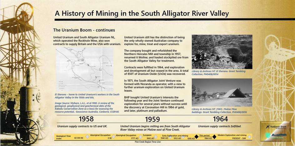
34 THE AUSTRALIAN GEOLOGIST
An example of the new large-format (2 x 1 m) signs installed at the new steel-framed gazebo
Future vision of NT geotourism
Aside from the ambitions of Phase 2 of the Pine Creek Geotrail, the geotourism potential in the NT remains high
We have a geologically diverse place with ‘bloody old rocks’, and a unique geoscientific story to tell NT boasts two World-Heritage listed assets, including Kakadu National Park, just 50 km northeast of Pine Creek Plus, we have the world’s oldest living culture, and much of the territory still in a natural state We abound in enthusiastic geotourism ambassadors, and have many options for future geotrails and geotourism generally
Bringing phase 2 into reality
And what would I like to personally see in the NT’s near future what is my vision?
That geotourism is no longer a ‘niche’ concept, but a normal and accepted part of the ‘place’ and tourism narrative
The NT as an internationally recognised destination for our geotourism attractions.
A network of geotourism attractions linking different sites across all states and territories, so that wherever you are in Australia, you can find a geotrail, geopark or something ‘geo-awesome’ to see
Sustainable and local capability and capacity to deliver geotourism projects and maintain geotourism assets, no matter where they are located.
Peter is looking for grants, sponsorship, and other potential funding sources to further enhance the total user experience in Phase 2 These include implementing the Pine Creek Orogen Rock Walk, Moule St Walkway and Moule St to Enterprise Pit Nature Trail; more signage and mixed reality experiences; and content for the websites.
If you are interested in helping us bring Phase 2 into reality, or know others who may be interested, please use the contact details on the Miners Park and Geotrail websites.
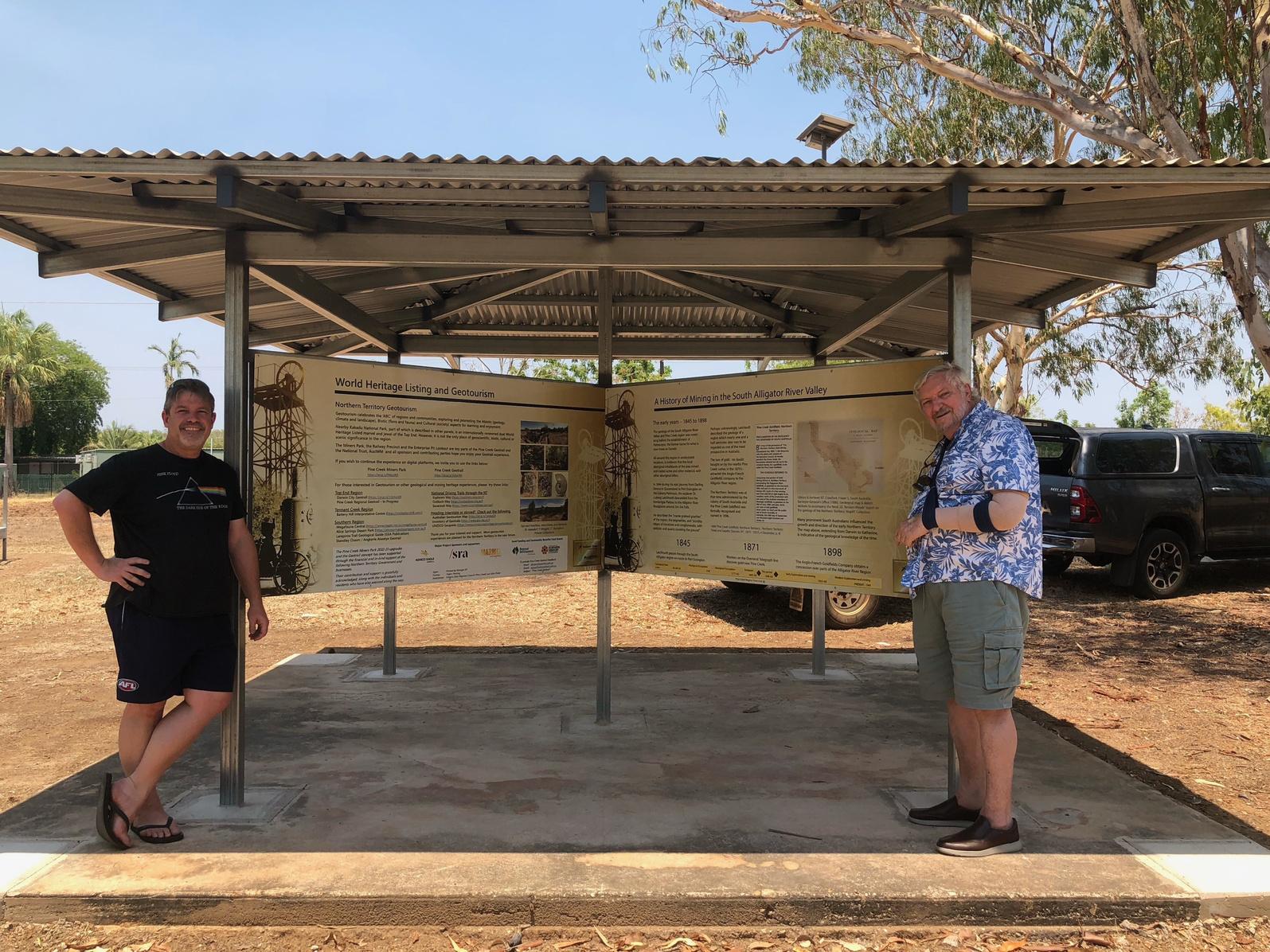
Mark Asendorf (L) with Peter on the 'final' day of physical works from Phase 1 of the Pine Creek Geotrail Project, where the last two panels were installed on 28 October 2023 (a very warm day — a Top End build-up special). Pete’s damaged wing was a hindrance, but luckily we had some help to finish the work. The final part of Phase 1 and the rest of the year was spent bringing both websites up to a standard fit for public release before their official launch.
35 THE AUSTRALIAN GEOLOGIST
GSA ENDOWMENT FUND AWARDS
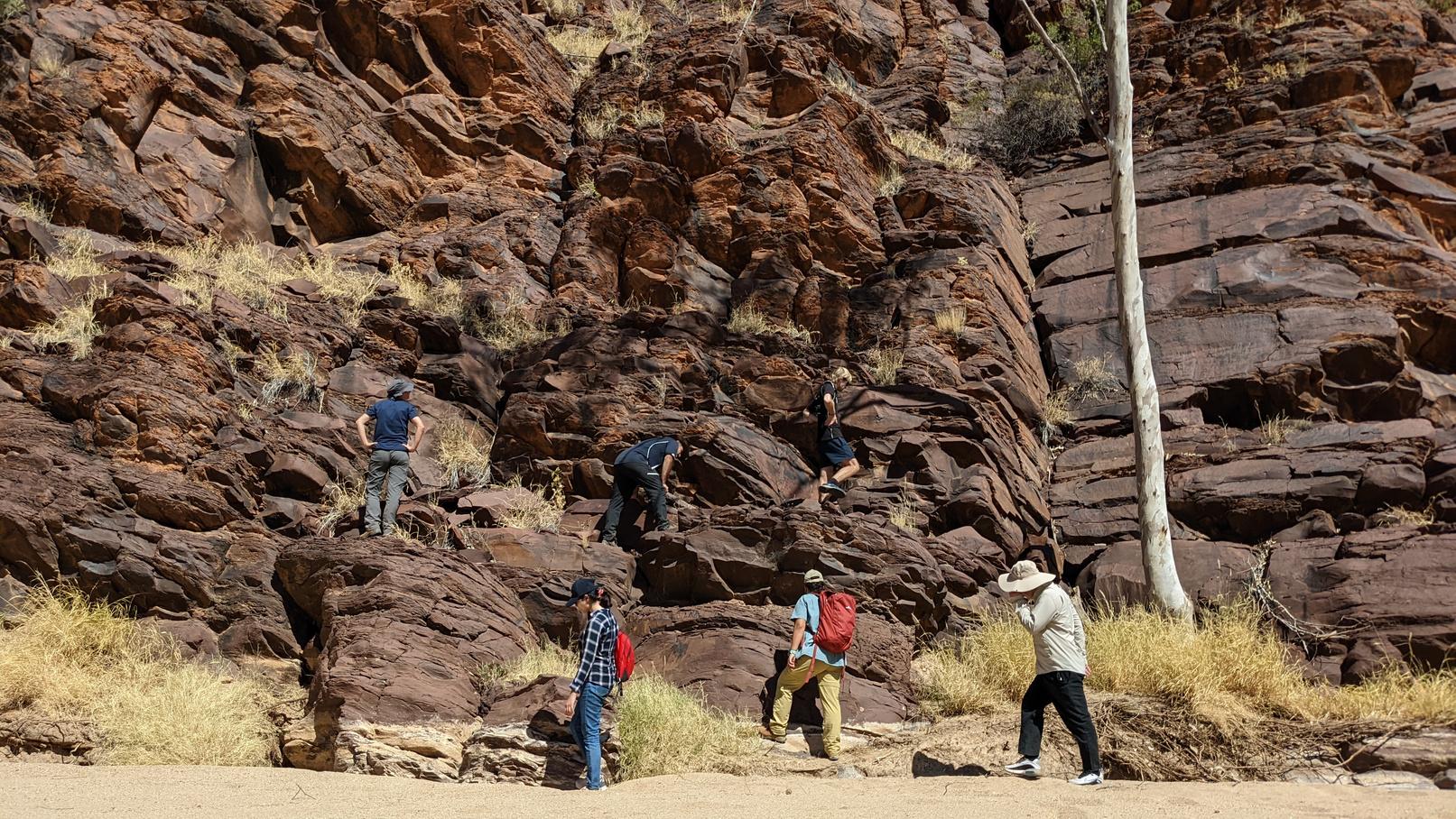
The GSA Endowment Fund was set up in 2007 to support students undertaking graduate studies in the Earth Sciences.
In 2023, the GSA Endowment Fund Committee disbursed $14,000 to assist Australian students undertaking studies in the Earth Sciences (see TAG, September 2023) Of the 28 applications received, nine were chosen to receive awards:
Celine Anderson (ANU) 2023 PhD award
Josh Reid (UQ) and Mark Williams (UTAS) 2023 Honorary awards
Eleanor Beidatsch (UNE), Emily Conn (UTAS), Samuel Keller (UWA), Bronwen Lee (Uni of Adelaide), Sabrina Newton (UQ) and Andrew Prior (Uni of Melbourne) 2023 Honours/Masters awards.
Set out below is a report by Mark Williams, a 2023 GSA Endowment Fund Honorary award recipient The impact of receiving financial assistance is evident in this report, which also shows the high calibre of research being undertaken The significance of the award is not lost on the recipients, and I hope the significance is not lost on the GSA members who have so generously donated money to the GSA Endowment Fund over the years.
It has been 10 years since the GSA Endowment Fund started giving out awards. Over this time, the GSA Endowment Fund has awarded $99,900 in grant monies to 58 students This is a legacy I am certainly proud of. I hope each GSA member who has generously donated money to the Fund over the years feels the same way
On a personal note, thank you to my fellow GSA Endowment Fund Committee members, Brad Opdyke and Laurie Hutton, and to the GSA Divisional Committees who assist each year with the Fund awards. Your efforts are greatly appreciated, and I’m sure all the students who have received funding agree with this sentiment
2024 GSA Endowment Fund Awards
The GSA Endowment Fund Committee is again offering awards in 2024 Applications were for: Honours or Masters students — grants of up to $1,000 are available for an Australian citizen in each state/territory undertaking either an Honours or a Masters course in 2024 PhD students — a single national PhD grant of up to $5,000 is available for one Australian citizen undertaking a PhD in 2024.
Applications closed on Friday 29 March 2024 and we look forward to announcing the awardees in the next edition of TAG
Call for donations
Before the student report steals the spotlight, I would like to ask GSA members to consider making another impact on the future of Earth Sciences by donating to the GSA Endowment Fund Please give generously so we can maintain a healthy foundation that can continue to support Australian students studying Earth Sciences
To be an asset into the future, the Fund needs to receive donations and interest that at least equals the monies granted each year to students
Currently, the donations and interest received by the Fund each year does not match the $12,000 that is planned to be disbursed to students yearly. For the student awards in their current form to be continued each year, your help is needed.
The GSA Endowment Fund is a charity and all donations are tax deductible. Donations can be made via cheque, money order, credit card, electronic funds transfer or by bequest To find out more, visit www.gsa.org.au, ring the business office on (02) 9160 8193, or email info@gsa org au
Thank you for your generosity in supporting this initiative Your contribution now will continue to grow into the future.
DIANE JORGENSEN Chair, GSA Endowment Fund Committee
36 THE AUSTRALIAN GEOLOGIST
Endowment Fund report: Mark Williams
As a recipient of the 2023 GSA Endowment Fund Honorary award, my PhD journey has shown that funding is not merely financial assistance, but rather a catalyst for important research and developing collaborations Currently in the final year of my PhD, I am focusing on designing innovative digital tools to support the conservation of geological heritage through sustainable geotourism in geoparks.
Although geoparks are relatively unknown in Australia, 211 UNESCO Global Geoparks are now spread across 48 countries. These geoparks, designated for their unique geological heritage, aim to promote sustainable development, education and conservation through geotourism In Australia, efforts are underway through the National Geotourism Strategy, under the auspices of the Australian Geoscience Council, to establish significant geotourism areas known as GeoRegions. These have laid the groundwork for future geoparks in Australia, with the potential to be recognised by UNESCO
I have been a member of the GSA since I began my PhD, a step taken to further connect with and contribute to the geoscientific community Through GSA meetings and regular reading of TAG I discovered the GSA Endowment Fund, which is dedicated to supporting graduate-led Earth Science projects The Fund award holds immense value for me and other emerging geoscientists, as it has the potential to transform infeasible project activities into achievable endeavours with real-world outcomes
My focus on geoparks and geotourism required substantial fieldwork, visiting seven geoparks on three continents, which would have been untenable without financial support from the Fund
In 2022, at the 7th Asia Pacific Geoparks Network Symposium at Satun Geopark, Thailand, I investigated the application of digital tools in geopark networks Collaborating with geoscientists and UNESCO leaders provided crucial insights into the challenges faced by geopark networks, and the potential use of digital tools to address them
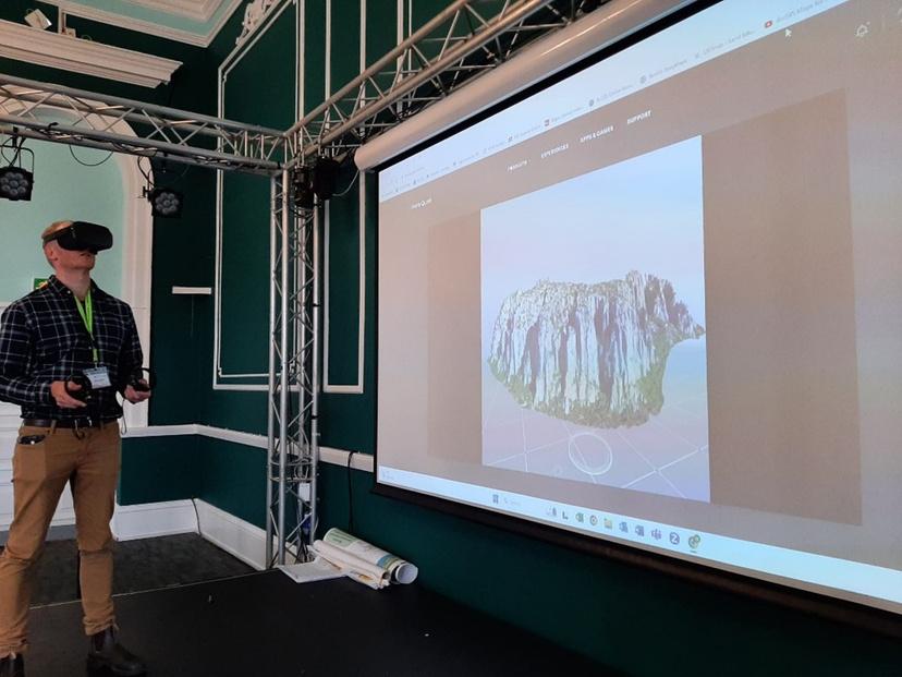
und
rary award recipient) demonstrates a virtual reality prototype at
r
osium,
urtesy Colin Prosser 37 THE AUSTRALIAN GEOLOGIST
Mark Williams (2023 GSA Endowment F
Hono
the P
oGEO symp
UK Image co
In Italy, at Sesia Val Grande Geopark and during the 16th European Geoparks Conference, I engaged in the IGCP 714 project '3GEO', aimed at developing a public outreach tool for disseminating geoscientific knowledge This tool involves a developing a web platform featuring 3D models of geoheritage sites located along hiking trails and at climbing areas
In 2023, I participated in the 10th International Conference on UNESCO Global Geoparks in M’Goun Geopark, Morocco, to conduct a workshop centred around understanding the design considerations of effective digital tools This was made more eventful by being interrupted by a magnitude-6 8 earthquake partway through the proceedings!
Despite the devastation of the earthquake, with close to 3,000 casualties, all conference delegates were safe I was able to visit M’Goun Geopark after the conference to explore how digital technologies could be used to address some of the challenges in a very different cultural setting such as Morocco
My journey then took me to the UK, where I visited four geoparks in England and Wales I concluded this phase of my PhD by presenting a virtual reality prototype, an extension of the 3GEO project, at the 11th ProGEO Symposium at Charnwood Forest Geopark in Loughborough
Back home in Australia, I am applying the lessons l d f b d b th l ll i T d
Through collaboration with working group members of the National Geotourism Strategy, I have been involved in developing a national digital platform prototype known as the Australian Geotourism Discovery Portal This serves as an information hub for various user personas, enabling them to discover and explore a wide range of geotourism sites and destinations across Australia.
Now in the final few months of my PhD, I am developing a geotrail planning tool, which will help planners and decision-makers design geotrails according to best practices This will be applied in a post-mining landscape on the west coast of Tas All the digital tools developed through this PhD project will be evaluated for effectiveness by geopark practitioners from around the world in the coming months as this project concludes.
The GSA Endowment Fund Honorary award has supported a truly global study that is also relevant to Australia My extensive travel to various geoparks, essential for my research, was made possible in part by the support from the GSA Endowment Fund I am also grateful to the Australian IGCP National Committee for providing funding that supported activities related to IGCP 714
For future applicants of the GSA Endowment Fund, my advice is to focus on pragmatic, applied research with clear societal benefits. In a world increasingly looking for practical solutions, such projects are more likely to be successful and have a greater impact, which is what a good research project should be all about I wish to thank the donors who have generously contributed to the GSA Endowment Fund. Your support is an investment in the future of geoscience, enabling emerging researchers like me to pursue our research interests and contribute to the global understanding of our planet
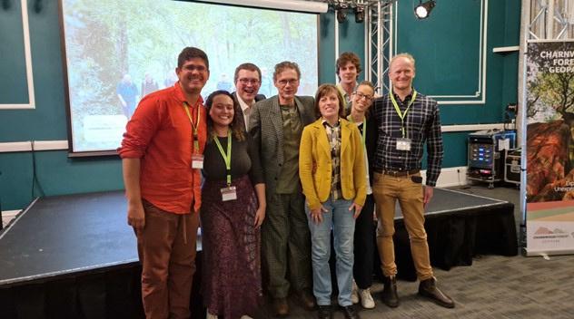
,
, Br
il,
,
mposium, UK. Mark Williams (right, 2023 GSA Endowment Fund Honoura
ward recipient) Image courtesy Irene Bollati 38 THE AUSTRALIAN GEOLOGIST Donations to the GSA Endowment Fund are tax deductible and can be made via cheque, money order, credit card, electronic funds transfer or by bequest. If you want to know more, please phone 02 9160 8193, or email info@gsa.org.au
IGCP 3GEO partners from UK, Italy
Australia
az
France
and Portugal at the ProGEO sy
ry a
 KEIRISSA LAWSON CSIRO
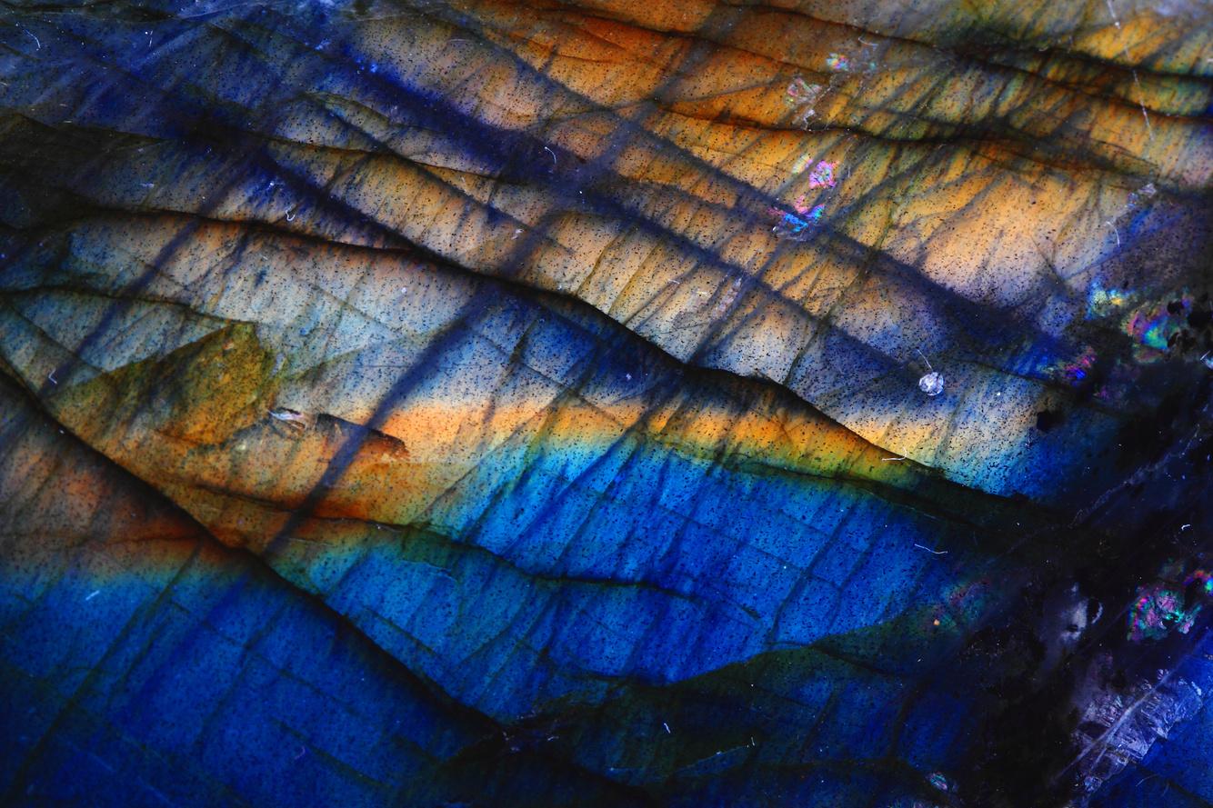
If we were to talk about ‘rock’ stars of CSIRO, Dr Steve Barnes would be a one of the legends
An award-winning exploration geologist and expert in magmatic ore deposits, Steve is a PostRetirement Fellow in ore systems science at CSIRO. Throughout his career he has published over 200 peer-reviewed papers and book chapters and gained 13,000 citations The breadth of his research has been truly global. His publications cover ore deposits and their host rocks in Australia, Canada, USA, Finland, China, Russia and Brazil.
It is his research on Australian ore systems that forms the basis for his legacy of geochemical data that has been donated to the Australian research community on AuScope’s AusGeochem open-access geospatial data platform
An invaluable resource for critical mineral exploration in Western Australia
The collection includes whole rock geochemical and mineral chemistry data collated by Steve while working at CSIRO from the mid-1980s to 2021 The data set includes over 6,400 samples, primarily from the Archean of Western Australia, focused on mafic to ultramafic rocks and associated nickel sulfide ores.
Most of the data was collected during research projects related to exploration for magmatic sulfide nickel-copper ore deposits
This compilation has been used to help recognise the regional footprints of magmatic Ni-Cu-Cuplatinum group deposits and offers a window for continued exploration for critical mineral ores Steve believes access to this collection will be a valuable resource for furthering the understanding of the formation and preservation of critical mineral deposits
“This dataset is the legacy of nearly 40 years of research involving a dozen or more scientists collaborating with at least 20 exploration companies searching for nickel in Australia,’ says Steve
“AusGeochem is providing a great service in making it available to the research and exploration communities. I’m hoping that future generations of scientists will keep using and expanding this dataset to deepen our understanding of the planet and aid in locating the resources we need for the green economy.” The collection is now fully live and interactive within the AusGeochem platform for users to explore various geochemical analysis and visualisation tools
The preservation of Steve’s data collections was enabled through funding from the National Collaborative Research Infrastructure Strategy (NCRIS).
Further information can be found on the AuScope website via Preserving the Steve Barnes (CSIRO) Ni-PGE Geochemistry Collection in AusGeochem at tinyurl com/steve-barnes
This article was first published by Australia’s national science agency, CSIRO. Subscribe to CSIRO’s Resourceful magazine at tinyurl.com/resourceful-mag for the latest in innovation, technology and research from across the minerals value chain.
The GSA wishes Steve Barnes all the best in his retirement and thank him for his service as past Chair of the Specialist Group in Geochemistry, Mineralogy & Petrology (SGGMP).
and
n 39 THE AUSTRALIAN GEOLOGIST
Steve Barnes Article
image by
BOOK REVIEW
The Foundation of Australia’s Capital Cities:
Geology, Landscape, and Urban Character
Anthony Webster
Tony Webster is a consulting mining geologist with a side interest in early Australian history, and particularly how the geology and landscape of Australia’s seven state and territory capitals influenced the early stages of their European (ie, British) settlement. (The book includes Darwin, but notably not Canberra ) Tony undertook much of the research for this book using online sources while working in a mining town in the Pilbara region, although he undertook subsequent research in libraries and other archives and has visited all the localities discussed in each city.
For the historical details or the origins of each of the capitals, and other information such as the pre-European vegetation and Indigenous occupation, the book acknowledges and has drawn on and summarised the published works of a range of other authors The main contribution of the book lies in its goal of interpreting the influence of geological and other natural landscape features in the site selection and early settlement patterns that are reflected in the modern cities
Although some of this information may have been previously written about individual cities, it is valuable to have an Australia-wide overview, and Tony is the first to create topographic reconstructions of the seven sites rigorously and systematically using modern, three-dimensional terrain modelling techniques The seven capital cities were all founded on undeveloped sites, and their establishment and initial expansion was well documented in official and personal accounts as well as relatively accurately surveyed maps and charts. ony used these historical sources to remove the two centuries of development and landscape modification, reconstructing the original topography and integrating it in a GIS with the geology and historic and modern maps. Although the threedimensional topographic models cannot be reproduced in the format of a book, reconstructed topographic contour maps are provided
Geology, vegetation and early infrastructure are shown as insets or overlain on the topographic reconstruction. The geographic focus of each capital is the ‘foundation footprint’ This is where the settlement first occurred and where most urban growth took place in the first two decades thereafter
Geology underpinned the topography and other elements of landscape such as rivers, wetlands, vegetation, and availability of building materials and water. Each of these factors influenced early decisions on street layout, siting of important buildings, transport and communication routes, and the choice of areas suitable for agriculture
The largely pre-industrial and unmechanised era of the late 18th to early 19th centuries was one where small landscape features played an important part in land-use decisions These early decisions determined the layout of our capital city centres, and remain deeply embedded in the modern urban fabric
Tony’s scientific background is reflected in the structure and style of the book as a technical text, rather than a conventional historical narrative. Each city is described in a separate chapter, divided into numerous subsections dealing with the site’s diverse aspects
One result of this is a degree of overlap and the repetition of points and information Some of this overlap is unavoidable, although some could probably have been eliminated with tighter editing The concluding chapter synthesises the main issues and trends, noting similarities and differences in how and why the settlements were established and how contrasts in geology and landscape resulted in the differences now evident in their urban character.
Reviews and suggestions are welcome
Have you read a book, or watched a film broadly related to Earth Science that you think the Society would be interested in? Please feel free to submit a review The TAG Editor is also happy to purchase new books for review please get in touch with any suggestions: tag@gsa org au
40 THE AUSTRALIAN GEOLOGIST
The character of the geology and landscape of each site is reflected in the chapter titles:
1
2
Sandstone Harbor: Sydney, New South Wales, 1788
On the Edge of the Graben: Hobart, Van Diemen’s Land, 1803–1804
3.
4
5
6.
7
8
Ridgelines and Waterways: Brisbane, Queensland, 1825
Limestone and Lakes: Perth, Western Australia, 1829
On the Edge of the Delta: Melbourne, Victoria, 1835
On the Woodland Plain: Adelaide, South Australia, 1836
The Northern Outpost: Darwin, Northern Territory, 1869
Geology, Landscape and Australian Cities.
Each chapter deals mainly with the foundations of European settlement However, between the descriptions of the pre-European environment and European settlement, they do include each a brief section examining the relationship between landscape elements and Indigenous economies.
One other reviewer of the book, a non-geologist, remarked that a considerable proportion of the geological references seemed relatively old notably from the 1970s to 1990s However, I think this reflects more on the research interests of our university Earth Science schools and state geological surveys than any lack of diligence by Tony on his review of the literature. While most ongoing social and historic research will be focused where most people live, current geoscientific research is more widely spread and directed to more remote parts of our continent, particularly where it depends on support by resource industries
In his final chapter, Tony acknowledges that publicly available, modern geological information about city CBDs in Australia is surprisingly hard to find This is despite the many geotechnical investigations, excavations and tunnels made in our cities in the last 50 years or so. He suggests that the need for knowledge about our cities’ substrates is probably greater than that needed to safely and efficiently mine a great orebody. He further says that these data should ideally be consolidated into a central repository
The text is well written, and I found very few obvious grammatical or typographical errors. The book uses in-text referencing familiar to scientists, and a combined reference list at the back of the book rather than traditional historians’ use of footnotes or endnotes Apart from the (partly necessary) repetition and overlap between subsections, my major criticism is that the figures, with their wealth of information, have not reproduced well because of the amount of reduction (from A3?).
A magnifying glass is required to make out much of the detail, or read the labels and legends. In addition, the maps of vegetation and geology were designed to be in colour, but in the hardcopy edition the solid colours are reproduced in black and white as shades of grey, greatly diminishing their usefulness Using patterned screens would have helped, although the small size would still be a problem I checked the Kindle version of the book by downloading a sample from Amazon to my tablet, and found that the figures are in full colour and readable if you zoom in. In a letter from Tony accompanying the review copy, he mentioned that a map and figure supplement in larger format and colour is available online on the Rowman and Littlefield website Unfortunately, I was not able to find any reference to that in the book itself An appendix contains expanded explanations of the detail in the figures and photographs
The only photographs in the book are in the last chapter, but again these have been severely reduced to little better than thumbnails (with 30 to a page over two pages). The colour versions in the e-book are slightly more informative, but it would have been better to have a collage of the 9–10 photographs for each city as a full-page panel in the relevant chapter
41 THE AUSTRALIAN GEOLOGIST
The Foundation of Australia’s Capital Cities: Geology, Landscape, and Urban Character, Anthony Webster, Lexington Books, Maryland USA, 2022, xii + 327 pp. ISBN 9781498597951
In summary, this book contributes to understanding the foundation of Australian capital cities and the important role of geology in Australia’s human history, particularly since European settlement The factors that most influenced the growth of Australian settlements are likely to have operated elsewhere in the world, and may provide guidance for the study of other cities founded by settler groups The book may even have applications in the study of cities established in earlier eras for which detailed historic records are not available
I personally learnt fascinating details that I was unaware of about the pre-settlement landscape of Brisbane, a city I have lived in for more than 50 years. I also learnt much from the overviews of the geology and early development of the other cities with which I am less familiar I recommend the book, although the cost of the hard cover edition (ranging from $170 on Amazon to $200 on Booktopia) may deter some potential readers. Amazon’s Kindle version ($63) or Booktopia’s online e-Book ($70) with colour images may be better options. Or else, lean on your local city council or university library to buy it if they don’t already have it!
IAN WITHNALL
GSA books for sale
Several Divisions are selling GSA books and publications Do you have these in your collection?
Geological Evolution of Tasmania, Keith Corbett, Patrick Quilty and Clive Calver (Eds) GSA Tas Publication
Behind the landscape of the Central Ranges: A geological guide to the Larapinta Trail and Tjoritja/West MacDonnell National Park, A. Weisheit, GSA NT Publication
Queensland Rocks and Landscapes Series
NATIONAL PARKS OF NORTH QUEENSLAND
NATIONAL PARKS OF CENTRAL
QUEENSLAND
NATIONAL PARKS OF SOUTHERN
QUEENSLAND
WET TROPICS, ROCKS, LANDSCAPES & RESOURCES
SUNSHINE COAST
GOLD COAST HINTERLAND
BRISBANE AND IPSWICH
GREAT ARTESIAN BASIN
ROCKS, LANDSCAPES & RESOURCES
TOOWOOMBA DISTRICT
NORTHWEST QUEENSLAND
GSA Qld Publication
BOOKS FOR REVIEW
Please contact the TAG Editor at tag@gsa.org.au if you would like to review either of the following publications:
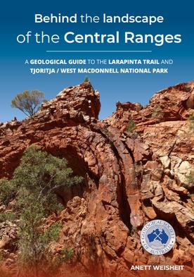
Behind the landscape of the Central Ranges: A geological guide to the Larapinta Trail and Tjoritja/West MacDonnell National Park, A Weisheit, GSA NT Publication
Soil hydrology in a changing climate, Humberto Blanco, Sandeep Kumar & Stephen Anderson (Eds), CSIRO Publishing
42 THE AUSTRALIAN GEOLOGIST
OBITUARIES
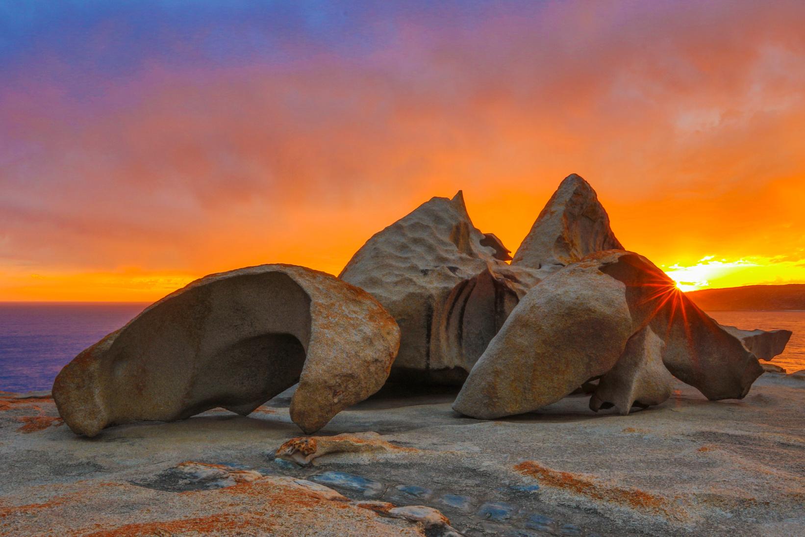
BARRY COOPER
23 September 1948 – 13 October 2023
Barry Cooper (Adjunct Professor of Geology, University of South Australia) was one of Australia’s best known geologists His contributions ranged across the fields of paleontology, the history of geology, and the promotion of heritage stones He was a longstanding member of the GSA and held positions of leadership in both national and international organisations Nationally, he was the Founding Chair of the Earth Sciences History Group (ESHG), a Specialist Group of the GSA He was also President and Secretary-General of the International Commission on the History of Geological Sciences (INHIGEO), as well as Founder and Secretary-General of the Heritage Stone Task Group of the International Union of Geological Sciences (IUGS)
Barry was born on 23 September, 1948 in the Melbourne suburb of Ivanhoe He attended Ashburton State School followed by Camberwell Grammar in 1960 His joining of the Hawthorn Junior Field Club in 1961 at age of around 13 records his early interest in natural history. Barry obtained first-class honours in geology from Melbourne University, followed by an MSc on conodonts from southeast NSW, supervised by George Thomas Next came a PhD from the Ohio State University in 1974 on Silurian conodonts from southern Ohio. His supervisor was Walter Sweet, one of the world’s leading conodont experts. They remained in touch and in 2008 published a joint paper on CH Pander’s contribution to the study of conodonts
Barry relocated to Adelaide in 1975, having accepted a position with the biostratigraphy division of the Department of Mines (SA Geological Survey) This involved migrating from conodonts of the Palaeozoic to foraminifera of the Cainozoic of SA.
One of Barry’s early publications was the comprehensive bulletin on the Cainozoic stratigraphy of the Willunga Basin During 1979 to 1989, he edited two Australian and New Zealand volumes in the journal Earth Sciences History
In this period he transferred to the Regional Mapping Section of the Mines Department
From 1989 Barry was reassigned to become technical advisor to the Minister of Mines and Energy He then worked for the Office of Technology and Special Projects, Department of Industry, Trade and Technology (DITT). This entailed the primary administration of the United Nations Development Organisation Conference, Adding Value to Natural Resources One thing that is clear about this period is that Barry was passionate about what he did. His work away from the geological survey clearly engendered the passion necessary to promote dimension stone (building stone) and the stone industry of SA.
From 1992 to 2000, Barry was essentially involved with the stone industry, either with DITT, or after he had returned to the Mines Department in the newly formed Resources Processing and Manufacturing Division. The knowledge required was peripheral to his paleontological expertise, but directed at demonstrating the value of mineral resources of SA to the state Through this period Barry managed numerous international delegations, including from China, Japan and the Ukraine
43 THE AUSTRALIAN GEOLOGIST
Barry Cooper and stones. Image courtesy Colin Conor
This latter period of Barry’s professional life allowed him to devote more time to his interest in history, especially that of geoscience and the prominent geologists who had evolved it As early as 1984, Barry had founded the ESHG within the GSA. And in 1991, he spoke at the first meeting of the History of Science, Technology and Ideas Group on ‘Walter Howchin: an unsung hero of South Australian Geology’ Barry retired from the Mines Department in November 2009 and joined the University of South Australia as an adjunct staff member, where he remained until his death on 13 October 2023 Barry authored or co-authored more than 200 publications on a wide variety of geologically related topics
Outside his activities for the SA Government, Barry was active in professional societies He was Secretary of GSA-SA Division 1975–1978, as well as Secretary of the Royal Society of South Australia 1977–1978 Barry was also Chair of GSA-SA 2002–2004 and remained on the committee for many years He was a very active Chair of the Field Guide Subcommittee for years, resulting in the production of several field guides. In 2019, Barry was awarded the Bruce Webb medal of the SA Division This was very well deserved as well as most appropriate, because he had previously initiated the establishment of both the Bruce Webb and Walter Howchin medals.
In the early 1980s, Barry became aware that celebrations were being planned in remembrance of the bicentenary of European settlement in Australia (1988) and the 150th anniversary (sesquicentenary) of SA (1986) Consequently, he wrote a letter in January 1983 to TAG soliciting interest in establishing a new special interest group dealing with the history of geology This led to the formation of the ESHG, formally established during the 7th Australian Geological Convention in August 1984 Barry became founding Chair (1983–1986), and in 2021 was awarded the Tom Vallance medal.
Quite unexpectedly, the same letter to TAG also led to a special request that Barry undertake historical investigations for the SA Geological Survey. The investigation was to support a sesquicentenary project that would consider the historical development of geology in SA over the 150 years since 1836.
Initiated by the Royal Society of South Australia, this project dealt with all natural sciences and was eventually published for the 150th anniversary of South Australia under the title, ‘Ideas and Endeavours The Natural Sciences in South Australia’ With David Corbett working on the 19th century history of geology, Barry was asked to focus on 20th century history of geology while also supporting David’s work
Most notably, as part of the joint investigation, Barry arranged oral interviews of several eminent SA geologists, including Ben Dickinson, Reg Sprigg, Lee Parkin and Eric Rudd Records of these interviews are stored in the oral history collection of the State Library of South Australia.
When the GSA reached its 40th anniversary, Barry and David Branagan were chosen to compile and write a history of the GSA, which was titled Rock Me Hard…Rock Me Soft…: A History of the Geological Society of Australia It was published in 1994, with all GSA members receiving a copy
Barry’s early experience with mineral industry development had introduced him to the building stone industry, and hence to heritage stone. His heritage stone involvement expanded rapidly from 2007 He encouraged the IUGS to establish a Heritage Stone Task Group that formally recognised the concept of Global Heritage Stone Resource. Barry was both founder and Secretary General of the task group, and promoted it through attendance and formal presentations at many international conferences.
In Barry’s latter years at the Geological Survey, historical research was revitalised with an initial focus on the history of Cambrian investigations in collaboration with Jim Jago Additionally, the history of uranium investigations in SA was encouraged by the Geological Survey and gained considerable interest from local mineral explorers The industry welcomed Barry as a speaker at the International Uranium Conference in Adelaide in 2008, as well as at the International Geological Congress in Oslo, Norway later the same year
Barry’s expanding historical research led David Oldroyd to suggest that with his retirement approaching, he might be interested in the role of Secretary General of INHIGEO. Barry felt honoured to be considered, and was subsequently appointed He held the post from 2008 to 2016 when he was elevated to President, a position he retained until 2020
VALE DONALD E OWEN
Former lecturer in soft-rock geology at Macquarie University (MQU) 1969–1971, Donald Owen died in Beaumont, Texas, USA on 30 December 2023, aged 87. Don taught many hundreds of students at MQU during the height of the first Australian mineral boom, and did consulting work for the Australian petroleum industry in that period, including fieldwork in the Darling Basin He will be fondly remembered by his surviving former MQU colleagues, the many students he taught, and his petroleum industry associates An obituary for Don will be published in a forthcoming issue of TAG.
44 THE AUSTRALIAN GEOLOGIST
Barry’s work involved considerable travel to oversee and organise conferences in far-flung parts of the world. He compiled four substantial annual newsletters and launched a Quarterly News Circular in 2012 He was involved in establishing the first INHIGEO website and in organising a wide-ranging revision of the INHIGEO Terms of Reference. Barry was PastPresident of INHIGEO at the time of his death in 2023
Finally, although a geologist and historian by learning and profession, Barry was more than that He was a writer of short stories, a poet, and a lover of literature and music In his quietness he had an affinity with the natural world His feeling for the family’s western Eyre Peninsula coastal property was as much spiritual as it was geologically pragmatic It was Barry’s wish that he be a part of that environment. Thus, he now rests at Calca in view of the Southern Ocean
We extend our sincerest sympathy to Barry’s wife, Maggy, and their four sons: Alexander, David, Edward and Sebastian.
COLIN CONOR, JIM JAGO & BOB MAJOR
VALE STEVE ‘TATS’ TATZENKO
Steve ‘Tats’ Tatzenko passed away on 2 December 2023 He was a NT public servant, Chair of the Darwin Mining Club and friend of the GSA-NT Division Tats was a passionate advocate for the Territory’s mining sector over his 42-year career. He will be fondly remembered as a true gentleman a generous and larger-than-life character Tats is greatly missed by his colleagues at the NT Geological Survey and the Minerals Council of Australia, as well as his extensive network across the industry His invaluable contribution to the Territory’s minerals industry will be his lasting legacy.

Although work by committee members and friends of the National Rock Garden is voluntary, we nevertheless incur the regular costs of an incorporated entity. We therefore seek donations from individuals who recognise the importance of geoscience and geoscience education to the future of Australia
The signing of the contract with the ACT Government for the re-location of the National Rock Garden into the very prominent Forest 13 block at the National Arboretum Canberra provides security of tenure for the Rock Garden and enables us to move more rocks into the ACT. We will incur substantial costs, including for transport and delivery of rock specimens, preparation of specimens for display, creation of descriptive plaques for the rocks, and maintenance of the NRG site We will be encouraging corporate contributions for the transportation of larger rocks from interstate. Our immediate task, following the works approval granted by the National Capital Authority earlier this year, is to appoint, via tender, a construction company to undertake the site landscaping
National.Rock.Garden.Australia@gmail.com

WE
YOUR FINANCIAL SUPPORT
NEED
45 THE AUSTRALIAN GEOLOGIST
to donate, or
Scan the QR code
email
WHAT’S ON IN 2024
March
18 March Webinar- Are supergene ore deposits a guarantee of Environmental, Social and Governance (ESG)?, ARGA
21 March ACT National Parks Meeting on the regional geology and its impact on the river systems in the ACT, GSA ACT
21 March Kevin Hill Selwyn Medallist 2023 will be presenting, GSA Vic
23–24 March World Science Festival Brisbane, GSA Qld
April
06 April Late Paleozoic Cygnet Field Trip, GSA Tas
18 April GSA Vic AGM
18 April Owen Wilson presents: Comparison of cobalt weathering behaviour from different host rocks: an Australian outback journey, GSA Tas
24 April Webinar TBD, ARGA
May
23 May Andrew Gunn presents: Aeolian Sediments on Mars, GSA Vic
24 May GSA AGM
July
18–19 July Geofest, GSA NSW
August
10–18 August National Science Week
21–23 August 42nd Sydney Basin Symposium, Coal Geology Council
October
13–19 October Earth Science Week
November
18–22 November Tectonics in the Tablelands, SGTSG
Please email information regarding events to GSA Secretariat via info@gsa.org.au to ensure your event is advertised on the web, and emailed out to members.
GSA Secretariat can also assist with field trip insurance and Eventbrite ticket sales
For any assistance creating a beautiful event flyer please email tag@gsa.org.au
45 THE AUSTRALIAN GEOLOGIST
46 THE AUSTRALIAN GEOLOGIST
OFFICE BEARERS 2023–2025
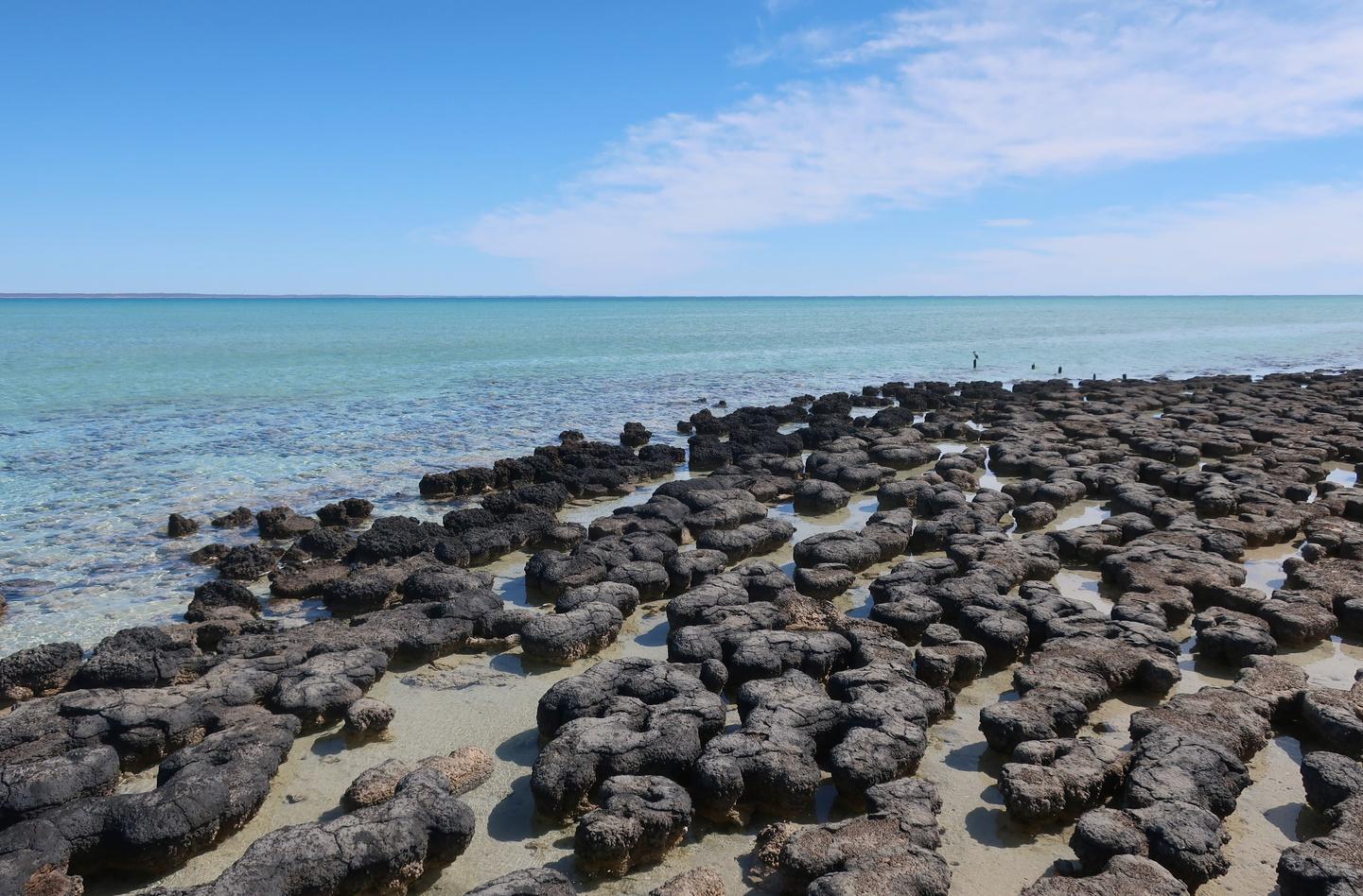
GOVERNING COUNCIL
President
Amber Jarrett
Secretary
Tiah Penny
Treasurer
Rick Squire
Past President
Pete Betts
General Councillors
Margaret Brocx
John Foden
Mark Pearce
Chris Taylor
Andy Tomkins
STANDING COMMITTEES
Finance and Risk
Chair: Rick Squire
Communications
Co-chairs: Mark Pearce, Pete Betts
Conferences
Co-chairs: John Foden, Andy Tompkins
Geoheritage
Chair: Margaret Brocx
Geotourism
Chair: David Robson
Safety & Culture
Co-chairs: Tiah Penny & Amber Jarrett
Stratigraphy Commission
National Convener
Cathy Brown
State Convenors
ACT, External Territories, Christo Marais-van Vuuren
New South Wales, James Ballard
Northern Territory, Tim Munson
Queensland, Paul Blake
South Australia, Jarred Lloyd
Tasmania, Stephen Forsyth
Victoria, Ross Cayley
Western Australia, Peter Haines
DIVISIONS AND BRANCHES
ACT
Chair: Tiah Penny
Secretary: Jessica Walsh
Hunter Valley Branch
Chair: Lindsay Gilligan
Secretary: Simone Meakin
NSW
Chair: Jo Parr
Secretary: Tom England
NT
Chair: Amber Jarrett
Secretary: Cait Stuart
Qld
Chair: Nick Dyriw
Secretary: Mark Pirlo
SA
Chair: Alan Collins
Secretary: Adrienne Brotodewo
Tas
Chair: Karin Orth
Secretary: Ron Berry
Vic
Chair: Anne-Marie Tosolini
Secretary: Ashleigh Hood
WA
Chair: Kailah Thorn
Secretary: Sandra Villacorta Chambi
SPECIALIST GROUPS
Australasian Palaeontologists/AAP
Chair: Nicolas Campione
Secretary: Patrick Smith
Australian Regolith Geoscientists Alliance (ARGA)
Chair: Anna Petts
Secretary: Leah Lynham
Australasian Sedimentologists Group (ASG)
Chair: Brad Opdyke
Secretary: Kathryn Amos
Coal Geology Group (CGG)
Chair: Joan Esterle
Secretary: Susan Faulkner
Earth Sciences History Group (ESHG)
Chair: Ian Withnall
Secretary: John Jell
Education & Outreach (EOSG)
Co-Chairs: Bonnie Teece & Sabin Zahirovic
Geochemistry, Mineralogy & Petrology Specialist Group (SGGMP)
Chair: David Murphy
Secretary: Balz Kamber
Geoscience Indigenous Collaboration and Engagement Specialist Group (GICE)
Chair: Susanne Schmid
Secretary: Marina Costelloe
Specialist Group in Planetary Geoscience and Geodynamics (SGPGG)
Chair: Fabio A Capitano
Secretary: Andy Tompkins
Specialist Group in Economic Geology (SGEG)
Chair: Marcus Willson
Secretary: Simon Buswell-Smith
Tectonics & Structural Geology Specialist Group (SGTSG)
Chair: Luke Milan
Secretary: Vasileios Chatzaras
Volcanology (LAVA)
Chair: Rebecca Carey
Secretary: Martin Jutzeler
FOR UPDATES PLEASE EMAIL INFO@GSA.ORG.AU AND TAG@GSA.ORG.AU
47 THE AUSTRALIAN GEOLOGIST

ISSUE 210, APRIL 2024
Registered by Australia Post
Publication No. 100010917
ISSN 0312 4711
MANAGING EDITOR
Amber Jarrett
PRODUCTION EDITOR
Kath Kovac
DESIGN & TYPESETTING
Amber Jarrett
PRINTED BY
Bell Print
DISTRIBUTED BY
The Pack Factory, Sydney
CENTRAL BUSINESS OFFICE
PO Box 576, Crows Nest NSW 1585
Email: info@gsa.org.au
Web: www.gsa.org.au
Phone: (02) 9160 8193
GENERAL NOTE
The Australian Geologist (TAG) is a quarterly member magazine that includes society news, conference details, special reports, feature articles, book reviews and other items of interest to Earth Scientists. Each issue has a long shelf-life and is read by more than 3,000 geologists, geophysicists, paleontologists, hydrologists, geochemists, cartographers and geoscience educators from Australia and around the world.
SUBMISSIONS
Submissions are welcome by any member of the GSA, or nonmembers by invitation. Please email contributions to tag@gsa.org.au. Artwork must be high resolution 300 dpi or larger.
COPYRIGHT
The Publication is copyright by the GSA Inc unless specifically stated otherwise. However, material in this issue may be used provided acknowledgement is made. Every effort has been made to trace and acknowledge copyright holders of material in this publication. If any rights have been omitted, apologies are offered.
The GSA is a learned Society and TAG is published by the Society to provide information for members and as a forum for the expression of their professional interests and opinions. Observations, interpretations and opinions published herein are the responsibility of the contributors and are not necessarily supported by the GSA.


The GSA has taken all reasonable precautions and made all reasonable efforts to ensure the accuracy of material contained in this publication, and makes no warranties, expressed or implied with respect to any of the material contained herein.
BUSINESS CORRESPONDENCE
All business enquiries and correspondence relating to advertising space, inserts and/or subscription matters, should be sent to tag@gsa.org.au
EDITORIAL MATTERS
Contributions: All editorial enquiries or contributions should be sent to tag@gsa.org.au
cover images:
48 THE AUSTRALIAN GEOLOGIST
Back
Top left: Wandrawandian Formation, Sydney Basin. Image courtesy Tiah Penny. Top right: Birrindudu Basin sand ripples, image courtesy Alan Collins. Bottom left: Pegmatite in Alice Springs, image courtesy Anthony Reid. Bottom right: Uluru, image courtesy Keegan McGuffie
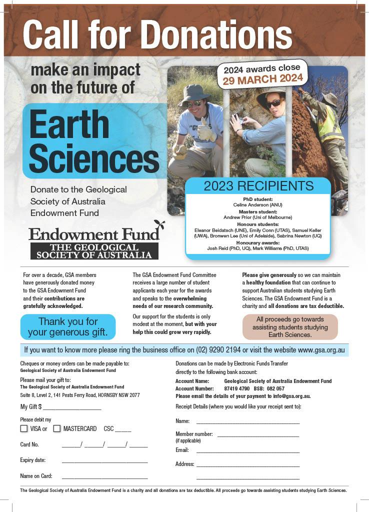
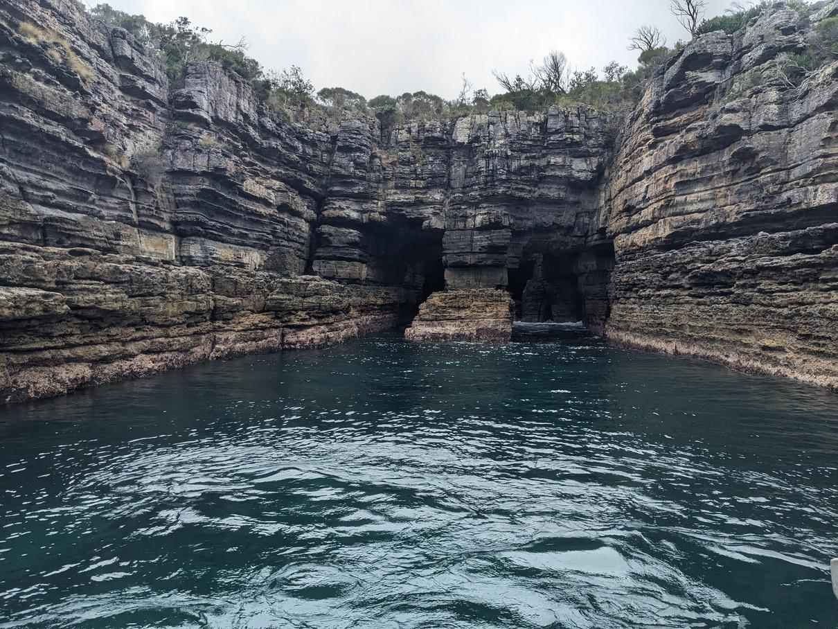
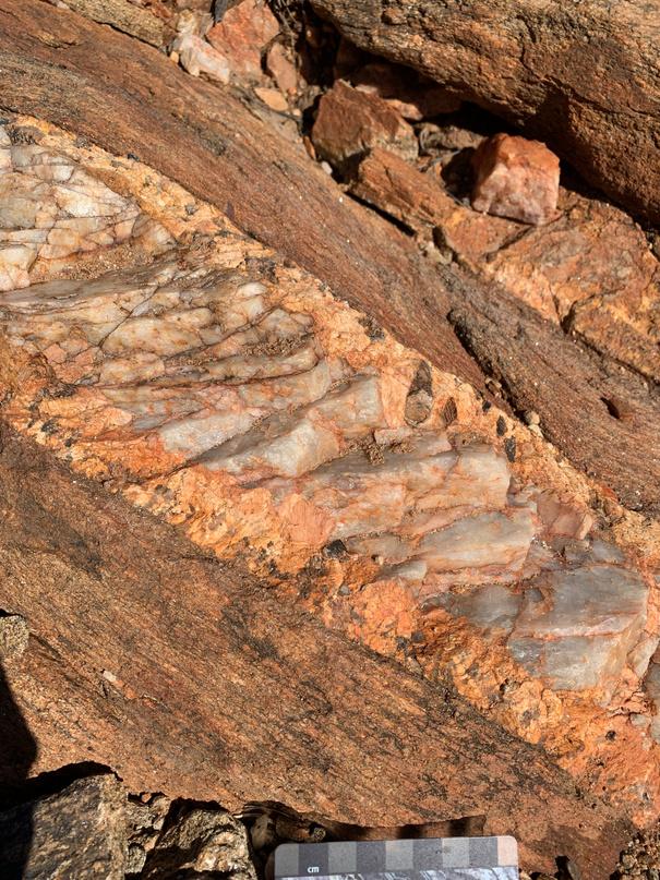
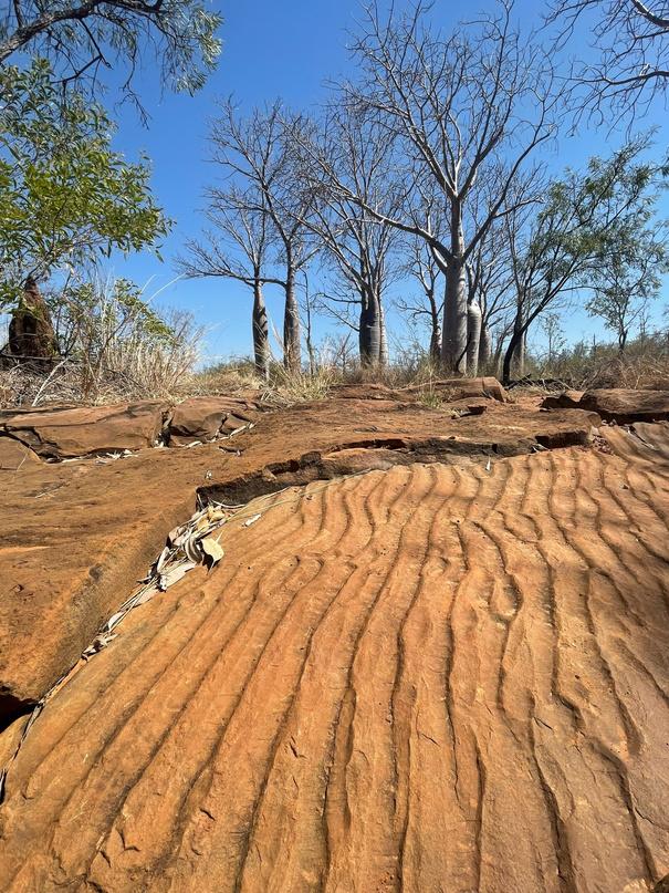
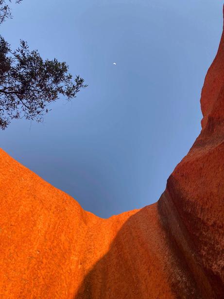
TAG THE AUSTRALIAN GEOLOGIST APRIL 2024 ISSUE No 210 WWW.GSA.ORG.AU


 Kim Kwan, QiS

 Erin Martin President, WOMEESA


 Katarina Miljkovic discusses the future of planetary science in Australia Images courtesy Craig James


 KEIRISSA LAWSON CSIRO


