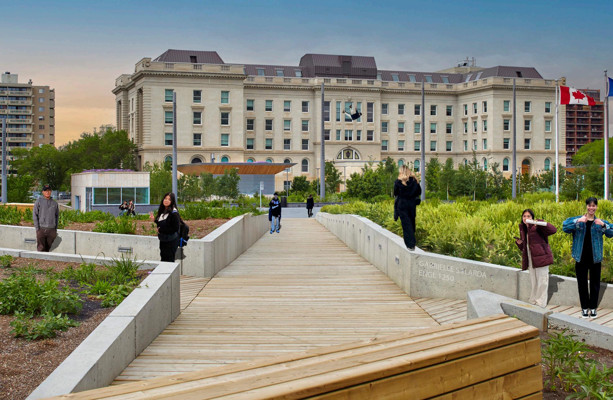
GABRIELLE SALARDA
N orther N A lbert A I N st I tute of t ech N ology

N orther N A lbert A I N st I tute of t ech N ology
Over the past two years, I’ve had the opportunity to explore the world of Landscape Architectural Technologies (LAT) — an experience that has been both exciting and deeply fulfilling.
Through my time in the Landscape Architectural Technologies program, I’ve gained a deeper understanding of landscape design, learning not only the principles of form, function, and sustainability but also how to communicate ideas through concept development and visual storytelling.
I’ve enjoyed the challenge of turning abstract ideas into real, functional outdoor spaces—whether it’s re-imagining public plazas, designing residential yards, or planning community-focused green areas.
This journey has been more than just an education — it’s been fun, inspiring, and rewarding. Each project has helped me grow both as a designer and as a thinker, and I’m excited to carry this passion forward as I continue to explore the creative possibilities of landscape architecture.

Contact:
garysalarda@gmail.com
https://www.linkedin.com/in/gsalarda1/ (780) 297 - 4279


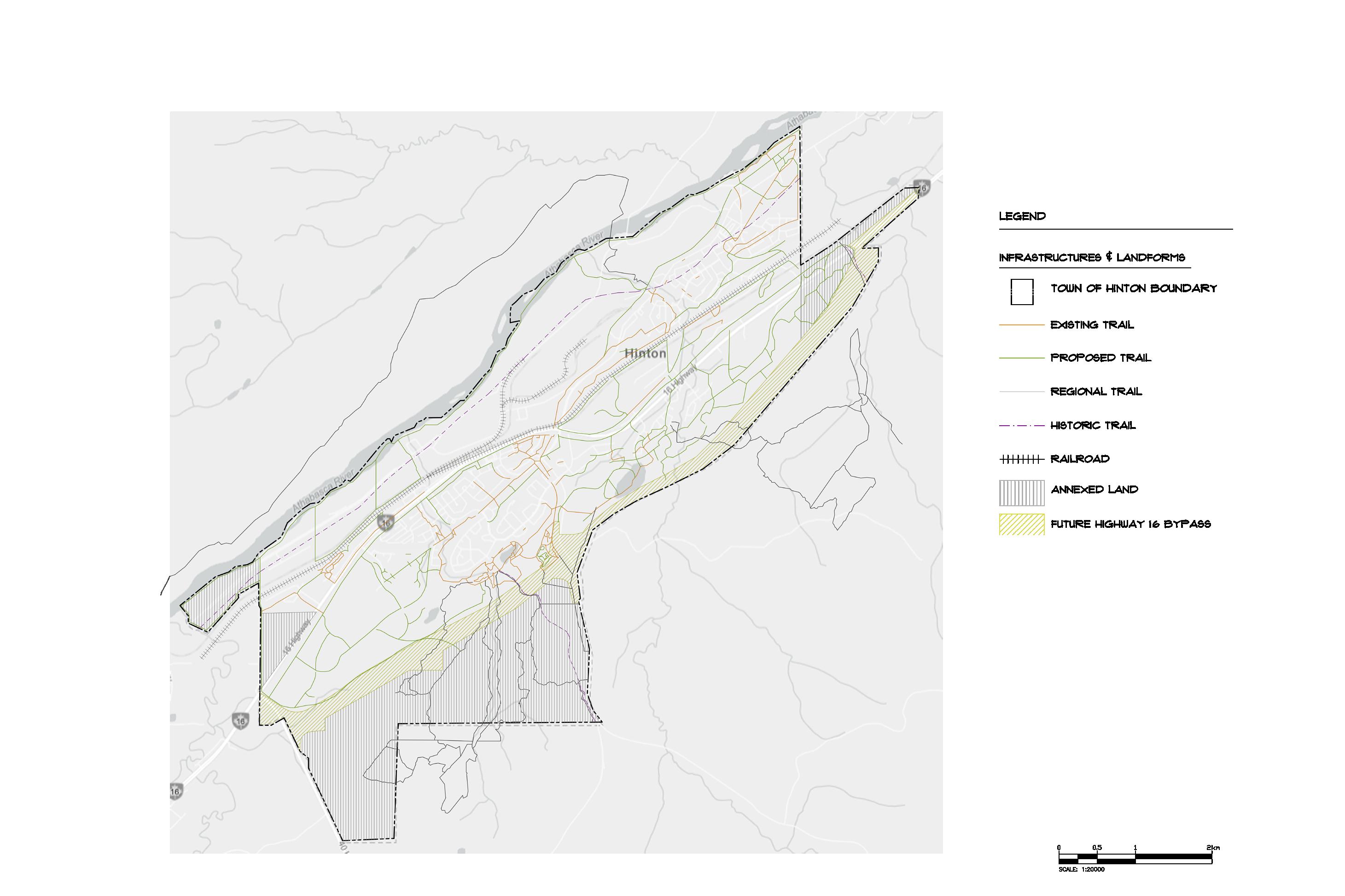

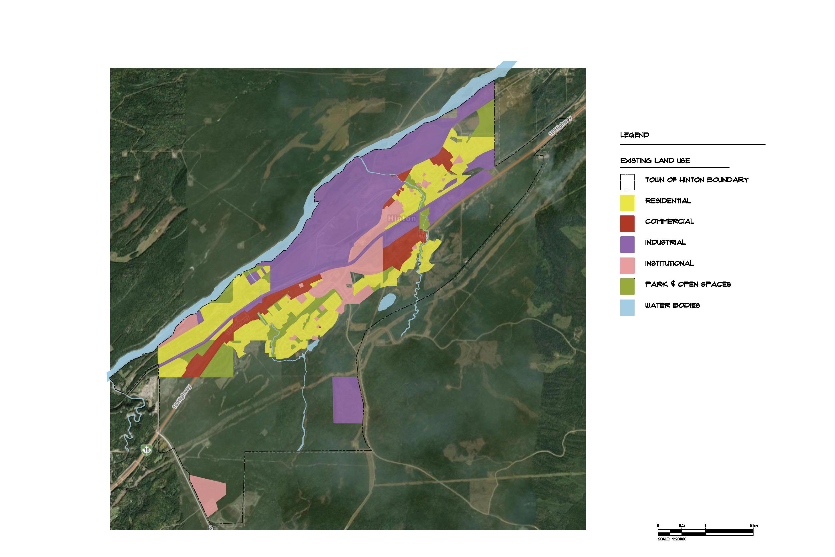

TOWN OF HINTON - SUITABILITY AND CAPABILITY MAP
This project was primarily developed using AutoCAD to create precise site plans and zoning layouts.
To support the planning process, ArcGIS was used to view real-time aerial data and accurately assess land use patterns. Additionally, I used Adobe Photoshop to compile and overlay images, creating a visual representation of the proposed land use layout.
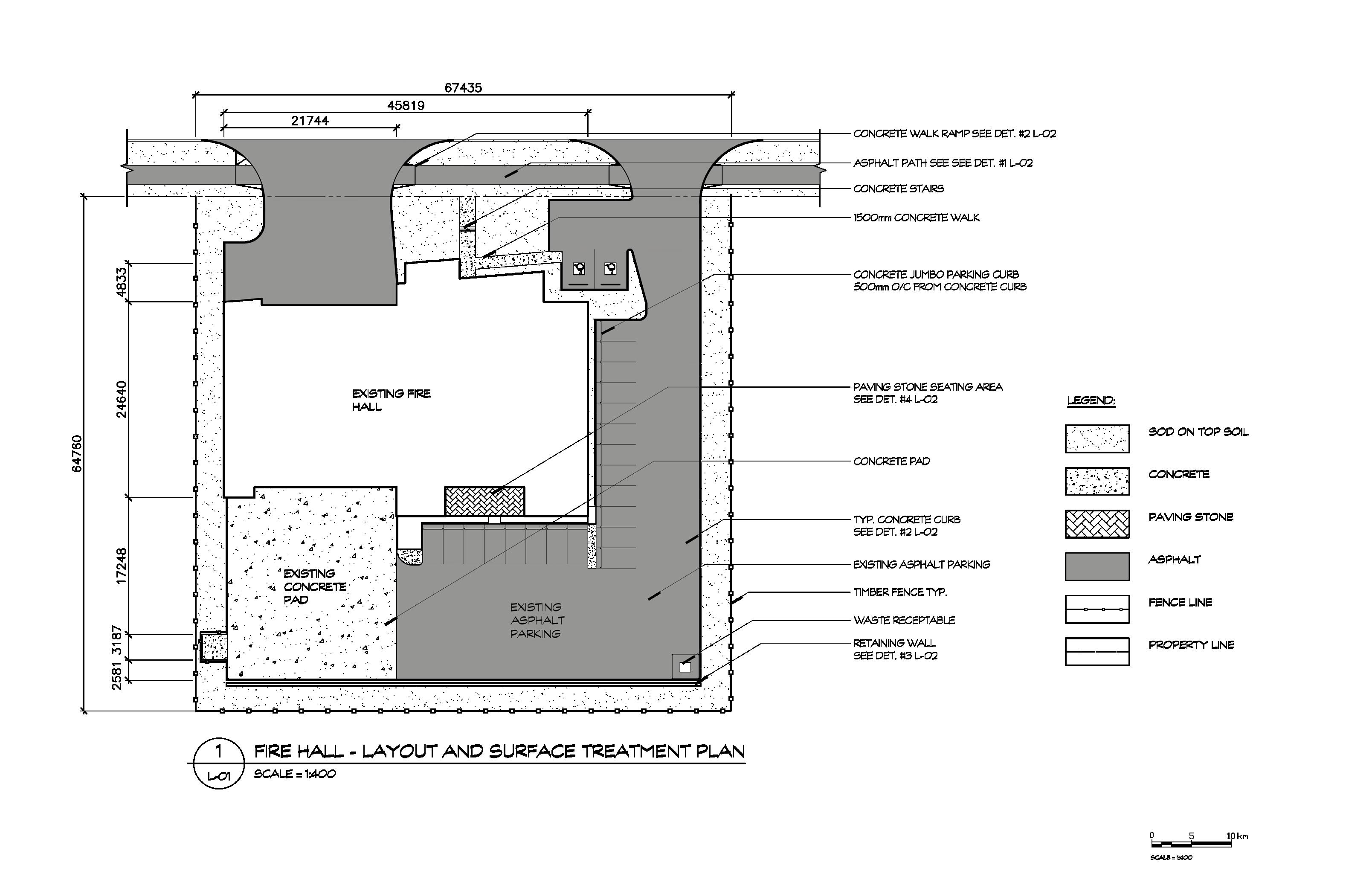
CONSTRUCTION DRAWINGS
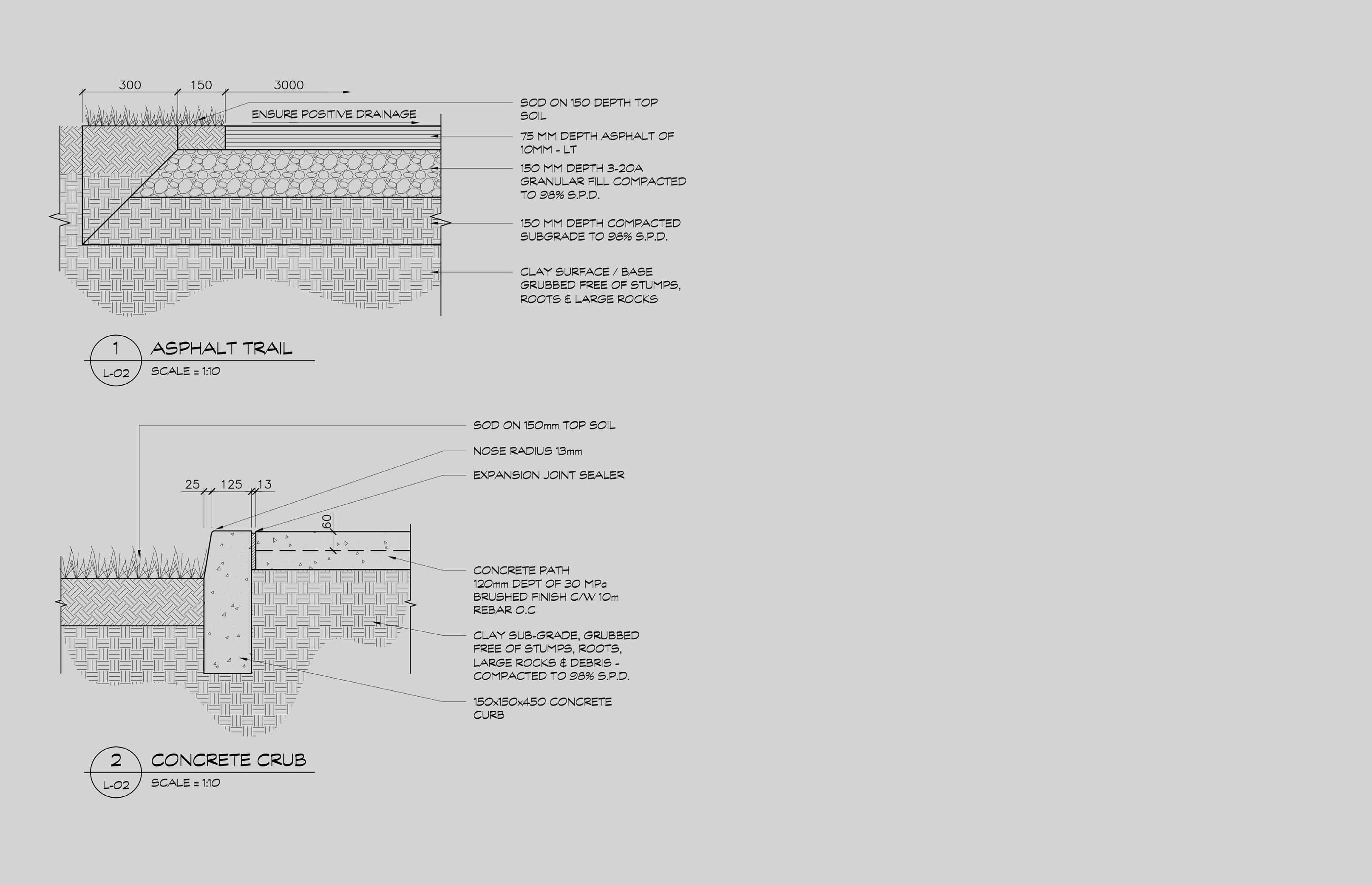
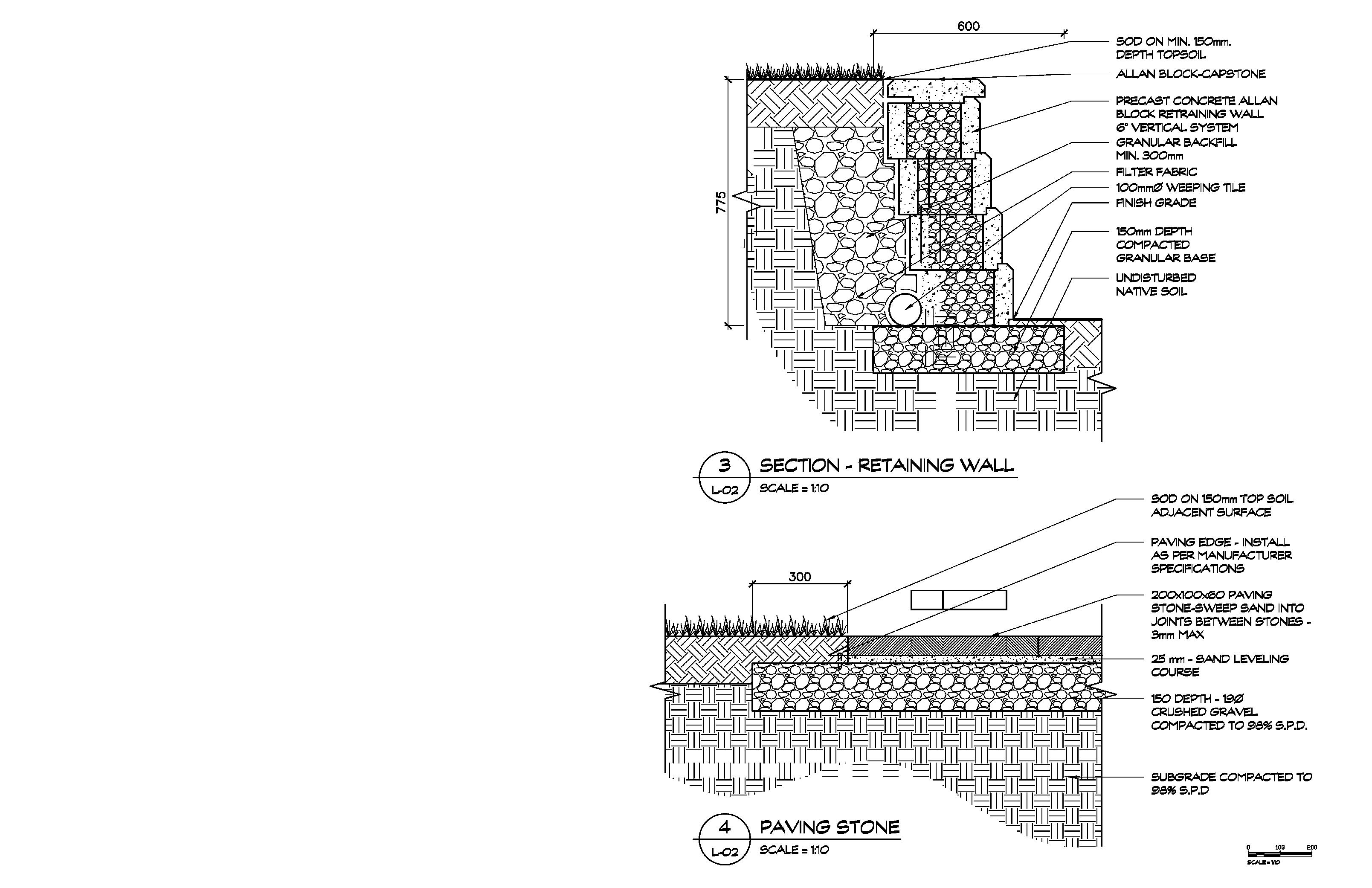
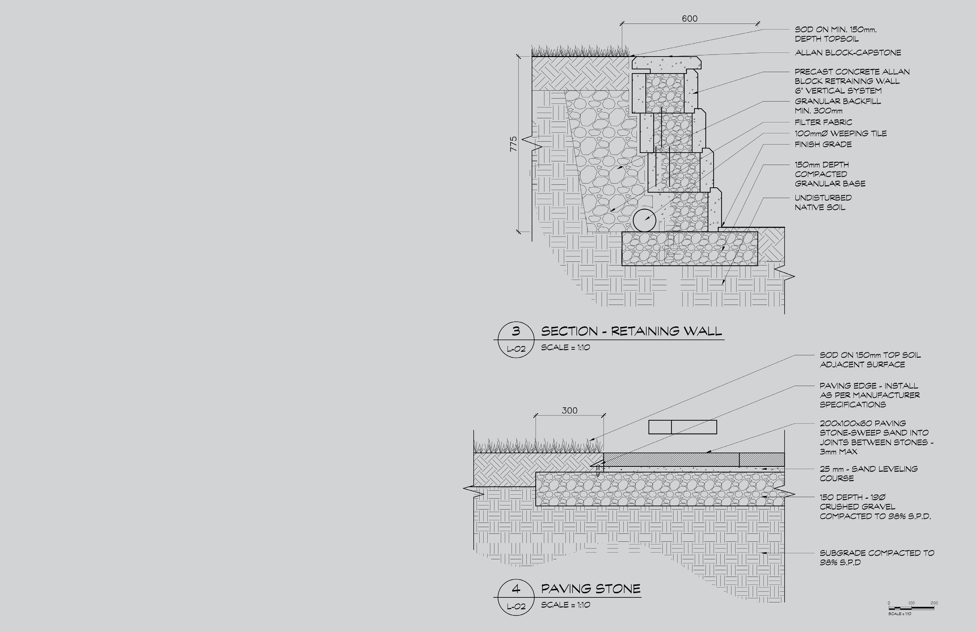
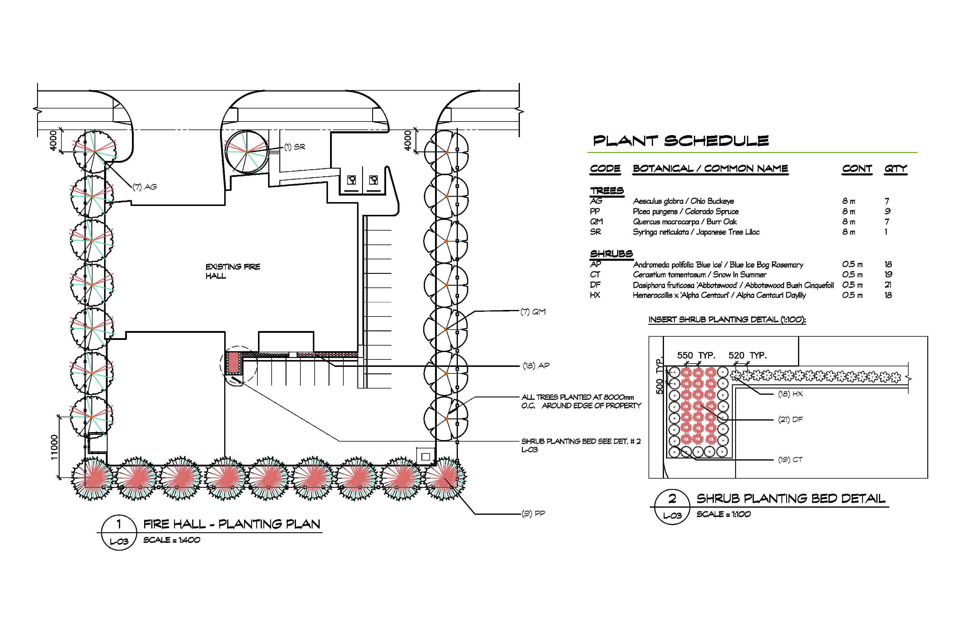
The Fire Hall Project was primarily developed using AutoCAD and was later refined with Land F/X. The drawing set included a Layout and Surface Treatment Plan, as well as a detailed Planting Plan and Schedule.
As part of the course, we were assigned weekly tasks to develop scaled construction detail drawings. These drawings were later combined to become part of the detail set included in the Fire Hall Final Package.
Category:
Construction Drawings
Tools:
AutoCAD & Land F/X
HILARY PARK GRADING PLAN
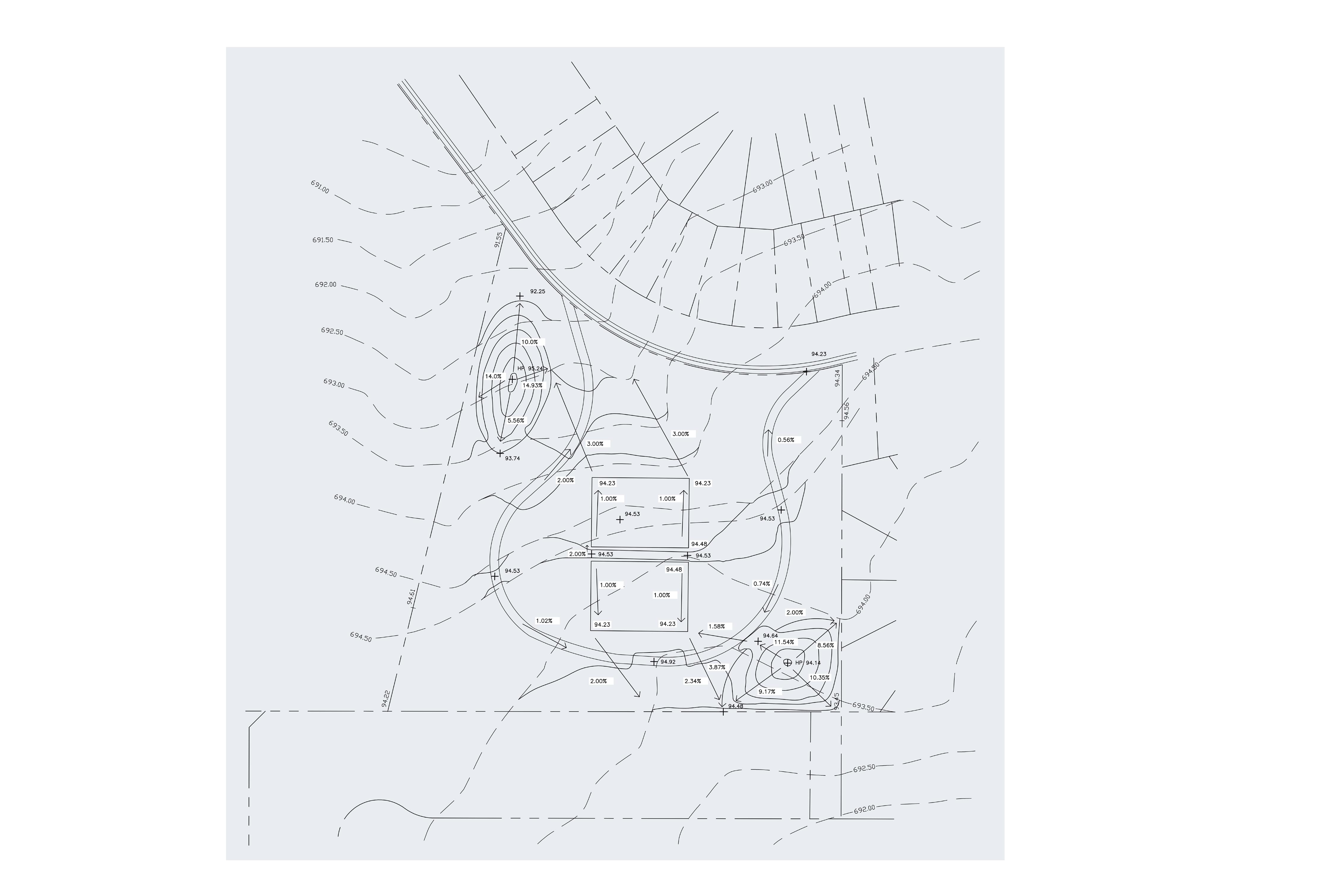
This project was mainly completed using AutoCAD, but I also Land F/X to clean up the northing and easting schedule and make the planting plan more efficient by generating blocks, labels, and a plant schedule.
LAYOUT AND SURFACE TREATMENT PLAN
CONSTRUCTION DOCUMENTS
This project was part of a course that challenged us with weekly assignments, each focusing on a different aspect of a construction drawing set—including a grading plan, layout and surface treatment plan, and planting plan. Over time, these components were combined into a complete construction package, making it, in my opinion, the most difficult project of my third semester.
DIGITAL RENDERING MASTER PLAN AND 3D PERSPECTIVES
AutoCAD: James Manuel
Adobe Photoshop : Gabrielle Salarda & Andrei Ceniza
Sketchup: Andrei Ceniza
Perspectives: Gabrielle Salarda


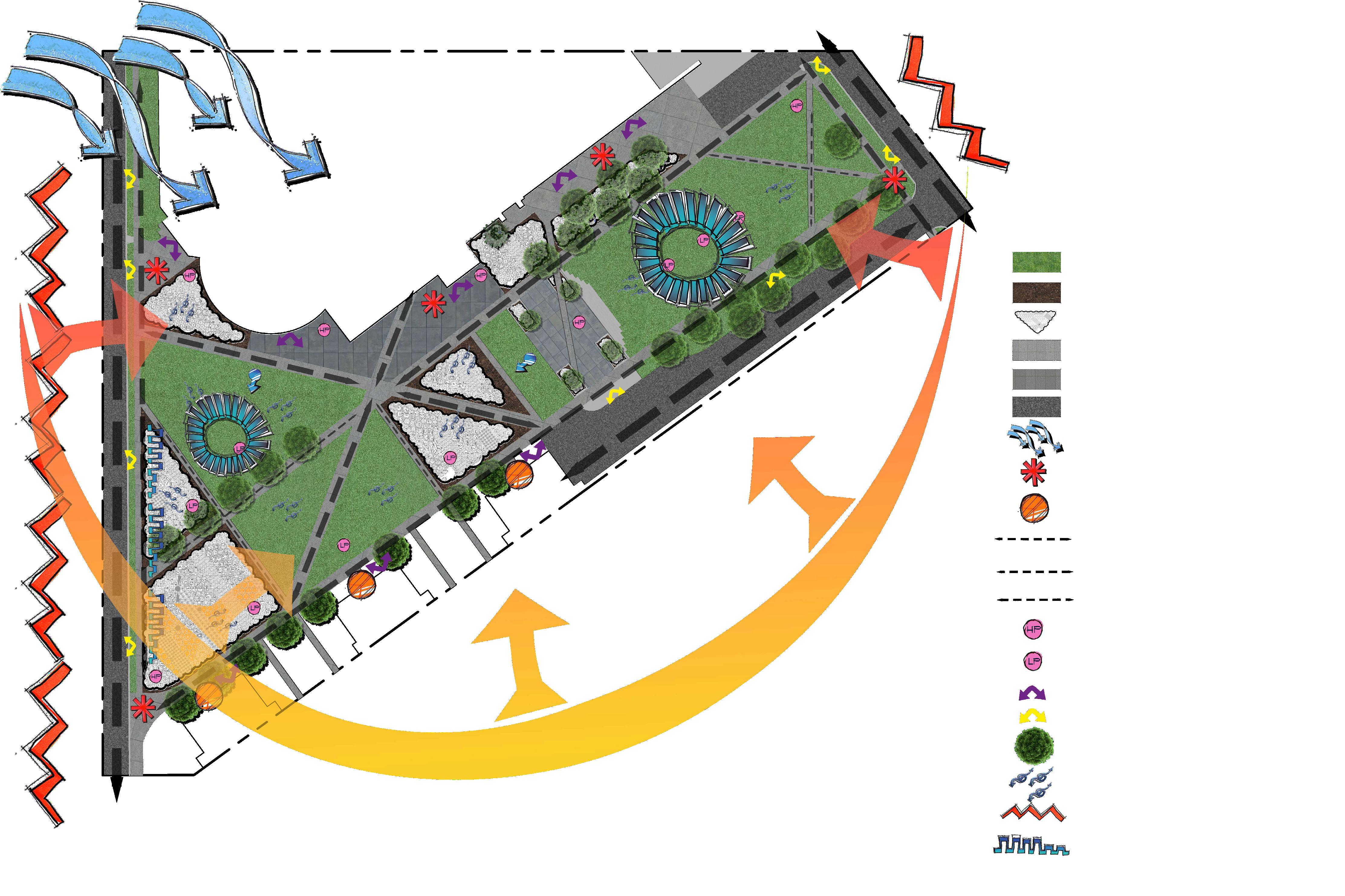


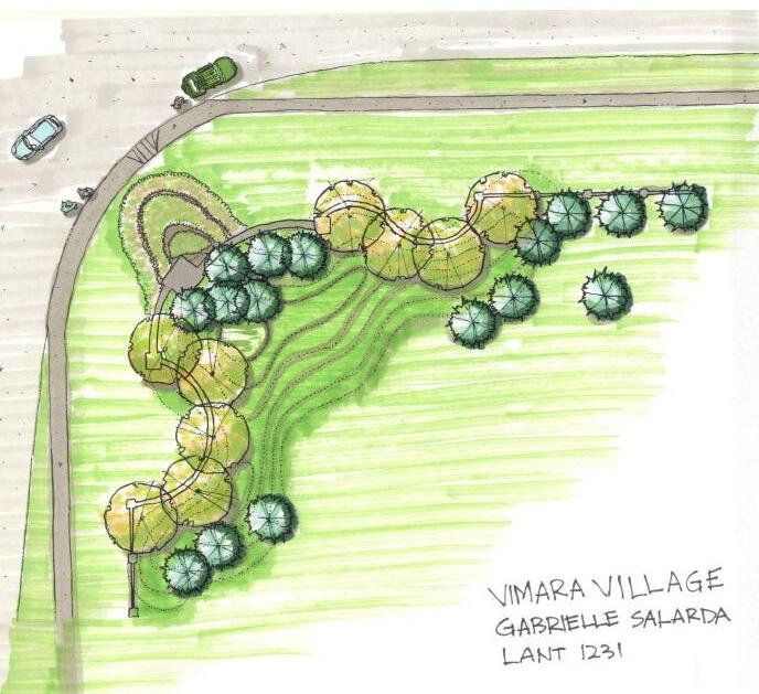
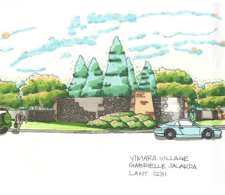
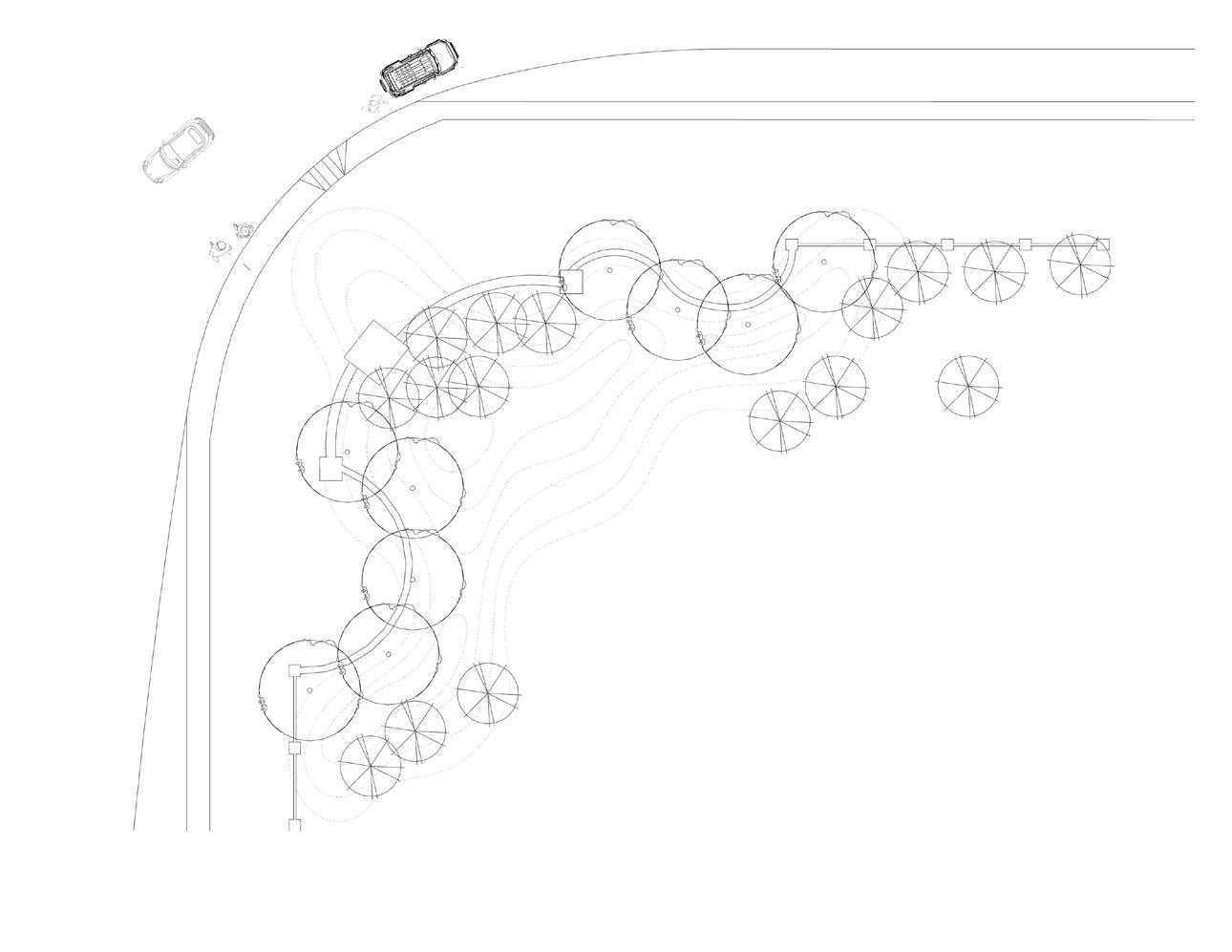
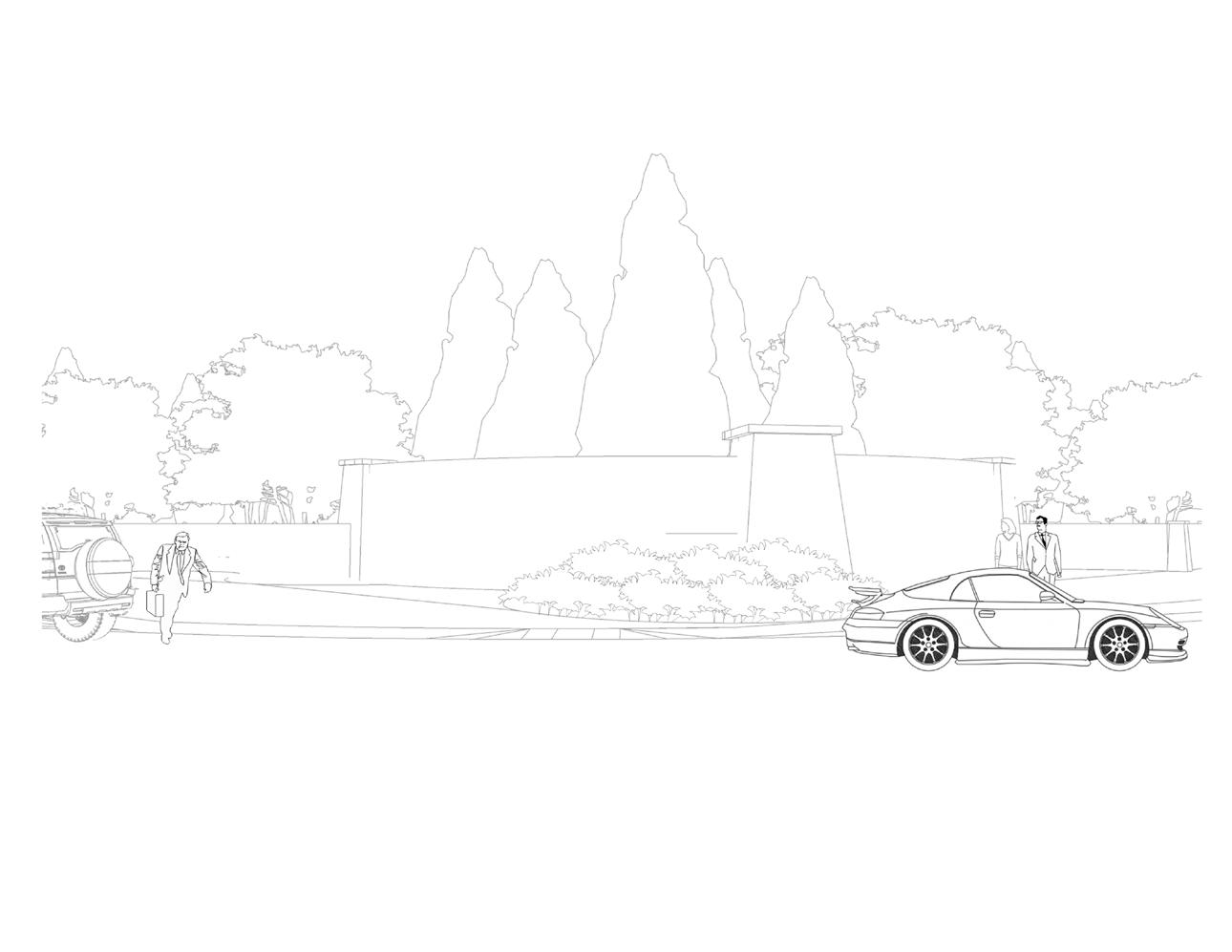
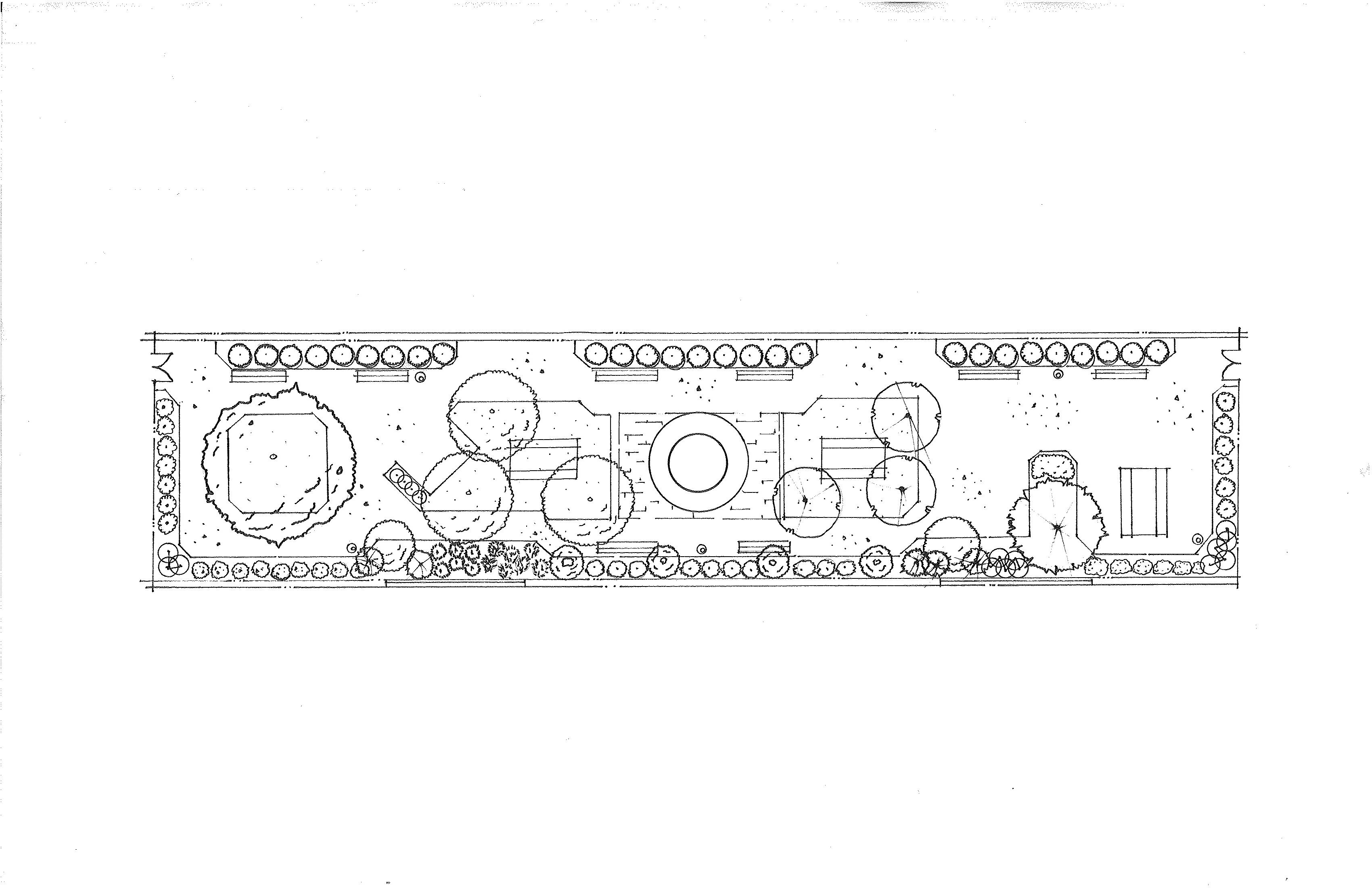
COURTYARD MASTER PLAN (HAND DRAWN)
Small Space Project
The NAIT courtyard redesign aims to create a vibrant, green space. Key improvements include replacing worn pavement with durable materials to introduce a new area for social engagement. In alignment with industry standards, computer-aided design tools such as AutoCAD and Land F/X were used to develop a detailed digital plan view of the courtyard.


SITE ANALYSIS AND INVENTORY

Category:
Graphic Design Master Plan
Site Analysis and Inventory
Tools:
Adobe Photoshop
Twinmotion
Sketchup
AutoCAD
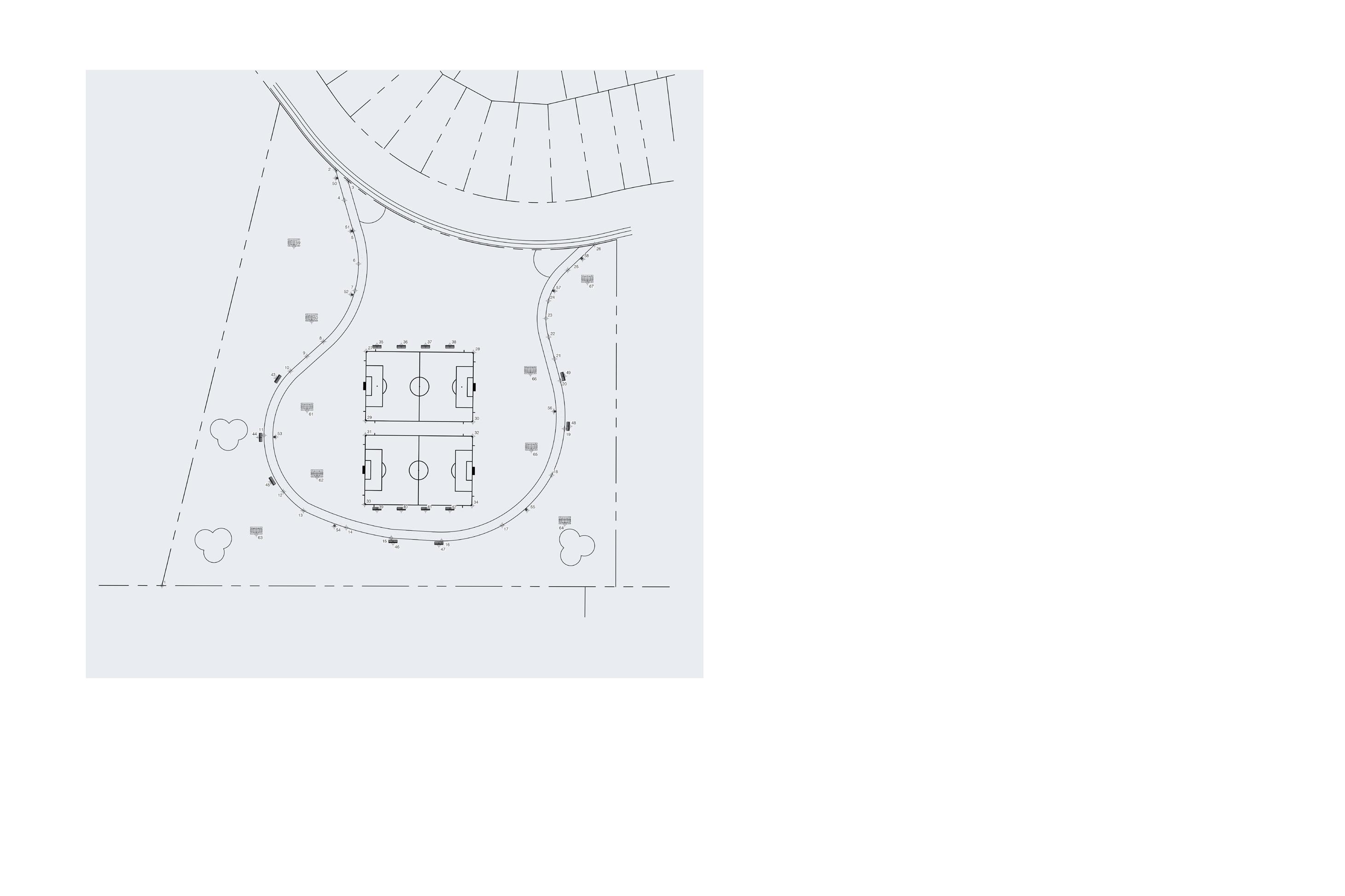
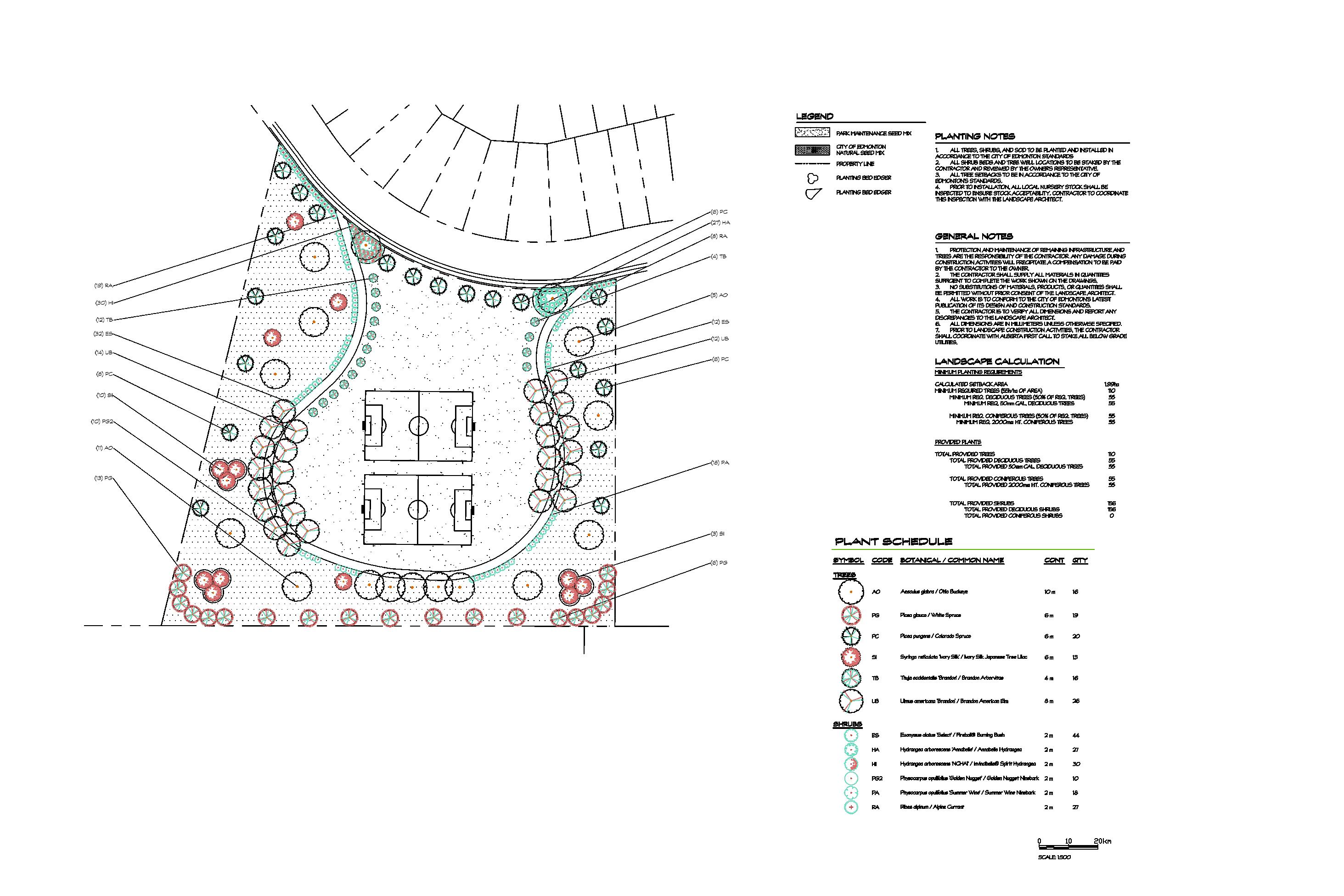
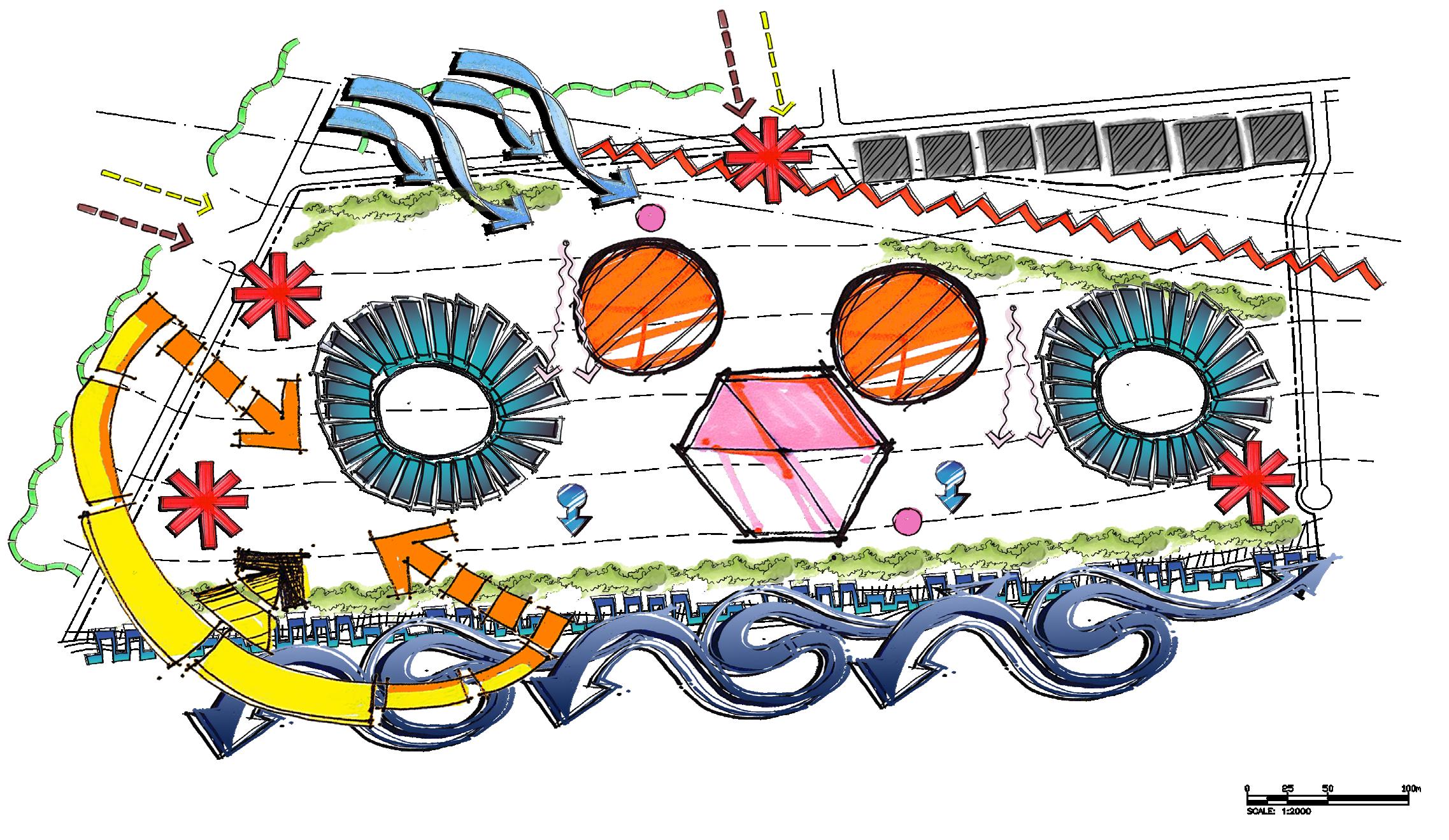
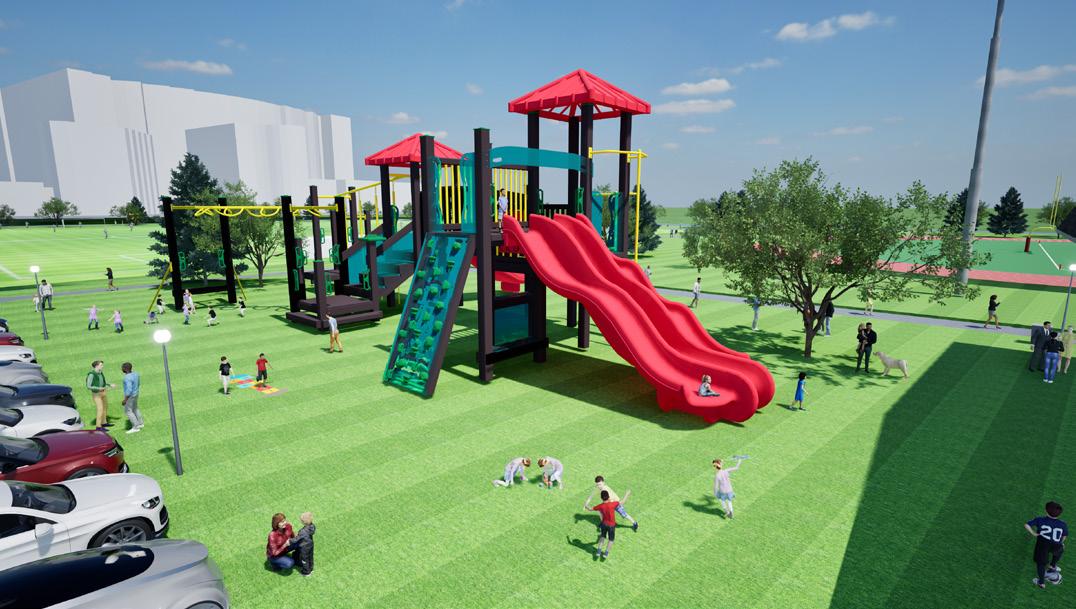
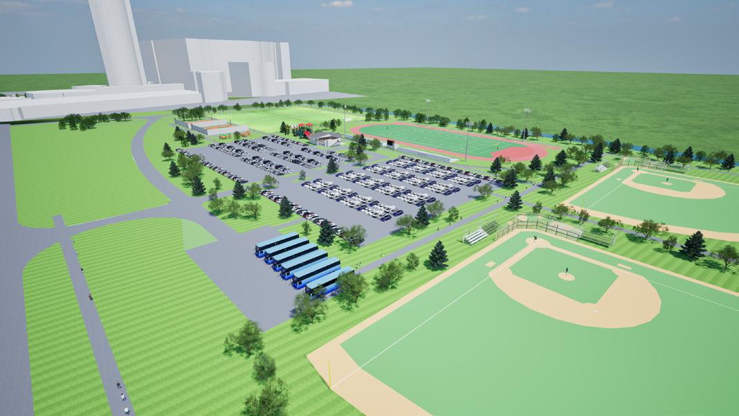
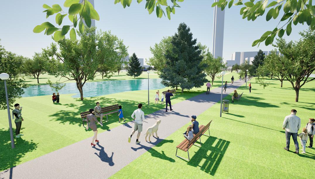
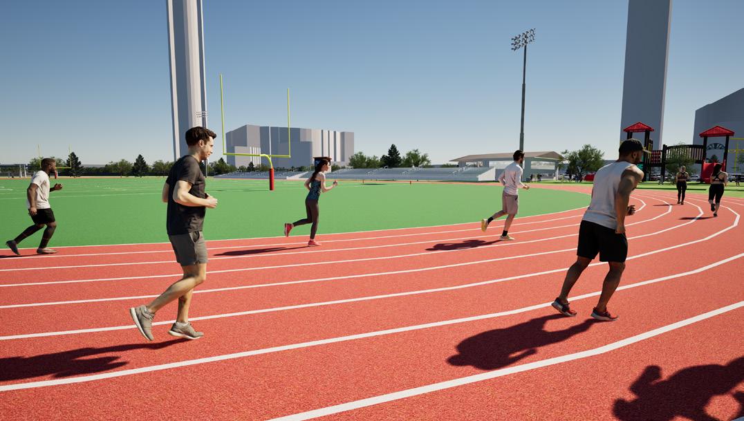
SPORTS FIELD CONCEPT PLAN


SITE ANALYSIS AND LANDSCAPE ARCHITECTURAL DESIGN
This project was developed over several weeks, beginning with a site analysis and inventory, followed by a concept plan, and a master plan with 3D character perspectives. A key focus throughout the process was researching proper sport field orientation, applying local offset bylaws, and addressing important climatic considerations such as water directions and storm water pond implementation.

LANDSCAPE PRESENTATION TECHNIQUES
ONE-POINT PERSPECTIVE
During the third and fourth terms of my studies at NAIT, I had the opportunity to work extensively with Adobe Photoshop and Illustrator. These tools became an essential part of my design process, whether I was working on site analysis and inventory, developing concept plans, or producing master plans.
TWO-POINT
LANDSCAPE PRESENTATION TECHNIQUES
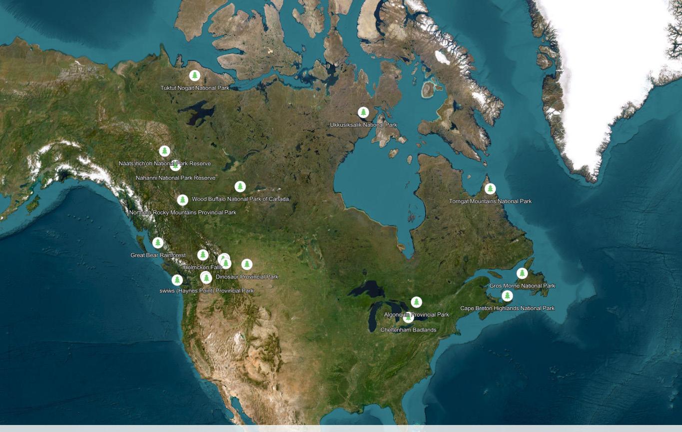
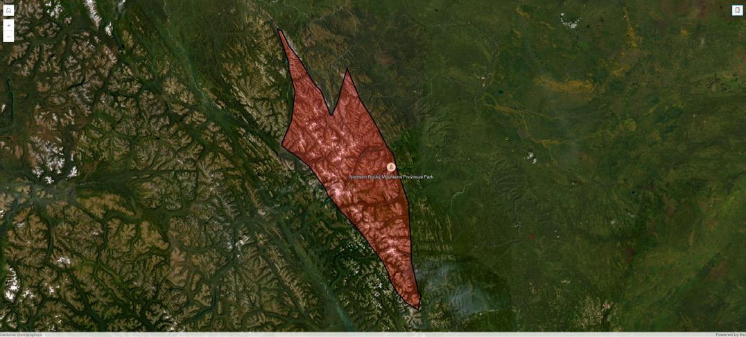
PROVINCIAL PARK
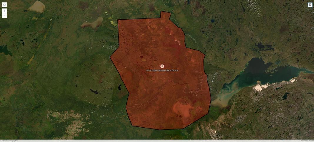
NATIONAL PARK
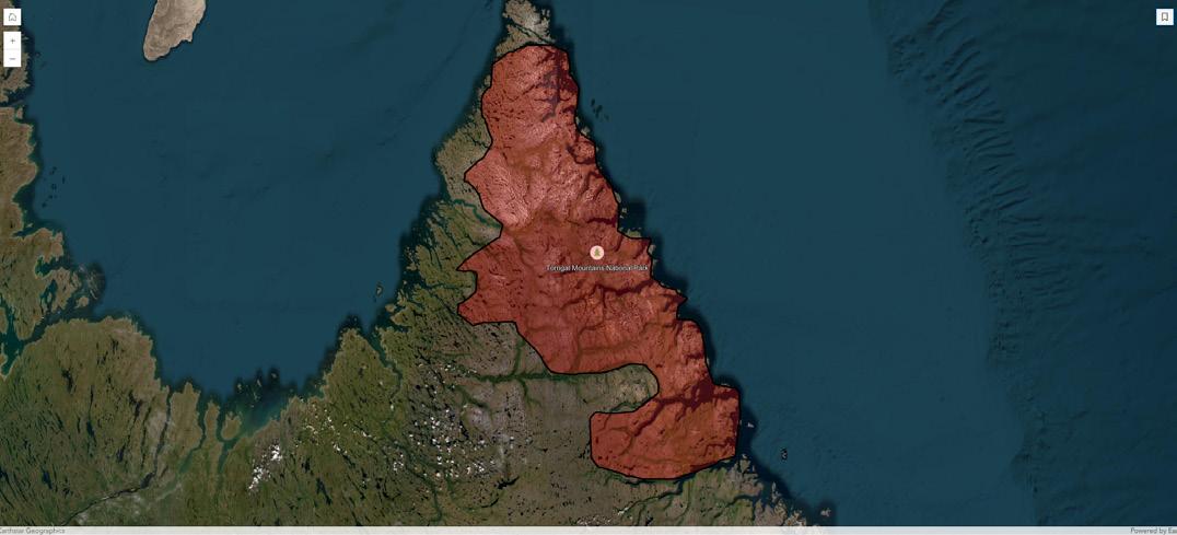
20 LANDSCAPE LOCATION WITHIN CANADA
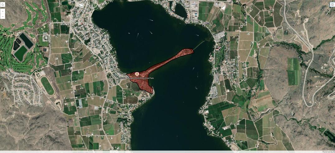
SẀIẀS (HAYNES POINT)
PROVINCIAL PARK
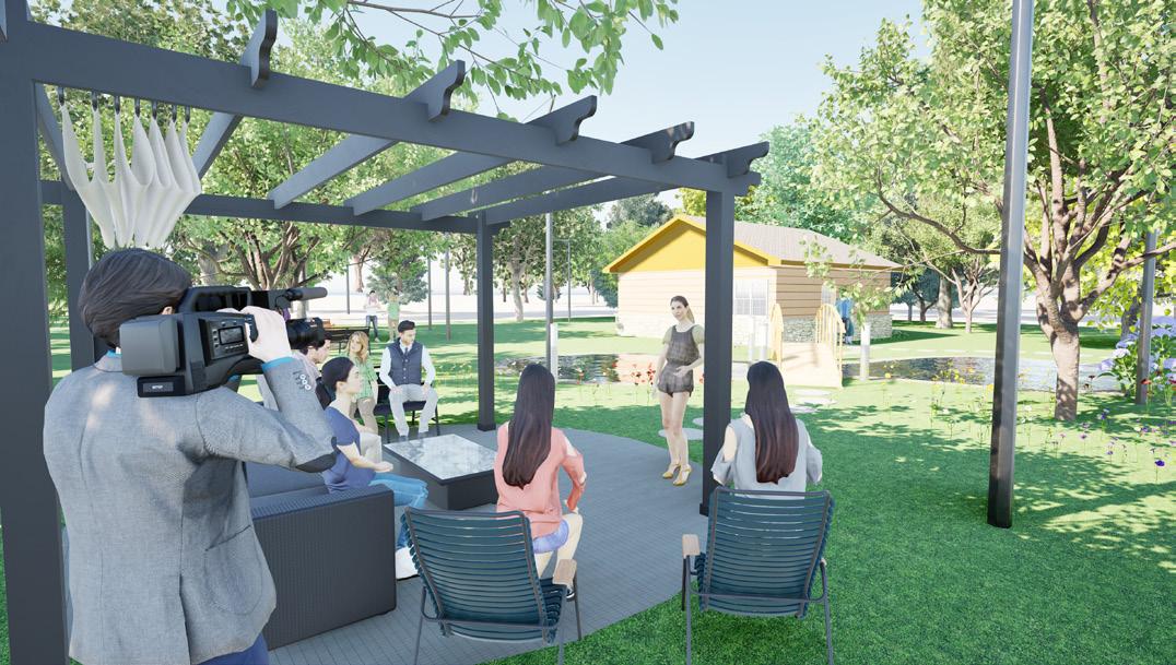
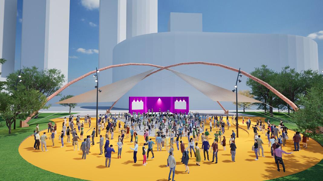
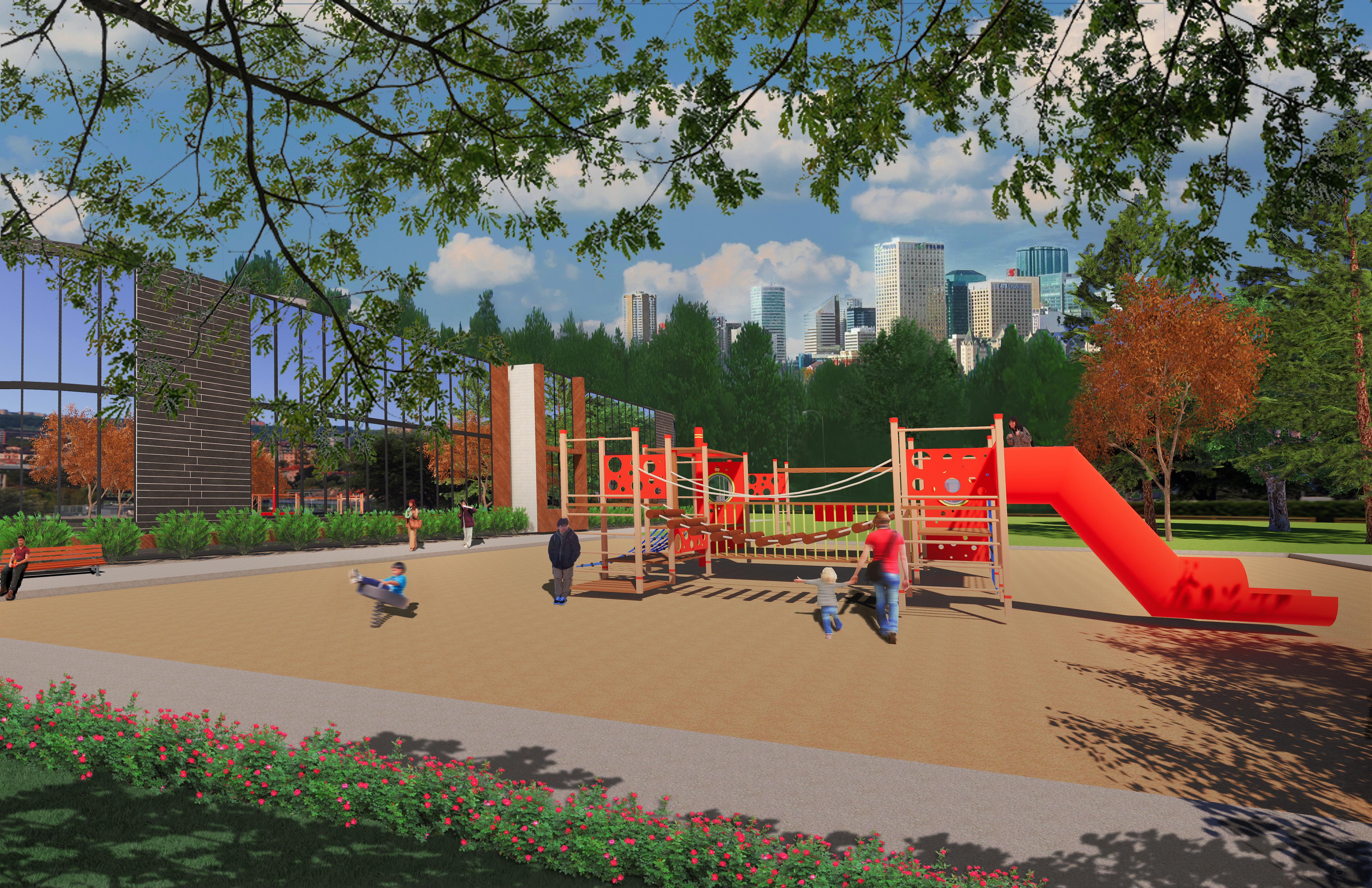
EXTERIOR DAY PERSPECTIVE #1
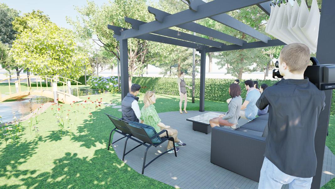
EXTERIOR DAY PERSPECTIVE #2
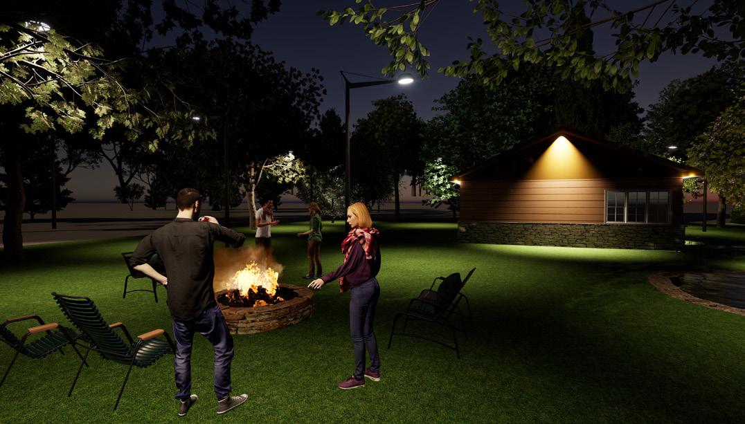
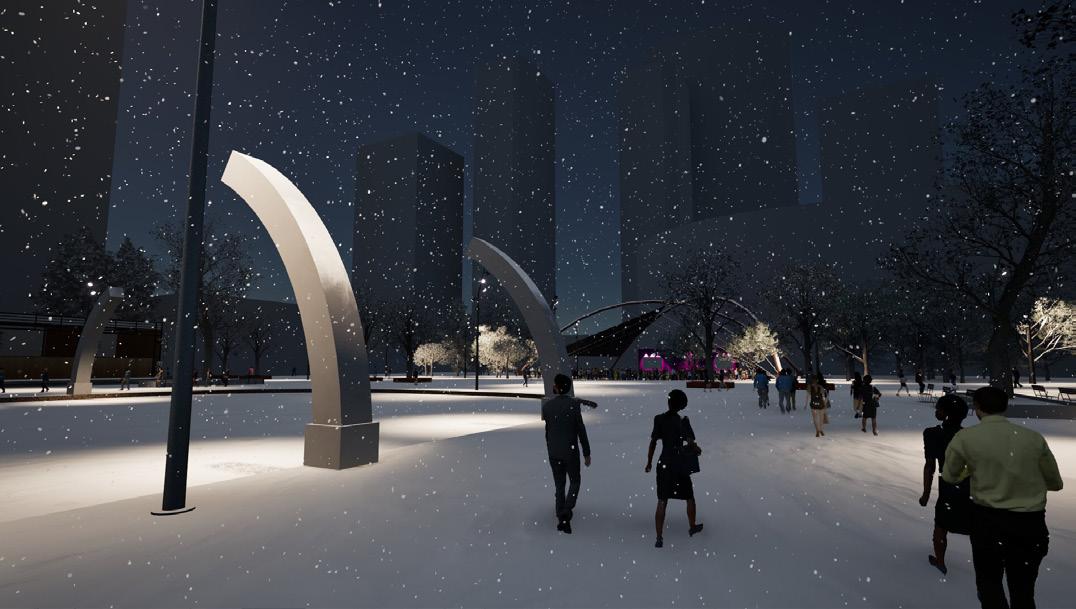
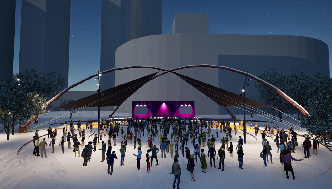
EXTERIOR NIGHT PERSPECTIVE #1
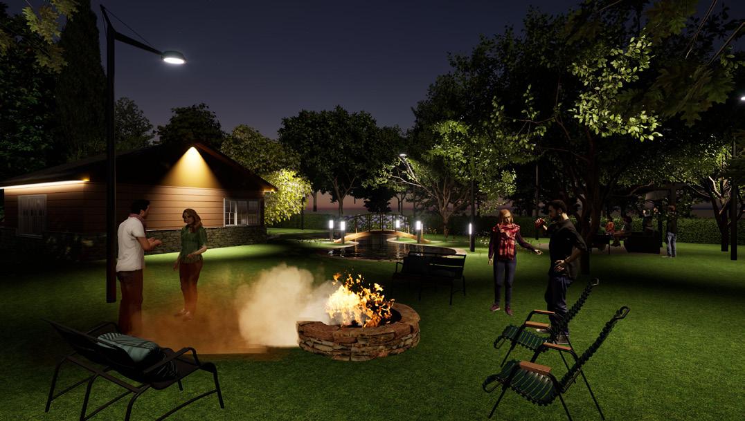
EXTERIOR NIGHT PERSPECTIVE #2
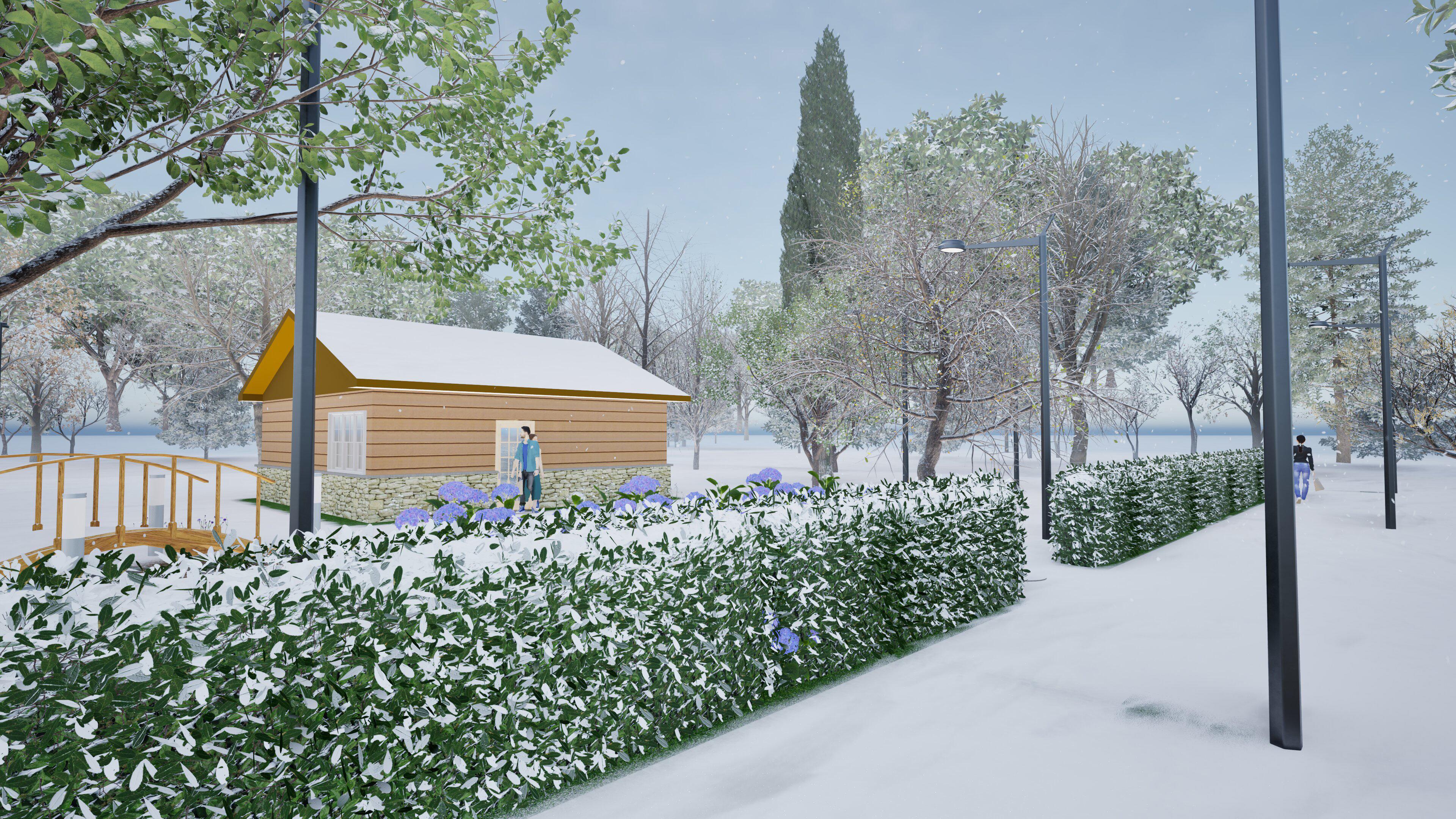
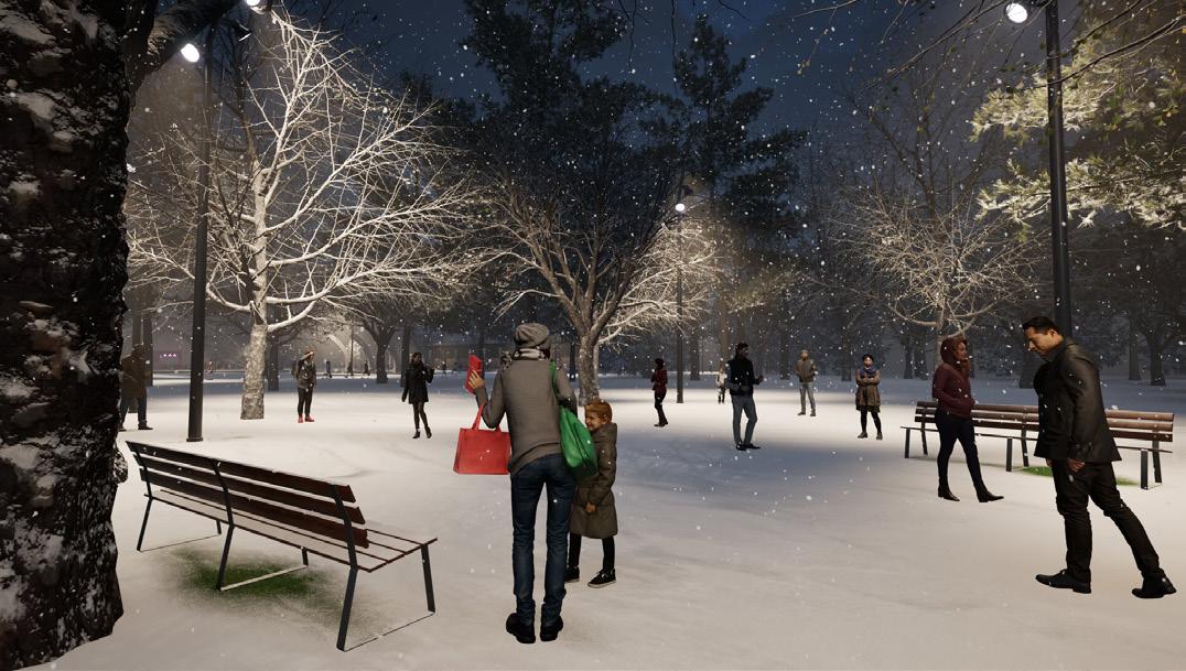
WINTER EXTERIOR PERSPECTIVE
Throughout my time at NAIT, I recognized that hand sketching was one of my weaker skills, which is why it’s featured near the bottom of my portfolio. However, I’m still proud of the work I produced and the progress I made. Despite the challenge, I genuinely enjoyed the process of sketching and found it to be a valuable way to express concepts in a more personal, hands-on manner.
URBAN SKETCHING
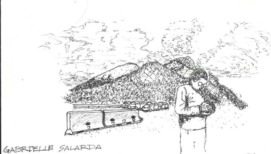
STORY TELLING SKETCH
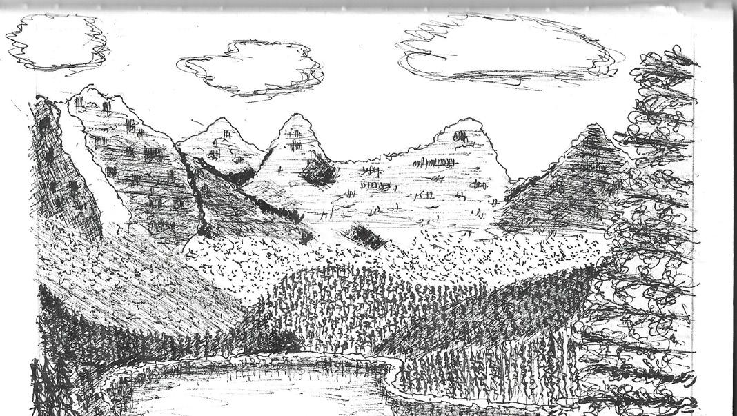
LANDSCAPE SKETCHING
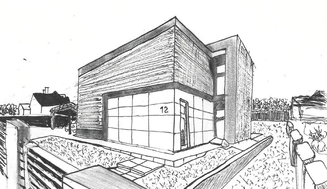
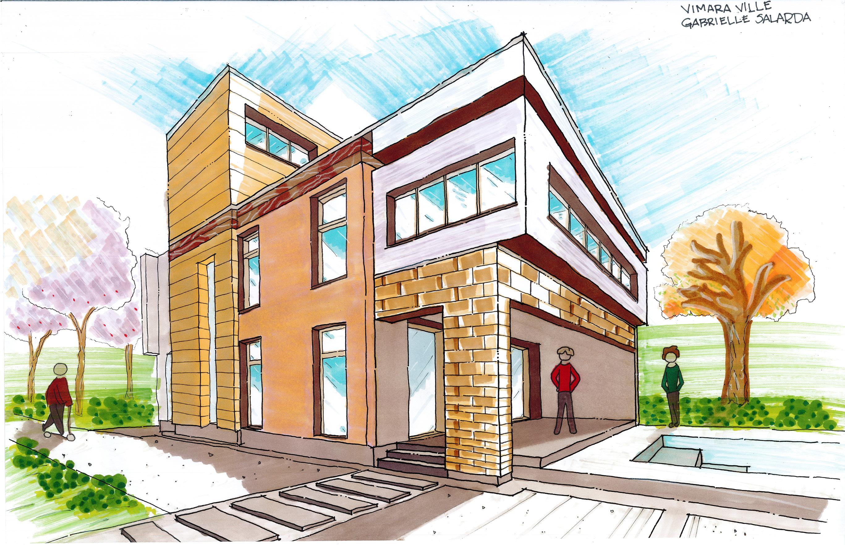
BUILDING PERSPECTIVE SKETCH
OTHER PROJECTS