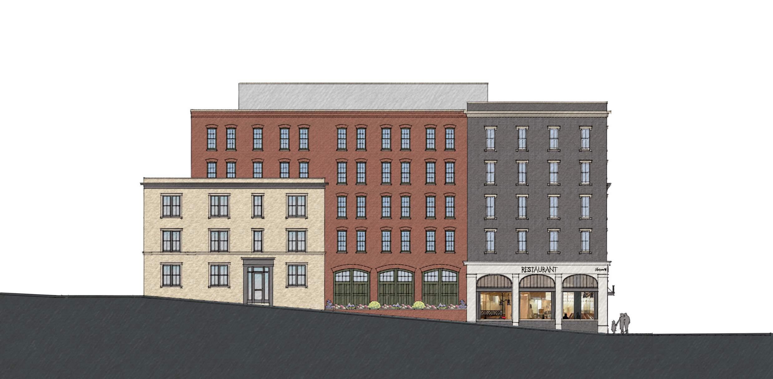
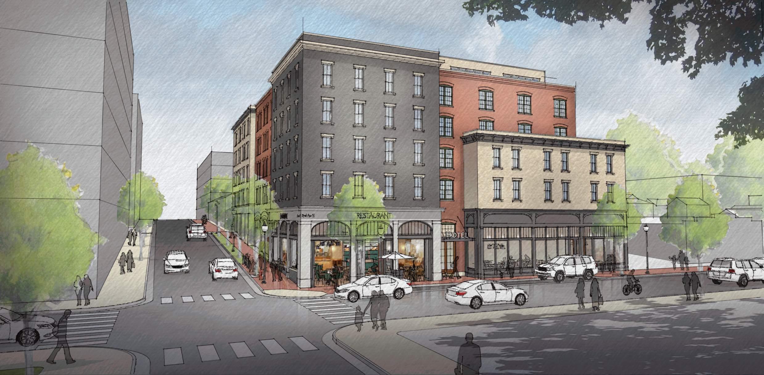
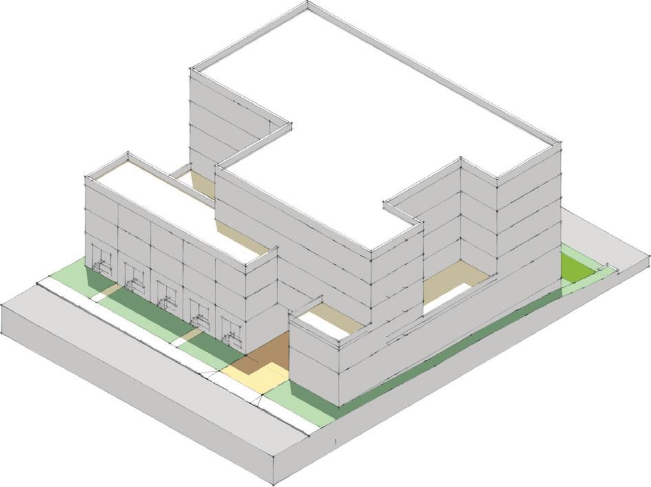
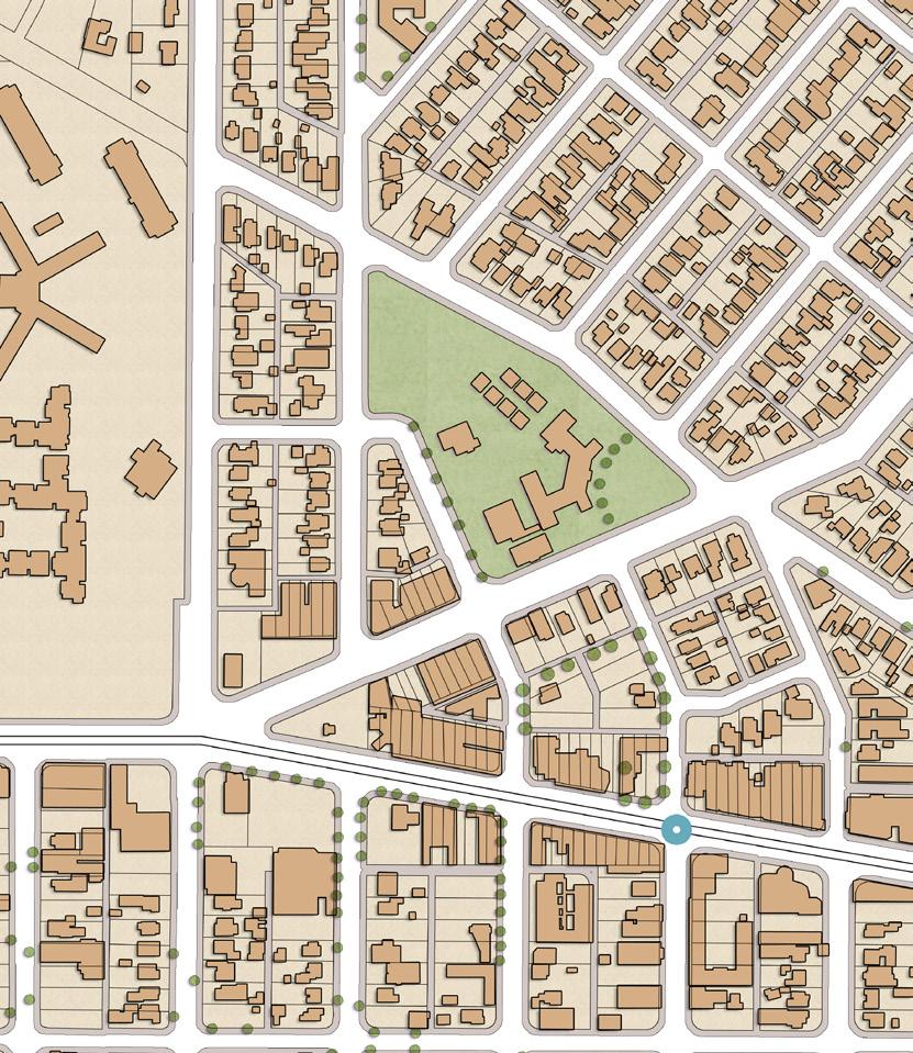
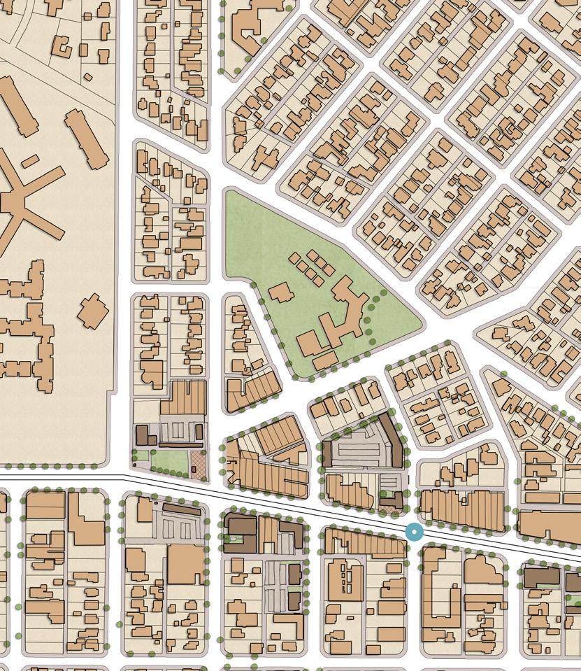
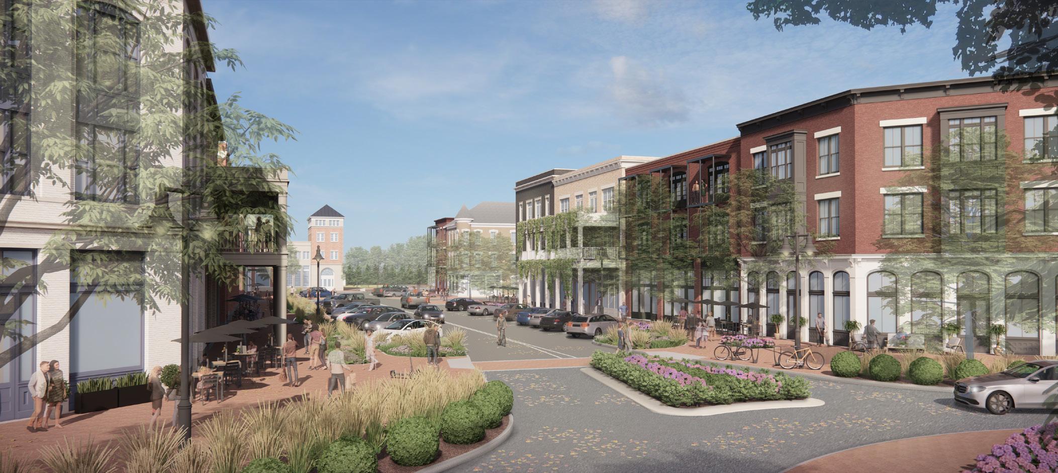
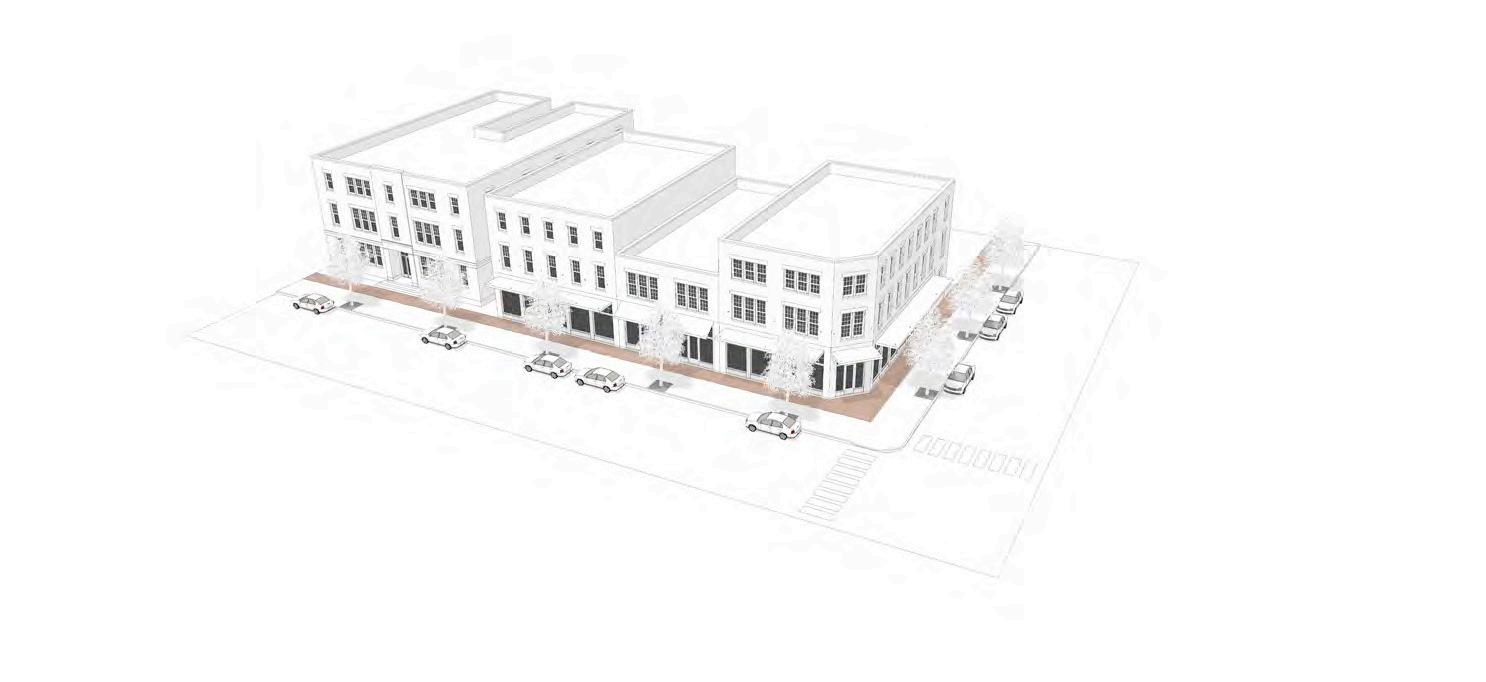
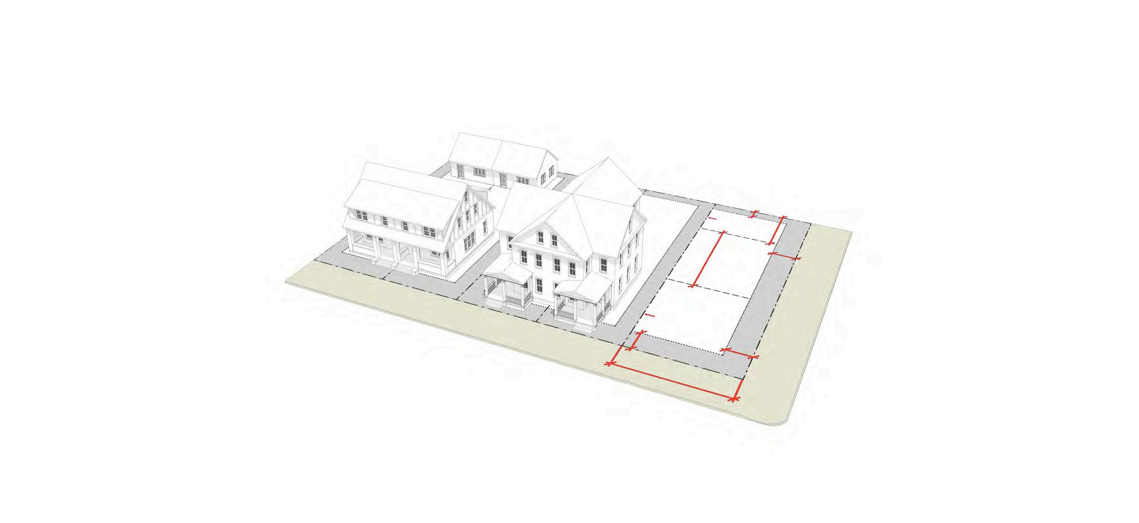
2nd Avenue Boutique Hotel
Urban Infill
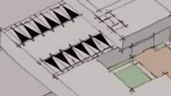
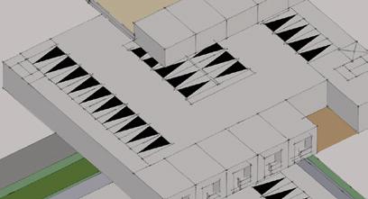
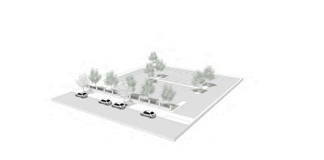
The Historic Germantown neighborhood is one of Nashville’s most walkable mixed-use neighborhoods. The approved plans for the 2nd Avenue Boutique Hotel elegantly combine the neighborhood’s classical and industrial roots into one building. The massing is broken down to fit the historic scale of the remaining contributing character.


LEGEND Arterial Street Historic Context Neighboring Transition Site Proposed Site New Developments Greenway Monroe St Taylor St Adams St 2nd Ave N 4th Ave N 3rd Ave N Peyton Stakes 75’ & Stories 1 Monroe Apts 75’ & 5 Stories 2 CubeSmart 6 Stories 3 2nd Ave SP Stories 4 1414 3rd Ave SP 85’ & 7 Stories 5 1324 2nd Ave N 85’ & 7 Stories 6 LC Germantown Stories 7 Neuhoff Phase 1 8 4 6 6 7 7 7 7 8 1 2 2 3 5 LOBBY KITCHEN BANQUET ROOMS RESTAURANT TENANT OFFICE © 2020 Smith Gee Studio, LLC. # 20057.00 1301 2ND AVENUE NORTH NASHVILLE, TN FLOOR PLANS LOBBY KITCHEN BANQUET ROOMS RESTAURANT TENANT Ground Floor OFFICE ENTERTAINMENT COURTYARD © 2020 Smith Gee Studio, LLC. # 20057.00 © 2020 Smith Gee Studio, LLC. # 20057.00 © 2020 Smith Gee Studio, LLC. # 20057.00 © 2020 Smith Gee Studio, LLC. # 20057.00 © 2020 Smith Gee Studio, LLC. # 20057.00 July 27, 1301 2ND AVENUE NORTH NASHVILLE, TN MONROE STREET ELEVATION © 2020 Smith Gee Studio, LLC. # 20057.00
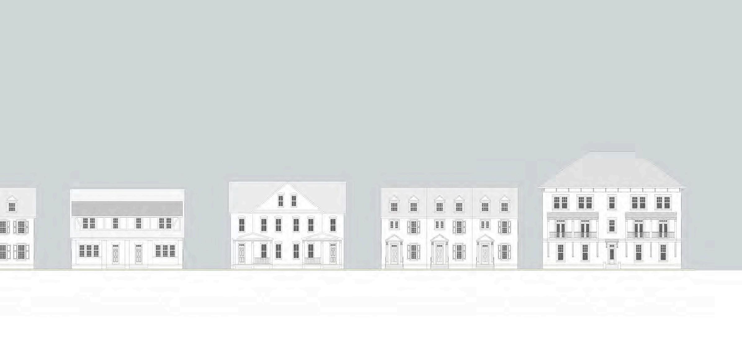
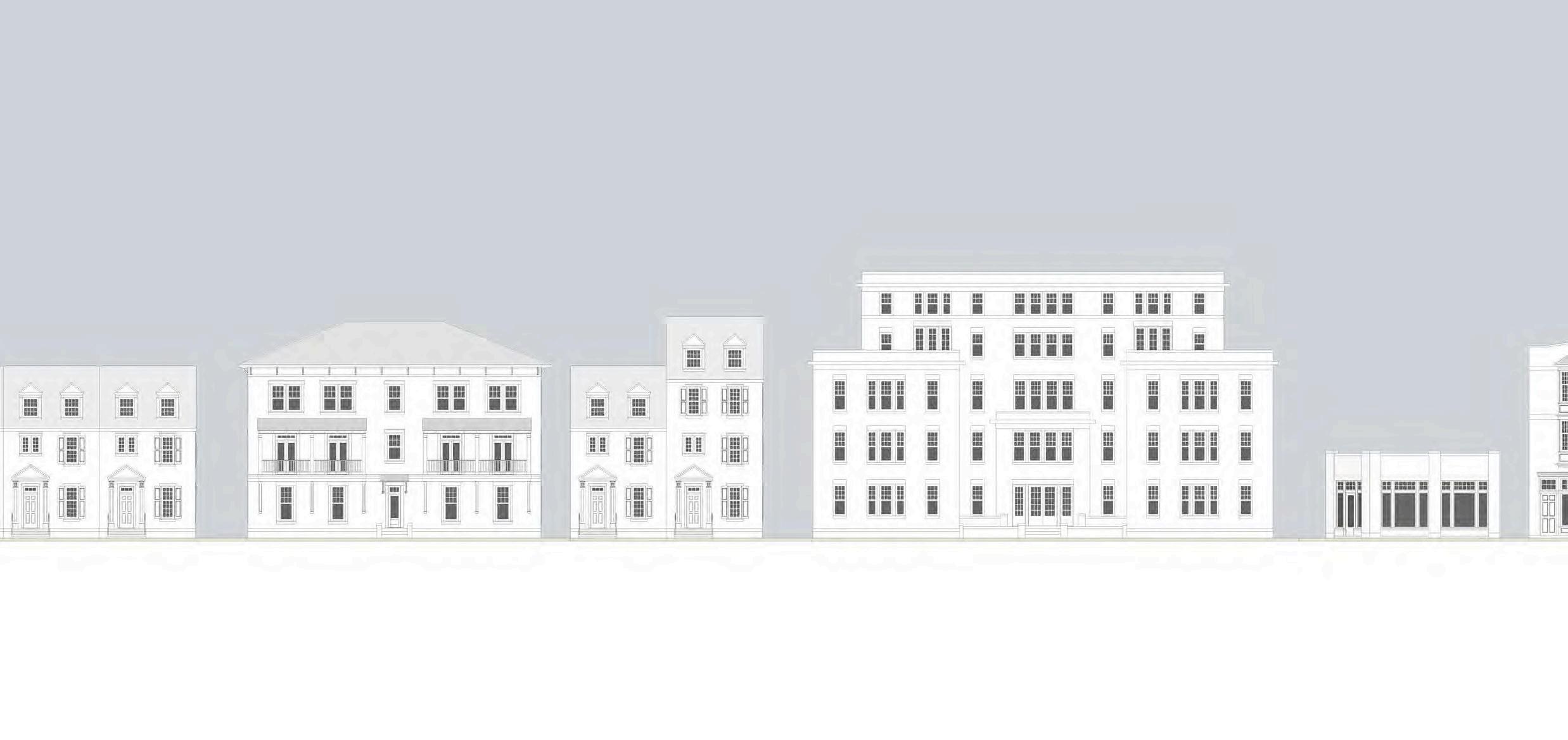
Neighborhood Context Streetside Perspective Axonometric Perspective Building Perspective Front Elevation Side Elevation Level 1 Level 2 Level 3-5
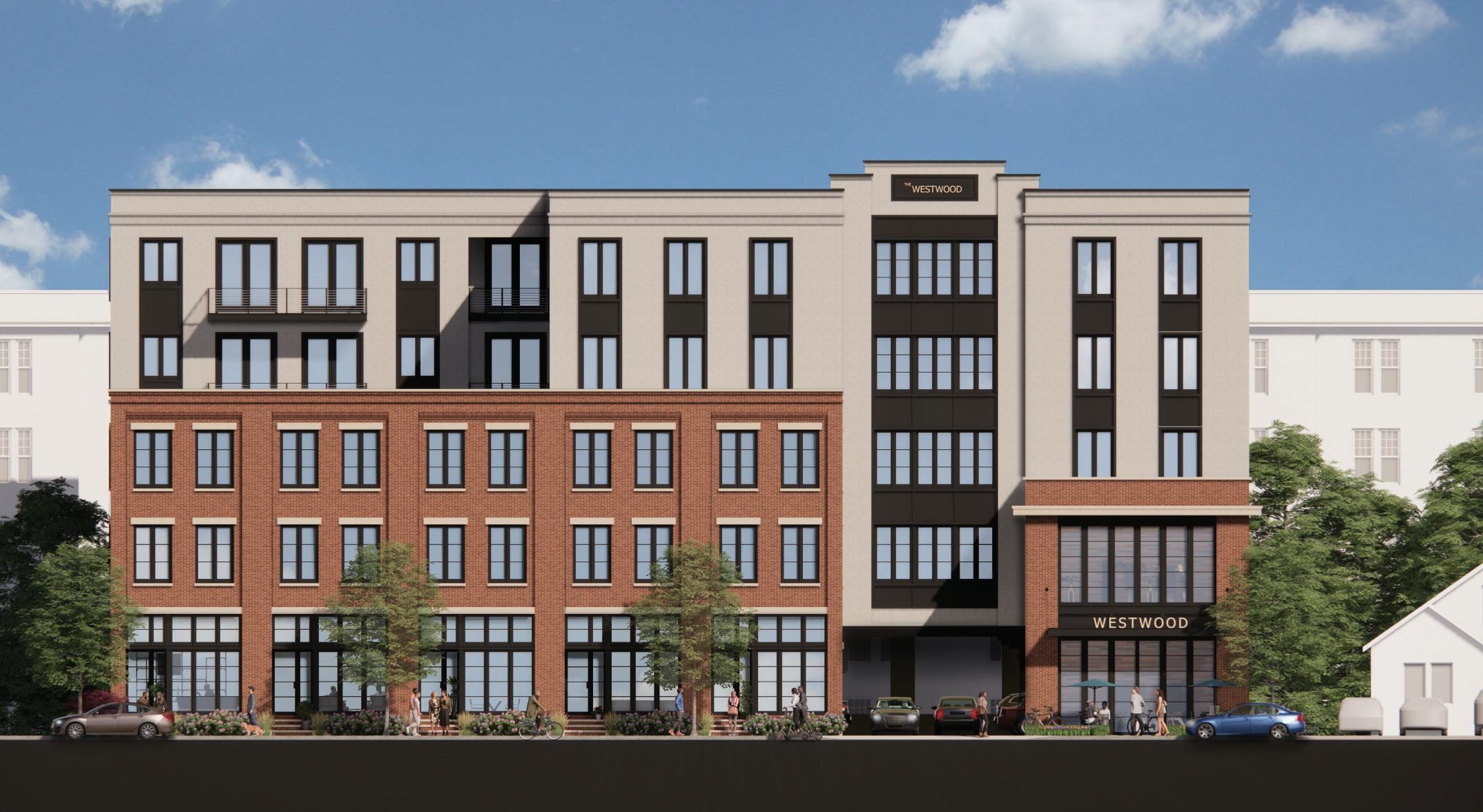
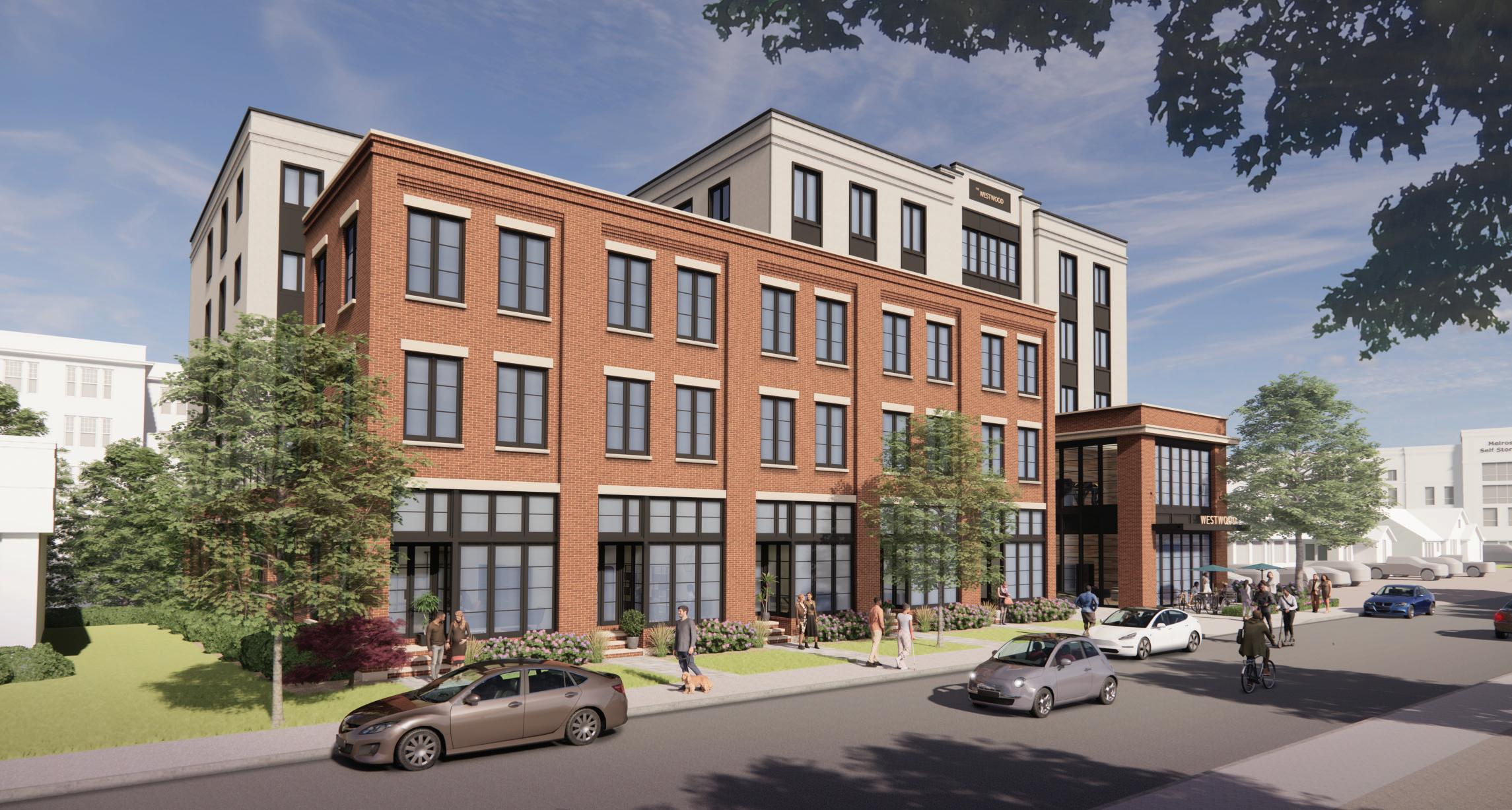
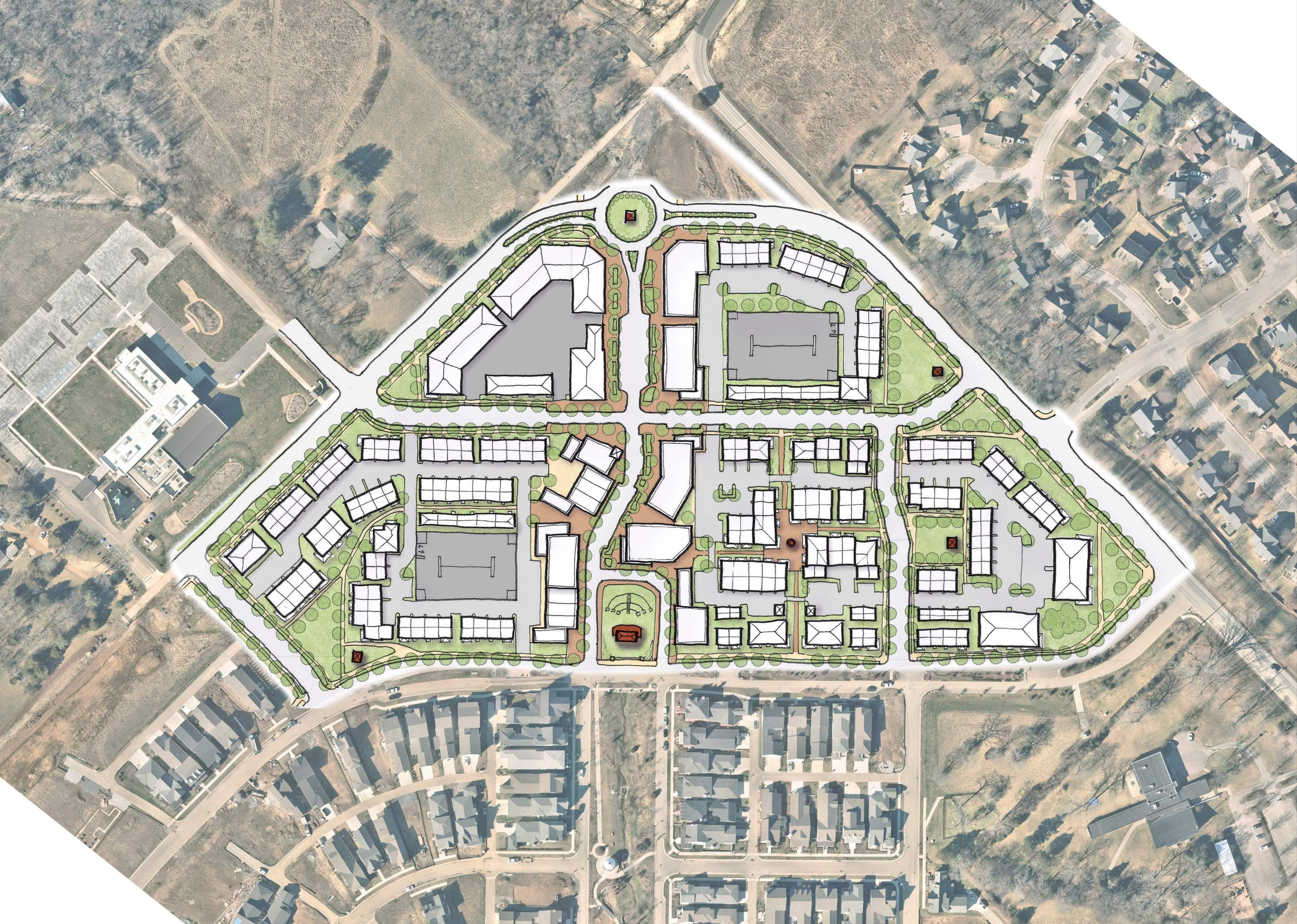
Westwood Drive
Urban Infill

The Westwood offers a different perspective for the standard pattern of multi-family development predominant in Nashville’s Berry Hill neighborhood. The building features live/work units and an amenity space along the street with the split-grade parking located un


Westwood Drive Westwood Drive ood Drive Westwood Drive Level 4 - 15 units - Private terrace - Shared bridge terrace Level 3 - 16 units - Shared bridge terrace Level 2 - 16 units - Shared bridge terrace Level 1 - Commercial Space - Lobby/Amenity - Parking accessed from Westwood Ave. through courtyard Basement Level - Parking accessed from Alley Level 5 - 14 units - Private terrace - Shared bridge terrace Roof - Potentially need green roof for stormwater requirements Bridge Bridge Bridge Terrace Bridge Terrace Courtyard Stormwater Stormwater Terrace Terrace Bridge Courtyard Residential Amenity +526’ +542’ +553’ +564’ +575’ +584’ +595’ Res.Amenity Parking Commercial © 2022 Smith Gee Studio, LLC. # 22005.00 WESTWOOD DRIVE BERRY Level 4 - 12 units - Terrace Level 3 -12 units - 5 Live/Work units - Terrace Level 2 - 12 units - 5 Live/Work units - Shared courtyard - Amenity opening onto terrace Level 1 - 5 Live/Work units - Lobby/Amenity - Parking accessed from Westwood Ave. Basement Level - Parking accessed from Alley Level 5 - 12 units Roof Terrace Terrace Terrace Courtyard Lobby Res. Amenity +602’
WESTWOOD DRIVE BERRY HILL, TN APRIL 28, 2022 © 2022 Smith Gee Studio, LLC. # 22005.00 CONCEPT ELEVATION Initial Concept Study Final Concept Rendered Perspective Concept Elevation
Edmond Mixed-Use
Urban Infill
Nestled in the heart of downtown Edmond, Oklahoma, this innovative mixed-use infill development seamlessly weaves together residential and commercial spaces, embodying a vibrant urban lifestyle. Boasting a harmonious blend of live-work units, narrow townhouses, and charming carriage houses, the project offers a dynamic living experience tailored to diverse needs. With its thoughtfully curated mix of amenities and proximity to downtown attractions, this development sets a new standard for contemporary urban living in Edmond, Oklahoma.


103 N BROADWAY PAGE 2 ARCHITECTURE & DESIGN AUGUST 22, 2023 SITE PLAN 10 20 30 40 50’ SCALE: 1”=20’-0” LW-1 2,400 SF MIXED-USE BDLG 10,860 SF LW-2 2,200 SF ADU-2 440 SF ADU-3 720 SF ADU-1 480 SF MICRO-RETAIL 100 SF LW-3 2,200 SF TH-2 1,070 SF TH-1 1,070 SF TH-1 COURTYARD COURTYARD LW-1 TERRACE ABOVE LW-1 SEATING/ FLEX AREA LW-2 SEATING/ FLEX AREA LW-3 SEATING/ FLEX AREA LW-2 TERRACE ABOVE SHARED COURTYARD 4 HURD STREET NORTH BROADWAY EXISTING ALLEY COMMON COURTYARD 105 N BROADWAY COVERED CAR BARN ON-STREET PARKING SIDEWALK DINING AREA COVERED CAR BARN PARKING COURT LW-3 PARKING LW-2 PARKING LW-1 PARKING TH-2 TH-1 DUMPSTERS ELEC. TRANS. FLUSH CURB 20’ 30’ 5’ 7’ 6’ 5’ COVERED PASEO ENCLOSED ON-SITE STORAGE @ GROUND LEVEL
Master Plan Townhouse Perspective
Corner Perspective
Paseo & Courtyard Perspective
Live / Work Perspective
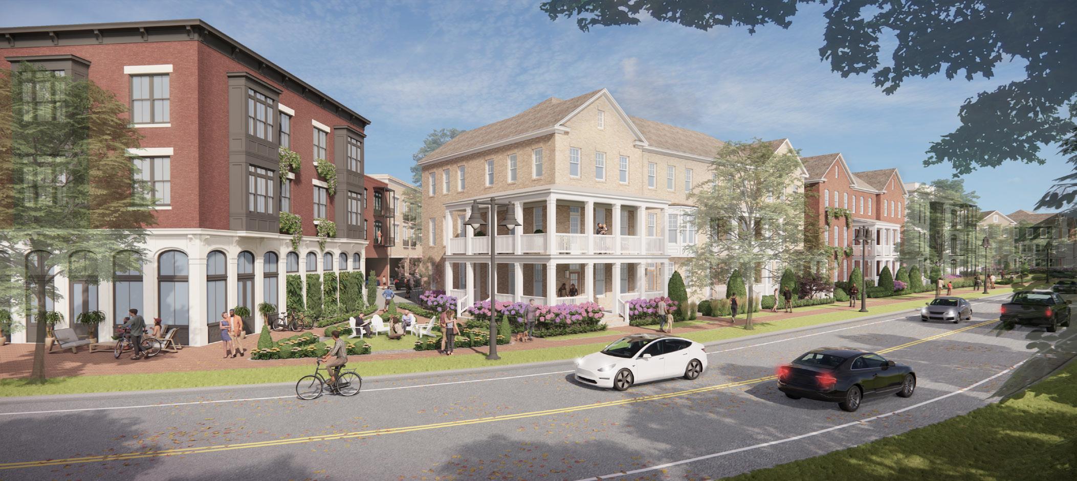
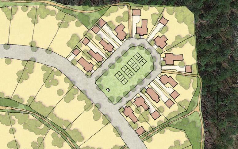
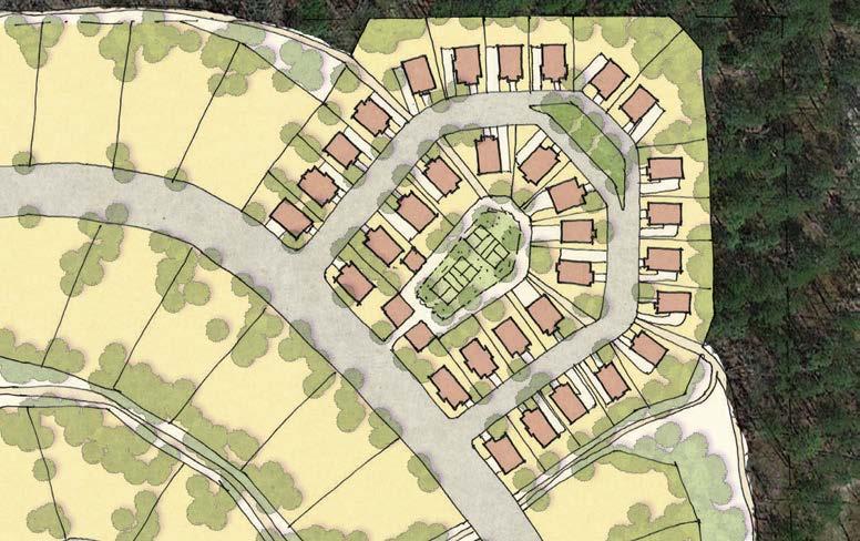
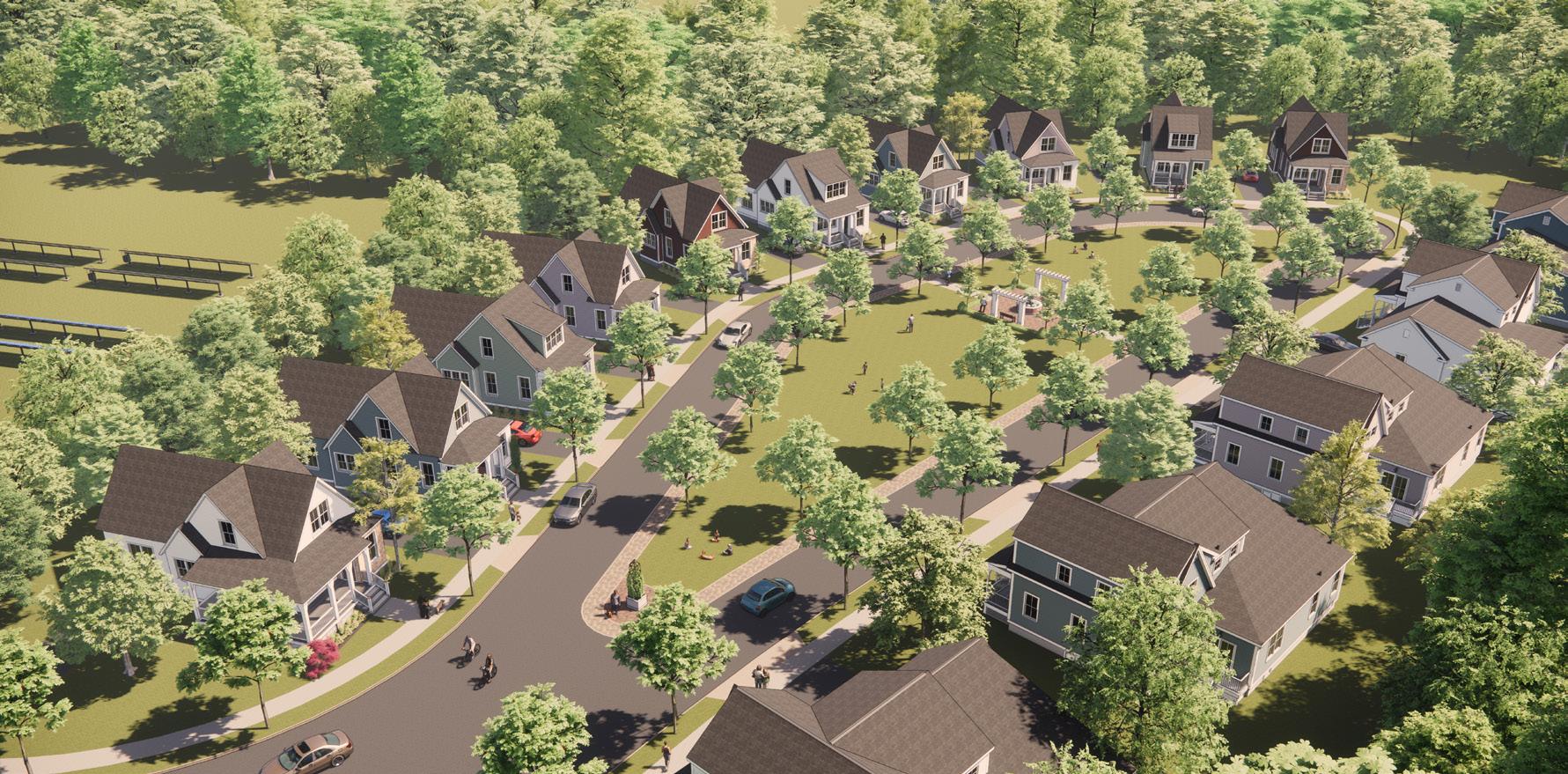
The Ember
Pocket Neighborhood
The Ember offers a variety of thoughtfully designed homes, from studio cottages to four bedroom homes, fostering a sense of belonging for residents of all ages. With inviting communal spaces like neighborhood parks and fire pits, as well as close proximity to downtown amenities, The Ember is more than just a place to live – it’s a sanctuary where neighbors become family, and every day brings new opportunities for connection and relaxation.


Aerial
Perspective
Central Green Perspective
Pedestrian Path Perspective
Master Plan
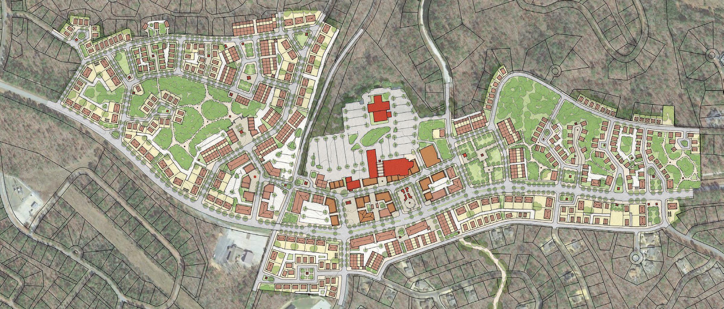
Chattanooga Westside Affordable Housing

The CNU Charter Award winning Chattanooga Westside District represents a model for affordable housing in the United States. The adopted plans allow for the densification of barrack-style post-war public housing while offering residents a replacement unit without having to first move out of the community and then move back in. The pandemic offered unique outreach challenges that were partially overcome with virtual design sessions featuring live action 3D modeling with resident’s input in real time.

 Boynton Terrace Virtual Community Input Before & After
The Lawn Virtual Community Input Before & After
Boynton Terrace Virtual Community Input Before & After
The Lawn Virtual Community Input Before & After
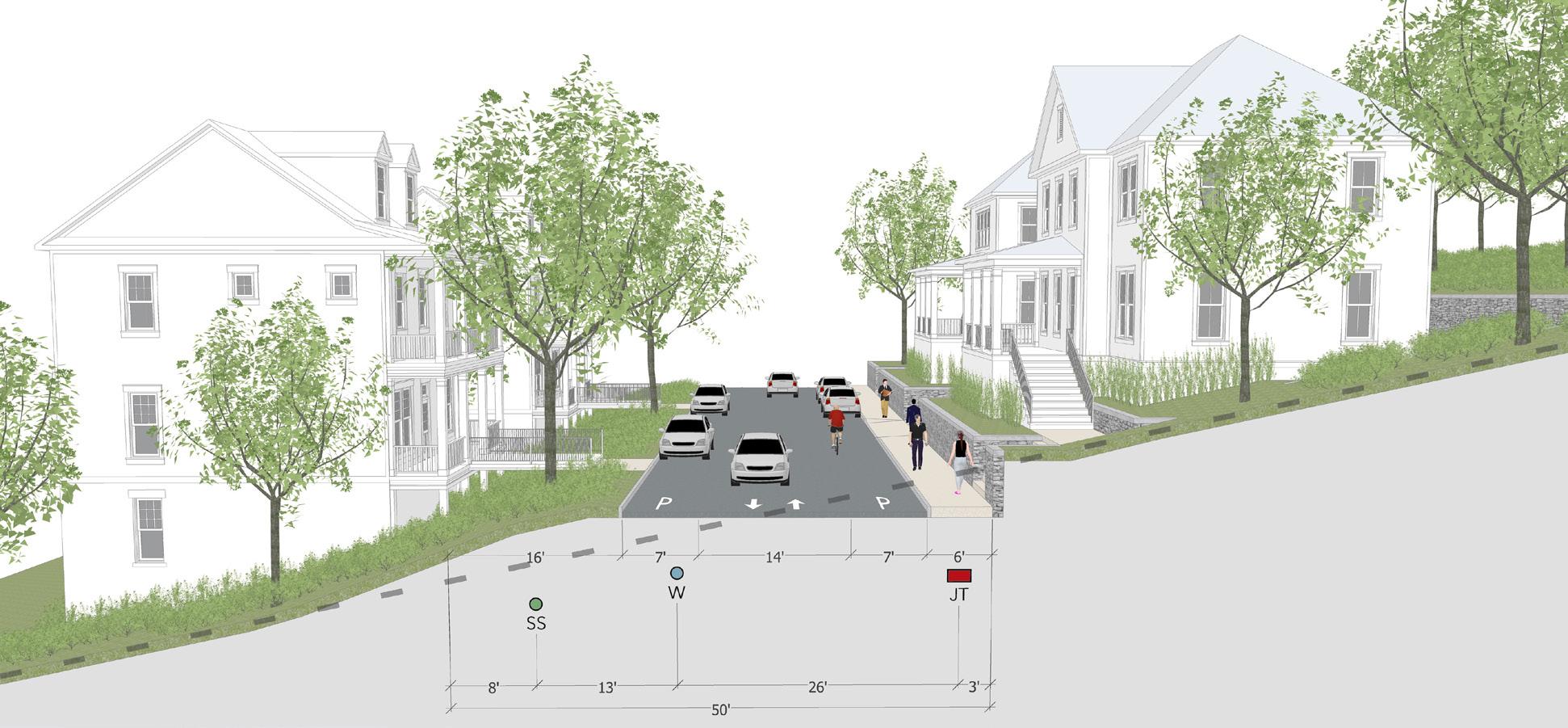
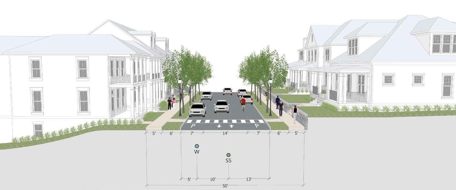
Kirkwood Neighborhood Revitalization
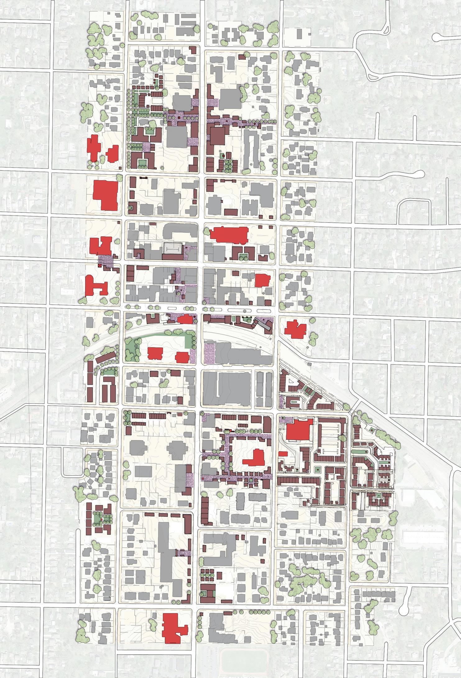
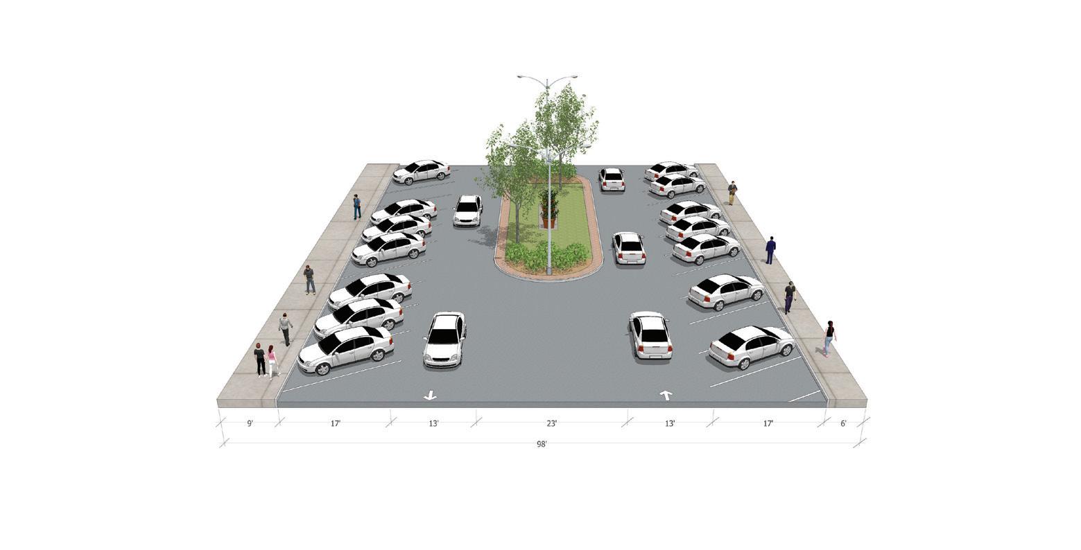
Kirkwood, MO is a traditional small town outside of St. Louis that has suffered from car-oriented development. Analyzing the existing area proved shared parking would create an abundance of infill opportunities. Strategic streetscape improve ments civilize public space and encourage walkability.
Proposed Section 2
W Argonne Dr

Proposed section 2 characteristics

Remove the angled parking and replace it with parallel
The median is widened to allow it to be used by pedes trians. It may also permit a small ‘jewel’ building to be
The sidewalks in this option are thus permitted to be 3x wider than the existing section.


STREET
98’
Clay Ave Kirkwood Rd Harrison Ave Taylor Ave Fillmore Ave Study Area Boundary Proposed Buildings Civic Buildings Argonne Dr Jefferson Ave Adams Ave Washington Ave Bodley Ave Madison Ave Monroe Ave are proposed on the following pages. Downtown Kirkwood Master Plan Interim Report 15 © 2017 DPZ Partners EXISTING CONDITIONS FRONTAGE SuRvEy Clay Ave Kirkwood Rd Harrison Ave Taylor Ave Fillmore Ave Argonne Dr Jefferson Ave Adams Ave Washington Ave Orrick Ln Bodley Ave Madison Ave Monroe Ave Woodbine Ave Clinton Pl Scott Ave Study Area Boundary Commercial Properties Good Frontage Fair Frontage Poor Frontage N ANALYSIS MAP Downtown Kirkwood Master Plan Interim Report 5 © 2017 DPZ Partners EXISTING CONDITIONS OPEN SPACE Study Area Boundary Open Space Open space is more prevalent in the downtown core, which illustrates the potential need for additional open space in the north and south extents of the downtown. N Clay Ave Kirkwood Rd Harrison Ave Taylor Ave Fillmore Ave Argonne Dr Jefferson Ave Adams Ave Washington Ave Orrick Ln Bodley Ave Madison Ave Monroe Ave Woodbine Ave Clinton Pl Scott Ave Pocket Park Park Plaza 4 Downtown Kirkwood Master Plan Interim Report return to TOC EXISTING CONDITIONS STREET NETWORK Kirkwood generally has a well-connected street grid throughout the downtown area, particularly around the train station, where the scale of the blocks are substantially smaller then the larger blocks to the north and south. The average block perimeter within the downtown core is 1,800 ft, whereas the average block perimeter of the blocks outside the downtown core measure 3,300 ft. Study Area Boundary Street Network N Clay Ave Kirkwood Rd Harrison Ave Taylor Ave Fillmore Ave Argonne Dr Jefferson Ave Adams Ave Washington Ave Bodley Ave Madison Ave Monroe Ave Woodbine Ave Clinton Pl Scott Ave Orrick Ln 8 Downtown Kirkwood Master Plan Interim Report return to TOC EXISTING CONDITIONS SuRFACE PARKING The downtown has an over-abundance of land devoted to parking, with both surface and structured parking facilities. More information is provided in the “Parking Study” on page 105. N Clay Ave Kirkwood Rd Harrison Ave Taylor Ave Fillmore Ave Argonne Dr Jefferson Ave Adams Ave Washington Ave Bodley Ave Madison Ave Monroe Ave Clinton Pl Scott Ave 320 310 Study Area Boundary Surface Parking Lots (62.5 ac) Structured Parking Woodbine Ave
Strategic Infill Master Plan Frontage Analysis Parking Analysis Existing Street Network Existing Open Space 160 Downtown Kirkwood Master Plan Interim Report return to TOC STREET SECTION ANALySIS Existing Section Proposed Section 1 Existing W Argonne Dr
Proposed
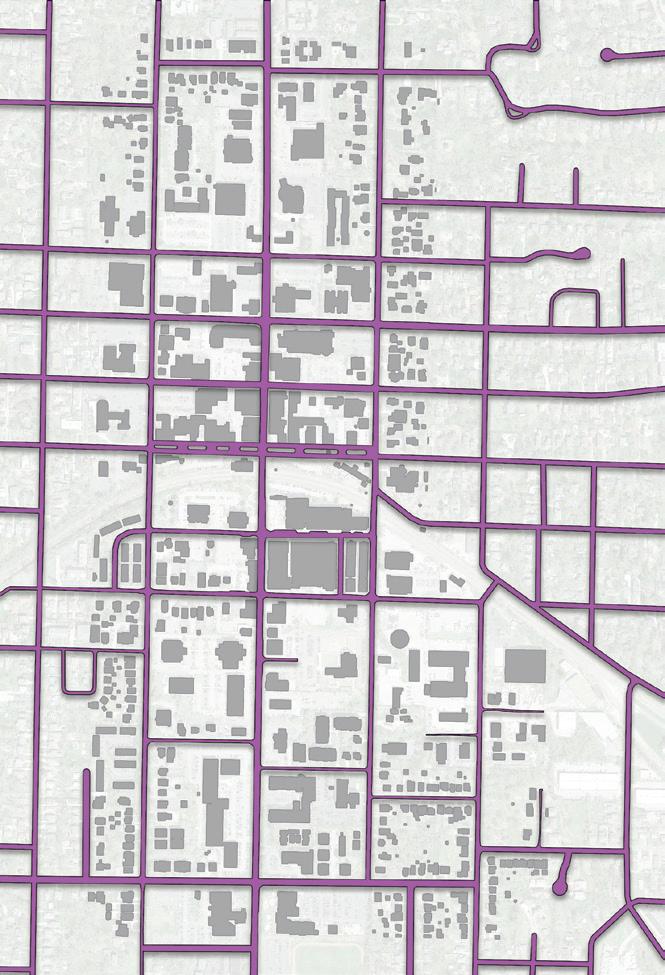
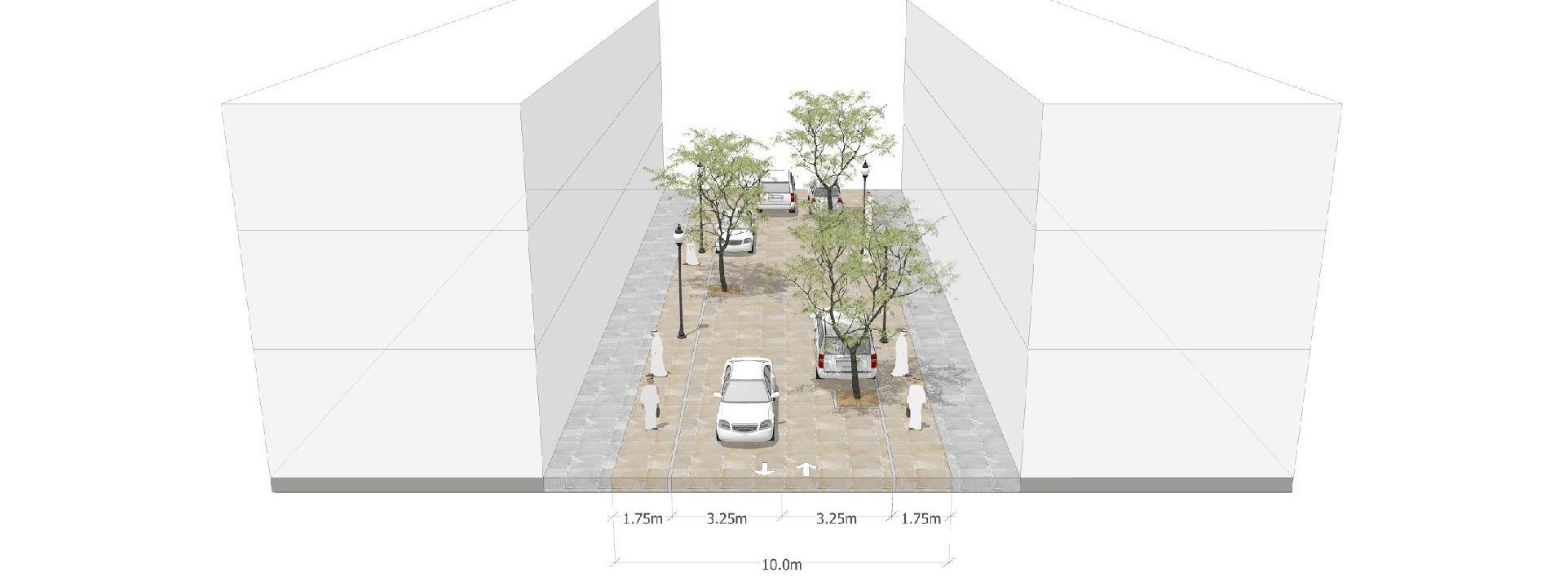
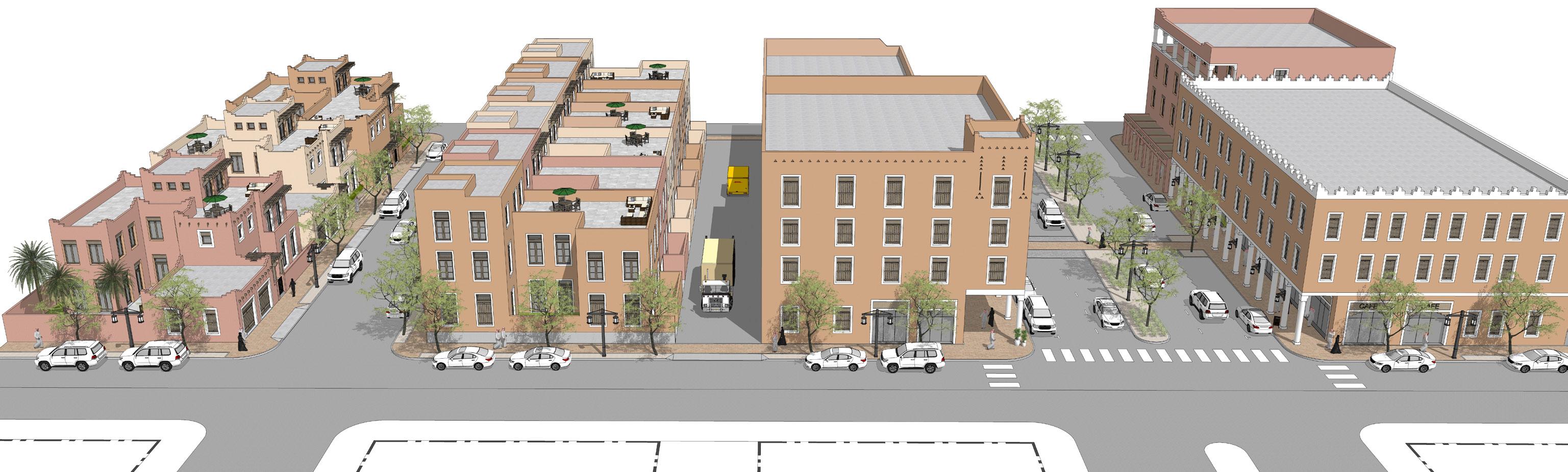
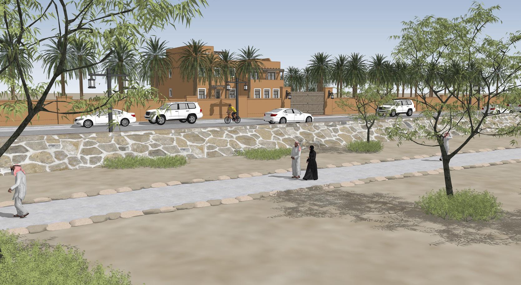
Central Riyadh
Transit Oriented Development
Supplemental Drawings and Images
Proposed Buildings
Supplemental Drawings and Images
Proposed Buildings

Precinct Planning – North Precinct
Thoroughfares: Local Street – proposed upgrade condition


Saudi Arabia’s capital city has suffered from years of disinvestment in the historic core. The addition of 176 km of metro rail spurred interest in strategically redeveloping key areas in central Riyadh. Reintroducing narrow shaded pedestrian passages in between blocks and the greening of streets invites pedestrians to return to the city’s many souks and historical sites.

Create meaningful pedestrian connections Additional Graphics Thoroughfares: Local Street existing condition Adding trees to help delineate opportunistic parking and
RequiredSetback RequiredSetback
Existing Buildings Proposed Buildings
Existing Buildings Proposed Buildings Axon Views of Study Area Proposed Shared Street Proposed Neighborhood Street
Midblock Passage Perspective
the existing lanes street redesigns median, provide an lane and two 10lanes. This leaves additional width that strip between the for street trees and lighting.
Albuquerque
NOB HILL
Transit Oriented Development unused right-of-way along the east side which is fronted by large tracts of vacant land primarily between MLK and Lomas. This additional right-of-way could provide an opportunity for the use of a tram which could serve as a circulator connecting the heart of EDo, Downtown and Old Town together again. There is also room to
provided to address the stopping within travthe ART bus is in version locates ART local busses could stop efficient for ticketing and convenient for riders.
EXISTING
The existing condition of University Boulevard is automobile oriented and does not support active uses, pedestrians, or cyclists. University is slated for a future expansion of ART, which has not been designed.
Route 66 is one of the best known American highways. Running through Albuquerque, it divides the city and is frequently congested with car traffic. The addition of a BRT line and associated streetscaping creates redevelopment opportunities along the major east-west arterial through the city. Strategic infill plans were created for areas surrounding key BRT stations showing the opportunities that existed by merely filling in and shielding existing parking lots and strip malls. Taking advantage of left over land allows the city to maximize the return on existing infrastructure and minimize the creation of more sprawl.
U.15 University ART Route

In considering a future ART route, area residents stated a desire to retain the planted median that currently exists. There are currently too many vehicular travel lanes that are too wide, and that the sidewalk is unprotected from speeding traffic and interrupted by light poles. Because the existing lanes are each 12 feet wide, the street redesigns both retain the 16-foot median, provide an 11-foot dedicated ART lane and two 10foot wide vehicular travel lanes. This leaves four to five feet of additional width that can provide a landscape strip between the sidewalk and travel lanes for street trees and pedestrian-scaled lighting.
U.16 University Preferred ART Route
BUENA VISTA & GOLD INFILL
Two alternatives are provided to address the concern of local busses stopping within travel lanes at the curb when the ART bus is in the center. The second version locates ART along the curb where local busses could stop as well. This is less efficient for ticketing and boarding platforms but is convenient for vehicular traffic and riders.
The ability to sensitively infill the corner parcel at Buena Vista and Gold was questioned by neighbors who have seen proposals they do not like. The site was analyzed and a quick building footprint developed that would accommodate up to 28 units in four floors or about 20 units in three floors. The ground floor has parking partially tucked-under with two ground floor units and the remaining units above. See plan on the left.
PROPOSED


YALE INFILL NEAR COAL
Residents raised concern for an infill development proposal on a lot along Yale Boulevard near Coal. The proposal was for a drive-through establishment. Residents did not want to see this type of development and requested an analysis of development potential for the site. Being zoned mixeduse, the analysis found that 12 units plus up to 38,000 square feet of non-residential could be developed on the site in a mixeduse format, within a three story building.
BUENA VISTA & GOLD INFILL
The ability to sensitively infill the corner parcel at Buena Vista and Gold was questioned by neighbors who have seen
Residents raised concern for an infill development proposal on a lot along Yale Boulevard near Coal. The proposal was
E.14
6 Buena Vista Dr
7 U.14 University Existing Conditions U.15 University ART Route U.16 University Preferred ART Route
6
Central Ave
YALE INFILL NEAR COAL
7
Central Bus Lane
Flanking Bus Lanes
Proposed Rail Line Revitalization
Stephens Valley Town Center

The town center is the long awaited mixed-use community heart for the new traditional Stephens Valley neighborhood. The deflected vista of the Main Street creates visual interest, drawing pedestrians through the site to the square. The breaking down of the parking lots allowed for a mix of product type through pedestrian paseos.

Master Planning D C B A F 4 4 4 4 4 5 5 5 5 6 6 6 6 7 7 7 8 8 8 9 9 9 10 10 11 11 12 12 13 13 14 15 15 16 17 1 1 1 1 1 2 2 2 2 2 3 3 3 3 3 # 59,110 sq ft 29,767 sq ft 88,877 sq ft 201 units Units 20 Units 12 Units 14 Units Units 82 Units 31 Units Units 387 Units 1158 sp 290 sp 868 sp 1109 sp PASQUORD NUNAHITR UNIONBRIDGERD TIMBERGAPDR MERRYWEATHER BLVD ST STEPHENS VALLEY BLVD © 2021 Smith Gee Studio, LLC. # 19065.00 March 26, 2021 Stephens Valley TC Nashville, Tennessee MAIN STREET ANGLED PARKING SECTION
Concept Master Plan
Main Street with BioRetention Swale
Pasquo Road Perspective
Main Street Perspective
Pedestrian Paseo Perspective
Pedestrian Paseo
Pedestrian Paseo
Clore Farm
Master Planning
Located outside of Louisville, Clore Farm presents itself as the location of Kentucky’s newest small town. The site presented many challenges, including an interstate highway, state highway, and major topographic challenges. Embracing the topography created a dramatic plan with sweeping views to adjacent hamlets and the preservation of an old-growth forest. Preserving the legacy of the farm was achieved by creating a farmer’s market in the historic tobacco barn and integrating the farmhouse into the neighborhood. Existing waterways are celebrated with generous green buffers creating sprawling greenways throughout the site.

from all previous plans, along with a greater attention paid to the detail of each parcel. Green fingers are integrated into the irregular plan’s topography-derived block pattern. A looped town center spans the southeast and central parcels. And the topography of the creek’s edge defines the overall development footprint. The remainder of this section further details the master plan.


Town Center Loop
SIDEWALK
Clore Farm © 2019 DPZ CoDesign 58 Draft 03/11/19 Commercial 60’ Right of Way Street Types Typical Adjacent Alley Clore Farm © 2019 DPZ CoDesign 62 Draft 03/11/19 Yield Street Street Types Typical Adjacent Alley Clore Farm | © 2019 DPZ 64 Draft 03/11/19 Edge Street 50’ Right of Way Street Types
Master Plan Hillside Neighborhood Street Section Mixed-Use Main Street Section Neighborhood Street Section
Hot
Springs Village Sprawl Repair
Hot Springs village is the largest gated community in North America. Planning a vibrant town center


PROPOSED PLAN
and creating densification strategies for the existing suburban conditions would allow residents to enjoy a town center without driving upwards of 10 miles to merely reach the community entrance. The addition of a mix of building types allows for elderly residents to remain in their community without the maintenance of large lots.


D EVELOPMENT S TRATEGIES
0’ 100’ 200’ 400’ pl A n CA p AC i T ie S Commercial / Retail 109,000 sf
72 DRAFT 12/19/17 Ho Sp R ing S Vill ge C HARR TT Summ AR ©2017 D o ign + CRAFT on ull D EVELOPMENT S TRATEGIES T o W n C en T e R EXISTING PLAN
Master Plan Existing Site 54 DRAFT 12/19/17 Ho T Sp R ing S Vill A ge C HARR TT e Summ AR y ©2017 D p C o D S ign CRAFT on T ull EXISTING PLAN PROPOSED: LARGE CLOSE PROPOSED: LOOP ROAD DRAFT 12/19/17 Ho T Sp R ing S Vill A ge C HARR e TT e Summ AR y ©2017 D p Z C o D S ign CRAFT on ull PROPOSED: TOWER LOOP PROPOSED: COTTAGE COURTS DRAFT 12/19/17 Ho Sp R ing S Vill A ge C HARR e TT Summ AR y ©2017 D p Z C o D e S ign + CRAFT on T ull PROPOSED: TOWER LOOP PROPOSED: COTTAGE COURTS DRAFT 12/19/17 Ho T Sp R ing S Vill A ge C HARR TT e Summ AR y ©2017 D p C o D e S ign + CRAFT on T ull 54 DRAFT 12/19/17 Ho Sp R ing S Vill A ge C HARR e TT e Summ AR y ©2017 D p C D e S ign + CRAFT on ull EXISTING PLAN PROPOSED: LARGE CLOSE PROPOSED: LOOP ROAD Densification Studies
Lower Merion Township
Form-Based Code
Lower Merion Township, located on the Main Line in Philadelphia, is known for beautiful historic architecture with convenient light rail access to the center city. The adoption of a form-based code allows for future development to be more in keeping with the existing character while eliminating unpredictable zoning challenges for builders.


ARTICLE 155-6: SPECIAL DISTRICTS 204 TABLE 6.9 RESIDENTIAL BUILDING TYPES MC BMMD RHR BMV R (1) R (2) R (1) R (2) R (1) ARTICLE 155-8: PARKING 244 ARTICLE 155-3: GENERAL TO DISTRICTS 55 SURFACE Maximum setback of 12 feet. 50% minimum shall be landscaped in MDR1, MDR2, and MDR3 and up to 100% may be paved in VC and TC. WALKWAYS Minimum one per frontage providing access to building entries. ILLUSTRATION SURFACE Maximum setback of 12 feet. 50% minimum shall be landscaped in MDR1, MDR2, and MDR3 and up to 100% may be paved in VC and TC. WALKWAYS Minimum one per frontage providing access to building entries. FENCING Frontage fencing is not permitted. Frontage facade, side, and rear fencing is permitted according to Section “155-3.7 Fences and Walls”. SURFACE Shall be paved at sidewalk grade, and trees in grates or tree pits. FIGURE 4.1.4 LDR4 FORM ILLUSTRATION ���� Single-Family LDR4 height publicsidewalkprivatelot right-of-way ���� Twin MDR1 height publicsidewalkprivatelot right-of-way FIGURE 4.2.3 MDR3 FORM ILLUSTRATION ARTICLE 155-4: DISTRICT SPECIFIC STANDARDS 95 FIGURE 4.3.1 VC FORM ILLUSTRATION ���� Village Center height street publicsidewalk privatelot Setbacks right-of-way
Low Density Residential Medium Density Residential High Density Residential Village Center Mixed-Use
Wadi Hanifa
Form-Based Code Levels of Architectural Controls
(T1), and Wadi Farm (T2). On the plateaus and for existing and new neighborhoods, there are three proposed T-zones. Neighborhood (T3), General (T4), and Center (T5). Additionally, Special Projects (SP) designation for areas with specialized purposes that may not conform to T-zones are proposed for specific areas only.
The benefits of using the Transect include:
• Using a commonly accepted language for a new zoning code that is user-friendly;
As urban sprawl from Riyadh began to encroach on Wadi Hanifa, an overhaul of their zoning code was necessary to save the area from uninspired development. Fine-tuning the code to reintroduce culturally significant courtyard housing and traditional building styles proved to be a challenging, but rewarding process.

• Regulating the preservation of open space and evolution and creation of walkable places;
• Coding for a more predictable form, that envisions intentional outcomes based on
The best urbanism permits the successional evolution of a place to occur in ways that do not erode the uniqueness of a place and preserve its desired character. Wadi Hanifa deserves no less.


Code Proposal Degrees of Form & Architecture Control Base Form ‘Character Area’ Form ‘Historic Area’ Form
T2 Wadi Farm T3 Neighborhood T4 General T5 Center
T1 Wadi
Wadi Hanifa Transect
T5 Commercial Perspective T4 Residential Perspective T2 Residential Perspective
Single-Family to Mixed-Use Transition
Levels of Architectural Control
Transect Zones


Renderings
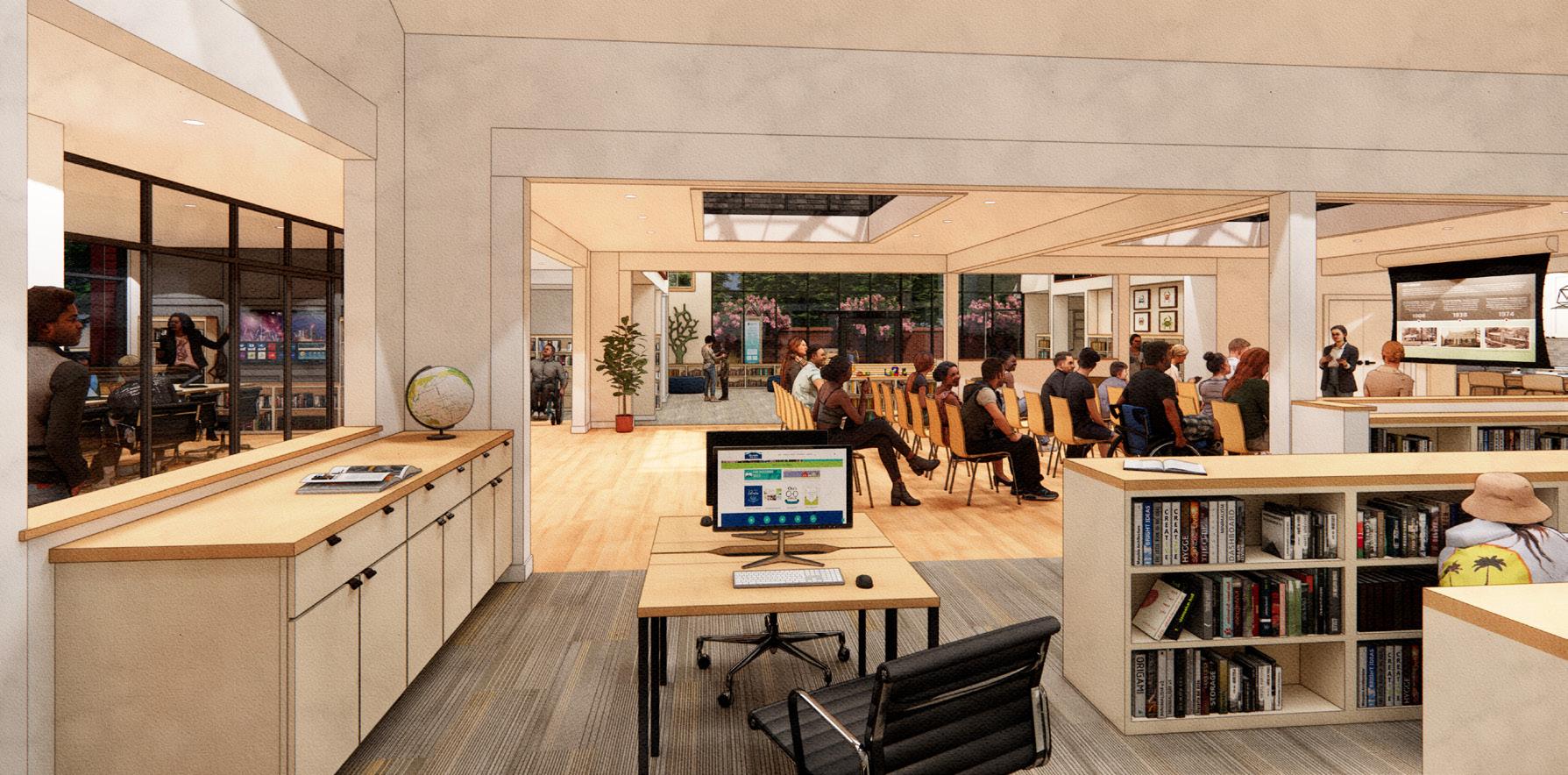
Noblesville, IN Brewery & Event Lawn Aerial Perspective
Library Interior Perspective
Nantucket Historic Reconstruction
Pocket Neighborhood Aerial
Dickerson Pike, Nashville, TN Multi-Family Perspective
Neighborhood Central Green Perspective
Contact: greglittell@gmail.com