
2.1 Goals and Policy Statements 2.2 Introduction 2.3 Approach 2.4 Park Classification System 2.5 Existing Park Network 2.6 Trails 2.7 Additional Recommendations 2.8 Actions Parks, Trails & Open Space 2 ch2


Outdoor space for healthy living, exercise, recreation, and connectivity
Goal:
Develop a comprehensive green network of parks, trails and open space for both active and passive use which meets the need of all age groups and enhances the quality of life.


Parks and Open Space
• Consider new nature-based recreation opportunities
• Develop new systems of trails and parks for future generations
Transportation and Mobility
• Create a citywide bicycle network
• Improve the City’s image and identity
• Promote locally grown healthy food and products via the Farmers Market
Connect Families with Trails: The City will collaborate with landowners, developers, and other partners to link parks, neighborhoods, and schools together with a network of greenways and multi-use trails.
Park Dedication Ordinance: The City will consider an improved Park Dedication Ordinance to acquire more parklands.
Market: The City will promote the Greenville SportsPark for tourism which creates a revenue source and community amenity.
Capital Improvements Program: The City will create a CIP line item to specifically fund the design, construction, and maintenance of parks, trails, and open spaces.
Natural Systems: Use floodplain land and natural environments to define areas for future parks and trails.
Citywide Bicycle Network: The City will study to create a small network of an on-street bicycle (share the lane/sharrow) system. This would increase mobility and add to a healthy lifestyle at a relatively low cost.
Farmers Market: The City will promote locally grown, healthy food and products by enhancing the existing Farmers Market in Downtown.
Community Partnerships: The City will partner with the school district (GISD), medical providers, local churches and other organizations to encourage active living and expand its sports facilities, recreation activities, health and wellness initiatives for residents of all ages.
Parks and recreation are vital components to health and wellness, and an essential element of community planning is the space devoted to satisfying active and passive community recreational needs. Parks, recreation, and leisure spaces collectively are elements that enhance and contribute to the quality of life found in the community. Investments in quality parks, recreation, and open space are hallmarks of healthy, vibrant communities.
The purpose of this chapter is to analyze Greenville’s existing parks and recreation facilities, assess present and future community needs, and make recommendations on new parks and recreation facilities.
Historically, the most common standards for park planning guidelines, as recognized by park and recreation professionals, have been the published guidelines by the National Recreation and Park Association (NRPA).
The purpose of the NRPA guidelines is to present park and recreation space guidelines that are applicable for the planning, acquisition, and development of parks. These guidelines address minimum, not maximum, goals to be achieved. The guidelines are to be coupled with conventional wisdom and judgment relating to the particular situation to which they are applied and specific local needs.
The planning approach for this parks chapter uses the draft park survey document developed by the Parks and Recreation Department and data/ input from the process that defined land use and park space relationships. This process engaged the standard park planning factors noted below:
Standards: Comparison of traditional park standards and evaluating current trends
Needs: Also called Level of Service (LOS), obtaining input from City staff, City Council, Parks, Recreation Board, Greenville ISD, Hunt County, and the residents to identify current facility deficiencies and future needs assessment.
Growth: Utilizing available land, natural features, right of way, and City facilities to fulfill the community’s needs and plan future facility expansions.
Supporting data clearly states that public parks raise the value of nearby residential properties as homebuyers are willing to pay a premium for proximity to parks, open space, and natural vegetation. Research shows a home adjacent to or fronting a park will see a 20% increase in value on average. Homes within a quarter-mile of a park have an increased value of 10% on average. Greenville should strive to update its existing parks to increase property tax revenue, build new parks that can be a catalyst for new development, and build more pedestrian trails/ walkways to serve and better connect the community.
The City of Greenville parks and recreation system will be analyzed against NRPA standards. Still, early in the planning process, the City defined its desire to promote and build parks and programs beyond the national standards. Residents in Greenville understand the comprehensive value gained for property and quality of life due to quality parks and recreational programs.
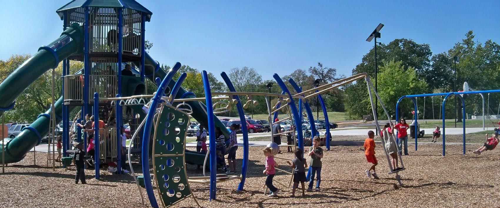
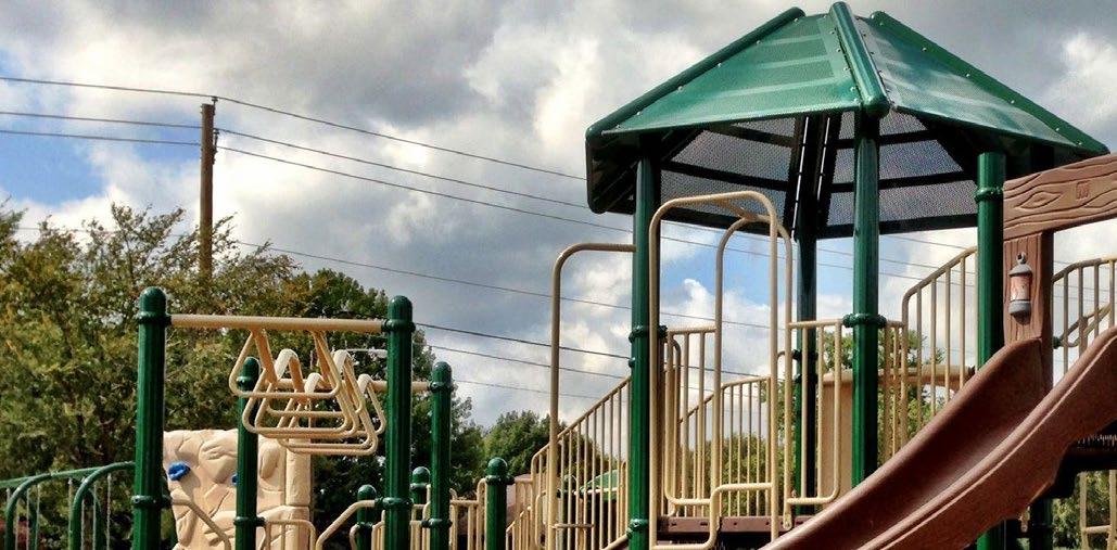
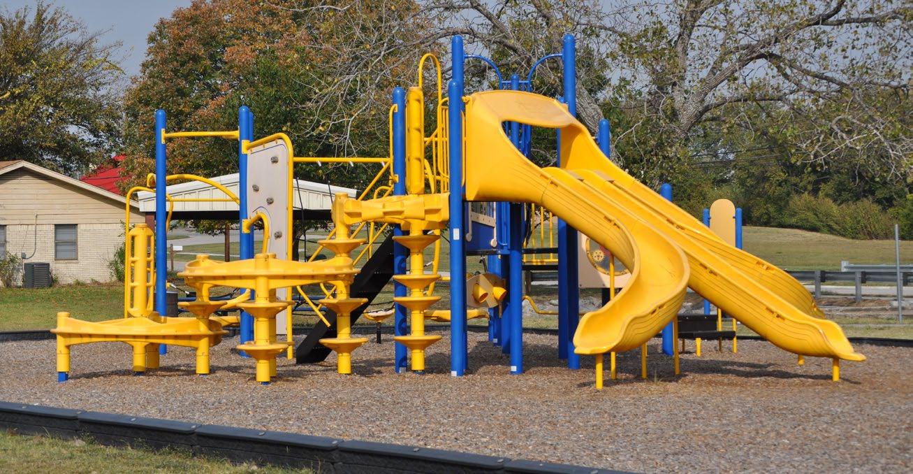
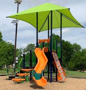
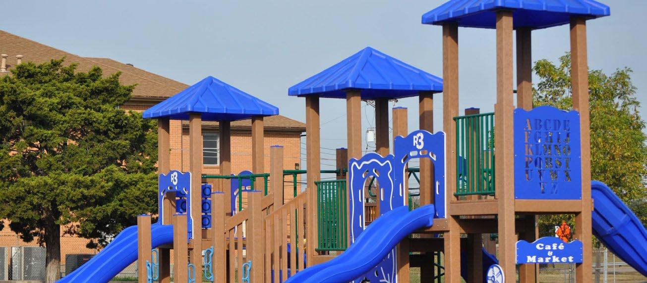
When evaluating existing or future parks in Greenville, it is necessary to classify each park by type, size, service area, and acres per 1,000 population. The program and design of each outdoor park facility are unique. The program for the parks is set along with a site review and analysis of each physical property. Slope, existing trees, and other natural amenities help to define a proper park program. Each of the community parks will be different but with some similar elements, such as children’s playgrounds (ageappropriate equipment to be determined), pedestrian sidewalks, benches, and some vehicular parking.
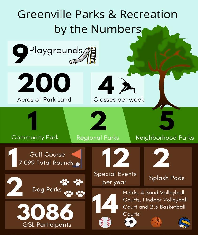
Greenville Parks and Recreation collectively provide approximately 200 acres of dedicated park and recreation space to the citizens of Greenville and Hunt County. The existing parks within Greenville are classified in the following sizes: Neighborhood, Community, and Regional Parks as defined below.
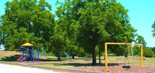
A neighborhood park is a medium-sized park serving a general neighborhood area, usually with play equipment, athletic facilities, and passive open space. They generally range in size from 1.515 acres and are the most frequently needed park size. They are easily accessible to area residents, serving approximately a 1-mile radius. They have a playground, multi-purpose court, open landscaped space for flexible activity, picnic areas, and shelters. Existing examples include Arnold and Middleton Parks.
A community park is a large park generally ranging in size from 25-375 acres. It serves multiple neighborhoods, including ball fields, playgrounds for different age groups, parking, picnic areas, passive areas, tennis courts, swimming pool, recreational building, restrooms, multi-purpose courts, and a meeting area for special events. These parks usually contain multiple ball fields and are lighted for evening play. In addition, the city park should be placed along a major road for easy access. Ja-Lu Community Park and Graham Park are good examples of this classification.
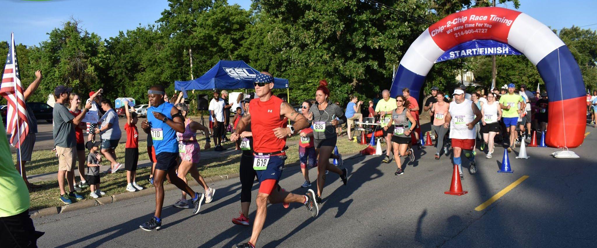
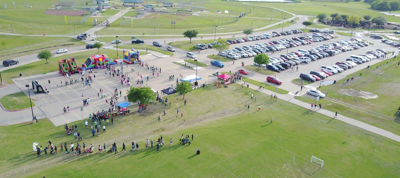
Regional Parks have the acreage to feature facilities like a major sports complex. The citizens of Greenville use the SportsPark for special events like the annual Bottle Rocket Bash and 5K race events. Regional Parks offer intensive recreational activities and may promote larger gatherings throughout the year. A regional park serves a wide area that can include several communities. These parks have many different types of outdoor recreation possibilities. There are no specific guidelines for the recommended number of acres. The SportsPark in Greenville is a good example of this classification.
A linear park is an area of open space that usually runs along a drainage corridor, utility easement, or body of water. These parks use the linear aspects of the open space to serve different types of trails. These trails typically tie into key locations such as schools, residential neighborhoods, and other parks. There are no specific guidelines for the recommended number of acres.
The construction of parks, trails, amenities, and open spaces is an important element in establishing the quality of life for citizens in Greenville. This recommend that the City budget for new park equipment and maintenance of current facilities every year. Budgets and CIPs change and vary with the regional and State of Texas economy – but do not fail to upgrade the system every year. Allocate
Park Name
and demand as much money as available. Typically a ten-year improvement program should be created to grow additional facilities as desired by the community. This type of program defines a yearly increase of the Parks budget for those ten years.
Developed Acreage Undeveloped Acreage Address Type
Arnold Park 1.07 - 2300 Jones Street Neighborhood Park
Middleton Park 1.69 - 3600 Spencer Street Neighborhood Park
Austin Park 2.01 - 1700 Wesley Street Neighborhood Park
Warren Park 4.23 - 3100 Webb Avenue Neighborhood Park
Wright Park 5.45403 Business Hwy 69 South Neighborhood Park
Graham Park 9.52 - 800 Walnut Street Community Park
Ja-Lu Community Park 13.65 - 4807 Stonewall Street Community Park
Oak Creek Park 12.59 - FM1570 and Aerobic Lane Communty Park Greenville SportsPark 112.57 - 3602 Leo Hackney Blvd Special Purpose Park
Wright Park Golf Course 62.025403 Business Hwy 69 South Special Purpose Park
Jones Park - 16 Sockwell Blvd Future Park
Betts Park - 25.53 Sockwell Blvd Future Park
East Mount Cemetery 31.6 - 1600 Marshall Street Cemetery
East Mount Expansion 15.9 - 1600 Marshall Street Cemetery
Forest Park Cemetery 205605 South Business Hwy 69 Cemetery
Total Acreage 302.46 43.54
Table 2-1: Existing Park Inventory
Several surveys have been conducted by Greenville’s Parks and Recreation Department to assess how citizens felt about parks and recreation in Greenville. The questions centered around existing park and recreation opportunities within Greenville and around what types of recreation opportunities or facilities respondents would like to see provided in the future.
Public engagement is a key component of planning for the future. Successful public engagement brings life into a project and ensures that it reflects the values, wants, and needs of the community it is going to serve. Greenville Parks and Recreation strives to understand how Greenville residents use the parks and facilities. The City of Greenville Parks and Recreation Department received 799 completed surveys. A full set of metrics from the survey is located in the appendix. In summary, key points are include on the right.
In 2018, the parks department administered a community survey of parks and recreation facilities. Below are the results of two of the questions asked.
Park facilities ranked most popular by respondents
This comprehensive plan utilizes two analysis techniques to determine future park needs. The first is a demand-based approach that looks at participation rates and community surveys to determine existing park demands. The second is a needs-based approach utilizing the level of
Table 2-2: Park Level of Service
service (LOS) established by the City of Greenville. Standards for the level of service are determined by the quantity of park acreage and recreation facilities needed to serve every 1,000 to 10,000 citizens of the city. Below is a table that shows the additional parkland acreage and recreational facilities needed to meet the target level of service.
2018 DEVELOPED PARKS 2018 DEVELOPED & UNDEVELOPED PARKS
Population 27060 27060
Number of Parks 10 13
Acreage* 235.0 278.5 Current LOS 8.68 acres per 1,000 10.29 acres per 1,000 Acreage to acquire to meet 12 acre Target LOS (325 acres) 90.04-acre deficit 46.50-acre deficit
*Acreage does not include cemetery acreage.
Table 2-3: Park Amenities Numbers
Existing Parks
Recreational Facilities
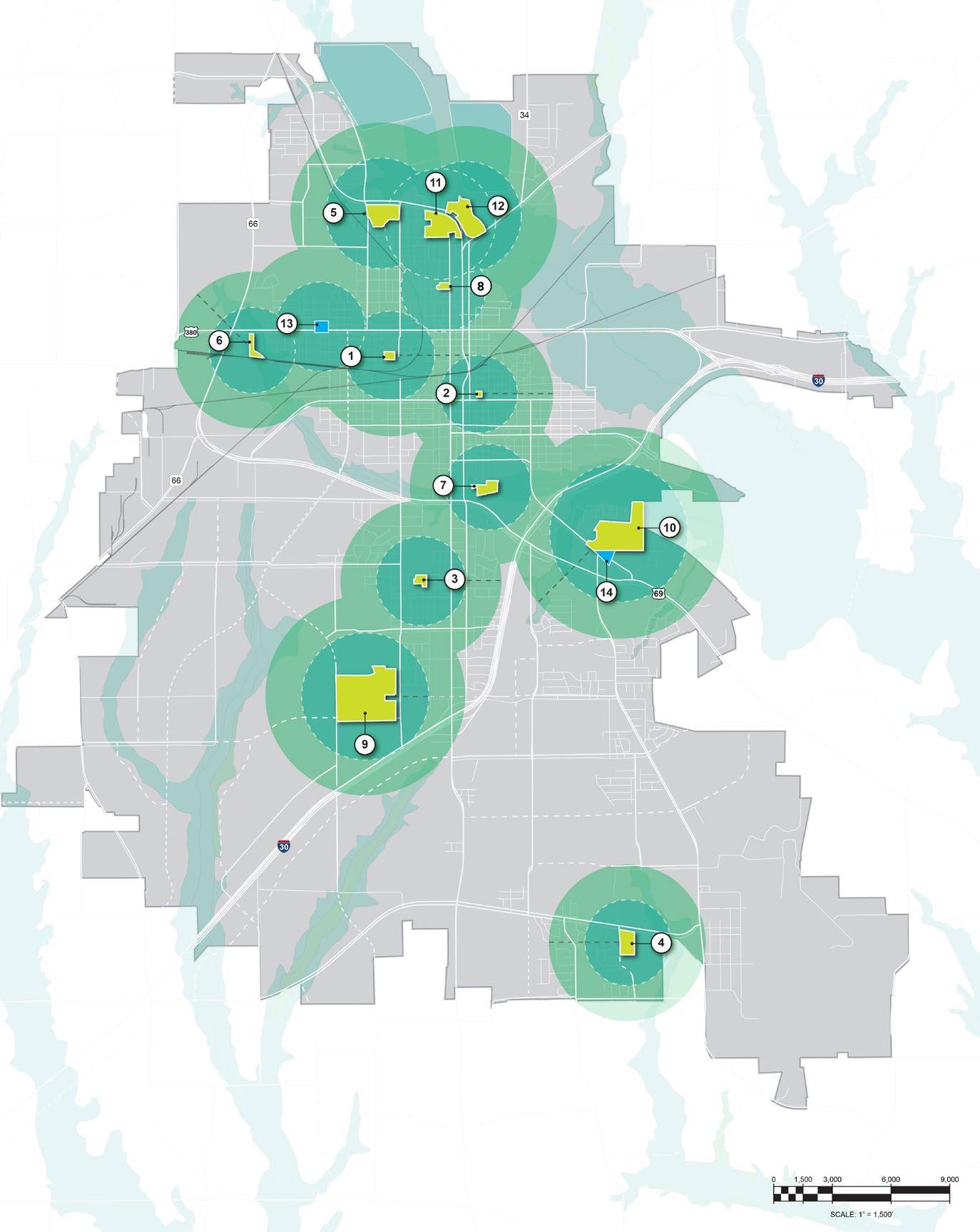
1/4 Mile Radius 1/2 Mile Radius
LEGEND
Neighborhood Parks (1) - Middleton Park (2) - Arnold Park (3) - Warren Park (4) - Oak Creek Park
Community Parks (5) - Graham Park (6) - Carver Park (7) - Ja-Lu Park (8) - Austin Park
Regional Parks (9) - Greenville Sports Park
Special Purpose Parks (10) - Wright Park
Undeveloped Parks (11) - Jones Park (12) - Betts Park
Recreation Centers (13) - Reecy Davis Sr Indoor Rec Center (14) - Fletcher Warren Civic Center
NORTH NOT TO SCALE
Figure 2-1: Parks Level of Service (LOS) Map
Parks, Trails,
Ja-Lu Community Park 2 Lou Finney Blvd 13.7 acres
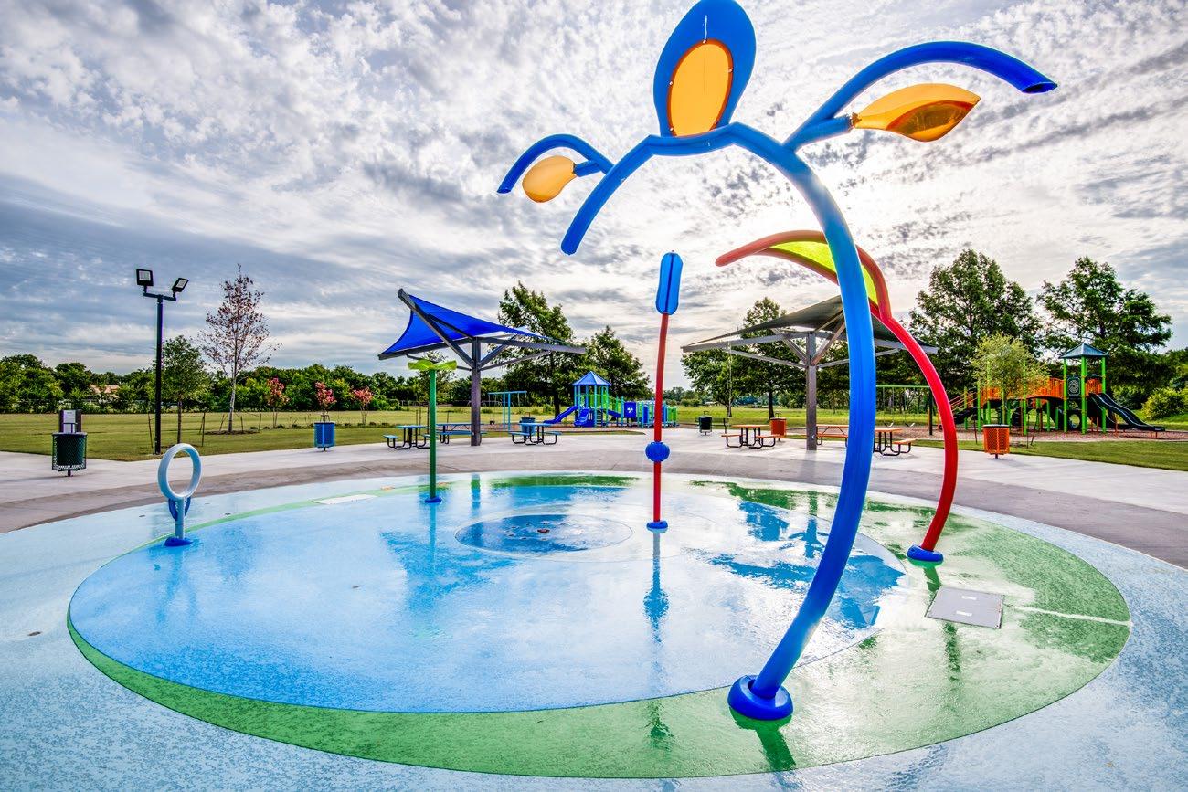
Ja-Lu Community Park, originally the Ja-Lu Pool, is located north of Highway 69 and east of Wesley. Updates were made in Ja-Lu Park, and this community park now features an interactive splash pad, new children’s playground, walking trail, shade structure, restrooms, and access to adjacent W. Walworth Harrison Public Library.
Oak Creek Park
FM1570 and Aerobic Lane 12.6 acres
Oak Creek Park is a 12-acre neighborhood park located in the southeastern region of Greenville 1/2 mile from L3Harris and Major Field Airport. The most recent updates to Oak Creek occurred in 2013 and include a large youth playground, family pavilion, parking, grills, picnic tables, restrooms, a drinking fountain, and a youth game soccer field.
Sports & Fitness
1 Baseball Backstop
2 Soccer Fields
Leisure Amenities
1 Pavilion 4 Picnic Tables Open Space
As the most southeastern neighborhood park, Oak Creek Park needs park enhancements and additional site elements to adequately accommodate the number of citizens who live within 1 to 2 miles of the park. Below is a list of recommendations based on the existing level of service needs.
Sports & Fitness
1 4,900LF 6’ Trail $330,000
1 Basketball Court $85,000
1 Volleyball Court $25,000
1 Fitness Station $105,000
Leisure Amenities
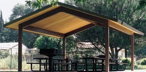
1 30’X30’ Pavilion $90,000
1 Dog Park $50,000
Site Features
92 Trail Lights $156,400
98 Parking Lot Spaces $335,000
Irrigation $10,000
30 Trees $4,500
Site Furnishings $42,000
1 Restroom $110,000
Estimated Total Cost $1,641,900
Warren Park 3100 Webb 4.2 acres
Warren Park is a 4-acre neighborhood park centrally located within the city two blocks west of Wesley Street. The park is situated with residential developments of various densities. There are townhomes, apartments, and single-family residents within walking distance of the park. There is parking, an open space for a soccer game or frisbee, and a backstop to practice baseball. There are also a pavilion and four picnic tables.
Sports & Fitness
1 Baseball Backstop
Leisure Amenities
1 Pavilion 4 Picnic Tables
1 Splash Pad 1 Playground 1 Grill Open Space
Warren Park has the potential to serve more residents due to the number of nearby residents and the amount of undeveloped land within the park. The following recommendations are based on the park facility’s level of service needs and citizens’ demands.
Sports & Fitness
1 1,500LF 6’ Trail $45,000
1 Basketball Court $85,000
1 Volleyball Court $25,000
1 Fitness Station $70,000
Leisure Amenities
1 Pavilion (remodel) $10,000
Site Features
33 Trail Lights $65,400
Irrigation $10,000 30 Trees $4,500
Site Furnishings $50,000 1 Restroom $110,000
Estimated Total Cost $474,900
2300 Jones Street 1.1 acres
Arnold Park is a neighborhood park located in northern Greenville, south of the Central Business District, situated within the Hemphill Street and Stuart Street intersection block. Arnold Park was named after Frances Arnold Ellis, who deeded the land to the City of Greenville in 1992. The most recent improvement to Arnold Park is the new play equipment installed in 2016. The park also includes a half-court basketball court, a picnic table, and benches around the playground area where parents can sit and watch their kids play.
Sports & Fitness
0.5 Basketball Court
Leisure Amenities 2 Picnic Tables 1 Grill Open Space
3600 Spencer 1.7 acres
Middleton Park is a small neighborhood park located south of downtown Greenville. The playground equipment is still the simple original metal painted equipment. There is a half-court basketball court, picnic tables, grills, and an open space where you can enjoy a soccer match or other family recreational activities.
Sports & Fitness
0.5 Basketball Court
Leisure Amenities
1 Playground 1 Grill
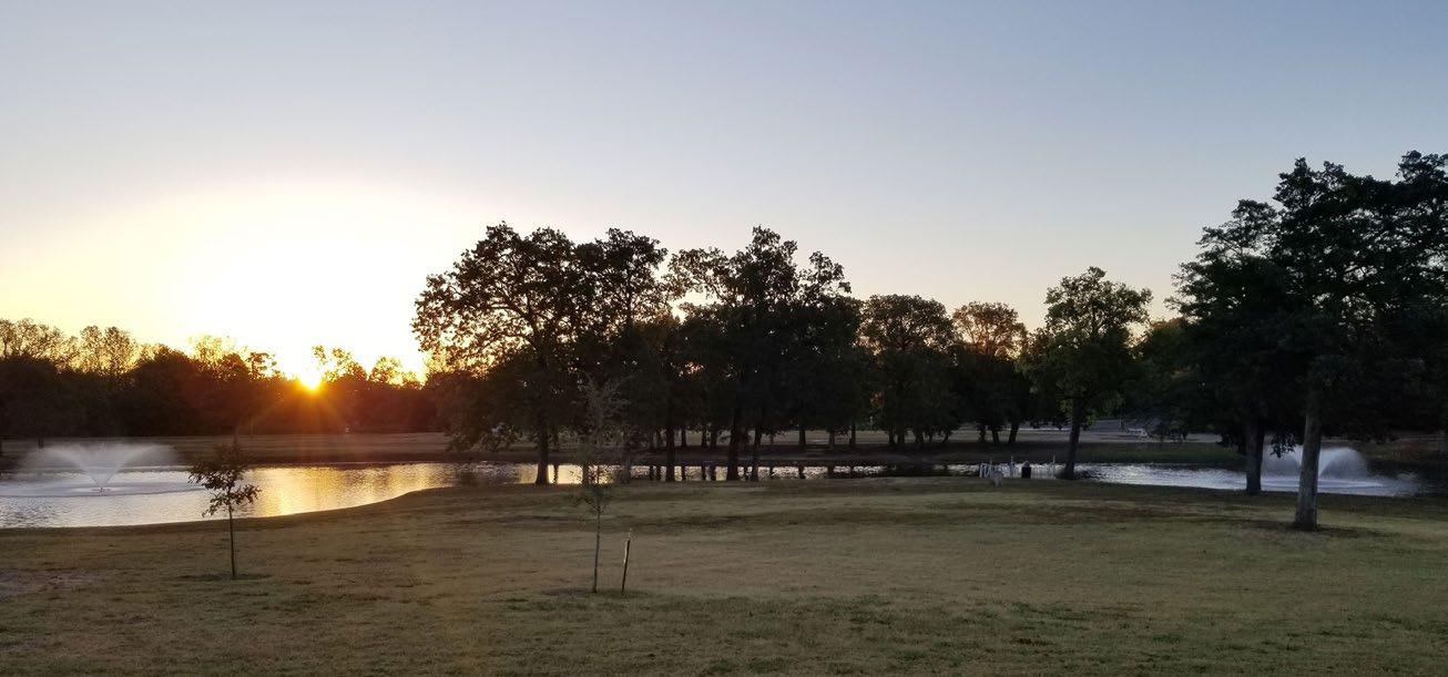
3602 Leo Hackney Blvd 112.6 acres
Sports & Fitness 1 Basketball Court 6 Baseball/Softball Fields 9 Soccer Fields 4 Sand/Volleyball Courts
Tennis Courts 1 1/2-mile Jogging Trail
Amenities
Tables
Ponds
Fountain
Sports & Fitness
1/2 Mile Loop Trail
The Greenville SportsPark is an active sports environment with six base / softball fields, up to nine various size soccer fields, four sand volleyball courts, one basketball court, and two batting cages. There are walking trails and a fishing pond for people looking for some other types of activities to do at the park. In addition to all of the sports amenities, the park features a newly constructed inclusive playground and play area with zip lines. This park is where the biggest fireworks show of Hunt County takes place, which is just one part of the larger 4th of July Bottle Rocket Bash Event. 1 Basketball Court Leisure Amenities
Indoor Athletic Facility
Fitness Course
Batting Cages
Multi-Purpose Athletic Field
Sand Volleyball Courts 1 Baseball Field (285-300ft)
Small Dog Park
Large Dog Park
Site Features
Amphitheater
Additional Parking Spaces Food Truck Parking
Pavilion 12x12
Indoor Athletic Facility (proposed)
Existing Parking
Parking (300 additional spaces proposed)
Elevated Fitness Course/ Batting Cages (proposed)
Small Dog Park (proposed)
Large Dog Park (proposed)
Multi-purpose Athletic Field (existing)
Multi-purpose Athletic Field (proposed)
Covered Pavilion (proposed)
Four Sand Volleyball Courts (proposed)
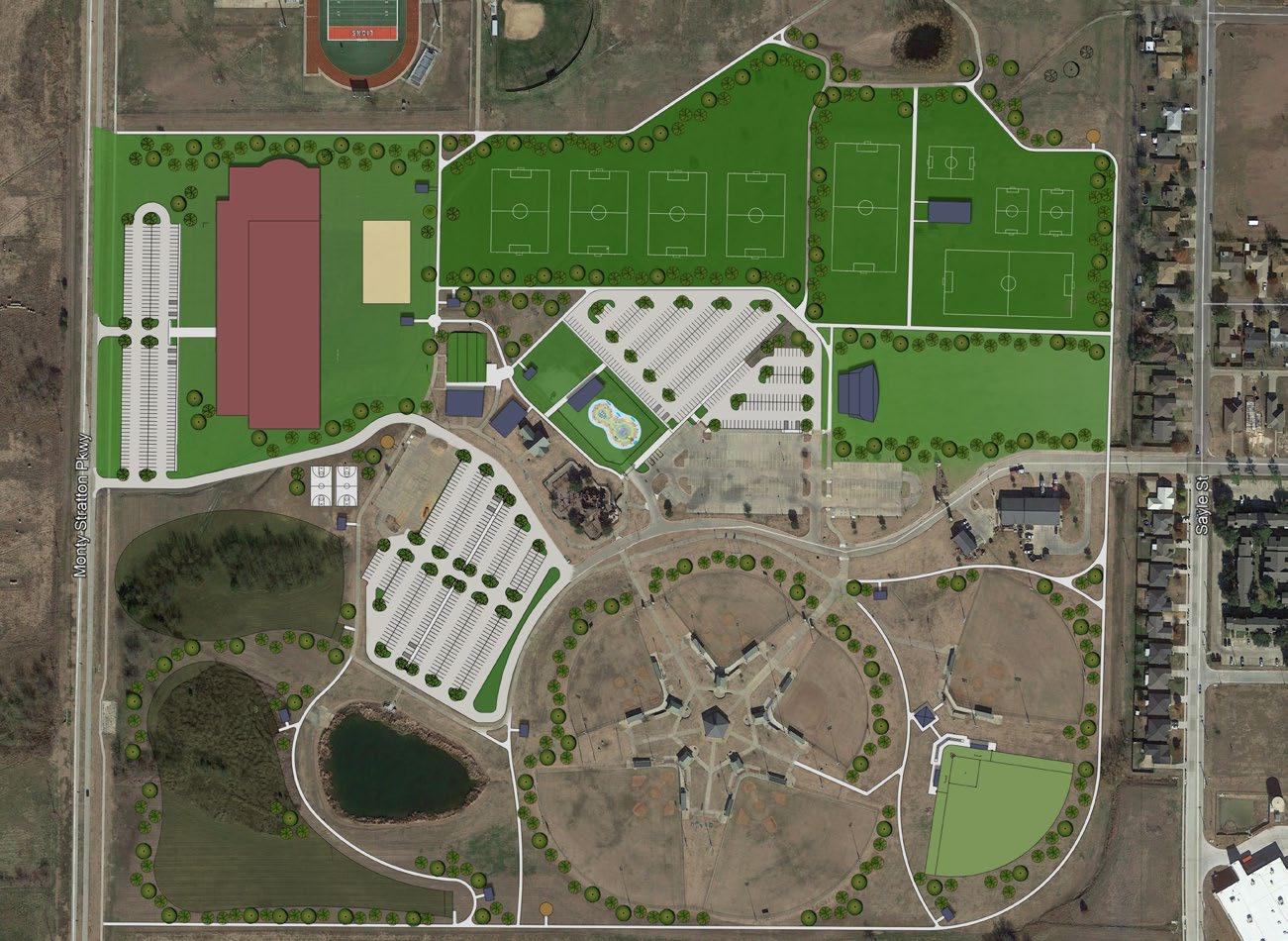
Amphitheater (proposed)
Baseball Field 285 to 300 feet (proposed)
Basketball Court (proposed)
1.2 Mile Loop Trail (proposed)
Existing Fields (Baseball/Softball)
Splash pad feature (proposed)
Concession/Restroom Building (proposed)
Existing Food Truck Parking
Existing Playground
Existing Park Equipment Building
Existing High School Field
5403 Business Hwy 69 South 5.4 acres
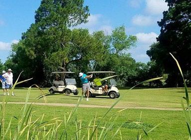
Wright Park is a neighborhood park on the same land plot as the Wright Park Municipal Golf Course. The Park consists of a playground, a multi-purpose court, a pavilion, and a picnic table with large shade trees.
Sports & Fitness 1 9-Hole Golf Course
5403 Business Hwy 69 South 62.0 acres
The Wright Park Municipal Golf Course is a ninehole course that sits on 39 acres. The design features mature trees that line most of the fairways; small, fast greens; and water that comes into play on four holes. Three par 3s and four par 4s are sandwiched between two par 5s. The opener is longer at 486 yards, but No. 9 is considered the signature, playing only 437 yards but featuring a pond in the middle of the fairway. The most difficult part is the 218-yard No. 5 hole.
The Wright Park Municipal Golf course has served the community of Greenville for many years. However, the demand for this special purpose park is low compared to the priorities identified by residents. As growth occurs, it is recommended that the city considers joining both the Wright Park and the Wright Park Municipal Golf course as one community park to accommodate the growth occurring on the southeastern side of I-30 and south of Joe Ramsey Blvd.
800 Walnut 9.5 acres
Graham Park has served many functions throughout the years. It was once a zoo, a railway destination, and an outdoor pool. In 2007 new restrooms were built, and in 2012 the playground was updated with the help of a Texas Parks and Wildlife parks and open space funding agreement. This park has multiple activities, including a fishing pond and a sand volleyball court. Graham Park’s programming makes it a prime location to visit if you are looking for a great park for families.
Sports & Fitness
0.5 Basketball Court
1 Sand/Volleyball Court 9 Disc Golf Holes 1 3/4-mi Jogging Mile
Leisure Amenities
1 Pavilion 10 Picnic Tables 1 Playground 1 Splash Pad 1 Fishing Pond 1 Dog Park 1 Water Fountain 4 Grills 1 Restroom Open Space
Graham Park has several natural features that foster leisure activities. In general, the existing playground and active recreational facilities are in good condition. A renovation to the existing splash pad would significantly enhance the summer experience for the park’s younger citizens.
Austin Park
1700 Wesley Street 2.0 acres
Austin Parks is a 2-acre park located in North Greenville along Welsey Street and Polk Steet and it is currently under construction. This is the former location of the Austin School and later the former location of the Police Department. This site has several mature shade trees and ornamental trees near the perimeter of the site. There is an existing structure on the site, but the remainder of the site is open space. The building that used to encompass the majority of the site was removed in 2019.
EXISTING PARK AMENITIES
Leisure Amenities Open Space
As a local neighborhood park, the development of Austin Park would provide more parks per residents north of Lee Street. The park will provide amenities that accommodate the population growth surrounding the park resulting from increased residential infill development.
Sports & Fitness
1 1,500LF 6’ Trail $55,000 1 Basketball Court $80,000 1 Playground $70,000
Leisure Amenities
1 Pavilion $40,000
Jones Park
Sockwell Blvd 16.0 acres
Jones park is a large 16-acre tract of undeveloped parkland. The site is primarily open space with several mature trees and an existing drainage channel running through the site. The park is separated into two parcels as Wesley Street runs north and south through the middle of the site.
Site Features
5 Trees $1,000
14 Site Furnishings $25,000 Parking Rehab $50,000
Estimated Total Cost $321,000
Leisure Amenities Open Space
North Greenville lacks the number of large athletic fields available in south Greenville at the SportsPark. It is recommended that this site be considered for a future location of multi-purpose athletic fields due to the site’s large amount of open land. Jones Park could function as a special purpose park providing recreation activities needed in north Greenville.
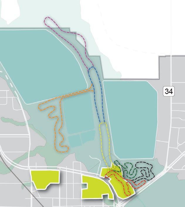
Betts Park
Sockwell Blvd 23.5 acres
Betts Park is a natural open space area located between Commerce Drive and Sockwell Blvd near the Cowleech Fork of the Sabine River. This site includes a large number of mature trees and drainage systems. Betts park was built on the former location of a baseball field that served the north side of Greenville.
Leisure Amenities Open Space
Due to the natural features located to the north of the park, this location can be comprised of a trailhead with parking, kiosks, bike racks, picnic tables, benches, and trails connecting to a future trail running along the Sabine River mentioned later in the chapter.
Hunt County
Jack Finney Blvd. 122.7 acres
The Hunt County Fairgrounds is approximately 123-acres of land located on Jack Finney Boulevard near the Greenville Municipal Airport in southeast Greenville. The Hunt County Fair and Livestock Show is an annual celebration of the youth, agricultural, educational, economic, cultural, and institutional strengths indigenous to the area, emphasizing agriculture. The fair is typically held during the spring.
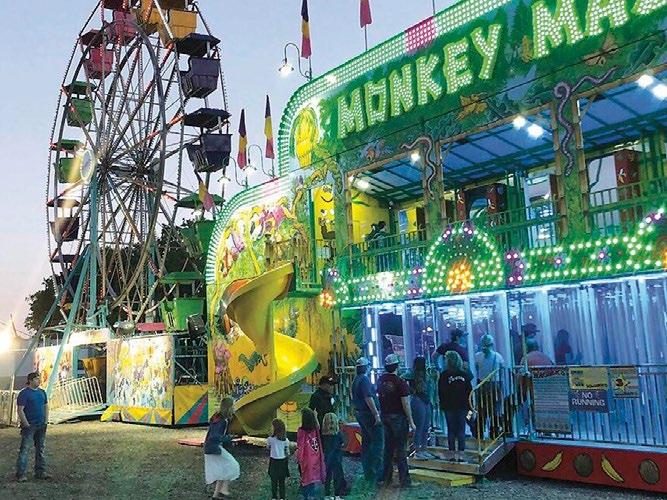
The Hunt County Fair offers various forms of affordable entertainment and amusement for families and friends and showcases talents, skills, and aspirations of the youth. The Fair also promotes agricultural growth and awareness through educational programs, competitions in breeding and showing livestock, and promoting and supporting local childrens’ education by providing scholarships.

Neighborhood Parks (1) - Middleton Park (2) - Arnold Park (3) - Warren Park (4) - Oak Creek Park
Community Parks (5) - Graham Park (6) - Carver Park (7) - Ja-Lu Park (8) - Austin Park
Regional Parks (9) -Greenville Sports Park
Special Purpose Parks (10) - Wright Park
Undeveloped Parks (11) - Jones Park (12) - Betts Park
Recreation Centers (13) - Reecy Davis Sr Indoor Rec Center (14) - Fletcher Warren Civic Center
Recreational Facilities
North Side Trail
South Loop Trail Midtown Trail Sports Park Trail Floodplain Trail Rails To Trails
NORTH
Figure 2-2: Parks Master Plan
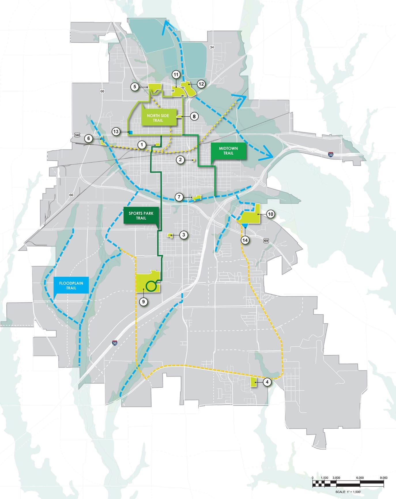
Greenville currently has one existing trail. However, the city has the opportunity to connect key destinations and residential areas citywide. Studies have shown an increased economic and quality of life connection to parks and trails. The only barrier to continuous east-west trail connection is the I-30 thoroughfare. Safe off-street trail crossings are needed at key intersections in the I-30 corridor. The following are existing and planned trail connections identified in Figure 2-2.
Long Branch Trail 0.3 miles
Long Branch Trail is an existing off-street trail that runs along Joe Ramsey Boulevard East, crossing King Street, Wesley Street, and Stonewall Street. This segment exists along with the floodplain trail designation and could be extended to connect to JaLu Community Park trail that terminates at Moulton Street.
North Side Trail 3.8 miles (approximately)
North Side Trail is a planned on-street and off-street trail that connects downtown, Reecy Davis Sr Indoor Recreation Center, Graham Park, Jones Park, and Betts Park. The trail runs along Lee Street, Wesley Street, Sayle Street, Salem Street, Cross Dr, Walnut Street, Main Street, and Morgan Street.
Midtown Trail 1.8 miles (approximately)
Midtown Trail is a planned on-street trail that connects residents to downtown. The trail runs along Moulton Street, Park Street, Bois D Arc Street, and Lee Street.
SportsPark Trail 3.5 miles (approximately)
Sports Park Trail is a planned on-street trail that connects the SportsPark to surrounding neighborhoods and provides a north-south connection across Joe Ramsey Boulevard East. It passes Greenville Middle School terminating downtown on Lee Street. The trails run along Leo Hackney Boulevard, Sayle Street, Lion Lair Road, Colorado Street, Eastland Street, Sayle Street, Templeton Street, Texas Street, and Spencer Street.
Floodplain Trail 20.5 miles (approximately, includes Betts Park Trail) Natural floodplain areas should be protected and preserved throughout the city as development occurs. These natural areas provide connections to nature and opportunities for recreation. Planned floodplain areas have been designated as conceptual trail alignments for future developments.
South Loop Trail 8.5 miles (approximately)
South Loop Trail begins at Wright Park running south along FM 1570 to Coyote Crossing, and north along Monty Straton Parkway connecting into the Flood Plan Trail.
Rails-To-Trail 4.5 miles (approximately)
Rails-to-Trials are trails that are constructed utilizing abandoned railroad lines that could be designated as regional trail connections to neighboring cities that share abandoned train routes. Identified trail segments connect destinations in north Greenville.
Betts Park Trail 8.5 miles (approximately)
Betts Park Trail is a planned 8-segment trail in the floodplain along the Cowleech Fork Sabine River that flows within Betts Park and the Greenville Reservoir. Figure 2-3 shows the planned trail segments.
From the parks survey information, citizen input received during the planning process, and current parks trends for mid-size communities, a set of parks, recreation, and open space recommendations has been developed that focus on three primary typologies:
•
•
•
The number one outdoor recreation activity that families participate in is walking and bike riding. We see linking parks and schools together as the most important priority for this plan relative to parks and recreation. Greenville is home to several existing parks with land available for future parks — a tremendous opportunity for healthy pedestrian networks.
We recommend a series of pedestrian trails, many within existing road rights-of-way, to link these features together. The trails should be 8-10 feet wide and have all the appropriate signage requirements for safety and wayfinding. The key to the success of these systems is to design them in such a way that they are perceived as a familyfriendly network for all. Safety is paramount, with loop trails ideal for casual recreational use preferred by families.
Figure 2-2 defines three pedestrian trails — each one can be built in a series of phases and/or with state and federal grant funding.
Greenville has a rich and wonderful history of artifacts that needs more storytelling through public parks and outdoor features. The railroad and Katy Depot, Majors Stadium, Audie Murphy, and Texas King Cotton are just a start of the places and names that contribute to the unique character of Greenville. The City should create a future park using the existing Majors Stadium gate at the site of the old ballpark to capitalize on the wonderful but largely isolated historical feature. Family recreation amenities can be built here as a neighborhood park with baseball as the major theme.
Downtown is also called the Central Business District (CBD) of Greenville. With this focus on business and walkable development, cities need to always focus on the elements that will help to provide a better quality of life for citizens downtown. The more things to do and places to gather, the more activity a downtown will enjoy. Downtown Greenville is underserved with outdoor pedestrian space. In essence, the Farmers Market, the SPOT (Smart Parks of Texas), and the landscape surrounding the Hunt County Courthouse constitute all of the park-like environment downtown.
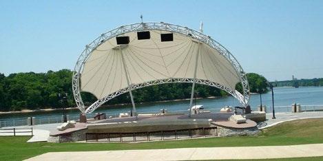
It is recommended that the City plan for a new civic public space with a bandshell or gazebo as the central focus. This park can support new development (urban housing and/or commercial) with pedestrian seating, lawn, and landscaping.
Each of the following actions is aligned with a single policy. They are listed with the policy that best connects to the action. It is possible and very likely that several actions have a relationship to other policies. That relationship shows the association between multiple policy statements as to how cities work and function.
The City will collaborate with landowners, developers, and other partners to link parks, neighborhoods, and schools together with a network of greenways and multi-use trails
Actions
1. Design and build Walking / Jogging Trails — Length one to two (1-2) Miles throughout the park network
2. Add Pedestrian Lighting for Walking / Jogging Trails
3. Plan and design a remote pedestrian trail network for areas of new subdivisions
The City will consider an improved Park Dedication Ordinance to acquire more parklands.
1. Create a Park Dedication Ordinance and/or upgrade the existing document to achieve the goals of the Park Board.
2. Review Greenville's ordinance to the surrounding mid-level cities to compare metrics.
3. Create a marketing plan for the City's park and trail amenities.
The City will create a CIP line item to specifically fund the design, construction, and maintenance of parks, trails, and open spaces.
Actions
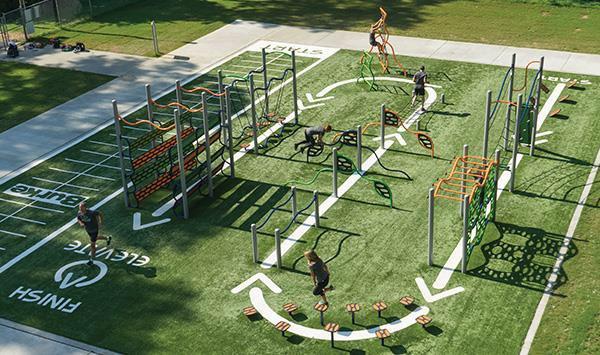
1. Add a splash pad to SportsPark Complex
2. New playground elements to be designed to be inclusive for all
3. Add one (1) baseball/softball field to SportsPark Complex
4. Add one (1) additional large multi-purpose field north of the SportsPark Complex
5. Update restrooms and add security connection
6. Upgrade Graham Park splash pad
7. Utilize existing undeveloped acreage to build an 18-hole Disc Golf Course
8. Add one (1) full size basketball court at the SportsPark with improved surfaces
9. Add one (1) sand volleyball court at Ja-Lu Park
Use floodplain land and natural environments to define areas for future parks and trails.
1. Repair and landscape (native & low water use plants) the six (6) existing pavilions
2. Dredge lakes at SportsPark Complex and Graham Park and maintain fountains
3. Add a dog park at the SportsPark with appropriate drainage
4. Preserve floodplain and natural areas for parks and trails
The City will study to create a small network of on-street bicycle (share the lane/sharrow) systems. This would increase mobility and add to a healthy lifestyle at a relatively low cost.
1. Increase bike mobility across Greenville by adding white painted sharrows on desired lowvolume travel lanes with signage
2. Add bicycle racks as needed across Greenville to promote Complete Streets, bike mobility and improved health
The City will promote locally grown, healthy food and products by enhancing the existing Farmers Market in Downtown.
Actions
1. Promote locally grown, healthy food and products by enhancing the existing Farmers Market
The City will partner with the school district (GISD), medical providers, local churches, and other organizations to encourage active living and expand its sports facilities, recreation activities, health and wellness initiatives for residents of all ages.
1. Plan for a new Downtown Park
2. Plan the programming for a new Downtown park
3. Landscape the new low-profile planters along Lee Street in Downtown
4. Coordinate with Downtown Element on Park recommendations
5. Partner with Texas Recreation and Parks Society (TRAPS) for promotion, grants and educational growth
6. Partner with North Central Texas Council of Governments (NCTCOG) for environmental, grants, and educational growth