
POINT
GREY REDEVELOPMENT OPPORTUNITIES AND CONSTRAINTS
SUMMARY REPORT

Acknowledgement of Country
We acknowledge and respect the separate and distinct Eastern Maar and Wadawurrung Peoples as the Traditional Owners of the Great Ocean Road’s land, waters, seas and skies and acknowledge their cultural knowledge that has led to sustainable practices and has cared for Country over tens of thousands of years.
We honour Elders past and present and express gratitude for their sharing of wisdom that has ensured the continuation of Culture and Traditional practices.
We are committed to genuinely partner and meaningfully build relationships that reflect self-determination and enable us to work together with Traditional Owners and Aboriginal communities to support the protection of Country, the maintenance of spiritual and cultural practices, and together deliver on their broader aspirations in the 21st century and beyond.

INTRODUCTION AND PROCESS OF DEVELOPING THE DOCUMENT
About the Project
The Point Grey Redevelopment Project is a major infrastructure initiative led by the Great Ocean Road Coast and Parks Authority as part of the Geelong City Deal. Its goal is to enhance tourism and visitor infrastructure while respecting and celebrating the area’s cultural and environmental values.
The redevelopment will provide new and improved facilities onsite, including:
• a new Lorne Aquatic and Angling Club;
• improved connectivity between the water’s edge and the public space with upgraded walking paths within the project area;
• greater recognition of Cultural heritage;
• space for casual hospitality offerings, including options for coffee, takeaway and al fresco seating.
Purpose of the Report
The Point Grey Opportunities and Constraints Summary Report outlines the key insights gathered from community and stakeholder consultations, government policies, spatial analysis, and expert technical input.
Developed by head consultants NMBW Architecture Studio, in collaboration with Architecture Associates, GLAS Landscape Architecture and the Great Ocean Road Coast and Parks Authority, the report identifies the current opportunities and constraints for the redevelopment.
This information will be used to guide an appropriate redevelopment proposal for the precinct which is responsive to the unique characteristics of the site, while ensuring compliance with the applicable statutory framework.
Significant contextual shifts have influenced this project, including the formal recognition of Eastern Maar Native Title (2023), the adoption of Victoria’s Resilient Coast Strategy (2023), and other pieces of legislation, such as the Great Ocean Road and Environs Protection Act (2020), the Marine and Coastal Policy (2020) and associated Guidelines, as well as Victorian Civil and Administrative Tribunal (VCAT) Hearing P1182/2020, Baker v Surf Coast (10th March 2022).
POINT GREY OPPORTUNITIES
AND CONSTRAINTS REPORT CONSIDERATIONS
SITE SIGNIFICANCE
The site offers a chance to connect with Point Grey's unique cultural, historical, and environmental features to preserve its beauty and character.
PUBLIC OPEN SPACE
There’s potential to re-imagine a ‘shared zone’ to better facilitate coastal use and enable equitable access to the coastal edge.
NATURAL ENVIRONMENT
There’s potential to maximise views and sightlines, using topography to conceal built forms, creating connections through changes in elevation and explore fire-resistant designs that meets safety regulations.
ACCESS AND MOVEMENT
There’s potential to improve parking efficiency and location, incorporate water-sensitive urban design, and increase permeable surfaces while managing limited space and vehicle access.
DEVELOPMENT AND BUILDING FOOTPRINT
There’s potential to enhance pedestrian safety and parking, reduce conflicts, and improve access to amenities, while considering the landscape, coastal hazards, and vehicle circulation.

SUMMARY OF OPPORTUNITIES AND CONSTRAINTS
SITE SIGNIFICANCE
The site offers a chance to connect with Point Grey's unique cultural, historical, and environmental features to preserve its beauty and character.
Aboriginal Cultural Heritage Coastal Edge and Use
OPPORTUNITIES
• Acknowledge and protect Aboriginal heritage places and values in a culturally appropriate manner.
• Protection of culturally significant sites and implementation of a Cultural Heritage Management Plan (CHMP).
• Support achievement of Eastern Maar Country Plan objectives, as self determined by Eastern Maar Aboriginal Corporation (EMAC) and the Eastern Maar Peoples.
• Strengthen existing relationships with EMAC to establish opportunities for Caring for Country together.
• Provide opportunities for understanding Traditional Owners knowledge of Caring for Country.
• Explore opportunities for co-design with EMAC throughout the precinct.
• Provide interpretation and opportunities to learn about People and Country.
• Work towards opportunities for self-determination throughout the project.
CONSTRAINTS
• N/A
OPPORTUNITIES
• Improve the condition of the boat and beach access ramp to increase safety and efficiency, as highlighted under the Victorian Recreational Boating Strategy 2021-2030.
• To create a multi-purpose asset combining ramp and stair to improve access to the shoreline for events such as the Lorne Pier to Pub.
• For informal LAAC parking to be located away from the Doug Stirling walking track and the coastal edge.
• To improve informal seating and picnic areas with views across Louttit Bay.
• To relocate the car park from the central public precinct between the LAAC and the Fishing Co-operative improve pedestrian access and safety to the pier, boat ramp and stairs.
• To formalise pedestrian access from the Great Ocean Road and existing overflow car park, and establish connections between the Lorne Historic Tramway Track and Queens Park.
• Remove large expanses of concrete and asphalt to improve permeability of the ground and include water-sensitive urban design strategies where appropriate.
• Implement smart tracking throughout the site to further inform site capacity and monitoring.
CONSTRAINTS
• Coastal hazards: sea level rise, erosion, storm tides.
• Eumeralla rock formation limits locations for boat launching.
• There is limited land along the coastal edge.
SITE SIGNIFICANCE
Geology Marine Landscape
OPPORTUNITIES
• Geological mapping of the site into the design of the buildings or public realm. For example, fault and fold lines that can be traced from the rock platform across the site.
• Use of rocks as mass elements for public realm furniture, sculpture and bollards (if required).
• Geological education and activities throughout the precinct such as providing a location to include earth monitoring devices and increase the visibility and understanding of the erosion markers on the Eumeralla Formation.
CONSTRAINTS
• The extents and depth of the Eumeralla Formation must be taken into consideration before any footing design and/or earthworks proceed.
OPPORTUNITIES
• Respect the rich and unique marine life, and explore the possibilities to implement these stories into the design.
• Use an ecosystem-based approach to manage the marine and coastal environment in a way that sustains marine ecosystems (Marine and Coastal Policy).
• Maintain and enhance the overall extent and condition of native habitats throughout the Point Grey precinct.
• Maintain ecological corridors and promote linkages (such as migration pathways) and habitat adaptation to climate change (for example, through landward movement of habitats in response to sea level rise).
• Provide spaces for art and sculpture to enhance community and visitor understanding of the marine environment.
• Investigate potential for kelp use and integration of intertidal understanding to the unique environment.
CONSTRAINTS
• N/A.
SITE SIGNIFICANCE
Maritime
History and Use
OPPORTUNITIES
• Sculpture, artwork and/or signage to celebrate the significance of Point Grey for both First Nations Peoples and Europeans as a place to gather, collect and consume fish and seafood.
• Improve efficiency and safety of circulation for both anglers and boating users.
• Celebrate the site’s maritime past but also enable amateur angling to continue well into the future by increasing facilities such as fish cleaning stations and benches.
• Improve parking for boats and trailers (currently located on the coastal edge/ coastal crown land behind the Fishing Co-operative).
• Use reclaimed materials and cultural artefacts from the fishing industry throughout the design of the precinct.
CONSTRAINTS
• Confluences between boats, trailers and pedestrian access.
• Distance between the beach access ramp and the LAAC and existing boat wash.
PUBLIC OPEN SPACE
There’s potential to re-imagine a ‘shared zone’ to better facilitate coastal use and enable equitable access to the coastal edge.
Public Realm Events
OPPORTUNITIES
• Build upon the sense of place that currently exists at Point Grey and heighten the sense of connection to this unique marine environment.
• Protect and enhance key views throughout the site (Lorne, Louttit Bay, Vera Lynn/ Shelley Beach).
• Opportunity to heighten the sense of landscape throughout the precinct and include water-sensitive urban design strategies wherever possible.
• Public open areas may provide opportunities for sculpture, art and historical representation of Point Grey’s history throughout the precinct.
• Improve access to the point/headland at Point Grey by extending the Doug Stirling Walking Track and provide seating, outlooks, and a beach access stair.
• Implement experiences that provide locals and visitors with opportunities to learn and build a connection with the coast and surrounding Country.
• Implement recognition of cultural heritage wherever appropriate throughout the precinct.
• Free and unimpeded pedestrian movement across the site.
• Safe opportunities to sit, pause and enjoy the views.
• Opportunities to increase protection from the sun and wind.
• Provide open space and associated amenities to safely conduct the range of events that occur at Point Grey.
CONSTRAINTS
• Limited locations for car parking.
• Public open space must be coordinated with existing marine and coastal infrastructure and historical/cultural elements.
OPPORTUNITIES
• Integrate suitable infrastructure and amenities to enable Point Grey to facilitate a range of events, such as farmers’ markets and community gatherings. This may include increased shade and shelter, specific services upgrades and power provision, and more appropriately located public amenities such as toilets and wash facilities.
• Ensure sustainability and waste management is included in all permits for events at the site.
• Explore opportunities for the site to accommodate public educational events.
• Consider developing existing relationships with current cultural events that exist throughout the precinct.
CONSTRAINTS
• Seasonal variation of visitation and tourism.
• The exposed marine environment may not be suitable for some events.
NATURAL ENVIRONMENT
There’s potential to maximise views and sightlines, using topography to conceal built forms, creating connections through changes in elevation and explore fireresistant designs that meets safety regulations.
Climate Change and Coastal Adaptation
OPPORTUNITIES
• Alignment with Victoria’s Resilient Coast - Adapting for 2100+.
• Alignment with Marine and Coastal Act 2018 and Siting and Design Guidelines for structures on Victorian Coast 2020.
• Coastal Adaptation Plan (CAP): Identify and confirm critical site values, coastal hazards, vulnerability and risk, and develop a clear coastal adaptation pathway.
• Facilitate the resilience and equitable access to state significant maritime infrastructure through appropriate coastal adaptation design strategies.
• Opportunity to repair and maintain the existing rock revetment.
CONSTRAINTS
• Coastal hazards: sea level rise, erosion, inundation and storm tides.
Wind and Weather
OPPORTUNITIES
• Work alongside EMAC to explore natural protection measures such as Indigenous tree planting.
• Integrate art and sculpture opportunities within any weather shelter infrastructure.
• Explore possibilities for weather shelter infrastructure to capture and store rainwater and solar energy.
• Improve wind and weather protection across the site.
• Increase opportunities to seek shelter from the sun.
• Raise consciousness of wind, weather and wave patterns throughout the project.
CONSTRAINTS
• Prevailing ocean winds and need for equitable public access to sheltered areas.
NATURAL ENVIRONMENT
Topography
OPPORTUNITIES
• Utilise the level changes to maximise views and sight lines.
• Integrate vantage points and lookouts which include seating and/or art and sculpture opportunities.
• Utilise the topography to advantage in order to ‘hide’ built form across the site.
• Use the level changes across the site to allow for both connection and compartmentalisation between a network of spaces and areas.
• Consider opportunities to provide equitable access to different levels by providing car parking spaces for mobility impaired users as an alternative to long ramped access.
CONSTRAINTS
• The 13m level change impacts site accessibility.
• Significant excavation, earthworks and/or retaining structures would be required to modify the existing topography.
Bushfire
OPPORTUNITIES
• Explore opportunities for robust but creative fire-resistant design that complies with the Bushfire Management Overlay (BMO).
• As an identified Neighbourhood Safer Place, the project has the potential to build awareness of bushfire within the community.
CONSTRAINTS
• The site lies in a Bushfire Prone Area (BPA).
• Landscaping (including retention and planting of trees) must comply with the requirements of the BMO.
• Particular locations for building siting may necessitate the removal of existing vegetation under the BMO.
NATURAL ENVIRONMENT
Existing Trees and Ecological History
OPPORTUNITIES
• Include Eastern Maar biocultural values and work alongside Traditional Owners on planting selection and design.
• Alignment with the Authority’s Coastal Vegetation Strategy (CVS).
• Establish a strategy for enhancing the site vegetation to improve the amenity and biodiversity of the site.
• Enhance vegetation cover to provide shelter, protection and reduce coastal erosion.
• Enhance and amplify the natural character of the site to help connect with the stories of the place and the cultural heritage.
• Tree planting should be located to frame and enhance key views.
• Protect the indigenous trees and vegetation and remove the exotic species to enhance sustainability and biodiversity.
• Ensure ongoing funding for the effective maintenance and establishment of vegetation on the site.
• Consider the longevity and appropriateness of all trees on site and develop a longer-term replacement strategy.
• Explore opportunities to increase the canopy cover of the site, revegetating different areas with additional tree planting.
• Consider revegetation activities that involve the local community to build a sense of connection with natural areas at Point Grey.
CONSTRAINTS
• Coastal site exposure requires a strategic revegetation strategy with appropriate and safe species.
• Vegetation management standards in the BMO.
• Useful Life Expectancy (ULE) of large trees.
• The existing soil and slopes are highly modified, increased exposure and weeds in the seedbank may hinder revegetation.
ACCESS AND MOVEMENT
There’s potential to improve parking efficiency and location, incorporate water-sensitive urban design, and increase permeable surfaces while managing limited space and vehicle access.
Pedestrian Connections
OPPORTUNITIES
• Improve public seating offerings and places to pause and enjoy the scenic views.
• Immerse walkers and visitors in the coastal environment through integration of lookouts and opportunities for bird watching.
• Implement safe pedestrian access throughout any new car parks, as well as areas with competing uses.
• Improve the current conflict between pedestrians, boats and trailers.
• Implement Universal Accessibility throughout the precinct wherever possible.
• Improve connectivity of the Doug Stirling Walking Track from the Lorne Pier, around the Point Grey headland to the paths south of the precinct, in particular the Lorne Historic Tramway Track.
• Implement nature-based and/or extensive indigenous planting strategies to mitigate the effects of coastal erosion on the Doug Stirling Walking Track, pending engagement with EMAC and delivery of the Coastal Adaptation Plan.
• Consider the use of existing ‘desire lines’ within future site design.
• Improve pedestrian access to public amenities by relocating them closer to the central lower precinct.
CONSTRAINTS
• Existing site levels and topography.
• Coastal hazards: sea level rise, erosion, inundation and storm tides.
• Boat and trailer circulation.
• Permeability of paving and accessibility.
Boats and Trailers
OPPORTUNITIES
• Improve the safety and efficiency of the state-owned Lorne Boat Ramp, which has been identified for renewal under the Victorian Recreational Boating Strategy 2021-2030.
• Include opportunities for efficient parking, queueing, boat washing and fish cleaning immediately adjacent to the boat ramp/beach access ramp.
• Identify alternative and/or additional locations for boat washing, fish cleaning and boat and trailer parking.
• Identify alternative locations for boat and trailer parking to increase equitable access to the coastal edge around the Point Grey headland.
• Limit and/or control movement of large vehicles across the precinct.
CONSTRAINTS
• Existing location of the boat wash and fish cleaning station adjacent to the LAAC.
• Car and trailer unit (CTU) turning circles and vehicular movement require careful integration with real usage scenarios, such as boats queueing to be washed.
• Space required to widen southern entry to accommodate turning circles for boats and trailers.
• Alternative boat and trailer parking locations may be located too far from the boat launch channel.
ACCESS AND MOVEMENT
Car Access and Parking
OPPORTUNITIES
• Minimise car movement and parking at the lower level of the site in preference of public open space at the coastal edge.
• Minimise boat and trailer parking on coastal crown land adjacent to the Fishing Cooperative.
• Increase unsealed surfaces (gravel, porous paving, grass) across the site and reduce the amount of asphalt roads and curbs to increase permeability and reduce stormwater runoff.
• Increase efficiency of the existing overflow carparking at the upper level adjacent to the Great Ocean Road in order to alleviate space in the natural setting on the eastern bank adjacent to sites of Indigenous cultural significance and public toilets.
• Widen southern entry road to accommodate turning circles for larger vehicles (CTU’s) as well as easing two-way passing.
• Reduce parking on western embankment behind the LAAC to allow planting and reinstatement of original topography.
• Water Sensitive Urban Design strategies for any new car parking.
• Provide parking for Universal Access and all abilities.
• Planning Scheme Planning Practice Note 22: Car Parking Provisions (PPN22).
• Widening of the southern entry to accommodate turning circles for larger vehicles.
• Compliance with Australian Standards for accessible car parking requirements (AS1428.1-2009).
CONSTRAINTS
• Limited space for additional car access routes and parking facilities, leading to difficulty meeting regulatory access and parking requirements.
• Potential conflicts with pedestrian pathways and other transport modes.
Buses
OPPORTUNITIES
• Assess the viability of accommodating large buses within the Point Grey precinct.
• If deemed viable, manage any long vehicle movement safely throughout the site, particularly at the lower level as to not impact public space and pedestrian circulation.
• Improve signage through out the precinct to assist in traffic management.
• Opportunity to improve relationship between potential bus drop-off and public site amenities/facilities.
CONSTRAINTS
• Existing road widths and gravel surfaces.
• Limited space within the precinct to accommodate bus parking.
DEVELOPMENT AND BUILDING FOOTPRINT
There’s potential to improve parking efficiency and location, incorporate water-sensitive urban design, and increase permeable surfaces while managing limited space and vehicle access.
Built Form
OPPORTUNITIES
• Reduce the size and impact of building footprints across the site to increase permeability, access and amenity.
• Consolidate buildings uses where appropriate.
• Reduce the height and scale of buildings to enhance important views, and consider the opportunity for accessible rooftop spaces, where appropriate.
• Include appropriate building setbacks in line with the Marine Coastal Act 2018.
• Implement Environmentally Sustainable Design (ESD) wherever possible.
• Consider the reuse of construction materials in any future works if demolition is deemed necessary.
• The design of any Food and Drinks premises should provide publicly accessible spaces and amenity for a range of users, e.g. outdoor shade, seating and tables for community events and meetings.
• Marine Coastal Policy 2020.
• Marine and Coastal Act 2018 (MACA).
• Victoria’s Resilient Coast, Adapting for 2100+.
• Siting and Design Guidelines for structures on Victorian Coast:
• Only structures that functionally need to be located near or in the water, or that significantly contribute to social values, should be on marine and coastal land.
• Only the elements of the proposed structure that need to be located on marine and coastal Crown land should be included in the design.
• Planning for new structures or the redevelopment of structures must consider how it will avoid vulnerable areas and adapt to increased coastal hazards.
• The design must ensure that the structure can adapt to the anticipated increase in coastal hazards including sea level rise over the structure’s intended lifespan.
• Options to avoid (for new structures), remove, retreat or relocate (for existing structures being updated/additional works) must be satisfied before proceeding.
• Most elements of the redesign of existing structures should be located within the existing structural footprint.
• The design of new structures should minimise the footprint (area and height).
DEVELOPMENT BUILDING FOOTPRINT
Form
CONSTRAINTS
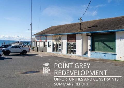
• The Fishing Co-operative building currently exists in a dilapidated state.
• Two independent structural assessments have indicated that significant engineering intervention would be needed to bring the Fishing Co-operative building up to current design and regulatory standards.
• Existing buildings have not been constructed in accordance with current building standards.
• The Fishing Co-operative building is currently located in an erosion-prone area and a coastal inundation hazard zone, as confirmed by technical assessments.
Food and Drink Premises
OPPORTUNITIES
• A food and drink premise with a relaxed atmosphere that is appropriate in scale, respects the natural setting and the cultural history of the precinct, provides amenity for access to the coastal edge, and is in accordance with the Marine and Coastal Act 2018.
• Enhance the user experience at Point Grey to provide food and drink for primary users of the site (fishing and boating).
• Food and Drinks premises design should provide publicly accessible spaces and amenity for a range of users, e.g. outdoor shade, seating and tables for community events and meetings, BBQ’s and benches.
• Explore flexibility of design to enable varied use and management type throughout quieter times of the year.
• Food and Drink premises should offer both seated dining and takeaway options.
• Implement Environmentally Sustainable Design wherever possible.
CONSTRAINTS
• Site visitation is seasonably variable.
THANK YOU AND NEXT STEPS…
The opportunities and constraints identified in this report will inform the establishment of an appropriate, site responsive Urban Design Framework (UDF) and Master Plan for the Precinct, which will balance community sentiment, best practice coastal planning, relevant legislation, and funding parameters.
The UDF and Master Plan will include design concepts that will illustrate how a future outcome can look at Point Grey, to enable testing with stakeholders, including the local community. Our Coastal Adaptation Plan will be incorporated into the UDF and is a fundamental part of the project’s planning.
The draft UDF and Master Plan for the Precinct is anticipated to be released in early 2025. Following this, the creation of architectural drawings will commence, and statutory approvals will be sought.
GET IN TOUCH
To stay up to date with the project, please visit the Have Your Say webpage - Point Grey Redevelopment | Your Great Ocean Road. The project team can be contacted at: haveyoursay@GreatOceanRoadAuthority.vic.gov.au.
