FACT SHEET
MARINE AND COASTAL MANAGEMENT FRAMEWORK FOR CROWN LAND IN VICTORIA


Aboriginal Victorians have been connected to Victoria’s marine and coastal Country for over 60,000 years. We acknowledge and respect the separate and distinct Eastern Maar and Wadawurrung Peoples as the Traditional Owners of the Great Ocean Road’s land, waters, seas and skies. We acknowledge their cultural knowledge that has led to sustainable practices and has cared for Country for tens of thousands of years. We honour Elders past and present and thanks Elders for sharing their wisdom, ensuring the continuation of Culture and Traditional practices.
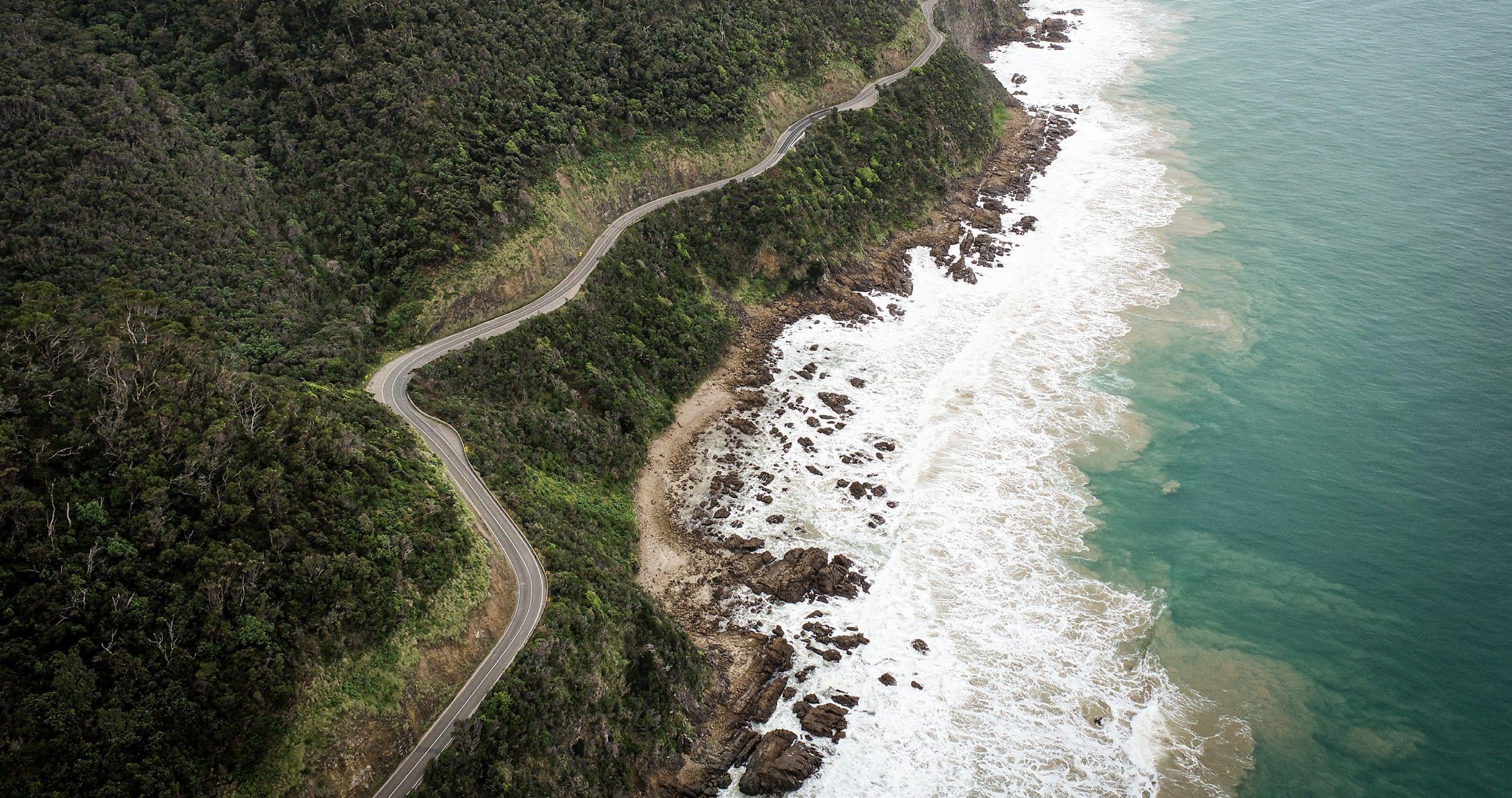
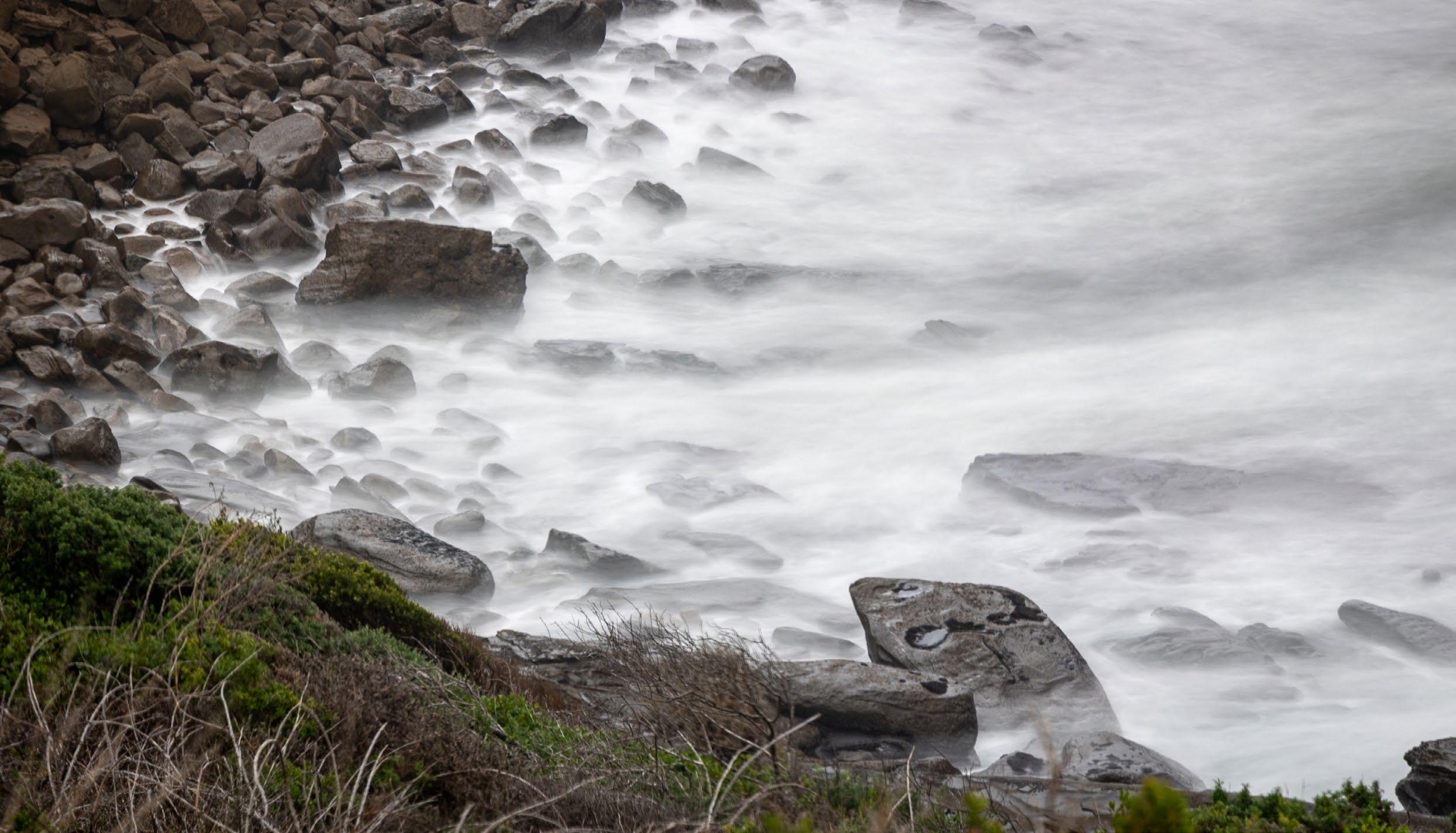
Victorians love to live near, visit and experience our coast and ocean. Coastal and marinedependent industries such as fishing, tourism, ports and shipping make significant contributions to local and regional economies. Our coasts and marine waters have many benefits and are core to our shared cultural identity and wellbeing. This sense of belonging and admiration is present when visiting or living near city beaches, coastal hamlets, smaller seaside towns or remote areas.
Victoria’s marine and coastal environments are important habitats for many plants and animals. There are many spectacular coastal landscapes that are integral to our identity. These environments can also protect us from the extremes of weather through natural coastal defences and carbon storage.
Coastal values and benefits are only possible when the marine and coastal environment is healthy and resilient. Currently, the health of the marine and coastal environment is under threat from multiple sources, including changing climate, growth in towns, cities, and industries that interact with coastal ecosystems. Drivers of change such as population & visitor growth, changing climate and ageing infrastructure exacerbate existing threats and bring new challenges. Identifying threats and adapting for change is an opportunity for coastal land managers and the community to ensure marine and coastal values are protected now and into the future.
Growth in resident populations and visitor numbers places pressure on the health of the marine and coastal environment. This can also cause a loss of character in coastal towns. As more people seek access to finite coastal spaces and marine resources, the risk of greater conflict between uses and the capacity of sites increases. A balance between maintaining healthy and functioning ecosystems that also support the economy is essential for the continued wellbeing of the marine and coastal environment.
Many coastal infrastructure assets and buildings are ageing and require maintenance
or upgrading. Increasing storms and erosion as a result of a changing climate will further undermine the integrity of many assets and buildings. This will force complex decisions to be made about the suitability of their future use and if replacement is suitable or appropriate.
The changing climate is increasing coastal hazard risks, like erosion and inundation. This requires coastal land managers to use coordinated, evidence-based planning and decision-making tools to plan and design assets whose function is dependent on being on or near the water, (following the adaptation pathway, Figure 5) and to relocate non-coastaldependant assets.
The Marine and Coastal Act (2018) and the Marine and Coastal Policy (2020) each play a role in managing the health of Victoria’s marine and coastal environment.
The Act outlines the guiding principles and objectives to ensure the marine and coastal environment is cared for so future generations may also experience and enjoy its multiple benefits.
The Policy sets out the vision for ‘a healthy, dynamic and biodiverse marine and coastal environment that is valued in its own right, and that benefits the Victorian community, now and in the future’ (Figure 1). The Policy provides specific considerations for planning, management and decision making and includes a ‘Planning and Decision Pathway’ (Figure 2) that shows how the objectives and guiding principles in the Act are to be used in decision-making.
Our vision is for a healthy, dynamic and biodiverse marine and coastal environment that is valued in its own right, and that benefits the Victorian community, now and in the future.
Integrated coastal zo ne management
Evidence -base d decision m aking
Ecologically sustainable deve lopment
Ecosys te m-based management
Adaptive managemen t
Proportionate an d risk-based principl e
Precautionary principle
Acknowledge Tr aditional Owners ' rights, aspirations and knowledge
Understand, acknowledge and act upon the rights and aspirations of Traditional Owne rg roups for Country
Protect and enhance the marine and coastal environment
Protect and enhance intrinsic va lues and goods an db enefits of th em arine an d coastal environment
Re s pect natural processe s
Understand the dynamic natu ra l processes in planningfor and managing riskstop e ople an da ss ets
Strengthen resilienc eto climate change
Understand the current and future stressors from climate change and assess ho ww el lt he marine and coastal environment can cope w ith and adapt to change a nd how that can be st re n gthened
Use and d eve lop susta inably
Consider the impacts and benefits of ex isting an dn ew use and development on the envi ro n men t, other users and the prosperity of fu tu re generation s
Taking a stewardship approach to ho ww e care for and manage the marine and coastal environment
Building understanding and knowledge of the condition and values of the marine and coas ta l environment
Engaging with a wide variety of communities and user groups that va lue the marine an d coastal environment
Collaborating across the bre adt hof people an do rg anisations involved in marine and coastal management to deliver an in te grated an dc o- ordinated approach
Recreational use of the marine and coastal environment is highly valued by Victorians and visitors alike. The ways in which people enjoy the coast are many and varied, from the passive (beach walking, picnicking) to the active (swimming, surfing, boating, fishing).
These activities are often supported by water-based clubs including angling, sailing, boating and lifesaving clubs, and structures and facilities such as campgrounds, public jetties, boat ramps, paths and signage.
Increases in populations and visitor numbers are adding to demand for buildings and structures to support safe, equitable and sustainable recreational and tourist activities. Strong strategic planning can ensure sustainable use that does not degrade the values that make the coast a desirable place to visit.
The Marine and Coastal Act (2018) sets out a hierarchy of tools (Figure 3) to enable strategic planning and guiding decisions to support the Policy vision.
These complement strategic tools under the Planning and Environment Act (1987). A more detailed version is included in Appendix 1.
STATE
Marine & Coastal Policy (2020)
Statewide approach to guide decision making
LOCAL LEVEL TOOL ROLE
Coastal & Marine Management Plan
Consent for Use Development
Strategic application of the Marine & Policy at local level for foreshore/ reserves
Figure 3. Hierarchy of tools to enable strategic planning and decision making.
Buildings and structures in the marine and coastal environment support the functioning of communities and industries. They include port facilities, transport docks, jetties, boat ramps, paths, toilet blocks, picnic facilities, structures to maintain public safety, and buildings to enhance recreation opportunities such as clubs and cafes.
New and improved buildings and structures that are well-designed, appropriately located and properly maintained are necessary to enable a diversity of uses in the marine and coastal environment, and to accommodate increasing demand as the population grows.


‘Marine and coastal environment’ means the area between the outer limit of Victorian coastal waters and 5km inland of the high-water mark, biodiversity associated with the land and water of these areas.

‘Marine and coastal Crown land,’ comprises the Crown land (whether covered by water or not) within the area between the outer limit of Victorian coastal waters and 200 metres inland of the highwater mark of the sea, to a depth of 200 metres below the surface of that land.
These terms are defined under sections 4 and 5 of the Marine and Coastal Act (2018).

‘Comprises the Crown land (whether covered by water or not) within the area between the outer limit of Victorian coastal waters and 200 metres inland of the highwater mark of the sea, to a depth of 200 metres below the surface of that land.’


Defined under section 4 of the Marine and Coastal Act (2018).

(LINKED TO STEP 5)
96% of Victoria’s coastline is designated Crown land. Buildings and structures on ‘marine and coastal Crown land,’ have additional specific requirements to ensure appropriate use.
Victoria’s marine and coastal Crown land is an important publicly owned asset offering benefits to all Victorians, as well as to visitors. Foreshores and reserves (on coastal Crown land) provide important public open spaces, as well as extensive environmental, social, and economic values.
Coastal Crown land has unique values and characteristics, is in high demand, is limited in size and may be reduced over time as sea levels rise and the coastline retreats. Given this, buildings or structures are confined to those that need to be located on or near the water and provide significant net community benefit*.
Proposal does not proceed or is modified to meet criteria
When considering potential use or development on marine and coastal Crown land it can be useful to use a pathway approach, outlined in Figures 4 and 5. This helps to step through the elements in the Marine and Coastal Policy. It is important to note that no two marine and coastal locations are the same. Each location must be evaluated and planned for considering its own opportunities and constraints.
* The definition of Significant public benefit – demonstrated by the following criteria:
• ‘public benefit’ should be defined as relevant to each individual case, based on an understanding of public values of the site in question there must be a need for the identified value to be protected in order to provide significant public benefit
• protection of private property should not be the only purpose of a structure on marine and coastal Crown land. Benefit should, be in the least, access and amenity to the broader local community it is not enough to show that there is no public detriment as a result of a proposal. ‘Significant’ public benefit must be demonstrated (e.g. protection of environmental and cultural features of the coast). (Marine and Coastal Policy (20202))
Proposal does not proceed or is modified to meet criteria
Planning & Decision Pathway
STEP 1 Detailed in Chapter 1
STEP 2
Detailed in Chapters 2-5
Is it in line with Traditional Owner Assertations?
Does it protect and enhance the marine & coastal environment and its intrinsic values?
Does it avoid areas vulnerable to coastal hazards?
How are Coastal Managed?
NO NO NO
Proposal does not proceed Proposal does not proceed or is modified to meet criteria
Proposal does not proceed or is modified to meet criteria
Chapter 6
Detailed in Chapters 8-13
SITING & DESIGN
Chapters 8 & 11
COMPLEMENTARY TO CHAPTERS 8 & 11 OF THE POLICY
Can the impacts and benefits on the environment, other users and future generations be managed appropriately?
Coastal Hazards Managed? NO NO
Provides a comprehensive review of key decision-making elements detailed in previous chapters & guides thorough planning.
Siting & Design Guidelines for Structures on the Victorian Coast (2020)
Proposal does not proceed or is modified to meet criteria
Proposal does not proceed or is modified to meet criteria Policy (2020).
Each chapter of the Policy has a corresponding step in the Planning and Decision Pathway, as articulated in Figure 5. Chapter 11 revisits the other chapters in a comprehensive way to ensure all requirements have been considered. The policies listed here are all the elements a coastal land manager must consider when planning structures or buildings on coastal Crown land.
Development on marine and coastal Crown land is detailed in Policy 11.4
“Provision or improvement of buildings and structures on marine and coastal Crown land is confined to those providing significant net community benefit* and whose function depends on being on or near the water.”
Manage increased exposure to coastal hazard risk
Exposure to public health and safety risk
Manage detrimental impact on neighbour land
Adverse effects on environment uses and values
Manage impacts on marine and coastal functions and processes
Minimise impacts on flora and fauna
Avoid impact on cultural and heritage values
Avoid impacts on sites of geomorphological significance and to fossils
Avoid generating ongoing noise that intrudes on local community
Make efficient
Facilitate multiple use and infrastructure
When replacing or modifying minimise its footprint (to efficiently and
Consider relocating existing that are not functionally dependent marine and coastal
Do not permit buildings or public use
efficient use of site
and sharing of sites and infrastructure
modifying buildings, consolidate/ (to use coastal Crown land and sparingly)
existing buildings and structures dependent on being located on coastal Crown land
structures that provide no use benefit
Provide increased public functions and adaptability
Minimise the structure’s environmental footprint
Not impede access to coastal Crown land
Avoid dominant structures not sympathetic to local heritage or character
Complement and enhance the surrounding landscape and coastal character
Retain public views to, from, along the coast
Use materials and finishes that are sympathetic to the coastal environment
Use materials that respond to geology and surrounding substrate
There are also examples in the Marine and Coastal Policy of buildings and structures that are functionally dependent on being located on marine and coastal Crown land. In conjunction with the Department of Energy, Environment and Climate Action (DEECA) we recognise this is not an extensive list therefore we seek advice if a proposed structure is not identified on the list in Table 3.
are func tionally dependent on being located on marine and
Usually located on marine and coas tal Cr own land because th ey are fun ct ionally dependent on being on or near the water
• Je tt y
• Ba thing box and boa t she d
• Pier
• Ma rina
• Mo oring
• Boat ramp
• Ha rbour
• Na viga tion aid
• Lifesaving obser vation tower
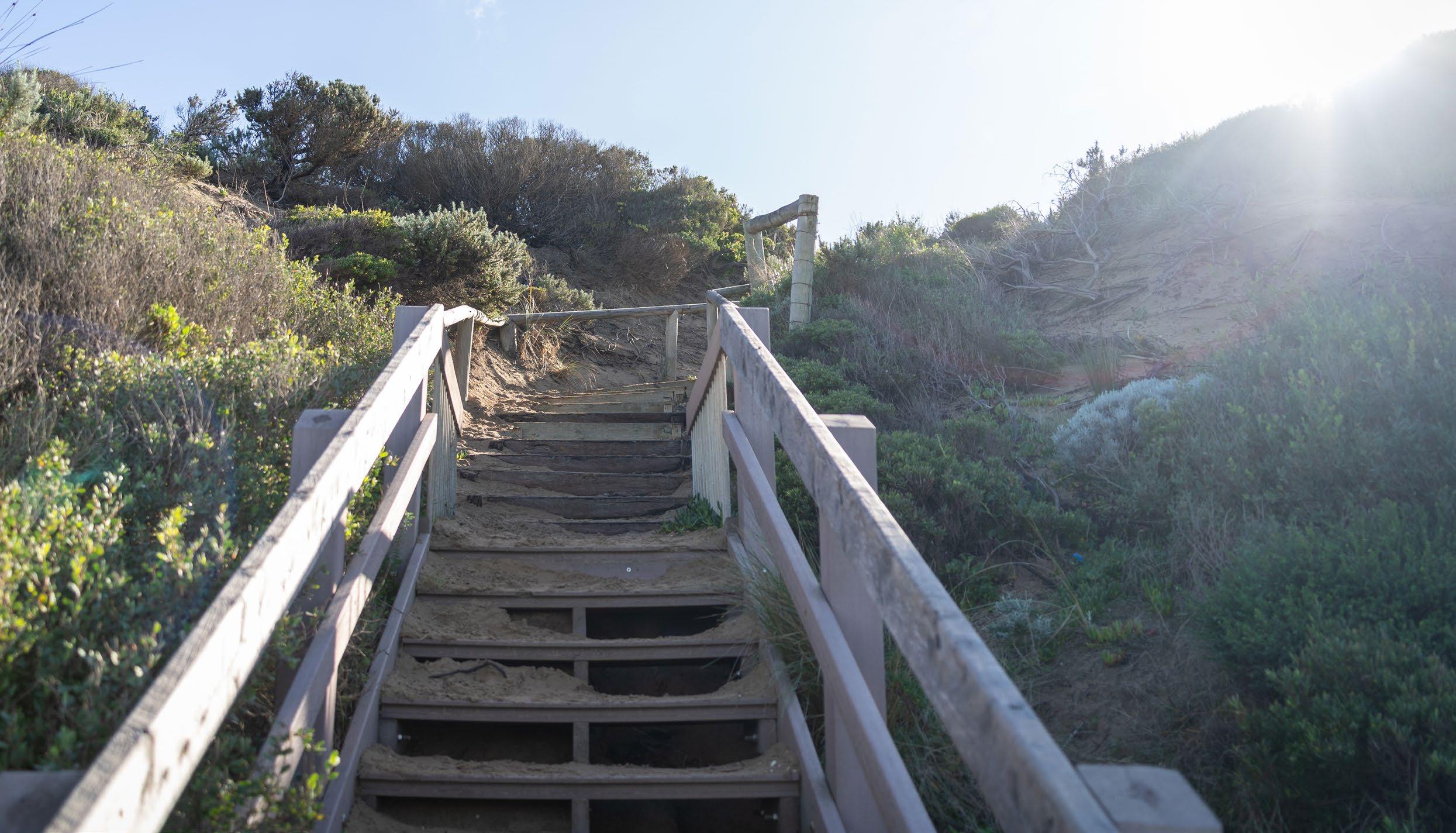
• Access poi nt and stairs
Provide suppor t to t he fun ct ioning of marine and coas tal ac tivities and may be appropriate in some marine and coas tal Cr own land locations
• Toilet facility
• Sh ared trail, bo ardwalk
• Car parking
• Ma rine rescue facility
• Lifesaving club room
• Public loo kout
• Ba rbecue, picn ic and play equipment
• Kiosk/ ca fé/restaurant (preferably in an urban sett ing)
• Appr opriate publ ic camping facilit y
Examples of buildings and structur es tha t do not suppor t a coastal or marine activit y and do not n ee d to be lo ca ted on m arine and co astal Crown land:
• Non- wa ter-based spor ting facilit y
• No n-ma ritime indus trial plant and storage
• Communit y hall
• Commer cial function centre
• Ot her ut ilities
(LINKED TO STEPS 3 & 4)
A crucial step in considering the use or development of coastal Crown land, is understanding and planning for coastal hazards and climate change impacts.
The Marine and Coastal Policy sets out a ‘pathway approach’ for this that is stepped over time and allows decision makers to plan for, prioritise, and stagger investment in adaptation options.
When identifying strategic adaptation options, they are to be considered in the below order:
• Non-intervention
• Avoid
• Nature-based methods
• Accommodate
• Retreat
• Protect
More information on these strategic adaptation options is detailed in Figure 8.
Strategic options order Descriptions (aligned to Marine and Coastal Policy 2020)
Nonintervention Allow marine and coastal processes and the hazards they may pose to occur.
Avoid Locate new uses, development and redevelopment away from areas that are or will be impacted by coastal hazards
Nature-based methods Nature- based methods use the creation or restoration of coastal habitats for hazard risk reduction.13
Accommodate Structures can be designed to reduce the exposure to or decrease the impact of coastal hazard risk.
Retreat Existing structures, assets or uses may be decommissioned or relocated away from areas that are or will be negatively impacted by coastal hazards
Protect (major engineering works)
Existing physical barriers are enhanced, or new ones constructed to mitigate the impact of coastal hazards.
Protect is an option of last resort ; it is often expensive, its benefits tend to be very localised, and it frequently transfers the problem to nearby areas.
Planning considerations/types of actions (examples - see Stage 5 for all actions)
Triggers (event, timing, other) can be identified for when additional action may commence.
This option typically applies for all coastal hazard areas
This may include beach and dune nourishment for the purposes of habitat restoration, wetland restoration, enabling landward migration of habitat, and potential hybrid nature- based approaches
This may include movable infrastructure (e.g life-saving towers, stairs/ramps) flood resilient building design and use of resilient materials
This may apply locally or more broadly as part of the adaptation planning process
This may include major beach nourishment programs, seawalls or other physical barriers/structures or interventions that are likely to have significant influence on natural coastal processes.
The Victorian Resilient Coasts – Adapting for 2100+ (2023) provides a strategic approach to coastal hazard risk management and adaptation. It includes a framework, guidelines and support for Local Government, coastal land managers and communities to:
• Enable place-based, best practice and long-term coastal hazard risk management and adaptation, and
• Build on the directions in the Marine and Coastal Policy 2020.
Another important policy for Victoria when managing coastal hazards is the sea level rise planning benchmark.
‘Plan for sea level rise of not less than 0.8m by 2100, and allow for the combined effects of storm surges, flooding, coastal processes and local conditions such as topography, and geology, when assessing risks and coastal impacts associated with climate change’.
Department of Energy, Environment and Climate Action Website
Great Ocean Road Coast & Parks Authority
Marine and Coastal Act
Great Ocean Road & Environs Protection Act
Marine and Coastal Policy
Marine and Coastal Strategy
Siting and Design for Structures on the Victorian Coast
Marine and Coastal Act consent Fact Sheet
Victorian Resilient Coasts – Adapting For 2100+
LE GISL AT IO N
Marine and Coastal Act 2018
Objectives and guiding principles for planning marine and coastal environment.
S TAT E WIDE POLICY
Marine and Coastal Policy (2020)*
15 year lifespan
Marine and Coastal Strategy (2022)*
Made every 5 years
Statewide policy to implement the Marine and Coastal a healthy, dynamic and biodiverse marine and valued in its own right , and that benefits the Vict in the future. Includes a Marine Spatial Planning
Strategic actions to implement policy directions
Traditional Owner Self-Determination
Habitat condition and connectivity
Adapting to climate change
Sustainable use and development
Implementing the Marine Spatial Planning Framework Resource needs for marine and coastal management.
Strategic planning supported by:
Regional strategic planning
- Coastal Hazard Adaptation and Resilience Plans
- Marine Plans
- Regional and Strategic Partnership Products*
- Environmental Management Plans*
- Other products and plans
LO CAL PLANNING AND DE CISION MAKING
Coastal and Marine Management Plans* Matters relating to and affecting marine and coastal Crown land
Made / renewed every 5 years
Consents for use & development on marine and coastal Crown land*
Regulations for specified use & development on marine and coastal Crown land*
• Act, Policy and Strategy directions
• Guidelines:
Coastal hazard risk Victoria’s Resilient Coast
Marine Spatial Planning
Victoria’s marine planning areas
Siting and design
Other materials to support Policy.
• Tools:
Victorian Coastal Monitoring Program
Other tools to support Policy.
Local planning supported by:
• Act, Policy, Strategy and regional planning
• Guidelines:
Coastal and Marine Management Plans
Bathing boxes
Other materials to support Policy
• Site specific plans and investigations
* Statutory tools under the Act
Appendix 1. Extract from Victoria’s Resilient Coast Framework and Guidelines, 2023 - Policy and legislation context for marine and coastal management
Coastal Act 2018 and support coastal environment that is Victorian Community, now and Planning Framework.*
and management of the directions (2022 - 2027): amework management.
Other relevant legislation
Statewide policy, frameworks and strategies
Other relevant and applicable Acts:
Aboriginal and Torres Strait Islander Heritage Protection Act 1984 (Cth)
Aboriginal Heritage Act 2006
Australian Maritime Safety Authority Act 1990 (Cth)
Biosecurity Act 2015 (Cth)
Catchment and Land Protection Act 1994
Climate Change Act 2017
Coastal Waters (State Powers) Act 1980
Crown Land (Reserves) Act 1978
Emergency Management Act 2013
Environment Effects Act 1978
Environment Protection Act 1970 & Environment Protection Act 2017
Environmental Protection and Biodiversity Conservation Act 1999 (Cth)
Fisheries Act 1995
Fisheries Management Act 1991 (Cth)
Flora and Fauna Guarantee Act 1988
Heritage Act 2017
Land Act 1958
Marine Safety Act 2010
Regional policies and strategies
Local policies, zones, overlays, management and action plans
Maritime Transport and Offshore Facilities Security Act 2003 (Cth)
National Parks Act 1975
Native Title Act 1993 (Cth)
Offshore Petroleum & Greenhouse Gas Storage Act 2010
Planning and Environment Act 1987
Pollution of Waters by Oil and Noxious Substances Act 1986
Ports Management Act 1995
Traditional Owner Settlement Act 2010
Transport Integration Act 2010
Underwater Cultural Heritage Act 2018 (Cth)
Planning permits, leases and licences
Underwater Cultural Heritage (Consequential and Transitional Provisions) Act 2018 (Cth)
Victorian Aboriginal Heritage Act 2006 Water Act 1989
Wildlife Act 1975