


LANDUSE AND LANDCOVER
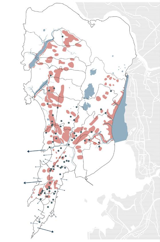
EMPLOYMENT DENSITY + SLUM CLUSTER MAP WASTE MOBILITY
LEGEND:
Mud flat with mangroves
Water bodies
Open jungle with other trees
Forested area
Cultivation
Built up area
Reclaimed area
Human encroachment in forested area

OPEN SPACES AND NATURAL AREAS

LEGEND: Less dense Less scarce
Densely employed area
Scarcely employed area
Slum cluster
Selected slum area
Ward boundary
LEGEND:
Open spaces
Beach Marsh/ Swamp
Moist deciduous forest
Mudflat vegetation(Mangroves)
Plantation
Rock along coast
Rock outcrop
Salt pan
Scrubland/ Grassland
Reserved forests
0 km 2.5 5
Thane creek flamingo sanctuary

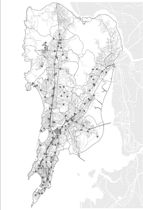
WATER BODIES AND FLOOD SPOTS
MSW Dumping grounds + + LEGEND: Refuse transfer station Open to dumping Truck transportation
Selected slum area Ward boundary

LEGEND: Flood extensions Major flood spots
Water bodies

LAND SURFACE TEMPERATURE


Water
No


The municipal actions in terms of localizing the SDGs, specifically targets:
LOCAL MUNICIPALITIES
COMMUNITY BASED ORGANIZATIONS
NON-GOVERNMENT ORGANIZATIONS
RESIDENTS
EDUCATION & RESEARCH (UNIVERSITIES)
STRATEGIC ACTIONS
CONNECTIVITY:
INCLUSIVITY:
RESILIENCE:

Ecology Spatiality Accessibility

DESIGN FRAMEWORK

HETEROGENITY:
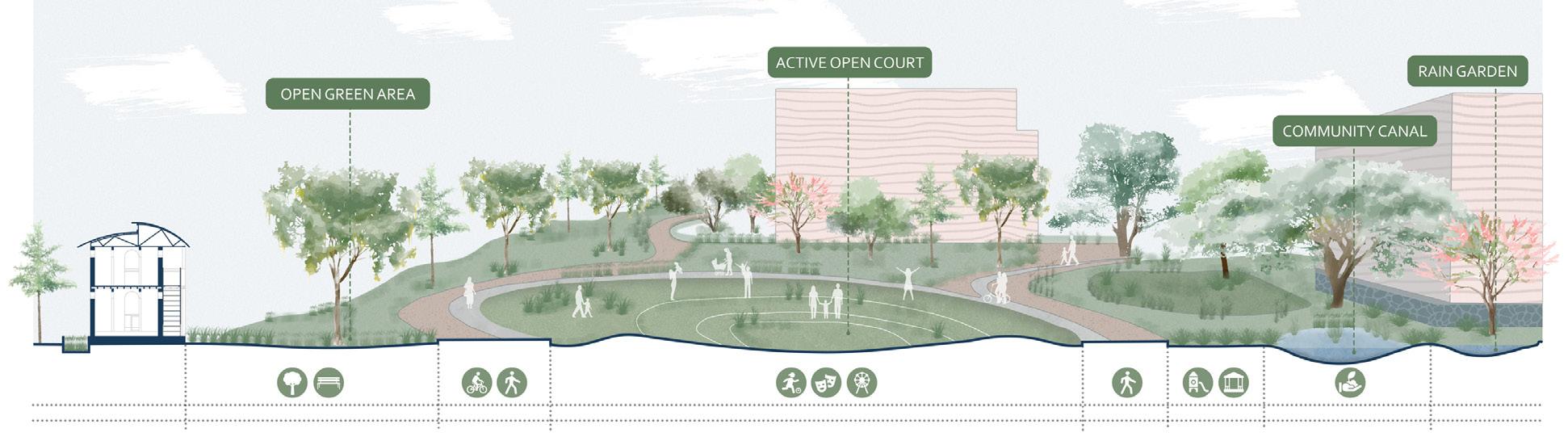
De-centralised connected open spaces for the community
Inter-relations within the residential blocks
CLIMATE RESPONSIVE:
of the
and ground

MAINTAINING SCALE:

Proposed community hubs

COMMUNITY LINKS
The community circulation connects the housings to the sharing hubs serving basic facilities like public healthcare. The community hub buildings serve the basic needs and education for the community as NGO buildings, education centres, community toilets and recycling centres which are spread throughout the settlement.
Proposed residential clusters
BUILT HABITAT
Clusters for housing are formed based on the circulation pattern and by extending the grid in place of the illegal informal housing.
MOBILITY
The major vehicular roads are maintained following the existing grid and pedestrian routes are established for better connectivity.
Vehicles
Pedestrians and residents
Existing open drains
Water supply lines
Retention ponds
CANALS AND DRAINS
New water supply lines are laid meeting basic drinking water facilities for the residents, rejuvenation of the open drains/canals and water retention ponds help in rainwater harvesting by collecting water during heavy monsoons.
Dumpyard
Flood prevention dyke
Pollution buffer
Community farm
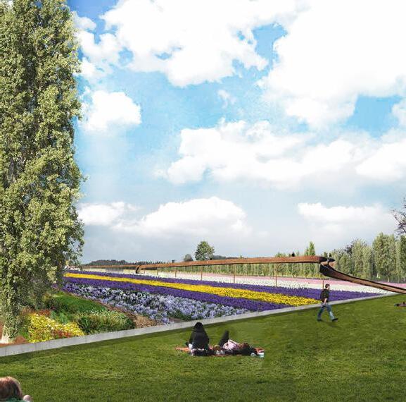
Open space/ pocket parks
URBAN GREEN POCKETS
Green pockets are created to improve the micro-environment and rows of trees to keep pedestrian areas shaded. Pollution buffer is planned along the boundary of the dumpyard for odour and emission management. The bio-filter treatment system also serve as green spaces for the community.
Open pocket parks
Community farms
Pollution buffer
Retention ponds
Flood prevention dyke


Trees are planted in each zone depending on the function of the areas-
Ht: 15-20m Dia: upto 12m
Ht: upto 10m Dia: 1-m
Ht: 10-12m Dia: 6-8m
Ht: upto 15m Dia: 8-10m
Ht: 20-35m Dia: upto 20m

fistula
Delonix regia
Peltoforum pterocarpum
Azadirachta indica
Ht: 15-30m Dia: upto 10m
indica

Flowering season
Evergreen
April to July
Deciduous
April to May
Ht: 2040m Dia: upto 5m
Ht: upto 10m Dia: 8-10m
Deciduous
April to June
Ht: 18-30m Dia: 8-12m
Deciduous
May to June,September to October
Ht: 20-35m Dia: upto 20m
Evergreen
March to July
Evergreen
February to March

Alstonia scholaris
Evergreen
Flowering season
Tree Tree Tree description description description
Flowering season
September to November
Eucalyptus globulus Evergreen
February to July
Albizzia lebbeck
Deciduous
April to May
Azadirachta indica
Evergreen
March to July
Ht: 15-30m Dia: upto 10m
Ht: 15-30m Dia:5m
Mangifera indica
Evergreen
February to March
Ficus religiosa
Deciduous or semi-evergreen
November to December

Ht: 10-12m Dia: 6-8m
Ht: upto 10m Dia: upto 6m
Ht: 1520m Dia: upto 5m
Ht: upto 10m Dia: upto 8m
Ht: 15-30m Dia: upto 10m
Ht: 15-30m Dia:5m
fistula Deciduous
April to May
Bauhinia varigeta Deciduous
January to March
Tabebuia aurea Deciduous
January to March
Lagerstromea speciosa Deciduous
April to June
Mangifera indica
Evergreen
February to March
Cocos nucifera
Evergreen Depends
Ficus religiosa
Deciduous or semi-evergreen
November to December
LEGEND:
1. Residential Blocks
2. Community Hub
3. Community Farm
4. Pretreatment Bio-filter
5. Urban Green pocket/ Playground
6. Retention Pond
7. Community Basketball Court
8. NGO/ School building


WASTEWATER TREATMENT

STORMWATER DRAINAGE WATER CYCLE CONCEPT DIAGRAM


COMMUNITY HUB
Unpaved path that connects all community hubs
Sharing facilities and community toilets COMMUNITY PATHWAY
OPEN GREEN POCKET/ PLAYGROUND
Shared outdoor space for the residents
HOUSING UNITS
Residential housing modules of the informal settlement

