Golden Plains Shire spans the Traditional lands of the Wadawurrung and Eastern Maar Peoples.
Council acknowledges them as the Traditional Owners and Custodians and pays its respects to both Wadawurrung and Eastern Maar Elders past, present and emerging.
Council extends that respect to all Aboriginal and Torres Strait Islander People who are part of Golden Plains Shire.
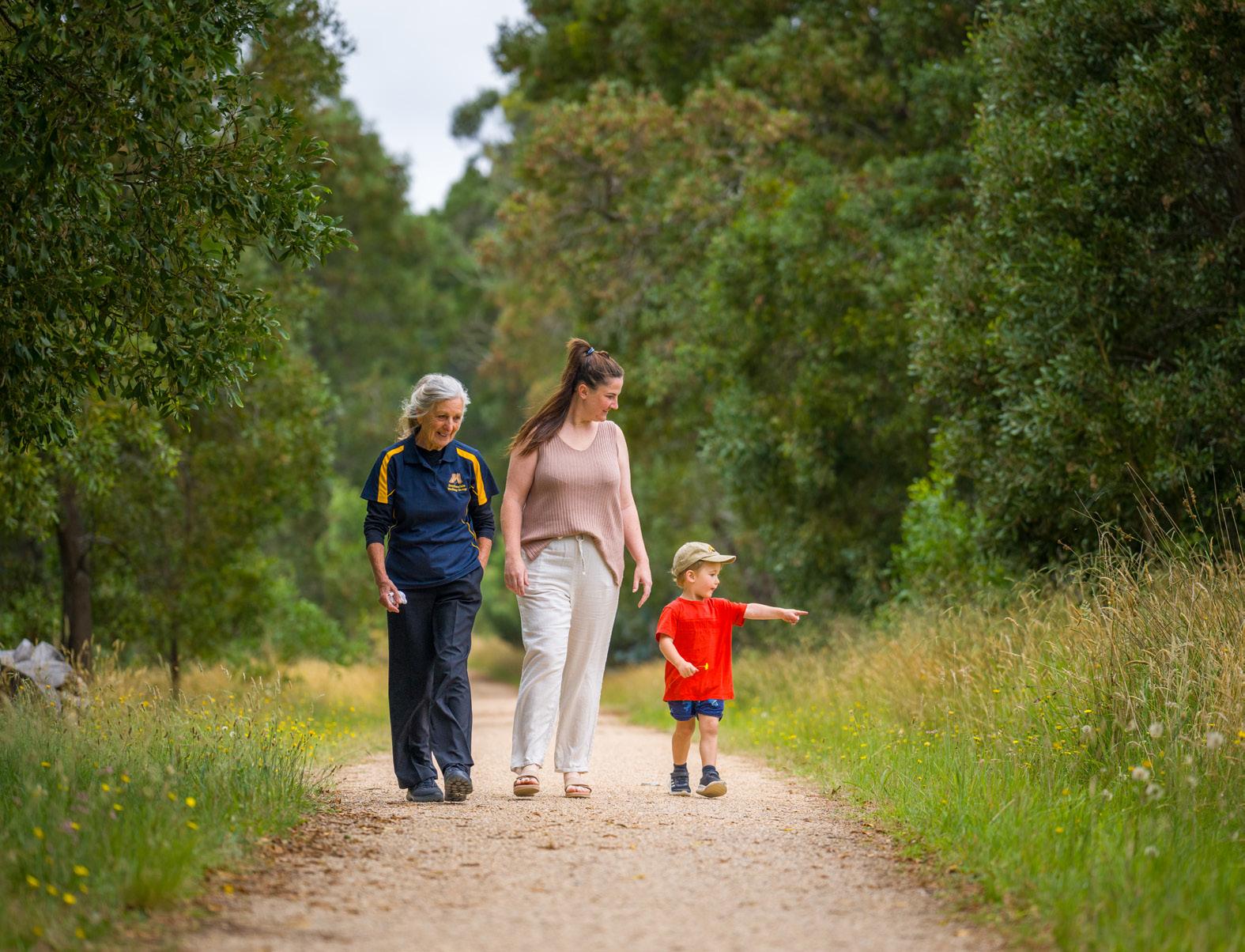
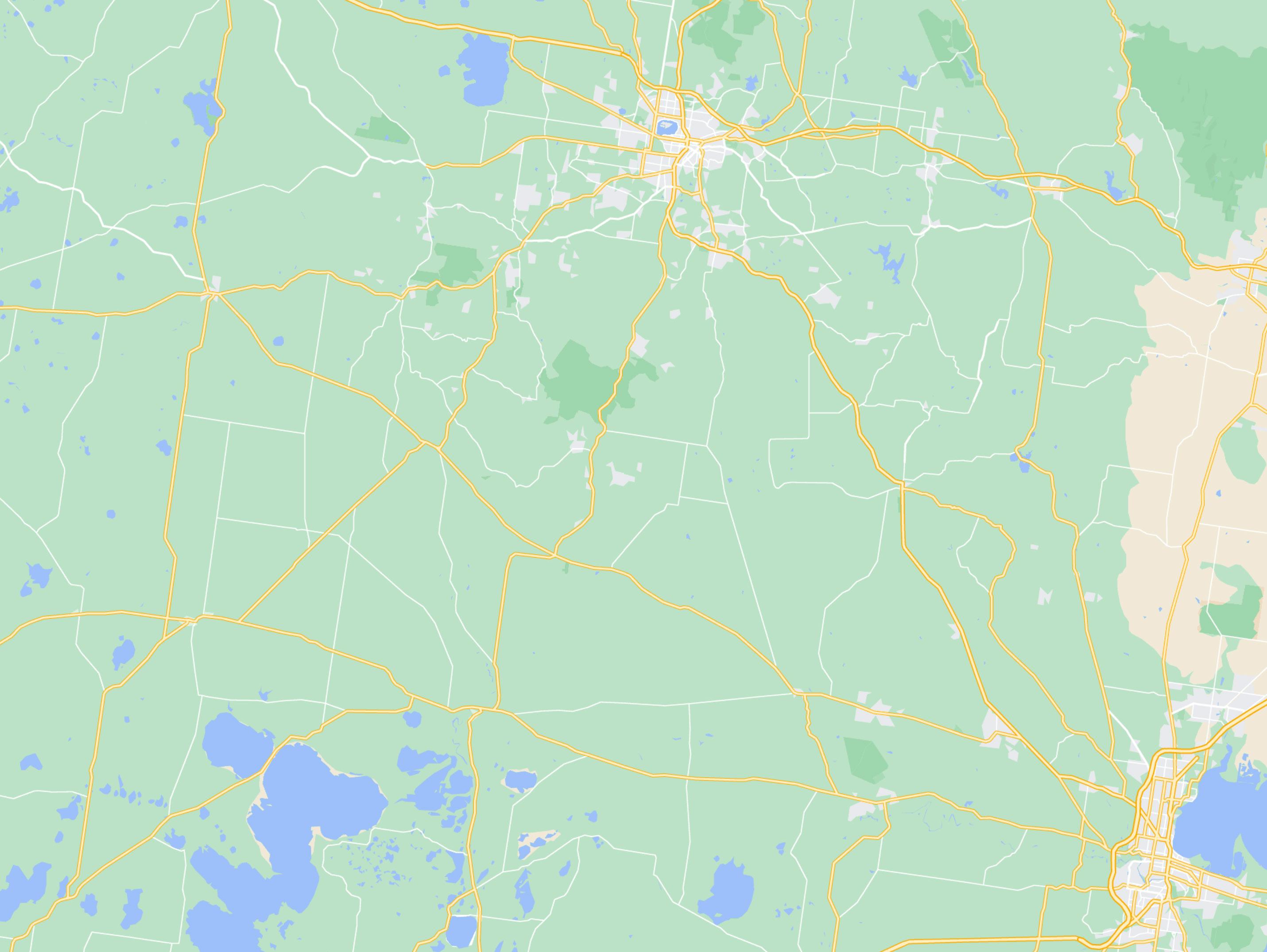
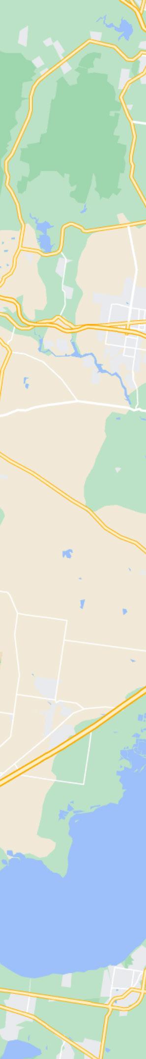
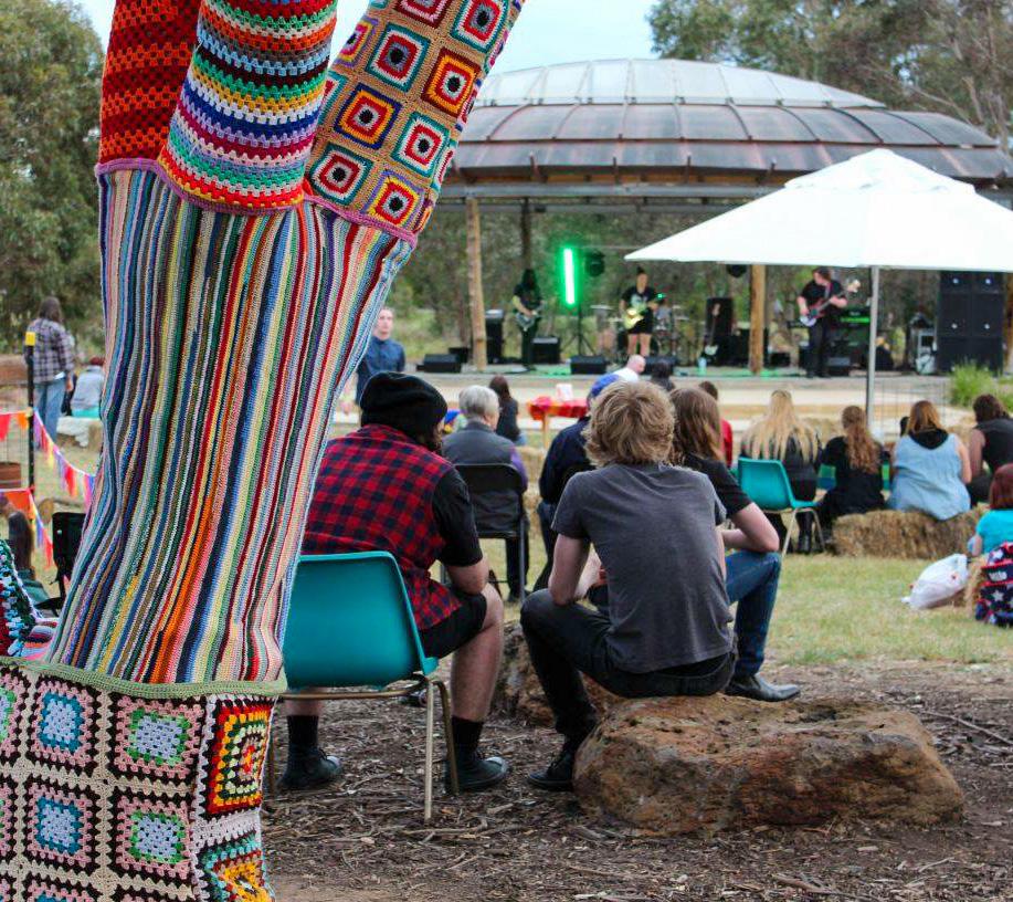
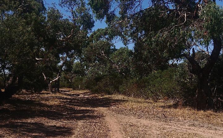
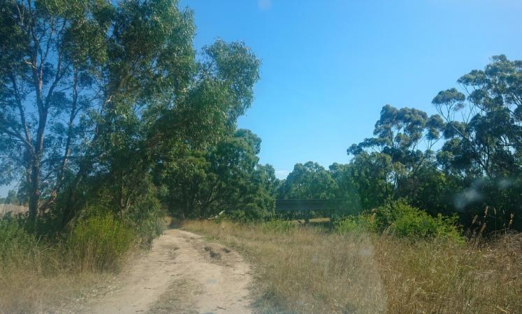
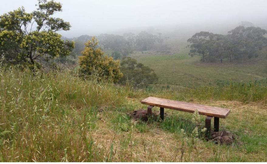
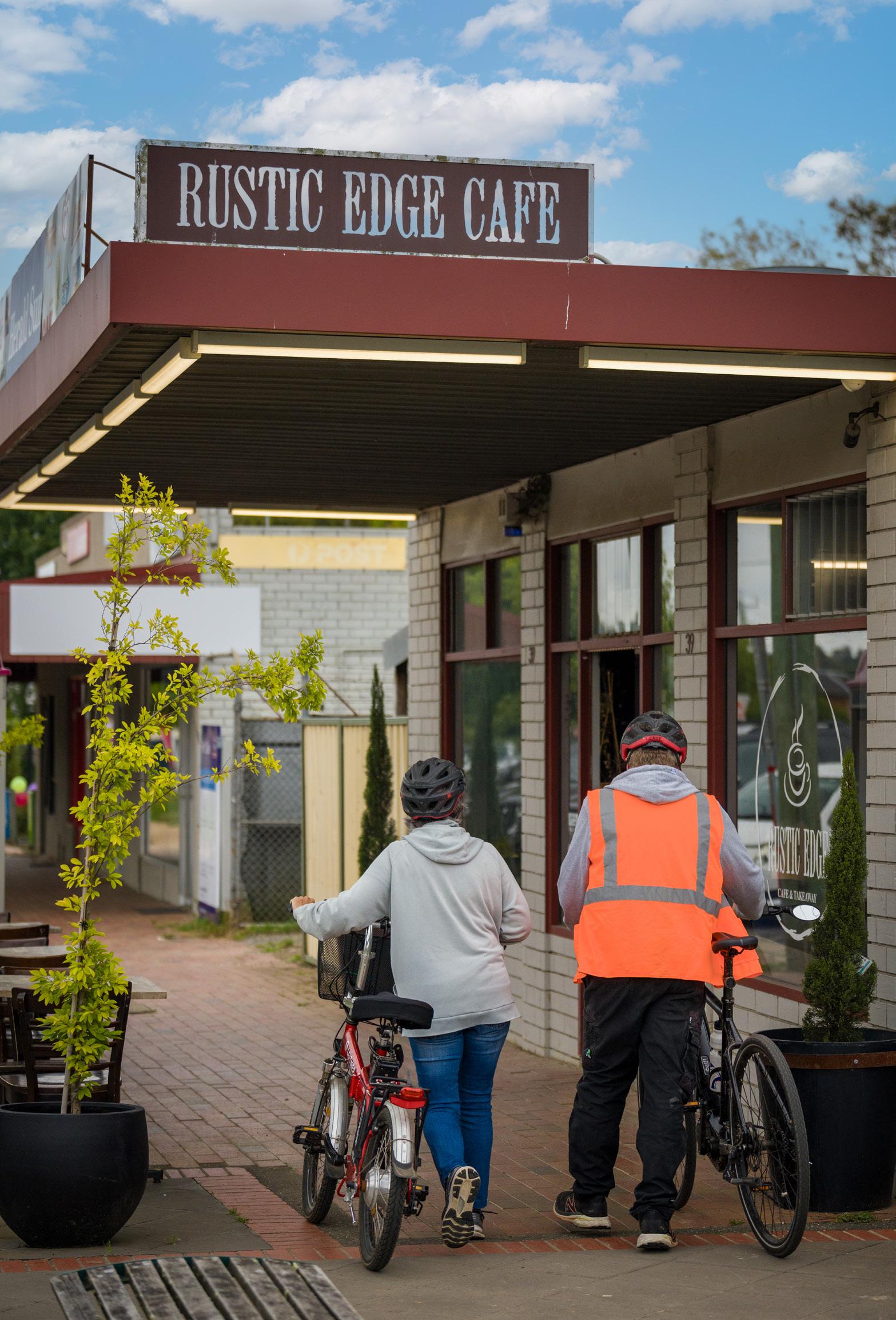
Situated between Geelong and Ballarat and within a stones’ throw from Melbourne, Golden Plains is a vibrant and beautiful Shire with sweeping plains and rugged bush landscapes that blend harmoniously with quaint historic townships. Golden Plains boasts an array of outdoor activities, from short walks to challenging cycling routes, designed to satisfy all types of adventurers. This brochure, an outcome of the comprehensive Tracks and Trails Strategy, serves as your guide to the abundance of wonders waiting to be discovered in Golden Plains.
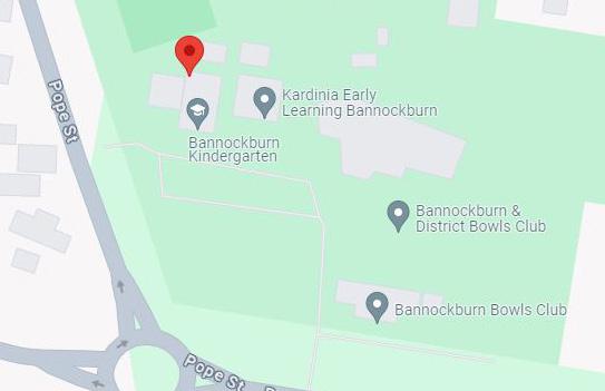
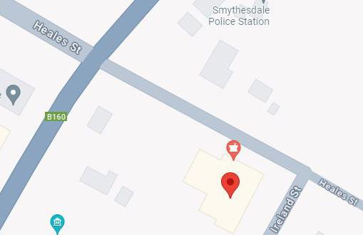
Visit one of our two Customer Hubs situated in Bannockburn and Smythesdale to obtain additional details about Golden Plains Tracks and Trails. Staff are committed to offering exceptional service and a positive experience.
Bannockburn Customer Hub
2 Pope Street, Bannockburn
8.30am to 5pm, Monday to Friday
Smythesdale Customer Hub
19 Heales Street, Smythesdale
8.30am to 5pm, Monday to Friday
• In the event of an emergency call Triple Zero (000)
• Download the free Emergency Plus App available on the App Store or Google Play to assist with location details required to mobilise emergency services
Be prepared for changing weather and unreliable phone reception. The provided walking times are estimates only and will vary based on fitness levels and weather conditions. Inform someone of your plans and ensure self-reliance.
Equip yourself with:
• A mobile phone
• Adequate supply of drinking water and food
• Appropriate footwear, clothing and sun protection
• First aid kit and torch
• Map
For bushfire safety restrictions and updates visit CFA website www.cfa.vic.gov.au or Hotline 1800 362 361.
Golden Plains is located within the Central Fire District.
GIVE WAY
Trails are there to be shared and enjoyed by everyone, please:
• Be considerate of other trail users
• Stay on the defined trail
• Be respectful of private property
Golden Plains is home to several endangered species as well as other rare flora and fauna. Your behaviour has a direct impact on nature. Please take your rubbish home with you.
Trails within Golden Plains Shire are managed and maintained various authorities and stakeholders including: Parks Vic, Council, DEECA, Western Region Ecological Network (WREN), and volunteer groups.
The Golden Plains tracks and trails have been classified under the following Australian Standards for grading, and will help you to choose routes that match your skill level, accessibility and fitness capabilities.
Walking and Hiking Trail Grading
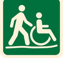
Grade 1: No bushwalking experience required. Flat even surface with no steps or steep sections. Suitable for wheelchair users who have someone to assist them.
Grade 2: No bushwalking experience required. The track is a hardened or compacted surface and may have a gentle hill section or sections and occasional steps.
Grade 3: Suitable for most ages and fitness levels. Some bushwalking experience recommended. Tracks may have short steep hill sections, a rough surface and many steps.
Grade 4: Bushwalking experience recommended. Tracks may be long, rough and very steep. Directional signage may be limited.
Grade 5: Very experienced bushwalkers with specialised skills, including navigation and emergency first aid. Tracks are likely to be very rough, very steep and unmarked.
Mountain Biking Trail Grading
Very Easy: Wide trail with a gentle gradient smooth surface and no obstacles. Suitable for beginner cyclists with basic bike skills, and most bikes.
Easy: Wide trail with a gentle gradient smooth surface. Some obstacles such as roots, logs and rocks. Suitable for beginner cyclists with basic mountain bike skills, and off-road bikes.
Easy with Intermediate Sections: Likely to be single track with a moderate gradient, variable surface and some obstacles. Some obstacles such as roots, logs and rocks. Suitable for mountain bikers with mountain bikes.
Golden Plains offers a diverse range of track and trail experiences, taking into consideration factors such as trail length and experience offered. Each track and trail has been categorised according to the following types, allowing you to select a trail that suits your time restraints and requirements.
Types of Tracks and Trails
Short Trail: Lasting no more than half a day. Ideal for walkers of all ages, from young families to active seniors, these trails offer a glimpse into the diverse landscapes the region boasts.
Day Trail: Typically lasts a half to full day, offering a opportunity to explore rugged bushland, river valleys, rolling hills and rocky plains.
Regional and Multi-Day Trail: Spanning multiple days, long distances and typically connecting various points of interest, these trails can be completed in sections or as complete routes, requiring more planning, equipment and overnight stays at campsites or in accommodation.
Historic Trail: Focussed on exploring historical sites, landmarks, and significant cultural heritage. They offer insights into the area’s past, highlighting important events, buildings, and stories.
Trail User Types
The icons shown below are used throughout this brochure to identify the user types suitable for each of the tracks and trails.
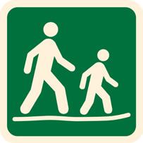
Walking/Hiking: Suitable for walking or hiking.
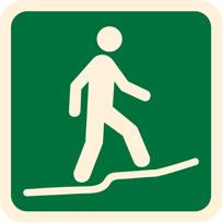
Running/Trail Running: Suitable for trail running.
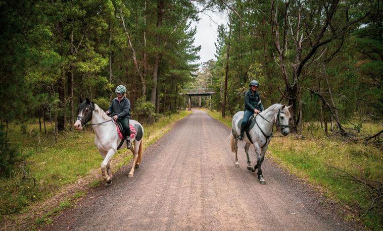
Horse Riding: Suitable for horse riders of all abilities.
Mountain Biking: Suitable to be ridden by a mountain bike.
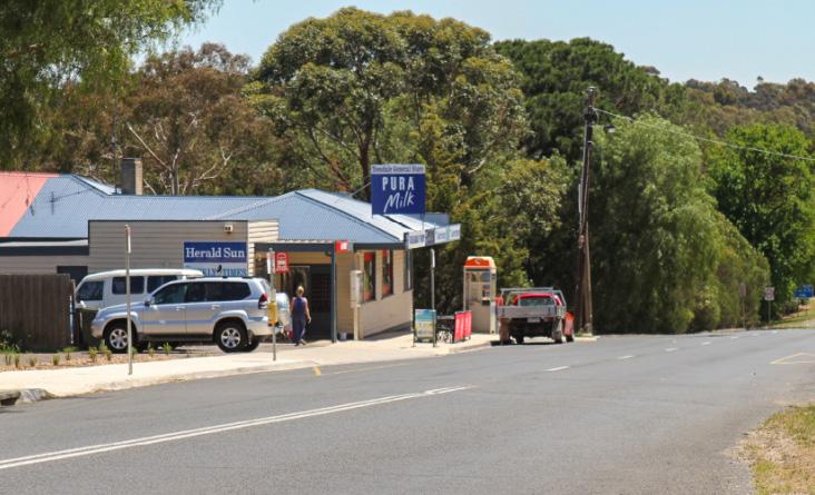
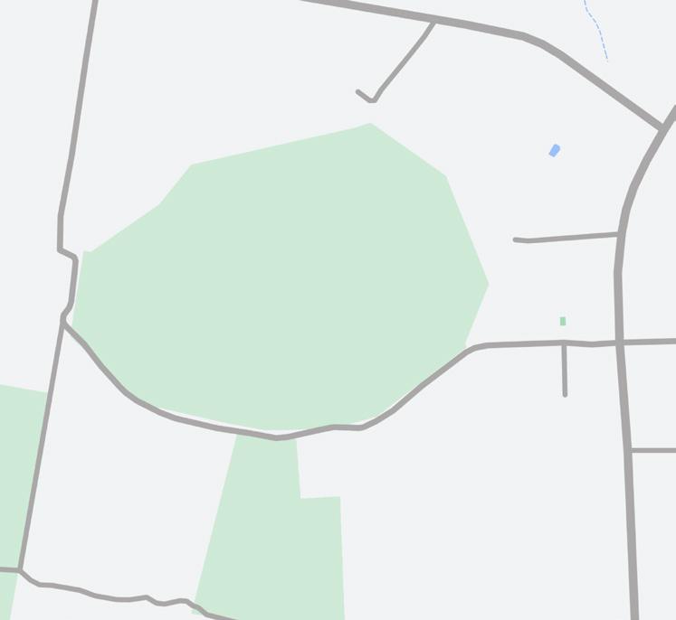
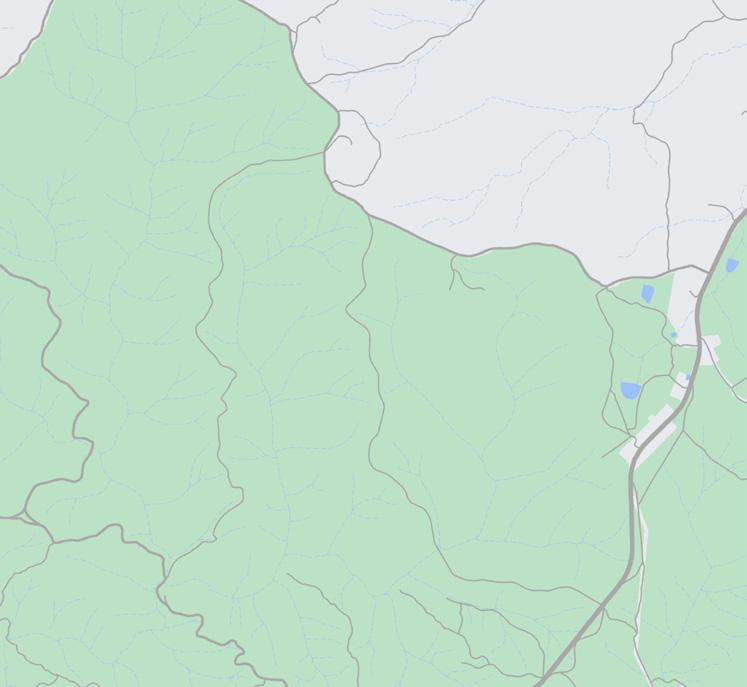
Haddon and Smythesdale District - Page 42
REGIONAL AND MULTI-DAY TRAILS
• Ballarat to Skipton Rail Trail
• Ross Creek Recreation Reserve Nature Loop
• Boden’s Water Races Loop
Central West Golden Plains - Page 35
• Dereel Lagoon
REGIONAL AND MULTI-DAY TRAILS
• Kuruc-a-ruc Trail
• Rainbow Bird Trail
Inverleigh, Teesdale and District - Page 22
• Kangaroo Track via Links Track Loop
• River Track
• Leigh River Trail
• Teesdale Grassy Woodlands
• Chinaman’s Lagoon
• Shelford-Bannockburn Road Shared Path
• Turtle Bend
• Inverleigh Flora Loop
Regional and Multi-Day Hikes - Page 08
REGIONAL AND MULTI-DAY TRAILS
• Ballarat to Skipton Rail Trail
• Kuruc-a-ruc Trail
• Rainbow Bird Trail
• Brisbane Ranges Extended Circuit
• Three Creeks Walk
• Burchell Trail
North West Golden Plains
- Page 38
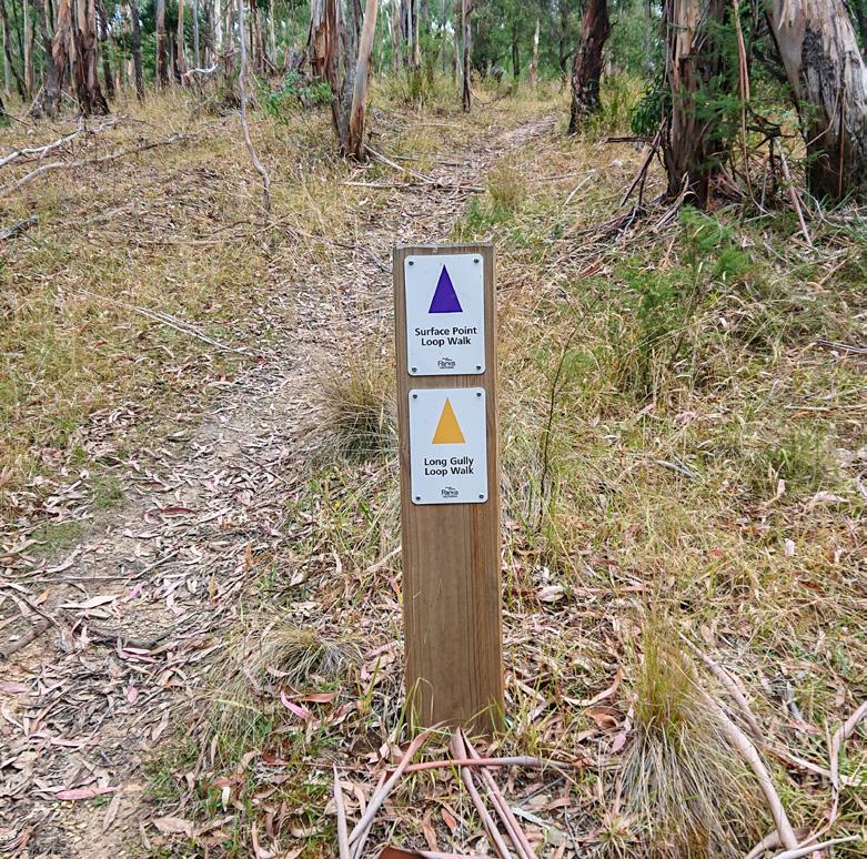
• Surface Point Loop
• Long Gully Loop
• Enfield Bald Hills Loop Trail
TRAILS
• Jubilee Mine Historic Walk
Meredith, Lethbridge and District - Page 28
• Lethbridge Lake Loop
• Ibis Middleton Walk
• Police Paddocks
• Possum Road and Moorabool River Loop
• Meredith Steiglitz Road to Byrne Road
• Meredith/Bamganie State Forest Circuit
• Hay and Burchell Walking Trail
• Deadmans Loop
• Beards Gully Walk
• Steiglitz Historic Walk
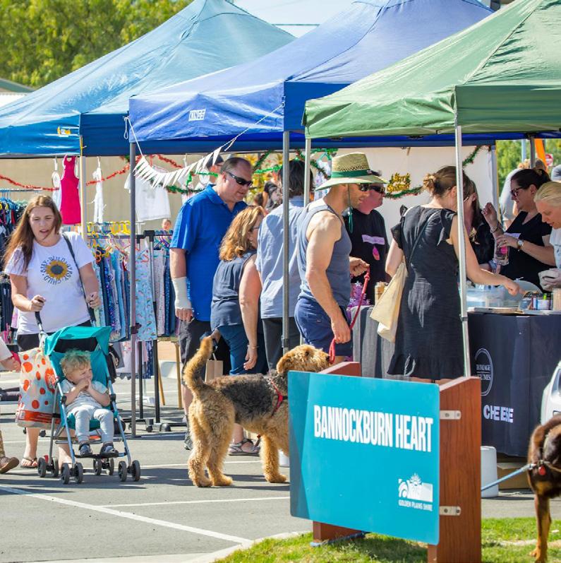
Bannockburn, Batesford and District - Page 17
• Bannockburn Bushland (South)
• Bannockburn Bushland (North)
• Wabdallah Reserve
• Bruce’s Creek
• Moorabool River Batesford
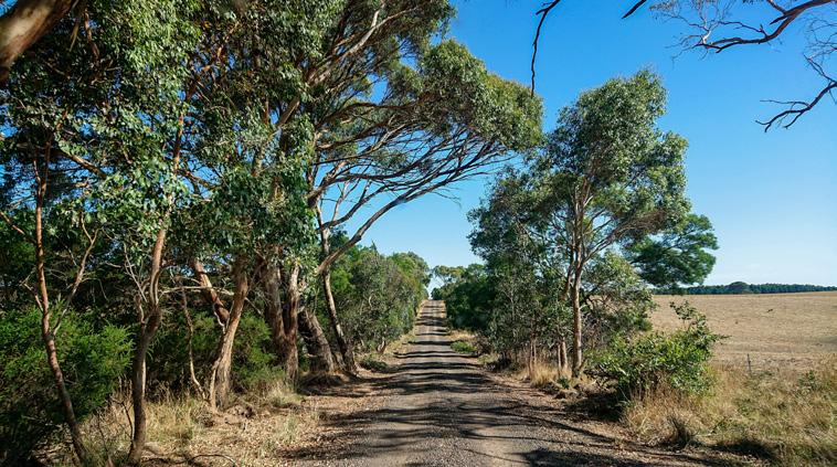
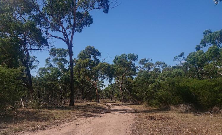
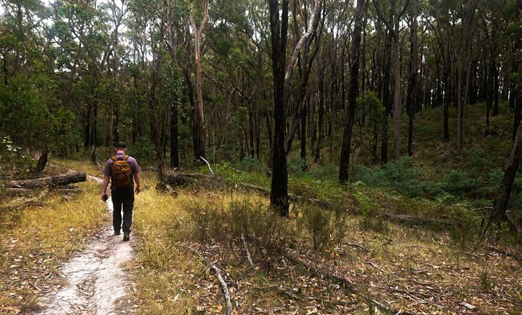
From the popular Ballarat to Skipton Rail Trail to the more remote Brisbane Ranges Extended Circuit, these trails showcase the diverse landscapes, natural settings, and history of the Golden Plains. They offer varying levels of difficulty, catering to hikers of all experience levels. You can walk, hike, or ride these trails in segments or take your time to enjoy the scenery, with options for overnight stays at campsites or accommodations along the route. Be sure to bring the appropriate gear and always inform someone about your plans.
REGIONAL AND MULTI-DAY TRAILS
• Ballarat to Skipton Rail Trail
• Kuruc-a-ruc Trail
• Rainbow Bird Trail
• Brisbane Ranges Extended Circuit
• Three Creeks Walk
• Burchell Trail

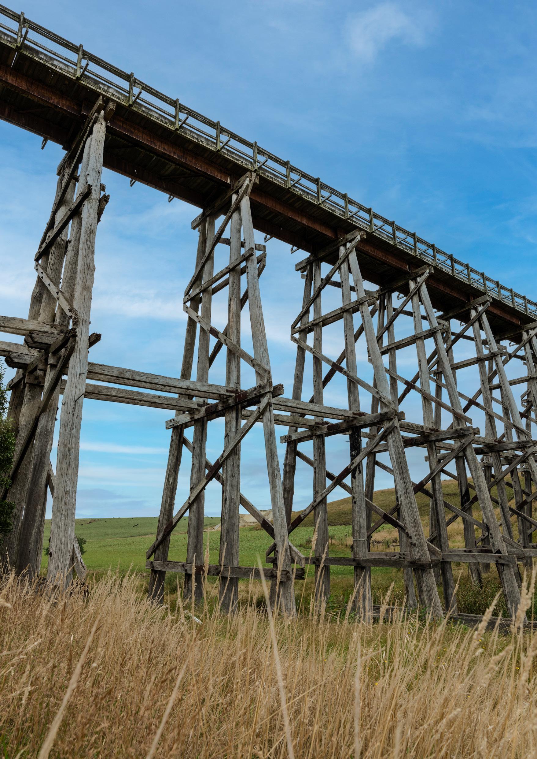
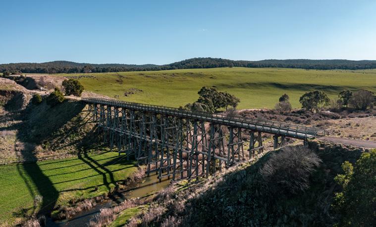
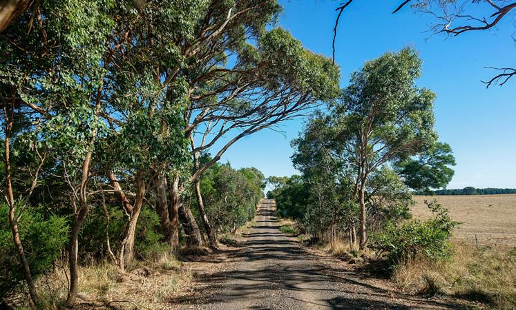
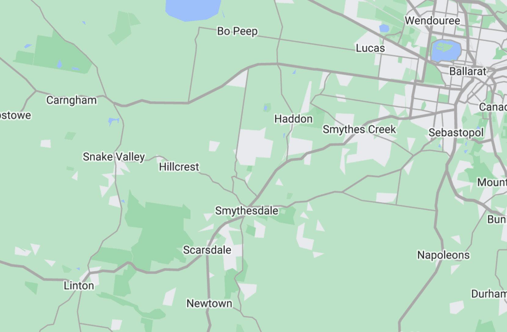
Ballarat to Skipton Rail Trail
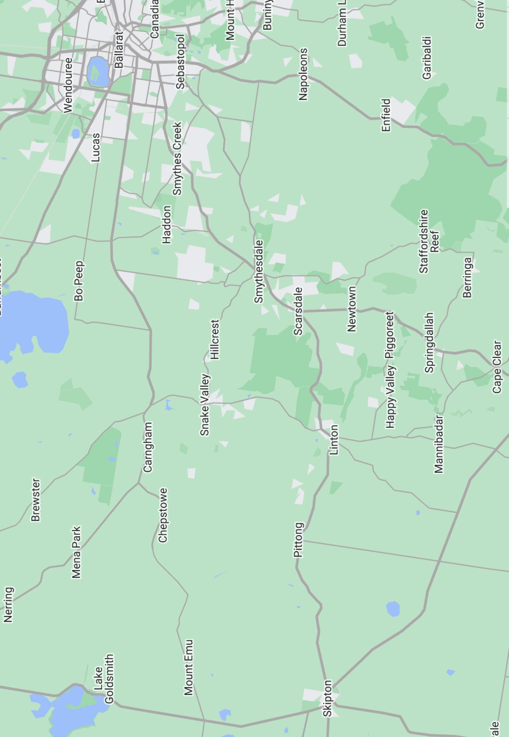
• Haddon, Smythesdale, Scarsdale, Linton and Skipton
• Nimons Bridge
Kuruc-a-ruc Trail
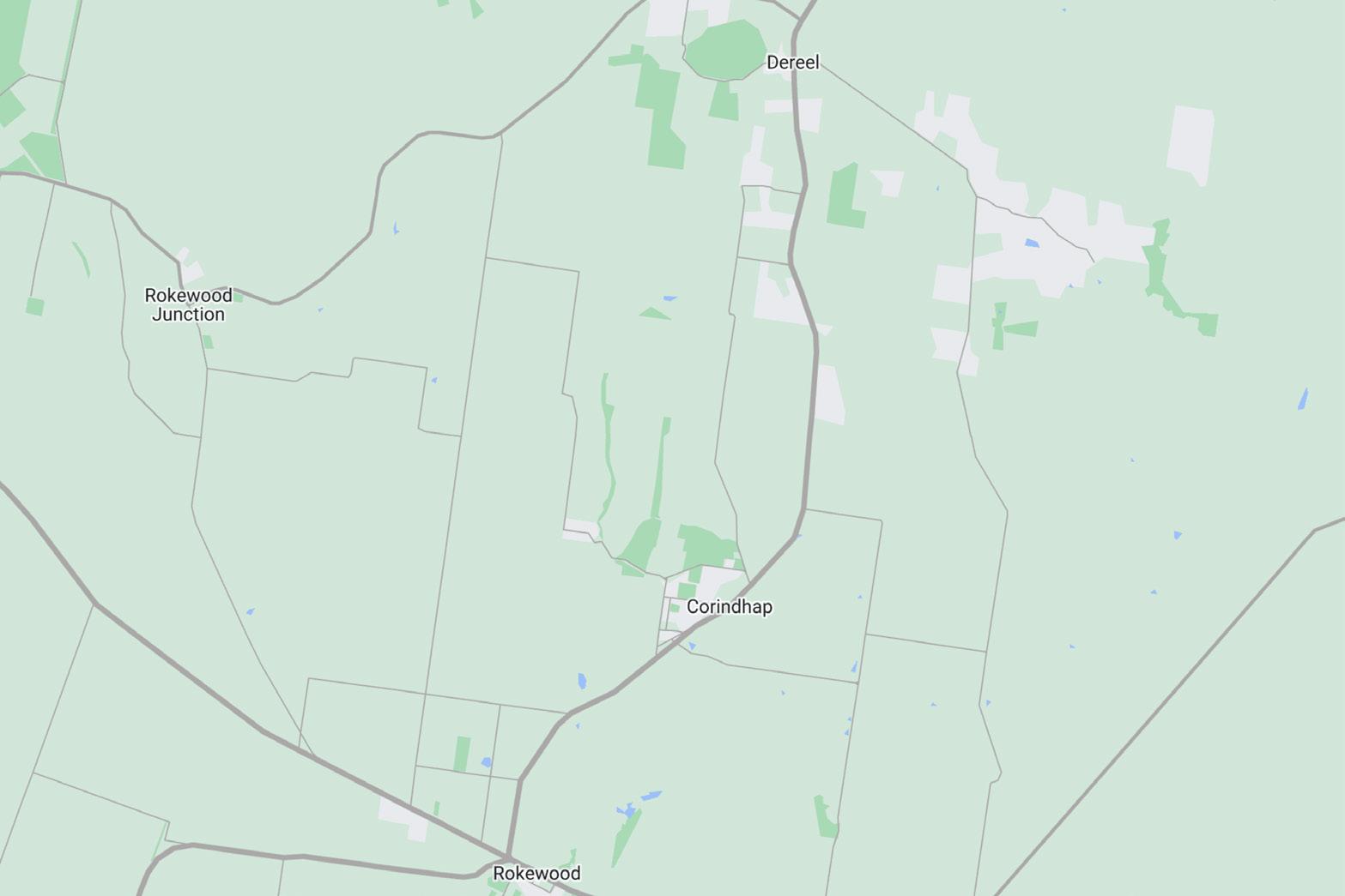
• Dereel, Cordinhap and Rokewood
Rainbow Bird Trail
• Enfield State Park, Jubilee Historic Area, Dereel Lagoon
Brisbane Ranges Extended Circuit, Three Creeks Walk, Burchell Trail
• Steiglitz, Steiglitz Historic Park, Brisbane Ranges National Park
Ballarat, Smythesdale, Scarsdale, Linton, Skipton
This leisurely trail explores the railway that operated between 1883 and 1985, linking the gold towns west of Ballarat to the surrounding region.
Distance: 53km (one way)
Time: 2 - 3 days
Elevation: 669m

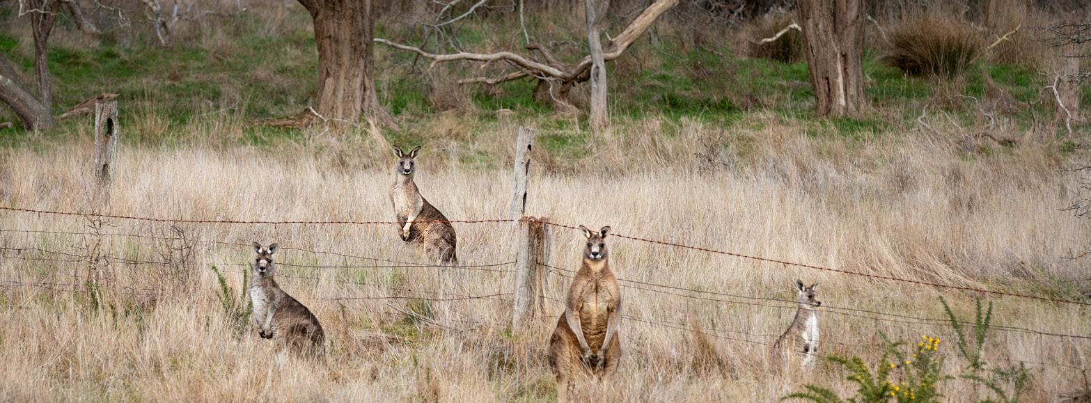
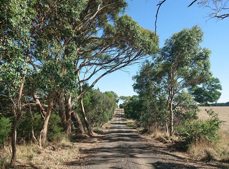
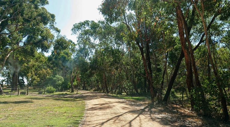
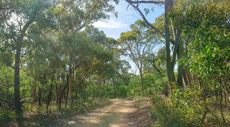
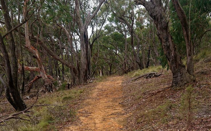
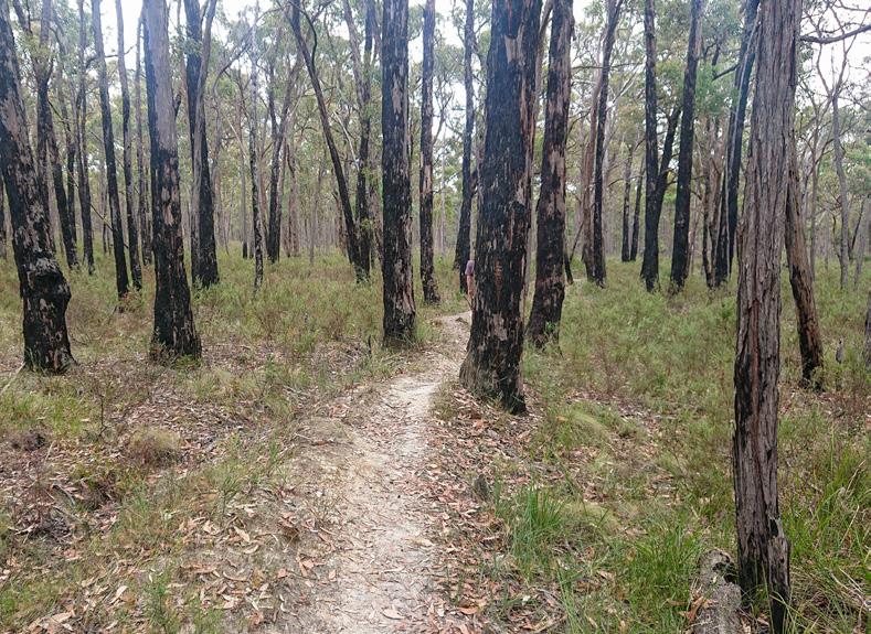
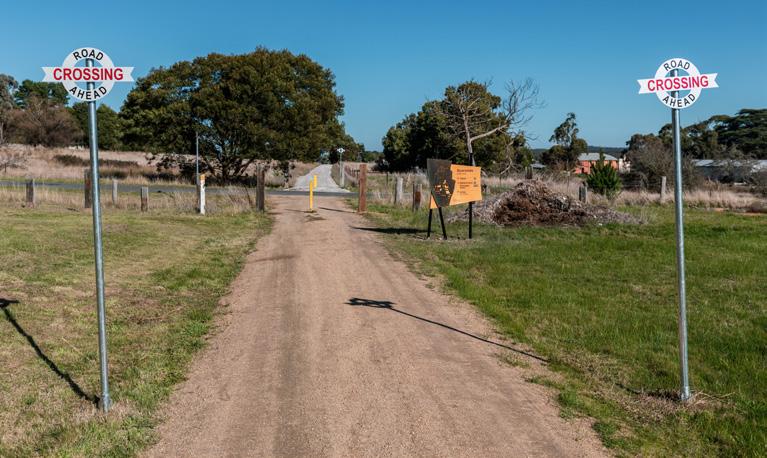
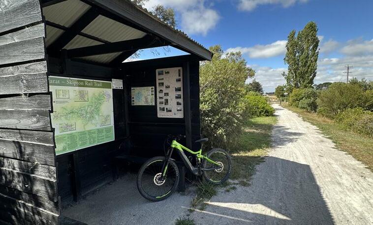
Bike, walk or ride along 53km of the former Ballarat to Skipton railway as it meanders through sweeping vistas, across historic bridges and through nineteenth century townships steeped in gold mining history. The Rail Trail crosses through the towns of Ballarat, Haddon, Smythesdale, Scarsdale, Linton and Skipton. This trail is ideal for families and all fitness levels due to its gentle gradient and wide, unsealed surfaces, making it accessible for cyclists, walkers, and horse riders of all abilities.
The railway line operated between 1883 and 1985. It was developed as a link between the gold towns west of Ballarat and the surrounding pastoral region. Initially the line out of Ballarat reached Scarsdale, then Linton, before it was eventually extended to Skipton.
Enjoy wide open grasslands, eucalypt forest, and historic railway stations which include information signs providing local information. Stop into some of the local attractions, cafés, vineyards and eateries along the way.
You can join the trail at any of the settlements along the route, making it ideal for completing in sections. To make a weekend of it, stay in overnight accommodation available in Smythesdale, Scarsdale, Linton and Skipton.
Download the complete Ballarat to Skipton Rail Trail Brochure here or the overview map here.
Kuruc-a-ruc Trail
Rokewood to Dereel via Cordinhap
Take the scenic route from Dereel to Rokewood travelling through historic gold mining countryside.
Dist: 13.3km (one way) Time: 3hrs Elev: 270m
This trail travels through this historic gold mining countryside and links the three goldfield townships of Dereel, Cordinhap and Rokewood. Beginning at the Dereel Community Hall, the trail is located mostly on quiet dirt back roads. Detour to the Avenue of Honour in Cordinhap and finish the walk in Rokewood.
Rainbow Bird Trail
Dereel to Scarsdale
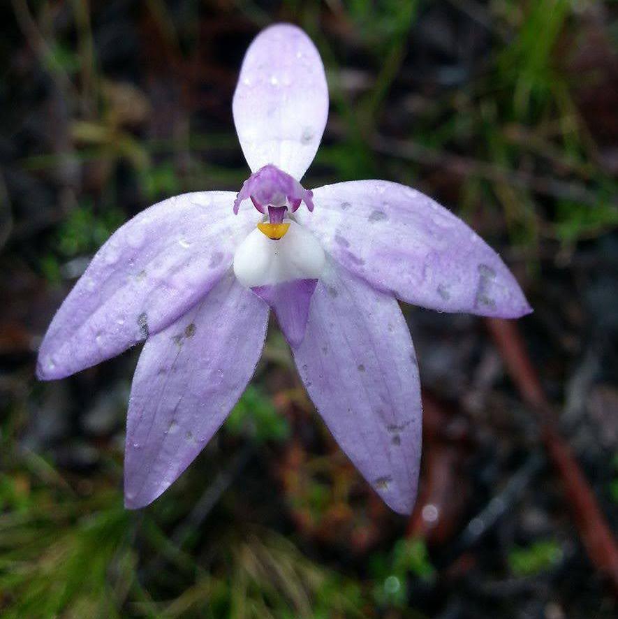
Ideal for a short walk or a long hike, and perfect for nature lovers, the Rainbow Bird Trail takes you through grasslands, wetlands and forests.
Dist: 35km (one way) Time: 2 days Elev: 709m
Connecting Scarsdale and Dereel, this trail follows quiet rural roads and bush tracks, providing opportunities to view eastern grey kangaroos, wild orchids, and a variety of birds. This trail initially follows the Ballarat to Skipton Rail Trail until it reaches Casey Road in Newtown. It then follows a well marked trail with blue markers through Enfield State Park, Staffordshire Reef and Berringa to Dereel. Enjoy this trail in sections, or embark on a longer journey by continuing on to the Rail Trail, Kuruca-ruc Trail or Jubilee Mine Historic Walk mid way.
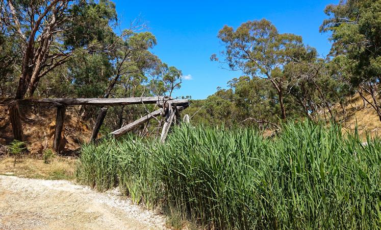
Brisbane Ranges Extended Circuit
Brisbane Ranges National Park
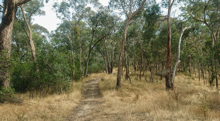
Explore eucalyptus forests, open woodlands, rocky outcrops and creeks. Look out for kangaroos, wallabies, and a variety of bird species.
Distance: 17.9km Time: 1 day Elevation: 608m
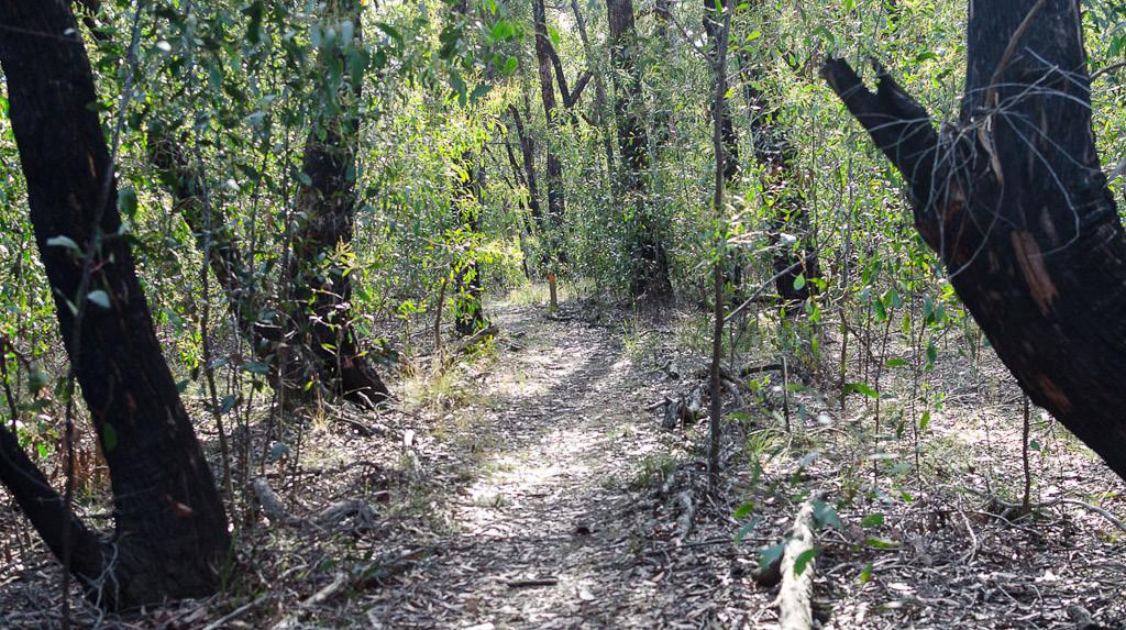
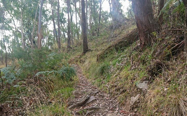
Managed by Parks Victoria, this trail begins at the Steiglitz Court House and offers a diverse range of scenery and varied terrain. For a more rewarding experience it’s recommended to hike the trail in an anticlockwise direction. Navigation can be tricky at times, so it’s helpful to carry a map or use the AllTrails App. Make it a multiday hike by staying at one of the camping areas.
Three Creeks Walk
hikingfiasco.com
Brisbane Ranges National Park
hikingfiasco.com
A mix of natural beauty and quiet seclusion, the Three Creeks Walk takes you through forests, valleys, and creeks.
Distance: 14.5km Time: 1 day Elevation: 546m
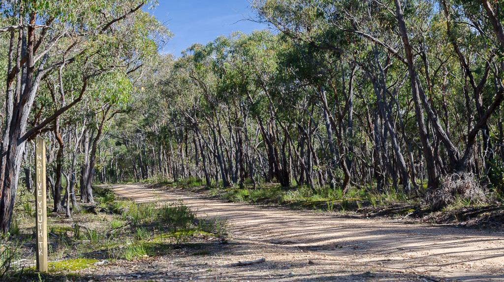
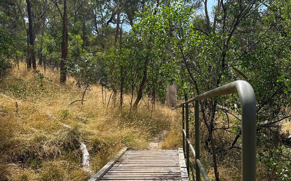
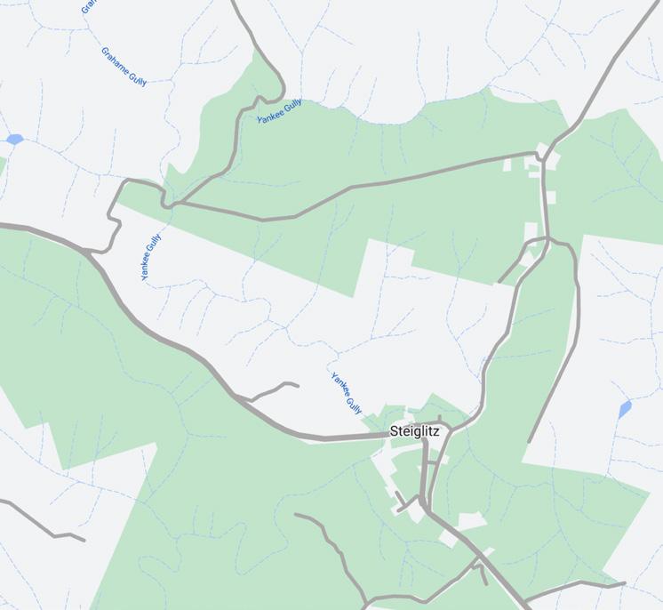
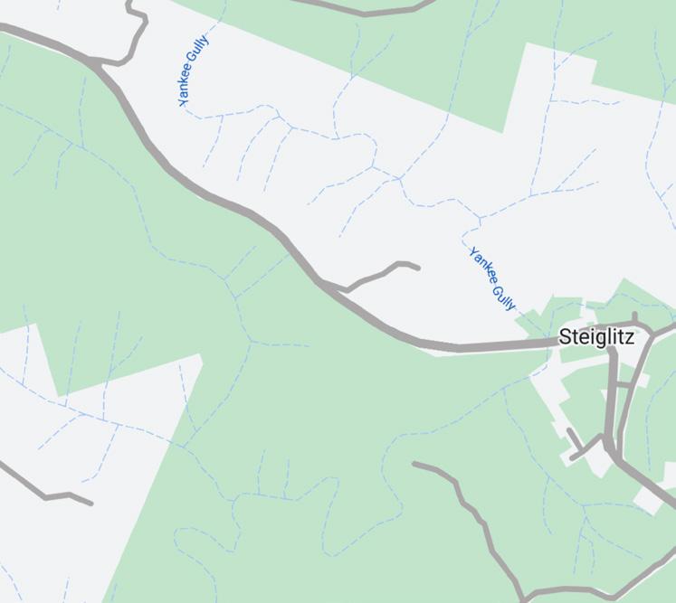
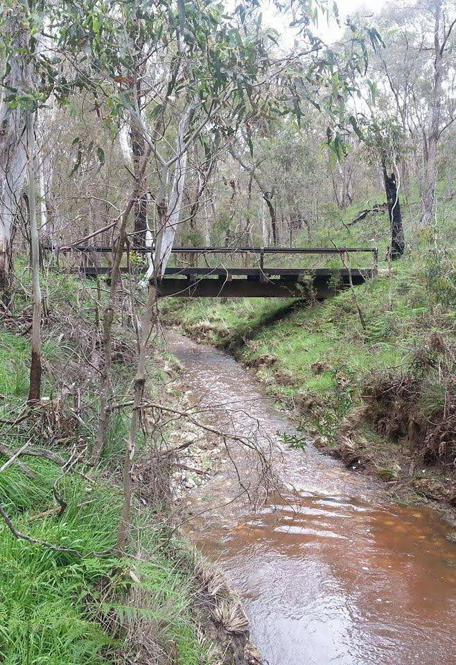
Managed by Parks Victoria, the Three Creeks Walk begins at The Crossing Picnic Area in Steiglitz Historic Park. From the Picnic area, access the trail off Lease Road and join onto Native Youth Track, follow this to Yankee Gully Track and onto Steiglitz Durdidwarrah Rd. Follow this road south onto Sawpit Gully Road and then complete the loop via Brisbane Ranges Extended Circuit.
Burchell Trail
Steiglitz Historic Park and Brisbane Ranges National Park
An adventurous three-day walk with opportunities for camping.
Distance: 40km (one way) Time: 3 days Elevation: 1,054m

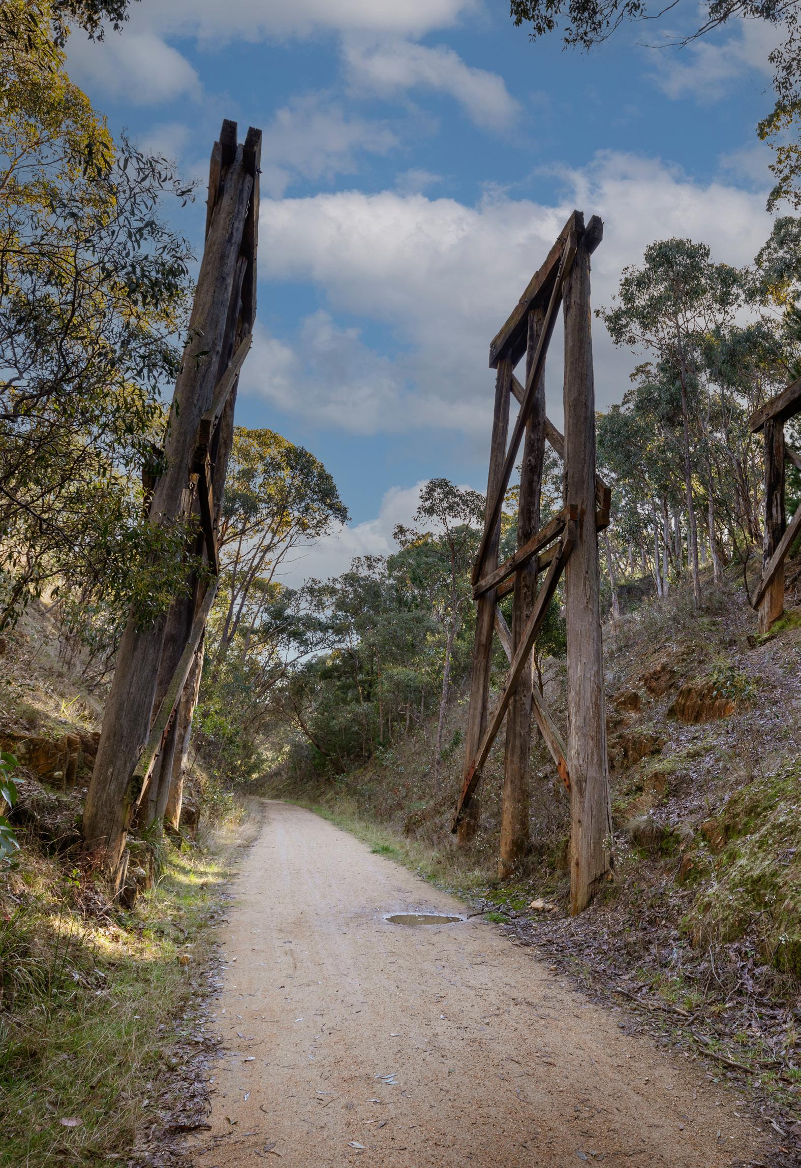
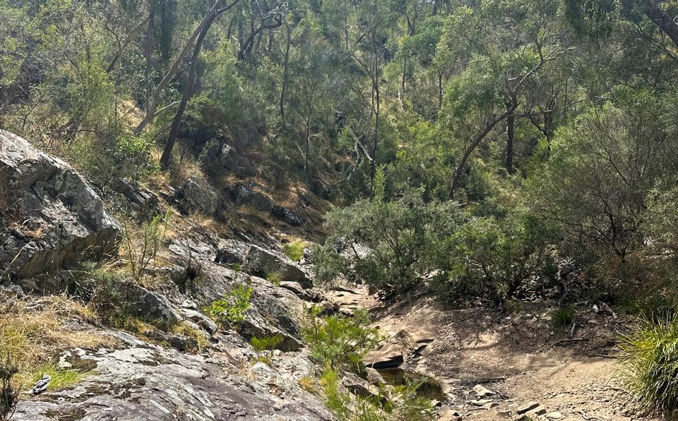
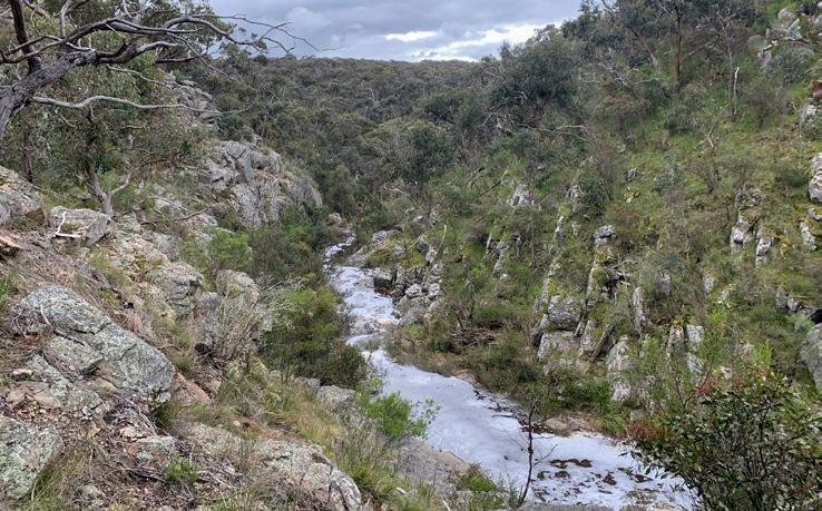
This trail travels through both Steiglitz Historic Park and Brisbane Ranges National Park and can be completed in sections or in its entirety, with overnight camps available at Friday’s, Old Mill, Little River and Boar Gully Camping Areas. The trail begins at Fridays Camping Area in Steiglitz Historic Park, or Boar Gully Camping Area in Brisbane Ranges National Park. Follow the orange markers and explore Victoria’s richest wildflower environment. For more information, see the Brisbane Ranges National Park Visitor Guide.
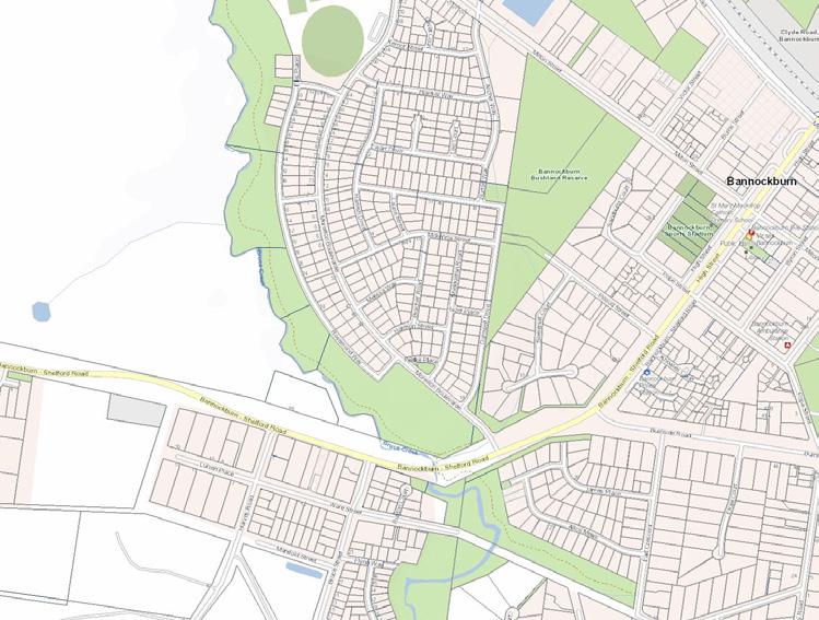
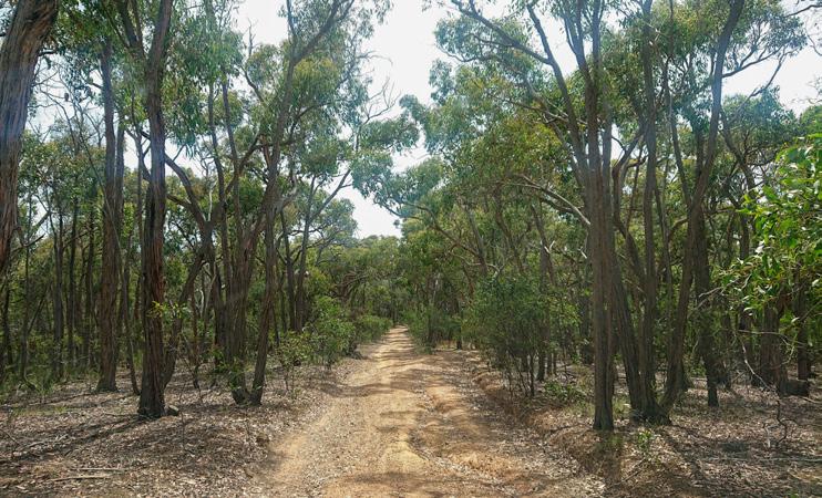
Located within Wadawurrung Country, Bannockburn, Batesford and District is located in the east of Golden Plains, only a short drive from Geelong. This district offers a blend of rural beauty, historical interest, and a friendly, growing community.
Bannockburn is the largest urban centre in Golden Plains, and contains distinctive landscapes and water bodies that are highly significant to Wadawurrung people. Bannockburn supports the southern network of townships providing community services, commercial and administrative functions whilst retaining a rural character.
Batesford is a small, growing township located midway between Geelong and Bannockburn. It has the ambience of a village which is distinguished by its topography and low scale development. The older area of Batesford is nestled within a small valley on the Midland Highway. The Dog Rocks area, including granite outcrop and rural residential development is a distinctive feature of Batesford.
• Bannockburn Bushland (South)
• Bannockburn Bushland (North)
• Wabdallah Reserve
• Bruce’s Creek
• Moorabool River Batesford

Bannockburn Bushland South
Bannockburn
Walk, run or ride this route along shaded management tracks through beautiful bushland.

Bannockburn Bushland North
Bannockburn
Wander along the Bannockburn Golf Club’s boundary and through tranquil bushland and plantations.

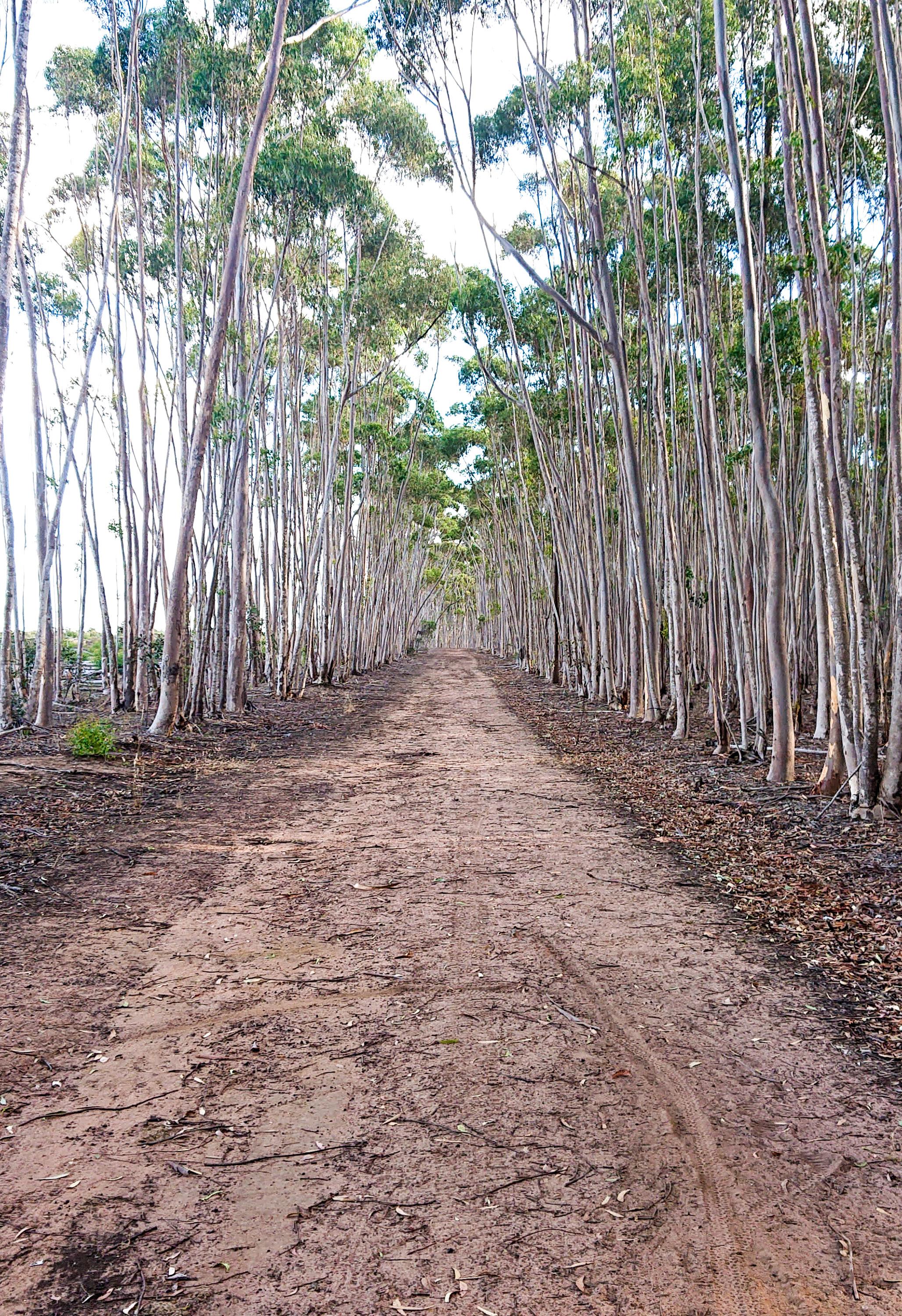
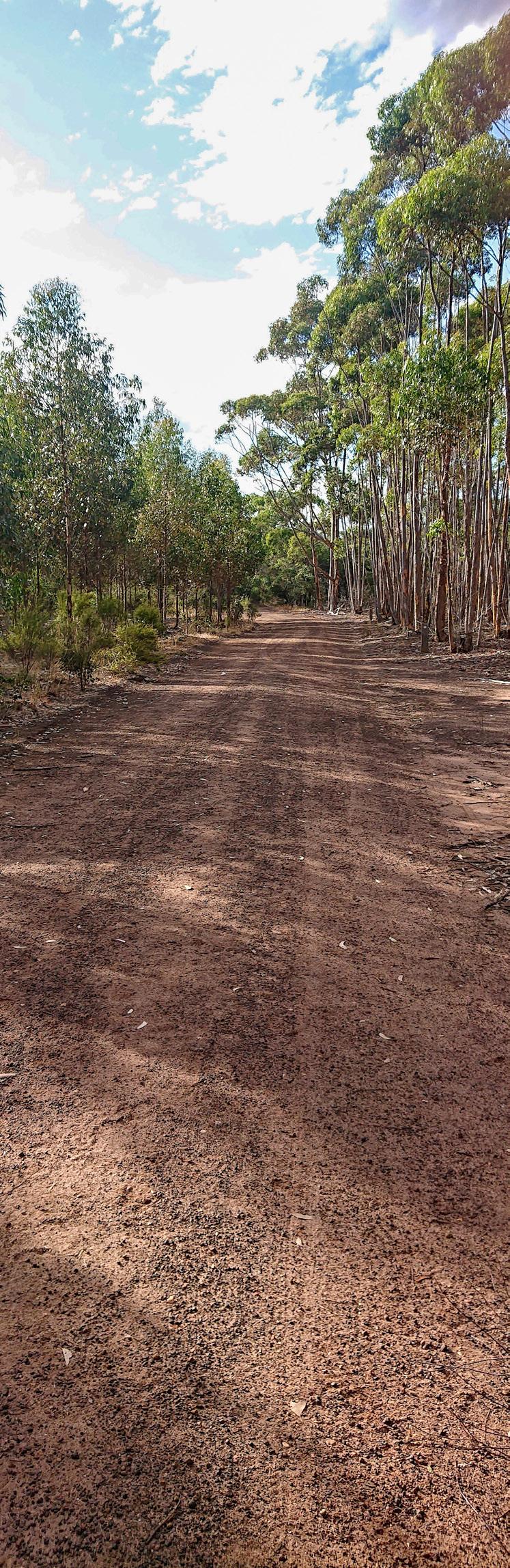
Managed by WREN and local volunteers, this trail is a short drive from Bannockburn’s town centre. Follow flat, well-marked tracks from Old Base Road through established vegetation. Please note that logging occurs to restore native bushland, and trails may be temporarily unavailable at times.
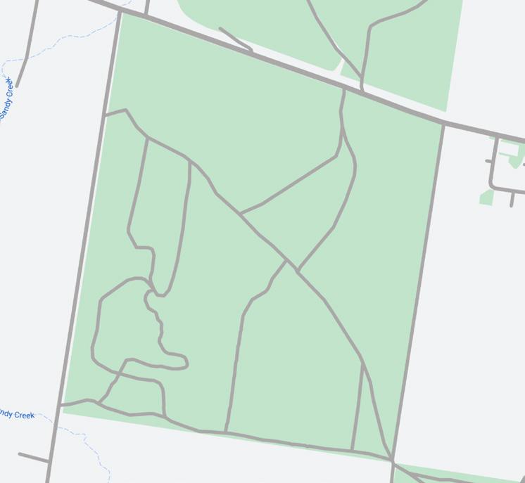
Managed by WREN and local volunteers, this loop trail is located north of Bannockburn-Shelford Road. It follows the Bannockburn Golf Club’s boundary northeast from the carpark, then turns east through dense bushland before heading south back to the carpark.
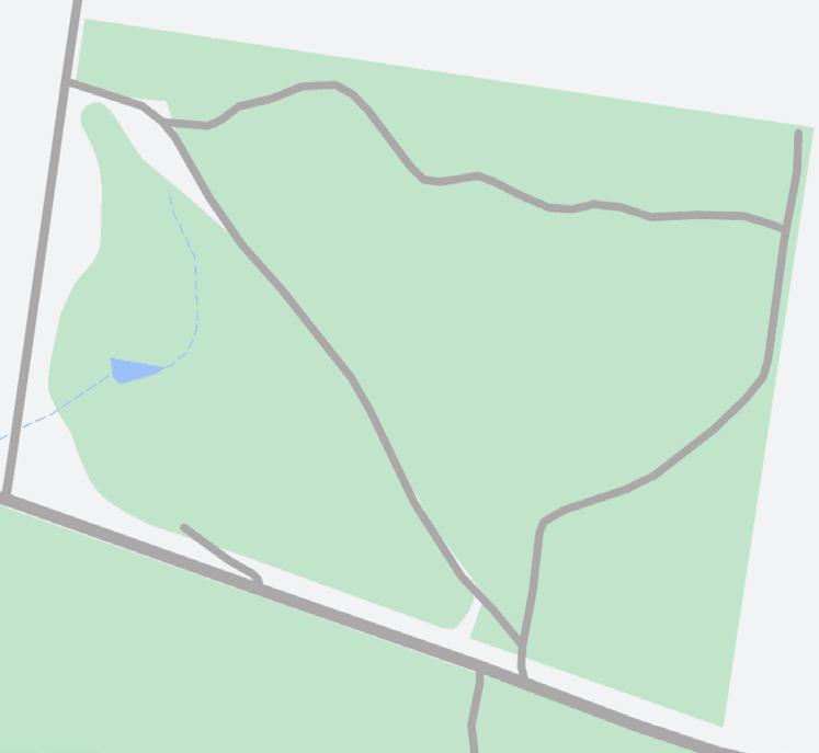
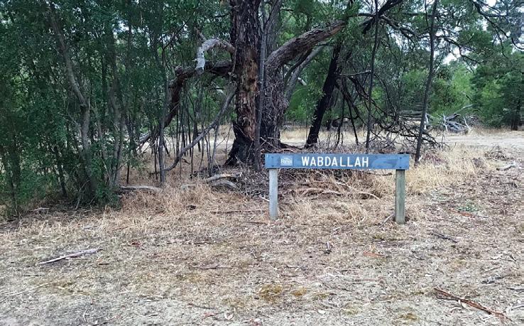
Wabdallah Reserve Loop
Bannockburn
Located only 200m off Bannockburn’s High Street, find a little pocket of nature with a short loop trail.
Distance: 1.2km
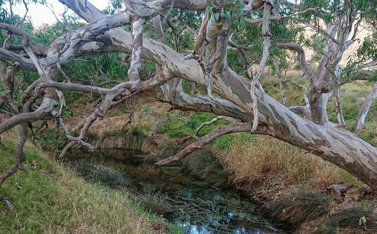
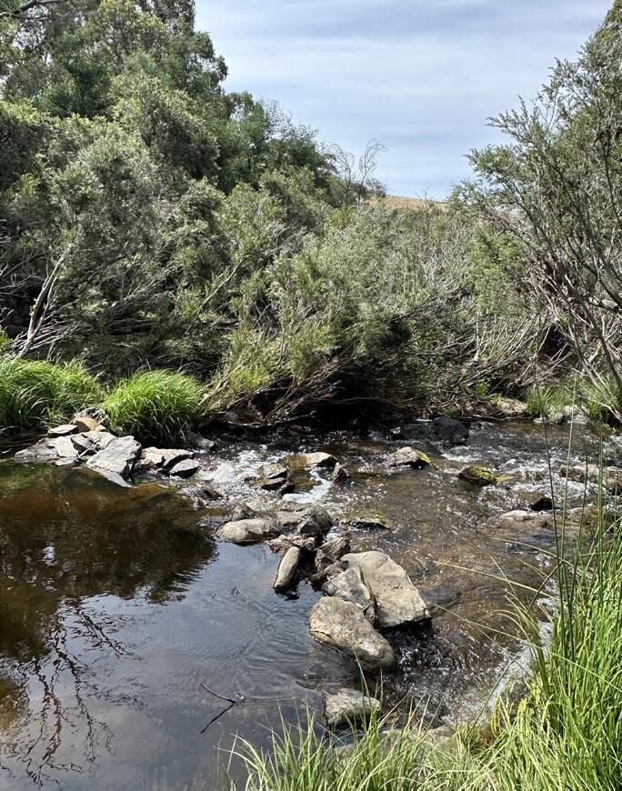
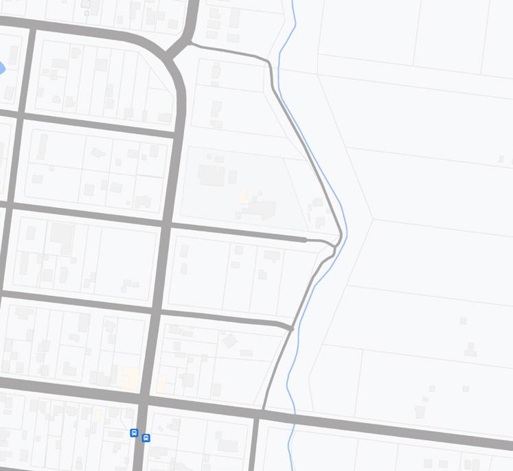
Bruce’s Creek Trail
Bannockburn
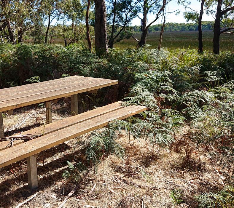
Walk, run, cycle or relax on one of the many seats overlooking the tranquil Bruce’s Creek.
Distance: 2.2km (one way) Time: 20mins Time: 30mins
Managed by Parks Victoria, and located only 200m north-west of Bannockburn’s High Street, Wabdallah Reserve provides a small loop trail. Use the trail to relax and unwind by birdwatching or sit with a coffee, or use it to easily connect from Milton Street or Darriwell Drive to Bannockburn’s town centre.


Easily accessible from different parts of Bannockburn, this trail follows Bruce’s Creek which is of great importance to the Wadawurrung people. It offers a combination of natural scenery and wildlife viewing opportunities in a tranquil setting with a mix of open spaces, shaded areas, and gentle slopes.
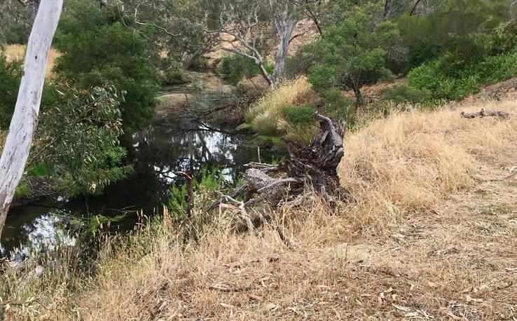
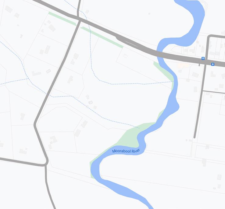
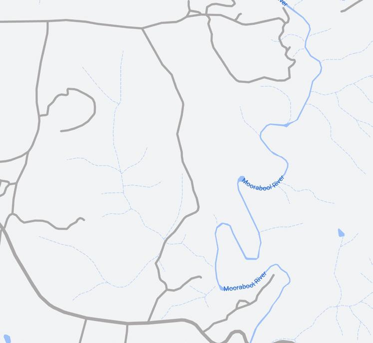
Moorabool River Trail
Batesford
A short walk down to the Moorabool River, passing farmland and ending as the river widens into a large pool.
Distance: 750m (one way) Time: 20mins
Beginning at the sharp bend on Dog Rocks Road, head down the trail and turn left once you meet the Moorabool River. The trail follows the river for a short distance where it ends at a beautiful pool. This trail is pram and dog friendly (on-lead) and is of an easy grade, making for a great family outing.
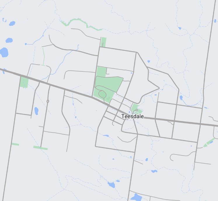
The Inverleigh, Teesdale and District region is located in southern Golden Plains and includes the towns of Inverleigh, Teesdale and Shelford, each offering a unique blend of rural charm and community spirit.
Inverleigh, the largest of the three, is located on the Barwon and Leigh Rivers. It has a growing population, unique cafés and shops and a country-town feel. Its proximity to the Barwon River and numerous reserves makes it a popular spot for outdoor activities like fishing and bushwalking.
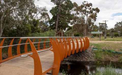
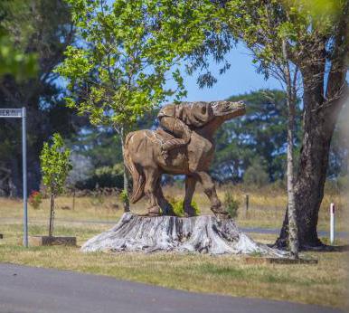
Teesdale is a vibrant rural community known for its picturesque landscapes and Turtle Bend Park, which features sculptures and nature trails. With a strong sense of community, Teesdale hosts various local events and activities that bring residents together.
Shelford is a historic township along the Leigh River, known for its old buildings and tranquil countryside. It has a rich history and a peaceful rural lifestyle.
• Kangaroo Track via Links Track Loop
• River Track
• Leigh River Trail
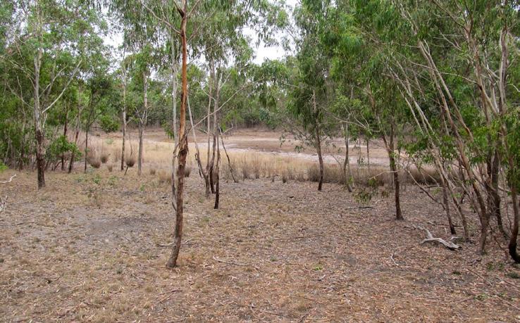
• Teesdale Grassy Woodlands
• Chinaman’s Lagoon
• Shelford-Bannockburn Road
Shared Path
• Turtle Bend
• Inverleigh Flora Loop
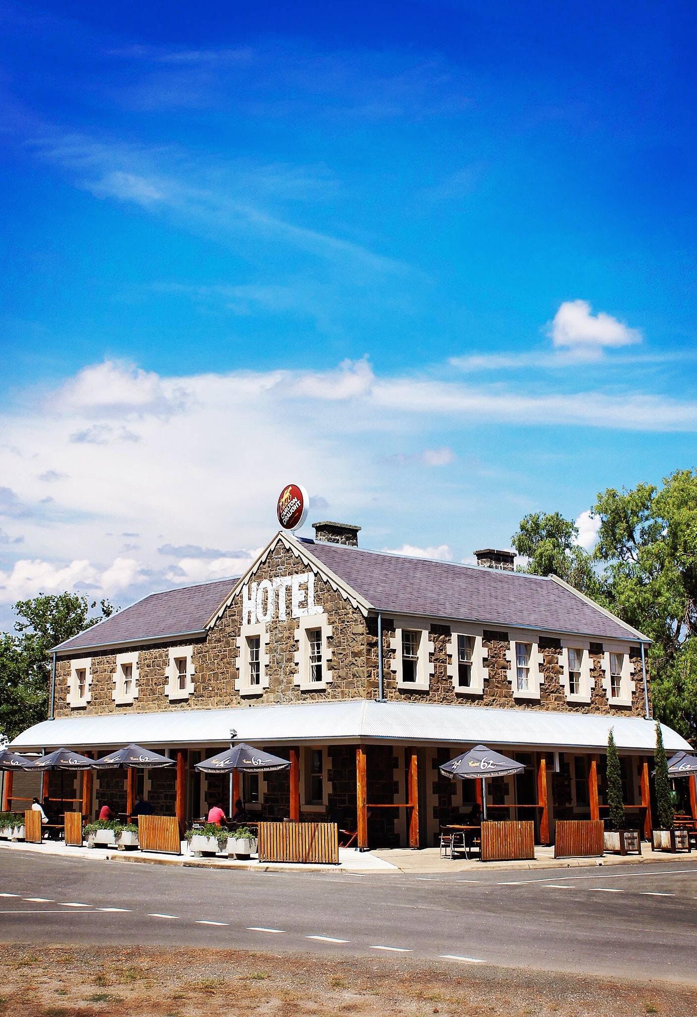
• Inverleigh Hotel
• Barwon River and Leigh Rivers
• Inverleigh Bakehouse
• St. Paul’s Anglican Church
Teesdale
• Turtle Bend Park
• Teesdale Grassy Woodlands
Shelford
• Leigh River
Inverleigh Flora Loop
Inverleigh
Explore the grassy woodlands and Endangered Ecological Vegetation of the Inverleigh Conservation Reserve.
Kangaroo Track
Inverleigh
Of the Grassy Woodlands that once existed in Victoria, only 1% remains. Explore some of it via this short track.
Managed by Parks Victoria, and starting at the information shelter located on Old Teesdale Track off Common Road, this trail follows management tracks. Open yearround, over 100 bird species have been spotted here, along with kangaroos, echidnas and koalas.
River Track
Inverleigh
Wander along the banks of the Barwon River and end with a meal and drink at the iconic Inverleigh Hotel.
Starting at the information shelter located on Old Teesdale Track off Common Road, this trail follows management tracks, providing a shorter loop than the Inverleigh Flora Loop but capturing the essence of the Reserve. Watch for deep sandy sections and lots of wildlife.
Beginning in Yerram Yaluk Bun Park outside the Inverleigh Hotel, follow this short out-and-back trail south along the banks of the Barwon River. Extend your walk further by following the trail north under Hamilton Highway and connect to the Leigh River Trail. Distance: 2.3km (one

Leigh River Trail
Inverleigh
Explore the beautiful natives of the Leigh River, and keep an eye out for resident platypuses.
Distance: 3km (one way)
Begin your walk at Yerram Yaluk Bun Park or Inverleigh Campground and follow the Leigh River Trail north to the historic Federation Bridge and beyond. Make sure to stop along the way to take in the native planting, spot a platypus and relax.
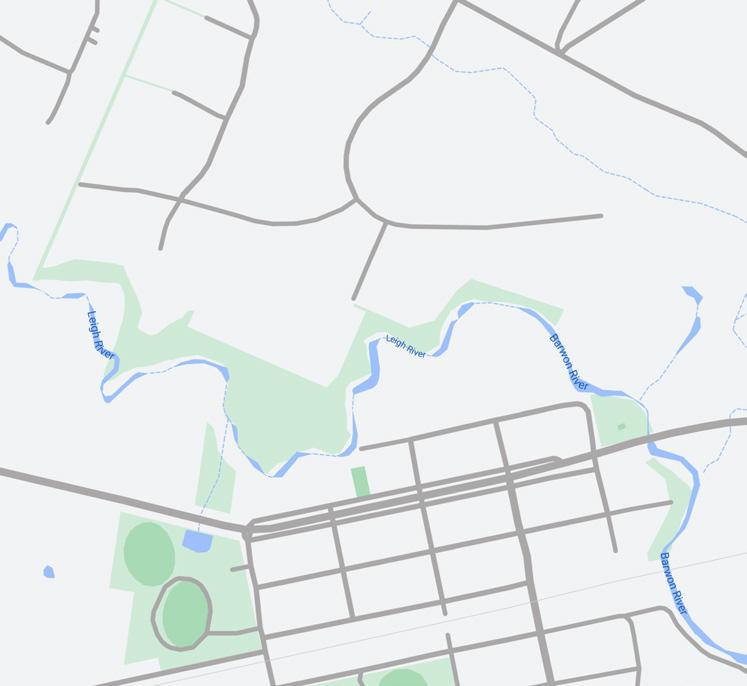
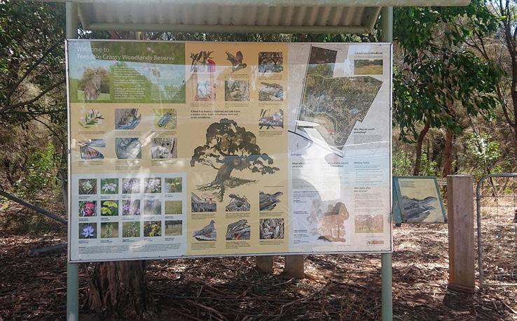
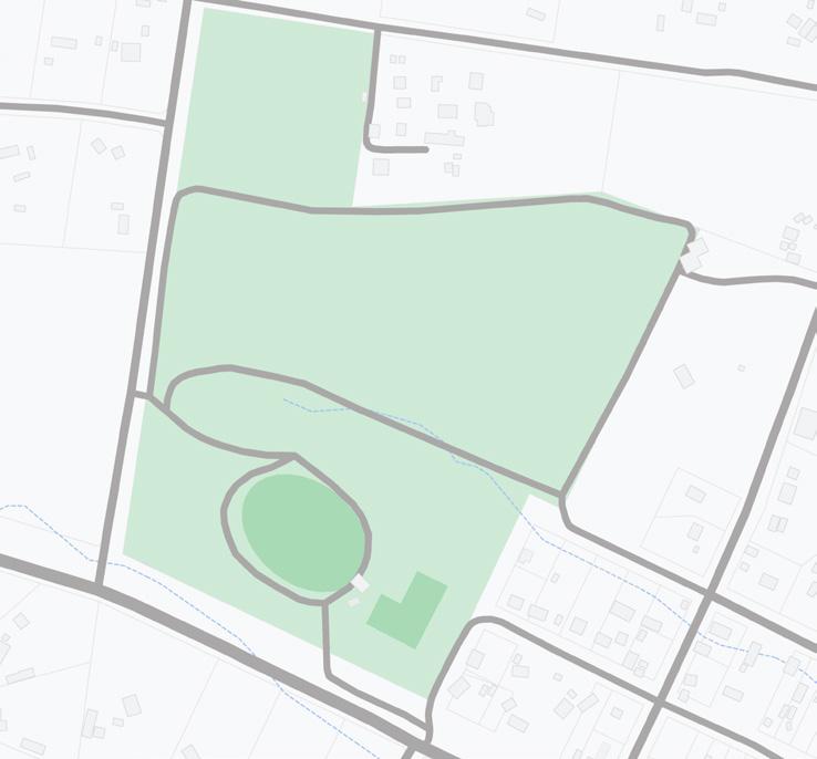
Don Wallace Reserve, Teesdale
Featuring abundant native flora and fauna, explore the Teesdale Grassy Woodlands by foot, horse or bike.
Teesdale
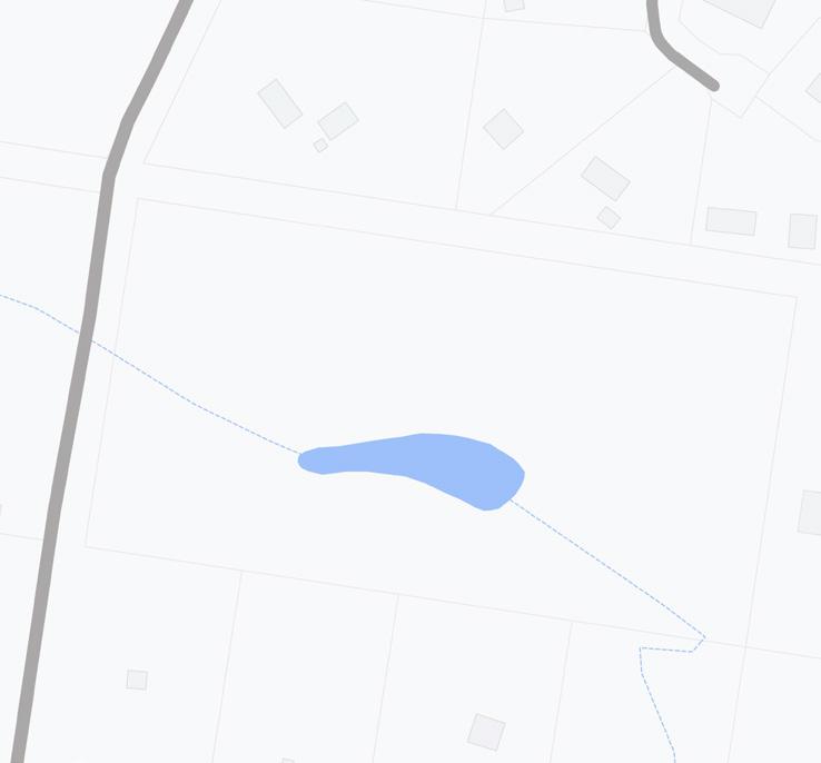
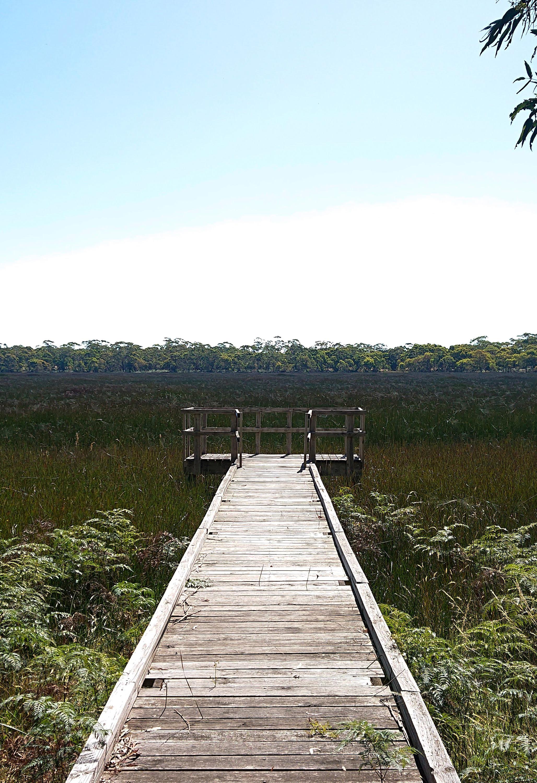
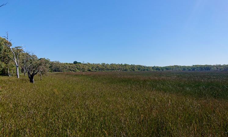
Explore the lagoon which once supplied Teesdale’s water supply from the late 1800’s until 1974.
Beginning at the trailhead sign located in Don Wallace Reserve nearby the tennis courts, public toilets and carparking. Follow the well-marked loop trail which showcases a range of unique flora, fauna and a deep Aboriginal history.
Shelford-Bannockburn Road
Shared Path, Teesdale
Perfect for walking, running or cycling, this shared path links Teesdale’s key attractions and facilities.
After rain, keep your eyes peeled for insects, yabbies, frogs, fish, eels and eastern snake-necked turtles.
Managed by DEECA, and beginning from the small carpark located on Learmonth Street, follow a number of informal walking trails that explore native bushland, the Chinaman’s Lagoon and its historical features, including the original well built by Quin Yung in the late 1800’s.
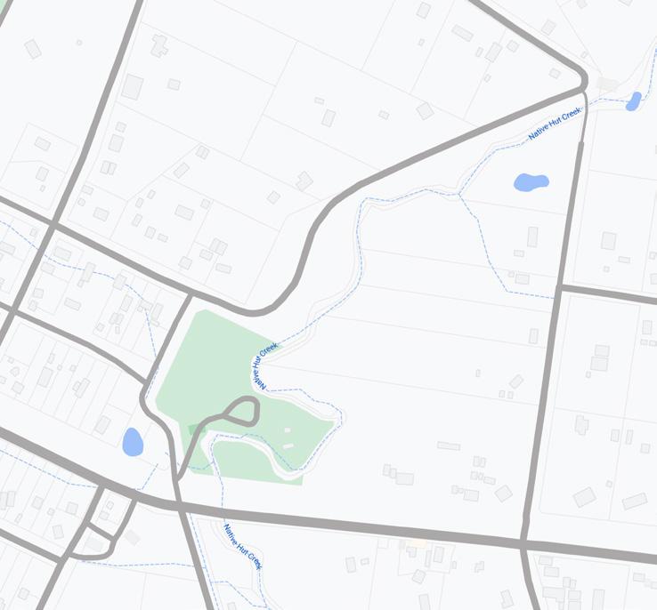
Spanning the entirety of ShelfordBannockburn Road in Teesdale, this asphalt, concrete and crushed rock shared path connects to Teesdale’s General Store and Post Office, Skatepark, Turtle Bend, Primary School, Community Hall and Don Wallace Recreation Reserve.
Beginning from the Turtle Bend Reserve carpark, follow the trail past the events pavilion and then north along the banks of Native Hut Creek, taking in the interpretive signage along the trail. Bring the family and enjoy the BMX track, skatepark, and playground.
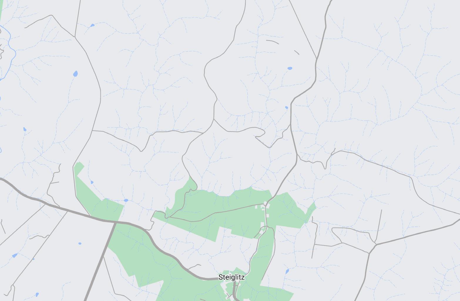
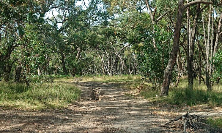
Meredith, Lethbridge and district encompasses Meredith, Lethbridge and Steiglitz, in north-east Golden Plains on Wadawurrung Country.
Meredith is a quaint rural town with rolling hills and farmlands. It has a vibrant community and hosts the annual Meredith Music Festival, drawing music lovers nationwide.
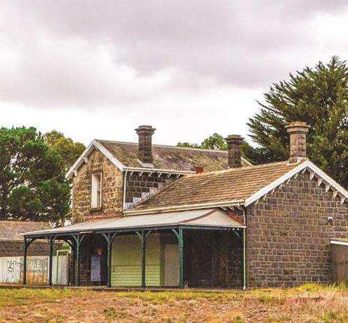
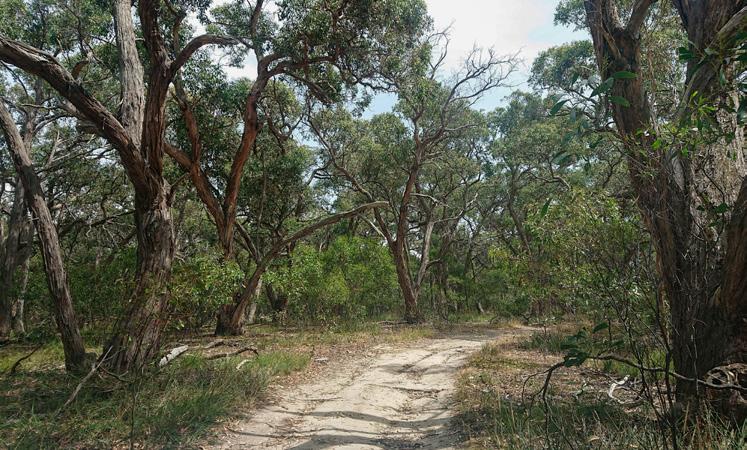
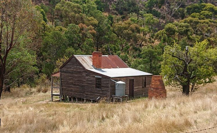
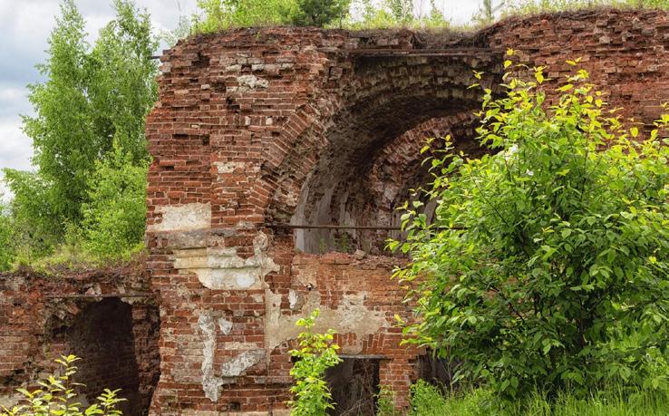
Steiglitz, a small locality in the Brisbane Ranges National Park, is rich in goldmining history. Visitors can explore old buildings, mining relics, and hiking trails surrounded by diverse native flora and fauna.
Lethbridge is known for its vast farmlands and vineyards. It attracts visitors for its tranquil countryside, wineries, and scenic views.
• Lethbridge Lake Loop
• Ibis Middleton Walk
• Police Paddocks
• Possum Road and Moorabool River Loop
• Meredith Steiglitz Road to Byrne Road
• Meredith/Bamganie State Forest Circuit
• Hay and Burchell Walking Trail
• Deadmans Loop
• Beards Gully Walk
• Steiglitz Historic Walk
Meredith
• Meredith Cafe and Corner Store
Steiglitz
• Steiglitz Historic Park
• Gold mining relics
• Historic buildings including court house, church and residences
• Camping and picnic grounds
Lethbridge
• Lethbridge Lake
• Lethbridge Wines
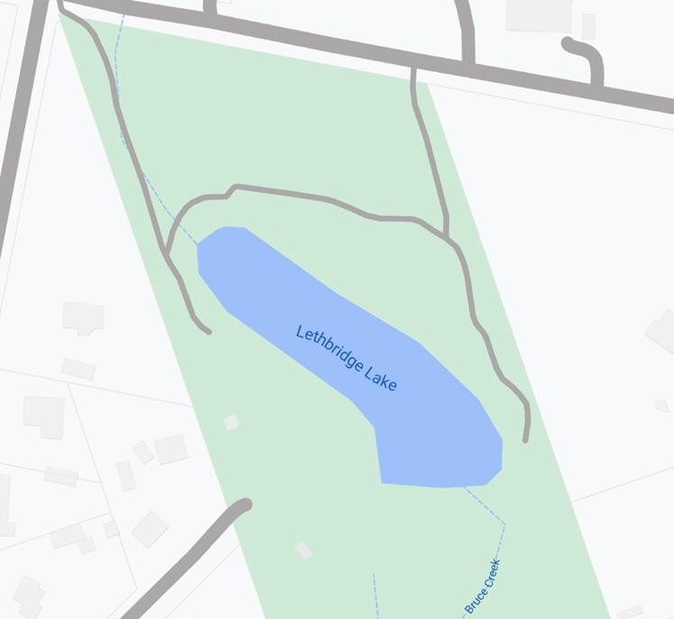
Lethbridge Lake Loop
Lethbridge
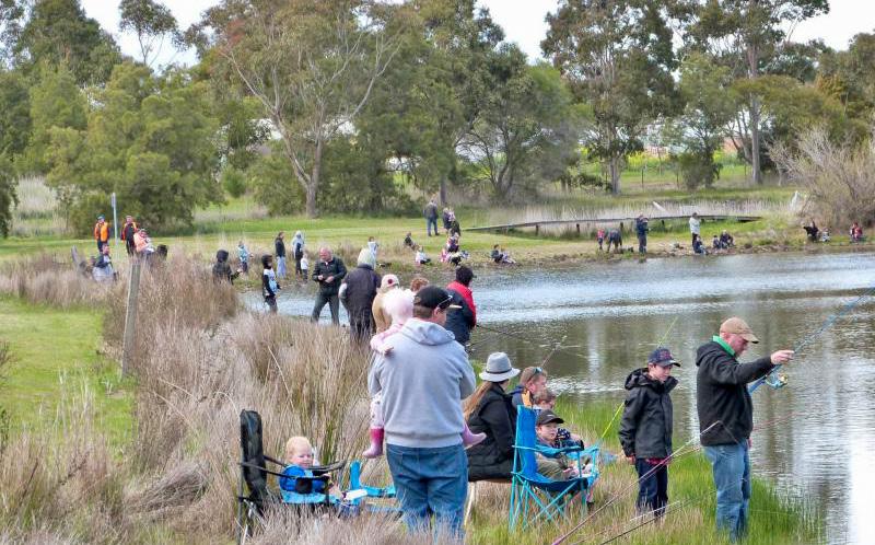
Walk around the Lethbridge Lake, admire the historic railway water tank, and even throw a fishing line in.
Distance: 550m Time: 10mins
Beginning at the Lethbridge Lake carpark, follow the short loop trail anti-clockwise or clockwise around Lethbridge Lake. Wander across the Lethbridge Lake boardwalk, admire the historic railway water tank, fishing pontoon and open park lands.
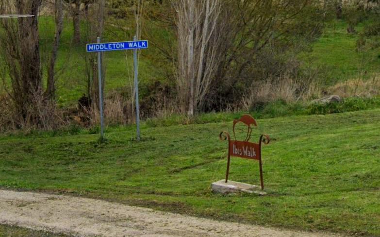
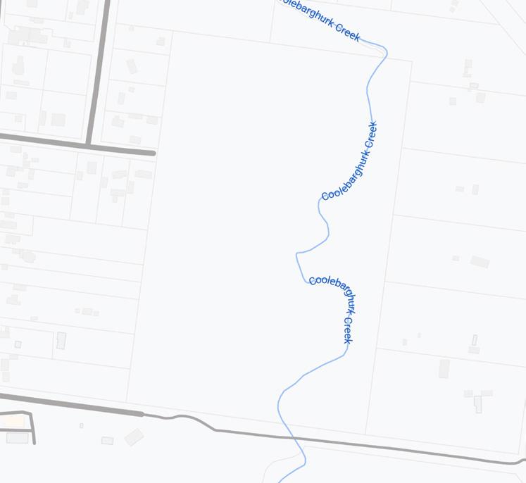
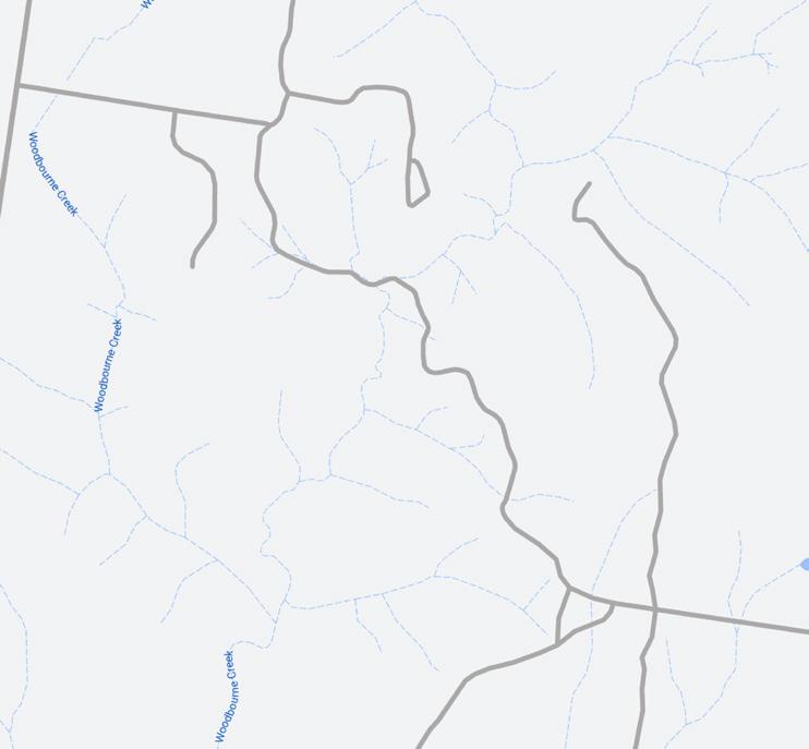
Enjoy this short but leisurely walk along the banks of the Coolebarghurk Creek in Meredith.
Distance: 683m (one way) Time: 15mins
This easy and short out-and-back trail can be accessed from Russell Street, Staughton Street East or BallanMeredith Rd. Follow the Coolebarghurk Creek and look out for the Ibis sculpture and the diversity of flora and fauna of the Creek.
Explore the Police Paddocks, including the Coolebarghurk Creek, native plantings, signage and birdlife.
Distance: 4km Time: 50mins
Managed by WREN and local volunteers, the Police Paddocks feature a range of grass walking trails on open and vegetated hills. The trails provide a range of loops suitable for shorter or longer distances. The trails provide excellent views and a large carpark.
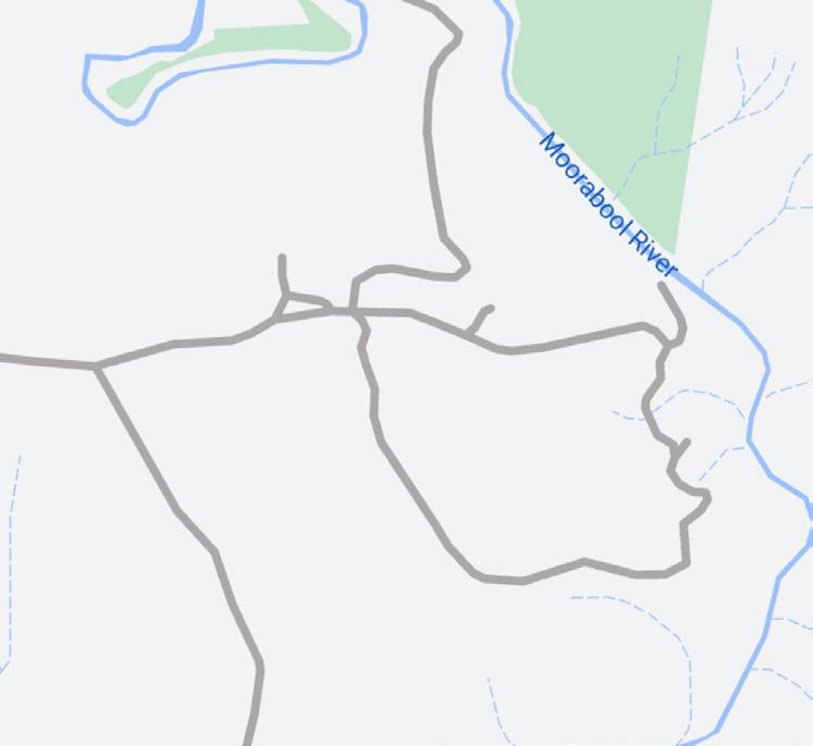
Possum Road and Moorabool River Loop, Meredith Education Area
Follow this loop trail down to the Moorabool River to relax and swim, and spend a night at the campsite.
Distance: 4.3km Time: 50mins
Managed by Parks Victoria, this loop trail begins on Byrne Road and travels down to the banks of the Moorabool River to a viewing and swimming spot. The trail then travels south past the Meredith Education Area Camping Area and back to Byrne Road.
Meredith Steiglitz Road to Byrne Road, Meredith Education Area
Explore Meredith Education Area’s dryland forest renowned for excellent bird watching.
Distance: 3.9km (one way) Time: 50mins
Managed by Parks Victoria, the Meredith-Steiglitz to Byrne Road Trail is a short point-to-point trail along fire track with some steep climbs. Walk there and back, or connect onto the Possum Road and Moorabool River Loop for a longer walk.
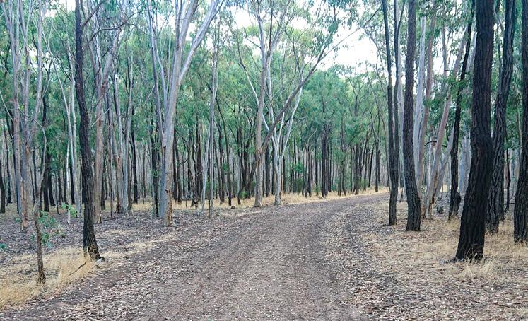
Meredith/Bamganie State Forest Circuit, Bamganie State Forest
Explore the steep undulating dryland forest and reward yourself with excellent views and creek crossings.
Distance: 7.4km Time: 2hrs
Managed by Parks Victoria, this trail is accessed from Bamganie Road. Follow existing fire tracks through dryland forest from the carparking area. This trail is rough and steep in some locations and is popular with 4WD’s. Keep your eyes peeled for kangaroos.
Hay and Burchell Walking Trail
Steiglitz
A beautiful loop trail showcasing creek crossings, kangaroos, wallabies and birdlife.
Distance: 8.4km Time: 2hrs
Managed by Parks Victoria, this trail begins at the trailhead in Steiglitz Historic Park and follows Deadmans Loop to Meredith-Steiglitz Rd. Pass through The Crossing Picnic Area and follow Yankee Gully before connecting to Steiglitz-Durdidwarrah Rd and back to trails start point.
Deadmans Loop
Steiglitz
Look for historic remnants including a large pine tree, a stone-lined well and bricks from an old house site.
Distance: 4.7km Time: 1hr 45mins
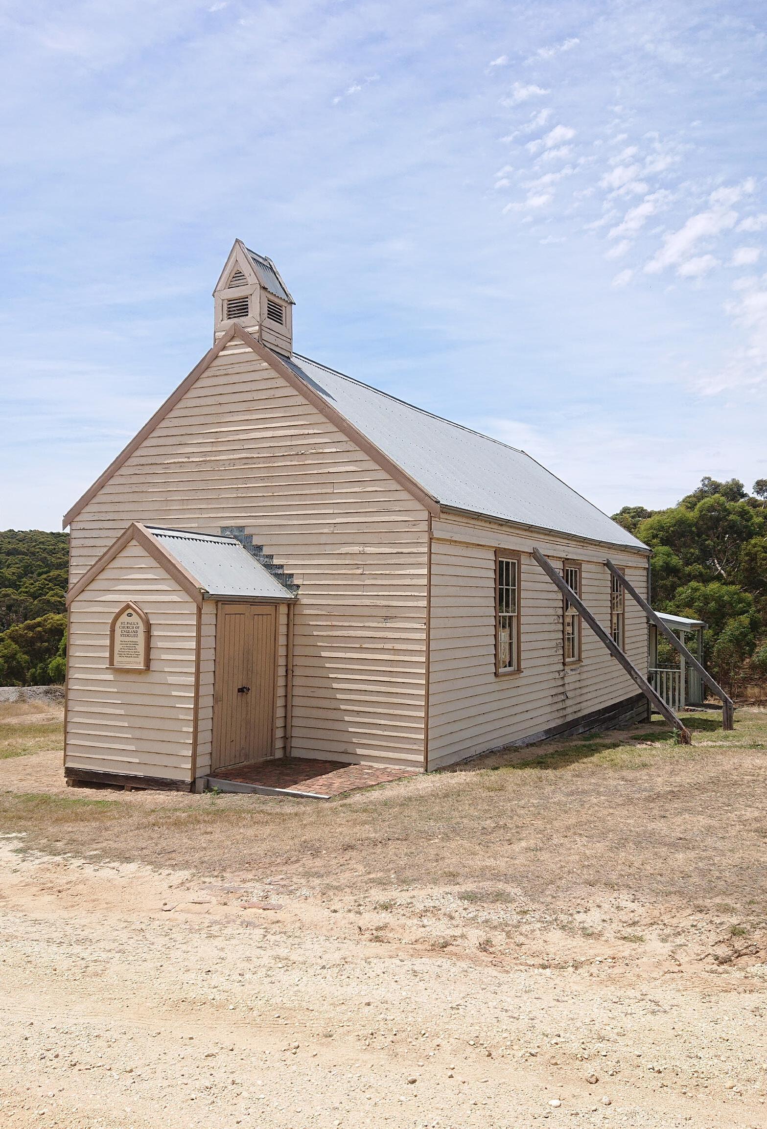
Managed by Parks Victoria, walk 1km from the courthouse along Stawell St to Sutherlands Creek. Follow the creek bed on the western side for 750m to a small waterfall. The track leads into small valleys with grass trees, finishing at Meredith-Steiglitz Rd. Return along the road, passing the old Catholic Church (circa 1868) and cemetery.
Dymy Vezdenetskyi, All Trails
Beards Gully Walk
Brisbane Ranges National Park
Look for signs of early gold mining, mine shafts, quartz in the creek bed and interesting rock formations.
Distance: 6km Time: 6hrs

For highly experienced hikers only, this unmarked, difficult off-track trail features steep climbs and dangerous mine shafts. Managed by Parks Victoria, it starts at Bert Boardman Recreation Area. Follow South Steiglitz Rd onto Sailors Track, turn north at Sutherlands Creek, rock hop along the creek, and follow Deadmans Track to Courthouse Carpark.
Yankee Gully
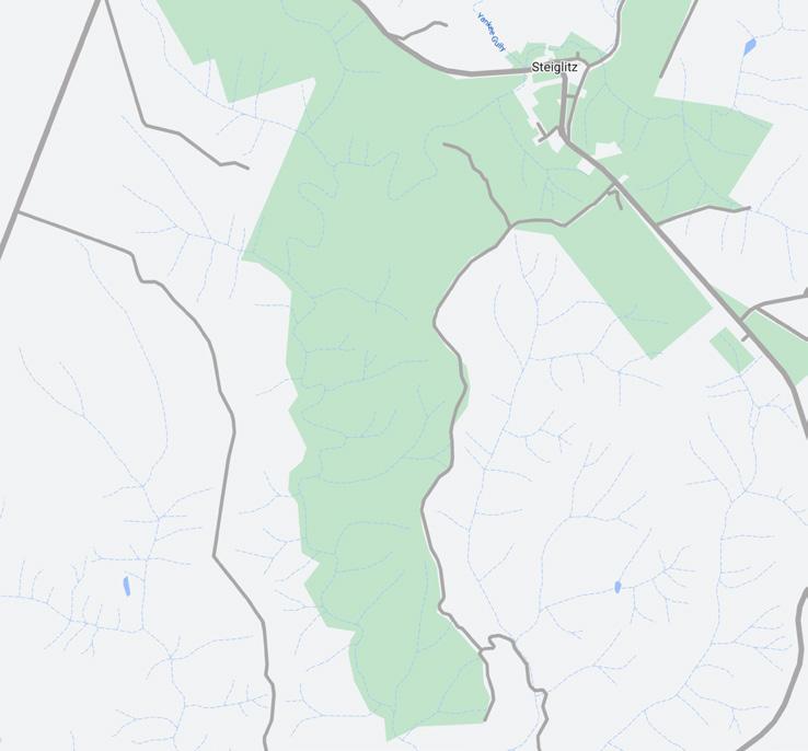
Steiglitz Historic Walk
Steiglitz
Go back in time and explore the remains of a once bustling gold mining town from the late 1800’s.
Distance: 760m Time: 20mins
At the height of the gold rush in the 1860’s, Steiglitz had a population of over 1,500, four hotels, a newspaper, a variety of shops and an undertaker. Follow this short trail from Steiglitz Historic Park along Clow and Regent Streets to historic sites and buildings detailed by interpretive signage.
Central West Golden Plains encompasses the townships of Cape Clear, Dereel, Rokewood, and Cordinhap.
Cape Clear is a rural area centred on agriculture and livestock, featuring wide-open fields and a close-knit community.
Dereel is a small town known for its bushland, tranquil atmosphere, and community spirit.
Rokewood, settled during the 1850’s Victorian gold rush, has a more developed infrastructure and serves as a hub for nearby farming communities, hosting various events throughout the year.
Cordinhap gained international attention in 1987 with the discovery of the 98-ounce “Orange Roughy” gold nugget. Also settled during the Victorian gold rush, it focuses on agriculture, with vast fields and a quiet, sparse population.
• Dereel Lagoon
• Kuruc-a-ruc Trail
• Rainbow Bird Trail
Things to see and do
Dereel
• Dereel Lagoon
Rokewood
• Kuruc A Ruc Creek
• Rokewood Swimming Lagoon
Cordinhap
• Avenue of Honour
Dereel Lagoon Loop Trail
Dereel
Walk around the reedy Dereel Lagoon, visit the jetty and take time to relax at one of many viewing platforms.
Distance: 2.5km Time: 30mins
Managed by Parks Victoria, this loop trail starts at the Dereel Community Hall and crosses the playing fields to their north-western corner from where its is well signmarked. Extend your walk by an additional 1.5km by following Kliens Rd south and looping back onto Swamp Rd.
Public
REGIONAL
Kuruc-a-ruc Trail
Dereel to Scarsdale
Take the scenic route from Dereel to Rokewood travelling through historic gold mining countryside.
Distance: 13.3km (one way)
Refer to page 12 for further trail details and map.
REGIONAL AND MULTI-DAY TRAIL
Rainbow Bird Trail
Dereel to Scarsdale
Ideal for a short walk or a long hike, and perfect for nature lovers, the Rainbow Bird Trail takes you through grasslands, wetlands and forests.
Distance: 35km (one way) Time: 3hrs Time: 2 days
Refer to page 13 for further trail details and map.
Located on Traditional Wadawurrung Country, North West Golden Plains contains the township of Enfield, with the remainder of the district being covered by the Enfield State Park.
Enfield is a quaint township offering a peaceful and scenic setting, characterised by its rural charm and surrounding bushland and farmland. The community is close-knit, with residents often engaging in local events and activities. Enfield is surrounded by the Enfield State Park, where you can enjoy bushwalking, camping, and birdwatching. Enfield’s history is rooted in the Victorian gold rush, with traces of this era still visible. While the township offers basic amenities, residents can access a broader range of facilities in nearby towns such as Ballarat or Smythesdale.
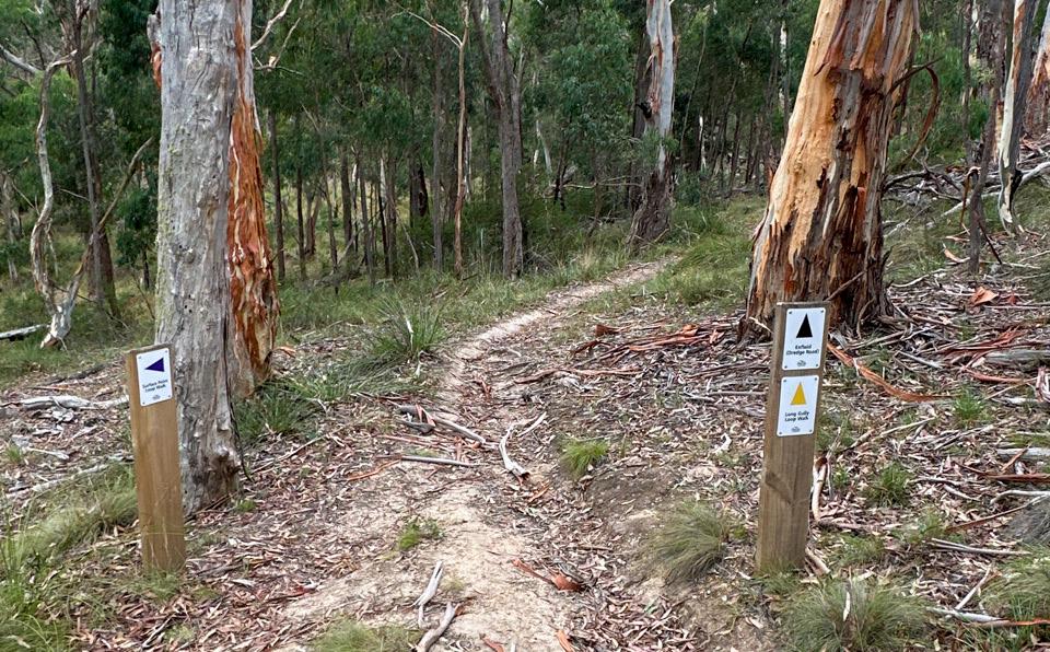
• Surface Point Loop
• Long Gully Loop
• Enfield Bald Hills Loop Trail
• Jubilee Mine Historic Walk
Enfield State Park
Pack a picnic and experience a short loop walk, and even try your luck at gold prospecting.
Look out for birdlife including little ravens, welcome swallows, bluewinged parrots and musk lorikeets.
Enfield Bald Hills Loop Trail
Enfield State Park
Reward yourself half way with nice views towards Ballarat and Mount Buninyong from the top of Bald Hill.
Explore ruins and remnants of past mining operations at the Jubilee Company Quartz Gold Mine.
7.1km Distance: 1km
20mins
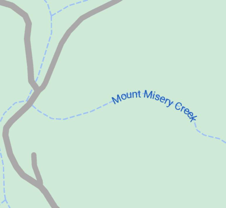
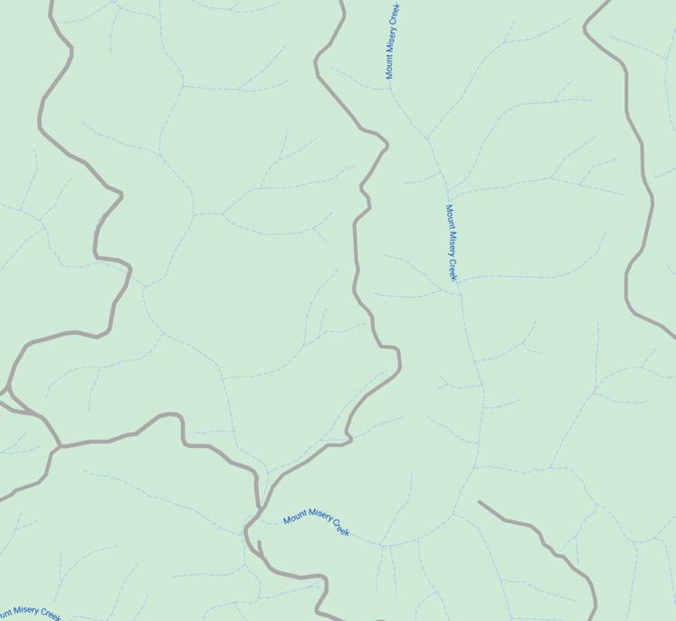
Managed by Parks Victoria, this well marked short loop trail begins at the Surface Point Picnic Area which includes a trailhead, carparking, camping, toilets, fire pits and seating. Follow the trail down to Mount Misery Creek, along Misery Creek Rd and back to the picnic area and carpark.
2hrs
Managed by Parks Victoria, this well marked loop trail begins at the Surface Point Picnic Area which includes a trailhead, carparking, camping, toilets, fire pits and seating. Some sections can get muddy and slippery after heavy rainfall.
4hrs
Managed by Parks Victoria, this loop trail begins at the Surface Point Picnic Area carpark and trailhead. Generally considered a moderately challenging route, the trail is well waymarked and is undulating with some steeper sections that become slippery when wet. Distance: 15km
20mins Jubilee Mine Historic Walk Jubilee Historic Area
Beginning at the carparking area within the Jubilee Historic Area, this loop trail includes waymarking and interpretive signage at key historic mining locations. The circuit has slight undulation and provides picnic and public toilet facilities.
Haddon, Smythesdale, and District is located in northern Golden Plains on traditional Wadawurrung Country. A short drive from Ballarat, this district encompasses numerous vibrant townships, including Haddon, Scarsdale, Linton, and Smythesdale, which were established after gold was first discovered in the Woady Yaloak River in 1852. This discovery sparked a gold rush that attracted thousands of miners.
The key trail in this district is the Ballarat to Skipton Rail Trail which travels through each town and provides key recreation and commuting opportunities for the area. The Rail Trail is supported by a number of shorter trails.
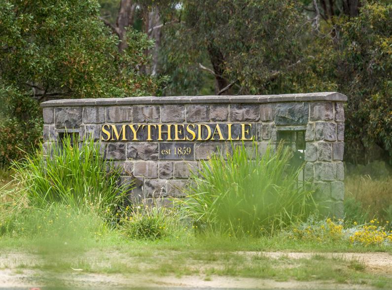
Haddon, situated 12 km west of Ballarat, has transformed from a bustling mining area to a tranquil residential community with a rural setting. Smythesdale is rich in history, much of which can still be seen today. By 1859, Smythesdale’s population had soared to 20,000. This contrasts with its current population of 1,189 residents (ABS 2021). Smythesdale became a legal hub in the late 1800s, serving as the law administration centre for the Ballarat Goldfields.
Scarsdale is a small town with an agricultural focus and a tight-knit community, and Linton, at the westernmost point, features numerous preserved heritage buildings, local amenities, and a rich mining history.
REGIONAL AND MULTI-DAY TRAILS
• Ballarat to Skipton Rail Trail
• Ross Creek Recreation Reserve Nature Loop
• Boden’s Water Races Loop
Smythesdale
• Smythesdale Historical Precinct
• Smythesdale Gardens
• Smythesdale Country Market
• Smythesdale Historic Walk
Linton
Smythesdale Township Sign
• Flagstaff Hill Lookout
Ballarat to Skipton Rail Trail
Ballarat, Smythesdale, Scarsdale, Linton, Skipton
This leisurely trail explores the railway that operated between 1883 and 1985, linking the gold towns west of Ballarat to the surrounding region.
Distance: 53km (one way)
2 - 3 days
669m
This trail can be accessed from any of the Haddon, Smythesdale and District’s Trailhead locations. Refer to page 10 for further trail details and map.
Ross Creek Recreation Reserve Nature
Waiting for sports training to finish? or just wanting a short walk? Explore Ross Creek Recreation Reserve.
Water Races Loop
Discover the water race and dam system built circa 1870 to support mining at Surface and Watson’s Hills.
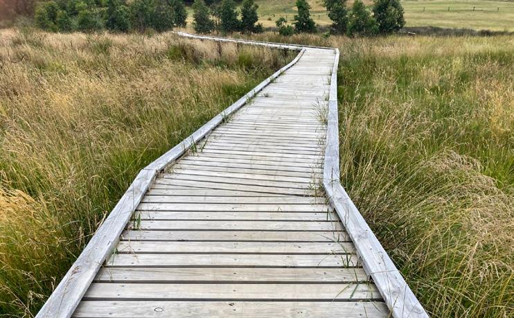
Beginning at Ross Creek Recreation Reserve this loop trail features a range of different options to provide varying distances. The loop features boardwalks, forest and open grasslands. Finish your walk with a rest at the picnic facilities or playground next to the tennis courts.
This loop trail, perfect for families, begins at the junction of Doctors Road and Wades Lane. It is well waymarked, gently undulating, and provides great birdwatching, an abundance of wildflowers in spring and views of the historic water races.