
The geospatial industry’s role in tackling climate change
BUSINESS GUIDE
Talent, technology, data and climate at the forefront
Insights into key trends, developments and challenges in the geospatial sector


The Surveyor 4.0: Which technical skills are needed today?
Why geomatics engineering education needs to change
Empowering the geospatial community www.gim-international.com
Issue 1 2023 | Volume 37

Director Strategy & Business Development
Durk Haarsma
Financial director Meine van der Bijl
Technical director Huibert-Jan Lekkerkerk
Contributing Editors Dr Rohan Bennett, Frédérique Coumans
Head of Content Wim van Wegen
Copy-editor Lynn Radford, Englishproof.nl
Marketing Advisor Myrthe van der Schuit
Business Development Manager

Jurjen Visser
Circulation Manager Adrian Holland
Design ZeeDesign, Witmarsum, www.zeedesign.nl
GIM International, one of the worldwide leading magazines in the geospatial industry, is published eight times per year by Geomares. The magazine and related website and newsletter provide topical overviews and reports on the latest news, trends and developments in geomatics all around the world. GIM International is orientated towards a professional and managerial readership, those leading decision making, and has a worldwide circulation.
Subscriptions
GIM International is available eight times per year on a subscription basis. Geospatial professionals can subscribe at any time via https://www.gim-international.com/subscribe/ print. Subscriptions will be automatically renewed upon expiry, unless Geomares receives written notification of cancellation at least 60 days before expiry date.
Advertisements
Information about advertising and deadlines are available in the Media Planner. For more information please contact our marketing advisor: myrthe.van.der.schuit@geomares.nl.
Editorial Contributions
All material submitted to Geomares and relating to GIM International will be treated as unconditionally assigned for publication under copyright subject to the editor’s unrestricted right to edit and offer editorial comment. Geomares assumes no responsibility for unsolicited material or for the accuracy of information thus received. Geomares assumes, in addition, no obligation to return material if not explicitly requested. Contributions must be sent for the attention of the head of content: wim.van.wegen@geomares.nl.
Talent, Technology, Data and Climate
at the Forefront
In line with tradition, we have conducted the latest annual GIM International survey among our readership of geospatial professionals. This year’s findings highlight the importance of sustainability, education and training, and the adoption of new technology in the geospatial sector.
The Geospatial Industry’s Role in Combating Climate Change


As the impacts of climate change become increasingly evident, this article zooms in on how the geospatial industry can play a meaningful role by providing accurate data and analysis to inform decision-making and guide the development of effective solutions.

Why Engineering Education Needs to Change
In order to educate a new generation of geomatics engineers, universities need to enhance their current programmes to expose students to emerging technologies. Only then will the industry be able to keep pace with the growth of geospatial information in today’s interconnected world.
The Surveyor 4.0: Which Technical Skills Are Needed Today?
Over the centuries, all four industrial revolutions have influenced surveying instruments and the profession as a whole. This article explores which different skills and capabilities surveyors are required to develop as a result of the latest revolution: Industry 4.0.


Geomares
P.O. Box 112, 8530 AC Lemmer, The Netherlands
T: +31 (0) 514-56 18 54
F: +31 (0) 514-56 38 98 gim-international@geomares.nl www.gim-international.com
No material may be reproduced in whole or in part without written permission of Geomares.

Copyright © 2023, Geomares, The Netherlands
All rights reserved. ISSN 1566-9076
The United Nations Integrated Geospatial Information Framework

The United Nations Integrated Geospatial Information Framework (UN-IGIF) creates an enabling environment where national governments can coordinate, develop, strengthen and promote the efficient and effective use and sharing of geospatial information for policy formulation, decision-making and innovation.
The Good, the Bad and the Ugly of the Surveying Profession
In the early days of surveying, surveyors were pioneers in charting the unknown. Today, with the Earth having been completely mapped to some degree, surveying has become a much more specialized field with different types of surveyors and sophisticated equipment.


Where Would the Geospatial World Be Without Circles?
How many realize that the models, concepts and equations which drive today’s 3D modelling and problem-solving technology are only possible thanks to methodologies and breakthroughs by our ancient counterparts? A number of key contributions are acknowledged in this article.
Aerial Precision Is Ready for Take-off
The Dutch startup Aerial Precision recently demonstrated its two first sensors with integrated artificial intelligence software. Over the past few years, the company’s innovation efforts have resulted in products that make Lidar cheaper and easier to use.
Cover story
The image on the front cover of this annual Business Guide shows the new Lidar dataset of Otago, a coastal region located in the southern half of New Zealand’s South Island. The Lidar data was captured for Otago Regional Council by AAM. (Image courtesy: Otago Regional Council/Land Information New Zealand)
Business Guide 2023 3 Contents
5 Editorial 7, 21, 37, 46, 49 5 Questions 41 Company Profiles
8 27 14 34 18 38 22 48 The Surveyor 4.0: Which technical skills are needed today? Talent, technology, data and climate at the forefront Insights into key trends, developments and challenges in the geospatial sector Why geomatics engineering education needs to change The geospatial industry’s role in tackling climate change www.gim-international.com BUSINESS GUIDE To subscribe to GIM International go to www.gim-international.com/subscribe
THE GLOBAL LEADERS OF AERIAL IMAGING
www.vexcel-imaging.com


Powerful

Perfromance
Sharp-eyed!

Last year was another odd year. Many parts of the world finally opened up again after a series of lockdowns. Some of those lockdowns were more severe than others, but they had all affected the general economy – and therefore our industry – in some way. But any relief felt at the beginning of 2022 was short-lived, because the biggest drama was still to come: the grim war on European soil that started with Russia’s invasion of Ukraine in February. This armed conflict is rapidly approaching the start of its second year and no one knows how things will unfold, but I hope very strongly that we will see peace restored again in 2023.
We have been conducting an annual survey to stay in close touch with our readers and –through them – the state of the geospatial business for a number of years now. We were delighted to receive an overwhelming response to our most recent survey, with close to a thousand GIM International readers participating in this edition. Wim van Wegen has summarized the outcomes for you, including in the context of current economic and geopolitical developments such as the Ukraine war, on page 11 of this Business Guide.
Besides presenting the results of our annual survey, our aim with our yearly Business Guide is to give you a glimpse of the future of the industry, and this edition is no exception. Among the many interesting articles, a particular highlight is the article by Rudolf Staiger who shines his light on ‘The


Surveyor 4.0’ (page 22). Staiger steered the International Federation of Land Surveyors (FIG) for the past four years until his term officially ended on 1 January 2023 and he was succeeded by Diane Dumashie. In his article, he ties the skills needed by surveyors to the technical developments that have shaped the business over the past decades and even centuries. Staiger divides the evolution into four stages, running from Surveyor 1.0 (in the years before 1590) until today’s Surveyor 4.0, with each technological phase (optical, electrooptical and multi-sensor) making different demands on surveyors. We can conclude that the Surveyor 4.0 needs to be a ‘jack of all trades’. It is no longer enough to merely master the instrument; in order to carry out a successful surveying project, the future surveyor also needs to master planning, budgets, uncertainty, data treatment, data analysis, presentation, visualization, control and validation. In an attempt to offer some solace, Staiger adds that a few skills have become obsolete, since the surveyor no longer needs to be a skilful mechanic, experienced in manual calculations, weatherproofed or sharp-eyed. I only tend to disagree with the last one; I believe it will still be very helpful if the surveyor of the future is sharp-eyed – figuratively speaking, of course!
As we look ahead to the rest of 2023, I would like to thank you all for not only contributing to our survey, but also for continuing to share your feedback and engage with us (and each other) as part of the geospatial community of GIM International and beyond!
Durk Haarsma director strategy & business development durk.haarsma@geomares.nl
Business Guide 2023 5 Editorial
KNOWLEDGE IS POWER
MITIGATE RISK WITH OPTECH GALAXY
Galaxy lidar sensor captures all features within transmission and distribution wire zones, in a single pass, at high altitude and without compromise. Get the highest resolution on wires, poles, and encroaching trees. Ideal for inspections, vegetation management and as-built surveys.


•Up to 2 million measurements per second
•High fidelity resolution of cross arms, insulators, transformers and all key small features
• Exceptional vegetation penetration
•Complete detection of dark wires, roofs and roads
FOR MORE INFORMATION:
www.teledyneoptech.com/galaxy
© 2022 Teledyne Optech and Teledyne CARIS, are both companies of Teledyne Technologies Inc. All rights reserved. Specifications are subject to change. Image courtesy of Merrick & Company and Aerial Surveys InternationalTeledyne Geospatial Imaging Solutions for Land and Water
See clearly and accurately where vegetation is encroaching.
Questions to... Kwabema Obeng Asiama


For this series of Q&As, we invited a number of geospatial industry experts to share their insights into the current state of the sector and their expectations for the future. What are their views on the biggest challenges facing the industry, the technological growth drivers in the years ahead, and the future outlook for the surveying profession?
What do you see as the biggest challenges for the geospatial industry as a whole in the coming years?


Based on my daily experience, the biggest challenge I see for the geospatial industry is the institutional acceptance of geospatial technological advances based on artificial intelligence (AI) applications, and their alignment with the legal and institutional setup of the local context to facilitate mainstream use. These advances include automatic parcel boundary extraction, automated valuation models, mass valuation and computer-assisted land use planning decision-support systems for smart cities. Especially in the Global South, the take-up of new technologies will help to accelerate the collection, management and dissemination of geospatial information in support of activities such as disaster risk management and improving food security. This was shown more recently during the COVID-19 pandemic, when potential links between the health sector, emergency services and law enforcement were explored via geospatial information. However, whether or not these links were kept in place after the worst shocks of the pandemic had passed depended on three aspects, as highlighted by the IGIF’s (United Nations Integrated Geospatial Information Framework, Ed.) three main areas of influence – governance, technology and people. The push of technological advances remains the biggest strength of the geospatial industry, but the governance of these technologies seems to be its biggest challenge in the coming years.
What will be the main technological drivers in mapping and surveying?
The key drivers of technological developments in the mapping and surveying profession have largely been the push of technological advances in other fields. However, looking to the future, I believe that the growing awareness of global challenges, and how those developments can aid in tackling them, will play a more central role in driving advancements in the profession.
Will surveyors have been replaced by robotization and AI in ten years’ time? Perhaps not in ten years’ time, but probably within 20 years’ time. Robotization and AI are taking over every aspect of human lives and processes. Some may say that AI and robots could never perform as well as human surveyors, and technology is not advanced enough to take over the work of enough surveyors. However, we tend to think of technological advancements and change as the ‘fancy new expensive stuff’, but real change comes from last decade’s stuff becoming cheaper and smarter, thus allowing for its wider use. A good example of this is the revolutionary change that the democratization of the global positioning system caused in our industry by making surveying and mapping faster and cheaper, whilst gradually increasing its efficiency. These technologies could be the competition for the next generation of surveyors, and the profession has to respond to this by providing them with the right training. This takeover by AI and
robotization may not happen immediately, and not across all surveying and mapping processes, but it will occur on a large enough scale and soon enough that it will be a problem for the profession if we are not prepared.

Which types of survey projects are paramount for your organization in the short to medium term?
The properties dealt with by my valuation and estate surveying firm, especially those in rural areas, are mostly on customary lands for large-scale land acquisitions. Hence, there is the need to adapt the local view of land value to mass valuation processes. Furthermore, these are areas with little land-related market activity, so the conventional approach to real estate valuation cannot be used. This means that data collection is paramount to the work of the organization to understand the limited local market.
How will you prioritize technology investments in your organization over the next couple of years?
Technological investments in my organization mostly have to do with data collection methods for land value indicators on rural lands. Some of the aspects that will be prioritized are the use of remote sensing imagery for identifying land cover, as well as a means of mapping and taking inventory of properties in a faster and cheaper way.
Business Guide 2023 7 5 Questions to...
5
Kwabena Obeng Asiama did his MSc (2015) and PhD (2019) at the University of Twente (ITC) with a focus on land administration. He is currently a lecturer in the Department of Land Economy at KNUST in Ghana and is chair of FIG Commission 8 on Spatial Planning and Development. He is also a junior partner
at the Centre for Property Investment, a valuation and estate surveying firm.
Insights into key trends, developments and challenges in the geospatial sector

Talent, technology, data and climate at the forefront
By Wim van Wegen, Head of Content, GIM InternationalIn line with tradition, we have conducted the latest annual GIM International survey among our readership of geospatial professionals. The aim is to identify key trends, developments and challenges related to technology and business operations. This year’s findings highlight the importance of sustainability, education and training, and the adoption of new technology in the geospatial sector. The mood is optimistic, but potentially threatening external factors are lurking in the shadows. Nevertheless, it is clear that technological developments are opening up new horizons for today’s and tomorrow’s mapping and surveying professionals.
Business Guide 2023 8
The Afsluitdijk renovation in the Netherlands is just one example of the crucial role played by highly-skilled land surveyors in large infrastructure projects. (Image courtesy: Rijkswaterstaat /Jan Wessels. For more information on this prestigious project, please visit theafsluitdijk.com)
Kristalina Georgieva, managing director of the International Monetary Fund (IMF), recently shared a widely publicized warning that ‘deglobalization’ – the economic fragmentation of the world – could cause a major blow to the worldwide economy, potentially leading to a global contraction of 7% in the long term. According to Georgieva, economic integration in recent decades has resulted in billions of people becoming wealthier, healthier and better educated. The Bulgarian IMF chief stated: “Since the end of the Cold War, the world economy has roughly tripled and nearly 1.5 billion people have been lifted out of extreme poverty. These gains of peace and cooperation should not be wasted.” In summary, international cooperation is essential to tackle the future challenges; governments should prioritize promoting trade, reducing debt and addressing climate issues, rather than forming blocs and engaging in conflicts. Needless to say, the geospatial sector forms part of – and is affected by – the world economy, so this economic backdrop inevitably provides meaningful context for interpreting the outcomes of our industry survey.
Optimism all around
The responses to our latest survey suggest that the majority of geospatial professionals view the surveying and mapping industry prospects as even better this year than in 2022. 43.6% of the respondents believe that the prospects will be better, 24.2% believe they will be much better and 26.3% believe they will be the same, while less than 6% believe they will be worse or much worse. This indicates a general sense of optimism in the geospatial industry about the coming year, and it is probably somewhat influenced by the growing belief that the COVID-19 era is now behind us. Of course, we should remember that these responses are subjective. The survey respondents’ opinions may not reflect the industry’s actual future prospects, especially when we consider what economic experts are predicting. Nevertheless, much of the feedback obtained from the mapping and surveying professionals who took the trouble to complete our survey confirms the positive mood. There are several reasons for the seemingly unwavering optimism.

Many respondents highlight the increased economic activity and post-COVID developments, with more projects and sites reopening and new opportunities emerging related to the fourth industrial revolution. Meanwhile, increasing attention is being paid to the role of geospatial data in addressing challenges such as climate change. All these developments are driving the need for geomatics expertise.
One geospatial professional from Louisiana, USA, highlights the extensive state and federal infrastructure investment in her country, and the need for land acquisition and construction surveys. Numerous survey participants mentioned public and private investment in renewable energy, new mines and new electricity transmission projects, such as huge new projects for solar farms or undersea power lines. Green hydrogen is also cited as a new opportunity with a promising future. Overall, the respondents believe that the need for more and better data and modelling is becoming more evident, which clearly has a positive impact on the prospects for the surveying and mapping industry in 2023.
Industry concerns
Despite the overwhelmingly positive outlook, there are still some concerns among geospatial professionals. It is interesting to take
Wim van Wegen is head of content at GIM International and Hydro International In his role, he is responsible for the print and online publications of one of the world’s leading geomatics and hydrography trade media brands. He is also a contributor of columns and feature articles, and often interviews renowned experts in the geospatial industry. Van Wegen has a bachelor degree in European Studies.
a closer look at these concerns to understand the risks that the geospatial industry faces and how they might be tackled. Some of the perceived threats relate to macroeconomic and geopolitical trends, partly in line with the concerns expressed by the IMF. Despite the widespread optimism, some survey respondents regard a financial downturn as a real possibility in 2023. For example, recessions may be looming as various countries are currently experiencing inflation. One of the respondents states: “From a revenue growth perspective, the industry may be impacted by inflationary pressures and also increased competition from new market entrants charging lower prices for products and services.”
In terms of other factors that could present serious hurdles for the geospatial industry, a staggering number of respondents express their concerns about the future of their profession. One respondent point out that the average age of surveyors in many Western countries is well above 50, adding that even this estimate may be conservative. This implies that a significant number of surveyors will be retiring in the next 15 years. In many European countries, for instance, this is coupled with a rather low number of students that graduate from surveying programmes. One respondent sums this up by stating: “There are not enough surveyors being produced through the system to meet an ever-burgeoning demand for qualified professionals.” Another puts it more bluntly: “Surveying is a dying industry with more surveyors retiring than our coming in”. Meanwhile, another respondent expresses their fears that the scarcity of

Business Guide 2023 9 Industry Survey
About the Author


surveying experts is likely to worsen in the future. As previously reported in GIM International, there is indeed a significant lack of young talent coming to work in the sector, as well as a shortage of skilled employees. In fact, according to our survey, this is one of the three biggest challenges facing the geospatial industry in the coming years, as explained in more detail below.
The three biggest challenges
1. Talent management and retention (recruitment, education, training): To meet growing demand for geospatial data and insights, the geospatial industry actually faces two major challenges relating to talent management: firstly to attract more people into the sector, and secondly to improve the retention and deployment of existing employees based on reskilling and continuous professional development. So what is at the root of these challenges, and how can they be solved? One of the survey respondents has strong views on this: “As a profession, surveying has lost its way. It is not ‘seen’ as a potential career for second-level students entering third-level studies. It needs to adopt clear messaging: technical geomatics skills and spatial data capture and management competencies are core to sustainable spatial planning, environmental management and decision-making, to achieving the Sustainable Development Goals and to good governance. The geospatial industry needs to communicate the ‘risks’ involved in this lack of appreciation of good data capture, analysis and management.” Many agree that our industry has somewhat of an image problem, since most people outside the industry still don’t know what geodesy is. One thing that
we can conclude from the numerous comments is that the sector has some work to do when it comes to talent management. Some of this year’s survey respondents suggest that better training and career opportunities should be on offer to appeal to the younger generation’s higher expectations, while others advocate that the industry should transform itself into a tech-savvy field to offer more exciting and impactful career prospects. One could ask whether we still need an influx of new surveying professionals, in view of all the technological advancements that have revolutionized the sector. The general consensus seems to be that the demand for geospatial professionals will continue to grow as such technologies become more prevalent, as expressed by this response: “Despite all the exciting high-tech solutions in reality capturing, it’s very important to note that they cannot replace the need for more skilled professionals to drive the industry forward.”
2. Staying up to date with and adopting new technologies: The adoption of advanced technologies into new or existing workflows is becoming increasingly important in order to stay competitive in the market. “This shift is not just about finding and retaining employees, but also about using our data more effectively and efficiently. Implementing knowledge management systems to easily retain and access data, as well as adopting standards for data and information sharing, are key in this process,” states one respondent from Brazil. One area where advanced technologies can greatly benefit is in the processing of Lidar and mapping data for 3D modelling. “The use of AI (artificial intelligence, Ed.) software can greatly reduce the cost of processing and analysis. Drones have also proven to be useful for mapping, but they currently have limitations. As the demand for spatial data continues to rise across various industries, advancements in drone technology will lead to wider-scale adoption in the geospatial industry,” explains a respondent working for a leading spatial information technology provider in India, as one of the numerous comments received on this topic.
3. Data quality and management: Many respondents make reference to the significant technological changes they have observed in the surveying and mapping industry in recent years. The fast-paced technological developments present new challenges. “The big data revolution and knowledge-doubling curve are not relenting,” one of the respondents states. Another respondent shares his thoughts as follows: “It is important to capitalize on the strengths of big data and utilize it where it can add the most value. As new applications for remote sensing and big data continue to emerge, and new sources of remotely sensed data become available, surveyors should


Business Guide 2023 11 Industry Survey
embrace the abundance of opportunities provided by these new tools.” This ties in with the ongoing shift of the land surveying profession towards automation and mass data gathering. Mobile mapping, scanning and other technologies are allowing for automatic machine extraction of data with minimal human intervention. While these new technologies have the potential to improve efficiency and accuracy, surveyors also have concerns about cost, complexity, data privacy and, not least, the knowledge of how to handle and use the resulting data. For example, many respondents highlight the importance of understanding how to integrate datasets from a wide variety of reality capture techniques.
AI, machine learning and digital twins
Machine learning (ML) offers a way to cope with the mind-boggling amount of data generated through automated data acquisition. Indeed, after having been a promising field of technology for decades, we have recently witnessed a significant acceleration in its development and the emergence of major trends that signify a golden age for machine learning, AI and advanced analytics. Industries such as infrastructure and space are already adopting such technologies, but what is the current view in the geospatial profession?
“Given our history as a geospatial services provider, it is clear that if we do not embrace AI and ML, we risk becoming obsolete as companies using these technologies will surpass us. We must acknowledge this reality and take action,” states one respondent. The digital twin trend, which is rapidly gaining momentum, is one example of how geospatial professionals are already combining their knowledge and skills with AI and the Internet of Things (IoT). One of
the respondents comments: “Most of our work ends up in digital twins and smart cities-type applications, in all sectors. These technologies are the choice of the modern user.” Visualization technologies such as virtual reality (VR) and augmented reality (AR) are increasingly playing an important part in sharing insights with users. Indeed,

agency reminds us: “The reliability of digital twins is directly dependent on the quality, completeness and timeliness of the data used.” This underlines “the importance of trained geospatial professionals in guiding the correct and ethical use of these technologies.”
Climate change and sustainability

Last but not least, the striking number of comments we received from survey participants emphasize the importance of the topic of climate change. As one respondent states in a very matter-offact manner: “Solving the climate change challenge is not really our task, but our geospatial data can contribute to it.” This year’s industry survey reveals that, besides playing a broad role by facilitating the use of geospatial data to tackle climaterelated issues, an increasing number of organizations are putting the environment centre stage within their own operations.
geospatial data-fed digital twins offer far-reaching possibilities. They enable us to make accurate decisions and take precautions based on advanced simulation models, for example. But as one surveyor with his own engineering consultancy
For example, one respondent comments: “Our company is focusing more and more on environmental monitoring and tries to increase its dependency on renewable energy sources.” Another survey participant explains: “We are reducing our actual CO2 emissions and helping customers with their
Business Guide 2023 12
Exciting new business opportunities are opening up, but the speed of the technological developments brings with it new challenges
own sustainability strategies.” A third response states: “Sustainability for our company is about being proactive on the global warming front and actions are being taken to ensure we are ‘net zero’ by 2050.”
With the right perspective, embracing sustainability not only addresses the threat of climate change but also opens up new business opportunities. A study conducted by IT research and consulting firm Gartner revealed that environmental and social change is now a top-three priority for investors, after earnings and revenue. Executives are realizing that investing in innovative solutions designed to help them achieve sustainability goals can give them a competitive advantage. Survey firms and mapping companies are starting to embrace this idea too, as illustrated by one respondent: “I feel like we are above most of our competitors in the push to sustainable services.” Moreover, the ongoing shift towards a more sustainable way of living is creating new application areas, such as the renewable energy sector and smart city management, all of which
of surveying and mapping. The revolution in geospatial technology, driven by the increased availability of data, advancements in AI and access to massive computer power, has transformed the nature of our profession. Exciting new business opportunities are opening up, but the speed of the technological developments brings with it new challenges, not least in terms of ensuring a sufficient number of professionals with the right skills. “The big data revolution and knowledge-doubling curve are not relenting,” one of the respondents states. “It will be a necessity rather than mere convenience to attract and retain top talents who can stay with, if not ahead of, this fast-paced technology and knowledge-led transformation in the geomatics landscape,” comments another survey participant. So what does our survey tell us about the future of the surveying profession? This response sums it up nicely: “The shift towards automation has been impressive so far. However, I still believe that the fundamentals of survey and spatial coordination are essential to understanding and processing geospatial data.” This underlines the growing

Business Guide 2023 13 Industry Survey
the success of engineering projects, but also in solving urgent societal
Automation and robotization have advanced greatly, but the field of land surveying still requires a new, highly-skilled workforce with a comprehensive understanding of survey and spatial coordination. (Image courtesy: Strabag)
How our sector can play a key role in developing sustainable solutions
Geospatial’s role in combating climate change
 By Wim van Wegen, Head of Content, GIM International
As the impacts of climate change become increasingly evident, this article zooms in on how the geospatial industry can play a meaningful role by providing accurate data and analysis to inform decision-making and guide the development of effective solutions. It is time for everyone to use their skills and knowledge to help pave the way towards a sustainable future, and there’s no better place to start than with ourselves. Therefore, this article also highlights how various companies in our industry are ‘greening’ their business.
Various international treaties make it clear that climate change is on the agenda. One of the most notable agreements at the multilateral level is the commitment of the European Union member states to achieve climate neutrality by 2050. Another example is the formulation and widespread
promotion of the Sustainable Development Goals (SDGs). Meanwhile, there have been 27 editions of the United Nations Climate Change conference series since it was first held in 1995. The most well-known and impactful agreements reached are the Kyoto Protocol, which was adopted in 1997 and
entered into force in 2005, and the Paris Agreement, established in December 2015. The Paris Agreement set a legally binding target to limit global warming to 1.5⁰C above pre-industrial levels, with a secondary goal of limiting warming to 2⁰C. Today, however, it is becoming increasingly clear how difficult
Business Guide 2023 14
Figure 1: This satellite image reveals the extent of Pakistan’s record flooding in August 2022. It shows how the overflowing Indus River turned part of Sindh Province into an inland lake stretching over 100km. (Image courtesy: NASA)
it will be to achieve those targets. Alarm bells are ringing ever-more loudly, but the key question is whether enough government leaders will hear them.
Despite all these ambitious agreements, the lack of swift, concrete action to transition to a green economy has led to a continued increase in temperature, loss of biodiversity and environmental degradation. As illustrated by Earth’s ever-louder and clearer distress signals, however, we can no longer afford to ignore the signs of climate change. In 2022, Pakistan was hit by devastating flooding, with the worst monsoon rains in decades submerging a third of the country’s land. Glaciers across the globe – including in Pakistan – are retreating at a rapid pace, which has consequences for the availability of meltwater for rivers. This, combined with the predicted decrease in snowfall over the coming decades, presents a grim scenario for glacial rivers. Meanwhile, for rivers that rely on rainfall, drought poses a major threat in various regions of the world. Additionally, the melting of the polar ice caps is causing sea levels to rise, putting the roughly 15% of the world’s population currently living in low-lying areas at extra risk. Therefore, while international treaties are crucial, the real challenge now lies in implementation and execution.
Geospatial data as a tool

The geospatial industry already plays a vital role in addressing climate change by designing and developing software tools that enable reliable geodata analysis used for monitoring, mitigating and adapting to climate change. Since many people from outside our industry are currently unaware of this, one aim should be to make our contribution more visible. Meanwhile, many geomatics specialists are examining ways in which our industry can help to halt climate change. Techniques such as radar altimetry, optical Earth observation satellites, airborne Lidar and digital cameras provide data on changes in elevation, land use, water storage, ice mass balance and more. Geodata is also crucial for responding to flooding and its value is dependent on accurate time tags and georeferencing. Therefore, geodata contains vital information for understanding and combating the effects of climate change. The challenge here is to effectively extract and convert data from multiple sources – such as satellite imagery, Lidar point clouds and radar data – into useful, quantitative information that can inform decision-makers and guide them towards implementing sustainable solutions.
Earth Archive initiative

One of the key steps in understanding and addressing the impacts of climate change is to create a comprehensive baseline record of the current state of the Earth’s land surface. This is crucial, as it allows for the measurement of change over time by comparing actual data against the baseline data. Unfortunately, there is currently a lack of high-resolution, three-dimensional baseline datasets for most of the planet’s land surface. Without this baseline, it is difficult to effectively monitor and assess the impact of efforts to mitigate the effects of human activity and climate change. In light of this need, Christopher Fisher has launched the Earth Archive initiative to create a digital baseline of the Earth. In this large-scale international effort, airborne Lidar will be used to perform a 3D scan of the planet’s entire landmass (roughly 30% of the total surface area). The acquired data will then be combined with other open-source data, such as the Landsat archives, and field-based measurements.
About the Author
Wim van Wegen is head of content at GIM International and Hydro International. In his role, he is responsible for the print and online publications of one of the world’s leading geomatics and hydrography trade media brands. He is also a contributor of columns and feature articles, and often interviews renowned experts in the geospatial industry. Van Wegen has a bachelor degree in European Studies.
Reducing the surveying footprint
The damage caused by climate change can only be tackled by collective action and responsibility. This means that, besides offering a vital range of tools to combat climate change, businesses in the geospatial sector cannot escape the need to consider their own impact on the environment as the basis for ‘greening’ their operations, or in other words acting to improve the efficient use of natural resources and the preservation of biodiversity and the living environment
A closer look at surveying engineering firms and geospatial equipment manufacturers reveals an increasing trend towards adopting sustainable business practices and technologies, such as by reducing emissions and switching to renewable energy sources, and taking the environmental impact into account across their decisionmaking. Several inspiring examples of ‘greening’ below demonstrate how industry players are taking steps to minimize their environmental footprint and promote sustainable solutions.
Business Guide 2023 15 Feature
Figure 2: The first photograph of Earth ever taken from the Moon by a human – just before the famous Earthrise picture was made. (Photo: William Anders, NASA Apollo Archive)
zero emissions by 2035, and has developed a comprehensive carbon reduction plan to realize this goal. Fugro is making steady progress towards meeting or even exceeding its objectives thanks to adopting low-emission solutions for data collection and enhancing analytical capabilities to deliver more effective guidance. This environmentally friendly approach actually has a wider impact as Fugro is actively collaborating with various communities and government agencies to distribute its sustainable solutions to a larger audience. Besides transforming into a net-zero company itself, it is also setting an inspiring example by encouraging others to embrace the route towards a green economy.
One example of a smaller business that is on a mission to provide efficient and effective survey and mapping services in an environmentally friendly manner is Geomaat. This Dutch land surveying company has incorporated sustainability and the reduction of carbon emissions as a key strategic pillar. Its offices are completely disconnected from the gas supply, and roughly 25% of its vehicle fleet is already electric – and this percentage will continue to grow as company vans are replaced by electrically powered vehicles. In addition, the company strives to minimize its environmental impact by taking its customers’
needs and expectations into account. This includes using sustainable materials and promoting the reuse of materials. The firm’s environmentally friendly practices are certified according to the ISO 14001 standard and are closely monitored as the basis for implementing necessary adjustments.
In another example, Davis Ogilvie, a renowned civil engineering firm in New Zealand, was one of the country’s first engineering and surveying companies to achieve net-zero carbon certification. To minimize its carbon footprint, this specialist in multi-disciplinary engineering, surveying and development planning services has implemented an environmental management plan and an environmental auditing process. These tools help the company to understand its impact on the environment and to develop sustainable solutions. Power and transport emissions are a major contributor to the company’s carbon footprint, so limiting these emissions is crucial to reducing the overall impact. The company therefore monitors and manages its vehicle fleet, waste stream and energy consumption. To further minimize emissions, Davis Ogilvie has installed a 20kW solar power system and biofuel tank at its Christchurch office. Additionally, the company balances its emissions by purchasing local carbon credits.
Contributions by surveying equipment manufacturers
The industrial, automotive, energy and utility sectors produce approximately half of all greenhouse gas emissions globally. While companies that supply equipment to the surveying and mapping business only account for a small portion of this, a growing number of them nevertheless recognize their responsibility to make a meaningful contribution to reducing carbon emissions.
Trimble is one company that has set science-based targets, including to utilize 100%-renewable energy sources to strive towards a net-zero future. Combined with this, it is a member of RE100: a global initiative bringing together the world’s most influential businesses committed to 100% renewable electricity. The company acknowledges that it will not be easy to decarbonize its activities and its value chains while solving customer challenges such as maximizing agricultural yield amid a changing climate, or increasing performance during labour shortages. “This takes the brightest minds to provide unique ideas. It requires a culture of belonging, teamwork and collaboration,” according to Trimble CEO Rob Painter. As a result of this approach, the industry giant is installing on-site renewable energy at select Trimble locations,
Business Guide 2023 16
Figure 3: Fugro is adopting low-emission surveying technologies, for example when it comes to its advanced solutions for nearshore and coastline seabed mapping. (Image courtesy: Fugro)
including a major on-site solar installation in Westminster, Colorado, USA. However, these projects are regarded as just the start. Trimble is committed to a full renewable energy future which involves using its influence to transform towards a net-zero carbon power grid.
Hexagon is another powerhouse in the geospatial industry which is taking several key steps aimed at accomplishing its sustainability goals. These steps include reducing greenhouse gas emissions in both its operations and supply chain, increasing energy efficiency at production facilities, and implementing processes for sustainable resource management to reduce waste in factories and offices. On top of this, the multinational is committed to reducing the burden of its own operations and its supply chain on water quality and air quality. Furthermore, the company is integrating sustainability considerations into its product development, design and production processes, and promoting a culture of sustainability among employees to become a role model in the management of environmental issues.
To facilitate concrete actions to achieve sustainability, Hexagon is developing and implementing a comprehensive Sustainability Programme. Additionally, it is dedicated to strictly adhering to chemical safety regulations, including the EU Directive on Registration, Evaluation, Authorization and Restriction of Chemicals in divisions that fall under such operational contexts. In support of these actions, Hexagon is implementing an environmental management system, such as ISO 14001 certification, in its major production facilities. This will ensure that the company is meeting the highest standards in environmental protection. Lastly, the company is implementing sustainability requirements for its suppliers through its Supplier Code and conducting audits to ensure that suppliers uphold the high sustainability standards.

These and many other examples make it evident that a growing number of providers of mapping and surveying solutions, whether they are based in Asia, Europe or North America, are involved in various aspects of sustainable business operations. Transparency about environmental, social and governance matters is becoming the norm, particularly among larger companies. This is being driven by their own principles and ideologies, the rising demand from customers for environmentally conscious solutions, and the effect of legislation. For example, under the European Union’s Corporate Sustainability Reporting Directive (CSRD), from 2024 onwards all large businesses will be required to disclose information about the impact of their activities on people and the environment, as well as any sustainability risks they may face. In contrast, however, small and medium-sized businesses often still find environmental legislation to be complex and difficult to understand. Such companies are key players in driving growth towards a sustainable and low-carbon economy, so there is certainly room for improvement here. Governments could play an influential role in encouraging such companies to do more to shoulder their environmental responsibility.
Conclusion
While international ambitions and agreements such as the Sustainable Development Goals and the Paris Agreement are important in addressing climate change, the real challenge now is all about their implementation and execution. Geospatial data is key to understanding and combating the effects of climate change. Therefore, the geospatial industry can make a significant contribution to sustainability by rising to the challenge of effectively extracting this data from multiple sources and converting it into useful, quantitative information. Our sector’s vital position in addressing the issue of climate change is highlighted by the attention that the topic receives from organizations such as the FIG and UN-GGIM, as well as at events like Intergeo. That is why GIM International will continue to cover this issue, aimed at further raising awareness about the industry’s role by exploring two key aspects: the use of geodata in understanding and addressing climate change, and the increasing focus on sustainability within industry players’ own operations.
Business Guide 2023 17 Feature
Figure 4: An impression of surveying activities during the construction of a wind farm which today produces enough green electricity to supply 370,000 households. (Image courtesy: Geomaat)
Further Reading Creating an Earth Archive, Proceedings of the National Academy of Sciences of the United States of America, Vol. 119, No. 11 The Surveyor’s Role in Monitoring and Adapting to Climate Change, FIG Publication 65
Why and how does geomatics engineering education need to change?

The impact of the digital transformation
By Emmanuel Stefanakis, University of Calgary, CanadaTo accomplish their mission of educating a new generation of geomatics engineers, universities need to enhance their current programmes to expose students to emerging technologies. Only then will the industry be able to keep pace with the growth of – and need for – geospatial information in today’s interconnected world.


Graduates of geomatics engineering programmes have traditionally been employed in a diverse range of careers, including land and engineering surveying, mapping, airborne and mobile mapping, positioning and navigation for the building sector, defence, mining, oil and gas, remote sensing for environmental management, public utilities and government. Nonetheless, the unprecedented global growth of – and need for – geospatial information and technologies in our interconnected world has recently provided geomatics engineers with many new challenges and opportunities.
Engineering colleges and universities need to rise to these challenges and accomplish their mission of educating a new generation of geomatics engineers by exposing students to emerging fields in the geospatial industry, such as the Internet of Things (IoT), uncrewed aerial vehicles (UAVs or ‘drones’), autonomous robots, intelligent 3D imaging, spaceborne Earth observation systems, the geospatial web and big data analytics. This requires the enhancement of the current geomatics engineering programmes with new courses and pathways for study that can: (a) provide students with the necessary

knowledge to excel as working professionals or as researchers, and (b) increase diversity and inclusivity among engineering students by broadening the number of available career pathways and thus attracting students from equity-deserving groups.
The geomatics engineering discipline has experienced rapid evolution in various areas, such as positioning systems, imaging systems and geospatial information systems, over the past four decades or more. University curricula have kept up with this evolution by implementing minor and major changes in the content of existing courses, or by introducing some new courses to integrate any mature theoretical and practical knowledge from these areas into a continuous process.
Pressure for change
Today, it is the widespread digital transformation that is having a profound impact on all aspects of geomatics engineering technologies and is putting unprecedented pressure for radical changes on university curricula. With billions of devices connected to the IoT and the rising number of Earth observation systems mounted on satellites, aircraft and UAVs, executives and decision-makers have access to voluminous geospatial data. One growing challenge for geomatics engineers is to build ‘location intelligence’ by processing, analysing and visualizing massive volumes of geospatial data to empower holistic planning, prediction
Business Guide 2023 18
and problem-solving. Now more than ever, the geospatial industry is seeking geomatics professionals with strong software engineering skills. To address this high demand, geomatics engineering curricula should be enhanced with software engineering attributes.
Software engineering courses
At the University of Calgary, Canada, we recently introduced an optional minor programme in software engineering to give students on our BSc in Geomatics Engineering programme distinct software engineering knowledge and associated skills. A total of ten software engineering courses were added to the minor programme with the goal of making geomatics engineering graduates more well-rounded and poised for success.
To ensure a solid programme that would offer geomatics engineering students a thorough understanding of software engineering as a discipline, the curriculum of the minor programme was developed in collaboration with the faculty members in the University of Calgary’s Department of Electrical and Software Engineering. Additionally, to determine the most in-demand skills and curriculum content for both employers and students, the curriculum was developed in consultation with leaders in geomatics and software engineering industries across Canada and internationally.
Theory and practice
The minor programme covers subjects like software design and development, data science, artificial intelligence (AI), machine
Emmanuel Stefanakis, PhD, PEng, is a professor of geospatial data science and head of the Geomatics Engineering Department at the University of Calgary, Canada. He is a member of the Association of Professional Engineers and Geoscientists of Alberta, the Canadian Institute of Geomatics, and the Canadian Cartographic Association. His active service includes the Canadian Board of Examiners for Professional Surveyors, and the International Society for Photogrammetry and Remote Sensing.
up new employment opportunities for our students and enhance the multidisciplinary collaboration within the Schulich School of Engineering at the University of Calgary.

Preparing tomorrow’s leaders
University curricula should align with the digital transformation to prepare tomorrow’s leaders in the geomatics engineering industry.
and inclusivity, especially in terms of the gender balance in geomatics

Business Guide 2023 19 Perspectives
About the Author
Geomatics Engineering Department at the University of Calgary.


Austria | USA | Japan | China | RIEGL WORLDWIDE | Australia | Canada | United Kingdom TERRESTRIAL UAS/UAV MOBILE AIRBORNE BATHYMETRY Explore the RIEGL Ultimate LiDARTM Technology www.riegl.com Digitize the World Fast. Precise. Efficiently.
Questions to... Christiane
 Salbach
For this series of Q&As, we invited a number of geospatial industry experts to share their insights into the current state of the sector and their expectations for the future.
What do you see as the biggest challenges for the geospatial industry as a whole in the coming years?
I see the continued significant increase in the enormous amounts of data as one of the greatest challenges. Another challenge is that this data comes from a wide variety of sources, especially sensors. Real-time data collection requires comprehensive geodata management and the use of the latest IT solutions, including AI. This begins with the collection and transmission of data on site to cloud-based storage systems, e.g. using remote sensing sensors, UAVs or laser scanning. This will be followed by data filtering, AI data processing and data analysis optimized for the intended use. Ultimately, the results must be made available for a wide variety of target groups, e.g. in the form of digital twins, for use on comprehensive data platforms or in apps.
What will be the main technological drivers in mapping and surveying?
Key drivers on the collection side will be the further developments of sensors and robots, which will be used in all scale ranges for data collection and updating. Technologies such as cloud computing, AI and linked data are of particular importance in processing, as they significantly support data evaluation and processing. The spatial data infrastructure provides the basic structure for the provision, while visualization applications such as VR/AR or apps tailored to the target group represent the user interface. Geodata was never an end in itself and nor will it be in the future. Rather, networked applications and processes will further increase the need for geodata in many future areas, such as autonomous driving, smart cities or digital planning and building.
Will surveyors have been replaced by robotization and AI in ten years’ time?
There is no doubt that work processes and workflows will shift towards ever-more automation. The use of AI and robotics in the areas of acquisition, processing and visualization will continue to increase. However, qualified specialists will continue to be required and responsible for the planning, the interpretation of the results and the final presentation of the surveying projects. It is therefore important to train the engineers of tomorrow accordingly and to train and further educate the staff who are already doing the job today. At DVW, as the largest German association for surveyors, we want to address this important task. But in conclusion, I believe that human intelligence and empirical knowledge will not be replaceable by machines for a long time.
As the organizer of Intergeo, how does DVW look back on last year’s event? Intergeo is an independent platform which offers knowledge transfer combined with networking and information exchange. We define this as Intergeo’s unique selling position. When Intergeo was held exclusively digitally in 2020, it became apparent that communication and networking on digital platforms only works to a limited extent. It was therefore right and important that the exhibitors were able to present themselves live again at Intergeo 2021 in Hanover. And last year’s event in Essen in particular showed that exhibitors and visitors were
and
hungry for direct communication and networking. Innovations only become possible through personal exchange and the immediate and direct transfer of knowledge. Innovative companies – and we have a lot of the major global players at Intergeo – determine the market and development opportunities in our industry.
What can you tell us about the upcoming Intergeo in Berlin?
I am sure that Intergeo in Berlin will fulfil its role as a neutral innovation platform and as the networking event for the whole industry. We are further developing the Intergeo concept significantly in 2023 to intensify the focus on internationalization, sustainability and future visibility. The event in Berlin will provide the right boost at the right time for the geospatial community. Along with London, Berlin is the start-up capital of Europe. The buzzing and unconventional environment will provide new impetus for national and international stakeholders at Intergeo. Dynamic smart city solutions, the next level of BIM applications, drones and their possible uses – Berlin is a laboratory, a market, an arena and a resource, all at the same time. Make sure to be there when Intergeo in Berlin not only presents itself as the world’s leading trade fair for the geospatial industry, but also as an international innovation hub.
Business Guide 2023 21 5 Questions to...
5
Christiane Salbach, who studied surveying at Leibniz University Hannover, is responsible for the planning, preparation and implementation of the annual Intergeo conference as the managing director of DVW, the German Association for Geodesy, Geoinformation and Land Management. In coordination with stakeholders from the public sector, research institutions
commercial organizations, she identifies current and future fields of action that drive the industry and incorporates these key items into the Intergeo conference programme.
Which technical skills are needed today?
The Surveyor 4.0
By Rudolf Staiger, President, German Association for Geodesy, Geoinformation and Land Management (DVW)Over the centuries, all four industrial revolutions have influenced surveying instruments and the profession as a whole. This article explores which different skills and capabilities surveyors are required to develop as a result of the latest revolution: Industry 4.0.
Surveying is a classical profession that goes back at least 500 years, and perhaps as many as 3,000. The technical development of surveying instruments has been very well documented over the past 400 years, and many of our classical instruments – levels and theodolites – can be traced back to the Middle Ages. Technological progress in surveying ran – and still runs – in parallel with the developments of the industrial revolutions (IRs). As the instruments and their capabilities change, surveyors are required to develop different skills in order to operate them in the field.
The main drivers of surveying in modern times are military purposes and the desire for land registration (cadastre) and objective taxation. Today’s surveyors use a variety of different measurement systems derived from the main instruments of the digital level, the electronic tacheometer (total station) and the GNSS receiver. These systems make it easier to acquire geodetic data (angles, distances, height differences and coordinates) faster and more accurately than before, provided that the surveyor has the right skillset.
Geodetic instruments over time

The archaic phase: Few details are known about the early surveying instruments, but they are thought to have been simple in nature (e.g. the Roman groma). This phase ended in 1590 with the invention of the optical telescope.
The optical phase: During a period of more than 300 years (1590-1924), technical developments produced instruments with opto-mechanical components such as telescopes, microscopes, circles and axes, which allowed the measurement of horizontal and vertical angles. Overall, the pace of advancement was slow. The instruments did not really become handy or easy to use compared to current technology until the early 20th century. Setting up a theodolite involved about an hour of assembly and adjustment at each site before the measurement activities could begin. Then the ingenious Heinrich Wild (co-founder of WILD in Heerbrugg, Switzerland) invented the T2, an instrument that allowed surveyors to begin measuring almost immediately after setting up the theodolite. This was not only the starting point for all modern surveying
instruments, but it was also the climax of the optical phase. More famous optical theodolites followed, including the WILD T3 and T4 and the KERN DKM3.
The electro-optical phase: This period was characterized by the arrival of electronic distance measurement, electronic or digital calculators, and digital storage of geodetic measurements and data. It lasted until 1989. The multi-sensor phase: This phase took off in 1990 with the rollout of the first digital level, the first usable GPS receivers and the first one-man total station. We are still in this phase.
The impact of the 4 industrial revolutions
The first two industrial revolutions (Figure 2) had no significant impact on the technical progress of geodetic instruments. However, the third industrial revolution resulted in significant changes, not only to surveying instruments themselves but also to the surveyor’s whole work approach due to the arrival of electronic distance measurement (EDM), the digital storage of measurements, and digital calculators. In the subsequent decades, the development and application of

Business Guide 2023 22
Figure 1: The technical development of surveying instruments can be divided into four phases. They have even been depicted on stamps by postal services around the world. phases of surveying instruments.
software (e.g. mainframe computers and PCs) became very important and shaped an entirely new job profile for the surveyor.
The multi-sensor phase
The multi-sensor phase began in 1990 with the appearance of the first digital level, the first usable GPS receivers and the first one-man station. In the early years, a technological rally took place between tacheometry and satellite-based surveying (namely, GPS). Today, this competition is over; GNSS receivers are commonly used in combination with total stations. Over the last 30 years, the industry has introduced huge technological progress to the market, and this era is still ongoing (see Figure 3).
In general, all types of instruments have become significantly more productive, more accurate and more versatile. Productivity is based on a variety of different aspects and criteria, such as the duration of a single measurement, the range of measurable distances, the number of measured distances per battery charge, as well as the skills of the operator needed for high-quality measurements. At the same time, there have been notable reductions in the amount of effort required from users thanks to instruments with a smaller size, lower weight and convenient accessories such as reflectors and tripods. Additionally, the costs have decreased in terms of not only financial investment, but also the time needed to train the operators .
The measurement process, past and present

In the past, operators of surveying instruments were called ‘observers’ because they had a direct influence on the measurements and their quality. Operators of optical levels or theodolites were sharp-eyed, weather-proofed and experienced in manual calculations. Until 100 years ago, they were also skilful mechanics. The observer read the raw observations and eliminated the influence of instrumental errors by numerous repetitions in welldefined observation schemes (e.g. double-face measure¬ments with systematic rotation of the horizontal circle between the sets, reversed order of targets in the opposite face). Such repetitions not only reduced the number of personal errors by the observer, but also ensured effective control against blunders and calculation mistakes. Today’s operators, rather than being observers, are users of mobile PCs with geometrical sensors. Apart from the setup of the instrument on site, they have no direct influence on the measurements. The measurement process itself is fully automatic, and the resulting values
Prof Rudolf Staiger has been president of the German Association for Geodesy, Geoinformation and Land Management (DVW) since January 2023, having already held various positions at DVW including heading the former working group ‘Surveying Instruments and Methods’ until 2010. Staiger previously served as president of the International Federation of Surveyors (FIG) from 2019-2022, as vice-president of FIG and as chair of Commission 5 (Positioning and Measurement). Over the last three decades, he has taught surveying engineering at the University of Essen and Bochum University of Applied Sciences in Germany, with a special interest in least squares adjustment, short-range triangulation, laser tracking and laser scanning.

that the user accesses are the product of multiple automatic readings from one or more sensors, which are numerically compensated based on complex geometrical and physical correction models. Nowadays, 80% of the measurements in the field are executed without any redundancy because the theoretical accuracy of a single measurement by the system is sufficient, given that the measurement devices are properly working within their specifications. Users often believe that their results are true values, without any deviations. Useful checks against known values are not often carried out.
Four measurement technologies

Users can nowadays choose from a rich toolbox of different measurement technologies. These can be divided into the following four categories (see Figure 4).
Acquisition of single points: The total station and the GNSS receiver are the main devices for capturing single points, which
Business Guide 2023 23 Feature
Figure 3: The technical progress of total stations and GNSS receivers over the last 30 years.
Figure 4: The variety of measurements systems today.
About the Author
means that each point represents an individual geometrical object. Poles for the antennas and reflectors with integrated inertial measurement units (IMUs) make it unnecessary to set the pole precisely upright. This feature not only allows for the measurement of inaccessible points, but also offers increased accuracy and speed.
Acquisition of point clouds: Laser scanners first appeared on the market 25 years ago. They produce entire point clouds in a very short period of time. While single points have no specific meaning, subsets of the point cloud represent geometrical elements like planes, spheres and cylinders. Often combined with digital cameras today, laser scanners offer peerless productivity and versatility in the sub-categories of stationary, mobile, unmanned and autonomous laser scanning. The high measurement speed (one million points per second) opened up entirely new fields of application where traditional techniques would fail due to technological and economic limitations.
Use of new technologies: New measurement technologies have recently appeared, including ground-penetrating radar (GPR), radar interferometry (RI) and fibre optics for deformation measurements (FODM). The latter two technologies focus on the detection of small changes in the objects (deformation analysis) through repetitive measurements. Use of freely available remote sensing data: High quality, up-to-date sets of remote sensing data are now available to everyone free of charge, such as from the Copernicus Services, following the open-source strategy of the European Union. However, these datasets require adapted analysis software approaches (big data and AI), because the smallest dataset that can be downloaded amounts to 1.6GB.
Obsolete skills
To answer the question of which skills today’s surveyors need, it is useful to start by examining which skills have become obsolete. Although there are few details about how the earliest surveyors worked, we know that Surveyors 2.0 and 3.0 were sharpeyed, weather-proofed and experienced in manual calculations. Their calculation tools changed over time, but a lot of manual work still remained. For the Surveyor 4.0, it is now a very different story, because the measurements have become fully automatic (e.g. with automatic target finding, tracking and laser scanning). There are numerous software packages available for conducting calculations. Meanwhile, the operating time in the field has become much shorter than it was decades ago and in the case of autonomous systems it has often been reduced to almost zero.
The Surveyor 4.0
So which skills does the Surveyor 4.0 need?
In order to achieve accurate and reliable data, the previous generations of surveyors
spent a lot of time and effort on mastering the instrumentation.
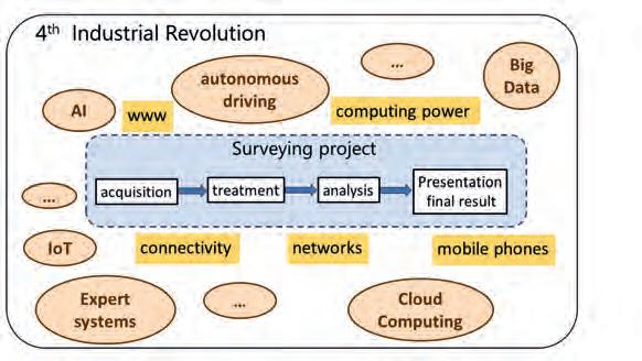
While mastering the instrumentation has become easier over the past years, today’s surveyors now have to master not only the instrumentation itself but also the whole process, from the acquisition, treatment and analysis of the data to the visualization and validation of the final result (see Figure 6). Moreover, what is the impact of the internet, ubiquitous connectivity and computing power that are driving the fourth industrial revolution? It is safe to say that the modern surveyor is already using significant parts of technologies such as AI, big data, IoT, expert systems and cloud computing.

In the past, surveying decisions were relatively simple. There were only a few measurement methods and, in contrast to the current situation, there was no need to choose between different types of instruments because there was a specific instrument for each task. In general, the execution of all data acquisition was guided

Business Guide 2023 24
Figure 5: Some skills have become obsolete over time.
Figure 7: Surveying in the fourth industrial revolution.
and controlled by regulations, and there was no room for individual decisions regarding the measurement procedure. The measurements determined only points –in the horizontal positions or heights –and the final results were either a map of predetermined fixed scale or a numerical analysis (Figure 9).
Today, both the possibilities and the actual demands are wider and more varied. A surveying project can be divided roughly into three phases: planning & design, data acquisition, and data treatment (Figure 10). In former times they were executed consecutively. Nowadays, however, the execution phase is preceded by a much longer planning phase, and the first part of the data treatment runs in parallel with the data acquisition phase. Due to the far more efficient equipment used for data acquisition and treatment, a project can be finished much faster than in the past. At the same time, the results can be used for a greater variety of purposes, such as planning, mapping at different scales and with different levels of detail, volume determination, and so on.
This has transformed the Surveyor 4.0 from a skilled observer into a project manager, creating and producing geodata. At the start of each project, the surveyor needs to define the task, including the type and shape of the final result. Each subsequent step, from the data acquisition to the final result, must then be determined. For the best data acquisition strategy, the Surveyor 4.0 needs to know all about the technical restrictions (e.g. if it is only possible to perform measurements at night time) and the relevant safety regulations, not to mention the economic aspects of the project.
Once a data acquisition concept is established, the Surveyor 4.0 needs to check whether the measurements goals (e.g. accuracy, point density, acquisition speed, required distances between the sensors and the objects) can be achieved. In addition, they are recommended to validate the acquired data.
Summary of skills
The skills required by the Surveyor 4.0 to meet the current needs can be summarized as follows:
• Measurement technologies: Thorough knowledge of all the potential measurement systems and technologies, including their limitations and restrictions (both legal and technical), is necessary in order to optimally choose the acquisition and data treatment strategy. Knowledge about the quality of the data and the specific output formats is also required.


• Mathematics: In particular, mathematical knowledge should cover geometry, statistics, least squares adjustment and blunder detection.
• Business administration: To include a comparative cost calculation between the different measurement options in the decision process, knowledge and experience related to calculating costs is needed.
• Programming: A project often calls for the surveyor to filter, select, transfer or manipulate the acquired or processed data. Therefore, programming capabilities in appropriate programming languages are required.
• Soft skills: The success of a surveying project depends on a close and constructive partnership between the surveyor and the customer, especially during the planning phase. This is supported by soft skills such as communication skills, presentation skills and teamwork.
Conclusion
The unique selling point of surveyors has always been their ability to acquire precise and detailed geometrical information about large objects, whether natural or artificial. This has not changed over the last century. However, the surveyor of today has become a versatile producer and manager of precise geometrical data. Whereas in the past it was the only task, mastering the instrument is nowadays reduced to just one task out of many.
Business Guide 2023 25 Feature
Figure 8: The planning phase of a surveying task.
Figure 9: The surveying tasks in the past and today.
Figure 10: The different phases of a surveying project (not to scale).
Today’s surveyors need to do more with less
Boost on-site productivity and avoid common mistakes and rework with the Leica AP20 AutoPole, a unique smart solution for our automated total stations. You need to adjust the pole height? The system will automatically record it for you. You struggle to measure hard-to-reach points? Measure with a tilted pole. Plus, on a busy site, you can trust that your AP20 searches and locks to your target only. Accelerate your work onsite, save time in the office and make fewer mistakes with the Leica AP20.

leica-geosystems.com/AP20


AutoPole it.
©2023 Hexagon AB and/or its subsidiaries and affiliates. Leica Geosystems is part of Hexagon. All rights reserved.

Cameras and aerial systems


For first class mapping results
PAS 880i
Leica Geosystems AG leica-geosystems.comDiscover more at geospatial.phaseone.com
After two years of virtual sessions due to the COVID-19 pandemic, the twelfth session of the United Nations Committee of Experts on Global Geospatial Information Management (UN-GGIM) took place during the first week of August 2022 at the United Nations Headquarters in New York City. It was an exciting session, with 33 side events, 256 participants from 73 countries and 111 observers. (All images courtesy of Anne Jørgensen)

Communicating transformational change
The United Nations Integrated Geospatial Information Framework
 By Greg Scott, CheeHai Teo, Lesley Arnold and Tim Trainor
Despite widespread awareness of the importance of geospatial information in a global digital economy, there is still a considerable lack of understanding of its role in contributing to national development, especially in developing countries. The United Nations Integrated Geospatial Information Framework (UN-IGIF) creates an enabling environment where national governments can coordinate, develop, strengthen and promote the efficient and effective use and sharing of geospatial information for policy formulation, decision-making and innovation. This will give all countries the opportunity to know ‘what is happening where’ and to develop and contribute to a vibrant national geospatial information ecosystem that enables visible and sustainable transformational change.
Business Guide 2023 27 Feature
“Everything happens somewhere” is a commonly used phrase by the United Nations Committee of Experts on Global Geospatial Information Management (UN-GGIM) and the geospatial community. It refers to the underlying importance of geospatial information in a global digital economy. As an essential national information resource and a major contributor to socio-economic transformation in many countries, geospatial information provides the integrative platform for all digital data that has a location dimension to it and is fundamental to development. Due to its cross-cutting nature, geospatial information is a nation’s ‘digital currency’ for evidence-based decision-making. It is a critical component of a national infrastructure and knowledge economy that provides a nation’s blueprint of what happens where, and the means to integrate a wide variety of government services that contribute to economic growth, national security, sustainable social development, environmental sustainability and national prosperity.
In today’s modern digital society, all countries and all sectors need geospatial information to address national priorities, for national development and for informed decisionmaking.
However, there is still a considerable lack of awareness and understanding of the vital and integrative role of geospatial information and related enabling architectures, such as National Spatial Data Infrastructures (NSDIs), in contributing to national development. This lack of awareness is particularly common at the policymaking and decision-making levels
in developing countries. National policies, and technical capacities and capabilities, need to be better aligned and considerably strengthened so that all countries have the opportunity to know ‘what is happening where’ and to develop and contribute to a vibrant national geospatial information ecosystem.
Forward-looking approach
The United Nations Integrated Geospatial Information Framework (UN-IGIF), adopted by the United Nations in 2018, provides a forward-looking approach that creates an enabling environment where national governments can coordinate, develop, strengthen and promote the efficient and effective use and sharing of geospatial information for policy formulation, decisionmaking and innovation. It establishes a common vision for all government agencies and expresses the goals that will realize the vision, the actions that need to be implemented to achieve the goals, and the outcomes and benefits necessary to support national development.

The UN-IGIF is multi-dimensional global framework that was developed initially as a collaboration between the United Nations and the World Bank to provide a basis and reference guide for lower to middleincome countries when developing and strengthening their national and sub-national arrangements in geospatial information management and related infrastructures. However, as the UN-IGIF has evolved in the past five years, it has become apparent that many high-income and developed countries are also significantly benefiting from its integrative and inclusive strategic nature.
The 3 parts of the UN-IGIF

The following three parts make up the UNIGIF as separate, but connected, documents covering the ‘why’, the ‘what’ and the ‘how’:
• Part 1: Overarching Strategy presents the forward-looking strategic elements of the UN-IGIF, built on national needs and circumstances, and provides the overarching strategic messages and more expansive and integrated national framework, particularly focusing on policy, perspectives and elements of geospatial information. It sets the context of why geospatial information management is a critical element of national social and economic development via seven underpinning principles, eight goals and nine strategic pathways that lead to a national approach that takes account of national circumstances, priorities and perspectives.
• Part 2: Implementation Guide is the detail document that provides the ‘what’: the specific guidance and actions to be taken in implementing the UN-IGIF. Expanding on each of the nine strategic pathways, the Implementation Guide comprises reference guides, good practices and specific principles for each of the strategic pathways, including those generated through each of the Subcommittee, Expert and Working Groups of UN-GGIM. The aim is to provide a reference resource and guidance for governments to establish nationally integrated geospatial information frameworks in countries in such a way that transformational change is enabled, visible and sustainable.
• Part 3: Country-level Action Plan is specific to and completed by each country. This plan details how the guiding principles, options and actions recommended in the Implementation Guide will be carried out, when and by whom. Importantly, the Country-level Action Plan is a plan, not a programme that is implemented.

Areas of influence
Nine strategic pathways anchor the UN-IGIF and support its implementation. These are organized in response to three main areas of influence: governance, technology and people.
• Governance is essential to achieving any nationally integrated geospatial information management capability. It includes the institutional arrangements, policy and legal requirements, and financial concerns that need to be factored into any sustainable geospatial information programme or project.
Business Guide 2023 28
The UN-IGIF is a multi-dimensional global framework that was initially developed as a collaboration between UN-GGIM and the World Bank
• Technology influences geospatial location data, innovations, the required standards and what can be achieved with the emerging geospatial data ecosystem that is able to respond to continually evolving needs, demands and uses.
• The People aspect is arguably the most important component as the people are the framework enablers – performing all the tasks needed for a successful UN-IGIF – often through partnerships and in collaboration with others. Having the necessary skills and knowledge is crucial to success, requiring capacity and education programmes as well as ongoing communication and engagement.
Critical Strategic Pathways
While all strategic pathways are important, two pathways in particular have been identified as the most critical to achieve to ensure that countries are able to establish and sustain nationally integrated geospatial information management capabilities. These are Strategic Pathway 1 (Governance and Institutions) and Strategic Pathway 9 (Communication and Engagement).

Why is this the case? Firstly, because strong leadership and commitment is ultimately required. Leadership drives change and is realized through the implementation of a national geospatial strategy that clearly describes the country’s strategic priorities and how geospatial information can be applied to address them. Leadership requires vision, the capacity to take positive steps, and knowing the tactics to achieve the vision. With strong leadership, anything is possible; without leadership, very little is achievable – including the implementation of the UN-IGIF.
In a similar vein, constant and ongoing communication and engagement is required to raise awareness and advocacy to the community, businesses, professionals, decision-makers and politicians of the relevance, value proposition and benefits of integrated geospatial information management at all levels. Amid rapidly evolving technologies, changing societal norms and economic outlooks, and against a backdrop of many competing priorities and agendas, it is critical to be able to communicate the value that geospatial information brings to national development, governments and the broader community.
Communication and engagement
While geospatial information underpins all industries and all sectors in its universality and applicability, it has an inherent ‘communication and awareness’ problem. It is for this reason that Strategic Pathway 9: Communication and Engagement is particularly important. In many respects geospatial information is similar to water and electricity’; it is taken for granted and is just expected to be there – until it is not. This is especially the case for developing countries and the least developed countries. Furthermore, it is a common reality that policy developers, decision-makers and the general public do not understand the detail of the problems being addressed, nor the immense value of such geospatial capabilities in solving everyday societal, economic and environmental problems, from very local to global levels.
There are a number of reasons for this. In many countries, the ‘foundational’ nature of geospatial information often means its direct impacts are hidden from the end users of the relevant applications and solutions. The downside of this ‘hidden’ role of geospatial information is that there is still a lack of awareness of its power and benefits, or the critical value that can be derived from combining and integrating this ‘location-based’ data with many other data types, including for example statistics. As a consequence, the generation of geospatial products and services is not well understood and the resulting products and services not necessarily as effective and fit-for-purpose as they could be. There are often weak links and communication gaps between geospatial professionals and the technical, political and decision-making levels of government. Geospatial science is a complex and often misunderstood discipline. Practitioners are commonly challenged by the need to explain a relatively technical subject in everyday business language or using key strategic messages. Therefore, the disconnect with the political, policymaking and decision-making levels of government persists, resulting in low levels of political buy-in, insufficient support, inadequate funding, limited resourcing and poorly executed geospatial development projects.
A key objective of Strategic Pathway 9 is to ensure that suitable material is available to assist countries in their efforts to raise awareness, improve advocacy and improve the visibility of nationally integrated geospatial information management and the societal benefits that can be derived. Successful communication and
Business Guide 2023 29 Feature
The nine strategic pathways that anchor the UN-IGIF and support its implementation.


Side Scan Sonar Sound Velocity Sensor & Profiler www.hydro-tech.cn 86-10-5727 5310 sales@hydro-tech.cn Greatly Enhance Sounding Accuracy MC-Max Excavator – As the demand for construction projects continues to grow and the pool of available skilled workers gets smaller, the flexible MC-Max Excavator solution helps you secure more projects and increase your site productivity. Do you want to learn more? Visit topconpositioning.com/machine-control/excavators/mc-max-excavator Transform your Excavator Excavator Control Systems built to keep you in control.
engagement efforts require the development of constructive, collaborative, productive, enduring and trusted relationships to adequately respond to identified opportunities, trends and emerging challenges impacting on or influencing nationally integrated geospatial information management.
4 key elements
Through four key elements, Strategic Pathway 9 recognizes that stakeholder identification, user engagement and strategic communication are essential to successfully deliver geospatial arrangements nationally and sub-nationally for sustainable social, economic and environmental development. The objective is to ensure effective communication and engagement to enhance and deepen participation and contributions from all stakeholders and at all levels. Commitment, mutual understanding, collaboration, cooperation and communication are essential to successfully implement the UN-IGIF with organizations and stakeholders.
• Monitoring and Evaluation sets the performance measures to assess the effectiveness of communications and engagement in meeting the intended outcomes. The process is typically incorporated into normal operations and as a feedback mechanism. This ensures strategic stakeholder and user communication and keeps pace with the changing times, delivering strategic messages that continually contribute to an enabling environment in which nationally integrated geospatial information management can thrive. Effective monitoring and evaluation ensures the dynamism and agility of communication processes and efforts, and that they are fit for purpose. It provides for continual review, assessment and improvement, ensuring that the communication and engagement efforts deliver the desire impacts.
Conclusion
The four key elements are listed below:
• Stakeholder and User Engagement identifies and develops relationships and alliances with advocates, users, partners and third parties. Given the underpinning nature of nationally integrated geospatial information management, stakeholders will be diverse, priorities will need to be set and expectations managed. Their interests, needs and motivations will continually change and evolve over time. Stakeholders are critical to strengthening integrated geospatial information management, and their buy-in and commitment are vital to success.
• Strategic Messaging seeks to develop the narrative of clear, succinct, compelling and strategic messages to all constituents and audiences to engender initial understanding and buy-in and to retain support during implementation. These will feed into support for, and development of, national policies and strategies. In so doing, a national geospatial branding is developed. A brand will strategically support messaging, increasing the likelihood that people will ‘look you up’, just to see what nationally integrated geospatial information management is about and to be associated with a ‘winner’.
• Strategy, Plans and Methods develop and use strategic messages and content from a forward-looking communication and engagement strategy to identify, engage and communicate with stakeholders and users, including to sustain communication channels and information flows. They reflect the understanding of prevailing circumstances, stakeholder needs derived from strategic and effective stakeholder and user engagement, perceptions and interests, and grow the acceptance and implementation of the UN-IGIF. Planning and execution are critical to effective strategies and plans.
The global geospatial community, an invested owner, still has much work to do and much to gain in raising awareness and advocacy of the value and benefits of geospatial information. This means establishing new and strategic alliances across a much broader stakeholder community, especially at the political and decision-maker level. There are also many technical, policy and legal matters that need to be addressed, requiring input and support from experts from across a broad range of disciplines and sectors. The diversity of the user community is also changing. This has an impact on how to communicate and engage with users. It also means that communication and engagement strategies, plans and methods need to be far reaching, inclusive and more versatile than ever before, and are crucial to implementing integrated geospatial information management and infrastructures. Successful communication and engagement efforts develop and sustain effective, trusted and collaborative relationships with stakeholders and users. They raise awareness, advocacy and investment in geospatial information management and applications by engaging and persuading the community, businesses, professionals, decision-makers and politicians of the relevance, contributions and benefits of geospatial
Strategic Pathway 9 highlights the importance of identifying stakeholders, engaging users and effectively communicating in order to successfully implement geospatial solutions for sustainable development at both the national and sub-national levels.
Business Guide 2023 31 Feature
The geospatial community still has much work to do to raise awareness of the benefits of geospatial information
YellowScan: Complete Lidar Solutions, the French Way
The city of Carcassonne in the south of France hopes to obtain UNESCO World Heritage certification for its sentinel mountain castles, better known as Les Châteaux Cathares. Built in the 13th century, the castles are an exceptional example of the military architecture and construction of the time. The Association Mission Patrimoine Mondial (AMPM) was created to manage the process for the city. As a part of the certification process, it needed to provide 3D models that could identify known archaeological remains and possibly detect new ones for future exploration to ensure that they are all protected by the UNESCO certification. L’Avion Jaune was mandated to fly the mission using the YellowScan Explorer Lidar solution.
What was the challenge?
The seven fortified castles are spread out over 60 kilometres of mountainous terrain and are not easily accessible by foot, so traditional archaeological methods did not make sense for this phase of the project. A secondary objective of the project was to identify new archaeological sites that had not previously been identified and were invisible to the naked eye for further research, as well as survey the primary seven sites looking for ruins yet to be discovered.
Solution
Given the mountainous terrain and distance between the castles, which are spread over the departments of Aude and Ariège in the south of France, it was decided that a manned helicopter mission was the best solution, to capture both photogrammetry resources for the sites and point cloud data to render the 3D models. The team used the YellowScan Explorer, its first Lidar solution that can be mounted on a light manned aircraft or helicopter or any professional UAV platform. Seven castles were surveyed in three flights over five days, 200m from the ground and at a flying speed of 30–35m/s. Ground data under canopy was obtained with a point cloud density of 80 points/m².


The Explorer, like all of YellowScan’s hardware platforms, aims to provide a solution that strikes the right balance between size, range, accuracy and weight. Combined with one-year unlimited technical support and training, users can take full advantage of Explorer’s functionality and successfully complete their surveying projects.
“Due to the difficult access and the density of the vegetation around the castles to be studied, airborne Lidar was the only feasible option. The Explorer’s long-range capability and size allowed us to easily integrate the solution on the helicopter and survey the seven castles, which are geographically distant, more quickly than if we had had
How a YellowScan Lidar system contributed to archaeological prospecting and exceptional heritage managementChâteau de Montségur is a former fortress near Montségur, a commune in the Ariège department in southern France. (Photo: Lucas Destrem) YellowScan Explorer mounted on a helicopter. (Courtesy: L’Avion Jaune)
to do it with a drone. Given the Explorer’s five-echo capability, it can easily penetrate the vegetation to recover the ground and generate the terrain profile, allowing the production of an accurate DTM thus giving the archaeologists a new set of mapping tools for their project,” said Benjamin Pradel, pilot & aerial survey project manager, L’Avion Jaune
Results
The data recovered enabled the complete 3D modelling of the seven sentinel mountain castles, and also detected possible reliefs and ruins, suggesting undiscovered human activity that will be used to guide future archaeological excavations. The mission also justified an extension of the original protection zone planned for these historic sites.


By commissioning this survey, the AMPM has improved its understanding of the historical significance of the area and increased its chances of a successful outcome to its UNESCO World Heritage application.
The best approach to selecting a Lidar system for crewed or uncrewed aerial applications
The first criteria when selecting a Lidar system is the expected accuracy. Most users will not need 1cm-accuracy when creating a DTM, but probably will for surveying facades or archaeological monuments. The next criteria is the range selection of the main application: trees more than 30m high, or a 40-storey building? This will impact the flight height for the operations, and will therefore give a better idea of which system is most suitable. This is also determined by the platform that the Lidar unit will be mounted on. The best compromise between density and productivity is then found by adapting the flight plan, in terms of speed and overlap.
About YellowScan
YellowScan designs, develops and builds Lidar solutions for professionals who require performance, robustness and accuracy. Its hardware and software solutions are easyto-use data collection tools that come with training and support from its experts.
Founded in 2012 in the south of France, YellowScan now has sales, customer training and support representatives around the globe. Its products are used worldwide in surveying, forestry, environmental research, archaeology, industrial inspection, civil engineering, mining, and more.
YellowScan products come with embedded laser scanners, INS, GNSS receivers and onboard computing. Each system is designed to meet the highest precision and accuracy needs for 3D mapping.
The YellowScan ecosystem is based on three pillars: compact turnkey hardware with embedded batteries that are designed, built and supplied ready to operate; proprietary software – the YellowScan CloudStation – with its user-friendly and evolving interface; and committed technical experts who deliver complete training sessions to customers upon receiving their systems, as well as one-year unlimited technical support to enable customers to confidently undertake their projects, whether they are new or experienced in the field.
YellowScan Lidar systems have been used in many different scenarios, thanks to the trust that customers have placed in its products. Its systems are used in archaeology, mining, powerline management, avalanche risk detection, rural road monitoring, and many more projects.
YellowScan’s CloudStation software for Lidar point cloud processing
The CloudStation software is very intuitive and user-friendly and requires just a few clicks to generate the final point cloud. Additional modules can improve the precision of the generated point cloud, or the interpretation of the area (automated colourization without any tie points to manually select, or ground classification).
YellowScan strives to improve the use of computer resources, by optimizing the
CloudStation algorithms between releases (every three weeks) to minimize the processing time.
Do you need help selecting a Lidar solution that best fits your needs? Please get in touch for a proof of concept tailored to your unique requirements.
Key Benefits of YellowScan
Explorer
• YellowScan’s longest range scanner (600m)
• Single solution for multi-platform usability
• Applanix APX-20 IMU
• Can switch between 100–500 kHC PRF, depending on mounted vehicle
• 165Hz scanning frequency
Sponsored article
Photo of the Puilaurens castle. (Photo: Stanislav Doronenko)
The good, the bad and the ugly of the surveying profession
Two decades of change
By Craig Hill, Leica Geosystems, Part of HexagonIn the early days of surveying, surveyors were pioneers in charting the unknown. Today, with the Earth having been completely mapped to some degree, surveying has become a much more specialized field with different types of surveyors and sophisticated equipment. This article looks back on how the surveying profession has changed over the past two decades.
It has been more than 20 years since I graduated from university. Back then, we were trained on both analogue and digital surveying equipment. Finding coordinates in new areas used to take us days or even weeks. Now, it can be done in minutes or even seconds with GPS or GNSS positioning. Analogue devices helped me understand measurement principles better. But more than that, for me they led to a greater appreciation of modern surveying equipment.
The survey industry is in a period of change, and it’s changing fast as technologies and needs evolve. Here are what I regard as some of the challenges currently shaping the industry, as well as the key priorities surveyors must bear in mind to thrive.
The Good
The challenge: The demand for costeffective services is increasing
The global digital twin market is projected to grow exponentially during the next
New technologies help surveyors become more efficient and accurate in how they collect, process and share information. Innovative positioning, measurement and reality capture technology can dramatically improve the way survey data is collected, processed, visualized and shared.
years as industries accelerate their digital transformation. Geospatial data is fundamental to unlocking efficiency gains in many industries. Surveyors are best positioned to support this exponential demand for geospatial data. However, surveyors need to find innovative ways to ensure their clients understand the value of their services. Surveyors who can provide services that add value for their clients will stand out from the crowd.
The priority: Pair new technology with userfriendly workflow services
When it comes to technology, surveyors are increasingly using newer technologies to improve their productivity and accuracy and to expand their service offerings. According to research by Hexagon’s Geosystems division, 95% of surveyors agreed that new technologies have made them more efficient at work, while 40% responded that they are already working with uncrewed aerial vehicle (UAV) systems. More surveyors will likely
adopt UAV systems in the coming years, which will spawn new use cases for aerial reality capture. Solutions like autonomous laser scanning modules for robots are also enabling scanning with minimal human intervention. As an increasing number of surveyors appreciate the accuracy and ease of data collection that laser scanners offer, their use will continue to rise.
Surveyors must also pair this technology with the adoption of user-friendly workflow services that enable faster data transfer between the field and the office, helping professionals create valuable deliverables from collected data as efficiently as possible.
The Bad
The challenge: Surveyors are facing increased competition from non-surveyors Technological advances have made it easier for people without a surveying background to complete many tasks involved in data collection. Although non-surveyors can now

Business Guide 2023 34
Surveyors optimize workflows and improve collaboration between field and office for enhanced project execution while ensuring the best quality.
easily collect 3D data, they often lack the knowledge to represent the data in the required reference frame correctly. In addition, they often miss the technical skills to perform field procedures to ensure checks are correctly conducted to deliver the best data quality.
The priority: Become a data manager
The professional surveyor can embrace this additional workforce and become the data manager who coordinates data collection and uses the most appropriate equipment to get the job done, using the personnel available.

The Ugly
The Challenge: The lack of skilled staff
With construction continuing to boom, the worldwide demand for surveyors has never been higher. With fewer people choosing careers in surveying, finding talented individuals has become increasingly difficult. To make matters worse, many surveyors are nearing retirement age and leaving the industry, creating a significant skills gap.
The priority: Keep up with innovations

To bridge this gap, surveyors need to keep up with innovations in technology so they can do more with less. New technologies and equipment allow professionals to do many more things in a shorter amount of time. Many construction projects rely on surveying instruments that are becoming more advanced. Today’s surveying equipment allows you to be faster and more efficient during construction by keeping building information modelling (BIM) data accessible in the field for more accurate layout and as-built verification. A total station can be used to compare the as-built situation with the design on site by checking the flatness of concrete floors or wall verticality, while 3D laser scanners help surveyors to quickly conduct on-site quality checks for completeness and perform as-built documentation. Similarly, total station solutions that automate process steps, including tilt compensation or target locking, avoid errors on site and mean quantum leaps in terms of productivity.
The biggest challenge: Protecting the planet
Extreme, climate-related physical events will become more intense and frequent. According to the Carbon Disclosure Project (CDP), four in five major cities are facing ‘significant’ climate risks. This year, 46% of the cities experienced extreme summer heat, 35% declared drought and 33% experienced urban flooding.
In a world that needs more renewable energy parks, modernized power grids and well-managed green spaces, surveyors help harness data that powers a sustainable future. Geospatial professionals capture, create and manage the datasets to build a smart digital reality for resilient infrastructure.
About the Author
Craig Hill is vice president of marketing and services at Leica Geosystems, part of Hexagon. Since 1995 he has helped to launch new technologies and services to increase surveyors’ efficiency. He received his PhD from RMIT University in Melbourne, Australia, after completing a bachelor of applied science and master of applied science. His university studies were in land surveying and included the design of new technologies for surveying professionals.
Surveyors are key players in offering cost-effective solutions that make data available to enable the shift to more sustainable practices, such as in building construction. Surveyors can bring together data creating a unified smart digital reality of a building to identify conditions and help understand what maintenance needs to be done during the building’s lifetime to maximize its lifespan. With their knowledge of state-of-the-art geospatial equipment and workflows, surveyors have the skills to efficiently document entire buildings before embarking on repairs, renovations or fit-outs.
The changing world
Surveyors are part of a changing world. Surveyors nowadays need to provide more value for their customers while reducing costs and waste at the same time. This means that they need to choose their tools carefully while continuously adapting their business models to thrive in this new environment and evolve alongside the industry they serve. Investing in new technology has allowed surveying companies to grow their business by offering multiple reality capture services and entering new markets such as structural monitoring. Many of them have found new ways to diversify into different types of projects and services by investing in technology such as laser scanning, mobile mapping, utility mapping and detection, and by becoming more efficient so they can do more with less.
The survey industry is undergoing a period of transition as it adapts to the challenges posed by new technologies and new regulations. Surveyors are being asked to do more with less, but they also have more opportunities than ever before to develop their businesses
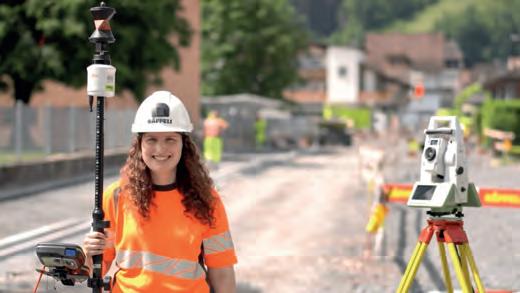
Business Guide 2023 35 Perspectives
Innovations such as the Leica AP20 AutoPole can help surveyors stay ahead of the curve by increasing productivity and allowing them to measure points that were impractical or unsafe to measure before.


Questions to...
Morten Hertz Knudsen

For this series of Q&As, we invited a number of geospatial industry experts to share their insights into the current state of the sector and their expectations for the future. What are their views on the biggest challenges facing the industry, the technological growth drivers in the years ahead, and the future outlook for the surveying profession?
What do you see as the biggest challenges for the geospatial industry as a whole in the coming years?
The geospatial industry’s biggest challenge will be to embrace and incorporate automation. We must engage employees who can handle robots and embrace and implement new methods and workflows such as machine learning (ML) and artificial intelligence (AI). I expect the automation of data collection will become much easier and therefore the availability of data will become more widespread in all aspects of our lives. All kinds of autonomous vehicles and platforms will collect data in real time and a here-and-now dataset will be available. In the world of building and construction, various robotic platforms will automate data collection and real-time data will characterize construction sites, thus increasing the need for geospatial professionals who link up with data scientists, engineers and programmers.
What will be the main technological drivers in mapping and surveying?
For the mapping and surveying profession
I see automation as the biggest driver – not only automation and robotization of data collection, i.e. the actual survey, but also automation of the generation of drawings and 3D models using things like AI. The combination of image-based feature recognition and automated modelling using feature extraction from point cloud geometry will provide completely new opportunities for lightning-fast production of CAD models and drawings. We increasingly find that only the point cloud is in demand, and the design is done
Morten Hertz Knudsen is a 3D scanning and survey specialist at COWI, with 20 years of experience in 3D laser scanning, technical surveying and mobile mapping. He has worked as a specialist, project manager and team leader on several national and international projects and has showcased projects and workflows at multiple international
directly in the point cloud. I also expect that there will be a transition to working with intelligent point clouds. This will mean that points on a road surface will be able to classify themselves as roadways, for example, and points on a wall will ‘know’ that they are part of a wall element.
Will surveyors have been replaced by robotization and AI in ten years’ time?
I believe that, in a decade from now, surveyors will support robotization and AI by creating the frame for how data must be collected, for example, and ensuring the quality of the collected data. In other words, they will develop the specification for the task at hand. In recent years, we have seen a greater demand for support and sparring about new methods and techniques. Today, anyone and everyone can fly a drone and produce an orthophoto or a DSM/DTM, or set up a capture device and document an area, but how do they ensure the quality of the data and how do they make sure the produced data is adding value to the projects? The more data that is collected, the greater the need will be for surveyors in a facilitating and quality-assurance role regarding the use of data originating from new methods and techniques.
Which types of survey projects are paramount for your organization in the coming years?
We are an in-house reality capture department that is part of a large-scale
conferences and educational institutions.
engineering and architecture consultancy company, so reality capture by images and 3D scanning is paramount to our organization. We see a strong demand for all forms of reality capture for various types of projects within building & construction, heavy industry (power, process and plant), infrastructure and even environmental projects, for design, visualization, inspection and as-built purposes and more. It is now increasingly the rule rather than the exception that reality capture is crucial for project success. Therefore, reality capture is now often initiated even before the project has been fully described, driven by a desire to uncover all possible and relevant areas. Today, we have several urgent projects that have been initiated without having to spend time on clarifications, quotation calculations, approvals and budget allocations.
How will you prioritize technology investments in your organization over the next couple of years?
Our investments in technology will focus on robots, autonomy and new technologies. We pay close attention to technologies such as autonomous drones and robots, image-based SLAM (in combination with point-cloud SLAM), intelligent point clouds, ML and AI-based feature extraction and modelling, and cloud-based solutions and workflows.
Business Guide 2023 37 5 Questions to...
5
Where would the geospatial world be without circles?
It’s about time, it’s about space!
By John F. Brock
There is probably no one involved in surveying and geospatial modelling who believes that they could achieve accurate and reliable results without trigonometry and space-correlated time. But how many realize that the models, concepts and equations which drive today’s 3D modelling and problem-solving technology are only possible thanks to methodologies and breakthroughs by our ancient counterparts. A number of key contributions are acknowledged in this article.
There was a great sitcom on TV when I was a young fellow (a very long time ago!) called It’s About Time!. The storyline involved two NASA astronauts being launched on a mission which spiralled into a time warp and cast them back to the prehistoric period. I thought it was brilliant, especially as I was fascinated by space, prehistory and how the world fitted into the vast framework of the cosmos. The first line of the theme song was “It’s about time, it’s about space”. And certainly, what we do as geospatial professionals is all about space and time, as well as how we measure and reshape our environment to cause minimal impact on the planet upon which we exist.
Is there anyone involved in surveying and geospatial modelling who believes that they could achieve accurate and reliable results without trigonometry and space-correlated time? Those of us possessing the gift of mathematical comprehension can send a big ‘thank you’ card back in time to two ancient Greek masters who are both variously attributed to dividing the circle into 360 degrees: Hipparchus and Hypsicles. Seeing as both men lived in about 200-180 BC, there could have possibly been some mutual interaction. This now well-recognized circular division has been modified into spherical 3D applications for all manner of precise figure creation and accurate mapping by surveyors and astronomers. In fact, Hipparchus has been called “The Father of Trigonometry”, having also invented the concept of latitude and longitude in addition to creating tables of chords, inventing a plane astrolabe and manufacturing celestial globes.
Ancient oracles
We only need to travel backwards to 310 BC to find the birth of another ancient oracle named Aristarchus of Samos. This guy, who lived until 230 BC, espoused a heliocentric solar system nearly 1,800 years before the later-favoured Copernicus… talk about being well ahead of your time! Not only did he teach that the Sun was at the centre of our galaxy, he also determined the relative distances of the Sun and the Moon from the Earth. So why did it take so long for the God-fearing Catholic scientists to convince
their Pope that the Earth was not flat and it actually orbited around the Sun not vice versa? It may have been practically useful for surveyors for the Earth to be planar, but when ships were disappearing over the curvaceous sea horizon, then the flat-Earth hypothesis must have been regarded as a bit of ‘Papal bull’ to all but the ‘true’ believers.
Everything old is new again
So what lessons can be extracted from these ancient men of learning? There has to be some truth in the saying “Everything old is new again”. Today, we still have paranoic groups obsessed with conspiracy theories about anything that appears to be fantastical or beyond their minute realm of brain activity. The Apollo 11 Moon landing doubters carry echoes of the time during the Industrial Revolution when luddites smashed up machinery and sabotaged factories because they regarded the advent of new technology as dislocating humans from bread-winning employment. The reality is that such technological innovations have invariably resulted in greater opportunities, including more viable careers with reduced physical exertion for those undergoing training and gaining experience in the new techniques and equipment.
Worldwide Standard Time
Meanwhile, another remarkable change with worldwide ramifications, without which global travel and interspace activities would not be possible, occurred less than 150 years ago.
Business Guide 2023 38
Portrait of Sir Sandford Fleming by John Wycliffe Lowes Forster.
On 1 January 1885, Scottish-Canadian surveyor Sandford Fleming’s idea of the globe divided into 24 one-hour time zones became reality when World Standard Time (WST) was adopted at a conference in Washington DC, USA. Fleming had proposed the concept of WST after an incident in Ireland in 1876, when he missed a train due to the nonstandard relativity of time between different localities. His surveyor brain went straight into action to devise the need for standardizing the relative time all over the globe, together with a 24-hour clock and a zero line of longitude at a Prime Meridian through Greenwich, UK.
It took quite a number of years to realize universal adoption of WST and there were many variations to the original prototype. The island nations near the International Date Line sought some compromises and modifications, and considerations of the local situation between adjoining countries brought about some deviations in the intended straight line. Various countries that were otherwise split into differing time zones chose to distort the symmetrical network of time zones by enlarging or diverting the ‘true time’ longitudinal lines to trace external boundaries or to include the whole nation within one of the final time zones. The overall result can be seen on the current international time zone chart.
The importance of time-related positioning
Clearly, the NASA space programme and all other such efforts to explore the outer regions of our solar system are dependent on time for precise positioning to ensure, as much as possible, that more satellites sent into orbit for the augmentation of Earth communication networks remain operational and reliable. With so much multiplicity of motion – with planets rotating, moons orbiting and satellite constellations competing for space – time-related positioning is critical to preserve the continuance of functionality. It is also essential to maintain a functional communication system to coordinate rescue and relief efforts in the aftermath of disasters. Unfortunately, such precise location pinpointing methods are also utilized by militantly aggressive nations to launch deadly strikes against defending territories. However, equally defensive rocket capabilities can use the same technology in an attempt to counteract such strikes.

Protectors and champions
Surveyors have always been an indispensable ingredient in the evolution and inhabitation of the planet Earth. In Ancient Egypt,
About the Author

John Brock has been a private land surveyor in since 1973. He holds a Bachelor of Surveying from the University of New South Wales and an MA in Egyptology from Macquarie University, Sydney, both in Australia. He became a registered surveyor in NSW in 1981. Today, he serves as the director of Brock Surveys in Parramatta (near Sydney). Brock is a well-known member of the geospatial community and has delivered presentations at a large number of congresses around the globe.

the scribe surveyors had the task of reinstating the boundary monuments of land parcels after the Nile floods washed them away. Today, with our fragile planet enduring multiple forms of physical transformation, surveyors and geospatial experts have never been more vital to our survival. They are the protectors and champions of a world facing the effects of pollution, population increase, climate change and natural disasters such as flooding, landslides, earthquakes, volcanic eruptions, fires and wars.
In my view, it is important to acknowledge how the methodologies and breakthroughs handed down to us from our ancient counterparts have provided us with the necessary models, concepts and equations to drive the modern computerized technology which has become the problem-solving 3D modelling equipment of the modern age. Naturally, as a very senior member of the geospatial family, I can never envisage a time when expert surveying knowledge developed over years of hands-on experience will be totally replaced by global positioning systems and robotic artificial intelligence (AI) instrumentation. Despite the great advances in computerization, I
Business Guide 2023 39 Perspectives
One of the first steps taken on the Moon; image of Buzz Aldrin’s bootprint from the Apollo 11 mission.
Astronomer Copernicus, or Conversations with God – painting by Jan Matejko.


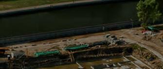


» » » Built-inMotionProfilesforEachApplication RobusttoVibratingEnvironments Post-processingwithQinertiaPPKSoftware 0.015°0.04° 1cm RTKRoll/Pitch RTKHeading RTK/PPKPosition Optimizedsizefordirectgeoreferencing inharshestGNSSenvironment bit.ly/gim2301 QUANTAPLUS
ComNav Technology
ComNav Technology is dedicated to being an innovator and leader in high-precision GNSS technologies and applications. As of the end of 2022, the business had sold its products and solutions to more than 120 countries with a total quantity of more than 1.5 million units of modules (receivers) in over 10 different industries, including land survey, machine control, UAV, UGV, deformation monitoring, personnel positioning, precision agriculture and marine. ComNav Technology is an R&D-driven company and nearly half of the employees have extensive experience in high-precision GNSS or engineering. Owning more than 60 technology patents and more than 50 software copyrights, the company continues to invest at least 20% of annual revenue into R&D every year to pursue the best of GNSS technologies and solutions for global users. Every product is subject to strict quality control and has been certified by authoritative international certification bodies. Located in Shanghai, the 26,000m2 ComNav Technology GNSS Industrial Park accommodates more than 500 employees for daily work.
comnavtech.com


+86
EvoLogics
EvoLogics is a high-tech enterprise with headquarters in Berlin, Germany, and a US sales office in Yorktown, Virginia. The company launched in 2000 with a strong group of scientists and R&D experts, aimed at developing innovative technologies for maritime and offshore industries. EvoLogics creates high-end solutions for underwater smart robotics, sensor systems, acoustic communication and positioning networks. These combine state-of-the-art engineering with bionic concepts. Research and innovation are the cornerstones of the company, and an underwater ‘Internet of Things’ that enables intelligent cooperation between various vehicles and sensors is the main vector of EvoLogics’ development strategy. Smart underwater networks build on EvoLogics’ S2C spread-spectrum communication technology that combines underwater acoustic data networks with integrated real-time positioning. Together with advanced sensor systems, AI-based object recognition and analytics, as well as autonomous underwater and surface vehicles for survey and support operations, they create highly capable underwater solutions for complex mission scenarios.

CHC Navigation (CHCNAV) creates innovative mapping, navigation and positioning systems and solutions. With a global presence and distributors in over 120 countries, and more than 1,600 employees, CHC Navigation is today recognized as one of the fastest growing and leading companies in geomatic technologies. From drone Lidar survey to machine control: leveraging its proprietary GNSS, INS, Lidar and drone technology platforms, CHCNAV offers a wide range of geospatial solutions for land surveying, construction, machine control, GIS, hydrographic surveys, deformation monitoring, precision agriculture and 3D mobile mapping for mass data acquisition. Solutions for companies of all sizes: CHCNAV’s mapping, positioning and navigation solutions are affordable, easy to use and designed to dramatically improve productivity and provide an exceptional return on investment for its customers and business partners.
+86 21 5426 02731 marketing@chcnav.com
CHC Navigation Flai
flai.ai +386 51 214 572
info@flai.ai

Business Guide 2023 41 Company profiles
The main focus of Flai is the analysis and classification of point clouds. The company is developing a web-based application that automatically turns raw point clouds into meaningful information. The app is very intuitive, does not require significant training and is therefore easy to adopt and use. Point clouds are classified using advanced artificial intelligence (AI) models in up to 18 different categories. This complex work is done automatically on a scalable infrastructure which reduces the processing time from months to days. Besides automatic classification, the Flai web application also includes a powerful online 3D point cloud viewer that allows manual annotation of point clouds using a variety of selection tools. Flai brings unique value to organizations dealing with point clouds that are gathered via airborne (UAVs, aeroplanes, satellites) or mobile (cars, trains) platforms. So far, the application has been used by clients dealing with use cases including general largescale Lidar mapping surveys, linear infrastructure mapping and monitoring, forest inventory production and environment and disaster management. 185 2172 2385 sales@comnavtech.com evologics.de +49 30 4679 8620 (German HQ) / +1 757 527 4009 (US office) sales@evologics.de / sales-us@evologics.com
chcnav.com
Geomares Media Gintec

Geomares Media is an international media and marketing agency with clients primarily in the geospatial, engineering, hydrographic and maritime sectors. Many people active in the geospatial industry will know Geomares Media as the publisher of GIM International, Hydro International and Geo-matching. With its printed magazines, online platforms and newsletters, Geomares Media has been at the forefront of informing members of the global geocommunity with news and authoritative and analytical articles on policy-related, product-related and technologyrelated developments for several decades. Geomares Media has been a corporate member of FIG for more than 20 years, advocating and supporting the message of land surveying for the betterment of societies across the globe. In addition, Geomares Media helps companies to grow worldwide by devising and executing smart marketing campaigns for its customers.
Founded in 2013, Guangzhou Geosurv Information Technology Co Ltd (Gintec) is a high-tech company that specializes in R&D and selling highaccuracy geographic and geotechnical instruments and software. Its products are widely applied in the surveying, mapping and deformation monitoring industries. Meanwhile, the company also offers professional technical services. Adhering to the concept of ‘Based on Integrity, Success in Quality’, Gintec is devoted to supplying high-quality, stable and reliable products for customers. Thanks to years of efforts and integrity management, the business has spread to over 60 countries around the world, and the company has built a good reputation and won the trust of its clients and partners. In the future, the Gintec team will continue to innovate and forge ahead. By further improving its products and services, the company continuously enhances the user experience to make surveying and deformation monitoring more efficient and convenient.
geomares.media
+31514561854 marketing@geomares.media
Hydro-Tech Hexagon
Hexagon is a global leader in digital reality solutions, combining sensor, software and autonomous technologies. The company puts data to work to boost efficiency, productivity, quality and safety across industrial, manufacturing, infrastructure, public-sector and mobility applications. Its technologies are shaping production- and people-related ecosystems to become increasingly connected and autonomous – ensuring a scalable, sustainable future. Hexagon’s Geosystems division provides a comprehensive portfolio of digital solutions that capture, measure and visualize the physical world and enable datadriven transformation across industry ecosystems. Hexagon owns several reputable brands, including Leica Geosystems. Revolutionizing the world of measurement and survey for more than 200 years, Leica Geosystems creates complete solutions for professionals across the planet.
With a focus on acoustic sounding technology, Hydro-Tech has developed products that have been widely applied in the underwater exploration industry. Today, Hydro-Tech develops fully independent and controllable core technologies in hydrographic surveying and remains committed to continued iterative innovation. Based on these years of technology accumulation, Hydro-Tech cannot only develop, but also manufacture, full series of sonar products and related auxiliary devices, including MS400P, MS400U and MS8200 multibeam echosounders; SS3060, SS900F and ES Series sidescan sonars; and SVS1500 and SVP1500 sound velocity sensors and profilers. All Hydro-Tech products show great performance and high quality, which is how we win our customers’ loyalty and so many industry awards. Hydro-Tech sonars occupy the leading market share in China.
The company can also take advantage of its strong R&D know-how and hydrographic expertise to provide an attentive consulting service, customized products or one-stop solutions for special project requirements.

Business Guide 2023 42
+86 (0)20 82514956 overseas@gintec.cn hydro-tech.cn/en/ +86 10 5727 5310 kn.xu@hydro-tech.cn hexagon.com/company/ divisions/geosystems + 41 71 727 3131 info.hexagongeosystems. geo@hexagon.com
gintec.cn
Phase One
Phase One is a leading researcher, developer and manufacturer of medium-format and large-format digital cameras, software and imaging solutions. Founded in 1993, Phase One is a pioneer of digital photography. The company has developed core imaging technologies and a range of digital cameras and imaging modules. Phase One provides the world’s highest image quality in terms of resolution, dynamic range, colour fidelity and geometric accuracy. As such, Phase One has grown to become the leading provider of high-end imaging technology across many business segments. This includes both hardware and software for aerial mapping, industrial inspection and cultural heritage digitization, as well as serving the world’s most demanding photographers. Based in Copenhagen, Denmark, and with regional offices in New York, Denver, Cologne, Tel Aviv, Tokyo, Beijing, Shanghai and Hong Kong, Phase One nurtures long-term relationships with customers, technology partners and its global network of distributors. It is with this passion for service that Phase One continually exceeds expectations and drives the imaging industry forward.
geospatial.phaseone.com
+45 364 60111 / +45 364 60222
geospatial@phaseone.com
ReSe Applications
ReSe Applications is a specialized Swiss company focused on high-end processing of optical and thermal remote sensing data. The company is dedicated to the development of remote sensing software applications for preprocessing of multispectral and hyperspectral images. Over the last 20 years, ReSe has continued to advance the development of its premium range of software applications, delivering top-performing off-the-shelf solutions: for direct orthorectification with PARGE, for atmospheric correction with ATCOR and for radiometric processing with MODO. A special focus is on imaging spectroscopy, including both satellite and airborne imagery. With the software application DROACOR, the company goes one step ahead in the area of drone imagery. DROACOR is a new fully automatic drone-based atmospheric correction and reflectance retrieval package suited for multispectral and hyperspectral image datasets. ReSe Applications stands ready as ever to address new challenges and to deliver powerful solutions for processing improvements.
rese-apps.com
+41 71 565 47 84 info@rese-apps.com
SBG Systems
RIEGL is a leading international provider of cutting-edge airborne, mobile, terrestrial, bathymetric and UAV-based laser scanning technology for a wide range of applications in surveying. In addition to its headquarters in Horn, Austria, RIEGL provides sales, support and service through the RIEGL USA headquarters in Winter Garden, Florida, as well as through subsidiaries in Japan, China, Australia, Canada and the UK, and through its worldwide network of distribution partners. RIEGL has been producing Lidar systems commercially for more than 40 years and focuses on pulsed time-of-flight laser radar technology in multiple wavelengths.
RIEGL’s core ‘smart waveform’ technologies provide pure digital Lidar signal processing, unique methodologies for resolving range ambiguities, multiple targets per laser shots, optimum distribution of measurements, calibrated amplitudes and reflectance estimates, as well as the seamless integration and calibration of systems. RIEGL’s various 3D scanners offer a wide array of performance characteristics. The professional advice of the RIEGL experts ensures that each customer finds the optimum solution for their specific applications.
SBG Systems is a leading supplier of inertial motion sensing solutions, from miniature to high accuracy. Combined with cutting-edge calibration techniques and advanced embedded algorithms, SBG Systems’ products are ideal solutions for surveying applications whether they are aerial, marine or land-based. SBG Systems has now unveiled Quanta Plus, its next-gen OEM GNSS-aided inertial navigation system (INS). Quanta Plus is a small, lightweight and high-performance OEM product that can be easily integrated into survey systems with Lidar or other third-party sensors. It delivers accurate and reliable navigation data even in the most demanding environments. It combines a high-performance miniature tactical IMU with a GNSS receiver that is resilient to harsh covering conditions, providing RTK fixes even in challenging situations (0.015° roll/pitch, 0.04° heading, 1cm positioning in RTK). Quanta Plus also benefits from easy integration within Qinertia, SBG Systems’ post-processing software.
riegl.com
sbg-systems.com
+33 1 80 88 45 00
sales@sbg-systems.com
Business Guide 2023 43 Company profiles
RIEGL
+43 2982 4211 office@riegl.com
South
South is a committed world-class survey equipment manufacturer and geoinformation solution provider. Over the past 30 years, South has continued to expand in the field of solutions while maintaining stability and innovation in conventional instruments. The robot total station has achieved a breakthrough in measurement accuracy of 0.5” with a strong motor, advanced intelligent system and measurement software, and outstanding measurement performance. After more than ten years of Lidar exploration, South has also launched a number of airborne and ground Lidar systems, and has provided over 1,000 integrated software and hardware Lidar measurement solutions in the fields of transportation, power, forestry, land, cultural security and other industries. In the area of monitoring, South’s deformation monitoring solutions based on the BeiDou Navigation Satellite System are characterized by high-intensity encryption, safety and reliability, higher precision and stronger signals. Meanwhile, the SMOS system, independently developed by South, is widely used in the structural health monitoring of reservoirs, dams, bridges, slopes, geological disasters and other scenarios.
Teledyne Geospatial

Teledyne Optech and Teledyne CARIS have united to form Teledyne Geospatial, offering holistic solutions to seamlessly map land and sea through the integration of industry-leading Lidar sensors and world-renowned software workflows. This collaboration empowers customers with a competitive edge in mapping and delivering data inside of one complete workflow. This year, the business will be introducing a new, ROI-revolutionizing workflow for Optech Galaxy airborne Lidar acquisition. The new compact Lidar payload CLS-A can deliver high accuracy and precision data with proven workflow support.
southinstrument.com
+86 20 23380888
mail@southsurvey.com

Topcon TI Asahi
TI Asahi was established in 2009 and inherited the business of manufacturing Pentax-branded surveying instruments. The origin of these dates back to 1933, when Fuji Seisakusho started producing surveying products in Japan. As a leading company in developing and manufacturing state-of-the-art surveying instruments, TI Asahi has been continuously introducing various high-precision and high-quality products such as optical levels, total stations, GNSS receivers and 3D scanning systems. These have been used and appreciated by countless professionals in various fields of surveying and construction worldwide. The company’s mission is to develop and provide products that fully meet surveyors’ needs by focusing on true performance. At TI Asahi, they believe the products they provide can offer substantial solutions to both technological and economical obstacles. They acknowledge it is essential that they continuously learn and develop their products and practices to match customers’ needs.
pentaxsurveying.com/en
+81 487930118
international@tiasahi.com
Topcon Positioning Group designs, manufactures and distributes precision measurement and workflow solutions for the global construction, geospatial and agriculture markets. Since being founded in 1994, Topcon has worked to provide cutting-edge technology across these sectors, helping to enhance accuracy, efficiency and productivity. Topcon provides a wide range of solutions across these industries, from its precise GT-1200 and GT-600 robotic total stations, to its state-of-the-art workflow management software, MAGNET. Headquartered in Livermore (California), USA, the company operates throughout North America, Europe, the Middle East and Africa, and has just opened a new European distribution centre in Zoetermeer, the Netherlands. The company also owns a variety of product families operating across these regions, including Sokkia, Tierra, Digi-Star, RDS Technology and NORAC, alongside having a worldwide network of trusted distribution partners. Across the globe, Topcon offers a comprehensive range of leading technologies and customer support, always striving to provide the right solution for every project.
Business Guide 2023 44
teledynegeospatial.com + 1 905 6600 808 inquiries@teledyneoptech.com topconpositioning.com +1 925 245 8300 infota@topcon.com
Trimble Geospatial
Trimble Geospatial provides solutions that facilitate high-quality, productive workflows and information exchange, driving value for a global and diverse customer base of surveyors, engineering and GIS service companies, governments, utilities and transportation authorities. Trimble’s innovative technologies include integrated sensors, field applications, real-time communications and office software for processing, modelling and data analytics. Using Trimble solutions, organizations can capture the most accurate spatial data and transform it into intelligence to deliver increased productivity and improved decision-making. Whether enabling more efficient use of natural resources or enhancing the performance and lifecycle of civil infrastructure, timely and reliable geospatial information is at the core of Trimble’s solutions to transform the way work is done. The company has a network of authorized distributors for local training, support, service and sales.
Vexcel Imaging
Developing cutting-edge aerial cameras and photogrammetric processing software with constant product upgrades and world-class support has made Vexcel Imaging
a global leader in aerial imaging. The broad UltraCam lineup offers optimized cameras for all applications in airborne photogrammetry. The new UltraCam Eagle 4.1 is a photogrammetric nadir camera supporting end customers in creating precise maps for infrastructure planning, cadastre or change monitoring. Data from the photogrammetric oblique system UltraCam Osprey 4.1 is used to create multiple views of a site, detailed facade representation and 3D city models. Digital terrain models, orthoimages and classification of large regions can be best generated using data collected by the wide-area system UltraCam Condor 4.1. UltraCam data is processed with the UltraMap photogrammetry software, providing an end-to-end processing workflow for highly automated generation of quality data products including point clouds, digital surface and terrain models, orthophotos and 3DTINs.
geospatial.trimble.com
YellowScan
YellowScan designs, develops and builds Lidar solutions for professionals who require performance, robustness and accuracy. The company’s hardware and software solutions are easy-to-use data collection tools that come with training and support from its experts. Founded in 2012 in the South of France, YellowScan now has sales, customer training and support representatives around the globe. Its products are used worldwide in surveying, forestry, environmental research, archaeology, industrial inspection, civil engineering, mining and more. They come with embedded laser scanners, INS, GNSS receivers and onboard computing. Each system is designed to meet the highest precision and accuracy needs for 3D mapping. The YellowScan ecosystem is based on three pillars, the first being compact turnkey hardware with embedded batteries that are designed, built and supplied ready to operate.
Zoller + Fröhlich
Beyond being a leader in the fields of ferrules, wire harnessing technology and laser measurement technology, Zoller + Fröhlich (Z+F) is known worldwide as a manufacturer of innovative products in the areas of switch cabinets and special machinery. All products have been developed and produced exclusively in Germany, where the company employs more than 280 people. Z+F is an internationally operating company and cooperates with dealers in more than 40 countries. It also has a permanent subsidiary in the USA. Besides the business success, human beings have always been at the heart of the corporate philosophy. This principle can be seen in the company’s various social and cultural commitments, which always share the objective of regionality and strengthening the company’s locations.
Business Guide 2023 45 Company profiles
vexcel-imaging.com +43 (0) 316 849 066-0 info@vexcel-imaging.com zf-laser.com +49 (0)7522 93080 sales@zf-laser.com yellowscan-lidar.com +33 411 931 400 contact@yellowscan.fr
Questions to... Nathan Quadros
For this series of Q&As, we invited a number of geospatial industry experts to share their insights into the current state of the sector and their expectations for the future. What are their views on the biggest challenges facing the industry, the technological growth drivers in the years ahead, and the future outlook for the surveying profession?
What do you see as the biggest challenges for the geospatial industry as a whole in the coming years?
Without a doubt the biggest challenge in the coming years is our need to rapidly increase geospatial workforce participation. This includes both strengthening our diversity and building a strong core skills capability. We have not solved these problems, and they continue to be exacerbated by the disconnect between universities and training institutions who measure success through student numbers. To generate increased interest, we need to work on inspiring and exciting would-be candidates rather than our current default of explaining what we do and the benefits of a geospatial career pathway. Although this is still relevant, it doesn’t generate as much interest as a compelling narrative. One of the other significant challenges is how to remain relevant as other industries play at our edges. We need to focus on creating value with our current technologies and capabilities without shifting too quickly to the next ‘shiny’ thing. We often risk being transactional and focusing on the cool technology without realizing the true value we are creating with our expertise. This encourages our clients to perceive us as a commodity service, which will be reflected in our fees. We need to break through that thinking and move into a professional service sphere.
Nathan Quadros is the digital & spatial business lead at Veris. He is a highly qualified spatial scientist and business executive with experience providing expert advice across Australia-Pacific to governments, industry and the World Bank. Nathan’s PhD in remote sensing led him to manage a United Nations award-winning project on sea-level rise capacity-building across the Pacific. He

What will be the main technological drivers in mapping and surveying?
Of all the technologies on the horizon, in my view the biggest impact is going to come from six developments. Firstly, digital twins of infrastructure and assets are going to be fundamental to management decisions. We will move up the hierarchy of value from visualization to analytics to simulation to prediction through digital technologies. Secondly, augmented reality is going to add tremendous value by enabling us to see through objects, into the future or the past, and augment our sight with data. Thirdly, AI and machine learning are already enabling us to extract more value from our data and this will only increase. Point cloud and imagery feature extraction will accelerate and recent developments in OpenAI, Neural Radiance Fields (NERF) and other technologies continue to challenge traditional processes. Fourthly, the growth in drone technology will be further accelerated through the ability for autonomy and self-piloting. The reduction in cost and size will support the expansion of drone swarms which will rapidly change the way we sense and enable a range of new applications. Fifthly, the growth in sensors will enable more and more devices to be streaming data in real time, resulting in ubiquitous sensing. The ability to rapidly analyse this data to provide timely insights and alerts to end users will become fundamental to managing
has also used his technical expertise to establish national quality assurance standards for Lidar, drone imagery and marine surveys.
our assets and environment. Last but not least, the growth of broad-coverage, accurate and timely free datasets will expand in the coming years. This will only grow further through crowd-sourced data. The connectivity to open data sources will change the way we ingest data.
Will surveyors have been replaced by robotization and AI in ten years’ time? I do not believe that surveyors will be replaced. But will the way that surveyors work change? Without a doubt, and in some cases quite significantly. However, the changes will only enhance current work practices, leading to increased efficiencies, improved data quality, frequency of capture and timeliness of delivery. After all, how did the advent of robotic total stations change the role of surveyors? It didn’t replace assistants per se, it didn’t lead to a decline in the number of surveyors, and it didn’t alter the skills and experience that clients and projects demanded of human surveyors. Robotic total stations mean that we now survey differently, and in many ways better, than we did previously. This has been a great enhancement which has increased the demand for more data. Similar enhancements will continue to arrive and will increase the demand for surveyors.
Which types of survey projects are paramount for your organization in the coming years?
Fundamentally, projects requiring expert multidisciplinary survey knowledge and
Business Guide 2023 46
5
capabilities, along with complex project management, are becoming more critical. These projects often require us to build strong partner and client collaborations so that we can provide innovative spatial data solutions to unique problems. Bringing people together from diverse backgrounds and enabling them to work seamlessly together in a trusted environment will become more important as the industry matures.
How will you prioritize technology investments in your organization over the next couple of years?


By investing in core skills and technologies that use and extend on our current capabilities to extract spatial data insights. We need to be extracting more value from our current data. This means investing in AI/machine learning, web visualization and analytics, and data integration through digital twins and augmented reality to


create experiences. These investments can be prioritized based on market potential and client need. Health and safety can also be enhanced further through technology which creates a safer working environment. This naturally feeds into autonomous drone technology and may even involve a robot dog!
FIG WORKING WEEK 2023
28 May - 1 June 2023


Protecting Our World, Conquering New Frontiers

Let’s

Focus will be on Protecting our World, Conquering New Frontiers emphasizing the importance of looking ahead and discover what will be needed in the future for our profession and at the same time make sure to preserve what works well today.


Don’t miss THE FIRST FIG ANNUAL CONFERENCE IN 20 YEARS IN THE AMERICAS, this will be one of the premier events within the surveying and geospatial profession in 2023.
Keynote sessions setting the agenda for each day. A platform to discuss experiences, innovations, best practices, research and much more to support the shaping of the future.
Access to an inspiring exhibition featuring the latest products and services.


Unlimited networking opportunities with peers.


Precious non-distracted time. Being at the Working Week gives you time for immersion – precious time for reflection.


Business Guide 2023 47 5 Questions to...
Orlando Florida USA
meet for a unique opportunity to
explore, expand
your knowledge and network with fellow peers across industries, countries and positions.
We measure & plan We position, map & locate We construct We estimate & cost We
develop and manage the land, the seas and any man-made structures appraise & value REGISTER NOW at www.fig.net/fig2023
We
Post-processing Lidar data no longer the norm
Aerial Precision is ready for take-off
By Frédérique Coumans, Contributing Editor, GIM InternationalThe Dutch startup Aerial Precision recently demonstrated its two first sensors with integrated artificial intelligence software. Over the past few years, the company’s innovation efforts have resulted in products that make Lidar cheaper and easier to use. For example, thanks to real-time point cloud registration, the 3D data is ready as soon as scanning is completed. Two investors – Dutch and Belgian – came on board. There are plans to rapidly add more functionalities.

“Based on our ambition to dramatically improve the way information is extracted from point clouds, in 2018 we founded Aerial Precision
cheaper,” said Vicente Payo-Ollero, CEO and founder, to clarify the company’s goal. This provided context for their demo day, which was
Business Guide 2023 48
Attendees were interested in how Aerial Precision delivers ready-for-use information.
vehicles (UAVs or ‘drones’), Payo-Ollero has been active in the development of high-end drone systems, using photogrammetry and Lidar, all around the world. This includes for the production of the seventh season of Game of Thrones, the latest Mission Impossible movie and numerous geophysical surveys. “There is an important need to generate 3D maps, but the way they are produced is inefficient. So I started to focus on making a next-generation Lidar system that can be used with any iOS device and generates point clouds within minutes,” he continued. “There will still be situations in which photogrammetry is the best solution, but in many cases our sensors with built-in artificial intelligence (AI) will be the smarter choice. It is still a case of ‘work in progress’, but at Aerial Precision we’re focused on delivering information that is ready for use.”
Demo day
Visitors to the demo day at the airfield saw how the sensor was affixed to the mount –in this case a tripod – before a hangar of aeroplanes and helicopters was scanned by walking up and down once. Then it was connected to an Apple tablet and the 3D colour point cloud was generated within minutes so that the model could be used for measuring purposes. The same principle was applied for mapping DronePort itself. The lightweight sensor was clicked under a commercially available drone: a DJI M300. No post-processing was necessary, because the processing is done in real time as the Lidar data is collected. “Of course, you still have to ask the authorities for permission to use the drone, but the promise of offering a real, fast alternative is solid,” commented Payo-Ollero. “You plan the flight in advance on your tablet, you go to the site, you conduct the flight


and by the time you get inside again, the information is there.”
“Depending on the sensor/artificial intelligence combination, you can register 720,000 to 1.3 million points per second with approximately 2cm or 5cm accuracy,” he explained. “There is an Ouster OS1 with 32 or 64 laser beams or a Livox AVIA sensor. A double payload is possible on most of the drones used these days, so you can combine other sensors in the same flight if you need other spectra.” In that case, some post-processing will be needed to match the two image sources, but most professionals should be able to handle that, since the data is recorded on the external SD card as LAS files – the standard industry format for optical remote sensor data.
During the demonstration, the positioning was based exclusively on simultaneous localization and mapping (SLAM) algorithms, so the spatial accuracy was relative. SLAM is fine when you need to know the volume of your stock every day, or the distance between powerlines and vegetation, or which areas of your agricultural crop have problems. However, absolute location precision is needed in many other applications. PayoOllero assured the attendees that RTK georeferencing will be ready at the beginning of 2023 and will be part of the basic version. The data can be used with any GIS software for further analysis.
In the current Aerial Precision images, different kinds of objects cannot be visualized in different colours. “The colours you see are based on adjustable height differences. In the near future, classification and colourization will also be integrated in
the AI software possibilities. I expect that will be ready in the first half of 2023,” he added. That will broaden the applications to automated mutation detection, for instance.
Financial support
Aerial Precision’s head office is in Maastricht, a Dutch city located very close to the border with Belgium. The startup has secured financial support from two investors, one on each side of the border. Between them, the Belgian firm LRM and the Dutch company LIOF have invested €760,000 to expand the company’s product range, protect its technology and further develop the commercial side. Both investors are keen to support the growth ambitions of innovative startups to reinforce the technologically innovative position of this Euroregion.
Aerial Precision has dedicated its early years to research and development. Payo-Ollero: “The goal was to produce a 3D sensing system that would not only offer a level of accuracy that is acceptable to most potential users, but would also substantially reduce costs compared with the existing solutions. This makes the technology attractive for a wide range of uses, including urban mapping projects, construction, forestry and agriculture, telecommunications and energy, as well as for utilization by the police force and the cultural sector. We are now ready for our first customers. We expect to reach break-even point in 2024.” Currently, Aerial Precision employs five people but the team is expected to have increased to eight by 2024. There are no limitations to the geographical sales scope.
Further Reading
www.aerial-precision.com
Start Up
Business Guide 2023 49
Vicente Payo-Ollero (r): “We want to offer a better option than photogrammetry: faster, easier and cheaper.” website from early 2023 onwards.
Questions to... James Kavanagh
For this series of Q&As, we invited a number of geospatial industry experts to share their insights into the current state of the sector and their expectations for the future. What are their views on the biggest challenges facing the industry, the technological growth drivers in the years ahead, and the future outlook for the surveying profession?
What do you see as the biggest challenges for the geospatial industry as a whole in the coming years?
I think that the geospatial industry is facing a number of challenges, but the biggest is a lack of professional and technical capacity. Most, if not all countries – and certainly the global south nations –have an enormous gap in geospatial and surveying capacity. We need more graduates – not necessarily specialists, but well-rounded professionals.

What will be the main technological drivers in mapping and surveying?
I can see augmented reality, digital twins –which is a much more user-friendly term than ‘smart cities’ or BIM) – and machine learning/AI becoming increasingly important. Moreover, data visualization is at another level. We can already process previously unthinkable amounts of geospatial data, and this will support the shift towards meta data.
Will surveyors have been replaced by robotization and AI in ten years’ time?
I don’t expect so, because surveyors are nothing if not adaptable. We have seen off multiple perceived threats – GNSS, drones, laser scanning, EDM, EO, optical/ mechanical instruments – and are adept at taking new technology and customizing
James Kavanagh, MRICS, C.Geog, is a chartered surveyor and chartered geographer who studied at TUD Dublin and University of London. With over 30 years’ experience in the global land and property sectors, he has worked on some of the largest surveying projects in Europe and has spent several years working on mapping, surveying and informal land rights issues for the United Nations. Besides being head of Land & Resources with The Royal Institution of Chartered Surveyors (RICS), Kavanagh is chair of the International Land Standard
(ILMS)
it for our surveyors’ ‘kit bag’. Robots and AI offer all kinds of possibilities for surveyors, but above all they can take the hard work out of geospatial data capture and post-processing. A professional surveyor’s intelligent eye will always be needed to guide AI and robotic applications: a human-based ‘control’ ecosystem, much like the classical principles of surveying.
Which types of survey projects are paramount for your organization in the coming years?
There are many, including land registration, cadastral land administration and compulsory purchase, issues of dispute resolution, and multi-sensor applications (UAV/aerial/EO). In terms of GNSS standards, we have a new third edition standard coming out this year. Geospatial support for climate change adaptation and resilience will be also high on the agenda as we move from a fossil fuel economy to a more sustainable new zero model.
How will you prioritize technology investments in your organization over the next couple of years?
As a professional institution, RICS is more about operationalizing and keep a watching brief on technology developments. It is key for our professional members that they keep up to date, although geospatial surveyors can’t help but be up to date. We hope to see some exciting new geospatial tech advances at this year’s editions of Geo Business and Intergeo.
Business Guide 2023 50
5
coalition, secretary general of the Commonwealth Association of Surveyors and Land Economists (CASLE), vice-chair of FIG Commission 9 and an expert member of the UN GLTN Valuation of Unregistered Land group.
SMART SUBSEA SOLUTIONS


Delivering data in most adverse conditions: underwater acoustic modems with advanced communication technology and networking


Accurate USBL and LBL positioning of underwater assets
Modem emulator and other cost-saving developer tools

Autonomous surface vehicle for bathymetry, monitoring, search & rescue, and AUV support
Accurate USBL positioning and data transfers, just unfold and deploy:

THE USBL BUOY
AVAILABLE NOW
sales@evologics.de


the all-in-one device features a modem with USBL antenna, AHRS, GNSS and on-board PC with positioning software, all ready go in minutes.

EvoLogics.de


© 2023, Trimble Inc. All rights reserved. GEO-220 (01/23) FIELD SOFTWARE Powerful. Connected. Future-proof. Supporting your survey workflows of today and tomorrow. With powerful 3D visualization, interoperability, and field-to-office connectivity, Trimble® Access™ software offers a complete digital solution. Getready for the future of surveying. Find out more at: geospatial.trimble.com/trimble-access Trimble Access