FEATURE
Christiaan Lemmen. And as Brent Jones, Esri’s global manager for land records and cadastre, wrote in a column for GIM International, “By combining technologies and leveraging standards, geospatial mobile apps can be rapidly deployed, eliminating the obstacles that typically impede land administration progress in developing economies”. Two of the buzzwords that have been heard at geomatics trade shows across the globe in the past year are virtual reality (VR) and augmented reality (AR). In numerous keynotes and presentations, both technologies have been hailed as two powerful tools that may well make a revolutionary impact on the survey industry. But although the spotlight has been shining brightly on VR and AR, today’s geomatics professionals have relatively subdued expectations of working in a virtual or augmented world. The question is: are geomatics professionals simply more conservative than their peers in other industries, or are VR and AR – apart from being nice gimmicks – not actually beneficial for geomatics applications? Rather than being a single, homogeneous world, the geomatics sector is made up of numerous different fields of application, and the perceived disruptive potential of some technologies varies depending on the respondent’s particular field of work. Opinions are divided on the benefits of artificial intelligence (AI), for example. Geomatics professionals in agriculture (who rank AI as the second-most disruptive technology) and forestry (who even rate it as number one) are currently the most enthusiastic about the potential of AI. Perhaps the other geomatics professionals will become convinced of the opportunities AI offers in their work in the near future.
MARKET TRENDS The responses to the survey paint a generally positive picture of the market situation. On average, over 70% of respondents believe that the market in which they are active will grow in the near future, while a further 20% expect it to stabilise. This sentiment is echoed throughout all market sectors but is most notable in mining, where a hefty 40% expect stabilisation of the market conditions. Among those respondents who expect their sector to decline, over 20% believe that there is still room for survey services to grow within that sector.
The overwhelming majority of respondents, more than 90%, anticipate that privatesector organisations will play an increasingly important role in the geoinformation market – even in land management, an area traditionally dominated by government organisations. Nonetheless, knowledge development remains a great concern. Multiple respondents from different regions and market sectors explicitly express their concerns about the lack of new students and professional development. This seems to be an issue that needs to be addressed if the geoinformation community wants to successfully capitalise on the expected market growth.
THE FUTURE OF SURVEYING An often-heard remark is that the role of the professional surveyor is changing. Some people even say that anyone will be able to be a surveyor in the future, thanks to technological developments making it easier to operate equipment and lower prices making geomatics solutions more widely available. “Many jobs that don’t require high precision will be performed by non-surveyors using mobile apps. Examples are preliminary surveys and estimates in farming and construction. Our job as surveyors will be more focused in areas and jobs that require specific knowledge and higher responsibilities,” states one of the respondents. Another development is the need for realtime data, which requires the time between acquisition and visualisation to be reduced. This can only be achieved by fully automating the data processing, which will change the work of surveyors currently involved in that step.
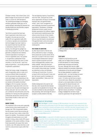
GIM International’s Wim van Wegen exploring a VR environment at Intergeo 2016.
TECH-SAVVY Traditional survey techniques are still widely used and highly valued by readers of GIM International, but newly emerging geoinformation techniques are entering the arena. Although there may be a slight difference between the perception of geomatics professionals and the disruptive technologies that are being developed in parallel to the geomatics world – one may not always be aware of advancing technologies just around the corner – it is safe to say that future surveyors must be tech-savvy. Maybe this perspective will open up new opportunities to attract more young people into relevant education and subsequently the industry, as a career as a geomatics professional will be full of appealing high-tech devices and software. A marketing strategy to highlight the cool factor of ‘geo’ would be a great step in the right direction!
BIOGRAPHIES OF THE AUTHORS Wim van Wegen is content manager of GIM International. In his role, he is responsible for the print and online publications of one of the world’s leading geomatics trade media brands. He is also a contributor of columns and feature articles, and often interviews renowned experts in the geospatial industry. Van Wegen has a bachelor degree in European studies from the NHL University of Applied Sciences in Leeuwarden, The Netherlands. wim.van.wegen@geomares.nl Martin Kodde is a specialist in the field of geomatics with a keen interest in real-time 3D data acquisition. He has a bachelor degree in geodesy from Utrecht University of Applied Sciences and a master degree in geomatics from Delft University of Technology, both in The Netherlands. Kodde leads the Geo-ICT department at Fugro in The Netherlands, where he is also responsible for R&D in geoinformation. He is also a contributing editor for GIM International. mail@martinkodde.nl
BUSI NESS GUI DE 2 0 1 7 |
06-07-09_featurevanwegen-kodde.indd 9
INTERNATIONAL | 9
01-02-17 08:08