INTERVIEW
The Proceedings of the GSDI 15 World Conference are available for downloading from the GSDI website.
GSDI has signed several Memorandums of Understanding with partner organisations such as FIG, ICA and ISPRS. What are the benefits of these partnerships? GSDI has MoUs with FIG, ISPRS, ICA, ISDE (International Society for Digital Earth), and CDMPS (the Centre for Disaster Management and Public Safety) of our member Univ. of Melbourne, the earliest dating back to 2010. The main benefits are sharing geo-related news and ensuring participation on themes related directly or indirectly to SDI at multiple international conferences and workshops of our MoU Partners. As well as joint promotion, over the years we have seen an SDI focus appearing in the structures of the organisations, such as ISPRS Commission 4, Working Group WG IV/6 - SDI: Internet of Things and Spatial Decision Support, the ICA Commission on SDI and Standards and FIG Commission 3 – Spatial Information Management. A good example of how all the MoU Partners work together is demonstrated by the International Workshop on the Role of Land Professionals and SDI in Disaster Risk Reduction in the context of Post 2015 Nepal Earthquake held in Kathmandu, Nepal, 25 – 27 November 2015, directly supported by our Nepal member, NGIID (National Geospatial Information Infrastructure Department, Nepal) and jointly organised by FIG Commission 2 (Professional Education) and ISPRS Technical Commission IV (Spatial Information Science), supported also by FIG Commission 7 (Cadastre and Management). This level of cross pollination of skills and expertise would be much more difficult to achieve without the existence of the MoUs – and we wish to thank all of our MoU Partners for their continued work with GSDI.
You are also involved with education focused on SDI development and implementation, and related geomatics technologies. Can you give some examples? The joint GSDI / FIG / ISPRS workshop mentioned above is one good example. Many different GSDI members have also been directly involved in implementing SDIs nationally and at trans-national level, such as for INSPIRE in Europe. Our members include not only the Open Geospatial Consortium (OGC), whose international geo specifications
work is crucial to implementing SDIs, but also eight universities in Europe, North America and Australia, plus UNIGIS, the global GI Science distance learning network that boasts 9 university partners, 15 study centres, 4,000 active students and over 10,000 alumni. We have also been implementing an expanded Capacity Building Programme since 2016, which includes many webinars relating to the work of our Strategic Projects, such a Marine SDI Best Practice and developing the global index of National Spatial Data Infrastructure (NSDI) mentioned earlier. In 2017, we are delivering specific webinars focusing on SDI issues that are often not covered by others in the geo sector, such as data policy, IPR and licensing practices, open data and big data challenges. GSDI also maintains a major online resource of open access publications directly related to SDI implementation, best practice, case studies, webinars, cookbooks, etc. at our website.
How do you foresee the future when we zoom in on the geospatial sector? Are there any developments that will change the industry in the coming years? We can be sure that there are developments that will change the industry in the coming years; only time and hindsight will tell us if we were able to predict them! It seems that everybody I meet professionally at the moment is talking about the potential of Geospatial Platforms. When I looked for a definition, I found the one from FGDC the simplest to consume - ‘The Geospatial Platform will be a portfolio of common geospatial data, services, and applications, managed, contributed and administered by authoritative sources and hosted on a shared infrastructure’. What struck me was that this was in a document published in June 2011. If this is the future, it’s a long time coming! Most recently I’ve been struck by the conversations about the future of national mapping authorities, and given the first forty years of my career were happily spent in a variety of roles with Ordnance Survey (GB), I guess that’s inevitable. Nowhere is this better covered than in an output from the recently held Cambridge Conference. I recommend reading the story ‘Mainstreaming geospatial data: an exercise in market satisfaction’ from the CEO of one of our members. So, fundamentally, I see the biggest need and the biggest change coming from the greater
integration of information and technologies driven by people with similar ambition, foresight and passion to maximise the benefit of geospatial (location) information as was the vision of those who founded GSDI in the first place.
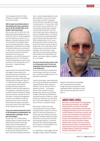
About Dave Lovell
Dave Lovell is currently president of the Global Spatial Data Infrastructure Association, chair of UN-GGIM Geospatial Societies, a member of the UN-GGIM Expanded Bureau, a Board member of the Association for Geographic Information and until 2014 a member of the British Geological Survey advisory committee. Lovell started his career with Ordnance Survey (Great Britain) and spent forty years with them in a variety of roles in Surveying, Sales and Marketing and concluded his time with them as their head of Public Affairs. Between September 2007 and October 2015 he was Secretary General and Executive Director of EuroGeographics the International not-for-profit association now representing 63 National Mapping, Cadastre and Land Registry authorities in 46 countries in Europe.
august 2 0 1 7 |
14-15-17_interview.indd 17
international | 17
25-07-17 14:49