REPORT
by RICHARD GROOM
OGC’s UK and Ireland Forum Open Geospatial Consortium (OGC) members and others converged on the Geovation hub in London last December to catch up and to network.
Andrew Hughes from the British Geological Society, who is chair of the forum, introduced the event as a means for OGC to connect with those who are not in a position to attend the quarterly technical committee meetings, which takes place around the world. As the name suggests, the forum focuses on issues that are pertinent to the UK and Ireland. CROWD-SOURCING IN DAR A fascinating account from Denise McKenzie, OGC Executive Director for Communications and Outreach, was about a crowdsourcing project in Tanzania called Dar Ramania Huria – Open Map in Swahili. This World Bank funded (amongst others) project filled in an area of Dar es Salaam shown blank on existing mapping with what is actually there – a sprawling settlement. It was achieved by training university students and community members to collect the data and then add it to OpenStreetMap. The purpose of the exercise was to improve flood resilience but, as we know, mapping is the basis for any kind of planning and decision-making and the new map has consequently also been for other applications including local government. Responding, Gary Gale from What3Words stressed the importance of addressing as well as mapping whilst Phil Cooper from Sterling Geo described how Landsat data had been used to demonstrate that the most important activity in rapidly expanding cities takes place on the periphery. He argued that this is where the planning process should concentrate by providing
infrastructure ahead of development. For more on this project visit: http:// ramanihuria.org/ AUTOMATED MODELLING IMGeopatial is a new member of OGC, which has developed fully automated cloud-based software as a service, bridging between remote sensing and mapping. They claim that their software can automatically extract features from 3D imagery at a progress rate of four minutes per square kilometre, with no human intervention. Their primary interest is change detection. For example they claim to detect leaks by detecting abnormal soil moisture. They have become members of OGC because they see standards as essential for getting the most out of automated mapping and modelling. FUTURE CITY PILOT Ordnance Survey is the only Strategic member of OGC outside the USA. They, along with organisations from France, Germany and Spain, sponsored the OGC’s Future City Pilot Phase 1 and have been looking at how to bring together CityGML and IFC – city modelling and BIM. The phase 1 project is at reporting stage and phase 2 will be discussed at the next Technical Committee meeting at Delft, The Netherlands, in March. OGC are looking for participants and sponsors.
for the web and for geospatial – W3C and OGC – have been operating in parallel rather than together. Parsons highlighted three activities: creation of a sensor network vocabulary; a semantic approach to coverage data and an ontology for time. The project was due for completion at this time but has been granted an extension of six months for writing up. PRIVATE SECTOR NETWORK At its meeting in August, the UN-GGIM committee of experts agreed to establish a private sector network. The objective is to provide a formal mechanism for the private sector to work with the UN body. McKenzie has been involved in writing the terms of reference, which have been provisionally approved. For more information and to download the terms of reference, visit: www.opengeospatial.org/ UNGGIM_PSN McKenzie urged the forum to participate. Hughes by saying he would arrange telecons before, and meetings after, each of the quarterly meetings of the OGC Technical Committee. This year there will be two opportunities for face-to-face meetings: at Delft in March and at the Ordnance Survey in Southampton in September. He concluded by stressing that the forum is open to all – not just members. Visit: www.opengeospatial.org/ogc/ regions/UKIrelandForum
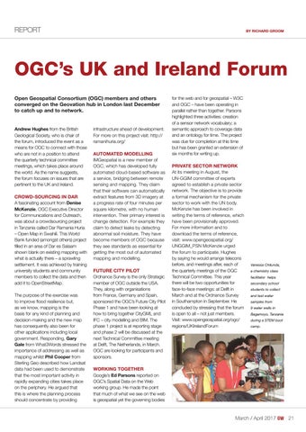
Vanessa Chilunda, a chemistry class facilitator helps secondary school students to collect and test water samples from 9 water wells in Bagamoyo, Tanzania during a STEM boot camp.
WORKING TOGETHER Google’s Ed Parsons reported on OGC’s Spatial Data on the Web working group. He made the point that much of what we see on the web is geospatial yet the governing bodies
March / April 2017
21_ogcatgeovation.indd 21
21
27-02-17 16:01