USA Voyager (In-depth)
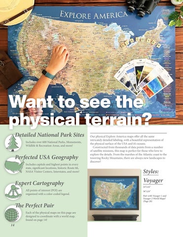
Want to see the physical terrain? Detailed National Park Sites Includes over 600 National Parks, Monuments, Wildlife & Recreation Areas, and more!
Perfected USA Geography Includes capitals and highest points in every state, significant locations, historic Route 66, NASA Visitor Centers, Interstates, and more!
Expert Cartography All points of interest (POI) are organized with a color-coded legend.
The Perfect Pair Each of the physical maps on this page are designed to coordinate with a world map, found on page 14!
14
Our physical Explore America maps offer all the same intricately detailed labeling, with a beautiful representation of the physical surface of the USA and it’s oceans. Constructed from thousands of data points from a number of satellite missions, this map is perfect for those who love to explore the details. From the marshes of the Atlantic coast to the towering Rocky Mountains, there are always new landscapes to discover!
Styles: Voyager 24"x16" 36"x24" Pair with Voyager 1 and Voyager 2 World Maps! (Page 20)

