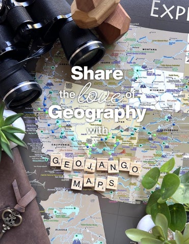
Title Page
love Geography Share
the
of
with
i
AboutUs About us
It’s GeoJango’s mission to create fascinating maps to help people learn about the world. Extraordinary Geographic Details in Every Map Professional Cartography and Geographical Science is our Passion. In our World Maps, one can visualize the depths of the oceans, ridges, and basins. We harness GIS technology to illustrate the geography of our world and landscapes including deserts, rain forests, and mountains. Discover the included fascinating references in every continent and country. We include historical events both heroic and tragic, facts about explorers and their epic voyages, and significant landmarks throughout the world. Our maps are created by highly skilled professionals with backgrounds in Environmental Science, Geography, History, Education, Computer Science, and Graphic Design.
Made in the USA Every map and geography game is made-toorder in our Pleasanton, California map studio. We use all USA-made materials and strive to support other USA companies. We purchase moldings for our frames from small business factories in Alabama and the New York. A factory in Stockton, California transforms the moldings into frames — exclusively for our maps.
Drop Us a Line! support@geojango.com (925) 264-9299
ii
Table of Contents Table of Contents
Maps U.S. States Shaded Relief Maps Historic Maps
United States Political Maps Physical Maps Sticker Maps
World Maps
2 4 6
10 12 14 16
18
Physical Maps
20
Other Regions
22
Hawaiian Islands The Caribbean Sea
Satellite Maps Standard Cities & Pick Your Own City
22 23
24 26
Games Geography Games Explorer Cards Kids’ U.S.A. Adventure Bundle
28 29 30
iii
Maps for Exploring the World Fine Art Quality
Impressively Giclée printed using archival inks, heavy photo paper for rich color depth and vivid labeling.
Expert Cartography Our intricate design elements and storytelling illustrations inspired by historical masterpieces combined with modern geography and data are a delight to discover.
Serious Scientific Data Harnessing GIS technology to transform NASA, USGS, GEBCO, NOAA, US Census, and more data into beautiful representations of our world.
by GeoJango iv
Maps title page
Why Maps? Maps have the unique ability to draw people in using spatial dimensions and visualization. Our maps are designed to make exploring the geography of the Earth’s lands and oceans fun and fascinating.
1
U.S. State Maps State Maps Title spread
Explorer Cards make a perfect companion for any map! (See page 29)
2
Durable Construction Built to last for decades! Includes a premium acrylic facing and a beautiful, solid wood frame made in the USA. Comes ready to hang with hardware installed.
Serious Satellite Data Created with a 3-D model of Earth using NASA ASTER stereoscopy data, LandSat for positional accuracy, and SRTM to model the elevation and landscape of the United States.
Original Hillshade The 3-D model created with satellite data was used to simulate how light interacts with the landscape. The beautiful shadows and texture are a result of meticulous knowledge of terrain modeling.
Fine Art Quality Impressively Giclée printed using archival inks, heavy, 240 gsm, matte photo paper for rich color depth and illusion of 3-D texture.
Expert Cartography Includes additional contextual information: road networks, major bodies of water, and an accurate scale bar for every state.
by GeoJango 3
Shaded Relief State Maps State Maps Enhanced Topos
These one-of-a-kind state maps are the perfect piece of geographic artwork for any map lover. 20 US states are available now, with other states, countries, and more available by request. Our professional GIS scientists used a proprietary process to analyze the highest resolution elevation data available. The data was rendered as a digital, three-dimensional model which meticulously simulates the shadows, reflections, and wrinkles in the Earth’s surface. Several more layers of data are applied to illustrate slope, erosion patterns, and deposition. A detailed road network adds informative geographic context to the landscapes. An artistic cartographic design with concentric lines illustrate every major body of water. For a finishing touch, we’ve included an accurate scale bar and a brief description of our design process for every state.
Greyscale
Classic
Available now: Arizona ■ California ■ Colorado ◆ Connecticut ■ Delaware ◆ Georgia ■ Maryland ◆ Massachusetts ◆
N. Carolina ◆ New Jersey ◆ New Mexico ■ New York ■ Nevada ◆ Oregon ■ Pennsylvania ◆ S. Carolina ■
Texas ■ Utah ■ Virginia ◆ Washington ■ And more by request!
Blueprint
■ Square map available in 24"×24" ◆ Rectangular map available in 24"×16" and 36"×24"
Explore beautiful landscapes 4
Antique
State Maps Enhanced Topos Colors
5
Historic U.S. State Maps State Maps Historic Maps
Explore the geographic history of the United Sates in these historic maps. Our vintage USA State Map Collection shows the geography of the states in the mid-19th century and the time of the Civil War Era. The maps are a reproduction of the original maps meticulously restored to their former glory using the latest digital imaging technology. We carefully restored the colors, torn edges, creases, smeared writings and more. With enhanced features, the original character and design of the map shines through.
6
State Maps Coltons Atlas
Tulare Lake, CA
A piece of American history Discover historic boundaries of the cities, counties, and states that have changed over the years. Discover physical changes in the geography — such as former lakes and canals used for transportation and agriculture.
7
Historic State Maps State Maps Historic Maps
Available now:
Alabama Arkansas Arizona ■ California ◆ Colorado ■ Connecticut Florida Georgia Hawaii Illinois Iowa Kansas ■ Kentucky & Tennessee ■ Louisiana Maine Maryland, Delaware & D.C. ■ Massachusetts & Rhode Island ■ Michigan Minnesota Mississippi
Missouri Nebraska & Kansas ◆ New Hampshire New Jersey New Mexico ■ New York Nevada ■ N. Carolina N. & S. Dakota ■ Ohio Pennsylvania S. Carolina Texas Utah ■ Vermont Virginia & West Virginia ■ Washington & Oregon ■ Wisconsin And more combinations!
■ Available in a multi-state or territory map ◆ Available both in stand-alone or in a multi-state/territory map
8
Grey
←
Pastel
←
Every map is available in its original pastel color scheme and a classic greyscale version. Both color versions are professionally restored to their former glory.
State Maps Coltons Atlas
9
The Explore America Map USA Maps Title spread
Explorer Cards make a perfect companion for any map! (See page 29)
10
USA Brown (In-depth)
by GeoJango Detailed National Park Sites Includes over 600 sites administered by the National Park Service, including National Parks, National Monuments, Historic Battlefields, Wildlife & Recreation Areas, and more!
Meticulous USA Geography Includes capitals and highest points in every state, significant locations, historic Route 66, NASA Visitor Centers, US Interstates, and more!
Perfected Projection Created by a professional geographer! Features an accurate projection of the entire USA (notice the curved border with Canada and the correct shapes of Alaska and Hawaii) Visualize the accurate shape and size of each state, without distortion.
Fine Art Quality Impressively crafted using archival inks, heavy, 280 gsm, satin photo paper with rich color depth. Features vivid & clear labeling.
Expert Cartography All 1,000+ points of interest (POI) are organized with a color-coded legend. Perfect for planning your next adventures!
11
USA Political Maps (other colors) Slate Grey White
Styles: Roadster 24" × 16" 36" × 24"
Roadster Fall
Classic Political Maps ➢ US Interstates & major roadways ➢ Major cities & state capitals ➢ Simple, modern design ➢ Illustrated bathymetry & ocean currents
36" × 24"
A political map primarily displays the political boundaries of countries, states, regions, and cities, including their borders, capitals, and major administrative divisions. These maps are valuable tools for understanding the organization of governments and the world’s political landscape.
Ansel
Ansel Landscape USA Map
24" × 16"
24" × 16" 36" × 24"
➢ 63 National Parks ➢ US Interstates & major roadways ➢ Our most detailed city labels ➢ Decorative landscape illustration ➢ Subtly illustrated terrain
Style: Brown ← All maps come rolled, packaged in a clear protective tube for easy storage and travel!
12
USA Political Maps (Roadsters) White Fall
Styles: Brown 24"x16" 36"x24"
Signature Explore America Map ➢ 63 National Parks ➢ 1,000+ NPS Sites ➢ Notable Cities & State Capitals ➢ Highest point in each state ➢ Our most detailed travel map ➢ Includes protective tube packaging
Grey 24" × 16" 36" × 24"
Slate 24" × 16" 36" x 24"
Our USA National Park Travel Maps feature all of the National Park Service locations, National Monuments, Historical Sites, Battlefields, Lake Shores, National Preserves, and other fascinating destinations within the United States. These are the gems of our nation and what makes the United States special. Every component of our products are made in the USA! The maps are produced with the highest quality printers, papers, and archival inks for rich color depth. Maps are fun to receive, fun to explore, and fun to cherish. They are educational and inspirational! They are great for every age, gender, and occasion. Maps are the perfect wedding gift, anniversary gift, Mother’s Day or Father’s Day gifts!
White 24"x16" 36"x24"
13
USA Voyager (In-depth)
Want to see the physical terrain? Detailed National Park Sites Includes over 600 National Parks, Monuments, Wildlife & Recreation Areas, and more!
Perfected USA Geography Includes capitals and highest points in every state, significant locations, historic Route 66, NASA Visitor Centers, Interstates, and more!
Expert Cartography All points of interest (POI) are organized with a color-coded legend.
The Perfect Pair Each of the physical maps on this page are designed to coordinate with a world map, found on page 14!
14
Our physical Explore America maps offer all the same intricately detailed labeling, with a beautiful representation of the physical surface of the USA and it’s oceans. Constructed from thousands of data points from a number of satellite missions, this map is perfect for those who love to explore the details. From the marshes of the Atlantic coast to the towering Rocky Mountains, there are always new landscapes to discover!
Styles: Voyager 24"x16" 36"x24" Pair with Voyager 1 and Voyager 2 World Maps! (Page 20)
USA Physical Maps (Other colors) Nautilus + World maps Magellan to pair Darwin
Styles: Nautilus 24"x16" 36"x24" Pair with Nautilus World Map! (Page 20)
Signature Explore America Map ➢ 63 National Parks ➢ 1,000+ NPS Sites ➢ Notable Cities & State Capitals ➢ Highest point in each state ➢ Our most detailed travel map ➢ Includes protective tube packaging
Magellan 24" × 16" 36" × 24" Pair with Magellan World Map! (Page 20)
Darwin 24" × 16" 36" x 24" Pair with Darwin World Map! (Page 21)
Our USA National Park Travel Maps feature all of the National Park Service locations, National Monuments, Historical Sites, Battlefields, Lake Shores, National Preserves, and other fascinating destinations within the United States. These are the gems of our nation and what makes the United States special. Every component of our products are made in the USA! The maps are produced with the highest quality printers, papers, and archival inks for rich color depth. Maps are fun to receive, fun to explore, and fun to cherish. They are educational and inspirational! They are great for every age, gender, and occasion. Maps are the perfect wedding gift, anniversary gift, Mother’s Day or Father’s Day gifts!
Odyssey 24"x16" 36"x24" Pair with Odyssey World Map! (Page 21)
15
NPS Sticker Maps
National Parks Sticker Maps
Park Tracker Stickers Every map comes with our original sheet of 66 vinyl stickers to match the arrowhead markers for each National Park (plus a few to spare).
Interactive Fun 16
Styles: Watercolor 24" × 16"
36" × 24"
Visit all 63 National Parks ➢ 63 National Parks ➢ Major cities, rivers, lakes, and oceans ➢ Unique illustrative designs in 2 styles ➢ Includes protective tube packaging ➢ Includes 1 sticker sheet per map
Dark Brown 24" × 16"
36" × 24"
Our USA National Parks Sticker Maps are the perfect tool to track all of your National Park adventures! This unique sticker map highlights all 63 US National Parks as well as all 50 states and major cities. Available in two styles, the USA National Parks Sticker Maps are beautifully illustrated by a team of professional geographers and artists.
17
USA Maps World Maps Title page
Explorer Cards make a perfect companion for any map! (See page 29)
The Nautilus World Map 18
World Nautilus (In-depth)
by GeoJango Beautiful Cartography Our intricate design elements and story-telling illustrations inspired by historical masterpieces are a delight to discover! These combined with modern geography and data from 3 satellites reveal the landscape and elevations.
Perfected Geography Includes essential geographic features and an accurate projection of the world! Our world maps are perfect for learning the relative size and shape of landmasses on Earth. I.E., Greenland is actually 10% the area of Africa!
Exploratory History Features cultural, environmental, and historical references to learn more about world history.
Fine Art Quality Impressively crafted using archival inks, heavy, 280 gsm, satin photo paper for rich color depth. Features meticulous, vivid, & clear labeling.
Detailed Oceanography Explore the ocean floor, ridges, basins, and tectonic plate fault lines. Follow ocean currents and find the deepest points in the world’s oceans.
19
World Maps (Other colors) Voyager 1 & 2 Magellan Darwin Odyssey
+ USA maps to pair
Styles: Nautilus 24"x16" 36"x24" Pair with Nautilus USA Map! (Page 15)
Our Signature World Map ➢ Modern Geography with current political boundaries ➢ Labeled USA States and Major Cities ➢ All 63 US National Parks ➢ Cartographic illustrations and historic commentary ➢ Elevation, Topography, and Landscape Modeling ➢ Tallest Peaks on every continent ➢ Ocean elevation and sea floor modeling ➢ Includes protective tube packaging
Voyager 1 24"x16" 36"x24" Pair with Voyager USA Map! (Page 14)
Voyager 2 24"x16" 36"x24" Pair with Voyager USA Map! (Page 14)
Magellan 24" × 16" 36" x 24" Pair with Magellan USA Map! (Page 15)
20
The comprehensive details in our maps truly differentiate our work from the rest of the market.
Styles: Darwin 24"x16" 36"x24" Pair with Darwin USA Map! (Page 15)
Odyssey 24"x16" 36"x24" Pair with Odyssey USA Map! (Page 15)
These beautiful maps feature physical geography of both land and sea. The comprehensive references in the map visualize all nations and major cities in the world, historical and significant destinations, and the deepest point in the ocean and the tallest peaks on Earth. The map is a delight to explore and plan travels! The oceanography is based on over 2 billion data points from NOAA bathymetry showing the topography of the seafloor including the ocean ridges, plate tectonics, the geography of the island formations, and continental shelves! The detailed information throughout this World Map is the result of years of geographic research and created by a professional Cartographer/Geographer.
Visualize the depths of the oceans & formation of Earth's landscapes.
Style: Voyager 1 ← All maps come rolled, packaged in a clear protective tube for easy storage and travel!
21
Island Time Blue Caribbean Blue Hawaii
Hawaii
This unique Hawaii State Map is a comprehensive guide to the Hawaiian islands. It features all of the Hawaiian islands, including Oahu, Maui, Hawai'i, Molokai, Kauai, Niihau, Lanai and Kaula. The oceanography is based on over 2 billion data points from NOAA sonar data. Using GIS, we modeled the topography of the seafloor including the ocean ridges, sea mounts, the geography of the island formations, and continental shelves!
Styles: Hawaii 24"x16" 36"x24"
Blue Caribbean 24" × 16" 36" x 24"
22
Gold Caribbean Rainbow Caribbean
The Caribbean Sea
Gold ←
Styles: Gold Caribbean 24" × 16" 36" x 24"
Our beautiful maps of the Caribbean Sea blend modern scientific geography and classic artistic cartography. The oceanography shows the topography of the seafloor including the ocean ridges, sea mounts, the geography of the island formations, and continental shelves! Our maps are perfect for tracking and planning cruise destinations and port hopping trips!
Rainbow Caribbean 24" × 16" 36" x 24"
23
Satellite Maps Satellite maps
Impressive Imagery Our satellite imagery maps provide a wealth of information about the Earth's geography, topography, vegetation, weather patterns, and more. We're able to achieve the highest level of detail using a combination of several NASA satellite and space shuttle missions and sophisticated GIS software.
24
Satellite maps
See the world from above
25
Satellite maps
Yosemite National Park 24"x16" 36"x24"
San Francisco Bay Area 24"x16" 36"x24"
San Diego 24"x16" 36"x24"
Choose any area 24"x16" 36"x24"
26
Our state-of-the-art software and licenses allow us to create the highest resolution and most detailed maps possible of any area on Earth. From the largest mega cities to the smallest towns and the highest mountain peaks to the lowest valleys.
Want to see another place? ➢
Satellite maps
See your world from above Impressive Imagery Our satellite imagery maps provide a wealth of information about the Earth's geography, topography, vegetation, weather patterns, and more. We're able to achieve the highest level of detail using a combination of several NASA satellites, Earth Observing System (EOS) missions, and sophisticated GIS software.
Your Choice of Area Our state-of-the-art software and licenses allow us to create the highest resolution and most detailed maps possible of any area on Earth. From the largest mega cities to the smallest towns and the highest mountain peaks to the lowest valleys.
27
Games & more title page
Geography Games Interactive Learning Our games are specially designed to engage everyone in geography, from seasoned explorers to new adventurers. Perfect for parents, educators, and students!
Inspire Wanderlust Learn more about our wide world to spark a lifelong passion for geography, history, adn culture.
Challenging Trivia Our trivia questions are expertly written to challenge your trivia skills & advance your geographic knowledge.
28
by GeoJango
Explorer cards
Explorer Cards What’s Included
➢ 50 Explorer Cards, each describing a unique site from around the world ➢ Each card includes a stunning photo, the location of the site, a fun fact, and a challenging trivia question. ➢ 1 instructions card with a game, and a link to find more! ➢ 3 GeoJango Game Maps for use in the many games included
Discover, learn, and challenge your friends with information about significant sites around the world. Our deck features 50 fascinating destinations around the world. From ancient ruins and historical cities to beautiful landscapes and modern marvels, our Explorer Trivia Card deck will help you learn about the greatest sites that our planet has to offer. Expand your knowledge of geography, culture, and history all at once by exploring this unique trivia card game!
29
Kids bundle
USA Adventure Bundle
Intricate Illustrations
Learn, explore, & play with our USA Adventure Bundle! Created by our professional team to help young minds learn all about the USA. Perfect for home-schoolers, parents, & educators to support their children's education in geography, history, and social studies! The beautifully illustrated 25-page Activity Book includes fun activities to challenge the whole family. You'll discover more details about your specific home state, practice your seeking skills by finding details on the map, match states to their capitals, untangle word scrambles and much more! You'll be a true geography expert! The Fabric Map is printed on a polyester fabric that makes it strong and durable. It is tear, wrinkle, and water resistant and tough enough for kids to interact with at playtime.
30
The Activity Book, Game Map, and Game Cards are brimming with fun and beautiful drawings of state icons, birds, flowers, and much more!
What’s Included ➢ 1 Activity Book ➢ 1 36" × 24" Tear-Resistant Fabric Map ➢ 51 Activity Game Cards ➢ 10 Game Marker Cards ➢ 1 Adventure Bag
31
We Care About Our Planet We are not just a destination for amazing maps & games, we’re a creative and caring team supporting the planet! We pledge 2% for our planet! Our goal is to provide support for wildlife rescue and conservation. For every order, we are donating 2% of our revenue to support a different wildlife cause every month! If you have any suggestions, please email us at care@geojango.com
Drop Us a Line! support@geojango.com (925) 264-9299 © 2024 GeoJango, LLC. All Rights Reserved