• Feature Geography students, faculty, staff, and alumni
• Encourage an engaged community within our program
• Recognize students, faculty, staff, and alumni for their efforts and accomplishments
• Provide ways to explore Geography outside of the classroom
• Help students learn about opportunities such as independent research at JMU, internships, graduate school, and career opportunities available after graduation
TABLE of CONTENTS
4 ~ Editorial Page
5 ~ Meet the Team
6-7 ~ Message from the Department Head
8-9 ~ Americans Who Tell The Truth Feature
10-11 ~ Faculty Celebration: Dr. Kraenzle
12-13 ~ Catching Up With Alumni
14-15 ~ Provost Highlight: Dr. Kolvoord
16-17 ~ Shenandoah National Park Projects: Dr. Nash
18-19 ~ Student Study Abroad Feature
20-21 ~ Climate Science Minor Q&A
22-23 ~ New Faculty Spotlight: Dr. Hartnett
24-25 ~ New Faculty Spotlight: Dr. Dohrenwend
26-27 ~ Words of Wisdom
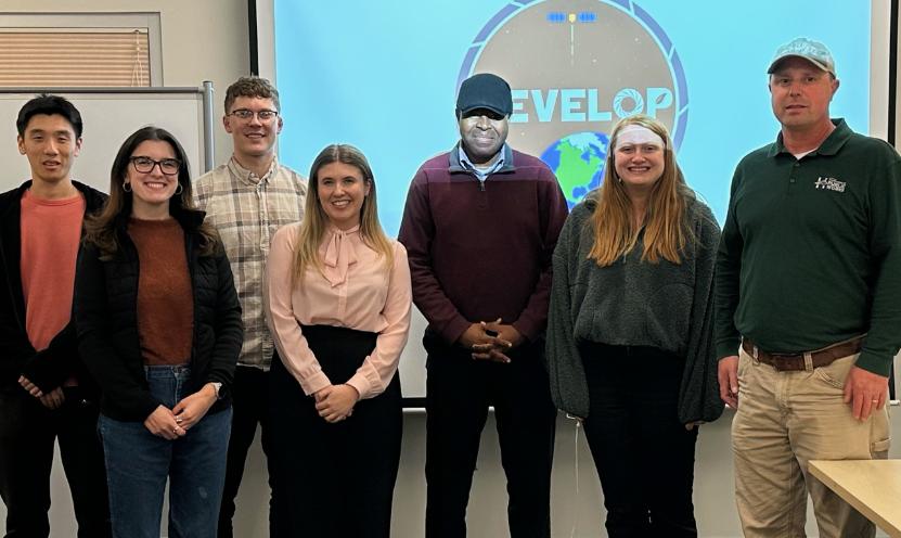
28-29 ~ Ghana Field Study: Dr. Tang
30-31 ~ Geography in 3 Words: First-Years
32-35 ~ Custom Concentration Features
36-37 ~ Photo Contest
38-39 ~ Sharon Lavigne Visit
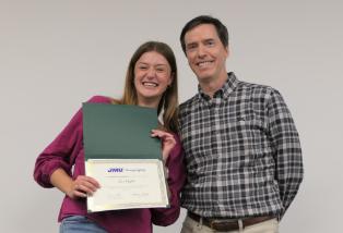
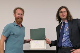
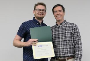
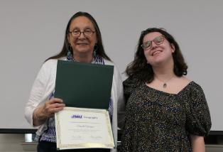
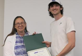
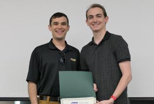
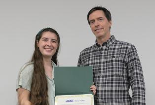
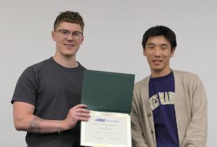
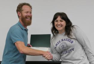
40-41 ~ Kari Zehner Scholarship/Student Awards
42-43 ~ Geography Ambassadors
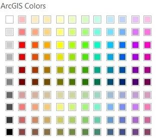
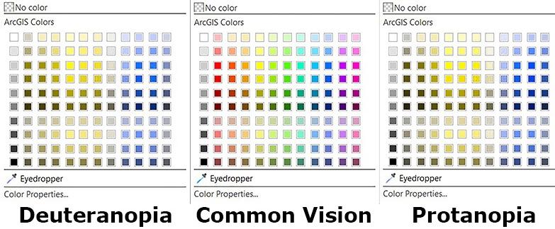
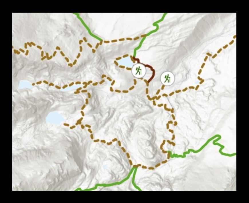
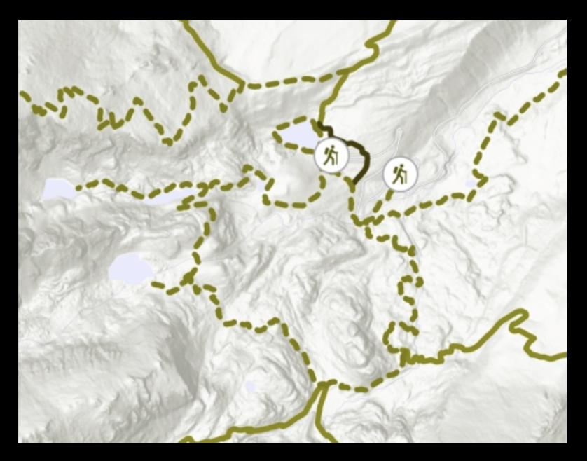
44-45 ~ Color Vision Deficiency in Geography
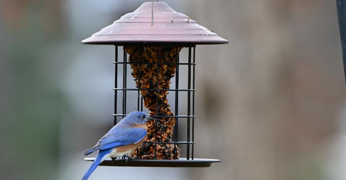
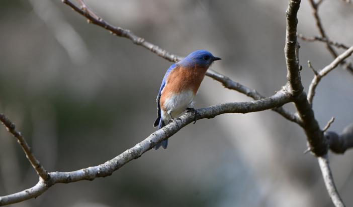
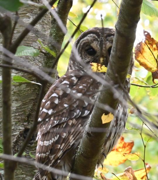
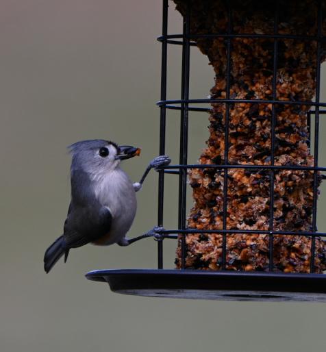
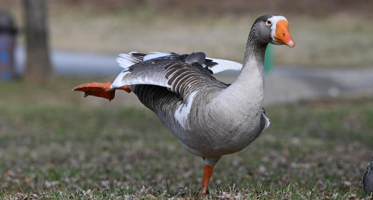
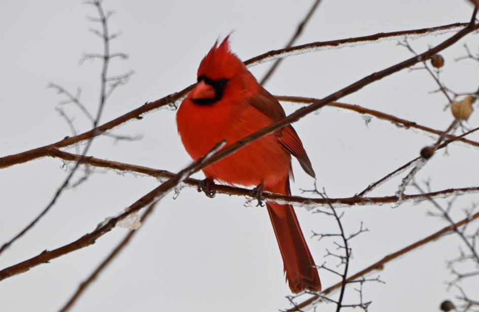
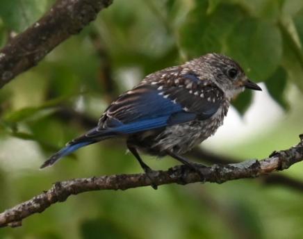
46-47 ~ Bird Club Feature
48-49 ~ Geography in Action/GTU/Geography Club
50-53 ~ Photo Essay
54-55 ~ Exploring Downtown Harrisonburg
56-57 ~ Senior Photos
58-59 ~ Senior Celebrations
HGreetings from the Geogazine Team
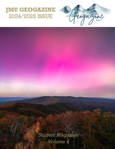
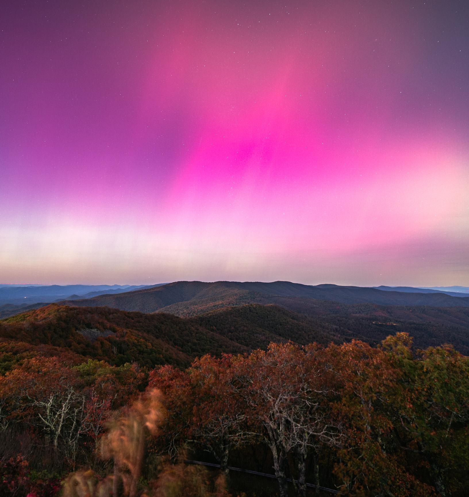
ello readers, and welcome to Volume 4 of the JMU Geogazine! In this edition, we have continued to explore the Geography program, the student and faculty communities, and JMU/Harrisonburg as a whole. There’s a wide range of content inside; from research grants and study abroads, to faculty celebrations and student profiles, we have many different angles and points of view. As geographers, that’s something we strive to keep in mind.
As we publish our fourth volume, the Geogazine is evolving. Many of our team members this year were new to both the Geogazine and journalism as a whole, which made this edition the beginning of a new and different era. Our founding members have all moved on, allowing the next generation of members to chart a new course. As time goes by, people will come and go, but we hope that the Geogazine’s spirit and mission will not change.
With the 2024-2025 academic year coming to a close, we would like to congratulate and thank two of our retiring Geography faculty members, Dr. Helmut Kraenzle and Dr. Mary Kimsey, for supporting the Geography program and the Geogazine throughout their time at JMU. Their support, as well as support from others in the major, is essential to the existence of this magazine and the success of each volume. We are lucky to have such supportive faculty with us, and we are thankful for the contributions they have made during their time at JMU.
Thank you, and we hope you enjoy reading Volume 4 of the Geogazine!
Sincerely,
The Geogazine Team
Audrey Sparrow Contributing Writer Class of ‘26
Ty Yu Contributing Writer Class of ‘28
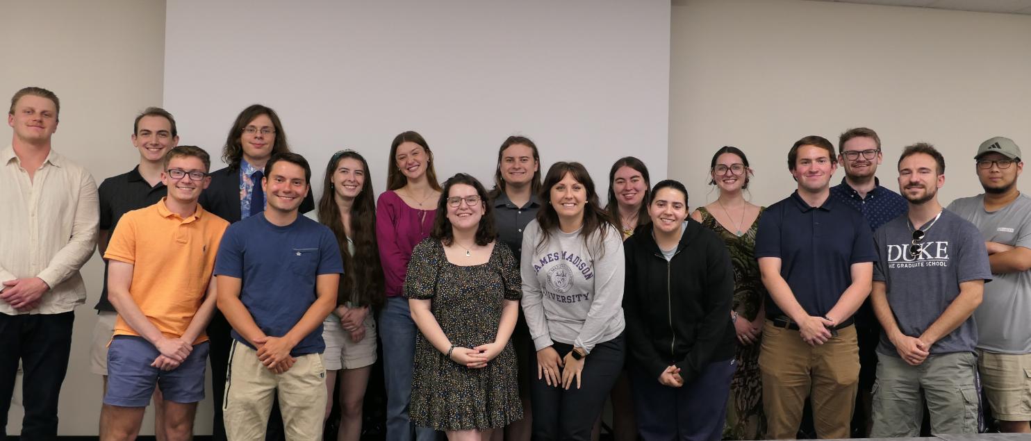
Meet the Team
Andrew Shinkle Editor-in-Chief and Contributing Writer Class of ‘26
Chris Timothy Feature Photographer and Contributing Writer Class of ‘25
Isabel Kinney Graphic Artist and Contributing Writer Class of ‘27
Teddy Umbrell Contributing Writer Class of ‘28
Intern
Past Team Members
Leah Wilczynski Class of ‘23 (Vol. 1-2)
Kayla Yurco Faculty Advisor
Olivia Offenbacker Class of ‘22 (Vol. 1)
Manita Khemthong Faculty Advisor
Devin Nappi Class of ‘27 (Vol. 3)
Lucie Griffith Class of ‘24 (Vol. 1-3)
Tovah Baer Class of ‘24 (Vol. 1-3)
Thammaphorn (Mel) Theerakarn
Message from the Department Head
Welcome to this fourth edition of Geogazine! I am consistently impressed by the quality of this student-led publication, which this year once more showcases the diversity of work being done by our geographers today—students, faculty, and those outside JMU. As we all respond to changing local and global contexts, this magazine is a reminder that the best education we can get is one that combines breadth with depth.
You can see throughout the stories here activities that speak to the broad program we are cultivating in Geography at JMU: integrating human, environmental, physical science, computing, and spatial analytic approaches, for instance. And you can also get a sense of the rich depth our cutting-edge scholars are pursuing in their research and the focused opportunities students are having to explore topics in fine detail. This combination of a holistically minded, balanced understanding of the world matched with a finer grained investigation of a place or topic—made more valuable from that wider understanding—is at the heart of a true geographical edu-
cation. We are proud to see that exemplified here in this, and previous editions, of Geogazine and in the work our alumni, faculty, and students do every day.
Our students, faculty, and alumni are navigating a changing world with the best map: a geographical education, illustrated in all its richness here. I hope you can develop the most rewarding pathways in similar ways to the people and stories found in this magazine. This navigation combines an eye on the wider landscape, with a passion for investigating the immediate environment.
Thank you for your support and membership of the wider geographical community at JMU, and we hope you enjoy this edition of Geogazine that continues to showcase this educational orientation!
Sincerely,
Dr. Henry Way
Americans Who Tell The Truth:
Artistically showcasing our difference-makers
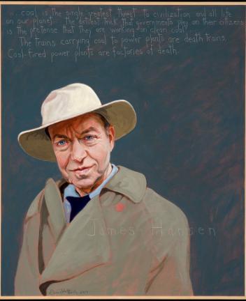
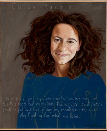
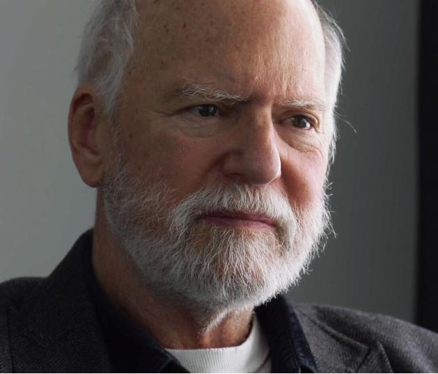
As the fall semester progressed, colorful and evocative portraits adorned the EnGeo building’s second floor halls. The portraits were part of a larger series called “Americans Who Tell The Truth” (AWTT) by artist and activist Robert Shetterly.While the visuals are simple in nature—each a depiction of the person against a solid color background with an accompanying quote—the meanings underneath are complex.
Shetterly, 78, began the series in January 2002, amidst the post-9/11 political climate “when our government was lying about the reasons for attacking Iraq,” he said. During this time, he strove to find a positive avenue for expression and change.
“I wanted to paint positive,” he said. “I started painting people that I admired and who had stood up for the best in this country rather than the worst.”
acts of courage, citizenship, and justice that these people have been engaged in.”
The main campus AWTT exhibit ran from August 27 through September 30 in a Duke Hall student exhibition gallery.
Plass enjoys the personal feeling of engaging with the portraits. “It’s like they're looking right at you, and you’re having a conversation with them,” she said.
Plass and other collaborators invited an array of JMU entities to sponsor portraits for the gallery. Around the time when the Main Campus exhibit was being planned, Plass reached out to Dr. Carole Nash to ask if CISE wanted to be involved. In the resulting conversations, CISE faculty planned to set up an East Campus AWTT exhibit that focused on environmental issues.
“I wanted to paint positive,” he said. “I started painting people that I admired and who had stood up for the best in this country rather than the worst.”
In the project’s first year, he mostly painted 19th century figures based on archival images, but later he began traveling to meet contemporaries in person. Shetterly’s subjects—both famous and relatively unknown—are difference-makers who advocate for social and environmental justice, as well as for other fields that work to better our society.
Justice Studies Academic Unit Head Dr. Peggy Plass originated the idea of bringing Shetterly’s work to JMU. She was inspired after Justice Studies sponsored a screening of Truth Tellers, a documentary about Shetterly, in February 2022. By summer 2023, Plass approached the School of Art, Design, and History (SADAH) Director MiKyoung Lee about finding an exhibit space to use.
“They’re just really special pieces of art,” Plass said. “I love the way that he connects art with justice. I like the fact that the paintings are both physically beautiful themselves, but they also represent these great deeds, and these amazing
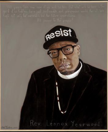
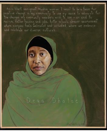
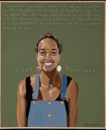
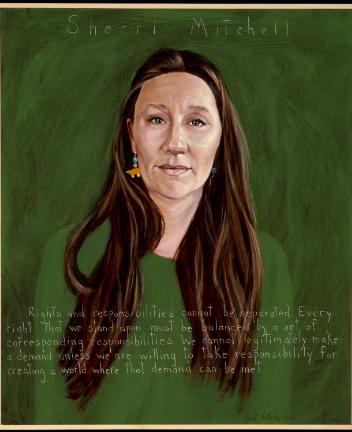
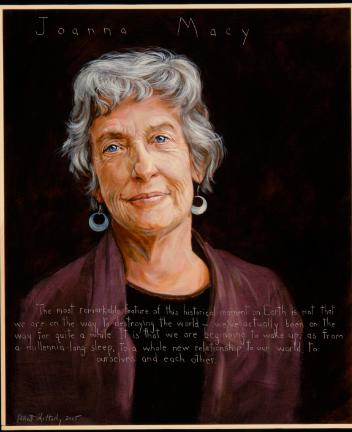
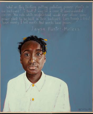
The CISE leadership team selected eight portraits (James Hansen, Chloe Maxmin, Rev. Lennox Yearwood, Deqa Dhalac, Leah Penniman, Sherri Mitchell, Joanna Macy, and Jaysa Hunter-Mellers), each with their own unique stories. Each portrait had its own accompanying QR code, which allowed viewers to learn more about each person.
“You get to learn about really important things that have happened that you may not have any familiarity with,” Nash said.
Nash, who is the Director of Inclusive Excellence in CISE, began planning the East Campus AWTT exhibit in February 2024. It opened on September 5th and ran through October 16th.To augment their display in the hallway, various CISE faculty members hosted brief pop-up talks about how their field of study coincided with a given portrait’s theme.
“We’ve had good attendance every time,” Nash said. “A lot of times students will walk through on their way somewhere else, but every now and then they’ll stop and just listen.”
In mid-September, shortly after the East Campus exhibit opened, Shetterly visited JMU to talk about AWTT and answer questions.
One of his more recent portraits (2024) was painted of environmental activist Julia Butterfly Hill. She was passionate about preserving the Old Brooks Forest in California, so she sat in a giant redwood tree for over two years to prevent loggers from cutting it down. In doing this, she gained negotiating power with the logging companies and made a difference for an issue that she was passionate about.
Twenty-three years after he first began AWTT, Shetterly advises everyone to “find their tree,” quoting Hill.
“Find the thing that you would say is meaningful, something you love,” Shetterly said. “Something you're willing to say ‘over my dead body’ for.”
Robert Shetterly, 78, has been painting his Americans Who Tell The Truth series since January 2002. (photo courtesy of AWTT)
Dr. Helmut Kraenzle retires after 28 years as a JMU professor
Dr. Helmut Kraenzle has been an incredibly integral figure at JMU for the last 30 years. He has not only contributed as a professor to more than 5000 students in over 200 classes during his time here, but he also created the data and infrastructure necessary to bring GIS as we know it to JMU.
Kraenzle has taught courses in GIS and other topics through his many years of teaching. His unique specialization led him to teach in the Shenandoah Valley in 1997, instructing the very first students to ever learn GIS at JMU. Over the years he has taught such classes as Intermediate GIS (GEOG 366), Programming for GIScience (GEOG 367), Geographic Concepts to Save Our Planet (GEOG 350), and GIS Project Management (GEOG 467).
Growing up in Baden-Baden and studying in Munich, Germany, Kraenzle went to university starting with a Studium Generale, which is a way for students to get an overview of different academic disciplines. After that, Kraenzle chose geography and computer science to focus on, unknowingly making an incredibly impactful decision. During his undergrad experience, his geography professor Dr. Hans-Günter Gierloff-Emden inspired him to pursue his Ph.D. and advance his career by becoming a teaching assistant.
While he worked in telecommunications, he was invited to teach at JMU. Kraenzle accepted, indulging in a love for the United States that he’d felt since he was seven. Through his time teaching GIS and computer cartography as a visiting professor during fourweek-long visiting trips, he finally received the welcome to America that he’d dreamt about. After his fourth visiting stint, he received an offer to become a full-time tenure-track faculty member at JMU. “When I started in 1997 at JMU, me and my colleagues’ task was to build a GIS curriculum and to make a change to the Geography program.”
“When I started in 1997 at JMU, me and my colleagues’ task was to build a GIS curriculum and to make a change to the Geography program.”
Dr. Kraenzle has made sizable contributions to the Geography program at JMU. While beginning to teach at JMU, Kraenzle and his colleagues created a curriculum that began with classes such as Geographic Tools and Techniques (GEOG 130), Applied Geographic Information Systems (GEOG 366), Geographic Databases (GEOG 466), and Applied Geographic Information Systems (GEOG 467). Afterward, Kraenzle found himself in the midst of revolutionary and life-saving research projects.
However, this didn’t come without hardship, as Kraenzle was a first-generation college student.
“I didn’t have a role model at home that said ‘you should do this.’ So for me, it was all new,” he said. He went on to get his Ph.D. in Natural Sciences at the University of Munich, overcoming the odds and obstacles against him, cultivating a legacy he once thought impossible.
Transitioning beyond his formal education, from 1991 to 1993, Kraenzle went into the telecommunications industry with a company called Deutsche Telekom Mobilfunk GmbH in Bonn, Germany. Then, from 1993 to 1996, he was with E-Plus Mobilfunk GmbH. He used a mixture of his computer science skills as well as geography to create GIS models of landscapes, topography, and land use data to plan cell tower construction. However, at the end of the day, it was teaching that called to him.
For example, in 2007, Kraenzle used his GIS knowledge on a grant that simulated shipping container movements using the Institute for Infrastructure and Information Assurance through an Esri and open source GIS software.
Dr. Helmut Kraenzle makes the keynote address at the MidAtlantic Union Group, 2004. (photo courtesy of Dr. Kraenzle)
“Back then you could not receive real-time coordinates from containers, right? Because the GIS simulation that I created just needs the coordinates; we simulated them. Now later, if you get them in real time, from the real world, it’s easy to use the GIS that was built to replace the simulated coordinates with the real ones,” Kraenzle said, describing how the GPS system works through coordinates. This process is used in anything from mobile GPS to tracking a package online, simply by tagging an object and using satellite data to monitor its movements.
In other projects, Dr. Kraenzle has helped save lives. In 2012, Kraenzle began a research project with students to remove mines from less developed countries, working for countries like Vietnam, Cambodia and Bosnia. Kraenzle and his students used GIS analysis in collaboration with the Department of Defense to map minefields.
“Right now in Ukraine, there’s tens of thousands of mines that have been placed because of the war,” he said. “Hopefully, after the war is over, these mines can be taken out because if they stay in, and they usually stay in for a long time, the most people who get killed by mines are actually not soldiers, but women and children.”
Solemnly, he spoke about being grateful to make a difference in people’s lives. “The students were very excited because we actually could make an impact in these less developed countries.”
Of all of his dozens of projects, Kraenzle is especially proud of working with the Mine Action Information Center (MAIC) at JMU, garnering over $400,000 toward these projects together with all the agencies MAIC worked with and giving his students the grand opportunity to make their mark on the world.
Through his research, Kraenzle has earned many accolades and awards, including the 2002 Madison
Scholar Award in the College of Integrated Science and Technology. Since winning the award, he has stayed busy, from involving over 125 students in grant sponsored research projects to contributing to over 16,000 credit hours earned by students.
Dr. Kraenzle’s work has made a difference in the world, and he thanks JMU for the opportunity to interact with students through these projects. He says that students are one of his main motivators for his love of teaching.
“I really love to interact with the students,” he said. “It’s a learning experience to work with them, because every year they bring a different background as time moves on.” Kraenzle plans to teach at JMU part time, even after he retires.
In retirement, Kraenzle plans to take care of his parents, focus more on yoga, and spend more time on his sailboat. While retirement may be thought of by many as a break, he sees it as an opportunity to continue to apply himself. Where Kraenzle’s approach differs from the norm is how he plans to spend the rest of his retirement professionally.
“It’s always important to think about your next step,” he said. “To think not what you’re retiring from, but what are you retiring to?”
While he’ll have more freedom than before, Kraenzle plans on continuing to teach students, generate grants for research projects around the globe, and help other people with the knowledge that he’s gained through his life.
“That’s a healthy way to think about all your life phases, where you go, and what you do in the future,” he said. “And it’s good to think about ‘what is it that I want to do in the future that is meaningful?’ I’m looking forward to that.”
Dr. Kraenzle hiking in the German Alps, 2024. (photo courtesy of Dr. Kraenzle)
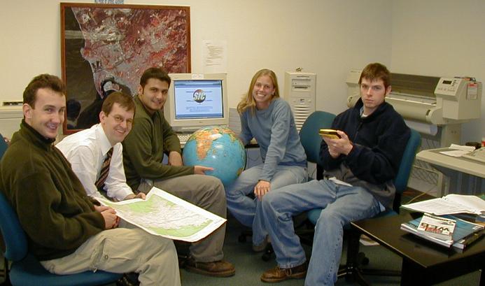
Spatial Information Clearinghouse (SIC) Project Team, 2002. (photo courtesy of Dr. Kraenzle)
Catching Up With Alumni
Alumni: Claire Snyder (‘19),
Kallie Wilkes
(‘19)
Please tell us a little about your current position. Could you also tell us how your education and career path led you to your current position?
Claire: I currently work as a Grazing Specialist with USDA-NRCS (Natural Resource Conservation Service). Being a Geography student at JMU opened my eyes to the possibilities for a career in conservation. I attended the East Africa study abroad program where my greatest takeaway was learning about the interrelations of agriculture and the environment. Through my studies I realized industrialized agriculture is one of the greatest contributors to climate change; however, agriculture also provides one of the best solutions to climate change. After graduating I knew I wanted to continue learning about this field and was fortunate enough to obtain a position that I absolutely love. I am able to work with farmers and producers across the state of Maryland helping with implementing best management practices to improve their natural resources.
Kallie: I graduated in 2019 with a Dual Concentration in ECSD and a Custom Concentration: Geospatial Analysis of Humanitarian Affairs. I also minored in ISAT with an Environmental Concentration. After graduation, I eventually moved to Richmond, VA, and started my professional career at GeoDecisions as a GIS Technician collecting sub-inch data at Veteran Affairs National Cemeteries. I quickly learned that my soft skills were a valuable asset and an area I wanted to pursue. With the support and encouragement of my manager, I transitioned to a Business Analyst role supporting Asset Management Systems and focusing on business requirements. Having a GIS background has been of instrumental value to be the mediator between the client and our technical staff.
What advice do you have for students when it comes to resumes, networking, and/or interviews?
Claire: After graduating in December 2019 right before the COVID shutdown, I realized getting a job was not as easy as I thought it might be. I learned that a federal government resume does not follow the basic resumes you may have used in the past. Making connections and tailoring your resume specifically to each job you apply for is one of the best things you can do for yourself. If you apply for a federal government job, your resume should be more than one page!
Kallie: JMU has many great resources to your advantage! Use the career center, professors, and peers to create a solid resume, LinkedIn, etc. Be genuine and curious of what others are doing while networking. You never know if a network will help you connect to your next or future job.
Did you have an internship or do research as an undergrad? If so, what advice can you give to students who are trying to pursue the same?
Claire: I participated in the farming internship course at JMU where I worked on two farms in the area learning about local food production. This experience was instrumental in helping me with my career, and I cannot recommend firsthand experience enough. I continued to do local internships on farms during the summer which helped to build my background knowledge that I continue to use every day in my career.
Kallie: I did a senior capstone with Dr. Yurco researching political ecology of the U.S. alpaca industry and presented my findings at the Dimensions of Political Ecology Conference. I am so grateful for my experience to present at a conference as an undergraduate. Start looking and having conversations early; don’t be a stranger in the program.
Are there any classes or certifications outside of your undergraduate studies that have helped you with your professional career?
Claire: As a Geography student, I would definitely recommend a GIS certification. It absolutely gives you an edge in applying for opportunities, and GIS is something I use everyday at work. I also realized when looking for a job that I did not meet the specific course requirements for some positions. If you are able to search USAJOBS, they give you specific courses you may need, and it can be helpful to look at those requirements before making your next semester's schedule!
Kallie: Virginia has a great geospatial community! I am the secretary of Virginia Association for Mapping and Land Information Systems (VAMLIS), which is a professional association in Virginia designed to provide educational and networking opportunities for professionals who have an interest in the mapping sciences in the state. VAMLIS is free for students and is a great opportunity to start to build your network. I moderated a room during my senior year when their annual conference, GeoCon, was in Harrisonburg. VAMLIS
will be returning to JMU for GeoCon. At GeoCon2024, there were over 10 web apps/posters submitted by students. I would love to see JMU Geography students display their research/maps in the fall!
For jobs that include GIS work, what was the training process like? Did you feel prepared given the content that was provided at JMU?
Claire: The JMU Geography program does a great job preparing you for GIS work in the field. My position is pretty flexible, and having the background knowledge to use GIS has been a huge help. I mostly use ArcPro to create maps for farmers detailing conservation practices on their land.
Kallie: My first project at GeoDecisions, I was out in the field using survey equipment—something completely new to me. My managers helped me learn the software and troubleshoot when the data wasn’t displaying correctly. I quickly learned to ask questions sooner than later. JMU taught me how to learn new skills, ask questions, and think critically to solve problems. Learning how to work on a team continues to be a skill I use today.
Do you feel like your current position gives you a balance between your work life and your personal life?
Claire: Working for NRCS has been great! There are so many benefits to working for the federal government that I had no idea about when I first started.
Kallie: I do! I am grateful to work with a great team and a great manager. The people you work with will make or break your day.
Specifically regarding your time as an Geographic Science undergrad, is there any advice you wish you could go back and give yourself?
Claire: During my time as a Geographic Science undergrad student I focused more on the social geography side of things, and I wish I would have taken more physical science classes. For example, my agency is rooted in soil health and conservation. I wish I would’ve taken a soil science class!
Kallie: Try different classes! You never know what subject or teaching style will trigger a new interest or maybe tell you what you don’t like. Take time to breathe and get to know your peers/professors.
What was the best class you took at JMU and why?
Claire: All of the classes I took as a Geog student were fantastic. Two that stand out (aside from the East Africa study abroad) were Agricultural Systems and Sustainability. I use
what I learned in those classes every single day. I remember we took a field trip to Joel Salatin’s farm in one class and people in my current position reference his farm management regularly, so I am able to say I’ve been there! I’ve seen it first hand!
Kallie: My favorite class was Gendered Geographies with Dr. Yurco. I really enjoyed her style of teaching and learning about the intersectionality of gender within a space, place, and scale. This class continues to impact how I view and interact with the world today.
What is your favorite memory you have as a JMU student?
Claire: JMU was such a great time for me, and I miss it! My best memory is being surrounded by my friends constantly. All of my college friends are thriving in their own careers now thanks to JMU.
Kallie: One of my favorite memories was going to New York City with Dr. Way in his Sustainable Cities Senior Seminar. I loved seeing how we interact with the built world. It was such a fun trip to go explore and learn with my GS friends.
Kallie Wilkes
Claire Snyder
In the past 30 years, some aspects of JMU have come and gone, but an important pillar has remained.
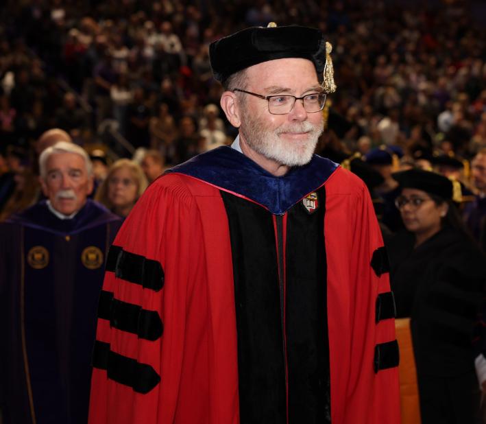
Dr. Bob Kolvoord, JMU’s current Interim Provost, has made his mark on campus in many ways. Starting out as a faculty member in the Integrated Science and Technology (ISAT) department, later as the founding dean of the College of Integrated Science and Engineering (CISE), to his current role as Provost, there have been many chapters in his JMU career, as well as in his career at large.
Kolvoord grew up in northwestern Vermont in a small town called Essex, close to Burlington. He ventured to Virginia to begin his higher education journey, receiving a Bachelor’s degree in Physics and a Master’s in Materials Science from the University of Virginia. Afterward, he earned a Ph.D. in Theoretical and Applied Mechanics (i.e., math-focused engineering) at Cornell University.
At Cornell, Kolvoord concentrated on planetary science and, in particular, Saturn’s rings. Using data from the Voyager spacecraft, this example of remote sensing marked one of his entry points into the geospatial field. While at Cornell, Kolvoord also took a seminar class taught by noted astronomer Carl Sagan.
Later, he went to the University of Arizona for his postdoc, where he researched the science behind how planets form. Through a side project with a colleague in education involving image processing, he discovered a passion for working with teachers.
Kolvoord’s love for the education field grew, and he decided he wanted a classroom of his own. This led him to discover JMU’s new ISAT program, where he was hired as a professor. Early on, he ran summer workshops for teachers based on geospatial technology funded by the National Science Foundation and the state of Virginia. As the GIS field grew, Kolvoord began to wonder if it could be harnessed to motivate and inspire new generations of students.
Twenty years ago, he began to answer this question with the creation of the Geospatial Semester
(GSS), which he co-created with Kathryn Keranen, a former Fairfax County Schools teacher and pioneer of GIS in education. The GSS is a year-long class for juniors and seniors, where they learn about geospatial technologies and apply them to personal choice projects. The program primarily runs in Northern Virginia, in the Loudoun, Fairfax, and Prince William counties.
The GSS began in 2005 with four schools and around 60 students, but in its twentieth year, more than 1000 students are participating. Student projects have varied widely over the years, from maps of Tolkien’s Middle Earth, to a database of space debris, offshore wind farms, and optimal path routing in schools. As a whole, the program has helped market and bolster the JMU Geography program as one of the nation’s best.
In a collaboration with Northwestern University’s Dr. David Uttal, Kolvoord conducted a study on how geospatial projects affect spatial thinking, problem solving, and cognition. Students who participated in the GSS had better spatial vocabulary and displayed more effective spatial/general problem solving. With Georgetown’s Dr. Adam Green, Kolvoord found that the GSS students had different cognition patterns and brain connectivity.
Dr. Bob Kolvoord in his graduation regalia at the December 2024 JMU Commencement ceremony. (photo courtesy of Dr. Kolvoord)
Seven years after co-founding the GSS, Kolvoord became the founding dean of the College of Integrated Science and Engineering in 2012. Although it started from modest beginnings, the college brought together ISAT, Computer Science, Geography, and Engineering while prioritizing a “strong focus on innovation.” Kolvoord served as Dean of CISE from its inception until mid-2024; in general, he enjoys the entrepreneurial mindset of starting things up.
Even as JMU has changed over the years, Kolvoord notices that the university’s ideals have remained consistent.
“The exterior changes, but what hasn’t changed is the focus,” he said. “The whole time, we’ve been focused on high quality education with a strong emphasis on undergrads.”
However, Kolvoord has dealt with change in other facets. As an educator in geospatial technology, he notes the constant focus on keeping lecture content updated.
“You’ve gotta keep up,” he said. “I can’t teach what I taught ten years ago; it’s out of date. It’s stimulating to me. I would much rather have that than be in something where it doesn’t change.”
sees academics at JMU as a whole and makes sure that the colleges have the resources they need to succeed. Among other goals that aim to govern and manage JMU thoughtfully, Kolvoord is looking to make tweaks to the General Education program.
“I’m getting to learn a lot about the areas of campus I wasn’t as familiar with,” he said. “I am at my heart a systems thinker, and this kind of job is really appealing, because there are a bunch of pieces, and you figure out how they work together.”
In addition, the new question of AI’s use in education has Kolvoord warily optimistic, but still thinking about the bigger picture. In a GIS setting, he advocates for understanding why processes work instead of how they work.
“If you’re really good at the why, you can figure out the how,” he said. “If you’re not so good at the why, then you can only get so far with the how.”
In his new role as Interim Provost, Kolvoord over-
Outside of JMU, Kolvoord enjoys traveling, playing hockey, shows at Forbes, and science fiction. For traveling, he has been to all fifty states and about fifty countries. The most recent place he’s traveled to was Xi’An, China, where the Terracotta Army was initially discovered. Kolvoord may be a fan of science fiction, but he is also referenced within the official Star Trek universe. A friend who he used to play hockey with, Naren Shankar, became a writer on Star Trek: The Next Generation, and he consulted Kolvoord to help him with scientific verbiage and accuracy.
In the Season 5 episode “The First Duty,” an advanced flight maneuver called the “Kolvoord Starburst” plays a central role. As such, Kolvoord’s name is in Star Trek encyclopedias and other merchandise. He also displays in his office a model of the ship that performs the maneuver.
As both an educator and administrator, Kolvoord has made a difference at JMU and in our broader Geography communities. After his time as Provost concludes, he plans to return to CISE as a faculty member.
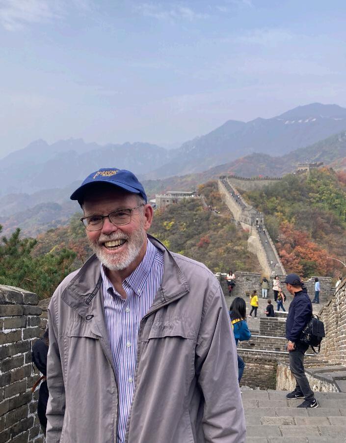
Dr. Bob Kolvoord exploring the Great Wall of China in a Fall 2024 trip to China for JMU. (photo courtesy of Dr. Kolvoord)
Dr. Carole Nash’s Shenandoah National Park projects showcase Cultural Resources Management
12,000-year-old Native American sites. World War II-era training camps.
These are just a few of the interesting resources Dr. Carole Nash has uncovered during her time working in Shenandoah National Park as a consulting archaeologist. As part of the park’s history, archaeological sites on federal lands need to be inventoried and studied to be in compliance with Section 106 of the National Historic Preservation Act. This broader field is known as Cultural Resources Management, and Nash has done this work for decades.
“We’re not just digging holes to see what we can find; we’re rather there to tell a story,” she said.
Nash’s career began as an undergraduate at JMU in the early 1980s, when the Anthropology department was relatively new. As a student, she worked with the Geography program on projects all over Western Virginia writing technical field reports.
“That’s what let me know I really wanted to do archaeology, because I got to see archaeology all over the state,” she said.
ery fifty feet in 1x1 units, and mapped them to determine the site boundaries.
The results were impressive. The team found a former Civilian Conservation Corps (CCC) camp from 1933, a World War II training camp from the Army Corps of Engineers, and multiple Native American sites, including subterranean remains of homes occupied by the Native people who lived there. Throughout the process, Nash and her students lived in an old CCC building that was renovated to function as a lab.
“This big cross section of Virginia history was right there in front of us in the mountains, and so we just kept going back [to Shenandoah National Park] every year after year for twenty years,” she said.
“We’re not just digging holes to see what we can find; we’re rather there to tell a story.”
When Nash returned to JMU as a professor, she contacted the National Park Service to ask who was doing archaeology for Shenandoah National Park. The park responded that they wanted a local university to be involved in the work, and Nash and her students (who she recruits from class or through announcements) became frequent contributors on annual grants.
Nash’s first big Shenandoah project took place in Big Meadows from 2000 to 2004, over the course of yearly eight-week sessions. During this time period, Big Meadows was transitioning to a forest ecosystem, and the park faced questions about its management. Before proceeding in forest management (cutting down trees), Nash’s team searched for archaeological sites in test pits.They dug thousands of pits, placed ev-
After the initial Big Meadows project finished, Nash worked on new grants in and around the park. Over the years, she has worked on 40 grants with around 170 students in Shenandoah National Park. These projects have included a rerouting of the Appalachian Trail to avoid archaeological sites, documenting cemeteries, and working on homestead sites of the families removed in the 1930s when the park was established.
Growing up in the shadow of the Blue Ridge Mountains in Madison County, Nash is very familiar with the park and the mountain ecosystem.
“The mountains are often overlooked,” she said. “What I have found is that there are so many stories to be told, and mountains are sometimes really seen as being on the periphery because they’re hard to get to. There’s a lot of opportunity to learn about a land that has not been studied.”
At JMU, Nash has incorporated her grant work into classes such as GEOG 348 (Indigenous Geographies) and GEOG 415 (Environment, Landscape and Culture), as well as others. In Indigenous Geographies, she explains what it is like to work with contemporary Native communities. Through the organization Virginia Indigenous Nations in Higher Education (which
has members from 20 universities), she helps answer complex questions that provide tribes with resources, as well as ways to tell their stories.
The Native tribes that previously lived within the Shenandoah National Park boundaries spoke the eastern Siouan language; the Monacan Nation is perhaps the largest that has survived, and their history stretches back 15,000 years.
Over the years, Nash’s work has seen changes in terms of the technology used, as well as differing field practices and industry trends. She says that the quantity and quality of newer data is extraordinary, and that updated GIS software has been a “game changer.” Also, even though she’s noticed a recent downward trend of prior outdoor training among her students, they approach the work with similar enthusiasm.
“When you’re working in the mountains, it’s very labor intensive,” she said. “It takes time; you are fighting against a lot of vegetation, you’re fighting that terrain and everything else, so remote sensing has made a huge difference.”
In the future, Nash is looking forward to increased diversity in the field sciences, as well as an increased number of archaeological opportunities. The field crews have been historically diverse in terms of gender, often with female leadership.
“It’s important to me that I let everybody know that they’ve got an opportunity to do this work,” she said.
As a result of the Recovery Act, new archaeological projects are being done in accordance with federally funded infrastructure projects. Nash estimates that society will need around 10,000 well-trained people to do this work in the next ten years, so geographers crossing over into archaeology will be a more common occurrence.
In the end, digging holes can truly teach us a lot about the Earth, as well as our history.
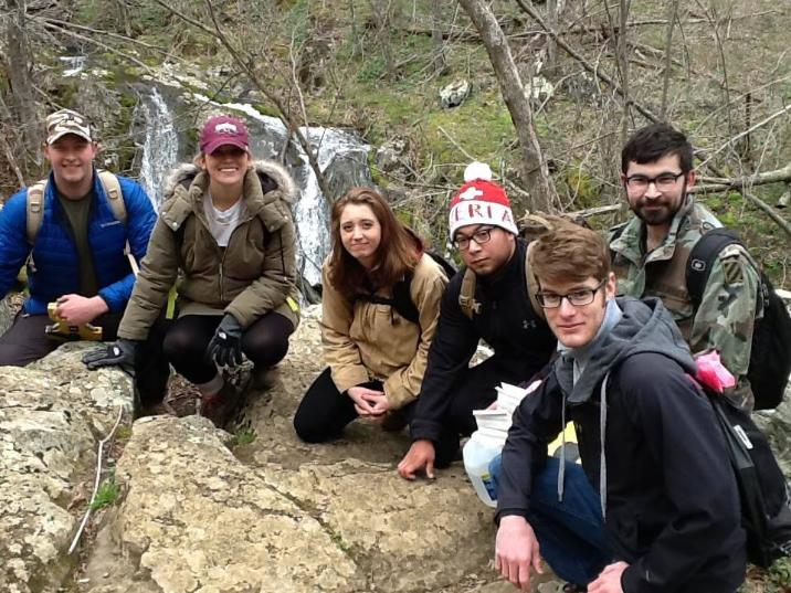
Crew with Dr. Nash at Old Rag Parking Lot Project, Central District, after a day of field work. (photo courtesy of Dr. Nash)
Students working on an acoustic archaeology project at South River Falls, Shenandoah National Park. (photo courtesy of Dr. Nash)
Lily Baugher and Emily Fuller return from a life-changing study abroad in Thailand Student Highlights
Through study abroad, students at JMU are encouraged to learn in extraordinary places around the world all year round. From Italy to Nepal, there’s a program for all majors and interests—for the wandering academic, the backpacker looking for their next adventure, or anyone in between. Two students, Emily Fuller and Lily Baugher, a senior and junior respectively, went on a lifechanging trip that brought them all over Southeast Asia. These two students experienced Thailand up close and personal, along with a brief stop in Malaysia.
During the summer of 2024, Fuller and Baugher stayed in Thailand from July 1st to the 26th. A brief three-night stay in Malaysia showed them how Southeast Asian cultures are intermixed across the region.
Baugher is a Geography major, while Fuller is an International Business major; both have minors in Asian Studies. They studied different aspects of Thai culture and the physical and cultural factors related to location and distribution of tourism resources. They explored Thai lifestyles, visiting temples, museums, and more, all while learning about and experiencing a new culture.
Students above all else, the young women studied two courses during their time abroad: Contemporary Issues in ASEAN (AS 287) and Geographic Tourism (GE 220) at Thammasat University, Bangkok. In their first course, they learned about the different cultures and societies of the Association of Southeast Asian Nations (ASEAN) and the relations they have with each other. In their geographic tourism class, they studied and took field trips that examined trends and the impacts of modernity on tourism from a geographical framework and perspective.
“I really recommend doing something out of your comfort zone, go to a different country and just see how everybody else lives. There are people that are different from me. You get to learn from it, see how they do things differently, and immerse yourself in their culture.”
Fuller emphasizes how important the experience was to her, noting how it has changed her life and given her a clearer sense of self.
“I need people to know how interesting this culture is
and just how interesting studying abroad in general really is,” she said. “I was able to explore new places and also just do things on my own which I've never done before. Being able to explore a foreign country alone just made me feel independent, and I really enjoyed that. I learned that I can be confident in a different country.”
These students found solace in the cultural and geographic differences, but they spent the most time in a place quite familiar to their own home.
“I love going to the mall over there. I'm always going to talk about the mall. I love the mall there because the mall here is way different from the one there,” Fuller said.
Fuller had so many wonderful experiences to recount about Thailand, but a highlight may have been the ten-story, air-conditioned mall. The two lit up as they recalled the hun-
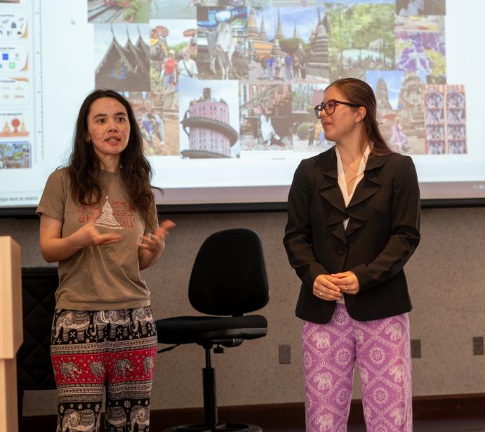
Baugher (left) and Fuller (right) give a presentation on their experiences. (photo by Chris Timothy)
dreds of shops within it, people cooking and serving food from right out of their kitchens, and the lively outdoor markets that brightened their senses with new smells and trinkets they had never seen.
Traditional culture meets modern lifestyles in this shopping place, providing a familiar scene to tourists and making for a comfortable, welcoming place for study abroad students to visit. As a free and air-conditioned destination, malls constitute a unique culture in Asia to escape the “heat” and are a place for people to come together. “They know how to mall,” she said.
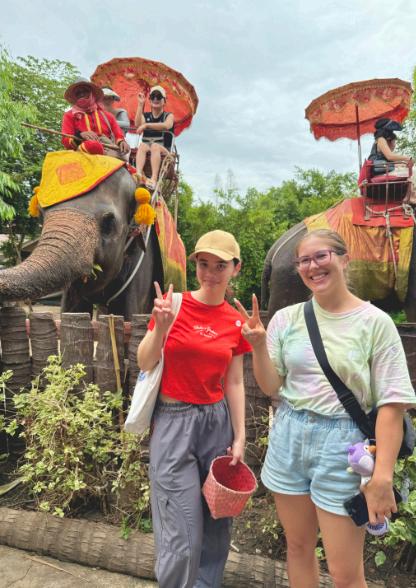
Baugher also added, “We went on multiple field trips that covered specific geographic themes such as history of place, like when we went to the Grand Palace in Bangkok, and Erawan Waterfall, when we delved into eco-tourism. Many more memorable field trips included seeing the process of sustainable farming at a coconut farm, participating in natural resources conservation tourism by feeding elephants, and visiting temples to learn about the rich cultural history of Thailand.”
After all of their time abroad, Fuller and Baugher have learned to appreciate the differences in culture around the world—the familiar and the starkly new. They say their one takeaway is their desire to travel abroad again, to continue exploring the world around them. They both express how incredibly grateful they are to have been able to go on this lifechanging trip, and they urge anyone who is able to study abroad to get outside of their hometown bubble and expand their worldview as they have.
“I think about Thailand every day, basically,” Baugher said. “I reminisce on all the amazing places that we were able to experience.”
If you want to study abroad in a program like this one, reach out to your advisor or a program director to see what opportunities are available. There are semester-long options spanning several months, or shorter programs that run for one or more weeks. If you feel your budget won’t allow you to study abroad, JMU’s Center for Global Engagement (CGE) also offers study abroad scholarships.
Fuller reminisced on the experience she and Baugher had together and will share for the rest of their lives. She shared that the trip changed their perspectives on the world outside of them and made their world a little bit bigger, and Baugher shares that sentiment.
Fuller and Baugher made their way across the globe and have come back as different, brighter, and more insightful people—and it’s an experience that they won’t soon forget.
1. Thai curry
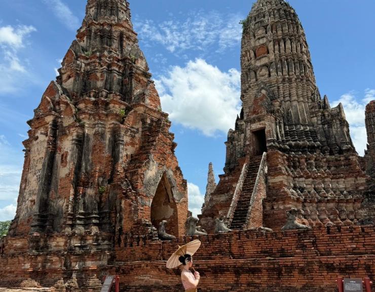
2. Wat Pho, Buddhist Temple in Bangkok
3. Chinatown 4. Chang Puak Camp, Elephant Farm
Wat Chiawattanaram, Temple in Ban Pam. (photos courtesy of Emily Fuller and Lily Baugher)
Climate Science Minor Interview with Dr. Mace Bentley
What’s the general overview of the Climate Science minor, and what are some of the requirements?
The Climate Science minor’s initial goal was to introduce students to climate science—what it is and what it entails, in a general sense. The minor is not developed to give students a deep background in climate science; that requires a lot of preparatory math and physics courses. We wanted to make the minor accessible to not just the students in Geography and Geology, but also students across campus. Any student with an interest in climate can take this minor, develop introductory experience, utilize it in their own fields; or if they want to build up a deeper knowledge in climatology, then we would recommend they go to graduate school. There’s three major sections to the minor. First, you need an introductory lecture and lab course. Secondly, 3–4 courses are required in what’s called a “content-specific” component—those will be the courses that really focus on climatology or meteorology, anything from Climatology, Global Climate Change, Weather Climate and Society, to Dynamics of the Atmosphere, and Geochemistry. Finally, there’s at least one course that would develop an analytical skill. For geography this tends to be either the Intro to GIS course (GEOG 215) or the Intro to Remote Sensing (GEOG 216) course. You can also fulfill the analytical skills requirement with a statistics or a math course. If you’re still short of the 18 credits that you need for the minor, then there’s an “other course” section which includes climate-related courses.
What do you want students to take away from the program?
The Climate Science minor is especially good for students who have an interest in climate science that goes deeper than just wanting to take one or two classes to complement their Geography degree. The Climate Science minor, because it’s going to show up on your transcript, is for students seriously thinking about a career path or academic path in graduate school that would involve more climatology. Climate
“The language of science… is mathematics.”
Science will give you the application side to your skills—you can say “I have taken an AGIS track but I am applying my skill set; I am learning climate science.” It’s also good if you’re interested in a custom concentration and want to tailor your degree to something more environmentally-related. However, you don’t want to do a Climate Science Custom Concentration and a Climate Science minor, because at that point you’re focusing yourself too much.
What are some surprising things that come up in this minor that wouldn’t come to mind when most students think about climate science?
“Climate science involves a lot more than just global climate change.“
Climate science involves a lot more than just global climate change. Global climate change is a component, and it’s an important component, but there are other areas in climate science that we discuss where we look at different scales. I like to focus on the urban scale, because of my research. A lot of students don’t realize that the place where we’re seeing significant changes (with evidence) due to humans is on the urban scale. It also happens to be the way that the world is reorganizing with human settlements—virtually all settlements are urbanizing. Looking at that scale from a climate sense, and how it interacts with the climate system, the city itself is very important.
Another focus is on extreme weather impacts on underlying populations. As more people move to the coastline, for instance, they put themselves in harm’s way of events like hurricanes. So even though you may have had a hurricane hit a similar portion of coastline in Florida 25 years ago, today that impact might double or triple simply because there are more people living where the storm made landfall. It’s not just climate that we focus on, but the impacts of climate on societies, and climate and land cover are both changing.
What are some standout classes in the minor?
For geography, in the content-specific section of the minor, some of the main classes are Climatology (GEOG 327), Weather Climate and Society (GEOG 330), etc. Oftentimes, faculty will offer courses on rotating topics that also fit well in this section, such as GEOG 470 Senior Seminars, GEOG 350 Special Topics, or GEOG 310 Environmental Issues on various climate topics. I also offer a course called Dynamics of the Atmosphere (GEOG 430) to give students exposure to the mathematical foundations of climate and meteorology and how we try to represent that using “the language of science,” which is mathematics.
Minor
Requirements
1) Introductory lecture and lab courses serve as an entry point to the program (4 credits total).
2) Content-specific courses build domain knowledge in climate science (minimum of 3 courses).
3) A minimum of one course focused on mathematical and/or data analytical skills provides tools necessary for working with scientific data.
4) The remaining credit hours needed to fulfill the 18 credithour minimum requirement may consist of additional courses that are closely aligned with climate science, such as undergraduate research, internships and honors theses, upon approval by the program director(s).
Total Credits: 18
Dr. Mace Bentley. (photo by Elise Trissel)
Dr. Justin Hartnett’s work on climate change displays environmental variations
Although he grew up in upstate New York, Dr. Justin Hartnett has always had a passion for the ocean. This led him to pursue his Bachelor’s degree in Marine Science (with a Physics concentration) at Coastal Carolina University.
After getting in contact with a faculty member researching hurricanes, he attended the University of South Florida (USF), where he researched with her, and graduated with a Master’s degree in Environmental Science and Policy. While attending USF, Hartnett discovered interesting snowfall patterns in the Eastern Great Lakes Basin, which led him back up to New York. After USF, Hartnett attended Syracuse University and received his Ph.D. in Geography.
During his graduate studies, Hartnett discovered his passion for education through being a teaching assistant. In this capacity, he was able to run discussions, as well as design lectures and labs—some of which are used in his current classes.
community. He has partnered with local schools, having students build coursework and develop academic material to give to schools around the area.
Hartnett’s current research revolves around snowfall in the Eastern Great Lakes. Hartnett describes it as “understanding how snowfall is changing in that area in terms of long-term trends, but specifically trying to delineate the different types of snowstorms.” The area falls in the intersection of a couple snow basins, meaning they receive snow from the coastal storms off the East Coast, as well as midwestern and Canadian storms. They also receive lake effect snow, adding to the heavy amount of snow received.
“Don't be scared to fail. Don’t be scared to take courses where you might struggle.”
One of Hartnett’s favorite lab assignments is the El Niño lab, which combines two important parts of physical geography: theoretical knowledge of our surroundings and practical skills such as Excel, GIS, scientific communication, and more. This lab takes both sides and meshes them together in order to help students understand class topics as well as relevant skills for their geographical futures.
Hartnett taught a senior seminar on climate change and extreme weather (GEOG 469 + 470), as well as GEOG 210, a physical geography class required for all geography majors. The class covers the five physical spheres of the Earth (atmosphere, biosphere, cryosphere, hydrosphere, geosphere), and teaches why features exist, how they interact, and how they change over time. “It’s like everything in our environment,” he said.
Hartnett wishes to get more involved in the
Historically, researchers expected an increase in lake effect snow and a decrease in non-lake effect. Hartnett is trying to look at how each individual event will change, rather than relying on circumstantial evidence.
Away from teaching and research, Hartnett is a huge sports fan—both playing and watching. Also, he enjoys going for hikes, gardening, boating, scuba, snorkeling, and just getting outside whenever possible.
Hartnett has some lasting advice for geography students. He says that one of his regrets from school is avoiding courses because he was nervous about not succeeding. “Don't be scared to fail. Don’t be scared to take courses where you might struggle,” he said. The knowledge and experience you gain from taking challenging courses will end up benefiting you in the future.
In bittersweet news, Hartnett has been recruited back to his previous institution, Colgate University, for a tenure-track opportunity in his line of work.We thank him for his contributions to JMU and wish him all the best.
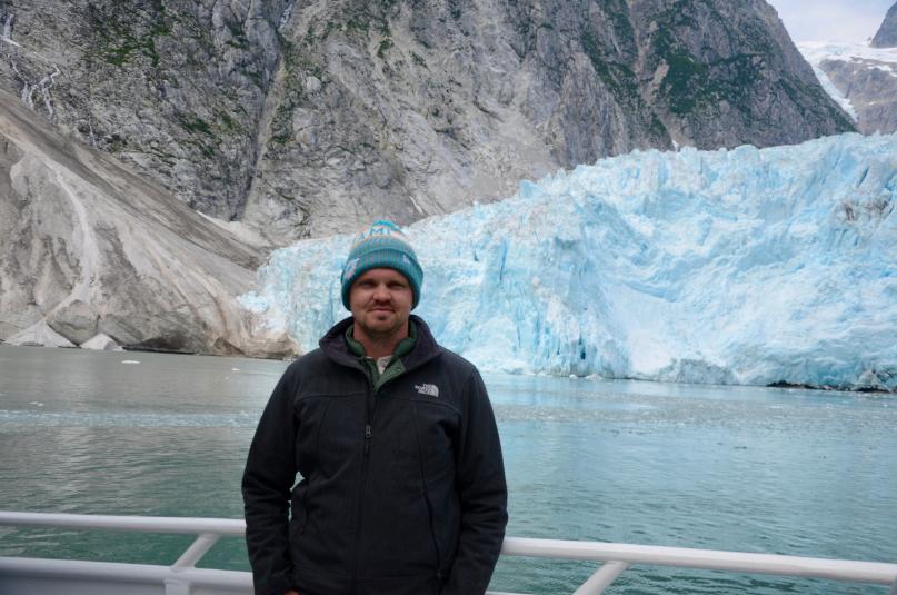
“This photo is also from July 2021 visiting the Kenai Fjords National Park. I took a boat out of Seward, Alaska to visit the glaciers and search for marine life. Having an undergrad degree in Marine Science, I like to spend as much time as possible on the water, and really enjoy searching for marine and wildlife.”
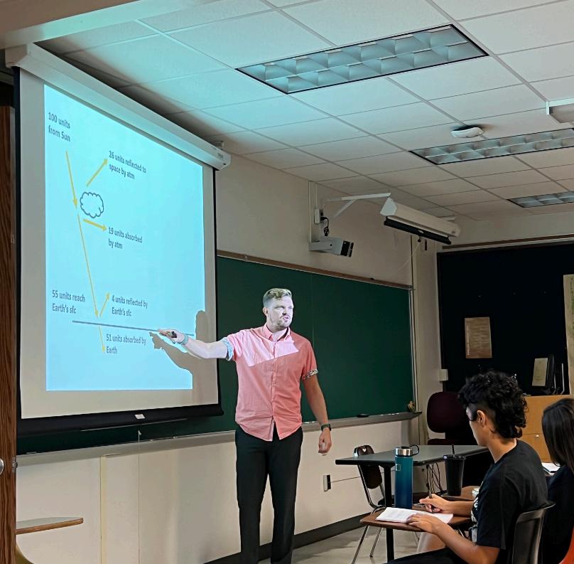
“In this photo, I’m teaching at my previous institution (SUNY Oneonta). This lecture is on the radiation—both incoming solar and outgoing terrestrial—in Physical Geography. This is one of my favorite lectures as we discuss concepts such as electromagnetic radiation, albedo, the ozone layer, and greenhouse gases.”
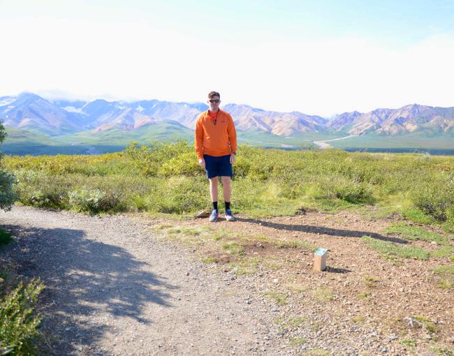
“This photo is of a trip to Alaska in July 2021. The photo is of the Polychrome Overlook in Denali National Park. One of my goals is to visit all 63 national parks.”
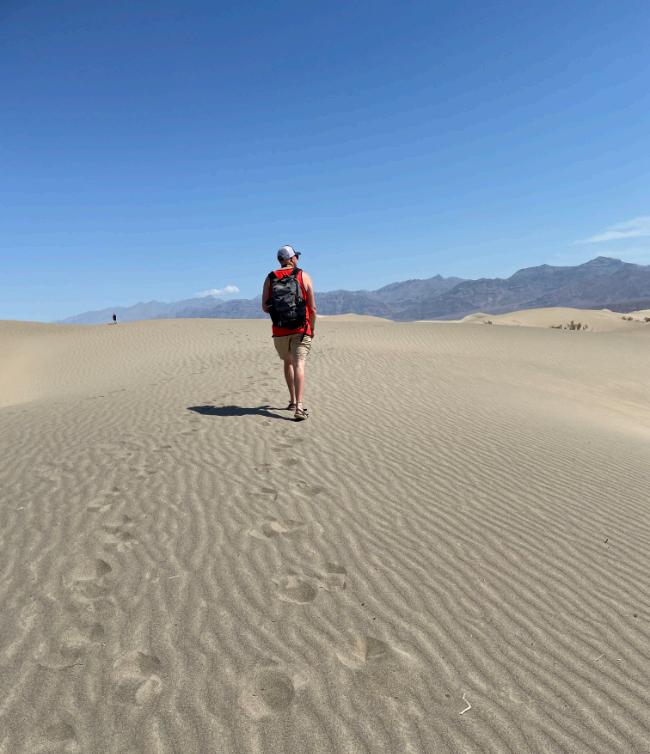
“This photo is from Death Valley National Park in May 2023. Although I spend most of the time searching for wildlife in national parks, Death Valley was extremely fascinating due to the diverse landscapes that are found here. Prior to visiting, I knew that Death Valley holds the record for hottest temperature on Earth, but I was not expecting to come across such diverse landscapes (rock formations, sand dunes, salt flats, and desert shrub).“
(photos courtesy of Dr. Hartnett)
Dr. Adam Dohrenwend brings his skills in Environmental Justice to JMU
Growing up in upstate New York, in the Catskill Mountains that connect to the Blue Ridge Mountains of the Shenandoah Valley, Dr. Adam Dohrenwend had an early connection to JMU. However, the journey he took to arrive in Harrisonburg is an interesting one.
Dohrenwend attended schools such as SUNY Geneseo (B.A. in Geography), University of Kansas (M.A. in Geography), and Louisiana State University (Ph.D. in Geography). And even though he has a comfortable place here at JMU, Dohrenwend has covered a lot of ground in his career already.
“People inherently are geographical beings,” Dohrenwend said, “taking space, making place, etc.; giving meaning to locations along the coordinate grid… Geography at its heart is about trying to understand why places are the way that they are.”
Dohrenwend’s early research was focused on the production of yerba mate (a caffeinated drink) in Argentina. Yerba mate, which he dubs as “kind of like bougie tea,” can help heal the body by boosting energy, improving physical performance, protecting against cancers, and more. Much of his research is detailed in a book titled Green Gold, published in October 2021. Unfortunately, before he could dive even deeper into yerba mate, the COVID-19 pandemic cut Dohrenwend’s work short.
“People inherently are geographical beings, taking space, making place, etc.; giving meaning to locations along the coordinate grid… Geography at its heart is about trying to understand why places are the way that they are.”
To help areas feeling the effects of toxic exposure and environmental degradation in Cancer Alley, Dohrenwend joined RISE St. James (RSJ), an environmental justice organization located in St. James Parish, Louisiana. Dohrenwend teamed up with RSJ, representing them at events, serving food, going to court cases, and all the while working closely with RSJ’s founder Sharon Lavigne. Lavigne, who visited JMU this spring to meet with students, faculty, and community organizations, was the 2021 recipient of the Goldman Environmental Prize, the 2022 recipient of the Laetare Medal (the highest honor for American Catholics), and was also a named to the 2024 TIME100 and 2023 TIME100 Climate lists.
Dohrenwend has also collaborated with groups such as the Concerned Citizens of Saint John (which also operates in Cancer Alley), United Steelworkers, International Brotherhood of Electrical Workers, True Transition, AFL-CIO, and more.
Throughout his research and outreach focusing on environmental justice, Dohrenwend has learned about the important topics of class and economic justice in places like Cancer Alley.
Pulling focus from yerba mate, Dohrenwend discovered Cancer Alley, an area full of oil refineries, chemical plants, and toxic waste dumps that runs along the Mississippi River between Baton Rouge and New Orleans.The region produces about a third of the nation’s plastics and petrochemicals and accounts for about a fifth of the nation’s oil refining capacity. When Dohrenwend started creating a map of the area in early 2021, he discovered that the footprints of most of these facilities were within a single racially gerrymandered congressional district.
Many workers in Cancer Alley know the risks that they’re taking at work, but they largely stay in their jobs due to the area’s limited economic opportunities. Climate solutions such as switching to green energy could vastly cut jobs for those workers, which tightens the situation further. Finally, political pressures like gerrymandering along racial lines can cut off the abilities of communities to cooperate in areas such as Cancer Alley. Dohrenwend has brought a geographical perspective to all of these issues.
Currently at JMU, Dohrenwend is helping students through classes like GEOG 200 (Geography: The Global Dimension) and GEOG 308 (Environment, Nature and Society), which is all about the relationships
between humans and their environment. In the future, he hopes to teach classes such as Geography of Appalachia, Geography of Poverty, Physical Geography, Geography of Latin America, Geography of Europe, Political Geography, and next semester, Population Geography. Although he is new to JMU, he enjoys the engaged students, friendly colleagues, and the opportunity to serve as a faculty advisor for the Geography Club and Gamma Theta Upsilon, the Geography honor society.
Broadening to Harrisonburg as a whole, Dohrenwend enjoys gazing at the mountain range that connects him to his hometown, the walkability of downtown, the Farmer’s Market (he recommends the wasabi chicken salad), and perhaps most importantly: owning a dishwasher for the first time in his life. For hobbies, Dohrenwend is an avid traveler who has been to fortyfive states and fifty-five countries. He relishes experiencing new cultures and exploring new landscapes, which connect back to themes seen in his geography classes here at JMU.
Dohrenwend has a lot to offer at JMU, including advice to students. He recommends that students go beyond their degree requirements by taking advantage of the geography program’s breadth of courses. He also advises all geography students to join the Geography Club as well as GTU, as they can help in developing one’s geography skills. And one day, it may be possible for you to solve the very same issues that Dohrenwend works to bring to light.
(photos courtesy
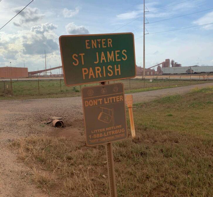
Top: River Road Anti-Littering Hotline sign caked in red dust, along with the surrounding landscape, emitted from an adjacent industrial facility—the only one of its kind in the United States—at the St. James/St. John the Baptist Parish Line, Louisiana, in 2021.
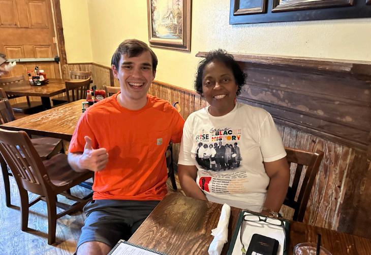
Middle: Dohrenwend and Sharon Lavigne, Founder and Executive Director of Rise St. James, in Baton Rouge, Louisiana, in 2024.
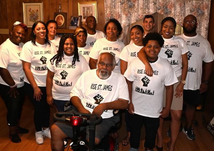
Bottom: Rise St. James group photo at the home of Milton Cayette (front)—Lavigne’s brother, retired industrial worker, and President of Rise St. James—in St. James, Louisiana, in 2023.
of Dr. Dohrenwend)
Words of Wisdom
“Be present —
keep showing up and paying attention.” — Dr. Carole Nash
“Boundless
curiosity is the secret sauce that makes every endeavor more intriguing and every life more interesting.” — Dr. Bob Kolvoord
“Live and learn — do your best.”
— Prof. Manita Khemthong
“In the words of Elbert Hubbard, ʻdo not take life too seriously–you will never get out of it alive.’” — Dr. Adam Dohrenwend
“Why make things difficult? With a little effort, you can make them impossible.” — Dr. Mace Bentley
“Ask good questions! And always listen closely to the answers you receive.” — Dr. Galen Murton
“Be curious, slow down, and take a lot of walks around trees.” — Dr. Kayla Yurco
“When resilience seems hard to come by, tap into your resourcefulness.” — Dr. Dudley Bonsal
“People on their deathbeds never wish they had spent more time working.” — Dr. Zachary Bortolot
Dr. Xiaojing Tang’s SERVIR grant displays a cross-section of physical and human geography
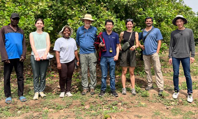
Some geospatial work may be done from behind a desk, but one JMU Geography professor’s recent research shows otherwise. In recent years, Dr. Xiaojing Tang has contributed to a project in West Africa that monitors land cover change in the area. Last March, he and other team members took a trip to Ghana to compare their results with the real environment on the ground.
Tang’s greater research focuses on using Earth observation to monitor land cover change, and this project falls right in line with that goal. As a whole, the project aims to develop near real-time monitoring algorithms and maps using NASA satellite data that can help African stakeholders manage their land more efficiently. Upon completion, the team hopes to transfer the knowledge completely so that those stakeholders can use the tools without assistance.
The team consists of Tang, three Ph.D. students from Boston University (BU), Curtis Woodcock (Tang’s former advisor from BU), a professor from the University of Florida, as well as two collaborators from the University of Ghana. In addition, thenJMU students and now alumni Madison Barrett and Amanda Acord worked on the project in 2023 and presented results at that year’s American Geophysical Union (AGU) conference in December.
global hubs across the world which help bring regional stakeholders together.
“They have their needs in terms of how they use Earth observations and satellite images to help them better manage their land, deal with climate change, deal with weather forecasting, air quality, health issues, and ecosystem management,” Tang said.
The project was based in Ghana but also served other surrounding West African countries. Aside from monitoring general land cover change, the team specifically studied the driving causes of forest changes. On the ground, the team prioritized interacting with stakeholders face-to-face and comparing the satellite references with the actual environment.
The project was funded through SERVIR (Spanish for ‘to serve’), which is a joint program between NASA and USAID. The program does outreach work and helps connect communities’ local needs to spacebased technology. As an organization, SERVIR has
“You can see things in the satellite images, but there are a lot of things you learn by going there and seeing it in person,” Tang said. “By talking to the farmers, you learn a lot.”
After flying into the capital, Accra, the team began driving to a series of test points to conduct ground truthing (in-person verification of land that was marked as recently-changed, or of an unknown plantation type). Some were close to the often bumpy dirt roads, but others were in the brush and off the beaten path. Very quickly, the team realized the difficulties of figuring out your location without a functioning phone.
“We’re so used to the technology; you pull out your phone, open Google Maps, and you know where you are,” Tang said. “In the field, it’s actually not that easy.”
Dr. Tang and collaborators from the University of Ghana trying to locate landscape changes in the field without internet access. (photo courtesy of Dr. Tang)
To solve this, they printed out maps beforehand, which required some adjustment to efficiently use and find the site locations. As they were in the field for five days and examined seven to eight sites per day, Tang estimates that the team investigated 35–40 sites over the course of the trip. They stayed at each site for around half an hour—some of the sites took half an hour of walking to reach.
The team was unable to visit some of the sites due to cultural reasons as well as safety. One of the sites in a forest reserve, for example, was off-limits due to gold mining activity.
Throughout the trip, Tang noticed fascinating aspects of his surroundings, such as massive termite mounds, goats roaming free, and community members’ practice of carrying items on their heads. He also appreciated their friendly nature, and their willingness to share information, history, and their personal experiences.
Future Plans
Dr. Tang is also working on a new, separate land cover project funded by NASA, which aims to better quantify urban albedo change in U.S. weather models. The project will begin in May 2025 as a collaboration with Boston University and the University of Massachusetts, and it invites JMU undergraduates to assist through research opportunities.
hubs and diverse project themes together to a central location.
“You get to really talk to the stakeholders in person, build those relationships, and listen to what they really need, instead of what you think they need,” he said.
As of Spring 2025, the SERVIR program has been terminated as part of the recent efforts to downsize the federal government. The interagency agreement between USAID and NASA, as well as the agreements between USAID and the international partners, have all been cancelled. Without USAID, NASA cannot continue this program and therefore has chosen to terminate the SERVIR program and any future solicitation.
“You can see things in the satellite images, but there are a lot of things you learn by going there and seeing it in person… by talking to the farmers, you learn a lot.”
As a whole, the project runs for three years. The first year focused on developing and working on the satellite image algorithm; the second year encompassed the Ghana field study; the third year will prepare the results to be shared with the stakeholders. Now in the third year, Tang is preparing for this iteration of the project’s conclusion.
Tang also traveled to a SERVIR conference in Morocco in November, which brought all of the global
Tang plans to continue the current collaboration with the University of Ghana and the important research work.
“We have built a network and a family with SERVIR, and the collaboration on scientific exploration will continue with or without funding support,” Tang said.
Until then, he is satisfied with the way he’s helped benefit the world around him.
“It feels like you’re making a real change,” he said. “Other research projects feel like you’re some distance away from real application and real change. With this one, you’re working with the stakeholders; they’re actually going to make use of your map and make policy changes.”
Dr. Tang and collaborators visited a village and talked to local farmers to learn about smallholder farming practices in Ghana.
(photo courtesy of Dr. Tang)
Opportunities, Jobs, International - Bryan Ouellette
People, Perspective, Environment - Leo Romano
Earth, Human, Connection - Isabel Kinney
Exploration, Discovery, Freedom - Jackson Joseph
Caring, Visual, Environmental - Lyla Mussie
Exploration, Collaboration, Foundation - Nicholas Westfall
Part of Everything - Tyler Yu
Interesting, New, Exciting - Carter Deffaa
Sustainability, Growth, Conscience - Ashe King
Space and Place - Shane Slaydon
Climate, Change, Real - Thomas Cochrane
Vast, Diverse, Ecosystem - Keegan Polson
World Written-Down - Teddy Umbrell
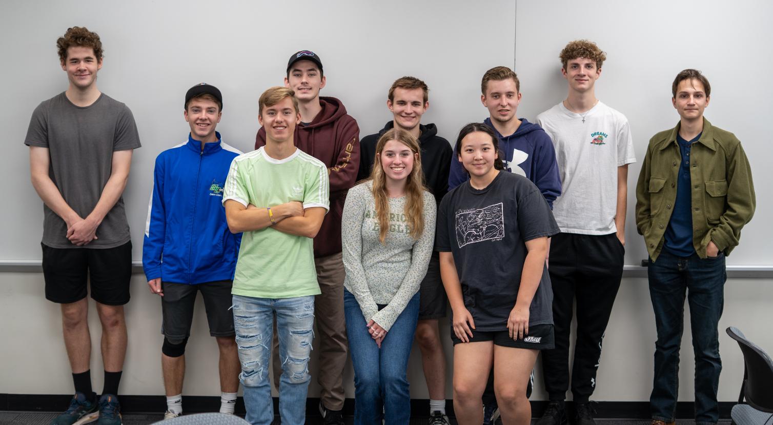
Geography in Three Words: Class of 2028 First-Year Edition
A World’s Perspective - Jack Pilkinton Conservation, Place, Future - Sydney Germond
Back row (from left): Evan Hogue, Teddy Umbrell, Jackson Joseph, Carter Deffaa, Nicholas Westfall, Bryan Ouellette, Linus Kantanis. Bottom row (from left): Keegan Polson, Sydney Germond, Tyler Yu.
Luke Ellis
Luke Ellis is a senior in the JMU Geography Program and has a custom concentration in Climate Science, along with a minor in Environmental Science. He discovered the custom concentration option when he attended a major/minor fair. He talked to Dr. Mace Bentley, the custom concentration advisor, and explained that he wanted to work with weather and perhaps go into the field of meteorology or climate in general. Although JMU doesn’t offer meteorology as a major, Bentley introduced him to the possibility of a Climate Science Concentration in Geography.
The custom concentration is a less common concentration option for Geography majors since most majors concentrate in AGIS or ECSD. Custom concentrations give students the chance to customize their coursework to fit a field of study they want to learn about, particularly if JMU does not offer a major or minor in that subject. Students must meet with a faculty advisor to build their concentration and fill out a form outlining six classes that relate to each other under a theme of the student’s choice. Two of those classes have to be 400-level or above.
An interesting component about the custom concentration is that three courses taken outside of the Geography Program can count for the concentration. A “methods” course is also required for the concentration—this is a course that teaches the student how to convey their concentration to others. It does not need to be a Geography course; for example, it can be a speech or communication class instead. The student will also name the concentration after the subject they want to study. After the forms are filled out, a copy will be given to the Geography Program Advisor Ms. Kimberly Stewart, as well as to the Registrar’s office. Later in their college career, the student can still make changes: the form can be altered and resubmitted at any point during the student’s time at JMU.
Ellis’s Climate Science Concentration includes a lot of the same classes as the Climate Science Minor, but it goes more in detail about his subjects of interest. Ellis said, “I take a wide array of classes from different clusters of geography.” He also takes a mixture of ECSD and AGIS classes, including cartography, to round out his education. [For more information about the Climate Science minor, please refer to the Climate Science minor article.]
Some of Ellis’s favorite classes have been weatherfocused. Meteorology (GEOL 320) was a class that he particularly liked because it gave him a good basis in his field of interest. Even though it was a geology course, it still counted for his custom concentration. He also enjoyed Dr. Mary Kimsey’s Natural Disasters course (GEOG 301) because he became intrigued with studying different natural disasters and learning how they form. “That class really opened my eyes to maybe a future in that, if not climate science,” Ellis said.
Custom Concentrations
“Custom concentrations give students the chance to customize their coursework to fit a field of study they want to learn about.”
Ellis worked closely with Bentley and Stewart when picking classes. When arranging his schedule, he tries to connect his classes to meteorology or climate when possible. Ellis has noted that there are a lot of classes in the Geography Program that involve climate and weather, so finding and getting into interesting classes has not been too difficult. On the other hand, the requirements for his Environmental Science Minor required more classes outside of Geography. Nevertheless, he has been able to find links to climate in some of them.
“One of the reasons why I stuck with the Environmental Sciences Minor was because a lot of geography classes for my major also count for my minor. I think four classes I have taken for my major have also double counted for my minor, so I haven’t had to take that many classes for the minor. I think it is a good minor to pair with geography,” he said.
The Geography Program itself requires an “advance sequence” for all concentrations, which is considered to be like a capstone for senior students. This can be completed with two 400-level courses, or students can choose to do an independent research project. Ellis is very excited to work with Dr. Weiming Hu and Kimsey for research on the Dale Weather Station in Bridgewater, VA. “I would much rather be doing research on something like that than taking a random one-credit class,” he said.
For the future, Ellis is looking for a career in a weather-related job. Originally, he wanted to be a meteorologist, which he still considers a possibility, but he is also considering jobs in government organizations such as the National Oceanic and Atmospheric Administration (NOAA), the National Weather Service, the Federal Emergency Management Agency (FEMA), and other meteorological jobs. He is currently looking into internships at FEMA, as he believes that would be a good entryway into the field. Ellis knows that many companies and organizations hire JMU alumni, and he hopes employers will see his custom concentration in Climate Science and be interested in his unique qualifications.
The idea for the custom concentration is for it to be an option that allows students to pursue their interests while guided by faculty within the program. By following a unique educational journey, students cultivate an expertise they are passionate about that will also prepare them for their prospective job fields.
LLucie Griffith
ucie Griffith graduated from JMU in December 2024 and was a Geography major. She completed a custom concentration in Geospatial Analysis, as well as minors in Environmental Science and Honors Interdisciplinary Studies.
Originally, Griffith came to JMU as SMAD major but switched to Geography since she wanted to study environmental sciences. After taking Dr. Mace Bentley’s Physical Geography (GEOG 210) class, Bentley introduced her to the custom concentration option.
“I ended up taking one of the custom concentration lists and refitting it more to fit my needs,” she said. “I think I took one that was another version of the AGIS concentration, added a little bit more math and statistics to round me out, and named it Geospatial Analysis. It ended up being really good because I got to take classes that I felt were the most beneficial to me and my path through this major rather than something that was curated for the masses.”
Griffith “fell in love, unexpectedly, with the AGIS side” of Geography.
“I think a lot of people take Geography because of the appeal of the environmental side, especially since JMU doesn’t have an Environmental Science major, and I think people fall into Geography kind of as a backup option. I could have taken the ECSD track, done a lot of ecosystem studies and environmental stuff—only later, I would find out that ECSD was more like human geography, and AGIS focuses more on GIS.”
Between her major, minors, and concentration requirements, scheduling was a challenge. According to Griffith, she had a big color-coded spreadsheet.
“The benefit of the custom concentration is that students are able to work towards a major focus they decide for themselves… and buildsomethingthatwasspecificto theexperience.”
“When I had questions about specific things, I had to type them up, make them organized, and bring them to the meetings with my advisors,” she said. “Usually, it was with Bentley; sometimes it was with my minor advisor, Dr. Bruce Wiggins. I always went into my meetings knowing exactly what I needed so that I was taking the needed credits. Your advisors are really helpful, but you need to know what classes you need to take for the custom concentration. The advisors have so many things going on that they can’t fully be researching your schedule for you. They are there to help you, not work for you.”
When thinking about balancing academics and a social life, Griffith recommended finding friends who similarly value academics so that you can all work together and hang out simultaneously.
“When you are in college, academics should be your number one; it is your job, but that doesn’t mean you should let your social life fall to the side.”
The benefit of the custom concentration is that it is custom; students are able to work towards a major focus they decide for themselves. For Griffith, she could “build something that was specific to the experience that [she] wanted at JMU.”
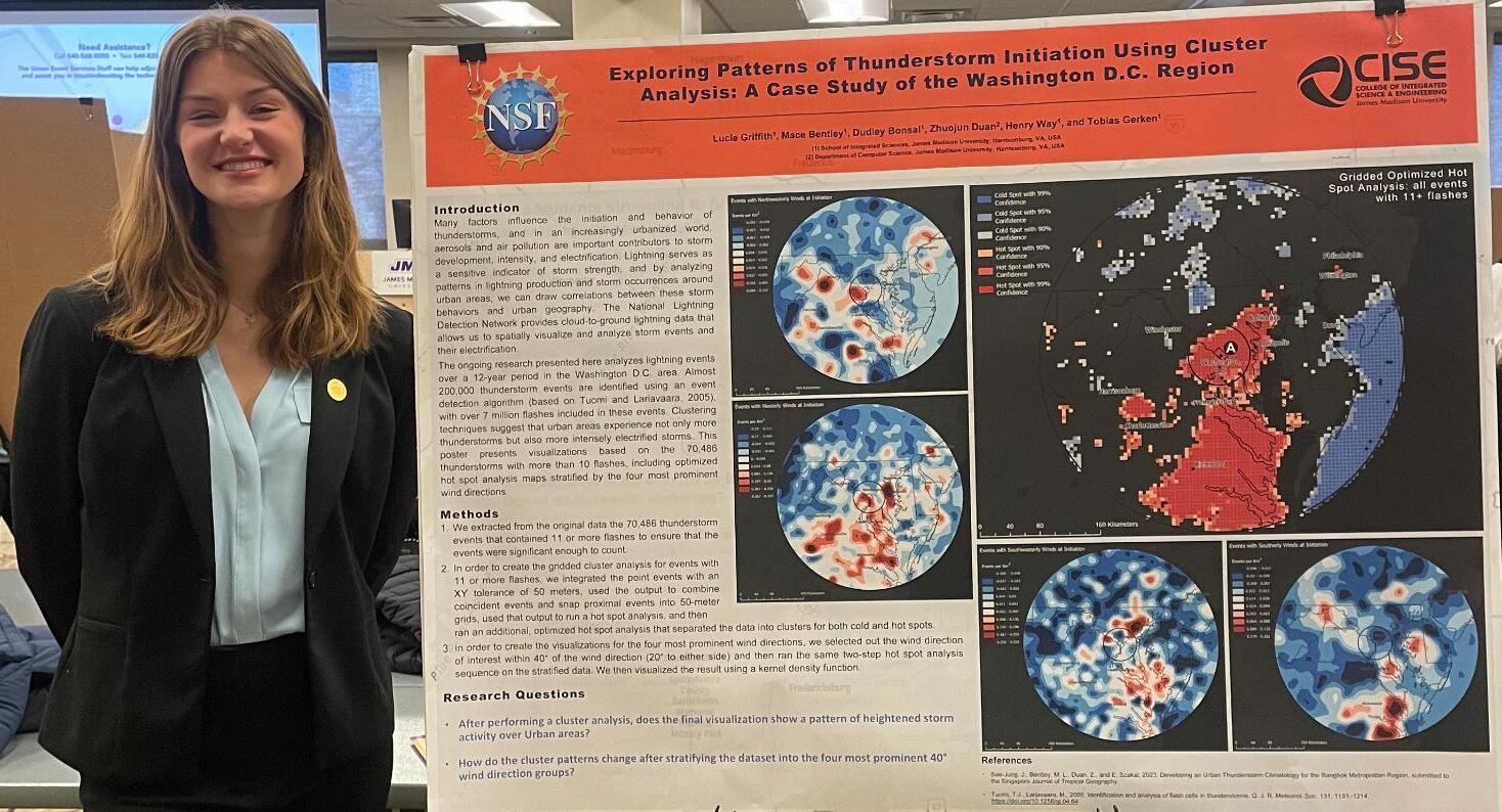
Griffith took many classes throughout her college career, but she said that the best course she took was Cartography (GEOG 365) with Dr. Dudley Bonsal. While it was not an easy class, according to Griffith, never before had she taken a class where she learned and retained more material that was relevant to her major. Relatedly, her favorite college experience was joining Bentley and Bonsal on their National Science Foundation (NSF) research grant about urban thunderstorms, where she gained practical experience in her area of study for the first time.
“It made me feel more confident in my skills,” she said. “It was a really valuable and awesome learning experience. I got the opportunity to go to the Southeastern Division of the American Association of Geographers (SEDAG) and present my research as part of the project. Later, I presented it at the Honors Symposium at JMU. I also was able to be an author on one of the research papers from the project, and I submitted it for an honors thesis. It’s still one of the craziest things ever.”
After graduating JMU, Griffith is expanding on her work with mapping and AGIS technology. Griffith now works as an environmental consultant at Balzer & Associates, Inc. Her job includes regulating and maintaining wetlands and working with related legal procedures, such as determining construction sites, floodplain studies, wetland feasibility studies, and wetland delineation records. “I majored and concentrated on mapping, and I still make maps at work,” she said. “We use different technology for it; we use AutoCAD with ArcGIS, and we also use ArcGIS Online to store data.”
Griffith also monitors nutrient banks: if someone builds over a wetland, they need to buy credits so that the net nutrient storage for the Chesapeake Bay has no net loss.
“I count the trees and I map the trees,” she said. “We make it really hard to build over the wetlands.” Overall, Griffith summarized, “Between my major, my minors, and my concentration, I was able to build a schedule that was well-rounded enough for me to have enough of a basis in everything to do well at my job now.”
Lucie Griffith presenting NSF grant research at the JMU Honor Symposium in December 2024. (photo courtesy of Lucie Griffith)
Photos by: Samaire Fleming
“Dragon” by: Fiona Anderson
Environmental Justice Sharon Lavigne
In early April, JMU Geography, in conjunction with the College of Integrated Science and Engineering, hosted noted environmental justice activist Sharon Lavigne. Lavigne, founder and executive director of Rise St. James, 2024 TIME100, 2023 TIME Climate 100, 2022 Lataere Medal, and 2021 Goldman Environmental Prize honoree, retired career public school special education teacher, grandmother, and partner in new faculty member Dr. Adam Dohrenwend’s research, visited us from the heart of Louisiana’s Cancer Alley—St. James.
Spanning a 103-mile long crescent along the lower Mississippi River and bookended by the Baton Rouge and New Orleans metropolitan areas, Cancer Alley is home to 378 industrial facilities, interspersed by remaining sugar plantations that had formerly long dominated the region’s landscape. The facilities are attracted to this part of Louisiana due to its strategic position along the lower Mississippi River, abundance of large consolidated lots (former sugar plantations), proximity to Gulf Coast petroleum extraction, lax labor and environmental regulatory climate and long unique form of industrial tax exemption system, and electoral disenfranchisement of most of the population until the Civil Rights Era. Today the region accounts for roughly a fifth of the United States’ petroleum refining capacity, a quarter of petrochemical and plastics production, and numerous other industrial and waste disposal ventures. Its communities also feature among the country’s highest cancer risks—long denied by industrial public relations departments and many prominent politicians. Once a source of abundant well-paying but hazardous jobs, while industry’s geographical footprint has grown, corporate consolidation, automation, and the ascent of outside contractor labor have brought depressed employment and stagnant wages. Geographers refer to places like Cancer Alley, many dotting the United States and the rest of the globe (but few at the same scale), as sacrifice zones.
DuPont Plant, Waynesboro, Virginia. (photo courtesy of Dr. Dohrenwend)
Sharon Lavigne. (photo courtesy of Sharon Lavigne)
Story by Dr. Adam Dohrenwend
With twelve major industrial polluters in a short radius of her home already, when Formosa Plastics Corporation proposed its “Sunshine Project” in 2018 (what would be the largest plastics complex in North America), Lavigne organized with her neighbors, many of them direct descendants of those enslaved by “King Sugar,” to challenge it. Construction still has not started. Together, their mission is to challenge the growing domination of the area by largely tax-exempt and heavily polluting megafacilities, whose economic bounty flows elsewhere.
Lavigne’s visit highlighted her David vs. Goliath fight against Formosa Plastics Corporation, as well as the history and prospects of the broader movement for environmental and economic justice in Cancer Alley and beyond. She hosted a community meeting with local environmental organization’s at JMU’s Ice House location in downtown Harrisonburg, visited downtown Waynesboro for a DuPont area walking tour and a tour of the School of Integrated Sciences’ robotics program at the local high school, delivered a standing-room-only talk to the JMU community in King Hall, and closely engaged with our students as a class discussion guest in Dr. Dohrenwend’s GEOG 308 (Environment, Nature, and Society) course and over meals with several Gamma Theta Upsilon members.
Lavigne, and her daughter Shamyra Lavigne-Davey (who accompanied her on the trip), loved their visit—specifically appreciating the stimulating conversations with students, faculty, and community members alike, as well as our idyllic Shenandoah Valley environs. Special thanks to the College of Integrated Science and Engineering and School of Integrated Sciences for their financial support, as well as to Dr. Carole Nash and Ms. Breann Riggert for their logistical support, in making this exciting set of opportunities for our students and broader JMU and Shenandoah Valley communities a reality!
The Kari Zehner Scholarship The Kari Zehner Scholarship
The Kari R. Zehner Scholarship is a memorial award made to honor Kari Zehner, who graduated from JMU in 1992 with a degree in Geography. As a geographer, she worked for the Marine Corps Intelligence Activity in 1994 on the Marine Corps base in Quantico, Virginia. She was one of the founding members of the Command’s Geospatial Intelligence Program, and she earned 21 awards in recognition of her work in the geospatial analysis program. Unfortunately, she passed away in 2012 at the age of 41 due to cancer.
Zehner donated to the JMU Geographic Science Program through her will to start the scholarship as a way to offset tuition fees for students passionate about geography. In 2013, her father, David Zehner, and brother, Kevin Zehner, reached out to Dr. Eric Maslen, the then-academic unit head to carry out her will. The Zehner Scholarship began in 2017, and with continued investments and additional contributions by the Zehner family, it has grown to more than $1800 per year.
The scholarship’s application requirements are a 500-word essay, a resume, two faculty references, and a minimum 3.0 GPA requirement. The applicant must not be a senior Geography major, as the award is put into effect the following year. The essay should describe how the applicant will use the scholarship to further their studies in geography, how the applicant views geography, how the scholarship will be meaningful to them, and what their future might entail if they were awarded. The scholarship is awarded by the Geography program faculty, who review the applications and come to a decision. The program faculty can also consult the two faculty references to evaluate the applicant’s coursework.
Applicants do not need to be involved in research similar to Zehner’s work in intelligence analysis, nor does the applicant need a military background. The Geography program faculty look for the best applicant from a grades, extracurricular, and maturity standpoint.
Previous winners generally have been students looking into graduate school or a career related to geography. Many end up doing capstone research projects during their senior year. Usually, there is one scholarship recipient, although there have been previous instances of two winners in a single year. There may be a year where there are low numbers of applicants, and the program faculty will not award a scholarship. If there is a year with no winner, the money rolls forward, and two winners can be awarded in the following year, with both winners receiving the full amount.
Kari R. Zehner. (photo courtesy of the Zehner family)
2025 Zehner Award: Jason Marceau (‘26)
Past winners include Lana Cruz (‘24), Lucie Griffith (‘23), Elena Finelli (‘22), Allison Tucker (‘21), Leah Wilczynski (‘21), Tyler Gingrich (‘19), Ryan Allen (‘18), and Avery Smith (‘17).
The Geography program continues to share immense gratitude for Kari Zehner, her family, and Geography faculty for making this scholarship opportunity possible to support our students.
Outstanding Geography Student: Lucie Griffith
Grimes
Student Awards
AAG Program of Excellence Award: Josh Reitinger
Geography Achievement Award:
GTU Award: Jack Scrivani
Geography Minor Award:
Kylie King
Alex Temoshok
Geography Service Award: Hilary Love
Geography Research Award: Dustin Rodriguez and Lucy Reynolds (not present)
Geography Club Award (selected by Geography Club): Savannah Walker
Dylan
Danielle Wagner
Charles Childers
Meet the Ambassadors
Student Ambassadors in the Geography program bring awareness of the major to incoming students and provide a student perspective to those who have yet to decide on a major. They participate in major/minor fairs and academic open houses to greet prospective students and answer questions about Geography at JMU. They also support current students by assisting with scheduling questions at the Geography Help Desk.
Ambassador Tasks
Representing Geography majors
Working major/ minor fairs, CHOICES events, and open house weekends
Supporting the Geography Help Desk for finals week
Helping anyone who has questions about classes
And more!
How did current ambassadors find out about the program?
“I knew that there were ambassadors in my freshman and sophomore years, but I thought that it was something that you didn’t apply for, that they were offered positions. I saw the applications that were sent out for it, and I applied. I’ve also heard about it through the department, and I’ve seen that other majors have ambassadors.” (Elizabeth Dyer)
“I received Kimberly’s notice about ambassador hiring that she sends out with academic advising. I really like geography, so I applied. It was just an application and an interview. It’s nice; I got to meet new people.”
(Emily Herrup)
“I knew Hilary, a previous Geography Ambassador, from a class, and she had talked about it a bit. I thought it seemed cool and saw the application open on Canvas. I would really like to get more involved with the Geography program, more involved with professors and with my major. I decided to apply to meet more people in the major, and to get to talk about my major to other people because I love geography.”
(Sarah Bell)
Sarah Bell
EMAIL: bell3sg@dukes.jmu.edu
YEAR: Junior
GEOGRAPHY CONCENTRATION: Dual concentration in AGIS and ECSD
WHAT THEY CAN HELP WITH: Bell can help with reaching out to prospective students and giving a student perspective of the major.
WHAT THEY ARE EXCITED ABOUT AS AN AMBASSADOR:
“We have so many opportunities within the program, so getting to talk with other people who are really interested in what I’m doing— it’s really cool. My classes made me really like my major, and I like how hands-on they are. I feel like the program is so practical; you can see how the class content applies in real life. I liked that part of the program, and getting to share that with other people is cool.”
Emily Herrup
EMAIL: herrupep@dukes.jmu.edu
YEAR: Sophomore
GEOGRAPHY CONCENTRATION: Dual concentration in AGIS and ECSD / MINOR: Environmental Studies
WHAT THEY CAN HELP WITH: Herrup can help provide general knowledge about the program and what it has to offer. She also likes talking to freshmen and high school students, especially people who are interested in the environment but not necessarily in biology or other natural sciences, to help figure out what they want to study in college.
WHAT THEY ARE EXCITED ABOUT AS AN AMBASSADOR: “I’m really excited to tell people about geography and everything that you can do with it because I really love it. I think there are so many avenues that you can explore with it. I’m looking to convert more people to Geography majors or minors because I think the program is fun, and I feel that a lot of people can use it practically in their life.”
Elizabeth Dyer
EMAIL: dyerea@dukes.jmu.edu
YEAR: Junior
GEOGRAPHY CONCENTRATION: AGIS
WHAT THEY CAN HELP WITH: Dyer has strong public speaking skills and likes to describe why the major is “awesome” when explaining different applications of the major.
WHAT THEY ARE EXCITED ABOUT AS AN AMBASSADOR: “I’m excited about interfacing more with incoming students, like at the major and minor fairs, and talking to them about Geography. I want to make it a little bit easier for students to find something to major in.”
Color Vision Deficiency in Geography
Color is an incredibly important issue in the cartography world. Poor attention to color can fail to convey a cartographer’s message. Color dictates what information should be considered important, guides where the eye should look, and generally makes maps aesthetically pleasing. However, not everyone is able to see the same colors, which makes it difficult to reach all audiences.
Color Vision Deficiency (CVD) describes the variation in how some people perceive or differentiate between colors. It is usually inherited genetically through recessive genes in the X chromosomes and most often affects men. About 8% of the male population experiences CVD to some degree. Color vision can differ from person to person, with variations in perceptions of hue, saturation, and brightness.
Color vision comes from light-receiving cones in the eyes. People with full color vision have three cones—L, M, and S-cones—each of which receives light from a different part of the light spectrum. People with CVD often lack or have a dysfunction with their L and M-cones. A lack of a cone is considered a “pure” form of color deficiency and is a more rare condition. Dysfunctions are more commonly seen as slight shifts in color sensitivity in cones.
Accessibility is a key component to consider when communicating about important issues. In cartography, improving readability of maps and graphs focuses more people’s attention to the information presented.
There are many ways to make maps accessible. Some examples include using CVD-friendly color palettes and increased use of textures when designing presentations. Blue is the most recognizable color, as viewers with CVD related to red, green, or blue can often perceive the color blue somewhat distinctly. Shapes, patterns, and sizes can help viewers discern map features regardless of color differences and without line confusion. Additionally, for people without CVD, these design features can also help with visual redundancy, especially if viewers are looking at many different maps or graphs. This is a great example of how accessible design features benefit everyone.
The ArcGIS Pro color swatch selector in common vision, no filter. (source: www.esri.com)
The ArcGIS Pro color swatch selector with the two most common types of color vision readability. (source: www.esri.com)
Map with color vision and dashed lines and differences in value. (source: www.esri.com)
Map with Deuteranopia and dashed lines and differences in value. (source: www.esri.com)
In JMU’s Geography program, GIS and cartography courses focus on the presentability of maps and their information. Some courses include modules on color and how CVD can affect the impact of maps. This is the case in Dr. Dudley Bonsal's cartography courses, where students learn to create interesting, informative maps that incorporate effective color choices.
In GEOG 464, Bonsal teaches his students to find inspiration in artwork and images that are not map-related. One assignment is to have students find images that inspire them, whether they include certain backgrounds or types of fonts that draw their eye.
“You might get inspiration from a Rembrandt painting or Andrew Wyeth or Georgia O’Keefe if you are trying to capture a certain theme,” he said. “You can make some really beautiful maps that way.”
Bonsal remembers a time when a student made a map of Hawaii and found a cheesy poster promoting visiting Hawaii. It was not a museum artwork, but it made you think of Hawaii. The student liked the colors in the poster and used some of them to create a terrain-style map of one of the Hawaiian islands.
Bonsal draws some inspiration himself from a book called Nature’s Palette by Patrick Baty.
“It has colors that were used in old-style nature books and nature drawings back from the 1700s and 1800s,” he said. “The fun thing about the book is it actually provides a whole palette of colors that you can use since the CMYK combinations are provided. I’ve created my own color library in ArcGIS that contains all the colors from the book. I really like that old fashioned, vintage look, with colors you might have seen in an Audubon painting from the 1800s.”
From the classroom to real life, color has an important role in information sharing, whether for aesthetic appreciation or academic communication. The design function of color is something not always thought about when presenting information, and it should be kept in mind when creating maps and graphs.
JMU Wildlife: Bird Club
JMU has over 400 organizations and clubs, spanning social, academic, and art-related experiences. JMU encourages students to form organizations which allow students to flourish and pursue interests that they might not have known that they had. One of these organizations that prompts students to get outside and explore is JMU’s Bird Club. The club was founded recently in the spring of 2024 and has risen in popularity since, drawing crowds of avid birders who seek to grow their ornithological knowledge.
The club is currently led by president Mia Goldberg, a sophomore Business Management major and an active member since the organization’s start. An avid hiker, as well as the owner of a prized parakeet named Budgie, Goldberg shared what she loves about the club.
“I really love the culture; everyone’s so nice,” she says. “Expanding your knowledge about birds and environmental conservation is so important, which is why we do a lot of hands-on activities so that we can go deeper into teaching people how to be environmentally safe—not just about birds, but about everything else.”
The Bird Club offers insights into the region’s passionate birding community. There are weekly bird walks and hikes in the surrounding Harrisonburg area, including in Hillendale Park and at Lake Shenandoah. There are also opportunities to get involved with wildlife in a safe and socio-ecologically responsible way by partnering with the Wildlife Center of Virginia.
Along with these regular experiences, the Bird Club offers other avenues for students to learn about the world around them, including activities during club meetings to increase environmental sustainability awareness and field trips to zoos and other wildlife centers.The club also encourages social wellbeing, offering opportunities for students to craft friendship bracelets at the start of each se-
mester, go on camping trips together, and make lasting connections through a shared love of birds.
The Bird Club is open to all majors and students from any part of campus and has minimal dues. Meetings are once a week.
If you’re interested in joining the Bird Club, contact Mia Goldberg at goldbergmia0@gmail.com.
Geese (2 & 5), owl (6), and bluebird (9) at Shenandoah River park.
Bluebirds (1, 4, & 9), goose (3), cardinals (7 & 11), tufted titmouse (8), and kingfisher (10) in Mechanicsville. (photos by Nathaniel Newsom)
Geography in Action!
Above: Dustin Rodriguez presented a poster at the “Pollinators in Your Yard” event of the city of Harrisonburg (https://www.harrisonburgva. gov/pollinators-in-your-yard). (photo courtesy of Dr. Xiaojing Tang)
Left: Lucy Reynolds (left) and Claire Hamilton (right) working on their capstone project, “Understanding and Perception of Danger in Remotely Sensed Images,” for the SIS Senior Symposium in April 2025. (photo courtesy of Dr. Zachary Bortolot)
Left: Alex Temoshok (back row second from left), a participant on the NASA DEVELOP team with Dr. Xiaojing Tang (back row first from the left), presented their results to the Harrisonburg City Public Works. (photo courtesy of Dr. Tang)
Above: Kylie King, a Geography minor, with a map she created of the Wrangell–St. Elias National Park and Preserve in Alaska for an independent study with Dr. Dudley Bonsal. (photo courtesy of Dr. Bonsal)
Gamma Theta Upsilon
Gamma Theta Upsilon (GTU) is a long-standing Geography honor society. Our JMU chapter, called Theta Gamma, is one of many spread across the globe.
To join the society, there is a “rule of threes.” Prospective members must have completed at least three semesters of college coursework, three geography courses, and have a 3.3 cumulative GPA in Geography and university-wide courses. There is also a one-time $50 fee; after that, members have access to scholarship and award opportunities, as well as an increased starting salary if they seek federal employment.
This year, Dr. Adam Dohrenwend, a former GTU member, has taken the lead on advising the JMU chapter. He says that his goal is to encourage members to be as enthusiastic as he is about it. He also wants the group to be in the students’ hands, with his guidance.
The future goals of the society are to increase community engagement with local schools and to volunteer in local parks in need of help. Right now, the group’s priority is regrowing membership after a drop due to COVID19. If any students are interested in joining or have questions regarding GTU, Dr. Dohrenwend has provided his email at dohrenas@jmu.edu.
GTU Initiated Group 2025: Back row (from left): Andrew Shinkle, James Parente, Jonathan Banks, Jeff Godowsky, Sydney DaPonte, Zaina Olibah. Bottom row (from left): Danielle Wagner, Sean Mennard, Sarah Bell, Reagan Kitts. Not present: Carly Overend, Morgan Peterson.
Geography Club
The Geography Club at JMU is a geography-focused club open to any student regardless of their major. Geography Club brings together Geography majors and minors, as well as other students who are interested in the field of geography.
In order to join, members pay a yearly $5 dues payment, which helps the club cover costs of materials and events. The club can help students find a community of like-minded people with similar interests. Club President Blake Eyre says that it helped him as a freshman to connect with more senior students in the major and to understand classes as well as the JMU Geography program structure.
As for events so far this year, perhaps the most notable was a visit on October 24th from JMU Geography alumnus and Esri employee J.W. Saunders, who came to speak about his career path and what he does at Esri. The club also organized a booth at the Edith J. Carrier Arboretum’s Harvest Fest on October 12th. Going forward, the Geography Club plans to schedule hikes and host more social events, potentially including collaborations with other student organizations.
As my drone hummed high above the cliffs of Xrobb l-Għaġin, I watched ancient stones inch toward the sea and realized how much of Malta’s story can be read from the sky alone. I spent a month this past summer studying aerial ecosystem monitoring in Malta and working with Nature Trust Malta to collect drone imagery at six protected sites. With a DJI Mavic Mini 2 and a mix of photogrammetry software like Pix4D, Map Pilot Pro, and Adobe tools, we documented everything from eroding cliffs to urbanfringe wetlands. Our goal was to capture high-resolution models and imagery of Malta’s nature parks that could help guide future conservation and restoration work. Through mapping habitats, assessing erosion patterns, and identifying human activity hotspots, this project was technologically demanding and incredibly gratifying. The drone’s small size meant we could capture close details in hard-to-reach areas and produce orthomosaics, which are georeferenced composite images that park managers and researchers can use.
Xrobb l-Għaġin, Malta
Wied il-Għasri, Malta
Dingli Cliffs, Malta
Eachsitecamewithitsownstoryandchallenges.AtIl-Ballut ta’ Marsaxlokk, a coastal marsh threatened by erosion and runoff, we proposed adding a second groyne (shore protectionstructure)toreducewaveimpactandencourage more seagrass growth. Just down the road, Il-Magħluq ta’ Marsaskala was in the process of being reshaped as a hybridspace(partprotectedwetland,partpublicgreenspace) with walking paths,educational signs,and efforts to reintroduce native species like the Mediterranean Killifish. Pembroke Garigue,with its limestone scrubland and history as a fenced-off military buffer zone, is now one of Malta’s most biodiverseareas,thoughlightandsoundpollutionstillnegatively affect its birds and pollinators. Underwater habi- tats were also a part of the equation at Ċirkewwa Ma-
rine Park, a major diving site that is closely monitored—its seagrass beds can dwindle due to pollution from ferries and recreational boats. Wied Għollieqa Nature Reserve, nestled between dense suburbs and L-Università ta’ Malta (the University of Malta), reminded me how fragile reforestation efforts can be, especially when native trees are still re-establishing themselves in urban environments.
Xrobb l-Għaġin might have been the most surreal site we surveyed. While flying the drone over its coastal cliffs, we captured erosion patterns that threaten its wildlife rehabilitation and neolithic sites, most notably a 5600-year-old megalithic temple. In one of the most intense moments of the project, I watched archaeologists move ancient limestone blocks by hand while attached to a crane and trying to buy time before it gave way to the sea.
Valletta, Malta
Xrobb l-Għaġin, Malta
Wied Għollieqa, Malta
Ċirkewwa Marine Park, Malta
Photo locations
My aerial footage was then stitched into 3D models to support geologists and park staff working to monitor the rate of erosion. It was truly amazing to see the site’s ecology and history in a way that felt urgent and real. I kept thinking about how quickly land changes here. In a matter of weeks, cliffs crack, marshes flood, and habitats shift, sometimes with irreversible consequences.
We also had our share of technological setbacks. Drone batteries failed, flights were cut short by strong winds, and at one point we had to track down our Mini 2 after an emer- gency landing in Pembroke. Some of the footage was corrupted and had to be re-shot, and the rendering time on photogrammetry models tested our patience (and our lap- tops). But each hiccup forced us to adapt, whether that meant revisiting a site from a different angle or learning how to make the most of partially damaged imagery. I relied
Il-Ballut ta’ Marsaxlokk, Malta
Mdina, Malta
Wied Babu, Malta
Crystal Lagoon, Comino
Dwejra Sea, Gozo
heavily on Google Earth Pro to plan our flight paths, espe- cially for sites like Wied Għollieqa where tree canopies and elevation changes made the navigation tricky. Despite the setbacks, seeing our processed models and stitched visuals come together made it all worth it.
What stayed with me most was how visually oriented this kind of research is. You could literally see the story of how far erosion had advanced and where the vegetation was reclaiming abandoned paths and structures. Malta’s protected sites carry millennia of human interaction and ecological strain, so I feel lucky to have contributed even a small part to their long-term preservation efforts. Learning and applying these new aerial technologies to increasingly variable sites can go a long way in keeping up with our rapidly changing Earth systems.
Xrobb l-Għaġin, Malta
Valletta, Malta
Wied Iż-Żurrieq, Malta
Gżira, Malta
Msida, Malta
Rotunda of Mosta, Malta
Ċirkewwa Marine Park, Malta
Exploring Downtown Harrisonburg Green Hummingbird
Sacred Hazel
The Green Hummingbird store mainly sells fair trade products from across the world. It’s located in downtown Harrisonburg, with a second store in Dayton at the Dayton Market. Its items have a lot of fun flair and include merchandise from Nepal, sweaters from Peru, and clothes from India, Thailand, and Guatemala. The owner, Eleanor Held, said that she is passionate about fair trade and clothes, and that she wants her business to appeal to people of different ages and styles. The clothes come in lots of designs and stylish fabric patterns, and there are other products such as purses, jewelry, and decorations, too.
In the summer of 2014, Held and her retired mother Ann co-founded Green Hummingbird. She gets her products from lots of suppliers, and the collection shifts seasonally.
Sadly, the Harrisonburg store's lease ends in June, but the Dayton store will remain open. Held hopes to do more community events soon, such as pop-up stores and festivals.
Sacred Hazel is a metaphysical-based boutique located in the Shops at Agora in downtown Harrisonburg. The owner, Jessica May, did tarot readings in the past for Boujie Hippie, a similar store that previously occupied the same storefront. May opened Sacred Hazel in January as her first business venture.
Aside from tarot and astrology readings, May sells a wide array of products largely sourced from women, LGBTQ+ people, and others from historically excluded communities.
“I offer a safe space for people who don’t feel that they have much of a community outside of this,” she said.
May, who is from the Harrisonburg area, got her first tarot deck when she was 13 years old and started reading for other people at age 22. Her future business goals include expanding to online shipping and hiring employees to help her.
Located in the front room of Agora, Sacred Hazel looks to be a nice addition to the small business community.
“Tarot readings are a universal tool, and they can be catered to answer to your individual paradigm,” she said.
Halcyon Video
Games
Halcyon Video Games opened in downtown Harrisonburg in September 2023 and has become a go-to gaming destination in the area. It is a video game shop with a niche in vintage games. The owner, Oscar Martinez-Elias, grew up in the valley. As a project manager at his previous job, he knew he always wanted to open his own store. Using his experience and previous business knowledge, he was first able to open Halcyon at the Elm Office Complex on South Main Street.
The store moved across the street to the Shops at Agora in January; the new location has been supported by customers from his previous location, as well as increased foot traffic and visibility in Agora. Some rarer pieces in Halcyon’s collection include a Nintendo Zone Box unit for the DS, as well as a mint-condition shipment box of “V-Tetris,” a 1995 game for the Nintendo Virtual Boy.
Some future goals for Halcyon are continued growth, hiring staff members, and moving to a new storefront. Martinez-Elias may also branch out to other types of media, but these changes are down the line over the next five to ten years.
Broad Porch
1. SageBird
2. ParenthesesBooks
3. BroadPorch
4. HalcyonVideoGames
5. SacredHazel
6. GreenHummingbird
Broad Porch Coffee Company’s name originated from its two founders, Jill McMullan and Phil Duntemann, who started the company by roasting coffee on their front porch on Broad Street. The business currently has two locations: Harrisonburg and Luray.
The outdoor seating at the shop’s downtown Harrisonburg location is key, since Broad Porch’s goal is to serve as a community space that hosts diverse activities and brings coffee and food lovers together. Events have ranged from private multi-course meals and local live music events to bingo, book clubs, and latte art competitions.
Parentheses Books
Parentheses Books is a local independent bookstore owned by Amanda Friss, who has been in the Harrisonburg area for 12 years now. Friss opened Parentheses in October 2023 after she was looking for a cozy, independent bookstore in the area but couldn’t find one. She decided to create one herself, and the store has been thriving ever since.
To set it apart from larger bookstores, Friss includes a local authors section and features their signed books available for purchase. The shop also has its own book club, book launch parties, and hosts stories and crafts once a month.
The store is located in the Liberty Street Mercantile in the north end of downtown, which features a community of other shops. Friss enjoys the community the different store owners have built and believes it makes Parentheses all the more special.
Sage Bird Ciderworks
Sage Bird Ciderworks is a Harrisonburg cidery founded by JMU alumni Zack Carlson and Amberlee Carlson in August 2020. During the COVID-19 pandemic, their team used the lockdown period to establish themselves in the community. As they dared to pursue their business amidst the onset of the pandemic, they found a rally of support from the surrounding locals. Post-COVID, Sage Bird finds itself a staple of the downtown community.
The Carlsons continue to work towards putting Sage Bird on the map, funding outreach for collaborations with local artists, musicians, and organizations. Sage Bird distributes their cider locally, but they also sell their Shenandoah Valley-made ciders and wines across Virginia. Before starting the business, they had been making cider recreationally at home. Approaching Sage Bird’s opening, they already had been making around 200 gallons of cider to share with friends and family.
Sage Bird is located in the north end of downtown and opened a month after its neighbor across the street, Magpie Diner. Downtown Harrisonburg continues to grow into a flourishing community where businesses thrive, and Sage Bird’s prominent corner has certainly made its mark.
JMU Geography
Joshua Reitinger
Favorite JMU Memory: Finishing a GIS assignment after three hours of struggling and computer failures, more than once
Chase Morgan
Emma Enright
Favorite JMU Memory: Studying abroad in Malta and working with classmates on a really cool project with a drone!
Favorite JMU Memory: Planting trees on East Campus for Dr. Goodall’s GEOG 340 class
Lacy Posner
Favorite JMU Memory: Visiting Kaiser elementary school and helping the kids with their gardens
Daniel Miller
Jack Scrivani
Favorite JMU Memory: Conducting surveys of pollinators in Advanced Biogeography with Dr. Goodall
Favorite JMU Memory: The opportunity to be a hall director on campus for 2 years
Senior Memories
Favorite JMU Memory: Coming back to school and engaging with the program
Favorite JMU Memory: Seeing owls during Dr. Amy’s class
Geography class of ’25
Hilary Love
Fiona Anderson
Congratulations to our Graduating
Ryan Thomas Allan Alexander Vincent DeChants
Fiona Clare Anderson
Anna Elizabeth Beeman
James Chesterman Duckwall
Cassandra Lynne Duncan
Dylan Michael Bencivengo Luke Andrew Ellis
Ryan Rochel Bernier
Gina Marie Bigo
Emma Mae Enright
Blake William Eyre
Eamon Michael Black Jonathan Michael Finnin
Giselle Renee Boisson
Noah Boswinkel-Magrum
Madison Bailey Brewer
Morgan Jane Folsom
Seth Joseph Genson
Jeffrey Alan Godowsky
Jenks Dalton Britt Lucie Tabb Griffith
Alexander James Brown
Hayden Patrick Brown
Dylan Michael Grimes
Reed Miller Hadsell
Dawson Andrew Calvin Andrew Thomas Healey
Sean Matthew Carley
Brigid Eileen Hennessey
Charles Richard Childers Connor Allen Hicks
Alexander Powell Chizmadia Theodore Ernst Hochmuth
Hayden John Collyer Evan Tyler Hoover
Ryan Cregg Crosby
Lana Kelsey Cruz
David Ryan Horan
Brooks Ryan Jarvis
Hayden Gene Daly Kira Michelle Kaznosky
Matthew Samuel Davis Finnegan Joseph Keena
Drew William DeBerry Kylie Alexis King
Geography Majors & Minors
Ashleigh Glynn Kite
Grace Fleming Lane
Shawn Joseph Long II
Hilary Hazel Love
Luke Jewett Maison
Eric Lamont Marlowe
Elliott Nelson Mathews
Sean Milan Mennard
Daniel Thomas Miller III
Ella Blake Mitchell
Chloe Elizabeth Monroe
Chase Addison Morgan
Lucas Coard Parks
Emily Ann Patterson
Kacie Elizabeth Pavey
Mikhail Pereda
Alexander Caleb Phifer
Emma Audrey Pierce
Dustin Alexander Rodriguez
Lucy Katharine Rose Reynolds
Thomas Siri Santaniello
Jack Ryan Scrivani
Adam Jay Scroggins
Alexandra Madeline Shanholtz
Dylan Jefferson Shelton
Mitchell John Sibenik
Sophia Smith
Jacob Tyler Snawder
Robert David Sadler Southern
Eric Hyuk Suh
Kyla Kathleen Taylor
Alexander Ford Temoshok
Loris Amelia Thomas
Kevin Patrick Tierney
Danielle Nicole Tormey
Danielle Rose Wagner
Harrison Tyler Porter Corey Walter Wells
Lacy Emelia Posner
Atticus Frederick Widener
Catherine Ann Reilly Jayden Lynn Wyatt
Joshua Stephen Reitinger
Justin Robert Reynolds
Abigail Kate Zindler
GO DUKES!
Thank You
A big thanks to the School of Integrated Sciences and the many faculty, staff, alumni, and student contributors. Faculty Advisors: Prof. Manita Khemthong and Dr. Kayla Yurco We would like to hear from you! And we look forward to featuring other members of our Geography community in future issues.
Please get in touch!
The March 2025 solar eclipse. (photo by Chris Timothy)