Scattergood Power Plant


Introduction
Project Need And Description
Goals and Objectives
Site Data
Site Context
Demographics
User Groups
Theory
Liturature Review
Precedent Studies
Roadmap
Timeline Contacts
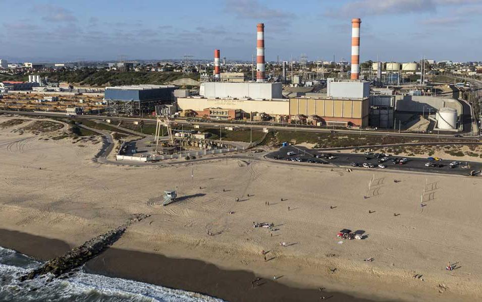
As calls for a greener future have become louder and more zealous. These viewpoints often rely on the assumption that the world can be saved simply by a restoration of the earth’s natural state. This involves actively destroying anything deemed “artificial” (i.e. built or introduced by man). Ironically, this impulse to remove the past stems from the same impulsive need that created their worries: a disregard for what currently exists. Often what is destroyed is an established ecosystem shaped by forces both natural and manmade.
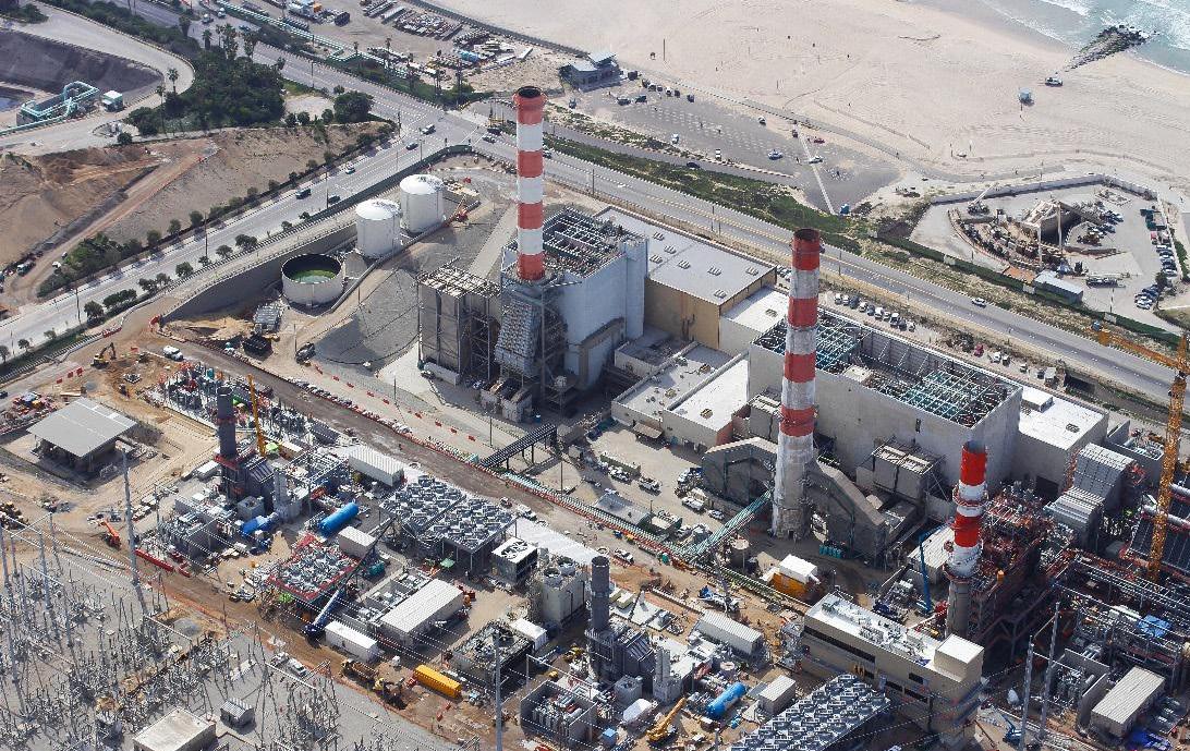
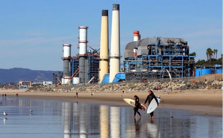
In accordance with California’s push for greener power, Los Angeles’ gas-fired Scattergood Power Plant, is currently scheduled to be decommissioned in 2024. Bordered by a water treatment plant, oil fields, single family residential homes, a bike path, and a popular beach, this 55-acre powerplant is in a geographically unique location.

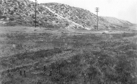
The site was historically in the Los Angeles Coastal Prairie, an ecosystem dominated by bunchgrasses and wildflowers now extinct due to development. This prairie was home to now federally endangered species like the El Segundo Blue Butterfly and the Coastal California Gnatcatcher. Provided ample resources, these animals could find a home in the site.
Saddled upon an artificial hill composed refuse sand, the site serves as a testament to the new world man has created. The site is completely paved over and supported by invasive ice plant and retaining walls. Years of power generation have left the soil at the site saturated with heavy metals; noxious fumes wafting from the water treatment plant below will continue to pollute for the foreseeable future. The soil that is visible is an imported loam, placed on top the sand. Nothing on the site is there naturally.
Since the decision to retire the powerplant, the question that has now arisen is the future of the site. Developers are looking to develop the site as the site is beach accessible, holds great views of the Santa Monica Bay, and it is profitable real estate. This view is in direct opposition to environmentalists and community stakeholders who see the potential the site holds for the region’s community and ecology. The community sees the site as a future park, providing beach access to those who live there. The environmentalists see the site as an opportunity to recreate the Los Angeles Prairie. None of these plans reflect the current reality of the site: the site is a horrible place for residential development as it is regularly exposed to airborne chemicals and the site has none of the systems that created and maintained those lost habitats. Instead, the site should be designed in a way that addresses and adopts the current realities: an area shaped by heavy industry, introduced species, which was built from an overall disregard for what came before. By doing this people’s minds will bechanged as they will grow to appreciate what currently exist whether its manmade or natural.
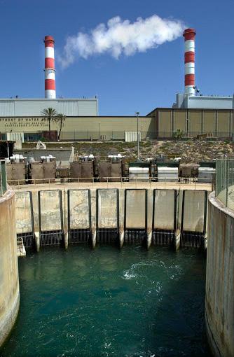
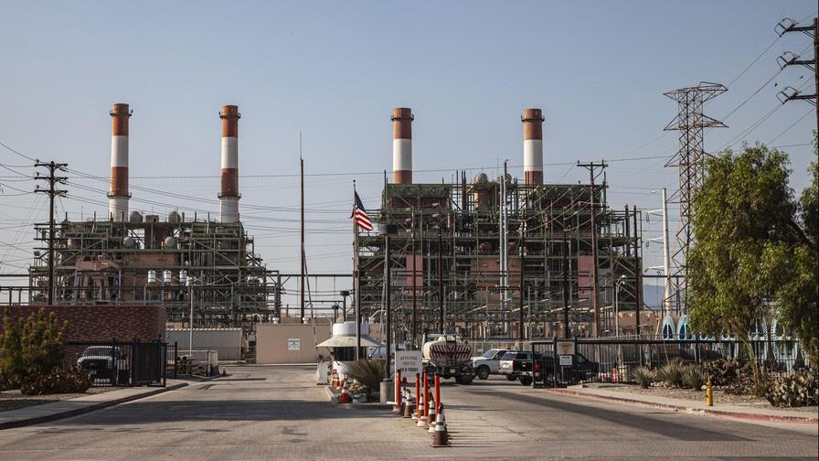
The area as it exists is quite toxic. Over the course of the power plant’s 62-year history, pollutants such as lead, and polonium have accumulated in the soil. These metalscause damage to most animals and plants living on the site and to species else where in the form of runoof. Cleaning the site will instil a sense of hope for the future as a relatively toxic site was reclaimed. Cleaning the soil should be done while also keeping aspects of the existing site. By completely removing the building, the design will remove the past, lessenening the impact of the cleanup. The juxtosistion of the the former building and the new site, the user is reminded of the past and given hope for the future. This feeling will be compounded by the surrounding area’s seemingly blighted landscape.
Industries adjacent to the site, have compounded the toxicity issue. Noxious fumes from the neighboring Hyperion Water Treatment Plant damage plant life, produce ailments such as headaches and nausea for users, and just smell plain bad. In order to treat water at the Hyperion Water Treatment Plant, chlorine and ammonia are mixed with water, producing chlorine and ammonia gas. These gases have been proven to reduce the lifespan of people living near them. Therefore building a residential neighborhood near the water treatment plant puts people’s health at risk and is simply irresponsible. Due to development, the area’s the indigenous habitats (Los Angeles Dunes and Los Angeles Coastal Prairie) have been completely eradicated. These ecosystems were the prime habitats of the federally endangered El Segundo Blue Butterfly, Coastal California Gnatcatcher, and Coastal Dunes Milkvetch.
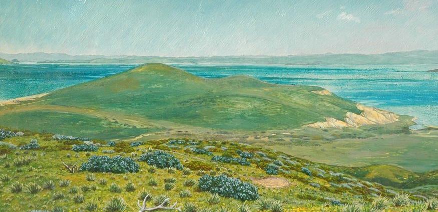
The site could be designed in a way that serves the same ecological functions which could in turn provide a habitat for these endangered species. A major problem with most attempts to restore habitats is that often the designer’s understanding of the natural ecology is flawed. They try to recreate a landscape, not realizing that it was a singular moment in a constantly shifting ecology. Keeping this in mind will be incredibly important for this project as the ecosystem that was originally there not only no longer exists but the forces that created and sustained it have been heavily altered. As a result, the design should reflect the current conditions and forces shaping the site.

1. Remediate the toxicity of the site
a. Bioremediate to improve the soil
b. Use flora that can resist toxins and simulate the native enviroment
c. Keep water on-site and apply sustainable drainage practices
2.Provide a habitat for endangered species
a. Understand what needs these animals require
b. Create partnerships with local environmental organizations (Heal the Bay, Santa Monica Wildlife Fund, etc.) to ensure monitoring
3. Design with the current realities affecting the site
a. Asess the feasibility of certain plant pallettes
b. Analyze toxins coming in the site and how to reduce there impacts
4. Retain components of the powerplant
a. Have the layout of the site be inspired by the powerplant
b. Keep parts the units and incorporate them into the design (concrete, substation, etc.)
5. Create an understanding of Urban Ecosystems
a. Use the powerplant as an example of remedation
b. Create an area where users can analyze the processes which can remediate a site
6. Provide community benefits
a. Provide access to the beach
b. Provide an a stopping point for those traveling the bike path
c. Create areas for community to gather

These Maps show the surrounding areas around the site. The area is heavily industrial, there is a petroleunm plant to the south and a water treatment plant to the north.
The site is built upon excavated sand from the water treatment plant. The sides of the hill were terraced and covered with loam. Now growing is invasive ice plant which maintain the sites stabiulity. These plants are necessary for the support of the hill, as otherwise the hill would not be structurally stable.
The area behind the site is predominatnly single family residential. There are many paths from the neighborhood that lead to the site. These are located on the blu s overlooking the water treatment plant. There are two major roads surrounding the site. To the west lies Vista Del Mar Ave. and to the south lies Grand Ave.
Part of the site goes under Vista Del Mar Ave., this could provide beach access to the site, making it a local attraction of sorts. It is on a hill and provides great views of the Santa Monica Bay and planes coming in and out.


Major Roads
Residential Roads
Bike Path
Walking Path
Site Area
Water Treatment
Oil Feilds
Scattergood Power Plant is not located in the city of El Segundo, but is actually a part of Los Angeles. El Segundo, is the only town around it, so it is the focus of this document.

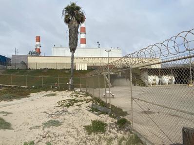
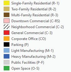
El Segundo is split into three primary zones:

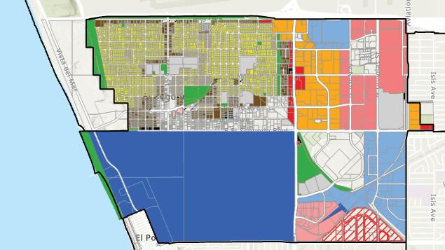
1. The Western residential area
2. The Southern Petroleum Feilds
3. The Eastern Commercial / Corperate / Light Manufacturing Economic Center
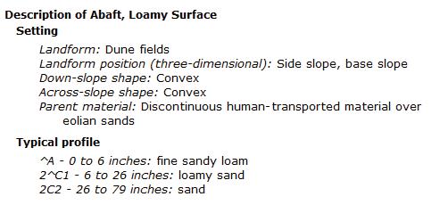
The Scattergood Power Plant is located between the Residential Area and the Petroleum Feilds
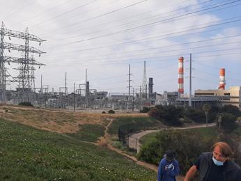
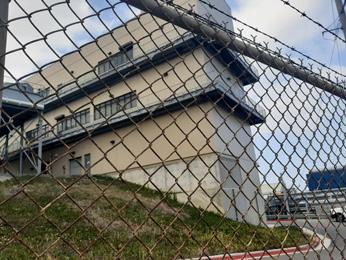 View from top of hill
View of Generating Station
View of area beyond the road
View of main building
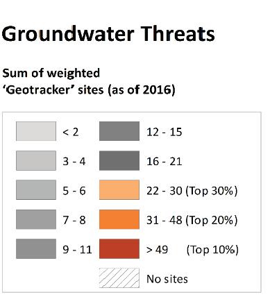

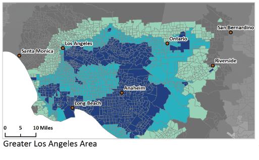
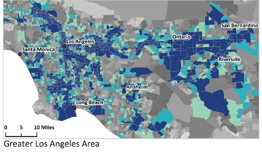
As stated before, the area of the site and surrounding area is heavily industrial. There is quite a lot of toxins in the soil from the surrounding industries. There are also threats to groundwater coming from the petroleum extraction from across the street. Plants that are chosen should reflect the area’s toxicity. THey should be hardy and be able to remediate the toxins that will inevitable end up in the soil.
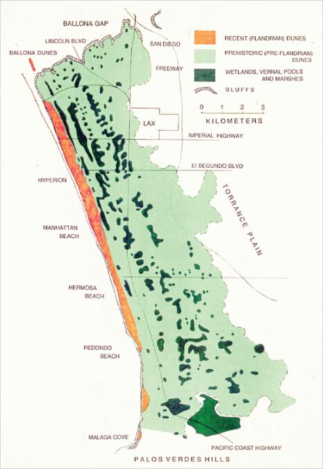
The area is naturally dunes, this means sands which move are the natural soil type. Unfortenatly these historical ecologies are antithetical to the current reality of the site. The site is on a hill that is artificial and would collapse into the water treatment plant below the site.
A quarter mile inland started the Great Los Angeles Coastal Prarie, an extinct habitat, which was home to many wildflowers and wild bunchgrasses. Interspersed were vernal pools and marshes. Unlike the dunes, the substrate of the habitat was older consolidated sand instead of shifting sand. Although historically inaccurate to site, this could be the ecology which is restored.
In the abandoned town of Palisades Del Rey there is an example of partially restored dunes and coastal prarie. The 302 acre area is right below LAX, was regraded and planted with native species. It is a protected nature preserve, home to over 900 species and animals. 277 acres are dunes and 25 acres are sand prarie. Further restoration of the project was severly hampered by an exploration to expand LAX. As a result, the site isn’t completely restored, there still are old roads and toxic soil in the preserve.
There lies 55 acres of dune and backdune habitat behind the Hyperion Water Treatment site. There is 1.6 acres of land in the Chevron Oil Feilds.
The landuse type is Heavy industrial which can be quite damaging to the health of the soil. Mercury, acid gases and many btoxic metals are commonly found in the soils of power plants. This must be remdiated therough the design of the site.
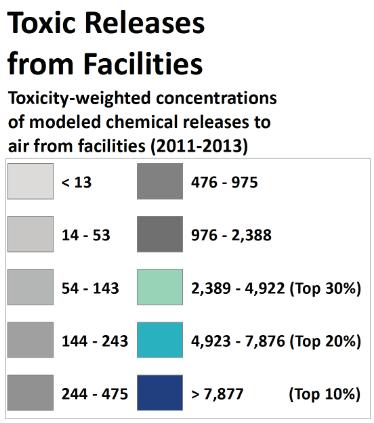
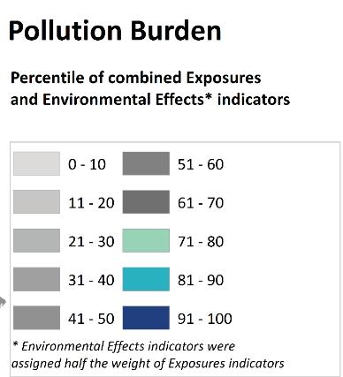

El Segundo’s permenant population is white, relatively well o and educated. It has a wide range in age, and is not skewed heavily. Most residents are renters, meaning they are less likely to be involved in local government. This park would be a boon to the residents as it would not only be another open space, it would also provide walking access to the beach.


Many people coming to El Segundo are from other places. The nearest industry is the petroleum feilds, which have their own private park. The other industries are located on the other side of town. Therefore it not walkable for the majority of workers .

This doesn’t mean that the site couldn’t be used by employees. The site could serve as an area for these workers to meet and have lunch at. It is in a prime location for views of the ocean and could provide positive mental wellbeing to those working in the El Segundo.

58% of residents are living with families
of people were living with children under 18.
The Beaches surrounding the Scattergood Power Plant are quite popular with the residents of LA. Many travel to the area from all across the county.
Dockwiler Beach is the beach directly next to the power station. It is quite popular as it is the only beach in LA county that has fire pits. As a result it’s primary userbase are families hosting get togethers. The users have less income than the surrounding neighborhood.
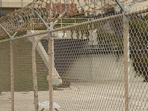
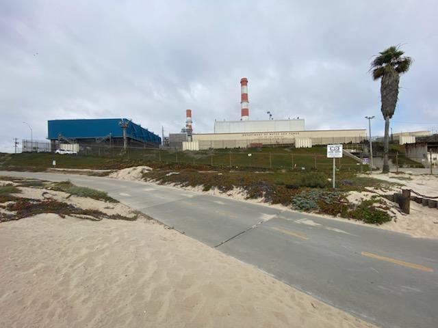
Redondo Beach, located 5 miles south of Scattergood Power Plant, is primarily visited for peir as well as it’s beach. This peir is a destination as it has resturants and souvenier shops.
Dockweiler State Beach
White Latino African American Other Races
Redondo Beach
White Latino African American Other Races
Poverty Line
58% Below The Poverty Line
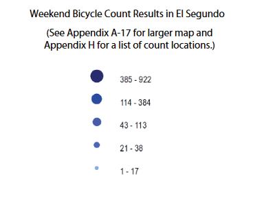
The Bike Path is a popular path. The path is used regualrly during the weekend by both bikers and joggers who are traveling the coastal bike route. Frequently these runners final destination is Manahttan Beach and Playa Del Rey, whereas the bikers ride from Playa Del Rey to the Redondo Beach Peir. Stops are common along the ride as users often
stop for lunch/breakfast or for a break. The site has access to the bike path.
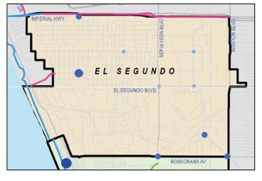
It is safe to assume the majority of users are at least middle class as bikes require a certain amount of money and space which is limited by poverty.
Poverty Line
33% Below The Poverty Line
View from bike path. Fenced area belongs to the DWP. View of tunnel going under the road.The site is intended to be a reimagination of the natural landscape that was lost. In order to do so, the landscape must remediate the soil and survive the toxic enviroment.
This will be combined with areas for benches, open space, and trails. It will serve as not only an educational area but as place to build community for residents.
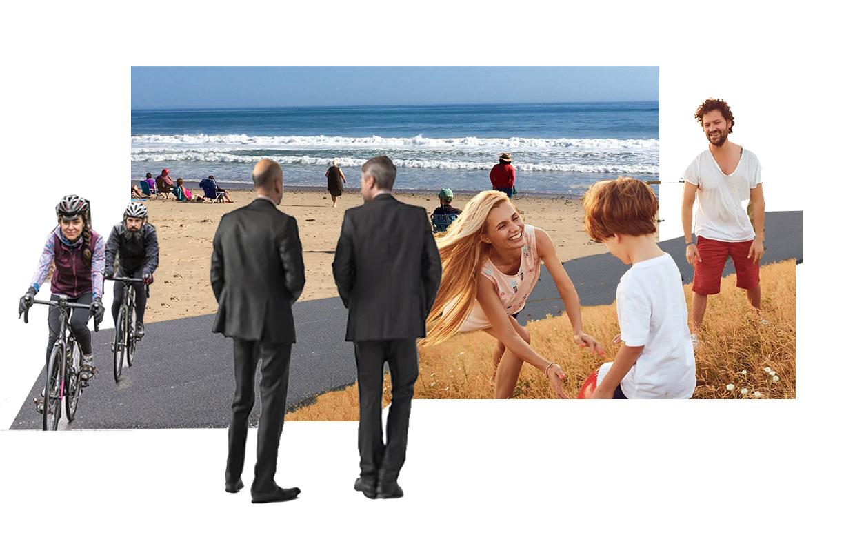
The site has a lot of oppurtunity to many di erent user groups. It will provide a spot for bikers traveling the coastal bike route, people using the beach for bonfires, workers in the area, and residents. The site as a result should provide a space for people from di erent backgrounds, ages, and interests to enjoy their time in the site.
- Lower Income Ethnically Diverse Families / Bikers
- Low emotional investment in the wellbeing of the site
- Irregular users
- Casual visitors passing through
- Families
- Non-Resident Workers
- Varying economic classes
- Potential emotional investment in the wellbeing of the site
- Regular users
- Used individualy or with others
- Residents
- Upper Middle Class
- Active emotional investment in the wellbeing of the site
- Regular users
- Used individualy, events, get togethers, etc.
- Connection to the beach
site is intended to be a reimagination of the natural landscape that was lost. In order to do so, the landscape must remediate the soil and survive the toxic enviroment.
will be combined with areas for benches, open space, trails. It will serve as not only an educational area but as to build community for residents.
site has a lot of oppurtunity to many di erent user groups. It will provide a spot for bikers traveling the coastal route, people using the beach for bonfires, workers in the and residents. The site as a result should provide a space people from di erent backgrounds, ages, and interests to their time in the site.
- Lower Income Ethnically Diverse Families / Bikers
- Low emotional investment in the wellbeing of the site
- Irregular users
- Casual visitors passing through
- Families
- Non-Resident Workers
- Varying economic classes
- Potential emotional investment in the wellbeing of the site
- Regular users
- Used individualy or with others
- Residents
- Upper Middle Class
- Active emotional investment in the wellbeing of the site
- Regular users
- Used individualy, events, get togethers, etc.
- Connection to the beach
The purpose of this essay was to poke a hole in the contemporary landscape approach of trying to recreate nature. Often our understanding of nature is flawed. As a result, we should focus more on aesthetics when designing and consider the systems of the site. The reality of design is that a sound ecology and aesthetics often go hand in hand. This theory is in direct contrast with the traditional viewpoint held by most landscape architects who view aesthetics as secondary. The most important aspect of all design is the ecological aspects. This understanding of ecological aspects is often not wholly understood and is often thought simply as “restoring nature”. As a result, we often create an idealized version of nature, one that does not reflect the reality of the site as it is now. This entire mentality perpetuates the idea that humans and nature are separate. The reality is something di erent: we should acknowledge the fact that Humanity’s Impact is as much a part of nature as the ecology that came before. The way around this is to acknowledge that we are not scientists. When designing, we should focus more on design and on using existing systems to our advantage. These systems can create new ecosystems which although di erent from the original landscape can serve a similar function. These functions can be incredibly successful in restoration projects providing dunctions that would have been lost if a designer was looking to recreate nature.
I feel that this theory is a very important factor to consider in the context of my site. The site I have chosen is on top of excavated sand and has no relationship to the original landscape. As a result, the landscape should not be a copy of what came before but an interpretation of the precontact landscape as well as taking stock of the recent past and the present. This design serving the same functions, can provide habitat for animals in the area.
Creating a project that pokes holes into the mentality of humans and “nature” being seperate could also be an interesting avenue. The site as it exists is quite dilapidated and is testament to heavy industry’s e ects on the landscape. Showing how landscapes can grow with this industry could be an eye opening experience for users not previously introduced to the idea.
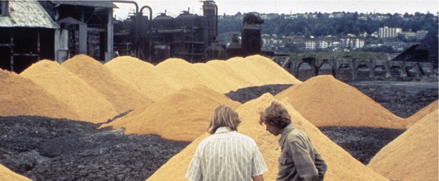
Seattle’s Gas Works Park is perhaps the most famous example of a recaimed Brownfeild. Here is a before and after shot.

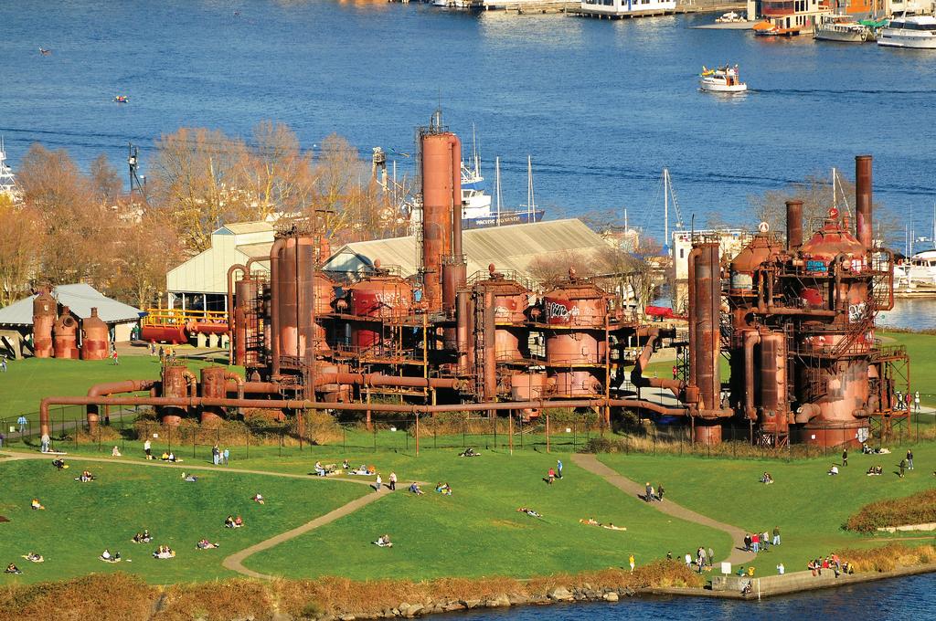
Site should be seen as an everchanging landscape. These sites should be seen as everchanging complex nodes of interaction rather a set area that will never change. These sites often have unpredictable futures rather than a clear path. These sites are often not the same as they were previously. Take the example of the reforestation of previous farms during the late 1800’s in Western Mass. Most old growth forests returned, just not to the original proportions or composition. Some like the American Chestnut could not reach maturity. We must see the reality: human influenced landscapes are just as damaging as natural disasters such as windstorms, insect boom, etc. Furthermore, they are not different.

Landscapes should be seen as a mosaic, constantly shifting and ranging in form. There is no such thing as a stable state, attempts to keep things stable will ultimately be fruitless. Walling o preserved sites is ultimately useless, as everything is temporary. We should instead pay attention to the processes that have shaped these landscapes.
A boundary for one species is not a boundary for another. The range of a sparrow is very di erent from the range of a gnat. These are based on a multitude of factors that are both based on landscape as well as based on physical forces.
This aspect of landscape architecture is important to remember as it is easy to ignore the overall area. Often when designing one acts as though the ecosystem starts and ends at the borders of the site. This is especially true in an industrial area which does not look like the “classical” landscape. These areas are in fact teaming with life and have created complex environments.
Furthermore it is important to be conscious of this fact in terms of change. The landscapes after all are products of a larger ecosystem, meaning that they are ready to change as something else o site changes. Using this theory will require a signifigant investment in site analysis.
An example of analysis on a macro scaleThis essay is an introduction to Gilles Clement’s theory of the “Third Landscape”. The theory of the Third Landscape can be described as the adoption and celebration of the “in-between spaces—neither the first landscape of preservation nor the cultivated second landscape—that host the genetic reservoir of the planet, spaces of the future” In other words this means accepting anthropic landscapes as they are and allowing them to exist undisturbed. This means the acceptance of nonnatives and weedy spots.
To Clement the Third Landscape provides a more adaptive and resilient landscape. “The response to the extinction crisis is to seek to preserve or increase the number and diversity of functionalities and agencies, not species” According to Clement, these landscapes should be designed around the idea that the purpose of a design in these landscapes is to provide the most amount of diverse functions. Other than providing functions, the designer’s influence should be limited.
The theory does not necessitate complacency, one is allowed to take an active role in these landscapes. When maintaining an open field, “one sometimes had to interrupt the course of certain strata to maintain the richness of the environment and prevent its systematic progress toward a forest” Sometimes a designer wants to encourage a certain species and habitat to get the results he or she wants.
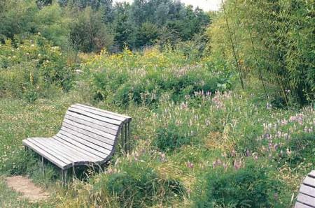
By being a wildly di erent design decision, he theory of the Third Landscape can change the mindset of users. According to Skinner, the theory of the Third Landscape tells the user “the earth is finite and its humans need to get over their alienation …(doing more by doing less).” This can provide a humbling experience as the mere experience of being in these landscapes will provide a new experience. This is done by blending the natural landscape with the landscape of refuse, something everyone has seen before.
I do think the idea of the Third Landscape is an interesting idea. I think that is a very pragmatic view of problems facing current landscapes in the world. I really liked the focus on retaining systems. I feel that in a ecological design, an e ective system dominated by non natives is more desirable than a native system who is not e ective.
I don’t think Ill be too literal with the use of the Third Landscape in my project. I feel that the theory is a bit open ended. Where one should and should not intervene is not clearly defined and I feel that’s where it fails as a theory. So, if I create a design to maintain one species, one could argue I’m using the theory while others wouldn’t. When using this theory, I will take a looser interpretation. Furthermore I do not agree with his disregard for the native species. I think that these species deserve a certain amount of protection. They often have built up complex and symbiotic relationships with the habitat that should not be discredited. Often we are not aware of these relationships and run the potential of destroying them if not careful.
An example of a Third Landscape GardenWhile also a beautiful park, this area serves as a piece of history. The remains of the Gas Works are the last existing gas works from that era (late Industrial Revolution). So by gong to the park, the user gains a connection to the city in the modern era as well as it’s history.
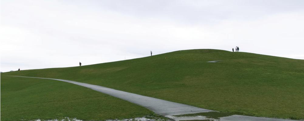
A central earth mound is located in the center of the site. It was modeled from both toxic soil and rubble. This is a central aspect of the site and was a creative use of the toxic litter that would otherwise be removed. This cuts down on transport which is a green alternative.
The central landmark of the park are the remains of the coal plant. This creates an incredibly unique experience and shows that industrial sites can be celebrated and turned into not only an attraction but a wonderful environment.
Richard HaggOpened: 1975
Built from the remnants of a coal gasification plant, Seattle’s Gas Works Park is one of the city’s most popular attractions. It’s success is a testament to the power of using local history and resources to create an attraction that is new and revolutionary.
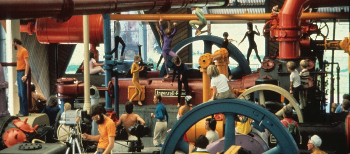
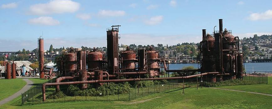
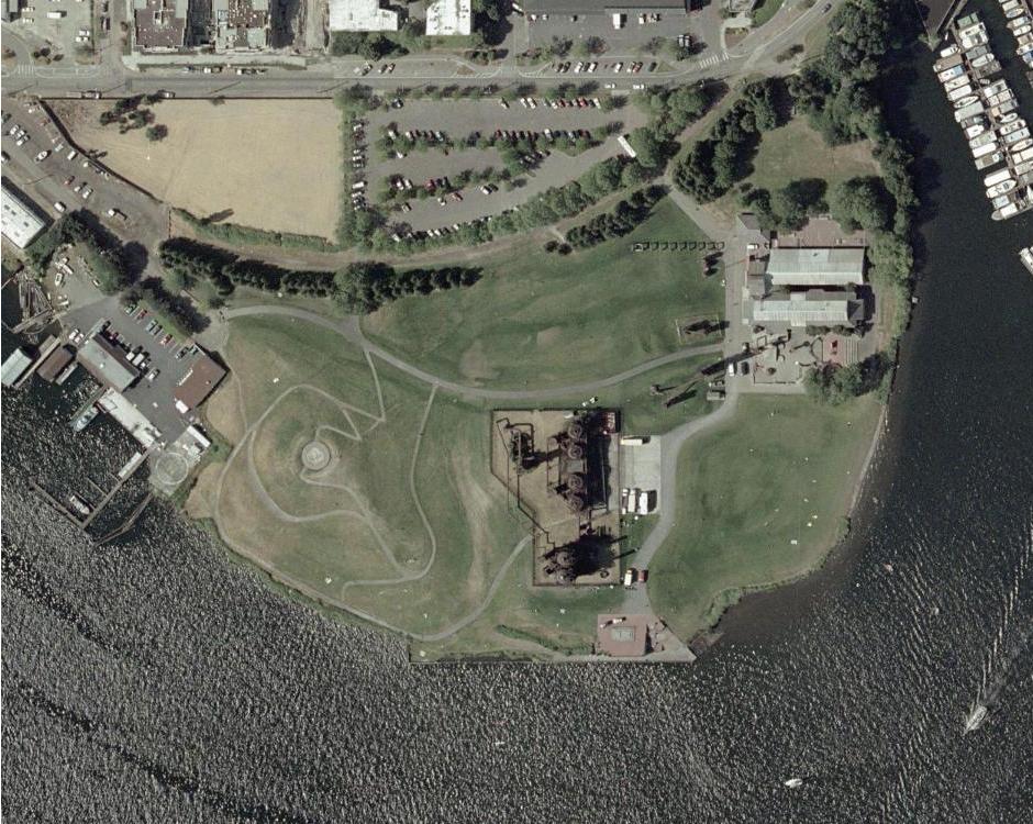
Removing toxins from the soil was necessary for the establishment of the park. A major component of the park to remove as little soil as possible. Toxic soil was formed into mounds and covered by topsoil and sawdust. The remaining soil had to be bioremediated.
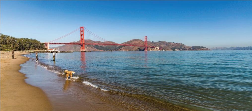
The design for Crissy Field reintroduces the natural and cultural features of the site while being a diverse recreational area. As there are many historical layers, the design is not a restoration to a particular period, but rather an interpretation of its past. These features create a unique and dynamic space for all users to enjoy.
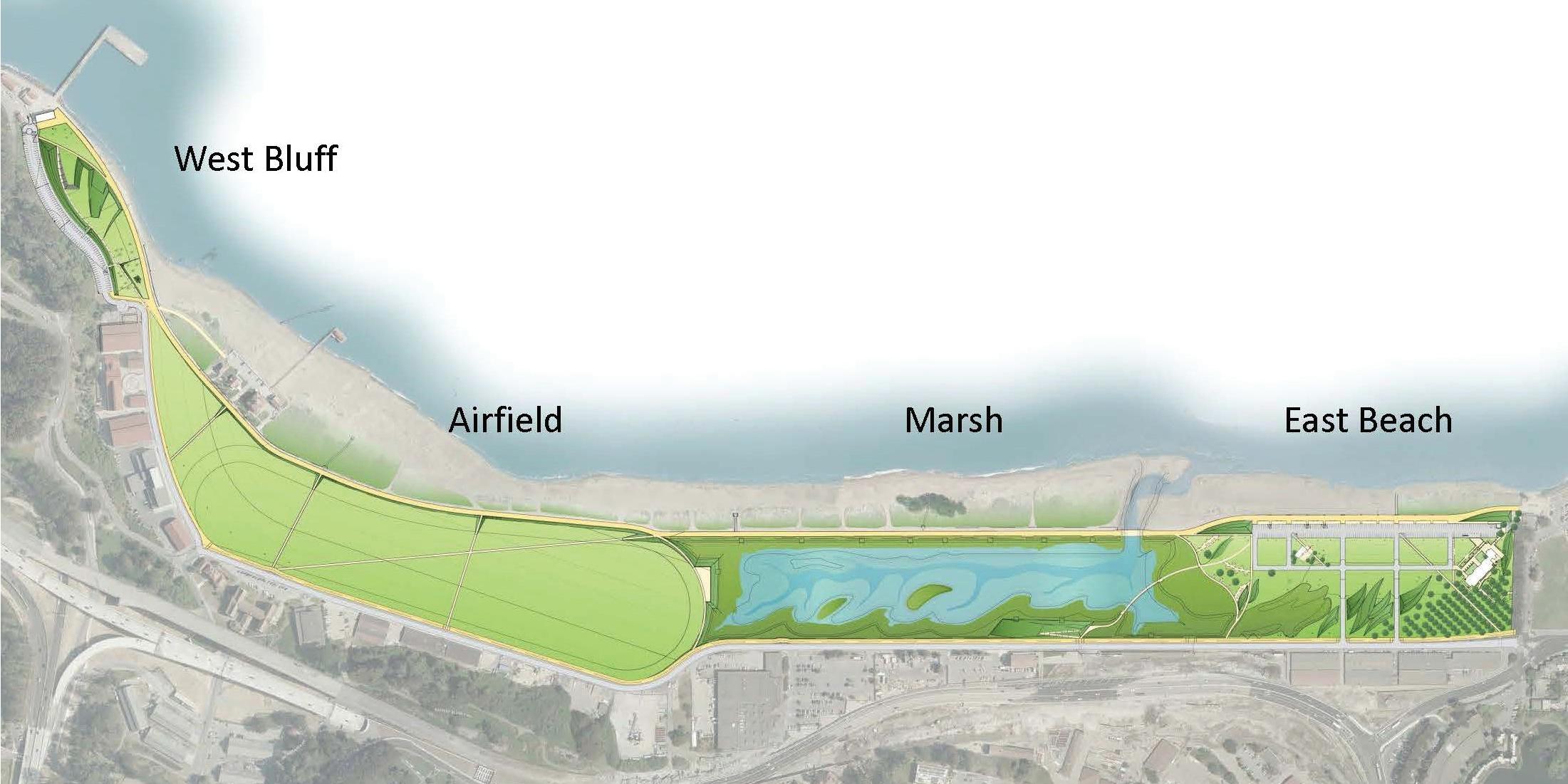
When visiting Crissy Field, one gets to experience both the built form and natural form simultaneously. When walking along the North side of the site, one walks with dunes on one side and grass on the other. It is impossible to separate the experience.

The layout and design of Crissy Field feels very site specific. When visiting, the historic use as a air base is obvious. The grass is in the shape of the airfield, hangers and workshops are kept, and it’s natural landscape is restored.
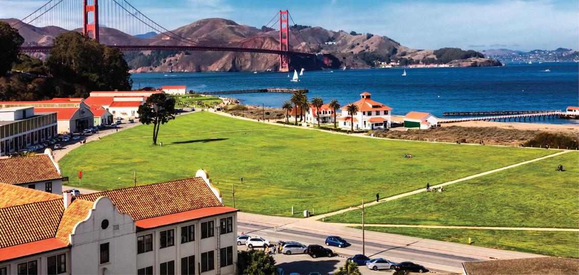
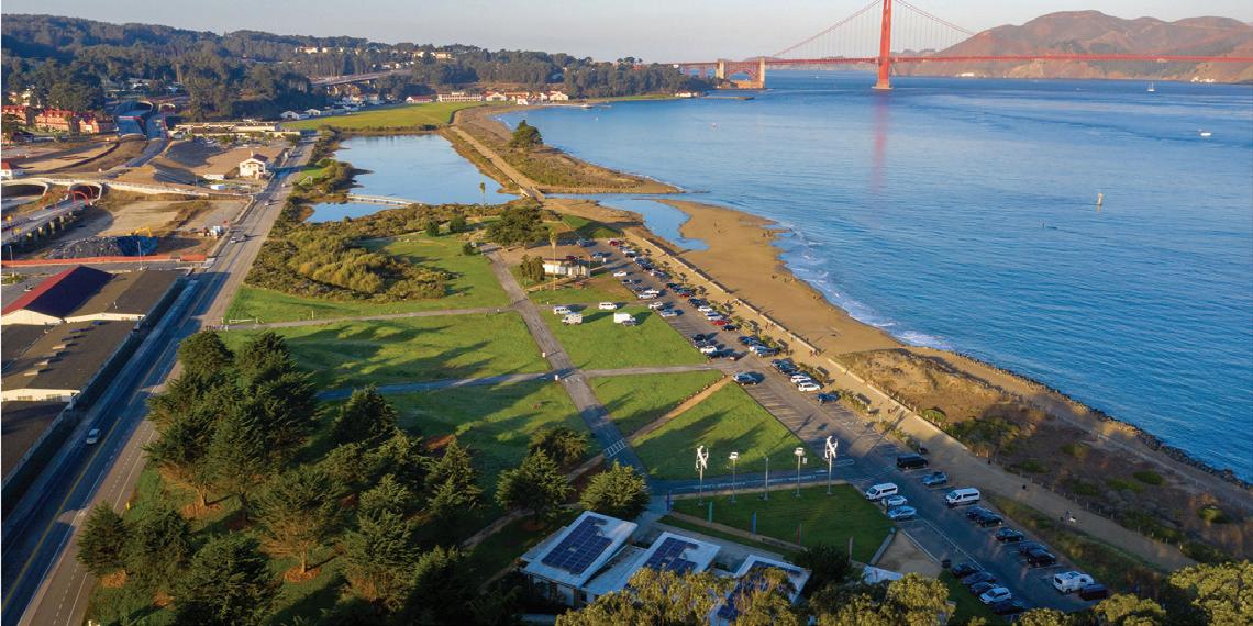
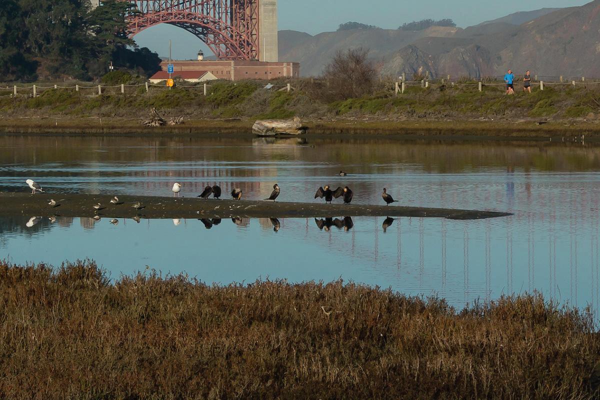
The area is incredibly picturesque. What was built does not interfere with the views of the Bay. It also provides multiple areas to sit and admire the view.

The area of Crissy’s field was once a salt marsh and estuary surrounded by sand dunes. The military built an airstrip which was then used as a garbage dump . The designers wanted to restore the marsh and dunes to a precontact condition. This required removing all toxic soil from the site.

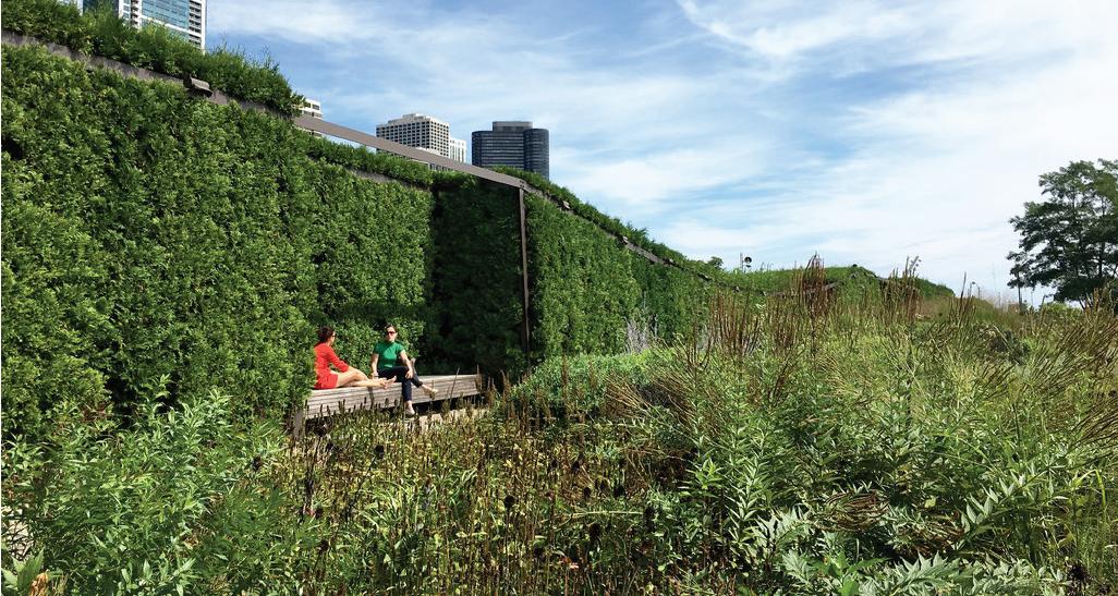
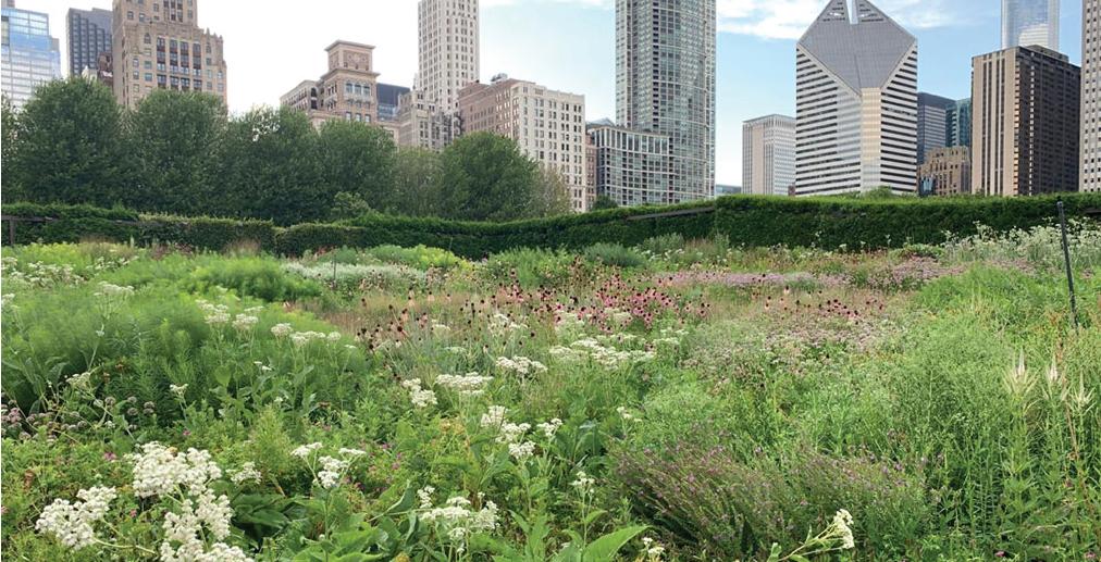
The Lurie Garden combines natural and foreign plants as well as historic motifs to create an artificial yet symbolic landscape. The main thesis of the landscape is to recreate the feelings that one would have in nature in the midst of an urban metropolis.
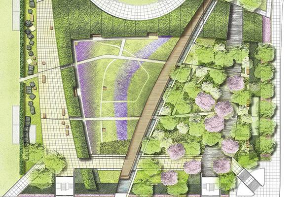
The garden is rich with symbolism representing Chicago’s waterfront history. One half of the garden is dominated by shade loving plants designed to represent the area’s wild and hidden past of a swamp. The other half is dominated by sun loving perennials, representing the area’s clean and noble future.

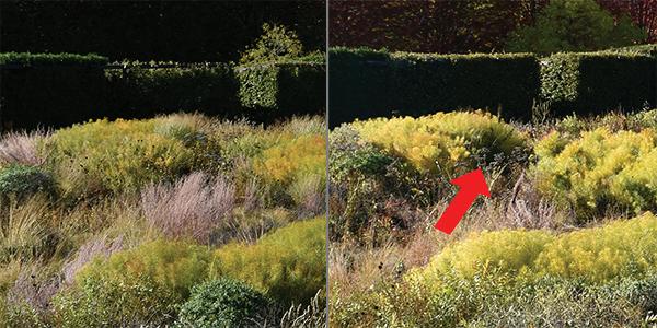
The landscape of the area is constantly changing. It was designed in such a way where every season has plenty of visual interest. The area is constantly shifting, plants were chosen to spread their seeds, making a landscape that changes from year to year.
The park has two main avenues of circulation which are busy and contain active areas. Surrounding the park are lesser traveled areas, which are more secluded. The park is also secluded from the rest of the park. This is done through the use of large hedges and trees.


Located in the heart of Millennium Park, the garden is a green roof designed to mimic the feeling of the prairie. 40% of the plants growing are non-natives. There are no annuals being grown, the landscape is dominated by perennials.

June
Complete Proposal
Organize Site Visit (if possible)
Initial sketches
September
Begining of studio
Solidify project goals and analysis
Finish site analysis diagrams
Continue research
July
Research bioremediation
Site analysis graphics
October
Refine solutions
Continue research
Start diagrams (data)
Develop initial graphic style
January
Finalize diagrams (data)
Review feedback
Sketch out final master plan
February
Complete final master plan
Begin final perspective and sections
August
Engage with professional contacts
Finish research on bioremediation
Compile research
November
Finish research
Finalize solutions
Continue diagrams (data)
Finalize graphic style
December
Conceptual design iterations (bubble diagrams)
Compile second round of research
Continue diagrams (data)
March
Final board production
Final prespectives and sections
Present
Larry Chase
TRC Companies
Director of Scattergood Decommissioning
Jose Gutierrez

LAWP
Scattergood Head Supervisor
Larry Chase

LA Planning Department
LAX Area Planner
Rudi Mattoni
UCLA School of Geography
Expert on Precontact SoCAL Habitats
James Lima
Lima Design
Expert on Designing on Sand

City of El Segundo 1992, General Plan, City of El Segundo, El Segundo, CA.
This was needed to understand the future trends outlined by the city of El Segundo. It was also needed to understand the views the city had of its industrial west.
Christensen, J., King, P. Southern California Beach Surveys (2016. UCLA Institute of the Environment and Sustainability. Retrieved from https://www. ioes.ucla.edu/wp-content/uploads/UCLA-coastal-access-report-Southern-California-supplement.pdf
This is an overall look at the demographic profile of Southern California Beaches. I was looking at neighboring beaches such as Dockweiler and Manhattan Beach for an understanding of visitors.
Los Angeles International Airport 2005, LAX Restoration Plan, Los Angeles International Airport, Los Angeles, CA.
This was used to understand the current restoration efforts being done for the endangered species in the area.
Seattle Gas Works Park. (2021, July 1). In Wikipedia. https://en.wikipedia.org/wiki/Gas_Works_Park
Used for an overall look at the history and amenities offered at the Gas Works Park.
William S. Saunders (Ed.): Richard Haag. Bloedel Reserve and Gas Works Park. New York: Princeton Architectural Press 1998
I used this resource to understand the thought process that went into design. I also learned about the process of bioremediation in the park. I also used it to understand the construction process and the site opportunities and constants.
Pirzio-Biroli: “Adaptive re-use. Layering of meaning on sites of industrial ruin.” in: Arcade journal 23/2004
This was piece discussing the history that is imbued in brownfields. They are not just areas of refuse, rather they have a complex history.
Phillips Williams and Associates: “Sustainable Wetland Design and Management at Crissy Field” In Internet Archive. https://web.archive.org/ web/20061120194630/http://www.pwa-ltd.com/projects/pr_res_crissy_field.html
This was used for an understanding of the restoration efforts undertook by the team. It was also used to understand how the restored area fits in with the San Francisco Bay.
ASLA (2008) “General Design Award of Excellence”. ASLA. Retrieved from https://www.asla.org/awards/2008/08winners/441.html
I used this resource to learn about the design process and overall design intent.
Lurie Garden. (2021, July 1). In Wikipedia. https://en.wikipedia.org/wiki/Lurie_Garden
Used for an overall look at the history and amenities offered at the Lurie Garden.
Crissy Field. (2021, July 1). In Wikipedia. https://en.wikipedia.org/wiki/Crissy_Field
Used for an overall look at the history and amenities offered at Crissy Field.
Mattoni, R. (1998, April 18) “Down Memory Lane: The Los Angeles Coastal Prairie and It’s Vernal Pools” UCLA Department of Geography: Urban Wildlands Group. Retrieved from https://www.urbanwildlands.org/prairie.html
I used this resource for an understanding of the Los Angeles Prairie before development. In this website lies a plant list and old photographs.
Skinner, J. (2011, June). “Gardens of Resistance” University of Warwick. Retrieved from https://warwick.ac.uk/fac/cross_fac/iatl/study/ugmodules/climatechange/reading_list-copy/skinnergardensofresistance.pdf
This is the translator’s introduction to an anthology of Giles Clément’s writings. Gives an overview of his theories.
Riemer, K. (2020, January 29) “The Aesthetics of Ecology and the Ecology of Aesthetics” McHarg Center Retrieved from https://mcharg.upenn.edu/ blog/aesthetics-ecology-and-ecology-aesthetics
An overview of the theory of ecology and its overlap with aesthetics.
U.S. Census Bureau (2019, July). El Segundo Census Data. Retrieved from https://www.census.gov/quickfacts/elsegundocitycalifornia
This is census for El Segundo. It was the primary source of my dada for the city of El Segundo.
Hill, K. (2020) Shifting Sites. Retrieved from https://www.taylorfrancis.com/chapters/edit/10.4324/9780429202384-9/shifting-sites-everything-different-kristina-hill
This is a discussion of designing with impermanence. It tells the designer to be aware of the systems creating the place, not the features.
TRC Company (2021, May,25) “RE POWER® for Decommissioning, Demolition and Redevelopment of Power Plants” retrieved from https://www.trccompanies.com/services/specialized-consulting/re-power-for-decommissioning-demolition-and-redevelopment-of-power-plants/
This is a discussion of what is currently being take down at Scattergood.
LAX Planning Association (2005, January) “Los Angeles/El Segundo Dunes Habitat Restoration Plan” retrieved from https://www.santamonicabay. org/wp-content/uploads/2016/11/LAX-Master-Plan-Final-EIS_Appdx-A-3c.-LAX-Dunes-Rest-Plan.pdf
A general plan of an unrealized project to restore sand dunes around LAX.
Kim, S Choi, D Sim, D Oh, Y (2005) Evaluation of bioremediation effectiveness on crude oil-contaminated sand retrieved from (https://www.sciencedirect.com/science/article/pii/S0045653504010136)
An exploration of remediating sand and the most effective ways to do so.
Gandy, M (N/A) Rethinking Urban Nature retrieved from https://www.rethinkingurbannature.org/about/
A look at the synthesis between urban ecology and the production of urban spaces.
Bermont, B (2020, May, 23) LA County beaches: Modest holiday-weekend crowds, light enforcement Retrieved from https://www.dailybreeze. com/2020/05/23/la-county-beaches-modest-holiday-weekend-crowds-light-enforcement/
A synthesis of statistics of beach bike use and beach holiday traffic.